Embed Size (px)
Citation preview
Dallas Area Rapid Transit Red & Blue Line Corridors Transit-Oriented Development Parking Study December 2019
Acknowledgements
Project Partners
North Central Texas Council of Governments
Dallas Area Rapid Transit
City of Dallas
City of Garland
City of Plano
City of Richardson
Consultant Team
Nelson\Nygaard Consulting Associates
C.J. Hensch & Associates
IMAGES
Gateway Planning
Representatives of Participating Sites
Alpha Barnes (LBJ Station Apartments)
Capstone Management (Lancaster Urban Village)
Foundry Commercial (Walnut Glen)
Gables Residential (Junction 15)
Greystar Real Estate Partners (5 Mockingbird)
Lincoln Apartments (Brick Row and The Lofts at Mockingbird)
Oaks Properties (5th Street Crossing Phase 1 and Phase 2)
Pillar Commercial (Rambler Park)
The Richman Group (The Parc at White Oak)
Tipton Group (Modena)
Transwestern (CityLine Towers 1, 2, and 3)
UAH Property Management (The Belleview)
West Village Management (3636 and 3700 McKinney)
DART Red & Blue Line Corridors TOD Parking Study North Central Texas Council of Governments
i
Table of Contents PART ONE ................................................................................................. 1 Executive Summary ................................................................................ 1 Study Summary ....................................................................................... 6
Background ............................................................................................................ 6 Intent ........................................................................................................................ 7 Approach and Analysis ..................................................................................... 13 Key Findings ......................................................................................................... 15
PART TWO ............................................................................................. 26 Toolbox Overview ................................................................................ 27 Toolbox Organization ......................................................................... 29 Eliminate or Reduce Minimum Parking Requirements ................ 30 Parking Maximums ............................................................................... 33 Monetizing Excess Capacity .............................................................. 36 Shared Parking Agreements .............................................................. 39 Code Incentives for Public Parking .................................................. 42 Parking Management Districts .......................................................... 45 Crediting Off-Site Parking .................................................................. 48 Parking Availability Platforms ............................................................ 51 Curb Space Management ................................................................... 54 Future Re-use Parking ......................................................................... 57 Public-Private Development .............................................................. 60 Density-Bonus Incentives ................................................................... 63 Fee-in-Lieu of Parking ......................................................................... 66 Unbundled Parking Costs ................................................................... 69 Improve Mobility Options to Reduce Parking ............................... 72 Tool Enhancer: Data-Based Performance Monitoring ................. 76 Conclusion .............................................................................................. 80
Appendix A: Site Summaries Appendix B: Data Results Comparative Matrix Appendix C: Questionnaire Form and Results Appendix D: Description of Shared Parking Model Appendix E: Recommendations for Parking Data Collection

PART ONE Study Summary
DART Red & Blue Line Corridors TOD Parking Study North Central Texas Council of Governments
1
Executive Summary Overview This study offers a new set of regional data, from Dallas Area Rapid Transit (DART)-served Transit-Oriented Developments (TODs), to inform future decisions about how parking is supplied, managed, and evaluated against alternative land uses to increase TOD investment and effectiveness in achieving growth and sustainability.
Excessive parking supply, whether provided to meet code requirements or perceived market demands, can create a cost barrier to TOD and reduce its potential transit ridership benefits. On-site parking constitutes a significant portion of overall development costs, typically ranging from 20% to over 30% in urbanized areas1. The guarantee of convenient on-site parking has also been consistently linked to increased reliance on driving and decreased use of transit, even in transit-rich locations2 – and even more so if the cost of this parking is minimized3 or built into the cost of a development’s housing or commercial-space costs4.
Yet, on-site parking remains a necessary amenity for most TOD investments, something that is particularly true for TOD in the DART region. The data and analysis presented in this report is provided to help cities and developers better anticipate rates of parking generation for land uses developed on sites with walkable access to DART stations. It is based on field-collected supply and occupancy data from 16 TODs located within 11 DART station areas. The central component of this report is a series of profiles from theses TODs, summarizing:
On-site parking supplies, relative to code requirements;
Parking demand patterns, from hourly measures completed continuously across a selected Thursday, Friday, and Saturday in the second half of 2018;
Parking pricing and other key management practices;
1 https://www.vtpi.org/park-hou.pdf (page 30)
2 Weinberger, R., Death by a thousand curb-cuts: Evidence on the effect of minimum parking requirements on the choice to drive. Transport Policy (2012), doi:10.1016/j.tranpol.2011.08.002 (page 8)
3 http://www.schallerconsult.com/pub/freeparking.htm
4 https://mobilitylab.org/research-document/unbundling-parking-costs-is-a-top-way-to-promote-transportation-options/
DART Red & Blue Line Corridors TOD Parking Study North Central Texas Council of Governments
2
Incorporated land use types and measures;
Key mobility amenities: distance to DART service and regional bike networks, bike parking, and local bus connections.
Results provide localized measures of parking demand generated by common TOD land uses that can be used to inform both local development codes and developers’ parking-need assumptions, leading to more “right sized” parking inventories at future TODs. These data and analysis, and their implications, informed the compilation of best practices into a TOD Parking Toolbox, to be a standing reference document for aligning parking supply and management approaches to TOD objectives. The Toolbox presents a range of strategies for supporting code revisions, management practices, and growth strategies to encourage and facilitate TOD growth by optimizing their performance of established and future parking assets in the NCTCOG region.
Key Site Analysis Findings
Most TODs are Significantly Overparked
Most study sites were significantly over-parked – with vacancy well above the common 10% target rate during periods of peak demand.
13 of 16 sites never peaked above 80% utilization over the course of the 72-hour data collection periods.
The excess parking capacity in these 13 sites combines to approximately 4,529 spaces (including 2,344 at City Line alone).
The 2018 median cost of $17,464 to construct a single parking space (above-ground garage) in the Dallas region (not including the cost of land, or for operations and maintenance)5 emphasizes the significant cost of oversupplied parking – a cost that is passed on to project tenants and residents.
This average suggests that the 4,529 spaces of excess parking among the studied sites represent over $79M in unnecessary infrastructure.
Affordable Housing and Office Uses are Particularly Overparked
Affordable housing development parking had peak utilizations of 50% and 40%.
Comparable market rate developments had much higher utilization peaks of as much as 93%.
No office-dominant TOD site in this study surpassed 65% occupancy during surveys.
The CityLine TOD, an example of an office-dominant project with some mixed uses built after DART service commenced, peaked at 56% utilization, despite a 99% occupancy rate for office space.
Supplied Parking Exceeds Requirements
At 10 of the 16 studied sites, 10% to 69% more spaces were constructed than required by code.
5 https://wginc.com/wp-content/uploads/2018/07/Parking-Construction-Cost-Article-17x11-8.5x11-Pages.pdf
DART Red & Blue Line Corridors TOD Parking Study North Central Texas Council of Governments
3
This suggests that reducing or removing minimum parking requirements may have limited or no impact on the amount of parking provided at most TODs.
Free Parking is the Norm
A majority of the parking provided on each site is offered free of charge, which dissuades people from considering other travel options.
While it is common for property managers to charge residents a monthly fee for a “reserved” space, it is not very common for residents to choose this option – largely because many projects have enough availability to make a standard parking space sufficiently convenient.
Shared Parking Can Work
Availability was plentiful among the studied mixed-use facilities with a significant share of publicly available on-site spaces.
Based on interviews and surveys, however, there appears to be significant discomfort with the concept of sharing parking beyond development boundaries – a discomfort, primarily among property owners and their tenants, that may be reduced when presented with excess-capacity findings such as those from this study.
Shared-Parking Modeling Works
A shared-parking model -- based on the one developed by the Urban Land Institute (ULI)6 to anticipate the cumulative/aggregate generation of parking demand from several land uses sharing the same on-site parking supply -- outperformed applicable parking requirements and built parking supplies in anticipating peak parking demand and supply needs.
For 10 out of the 16 sites, shared-parking model outputs came closer to observed peak-occupancy demand than either the project’s on-site supply or its minimum code requirement.
By comparison, constructed parking supplies most-consistently over-anticipated need.
While the shared-parking model uses traditional source materials (like the ITE parking demand rates by land use), it assumes data-based realities such as offsetting peak-demand patterns, internal-capture impacts, and other shared-parking efficiencies.
6 Please see Appendix E for a description of the shared-parking model methodology. The source material for the model can be obtained via the ULI at: https://uli.bookstore.ipgbook.com/shared-parking-cd-products-9780874202618.php
DART Red & Blue Line Corridors TOD Parking Study North Central Texas Council of Governments
4
More Local Data is Needed
A primary purpose of this study is to provide localized demand-generation rates to inform local policies and practices for more accurate projections of parking demand and supply needs for future TODs in the DART region.
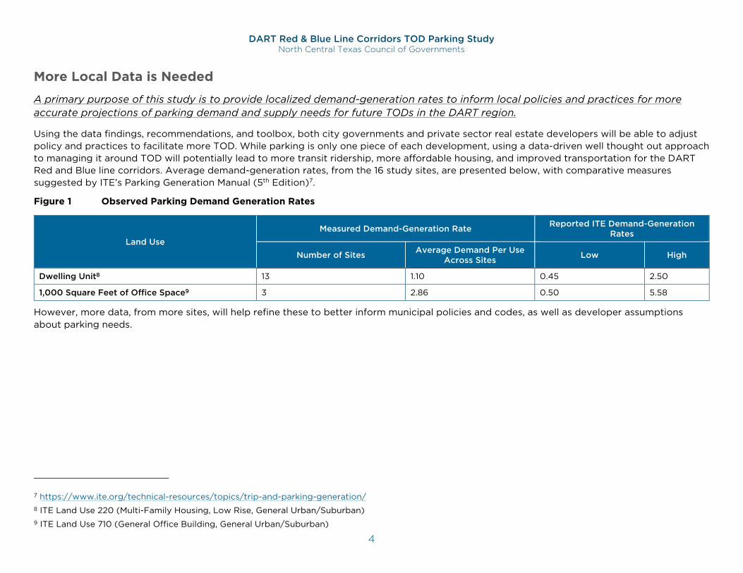
Using the data findings, recommendations, and toolbox, both city governments and private sector real estate developers will be able to adjust policy and practices to facilitate more TOD. While parking is only one piece of each development, using a data-driven well thought out approach to managing it around TOD will potentially lead to more transit ridership, more affordable housing, and improved transportation for the DART Red and Blue line corridors. Average demand-generation rates, from the 16 study sites, are presented below, with comparative measures suggested by ITE’s Parking Generation Manual (5th Edition)7.
Figure 1 Observed Parking Demand Generation Rates
Land Use Measured Demand-Generation Rate Reported ITE Demand-Generation
Rates
Number of Sites Average Demand Per Use Across Sites Low High
Dwelling Unit8 13 1.10 0.45 2.50
1,000 Square Feet of Office Space9 3 2.86 0.50 5.58
However, more data, from more sites, will help refine these to better inform municipal policies and codes, as well as developer assumptions about parking needs.
7 https://www.ite.org/technical-resources/topics/trip-and-parking-generation/ 8 ITE Land Use 220 (Multi-Family Housing, Low Rise, General Urban/Suburban) 9 ITE Land Use 710 (General Office Building, General Urban/Suburban)
DART Red & Blue Line Corridors TOD Parking Study North Central Texas Council of Governments
5
DART Red & Blue Line Corridors TOD Parking Study North Central Texas Council of Governments
6
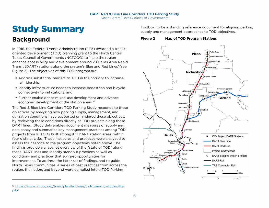
Study Summary Background In 2016, the Federal Transit Administration (FTA) awarded a transit-oriented development (TOD) planning grant to the North Central Texas Council of Governments (NCTCOG) to “help the region enhance accessibility and development around 28 Dallas Area Rapid Transit (DART) stations along the system’s Blue and Red Lines”(see Figure 2). The objectives of this TOD program are:
Address substantial barriers to TOD in the corridor to increase rail ridership;
Identify infrastructure needs to increase pedestrian and bicycle connectivity to rail stations; and
Further enable dense mixed-use development and advance economic development of the station areas.10
The Red & Blue Line Corridors TOD Parking Study responds to these objectives by analyzing how parking supply, management, and utilization conditions have supported or hindered these objectives, by reviewing these conditions directly at TOD projects along these DART lines. Study deliverables document measures of supply and occupancy and summarize key management practices among TOD projects from 16 TODs built amongst 11 DART station areas, within four distinct cities. These measures and practices were analyzed to assess their service to the program objectives noted above. The findings provide a snapshot overview of the “state of TOD” along these DART lines and identify standout practices as well as conditions and practices that suggest opportunities for improvement. To address the latter set of findings, and to guide North Texas communities, a series of best practices from across the region, the nation, and beyond were compiled into a TOD Parking
10 https://www.nctcog.org/trans/plan/land-use/tod/planning-studies/fta-pilot
Toolbox, to be a standing reference document for aligning parking supply and management approaches to TOD objectives.
Figure 2 Map of TOD Program Stations
DART Red & Blue Line Corridors TOD Parking Study North Central Texas Council of Governments
7
Figure 3 Summary of Study Cities
City County DART Stations with
Studied Parking Sites Population
(2017)11
Dallas Dallas (Partially Collin, Denton, Kaufman, and Rockwall)
Cedars CityPlace/Uptown LBJ/Central Mockingbird VA Medical Center Walnut Hill White Rock
1,341,075
Garland Dallas (Partially Collin and Rockwall)
Downtown Garland 238,002
Plano Collin (Partially Denton)
Downtown Plano 286,143
Richardson Dallas (Partially Collin)
CityLine/Bush Spring Valley
116,783
NCTCOG coordinated closely with DART and the cities of Dallas, Garland, Plano, and Richardson on all tasks under the TOD program. Each city contains at least one TOD parking site profiled (Figure 3) and analyzed for the TOD Parking Study. This provides a broader overview of current TOD parking conditions and ensures that study findings will be relevant across NCTCOG communities.
11 U.S. Census Bureau, Population Estimates Program
Intent
The Problem with Too Much Parking
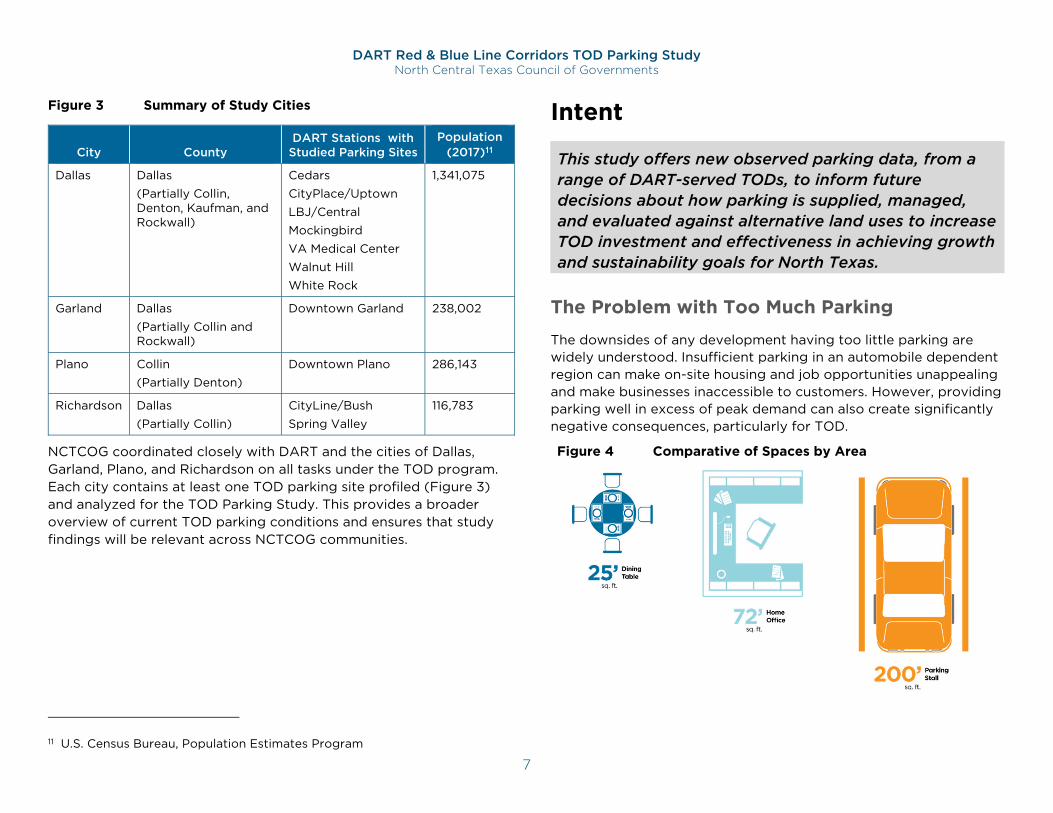
The downsides of any development having too little parking are widely understood. Insufficient parking in an automobile dependent region can make on-site housing and job opportunities unappealing and make businesses inaccessible to customers. However, providing parking well in excess of peak demand can also create significantly negative consequences, particularly for TOD.
This study offers new observed parking data, from a range of DART-served TODs, to inform future decisions about how parking is supplied, managed, and evaluated against alternative land uses to increase TOD investment and effectiveness in achieving growth and sustainability goals for North Texas.
Figure 4 Comparative of Spaces by Area
DART Red & Blue Line Corridors TOD Parking Study North Central Texas Council of Governments
8
One of the most consequential downside of excess parking supplies is the “opportunity cost” that unnecessary parking spaces represent. Each parking space represents roughly 200 or more square feet of space, plus the entry/exit space required for cars to access it. This reduces development densities, by either reducing the developable area of a site or by reducing the share of allowable building height or bulk available for land uses.
In the context of DART station areas, this means less commercial activity and reduced resident and employee densities for generating transit ridership. For municipalities, this means reduced tax revenues from station-area properties, compared to the potential from more fully realized development densities. These reduced activity/population densities can also reduce area walkability, a key catalyst for increased market demand for jobs and housing in many TOD markets.
Walkability ratings have become primary tools for marketing real estate in urban areas. And, as urban mobility continues to attract modal and technological innovation, offering more and cheaper alternatives to vehicle-ownership-based travel, the added-value of ample, free parking will continue to decline in favor of TODs that offer the sense of community and connection that come with optimal walkability and shared-mobility options – including transit.
Finally, significant excess parking capacity tends to lead to underpriced parking – a natural market response to oversupply conditions – which puts transit options at a distinct disadvantage within local and regional travel markets. Residents offered free, on-site parking are likely to own more cars. Business employees and customers similarly offered ample, free parking are less likely to
12 https://www.nctcog.org/nctcg/media/Transportation/DocsMaps/Plan/MTP/1-Introduction.pdf
choose fare-based transit options for their travel to overparked TODs.
Regional Growth Brings Challenges
The North Central Texas Region is expected to grow by roughly 50% in both population and employment by 2045.12 The ongoing construction of new housing, services, and places of employment is a positive sign of accommodating such growth. At the same time, rising housing and transportation costs are challenging affordability in the region:
A majority of families in the City of Dallas are spending more than 30% of their income on housing.13
A majority of households in the NCTCOG region are spending over 45% of income on housing and transportation – a rate above what is recommended by the Center for Neighborhood Technology (CNT).14
The extent to which the cost of housing and transportation can be reduced will be an important factor in determining future quality of life in the North Central Texas region. Reducing the burdens associated with the construction of unneeded parking is an example of how the cost of housing and transportation can be reduced.
Why Study TOD Parking?
TODs are designed to facilitate transit use, as well as walking, biking, and shared-ride mobility. Nonetheless, parking remains a significant component of most TODs. While often a necessary TOD component, the amount of parking provided, and how it is managed and incorporated into the project’s design, will strongly influence the modes of travel used for trips to and from the station areas, as well
13 https://dallascityhall.com/departments/housing-neighborhood-revitalization/CHP%20Documents/Comprehensive%20Housing%20Policy_Amended%2011-28-18.pdf 14 https://htaindex.cnt.org/
DART Red & Blue Line Corridors TOD Parking Study North Central Texas Council of Governments
9
as the cost to buy or rent space in each development. A TOD Parking Study can provide guidance on calculating the “right sized” parking supply for future TODs, and on effectively managing parking at existing TODs, to ensure that parking provides optimal value to each project, while also supporting primary TOD objectives.
In the absence of recent and local “systemic data that relate peak parking demand to land use,”15 TOD developers tend to rely on applicable parking requirements in the local zoning code, and/or industry-standard guides to parking-generation rates, such as the ITE Parking Generation manual. It is rare for either to provide guidance that is based on local, field-recorded parking occupancy data. Rather, it is most often the case that both are based on demand-generation data originally collected in suburban areas with limited or no transit service.
This sets TOD up to fail one of its primary objectives – boosting transit use. Put simply, parking TODs the same as a suburban location with no transit is the best way to ensure that the TOD, in fact, fails to generate much transit ridership at all. An effective starting point to address this is to remove minimum parking requirements for TOD.
However, in many contexts, TOD developers are likely to still build too much parking and will still rely on guides that will consistently over-project demand for TOD-based land uses. In such contexts, reducing and/or eliminating minimum parking requirements, will need to be complemented by other tools for guiding how TODs are parked. One of the most valuable such tools is a set of demand-generation rates, based on local measures of parking demand from local TODs. These rates can be used to “right size” minimum parking requirements, and just as importantly, to inform TOD developer/investor assumptions about supply needs.
15 http://shoup.bol.ucla.edu/Trouble.pdf
Addressing this opportunity to provide more accurate estimates of TOD parking needs was the first purpose of this study, and a defining reason to study TOD parking in the DART region.
This is not the first study to seek this goal. Several studies have sought to define such benchmarks. However, each has noted the context sensitivity of its data and discourage using it to inform parking assumptions outside their region of study. As transportation conditions continue to evolve in the greater Dallas region, this study offers a new set of regionally derived data to inform future decisions of parking supply, regulation, and management in TODs spanning multiple locations and development types.
Peer Studies
Several recent studies brought a similar analytical focus to documenting parking demand patterns among TODs across the country. Three very recent such studies included extensive surveys to measure parking demand patterns among several existing TODs. These “peer” studies also used findings to develop policy guidance and to inform future supply decisions. While none were meant to serve as a national resource for TOD parking, their findings along with the findings of this study, underscore the consistency of certain patterns and their importance for TOD planning, policy, and practice.
Parking Requirements for Multifamily Residential in Transit Priority Areas (2019) – Chen Ryan Associates, for City of San Diego16
The City of San Diego completed this study to better inform the process of updating the City’s multifamily residential parking requirements and understand the factors which influence vehicle ownership and parking demand. The study included a peer-city review, complemented by parking supply and utilization data
16 https://www.sandiego.gov/planning/programs/transportation/mobility/tpa
DART Red & Blue Line Corridors TOD Parking Study North Central Texas Council of Governments
10
collection and analysis from over 30 multifamily developments within designated Transit Priority Areas (TPAs), areas within one-half mile of an existing or planned major transit stop, located across the city outside of downtown.
Key Findings
Peak residential parking demand averaged 1.05 spaces per dwelling unit.
- East Village developments averaged less than one space per dwelling unit.
Each parking space adds between $35,000 and $90,000 to the construction cost of housing (based on local San Diego construction estimates).
Peer cities are following a trend toward broad elimination of parking requirements, particularly for transit-served areas.
Leading cities are adopting requirements that parking costs be unbundled from housing or commercial-space costs.
Key Recommendations
Citywide changes to zoning code for development within TPAs:
Elimination of parking requirements.
Transportation amenities required, for both tenants and the community.
The costs for all provided parking must be unbundled from rent or purchase price.
Perfect Fit Parking Initiative (2019) – Metro Boston, Metropolitan Area Planning Council17
This three-year study measured the actual supply of and demand for residential parking in the Inner Core subregion, which includes Boston and 20 surrounding cities and towns. Property managers were interviewed, and overnight parking-occupancy counts were
17 https://perfectfitparking.mapc.org/
completed at nearly 200 multifamily residential developments in 14 municipalities. The survey included apartments and condos, large and small projects, and projects close to and far from transit. Counts took place during peak utilization hours: in the middle of the night on weeknights, and not during the summer or near major holidays. While not specifically focused on TODs, roughly two-thirds of the developments surveyed were within a half mile distance of a regional rapid transit or commuter rail station.
Key Findings
Peak residential parking demand averaged less than 0.7 spaces per dwelling unit for market-rate housing, and less than 0.5 spaces per dwelling unit for affordable housing18.
Abundant parking at developments meant to be transit-oriented is counter-productive.
- It attracts car owners; makes housing less affordable for car-free or car-limited households; and encourages residents to use cars for trips that could be made by transit, walking, or biking.
- New housing in areas with good transit connections should provide less than one space per unit, to attract households with fewer vehicles.
- Bike storage, car sharing, transit subsidies, shuttles, and human-oriented design are also all key elements of TOD.
- Transit Connectivity – defined as the number of “jobs within a 30-minute transit commute” of the development’s location – was one of three factors found to be strongly predictive of measured parking demand.
Parking policies have a role to play in enabling more housing production near transit and promoting the use of low-carbon transportation modes.
Cities and towns shape the region's transportation future through their land use regulations, and they would do well to
18 The average unit size of developments measured was 1.6 bedrooms.
DART Red & Blue Line Corridors TOD Parking Study North Central Texas Council of Governments
11
implement parking requirements aligned with actual parking demand, emerging trends, and transportation policy objectives.
Empty Spaces: Real Parking Needs at Five TODs (2017) – Smart Growth America, University of Utah Department of City & Metropolitan Planning19
To determine how much TOD can be expected to reduce parking needs compared to industry-standard estimates, Professor Reid Ewing and his research team at the University of Utah College of Architecture + Planning selected five TODs across the country, and conducted parking inventory and occupancy counts to directly measure parking demand.
Key Findings
“Consistent with other research, this study found that the five TODs generated fewer vehicle trips than ITE20 publications estimate, and used less parking than many regulations require for similar land uses.”
The five-site average for peak residential parking demand was 0.87 spaces per dwelling unit:
- The five-site average for parking supply was 1.18 spaces per dwelling unit.
- ITE-standard demand estimates averaged 1.55 spaces per dwelling unit.
Factors cited as likely cause for the reduced level of parking demand include:
Shared Parking Efficiencies: parking is shared between commercial and residential uses at two sites, and between transit and park-and-ride uses at another.
19 https://smartgrowthamerica.org/resources/empty-spaces-real-parking-needs-five-tods/
Unbundling/Pricing: the price of parking is unbundled from apartment rents at two sites and is priced at market rates for commercial users at three.
Alternative Mobility Options: in each of the five TODs studied, at least 33 percent of trips were taken by modes other than driving.
The primary finding common to each of the peer studies is the tendency for TODs to be overparked relative to documented parking demand peaks, whether due to too-high parking requirements or to developers or their advisors over-anticipating parking needs.
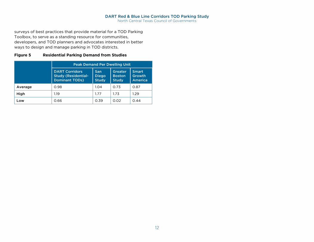
It is worth noting that, out of all these studies (Figure 5), none found a single site with demand as high as two spaces per dwelling unit (a common parking requirement for residential development, even for TOD).
The Role of This Study
The documented demand measures from peer studies provide important guidance regarding parking demand for TODs, as well as benchmarks for similar measures resulting from subsequent studies. However, none are meant to provide universal benchmarks or demand metrics that should be used if local/regional measures can be developed. As noted in the Conclusion section of the Empty Spaces report: “Analysis of five TOD projects is far from comprehensive, but engineers and municipal leaders can use these findings to make more educated decisions about future TOD projects.”
This study adds its findings to this growing body of data, while also providing measures that are specific to the Dallas region and DART service areas. It builds upon their collective findings and uses locally derived data to best inform efforts to right-size parking for future DART-based TODs. This is complemented by national and regional
20 Institute for Transportation Engineers (ITE)
DART Red & Blue Line Corridors TOD Parking Study North Central Texas Council of Governments
12
surveys of best practices that provide material for a TOD Parking Toolbox, to serve as a standing resource for communities, developers, and TOD planners and advocates interested in better ways to design and manage parking in TOD districts.
Figure 5 Residential Parking Demand from Studies
Peak Demand Per Dwelling Unit
DART Corridors Study (Residential-Dominant TODs)
San Diego Study
Greater Boston Study
Smart Growth America
Average 0.98 1.04 0.73 0.87
High 1.19 1.77 1.73 1.29
Low 0.66 0.39 0.02 0.44
DART Red & Blue Line Corridors TOD Parking Study North Central Texas Council of Governments
13
Approach and Analysis Site Selection
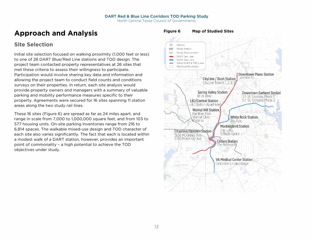
Initial site selection focused on walking proximity (1,000 feet or less) to one of 28 DART Blue/Red Line stations and TOD design. The project team contacted property representatives at 26 sites that met these criteria to assess their willingness to participate. Participation would involve sharing key data and information and allowing the project team to conduct field counts and conditions surveys on their properties. In return, each site analysis would provide property owners and managers with a summary of valuable parking and mobility performance measures specific to their property. Agreements were secured for 16 sites spanning 11 station areas along the two study rail lines.
These 16 sites (Figure 6) are spread as far as 24 miles apart, and range in scale from 7,000 to 1,000,000 square feet, and from 103 to 577 housing units. On-site parking inventories range from 216 to 6,814 spaces. The walkable mixed-use design and TOD character of each site also varies significantly. The fact that each is located within a modest walk of a DART station, however, provides an important point of commonality – a high potential to achieve the TOD objectives under study.
Figure 6 Map of Studied Sites
DART Red & Blue Line Corridors TOD Parking Study North Central Texas Council of Governments
14
Conditions Surveys
Parking Inventories
Site surveys were conducted across all 16 sites in July, August, and October of 2018. Project staff visited each site to document the on-site supply directly, or to verify inventory data received by a property representative.
Occupancy Measures
Parking occupancy was measured using cameras installed at the entrances of each site’s primary parking facilities. Counts were collected over a span of 72 hours (from midnight at the start of Thursday to midnight at the end of Saturday) at each site. Parking occupancy generally fluctuates from day to day due to a range of factors, including weather, traffic conditions, and events. Occupancy also varies by season, particularly at shopping-oriented developments like Uptown Dallas’ West Village. Nonetheless, the dates selected for counts were chosen to represent the “normative” conditions that typically define measure of parking need.
A single, baseline parking occupancy count was completed manually by a member of the project staff during the same 72-hour span, to ensure the accuracy of the camera-based counts. The baseline count was matched to the number of entrances and exits of traffic to formulate a demand profile across the full 72-hour period.
While every effort was made to survey the entire on-site parking supply, some entrances and exits could not be cost-effectively counted. In these instances (at 5 sites), the difference between total provided parking spaces and the number of studied parking spaces was insignificant, never surpassing 5% of any single site’s total inventory.
On-street parking occupancy was also measured at sites with 50 or more of these spaces. Counts were completed, at least once a day, during the three days of camera-based count, at each of these five sites.
Supplies, Requirements, & Projections
For each site, occupancy measures were compared to the project’s:
1. Documented site parking space inventory;
2. Minimum parking requirement, based on the relevant City codes; and
3. Projected parking demand, based on a shared-parking model developed for this study using ITE demand-generation ratios.
Shared-Parking Model Based on Industry Standards
Building off of currently established ITE demand-generation rates, the shared-parking model incorporates Urban Land Institute (ULI)-established measures of demand-variability across the week to anticipate accumulated parking-generation among the site’s land uses, over time, to more accurately anticipate when demand will peak, and at what level, within a typical week. Although the shared-parking model in this study is using default ULI and ITE rates, it is technically capable of incorporating adjustments for internal capture rates by user groups and transportation mode shift responses to an on-site travel demand management (TDM) program.
The application of the shared-parking model provides a useful point of comparison against provided supplies and minimum requirements, while the occupancy measures provide a useful set of data to test the assumptions built into the model.
Parking Management Practices
Project staff interviewed a property-management representative for each site, to inquire about management policies and practices, building occupancy conditions, and perceptions of parking conditions both on-site and in the surrounding area. A sample question set, and a summary of responses is available in Appendix B.
DART Red & Blue Line Corridors TOD Parking Study North Central Texas Council of Governments
15
Site Area Context and Summary Data
A summary profile was developed for each site, based on available data, site visits, and interviews with property representatives. These focused primarily on the scale and nature of on-site land uses, but also included notable site and contextual characteristics. Walking distances were also measured for the closest DART station, employment centers, significant bike trails, bike parking amenities, and DART bus routes. Additionally, in each summary profile, built supplies were compared to zoning requirements and occupancy measures, and summarizing other key findings.
Together, these profiles – which are available in the appendix of this report -- provide an overview of how DART-based TODs have addressed parking, how markets have responded, and the implications for cities, developers, and TOD advocates across the DART service region.
Key Findings Supply-Demand Balance Findings
Parking facilities tend to operate most efficiently when they are mostly, but not completely, full – around 90% utilization is a conservative benchmark for optimal efficiency for off-street facilities. Above this level, the functionality of lots and garages tends to decline, as drivers circulate more and more cautiously in search of a space. By contrast, utilization levels significantly below this benchmark suggest excess capacity that is not optimizing land use. Based on the configuration and technology typical of the parking facilities surveyed for this study, the industry-standard 90% threshold was used to assess supply sufficiency and efficacy across all sites.
21 https://wginc.com/wp-content/uploads/2018/07/Parking-Construction-Cost-Article-17x11-8.5x11-Pages.pdf
Excess Supply is the Norm
Most developments provide far more parking than is needed, even at peak demand times.
Most study sites were significantly over-parked – with vacancy well above the common 10% target rate during periods of peak demand.
13 of 16 sites never peaked above 80% utilization over the course of the 72-hour data collection periods.
The excess parking capacity in these 13 sites combines to approximately 4,529 spaces (including 2,344 at CityLine alone).
The current median price of $17,464 to construct a single parking space (above-ground garage) in the Dallas region (not including the cost of land, or for operations and maintenance)21 emphasizes the significant cost of oversupplied parking – a cost that is passed on to project tenants and residents.
Most developments provide more parking than was required.
The supply at 10 of the 16 sites exceed the municipal requirement by at least 10%.
This suggests that simply removing minimum parking requirements may not be sufficient to “right-size” parking facilities built to support future TOD.
Supply is Especially Excessive at Affordable Housing
Studied affordable housing TODs used relatively less parking.
Affordable housing development parking had peak utilizations of 50% at The Belleview and 40% at Lancaster Urban Village, while market rate developments exhibited higher use (Modena 93% and Junction 15 at 92%).
DART Red & Blue Line Corridors TOD Parking Study North Central Texas Council of Governments
16
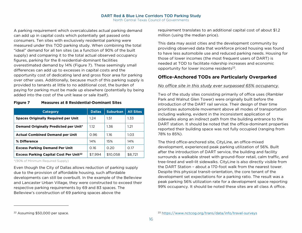
A parking requirement which overcalculates actual parking demand can add up in capital costs which potentially get passed onto consumers. Ten sites with exclusively residential parking were measured under this TOD parking study. When combining the total “ideal” demand for all ten sites (as a function of 90% of the built supply) and comparing it to the total actual observed occupancy figures, parking for the 8 residential-dominant facilities overestimated demand by 14% (Figure 7). These seemingly small differences can add up to excesses in capital costs and the opportunity cost of dedicating land and gross floor area for parking over other uses. Additionally, because much of this parking supply is provided to tenants at little to no additional cost, the burden of paying for parking must be made up elsewhere (potentially by being added into the cost of the unit lease or sale itself).
Figure 7 Measures at 8 Residential-Dominant Sites
Category Dallas Suburban All Sites
Spaces Originally Required per Unit 1.24 1.51 1.33
Demand Originally Predicted per Unit* 1.12 1.36 1.21
Actual Combined Demand per Unit 0.96 1.16 1.03
% Difference 14% 15% 14%
Excess Parking Demand Per Unit 0.16 0.20 0.17
Excess Parking Capital Cost Per Unit22 $7,994 $10,058 $8,721
*(90% of Minimum Required Supply)
Even though the City of Dallas allows reduction of parking supply due to the provision of affordable housing, such affordable developments can still be overbuilt. In the example of the Belleview and Lancaster Urban Village, they were constructed to exceed their respective parking requirements by 69 and 83 spaces. The Belleview’s construction of 69 parking spaces above the
22 Assuming $50,000 per space.
requirement translates to an additional capital cost of about $1.2 million (using the median price).
This data may assist cities and the development community by providing observed data that workforce priced housing was found to have less automobile use and reduced parking needs. Housing for those of lower incomes (the most frequent users of DART) is needed at TOD to facilitate ridership increases and economic opportunity for lower income residents23.
Office-Anchored TODs are Particularly Overparked
No office site in this study ever surpassed 65% occupancy.
Two of the study sites consisting primarily of office uses (Rambler Park and Walnut Glen Tower) were originally built before the introduction of the DART rail service. Their design of their time prioritizes automobile movement above all modes of transportation including walking, evident in the inconsistent application of sidewalks along an indirect path from the building entrance to the DART station. It should be noted that the office-dominant properties reported their building space was not fully occupied (ranging from 78% to 85%).
The third office-anchored site, CityLine, an office-mixed development, experienced peak parking utilization of 56%. Built after the introduction of DART service, the building and facility surrounds a walkable street with ground-floor retail, calm traffic, and tree-lined and well-lit sidewalks. CityLine is also directly visible from the DART Station – about a 170-foot walk from the nearest tower. Despite this physical transit-orientation, the core tenant of the development set expectations for a parking ratio. The result was a peak parking 56% utilization rate for a development space reporting 99% occupancy. It should be noted these sites are all class A office.
23 https://www.nctcog.org/trans/data/info/travel-surveys
DART Red & Blue Line Corridors TOD Parking Study North Central Texas Council of Governments
17
Predictable use patterns make these sites good candidates to support nearby uses, or expanded site development, with existing parking.
Parking utilization patterns at office sites follow a very clear and predictable path on the weekdays (typically plateauing shortly after 10 AM), which can be easily used to calibrate a parking model. Despite the predictability in the shape of the demand curve, the amount of peak demand remains significantly less than what was originally estimated. At their most utilized, there are still a total of 750 spaces in excess parking capacity from the two pre-DART office buildings and 2,300 spaces at CityLine.
It may be in the interest of the development and community to consider how best to improve the utilization of these spaces – whether by sharing their parking with off-site uses (including perhaps as DART park-and-ride), or by using the excess parking capacity to support expanded site development.
Patterns Vary by TOD Type
Typing the 16 studied TODs by their predominant land use enables more detailed findings (see Figure 8 for summary observations by land use category and Figure 9 for observations by site).
Residential sites have distinctive demand patterns, higher utilization.
Peak occupancy occurred during the early morning hours (between 3 and 5 AM), though rarely approaching 90% occupancy, even at these times.
Occupancy typically decreased throughout the morning, dropping to between 40% and 60% utilization during the midday.
Locations with non-market housing, including mixed income (Lancaster Urban Village) and low-income rentals (The
Belleview), had some of the lowest parking utilization measures, peaking at 50%.
Sites with mixed-uses experienced different patterns in demand.
At the two West Village sites (which contain a combined 88,000 square feet in retail) peak parking occupancy occurred during weekday evenings (7 PM) and weekend during the lunch hour (1 PM). This contrasts with residential-dominant uses, where parking utilization peaks overnight.
CityLine, which contains on-site retail, never experienced any substantial decrease in parking utilization during the lunch hour (10 AM to 1 PM) that single-use office buildings like Rambler Park and Walnut Glen Tower do.
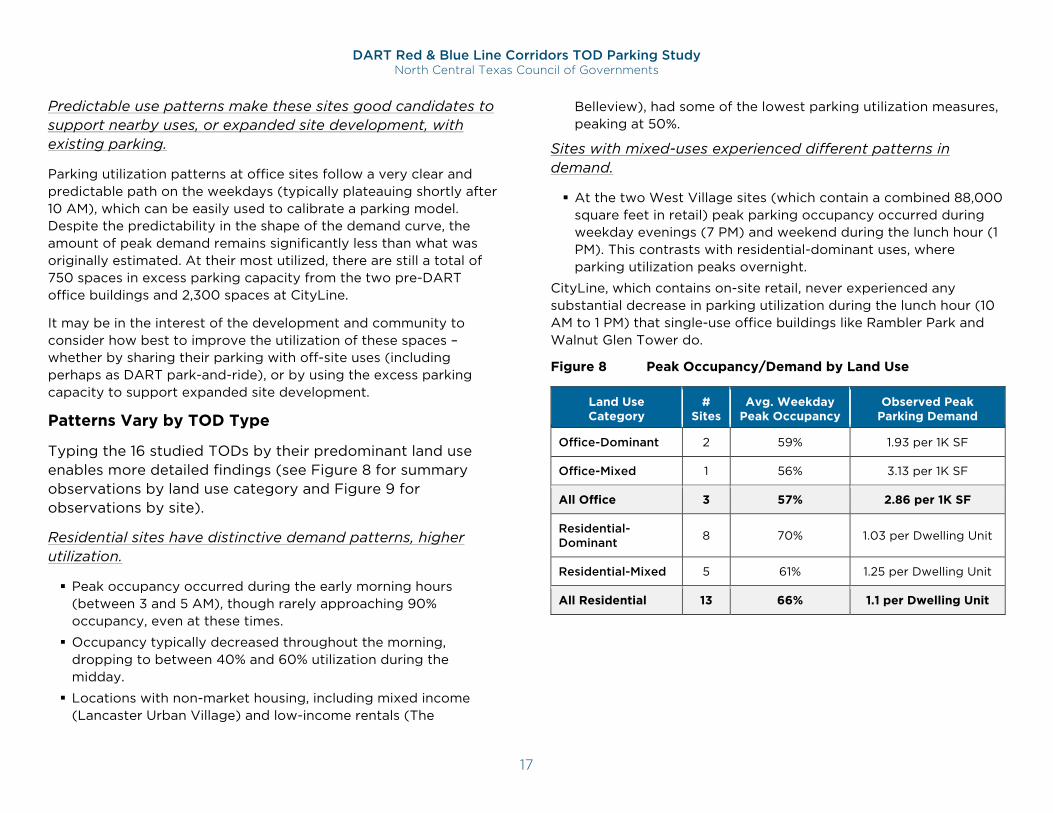
Figure 8 Peak Occupancy/Demand by Land Use
Land Use Category
# Sites
Avg. Weekday Peak Occupancy
Observed Peak Parking Demand
Office-Dominant 2 59% 1.93 per 1K SF
Office-Mixed 1 56% 3.13 per 1K SF
All Office 3 57% 2.86 per 1K SF
Residential-Dominant 8 70% 1.03 per Dwelling Unit
Residential-Mixed 5 61% 1.25 per Dwelling Unit
All Residential 13 66% 1.1 per Dwelling Unit
DART Red & Blue Line Corridors TOD Parking Study North Central Texas Council of Governments
18
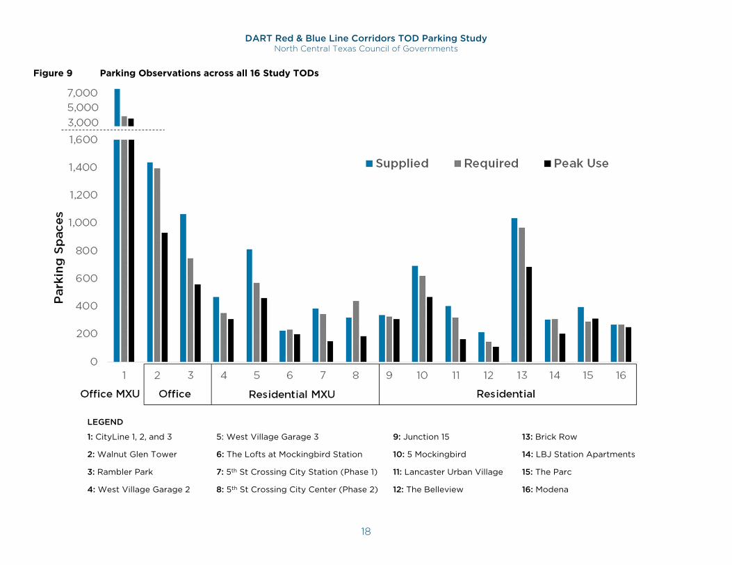
Figure 9 Parking Observations across all 16 Study TODs
LEGEND
1: CityLine 1, 2, and 3 5: West Village Garage 3 9: Junction 15 13: Brick Row
2: Walnut Glen Tower 6: The Lofts at Mockingbird Station 10: 5 Mockingbird 14: LBJ Station Apartments
3: Rambler Park 7: 5th St Crossing City Station (Phase 1) 11: Lancaster Urban Village 15: The Parc
4: West Village Garage 2 8: 5th St Crossing City Center (Phase 2) 12: The Belleview 16: Modena
DART Red & Blue Line Corridors TOD Parking Study North Central Texas Council of Governments
19
Parking Management Findings
Free Parking is the Norm
A majority of the parking provided on each site is offered free of charge, which can dissuade people from considering other options.
Free parking puts transit at a significant mode-share disadvantage, when by comparison a local monthly DART pass costs $96.
While it is common for property managers to charge residents a monthly fee for a “reserved” space, those interviewed noted that it is rare for residents to choose this option – largely because many projects have enough availability to make a standard parking space sufficiently convenient.
Shared Parking Can Work
Sharing parking spaces does not constrain availability for development tenants/residents.
Availability was plentiful among the studied mixed-use facilities with over 250 spaces of publicly accessible spaces.
There appears, however, to be some significant level of discomfort with the concept of sharing parking beyond development boundaries. Addison Circle (not included in this study) is a mixed-use development originally planned to have shared parking. However, the shared parking scheme was abandoned at the behest of lenders for the development’s second phase.24 This has important implications for addressing existing excess parking supplies at DART-served TODs, as changes to parking codes can only mitigate against future oversupplies. Encouraging and facilitating shared use of existing excess capacities will be critical for recapturing the value
24 urbanland.uli.org/development-business/dallasfort-worth-region-considering-options-flexible-future-parking/
of these spaces. Best practices for shared parking policies are discussed further in the TOD Parking Toolbox.
Estimated vs. Actual Demand Findings
Minimum Requirements Are Not Entirely to Blame
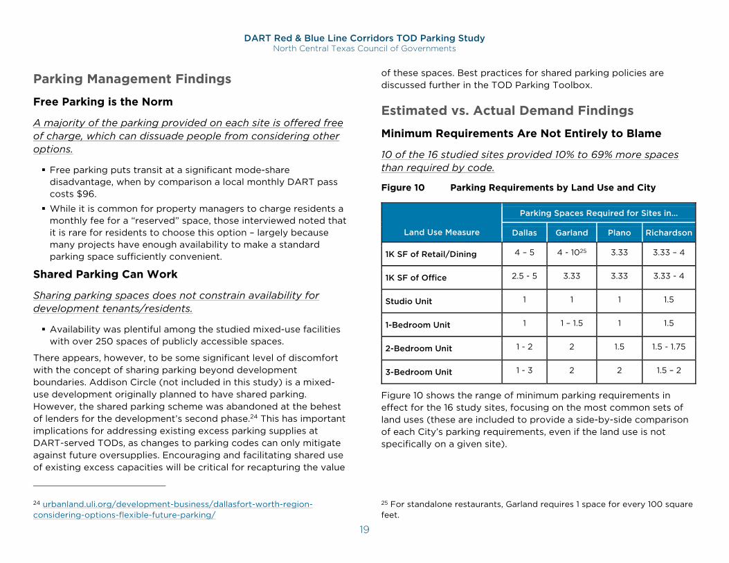
10 of the 16 studied sites provided 10% to 69% more spaces than required by code.
Figure 10 Parking Requirements by Land Use and City
Figure 10 shows the range of minimum parking requirements in effect for the 16 study sites, focusing on the most common sets of land uses (these are included to provide a side-by-side comparison of each City’s parking requirements, even if the land use is not specifically on a given site).
25 For standalone restaurants, Garland requires 1 space for every 100 square feet.
Land Use Measure
Parking Spaces Required for Sites in…
Dallas Garland Plano Richardson
1K SF of Retail/Dining 4 – 5 4 - 1025 3.33 3.33 – 4
1K SF of Office 2.5 - 5 3.33 3.33 3.33 - 4
Studio Unit 1 1 1 1.5
1-Bedroom Unit 1 1 – 1.5 1 1.5
2-Bedroom Unit 1 - 2 2 1.5 1.5 - 1.75
3-Bedroom Unit 1 - 3 2 2 1.5 – 2
DART Red & Blue Line Corridors TOD Parking Study North Central Texas Council of Governments
20
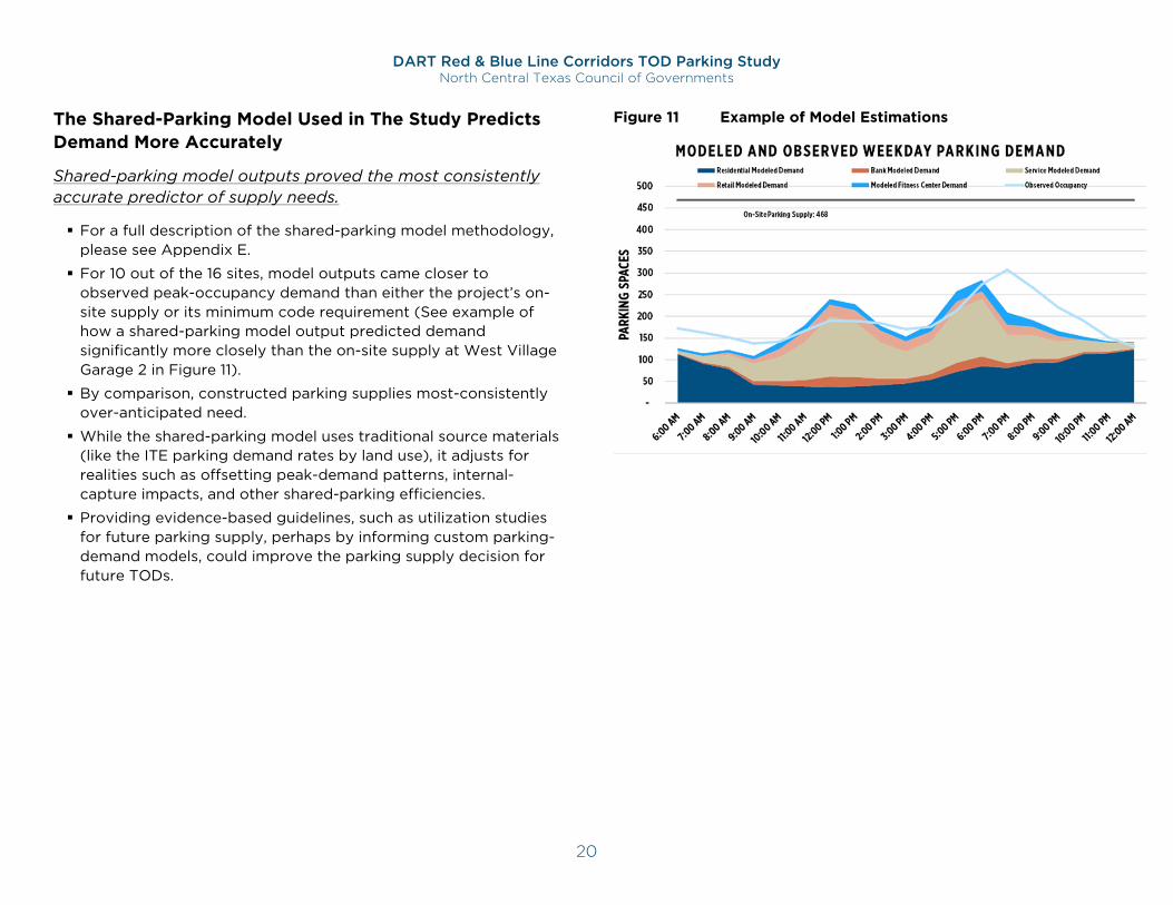
The Shared-Parking Model Used in The Study Predicts Demand More Accurately
Shared-parking model outputs proved the most consistently accurate predictor of supply needs.
For a full description of the shared-parking model methodology, please see Appendix E.
For 10 out of the 16 sites, model outputs came closer to observed peak-occupancy demand than either the project’s on-site supply or its minimum code requirement (See example of how a shared-parking model output predicted demand significantly more closely than the on-site supply at West Village Garage 2 in Figure 11).
By comparison, constructed parking supplies most-consistently over-anticipated need.
While the shared-parking model uses traditional source materials (like the ITE parking demand rates by land use), it adjusts for realities such as offsetting peak-demand patterns, internal-capture impacts, and other shared-parking efficiencies.
Providing evidence-based guidelines, such as utilization studies for future parking supply, perhaps by informing custom parking-demand models, could improve the parking supply decision for future TODs.
Figure 11 Example of Model Estimations
DART Red & Blue Line Corridors TOD Parking Study North Central Texas Council of Governments
21
Parking Regulations Findings
There is a common interest across the Dallas-Fort Worth Region in making sure transit-proximate sites are incentivizing multimodal options and shared and right-sized parking26. As the region’s population is projected to grow27, so will the demand for land and transportation infrastructure. Private and public sector individuals and coalitions are planning for a multimodal future28 where land in proximity to DART, shared mobility options, and future high-speed rail is truly at a premium29. There is a considerable extent to which parking factors into such plans.
The cities of Dallas, Garland, Plano, and Richardson have taken efforts to improve their zoning to support TOD by reducing the burden of constructing and maintaining parking in sites which are already well-served by public transit. Each city has at least one parking regulation which stands out as supportive to the ideals of successful TOD and other walkable communities:
Dallas, in some locations, applies a simple 1:1 requirement for residential units, and may employ a maximum requirement as well.30
Garland provides a simplified list of three terms in which a development may reduce its overall parking requirement: incorporating on-street parking, providing at least 80% of parking as publicly available, or following mixed-use shared parking provisions.31
26 www.nctcog.org/trans/plan/land-use/parking-management 27 www.nctcog.org/nctcg/media/Transportation/DocsMaps/Plan/MTP/1-Introduction.pdf 28 www.planning.dot.gov/documents/regional_shared_mobility_planning_caseStudies.pdf 29 nextcity.org/daily/entry/dallas-dot-is-making-plans-for-a-better-connected-city
Plano limits the amount of surface parking in station area zones and requires surface lots above 100 spaces to “be designed as future development sites.”32
Richardson has form-based codes which intend to incentivize public-private partnerships for providing shared public parking and requires that such facilities are connected to neighboring business “with paved and landscaped pedestrian walkways.”33
Elsewhere in North Central Texas, the public sector has also made notable parking policy reforms in the interest of planning for successful TOD and communities with many mobility choices. These concepts include:
Eliminated parking requirements in the city of DeSoto’s Market Place Planned Development34
Consolidated parking with publicly-accessible spaces to accommodate developments of varying sizes in the city of Carrollton’s Downtown Transit-Oriented Development Plan35
Allowance of shared, on-street, and remote (within 1,200 feet) parking for all uses under requirements in the North Richland Hills TOD Code36
30 City of Dallas. Article 875. PD 875. 31 City of Garland. 2018. Garland Development Code. 32 Plano Zoning Ordinance. 2018. Page 10-17 33 City of Richardson. 2013. Main Street/Central Expressway Form Based Code. 34 www.developmentexcellence.com/clide-past-winners.html 35 www.cityofcarrollton.com/home/showdocument?id=522 36 www.nrhtx.com/DocumentCenter/View/576/NRH_TOD?bidId=
DART Red & Blue Line Corridors TOD Parking Study North Central Texas Council of Governments
22
Consideration of the future ability of autonomous vehicles to substantially reduce the need for on-site long-term parking in the Fort Worth High-Speed Rail Station Area Planning Study37
City of Dallas Parking Policies & Practices
Key Policies in TOD Parking Study Sites
Planned Development Districts surrounding the study sites allow reduced parking requirements, including those listed below:
PD 317, which applies to the Belleview, credits on-street parking available to the public toward a project’s parking requirement.38
Proximity to a DART station and the accompanying provision of “enhanced pedestrian amenities” can reduce a project’s parking requirement.39
In the Cityplace Planned Development, parking requirements are reduced for mixed-use projects. Developers can also pay into the Cityplace Transit Fund in lieu of meeting their full parking requirement.40 This district also requires just 1 space per dwelling unit for residential uses.
The Parc Planned Development sets a maximum of 1.5 spaces per dwelling unit.41
City of Garland Parking Policies & Practices
Key Policies in TOD Parking Study Sites
Today, Phase 2 of 5th Street Crossing is surrounded by the Downtown District Form-Based Code. This is a new code that was not yet in place at the time 5th Street Crossing was being
37 www.nctcog.org/nctcg/media/Transportation/DocsMaps/Plan/Transit/FWHSR.pdf 38 City of Dallas. Article 317. PD 317. Cedars Area Special Purpose District. 39 Ibid. 40 City of Dallas. Article 305. PD 305. Cityplace.
developed. According to the Planning Report for Phase 2 of the 5th Street Crossing project dated July 8, 2013, 5th Street Crossing was located in the Central Area – 1 District which no longer exists, and this district did not have parking requirements.
Downtown District form-based code:
Parking reductions can be taken for:
- On-street parking in front of the site
- Providing at least 80% of on-site parking as publicly accessible.42
- Residential uses are not permitted to take this reduction.
Bicycle parking is required at a rate of 1 space per every 10 vehicular spaces required.
City of Plano Parking Policies & Practices
Key Policies in TOD Parking Study Sites
In the Downtown Business/Government District, required parking can be reduced by the provision of accessible public parking.
Additionally, “all surface parking lots with 100 or more spaces must be designed as future development sites.” and “no surface parking lot may contain more than 300 spaces.”43
In the Central Business-1 District44, off-street parking can be located a maximum of 600 feet from the property.
41 City of Dallas. Article 875. PD 875. 42 City of Garland. 2018. Garland Development Code. 43 Plano Zoning Ordinance. 2018. Page 10-17 44 Plano Zoning Ordinance. 2018. Page 10-33.
DART Red & Blue Line Corridors TOD Parking Study North Central Texas Council of Governments
23
City of Richardson Parking Policies & Practices
Key Policies in TOD Parking Study Sites
The Bush Central Station PD #3 does not require minimum parking to be situated on the same site as the use it is serving, “Required parking may be provided anywhere within the Bush Central Station PD #3”.45
Much of the required parking for residential uses is to be in garages in the Spring Valley Station District’s Development Regulations.
Neither TOD site provides clear instructions for reducing required parking for specific developments.
Key Improvement Opportunities
North-Central Texas peer-community code strategies include several promising TOD parking approaches.
Eliminating minimum requirements in key growth districts (DeSoto).
Policies that encourage public parking, and emphasize the importance of managed, on-street parking (Carrollton).
Crediting on-street spaces toward parking requirement (North Richland Hills and Planned Development Districts in Dallas).
Future-ready flexibility in parking requirements/assumptions, including an emphasis on shared parking (Fort Worth).
Requirement reduction incentives may offer more promise than results.
Reducing parking requirements as an incentive for developers to provide multimodal amenities – as City of Dallas does near DART stations – may have limited influence on TODs if the majority of developers plan to provide more parking than is required.
45 Bush Central Station Planned Development Code #3. Page 25.
− This is an important incentive to offer with any code that includes minimum parking requirements, even if only a minority of TOD proposal seek requirement reductions.
− However, study findings suggest that the current inclination to provide more parking than is required should temper expectations that this incentive alone will make such amenities a commonplace among DART-area TODs.
Emphasize flexibility to increase comfort with parking maximums.
Since most developers appear to provide more parking than is required, incentives typically linked to reduced minimums should be considered as part of a broader application of parking maximums
− Allowing developers to exceed maximums by providing desired multimodal amenities – improved pedestrian/bike facilities, shared/public parking, transit infrastructure, etc. – can make adoption of maximums more politically viable, and allow for lower maximum ratios.
− Traditional maximums, because they present a hard “cap” on parking supplies, are often set relatively high compared to expected parking needs or preferred supply levels.
− By providing more options to developers, flexible maximums can be set at ratios low enough to challenge developer assumptions about parking needs, without discouraging TOD by constraining developers who may need to provide more parking to secure investor backing.
Form-based codes can be good vehicles for code innovation.
Form-based codes (FBC) tend to offer more capacity for innovative parking solutions, such as minimum requirements for shared/public parking, incentives for shared/public parking beyond what is required, and flexible maximums for non-
DART Red & Blue Line Corridors TOD Parking Study North Central Texas Council of Governments
24
shared/public parking that are often set much lower than conventional maximums.
These codes can also emphasize multimodal amenity requirements that reflect locally relevant opportunities to shift travel away from parking-dependent modes.
The City of Garland’s Downtown District FBC is a good example of a district-focused set of synergistic strategies that can directly support better TOD.
District-focused parking standards facilitate long-term efficiency and flexibility.
Codes that focus on district-level parking, such as the Bush Central Station PD #3, emphasize investments in parking infrastructure that is not tied to any specific land use, building, or property.
Such infrastructure will be better positioned, designed, and managed to adjust to anticipated declines in off-street parking demand anticipated to result from expanding mobility options, technology solutions, and demographic trends.46
These declines are projected to vary significantly from city to city, district to district, in terms of magnitude and timeline47, but weigh heavily on present-day decisions to invest in 50-year infrastructure like parking structures.48
A common response to this increasing uncertainty about how much parking the future will require, is to build parking facilities that can be repurposed for other uses as demand declines.
District-focused parking infrastructure presents a similar opportunity, but rather than seeking to accommodate new land uses within parking facilities, district-focused parking
46 https://www.t2systems.com/img/T2/banners/T2-eBook-5-Trends.pdf 47 https://www.parking.org/wp-content/uploads/2018/05/0509_2018_Emerging-Trends_blue_printPages.pdf
facilities accommodate new land uses by doing what they do best – parking their cars.
More multimodal amenities may provide significant long-term gains.
Current codes do not seem to effectively encourage investments in innovative mobility connections to nearby DART stations or regional bike trails, or amenities such as sidewalk enhancements, travel information technology, or curbside management.
Nonetheless, property manager surveys indicate that such investments – particularly direct connections to DART or bike trails – have been embraced by tenants and valued as notable property features.
The overabundance of parking supplies at most surveyed TODs also suggests that increased TOD development may lead to traffic congestion issues in TOD districts, undermining the potential walkability and urban-lifestyle features of these areas.
Given that the amount of parking in these areas is a fixed condition, addressing its impacts on traffic levels will likely require a significantly more concerted effort to protect and enhance walking, cycling, and riding conditions with targeted investments in physical infrastructure, management/regulatory practices, and municipal codes/policies.
48 https://www.reit.com/news/reit-magazine/march-april-2019/camden-property-future-proofs-parking-garages-adaptive-reuse
DART Red & Blue Line Corridors TOD Parking Study North Central Texas Council of Governments
25
PART TWO TOD Parking Toolbox

DART Red & Blue Line Corridors TOD Parking Study North Central Texas Council of Governments
27
Toolbox Overview This strategic-parking toolbox was developed based on findings from NCTCOG’s Red and Blue Line Corridors TOD Parking Study along with national best practices. It identifies proven-effective strategies to address the parking challenges identified by the study. It is organized to serve as a guide for the development of innovative parking approaches for future TODs and existing TOD areas in the DART region and beyond. While a toolbox provides solutions for a wide range of TOD parking challenges, its contents focus particularly on opportunities to address the following issues, revealed in the study to be the most pressing and consistent challenges.
Developers have consistently and significantly overparked TOD projects along these DART corridors, with peak-hour occupancy measures averaging approximately 60% of available supplies among the 16 studied TODs.
Peak demand also falls far below the amount of parking required at nearly all studied TODs.
Most (81%) of the studied sites were built with more parking than is required by code; Over half of all studied sites (62.5%) exceeded requirements by over 10%.
Input from developers engaged during the study indicate that TOD investors, lenders, brokers, and commercial tenants often demand more parking supplies based on their perceptions and
experience, even if those requested supplies is in excess of code requirements and the developer’s demand estimates.
The consistent oversupply of parking provides minimal value to TOD areas, as it is an unused resource which limits further density of development needed to attract additional transit riders.
Several municipalities and TOD developers from across the NCTCOG region have adopted innovative parking code, supply, and management practices, providing an opportunity to compile these practices into a shared resource for all station-served communities to consider adopting similar code changes
Leading practices from beyond the region also offer valuable opportunities for municipalities, developers, and TOD planners and advocates to benefit from several years of TOD parking innovation and strategic refinement.
The toolbox offers a wide range of strategies, each of which is provided a set of pages with primer-level content as follows.
Overview
Key Benefits
National Case Study
Regional/State Case Study
Implementation Considerations
DART Red & Blue Line Corridors TOD Parking Study North Central Texas Council of Governments
28
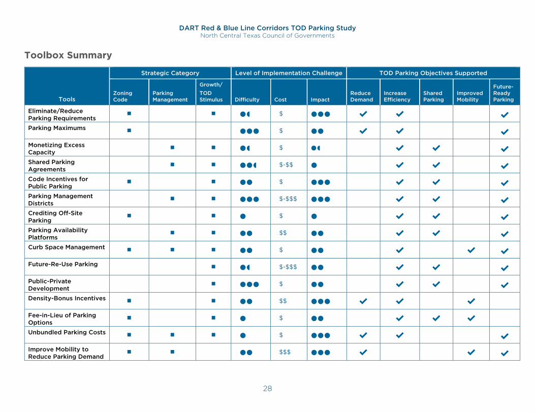
Toolbox Summary
Tools
Strategic Category Level of Implementation Challenge TOD Parking Objectives Supported
Zoning Code
Parking Management
Growth/ TOD Stimulus Difficulty Cost Impact
Reduce Demand
Increase Efficiency
Shared Parking
Improved Mobility
Future-Ready Parking
Eliminate/Reduce Parking Requirements
$ ✔ ✔ ✔
Parking Maximums $ ✔ ✔ ✔
Monetizing Excess Capacity
$ ✔ ✔ ✔
Shared Parking Agreements
$-$$ ✔ ✔ ✔
Code Incentives for Public Parking
$ ✔ ✔ ✔
Parking Management Districts
$-$$$ ✔ ✔ ✔
Crediting Off-Site Parking
$ ✔ ✔ ✔
Parking Availability Platforms
$$ ✔ ✔ ✔
Curb Space Management $ ✔ ✔ ✔
Future-Re-Use Parking $-$$$ ✔ ✔ ✔
Public-Private Development
$ ✔ ✔ ✔
Density-Bonus Incentives $$ ✔ ✔ ✔
Fee-in-Lieu of Parking Options
$ ✔ ✔ ✔
Unbundled Parking Costs $ ✔ ✔ ✔
Improve Mobility to Reduce Parking Demand
$$$ ✔ ✔ ✔
DART Red & Blue Line Corridors TOD Parking Study North Central Texas Council of Governments
29
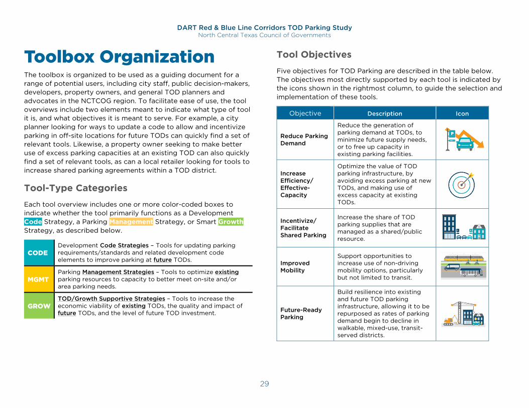
Toolbox Organization The toolbox is organized to be used as a guiding document for a range of potential users, including city staff, public decision-makers, developers, property owners, and general TOD planners and advocates in the NCTCOG region. To facilitate ease of use, the tool overviews include two elements meant to indicate what type of tool it is, and what objectives it is meant to serve. For example, a city planner looking for ways to update a code to allow and incentivize parking in off-site locations for future TODs can quickly find a set of relevant tools. Likewise, a property owner seeking to make better use of excess parking capacities at an existing TOD can also quickly find a set of relevant tools, as can a local retailer looking for tools to increase shared parking agreements within a TOD district.
Tool-Type Categories
Each tool overview includes one or more color-coded boxes to indicate whether the tool primarily functions as a Development Code Strategy, a Parking Management Strategy, or Smart Growth Strategy, as described below.
CODE Development Code Strategies – Tools for updating parking requirements/standards and related development code elements to improve parking at future TODs.
MGMT Parking Management Strategies – Tools to optimize existing parking resources to capacity to better meet on-site and/or area parking needs.
GROW TOD/Growth Supportive Strategies – Tools to increase the economic viability of existing TODs, the quality and impact of future TODs, and the level of future TOD investment.
Tool Objectives
Five objectives for TOD Parking are described in the table below. The objectives most directly supported by each tool is indicated by the icons shown in the rightmost column, to guide the selection and implementation of these tools.
Objective Description Icon
Reduce Parking Demand
Reduce the generation of parking demand at TODs, to minimize future supply needs, or to free up capacity in existing parking facilities.
Increase Efficiency/ Effective-Capacity
Optimize the value of TOD parking infrastructure, by avoiding excess parking at new TODs, and making use of excess capacity at existing TODs.
Incentivize/ Facilitate Shared Parking
Increase the share of TOD parking supplies that are managed as a shared/public resource.
Improved Mobility
Support opportunities to increase use of non-driving mobility options, particularly but not limited to transit.
Future-Ready Parking
Build resilience into existing and future TOD parking infrastructure, allowing it to be repurposed as rates of parking demand begin to decline in walkable, mixed-use, transit-served districts.
DART Red & Blue Line Corridors TOD Parking Study North Central Texas Council of Governments
30
Eliminate or Reduce Minimum Parking Requirements Overview Minimum parking requirements are typically based on parking-demand-generation rates identified for an extensive variety of land use types within the Institute of Transportation Engineers (ITE) Parking Generation Manual. As the manual makes clear, however, these rates are derived from data primarily collected within suburban, car-dependent contexts. Predictably, the use of these ratios to set minimum parking requirements leads to an oversupply of parking in most contexts in which walking, cycling, transit and other options offer attractive and viable alternatives to drive-alone mobility.
Such minimum parking requirements will invariably create an oversupply of parking among TOD projects, which in turn will depress parking rates and demand for alternative-mode use, transit foremost among them. This oversupply also reduces developable densities while increasing the cost of housing and commercial space in the associated TOD projects. These unintended consequences arise from a very common development-code requirement that is also commonly waived in downtown districts to avoid these same challenges to walkable-urban objectives. As a result, many cities are choosing to also waive, lower, or provide alternative means of satisfying these requirements in designated TOD areas.
Tool Type CODE MGMT GROW
Primary Objectives Implementation Factors
Difficulty:
Cost: $
Impact:
Key Benefits Provides developers with greater flexibility in designing and
programming their projects
Increases the potential density of mixed-use developments
Incentivizes further development, by increasing the return-on-investment potential by removing the cost of unneeded parking supplies and maximizing the land-use buildout potential
Facilitates TOD that optimizes tax-generating land-use densities and benefits from walkable/transit-focused urban design that furthers transit ridership and mode-shift objectives
DART Red & Blue Line Corridors TOD Parking Study North Central Texas Council of Governments
31
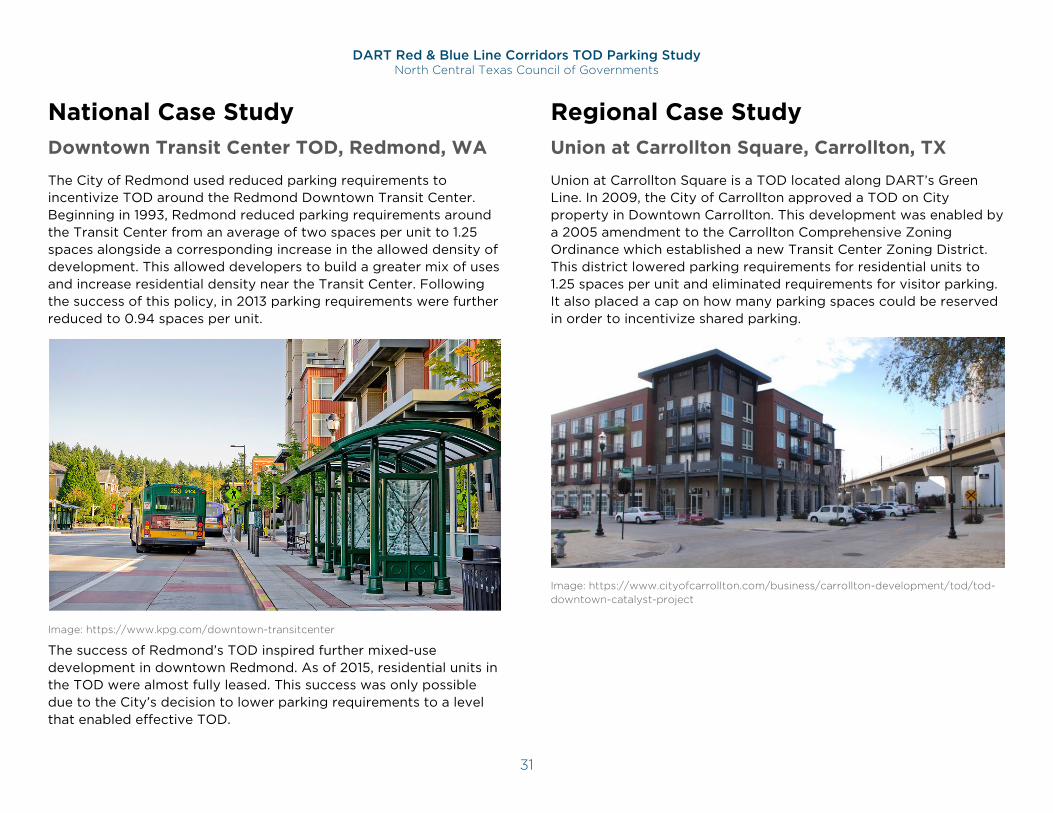
National Case Study Downtown Transit Center TOD, Redmond, WA
The City of Redmond used reduced parking requirements to incentivize TOD around the Redmond Downtown Transit Center. Beginning in 1993, Redmond reduced parking requirements around the Transit Center from an average of two spaces per unit to 1.25 spaces alongside a corresponding increase in the allowed density of development. This allowed developers to build a greater mix of uses and increase residential density near the Transit Center. Following the success of this policy, in 2013 parking requirements were further reduced to 0.94 spaces per unit.
Image: https://www.kpg.com/downtown-transitcenter
The success of Redmond’s TOD inspired further mixed-use development in downtown Redmond. As of 2015, residential units in the TOD were almost fully leased. This success was only possible due to the City’s decision to lower parking requirements to a level that enabled effective TOD.
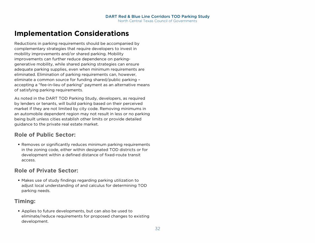
Regional Case Study Union at Carrollton Square, Carrollton, TX
Union at Carrollton Square is a TOD located along DART’s Green Line. In 2009, the City of Carrollton approved a TOD on City property in Downtown Carrollton. This development was enabled by a 2005 amendment to the Carrollton Comprehensive Zoning Ordinance which established a new Transit Center Zoning District. This district lowered parking requirements for residential units to 1.25 spaces per unit and eliminated requirements for visitor parking. It also placed a cap on how many parking spaces could be reserved in order to incentivize shared parking.
Image: https://www.cityofcarrollton.com/business/carrollton-development/tod/tod-downtown-catalyst-project
DART Red & Blue Line Corridors TOD Parking Study North Central Texas Council of Governments
32
Implementation Considerations Reductions in parking requirements should be accompanied by complementary strategies that require developers to invest in mobility improvements and/or shared parking. Mobility improvements can further reduce dependence on parking-generative mobility, while shared parking strategies can ensure adequate parking supplies, even when minimum requirements are eliminated. Elimination of parking requirements can, however, eliminate a common source for funding shared/public parking – accepting a “fee-in-lieu of parking” payment as an alternative means of satisfying parking requirements.
As noted in the DART TOD Parking Study, developers, as required by lenders or tenants, will build parking based on their perceived market if they are not limited by city code. Removing minimums in an automobile dependent region may not result in less or no parking being built unless cities establish other limits or provide detailed guidance to the private real estate market.
Role of Public Sector:
Removes or significantly reduces minimum parking requirements in the zoning code, either within designated TOD districts or for development within a defined distance of fixed-route transit access.
Role of Private Sector:
Makes use of study findings regarding parking utilization to adjust local understanding of and calculus for determining TOD parking needs.
Timing:
Applies to future developments, but can also be used to eliminate/reduce requirements for proposed changes to existing development.
DART Red & Blue Line Corridors TOD Parking Study North Central Texas Council of Governments
33
Parking Maximums Overview Parking maximums set a cap on the number of parking spaces that developers can provide. Maximums ensure that parking is not oversupplied and incentivize developers to plan for alternative transportation modes. Given that their tenants will require effective access to transportation, developers affected by parking maximums are incentivized to direct resources to alternative transportation modes in lieu of parking. Parking maximums can also increase development density, improving area walkability and multimodal functionality in support of the TOD concept.
Fixed or Flexible Maximums
Zoning codes can establish fixed maximums, which define a limit on potential on-site parking supplies, with no/minimal exceptions. They can also establish a more flexible maximum, in which one or more options for providing parking above the maximum are available. The most common exceptions with flexible parking maximums are:
The provision of shared, or public, parking, which is not counted toward the project’s maximum;
The payment of a fee for each non-shared space provided in excess of the maximum; and
The provision of mobility improvements or travel demand management (TDM) commitments;
Adherence to higher development standards, such as improved design or higher densities.
Tool Type CODE MGMT GROW
Primary Objectives Implementation Factors
Difficulty:
Cost: $
Impact:
A significant advantage of the flexible approach to parking maximums is that the maximums can be set significantly lower than would likely be feasible for a fixed maximum. Because a fixed maximum provides little or no options for supply projects above the limit they set, they are typically set high enough to avoid discouraging development. By contrast, providing widely viable options for exceeding a maximum makes it viable to set the maximums at levels indicative of an area seeking to reduce parking demand and shift travel to non-driving modes. In many cases where this approach has been taken, the maximum is not much higher than, or even the same as, the minimum requirement.
Key Benefits Facilitates and encourages higher development densities
Incentivizes cities and developers to invest in alternative transportation modes
Prevents oversupply of parking and future-proof parking facilities
Reduces traffic congestion by reducing parking activity
Reduces housing costs by maximizing the potential number of units that can be developed
Reduces housing costs by capping the potential cost of excess parking, which developers often offset via higher housing prices/lease-rates
Emphasizes the expectation of reduced parking needs in the affected TOD area
G
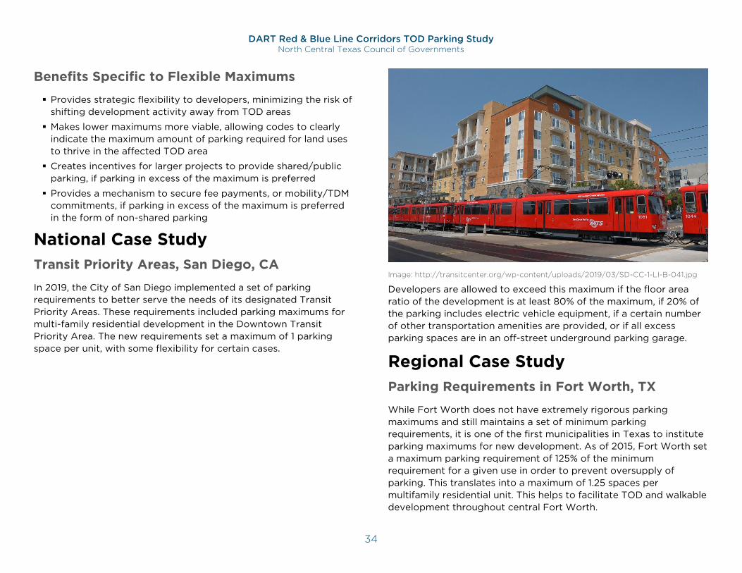
DART Red & Blue Line Corridors TOD Parking Study North Central Texas Council of Governments
34
Benefits Specific to Flexible Maximums
Provides strategic flexibility to developers, minimizing the risk of shifting development activity away from TOD areas
Makes lower maximums more viable, allowing codes to clearly indicate the maximum amount of parking required for land uses to thrive in the affected TOD area
Creates incentives for larger projects to provide shared/public parking, if parking in excess of the maximum is preferred
Provides a mechanism to secure fee payments, or mobility/TDM commitments, if parking in excess of the maximum is preferred in the form of non-shared parking
National Case Study Transit Priority Areas, San Diego, CA
In 2019, the City of San Diego implemented a set of parking requirements to better serve the needs of its designated Transit Priority Areas. These requirements included parking maximums for multi-family residential development in the Downtown Transit Priority Area. The new requirements set a maximum of 1 parking space per unit, with some flexibility for certain cases.
Image: http://transitcenter.org/wp-content/uploads/2019/03/SD-CC-1-LI-B-041.jpg
Developers are allowed to exceed this maximum if the floor area ratio of the development is at least 80% of the maximum, if 20% of the parking includes electric vehicle equipment, if a certain number of other transportation amenities are provided, or if all excess parking spaces are in an off-street underground parking garage.
Regional Case Study Parking Requirements in Fort Worth, TX
While Fort Worth does not have extremely rigorous parking maximums and still maintains a set of minimum parking requirements, it is one of the first municipalities in Texas to institute parking maximums for new development. As of 2015, Fort Worth set a maximum parking requirement of 125% of the minimum requirement for a given use in order to prevent oversupply of parking. This translates into a maximum of 1.25 spaces per multifamily residential unit. This helps to facilitate TOD and walkable development throughout central Fort Worth.
DART Red & Blue Line Corridors TOD Parking Study North Central Texas Council of Governments
35
Implementation Considerations Parking Maximums can be a valuable tool in districts in which high-density, mixed-use development are desired, and work best in such areas with direct access to transit and other non-driving options. Parking maximums do, however, represent a departure from traditional zoning strategies and may not be appropriate for all zones, especially if it discourages infill development. Reliable transit, bicycle, and pedestrian infrastructure in mixed-use districts of moderate or greater density are key indicators of locations where implementation is likely to be effective. Local data on observed parking utilization should be collected to calibrate appropriate maximums levels for various land use cases. Flexible maximums provide several additional benefits that should be considered, including minimizing the risk of discouraging development in TOD areas.
Role of Public Sector:
Collects data on observed parking utilization to calibrate maximums
Drafts zoning code language defining maximum parking limits, based on proposed land uses, perhaps including options for exceeding these limits via shared parking and/or payment of a fee
Role of Private Sector:
May provide data on observed parking in coordination with public to inform recommendations
Responds to proposed guidelines by providing parking that does not exceed the maximum, or by making excess supply available for shared or public parking, or by paying a fee to fund public demand-management/demand-reduction investments
Timing:
Applies to future developments, but could be applied to proposed changes to existing development
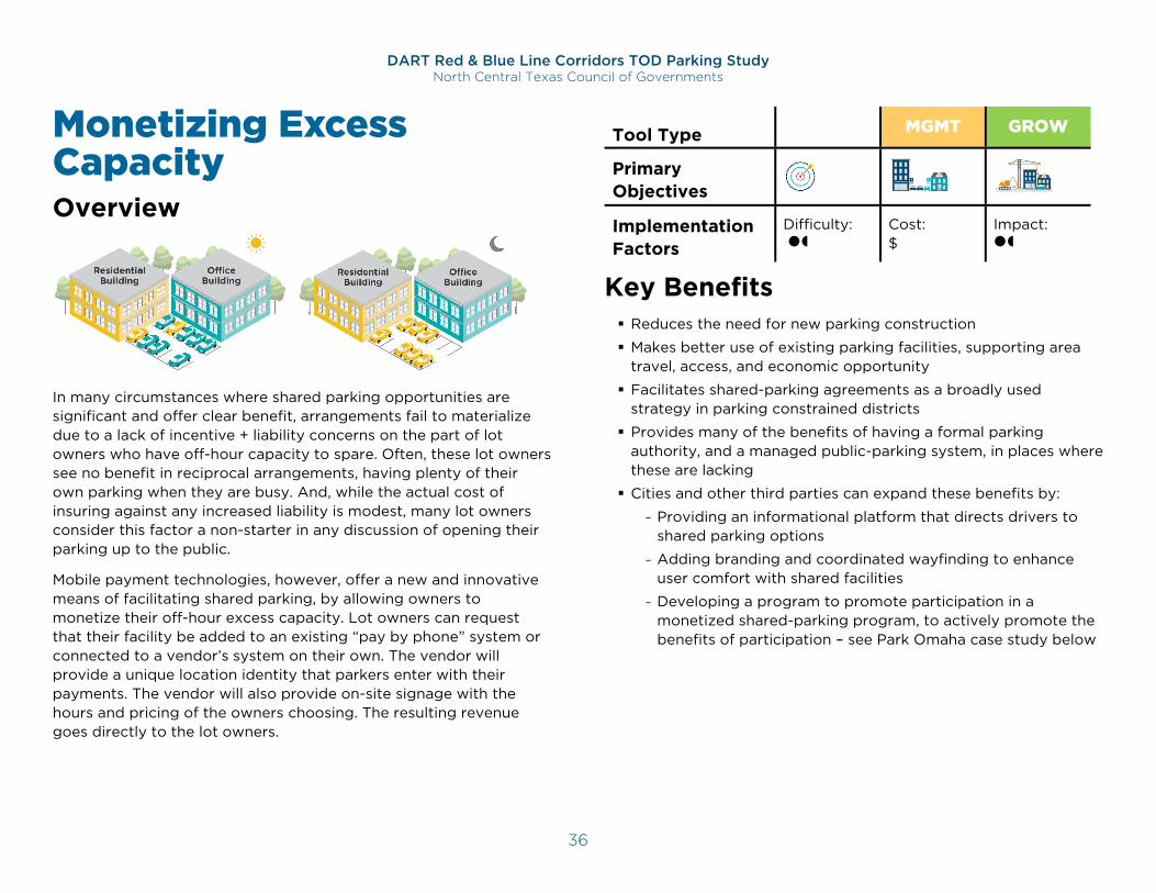
DART Red & Blue Line Corridors TOD Parking Study North Central Texas Council of Governments
36
Monetizing Excess Capacity Overview
In many circumstances where shared parking opportunities are significant and offer clear benefit, arrangements fail to materialize due to a lack of incentive + liability concerns on the part of lot owners who have off-hour capacity to spare. Often, these lot owners see no benefit in reciprocal arrangements, having plenty of their own parking when they are busy. And, while the actual cost of insuring against any increased liability is modest, many lot owners consider this factor a non-starter in any discussion of opening their parking up to the public.
Mobile payment technologies, however, offer a new and innovative means of facilitating shared parking, by allowing owners to monetize their off-hour excess capacity. Lot owners can request that their facility be added to an existing “pay by phone” system or connected to a vendor’s system on their own. The vendor will provide a unique location identity that parkers enter with their payments. The vendor will also provide on-site signage with the hours and pricing of the owners choosing. The resulting revenue goes directly to the lot owners.
Tool Type CODE MGMT GROW
Primary Objectives Implementation Factors
Difficulty:
Cost: $
Impact:
Key Benefits Reduces the need for new parking construction
Makes better use of existing parking facilities, supporting area travel, access, and economic opportunity
Facilitates shared-parking agreements as a broadly used strategy in parking constrained districts
Provides many of the benefits of having a formal parking authority, and a managed public-parking system, in places where these are lacking
Cities and other third parties can expand these benefits by:
- Providing an informational platform that directs drivers to shared parking options
- Adding branding and coordinated wayfinding to enhance user comfort with shared facilities
- Developing a program to promote participation in a monetized shared-parking program, to actively promote the benefits of participation – see Park Omaha case study below
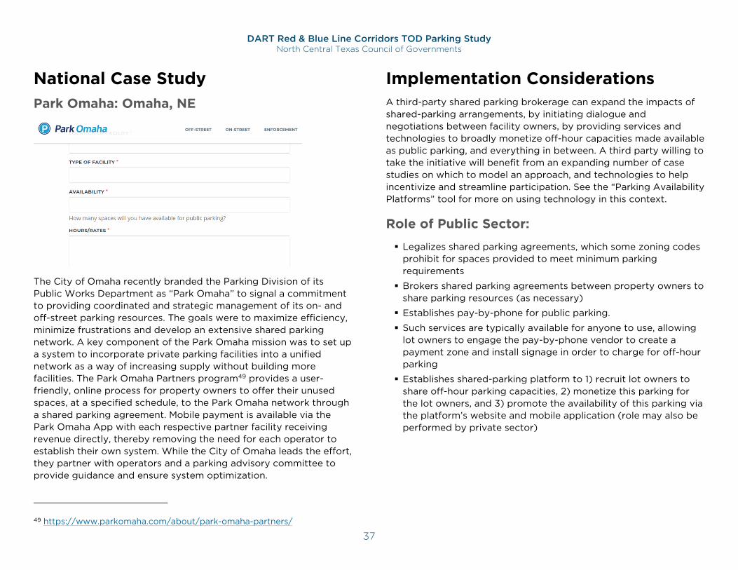
DART Red & Blue Line Corridors TOD Parking Study North Central Texas Council of Governments
37
National Case Study Park Omaha: Omaha, NE
The City of Omaha recently branded the Parking Division of its Public Works Department as “Park Omaha” to signal a commitment to providing coordinated and strategic management of its on- and off-street parking resources. The goals were to maximize efficiency, minimize frustrations and develop an extensive shared parking network. A key component of the Park Omaha mission was to set up a system to incorporate private parking facilities into a unified network as a way of increasing supply without building more facilities. The Park Omaha Partners program49 provides a user-friendly, online process for property owners to offer their unused spaces, at a specified schedule, to the Park Omaha network through a shared parking agreement. Mobile payment is available via the Park Omaha App with each respective partner facility receiving revenue directly, thereby removing the need for each operator to establish their own system. While the City of Omaha leads the effort, they partner with operators and a parking advisory committee to provide guidance and ensure system optimization.
49 https://www.parkomaha.com/about/park-omaha-partners/
Implementation Considerations A third-party shared parking brokerage can expand the impacts of shared-parking arrangements, by initiating dialogue and negotiations between facility owners, by providing services and technologies to broadly monetize off-hour capacities made available as public parking, and everything in between. A third party willing to take the initiative will benefit from an expanding number of case studies on which to model an approach, and technologies to help incentivize and streamline participation. See the “Parking Availability Platforms” tool for more on using technology in this context.
Role of Public Sector:
Legalizes shared parking agreements, which some zoning codes prohibit for spaces provided to meet minimum parking requirements
Brokers shared parking agreements between property owners to share parking resources (as necessary)
Establishes pay-by-phone for public parking.
Such services are typically available for anyone to use, allowing lot owners to engage the pay-by-phone vendor to create a payment zone and install signage in order to charge for off-hour parking
Establishes shared-parking platform to 1) recruit lot owners to share off-hour parking capacities, 2) monetize this parking for the lot owners, and 3) promote the availability of this parking via the platform’s website and mobile application (role may also be performed by private sector)
DART Red & Blue Line Corridors TOD Parking Study North Central Texas Council of Governments
38
Role of Private Sector:
Works with municipality and fellow property owners to make effective, and potentially lucrative, arrangements to make off-hour parking capacities more widely available
Promote coordination with city/other non-profit on shared-parking platform with other private property owners
Establishes shared-parking platform to 1) recruit lot owners to share off-hour parking capacities, 2) monetize this parking for the lot owners, and 3) promote the availability of this parking via the platform’s website and mobile application (role may also be performed by public sector)
Timing:
Applies most directly to existing properties with excess parking capacity
May also inform future parking supply decisions, particularly if a broad application makes significant parking resources available through shared parking, thus reducing perceived needs for on-site parking
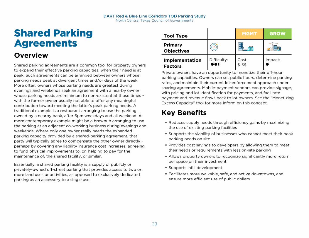
DART Red & Blue Line Corridors TOD Parking Study North Central Texas Council of Governments
39
Shared Parking Agreements Overview Shared parking agreements are a common tool for property owners to expand their effective parking capacities, when their need is at peak. Such agreements can be arranged between owners whose parking needs peak at divergent times and/or days of the week. More often, owners whose parking needs are greatest during evenings and weekends seek an agreement with a nearby owner whose parking needs are minimum to non-existent at those times – with the former owner usually not able to offer any meaningful contribution toward meeting the latter’s peak parking needs. A traditional example is a restaurant arranging to use the parking owned by a nearby bank, after 6pm weekdays and all weekend. A more contemporary example might be a brewpub arranging to use the parking at an adjacent co-working business during evenings and weekends. Where only one owner really needs the expanded parking capacity provided by a shared-parking agreement, that party will typically agree to compensate the other owner directly – perhaps by covering any liability insurance cost increases, agreeing to fund physical improvements to, or helping to pay for the maintenance of, the shared facility, or similar.
Essentially, a shared parking facility is a supply of publicly or privately-owned off-street parking that provides access to two or more land uses or activities, as opposed to exclusively dedicated parking as an accessory to a single use.
Tool Type CODE MGMT GROW
Primary Objectives Implementation Factors
Difficulty:
Cost: $-$$
Impact:
Private owners have an opportunity to monetize their off-hour parking capacities. Owners can set public hours, determine parking rates, and maintain their current lot-enforcement approach under sharing agreements. Mobile-payment vendors can provide signage, with pricing and lot identification for payments, and facilitate payment and revenue flows back to lot owners. See the “Monetizing Excess Capacity” tool for more inform on this concept.
Key Benefits Reduces supply needs through efficiency gains by maximizing
the use of existing parking facilities
Supports the viability of businesses who cannot meet their peak parking needs on site
Provides cost savings to developers by allowing them to meet their needs or requirements with less on-site parking
Allows property owners to recognize significantly more return per space on their investment
Supports infill development
Facilitates more walkable, safe, and active downtowns, and ensure more efficient use of public dollars
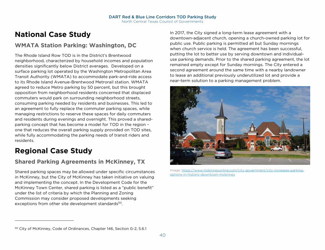
DART Red & Blue Line Corridors TOD Parking Study North Central Texas Council of Governments
40
National Case Study WMATA Station Parking: Washington, DC
The Rhode Island Row TOD is in the District’s Brentwood neighborhood, characterized by household incomes and population densities significantly below District averages. Developed on a surface parking lot operated by the Washington Metropolitan Area Transit Authority (WMATA) to accommodate park-and-ride access to its Rhode Island Avenue-Brentwood Metrorail station. WMATA agreed to reduce Metro parking by 50 percent, but this brought opposition from neighborhood residents concerned that displaced commuters would park on surrounding neighborhood streets, consuming parking needed by residents and businesses. This led to an agreement to fully replace the commuter parking spaces, while managing restrictions to reserve these spaces for daily commuters and residents during evenings and overnight. This proved a shared-parking concept that has become a model for TOD in the region – one that reduces the overall parking supply provided on TOD sites, while fully accommodating the parking needs of transit riders and residents.
Regional Case Study Shared Parking Agreements in McKinney, TX
Shared parking spaces may be allowed under specific circumstances in McKinney, but the City of McKinney has taken initiative on valuing and implementing the concept. In the Development Code for the McKinney Town Center, shared parking is listed as a “public benefit” under the list of criteria by which the Planning and Zoning Commission may consider proposed developments seeking exceptions from other site development standards50.
50 City of McKinney, Code of Ordinances, Chapter 146, Section G-2, 5.6.1
In 2017, the City signed a long-term lease agreement with a downtown-adjacent church, opening a church-owned parking lot for public use. Public parking is permitted all but Sunday mornings when church service is held. The agreement has been successful, putting the lot to better use by serving downtown and individual-use parking demands. Prior to the shared parking agreement, the lot remained empty except for Sunday mornings. The City entered a second agreement around the same time with a nearby landowner to lease an additional previously underutilized lot and provide a near-term solution to a parking management problem.
Image: https://www.mckinneyonline.com/city-government/city-increases-parking-options-in-historic-downtown-mckinney
DART Red & Blue Line Corridors TOD Parking Study North Central Texas Council of Governments
41
Implementation Considerations Shared parking agreements can sometimes be easier to secure if access to the shared parking is restricted to the employees of the other party. This can provide the same level of expanded parking capacity to the owner seeking more parking, while providing more control accountability to moderate the concerns of the owner providing the shared access.
Some private property owners may support sharing all or a portion of their parking, but would prefer to share with other private entities, such as a specific company, and have a third-party operator manage their parking. This type of agreement should also be encouraged, as it further supports more efficient use of available parking. Still, all shared parking contracts should incorporate, at a minimum, a 90-day termination clause to allow adequate time to obtain other leasing options, if needed.
Proactively offering ongoing technical assistance will build support for private-to-public or private-to-private agreements. Potential elements of a technical assistance program could include:
Parking database to connect parties to each other
Educational materials about benefits
Marketing materials
Sample language and agreements
Cost and revenue sharing information
Facility infrastructure, including baseline technology/ receipt requirements
Payment technology options
Wayfinding and signage standards
Insurance and liability information
Zoning/property rights retainage
Precedents, including reasonable comparables within the Metroplex.
Role of Public Sector:
Legalizes shared parking agreements, which some zoning codes prohibit for spaces provided to meet minimum parking requirements
Brokers shared parking agreements between property owners to share parking resources (as necessary)
Provides technical assistance and shares example agreements to private partners
Role of Private Sector:
Facilitates relationships with neighboring land owners and third parties
Helps public sector confirm key challenges and issues towards a shared agreement
Timing:
Agreements can be between established property owners, or between an established property owner and a developer
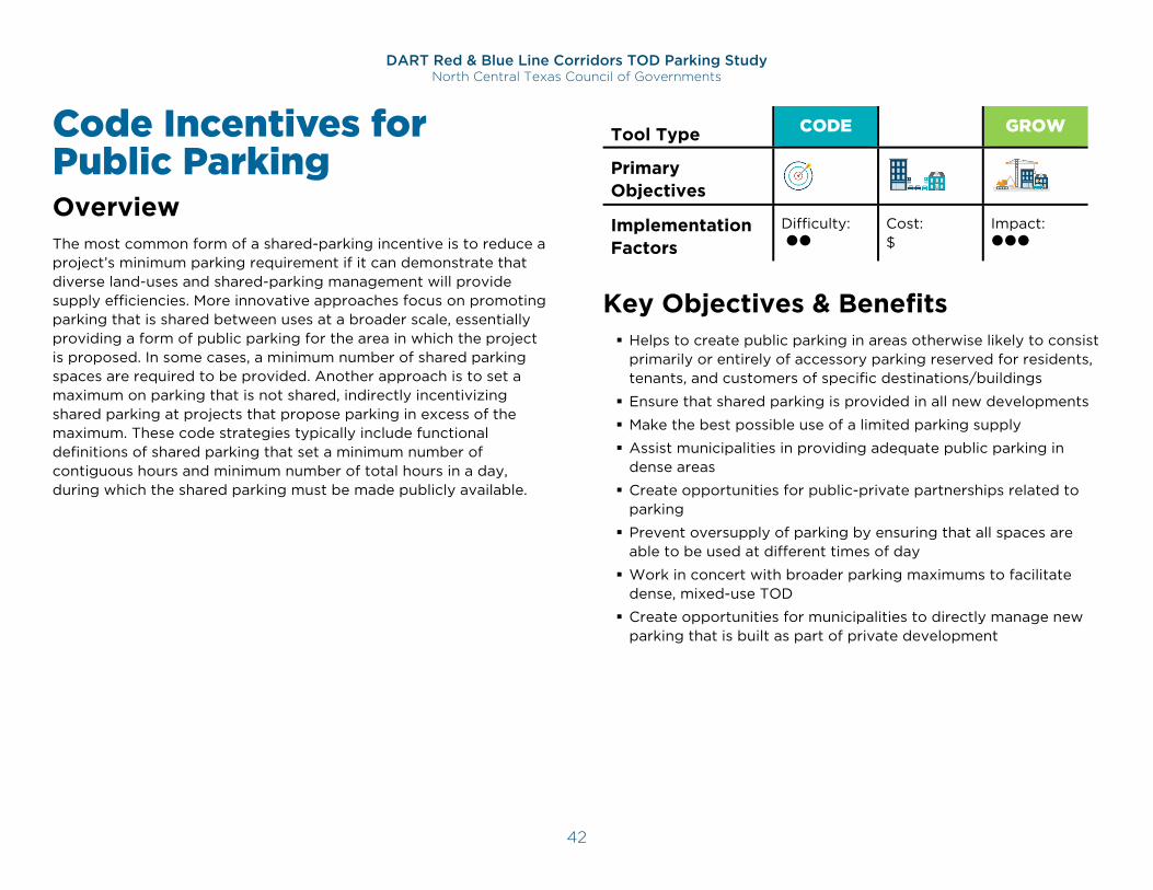
DART Red & Blue Line Corridors TOD Parking Study North Central Texas Council of Governments
42
Code Incentives for Public Parking Overview The most common form of a shared-parking incentive is to reduce a project’s minimum parking requirement if it can demonstrate that diverse land-uses and shared-parking management will provide supply efficiencies. More innovative approaches focus on promoting parking that is shared between uses at a broader scale, essentially providing a form of public parking for the area in which the project is proposed. In some cases, a minimum number of shared parking spaces are required to be provided. Another approach is to set a maximum on parking that is not shared, indirectly incentivizing shared parking at projects that propose parking in excess of the maximum. These code strategies typically include functional definitions of shared parking that set a minimum number of contiguous hours and minimum number of total hours in a day, during which the shared parking must be made publicly available.
Tool Type CODE MGMT GROW
Primary Objectives Implementation Factors
Difficulty:
Cost: $
Impact:
Key Objectives & Benefits Helps to create public parking in areas otherwise likely to consist
primarily or entirely of accessory parking reserved for residents, tenants, and customers of specific destinations/buildings
Ensure that shared parking is provided in all new developments
Make the best possible use of a limited parking supply
Assist municipalities in providing adequate public parking in dense areas
Create opportunities for public-private partnerships related to parking
Prevent oversupply of parking by ensuring that all spaces are able to be used at different times of day
Work in concert with broader parking maximums to facilitate dense, mixed-use TOD
Create opportunities for municipalities to directly manage new parking that is built as part of private development
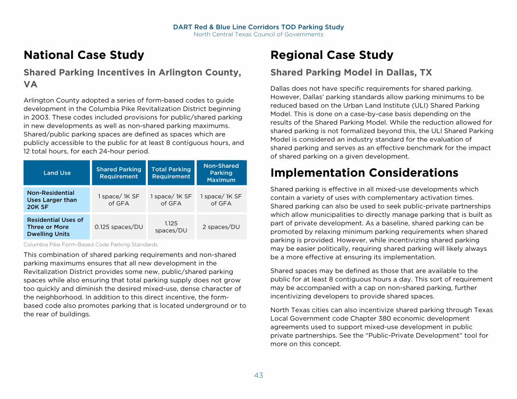
DART Red & Blue Line Corridors TOD Parking Study North Central Texas Council of Governments
43
National Case Study Shared Parking Incentives in Arlington County, VA
Arlington County adopted a series of form-based codes to guide development in the Columbia Pike Revitalization District beginning in 2003. These codes included provisions for public/shared parking in new developments as well as non-shared parking maximums. Shared/public parking spaces are defined as spaces which are publicly accessible to the public for at least 8 contiguous hours, and 12 total hours, for each 24-hour period.
Land Use Shared Parking Requirement
Total Parking Requirement
Non-Shared Parking
Maximum
Non-Residential Uses Larger than 20K SF
1 space/ 1K SF of GFA
1 space/ 1K SF of GFA
1 space/ 1K SF of GFA
Residential Uses of Three or More Dwelling Units
0.125 spaces/DU 1.125 spaces/DU 2 spaces/DU
Columbia Pike Form-Based Code Parking Standards
This combination of shared parking requirements and non-shared parking maximums ensures that all new development in the Revitalization District provides some new, public/shared parking spaces while also ensuring that total parking supply does not grow too quickly and diminish the desired mixed-use, dense character of the neighborhood. In addition to this direct incentive, the form-based code also promotes parking that is located underground or to the rear of buildings.
Regional Case Study Shared Parking Model in Dallas, TX
Dallas does not have specific requirements for shared parking. However, Dallas’ parking standards allow parking minimums to be reduced based on the Urban Land Institute (ULI) Shared Parking Model. This is done on a case-by-case basis depending on the results of the Shared Parking Model. While the reduction allowed for shared parking is not formalized beyond this, the ULI Shared Parking Model is considered an industry standard for the evaluation of shared parking and serves as an effective benchmark for the impact of shared parking on a given development.
Implementation Considerations Shared parking is effective in all mixed-use developments which contain a variety of uses with complementary activation times. Shared parking can also be used to seek public-private partnerships which allow municipalities to directly manage parking that is built as part of private development. As a baseline, shared parking can be promoted by relaxing minimum parking requirements when shared parking is provided. However, while incentivizing shared parking may be easier politically, requiring shared parking will likely always be a more effective at ensuring its implementation.
Shared spaces may be defined as those that are available to the public for at least 8 contiguous hours a day. This sort of requirement may be accompanied with a cap on non-shared parking, further incentivizing developers to provide shared spaces.
North Texas cities can also incentivize shared parking through Texas Local Government code Chapter 380 economic development agreements used to support mixed-use development in public private partnerships. See the “Public-Private Development” tool for more on this concept.
DART Red & Blue Line Corridors TOD Parking Study North Central Texas Council of Governments
44
Role of Public Sector:
Revises codes to incentivize the provision of shared publicly-accessible parking
Initiates outreach to property owners, employers, and parking operators to ensure that incentive parameters are understood
Monitors implementation to ensure that credited parking is functioning as shared/public parking
Role of Private Sector:
Considers the option of sharing parking as a means of providing more parking than is allowed to be reserved for the developed land uses
Timing:
Incentives will inform decisions about parking supplies at new developments
Credited parking should be observed periodically to confirm that it is being offered in accordance with the parameters of the incentive
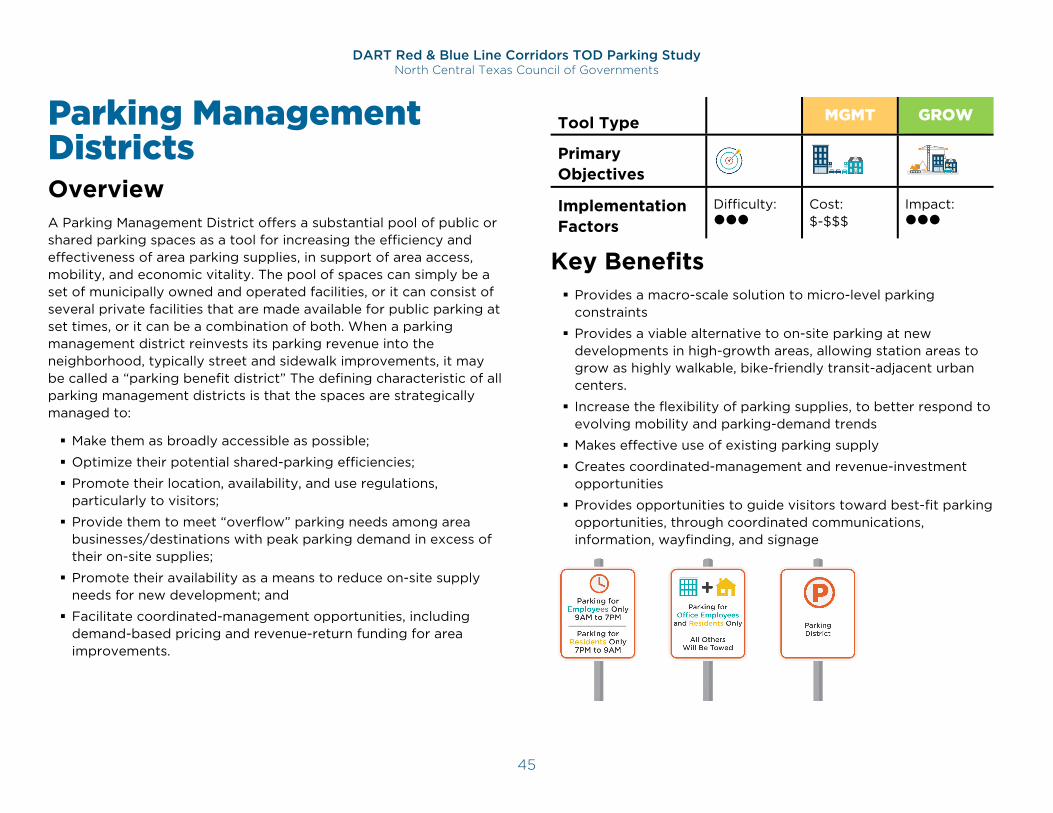
DART Red & Blue Line Corridors TOD Parking Study North Central Texas Council of Governments
45
Parking Management Districts Overview A Parking Management District offers a substantial pool of public or shared parking spaces as a tool for increasing the efficiency and effectiveness of area parking supplies, in support of area access, mobility, and economic vitality. The pool of spaces can simply be a set of municipally owned and operated facilities, or it can consist of several private facilities that are made available for public parking at set times, or it can be a combination of both. When a parking management district reinvests its parking revenue into the neighborhood, typically street and sidewalk improvements, it may be called a “parking benefit district” The defining characteristic of all parking management districts is that the spaces are strategically managed to:
Make them as broadly accessible as possible;
Optimize their potential shared-parking efficiencies;
Promote their location, availability, and use regulations, particularly to visitors;
Provide them to meet “overflow” parking needs among area businesses/destinations with peak parking demand in excess of their on-site supplies;
Promote their availability as a means to reduce on-site supply needs for new development; and
Facilitate coordinated-management opportunities, including demand-based pricing and revenue-return funding for area improvements.
Tool Type CODE MGMT GROW
Primary Objectives Implementation Factors
Difficulty:
Cost: $-$$$
Impact:
Key Benefits Provides a macro-scale solution to micro-level parking
constraints
Provides a viable alternative to on-site parking at new developments in high-growth areas, allowing station areas to grow as highly walkable, bike-friendly transit-adjacent urban centers.
Increase the flexibility of parking supplies, to better respond to evolving mobility and parking-demand trends
Makes effective use of existing parking supply
Creates coordinated-management and revenue-investment opportunities
Provides opportunities to guide visitors toward best-fit parking opportunities, through coordinated communications, information, wayfinding, and signage
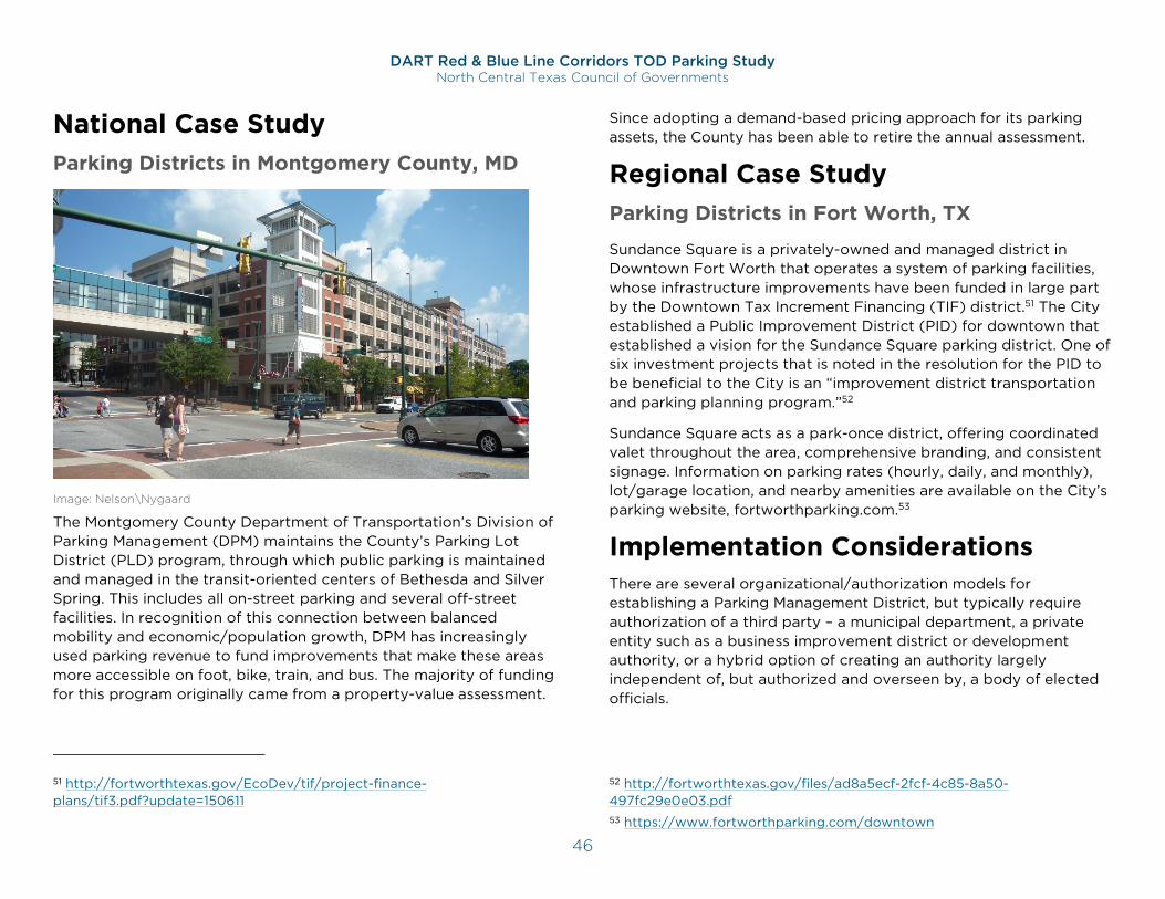
DART Red & Blue Line Corridors TOD Parking Study North Central Texas Council of Governments
46
National Case Study Parking Districts in Montgomery County, MD
Image: Nelson\Nygaard
The Montgomery County Department of Transportation’s Division of Parking Management (DPM) maintains the County’s Parking Lot District (PLD) program, through which public parking is maintained and managed in the transit-oriented centers of Bethesda and Silver Spring. This includes all on-street parking and several off-street facilities. In recognition of this connection between balanced mobility and economic/population growth, DPM has increasingly used parking revenue to fund improvements that make these areas more accessible on foot, bike, train, and bus. The majority of funding for this program originally came from a property-value assessment.
51 http://fortworthtexas.gov/EcoDev/tif/project-finance-plans/tif3.pdf?update=150611
Since adopting a demand-based pricing approach for its parking assets, the County has been able to retire the annual assessment.
Regional Case Study Parking Districts in Fort Worth, TX
Sundance Square is a privately-owned and managed district in Downtown Fort Worth that operates a system of parking facilities, whose infrastructure improvements have been funded in large part by the Downtown Tax Increment Financing (TIF) district.51 The City established a Public Improvement District (PID) for downtown that established a vision for the Sundance Square parking district. One of six investment projects that is noted in the resolution for the PID to be beneficial to the City is an “improvement district transportation and parking planning program.”52
Sundance Square acts as a park-once district, offering coordinated valet throughout the area, comprehensive branding, and consistent signage. Information on parking rates (hourly, daily, and monthly), lot/garage location, and nearby amenities are available on the City’s parking website, fortworthparking.com.53
Implementation Considerations There are several organizational/authorization models for establishing a Parking Management District, but typically require authorization of a third party – a municipal department, a private entity such as a business improvement district or development authority, or a hybrid option of creating an authority largely independent of, but authorized and overseen by, a body of elected officials.
52 http://fortworthtexas.gov/files/ad8a5ecf-2fcf-4c85-8a50-497fc29e0e03.pdf 53 https://www.fortworthparking.com/downtown
DART Red & Blue Line Corridors TOD Parking Study North Central Texas Council of Governments
47
Funding options can include any or all of the following:
Parking revenue
Development fees
Property assessments
Property taxes.
The best-fit approach for organizing and funding districts will vary by location and circumstances, including level of interest, and current involvement in parking management, among potential/viable departments and organizations.
Role of Public Sector:
Explores options for creating a district parking program, to be maintained/administered by the City or a parking authority, a business improvement district, or other 3rd Party, non-profit entity
Coordinates with parties who control parking assets not directly controlled by the district administrator
Works with a parking operator to provide consistent, specialized, and customer-friendly operations across the district
Oversees policy development and implementation to ensure district assets are managed in service to identified goals and objectives
Establishes district roles, responsibilities, areas of authority, and funding streams
Directs investment of district funds, including revenue sharing as applicable
Monitors program implementation and effectiveness
Role of Private Sector:
Agrees to allow incorporation of their parking assets into a district parking program, to both increase the efficiency of these assets and to contribute to the economy
Markets and implements district benefits for development tenants and visitors
Collaborates with new developments to facilitate potential shared parking agreements and benefits
Timing:
District parking benefits existing TOD properties and stakeholders as well as potential developers who can leverage district benefit to provide less on-site parking
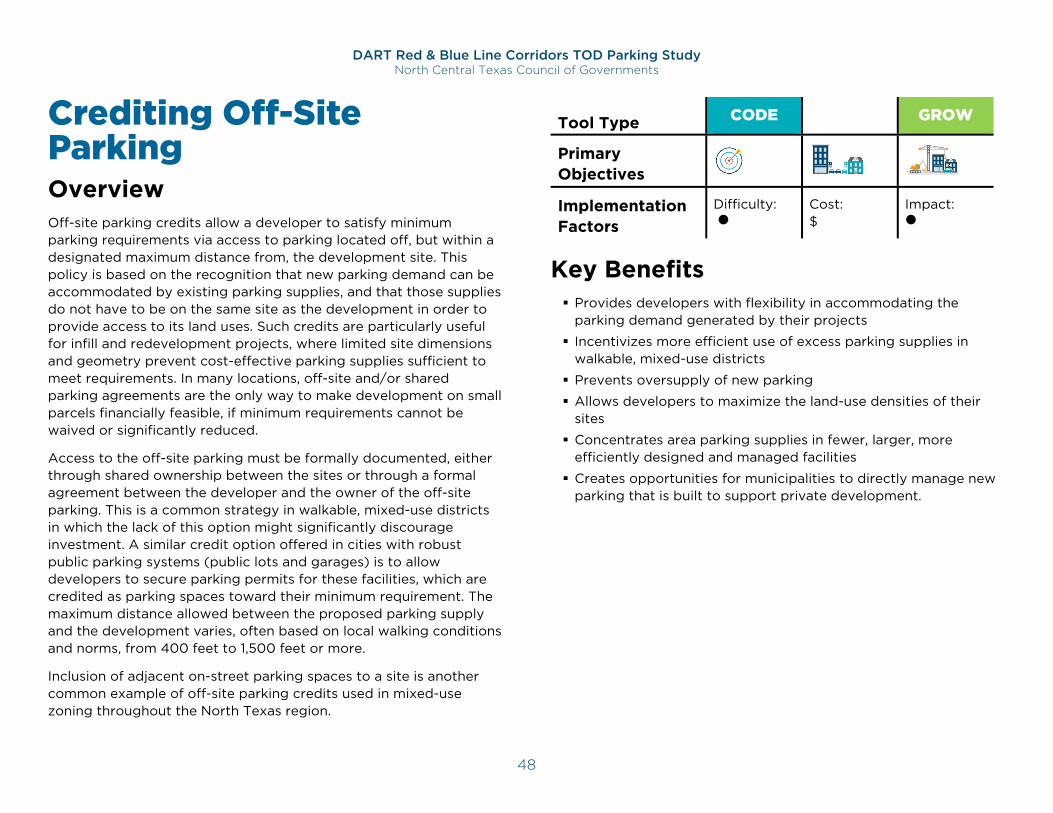
DART Red & Blue Line Corridors TOD Parking Study North Central Texas Council of Governments
48
Crediting Off-Site Parking Overview Off-site parking credits allow a developer to satisfy minimum parking requirements via access to parking located off, but within a designated maximum distance from, the development site. This policy is based on the recognition that new parking demand can be accommodated by existing parking supplies, and that those supplies do not have to be on the same site as the development in order to provide access to its land uses. Such credits are particularly useful for infill and redevelopment projects, where limited site dimensions and geometry prevent cost-effective parking supplies sufficient to meet requirements. In many locations, off-site and/or shared parking agreements are the only way to make development on small parcels financially feasible, if minimum requirements cannot be waived or significantly reduced.
Access to the off-site parking must be formally documented, either through shared ownership between the sites or through a formal agreement between the developer and the owner of the off-site parking. This is a common strategy in walkable, mixed-use districts in which the lack of this option might significantly discourage investment. A similar credit option offered in cities with robust public parking systems (public lots and garages) is to allow developers to secure parking permits for these facilities, which are credited as parking spaces toward their minimum requirement. The maximum distance allowed between the proposed parking supply and the development varies, often based on local walking conditions and norms, from 400 feet to 1,500 feet or more.
Inclusion of adjacent on-street parking spaces to a site is another common example of off-site parking credits used in mixed-use zoning throughout the North Texas region.
Tool Type CODE MGMT GROW
Primary Objectives Implementation Factors
Difficulty:
Cost: $
Impact:
Key Benefits Provides developers with flexibility in accommodating the
parking demand generated by their projects
Incentivizes more efficient use of excess parking supplies in walkable, mixed-use districts
Prevents oversupply of new parking
Allows developers to maximize the land-use densities of their sites
Concentrates area parking supplies in fewer, larger, more efficiently designed and managed facilities
Creates opportunities for municipalities to directly manage new parking that is built to support private development.
DART Red & Blue Line Corridors TOD Parking Study North Central Texas Council of Governments
49
National Case Study Crediting Off-Site Parking in Mesa, AZ
Development projects may be granted permission to locate all or a portion of their required off-street parking supply on a remote and separate lot from the site of the principal use, if:
The location is not more than 1,000 feet from the primary entrance on a legal, practical walking route.
- Van or shuttle service may allow the distance limitation to be waived.
Shared or Exclusive parking agreements guarantee long-term availability of the parking supply.54
Regional Case Study Crediting Off-Site Parking in Denton, TX The Denton Development Code allows for approved shared parking and off-site parking for nonresidential and apartment uses across the City. There are multiple ways for existing spaces to be counted towards the required off-street spaces, including:
Any public parking facilities within 500 feet (up to 25 percent) of the property.
Every recorded shared/off-site parking space within 500 feet of nonresidential properties and within 300 feet of apartment properties.
The provision of valet parking, which increases the distance of counting shared/off-site parking for nonresidential properties to 1,000 feet.
On-street spaces abutting the property.55
54 https://www.mesaaz.gov/home/showdocument?id=4210
Implementation Considerations Where off-site credits are common in development approvals, concerns may arise that the same parking spaces are being included in multiple agreements, crediting them with demand-accommodation well beyond their capacity. If off-site parking is leased from a separate owner, shared agreements should specify:
The use of facilities to be shared (location, times, users, etc.);
The exclusivity of specific spaces not to be shared;
The times of day, days of week, or seasons of the year when parking is to be shared;
Responsibilities for maintaining shared spaces, including striping, signage, repair, cleaning, and improvements;
Responsibilities for utility bills and tax payments;
Enforcement staffing and procedures, especially for addressing violations;
Insurance requirements and payment obligations;
The term and extension;
Any additional legal language related to contractual agreements, such as indemnification and termination clauses; and
Monitoring obligations to ensure availability remains, at peak times, before facilities can be included in further agreements.
Role of Public Sector:
Defines parameters for crediting off-site parking toward a project’s minimum parking requirements, primarily by defining the maximum-allowed distance between the property and the proposed parking
Defines requirements for shared-use agreements between the developer and the owner of the off-site parking
55 https://www.cityofdenton.com/CoD/media/City-of-Denton/Business/Denton-DDC_Adoption_Print-05-10-19_v2.pdf
DART Red & Blue Line Corridors TOD Parking Study North Central Texas Council of Governments
50
Role of Private Sector:
Explores potential partnerships with off-site property owners
Contracts with partners and provides agreements as part of proposal submission, with specifications on responsibilities, terms, and conditions
Timing:
Off-site parking agreements can benefit both existing property owners, by making use of (and likely monetizing) their site’s excess parking capacity, and developers who can support their project with reduced on-site parking
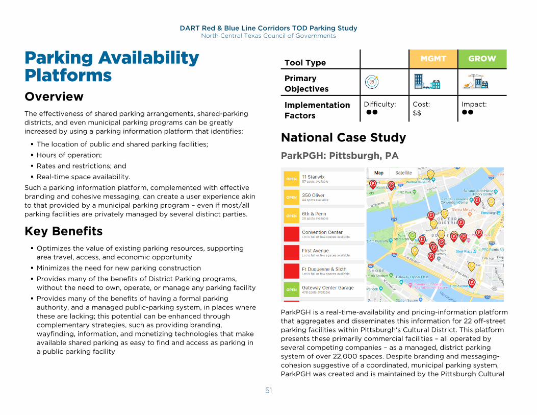
DART Red & Blue Line Corridors TOD Parking Study North Central Texas Council of Governments
51
Parking Availability Platforms Overview The effectiveness of shared parking arrangements, shared-parking districts, and even municipal parking programs can be greatly increased by using a parking information platform that identifies:
The location of public and shared parking facilities;
Hours of operation;
Rates and restrictions; and
Real-time space availability.
Such a parking information platform, complemented with effective branding and cohesive messaging, can create a user experience akin to that provided by a municipal parking program – even if most/all parking facilities are privately managed by several distinct parties.
Key Benefits Optimizes the value of existing parking resources, supporting
area travel, access, and economic opportunity
Minimizes the need for new parking construction
Provides many of the benefits of District Parking programs, without the need to own, operate, or manage any parking facility
Provides many of the benefits of having a formal parking authority, and a managed public-parking system, in places where these are lacking; this potential can be enhanced through complementary strategies, such as providing branding, wayfinding, information, and monetizing technologies that make available shared parking as easy to find and access as parking in a public parking facility
Tool Type CODE MGMT GROW
Primary Objectives Implementation Factors
Difficulty:
Cost: $$
Impact:
National Case Study ParkPGH: Pittsburgh, PA
ParkPGH is a real-time-availability and pricing-information platform that aggregates and disseminates this information for 22 off-street parking facilities within Pittsburgh's Cultural District. This platform presents these primarily commercial facilities – all operated by several competing companies – as a managed, district parking system of over 22,000 spaces. Despite branding and messaging-cohesion suggestive of a coordinated, municipal parking system, ParkPGH was created and is maintained by the Pittsburgh Cultural
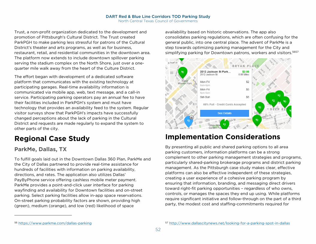
DART Red & Blue Line Corridors TOD Parking Study North Central Texas Council of Governments
52
Trust, a non-profit organization dedicated to the development and promotion of Pittsburgh's Cultural District. The Trust created ParkPGH to make parking less stressful for patrons of the Cultural District’s theater and arts programs, as well as for business, restaurant, retail, and residential communities in the downtown area. The platform now extends to include downtown spillover parking serving the stadium complex on the North Shore, just over a one-quarter mile walk away from the heart of the Culture District.
The effort began with development of a dedicated software platform that communicates with the existing technology at participating garages. Real-time availability information is communicated via mobile app, web, text message, and a call-in service. Participating parking operators pay an annual fee to have their facilities included in ParkPGH’s system and must have technology that provides an availability feed to the system. Regular visitor surveys show that ParkPGH’s impacts have successfully changed perceptions about the lack of parking in the Cultural District and requests are made regularly to expand the system to other parts of the city.
Regional Case Study ParkMe, Dallas, TX
To fulfill goals laid out in the Downtown Dallas 360 Plan, ParkMe and the City of Dallas partnered to provide real-time assistance for hundreds of facilities with information on parking availability, directions, and rates. The application also utilizes Dallas’ PayByPhone service offering cashless mobile meter payment. ParkMe provides a point-and-click user interface for parking wayfinding and availability for Downtown facilities and on-street parking. Select parking facilities allow in-app space reservations. On-street parking probability factors are shown, providing high (green), medium (orange), and low (red) likelihood of space
56 https://www.parkme.com/dallas-parking
availability based on historic observations. The app also consolidates parking regulations, which are often confusing for the general public, into one central place. The advent of ParkMe is a step towards optimizing parking management for the City and simplifying parking for Downtown patrons, workers and visitors.5657
Implementation Considerations By presenting all public and shared parking options to all area parking customers, information platforms can be a strong complement to other parking management strategies and programs, particularly shared-parking brokerage programs and district parking management. As the Pittsburgh case study makes clear, effective platforms can also be effective independent of these strategies, creating a user experience of a cohesive parking program by ensuring that information, branding, and messaging direct drivers toward right-fit parking opportunities – regardless of who owns, controls, or manages the spaces they end up using. While platforms require significant initiative and follow-through on the part of a third party, the modest cost and staffing-commitments required for
57 http://www.dallascitynews.net/looking-for-a-parking-spot-in-dallas
DART Red & Blue Line Corridors TOD Parking Study North Central Texas Council of Governments
53
success significantly increase the viability and relevance of this management tool.
These platforms will likely be most viable in areas where parking is priced, such as central business districts and highly urban areas. In suburban centers where the parking is free, these can still be used but will likely require public funding as a complement to shared parking strategies.
Role of Public Sector:
Initiates platform development, branding, security, and outreach
Engages potential participating parking facilities
Defines information-sharing and fee requirements to ensure platform effectiveness and sustainability
Role of Private Sector:
Initiates development of a platform, branding, security, and outreach
Helps fund the program, in return for the benefits of having their parking capacity promoted to drivers
Installs necessary technology to track and share availability information, and updates the program administrator on hours, fees, and other regulations
Offers promotions and discounts for platform patrons
Timing:
Viable for both established and future TODs
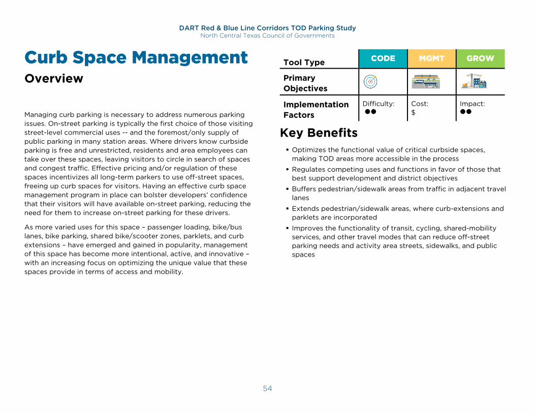
DART Red & Blue Line Corridors TOD Parking Study North Central Texas Council of Governments
54
Curb Space Management Overview Managing curb parking is necessary to address numerous parking issues. On-street parking is typically the first choice of those visiting street-level commercial uses -- and the foremost/only supply of public parking in many station areas. Where drivers know curbside parking is free and unrestricted, residents and area employees can take over these spaces, leaving visitors to circle in search of spaces and congest traffic. Effective pricing and/or regulation of these spaces incentivizes all long-term parkers to use off-street spaces, freeing up curb spaces for visitors. Having an effective curb space management program in place can bolster developers’ confidence that their visitors will have available on-street parking, reducing the need for them to increase on-street parking for these drivers.
As more varied uses for this space – passenger loading, bike/bus lanes, bike parking, shared bike/scooter zones, parklets, and curb extensions – have emerged and gained in popularity, management of this space has become more intentional, active, and innovative – with an increasing focus on optimizing the unique value that these spaces provide in terms of access and mobility.
Tool Type CODE MGMT GROW
Primary Objectives Implementation Factors
Difficulty:
Cost: $
Impact:
Key Benefits Optimizes the functional value of critical curbside spaces,
making TOD areas more accessible in the process
Regulates competing uses and functions in favor of those that best support development and district objectives
Buffers pedestrian/sidewalk areas from traffic in adjacent travel lanes
Extends pedestrian/sidewalk areas, where curb-extensions and parklets are incorporated
Improves the functionality of transit, cycling, shared-mobility services, and other travel modes that can reduce off-street parking needs and activity area streets, sidewalks, and public spaces
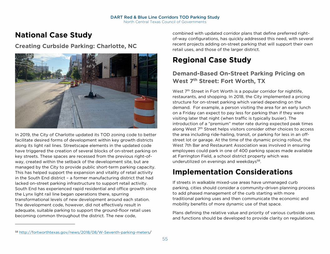
DART Red & Blue Line Corridors TOD Parking Study North Central Texas Council of Governments
55
National Case Study Creating Curbside Parking: Charlotte, NC
In 2019, the City of Charlotte updated its TOD zoning code to better facilitate desired forms of development within key growth districts along its light rail lines. Streetscape elements in the updated code have triggered the creation of several blocks of on-street parking on key streets. These spaces are recessed from the previous right-of-way, created within the setback of the development site, but are managed by the City to provide public short-term parking capacity. This has helped support the expansion and vitality of retail activity in the South End district – a former manufacturing district that had lacked on-street parking infrastructure to support retail activity. South End has experienced rapid residential and office growth since the Lynx light rail line began operations there, spurring transformational levels of new development around each station. The development code, however, did not effectively result in adequate, suitable parking to support the ground-floor retail uses becoming common throughout the district. The new code,
58 http://fortworthtexas.gov/news/2018/08/W-Seventh-parking-meters/
combined with updated corridor plans that define preferred right-of-way configurations, has quickly addressed this need, with several recent projects adding on-street parking that will support their own retail uses, and those of the larger district.
Regional Case Study
Demand-Based On-Street Parking Pricing on West 7th Street: Fort Worth, TX
West 7th Street in Fort Worth is a popular corridor for nightlife, restaurants, and shopping. In 2018, the City implemented a pricing structure for on-street parking which varied depending on the demand. For example, a person visiting the area for an early lunch on a Friday can expect to pay less for parking than if they were visiting later that night (when traffic is typically busier). The introduction of a “premium” meter rate during expected peak times along West 7th Street helps visitors consider other choices to access the area including ride-hailing, transit, or parking for less in an off-street lot or garage. At the time of the dynamic pricing rollout, the West 7th Bar and Restaurant Association was involved in ensuring employees could park in one of 400 parking spaces made available at Farrington Field, a school district property which was underutilized on evenings and weekdays58.
Implementation Considerations If streets in walkable mixed-use areas have unmanaged curb parking, cities should consider a community-driven planning process to add phased management of the curb starting with more traditional parking uses and then communicate the economic and mobility benefits of more dynamic use of that space.
Plans defining the relative value and priority of various curbside uses and functions should be developed to provide clarity on regulations,
DART Red & Blue Line Corridors TOD Parking Study North Central Texas Council of Governments
56
restrictions, and pricing applied to these spaces. Priorities can shift between street types, and across distinct time periods, to seek to accommodate a wide range of uses/funcitons, while still priortizing some over others. The same block may be prioritized in favor of commerial loading in the morning, short-term visitor parking during the midday and afternoon, and passenger loading/dropoff in the evening.
As free curbside parking is highly favored by North Texans, it is important to focus on the long term benefits to the public of managing those spaces in high-demand areas to ensure their functionality. Management of public curbside parking relative to other travel modes can also be a city’s first step to catalyzing conversation around other tools in this toolbox.
Several resources are available that offer more detailed guidance on the value of, options for, and means of implementing effective curb space management. The two below provide a good overview of options, benefits, and action items applicable in a TOD context:
NACTO’s Curb Appeal: https://nacto.org/wp-content/uploads/2017/11/NACTO-Curb-Appeal-Curbside-Management.pdf
ITE’s Curbside Management Practitoners Guide: https://www.ite.org/pub/?id=C75A6B8B-E210-5EB3-F4A6-A2FDDA8AE4AA
Role of Public Sector:
Ensures that codes encourage the creation of public, on-street parking at TODs
Develops process for determining and supporting higher and better use of curbside parking spaces
Actively regulates curbside occupancy to optimize availability for preferred uses, by time of day and day of week
(Most typically) Establishes restrictions, pricing, and/or time limits for curbside occupancy to maintain space availability for short-term parking needs
Monitors availability/occupancy conditions over time, and adjusts restrictions, price, and/or time limits as necessary to achieve desired levels of availability
Balances short-term parking needs with those of other curbside uses to optimize the value of the curb space on each block.
Role of Private Sector
Coordinates on-site off-street parking management with curbside management to optimize synergies to improve the overall parking and access experience at their property
Timing
Viable for both established and future TODs
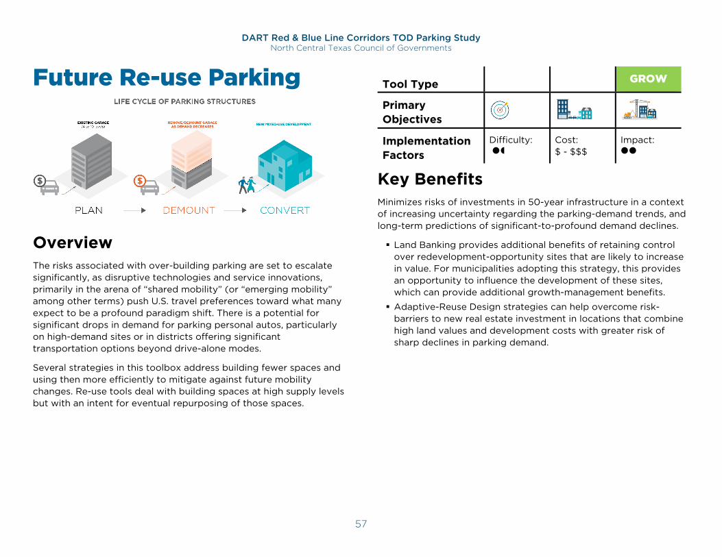
DART Red & Blue Line Corridors TOD Parking Study North Central Texas Council of Governments
57
Future Re-use Parking
Overview The risks associated with over-building parking are set to escalate significantly, as disruptive technologies and service innovations, primarily in the arena of “shared mobility” (or “emerging mobility” among other terms) push U.S. travel preferences toward what many expect to be a profound paradigm shift. There is a potential for significant drops in demand for parking personal autos, particularly on high-demand sites or in districts offering significant transportation options beyond drive-alone modes.
Several strategies in this toolbox address building fewer spaces and using then more efficiently to mitigate against future mobility changes. Re-use tools deal with building spaces at high supply levels but with an intent for eventual repurposing of those spaces.
Tool Type CODE MGMT GROW
Primary Objectives Implementation Factors
Difficulty:
Cost: $ - $$$
Impact:
Key Benefits Minimizes risks of investments in 50-year infrastructure in a context of increasing uncertainty regarding the parking-demand trends, and long-term predictions of significant-to-profound demand declines.
Land Banking provides additional benefits of retaining control over redevelopment-opportunity sites that are likely to increase in value. For municipalities adopting this strategy, this provides an opportunity to influence the development of these sites, which can provide additional growth-management benefits.
Adaptive-Reuse Design strategies can help overcome risk-barriers to new real estate investment in locations that combine high land values and development costs with greater risk of sharp declines in parking demand.
DART Red & Blue Line Corridors TOD Parking Study North Central Texas Council of Governments
58
National Case Study Grand Rapids, MI
The City’s parking & mobility department, Mobile GR, has adopted a Land Banking strategy to address concerns about building new parking structures with a design-life of 50+ years to address what may prove to be short-term supply-expansion needs. By purchasing/leasing, improving, and controlling sites on the downtown periphery, Mobile GR has been able to expand supplies to address pressing needs. This has also provided it, and the City, the opportunity to potentially influence when and how these sites become redeveloped, should the value of their parking supplies diminish, and value for private redevelopment increase. This has allowed Mobile GR to avoid investments in parking structures, while it continues to track mobility trends suggesting continued and strengthening market favor for alternatives to personal-auto travel and parking in urbanized areas.
Regional Case Study Carrollton, TX
The City of Carrollton intends to develop a Parking Master Plan to include long-range and interim parking goals that bolster TOD. In 2010, the City developed a downtown lot into an “Interim ‘Green’ Parking Lot” with repurposed materials and features grass stone pavers. Built with a simple and relatively low-cost design, the site can easily be adaptively repurposed into a revenue generating use in the long term. Meanwhile in the near-term, the City can lease the lot out for special events. Having designed the parking lot with near-term alternative use in mind, the City emphasized the comfort of event users. The use of fully permeable pavers and grass lessens the
59 https://www.cityofcarrollton.com/Home/Components/News/News/325/?navid=542
radiant heat and glare that would typically deter the use of parking lots as event venues.59,60
Implementation Considerations The right-fit strategy will be determined largely by land values, development costs, and susceptibility to declining parking demand. The viability, cost, and effectiveness of all options will benefit from a district-scaled shared/public parking program. Adaptive-Reuse Design, for example, is extremely expensive and complicated, reducing its viability in most development contexts. Public-Private Development projects can also serve as a key, complementary tool for construction options, by spreading the risk of investments in, and expanding the markets for, new parking infrastructure.
Land Banking
Securing low-cost, underutilized sites to use as surface lots can provide temporary parking supply expansions. If current trends continue, the redevelopment value of these sites will increase as their parking-supply value declines. If trends alter from these trajectories, these lots can be maintained with modest investments, allowing their owners to continue to track market trends and opportunities.
60Image: https://www.cityofcarrollton.com/business/carrollton-development/tod/tod-capital-projects
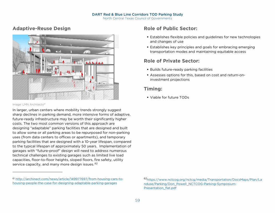
DART Red & Blue Line Corridors TOD Parking Study North Central Texas Council of Governments
59
Adaptive-Reuse Design
Image: LMN Architects61
In larger, urban centers where mobility trends strongly suggest sharp declines in parking demand, more intensive forms of adaptive, future-ready infrastructure may be worth their significantly higher costs. The two most common versions of this approach are designing “adaptable” parking facilities that are designed and built to allow some or all parking areas to be repurposed for non-parking uses (from data centers to offices or apartments), and temporary parking facilities that are designed with a 10-year lifespan, compared to the typical lifespan of approximately 50 years. Implementation of garages with “future-proof” design will need to address numerous technical challenges to existing garages such as limited live load capacities, floor-to-floor heights, sloped floors, fire safety, utility service capacity, and many more design issues. 62
61 http://archinect.com/news/article/149977697/from-housing-cars-to-housing-people-the-case-for-designing-adaptable-parking-garages
Role of Public Sector:
Establishes flexible policies and guidelines for new technologies and changes of use
Establishes key principles and goals for embracing emerging transportation modes and maintaining equitable access
Role of Private Sector:
Builds future-ready parking facilities
Assesses options for this, based on cost and return-on-investment projections
Timing:
Viable for future TODs
62https://www.nctcog.org/nctcg/media/Transportation/DocsMaps/Plan/Landuse/Parking/Don_Powell_NCTCOG-Parking-Symposium-Presentation_flat.pdf
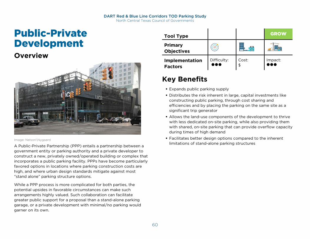
DART Red & Blue Line Corridors TOD Parking Study North Central Texas Council of Governments
60
Public-Private Development Overview
Image: Nelson\Nygaard
A Public-Private Partnership (PPP) entails a partnership between a government entity or parking authority and a private developer to construct a new, privately owned/operated building or complex that incorporates a public parking facility. PPPs have become particularly favored options in locations where parking construction costs are high, and where urban design standards mitigate against most “stand alone” parking structure options.
While a PPP process is more complicated for both parties, the potential upsides in favorable circumstances can make such arrangements highly valued. Such collaboration can facilitate greater public support for a proposal than a stand-alone parking garage, or a private development with minimal/no parking would garner on its own.
Tool Type CODE MGMT GROW
Primary Objectives Implementation Factors
Difficulty:
Cost: $
Impact:
Key Benefits Expands public parking supply
Distributes the risk inherent in large, capital investments like constructing public parking, through cost sharing and efficiencies and by placing the parking on the same site as a significant trip generator
Allows the land-use components of the development to thrive with less dedicated on-site parking, while also providing them with shared, on-site parking that can provide overflow capacity during times of high demand
Facilitates better design options compared to the inherent limitations of stand-alone parking structures
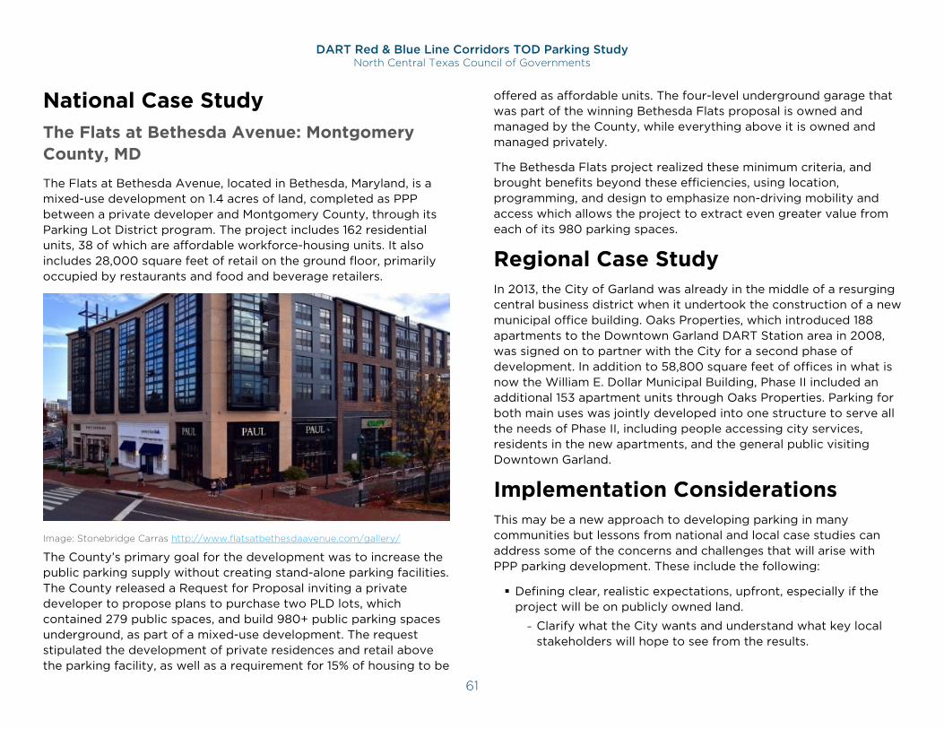
DART Red & Blue Line Corridors TOD Parking Study North Central Texas Council of Governments
61
National Case Study The Flats at Bethesda Avenue: Montgomery County, MD
The Flats at Bethesda Avenue, located in Bethesda, Maryland, is a mixed-use development on 1.4 acres of land, completed as PPP between a private developer and Montgomery County, through its Parking Lot District program. The project includes 162 residential units, 38 of which are affordable workforce-housing units. It also includes 28,000 square feet of retail on the ground floor, primarily occupied by restaurants and food and beverage retailers.
Image: Stonebridge Carras http://www.flatsatbethesdaavenue.com/gallery/
The County’s primary goal for the development was to increase the public parking supply without creating stand-alone parking facilities. The County released a Request for Proposal inviting a private developer to propose plans to purchase two PLD lots, which contained 279 public spaces, and build 980+ public parking spaces underground, as part of a mixed-use development. The request stipulated the development of private residences and retail above the parking facility, as well as a requirement for 15% of housing to be
offered as affordable units. The four-level underground garage that was part of the winning Bethesda Flats proposal is owned and managed by the County, while everything above it is owned and managed privately.
The Bethesda Flats project realized these minimum criteria, and brought benefits beyond these efficiencies, using location, programming, and design to emphasize non-driving mobility and access which allows the project to extract even greater value from each of its 980 parking spaces.
Regional Case Study In 2013, the City of Garland was already in the middle of a resurging central business district when it undertook the construction of a new municipal office building. Oaks Properties, which introduced 188 apartments to the Downtown Garland DART Station area in 2008, was signed on to partner with the City for a second phase of development. In addition to 58,800 square feet of offices in what is now the William E. Dollar Municipal Building, Phase II included an additional 153 apartment units through Oaks Properties. Parking for both main uses was jointly developed into one structure to serve all the needs of Phase II, including people accessing city services, residents in the new apartments, and the general public visiting Downtown Garland.
Implementation Considerations This may be a new approach to developing parking in many communities but lessons from national and local case studies can address some of the concerns and challenges that will arise with PPP parking development. These include the following:
Defining clear, realistic expectations, upfront, especially if the project will be on publicly owned land.
- Clarify what the City wants and understand what key local stakeholders will hope to see from the results.
DART Red & Blue Line Corridors TOD Parking Study North Central Texas Council of Governments
62
- Central to this will invariably be defining how much of the new supply will be publicly available, how much of the time, and comparing the cost/benefit of the investment with this as a key measure.
Determine how the project will be financed, how the ownership of the property and buildings will be apportioned, and who will set policy for and operate the parking facility.
Examine the cost/benefit of working with a master developer for the whole property.
Role of Public Sector:
Develops/plans for public parking facilities that are incorporated into privately developed TODs
Manages and operates/administers these facilities as municipal parking resources
Leverages its investment to secure improved design and functionality that developer expertise brings to mixed-use projects
Role of Private Sector:
Develops the land-use components of these mixed-use facilities
Manages and operates/administers these facilities as municipal parking resources
Leverages its investment to offload the cost-risk of constructing new parking, while securing a significant public parking resource on-site
Timing:
Viable for future TODs
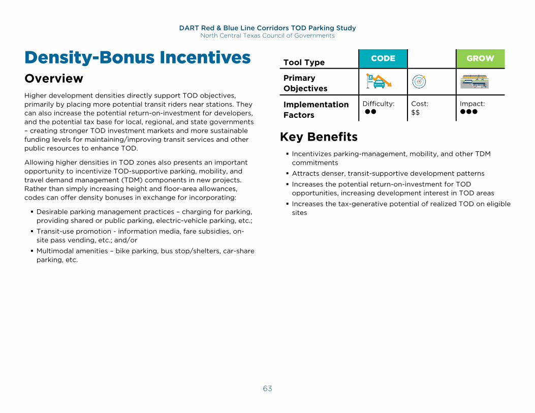
DART Red & Blue Line Corridors TOD Parking Study North Central Texas Council of Governments
63
Density-Bonus Incentives Overview Higher development densities directly support TOD objectives, primarily by placing more potential transit riders near stations. They can also increase the potential return-on-investment for developers, and the potential tax base for local, regional, and state governments – creating stronger TOD investment markets and more sustainable funding levels for maintaining/improving transit services and other public resources to enhance TOD.
Allowing higher densities in TOD zones also presents an important opportunity to incentivize TOD-supportive parking, mobility, and travel demand management (TDM) components in new projects. Rather than simply increasing height and floor-area allowances, codes can offer density bonuses in exchange for incorporating:
Desirable parking management practices – charging for parking, providing shared or public parking, electric-vehicle parking, etc.;
Transit-use promotion - information media, fare subsidies, on-site pass vending, etc.; and/or
Multimodal amenities – bike parking, bus stop/shelters, car-share parking, etc.
Tool Type CODE MGMT GROW
Primary Objectives Implementation Factors
Difficulty:
Cost: $$
Impact:
Key Benefits Incentivizes parking-management, mobility, and other TDM
commitments
Attracts denser, transit-supportive development patterns
Increases the potential return-on-investment for TOD opportunities, increasing development interest in TOD areas
Increases the tax-generative potential of realized TOD on eligible sites
M
DART Red & Blue Line Corridors TOD Parking Study North Central Texas Council of Governments
64
National Case Study Site Plan Development in Arlington County, VA
The primary strategy responsible for Arlington County’s remarkable concentration of growth along rail corridors has been the Site Plan Development option offered to developers looking to build in these areas. This option allows developers to build to a significantly higher density in return for agreeing to a review process that is much more rigorous than a typical zoning review and focused essentially on fostering “smart growth” characteristics in approved projects. Density bonuses are significant enough to attract the majority of new development projects into this process, resulting not only in growth that is concentrated along rail-transit corridors, but projects built to meet exacting standards of multimodal accessibility and traffic mitigation.
A central component of this review process is an emphasis on TDM requirements applied to Site Plan Review projects. These requirements generally focus on workplace commuter travel and opportunities to reduce peak-hour single-occupant vehicle trips. The following is a list of core requirements for all Site Plan Review projects.
A TDM plan for each development, including conditional requirements for implementation.
On-site parking provisions that extend preference to vanpools, carpools, and bicycles.
The encouragement of travel to and from the workplace by modes other than single occupant automobile through various educational and incentive measures.
Coordination and cooperation among employers, building owners, and management companies, and engagement with Arlington Transportation Partners.63
63 http://arlingtontransportationpartners.com/
Regional Case Study Form-Based Codes in Dallas, TX
The form-based code produced for City of Dallas’s walkable urban mixed-use (WMU) and walkable urban residential (WR) districts is “intended to create walkable urban neighborhoods where higher-density mixed uses and mixed housing types promote less dependence on the automobile.”64 This code notably aspires to reduce automobile dependency in a variety of ways, including setting standards for sidewalk development and building frontage visibility to help make the walking experience more desirable. Specific to parking, the form-based code permits reductions in parking for developments for a variety of provisions, including:
Proximity to active car-sharing spaces;
Affordable housing units with proximity to alternate transportation;
A transportation demand management (TDM) program;
Pedestrian amenities at a level above the requirement;
Underground office parking; and
Preserving trees that would have been otherwise removed.
Provisions like these not only incent the expansion and availability of alternative modes of transportation for residents and tenants of developments, but they also encourage parking construction to not come at the expense of using valuable land area solely for surface parking.
Implementation Considerations This tool is particularly effective in areas where there is strong demand for land-use development beyond the scale and density typically allowed by the current code. In such contexts, density bonus or similar incentives can be a very effective means of
64 http://www.dallascityattorney.com/51A/article13.pdf
DART Red & Blue Line Corridors TOD Parking Study North Central Texas Council of Governments
65
ensuring that TDM and reduced excess parking are part of new TOD projects. However, incentives must be carefully designed to ensure that the incentivized development aligns with local goals and is balanced with neighborhood character to avoid conflict. While increased density is typically favorable for developers and TOD goals, new development should fall in line with density goals established in local land use plans as it may create impacts due to increased activity levels. Land-use-based incentives should:
Align with broader land use planning goals;
Consider local stakeholder goals and needs;
Include requirements for multimodal transportation impact mitigation; and
Leverage private dollars from developers to support mobility goals.
Role of Public Sector:
Establishes incentives in the development code, linking increased development scales/densities to commitments to align on-site parking and mobility with common TOD objectives
Role of Private Sector:
Commits to parking and mobility polices, programs, and amenities sought by the community for its TOD areas, in exchange for increased development scale/density limits
Timing:
Viable for future TODs
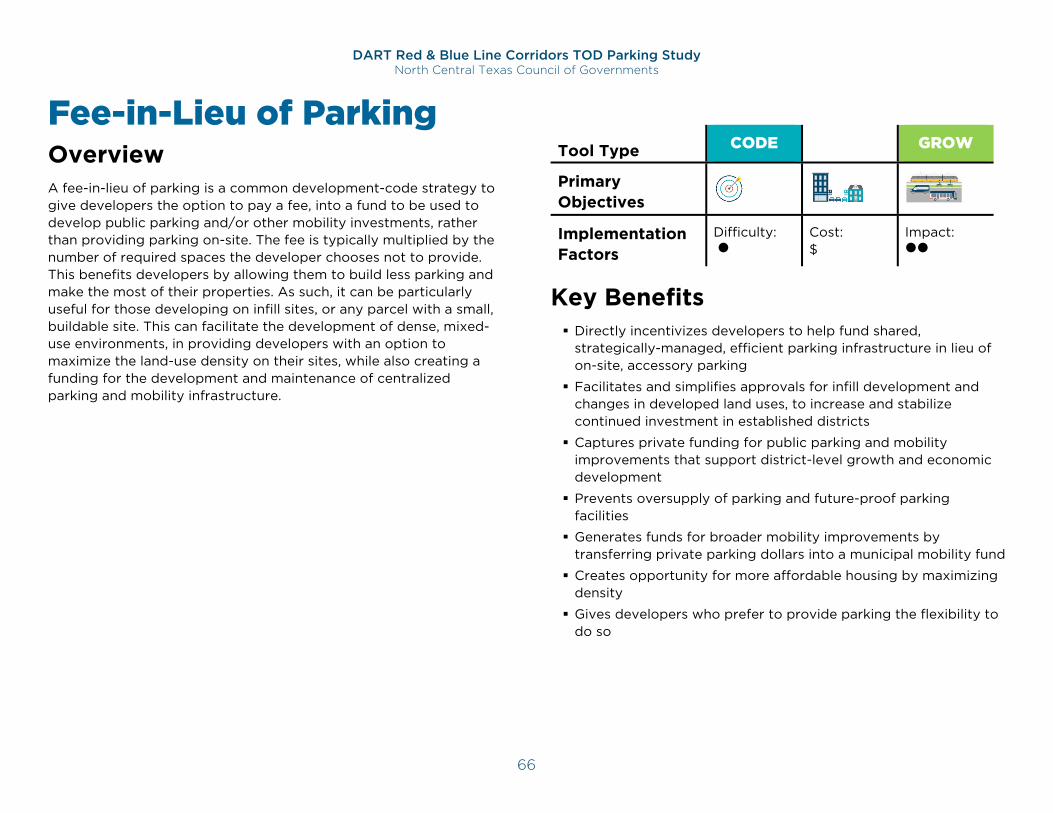
DART Red & Blue Line Corridors TOD Parking Study North Central Texas Council of Governments
66
Fee-in-Lieu of Parking Overview A fee-in-lieu of parking is a common development-code strategy to give developers the option to pay a fee, into a fund to be used to develop public parking and/or other mobility investments, rather than providing parking on-site. The fee is typically multiplied by the number of required spaces the developer chooses not to provide. This benefits developers by allowing them to build less parking and make the most of their properties. As such, it can be particularly useful for those developing on infill sites, or any parcel with a small, buildable site. This can facilitate the development of dense, mixed-use environments, in providing developers with an option to maximize the land-use density on their sites, while also creating a funding for the development and maintenance of centralized parking and mobility infrastructure.
Tool Type CODE MGMT GROW
Primary Objectives Implementation Factors
Difficulty:
Cost: $
Impact:
Key Benefits Directly incentivizes developers to help fund shared,
strategically-managed, efficient parking infrastructure in lieu of on-site, accessory parking
Facilitates and simplifies approvals for infill development and changes in developed land uses, to increase and stabilize continued investment in established districts
Captures private funding for public parking and mobility improvements that support district-level growth and economic development
Prevents oversupply of parking and future-proof parking facilities
Generates funds for broader mobility improvements by transferring private parking dollars into a municipal mobility fund
Creates opportunity for more affordable housing by maximizing density
Gives developers who prefer to provide parking the flexibility to do so
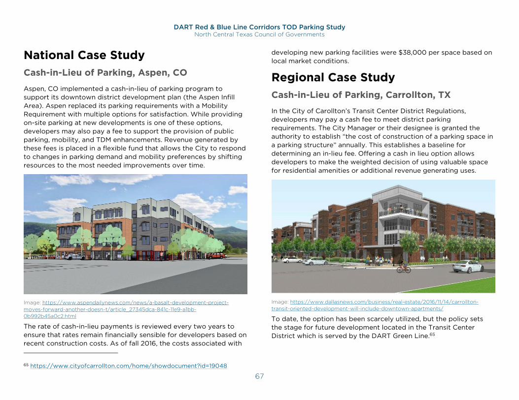
DART Red & Blue Line Corridors TOD Parking Study North Central Texas Council of Governments
67
National Case Study Cash-in-Lieu of Parking, Aspen, CO
Aspen, CO implemented a cash-in-lieu of parking program to support its downtown district development plan (the Aspen Infill Area). Aspen replaced its parking requirements with a Mobility Requirement with multiple options for satisfaction. While providing on-site parking at new developments is one of these options, developers may also pay a fee to support the provision of public parking, mobility, and TDM enhancements. Revenue generated by these fees is placed in a flexible fund that allows the City to respond to changes in parking demand and mobility preferences by shifting resources to the most needed improvements over time.
Image: https://www.aspendailynews.com/news/a-basalt-development-project-moves-forward-another-doesn-t/article_27345dca-841c-11e9-a1bb-0b992b45a0c2.html
The rate of cash-in-lieu payments is reviewed every two years to ensure that rates remain financially sensible for developers based on recent construction costs. As of fall 2016, the costs associated with
65 https://www.cityofcarrollton.com/home/showdocument?id=19048
developing new parking facilities were $38,000 per space based on local market conditions.
Regional Case Study Cash-in-Lieu of Parking, Carrollton, TX
In the City of Carollton’s Transit Center District Regulations, developers may pay a cash fee to meet district parking requirements. The City Manager or their designee is granted the authority to establish “the cost of construction of a parking space in a parking structure” annually. This establishes a baseline for determining an in-lieu fee. Offering a cash in lieu option allows developers to make the weighted decision of using valuable space for residential amenities or additional revenue generating uses.
Image: https://www.dallasnews.com/business/real-estate/2016/11/14/carrollton-transit-oriented-development-will-include-downtown-apartments/
To date, the option has been scarcely utilized, but the policy sets the stage for future development located in the Transit Center District which is served by the DART Green Line.65
DART Red & Blue Line Corridors TOD Parking Study North Central Texas Council of Governments
68
Implementation Considerations In-lieu fees are straightforward to implement via development codes. However, fees must be regularly calibrated to ensure that they offer a financial incentive to developers to avoid constructing parking. In some cases, it may be beneficial to set fees on a case-by-case basis depending on the scale and location of a given development. In-lieu fees can also benefit from the presence of a mobility benefit district which may strategically invest revenues gathered from fees into key mobility improvements or centralized municipal parking facilities.
Role of Public Sector:
Establishes in-lieu fee program by code
Sets and adjusts in-lieu fees
Defines how revenues can/cannot be invested, typically toward expanding/improving area parking or mobility conditions
Ensures that received revenues are significant enough to make necessary and strategic investments, and adjusts fees as necessary
Makes strategic investments
Role of Private Sector:
Uses fee option to preserve more development area for proposed land uses
Uses fee option to increase the viability of infill projects or other site-constrained development opportunities that would not be able to provide significant on-site parking
Advises on strategic use of collected-fee revenues
Timing:
Viable for future TODs
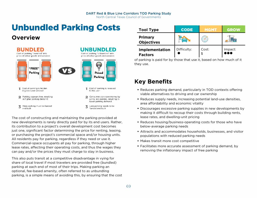
DART Red & Blue Line Corridors TOD Parking Study North Central Texas Council of Governments
69
Unbundled Parking Costs Overview
The cost of constructing and maintaining the parking provided at new developments is rarely directly paid for by its end users. Rather, its contribution to a project’s overall development cost becomes just one, significant factor determining the price for renting, leasing, or purchasing the project’s commercial space and/or housing units. All residents pay for parking, regardless if they need or use it. Commercial-space occupants all pay for parking, through higher lease rates, affecting their operating costs, and thus the wages they can pay and/or the prices they must charge to stay in business.
This also puts transit at a competitive disadvantage in vying for share of local travel if most travelers are provided free (bundled) parking at each end of most of their trips. Making parking an optional, fee-based amenity, often referred to as unbundling parking, is a simple means of avoiding this, by ensuring that the cost
of parking is paid for by those that use it, based on how much of it they use.
Key Benefits Reduces parking demand, particularly in TOD contexts offering
viable alternatives to driving and car ownership
Reduces supply needs, increasing potential land-use densities, area affordability and economic vitality
Discourages excessive parking supplies in new developments by making it difficult to recoup their costs through building rents, lease rates, and dwelling-unit pricing
Reduces housing/business-operating costs for those who have below-average parking needs
Attracts and accommodates households, businesses, and visitor populations with reduced parking needs
Makes transit more cost competitive
Facilitates more accurate assessment of parking demand, by removing the inflationary impact of free parking
Tool Type CODE MGMT GROW
Primary Objectives Implementation Factors
Difficulty:
Cost: $
Impact:
DART Red & Blue Line Corridors TOD Parking Study North Central Texas Council of Governments
70
National Case Studies Requiring Unbundled Parking: San Diego, CA
In March of 2019, San Diego, California added their name to what is becoming a long list of American cities to require the unbundled parking for new multi-family developments in transit-oriented areas – referred to as Transit Priority Areas (TPAs) in the new code. TPAs are defined as a half-mile geographical area from an existing or planned major transit stop. The new code achieves the following:
Abolishes parking minimums for multi-family residential developments in TPAs;
Introduces parking maximums of one space per new apartment/condominium;
Requires developers to unbundle the one space from monthly rent or purchase price; and
Requires transportation amenities, based on project ranked vehicle trip reduction.
Unbundled Residential Parking: St. Louis, MO
Ballpark Lofts is a historic, 6-story, 1894-built industrial property renovated into a mixed-use TOD in 2007. It is located two blocks west of the Stadium MetroLink (light rail) station, and Busch Stadium (St. Louis Cardinals) in the heart of downtown St. Louis. The development includes 68 residential units above two floors and 31,000 square feet of commercial space. A secure surface parking lot is provided for residents, while commercial tenants make use of an adjacent 838-car City parking garage.66
Parking was offered to residential-unit buyers as a separate purchase, priced at $18,000 per space. This allowed its developers to reduce the cost of the residential units for those who chose not
66 https://www.stlballparklofts.com/ballpark-lofts
to purchase a space. As a result, roughly 20-25% of condo buyers opted not to also buy a parking space. The developer credits the nearby MetroLink stop for the demonstrated willingness to forgo on-site parking, and presumably owning a car.67
Regional Case Study Proposed Unbundled Parking Requirement: Austin, TX
The City of Austin Transportation Department, in collaboration with Capital Metro, the Innovation Office, and the Equity Office, completed a study to identify strategies to incentivize use of transit and other non-automobile modes of transportation throughout the city. The report concluded with fifteen actionable strategy options, of which six were recommended to the City Council for consideration. The report included measures to compare the relative cost-effectiveness of these strategies, with Unbundling scoring five out of five for Impact and carrying the lowest estimated implementation cost. The 2018 final report included the recommendation to City Council to consider options to “require the cost to rent or buy a parking space be separated from the cost to rent or buy an apartment, condo, or office”.
67 http://www.urbanreviewstl.com/2006/11/downtown-still-going-strong-neighborhoods-and-inner-suburbs-need-leadership/
DART Red & Blue Line Corridors TOD Parking Study North Central Texas Council of Governments
71
Implementation Considerations Unbundling can be required or incentivized through reduced parking requirements or parking-maximum exemptions. To ensure effective compliance, codes can include stipulations regarding the cost charged for unbundled parking – such as requiring that the rate not fall too far below local averages among commercial or public parking facilities.
The effectiveness (and political viability) of an unbundling policy can be supported by implementing paid parking or resident-permit restrictions on nearby streets, to discourage use of these spaces to avoid on-site parking charges. Enhanced walking, cycling, and transit networks and amenities can also expand the benefits of unbundling in shifting more travel activity away from personal-auto use. Additionally, use of concepts in the “Monetizing Excess Capacity” and “Parking Management Districts” tools will be helpful in managing the market for spaces.
A common practice where developments include efficient parking supplies, unbundling is rare in areas where developments are consistently over-supplied with parking.
Role of Public Sector:
Provides TOD Guidelines that encourage this practice.
Codifies unbundling incentives/requirements
Educate private sector on code changes and the benefits of unbundling
Role of Private Sector:
Charges tenants for parking, separate from any charges for renting, leasing, or buying building space or units
Timing:
Viable for both established and future TODs
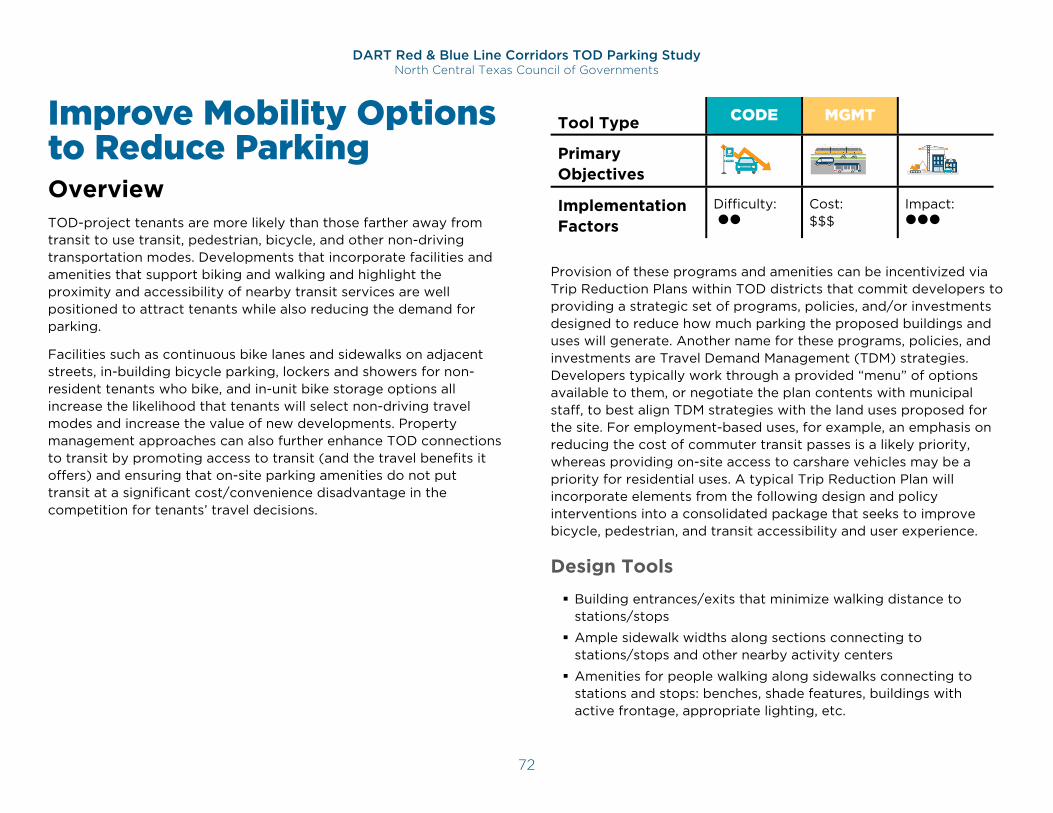
DART Red & Blue Line Corridors TOD Parking Study North Central Texas Council of Governments
72
Improve Mobility Options to Reduce Parking Overview TOD-project tenants are more likely than those farther away from transit to use transit, pedestrian, bicycle, and other non-driving transportation modes. Developments that incorporate facilities and amenities that support biking and walking and highlight the proximity and accessibility of nearby transit services are well positioned to attract tenants while also reducing the demand for parking.
Facilities such as continuous bike lanes and sidewalks on adjacent streets, in-building bicycle parking, lockers and showers for non-resident tenants who bike, and in-unit bike storage options all increase the likelihood that tenants will select non-driving travel modes and increase the value of new developments. Property management approaches can also further enhance TOD connections to transit by promoting access to transit (and the travel benefits it offers) and ensuring that on-site parking amenities do not put transit at a significant cost/convenience disadvantage in the competition for tenants’ travel decisions.
Tool Type CODE MGMT GROW
Primary Objectives Implementation Factors
Difficulty:
Cost: $$$
Impact:
Provision of these programs and amenities can be incentivized via Trip Reduction Plans within TOD districts that commit developers to providing a strategic set of programs, policies, and/or investments designed to reduce how much parking the proposed buildings and uses will generate. Another name for these programs, policies, and investments are Travel Demand Management (TDM) strategies. Developers typically work through a provided “menu” of options available to them, or negotiate the plan contents with municipal staff, to best align TDM strategies with the land uses proposed for the site. For employment-based uses, for example, an emphasis on reducing the cost of commuter transit passes is a likely priority, whereas providing on-site access to carshare vehicles may be a priority for residential uses. A typical Trip Reduction Plan will incorporate elements from the following design and policy interventions into a consolidated package that seeks to improve bicycle, pedestrian, and transit accessibility and user experience.
Design Tools
Building entrances/exits that minimize walking distance to stations/stops
Ample sidewalk widths along sections connecting to stations/stops and other nearby activity centers
Amenities for people walking along sidewalks connecting to stations and stops: benches, shade features, buildings with active frontage, appropriate lighting, etc.
G
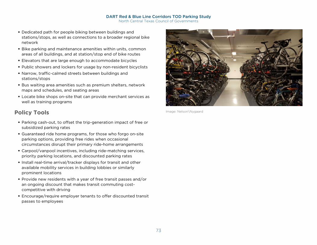
DART Red & Blue Line Corridors TOD Parking Study North Central Texas Council of Governments
73
Dedicated path for people biking between buildings and stations/stops, as well as connections to a broader regional bike network
Bike parking and maintenance amenities within units, common areas of all buildings, and at station/stop end of bike routes
Elevators that are large enough to accommodate bicycles
Public showers and lockers for usage by non-resident bicyclists
Narrow, traffic-calmed streets between buildings and stations/stops
Bus waiting area amenities such as premium shelters, network maps and schedules, and seating areas
Locate bike shops on-site that can provide merchant services as well as training programs
Policy Tools
Parking cash-out, to offset the trip-generation impact of free or subsidized parking rates
Guaranteed ride home programs, for those who forgo on-site parking options, providing free rides when occasional circumstances disrupt their primary ride-home arrangements
Carpool/vanpool incentives, including ride-matching services, priority parking locations, and discounted parking rates
Install real-time arrival/tracker displays for transit and other available mobility services in building lobbies or similarly prominent locations
Provide new residents with a year of free transit passes and/or an ongoing discount that makes transit commuting cost-competitive with driving
Encourage/require employer tenants to offer discounted transit passes to employees
Image: Nelson\Nygaard
DART Red & Blue Line Corridors TOD Parking Study North Central Texas Council of Governments
74
Key Benefits Reduces parking demand
Increases value of developments
Increases development attractiveness for tenants
Supports Travel Demand Management (TDM) programs that incentivize biking and walking
Increases market demand for, value of, and return on investment from TOD investments
Increases pedestrian and bike activity on the street, leading to a more vibrant neighborhood
Reduces area traffic impacts and dependence on personal-auto access
Increases development densities, optimizing the area’s economic- and community-development potential
National Case Study TDM Program in San Francisco, CA
In early 2016, the City and County of San Francisco adopted a resolution to initiate Code amendments that would require development projects to comply with a TDM program, with the intent to reduce vehicle miles traveled (VMT), and to make it easier for people to get around by sustainable travel modes such as transit, walking, and biking. Under the TDM program, proposed developments are required to achieve a target TDM score, based on the number of accessory vehicle parking spaces included with the proposed project. In general, the TDM target score increases with the amount of parking proposed. Selected TDM measures must be incorporated into the project proposal and analyzed in Draft 1 of the Transportation Impact Study (TIS) or Transportation Circulation Memo. Property owners are required to implement the TDM measures in the approved TDM plan for the life of the project.
Developers can meet the target by selecting TDM measures – each with a specified number of points – from a diverse menu of options. Some of the more innovative options include:
Provide streetscape improvements to encourage walking;
Provide on-site showers and lockers so commuters can travel by active modes;
Provide on-site tools and space for bicycle repair;
Provide bike maintenance services through an on-call mechanic or vouchers to a local shop;
Provide an onsite fleet of bicycles for residents, employees, and/or guests to use;
Several options for providing car-share parking and memberships, more points given for higher levels of participation;
Facilitate deliveries with a staffed reception desk, lockers, or other accommodations;
Provide storage for car seats near car-share parking, cargo bikes and shopping carts;
Provide an on-site childcare service;
25, 50, 75, or 100% subsidies for transit passes, or other sustainable transportation costs (more points given for higher rate of subsidy);
Provide shuttle bus services, more points given for more frequent service;
Large screen or monitor that displays, at a minimum, transit arrival and departure information.
Regional Case Study Texas Instruments Inc. in Dallas, TX
Texas Instruments Inc. (TI), which employs 6,500 people, earned a Silver award from the League of American Bicyclists as a bike-
DART Red & Blue Line Corridors TOD Parking Study North Central Texas Council of Governments
75
friendly business. TI has formally supported alternative commuting for over 20 years and contributed close to $400,000 in direct funding and donated land to expand the Cottonwood Trail, connecting DART’s Forest Lane station to the western edge of the TI campus in North Dallas. TI has also installed long-term bike storage, onsite showers, and repair stations at its headquarters.68
Implementation Considerations Trip reduction ordinances should set a minimum building size on which to enforce requirements, to both focus on larger-impact developments and avoid creating a burden on smaller developers/property owners. Determining this gross square footage may differ based on land use(s).
To be effective, trip reduction plans and programs must include continual monitoring and benchmarking toward mode share and mode shift goals. If employers or property managers cannot document reduced drive-alone travel by employees, customers, or residents, additional investment or incentives should be triggered.
Providing free staff resources to assist in the administration of required TDM programs can effectively encourage effective participation, leading to better results and less public resistance to TDM requirements.
68 https://www.dallasnews.com/business/business/2013/06/25/ti-sees-benefits-in-encouraging-bicycle-commuting
Effective incentives for non-required TDM include reduced development fees or an expedited approvals process for proposed developments that include reduced parking or that encourage use of non-auto modes through TDM measures.
Role of Public Sector:
Codifies incentives and/or requirements for mobility improvements and/or TDM measures and trip reduction plans
Role of Private Sector:
Implements and manages approved programs and policies to meet development-approval commitments, and/or for the benefit of site tenants and visitors
Coordinates shared and scalable programs (such as employer shuttles to/from transit stations) with neighboring developments and employers
Monitors program/resource utilization and progress towards transportation mode share goals
Timing:
Viable for both established and future TODs
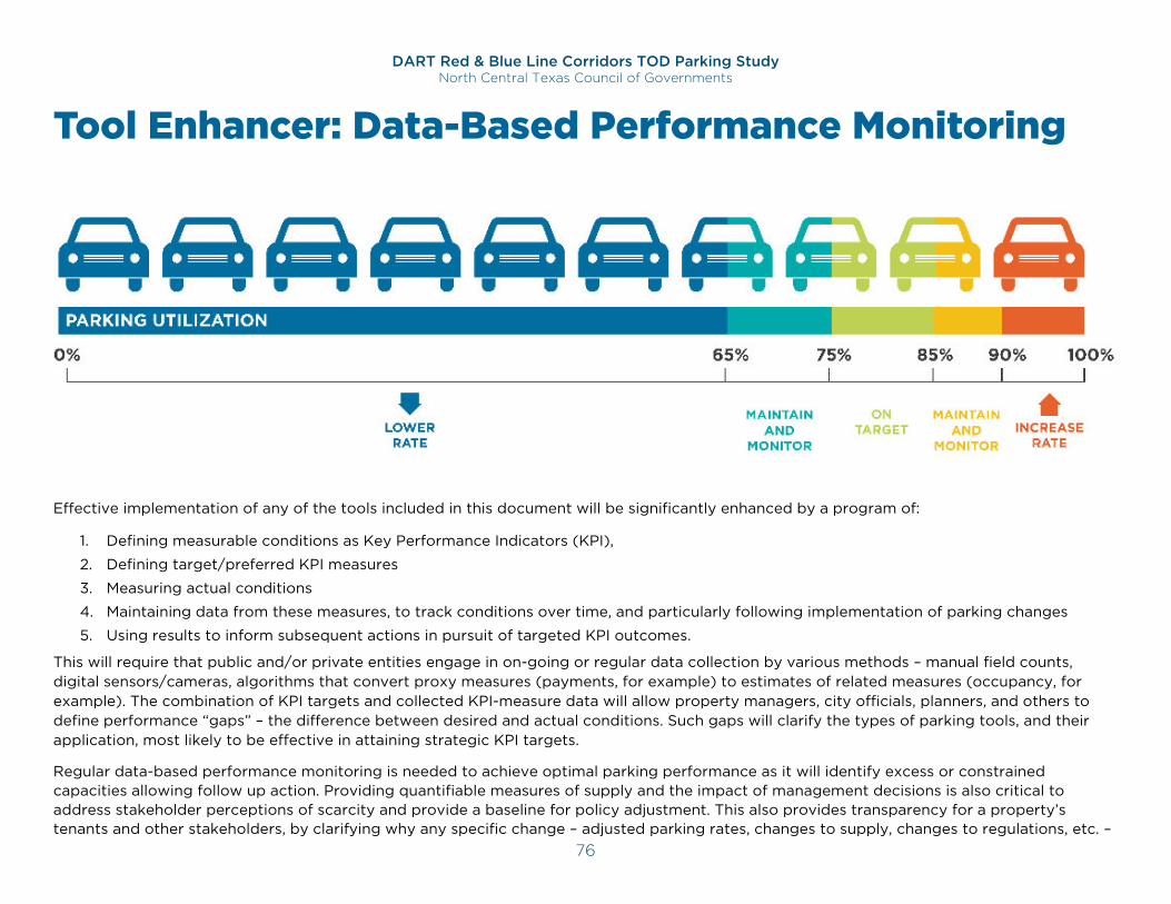
DART Red & Blue Line Corridors TOD Parking Study North Central Texas Council of Governments
76
Tool Enhancer: Data-Based Performance Monitoring
Effective implementation of any of the tools included in this document will be significantly enhanced by a program of:
1. Defining measurable conditions as Key Performance Indicators (KPI),
2. Defining target/preferred KPI measures
3. Measuring actual conditions
4. Maintaining data from these measures, to track conditions over time, and particularly following implementation of parking changes
5. Using results to inform subsequent actions in pursuit of targeted KPI outcomes.
This will require that public and/or private entities engage in on-going or regular data collection by various methods – manual field counts, digital sensors/cameras, algorithms that convert proxy measures (payments, for example) to estimates of related measures (occupancy, for example). The combination of KPI targets and collected KPI-measure data will allow property managers, city officials, planners, and others to define performance “gaps” – the difference between desired and actual conditions. Such gaps will clarify the types of parking tools, and their application, most likely to be effective in attaining strategic KPI targets.
Regular data-based performance monitoring is needed to achieve optimal parking performance as it will identify excess or constrained capacities allowing follow up action. Providing quantifiable measures of supply and the impact of management decisions is also critical to address stakeholder perceptions of scarcity and provide a baseline for policy adjustment. This also provides transparency for a property’s tenants and other stakeholders, by clarifying why any specific change – adjusted parking rates, changes to supply, changes to regulations, etc. –
DART Red & Blue Line Corridors TOD Parking Study North Central Texas Council of Governments
77
has been implemented, how its effectiveness may be assessed going forward, and what further changes might be expected depending on that assessment.
Perhaps most importantly, consistent data-gathering and conditions-monitoring will provide a new framework for assessing the sufficiency, effectiveness, and market appeal of TOD parking resources. Without these objective measures, assessment of these important considerations will be wholly reliant upon subjective perceptions, largely from those who most frequently use these resources and who are naturally inclined to prefer abundance and perceive scarcity.
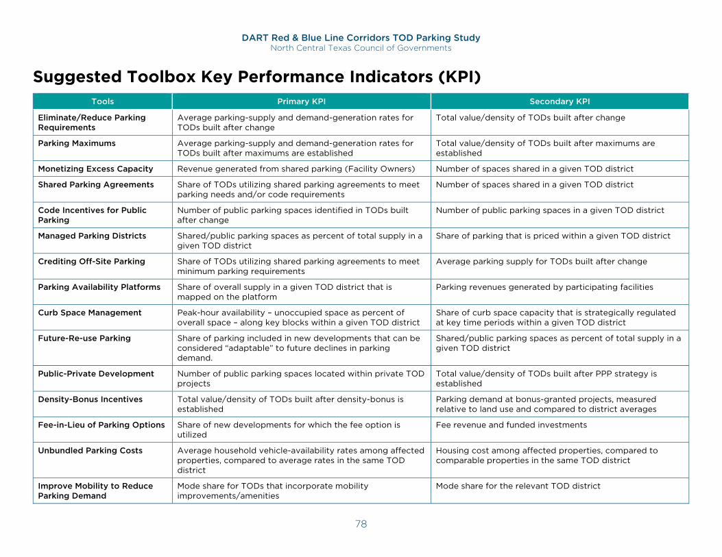
DART Red & Blue Line Corridors TOD Parking Study North Central Texas Council of Governments
78
Suggested Toolbox Key Performance Indicators (KPI) Tools Primary KPI Secondary KPI
Eliminate/Reduce Parking Requirements
Average parking-supply and demand-generation rates for TODs built after change
Total value/density of TODs built after change
Parking Maximums Average parking-supply and demand-generation rates for TODs built after maximums are established
Total value/density of TODs built after maximums are established
Monetizing Excess Capacity Revenue generated from shared parking (Facility Owners) Number of spaces shared in a given TOD district
Shared Parking Agreements Share of TODs utilizing shared parking agreements to meet parking needs and/or code requirements
Number of spaces shared in a given TOD district
Code Incentives for Public Parking
Number of public parking spaces identified in TODs built after change
Number of public parking spaces in a given TOD district
Managed Parking Districts Shared/public parking spaces as percent of total supply in a given TOD district
Share of parking that is priced within a given TOD district
Crediting Off-Site Parking Share of TODs utilizing shared parking agreements to meet minimum parking requirements
Average parking supply for TODs built after change
Parking Availability Platforms Share of overall supply in a given TOD district that is mapped on the platform
Parking revenues generated by participating facilities
Curb Space Management Peak-hour availability – unoccupied space as percent of overall space – along key blocks within a given TOD district
Share of curb space capacity that is strategically regulated at key time periods within a given TOD district
Future-Re-use Parking Share of parking included in new developments that can be considered “adaptable” to future declines in parking demand.
Shared/public parking spaces as percent of total supply in a given TOD district
Public-Private Development Number of public parking spaces located within private TOD projects
Total value/density of TODs built after PPP strategy is established
Density-Bonus Incentives Total value/density of TODs built after density-bonus is established
Parking demand at bonus-granted projects, measured relative to land use and compared to district averages
Fee-in-Lieu of Parking Options Share of new developments for which the fee option is utilized
Fee revenue and funded investments
Unbundled Parking Costs Average household vehicle-availability rates among affected properties, compared to average rates in the same TOD district
Housing cost among affected properties, compared to comparable properties in the same TOD district
Improve Mobility to Reduce Parking Demand
Mode share for TODs that incorporate mobility improvements/amenities
Mode share for the relevant TOD district
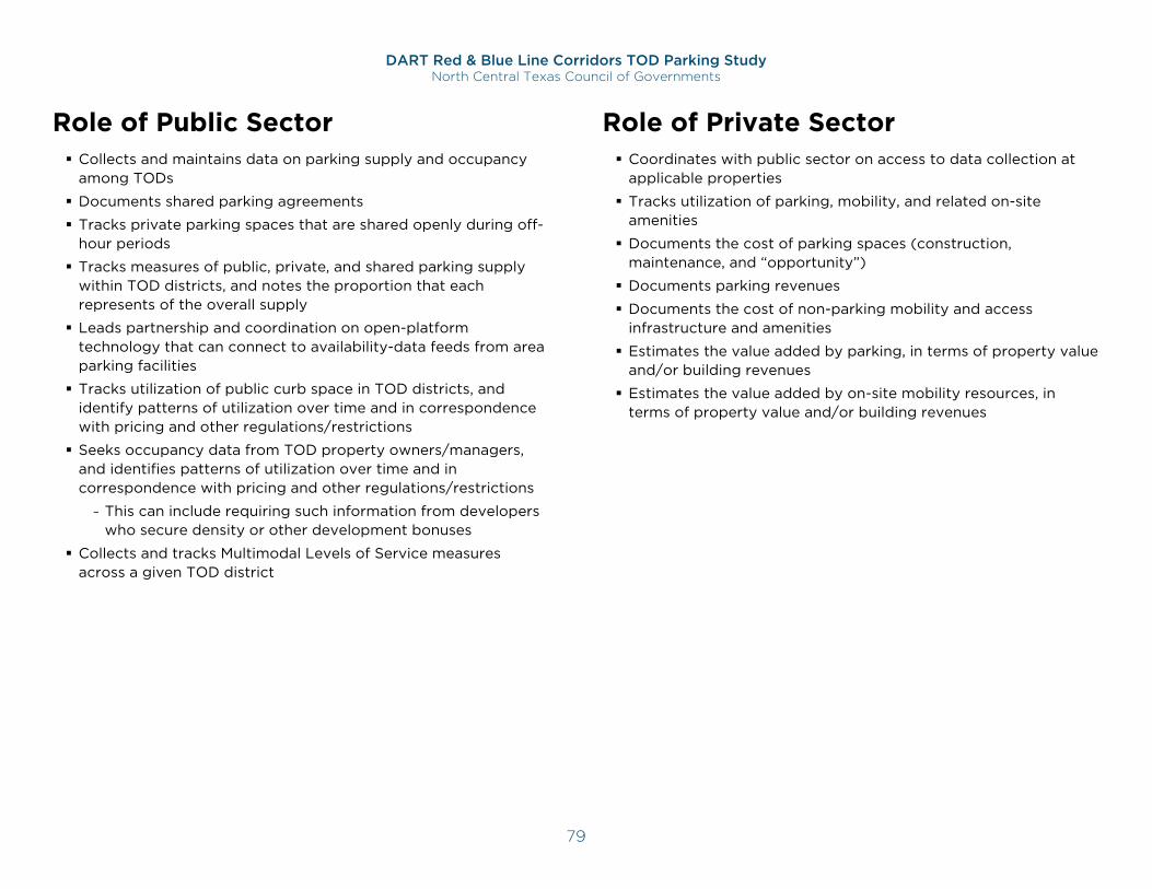
DART Red & Blue Line Corridors TOD Parking Study North Central Texas Council of Governments
79
Role of Public Sector Collects and maintains data on parking supply and occupancy
among TODs
Documents shared parking agreements
Tracks private parking spaces that are shared openly during off-hour periods
Tracks measures of public, private, and shared parking supply within TOD districts, and notes the proportion that each represents of the overall supply
Leads partnership and coordination on open-platform technology that can connect to availability-data feeds from area parking facilities
Tracks utilization of public curb space in TOD districts, and identify patterns of utilization over time and in correspondence with pricing and other regulations/restrictions
Seeks occupancy data from TOD property owners/managers, and identifies patterns of utilization over time and in correspondence with pricing and other regulations/restrictions
- This can include requiring such information from developers who secure density or other development bonuses
Collects and tracks Multimodal Levels of Service measures across a given TOD district
Role of Private Sector Coordinates with public sector on access to data collection at
applicable properties
Tracks utilization of parking, mobility, and related on-site amenities
Documents the cost of parking spaces (construction, maintenance, and “opportunity”)
Documents parking revenues
Documents the cost of non-parking mobility and access infrastructure and amenities
Estimates the value added by parking, in terms of property value and/or building revenues
Estimates the value added by on-site mobility resources, in terms of property value and/or building revenues
DART Red & Blue Line Corridors TOD Parking Study North Central Texas Council of Governments
80
Conclusion Better Data is Essential Existing public code and private decisions on how much parking to provide at TODs have not widely been using data adjusted to their site context. The data collected for this study can and should be used to improve demand projections and parking requirements, by replacing the default demand-generation rates with rates based on documented, local parking conditions. To fully capture the complexity of all development scenarios and improve data on parking supply calculations, the public and private sectors should work together to build parking utilization databases. Robust data presented in an easily accessible form is key to helping North Texas’ decision makers.
Appendix C includes recommendations and strategies for increasing parking studies and data availability.
Codes Should Support Modeled Data Parking requirements can include a standard that recognizes the results of an approved shared-parking model to define a project’s parking requirement. This can identify the ULI model69 as an approved model, while also allowing approved variations on this model to be used. As demonstrated in the site profiles, modeled outputs were consistently and significantly more accurate in anticipating survey-documented demand conditions, compared to relevant parking requirements, and built supplies.
Accepting model results as determining parking requirements would be a major step forward in right-sizing TOD parking for communities that want to maintain minimum parking requirements for TODs.
69 https://uli.bookstore.ipgbook.com/shared-parking-cd-products-9780874202618.php
Maximums May be Useful Because so many TOD developers are overparking their projects well beyond what is required by code, reducing or eliminating minimum requirements may not be enough to reverse the supply patterns identified through this study. Where possible, parking maximums, which limit the amount of parking that can be provided, using ratios assigned to each proposed land use, should be considered. This may be most important in locations where the ridership benefits of TODs are a high priority, as overparking such projects significantly reduce their ridership-generating potential. Maximums are not recommended, however, in locations where they may significantly reduce TOD investment. To minimize this risk, maximums can be framed as “soft” or “flexible” limits on parking – allowing developers to exceed these limits if they commit to sharing excess supplies, unbundling parking, or other desired demand-management practices.
Solutions Must Go Beyond the Code Two key areas of challenge and opportunity emerge from this study as essential for supporting DART-line TOD through better parking.
1. Reversing the historic tendency to overpark TODs.
2. Making effective use of the excess parking supplies at existing TODs.
Meeting these challenges/opportunities will require tools that go beyond reducing or eliminating parking requirements, and beyond the development code itself. Additional actions beyond code include:
Public Private Coordination: Proactively coordinate with the private sector on data collection and information sharing on reducing parking supply/demand at TODs. Provide data and
DART Red & Blue Line Corridors TOD Parking Study North Central Texas Council of Governments
81
education as needed to developers, lenders, and property owners on data-based evidence of sufficient parking to mitigate risk concerns.
Increase Non-driving Options: Work with multiple stakeholders to reduce parking demand though support of mode shifts to transit and active-mobility options. Advance interdepartmental and inter-agency coordination to increase infrastructure supporting non-driving mobility options, such as transit.
Share and Manage: Optimize the value of existing and future parking infrastructure, by identifying excess capacity at existing TODs that may be shared with new development. Plan for an increase of parking that is managed as a shared resource, such as through a parking management district.
Build TOD Parking Resilience: Best practice and information sharing on repurposed parking as demand begins to decline in walkable, mixed-use, transit-served districts. Target public/private initiatives to reduce parking demand at individual TOD parking facilities that may experience peak-hour supply constraints.
What Can You Do? NCTCOG depends on informed and committed partners to help make the best practices highlighted in this study a reality. After reading and understanding this report, there are critical actions to take.
North Texas Local Government
Reform parking ratios and requirements for all future developments to be in keeping with actual demand observed
Enact policy, code reforms, and partnership incentives to realize best practices
Continue to collect data
Create and/or share educational information on parking reforms and best practices such as this report
Developers and Property Owners
Embrace a performance-based management approach that includes relevant best practices, complemented by periodic parking occupancy surveys to assess and track demand at TOD projects. This will not only improve the effectiveness of parking management among existing sites, it will provide data to better inform future TOD parking investments
Collect data and share findings within the commercial real estate trade, along with prospective tenants, to support arguments for “right-sizing” parking
Build partnerships with cities and neighbors to realize best practices
TOD Lenders and Investors
Understand and use more targeted local parking data sources, including that provided by this study, and shared-parking model projections for any mixed-use project or development context to determine parking needs for potential TOD opportunities
Evaluate the financial returns of increased density in exchange for less land used as parking
Transit Agencies
Regularly assess utilization and management of commuter parking facilities
Evaluate opportunities for redevelopment of all or part of commuter parking facilities with excess capacity
Advocates
Educate community members on report findings and best practices
Support best practices at public meetings related to future development and codes
DART Red & Blue Line Corridors TOD Parking Study North Central Texas Council of Governments
82
All
Commission parking studies/surveys to add to the local demand-generation database begun with this study, and work with NCTCOG to ensure the results become available across the region to improve understanding of TOD parking needs and practices