Embed Size (px)
Citation preview
Maryland’s Data Download Tool –Now it’s Your Turn
Robert Pierson, CFM
Project OfficerFEMA Region [email protected]
Matt Breen, PE, CFM
Water Resources EngineerAmec Foster [email protected]
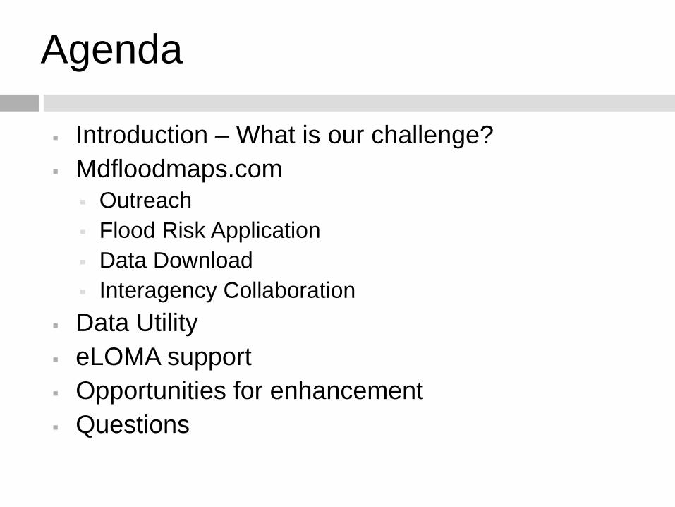
Agenda
Introduction – What is our challenge?
Mdfloodmaps.com
Outreach
Flood Risk Application
Data Download
Interagency Collaboration
Data Utility
eLOMA support
Opportunities for enhancement
Questions
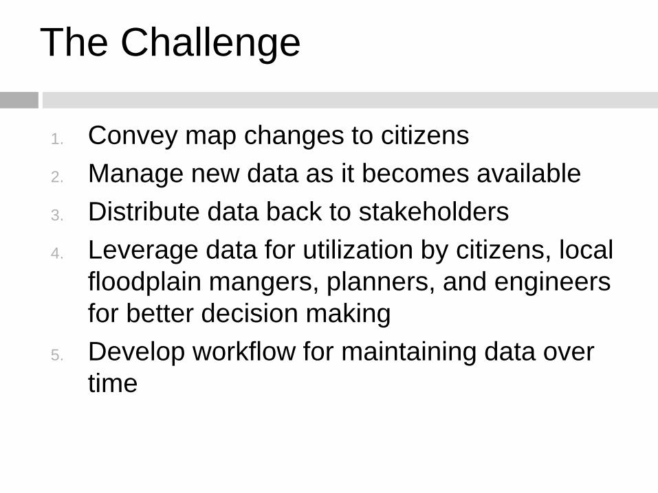
The Challenge
1. Convey map changes to citizens
2. Manage new data as it becomes available
3. Distribute data back to stakeholders
4. Leverage data for utilization by citizens, local
floodplain mangers, planners, and engineers
for better decision making
5. Develop workflow for maintaining data over
time
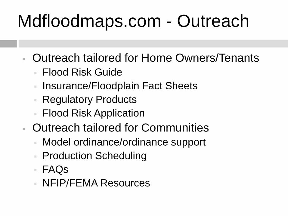
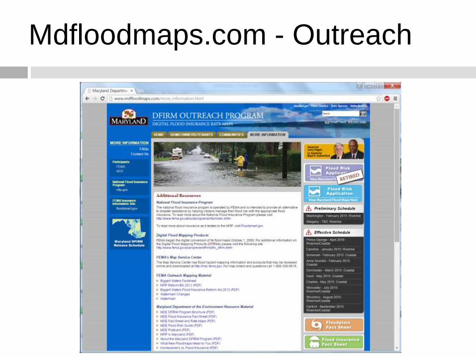
Mdfloodmaps.com - Outreach
Outreach tailored for Home Owners/Tenants
Flood Risk Guide
Insurance/Floodplain Fact Sheets
Regulatory Products
Flood Risk Application
Outreach tailored for Communities
Model ordinance/ordinance support
Production Scheduling
FAQs
NFIP/FEMA Resources
Mdfloodmaps.com - Outreach
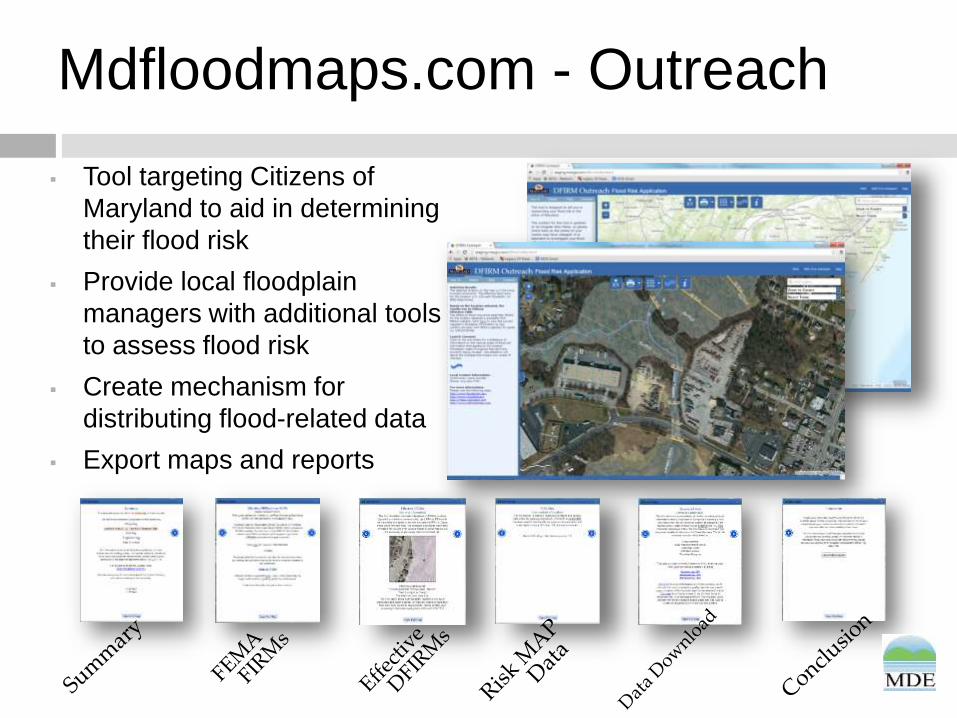
Mdfloodmaps.com - Outreach
Tool targeting Citizens of
Maryland to aid in determining
their flood risk
Provide local floodplain
managers with additional tools
to assess flood risk
Create mechanism for
distributing flood-related data
Export maps and reports
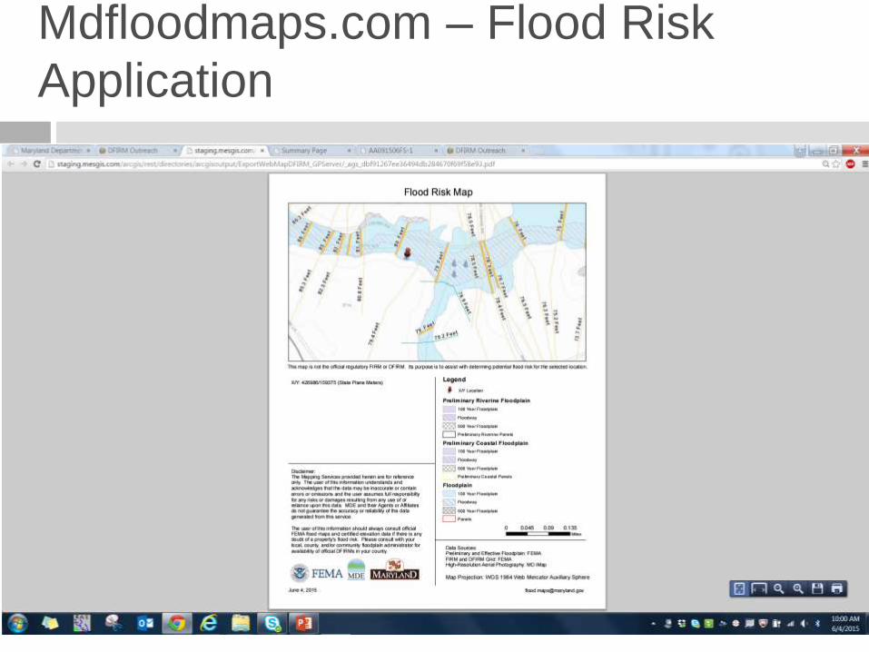
Mdfloodmaps.com – Flood Risk
Application
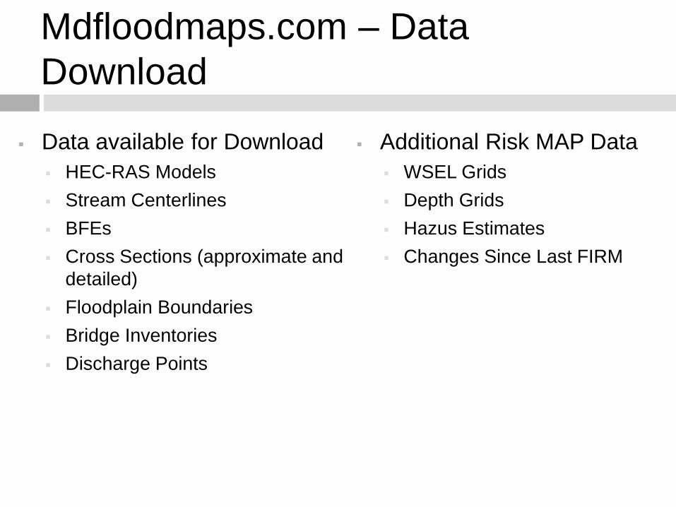
Mdfloodmaps.com – Data
Download
Data available for Download
HEC-RAS Models
Stream Centerlines
BFEs
Cross Sections (approximate and
detailed)
Floodplain Boundaries
Bridge Inventories
Discharge Points
Additional Risk MAP Data
WSEL Grids
Depth Grids
Hazus Estimates
Changes Since Last FIRM
Interagency Collaboration
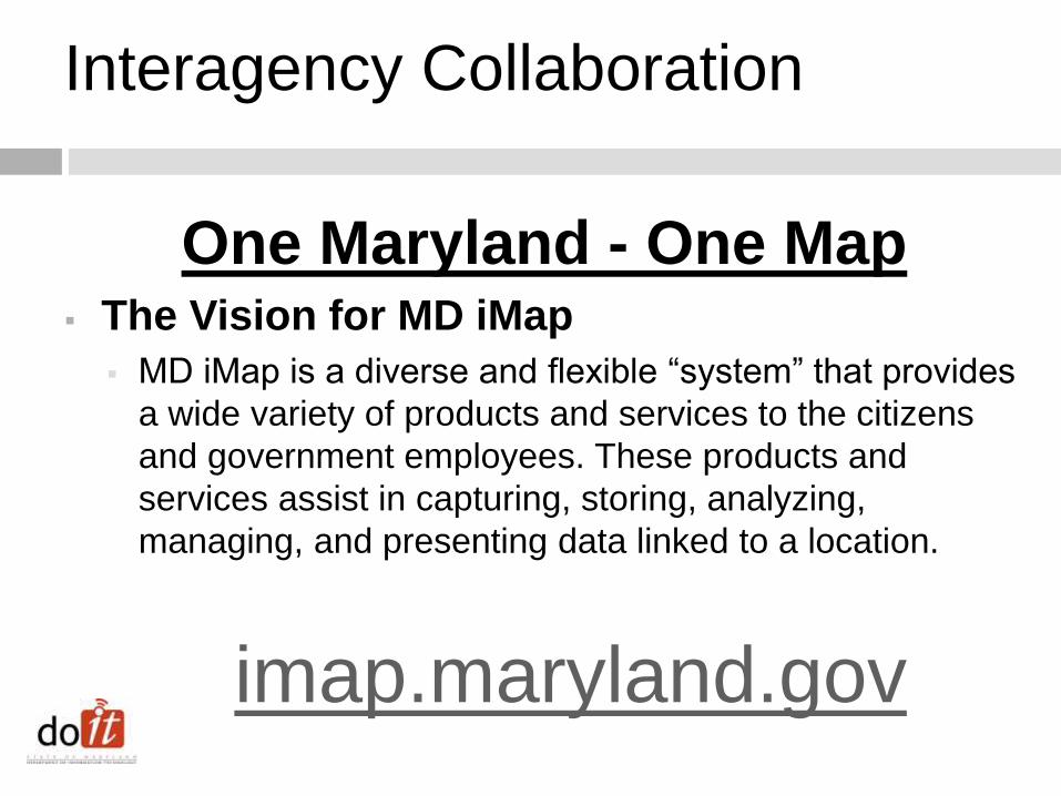
One Maryland - One Map The Vision for MD iMap
MD iMap is a diverse and flexible “system” that provides
a wide variety of products and services to the citizens
and government employees. These products and
services assist in capturing, storing, analyzing,
managing, and presenting data linked to a location.
imap.maryland.gov
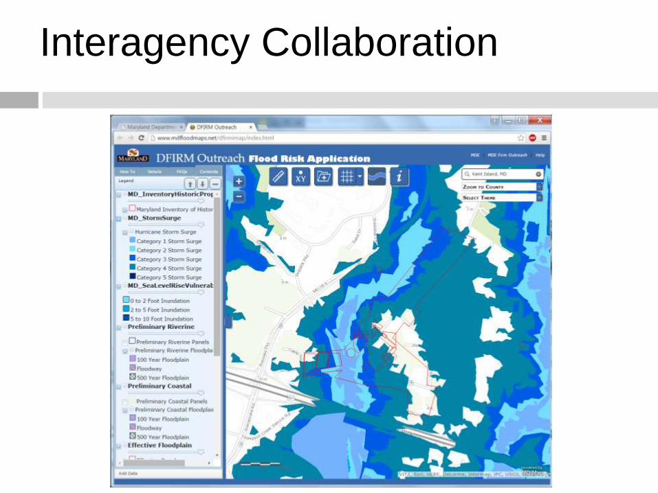
Interagency Collaboration
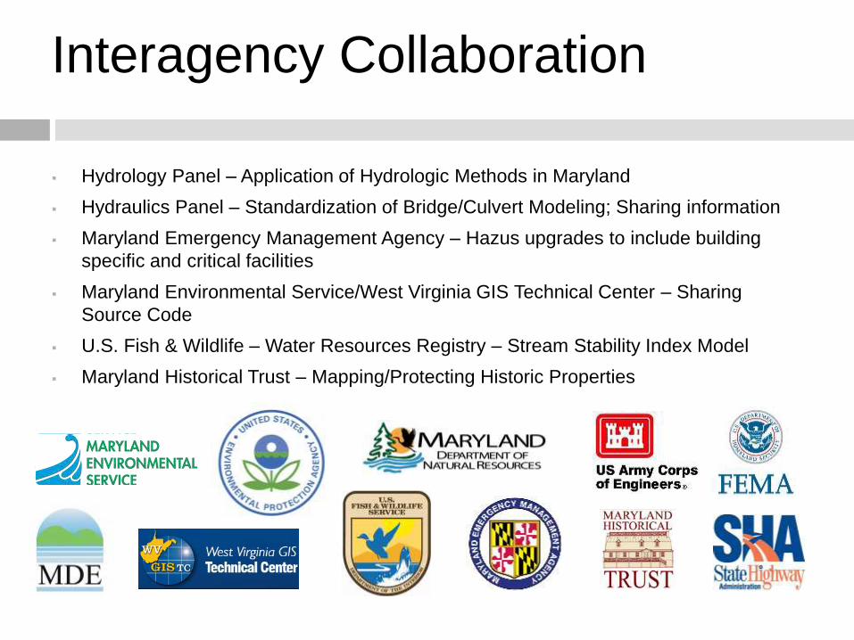
Interagency Collaboration
Hydrology Panel – Application of Hydrologic Methods in Maryland
Hydraulics Panel – Standardization of Bridge/Culvert Modeling; Sharing information
Maryland Emergency Management Agency – Hazus upgrades to include building
specific and critical facilities
Maryland Environmental Service/West Virginia GIS Technical Center – Sharing
Source Code
U.S. Fish & Wildlife – Water Resources Registry – Stream Stability Index Model
Maryland Historical Trust – Mapping/Protecting Historic Properties
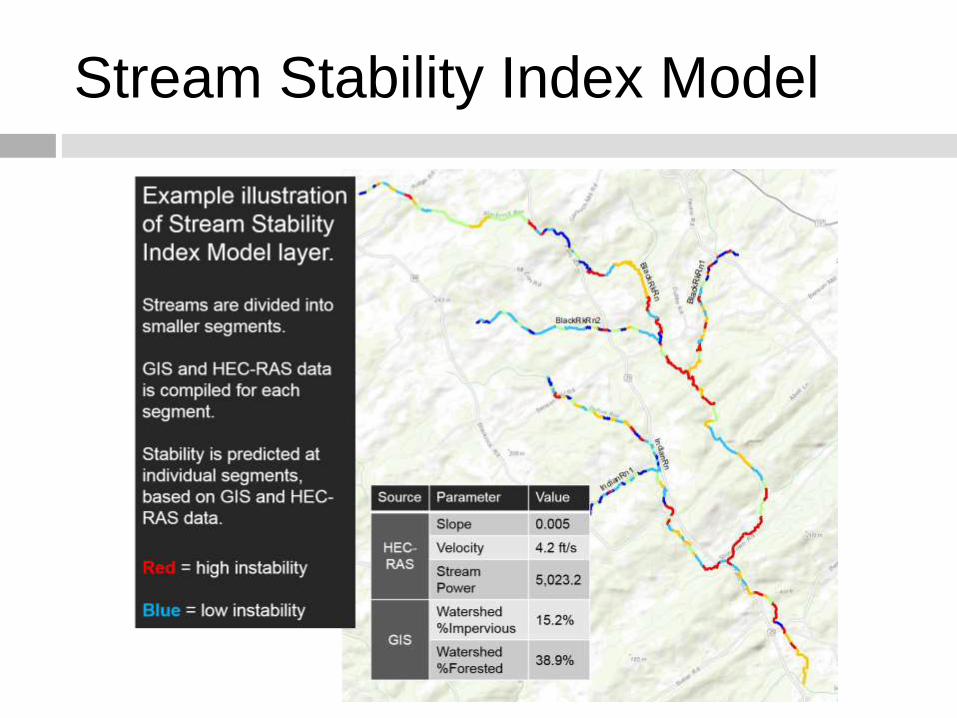
Stream Stability Index Model
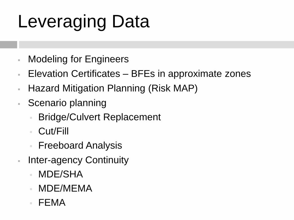
Leveraging Data
Modeling for Engineers
Elevation Certificates – BFEs in approximate zones
Hazard Mitigation Planning (Risk MAP)
Scenario planning
Bridge/Culvert Replacement
Cut/Fill
Freeboard Analysis
Inter-agency Continuity
MDE/SHA
MDE/MEMA
FEMA
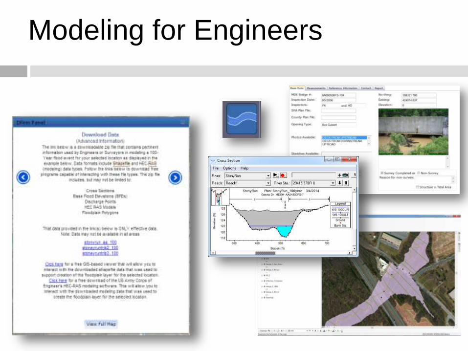
Modeling for Engineers
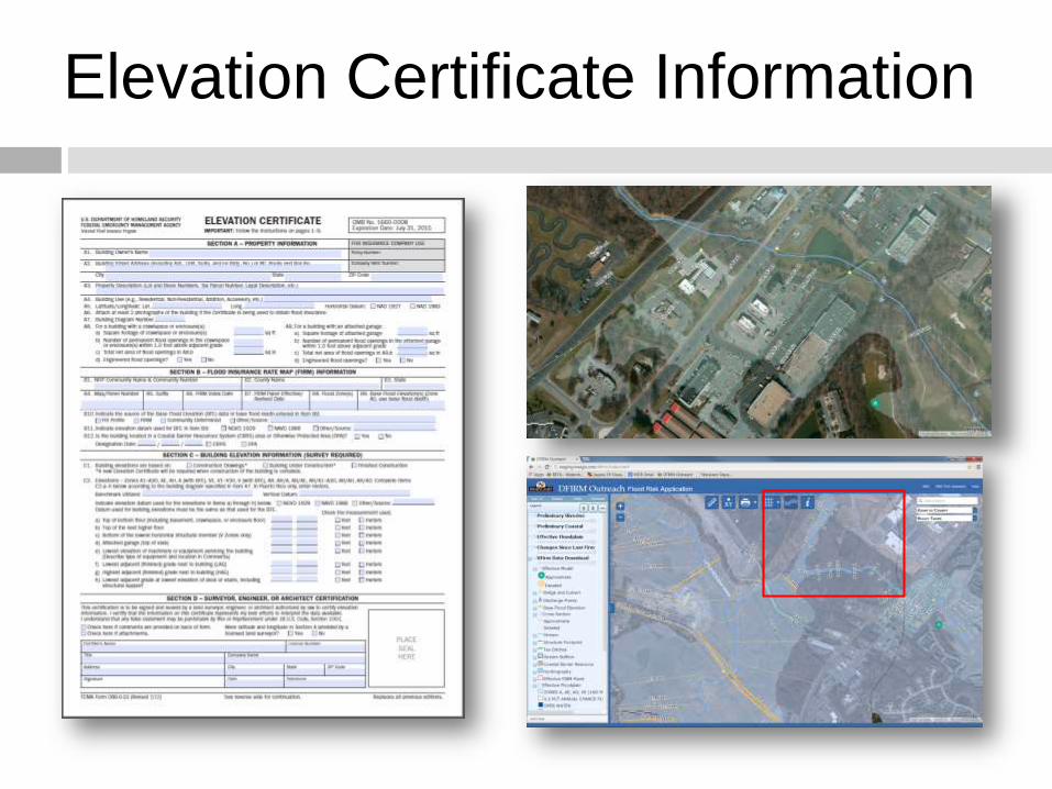
Elevation Certificate Information
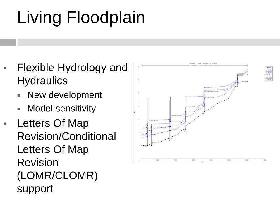
Living Floodplain
Flexible Hydrology and
Hydraulics
New development
Model sensitivity
Letters Of Map
Revision/Conditional
Letters Of Map
Revision
(LOMR/CLOMR)
support
Using publically available Approximate BFE values for eLOMA’s?!
How did this idea come about? Surveyors in MD and WV started using the approximate BFE’s found on the MD and WV Flood Tools for the BFE field in eLOMA applications.
This was in reaction to presentations given at state conferences encouraging their use for traditional LOMA applications.
The LOMA processing team questioned the use of these sites for the BFE value asking how the values were derived off of the interactive tools.
The discussion began! Why can’t they be used?
The discussion is ongoing but it seems as though the submitters will have to provide additional information than what is usually provided in an eLOMA application.
Some possible additional data that may need to be uploaded and provided:
Upstream and downstream cross sections, the discharge, screenshot of the area after clicking, and latitude longitude.
eLOMAs Processed
National eLOMAs –
Since eLOMA Launch (2006) – 25,584
Calendar Year 2014 – 4,849
Almost 20% of all eLOMA’s ever processed by FEMA were in the calendar year 2014.
With the use of interactive websites such as the MDE flood tool and the increased functionality of the eLOMA tool itself (enhancements launched early 2015) the # of eLOMAs is expected to steadily increase every year as the current trend has been since 2006.
Saving time and money for the NFIP and property owners!
How long does LOMA and eLOMA processing take??
eLOMAs = Instant printable determination. If audited and passes audit takes about 5 business days. If audit fails it goes into regular LOMA process.
Online LOMC Tool – 30-60 days but saves in mailing times. May save up to 15 business days vs paper submission.
Paper MT-EZ and MT-1 submissions – 30-60 days
***These times imply all necessary data is supplied to complete the application.
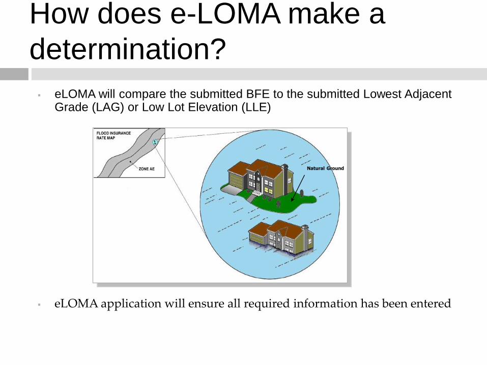
How does e-LOMA make a
determination?
eLOMA will compare the submitted BFE to the submitted Lowest Adjacent Grade (LAG) or Low Lot Elevation (LLE)
eLOMA application will ensure all required information has been entered
Natural Ground
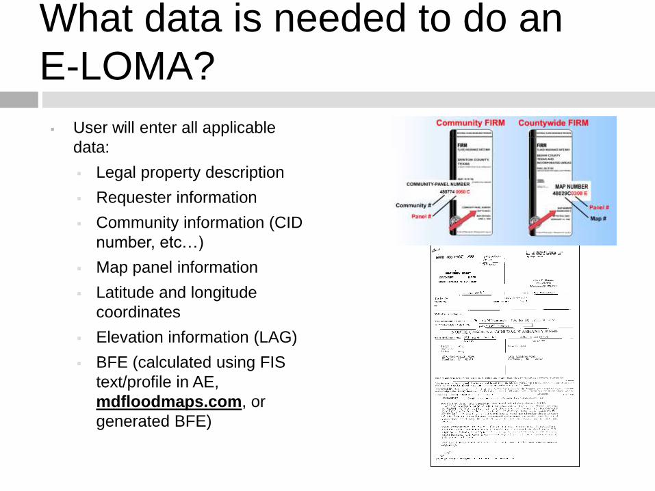
What data is needed to do an
E-LOMA?
User will enter all applicable
data:
Legal property description
Requester information
Community information (CID
number, etc…)
Map panel information
Latitude and longitude
coordinates
Elevation information (LAG)
BFE (calculated using FIS
text/profile in AE,
mdfloodmaps.com, or
generated BFE)
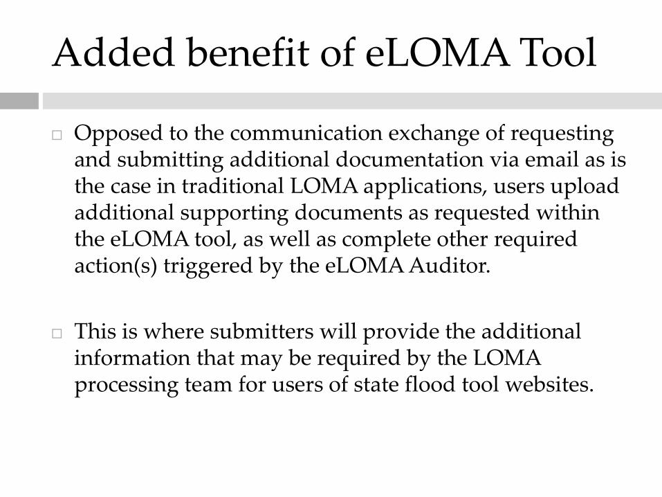
Added benefit of eLOMA Tool
Opposed to the communication exchange of requesting and submitting additional documentation via email as is the case in traditional LOMA applications, users upload additional supporting documents as requested within the eLOMA tool, as well as complete other required action(s) triggered by the eLOMA Auditor.
This is where submitters will provide the additional information that may be required by the LOMA processing team for users of state flood tool websites.
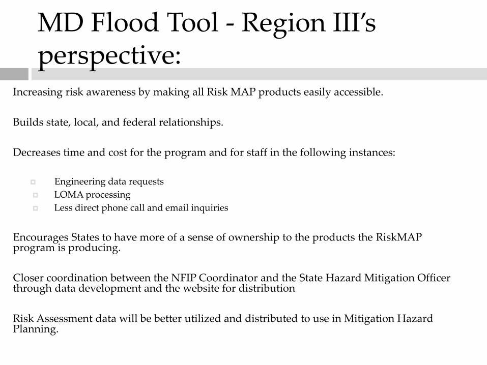
MD Flood Tool - Region III’s perspective:
Increasing risk awareness by making all Risk MAP products easily accessible.
Builds state, local, and federal relationships.
Decreases time and cost for the program and for staff in the following instances:
Engineering data requests
LOMA processing
Less direct phone call and email inquiries
Encourages States to have more of a sense of ownership to the products the RiskMAPprogram is producing.
Closer coordination between the NFIP Coordinator and the State Hazard Mitigation Officer through data development and the website for distribution
Risk Assessment data will be better utilized and distributed to use in Mitigation Hazard Planning.
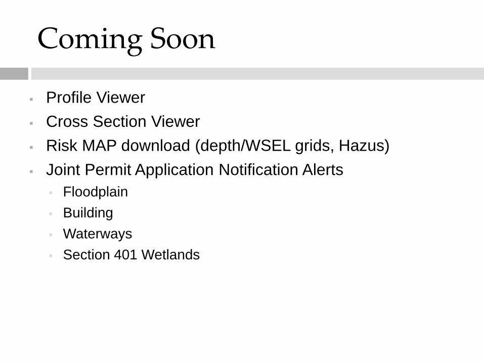
Coming Soon
Profile Viewer
Cross Section Viewer
Risk MAP download (depth/WSEL grids, Hazus)
Joint Permit Application Notification Alerts
Floodplain
Building
Waterways
Section 401 Wetlands
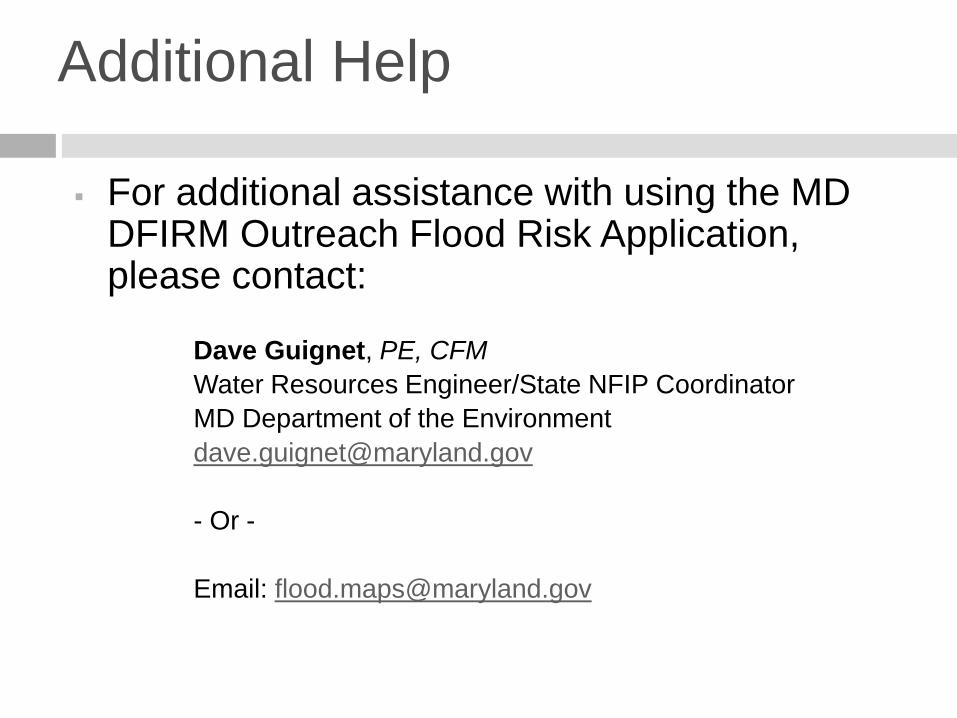
Additional Help
For additional assistance with using the MD DFIRM Outreach Flood Risk Application, please contact:
Dave Guignet, PE, CFM
Water Resources Engineer/State NFIP Coordinator
MD Department of the Environment
- Or -
Email: [email protected]
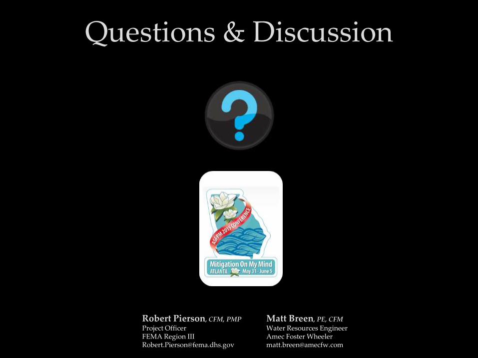
Questions & Discussion
Robert Pierson, CFM, PMP
Project OfficerFEMA Region [email protected]
Matt Breen, PE, CFM
Water Resources EngineerAmec Foster [email protected]


![[P970]Download Tool Guide ExternalMode Ver 1.2 20110221](https://img.pdfslide.net/doc/110x75/5454b981b1af9fa34d8b48cc/p970download-tool-guide-externalmode-ver-12-20110221.jpg)