Embed Size (px)
Citation preview

Data Merging and GIS IntegrationData Merging and GIS Integration
Analysis and applications of remote sensing imagery
Instructor: Dr. Cheng-Chien Liu
Department of Earth Sciences
National Cheng Kung University
Last updated: April 18, 2023
ChapterChapter
IntroductionIntroduction
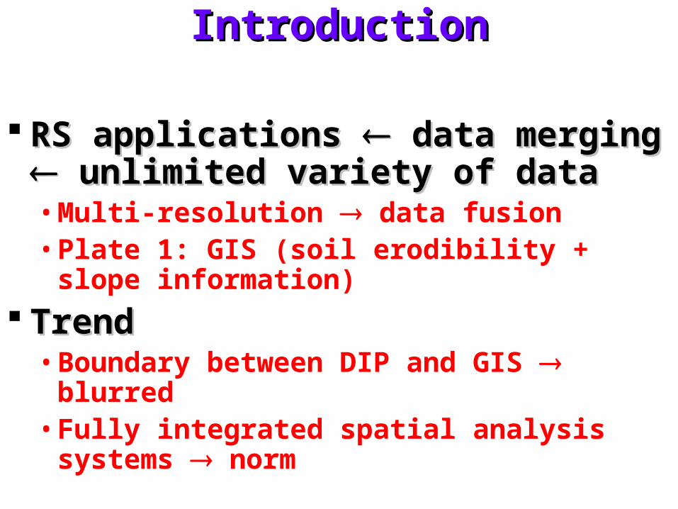
RS applications RS applications data merging data merging unlimited variety of dataunlimited variety of data• Multi-resolution data fusion• Plate 1: GIS (soil erodibility + slope
information)
TrendTrend• Boundary between DIP and GIS blurred• Fully integrated spatial analysis systems
norm

Multi-temporal data mergingMulti-temporal data merging
Same area but different dates Same area but different dates composites composites visual interpretationvisual interpretation• e.g. agricultural crop• Plate 31(a): mapping invasive plant species
NDVI from Landsat-7 ETM+ March 7 blue April 24 green October 15 red
GIS-derived wetland boundary eliminate the interpretation of false positive areas
• Plate 31(b): mapping of algae bloom• Enhance the automated land cover classification
Register all spectral bands from all dates into one master data set More data for classification Principal components analysis reduce the dimensionality manipulate, store, classify, …
• Multi-temporal profileFig 7.54: greenness. (tp, , Gm, G0)

Change detection proceduresChange detection procedures
Change detectionChange detection• Types of interest
Short term phenomena: e.g. snow cover, floodwaterLong tern phenomena: e.g. urban fringe development, desertification
• Ideal conditionsSame sensor, spatial resolution, viewing geometry, time of day
An ideal orbit: ROCSAT-2 Anniversary dates Accurate spatial registration
• Environmental factorsLake level, tidal stage, wind, soil moisture condition, …

Change detection procedures (cont.)Change detection procedures (cont.)
ApproachApproach• Post-classification comparison
Independent classification and registrationChange with dates
• Classification of multi-temporal data setsA single classification is performed on a combined data setsGreat dimensionality and complexity redundancy
• Principal components analysisTwo or more images one multiband imageUncorrelated principal components areas of changeDifficult to interpret or identify the changePlate 32: (a) before (b) after (c) principal component image

Change detection procedures (cont.)Change detection procedures (cont.)
Approach (cont.)Approach (cont.)• Temporal image differencing
One image is subtracted from the otherChange-no change thresholdAdd a constant to each difference image for display purpose
• Temporal image ratioingOne image is divided by the otherChange-no change thresholdNo change area ratio 1
• Change vector analysisFig 7.55
• Change-versus-no-change binary maskTraditional classification of time 1 imageTwo-band (one from time 1 and the other from time 2) algebraic
operation threshold binary mask apply to time 2 image

Change detection procedures (cont.)Change detection procedures (cont.)
Approach (cont.)Approach (cont.)• Delta transformation
Fig 7.56 (a): no spectral change between two dates (b): natural variability in the landscape between dates (c): effect of uniform atmospheric haze differences between dates (d): effect of sensor drift between dates (e): brighter or darker pixels indicate land cover change (f): delta transformation
Fig 7.57: application of delta transformation to Landsat TM images of forest

Multisensor image mergingMultisensor image merging
Multi-sensor image mergingMulti-sensor image merging• Plate 33: IHS multisensor image merger of
SPOT HRV, landsat TM and digital orthophoto data
Multi-spectral scanner + radar image Multi-spectral scanner + radar image datadata
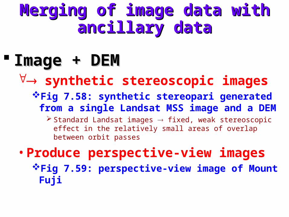
Merging of image data with ancillary Merging of image data with ancillary datadata
Image + DEM Image + DEM synthetic stereoscopic images
Fig 7.58: synthetic stereopari generated from a single Landsat MSS image and a DEM
Standard Landsat images fixed, weak stereoscopic effect in the relatively small areas of overlap between orbit passes
• Produce perspective-view imagesFig 7.59: perspective-view image of Mount Fuji

Incorporating GIS data in automated Incorporating GIS data in automated land cover classificationland cover classification
Useful GIS data (ancillary data)Useful GIS data (ancillary data)• Soil types, census statistics, ownership
boundaries, zoning districts, …
Geographic stratificationGeographic stratification• Ancillary data geographic stratification
classification• Basis of stratification
Single variable: upland wetland, urban ruralFactors: landscape units or ecoregions that combine several
interrelated variables (e.g. local climate, soil type, vegetation, landform)

Incorporating GIS data in automated Incorporating GIS data in automated land cover classification (cont.)land cover classification (cont.)
Multi-source image classification Multi-source image classification decision rules (user-defined)decision rules (user-defined)• Plate 34: a composite land cover classification
A supervised classification of TM image in early MayA supervised classification of TM image in late JuneA supervised classification of both dates combined using a
PCAA wetlands GIS layerA road DLG (digital line graph)
• Table 7.5: basis for sample decision rules
Incorporating GIS data in automated Incorporating GIS data in automated land cover classification (cont.)land cover classification (cont.)
Artificial neural networksArtificial neural networks