Embed Size (px)
Citation preview
Join us on Twitter: #AU2013
Data Synchronization: Autodesk® AutoCAD® Map
3D Enterprise, FME®, and ESRI® ArcGIS®
Drew Burgasser, P.E. Vice-President, CAD Masters, Inc.

Sacramento Area Sewer District (SASD) chose AutoCAD® Map 3D
Enterprise software industry models as the front-end GIS application for
creating and editing sewer assets. SASD needed a synchronization
solution so that the SASD enterprise GIS (ArcGIS®) could be updated
accordingly. The long-transaction functionality (jobs) in AutoCAD® Map
3D Enterprise industry models provides a framework where inserted,
edited, and deleted features can easily be queried for synchronization.
In this roundtable session, we discuss how to use AutoCAD® Map 3D
jobs in conjunction with FME® data conversion software to synchronize
ESRI® ArcGIS®.
Class summary
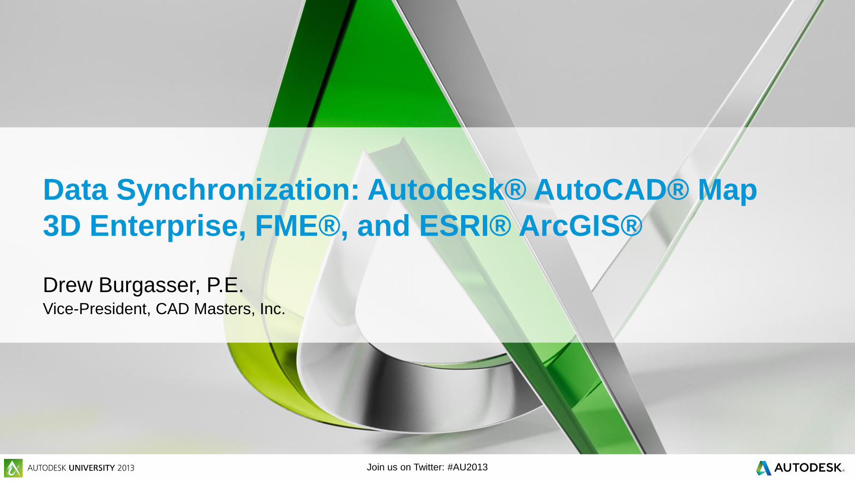
At the end of this class, you will be able to:
Identify the database tables used in an AutoCAD® Map 3D
Enterprise industry model to work with jobs.
Customize job states to provide a synchronization state.
Query inserts, edits, and deletes in an AutoCAD® Map 3D
Enterprise industry model job.
Explain how FME® data conversion software can be used in
conjunction with Map 3D jobs to update ESRI® ArcGIS®.
Key learning objectives
Introduction
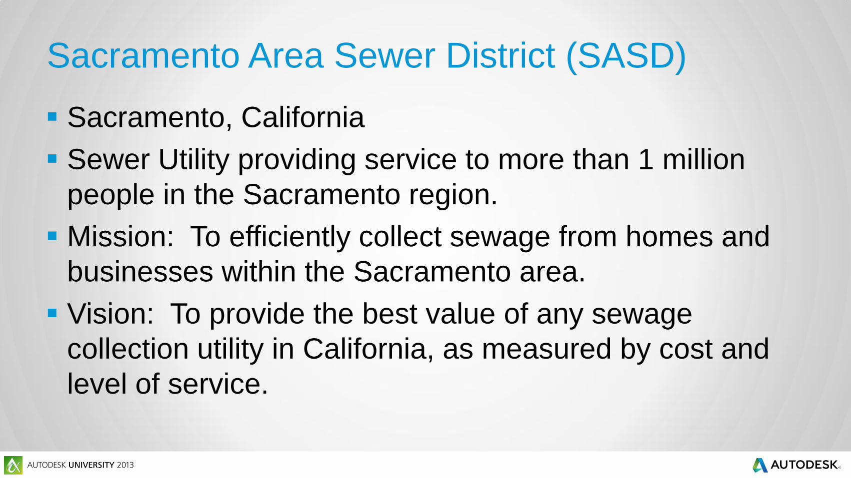
Sacramento Area Sewer District (SASD)
Sacramento, California
Sewer Utility providing service to more than 1 million
people in the Sacramento region.
Mission: To efficiently collect sewage from homes and
businesses within the Sacramento area.
Vision: To provide the best value of any sewage
collection utility in California, as measured by cost and
level of service.
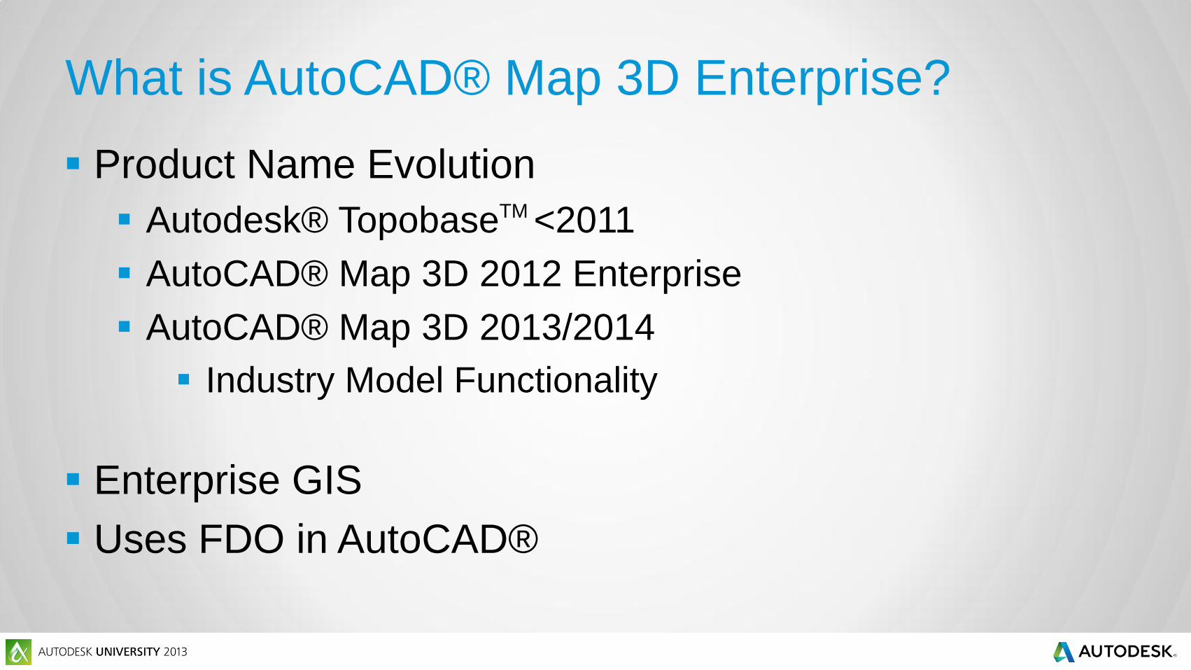
What is AutoCAD® Map 3D Enterprise?
Product Name Evolution
Autodesk® TopobaseTM <2011
AutoCAD® Map 3D 2012 Enterprise
AutoCAD® Map 3D 2013/2014
Industry Model Functionality
Enterprise GIS
Uses FDO in AutoCAD®
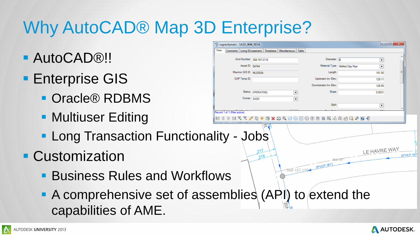
Why AutoCAD® Map 3D Enterprise?
AutoCAD®!!
Enterprise GIS
Oracle® RDBMS
Multiuser Editing
Long Transaction Functionality - Jobs
Customization
Business Rules and Workflows
A comprehensive set of assemblies (API) to extend the
capabilities of AME.

Pre-Existing ESRI® ArcGIS®
ArcSDE® (Spatial Database Engine) on SQL Server
Enterprise Solution
AutoCAD® Map 3D is not a replacement, rather a
supplement
Used to view and query assets
“Talks to” Maximo Asset Management

The Challenge
ArcGIS® must be synchronized with AutoCAD® Map 3D
Inserts, Updates, and Deletes completed in
AutoCAD® Map 3D need to be copied to ArcGIS®.
Geometry and Attribute Values.

AutoCAD Map 3D Enterprise Jobs
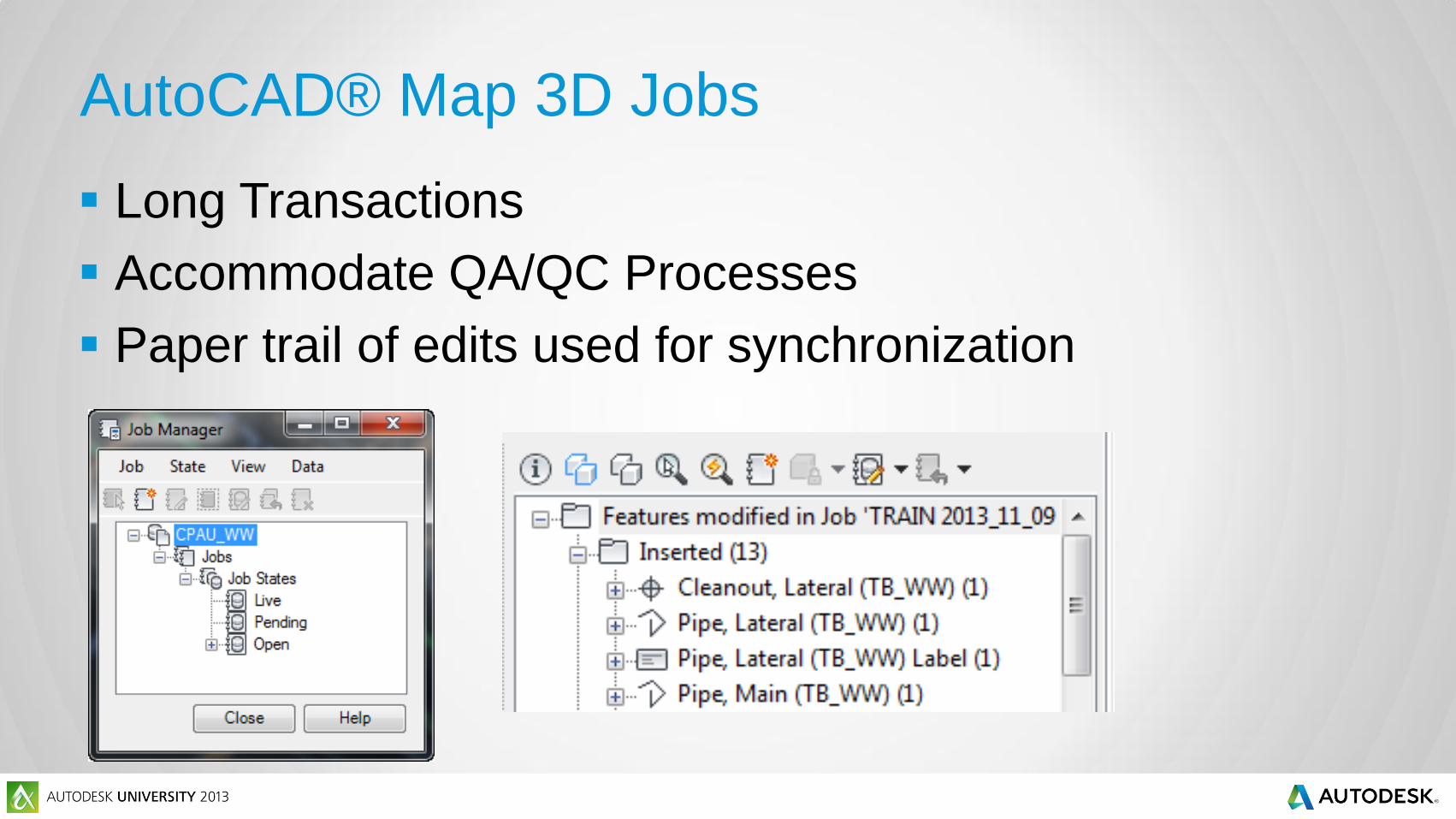
AutoCAD® Map 3D Jobs
Long Transactions
Accommodate QA/QC Processes
Paper trail of edits used for synchronization
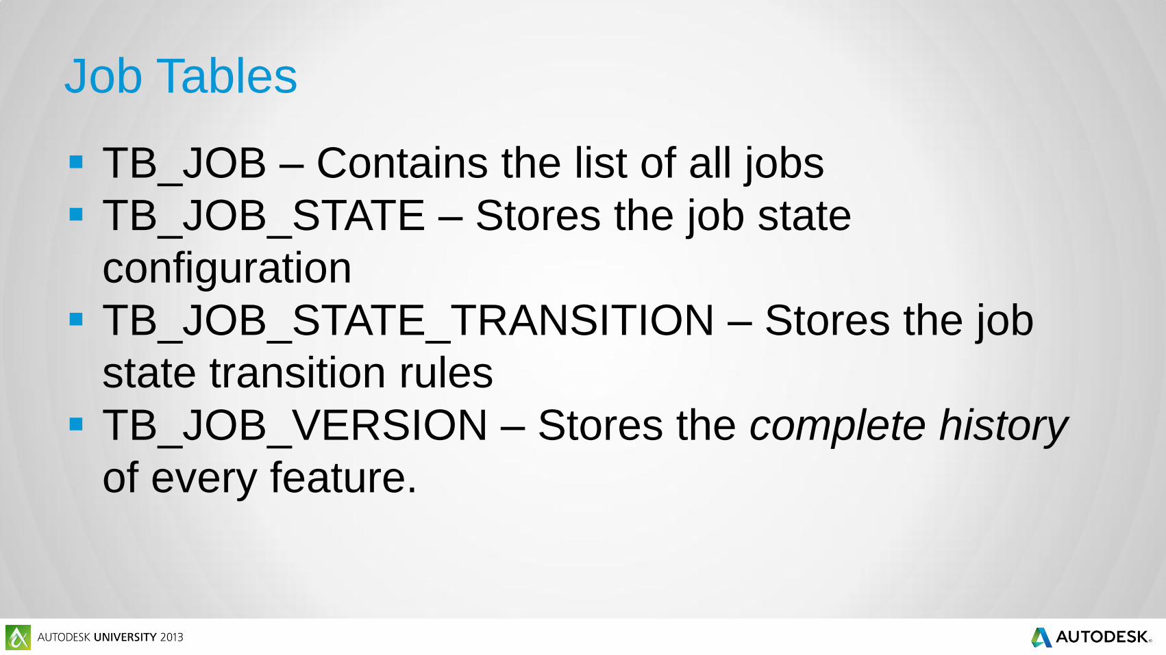
Job Tables
TB_JOB – Contains the list of all jobs
TB_JOB_STATE – Stores the job state
configuration
TB_JOB_STATE_TRANSITION – Stores the job
state transition rules
TB_JOB_VERSION – Stores the complete history
of every feature.
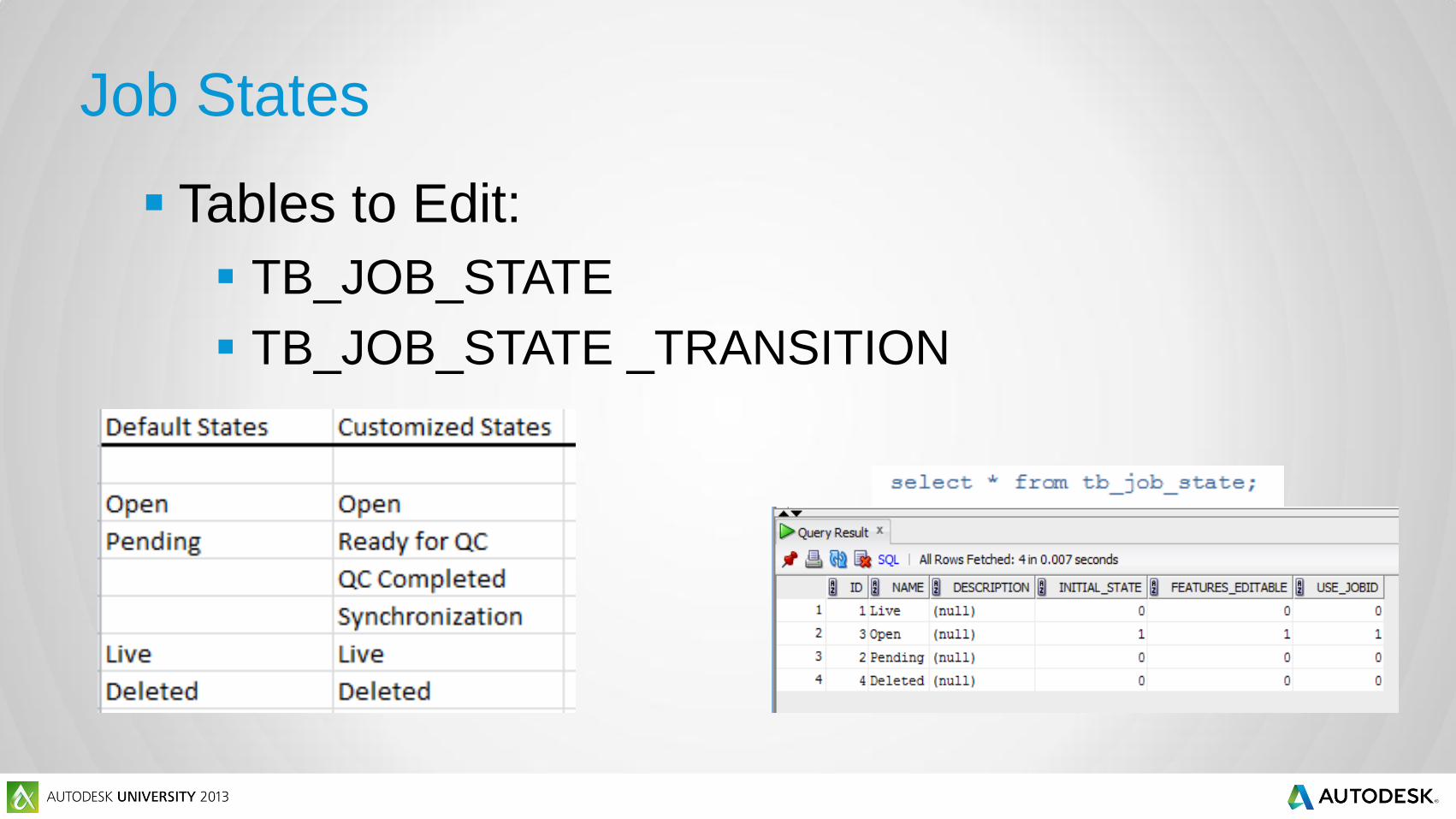
Job States
Tables to Edit:
TB_JOB_STATE
TB_JOB_STATE _TRANSITION
Using Job Tables to Query Inserts,
Updates, and Deletes
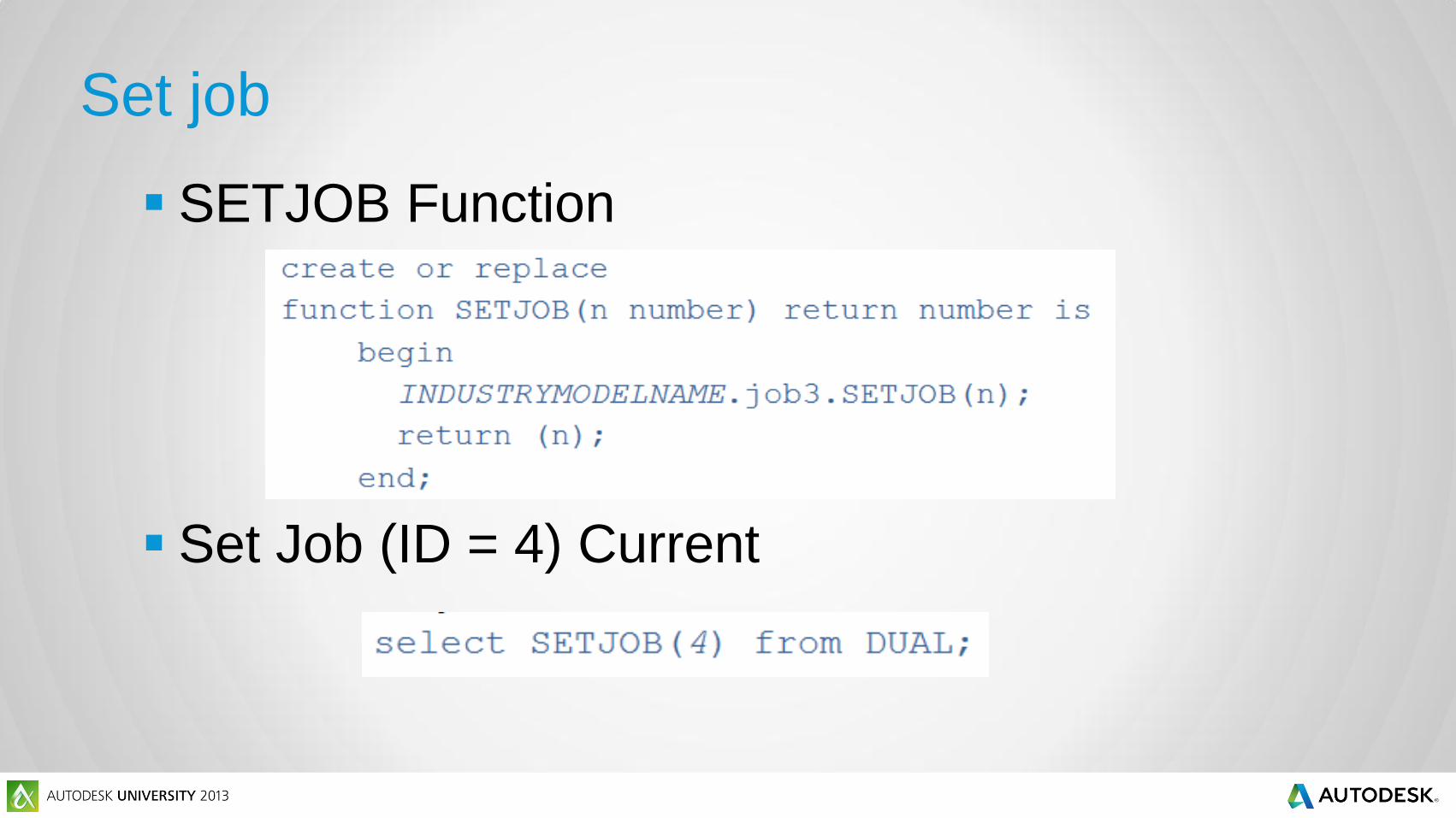
Set job
SETJOB Function
Set Job (ID = 4) Current
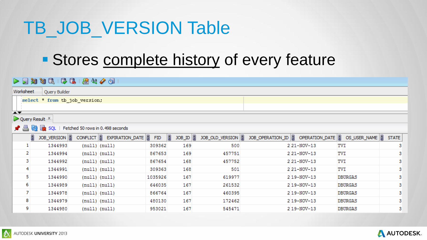
TB_JOB_VERSION Table
Stores complete history of every feature

Queries
Query Inserted Features
Query Updated Features
Using FME® for Synchronization
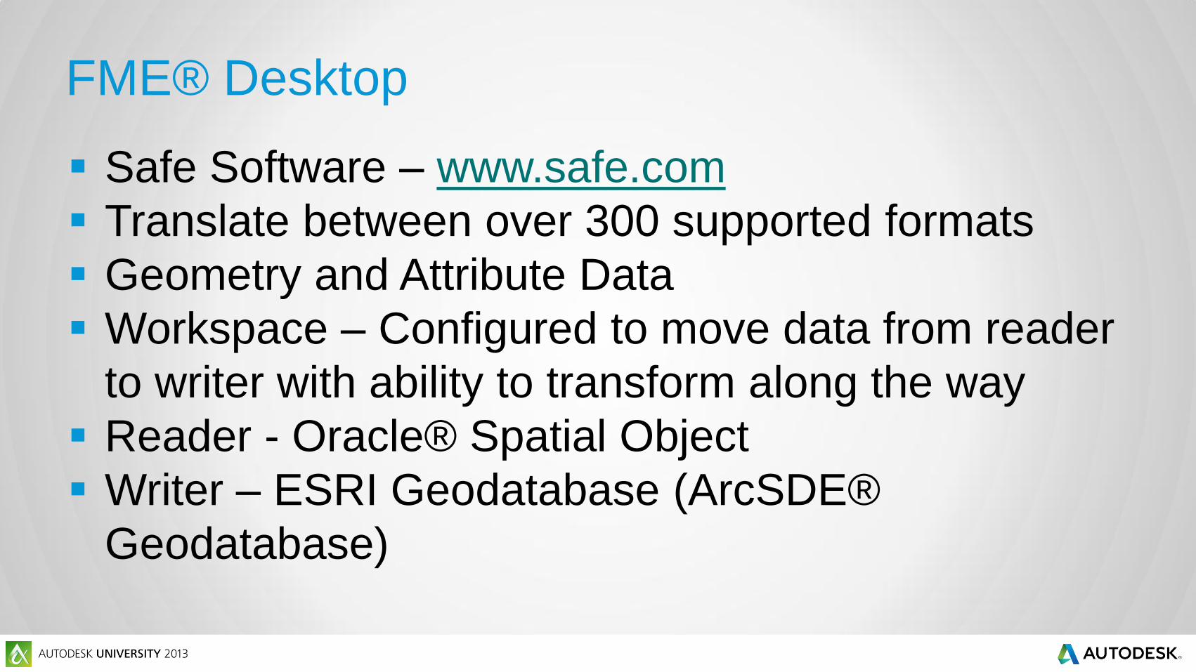
FME® Desktop
Safe Software – www.safe.com
Translate between over 300 supported formats
Geometry and Attribute Data
Workspace – Configured to move data from reader
to writer with ability to transform along the way
Reader - Oracle® Spatial Object
Writer – ESRI Geodatabase (ArcSDE®
Geodatabase)
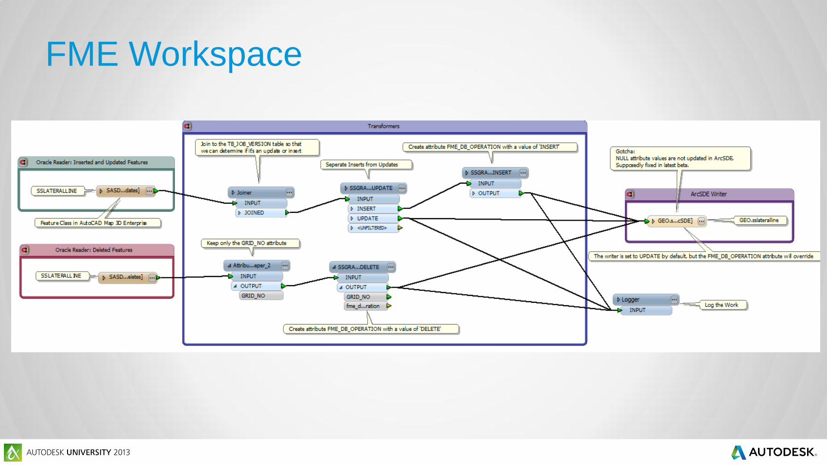
FME Workspace
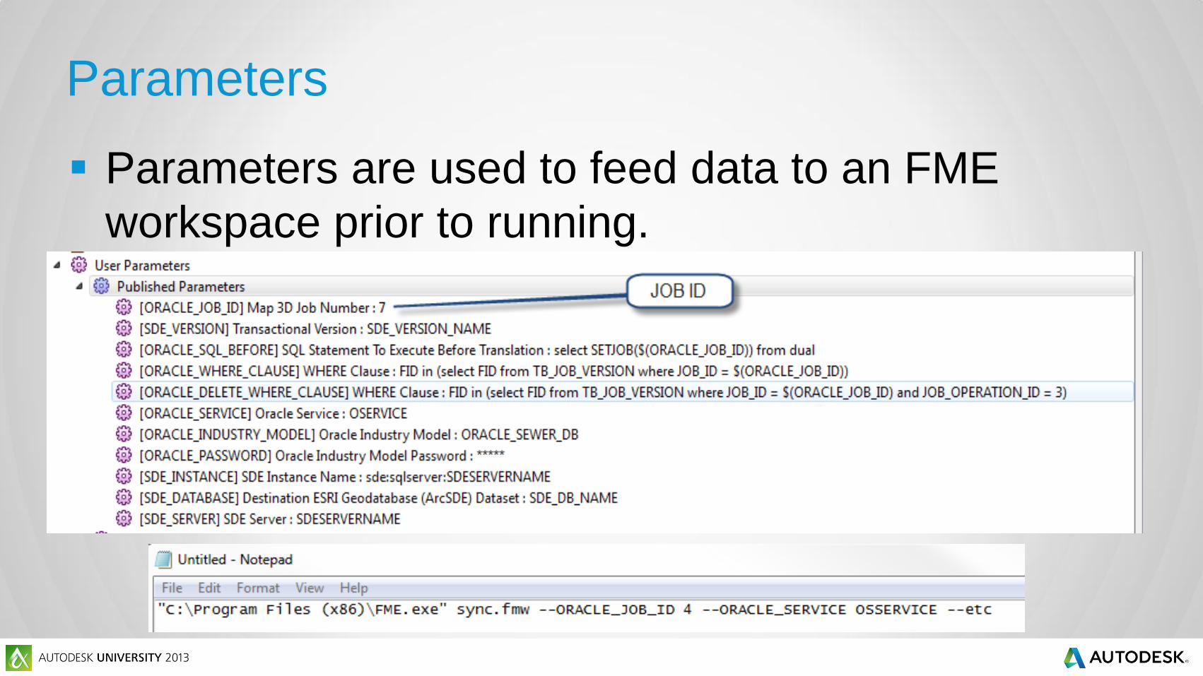
Parameters
Parameters are used to feed data to an FME
workspace prior to running.
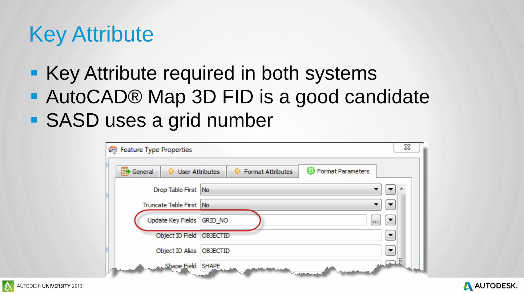
Key Attribute
Key Attribute required in both systems
AutoCAD® Map 3D FID is a good candidate
SASD uses a grid number
Conclusion
FME® Desktop can be used to translate data
between disparate data sources. For SASD, FME®
Desktop is used to synchronize ESRI® ArcSDE® with
AutoCAD® Map 3D Enterprise. Using the job tables
and queries discussed earlier, FME® can be
configured to read job edits and translate those edits
to ArcSDE.
Roundtable Topics
Disparate Data Issues
CAD vs. GIS
ArcGIS® for AutoCAD®
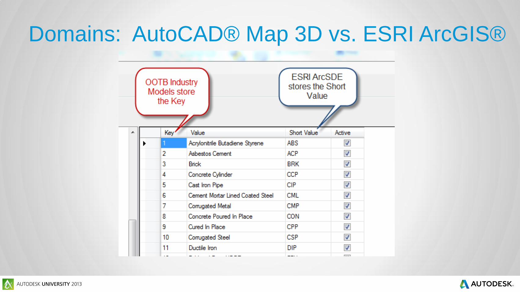
Domains: AutoCAD® Map 3D vs. ESRI ArcGIS®

Autodesk is a registered trademark of Autodesk, Inc., and/or its subsidiaries and/or affiliates in the USA and/or other countries. All other brand names, product names, or trademarks belong to their respective holders. Autodesk reserves the right to alter product and services offerings, and specifications and pricing at any time without notice, and is not responsible for typographical or graphical errors that may appear
in this document. © 2013 Autodesk, Inc. All rights reserved.