Embed Size (px)
Citation preview
U.S. Department of the Interior
U.S. Geological Survey
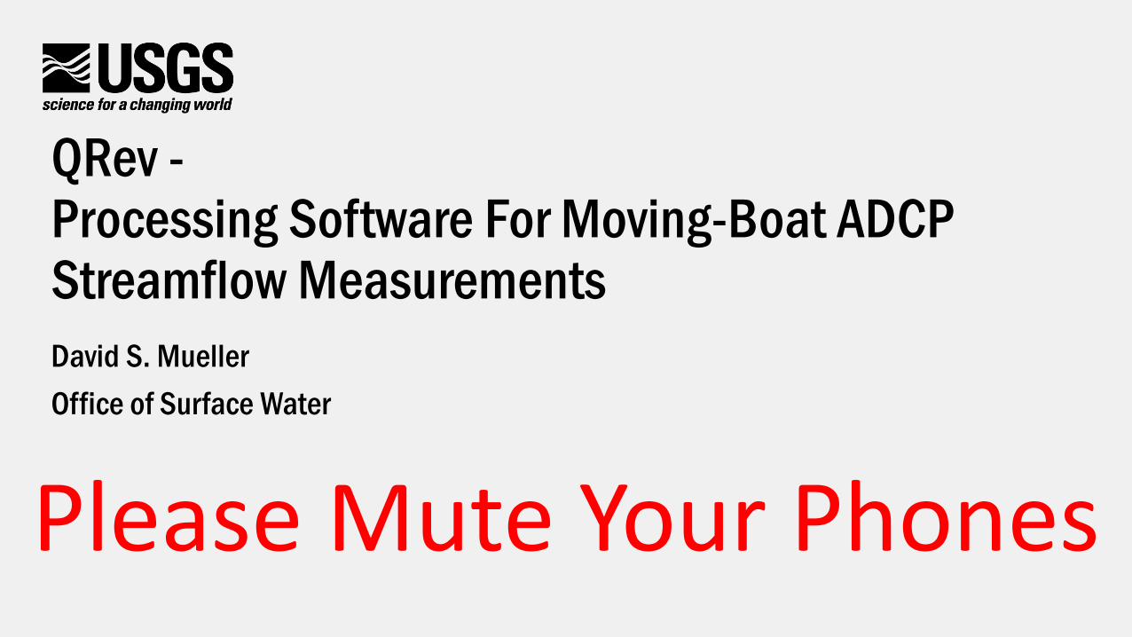
QRev -Processing Software For Moving-Boat ADCP Streamflow MeasurementsDavid S. MuellerOffice of Surface Water
Please Mute Your Phones
Overview
• QRev Goals• QRev Processing Approach• Recommended Workflow• QRev’s Graphical User Interface• QRev Features• Recommended Workflow• Requirements and Limitations
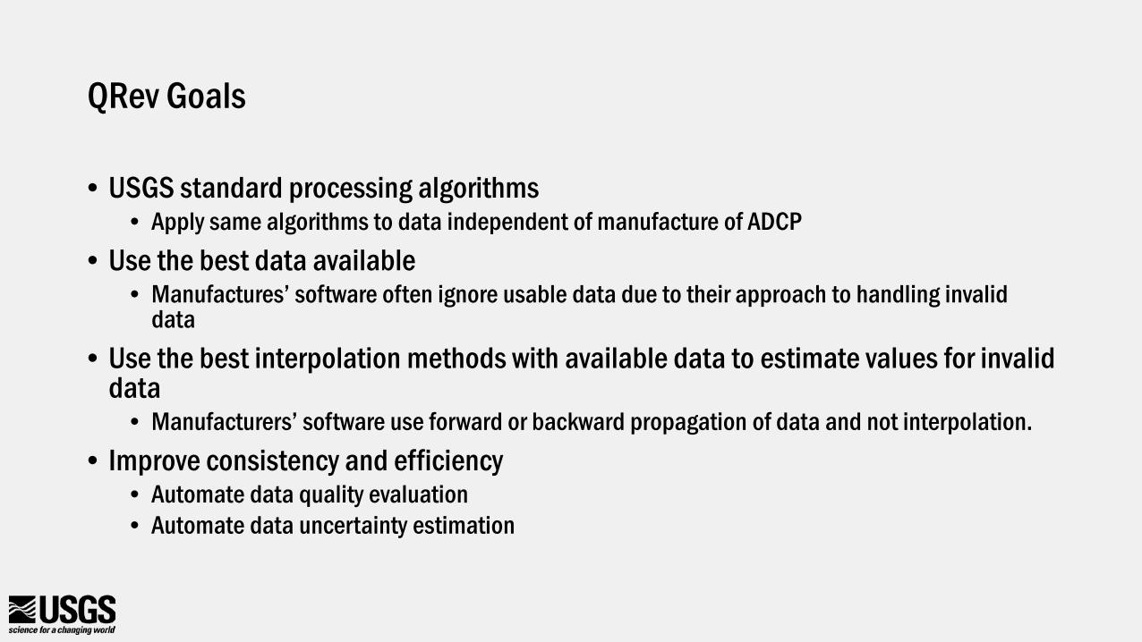
QRev Goals
• USGS standard processing algorithms• Apply same algorithms to data independent of manufacture of ADCP
• Use the best data available• Manufactures’ software often ignore usable data due to their approach to handling invalid
data• Use the best interpolation methods with available data to estimate values for invalid
data• Manufacturers’ software use forward or backward propagation of data and not interpolation.
• Improve consistency and efficiency• Automate data quality evaluation• Automate data uncertainty estimation
• Discharge• Water
velocity• Depth• Boat speed
• Water velocity• Depth• Boat speed
• Depth• Boat speed
• Bottom track
• GPS
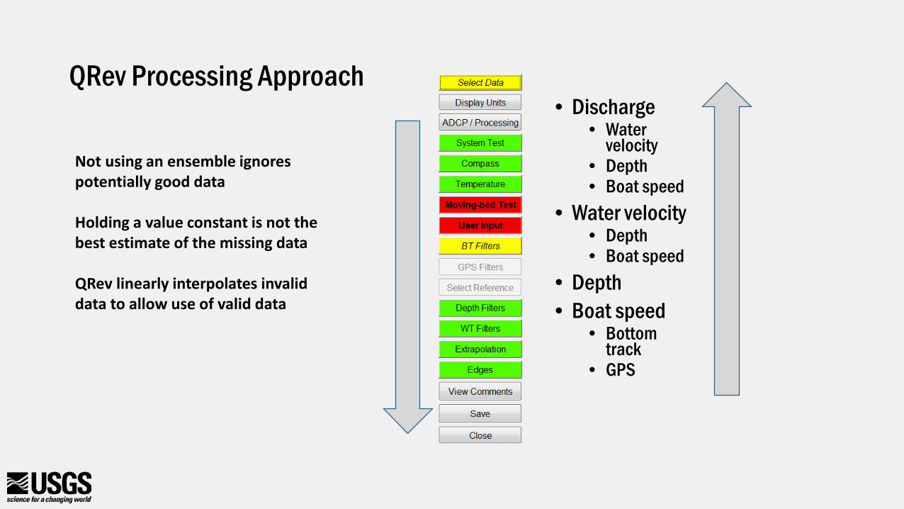
QRev Processing Approach
Not using an ensemble ignores potentially good data
Holding a value constant is not the best estimate of the missing data
QRev linearly interpolates invalid data to allow use of valid data

Workflow
• Collect data in field using manufacturer software• WinRiver II• RiverSurveyor Live• Use USGS procedures as before
• Postprocess data in field using QRev• For current versions of RSL you will need to reprocess the data in RSL to create the Matlab
files.• Once data are loaded into QRev the manufactures software should not longer be used for
processing.• Load data into SV Mobile
• *_QRev.xml• Office checking and review must be done in QRev using saved QRev file
• *_QRev.mat
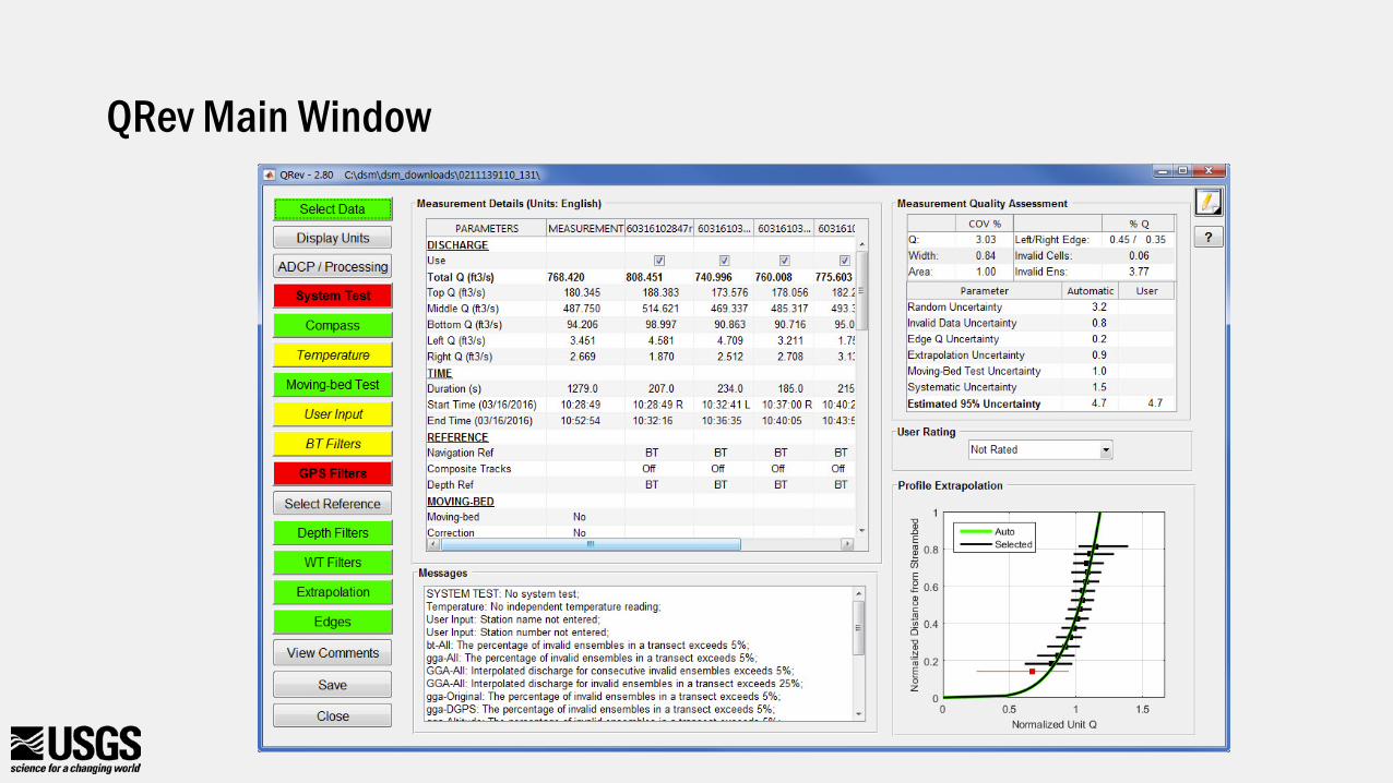
QRev Main Window
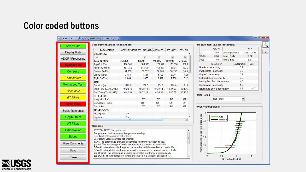
Color coded buttons
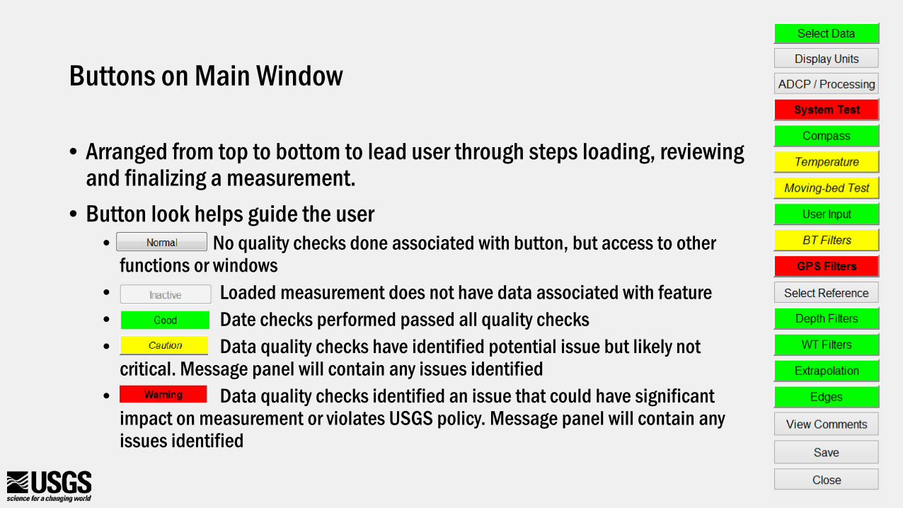
Buttons on Main Window
• Arranged from top to bottom to lead user through steps loading, reviewing and finalizing a measurement.
• Button look helps guide the user• No quality checks done associated with button, but access to other
functions or windows• Loaded measurement does not have data associated with feature• Date checks performed passed all quality checks• Data quality checks have identified potential issue but likely not
critical. Message panel will contain any issues identified• Data quality checks identified an issue that could have significant
impact on measurement or violates USGS policy. Message panel will contain any issues identified
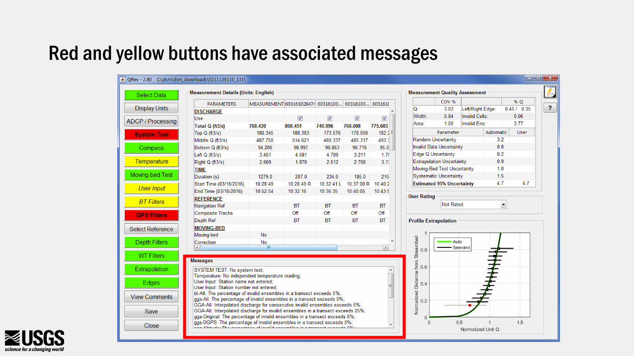
Red and yellow buttons have associated messages
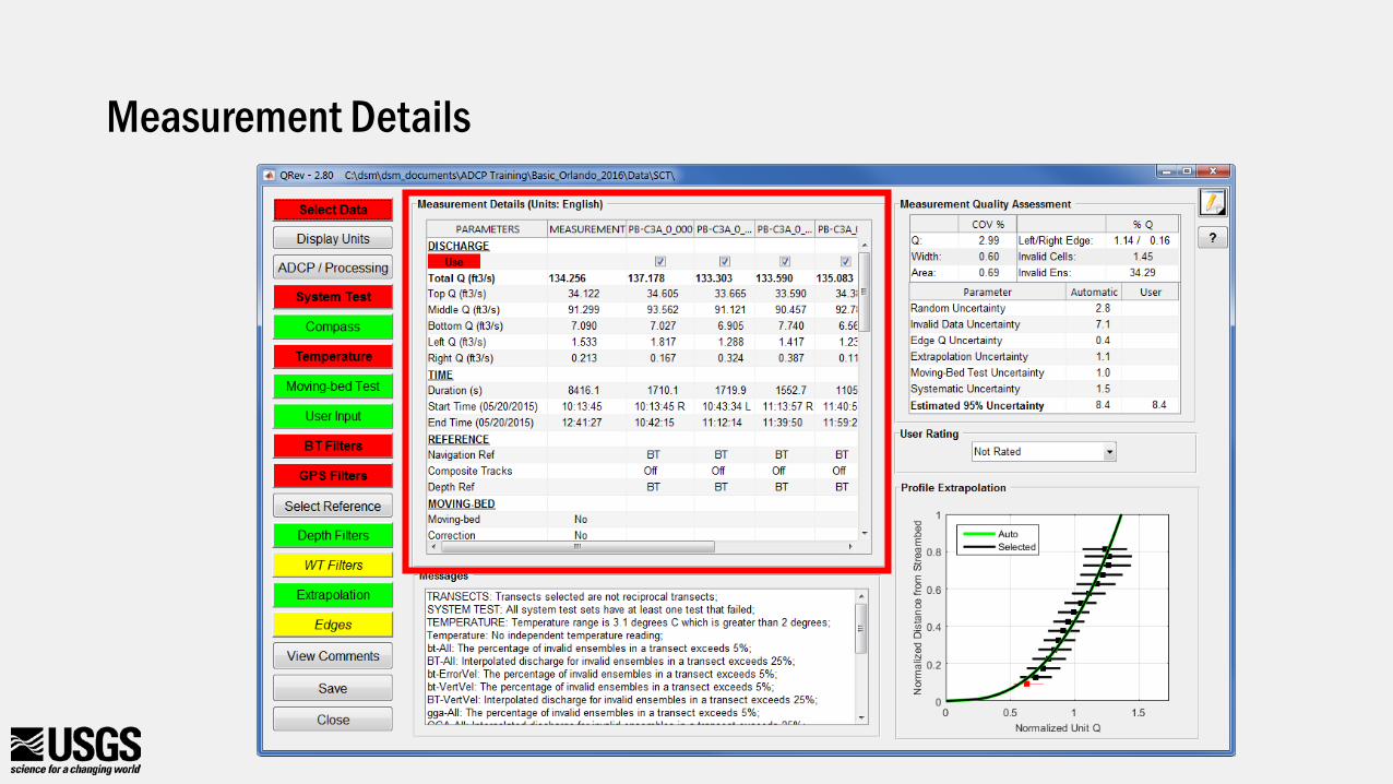
Measurement Details
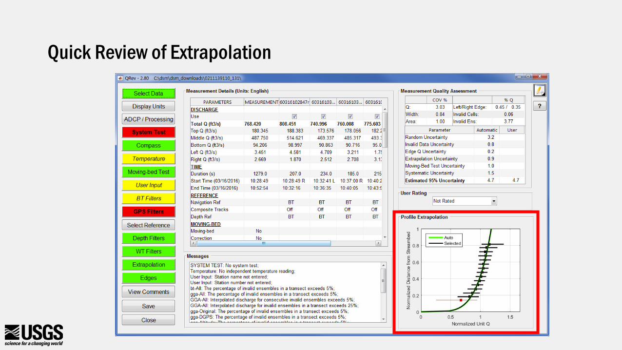
Quick Review of Extrapolation
Measurement Quality Assessment
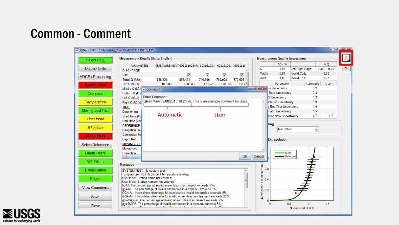
Common - Comment
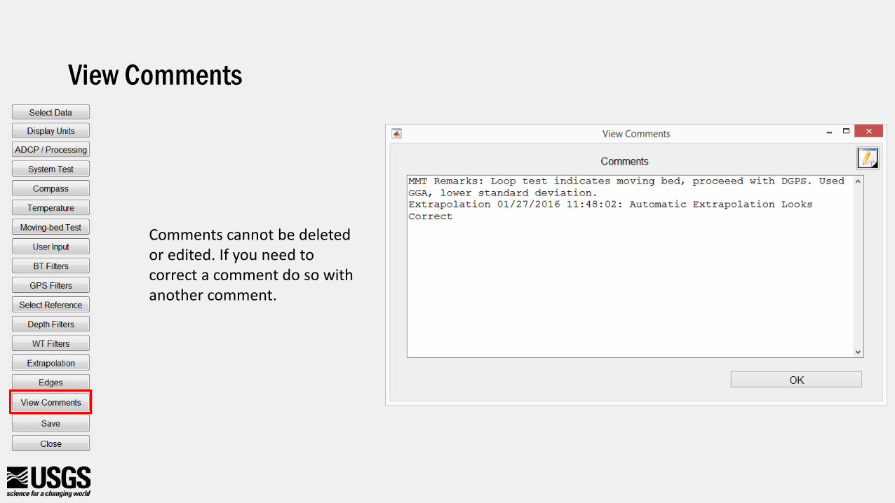
View Comments
Comments cannot be deleted or edited. If you need to correct a comment do so with another comment.
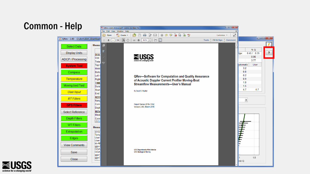
Common - Help
Common Features in QRev Windows
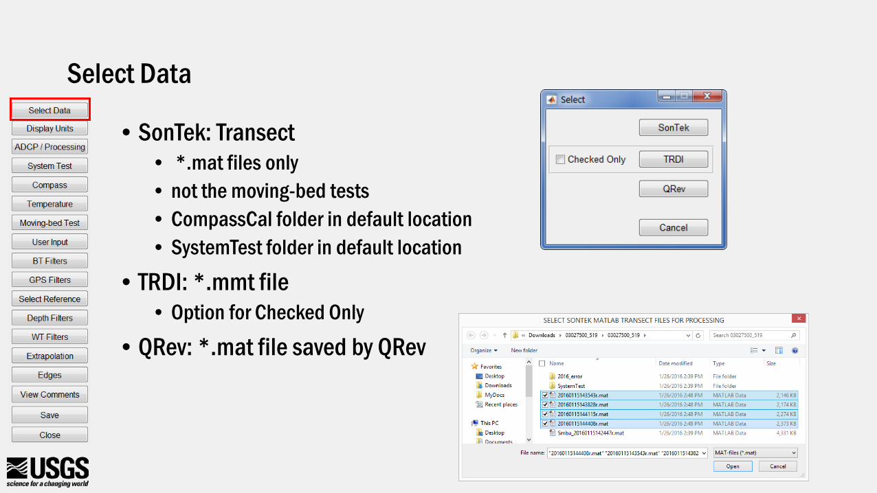
Select Data
• SonTek: Transect• *.mat files only• not the moving-bed tests• CompassCal folder in default location• SystemTest folder in default location
• TRDI: *.mmt file• Option for Checked Only
• QRev: *.mat file saved by QRev
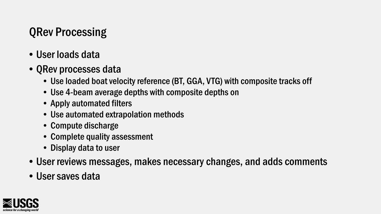
QRev Processing
• User loads data• QRev processes data
• Use loaded boat velocity reference (BT, GGA, VTG) with composite tracks off• Use 4-beam average depths with composite depths on• Apply automated filters• Use automated extrapolation methods• Compute discharge• Complete quality assessment• Display data to user
• User reviews messages, makes necessary changes, and adds comments• User saves data
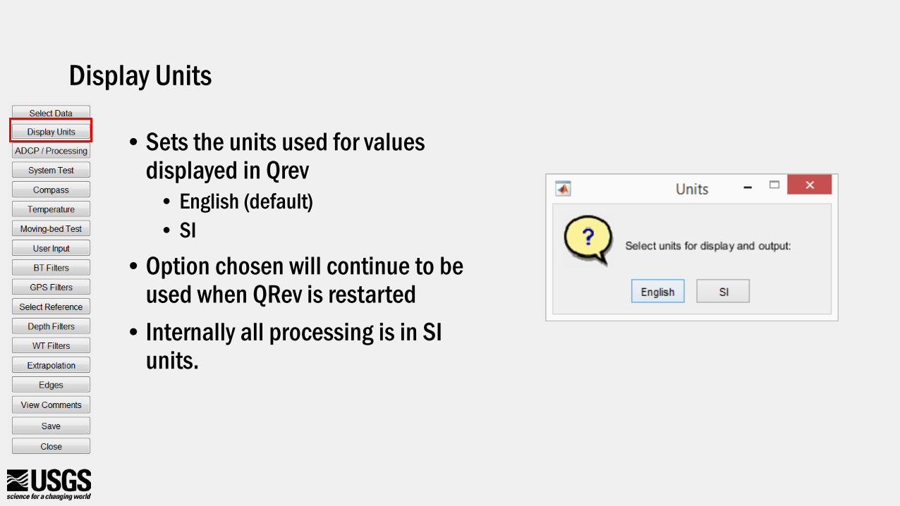
Display Units
• Sets the units used for values displayed in Qrev
• English (default)• SI
• Option chosen will continue to be used when QRev is restarted
• Internally all processing is in SI units.
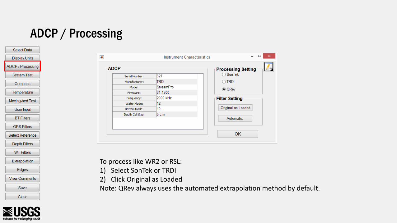
ADCP / Processing
To process like WR2 or RSL:1) Select SonTek or TRDI2) Click Original as LoadedNote: QRev always uses the automated extrapolation method by default.
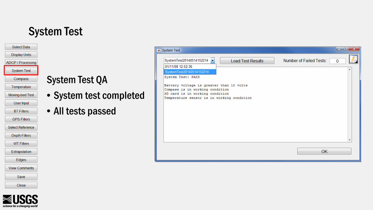
System Test QA• System test completed• All tests passed
System Test
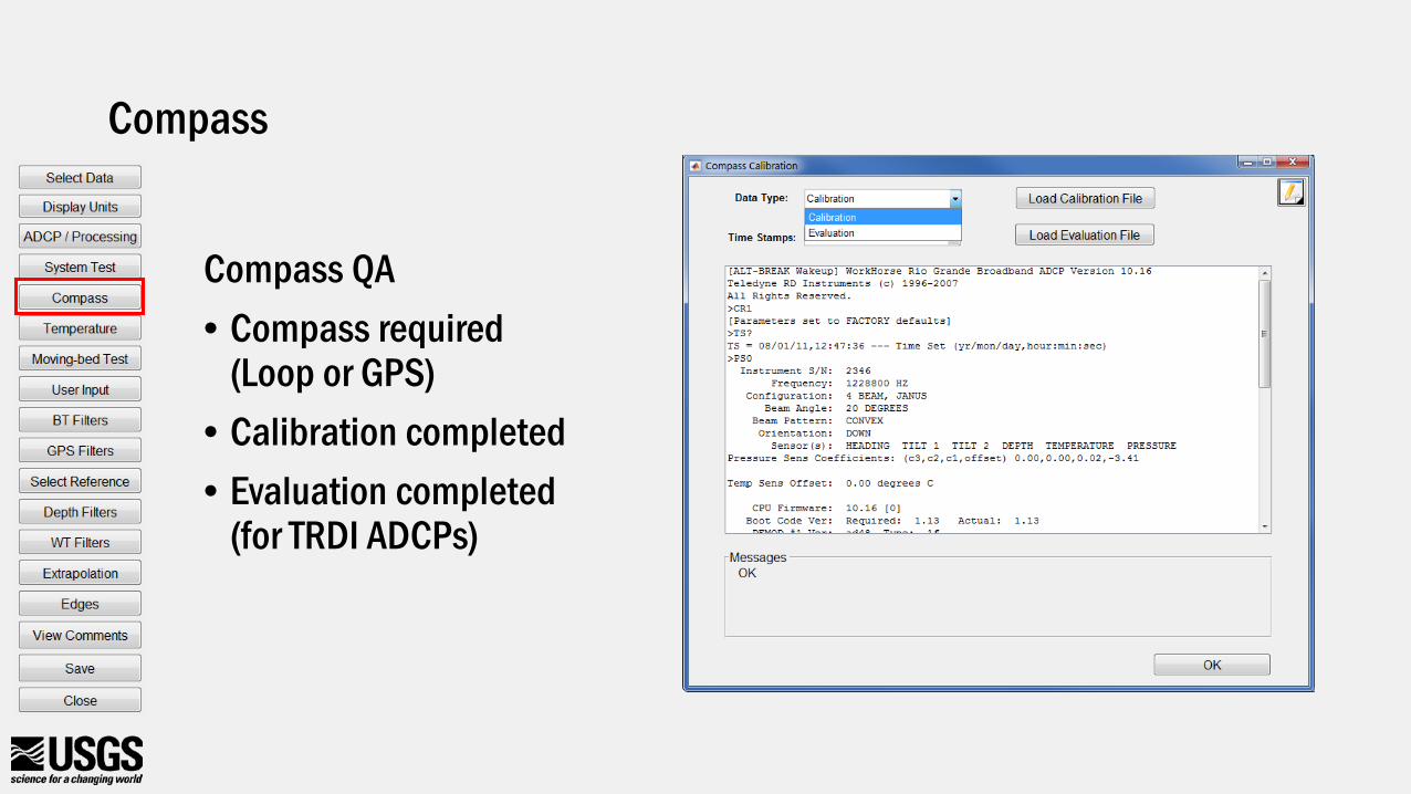
Compass QA• Compass required
(Loop or GPS)• Calibration completed• Evaluation completed
(for TRDI ADCPs)
Compass
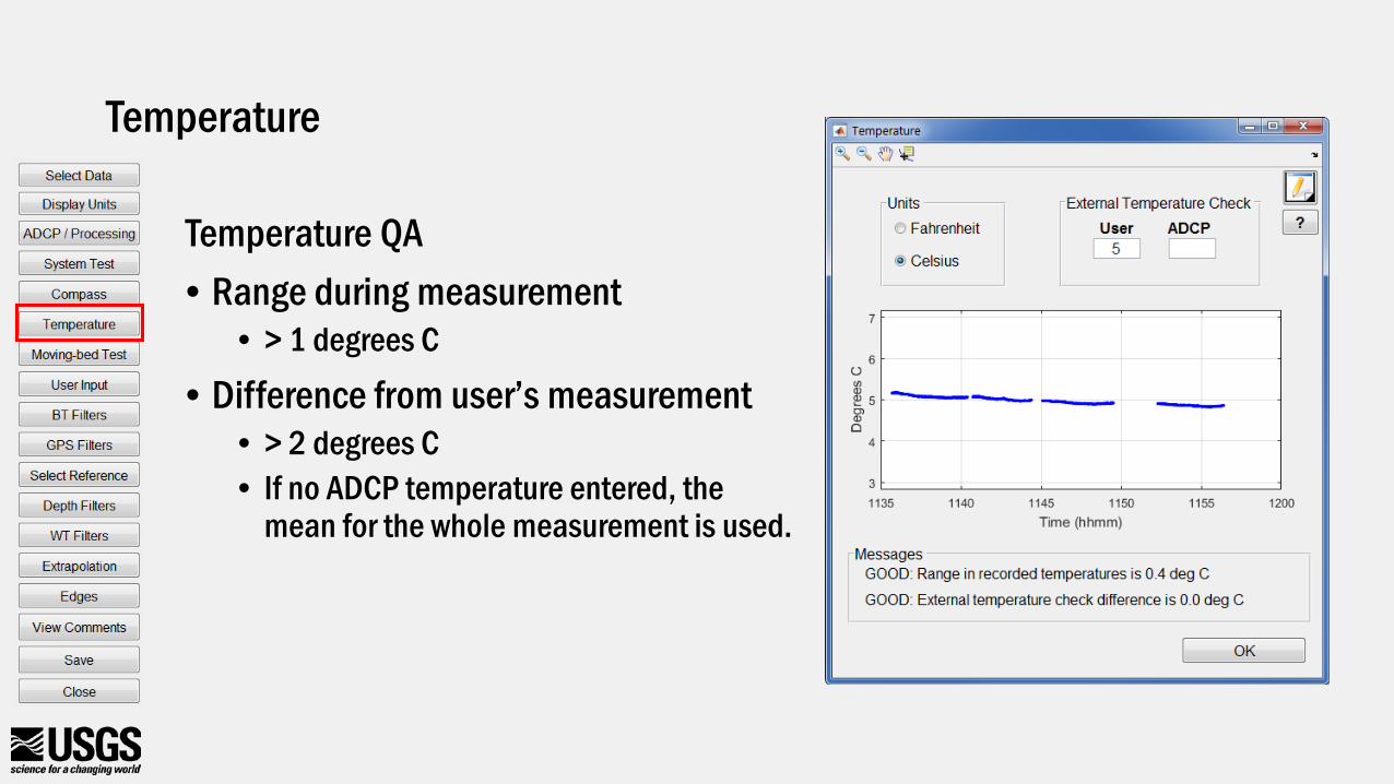
Temperature QA• Range during measurement
• > 1 degrees C
• Difference from user’s measurement• > 2 degrees C• If no ADCP temperature entered, the
mean for the whole measurement is used.
Temperature
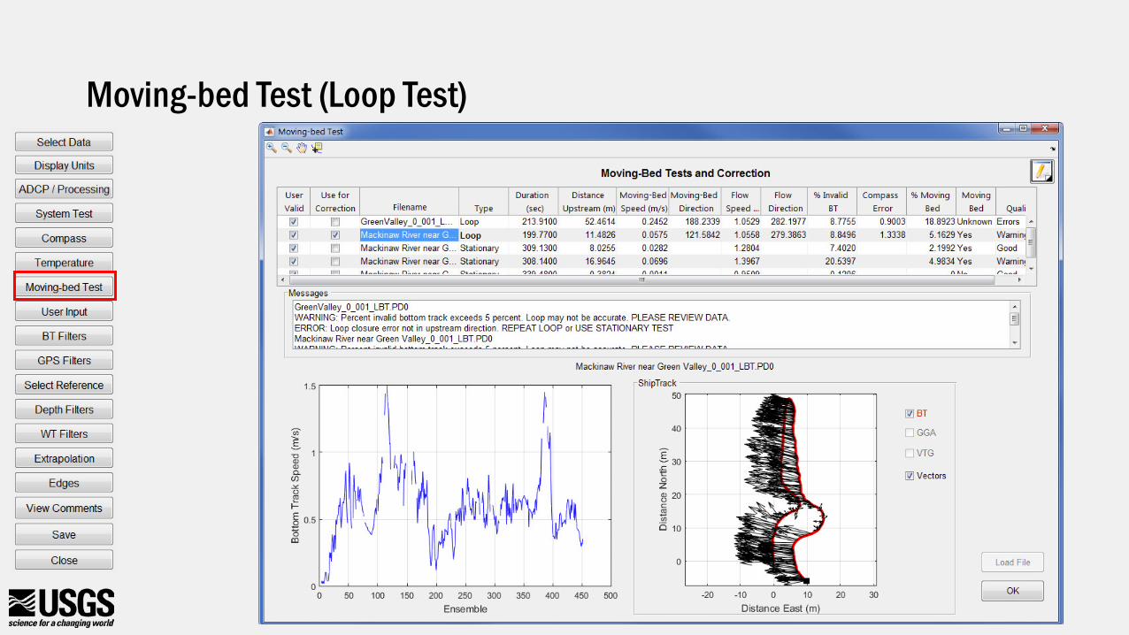
Moving-bed Test (Loop Test)
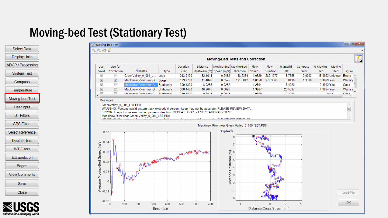
Moving-bed Test (Stationary Test)
Moving-bed Test Auto Selection for Multiple Tests
• Used to determine if there is a moving-bed• Used to correct for a moving-bed if applicable• Priority
• Last loop test which does not have critical errors• If not valid loop, all stationary tests that do not have critical errors
• QRev will not use a mix of loop and stationary tests
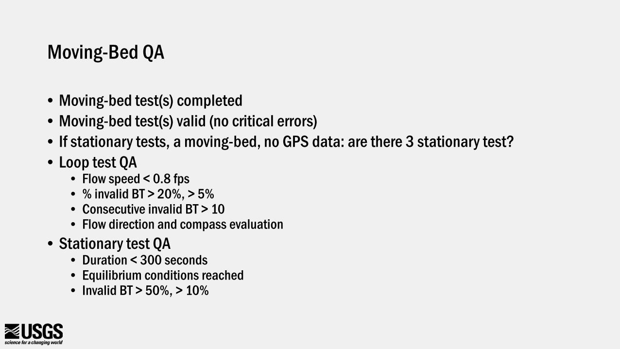
Moving-Bed QA
• Moving-bed test(s) completed• Moving-bed test(s) valid (no critical errors)• If stationary tests, a moving-bed, no GPS data: are there 3 stationary test?• Loop test QA
• Flow speed < 0.8 fps• % invalid BT > 20%, > 5%• Consecutive invalid BT > 10• Flow direction and compass evaluation
• Stationary test QA• Duration < 300 seconds• Equilibrium conditions reached• Invalid BT > 50%, > 10%
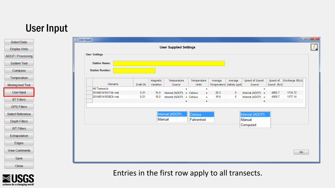
User Input
Entries in the first row apply to all transects.
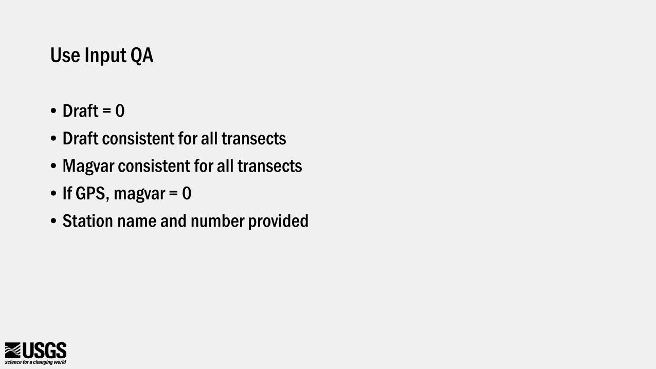
Use Input QA
• Draft = 0• Draft consistent for all transects• Magvar consistent for all transects• If GPS, magvar = 0• Station name and number provided
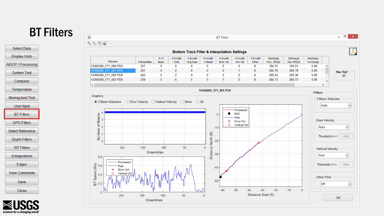
BT Filters
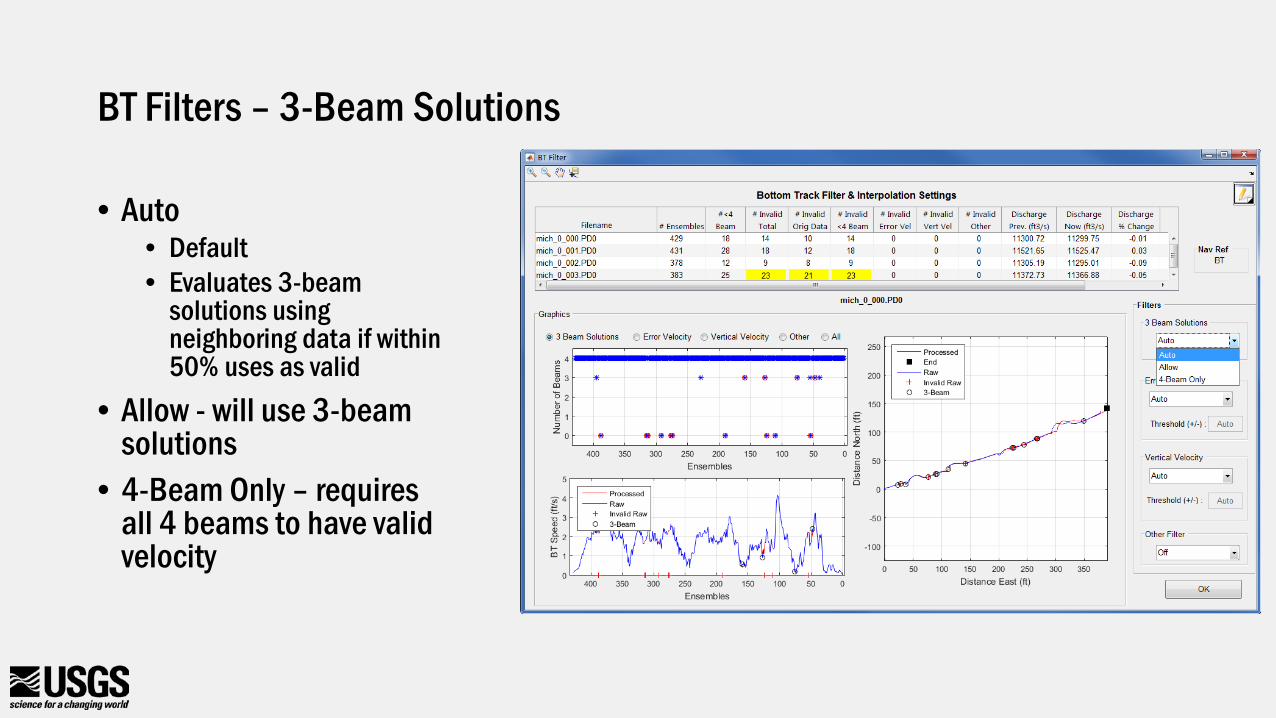
BT Filters – 3-Beam Solutions
• Auto• Default• Evaluates 3-beam
solutions using neighboring data if within 50% uses as valid
• Allow - will use 3-beam solutions
• 4-Beam Only – requires all 4 beams to have valid velocity
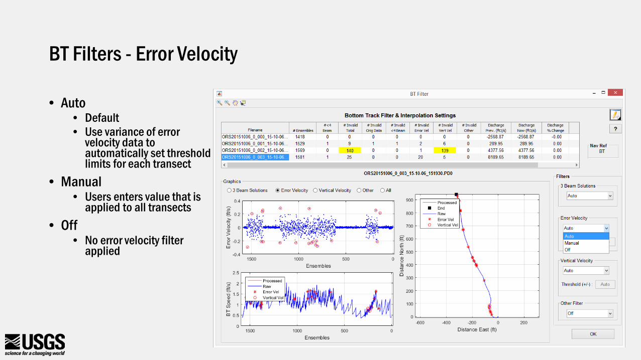
BT Filters - Error Velocity
• Auto• Default• Use variance of error
velocity data to automatically set threshold limits for each transect
• Manual• Users enters value that is
applied to all transects• Off
• No error velocity filter applied
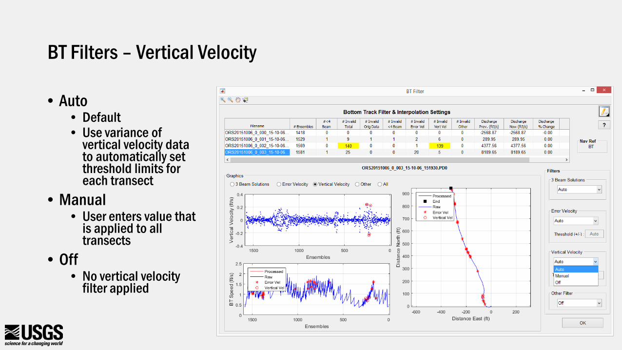
BT Filters – Vertical Velocity
• Auto• Default• Use variance of
vertical velocity data to automatically set threshold limits for each transect
• Manual• User enters value that
is applied to all transects
• Off• No vertical velocity
filter applied
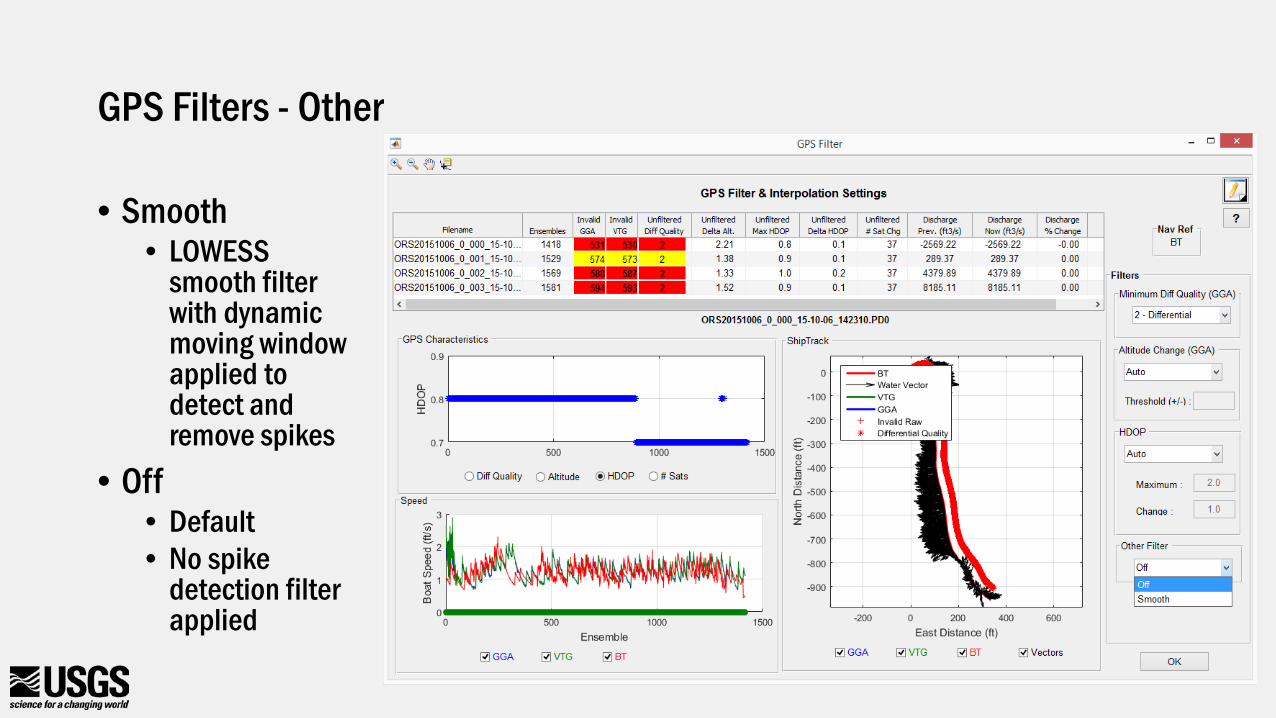
BT Filters – Other Filters
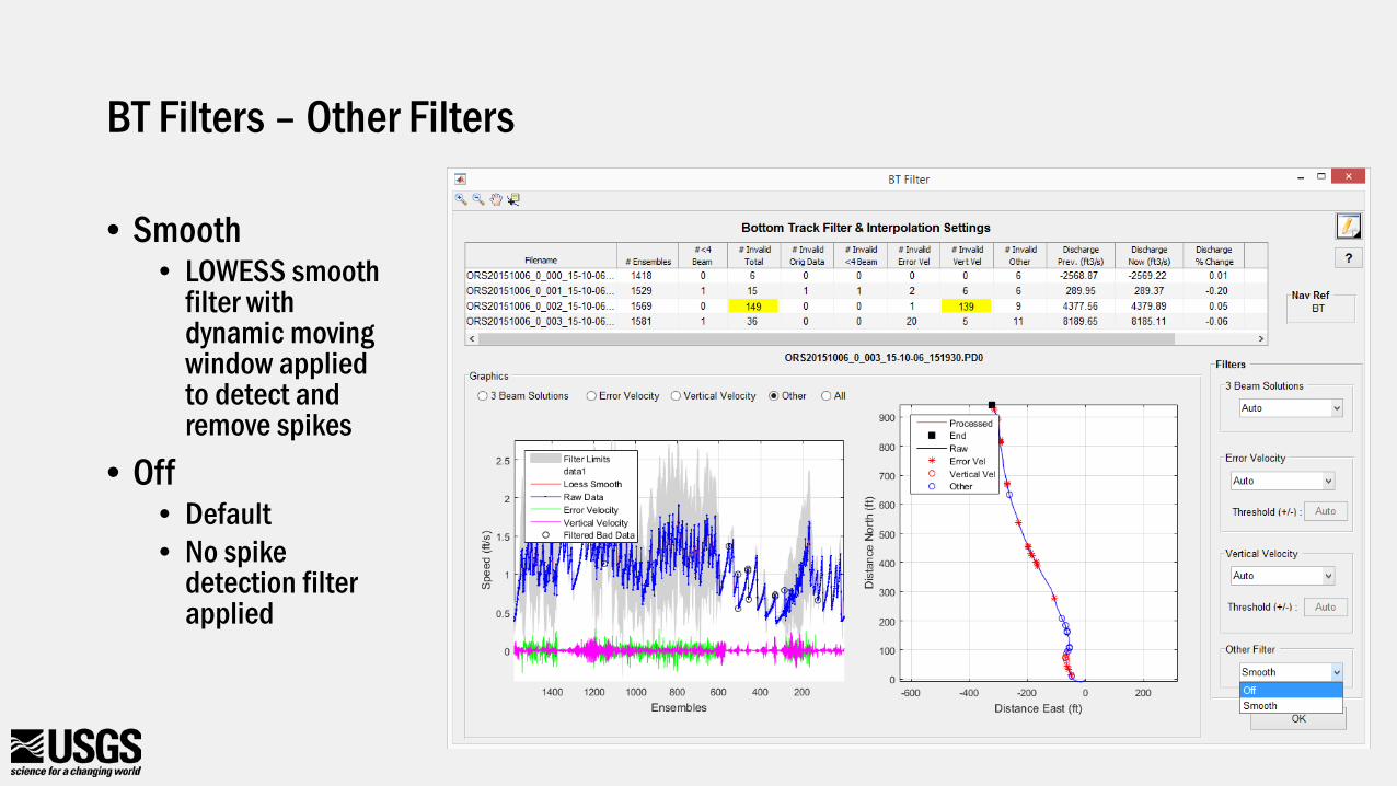
• Smooth • LOWESS smooth
filter with dynamic moving window applied to detect and remove spikes
• Off• Default• No spike
detection filter applied
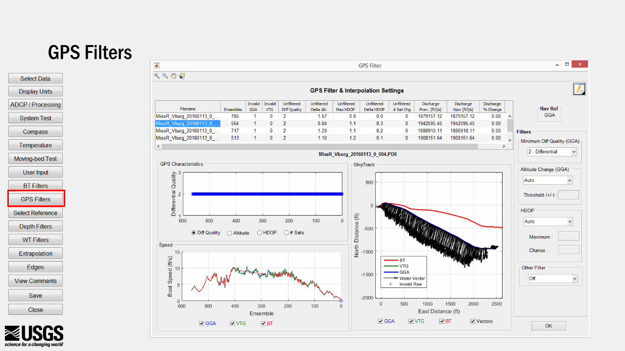
GPS Filters
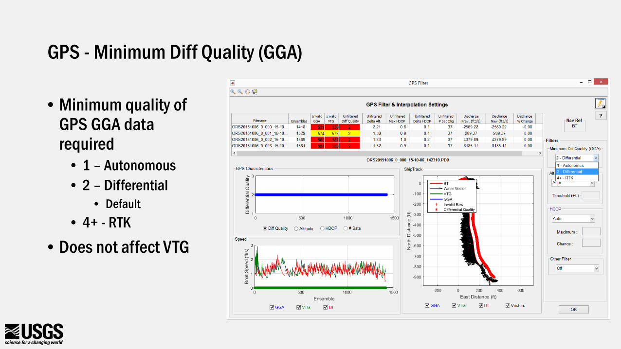
GPS - Minimum Diff Quality (GGA)
• Minimum quality of GPS GGA data required
• 1 – Autonomous• 2 – Differential
• Default• 4+ - RTK
• Does not affect VTG
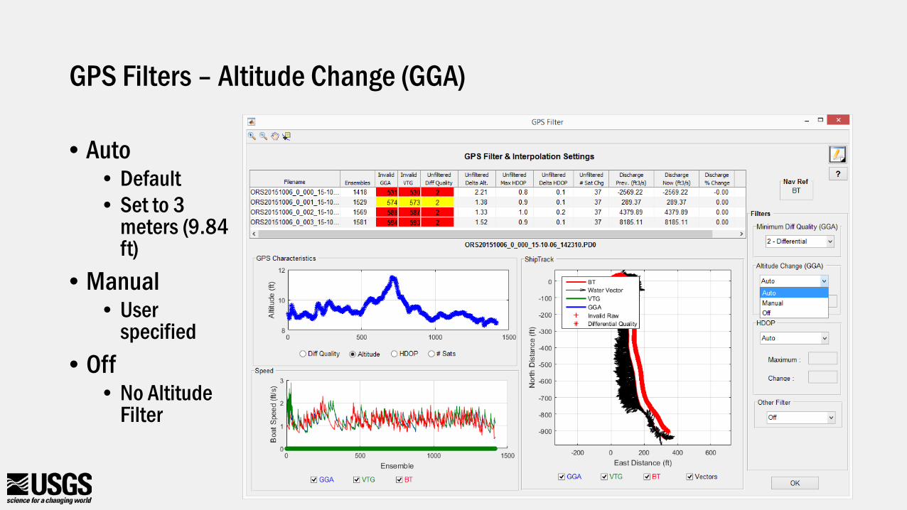
GPS Filters – Altitude Change (GGA)
• Auto• Default• Set to 3
meters (9.84 ft)
• Manual• User
specified• Off
• No Altitude Filter
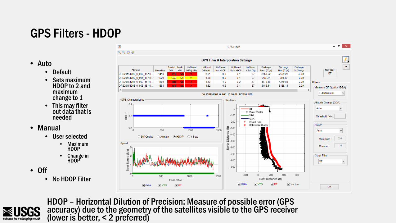
GPS Filters - HDOP
• Auto• Default• Sets maximum
HDOP to 2 and maximum change to 1
• This may filter out data that is needed
• Manual• User selected
• Maximum HDOP
• Change in HDOP
• Off• No HDOP Filter
HDOP – Horizontal Dilution of Precision: Measure of possible error (GPS accuracy) due to the geometry of the satellites visible to the GPS receiver (lower is better, < 2 preferred)
GPS Filters - Other
• Smooth • LOWESS
smooth filter with dynamic moving window applied to detect and remove spikes
• Off• Default• No spike
detection filter applied
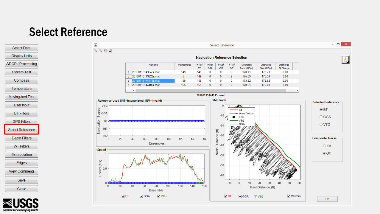
Select Reference
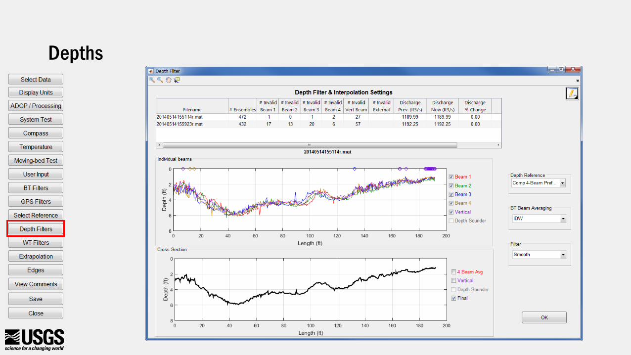
Depths
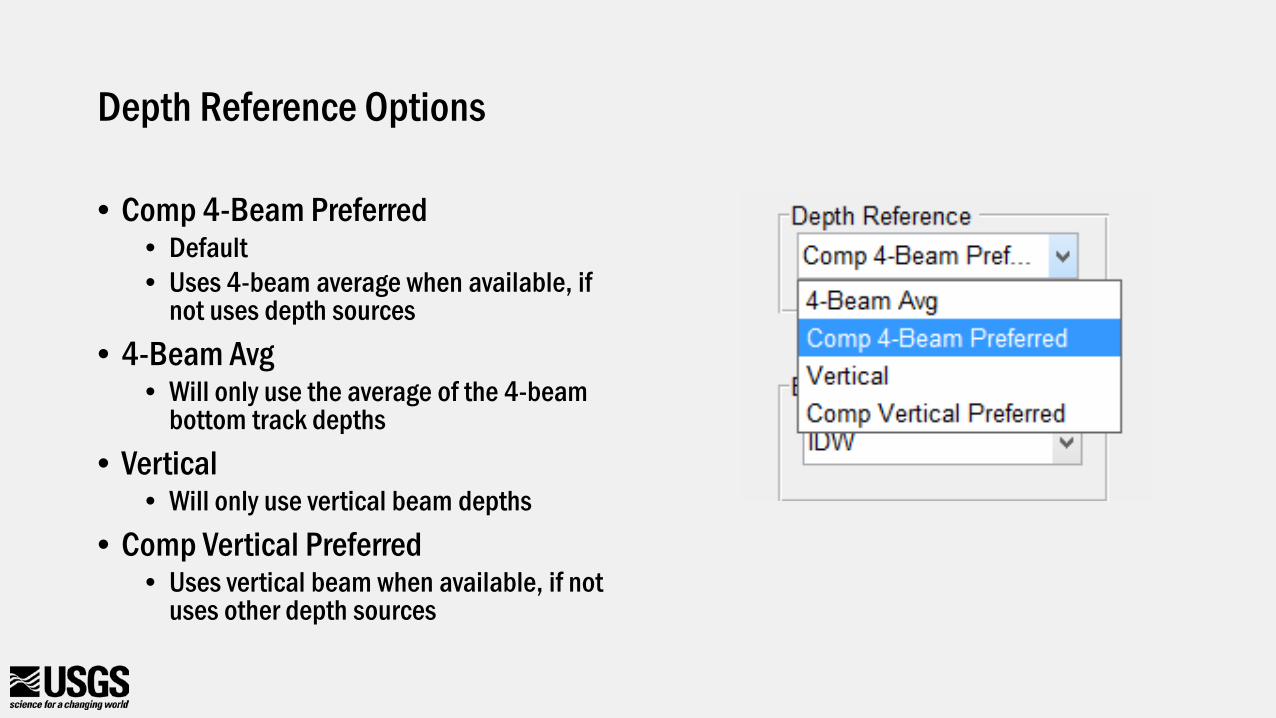
Depth Reference Options
• Comp 4-Beam Preferred• Default• Uses 4-beam average when available, if
not uses depth sources• 4-Beam Avg
• Will only use the average of the 4-beam bottom track depths
• Vertical• Will only use vertical beam depths
• Comp Vertical Preferred• Uses vertical beam when available, if not
uses other depth sources
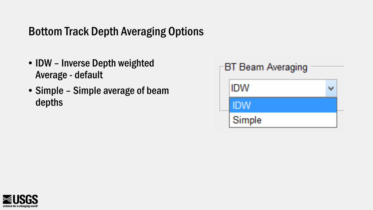
Bottom Track Depth Averaging Options
• IDW – Inverse Depth weighted Average - default
• Simple – Simple average of beam depths
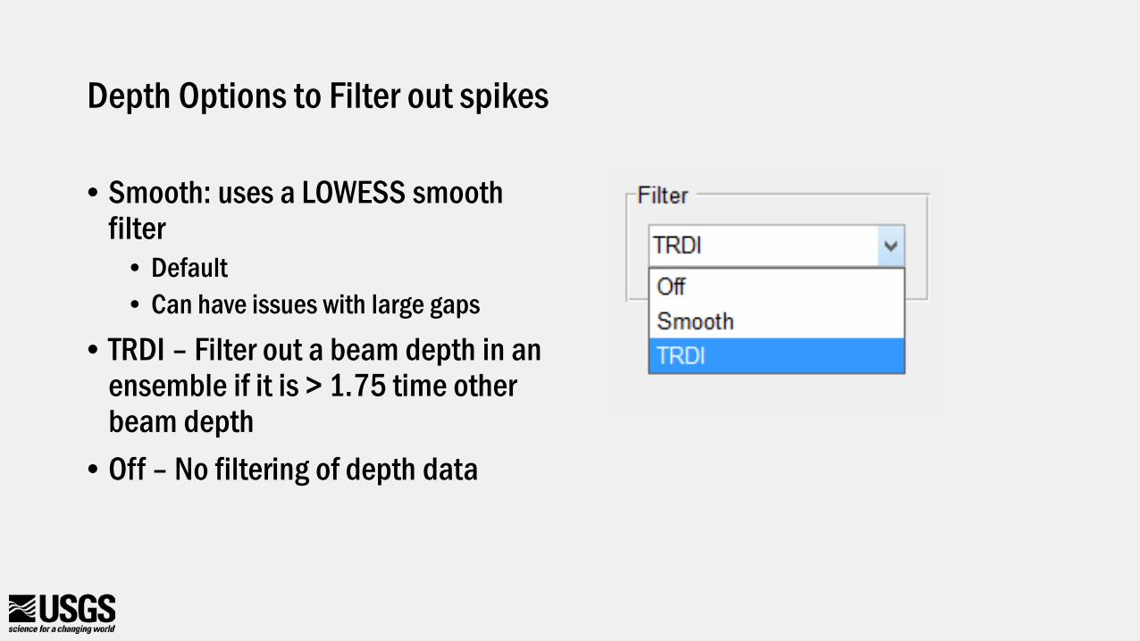
Depth Options to Filter out spikes
• Smooth: uses a LOWESS smooth filter
• Default• Can have issues with large gaps
• TRDI – Filter out a beam depth in an ensemble if it is > 1.75 time other beam depth
• Off – No filtering of depth data
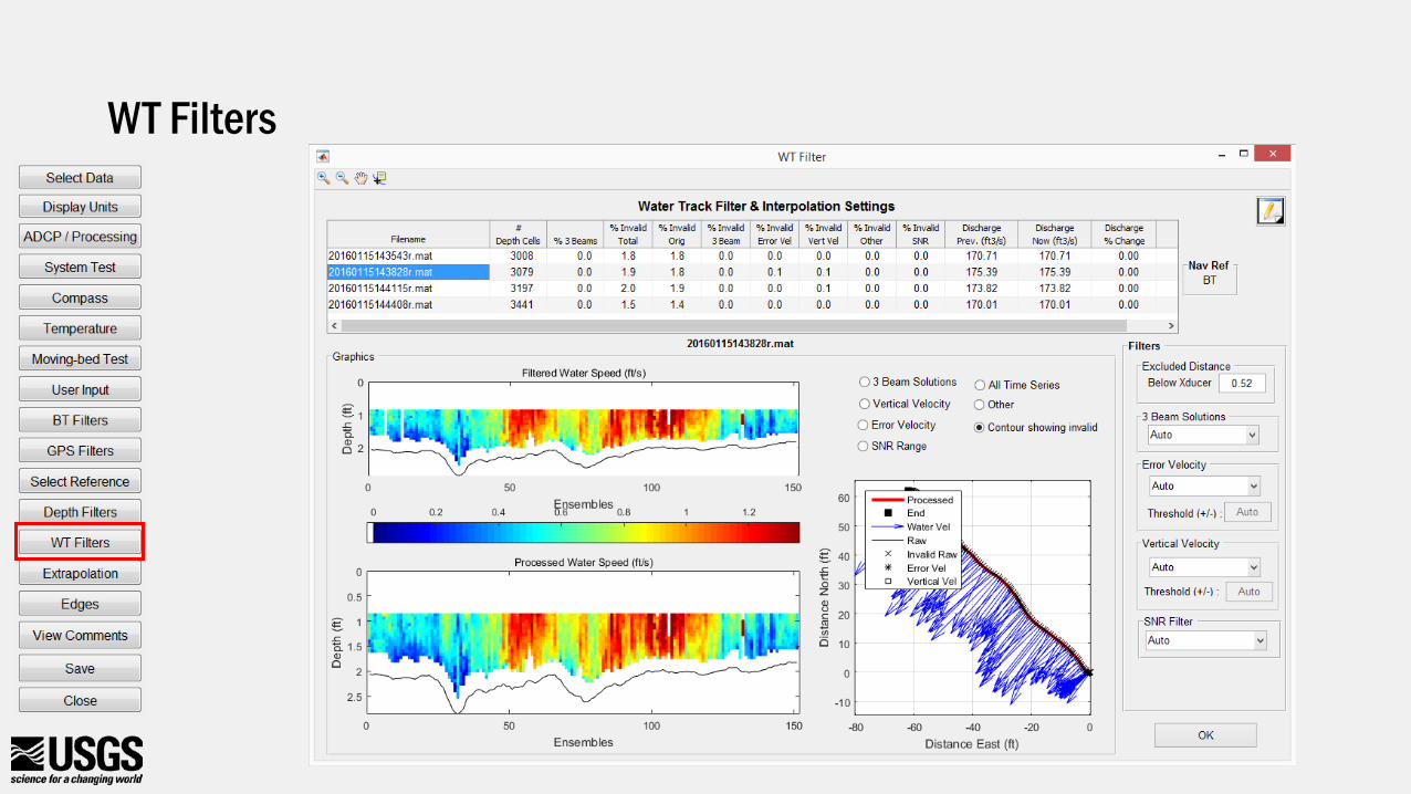
WT Filters
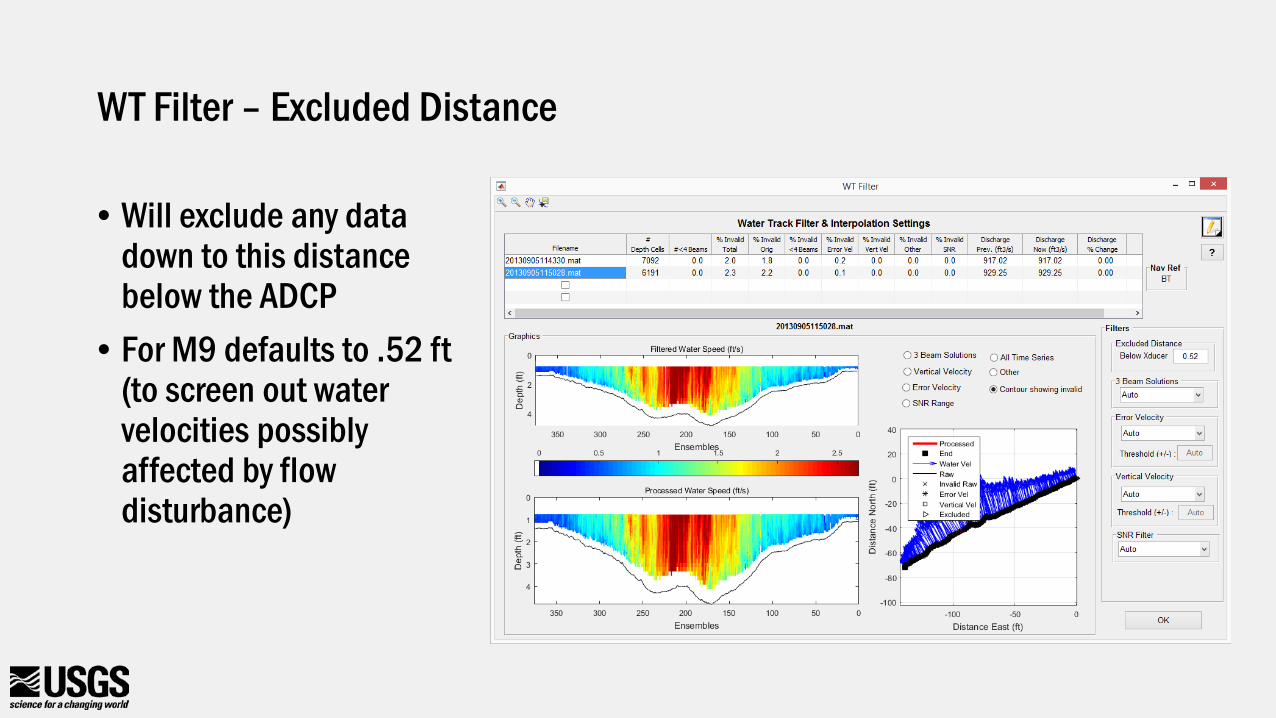
WT Filter – Excluded Distance
• Will exclude any data down to this distance below the ADCP
• For M9 defaults to .52 ft(to screen out water velocities possibly affected by flow disturbance)

WT Filters – 3-Beam Solutions
• Auto• Default• Evaluates 3-
beam solutions using neighboring data
• Allow - will use 3-beam solutions
• 4-Beam Only –requires all 4 beams to have valid velocity
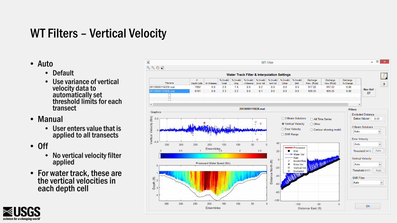
WT Filters – Vertical Velocity
• Auto• Default• Use variance of vertical
velocity data to automatically set threshold limits for each transect
• Manual• User enters value that is
applied to all transects• Off
• No vertical velocity filter applied
• For water track, these are the vertical velocities in each depth cell
WT Filters – SNR Filter
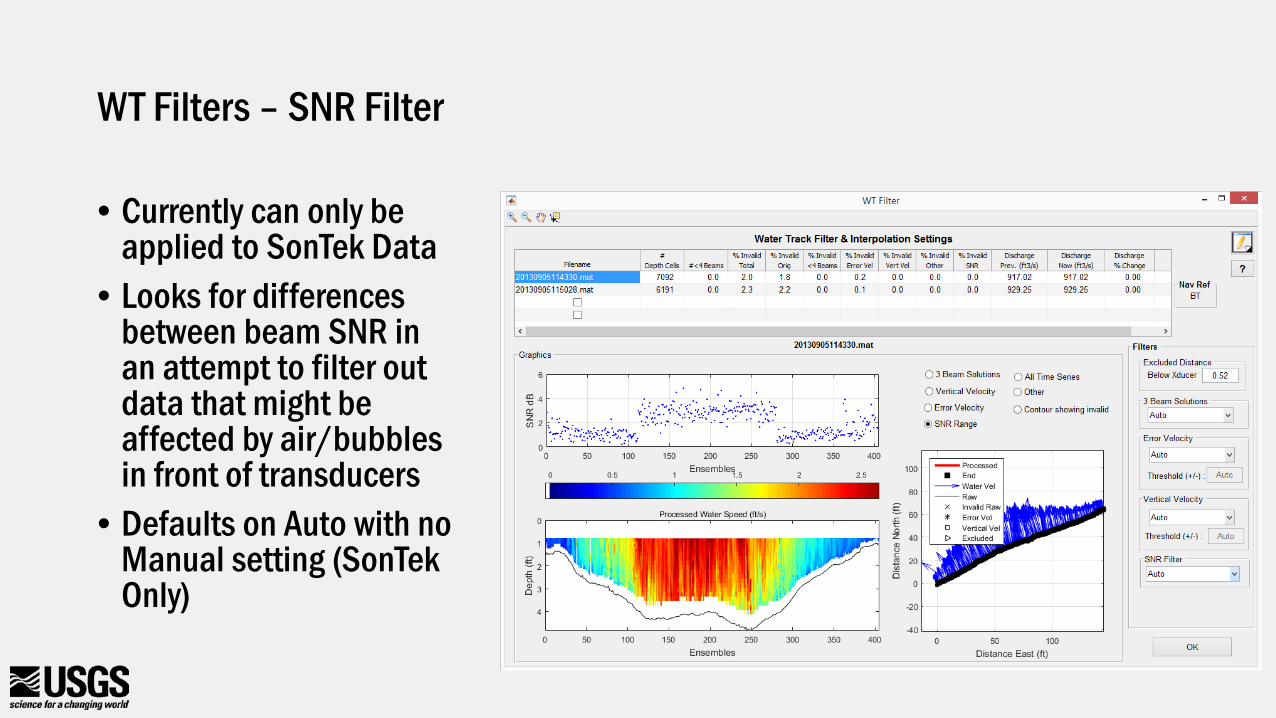
• Currently can only be applied to SonTek Data
• Looks for differences between beam SNR in an attempt to filter out data that might be affected by air/bubbles in front of transducers
• Defaults on Auto with no Manual setting (SonTek Only)
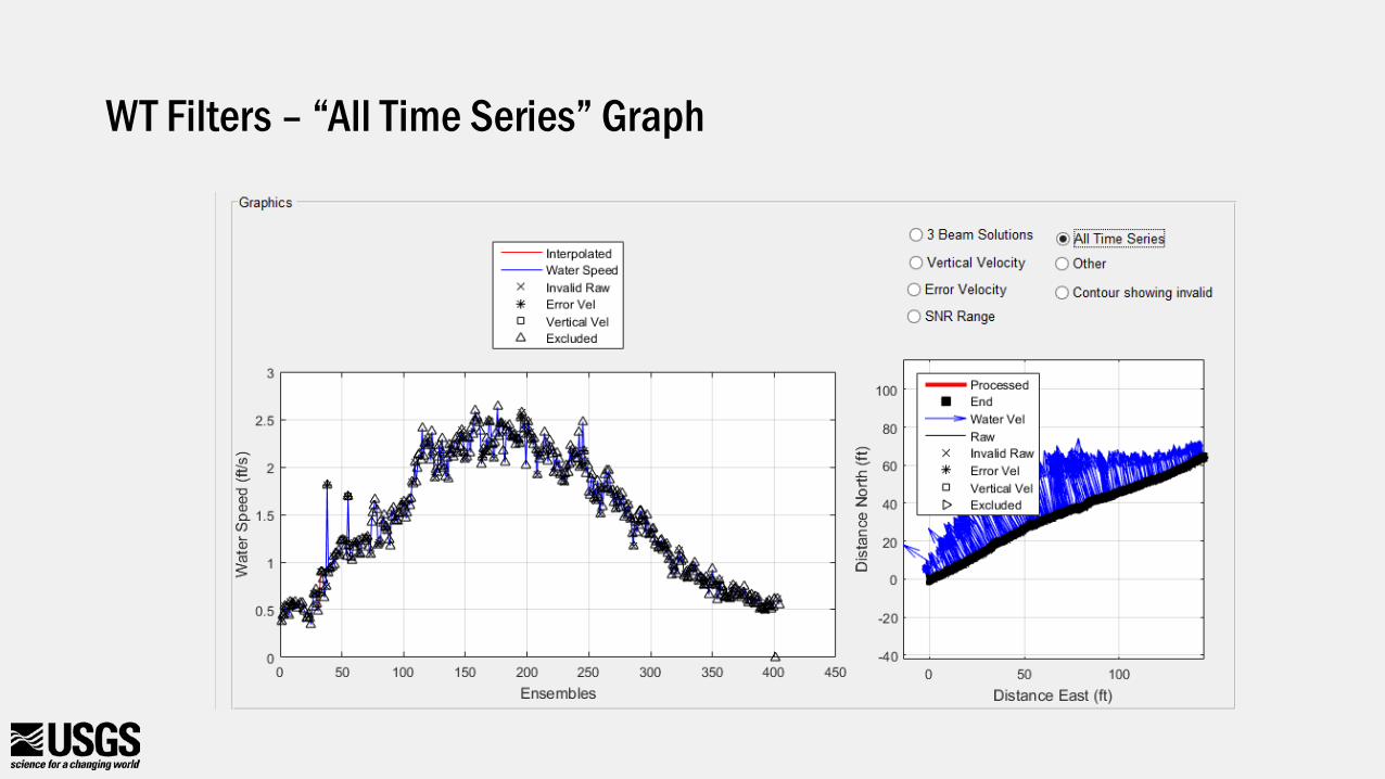
WT Filters – “All Time Series” Graph
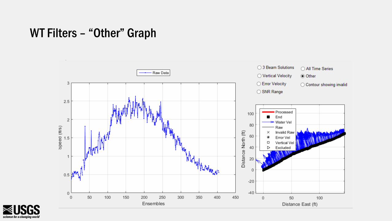
WT Filters – “Other” Graph
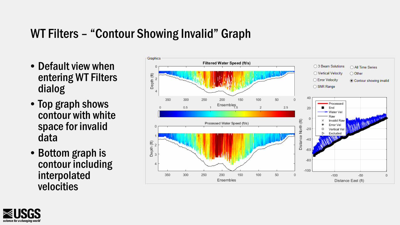
WT Filters – “Contour Showing Invalid” Graph
• Default view when entering WT Filters dialog
• Top graph shows contour with white space for invalid data
• Bottom graph is contour including interpolated velocities
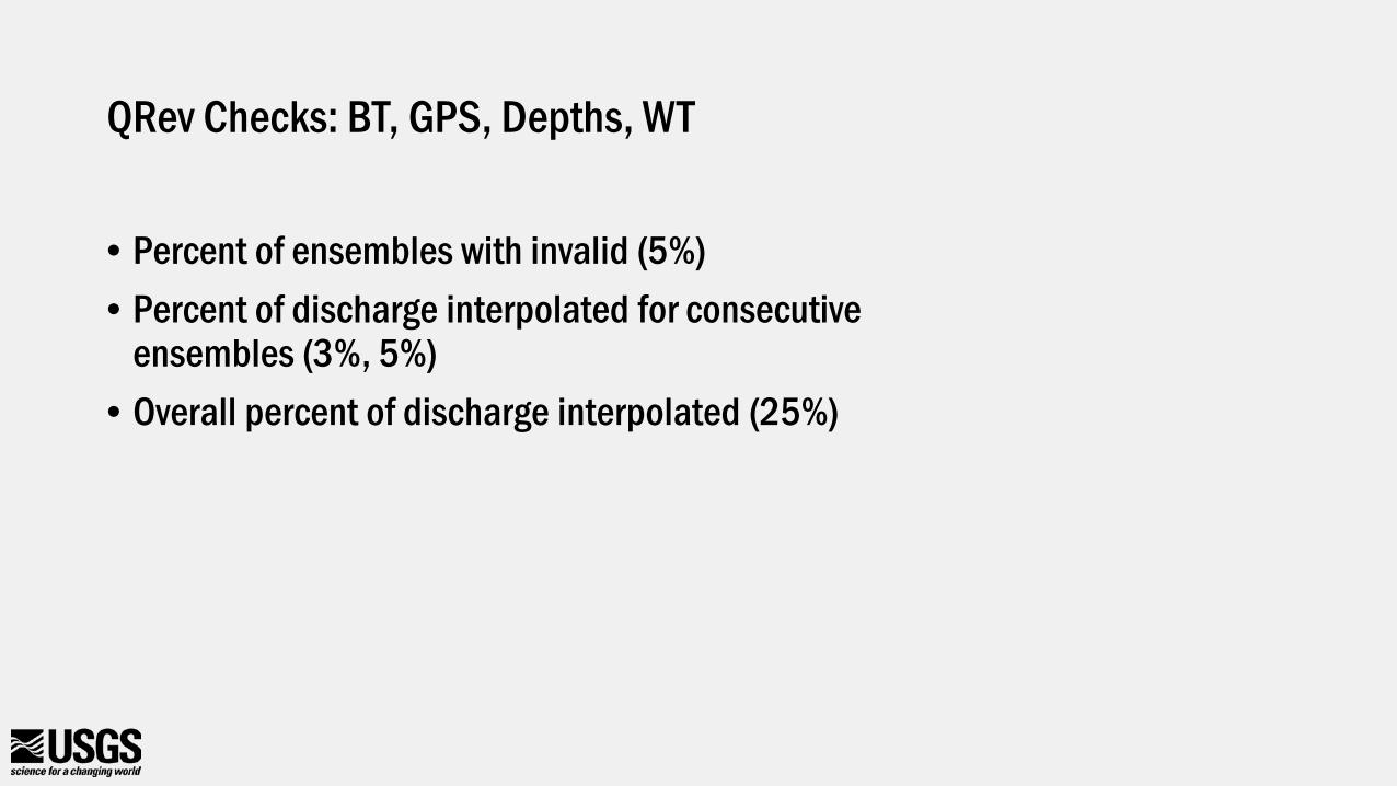
QRev Checks: BT, GPS, Depths, WT
• Percent of ensembles with invalid (5%)• Percent of discharge interpolated for consecutive
ensembles (3%, 5%)• Overall percent of discharge interpolated (25%)
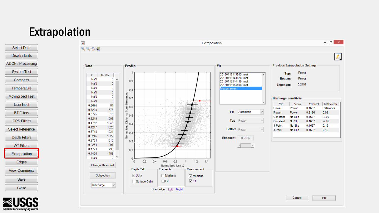
Extrapolation
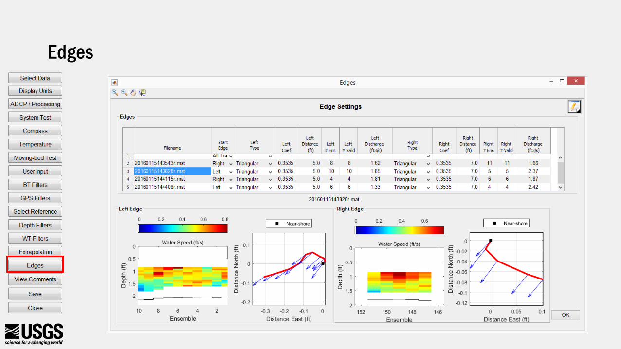
Edges
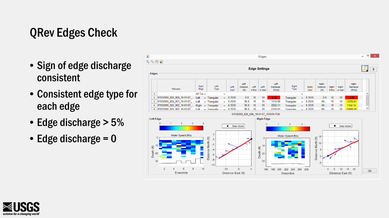
QRev Edges Check
• Sign of edge discharge consistent
• Consistent edge type for each edge
• Edge discharge > 5%• Edge discharge = 0
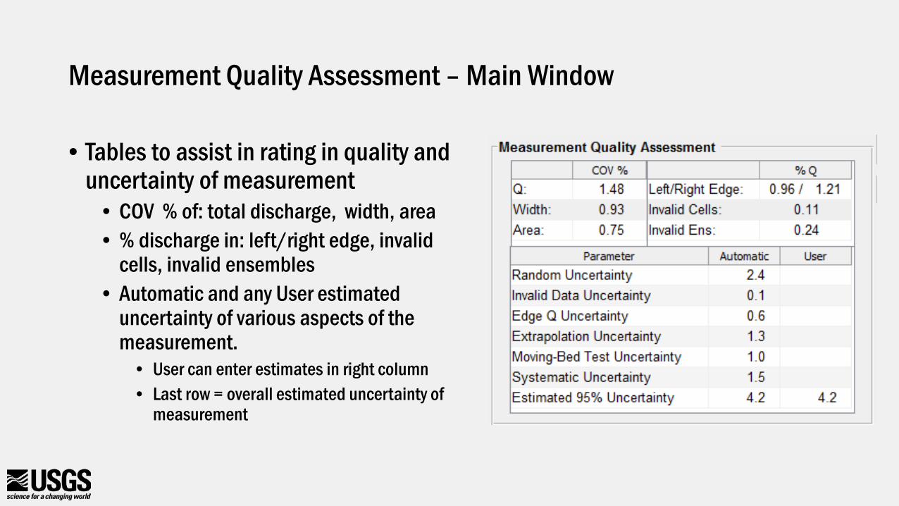
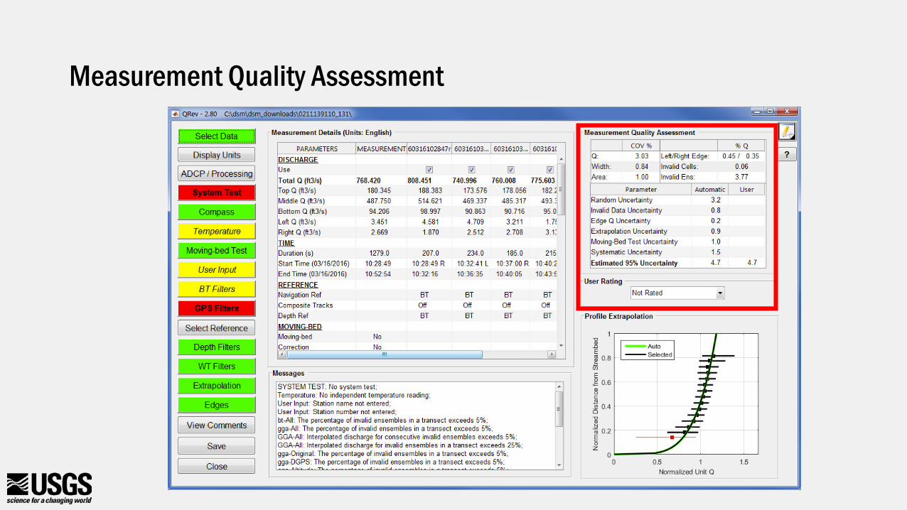
Measurement Quality Assessment – Main Window
• Tables to assist in rating in quality and uncertainty of measurement
• COV % of: total discharge, width, area• % discharge in: left/right edge, invalid
cells, invalid ensembles• Automatic and any User estimated
uncertainty of various aspects of the measurement.
• User can enter estimates in right column• Last row = overall estimated uncertainty of
measurement
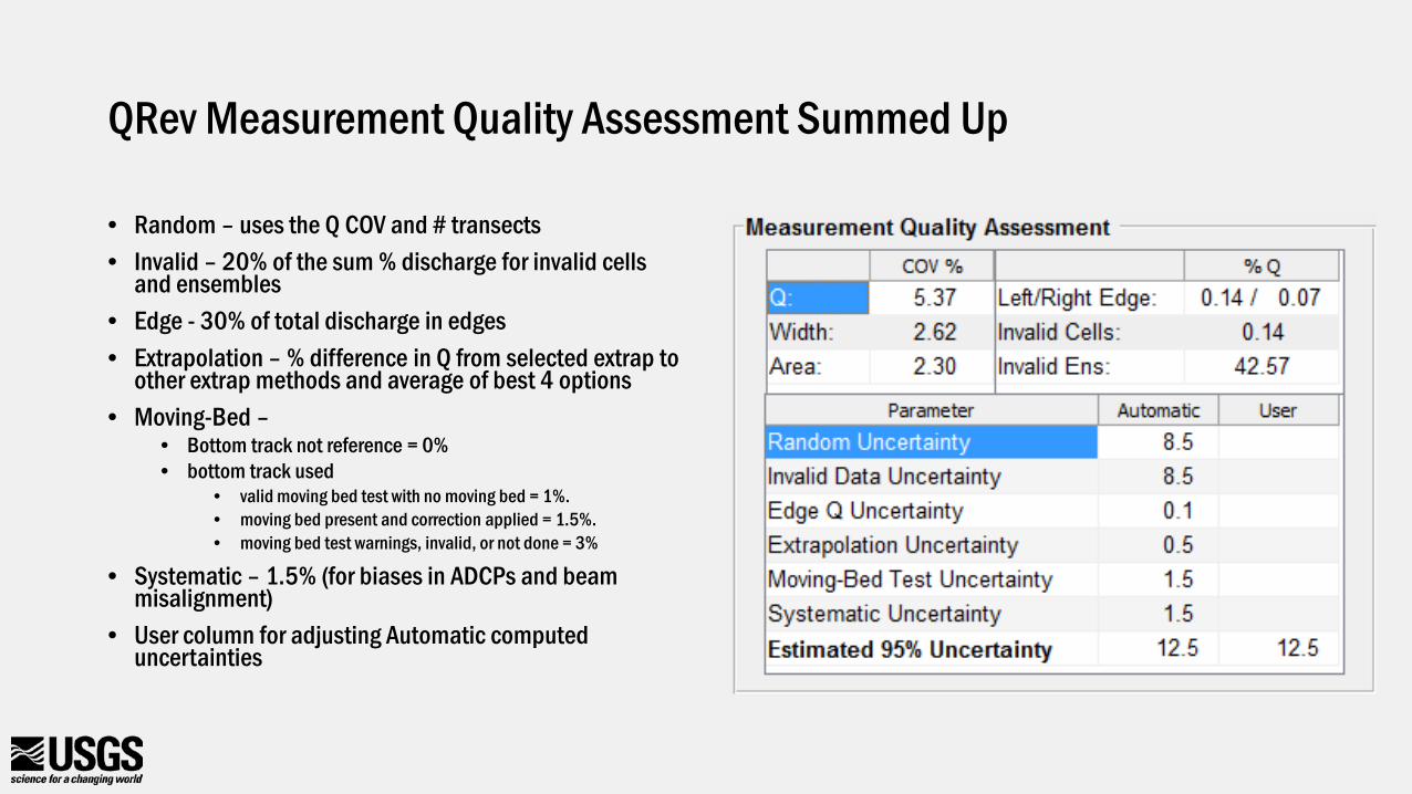
QRev Measurement Quality Assessment Summed Up
• Random – uses the Q COV and # transects• Invalid – 20% of the sum % discharge for invalid cells
and ensembles• Edge - 30% of total discharge in edges• Extrapolation – % difference in Q from selected extrap to
other extrap methods and average of best 4 options• Moving-Bed –
• Bottom track not reference = 0% • bottom track used
• valid moving bed test with no moving bed = 1%. • moving bed present and correction applied = 1.5%. • moving bed test warnings, invalid, or not done = 3%
• Systematic – 1.5% (for biases in ADCPs and beam misalignment)
• User column for adjusting Automatic computed uncertainties
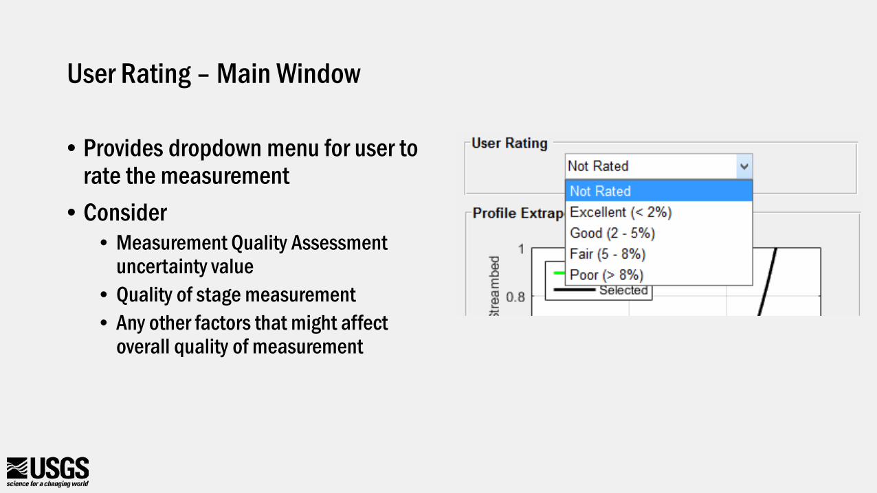
User Rating – Main Window
• Provides dropdown menu for user to rate the measurement
• Consider• Measurement Quality Assessment
uncertainty value• Quality of stage measurement• Any other factors that might affect
overall quality of measurement
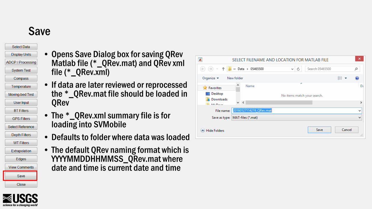
Save
• Opens Save Dialog box for saving QRev Matlab file (*_QRev.mat) and QRev xml file (*_QRev.xml)
• If data are later reviewed or reprocessed the *_QRev.mat file should be loaded in QRev
• The *_QRev.xml summary file is for loading into SVMobile
• Defaults to folder where data was loaded• The default QRev naming format which is
YYYYMMDDHHMMSS_QRev.mat where date and time is current date and time
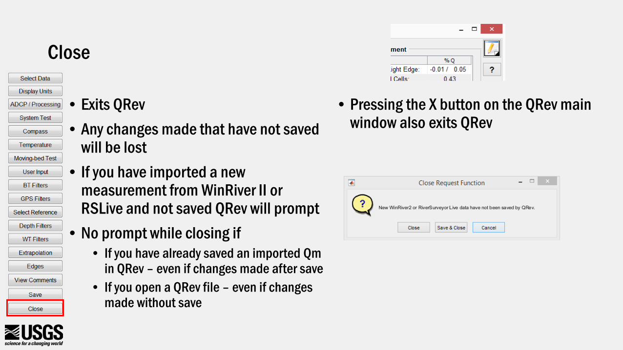
Close
• Exits QRev• Any changes made that have not saved
will be lost• If you have imported a new
measurement from WinRiver II or RSLive and not saved QRev will prompt
• No prompt while closing if• If you have already saved an imported Qm
in QRev – even if changes made after save• If you open a QRev file – even if changes
made without save
• Pressing the X button on the QRev main window also exits QRev
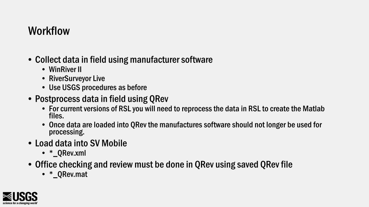
Workflow
• Collect data in field using manufacturer software• WinRiver II• RiverSurveyor Live• Use USGS procedures as before
• Postprocess data in field using QRev• For current versions of RSL you will need to reprocess the data in RSL to create the Matlab
files.• Once data are loaded into QRev the manufactures software should not longer be used for
processing.• Load data into SV Mobile
• *_QRev.xml• Office checking and review must be done in QRev using saved QRev file
• *_QRev.mat
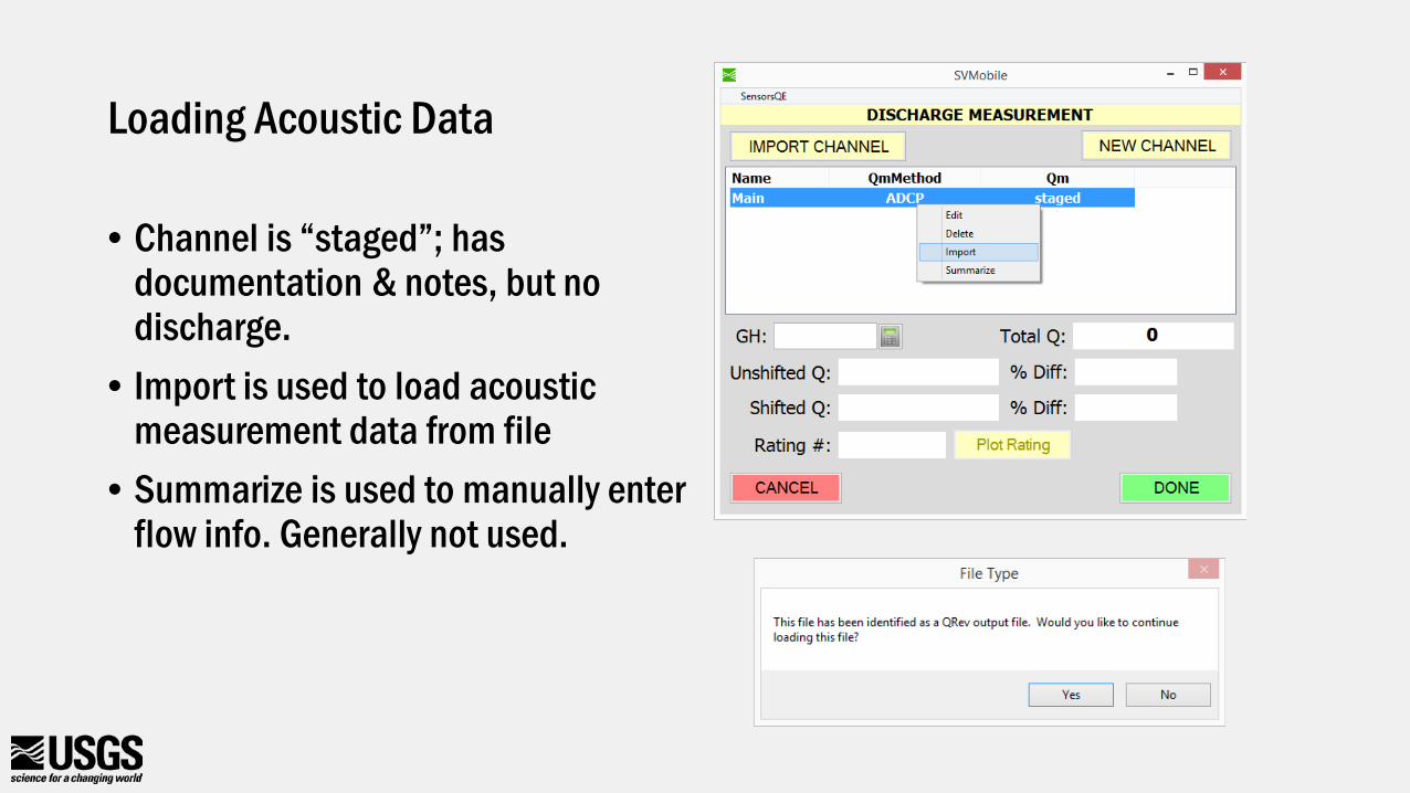
Loading Acoustic Data
• Channel is “staged”; has documentation & notes, but no discharge.
• Import is used to load acoustic measurement data from file
• Summarize is used to manually enter flow info. Generally not used.
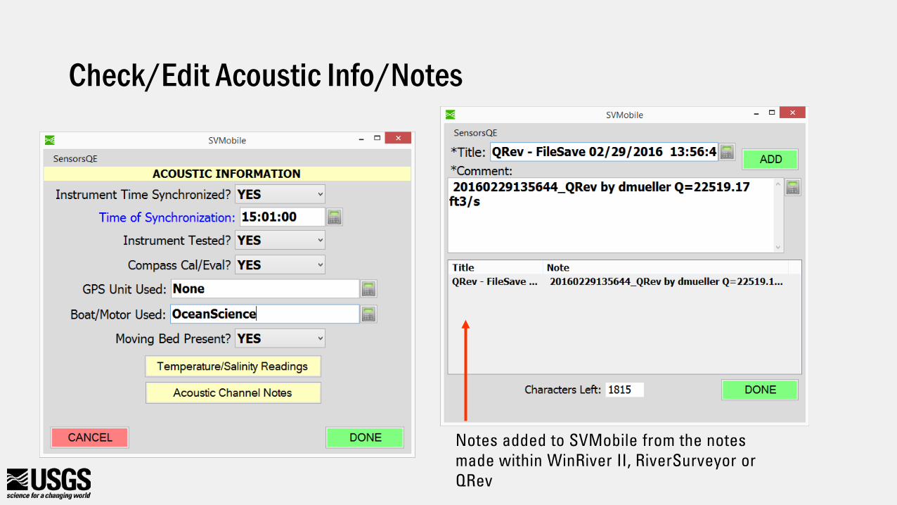
Check/Edit Acoustic Info/Notes
Notes added to SVMobile from the notes made within WinRiver II, RiverSurveyor or QRev
Not currently reviewable in QRev
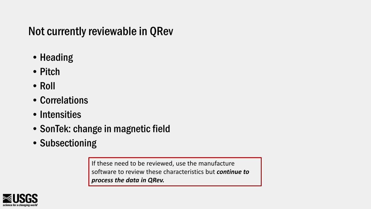
• Heading • Pitch• Roll• Correlations• Intensities• SonTek: change in magnetic field• Subsectioning
If these need to be reviewed, use the manufacture software to review these characteristics but continue to process the data in QRev.
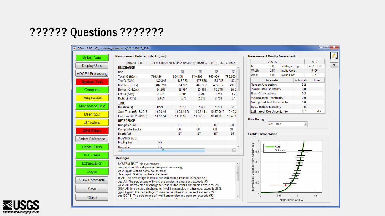
?????? Questions ???????


![V[c[ · 2020. 7. 14. · G 5RaV\SRPbVR[MbR`VMMYd]]`TMabR\e]`QbMM\TRO]QR\OVWURbORb`RQR\dM\QReV\XRY G 6`[]TR\aYRPUbaRR\OR^R`XbMM\bMY[R\aR\QReV\XRYV\ :Rb^R`a]\RRYTRRSbV\QVR\ \]QVTV\ab`cPbVRa](https://img.pdfslide.net/doc/110x75/60adf1b668cb3d336c390238/vc-2020-7-14-g-5ravsrpbvrmbrvmmydtmabreqbmmtroqrovwurborbrqrdmqrevxry.jpg)