Embed Size (px)
Citation preview
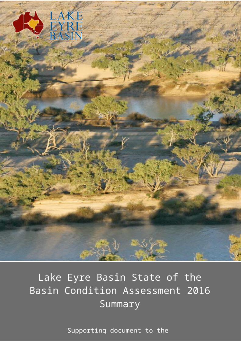
Lake Eyre Basin State of the Basin Condition Assessment 2016 Summary
Lake Eyre Basin State of the Basin Condition Assessment 2016 Summary
Supporting document to the Lake Eyre Basin State of the Basin Condition Assessment 2016
Report
Lake Eyre Basin State of the Basin Condition Assessment 2016 Summary
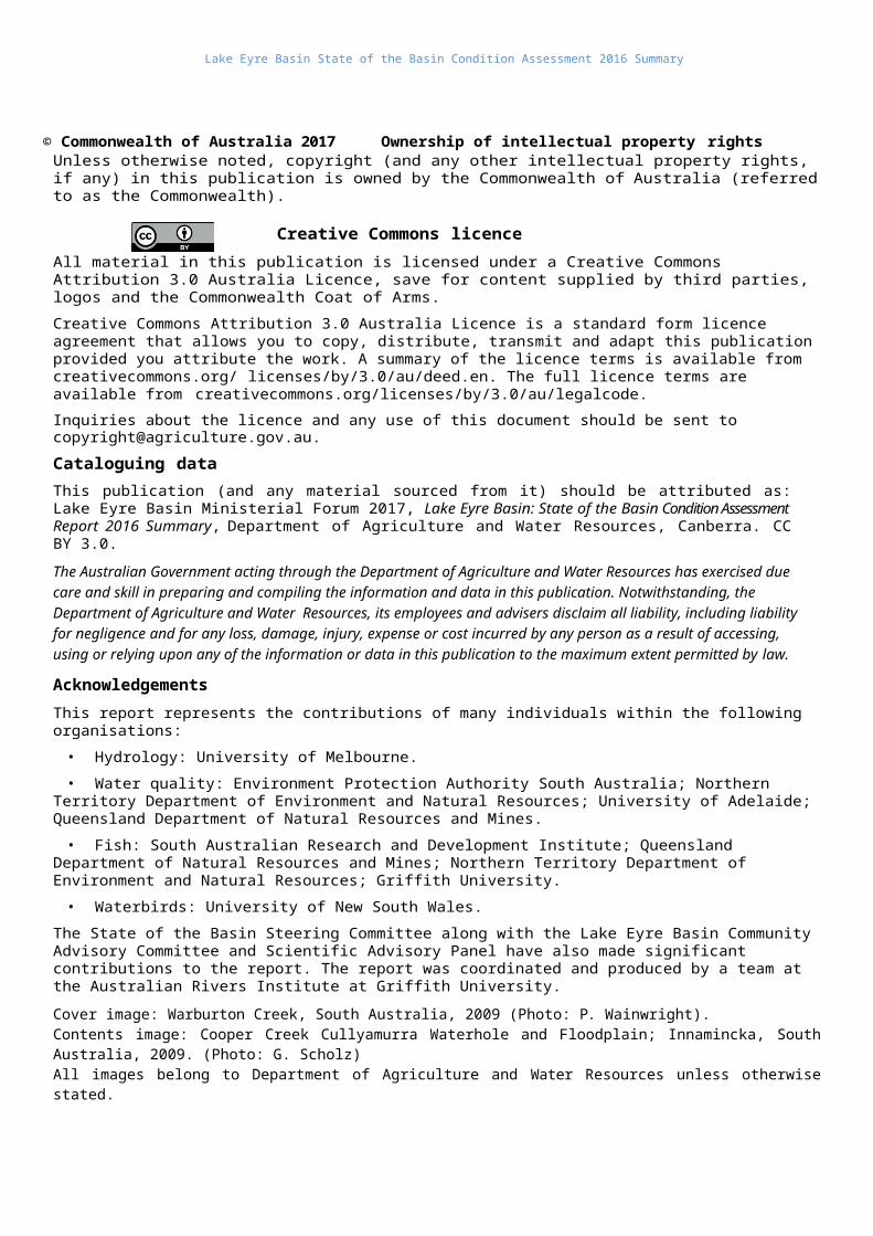
© Commonwealth of Australia 2017 Ownership of intellectual property rightsUnless otherwise noted, copyright (and any other intellectual property rights, if any) in this publication is owned by the Commonwealth of Australia (referred to as the Commonwealth).
Creative Commons licence
All material in this publication is licensed under a Creative Commons Attribution 3.0 Australia Licence, save for content supplied by third parties, logos and the Commonwealth Coat of Arms.
Creative Commons Attribution 3.0 Australia Licence is a standard form licence agreement that allows you to copy, distribute, transmit and adapt this publication provided you attribute the work. A summary of the licence terms is available from creativecommons.org/ licenses/by/3.0/au/deed.en. The full licence terms are available from creativecommons.org/licenses/by/3.0/au/legalcode.
Inquiries about the licence and any use of this document should be sent to [email protected].
Cataloguing data
This publication (and any material sourced from it) should be attributed as: Lake Eyre Basin Ministerial Forum 2017, Lake Eyre Basin: State of the Basin Condition Assessment Report 2016 Summary, Department of Agriculture and Water Resources, Canberra. CC BY 3.0.
The Australian Government acting through the Department of Agriculture and Water Resources has exercised due care and skill in preparing and compiling the information and data in this publication. Notwithstanding, the Department of Agriculture and Water Resources, its employees and advisers disclaim all liability, including liability for negligence and for any loss, damage, injury, expense or cost incurred by any person as a result of accessing, using or relying upon any of the information or data in this publication to the maximum extent permitted by law.
Acknowledgements
This report represents the contributions of many individuals within the following organisations:
• Hydrology: University of Melbourne.
• Water quality: Environment Protection Authority South Australia; Northern Territory Department of Environment and Natural Resources; University of Adelaide; Queensland Department of Natural Resources and Mines.
• Fish: South Australian Research and Development Institute; Queensland Department of Natural Resources and Mines; Northern Territory Department of Environment and Natural Resources; Griffith University.
• Waterbirds: University of New South Wales.
The State of the Basin Steering Committee along with the Lake Eyre Basin Community Advisory Committee and Scientific Advisory Panel have also made significant contributions to the report. The report was coordinated and produced by a team at the Australian Rivers Institute at Griffith University.
Cover image: Warburton Creek, South Australia, 2009 (Photo: P. Wainwright). Contents image: Cooper Creek Cullyamurra Waterhole and Floodplain; Innamincka, South Australia, 2009. (Photo: G. Scholz) All images belong to Department of Agriculture and Water Resources unless otherwise stated.
Lake Eyre Basin State of the Basin Condition Assessment 2016 Summary
ContentsAbout the report.........................................................................................1About the Basin..........................................................................................2Hydrology and water quality.......................................................................4Fish Communities......................................................................................6Waterbirds..................................................................................................7Management..............................................................................................8High-risk pressures and threats.................................................................9Conclusion...............................................................................................10
Lake Eyre Basin State of the Basin Condition Assessment 2016 Summary
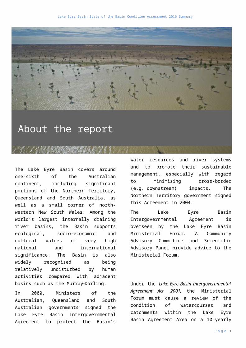
The Lake Eyre Basin covers around one-sixth of the Australian continent, including significant portions of the Northern Territory, Queensland and South Australia, as well as a small corner of north-western New South Wales. Among the world’s largest internally draining river basins, the Basin supports ecological, socio-economic and cultural values of very high national and international significance. The Basin is also widely recognised as being relatively undisturbed by human activities compared with adjacent basins such as the MurrayDarling.
In 2000, Ministers of the Australian, Queensland and South Australian governments signed the Lake Eyre Basin Intergovernmental Agreement to protect the Basin’s water resources and river systems and to promote their sustainable management, especially with regard to minimising cross-border (e.g. downstream) impacts. The Northern Territory government signed this Agreement in 2004.
The Lake Eyre Basin Intergovernmental Agreement is overseen by the Lake Eyre Basin Ministerial Forum. A Community Advisory Committee and Scientific Advisory Panel provide advice to the Ministerial Forum.
Under the Lake Eyre Basin Intergovernmental Agreement Act 2001, the Ministerial Forum must cause a review of the condition of watercourses and catchments within the Lake Eyre Basin Agreement Area on a 10-yearly basis. The Lake Eyre Basin State of the Basin Condition Assessment 2016 report addresses this requirement. An initial State of the Basin report was produced in 2008 and this is now the second report.
The two major aims of this report are to:
describe the current status of Lake Eyre Basin watercourses and catchments with a particular focus on hydrology, water quality, fish and waterbirds
identify and evaluate current threats and pressures facing water resources and riverine ecosystems of the Basin, especially those requiring a coordinated inter-jurisdictional approach.
This summary document accompanies the full Lake Eyre Basin State of the Basin Condition Assessment 2016 report and provides a synthesis of its key findings. The full report is available at
P a g e 1
About the report
Lake Eyre Basin State of the Basin Condition Assessment 2016 Summary
lakeeyrebasin.gov.au.
P a g e 2
Lake Eyre Basin State of the Basin Condition Assessment 2016 Summary
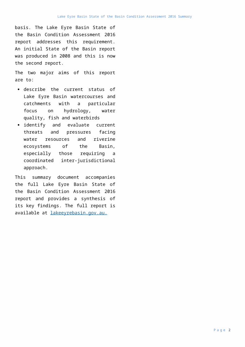
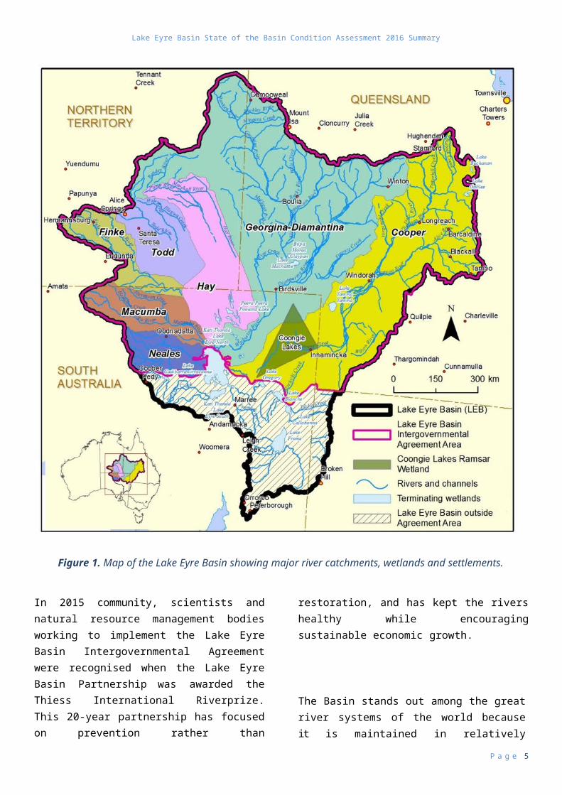
At a glanceThe major river catchments in the Lake Eyre Basin include the Cooper and GeorginaDiamantina in the east; the Finke, Todd and Hay to the west; Macumba, Neales and Lake Frome in south-west (Lake Frome lies outside the Lake Eyre Basin Agreement Area) (Figure 1).
The Basin’s rivers are among the most hydrologically variable in the world. Their unpredictable river flows are the key feature shaping the health of the Basin’s diverse riverine environments, supporting many plants and fish that are not found elsewhere on the continent. The Basin’s wetlands, such as Coongie Lakes, are also among the most significant on the continent for abundance and diversity of waterbirds.
Underneath most of the Basin—and extending beyond—lies Australia’s largest groundwater resource, the Great Artesian Basin. This underground water is essential for the Great Artesian Basin springs: permanent wetlands that provide habitat for unique aquatic life forms in otherwise dry landscapes.
There is a long and continuous Aboriginal history in the Basin, and a rich and complex culture that reflects thousands of years of living with and surviving highly variable conditions. The dreaming paths of
Aboriginal
nations across the Basin form ceremonial routes along which goods and knowledge originally flowed, and which are alive and relevant today.
Grazing occupies the greatest area as a land use, although oil and gas extraction are the most economically significant. Conservation and heritage areas represent a further significant land use and provide a major focus for a growing tourism industry. Seven sites are on the National Heritage List, including Witjira–Dalhousie Springs, the Dig Tree of Burke and Wills, the birthplace of Qantas, and events such as the Birdsville Races are of national prominence.
The Lake Eyre Basin supports diverse human communities. Around 60,000 people currently live in the Basin with over two million more visiting each year. Apart from Alice Springs, most people are dispersed in small towns, settlements, Aboriginal communities, mining developments and homesteads.
The Lake Eyre Basin Intergovernmental Agreement was established as a result of community concern about potential intensification of development and negative consequences of the separate management
P a g e 3
About the Basin
Lake Eyre Basin State of the Basin Condition Assessment 2016 Summary
of the Basin by four different governments.
P a g e 4
Lake Eyre Basin State of the Basin Condition Assessment 2016 Summary
Figure 1. Map of the Lake Eyre Basin showing major river catchments, wetlands and settlements.
In 2015 community, scientists and natural resource management bodies working to implement the Lake Eyre Basin Intergovernmental Agreement were recognised when the Lake Eyre Basin Partnership was awarded the Thiess International Riverprize. This 20-year partnership has focused on prevention rather than restoration, and has kept the rivers healthy while encouraging sustainable economic growth.
The Basin stands out among the great river systems of the world because it is maintained in relatively unaltered character. The community has consistently argued for this outcome and demonstrated the ability to come together to achieve it. Through resistance to water diversions in upper catchments, the community has helped foster ongoing cattle grazing and tourism, and consequently has facilitated maintenance of the predominantly good condition of the Basin’s aquatic environments.
P a g e 5
Lake Eyre Basin State of the Basin Condition Assessment 2016 Summary
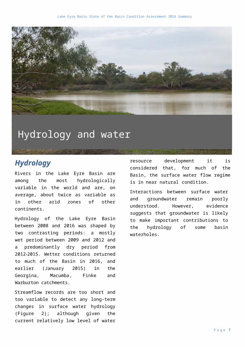
HydrologyRivers in the Lake Eyre Basin are among the most hydrologically variable in the world and are, on average, about twice as variable as in other arid zones of other continents.
Hydrology of the Lake Eyre Basin between 2008 and 2016 was shaped by two contrasting periods: a mostly wet period between 2009 and 2012 and a predominantly dry period from 20122015. Wetter conditions returned to much of the Basin in 2016, and earlier (January 2015) in the Georgina, Macumba, Finke and Warburton catchments.
Streamflow records are too short and too variable to detect any long-term changes in surface water hydrology (Figure 2); although given the current relatively low level of water resource development it is considered that, for much of the Basin, the surface water flow regime is in near natural condition.
Interactions between surface water and groundwater remain poorly understood. However, evidence suggests that groundwater is likely to make important contributions to the hydrology of some basin waterholes.
Streamflow is also likely to be an important source of recharge for both deep (Great Artesian Basin) and shallow ground waters which are ecologically significant because they sustain spring ecosystems and riparian trees respectively.
Considerable advances in understanding waterhole hydrology have been made as a result of monitoring by the Lake Eyre Basin Rivers Assessment program and through previous natural resource management studies such as ARIDFLO. Patterns in aquatic habitat availability can now be more accurately mapped in space and time due to identification of relationships between waterhole surface area and volume, and their persistence when flow ceases (Figure 2).
P a g e 6
Hydrology and water quality
Lake Eyre Basin State of the Basin Condition Assessment 2016 Summary
Figure 2. Daily discharge (megalitres per day) at Longreach, Cullyamurra, Diamantina Lakes and Birdsville waterholes between 2007 and 2014. Where gauging stations have sufficiently long records, the annual recurrence interval of each flood year is also shown on the hydrograph by numbers above bars. Grey dots represent Lake Eyre Basin Rivers Assessment sampling dates.
Water qualityNo major deterioration of water quality has been observed in the Lake Eyre Basin since the 2008 assessment. Water quality (salinity, turbidity and nutrient levels) at individual waterholes vary greatly through time in response to flow patterns, which are largely natural. There are also significant differences between catchments, notably in salinity and turbidity, due to differences in geology and groundwater systems. Streams of the northern and eastern Lake Eyre Basin (the Cooper and GeorginaDiamantina) tend to be mostly fresh, turbid, slightly alkaline and high in nutrients. Waterholes in the lower reaches of these catchments tend to be less turbid and become more saline between flows.
In some parts of the Basin, nutrient concentrations and turbidity could be higher than natural levels. The high turbidity values are considered to be a natural effect of clay-rich soils, whereas the processes
influencing
nutrient levels are less well understood and need further research. High salinity in some parts of the Basin is a natural result of the arid climate.
Existing national water quality guidelines are unsuitable for evaluating water quality in the Lake Eyre Basin due to the variable river conditions. Levels of nutrients and turbidity are often higher than the guidelines and appear to be naturally higher than in many Australian rivers. New guidelines are currently under development for Australia’s temporary waters.
P a g e 7
Lake Eyre Basin State of the Basin Condition Assessment 2016 Summary
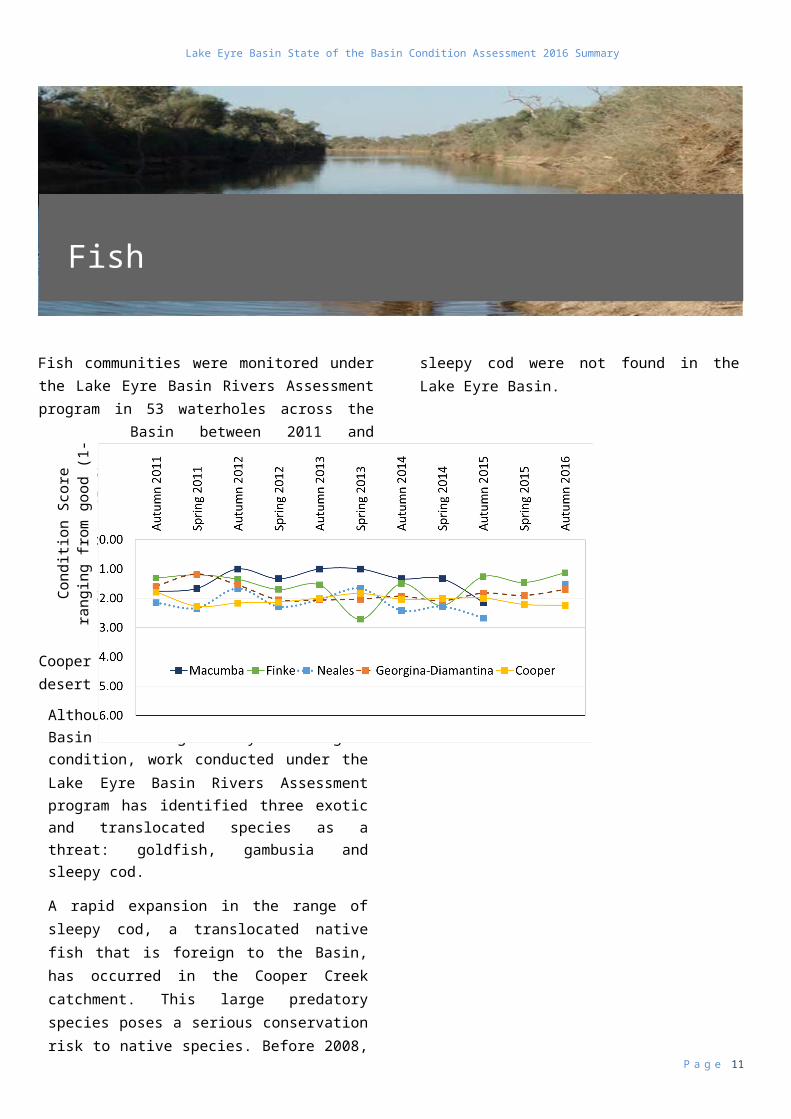
Fish communities were monitored under the Lake Eyre Basin Rivers Assessment program in 53 waterholes across the Basin between 2011 and 2016. Fish communities are generally in good condition across the Basin (Figure 3), with riverine environments supporting 19 native fish species including Lake Eyre yellow belly, Barcoo grunter, three catfish species, Cooper Creek tandan, Welch’s grunter, desert goby and Finke goby.
Although fish communities in the Basin are generally in good condition, work conducted under the Lake Eyre Basin Rivers Assessment program has identified three exotic and translocated species as a threat: goldfish, gambusia and sleepy cod.
A rapid expansion in the range of sleepy cod, a translocated native fish that is foreign to the Basin, has occurred in the Cooper Creek catchment. This large predatory species poses a serious conservation risk to native species. Before 2008, sleepy cod were not found in the Lake Eyre Basin.
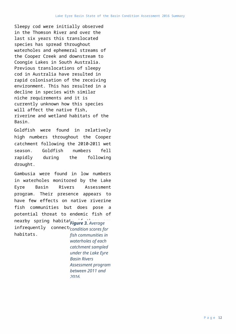
Sleepy cod were initially observed in the Thomson River and over the last six years this translocated species has spread throughout waterholes and ephemeral streams of the Cooper Creek and downstream to Coongie Lakes in South Australia. Previous translocations of sleepy cod in Australia have resulted in rapid colonisation of the receiving environment. This has resulted in a decline in species with similar niche requirements and it is currently unknown how this species will affect the native fish, riverine and wetland habitats of the Basin.
Goldfish were found in relatively high numbers throughout the Cooper catchment following the 20102011 wet season. Goldfish numbers fell rapidly during the following drought.
Gambusia were found in low numbers in waterholes monitored by the Lake Eyre Basin Rivers Assessment program. Their presence appears to have few effects on native riverine fish communities but does pose a potential threat to endemic fish of nearby spring habitats if these are infrequently connected to riverine habitats.
P a g e 8
Con
ditio
n S
core
rang
ing
from
goo
d (1
-2) t
o di
re (5
-6)
Con
ditio
n S
core
rang
ing
Fish Communities
Figure 3. Average condition scores for fish communities in waterholes of each catchment sampled under the Lake Eyre Basin Rivers Assessment program between 2011 and 2016.
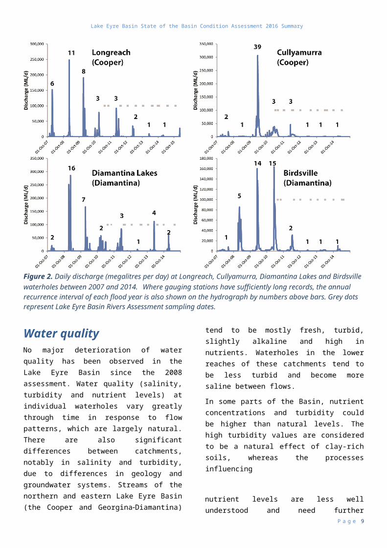
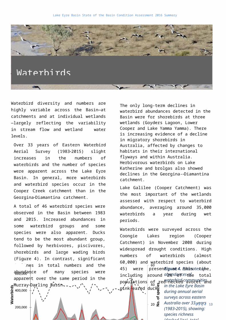
Figure 4. Estimates of abundances of waterbird communities in the Lake Eyre Basin during annual aerial surveys across eastern Australia over 33 years (19832015), showing: species richness (dashed line), total abundance (grey fill) and abundances of each of the five functional response groups: ducks (red); herbivores (green); large wading birds (purple); piscivores (light blue); and shorebirds (orange).
Lake Eyre Basin State of the Basin Condition Assessment 2016 Summary
Waterbird diversity and numbers are highly variable across the Basin—at catchments and at individual wetlands—largely reflecting the variability in stream flow and wetland water levels.
Over 33 years of Eastern Waterbird Aerial Survey (19832015) slight increases in the numbers of waterbirds and the number of species were apparent across the Lake Eyre Basin. In general, more waterbirds and waterbird species occur in the Cooper Creek catchment than in the GeorginaDiamantina catchment.
A total of 46 waterbird species were observed in the Basin between 1983 and 2015. Increased abundances in some waterbird groups and some species were also apparent. Ducks tend to be the most abundant group, followed by herbivores, piscivores, shorebirds and large wading birds (Figure 4). In contrast, significant declines in total numbers and the abundance of many species were apparent over the same period in the MurrayDarling Basin.
The only long-term declines in waterbird abundances detected in the Basin were for shorebirds at three wetlands (Goyders Lagoon, Lower Cooper and Lake Yamma Yamma). There is increasing evidence of a decline in migratory shorebirds in Australia, affected by changes to habitats in their international flyways and within Australia. Herbivorous waterbirds on Lake Katherine and brolgas also showed declines in the Georgina-Diamantina catchment.
Lake Galilee (Cooper Catchment) was the most important of the wetlands assessed with respect to waterbird abundance, averaging around 35,000 waterbirds a year during wet periods.
Waterbirds were surveyed across the Coongie Lakes region (Cooper Catchment) in November 2008 during widespread drought conditions. High numbers of waterbirds (almost 60,000) and waterbird species (about 45) were present at this time, including around 2% of the total populations of red-necked avocet and pink-eared duck.
P a g e 9
Waterbirds
Lake Eyre Basin State of the Basin Condition Assessment 2016 Summary
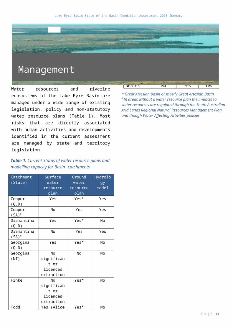
Water resources and riverine ecosystems of the Lake Eyre Basin are managed under a wide range of existing legislation, policy and non-statutory water resource plans (Table 1). Most risks that are directly associated with human activities and developments identified in the current assessment are managed by state and territory legislation.
Catchment (State)
Surface water resource plan
Ground water
resource plan
Hydrology model
Cooper (QLD) Yes Yes* YesCooper (SA)# No Yes YesDiamantina (QLD)
Yes Yes* No
Diamantina (SA)#
No Yes Yes
Georgina (QLD)
Yes Yes* No
Georgina (NT) No significant or licenced extraction
No No
Finke No significant or licenced extraction
Yes* No
Todd Yes (Alice Springs)
Yes* No
Hay (SA)# No Yes NoHay (NT) No significant
or licenced extraction
Yes*
Macumba# No Yes NoNeales# No Yes Yes
Coordinated, cross-border management approaches are more effective in addressing the impacts and risks of Basin wide pressures and threats such as invasive species and climate change.
Management of many invasive species in the Basin involves identification of source populations and potential invasion pathways. This knowledge can be used to develop strategies for preventing or minimising spread. Expansion of cane toad populations, for example, may be inhibited by fencing around invasion hubs such as water storages. Management of invasive riparian plants (e.g. parkinsonia and prickly acacia) involve control or eradication of source populations before they spread.
Adaptation strategies for protecting water resources, riverine ecosystems and biodiversity from climate change impacts include protecting or building the resilience of ecosystems and biota to climatic changes. Relevant approaches include management of existing pressures and threats, and the identification and protection of aquatic refuges (e.g. persistent waterholes) that may allow some aquatic species to persist in the Basin during unfavourable conditions. Priority species or sites for management actions may also shift in relation to climate change projections.
The effective management of international obligations through the Ramsar Convention on wetlands (i.e. Coongie Lakes within the Lake Eyre Basin Agreement area) also requires cross-border coordination of information and management to identify and address threats such as hydrological change, weeds and pests.
P a g e 10
Management
Table 1. Current Status of water resource plans and modelling capacity for Basin catchments
* Great Artesian Basin or mostly Great Artesian Basin # In areas without a water resource plan the impacts to water resources are regulated through the South Australian Arid Lands Regional Natural Resources Management Plan and though Water Affecting Activities policies
Lake Eyre Basin State of the Basin Condition Assessment 2016 Summary
Managing risks to water resources and river ecosystems in the Basin is about determining the consequences or impacts of an activity and the likelihood of events occurring. The aim of planning, policy and management activities is to reduce the consequence of and or the likelihood of an event. Some consequences can be controlled by management (e.g. water allocation and state water management instruments) and others we will have to learn to manage (e.g. climate change). The community’s perception of risk generally highlights issues with the biggest impact on community values or reflects concerns about the adequacy of the current controls in place.
Risks associated with the majority of current threats to water resources and riverine aquatic ecosystems in the Basin are typically considered to be low under current water resource management plans, pastoral legislation and inter-state cooperation in assessing the effects of cross-border issues on stream flow. Additionally, the spatial extent and probable responses to many current threats are localised, often concentrated around particular waterholes. There is potential for the intensity and extent of some localised pressures to grow in the future, potentially leading to cumulative impacts across the Basin if aquatic refuges are disrupted during bust phases or the hydrological connectivity between these is limited during boom phases.
Invasive species, including aquatic and terrestrial animals and terrestrial plants, are a high-priority risk to riverine ecosystems in the Lake Eyre Basin. There is evidence that invasive goldfish and sleepy cod are becoming more abundant and widespread. Illegal stocking of fish in waterholes for fishing also poses a
risk to aquatic communities in the Basin.
Other current threats with moderately high levels of risk include the uncontrolled outflow of ground waters from artesian bores, mainly because of the potential for populations of gambusia to invade spring habitats and threaten their endemic fish species. The effects of an expanded petroleum and gas industry, particularly in the Cooper basin sub-region of south-western Queensland and north-eastern South Australia, are of moderate concern, as is the associated mining infrastructure and roads on surface water movement within the floodplain. Floodplain infrastructure has the potential to alter the quality and connectedness of aquatic and riparian habitats, although these effects remain uncertain.
Climate change is the most concerning emerging threat to the Basin. Rising temperatures and heat waves pose significant risks to riverine ecosystems and biodiversity. Potential impacts may include loss of native species and shifts in species’ distributions across the Basin. Climate change may facilitate further growth and spread of many invasive species and aggravate their effects on native species and ecosystems. Rainfall and hydrological changes are highly uncertain, but a drier future in the Basin is possible by the end of this century, especially in the south. A South Australian assessment of the vulnerability of water-dependent ecosystems to projected climate change identified the Far North Prescribed Wells Area—which encompasses the South Australian portion of the Basin—as an area with significant risks, especially with respect to the presence of high value water-dependent ecosystems in the region, such as the Coongie Lakes Ramsar site.
P a g e 11
High-risk pressures and threats
Lake Eyre Basin State of the Basin Condition Assessment 2016 Summary
P a g e 12
Lake Eyre Basin State of the Basin Condition Assessment 2016 Summary
The Lake Eyre Basin State of the Basin Condition Assessment 2016 report addresses the requirements of the Lake Eyre Basin Intergovernmental Agreement Act 2001 to review and report on the condition of watercourses and catchments within the Lake Eyre Basin Agreement Area every 10 years. This summary document provides a synthesis of the report’s key findings.
The report found that the riverine aquatic ecosystems of the Basin are currently in relatively good condition which is consistent with the findings of the initial 2008 report.
Surface water flow regime is considered to be near natural condition.
Water quality has not deteriorated since the 2008 assessment.
Fish community is in good condition, but the rapid expansion of the sleepy cod is of concern.
Waterbird numbers have increased over the past 33 years.
Most of the current risks to the Basin’s water resources and river ecosystems are directly associated with human activities and developments. These risks are considered low as they are managed by State and Territory legislation and water resource management plans.
Future pressures and threats considered to be of highest risk include the management of invasive species and the effects of climate change. Mining and petroleum activities, altered river flow patterns and uncontrolled flow of groundwater from artesian bores were of significant concern to the Lake Eyre Basin Community Advisory Committee.
Joint leadership by jurisdictions under the Lake Eyre Basin Intergovernmental Agreement, coupled with strong scientific advice and community involvement and support for Intergovernmental Agreement activities, is a major contributing factor to the Basin’s good condition.
The Lake Eyre Basin State of the Basin Condition Assessment 2016 report provides a solid basis for thinking about what might come next for the Basin.
It reveals an internationally significant river Basin in good environmental condition, which is a rarity around the globe.
It provides a springboard for considering how jurisdictions might go about ensuring that such quality is maintained into the future.
P a g e 13
Conclusion
Lake Eyre Basin State of the Basin Condition Assessment 2016 Summary
P a g e 14
For further information, contact:
Lake Eyre Basin Secretariat
Department of Agriculture and Water Resources
GPO Box 858
Canberra ACT 2601
Email: [email protected].
Or visit
www.lakeeyrebasin.gov.au
This report was prepared by
Dr Samantha Capon, Australian Rivers Institute, Griffith University.
For further information, contact:
Lake Eyre Basin Secretariat
Department of Agriculture and Water Resources
GPO Box 858
Canberra ACT 2601
Email: [email protected].