Embed Size (px)
Citation preview
Deutscher Wetterdienst
Consolidation of the software for the generation of External Parameters and
extension with new raw data sets
Hermann Asensio
Task 2: Tools – Software for generating external parameters
• Write software requirements specification;evaluate existing tools (DWD, PEP by CLM-community, fieldextra by
MeteoSwiss) choose a solution
• Consolidate tools to retrieve data from DWD database
• Create/consolidate software to process raw data, as defined in first bullet(interface with raw data, look-up table, aggregation on user defined grid, GRIB and NetCDF output, …)
• Create and deploy a reference system at DWD, accessible through a Web interface (using consolidated look-up tables defined in task 4)
• Write technical documentation
Tasks
Tasks
Task 3: Revision of external parameters
Task 3.1: Document available data
Task 3.2: Consolidate and extend database
Add seasonal climatology of vegetation characteristics. Add parameters for subscale orography. Add parameters for orographic radiation correction. Add parameters for urban fraction. Add parameters for deep soil temperature. Add parameters for FLake. Provide alternative sets of soil types in Europe. Address the feasibility of deriving surface characteristics with known deficiencies (e.g. solar albedo) using alternative data sources or methods.
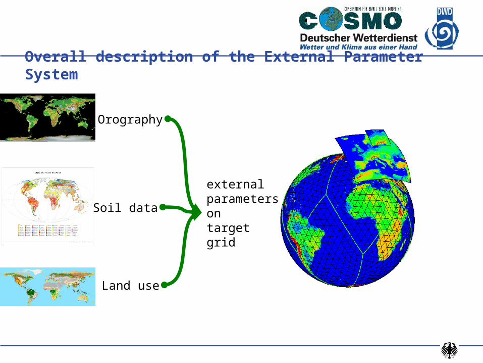
Overall description of the External Parameter System
externalparametersontarget grid
Orography
Soil data
Land use
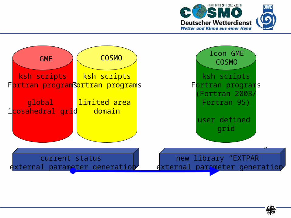
ksh scriptsFortran programs
global icosahedral grid
GME
ksh scriptsFortran programs
limited area domain
COSMO
current status external parameter generation
new library “EXTPAR”external parameter generation
ksh scriptsFortran programs
(Fortran 2003/Fortran 95)
user defined grid
Icon GMECOSMO
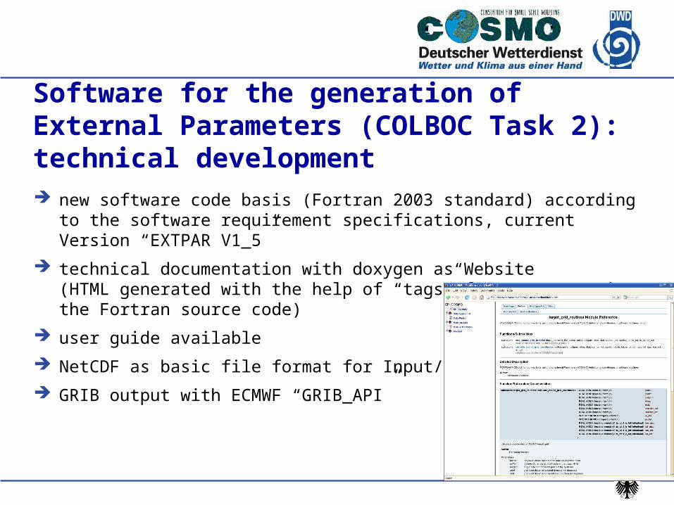
Software for the generation of External Parameters (COLBOC Task 2): technical development new software code basis (Fortran 2003 standard) according to the software
requirement specifications, current Version “EXTPAR V1_5”
technical documentation with doxygen as Website(HTML generated with the help of “tags” from comments in the Fortran source code)
user guide available
NetCDF as basic file format for Input/Output
GRIB output with ECMWF “GRIB_API”
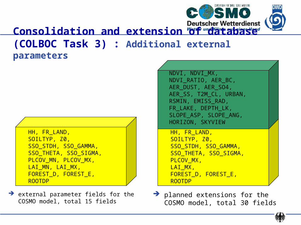
Consolidation and extension of database (COLBOC Task 3) : Additional external parameters
external parameter fields for the COSMO model, total 15 fields
planned extensions for the COSMO model, total 30 fields
HH, FR_LAND,SOILTYP, Z0,SSO_STDH, SSO_GAMMA,SSO_THETA, SSO_SIGMA,PLCOV_MN, PLCOV_MX,LAI_MN, LAI_MX,FOREST_D, FOREST_E,ROOTDP
HH, FR_LAND,SOILTYP, Z0,SSO_STDH, SSO_GAMMA,SSO_THETA, SSO_SIGMA,PLCOV_MX,LAI_MX,FOREST_D, FOREST_E,ROOTDP
NDVI, NDVI_MX,NDVI_RATIO, AER_BC,AER_DUST, AER_SO4,AER_SS, T2M_CL, URBAN,RSMIN, EMISS_RAD,FR_LAKE, DEPTH_LK,SLOPE_ASP, SLOPE_ANG,HORIZON, SKYVIEW
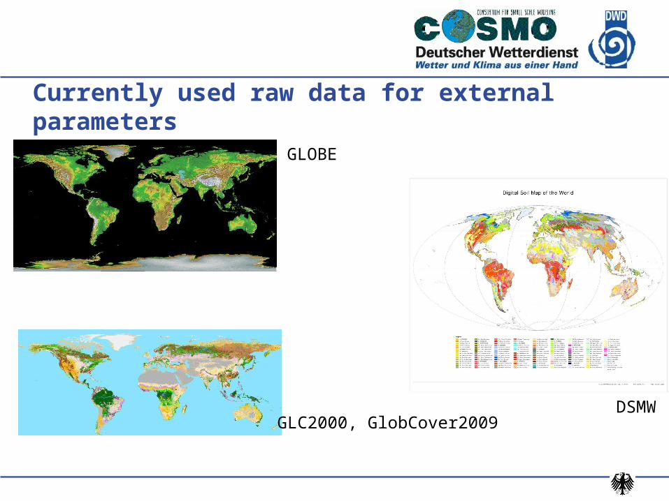
Currently used raw data for external parametersGLOBE
DSMWGLC2000, GlobCover2009
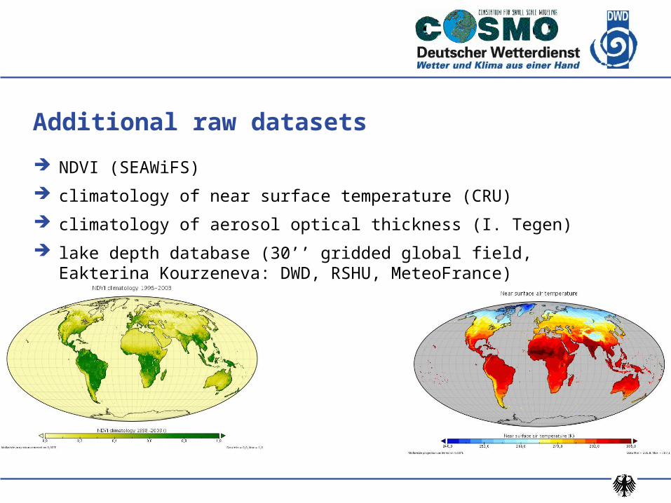
NDVI (SEAWiFS)
climatology of near surface temperature (CRU)
climatology of aerosol optical thickness (I. Tegen)
lake depth database (30’’ gridded global field, Eakterina Kourzeneva: DWD, RSHU, MeteoFrance)
Additional raw datasets
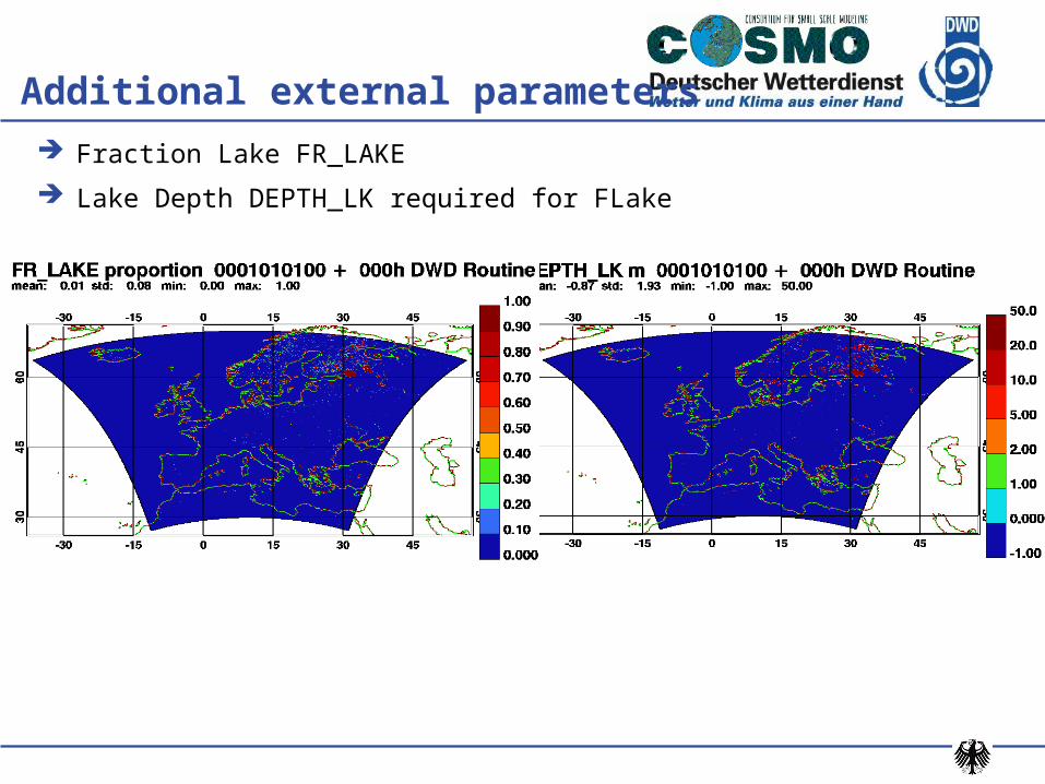
Additional external parameters
Fraction Lake FR_LAKE
Lake Depth DEPTH_LK required for FLake
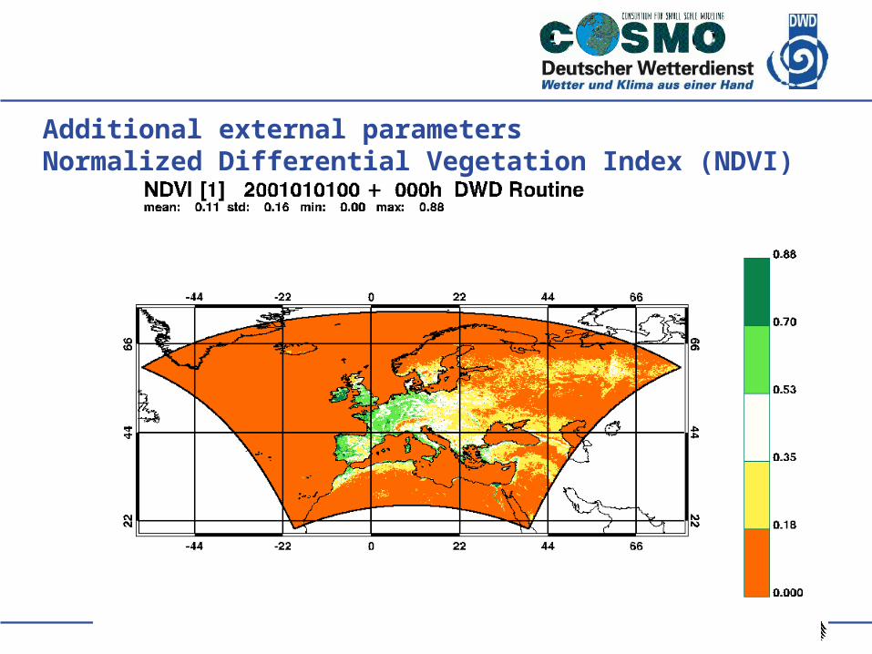
Additional external parametersNormalized Differential Vegetation Index (NDVI)
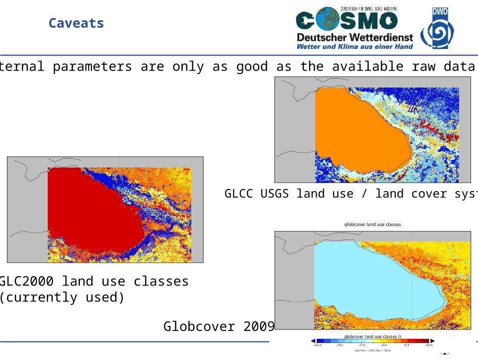
Caveats
The external parameters are only as good as the available raw data sets.
GLC2000 land use classes(currently used)
Globcover 2009
GLCC USGS land use / land cover system
EXTPAR development
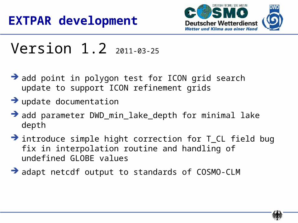
Version 1.2 2011-03-25
add point in polygon test for ICON grid search update to support ICON refinement grids
update documentation
add parameter DWD_min_lake_depth for minimal lake depth
introduce simple hight correction for T_CL field bug fix in interpolation routine and handling of undefined GLOBE values
adapt netcdf output to standards of COSMO-CLM
EXTPAR development
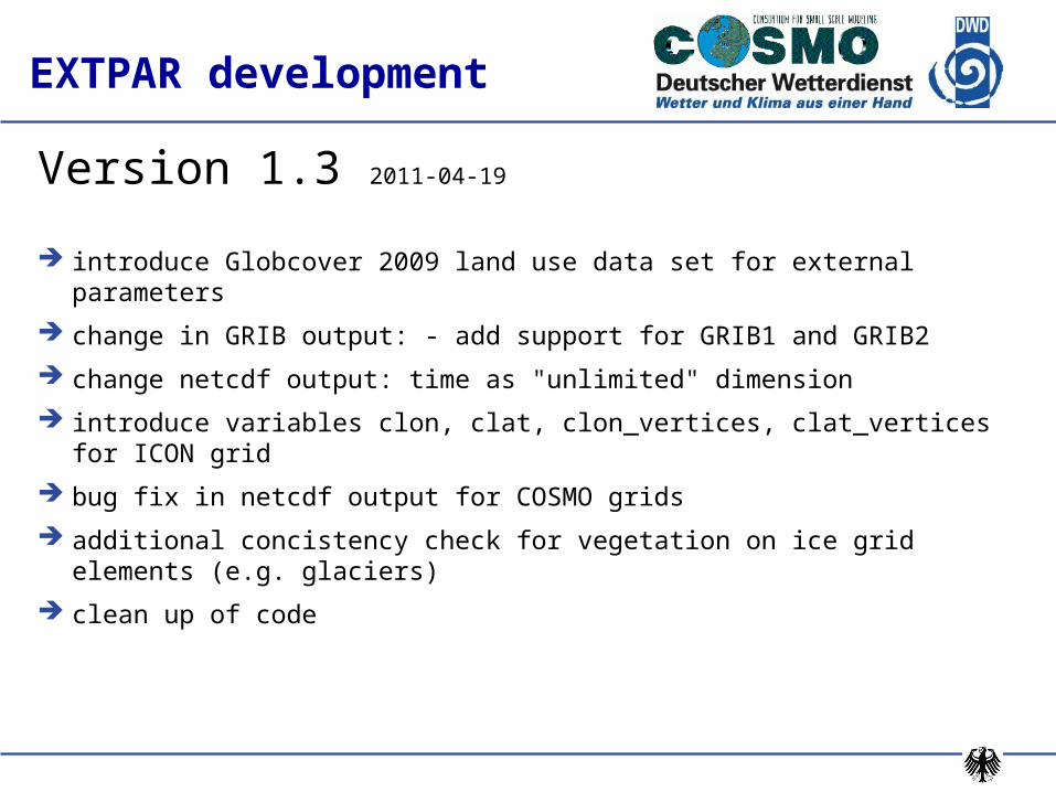
Version 1.3 2011-04-19
introduce Globcover 2009 land use data set for external parameters
change in GRIB output: - add support for GRIB1 and GRIB2
change netcdf output: time as "unlimited" dimension
introduce variables clon, clat, clon_vertices, clat_vertices for ICON grid
bug fix in netcdf output for COSMO grids
additional concistency check for vegetation on ice grid elements (e.g. glaciers)
clean up of code
EXTPAR development
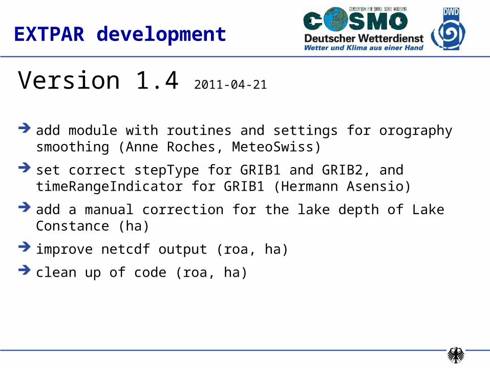
Version 1.4 2011-04-21
add module with routines and settings for orography smoothing (Anne Roches, MeteoSwiss)
set correct stepType for GRIB1 and GRIB2, and timeRangeIndicator for GRIB1 (Hermann Asensio)
add a manual correction for the lake depth of Lake Constance (ha)
improve netcdf output (roa, ha)
clean up of code (roa, ha)
EXTPAR development
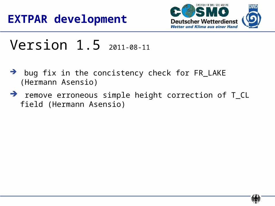
Version 1.5 2011-08-11
bug fix in the concistency check for FR_LAKE (Hermann Asensio)
remove erroneous simple height correction of T_CL field (Hermann Asensio)
Open topics
distribution of software (and raw datasets)
Webinterface for standard requests for the generation of external parameters for arbitrary domains (prototype available https://webservice.dwd.de/)
update documentation
Software for the generation of External Parameters (COLBOC Task 2) : open topics
Consolidation and extension of database (COLBOC Task 3) : open topics
smoothing of orography in EXTPAR for parameters for sub-grid scale orography effects (proper scale separation for Z0 / SSO ?)
External parameters for orographic radiation correction
consolidate and extend raw datasets:
Harmonized World Soil Database
MODIS data for surface background albedo
ETOPO1, SRTM or ASTER DEM for orography
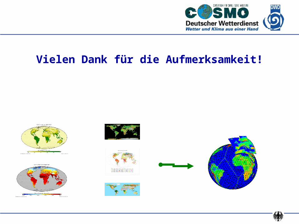
Vielen Dank für die Aufmerksamkeit!