Embed Size (px)
Citation preview

United Nations Economic Commission for Africa
ICT and Sciences & Technology Division (ISTD)
Makane FAYE
E-Applications Section
Developing Spatial Data Infrastructure (SDI) in Africa: Developing Spatial Data Infrastructure (SDI) in Africa:
A cooperative Geospatial information Management processA cooperative Geospatial information Management process
IAMOSA– Geneva – 16-18 March 2011

22www.uneca.orgwww.uneca.orgwww.uneca.orgwww.uneca.orgwww.uneca.orgwww.uneca.orgwww.uneca.orgwww.uneca.org
Outlines
� Why Geographies
� Why Spatial Data Infrastructures
� What SDI is about
� Africa’s Vision : ARSDI
� Priorities & Strategies
� Challenges & Conclusions

33www.uneca.orgwww.uneca.orgwww.uneca.orgwww.uneca.orgwww.uneca.orgwww.uneca.orgwww.uneca.orgwww.uneca.org
Why we need Geographies
� All the information products exemplified would not be complete without the location attribute
� They need to be localized:
� Where are the features located?
� Where are the population involved in an activity, vis-à-vis location of the activity?
� Who will benefit from an activity or event ? Or at risk? Where are they?
� Where are the markets for the products? The input factors?
� Where are the infrastructure elements, utilities, etc?
� What areas are suitable (or unsuitable) for specific activities or events?
� How do we move (people, products, services) from source to destination?
Need for complex Information
Food Security Land cover, soil, topography, hydrography, rainfall,
moisture, demographics, infrastructure, yield,
production..
Water Supply Hydrography, topography, aquifers, waterbodies,
land cover, soil types, vegetation, rainfall…
Resources
Management
Ecosystems, biodiversity, vegetation, land cover,
soils, water, wetlands, biomass…
Drought Rainfall, temperature, evapo-transpiration, wind,
aerosols…
Security and
Emergency
Land cover, soil chemistry, topography, geology,
utilities, settlements, transport infrastructure….
Health
Planning
Hospitals locations, settlements and demographics,
disease vectors, environmental factors distribution…
Etc.. Etc..
44www.uneca.orgwww.uneca.orgwww.uneca.orgwww.uneca.orgwww.uneca.orgwww.uneca.orgwww.uneca.orgwww.uneca.org
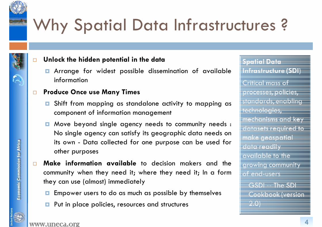
Why Spatial Data Infrastructures ?
� Unlock the hidden potential in the data
� Arrange for widest possible dissemination of available information
� Produce Once use Many Times
� Shift from mapping as standalone activity to mapping as component of information management
� Move beyond single agency needs to community needs : No single agency can satisfy its geographic data needs on its own - Data collected for one purpose can be used for other purposes
� Make information available to decision makers and the community when they need it; where they need it; In a form they can use (almost) immediately
� Empower users to do as much as possible by themselves
� Put in place policies, resources and structures

55www.uneca.orgwww.uneca.orgwww.uneca.orgwww.uneca.orgwww.uneca.orgwww.uneca.orgwww.uneca.orgwww.uneca.org
SDI Africa : National Governance
14 Countries with SDI
Coordinating Bodies
Botswana, Burkina,
Congo, Liberia,
Madagascar, Mali,
Namibia, Nigeria,
Senegal, South Africa,
Sudan, Swaziland,
Tanzania, Zambia
9 Countries with SDI Committee, Sub-Committees, Working Groups
Botswana, Burkina, Liberia, Mali, Namibia, Nigeria, South Africa, Swaziland, Tanzania.

66www.uneca.orgwww.uneca.orgwww.uneca.orgwww.uneca.orgwww.uneca.orgwww.uneca.orgwww.uneca.orgwww.uneca.org
SDI Africa : National Implementation
At least 1 Meeting
held in a year
Botswana, Burkina,
Madagascar, Mali,
Namibia, Nigeria,
Senegal, South Africa,
Sudan, Tanzania
13Countries with Geographical Names Authority
Botswana, Burkina, Congo, Liberia, Madagascar, Mali, Namibia, Nigeria, Senegal, South Africa, Sudan, Tanzania, Zambia

77www.uneca.orgwww.uneca.orgwww.uneca.orgwww.uneca.orgwww.uneca.orgwww.uneca.orgwww.uneca.orgwww.uneca.org
SDI Africa : Maps Revision
16 Countries with
New Mapping
Initiatives
BBotswana, Burkina,
Congo, Lesotho, Liberia,
Madagascar, Mali,
Namibia, Niger, Nigeria,
Senegal, South Africa,
Sudan, Swaziland,
Tanzania, Zambia
15 Countries with Maps Revision
Botswana, Burkina, Congo, Lesotho, Liberia, Madagascar, Mali, Namibia, Nigeria, Senegal, South Africa, Sudan, Swaziland, Tanzania, Zambia
88www.uneca.orgwww.uneca.orgwww.uneca.orgwww.uneca.orgwww.uneca.orgwww.uneca.orgwww.uneca.orgwww.uneca.org
Let’s Assume we do not have yet…
� … functional “SDIs” in Africa.
� The technology, policies,
standards, human
resources, and related
activities necessary to
acquire, process,
distribute, use, maintain,
and preserve spatial data
� What should we do?

99www.uneca.orgwww.uneca.orgwww.uneca.orgwww.uneca.orgwww.uneca.orgwww.uneca.orgwww.uneca.orgwww.uneca.org
� ARDSI Paradigm
� Adopt cooperative, multi-stakeholder approach to production, management, and dissemination of spatially enabled data: Regional and National level
� Improve regional scale development decision-making
� Ensure that reliable information is easily available for policy, investment, planning, management and monitoring and evaluation purposes at the regional and sub regional scales:
� Infrastructures, Agriculture, Environment, Health, Biodiversity, etc…
� They all need to answer “where”questions from a regional perspective
The African Regional Spatial Data Infrastructure
1010www.uneca.orgwww.uneca.orgwww.uneca.orgwww.uneca.orgwww.uneca.orgwww.uneca.orgwww.uneca.orgwww.uneca.org
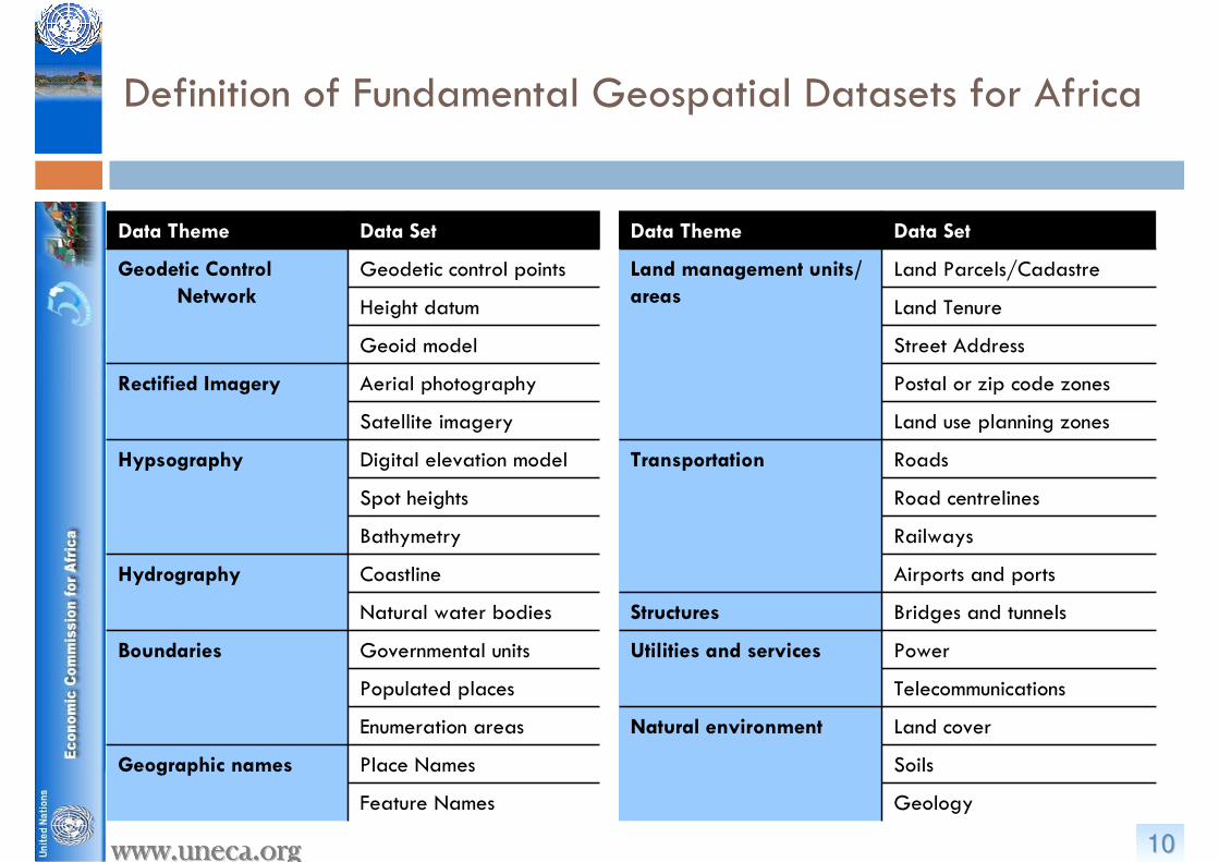
Data Theme Data Set
Geodetic Control
Network
Geodetic control points
Height datum
Geoid model
Rectified Imagery Aerial photography
Satellite imagery
Hypsography Digital elevation model
Spot heights
Bathymetry
Hydrography Coastline
Natural water bodies
Boundaries Governmental units
Populated places
Enumeration areas
Geographic names Place Names
Feature Names
Data Theme Data Set
Land management units/
areas
Land Parcels/Cadastre
Land Tenure
Street Address
Postal or zip code zones
Land use planning zones
Transportation Roads
Road centrelines
Railways
Airports and ports
Structures Bridges and tunnels
Utilities and services Power
Telecommunications
Natural environment Land cover
Soils
Geology
Definition of Fundamental Geospatial Datasets for Africa

1111www.uneca.orgwww.uneca.orgwww.uneca.orgwww.uneca.orgwww.uneca.orgwww.uneca.orgwww.uneca.orgwww.uneca.org
Creation of Regional Databases
� Geospatial databases for regional use
� Infrastructures Development Database (Energy, Transport, Telecommunication…)
� African Climate Policy Development Database
� Agriculture Commodity Value Chain Database
� Disasters and Security Preparedness Database
Trans African Highways

1212www.uneca.orgwww.uneca.orgwww.uneca.orgwww.uneca.orgwww.uneca.orgwww.uneca.orgwww.uneca.orgwww.uneca.org

1313www.uneca.orgwww.uneca.orgwww.uneca.orgwww.uneca.orgwww.uneca.orgwww.uneca.orgwww.uneca.orgwww.uneca.org
� Network of permanent GNSS base
stations (CORS) covering the whole
continent
� At least one in every country
� Eventually, everywhere in Africa less
than 1000 km from a base station.
� Salient Features
� 5 GPS CORS Stations installed in African
Sub regions
� 30 GPS Reference Stations to be installed
� On-going inventory of existing and
planned GNSS base stations in African
countries
� http://geoinfo.uneca.org/afref/
Development of Interoperability & Standards: The Common Geodetic Reference (AFREF)

1414www.uneca.orgwww.uneca.orgwww.uneca.orgwww.uneca.orgwww.uneca.orgwww.uneca.orgwww.uneca.orgwww.uneca.org
� Second Administrative Level Boundary (SALB)
� Produce a comprehensive digital database of Second Administrative Level Boundaries
� Provide a flexible and intuitive coding scheme that can be applied to any country, independently from administrative structure.� an international borders template developed by the
UN Cartographic Section in order to be able to create a global data set that is cross-boundary
� an editing protocol in order to insure the comparability between the countries
� a coding scheme for the identification of each administrative unit through time and space
� a metadata profile that is associated with the information
� a validation process of all the information by an official entity (generally the National Mapping Agency.
� www.salb.org
Development of Interoperability & Standards: The Harmonized Administrative Boundary

1515www.uneca.orgwww.uneca.orgwww.uneca.orgwww.uneca.orgwww.uneca.orgwww.uneca.orgwww.uneca.orgwww.uneca.org
� Existence of many Operational Centres of Excellence
� AGRHYMET
� RECTAS
� RCMRD
� RSAU
� CRASTE
� National Agencies
Data collection, Data collection,
accessibility and accessibility and
integrationintegration
Monitoring Monitoring andand
AssessmentAssessment
Information Information
Diffusion & Diffusion &
CapacityCapacity
Institutions Collectio
n
Access Integrati
onAssessmAssessm
ententMonitoMonito
ringringForecaForeca
ststDiffusiDiffusi
ononCapaciCapaci
tyty
AGRHYMET
RSAU
CRTEAN
RCMRD
African Status : Infrastructures – Enabling Environment
Yes
Yes/No
No

1616www.uneca.orgwww.uneca.orgwww.uneca.orgwww.uneca.orgwww.uneca.orgwww.uneca.orgwww.uneca.orgwww.uneca.org
oo All maintain geoinformation activitiesAll maintain geoinformation activities
oo Same multiple bodies at national levelSame multiple bodies at national level
TANZANIA
EACEACEAC
CAPE VERDE GAMBIA
GHANA
BOTSWANALESOTHOSOUTH AFRICA
SACUSACUSACU
SAO TOME & PRINCIPE
BENINCOTE D’IVOIRE
TOGO
GUINEA LIBERIA NIGERIASIERRA LEONE
BURKINA FASO GUINEA BISSAU SENEGAL MALI NIGER
CHADCAMEROONCENTR. AFR. REPGABONEQUAT. GUINEAREP.CONGO
CEMACCEMACCEMAC
BURUNDIRWANDA
DR CONGOANGOLA
CILSSCILSSCILSSECOWASECOWASECOWAS
ALGERIA LIBYEMORROCO TUNISIA
MAURITANIA
AMUAMUAMU
SADCSADCSADCNAMIBIASWAZILAND
DJIBOUTIERITREAETHIOPIASOUDANSOMALIEKENYAUGANDA
MALAWI ZAMBIAZIMBABWE
IGADIGADIGAD
COMES
A
COMESCOMES
AA
MAURITIUSSEYCHELLES
COMOROSMADAGASCAR
EGYPT
IOCIOCIOC
ECCASECCASECCAS
UEMOAUEMOAUEMOA
Institutional Capacity
� Partnering Numerous Regional and Continental Bodies

1717www.uneca.orgwww.uneca.orgwww.uneca.orgwww.uneca.orgwww.uneca.orgwww.uneca.orgwww.uneca.orgwww.uneca.org
� Institutional Frameworks
� Objective
� To put in place a cooperative, multi-stakeholder approach to production, management, and dissemination of spatially enabled data: Regional and National level
� Committee on Development Information, Science and
Technology (2-5 May 2011 in Addis Ababa, Ethiopia)
� ECA’s parliamentary body to provide technical advice on, and oversight over the information science and technology including Geospatial Science (GSS) and Geospatial Information Technology (GIT).
� Open to delegates from government and various observers
� CODIST-Geo Executive Working Groups :
� Fundamental Datasets, AFREF, Capacity Building, Standards
Geoinformation Governance in Africa

1818www.uneca.orgwww.uneca.orgwww.uneca.orgwww.uneca.orgwww.uneca.orgwww.uneca.orgwww.uneca.orgwww.uneca.org
Networking with Others SDIs….
� United Nations Spatial Data Infrastructure (UNSDI) coordinated by the UN Geographic Information Working Group (UNGIWG)� Vision for comprehensive, decentralized geospatial information
framework that facilitates decision-making at various levels by enabling access, retrieval and dissemination of geospatial data and services in a rapid and secure way
� UNSDI initiative recognizes common interests with national, nongovernmental and multilateral development efforts
� Coordination of activities and services
� ECA role in coordinating African countries
� ARSDI therefore overlaps with UNSDI in content and methodology

1919www.uneca.orgwww.uneca.orgwww.uneca.orgwww.uneca.orgwww.uneca.orgwww.uneca.orgwww.uneca.orgwww.uneca.org
�� StrategyStrategy…… Indigenous African capabilities� Coordinate with other regional bodies a continental vision to foster the
development of an indigenous African capability in Geospatial Science and Technology where all the technical capacities are maintained and shared by Africans.
�� Priorities...Priorities... African Holistic Geoinformation Vision� Build an African Geospatial policy and champion sound research and
technology programmes development, where activities will be significantly expanded to cover the fostering of innovation, product and service development, and applications (linking global to local, based on prevailing social, economic and technological realities in the continent)
Strategies and Priorities

2020www.uneca.orgwww.uneca.orgwww.uneca.orgwww.uneca.orgwww.uneca.orgwww.uneca.orgwww.uneca.orgwww.uneca.org
Contacting Us
� UN Economic Commission for Africa (UNECA)� ICT, Science & Technolgy Division
�http://geoinfo.uneca.org/sdiafrica/�http://www.uneca.org

![[MS-ISTD]: iSCSI Software Target Discovery ProtocolMS-ISTD].pdf · iSCSI Software Target Discovery Protocol ... [MS-ISTD]: iSCSI Software Target Discovery Protocol ... The component](https://img.pdfslide.net/doc/110x75/5aa8c7067f8b9a9a188c0144/ms-istd-iscsi-software-target-discovery-protocol-ms-istdpdfiscsi-software-target.jpg)