Embed Size (px)
Citation preview
Dharhas Pothina
Surface Water Resources Division
To aid water resources planning and management
efforts by providing scientific and engineering
expertise to ensure continued availability of water
supplies and maintenance of the ecological health of
Texas inland aquatic and coastal systems.
Data Consumer & Data Provider
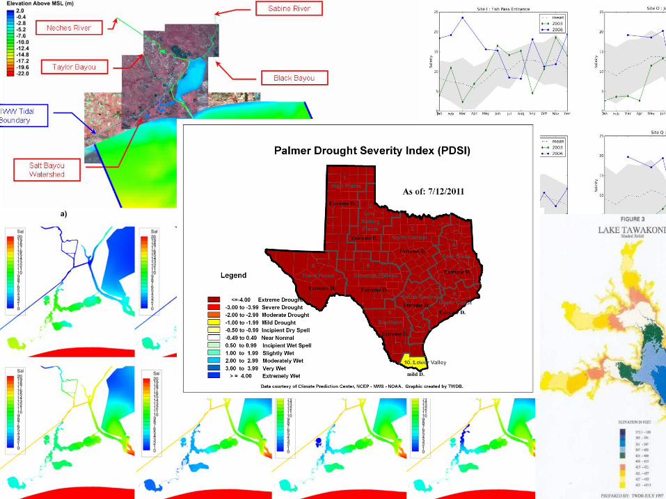
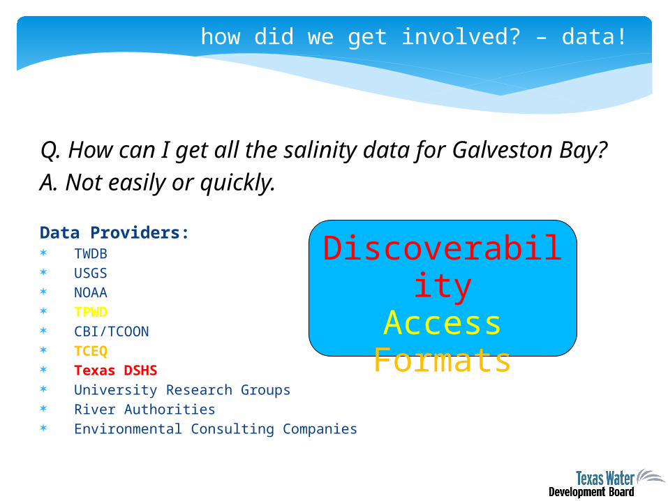
how did we get involved? – data!
Q. How can I get all the salinity data for Galveston Bay?A. Not easily or quickly.
Data Providers: TWDB USGS NOAA TPWD CBI/TCOON TCEQ Texas DSHS University Research Groups River Authorities Environmental Consulting Companies
Discoverability
AccessFormats
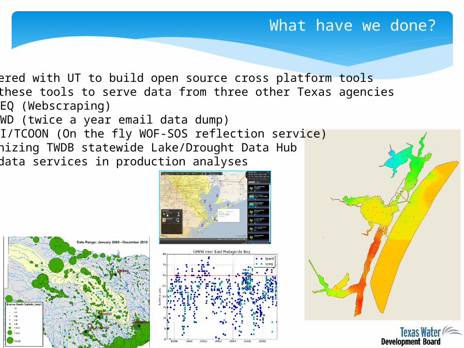
What have we done?
• Partnered with UT to build open source cross platform tools• Used these tools to serve data from three other Texas agencies
• TCEQ (Webscraping)• TPWD (twice a year email data dump)• CBI/TCOON (On the fly WOF-SOS reflection service)
• Modernizing TWDB statewide Lake/Drought Data Hub• Used data services in production analyses
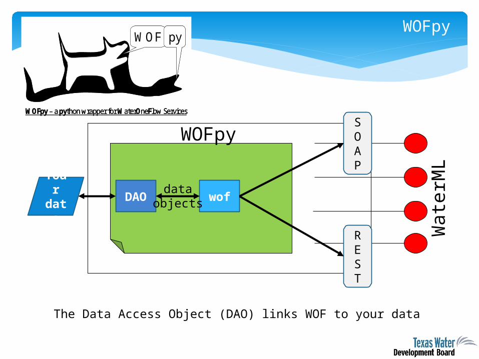
WOF py
WOFpy – a python wrapper for WaterOneFlow Services
WOF py
WOFpy – a python wrapper for WaterOneFlow Services
WOFpy
Your data
DAO wof
SOAP
REST
dataobjects
Wate
rML
The Data Access Object (DAO) links WOF to your data
WOFpy
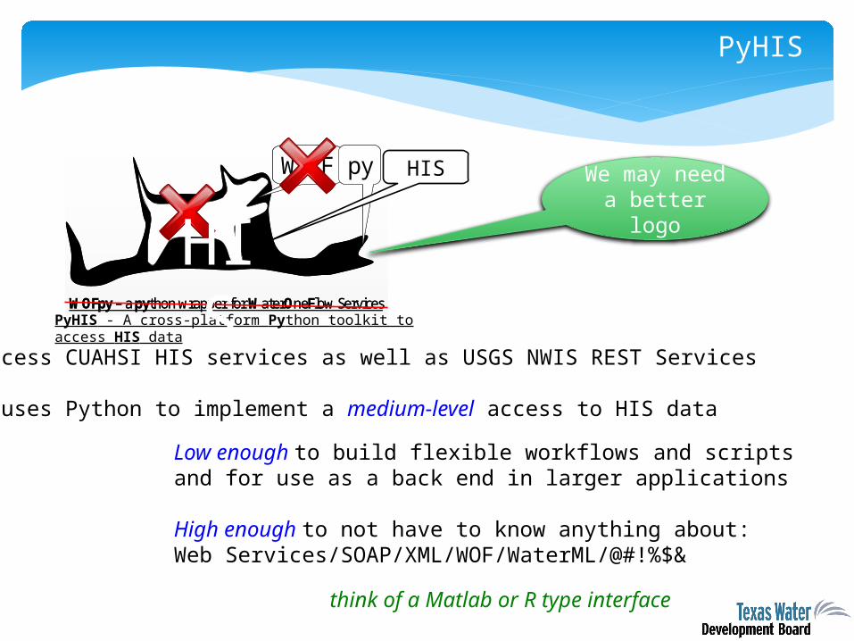
PyHIS
WOF py
WOFpy – a python wrapper for WaterOneFlow Services
WOF py
WOFpy – a python wrapper for WaterOneFlow ServicesPyHIS - A cross-platform Python toolkit to access HIS data
HIS We may need a
better logo
Can access CUAHSI HIS services as well as USGS NWIS REST Services
PyHIS uses Python to implement a medium-level access to HIS data
HIS
Low enough to build flexible workflows and scripts and for use as a back end in larger applications
High enough to not have to know anything about: Web Services/SOAP/XML/WOF/WaterML/@#!%$&
think of a Matlab or R type interface

Lake and Drought Data Hub
• Data from : TWDB, USGS, USACE, USBR, IBWC, LCRA, NCDC, TAMU, DRI
• Pulling in offline historical data
• Assembling ‘best available’ time series from date of reservoir impoundment
• Compiling aggregate measurements (i.e. statewide percent full etc)
• Data will be re-served as web services.
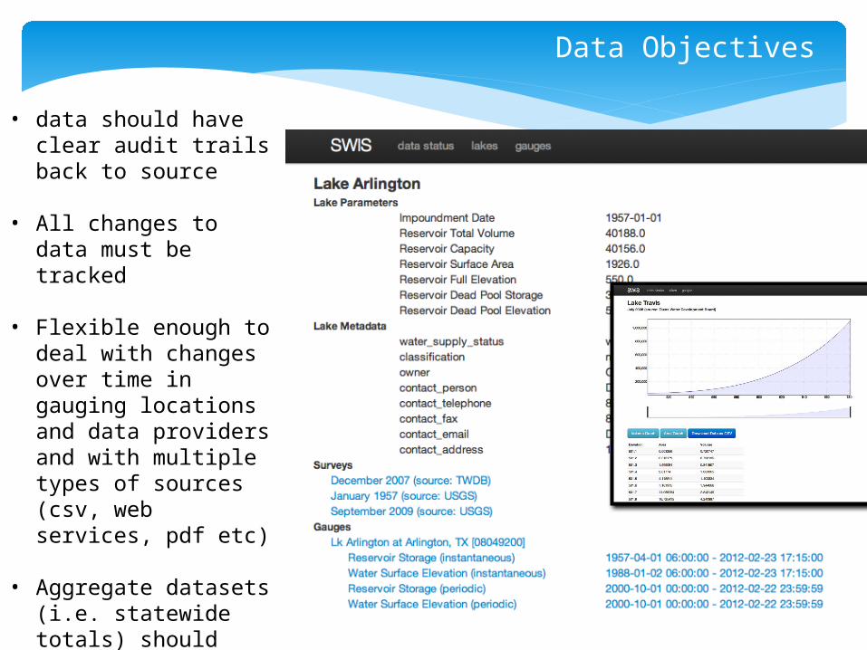
Data Objectives
• data should have clear audit trails back to source
• All changes to data must be tracked
• Flexible enough to deal with changes over time in gauging locations and data providers and with multiple types of sources (csv, web services, pdf etc)
• Aggregate datasets
(i.e. statewide totals) should have clear trail back to components.
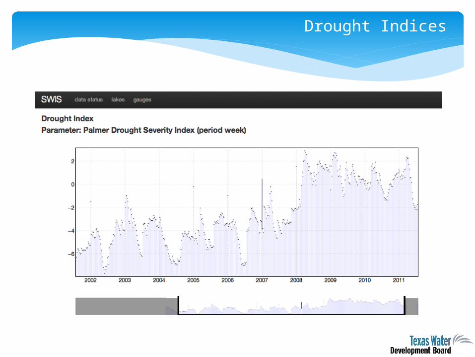
Drought Indices
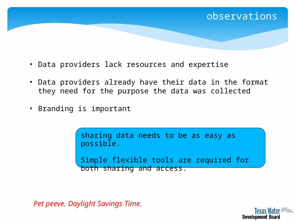
observations
• Data providers lack resources and expertise
• Data providers already have their data in the format they need for the purpose the data was collected
• Branding is important
sharing data needs to be as easy as possible.
Simple flexible tools are required for both sharing and access.
Pet peeve. Daylight Savings Time.