Embed Size (px)
Citation preview
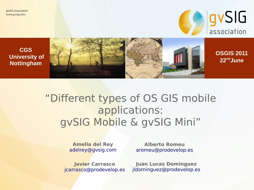
“Different types of OS GIS mobile applications:
gvSIG Mobile & gvSIG Mini”
Amelia del [email protected]
Javier [email protected]
OSGIS 2011 22ndJune
CGS University of Nottingham
Alberto [email protected]
Juan Lucas [email protected]
Contents
1. Mobile applications in gvSIG Project
2. gvSIG Mobile
3. gvSIG Mini
4. Differences between applications
5. Videos
6. Useful links
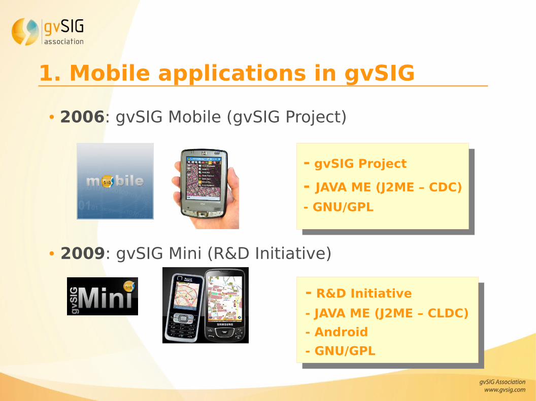
1. Mobile applications in gvSIG
● 2006: gvSIG Mobile (gvSIG Project)
● 2009: gvSIG Mini (R&D Initiative)
- gvSIG Project
- JAVA ME (J2ME – CDC)
- GNU/GPL
- R&D Initiative
- JAVA ME (J2ME – CLDC)
- Android
- GNU/GPL
Contents
1. Mobile applications in gvSIG Project
2. gvSIG Mobile
3. gvSIG Mini
4. Differences between applications
5. Videos
6. Useful links
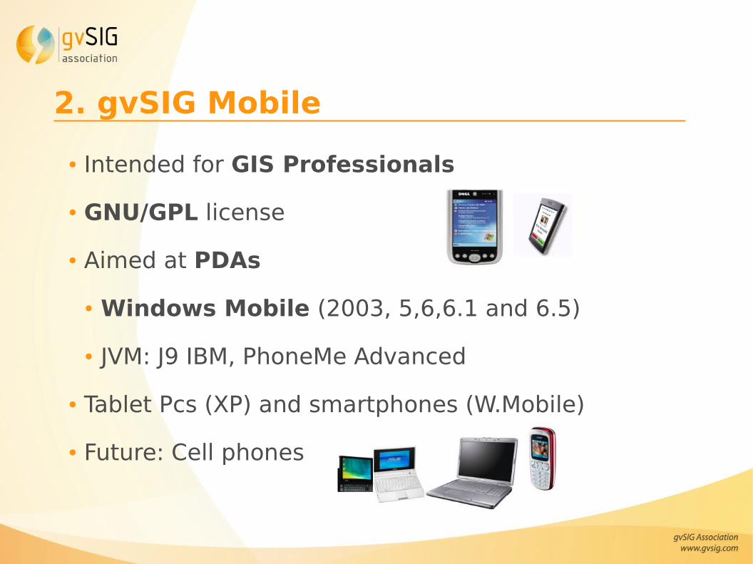
2. gvSIG Mobile
● Intended for GIS Professionals
● GNU/GPL license
● Aimed at PDAs
● Windows Mobile (2003, 5,6,6.1 and 6.5)
● JVM: J9 IBM, PhoneMe Advanced
● Tablet Pcs (XP) and smartphones (W.Mobile)
● Future: Cell phones
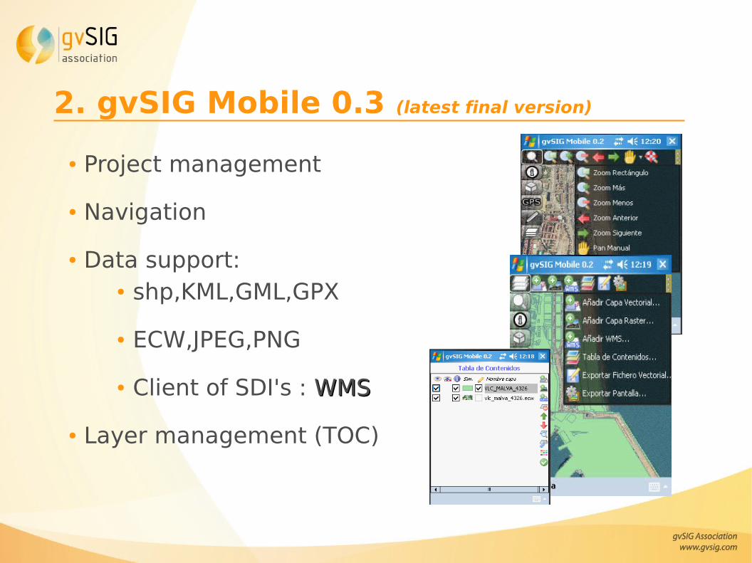
2. gvSIG Mobile 0.3 (latest final version)
● Project management
● Navigation
● Data support:● shp,KML,GML,GPX
● ECW,JPEG,PNG
● Client of SDI's : WMSWMS
● Layer management (TOC)
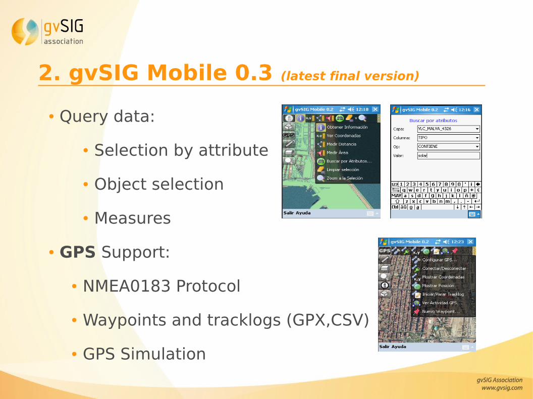
2. gvSIG Mobile 0.3 (latest final version)
● Query data:
● Selection by attribute
● Object selection
● Measures
● GPS Support:
● NMEA0183 Protocol
● Waypoints and tracklogs (GPX,CSV)
● GPS Simulation
2. gvSIG Mobile 0.3 (latest final version)
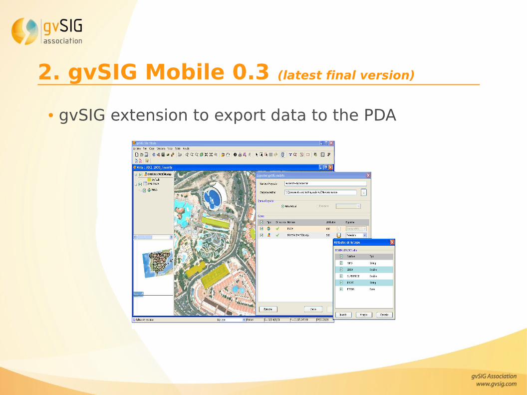
● gvSIG extension to export data to the PDA
2. gvSIG Mobile 0.3 (latest final version)
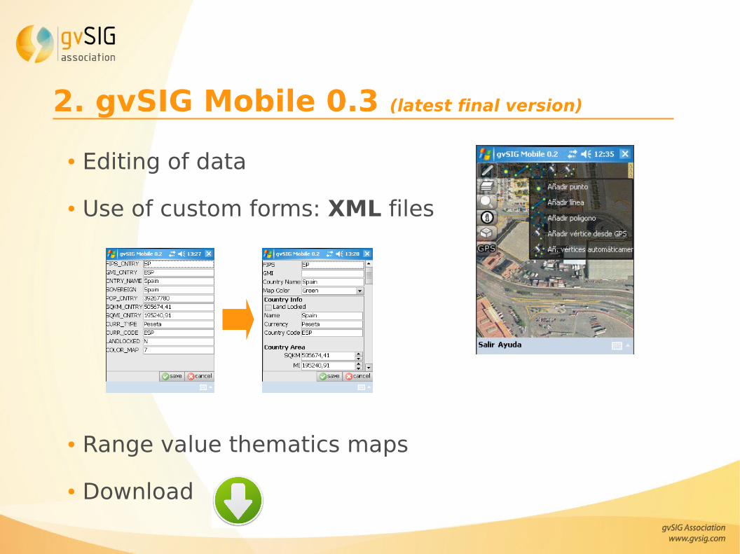
● Editing of data
● Use of custom forms: XML files
● Range value thematics maps
● Download
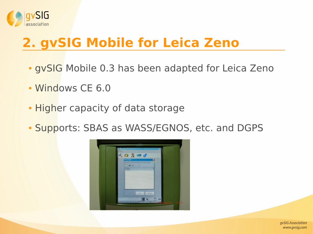
2. gvSIG Mobile for Leica Zeno
● gvSIG Mobile 0.3 has been adapted for Leica Zeno
● Windows CE 6.0
● Higher capacity of data storage
● Supports: SBAS as WASS/EGNOS, etc. and DGPS
2. gvSIG Mobile 1.0 (under development)
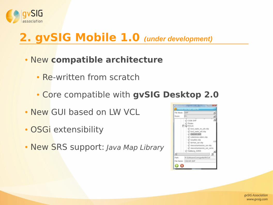
● New compatible architecture
● Re-written from scratch
● Core compatible with gvSIG Desktop 2.0
● New GUI based on LW VCL
● OSGi extensibility
● New SRS support: Java Map Library
2. gvSIG Mobile 1.0 (under development)
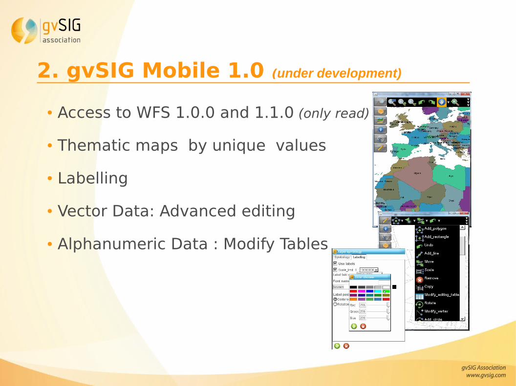
● Access to WFS 1.0.0 and 1.1.0 (only read)
● Thematic maps by unique values
● Labelling
● Vector Data: Advanced editing
● Alphanumeric Data : Modify Tables
2. gvSIG Mobile 1.0 (under development)
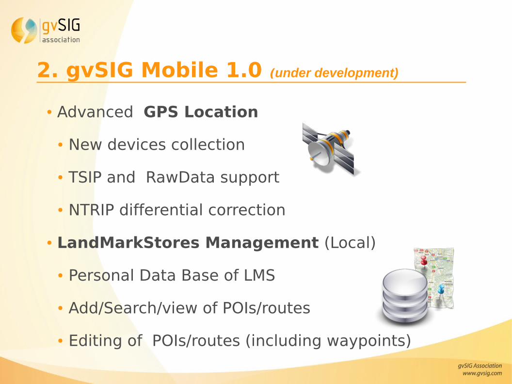
● Advanced GPS Location
● New devices collection
● TSIP and RawData support
● NTRIP differential correction
● LandMarkStores Management (Local)
● Personal Data Base of LMS
● Add/Search/view of POIs/routes
● Editing of POIs/routes (including waypoints)
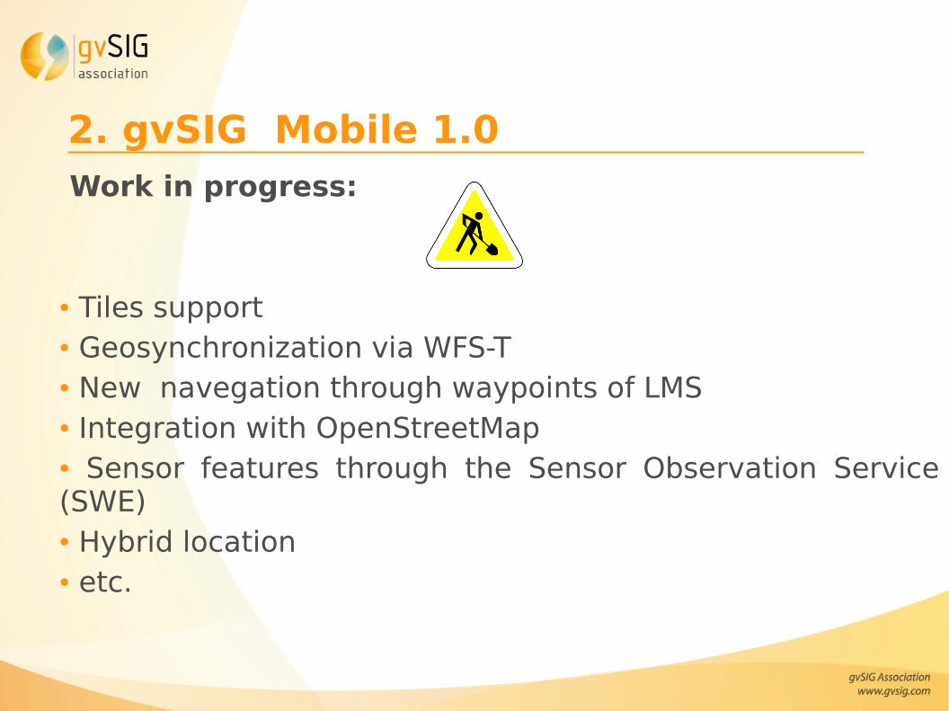
2. gvSIG Mobile 1.0Work in progress:
● Tiles support● Geosynchronization via WFS-T ● New navegation through waypoints of LMS ● Integration with OpenStreetMap● Sensor features through the Sensor Observation Service (SWE)● Hybrid location● etc.
Contents
1. Mobile applications in gvSIG Project
2. gvSIG Mobile
3. gvSIG Mini
4. Differences between applications
5. Videos
6. Useful links
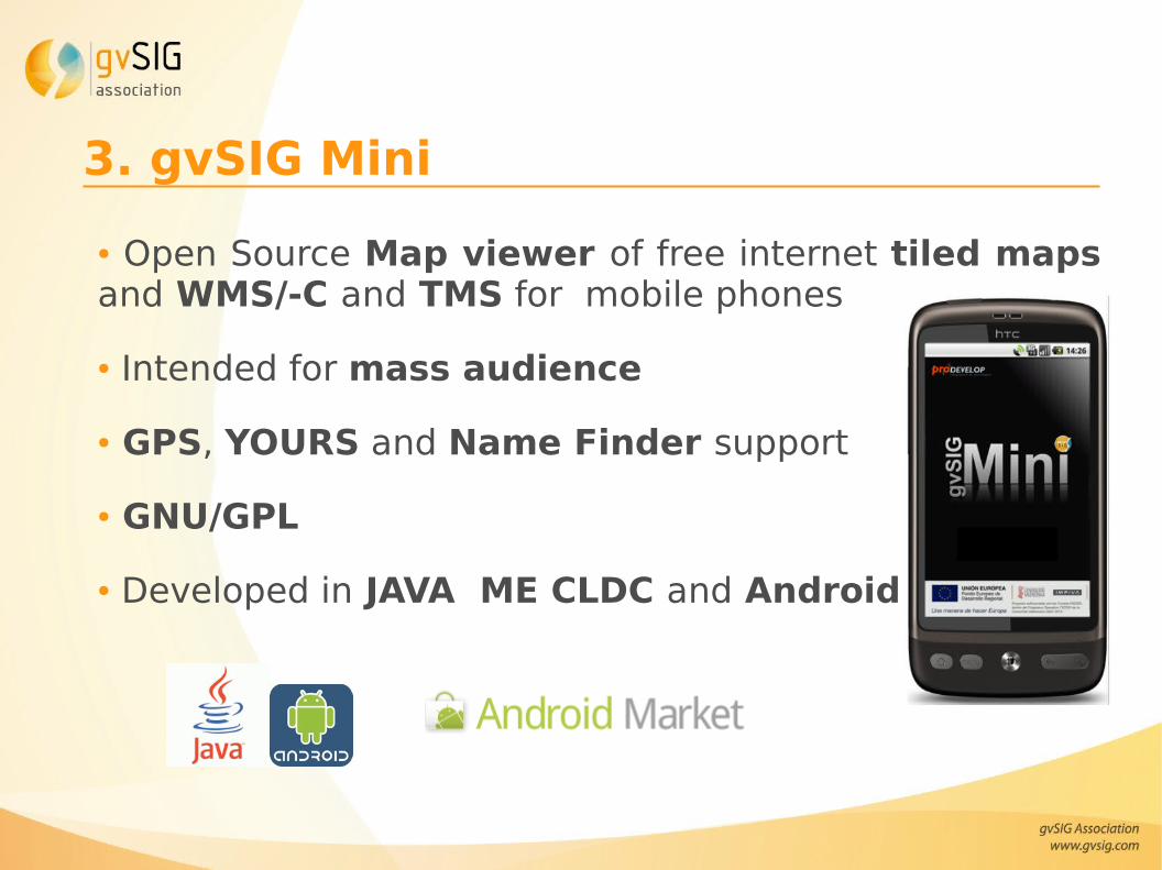
3. gvSIG Mini
● Open Source Map viewer of free internet tiled maps and WMS/-C and TMS for mobile phones
● Intended for mass audience
● GPS, YOURS and Name Finder support
● GNU/GPL
● Developed in JAVA ME CLDC and Android
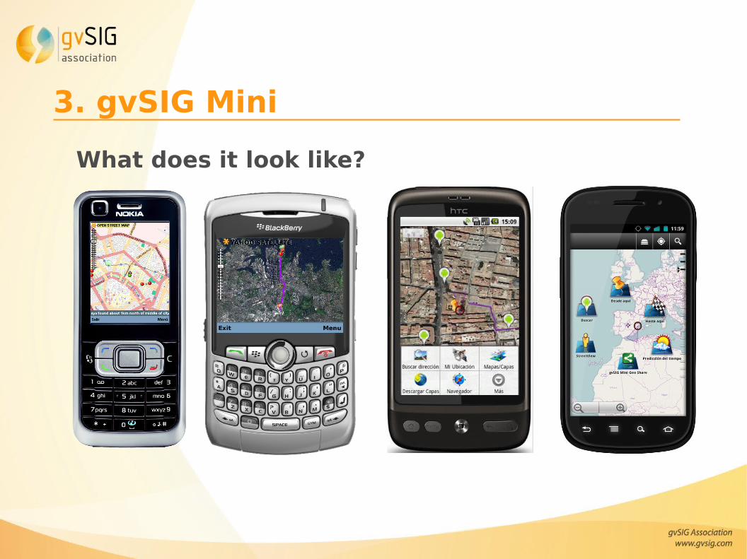
3. gvSIG Mini
What does it look like?
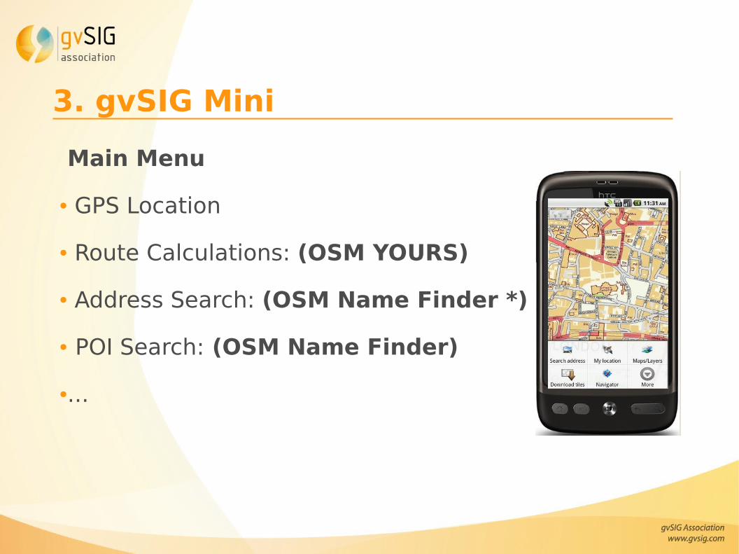
3. gvSIG Mini
Main Menu
● GPS Location
● Route Calculations: (OSM YOURS)
● Address Search: (OSM Name Finder *)
● POI Search: (OSM Name Finder)
●...
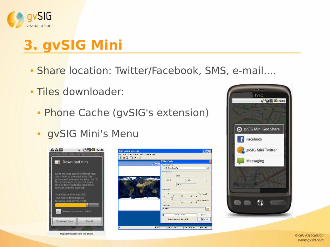
3. gvSIG Mini
● Share location: Twitter/Facebook, SMS, e-mail....
● Tiles downloader:
● Phone Cache (gvSIG's extension)
● gvSIG Mini's Menu
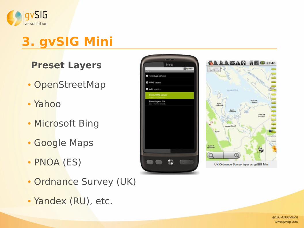
3. gvSIG Mini
Preset Layers
● OpenStreetMap
● Yahoo
● Microsoft Bing
● Google Maps
● PNOA (ES)
● Ordnance Survey (UK)
● Yandex (RU), etc.
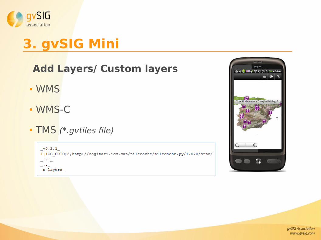
3. gvSIG Mini
Add Layers/ Custom layers
● WMS
● WMS-C
● TMS (*.gvtiles file)
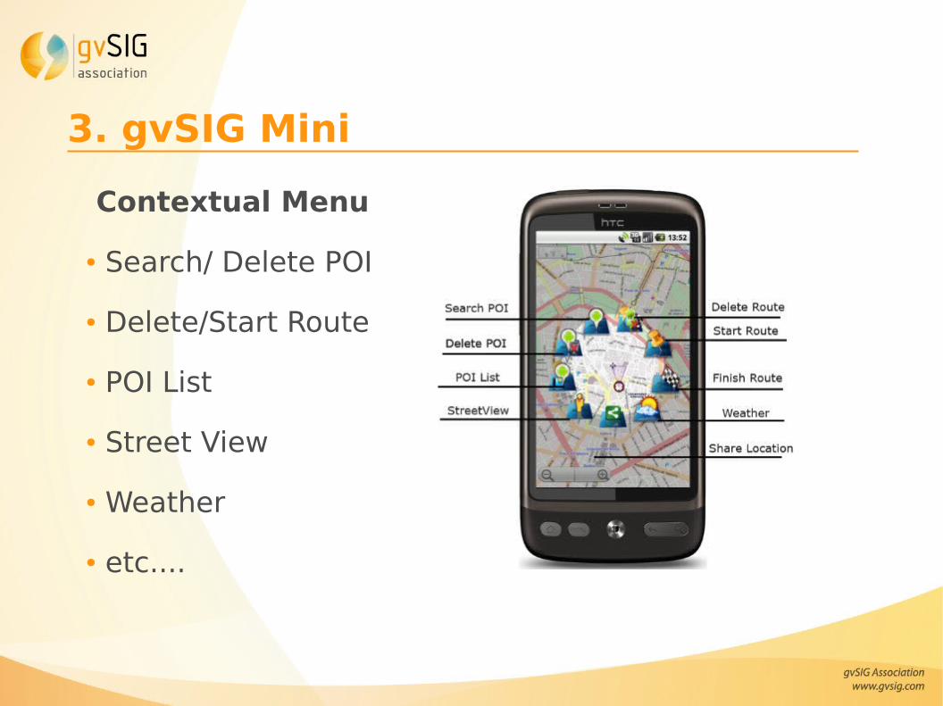
3. gvSIG Mini
Contextual Menu
● Search/ Delete POI
● Delete/Start Route
● POI List
● Street View
● Weather
● etc....
3. gvSIG MiniLatest features:
● Map download directly from the mobile phone, for off-line usage.● Off-line mode for viewing maps with no data connection● Multi touch support● New map rendering system, much more agile● Standard Android search button support● New layers available by default● New cache options● Android 2.2 support (now from 1.5 to 2.2)● UK Ordnance Survey true maps (rendered by OS)
3. gvSIG MiniWork in progress● WFS client (near future)● Google Summer of Code 2011:
● “Tiled vector support of non-standard services data: Panoramio, Flickr, Foursquare, Wikipedia, Buzz, Youtube, etc
● Vector support for gvSIG Mini: GPX, KML,GML
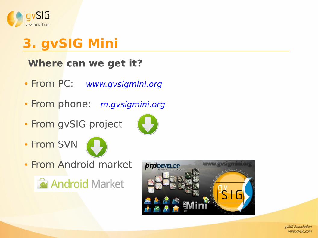
3. gvSIG Mini
Where can we get it?
● From PC: www.gvsigmini.org
● From phone: m.gvsigmini.org
● From gvSIG project
● From SVN
● From Android market
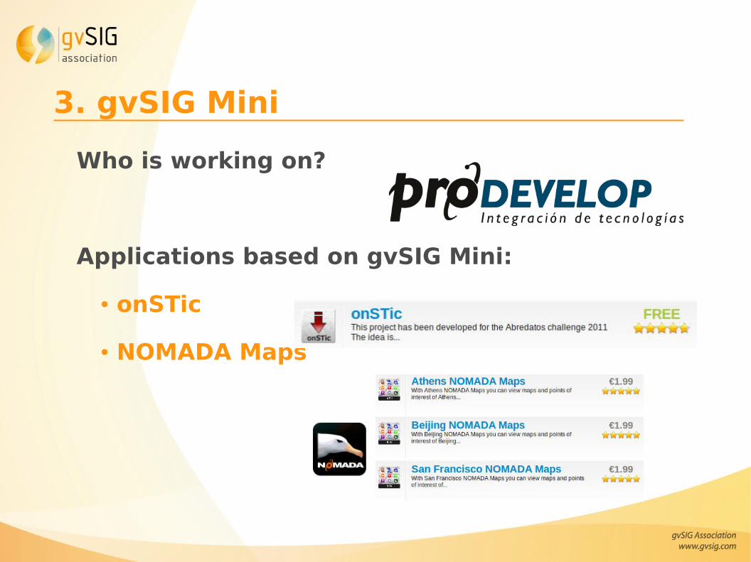
3. gvSIG Mini
Who is working on?
Applications based on gvSIG Mini:
● onSTic
● NOMADA Maps
Contents
1. Mobile applications in gvSIG Project
2. gvSIG Mobile
3. gvSIG Mini
4. Differences between applications
5. Videos
6. Useful links
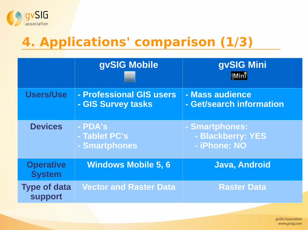
4. Applications' comparison (1/3)
gvSIG Mobile gvSIG Mini
Users/Use - Professional GIS users- GIS Survey tasks
- Mass audience- Get/search information
Devices - PDA's- Tablet PC's- Smartphones
- Smartphones: - Blackberry: YES - iPhone: NO
Operative System
Windows Mobile 5, 6 Java, Android
Type of data support
Vector and Raster Data Raster Data
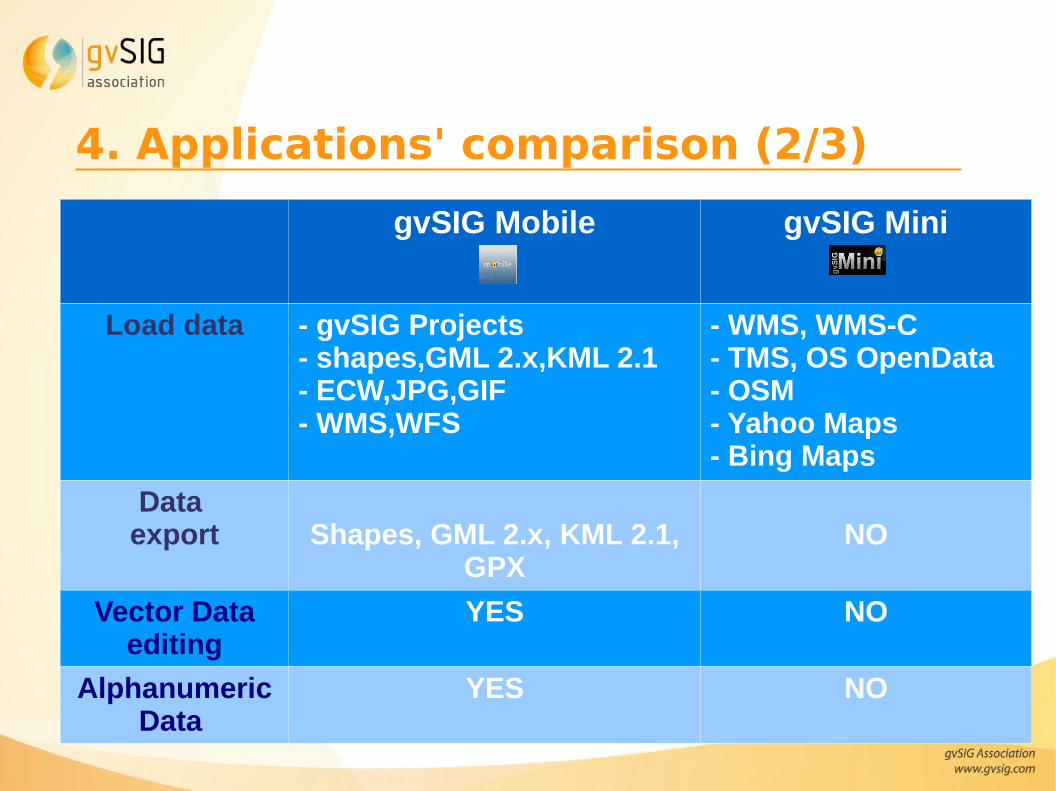
4. Applications' comparison (2/3)
gvSIG Mobile gvSIG Mini
Load data - gvSIG Projects - shapes,GML 2.x,KML 2.1- ECW,JPG,GIF- WMS,WFS
- WMS, WMS-C- TMS, OS OpenData- OSM- Yahoo Maps- Bing Maps
Data export Shapes, GML 2.x, KML 2.1,
GPXNO
Vector Data editing
YES NO
Alphanumeric Data
YES NO
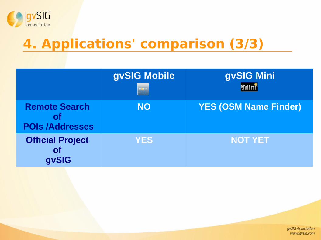
4. Applications' comparison (3/3)
gvSIG Mobile gvSIG Mini
Remote Search of
POIs /Addresses
NO YES (OSM Name Finder)
Official Project of
gvSIG
YES NOT YET
Contents
1. Mobile applications in gvSIG Project
2. gvSIG Mobile
3. gvSIG Mini
4. Differences between applications
5. Videos
6. Useful links
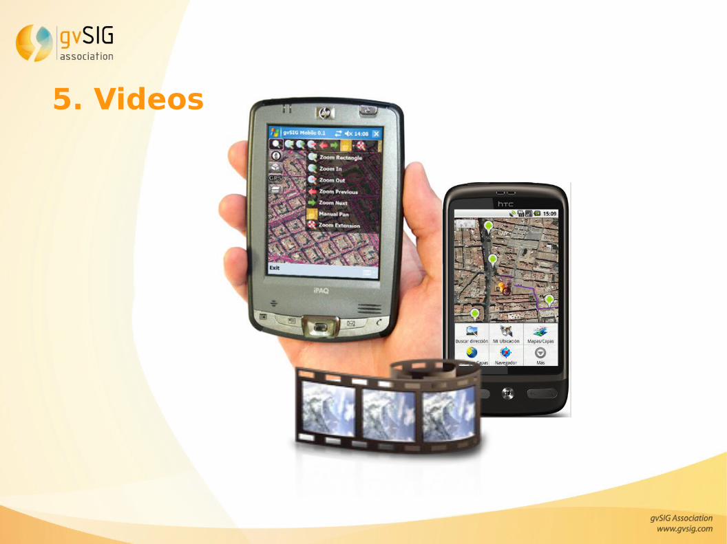
5. Videos
6. Useful links
● gvSIG Mobile and Mini tutorial at FOSS4G 2010 BCN
● gvSIG Mobile workshop at FOSS4G 2010 BCN
● Tutorial of gvSIG Mini 1.0 for Android
● Some new gvSIG Mobile and Mini videos
● gvSIG Mobile for Leica Zeno:
● Open Mobile IS synchronization with PostGIS table & cached WMS tiles
● Editing a shapefile with GPS
● ECW image + manual SHP editing
“Different types of OS GIS mobile applications:
gvSIG Mobile & gvSIG Mini”
OSGIS 2011 22ndJune
CGS University of Nottingham
Thank you very much!!!
Amelia del [email protected]
Javier [email protected]
Alberto [email protected]
Juan Lucas [email protected]