Embed Size (px)
Citation preview
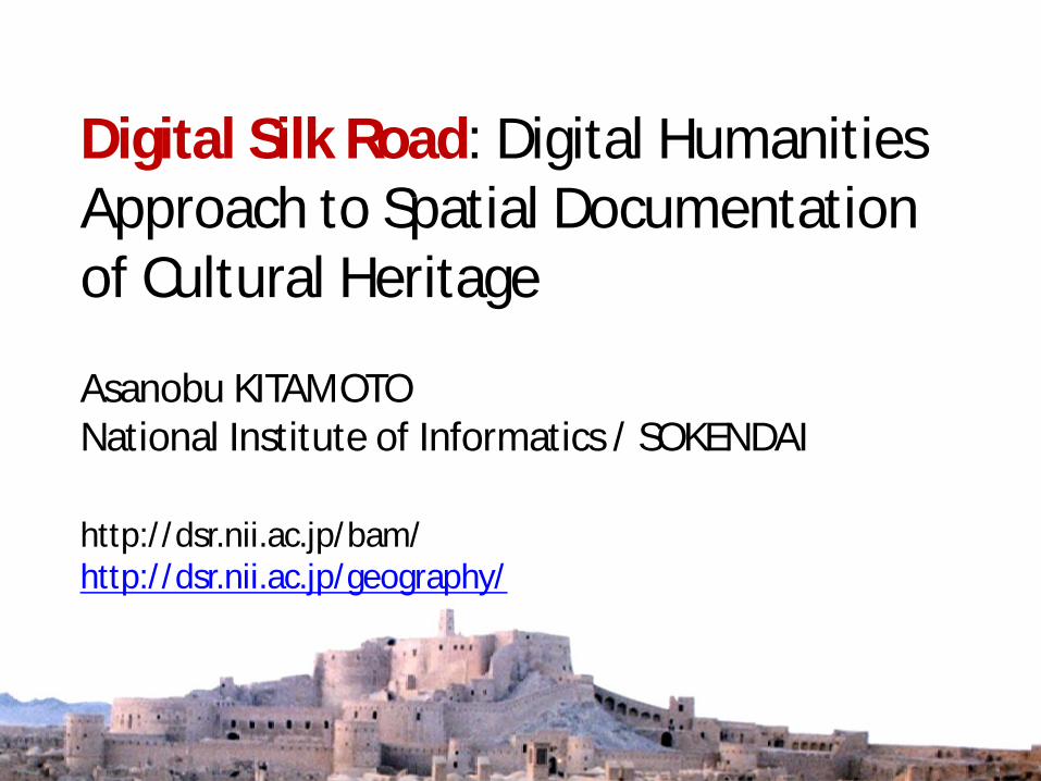
Digital Silk Road: Digital Humanities Approach to Spatial Documentation of Cultural Heritage
http://dsr.nii.ac.jp/bam/ http://dsr.nii.ac.jp/geography/
Asanobu KITAMOTO National Institute of Informatics / SOKENDAI
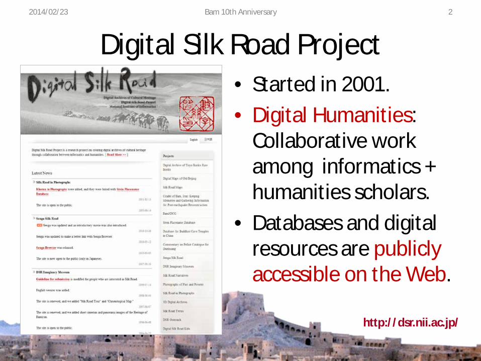
Digital Silk Road Project • Started in 2001. • Digital Humanities:
Collaborative work among informatics + humanities scholars.
• Databases and digital resources are publicly accessible on the Web.
http://dsr.nii.ac.jp/
2014/02/23 Bam 10th Anniversary 2
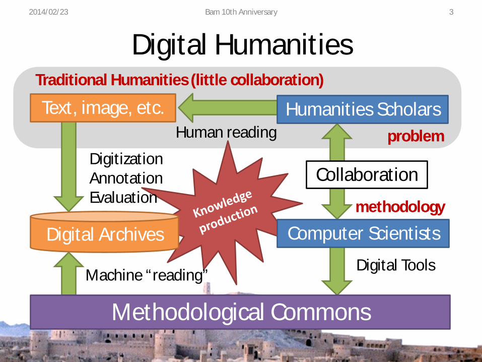
Digital Humanities 2014/02/23 Bam 10th Anniversary 3
Digital Tools
problem
methodology
Collaboration
Machine “reading”
Human reading
Digitization Annotation Evaluation
Methodological Commons
Computer Scientists
Humanities Scholars
Traditional Humanities (little collaboration)
Text, image, etc.
Digital Archives

Toyo Bunko Rare Books • Digitization of 203
books, 59358 pages. • Collection of relevant
academic references. • Manual input of
captions and TOCs. • OCR for full-text
search (with errors). http://dsr.nii.ac.jp/toyobunko/
2014/02/23 Bam 10th Anniversary 4

Dealing with Many Types of Data 2014/02/23 Bam 10th Anniversary 5
Text Map
Photograph Gazetteer
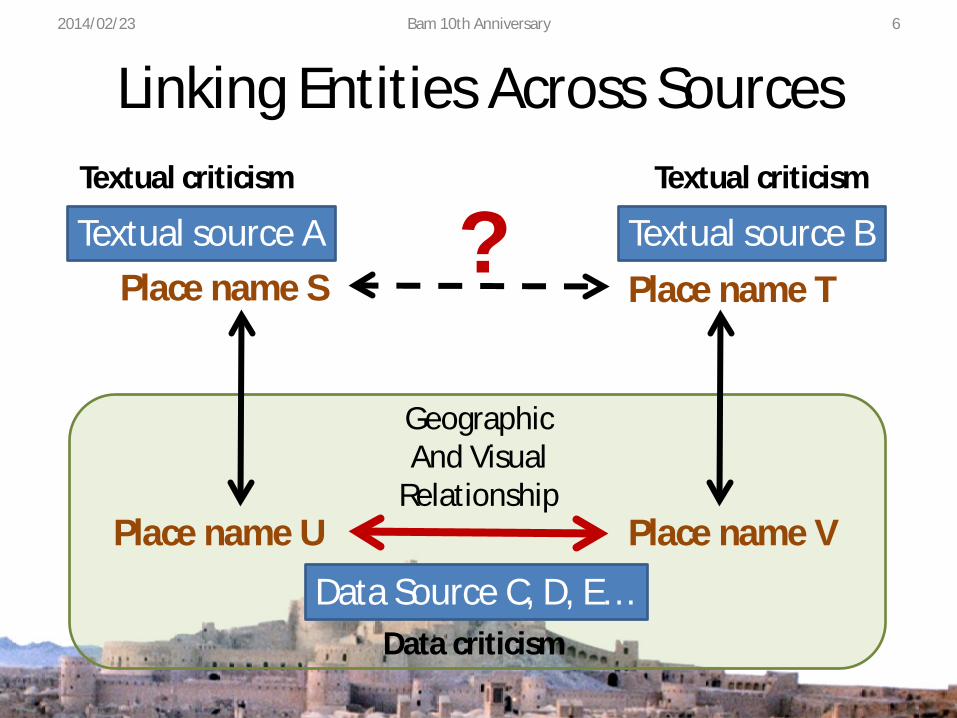
Linking Entities Across Sources 2014/02/23 Bam 10th Anniversary 6
Textual source A Textual source B Place name S Place name T
Data Source C, D, E…
Place name U Place name V
?
Geographic And Visual
Relationship
Textual criticism Textual criticism
Data criticism
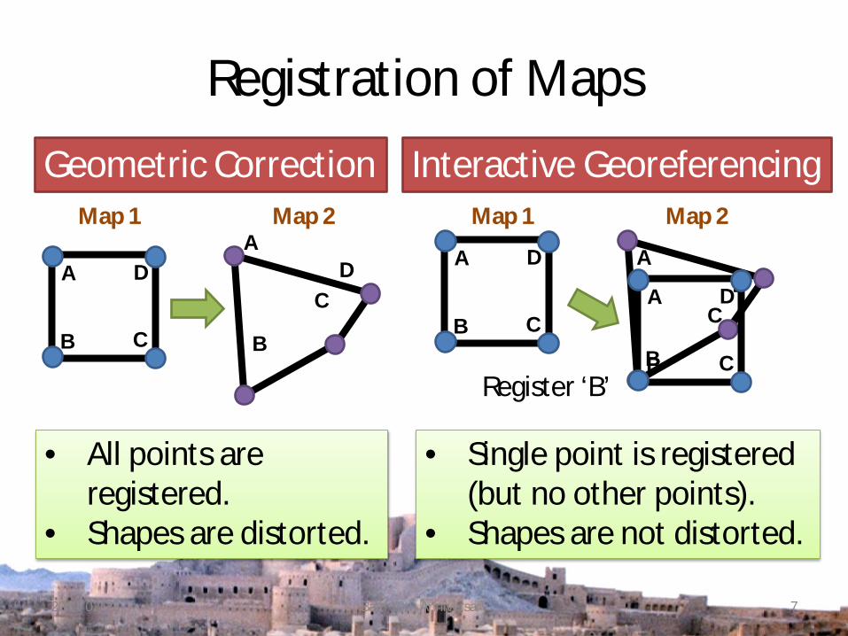
Registration of Maps
2014/02/23 Bam 10th Anniversary 7
Geometric Correction Interactive Georeferencing
A
B C
D A
B
C D A
B C
D A
B
C D A
B C
D
Register ‘B’
• All points are registered.
• Shapes are distorted.
• Single point is registered (but no other points).
• Shapes are not distorted.
Map 1 Map 2 Map 1 Map 2
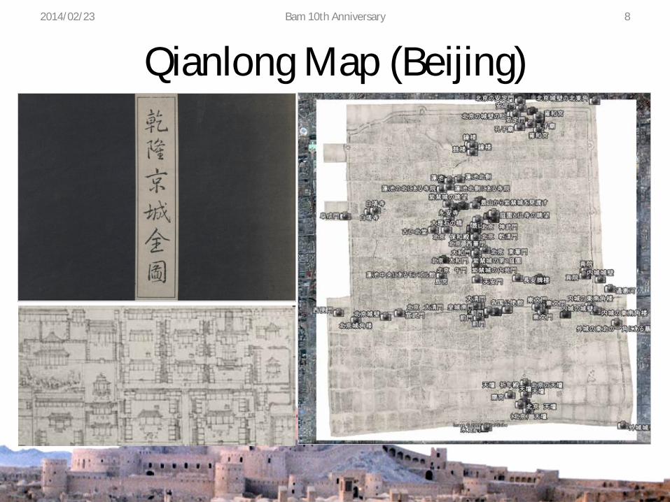
Qianlong Map (Beijing) 2014/02/23 Bam 10th Anniversary 8
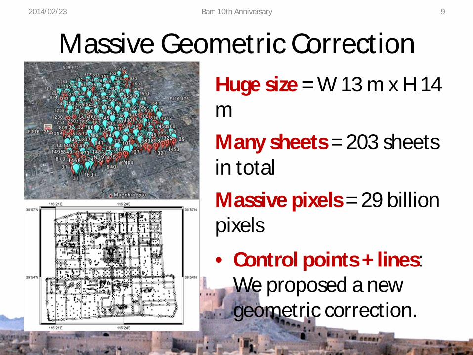
Massive Geometric Correction
• Control points + lines: We proposed a new geometric correction.
Huge size = W 13 m x H 14 m Many sheets = 203 sheets in total Massive pixels = 29 billion pixels
2014/02/23 Bam 10th Anniversary 9
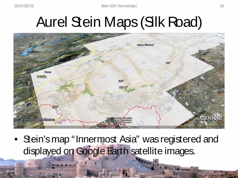
Aurel Stein Maps (Silk Road)
• Stein’s map “Innermost Asia” was registered and displayed on Google Earth satellite images.
2014/02/23 Bam 10th Anniversary 10
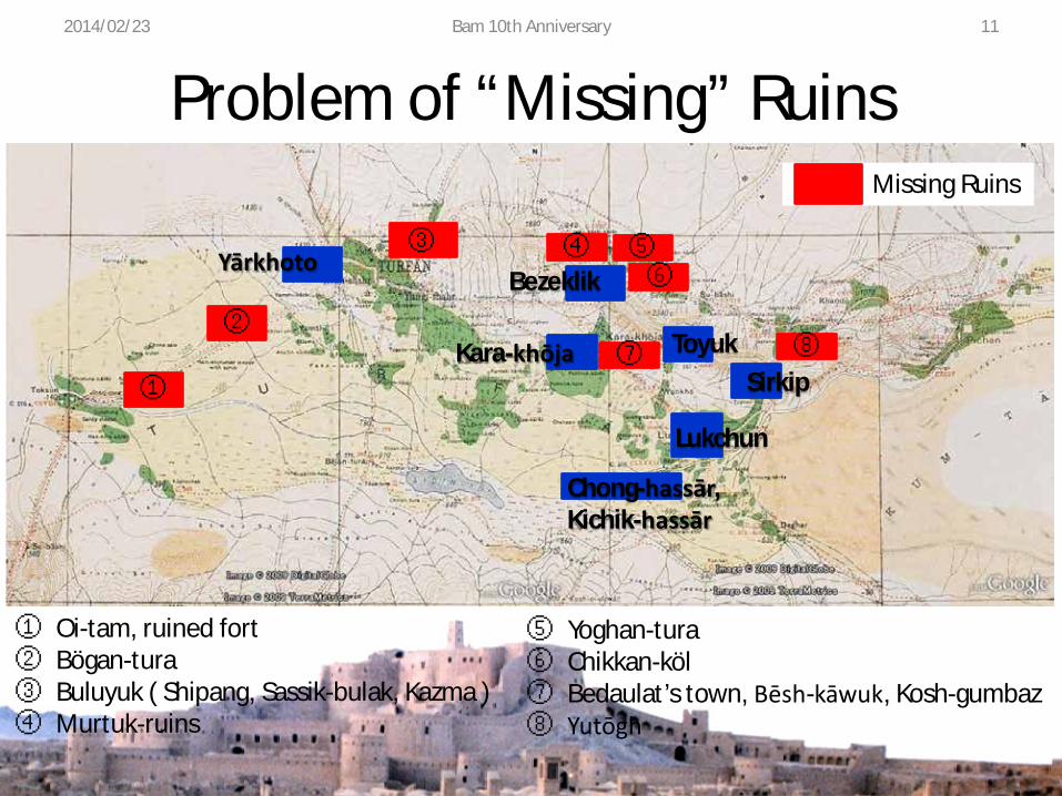
Problem of “Missing” Ruins
①
Yārkhoto ③ ④
Bezeklik ⑤ ⑥
② ⑦ ⑧ Kara-khōja Toyuk
Sirkip
Lukchun
Chong-hassār, Kichik-hassār
① Oi-tam, ruined fort ② Bögan-tura ③ Buluyuk ( Shipang, Sassik-bulak, Kazma ) ④ Murtuk-ruins
⑤ Yoghan-tura ⑥ Chikkan-köl ⑦ Bedaulat’s town, Bēsh-kāwuk, Kosh-gumbaz ⑧ Yutōgh
2014/02/23 Bam 10th Anniversary 11
Missing Ruins
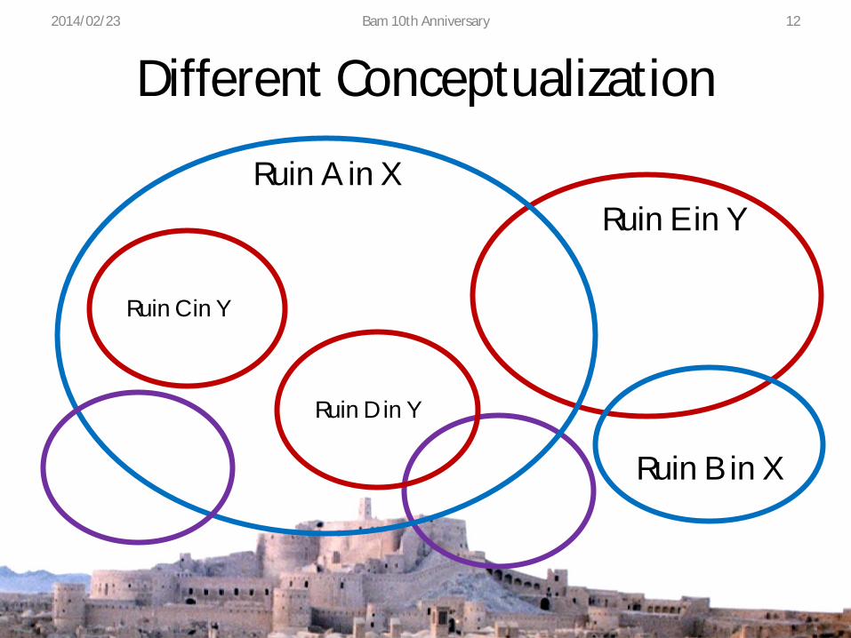
Different Conceptualization 2014/02/23 Bam 10th Anniversary 12
Ruin A in X
Ruin C in Y
Ruin D in Y
Ruin E in Y
Ruin B in X

Sven Hedin Maps • Sven Hedin (1865-
1952) explored Persia and Central Asia.
• His map (1920s) was digitized and geo-referenced.
• Overlay on satellite images.
2014/02/23 Bam 10th Anniversary 13
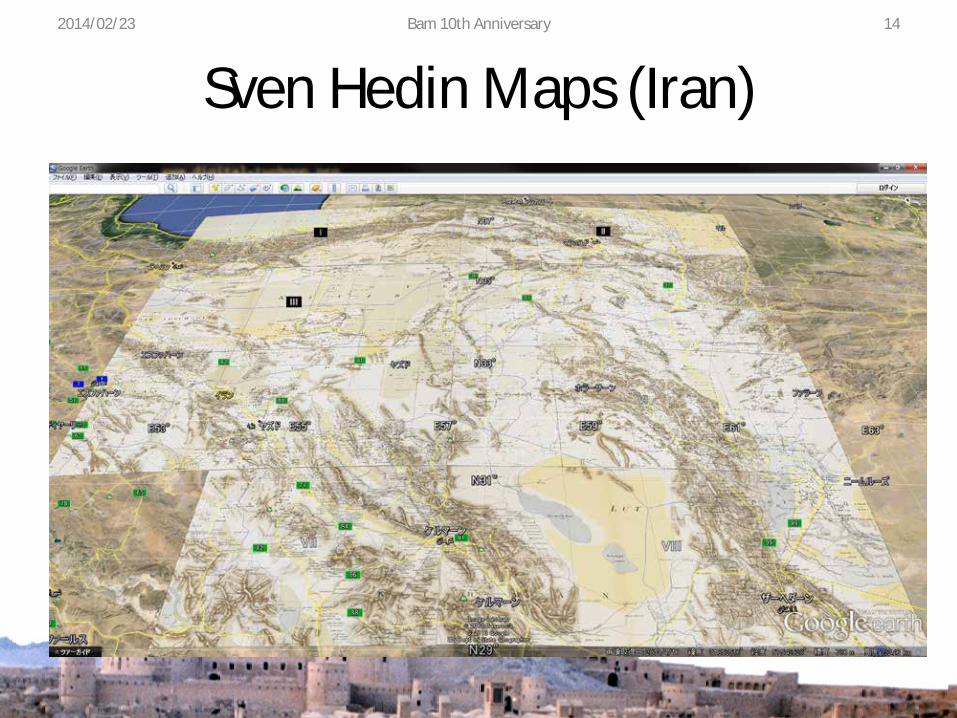
Sven Hedin Maps (Iran) 2014/02/23 Bam 10th Anniversary 14
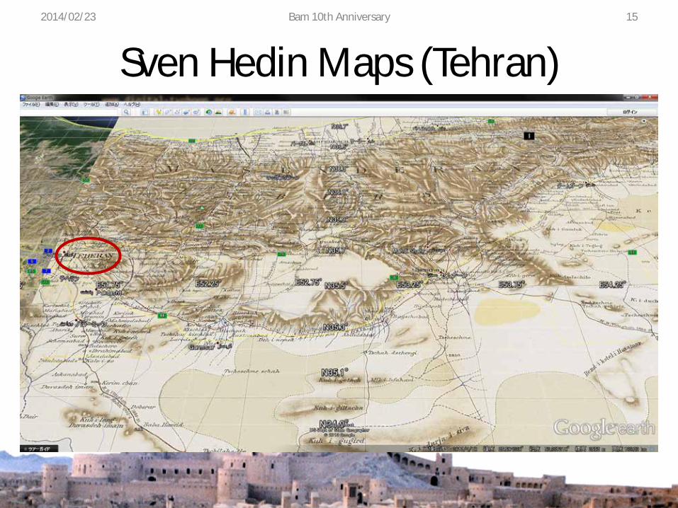
Sven Hedin Maps (Tehran) 2014/02/23 Bam 10th Anniversary 15
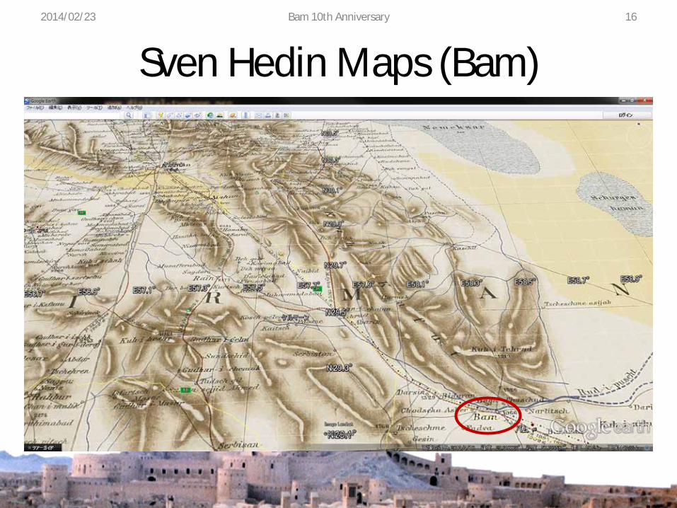
Sven Hedin Maps (Bam) 2014/02/23 Bam 10th Anniversary 16
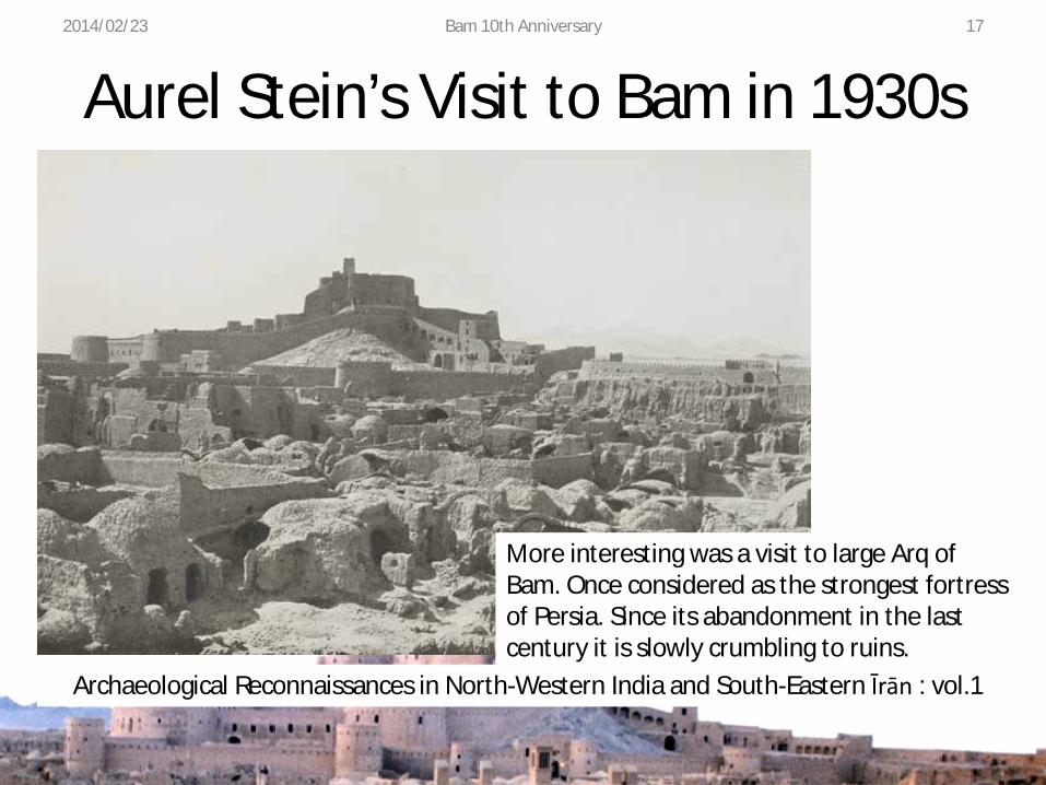
Aurel Stein’s Visit to Bam in 1930s 2014/02/23 Bam 10th Anniversary 17
More interesting was a visit to large Arq of Bam. Once considered as the strongest fortress of Persia. Since its abandonment in the last century it is slowly crumbling to ruins.
Archaeological Reconnaissances in North-Western India and South-Eastern Īrān : vol.1
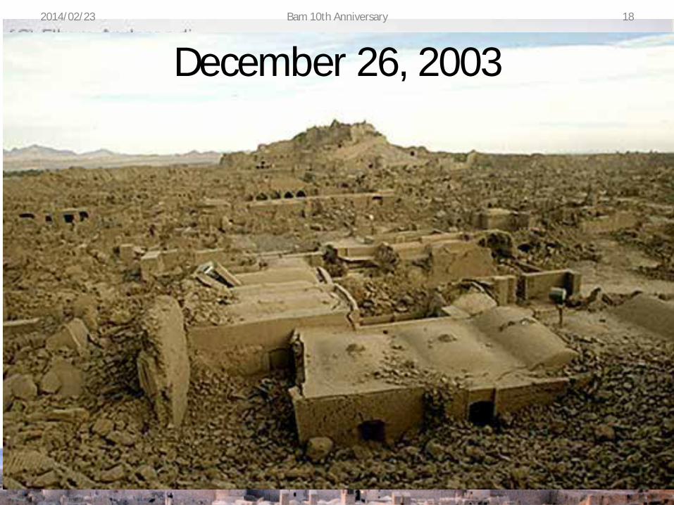
December 26, 2003 2014/02/23 Bam 10th Anniversary 18
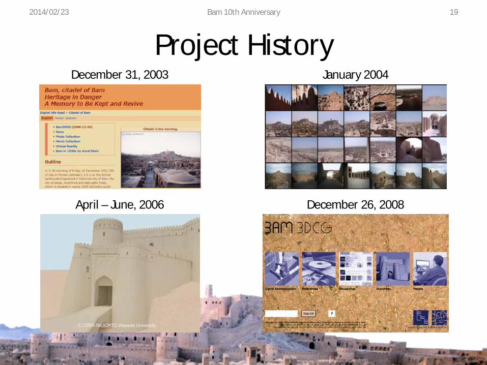
Project History December 31, 2003 January 2004
April – June, 2006 December 26, 2008
2014/02/23 Bam 10th Anniversary 19
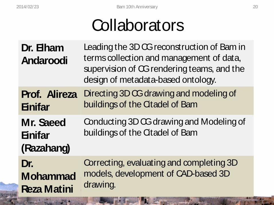
Collaborators 2014/02/23 Bam 10th Anniversary 20
Dr. Elham Andaroodi
Leading the 3D CG reconstruction of Bam in terms collection and management of data, supervision of CG rendering teams, and the design of metadata-based ontology.
Prof. Alireza Einifar
Directing 3D CG drawing and modeling of buildings of the Citadel of Bam
Mr. Saeed Einifar (Razahang)
Conducting 3D CG drawing and Modeling of buildings of the Citadel of Bam
Dr. Mohammad Reza Matini
Correcting, evaluating and completing 3D models, development of CAD-based 3D drawing.

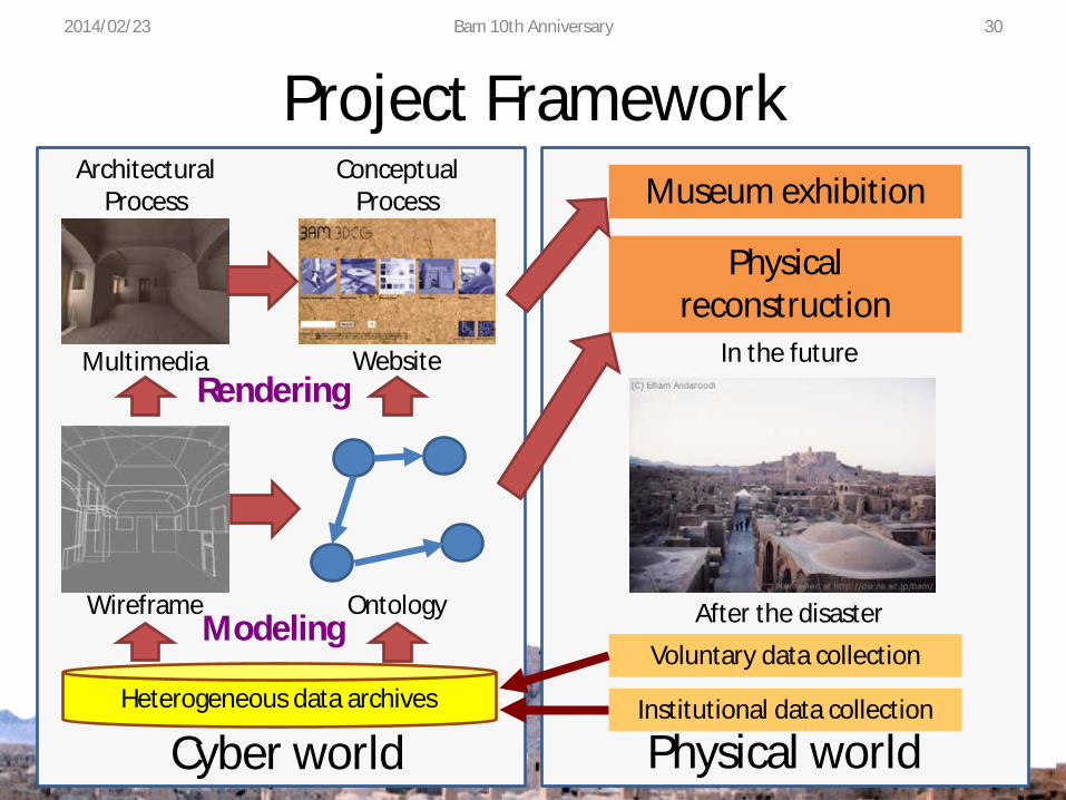
Project Framework 2014/02/23 Bam 10th Anniversary
Ontology Modeling
Rendering
Wireframe
Multimedia Website
Heterogeneous data archives
Voluntary data collection
Institutional data collection
Physical reconstruction
Museum exhibition
Cyber world Physical world
Architectural Process
Conceptual Process
After the disaster
In the future
21
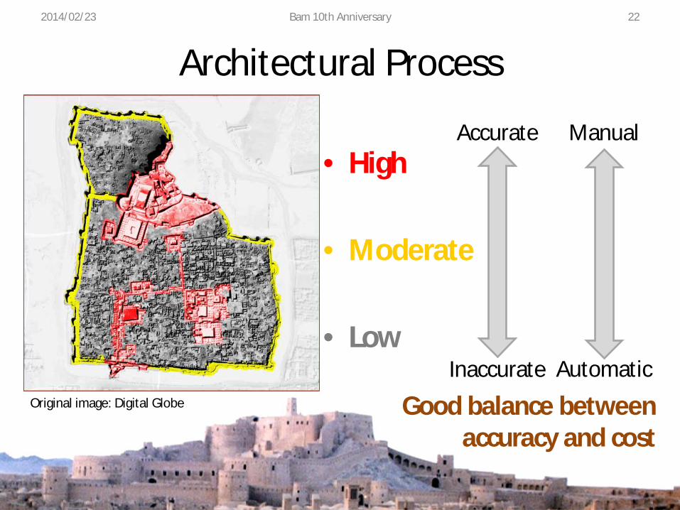
Architectural Process
• High
• Moderate
• Low
Original image: Digital Globe
Accurate
Inaccurate
Manual
Automatic
Good balance between accuracy and cost
2014/02/23 Bam 10th Anniversary 22
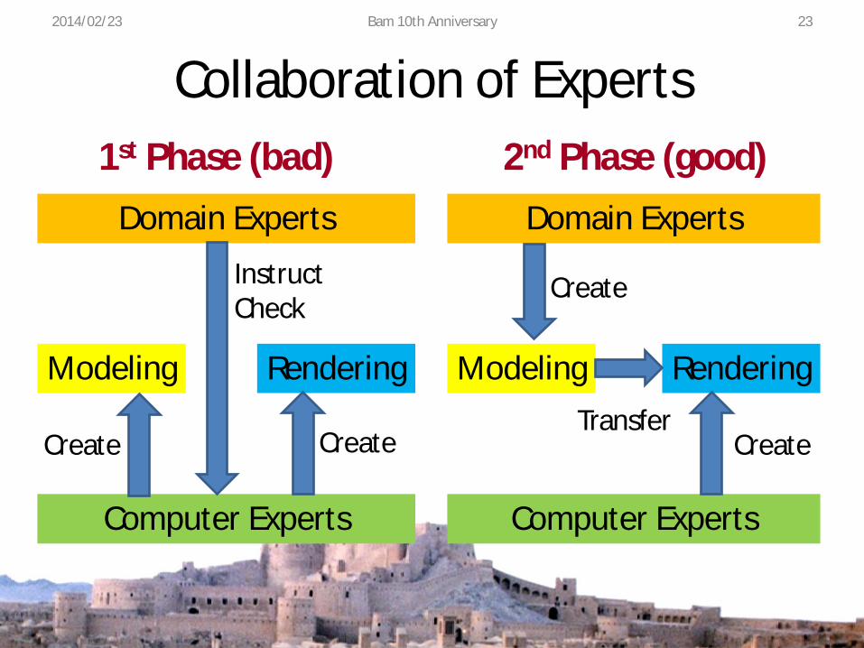
Collaboration of Experts
Computer Experts
Domain Experts
Modeling Rendering
Computer Experts
Domain Experts
Modeling Rendering
Create
Instruct Check
Create
Create
1st Phase (bad) 2nd Phase (good)
Create Transfer
2014/02/23 Bam 10th Anniversary 23
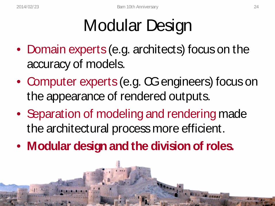
Modular Design • Domain experts (e.g. architects) focus on the
accuracy of models. • Computer experts (e.g. CG engineers) focus on
the appearance of rendered outputs. • Separation of modeling and rendering made
the architectural process more efficient. • Modular design and the division of roles.
2014/02/23 Bam 10th Anniversary 24
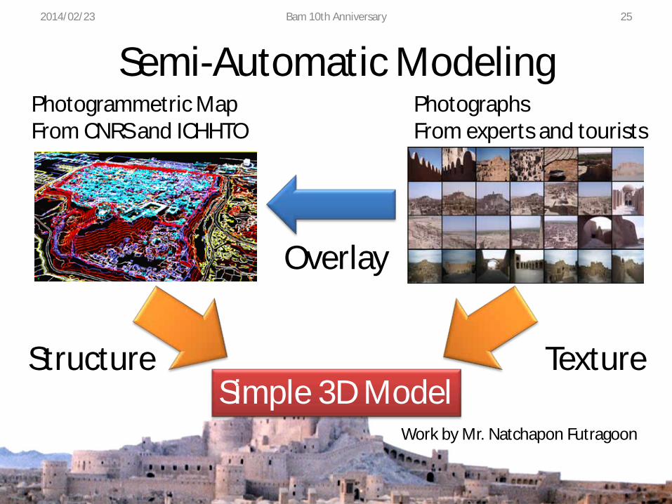
Semi-Automatic Modeling Photogrammetric Map From CNRS and ICHHTO
Photographs From experts and tourists
Simple 3D Model Texture Structure
Overlay
2014/02/23 Bam 10th Anniversary
Work by Mr. Natchapon Futragoon
25

Workflow 2014/02/23 Bam 10th Anniversary 26
2014/02/23 Bam 10th Anniversary 27
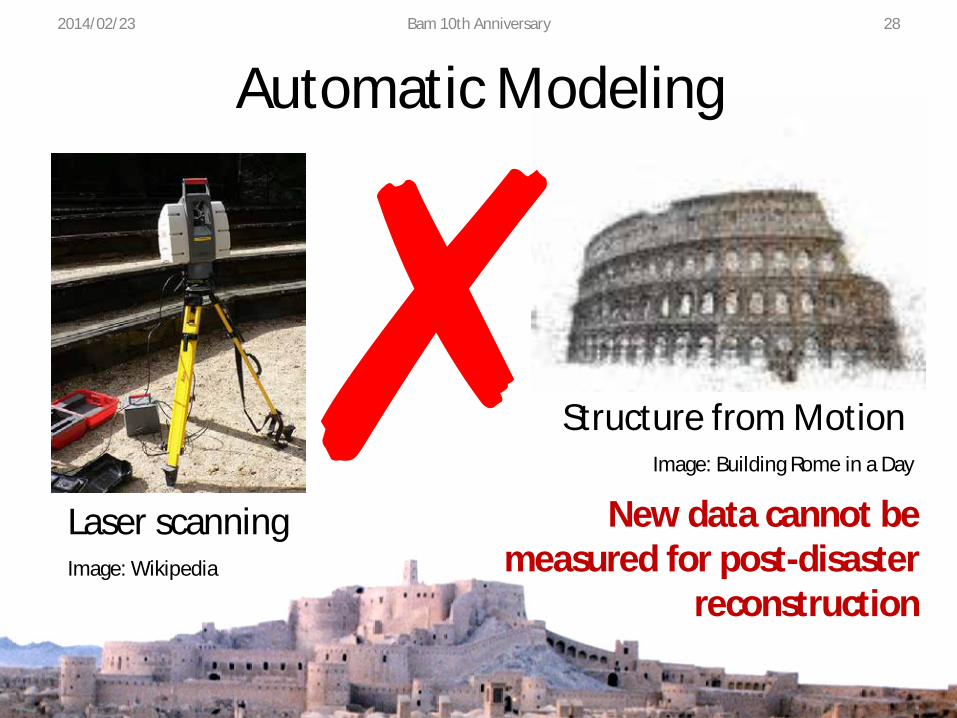
Structure from Motion Image: Building Rome in a Day
Automatic Modeling
Laser scanning Image: Wikipedia
New data cannot be measured for post-disaster
reconstruction
2014/02/23 Bam 10th Anniversary 28
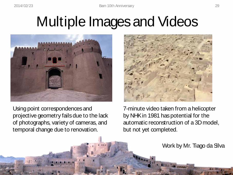
Multiple Images and Videos
Work by Mr. Tiago da Silva
Using point correspondences and projective geometry fails due to the lack of photographs, variety of cameras, and temporal change due to renovation.
7-minute video taken from a helicopter by NHK in 1981 has potential for the automatic reconstruction of a 3D model, but not yet completed.
2014/02/23 Bam 10th Anniversary 29
Project Framework 2014/02/23 Bam 10th Anniversary
Ontology Modeling
Rendering
Wireframe
Multimedia Website
Heterogeneous data archives
Voluntary data collection
Institutional data collection
Physical reconstruction
Museum exhibition
Cyber world Physical world
Architectural Process
Conceptual Process
After the disaster
In the future
30
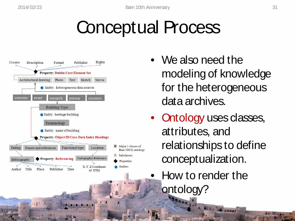
Conceptual Process 2014/02/23 Bam 10th Anniversary 31
• We also need the modeling of knowledge for the heterogeneous data archives.
• Ontology uses classes, attributes, and relationships to define conceptualization.
• How to render the ontology?
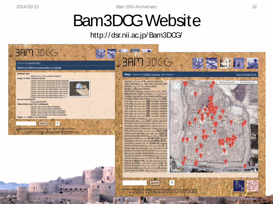
Bam3DCG Website http://dsr.nii.ac.jp/Bam3DCG/
2014/02/23 Bam 10th Anniversary 32
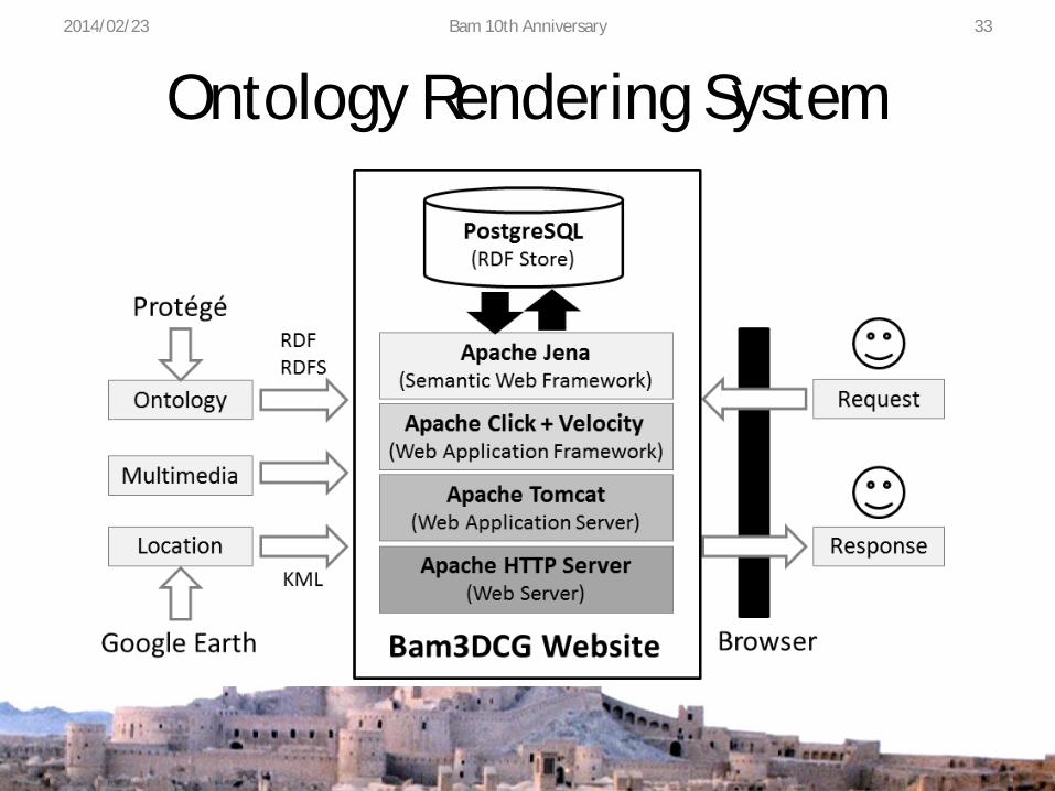
Ontology Rendering System 2014/02/23 Bam 10th Anniversary 33
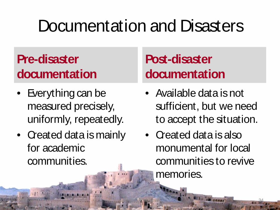
Documentation and Disasters
Pre-disaster documentation • Everything can be
measured precisely, uniformly, repeatedly.
• Created data is mainly for academic communities.
Post-disaster documentation • Available data is not
sufficient, but we need to accept the situation.
• Created data is also monumental for local communities to revive memories.
2014/02/23 Bam 10th Anniversary 34
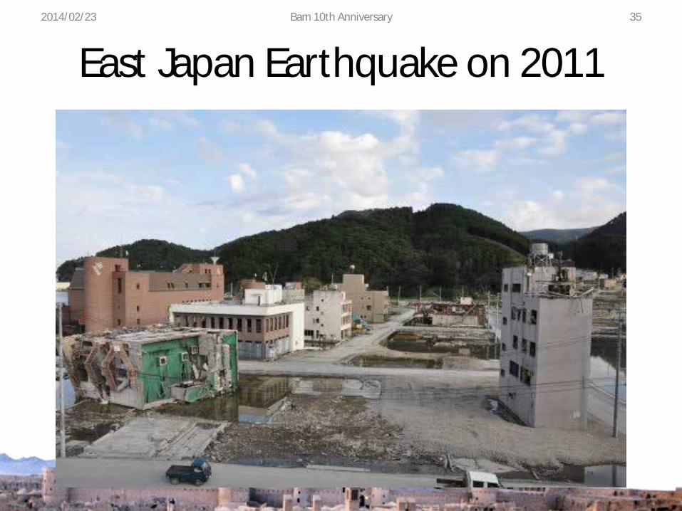
East Japan Earthquake on 2011 2014/02/23 Bam 10th Anniversary 35
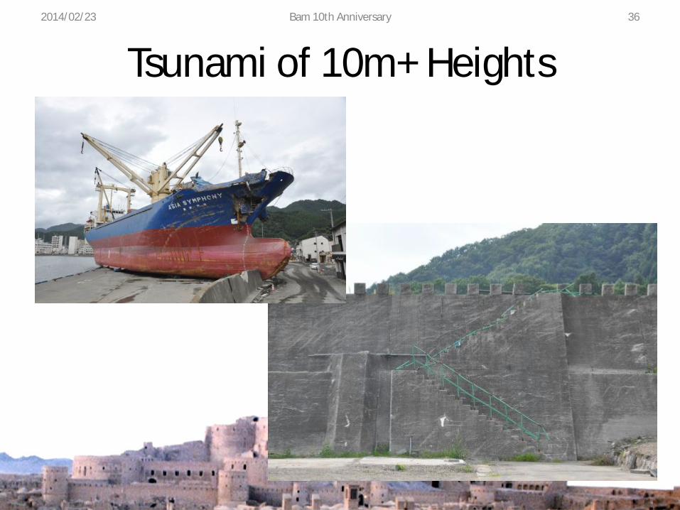
Tsunami of 10m+ Heights 2014/02/23 Bam 10th Anniversary 36

Radiation Monitoring 2014/02/23 Bam 10th Anniversary 37
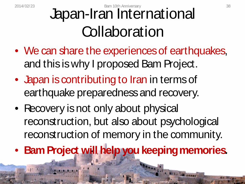
Japan-Iran International Collaboration
• We can share the experiences of earthquakes, and this is why I proposed Bam Project.
• Japan is contributing to Iran in terms of earthquake preparedness and recovery.
• Recovery is not only about physical reconstruction, but also about psychological reconstruction of memory in the community.
• Bam Project will help you keeping memories.
2014/02/23 Bam 10th Anniversary 38

Acknowledgment 3D CG reconstruction of the Citadel of Bam is a collaborative research project between the Digital Silk Road project of NII and Iranian Cultural Heritage, Handicraft and Tourism Organization (ICHHTO), The University of Tehran, and Razahang Architectural Office. The 3D photogrammetric material is provided to NII by Professor Chahryar ADLE from CNRS and ICHHTO. We thank Mr. Tomohiro Ikezaki for implementing the Bam3DCG website generation system. We also thank students who worked for Bam Project at Kitamoto Lab during the NII internship program, namely Tiago da Silva, Natchapon Futragoon, and Xinling Chen.
2014/02/23 Bam 10th Anniversary 39