Embed Size (px)
Citation preview
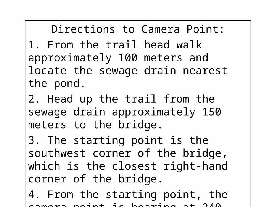
Directions to Camera Point:
1. From the trail head walk approximately 100 meters and locate the sewage drain nearest the pond.
2. Head up the trail from the sewage drain approximately 150 meters to the bridge.
3. The starting point is the southwest corner of the bridge, which is the closest right-hand corner of the bridge.
4. From the starting point, the camera point is bearing at 240 degrees and is 20 feet in distance from the starting to the camera point, and by the exposed log closest to the river.
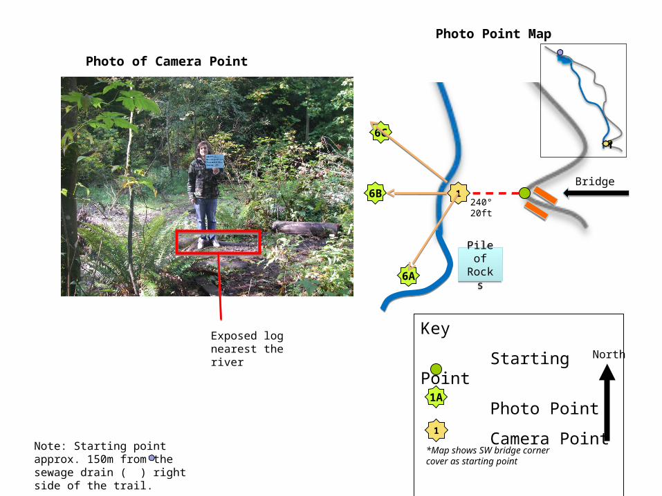
Photo of Camera Point
Photo Point Map
1A
Key
Starting Point
Photo Point
Camera Point1
Insert photo of camera point•Label any features that help locate the camera point
*Map shows SW bridge corner cover as starting point
North
Exposed log nearest the river
Note: Starting point approx. 150m from the sewage drain ( ) right side of the trail.
6A
1
6C
6B240° 20ft
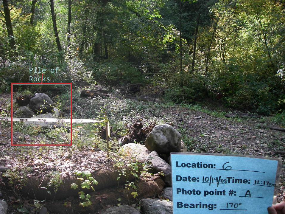
Pile of RocksPile of Rocks
Bridge
Insert Photo HereAnd mark any obvious features in the photo
that are discussed in the camera point description
Pile of Rocks
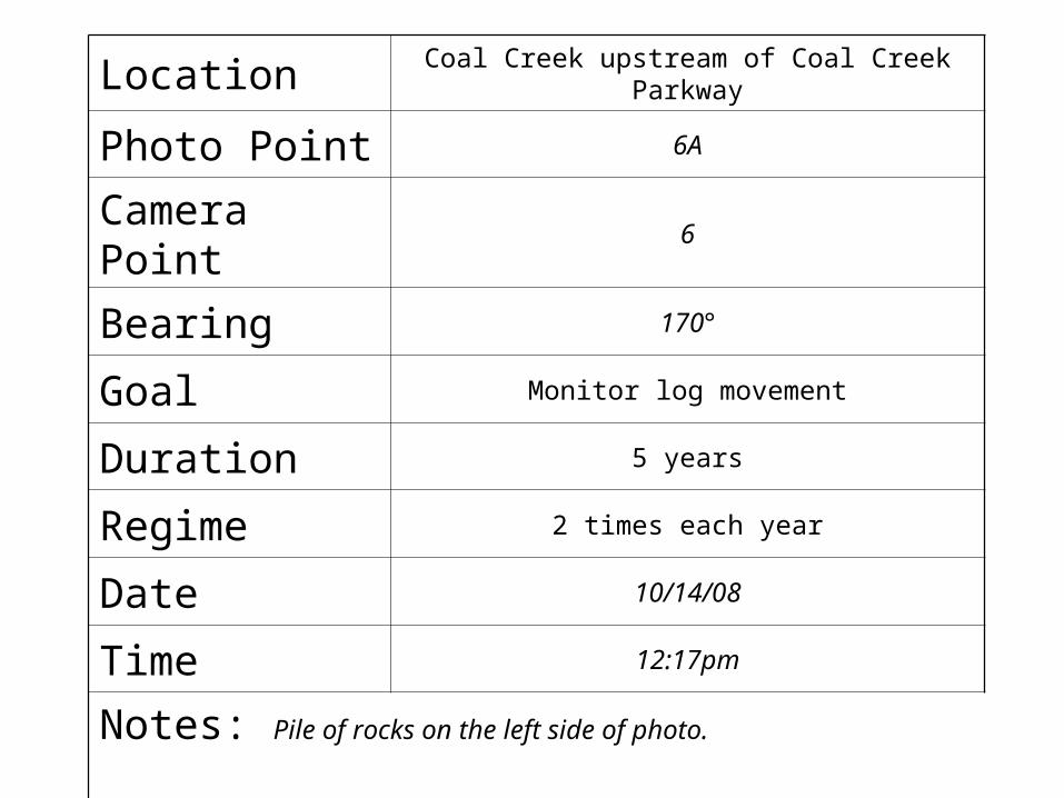
Location Coal Creek upstream of Coal Creek Parkway
Photo Point 6A
Camera Point 6
Bearing 170°
Goal Monitor log movement
Duration 5 years
Regime 2 times each year
Date 10/14/08
Time 12:17pm
Notes: Pile of rocks on the left side of photo.
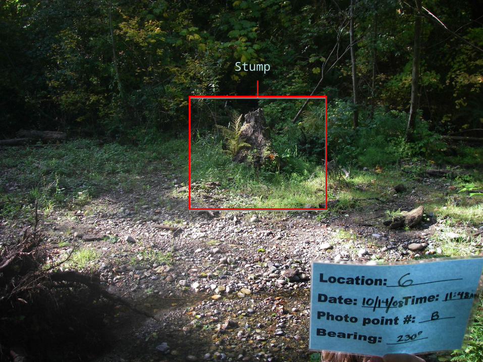
Stump
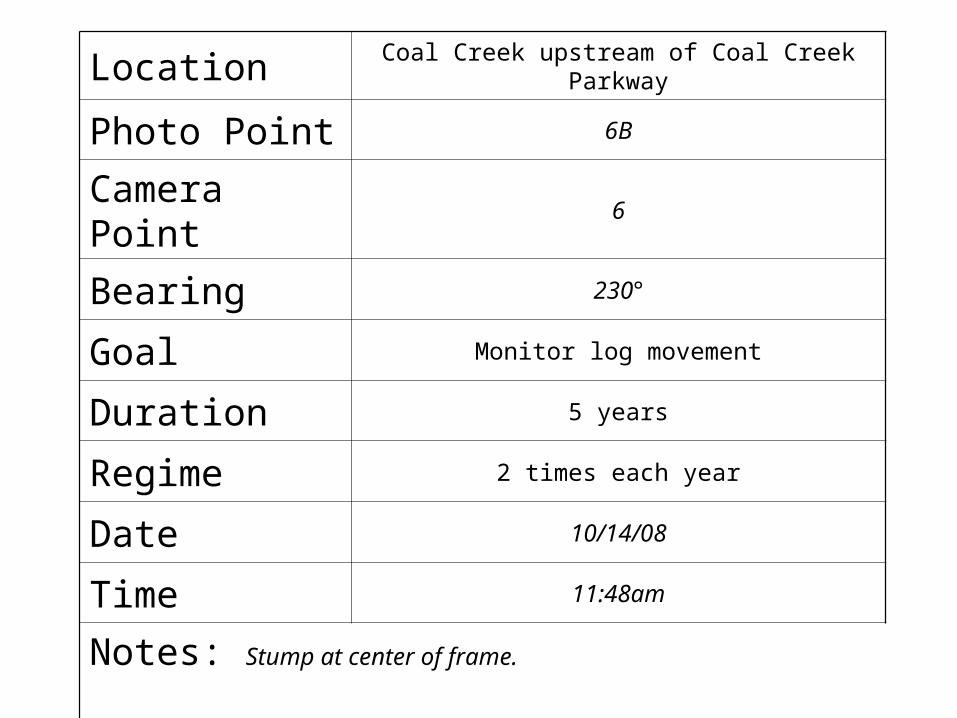
Location Coal Creek upstream of Coal Creek Parkway
Photo Point 6B
Camera Point 6
Bearing 230°
Goal Monitor log movement
Duration 5 years
Regime 2 times each year
Date 10/14/08
Time 11:48am
Notes: Stump at center of frame.
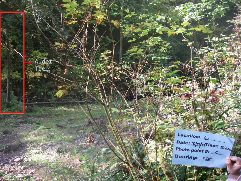
Alder Tree
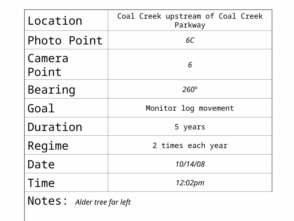
Location Coal Creek upstream of Coal Creek Parkway
Photo Point 6C
Camera Point 6
Bearing 260°
Goal Monitor log movement
Duration 5 years
Regime 2 times each year
Date 10/14/08
Time 12:02pm
Notes: Alder tree far left