Embed Size (px)
Citation preview
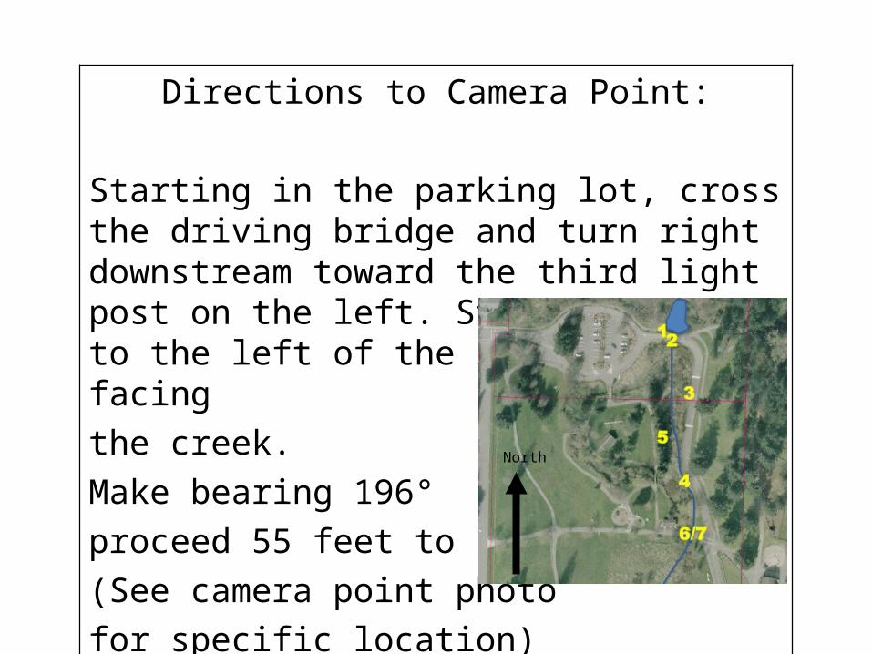
Directions to Camera Point:
Starting in the parking lot, cross the driving bridge and turn right downstream toward the third light post on the left. Stand directly to the left of the light post facing
the creek.
Make bearing 196°
proceed 55 feet to creek
(See camera point photo
for specific location)
North
Photo Point Map
4A
Key
Starting Point
Photo Point
Camera Point4
North
4
4C
4B
4A
55 ft. 196° S
296°
216°
172°
Road4
4
Camera PointCamera Point
Camera PointCamera Point
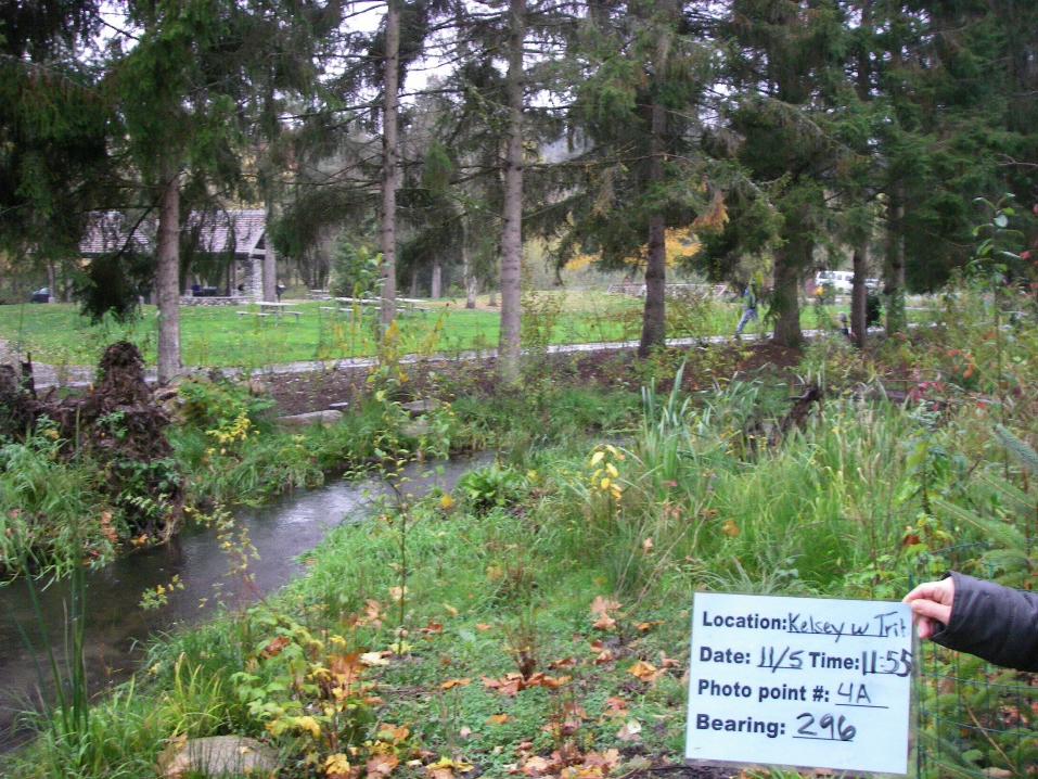
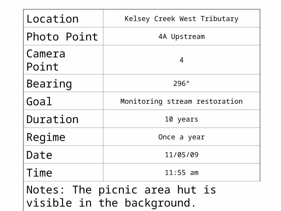
Location Kelsey Creek West Tributary
Photo Point 4A Upstream
Camera Point 4
Bearing 296°
Goal Monitoring stream restoration
Duration 10 years
Regime Once a year
Date 11/05/09
Time 11:55 am
Notes: The picnic area hut is visible in the background.
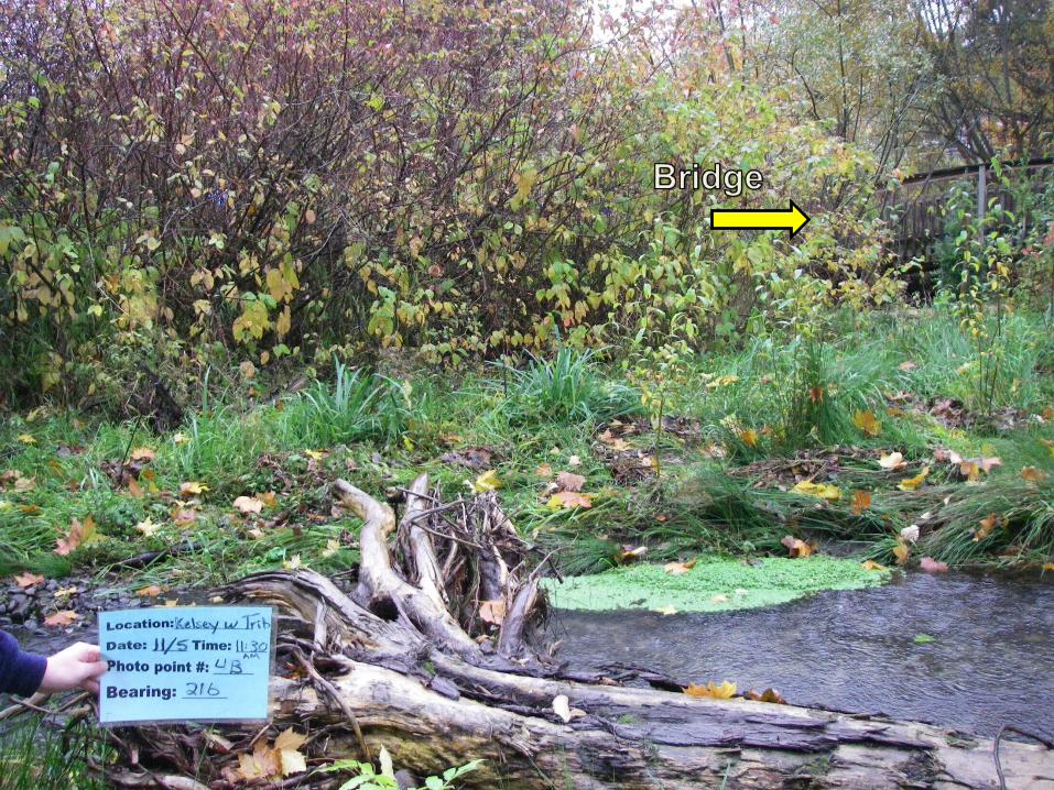
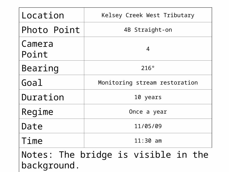
Location Kelsey Creek West Tributary
Photo Point 4B Straight-on
Camera Point 4
Bearing 216°
Goal Monitoring stream restoration
Duration 10 years
Regime Once a year
Date 11/05/09
Time 11:30 am
Notes: The bridge is visible in the background.
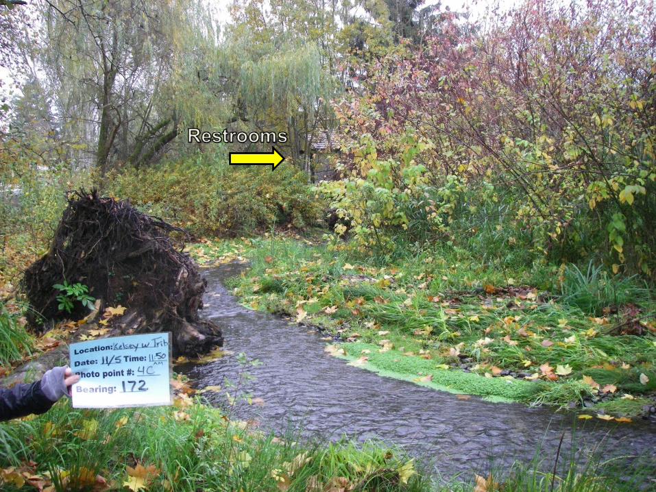
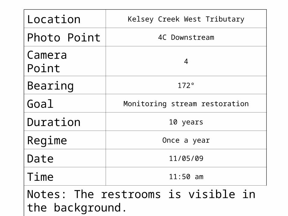
Location Kelsey Creek West Tributary
Photo Point 4C Downstream
Camera Point 4
Bearing 172°
Goal Monitoring stream restoration
Duration 10 years
Regime Once a year
Date 11/05/09
Time 11:50 am
Notes: The restrooms is visible in the background.

Mac Cahill, Joe Gooden, Heather Mac Cahill, Joe Gooden, Heather Hatchie, Natalie MacKnight, Miles Hatchie, Natalie MacKnight, Miles
WhitakerWhitaker
THE DECEPTICONS:THE DECEPTICONS: