Embed Size (px)
Citation preview

INTRODUCTION Although the Port of Melbourne is an enormous asset to the national economy, Port Phillip Bay is also a unique social, cultural and recreational asset. Almost 2000 sq km, with 264 km of coastline, some three million people live in its vicinity. It includes two Marine National Parks and Ramsar wetlands. It is home to multiple fish species, little penguins, whales, dolphins and seals, extensive sponge gardens, various coldwater coral species and natural seagrass habitats and is an attractive recreational locale for swimming, diving and boating. The adjacent Yarra River, where the container terminals are located, has a highly contaminated silt bottom. In both areas, the environmental impacts of dredging were of clear concern to government, the Australian public and media and addressing these concerns often affected the methods and equipment used for the dredging operations.
PROJECT SPECIFICATIONS After signing an Alliance Agreement with PoMC in May 2004, Boskalis Australia Pty. Ltd. became an active partner in assisting PoMC with the studies for the Supplementary Environmental Effects Statement (SEES) and the development of an Environmental Management Plan (EMP). Boskalis and Hydronamic also developed work methods and environmentally sound equipment for dredging of the Entrance, the removal of the contaminated silt in the Yarra River, the placement of the contaminated material in a bunded disposal site and for placement of the sand cap. In addition, they developed and deployed a turbidity monitoring system to protect the environmental assets and to control the dredging process.
ENVIRONMENTAL MANAGEMENT PLAN (EMP) The final risk assessment of the SEES included the findings of the environmental impact assessments
A
PROJECT SHEETENVIRONMENTAL PROTECTION wORkSCHANNEL DEEPENINg PRojECT, MELBouRNE, AuSTRALIA
A Location mapB Monitoring buoy in Port Phillip BayC Seals in the South Channel in Melbourne, with the TSHD Queen of the Netherlands sailing by
FEATURES
Client Port of Melbourne Corporation
Location Melbourne, Victoria, Australia
Period Preparation: including the tender, EES and SEES: August 2003 – january 2008 Execution: February 2008 – November 2009
Contractor Boskalis Australia Pty. Ltd.
CB C
and formed an important underlying foundation for the EMP. The identified risks were documented in a risk register which was reviewed periodically during the project to incorporate environmental monitoring results, to reflect operational changes or as a result of an environmental incident. The EMP was established and approved both by the Victorian and Australian Federal ministers of environment. Environmental limits were set for turbidity and noise, which were monitored to prove compliance with the EMP, and work method related controls were established to manage all dredging operations. In addition, all vessels were equipped with vessel tracking systems
The
info
rmat
ion
cont
aine
d in
this
dat
a sh
eet i
s fo
r gu
idan
ce p
urpo
ses
only
and
may
be
subj
ect t
o ch
ange
s. ©
Bos
kalis
. A
ll rig
hts
rese
rved
.0
1 —
20
12
to ensure compliance with dredged material management demands, which included limits to the quantity of material to be dredged and to the vertical and horizontal tolerances, as well as to the time frame for dredging (e.g., not during spawning and migration periods or peak holiday seasons). Turbidity and vessel position were monitored automatically and transmitted to a database at the office. Boskalis managed the data flow and guarded the data integrity, which was a fully transparent process that was audited regularly. The data could be visualised via a web page. Both the operations and PoMC staff as well as the vessels had access to this web page. Dredging performance was compared to the limits set by the EMP, which was reported weekly to PoMC. However, exceedances, non-compliances
ENVIRONMENTAL PROTECTION wORkSCHANNEL DEEPENINg PRojECT, MELBouRNE, AuSTRALIA
and other incidents and hazards were required to be reported immediately, also to the government. An extensive audit schedule was put in place by the government with 12 audits to check compliance with the EMP of the vessels and the different dredging activities. only a few minor non-conformities were found.
Furthermore, PoMC had the obligation to provide quarterly and annual reports to the government. These contained a summary of all construction activities, project progress, communications with the public and the media, notifications to the government, training, reports, incidents and the results of all monitoring programmes, internal and external audits, risk assessments and management reviews.
All notifications and reporting to the government were publicly accessible through the websites of both PoMC and the government.
D Boskalis’ TSHD ‘Queen of the Netherlands’ in Melbourne. With its capacity of 35,500 m3, this is one of the largest Trailer Suction Hopper Dredgers in the worldE Project outlineF Monitoring vessel with streamer
D
E F
01
— 2
01
2Th
e in
form
atio
n co
ntai
ned
in th
is d
ata
shee
t is
for
guid
ance
pur
pose
s on
ly a
nd m
ay b
e su
bjec
t to
chan
ges.
© B
oska
lis.
All
right
s re
serv
ed.
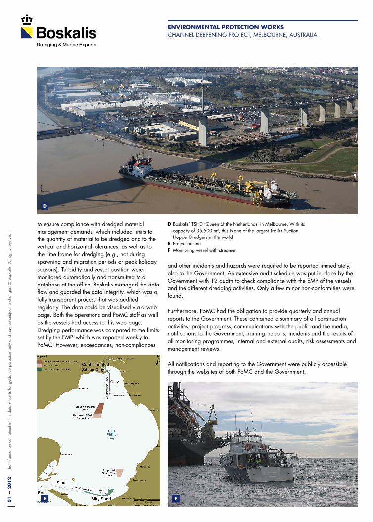
CHANGE MANAGEMENT Changes to the project had to follow a strict procedure to manage and identify any consequences. This applied to changes to the project schedule, work methods, environmental monitoring response levels, project description and dredging technology. The change management process also included a re-assessment of the risk and a check on compliance with the legal requirements. occasionally additional turbidity modelling was required to support the risk assessment. If the change required the EMP to be revised, government had to be notified and approval was required for major revisions.
ENTRANCE DREDGING In addition to using an optimised ripper draghead at the Entrance, a work method was applied to minimise the likelihood that any residual rock might tip over the edge into the 80-m deep canyon and damage the precious sessile fauna like sponges and soft corals. This entailed the TSHD Queen of the Netherlands dredging away from the canyon edge and cleaning up for 18 hours after every 24,000 m3 of dredging, 460,000 m3 in total. A special data analysis tool applied to the vessel tracking system was used to prove that the operations proceeded in accordance with the EMP. After 22 clean-up sessions 15,500 m3 of loose material was collected and video surveys after completion of the Entrance verified their effectiveness. Video recordings along 165 transects with a total length of 25 km were used for the retrieval of 1350 stills for the classification of the spill in the dredged areas. Later surveys have shown re-growth of the original kelp vegetation.
CONTAMINATED MATERIAL At the Yarra River and Williamstown Channel, toxicity tests conducted as part of the SEES determined that all silt in these areas was highly contaminated. Therefore, an underwater disposal facility in the Port of Melbourne Dredge Material ground (DMg) was created for the safe disposal of 1.4 Mm3 of contaminated silt in 20-m deep
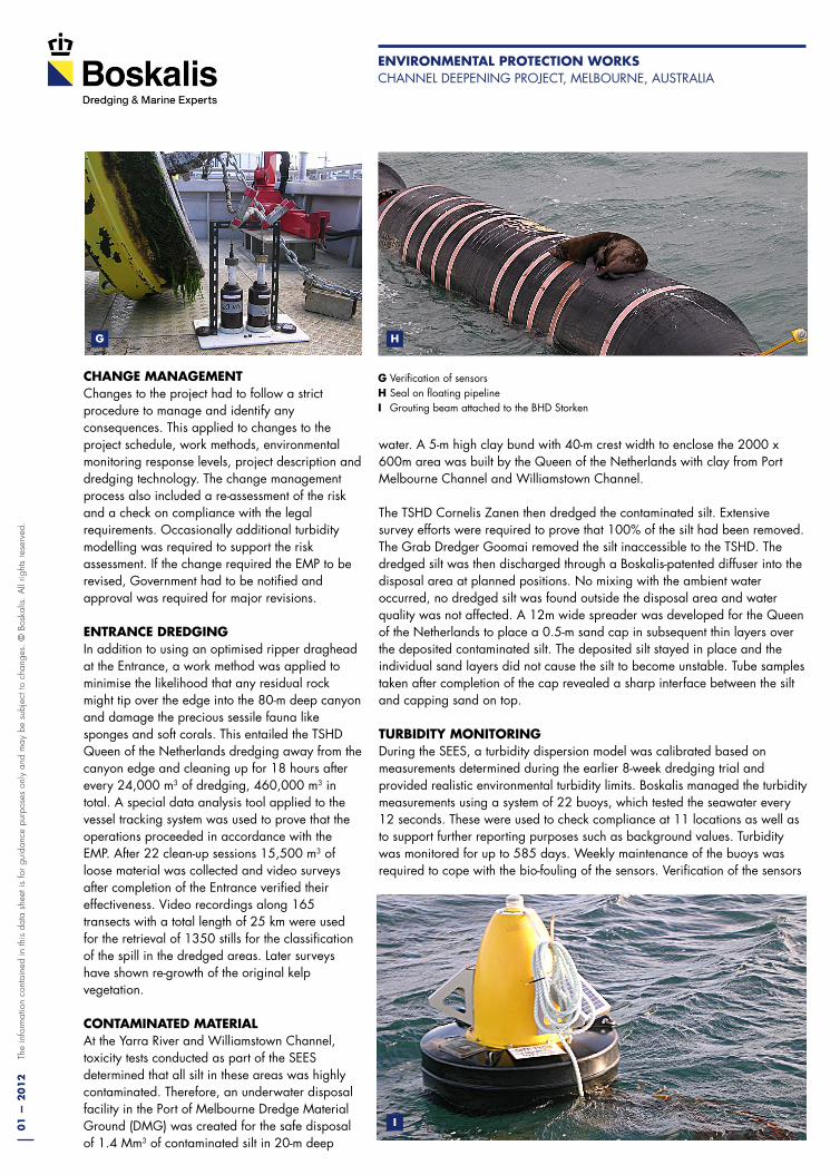
G Verification of sensorsH Seal on floating pipelineI grouting beam attached to the BHD Storken
G H
I
water. A 5-m high clay bund with 40-m crest width to enclose the 2000 x 600m area was built by the Queen of the Netherlands with clay from Port Melbourne Channel and Williamstown Channel.
The TSHD Cornelis Zanen then dredged the contaminated silt. Extensive survey efforts were required to prove that 100% of the silt had been removed. The grab Dredger goomai removed the silt inaccessible to the TSHD. The dredged silt was then discharged through a Boskalis-patented diffuser into the disposal area at planned positions. No mixing with the ambient water occurred, no dredged silt was found outside the disposal area and water quality was not affected. A 12m wide spreader was developed for the Queen of the Netherlands to place a 0.5-m sand cap in subsequent thin layers over the deposited contaminated silt. The deposited silt stayed in place and the individual sand layers did not cause the silt to become unstable. Tube samples taken after completion of the cap revealed a sharp interface between the silt and capping sand on top.
TURBIDITY MONITORING During the SEES, a turbidity dispersion model was calibrated based on measurements determined during the earlier 8-week dredging trial and provided realistic environmental turbidity limits. Boskalis managed the turbidity measurements using a system of 22 buoys, which tested the seawater every 12 seconds. These were used to check compliance at 11 locations as well as to support further reporting purposes such as background values. Turbidity was monitored for up to 585 days. Weekly maintenance of the buoys was required to cope with the bio-fouling of the sensors. Verification of the sensors
ENVIRONMENTAL PROTECTION wORkSCHANNEL DEEPENINg PRojECT, MELBouRNE, AuSTRALIA

01
— 2
01
2Th
e in
form
atio
n co
ntai
ned
in th
is d
ata
shee
t is
for
guid
ance
pur
pose
s on
ly a
nd m
ay b
e su
bjec
t to
chan
ges.
© B
oska
lis.
All
right
s re
serv
ed.
Royal Boskalis Westminster N.V.Po Box 43 3350 AA Papendrecht The Netherlands
T +31 78 69 69 000F +31 78 69 69 555
[email protected] www.boskalis.com
water column by means of a winch. The monitoring results were reviewed every 6 months by comparing the field data with the predictions from the modelling. None of the environmental limits had to be adjusted after these reviews.
FULL COMPLIANCE AND SUCCESSFUL COMPLETION The combined efforts of the client PoMC and the contractor Boskalis Australia Pty Ltd in an Alliance Contract led to nearly full compliance and successful completion of the project. Significantly, stakeholder acceptance of the project was closely related to the accurate and transparent communications made by the Alliance Team. These included public consultations, a dedicated website, a 24-hour toll-free telephone number, weekly press conferences, media releases, mailing lists, signage around the Bay and notices to mariners.
J Sand-silt interface of capped siltk Removing seaweedL Sponges of approximately 60cm at 65m water depthM Sponges of approximately 53m water depth.N Nepean Bank after clean upO Disposal area after capping with sandP Nepean Bank kelp re-growthQ Nepean Bank re-growth algae
J
k
L
in standard solutions was applied monthly. Approximately 2 buoy replacements were carried out on average every week. A high level of redundancy was created by using 2 independent sensors per buoy and by doubling the computer system at the office. over 99.98% of data capture was achieved during the approximately 300,000 service hours of the 22 buoys.
No mechanical or electrical breakdown of the monitoring system occurred during the last 9 months of the operations. Data was retrieved by 2 hourly downloads through the local gSM network. Compliance was based on 6 hourly exponentially weighted moving averages, based on which the TSHDs’ work method could be adjusted. In fact, adjustments were only necessary during strong winds when elevated levels of turbidity occurred and it was decided to move the TSHD to a different dredging area.
PoMC conducted several Baywide monitoring programmes to provide broader information on the status of key species, habitats and ecological processes in the Bay. As part of this, Boskalis conducted the Plume Intensity and Extent monitoring programme. Turbidity was measured by sailing tracks in each dredging area during at least 14 consecutive days. This meant that plume monitoring was conducted during 117 days, covering a distance of 4,400 km. A streamer with 2 or 3 turbidity sensors was towed along straight tracks across the dredging area. The streamer could be automatically raised and lowered in the
M
N O
P Q
ENVIRONMENTAL PROTECTION wORkSCHANNEL DEEPENINg PRojECT, MELBouRNE, AuSTRALIA