Embed Size (px)
Citation preview
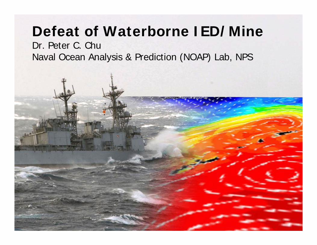
Defeat of Waterborne IED/Mine Dr. Peter C. ChuNaval Ocean Analysis & Prediction (NOAP) Lab, NPS
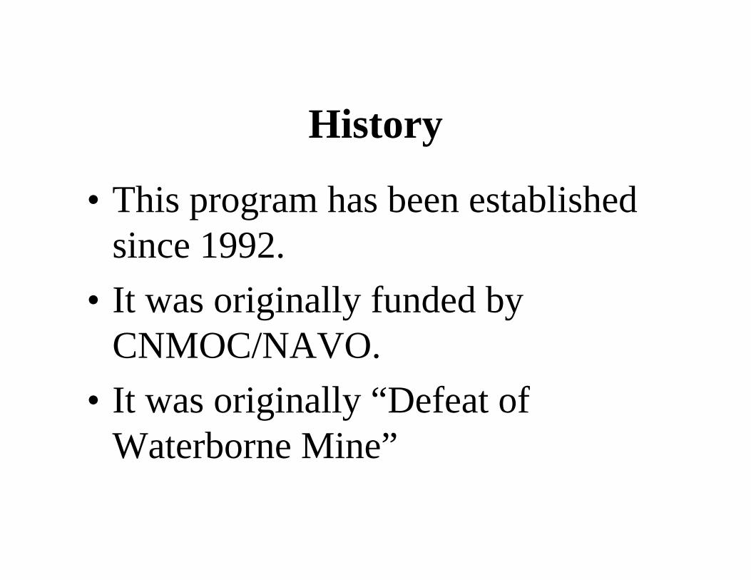
History
• This program has been established since 1992.
• It was originally funded by CNMOC/NAVO.
• It was originally “Defeat of Waterborne Mine”
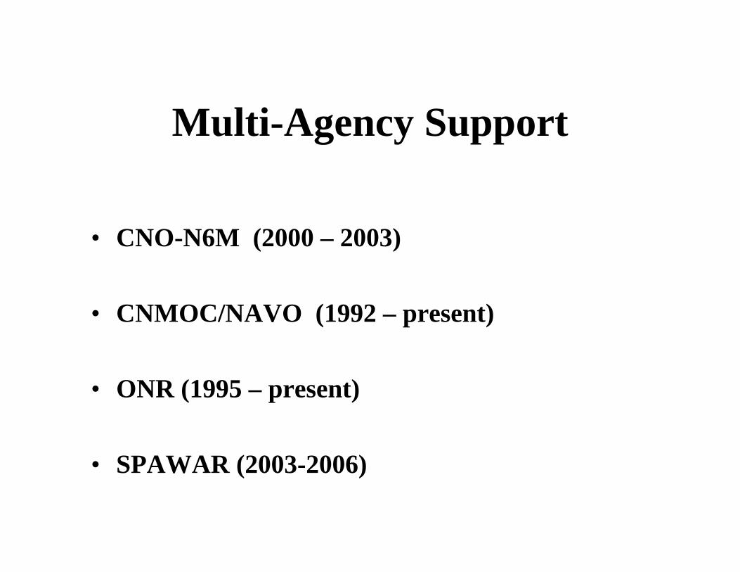
Multi-Agency Support
• CNO-N6M (2000 – 2003)
• CNMOC/NAVO (1992 – present)
• ONR (1995 – present)
• SPAWAR (2003-2006)
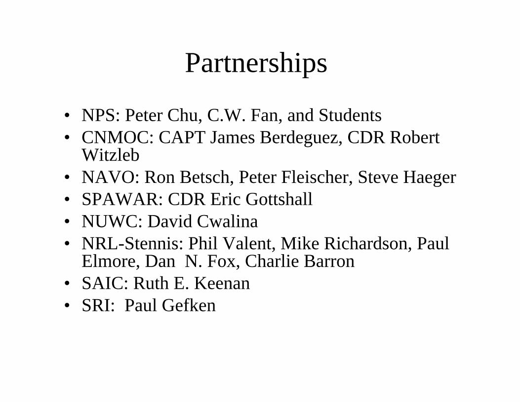
Partnerships
• NPS: Peter Chu, C.W. Fan, and Students • CNMOC: CAPT James Berdeguez, CDR Robert
Witzleb• NAVO: Ron Betsch, Peter Fleischer, Steve Haeger• SPAWAR: CDR Eric Gottshall• NUWC: David Cwalina• NRL-Stennis: Phil Valent, Mike Richardson, Paul
Elmore, Dan N. Fox, Charlie Barron• SAIC: Ruth E. Keenan• SRI: Paul Gefken
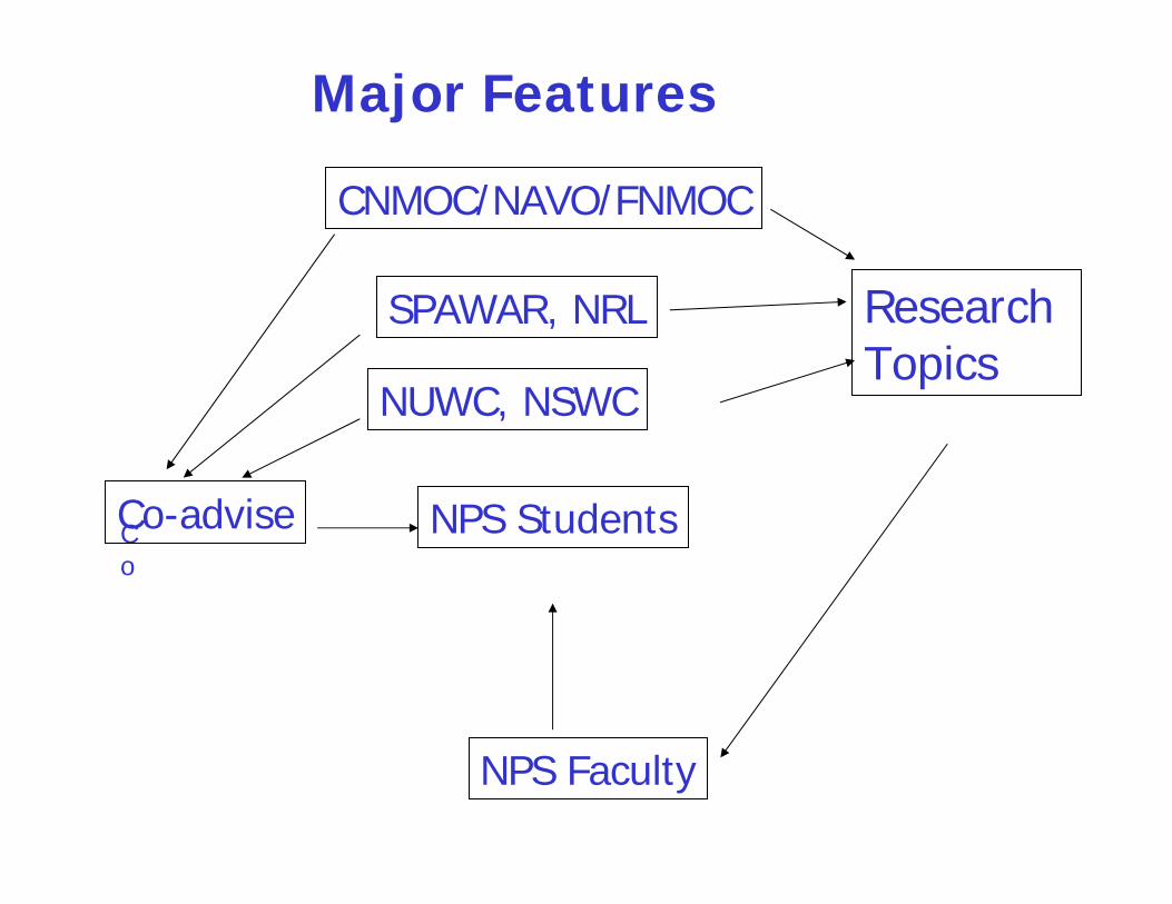
CNMOC/NAVO/FNMOC
SPAWAR, NRL
NUWC, NSWC
Research Topics
NPS Students
NPS Faculty
Co
Co-advise
Major Features

Vision
(1) World-Class Research Program
(2) Well Preparation of NPS Students for Future Assignments
(3) High Quality
( most of the theses were published in the reputable journals)
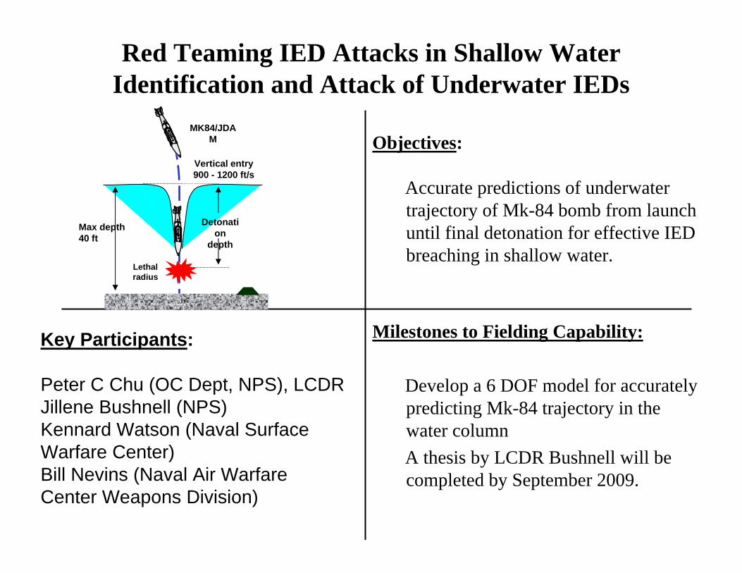
Key Participants:
Peter C Chu (OC Dept, NPS), LCDR Jillene Bushnell (NPS)Kennard Watson (Naval Surface Warfare Center)Bill Nevins (Naval Air Warfare Center Weapons Division)
Objectives:
Accurate predictions of underwater trajectory of Mk-84 bomb from launch until final detonation for effective IED breaching in shallow water.
Milestones to Fielding Capability:
Develop a 6 DOF model for accurately predicting Mk-84 trajectory in the water columnA thesis by LCDR Bushnell will be completed by September 2009.
Red Teaming IED Attacks in Shallow WaterIdentification and Attack of Underwater IEDs
Vertical entry 900 - 1200 ft/s
MK84/JDAM
Detonation
depth
Lethal radius
Max depth 40 ft
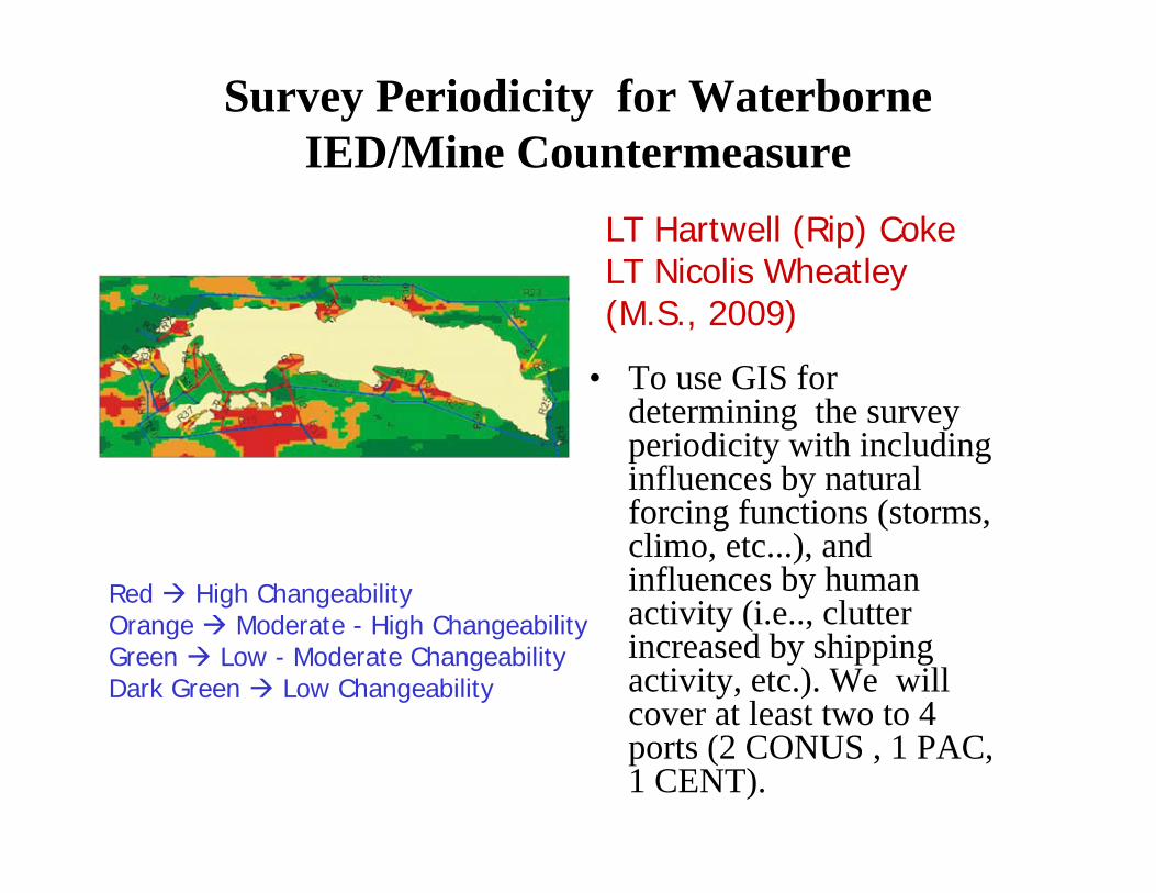
Survey Periodicity for Waterborne IED/Mine Countermeasure
• To use GIS for determining the survey periodicity with including influences by natural forcing functions (storms, climo, etc...), and influences by human activity (i.e.., clutter increased by shipping activity, etc.). We will cover at least two to 4 ports (2 CONUS , 1 PAC, 1 CENT).
Red High ChangeabilityOrange Moderate - High ChangeabilityGreen Low - Moderate ChangeabilityDark Green Low Changeability
LT Hartwell (Rip) Coke LT Nicolis Wheatley(M.S., 2009)
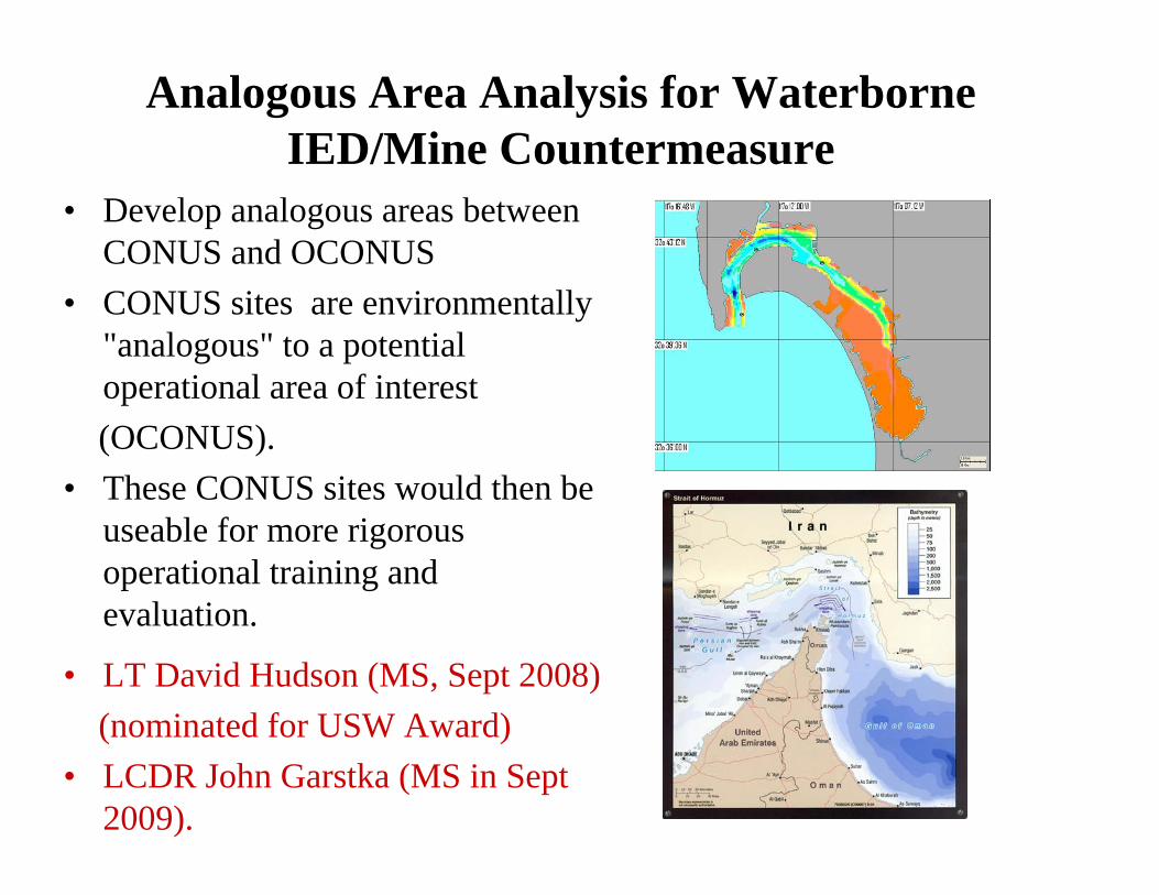
Analogous Area Analysis for Waterborne IED/Mine Countermeasure
• Develop analogous areas between CONUS and OCONUS
• CONUS sites are environmentally"analogous" to a potential operational area of interest(OCONUS).
• These CONUS sites would then be useable for more rigorous operational training andevaluation.
• LT David Hudson (MS, Sept 2008)(nominated for USW Award)
• LCDR John Garstka (MS in Sept 2009).
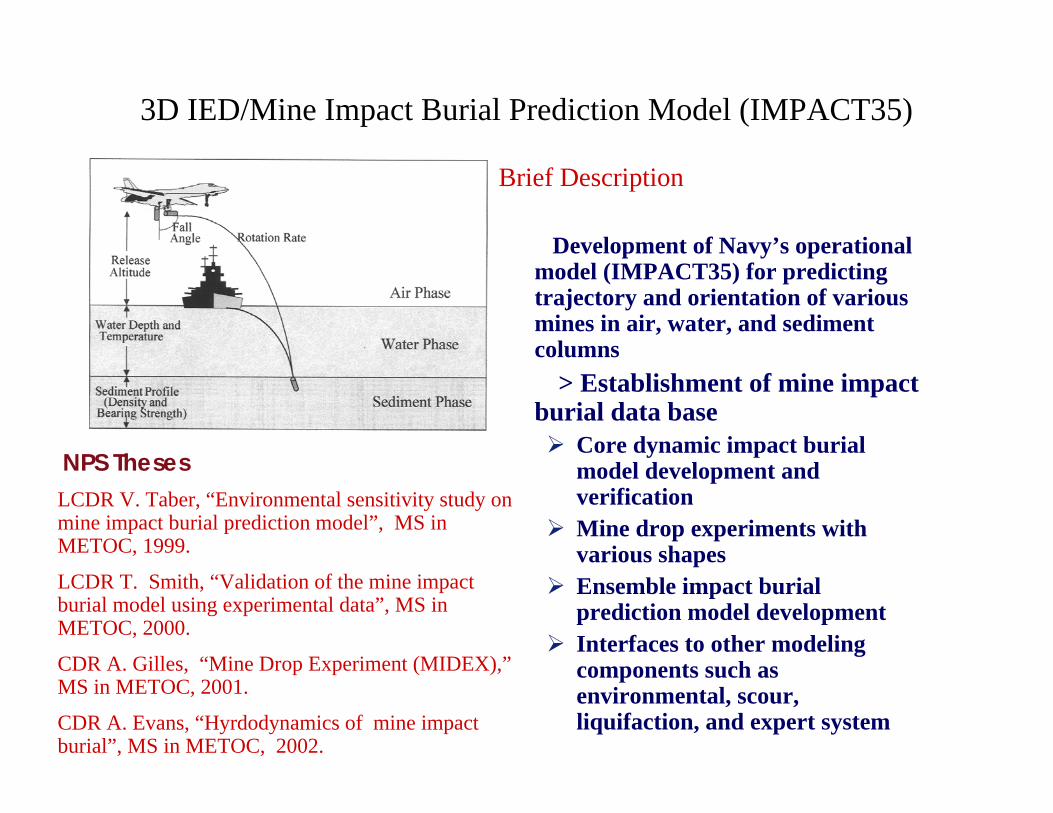
3D IED/Mine Impact Burial Prediction Model (IMPACT35)
Brief Description
Development of Navy’s operational model (IMPACT35) for predicting trajectory and orientation of various mines in air, water, and sediment columns
> Establishment of mine impact burial data base
Core dynamic impact burial model development and verificationMine drop experiments with various shapesEnsemble impact burial prediction model developmentInterfaces to other modeling components such as environmental, scour, liquifaction, and expert system
NPS ThesesLCDR V. Taber, “Environmental sensitivity study on mine impact burial prediction model”, MS in METOC, 1999.
LCDR T. Smith, “Validation of the mine impact burial model using experimental data”, MS in METOC, 2000.
CDR A. Gilles, “Mine Drop Experiment (MIDEX),”MS in METOC, 2001.
CDR A. Evans, “Hyrdodynamics of mine impact burial”, MS in METOC, 2002.
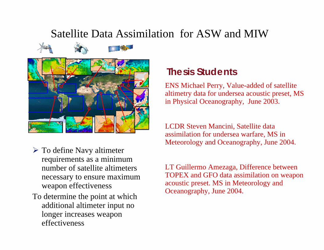
Satellite Data Assimilation for ASW and MIW
To define Navy altimeter requirements as a minimum number of satellite altimeters necessary to ensure maximum weapon effectiveness
To determine the point at which additional altimeter input no longer increases weapon effectiveness
Thesis StudentsENS Michael Perry, Value-added of satellite altimetry data for undersea acoustic preset, MS in Physical Oceanography, June 2003.
LCDR Steven Mancini, Satellite data assimilation for undersea warfare, MS in Meteorology and Oceanography, June 2004.
LT Guillermo Amezaga, Difference between TOPEX and GFO data assimilation on weapon acoustic preset. MS in Meteorology and Oceanography, June 2004.
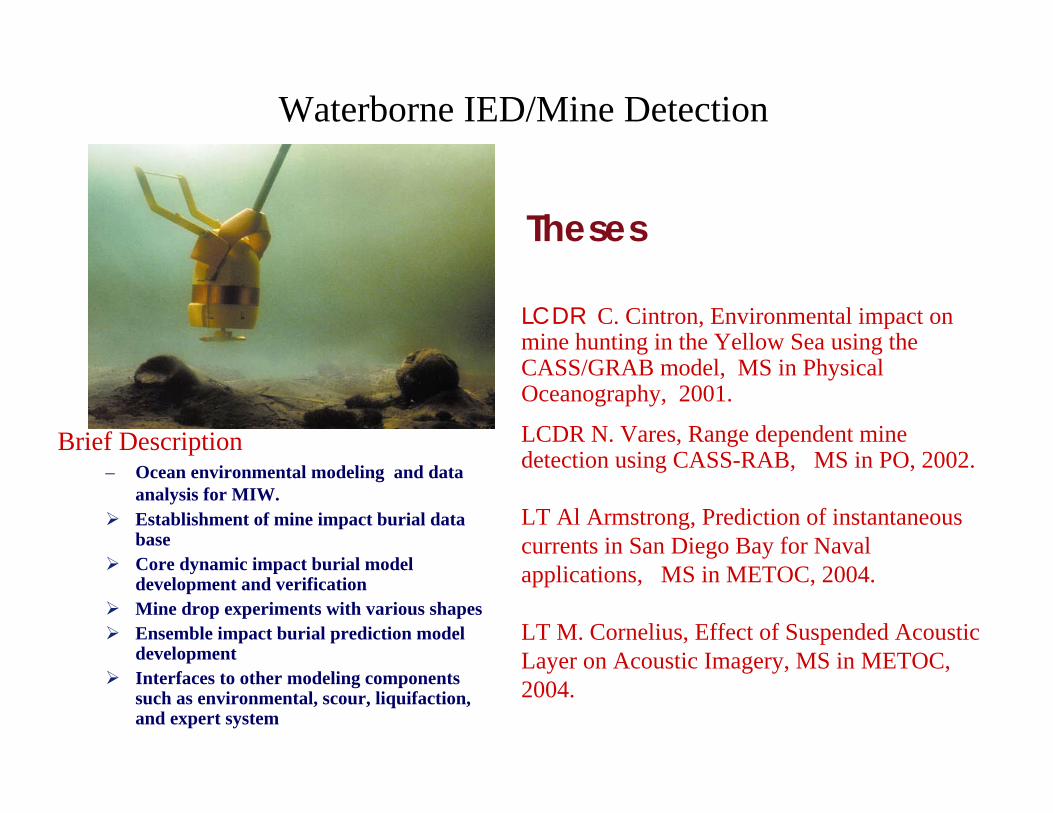
Waterborne IED/Mine Detection
Brief Description– Ocean environmental modeling and data
analysis for MIW. Establishment of mine impact burial data baseCore dynamic impact burial model development and verificationMine drop experiments with various shapesEnsemble impact burial prediction model developmentInterfaces to other modeling components such as environmental, scour, liquifaction, and expert system
Theses
LCDR C. Cintron, Environmental impact on mine hunting in the Yellow Sea using the CASS/GRAB model, MS in Physical Oceanography, 2001.
LCDR N. Vares, Range dependent mine detection using CASS-RAB, MS in PO, 2002.
LT Al Armstrong, Prediction of instantaneous currents in San Diego Bay for Naval applications, MS in METOC, 2004.
LT M. Cornelius, Effect of Suspended Acoustic Layer on Acoustic Imagery, MS in METOC, 2004.
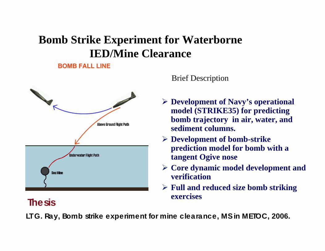
Bomb Strike Experiment for Waterborne IED/Mine Clearance
Brief Description
Development of Navy’s operational model (STRIKE35) for predicting bomb trajectory in air, water, and sediment columns. Development of bomb-strike prediction model for bomb with a tangent Ogive noseCore dynamic model development and verificationFull and reduced size bomb striking exercises Thesis
LT G. Ray, Bomb strike experiment for mine clearance, MS in METOC, 2006.
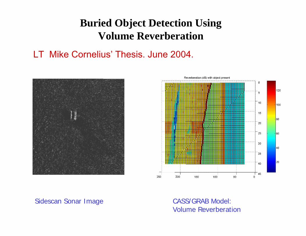
Buried Object Detection Using Volume Reverberation
LT Mike Cornelius’ Thesis. June 2004.
Sidescan Sonar Image CASS/GRAB Model: Volume Reverberation
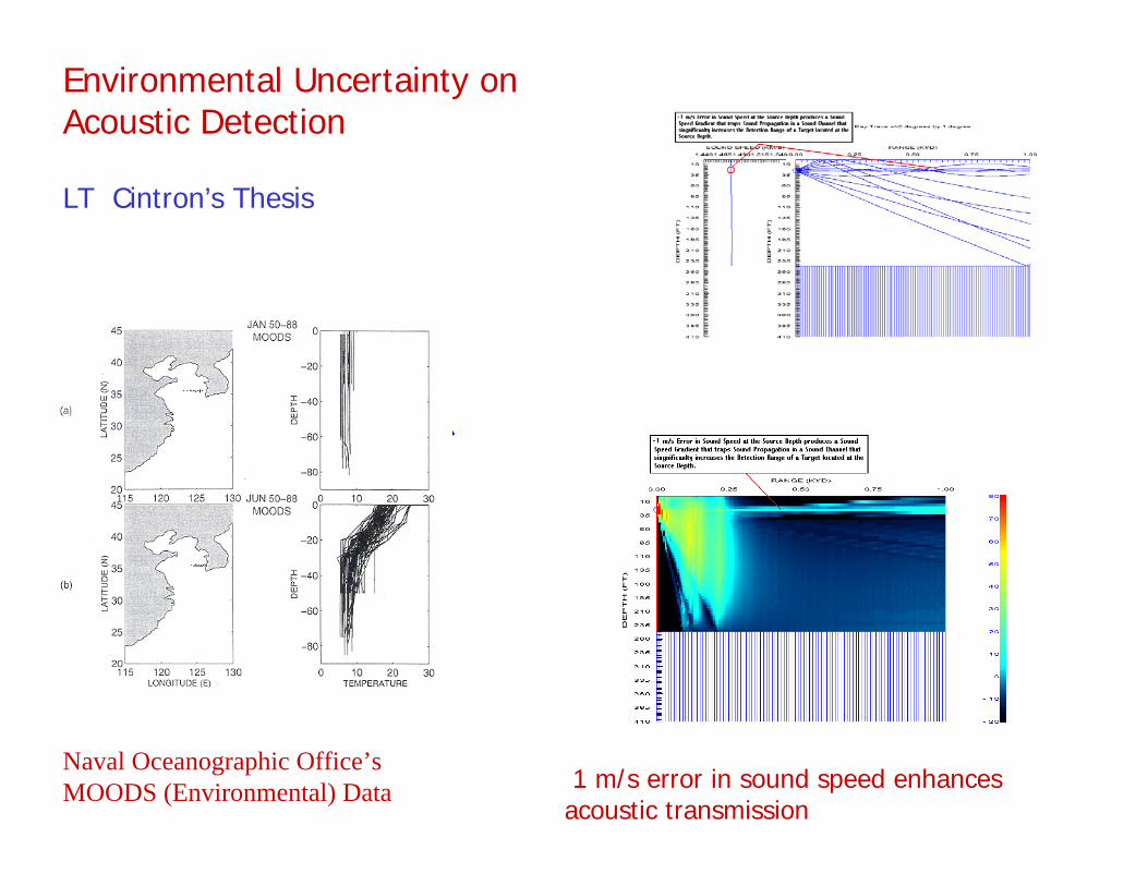
Environmental Uncertainty on Acoustic Detection
LT Cintron’s Thesis
L L
Naval Oceanographic Office’s MOODS (Environmental) Data 1 m/s error in sound speed enhances
acoustic transmission
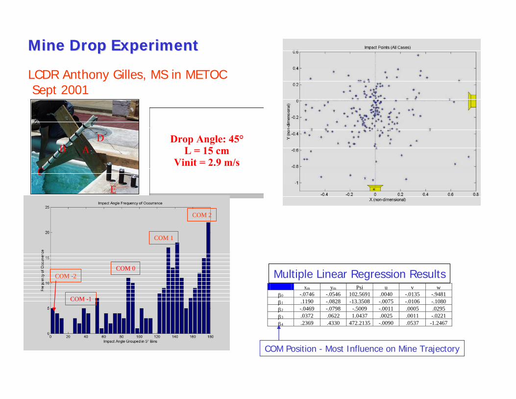
Mine Drop ExperimentMine Drop Experiment
LCDR Anthony Gilles, MS in METOCSept 2001
COM 2
COM -1
COM -2COM 0
COM 1
xm ym Psi u v w β0 -.0746 -.0546 102.5691 .0040 -.0135 -.9481 β1 .1190 -.0828 -13.3508 -.0075 -.0106 -.1080 β2 -.0469 -.0798 -.5009 -.0011 .0005 .0295 β3 .0372 .0622 1.0437 .0025 .0011 -.0221 β4 .2369 .4330 472.2135 -.0090 .0537 -1.2467
Multiple Linear Regression Results
COM Position - Most Influence on Mine Trajectory
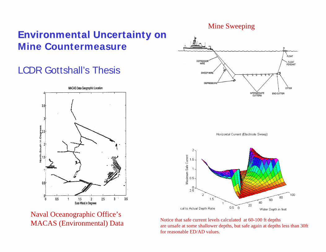
Environmental Uncertainty on Environmental Uncertainty on Mine Countermeasure
LCDR Gottshall’s Thesis
L L
Naval Oceanographic Office’s MACAS (Environmental) Data Notice that safe current levels calculated at 60-100 ft depths
are unsafe at some shallower depths, but safe again at depths less than 30ftfor reasonable ED/AD values.
Mine Sweeping
Conclusions
• “Defeat of Waterborne IED/Mine” is an important program.
• Your support is highly appreciated.