Embed Size (px)
Citation preview

DROIT ET SÉCURITÉ MARITIMES DES AUVS ET GLIDERS
POUR LA RECHERCHE SCIENTIFIQUE
H. Claustre 1, F. Dabe 2, E. Jarmache 3, P. Lherminier 4, L. Mortier 5, V. Rigaud 6, P. Testor 7
1 LOV, CNRS 2 GESMA, DGA3 Secrétariat Général de la Mer 4 LPO, IFREMER 5 ENSTA, DGA 6 DSSM, IFREMER 7 LOCEAN, CNRS

Mesures automatisées aujourd'hui: le réseau de flotteurs ARGO
ARGOOrigine, organisation- Pilotage scientif., suite WOCE- Experience GODAE- Endossé UNESCO, OMM, …- Participation 40 pays- Gestion distribuée- Coût : 40 MEUR
Applications- Prévision climatique- Prévision météorologique- Recherche
http://www.coriolis.eu.org
Mesures de Température et Salinité
Avantages- Couverture globale- Données 4D- QC et temps réel facile
Inconvénients- Purement lagrangien pas de contrôle- Résolution spatiale/temporelle faibleconvient pas aux échelles régionnales
Réseaux de GLIDERS

OPERATIONNELSystèmes d’observation opérationnels
régionaux et globaux
Télédétection In-situ !!
RECHERCHEEtudes de processus haute
résolution spatiale/temporelle
Les gliders peuvent accroître significativement nos capacités d’observation in-situ
Les gliders sont des “teenagers” avec un fort potentiel :
1) possibilité de manoeuvres au sein de réseaux : - sections répétées- mouillage virtuel- réponse à des événements - échantillonnage adaptatif
2) Longue autonomieavec des piles Lithium = 3-5 mois ~ 2000-3000 km
3) Possibilité de mesurer des paramètres physiques et biogéochimiques
4) Très haute densité et résolution des mesures
Nouvelles possibilités offertes par les gliders

Fonctionnement opérationnel
Vitesse horizontale: 20-40 km/jour
Centre de données Coriolis, IFREMER
Brest, France
Modèles opérationnelsMFS, INGV
MERCATOR
Station de réceptionIFM-GEOMAR
LOCEAN, LPO-IfremerNOCS
IMEDEACETSSM ?
GTS,...???

Joint initiative for the development of a new observational capacity for process studies and operational monitoring of the ocean physics and biogeochemistry with gliders.
• LOCEAN-IPSL/ENSTA, LOV, LPO, France• IFM-GEOMAR, Germany• IMEDEA, Spain• NOCS, UK• ...
http://www.locean-ipsl.upmc.fr/gliders
A fleet of up to 8-10 gliders will be deployed in the northwestern Mediterranean Sea during Fall 2006 - Spring 2007
General circulation andSeasonal variability
Physical (T,S) and Biogeochemical (O2, Fluorescence, Turbidity) processes
Deep convection
Across-slope exchanges
Seawifs Image on 18.04.2000 – courtesy of R. Santoleri et al.
European Gliding Observatories (EGO)

• Crowded area for commercial navigation
• Fishing: prawn, tuna, … , trawlers, …
• In summer: recreative uses, sport fishing
•Navies: French (Toulon), Italian and NATO (La Spezia), Spanish (Gerona ?)
•Toulon: Basis of nuclear submarines
•French « ZONEX »
Why should we take care of the navigation in the Gulf of Lions ?
Example of the western Mediterranean Sea:possible interferences with other maritime activities

• Main objectives– Prevent loss and damage of our instruments– Prevent damage or injuries to third parties
• Main risks– Within the 20m surface layer– Fishing areas, trawling, drifting nets, ...
• Specific risk due to recreative uses (sailing, jet ski, day cruiser, …) within 3 to 6 nm (20nm) strip from the coast
• Specific risk in July/August
Operating gliders in term of marine security~2m and ~ 50 kg in air (+/-250g in water), short periods at surface (10mn every 4-5 hours)

• Minimize surfacing– No surfacing at all: Acoustic positioning and communication.
Feasibility and project by ACSA/LOV– Near Real Time and/or « Bufferized » glider data (iridium and
freewave: higher rate but need to establish a freewave antenna network)
• Navigation– Lights?– « radio lights », AIS system or similar suitable? Feasible?– Radio security announcements
• Use of acoustic detection to prevent collisions– Feasibility? (Hydrophone : yes ; software : no)
• Toward integration within OMI regulations?– Contact with “Direction de la Sécurité Maritime”
Active behaviour to prevent collision

• Official institutions– International:
IOC (consults ABE-LOS and J-COMM)IMO
e.g. IOC resolution XX-6 (ARGO Project) Not suitable for glider
– National: SGMDir. Séc. Mar.
• Working groups for drifters, gliders, …– Institutional
• IOC consults ABE-LOS and J-COMM • IOC Meeting on Operationnal Oceanography, Libreville, 26-30
March 2007• IMO from members states
– Scientist and lawyers : e.g. Workshop during SeaTechWeek,Brest, Oct. 2006
Legal and regulation frames

• French regulations
– Deployment and recovery from research vessels. Authorization asked by the chief scientist or the company (INSU, GENAVIR) and given by « Préfet Maritime » upon Navy advice. Ultimate authority : SecrétariatGénéral de la Mer
– Free navigation of the gliders
• Spain– Coastal zone (5nm) : escort ship– Open sea water : free navigation but
• Information to Capitania Maritima• Transfer to SASEMAR and IHM• Broadcast of Coastal Navigational Warnings• It works !
Legal and regulation examples

• Que veut-on ?– Pas d’assimilation des gliders aux gros AUV (Asterx) car contraintes très différentes– Cadre de type ARGO: leve la contrainte partie 13 UNCLOS, ZEE
Capteurs physiques/biogeochmiques: pb des ressources ?– Accès aux moyens locaux, regionaux et nationaux et procedures de “rescue”– Contraintes (?) juridictionnelles et de navigation
Conclusions et futur
• Actions en cours– Prise en charge par E. Jarmache au titre de SGM et ABELOS (+contact COI)– Contacts locaux : pêches, MN, loueurs (déploiement, sauvetage ! )
2? 5? nm12 nm20 nmZEE
5? 20? m
• Actions à entreprendre– Groupes de travail techniques : définition de procédures, “traçabilité”

• All over the year, except WE and public holidays
• Prawn (mainly spanish fishermen)– On the continental slope between 400 to 800m– Usually from the SW of the Gulf and more south
• Palangriers (Trawl lines ?)– From the canyon heads down to 300m
• Trawlers– Fordidden in the 3nm from coast– The whole shelf mainly between 80m and 150m
• Drifting nets– Forbidden but … Mention of the « Cetacean sanctuary »
• Sporting fishing in summer
Fishing activity in the NW Med

• Avoid main known commercial routes– Difficult to access the information– In theory, adequate waypoints and surfacing strategies could lower the risks
• Avoid main fishing areas and period– Almost impossible– Maintain good contacts with fisherman through their authorities and conciliation boards
(Comités regionaux/locaux des pêches, Prud’hommies de pêche, Cofradias de percadores) : to be done if necessary
• Avoid recreative areas in Summer– Coastal areas (3nm, 6nm, 20nm)– Specific routes or areas (e.g. Barcelona-Palma, Nice-Corsica, Monaco, …)– Provides gliders routes to harbour authorities ?
• ZONEX– « classical » Cruises Plans submitted 2 weeks before the begining to the French Navy
for aproval – Specific (good) contact with CECMED concerning gliders already established– See with spanish and italian authorities ?
Cautious navigation for gliders
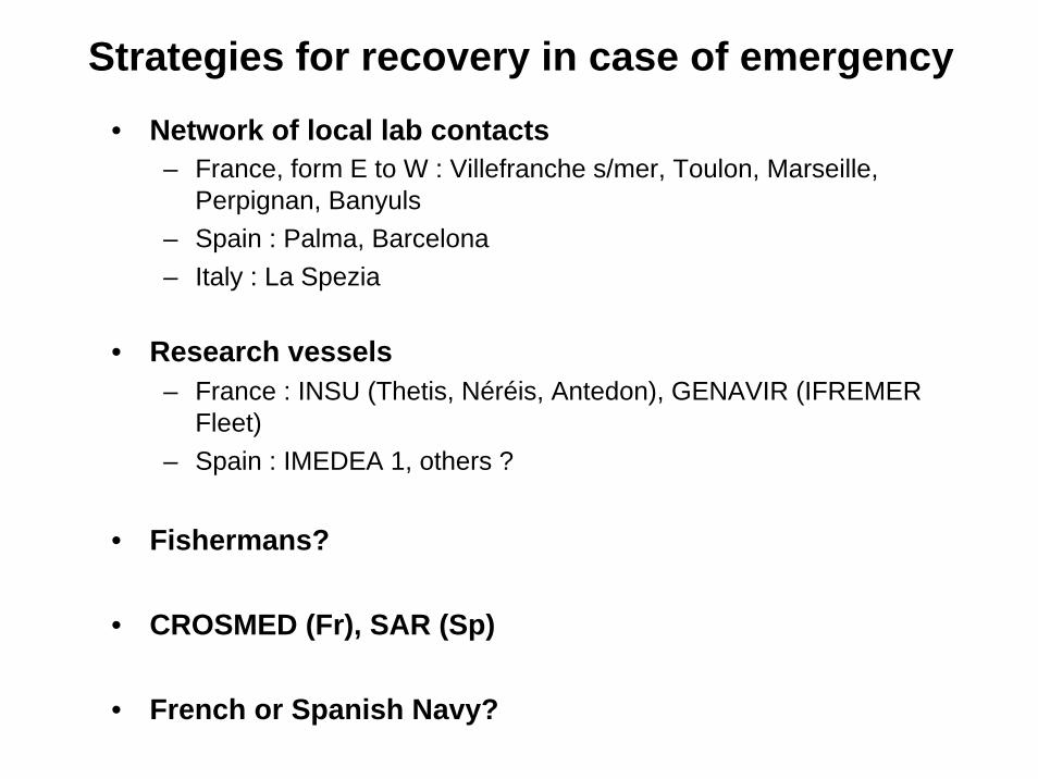
• Network of local lab contacts – France, form E to W : Villefranche s/mer, Toulon, Marseille,
Perpignan, Banyuls– Spain : Palma, Barcelona– Italy : La Spezia
• Research vessels– France : INSU (Thetis, Néréis, Antedon), GENAVIR (IFREMER
Fleet) – Spain : IMEDEA 1, others ?
• Fishermans?
• CROSMED (Fr), SAR (Sp)
• French or Spanish Navy?
Strategies for recovery in case of emergency

Initiative MOON
• Cadre déjà existant coordonné par Nadia Pinardi (INGV) et Pierre Bahurel (MERCATOR)
• Labo/Institutions françaises partenaires : Ifremer, Mercator, POCT, LOV
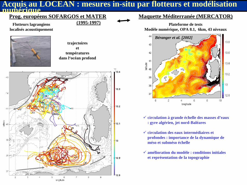
Prog. européens SOFARGOS et MATER(1995-1997)
Maquette Méditerranée (MERCATOR)Plateforme de tests
Modèle numérique, OPA 8.1, 6km, 43 niveauxFlotteurs lagrangiens
localisés acoustiquement
Acquis au LOCEAN : mesures in-situ par flotteurs et modélisation numérique
trajectoires et
températures dans l‘océan profond
Béranger et al. [2002]
circulation à grande échelle des masses d’eaux : gyre algérien, jet nord-Baléares
circulation des eaux intermédiaires et profondes : importance de la dynamique de méso et subméso échelle
amélioration du modèle : conditions initiales et représentation de la topographie

• Damage to third party during deployment and recovery– By the institution which commissions the research vessels– Not clear in case of rented boats
• Damage to third party during the free navigation– By our institutions– Something specific with gliders ?
• Damage or loss of the instrument– Commercial companies : e.g. 5000 EUR/y + 30 EUR/d for one
instrument. « Group » prices.
Insurance issues


![AdaptiveMMSEturboequalizationwithhigh-order ... TRIDENT receiver [1], developed by GESMA (Groupe d’EtudesSous-Marinesdel’Atlantique,Brest,France),incol-laborationwithTelecomBretagneandSERCEL.Thisreceiver](https://img.pdfslide.net/doc/110x75/5b36714c7f8b9a330e8e64ec/adaptivemmseturboequalizationwithhigh-order-trident-receiver-1-developed.jpg)