Embed Size (px)
Citation preview
DULLES AREA TRANSPORTATION ASSOCIATION
(DATA)
February 18, 2015
Susan Shaw, P.E., VDOT, Megaprojects Director
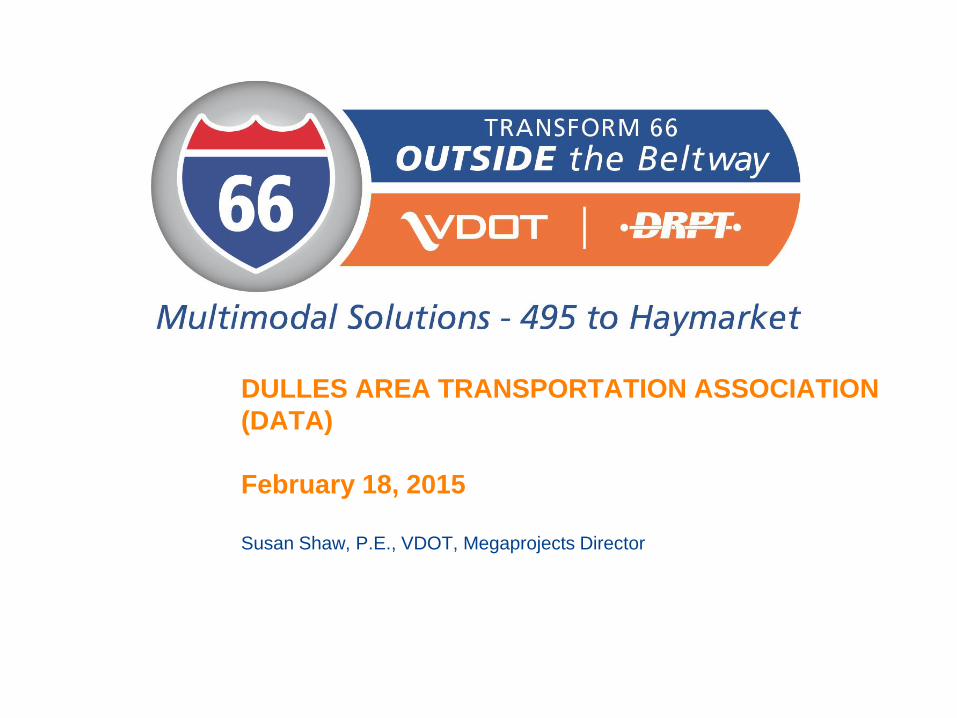
I-66 Corridor Conditions
2
• Steady population growth
• Employment growth in
activity centers
• Congestion and mobility
demands
• 8-10 hours of congestion in
2040
• Safety concerns
• Lack of coordinated transit
service and modal choices
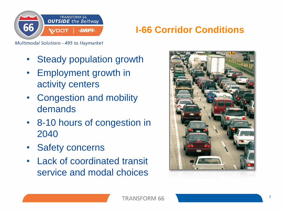
Purpose and Need
3
• Improve multimodal mobility along the I-66 corridor by
providing diverse travel choices in a cost-effective
manner
• Enhance transportation safety and travel reliability
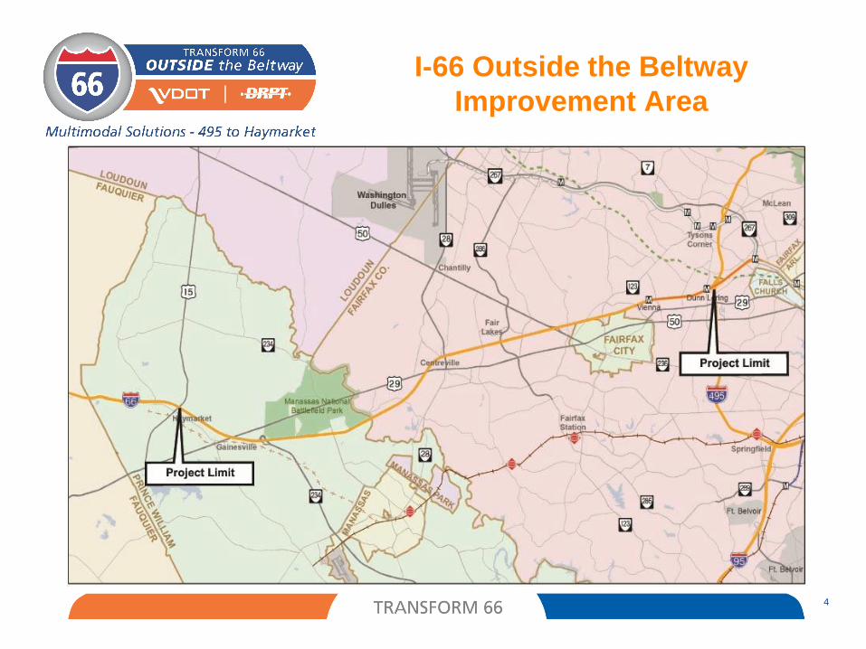
I-66 Outside the Beltway
Improvement Area
4
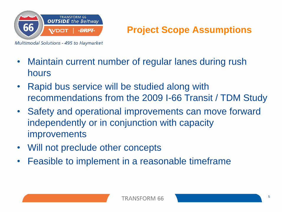
Project Scope Assumptions
• Maintain current number of regular lanes during rush
hours
• Rapid bus service will be studied along with
recommendations from the 2009 I-66 Transit / TDM Study
• Safety and operational improvements can move forward
independently or in conjunction with capacity
improvements
• Will not preclude other concepts
• Feasible to implement in a reasonable timeframe
5
Project Scope Elements
6
• Two Express Lanes (convert existing HOV lane & add one lane) HOV-3 and buses travel free
Non-HOV tolled
Congestion-based tolls (similar to other Express Lanes in region)
Converting HOV-2 to HOV-3 by 2020, consistent with the
region’s Constrained Long Range Plan
• Three regular lanes Open to all traffic
No tolls
Ramp-to-ramp connections (auxiliary lanes)
• Rapid bus service and other multimodal improvements High frequency of service beyond peak hours
Travel in express lanes for predictable travel times
Park-and-Ride lots, Transportation Demand Management
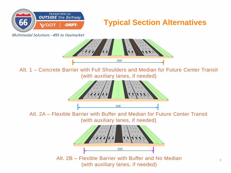
Typical Section Alternatives
7
290’
Alt. 1 – Concrete Barrier with Full Shoulders and Median for Future Center Transit
(with auxiliary lanes, if needed)
246’
Alt. 2A – Flexible Barrier with Buffer and Median for Future Center Transit
(with auxiliary lanes, if needed)
206’
Alt. 2B – Flexible Barrier with Buffer and No Median
(with auxiliary lanes, if needed)
8
• Locating potential access points near key activity centers or park-and-
ride lots
• Identified locations for connections between express and general
lanes
• Studying existing interchanges to address recurring congestion at
bottlenecks and safety concerns at hot-spot locations
• Evaluating needs for ramp-to-ramp connections between
interchanges
• Replacing or widening I-66 overpasses and bridges, where needed
• In coordination with interchange and overpass construction,
identifying bicycle and pedestrian access needs to improve
multimodal connectivity
Access Points and Interchange
Improvements
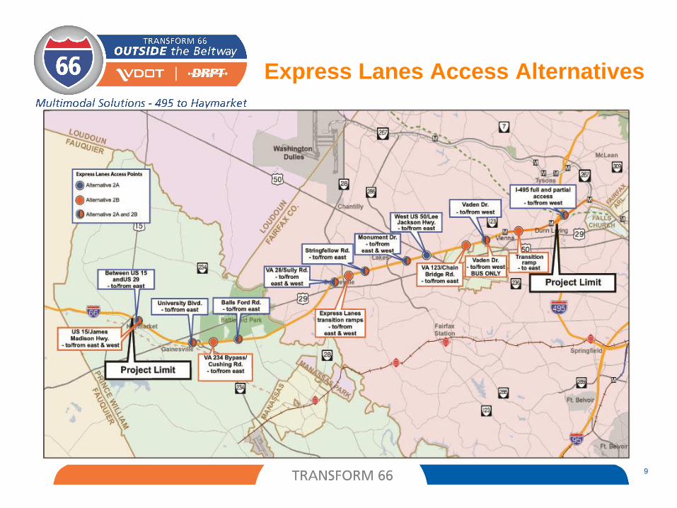
Express Lanes Access Alternatives
9
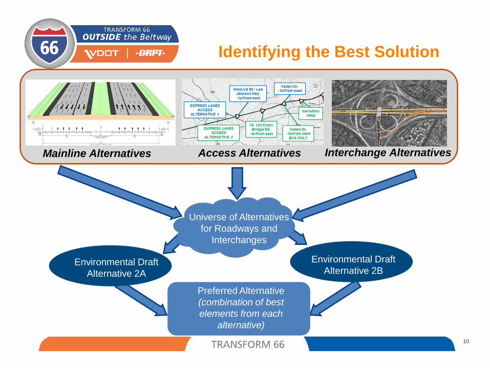
Identifying the Best Solution
10
Universe of Alternatives
for Roadways and
Interchanges
Environmental Draft
Alternative 2A
Environmental Draft
Alternative 2B
Preferred Alternative
(combination of best
elements from each
alternative)
Mainline Alternatives Access Alternatives Interchange Alternatives
Current Project Activities
Gathering data Survey Environmental Geotechnical Traffic
Developing preliminary designs
Completing traffic projections and analyses
Assessing potential impacts
Presenting findings to the public
Identifying a preferred alternative
11
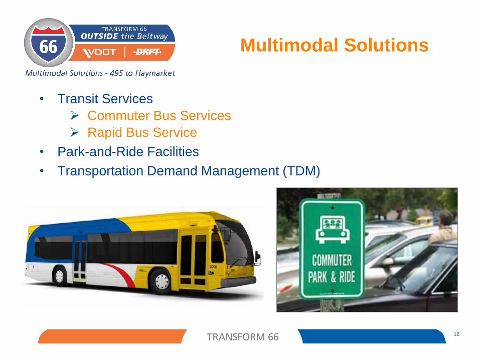
Multimodal Solutions
• Transit Services
Commuter Bus Services
Rapid Bus Service
• Park-and-Ride Facilities
• Transportation Demand Management (TDM)
12
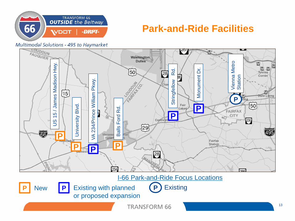
Park-and-Ride Facilities
13
P
P P P
P
US
15
/ J
am
es M
ad
ison
Hw
y.
Ba
lls F
ord
Rd.
VA
23
4/P
rince
Will
iam
Pkw
y.
Univ
ers
ity B
lvd
.
Vie
nn
a M
etr
o
Sta
tio
n
Mo
nu
men
t D
r.
Str
ingfe
llow
R
d.
I-66 Park-and-Ride Focus Locations
P New P Existing with planned
or proposed expansion
ExistingP
P
P
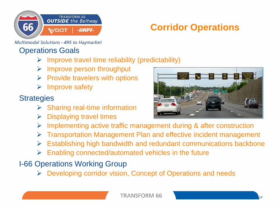
Corridor Operations
Operations Goals
Improve travel time reliability (predictability)
Improve person throughput
Provide travelers with options
Improve safety
Strategies
Sharing real-time information
Displaying travel times
Implementing active traffic management during & after construction
Transportation Management Plan and effective incident management
Establishing high bandwidth and redundant communications backbone
Enabling connected/automated vehicles in the future
I-66 Operations Working Group
Developing corridor vision, Concept of Operations and needs
14
Public-Private Partnership Process
• Similar to the 95 and 495 Express Lanes projects, the I-66 Project is
advancing as a Public Private Partnership (P3)
• The Virginia Office of Public-Private Partnerships (VAP3) is working
with VDOT and DRPT to evaluate the project as a P3 initiative,
following Virginia’s updated 2014 P3 Guidelines
• The Project is being evaluated for risk, cost, benefit to the users and
other project specific elements that bring value
• Overall project cost expected to be $2B - $3B
15
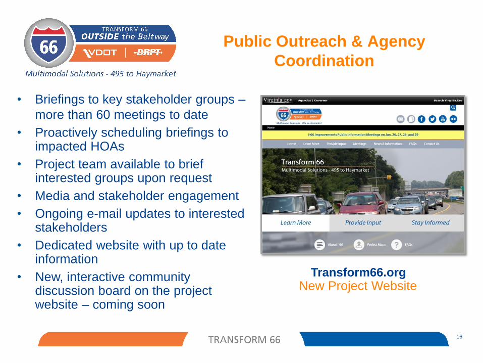
Public Outreach & Agency
Coordination
16
• Briefings to key stakeholder groups –
more than 60 meetings to date
• Proactively scheduling briefings to impacted HOAs
• Project team available to brief interested groups upon request
• Media and stakeholder engagement
• Ongoing e-mail updates to interested stakeholders
• Dedicated website with up to date information
• New, interactive community discussion board on the project website – coming soon
Transform66.orgNew Project Website
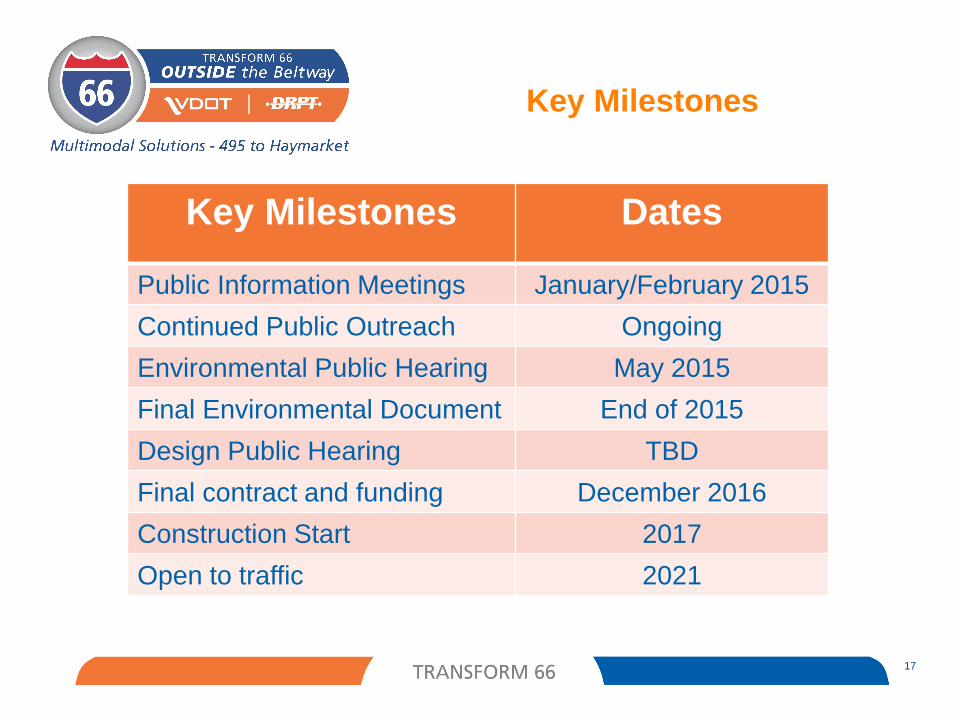
Key Milestones
17
Key Milestones Dates
Public Information Meetings January/February 2015
Continued Public Outreach Ongoing
Environmental Public Hearing May 2015
Final Environmental Document End of 2015
Design Public Hearing TBD
Final contract and funding December 2016
Construction Start 2017
Open to traffic 2021
PROJECT OVERVIEW
18
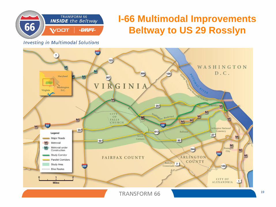
19
I-66 Multimodal Improvements
Beltway to US 29 Rosslyn
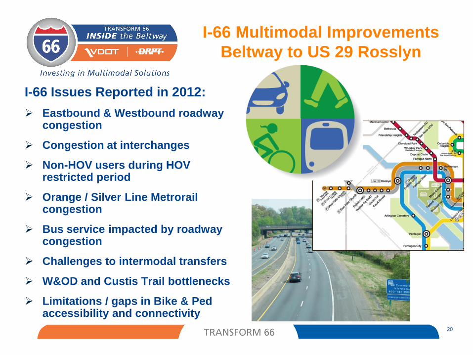
I-66 Issues Reported in 2012:
Eastbound & Westbound roadway congestion
Congestion at interchanges
Non-HOV users during HOVrestricted period
Orange / Silver Line Metrorail congestion
Bus service impacted by roadway congestion
Challenges to intermodal transfers
W&OD and Custis Trail bottlenecks
Limitations / gaps in Bike & Pedaccessibility and connectivity
I-66 Multimodal Improvements
Beltway to US 29 Rosslyn
20
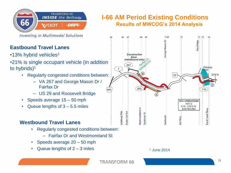
I-66 AM Period Existing Conditions Results of MWCOG’s 2014 Analysis
21
Eastbound Travel Lanes
•13% hybrid vehicles1
•21% is single occupant vehicle (in addition
to hybrids)1
• Regularly congested conditions between:
– VA 267 and George Mason Dr /
Fairfax Dr
– US 29 and Roosevelt Bridge
• Speeds average 15 – 50 mph
• Queue lengths of 3 – 5.5 miles
Westbound Travel Lanes
• Regularly congested conditions between:
– Fairfax Dr and Westmoreland St
• Speeds average 20 – 50 mph
• Queue lengths of 2 – 3 miles 1 June 2014
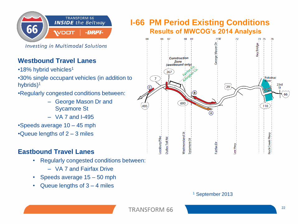
I-66 PM Period Existing Conditions Results of MWCOG’s 2014 Analysis
22
Eastbound Travel Lanes
• Regularly congested conditions between:
– VA 7 and Fairfax Drive
• Speeds average 15 – 50 mph
• Queue lengths of 3 – 4 miles
Westbound Travel Lanes
•18% hybrid vehicles1
•30% single occupant vehicles (in addition to
hybrids)1
•Regularly congested conditions between:
– George Mason Dr and
Sycamore St
– VA 7 and I-495
•Speeds average 10 – 45 mph
•Queue lengths of 2 – 3 miles
1 September 2013
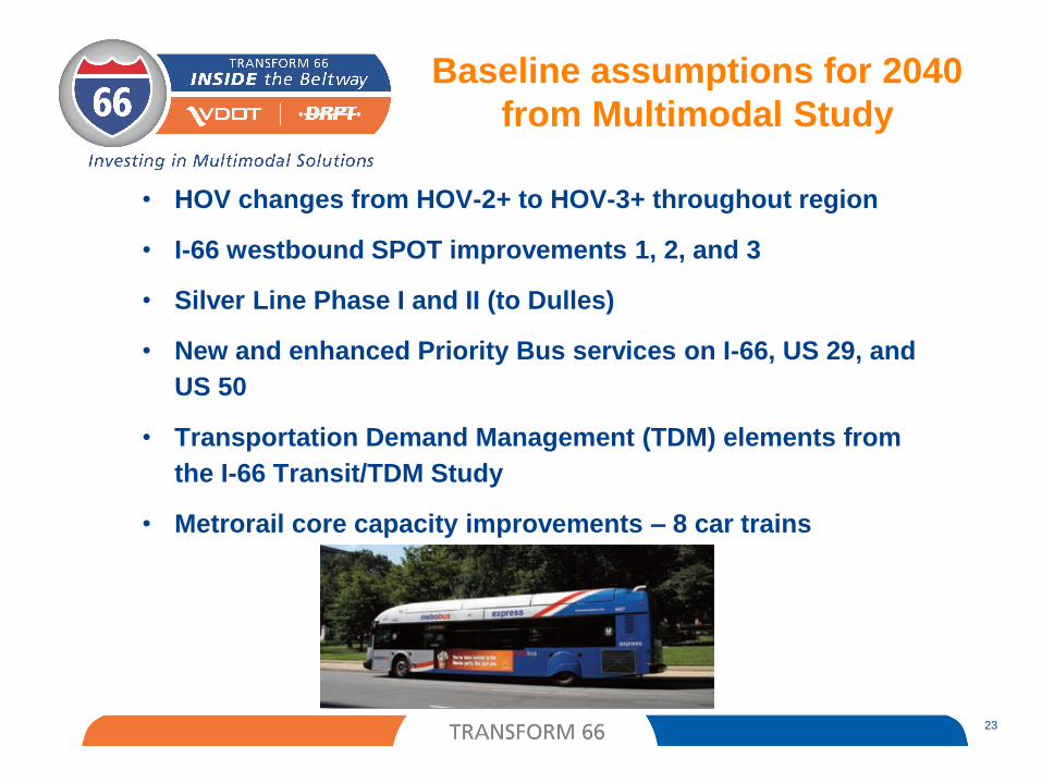
23
• HOV changes from HOV-2+ to HOV-3+ throughout region
• I-66 westbound SPOT improvements 1, 2, and 3
• Silver Line Phase I and II (to Dulles)
• New and enhanced Priority Bus services on I-66, US 29, and
US 50
• Transportation Demand Management (TDM) elements from
the I-66 Transit/TDM Study
• Metrorail core capacity improvements – 8 car trains
Baseline assumptions for 2040
from Multimodal Study
Corridor activity since 2012:
August 2013 Supplemental Report
• Refined Package
Completed or Active Projects
• Active Traffic Management (ATM) underway
• Spot 1 Widening WB – Completed December 2011
• Spot 2 Widening WB – Under Construction
• Bus on Shoulder – Under implementation, operational in 2015
Outside the Beltway project development
Dec 9 letter from Secretary Layne
• Multimodal package of solutions
CLRP project submission, Jan 2015
I-66 Multimodal Improvements
Beltway to US 29 Rosslyn
24
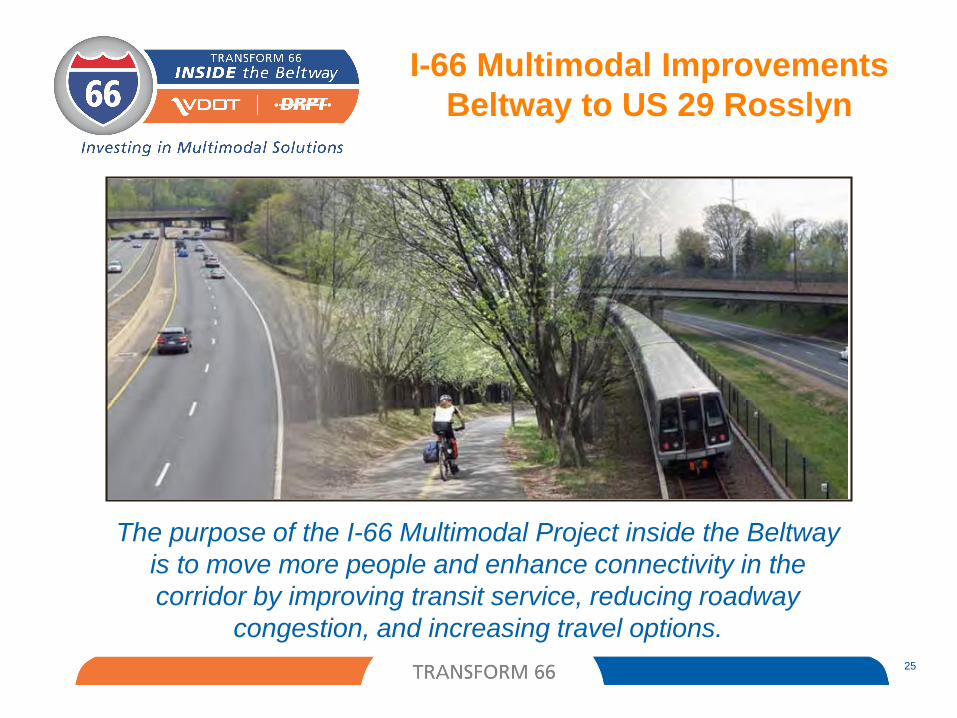
The purpose of the I-66 Multimodal Project inside the Beltway
is to move more people and enhance connectivity in the
corridor by improving transit service, reducing roadway
congestion, and increasing travel options.
I-66 Multimodal Improvements
Beltway to US 29 Rosslyn
25
26
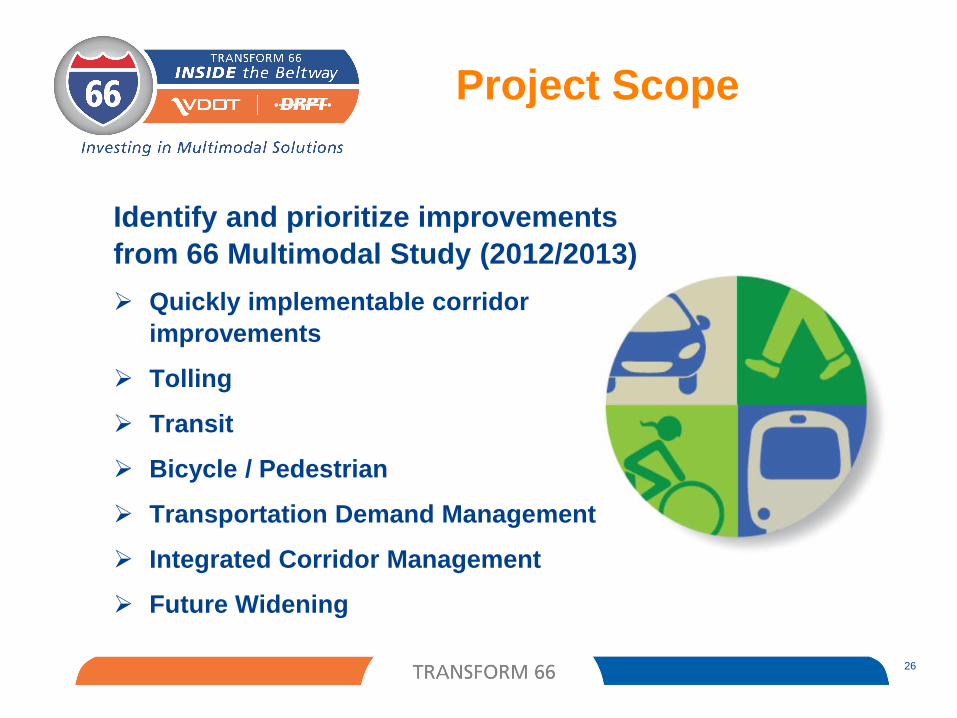
Identify and prioritize improvements
from 66 Multimodal Study (2012/2013)
Quickly implementable corridor
improvements
Tolling
Transit
Bicycle / Pedestrian
Transportation Demand Management
Integrated Corridor Management
Future Widening
Project Scope
27
Environmental documentation to include:
• Tolling Element
• Multimodal improvements that require environmental
clearance
• Future widening
Environmental
Documentation
28
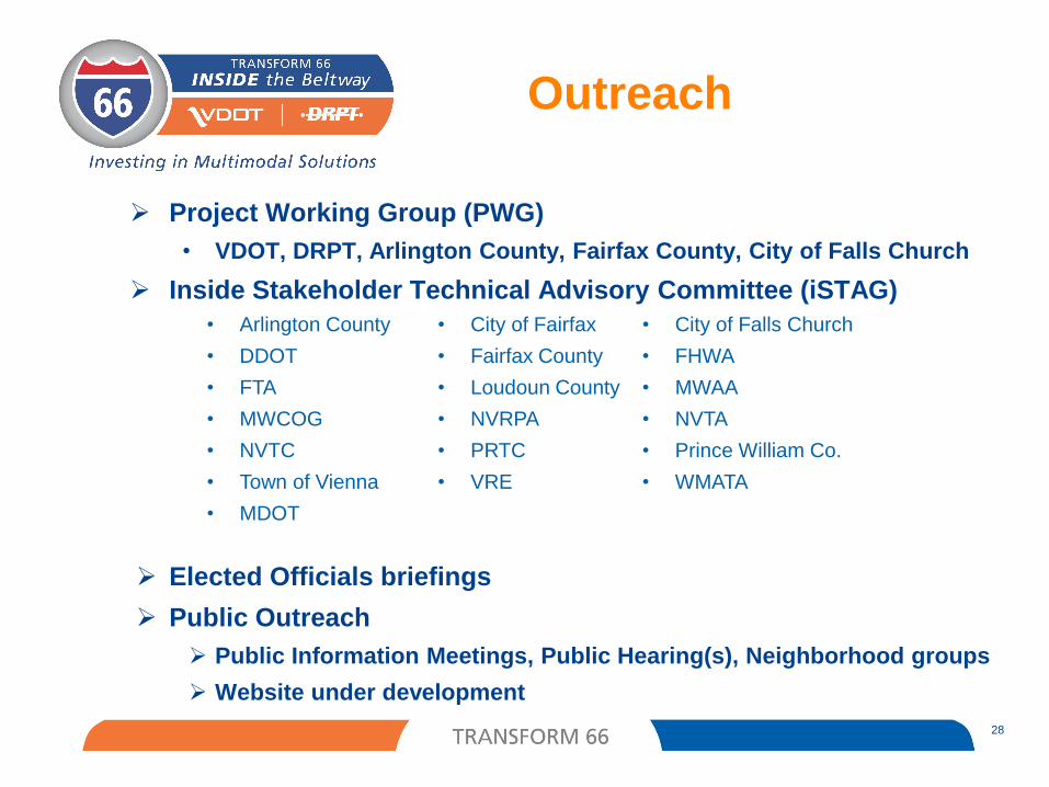
Project Working Group (PWG)
• VDOT, DRPT, Arlington County, Fairfax County, City of Falls Church
Inside Stakeholder Technical Advisory Committee (iSTAG)
Elected Officials briefings
Public Outreach
Public Information Meetings, Public Hearing(s), Neighborhood groups
Website under development
Outreach
• Arlington County • City of Fairfax • City of Falls Church
• DDOT • Fairfax County • FHWA
• FTA • Loudoun County • MWAA
• MWCOG • NVRPA • NVTA
• NVTC • PRTC • Prince William Co.
• Town of Vienna • VRE • WMATA
• MDOT
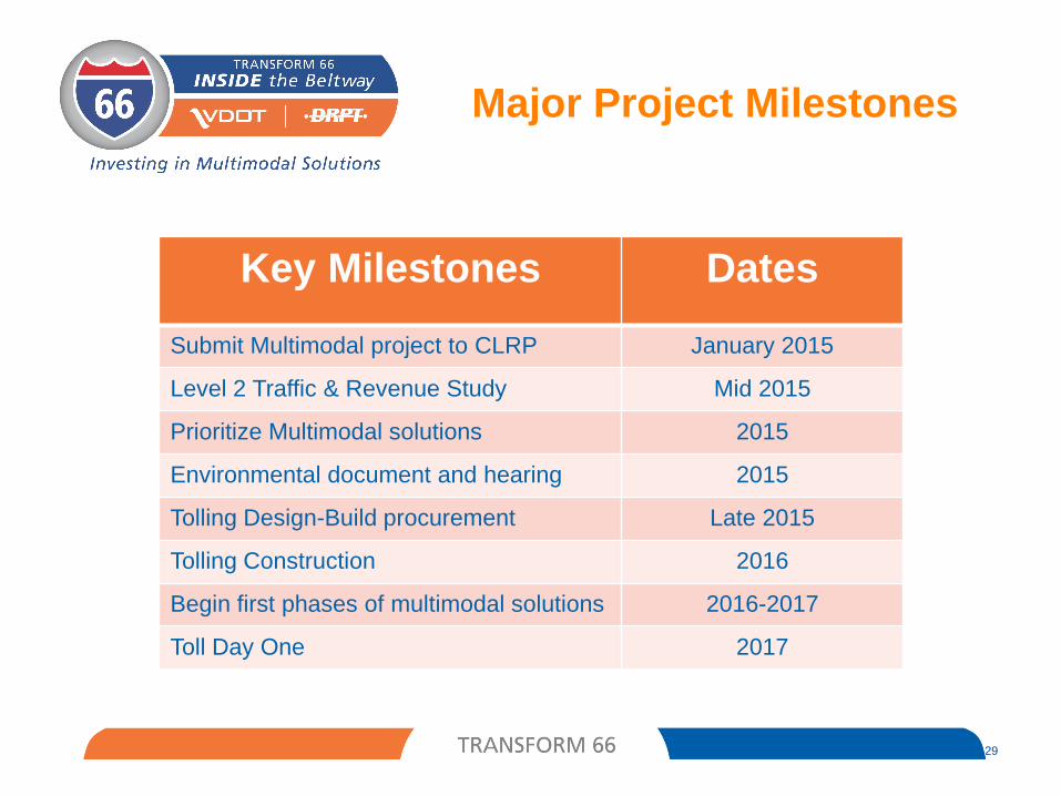
Major Project Milestones
29
Key Milestones Dates
Submit Multimodal project to CLRP January 2015
Level 2 Traffic & Revenue Study Mid 2015
Prioritize Multimodal solutions 2015
Environmental document and hearing 2015
Tolling Design-Build procurement Late 2015
Tolling Construction 2016
Begin first phases of multimodal solutions 2016-2017
Toll Day One 2017