Embed Size (px)
Citation preview

Edit
or’
s m
Essa
gE
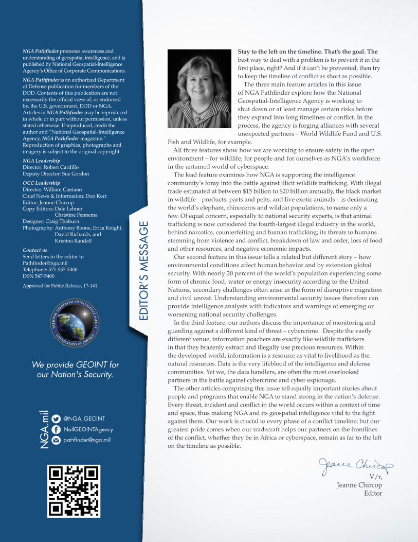
Stay to the left on the timeline. That’s the goal. The best way to deal with a problem is to prevent it in the first place, right? And if it can’t be prevented, then try to keep the timeline of conflict as short as possible.
The three main feature articles in this issue of NGA Pathfinder explore how the National Geospatial-Intelligence Agency is working to shut down or at least manage certain risks before they expand into long timelines of conflict. In the process, the agency is forging alliances with several unexpected partners – World Wildlife Fund and U.S.
Fish and Wildlife, for example. All three features show how we are working to ensure safety in the open
environment – for wildlife, for people and for ourselves as NGA’s workforce in the untamed world of cyberspace.
The lead feature examines how NGA is supporting the intelligence community’s foray into the battle against illicit wildlife trafficking. With illegal trade estimated at between $15 billion to $20 billion annually, the black market in wildlife – products, parts and pelts, and live exotic animals – is decimating the world’s elephant, rhinoceros and wildcat populations, to name only a few. Of equal concern, especially to national security experts, is that animal trafficking is now considered the fourth-largest illegal industry in the world, behind narcotics, counterfeiting and human trafficking; its threats to humans stemming from violence and conflict, breakdown of law and order, loss of food and other resources, and negative economic impacts.
Our second feature in this issue tells a related but different story – how environmental conditions affect human behavior and by extension global security. With nearly 20 percent of the world’s population experiencing some form of chronic food, water or energy insecurity according to the United Nations, secondary challenges often arise in the form of disruptive migration and civil unrest. Understanding environmental security issues therefore can provide intelligence analysts with indicators and warnings of emerging or worsening national security challenges.
In the third feature, our authors discuss the importance of monitoring and guarding against a different kind of threat – cybercrime. Despite the vastly different venue, information poachers are exactly like wildlife traffickers in that they brazenly extract and illegally use precious resources. Within the developed world, information is a resource as vital to livelihood as the natural resources. Data is the very lifeblood of the intelligence and defense communities. Yet we, the data handlers, are often the most overlooked partners in the battle against cybercrime and cyber espionage.
The other articles comprising this issue tell equally important stories about people and programs that enable NGA to stand strong in the nation’s defense. Every threat, incident and conflict in the world occurs within a context of time and space, thus making NGA and its geospatial intelligence vital to the fight against them. Our work is crucial to every phase of a conflict timeline; but our greatest pride comes when our tradecraft helps our partners on the frontlines of the conflict, whether they be in Africa or cyberspace, remain as far to the left on the timeline as possible.
V/r,Jeanne Chircop
Editor
We provide GEOINT for our Nation's Security.
NGA Pathfinder promotes awareness and understanding of geospatial intelligence, and is published by National Geospatial-Intelligence Agency’s Office of Corporate Communications.
NGA Pathfinder is an authorized Department of Defense publication for members of the DOD. Contents of this publication are not necessarily the official view of, or endorsed by, the U.S. government, DOD or NGA. Articles in NGA Pathfinder may be reproduced in whole or in part without permission, unless stated otherwise. If reproduced, credit the author and “National Geospatial-Intelligence Agency, NGA Pathfinder magazine.” Reproduction of graphics, photographs and imagery is subject to the original copyright.
NGA Leadership Director: Robert Cardillo Deputy Director: Sue Gordon
OCC Leadership Director: William Caniano Chief News & Information: Don Kerr Editor: Jeanne ChircopCopy Editors: Dale Lehner Christine Fennema Designer: Craig Thoburn Photography: Anthony Boone, Erica Knight, David Richards, and Kristina Randall
Contact us Send letters to the editor to [email protected] Telephone: 571-557-5400 DSN 547-5400 Approved for Public Release, 17-141

FEATURES10 Trouble under The Trees: GEOINT hElps fIGhT a dIffErENT kINd Of baTTlE IN afrIca
20 FighT or FlighT: WhEN ENvIrONmENTal cONdITIONs spark cIvIl uNrEsT,
mIGraTION aNd OThEr sEcurITy ThrEaTs
24 sTanding guard: ThE mOsT OvErlOOkEd cybErsEcurITy parTNEr Is us
4 Know thE Earth
6 Team NGa
14 ViewpoiNT
16 Show The way
18 Special Farewell
19 TelliNG our STory
27 collaboraTioN
30 uNderSTaNd The world
DEPARTMENTS
4|nga.miL PAThFiNder 2016|5
Kno
w t
hE
Eart
h
and services. The blending of different tradecraft cultures continues today in order to provide the most comprehensive, multidimensional geospatial intelligence possible in support of national security.
Fully incorporaTed agencies
DEFENSEMAPPiNg AgENcy
DMA emerged in 1972 and absorbed operations of the following organizations: U.S. Air Force Aeronautical Chart and
Dissemination Program Office, the National Photographic Interpretation Center and the Defense Mapping Agency. It also incorporated parts of the Central Intelligence Agency, the Defense Airborne Reconnaissance Office, the Defense Intelligence Agency and the National Reconnaissance Office.
With the integration of several organizations pursuing similar missions, also came cultural differences. Overcoming this obstacle required collaboration and coordination among teammates in order to provide the best products
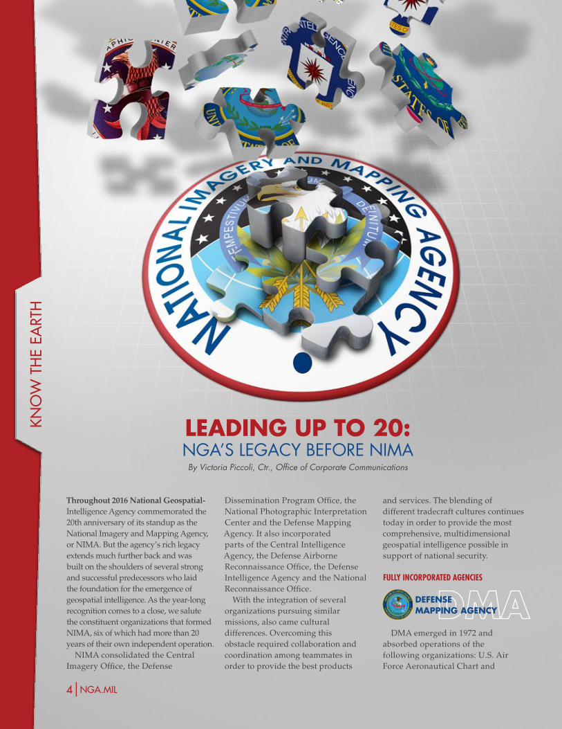
Throughout 2016 National Geospatial-Intelligence Agency commemorated the 20th anniversary of its standup as the National Imagery and Mapping Agency, or NIMA. But the agency’s rich legacy extends much further back and was built on the shoulders of several strong and successful predecessors who laid the foundation for the emergence of geospatial intelligence. As the year-long recognition comes to a close, we salute the constituent organizations that formed NIMA, six of which had more than 20 years of their own independent operation.
NIMA consolidated the Central Imagery Office, the Defense
LEADiNg UP To 20: NGa’S leGacy beFore Nima
By Victoria Piccoli, Ctr., Office of Corporate Communications
| Know the earth |
4|nga.miL PAThFiNder 2016|5
components supported the nation’s president, the National Security Council and national security policymakers by providing accurate, evidence-based, comprehensive and timely foreign intelligence related to national security; and by conducting counterintelligence activities and other functions related to foreign intelligence and national security as directed by the president.
DEFENSE AiRboRNE REcoNNAiSSANcE oFFicE
DARO transferred two areas of responsibility to NIMA – technology development in imagery exploitation and the exploitation and dissemination elements of the Common Imagery Ground/Surface System. Prior to the transfer DARO was responsible for the management and oversight of development and acquisition of all defense-wide and joint airborne reconnaissance programs, including platforms, sensors, data links, data relays and ground stations.
DEFENSEiNTELLigENcE AgENcy
DIA transferred its imagery analysis capabilities to NIMA. As a combat-support agency, DIA’s imagery-derived products blended with those of other NIMA-legacy agencies to enable the new agency to provide expertly exploited multi-layered imagery to customers such as the secretary of defense, the combatant commands and subordinate organizations.
NATioNALREcoNNAiSSANcE oFFicE
NRO transferred 20 imagery-related programs and the individuals associated with them into NIMA. NRO ensures that the United States has the technology and space-borne assets to acquire intelligence worldwide through research, development, acquisition and operation of the intelligence satellites. NIMA, and now NGA, acquires much of its imagery from NRO’s satellites.
of Defense Dick Cheney, Director of Central Intelligence Robert Gates and Chairman of the Joint Chiefs of Staff, Army Gen. Colin Powell.
NATioNAL PhoTogRAPhic iNTERPRETATioN cENTER
President Dwight D. Eisenhower created NPIC on nearly his last day in office in 1961. It was a joint project of the CIA and DOD.
NPIC was formed to consolidate the nation’s photoreconnaissance analysis assets. Its mission was to analyze imagery from classified satellite collection systems for reporting to the executive branch, Department of State, DOD and the U.S. military command, and civil agencies. The center was commended for its monitoring and reporting support to Operation Desert Shield and Operation Desert Storm.
DEFENSE DiSSEMiNATioN PRogRAM oFFicE
The DDPO was formed in 1974
as the main source of time-critical imagery for warfighters, national intelligence agencies, the scientific community and the civil sector. Its products supported analysis for intelligence, precision targeting and other activities that monitored indications and warnings.
Among its many services to the nation, the DDPO provided critical support to Operation Just Cause in Panama in December 1989, to Operation Desert Shield and Operation Desert Storm from1990 to 1991, and to peacekeeping operations in Bosnia in the 1990s.
conTribuTory agencies
cENTRALiNTELLigENcE AgENcy
CIA transferred to NIMA the Office of Imagery Analysis, management of foreign imagery-sharing arrangements, NPIC, and an element of research and development from its directorate for science and technology. These
Information Center, Oceanographic and Charting Services of the U.S. Naval Hydrographic Office and the Army Map Service. DMA was the largest organization integrated into NIMA. During its 24-year history it supported military and civilian agencies with accurate, tailored and interoperable global geospatial information and services.
DMA provided mapping, charting and geodesy support to the secretary of defense, the Joint Chiefs of Staff and the Department of Defense. The agency also supported the Drug Enforcement Agency for counter-drug operations in the Western Hemisphere and extended cartographic support for humanitarian relief efforts in Africa, the Caribbean and other geographic regions. Just prior to integrating into NIMA, DMA gave superior and responsive support to warfighters during Desert Shield and Desert Storm operations, as well as to the peacemaking and negotiating efforts in Bosnia.
In the 1980s DMA led a major effort to convert its map making from paper to digital format, adapting a variety of new geographic products, procedures and modernization programs. By harnessing the power of the computer to manipulate data, DMA built a strong foundation for the consolidation of analysis and generation of products into a single agency.
cENTRALiMAgERy oFFicE
DOD established CIO in 1992 as a combat-support agency to meet mapping, charting, geodesy and other U.S. imagery intelligence needs. Disagreement over its organizational structure and authorities changed its course, however; for the four years prior to its integration into NIMA, the CIO set standards and policy for imagery quality, exploitation and dissemination in response to imagery shortfalls during Operation Desert Storm.
Notables who influenced the structure of CIO in 1992 included Secretary
tEa
m n
ga
6|nga.miL
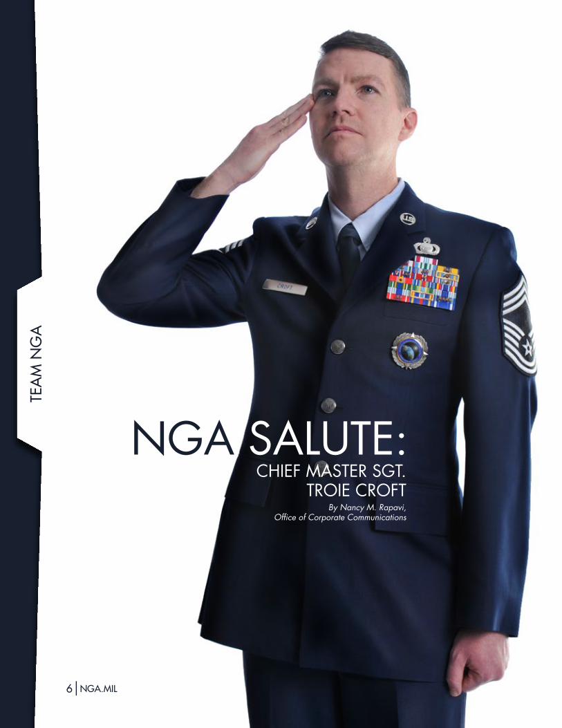
NGa SaluTe: chieF maSTer SGT.
Troie croFTBy Nancy M. Rapavi,
Office of Corporate Communications
Know a service member worthy of an NGA Salute? Send your suggestion to [email protected].
| Team NGa |
6|nga.miL PAThFiNder 2016|7
For U.S. Air Force Chief Master Sgt. Troie Croft, it’s important to make a difference. As the new senior enlisted advisor at National Geospatial-Intelligence Agency, that’s exactly what he’s doing.
Croft is in a unique position in his new role to assist both NGA and the 600 members of all branches of the military who work at the agency. He advises the NGA director on issues affecting the military, such as personnel development, utilization of skillsets and training. He advises NGA’s military staffers on career development, training and specific issues such as work-life balance.
NGA is a unique duty station for military personnel and provides opportunities as well as challenges, said Croft, who began his new post in early September.
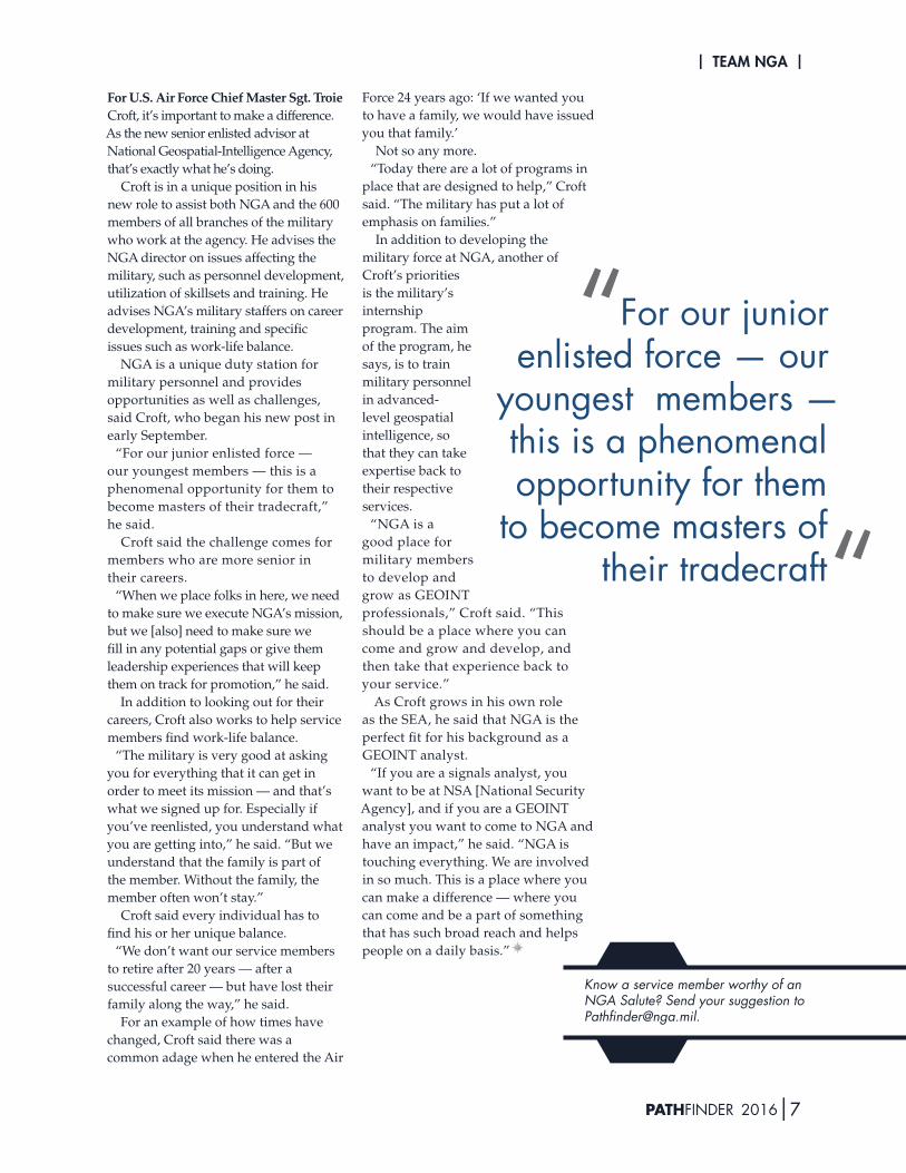
“For our junior enlisted force — our youngest members — this is a phenomenal opportunity for them to become masters of their tradecraft,” he said.
Croft said the challenge comes for members who are more senior in their careers.
“When we place folks in here, we need to make sure we execute NGA’s mission, but we [also] need to make sure we fill in any potential gaps or give them leadership experiences that will keep them on track for promotion,” he said.
In addition to looking out for their careers, Croft also works to help service members find work-life balance.
“The military is very good at asking you for everything that it can get in order to meet its mission — and that’s what we signed up for. Especially if you’ve reenlisted, you understand what you are getting into,” he said. “But we understand that the family is part of the member. Without the family, the member often won’t stay.”
Croft said every individual has to find his or her unique balance.
“We don’t want our service members to retire after 20 years — after a successful career — but have lost their family along the way,” he said.
For an example of how times have changed, Croft said there was a common adage when he entered the Air
Force 24 years ago: ‘If we wanted you to have a family, we would have issued you that family.’
Not so any more.“Today there are a lot of programs in
place that are designed to help,” Croft said. “The military has put a lot of emphasis on families.”
In addition to developing the military force at NGA, another of Croft’s priorities is the military’s internship program. The aim of the program, he says, is to train military personnel in advanced-level geospatial intelligence, so that they can take expertise back to their respective services.
“NGA is a good place for military members to develop and grow as GEOINT professionals,” Croft said. “This should be a place where you can come and grow and develop, and then take that experience back to your service.”
As Croft grows in his own role as the SEA, he said that NGA is the perfect fit for his background as a GEOINT analyst.
“If you are a signals analyst, you want to be at NSA [National Security Agency], and if you are a GEOINT analyst you want to come to NGA and have an impact,” he said. “NGA is touching everything. We are involved in so much. This is a place where you can make a difference — where you can come and be a part of something that has such broad reach and helps people on a daily basis.”
For our junior enlisted force — our
youngest members — this is a phenomenal opportunity for them
to become masters of their tradecraft
“
“
tEa
m n
ga
8|nga.miL
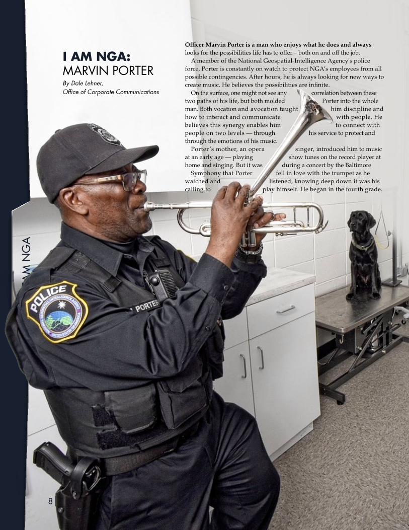
i AM NgA: marViN porTerBy Dale Lehner, Office of Corporate Communications
Officer Marvin Porter is a man who enjoys what he does and always looks for the possibilities life has to offer – both on and off the job.
A member of the National Geospatial-Intelligence Agency's police force, Porter is constantly on watch to protect NGA’s employees from all possible contingencies. After hours, he is always looking for new ways to create music. He believes the possibilities are infinite.
On the surface, one might not see any correlation between these two paths of his life, but both molded Porter into the whole man. Both vocation and avocation taught him discipline and how to interact and communicate with people. He believes this synergy enables him to connect with people on two levels — through his service to protect and through the emotions of his music.
Porter ’s mother, an opera singer, introduced him to music at an early age — playing show tunes on the record player at home and singing. But it was during a concert by the Baltimore
Symphony that Porter fell in love with the trumpet as he watched and listened, knowing deep down it was his calling to play himself. He began in the fourth grade.
| Team NGa |
8|nga.miL PAThFiNder 2016|9
“Once you start learning music, the journey starts, and you will be a student for life,” said Porter, explaining that there’s just too much information about music to learn, as well as the never-ending development of skills to play the instrument.
“I know I will never learn it all; but it’s a lot of fun,” he said.Porter learned the theory and fundamentals of
performance during six years of studying at the Johns Hopkins Peabody Conservancy. He fell in love with the Big Band sound in his early performing years, but jazz is where he learned to feel the music.
“Events in life affect how you feel and play,” said Porter. The improvisation of the genre paired with a “good understanding of the instrument and knowledge of the movement of the chords” allows the musician to “play from feeling.”
He has written 25 songs; ballads that “give me inspiration throughout the day.”
Porter also finds inspiration from those he meets on his daily job as a police officer. A self-proclaimed ‘people watcher,’ he enjoys the interaction and getting to know agency employees on a personal basis. He is very confident in his ability to remember 85 percent of the names of those he meets. Both qualities help him from a “police point of view,” of needing to be observant.
“I may see something, a change in a person that might affect my day; other people’s day; NGA’s day; and the next day,” he said. “I’m a very good reader of people, and I need to know what’s going on.”
His ability to ‘read’ people was honed during Porter’s 23 years as an officer in the Maryland Division of Corrections. He also learned early on to display and portray the same attitude every day when he put the uniform on; to not get angry or upset on the job -- a professionalism that instills confidence.
“Working in the prison was like going to college; you learn about people, which helped me in tough situations, then and now,” he said. “Policing is not just about force. If you show respect and talk to a person in a positive way, you get better results.”
Porter will retire from NGA in 2017 after seven years on the force and more than 30 years in law enforcement. He says his retirement will be full of music and interacting with people, as he continues in the role of music minister at his church. He will also continue giving trumpet and theory lessons to high school students working to take their music to the next level.
Retirement will also give Porter more time to concentrate on his own skills with the trumpet. After all, he’s still on his own journey of learning about music and life, and the possibilities are infinite.
FEa
turE
10|nga.miL PAThFiNder 2016|11
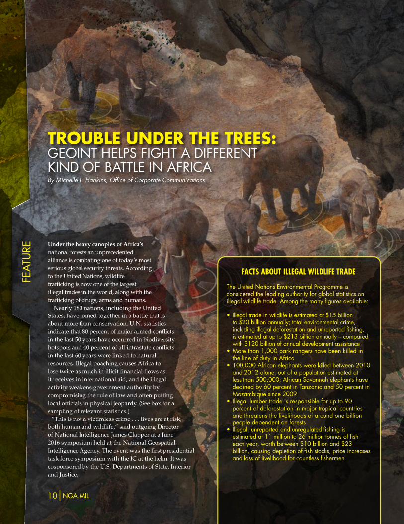
Under the heavy canopies of Africa’s national forests an unprecedented alliance is combating one of today’s most serious global security threats. According to the United Nations, wildlife trafficking is now one of the largest illegal trades in the world, along with the trafficking of drugs, arms and humans.
Nearly 180 nations, including the United States, have joined together in a battle that is about more than conservation. U.N. statistics indicate that 80 percent of major armed conflicts in the last 50 years have occurred in biodiversity hotspots and 40 percent of all intrastate conflicts in the last 60 years were linked to natural resources. Illegal poaching causes Africa to lose twice as much in illicit financial flows as it receives in international aid, and the illegal activity weakens government authority by compromising the rule of law and often putting local officials in physical jeopardy. (See box for a sampling of relevant statistics.)
“This is not a victimless crime . . . lives are at risk, both human and wildlife,” said outgoing Director of National Intelligence James Clapper at a June 2016 symposium held at the National Geospatial-Intelligence Agency. The event was the first presidential task force symposium with the IC at the helm. It was cosponsored by the U.S. Departments of State, Interior and Justice.
TRoUbLE UNDER ThE TREES: GeoiNT helpS FiGhT a diFFereNTkiNd oF baTTle iN aFrica By Michelle L. Hankins, Office of Corporate Communications
FacTs abouT illegal wildliFe Trade
The united Nations environmental programme is considered the leading authority for global statistics on illegal wildlife trade. among the many figures available:
• Illegaltradeinwildlifeisestimatedat$15billionto$20billionannually;totalenvironmentalcrime,includingillegaldeforestationandunreportedfishing,isestimatedatupto$213billionannually–comparedwith$120billionofannualdevelopmentassistance
•Morethan1,000parkrangershavebeenkilledinthe line of duty in africa
•100,000Africanelephantswerekilledbetween2010and2012alone,outofapopulationestimatedatlessthan500,000;AfricanSavannahelephantshavedeclinedby60percentinTanzaniaand50percentinmozambique since 2009
•Illegallumbertradeisresponsibleforupto90percent of deforestation in major tropical countries and threatens the livelihoods of around one billion people dependent on forests
• Illegal,unreportedandunregulatedfishingisestimated at 11 million to 26 million tonnes of fish eachyear,worthbetween$10billionand$23billion,causingdepletionoffishstocks,priceincreasesand loss of livelihood for countless fishermen
| Feature |
10|nga.miL PAThFiNder 2016|11
sharing initiative, are leveraging open-source data from international nongovernmental organizations whose grassroots efforts in Africa often yield vast amounts of previously untapped information. Team members believe that gaining access to this data and giving it geospatial context can help track illegal operations, the perpetrators of those operations and the patterns that exist between wildlife trafficking and other crimes related to human and national security.
Wildlife trafficking represents “a global criminal enterprise of epic proportions,” said Terrance Ford, national intelligence manager for Africa, Office of the DNI, at a congressional forum held on Capitol Hill in spring 2016.
The crime’s effects are most felt in sub-Saharan Africa, where the supply chain begins, according to Ford. Trafficking provides a source of revenue that undermines and destabilizes weak governments there, he says. Illicit activity spans the globe, however; Traffic, a WWF partner organization based in the United Kingdom, identifies numerous hotspots for illegal trade. Among them are China’s international borders; the eastern borders of the European Union; trade hubs in eastern and southern Africa; some markets in Mexico; parts of the Caribbean, Indonesia, New Guinea and the Solomon Islands; and even certain locations in the United States.
The United States is also a powerful ally in the fight against illicit wildlife trafficking, according to Judi W. Wakhungu, cabinet secretary for environment, water and natural resources for the Republic of Kenya, who also attended the spring congressional forum.
leFT oF Kill
For the IC’s nontraditional partners, such as conservation and animal welfare groups, bringing an end to wildlife trafficking is about stopping the poaching before it happens, or getting 'left of kill’ on the timeline.
The fight against wildlife trafficking has brought together strange bedfellows, including the intelligence community and the World Wildlife Fund, military strategists and endangered species experts, extreme liberals and staunch conservatives. The bipartisan Eliminate, Neutralize and Disrupt (END) Wildlife Trafficking Act, which became law in October 2016, was introduced in the Senate by Chris Coons (D-Del.) and Jeff Flake (R-Ariz.) and in the House by Congressmen Ed Royce (R-Calif.) and Eliot Engel (D-N.Y.). END incorporates provisions of an earlier bill, the Wildlife Trafficking Enforcement Act of 2015, which was cosponsored in the Senate by unlikely partners Dianne Feinstein (D-Calif.) and Lindsay Graham (R-S.C.). The new legislation elevates wildlife trafficking to a serious crime under U.S. law.
IC involvement in the effort stems from the whole-of-government approach outlined in the National Strategy for Combating Wildlife Trafficking adopted in 2014. To contribute to the IC’s role in implementing the strategy, NGA works with a large array of nontraditional partners, including nongovernmental organizations, industry and academia, to leverage relevant data and apply geospatial intelligence to better understand the connection between wildlife trafficking, other forms of illegal trafficking and the corresponding threats to national security.
creaTing a communiTyNGA became part of the U.S. effort
in January 2016, when DNI Clapper designated Odean Serrano, Ph.D., from NGA as the first IC lead to focus on IC contributions toward the issue, in support of Executive Order 13648. The agency created a Combating Wildlife Trafficking Community of Interest, which aims to create a common operating picture for decision-makers and law enforcement through cooperation and information sharing, and use of existing and emerging sources of data.
NGA and its IC partners, as part of the CWT COI information-
“How do we gather information … to be able to move and respond, so we don’t have to count carcasses?” said Kelvin Alie, director of the wildlife trade program at the International Fund for Animal Welfare. Being able to characterize the networks responsible for poaching would help move the needle back, he says.
For national security experts there is an understanding that wildlife trafficking relates to more than animal welfare.
“Wildlife trafficking contributes billions of dollars to the illegal economy, fuels instability and undermines human security,” said NGA Director Robert Cardillo at the summer symposium.
David Luna, the State Department’s senior director of national security and diplomacy, went a step further in his testimony at the congressional forum. He said, “More and more terrorists are turning to the illicit trades to finance their operations.”
oTher groups are more speciFic.“We’re not talking about the kind
of traffickers we’ve had before,” said Andrea Crosta, executive director and co-founder of the Elephant Action League, which released a report in 2013 linking illegal ivory trade to both al-Shabaab in Somalia and Joseph Kony’s Lord’s Resistance Army, known as the LRA, in the Democratic Republic of Congo.
new synergiesNot all of the CWT COI participants
entered the group because of direct wildlife trafficking concerns. Some, like Lisa Dougan, president and chief executive officer of Invisible Children, did so because their cause is related to the trafficking. Dougan and her colleagues have been fighting for human security in underserved regions in central Africa since 2005. The group’s primary goal is to end conflict related to the LRA, and the organization’s operations in Africa include human security reporting and analysis. Dougan says that the CWT COI represents an opportunity for new partners to find synergies.
Fea
ture
12|nga.miL PAThFiNder 2016|13nmb-boT chobe river elephanTs wv3
image daTe: augusT 12, 2015copyright 2016, digitalglobe
Faye Cuevas, chief of staff at IFAW, is another member of the CWT COI with an eye for synergies. An experienced military veteran, she brings several lessons learned from the war on terror to the fight against wildlife trafficking. One practice she carried forward is that of conducting community meetings. The IFAW calls these local community meetings in Africa “time under the trees.”
Time under the trees, Cuevas says, provides a view into what is happening on the ground. While the IC and the Department of Defense often look at events literally from the top down, using overhead sensors and satellite imagery to perform geospatial intelligence, NGOs such as IFAW come at it from below the limitations of
which are then sent to a team of analysts who assign verification ratings based on existing knowledge about LRA activity. They aggregate the data from all of the communities and send daily reports to key stakeholders.
That’s when GEOINT comes into play. Data with a high verification score is fed into an online mapping platform through which the organization is able to put geography to work to identify trends in the violence.
“We were able to see a correlation between the LRA poaching activity and violence against civilians in the region,” Dougan says, after the organization overlaid information from the community into the mapping tool.
“One elephant being killed means
the triple-canopy forest to “inversely illuminate these networks from the ground up,” said Cuevas.
Robert Dreher, associate director, U.S. Fish and Wildlife Service, says this kind of community-based intelligence is vital. In Kenya, for example, he says a stranger cannot walk across the land without it being reported.
Invisible Child’s early warning network is another example of community action. Villages communicate via twice-daily conference calls to report incidents occurring in or around their communities. Trained Invisible Child staff members document the reports from each village. They perform the initial vetting on the incident reports,
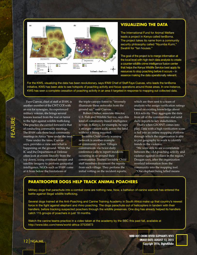
ViSUALiziNg ThE DATA
The International Fund for Animal Welfare leads a project in Kenya called tenBoma. The project takes its name from a community security philosophy called “Nyumba Kumi,” Swahili for “ten houses.”
The goal of the project is to merge information at the local level with high-tech data analysis to create a counter-wildlife crime intelligence fusion center that helps the Kenya Wildlife Service best apply its resources to stop poaching before it occurs – in essence making the data operationally relevant.
For the KWS, visualizing the data has been revolutionary, says IFAW Chief of Staff Faye Cuevas, who leads the tenBoma initiative. KWS has been able to see hotspots of poaching activity and focus operations around those areas. In one instance, KWS has seen a complete cessation of poaching activity in an area it targeted in response to mapping out collected data.
PARATRooPER DogS hELP TRAck ANiMAL PoAchERS
Military dogs that parachute into a combat zone are nothing new. Now, a battalion of canine warriors has entered the battle against illegal wildlife trafficking.
Several dogs trained at the Anti-Poaching and Canine Training Academy in South Africa make up that country’s newest force in the fight against elephant and rhino poaching. The dogs parachute out of helicopters in tandem with their handlers, before tracking suspected poachers through the wildlife preserves. One dog has already helped its handlers catch 115 groups of poachers in just 18 months.
Watch the canine teams practice in a video taken at the academy by the BBC this past fall, available at http://www.bbc.com/news/world-africa-37535873
| Feature |
12|nga.miL PAThFiNder 2016|13
there are a host of communities being attacked,” said Dougan.
human geography By all accounts most poaching
occurs among poor and subsistence communities, and Cuevas says, “We need to view it amongst the tapestry in which these killings occur.”
Typically these communities are under-governed, usually with very few jobs. Often their economies are based in eco-tourism, and so the impact of poaching threatens their stability even further. A new study released in November by a consortium of scientists from the University of Cambridge, University of Vermont and WWF found that African nations lose approximately $25 million in tourism revenue each year due to current levels of elephant poaching. The researchers found that poachers kill between 20,000 and 30,000 elephants each year for illegal ivory trade. In Tanzania’s Selous Game Reserve, the country’s largest protected area, poaching has reduced the elephant population by a whopping 90 percent.
Because wildlife poaching is intricately interconnected with security issues, members of the CWT COI believe it is crucial to have access to human geography foundation data and the ability to depict human interactions within the environment. In January 2016 Serrano worked with NGA experts to design and launch a public-facing website – the CWT Common Operating Picture – to provide stakeholders with foundation data. NGA provides data layers such as information about water sources,
understand that leveraging the data analysis, technology, investigative tools and best practices from a variety of traditionally unrelated partners may be the solution to achieving both wildlife trafficking and national security missions.
This new breed of shared intelligence gives Fish and Wildlife’s Dreher hope.
“There are a limited number of kingpins that are involved in this,” said Dreher. He believes illegal wildlife trafficking can be overcome as a result of analyzing the behavior of those committing the crimes.
Kenya’s Wakhungu agrees. She said she feels strongly that Kenya has seen illegal poaching decrease because the country has paid attention to the human networks rather than just to the animal slaughter.
Other countries have experienced success as well. In May 2016 Nepal announced it had gone
two full years without a single rhino poaching. Among the tools in the country’s coordinated response to trafficking is a software system that helps rangers identify and monitor poaching hotspots.
Innovative use of technology and collaboration – often among very unconventional partners – are increasingly common themes in the battle against wildlife trafficking. Director Luna of the State Department perhaps summed it best in his congressional testimony: “It takes a network to fight a network.”
cellular telephone tower sites and roadways. Most other CWT COI members, whose primary jobs are not geospatial in nature, use the website to share service-enabled data that can be used to accomplish their disparate
but related missions. Among the many organizations that share data on the site are the National Oceanic and Atmospheric Administration, U.S. Fish and Wildlife Service, C4ADS Environmental Crimes Fusion Cell, the University of Washington, JCIC International and a National Geographic special investigative unit.
iT TaKes a neTworKBefore creation of the CWT COI,
the wildlife security world had been very insular, according to IFAW’s Alie. Participant organizations now
AcTioN AgAiNST ThE SALE oF iLLEgAL gooDS
New regulations in the United States and a declaration of intent in China are targeted at the last phase of the wildlife trafficking cycle — the sale of illegal goods. In June 2016 the U.S. Fish and Wildlife Service completed a rulemaking process designed to shut down the commercial ivory trade within U.S. borders. New policy requires sellers of ivory to provide proof that their ivory is legal, a serious step in eliminating the market for illegal goods in this country. In December 2016 China announced its intention to ban the sale and processing of ivory within its boarders by the end of 2017.
“We were able to see a correlation between the LRA poaching activity
and violence against civilians
in the region”
14|nga.miL PAThFiNder 2016|15
ViE
wpo
int
Editor's note: The views expressed in this article are those of the author and do not reflect the official policy or position of the National Geospatial-Intelligence Agency, the intelligence community, the Department of Defense or the United States Government.
The numbers on wildlife poaching and trafficking are almost too hard to comprehend: a 9,000 percent increase in the number of rhinos poached for their horn between 2007 and 2015 in southern Africa; Tanzania’s elephant population plummeting over 60 percent in only five years. The rapid declines in these and other wildlife populations from illegal overexploitation by humans are compounded by effects from climate change, pollution, deforestation, disease and invasive species.
Illegal overexploitation creates huge criminal profits. Control over limited wildlife resources can be a means of securing wealth and power.
The problem is global; no single country has been identified as the source of more than 15 percent of the total number of seized illegal wildlife shipments. The collateral effects of wildlife poaching and trafficking are not confined to wild spaces either. Wildlife declines can serve as both a cause and consequence of human insecurity. States with declining wildlife populations often experience increased criminality, social decay, corruption, border disputes and erosion of state control. Wildlife trafficking can converge with transnational organized crime, human trafficking and terrorist threat financing.
science-based soluTionsConservation criminology is the interdisciplinary scientific
study of environmental crimes such as wildlife poaching
USiNg coNSERVATioN cRiMiNoLogy To PREVENT
wiLDLiFE cRiME
By Meredith L. Gore, Ph.D., Michigan State University
| VIEWPOINT |
14|nga.miL PAThFiNder 2016|15
Meredith L. Gore, Ph.D., is an associate professor in the Department of Fisheries & Wildlife and School of Criminal Justice at Michigan State University. She is also a U.S. Department of State Jefferson Science Fellow. Gore can be reached for comment at [email protected] or through her personal website, www.conservationcriminology.com.
Have an idea for a GEOINT or national security Viewpoint contribution? Send your query to [email protected].
and trafficking or illegal trade in electronic waste. In short, the approach integrates conservation biology, risk and decision science, and criminology. Conservation criminology contributes to more secure human livelihoods, wildlife conservation and improved environmental resilience.
The approach enables thinking about preventing and responding to wildlife poaching and trafficking. In locations including Namibia, Madagascar, Indonesia and the United States, conservation criminology has served as a force multiplier in global efforts to reduce risks associated with wildlife crime.
Conservation criminology recognizes the role landscapes play in producing wildlife crime. From this perspective, wildlife poaching is the result of motivated offenders seizing criminal opportunities they encounter during their routine activities conducted across the landscape of their daily life, e.g., school, church, bank, house, market. Opportunity is a requirement for a crime to occur. Preventative action is informed by understanding how criminal opportunity structures for wildlife poaching and trafficking develop and can be exploited.
Building on this idea, wildlife crime may be viewed as a criminal opportunity involving the spatial and temporal overlap of three groups: offenders, targets and guardians. Crime opportunities are highest when suitable targets – i.e., victims or elephants – and offenders – i.e., perpetrators or poachers – meet in the absence of capable guardians – i.e., authorities or park rangers.
Analyzing the opportunity structures that permit crime events to occur helps identify crime patterns. These crime patterns suggest where to focus efforts across a landscape in order to dismantle opportunity structures for wildlife crime. The 25 techniques of situational crime prevention prescribe tactics to increase the effort, increase the risks, reduce the rewards, reduce provocations and remove excuses associated with wildlife crime. Examples include assisting with natural surveillance, concealing targets, discouraging imitation and assisting compliance.
conservaTion criminology in pracTiceIntelligence mapping, or IM, is one way to measure
and visualize the opportunity structures that can result in wildlife poaching. IM, among other outcomes, aids risk assessment across a geospatial threat landscape and identifies entry points for research, intervention, planning or evaluation. IM is currently used to provide strategic, tactical and operational advantages to policymakers, warfighters, intelligence professionals and first responders.
Key to IM is the notion of all-source intelligence, or incorporating multiple sources of information into a decision-aiding tool. One example might be a map that incorporates human resources intelligence, imagery intelligence and open-source data in the production of
finished intelligence. Fusing such information for the benefit of decision-making provides a context-specific and holistic perspective of the problem, and thus the solution set.
In practice, fine-scale IM of the opportunity structures that enable wildlife poaching have been generated through a combination of land-cover data, local knowledge and law enforcement records. For example, in Namibia, georeferenced crime statistics were synthesized with technical wildlife population abundance estimates and public perceptions of poaching incidents. This analysis produced a heatmap of current and future potential criminal opportunities that was used by local decision-makers to plan law-enforcement investments and other preventative conservation activities.
Interdisciplinary IM can enable precision targeting of the opportunity structure underlying conservation crimes so that effort can be made to separate the overlap of motivated offender, suitable target and lack of guardianship. Identifying the geospatial intersection of these three groups promotes implementation of preventative techniques that target the crime situation and prevent crime from occurring in the first place. This means the focus of strategies and tactics can be the crime and not the criminal.
Most wildlife crime is irreversible. Once an elephant is dead, it is dead. This particularly important point has human dimensions as well, given the environmental injustice and moral issues associated with criminalizing the behavior of individuals on the supply side of the supply chain; low-level supply side actors are disproportionately trying to survive amongst the backdrop of poverty, geopolitical instability or food insecurity. It is also possible some individuals are coerced into illegal exploiting wildlife.
Amongst the backdrop of evolving public-private partnerships, legislation, technological developments and demand-reduction activities working to combat wildlife trafficking, there is a clear role for interdisciplinary ways of thinking that promote wildlife crime prevention. Conservation criminology offers one such path for achieving forward movement.
16|nga.miL PAThFiNder 2016|17
Sho
w t
he
way
“Imagine you’re on water. You’re looking out at the water and saying, ‘Where’s the oil?’ You can’t see it.” – Chris Heath, NGA onsite crisis response team lead
When moviegoers are immersed in the less-than-two-hour cinematic retelling of the Deepwater Horizon disaster, the months that followed the real-life event are likely not foremost on their minds. But for Chris Heath, Matt Gamm, Brian Bates and the other NGA crisis response team members who deployed to assist the cleanup, the stories behind the real scenes were often full of drama.
For starters, how do you fix a problem you can’t even see? Pinpointing the location and extent of oil spill damage was a major role played by the National Geospatial-Intelligence Agency and its fellow GEOINT partners.
worsT in hisToryOn April 20, 2010 an explosion on the
Deepwater Horizon semi-submersible mobile offshore drilling rig, located 40 miles off the coast of Louisiana, claimed the lives of nearly a dozen workers and resulted in an unprecedented environmental challenge. An estimated 210 million gallons of oil poured into the Gulf of Mexico until the damaged wellhead, owned by British Petroleum, could be sealed nearly five months later.
“Already, this oil spill is the worst environmental disaster America has ever faced,” said President Obama when he outlined his ‘battle plan’ to the nation after the explosion. “And unlike an earthquake or a hurricane, it’s not a single event that does its damage in a matter of minutes or days. The millions of gallons of oil that have spilled into the Gulf of Mexico are more like an epidemic, one that we will be fighting for months and even years.”
Nearly 30,000 people worked on cleanup efforts across four states, along with 17,000 National Guardsman and thousands of ships, according to the White House. One small but essential
part of that recovery effort was a team of analysts, collection managers, and technological experts from NGA. The NGA crisis action team stood up soon after the explosion and delivered a full range of GEOINT services to the U.S. Coast Guard, the lead federal agency in the response to the spill.
24/7 shiFTs For monThsNGA’s deployed team joined
hundreds of federal government representatives, scientists, Guard units, BP officials, local fisherman and volunteers at the Unified Area Command, or UAC, in Robert, Louisiana. They convened at a Shell Oil Company training facility to focus on a single mission – finding a way to cap and contain the spewing oil well.
The NGA team worked 24/7 shifts for months following the sinking of the rig.
“A typical day at the UAC was like any other deployment crisis – the 12-hour day usually stretched to 16 hours, with the demands from a presidential visit driving a 24-plus hour workday,” said Chris Heath, who served as NGA’s onsite lead for multiple rotations.
“Not shocking to say, but no one ever complained about the hours; that’s just our workforce at its best.”
The DMIGS, NGA’s Domestic Mobile Integrated Geospatial-Intelligence System, is a 44-foot long, self-contained mobile unit designed for multifaceted, on-demand GEOINT support to onsite first responders during a crisis. NGA's deployed team used the DMIGS to provide customers and partners with operational planning map atlases and graphics depicting the extent of the oil spill and providing predictive analysis of spill migration.
“The DMIGS was deployed in early May and was there through August,” said Heath. “It couldn’t keep up with the blistering heat Louisiana’s summer brings, so the ingenuity of the DMIGS Operations staff, led by Hector Montalvo, kicked in, resulting in an external
cooling unit attached to the DMIGS. The immediate benefit to work conditions and potential savings of IT equipment can’t be overstated.”
NGA analyst Matt Gamm worked with a team out of the mobile unit to support the Coast Guard and BP, focusing his efforts on analysis of boom, a temporary floating barrier used to contain an oil spill.
“We used all imagery sources available to track and map out the boom, where that oil-absorbent boom was being placed,” said Gamm.
BP handed out boom to shrimp boats and other vessels, but had no way of tracking where the boom was being placed, if it was intact or if it was stopping the oil as intended. Rising and falling tides, especially in the bayou, were so massive that the boom would become tangled and out of place, according to Gamm.
A turning point came when Gamm briefed BP’s highest-ranking member at the UAC, Chief Operating Officer Doug Suttles. He took Suttles into the DMIGS and demonstrated how NGA was using commercial radar to map out the oil extent.
“I showed him some of the boom analysis using commercial imagery, and that was when he realized that the reporting that they were getting internally was incorrect and that we could provide more accurate information,” said Gamm. “They started to use our boom analysis to coordinate what boats they were going to use to go fix the boom, where it needed replacing and where they needed to lay more.”
collaboraTive eFForTInternational commercial partners also
proved valuable in collecting unclassified imagery for damage extent products. The central orchestration of leveraging these collection platforms was born out of a pilot effort commissioned by Karyn Hayes-Ryan, then-director of commercial imagery, data and programs office, and led by Tom Ager, lead SAR engineer at the time, with Hans C. Graber, Ph.D., executive director of the Center for Southeastern Tropical Advanced Remote Sensing, or CSTARS.
NgA ShowS ThE wAy: deepwaTer horizoNBy Samuel Wilson, Office of Corporate Communications
PAThFiNder 2016|17
| Show The way |
wv-2image daTe: June 15, 2010copyright 2016, digitalglobe
Building on the progress of the pilot, Heath and Brian Bates, an NGA collection manager who served multiple onsite rotations, conducted a tabletop exercise in early April 2010 with the CSTARS staff. Collaboratively, they identified the processes necessary to drive operations throughout the lifecycle, from collection through data dissemination. This effort led to the ability to fully leverage the commercial SAR collectors of Canada, Germany and Italy in an orchestrated and seamless fashion; they put that tasking to practice after the rig disaster.
“What we provided was commercial SAR [synthetic aperture radar], which can do large swaths of sensing. We covered the entire Gulf region in collection, using all three of those different providers [Canadians, Germans, Italians] and European Space Agency government systems,” said Bates.
The work was unprecedented. “This is the first time NGA leveraged
international commercial partners in real-time operations,” said Bates. “We were tasking everything, and all the sensors we had were contributing something…these wide-area unclassified commercial collectors were invaluable to supporting the mission.”
predicTive analysisOne of the UAC’s biggest challenges,
according to Heath, was helping the fleet of response ships know where to go. The fleet comprised fisherman and shrimpers who had converted their vessels into oil-containment devices. There was no way to easily direct them to the most severely affected areas on a consistent basis. Daily shifts in tides, wind direction and the oil dispersant were all factors that made oil containment and recovery operations challenging.
“We created a process that allowed for our analysts to identify and produce a graphic that made it down to the affected areas. The Coast Guard folks directing the vessels would use our analysis to say, ‘Here’s where you need to go.’ Without that, the ships would’ve remained idle; they couldn’t do anything,” he said.
The UAC later relocated to New Orleans, where it served as the overall
command for containment and cleanup efforts and focused on the big picture, while the Incident Command Post run by the Coast Guard and the Louisiana National Guard in Houma, Louisiana, focused on environmentally protected areas.
NGA analysts worked with U.S. Fish and Wildlife, which provided data identifying the national environmentally protected areas in the bayou and species of fish and plants unique to the region.
“The boom analysis was the most important thing at Houma because that was their key to make sure the boom was protecting as much of the environment as possible,” said Gamm, who deployed to Houma following his time at the UAC.
In the other three states directly affected by the spill – Alabama, Florida and Mississippi – the focus was on preventing the oil from reaching the beaches. It was difficult to determine through imagery which areas had substantial oil in the water and which had just an oily sheen, according to Gamm.
“Once we found the oil…we used the latest trends in currents in oceans and rivers, based on the weather forecast and the wind, and [our analytic tools] would simulate where the oil would be the next day,” said Gamm.
This predictive analysis would prove invaluable to the Coast Guard, which used skimmers – large, repurposed ships – to remove oil from the surface of the water in concentrated areas.
“The skimmers could only work when there was sunlight, so if they were almost done cleaning up the oil for the day, we would let them know where the oil would be at sunup, so they could reposition the boat – which moved at a snail’s pace – so they were in position in the morning,” said Gamm.
By July, a few months after the spill began, NGA and the Naval Oceanographic Office were able to identify bands of thick, recoverable oil, based on algorithms run against commercial radar.
“We would process the data and release a color map we produced as unclassified that was measuring the
height of the surface of the water, and it was projecting that where the surface of the water was depressed by millimeters…it was being depressed by oil,” said Bates. “We did a lot of directing of recovery vehicles with these maps. We’d identify these bands of thick recoverable oil that were hard to spot with the naked eye, even in a plane,” he said.
single Focus, many handsTogether, NGA personnel were
deployed more than 100 days to multiple locations, but they didn’t do it alone.
”Reachback to our teams at [NGA] headquarters and St. Louis [NGA Campus West] was key to our success,” said Heath. “It wasn’t just us working extended hours on the ground; our colleagues back home were working 24/7 too. Our analysis, map atlas products and collection activities from the home offices were robust and critical to the effort.”
NGA analysts called on existing contacts and commercial partners, but they also had to improvise and learn how to interact with new stakeholders and customers, and develop new relationships to accomplish this distinctive mission, according to Heath.
“GEOINT played a key role in the cleanup,” said Heath. "[T]he lasting memory for me was the incredible team effort NGA brought to bear on this crisis.”
SPEC
IAL
FARE
WEL
L
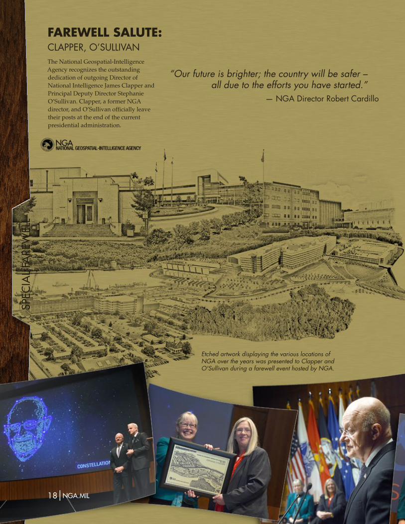
18|nga.miL PAThFiNder 2016|19
Etched artwork displaying the various locations of NGA over the years was presented to Clapper and O'Sullivan during a farewell event hosted by NGA.
The National Geospatial-Intelligence Agency recognizes the outstanding dedication of outgoing Director of National Intelligence James Clapper and Principal Deputy Director Stephanie O’Sullivan. Clapper, a former NGA director, and O’Sullivan officially leave their posts at the end of the current presidential administration.
FAREwELL SALUTE:ClApper,O’SullIvAn
“Our future is brighter; the country will be safer – all due to the efforts you have started.”
— NGa director robert cardillo
tELL
ing
ou
r st
ory
| Telling Our STOry |
PAThFiNder 2016|19
Tell us your personal, unclassified version of the work you or your office does for NGA for possible inclusion in the next Pathfinder. Send your 600 word or less account to [email protected]. Submissions may be edited for clarity and length.
What’s your story?
One of the goals Director Robert Cardillo has set for the National Geospatial-Intelligence Agency is to create a culture of innovation. In a speech delivered at the GEOINT Symposium, he said the agency will
"do it in an environment that rewards people that take risk, and do their best to collaborate."
Risk is very often necessary for opportunity. Certain issues, however, remain enterprise-wide concerns, embedded in day-to-day functional activities and operations at every level.
Enterprise risk management, or ERM, is an important business practice that contributes to mission success. It is an effective agency-wide approach to address the full spectrum of the organization’s external and internal risks by understanding the combined impact of risks as an interrelated portfolio, rather than addressing risks only within silos. ERM provides the big-picture view of organizational challenges that provides better insight into how to prioritize resource allocations to maximize mission delivery success. Through adequate risk management, agencies can concentrate efforts on key points of failure and reduce or eliminate the potential for disruptive events.
From the lowest levels of any organization, including NGA, risks may percolate up, affecting one office, many or the entire enterprise as a whole, depending on the criticality and severity of potential impacts and/or benefits – a.k.a., opportunities – that may be derived. Regardless of the
level at which risks are handled, it is imperative that decision-makers are provided knowledge of their existence as early as is feasible. This will foster timely decisions to avoid or reduce the potential for negative outcomes or to take advantage of and exploit the potential for positive outcomes.
The 2016 Office of Management and Budget Circular No. A-123 was issued under the authority of the Federal Managers’ Financial Integrity Act and the Government Performance Results Act Modernization Act. The circular emphasizes the need for all agencies to integrate and coordinate risk management and strong internal control into existing business activities, as an integral part of their overall management. The circular also requires risk identification at all levels of the agency, development of 'risk profiles’ that identify risks arising from mission and operations, specific consideration of an Anti-deficiency Act violation, and considering risks as part of the annual strategic review process. Commencing Fiscal Year 2017, the Department of Defense also requires NGA to identify and report the most significant risks that impact the agency.
NGA is currently identifying, mitigating, and monitoring risks across the agency. Each NGA component is already acting as a risk center that accounts for risks in decision-making in some way. The NGA Office of Strategic Operations-Performance is tasked to build on the agency's existing methodologies and unify these under an ERM framework. The
agency is adopting an approach that uses existing offices, functions and resources currently monitoring risk, and coordinating risk-management capabilities with strategic-planning processes and internal controls. The responsibility of managing risks is shared throughout the agency, from the highest level of executive leadership to managers executing functional activities.
NGA components will build risk identification and recording capabilities to identify new and emerging risks and changes in existing risk from both internal and external sources. They will measure the extent to which they are threatened by a potential circumstance or event. This is typically a function of the likelihood of the circumstance or event occurring and of the resulting adverse consequence. Common lexicons and templates are being developed by OSO-P to provide consistency across the organization. Decision authority will be aligned to the level of risk – the higher the risk, the more senior the decision-maker will be.
Together, this work will create an integrated ERM framework to accumulate different types of risks across the agency and implement criteria for elevating risk. The objective is to make smart, risk-informed decisions, backed by formal risk assessment processes, so that appropriate decision-makers are informed, involved and armed with facts they need to ensure NGA’s mission success.
MANAgiNg ENTERPRiSE RiSk:iNTeGraTed Framework aidS deciSioN makiNGBy Shal Malhotra, Office of Strategic Operations–Performance

FEa
turE
20|nga.miL PAThFiNder 2016|21
It can be easy to forget that sometimes the biggest threat to national security is nature. Environmental conditions can be unpredictable, and unexpected changes can cause secondary consequences. When a change of a river’s course destroys a key local food source, for example, food shortages can lead to price spikes that in turn can contribute to civil unrest. A famine can trigger mass migration, which can lead to any number of unanticipated and potentially very serious consequences.
Environmental security analysis means understanding national security threats that stem from human interaction with the environment. This topic encompasses short-term disasters such as hurricanes and tsunamis to slower phenomena such as desertification; it includes possible conflict over shared natural resources and examines multifaceted issues such as the warming of the Arctic region.
In addition to its breadth, environmental security is also complex. Environmental security questions cross operational, tactical and strategic scales, as well as spatial and temporal ones, and they frequently ignore manmade boundaries. Accordingly, the National Geospatial-Intelligence Agency and its mission partners take several approaches to monitoring issues related to environmental security.
ThreaT mulTipliersNGA analysts study intrinsically
spatiotemporal aspects of environmental security issues. Challenges arising from environmental security typically act as threat multipliers, aggravating existing problems such as political instability and regional tensions. They also tend to indirectly threaten U.S. national security by consuming finite security resources – military, economic, political, etc. – that might otherwise be available to cope with other threats.
Understanding environmental security can provide intelligence analysts with indicators and warnings of emerging or worsening problems, however; as when the water supply
FighT oR FLighT: wheN eNViroNmeNTal
COndITIOnSSpArkCIvIlunreST,miGraTioN aNd oTher
SecuriTy ThreaTSBy Kea U. Duckenfield, Ph.D., Analysis
| Feature |
20|nga.miL PAThFiNder 2016|21
landslides to droughts, to mining and other land-cover-disrupting activities. It gives analysts access to a huge volume of open-source imagery.
In all of its analytic activities NGA emphasizes continuous innovation and planning for future GEOINT needs, and much of this effort will benefit environmental security analysis. The agency’s directorate responsible for research recently reorganized into seven focus areas, one of which is devoted to environment and culture. The environment and culture 'pod,’ as it is called, will perform research to improve our understanding of how the complex interaction between humans and their environment can be modeled to address problems of relevance to the intelligence and defense communities, and other U.S. government agencies. Other researchers within the agency are identifying and pursuing innovative new tools to advance environmental security-related GEOINT tradecraft and technology, and management supports future GEOINT needs analysis relevant to environmental security.
parTnershipsCollaboration with multiple
partners – both inside and outside of NGA – is critical for effective GEOINT assessments, because environmental security touches other intelligence issues. During one targeted effort, an Army chief warrant officer teamed with an NGA spectral scientist to analyze agricultural and climatological elements contributing to food security, in order to estimate the severity of a potential hunger crisis.
Groups across all organizational levels and disciplines within NGA coordinate and collaborate to support and make use of environmental security analysis. For instance, regional and functional analysts might join forces with a human geographer and a data scientist to examine environmental factors affecting the selection of a site for a military or humanitarian endeavor. Experts from multiple analytic specialties work together to understand how
the area have caused some to ask what consequences a major oil spill in this fragile and dangerous setting might bring.
NGA’s senior Arctic analyst coordinates and conducts analysis and production on these and similarly intricate topics.
resources, meThods and ToolsNGA intelligence officers work to
identify, produce, acquire and improve a wealth of relevant geospatial datasets to support analysis of environmental security issues. Some of these datasets are created within NGA, such as environmental data used by the agency’s human geography effort, and a suite of geotechnical datasets for soil, water, seismic activity and other phenomena. NGA also hosts the National System for Geospatial Intelligence meteorology and oceanography team, known as METOC, and representatives from the Pentagon Air Staff that help NGA analysts find, understand and use valuable meteorological and oceanographic datasets. In addition, the agency commits resources to commissioning commercial vendors to create key environment-related geospatial data for analysts’ use.
Elsewhere in the agency image scientists created and continue to improve on the Time Series Analysis Toolkit, a suite of time series tools for visualizing images. Using TSAT, analysts can determine changes over time in water, vegetation and other environmental parameters. Changes can be measured remotely by applying these tools to a broad range of multispectral imagery and other kinds of remotely sensed information.
NGA also worked in partnership with the Australian Geospatial-Intelligence Organization to create a tool that harnesses the Google Earth Engine to identify areas that have undergone abrupt change in vegetation at some point. This tool, called the Worldwide Activity Locator through Disruption of Organics, or WALDO, can be applied to environmental security questions ranging from
begins to decline in a basin shared by two countries with a history of tense relations. NGA analysts study the dynamics of shared natural resources – especially water resources, which are particularly well-suited for use as diplomatic leverage or even as a weapon against a downstream neighbor. They measure food security and monitor critical infrastructure – such as water control features – in conflict zones in order to assess how civilians and military personnel in different areas of influence may be vulnerable. They evaluate the extent and impact of events such as major floods, contaminant spills and humanitarian disasters. Analysts also consider broader security implications, such as impacts to economic security or our global defense posture.
complex issuesThe Arctic region represents a
prime example of a complex security issue. Two key characteristics of environmental security issues are their tendency to interact with other security issues and the power that perceptions hold. Nowhere is this more true than in the Arctic, where environmental, economic, diplomatic and military concerns collide.
As one example a cruise ship carrying more than 1,000 passengers traversed the tortuous Northwest Passage last summer, anxiously escorted by a chartered ice-breaking logistics vessel. Given the scarcity of search and rescue infrastructure in the Arctic, the success of the cruise is raising concerns among thought-leaders that future years will bring other risky trips along with the potential for an emergency event in an area where there is little ability to respond.
On another note warming appears to be driving fish habitats northward. This may lead to clashes between fishing fleets in the Arctic, as the fish move between different countries’ economic exclusion zones.
Similarly, while only two countries currently have oil-producing platforms in the Arctic – Russia and Norway – prospects for future oil exploitation in
Fea
ture
PAThFiNder 2016|2322|nga.miL
environmental hazards might play into a critical political event such as a national election in a strategically important country, or how counterinsurgency operations altering access to natural resources might be affecting a region’s economic health. Even the most senior intelligence officers nurture collaboration and communication; in one case a naval officer detailed to NGA coordinates and aligns disparate groups contributing to environmental GEOINT, with a view to optimizing the use of their resources.
NGA analysts also team with other national and international counterparts in the intelligence community. In addition to the NSG METOC team, military partners such as the 557th Weather Wing and the Naval Oceanographic Office provide support to GEOINT analysts in the forms of data, expertise and specialized products. NGA personnel coauthor National Intelligence Council-published community-level assessments relevant to environmental security, and the agency’s senior Arctic analyst has
fostered a vibrant community using social media tools.
NGA also fosters collaboration by bringing together environmental security experts from across the public and private sectors. In the last three years the agency has held interagency symposiums on water security, climate change and national security, and wildlife trafficking. These and other efforts involve building partnerships with colleagues in academia and industry.
Notable among NGA’s interagency activities is the civil applications
Food insecuriTy The intelligence community assessment on Global FoodSecurity,publishedbytheOfficeofthedirectorofnationalIntelligence,definesfoodsecurityasthe
“perceived and actual physical access to food supplies sufficient to meet basic needs and preferences at every level–individual,community,stateandglobal.” Akeypremiseofthereportisthatglobalfoodinsecuritycannotbesolvedbysimplygrowingmorefood;therealissue is having access to food. millions of people worldwide eitherlackpurchasingpowertobuyfoodorlackaccesstolandonwhichtogrowtheirown.extremeweather,conflict,politicalcorruption,diseasesandenvironmentaldegradation compound these problems and often lead to civil unrest.
The Food and agriculture organization of the united Nations estimates that 870 million people suffer from chronichungerworldwide;ofthatnumber852millionpeople live in developing nations. by mapping and monitoring geographic regions experiencing chronic food insecurity,geospatialintelligenceanalystscansupportthemissions of both humanitarian assistance organizations and national security agencies.
AccordingtotheICAonGlobalFoodSecurity,insurgentsoftentakeadvantageofweaknessesstemmingfromfoodshortages,especiallyincountrieswherethecentralgovernment has little control over large areas and land ownership is not well defined or protected. common tactics include exploiting international aid and fomenting unrest against governments that are unable or unwilling to assist their struggling citizens. other disputes may arise whendepletedfishstocksforcefishermenintocontestedwatersinsearchofcatch,asituationparticularlycommonin the South china Sea.
impacTs oF climaTe change regardlessoftheircauses,changestotheclimatecanhavedevastating effects on local communities. extreme weather eventscanhavesignificantimpactonsocial,economic,political and national security conditions.
Severeheatwaves,droughts,heavyrainfallsandfloodsalldisrupt natural and human systems. Such events can trigger cropfailuresandwildfires,anddisruptcriticalinfrastructure,among other consequences. cyclones can damage or destroy watertreatmentfacilities,leadingtothepotentialspreadofwaterborne diseases. all of these stressful impacts can threaten regional economies and the overall stability of communities.
according to the intelligence community assessment on GlobalFoodSecurity,publishedbytheOfficeofthedirectorofnationalIntelligence,weatherandclimateconditionsarekeytodetermininglocalcropproduction,whichcancontributeto volatility of local food prices and possible civil unrest. The ica report identifies africa and asia as regions where food security is most affected by weather and climate pressures.
a September 2016 memorandum prepared by the National intelligence council projects more frequent and intense weather conditions over the coming years. it claims that changing climate conditions could have significant implications for where and how people live. examples of climatologicalstressesaresea-levelrise,oceanacidificationand permafrost and glacial melt. other stresses are changesincloudcover,sustainedshiftsintemperatureandprecipitation,anddegradationofairquality.
climate stress compounds when several extreme weather events occurwithinashorttimeorinasmallregion,accordingtothecouncil. effects will be especially pronounced as populations continuetoconcentrateinclimate-vulnerablelocales,suchascoastalareas,fast-growingcitiesandwater-stressedregions.
| Feature |
PAThFiNder 2016|2322|nga.miL
committee, which was initiated to foster collaboration with scientists and program managers at civil agencies, such as the U.S. Geologic Survey and the National Science Foundation. NGA’s visiting scientist program also brings state-of-the-art expertise on environmental issues in house; cooperative research and development agreements and other outreach programs make it possible for external partners to offer their research and technical solutions to solving environmental security challenges.
mulTilayered supporTNGA’s contribution to
environmental security analysis operates in almost every level of effort at the agency, from data production to intelligence analysis, to tool and tradecraft development. It extends to NGA programs that innovate and shape future GEOINT capabilities, and includes expert support to national policy development.
NGA representatives participate in community-wide groups dealing with environmental security, including all
four subcommittees of the climate and national security working group. In September of this year, NGA contributed to language for a presidential memorandum on climate change and national security.
It is this kind of collaboration that is key to the successful mastery of the complex and extensive field of environmental security. Ultimately, it is through interaction with each other that we can best understand the intricate dynamics of human interaction with the environment.
impacTs oF energy use on waTer and Food supplies
The u.S. energy information administration estimates global demand for energy will increase significantly by 2040. basing itsprojectionon2012statistics–themostrecentavailable–theagency’s2016InternationalenergyOutlookpredicts48percent growth over the period from 2012 to 2040.
The vast majority of that growth is expected to occur in developing nations. The eia report estimates that energy demand in countries outside the organization of economic cooperation and development will increase by 71 percent overtheexaminedtimeframe.Incontrast,growthinthemoredeveloped nations of the oecd is estimated at 18 percent.
energysecurityisanextensivetopicinitself;theintelligencecommunity is primarily concerned with how energy demand influencesinternationalrelations.Theenergy,waterandfoodsectorsareinextricablylinked,andactionsinonesectoraffectoneor both of the others. The intelligence community assessment on GlobalFoodSecurity,publishedbytheOfficeofthedirectorofnationalIntelligence,citestheseandotherexamplesofnegativeimpacts stemming from growing energy use and production:
• large amounts of water are required for every phase of energyproduction–extractionofresources,processingelectricpowergeneration,storageandtransport
• pollution stemming from energy production sometimes renderswaterunusable;culpritsincludeprocessandextractionwaste,andspills
• reservoirs and rivers are often reserved for hydroelectric generation,divertingnecessaryresourcesawayfromagriculture and other types of human consumption
• oil production consumes between 1 to 14 gallons of waterpergallonofoil;coal-washingrequiresbetween 20 gallons to 40 gallons of water per ton of coal washed
• depletedcleanwatersuppliesadverselyaffectfoodproduction;energy-realted pollution can render water unusable for agriculture or fishing
waTer insecuriTyTheworldhasnoshortageofwaterinabsoluteterms;however,it is a different story when it comes to the amount of freshwater availableforhuman,animalandplantconsumption.Accordingtoun-Water,theunitednationsorganizationdevotedtomonitoringandreportingonglobalwatersecurity,less than 1 percent of the world’s freshwater supply is suitable forconsumption.demandforthatwaterisgrowingtoo–theu.N. organization claims water use has increased at more than twice the rate of population growth in the last century.
TheWorldBankestimatesthatmorethan1billionpeoplecurrentlyliveinareaswithoutadequatewaterresources;thenumberisexpectedtomorethantripleby2025.reasonsforwaterscarcityrangefromnaturalchanges,suchasdroughtorerosion,tofloodingandotherimpactsfromcatastrophicweatherevents,tomanmadedisasterssuchasoilspillsandcontamination. Scarcity also stems from overuse to support a growingpopulation,includingeffectsfromurbanizationandincreased agricultural and energy needs.
TheIntelligenceCommunityAssessmentonGlobalFoodSecurity,publishedbytheOfficeofthedirectorofnationalIntelligence,includes considerable mention of water security because of its effectsonfoodsupplies.Accordingtothereport,worldagricultureconsumes more than 70 percent of the world’s freshwater.
Growinguseofwaterforagriculture,energy,buildingandhuman consumption is particularly problematic in certain parts oftheworld,accordingtotheICA.SeveralcountriesinAsiaand nearly all of the middle east and North africa have over-pumped their groundwater.
Numerous studies conducted since 2010 have found that water insecurityisnearlyalwaysaccompaniedbypoverty,warandconflict. by monitoring and mapping where water availablity mightcreatenationalsecuirtythreats,geospatialanalystscan help national security experts predict where unplanned migration and its resulting conflicts may occur.

Fea
ture
24|nga.miL
STANDiNg gUARD: The moST oVerlooked cyberSecuriTy parTNer iS uSBy Cliff Shelton and Evan Frank, Ctrs. CIO-T Communications

| Feature |
24|nga.miL PAThFiNder 2016|25
CSOC’s sustainment team lead, U.S. Air Force Capt. Nicholas Gronlund, has for months led the charge in improving cybersecurity communication with the workforce. Gronlund works in close coordination with an IT-focused strategic communications team to deliver informative features and news updates to assist workforce cybersecurity both at the job and at home. His stance is one that treats NGA users as customers who can benefit from his team’s guidance.
“There are several ways employees can be big assets to cybersecurity defense,” said Gronlund. “One way is by being situationally aware so they don’t click on emails or websites that they shouldn’t. Another way is by being an additional set of eyes on NGA networks; security filters can’t catch everything, and we need employees to tell us when things don’t look right.”
A number of NGA personnel have done just that, forwarding to CSOC
— in September 2016 alone — more than 100 emails suspected of carrying payloads for suspicious malware for quarantine and forensics.
“A phishing email can be a tremendously valuable forensic artifact,” said Gronlund, “because security might not have seen it, and it might not have [otherwise] triggered an alert [in our defenses].”
The desire to capitalize on such success stories is the reason that Gronlund and his fellow team members are developing a cybersecurity communications working group to engage personnel more directly, show the workforce what the CSOC can offer and remove the image of cybersecurity as a roadblock to mission functionality.
“We are revamping the entire way that the CSOC communicates, including current communications distribution, frequency and content,” said Brown.
A difficulty cybersecurity experts may have in reaching a broader audience is that the concept is deemed too technically complex or, worse, boring.
Cybersecurity, more than information technology, is about people.
“There is a general lack of under-standing about how much digital dust people are leaving around,” Andrew Howard, director of the Cyber Technology & Information Security Laboratory at George Tech Research Institute, was quoted as saying in the institute’s 2016 report on emerging cyber threats. “There is a drastic need for two things: education and technology to focus on the problem.”
There is no software or architectural solution that in itself removes the risk that an enterprise like National Geospatial-Intelligence Agency falls victim to cyber-attacks or cyber-espionage – especially as the agency integrates more open-source data and collaborates with partners outside of the intelligence and defense communities.
Criminals and spies act on that notion, cleverly using social engineering tactics to take advantage of cases of human honesty, integrity and sense of safety.
“Cyber threats continue to be an area of growing concern,” stated outgoing Director of National Intelligence James Clapper in testimony before the House Permanent Select Committee on Intelligence in November. “In the next few years, the effect of innovation and increased reliance on information technology on our society’s way of life and our mission in support of DOD [Department of Defense] probably will be far greater in scope and impact than ever.”
At the frontlines combating the threat at NGA is not only the certified cybersecurity expert but all employees, each a strong or weak combination in the fight to lock out malicious code and criminals seeking access to the agency’s networks, data and sensitive personnel information.
The partnership between NGA’s greater workforce and its cybersecurity component is critical to securing the geospatial intelligence mission. Vigilant and well-informed users greatly reduce the surface of attack, thereby reducing
the risk of a successful breach or attack.“Today, cyber threats are all around us,
and, as intelligence professionals, we are unfortunately juicy targets,” said Logan Schwartz, an NGA emerging technology specialist. “Staying vigilant inside and outside the workplace is key to safeguarding our information, whether developing a [secure] piece of code, connecting devices to our networks at home, or being suspicious of that email asking for personal information.”
a Team approachNGA, by direction of its
cybersecurity strategy, contains a collective of teams responsible for all facets of the agency’s network protection: risk management, compliance, vulnerability assessment, incident response and cyber forensics. Those tasked with upholding these forms of network protection are knowledgeable, skilled and dedicated enterprise network and data protection specialists, but they are a relatively small fraction within NGA’s workforce of several thousand employees. So how do the few empower the many, who represent the largest footprint of risk?
This is a question that the director of the NGA cybersecurity operations cell, or CSOC, wrestles with.
“Cyber defense has to be right 100 percent of the time; [cyber] attackers only need to be right once,” said CSOC Director Mike Ryan. “As NGA expands its unclassified mission, the surface of attack expands.”
Chris Brown, deputy director of the CSOC, added that it is incumbent upon his team to form a trustworthy partnership with the workforce and reduce that attack surface.
“We need to focus on more valuable information and communicating it wisely,” said Brown. “It’s like crying wolf — we could send spearphishing warnings weekly, but then folks won’t read them. We want to build trust with the workforce to get beyond complaints; get to the real questions.”
Fea
ture
26|nga.miL
cybersecurity technology, or lack thereof (e.g., out-of-date hardware and software), and the ways in which cutting-edge solutions and automation detect, prevent and respond to cybercrime and cyber-espionage. Yet many breaches, whether transgressed by nation-state or independent 'hacktivist’ group, only require the right default password left unchanged or a link clicked within a maliciously based email.
“These are the cyber equivalents of an unattended backpack at a bus station,” said Conner. “At some point, something bad is bound to happen, and we can prevent it.”
Studies consistently show that the human element poses the most challenging obstacle to cybersecurity and the impact of employee behavior on cybersecurity does not receive its due attention. A 2015 report by Intermedia found that 93 percent of the IT users it surveyed admitted to engaging in at least one form of a risky data security practice, from sharing account credentials, i.e. user names and passwords, to installing unapproved applications on company networks.
NGA’s own trend has been more positive, in that users are reporting risks rather than becoming risks. The agency’s cyber-specific groups like the CSOC are seeking to build on that budding collaboration and offer an alternative to the idea that mission continuity at times negates sound cybersecurity.
“Our developers, administrators and users form an important layer in our defenses,” said Conner. “Cybersecurity is a team sport, and there’s simply no way we can achieve our shared goals of protecting and extending the GEOINT mission without an educated and engaged user population.”
This 'team sport’ goes beyond framework, policy and procedure; it is driven by culture, by everyone taking an openly understood and agreed-upon level of responsibility to protect the GEOINT mission—and one’s own livelihood—in cyberspace.
the mission-critical GEOINT that we provide to our partners, warfighters, allies and first responders. And that’s the whole point [of NCSAM], to highlight the importance of cybersecurity and come together to follow best practices.”
Gordon highlighted recent employee preemptive actions that helped identify adversarial activity on several NGA external websites — acts of employee-led cybersecurity that assisted the agency’s efforts to secure the GEOINT mission.
“As NGA continues to succeed in the open and drive new technology integrations into IC processes, it’s critical that we keep security in the forefront of our minds and ensure that we deliver a secure product that is simple for users to engage with,” said CSOC’s Gronlund.
CSOC Director Ryan, placing himself in the shoes of the general user, said that his team’s challenge is to clearly relate security to a real, proven and persistent threat.
“One of the messages communicated to us during [NCSAM] was, ’Show us that there really is a threat,’” said Ryan.
“As we communicate more, we need to tie in events like the [Democratic National Committee] hacks; show that these threats happens every day. We’re geeks and techies, so it’s hard to describe it so people can understand. How did general users feel about the OPM [Office of Personnel Management] breach? Are they still concerned that everything they put on their [Standard Form 86] is in someone else’s hands?”
The human elemenTAccording to the 2016 Verizon Data
Breach Report, the number of large breaches, those exposing more than 10 million identities, increased 125 percent between 2014 and 2015; 429 million identities were exposed in breaches last year alone.
These statistics, when conflated with the media’s highly publicized data breaches, often attract focus to
NGA Deputy Chief Information Security Officer, Matt Conner, someone who considers cyber journalist Brian Krebs’ blog – Krebs on Security – easy reading, wants to change that perception.
“I want to emphasize our customer service mindset,” said Conner. “Our intent is to find a way to say ‘yes, here’s how.’”
a larger communiTyThis past October Conner used the
annually celebrated National Cyber Security Awareness Month, or NCSAM, as a vehicle not just to raise awareness about the dangers lurking online, but to raise the perceived stakes for all supporting the GEOINT mission.
NCSAM, created by the Department of Homeland Security to collaboratively increase national-level cybersecurity, has grown exponentially since its inception, reaching consumers, small- and medium-sized businesses, corporations, educational institutions and young people across the nation and internationally.
Honoring NCSAM’s 13th consecutive year, always celebrated during October, Conner oversaw a series of events executed by NGA’s Chief Information Security Office to expand the outreach, education and engagement of the workforce – games of Cybersecurity Jeopardy, for instance.
“The purpose of celebrating [NCSAM] at NGA is to provide an insightful mix of both technical- and consumer-level information to make cybersecurity relevant to users in both their professional and personal lives,” said Conner.
Conner wants to make cybersecurity awareness and good cyber hygiene a commonality shared by every link in NGA’s chain, and it’s a sentiment that the agency’s deputy director shares.
“It’s vital that we think about cybersecurity as an enterprise, as a workforce and as individuals,” said NGA Deputy Director Sue Gordon during the commencement of this year’s NGA NCSAM activities.
“Cybersecurity is essential to protect
Co
LLa
bora
tio
n| Collaboration |
PAThFiNder 2016|2726|nga.miL
During the GEOINT Symposium last year, National Geospatial-Intelligence Agency Director Robert Cardillo highlighted that “…we must reject outdated ideas about the value of open-source data. We must embrace the imperative to release appropriate information on our unclassified network. We must do all of this – and we must do it smartly. We’ll go wherever necessary to create the service the world demands and our customers deserve.”
Supporting this challenge, NGA has been actively investing operations and manpower within what the IT industry has dubbed the Silicon Prairie.
Much like our operations in Silicon Valley, the Silicon Prairie describes innovation occurring in cities such as St. Louis, Dallas, Denver, Sioux City and Chicago. St. Louis in particular, is quickly becoming a mini Palo Alto, where once-abandoned buildings near Washington University are now home to the most advanced coworking spaces.
One such building is the Cortex, home to the Innovation Center, or the CiC, a vibrant 200-acre innovation hub and technology district integrated into St. Louis’ historic Central West End and Forest Park Southeast residential neighborhoods. Founded in 2002, Cortex is the Midwest’s premier innovation hub of bioscience and technology research, development and commercialization, serving as the anchor of St. Louis’ growing ecosystem for innovative startup programs and established companies such as DuPont, Boeing Ventures, Centene, Express-Scripts, Nestle-Purina and MasterCard.
Across the Midwest -- even during winter months -- the new cash crop is high tech, and NGA’s presence in St. Louis has never been more important than it is now. As can be expected, larger, more established development firms are taking notice. Some of the city’s notable startups, such as Lockerdome, a social network, and Hatchbuck, a sales and
marketing software as a service (SaaS) platform, also participate at the CiC. More recently, San Francisco-based mobile-payments company Square said it will hire 200 people at its new office in the Cortex innovation district in the Central West End.
creaTing new business modelsBut NGA isn’t a venture capitalist
with the ability to immediately invest millions of dollars like they do on an episode of TV’s “Shark Tank.” Instead, NGA leaders had to navigate developmental roadblocks, policies and security concerns in an effort to make Director Cardillo’s request a reality, “… we need to bring ideas to optimize our contract and acquisition processes."
Despite the obstacles NGA wanted to strike while the iron was hot. St. Louis has seen growth in its tech start-up scene and has the venture capital dollars to prove it. The city was the fastest-growing area for total funding for tech start-ups in 2014, according to CB Insights. From November 2013 through October 2014, funding in St. Louis-based tech start-ups increased 1,221 percent year over year. In 2014 venture capitalists invested about $71.3 million in 21 deals, according to data from Pitchbook, a firm that tracks private equity and venture capital investments.
“We are thrilled to see the innovation agenda defined by our founding partners continue to thrive and flourish,” said Dennis Lower, president and CEO of Cortex. “C2N, Orion, aisle411, Uber, OG Systems, CIC, Quiet Signal, Capital Innovators, iSelect, the Women’s Bakery, Sprouthood and many others – an entrepreneurial renaissance is happening in St. Louis, and Cortex is at ground zero.”
As a result, NGA has created solutions that are quite unusual when compared with our typical business model.
NGA created a program called The Innovative GEOINT Application Provider Program, or IGAPP, a revolutionary business model providing
an open-source environment for the government to engage directly with startups, academia and midsized software firms. By simplifying the federal government acquisition requirements, IGAPP removes the barriers that have historically stymied most private-sector firms or businesses. Through vendor opportunity packages, IGAPP delivers the needs of the intelligence and defense communities directly to the developers, and removes the guesswork – ensuring developers are creating meaningful apps.
Since the launch of IGAPP more than two years ago, NGA has coordinated with more than 40 IGAPP-approved vendors that distributed more than 50 GEOINT-tailored products in the GEOINT AppStore. This revolutionary program not only provided applications NGA’s partners and customers actually need, but reduced the acquisition time from 18 months to less than four weeks.
exTending The realm oF The possibleNGA isn’t alone in this endeavor;
Arch Grants, a nonprofit organization, accelerates economic development by providing $50,000 equity-free grants and pro bono support services to entrepreneurs who locate their businesses in St. Louis. Through its competitive Global Startup Competition, Arch Grants retains and attracts the most innovative entrepreneurs to the St. Louis region.
These programs, and the continued efforts of NGA, are an aggressive effort to inspire the next generation of employers, civic leaders and philanthropists for St. Louis. As the agency continues to create the infrastructure that supports its development in the open environment, it will be exciting to see what new and unusual developments these new-found relationships with the private sector will deliver to users in the IC, NSG and ASG
– and forever change our perspective regarding the realm of the possible.
AT ThE cENTER oF iNNoVATioN: NGa oN The ‘prairie’By David Geiger, Ctr., Xperience Communications
Co
lla
bora
tio
n
28|nga.miL
Customer service is at the very heart of the National Geospatial-Intelligence Agency strategy. A key goal for the agency’s workforce is to 'drive relentlessly for our customers’ success.’
The core of this leadership-driven effort is to improve customer engagement, champion a better experience and bolster effectiveness. To ensure top-quality service to the Department of Defense, NGA’s most important ‘customer’ behind the president, the agency has a robust, interconnected system of teams.
NGA and DOD have a cadre of representatives and liaisons embedded not only throughout the agency, but worldwide. The concept of NGA support teams, or NSTs, is fairly well known both inside and outside of the agency, but what is less familiar are the service GEOINT offices, or SGOs, at NGA. There are also multiple types of NSTs, and even NGA insiders sometimes don’t really know the differences between them.
Understanding who these customer-service enablers are, their missions and who they support is the first step to achieving a greater customer experience. The most important distinction is that SGOs serve as representatives of the military services to NGA; NSTs serve as NGA liaisons to the services. The physical co-location and personal engagement between these offices are key to fostering the strong relationships necessary for effective customer service to DOD agencies.
sgos: The voice oF The services To ngaSGOs are the principal service
GEOINT element representatives to NGA. As such they are the senior service GEOINT leaders’ representatives to NGA. Per DOD directive 5101.60, they are the formal point of contact for all National System for Geospatial Intelligence — NSG — planning, programming, budgeting, policy, requirements and execution functions
appropriate to their branches of service. They are responsible for coordinating service GEOINT plans, programs and budgets with NGA.
The SGOs share common command relationships and missions, and have a physical presence at NGA Campus East to promote broad engagement across a spectrum of GEOINT topics. They are particularly important for coordinating senior service leadership visits to NGA.
All SGOs participate in the National GEOINT Committee, or GEOCOM, through forums, committees, subcommittees and working groups that support the NSG. They also serve as GEOINT advisors to the headquarters’ service-staff leadership. (See below for descriptions of each SGO.)
nsTs: The voice oF nga To The cusTomerThere are various types of NSTs.
Based on regional or functional mission, they are organizationally tailored, consist of both military and civilian
MUTUAL SUPPoRT: TeamS collaboraTe To SerVe dodBy Maj. Nicole Bell, U.S. Army
PRiMARy RESPoNSibiLiTiES: SgosU.S. Navy Sgo –Advocatesonbehalfofthedirectorofnavalintelligence.providesvisibilityofnavycapabilitiestotheagency,includingsafetyofnavigation;workswithnGAtodevelopGeOInTcapabilitiesoridentifycommercialcapabilitiesforperforming broad-area open ocean surveillance.
U.S. Marine corps Sgo –AdvocatesonbehalfoftheCorps’directoroftheintelligencedepartment.ArticulatesCorpsrequirementsandprioritiesforcollection,productionandaccessibilityofGeOInT;providesnGAwithinsightintoallfull-spectrum GeoiNT products and services created by the marine corps.
U.S. Air Force Sgo –AdvocatesonbehalfoftheAirForcedeputychiefofstaffforintelligence,surveillanceandreconnaissance[A2],withadualfocusonGeOInTandtargeting.FocusesonthedevelopmentoftheAirForceGeOInTenterprise in support of the air Force’s core missions.
U.S. Army Sgo –AdvocatesonbehalfofboththeArmydeputychiefofstaff,G-2[Intelligence]andthechiefofengineers,due to the partnership between GeoiNT imagery analysts and geospatial engineers representing separate branches of the Army.FocusesonaligningArmyGeOInTrequirementswithnGAcapabilities,promotingArmyGeOInTprofessionalizationand monitoring army contributions to the NSG.
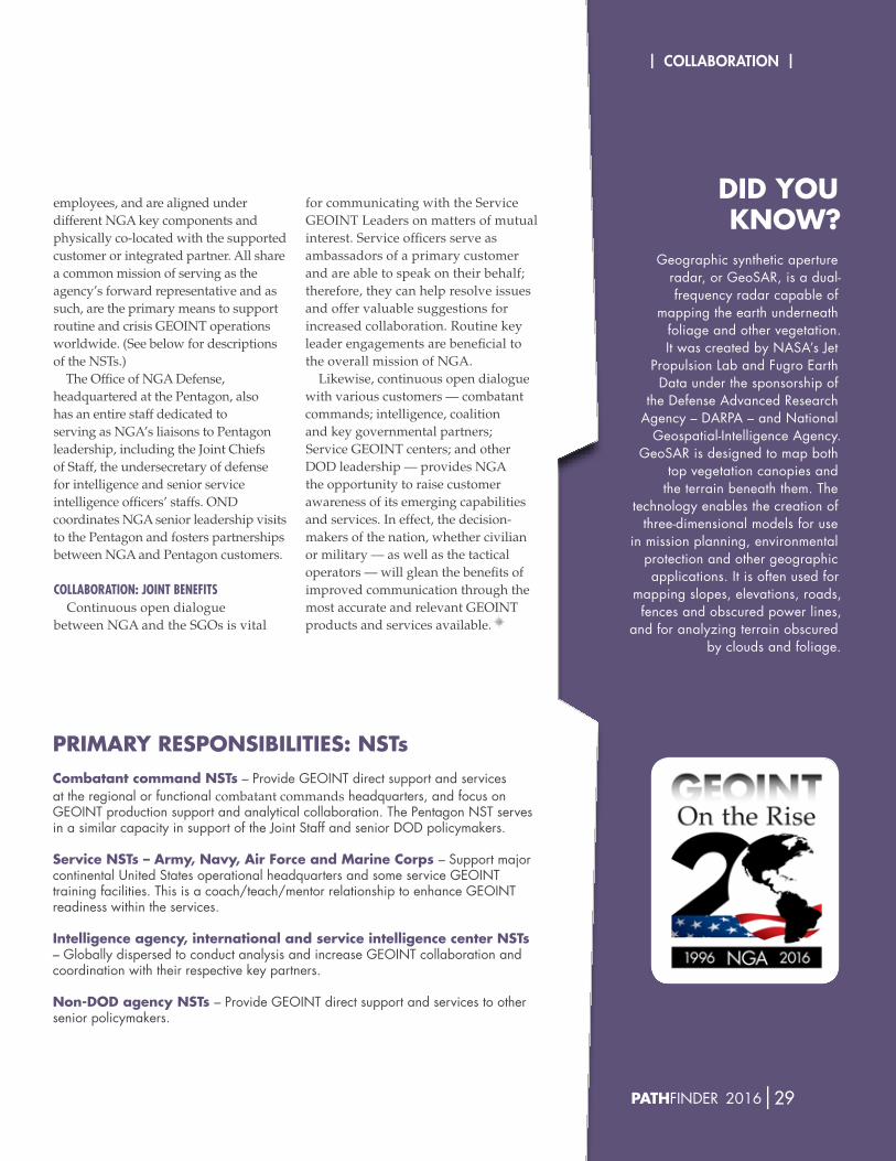
| Collaboration |
28|nga.miL PAThFiNder 2016|29
employees, and are aligned under different NGA key components and physically co-located with the supported customer or integrated partner. All share a common mission of serving as the agency’s forward representative and as such, are the primary means to support routine and crisis GEOINT operations worldwide. (See below for descriptions of the NSTs.)
The Office of NGA Defense, headquartered at the Pentagon, also has an entire staff dedicated to serving as NGA’s liaisons to Pentagon leadership, including the Joint Chiefs of Staff, the undersecretary of defense for intelligence and senior service intelligence officers’ staffs. OND coordinates NGA senior leadership visits to the Pentagon and fosters partnerships between NGA and Pentagon customers.
collaboraTion: JoinT beneFiTsContinuous open dialogue
between NGA and the SGOs is vital
for communicating with the Service GEOINT Leaders on matters of mutual interest. Service officers serve as ambassadors of a primary customer and are able to speak on their behalf; therefore, they can help resolve issues and offer valuable suggestions for increased collaboration. Routine key leader engagements are beneficial to the overall mission of NGA.
Likewise, continuous open dialogue with various customers — combatant commands; intelligence, coalition and key governmental partners; Service GEOINT centers; and other DOD leadership — provides NGA the opportunity to raise customer awareness of its emerging capabilities and services. In effect, the decision-makers of the nation, whether civilian or military — as well as the tactical operators — will glean the benefits of improved communication through the most accurate and relevant GEOINT products and services available.
PRiMARy RESPoNSibiLiTiES: NSTscombatant command NSTs –provideGeOInTdirectsupportandservicesat the regional or functional combatant commandsheadquarters,andfocusonGeoiNT production support and analytical collaboration. The pentagon NST serves inasimilarcapacityinsupportoftheJointStaffandseniordOdpolicymakers.
Service NSTs – Army, Navy, Air Force and Marine corps –Supportmajorcontinental united States operational headquarters and some service GeoiNT training facilities. This is a coach/teach/mentor relationship to enhance GeoiNT readiness within the services. intelligence agency, international and service intelligence center NSTs –GloballydispersedtoconductanalysisandincreaseGeOInTcollaborationandcoordinationwiththeirrespectivekeypartners.
Non-DoD agency NSTs –provideGeOInTdirectsupportandservicestootherseniorpolicymakers.
DiD yoU kNow?
Geographic synthetic aperture radar,orGeoSAr,isadual-frequency radar capable of
mapping the earth underneath foliage and other vegetation. it was created by NaSa’s Jet
propulsion lab and Fugro earth data under the sponsorship of
the defense advanced research Agency–dArpA–andnational
Geospatial-intelligence agency.GeoSar is designed to map both
top vegetation canopies and the terrain beneath them. The
technology enables the creation of three-dimensional models for use
inmissionplanning,environmentalprotection and other geographic applications. it is often used for
mappingslopes,elevations,roads,fencesandobscuredpowerlines,
and for analyzing terrain obscured by clouds and foliage.
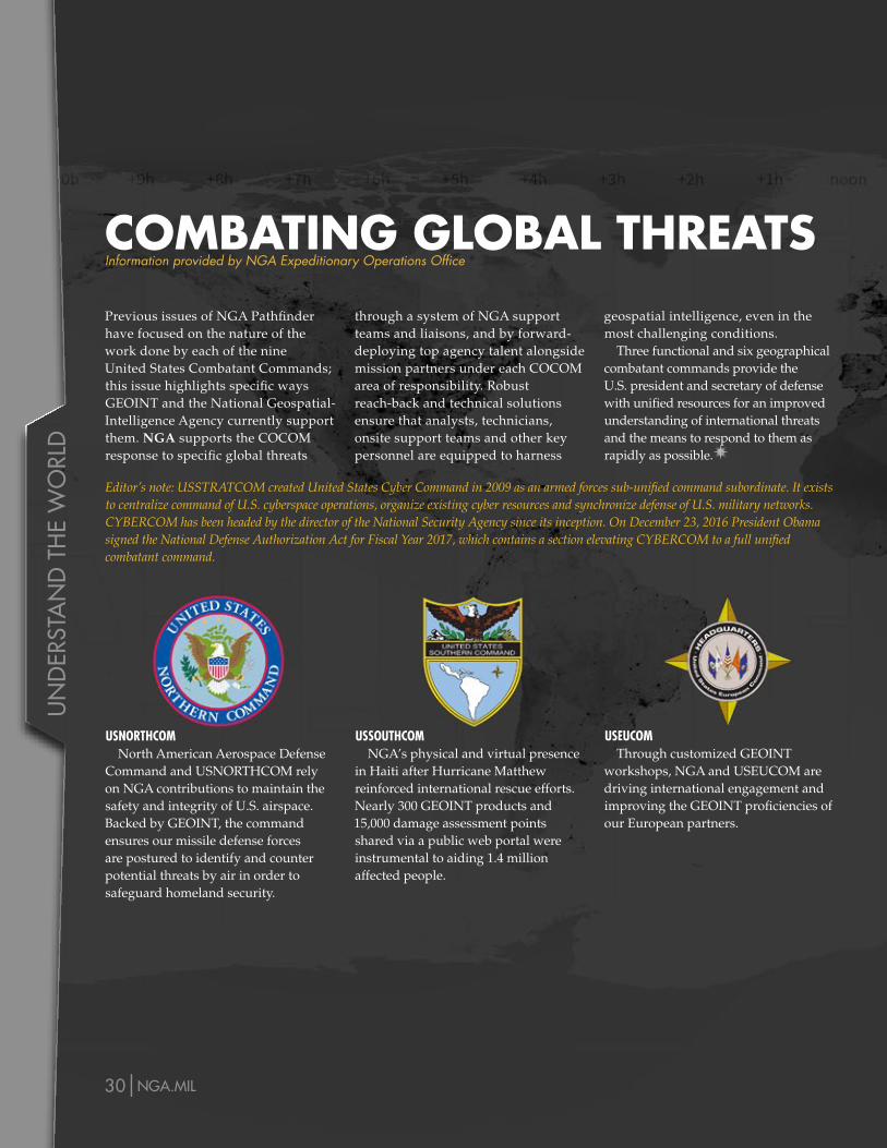
Un
der
sta
nd
th
e w
orl
d
30|nga.miL PAThFiNder 2016|31
Previous issues of NGA Pathfinder have focused on the nature of the work done by each of the nine United States Combatant Commands; this issue highlights specific ways GEOINT and the National Geospatial-Intelligence Agency currently support them. NGA supports the COCOM response to specific global threats
Editor’s note: USSTRATCOM created United States Cyber Command in 2009 as an armed forces sub-unified command subordinate. It exists to centralize command of U.S. cyberspace operations, organize existing cyber resources and synchronize defense of U.S. military networks. CYBERCOM has been headed by the director of the National Security Agency since its inception. On December 23, 2016 President Obama signed the National Defense Authorization Act for Fiscal Year 2017, which contains a section elevating CYBERCOM to a full unified combatant command.
through a system of NGA support teams and liaisons, and by forward-deploying top agency talent alongside mission partners under each COCOM area of responsibility. Robust reach-back and technical solutions ensure that analysts, technicians, onsite support teams and other key personnel are equipped to harness
geospatial intelligence, even in the most challenging conditions.
Three functional and six geographical combatant commands provide the U.S. president and secretary of defense with unified resources for an improved understanding of international threats and the means to respond to them as rapidly as possible.
usnorThcomNorth American Aerospace Defense
Command and USNORTHCOM rely on NGA contributions to maintain the safety and integrity of U.S. airspace. Backed by GEOINT, the command ensures our missile defense forces are postured to identify and counter potential threats by air in order to safeguard homeland security.
ussouThcomNGA’s physical and virtual presence
in Haiti after Hurricane Matthew reinforced international rescue efforts. Nearly 300 GEOINT products and 15,000 damage assessment points shared via a public web portal were instrumental to aiding 1.4 million affected people.
useucomThrough customized GEOINT
workshops, NGA and USEUCOM are driving international engagement and improving the GEOINT proficiencies of our European partners.
coMbATiNg gLobAL ThREATSInformation provided by NGA Expeditionary Operations Office
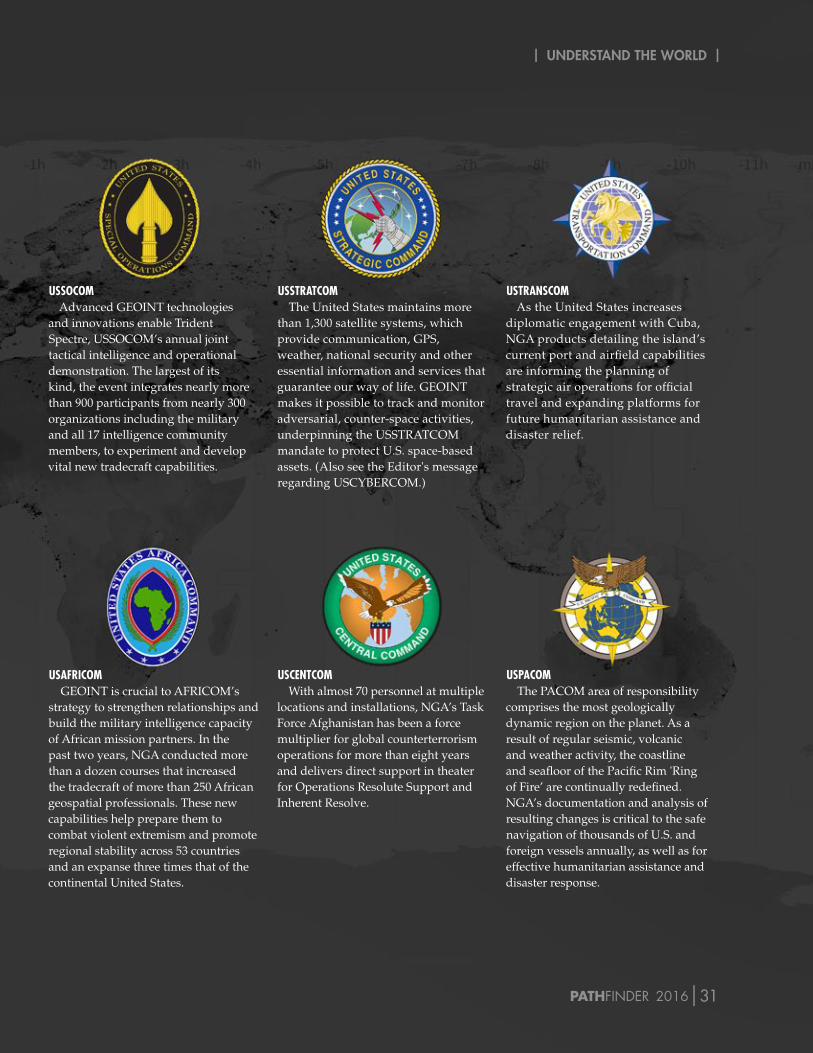
| Understand the World |
30|nga.miL PAThFiNder 2016|31
ussocomAdvanced GEOINT technologies
and innovations enable Trident Spectre, USSOCOM’s annual joint tactical intelligence and operational demonstration. The largest of its kind, the event integrates nearly more than 900 participants from nearly 300 organizations including the military and all 17 intelligence community members, to experiment and develop vital new tradecraft capabilities.
ussTraTcomThe United States maintains more
than 1,300 satellite systems, which provide communication, GPS, weather, national security and other essential information and services that guarantee our way of life. GEOINT makes it possible to track and monitor adversarial, counter-space activities, underpinning the USSTRATCOM mandate to protect U.S. space-based assets. (Also see the Editor's message regarding USCYBERCOM.)
usTranscomAs the United States increases
diplomatic engagement with Cuba, NGA products detailing the island’s current port and airfield capabilities are informing the planning of strategic air operations for official travel and expanding platforms for future humanitarian assistance and disaster relief.
usaFricomGEOINT is crucial to AFRICOM’s
strategy to strengthen relationships and build the military intelligence capacity of African mission partners. In the past two years, NGA conducted more than a dozen courses that increased the tradecraft of more than 250 African geospatial professionals. These new capabilities help prepare them to combat violent extremism and promote regional stability across 53 countries and an expanse three times that of the continental United States.
uscenTcomWith almost 70 personnel at multiple
locations and installations, NGA’s Task Force Afghanistan has been a force multiplier for global counterterrorism operations for more than eight years and delivers direct support in theater for Operations Resolute Support and Inherent Resolve.
uspacomThe PACOM area of responsibility
comprises the most geologically dynamic region on the planet. As a result of regular seismic, volcanic and weather activity, the coastline and seafloor of the Pacific Rim 'Ring of Fire’ are continually redefined. NGA’s documentation and analysis of resulting changes is critical to the safe navigation of thousands of U.S. and foreign vessels annually, as well as for effective humanitarian assistance and disaster response.
coMbATiNg gLobAL ThREATSInformation provided by NGA Expeditionary Operations Office
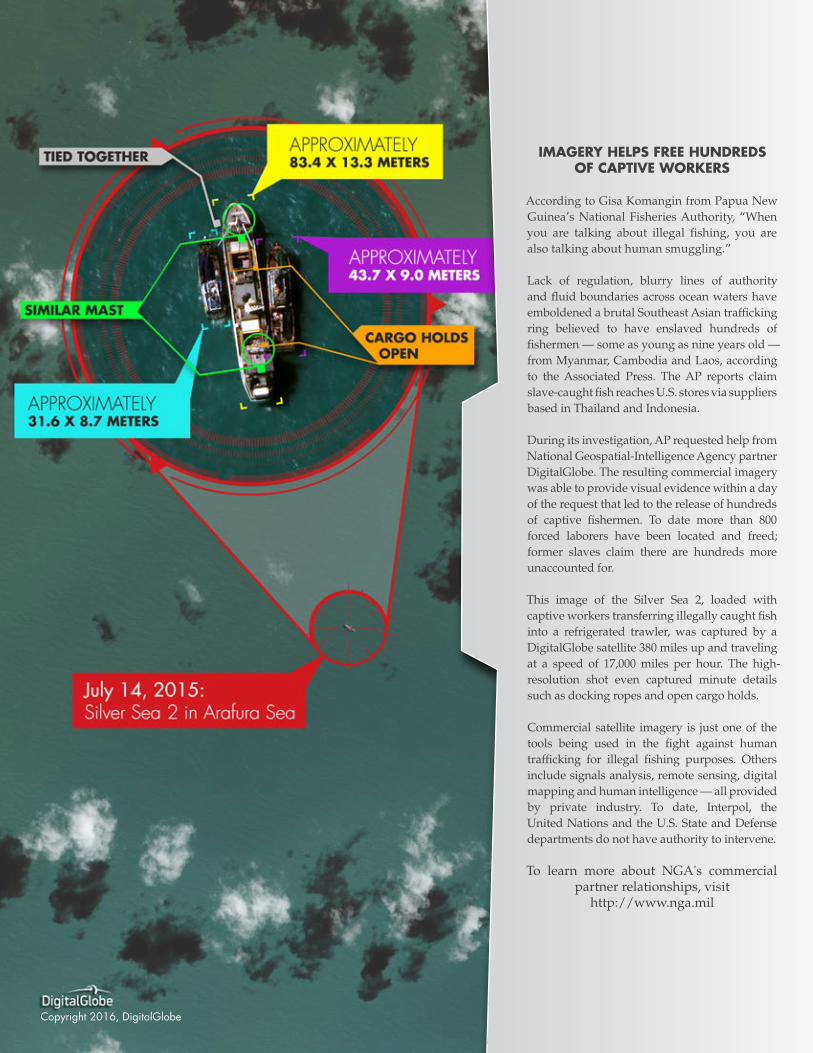
Copyright2016,digitalGlobe
iMAgERy hELPS FREE hUNDREDS oF cAPTiVE woRkERS
According to Gisa Komangin from Papua New Guinea’s National Fisheries Authority, “When you are talking about illegal fishing, you are also talking about human smuggling.”
Lack of regulation, blurry lines of authority and fluid boundaries across ocean waters have emboldened a brutal Southeast Asian trafficking ring believed to have enslaved hundreds of fishermen — some as young as nine years old — from Myanmar, Cambodia and Laos, according to the Associated Press. The AP reports claim slave-caught fish reaches U.S. stores via suppliers based in Thailand and Indonesia.
During its investigation, AP requested help from National Geospatial-Intelligence Agency partner DigitalGlobe. The resulting commercial imagery was able to provide visual evidence within a day of the request that led to the release of hundreds of captive fishermen. To date more than 800 forced laborers have been located and freed; former slaves claim there are hundreds more unaccounted for.
This image of the Silver Sea 2, loaded with captive workers transferring illegally caught fish into a refrigerated trawler, was captured by a DigitalGlobe satellite 380 miles up and traveling at a speed of 17,000 miles per hour. The high-resolution shot even captured minute details such as docking ropes and open cargo holds.
Commercial satellite imagery is just one of the tools being used in the fight against human trafficking for illegal fishing purposes. Others include signals analysis, remote sensing, digital mapping and human intelligence — all provided by private industry. To date, Interpol, the United Nations and the U.S. State and Defense departments do not have authority to intervene.
To learn more about NGA's commercial partner relationships, visit
http://www.nga.mil