Embed Size (px)
Citation preview

© 2014 SAP SE or an SAP affiliate company. All rights reserved. 1 Public
Earth Observation Analysis SAP HANA Cloud Service
© 2014 SAP SE or an SAP affiliate company. All rights reserved. 2 Public
Disclaimer
This presentation outlines our general product direction and should not be relied on in making a
purchase decision. This presentation is not subject to your license agreement or any other agreement
with SAP. SAP has no obligation to pursue any course of business outlined in this presentation or to
develop or release any functionality mentioned in this presentation. This presentation and SAP's
strategy and possible future developments are subject to change and may be changed by SAP at any
time for any reason without notice. This document is provided without a warranty of any kind, either
express or implied, including but not limited to, the implied warranties of merchantability, fitness for a
particular purpose, or non-infringement. SAP assumes no responsibility for errors or omissions in this
document, except if such damages were caused by SAP intentionally or grossly negligent.
© 2014 SAP SE or an SAP affiliate company. All rights reserved. 3 Public
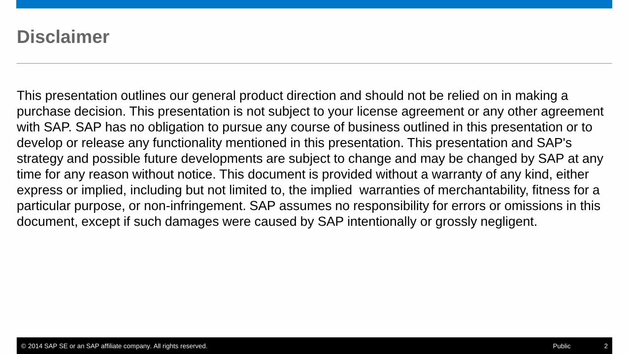
Geospatial Technologies
• Rapid development of geospatial technologies in recent years
• Enables new ways of collection and analysis of geo- and business data
• Sensors
• Remote Sensing (RS)
• Unmanned Aerial Vehicle (UAV)
• Global Positioning System (GPS)
• Geo Enrichment
• Geographic Information System (GIS)
• Information technologies (database)
© 2014 SAP SE or an SAP affiliate company. All rights reserved. 4 Public
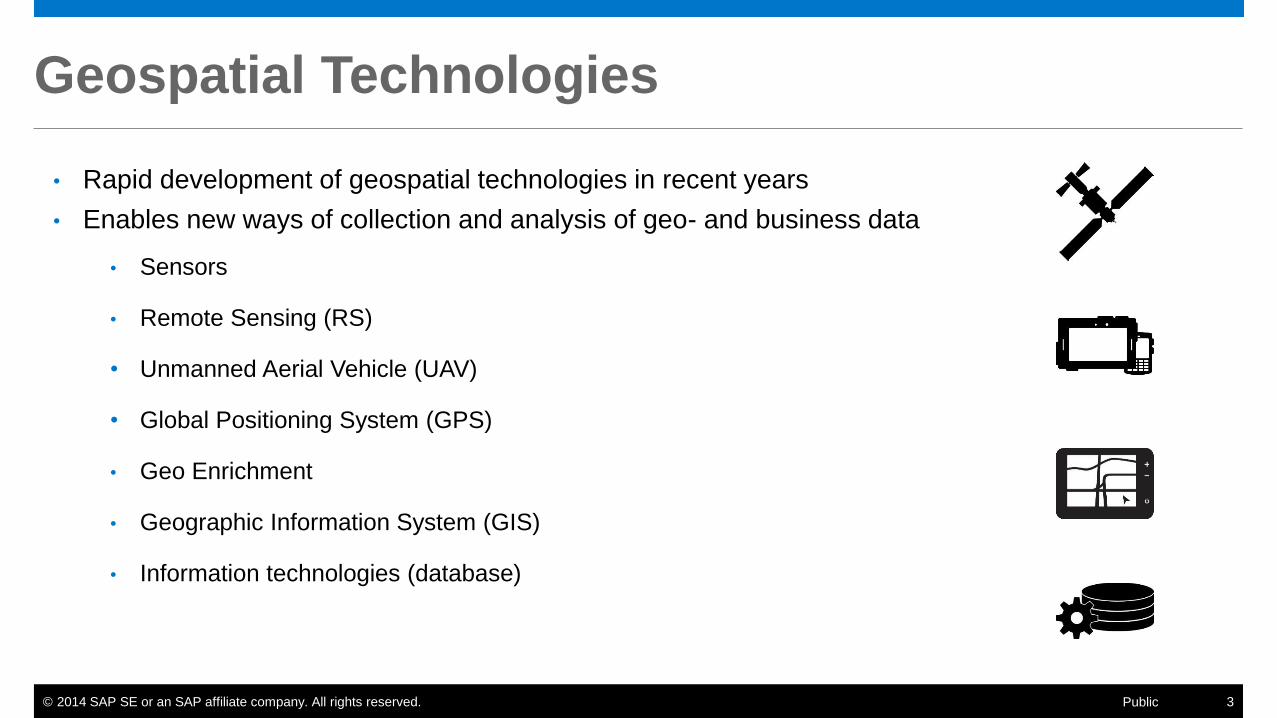
Spatial Data Vector, Point Cloud, Raster Data
Point Linestring Polygon
CircularString MultiPoint MultiLinestring
MultiPolygon GeometryCollection X
Y
Z
14 35 25
17 39 59
16 15 17
Complex types Raster Data
© 2014 SAP SE or an SAP affiliate company. All rights reserved. 5 Public
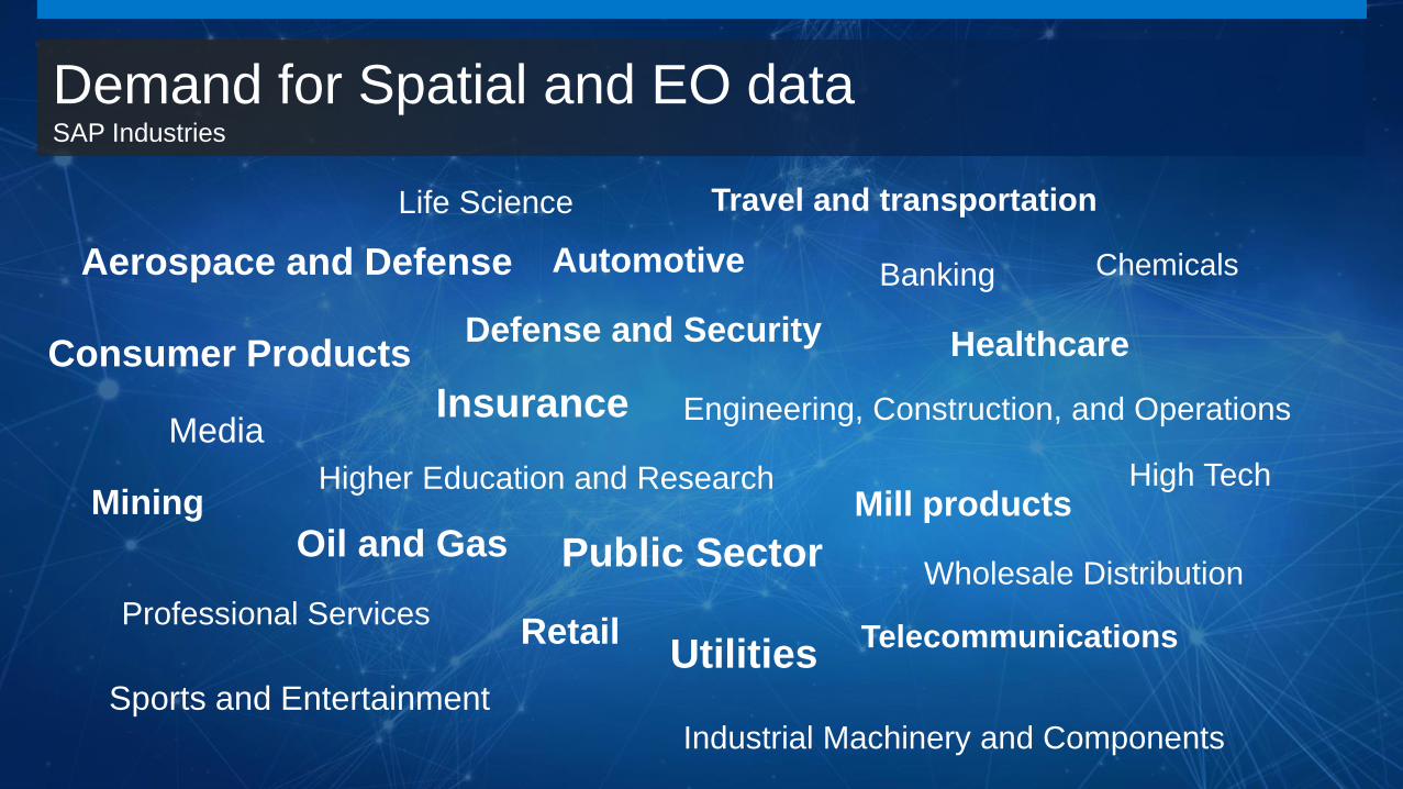
Demand for Spatial and EO data SAP Industries
Aerospace and Defense Automotive Banking Chemicals
Consumer Products Defense and Security
Engineering, Construction, and Operations
Healthcare
High Tech Higher Education and Research
Industrial Machinery and Components
Insurance
Life Science
Media
Mill products Mining
Oil and Gas
Professional Services
Public Sector
Retail
Sports and Entertainment
Telecommunications
Travel and transportation
Utilities
Wholesale Distribution

6 © 2015 SAP SE or an SAP affiliate company. All rights reserved.
Key Challenge with EO Data
Big data leads to IT complexity
Understanding EO data
Extracting valuable information
Expert knowledge required
Image processing and performance
Harmonize, correct and correlate information
© 2015 SAP SE or an SAP affiliate company. All rights reserved. 6 Public

© 2014 SAP SE or an SAP affiliate company. All rights reserved. 7 Public
Earth Observation
Analysis
© 2014 SAP SE or an SAP affiliate company. All rights reserved. 8 Public
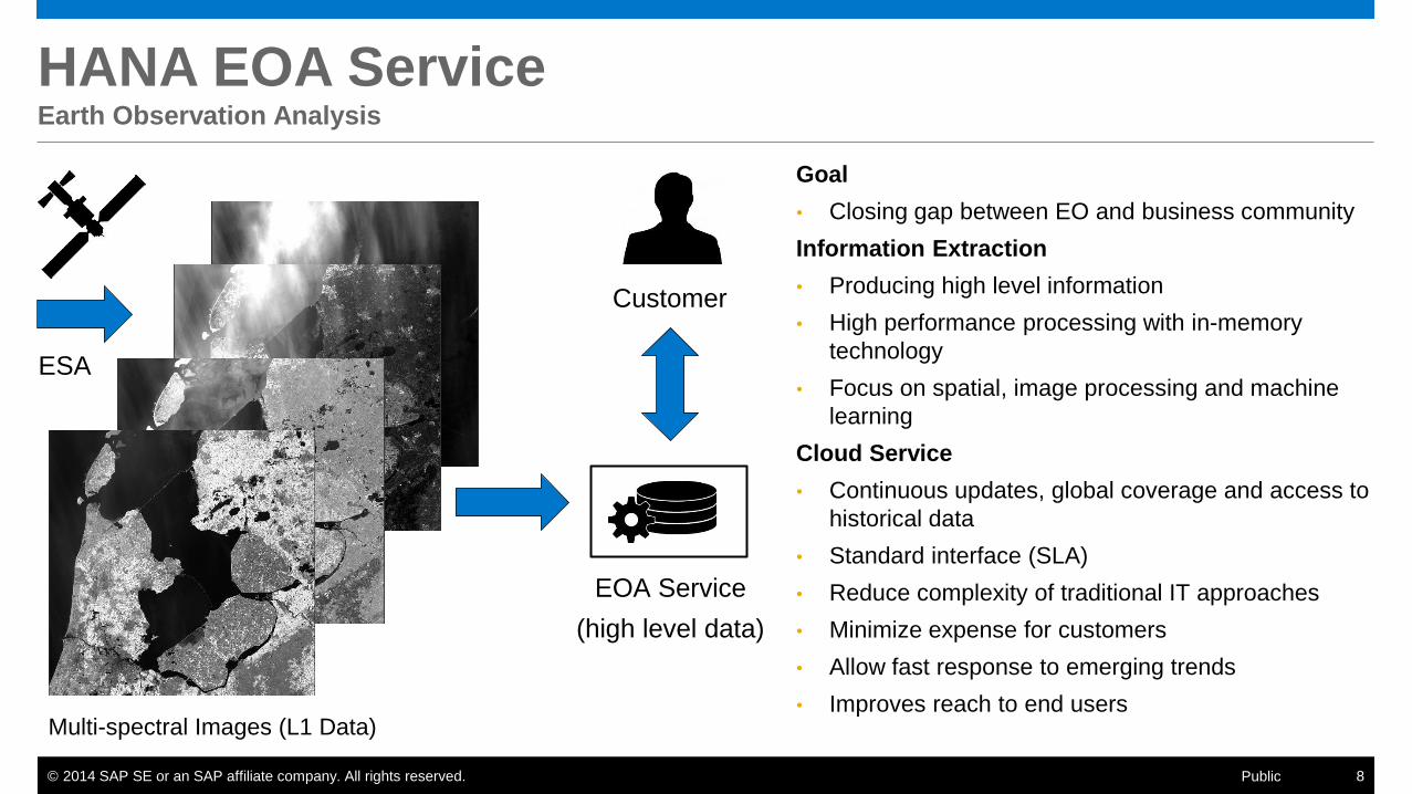
HANA EOA Service Earth Observation Analysis
Multi-spectral Images (L1 Data)
EOA Service
(high level data)
ESA
Goal
• Closing gap between EO and business community
Information Extraction
• Producing high level information
• High performance processing with in-memory
technology
• Focus on spatial, image processing and machine
learning
Cloud Service
• Continuous updates, global coverage and access to
historical data
• Standard interface (SLA)
• Reduce complexity of traditional IT approaches
• Minimize expense for customers
• Allow fast response to emerging trends
• Improves reach to end users
Customer
© 2014 SAP SE or an SAP affiliate company. All rights reserved. 9 Public
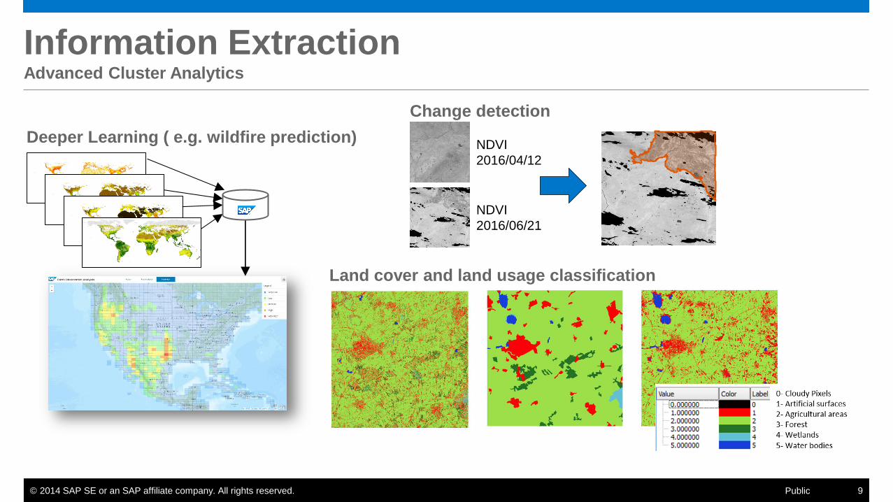
Information Extraction Advanced Cluster Analytics
Land cover and land usage classification
NDVI
2016/04/12
NDVI
2016/06/21
Change detection
Deeper Learning ( e.g. wildfire prediction)
© 2014 SAP SE or an SAP affiliate company. All rights reserved. 10 Public
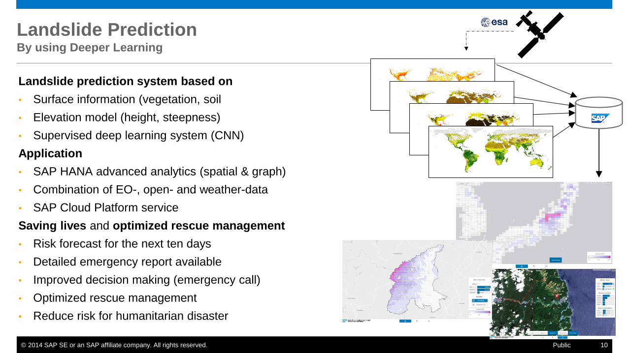
Landslide Prediction By using Deeper Learning
Landslide prediction system based on
• Surface information (vegetation, soil
• Elevation model (height, steepness)
• Supervised deep learning system (CNN)
Application
• SAP HANA advanced analytics (spatial & graph)
• Combination of EO-, open- and weather-data
• SAP Cloud Platform service
Saving lives and optimized rescue management
• Risk forecast for the next ten days
• Detailed emergency report available
• Improved decision making (emergency call)
• Optimized rescue management
• Reduce risk for humanitarian disaster
© 2014 SAP SE or an SAP affiliate company. All rights reserved. 11 Public
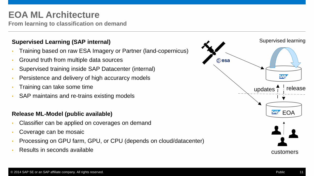
EOA ML Architecture From learning to classification on demand
Supervised Learning (SAP internal)
• Training based on raw ESA Imagery or Partner (land-copernicus)
• Ground truth from multiple data sources
• Supervised training inside SAP Datacenter (internal)
• Persistence and delivery of high accurarcy models
• Training can take some time
• SAP maintains and re-trains existing models
Release ML-Model (public available)
• Classifier can be applied on coverages on demand
• Coverage can be mosaic
• Processing on GPU farm, GPU, or CPU (depends on cloud/datacenter)
• Results in seconds available
Supervised learning
release updates
EOA
customers

© 2014 SAP SE or an SAP affiliate company. All rights reserved. 12 Public
Business Model EO data for enterprise companies

© 2014 SAP SE or an SAP affiliate company. All rights reserved. 13 Public
HANA EO Service Refine Earth Observation Data Processing
Raw imagery (L1)
Targeting EO specialist, researchers, and developers
Spectral Indices (L2)
NDVI, NDWI, NDSI, NBR, VARI, LAI, FAPAR, DMP, BA, …
Business
Relevance
Raw Imagery
General EO
Higher Value
Industry Index
Land cover / usage classification and change detection (L3)
Change-, alert- and forecasting systems with classification
Industry index (L4)
Insurance value-, agriculture-, smart city-, climate-index
Customer Index
Customer index (L5)
Specific customer value index
Adaptability
high
low high low
Value
© 2014 SAP SE or an SAP affiliate company. All rights reserved. 14 Public
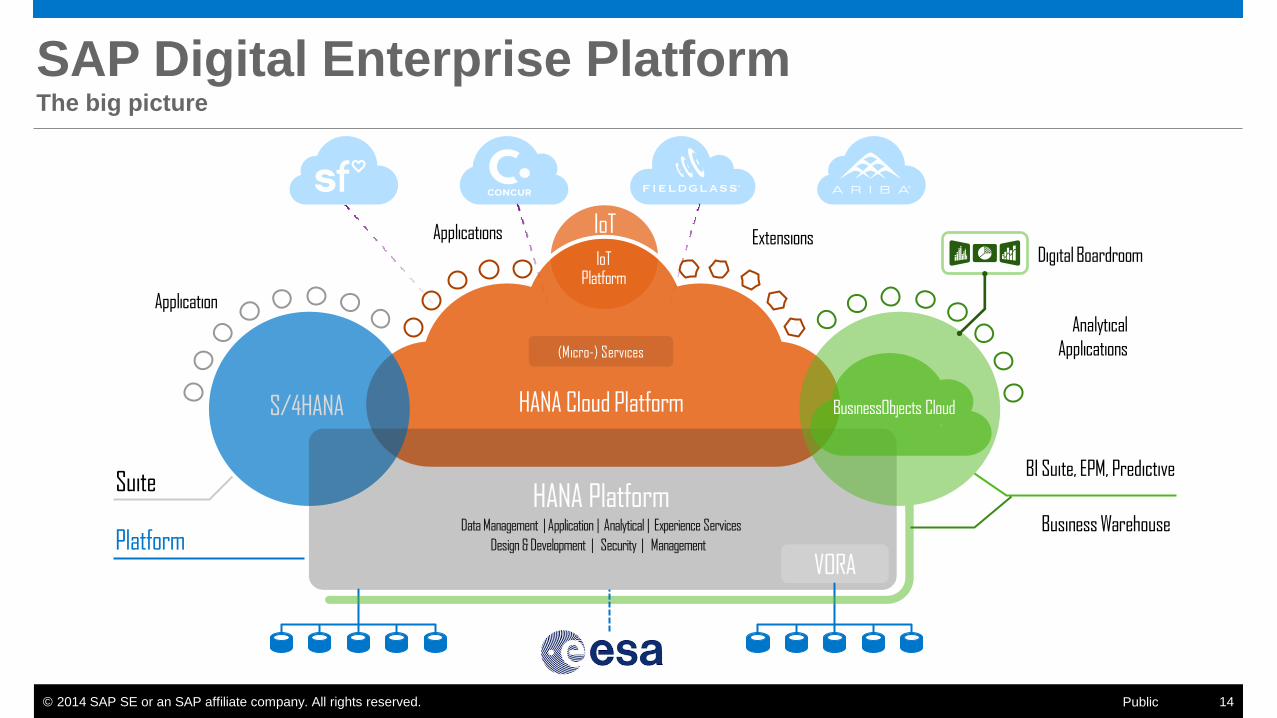
HANA Cloud Platform
(Micro-) Services
IoT Platform
IoT
Suite
Applications
S/4HANA
Platform
HANA Platform
VORA
any DB Hadoop
Digital Boardroom Icon
BI Suite, EPM, Predictive
Business Warehouse
BusinessObjects Cloud
Applications
Extensions
Analytical
Applications
SAP Digital Enterprise Platform The big picture
© 2014 SAP SE or an SAP affiliate company. All rights reserved. 15 Public
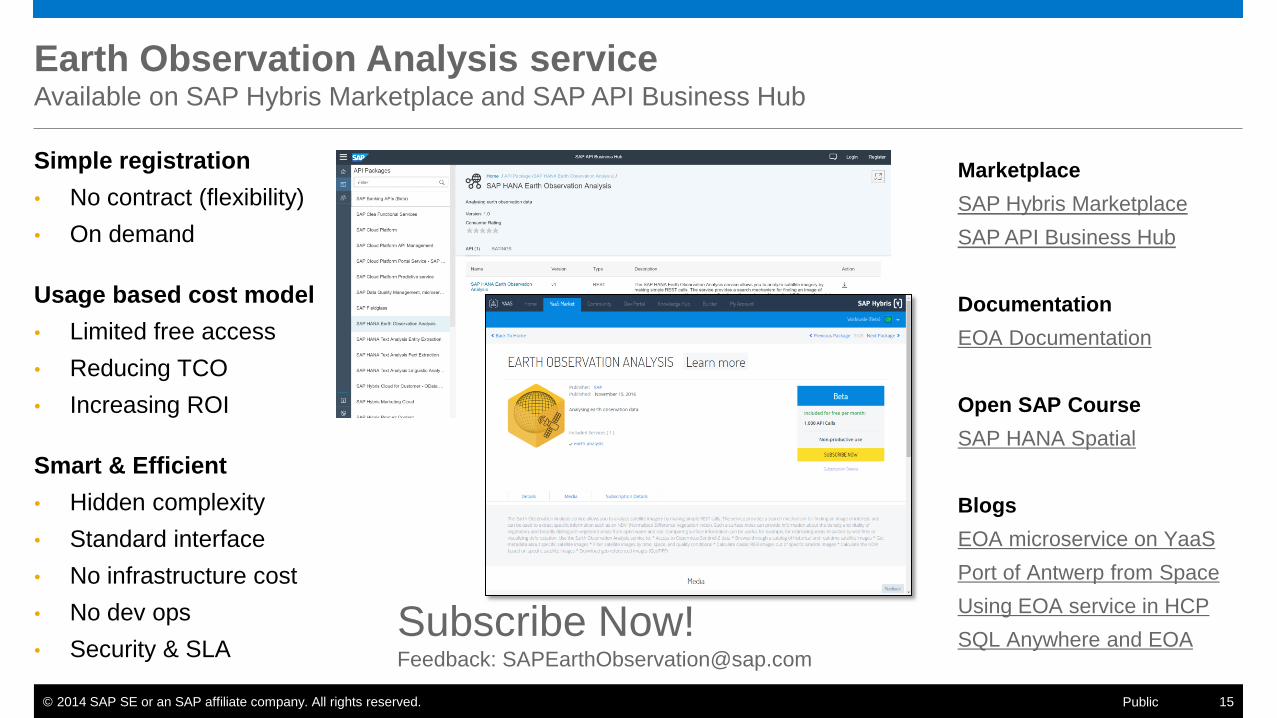
Earth Observation Analysis service Available on SAP Hybris Marketplace and SAP API Business Hub
Simple registration
• No contract (flexibility)
• On demand
Usage based cost model
• Limited free access
• Reducing TCO
• Increasing ROI
Smart & Efficient
• Hidden complexity
• Standard interface
• No infrastructure cost
• No dev ops
• Security & SLA
Marketplace
SAP Hybris Marketplace
SAP API Business Hub
Documentation
EOA Documentation
Open SAP Course
SAP HANA Spatial
Blogs
EOA microservice on YaaS
Port of Antwerp from Space
Using EOA service in HCP
SQL Anywhere and EOA Subscribe Now! Feedback: [email protected]
© 2014 SAP SE or an SAP affiliate company. All rights reserved. 16 Public
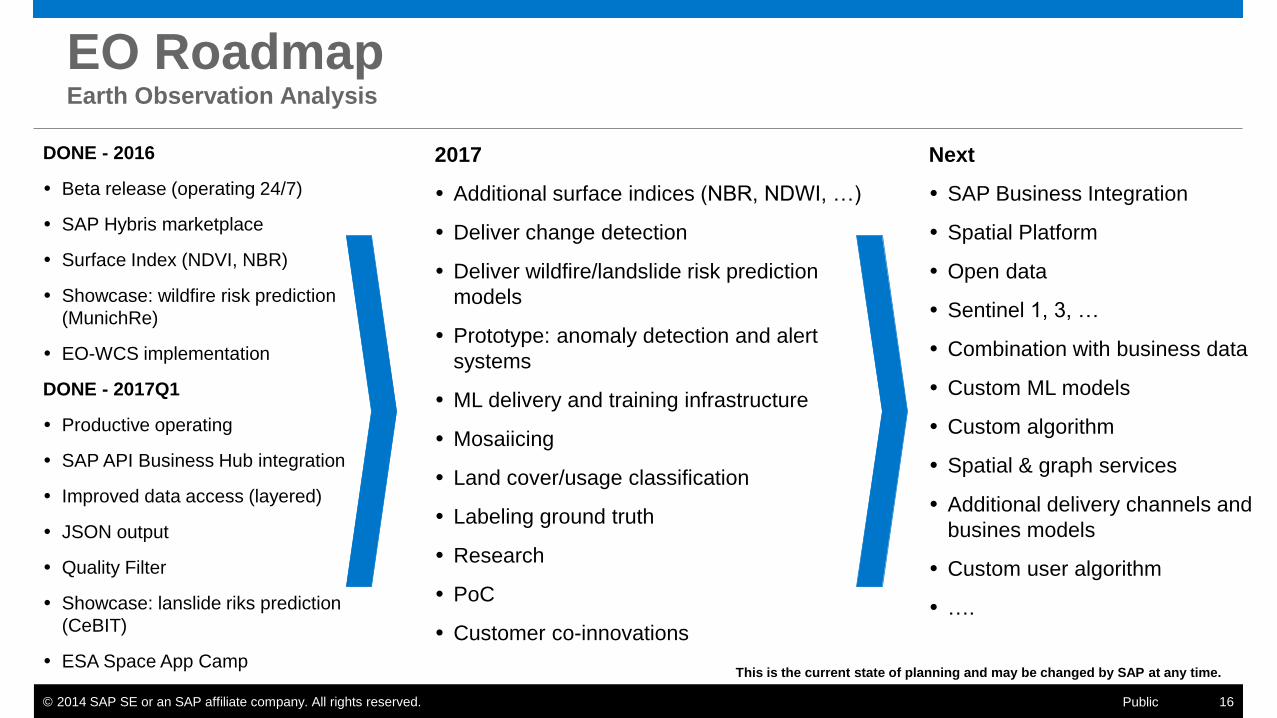
EO Roadmap Earth Observation Analysis
This is the current state of planning and may be changed by SAP at any time.
DONE - 2016
Beta release (operating 24/7)
SAP Hybris marketplace
Surface Index (NDVI, NBR)
Showcase: wildfire risk prediction
(MunichRe)
EO-WCS implementation
DONE - 2017Q1
Productive operating
SAP API Business Hub integration
Improved data access (layered)
JSON output
Quality Filter
Showcase: lanslide riks prediction
(CeBIT)
ESA Space App Camp
2017
Additional surface indices (NBR, NDWI, …)
Deliver change detection
Deliver wildfire/landslide risk prediction
models
Prototype: anomaly detection and alert
systems
ML delivery and training infrastructure
Mosaiicing
Land cover/usage classification
Labeling ground truth
Research
PoC
Customer co-innovations
Next
SAP Business Integration
Spatial Platform
Open data
Sentinel 1, 3, …
Combination with business data
Custom ML models
Custom algorithm
Spatial & graph services
Additional delivery channels and
busines models
Custom user algorithm
….
© 2014 SAP SE or an SAP affiliate company. All rights reserved.
Thank You! SAP HANA Spatial
Earth Observation Service
SAP HANA Spatial Reference
SAP HANA Academy
@HinnerkGildhoff
Live Demo
© 2014 SAP SE or an SAP affiliate company. All rights reserved. 18 Public
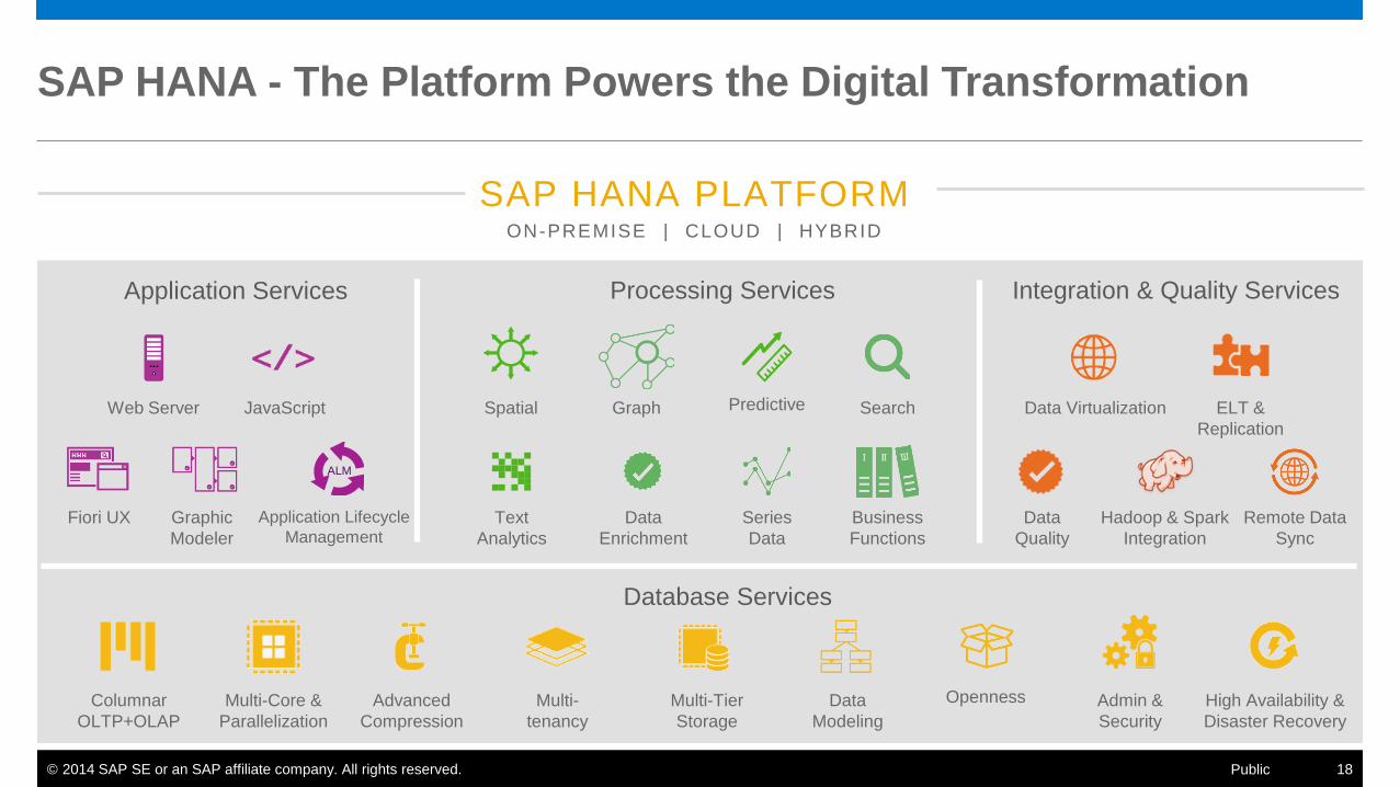
SAP HANA - The Platform Powers the Digital Transformation
SAP HANA PLATFORM ON-PREMISE | CLOUD | HYBRID
Web Server JavaScript
Fiori UX Graphic
Modeler
Data Virtualization ELT &
Replication
Application Services Integration & Quality Services
Columnar
OLTP+OLAP
Multi-Core &
Parallelization
Advanced
Compression
Multi-
tenancy
Multi-Tier
Storage
Spatial Graph Predictive Search
Text
Analytics
Data
Quality
Series
Data
Business
Functions
ALM
Processing Services
Database Services
Hadoop & Spark
Integration
Application Lifecycle
Management
High Availability &
Disaster Recovery
Openness Data
Modeling
Remote Data
Sync
Admin &
Security
Data
Enrichment