Embed Size (px)
Citation preview

EarthKAMJacob Pruitt5th Period
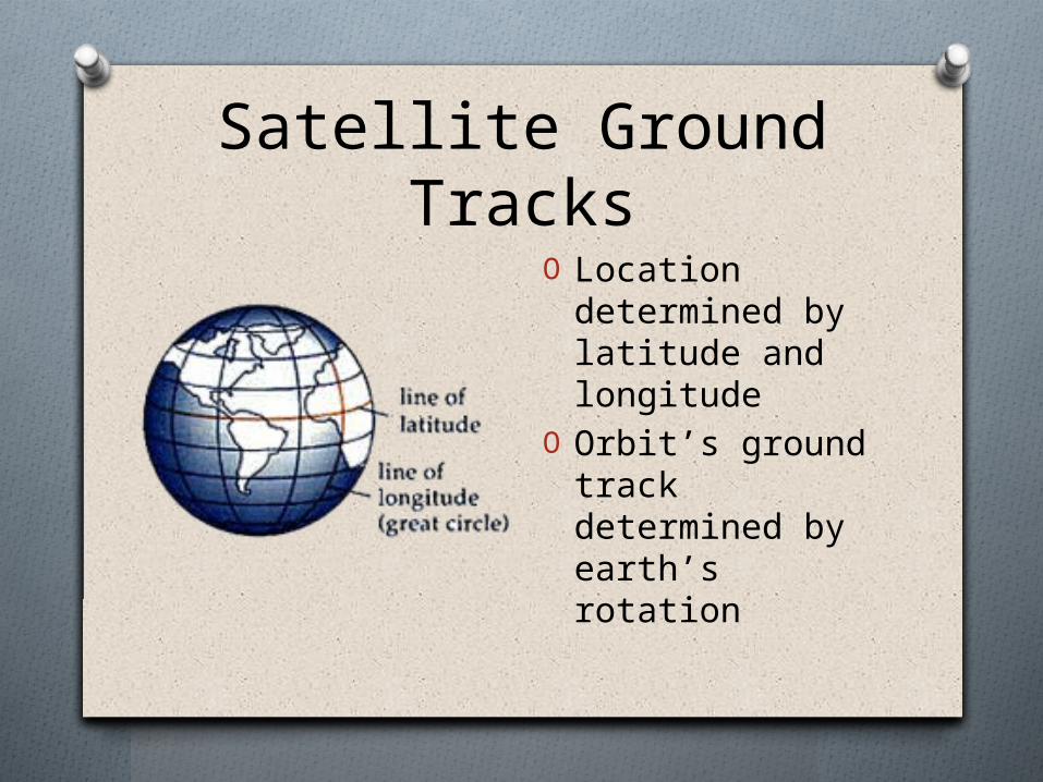
Satellite Ground TracksO Location
determined by latitude and longitude
O Orbit’s ground track determined by earth’s rotation

How does the Earth’s Orbit Affect Ground Tracks?
O Space craft fixed in space
O Rotates eastO Shifts to the west
during successive orbits

Location of Different Orbits
O 10° inclination of orbit A
O 30° inclination of orbit B
O 50° inclination of orbit C
O 85°inclination of orbit D
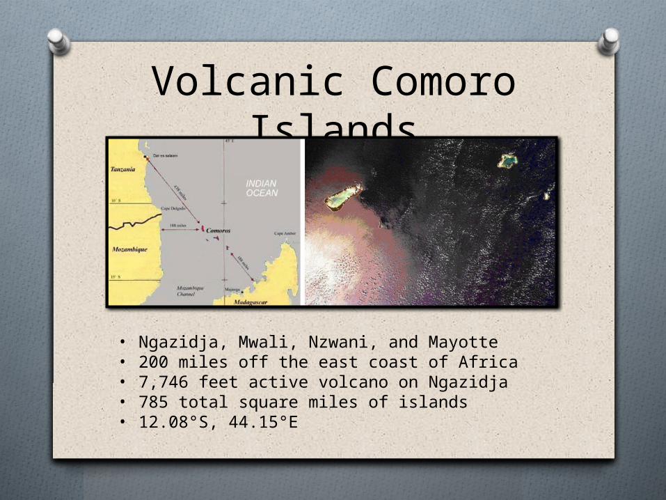
Volcanic Comoro Islands
• Ngazidja, Mwali, Nzwani, and Mayotte• 200 miles off the east coast of Africa• 7,746 feet active volcano on Ngazidja • 785 total square miles of islands• 12.08°S, 44.15°E

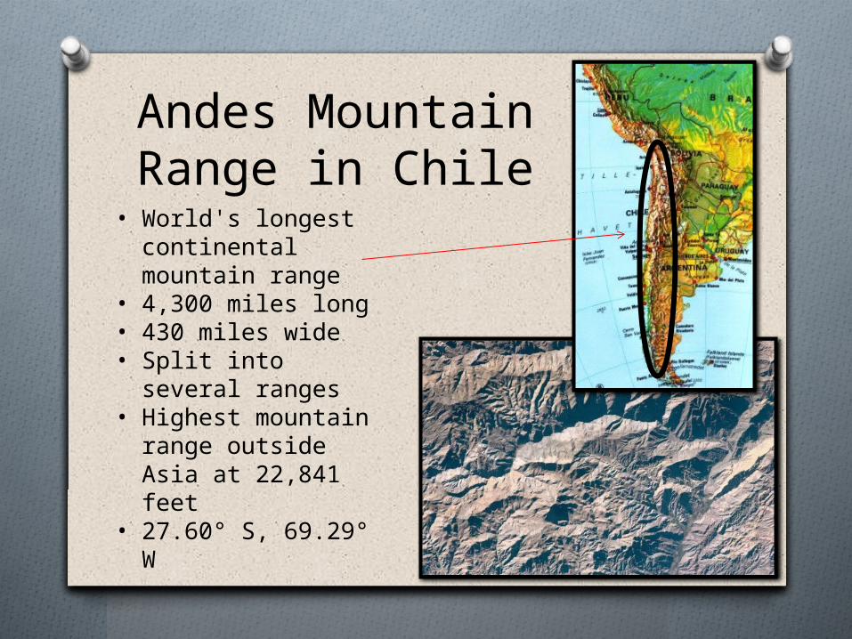
Andes Mountain Range in Chile
• World's longest continental mountain range
• 4,300 miles long• 430 miles wide• Split into several
ranges• Highest mountain
range outside Asia at 22,841 feet
• 27.60° S, 69.29° W
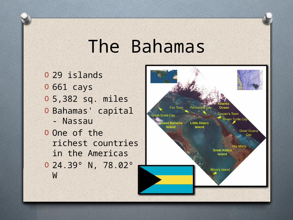
The BahamasO 29 islandsO 661 caysO 5,382 sq. milesO Bahamas' capital -
Nassau O One of the richest
countries in the Americas
O 24.39º N, 78.02º W
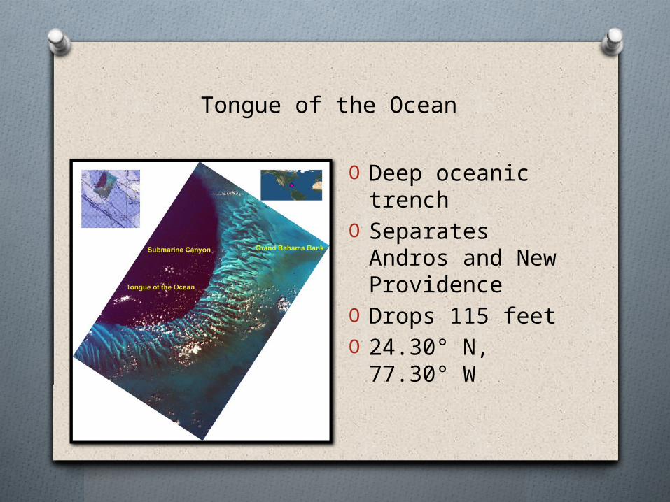
Tongue of the Ocean
O Deep oceanic trench
O Separates Andros and New Providence
O Drops 115 feetO 24.30° N, 77.30°
W

Stonehenge• Cumulus clouds• Flat base• May only be 330 feet above the ground
• Prehistoric monument• Constructed from 3000 BC to 2000 BC• Located in Wiltshire, United Kingdom• 51.10° N, 1.49° W
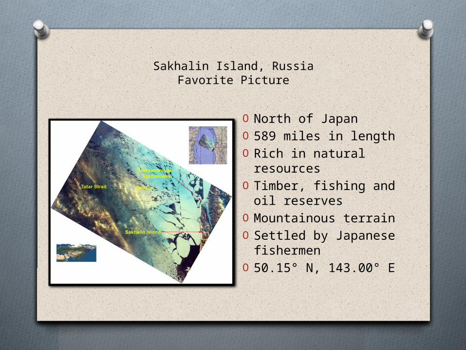
Sakhalin Island, RussiaFavorite Picture
O North of JapanO 589 miles in lengthO Rich in natural
resources O Timber, fishing and
oil reservesO Mountainous terrainO Settled by Japanese
fishermenO 50.15° N, 143.00° E
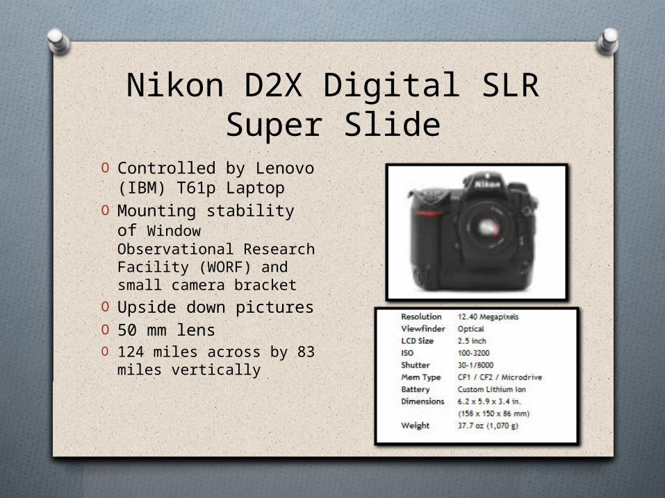
Nikon D2X Digital SLRSuper Slide
O Controlled by Lenovo (IBM) T61p Laptop
O Mounting stability of Window Observational Research Facility (WORF) and small camera bracket
O Upside down picturesO 50 mm lensO 124 miles across by 83
miles vertically

Works Cited
"Andes - Wikipedia, the free encyclopedia." Wikipedia, the free encyclopedia. N.p., n.d. Web. 22 Nov. 2011. <http://en.wikipedia.org/wiki/Andes>.
"Cloud Types!." Spark | UCAR Science Education. N.p., n.d. Web. 27 Nov. 2011. <http://eo.ucar.edu/webweather/cloud3.html>.
"NASA - Home." NASA - Home. N.p., n.d. Web. 22 Nov. 2011. <http://www.nasa.gov/>.
"Redirect Notice." Google. N.p., n.d. Web. 22 Nov. 2011. <http://www.google.com/imgres?q=andes+mountains+map&um=1&hl=en&biw=1024&bih=398&tbm=isch&tbnid=u892sA2M_gc_9M:&imgrefurl=http://pitchforksupperclub.blogspot.com/2010/07/chilean-family-feast.html&docid=GpoPkIr7vMIiMM&imgurl=http://4.bp.blogspot.com/_jrOW0il>.
"Stonehenge - Wikipedia, the free encyclopedia." Wikipedia, the free encyclopedia. N.p., n.d. Web. 27 Nov. 2011. <http://en.wikipedia.org/wiki/Stonehenge>.
"Tongue of the Ocean - Wikipedia, the free encyclopedia." Wikipedia, the free encyclopedia. N.p., n.d. Web. 27 Nov. 2011. <http://en.wikipedia.org/wiki/Tongue_of_the_Ocean>.
capita, the terms of GDP per. "The Bahamas - Wikipedia, the free encyclopedia." Wikipedia, the free encyclopedia. N.p., n.d. Web. 22 Nov. 2011. <http://en.wikipedia.org/wiki/The_Bahamas>.
MLA formatting by BibMe.org