Embed Size (px)
Citation preview
Earthquake Hazards and Risk
Scenario for Metro Manila and
Vicinity: the Need for Whole of
Society Preparedness
May 20, 2015
Renato U. Solidum, Jr.
Philippine Institute of Volcanology and Seismology
Department of Science and Technology
What Happened in Nepal?
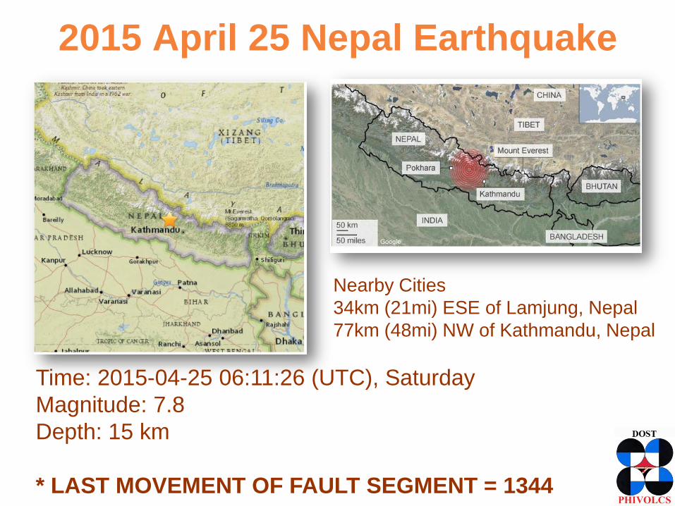
2015 April 25 Nepal Earthquake
Time: 2015-04-25 06:11:26 (UTC), Saturday
Magnitude: 7.8
Depth: 15 km
* LAST MOVEMENT OF FAULT SEGMENT = 1344
Nearby Cities
34km (21mi) ESE of Lamjung, Nepal
77km (48mi) NW of Kathmandu, Nepal
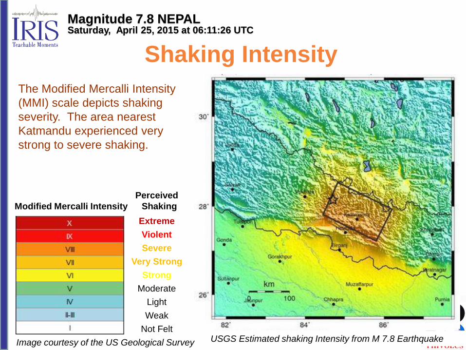
Modified Mercalli Intensity
Perceived
Shaking
Extreme
Violent
Severe
Very Strong
Strong
Moderate
Light
Weak
Not Felt
USGS Estimated shaking Intensity from M 7.8 Earthquake
The Modified Mercalli Intensity
(MMI) scale depicts shaking
severity. The area nearest
Katmandu experienced very
strong to severe shaking.
Image courtesy of the US Geological Survey
Shaking Intensity
Magnitude 7.8 NEPAL Saturday, April 25, 2015 at 06:11:26 UTC
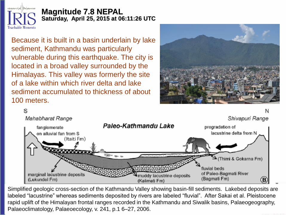
Because it is built in a basin underlain by lake
sediment, Kathmandu was particularly
vulnerable during this earthquake. The city is
located in a broad valley surrounded by the
Himalayas. This valley was formerly the site
of a lake within which river delta and lake
sediment accumulated to thickness of about
100 meters.
Magnitude 7.8 NEPAL Saturday, April 25, 2015 at 06:11:26 UTC
Simplified geologic cross-section of the Kathmandu Valley showing basin-fill sediments. Lakebed deposits are
labeled “lacustrine” whereas sediments deposited by rivers are labeled “fluvial”. After Sakai et al. Pleistocene
rapid uplift of the Himalayan frontal ranges recorded in the Kathmandu and Siwalik basins, Palaeogeography,
Palaeoclimatology, Palaeoecology, v. 241, p.1 6–27, 2006.
Summary of Hazards and Impact as of 12 May (Center for Disaster Management and Risk Reduction Technology)
• Well built structures received slight damage. Older buildings
suffered great damage. Ground shaking in epicentral area
corresponds to Intensity VIII.
• Many government, religious and private buildings destroyed.
~ 300,000 destroyed, 250,000 damaged.
• Many landslides blocking roads and causing infrastructure
damage, and limited liquefaction.
• Death toll 8151, 377 missing in Nepal. Around 100 fatalities
in Tibet, India and Bangladesh.
What is the Earthquake Scenario in
Metro Manila and nearby Provinces?
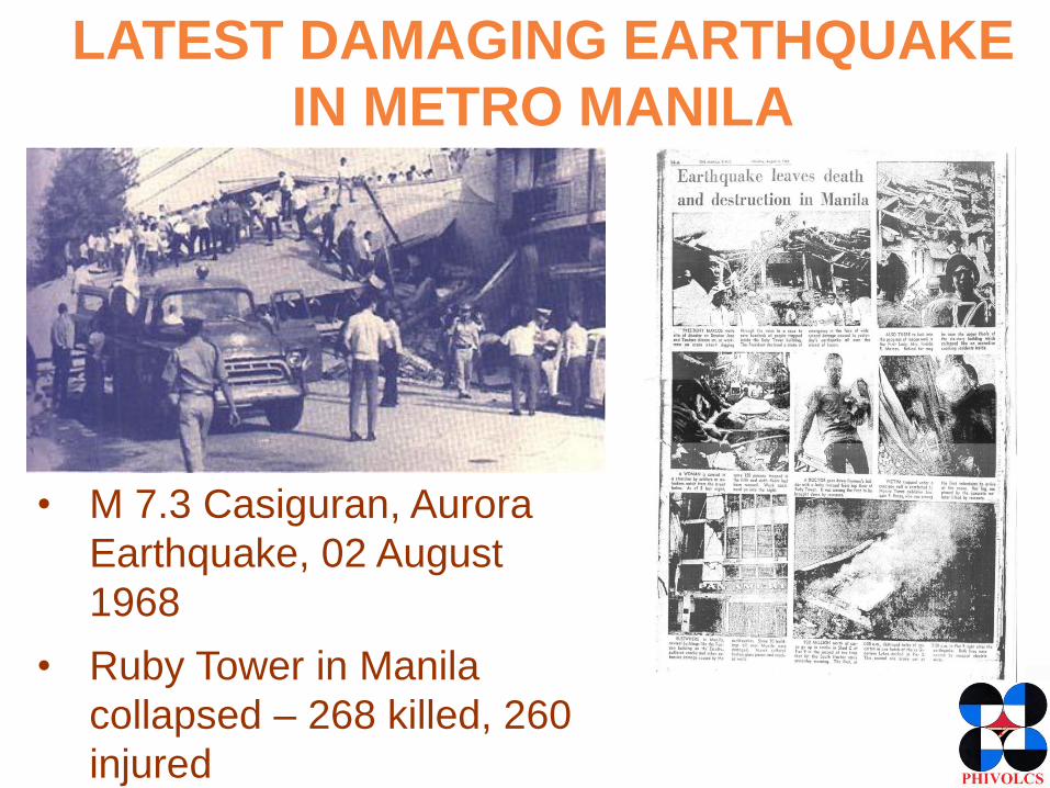
LATEST DAMAGING EARTHQUAKE
IN METRO MANILA
• M 7.3 Casiguran, Aurora
Earthquake, 02 August
1968
• Ruby Tower in Manila
collapsed – 268 killed, 260
injured
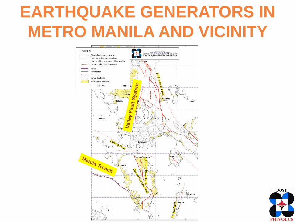
EARTHQUAKE GENERATORS IN
METRO MANILA AND VICINITY
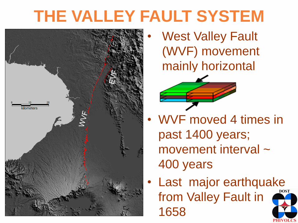
THE VALLEY FAULT SYSTEM
• West Valley Fault
(WVF) movement
mainly horizontal
• WVF moved 4 times in
past 1400 years;
movement interval ~
400 years
• Last major earthquake
from Valley Fault in
1658
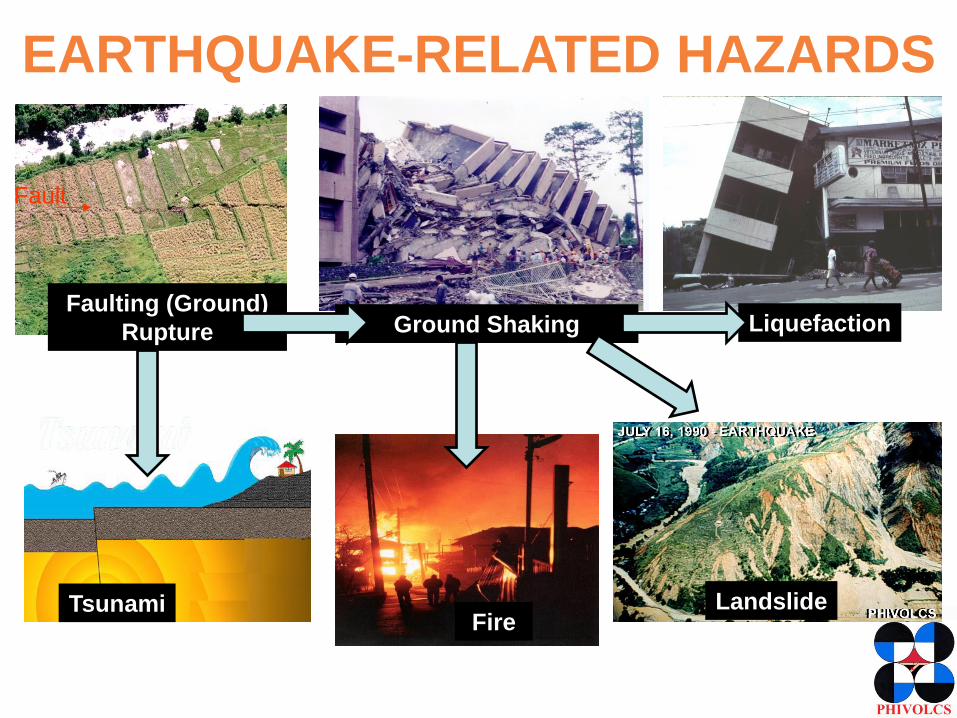
EARTHQUAKE-RELATED HAZARDS
Tsunami Fire
Ground Shaking Liquefaction
Landslide
Faulting (Ground)
Rupture
Fault
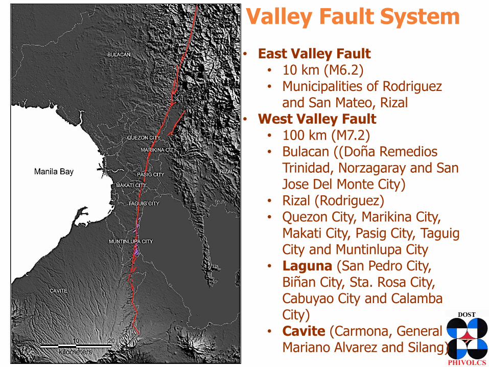
Valley Fault System • East Valley Fault
• 10 km (M6.2) • Municipalities of Rodriguez
and San Mateo, Rizal • West Valley Fault
• 100 km (M7.2) • Bulacan ((Doña Remedios
Trinidad, Norzagaray and San Jose Del Monte City)
• Rizal (Rodriguez) • Quezon City, Marikina City,
Makati City, Pasig City, Taguig City and Muntinlupa City
• Laguna (San Pedro City, Biñan City, Sta. Rosa City, Cabuyao City and Calamba City)
• Cavite (Carmona, General Mariano Alvarez and Silang)
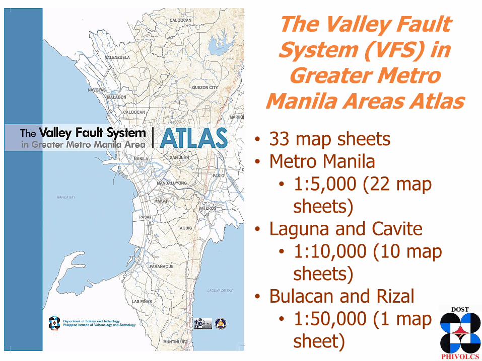
The Valley Fault System (VFS) in Greater Metro
Manila Areas Atlas
• 33 map sheets • Metro Manila
• 1:5,000 (22 map sheets)
• Laguna and Cavite • 1:10,000 (10 map
sheets) • Bulacan and Rizal
• 1:50,000 (1 map sheet)
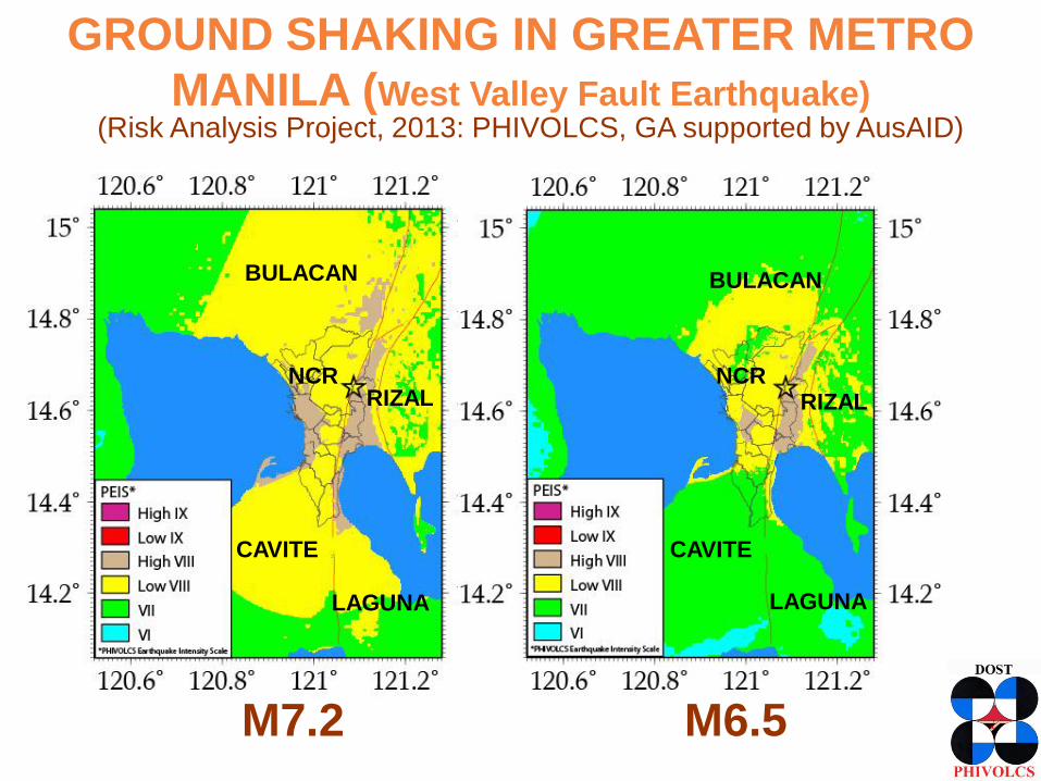
GROUND SHAKING IN GREATER METRO
MANILA (West Valley Fault Earthquake) (Risk Analysis Project, 2013: PHIVOLCS, GA supported by AusAID)
NCR
BULACAN
RIZAL
CAVITE
LAGUNA
BULACAN
NCR RIZAL
CAVITE
LAGUNA
M6.5 M7.2
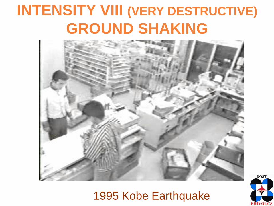
INTENSITY VIII (VERY DESTRUCTIVE)
GROUND SHAKING
1995 Kobe Earthquake
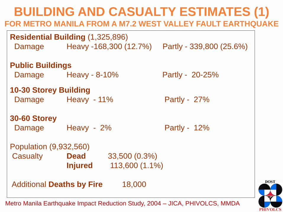
BUILDING AND CASUALTY ESTIMATES (1) FOR METRO MANILA FROM A M7.2 WEST VALLEY FAULT EARTHQUAKE
Residential Building (1,325,896)
Damage Heavy -168,300 (12.7%) Partly - 339,800 (25.6%)
Public Buildings
Damage Heavy - 8-10% Partly - 20-25% 10-30 Storey Building
Damage Heavy - 11% Partly - 27%
30-60 Storey
Damage Heavy - 2% Partly - 12%
Population (9,932,560)
Casualty Dead 33,500 (0.3%)
Injured 113,600 (1.1%)
Additional Deaths by Fire 18,000
Metro Manila Earthquake Impact Reduction Study, 2004 – JICA, PHIVOLCS, MMDA

BUILDING AND CASUALTY ESTIMATES (2) FOR METRO MANILA FROM A WEST VALLEY FAULT EARTHQUAKE
Risk Analysis Project, 2013 – PHIVOLCS, UP-ICE, GA (AusAID)
M7.2 M6.5
Total Floor Area in Complete 88,142,000 65,407,000
to Collapsed Damage (sqm)
Total Floor Area in Slight 172,924,000 162,799,000
to Extensive Damage (sqm)
Total Fatalities (Death) 31,000 23,000
Total Injuries Very Serious 14,000 10,000
Serious 112,000 85,171
Slight 385,000 302,000
Total Economic Losses (millions of PhP) 2,269,000 1,773,000
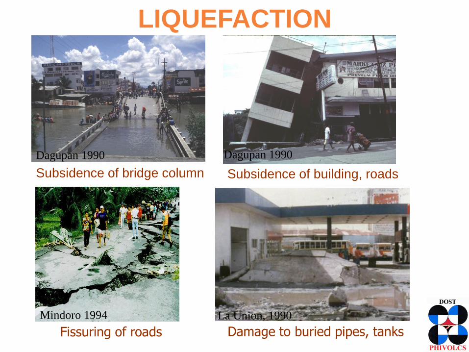
LIQUEFACTION
Subsidence of bridge column Subsidence of building, roads
Dagupan 1990
Fissuring of roads
Mindoro 1994
Dagupan 1990
La Union, 1990
Damage to buried pipes, tanks
(READY for GMMA Project, 2013)
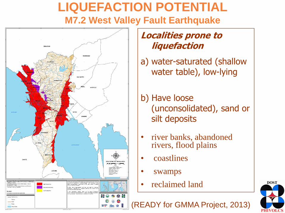
LIQUEFACTION POTENTIAL M7.2 West Valley Fault Earthquake
Localities prone to liquefaction
a) water-saturated (shallow water table), low-lying
b) Have loose
(unconsolidated), sand or silt deposits
• river banks, abandoned
rivers, flood plains
• coastlines
• swamps
• reclaimed land
(MMEIRS, 2004)
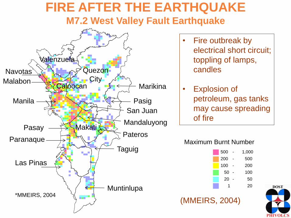
FIRE AFTER THE EARTHQUAKE M7.2 West Valley Fault Earthquake
*MMEIRS, 2004
Pasig Manila
Marikina
Muntinlupa
Taguig
Pasay
Paranaque
Las Pinas
Quezon
City
Makati Mandaluyong
Navotas
Malabon Caloocan
Valenzuela
San Juan
Pateros Maximum Burnt Number
500 - 1,000
200 - 500
100 - 200
50 - 100
20 - 50
1 - 20
• Fire outbreak by
electrical short circuit;
toppling of lamps,
candles
• Explosion of
petroleum, gas tanks
may cause spreading
of fire
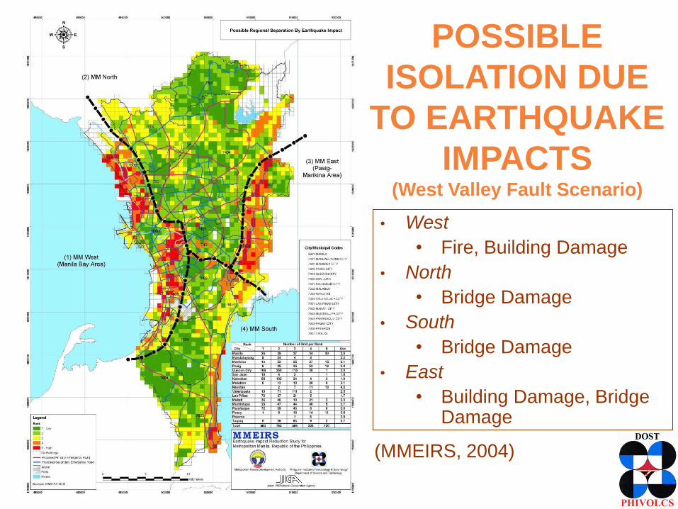
• West
• Fire, Building Damage
• North
• Bridge Damage
• South
• Bridge Damage
• East
• Building Damage, Bridge Damage
POSSIBLE
ISOLATION DUE
TO EARTHQUAKE
IMPACTS (West Valley Fault Scenario)
(MMEIRS, 2004)
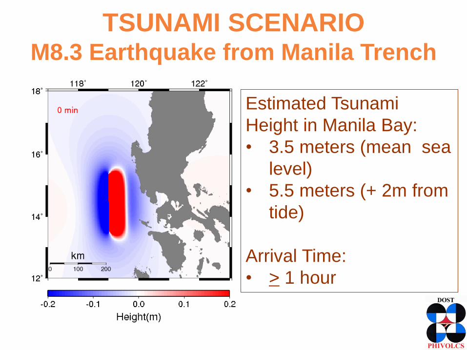
TSUNAMI SCENARIO M8.3 Earthquake from Manila Trench
Estimated Tsunami
Height in Manila Bay:
• 3.5 meters (mean sea
level)
• 5.5 meters (+ 2m from
tide)
Arrival Time:
• > 1 hour
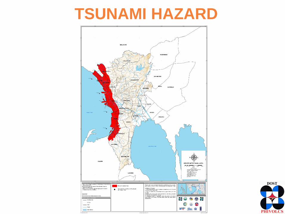
TSUNAMI HAZARD
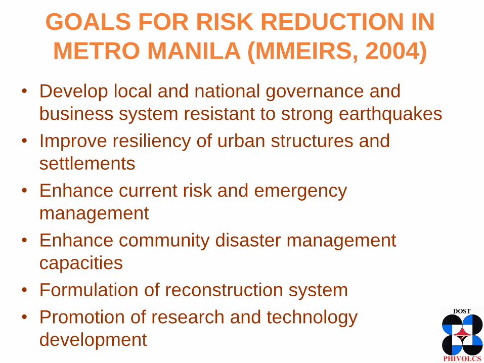
GOALS FOR RISK REDUCTION IN
METRO MANILA (MMEIRS, 2004)
• Develop local and national governance and
business system resistant to strong earthquakes
• Improve resiliency of urban structures and
settlements
• Enhance current risk and emergency
management
• Enhance community disaster management
capacities
• Formulation of reconstruction system
• Promotion of research and technology
development
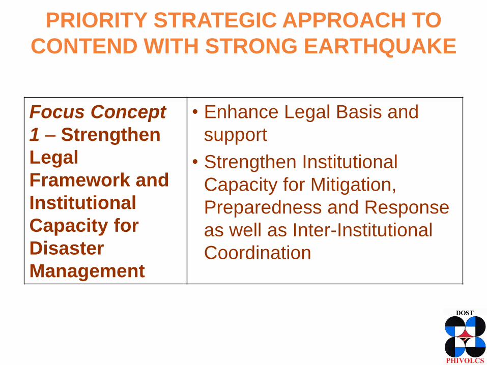
PRIORITY STRATEGIC APPROACH TO
CONTEND WITH STRONG EARTHQUAKE
Focus Concept
1 – Strengthen
Legal
Framework and
Institutional
Capacity for
Disaster
Management
• Enhance Legal Basis and
support
• Strengthen Institutional
Capacity for Mitigation,
Preparedness and Response
as well as Inter-Institutional
Coordination
PRIORITY STRATEGIC APPROACH TO
CONTEND WITH STRONG EARTHQUAKE
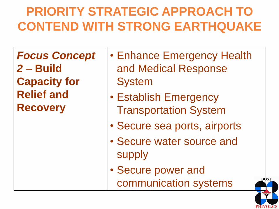
Focus Concept
2 – Build
Capacity for
Relief and
Recovery
• Enhance Emergency Health
and Medical Response
System
• Establish Emergency
Transportation System
• Secure sea ports, airports
• Secure water source and
supply
• Secure power and
communication systems
PRIORITY STRATEGIC APPROACH TO
CONTEND WITH STRONG EARTHQUAKE
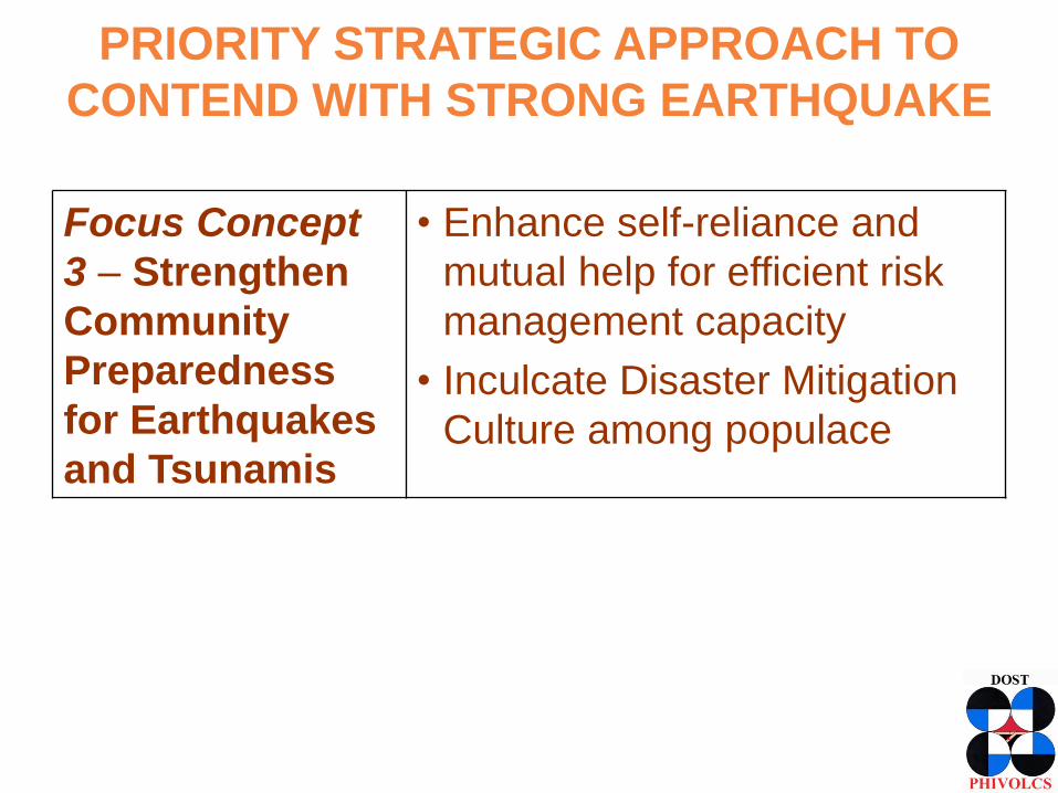
Focus Concept
3 – Strengthen
Community
Preparedness
for Earthquakes
and Tsunamis
• Enhance self-reliance and
mutual help for efficient risk
management capacity
• Inculcate Disaster Mitigation
Culture among populace
PRIORITY STRATEGIC APPROACH TO
CONTEND WITH STRONG EARTHQUAKE
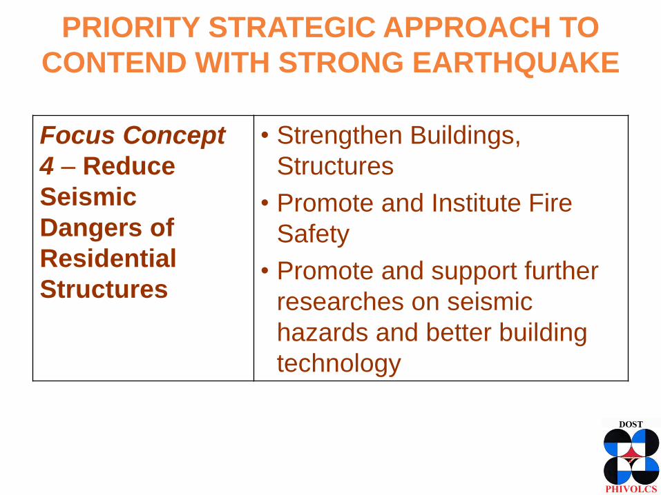
Focus Concept
4 – Reduce
Seismic
Dangers of
Residential
Structures
• Strengthen Buildings,
Structures
• Promote and Institute Fire
Safety
• Promote and support further
researches on seismic
hazards and better building
technology
PRIORITY STRATEGIC APPROACH TO
CONTEND WITH STRONG EARTHQUAKE
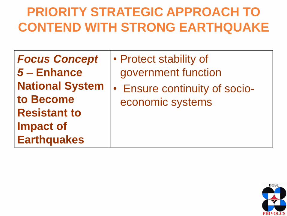
Focus Concept
5 – Enhance
National System
to Become
Resistant to
Impact of
Earthquakes
• Protect stability of
government function
• Ensure continuity of socio-
economic systems
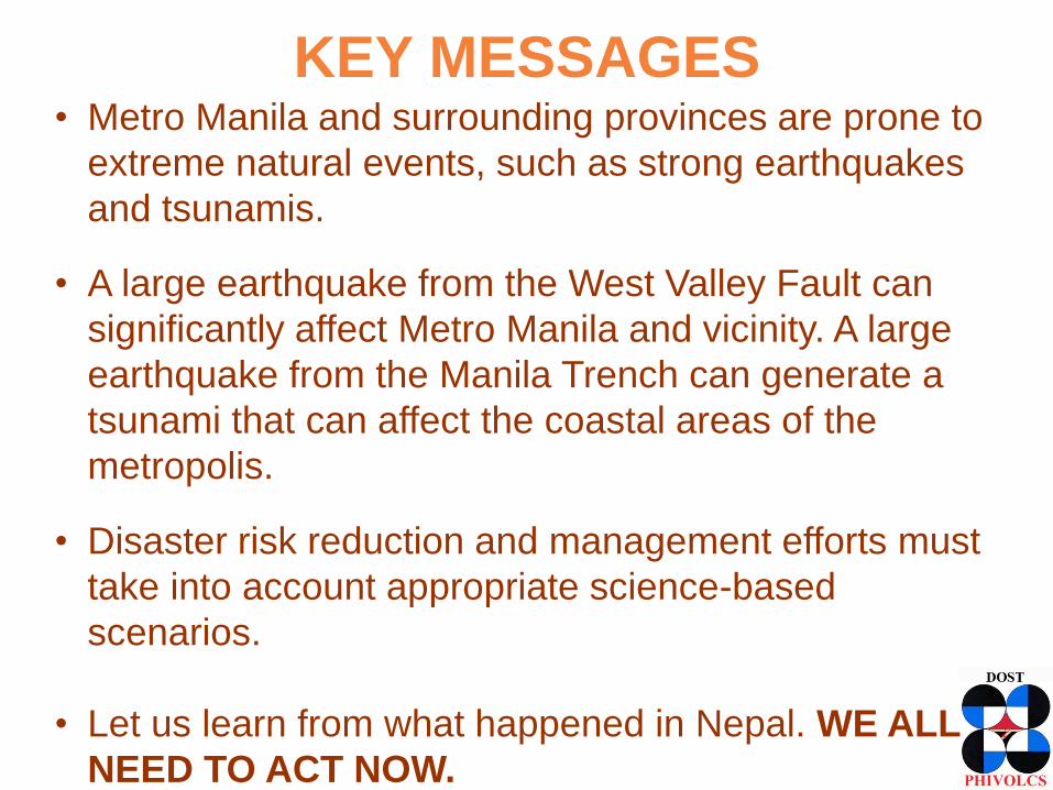
KEY MESSAGES • Metro Manila and surrounding provinces are prone to
extreme natural events, such as strong earthquakes
and tsunamis. • A large earthquake from the West Valley Fault can
significantly affect Metro Manila and vicinity. A large
earthquake from the Manila Trench can generate a
tsunami that can affect the coastal areas of the
metropolis. • Disaster risk reduction and management efforts must
take into account appropriate science-based
scenarios.
• Let us learn from what happened in Nepal. WE ALL
NEED TO ACT NOW.
/PHIVOLCS
@phivolcs.dost
www.phivolcs.dost.gov.ph
Earthquake & Tsunami (24/7):
Tel. Numbers
+632 929-9254
+632 426-1468 loc 124 / 125
Fax number
+632 927-1087
Volcano (24/7):
Tel. Numbers
+632 426-1468 loc 127
Telefax number
+632 927-1095
IEC materials:
+632 426-1468 loc 128
+632 927-4524