Embed Size (px)
Citation preview
EARTHQUAKEVULNERABILITYOF TRANSPORTATIONSYSTEMS IN THECENTRAL UNITED STATES
EARTHQUAKEVULNERABILITYOF TRANSPORTATIONSYSTEMS IN THECENTRAL UNITED STATES
Compiled by the Central U.S. Earthquake Consortiumwith technical support from MS Technology
September 1996Revised–August 11, 2000
EARTHQUAKE VULNERABILITY OF
TRANSPORTATION SYSTEMS
IN THE CENTRAL UNITED STATES
This monograph was prepared by theCentral U.S. Earthquake Consortium
with technical support from MS Technologyand funding support from the
U.S. Department of Transportation,Research and Special Programs Administration,
Office of Emergency Transportation
September 1996
Reprinted under contract withOffice of Emergency Transportation
August 11, 2000
Central United StatesEarthquake Consortium D
EPA
RT
MENT OF TRANSPORTATIO
N
UN
ITED STATES OF AMERICA
2
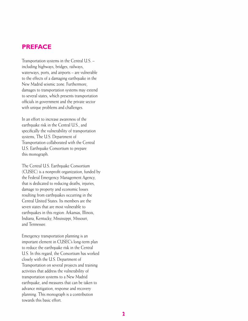
PREFACE
Transportation systems in the Central U.S. –including highways, bridges, railways,waterways, ports, and airports – are vulnerableto the effects of a damaging earthquake in theNew Madrid seismic zone. Furthermore,damages to transportation systems may extendto several states, which presents transportationofficials in government and the private sectorwith unique problems and challenges.
In an effort to increase awareness of theearthquake risk in the Central U.S., andspecifically the vulnerability of transportationsystems, The U.S. Department ofTransportation collaborated with the CentralU.S. Earthquake Consortium to preparethis monograph.
The Central U.S. Earthquake Consortium(CUSEC) is a nonprofit organization, funded bythe Federal Emergency Management Agency,that is dedicated to reducing deaths, injuries,damage to property and economic lossesresulting from earthquakes occurring in theCentral United States. Its members are theseven states that are most vulnerable toearthquakes in this region: Arkansas, Illinois,Indiana, Kentucky, Mississippi, Missouri,and Tennessee.
Emergency transportation planning is animportant element in CUSEC’s long-term planto reduce the earthquake risk in the CentralU.S. In this regard, the Consortium has workedclosely with the U.S. Department ofTransportation on several projects and trainingactivities that address the vulnerability oftransportation systems to a New Madridearthquake, and measures that can be taken toadvance mitigation, response and recoveryplanning. This monograph is a contributiontowards this basic effort.
3
CONTENTS
2 Preface
5 IntroductionTransportation System Vulnerability
7 The Earthquake RiskMulti-State ImpactRecent EarthquakesProbability of Future Damaging EarthquakesEarthquake Induced HazardsFaultingLiquefactionSlope StabilityDam or Levee FailureHazardous Materials Spills
11 Effects of Earthquakes on the Transportation SystemHighway TransportationRailroad TransportationWaterway TransportationPortsAir TransportationLiquid Fuel and Transport
20 Reducing the Vulnerability of Transportation Systems:Challenges and OpportunitiesVulnerability AssessmentAwareness and EducationMitigationResponse and RecoveryResearch and Information Transfer
24 Resources

INTRODUCTION
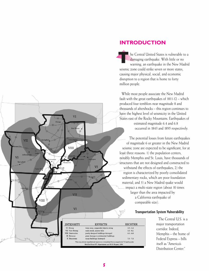
he Central United States is vulnerable to adamaging earthquake. With little or nowarning, an earthquake in the New Madrid
seismic zone could strike seven or more states,causing major physical, social, and economicdisruption to a region that is home to fortymillion people.
While most people associate the New Madridfault with the great earthquakes of 1811-12 – whichproduced four temblors near magnitude 8 andthousands of aftershocks – this region continues tohave the highest level of seismicity in the UnitedStates east of the Rocky Mountains. Earthquakes of
estimated magnitude 6.4 and 6.8occurred in 1843 and 1895 respectively.
The potential losses from future earthquakesof magnitude 6 or greater in the New Madrid
seismic zone are expected to be significant, for atleast three reasons: 1) the population centers,notably Memphis and St. Louis, have thousands ofstructures that are not designed and constructed to
withstand the effects of earthquakes; 2) theregion is characterized by poorly consolidated
sedimentary rocks, which are poor foundationmaterial; and 3) a New Madrid quake would
impact a multi-state region (about 10 timeslarger than the area impacted by
a California earthquake ofcomparable size).
Transportation System Vulnerability
The Central U.S. is amajor transportationcorridor. Indeed,Memphis – the home ofFederal Express – billsitself as “America’sDistribution Center.”
T
5
Generally speaking, the consequencesof failure in a transportation system dueto an earthquake or other natural disastercan involve:
• Direct loss of life due to collapse or structural failure of the lifeline.
• Indirect loss of life due to an inability to respond to secondary catastrophes, such as fires, and/or provide emergency medical aid.
• Delayed recovery operations.
• Release of hazardous products (e.g., losses from tank cars derailed by track failure, gas leaks from ruptured utility lines) and environmental impacts.
• Direct loss of property and utilityservice (e.g., the collapse of a bridgecarrying utilities).
• Losses due to interruption of access(e.g., export losses due to port damage).
• Disruption of economic activity acrossthe region and nation as well as in thecommunity directly affected.
This monograph is organized into threesections. The first part examines theunique nature of the earthquake risk inthe Central U.S. The second sectiondiscusses the effects of earthquakes oneach component of our nation’stransportation system, and how this willaffect response and recovery efforts.
The final section of the monographlooks ahead to the challenges andopportunities for transportation officials,emergency managers and others indeveloping a comprehensive approach toreducing the vulnerability of ourtransportation system to earthquakes inthe Central U.S.
6
During the twentieth century, the U.S.has witnessed an explosion in the growthof transportation systems, population,and wealth. In 1900, our nation’stransportation system was comprisedof three elements: unpaved highway,railroad, and waterway, whichaccounted for 78 percent of allcommodity transport.
Nearly a century later, 90 percent of alltravel – measured in passenger miles – isby the highway system. Air travel duringthis period increased dramatically,accounting for 9 percent of passengermiles. The remaining 1 percent is by rail,water, and local transit.
Our nation’s economy, then, isinextricably tied to our transportationinfrastructure. To put this intoperspective, in 1992, the U.S. GrossDomestic Product was over $6 trillion, ofwhich $728 billion, or 12.1%, wasattributable to transportation demand. Inaddition, over 11 million employeessupport today’s transportation systems.
In essence, the Central U.S. is a majortransportation corridor whoseinfrastructure – roads, bridges, runways,port facilities, rail lines, tunnels – restsatop a landscape that is vulnerable to theeffects of earthquakes, including groundshaking and liquefaction (quicksandeffect resulting from soil failure).
The consequences from a major NewMadrid earthquake would be substantial,estimated from $60 to $100 billion. Thedestruction to the transportation systemwould make up a significant portion ofthose losses.
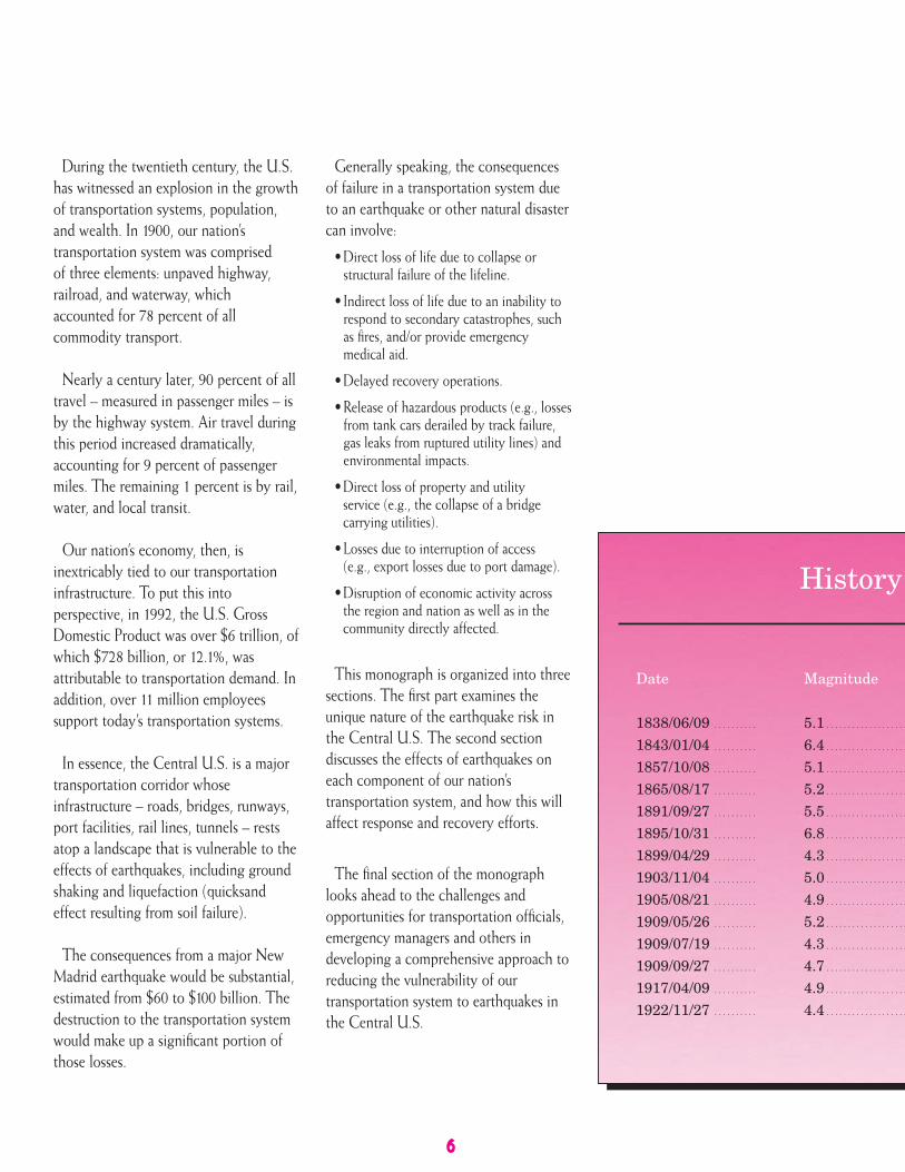
History
Date
1838/06/09 . . . . . . . . . .
1843/01/04 . . . . . . . . . .
1857/10/08 . . . . . . . . . .
1865/08/17 . . . . . . . . . .
1891/09/27 . . . . . . . . . .
1895/10/31 . . . . . . . . . .
1899/04/29 . . . . . . . . . .
1903/11/04 . . . . . . . . . .
1905/08/21 . . . . . . . . . .
1909/05/26 . . . . . . . . . .
1909/07/19 . . . . . . . . . .
1909/09/27 . . . . . . . . . .
1917/04/09 . . . . . . . . . .
1922/11/27 . . . . . . . . . .
Magnitude
5.1 . . . . . . . . . . . . . . . . . . .
6.4 . . . . . . . . . . . . . . . . . . .
5.1 . . . . . . . . . . . . . . . . . . .
5.2 . . . . . . . . . . . . . . . . . . .
5.5 . . . . . . . . . . . . . . . . . . .
6.8 . . . . . . . . . . . . . . . . . . .
4.3 . . . . . . . . . . . . . . . . . . .
5.0 . . . . . . . . . . . . . . . . . . .
4.9 . . . . . . . . . . . . . . . . . . .
5.2 . . . . . . . . . . . . . . . . . . .
4.3 . . . . . . . . . . . . . . . . . . .
4.7 . . . . . . . . . . . . . . . . . . .
4.9 . . . . . . . . . . . . . . . . . . .
4.4 . . . . . . . . . . . . . . . . . . .
violent shaking from the first of threemagnitude 8 earthquakes in the region.Thousands of aftershocks were to rockthe region during that winter.
The earthquakes of that memorablewinter were not freak events. On thecontrary, scientists have learned thatstrong earthquakes in the centralMississippi Valley have occurred
7
THE EARTHQUAKERISK
he potential for a destructiveearthquake is a real threat to the
Central United States.
In the winter of 1811-12, the centralMississippi Valley was struck by three ofthe most powerful earthquakes in theU.S. history. On December 16, 1811, theresidents of the town of New Madrid,Missouri were abruptly awakened by
T repeatedly in the geologic past. The areaof major earthquake activity also hasfrequent minor shocks and is known asthe New Madrid seismic zone.
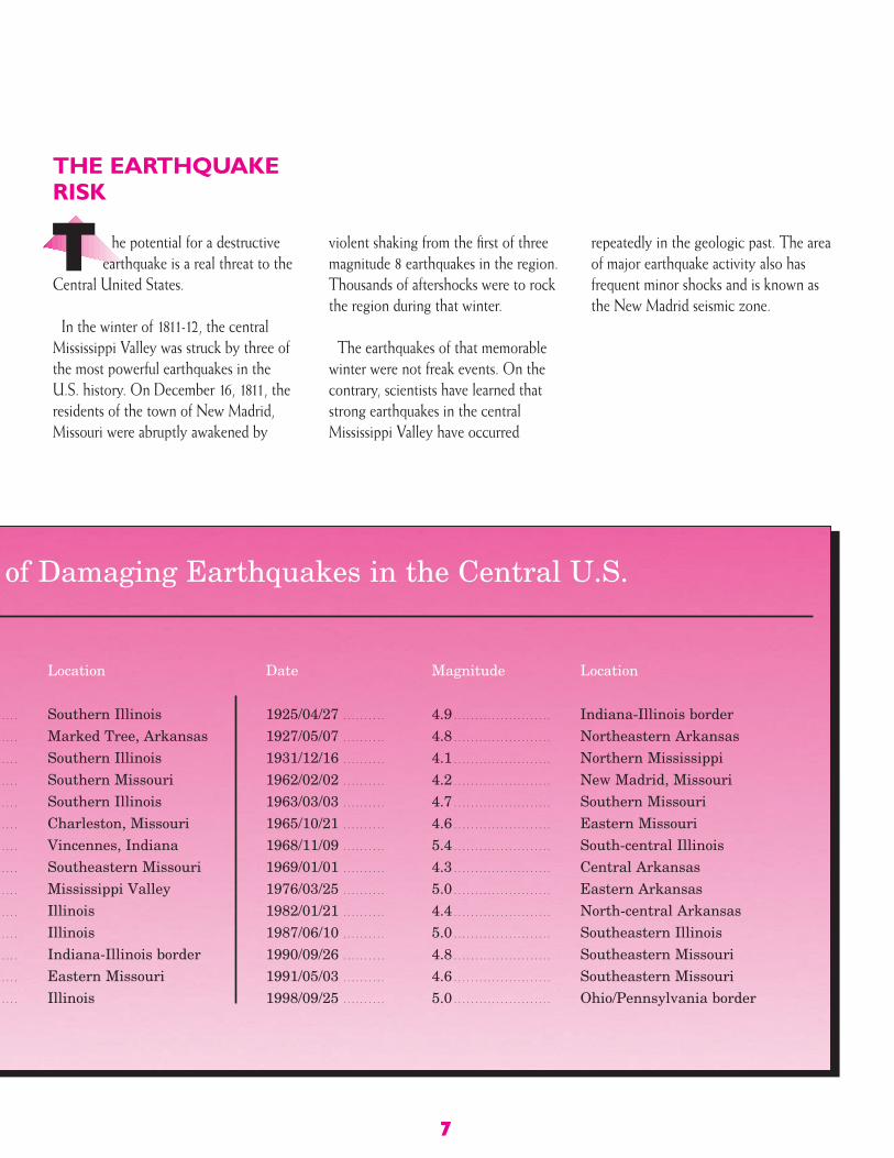
of Damaging Earthquakes in the Central U.S.
. . . .
. . . .
. . . .
. . . .
. . . .
. . . .
. . . .
. . . .
. . . .
. . . .
. . . .
. . . .
. . . .
. . . .
Location
Southern IllinoisMarked Tree, ArkansasSouthern IllinoisSouthern MissouriSouthern IllinoisCharleston, MissouriVincennes, IndianaSoutheastern MissouriMississippi ValleyIllinoisIllinoisIndiana-Illinois borderEastern MissouriIllinois
Date
1925/04/27 . . . . . . . . . .
1927/05/07 . . . . . . . . . .
1931/12/16 . . . . . . . . . .
1962/02/02 . . . . . . . . . .
1963/03/03 . . . . . . . . . .
1965/10/21 . . . . . . . . . .
1968/11/09 . . . . . . . . . .
1969/01/01 . . . . . . . . . .
1976/03/25 . . . . . . . . . .
1982/01/21 . . . . . . . . . .
1987/06/10 . . . . . . . . . .
1990/09/26 . . . . . . . . . .
1991/05/03 . . . . . . . . . .
1998/09/25 . . . . . . . . . .
Magnitude
4.9 . . . . . . . . . . . . . . . . . . . . . . .
4.8 . . . . . . . . . . . . . . . . . . . . . . .
4.1 . . . . . . . . . . . . . . . . . . . . . . .
4.2 . . . . . . . . . . . . . . . . . . . . . . .
4.7 . . . . . . . . . . . . . . . . . . . . . . .
4.6 . . . . . . . . . . . . . . . . . . . . . . .
5.4 . . . . . . . . . . . . . . . . . . . . . . .
4.3 . . . . . . . . . . . . . . . . . . . . . . .
5.0 . . . . . . . . . . . . . . . . . . . . . . .
4.4 . . . . . . . . . . . . . . . . . . . . . . .
5.0 . . . . . . . . . . . . . . . . . . . . . . .
4.8 . . . . . . . . . . . . . . . . . . . . . . .
4.6 . . . . . . . . . . . . . . . . . . . . . . .
5.0 . . . . . . . . . . . . . . . . . . . . . . .
Location
Indiana-Illinois borderNortheastern ArkansasNorthern MississippiNew Madrid, MissouriSouthern MissouriEastern MissouriSouth-central IllinoisCentral ArkansasEastern ArkansasNorth-central ArkansasSoutheastern IllinoisSoutheastern MissouriSoutheastern MissouriOhio/Pennsylvania border
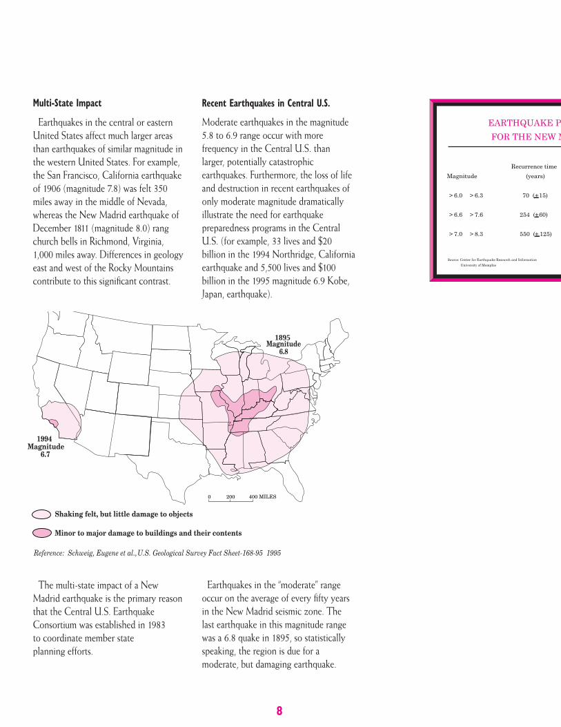
Multi-State Impact
Earthquakes in the central or easternUnited States affect much larger areasthan earthquakes of similar magnitude inthe western United States. For example,the San Francisco, California earthquakeof 1906 (magnitude 7.8) was felt 350miles away in the middle of Nevada,whereas the New Madrid earthquake ofDecember 1811 (magnitude 8.0) rangchurch bells in Richmond, Virginia,1,000 miles away. Differences in geologyeast and west of the Rocky Mountainscontribute to this significant contrast.
The multi-state impact of a NewMadrid earthquake is the primary reasonthat the Central U.S. EarthquakeConsortium was established in 1983to coordinate member stateplanning efforts.
Recent Earthquakes in Central U.S.
Moderate earthquakes in the magnitude5.8 to 6.9 range occur with morefrequency in the Central U.S. thanlarger, potentially catastrophicearthquakes. Furthermore, the loss of lifeand destruction in recent earthquakes ofonly moderate magnitude dramaticallyillustrate the need for earthquakepreparedness programs in the CentralU.S. (for example, 33 lives and $20billion in the 1994 Northridge, Californiaearthquake and 5,500 lives and $100billion in the 1995 magnitude 6.9 Kobe,Japan, earthquake).
Earthquakes in the “moderate” rangeoccur on the average of every fifty yearsin the New Madrid seismic zone. Thelast earthquake in this magnitude rangewas a 6.8 quake in 1895, so statisticallyspeaking, the region is due for amoderate, but damaging earthquake.
1895Magnitude
6.8
1994Magnitude 6.7
Shaking felt, but little damage to objects
Minor to major damage to buildings and their contents
U.S. Geological Survey Fact Sheet-168-95 1995Reference: Schweig, Eugene et al.,
0 200 400 MILES
8
Probability of Future DamagingEarthquakes
The probability of a moderateearthquake occurring in the New Madridseismic zone in the near future is high.Scientists estimate that the probability ofa magnitude 6 to 7 earthquake occurringin this seismic zone within the next 50years is higher than 90 percent.
Earthquake Induced HazardsA central question becomes, how
can earthquakes affect transportationsystems?
When earthquakes occur, there are anumber of ways in which transportationsystems can be affected. Typically, onethinks of the ground shaking hazard thatcauses major damage or failures.However, there are other earthquakerelated hazards that can affecttransportation systems. These hazardsare: (1) faulting, which results in ruptureof the earth’s surface; (2) ground failures,which can result in liquefaction, slopeinstability, and subsidence; and (3) inducedphysical damages, such as flooding, damor levee failures, landslides, fires andhazardous materials releases.
Faulting
An earthquake occurs when a fracture,commonly known as a fault, ruptures dueto stresses that have built up in the crust.Fault ruptures are more common in thewestern U.S.
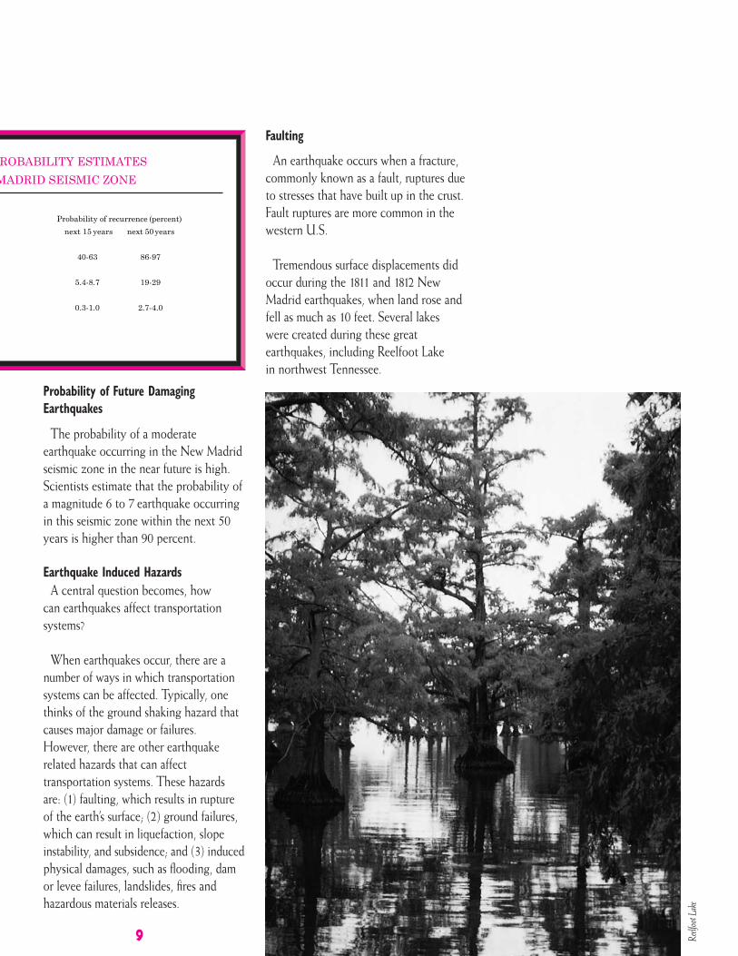
Tremendous surface displacements didoccur during the 1811 and 1812 NewMadrid earthquakes, when land rose andfell as much as 10 feet. Several lakeswere created during these greatearthquakes, including Reelfoot Lakein northwest Tennessee.
9 Reelf
oot L
ake

Liquefaction
Liquefaction typically occurs in layersof sandy soil that are located in the upper30 feet of the soil strata where a highwater table exists. This phenomena iscaused by ground shaking, whichrearranges soil particles in such a fashionthat a “quicksand” effect results.
When liquefaction occurs, twoconditions can result: (1) loss of bearingstrength needed to support thefoundations of roads, bridges, andbuildings; (2) lateral spreading wherea layer of stable soil can slide over thetop of a liquefied layer.
Another type of earthquake inducedliquefaction soil failure is a sand blow.As the soil particles lose their ability toprovide bearing strength, the weight ofthe soil above causes pressure in theliquefied layer to build up. This can causesand and water of the liquefied layer tobe jettisoned to the surface through weakpoints in the overlaying soil. Sand blowswere extensive in the New Madridearthquakes of 1811-12, and can still beseen today.
Slope Stability
Slope stability failures, or landslides,occur when unstable slopes lose theircohesive stability during ground shaking.One of the largest rock slides occurredduring the 1959 Hebgen, Montana,earthquake, when a complete mountainside was dislodged causing 80 milliontons of rock mass and debris to end upat the bottom of the mountain.
Slope stability can be a major problemin hilly areas in the Central U.S., andlead to serious problems with road andrailway embankment failure.
Dam or Levee Failure
The Central U.S. has historically beensusceptible to flooding. The 1993Midwest Floods clearly illustrate theconsequences of widespread flooding,and the key role that dams and leveesplay in flood protection in this part ofthe country.
10
Earth
en da
m fai
lure,
Morg
an H
ill, C
A
These same levees and dams arevulnerable to ground shaking. Given thelarge number of dams and the extensivenetwork of reservoirs and levees alongthe region’s river systems, significantflooding from earthquake induced breaksin dams and levees should be expected athigh water periods. Roads and bridgeswould also be damaged, compoundingresponse and recovery efforts.
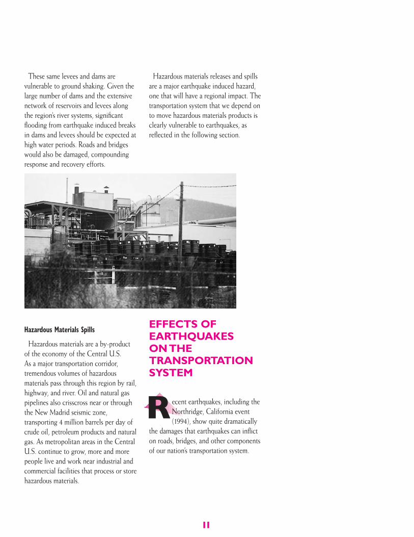
Hazardous Materials Spills
Hazardous materials are a by-productof the economy of the Central U.S.As a major transportation corridor,tremendous volumes of hazardousmaterials pass through this region by rail,highway, and river. Oil and natural gaspipelines also crisscross near or throughthe New Madrid seismic zone,transporting 4 million barrels per day ofcrude oil, petroleum products and naturalgas. As metropolitan areas in the CentralU.S. continue to grow, more and morepeople live and work near industrial andcommercial facilities that process or storehazardous materials.
Hazardous materials releases and spillsare a major earthquake induced hazard,one that will have a regional impact. Thetransportation system that we depend onto move hazardous materials products isclearly vulnerable to earthquakes, asreflected in the following section.
EFFECTS OFEARTHQUAKESON THETRANSPORTATIONSYSTEM
ecent earthquakes, including theNorthridge, California event(1994), show quite dramatically
the damages that earthquakes can inflicton roads, bridges, and other componentsof our nation’s transportation system.
R
11
12
Although transportation systemdisruption or failure is not considered amajor risk to life safety, thesocioeconomic consequences can beparticularly devastating to the generalpublic. These include the primaryimpacts that flow directly from impededaccess to hospitals, evacuation areas,emergency relief centers, and firedepartments, and the secondary impactsdue to closed mass-transit facilities andthe inability to get to or from work foran extended period of time.
A recurring theme of this monograph isthat our nation’s transportation networkshould be viewed as an interdependentsystem of components (e.g., roads,bridges, tracks, retaining walls, tunnels,embankments, etc.), and the failureof any one component can causeproblems or even failure in other partsof the system.
The following section examines in moredetail the effects of earthquakes on keycomponents of the transportation system,with implications for pre-disastermitigation (steps that can be taken tominimize damages), and response andrecovery planning.
Highway Transportation
The major components of the highwaytransportation system are pavements,bridges, overpasses, viaducts or elevatedexpressways, tunnels, embankments,slopes, avalanche and rock shelters,retaining walls, and maintenancefacilities. Roadways and bridges are ofprimary concern, since their loss offunction will have the greatest impacton the ability to move people andequipment after the earthquake.
Roadways will sustain damages in aNew Madrid earthquake, primarily fromsurface displacements, liquefaction,slope instability and earthquakeinduced flooding from broken leveesduring high water events.
Pavements will crack in a damagingNew Madrid earthquake, principally dueto ground failure (such as liquefaction).Critical links in the interstate system,including Interstate 55 and Interstate 40,would in all likelihood be closed due tofailures to approaches to bridges, anddamage to the pavement itself.
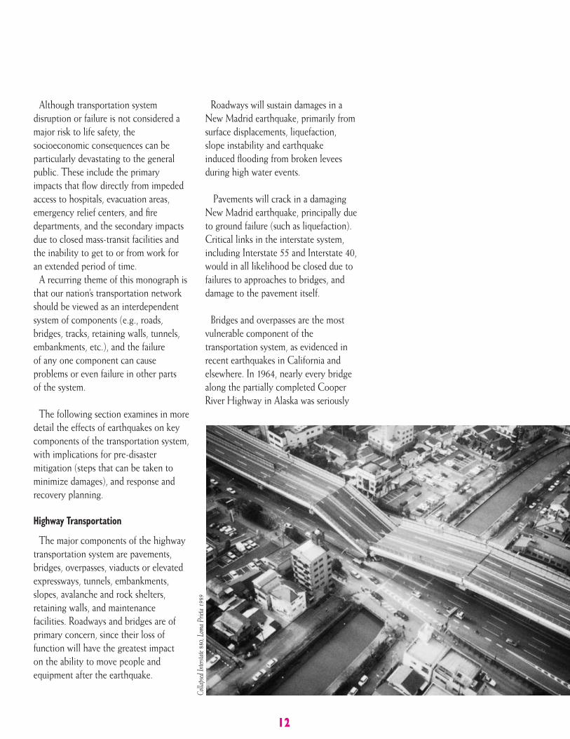
Bridges and overpasses are the mostvulnerable component of thetransportation system, as evidenced inrecent earthquakes in California andelsewhere. In 1964, nearly every bridgealong the partially completed CooperRiver Highway in Alaska was seriously
Colla
psed
Inter
state
880,
Loma
Prie
ta 19
89
13
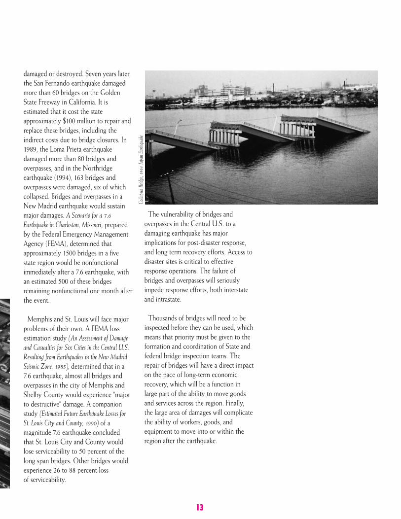
damaged or destroyed. Seven years later,the San Fernando earthquake damagedmore than 60 bridges on the GoldenState Freeway in California. It isestimated that it cost the stateapproximately $100 million to repair andreplace these bridges, including theindirect costs due to bridge closures. In1989, the Loma Prieta earthquakedamaged more than 80 bridges andoverpasses, and in the Northridgeearthquake (1994), 163 bridges andoverpasses were damaged, six of whichcollapsed. Bridges and overpasses in aNew Madrid earthquake would sustainmajor damages. A Scenario for a 7.6Earthquake in Charleston, Missouri, preparedby the Federal Emergency ManagementAgency (FEMA), determined thatapproximately 1500 bridges in a five state region would be nonfunctionalimmediately after a 7.6 earthquake, withan estimated 500 of these bridgesremaining nonfunctional one month afterthe event.
Memphis and St. Louis will face majorproblems of their own. A FEMA lossestimation study (An Assessment of Damageand Casualties for Six Cities in the Central U.S.Resulting from Earthquakes in the New MadridSeismic Zone, 1985), determined that in a7.6 earthquake, almost all bridges andoverpasses in the city of Memphis andShelby County would experience “majorto destructive” damage. A companionstudy (Estimated Future Earthquake Losses forSt. Louis City and County, 1990) of amagnitude 7.6 earthquake concludedthat St. Louis City and County wouldlose serviceability to 50 percent of thelong span bridges. Other bridges wouldexperience 26 to 88 percent lossof serviceability.
The vulnerability of bridges andoverpasses in the Central U.S. to adamaging earthquake has majorimplications for post-disaster response,and long term recovery efforts. Access todisaster sites is critical to effectiveresponse operations. The failure ofbridges and overpasses will seriouslyimpede response efforts, both interstateand intrastate.
Thousands of bridges will need to beinspected before they can be used, whichmeans that priority must be given to theformation and coordination of State andfederal bridge inspection teams. Therepair of bridges will have a direct impacton the pace of long-term economicrecovery, which will be a function inlarge part of the ability to move goodsand services across the region. Finally,the large area of damages will complicatethe ability of workers, goods, andequipment to move into or within theregion after the earthquake.
Colla
psed
Bridg
e, 19
64 Ja
pan E
arthq
uake
14
Railroad Transportation
While the growth of the railroadsystem peaked in this country at the turnof the century, our nation still dependson rail to move people and goods.
Although the number of miles of railhas been reduced by 50 percent since1900, the tons and ton-miles of freightbeing transported by rail has increased.Passenger service is increasing. Today,Amtrak passenger service carries 20million passengers a year over 24,000miles of track to 530 locations.
The railroad system is vulnerable toearthquakes in much the same way as theroadway system is. A survey of damageto railroad components during pastearthquakes in the United States andJapan shows damage to bridges,embankment failures, vertical andhorizontal track misalignments, tunnelmisalignments, failure of tunnel linings,structural damage to railroad buildings,and overturned rail cars and locomotives.
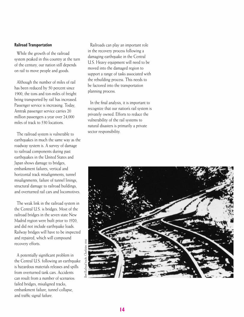
The weak link in the railroad system inthe Central U.S. is bridges. Most of therailroad bridges in the seven state NewMadrid region were built prior to 1920,and did not include earthquake loads.Railway bridges will have to be inspectedand repaired, which will compoundrecovery efforts.
A potentially significant problem inthe Central U.S. following an earthquakeis hazardous materials releases and spillsfrom overturned tank cars. Accidentscan result from a number of scenarios:failed bridges, misaligned tracks,embankment failure, tunnel collapse,and traffic signal failure.
Railroads can play an important rolein the recovery process following adamaging earthquake in the CentralU.S. Heavy equipment will need to bemoved into the damaged region tosupport a range of tasks associated withthe rebuilding process. This needs tobe factored into the transportationplanning process.
In the final analysis, it is important torecognize that our nation’s rail system isprivately owned. Efforts to reduce thevulnerability of the rail systems tonatural disasters is primarily a privatesector responsibility.
Bent
Railr
oad t
rack
s, Ch
arles
ton 18
86
15
Waterway TransportationThe New Madrid region plays a pivotal
role in the United State’s water-bornetransportation system. The Ohio,Missouri, and Mississippi Rivers are usedextensively by barges to transport a widevariety of manufactured goods andpetroleum. The many ports along theserivers (including the highly-traffickedports at Memphis and St. Louis) and anextensive series of locks, dams, andreservoirs are highly exposed toearthquake induced ground shakingand liquefaction.
Again, waterway transportation is asystem of interlocking components. Tobetter understand the potential impact ofan earthquake on this system, it isimportant to view the waterway systemin the Central and Eastern U.S.
Generally speaking, water-bornecommodities traffic within the Centraland Eastern U.S. occurs over three typesof navigational waterways: 1) coastwise,which is traffic along the coasts andtraffic receiving a carriage from deep sea;2) lakewise, which is traffic within theGreat Lakes; and 3) internal, which takesplace solely on inland waterways.
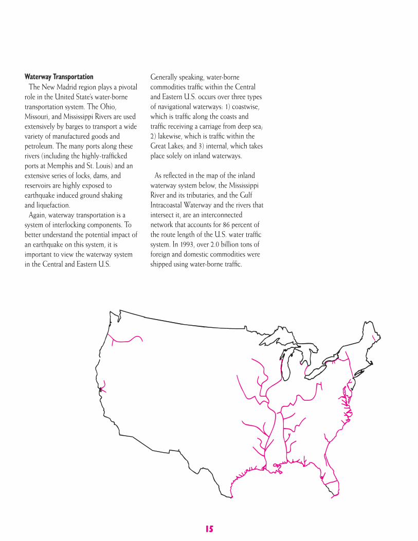
As reflected in the map of the inlandwaterway system below, the MississippiRiver and its tributaries, and the GulfIntracoastal Waterway and the rivers thatintersect it, are an interconnectednetwork that accounts for 86 percent ofthe route length of the U.S. water trafficsystem. In 1993, over 2.0 billion tons offoreign and domestic commodities wereshipped using water-borne traffic.
Vulnerability of Inland Waterwaysand Ports
An earthquake in the New Madridseismic zone would have two directimpacts on the inland waterways system:first, it could seriously impede thenavigability of the rivers and canals; andsecondly, an earthquake could causeserious damages to port facilities.
The 1993 Midwest Floods demon-strated once again how important thiswater-borne transportation system is toour nation’s economy. For 52 days, it wasimpossible to traverse the Missouri,Illinois, and upper Mississippi rivers.A total of 26 of the 30 locks on theMississippi were closed. It was estimatedthat 5,000 barges were affected, and thecosts of delays in commodity traffic wasin the millions of dollars per day.
A New Madrid earthquake would causeconsiderably more damage, to a widerarea, leading to longer delays. Thereason is that the major components ofinland waterways – channels, banks,levees, and locks and dams – arevulnerable to ground shaking andliquefaction, which could lead to theirfailure. This in turn would have asignificant impact on navigability.Landslides and bank failures could blockchannels. Debris from fallen trees andother materials could hinder navigation.Uplift and subsidence, could result inchanges in channel depth or the courseof the river. Liquefaction could result inlarge lateral flows that could blockchannels. Channels can also be blockedby the collapse of bridges.
The five inland waterways at highestrisk are the Missouri, Mississippi, Ohio,Tennessee, and Illinois Rivers. This is dueto at least three factors. First, sections ofthese river systems are within areas thatcan produce strong ground shaking andliquefaction; second, these are rivers thatare used to transport large volumes ofcommodities; and finally, these are riversthat, if unnavigable, can have direct andprolonged consequences for the nationaleconomy.
In essence, inland waterways, which arecounted on to provide an economicalsource of transportation for themovement of bulk goods across theregion, can suddenly becomedysfunctional as a result of anearthquake. Furthermore, alternativemodes of transportation for bulk goods– notably railroad – would also berendered inoperable for extendedperiods of time.
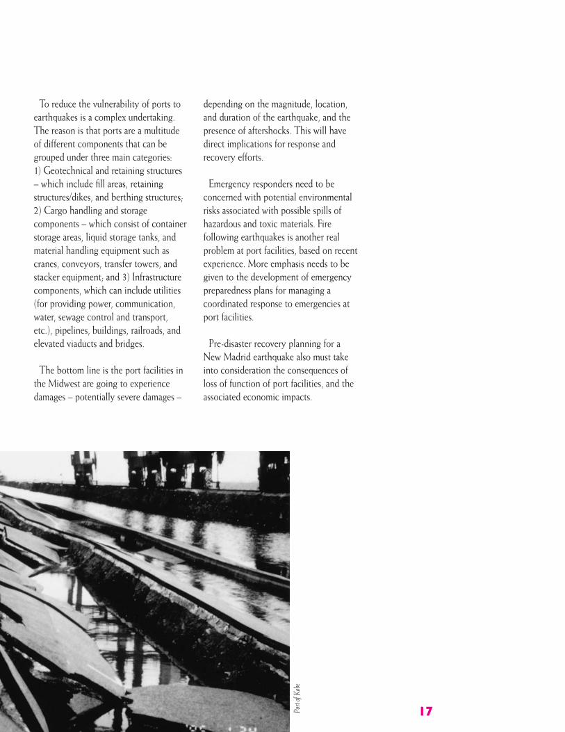
Ports
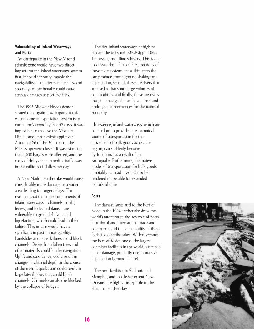
The damage sustained to the Port ofKobe in the 1994 earthquake drew theworld’s attention to the key role of portsin national and international trade andcommerce, and the vulnerability of thesefacilities to earthquakes. Within seconds,the Port of Kobe, one of the largestcontainer facilities in the world, sustainedmajor damage, primarily due to massiveliquefaction (ground failure).
The port facilities in St. Louis andMemphis, and to a lesser extent NewOrleans, are highly susceptible to theeffects of earthquakes.
16
17
To reduce the vulnerability of ports toearthquakes is a complex undertaking.The reason is that ports are a multitudeof different components that can begrouped under three main categories:1) Geotechnical and retaining structures– which include fill areas, retainingstructures/dikes, and berthing structures;2) Cargo handling and storagecomponents – which consist of containerstorage areas, liquid storage tanks, andmaterial handling equipment such ascranes, conveyors, transfer towers, andstacker equipment; and 3) Infrastructurecomponents, which can include utilities(for providing power, communication,water, sewage control and transport,etc.), pipelines, buildings, railroads, andelevated viaducts and bridges.
The bottom line is the port facilities inthe Midwest are going to experiencedamages – potentially severe damages –
depending on the magnitude, location,and duration of the earthquake, and thepresence of aftershocks. This will havedirect implications for response andrecovery efforts.
Emergency responders need to beconcerned with potential environmentalrisks associated with possible spills ofhazardous and toxic materials. Firefollowing earthquakes is another realproblem at port facilities, based on recentexperience. More emphasis needs to begiven to the development of emergencypreparedness plans for managing acoordinated response to emergencies atport facilities.
Pre-disaster recovery planning for aNew Madrid earthquake also must takeinto consideration the consequences ofloss of function of port facilities, and theassociated economic impacts.
Port
of Ko
be
18
In the final analysis, greater attentionneeds to be given to the systematicincorporation of seismic design andplanning of port facilities and theircomponents. The objective is to improve– over time – the seismic performance ofkey parts of port facilities, so that whenthe earthquake occurs, restoration timesare reduced, lives are protected, andenvironmental problems are reduced.
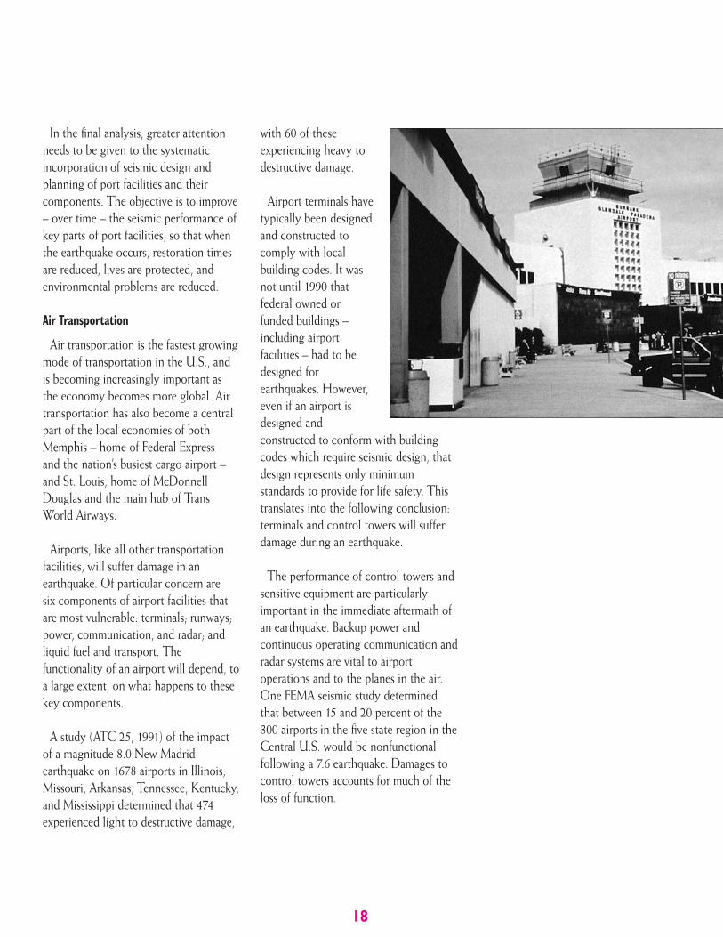
Air Transportation
Air transportation is the fastest growingmode of transportation in the U.S., andis becoming increasingly important asthe economy becomes more global. Airtransportation has also become a centralpart of the local economies of bothMemphis – home of Federal Expressand the nation’s busiest cargo airport –and St. Louis, home of McDonnellDouglas and the main hub of TransWorld Airways.
Airports, like all other transportationfacilities, will suffer damage in anearthquake. Of particular concern are six components of airport facilities thatare most vulnerable: terminals; runways;power, communication, and radar; andliquid fuel and transport. Thefunctionality of an airport will depend, toa large extent, on what happens to thesekey components.
A study (ATC 25, 1991) of the impactof a magnitude 8.0 New Madridearthquake on 1678 airports in Illinois,Missouri, Arkansas, Tennessee, Kentucky,and Mississippi determined that 474experienced light to destructive damage,
with 60 of theseexperiencing heavy todestructive damage.
Airport terminals havetypically been designedand constructed tocomply with localbuilding codes. It wasnot until 1990 thatfederal owned orfunded buildings –including airportfacilities – had to bedesigned forearthquakes. However,even if an airport isdesigned andconstructed to conform with buildingcodes which require seismic design, thatdesign represents only minimumstandards to provide for life safety. Thistranslates into the following conclusion:terminals and control towers will sufferdamage during an earthquake.
The performance of control towers andsensitive equipment are particularlyimportant in the immediate aftermath ofan earthquake. Backup power andcontinuous operating communication andradar systems are vital to airportoperations and to the planes in the air.One FEMA seismic study determinedthat between 15 and 20 percent of the300 airports in the five state region in theCentral U.S. would be nonfunctionalfollowing a 7.6 earthquake. Damages tocontrol towers accounts for much of theloss of function.
19
Because airports requirelarge flat areas toaccommodate the landing ofaircraft, many cities havelocated airports near rivers,or large bodies of water. Therunways at these airportsmay be located on fill land,or soil that is otherwisehighly vulnerable toliquefaction. However,except where majorliquefaction occurs, runwayscan be repaired quickly.
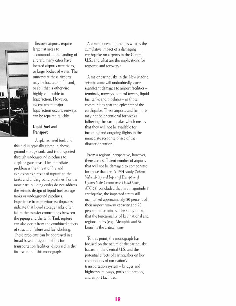
Liquid Fuel andTransport
Airplanes need fuel, andthis fuel is typically stored in aboveground storage tanks and is transportedthrough underground pipelines toairplane gate areas. The immediateproblem is the threat of fire andexplosion as a result of rupture to thetanks and underground pipelines. For themost part, building codes do not addressthe seismic design of liquid fuel storagetanks or underground pipelines.Experience from previous earthquakesindicate that liquid storage tanks oftenfail at the transfer connections betweenthe piping and the tank. Tank rupturecan also occur from the combined effectsof structural failure and fuel sloshing.These problems can be addressed in abroad based mitigation effort fortransportation facilities, discussed in thefinal sectionof this monograph.
A central question, then, is what is thecumulative impact of a damagingearthquake on airports in the CentralU.S., and what are the implications forresponse and recovery?
A major earthquake in the New Madridseismic zone will undoubtedly causesignificant damages to airport facilities –terminals, runways, control towers, liquidfuel tanks and pipelines – in thosecommunities near the epicenter of theearthquake. These airports and heliportsmay not be operational for weeksfollowing the earthquake, which meansthat they will not be available forincoming and outgoing flights in theimmediate response phase of thedisaster operation.
From a regional perspective, however,there are a sufficient number of airportsthat will not be damaged to compensatefor those that are. A 1991 study (SeismicVulnerability and Impact of Disruption ofLifelines in the Conterminous United States,ATC-25) concluded that in a magnitude 8earthquake, the impacted states stillmaintained approximately 80 percent oftheir airport runway capacity and 20percent on terminals. The study notedthat the functionality of key national andregional hubs (e.g., Memphis and St.Louis) is the critical issue.
To this point, the monograph hasfocused on the nature of the earthquakehazard in the Central U.S. and thepotential effects of earthquakes on keycomponents of our nation’stransportation system – bridges andhighways, railways, ports and harbors,and airport facilities.
20
The final section examines some ofthe challenges and opportunities indeveloping and implementing acomprehensive program to address thevulnerability of transportation systemsin the Central U.S.
REDUCING THEVULNERABILITY OFTRANSPORTATIONSYSTEMS:CHALLENGES ANDOPPORTUNITIES
broadly based initiative toreduce the vulnerability of the
transportation system in the Central U.S.to earthquakes and other hazards is acomplex undertaking that will involvethe input and expertise of federal, state,and local governments, the privatesector, and the research community.
This section sets forth a framework forfuture action, organized under fourheadings: 1) Vulnerability Assessment;2) Awareness and Education; 3) Mitigation;and 4) Response and Recovery.
Vulnerability Assessment
The starting point for a long-termtransportation vulnerability reductioninitiative is a scientifically basedassessment of the vulnerability of keycomponents of transportation systems.
In September, 1988, the AppliedTechnology Council (ATC), with supportfrom FEMA, initiated an assessment ofthe seismic vulnerability of lifeline
systems (electric power, gas and liquidfuels, telecommunications,transportation, and water supply andsewers) nationwide. The purpose of theproject was to develop a betterunderstanding of the impact of lifelinedisruption caused by earthquakes and toassist in the identification andprioritization of hazard mitigationmeasures and policies.
Four basic steps were followed toestimate lifeline damage and subsequenteconomic disruption for givenearthquake scenarios: development of anational lifeline inventory database;development of seismic vulnerabilityfunctions for each lifeline system orsystem component; characterization andquantification of the seismic hazardnationwide; and development ofestimates of direct damage and ofindirect economic loss for eachscenario earthquake.
CUSEC State Transportation Task Force
On June 28th 2000, the sevenCUSEC State DOT’s formed what isnow known as the CUSEC StateTransportation Task Force. TheTransportation Task Force will providea formal, coordinated, regionalapproach to deal with earthquakerelated transportation issues in theCentral U.S. The Task Force willcollaborate with other organizationson common issues, and become anintegral part of the Central UnitedStates Partnership, contributing to thedevelopment of a coordinated long-term strategic plan to addressearthquake issues in the Central U.S.
A
21
Assessing vulnerability of transportationsystems and other lifeline components iscomplicated by several factors: lack ofavailable data, technical difficulties, andthe interdependence of the lifelines. Forexample, transportation systems areseverely affected by the loss of power,particularly in urban centers where masstransit and traffic signals depend onelectric power.
Vulnerability assessment, then, isfundamental to our understanding of thepotential impacts of earthquakes andother hazards on our buildings,infrastructure, and people. The federalgovernment will continue to take thelead role in vulnerability assessments, andthe use of this information to establishguidelines and standards for design andconstruction of transportation systems,and other lifeline components.
Awareness and EducationInformation on the vulnerability of
transportation systems to earthquakesand other hazards can be used in anawareness and education campaign thatraises the level of understanding ofnatural hazards, their effects, andsteps that can be taken to reducehazard vulnerability.
Awareness and education efforts cantarget a broad range of groups:transportation officials (federal, state,local), other government officials, electedand appointed officials, the media,emergency managers, researchers, thedesign and construction professions, theprivate sector, educators, and the public.
These programs should capitalize onexisting research and lessons learnedfrom recent disasters. Finally, there is agrowing market of software programs,including interactive software, that canbe effectively used in a program toincrease awareness and education of thevulnerability of transportation systems toearthquakes and other hazards.
Mitigation
Mitigation – those actions that can betaken prior to a disaster to minimizedamages and losses – is at the heart of along-term commitment to reducing thevulnerability of transportation systems toall natural hazards.
The cornerstone of a transportationlifeline mitigation program is thedevelopment of design criteria andstandards that will guide and facilitatetransportation mitigation efforts,and provide consistent minimumrecommended levels of facilityengineering design andconstruction practice.
To date, very few standards have beenwritten explicitly for the design andconstruction of transportation systems.Those that do exist are only forcomponents (e.g., bridges), and noneaddresses system performance.
22
The best example of transportationstandards is the seismic specifications fornew highway bridges, adopted by theAmerican Association of State Highwayand Transportation Officials in 1990.These AASHTO requirements arephilosophically defensible and nationallyapplicable. On the other hand, standardsfor upgrading existing highway bridgesare not as well developed.
A plan to reduce the vulnerability oftransportation systems in the CentralU.S. will necessarily require acomprehensive, collaborative approach,led by the Federal government. PublicLaw 101-614, the National EarthquakeHazards Reduction Program (NEHRP)Reauthorization Act directs FEMA, inconsultation with the National Instituteof Standards and Technology (NIST), todevelop a “plan, including precisetimetables and budget estimates, fordeveloping and adopting, in consultationwith appropriate private sectororganizations, design and constructionstandards for lifelines,” includingtransportation systems.
Demonstration projects are a keyelement in the recommended approachto carrying out the Congressionalmandate. In essence, these projectsprovide opportunities to show earlysuccesses of the program. They shouldbe encouraged in various seismic zonesfor the retrofit and or design of highwayand railway structures. This is particularlyuseful for the implementation of newand innovative technologies, such asbase isolation and protective systemsfor bridges.
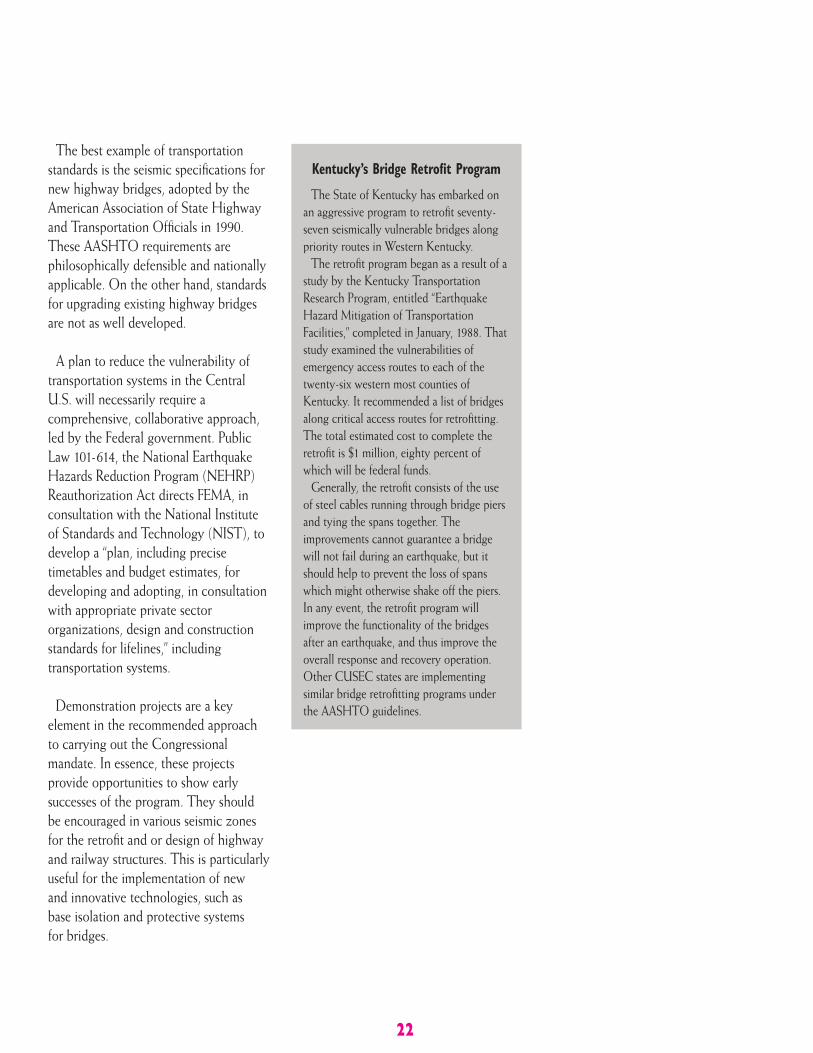
Kentucky’s Bridge Retrofit Program
The State of Kentucky has embarked onan aggressive program to retrofit seventy-seven seismically vulnerable bridges alongpriority routes in Western Kentucky.
The retrofit program began as a result of astudy by the Kentucky TransportationResearch Program, entitled “EarthquakeHazard Mitigation of TransportationFacilities,” completed in January, 1988. Thatstudy examined the vulnerabilities ofemergency access routes to each of thetwenty-six western most counties ofKentucky. It recommended a list of bridgesalong critical access routes for retrofitting.The total estimated cost to complete theretrofit is $1 million, eighty percent ofwhich will be federal funds.
Generally, the retrofit consists of the useof steel cables running through bridge piersand tying the spans together. Theimprovements cannot guarantee a bridgewill not fail during an earthquake, but itshould help to prevent the loss of spanswhich might otherwise shake off the piers.In any event, the retrofit program willimprove the functionality of the bridgesafter an earthquake, and thus improve theoverall response and recovery operation.Other CUSEC states are implementingsimilar bridge retrofitting programs underthe AASHTO guidelines.
23
Response and Recovery
A New Madrid earthquake will placeunprecedented demands on federal, stateand local transportation officials andemergency managers. There will be nowarning. Multiple states will beimpacted. Communications will be lost.Decisions will be made in the absenceof situation assessment information.States will request critically neededtransportation resources in the first daysand weeks following the earthquake;criteria for “resource adjudication” willneed to be established.
In short, there is a compelling needfor pre-disaster policies, plans andprocedures to guide Transportation(Emergency Support Function #1)decisions in the first 72 hours followingan earthquake, the first thirty days,and beyond.
Because of the large area that would beimpacted – up to ten states in fourFederal regions – there needs to be anover-arching “umbrella” plan thataddresses Transportation priorities andcoordination issues for a New Madridearthquake. Such a plan can:1) incorporate the loss estimation datathat reflects direct loss estimates andfunctionality losses; and 2) serve as acentral, unifying plan to ensure acoordinated approach to transportationresponse and recovery.
A New Madrid Transportation Plan andStrategy, which would be the productof an intergovernmental-privatesector planning process, can addressthe following:
1. Loss estimates and functionalityassessments for select earthquake scenarios.
2. Common set of planning assumptions for Federal, State, and local governments.
3. Criteria for decisions on establishing field operations in a multi-state, multiple Federal region disaster.
4. How to prioritize the allocation of resources to multiple impacted areas.
5. State versus Federal roles in determining priorities and planning for infrastructure repair.
6. Procedures and criteria for conflict resolution in meeting requestsfor resources.
7. Pre-disaster determination of conditions that must be present before federal transportation support is withdrawn.
In essence, a New Madrid earthquakewill impact the strategic center of thenational transportation hub, and affectthe movement of goods and services ina manner that will have profoundimplications for our national economy.In this context, it is important todevelop and test an intergovernmentalplan and strategy that addressestransportation issues.
24
USEFULPUBLICATIONS
An Assessment of Damage and Casualtiesfor Six Cities in the Central United StatesResulting From Earthquakes in the NewMadrid Seismic Zone. Central United StatesEarthquake Preparedness Project October 1985,Federal Emergency Management Agency.
This report was the first loss estimation studyconducted for a damaging earthquake in thecentral United States. It was based on theoccurrence of magnitudes 7.5 and 8.5 NewMadrid earthquakes. The report includedestimates of the losses to transportationsystems. Available from Federal EmergencyManagement Agency, Washington, D.C.
Seismic Vulnerability and Impact ofDisruption of Lifelines in the ConterminousUnited States (ATC-25). Earthquake HazardReduction Series 58, Federal Emergency ManagementAgency, 1991, FEMA 224.
This study inventoried the transportationsystems of highways, bridges, railroads,airports, and ports; energy systems of electricpower, gas and liquid fuel transmission;emergency service facilities in broadcastingand hospitals; and water aqueducts andsupply. It considered the occurrence ofmagnitudes 7.0 and 8.0 New Madridearthquakes. Available from Federal EmergencyManagement Agency, Washington, D.C.
Mitigation of Damage to the BuiltEnvironment. Central United States EarthquakeConsortium, 1993. This is one of fivemonographs prepared for the 1993 NationalEarthquake Conference that focused onearthquake mitigation in the central andeastern United States. Part II of themonograph consists of six chapters that focuson lifelines with Chapter 7 discussing
highways and railroads, Chapter 8 discussingports and air transportation systems, andChapter 12 discussing standards for lifelines.Available from Central United States EarthquakeConsortium, Memphis, Tennessee.
American Society of Civil Engineers,Technical Council on Lifeline EarthquakeEngineering. Fourth U.S. Conference onEarthquake Engineering–Lifelines EarthquakeEngineering. A set of proceedings onearthquake vulnerability, mitigation, andpreparedness of life lines that includes anumber of state-of-the-art papers on variouselements of transportation systems. TheAmerican Society of Civil Engineers,Technical Council on Lifeline EarthquakeEngineering has a series of other pertinentpublications. Available from the AmericanSociety of Civil Engineers, New York.
Seismic Damage to Railroad Bridges in theUnited States. Paper prepared by J.M. Pauschke,and published in the Proceedings of the Fourth U.S.National Conference on Earthquake Engineering,Volume 1, Earthquake Engineering ResearchInstitute, 1990.
This paper provides a summary of earthquakedamage to railroad bridges and discusses whyrailroad bridges appear to perform betterthan highway bridges.
For additional information contact theCentral U.S. Earthquake Consortium at 2630 E. Holmes Rd. Memphis, TN 38118