Embed Size (px)
DESCRIPTION
East and Southern Africa Flagship Site Selection Mohammed Said and KCP Rao. Workshop 21 st – 23 rd October, 2014 ILRI - Addis, Ethiopia. Resilience areas. - PowerPoint PPT Presentation
Citation preview
East and Southern Africa Flagship
Site SelectionMohammed Said and KCP Rao
Workshop21st – 23rd October, 2014
ILRI - Addis, Ethiopia
1
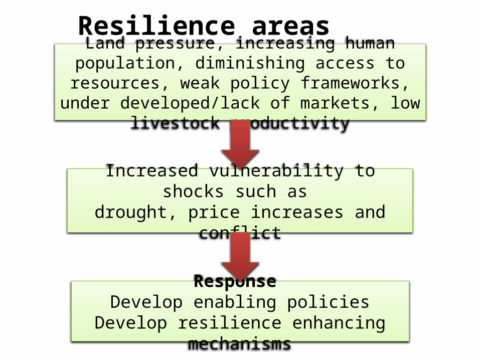
Resilience areasLand pressure, increasing human population, diminishing access to resources, weak policy
frameworks, under developed/lack of markets, low livestock productivity
Increased vulnerability to shocks such as drought, price increases and conflict
Response Develop enabling policies
Develop resilience enhancing mechanisms
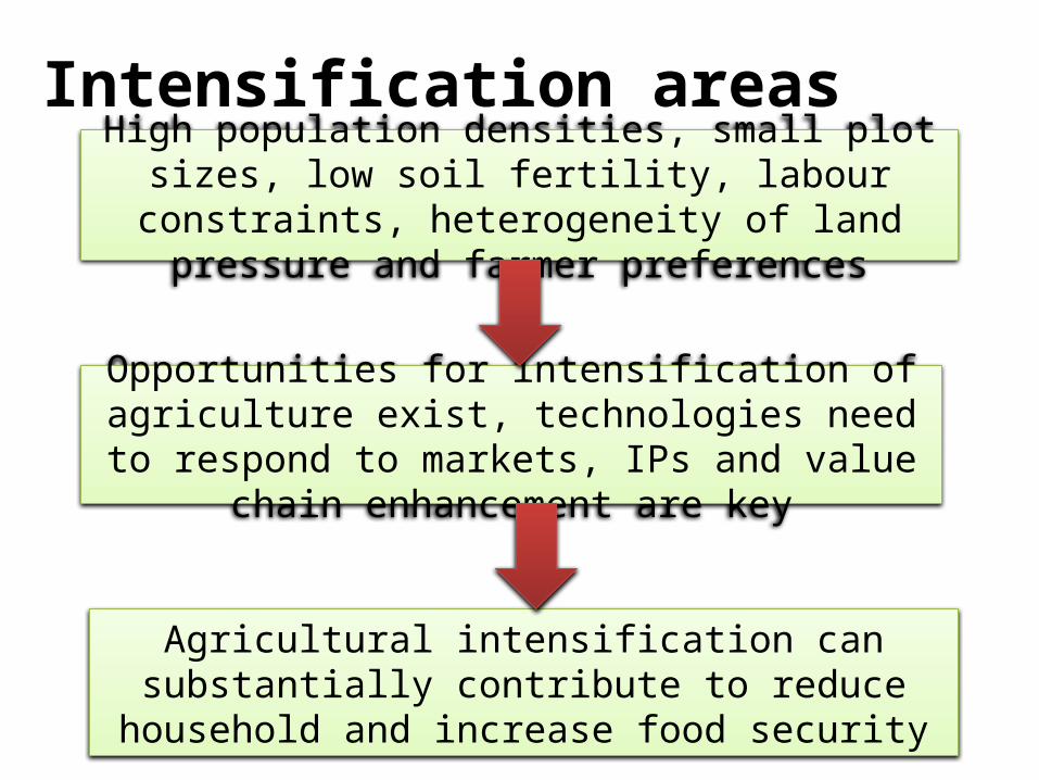
Intensification areasHigh population densities, small plot sizes, low soil fertility, labour constraints, heterogeneity of land
pressure and farmer preferences
Opportunities for intensification of agriculture exist, technologies need to respond to markets, IPs and
value chain enhancement are key
Agricultural intensification can substantially contribute to reduce household and increase food security
4
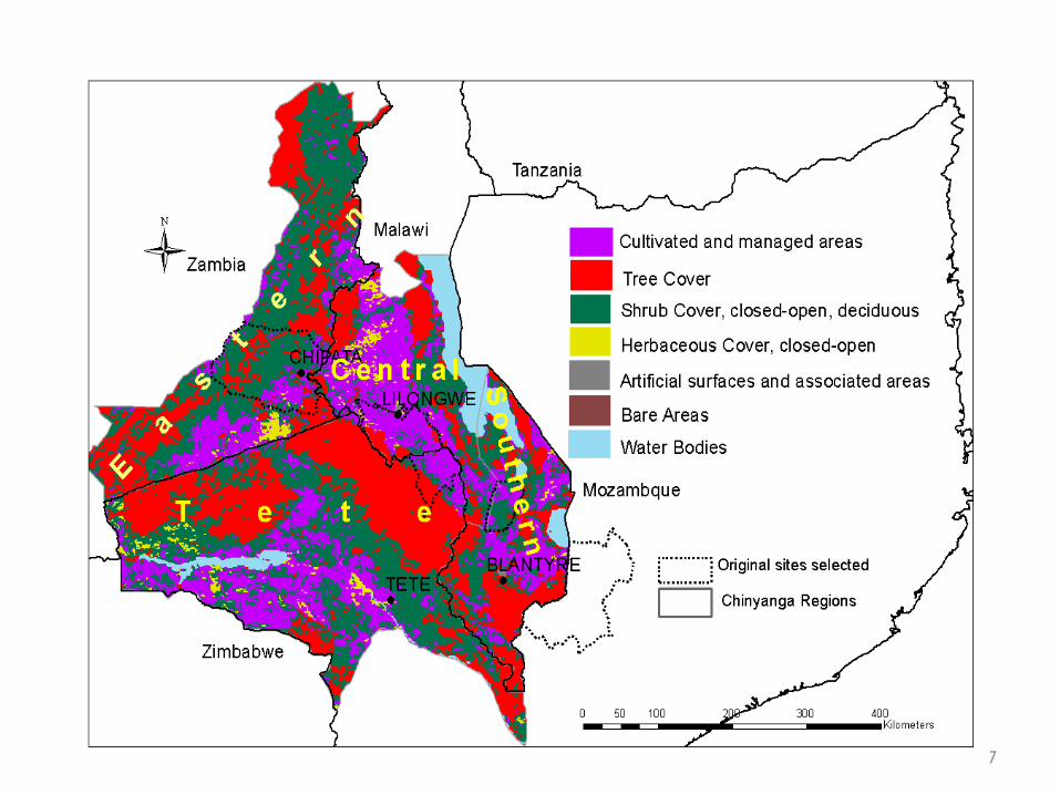
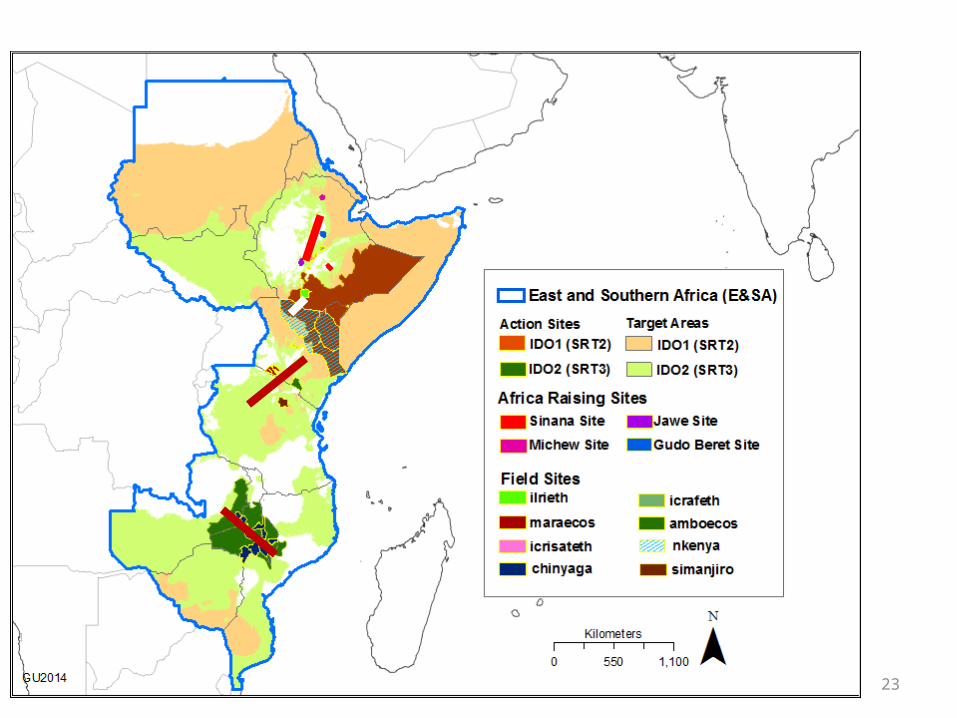
East and Southern Africa Flagship Action Sites
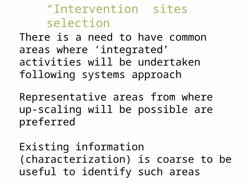
There is a need to have common areas where ‘integrated’ activities will be undertaken following systems approach
Representative areas from where up-scaling will be possible are preferred
Existing information (characterization) is coarse to be useful to identify such areas
Criteria needed to identify such areas
“Intervention” sites selection
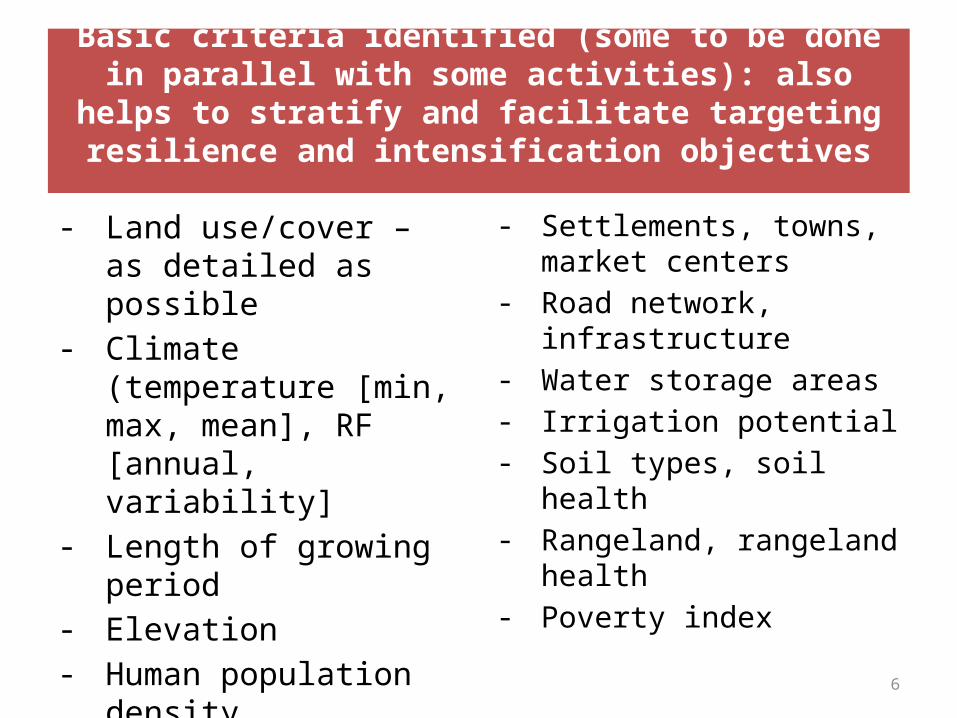
Basic criteria identified (some to be done in parallel with some activities): also helps to stratify and facilitate targeting
resilience and intensification objectives
- Land use/cover – as detailed as possible
- Climate (temperature [min, max, mean], RF [annual, variability]
- Length of growing period- Elevation- Human population density- Livestock density- Crop density- Average farm size
- Settlements, towns, market centers
- Road network, infrastructure
- Water storage areas- Irrigation potential- Soil types, soil health- Rangeland, rangeland
health- Poverty index
6
7
Participatory mapping and problem analysis
(millet and sorghum)
(maize, groundnut, legume)
Crop-livestock farming
Livestock dominated
Fish
Crop dominatedCrop
-live
stock
farm
ing
<700
9
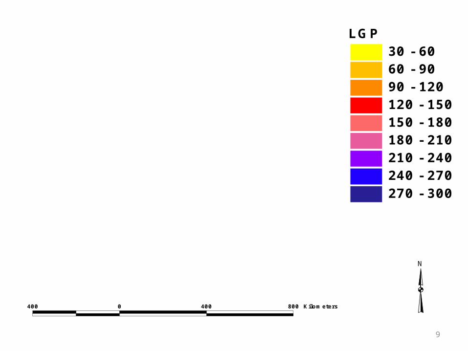
LGP30 - 6060 - 9090 - 120120 - 150150 - 180180 - 210210 - 240240 - 270270 - 300
400 0 400 800 Kilometers
N
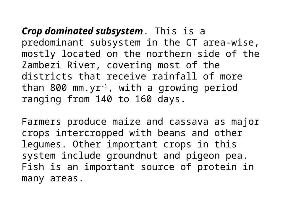
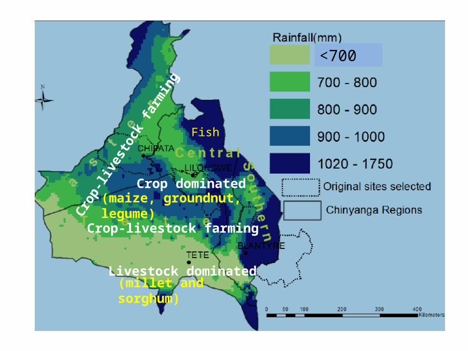
Crop dominated subsystem. This is a predominant subsystem in the CT area-wise, mostly located on the northern side of the Zambezi River, covering most of the districts that receive rainfall of more than 800 mm.yr-1, with a growing period ranging from 140 to 160 days.
Farmers produce maize and cassava as major crops intercropped with beans and other legumes. Other important crops in this system include groundnut and pigeon pea. Fish is an important source of protein in many areas.
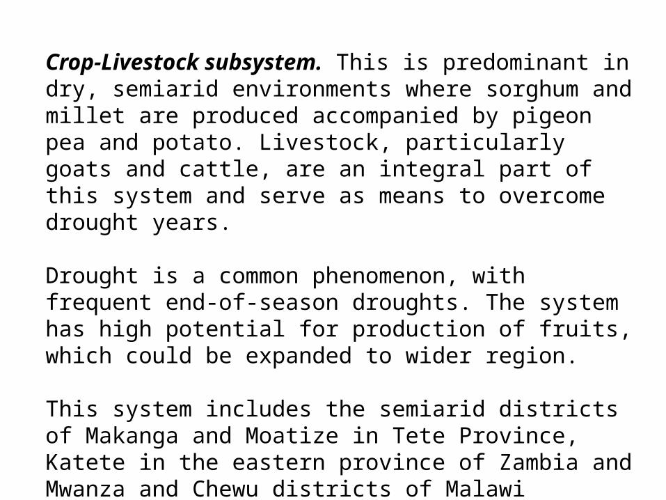
Crop-Livestock subsystem. This is predominant in dry, semiarid environments where sorghum and millet are produced accompanied by pigeon pea and potato. Livestock, particularly goats and cattle, are an integral part of this system and serve as means to overcome drought years.
Drought is a common phenomenon, with frequent end-of-season droughts. The system has high potential for production of fruits, which could be expanded to wider region.
This system includes the semiarid districts of Makanga and Moatize in Tete Province, Katete in the eastern province of Zambia and Mwanza and Chewu districts of Malawi
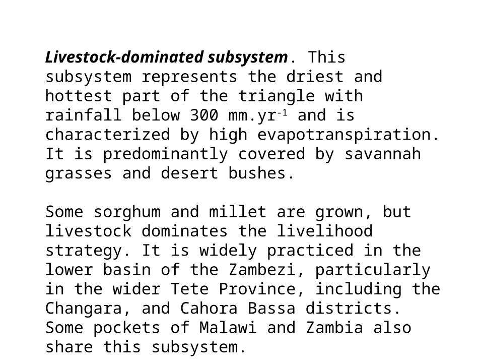
Livestock-dominated subsystem. This subsystem represents the driest and hottest part of the triangle with rainfall below 300 mm.yr-1 and is characterized by high evapotranspiration. It is predominantly covered by savannah grasses and desert bushes.
Some sorghum and millet are grown, but livestock dominates the livelihood strategy. It is widely practiced in the lower basin of the Zambezi, particularly in the wider Tete Province, including the Changara, and Cahora Bassa districts. Some pockets of Malawi and Zambia also share this subsystem.
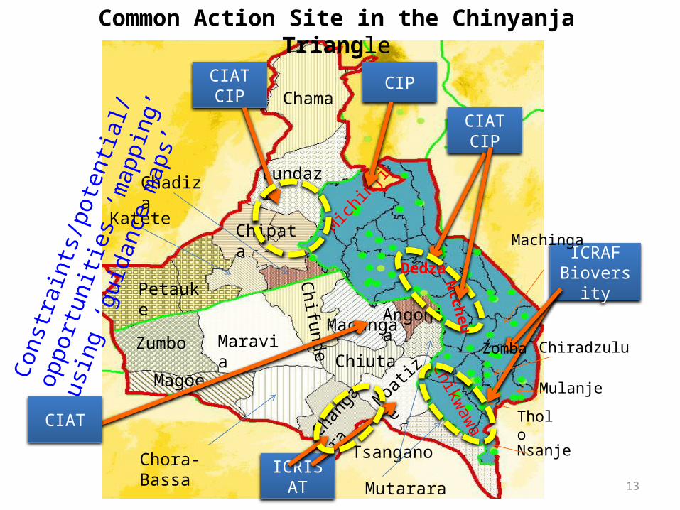
13
Chama
Angonia
Lundazi
Chipata
Petauke
Katete
Chadiza
Tsangano
MoatizeZumbo
Mutarara
Changa
ra
Chora-Bassa
Magoe
MaraviaChiuta
Chifunde Macanga
Cons
trai
nts/
pote
ntial
/opp
ortu
nitie
s
‘map
ping
’ usin
g ‘g
uida
nce
map
s’
ICRISAT
CIAT
CIATCIP
ICRAFBioversity
CIATCIP
Mich
inji
CIP
Dedza
Ntcheu
Chikwaw
a
Nsanje
Tholo
Zomba Chiradzulu
Mulanje
Machinga
Common Action Site in the Chinyanja Triangle
Land cover
East Africa
15
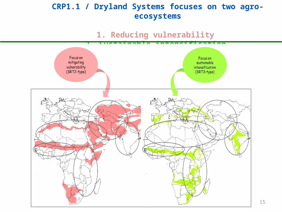
CRP1.1 / Dryland Systems focuses on two agro-ecosystems
1. Reducing vulnerability 2. Sustainable intensification
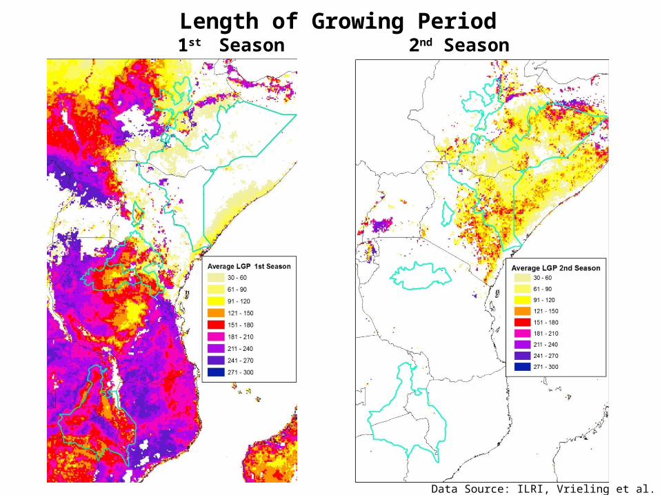
Length of Growing Period 1st Season 2nd Season
Data Source: ILRI, Vrieling et al. 2012

17
1st Growing Season Start season End season
Data Source: ILRI, Vrieling et al. 2012
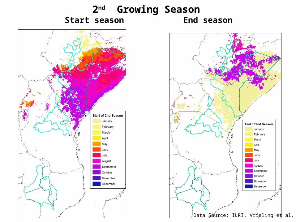
Data Source: ILRI, Vrieling et al. 2012
2nd Growing Season Start season End season
Mapping exercise
Ethiopia
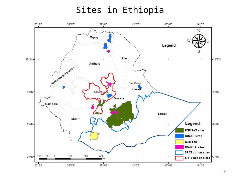
Sites in Ethiopia
20
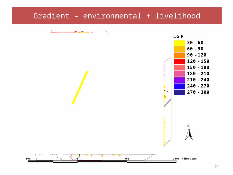
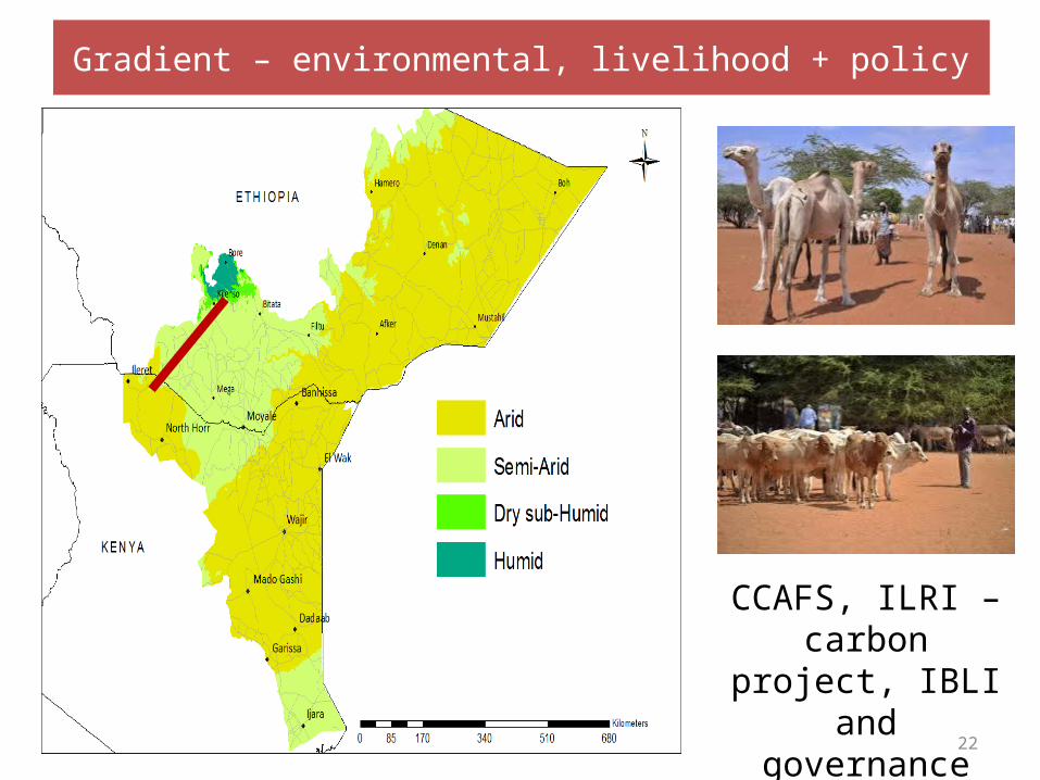
Gradient – environmental + livelihood
21
LGP30 - 6060 - 9090 - 120120 - 150150 - 180180 - 210210 - 240240 - 270270 - 300
500 0 500 1000 Kilometers
N
22
CCAFS, ILRI – carbon project, IBLI
and governance
Gradient – environmental, livelihood + policy
23
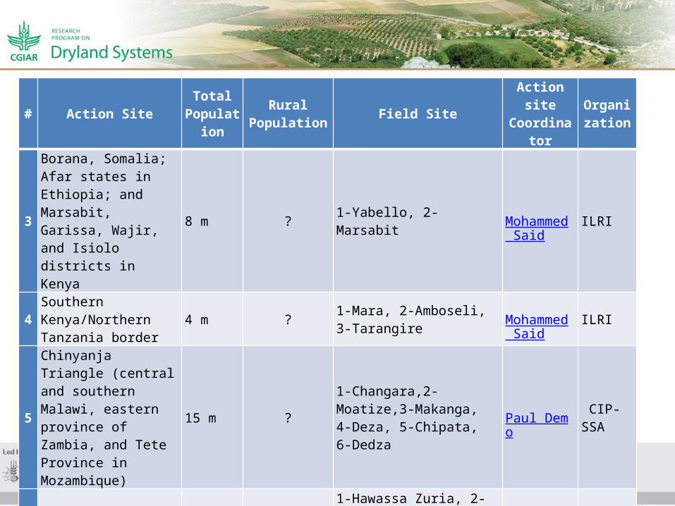
# Action SiteTotal
Population
Rural Population Field Site Action site
CoordinatorOrganizat
ion
3
Borana, Somalia; Afar states in Ethiopia; and Marsabit, Garissa, Wajir, and Isiolo districts in Kenya
8 m ? 1-Yabello, 2-Marsabit Mohammed Said
ILRI
4Southern Kenya/Northern Tanzania border
4 m ? 1-Mara, 2-Amboseli, 3-Tarangire Mohammed
SaidILRI
5
Chinyanja Triangle (central and southern Malawi, eastern province of Zambia, and Tete Province in Mozambique)
15 m ?1-Changara,2-Moatize,3-Makanga, 4-Deza, 5-Chipata, 6-Dedza
Paul Demo CIP-SSA
6 Ethiopian Highlands 13 m ?1-Hawassa Zuria, 2-Hawassa town, 3-Adami Tulu Jido Kombolcha, 4-Boset, 5-Zeway Dugda
KPC Rao ICRISAT
7 Shinyanga and Babati gradient (Tanzania) 4.5 m ? 1-Shinyanga Amede Tilah
unICRISAT


![Payment Gateway 생존전략 [KCP]](https://img.pdfslide.net/doc/110x75/549d447fac7959f12a8b49bc/payment-gateway-kcp.jpg)