Embed Size (px)
Citation preview

East Transit Oriented District (ETOC)Zoning Map and Text Amendments
December 20, 2017Planning & Zoning Board Hearing
1December 20, 2017
2December 20, 2017
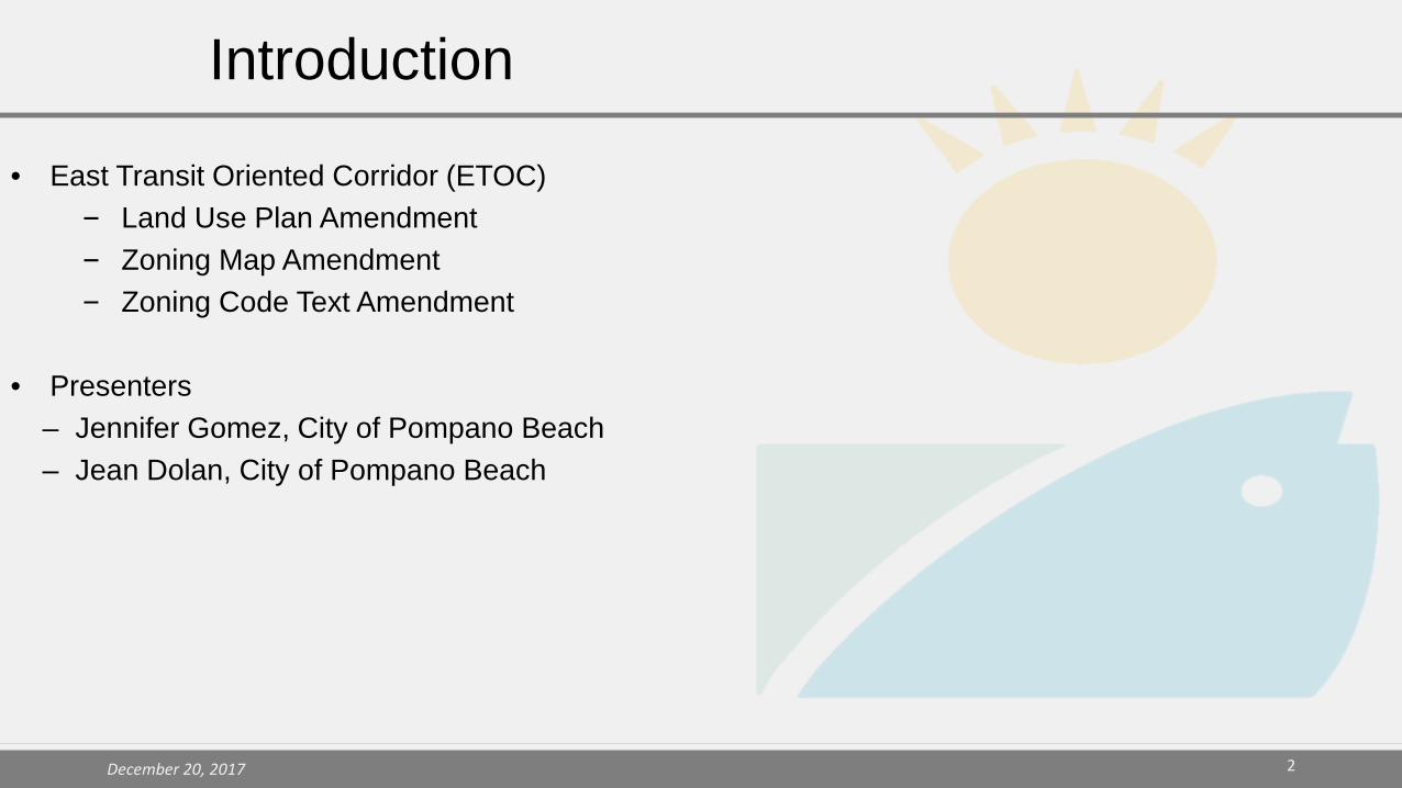
• East Transit Oriented Corridor (ETOC)‒ Land Use Plan Amendment‒ Zoning Map Amendment‒ Zoning Code Text Amendment
• Presenters– Jennifer Gomez, City of Pompano Beach– Jean Dolan, City of Pompano Beach
Introduction

2015 • November 12, 2015 - Commission/Stakeholder Kick-off Meeting2016• March 16, 2016 - Workshop – Stakeholder, East CRA Advisory Committee • April 16, 2016 - Public meeting (Saturday, 10-12:30 PM)• April 20, 2016 - LUPA P&Z Workshop at 6 PM• May 25, 2016 - P&Z Hearing for LUPA• June 28, 2016 - City Commission First Reading and County transmittal for LUPA• December 01, 2016 - BCPC Hearing2017• January 24, 2017 - Broward County Commission (BCC) First Reading and Transmittal of City and County Plan
Amendment to State• March 23, 2017 - BCPC Second Reading LUPA• April 25, 2017 - County Commission Second Reading LUPA• June 15, 2017 - ETOC/Dixie/Atlantic Blvd Transportation/Traffic: 1st Public Meeting (present issues and gather public
input)• July 19, 2017 - ETOC/Dixie/Atlantic Blvd Transportation/Traffic/Zoning: 2nd Public Meeting (present preliminary roadway
design and draft zoning)• August 30, 2017 - ETOC/Dixie/Atlantic Blvd Transportation/Traffic/Zoning: 3rd Public Meeting (final roadway design and
zoning)• October 09, 2017: Planning Board and Commission Workshop (Comp Plan and Zoning Text and Map Amendments)• November 15, 2017 DRC Hearing• December 20, 2017 Planning and Zoning Board Hearing • February 13, 2018 City Commission Comp Plan Adoption and 1st Reading Zoning Text and Map Amendments tentative• February 27, 2018 City Commission 2nd Reading - Adoption Zoning Text and Map Amendments tentative
Public Outreach and Approval Process
3December 20, 2017

Land Use Plan AmendmentReview
4December 20, 2017

- Single purpose commercial uses along corridor
- Commercial land use allows up to 105’ height
- SF Residential land uses immediately adjacent to Commercial
Adopted Land Use Map:
5December 20, 2017

- Mixed Residential and Commercial uses along corridor
- Connects Downtown to Beach
- Establishes total entitlements in a Basket of Rights
Proposed Land Use Map Amendment:
6December 20, 2017

Land Use Category Square Footage (SF)/Units
Built Square Footage (SF)/Units
Commercial (General Business)
7,000,000 SF(-37,739,280 SF)
1,759,384 SF
Residential Units 3,718 Units (+2,399 units)
1,046 Units(273 unbuilt)
Recreation and Open Space (Park)
5.5 Acres 5.5 Acres
Community Facility 5.0 Acres 5.0 Acres
Proposed Entitlements for ETOC Basket-of-Rights:(15-Year Planning Horizon to 2030)
7December 20, 2017
Zoning Map Amendment
8December 20, 2017

Adopted Zoning Map:
9December 20, 2017

Proposed Zoning Map Amendment:
10December 20, 2017

Zoning Text Amendments
11December 20, 2017
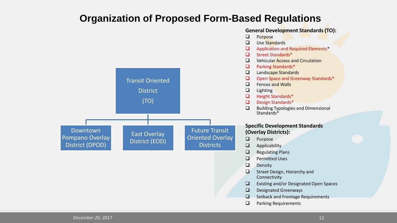
Organization of Proposed Form-Based RegulationsGeneral Development Standards (TO): Purpose Use Standards Application and Required Elements* Street Standards* Vehicular Access and Circulation Parking Standards* Landscape Standards Open Space and Greenway Standards* Fences and Walls Lighting Height Standards* Design Standards* Building Typologies and Dimensional
Standards*
Specific Development Standards (Overlay Districts): Purpose Applicability Regulating Plans Permitted Uses Density Street Design, Hierarchy and
Connectivity Existing and/or Designated Open Spaces Designated Greenways Setback and Frontage Requirements Parking Requirements
Transit Oriented District
(TO)
Downtown Pompano Overlay
District (DPOD)
East Overlay District (EOD)
Future Transit Oriented Overlay
Districts
12December 20, 2017
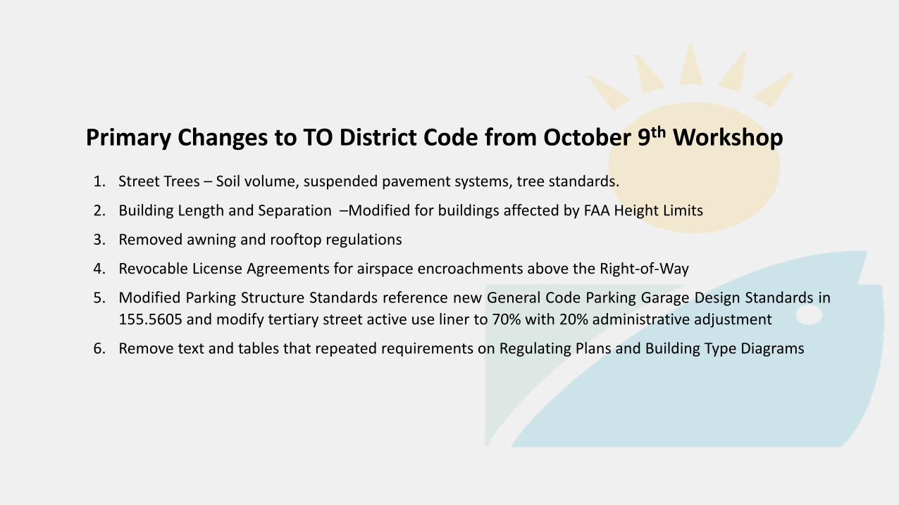
Primary Changes to TO District Code from October 9th Workshop1. Street Trees – Soil volume, suspended pavement systems, tree standards.
2. Building Length and Separation –Modified for buildings affected by FAA Height Limits
3. Removed awning and rooftop regulations
4. Revocable License Agreements for airspace encroachments above the Right-of-Way
5. Modified Parking Structure Standards reference new General Code Parking Garage Design Standards in155.5605 and modify tertiary street active use liner to 70% with 20% administrative adjustment
6. Remove text and tables that repeated requirements on Regulating Plans and Building Type Diagrams

AmendmentsSection 155.3709:East Overlay District (EOD)
14December 20, 2017

Organization of Proposed Form-Based RegulationsGeneral Development Standards (TO): Purpose Use Standards Application and Required Elements* Street Standards* Vehicular Access and Circulation Parking Standards* Landscape Standards Open Space and Greenway Standards* Fences and Walls Lighting Height Standards* Design Standards* Building Typologies and Dimensional
Standards*
Specific Development Standards (Overlay Districts): EOD Purpose Applicability Regulating Plans Permitted Uses Modified Use Standards Density and Density Bonus Options Street Design, Hierarchy and
Connectivity Existing and/or Designated Open Spaces Designated Greenways Setback and Active Use Requirements Modified Off-Street Parking Standards Traffic Analysis Requirements
Transit Oriented District
(TO)
Downtown Pompano Overlay
District (DPOD)
East Overlay District (EOD)
Future Transit Oriented Overlay
Districts
15December 20, 2017

Primary Changes to EOD District Code from October 9th Workshop1. Parking standards were modified to require parking per current code for multifamily
development in the Edge subarea.2. Modified use standards for medical office to allow emergency procedures after hours, allow
medical office on first floor.3. Added Traffic Analysis requirements.4. EOD Building Heights Regulating Plan: Two changes: height of parcel adjacent to and east of
the Koi Development, added Harbor Village PCD to Core subarea. 5. EOD Use Area/Density Regulating Plan: Two corrections: Added Harbor Village PCD to MM 0-
90 use area; changed color of RM 24 designated half-block west of NE 18th Avenue between NE 1st and NE 2nd Street.
6. EOD Designated Publicly Accessible Open Space and Greenway Systems Plan: Created themed streets by identifying preferred tree species on most greenway streets.
7. EOD Permitted Use Table: Modified Note 5 to allow up to 50% of the first 20’ feet of depth fronting on Federal Highway and Atlantic Boulevard to be used for residential lobby entrance rather than limiting it to nonresidential active use.

SUMMARY:Section 155.3709:East Overlay District (EOD)
• Regulating Plans:
• Sub-Areas/Building Heights Regulating Plan• Use Areas/Density Regulating Plan• Street Network Connectivity Regulating Plan• Designated Publicly Accessible Open Space and Greenway System
Regulating Plan
17December 20, 2017

The Sub-Areas/Building Heights Regulating Plan:
Divides the EOD into three areas where different intensities are permitted to establish compatibility with the single-family neighborhoods:
• Core: area with the highest intensity and maximum building height of either 105’ or 80’ (stepback may apply)
• Center: area with a medium intensity and maximum building height of 55’• Edge: area with the lowest intensity and maximum building height of 35’

The Use-Areas/Density Regulating Plan:Divides the EOD into four use types where different densities* are permitted to establish compatibility with the single-family neighborhoods:• Mixed-Use Main Street (MM)• Mixed-Use Residential (MUR)• Residential Multi-Family (RM)• Parks and Recreation Zoning (PR)* Limited Density Bonuses are available within the Core and Center Sub-Areas.

The Use-Areas/Density Regulating Plan:
AmendmentsSection 155.3709:East Overlay District (EOD)
• Use Areas and Densities:
• Residential Multi-Family (RM): • Along the district edges; • Residential is required; • Non-residential is prohibited; • Minimum density ranges between 7 u/a and 12 u/a; Maximum density
ranges between 24 u/a and 36 u/a by right• Areas in blue (west of 18th Avenue and behind Atlantic Square):
• only permitted to have zero-lot lines and townhouse typologies (no flex or apartment buildings permitted)
• Townhouse development on properties north of Atlantic Blvd. shall have a minimum of 230 feet of frontage along the street
• Rest of RM areas are permitted townhouse and flex typologies • Duplexes are not permitted anywhere
December 20, 2017

Street Network Connectivity Regulating Plan:
• Shows location of existing and required new streets needed to create prescribed network of streets within District
• Establishes hierarchy of streets (Primary, Secondary, Tertiary Streets and Alleys) in terms of pedestrian connectivity
• Establishes criteria for % of active use required along the ground floor

Designated Publicly Accessible Open Space & Greenway System Regulating Plan:
Bike Lane
Sharrow
Shared Use Path

SUMMARY OF OTHER CODE CHANGES RELATED TO THE TO/EOD
Ch. 155, Article 9 – TO/EOD related definitions (Active Use; Types of Open Spaces, etc)
Chapter 100 – Streets (Acknowledges specific street design for EOD)
Ch. 155, Article 4 – Use Standards (separating grocery and convenience store definitions; separation requirements for AOD also permitted in EOD
Ch. 155, Article 2 – Allowable Administrative Adjustments (10-20% for EOD standards related to max block length and perimeter; # of access points; minimum lot depth and width; floor plate size; minimum ground floor active use liner depth; maximum building length; active use requirements on tertiary streets; minimum open space size).
Ch. 155, Article 5 – Created Section 155.5605 Parking Deck or Garage Design Standards
Ch. 155, Article 3, Section 155.3708 Downtown Pompano Overlay District – Modified to reflect standards transferred to TO District.
• December 20, 2017 Planning and Zoning Board Hearing
• February 13, 2018 City Commission 1st Reading Zoning Text and Map Amendments
• February 27, 2018 City Commission 2nd Reading - Adoption of ETOC Comprehensive Plan Amendment (LUPA) and Zoning Text and Map Amendments
• Broward County Planning Council Recertification of LUPA
Next Steps
24December 20, 2017

25December 20, 2017
Recommended Motions:Zoning Text Amendment: Staff recommends approval of the package of Code changes (which may be subject to minor edits and scrivener’s error corrections prior to City Commission approval) to accommodate the Transit Oriented (TO) base district and East Overlay District (EOD) and the associated general City Code amendments provided herein, to implement the vision for redevelopment of the East Transit Oriented Corridor (ETOC) land use designation.
Zoning Map Amendment: Alternative Motion IRecommend approval of the rezoning request to TO/EOD.