Embed Size (px)
Citation preview

Harpers Ferry CenterNational Park ServiceU.S. Department of the Interior
Ebey’s Landing National Historical Reserve Long-Range Interpretive Plan
Pho
to C
red
it: A
mo
s M
org
an
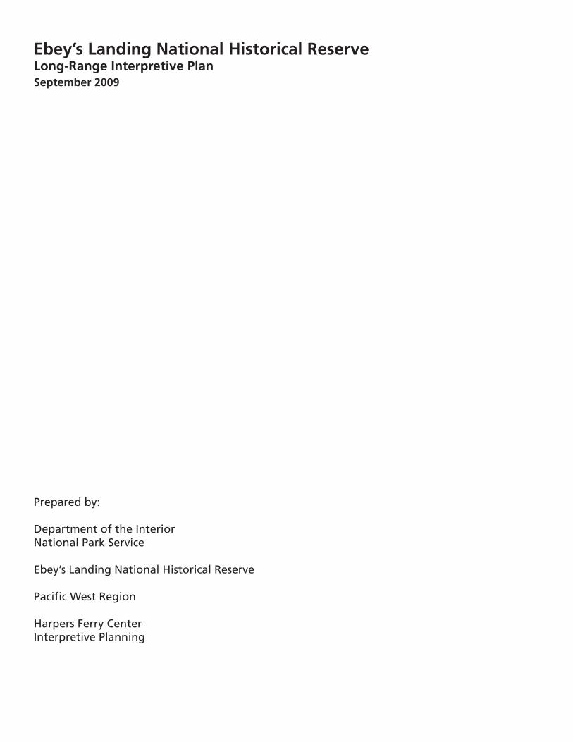
Prepared by:
Department of the InteriorNational Park Service
Ebey’s Landing National Historical Reserve
Pacifi c West Region
Harpers Ferry CenterInterpretive Planning
Ebey’s Landing National Historical ReserveLong-Range Interpretive PlanSeptember 2009
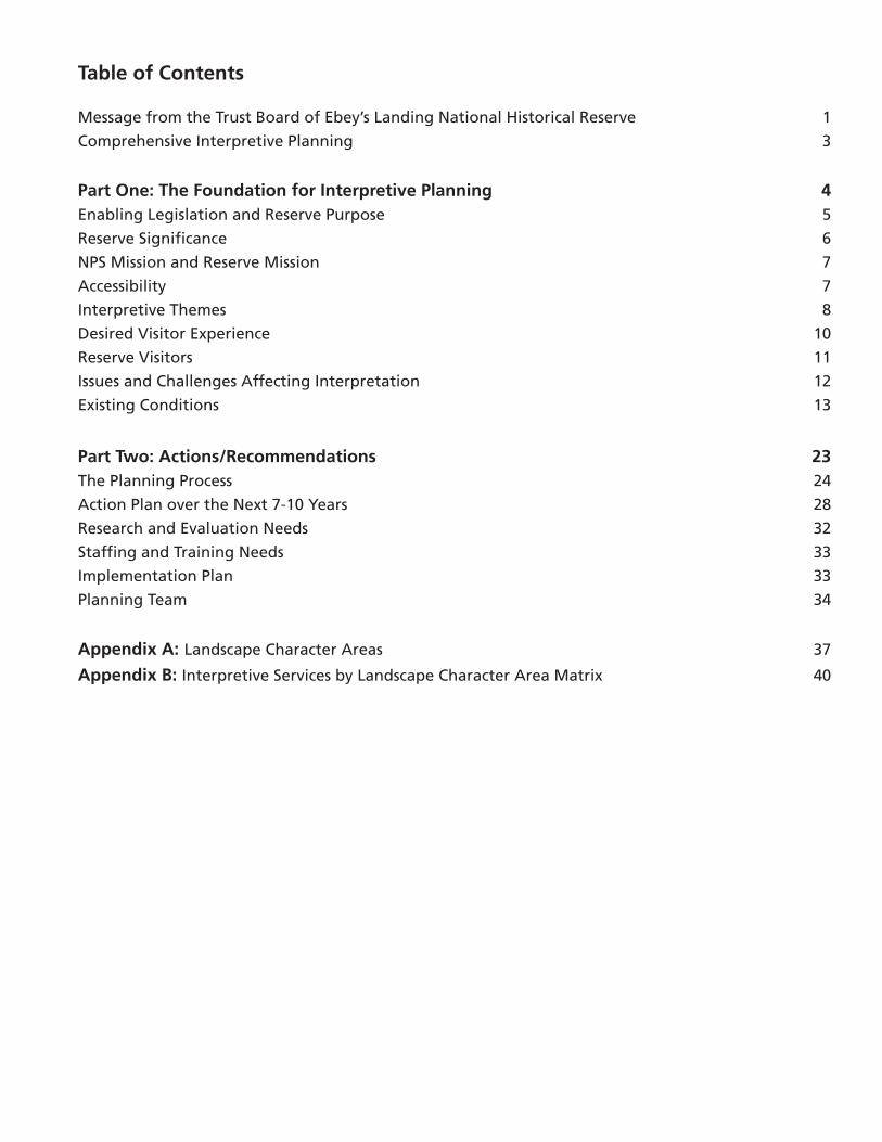
Table of Contents
Message from the Trust Board of Ebey’s Landing National Historical Reserve 1
Comprehensive Interpretive Planning 3
Part One: The Foundation for Interpretive Planning 4Enabling Legislation and Reserve Purpose 5
Reserve Signifi cance 6
NPS Mission and Reserve Mission 7
Accessibility 7
Interpretive Themes 8
Desired Visitor Experience 10
Reserve Visitors 11
Issues and Challenges Affecting Interpretation 12
Existing Conditions 13
Part Two: Actions/Recommendations 23The Planning Process 24
Action Plan over the Next 7-10 Years 28
Research and Evaluation Needs 32
Staffi ng and Training Needs 33
Implementation Plan 33
Planning Team 34
Appendix A: Landscape Character Areas 37
Appendix B: Interpretive Services by Landscape Character Area Matrix 40
“The precious living landscape of Ebey’s Landing Historical Reserve is now more secure than ever. Its rich history and the collaboration of all partners have provided the foundation upon which to build a bright future through the implementation of this long-range interpretive plan.”
Helen Price JohnsonIsland County Commissioner, District 1
1Ebey’s Landing National Historical Reserve Long-Range Interpretive Plan I
Trust Board Members
Jan Pickard, Chair
Fran Einterz, Vice Chair
Al Sherman, Treasurer
Marilyn Clay,
Secretary
Molly Hughes
Hank Florence
Lisa Meserole
Jon Roberts
Jim Neill
Mark Preiss, Reserve Manager
Trust Board Partners
National Park Service
Washington State Parks
Island County
Town of Coupeville
Post Office Box 774 Coupeville, WA 98239 Phone (360) 678-6084 Fax (360) 678-7490
Message from the Trust Board of Ebey’s Landing National Historical Reserve
As the first historical reserve in the United States, Ebey’s Reserve protects an important part of America’s rural character – a cultural landscape of 17,572 acres that includes 17 working farms, more than 400 historic structures, native prairies, three state parks, miles of shoreline, a network of hiking and biking trails, and the second oldest town in Washington. Ebey’s Reserve is a national model for sustainable development in rural communities. It is the only remaining area in the Puget Sound region where a broad spectrum of Northwest history is clearly visible on the land, and protected within a landscape that is lived in and actively farmed. It is a place that is sustained using contemporary conservation strategies, local stewardship, and by leaving the land in primarily private ownership, while preserving its historic, cultural, and rural character. The Long-Range Interpretive Plan is a document that sharpens our focus and pulls together all of the education and interpretation efforts within Ebey’s Landing National Historical Reserve. Part One defines the Reserve themes, identifies the desired visitor experience, lists issues and challenges, and describes the existing condition of the Reserve’s interpretive services. Part Two lists the specific actions the Reserve and its partners will take to meet our vision for the future of interpretation over the next seven to ten years. Ebey’s Landing National Historical Reserve is supported through partnerships with many local, regional, and national organizations. The Reserve staff engaged all of the Trust Board members, partners, local community members, and many others throughout the planning process. This collaborative effort produced a more comprehensive and inclusive look at how we will interpret Ebey’s Reserve to visitors in the future. On behalf of the Trust Board, we hope you will take time to review this important plan and join us as we continue to move forward in our efforts to preserve and protect the values and resources of Ebey’s Landing National Historical Reserve. Sincerely,
Jan Pickard Trust Board Chair Ebey’s Landing National Historical Reserve
Mark Preiss Reserve Manager Ebey’s Landing National Historical Reserve
2 I National Park Service
20
20
20
20
20
20
525
20
0 0.2
0 0.2
1 Mile
1 Kilometer
North
Robert Y. PrattPreserve
Ebey’s Landing National Historical Reserveauthorized boundary
Fort Ebey
State Park
Fort FlaglerState Park
KettlesRecreation
Area
Fort Casey State ParkUnderwater Marine ParkFort Casey State Park
Nass NaturalArea Preserve
RhododendronPark
Ebey’s LandingState Park
Fort WordenState Park
P E N N C O V E
SA
RA
TO
GA
PA
SS
AG
E
PU
GE
T S
OU
ND
ADM
IRALTY IN
LET
ST
RA
I T
OF
JU
AN
D
E
FU
CA
A D M I R A L T Y
B A Y
KeystoneHarbor
CROCKETTLAKE
KennedysLagoon
GrassersLagoon
LakePondilla
HarringtonLagoon
PEREGO’S LAKE
C R O C K E T T
P R A I R I E
S A N D E F U C A
U P L A N D S
S A N D E F U C A
U P L A N D S
SMITH
PRAIRIE
E B E Y ’ S
P R A I R I E
COUPEVILLE
San de FucaGrassers
Hill
Arnold Road
Libbey Road
Hill Road
Cook Road
Sher
man
Ro
ad
Eng
le
R
oad
Mai
n
Stre
et
Key
sto
ne
H
ill
Ro
ad
Ebey
Ro
ad
KETTLEHOLES
Van Dam Road
Ho
lbro
ok
Rd
Oak HarborAir Park
West B
each R
oad
Mo
nro
e L
and
ing
R
oad
Au SableInstitutePrairie
Center
Chamber ofCommerce
LongPoint
PointPartridge Lovejoy
Point
BlowersBluff
WHIDBEY
ISLAND
NAVAL AIR
STATION
PORT
TOWNSEND
PointWilson
AdmiraltyHead
Keystone Ave
DriftwoodPark
Coupeville OLF(Outlying
Landing Field)
Port To
wnsend–Keyst
one Ferry
(car a
nd passenger f
erry)
To Clintonand ferry to Seattle
To Oak Harborand Deception Pass
To
WH I D B E Y I S L A N D
Scenic
Hei
gh
ts
R
oad
Monroe’sLanding
Penn Cove Road
Zylstra Ro
ad
Mad
rona W
ay
Eng
le Road
Fort
Cas
ey R
oad
Fort Casey R
oad
Wanamaker Road
CrockettBlockhouse
Davis Blockhouse
AlexanderBlockhouse
Jacob Ebey Blockhouse
PrairieOverlook
PrairieWayside
Admiralty Head Lighthouse
Camp Casey Conference Center
ParkOffice
ContactStation
KeystoneFerryLanding
Patmore
R
oad
Patmore Rd
(unpaved road
)
Parker Road
Park
er
R
oad
Terry Road
SunnysideCemetery
Wh
arf
Hill V
alley Dr
Bluff Trail
Tra
il
Ebey
’s Pr
airie
Kettle’s Trail
Jacob
Rd
PatmorePark
(off-leashdog area)
Hiking/walking trail
Multi-use trail (paved)bike/hike
Restroom
Boat launch
Campground
Outdoor exhibit/scenic overlook
Libbey Beach(county park,no beach access)
Keystone
Spit
Island CountyHistorical Museum
Reserve Information
Jacob Ebey HouseVisitor Contact Station
(seasonal)
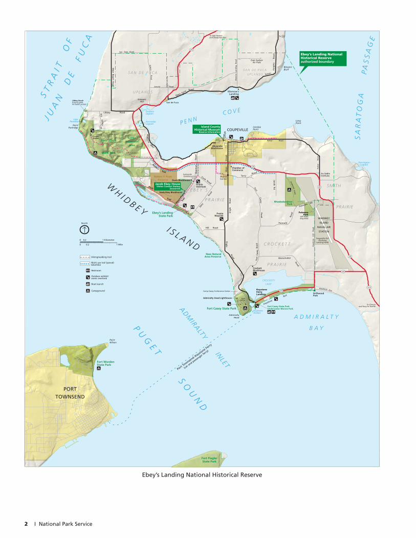
Ebey’s Landing National Historical Reserve
3Ebey’s Landing National Historical Reserve Long-Range Interpretive Plan I
Comprehensive Interpretive Planning
and long-term (7-10 years) interpretive goals of the park. The process that develops the LRIP defi nes realistic strategies and actions that work toward achievement of the interpretive goals.
The Annual Implementation Plan and Interpretive DatabaseThe completed LRIP is a critical part of the CIP, but it does not stand alone. Actions in the LRIP are divided into annual, achievable steps and
reproduced in the Annual Implementation Plan (AIP), the second component of the CIP. Creating a series of these AIPs that implement the recommendations outlined in the LRIP simplifi es the park’s annual planning. The third component of the CIP is the Interpretive Database, an ongoing compilation of information, reports, bibliographies, plans, and inventories that document the LRIP’s ongoing progress.
The National Park Service (NPS) has a unifi ed planning approach for interpretation and education. This approach combines planning for interpretive media, personal services, and education programs. The Comprehensive Interpretive Planning (CIP) process is the basic planning document for interpretation and was incorporated into NPS guidelines in 1995. Responsibility for accomplishing the CIP process lies with the Trust Board and the Reserve Manager.
What is a Comprehensive Interpretive Plan?The CIP process helps the Reserve make choices, and this planning document is written to provide guidance to Reserve staff . It helps them decide what their objectives are, who their visitors are, and what mix of media and personal series to use. Although the CIP as defi ned in Director’s Order 6 is composed of specifi c elements, good planning is customized to meet an individual unit’s need and situations. The CIP is not a recipe; rather it is a guide to eff ective, goal-driven planning. While it considers past interpretive programming, it is primarily a forward-looking document that concentrates on actions needed to create or sustain a vigorous and eff ective interpretive program for the future. All CIPs have these three components: the Long-Range Interpretive Plan (LRIP), a series of Annual Implementation Plans and an Interpretive Database.
What is a Long-Range Interpretive Plan?The heart of the CIP is the Long-Range Interpretive Plan. The LRIP defi nes the overall vision
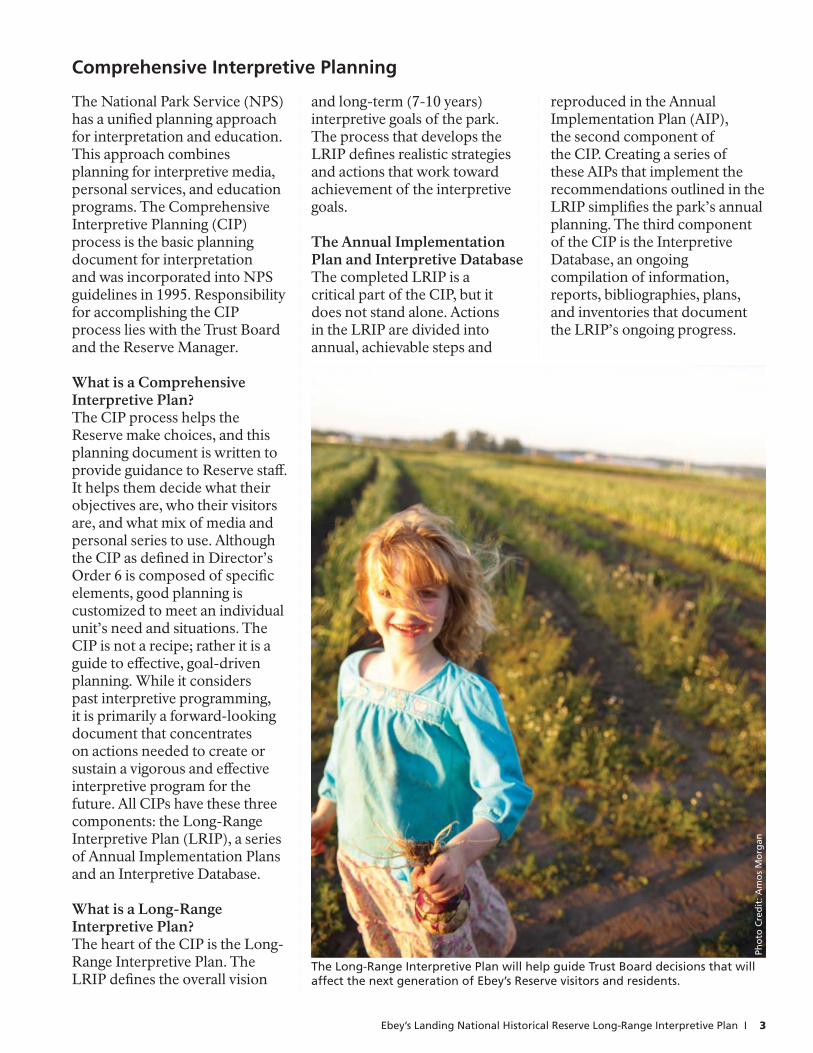
The Long-Range Interpretive Plan will help guide Trust Board decisions that will affect the next generation of Ebey’s Reserve visitors and residents.
Pho
to C
red
it: A
mo
s M
org
an

4 I National Park Service
My dear brother— I scarcely know how I shall write or what I shall write . . . the great desire of heart is to get my own and father’s family to this country. I think it would be a great move. I have always thought so . . . To the north down along Admiralty Inlet . . . the cultivating land is generally found confi ned to the valleys of streams with the exception of Whidbey’s Island . . . which is almost a paradise of nature. Good land for cultivation is abundant on this island. I have taken a claim on it and am now living on the same in order to avail myself of the provisions of the Donation Law. If Rebecca, the children, and you all were here, I think I could live and die here content.
Colonel Isaac Ebeyletter to his brother, W.S. Ebey, April 25, 1851
The Reserve strives to engage all visitors and residents; to share and enrich their lives; and to inspire them to help preserve our natural heritage for seven generations into the future. As wildlife habitat and farmland is lost throughout the Pacifi c Northwest and on Whidbey Island, Ebey’s Reserve serves as a unique and exciting resource for visitors and residents. The experience of discovery, beauty, natural landscape, and coastline enriches young and old with a unique national model of a living landscape, where premeditated preservation and community management reconnect us to the soil, wind, sea, and heighten our attention to the empowering experience of Mother Nature!
Lisa MeseroleTrust Board Member, Education & Outreach Committee Chair
Part One: The Foundation for Interpretive Planning
Part One: The Foundation for Interpretive Planning
5Ebey’s Landing National Historical Reserve Long-Range Interpretive Plan I
Enabling Legislation and Reserve Purpose
Enabling Legislation
Each unit of the National Park System is created by Congress and the President of the United States. The following pieces of legislation created Ebey’s Landing National Historical Reserve.
Section 508 of the Parks and Recreation Act of 1978 (Public Law 95-625) established Ebey’s Landing National Historical Reserve. Its boundaries are the same as those of the Central Whidbey Island Historic District established in 1973. The Reserve comprises an area of approximately 17,572 acres: 13, 617 acres of land and 3,955 surface acres of water (Penn Cove). Approximately 2,023 acres are protected with NPS-held conservation easements and 684 acres are NPS-owned in fee.
The language of the law cited the unbroken historical record of the central Whidbey Island community “from nineteenth century exploration and settlement in Puget Sound to the present time” and emphasized four historic eras: Vancouver’s exploration of the Puget Sound in 1792; the fi rst permanent settlement on Whidbey Island, led by Isaac Ebey; the Donation Land Claim settlements and subsequent settlements; and the development of Coupeville.
In more ways than one, the Reserve is not a typical national park. It is a new model in its approach to park management and land protection. Ebey’s Reserve is the fi rst historical
reserve in the National Park System – its boundaries surround mostly private land (approximately 85%). The movement to protect central Whidbey Island began more than thirty years ago with local citizens’ initiative to protect Ebey’s Prairie from development. Establishing a national historical reserve would provide immediate protection of critical lands threatened by development The Reserve now preserves open space with a minimum disturbance to private landowners, and provides federal technical support without threatening local autonomy.
As part of the legislation, management of the Reserve is through a unit of local government, and not solely with the NPS. Though most national park units are managed by a superintendent, the Reserve is managed by a nine-member Trust Board comprised of representatives from four units of government - the town of Coupeville, Island County, Washington State Parks, and the National Park Service. On July 23, 1988, an Interlocal Agreement for the Administration of the Reserve established this joint interagency administrative board for management of the Reserve.
Reserve Purpose
A purpose statement summarizes the reasons a unit is included in the National Park System. It is derived from the legislation that created both the National Park Service and a specifi c site.
The purpose of Ebey’s Landing National Historical Reserve is to:
• Preserve and protect the cultural landscape and to commemorate the history of a rural community, which provides a continuous record of exploration and American settlement in Puget Sound from the nineteenth century to the present. This includes the fi rst thorough exploration of Puget Sound by Captain Vancouver in 1792; settlement of Whidbey Island by Colonel Ebey; settlement during the years of the Donation Land Law beginning in the 1850s; and the growth of the town of Coupeville.
• Preservation of natural and cultural resources in the reserve happens in the context of a living, working, and changing community.
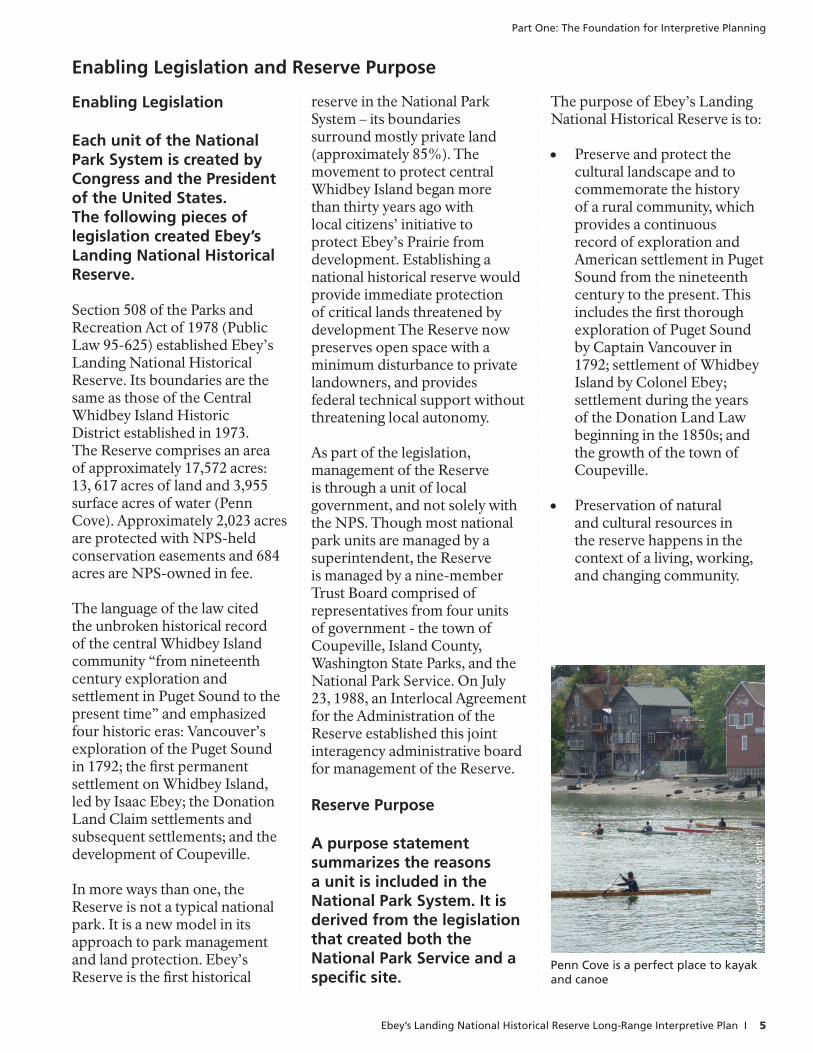
Penn Cove is a perfect place to kayak and canoe
Pho
to C
red
it: C
hri
s Sm
ith
Part One: The Foundation for Interpretive Planning
6 I National Park Service
Reserve Signifi cance
• Within the fast growing Puget Sound region, the Reserve has quickly become the only remaining area where a broad spectrum of Northwest history is still clearly visible within a large-scale (and partially protected) landscape.
Secondary Signifi cance• Ebey’s Landing National
Historical Reserve consists of excellent undisturbed examples of post-glacial geological features such as kettle ponds; steep gravel bluff s; remnant prairies formed by glacial lakes; and sweeping shoreline topography left by the receding glaciers.
• The unique climates, rain shadow, soils, maritime infl uence, and geologic features result in an unusual diversity of plant and animal species, communities, and habitats.
• Within the Reserve, the visitor can experience a variety of diverse physical and visual landscapes within a small geographic area.
• Because the Reserve is a short drive from major Northwest population centers, it is a popular destination for various forms of recreational and educational activities.
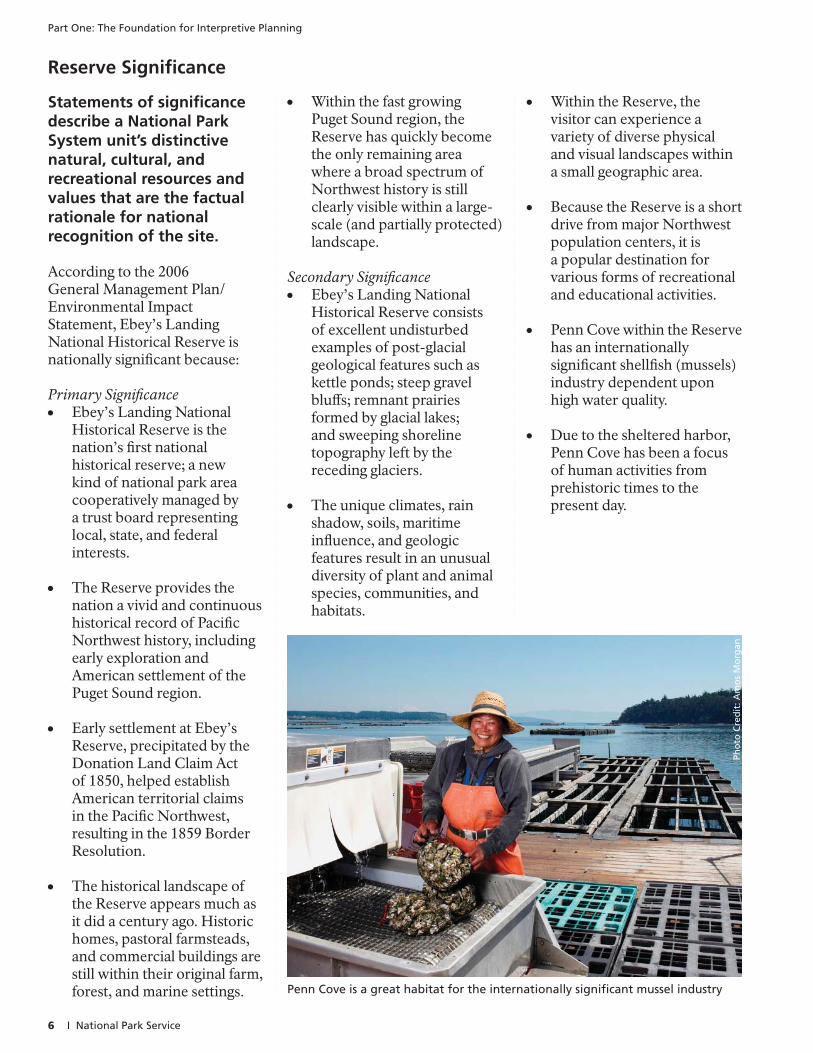
• Penn Cove within the Reserve has an internationally signifi cant shellfi sh (mussels) industry dependent upon high water quality.
• Due to the sheltered harbor, Penn Cove has been a focus of human activities from prehistoric times to the present day.
Statements of signifi cance describe a National Park System unit’s distinctive natural, cultural, and recreational resources and values that are the factual rationale for national recognition of the site.
According to the 2006 General Management Plan/Environmental Impact Statement, Ebey’s Landing National Historical Reserve is nationally signifi cant because:
Primary Signifi cance• Ebey’s Landing National
Historical Reserve is the nation’s fi rst national historical reserve; a new kind of national park area cooperatively managed by a trust board representing local, state, and federal interests.
• The Reserve provides the nation a vivid and continuous historical record of Pacifi c Northwest history, including early exploration and American settlement of the Puget Sound region.
• Early settlement at Ebey’s Reserve, precipitated by the Donation Land Claim Act of 1850, helped establish American territorial claims in the Pacifi c Northwest, resulting in the 1859 Border Resolution.
• The historical landscape of the Reserve appears much as it did a century ago. Historic homes, pastoral farmsteads, and commercial buildings are still within their original farm, forest, and marine settings. Penn Cove is a great habitat for the internationally signifi cant mussel industry
Pho
to C
red
it: A
mo
s M
org
an
Part One: The Foundation for Interpretive Planning
7Ebey’s Landing National Historical Reserve Long-Range Interpretive Plan I
perpetuity, the historic, natural, cultural, scenic, recreational, and community resources which are vital to Ebey's Landing National Historical Reserve;
• Foster appreciation, understanding, and enjoyment of Ebey’s Landing National Historical Reserve through education and interpretation;
• Further the purposes of Ebey’s Landing National Historical Reserve by establishing and maintaining productive partnerships between federal, state, and local governments, public and private organizations and individuals;
• Administer and manage Ebey’s Landing National Historical Reserve as a unit of the National Park system, consistent with the mandate of Congress (PL 95-625) and the Interlocal Agreement of July 26, 1988 between the National Park Service, Washington State Parks and Recreation Commission, Island County, and the Town of Coupeville.
Accessibility
Every attempt will be made to provide full access to interpretive media and programs to ensure people with physical and mental disabilities have access to the same information necessary for safe and meaningful visits to national parks. This is in compliance with the National Park Service policy:
“ …To provide the highest level of accessibility possible and feasible for persons with visual, hearing, mobility, and mental impairments, consistent with the obligation to conserve park resources and preserve the qualities of the park experience for everyone.”NPS Special Directive 83-3, Accessibility for Disabled Persons
All interpretation will follow general standards for accessibility as described in the Harpers Ferry Center Programmatic Accessibility Guidelines for Interpretive Media http://www.nps.gov/hfc/pdf/accessibility/access-guide-aug2009.pdf
NPS Mission and Reserve Mission
A mission statement is a vision for the future and articulates, in broad terms, the ideas that the NPS and the Trust Board strives to achieve.
National Park Service Mission StatementThe National Park Service preserves unimpaired natural and cultural resources and values of the national park system for the enjoyment, education and inspiration of this and future generations. The Park Service cooperates with partners to extend the benefi ts of natural and cultural resource conservation and outdoor recreation throughout this country and the world.
Ebey’s Landing National Historical Reserve Mission Statement
The Mission of the Trust Board of Ebey’s Landing National Historical Reserve is to:
• Preserve and protect, in
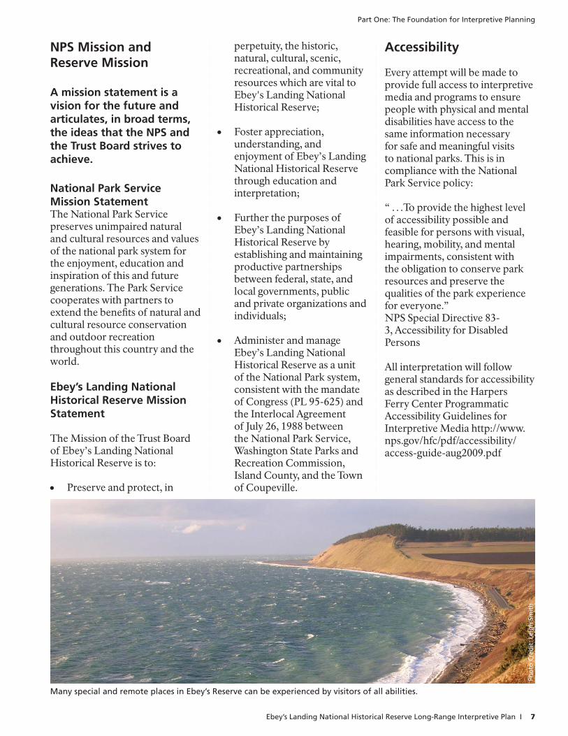
Many special and remote places in Ebey’s Reserve can be experienced by visitors of all abilities.
Pho
to C
red
it: L
eig
h S
mit
h
Part One: The Foundation for Interpretive Planning
8 I National Park Service
Interpretive Themes
Theme 1 – Change/Cultural Heritage
People have long been attracted to the Ebey’s Reserve area, making it their home for similar reasons yet bringing new motivations and uses.
• Native Americans resided in this area, cultivating the prairies and Penn Cove.
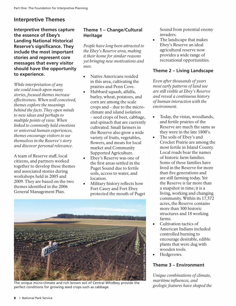
• Hubbard squash, alfalfa, barley, wheat, potatoes, and corn are among the scale crops and – due to the micro-climate and island isolation – seed crops of beet, cabbage, and spinach that are currently cultivated. Small farmers in the Reserve also grow a wide variety of fruits, vegetables, fl owers, and meats for local market and Community Supported Agriculture.
• Ebey’s Reserve was one of the fi rst areas settled in the Puget Sound due to fertile soils, access to water, and location.
• Military history refl ects how Fort Casey and Fort Ebey protected the mouth of Puget
Sound from potential enemy invaders.
• The landscape that makes Ebey’s Reserve an ideal agricultural reserve now provides a wide range of recreational opportunities.
Theme 2 – Living Landscape
Even after thousands of years most early patterns of land use are still visible at Ebey’s Reserve and reveal a continuous history of human interaction with the environment.
• Today, the vistas, woodlands, and fertile prairies of the Reserve are much the same as they were in the late 1800’s.
• The soils of Ebey’s and Crocket Prairie are among the most fertile in Island County. Local roads bear the names of historic farm families. Some of these families have lived in the Reserve for more than fi ve generations and are still farming today. Yet the Reserve is far more than a snapshot in time; it is a living, working and changing community. Within its 17,572 acres, the Reserve contains more than 300 historic structures and 18 working farms.
• Cultivation tactics of American Indians included controlled burning to encourage desirable, edible plants that were dug with wooden tools.
• Hedgerows.
Theme 3 – Environment
Unique combinations of climate, maritime infl uences, and geologic features have shaped the
Interpretive themes capture the essence of Ebey’s Landing National Historical Reserve’s signifi cance. They include the most important stories and represent core messages that every visitor should have the opportunity to experience.
While interpretation of any site could touch upon many stories, focused themes increase eff ectiveness. When well conceived, themes explore the meanings behind the facts. They open minds to new ideas and perhaps to multiple points of view. When linked to commonly held emotions or universal human experiences, themes encourage visitors to see themselves in the Reserve’s story and discover personal relevance.
A team of Reserve staff , local citizens, and partners worked together to develop these themes and associated stories during workshops held in 2005 and 2009. They are based on the two themes identifi ed in the 2006 General Management Plan.
The unique micro-climate and rich brown soil of Central Whidbey provide the perfect conditions for growing seed crops such as cabbage.
Pho
to C
red
it: M
itch
Ric
har
ds
Part One: The Foundation for Interpretive Planning
9Ebey’s Landing National Historical Reserve Long-Range Interpretive Plan I
landscape, resulting in an unusual diversity of habitats and species.
Examples of these unique features include:• Geology• Glaciers• Prairie• Forest• Wetlands• Sea life• Wildlife• Flora• Climate• Night sky• Natural quiet• Soil
Theme 4 – Historical Reserve
The partners of the Reserve work together to create a model of sustainable development that respects a community’s need to adapt to new challenges while protecting natural and cultural resources. The Reserve is a model for preservation of a cultural landscape.
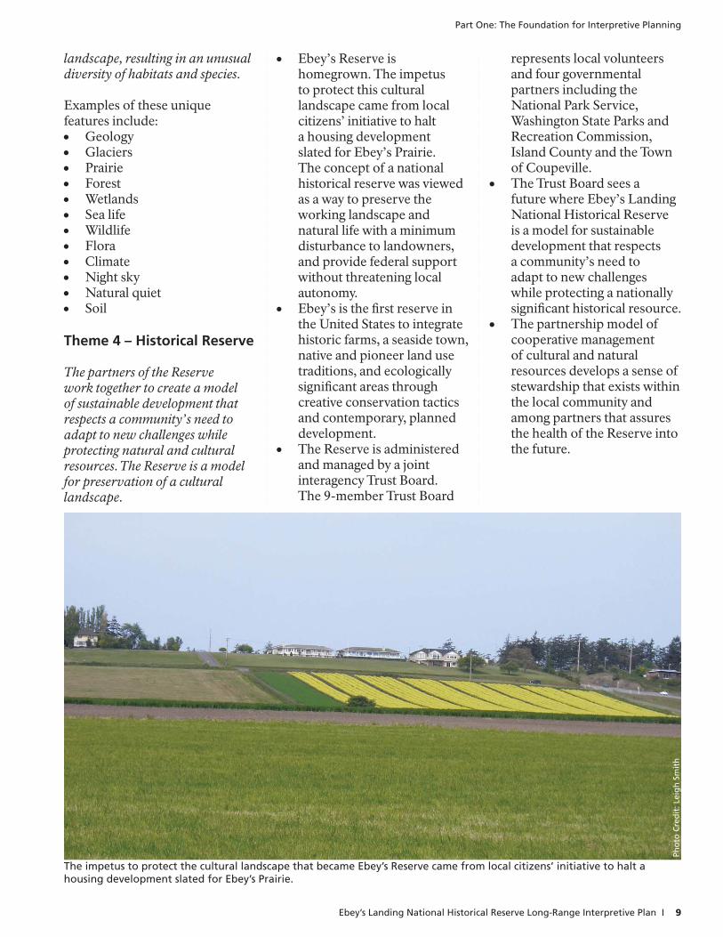
• Ebey’s Reserve is homegrown. The impetus to protect this cultural landscape came from local citizens’ initiative to halt a housing development slated for Ebey’s Prairie. The concept of a national historical reserve was viewed as a way to preserve the working landscape and natural life with a minimum disturbance to landowners, and provide federal support without threatening local autonomy.
• Ebey’s is the fi rst reserve in the United States to integrate historic farms, a seaside town, native and pioneer land use traditions, and ecologically signifi cant areas through creative conservation tactics and contemporary, planned development.
• The Reserve is administered and managed by a joint interagency Trust Board. The 9-member Trust Board
represents local volunteers and four governmental partners including the National Park Service, Washington State Parks and Recreation Commission, Island County and the Town of Coupeville.
• The Trust Board sees a future where Ebey’s Landing National Historical Reserve is a model for sustainable development that respects a community’s need to adapt to new challenges while protecting a nationally signifi cant historical resource.
• The partnership model of cooperative management of cultural and natural resources develops a sense of stewardship that exists within the local community and among partners that assures the health of the Reserve into the future.
The impetus to protect the cultural landscape that became Ebey’s Reserve came from local citizens’ initiative to halt a housing development slated for Ebey’s Prairie.
Pho
to C
red
it: L
eig
h S
mit
h
Part One: The Foundation for Interpretive Planning
10 I National Park Service
Desired Visitor Experience
• Safely enjoy a variety of accessible, sustainable, recreational experiences.
• Enjoy solitude, dark night skies, prairie landscapes, and ocean vistas.
• Hike and bike across the entire Reserve on an integrated trails system.
• Go to an Ebey’s Reserve visitor center to receive an orientation to the Reserve and to get maps and basic history of the area.
• Purchase Ebey’s Reserve branded fresh local produce and products.
• Participate in hands-on educational experiences and weekend demonstration of historic events to better understand the natural and human history of the Reserve.
• Experience what it was like to be a pioneer on the prairie – eat the food they would have eaten.
• Enjoy the beautiful scenery including prairies, mountains and water.
• Feel the continuity and stability of the place.
• Experience a day on a farm in the Reserve - meet a farmer and plow a fi eld with a tractor.
• Discover the history and stories of the people who have lived here for thousands of years.
• Explore the diff erent landscapes and discover how they were formed.
• Enjoy a self-guided tour of the Reserve.
• See and explore the historic buildings, structures, and farms found throughout the Reserve.
Desired visitor experiences describe what physical, intellectual, and emotional experiences should be available for visitors to Ebey’s Landing National Historical Reserve. These experiences will be available to visitors of all abilities, including those with visual, auditory, mobility, or cognitive impairments.
Visitors to Ebey’s Landing National Historical Reserve will have opportunities to:
• Have advance access to maps and orientation information through a variety of media, in a variety of locations, including websites, exhibits at the ferry terminals, and published guides that will assist them in planning a trip to Whidbey Island and the Reserve, thereby maximizing their time, enjoyment, and understanding of the resources.
Part One: The Foundation for Interpretive Planning
11Ebey’s Landing National Historical Reserve Long-Range Interpretive Plan I
Reserve Visitors
to the NPS Public Use Statistics Offi ce. Peak visitation is during May through September. High visitation periods also occur during the Thanksgiving and Christmas holidays. Visitation data from the 1995 University of Washington Visitor Survey and the 2007 NPS Visitor Survey Project study suggests most visitors drive to the Reserve and 93% come from within the state.
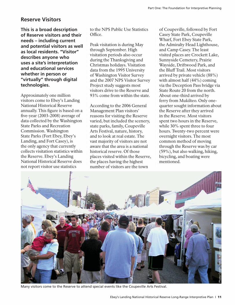
According to the 2006 General Management Plan visitors’ reasons for visiting the Reserve varied, but included the scenery, state parks, family, Coupeville Arts Festival, nature, history, and to look at real estate. The vast majority of visitors are not aware that the area is a national historical reserve. Of those places visited within the Reserve, the places having the highest number of visitors are the town
of Coupeville, followed by Fort Casey State Park, Coupeville Wharf, Fort Ebey State Park, the Admiralty Head Lighthouse, and Camp Casey. The least visited places are Crockett Lake, Sunnyside Cemetery, Prairie Wayside, Driftwood Park, and the Bluff Trail. Most visitors arrived by private vehicle (88%) with almost half (44%) coming via the Deception Pass bridge via State Route 20 from the north. About one-third arrived by ferry from Mukilteo. Only one-quarter sought information about the Reserve after they arrived in the Reserve. Most visitors spent two hours in the Reserve, while 30% spent three to four hours. Twenty-two percent were overnight visitors. The most common method of moving through the Reserve was by car (59%), but also walking, hiking, bicycling, and boating were mentioned.
This is a broad description of Reserve visitors and their needs – including current and potential visitors as well as local residents. “Visitor” describes anyone who uses a site’s interpretation and educational services whether in person or “virtually” through digital technologies.
Approximately one million visitors come to Ebey’s Landing National Historical Reserve annually. This fi gure is based on a fi ve-year (2003-2008) average of data collected by the Washington State Parks and Recreation Commission. Washington State Parks (Fort Ebey, Ebey’s Landing, and Fort Casey), is the only agency that currently collects visitation statistics within the Reserve. Ebey’s Landing National Historical Reserve does not report visitor use statistics
Many visitors come to the Reserve to attend special events like the Coupeville Arts Festival.
Pho
to C
red
it: M
itch
Ric
har
ds
Part One: The Foundation for Interpretive Planning
12 I National Park Service
Issues and Challenges Affecting Interpretation
Funding• Maintaining and acquiring
property and easements.
Agritourism/Farm to Table• Most farmers do not have
time to teach and support visitors coming to the farms.
• Is it practical to provide hands-on agritourism?
• Is agritourism sustainable?• Is there enough interest
within the farming community to support agritourism?
Transportation• Transportation to the island –
ferry service may be reduced. • Where will people be coming
from and how will they be getting to the Reserve?
Volunteers• Challenge to fi nd quality
people to get the job done.• There is a fi nite capacity of
labor on the island.• Interpretive services
throughout the Reserve are primarily provided by volunteers.
Partnerships• Partners need to collaborate
and work together as a whole Reserve community.
• Partners need to share and provide more open access to information.
Ebey’s Landing National Historical Reserve has many assets upon which to build an effective interpretive program, including evocative and compelling stories, outstanding natural and cultural resources, ongoing research, and dedicated staff and supporters. It also faces a number of challenges. Well-designed programs can build on interpretive strengths to help overcome the challenges.
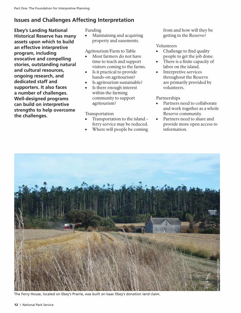
The Ferry House, located on Ebey’s Prairie, was built on Isaac Ebey’s donation land claim.
Pho
to C
red
it: C
hri
s Sm
ith
Part One: The Foundation for Interpretive Planning
13Ebey’s Landing National Historical Reserve Long-Range Interpretive Plan I
Existing Conditions
are wayside exhibits and a trailhead located at the parking area.
Prairie Wayside is located on the opposite side of Ebey’s Prairie from the Overlook. Hedgerows obscure the breathtaking views of the prairie and the wayside area is continually subjected to vandalism and littering.
Sunnyside Cemetery overlooks Ebey’s Prairie and is the burial site of many prominent historic fi gures including Jacob and Isaac Ebey and Captain Coupe. The Davis Blockhouse is located within the cemetery.
West Coastal Strip
Scott’s Bluff , an NPS lease from the Nature Conservancy, is the most popular hike in the Reserve. Breathtaking views overlooking Ebey’s Prairie, Perego Lake, and Puget Sound, and bald eagles circling overhead draw many visitors.
Ebey’s Landing State Park is located along the beach on the western edge of the Reserve. The ferry came ashore here during the mid-19th century. Archaeological research has confi rmed there was an American Indian village site. A spur trail provides access to Scott’s Bluff . Due to its size and location the park has limited capacity for trail use and parking.
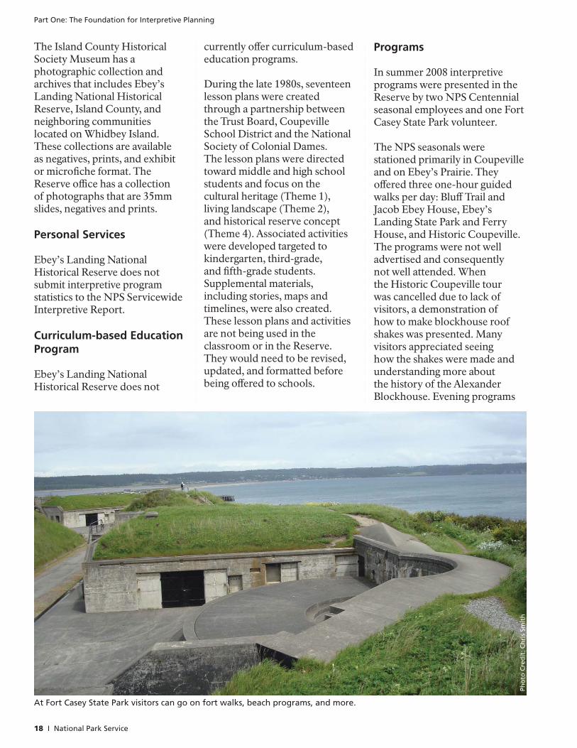
Fort Casey State Park forms the southwestern edge of the Reserve and was the site of the Kellogg donation land claim. Camping, picnicking, and spectacular views of Admiralty Inlet and the Strait
of Juan de Fuca draw hundreds of thousands of visitors annually. A coastal artillery post features two historic guns on display. The park also includes Keystone Spit, a two-mile-plus stretch of land separating Admiralty Inlet and Crockett Lake. Birding, diving, and fi shing are popular activities along the Spit.
The Admiralty Head Lighthouse is located within Fort Casey State Park. Visitors can stamp their NPS Passport and tour the 1861 lighthouse.
Woodlands
Straddling the west coastal strip and the Kettle and Pratt woodlands, Fort Ebey State Park highlights the natural beauty of the Reserve. Visitors can stamp their NPS Passport and enjoy the many recreational opportunities such as camping, bicycling through the Kettles, picnicking, paragliding, and fi shing on the beach. There is an amphitheater for evening programs and 28 miles of trails for hiking and mountain biking. Horseback riding is also allowed on some trails.
Penn Cove
Monroe’s Landing was an American Indian village site thousands of years ago. Today there is a public boat launch into Penn Cove and beach access for swimming and clamming. Wayside exhibit panels describing the Indian village and Penn Cove are in good condition, just diffi cult to see from highway.
Landscape Character Areas
There are ten landscape character areas (see Appendix A) found within Ebey’s Landing National Historical Reserve. Within this LRIP, one “prairie” area and one “woodland” area are recognized, reducing the total number of character areas to six. Ebey’s Prairie and the West Coastal Strip have been the focus of interpretive services and programming. The three Washington State Parks, Scott’s Bluff on the Nature Conservancy property, and the Ebey land claims have served as anchors along the western side of the Reserve. Coupeville is the center for visitor services, lodging, dining, and shopping. Many of the restaurants and shops feature Ebey’s Reserve produce and products. Appendix B identifi es the interpretive services currently off ered in the Reserve by landscape character area.
Ebey’s Prairie
The Ferry House was built on Isaac Ebey’s donation land claim and was the site of the fi rst ferry station. From 1860-1880 the house served as an inn, mail post, ferry stop, and salon. An old wagon trail still provides access to the beach and Ebey’s Landing State Park. Closed to the public.
Jacob Ebey House and Blockhouse is still on the original donation land claim. The house has been restored to a ca. 1855 appearance. Closed to the public.
The view from Prairie Overlook is the iconic image of Ebey’s Prairie and the Reserve. There
Part One: The Foundation for Interpretive Planning
14 I National Park Service
Coupeville
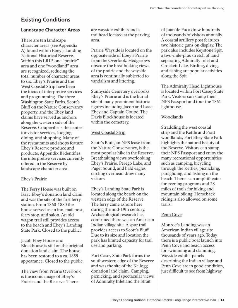
Visitors can walk around the historic district featuring 19th century homes and store fronts. The Island County Museum is open daily and has an NPS passport station as well as Reserve exhibits and wayside exhibit panels. Visitors can shop or eat at a local restaurant featuring Ebey’s Reserve-grown produce. Exhibits inside the Coupeville Wharf tell “Rosie’s Story” about a gray whale and also Rudy, the dolphin. NPS passport stations are also located at the Central Whidbey Chamber of Commerce and the Town of Coupeville offi ces.
Agritourism/Farm to Table
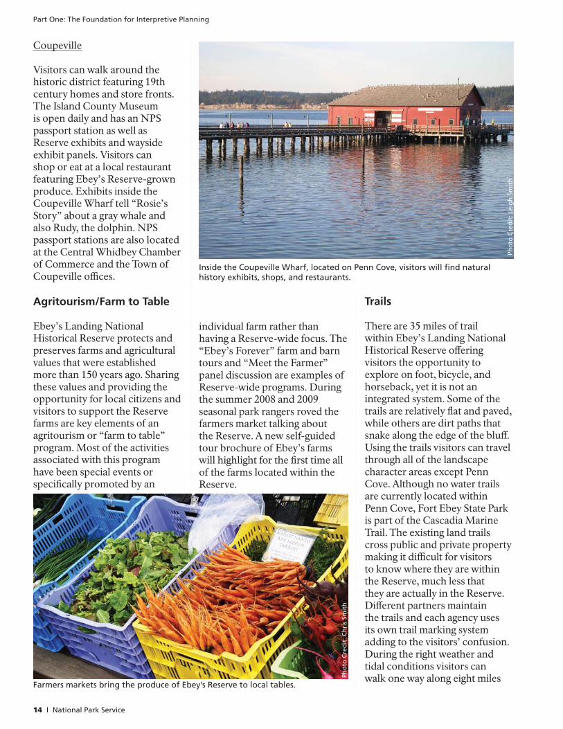
Ebey’s Landing National Historical Reserve protects and preserves farms and agricultural values that were established more than 150 years ago. Sharing these values and providing the opportunity for local citizens and visitors to support the Reserve farms are key elements of an agritourism or “farm to table” program. Most of the activities associated with this program have been special events or specifi cally promoted by an
individual farm rather than having a Reserve-wide focus. The “Ebey’s Forever” farm and barn tours and “Meet the Farmer” panel discussion are examples of Reserve-wide programs. During the summer 2008 and 2009 seasonal park rangers roved the farmers market talking about the Reserve. A new self-guided tour brochure of Ebey’s farms will highlight for the fi rst time all of the farms located within the Reserve.
Trails
There are 35 miles of trail within Ebey’s Landing National Historical Reserve off ering visitors the opportunity to explore on foot, bicycle, and horseback, yet it is not an integrated system. Some of the trails are relatively fl at and paved, while others are dirt paths that snake along the edge of the bluff . Using the trails visitors can travel through all of the landscape character areas except Penn Cove. Although no water trails are currently located within Penn Cove, Fort Ebey State Park is part of the Cascadia Marine Trail. The existing land trails cross public and private property making it diffi cult for visitors to know where they are within the Reserve, much less that they are actually in the Reserve. Diff erent partners maintain the trails and each agency uses its own trail marking system adding to the visitors’ confusion. During the right weather and tidal conditions visitors can walk one way along eight miles
Pho
to C
red
it: L
eig
h S
mit
h
Inside the Coupeville Wharf, located on Penn Cove, visitors will fi nd natural history exhibits, shops, and restaurants.
Farmers markets bring the produce of Ebey’s Reserve to local tables.
Pho
to C
red
it: C
hri
s Sm
ith

Part One: The Foundation for Interpretive Planning
15Ebey’s Landing National Historical Reserve Long-Range Interpretive Plan I
of beach from Fort Ebey to Fort Casey. They cannot return by walking along the bluff above the same beach using a single trail. A Reserve trail concept plan was outlined in 2003. The Island County trail plan and the Whidbey Island Scenic Route are not mentioned in the plan.
Marketing, Orientation and Access to Information and Interpretation
Marketing
Ebey’s Reserve does not have a well-known identity or marketing strategy. Because the Reserve is founded on partnerships, the partners struggle to maintain their own identity as well as to refl ect a single “Reserve” identity. Many partners are reluctant to emphasize the connection to the National Park Service. The NPS arrowhead is not seen by most people as a unifying symbol. The Trust Board logo is used periodically on signs and publications.
Ebey’s Landing National Historical Reserve is not acknowledged in the majority of tourist publications produced by local groups, communities, or agencies located within the Reserve including: 2008-2009 Whidbey/Camano Islander, Island County Museum brochure, Whidbey Island Farm Map and Guide, Lavender Wind Farm brochure, and North and Central Whidbey Island Map. The Island County Bicycle Touring Map has the area where the offi ce is located marked as the Reserve. The 2008-2009 Whidbey Island Newcomers and Visitors Guide has two mentions of the Reserve, but only as invitation to attend the “Ebey’s Forever” conference.
The Reserve informs the public of upcoming events and special programs through public service announcements sent to area newspapers, radio stations, and television stations. Most information is distributed through press releases in the newspapers. Posters are placed throughout the Reserve advertising interpretive programs. E-mail and the website are also used to promote programs. The Reserve has limited staff and resources to handle large outreach eff orts.
Signs
Reserve IdentityThe Trust Board logo, rather than the NPS arrowhead, is currently used to identify many sites within the Reserve. The two major recreational destinations within the Reserve, Fort Casey State Park and Fort Ebey State Park, exclude signs that indicate they are part of the Reserve. The sign for the Town of Coupeville, the heart of Ebey’s Reserve at the corner of Main and State Road 20, also excludes any text or graphic element that connects it
with the Reserve. Rhododendron Park, a future trail connector, is completely sign-free (from the highway), and Ebey’s Landing State Park has no identifying sign.
Entrance SignsEbey’s Reserve has four entrance signs, on State Road 20 at the north and south entrances to the Reserve and two at Crockett Lake. These are the only road guide signs that inform people they are within the Reserve. The signs are dated, in poor condition, and include the trust board logo as the dominant identity.
Directional SignsDirectional signs, except for a few county road markers, are non-existent within the Reserve boundary. There are no signs to direct you to visitor information or to visitor destinations. A small visitor information sign on Main Street, which is visible from State Road 20, is for the Central Whidbey Chamber of Commerce and visitors may obtain a Reserve brochure from this location. Directional signs for the two state parks exist, but exclude any connection to the Reserve.
One of four entrance signs located within the Reserve.
Pho
to C
red
it: N
PS P
ho
to

Part One: The Foundation for Interpretive Planning
16 I National Park Service
Ferry TerminalsNo directional or entrance signs are apparent at either of the Whidbey Island ferry landings. The Clinton-Mukilteo and Port Townsend-Keystone Ferries have limited quality, interpretive information inside the ferry terminals and on the ferries. Also limited is the quantity of information available at the various ferry landings. There has been no signifi cant eff ort to educate ferry goers or pedestrians near the ferry landings or within the ferry terminals themselves. Each ferry off ers minimal interpretation of Ebey’s Landing National Historical Reserve. Numerous brochures are off ered for various sites throughout Whidbey Island and the Puget Sound. The Central Whidbey Chamber of Commerce continually stocks the Reserve unigrid brochures at the Keystone Landing ferry terminal, on the Port Townsend ferry, and at the Coupeville Wharf.
There is a three-sided kiosk outside the Port Townsend-Keystone Ferry Terminal featuring orientation information on the reserve concept, map of the Reserve and an interpretive panel on the Washington State Ferry System.
Traveler Information Service
In 2007, the Reserve Traveler Information System (TIS) was upgraded. The Island County Historical Society, through a Cooperative Agreement with the Reserve, is now responsible for maintaining and updating the TIS. Segments advertise upcoming events and refl ect the cultural heritage (Theme 1) of the Reserve.
Website
The Reserve offi cial NPS website (www.nps.gov/ebla) is a very popular way for visitors to access information. Virtual visitors can learn about Reserve history, planning projects, and to fi nd directions to the Reserve. The Reserve staff has been working to upgrade and improve the NPS website; however, the content is primarily information that does not need to be changed very often. Interpretive activities and programs are not posted on the website. There is an orientation video on the website that provides visitors with an opportunity to see the diversity of the Reserve and learn a little about the history.
There is also a locally produced “Ebey’s Forever” website (www.ebeysforever.com) that is used primarily for the annual conference. This can be confusing for visitors if they do a search and fi nd both websites listed.
Visitor Center
Ebey’s Landing National Historical Reserve does not have its own visitor center. Instead there are many diff erent locations where visitors can get information about the Reserve including the Admiralty Head Lighthouse, Central Whidbey Chamber of Commerce, Fort Casey and Fort Ebey State Parks, Coupeville Wharf, Island County Museum, and the Coupeville Library. Because each of these partner locations also has their own mission to fulfi ll, Reserve-specifi c orientation and information may be limited.
Interpretive Media
There is interpretive media located within the Reserve, including:
Publications
The current Ebey’s Landing National Historical Reserve brochure was locally designed, produced and distributed. Harpers Ferry Center is working with Reserve staff to create an offi cial NPS Map and Guide. The new brochure will be available in September 2009. Once the brochure is completed, Reserve staff will be able to easily re-order as well as update and revise it.
A variety of Reserve-produced publications that are primarily informational rather than interpretive, are available at the Reserve offi ce, the Coupeville Library, Central Whidbey Chamber of Commerce, Oak Harbor Chamber of Commerce, the Island County Museum, and the Coupeville Wharf. These publications include:
• Central Whidbey’s Archaeological Heritage
• Naturalist’s Guide: Fall and Winter at Ebey’s Landing National Historical Reserve
• Naturalist’s Guide: Spring and Summer at Ebey’s Landing National Historical Reserve
• Traces of the Chinese in the Reserve
• Hedgerows • Ebey’s Landing National
Historical Reserve: Self-Guided Walking Tour of Historic Coupeville
• Ebey’s Landing National Historical Reserve: A Driving and Bicycling Tour
Part One: The Foundation for Interpretive Planning
17Ebey’s Landing National Historical Reserve Long-Range Interpretive Plan I
o The driving and bicycling tour is the only form of interpretive media that includes all of the Reserve’s landscape character areas.
Reserve partner-produced publications cover military history and coastal ecology:
• Washington State Parks and Recreation CommissionYour Guide to Fort Casey State Park (9/98)Coast Artillery Forts: A Century of Service (8/99)Fort Ebey State Park (9/02)Whidbey Island’s Admiralty Head Lighthouse
• WSU Island County Extension Service and Island County Marine Resources CommitteeBeaches and Bluff s: Living on the Edge Island CountyRosie’s Story
• Getting to the Water’s Edge on Whidbey & Camano Islands is a sales item that makes reference to the Reserve on page 42 and page 47.
Junior Ranger Program
In 2008 an Ebey’s Landing National Historical Reserve Junior Ranger booklet was developed and printed. Badges were also purchased. During the summer 2009 seasonal interpreters will update and fi nalize the program.
A Puget Sound Junior Ranger booklet has been drafted. The booklet will feature all parks, including Ebey’s Reserve, that are located on the Sound.
Wayside Exhibits
Wayside exhibits at Ebey’s Reserve have been the predominant form of interpretation since the Reserve was created in 1978. They serve three diff erent roles: as confi rmation that visitors are in a national park, as visitor contact stations that provide information about the Reserve, and as visitor orientation that explains where visitors can go and how to get there. All three functions are very important to visitors. However, because of the limited space on a wayside panel, they accomplish these tasks marginally well. Wayside exhibits are best at conveying site-specifi c information and leaving other information to other media or other modes of communication.
The general condition of approximately 36 wayside exhibits that exist in the Reserve is average to poor. A majority of the fi berglass panels exposed to the elements (not under protected kiosk shelters) have become badly worn and faded. The bases (again, not under protected kiosk shelters) are scratched, chipped, and the paint has lost its luster and is beginning to chalk on many of the exhibits.
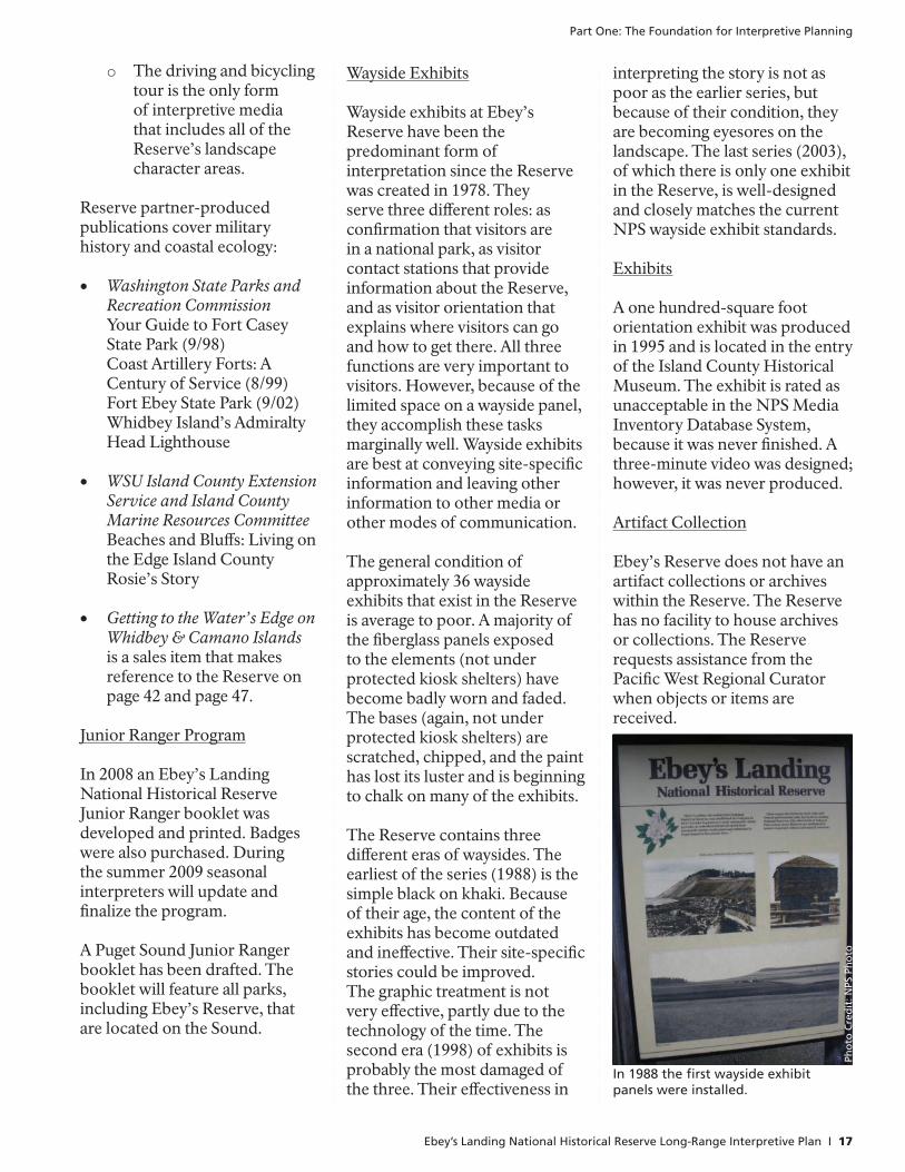
The Reserve contains three diff erent eras of waysides. The earliest of the series (1988) is the simple black on khaki. Because of their age, the content of the exhibits has become outdated and ineff ective. Their site-specifi c stories could be improved. The graphic treatment is not very eff ective, partly due to the technology of the time. The second era (1998) of exhibits is probably the most damaged of the three. Their eff ectiveness in
interpreting the story is not as poor as the earlier series, but because of their condition, they are becoming eyesores on the landscape. The last series (2003), of which there is only one exhibit in the Reserve, is well-designed and closely matches the current NPS wayside exhibit standards.
Exhibits
A one hundred-square foot orientation exhibit was produced in 1995 and is located in the entry of the Island County Historical Museum. The exhibit is rated as unacceptable in the NPS Media Inventory Database System, because it was never fi nished. A three-minute video was designed; however, it was never produced.
Artifact Collection
Ebey’s Reserve does not have an artifact collections or archives within the Reserve. The Reserve has no facility to house archives or collections. The Reserve requests assistance from the Pacifi c West Regional Curator when objects or items are received.
In 1988 the fi rst wayside exhibit panels were installed.
Pho
to C
red
it: N
PS P
ho
to
Part One: The Foundation for Interpretive Planning
18 I National Park Service
The Island County Historical Society Museum has a photographic collection and archives that includes Ebey’s Landing National Historical Reserve, Island County, and neighboring communities located on Whidbey Island. These collections are available as negatives, prints, and exhibit or microfi che format. The Reserve offi ce has a collection of photographs that are 35mm slides, negatives and prints.
Personal Services
Ebey’s Landing National Historical Reserve does not submit interpretive program statistics to the NPS Servicewide Interpretive Report.
Curriculum-based Education Program
Ebey’s Landing National Historical Reserve does not
currently off er curriculum-based education programs.
During the late 1980s, seventeen lesson plans were created through a partnership between the Trust Board, Coupeville School District and the National Society of Colonial Dames. The lesson plans were directed toward middle and high school students and focus on the cultural heritage (Theme 1), living landscape (Theme 2), and historical reserve concept (Theme 4). Associated activities were developed targeted to kindergarten, third-grade, and fi fth-grade students. Supplemental materials, including stories, maps and timelines, were also created. These lesson plans and activities are not being used in the classroom or in the Reserve. They would need to be revised, updated, and formatted before being off ered to schools.
Programs
In summer 2008 interpretive programs were presented in the Reserve by two NPS Centennial seasonal employees and one Fort Casey State Park volunteer.
The NPS seasonals were stationed primarily in Coupeville and on Ebey’s Prairie. They off ered three one-hour guided walks per day: Bluff Trail and Jacob Ebey House, Ebey’s Landing State Park and Ferry House, and Historic Coupeville. The programs were not well advertised and consequently not well attended. When the Historic Coupeville tour was cancelled due to lack of visitors, a demonstration of how to make blockhouse roof shakes was presented. Many visitors appreciated seeing how the shakes were made and understanding more about the history of the Alexander Blockhouse. Evening programs
At Fort Casey State Park visitors can go on fort walks, beach programs, and more.
Pho
to C
red
it: C
hri
s Sm
ith

Part One: The Foundation for Interpretive Planning
19Ebey’s Landing National Historical Reserve Long-Range Interpretive Plan I
were presented at Fort Ebey State Park amphitheater on Friday and Saturday nights during July and August. Approximately 30-40 people attended each program. Most visitor contacts were made when the seasonals roved the Bluff Trail, Perego Lake, and the Keystone Ferry terminal.
A variety of programs were presented at Fort Casey including fort walks, lighthouse history talks, beach programs, nature walks and an evening slide program. Sixty-six programs were presented to a total of 1,274 people.
The Island County Historical Society presents regular historical programming for all ages. A new public program, where oral histories are recorded in an informal and open atmosphere has been especially popular, routinely drawing crowds of 60 or more per event.
Staffi ng
The staff at the Reserve consists of the Reserve Manager, an offi ce assistant, and a three-quarter-time education and outreach coordinator. These positions report to and are funded by the Trust Board. An NPS Operations Manager is detailed to the Reserve and reports to the Pacifi c West Deputy Regional Director. The Operations Manager provides technical support to the Reserve staff .
Two NPS Centennial seasonal employees provided interpretive programs July through October 2008. Centennial seasonal employees will again be hired in 2009. The seasonal employees are the only staff in the Reserve wearing the NPS uniform.
Partnerships
Partnerships provide the Reserve with opportunities to reach and educate the public about the history and signifi cance of the Reserve. Though few of the partners’ interpretive programs target the Reserve specifi cally, many programs overlap with the Reserve’s primary themes.
Washington State Parks: Is one of four representative agencies that form the Trust Board. Fort Casey State Park, Ebey’s Landing State Park, and Fort Ebey State Park are located within the Reserve. The Trust Board and State Park staff s collaborate on a wide variety of projects including weed control, Golden Paintbrush restoration activities, and wayside exhibit panels. During the summer NPS interpreters provide evening programs at the Fort Ebey amphitheater.
Town of Coupeville: Is one of four representative agencies that form the Trust Board. The town appoints three members to the Trust Board, provides fi nancial supports to the Reserve per the Interlocal Agreement, and is an “Ebey’s Forever” conference partner. The Trust Board provides technical support to the town’s design review process. The town participates in quarterly Trust Board partner discussions, and bi-monthly meetings between the Reserve manager, town planner, and Island County planning department director. The Town of Coupeville works closely with the Trust Board on design review issues, and is partnering with the Reserve and Island County to develop a new Reserve-wide design review process. The town has hosted historic preservation
workshops for owners of historic properties located within the Reserve.
Island County: Is one of four representative agencies that form the Trust Board. Island County appoints four members to the Trust Board and provides fi nancial supports to the Reserve per the Interlocal Agreement. Island County works closely with the Trust Board on design review issues, and is partnering with the Reserve and the Town of Coupeville to develop a new Reserve-wide design review process. Public works and other departments coordinate their Reserve activities and projects with Reserve staff on a select basis. Island County is an “Ebey’s Forever” conference partner.
Island County Historical Society (ICHS): The Historical Society provides free and low-cost programs and special events, many of which feature the Reserve. ICHS oversees management and operations of the Reserve’s Traveler Information System, informing visitors about current Reserve events and history; and is also an “Ebey’s Forever” conference partner.
The Nature Conservancy (TNC): Works to restore golden paintbrush and other prairie plant species in the Ebey’s Reserve area. TNC is also focused on removal of non-native species such as gorse, Scotch broom and English ivy. Conservancy volunteers serve as docents along the popular bluff trail, informing visitors about the area, and monitoring the preserve for appropriate use. TNC is partnering with Ebey’s Reserve for volunteer restoration events.
Part One: The Foundation for Interpretive Planning
20 I National Park Service
Central Whidbey Chamber of Commerce: Hosts and staff s a Visitor Information Center in Coupeville. They provide visitor information, distribute Reserve brochures including the unigrid, Ebey’s Landing Driving Tour, Historic Coupeville Walking Tour, Farms of Ebey’s, and conference materials, help publicize Reserve programs and events, and serve as an “Ebey’s Forever” conference partner.
Island Transit: Off ers free bus rides to everyone on main roadways throughout the Reserve and provide bike racks for cyclists. Island Transit provides access to Reserve sites including the Port Townsend-Keystone Ferry, Fort Casey, Coupeville Schools, and the Town of Coupeville.
WSU Island County Extension Service: Provides funding and support to programs in the Reserve including the Admiralty Head Lighthouse, Beach Watchers, Master Gardeners, Marine Resource Committee. Also serves as a member of the Whidbey Island Sustainable Agriculture Committee.
• Admiralty Head Lighthouse: Docents provide visitor access to the lighthouse and promote knowledge, appreciation, and understanding through tours, exhibits, events, research, and lighthouse restoration.
• Beach Watchers: Collect data on marine plants and animals, measure shore topography, evaluating water quality, talk with the public, conduct tours and classes, and remove invasive weeds from fragile estuaries. Beach Watchers
works to improve, maintain, and protect the thriving Puget Sound ecosystem through education, community outreach, stewardship, and research. In addition, Beach Watchers developed and manages the marine exhibits at the Coupeville Wharf.
• Master Gardeners: Staff a booth at the Coupeville Farmer’s Market and a call line to educate home gardeners about sustainable methods to maintain a beautiful, functioning landscape. They also provide educational classes throughout the year.
• Marine Resources Committee: Established the Shore Stewards program to help shoreline property owners become ecologically sensitive and protect shoreline health.
Coupeville School District: Provides venue for events. The Trust Board has worked closely with teachers and students on Reserve-based curriculum and other special projects including History Day and the Building and Landscape Inventory DVD; now available to all Reserve residents and visitors.
Au Sable Institute: Provides a venue for events, participates in prairie restoration projects, donates plants for revegetation work, and is an “Ebey’s Forever” conference partner.
Whidbey-Camano Land Trust: Works in collaboration with the Trust Board to acquire conservation easements in the Reserve and throughout Island County. The Trust participates as
a member of Reserve Sustainable Agriculture Committee, coordinates easement language, sets land protection priorities, leverages resources, and shares information. The Trust also monitors easements, serves as the lead in select prairie restoration activities within the Reserve and other land conservation programs, and is an “Ebey’s Forever” conference partner.
Island County Tourism: Promotes Whidbey Island to visitors through brochures, press releases, and an interactive website, which includes lodging, activities, history, beaches, restaurants, and Reserve information.
Coupeville Historic Waterfront Association (CHWA): Has a virtual walking tour of Historic Coupeville available on their website, based on the Reserve’s Historic Coupeville Walking Tour brochure, and is an “Ebey’s Forever” conference partner. The association is a community of businesses, buildings, and homeowners focusing on putting Coupeville’s unique location and architecture to work as a catalyst for economic growth and community pride. CHWA participates as a partner in sponsoring several Coupeville festivals including the Mussel Festival, Wharf Fest, and Penn Cove Water Festival.
Coupeville Farmer’s Market: Provides access to fresh Reserve-grown foods. Reserve interpretation staff hosts an informational table each Saturday during market hours, free of charge. The Market participates in the Reserve agritourism working group, and is an “Ebey’s Forever” conference partner.
Part One: The Foundation for Interpretive Planning
21Ebey’s Landing National Historical Reserve Long-Range Interpretive Plan I
Port of Coupeville: Manages the moorage marina and the Coupeville Wharf which hosts several marine exhibits provided by the WSU Island County Extension Beach Watchers, and is the location where whale watching tours depart. The marine exhibits include an underwater camera, various interpretive displays and two life-size, marine mammal skeletons.
SNO-ISLE Libraries – Coupeville Branch: Distribute Reserve brochures, is a program partner, and is an “Ebey’s Forever” conference supporter. The library Friends group hosts an educational series of programs throughout the year, and is a potential future partner for summer children’s programs.
Washington State Ferries: Provide visitor access to Reserve, provide rack space for Reserve brochures, and support a Reserve kiosk at the Port Townsend-Keystone Ferry terminal.
Coupeville Festival Association: Coordinates various events in Coupeville that bring many visitors to the Reserve. The goal of the Association is to enhance and promote local arts and crafts, and to help preserve the unique historic qualities of the Town of Coupeville. Proceeds from the festivals go back into the community through a grants program.
National Audubon Society, Whidbey Chapter: Hosts and coordinates a variety of educational events in the Reserve such as walks, talks, and tours relating to local birds and nature.
Whidbey Sea-Tac Shuttle: Off ers special group tours of
the Reserve upon request, and provides transportation for special events around Puget Sound.
Pacifi c Northwest Art School: Hosts the annual Plein Air Painters’ US Open art event which features the Reserve, and curates annual art contest and exhibit in conjunction with the “Ebey’s Forever” conference. Provides art school courses in all mediums throughout the year; facility is located within the Reserve.
Whidbey Sustainable Agriculture Committee (WSAC): Is an informal agriculture advisory committee that was formed to address infrastructure issues impacting agriculture on Whidbey Island. Their mission is to provide leadership for agricultural profi tability, sustainability, and land stewardship through the integration of agricultural producers and the island community. Reserve staff members participate in monthly meetings of the executive committee at Trust Board offi ces. WSAC hosts an annual Family Farms Forum community event and provides advisory support to the Island County Board of Commissioners.
Camp Casey – Seattle Pacifi c University: Works with the Reserve’s design review team on their campus facilities expansion planning including design, engineering, siting, green building, and other issues. The facility is located in the West Coastal Strip Landscape Character Area. The campus is an excellent example of cluster arrangement of military installation that retains a high
degree of integrity. Camp Casey’s expanded campus will include a wide-range of educational programming and partnering opportunities with Reserve. Initial programming discussions with the Reserve are underway.
Seventeen Farms of Ebey’s Reserve: Install “Ebey’s Grown” logo at farmers’ markets and are interested in developing and promoting agritourism in the Reserve. The Reserve promotes the farmers by hosting educational programs such as “Meet the Farmers” during the “Ebey’s Forever” conference, and publishing a Farms of the Reserve brochure.
B&B Lodging Association: Encourages visitors to participate in Reserve activities.
Coupeville Lions Club: Maintains Prairie Wayside; provides volunteers, technical support, and project coordination for the Reserve’s restoration fi eld school; and is an “Ebey’s Forever” conference partner.
Central Whidbey Lions Club: Provides volunteer support on select Reserve projects.
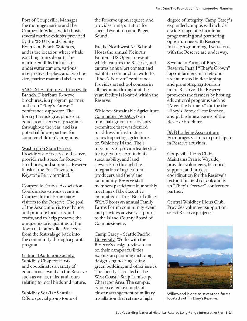
Willowood is one of seventeen farms located within Ebey’s Reserve.
Pho
to C
red
it: N
PS P
ho
to
Part One: The Foundation for Interpretive Planning
22 I National Park Service
Coupeville Garden Club: Promotes wildlife-friendly gardening and maintains historic Coupeville’s fl oral baskets.
Skagit Valley College: Coordinates Elderhostel visit to the Reserve.
Washington Department of Archaeology and Historic Preservation: Provides technical assistance on historic preservation and archaeology issues as requested, participates in Reserve historic preservation workshops and the “Ebey’s Forever” conference, and is a consulting agency for Reserve Section 106 projects.
Whidbey Island Conservation District: Is a member of the Whidbey Sustainable Agriculture Committee, provides technical support to Reserve farmers, participates as lead agency on low impact development select projects in Reserve with town and county partners and developers, and is an “Ebey’s Forever” conference partner.
Northwest Agricultural Business Center: Provides technical assistance to farms in the Reserve through a variety of programs including the development of “Whidbey Island Grown” brand.
Boys & Girls Club: Request that Reserve seasonal staff present summer programs.
Volunteers
The FY2008 NPS Volunteer-in-Parks report documented over 120 volunteers donating more than 3,500 hours at Ebey’s Landing National Historical Reserve. Most of that time was donated by the volunteer Trust Board members. Partner groups also provide support to the Reserve including the Nature Conservancy, Coupeville Lions Club, Island County Museum, and the Central Whidbey Chamber of Commerce. Washington State Parks volunteers as well as WSU Island County Extension Beach Watchers and Admiralty Head Lighthouse docents are not currently included in the NPS report. $3000 is provided by the NPS annually to support the volunteer program.
Volunteers worked on many projects during FY2008: Community Restoration Field School, Alexander Blockhouse restoration, Protecting Rural Character Community workshop, prairie restoration, maintenance,
weed control, and the “Ebey’s Forever” conference. Volunteer work teams meet monthly and focus on design review, sustainable agriculture, education and outreach, and capacity building. For the summer 2008 season, a volunteer manual was created for Fort Casey State Park. All of the 2008 interpretive programs at Fort Casey were presented by volunteers.
Most of the interpretive programs and services off ered within the Reserve are provided by docents and volunteers. The Nature Conservancy docents rove the bluff , beaches, and Perego Lake. Central Whidbey Chamber of Commerce volunteers staff the Chamber Visitor Information Station. WSU Island County Extension Beach Watchers provide education programs and rove Coupeville Wharf, Penn Cove beachfront, and the coastal beaches. Admiralty Head Lighthouse is staff ed by WSU Island County Extension docents. Docents staff the Island County Museum.
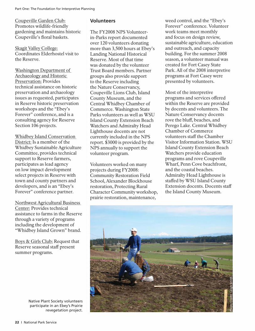
Native Plant Society volunteers participate in an Ebey’s Prairie
revegetation project. Pho
to C
red
it: L
eig
h S
mit
h
23Ebey’s Landing National Historical Reserve Long-Range Interpretive Plan I
The “abruptness of the forests that surround (the prairies) give them the appearance of lands, which have been cleared and cultivated for hundreds of years.”
Governor Governor Isaac Stevens, 1855Describing the prairies of Whidbey Island
When I till, dig a hole, plant a seed, I’m doing the same things my great-grandfather did 100+ years ago on the same land. Now my children are continuing that tradition. To see and experience this connection to our agricultural past is something that many communities have lost. The reserve not only reminds us of our past, but creates hope for our remaining working rural landscapes.
Georgie Smith, 4th generation Ebey’s Prairie FarmerWillowood Farm of Ebey’s Prairie
Part Two: Actions/ Recommendations
Part Two: Actions/ Recommendations
24 I National Park Service
The Planning Process
An update on the planning process was presented at the November 2008 “Ebey’s Forever” conference. More than 20 people, including Reserve residents, participated in the one-hour session. Two workshops were held in February 2009. During the fi rst workshop nineteen participants updated the LRIP Foundation section. This meeting was also the fi rst opportunity to brief the current Trust Board members on the planning process. The second workshop focused on identifying the existing condition of interpretive services within the Reserve as well as developing recommendations for the next seven to ten years. Using the fi ve Reserve landscape character areas as a framework for the discussion, the twenty-fi ve participants all worked together to propose realistic interpretive services. In April 2009 the implementation workshop was held. Twenty participants reviewed the recommendations, identifi ed the top fi ve priorities,
and grouped the task into short-term, mid-term, and long-term goals. The participants at all three of the 2009 workshops included Trust Board members, Reserve staff , NPS staff , park partners, farmers, Reserve residents, the Town of Coupeville and Island County offi cials, and interested local citizens.
Once the initial draft LRIP was completed in May 2009, it was used by the Trust Board to create annual implementation plans during their strategic planning workshop. The draft was made available for review by workshop participants, Reserve staff , and Pacifi c West Region NPS staff . The goal is to have the plan completed by the November 2009 “Ebey’s Forever” conference. This collaborative interpretive planning eff ort, and the thorough reviews, has produced a more comprehensive document to guide the Reserve’s interpretive program into the future.
In developing this Long-Range Interpretive Plan (LRIP) as part of the Comprehensive Interpretive Planning process, a series of workshops was conducted with Reserve staff, NPS staff, local constituents, and partners.
The Project Agreement was signed in 2004. A Foundations workshop was held in March 2005 and a Recommendations workshop was held in December 2005. Reserve staff , partners, Pacifi c West Region NPS staff , and two media specialists from Harpers Ferry Center participated in the 2005 workshops. Due to changes in Reserve management and the Trust Board, the project was put on hold in late 2007. The original planner accepted another position, and a new planner was assigned to the project in August 2008.
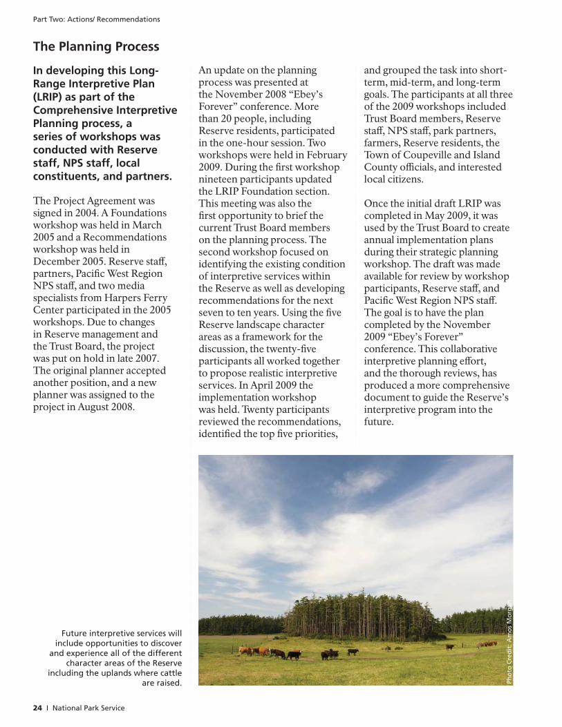
Future interpretive services will include opportunities to discover
and experience all of the different character areas of the Reserve
including the uplands where cattle are raised. Ph
oto
Cre
dit
: Am
os
Mo
rgan
Part Two: Actions/ Recommendations
25Ebey’s Landing National Historical Reserve Long-Range Interpretive Plan I
Goals for Interpretive Programming
After reviewing the contents of this LRIP’s Part One, Reserve staff identifi ed the following areas of focus that have not been adequately addressed. In order to enhance the effectiveness of the overall interpretive services in the Reserve, the following goals and issues must be addressed over the next 7 to 10 years:
Implement the Plan
Interpretive partnerships will play a key role in the implementation of the LRIP and also provide opportunities for enhanced interpretive products and services. A Reserve-wide LRIP team will be established to coordinate implementation; conduct an annual review; and update and revise the plan. Washington State Parks and Recreation Commission is a primary partner within Ebey’s Landing National Historical Reserve. To ensure that Reserve interpretive services are integrated and coordinated; the Ebey’s Landing National Historical Reserve LRIP has been vetted with the Fort Casey State Park Interpretive Plan.
Use of Landscape Character Areas
The six primary landscape character areas (prairies, woodlands, uplands, coastal strip, Penn Cove and Coupeville) identifi ed in the 2006 General Management Plan (see Appendix A) will be used along with the primary Reserve themes to identify future interpretive programs and services. While an emphasis will be placed on Ebey’s Prairie, visitors will have a wide range of opportunities to discover and experience each unique character area.
Expand Agritourism/Farm to Table Opportunities
Farms and agriculture are part of the life blood of Ebey’s Landing National Historical Reserve. Agritourism and the locally coined phrase “Farm to Table” opportunities are in their infancy within the Reserve. Throughout the next 7 to 10 years expanding the number and type of opportunities will be one of the Reserve’s most important goals. Creating “Ebey’s Reserve” branded products and produce; highlighting Ebey’s farms through on-site tours and web-based programs; and expanding relationships between farms, markets, restaurants, and accommodations will provide visitors with a variety of sensory experiences and emphasize the importance of the living landscape (Theme 2).
Create an Integrated Trail System
A variety of walking, biking, horseback, and hiking trails are located throughout the Reserve. Most of the trails
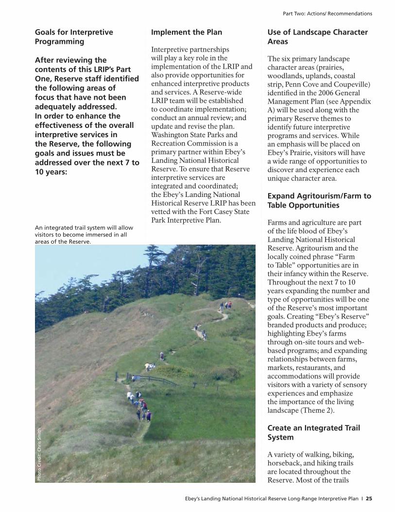
An integrated trail system will allow visitors to become immersed in all areas of the Reserve.
Pho
to C
red
it: C
hri
s Sm
ith
Part Two: Actions/ Recommendations
26 I National Park Service
are not linked nor are they identifi ed as being within the Reserve. During the next 7 to 10 years a Trust Board Advisory Committee will be established to complete a trail concept plan and create an integrated trail system within Ebey’s Landing National Historical Reserve. Acquiring easements, creating an infrastructure, connecting existing trails, and actually improving and building trails will be a high priority. Providing visitors with access to become immersed in the natural resource will aid in understanding why Ebey’s Reserve was established and provide opportunities for connections to all Reserve themes.
Improve Marketing, Orientation and Access to Information and Interpretation
An important goal for providing interpretive services over the next 7 to 10 years is to improve orientation and access to basic Reserve information. No unifi ed sign system exists to clearly identify Reserve farms, landscape character areas, structures, and historic sites, or provide information and clear directions to Reserve sites. A Master Sign Plan needs to be created to unify the many farms, landscape areas, partners, and agencies within the Reserve.
Establishing a Reserve-wide marketing team and developing an “Ebey’s Reserve” campaign will promote a strong connection between the Reserve and the local community. Informing the Ebey’s Landing National Historical Reserve area
community about activities and events is an opportunity to create goodwill with local residents. It is also important that Reserve identity be addressed comprehensively when working with the community to address the actual and thematic relationship between the Reserve and local landowners (Theme 4).
An ever-increasing percentage of Reserve visitors are web users who visit Ebey’s Landing National Historical Reserve (www.nps.gov/ebla) seeking information. Many of these “virtual visitors” never actually come to the Reserve, but have their needs met solely though the website. The website should highlight the opportunities and experiences that are available to both on-site visitors and virtual visitors. A Reserve “web team” will establish a single comprehensive website that connects all of the partners.
Within the next 7 to 10 years, Ebey’s Landing National Historical Reserve will determine a location for a Reserve-wide visitor center. The function of a visitor center is to orient visitors to the Reserve and its resources, services, and attractions. Another purpose of a visitor center is to interpret the Reserve’s stories and provide opportunities for personal connections to resource meanings and signifi cance as described by interpretive themes. Visitor centers emphasize those story elements that are best told by indoor interpretive media. Visitor centers provide a human point of contact as well as special and visual identity for the Reserve.
Upgrade and Improve Interpretive Media
Wayside Exhibits
Wayside exhibits tell the Reserve story on location. They “caption the landscape” and help visitors make direct connections with resources and their meanings. Wayside exhibits provide round-the-clock information and interpretation, and with appealing high quality design, writing, and graphics, they can serve to instill and reinforce respect for important resources. In association with good graphics, waysides can show what a site looked like at diff erent points in time. In addition, temporary waysides can be developed inexpensively to interpret construction and restoration/preservation projects. A Reserve-wide wayside exhibit proposal is recommended to ensure the development of a complete, high-quality, and unifi ed system of waysides with an Ebey’s Reserve identity. The proposal will provide an in-depth assessment of all potential wayside exhibit sites. It includes both informational and interpretive exhibits. The document also can set priorities to guide wayside development in phases as funding allows. The proposal will describe the purpose of each wayside exhibit, identify graphics available for use, show thumbnail design concept drawings, and determine exact exhibit sizes, base styles, and locations. A detailed budget estimate would also be part of the document.
Part Two: Actions/ Recommendations
27Ebey’s Landing National Historical Reserve Long-Range Interpretive Plan I
Publications
Visitors typically use publications in two ways: for information and orientation during their visit, and for in-depth interpretation following their visit. The Reserve’s size, access issues, and number of stories to tell make publications an eff ective method of interpretive delivery. Publications are a means for getting information to diverse audiences through a variety of formats. All brochures, site bulletins, maps, rack cards, and other publications should meet the Ebey’s Reserve graphic identity standards determined by the marketing team. It is important that Reserve identity be addressed comprehensively to address the unique nature of an historical reserve (Theme 4).
Audiovisual
Audiovisual media are well suited to the presentation of chronological and sequential material. They can capture realism, provide emotional impact, and create a mood or atmosphere. Also they can reach the many visitors who are now using computers, cell phones, GPS units, IPods, MP3 players, and a variety of other technological systems for entertainment, information, orientation, and interpretation. In response to the growing demand for these services, the Reserve needs to off er portable “individualized” audio and/or audiovisual opportunities. Using new technology will possibly create opportunities for a more diverse audience to experience park resources than ever before.
These services will allow visitors to access more Reserve resources and meanings at their convenience.
In response to former NPS Director Mary Bomar’s memo of October 20, 2006 on the “Audiovisual Accessibility Initiative for Visitors with Disabilities,” staff should initiate steps to assure that the Reserve’s current and future audiovisual programs are meeting accessibility requirements. For more information, see the website for Programmatic Accessibility Guidelines for National Park Service Interpretive Media at www.nps.gov/hfc/accessibility/index.htm#. Audio provides intellectual access to visually impaired visitors and can be more eff ective for reaching visitors whose preferred learning style is auditory rather than visual. Audio descriptions could also be used to narrate the text of a wayside exhibit and describe the graphics seen on the panels as well as describe the surrounding view that prompted the need to tell the story.
Provide Personal Services
Interpreters are the best interactive tool in enabling visitors to experience, understand, appreciate, and make personal connections with the resource. Seasonal roving docents and interpreters along the Bluff , the Wharf, and in other Reserve areas will increase opportunities to help visitors make personal connections with the resources. Education programs and special events will
be increased covering a wider range of landscape character areas and thematic connections will be established.
The diversity of the Reserve’s resources and themes presents almost limitless opportunities for both standard and innovative interpretive activities. As staffi ng levels permit, and in keeping within the parameters of the interpretive themes and visitor experience goals, docents, volunteers, and interpreters throughout the Reserve should be given a high degree of creative freedom to explore and experiment with new programs. This will help to maintain a creative edge and attract new and returning audiences. NPS Centennial-funded seasonal employees should allow the Reserve to increase the numbers of programs off ered as well as diversify the programming.
There is great potential to experiment with the development of programs related to agriculture, the landscape character areas, Ebey’s Landing National Historical Reserve history, military history, and the stories of the people who have lived, and continue to live in the Reserve. Since personal services interpretive programs are relatively easy to change, the activities should be evaluated on a regular basis to discontinue those that are not eff ective, modify or improve those that require it, and validate those that are successful.
Part Two: Actions/ Recommendations
28 I National Park Service
Action Plan over the Next 7-10 Years
• Interpret historic barns and explain how they were built.
• Explain the color of the soil and why it is so fertile.
• Explain the importance of farming to the natural area.
• Conduct a Reserve-specifi c farm tour.
• Label booths at farmers markets so people will recognize Reserve farms.
• Staff interpretation booth at farmer’s market.
• Improve crop signs and include within the Master Sign Plan.
• Connect Reserve farms with schools and hospitals to educate public about how the food goes from farm to cafeteria.
Mid-term:• Host “Experiencing Ebey’s
Farms” - a seasonally scheduled series of guided sensory farm walks.
• Host First Saturday events that highlight one farm each month.
• Establish a tasting room.• Establish a tasting garden.
Long-term:• Present farming
demonstrations so visitors can watch a fi eld being plowed, mowed, and threshed.
• Present a living history program using farm machinery.
• Set up Reserve webcam and show time lapse photography of crops and animals growing.
• Develop short audio- and video-casts using current technologies to highlight Reserve agriculture programs and products.
Actions to Create an Integrated Trail SystemLeads: Ebey’s Reserve Trust Board with Advisory Committee, NPS, Washington State Parks
Short-term:• Complete trail concept plan.
On-going:Trail Implementation• Prioritize phases and identify
missing links.• Acquire property and/or
easements.• Include all of the existing
trails/walks – historic Coupeville, Broadway, AuSable, Rhododendron Park, county trails, and Naas Preserve.
Trail Infrastructure• Facilities• Standards• Policies• Signs• Maps
Build trails• Provide multi-use trails –
walking, bicycling, horseback riding, and hiking.
• Create new trailheads at Island Transit Park and Ride, and Prairie Wayside.
• Improve Kettles trailhead.• Create bluff trail from Fort
Ebey to Fort Casey.• Create a water trail.
During the 2009 Recommendations workshop, the participants agreed to divide the actions necessary to implement the recommendations into short-term (1-3 years), mid-term (3-5 years), and long-term (5-10 years) goals. Some actions will be undertaken immediately and others will be on-going. Lead agencies were defi ned to implement the recommendations. Actions to Implement the Long-Range Interpretive Plan• Form an LRIP team to
coordinate implementation, conduct annual review, and update and revise plan as needed.
• Link to Fort Casey State Park Interpretive Plan.
Actions to Expand Agritourism/Farm to Table OpportunitiesLeads: Farmers, Ebey’s Reserve – Agriculture Committee, Whidbey Sustainable Agriculture Committee, Northwest Agriculture Business Center, Washington State Department of Agriculture
Short-term:• Connect local chefs with
farmers and lodging to host “farm dinners”, slow food dinners, and “Taste of the Prairie” interpretive dinners.
• Sell “Ebey’s Reserve” branded products and produce.
• Produce, interpret, and sell heirloom crops including sugar squash and Rockwell beans.
• Integrate stories with produce.
Part Two: Actions/ Recommendations
29Ebey’s Landing National Historical Reserve Long-Range Interpretive Plan I
Actions to Improve Marketing, Orientation and Access to Information and Interpretation
Signs• Create a sign element
throughout the Reserve that indicates the landscape character area one is traveling through.
• Develop a Master Sign Plan for the Reserve including a sign assessment, sign condition plan, determination of needs, sign location, and sign drawings that would be used by all partners.o Identity signs including
entrance signs.o Motorist guidance
signs including Reserve boundaries.
MarketingLeads: Ebey’s Reserve Trust Board, Partners, NPS, Washington State Ferries, Island County Historical Society, Central Whidbey Chamber of Commerce
Short-term:o Establish a Reserve
marketing team. o Develop a marketing
strategy including a Reserve identity and graphic design standards.
Mid-term:o Develop a “Located in
Ebey’s Reserve” logo and brand that can be used throughout the Reserve.
o Develop a local resident and business owner awareness and education program that may include bumper stickers and buttons featuring slogans such as “Proud resident
of Ebey’s Reserve” and “Ask me about Ebey’s Reserve.”
Long-term:o Update and revise signs
and publications.o Conduct local and
regional outreach.
On-goingo Use the ferry terminals
to convey interpretive history and stories about Ebey’s Landing National Historical Reserve.
o Use the Traveler’s Information System (TIS) to communicate stories and information.
o Hold annual conference.
WebsiteLeads: Ebey’s Reserve Trust Board and NPS
Short-term:o Establish a Reserve
“webteam” that will assess and determine content and layout.
o Identify web manager for the Reserve NPS website (www.nps.gov/ebla).
o Determine how many websites are currently connected to the Reserve and decide which one will be the primary one.
o Link to all partner sites.o Develop a comprehensive
website that visitors can use to plan their trip prior to visiting the Reserve.
o Establish business partners, internships, and volunteer opportunities.
o Create an “Ebey’s Seasons” section that includes what’s growing and why, heritage recipe of the week, where can you buy our produce
and homemade crafts, where can you taste our local food, where can you visit with a farmer, what is going on in the winter, canning, what are heirlooms, what’s going on in the barns, and more.
o Update online map and basic information to capture the essence of the Reserve.
Mid-term:o Create a virtual “walk”
through the six landscape character areas.
o Create a 360° virtual tour of the Ferry House interior.
o Identify and establish links to further themes in the Reserve.
Long-term:o Set up a Reserve webcam
and show time lapse photography of crops and animals growing.
o Create a “terra server” including a 3-dimensional view of the Reserve that has interactive features visitors can “click” on for detail about Reserve sites and features.
o Create a scale map of the Reserve with distances, elevation, terrain, and orientation.
Visitor CenterLeads: Ebey’s Reserve Trust Board, NPS and Washington State Parks
Short-term:o Finalize and secure visitor
center site.o Identify partners.o Well trained, friendly,
knowledgeable staff .
Part Two: Actions/ Recommendations
30 I National Park Service
o Record and maintain oral histories including videos and interviews.
o Develop temporary exhibits.
o Develop a Visitor Center Media Concept Plan for building and grounds. The Concept Plan will provide detailed recommendations for determining how people will experience the site and learn of its signifi cance, events, and context. Recommendations for interpretive media will include interior and exterior exhibits, wayside exhibits, and digital media.
Mid-term:o Develop “Welcome
to Ebey’s Reserve” interpretive fi lm.
o Provide sense of place with 3-dimensional map and interactive exhibits.
o Facility operations: identity as a visitor center; focal point of Reserve; and consistent hours of operation.
o Preservation and continued use of historically appropriate garden plantings and native plants.
o Interpret Native American agriculture practices including land use of the prairie (burning and harvest).
o Maintain a well lit and clean building.
Long-term:o Provide retail sales of
Reserve products.o Act as a model
highlighting sustainable eff orts within the Reserve.
Actions to Upgrade and Improve Interpretive Media
Wayside Exhibits:• Update the 1990 Wayside
Exhibit Plan.• Develop exterior
interpretation at Ferry House that includes wayside exhibits.
• Develop wayside exhibit panels for each of the six landscape character areas and include appropriate stories associated with each area: ships, Brooklyn and Chicago, native plants, Fort Casey, Admiralty Head Lighthouse, Fort Ebey, and prairie restoration.
• Develop a wayside exhibit at Grasser’s Hill describing and showing what had been in this area, and why we have protective easements across the hillside.
• Develop a wayside exhibit describing the Mussel Farm on Penn Cove.
• Develop a roadside pullout that describes the history of the San de Fuca area.
• Develop a series of wayside exhibit panels for Coupeville including the Krueger Farm, Front Street, Prairie Center, and Main Street.
• Continue to include panels that provide information about the signifi cance of the Reserve.
• Maintain existing wayside exhibit panels.
Publications:• Develop, print, and distribute
a Ferry House publication.• Develop, print and distribute
the “Farms of Ebey’s” self-guided tour including a section on donation land claims.
• Create a brochure detailing pre-1850 and 1850-2008 agriculture practices emphasizing the crops, soils, and seasonal detail during each time period. Once completed, print and publish on website.
Audiovisual• Develop an audio tour of the
Reserve.• Develop an audiovisual
program about the Reserve.• Create a “Birding by Ear”
forest audio tour.• Create a “Hearing Ebey’s
Reserve” audio tour that would include all landscape areas.
Exhibits• Create a visitor contact
station at Jacob Ebey House including interior exhibits.
Actions to Improve Personal Services
Programs• Use living history docents
to portray historical town residents, tell their stories, and interact with each other and visitors.
• Conduct mountain biking tours and rides through all six landscape character areas on annual basis including various levels of diffi culty and distance.
• Conduct Fort Ebey, Fort Casey, and Admiralty Head Lighthouse guided walking tours.
• Interpret sheep farm stories including herding dog demonstrations.
• Conduct a native plant van tour of Keystone Spit in the spring.
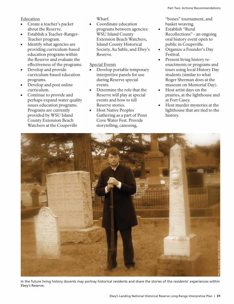
Part Two: Actions/ Recommendations
31Ebey’s Landing National Historical Reserve Long-Range Interpretive Plan I
Education• Create a teacher’s packet
about the Reserve.• Establish a Teacher-Ranger-
Teacher program.• Identify what agencies are
providing curriculum-based education programs within the Reserve and evaluate the eff ectiveness of the programs.
• Develop and provide curriculum-based education programs.
• Develop and post online curriculum.
• Continue to provide and perhaps expand water quality issues education programs. Programs are currently provided by WSU Island County Extension Beach Watchers at the Coupeville
Wharf.• Coordinate education
programs between agencies: WSU Island County Extension Beach Watchers, Island County Historical Society, Au Sable, and Ebey’s Reserve.
Special Events• Develop portable temporary
interpretive panels for use during Reserve special events.
• Determine the role that the Reserve will play at special events and how to tell Reserve stories.
• Host Native Peoples Gathering as a part of Penn Cove Water Fest. Provide storytelling, canoeing,
“bones” tournament, and basket weaving.
• Establish “Rural Recollections” - an ongoing oral history event open to public in Coupeville.
• Organize a Founder’s Day Festival.
• Present living history re-enactments or programs and tours using local History Day students (similar to what Roger Sherman does at the museum on Memorial Day).
• Host artist days on the prairies, at the lighthouse and at Fort Casey.
• Host murder mysteries at the lighthouse that are tied to the history.
In the future living history docents may portray historical residents and share the stories of the residents’ experiences within Ebey’s Reserve.
Pho
to C
red
it: M
itch
Ric
har
ds
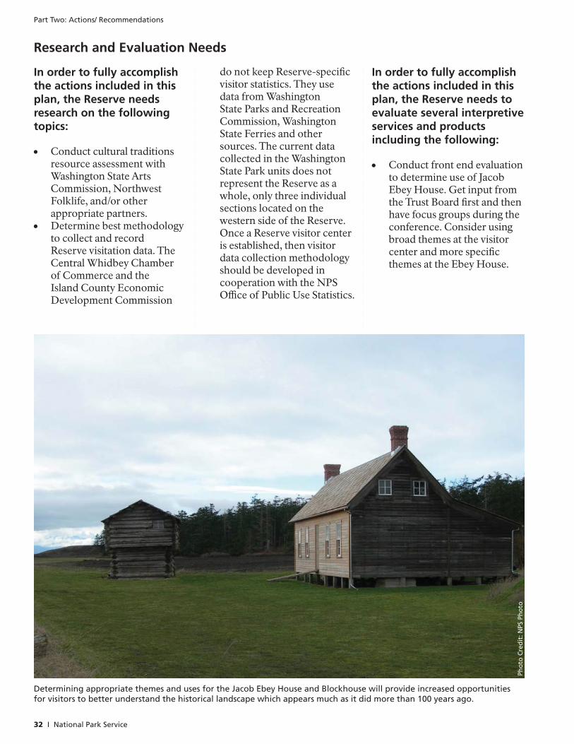
Part Two: Actions/ Recommendations
32 I National Park Service
Research and Evaluation Needs
do not keep Reserve-specifi c visitor statistics. They use data from Washington State Parks and Recreation Commission, Washington State Ferries and other sources. The current data collected in the Washington State Park units does not represent the Reserve as a whole, only three individual sections located on the western side of the Reserve. Once a Reserve visitor center is established, then visitor data collection methodology should be developed in cooperation with the NPS Offi ce of Public Use Statistics.
In order to fully accomplish the actions included in this plan, the Reserve needs to evaluate several interpretive services and products including the following:
• Conduct front end evaluation to determine use of Jacob Ebey House. Get input from the Trust Board fi rst and then have focus groups during the conference. Consider using broad themes at the visitor center and more specifi c themes at the Ebey House.
In order to fully accomplish the actions included in this plan, the Reserve needs research on the following topics:
• Conduct cultural traditions resource assessment with Washington State Arts Commission, Northwest Folklife, and/or other appropriate partners.
• Determine best methodology to collect and record Reserve visitation data. The Central Whidbey Chamber of Commerce and the Island County Economic Development Commission
Determining appropriate themes and uses for the Jacob Ebey House and Blockhouse will provide increased opportunities for visitors to better understand the historical landscape which appears much as it did more than 100 years ago.
Pho
to C
red
it: N
PS P
ho
to
Part Two: Actions/ Recommendations
33Ebey’s Landing National Historical Reserve Long-Range Interpretive Plan I
Staffi ng and Training Needs
Permanent Staff• Based upon a 2006
General Management Plan recommendation, an NPS OFS Request (#25764) has been submitted to hire a permanent, full-time Interpretation Specialist. This position may be hired in 2010.
Volunteers:• Establish a Reserve volunteer
program.• Determine how this program
will be diff erent and/or gain support from other local volunteer organizations.
• Expand Reserve-wide pool of interpretive volunteers.
• Provide beach volunteers at Fort Ebey.
Training• Need to establish a training
framework and conduct a training needs assessment.
• Provide interpretive training.• Provide resource-specifi c
training.• Provide visitor services
training.• Create a resource list.• Create Reserve-specifi c
training opportunities.• Training should be open to
all – paid staff and volunteers/docents.
Partnerships• Establish a “Friends of Ebey’s
Reserve” group.
Implementation Plan
Actions items will be reviewed and integrated into annual work plans. During the May 2009 Trust Board Strategic Planning Workshop, these items were identifi ed as short-term (1-3 year) priorities.
2009• Publish the Long-Range
Interpretive Plan.• Establish working group
to develop agritourism programs.
• Publish Farms of Ebey’s Reserve interpretive guide.
• Conduct annual community restoration fi eld school.
• Continue to off er summer interpretive hikes.
• Continue to present evening interpretive talks at Fort Casey and Fort Ebey State Parks.
2010• Off er agritourism programs
such as “The Seasons of Ebey’s Reserve”.
• Establish Reserve trails team.• Complete Integrated Trails
Plan.• Establish “Friends of
Ebey’s Reserve” to support historic preservation and interpretation programs.
• Develop exhibit concept plan including interpretive themes and fabricate exhibits for Jacob Ebey House.
2011• Install permanent exhibit at
Jacob Ebey House.• Develop Reserve Master Sign
Plan. • Expand number of
agritourism programs off ered. • Develop reserve brand/label. • Implement Trails program
focusing on high priority trails.
• Acquire Visitor Center property based on 2010 assessment process.
2012• Implement sign plan
including fabrication and installation.
• Develop Visitor Center Media Concept Plan for building and grounds.
Ongoing• Host “Ebey’s Forever”
conference.• Provide annual interpretive
training for partners and staff .• Update website.• Off er Junior Ranger
programs.• Increase number of
participants and projects in the Volunteer-in-Parks program.
• Seek funding annually for LRIP recommendations.
Part Two: Actions/ Recommendations
34 I National Park Service
Planning Team
Ebey’s Landing National Historical ReserveMark Preiss, Reserve ManagerEmi Morgan, Education and Outreach CoordinatorKaren Hossfeld, Administrative AssistantCraig Holmquist, NPS Operations ManagerLeigh Smith, NPS Operations Manager (retired)Gretchen Luxenberg, NPS Superintendent (transferred)Rob Harbour, former Reserve Manager Rachael Protas, 2008 NPS seasonal employeeChris Smith, 2008 NPS seasonal employee
Trust Board of Ebey’s Landing National Historical ReserveJan Pickard, Chair, Town of Coupeville RepresentativeHank Florence, NPS RepresentativeJon Roberts, Town of Coupeville RepresentativeMolly Hughes, Town of Coupeville RepresentativeMarilyn Clay, Secretary, Island County RepresentativeAl Sherman, Treasurer / Auditing Offi cer, Island County RepresentativeLisa Meserole, Island County RepresentativeFran Einterz, Vice Chair, Island County RepresentativeJim Neill, Washington State Parks and Recreation Commission RepresentativeJohn Krambrink, former Washington State Parks and Recreation Commission Representative
Pacifi c West RegionLynne Nakata, Interpretive Specialist
Harpers Ferry CenterToni Duffi cy, Interpretive Planner (Team Captain)Chad Beale, Graphic DesignerDavid T. Gilbert, Web Manager (transferred)Katherine Brock, Interpretive Planner (transferred)
Partners and FriendsSteve Ellis, President, Whidbey Island Chapter of the National Audubon Society Lindy Kortus, Marketing Coordinator, Island County Tourism Lynda Eccles, Executive Director, Central Whidbey Chamber of Commerce Kimberly Martin, Public Aff airs Offi cer, Naval Air Station Whidbey IslandNancy Conard, Mayor, Town of CoupevilleRick Castellano, Executive Director, Island County Historical SocietyHelen Price-Johnson, Commissioner, Island CountyGraham Johnson, Beach Watchers, WSU Island County ExtensionPat Powell, Executive Director, Whidbey Camano Land TrustAaron Terada, Park Manager, Fort Ebey State ParkSally Straathof, Volunteer Interpreter, Fort Casey State ParkKen Hageman, Park Manager, Fort Casey State ParkAdam Lorio, Interpretive Specialist, Deception Pass State ParkSarah Martin, Beach Watchers Program Coordinator, WSU Island County ExtensionJudy Feldman, Interim Director, WSU Island County ExtensionGloria Wahlin, Admiralty Head Lighthouse Docents Program Coordinator, WSU Island County ExtensionAlan and Elizabeth Hancock, Reserve Farmers, Hancock Farm
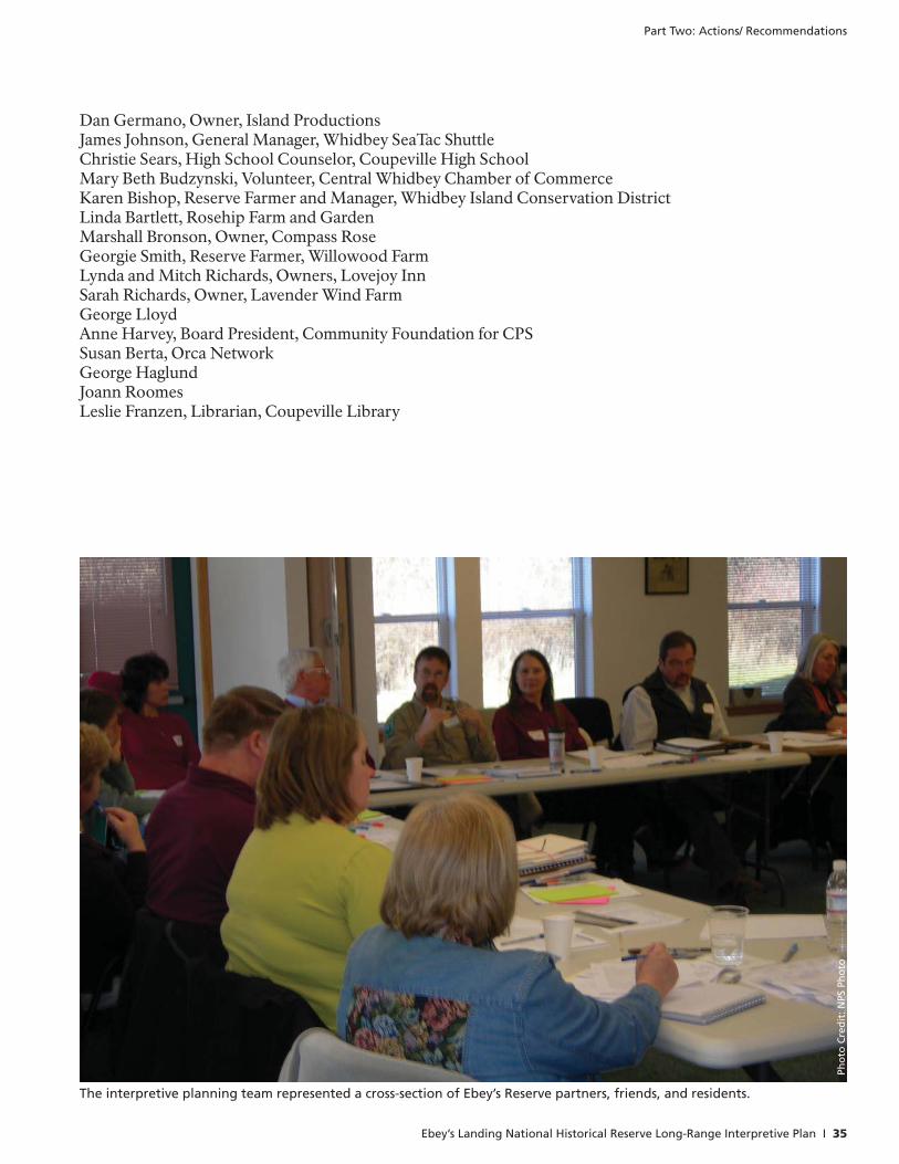
Part Two: Actions/ Recommendations
35Ebey’s Landing National Historical Reserve Long-Range Interpretive Plan I
Dan Germano, Owner, Island ProductionsJames Johnson, General Manager, Whidbey SeaTac ShuttleChristie Sears, High School Counselor, Coupeville High SchoolMary Beth Budzynski, Volunteer, Central Whidbey Chamber of CommerceKaren Bishop, Reserve Farmer and Manager, Whidbey Island Conservation DistrictLinda Bartlett, Rosehip Farm and GardenMarshall Bronson, Owner, Compass RoseGeorgie Smith, Reserve Farmer, Willowood FarmLynda and Mitch Richards, Owners, Lovejoy InnSarah Richards, Owner, Lavender Wind FarmGeorge Lloyd Anne Harvey, Board President, Community Foundation for CPSSusan Berta, Orca NetworkGeorge Haglund Joann Roomes Leslie Franzen, Librarian, Coupeville Library
The interpretive planning team represented a cross-section of Ebey’s Reserve partners, friends, and residents.
Pho
to C
red
it: N
PS P
ho
to

36 I National Park Service
Appendices:Appendix A: Landscape Character Areas Appendix B: Interpretive Services by Landscape Character Area Matrix
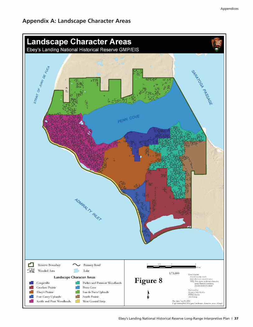
Appendices
37Ebey’s Landing National Historical Reserve Long-Range Interpretive Plan I
Appendix A: Landscape Character Areas
Appendices
38 I National Park Service
CoupevilleThis nineteenth century seaport town, set on the southern edge of Penn Cove, has the greatest concentration of historic buildings in the state and is the second oldest town in Washington State. It is also the commercial center of the Reserve. Within the town limits, one can experience dramatic views of Penn Cove, Mt. Hood, the Cascades Mountains, and prairies.
Signifi cant areas within Coupeville are the Coupeville Wharf, Town Park, Captain Coupe Park, Summit Loop Park, historic Front and Main Streets, and Prairie Center. Coupeville’s historic resources include historic buildings, structures, platted neighborhoods, and remnant orchards. Signifi cant corridors are Main Street, Front Street, Broadway, Madrona Way, Coveland Street, Ninth Street, and Parker Road.
Crockett PrairieCrockett Prairie is a natural, open prairie adjacent to Crockett Lake, Keystone Spit, and Admiralty Bay. Crockett Lake is a salt marsh, and is an important migratory bird habitat and nesting area. From Keystone Spit, the view of Crockett Prairie is complemented by the open water of Crockett Lake and the tree covered ridges beyond.
Other signifi cant areas include the inter-prairie Ridge between Ebey’s and Crockett prairies, and the Washington State Ferry Terminal. Historic remnants in this area refl ect the building of Fort Casey, including ponds, wharf, and dock remains.
Ebey’s PrairieEbey’s Prairie is located in the central portion of the Reserve and is the largest natural prairie on Whidbey Island. It contains its most productive agricultural land, which refl ects its agricultural character. It is characterized by its historic farm clusters, fi elds, fences and hedgerows, upland ridges, and forest edges. It has a long history of agricultural use by Skagit Indians, dating back 8,000 years, and by European settlers since the 1850s.
Signifi cant areas and locations within this Character Area are Ebey’s Landing, the Ferry House and ravine, Sunnyside Cemetery and the (Davis) Blockhouse, Jacob Ebey House and Blockhouse, Sherman-Bishop Farm, Smith Farm, Engle Farm, Jenne Farm, Hancock Farm and the inter-prairie ridge between Ebey and Crockett prairies.
Smith PrairieSmith Prairie is a 600-acre natural prairie surrounded by Douglas fi r forest. The prairie is open, characterized by agricultural features refl ecting its cultural history.
Signifi cant areas are Au Sable Institute (the former site of the Washington State Game Farm), Naval Air Station-Whidbey’s Outlying Landing Field, and two commercial tree farms growing seed stock. The Au Sable Institute property is the site of the largest remaining remnant of a native prairie plant community on Whidbey Island.
Fort Casey UplandsThe Fort Casey Uplands is characterized by undulating and gently rolling hills of forest, fi elds, and residential areas. Natural areas include remnant prairie communities, a Washington State Natural Heritage Forest, and golden paintbrush populations.
Cultural areas include the historic buildings of Fort Casey State Park and Camp Casey.
San de Fuca UplandsThe San de Fuca Uplands are characterized by undulating and gently rolling hills that begin at the shoreline of Penn Cove and rise in elevation. The slope levels onto agricultural land, divided by woodlots and residential subdivisions. The visual continuity of open fi elds and Penn Cove is relatively unimpaired.
Appendices
39Ebey’s Landing National Historical Reserve Long-Range Interpretive Plan I
Signifi cant natural features include saltwater wetland areas, Garry oak plant communities, and remnant prairie plant communities.
Signifi cant areas include Grasser’s Hill and Lagoon, San de Fuca’s commercial and residential building clusters, Arnold Farm, Monroe’s Landing, Muzzall Farm, Vandewerfhorst Farm, and Blower’s Bluff .
Kettle and Pratt WoodlandsThe Kettle and Pratt Woodlands area is characterized by dense forests including Douglas fi r, western red cedar, and alder, with salal, Oregon grape, and rhododendron understory. The interior portions of these woodlands are remote and isolated. The area contains kettles and trails that connect to Fort Ebey State Park. After owner Robert Pratt died, TNC purchased 400 acres of woodlands, eventually selling an easement to NPS. The kettles are large depressions up to 200 feet deep, which are signifi cant geological features, formed by retreating glaciers. Kettle holes are formed when huge blocks of ice melt. These melted ice blocks formed deep ponds and wetland areas. Most of the kettles found in the Reserve occur in forested areas. Lake Pondilla is the only kettle large enough to be classifi ed as a pond. The remaining kettle holes are scattered and relatively small in size.
Other signifi cant sites are historic Coveland and the Captain Whidbey Inn. Signifi cant corridors are Libbey Road, State Highway 20, Madrona Way, and the Kettles Trail.
Parker and Patmore WoodlandsThe Parker and Patmore Woodlands are a natural resource area characterized by densely wooded second and third-growth Douglas fi r forest with western red cedar, alder, salal, and rhododendron undergrowth. It is located along a ridge on the eastern portion of the Reserve.
Penn CoveThe Penn Cove character area is characterized by low beaches and uplifted banks. It consists of 3,955 acres of open water with nearshore and shoreline habitats of mudfl at tidelands, high sandy bluff s, beaches, and eelgrass beds. The Penn Cove shoreline has more than thirty archaeological sites along the shoreline, including three permanent Salish villages.
Signifi cant areas include Blower’s Bluff , Monroe’s Landing, Grasser’s Lagoon, Kennedy’s Lagoon, Long Point, and Snakelum Point.
West Coastal StripThe west shore of the Reserve along Admiralty Inlet is an eight-mile strip of narrow sand and stone beaches that give way to dramatic bluff s and ravines. Elevations range from sea level to just over 200 feet. Bluff instability, combined with steep slopes and well-drained sandy soil, prevents development of forest and shrub vegetation and helps maintain conditions allowing development of low-growing herbaceous plants. Nearshore areas include eelgrass and bull kelp beds. Remnant prairie populations and populations of a federally threatened and state endangered plant, golden paintbrush (Castilleja levisecta), are found at several locations along the bluff s.
Signifi cant areas include Point Partridge, Fort Ebey State Park, Ebey’s Landing Bluff Trail, Perego’s Lagoon, Ebey’s Landing State Park, Camp Casey, and Fort Casey State Park. Signifi cant corridors are Hill Road, trails through Fort Ebey and Fort Casey state parks, Ebey’s Landing Bluff Trail, and the coastal bluff and beach trail.
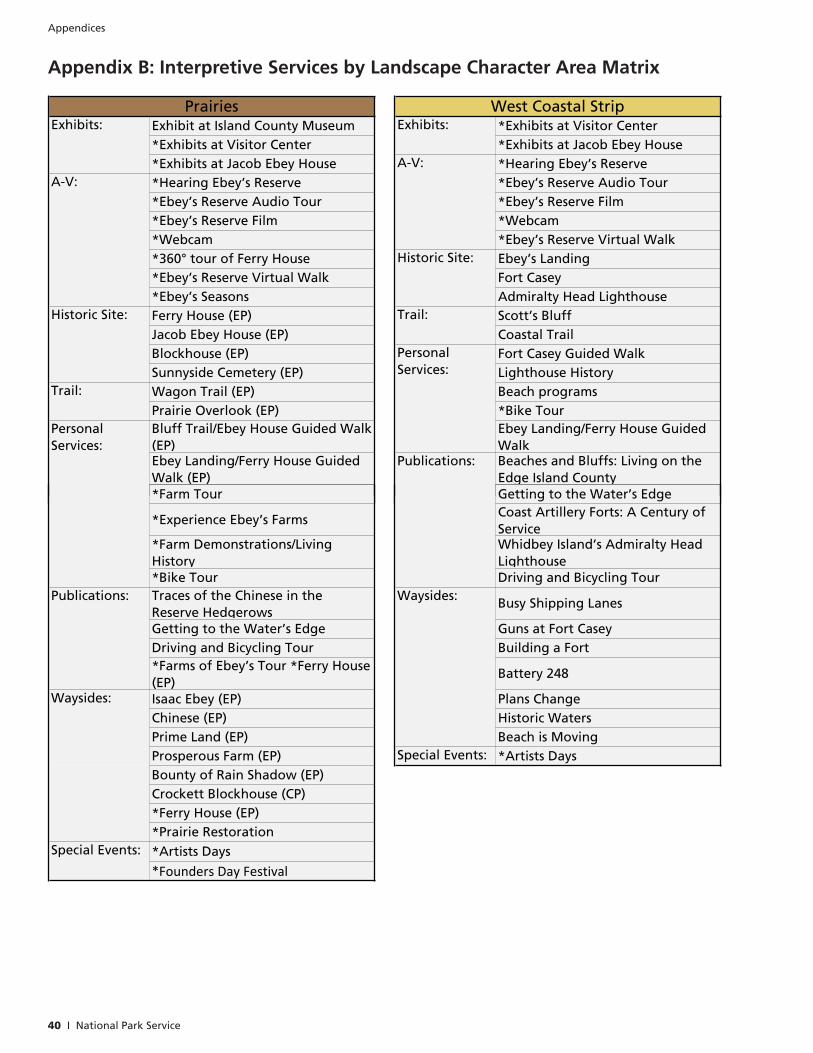
Appendices
40 I National Park Service
Exhibit at Island County Museum *Exhibits at Visitor Center*Exhibits at Visitor Center *Exhibits at Jacob Ebey House*Exhibits at Jacob Ebey House *Hearing Ebey’s Reserve*Hearing Ebey’s Reserve *Ebey’s Reserve Audio Tour*Ebey’s Reserve Audio Tour *Ebey’s Reserve Film*Ebey’s Reserve Film *Webcam*Webcam *Ebey’s Reserve Virtual Walk*360° tour of Ferry House Ebey’s Landing *Ebey’s Reserve Virtual Walk Fort Casey *Ebey’s Seasons Admiralty Head LighthouseFerry House (EP) Scott’s Bluff Jacob Ebey House (EP) Coastal Trail Blockhouse (EP) Fort Casey Guided Walk Sunnyside Cemetery (EP) Lighthouse History Wagon Trail (EP) Beach programs Prairie Overlook (EP) *Bike TourBluff Trail/Ebey House Guided Walk (EP)
Ebey Landing/Ferry House Guided Walk
Ebey Landing/Ferry House Guided Walk (EP)
Beaches and Bluffs: Living on the Edge Island County
*Farm Tour Getting to the Water’s Edge
Trail:
Personal Services:
A-V:
Historic Site:
Trail:
Personal Services:
Publications:
Prairies West Coastal Strip
A-V:
Exhibits:Exhibits:
Historic Site:
Farm Tour Getting to the Water s Edge
*Experience Ebey’s Farms Coast Artillery Forts: A Century of Service
*Farm Demonstrations/Living History
Whidbey Island’s Admiralty Head Lighthouse
*Bike Tour Driving and Bicycling Tour Traces of the Chinese in the Reserve Hedgerows
Busy Shipping Lanes
Getting to the Water’s Edge Guns at Fort Casey Driving and Bicycling Tour Building a Fort *Farms of Ebey’s Tour *Ferry House (EP)
Battery 248
Isaac Ebey (EP) Plans Change Chinese (EP) Historic Waters Prime Land (EP) Beach is Moving Prosperous Farm (EP) Special Events: *Artists DaysBounty of Rain Shadow (EP)Crockett Blockhouse (CP)*Ferry House (EP)*Prairie Restoration *Artists Days
*Founders Day Festival
Publications:
Waysides:
Waysides:
Special Events:
Appendix B: Interpretive Services by Landscape Character Area Matrix
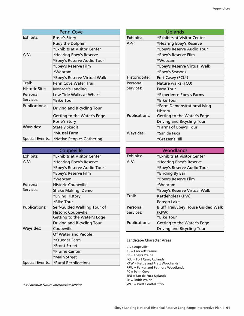
Appendices
41Ebey’s Landing National Historical Reserve Long-Range Interpretive Plan I
Rosie’s Story Exhibits: *Exhibits at Visitor CenterRudy the Dolphin *Hearing Ebey’s Reserve*Exhibits at Visitor Center *Ebey’s Reserve Audio Tour*Hearing Ebey’s Reserve *Ebey’s Reserve Film*Ebey’s Reserve Audio Tour *Webcam*Ebey’s Reserve Film *Ebey’s Reserve Virtual Walk*Webcam *Ebey’s Seasons*Ebey’s Reserve Virtual Walk Historic Site: Fort Casey (FCU )
Trail: Penn Cove Water Trail Nature walks (FCU)Historic Site: Monroe’s Landing Farm Tour
Low Tide Walks at Wharf *Experience Ebey’s Farms*Bike Tour *Bike Tour
Driving and Bicycling Tour *Farm Demonstrations/Living History
Getting to the Water’s Edge Getting to the Water’s Edge Rosie’s Story Driving and Bicycling Tour Stately Skagit *Farms of Ebey’s Tour *Mussel Farm *San de Fuca
Special Events: *Native Peoples Gathering *Grasser’s Hill
A-V:
Personal Services:
Publications:
Waysides:
A-V:
Personal Services:
Publications:
Waysides:
Penn Cove Uplands
Co pe ille Woodlands
Exhibits:
Exhibits: *Exhibits at Visitor Center Exhibits: *Exhibits at Visitor Center*Hearing Ebey’s Reserve *Hearing Ebey’s Reserve*Ebey’s Reserve Audio Tour *Ebey’s Reserve Audio Tour*Ebey’s Reserve Film *Birding By Ear*Webcam *Ebey’s Reserve FilmHistoric Coupeville *WebcamShake Making Demo *Ebey’s Reserve Virtual Walk*Living History Kettleholes (KPW)*Bike Tour Perego LakeSelf-Guided Walking Tour of Historic Coupeville
Bluff Trail/Ebey House Guided Walk (KPW)
Getting to the Water’s Edge *Bike TourDriving and Bicycling Tour Getting to the Water’s Edge Coupeville Driving and Bicycling TourOf Water and People*Krueger Farm*Front Street*Prairie Center*Main Street
Special Events: *Rural Recollections
C = CoupevilleCP = Crockett PrairieEP = Ebey’s PrairieFCU = Fort Casey UplandsKPW = Kettle and Pratt WoodlandsPPW = Parker and Patmore WoodlandsPC = Penn CoveSFU = San de Fuca UplandsSP = Smith PrairieWCS = West Coastal Strip
Landscape Character Areas
* = Potential Future Interpretive Service
A-V:
Trail:
Personal Services:
Publications:
Personal Services:
Publications:
Waysides:
Coupeville Woodlands
A-V:


Harpers Ferry CenterNational Park ServiceU.S. Department of the Interior
Ebey’s Landing National Historical ReservePO Box 774162 Cemetery RoadCoupeville, WA 98239
360-678-6084
www.nps.gov/ebla
EXPERIENCE YOUR AMERICA™