Embed Size (px)
Citation preview
ELEVATIONA GEOGRAPHIC “BIG IDEA”
WITH MANY CONSEQUENCE IN
SOUTH AMERICA
Elevation is a big idea that can help us understandmany geographic patterns in South America
including the patterns of rivers, rainforests,
ancient empires, food production,
mining, tourism, deforestation,
and the locations of capital cities.Skip to
questionsection.
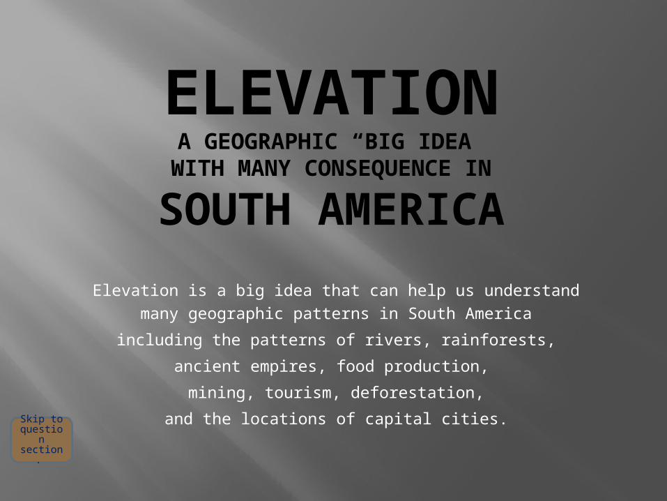
A satelliteimage shows
the majorregions.
The greenAmazonrainforest
The highAndes
MountainsThe dry
Patagoniangrasslands
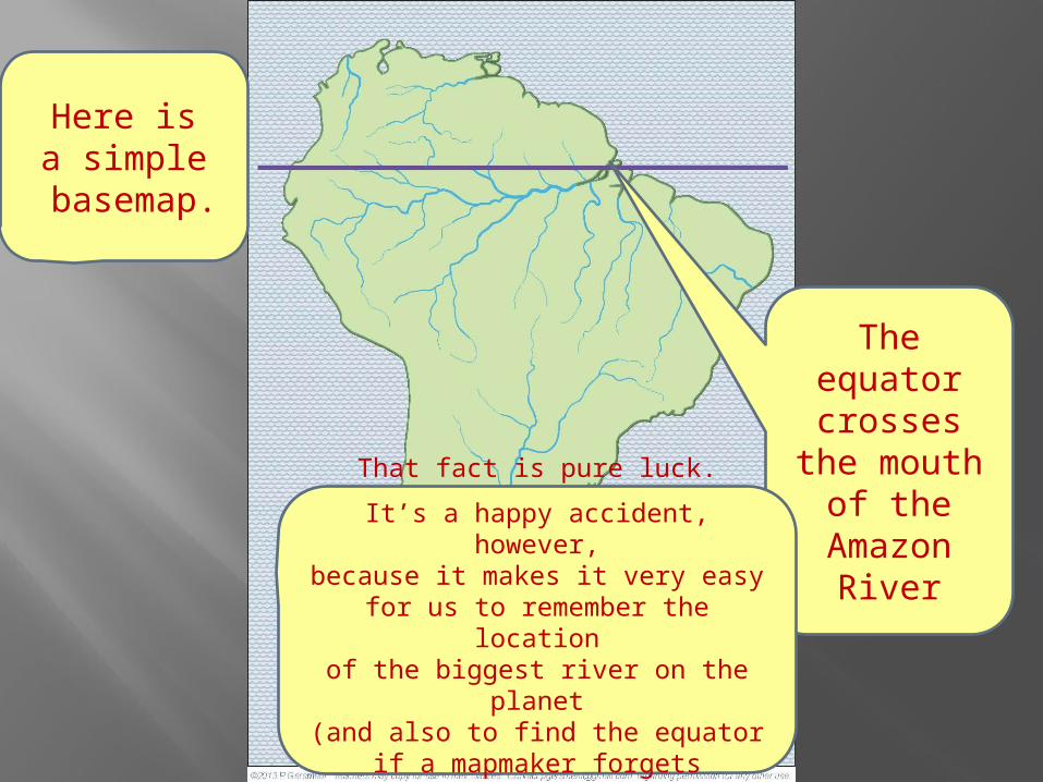
Here isa simple
basemap.
Here isa simple
basemap.
Theequatorcrosses
the mouthof the
AmazonRiver
That fact is pure luck.
It’s a happy accident, however,because it makes it very easy
for us to remember the locationof the biggest river on the planet
(and also to find the equatorif a mapmaker forgets to put it on a map).

The highAndes
Mountainsform a wall
near thewest coast.
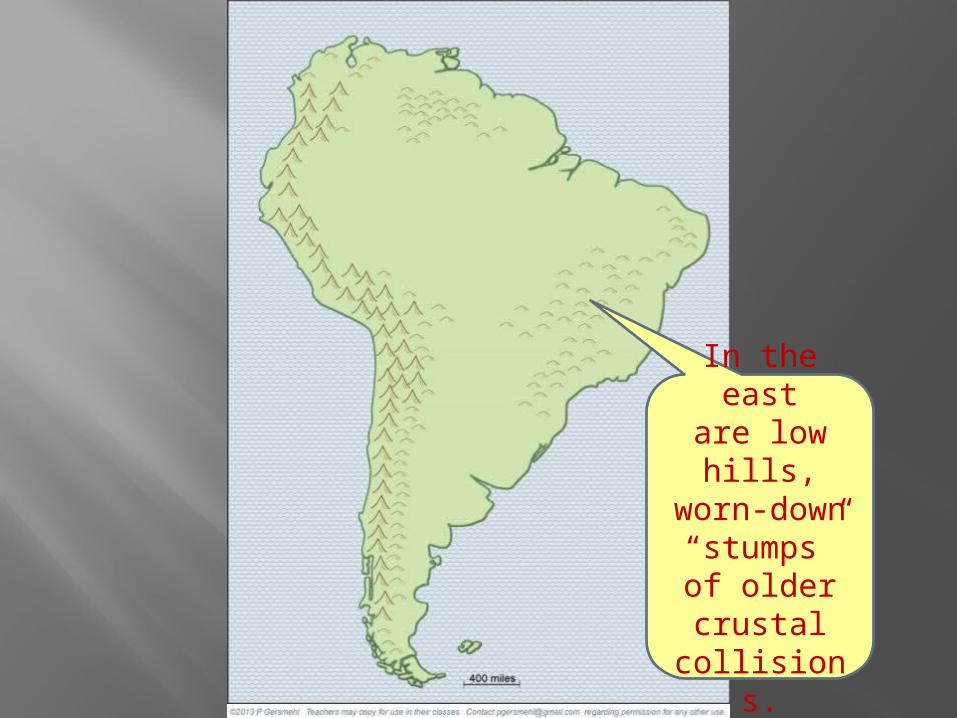
In the eastare low hills,worn-down“stumps”of oldercrustal
collisions.

Big Idea:The elevationof the land
in different placeshas great influence
on many other features of
South America.

For example,the Amazon Riverstarts in the high Andes Mountains and then flows
all the wayacross thecontinent.
While theParaguaydrains thesouthern
partIt’s also called
the Parana andRio de la Plata.
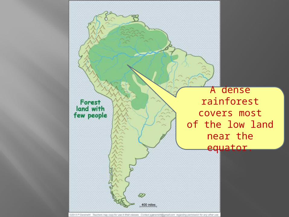
A dense rainforestcovers most
of the low landnear the equator.

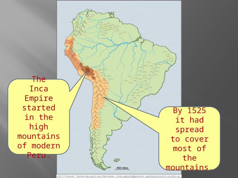
TheInca Empire
startedin the highmountainsof modern
Peru.
TheInca Empire
startedin the highmountainsof modern
Peru.
By 1525it had spread
to covermost of themountains.
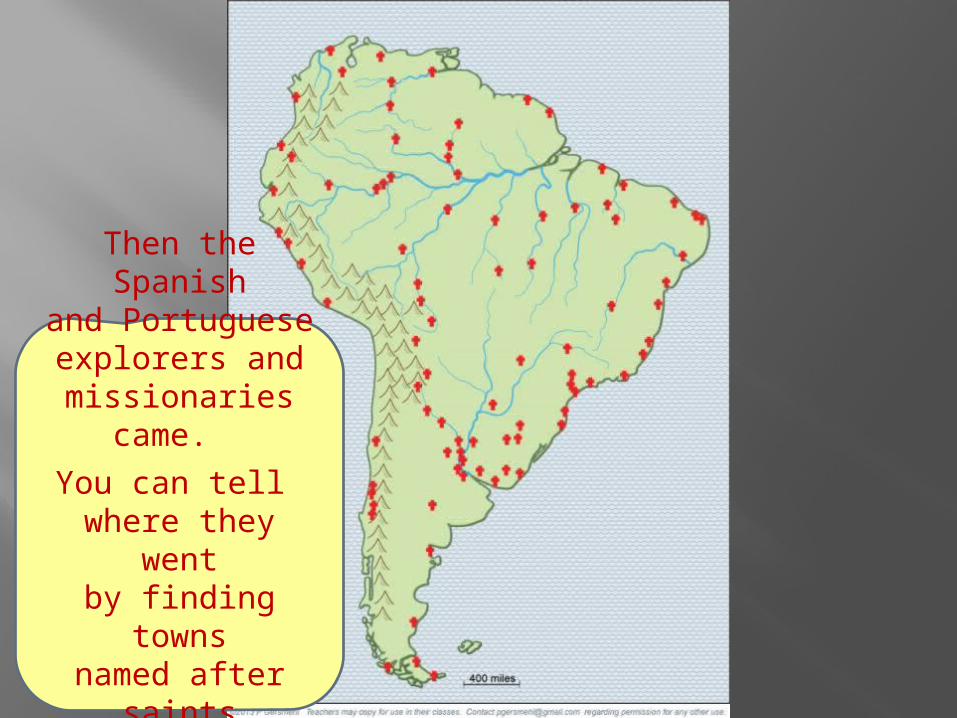
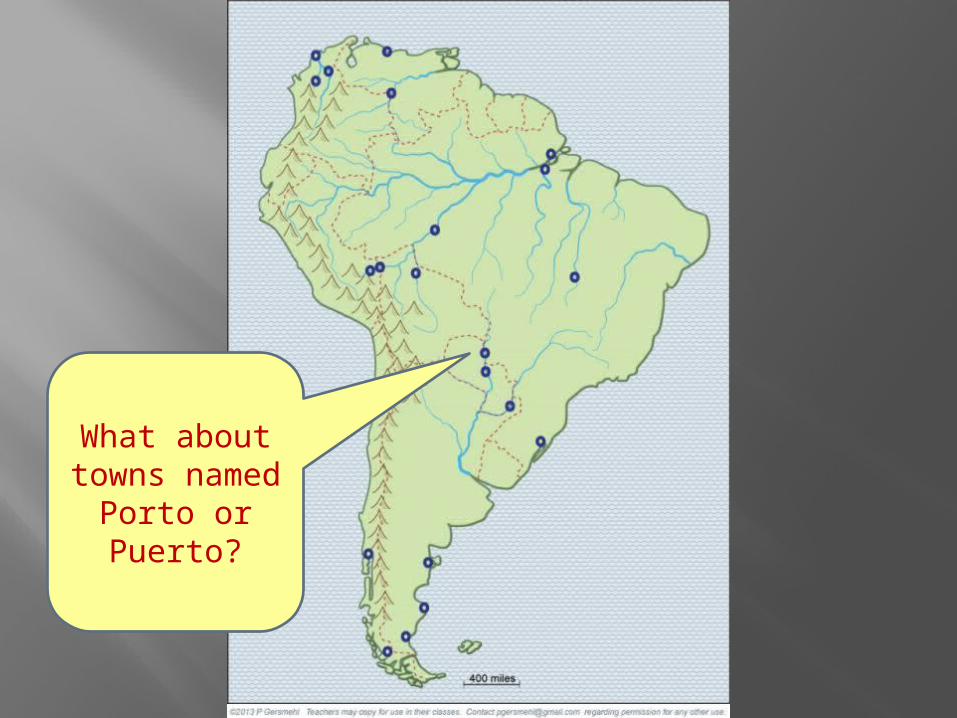
Then the Spanishand Portugueseexplorers and
missionaries came.
You can tell where they wentby finding towns
named after saints(San, Sao, Santa).
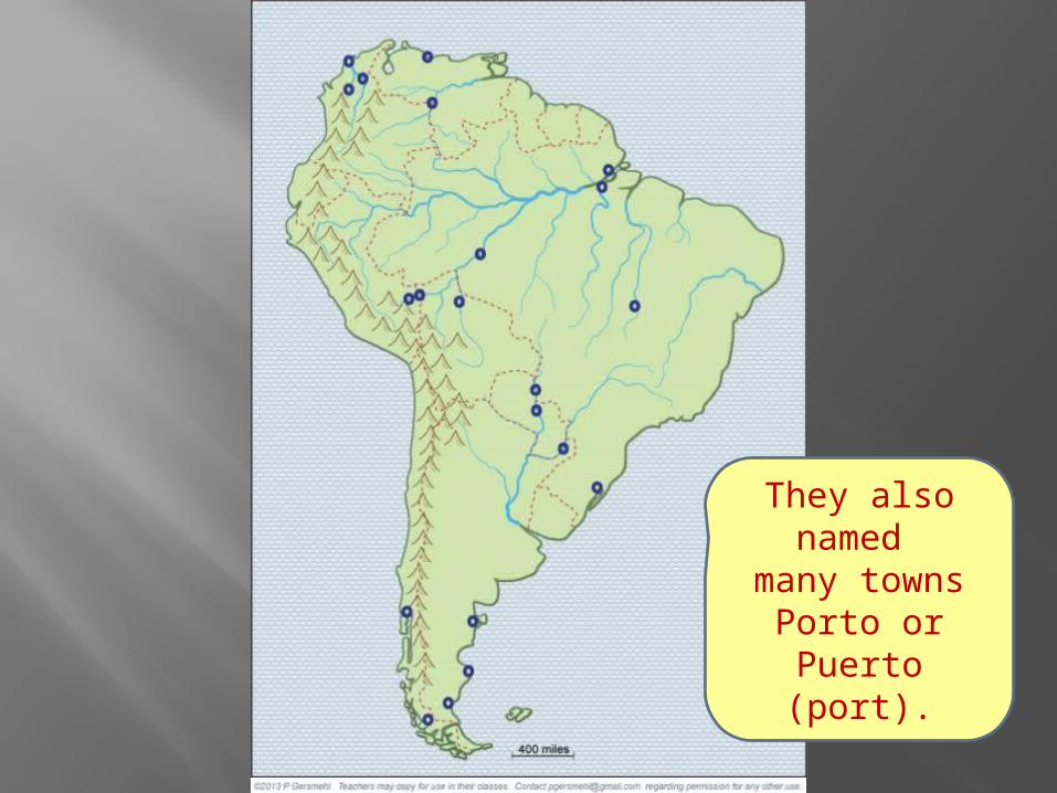
They alsonamed
many townsPorto or Puerto
(port).
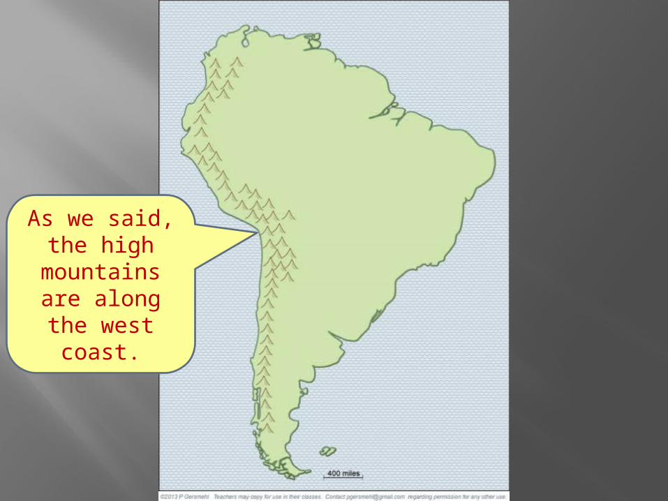
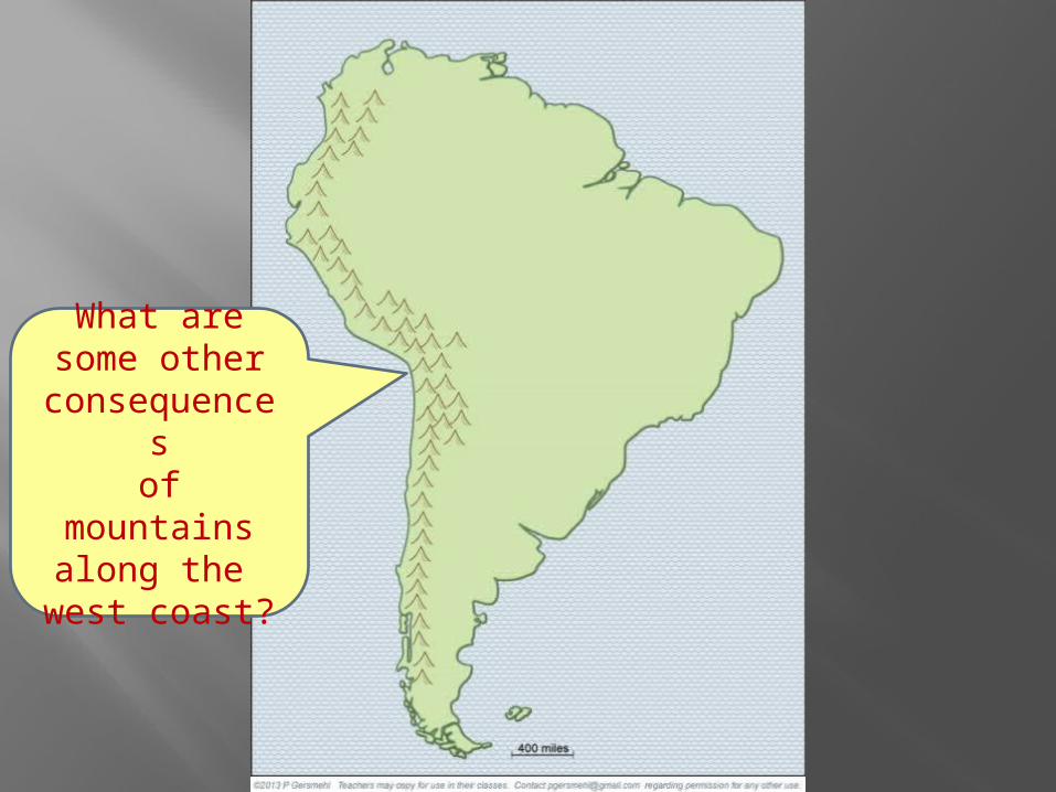
As we said,the high
mountainsare along
the west coast.

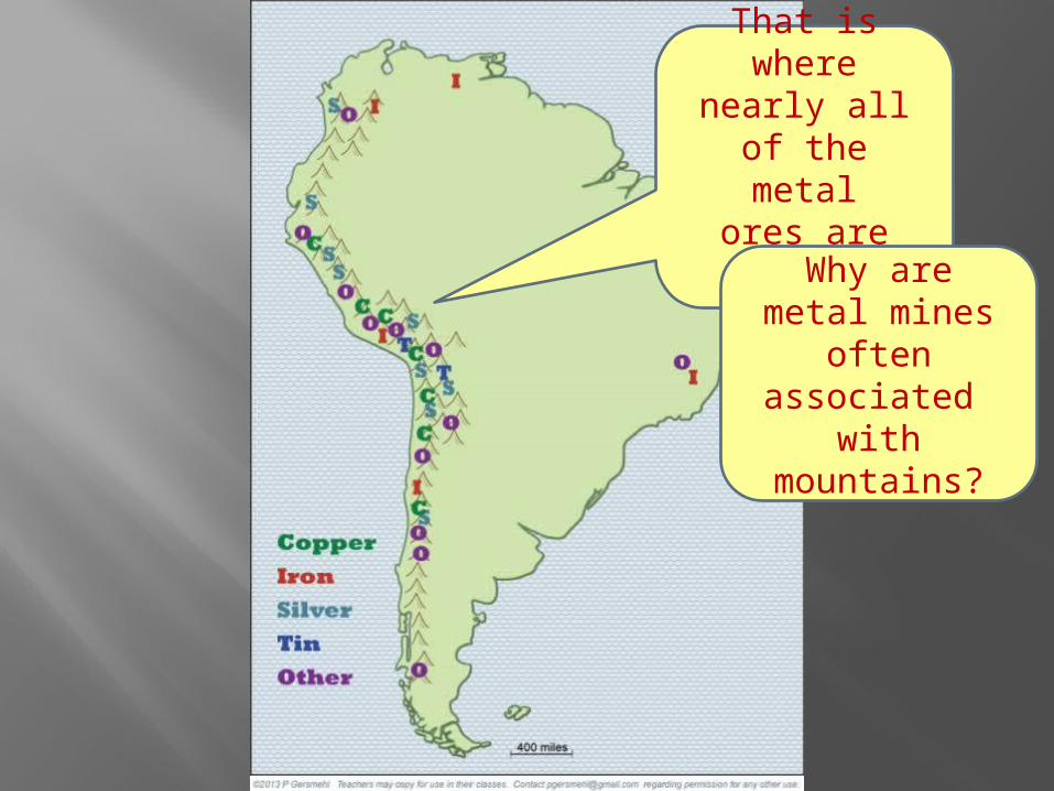
That is wherenearly all
of the metalores are found,
. . .because
metal ores are associated with
the geologic processes that make
mountains.
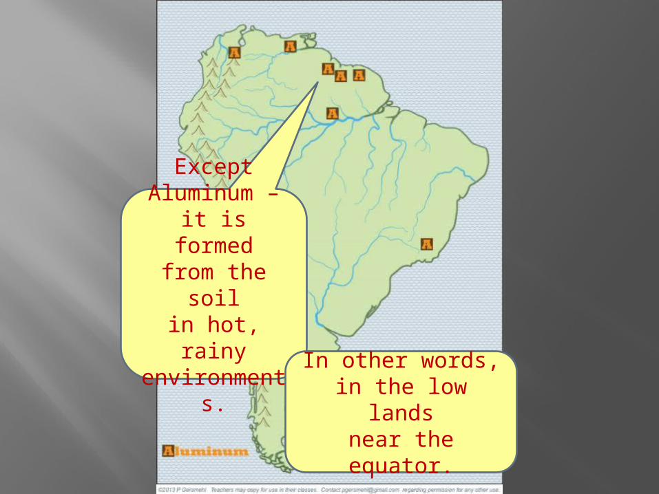
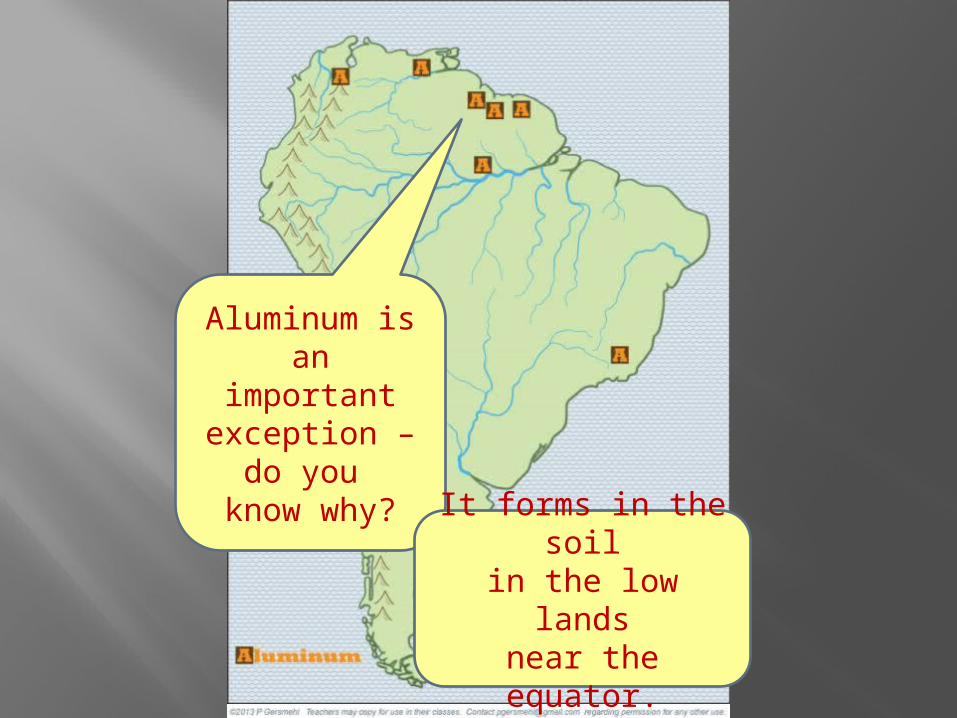
ExceptAluminum –it is formed
from the soilin hot, rainy
environments.
In other words,in the low lands
near the equator.

Becauseit drains
so much landnear the equator,
the Amazonis a huge river –by far the largest
in the world.
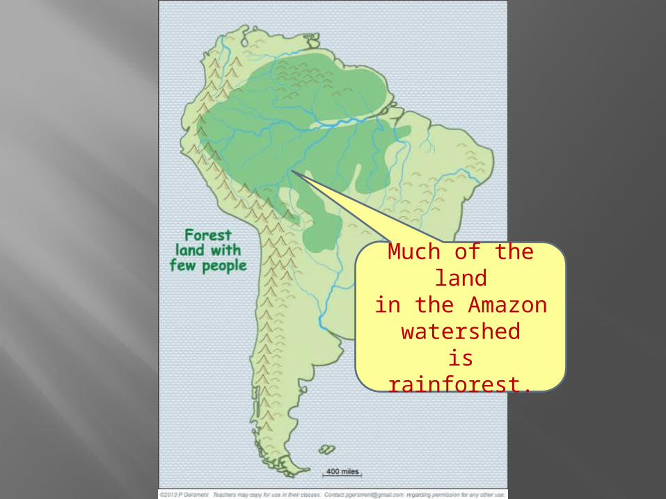
Much of the landin the Amazon
watershedis rainforest.

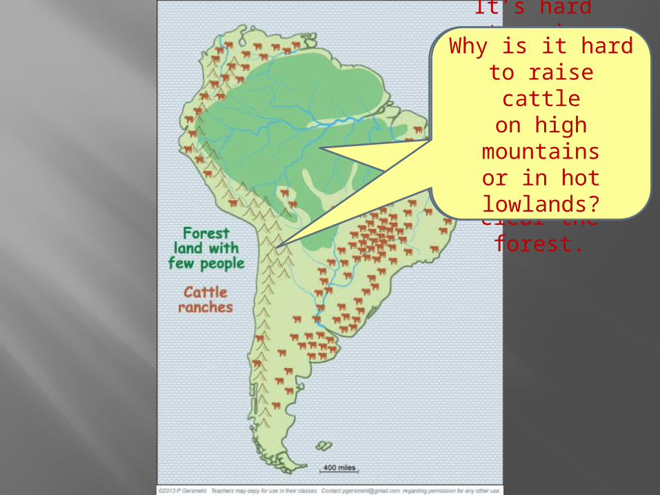
The old, worn-down hillsnow have manycattle ranches(think McDonalds!)
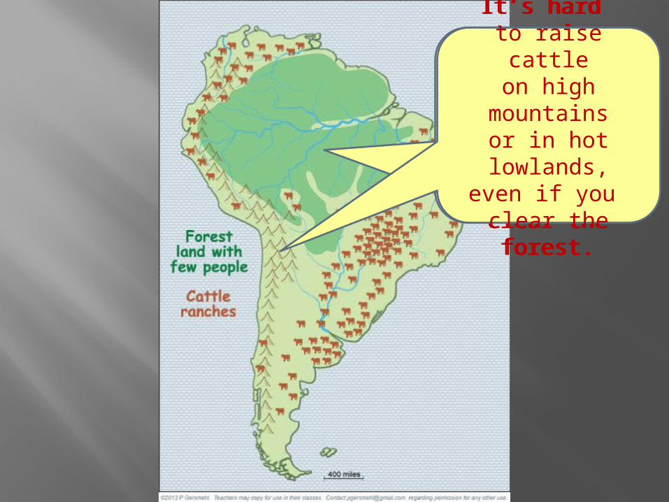
It’s hard to raise cattle
on high mountainsor in hot lowlands,
even if you clear the forest.
It’s hard to raise cattle
on high mountainsor in hot lowlands,
even if you clear the forest.

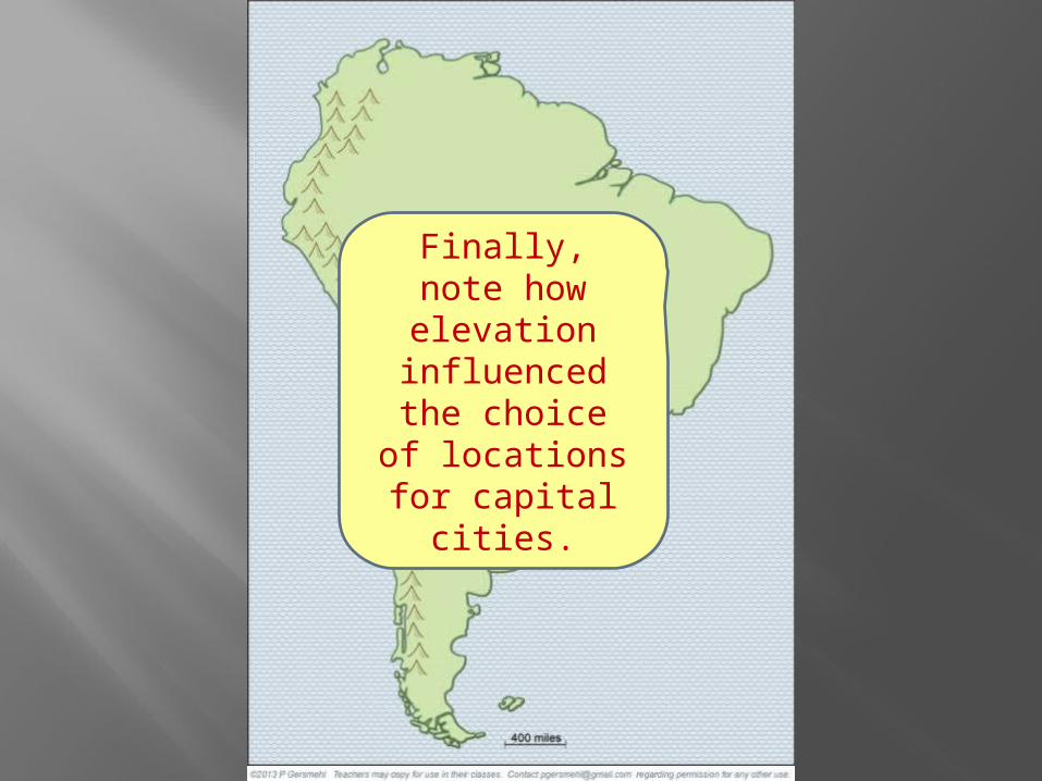
Finally,note howelevation
influencedthe choiceof locations
for capital cities.
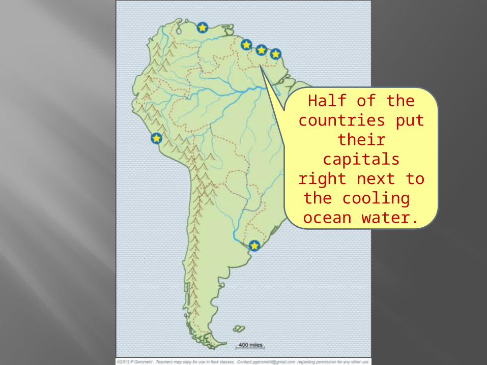
Half of thecountries puttheir capitalsright next tothe cooling
ocean water.
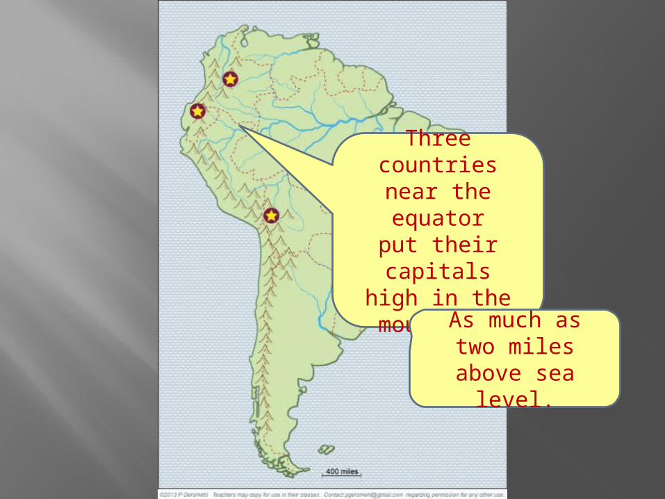
Three countriesnear the equatorput their capitals
high in the mountains
As much astwo miles
above sea level.

Three countriesfarthest fromthe equator
put their capitalson low land near rivers.
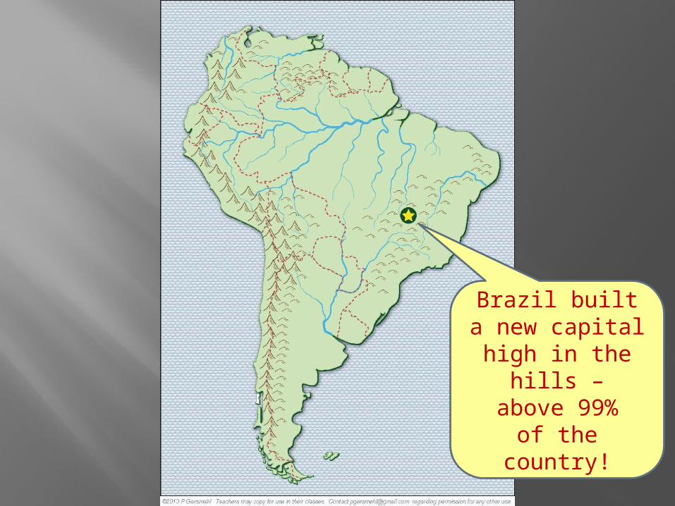
Brazil builta new capital
high in the hills –above 99%
of the country!

For comparison,here is the
United Statesat the same size
and properlatitude.
It’s “upside-down”because this partof South America
is south ofthe Equator.
Many placesin Chile
and Argentinaare similarto places
in the U.S.
Butno place
in the U.S.is like theAmazon
rainforest or the
high Andesmountains.
Butno place
in the U.S.is like theAmazon
rainforest or the
high Andesnear theequator.
This presentation was a brief look at some consequences of elevation,using examples from South America.

QUESTIONS SECTION
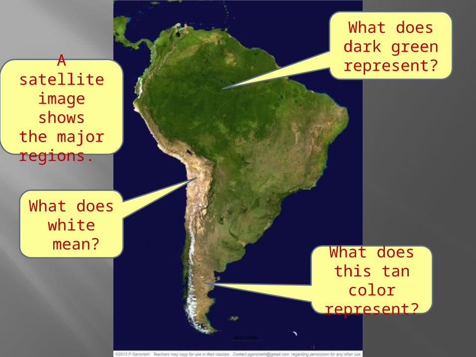
A satelliteimage shows
the majorregions.
What doesdark greenrepresent?
What doeswhite
mean?What does
this tan colorrepresent?

Here isa simple
basemap.
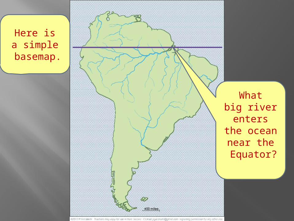
Here isa simple
basemap.
Whatbig riverenters
the oceannear the
Equator?
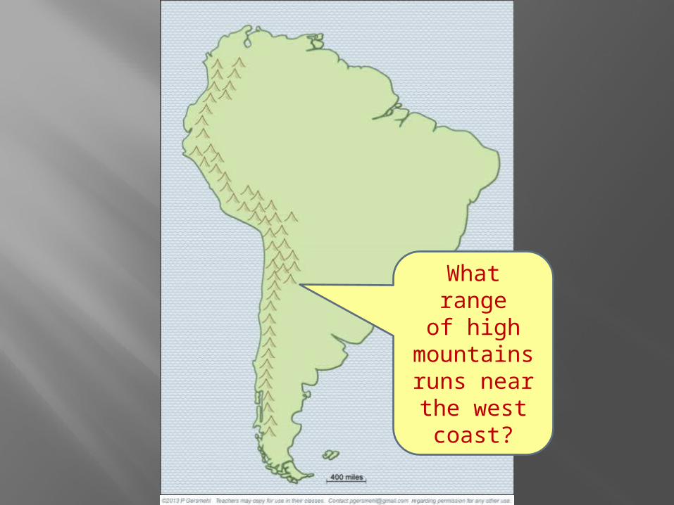
What rangeof high
mountainsruns nearthe westcoast?
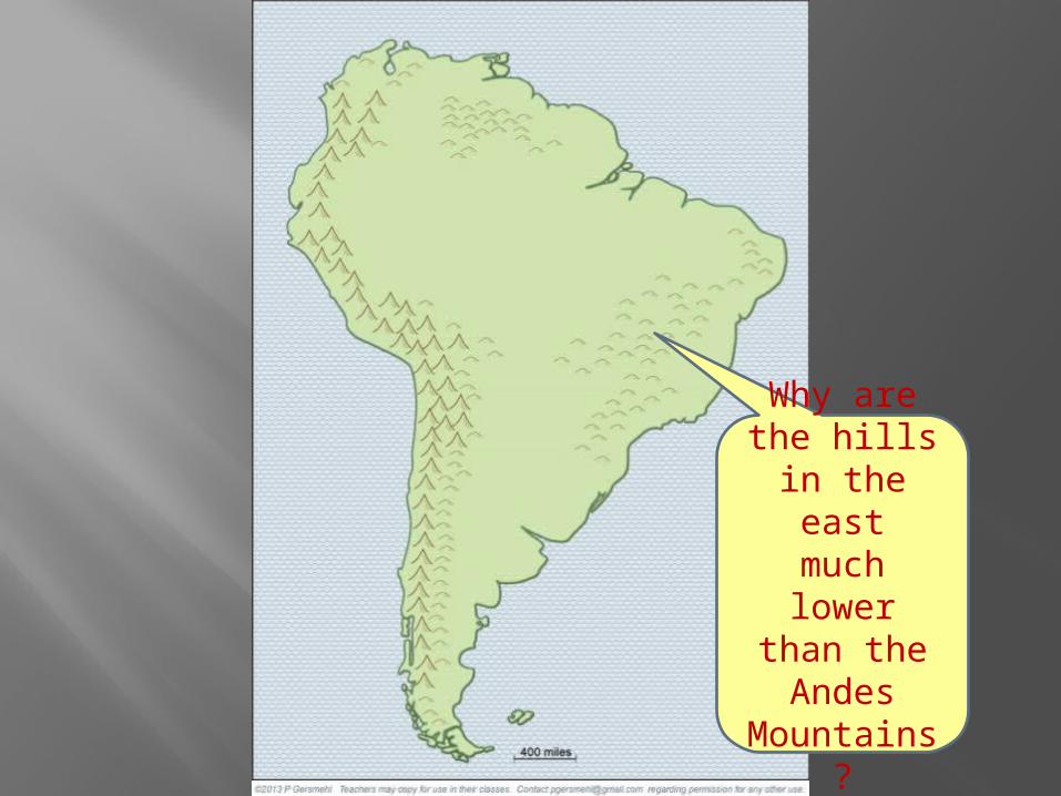
Why arethe hills
in the eastmuch lower
than theAndes
Mountains?

Big Idea:
Why is elevationan importantgeographic
“big idea” ?
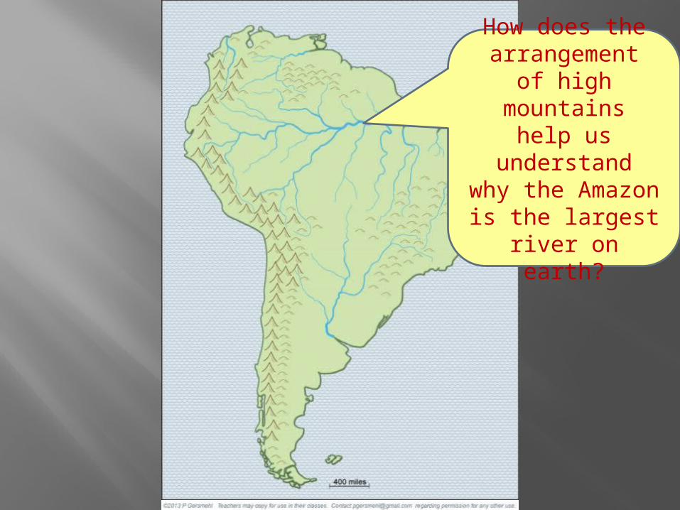
How does thearrangement
of high mountainshelp us understand
why the Amazonis the largest
river on earth?
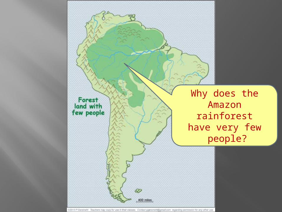
Why does theAmazon rainforest
have very few people?
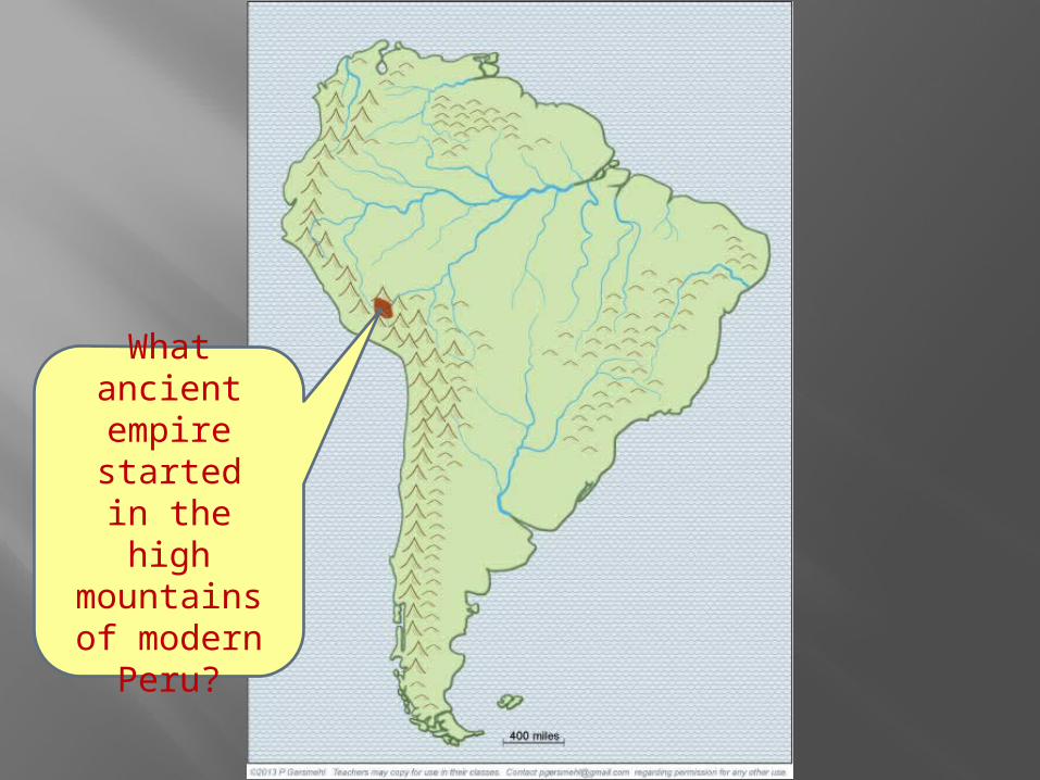
What ancientempire started
in the highmountainsof modern
Peru?
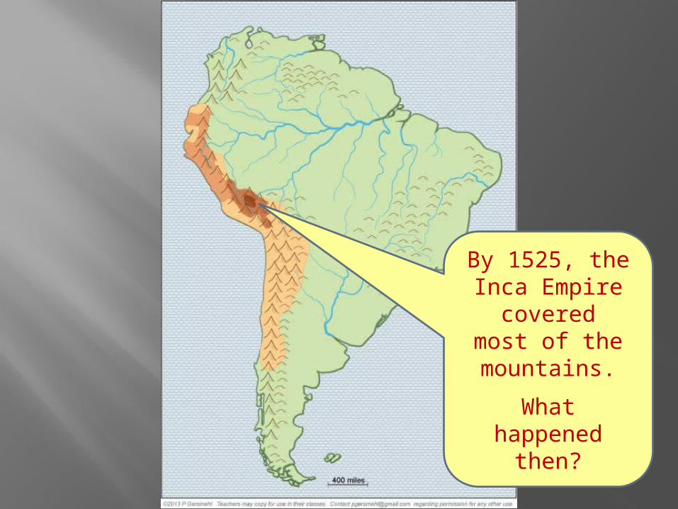
By 1525, theInca Empire
coveredmost of themountains.
What happenedthen?

All these towns arenamed after saints(San, Sao, Santa).
What does thattell us abouttheir history?
What abouttowns named
Porto orPuerto?
What aresome other
consequencesof mountains
along the west coast?
That is wherenearly all
of the metalores are found.
. . .
Why aremetal mines
often associated with mountains?
Aluminum isan importantexception –
do you know why?
It forms in the soilin the low lands
near the equator.
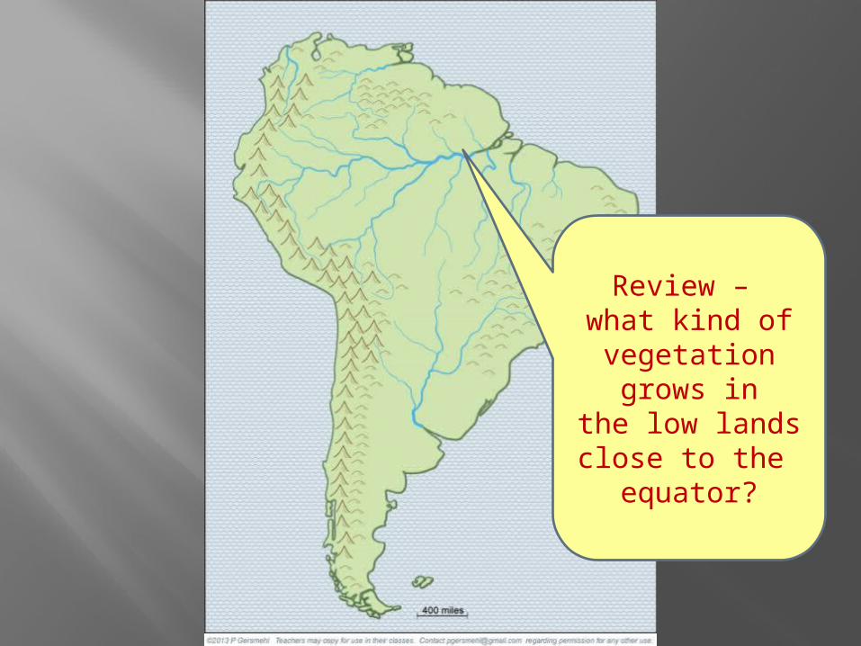
Review – what kind ofvegetationgrows in
the low landsclose to the
equator?

Much of the landin the Amazon
watershedis rainforest.

Why arecattle ranchesfound mainly
on the low hillsin eastern Brazil?
It’s hard to raise cattle
on high mountainsor in hot lowlands,
even if you clear the forest.
Why is it hard to raise cattle
on high mountainsor in hot lowlands?
Finally,note howelevation
influencedthe choiceof locations
for capital cities.

Why domany countries put their capitalsright next to the ocean shore?
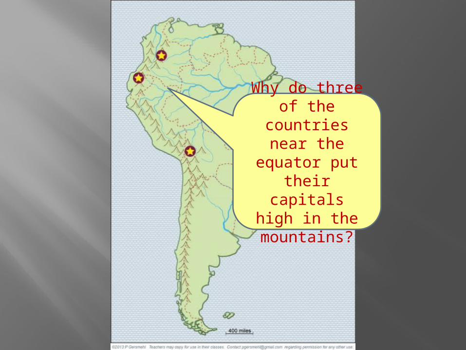
Why do threeof the countriesnear the equator put their capitals
high in the mountains?
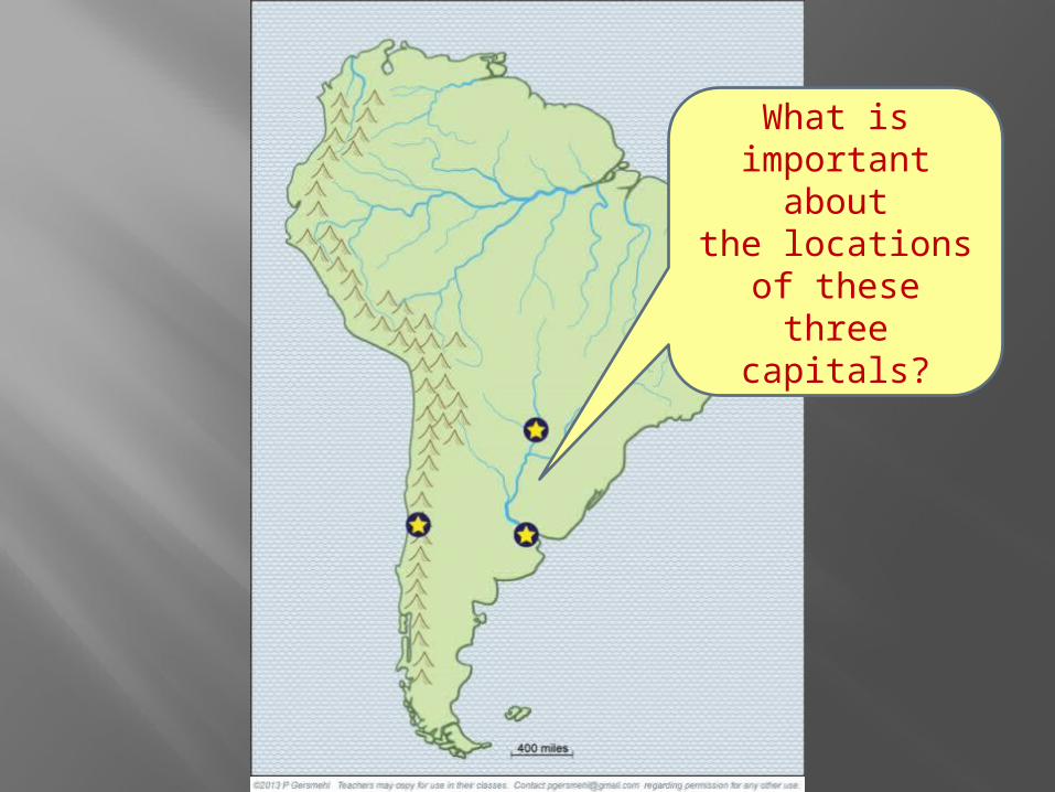
What isimportant aboutthe locations of these three
capitals?

What isthe storyabout this
capital city?
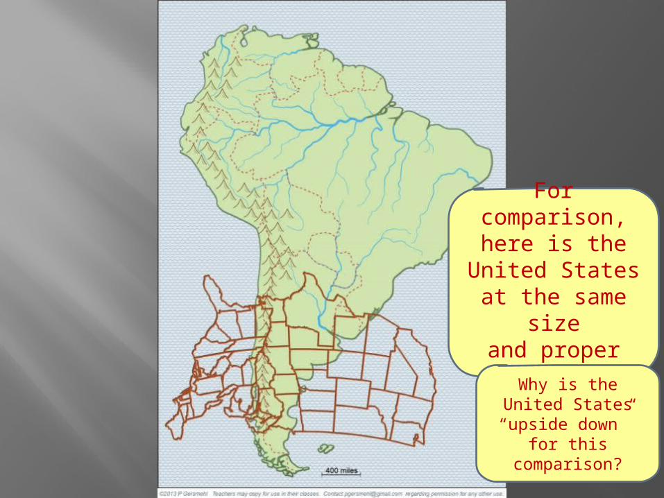
For comparison,here is the
United Statesat the same size
and properlatitude.
Why is theUnited States“upside down”
for this comparison?
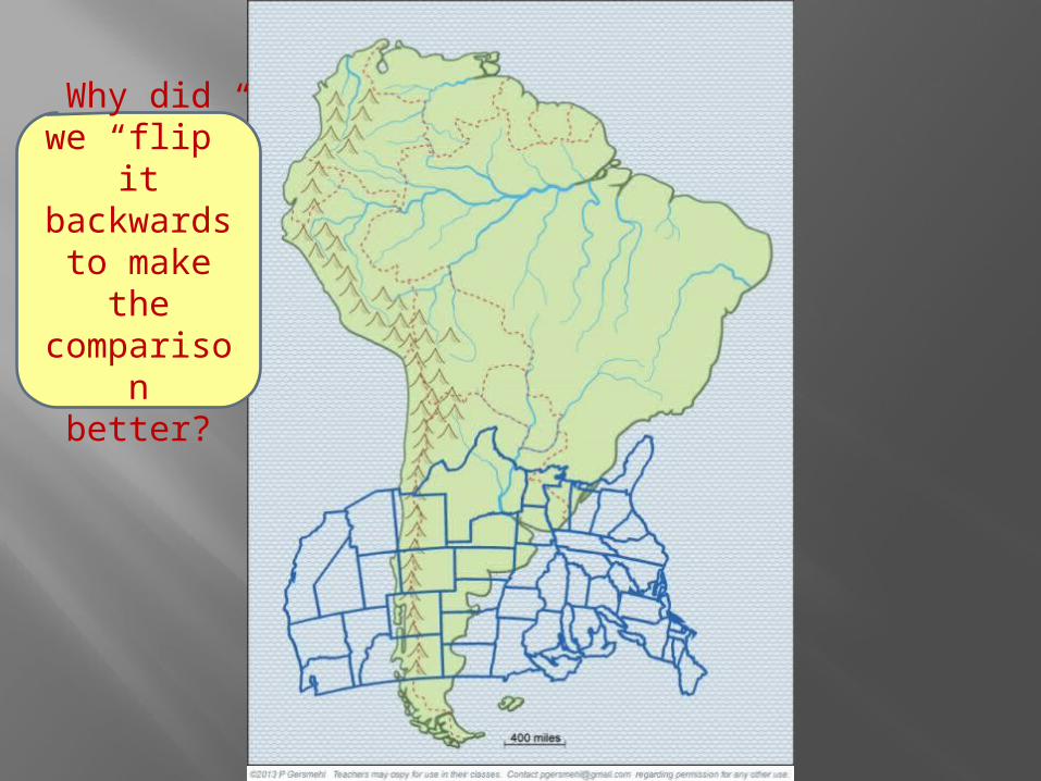
Why didwe “flip” it backwardsto make thecomparison
better?
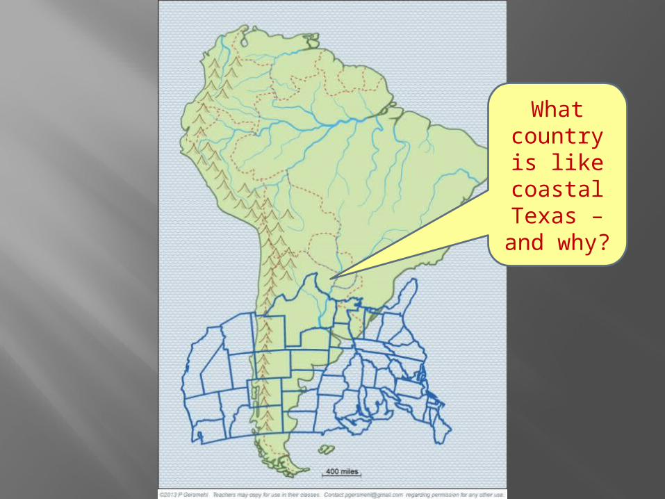
What countryis like
coastalTexas –
and why?
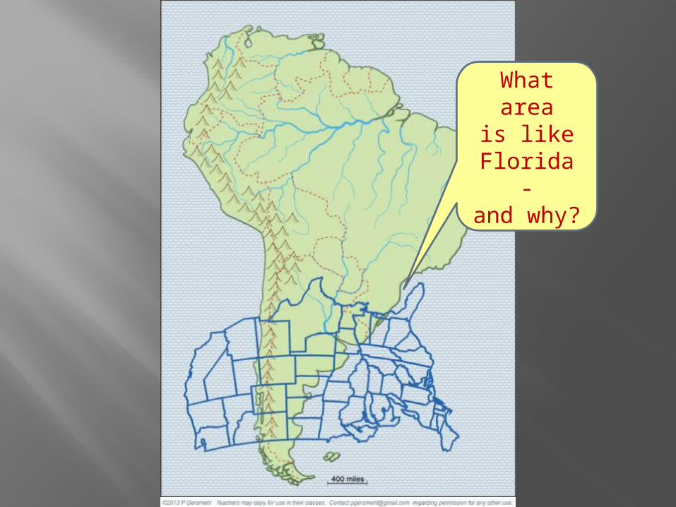
What areais like
Florida-
and why?

What small countryis like
Mississippiand
Arkansas?
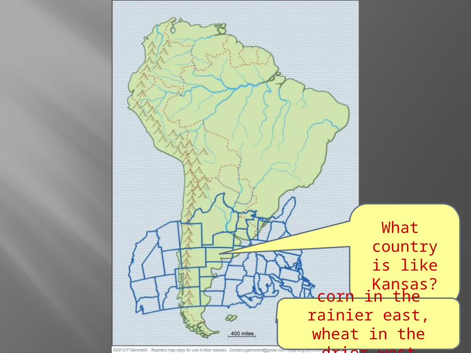
What countryis like
Kansas?
corn in the rainier east,wheat in the drier west

What areais like eastern
Montana –cool and dry?
Patagoniais like
easternMontana –
cool and dry.
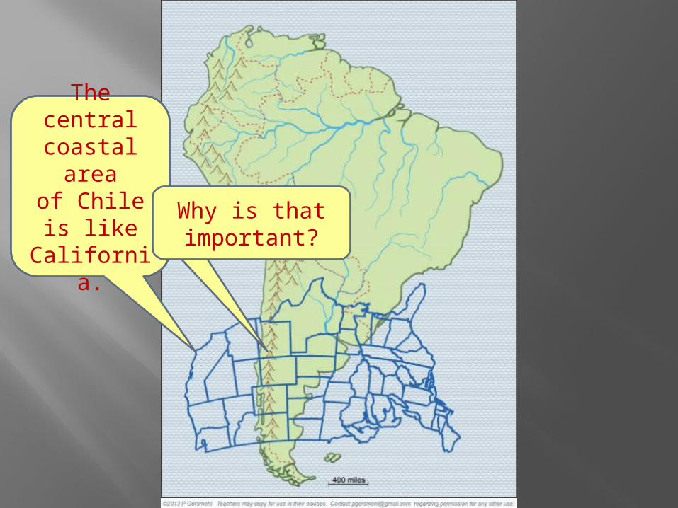
The centralcoastal area
of Chileis like
California.Why is thatimportant?
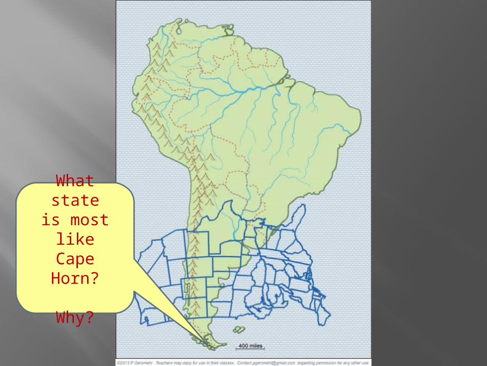
What stateis most likeCape Horn?
Why?

Why doesthe U.S.have no
place thatis like theequatorialrainforest?