Embed Size (px)
Citation preview

Ellen Vos
MSDIWG6Netherlands report

2
IHO
•A principal Aim of the IHO is to ensure that all the world's seas, oceans and navigable waters are surveyed and charted.
•The Mission of the IHO is to create a global environment in which States provide adequate and timely hydrographic data, products and services and ensure their widest possible use.
ERGO
•Hydrography is more than Nautical Charting

3
HO traditional : Safety of Navigation
19
-04
-23
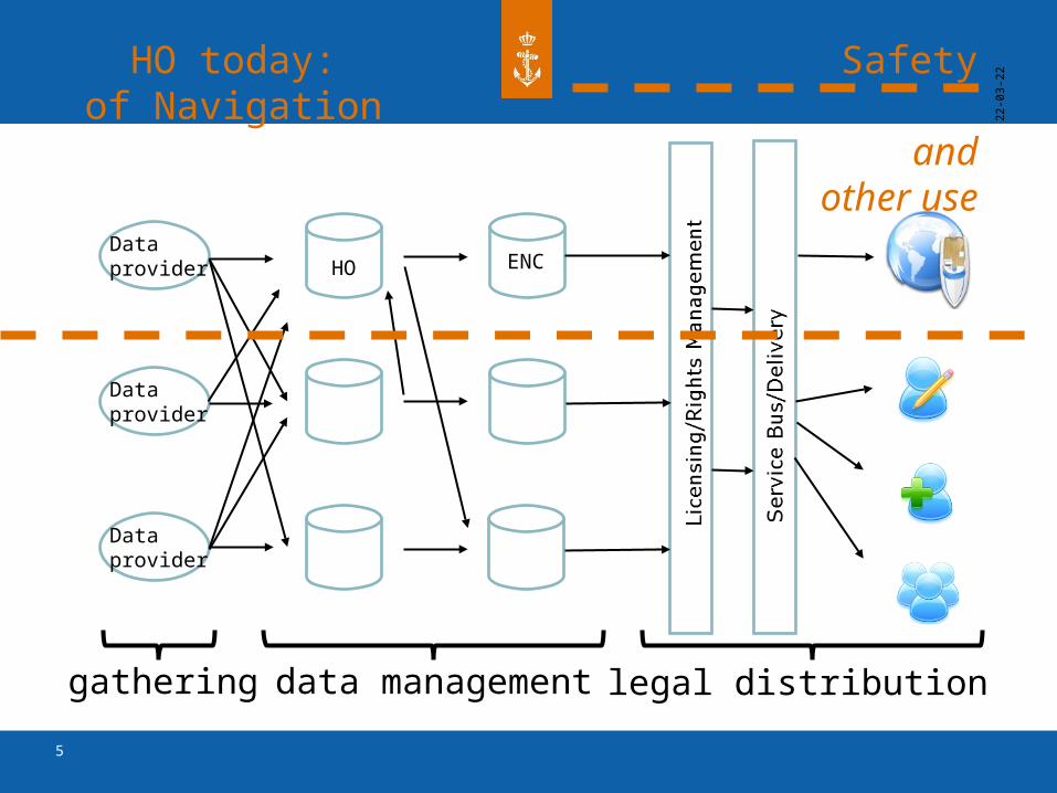
Dataprovider HO ENC
Dataprovider
Dataprovider
gathering data management legal distribution

4
Toward Data CentricityNSHC31 Amsterdam 25-27 June 2014
• Knowledge transfer is only small part of the original data
Bathymetry
Chart
• Think in therms of data, rather than product
5
HO today: Safety of Navigation and other
use
19
-04
-23
Dataprovider HO ENC
Dataprovider
Dataprovider
gathering data management legal distribution

6
Other use of data
•Full 3d seafloor modeling for engineering
•Seafloor type definition from backscatter data for sedimentary studies
•Sound velocity studies for oceanographic studies
•Wreck and obstruction data in more detail than chart
•Geodetic and tidal information for datum studies.
7
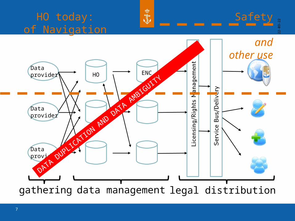
HO today: Safety of Navigation and other
use
19
-04
-23
Dataprovider HO ENC
Dataprovider
Dataprovider
gathering data management legal distribution
DATA DUPL
ICATIO
N AND D
ATA AMBIG
UITY
8
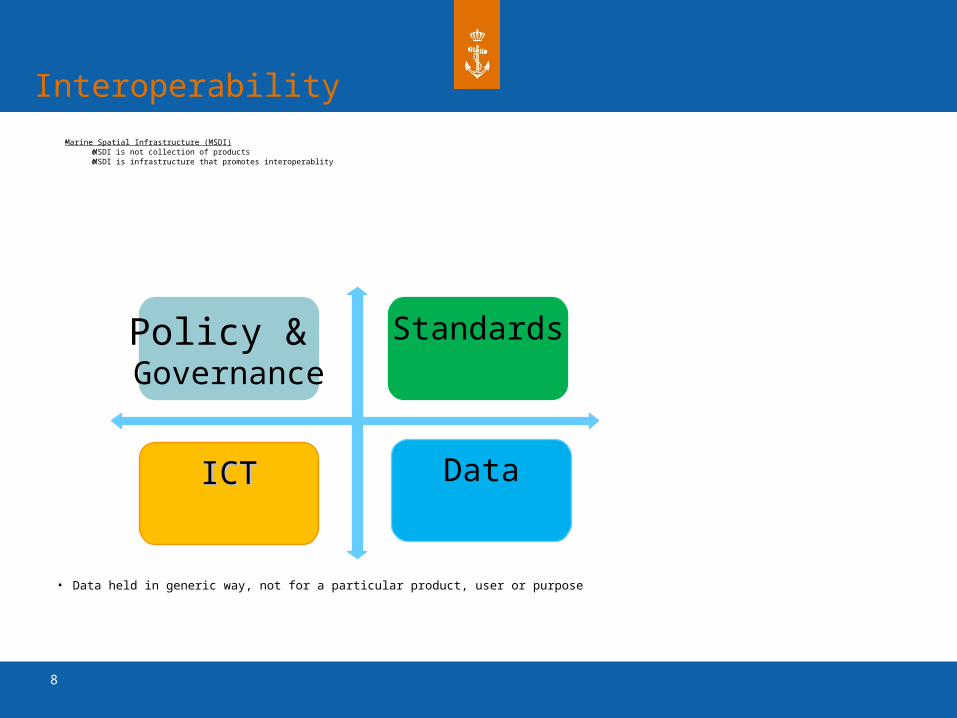
Policy & Governance
Standards
ICTICT Data
Interoperability
•Marine Spatial Infrastructure (MSDI)oMSDI is not collection of productsoMSDI is infrastructure that promotes interoperablity
• Data held in generic way, not for a particular product, user or purpose

9
19
-04
-23
Dataprovider
Dataprovider
Dataprovider
MSDI : Standards
S-44 ISO 9001ISO 191xx
WMSWFS
S-57INSPIRE
CC
10
19
-04
-23
Dataprovider
Dataprovider
Dataprovider
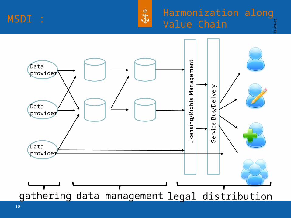
MSDI :Harmonization along Value Chain
gathering data management legal distribution
11
19
-04
-23
Dataprovider
Dataprovider
Dataprovider
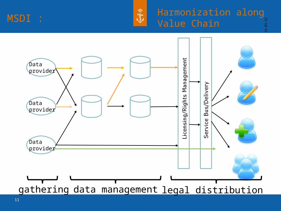
MSDI :Harmonization along Value Chain
gathering data management legal distribution
12
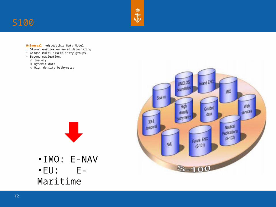
S100
Universal hydrographic Data Model• Strong enabler enhanced datasharing• Across multi-disciplinary groups• Beyond navigation.
o Imageryo Dynamic datao High density bathymetry
•IMO: E-NAV•EU: E-Maritime
13
Zorgelijke ontwikkelingen
Instandhouding HOV
•Geen voldragen ILS. Knelpunten zijn.
o Korte termijn: hydrografisch systeem (servers en netwerk)o Middellange termijn: sensoren als multibeam echolood en side scan
sonar
•Ontbreken samenhangend plan voor IP-HOV
• Relatie achterstand: betere sensoren => efficiëntere inzet HOV
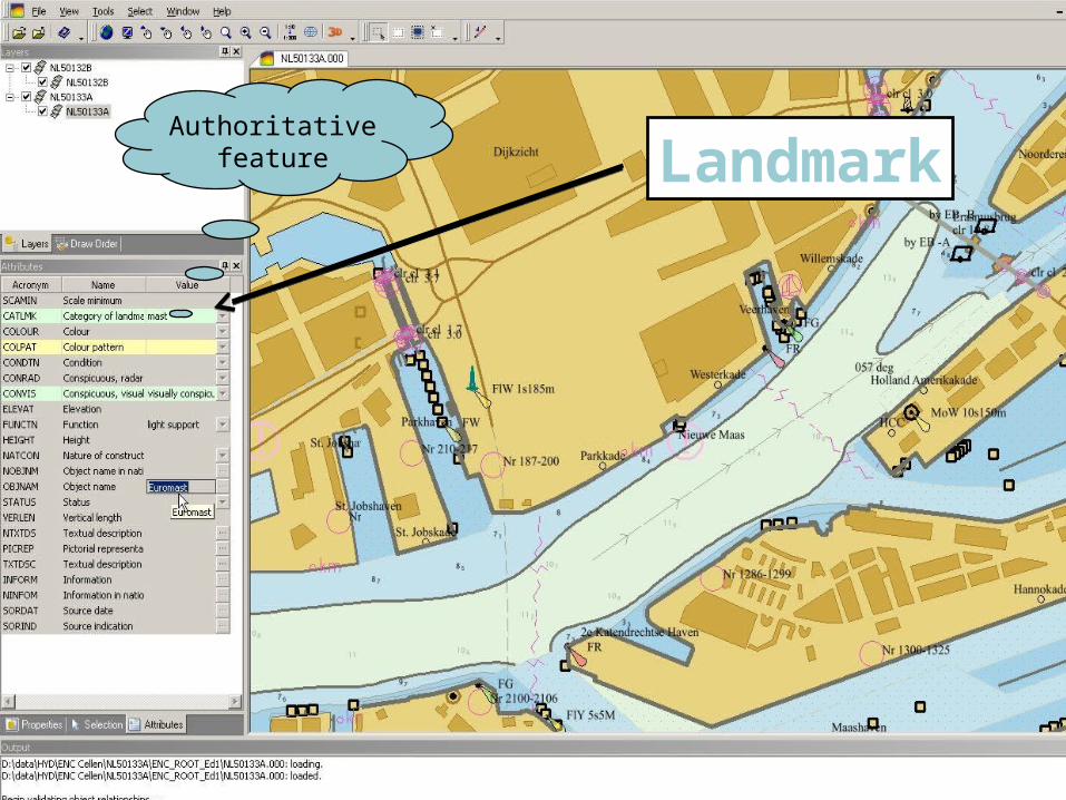
LandmarkAuthoritative
feature
14
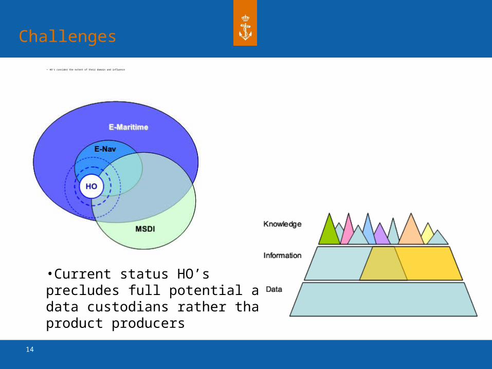
Challenges
• HO’s consider the extent of their domain and influence
•Current status HO’s precludes full potential as data custodians rather than product producers
15
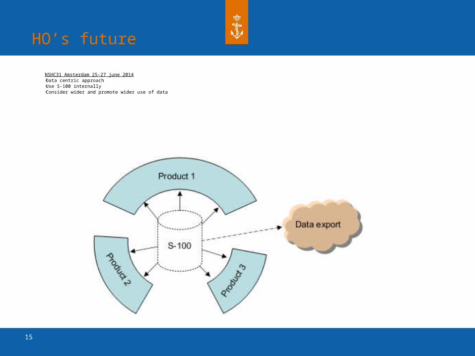
HO’s future
NSHC31 Amsterdam 25-27 june 2014•Data centric approach•Use S-100 internally•Consider wider and promote wider use of data
16
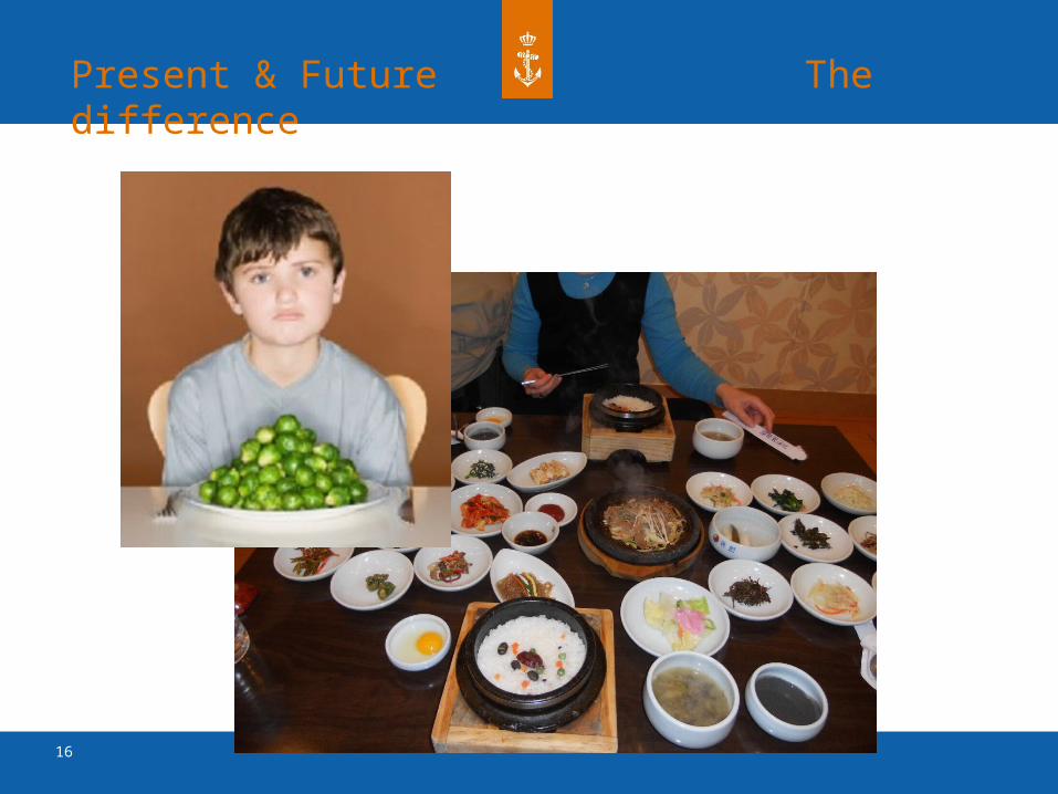
Present & Future The difference

![IHO S-100: The New IHO Hydrographic Geospatial … hydrographic review may 2009 →iho s-100) iho s-100 [] .Published in: International Hydrographic Review · 2009Authors: Robert Ward](https://img.pdfslide.net/doc/110x75/5ae4a48c7f8b9a495c8ed661/iho-s-100-the-new-iho-hydrographic-geospatial-hydrographic-review-may-2009.jpg)


![NAVIGABLE WATERS RULES ANNOTATED - IN.govUpdated February 14, 2011) 1 NAVIGABLE WATERS RULES ANNOTATED AND INDEXED [Document Index: pp. 46 – 50] _____ The navigable waters rules](https://img.pdfslide.net/doc/110x75/5ac47a757f8b9a5c558cd870/navigable-waters-rules-annotated-in-updated-february-14-2011-1-navigable-waters.jpg)