Embed Size (px)
Citation preview
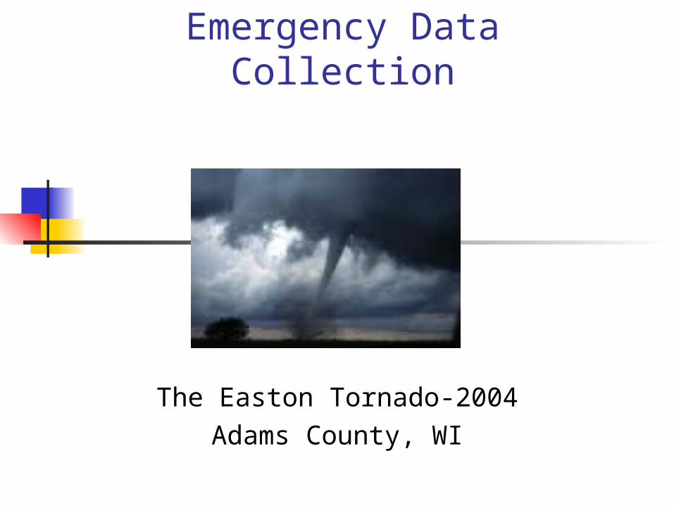
Emergency Data Collection
The Easton Tornado-2004Adams County, WI
Adams County
Land Records Status Parcel mapping completed 2004 Digital Ortho Photo projected March 2005 ArcIMS site available intranet Fall ‘04 Tabular data available on web
Land Information Office Staff Responsibilities
Emergency Management Mapping
Project with WI DNR to create response area grids
Partner in orthophoto project
Sponsoring data verification project
Sponsoring HazMat project
Installing equipment and software in Emergency
Operations Center and Mobile Command Post
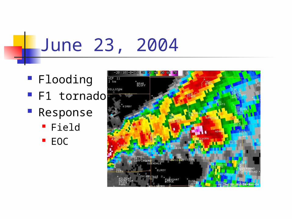
June 23, 2004
Flooding F1 tornado Response
Field EOC
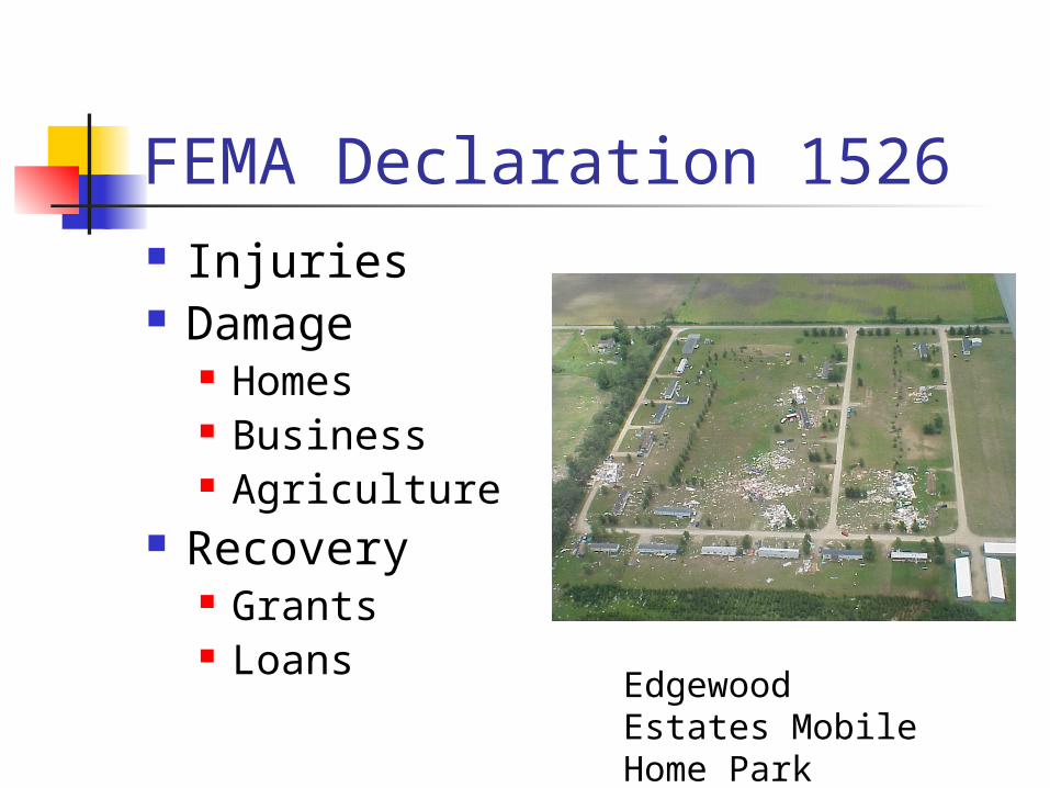
FEMA Declaration 1526 Injuries Damage
Homes Business Agriculture
Recovery Grants Loans
Edgewood Estates Mobile Home Park
Limitations Communication Address data
Structures vs. address points Numerous addressing systems
On-site hardware State damage report
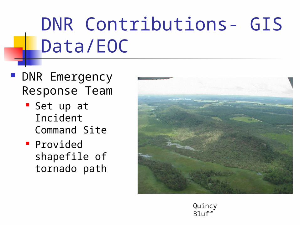
DNR Contributions- GIS Data/EOC
DNR Emergency Response Team Set up at Incident
Command Site Provided shapefile
of tornado path
Quincy Bluff
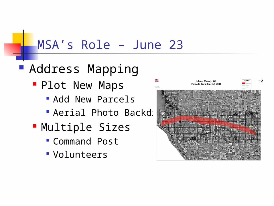
MSA’s Role – June 23
Address Mapping Plot New Maps
Add New Parcels Aerial Photo Backdrop
Multiple Sizes Command Post Volunteers
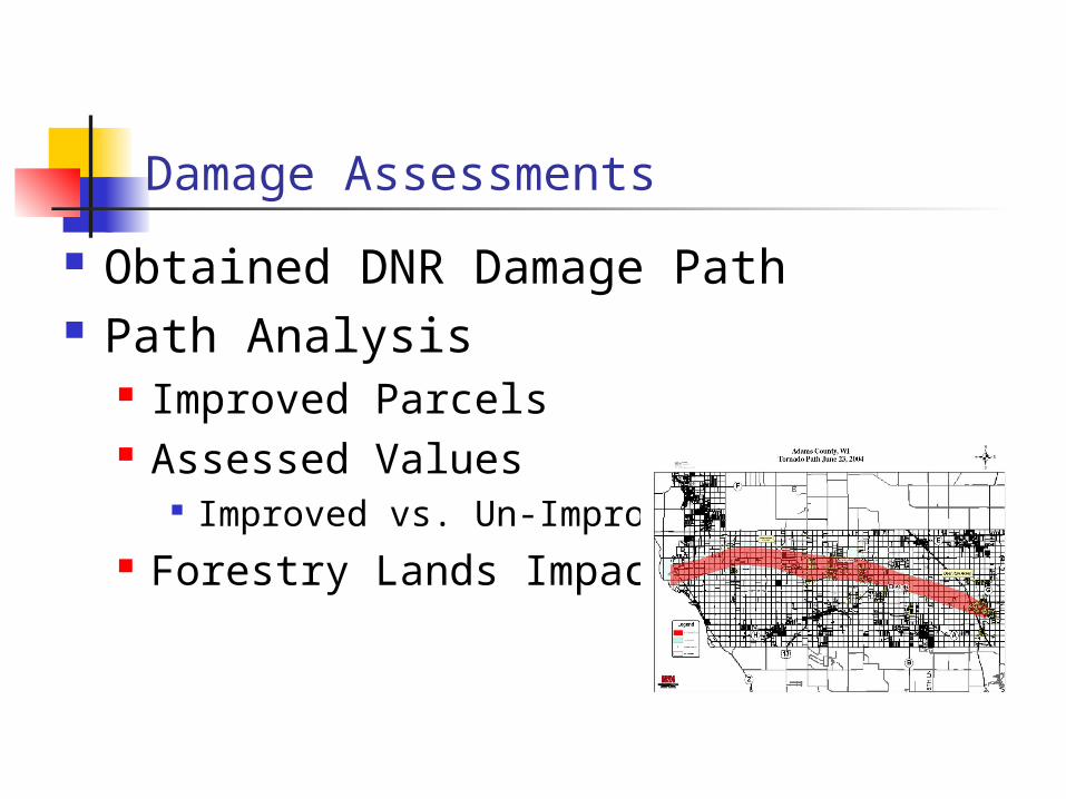
Damage Assessments
Obtained DNR Damage Path Path Analysis
Improved Parcels Assessed Values
Improved vs. Un-Improved Forestry Lands Impacted
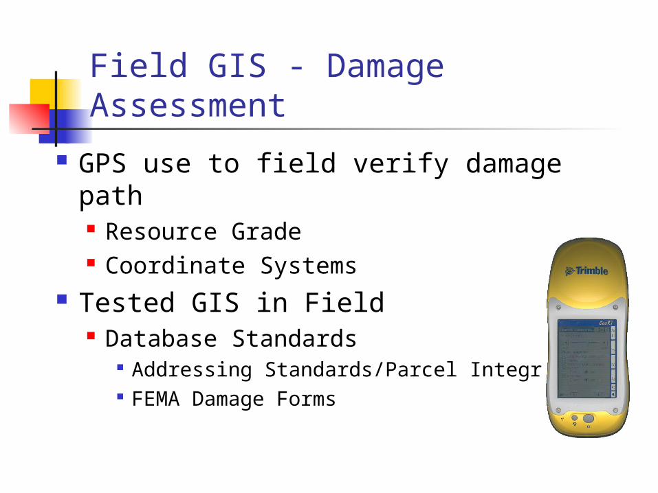
Field GIS - Damage Assessment
GPS use to field verify damage path Resource Grade Coordinate Systems
Tested GIS in Field Database Standards
Addressing Standards/Parcel Integration FEMA Damage Forms
Lessons Learned Need trained, practiced and equipped damage
assessment team Improve Communication Plans
Telephone Internet
Need coordination of GIS activities with all response agencies
Integrate Land Records Assessment w/ Rapid Response Needs
Future Projects/Plans Train staff to use GIS to help with
damage assessment; exercise competency
Link data into an application that completes UDSR automatically
Create layers that will help responders