Embed Size (px)
Citation preview
Ericsson Internal | 2018-02-21
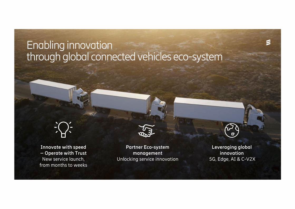
Enabling innovationthrough global connected vehicles eco-system
Partner Eco-system management
Unlocking service innovation
Leveraging globalinnovation
5G, Edge, AI & C-V2X
Innovate with speed– Operate with Trust New service launch,
from months to weeks
Ericsson Internal | 2018-02-21
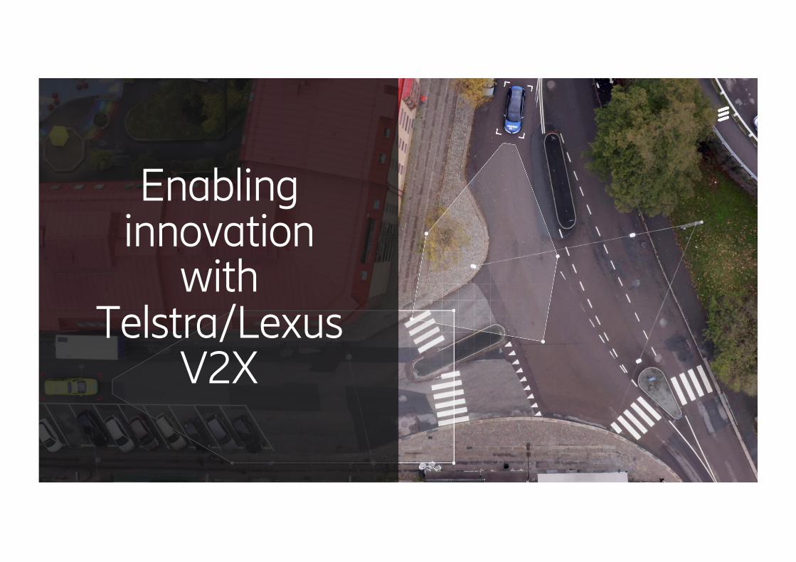
Enabling innovation
with Telstra/Lexus
V2X
Ericsson Internal | 2018-02-21
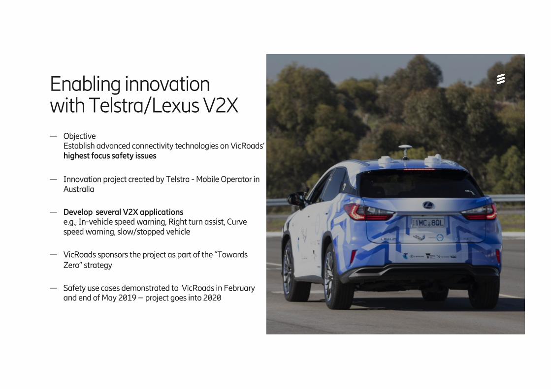
— Objective Establish advanced connectivity technologies on VicRoads’ highest focus safety issues
— Innovation project created by Telstra - Mobile Operator in Australia
— Develop several V2X applicationse.g., In-vehicle speed warning, Right turn assist, Curve speed warning, slow/stopped vehicle
— VicRoads sponsors the project as part of the “Towards Zero” strategy
— Safety use cases demonstrated to VicRoads in February and end of May 2019 – project goes into 2020
Enabling innovationwith Telstra/Lexus V2X
Ericsson Internal | 2018-02-21
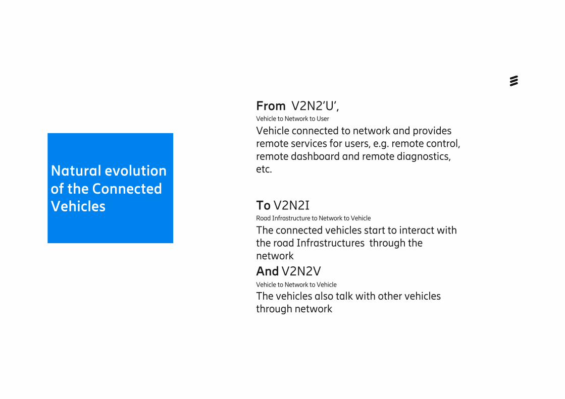
Natural evolution of the Connected Vehicles
From V2N2’U’, Vehicle to Network to User
Vehicle connected to network and provides remote services for users, e.g. remote control, remote dashboard and remote diagnostics, etc.
To V2N2I Road Infrastructure to Network to Vehicle
The connected vehicles start to interact with the road Infrastructures through the network
And V2N2VVehicle to Network to Vehicle
The vehicles also talk with other vehicles through network
Ericsson Internal | 2018-02-21
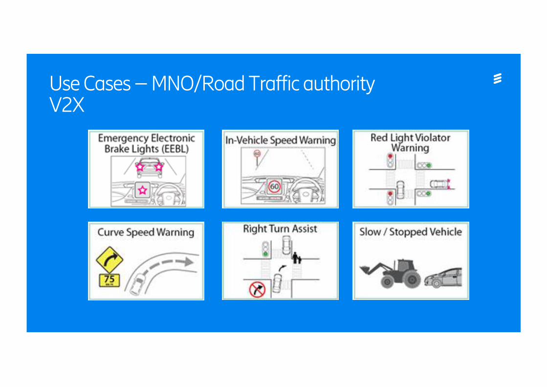
Use Cases – MNO/Road Traffic authority V2X
Ericsson Internal | 2018-02-21
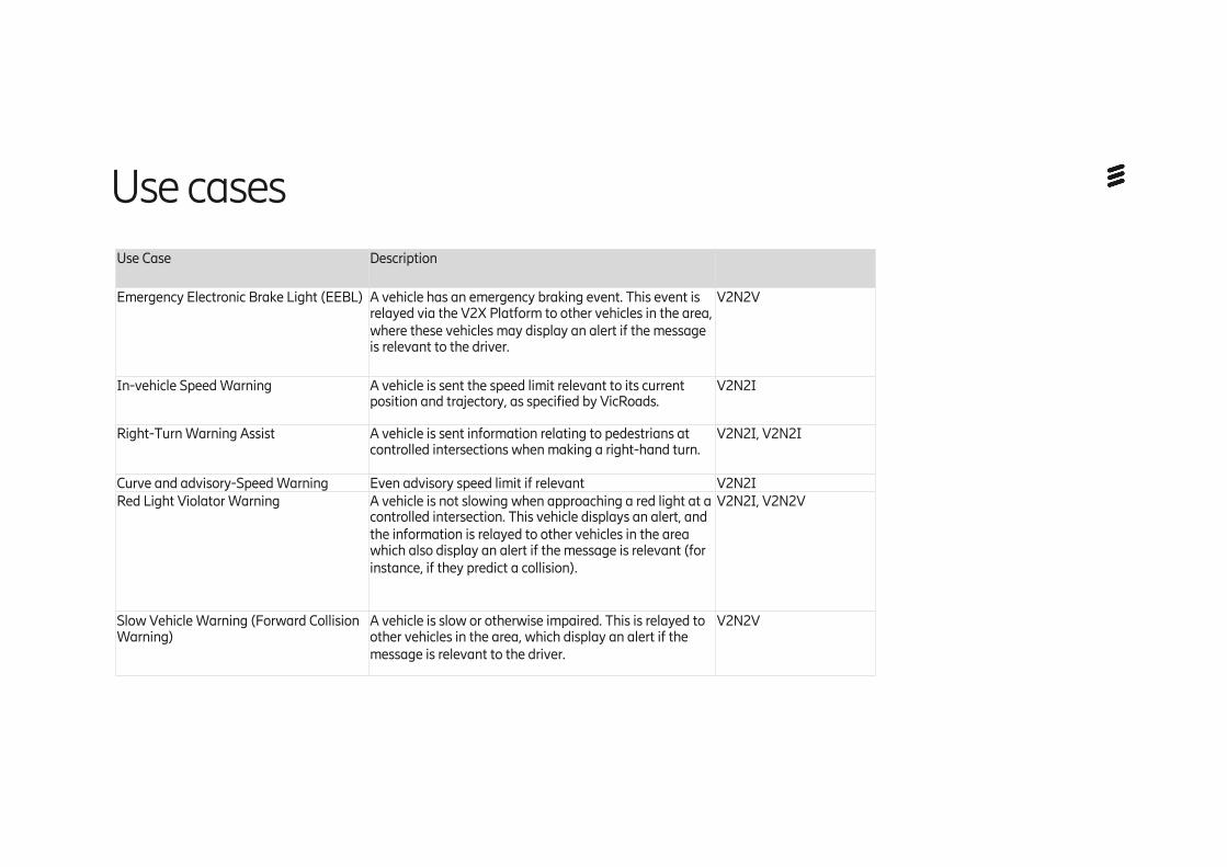
Use Case Description
Emergency Electronic Brake Light (EEBL) A vehicle has an emergency braking event. This event is relayed via the V2X Platform to other vehicles in the area, where these vehicles may display an alert if the message is relevant to the driver.
V2N2V
In-vehicle Speed Warning A vehicle is sent the speed limit relevant to its current position and trajectory, as specified by VicRoads.
V2N2I
Right-Turn Warning Assist A vehicle is sent information relating to pedestrians at controlled intersections when making a right-hand turn.
V2N2I, V2N2I
Curve and advisory-Speed Warning Even advisory speed limit if relevant V2N2IRed Light Violator Warning A vehicle is not slowing when approaching a red light at a
controlled intersection. This vehicle displays an alert, and the information is relayed to other vehicles in the area which also display an alert if the message is relevant (for instance, if they predict a collision).
V2N2I, V2N2V
Slow Vehicle Warning (Forward Collision Warning)
A vehicle is slow or otherwise impaired. This is relayed to other vehicles in the area, which display an alert if the message is relevant to the driver.
V2N2V
Use cases
Ericsson Internal | 2018-02-21
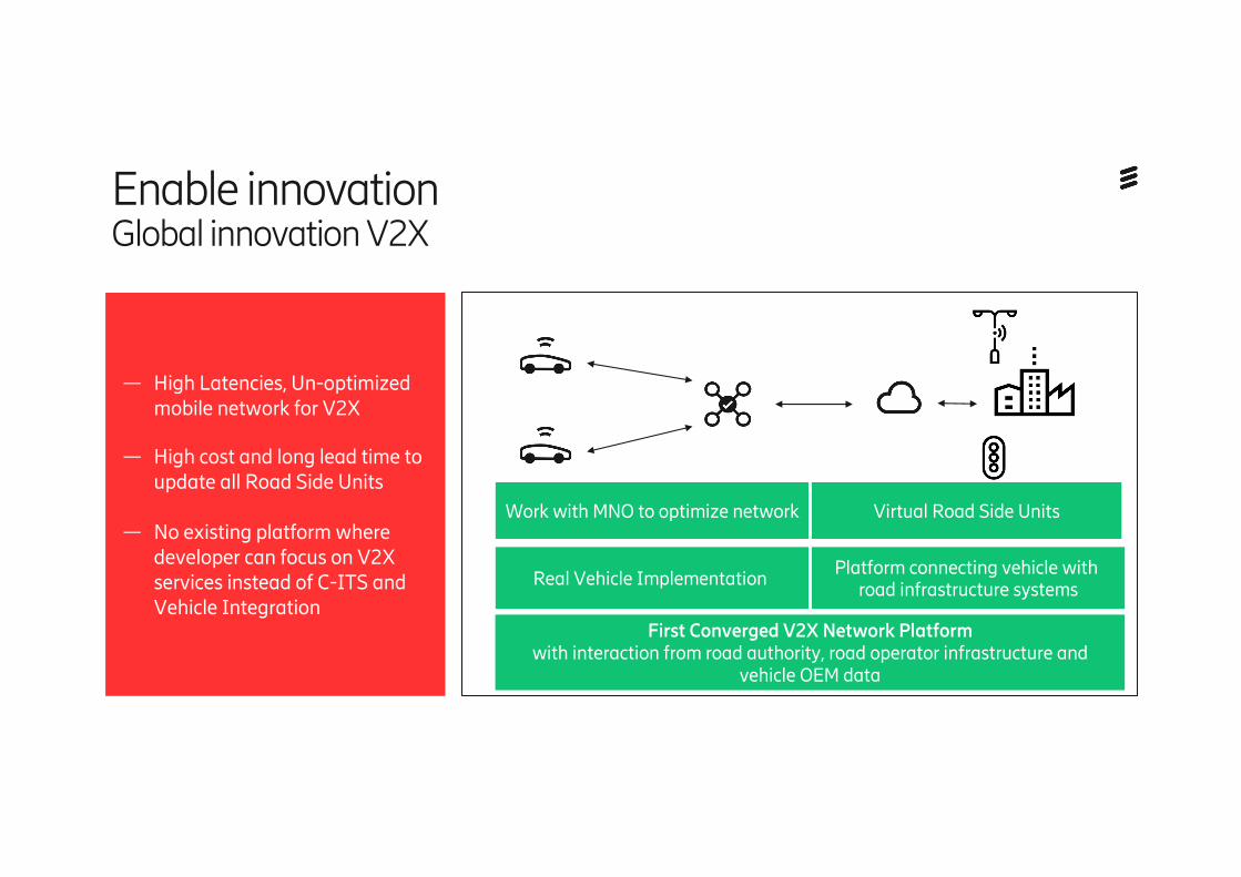
Work with MNO to optimize network
Real Vehicle Implementation
Virtual Road Side Units
Platform connecting vehicle with road infrastructure systems
First Converged V2X Network Platform with interaction from road authority, road operator infrastructure and
vehicle OEM data
Enable innovation Global innovation V2X
— High Latencies, Un-optimized mobile network for V2X
— High cost and long lead time to update all Road Side Units
— No existing platform where developer can focus on V2X services instead of C-ITS and Vehicle Integration
Ericsson Internal | 2018-02-21
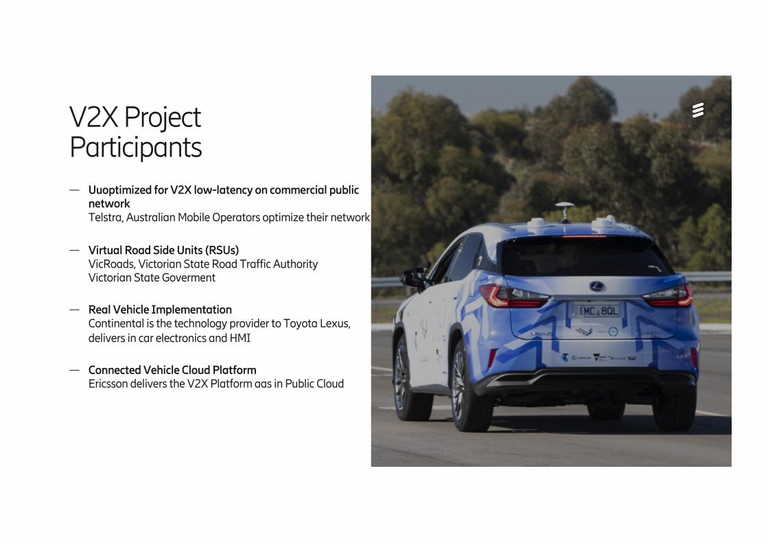
— Uuoptimized for V2X low-latency on commercial public networkTelstra, Australian Mobile Operators optimize their network
— Virtual Road Side Units (RSUs)VicRoads, Victorian State Road Traffic AuthorityVictorian State Goverment
— Real Vehicle ImplementationContinental is the technology provider to Toyota Lexus, delivers in car electronics and HMI
— Connected Vehicle Cloud PlatformEricsson delivers the V2X Platform aas in Public Cloud
V2X ProjectParticipants
Ericsson Internal | 2018-02-21
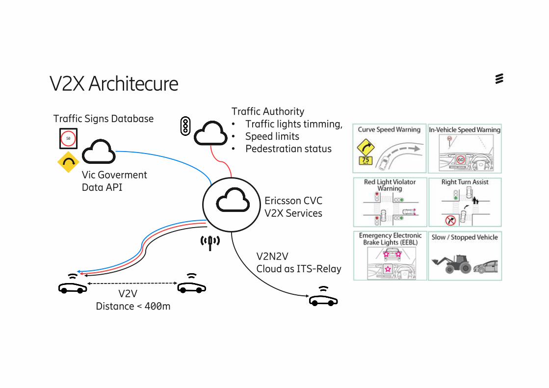
V2X Architecure
50
V2V Distance < 400m
Ericsson CVCV2X Services
Vic Goverment Data API
Traffic Authority• Traffic lights timming, • Speed limits• Pedestratian status
V2N2VCloud as ITS-Relay
Traffic Signs Database
Ericsson Internal | 2018-02-21
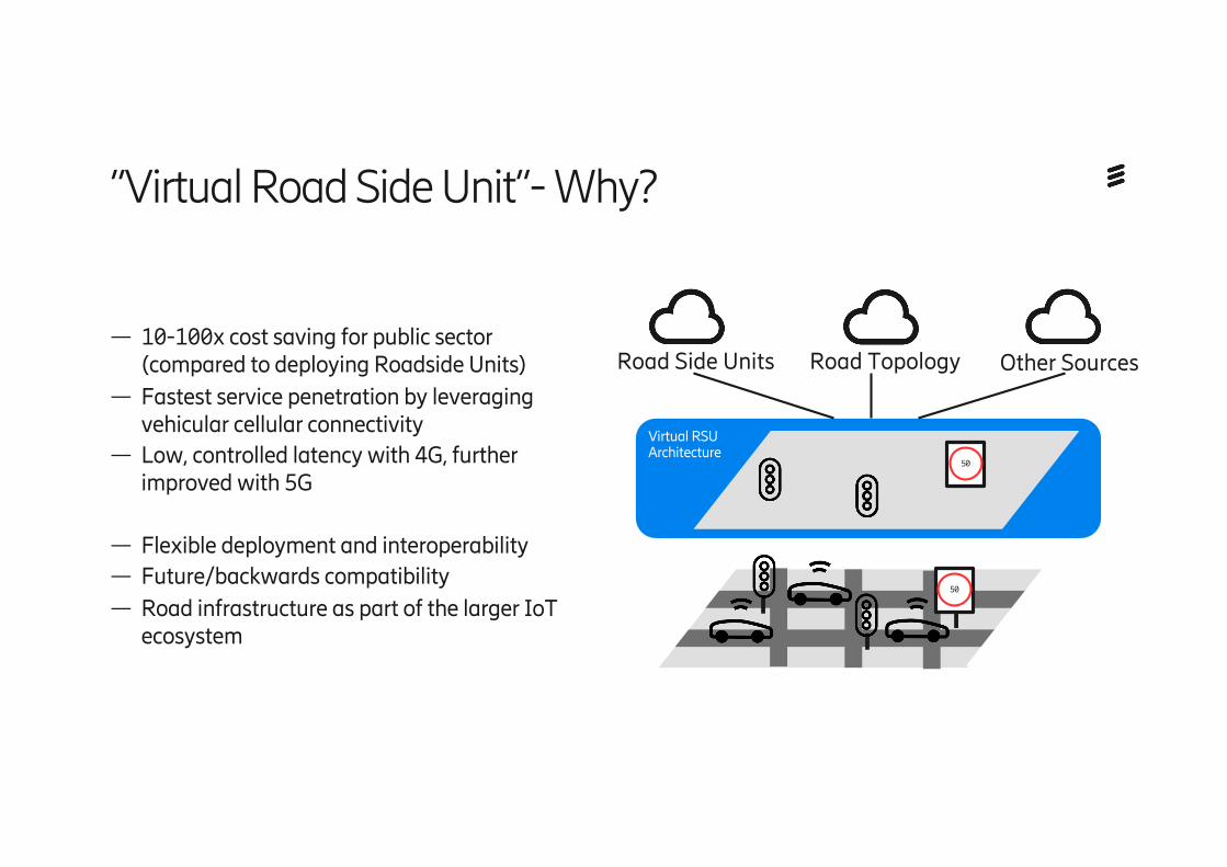
— 10-100x cost saving for public sector (compared to deploying Roadside Units)
— Fastest service penetration by leveraging vehicular cellular connectivity
— Low, controlled latency with 4G, further improved with 5G
— Flexible deployment and interoperability— Future/backwards compatibility— Road infrastructure as part of the larger IoT
ecosystem
”Virtual Road Side Unit”- Why?
Road Side Units Road Topology Other Sources
Virtual RSUArchitecture
50
50
Ericsson Internal | 2018-02-21
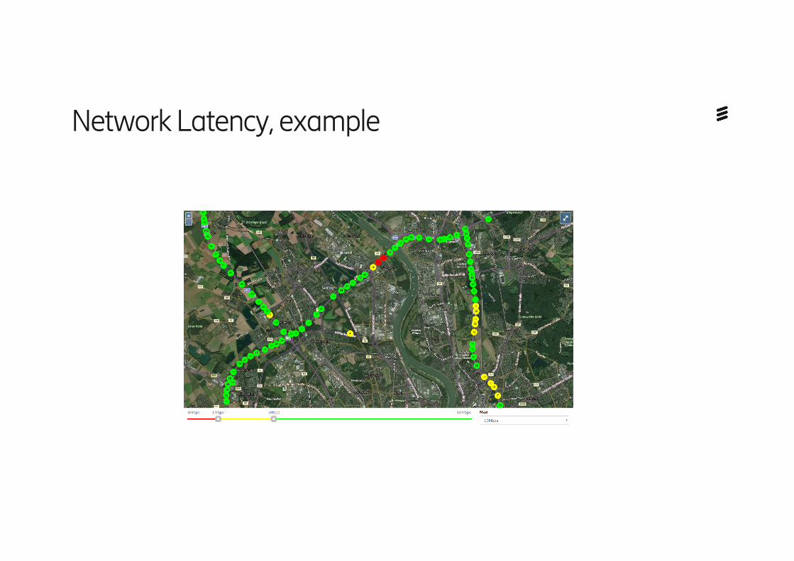
Network Latency, example
Ericsson Internal | 2018-02-21
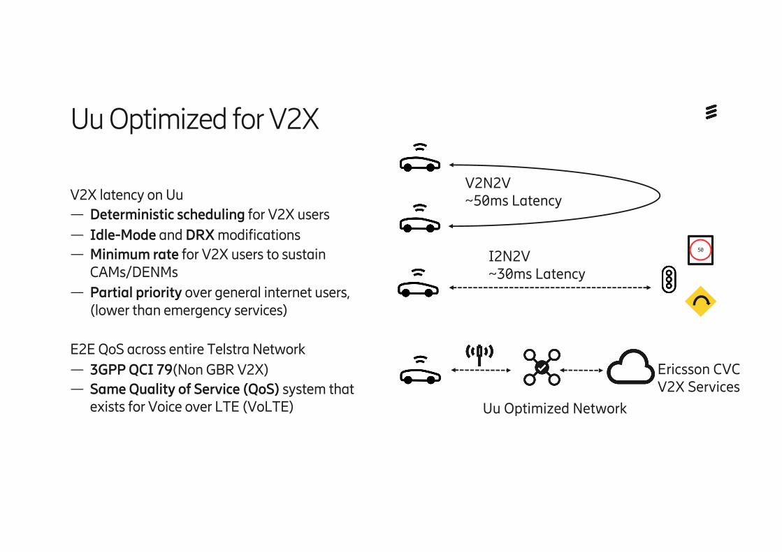
V2X latency on Uu— Deterministic scheduling for V2X users— Idle-Mode and DRX modifications— Minimum rate for V2X users to sustain
CAMs/DENMs— Partial priority over general internet users,
(lower than emergency services)
E2E QoS across entire Telstra Network— 3GPP QCI 79(Non GBR V2X)— Same Quality of Service (QoS) system that
exists for Voice over LTE (VoLTE)
Uu Optimized for V2X
Ericsson CVCV2X Services
I2N2V~30ms Latency
Uu Optimized Network
V2N2V~50ms Latency
50
Ericsson Internal | 2018-02-21
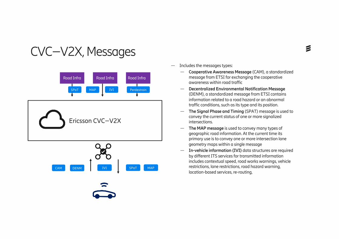
— Includes the messages types:— Cooperative Awareness Message (CAM), a standardized
message from ETSI for exchanging the cooperative awareness within road traffic
— Decentralized Environmental Notification Message (DENM), a standardized message from ETSI contains information related to a road hazard or an abnormal traffic conditions, such as its type and its position.
— The Signal Phase and Timing (SPAT) message is used to convey the current status of one or more signalized intersections.
— The MAP message is used to convey many types of geographic road information. At the current time its primary use is to convey one or more intersection lane geometry maps within a single message
— In-vehicle information (IVI) data structures are required by different ITS services for transmitted information includes contextual speed, road works warnings, vehicle restrictions, lane restrictions, road hazard warning, location-based services, re-routing,
CVC–V2X, Messages
Ericsson CVC–V2X
Road Infra Road Infra Road Infra
SPaT MAP IVI Perdestrain
CAM DENM IVI SPaT MAP
Ericsson Internal | 2018-02-21
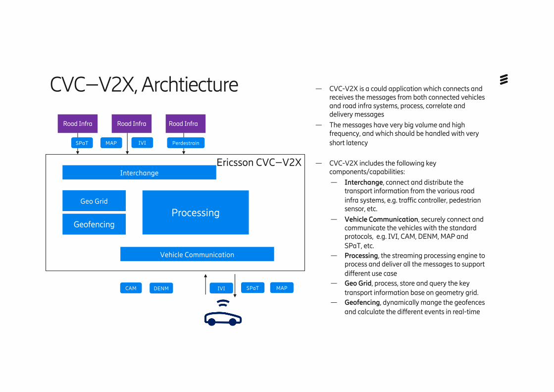
— CVC-V2X is a could application which connects and receives the messages from both connected vehicles and road infra systems, process, correlate and delivery messages
— The messages have very big volume and high frequency, and which should be handled with very short latency
— CVC-V2X includes the following key components/capabilities:
— Interchange, connect and distribute the transport information from the various road infra systems, e.g. traffic controller, pedestrian sensor, etc.
— Vehicle Communication, securely connect and communicate the vehicles with the standard protocols, e.g. IVI, CAM, DENM, MAP and SPaT, etc.
— Processing, the streaming processing engine to process and deliver all the messages to support different use case
— Geo Grid, process, store and query the key transport information base on geometry grid.
— Geofencing, dynamically mange the geofences and calculate the different events in real-time
CVC–V2X, Archtiecture
Ericsson CVC–V2X
Geo Grid
Processing
Interchange
Vehicle Communication
Road Infra Road Infra Road Infra
Geofencing
SPaT MAP IVI Perdestrain
CAM DENM IVI SPaT MAP
Ericsson Internal | 2018-02-21
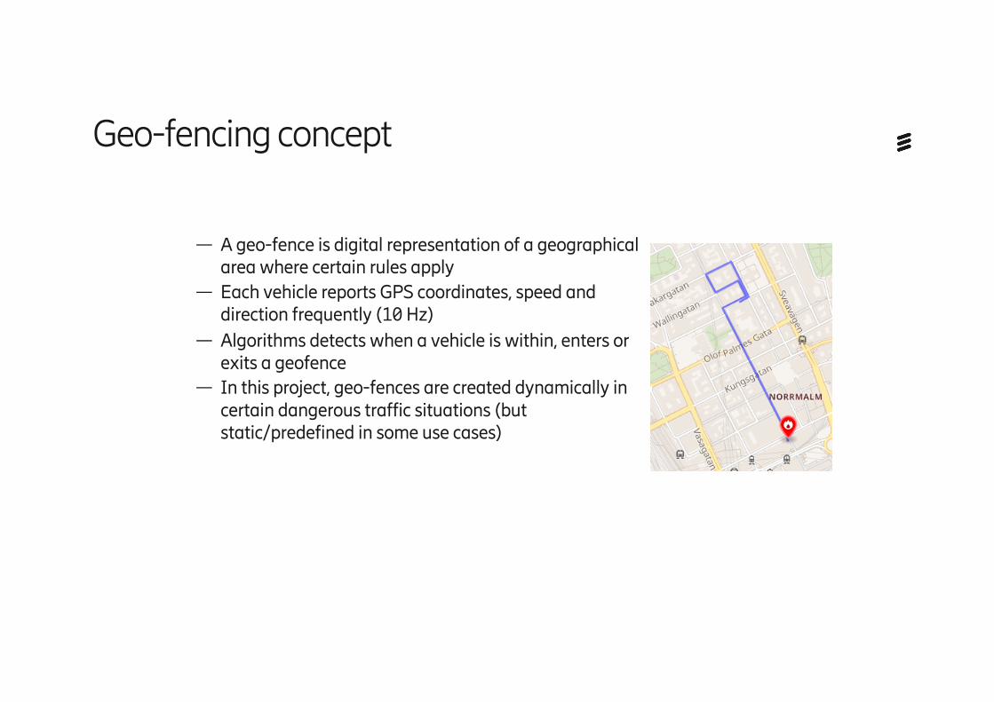
— A geo-fence is digital representation of a geographical area where certain rules apply
— Each vehicle reports GPS coordinates, speed and direction frequently (10 Hz)
— Algorithms detects when a vehicle is within, enters or exits a geofence
— In this project, geo-fences are created dynamically in certain dangerous traffic situations (but static/predefined in some use cases)
Geo-fencing concept