Embed Size (px)
Citation preview

8/3/2019 ES & GIS new
http://slidepdf.com/reader/full/es-gis-new 1/58
8/3/2019 ES & GIS new
http://slidepdf.com/reader/full/es-gis-new 2/58
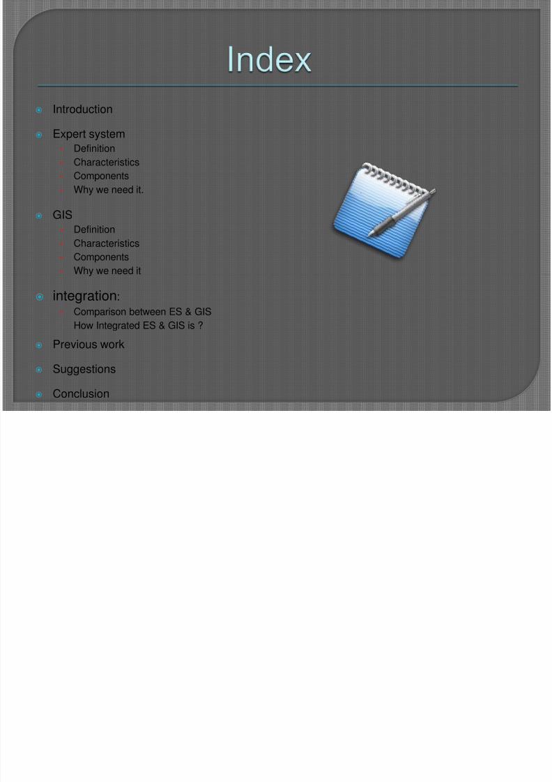
Introduction
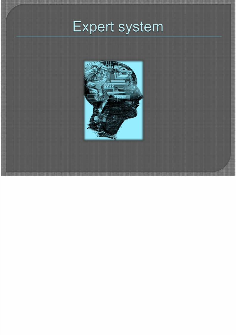
Expert system
• Definition
• Characteristics
• Components
• Why we need it.
GIS
• Definition
• Characteristics
• Components
• Why we need it
integration:
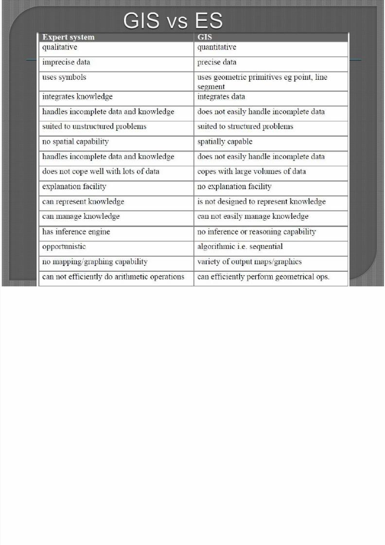
• Comparison between ES & GIS
How Integrated ES & GIS is ?
Previous work
Suggestions
Conclusion
8/3/2019 ES & GIS new
http://slidepdf.com/reader/full/es-gis-new 3/58
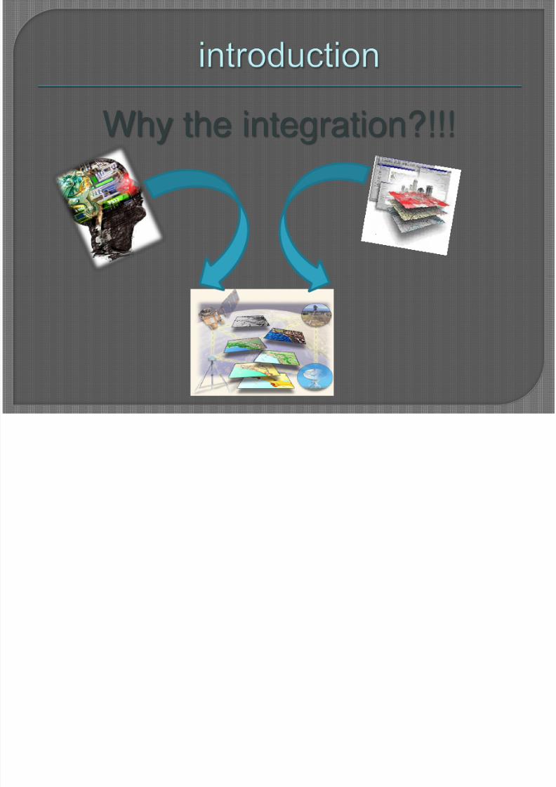
Why the integration?!!!
8/3/2019 ES & GIS new
http://slidepdf.com/reader/full/es-gis-new 4/58
8/3/2019 ES & GIS new
http://slidepdf.com/reader/full/es-gis-new 5/58
An expert system is a computer that uses arepresentation of human expertise in a specialist domainin order to perform functions similar to those normallyperformed by a human expert in that domain". Goodall's (1985)
Expert systems are branch of artificial intelligence (AI) thatis the study of how to make computers do things
at which, at moment, people are better“ Elaine Rich (1983)
8/3/2019 ES & GIS new
http://slidepdf.com/reader/full/es-gis-new 6/58
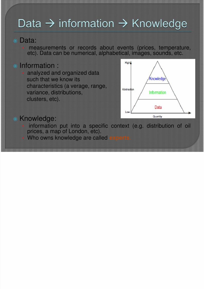
Data:• measurements or records about events (prices, temperature,
etc). Data can be numerical, alphabetical, images, sounds, etc.
Information :• analyzed and organized data
such that we know itscharacteristics (a verage, range,variance, distributions,clusters, etc).
Knowledge:• information put into a specific context (e.g. distribution of oil
prices, a map of London, etc).• Who owns knowledge are called experts.
8/3/2019 ES & GIS new
http://slidepdf.com/reader/full/es-gis-new 7/58
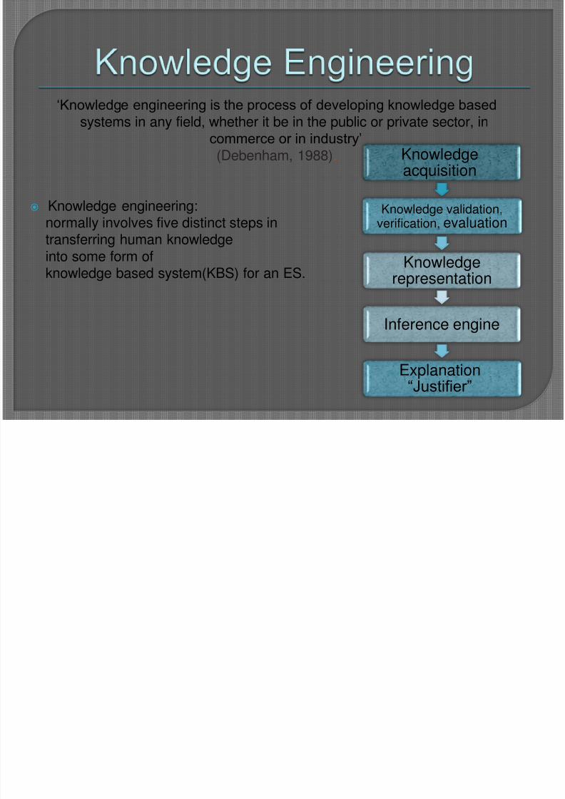
„Knowledge engineering is the process of developing knowledge based
systems in any field, whether it be in the public or private sector, incommerce or in industry‟ (Debenham, 1988).
Knowledge engineering:normally involves five distinct steps intransferring human knowledgeinto some form ofknowledge based system(KBS) for an ES.
Knowledgeacquisition
Knowledge validation,verification, evaluation
Knowledgerepresentation
Inference engine
Explanation
“Justifier”
8/3/2019 ES & GIS new
http://slidepdf.com/reader/full/es-gis-new 8/58
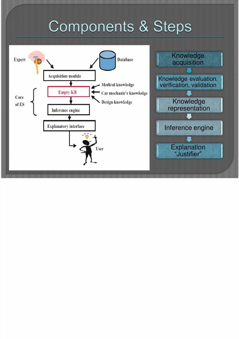
Knowledgeacquisition
Knowledge evaluation,
verification, validation
Knowledgerepresentation
Inference engine
Explanation“Justifier”
8/3/2019 ES & GIS new
http://slidepdf.com/reader/full/es-gis-new 9/58
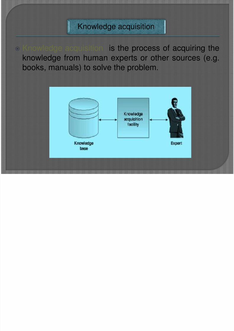
Knowledge acquisition is the process of acquiring the
knowledge from human experts or other sources (e.g.books, manuals) to solve the problem.
Knowledge acquisition
8/3/2019 ES & GIS new
http://slidepdf.com/reader/full/es-gis-new 10/58
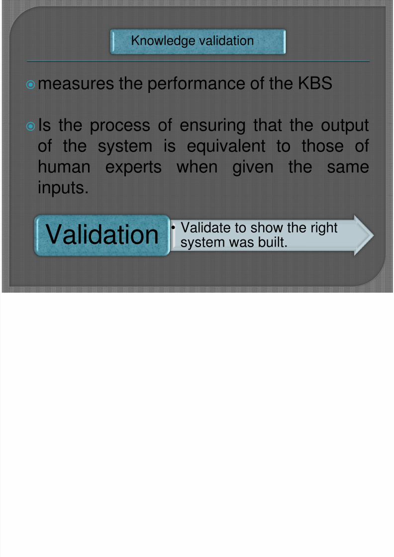
measures the performance of the KBS
Is the process of ensuring that the outputof the system is equivalent to those ofhuman experts when given the sameinputs.
Knowledge validation
• Validate to show the rightsystem was built. Validation
8/3/2019 ES & GIS new
http://slidepdf.com/reader/full/es-gis-new 11/58
Mean how to represent knowledge in a manner that
facilitates inferencing (i.e. drawing conclusions) from
knowledge. There are Different knowledge
representation schemes: Rules, Semantic Networks
and Frames.
Knowledge representation
8/3/2019 ES & GIS new
http://slidepdf.com/reader/full/es-gis-new 12/58
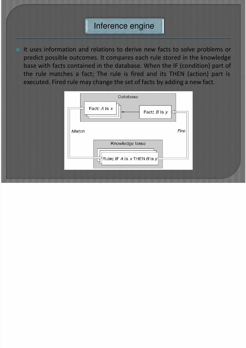
It uses information and relations to derive new facts to solve problems or
predict possible outcomes. It compares each rule stored in the knowledge
base with facts contained in the database. When the IF (condition) part of
the rule matches a fact; The rule is fired and its THEN (action) part is
executed. Fired rule may change the set of facts by adding a new fact.
Inference engine
8/3/2019 ES & GIS new
http://slidepdf.com/reader/full/es-gis-new 13/58
Inference techniques:
a. Forward chaining: is a data-driven inference process; It is a
technique for gathering information and then inferring from it
whatever can be inferred. You start with facts and try to reach
conclusions. The user of the system has to give all the availabledata before the start of the inference. The inference mechanism
tries to establish the facts as they appear in the knowledge base
until the goal is established.
b. Backward chaining: You start with conclusions; It is a goal-drivenprocess and the most frequently used inference mechanism; It
tries to establish goals in the order in which they appear in the
knowledge base; The goal variable defined in the rule base for
selection of a structural.
Inference engine
8/3/2019 ES & GIS new
http://slidepdf.com/reader/full/es-gis-new 14/58
Explanation Facilities:
• A basic component of an expert system that enables
the user to query the expert system about how it
reached a particular conclusion; They can show the
sequence of the rules they applied to reach a solution,
but cannot relate accumulated, heuristic knowledge to
any deeper understanding of the problem domain.
Explanation “Justifier”
8/3/2019 ES & GIS new
http://slidepdf.com/reader/full/es-gis-new 15/58
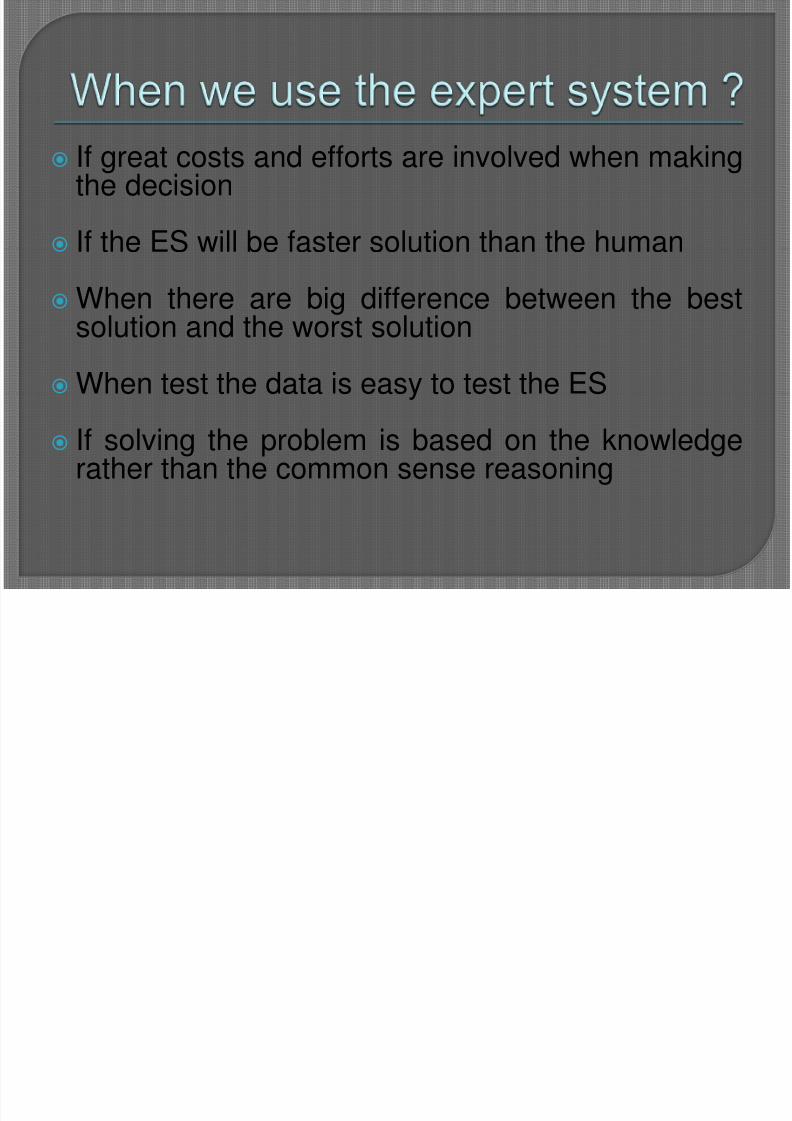
If great costs and efforts are involved when makingthe decision
If the ES will be faster solution than the human When there are big difference between the best
solution and the worst solution
When test the data is easy to test the ES
If solving the problem is based on the knowledgerather than the common sense reasoning

8/3/2019 ES & GIS new
http://slidepdf.com/reader/full/es-gis-new 16/58
MYCIN

8/3/2019 ES & GIS new
http://slidepdf.com/reader/full/es-gis-new 17/58
8/3/2019 ES & GIS new
http://slidepdf.com/reader/full/es-gis-new 18/58
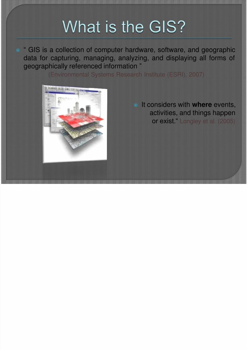
“ GIS is a collection of computer hardware, software, and geographicdata for capturing, managing, analyzing, and displaying all forms ofgeographically referenced information ”
(Environmental Systems Research Institute (ESRI), 2007)
It considers with where events,activities, and things happenor exist.“ Longley et al. (2005)
8/3/2019 ES & GIS new
http://slidepdf.com/reader/full/es-gis-new 19/58
8/3/2019 ES & GIS new
http://slidepdf.com/reader/full/es-gis-new 20/58
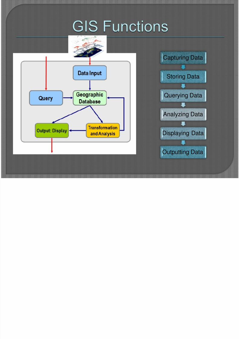
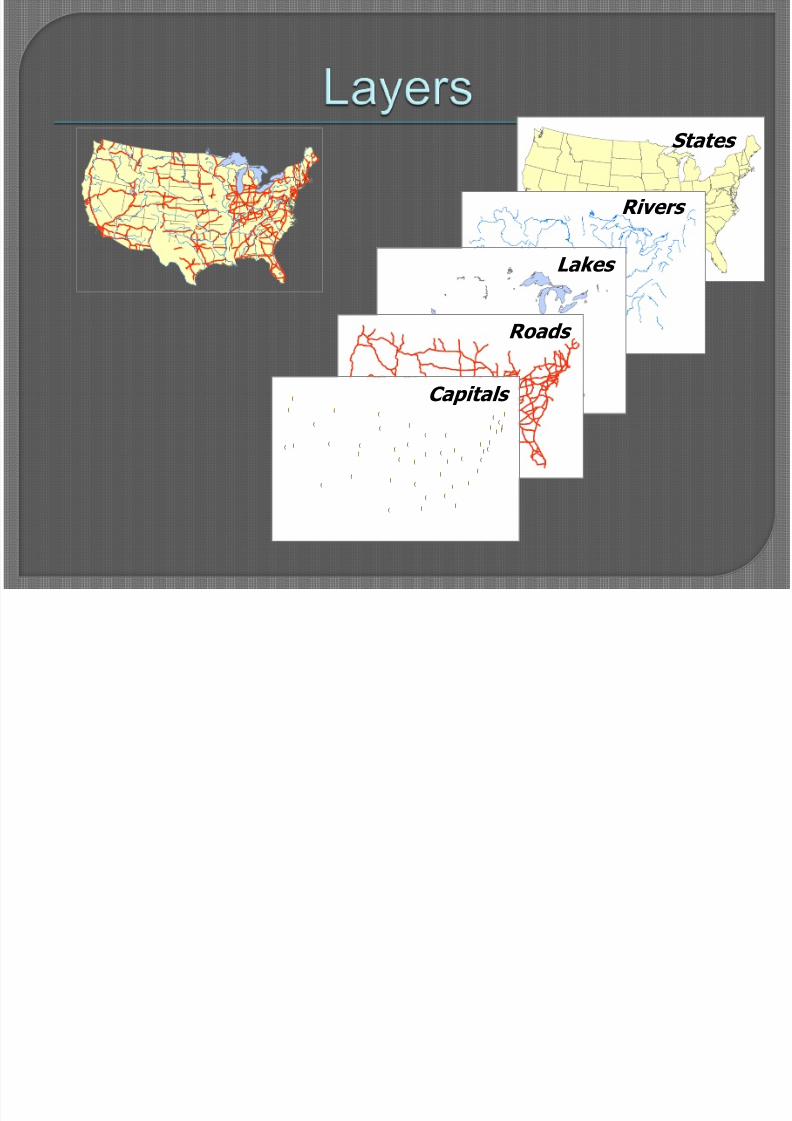
Capturing Data
Storing Data
Querying Data
Analyzing Data
Displaying Data
Outputting Data
8/3/2019 ES & GIS new
http://slidepdf.com/reader/full/es-gis-new 21/58
!(
!(!(
!(
!(
!(
!(
!(
!(
!(
!(
!( !(
!( !(
!(
!(
!(
!(
!(
!(
!(
!(
!(
!(
!(
!(
!(
!(
!(
!(
!(
!(
!(
!(
!(
!(
!(
!(
!(
!(
!(
!(
!(
!(
!(
!(
!(
States
Rivers
Lakes
Roads
!(
!(!(
!(
!(
!(
!(
!(
!(
!(
!(
!( !(
!( !(
!(
!(
!(
!(
!(
!(
!(
!(
!(
!(
!(
!(
!(
!(
!(
!(
!(
!(
!(
!(
!(
!(
!(
!(
!(
!(
!(
!(
!(
!(
!(
!(
!(
Capitals
8/3/2019 ES & GIS new
http://slidepdf.com/reader/full/es-gis-new 22/58
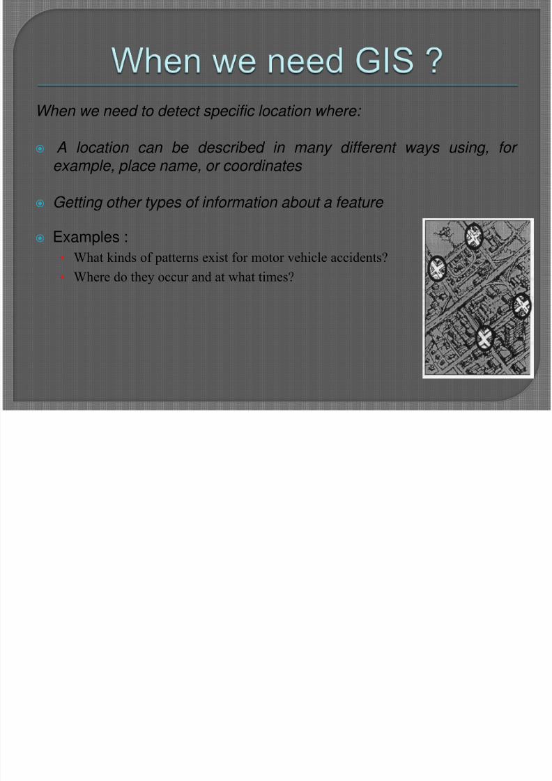
When we need to detect specific location where:
A location can be described in many different ways using, for example, place name, or coordinates
Getting other types of information about a feature
Examples :
• What kinds of patterns exist for motor vehicle accidents?
• Where do they occur and at what times?

8/3/2019 ES & GIS new
http://slidepdf.com/reader/full/es-gis-new 23/58
Integration between ES and GIS
8/3/2019 ES & GIS new
http://slidepdf.com/reader/full/es-gis-new 24/58
Concerned with the coupling of pre-existingsystems to fuse a desired set of capabilitieswith some targeted degree of usability of theintegrated system.
Pre-existing systems themselves are to betaken as not to be modified.
Involves the design of some specialistcomponents and linkage components tofacilitate coupling .
8/3/2019 ES & GIS new
http://slidepdf.com/reader/full/es-gis-new 25/58
To avoid some of the limitations anddifficulties existing in each of them
The spatial decision making can bemade more effective within suchintegrated systems.
8/3/2019 ES & GIS new
http://slidepdf.com/reader/full/es-gis-new 26/58
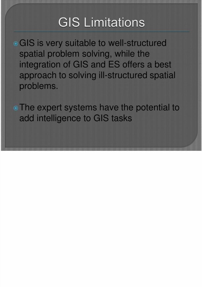
GIS is very suitable to well-structuredspatial problem solving, while theintegration of GIS and ES offers a best
approach to solving ill-structured spatialproblems.
The expert systems have the potential toadd intelligence to GIS tasks
8/3/2019 ES & GIS new
http://slidepdf.com/reader/full/es-gis-new 27/58
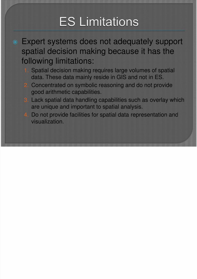
Expert systems does not adequately supportspatial decision making because it has thefollowing limitations:
1. Spatial decision making requires large volumes of spatialdata. These data mainly reside in GIS and not in ES.
2. Concentrated on symbolic reasoning and do not providegood arithmetic capabilities.
3. Lack spatial data handling capabilities such as overlay whichare unique and important to spatial analysis.
4. Do not provide facilities for spatial data representation andvisualization.
8/3/2019 ES & GIS new
http://slidepdf.com/reader/full/es-gis-new 28/58
8/3/2019 ES & GIS new
http://slidepdf.com/reader/full/es-gis-new 29/58
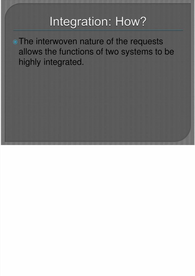
The interwoven nature of the requestsallows the functions of two systems to behighly integrated.
8/3/2019 ES & GIS new
http://slidepdf.com/reader/full/es-gis-new 30/58
8/3/2019 ES & GIS new
http://slidepdf.com/reader/full/es-gis-new 31/58
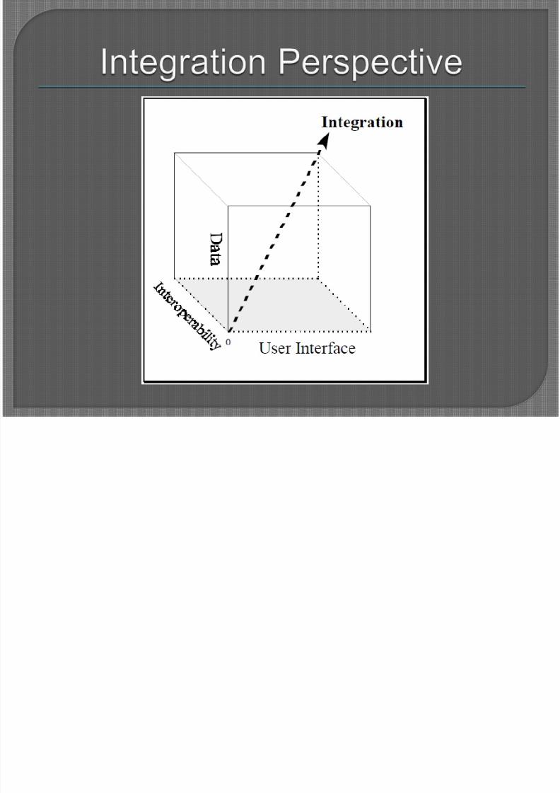
It is the ability of two or more softwarecomponents to cooperate despitedifferences in language, interface, and
execution platform
The degree of interoperability between an
expert system and a GIS will affect theability of an integrated system to model thecomplexity of the real world

8/3/2019 ES & GIS new
http://slidepdf.com/reader/full/es-gis-new 32/58
8/3/2019 ES & GIS new
http://slidepdf.com/reader/full/es-gis-new 33/58
COM (Component Object Model): the basestandards to develop specifications for exchangingGIS data and functionality.
• Component Based Software Development (CBSD) thatfocuses on building large software systems by integratingpreviously existing software components as a way to reduce development costs, improve productivity, and
provide controlled systems upgrade in the face of rapid technology
evolution
The main goal of COM is promote the interoperability
8/3/2019 ES & GIS new
http://slidepdf.com/reader/full/es-gis-new 34/58
Examples:• ArcGIS Desktop (an integrated suite of professional
GIS application) developed by Environmental systems
Research Institute (ESRI), is based on a commonmodular component-based library of shared GISsoftware components called ArcObjects .
• Visual Rule Studio (an object-oriented COM-compliantexpert system development environment for windows)developed by Rule Machines; it installs as an integralpart of MS Visual Basic 6.0.
8/3/2019 ES & GIS new
http://slidepdf.com/reader/full/es-gis-new 35/58
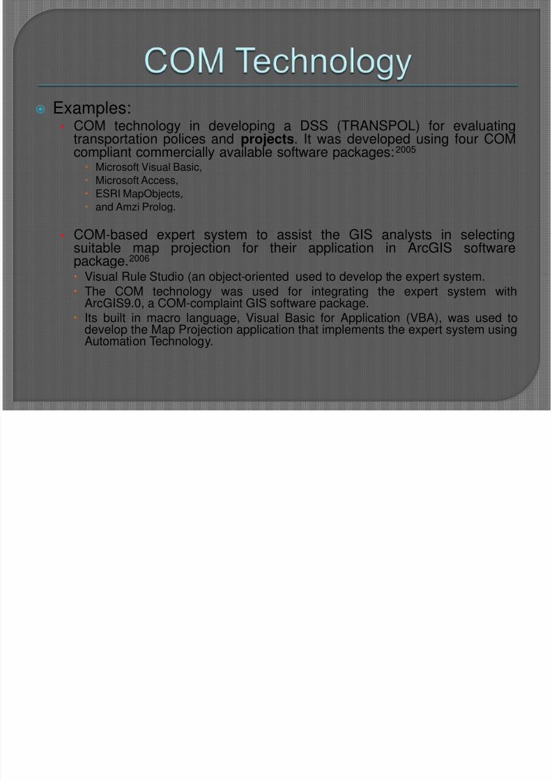
Examples:• COM technology in developing a DSS (TRANSPOL) for evaluating
transportation polices and projects. It was developed using four COMcompliant commercially available software packages:2005
Microsoft Visual Basic,
Microsoft Access,
ESRI MapObjects, and Amzi Prolog.
• COM-based expert system to assist the GIS analysts in selectingsuitable map projection for their application in ArcGIS softwarepackage.2006 Visual Rule Studio (an object-oriented used to develop the expert system.
The COM technology was used for integrating the expert system withArcGIS9.0, a COM-complaint GIS software package. Its built in macro language, Visual Basic for Application (VBA), was used to
develop the Map Projection application that implements the expert system usingAutomation Technology.
8/3/2019 ES & GIS new
http://slidepdf.com/reader/full/es-gis-new 36/58
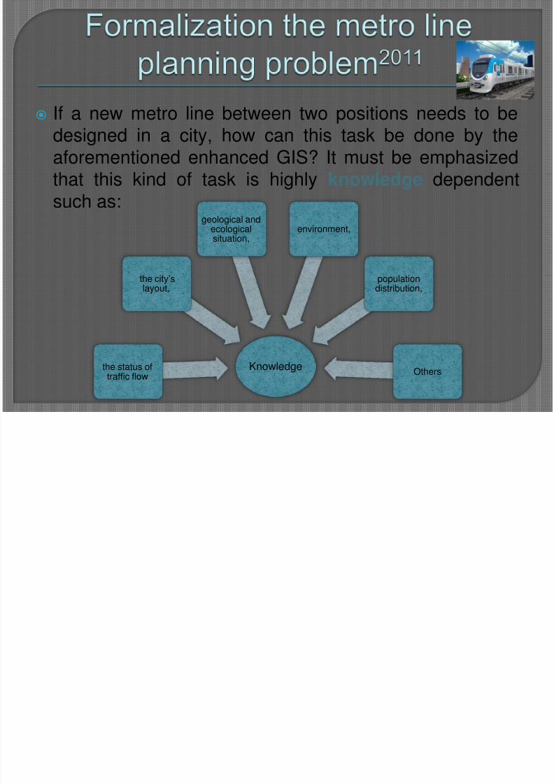
If a new metro line between two positions needs to bedesigned in a city, how can this task be done by theaforementioned enhanced GIS? It must be emphasizedthat this kind of task is highly knowledge dependent
such as:
Knowledgethe status oftraffic flow
the city‟slayout,
geological andecologicalsituation,
environment,
populationdistribution,
Others
8/3/2019 ES & GIS new
http://slidepdf.com/reader/full/es-gis-new 37/58
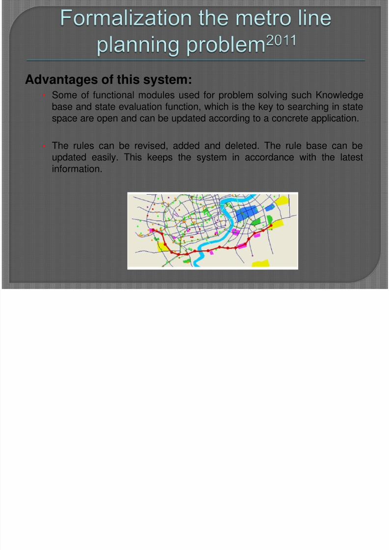
Advantages of this system: • Some of functional modules used for problem solving such Knowledge
base and state evaluation function, which is the key to searching in statespace are open and can be updated according to a concrete application.
• The rules can be revised, added and deleted. The rule base can beupdated easily. This keeps the system in accordance with the latestinformation.
8/3/2019 ES & GIS new
http://slidepdf.com/reader/full/es-gis-new 38/58
Helps in estimating damage levelFacilitates decision-making and planning
for disaster managers.Allow managers can estimate disaster
area and number of victims to determineand allocate required resources.
Due to the time-sensitive nature ofdisasters, rapid and reliable decision-making has a significant impact on
managing disasters.
8/3/2019 ES & GIS new
http://slidepdf.com/reader/full/es-gis-new 39/58
8/3/2019 ES & GIS new
http://slidepdf.com/reader/full/es-gis-new 40/58
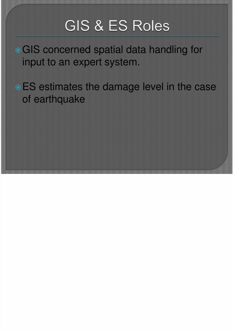
GIS concerned spatial data handling forinput to an expert system.
ES estimates the damage level in the caseof earthquake
8/3/2019 ES & GIS new
http://slidepdf.com/reader/full/es-gis-new 41/58
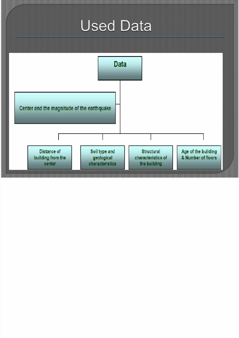
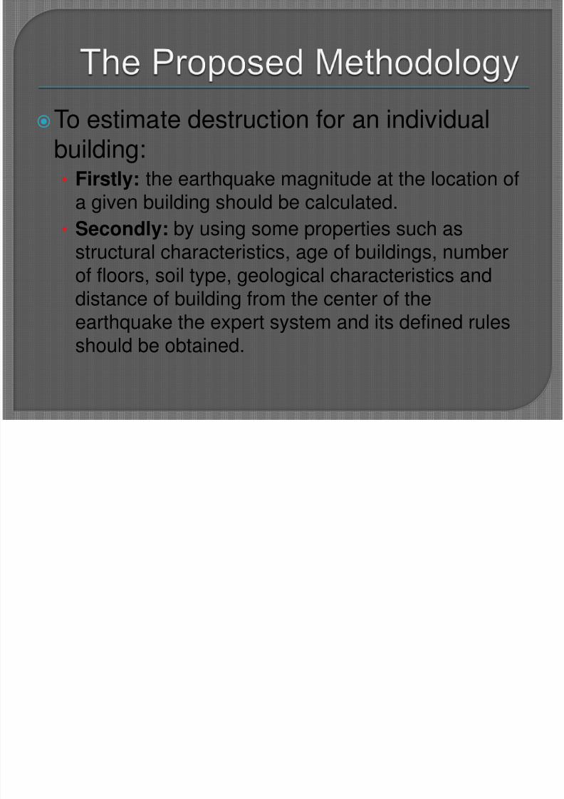
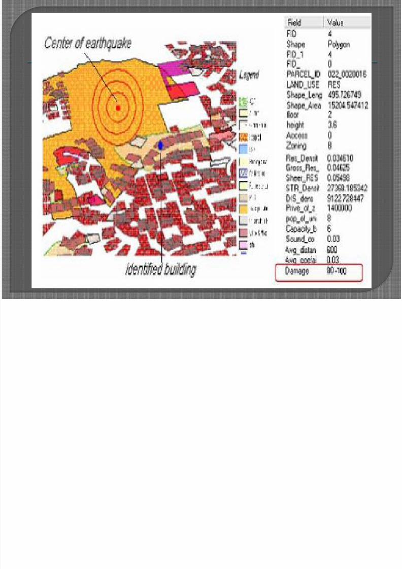
To estimate destruction for an individualbuilding:• Firstly: the earthquake magnitude at the location of
a given building should be calculated.• Secondly: by using some properties such as
structural characteristics, age of buildings, numberof floors, soil type, geological characteristics and
distance of building from the center of theearthquake the expert system and its defined rulesshould be obtained.
8/3/2019 ES & GIS new
http://slidepdf.com/reader/full/es-gis-new 42/58
8/3/2019 ES & GIS new
http://slidepdf.com/reader/full/es-gis-new 43/58
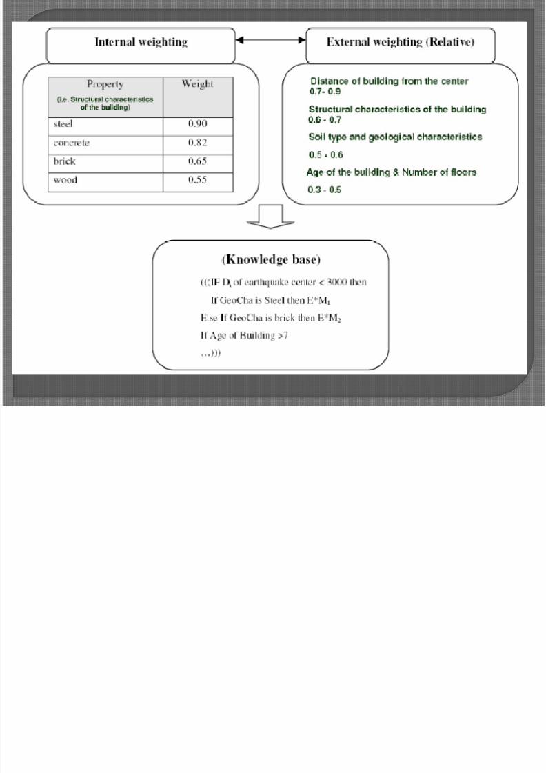
The properties should be classified intoclasses of high and low priority of weightto obtain destruction probability.
This is done through a two step weightingprocess:
1. Each property is externally weighted based on
degree of importance in destruction probability.2. Each property is internally weighted.
8/3/2019 ES & GIS new
http://slidepdf.com/reader/full/es-gis-new 44/58
8/3/2019 ES & GIS new
http://slidepdf.com/reader/full/es-gis-new 45/58
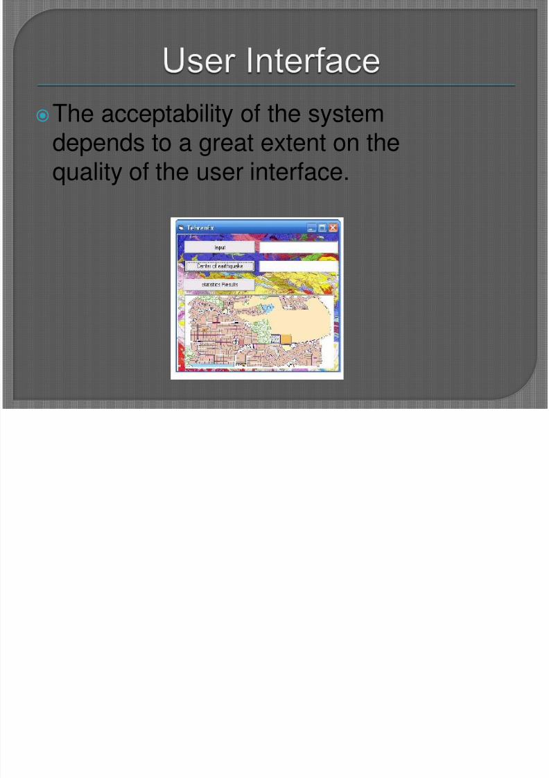
The acceptability of the systemdepends to a great extent on thequality of the user interface.

8/3/2019 ES & GIS new
http://slidepdf.com/reader/full/es-gis-new 46/58
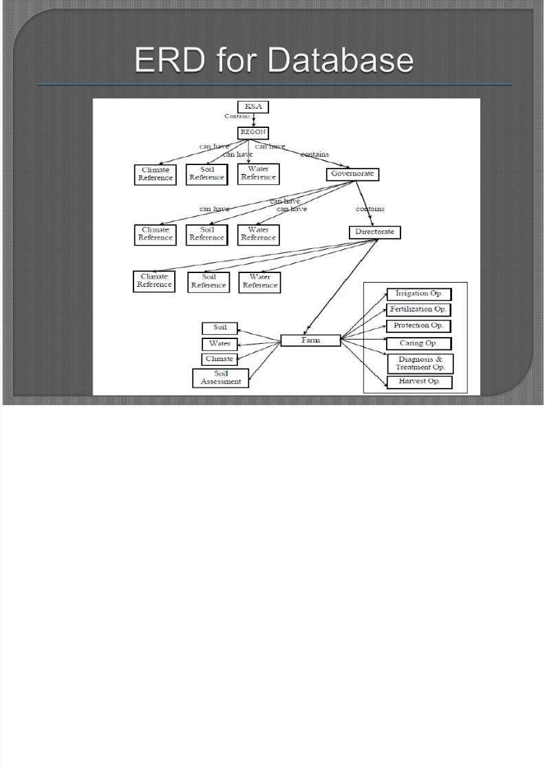
It consists of:1. Expert System (ES)
2. Geographical Information System (GIS)
3. Farm database system.
Integration occurs between thosecomponents
8/3/2019 ES & GIS new
http://slidepdf.com/reader/full/es-gis-new 47/58
The integration between the ES & GISoccurs through the database.
The database stores all the data about thesoil, water, and climate for each location.
Those data comes from two sources.1. The result of the analytical part of the
geographical information system.
2. The second resource of those data is the user
8/3/2019 ES & GIS new
http://slidepdf.com/reader/full/es-gis-new 48/58
8/3/2019 ES & GIS new
http://slidepdf.com/reader/full/es-gis-new 49/58
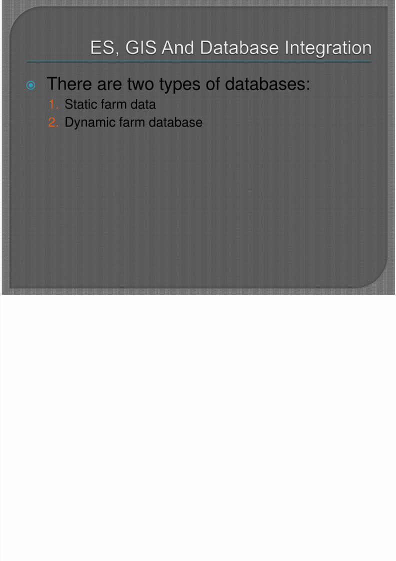
There are two types of databases:1. Static farm data
2. Dynamic farm database
8/3/2019 ES & GIS new
http://slidepdf.com/reader/full/es-gis-new 50/58
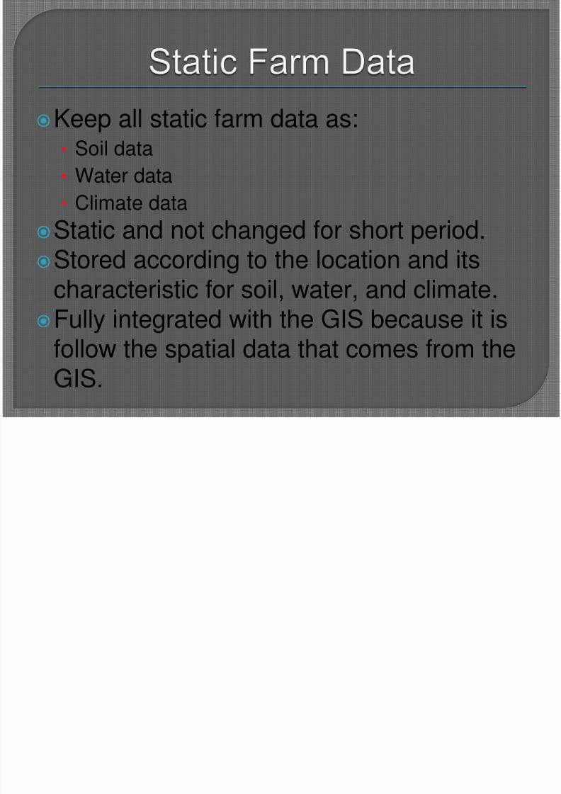
Keep all static farm data as:• Soil data
• Water data
• Climate dataStatic and not changed for short period.Stored according to the location and its
characteristic for soil, water, and climate.Fully integrated with the GIS because it is
follow the spatial data that comes from theGIS.
8/3/2019 ES & GIS new
http://slidepdf.com/reader/full/es-gis-new 51/58
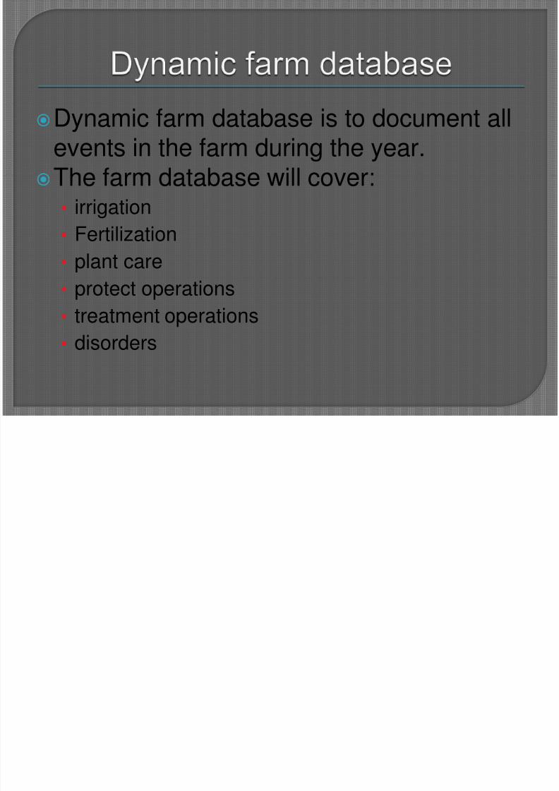
Dynamic farm database is to document allevents in the farm during the year.
The farm database will cover:• irrigation
• Fertilization
• plant care
• protect operations• treatment operations
• disorders
8/3/2019 ES & GIS new
http://slidepdf.com/reader/full/es-gis-new 52/58
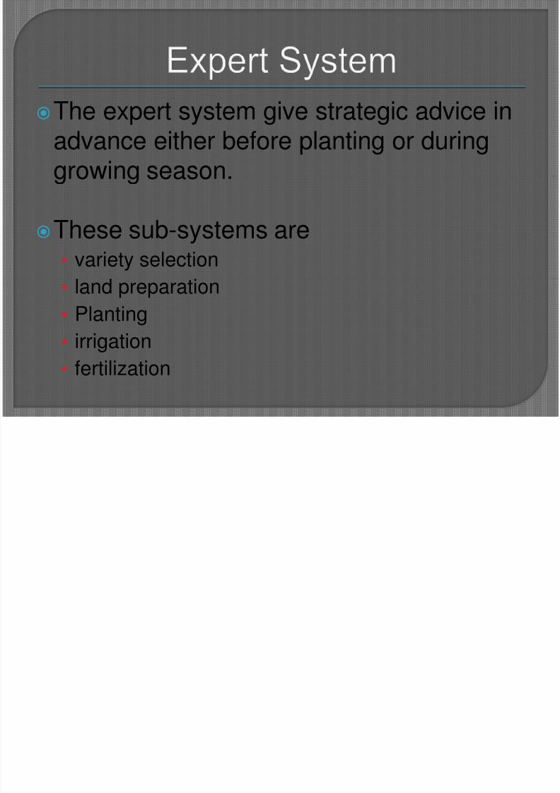
The expert system give strategic advice inadvance either before planting or duringgrowing season.
These sub-systems are• variety selection
• land preparation
• Planting
• irrigation
• fertilization
8/3/2019 ES & GIS new
http://slidepdf.com/reader/full/es-gis-new 53/58
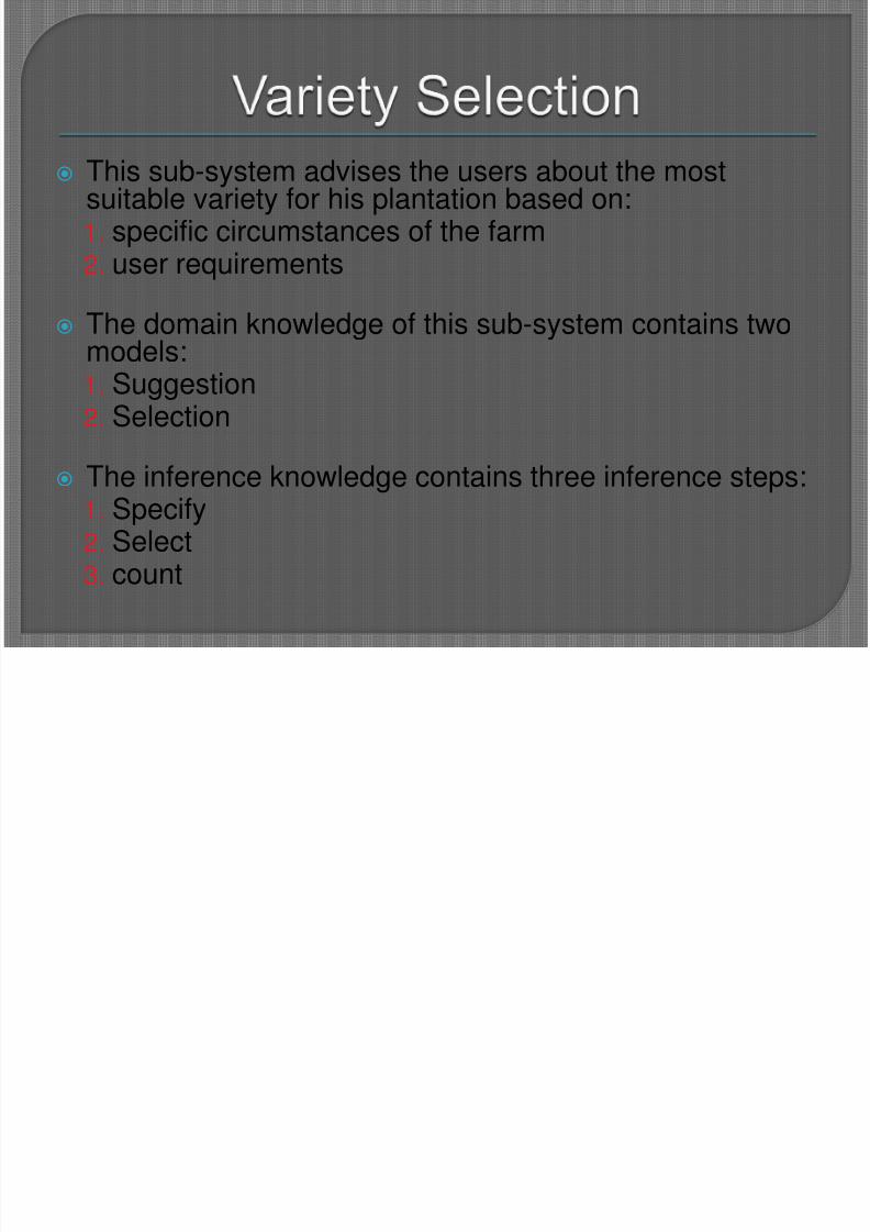
This sub-system advises the users about the mostsuitable variety for his plantation based on:1. specific circumstances of the farm2. user requirements
The domain knowledge of this sub-system contains twomodels:1. Suggestion2. Selection
The inference knowledge contains three inference steps:1. Specify2. Select3. count
8/3/2019 ES & GIS new
http://slidepdf.com/reader/full/es-gis-new 54/58
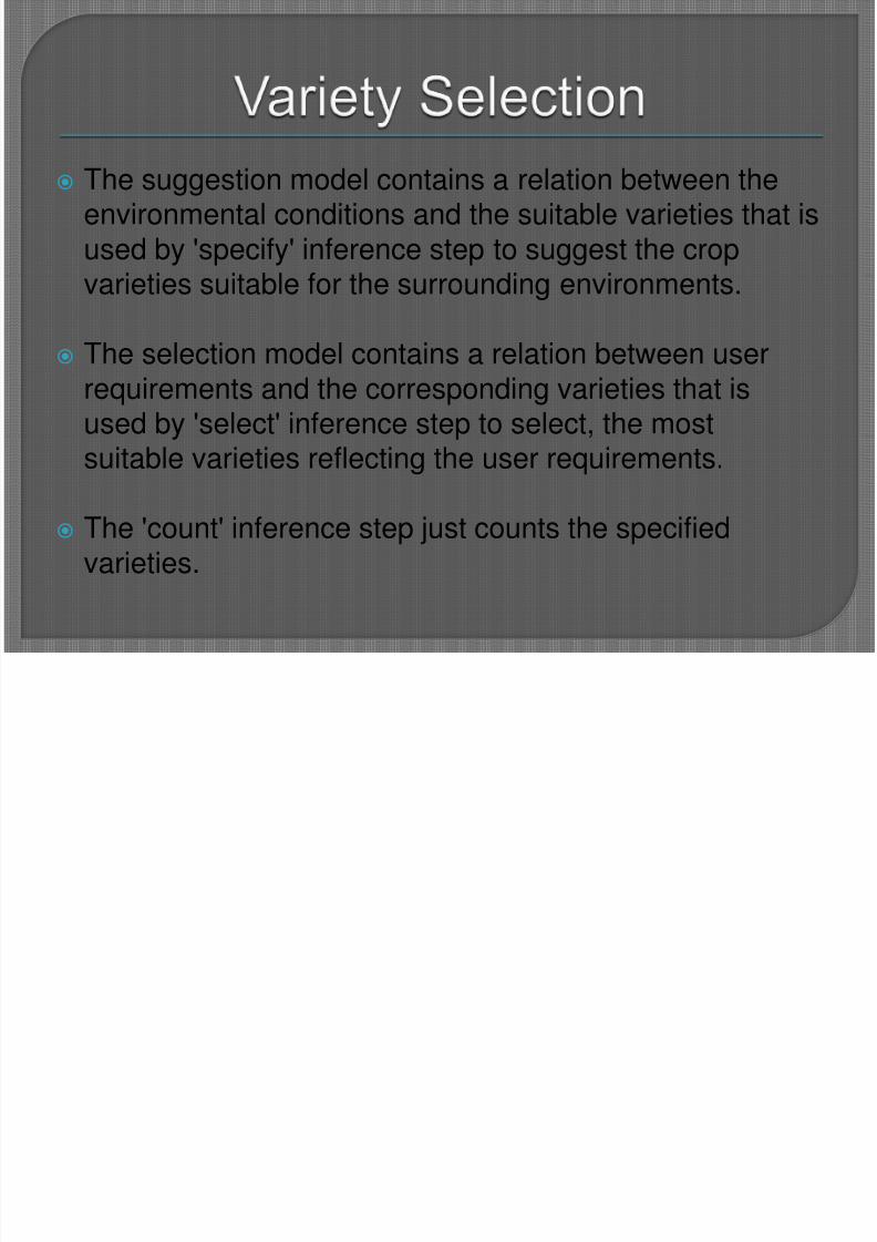
The suggestion model contains a relation between theenvironmental conditions and the suitable varieties that isused by 'specify' inference step to suggest the cropvarieties suitable for the surrounding environments.
The selection model contains a relation between userrequirements and the corresponding varieties that isused by 'select' inference step to select, the most
suitable varieties reflecting the user requirements.
The 'count' inference step just counts the specifiedvarieties.
8/3/2019 ES & GIS new
http://slidepdf.com/reader/full/es-gis-new 55/58
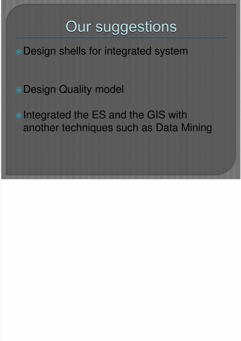
Design shells for integrated system
Design Quality model
Integrated the ES and the GIS with
another techniques such as Data Mining
8/3/2019 ES & GIS new
http://slidepdf.com/reader/full/es-gis-new 56/58
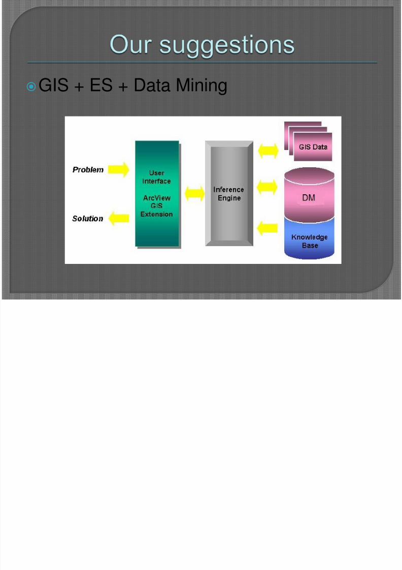
GIS + ES + Data Mining
8/3/2019 ES & GIS new
http://slidepdf.com/reader/full/es-gis-new 57/58
There are many capability limitations in both expertsystems and geographic information systemsthese limitations make it hard for each of themalone to handle many of real world. Integration
between both ES and GIS can handle thesecapability limitations.
There are many systems that are developed afterintegrating both GIS and ES. These systems help
in solving complex problems in different fields asagriculture, transportations, risk management…etc.

8/3/2019 ES & GIS new
http://slidepdf.com/reader/full/es-gis-new 58/58