Embed Size (px)
Citation preview
Esri Support for Geospatial Standards: • Open Geospatial Consortium (OGC)
• International Organization for Standardization Technical Committee 211 (ISO/TC211)
An Esri® White Paper April 2015
Copyright © 2015 Esri All rights reserved. Printed in the United States of America. The information contained in this document is the exclusive property of Esri. This work is protected under United States copyright law and other international copyright treaties and conventions. No part of this work may be reproduced or transmitted in any form or by any means, electronic or mechanical, including photocopying and recording, or by any information storage or retrieval system, except as expressly permitted in writing by Esri. All requests should be sent to Attention: Contracts and Legal Services Manager, Esri, 380 New York Street, Redlands, CA 92373-‐8100 USA. The information contained in this document is subject to change without notice. Esri, the Esri globe logo, Esri product names included in this white paper, esri.com, and @esri.com are trademarks, service marks, or registered marks of Esri in the United States, the European Community, or certain other jurisdictions. Other companies and products or services mentioned herein may be trademarks, service marks, or registered marks of their respective mark owners.
Esri White Paper i
Esri Support for Geospatial Standards: OGC and ISO/TC211
An Esri White Paper Page The ArcGIS Platform……………………………………………………………. 1
• Designed for Interoperability…………………………………… 2 • Understanding Interoperability Enablers………………… 2 • Supporting Open and Protected Source, Standards,
and Open Data………………………………………………………….. 3
Supported OGC Standards…………………………………………………… 4
• Part 1: Esri OGC Compliant Products……………………….. 4 • Part 2: Esri Implementing OGC Standards……………….. 8
Supported ISO/TC 211 Standards……………………………………….. 20 For More Information…………………………………………………………. 25

Esri Support for Geospatial Standards: OGC and ISO/TC211
Esri White Paper
1
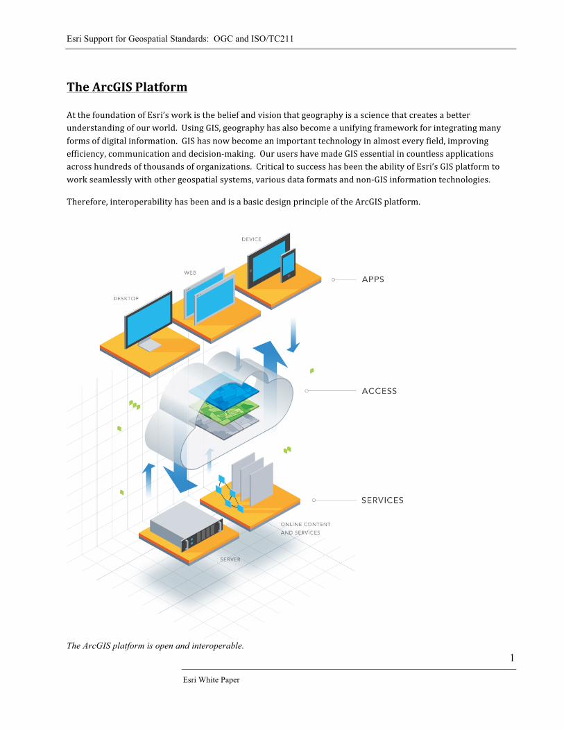
The ArcGIS Platform At the foundation of Esri’s work is the belief and vision that geography is a science that creates a better understanding of our world. Using GIS, geography has also become a unifying framework for integrating many forms of digital information. GIS has now become an important technology in almost every field, improving efficiency, communication and decision-‐making. Our users have made GIS essential in countless applications across hundreds of thousands of organizations. Critical to success has been the ability of Esri’s GIS platform to work seamlessly with other geospatial systems, various data formats and non-‐GIS information technologies. Therefore, interoperability has been and is a basic design principle of the ArcGIS platform.
The ArcGIS platform is open and interoperable.
Esri Support for Geospatial Standards: OGC and ISO/TC211
April 2015
2
Designed for Interoperability GIS from the beginning has been a field where information from multiple entities has been integrated to help analyze and answer specific questions. Data is often developed and maintained by specific businesses, agencies or departments and then used by others. Very often the different GIS technologies, data formats, data models, projections, etc. are used at the same time. This has led Esri to implement a basic design principle of ArcGIS: facilitate the use and integration of data from a large variety of sources to perform comprehensive geospatial analysis and visualization, and enable the sharing of the results of these analyses with many different users. This design principle is generally known as interoperability. In short, ArcGIS is designed for interoperability. For example, one of the basic design principles of ArcGIS is that it is built on the OGC Simple Feature Specification. That is how ArcGIS stores basic geographic features. Fundamental geographic objects are implemented using the OGC standard for Simple Features and are then extended for more complex objects like networks, topologies and cadastral fabrics, etc. These fundamental GIS building blocks create the foundation for GIS interoperability. Interoperability also applies to multiple layers within a GIS technology stack, from operating systems, to data stores, application server technologies, data models, semantics, web services protocols, browsers, and mobile devices. ArcGIS works on a wide variety of operating systems and external software programs and technologies. ArcGIS interacts with CAD and raster data; geospatial files from third-‐party developers; various relational databases: and provides a choice of developer tools to extend the ArcGIS Platform. These developer tools include ArcGIS Runtime SDKs and APIs.
Understanding Interoperability Enablers GIS interoperability enablers ensure users successfully interoperate and do so easily. The ArcGIS Platform also supports these important interoperability enablers:
• Openly published data formats and data models • Openly published application programming interfaces (APIs) • Direct read/write of a wide variety of data formats • Extraction, transformation, and loading (ETL) technology • Hardware platform choices • Database choices • Operating environment choices • Developer tool choices • Support for multiple coordinate, address, and temporal reference systems • Support for thousands of datums and projections • Adoption and use of fundamental information technology (non-‐geospatial) web and cloud
standards, patterns, and best practices.
Esri Support for Geospatial Standards: OGC and ISO/TC211
Esri White Paper
3
Supporting Open and Protected Source, Open Standards and Open Data
Interoperability and openness are often interconnected. Esri's ArcGIS Platform is designed to help our users be interoperable with other GIS and IT systems and to enable our users to openly share their data and work. Esri’s goal is to build the best GIS platform to enable core analytical GIS work; simple web mapping; and extensibility by developers. Therefore, Esri defines ‘open’ as being open to using both protected and open source in our own engineering. Most organizations no longer see the choice between protected and open source coding as a black and white choice between being 'open or closed' as this construct is no longer true. Therefore, we use and deploy the best of both the protected and open source paradigms, and our users benefit from both approaches. The benefits of building and delivering ArcGIS platform as SCOTS (standards commercial off the shelf software):
• Well engineered out of the box products for end-‐users and developers • Built with team of engineers using well-‐known and recognized development and testing regimes • Scalable • Extensible • Secure • IPR (intellectual property rights) are well understood • Integrated platform of full feature GIS across cloud-‐web, server, desktop, and mobile • Highly developed training available in classroom, on-‐line, and Esri Press books • Esri technical support • 2000+ Esri Business Partners that offer customized products, services and training extending
and supporting ArcGIS Platform • Esri stands behind its products and is responsible for our engineering • Sustainable business model means we are there for our users. • Cost effective in that all of the above is provided 'out of the box' meaning from the ArcGIS
Platform and without the added expense and complexity of in-‐house software coding.
The value of ArcGIS platform open source engineering and offering openly published Esri GitHub resources:
• Community driven and participant development • Flexible • Quick deployment • Reusable code
Esri has hundreds of open source projects that allow developers to take full advantage of the platform, building web or mobile applications, integrate with enterprise or expert systems, and consuming external data sources. For more information, please visit http://esri.github.io to see 266+ open source projects. Additionally, Esri frequently sponsors, supports, or participates in open source events, such as the FOSS4G conference, OpenSourceBridge, and OSCON and for the past 10 years organized developer conferences and dev meetups where thousands of developers from across the globe join and exchange expertise, code, and ideas. An important part of the ArcGIS platform is the Open Data Portal, which helps organizations join the open data movement and easily publish their data for others to discover and use.
Esri Support for Geospatial Standards: OGC and ISO/TC211
April 2015
4
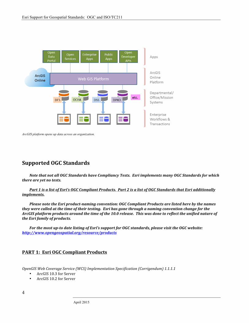
ArcGIS platform opens up data across an organization. Supported OGC Standards Note that not all OGC Standards have Compliancy Tests. Esri implements many OGC Standards for which there are yet no tests. Part 1 is a list of Esri’s OGC Compliant Products. Part 2 is a list of OGC Standards that Esri additionally implements. Please note the Esri product-‐naming convention: OGC Compliant Products are listed here by the names they were called at the time of their testing. Esri has gone through a naming convention change for the ArcGIS platform products around the time of the 10.0 release. This was done to reflect the unified nature of the Esri family of products.
For the most up-‐to date listing of Esri’s support for OGC standards, please visit the OGC website: http://www.opengeospatial.org/resource/products PART 1: Esri OGC Compliant Products OpenGIS Web Coverage Service (WCS) Implementation Specification (Corrigendum) 1.1.1.1
• ArcGIS 10.3 for Server • ArcGIS 10.2 for Server
Esri Support for Geospatial Standards: OGC and ISO/TC211
Esri White Paper
5
OpenGIS Web Coverage Service (WCS) Implementation Specification (Corrigendum) 1.0.0
• ArcGIS 10.3 for Server • ArcGIS 10.2 for Server • ArcGIS 10.1 for Server • ArcGIS Server 10.0 • ArcGIS Server 9.3
Web Feature Service 1.0.0 (WFS)
• ArcGIS 10.3 for Server • ArcGIS 10.2 for Server • ArcGIS 10.1 for Server • ArcGIS Server 10.0 • ArcGIS Server 9.3.1 • ArcGIS Server 9.3 SP1 • ArcIMS 9.3 • ArcIMS 9.2 • ArcIMS 9.1 SP1
OpenGIS Web Map Service (WMS) Implementation Specification 1.3.0
• ArcGIS 10.3 for Server • ArcGIS 10.2 for Server • ArcGIS 10.1 for Server • ArcGIS Server 10.0 • ArcGIS Server 9.3.1 • ArcGIS Server 9.3 • ArcIMS 9.3
OpenGIS Web Map Service (WMS) Implementation Specification 1.1.1
• ArcGIS 10.3 for Server • ArcGIS 10.2 for Server • ArcGIS 10.1 for Server • ArcGIS Server 10.0 • ArcGIS Server 9.3 • ArcIMS 9.3 • ArcGIS Server 9.2 • ArcIMS 9.2 • ArcIMS 9.1 • ArcIMS 9.0
OpenGIS Catalogue Service Implementation Specification 2.0.2 (CAT 2.0.2)
• Esri Geoportal Server 1.2.5 (Official OGC Reference Implementation) • Esri Geoportal Server 1.2.4 • Esri Geoportal Server 1.2.2 • ArcGIS Server Geoportal Extension 10.0 • ArcGIS Server Geoportal Extension 9.0
Catalogue Service for the Web 2.0.2
• Esri Geoportal Server 1.2.5 (Official OGC Reference Implementation) • Esri Geoportal Server 1.2.4 • Esri Geoportal Server 1.2.2
Esri Support for Geospatial Standards: OGC and ISO/TC211
April 2015
6
• ArcGIS Server Geoportal Extension 10.0 • ArcGIS Server Geoportal Extension 9.3.1
OpenGIS Information Specification for Geospatial Information -‐Simple Features Access 1.1 (SFS 1.1) (Core)
• ArcGIS 10.3 for Server–Informix • ArcGIS 10.3 for Server–DB2 • ArcGIS 10.3 for Server –SQL Server • ArcGIS 10.3 for Server– SQLite • ArcGIS 10.3 for Server– Netezza • ArcGIS 10.3 for Server – Oracle • ArcGIS 10.3 for Server – PostgreSQL • ArcGIS 10.3 for Server – Teradata • ArcGIS 10.2 for Server– Informix • ArcGIS 10.2 for Server– DB2 • ArcGIS 10.2 for Server –SQL Server • ArcGIS 10.2 for Server– SQLite • ArcGIS 10.2 for Server– Netezza • ArcGIS 10.2 for Server – Oracle • ArcGIS 10.2 for Server – PostgreSQL • ArcGIS 10.2 for Server – Teradata • ArcGIS 10.1 for Server Enterprise (ArcSDE) – DB2 • ArcGIS 10.1 for Server Enterprise (ArcSDE) – Informix • ArcGIS 10.1 for Server Enterprise (ArcSDE) – Oracle • ArcGIS 10.1 for Server Enterprise (ArcSDE) – PostgreSQL • ArcGIS 10.1 for Server Enterprise (ArcSDE) – SQL Server • ArcGIS Server Enterprise (ArcSDE) 10.0 – DB • ArcGIS Server Enterprise (ArcSDE) 10.0 – Informix • ArcGIS Server Enterprise (ArcSDE) 10.0 – Oracle • ArcGIS Server Enterprise (ArcSDE) 10.0 – PostgreSQL • ArcGIS Server Enterprise (ArcSDE) 10.0 – SQL Server • ArcGIS Server Enterprise (ArcSDE) 9.3.1– DB2 • ArcGIS Server Enterprise (ArcSDE) 9.3.1– Informix • ArcGIS Server Enterprise (ArcSDE) 9.3.1– Oracle • ArcGIS Server Enterprise (ArcSDE) 9.3.1– PostgreSQL • ArcGIS Server Enterprise (ArcSDE) 9.3.1 – SQL Server • ArcGIS Server 9.3 – DB2 • ArcSDE 9.3 – Informix • ArcSDE 9.3 – Oracle • ArcSDE 9.3 – Postgres • ArcSDE 9.3 – SQL Server • ArcGIS Server Enterprise 9.2 – DB2 • ArcGIS Server Enterprise 9.2 –Informix • ArcGIS Server Enterprise 9.2 –Oracle • ArcGIS Server Enterprise 9.2 –SQL • ArcGIS Server Enterprise 9.2 –SQL Express • ArcSDE 9.1 – DB2 • ArcSDE 9.1 – Informix • ArcSDE 9.1 – Oracle • ArcSDE 9.1 – SQL Server
Esri Support for Geospatial Standards: OGC and ISO/TC211
Esri White Paper
7
• ArcSDE 9.0 – DB2 • ArcSDE 9.0 – Informix • ArcSDE 9.0 – Oracle • ArcSDE 9.0 – SQL Server • ArcSDE 8.1 –DB2 • ArcSDE 8.1 –Informix • ArcGIS 8.1 –OLE/COM • Spatial Database Engine Datajoiner 3.0.2 – DB2 • Spatial Database Engine Datajoiner 3.0.2 – Informix • Spatial Database Engine Datajoiner 3.0.2 – Oracle
OpenGIS Information Specification for Geospatial Information Simple Features-‐SQL-‐ Types and Functions, 1.1 (SFS TF) (Compliance Alternative)
• ArcGIS 10.3 for Server – PostgreSQL • ArcGIS 10.3 for Server –DB2 • ArcGIS 10.3 for Server-‐ Informix • ArcGIS 10.3 for Server –Oracle • ArcGIS 10.3 for Server – Netezza • ArcGIS 10.3 for Server – SQLite • ArcGIS 10.3 for Server – Teradata • ArcGIS 10.2 for Server – PostgreSQL • ArcGIS 10.2 for Server –DB2 • ArcGIS 10.2 for Server-‐ Informix • ArcGIS 10.2 for Server –Oracle • ArcGIS 10.2 for Server – Netezza • ArcGIS 10.2 for Server – SQLite • ArcGIS 10.2 for Server – Teradata • ArcGIS 10.1 for Server Enterprise (ArcSDE) – DB2 • ArcGIS 10.1 for Server Enterprise (ArcSDE) – Informix • ArcGIS 10.1 for Server Enterprise (ArcSDE) -‐ Oracle • ArcGIS 10.1 for Server Enterprise (ArcSDE) – PostgreSQL • ArcGIS Server Enterprise (ArcSDE) 10.0– DB2 • ArcGIS Server Enterprise (ArcSDE) 10.0 – Informix • ArcGIS Server Enterprise (ArcSDE) 10.0 – Oracle • ArcGIS Server Enterprise (ArcSDE) 10.0 – PostgreSQL • ArcGIS Server Enterprise (ArcSDE) 9.3.1– DB2 • ArcGIS Server Enterprise (ArcSDE) 9.3.1– Informix • ArcGIS Server Enterprise (ArcSDE) 9.3.1– Oracle • ArcGIS Server Enterprise (ArcSDE) 9.3.1 – PostgreSQL • ArcGIS Server 9.3 – DB2 • ArcSDE 9.3 – Informix • ArcSDE 9.3 – Oracle • ArcSDE 9.3 -‐ Postgres • ArcGIS Server Enterprise 9.2 – DB2 • ArcGIS Server Enterprise 9.2 – Informix • ArcGIS Server Enterprise 9.2 –Oracle • ArcSDE 9.1 –DB2 • ArcSDE 9.1 -‐ Informix • ArcSDE 9.0 – DB2
Esri Support for Geospatial Standards: OGC and ISO/TC211
April 2015
8
• ArcSDE 9.0 -‐ Informix • ArcSDE 8.1 – DB2 • ArcSDE 8.1 – Informix • Spatial Database Engine Datajoiner 3.0.2 – DB2 • Spatial Database Engine Datajoiner 3.0.2 – Informix • Spatial Database Engine Datajoiner 3.0.2 – Oracle
OpenGIS Information Specification for Geospatial Information -‐Simple Features Binary Geometry, 1.1 (SFS BG) (Compliance Alternative)
• ArcGIS 10.3 for Server – Oracle • ArcGIS 10.3 for Server – SQL Server • ArcGIS 10.2 for Server – Oracle • ArcGIS 10.2 for Server – SQL Server • ArcGIS for Server 10.1 Enterprise (ArcSDE) –Oracle • ArcGIS for Server 10.1 Enterprise (ArcSDE) – SQL Server • ArcGIS Server Enterprise (ArcSDE) 10.0 – Oracle • ArcGIS Server Enterprise (ArcSDE) 10.0 – SQL Server • ArcGIS Server Enterprise (ArcSDE) 9.3.1– Oracle • ArcGIS Server Enterprise (ArcSDE) 9.3.1– SQL Server • ArcSDE 9.3 – Oracle • ArcSDE 9.3 – SQL Server • ArcGIS Server Enterprise 9.2 -‐ Oracle • ArcGIS Server Enterprise 9.2 –SQL Server • ArcGIS Server Enterprise 9.2 –SQL Server Express • ArcSDE 9.1 – Oracle • ArcSDE 9.1 – SQL Server • ArcSDE 9.0 – Oracle • ArcSDE 9.0 – SQL Server
Part 2: Esri Products Implementing OGC Standards See part 1 above for listing of Esri products that have OGC Compliancy Certificates. Having OGC Compliancy also means there is OGC standard implementation. Here is the list of Esri products that implement OGC standards for which there are no compliancy tests.
OpenGIS Catalogue Service Implementation Specification (Catalogue Service for the Web) 2.0.2
• ArcGIS 10.3 • ArcGIS 10.2 • ArcGIS 10.1 • ArcGIS 10.0 • ArcGIS 9.3 • Esri Geoportal Server 1.2.5 • Esri Geoportal Server 1.2.4 • Esri Geoportal Server 1.2.2 • GIS Portal Tool Kit 9.3 • GIS Portal Tool Kit 3.1 • ArcGIS Explorer
Esri Support for Geospatial Standards: OGC and ISO/TC211
Esri White Paper
9
OpenGIS Catalogue Service Specification 2.0.2 –ISO Metadata Application Profile 1.0.0
• ArcGIS Server Geoportal Extension 10.0 • Esri Geoportal Server 1.2.5 • Esri Geoportal Server 1.2.4 • Esri Geoportal Server 1.2.2
OpenGIS Catalogue Service Implementation Specification (Catalogue Service for the Web) 2.0.1 • ArcGIS 10.1 • ArcGIS 10.0 • ArcGIS Server Geoportal Extension 10.0 • ArcGIS Server Geoportal Extension 9.3.1 • ArcGIS 9.3 • GIS Portal Tool Kit 9.3 • ArcIMS Metadata Server 9.0 • ArcGIS Explorer • GIS Portal Tool Kit 3.1 • GIS Portal Tool Kit 2.0
Catalog Interface 1.1.1
• ArcGIS Server Geoportal Extension 9.3.1 • GIS Portal Tool Kit 9.3 • ArcIMS Metadata Server 9.0 • ArcIMS Metadata Server 4.0.1 • ArcIMS Metadata Server 4.0 • GIS Portal Tool Kit 2.0
Catalog Interface 1.0
• ArcGIS Server Geoportal Extension 10.0 • ArcGIS Server Geoportal Extension 9.3.1 • GIS Portal Tool Kit 9.3 • ArcIMS Metadata Server 9.0 • ArcIMS Metadata Server 4.0.1 • ArcIMS Metadata Server 4.0 • GIS Portal Tool Kit 3.1 • GIS Portal Tool Kit 2.0
Open GIS Catalogue Services –Part 1: ebRIM profile of CSW 1.0.0
• ArcGIS Server Geoportal Extension 9.3.1 • GIS Portal Tool Kit 9.3 • GIS Portal Tool Kit 3.1
Catalog Service Web (CSW) –ebRIM Registry Service – Part 2: Basic extension package 1.0.0
• ArcGIS Server Geoportal Extension 9.3.1 • GIS Portal Tool Kit 9.3 • GIS Portal Tool Kit 3.1
OpenGIS City Geography Markup Language (CityGML) Encoding Standard 1.0
• ArcGIS 10.3 Data Interoperability Extension • ArcGIS 10.2.2 Data Interoperability Extension
Esri Support for Geospatial Standards: OGC and ISO/TC211
April 2015
10
• ArcGIS 10.2.1 Data Interoperability Extension • ArcGIS 9.3 Data Interoperability Extension
OpenGIS Filter Encoding Implementation Specification 2.0
• ArcGIS 10.3 for Server • ArcGIS 10.3
OpenGIS Filter Encoding Implementation Specification 1.1
• ArcGIS 10.3 • ArcGIS 10.2.2 • ArcGIS 10.2.1 • ArcGIS 10.1 • ArcGIS 10.0 • ArcGIS Server 10.0 • ArcGIS Server Geoportal Extension 10.0 • ArcGIS Server 9.3.1 • ArcGIS Server Geoportal Extension 9.3.1 • ArcGIS Server 9.3 SP1 • GIS Portal Tool Kit 9.3 • GIS Portal Tool Kit 3.1
Filter Encoding 1.0
• ArcGIS 10.3 for Server • ArcGIS 10.2.2 for Server • ArcGIS 10.2.2 • ArcGIS 10.2.1 • ArcGIS 10.2.1 for Server • ArcGIS 10.2 for Server. • ArcGIS 10.1 • ArcGIS 10.0 • ArcGIS Server 10.0 • ArcGIS Server 9.3.1 • ArcGIS Server Geoportal Extension 9.3.1 • ArcGIS Server 9.3 SP1 • ArcGIS 9.3 • GIS Portal Tool Kit 9.3 • ArcGIS 9.2 • ArcIMS 9.1 SP1 • ArcIMS 9.1 • ArcIMS 4.0.1 • ArcIMS 4.0 • GIS Portal Tool Kit 3.1
OpenGIS Geography Markup Language (GML) Encoding Standard 3.2.1
• ArcGIS 10.3 for Server • ArcGIS 10.3 Data Interoperability Extension • ArcGIS 10.2 for Server • ArcGIS Server 9.3.1 • ArcGIS Server 9.3 SP1
Esri Support for Geospatial Standards: OGC and ISO/TC211
Esri White Paper
11
OpenGIS Geography Markup Language (GML) Encoding Specification 3.1.1
• ArcGIS 10.3 • ArcGIS 10.2.2 • ArcGIS 10.2.1 for Server • ArcGIS 10.2 for Server • ArcGIS 10.1 for Server • ArcGIS Server 10.0 • ArcGIS Server 9.3.1 • ArcGIS Server 9.3 SP1
Geography Markup Language (GML) 3.1.1 simple feature profile 1.0.0
• ArcGIS 10.3 • ArcGIS 10.2 • ArcGIS 10.1 • ArcGIS 10.0 • ArcGIS Server 10.0 • ArcGIS Server 9.3.1 • ArcGIS Server 9.3 SP1 • ArcGIS 9.3 • ArcGIS 9.2
OpenGIS Geography Markup Language (GML) Encoding Standard 3.0
• ArcGIS 10.2.2 • ArcGIS 10.2.2 for Server • ArcGIS 10.2.1 • ArcGIS 10.2.1 for Server • ArcGIS 10.2 for Server • ArcIMS 9.1 SP1 • ArcIMS 9.1 • ArcGIS Data Interoperability Extension 9.0 • ArcIMS Data Delivery Extension 9.0
Geography Markup Language (GML) 2.1.2
• ArcGIS 10.3 for Server • ArcGIS 10.2.2 • ArcGIS 10.2.2 for Server • ArcGIS 10.2.1 • ArcGIS 10.2.1 for Server • ArcGIS 10.2 for Server • ArcIMS 9.1 SP1 • ArcIMS 9.1 • ArcGIS Data Interoperability Extension 9.0 • ArcIMS Data Delivery Extension 9.0 • ArcIMS 4.0.1 • ArcIMS 4.0
Geography Markup Language (GML) 2.1.1
• ArcGIS 10.3 for Server • ArGIS 10.3 Data Interoperability Extension • ArcGIS 10.2.2
Esri Support for Geospatial Standards: OGC and ISO/TC211
April 2015
12
• ArcGIS 10.2.2 for Server • ArcGIS 10.2.1 • ArcGIS 10.2.1 for Server • ArcGIS 10.2 for Server • ArcIMS 9.1 SP1 • ArcIMS 9.1 • ArcGIS Interoperability Tool Bar Add-‐on 8.3 • ArcIMS 4.0.1 • ArcIMS 4.0
OGC GeoPackage Encoding Standard 1.0
• ArcGIS Runtime • ArcGIS 10.3 • ArcGIS 10.2.2 • ArcGIS 10.2.1
GeoRSS, An Introduction to 1.0.0
• Esri Geoportal Server 1.2.5 • Esri Geoportal Server 1.2.4 • ArcGIS Server Geoportal Extension 10.0 • ArcGIS Server Geoportal Extension 9.3.1 • GIS Portal Tool Kit 9.3
OGC Keyhole Markup Language (KML) 2.2.0
• ArcGIS 10.3 for Server • ArcGIS Online • Portal for ArcGIS 10.3 • Portal for ArcGIS 10.2 • ArcGIS 10.3 Data Interoperability Extension • ArGIS 10.2.2 • ArcGIS 10.2.2 for Server • ArcGIS 10.2.1 • ArcGIS 10.2.1 for Server • ArcGIS 10.2 for Server • ArcGIS 10.1 • ArcGIS 10.0 • ArcGIS Server 10.0 • Esri Geoportal Server 1.2.5 • Esri Geoportal Server 1.2.4 • ArcGIS Server Geoportal Extension 10.0 • ArcGIS Server Geoportal Extension 9.3.1 • ArcGIS Server 9.3 SP1 • GIS Portal Tool Kit 9.3
Keyhole Markup Language 2.1 Reference – And OGC Best Practice 2.1.0
• ArcGIS 10.3 • ArcGIS 10.2.2 • Portal for ArcGIS 10.3 • Portal for ArcGIS 10.2
Esri Support for Geospatial Standards: OGC and ISO/TC211
Esri White Paper
13
• ArcGIS Online • ArcGIS 10.2.2 for Server • ArcGIS 10.2.1 • ArcGIS 10.2.1 for Server • ArcGIS 10.2 for Server • ArcGIS 10.1 • ArcGIS 10.0 • ArcGIS Server Geoportal Extension 10.0 • ArcGIS Server Geoportal Extension 9.3.1 • ArcGIS Server 9.3 SP1 • GIS Portal Tool Kit 9.3
OpenGIS Location Service (Open LS) Implementation Specification: Core Services 1.1
• ArcIMS 9.1 • ArcIMS 9.0 • ArcWeb Services 2006
OpenGIS Location Service (Open LS): Cores Services (Parts 1-‐5) 1.0
• ArcIMS 9.1 • ArcIMS 9.0 • ArcWeb Services 2006
OpenGIS Location Service (Open LS): Cores Services (Part 1 Directory Service) 1.0
• ArcIMS 9.1 • ArcIMS 9.0 • ArcWeb Services 2006
OpenGIS Location Service (Open LS): Cores Services (Part 2 Gateway Services) 1.0
• ArcWeb Services 2006
OpenGIS Location Service (Open LS): Cores Services (Part 3 Location Utility Service) 1.0 • ArcIMS 9.1 • ArcIMS 9.0 • ArcWeb Services 2006
OpenGIS Location Service (Open LS): Cores Services (Part 4 Presentation Service) 1.0
• ArcIMS 9.1 • ArcIMS 9.0 • ArcWeb Services 2006
OpenGIS Location Service (Open LS): Cores Services (Part 5 Route Service) 1.0
• ArcIMS 9.1 • ArcIMS 9.0 • ArcWeb Services 2006
OpenGIS Implementation Specification for Geographic Information – Simple Feature (SF) Access 1.1
• ArcGIS 10.2.2 for Server • ArcGIS 10.2 for Server • ArcGIS Server 9.3.1 • ArcGIS Server 9.3 SP1
Esri Support for Geospatial Standards: OGC and ISO/TC211
April 2015
14
OpenGIS Simple Feature Implementation Specification for OLE/COM 1.1 • ArcGIS Server 9.3.1 • ArcGIS Server 9.3 SP1
Simple Features (SF) – SQL Binary Geometry 1.1 • ArcGIS 10.1 • ArcGIS 10.0 • ArcGIS Server 9.3 SP1
Simple Features (SF) – SQL Types and Functions 1.1
• ArcGIS 10.1 • ArcGIS 10.0 • ArcGIS Server 9.3 SP1
Simple Features (SF) – SQL Normalized Geometry 1.1
• ArcGIS Server 9.3 SP1 OpenGIS Sensor Observation Service 1.0.0
• ArcGIS 10.3 for Server • ArcGIS 10.2.2 for Server • ArcGIS 10.2.1 for Server • ArcGIS 10.2 for Server
OpenGIS Styled Layer Descriptor (SLD) Implementation Specification 1.0
• ArcGIS 10.3 for Server • ArcGIS 10.2.2 for Server • ArcGIS 10.2.1 for Server • ArcGIS 10.2 for Server • ArcGIS 10.3 • ArcGIS 10.2 • ArcGIS 10.1 • ArcGIS 10.0 • ArcGIS Server 10.0 • ArcGIS Server Geoportal Extension 10.0 • ArcGIS Server 9.3.1 • ArcGIS Server Geoportal Extension 9.3.1 • ArcGIS Server 9.3 SP1 • ArcGIS 9.3 • GIS Portal Tool Kit 9.3 • ArcGIS 9.2 • ArcIMS 9.1 SP1 • ArcIMS 9.1 • ArcIMS 4.0.1 • ArcIMS 4.0 • GIS Portal Tool Kit 3.1
OpenGIS Web Map Context Implementation Specification 1.1
• ArcGIS 10.2.2 • ArcGIS 10.2.1
Esri Support for Geospatial Standards: OGC and ISO/TC211
Esri White Paper
15
Web Map Context Document 1.0
• ArcExplorer Web Web Coverage Service (WCS) Implementation Standard 2.0.1
• ArcGIS 10.3 for Server
Web Coverage Service (WCS) Implementation Specification (Corrigendum) 1 1.1.1 • ArcGIS 10.3 • ArcGIS 10.2.2 • ArcGIS 10.3 for Server • ArcGIS 10.2.2 for Server • ArcGIS 10.2.1 • ArcGIS 10.2.1 for Server • ArcGIS 10.1 • ArcGIS 10.0 • ArcGIS Server 10.0 • ArcGIS Server Geoportal Extension 10.0 • ArcGIS Server 9.3.1 • ArcGIS Server Geoportal Extension 9.3.1 • ArcGIS Server 9.3 SP1 • ArcGIS 9.3 • GIS Portal Tool Kit 9.3 • GIS Portal Tool Kit 3.1
Web Coverage Service (WCS) Implementation Specification 1.1.0
• ArcGIS 10.3 • ArcGIS 10.2 • ArcGIS 10.1 • ArcGIS 10.0 • ArcGIS 10.3 for Server • ArcGIS 10.2 for Server • ArcGIS Server 10.0 • ArcGIS Server 9.3.1 • ArcGIS Server 9.3 SP1 • ArcGIS 9.3
Web Coverage Service (WCS) Implementation Specification (Corrigendum) 1.0.0
• ArcGIS 10.3 • ArcGIS 10.2.2 • ArcGIS 10.3 for Server • ArcGIS 10.2.2 for Server • ArcGIS 10.2.1 • ArcGIS 10.2.1 for Server • ArcGIS 10.1 • ArcGIS 10.0 • ArcGIS Server Geoportal Extension 10.0 • ArcGIS Server 9.3.1 • ArcGIS Server Geoportal Extension 9.3.1 • ArcGIS Server 9.3 SP1 • ArcGIS 9.3
Esri Support for Geospatial Standards: OGC and ISO/TC211
April 2015
16
• GIS Portal Tool Kit 9.3 • ArcGIS 9.0 • ArcGIS Server 9.0 • GIS Portal Tool Kit 3.1 • GIS Portal Tool Kit 2.0
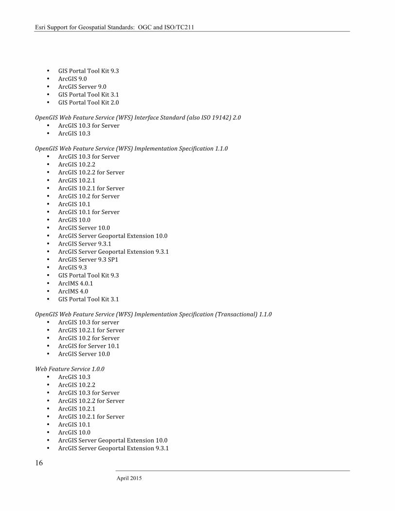
OpenGIS Web Feature Service (WFS) Interface Standard (also ISO 19142) 2.0
• ArcGIS 10.3 for Server • ArcGIS 10.3
OpenGIS Web Feature Service (WFS) Implementation Specification 1.1.0
• ArcGIS 10.3 for Server • ArcGIS 10.2.2 • ArcGIS 10.2.2 for Server • ArcGIS 10.2.1 • ArcGIS 10.2.1 for Server • ArcGIS 10.2 for Server • ArcGIS 10.1 • ArcGIS 10.1 for Server • ArcGIS 10.0 • ArcGIS Server 10.0 • ArcGIS Server Geoportal Extension 10.0 • ArcGIS Server 9.3.1 • ArcGIS Server Geoportal Extension 9.3.1 • ArcGIS Server 9.3 SP1 • ArcGIS 9.3 • GIS Portal Tool Kit 9.3 • ArcIMS 4.0.1 • ArcIMS 4.0 • GIS Portal Tool Kit 3.1
OpenGIS Web Feature Service (WFS) Implementation Specification (Transactional) 1.1.0
• ArcGIS 10.3 for server • ArcGIS 10.2.1 for Server • ArcGIS 10.2 for Server • ArcGIS for Server 10.1 • ArcGIS Server 10.0
Web Feature Service 1.0.0
• ArcGIS 10.3 • ArcGIS 10.2.2 • ArcGIS 10.3 for Server • ArcGIS 10.2.2 for Server • ArcGIS 10.2.1 • ArcGIS 10.2.1 for Server • ArcGIS 10.1 • ArcGIS 10.0 • ArcGIS Server Geoportal Extension 10.0 • ArcGIS Server Geoportal Extension 9.3.1
Esri Support for Geospatial Standards: OGC and ISO/TC211
Esri White Paper
17
• ArcGIS 9.3 • GIS Portal Tool Kit 9.3 • ArcGIS 9.2 • ArcIMS 9.1 • ArcGIS Data Interoperability Extension 9.0 • ArcIMS Data Delivery Extension 9.0 • ArcGIS Interoperability Tool Bar Add-‐on 8.3 • ArcIMS 4.0 • GIS Portal Tool Kit 3.1 • GIS Portal Tool Kit 2.0
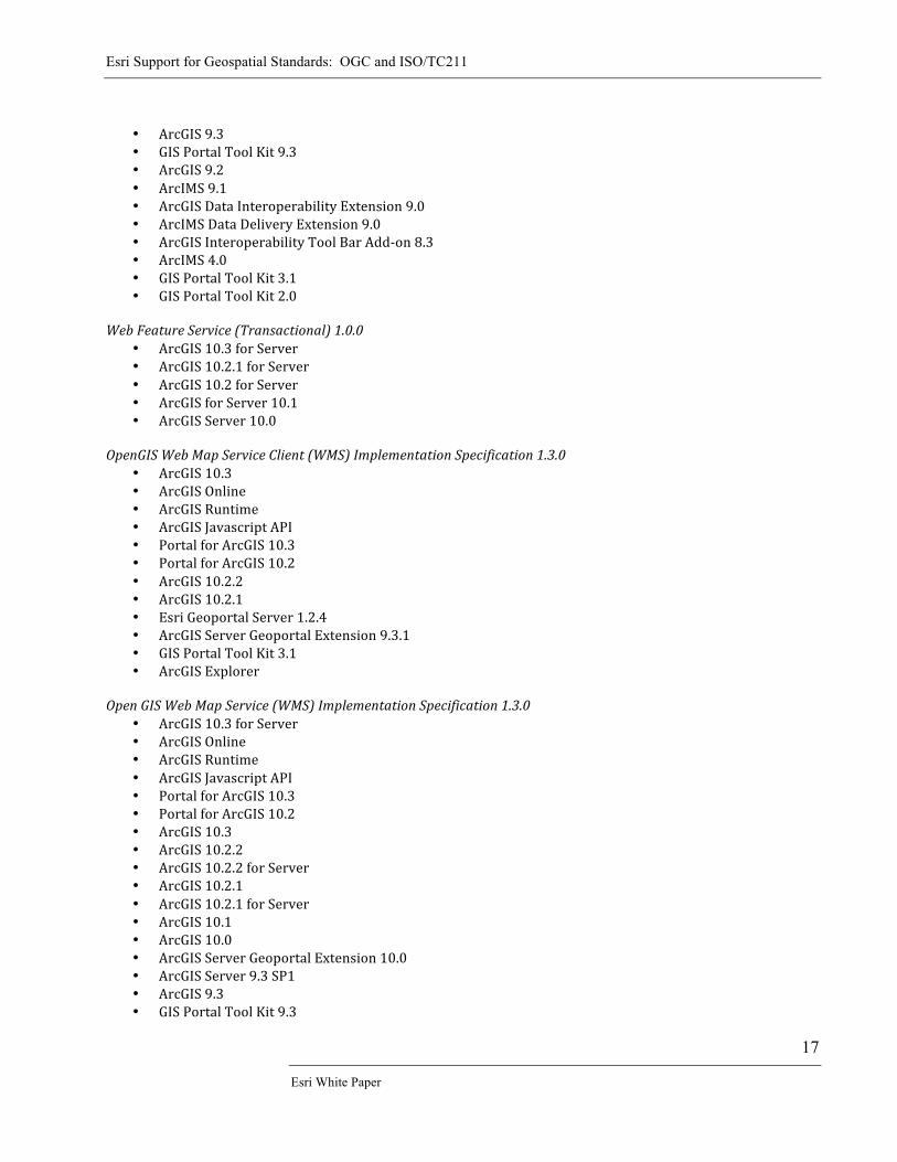
Web Feature Service (Transactional) 1.0.0
• ArcGIS 10.3 for Server • ArcGIS 10.2.1 for Server • ArcGIS 10.2 for Server • ArcGIS for Server 10.1 • ArcGIS Server 10.0
OpenGIS Web Map Service Client (WMS) Implementation Specification 1.3.0
• ArcGIS 10.3 • ArcGIS Online • ArcGIS Runtime • ArcGIS Javascript API • Portal for ArcGIS 10.3 • Portal for ArcGIS 10.2 • ArcGIS 10.2.2 • ArcGIS 10.2.1 • Esri Geoportal Server 1.2.4 • ArcGIS Server Geoportal Extension 9.3.1 • GIS Portal Tool Kit 3.1 • ArcGIS Explorer
Open GIS Web Map Service (WMS) Implementation Specification 1.3.0
• ArcGIS 10.3 for Server • ArcGIS Online • ArcGIS Runtime • ArcGIS Javascript API • Portal for ArcGIS 10.3 • Portal for ArcGIS 10.2 • ArcGIS 10.3 • ArcGIS 10.2.2 • ArcGIS 10.2.2 for Server • ArcGIS 10.2.1 • ArcGIS 10.2.1 for Server • ArcGIS 10.1 • ArcGIS 10.0 • ArcGIS Server Geoportal Extension 10.0 • ArcGIS Server 9.3 SP1 • ArcGIS 9.3 • GIS Portal Tool Kit 9.3
Esri Support for Geospatial Standards: OGC and ISO/TC211
April 2015
18
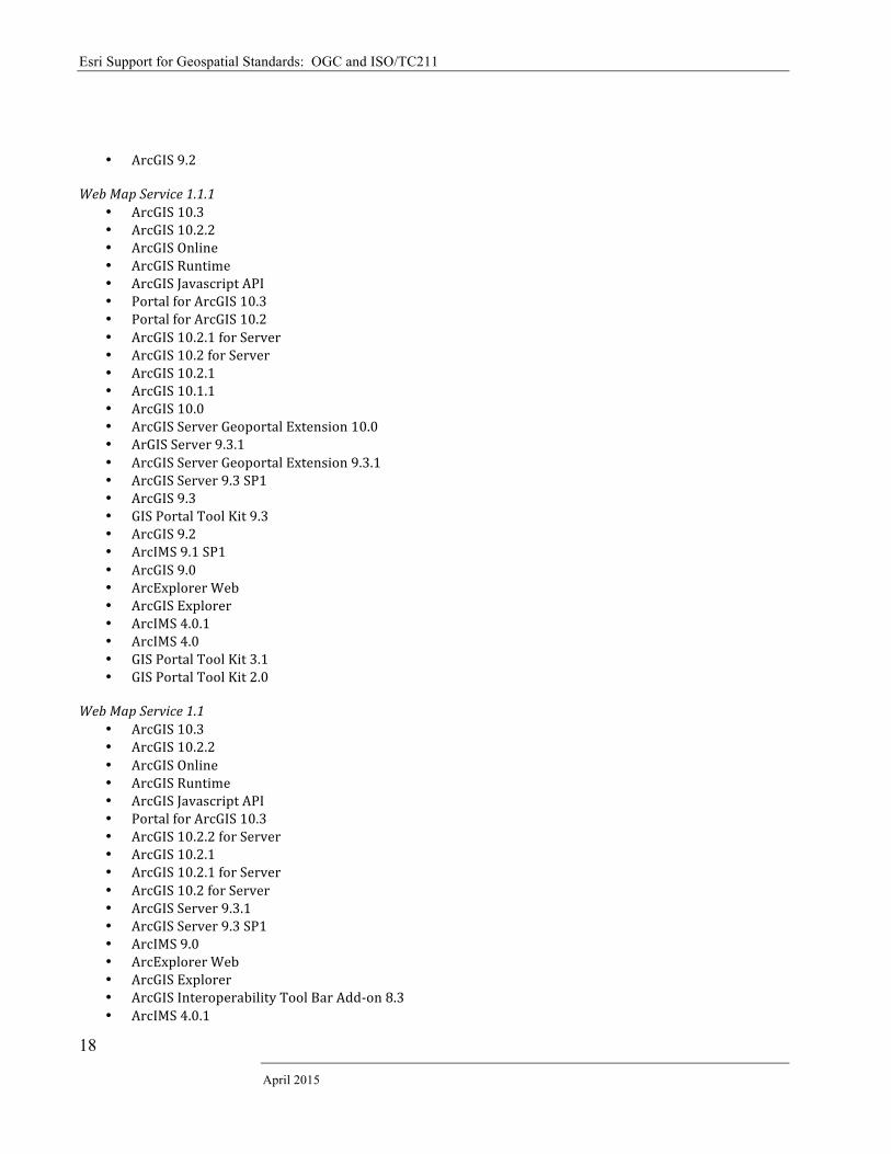
• ArcGIS 9.2 Web Map Service 1.1.1
• ArcGIS 10.3 • ArcGIS 10.2.2 • ArcGIS Online • ArcGIS Runtime • ArcGIS Javascript API • Portal for ArcGIS 10.3 • Portal for ArcGIS 10.2 • ArcGIS 10.2.1 for Server • ArcGIS 10.2 for Server • ArcGIS 10.2.1 • ArcGIS 10.1.1 • ArcGIS 10.0 • ArcGIS Server Geoportal Extension 10.0 • ArGIS Server 9.3.1 • ArcGIS Server Geoportal Extension 9.3.1 • ArcGIS Server 9.3 SP1 • ArcGIS 9.3 • GIS Portal Tool Kit 9.3 • ArcGIS 9.2 • ArcIMS 9.1 SP1 • ArcGIS 9.0 • ArcExplorer Web • ArcGIS Explorer • ArcIMS 4.0.1 • ArcIMS 4.0 • GIS Portal Tool Kit 3.1 • GIS Portal Tool Kit 2.0
Web Map Service 1.1
• ArcGIS 10.3 • ArcGIS 10.2.2 • ArcGIS Online • ArcGIS Runtime • ArcGIS Javascript API • Portal for ArcGIS 10.3 • ArcGIS 10.2.2 for Server • ArcGIS 10.2.1 • ArcGIS 10.2.1 for Server • ArcGIS 10.2 for Server • ArcGIS Server 9.3.1 • ArcGIS Server 9.3 SP1 • ArcIMS 9.0 • ArcExplorer Web • ArcGIS Explorer • ArcGIS Interoperability Tool Bar Add-‐on 8.3 • ArcIMS 4.0.1
Esri Support for Geospatial Standards: OGC and ISO/TC211
Esri White Paper
19
• ArcIMS 4.0 • GIS Portal Tool Kit 2.0
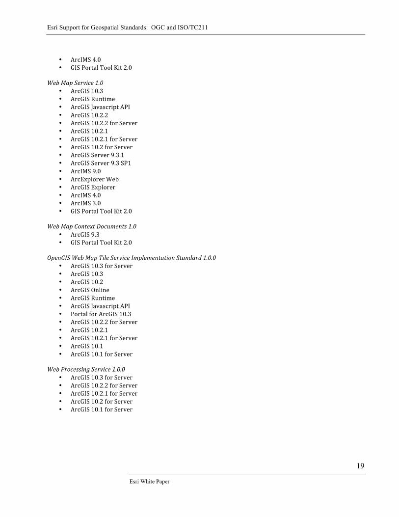
Web Map Service 1.0
• ArcGIS 10.3 • ArcGIS Runtime • ArcGIS Javascript API • ArcGIS 10.2.2 • ArcGIS 10.2.2 for Server • ArcGIS 10.2.1 • ArcGIS 10.2.1 for Server • ArcGIS 10.2 for Server • ArcGIS Server 9.3.1 • ArcGIS Server 9.3 SP1 • ArcIMS 9.0 • ArcExplorer Web • ArcGIS Explorer • ArcIMS 4.0 • ArcIMS 3.0 • GIS Portal Tool Kit 2.0
Web Map Context Documents 1.0
• ArcGIS 9.3 • GIS Portal Tool Kit 2.0
OpenGIS Web Map Tile Service Implementation Standard 1.0.0
• ArcGIS 10.3 for Server • ArcGIS 10.3 • ArcGIS 10.2 • ArcGIS Online • ArcGIS Runtime • ArcGIS Javascript API • Portal for ArcGIS 10.3 • ArcGIS 10.2.2 for Server • ArcGIS 10.2.1 • ArcGIS 10.2.1 for Server • ArcGIS 10.1 • ArcGIS 10.1 for Server
Web Processing Service 1.0.0
• ArcGIS 10.3 for Server • ArcGIS 10.2.2 for Server • ArcGIS 10.2.1 for Server • ArcGIS 10.2 for Server • ArcGIS 10.1 for Server
Esri Support for Geospatial Standards: OGC and ISO/TC211
April 2015
20
Supported ISO/TC211 Standards Part 1: Supported Standards Most ISO TC 211 standards are conceptual in nature providing the underpinnings for many OGC implementation standards; are used in the development of national and information community profiles and application schema standards; and/or are used in the design of geographic management and production systems. The ISO standards that inform or are implemented by Esri are summarized below: ISO 6709:2008 -‐ Standard representation of latitude, longitude and altitude for geographic point locations; 6709/Cor 1
• This standard specifies a variable-‐length format for the representation of latitude, longitude and altitude for use in data interchange used in Esri products.
ISO 19101:2002 -‐ Reference model (under revision) ISO 19101-‐1 Reference model -‐ Part 1: Fundamentals (revision) ISO 19101-‐2:2008 -‐ Reference model -‐ Part 2: Imagery
• These standards provide a framework for the 191** Family of Standards and are used by Esri and others to understand the organization of ISO TC 211 standards and how they work together.
ISO 19103:2005 -‐ Conceptual schema language (under revision) ISO 19103 -‐ Conceptual schema language (revision)
• This standard provides Esri and other users with an understanding of the UML and basic types and Object Constraint Language used in the ISO TC 211 standards.
ISO 19104:2008 – Terminology
• This standard provides an understanding of the terminology used by the ISO TC 211 standards. ISO 19106:2004 – Profiles
• A profile is a sub set of 1 or more generic standards with selected options. A profile provides the limited scope and functionality for effective specialist implementations of data and systems.
• Esri uses this standard to understand ISO and OGC profiles and when it is working with organizations to develop profiles.
ISO 19107:2003 -‐ Spatial schema
• This standard defines and describes a fundamental model for computer representations of geometry and topology that is referenced to reality by coordinates systems.
• Esri has used the concepts in this standard in the development of ISO 19125 and ISO 19115; basic concepts defined in this standard are implemented in ArcGIS and the design of geodatabases. This is the foundation for Simple Features GML and all standards that deal with vector geometry and topology.
ISO 19108:2002 -‐ Temporal schema ISO 19108/Cor 1
• This standard defines standard concepts needed to describe the temporal characteristics of geographic information.
• Esri supports the concepts in this standard in metadata and handling time-‐aware data in ArcGIS. ISO 19109:2005 -‐ Rules for application schema (under revision) ISO 19109 -‐ Rules for application schema (revision)
Esri Support for Geospatial Standards: OGC and ISO/TC211
Esri White Paper
21
• Defines the general feature model and rules for creating and documenting application schemas for modeling features and their properties allowing physical applications to understand and share data.
• Using the concepts described in this standard, Esri defines application schemas using a conceptual schema language (e.g., UML). The ArcGIS Data Interoperability extension applies the concepts of mapping from one application schema to another for data transfer as defined in the standard. Esri also uses the same concepts as the general feature model (GFM) as defined in the standard.
ISO 19110:2005 -‐ Methodology for feature cataloguing (under revision) ISO 19110:2005/Amd 1:2011 ISO 19110 -‐ Methodology for feature cataloguing (revision)
• Describes a methodology for creating a catalogue defining features and properties for a domain of interest and/or a dataset and a schema for encoding in XML
• Esri participates in several standards organizations to develop encoding for feature catalogs based on the concepts in this standard. Encoded catalogs can be used as additional metadata.
ISO 19111:2007 -‐ Spatial referencing by coordinates ISO 19111-‐2:2009 -‐ Spatial referencing by coordinates -‐ Part 2: Extension for parametric value
• Standardizes a common method for defining coordinate reference systems • Esri implements the basic concepts defined in this standard through GML and in coordinate reference
system libraries in ArcGIS. ISO 19112:2003 -‐ Spatial referencing by geographic identifiers
• Metadata about/defining a reference system that uses spatial unit identifiers other than coordinates i.e. gazetteer, postal codes, etc.
• Esri uses the concepts defined in this standard in the implementation of gazetteers as well as wherever spatial referencing by geographic identifiers is used.
ISO 19113:2002 -‐ Quality principles (replaced by ISO 19157)
• Defines the principles, the elements/sub-‐elements of data quality. • Esri implements the concepts in these standards in its mapping and charting solution products and
database production services. • See ISO 19157 below.
ISO 19114:2003 -‐ Quality evaluation procedures ISO 19114/Cor. 1 (replaced by ISO 19157)
• Defines procedures for determining data quality. • Esri implements the concepts in these standards in its mapping and charting solution products and
database production services. • See ISO 19157 below.
ISO 19115:2003 -‐ Metadata; 19115/Cor. 1 (replaced by 19115-‐1)
• Defines metadata elements and schema describing geospatial datasets • Esri products implement several major profiles of this standard: North American Profile, Infrastructure
for Spatial Information in Europe (INSPIRE), and the complete ISO 19115. Esri played a lead role in supporting the development of this standard and lead the revision project.
• Implemented in: o ArcGIS 10.3 o ArcGIS 10.2.2 o ArcGIS 10.2.1 o ArcGIS 10.1 o ArcGIS 10.0 o ArcGIS Server Geoportal Extension 10.0 o ArcGIS Server Geoportal Extension 9.3.1
Esri Support for Geospatial Standards: OGC and ISO/TC211
April 2015
22
o ArcGIS 9.3 o GIS Portal Tool Kit 9.3 o ArcIMS Metadata Server 9.0 o GIS Portal Tool Kit 3.1 o GIS Portal Tool Kit 2.0
ISO 19115-‐1 -‐ Metadata -‐ Part 1: Fundamentals
• Revision of ISO19115 which defines metadata elements and schema describing geospatial resources i.e. datasets and services
ISO 19115-‐2:2009 -‐ Metadata -‐ Part 2: Extensions for imagery and gridded data
• Defines additional metadata elements and schema describing imagery and gridded geospatial datasets ISO 19117:2005 -‐ Portrayal (under revision) ISO 19117 -‐ Portrayal (revision)
• Provides applications with a common interface to supported standard symbol sets. These concepts are used by the OGC Styled Layer Descriptor specification
• See OpenGIS Styled Layer Descriptor (SLD) Implementation Specification 1.0 above ISO 19118:2005 -‐ Encoding (under revision) ISO 19118 -‐ Encoding (revision)
• Defines an encoding rule based on the Extensible Markup Language (XML). • Esri used the concepts defined in this standard while leading the development of SF-‐GML and ISO 19139.
ISO 19119:2005 -‐ Services (under revision) ISO 19119/Amd. 1 ISO 19119 -‐ Services (revision)
• Provides a framework and defines the metadata for services, enabling users to access and process geographic information across a generic computing interface. The metadata portion of this standard has been moved to ISO19115-‐1
• Esri is using the concepts defined in this standard in its implementation of the OGC W*S specifications. ISO 19123:2005 -‐ Schema for coverage geometry and functions
• Defines the conceptual schema for the spatial characteristics of mappings from a collection of points in a coordinate space to attribute values where attribute types are common to all geographic positions within the spatial domain called coverages – raster data
• Esri uses the concepts defined in this standard for exchanging and interfacing with raster, matrix, and TIN structures.
ISO 19125-‐1:2004 -‐ Simple feature access -‐ Part 1: Common architecture
• Describes the common architecture for simple feature geometry based on the concepts in ISO 19107. • See OpenGIS Information Specification for Geospatial Information -‐Simple Features Access 1.1 in Esri
compliant OGC products above. ISO 19125-‐2:2004 -‐ Simple feature access -‐ Part 2: SQL option
• This standard specifies an SQL schema that supports storage, retrieval, query and update of simple geospatial feature collections based on the architecture defined in Part 1;
• See OpenGIS Information Specification for Geospatial Information -‐Simple Features Access 1.1 in Esri compliant OGC products above.
ISO 19126:2009 -‐ Profile -‐ FACC Data Dictionary
Esri Support for Geospatial Standards: OGC and ISO/TC211
Esri White Paper
23
• This is a profile of ISO 19110 used by the defense community • Esri implements this standard in Esri Defense Mapping solution and in database production work.
ISO 19128:2005 -‐ Web Map server interface
• Specifies a service for rendering spatially referenced digital image maps for display on a computer screen dynamically derived from geographic information.
• See Open GIS Web Map Service (WMS) Implementation Specification 1.3.0 and Open GIS Web Map Service Client (WMS) Implementation Specification 1.3.0 above.
ISO 19130:2010 -‐ Sensor and data models for imagery and gridded data
• Specifies a sensor model describing the physical and geometrical properties of frame, wisk broom, and push broom sensors.
• Esri uses these concepts when exploiting remotely sensed imagery. ISO 19130-‐2 -‐ Sensor and data models for imagery and gridded data -‐. Part 2: SAR, InSAR, Lidar and Sonar
• Specifies a sensor model describing the physical and geometrical properties of the identified sensors. • Esri follows the general modeling concepts in the use of Lidar and Sonar.
ISO 19131:2007 -‐ Data product specifications
• This standard provides requirements for the specification of geographic data products. These include the application schema, spatial and temporal referencing systems, quality and data capture and maintenance processes.
• Esri is required to understand and respond to these requirements in data production. ISO 19136:2007 -‐ Geography Markup Language
• This standard provides an XML encoding and XML Schema syntax that provides an open, vendor-‐neutral framework for the definition of geospatial application schemas and objects for the storage and transportation of application schemas and datasets.
• See OpenGIS Geography Markup Language (GML) Encoding Standard and Geography Markup Language versions above.
ISO 19138:2006 -‐ Data quality measures (replaced by 19157)
• Defines commonly used measures for reporting data quality for the sub-‐elements defined in ISO 19113 and a structure so they may be maintained in a register.
• Esri implements the concepts in these standards in its mapping and charting solution products and database production services.
• See ISO 19157 below. ISO 19139:2007 -‐ Metadata -‐ XML schema implementation
• Provides encoding rules and a schema for implementing ISO 19115 in XML. • Implemented in:
o ArcGIS 10.3 o ArcGIS 10.2.2 o ArcGIS 10.2.1 o ArcGIS 10.1 o ArcGIS 10.0 o ArcGIS Server Geoportal Extension 10.3 o ArcGIS Server Geoportal Extension 10.2 o ArcGIS Server Geoportal Extension 10.0 o ArcGIS Server Geoportal Extension 9.3.1 o ArcGIS 9.3 o GIS Portal Tool Kit 9.3
Esri Support for Geospatial Standards: OGC and ISO/TC211
April 2015
24
o GIS Portal Tool Kit 3.1 o GIS Portal Tool Kit 2.0
ISO 19142:2010 -‐ Web Feature Service
• Specifies a web service which provides direct fine-‐grained access to geographic information at the feature and feature property level.
• See OpenGIS Web Feature Service (WFS) Interface Standard 2.0 above. ISO 19143:2010 -‐ Filter encoding
• This standard describes an XML and KVP encoding of a system neutral syntax for expressing projections, selection and sorting clauses collectively called a query expression.
• See OpenGIS Filter Encoding Implementation Specification 2.0 above. ISO 19144-‐1:2009 -‐ Classification Systems – Part 1: Classification system structure
• Specifies the general criteria and structure of a land cover classification system. • Esri supports the concepts defined in this standard when dealing with land classification systems.
ISO 19144-‐2 -‐ Classification systems – Part 2: Land Cover Meta Language (LCML)
• Specifies a Land Cover Meta Language (LCML) expressed as a UML metamodel that allows different land cover classification systems to be described based on the physiognomic aspects.
• Esri supports the concepts defined in this standard when dealing with land classification systems. ISO 19156 -‐ Observations and measurements
• This standard defines a conceptual schema for observations, and for features involved in sampling when making observations -‐ an act that results in the estimation of the value of a feature property.
• Esri implements these concepts when dealing with sensor observations. ISO 19157 -‐ Data quality (revision of ISO 19113, 19114 and 19138)
• Defines the principles and components for describing, evaluating, and the measures used for reporting data quality. Revising and replacing ISO 19113, 19114, 19138.
• Esri participated in the development of this standard. • Esri will be implementing this standard once ISO 19157-‐2 XML encoding standard is finalized.
ISO 19158 -‐ Quality assurance of data supply
• This Technical Specification provides a quality assurance framework for the producer and customer in their production relationship. It identifies methods of managing the quality of production more efficiently and effectively.
• Esri follows these principles when working with customers during database production. ISO 15836:2009 The Dublin Core metadata element set
• Cross-‐domain resource descriptions – not limited to specific resources. • Implemented in:
o ArcGIS Server Geoportal Extension 10.3 o ArcGIS Server Geoportal Extension 10.0 o ArcGIS Server Geoportal Extension 9.3.1 o GIS Portal Tool Kit 9.3 o GIS Portal Tool Kit 3.1 o GIS Portal Tool Kit 2.0
Esri Support for Geospatial Standards: OGC and ISO/TC211
Esri White Paper
25
Part 2: ISO TC211 Standards Development Supported by Esri ISO 19115-‐2 Metadata -‐ Part 2: Extensions for imagery and gridded data (Revision of ISO 19115-‐2:2009)
• Defines additional metadata elements and schema describing imagery and gridded geospatial datasets. • Esri is leading the revision process for this standard.
ISO 19115-‐3 Metadata -‐ Part 3: XML schema implementation of metadata fundamentals
• Provides a schema for implementing ISO 19115-‐1 in XML. • Esri is participating in the development of this standard and has performed test implementations.
ISO 19150-‐2 -‐ Ontology -‐ Part 2: Rules for developing ontologies in the Web Ontology Language (OWL)
• Defines the conversion of the UML static view modeling elements used in the ISO geographic information standards into OWL.
• Esri is participating in the development of this standard. ISO 19157-‐2 Data Quality -‐ Part 2: XML Schema Implementation of ISO 19157
• Provides a schema for implementing ISO 19157 in XML. • Esri is participating in the development of the schemas.
ISO 19160-‐1 Addressing -‐ Part 1: Conceptual model
• Defines a conceptual model for address information (address model), together with the terms and definitions that describe the concepts in the model.
• Esri is participating in the development of this standard. ISO 19162 Well known text representation of coordinate reference systems
• This standard defines the structure and content of a text string implementation of the abstract model for coordinate reference systems described in ISO 19111:2007 and ISO 19111-‐2:2009.
• Esri is actively participating in the development of this standard. ISO 19165 Preservation of digital data and metadata
• This standard will define the rules for the long-‐term preservation of digital geospatial data. • Esri is participating in the development of this standard.
For More Information: www.esri.com http://www.opengeospatial.org/resource/products http://server.arcgis.com/en/server/latest/publish-‐services/windows/ogc-‐support-‐in-‐arcgis-‐server.htm