Embed Size (px)
Citation preview
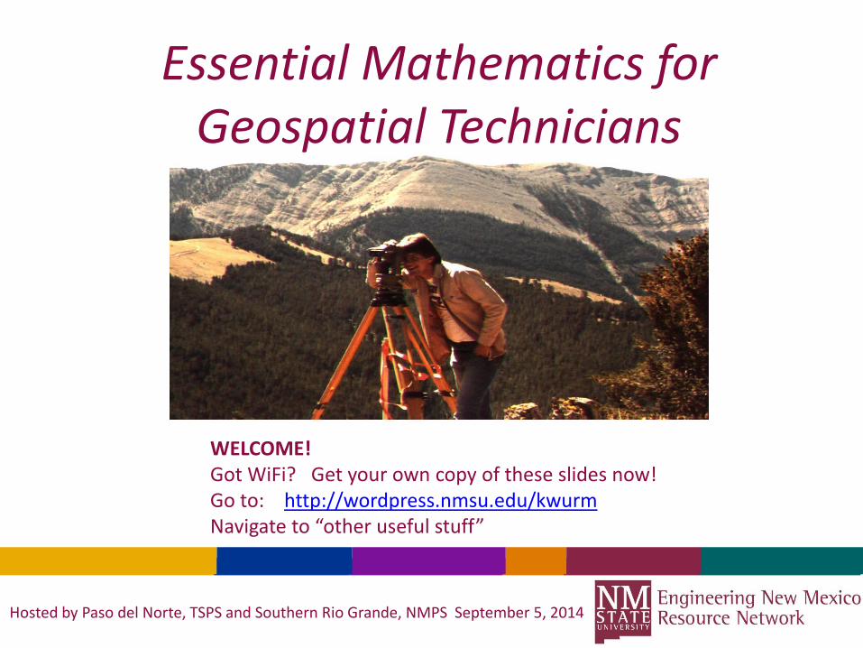
Essential Mathematics for Geospatial Technicians
Hosted by Paso del Norte, TSPS and Southern Rio Grande, NMPS September 5, 2014
WELCOME!Got WiFi? Get your own copy of these slides now! Go to: http://wordpress.nmsu.edu/kwurmNavigate to “other useful stuff”
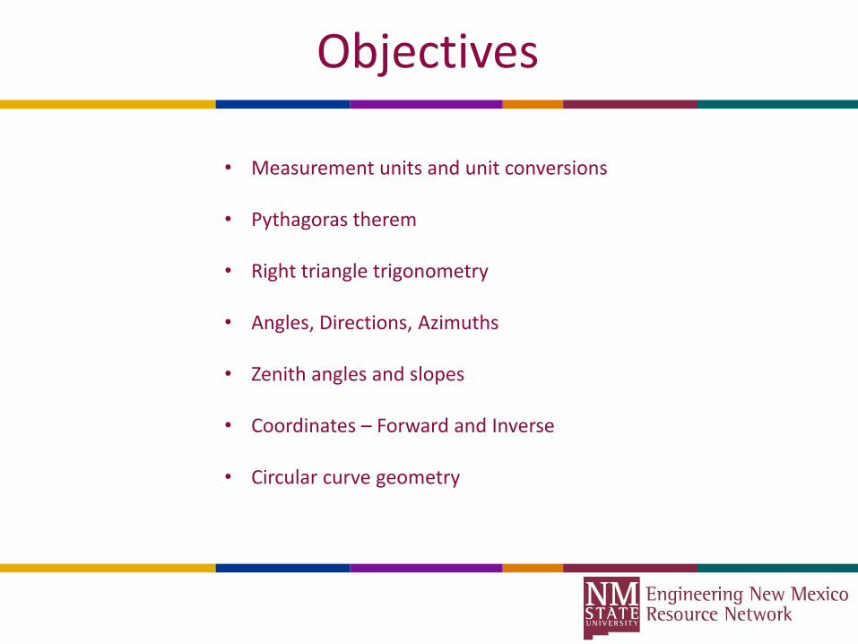
Objectives
• Measurement units and unit conversions
• Pythagoras therem
• Right triangle trigonometry
• Angles, Directions, Azimuths
• Zenith angles and slopes
• Coordinates – Forward and Inverse
• Circular curve geometry

Sexigesimal Units
Sexagesimal (base 60) is a numeral system with sixty as its base. It originated with the ancient Sumerians in the 3rd millennium BC, it was passed down to the ancientBabylonians, and it is still used — in a modified form — for measuring time, angles, and geographic coordinates.
The number 60, a highly composite number, has twelve factors, namely {1, 2, 3, 4, 5, 6, 10, 12, 15, 20, 30, 60}, of which 2, 3, and 5 are prime numbers. With so many factors, many fractions involving sexagesimal numbers are simplified. For example, one hour can be divided evenly into sections of 30 minutes, 20 minutes,5 minutes, 12 minutes, 10 minutes, 6 minutes, 5 minutes, 4 minutes, 3 minutes, 2 minutes, and 1 minute. 60 is the smallest number that is divisible by every number from 1 to 6; that is, it is the lowest common multiple of 1, 2, 3, 4, 5, and 6.

Unit Conversions
DMS to decimal: DD= Deg + Min/60 + Sec/3600
Decimal to DD MM SS: *Strip off whole degrees*take fractional part * 60 = take integer minutes*take fractional part * 60 = Seconds and decimal seconds
Decimal degrees to radians: Radians = DD * (π/180)
Radians to decimal degrees: DD = rad * (180/ π)

Other units
Units of Linear Measure1 chain = 100 links= 66 feet (U.S. Survey Foot)= 4 poles, perches, rods1 mile = 80 chains= 5,280 feet (U.S. Survey Foot)Units of Area1 acre = 10 square chains= 43,560 square feet (U.S. Survey Foot)1 square mile = 640 acres
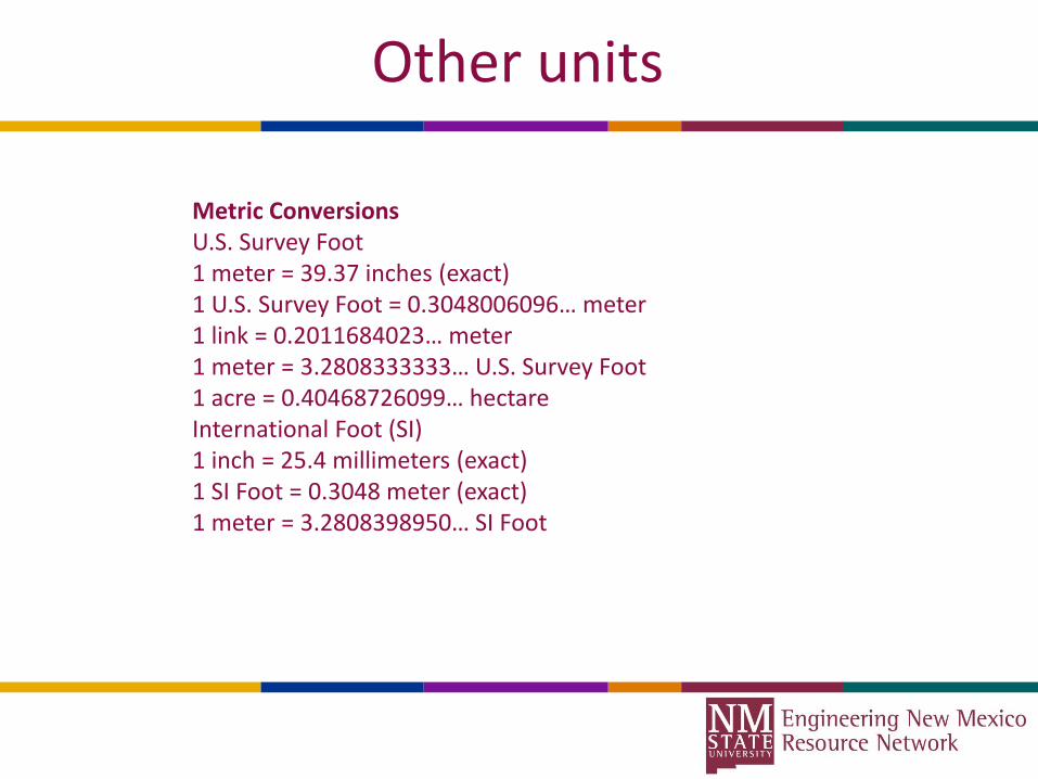
Other units
Metric ConversionsU.S. Survey Foot1 meter = 39.37 inches (exact)1 U.S. Survey Foot = 0.3048006096… meter1 link = 0.2011684023… meter1 meter = 3.2808333333… U.S. Survey Foot1 acre = 0.40468726099… hectareInternational Foot (SI)1 inch = 25.4 millimeters (exact)1 SI Foot = 0.3048 meter (exact)1 meter = 3.2808398950… SI Foot
The concept of PI (π)
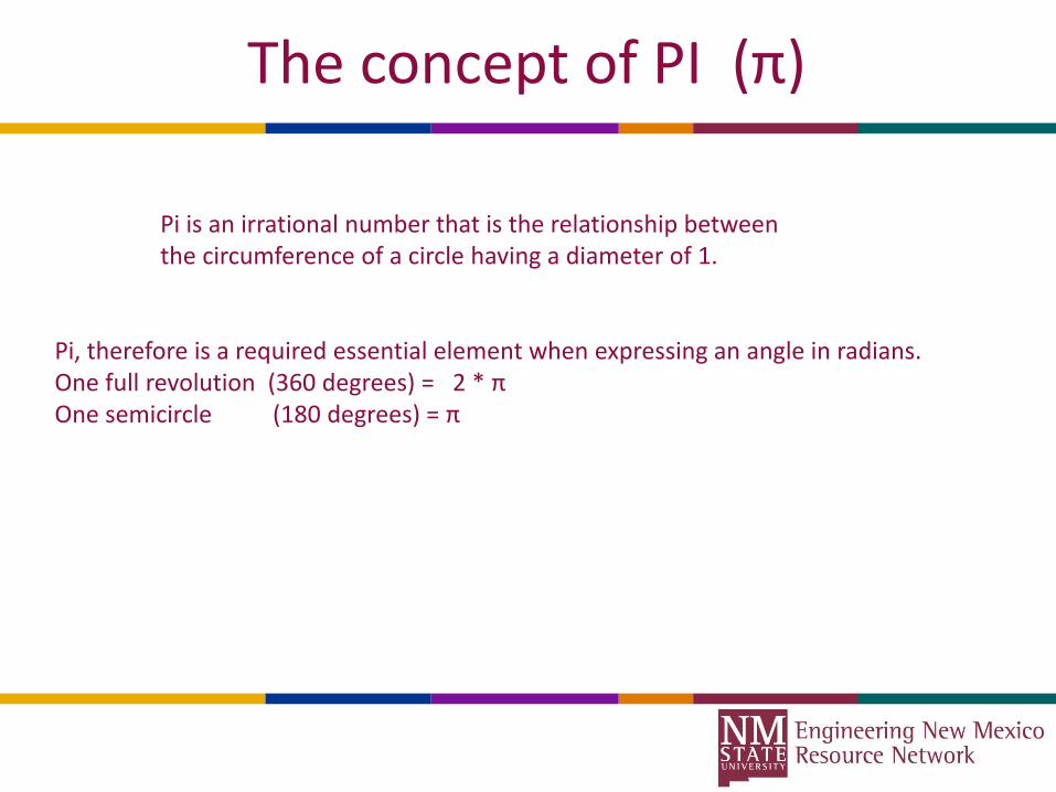
Pi is an irrational number that is the relationship between the circumference of a circle having a diameter of 1.
Pi, therefore is a required essential element when expressing an angle in radians.One full revolution (360 degrees) = 2 * πOne semicircle (180 degrees) = π
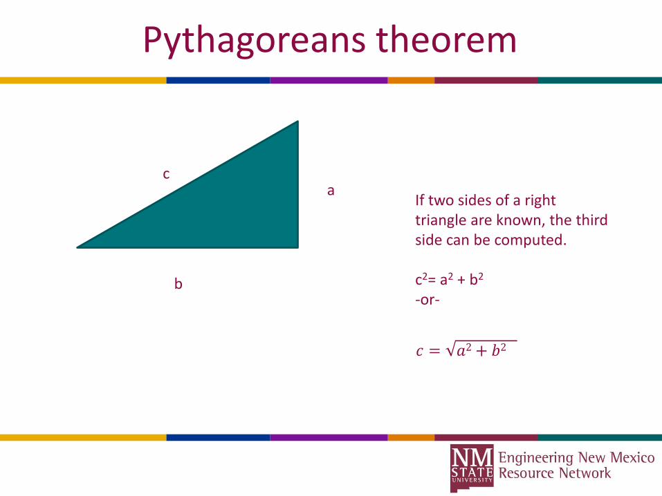
Pythagoreans theorem
a
b
c
If two sides of a right triangle are known, the third side can be computed.
c2= a2 + b2
-or-
𝑐 = 𝑎2+ 𝑏2
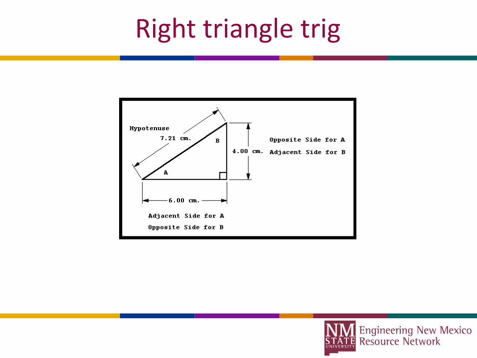
Right triangle trig

Right triangle trigonometry
SOHCAHTOA
Sine A = Opposite/HypotenuseSine A = (4.00/7.21)Angle A = ArcSine (4.00/7.21)Angle A = Sin-1 (4.00/7.21)
Cosine A = Adjacent/Hypotenuse
Tangent A = Opposite/Adjacent
Sine is typically abbreviated to SIN, Cosine abbreviates to COS, Tangent abbreviates to TAN
The inverse functions are often displayed as -1 power or use of the prefix “Arc” example: Arcsin = Sin-1
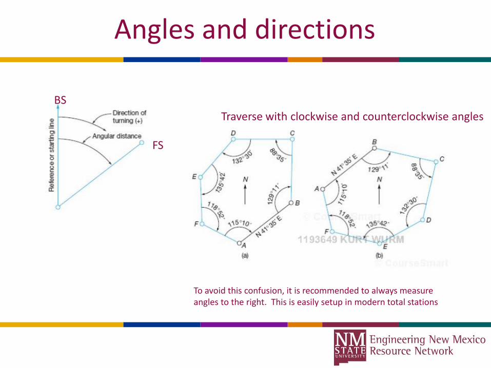
Angles and directions
BS
FS
Traverse with clockwise and counterclockwise angles
To avoid this confusion, it is recommended to always measure angles to the right. This is easily setup in modern total stations
Angles and directions
• Due to the random error in our instruments, Angles should always be measured direct and reverse, a total of 4 pointings (or more for greater precision)
• The direction is read at the BS and the FS, these must be differenced to derive the angle between. (FS-BS)
• The direction is read in the reverse face, and reduced as above• The two derived angles are then averaged. This effectively removes systematic
error in the instrument.
• For efficiency, we often set the initial direction to the BS to Zero.
• BE CAREFUL, If an angle accumulates to greater than 359°59’59”, our instruments will go back to zero (thus you may have to add 360° to the direction displayed).
Zenith angles
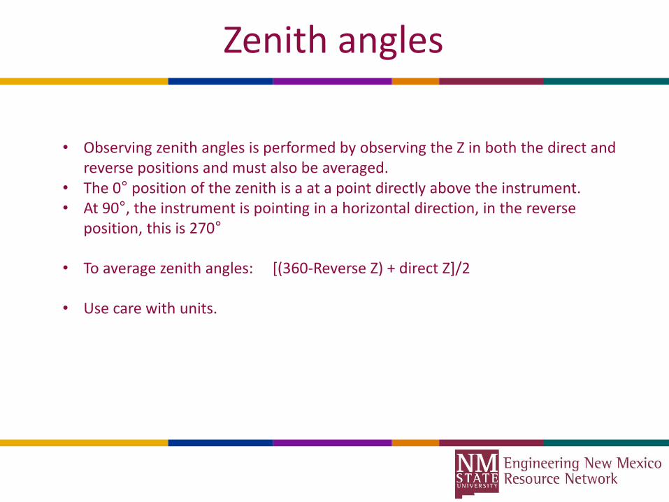
• Observing zenith angles is performed by observing the Z in both the direct and reverse positions and must also be averaged.
• The 0° position of the zenith is a at a point directly above the instrument.• At 90°, the instrument is pointing in a horizontal direction, in the reverse
position, this is 270°
• To average zenith angles: [(360-Reverse Z) + direct Z]/2
• Use care with units.
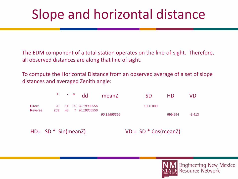
Slope and horizontal distance
The EDM component of a total station operates on the line-of-sight. Therefore, all observed distances are along that line of sight.
To compute the Horizontal Distance from an observed average of a set of slope distances and averaged Zenith angle:
° ‘ “ dd meanZ SD HD VD
HD= SD * Sin(meanZ) VD = SD * Cos(meanZ)
Direct 90 11 35 90.19305556 1000.000
Reverse 269 48 7 90.19805556
90.19555556 999.994 -3.413

Directions and Azimuths
Azimuths: Clockwise from North Bearings: East or West of North or South
Computing Azimuths
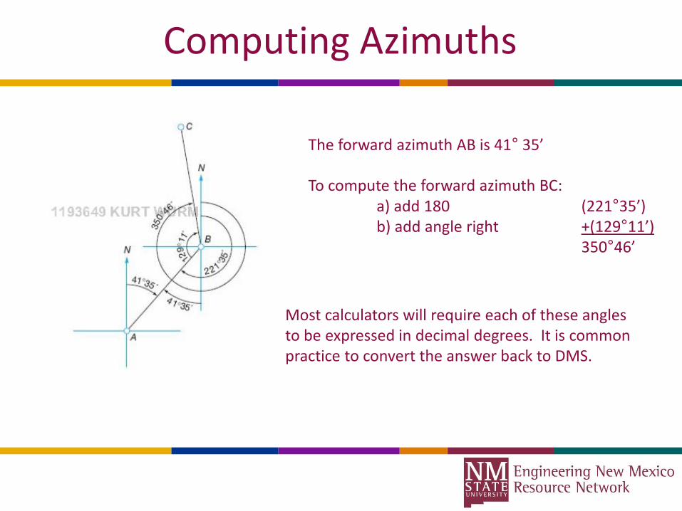
The forward azimuth AB is 41° 35’
To compute the forward azimuth BC:a) add 180 (221°35’)b) add angle right +(129°11’)
350°46’
Most calculators will require each of these angles to be expressed in decimal degrees. It is common practice to convert the answer back to DMS.
Calculator modes of operation
• The default setting in most handheld calculators is DEGREES mode, meaning decimal degrees. Therefore, to take the SIN, COS, or TAN of an angle, it must first be converted to DD.ddddd format. (do not round off, try to use full precision)
• This also means that Arcsine, Arccosine, and Arctangent functions will return an angle in DD.ddddd format.
• Most computer software such as MS-EXCEL operate in RADIANS mode. Therefore, an angle in DMS must first be converted to DD, then to radians for trig functions to work properly.
• Angle arithmetic and typically be conveniently performed in decimal degrees. The caution about radians is concerning trig functions.

Total Stations and Data Collectors
• For the purpose of ease of use, our modern data collectors often allow one to setup over a known station, enter its point ID or coordinates, same for the BS
• The total station is triggered at each of the pointings, software reduces the angles, and computes the forward azimuth.
• Distances are always measured on the slope, by automatically reducing the zenith angles also, the computation of Horizontal Distance is automated.
• The azimuth and HD are used to compute the coordinates of the FS station.
Forward Solution
With horizontal angles reduced, forward azimuths computed, Zenith angles reduced and horizontal distances computed, we can now begin to compute coordinates!
In mathematics, coordinates are typically referred to as X and Y, in surveying, we often refer to these as Northings (y coordinates) and Eastings (x coordinates)
The change in Northing between a pair of points is referred to as Latitude (not the same as geographic coordinates, but rather – how far North or South between the points.
The change in Easting between a pair of points is referred to as Departure – how far East or West between the points.

Forward Solution
Latitude = HD * Cos (azimuth)
Departure = HD * Sin(azimuth)
Example: If the coordinates of A are 1000.00, 1000.00 (N,E), the Azimuth of line AB is 83°52’30” and the horizontal distance AB is 200.615. The coordinates of B will be computed as:
N: 1000.00 + {latitude} N= 1000.00 + (HD * Cos(az)) = 1021.405E: 1000.00 + {departure} E= 1000.00 + (HD * Sin(az)) = 1199.470
Inverse Solution
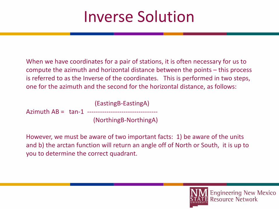
When we have coordinates for a pair of stations, it is often necessary for us to compute the azimuth and horizontal distance between the points – this process is referred to as the Inverse of the coordinates. This is performed in two steps, one for the azimuth and the second for the horizontal distance, as follows:
(EastingB-EastingA)Azimuth AB = tan-1 ---------------------------------
(NorthingB-NorthingA)
However, we must be aware of two important facts: 1) be aware of the units and b) the arctan function will return an angle off of North or South, it is up to you to determine the correct quadrant.
Inverse Solution
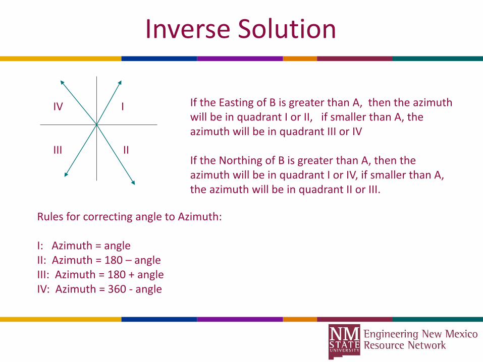
IV I
III II
If the Easting of B is greater than A, then the azimuth will be in quadrant I or II, if smaller than A, the azimuth will be in quadrant III or IV
If the Northing of B is greater than A, then the azimuth will be in quadrant I or IV, if smaller than A, the azimuth will be in quadrant II or III.
Rules for correcting angle to Azimuth:
I: Azimuth = angleII: Azimuth = 180 – angleIII: Azimuth = 180 + angleIV: Azimuth = 360 - angle
Inverse Solution
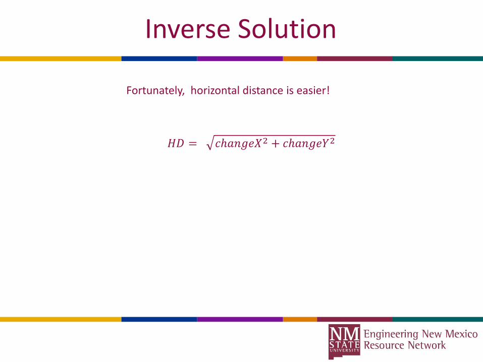
Fortunately, horizontal distance is easier!
𝐻𝐷 = 𝑐ℎ𝑎𝑛𝑔𝑒𝑋2 + 𝑐ℎ𝑎𝑛𝑔𝑒𝑌2

A look at MS-EXCEL
A number of MS-Excel spreadsheets have been prepared for your use,
Go to: http://wordpress.nmsu.edu/kwurm
Navigate to “other useful stuff”
MS-Excel, as a part of the Microsoft Office Suite, is a widely used computational tool that offers precision computations once a few basic skills are achieved. It is available on many platforms: desktop, tablet, android tablets and phones may find free or low cost compatible products.

Excel examples
1. We will begin with the spreadsheet named “AngularUnits”2. Directions3. Angles and traverse4. Level loop

Horizontal Circular Curves
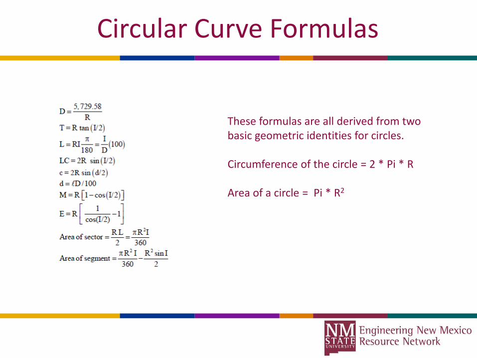
Circular Curve Formulas
These formulas are all derived from two basic geometric identities for circles.
Circumference of the circle = 2 * Pi * R
Area of a circle = Pi * R2

Closing comments?
Questions?
Door Prizes!
Acknowledgments
Elementary Surveying: An Introduction to Geomatics, 14th ed. by Charles GhilaniISBN: 978-0133758887
NCEES -- Fundamentals of surveying reference book
NSPS Certified Surveying Technician program