Embed Size (px)
Citation preview

Evaluating Early Warning System in
Sundarbans of West Bengal
Study is done under the project “Collective Action to Reduce Climate Disaster Risks and enhancing Resilience of Vulnerable Coastal Communities around the Sundarbans in Bangladesh and India”
Published by DRCSC, Kolkata


CONTENTS
1. Background
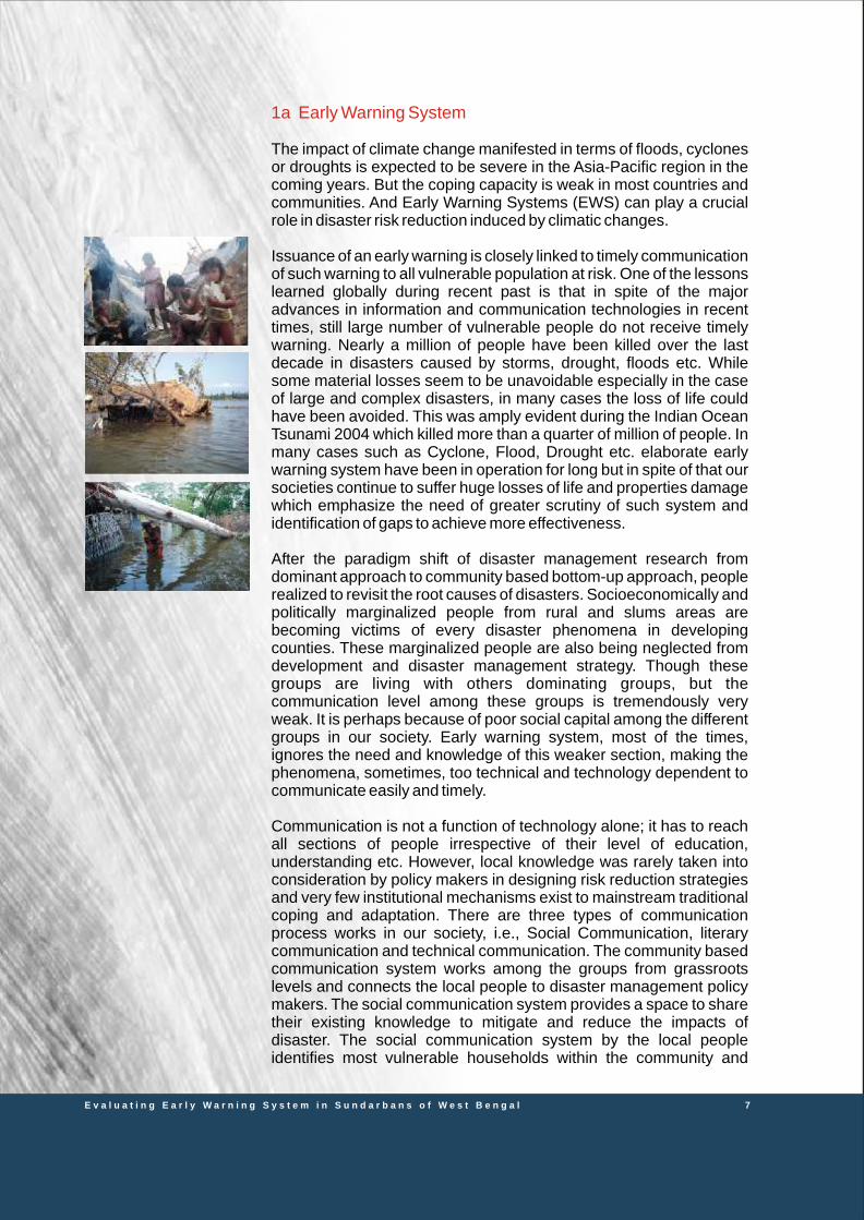
1a Early Warning System
2. Objective of the Study
3. Methodology
4. Findings
a. The history of Weather Forecast in India
a.1 The case study of AILA
b. EWS, its legal frame work and management plan at execution
level
c. Performance of EWS at the target beneficiary level
d. Local knowledge about weather forecast
e. Community’s expectation and recommendation
5. Analysis and Recommendation
Page 6
Page 7
Page 10
Page 12
Page 17
Page 19
Page 21
Page 27
Page 27
Page 27
Page 30
E v a l u a t i n g E a r l y W a r n i n g S y s t e m i n S u n d a r b a n s o f W e s t B e n g a l
Implemented jointly by Bangladesh India |The Project is funded by European Union Supported by
ACKNOWLEDGEMENT
We owe our warm gratitude to Mr. Anshuman Das for helping in preparing this report.
We acknowledge the support of all the villagers, field staff, people of different communities of all the four blocks, without their help and valuable information this report could not have been completed.
We are also thankful to the production team of DRCSC for helping in the designing of
this report.

ABBREVIATIONS
ICAR Indian Council of Agricultural Research
EU European Union
BCAS Bangaladesh for Advance Studies
DRCSC Development Research Communication and Services Centre
EWS Early Warning System
CCDRER Collective Action to Reduce Climate Disaster Risks and enhancing
Resilience of Vulnerable Coastal Communities
FGD Focused Group Discussion
FDC Forest Dependent Community
MVZ Most Vulnerable Zone
FC Fishermen community
SF Small Farmer
NWP Numerical weather prediction
NCMRWF National Centre for Medium Range Weather Forecasting
IMD Indian Metrological Department
SEOC State Emergency Operation Centre
DEOC District Emergency Operation Centre
BEOC Block Emergency Operation Centre (BEOC)
INCOIS Indian National Centre for Ocean Information System
4 E v a l u a t i n g E a r l y W a r n i n g S y s t e m i n S u n d a r b a n s o f W e s t B e n g a l
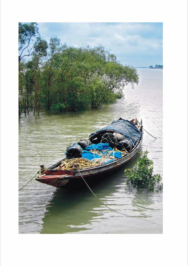

Sunderbans, the largest mangrove forest in the world with associated flora and fauna diversity, is presently under threat by many adverse changes including climate change factors. The entire mangrove forest ecosystems are already characterised by a low level of development, lack of infrastructure, prevalence of extreme poverty, high unmet energy demand and high incidence of vector and water borne diseases. The assessments of natural and anthropogenic changes in this sensitive ecosystem of Sunderbans clearly bring out certain trends, which are expected to continue in future and make the system more vulnerable.
Considering the above scenario the CCDRER (supported by EU, Ref No. DCI-ENV/2010/221-426) project envisages working on the following major areas of concerns within the Sunderbans of Bangladesh and West Bengal, India.
• Risk, vulnerability and DRR in the coastal mangrove ecosystems and the communities around the Sunderbans of both Bangladesh and India.
• Food, fodder, livelihood insecurity causing seasonal and permanent migration.
• Severe water scarcity for drinking, irrigation and fisheries due to salinisation because of sea level rise, tidal surges.
• Energy and fuel insecurity including forest mining.
• Increased risk of high tidal inundation, salinity, cyclonic storm / tidal surges for the livelihoods of the local people, land infrastructure etc.leading to direct loss of agricultural land, pond and other community assets and human settlement.
The project is lead by Bangladesh Centre for Advance Studies (BCAS), a leading research and policy institute in the non-government sector in Bangladesh and South Asia. And in India, it is implemented by Development Research Communication and Services Centre.
The overall goal of the project is to reduce climatic disaster risks and enhance resilience of the coastal communities around the Sundarbans by building capacity of the vulnerable communities, local actors and stakeholders through sustainable natural resource management and disaster risk reduction for promotion of livelihoods as well as by advancing community adaptation to climate change.
1 Background
6 E v a l u a t i n g E a r l y W a r n i n g S y s t e m i n S u n d a r b a n s o f W e s t B e n g a l
E v a l u a t i n g E a r l y W a r n i n g S y s t e m i n S u n d a r b a n s o f W e s t B e n g a l 7
1a Early Warning System
The impact of climate change manifested in terms of floods, cyclones or droughts is expected to be severe in the Asia-Pacific region in the coming years. But the coping capacity is weak in most countries and communities. And Early Warning Systems (EWS) can play a crucial role in disaster risk reduction induced by climatic changes.
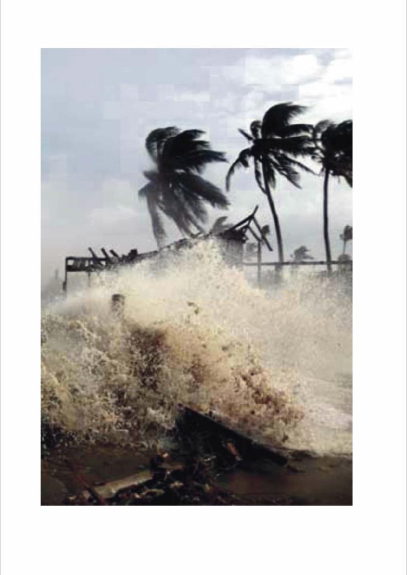
Issuance of an early warning is closely linked to timely communication of such warning to all vulnerable population at risk. One of the lessons learned globally during recent past is that in spite of the major advances in information and communication technologies in recent times, still large number of vulnerable people do not receive timely warning. Nearly a million of people have been killed over the last decade in disasters caused by storms, drought, floods etc. While some material losses seem to be unavoidable especially in the case of large and complex disasters, in many cases the loss of life could have been avoided. This was amply evident during the Indian Ocean Tsunami 2004 which killed more than a quarter of million of people. In many cases such as Cyclone, Flood, Drought etc. elaborate early warning system have been in operation for long but in spite of that our societies continue to suffer huge losses of life and properties damage which emphasize the need of greater scrutiny of such system and identification of gaps to achieve more effectiveness.
After the paradigm shift of disaster management research from dominant approach to community based bottom-up approach, people realized to revisit the root causes of disasters. Socioeconomically and politically marginalized people from rural and slums areas are becoming victims of every disaster phenomena in developing counties. These marginalized people are also being neglected from development and disaster management strategy. Though these groups are living with others dominating groups, but the communication level among these groups is tremendously very weak. It is perhaps because of poor social capital among the different groups in our society. Early warning system, most of the times, ignores the need and knowledge of this weaker section, making the phenomena, sometimes, too technical and technology dependent to communicate easily and timely.
Communication is not a function of technology alone; it has to reach all sections of people irrespective of their level of education, understanding etc. However, local knowledge was rarely taken into consideration by policy makers in designing risk reduction strategies and very few institutional mechanisms exist to mainstream traditional coping and adaptation. There are three types of communication process works in our society, i.e., Social Communication, literary communication and technical communication. The community based communication system works among the groups from grassroots levels and connects the local people to disaster management policy makers. The social communication system provides a space to share their existing knowledge to mitigate and reduce the impacts of disaster. The social communication system by the local people identifies most vulnerable households within the community and

existing community resources (Social, human, natural) to provide greater support during pre and post disaster situation. On the other hand, the literary communication among communities leads through social communication system which helps to enhance the capacity of local people to deal with risk. In the same way technical communication will be successful by the existence of social and literary communication.
For the implementation of the CCDRER project, different studies will be undertaken to understand the existing scenario, its adequacy and possible scope of improvement. One such important and basic study is to prepare a report on Existing Early Warning Systems (EWS). The report will provide updated information about existing warning systems in case of any climate related disasters that have the potential to impact the livelihoods of the people living in the coastal regions particularly under CCDRER project in coastal areas around Sundarban. The aim is to recommend ways and means to improve EWS or make EWS more effective. The recommendations from the study can be raised at appropriate places for policy implication.
8 E v a l u a t i n g E a r l y W a r n i n g S y s t e m i n S u n d a r b a n s o f W e s t B e n g a l

2 Objective of the study
The study will try to make a comprehensive overview on existing early warning systems in Sunderban, West Bengal, its present legal framework, disaster management regulatory framework, and disaster management plan. It will also try to have clear understanding about how disaster warnings reach to CCDRER target beneficiaries living around coastal areas of Sundarban. The objectives in specifics are
• To assess present EWS, its legal frame work and management plan at execution level.
• To assess how EWS performs at target beneficiary level.• To understand how vulnerable communities in CCDRER project
areas assess present EWS.• To determine local knowledge about EWS and recommendations.• To assess problems and prospects of present EWS and suggest or
recommend ways of improving it based on community expectations.
10 E v a l u a t i n g E a r l y W a r n i n g S y s t e m i n S u n d a r b a n s o f W e s t B e n g a l

3 Methodology
The methodology of the study includes the following components• Secondary information, data collection and analysis
The main contents that were seen were• Websites, papers and documents on history and evolution
of early warning system.• Policy papers of Government of India and Government of
West Bengal disaster management plans.• Various papers, study and workshop proceedings on Early
Warning Systems in India.• Focus Group Discussion with targeted stakeholders.
The stakeholders selected for FGD were• Fisherman folks• Small farmers• Dwellers of the most vulnerable zone• Forest dependent community• Police• Block office
• The FGD was based on a semi-structured questionnaire which has the following questions
• What kind of forecasting information you are getting on weather and disaster?
• Is the information useful?• What are the possible improvements in this system?• How do you predict any disaster?• The information that you are getting on disaster, are they
accurate? (to the police and block offices)• How one can improve the situation to take the message
quickly to the beneficiaries? (to the police and block offices)
12 E v a l u a t i n g E a r l y W a r n i n g S y s t e m i n S u n d a r b a n s o f W e s t B e n g a l

We have conducted the following FGDs
Sl District Block Village Target DateNo Benificiary
1 South 24 Pgns Basanti Bharatgarh FDC 27.06.2012
2 South 24 Pgns Basanti Anandabad MVZ 27.06.2012
3 South 24 Pgns Basanti Harbhangi FC 25.06.2012
4 South 24 Pgns Basanti Godkhali SF 25.06.2012
5 South 24 Pgns Patharpratima Indraprastha FC 27.06.2012
6 South 24 Pgns Patharpratima Gobindapurabad SF+MVZ 24.06.2012
7 North 24 Pgns Hingalganj Kuler Math FDC 05.07.2012
8 North 24 Pgns. Hingalganj Kanaknagar FC 03.07.2012
9 North 24 Pgns Hingalganj Kanaknagar SF 03.07.2012
10 North 24 Pgns Hingalganj Kothabari MVZ 06.07.2012
11 North 24 Pgns Hingalganj Kothabari FC 06.07.2012
12. North 24 Pgns Sandeshkhali II Natunpara SF 30.06.2012
13 North 24 Pgns Sandeshkhali II Polpara MVZ 29.06.2012
14 North 24 Pgns Sandeshkhali II Polpara FC 30.06.2012
* every villages, we contacted police and block officials.
E v a l u a t i n g E a r l y W a r n i n g S y s t e m i n S u n d a r b a n s o f W e s t B e n g a l 13
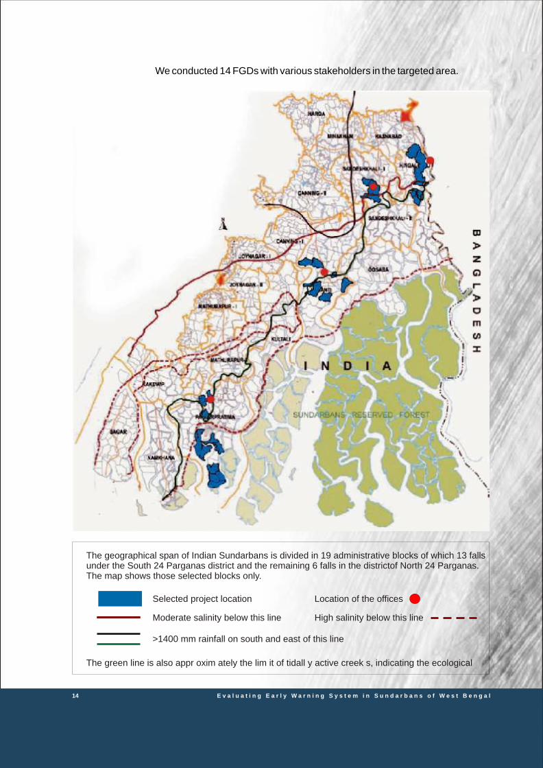
We conducted 14 FGDs with various stakeholders in the targeted area.
Selected project location
Moderate salinity below this line
>1400 mm rainfall on south and east of this line
Location of the offices
High salinity below this line
The geographical span of Indian Sundarbans is divided in 19 administrative blocks of which 13 falls under the South 24 Parganas district and the remaining 6 falls in the districtof North 24 Parganas. The map shows those selected blocks only.
The green line is also appr oxim ately the lim it of tidall y active creek s, indicating the ecological
14 E v a l u a t i n g E a r l y W a r n i n g S y s t e m i n S u n d a r b a n s o f W e s t B e n g a l

• Prepare report with recommendations for policy implications.
The report findings consists of 3 major part• History and evolution of Early Warning Systems in India,
with particular reference to West Bengal.• EWS, its legal frame work and management plan at
execution level• Excerpts of FGD:
• Performance of EWS at the target beneficiary level• Local knowledge about weather forecast• Community’s expectation and recommendation
The recommendation of the report is mainly focusing on the project and policy.
E v a l u a t i n g E a r l y W a r n i n g S y s t e m i n S u n d a r b a n s o f W e s t B e n g a l 15


4 Findings
4a. The history of Weather Forecast in India
Being an ancient civilization and with the major population predominantly dependent upon agriculture, the economy and prosperity of India have depended upon agricultural production for millennia. Weather and climate have been the presiding deities of the Indian agriculture. From the ancient Indian treatise Arthashasthra by Kautilya as early as 3rd century BCE are available to indicate that the measurement of rain over different parts of India. A system of forecasting weather on long-range and extended-range scales had existed in those hoary times. Such efforts were based on planetary configurations and the position of the moon in the orbit of the sun.
Scientific meteorology began in Europe in the 15th and the 16th centuries CE with the inventions of barometer, thermometer, hygrometer and wind measuring instruments. With the increasing influence of their maritime trade with India and East Indies, the voyagers kept careful records of weather elements measured during their long journeys into the Indian Ocean. These data, by the end of the 17th century CE, had provided the first scientific link of the monsoon rains over India with the changes in wind patterns over the Indian Ocean.
Scientific meteorology in India can be said to have started with the establishment of the first observatory at Madras (now Chennai) in 1802 by the East India Company. Over the next five decades, meteorological observations began to be recorded at different places in India by the interested employees of the East India Company, and by 1865, the meteorological system was organized in British-ruled India on provincial basis. This was the period when centralized system of meteorological organizations was being established in different countries in Europe and North America. India also followed by establishing the India Meteorological Department (IMD) in 1875 as a central agency of the Government of India with the purpose of organizing a uniform system of standardized meteorological observations, keeping their records and disseminating the information for societal benefits. Thus began the modern system of scientific meteorology in India.
More frequent failures of monsoon and the consequent famines in 1877, 1896, 1899, 1902, 1903, 1905, 1911 and 1918 prompted the British administration in India toward the need to modernize Indian agriculture. The visit of the Royal Agricultural Commission to India in 1927 led to the establishment of Imperial (now Indian) Council of Agricultural Research (ICAR). Under their grants, in 1932, the IMD also established a section on Agricultural Meteorology at its then Headquarters at Poona (now Pune) Meteorological Office. Later, it
E v a l u a t i n g E a r l y W a r n i n g S y s t e m i n S u n d a r b a n s o f W e s t B e n g a l 17
became the Agricultural Meteorology Division under whose aegis the Farmer Weather Bulletins began to be issued from the end of 1942 for the benefit of farming operations. This was the beginning of the application of scientific meteorology to agriculture in India. The need to enhance this focused weather service to the farming community was increasingly felt over the years, and the IMD took steps to enhance this service since 1950. For smooth running, 7 regional centres were established in 1945. Central observatory at Alipur was the first observatory in India to impart training to the observers, to test instruments and standerdadize for taking several types of observations. A ‘NEWMAN BAROMETER’ was installed at Alipur observatory and was used as a standers Barometer for secondary use were kept in Alipur and are still in use since 1877.
The first seven decades of the IMD (1875-1945) were spent on setting up the system consisting of rainfall registration, surface and upper air observatories network, synoptic reporting of observations, storm warning and weather forecasting systems. During most of this period, weather forecasts were issued by national meteorological services world over by employing empirical methods. The IMD had taken a far reaching step in establishing the Institute of Tropical Meteorology (ITM, now known as the Indian Institute of Tropical Meteorology or IITM) in November 1962 as a Special Fund Project of the United Nations Development Programme (UNDP) with the purpose of encouraging research in various disciplines of meteorology. Its establishment coincided with the start of the International Indian Ocean Expedition (IIOE) and the setting up of International Meteorological Centre (IMC) in Bombay (now Mumbai) on January 1, 1963 to function as a hub of the IIOE operations in India. While development work in NWP was taking place at ITM, progress was also made simultaneously at IMD in New Delhi. Northern Hemisphere Exchange Centre (NHEC), Northern Hemisphere Analysis Centre (NHAC) and global telecommunication hub at New Delhi as part of the Global Telecommunication System (GTS) were established by the IMD during 1967-1970 under the World Weather Watch (WWW) Programme of the WMO. IIT-Delhi had succeeded in establishing the Centre for Atmospheric Science (CAS) there in 1979 with the support of IMD and the Ministry of Education.
India had passed through a string of drought monsoon years between 1965 and 1982 during which the summer monsoon rainfall was significantly below normal (in 1965, 1968, 1972, 1974, 1979 and 1982). This had adversely impacted upon the Indian agriculture and had threatened the prosperity of rural India as well as the Indian economy in general. The Indian Council of Agricultural Research (ICAR) had launched a massive program of Green Revolution during 1960s and 1970s to enhance the agricultural productivity. The Green Revolution had no doubt brought remarkable increase in food production and made India self reliant on the food front. However, data showed that, for every drought monsoon year, the food production had sharply declined on the curve of overall rising production under the Green Revolution. This was again reflected in reduced food production figures after the drought of 1982. If this was not bad enough, the weather in April 1983 over NW India was abnormal. Rabi
18 E v a l u a t i n g E a r l y W a r n i n g S y s t e m i n S u n d a r b a n s o f W e s t B e n g a l

crops in the food basket of Haryana and Punjab states of India was ready to be harvested when much higher frequency of thunderstorms, squalls and hailstorms occurred in April 1983. This adverse weather endangered the food crops lying in open fields. The threat of climate change due to global warming was then being discussed by the world scientific community. The then Prime Minister of India, Mrs. Indira Gandhi, was already much concerned about the frequent sub-normal monsoons since 1965. The drought of 1982 and the destruction of Rabi food crops in the fields of Haryana and Punjab during April-May 1983 made her concerned about the abnormalities in weather and climate over India. She appointed a committee in mid-1983, which eventually initiated be National Centre for Medium Range Weather Forecasting (NCMRWF).
The Centre’s main function or mission was to predict global weather using global dynamical models, progressively extending the forecasts periods to cover 3 to 10 days and to develop specific applications catering particularly to the needs of agriculture in order to facilitate areaspecific and crop-specific (if possible) farming operations in a more informed way on mediumrange scale. The
NCMRWF Project, as it was envisaged, had intimate links with application of its forecast products to agricultural operations in the 127 Agrometeorological Field Unit (AMFU) depending upon the status of crops on the field and farming cycle in the crop-season. Till the beginning of 1994, when the formative phase of the NCMRWF was over, 22 AMFUs had been established which were spread over different parts of the country. Twice a week, weather forecasts also began to be issued on experimental bases from 1991.
For the purpose of preparing location-specific weather forecast for Agromet Advisory Service (AAS), the methodology of Direct Model Output (DMO) forecast was adopted. The model output for each of the 15 minute time step is accumulated to obtain 24-hours forecast values for the following variables.
• Total precipitation (mm)• Mean Sea level pressure (hPa)• Average surface wind sped (kmph)• Predominant surface wind direction• Maximum daily temperature (ºC)• Minimum daily temperature (ºC)• Maximum daily relative humidity (%)• Minimum daily relative humidity (%)
Now, with so much sophisticated weather prediction system, if we consider the latest case of AILA in 2009. We will see the following.
• On 22 May 2009, the Kolkata Meteorological Department reported that a low pressure area had formed over West-central Bay of Bengal and adjoining East - central Bay of Bengal. The system was likely to intensify further.
4a.1 The case study on AILA
E v a l u a t i n g E a r l y W a r n i n g S y s t e m i n S u n d a r b a n s o f W e s t B e n g a l 19

• On 23 May, the department reported that the system had further intensified and was likely to concentrate into a Depression.
• On 24 May, the system intensified into a Deep Depression and lay about 550 kilometres south of Kolkata. The meteorological department predicted that the system was likely to intensify further into a Cyclonic Storm and cross West Bengal or Bangladesh coast near 89° East, about 100 kilometres east of Sagar Island by 25 May evening.
• On 25 May, the Cyclonic Storm “Aila” over North West Bay, moved northwards and intensified further and lay centred at 0830 hrs IST within half a degree of latitude 20.5°N/Longitude 88.0°E, about 250 Km south of Kolkata with estimated central pressure 984 HPA and move in a near northerly direction and cross West Bengal Coast near latitude 88.0 Deg East (near Sagar Islands).
• On 26 May, Cyclone Aila over Sub-Himalayan West Bengal & adjoining Bangladesh moved further northward, weakened into a deep depression and lay centred at 0830 hours IST over Sub -Himalayan West Bengal, about 50 km to the north of Malda.
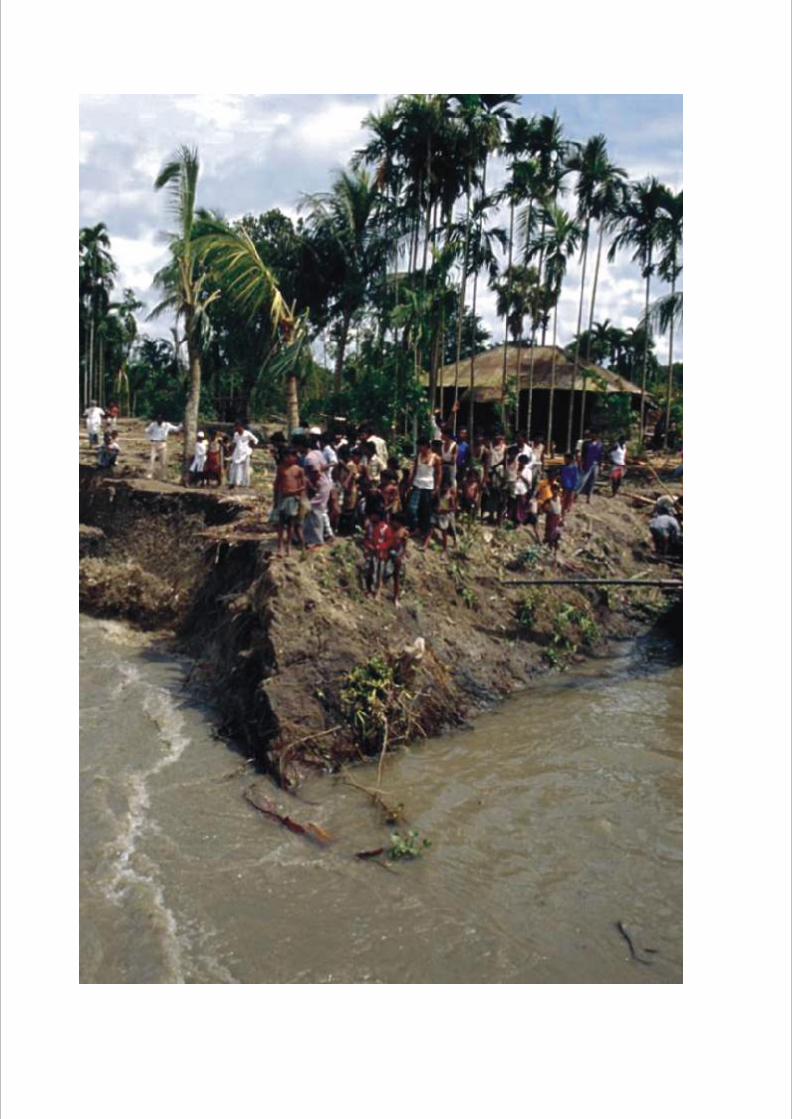
Among the 12 affected districts of West Bengal, the damage in North & South 24 Parganas has been the maximum. Out of the total crop affected area of 2,56,750 ha in all the 12 districts, the share of North 24 Parganas is 55, 600 ha and that of South 24 Parganas is 69, 150 ha. Saline water gushed in through breaches in the river dykes and inundated houses and lands. Under the present conditions, almost 60% of the area in these 2 districts has been rendered uncultivable and not suitable for making seedbed. It has caused a havoc in 5 Blocks (Sandeshkhali-I, II, Minakhan, Hasnabad and Hingalganj) of North 24 Parganas. In Canning II about 1300 bighas of land is under saline water. 600 families in Tambuldaha I and Sarengabad GPs of Canning II block and 2200 families in Bermajur I & II GPs of Sandeshkhali II block lost their houses. They are now residing on the roadside in small makeshift huts or have taken shelter in relief camps and schools. Only in North 24 Pgs., livestock loss amounts to a whopping 1,17,332. Loss of domestic animals was caused not only by the cyclone, but also by high tide that followed. In Sandeshkhali I & II and Hingalgunj blocks about 70-80 poultry farms got completely shattered. According to the Government of West Bengal statistics, over 6.77 million people have been affected and 137 killed in North 24 Parganas and South 24 Parganas. The cyclone AILA collapsed more than 500 kilometers of embankments and 926,000 semi permanent houses.
Whereas the affected areas were familiar with the consequences of heavy rains and winds or with some degree of flooding, there were two unique findings when it came to the preparedness of communities for the cyclone. The first is that both inland communities and those living closer to waterways have not experienced a cyclone induced tidal surge with such an intensity or scale in the last two decades or in most cases in living memory. Second, preparedness was hampered by the
20 E v a l u a t i n g E a r l y W a r n i n g S y s t e m i n S u n d a r b a n s o f W e s t B e n g a l

fact that it could not be predicted that the embankments would suffer such extensive damage.
The warning given over the radio (due to lack of electrification in remote areas many communities find it difficult to get access to television) was inadequate for the following reasons. While the warning informed people that they were going to experience heavy rain and strong winds, they did not specify or explain the basic issues of what exactly is a cyclone, where landfall will occur. Second, the nature of the warning was in such general terms that individuals who were already habituated to experiencing severe weather conditions did not feel the need to evacuate. On experiencing cyclonic conditions combined with extensive flooding and waves (as a consequence of the breaking of embankments) communities were not able to organize or systematically evacuate to safer locations. Three major experiences emerge from the time individual communities began experiencing the disaster.
• only 10-15 minutes of reaction time was available to people toevacuate to higher ground, gather children and the elderly as well as pack away essential belongings.
• the time of occurrence did play a crucial role in the entire evacuation process. Since the cyclone occurred during day time people could actually move to safer places ensuring minor damage to human lives. Had it occurred in the night the damage to human life would have been more.
• as a consequence of the rapidity of the onset and the lack of preparedness time individuals have suffered from three major losses which will be detrimental to the postdisaster reconstruction stage: the loss of all forms of documentation (ration-cards, Below Poverty Line Certificates, NREGA work cards, birth and death certificates, proofs of school enrollment and other documentation); the loss of all livestock (cattle and poultry); and, the entire loss of accumulated money and food grain reserves (both for consumption and for selling in the market).
So, it is evident that the forecast was available, but there is a huge gap in communicating that at the local level.
The district administration is the prime agency responsible for issuing the disaster warning. Additionally the technical agencies authorized to issue warning will also communicate the same to the District Control Room and in case are mentioned below.
4b EWS, its legal frame work and management plan at execution level
E v a l u a t i n g E a r l y W a r n i n g S y s t e m i n S u n d a r b a n s o f W e s t B e n g a l 21
Disaster Agencies
Dissemination of Warning
Current communication System
Earthquakes IMD, MERI, BARC
Floods Meteoro log ica l Depar tment ,Irrigation Department
Cyclones IMD
Epidemics Public Health Department
Road Accidents Police
Industrial and Chemical Accidents Industry, MARG, Police, DISH, BARC, AERB
Fires Fire Brigade, Police
• Communities in disaster prone areas are made aware of the warning systems.
• All warning systems and technologies are maintained in working condition and checked regularly.
• Alternate warning systems must be kept in readiness in case of technical failure (e.g., power failure).
• Only the designated agencies/officers will issue the warning.• All available warning systems should be used.• The warning should to the extent possible be clear about the
severity, the time frame, area that may be affected.• Warning statements should be conveyed in a simple, direct and
non-technical language, and incorporate day-to-day usage patterns.
• The do’s and don’ts should be clearly communicated to the community to ensure an appropriate responses.
• Warning statements should not evoke curiosity or panic behavior. This should be in a professional language devoid of emotions.
• Rumor control mechanisms should be activated.• All relevant agencies and organizations should be alerted.• Wherever possible, assistance of community leaders and
organized groups should be sought in explaining the threat.• Once a warning is issued, it should be followed-up by subsequent
warnings in order to keep the people informed of the latest situations.
• When the disaster threat tiding away, an all clear signal must be given.
At present, there is no separate and independent communication network for Disaster Management in the state. After renaming and reorganization of the Department of Relief to that of Disaster Management, the prevailing and conventional communication network is being used along with other State Government Departments. Existing communication network systems are PSTN, CELLULAR NETWORK & Broad-Band network from State level to Gram Panchayat level. Some District Magistrates are equipped with Inmarsat phones. WBSWAN system works only in Bardhaman District. VSAT network system is available from State Government level to Central Government. At present the existing system of
22 E v a l u a t i n g E a r l y W a r n i n g S y s t e m i n S u n d a r b a n s o f W e s t B e n g a l

receiving and conveying the cyclone warning system and other natural hazard reports are originated from the Indian Meteorological Department (IMD) and then it is conveyed simultaneously to State Disaster Management department, concerning District and Zilla Parishad authorities and to the AIR & electronic (TVchannels) and non-electronic media(newspaper). Existing communication network systems are being used for this whole activity. The Government administration and media depend on the existing telecommunication network. The population of the affected areas is dependent only on radio & TV broadcast.
Apart from contingency planning, sustainable development process can mitigate the hardships faced by the people due to disasters. This can be done through various structural and non structural measures. Structural measures include strengthening of embankments, anti-erosion work, village-raising, channel improvement through desiltation, removal of obstacles from the drainage channels and reservoirs, etc. Of the Non-structural methods, improved Communication System is a must. Communication plays a vital role in the matter of rescue and relief operations in all disasters. We should take steps to connect all the Gram Panchayats with sub-divisional and district headquarters so that the District Magistrates receiving any information of natural calamities, should be ideally communicated immediately to the Principal Secretary, Department of Disaster Management and ensure rescue /relief operation as early as possible.
The proposed Central Communication Network for Disaster Management will connect the State Emergency Operation Centre (SEOC), District Emergency Operation Centre (DEOC) and Block Emergency Operation Centre (BEOC). SEOC will be connected to the DEOC and DEOC will be connected to the BEOC through PSTN/CELLULAR/WBSWAN/VSAT as part of the said communication network. The other technologies like INMARSAT, HAM radio, Loudspeakers, World Space Radio Receiver (WSRR) system at different levels with fixed, nomadic and mobile communication equipment shall also be considered.
In case, when the existing communication system breaks down due to natural hazards (like, Tropical Cyclone), a Rapidly Deployable Communication system shall be required for proper Disaster Management, which may includes various wireless communication technologies like Wi-Fi, Wi-Max, etc. and the available existing network will be used wherever possible. This network component shall be divided into four network zones namely Frontier, Access, Backhaul, and Backbone. Frontier network zones is the nearest reachable location from the core of disaster zone. Using nomadic wireless communication components and mobile handheld devices disaster related data shall be collected and transmitted via Wireless mesh network to a Local information Repository. This mesh network along with Local information Repository shall be called ACCESS Network. A copy of the received information in the Local information Repository shall be transmitted to the Central Information Repository partly via a long range communication link using WiMax /WiFi link with High Gain antennas (the Backhaul Network) and partly via existing
Proposed Communication System
E v a l u a t i n g E a r l y W a r n i n g S y s t e m i n S u n d a r b a n s o f W e s t B e n g a l 23

communication network like (Cellular/ WBSWAN/PSTN/ VSAT)(Backbone Network , Backhaul network will merge to it). The received information at the Central Information Repository can further be divided to different departmental Network via Internet/ LAN/WBSWAN. Also INMARSAT terminals can be used at disaster site.
Following is the complete network architecture in picture,
Communication Procedures shall be established by the entity and regularly exercised to support the program.
The following communication facilities should available in the control room of EOC.
• Telephones.
24 E v a l u a t i n g E a r l y W a r n i n g S y s t e m i n S u n d a r b a n s o f W e s t B e n g a l
R
• Intercom units for contact within control room.• Police Wireless• Civil Wireless• VSAT connection to the Divisional Commissioners and
Collectors with video-conferencing facilities• Hotline• One Mobile with the Relief Commissioner• Networking of Computers• One PC with printer• Photocopying machine• Television unit
There should be phones, i.e. intercom, STD phone, EPBX extension,hotline etc., of different colors, and with distinct rings, to enable themto be distinguished from each other. The color codes for thetelephone instruments should displayed on the display board. Anemergency light,fire extinguishers, and a generator for the computerand fax machine should be provided in the control room.
• Divisional Commissioner/s of the affected district/s
• District Collector/s of the affected district/s
• Superintendent of Police of the affected district/s
• an independent phone with STD facility
• intercom units for contact within control room.
• hotline connection for all Branch/Nodal officers to their respective departments/agencies.
• Central secretarial facility for all Branch/Nodal officers should be
provided in the EOC.
A car with wireless communication should be assigned to EOC. Information on additional vehicles requisitioned for the emergency should available with Logistics branch. As you will see, the EOC is equipped with number of devices and instruments which are crucial for establishing rapid contact and communication and getting feedback from the disaster site.
It is therefore important that all the instruments and devices are in good working condition all the time. To ensure this regular maintenance is being undertaken by competent technical personnel through a contractual arrangement. The EDP Manager is responsible for ensuring renewal of maintenance contracts and attending to maintenance requirements. All requirements regarding maintenance must therefore be reported to EDP Manager.
• Appropriate central government departments, agencies andinstitutions such as railways, defense services, IMD.
• Police, fire brigade, PWD, MSEB, Irrigation, MWSSB, and all other State department.
• Private donors.
During Disaster Hotlines from EOC should connected to
Each of the workstation should have
Establish communication links with
E v a l u a t i n g E a r l y W a r n i n g S y s t e m i n S u n d a r b a n s o f W e s t B e n g a l 25

Three categories of staff should exist for the control room: Regular, Staff on-call and Staff onDisaster Duty. This personnel entity should develop to alert officials and emergency response personnel.
The regular staffs are posted permanently in the control room and are responsible for manning the Control Room on a 24-hour basis. The regular staffs include the following:
An officer of the rank of officer on special duty and Ex-officio on charge – Control Room. He is in charge of the day-to-day operation of the control room during official working hours. He is assisted by Disaster Management officers from control room in rotation during non-workinghours.
EDP Manager is a technical person thoroughly conversant with computer technology. He is responsible for the information processing and data management and maintenance of the computerized network.
To provide all secretarial assistance to the control room, a computer literate stenographer able to operate database systems has been provided.
Communication operators attend to wireless set in the control room.
Drivers for the vehicle attached to the control room are trained to operate the wireless fitted in the vehicle.
Staffs-on-call should available for immediate duty in case of a disaster. Two Deputy Secretaries make up the Staff -on-call. During a disaster, these officers are always available “on call”.
Staffs on Disaster Duty are the additional staff required to shoulder additional responsibility. These additional staffs are in the nature of a reserve and drawn from various departments who are experienced in control room and EOC operations.
An autonomous body under ministry of earth science, Indian National Centre for Ocean Informa tion Service is a body to provide ocean information and advisory services to the society,industry, government and scientific community through sustained ocean observations and constant improvements through systematic and focused research, which also helps in EWS through SMS.
Regular Staff
Emergency Operation Officer - Control Room
EDP Manager
Computer operator
Communication operators (for 24 hours)
Driver cum Messenger/Attendant (for 24 hours)
Staff-on-call
Staff on Disaster Duty
INCOIS
26 E v a l u a t i n g E a r l y W a r n i n g S y s t e m i n S u n d a r b a n s o f W e s t B e n g a l

G-plot matsojibi committee. Member –Narayan Das,9732836842, mentioned the following.
Fisherman community believes the weather news which is broadcasting form Bangladesh. It is being broadcasted at an interval of one hour.
They identity some changes in the weather which is pre symptom of disaster like sea roaring become more frequent, suddenly the breeze come to holt or stop blowing.
Govt. has no strong early warning system which is help them.
He also told us the climate change effect on day by day because sea level became high, salinity of the river water is increasing.
Mangrove trees like Sundari, golpata total lost.
Fisherman normal use mass netting against the flow of river. So it damages the reproduction of pregnant fish. sundarban like brackish fish ( chandana, chhala, lal bhola, hilsa) is decreasing
4c Performance of EWS at the target beneficiary level
4d Local knowledge about weather forecast
4e Community’s expectation and recommendation
The summary of response from the community on this aspect is following
• Usually the information and warning comes through radio, miking by Panchayet, newspaper and television. And it is about rainfall, water level and storm.
• When the fishermen are in the sea, they are informed by the family member over phone. But if they hear about a possibility of danger, usually they do not go to the sea/river.
• Most of the cases, it was reported that• information is not sufficient and effective• information is given just before the incident happens, so
most of time the livestock, food stock and crops could not be saved
• the warning doesn’t reach to the interior
• The weather information is still more or less effective, but the disaster information is 50-60% effective. Sometimes, it happens that the forecast from Bangladesh through radio is much more accurate.
The summary of response from the community on indication of disaster is following
• Observation of animal behavior, especially dogs.• The cranes and open-bill stork flying on north west.• The oppressive weather indicates impending disaster.• Colourful water snakes comes to the river bank• Ant carrying eggs to safe place• Colour of the cloud often indicates storm, cyclone and rainfall.• Water level of the river.• Direction and flow of wind.• Rainfall pattern – heavy rainfall indicates water level increase and
devastation of river bank.• Behavior of fish becomes unnatural; it jumps on the surface of the
pond.• Humidity increases indicates storm and rainfall.• Studying the moon ring.
The villagers expect and recommend the following• Siren alarm from block office and forest offices.• Weather information in every one hour, especially for the
fishermen.• Signaling system in the river and making signal post in the
remote island.• Some villagers recommended that if some basic observatory
mechanism are established in the villages and training is provided – villagers can also do weather data tracking.
• Requested for a board where warning and weather information
E v a l u a t i n g E a r l y W a r n i n g S y s t e m i n S u n d a r b a n s o f W e s t B e n g a l 27

will be displayed, also requested hazard map with escape route. Some also focused on awareness building.
• Villagers also focused on forming decentralized team, which will be responsible to spread the EWS in various corner.
From the villagers and the block office, the issue and recommendation came are following
• Police try to disseminate the information received from Metrological Department. But across the district, the police unanimously said that beyond the office hours (10 AM-5PM) it is difficult to convey information to Panchayet and Block office. Hence, EWS highly hampered.
• Police also said that clarity of information received from Met Department is not up to the mark always.
• Block office mentioned of a specific worker for EWS and wireless system.
• Block office also banked upon direct contact with met department to reduce time gap.
• Block office also focused on Panchayet to decentralize the process of disseminating through EWS groups and create link with NGOs. Among 12 Gram Panchayet, only 4 has a committee or responsible person for warning.
28 E v a l u a t i n g E a r l y W a r n i n g S y s t e m i n S u n d a r b a n s o f W e s t B e n g a l


The study has shown that receipt of an early warning do not necessarily translate to compliance behavior and vulnerable population often differ in their hazard risk perception, ability to take action and compliance pattern. Considering the goal of an early warning is ultimately prevention or minimizing loss of life and properties, greater understanding of public response process to early warning is a prerequisite to improve and ensure desired actions are taken.
The basic issues that are coming up from these are• The economic and geographic conditions in the region hamper
the formal institutionalization of an efficient early warning system.
• There is need for agencies involved in prediction to ensure that warning percolates down to the micro-level through panchayats even in situations where individuals do not have access to either radio or television.
• It is also important to see that the community is convinced with the warning system and responds to the situation in terms of evacuation.
• Also though the plan of the government seems to be full proof, it is far away to be implemented and too much technology driven. And, most importantly the role of the community is very weakly described.
• The communication methodology of the EW, after it reaches
A local respondent summarised: “the old system is gone and the new system is not working.” Most of the traditional early warning systems have disappeared due to a combination of socioeconomic, geo-political, technological, land-use, and perception factors and changes. The new early warning systems rely upon scouts’ sirens, telephones, and information delivered by the central government through the Flood Forecasting Division of the Meteorological Office in Lahore, based on data from radars and satellites. However, new technologies have limitations. Firstly, although they provide relatively rapid means of communication, not everybody can benefit from these new technologies. The early warning systems might, therefore, contribute to increasing socioeconomic disparity among households and villages because not every village and household can have access to and, more importantly, benefit from the new technologies and information delivered by them. Shouting and whistling is still the most common form of communication used today. Secondly, the mikings do not reach all the villages in time. Thirdly, the diversity of communication strategies and options has been replaced by technological solutions that are centralised. People are now more dependent on external technologies and external experts, which may be contributing to a reduction in their flexibility, adaptability, and creativity and to the development of dependency.
5 Analysis and Recommendation
30 E v a l u a t i n g E a r l y W a r n i n g S y s t e m i n S u n d a r b a n s o f W e s t B e n g a l
the Police/Block/Panchayet seems to be one of the hurdles. After that it is also much centralised and community is only at the receiving end.
• The local knowledge and methodology of understanding has never been a part of the mainstream system.
1. There is a need of methodical study of people’s indigenous knowledge of reading weather.
2. Hazard seasonality calendar and hazard map with escape route, vulnerable household, highest portion of the villages, important contact person etc to be done and displayed in the prominent location of the village.
3. In the central office in Kolkata, should track IMD website regularly and establish linkages with INCOIS, so that information on weather is tracked regularly. The central office should inform the field offices.
4. Early warning network with all the villages with one representative person to be establish, so that information passes through mobile phone. The 4 field should have common SMS facilities so that the message can be sent within few seconds.
5. In each village the representative should have contact information of key persons in the community, through whom the message can be reached quickly. The village representative also should track Bangladesh Radio and Indian Radio. That’s how point 3,4,5 form an alternative network for effective EWS.
6. To improve the existing system, field offices should work with Police so that, along with Panchayet, they also get first hand information and work in close collaboration with Panchayet. Panchayet also should be advocated and helped to nominate one person and finalise one vehicle to work beyond office hours.
Recommendation for the project
E v a l u a t i n g E a r l y W a r n i n g S y s t e m i n S u n d a r b a n s o f W e s t B e n g a l 31

7. Should do regular awareness on point 1 and 5 with the community.
8. Should take initiative to create multiple disaster task force to take action against the EWS received.
• Two Decades of Medium-Range Weather Forecasting in India, DR Sikha
• Reducing risks Securing lives, Oxfam• Sunderbans: Future imperfect, WWF• THE RELEVANCE OF COMMUNITY BASED SOCIAL
COMMUNICATION SYSTEMS TO ENHANCE THE COMMUNITY CAPACITY TO COPE WITH INCREASING HIGH TIDE LEVELS AND DISASTERS IN SOUTH-EASTERN PART OF SUNDARBAN, WEST BENGAL, Mohan Kumar Bera
• AN ARCHITECTURE OF RAPIDLY DEPLOYABLE COMMUNICATION NETWORK FOR DISASTER MANAGEMENT, Centre for Distributed Computing
Sources of information
• Forecasting Manual, IMD• Disaster Management Plan, Government of West Bengal• Disaster Management Policy, Government of India• • Local knowledge for disaster preparedness, ICIMOD
http://www.incois.gov.in
32 E v a l u a t i n g E a r l y W a r n i n g S y s t e m i n S u n d a r b a n s o f W e s t B e n g a l