Embed Size (px)
Citation preview
1
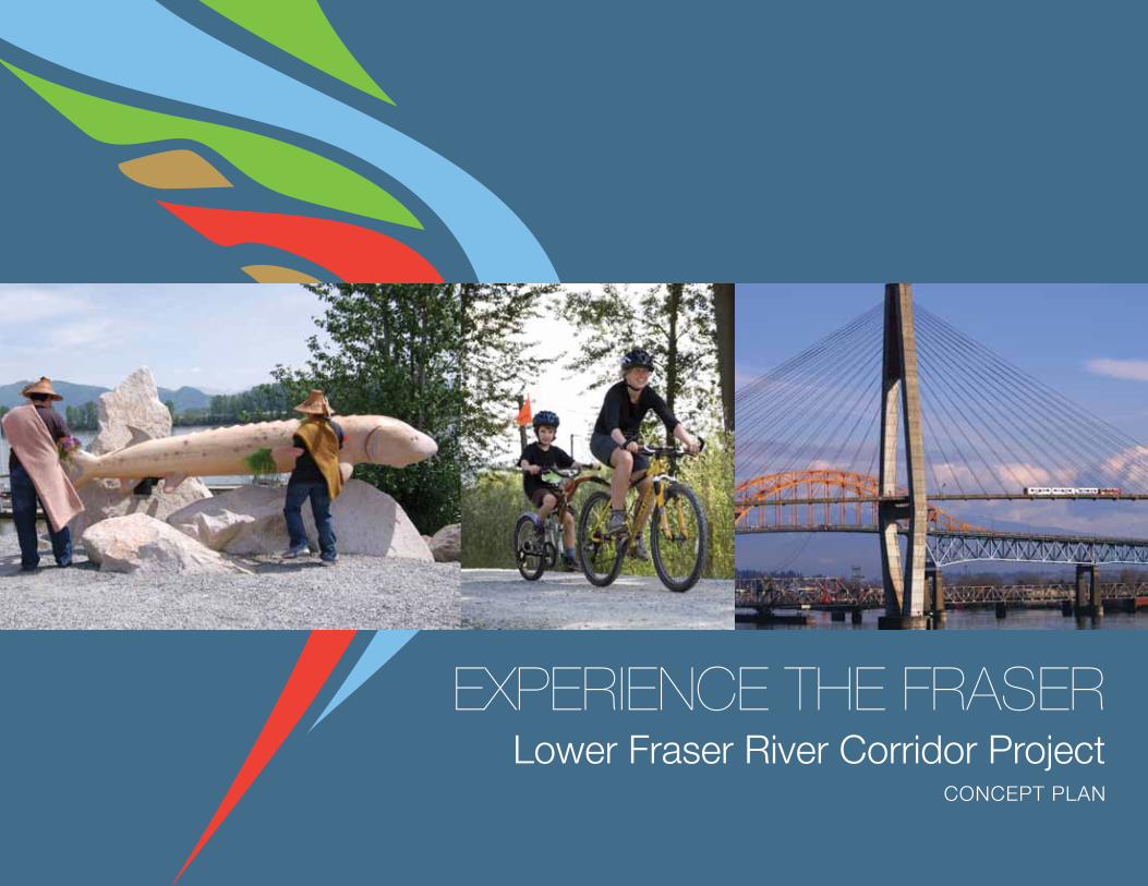
EXPERIENCE THE FRASERLower Fraser River Corridor Project
ConCePt PLan

“...it flows majestically, unhurriedly, towards the Pacific Ocean.”
Fraser River at Harrison and Pegleg Bars, Chilliwack
Experience the Fraser – Concept Plan
2
3
“At HoPE, tHE FRAsER RivER ABAndons tHE lAst REmnAnts oF its wild PAst, swings wEstwARd in A gREAt
90 dEgREE ARC And AssumEs A tRAnquil FACE As it Flows mAjEstiCAlly, unHuRRiEdly, towARds tHE
PACiFiC oCEAn. still 140 kilomEtREs FRom tHE sEA, tHE RivER At HoPE is only ABout FivE mEtREs ABovE
sAlt wAtER. FoR A wHilE mountAins loom dARkly ovERHEAd, REluCtAnt to lEt tHE RivER go; disCREEt-
ly, tHEy witHdRAw to A REsPECtFul distAnCE. now, At lAst, tHE FRAsER HAs sPACE EnougH to AssumE A
widtH APPRoPRiAtE to its gRAndEuR. tHE vAllEy widEns, FERtilE witH soil CARRiEd By tHE RivER FRom
ERoding sloPEs HundREds oF kilomEtREs uPstREAm. CAREssEd By A gEntlE oCEAniC ClimAtE, tHE
gREEn And PlEAsAnt lAnd is A widEning CoRnuCoPiA PouRing its wEAltH towARd tHE sEA.”
RiCHARd C. BoCking - migHty RivER, A PoRtRAit oF tHE FRAsER (1997)
4
Experience the Fraser – Concept Plan
Table of Contents
EXECutivE summARy .................................................................................................................... 7
1.0 A BOLD VISION .......................................................................................................................8
1.1 vision ....................................................................................................................................... 9
1.2 goAls ..................................................................................................................................... 12
goal 1 Connect Hope to the salish sea ................................................................................ 12
goal 2 link and inspire experiences along the river ............................................................. 13
goal 3 develop enduring and committed partnerships .......................................................... 14
goal 4 Build and deepen connections to the river ................................................................. 15
1.3 PRojECt BACkgRound ....................................................................................................... 16
demonstration Projects ........................................................................................................... 17
1.4 ConnECtEd nEtwoRks… situating Experience the Fraser ................................................ 18
1.5 lEARning and dRAwing insPiRAtion from otHER suCCEssEs .................................... 20
mountains to sound ................................................................................................................ 20
waterfront trail ......................................................................................................................... 21
The Confluence ........................................................................................................................ 21
1.6 tHEmEs ................................................................................................................................... 22
1.7 A stoRiEd RivER… stories of people and place unfolding .................................................... 24
2.0 EXPERIENCE THE FRASER: THE CONCEPT ....................................................................... 28
2.1 tHE ConCEPt ....................................................................................................................... 29
2.2 ElEmEnts .............................................................................................................................. 33
‘Canyon to Coast’ trail ........................................................................................................... 33
Recreational Blueway .............................................................................................................. 35
Amenity and Feature Points .................................................................................................... 35
nodes ...................................................................................................................................... 36
Portals ..................................................................................................................................... 42
2.3 illustRAtivE FoundAtionAl PRogRAm .......................................................................... 44
2.4 AsPiRAtions… more Big ideas ........................................................................................... 49
3.0 NEXT STEPS ......................................................................................................................... 52
3.1 imPlEmEntAtion stRAtEgiEs ............................................................................................ 53
Acknowledgements ......................................................................................................................... 56
Photo Credits .................................................................................................................................. 57
List of Figures
Figure 1: the Project Area ............................................................................................................... 10
Figure 2: Connected networks: situating Experience the Fraser ................................................... 18
Figure 3: Experience the Fraser: Concept Plan map ....................................................................... 30
Figure 4: EtF Planning Atlas ........................................................................................................... 32
Figure 5: Bridges along the lower Fraser River .............................................................................. 34
5
west delta
6
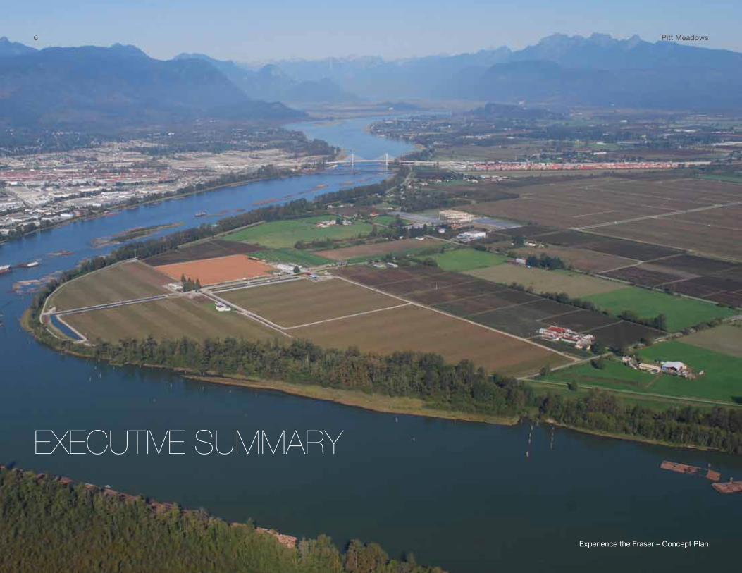
EXECUTIVE SUMMARY
6 Pitt meadows
Experience the Fraser – Concept Plan
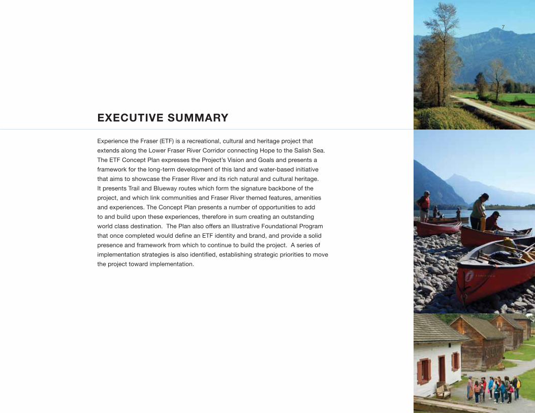
EXECUTIVE SUMMARY
Experience the Fraser (EtF) is a recreational, cultural and heritage project that
extends along the lower Fraser River Corridor connecting Hope to the salish sea.
the EtF Concept Plan expresses the Project’s vision and goals and presents a
framework for the long-term development of this land and water-based initiative
that aims to showcase the Fraser River and its rich natural and cultural heritage.
it presents trail and Blueway routes which form the signature backbone of the
project, and which link communities and Fraser River themed features, amenities
and experiences. the Concept Plan presents a number of opportunities to add
to and build upon these experiences, therefore in sum creating an outstanding
world class destination. the Plan also offers an illustrative Foundational Program
that once completed would define an ETF identity and brand, and provide a solid
presence and framework from which to continue to build the project. A series of
implementation strategies is also identified, establishing strategic priorities to move
the project toward implementation.
7
8
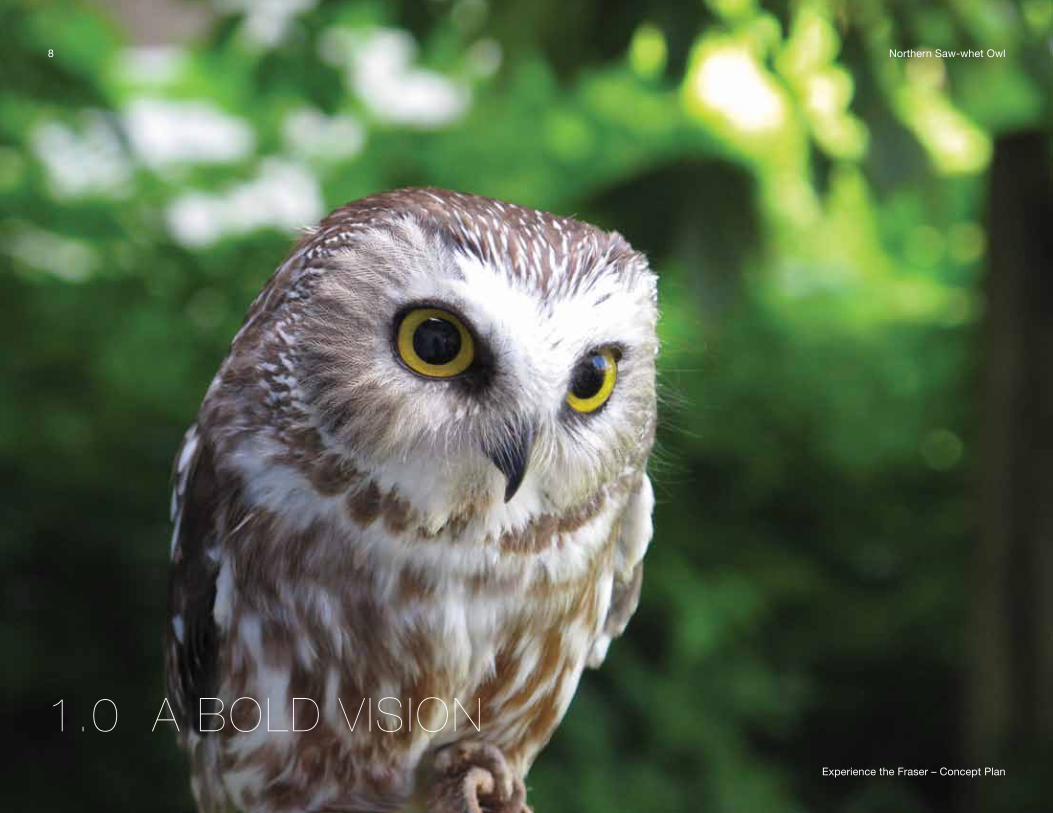
1.0 A BOLD VISION
8 northern saw-whet owl
Experience the Fraser – Concept Plan
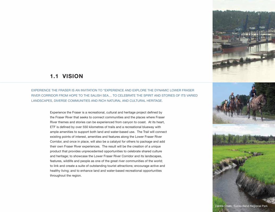
1.1 VISION
Experience the Fraser is a recreational, cultural and heritage project defined by
the Fraser River that seeks to connect communities and the places where Fraser
River themes and stories can be experienced from canyon to coast. At its heart,
ETF is defined by over 550 kilometres of trails and a recreational blueway with
ample amenities to support both land and water-based use. the trail will connect
existing points of interest, amenities and features along the lower Fraser River
Corridor, and once in place, will also be a catalyst for others to package and add
their own Fraser River experiences. the result will be the creation of a unique
product that provides unprecedented opportunities to celebrate shared culture
and heritage; to showcase the lower Fraser River Corridor and its landscapes,
features, wildlife and people as one of the great river communities of the world;
to link and create a suite of outstanding tourist attractions; encourage active and
healthy living; and to enhance land and water-based recreational opportunities
throughout the region.
EXPERiEnCE tHE FRAsER is An invitAtion to “EXPERiEnCE And EXPloRE tHE dynAmiC lowER FRAsER
RivER CoRRidoR FRom HoPE to tHE sAlisH sEA… to CElEBRAtE tHE sPiRit And stoRiEs oF its vARiEd
lAndsCAPEs, divERsE CommunitiEs And RiCH nAtuRAl And CultuRAl HERitAgE.
9
Centre Creek, surrey Bend Regional Park
Experience the Fraser – Concept Plan
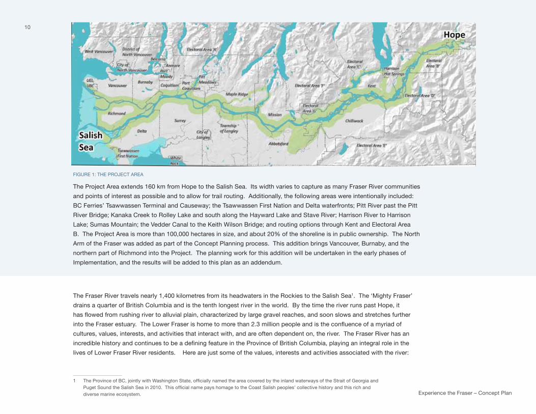
FiguRE 1: tHE PRojECt AREA
the Project Area extends 160 km from Hope to the salish sea. its width varies to capture as many Fraser River communities
and points of interest as possible and to allow for trail routing. Additionally, the following areas were intentionally included:
BC Ferries’ tsawwassen terminal and Causeway; the tsawwassen First nation and delta waterfronts; Pitt River past the Pitt
River Bridge; kanaka Creek to Rolley lake and south along the Hayward lake and stave River; Harrison River to Harrison
lake; sumas mountain; the vedder Canal to the keith wilson Bridge; and routing options through kent and Electoral Area
B. the Project Area is more than 100,000 hectares in size, and about 20% of the shoreline is in public ownership. the north
Arm of the Fraser was added as part of the Concept Planning process. this addition brings vancouver, Burnaby, and the
northern part of Richmond into the Project. the planning work for this addition will be undertaken in the early phases of
implementation, and the results will be added to this plan as an addendum.
the Fraser River travels nearly 1,400 kilometres from its headwaters in the Rockies to the salish sea1. the ‘mighty Fraser’
drains a quarter of British Columbia and is the tenth longest river in the world. By the time the river runs past Hope, it
has flowed from rushing river to alluvial plain, characterized by large gravel reaches, and soon slows and stretches further
into the Fraser estuary. The Lower Fraser is home to more than 2.3 million people and is the confluence of a myriad of
cultures, values, interests, and activities that interact with, and are often dependent on, the river. the Fraser River has an
incredible history and continues to be a defining feature in the Province of British Columbia, playing an integral role in the
lives of lower Fraser River residents. Here are just some of the values, interests and activities associated with the river:
1 The Province of BC, jointly with Washington State, officially named the area covered by the inland waterways of the Strait of Georgia and Puget Sound the Salish Sea in 2010. This official name pays homage to the Coast Salish peoples’ collective history and this rich and diverse marine ecosystem.
10
11• First nations have lived, travelled and traded along the
lower reaches of the river for thousands of years. the
stó:lō, whose traditional territory spans beyond the entire
project area, are known as the People of the River. By
believing in s’ólh téméxw te íkw’élò - Xólhmet te mekw’
stám ít kwelát, which means “this is our land - we have
to look after everything that belongs to us,”protecting,
preserving, and managing heritage and environment in
a way that is consistent with stó:lō values, beliefs, and
traditions, is an overarching guiding principle.
• Named after Simon Fraser, the first European to fully
travel its waters in 1808, the Fraser River was designated
as a Canadian Heritage River in 1998 to honour its rich
cultural and natural history2.
• Parts of the lower Fraser were initially dyked in the
1860s and 1870s by early settlers to create and protect
agricultural lands. Early dyking efforts were found in
Chilliwack, sumas and matsqui prairie areas as well
as on lulu island. the Fraser delta has some of the
richest agricultural soils in Canada, is home to diverse
agricultural operations growing over 130 different
products, and although it comprises only 1.5 percent
of the total agricultural land in BC, it generates over a
quarter of the Province’s gross farm income.
• the Fraser River estuary, one of the largest along the
west coast of north America, is recognized as a globally
2 the Canadian Heritage River system (CHRs) Board, made up of private citizens and officials appointed by federal and provincial governments called the Fraser a `river of superlatives`. the CHRs was established in 1984 to conserve rivers with outstanding natural, cultural and recre-ational heritage, to give them national recognition, and to encourage the public to enjoy and appreciate them. today, there are 41 Canadian Heritage Rivers.
important ecosystem3. it has the largest wintering
concentrations of water birds and raptors in Canada, and
provides significant habitat and feeding areas along the
Pacific Flyway. It is the largest salmon producing river
along the Pacific Coast and is one of three rivers in BC in
which white sturgeon spawn.
• the Fraser River is integral to industry as a transportation
corridor and location for businesses, including pulp and
sawmills, piling and dredging companies, fisheries, and
fish processing. It plays a vital role the region’s economy
contributing to 80% of the provincial economic output.
• Port metro vancouver cargo terminals and other port
activities are essential to the functioning of our economy
and metropolitan region. their jurisdiction stretches
across 600 kilometres of shoreline and waterways
including the Fraser River up to kanaka Creek. the Port
trades $75 billion in goods annually with more than 160
trading economies, generating over 125,000 jobs, and
$10.5 billion in gdP.
• A number of communities line the banks of the river and
people continue to be drawn to live along its edge.
• the lower Fraser River Corridor also provides ample
recreation opportunities including wildlife viewing,
fishing, hiking, geocaching, cycling, camping, boating, or
horseback riding.
• the lower Fraser River Corridor is an integral part of
BC’s tourism industry which generates $12.7 billion in
revenues annually. People come from all over the world
to experience a combination of the interests and themes
listed above. EtF will create an even greater draw to this
part of the province.
3 RAmsAR site at Alaksen national wildlife Area has been designated as a wetland of international importance; proposed as a western Hemispheric shorebird Reserve network, an international initiative that identifies and protects habitats used by migrating shorebirds.
Experience the Fraser – Concept Plan
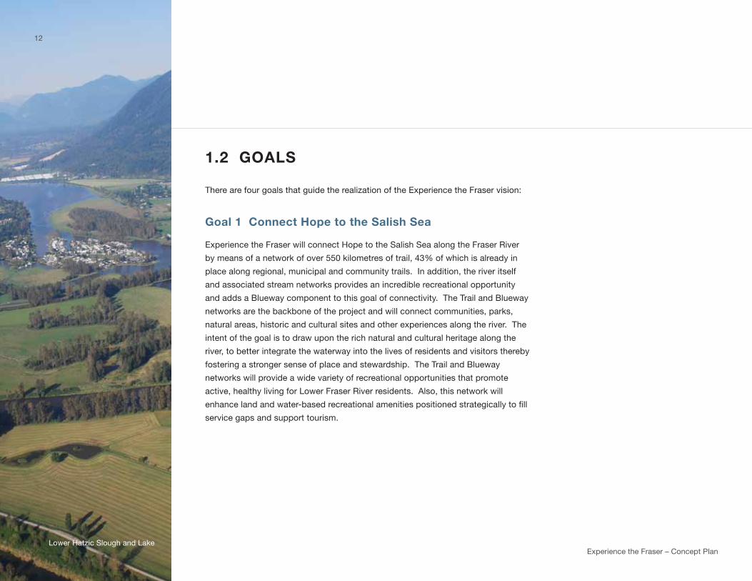
1.2 GOALS
there are four goals that guide the realization of the Experience the Fraser vision:
Goal 1 Connect Hope to the Salish Sea
Experience the Fraser will connect Hope to the salish sea along the Fraser River
by means of a network of over 550 kilometres of trail, 43% of which is already in
place along regional, municipal and community trails. in addition, the river itself
and associated stream networks provides an incredible recreational opportunity
and adds a Blueway component to this goal of connectivity. the trail and Blueway
networks are the backbone of the project and will connect communities, parks,
natural areas, historic and cultural sites and other experiences along the river. the
intent of the goal is to draw upon the rich natural and cultural heritage along the
river, to better integrate the waterway into the lives of residents and visitors thereby
fostering a stronger sense of place and stewardship. the trail and Blueway
networks will provide a wide variety of recreational opportunities that promote
active, healthy living for lower Fraser River residents. Also, this network will
enhance land and water-based recreational amenities positioned strategically to fill
service gaps and support tourism.
12
lower Hatzic slough and lake

Goal 2 Link and inspire experiences along the river
there are already a multitude of existing opportunities to experience the Fraser
River. For example, there are Circle Farm tours, farm gate sales, and wineries.
From an outdoor recreation and environmental perspective, there are parks and
trails that provide river access, and amazing fishing spots and that interpret the
river’s ecological importance to salmon, raptors, and bird migrations. Heritage and
culture can be explored at the Xa:ytem longhouse interpretive Centre, Fraser River
discovery Centre, Britannia shipyards, Fort langley and gulf of georgia Cannery
national Historic sites, Hyack’s Fraserfest, the Fraser valley Bald Eagle Festival
and the Artists on the River, all of which provide opportunities to celebrate the
river’s heritage and cultural values.
The first part of this goal speaks to linking these experiences, to knitting them
together with a common Experience the Fraser brand and to recognizing the
appeal and promotional value in their synergy. EtF offers a way to build on and
package these experiences and opportunities. the second part of the goal is
about enhancing and adding to what is already in place – about utilizing the trail
and existing experiences and amenities as a catalyst upon which to build an
integrated suite of recreation, cultural and heritage amenities and features. the
outcome will be a world-class tourism destination that can be traveled end to
end or theme by theme. the lower Fraser River Corridor will be promoted and
known as one of the great river destinations of the world, inspiring participation,
generating economic growth and jobs, and fostering pride and sustainability.
13
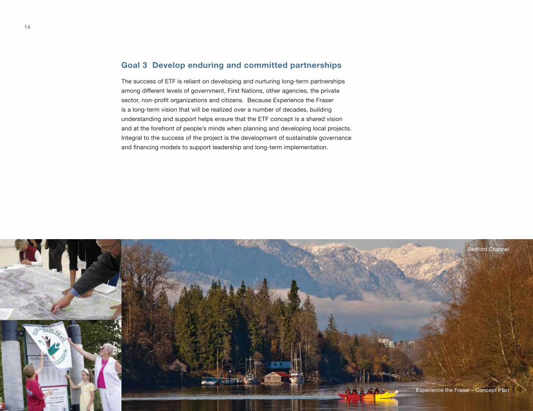
Goal 3 Develop enduring and committed partnerships
the success of EtF is reliant on developing and nurturing long-term partnerships
among different levels of government, First nations, other agencies, the private
sector, non-profit organizations and citizens. Because Experience the Fraser
is a long-term vision that will be realized over a number of decades, building
understanding and support helps ensure that the EtF concept is a shared vision
and at the forefront of people’s minds when planning and developing local projects.
integral to the success of the project is the development of sustainable governance
and financing models to support leadership and long-term implementation.
Experience the Fraser – Concept Plan
14
Bedford Channel
15
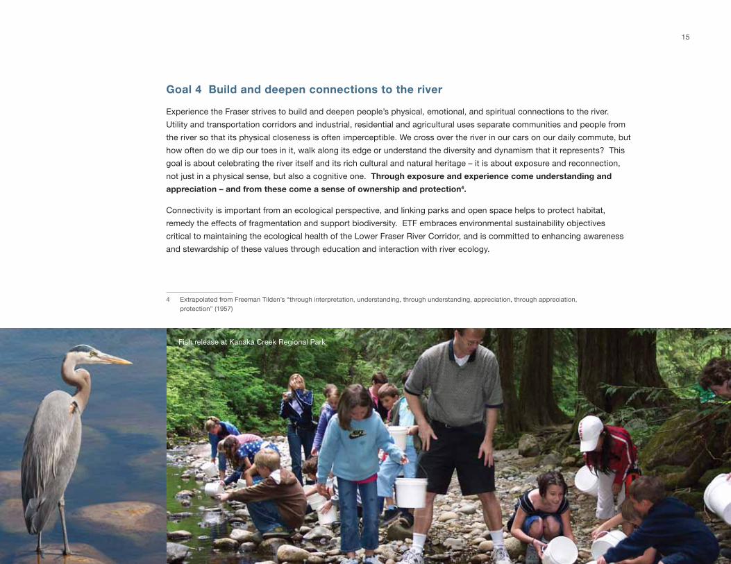
Goal 4 Build and deepen connections to the river
Experience the Fraser strives to build and deepen people’s physical, emotional, and spiritual connections to the river.
utility and transportation corridors and industrial, residential and agricultural uses separate communities and people from
the river so that its physical closeness is often imperceptible. we cross over the river in our cars on our daily commute, but
how often do we dip our toes in it, walk along its edge or understand the diversity and dynamism that it represents? this
goal is about celebrating the river itself and its rich cultural and natural heritage – it is about exposure and reconnection,
not just in a physical sense, but also a cognitive one. Through exposure and experience come understanding and
appreciation – and from these come a sense of ownership and protection4.
Connectivity is important from an ecological perspective, and linking parks and open space helps to protect habitat,
remedy the effects of fragmentation and support biodiversity. EtF embraces environmental sustainability objectives
critical to maintaining the ecological health of the lower Fraser River Corridor, and is committed to enhancing awareness
and stewardship of these values through education and interaction with river ecology.
4 Extrapolated from Freeman tilden’s “through interpretation, understanding, through understanding, appreciation, through appreciation, protection” (1957)
Fish release at kanaka Creek Regional Park
Experience the Fraser – Concept Plan
16
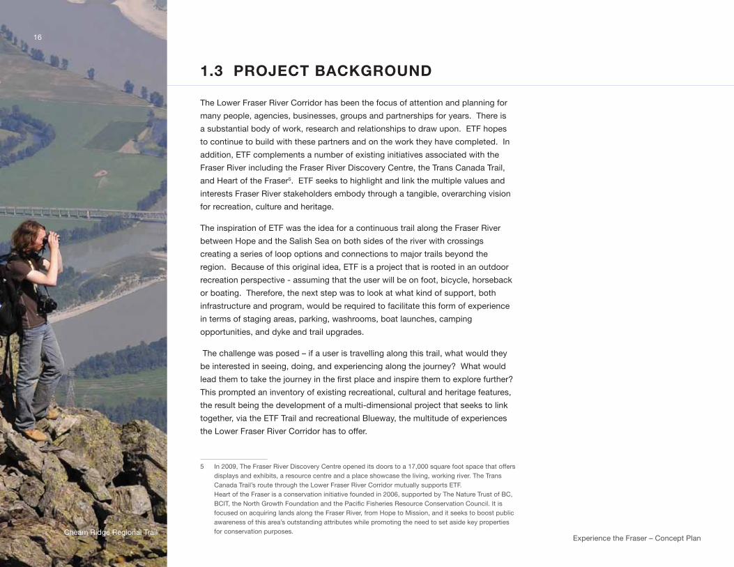
1.3 PROJECT BACKGROUND
the lower Fraser River Corridor has been the focus of attention and planning for
many people, agencies, businesses, groups and partnerships for years. there is
a substantial body of work, research and relationships to draw upon. EtF hopes
to continue to build with these partners and on the work they have completed. in
addition, EtF complements a number of existing initiatives associated with the
Fraser River including the Fraser River discovery Centre, the trans Canada trail,
and Heart of the Fraser5. EtF seeks to highlight and link the multiple values and
interests Fraser River stakeholders embody through a tangible, overarching vision
for recreation, culture and heritage.
the inspiration of EtF was the idea for a continuous trail along the Fraser River
between Hope and the salish sea on both sides of the river with crossings
creating a series of loop options and connections to major trails beyond the
region. Because of this original idea, EtF is a project that is rooted in an outdoor
recreation perspective - assuming that the user will be on foot, bicycle, horseback
or boating. therefore, the next step was to look at what kind of support, both
infrastructure and program, would be required to facilitate this form of experience
in terms of staging areas, parking, washrooms, boat launches, camping
opportunities, and dyke and trail upgrades.
the challenge was posed – if a user is travelling along this trail, what would they
be interested in seeing, doing, and experiencing along the journey? what would
lead them to take the journey in the first place and inspire them to explore further?
this prompted an inventory of existing recreational, cultural and heritage features,
the result being the development of a multi-dimensional project that seeks to link
together, via the EtF trail and recreational Blueway, the multitude of experiences
the lower Fraser River Corridor has to offer.
5 in 2009, the Fraser River discovery Centre opened its doors to a 17,000 square foot space that offers displays and exhibits, a resource centre and a place showcase the living, working river. the trans Canada trail’s route through the lower Fraser River Corridor mutually supports EtF. Heart of the Fraser is a conservation initiative founded in 2006, supported by the nature trust of BC, BCIT, the North Growth Foundation and the Pacific Fisheries Resource Conservation Council. It is focused on acquiring lands along the Fraser River, from Hope to mission, and it seeks to boost public awareness of this area’s outstanding attributes while promoting the need to set aside key properties for conservation purposes.Cheam Ridge Regional trail
17
in April 2009, the Province of BC provided the Fraser valley Regional district (FvRd) and metro vancouver (mv) $2.5
million dollars to undertake EtF planning and to implement two demonstration projects. $2 million was allocated toward
developing a comprehensive Concept Plan by Fall 2011.
An integral component then was to “demonstrate” the potential of Experience the Fraser in communities along the river
and to provide an opportunity for people to understand what an “experience’ of the Fraser might in fact be. As a result,
$500,000 was allocated for two demonstration projects to ‘get started on the ground’.
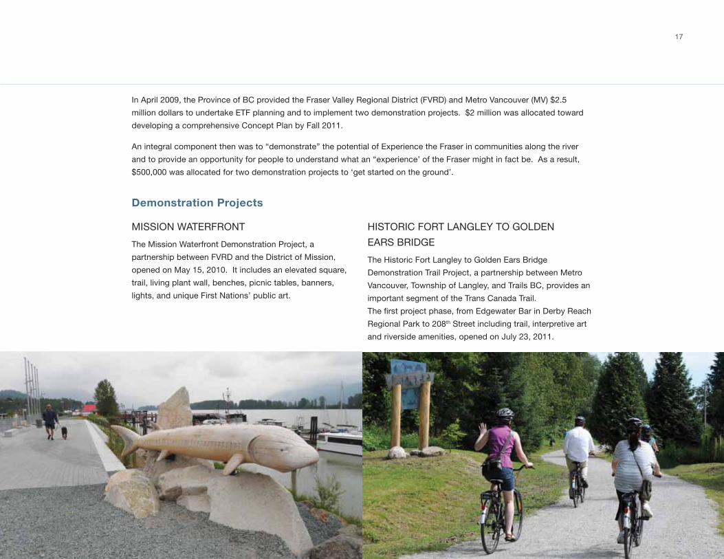
Demonstration Projects
mission wAtERFRont
the mission waterfront demonstration Project, a
partnership between FvRd and the district of mission,
opened on may 15, 2010. it includes an elevated square,
trail, living plant wall, benches, picnic tables, banners,
lights, and unique First nations’ public art.
HistoRiC FoRt lAnglEy to goldEn
EARs BRidgE
the Historic Fort langley to golden Ears Bridge
demonstration trail Project, a partnership between metro
vancouver, township of langley, and trails BC, provides an
important segment of the trans Canada trail.
The first project phase, from Edgewater Bar in Derby Reach
Regional Park to 208th street including trail, interpretive art
and riverside amenities, opened on july 23, 2011.

18
1
5
1
99
991
Coast Millennium Trail (US)
New Pathways to Gold
Kettle Valley Rail TrailSea to Sky Trail
Trans Canada Trail
Trans Canada Trail
LochsideGalloping Goose &Cowichan Valley Trails
3
Kent Hope
Sidney
Duncan
Surrey
Lytton
Sechelt
MissionNanaimo
Merritt
Whistler
Squamish
Pemberton
Vancouver
Princeton
Chilliwack
Parksville
White RockAbbotsford
Powell River
One of the primary objectives for trail routing is to fill
the gaps in the existing trail network along the lower
Fraser River Corridor between Hope and the salish sea.
Embodied within this objective is the desire to ensure
connectivity to, and integration with, existing and planned
community trail networks and waterfront community
centres with an aim to improving access to the Fraser River
and connections among communities and trails.
while these local and regional connections are vital, so is
ensuring connectivity to trail systems outside the lower
Fraser Corridor to help build a provincial trail network
for residents and visitors alike. integral to the planning
and development of the Experience the Fraser route is
the integration and inclusion of the trans Canada trail
as it proceeds through the lower Fraser River Corridor
and connects with the rest of Canada from sea to sea.
looking beyond our national border, EtF seeks to make
connections south to the united states. therefore, once
completed and connections are put in place, Experience
the Fraser will provide not only an inter-regional trail
between Hope and the salish sea, but it will also link to
other regional, provincial, national and international trails,
effectively nesting it within other initiatives and providing
connectivity at multiple levels (Figure 2). once complete,
Experience the Fraser aspires to connect to:
FiguRE 2: ConnECtEd nEtwoRks: situAting EXPERiEnCE tHE FRAsER
1.4 CONNECTED NETWORKS… Situating Experience the Fraser
Experience the Fraser – Concept Plan
“tHE goAl is to HAvE A tRAil nEtwoRk ConnECting FRom HoPE RigHt to tHE oCEAn. it will PRovidE
EndlEss oPPoRtunitiEs – And you CAn tAkE wHAtEvER lEngtH oF tRiP you wAnt.”
gAylE mARtin, Co-CHAiR, EtF joint PolitiCAl stEERing CommittEE

19
International
• Pacific Northwest Trail: The 1,200 mile trail runs
from the Continental Divide to the Pacific Ocean
and is considered to be among the most scenic
trails in the world. It is connected to the Pacific
Crest and Coast millennium trails.
• Pacific Crest Trail (PCT): Extending from the
Canadian to the mexican border, the PCt
boasts the greatest elevation changes of
any of America's national scenic trails and
passes through six of north America's seven
eco-zones. it offers users a unique, varied
experience and connects into Canada at
manning Provincial Park.
• Coast millennium trail: A trail initiative that
strives to connect Bellingham, washington to
white Rock along Boundary Bay with future
phases envisioned to extend the trail south to
seattle, and north to vancouver connecting to
other regional trails including Experience the
Fraser.
National
• trans Canada trail: A mosaic of local and
regional trails built by provincial and territorial
members of the Canadian trails Foundation
extending from the Atlantic to the Pacific to the
Arctic oceans and providing 22,000 kilometres
of trail linking 1,000 communities and 33 million
Canadians.
• national Hiking trail: An initiative for a
pedestrian trail from Cape spear, newfoundland
to white Rock, British Columbia.
Regional
• sea-to-sky trail: A partnership initiative led
by the squamish-lillooet Regional district,
the sea-to-sky trail links communities from
Horseshoe Bay north to lillooet.
• new Pathways to gold society: A society
that supports economic development through
heritage tourism, First nations Reconciliation,
and community projects such as the Hudson's
Bay Company (1849) Heritage trail. the trail
extends from Barkerville to Hope area and
through the gold Rush region of BC.
• spirit of 2010 trails: Four regional Rail to trail
initiatives that make up a portion of the trans
Canada trail connecting Hope to nelson
including: the Hudson’s Bay Company Heritage
trail from Hope to tulameen and the kettle
valley Rail trail from Hope to Castelgar.
• vancouver island trails: the lochside Regional
trail begins at the swartz Bay Ferry terminal
and connects to the galloping goose Regional
trail north to the nanaimo Regional district
where the trans Canada trail currently arrives
on vancouver island at the nanaimo Ferry
terminal.
Agassiz-Rosedale Bridge
Experience the Fraser – Concept Plan
there are a number of projects analogous to Experience
the Fraser throughout north America. this is no surprise,
as waterfront cities recognize the merit of collecting
and showcasing their amazing amenities and features
into a synergized, value added package. several of
these projects bill themselves as recreational, cultural
and heritage initiatives that act as catalysts for tourism,
economic development, active, healthy living, and
partnership development. Below are three examples of
visionary, successful projects.
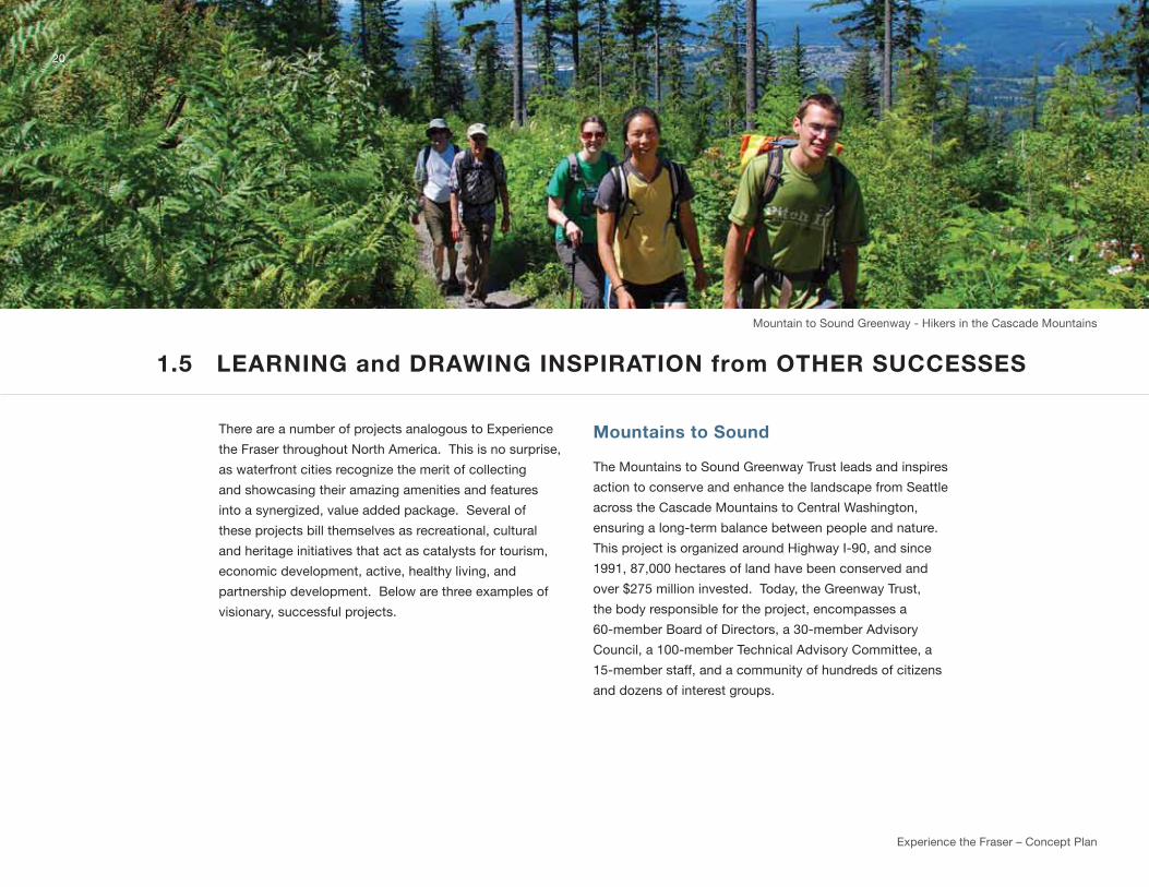
Mountains to Sound
the mountains to sound greenway trust leads and inspires
action to conserve and enhance the landscape from seattle
across the Cascade mountains to Central washington,
ensuring a long-term balance between people and nature.
this project is organized around Highway i-90, and since
1991, 87,000 hectares of land have been conserved and
over $275 million invested. today, the greenway trust,
the body responsible for the project, encompasses a
60-member Board of directors, a 30-member Advisory
Council, a 100-member technical Advisory Committee, a
15-member staff, and a community of hundreds of citizens
and dozens of interest groups.
1.5 LEARNING and DRAWING INSPIRATION from OTHER SUCCESSES
20
mountain to sound greenway - Hikers in the Cascade mountains

Waterfront Trail
the waterfront trail stretches from niagara-on-the-lake in ontario
to the quebec border, along the shores of lake ontario and the st.
lawrence River. the trail includes 41 communities, 182 parks, 152
arts and culture heritage attractions and 37 major annual waterfront
festivals. 780 km of trail have been built and/or designated. the
project is run by the waterfront Regeneration trust, and partners
with CiBC, Heart and stroke Foundation, Province of ontario,
ontario trillium Foundation, welcome Cyclists, ontario trails
Council, 63 local governments and Conservation Authorities, two
cycling groups and three other private sector companies.
The Confluence
Located in the heart of the St. Louis Region at the confluence of
the Missouri and Mississippi Rivers, the Confluence is a dynamic
conservation, heritage and recreation corridor. the project area is
52,000 hectares. The Confluence Project is an ambitious, long-
term undertaking where investments in land conservation, facilities
and public programs for this unique regional initiative will ultimately
exceed $200 million. Today, the Confluence is an evolving system
of conserved open space, parks, museums, heritage sites, and
recreational trails along the great Rivers of the bi-state st. louis
area. By reconnecting the public to the wealth of natural, historic
and recreational resources at the heart of the community, this
project contributes significantly to quality of life and economic
competitiveness in the 21st century. Currently, over $150 million has
been secured or committed by various governmental agencies and
non-profit organizations, and the transformation of riverfronts is well
underway. An impressive set of early achievements encourages
community residents and tourists to care and protect the land
and water in the Confluence region as they reconnect to two of
America’s great rivers.
21
originally part of Route 66, the Chain of Rocks Bridge is now one of the longest pedestrian/ cyclist bridges in the world
the great waterfront trail Adventure
Experience the Fraser – Concept Plan
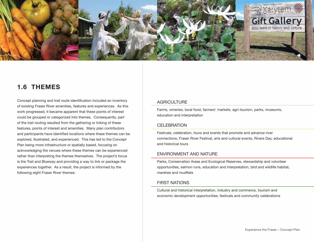
1.6 THEMES
Concept planning and trail route identification included an inventory
of existing Fraser River amenities, features and experiences. As this
work progressed, it became apparent that these points of interest
could be grouped or categorized into themes. Consequently, part
of the trail routing resulted from the gathering or linking of these
features, points of interest and amenities. many plan contributors
and participants have identified locations where these themes can be
explored, illustrated, and experienced. this has led to the Concept
Plan being more infrastructure or spatially based, focusing on
acknowledging the venues where these themes can be experienced
rather than interpreting the themes themselves. the project’s focus
is the trail and Blueway and providing a way to link or package the
experiences together. As a result, the project is informed by the
following eight Fraser River themes:
AgRiCultuRE
Farms, wineries, local food, farmers’ markets, agri-tourism, parks, museums,
education and interpretation
CElEBRAtion
Festivals, celebration, tours and events that promote and advance river
connections, Fraser River Festival, arts and cultural events, Rivers day, educational
and historical tours
EnviRonmEnt And nAtuRE
Parks, Conservation Areas and Ecological Reserves, stewardship and volunteer
opportunities, salmon runs, education and interpretation, bird and wildlife habitat,
marshes and mudflats
FiRst nAtions
Cultural and historical interpretation, industry and commerce, tourism and
economic development opportunities, festivals and community celebrations
22

23
HERitAgE And CultuRE
Historic sites, museums, cultural centres, guided heritage tours, landscapes,
festivals, settlements, businesses
industRy And tRAnsPoRtAtion
The role and importance of the “working river”, fisheries, log booms, tug
boats, debris trap, water dependent industry, port and rail operations, access
and crossings, infrastructure and new technologies
outdooR RECREAtion
Parks, trails, water access and boat launches, camping, fishing, day-use
facilities, wildlife viewing, marinas
RivERFRont CommunitiEs
Connecting to and integrating with the river, trail and blueway connections,
river access, orientation and wayfinding, education and interpretation, food
and accommodation services, business development and sales, waterfront
revitalization initiatives
in addition, the themes provide a framework for others (e.g. the
private sector or other potential partners) who want to:
a) package and program these points of interest and utilize the trail
as a means of travel or connection (e.g. a tourism opportunity
such as winery or heritage tours by bike or foot); or
b) add a new experience / amenity along the river that ‘fits’
with one of the themes therefore creating an added value for
themselves of having other similarly themed experiences be
in close proximity with them connected by the trail (e.g. an
economic development opportunity such as bicycle or boat
rentals or a trail-side café).

24
INTERPRET … And undERstAnd tHE RivER HydRAuliCs
And tHE Evolution oF tHE RivER CouRsE, tHE gEology
And tHE FoRCEs wHiCH HAvE sHAPEd tHis iConiC lAnd-
sCAPE And dEltA ovER millEnniA.
1.7 A STORIED RIVER… stories of people and place unfolding
The myriad of stories related to the Fraser River are as plentiful and intertwined as the tributaries which flow into it.
Experience the Fraser recognizes the importance of these stories in enhancing the recreational and cultural experiences
of each visitor. Certain stories lend themselves to being told through multiple venues over the length of the lower Fraser
River Corridor. A sampling of five of these stories is presented here. These stories would be developed and programmed
by historians, First Nation elders and other willing story-tellers. They hint at the incredible influence the river had, and
continues to have, on our lives and the connections that flow strongly among stories, people and places.
The Story of the Living River... from Salmon to Sandpiper
this journey highlights the story of the Fraser River’s natural
history and paints an ecological picture of one of the most
biodiverse areas in Canada.
• the Fraser produces more salmon than any other river
system in the world;
• the Fraser is one of just three rivers in British Columbia in
which the white sturgeon spawn;
• the Fraser River Estuary is one Canada’s premier
important Bird Areas providing a crucial staging area on
the Pacific Flyway;
• the dynamic river conditions of the Fraser from the
canyon to the coast;
• the future of the living river is another critical storyline
for interpretation. Humans have put pressures on the
river system, and changed it from its natural course.
Much of the Fraser Valley is naturally a floodplain, but
is now protected by dykes which prevent the river from
inundating the land and people have influenced the life of
the Fraser, just as the river has permeated our lives;
• the formation of the wetlands and bogs of the lower
Fraser (e.g. Burns Bog);
• Augment the work currently being done to tell the living
River story by enhancing this work through coordinating
resources and introducing new outlets.
the living River stories could be presented through a
living River tour supported with a smartphone interpretive
guidebook application.
Experience the Fraser – Concept Plan
25
A WEALTH OF RESOURCES ... lEARn ABout tHE woRking
RivER And tHE imPoRtAnCE oF tHE lowER FRAsER As A
PlACE oF industRy And CommERCE And A souRCE oF
EConomiC PRosPERity in BC.
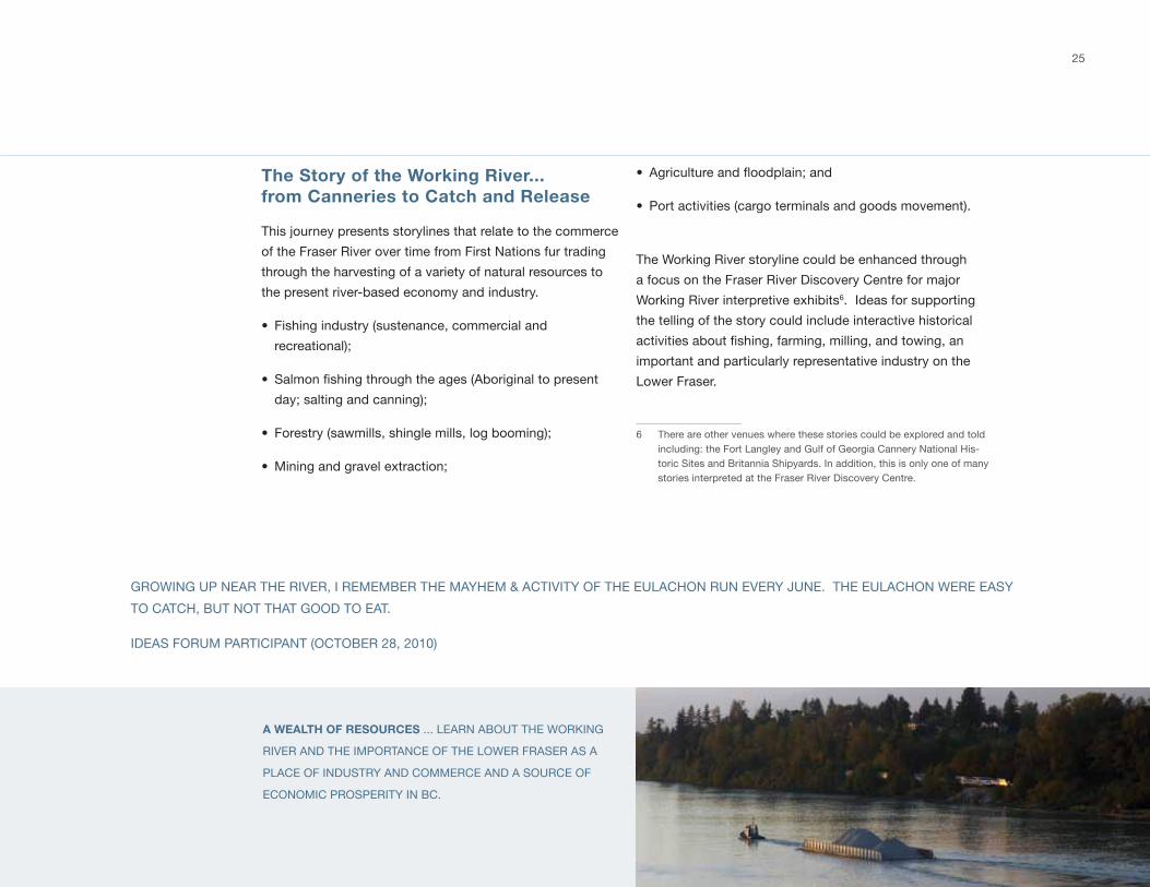
The Story of the Working River... from Canneries to Catch and Release
this journey presents storylines that relate to the commerce
of the Fraser River over time from First nations fur trading
through the harvesting of a variety of natural resources to
the present river-based economy and industry.
• Fishing industry (sustenance, commercial and
recreational);
• Salmon fishing through the ages (Aboriginal to present
day; salting and canning);
• Forestry (sawmills, shingle mills, log booming);
• mining and gravel extraction;
• Agriculture and floodplain; and
• Port activities (cargo terminals and goods movement).
the working River storyline could be enhanced through
a focus on the Fraser River discovery Centre for major
working River interpretive exhibits6. ideas for supporting
the telling of the story could include interactive historical
activities about fishing, farming, milling, and towing, an
important and particularly representative industry on the
lower Fraser.
6 there are other venues where these stories could be explored and told including: the Fort langley and gulf of georgia Cannery national His-toric sites and Britannia shipyards. in addition, this is only one of many stories interpreted at the Fraser River discovery Centre.
gRowing uP nEAR tHE RivER, i REmEmBER tHE mAyHEm & ACtivity oF tHE EulACHon Run EvERy junE. tHE EulACHon wERE EAsy
to CAtCH, But not tHAt good to EAt.
idEAs FoRum PARtiCiPAnt (oCtoBER 28, 2010)
26
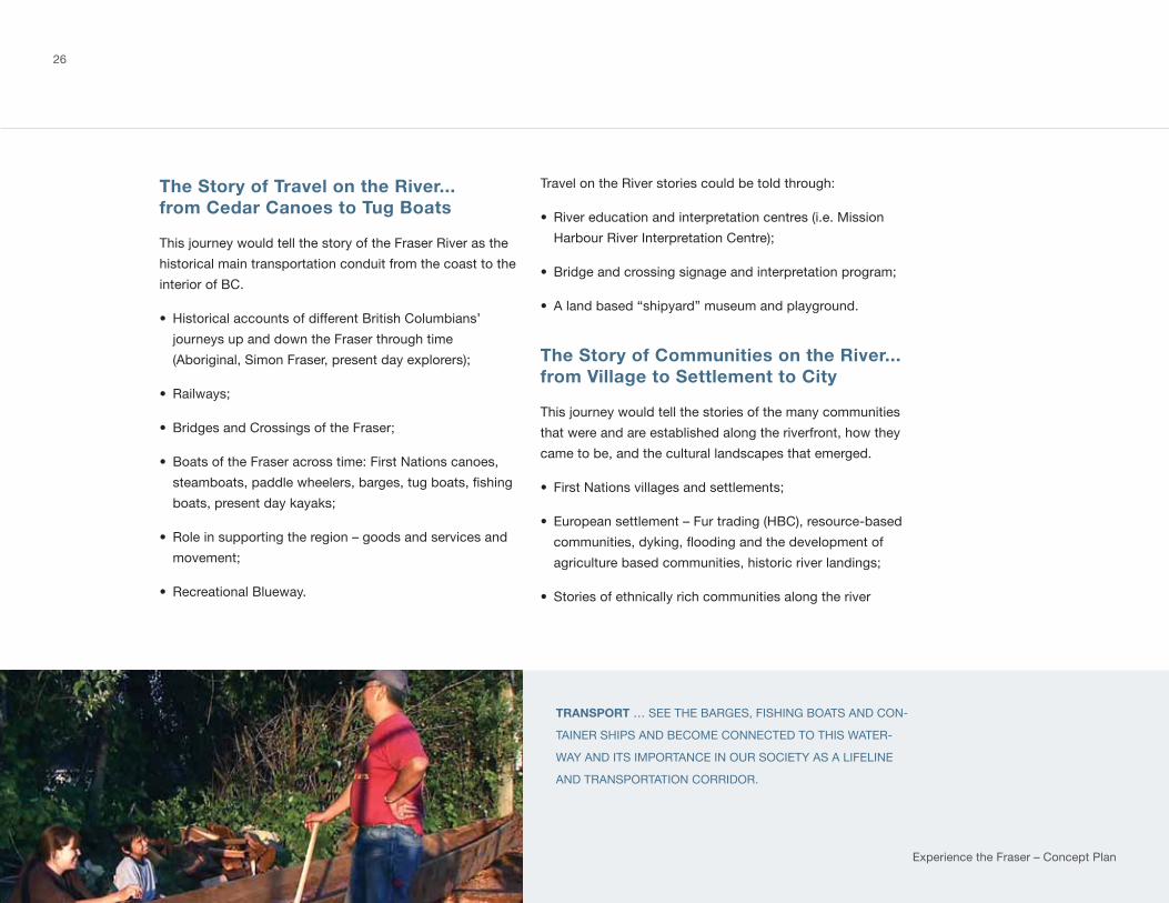
The Story of Travel on the River... from Cedar Canoes to Tug Boats
this journey would tell the story of the Fraser River as the
historical main transportation conduit from the coast to the
interior of BC.
• Historical accounts of different British Columbians’
journeys up and down the Fraser through time
(Aboriginal, simon Fraser, present day explorers);
• Railways;
• Bridges and Crossings of the Fraser;
• Boats of the Fraser across time: First nations canoes,
steamboats, paddle wheelers, barges, tug boats, fishing
boats, present day kayaks;
• Role in supporting the region – goods and services and
movement;
• Recreational Blueway.
travel on the River stories could be told through:
• River education and interpretation centres (i.e. mission
Harbour River interpretation Centre);
• Bridge and crossing signage and interpretation program;
• A land based “shipyard” museum and playground.
The Story of Communities on the River... from Village to Settlement to City
this journey would tell the stories of the many communities
that were and are established along the riverfront, how they
came to be, and the cultural landscapes that emerged.
• First nations villages and settlements;
• European settlement – Fur trading (HBC), resource-based
communities, dyking, flooding and the development of
agriculture based communities, historic river landings;
• stories of ethnically rich communities along the river
TRANSPORT … sEE tHE BARgEs, FisHing BoAts And Con-
tAinER sHiPs And BEComE ConnECtEd to tHis wAtER-
wAy And its imPoRtAnCE in ouR soCiEty As A liFElinE
And tRAnsPoRtAtion CoRRidoR.
Experience the Fraser – Concept Plan
27
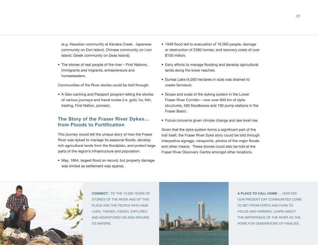
CONNECT...to tHE 10,000 yEARs oF
stoRiEs oF tHE RivER And oF tHis
PlACE And tHE PEoPlE wHo HAvE
livEd, tRAdEd, FisHEd, EXPloREd
And AdvEntuREd on And ARound
its wAtERs.
A PLACE TO CALL HOME … How did
ouR PREsEnt dAy CommunitiEs ComE
to BE? FRom FoRts And FuRs to
FiElds And FARming, lEARn ABout
tHE imPoRtAnCE oF tHE RivER As tHE
HomE FoR gEnERAtions oF FAmiliEs.
(e.g. Hawaiian community at kanaka Creek, japanese
community on don island, Chinese community on lion
island, greek community on deas island);
• the stories of real people of the river – First nations,
immigrants and migrants, entrepreneurs and
homesteaders.
Communities of the River stories could be told through:
• A geo-caching and Passport program telling the stories
of various journeys and travel routes (i.e. gold, fur, fish,
trading, First nation, pioneer).
The Story of the Fraser River Dykes… from Floods to Fortification
this journey would tell the unique story of how the Fraser
River was dyked to manage its seasonal floods, develop
rich agricultural lands from the floodplain, and protect large
parts of the region’s infrastructure and population.
• May, 1894, largest flood on record, but property damage
was limited as settlement was sparse;
• 1948 flood led to evacuation of 16,000 people, damage
or destruction of 2300 homes, and recovery costs of over
$150 million;
• Early efforts to manage flooding and develop agricultural
lands along the lower reaches;
• sumas lake (4,050 hectares in size) was drained to
create farmland;
• scope and scale of the dyking system in the lower
Fraser River Corridor – now over 600 km of dyke
structures, 400 floodboxes and 100 pump stations in the
Fraser Basin;
• Future concerns given climate change and sea level rise.
Given that the dyke system forms a significant part of the
trail itself, the Fraser River dyke story could be told through
interpretive signage, viewpoints, photos of the major floods
and other means. these stories could also be told at the
Fraser River discovery Centre amongst other locations.
28
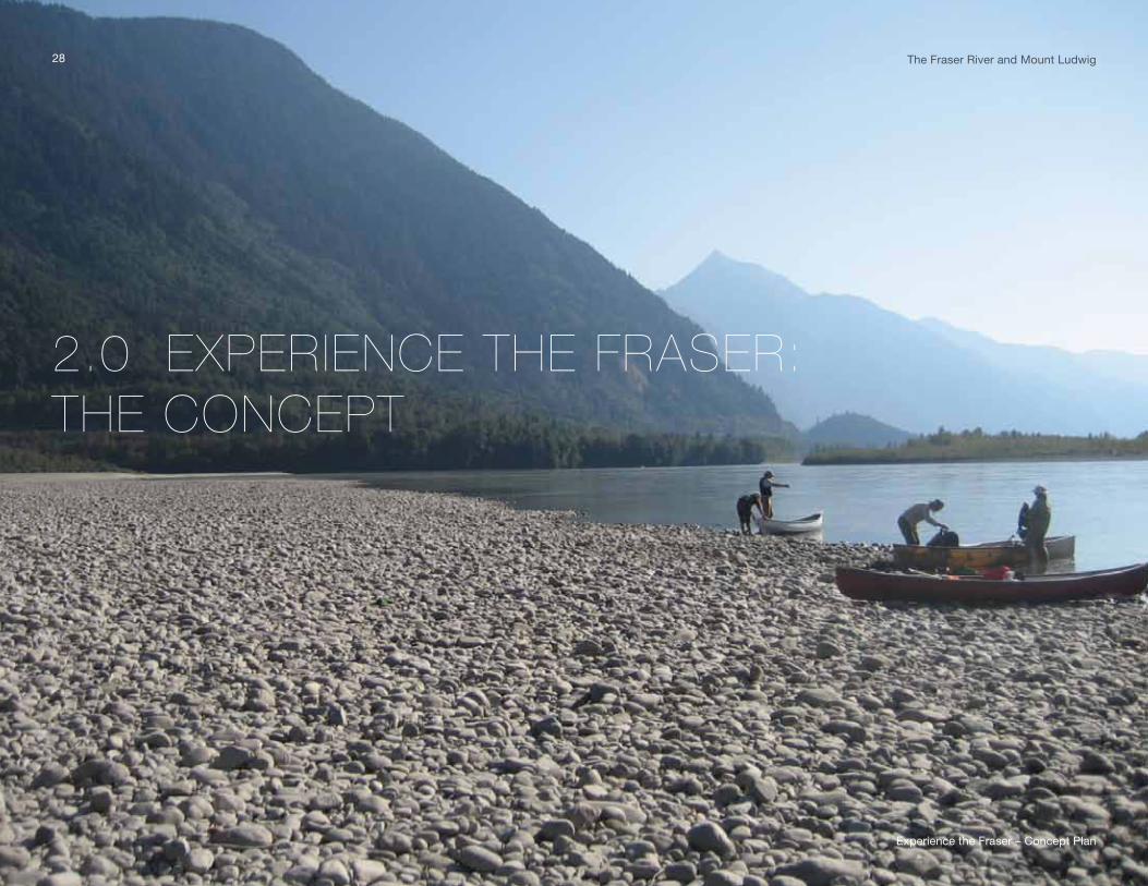
2.0 EXPERIENCE THE FRASER: THE CONCEPT
28 the Fraser River and mount ludwig
Experience the Fraser – Concept Plan
29
2.1 THE CONCEPT
the Experience the Fraser Concept is, at its heart, quite simple - it is a recreational, cultural and heritage project
that seeks to connect Hope to the salish sea along the Fraser River and to link and inspire river and other
theme-based experiences. the trail and recreational Blueway serve as the connectors, linking communities,
the multitude of stories, river-based amenities, and the natural, recreational, cultural and heritage features and
experiences that the lower Fraser River Corridor offers.
the Experience the Fraser Concept builds from a strong base of existing infrastructure, amenities, features
and Fraser River attractions. About 43% of the proposed trail is already in place along segments provided by
regional districts, municipalities and others. there are 15 sanctioned boat launches along this stretch of the river
and many riverfront parks that provide water access and amenities. there are a number of cultural and heritage
attractions and festivals for residents and visitors alike and several businesses that rent bicycles, boats and offer
tours. Experience the Fraser is not starting from scratch. ETF simply seeks to fill the connectivity gaps and add to
the experiences available.
the result will be a project that ties together, and adds strength and dynamism to, local tourism and economic
development efforts as well as cultural, heritage, and recreational amenities. All of which will be branded under
one banner. EtF will become an anchor enticing other tourism opportunities. the lower Fraser River Corridor will
be showcased and promoted as one of the world’s great river destinations. People will be inspired to respect and
protect its value. it is important to recognize that the Concept is a long-term vision and will be implemented by
many, over decades.
tRAvEling on, oR Along, tHE lowER FRAsER, stARting FRom tHE town oF HoPE And HEAding downstREAm to
tHE sEA, EnABlEs onE to EXPERiEnCE tHE vERy HEARt oF onE oF tHE woRld's gREAt wAtERwAys; onE oF tHE most
PRoduCtivE stREtCHEs oF RivER on EARtH.
mARk AngElo, CHAiR EmERitus, RivERs institutE At BCit
30
Experience the Fraser – Concept Plan
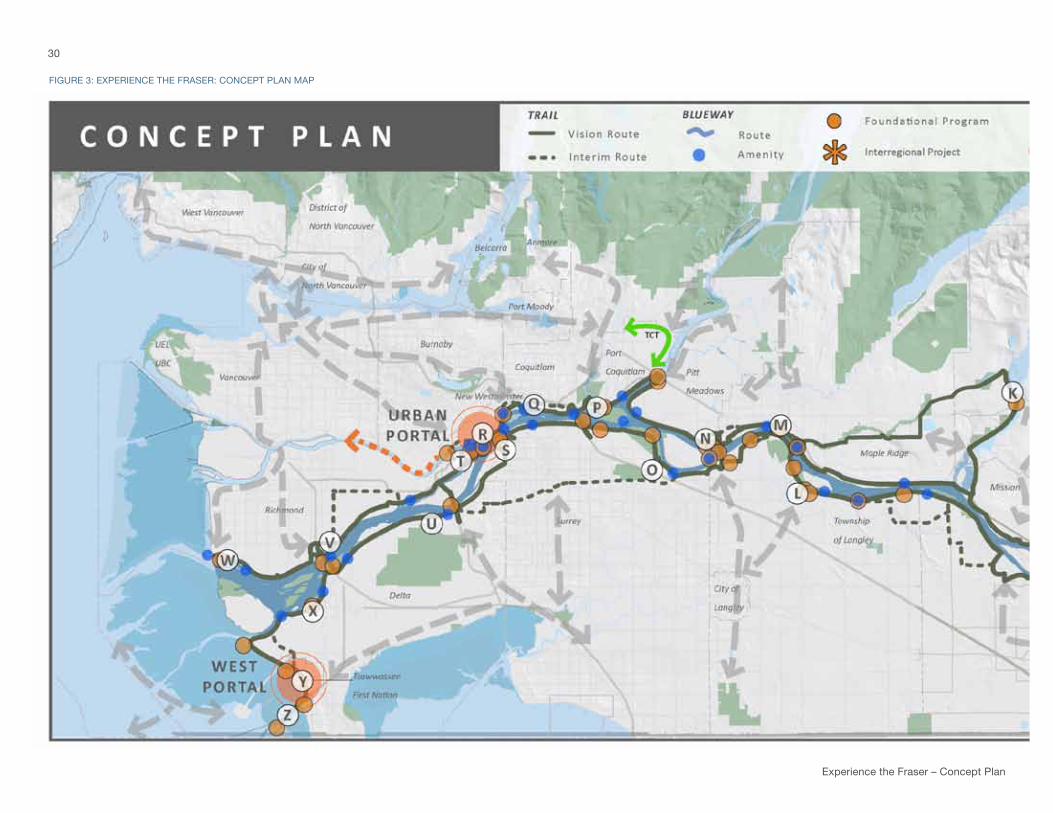
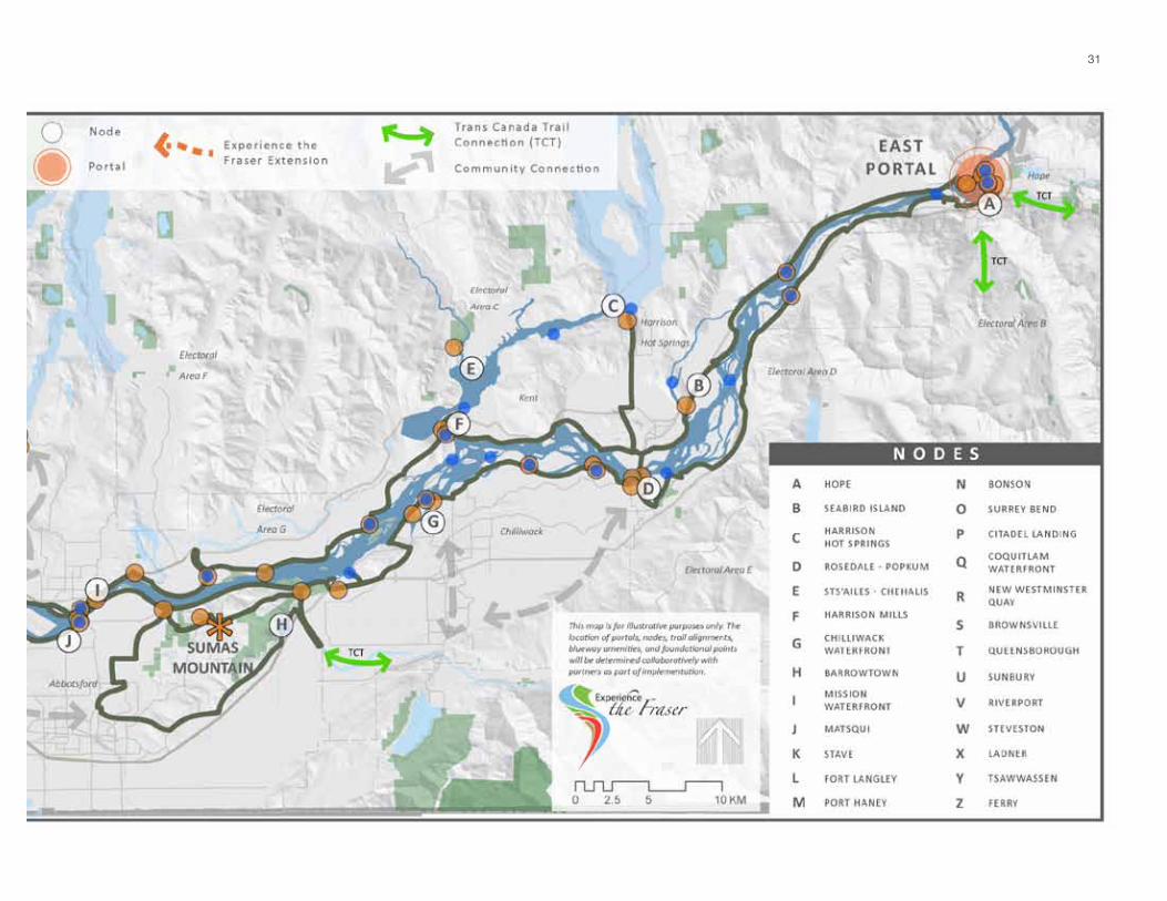
FiguRE 3: EXPERiEnCE tHE FRAsER: ConCEPt PlAn mAP
31
Experience the Fraser – Concept Plan
The Concept is structured around five elements: portals,
nodes, the trail, the Blueway, and amenity and feature
points based on the eight Fraser River themes introduced
above (Figure 3: Experience the Fraser Concept Plan map).
this structure highlights and facilitates connectivity among
communities, features, amenities and ultimately, Fraser
River experiences. it also highlights connections to, and
overlap with, the trans Canada trail, and expresses a desire
to expand the Project Area to include the north Arm of the
Fraser River in the future.
In addition, Sumas Mountain is identified as an Interregional
Project on the Concept Plan map. sumas mountain is a
dominant and unique landscape feature in the Fraser valley
that captures the appreciation and imagination of many. it
holds special significance to First Nations, is popular with
trail users and has high conservation values. the mountain
also straddles regional park service areas of the Fraser
valley Regional district and metro vancouver, creating a
unique opportunity for collaboration to advance outdoor
recreation, cultural and conservation objectives supporting
EtF goals, for the two regional districts and other partners.
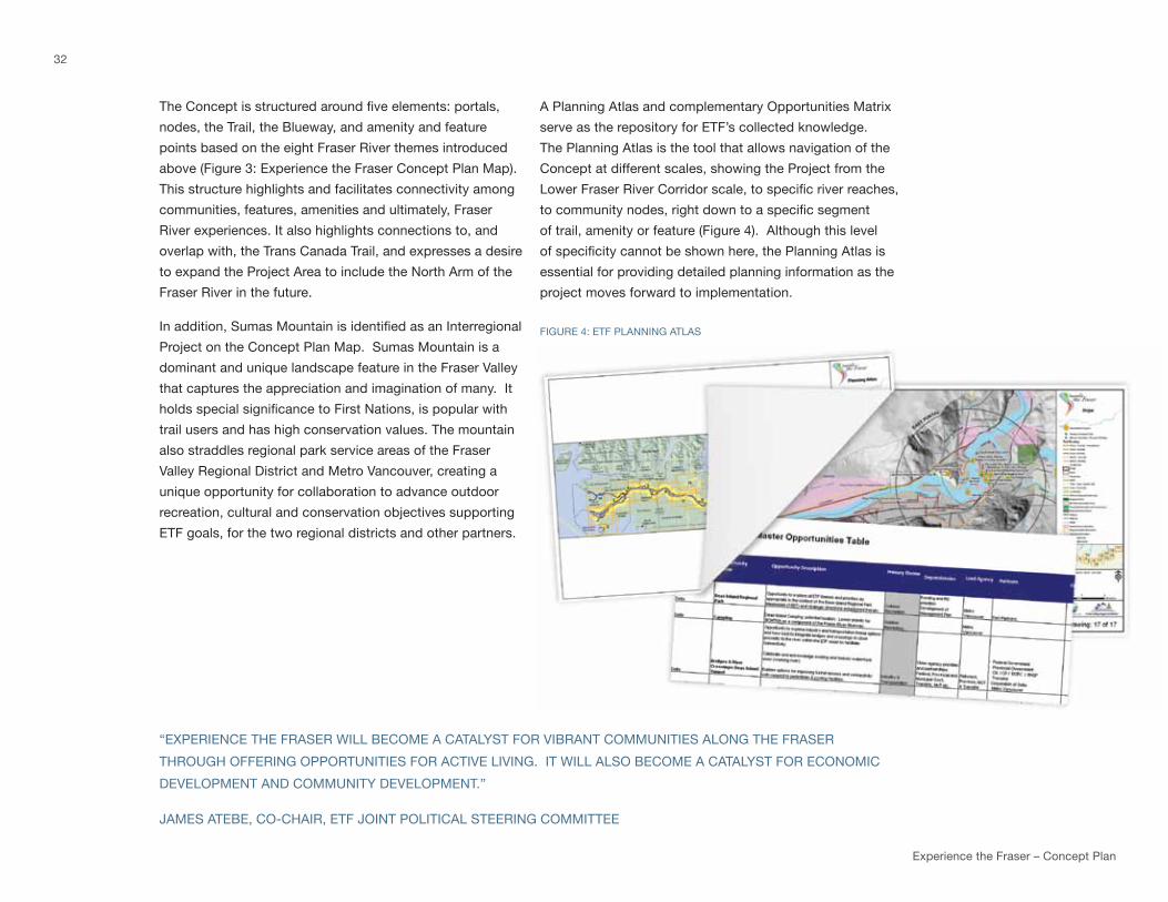
A Planning Atlas and complementary opportunities matrix
serve as the repository for EtF’s collected knowledge.
the Planning Atlas is the tool that allows navigation of the
Concept at different scales, showing the Project from the
Lower Fraser River Corridor scale, to specific river reaches,
to community nodes, right down to a specific segment
of trail, amenity or feature (Figure 4). Although this level
of specificity cannot be shown here, the Planning Atlas is
essential for providing detailed planning information as the
project moves forward to implementation.
FiguRE 4: EtF PlAnning AtlAs
32
“EXPERiEnCE tHE FRAsER will BEComE A CAtAlyst FoR viBRAnt CommunitiEs Along tHE FRAsER
tHRougH oFFERing oPPoRtunitiEs FoR ACtivE living. it will Also BEComE A CAtAlyst FoR EConomiC
dEvEloPmEnt And Community dEvEloPmEnt.”
jAmEs AtEBE, Co-CHAiR, EtF joint PolitiCAl stEERing CommittEE
2.2 ELEMENTS
the EtF Concept is spatially based around locations where the stories about the Fraser River, its history,
industry, culture and environment can be told. As a result, there are five concept elements – “Canyon to
Coast” trail, recreational blueway, amenity and feature points, nodes and portals.
‘Canyon to Coast’ Trail
the “Canyon to Coast” trail is the backbone of the project, linking together communities and points of
interest along the river. once complete, it will provide the glue, brand, and impetus enticing others to
build on Experience the Fraser by adding additional businesses, recreational features and other points of
interest. over 550 kilometres of trail are a part of the project, spanning from Hope to the salish sea on
both sides of the river.
many participants in the planning process articulated that the trail needs a brand that expresses the
geography, themes or intent of the project more clearly than the Experience the Fraser trail. the
“Canyon to Coast” trail seems to excite and resonate, since it clearly references the geography of the
lower Fraser River Corridor and begins to connect people to place.
in the short term, an interim Route utilizes existing trails and roads and allows users to travel from end
to end or portal to portal. this alignment is subject to agreement and participation by the agencies,
organizations, and local governments along the route. there is also a vision Route, which is the long-
term objective of the project and is over 550 kilometres long. Although this length may sound daunting,
43% of the vision Route is already in place coinciding with regional and municipal park and community
trails. the vision Route will be implemented over many years.
the primary objective when developing the vision Route was to develop a continuous east /west
connection from Hope to the salish sea. the intent was to follow and feature the Fraser River as closely
as possible: however, the long-term route will be aligned to harmonize with working river industrial
activities, sensitive natural features, private land and First nation land interests. most times it will mean
going around these features, but creative ways of integrating the trail into such landscapes and uses can
produce the richest experiences. The preferred alignment also reflects the original partnership between
the Province, the Fraser Valley Regional District and Metro Vancouver, therefore reflecting the desire to
connect provincial and regional parks and facilities and to include sufficient amenities to facilitate multi-
day travel (e.g. camping). it was also an objective to advance the trans Canada trail alignment through
the lower Fraser River Corridor.
33
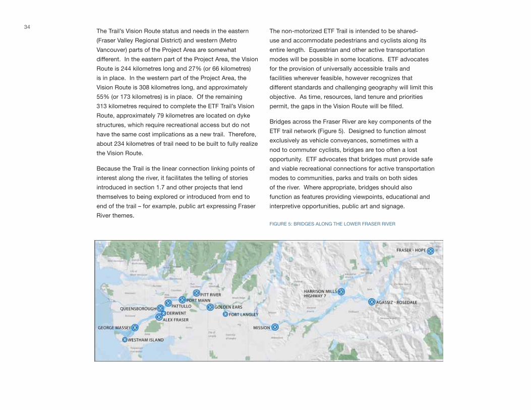
34the trail’s vision Route status and needs in the eastern
(Fraser valley Regional district) and western (metro
vancouver) parts of the Project Area are somewhat
different. in the eastern part of the Project Area, the vision
Route is 244 kilometres long and 27% (or 66 kilometres)
is in place. in the western part of the Project Area, the
vision Route is 308 kilometres long, and approximately
55% (or 173 kilometres) is in place. of the remaining
313 kilometres required to complete the EtF trail’s vision
Route, approximately 79 kilometres are located on dyke
structures, which require recreational access but do not
have the same cost implications as a new trail. therefore,
about 234 kilometres of trail need to be built to fully realize
the vision Route.
Because the trail is the linear connection linking points of
interest along the river, it facilitates the telling of stories
introduced in section 1.7 and other projects that lend
themselves to being explored or introduced from end to
end of the trail – for example, public art expressing Fraser
River themes.
the non-motorized EtF trail is intended to be shared-
use and accommodate pedestrians and cyclists along its
entire length. Equestrian and other active transportation
modes will be possible in some locations. EtF advocates
for the provision of universally accessible trails and
facilities wherever feasible, however recognizes that
different standards and challenging geography will limit this
objective. As time, resources, land tenure and priorities
permit, the gaps in the Vision Route will be filled.
Bridges across the Fraser River are key components of the
EtF trail network (Figure 5). designed to function almost
exclusively as vehicle conveyances, sometimes with a
nod to commuter cyclists, bridges are too often a lost
opportunity. EtF advocates that bridges must provide safe
and viable recreational connections for active transportation
modes to communities, parks and trails on both sides
of the river. where appropriate, bridges should also
function as features providing viewpoints, educational and
interpretive opportunities, public art and signage.
FiguRE 5: BRidgEs Along tHE lowER FRAsER RivER
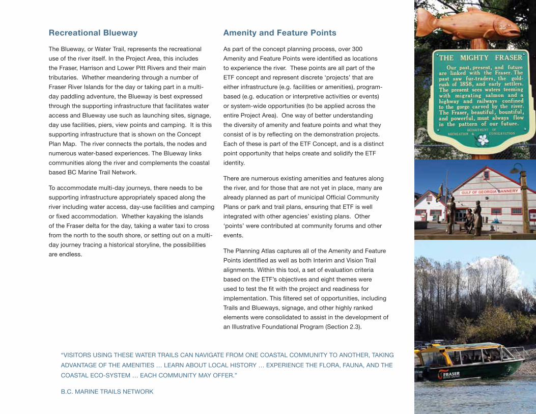
Recreational Blueway
the Blueway, or water trail, represents the recreational
use of the river itself. in the Project Area, this includes
the Fraser, Harrison and lower Pitt Rivers and their main
tributaries. whether meandering through a number of
Fraser River islands for the day or taking part in a multi-
day paddling adventure, the Blueway is best expressed
through the supporting infrastructure that facilitates water
access and Blueway use such as launching sites, signage,
day use facilities, piers, view points and camping. it is this
supporting infrastructure that is shown on the Concept
Plan map. the river connects the portals, the nodes and
numerous water-based experiences. the Blueway links
communities along the river and complements the coastal
based BC marine trail network.
to accommodate multi-day journeys, there needs to be
supporting infrastructure appropriately spaced along the
river including water access, day-use facilities and camping
or fixed accommodation. Whether kayaking the islands
of the Fraser delta for the day, taking a water taxi to cross
from the north to the south shore, or setting out on a multi-
day journey tracing a historical storyline, the possibilities
are endless.
Amenity and Feature Points
As part of the concept planning process, over 300
Amenity and Feature Points were identified as locations
to experience the river. these points are all part of the
EtF concept and represent discrete ‘projects’ that are
either infrastructure (e.g. facilities or amenities), program-
based (e.g. education or interpretive activities or events)
or system-wide opportunities (to be applied across the
entire Project Area). one way of better understanding
the diversity of amenity and feature points and what they
consist of is by reflecting on the demonstration projects.
Each of these is part of the EtF Concept, and is a distinct
point opportunity that helps create and solidify the EtF
identity.
there are numerous existing amenities and features along
the river, and for those that are not yet in place, many are
already planned as part of municipal Official Community
Plans or park and trail plans, ensuring that EtF is well
integrated with other agencies’ existing plans. other
‘points’ were contributed at community forums and other
events.
the Planning Atlas captures all of the Amenity and Feature
Points identified as well as both Interim and Vision Trail
alignments. within this tool, a set of evaluation criteria
based on the EtF’s objectives and eight themes were
used to test the fit with the project and readiness for
implementation. This filtered set of opportunities, including
trails and Blueways, signage, and other highly ranked
elements were consolidated to assist in the development of
an illustrative Foundational Program (section 2.3).
35
“visitoRs using tHEsE wAtER tRAils CAn nAvigAtE FRom onE CoAstAl Community to AnotHER, tAking
AdvAntAgE oF tHE AmEnitiEs … lEARn ABout loCAl HistoRy … EXPERiEnCE tHE FloRA, FAunA, And tHE
CoAstAl ECo-systEm … EACH Community mAy oFFER.”
B.C. mARinE tRAils nEtwoRk
Experience the Fraser – Concept Plan
Nodes
nodes are destinations along the trail and Blueway or locations where people can come to the project
to ‘experience the Fraser’ without having to travel the trail. they are characterized as having a cluster of
amenities, features and experiences close together, are in a location where there is an existing or planned
population density or community, are intersecting with the trail, and are providing an access point and
amenities for the blueway. there are 26 nodes envisioned between Hope and the salish sea, some of
which exist, and others that are planned in municipal Official Community Plans or as an integral part of
EtF. they are intended to motivate and facilitate engagement with the Fraser River and will have a kiosk
to act as a point of introduction, information and orientation to the trail. travelling downstream, these
envisioned nodes are:
“my FAvouRitE mEmoRiEs oF tHE lowER FRAsER ARE tHE FAmily outings on tHE RivER And mARsHEs in tHE
PoRt guiCHon AREA wHERE i HAvE livEd Almost All oF my liFE. ovER tHE yEARs, i HAvE EnjoyEd nAtuRE wAlks,
BiRtHdAy PARtiEs, BEACH PARtiEs, BARBECuEs, BiRd Hunting And CommERCiAl FisHing in my “BACkyARd”.
- EtF idEAs FoRum PARtiCiPAnt (oCtoBER 28, 2010)
36
A. Hope
Hope is one of British Columbia’s oldest
settlements. Before the municipality was
established, the stó:lō tribal village of ts’qo:ls
existed along the banks of the Fraser River.
when visiting the local museum visitors can
learn about explorer simon Fraser’s arrival
in 1808 and the establishment of Fort Hope
trading post by the Hudson’s Bay Company
forty years later. this destination also offers
the opportunity for First nations to share their
culture and heritage with visitors. today four
major highways converge at Hope, enabling it
to serve as a gateway to rest of the province.
Combined with stunning geography, this hub
provides a key stop for visitors to experience an
abundance of recreational adventures from the
Fraser River up to the peaks of the surrounding
mountains.
B. Seabird Island
seabird island is located along the north
shore of the Fraser River in the upper Fraser
valley, three kilometres northeast of the town
of Agassiz and home to the seabird island
indian Band. this storied island derived its
name from the june 1858 grounding of the
transport paddle-wheeler ‘sea Bird’. this
destination could offer visitors authentic cultural
and heritage tourism experiences, and already
has as the annual tulips of the valley Festival
and First nation Festival. if the breathtaking
backdrop does not give a true appreciation
for the ecological importance of the area, then
maria slough which surrounds the island will
certainly do so. it is known for its ecological
importance for amphibians, fish, birds, and
several species at risk.
totem Pole, Hope
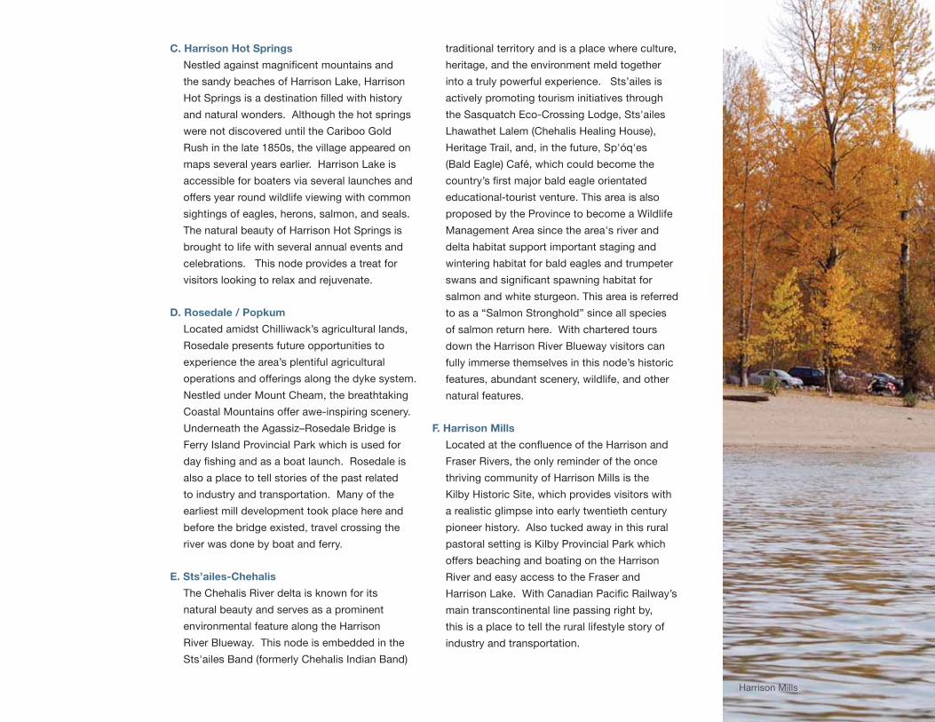
C. Harrison Hot Springs
Nestled against magnificent mountains and
the sandy beaches of Harrison lake, Harrison
Hot Springs is a destination filled with history
and natural wonders. Although the hot springs
were not discovered until the Cariboo gold
Rush in the late 1850s, the village appeared on
maps several years earlier. Harrison lake is
accessible for boaters via several launches and
offers year round wildlife viewing with common
sightings of eagles, herons, salmon, and seals.
the natural beauty of Harrison Hot springs is
brought to life with several annual events and
celebrations. this node provides a treat for
visitors looking to relax and rejuvenate.
D. Rosedale / Popkum
located amidst Chilliwack’s agricultural lands,
Rosedale presents future opportunities to
experience the area’s plentiful agricultural
operations and offerings along the dyke system.
nestled under mount Cheam, the breathtaking
Coastal mountains offer awe-inspiring scenery.
underneath the Agassiz–Rosedale Bridge is
Ferry island Provincial Park which is used for
day fishing and as a boat launch. Rosedale is
also a place to tell stories of the past related
to industry and transportation. many of the
earliest mill development took place here and
before the bridge existed, travel crossing the
river was done by boat and ferry.
E. Sts’ailes-Chehalis
the Chehalis River delta is known for its
natural beauty and serves as a prominent
environmental feature along the Harrison
River Blueway. this node is embedded in the
sts'ailes Band (formerly Chehalis indian Band)
traditional territory and is a place where culture,
heritage, and the environment meld together
into a truly powerful experience. sts’ailes is
actively promoting tourism initiatives through
the sasquatch Eco-Crossing lodge, sts'ailes
lhawathet lalem (Chehalis Healing House),
Heritage trail, and, in the future, sp'óq'es
(Bald Eagle) Café, which could become the
country’s first major bald eagle orientated
educational-tourist venture. this area is also
proposed by the Province to become a wildlife
management Area since the area's river and
delta habitat support important staging and
wintering habitat for bald eagles and trumpeter
swans and significant spawning habitat for
salmon and white sturgeon. this area is referred
to as a “salmon stronghold” since all species
of salmon return here. with chartered tours
down the Harrison River Blueway visitors can
fully immerse themselves in this node’s historic
features, abundant scenery, wildlife, and other
natural features.
F. Harrison Mills
Located at the confluence of the Harrison and
Fraser Rivers, the only reminder of the once
thriving community of Harrison mills is the
kilby Historic site, which provides visitors with
a realistic glimpse into early twentieth century
pioneer history. Also tucked away in this rural
pastoral setting is kilby Provincial Park which
offers beaching and boating on the Harrison
River and easy access to the Fraser and
Harrison Lake. With Canadian Pacific Railway’s
main transcontinental line passing right by,
this is a place to tell the rural lifestyle story of
industry and transportation.
37
Harrison mills
Experience the Fraser – Concept Plan
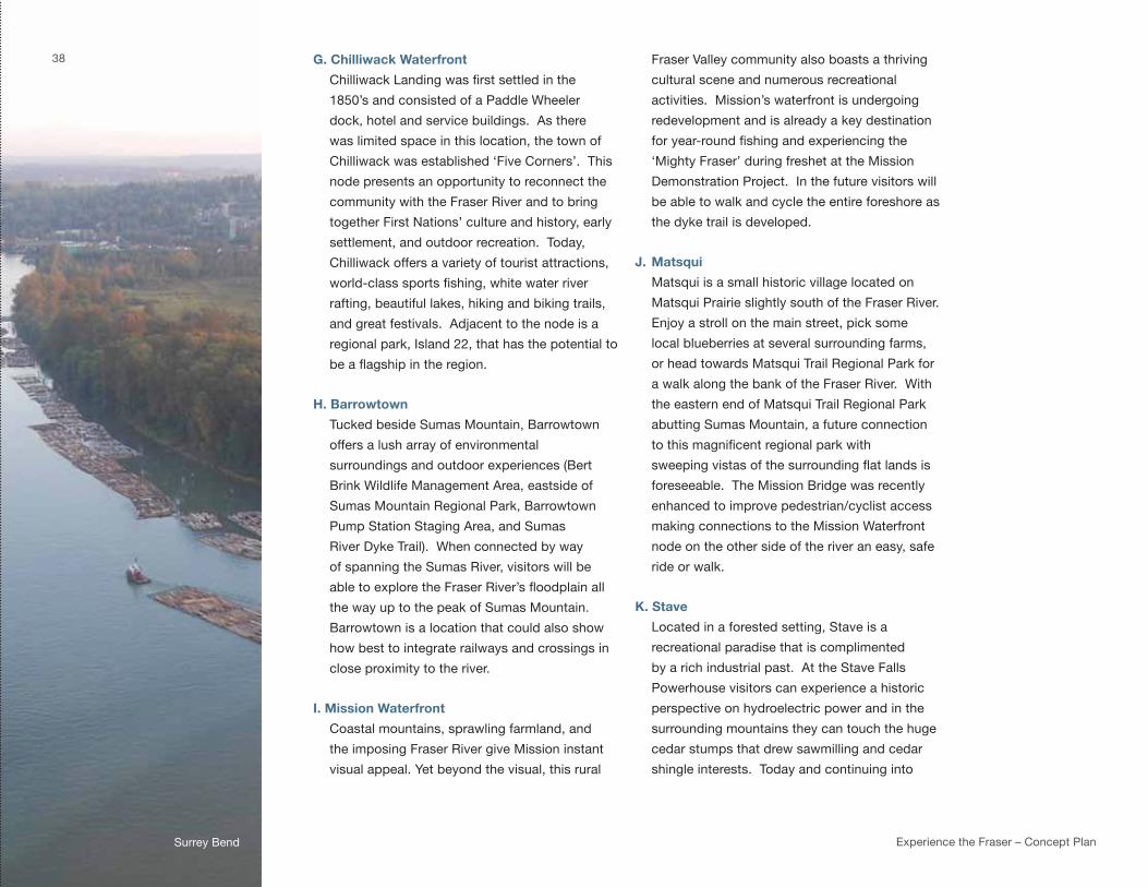
G. Chilliwack Waterfront
Chilliwack Landing was first settled in the
1850’s and consisted of a Paddle wheeler
dock, hotel and service buildings. As there
was limited space in this location, the town of
Chilliwack was established ‘Five Corners’. this
node presents an opportunity to reconnect the
community with the Fraser River and to bring
together First nations’ culture and history, early
settlement, and outdoor recreation. today,
Chilliwack offers a variety of tourist attractions,
world-class sports fishing, white water river
rafting, beautiful lakes, hiking and biking trails,
and great festivals. Adjacent to the node is a
regional park, island 22, that has the potential to
be a flagship in the region.
H. Barrowtown
tucked beside sumas mountain, Barrowtown
offers a lush array of environmental
surroundings and outdoor experiences (Bert
Brink wildlife management Area, eastside of
sumas mountain Regional Park, Barrowtown
Pump station staging Area, and sumas
River dyke trail). when connected by way
of spanning the sumas River, visitors will be
able to explore the Fraser River’s floodplain all
the way up to the peak of sumas mountain.
Barrowtown is a location that could also show
how best to integrate railways and crossings in
close proximity to the river.
I. Mission Waterfront
Coastal mountains, sprawling farmland, and
the imposing Fraser River give mission instant
visual appeal. yet beyond the visual, this rural
Fraser valley community also boasts a thriving
cultural scene and numerous recreational
activities. mission’s waterfront is undergoing
redevelopment and is already a key destination
for year-round fishing and experiencing the
‘mighty Fraser’ during freshet at the mission
demonstration Project. in the future visitors will
be able to walk and cycle the entire foreshore as
the dyke trail is developed.
J. Matsqui
matsqui is a small historic village located on
matsqui Prairie slightly south of the Fraser River.
Enjoy a stroll on the main street, pick some
local blueberries at several surrounding farms,
or head towards matsqui trail Regional Park for
a walk along the bank of the Fraser River. with
the eastern end of matsqui trail Regional Park
abutting sumas mountain, a future connection
to this magnificent regional park with
sweeping vistas of the surrounding flat lands is
foreseeable. the mission Bridge was recently
enhanced to improve pedestrian/cyclist access
making connections to the mission waterfront
node on the other side of the river an easy, safe
ride or walk.
K. Stave
located in a forested setting, stave is a
recreational paradise that is complimented
by a rich industrial past. At the stave Falls
Powerhouse visitors can experience a historic
perspective on hydroelectric power and in the
surrounding mountains they can touch the huge
cedar stumps that drew sawmilling and cedar
shingle interests. today and continuing into
38
surrey Bend

the future this area will grow as a recreational
hub with Rolley lake Provincial Park, mission
interpretive Forest, and BC Hydro’s stave lake,
Hayward lake, and Ruskin recreational sites.
L. Fort Langley
one of the best known heritage sites in the
lower Fraser River Corridor, Fort langley has
many historic buildings, the Parks Canada Fort
langley national Historic site, the BC Farm
machinery & Agricultural museum, the Fort
langley Heritage Cn station, and the langley
Centennial museum. Brae island Regional
Park is part of this node, offering connections
to and from the river and Bedford Channel and
Fort Camping offers sites and programming on
the river. the eastern end of mcmillan island
is home to the kwantlen First nation. the Fort
to Fort trail connects to Fort langley to derby
Reach Regional Park.
M. Port Haney
Port Haney is a heritage waterfront community,
historically important for its rail station and
regular steamboat traffic as well as its brick
works and farming. the community hosts the
Haney Farmers market and music on the wharf
and residents enjoy Fraser River access at the
historic Haney wharf or along nature trails that
weave through kanaka Creek Regional Park to
the riverfront.
N. Bonson
Bonson, a relatively new Fraser River
community, is located in Pitt meadows in
close proximity to the Pitt meadows Airport
and the golden Ears Bridge. the community
waterfront incorporates the Pitt River Regional
greenway, a riverfront trail along the dyke
connecting the golden Ears and Pitt River
Bridges. A new community centre, river
viewing piers, and waterfront commons allow
for direct connections to the river. there are
many opportunities to learn and discover stories
about the surrounding agricultural landscape,
the log booms on the waterfront, the katzie First
nation and long history of the stó:lō people.
O. Surrey Bend
the surrey Bend node is anchored by surrey
Bend Regional Park, a complex wetland home
to a diversity of wildlife and one of the few
remaining undyked floodplain areas on this
stretch of the Fraser River. visitors can wander
through the park or hop on a ferry to Barnston
island, a quiet agricultural community which is
home to fewer than 100 residents, the katzie
First nation, and metro vancouver’s parkland.
P. Citadel Landing
Citadel landing is situated along Port
Coquitlam's riverfront and includes a waterfront
boardwalk, Peace Park and staging area.
Adjacent to this node is the confluence of the
Coquitlam, Pitt and Fraser rivers, the south
Pitt River section of the traboulay PoCo trail,
Colony Farm Regional Park, and the Coquitlam
River wildlife management Area. these
locations provide connections to the river
and the area’s rich biodiversity. the wildlife
management Area is home to one of the largest
great Blue Heron colonies in BC, and provides
habitat and feeding grounds for many other
birds and animals. Colony Farm Regional Park
provides dyke trails, a community garden and
is the former site of the historic Essondale
psychiatric asylum and provincial demonstration
farm. the kwikwetlem First nation lands are
39
Citadel landing
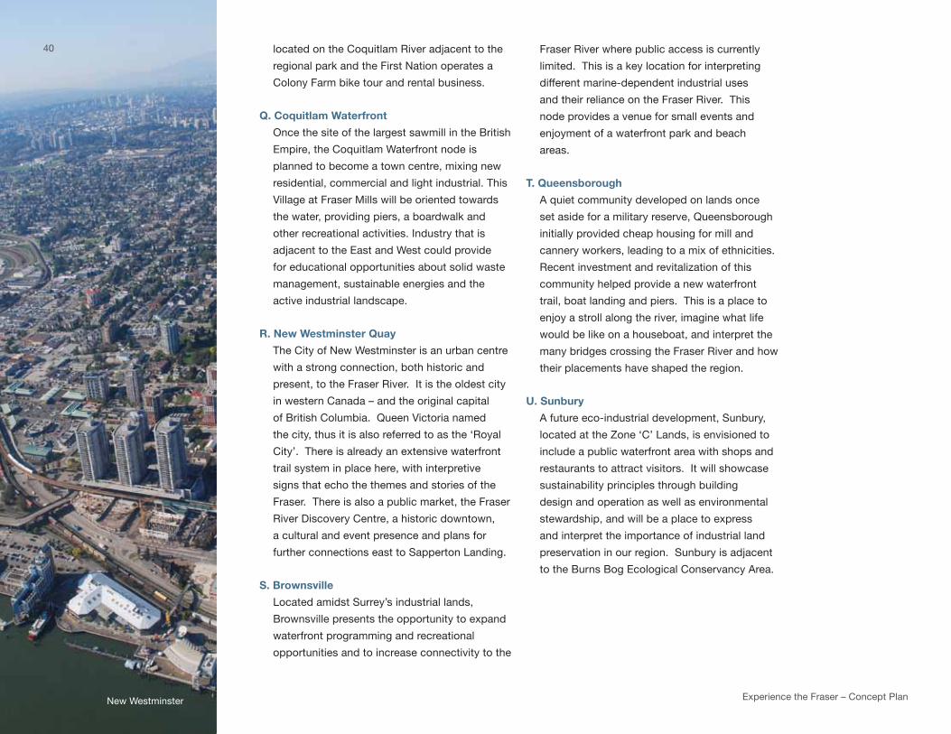
Experience the Fraser – Concept Plan new westminster
located on the Coquitlam River adjacent to the
regional park and the First nation operates a
Colony Farm bike tour and rental business.
Q. Coquitlam Waterfront
once the site of the largest sawmill in the British
Empire, the Coquitlam waterfront node is
planned to become a town centre, mixing new
residential, commercial and light industrial. this
village at Fraser mills will be oriented towards
the water, providing piers, a boardwalk and
other recreational activities. industry that is
adjacent to the East and west could provide
for educational opportunities about solid waste
management, sustainable energies and the
active industrial landscape.
R. New Westminster Quay
the City of new westminster is an urban centre
with a strong connection, both historic and
present, to the Fraser River. it is the oldest city
in western Canada – and the original capital
of British Columbia. queen victoria named
the city, thus it is also referred to as the ‘Royal
City’. there is already an extensive waterfront
trail system in place here, with interpretive
signs that echo the themes and stories of the
Fraser. there is also a public market, the Fraser
River discovery Centre, a historic downtown,
a cultural and event presence and plans for
further connections east to sapperton landing.
S. Brownsville
located amidst surrey’s industrial lands,
Brownsville presents the opportunity to expand
waterfront programming and recreational
opportunities and to increase connectivity to the
Fraser River where public access is currently
limited. this is a key location for interpreting
different marine-dependent industrial uses
and their reliance on the Fraser River. this
node provides a venue for small events and
enjoyment of a waterfront park and beach
areas.
T. Queensborough
A quiet community developed on lands once
set aside for a military reserve, queensborough
initially provided cheap housing for mill and
cannery workers, leading to a mix of ethnicities.
Recent investment and revitalization of this
community helped provide a new waterfront
trail, boat landing and piers. this is a place to
enjoy a stroll along the river, imagine what life
would be like on a houseboat, and interpret the
many bridges crossing the Fraser River and how
their placements have shaped the region.
U. Sunbury
A future eco-industrial development, sunbury,
located at the Zone ‘C’ lands, is envisioned to
include a public waterfront area with shops and
restaurants to attract visitors. it will showcase
sustainability principles through building
design and operation as well as environmental
stewardship, and will be a place to express
and interpret the importance of industrial land
preservation in our region. sunbury is adjacent
to the Burns Bog Ecological Conservancy Area.
40
steveston
V. Riverport
A recreation and entertainment hub, Riverport
is a place where visitors can catch a movie,
play hockey, go for a swim or grab a pint
with friends. nestled between industrial and
agricultural lands, visitors and residents can
also enjoy the waterfront trail, launch a kayak at
the dock, or pick up some fresh produce at the
local farm market.
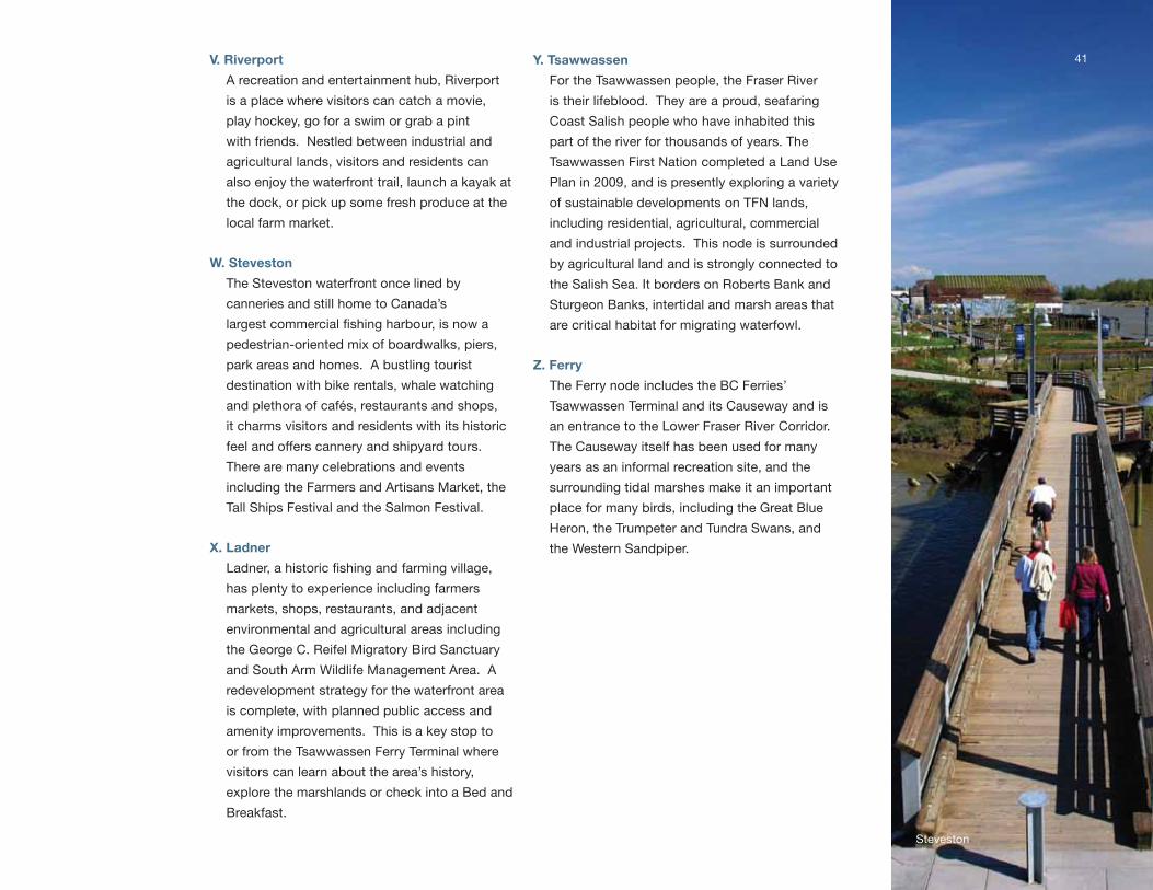
W. Steveston
the steveston waterfront once lined by
canneries and still home to Canada’s
largest commercial fishing harbour, is now a
pedestrian-oriented mix of boardwalks, piers,
park areas and homes. A bustling tourist
destination with bike rentals, whale watching
and plethora of cafés, restaurants and shops,
it charms visitors and residents with its historic
feel and offers cannery and shipyard tours.
there are many celebrations and events
including the Farmers and Artisans market, the
tall ships Festival and the salmon Festival.
X. Ladner
Ladner, a historic fishing and farming village,
has plenty to experience including farmers
markets, shops, restaurants, and adjacent
environmental and agricultural areas including
the george C. Reifel migratory Bird sanctuary
and south Arm wildlife management Area. A
redevelopment strategy for the waterfront area
is complete, with planned public access and
amenity improvements. this is a key stop to
or from the tsawwassen Ferry terminal where
visitors can learn about the area’s history,
explore the marshlands or check into a Bed and
Breakfast.
Y. Tsawwassen
For the tsawwassen people, the Fraser River
is their lifeblood. they are a proud, seafaring
Coast salish people who have inhabited this
part of the river for thousands of years. the
tsawwassen First nation completed a land use
Plan in 2009, and is presently exploring a variety
of sustainable developments on tFn lands,
including residential, agricultural, commercial
and industrial projects. this node is surrounded
by agricultural land and is strongly connected to
the salish sea. it borders on Roberts Bank and
sturgeon Banks, intertidal and marsh areas that
are critical habitat for migrating waterfowl.
Z. Ferry
the Ferry node includes the BC Ferries’
tsawwassen terminal and its Causeway and is
an entrance to the lower Fraser River Corridor.
the Causeway itself has been used for many
years as an informal recreation site, and the
surrounding tidal marshes make it an important
place for many birds, including the great Blue
Heron, the trumpeter and tundra swans, and
the western sandpiper.
41
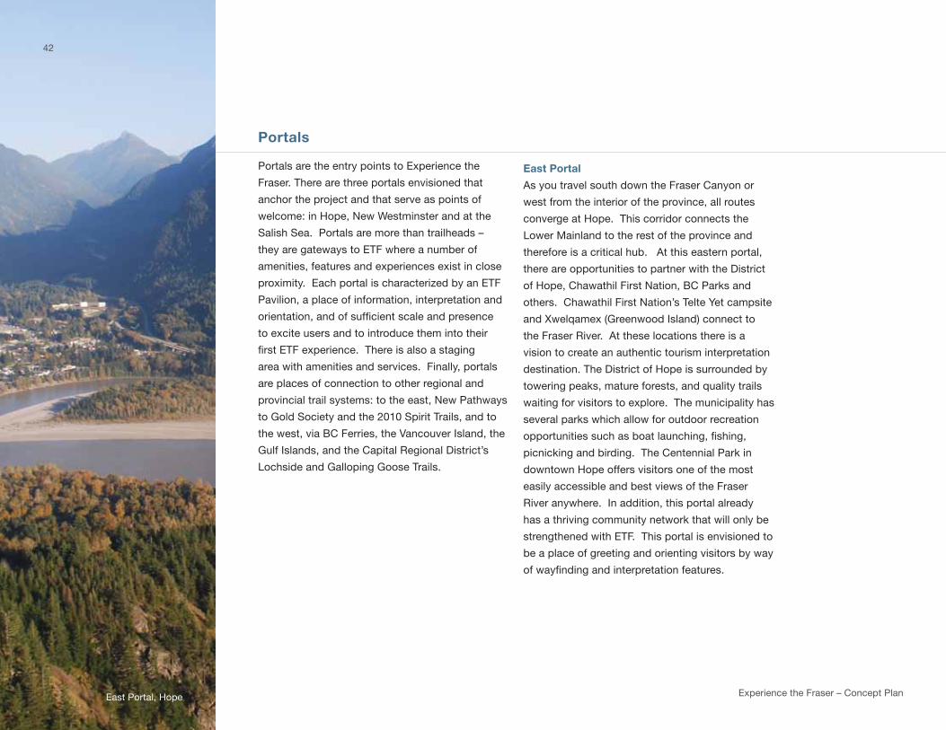
Experience the Fraser – Concept Plan
Portals
Portals are the entry points to Experience the
Fraser. there are three portals envisioned that
anchor the project and that serve as points of
welcome: in Hope, new westminster and at the
salish sea. Portals are more than trailheads –
they are gateways to EtF where a number of
amenities, features and experiences exist in close
proximity. Each portal is characterized by an EtF
Pavilion, a place of information, interpretation and
orientation, and of sufficient scale and presence
to excite users and to introduce them into their
first ETF experience. There is also a staging
area with amenities and services. Finally, portals
are places of connection to other regional and
provincial trail systems: to the east, new Pathways
to gold society and the 2010 spirit trails, and to
the west, via BC Ferries, the vancouver island, the
gulf islands, and the Capital Regional district’s
lochside and galloping goose trails.
East Portal
As you travel south down the Fraser Canyon or
west from the interior of the province, all routes
converge at Hope. this corridor connects the
lower mainland to the rest of the province and
therefore is a critical hub. At this eastern portal,
there are opportunities to partner with the district
of Hope, Chawathil First nation, BC Parks and
others. Chawathil First nation’s telte yet campsite
and Xwelqamex (greenwood island) connect to
the Fraser River. At these locations there is a
vision to create an authentic tourism interpretation
destination. the district of Hope is surrounded by
towering peaks, mature forests, and quality trails
waiting for visitors to explore. the municipality has
several parks which allow for outdoor recreation
opportunities such as boat launching, fishing,
picnicking and birding. the Centennial Park in
downtown Hope offers visitors one of the most
easily accessible and best views of the Fraser
River anywhere. in addition, this portal already
has a thriving community network that will only be
strengthened with EtF. this portal is envisioned to
be a place of greeting and orienting visitors by way
of wayfinding and interpretation features.
42
East Portal, Hope
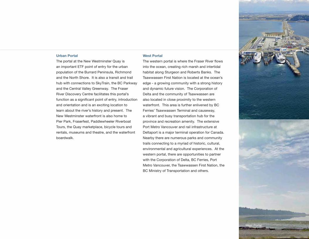
Urban Portal
the portal at the new westminster quay is
an important EtF point of entry for the urban
population of the Burrard Peninsula, Richmond
and the north shore. it is also a transit and trail
hub with connections to skytrain, the BC Parkway
and the Central valley greenway. the Fraser
River discovery Centre facilitates this portal’s
function as a significant point of entry, introduction
and orientation and is an exciting location to
learn about the river’s history and present. the
new westminster waterfront is also home to
Pier Park, Fraserfest, Paddlewheeler Riverboat
tours, the quay marketplace, bicycle tours and
rentals, museums and theatre, and the waterfront
boardwalk.
West Portal
The western portal is where the Fraser River flows
into the ocean, creating rich marsh and intertidal
habitat along sturgeon and Roberts Banks. the
tsawwassen First nation is located at the ocean’s
edge - a growing community with a strong history
and dynamic future vision. the Corporation of
delta and the community of tsawwassen are
also located in close proximity to the western
waterfront. this area is further enlivened by BC
Ferries’ tsawwassen terminal and causeway,
a vibrant and busy transportation hub for the
province and recreation amenity. the extensive
Port metro vancouver and rail infrastructure at
deltaport is a major terminal operation for Canada.
nearby there are numerous parks and community
trails connecting to a myriad of historic, cultural,
environmental and agricultural experiences. At the
western portal, there are opportunities to partner
with the Corporation of delta, BC Ferries, Port
metro vancouver, the tsawwassen First nation, the
BC ministry of transportation and others.
43
west Portal

Experience the Fraser – Concept Plan
2.3 ILLUSTRATIVE FOUNDATIONAL PROGRAM
the illustrative Foundational Program consists of 63 actions and projects essential to building a strong and recognizable
ETF identity. It is a recommended set of priority actions and is intended to have the flexibility to be guided by the various
partners choosing to participate in delivery. As funding is secured, the program can advance. However, if resources
or priorities change, the Foundational Program can adapt and projects of similar impact may be substituted. the
Illustrative Foundational Program includes the top 20% of the over 300 amenity and feature opportunities identified for
the Concept Plan which were evaluated for ‘fit’ and ‘readiness’ with ETF or alignment with existing plans and resources.
it also includes a number of recommended projects that are already planned but which demonstrate how association
with and connection to ETF will amplify tourism, economic development, recreation and other benefits. The Illustrative
Foundational Program is laid out to align with the five concept elements, but also includes some actions that are either not
geographically based, or that span the entire project area. the illustrative Foundational Program will:
• result in sufficient on the ground presence that ETF has a recognizable, well branded identity that reflects project goals;
• ensure that the “Canyon to Coast” trail is navigable from Portal to Portal;
• have Recreational Blueway support infrastructure for a daily paddling distance (approximately every fifteen kilometers);
and
• fill 50% of the gap in the “Canyon to Coast” Trail’s Vision Route, (completing over 70% of the total Vision Route).
4444
kettle valley Railway Bridge
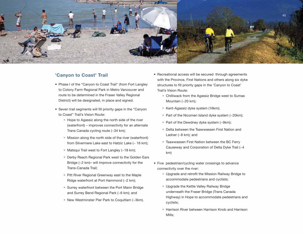
'Canyon to Coast’ Trail
• Phase i of the “Canyon to Coast trail" (from Fort langley
to Colony Farm Regional Park in metro vancouver and
route to be determined in the Fraser valley Regional
district) will be designated, in place and signed.
• Seven trail segments will fill priority gaps in the “Canyon
to Coast” trail’s vision Route:
à Hope to Agassiz along the north side of the river
(waterfront) – improves connectivity for an alternate
trans Canada cycling route (~34 km);
à mission along the north side of the river (waterfront)
from silvermere lake east to Hatzic lake (~ 16 km);
à matsqui trail west to Fort langley (~18 km);
à derby Reach Regional Park west to the golden Ears
Bridge (~2 km)– will improve connectivity for the
trans-Canada trail;
à Pitt River Regional greenway east to the maple
Ridge waterfront at Port Hammond (~2 km);
à surrey waterfront between the Port mann Bridge
and surrey Bend Regional Park (~6 km); and
à new westminster Pier Park to Coquitlam (~3km).
• Recreational access will be secured through agreements
with the Province, First nations and others along six dyke
structures to fill priority gaps in the ‘Canyon to Coast’
trail’s vision Route:
à Chilliwack from the Agassiz Bridge west to sumas
mountain (~20 km);
à kent-Agassiz dyke system (16km);
à Part of the nicomen island dyke system (~20km);
à Part of the dewdney dyke system (~9km);
à delta between the tsawwassen First nation and
ladner (~8 km); and
à tsawwassen First nation between the BC Ferry
Causeway and Corporation of delta dyke trail (~4
km)
• Five pedestrian/cycling water crossings to advance
connectivity over the river:
à Upgrade and retrofit the Mission Railway Bridge to
accommodate pedestrians and cyclists;
à upgrade the kettle valley Railway Bridge
underneath the Fraser Bridge (trans Canada
Highway) in Hope to accommodate pedestrians and
cyclists;
à Harrison River between Harrison knob and Harrison
mills;
45
Pegleg Bar
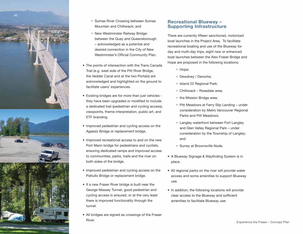
Experience the Fraser – Concept Plan
à sumas River Crossing between sumas
mountain and Chilliwack; and
à new westminster Railway Bridge:
between the quay and queensborough
– acknowledged as a potential and
desired connection in the City of new
Westminster’s Official Community Plan.
• the points of intersection with the trans Canada
trail (e.g. west side of the Pitt River Bridge,
the vedder Canal and at the two Portals) are
acknowledged and highlighted on the ground to
facilitate users’ experiences.
• Existing bridges are for more than just vehicles -
they have been upgraded or modified to include
a dedicated trail (pedestrian and cycling access),
viewpoints, theme interpretation, public art, and
EtF branding.
• improved pedestrian and cycling access on the
Agassiz Bridge or replacement bridge.
• improved recreational access to and on the new
Port mann bridge for pedestrians and cyclists,
ensuring dedicated ramps and improved access
to communities, parks, trails and the river on
both sides of the bridge.
• improved pedestrian and cycling access on the
Pattullo Bridge or replacement bridge.
• if a new Fraser River bridge is built near the
george massey tunnel, good pedestrian and
cycling access is ensured, or at the very least
there is improved functionality through the
tunnel.
• All bridges are signed as crossings of the Fraser
River.
Recreational Blueway – Supporting Infrastructure
There are currently fifteen sanctioned, motorized
boat launches in the Project Area. to facilitate
recreational boating and use of the Blueway for
day and multi-day trips, eight new or enhanced
boat launches between the Alex Fraser Bridge and
Hope are proposed in the following locations:
à Hope;
à dewdney / deroche;
à island 22 Regional Park;
à Chilliwack – Rosedale area;
à the mission Bridge area;
à Pitt meadows at Ferry slip landing – under
consideration by metro vancouver Regional
Parks and Pitt meadows;
à langley waterfront between Fort langley
and glen valley Regional Park – under
consideration by the township of langley;
and
à surrey at Brownsville node.
• A Blueway Signage & Wayfinding System is in
place.
• All regional parks on the river will provide water
access and some amenities to support Blueway
use.
• in addition, the following locations will provide
clear access to the Blueway and sufficient
amenities to facilitate Blueway use:
46
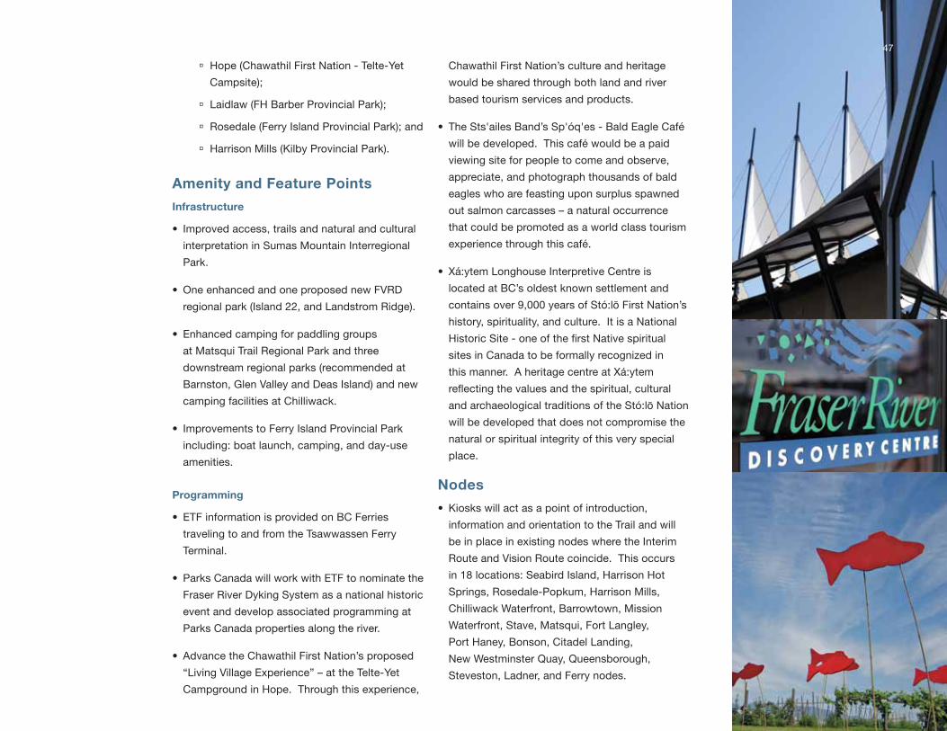
à Hope (Chawathil First nation - telte-yet
Campsite);
à laidlaw (FH Barber Provincial Park);
à Rosedale (Ferry island Provincial Park); and
à Harrison mills (kilby Provincial Park).
Amenity and Feature Points
Infrastructure
• improved access, trails and natural and cultural
interpretation in sumas mountain interregional
Park.
• one enhanced and one proposed new FvRd
regional park (island 22, and landstrom Ridge).
• Enhanced camping for paddling groups
at matsqui trail Regional Park and three
downstream regional parks (recommended at
Barnston, glen valley and deas island) and new
camping facilities at Chilliwack.
• improvements to Ferry island Provincial Park
including: boat launch, camping, and day-use
amenities.
Programming
• EtF information is provided on BC Ferries
traveling to and from the tsawwassen Ferry
terminal.
• Parks Canada will work with EtF to nominate the
Fraser River dyking system as a national historic
event and develop associated programming at
Parks Canada properties along the river.
• Advance the Chawathil First nation’s proposed
“living village Experience” – at the telte-yet
Campground in Hope. through this experience,
Chawathil First nation’s culture and heritage
would be shared through both land and river
based tourism services and products.
• the sts'ailes Band’s sp'óq'es - Bald Eagle Café
will be developed. this café would be a paid
viewing site for people to come and observe,
appreciate, and photograph thousands of bald
eagles who are feasting upon surplus spawned
out salmon carcasses – a natural occurrence
that could be promoted as a world class tourism
experience through this café.
• Xá:ytem longhouse interpretive Centre is
located at BC’s oldest known settlement and
contains over 9,000 years of stó:lō First nation’s
history, spirituality, and culture. it is a national
Historic Site - one of the first Native spiritual
sites in Canada to be formally recognized in
this manner. A heritage centre at Xá:ytem
reflecting the values and the spiritual, cultural
and archaeological traditions of the stó:lō nation
will be developed that does not compromise the
natural or spiritual integrity of this very special
place.
Nodes
• kiosks will act as a point of introduction,
information and orientation to the trail and will
be in place in existing nodes where the interim
Route and vision Route coincide. this occurs
in 18 locations: seabird island, Harrison Hot
springs, Rosedale-Popkum, Harrison mills,
Chilliwack waterfront, Barrowtown, mission
waterfront, stave, matsqui, Fort langley,
Port Haney, Bonson, Citadel landing,
new westminster quay, queensborough,
steveston, ladner, and Ferry nodes.
47

Experience the Fraser – Concept Plan
Portals
• A pavilion will be in place at each portal to mark the
beginning of the EtF trail and Recreational Blueway.
These will be of sufficient scale to denote this as an entry
point to EtF and to provide information, orientation, and
interpretive opportunities.
• there will be a staging area with services and amenities
at each portal.
• the urban Portal at new westminster will be an
important point of entry from the Burrard Peninsula,
Richmond, and the north shore. the Fraser River
discovery Centre will facilitate this portal’s function as
a significant point of entry, introduction, and orientation
to ETF with a film and a small exhibit dedicated to
promoting EtF. in addition, the Fraser River discovery
Centre will be enhanced through the completion of its
fixed exhibits featuring the bold landscapes of the Fraser
River from Mount Robson to the Pacific Ocean.
System-wide Initiatives
• EtF is well branded including logo, tag line, and
marketing strategy.
• EtF website.
• EtF smart phone “app”.
• Five Fraser River stories will be developed and
programmed along the “Canyon to Coast” trail.
• two annual events in different parts of the corridor will be
held where EtF can be celebrated.
• A full scale way-Finding system will be in place from
Hope to the salish sea.
• Add the north Arm of the Fraser River to the Project Area
and undertake the planning for this addition in the early
phases of implementation.
48
trans Canada trail Pavilion, north vancouver
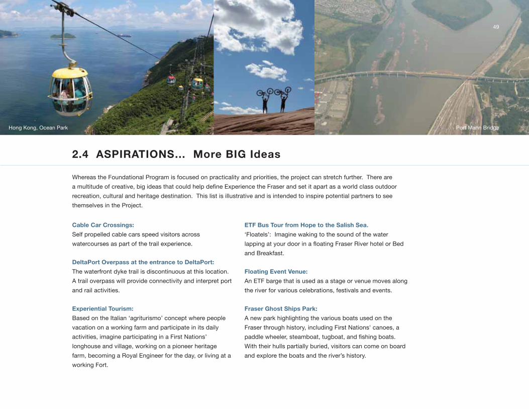
2.4 ASPIRATIONS… More BIG Ideas
whereas the Foundational Program is focused on practicality and priorities, the project can stretch further. there are
a multitude of creative, big ideas that could help define Experience the Fraser and set it apart as a world class outdoor
recreation, cultural and heritage destination. this list is illustrative and is intended to inspire potential partners to see
themselves in the Project.
49
Cable Car Crossings:
self propelled cable cars speed visitors across
watercourses as part of the trail experience.
DeltaPort Overpass at the entrance to DeltaPort:
the waterfront dyke trail is discontinuous at this location.
A trail overpass will provide connectivity and interpret port
and rail activities.
Experiential Tourism:
Based on the italian ‘agriturismo’ concept where people
vacation on a working farm and participate in its daily
activities, imagine participating in a First nations’
longhouse and village, working on a pioneer heritage
farm, becoming a Royal Engineer for the day, or living at a
working Fort.
ETF Bus Tour from Hope to the Salish Sea.
‘Floatels’: imagine waking to the sound of the water
lapping at your door in a floating Fraser River hotel or Bed
and Breakfast.
Floating Event Venue:
An EtF barge that is used as a stage or venue moves along
the river for various celebrations, festivals and events.
Fraser Ghost Ships Park:
A new park highlighting the various boats used on the
Fraser through history, including First nations' canoes, a
paddle wheeler, steamboat, tugboat, and fishing boats.
with their hulls partially buried, visitors can come on board
and explore the boats and the river’s history.
Hong kong, ocean Park Port mann Bridge

Experience the Fraser – Concept Plan
50
Fraser River Island Hopping:
Paddling and camping tours through the Fraser River islands (e.g. Bristol, island 22,
greenwood, Croft, vasasus, Herrling group or others with expanded First nation
partnerships). A water taxi or water bus provides transportation and regulates visits.
Pocket Picnic Riverside Parks:
small, riverfront parks, possibly linear, with a high level of accessibility, contain enclosed
picnic shelters and tables for all-season use. in urban areas, food carts or vendors are
located in close proximity.
Port Park:
A new waterfront ‘Port Park’ where the industrial working river is showcased and
interpreted. Proposed location is in Richmond at the Riverport node.
Railway Park:
A linear ‘Railway Park’ where historic and present railway stories are interpreted. the
proposed location is in surrey at thornton Railyards.

River Rail tour:
travel along the Fraser River by rail and experience the lower Fraser River Corridor from
end to end in one day!
Snorkeling with the Salmon:
Guided snorkeling tour on Harrison River gets people into the river swimming or floating
down the river in the midst of a salmon run.
Underwater Viewing Cavern:
located on the Harrison River, this facility would provide people with a window into river life
– they will see spawning salmon and other types of freshwater fish in their natural habitat.
A suite of visitor or presentation centres that are multi-experiential and partnership driven
(either building from existing locations or new) that interpret Fraser River themes and
support Experience the Fraser.
“tHE FRAsER RivER BElongs to All oF us, BRinging PEoPlE down to tHE RivER on A tRAil
oF ConnECtivity is just tHE RigHt tHing to do, FRom An EnviRonmEntAl… HEAltH …
RECREAtionAl stAndPoint, tHERE is no losE HERE, tHis is A win FoR EvERyonE!
RAndy HAwEs, mEmBER oF tHE lEgislAtivE AssEmBly oF BC.
51
High line Park, nyC

52
3.0 NEXT STEPS
52 Harrison mills and kilby Provincial Park
Experience the Fraser – Concept Plan
53
3.1 IMPLEMENTATION STRATEGIES
Experience the Fraser was initiated by the Fraser valley Regional district, metro vancouver, and the Province: however, it
has always been recognized that EtF is much bigger than these three parties. growing and implementing the vision must
to be a collaborative venture that involves many stakeholders including First nations, municipalities, other agencies, the
private sector and motivated community groups and citizens, with ongoing support and participation from the regional
districts and the Province. it has already been stated that this project’s success is contingent on strong partnerships
where a common vision is shared, where partners recognize the multiple benefits of participation and are committed
to seeing the project come to fruition. As a result, there are a number of strategies that need further discussion and
development to help guide the Concept from Plan to implementation.
Ongoing partnership development must be the first priority. This Concept Plan illustrates what can be achieved and
attempts to entice potential partners with a compelling vision, but these relationships need to be cultivated and it remains
to be determined who key implementers will be and who will administer the project over time.
“A RivER sEEms A mAgiC tHing. A mAgiC, moving, living PARt oF tHE vERy EARtH itsElF.”
lAuRA gilPin
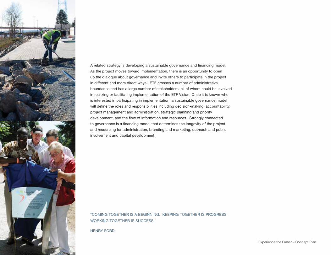
Experience the Fraser – Concept Plan
A related strategy is developing a sustainable governance and financing model.
As the project moves toward implementation, there is an opportunity to open
up the dialogue about governance and invite others to participate in the project
in different and more direct ways. EtF crosses a number of administrative
boundaries and has a large number of stakeholders, all of whom could be involved
in realizing or facilitating implementation of the EtF vision. once it is known who
is interested in participating in implementation, a sustainable governance model
will define the roles and responsibilities including decision-making, accountability,
project management and administration, strategic planning and priority
development, and the flow of information and resources. Strongly connected
to governance is a financing model that determines the longevity of the project
and resourcing for administration, branding and marketing, outreach and public
involvement and capital development.
“Coming togEtHER is A BEginning. kEEPing togEtHER is PRogREss.
woRking togEtHER is suCCEss."
HEnRy FoRd
54
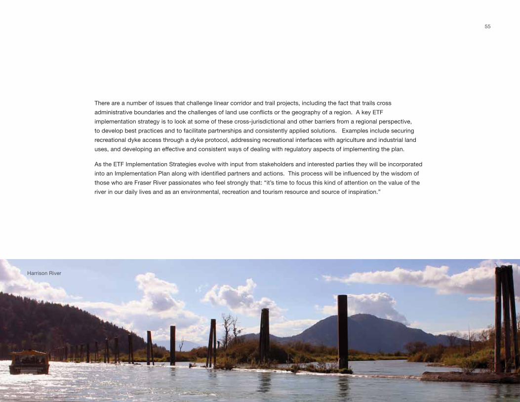
55
there are a number of issues that challenge linear corridor and trail projects, including the fact that trails cross
administrative boundaries and the challenges of land use conflicts or the geography of a region. A key ETF
implementation strategy is to look at some of these cross-jurisdictional and other barriers from a regional perspective,
to develop best practices and to facilitate partnerships and consistently applied solutions. Examples include securing
recreational dyke access through a dyke protocol, addressing recreational interfaces with agriculture and industrial land
uses, and developing an effective and consistent ways of dealing with regulatory aspects of implementing the plan.
As the EtF implementation strategies evolve with input from stakeholders and interested parties they will be incorporated
into an Implementation Plan along with identified partners and actions. This process will be influenced by the wisdom of
those who are Fraser River passionates who feel strongly that: “it’s time to focus this kind of attention on the value of the
river in our daily lives and as an environmental, recreation and tourism resource and source of inspiration.”
Harrison River
Experience the Fraser – Concept Plan
Acknowledgements
ETF Joint Political Steering Committee
gayle martin, Co-Chair
sharon gaetz, Co-Chair
Heather deal, mv director
ted Adlum, FvRd director
james Atebe, former Co-Chair
wayne wright, mv director, former Committee member
Randy Hawes, mlA
marc dalton, mlA
Provincial Government Staff
Peter walters, Assistant deputy minister
john Hawkings, manager of trails
Fraser Valley Regional District Staff
George Murray, Chief Administrative Officer
siri Bertelsen, director of Regional Programs
doug wilson, manager of Parks
david urban, Project lead
Metro Vancouver Staff
gaëtan Royer, metropolitan Planning, Environment and Parks manager
Ed Andrusiak, former Regional Parks department manager
wendy dadalt, interregional Project Coordinator
Heather mcnell, senior Regional Planner
Barry Potvin, Planning lead
sue mah, interregional Administrative support
deanne manzer, Research technician
metro vancouver East Area Parks and graphics
thank you also to the township of langley, district of mission and trails BC
56
57
Photo Credits
Cover .....skytrain Bridge, new westminster .............................. jason Haight
Cover .....Cyclists along matsqui trail .......................................... taneane twele
p. 8 ........northern saw-whet owl ............................................... jeremy Plotkin
p. 13.......get out youth Camp .................................................... Chris Eastman
p. 14.......matsqui Canada Parks day .......................................... taneane twele
p. 14.......Bedford Channel, Brae island ...................................... larry meneely
p. 20.......Hikers in the Cascade mountains ................................. mountains to sound trust
p. 21....... the great waterfront trail Adventure ........................... goh iromoto and the waterfront Regeneration trust
p. 21.......Cyclists on the Confluence’s Chain of Rocks Bridge ... trailnet, st. louis
p. 22.......midsummer Fete, Colony Farm .................................... trish Erikson
p. 22....... lily at surrey Bend Regional Park ................................ ted uhrich
p. 23.......kayakers at mission Bridge .......................................... taneane twele
p. 35.......gulf of georgia Cannery ............................................... yvonne stich
p. 40....... imperial Boardwalk ....................................................... yvonne stich
p. 47....... Fraser River discovery Centre ...................................... dana montgomery
p. 48.......north vancouver trans Canada trail Pavilion ............... trails BC
p. 49.......Cyclists ......................................................................... michael lim
p. 49.......Hong kong ocean Park Cable Car ............................... wikipedia
p. 50.......wildPlay whistler Zipline .............................................. wildplay
p. 50.......wildplay nanaimo Bungee jumper .............................. wildplay
p. 51.......native Paddlewheeler ................................................... Paddlewheeler Riverboat tours
p. 51.......High line, new york City .............................................. iwan Baan

58
Experience the Fraser – Concept Plan
notEs

59
Fraser Valley Regional District
Fraser Valley Regional District