Embed Size (px)
Citation preview
DRAFT
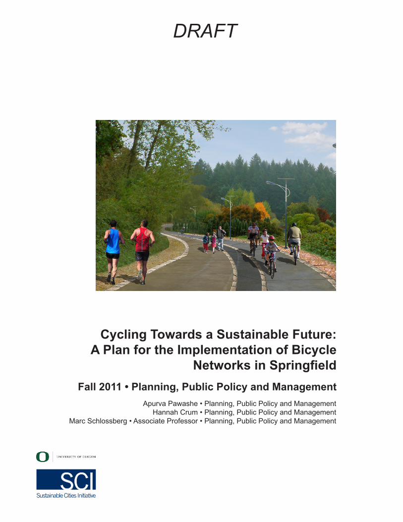
Fall 2011 • Planning, Public Policy and Management
Cycling Towards a Sustainable Future: A Plan for the Implementation of Bicycle
Networks in Springfield
Apurva Pawashe • Planning, Public Policy and Management Hannah Crum • Planning, Public Policy and Management
Marc Schlossberg • Associate Professor • Planning, Public Policy and Management
2
DRAFT
AcknowledgementsFirst and foremost, we would like to thank Professor Marc Schlossberg, who presented a comprehensive overview of the practicalities regarding the advancement of bicycle transportation. His passion about and belief in the power of social change has been inspiring to his students from day one of class, and has motivated his students to envision the promise of a better future for bicycling in Springfield. We would also like to acknowledge the many City of Springfield officials, bicycle advocates, small businesses, and residents who contributed to surveys and interviews. Thanks also to Dave Reesor, transportation planner for the City of Springfield, who contributed his time and effort to help students understand the current state of bicycling in Springfield, along with City of Springfield staff and Springfield residents who attended the presentation of our proposals.
Special thanks are also due to guest speakers who contributed to the course content. Different perspectives on bicycle transportation came from:
• Dave Reesor, Senior Transportation Planner at the City of Springfield• Fred Tepfer, Planning Associate at the University of Oregon Campus
Planning and Real Estate Office• Tom Larson, Traffic Engineer for the City of Eugene• Monica Adkins, a car-free mother of four
SCI Directors and Staff Robert Liberty, Executive Director
Nico Larco, SCI Associate Director, and Associate Professor of Architecture
Marc Schlossberg, SCI Associate Director, and Associate Professor of Planning, Public Policy, and Management
Robert Choquette, SCI Program Manager
3
DRAFT
About SCIThe Sustainable Cities Initiative (SCI) is a cross-disciplinary organization at the University of Oregon that promotes education, service, public outreach, and research on the design and development of sustainable cities. We are redefining higher education for the public good and catalyzing community change toward sustainability. Our work addresses sustainability at multiple scales and emerges from the conviction that creating the sustainable city cannot happen within any single discipline. SCI is grounded in cross-disciplinary engagement as the key strategy for improving community sustainability. Our work connects student energy, faculty experience, and community needs to produce innovative, tangible solutions for the creation of a sustainable society.
About SCYPThe Sustainable City Year Program (SCYP) is a year-long partnership between SCI and one city in Oregon, in which students and faculty in courses from across the university collaborate with the partner city on sustainability and livability projects. SCYP faculty and students work in collaboration with staff from the partner city through a variety of studio projects and service-learning courses to provide students with real-world projects to investigate. Students bring energy, enthusiasm, and innovative approaches to difficult, persistent problems. SCYP’s primary value derives from collaborations resulting in on-the-ground impact and expanded conversations for a community ready to transition to a more sustainable and livable future. SCY 2011-12 includes courses in Architecture; Arts and Administration; Business; Economics; Journalism; Landscape Architecture; Law; Oregon Leadership in Sustainability; and Planning, Public Policy, and Management.
About Springfield, OregonThe City of Springfield has been a leader in sustainable practices for more than 30 years, tackling local issues ranging from waste and stormwater management to urban and suburban redevelopment. It is the first and only jurisdiction in Oregon to create two separate Urban Renewal Districts by voter approval. Constrained by dramatic hillsides and rivers to the north and south, Springfield has worked tirelessly to develop efficiently and respectfully within its natural boundary as well as the current urban growth boundary. Springfield is proud of its relationships and ability to work with property owners and developers on difficult developments, reaching agreements that are to the benefit of both the project and the affected property owners. These relationships with citizens are what continue to allow Springfield to turn policy and planning into reality. Springfield recruited a strong, diverse set of partners to supplement city staff participation in SCYP. Partners include the Springfield Utility Board, Willamalane Park and Recreation District, Metro Wastewater Management Commission, United Way of Lane County, and Springfield School District 19.
4
DRAFT
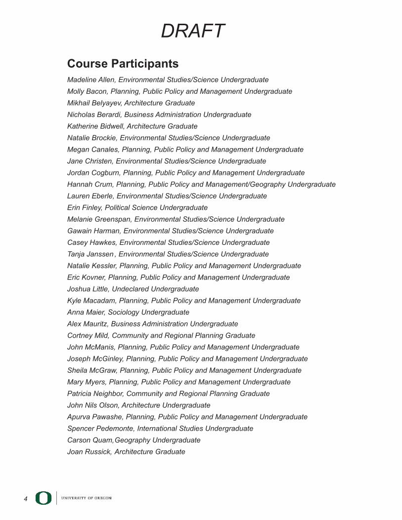
Course ParticipantsMadeline Allen, Environmental Studies/Science Undergraduate
Molly Bacon, Planning, Public Policy and Management Undergraduate
Mikhail Belyayev, Architecture Graduate
Nicholas Berardi, Business Administration Undergraduate
Katherine Bidwell, Architecture Graduate
Natalie Brockie, Environmental Studies/Science Undergraduate
Megan Canales, Planning, Public Policy and Management Undergraduate
Jane Christen, Environmental Studies/Science Undergraduate
Jordan Cogburn, Planning, Public Policy and Management Undergraduate
Hannah Crum, Planning, Public Policy and Management/Geography Undergraduate
Lauren Eberle, Environmental Studies/Science Undergraduate
Erin Finley, Political Science Undergraduate
Melanie Greenspan, Environmental Studies/Science Undergraduate
Gawain Harman, Environmental Studies/Science Undergraduate
Casey Hawkes, Environmental Studies/Science Undergraduate
Tanja Janssen , Environmental Studies/Science Undergraduate
Natalie Kessler, Planning, Public Policy and Management Undergraduate
Eric Kovner, Planning, Public Policy and Management Undergraduate
Joshua Little, Undeclared Undergraduate
Kyle Macadam, Planning, Public Policy and Management Undergraduate
Anna Maier, Sociology Undergraduate
Alex Mauritz, Business Administration Undergraduate
Cortney Mild, Community and Regional Planning Graduate
John McManis, Planning, Public Policy and Management Undergraduate
Joseph McGinley, Planning, Public Policy and Management Undergraduate
Sheila McGraw, Planning, Public Policy and Management Undergraduate
Mary Myers, Planning, Public Policy and Management Undergraduate
Patricia Neighbor, Community and Regional Planning Graduate
John Nils Olson, Architecture Undergraduate
Apurva Pawashe, Planning, Public Policy and Management Undergraduate
Spencer Pedemonte, International Studies Undergraduate
Carson Quam, Geography Undergraduate
Joan Russick, Architecture Graduate
5
DRAFT
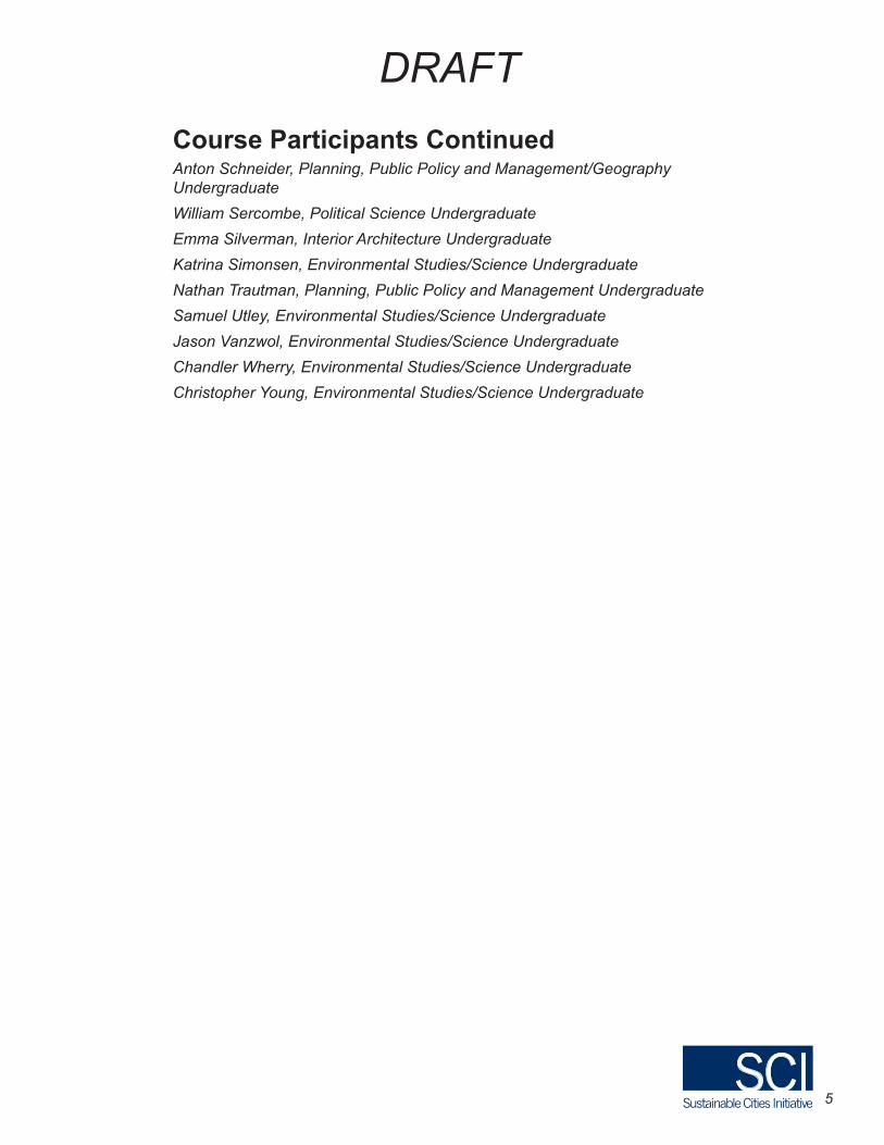
Course Participants ContinuedAnton Schneider, Planning, Public Policy and Management/Geography Undergraduate
William Sercombe, Political Science Undergraduate
Emma Silverman, Interior Architecture Undergraduate
Katrina Simonsen, Environmental Studies/Science Undergraduate
Nathan Trautman, Planning, Public Policy and Management Undergraduate
Samuel Utley, Environmental Studies/Science Undergraduate
Jason Vanzwol, Environmental Studies/Science Undergraduate
Chandler Wherry, Environmental Studies/Science Undergraduate
Christopher Young, Environmental Studies/Science Undergraduate

6
DRAFT
7
DRAFT
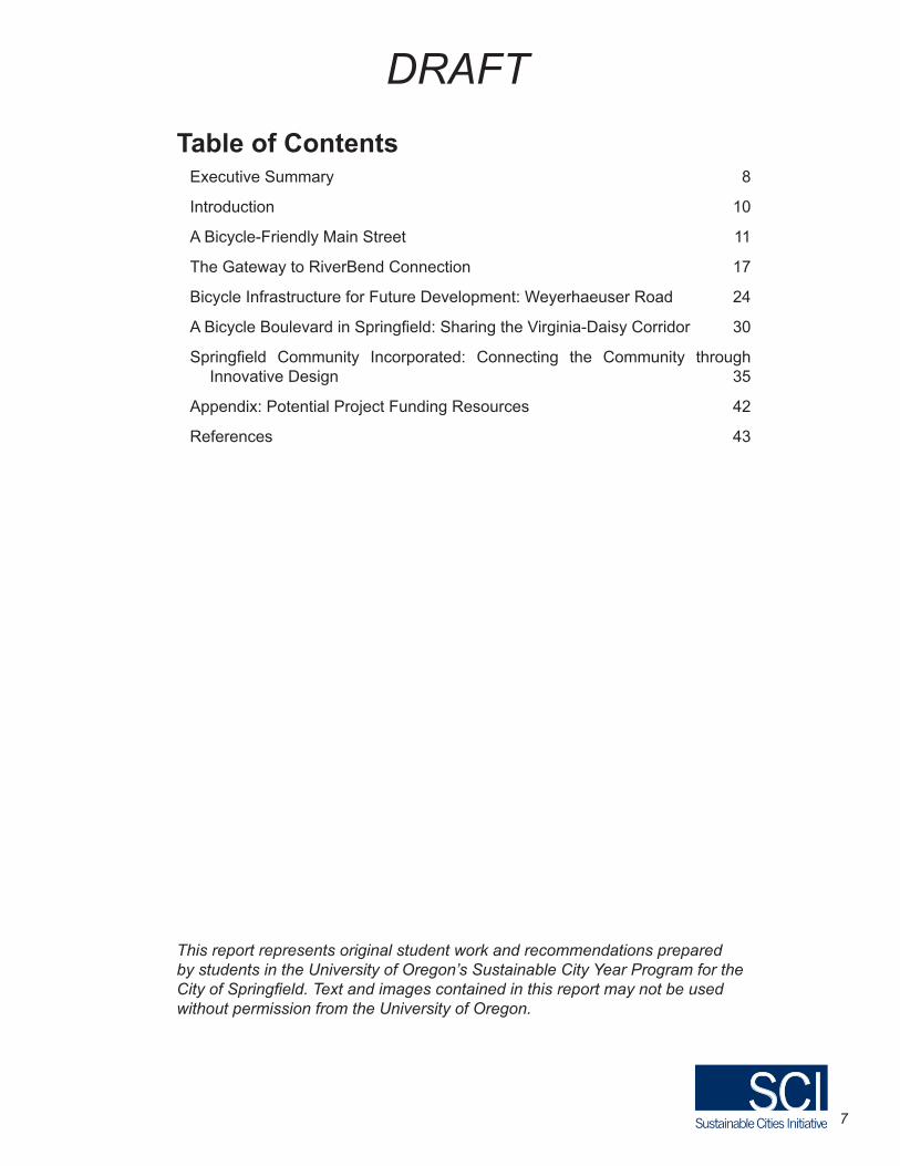
Table of ContentsExecutive Summary 8
Introduction 10
A Bicycle-Friendly Main Street 11
The Gateway to RiverBend Connection 17
Bicycle Infrastructure for Future Development: Weyerhaeuser Road 24
A Bicycle Boulevard in Springfield: Sharing the Virginia-Daisy Corridor 30
Springfield Community Incorporated: Connecting the Community through Innovative Design 35
Appendix: Potential Project Funding Resources 42
References 43
This report represents original student work and recommendations prepared by students in the University of Oregon’s Sustainable City Year Program for the City of Springfield. Text and images contained in this report may not be used without permission from the University of Oregon.
8
DRAFT
Executive Summary The proposals outlined in this report were generated in the collaboration between the City of Springfield and the University of Oregon Sustainable Cities Initiative during the fall of 2011. Forty-two students in the Planning, Public Policy, and Management course entitled “Bicycle Transportation,” taught by Professor Marc Schlossberg, reviewed and examined critical elements of an urban bikeway system and proposed projects that would utilize bicycle infrastructure to encourage bicycle ridership in Springfield. This course was offered to upper-level undergraduates and graduate students from a variety of academic disciplines.
The City of Springfield provided three project concept documents to facilitate collaboration and inform work products that contributed to the city’s goals. These included the Gateway to RiverBend Connection, the Virigina/Daisy Bicycle Boulevard, and the conversion of Weyerhaeuser Haul Road into a multi-use path. These project concepts laid the groundwork for and inspired some of the student proposals outlined in this report. This class generated a total of nine group proposals, which fell into four general categories: A Bicycle-Friendly Main Street, the Gateway to RiverBend Connection, Bicycle Infrastructure for Future Development: Weyerhaeuser, and Increasing Neighborhood Connectivity.
Two proposals address the issue of transforming Main Street into a more accommodating environment by applying the principles of Complete Streets. These projects include suggestions for physical infrastructure and bicycle design elements such as bicycle tracks, bicycle traffic lights, and implementation of road diets to reduce automobile speeds and create a friendlier environment for bicyclists. In addition, these projects also address the issue of raising public awareness and encouragement of bicycling as a form of transportation within Springfield. This includes the implementation of programs such as the National Safe Routes to School program.
Three proposals focus on improving the connection between the new Gateway Transit Center and Springfield’s largest regional hospital, RiverBend Medical Center. Recommendations for physical improvements along this route include narrowing roadway within some areas, bike lanes, sharrows, wayfinding signage, and traffic calming elements such as roundabouts on residential streets. The scope of these projects encompasses improved connectivity between residential streets and neighborhoods to three EmX stations, as well as improved connectivity to the area from the new bicycle/pedestrian bridge across I-5 between Eugene and Springfield.
Two proposals address the issues of improving bicycle infrastructure through neighborhoods and residential areas. One project critically examines the potential benefits of a bicycle boulevard on the Virginia/Daisy corridor as a safer and more accessible bicycle route alternative to Main Street. The other project analyzes connectivity in an area just south of Highway 126, at the intersection of Pioneer Parkway and Centennial Boulevard. This project divides the area into
9
DRAFT
four cardinal quadrants and proposes design improvements such as bicycle boulevards, buffered bike lanes, and various traffic calming methods. Both projects also address the issue of public education to raise awareness and use of the bicycle infrastructure.
Two proposals address the redesign of Weyerhaeuser Haul Road into a multi-use path in anticipation of future urban growth and development in the Jasper-Natron Area. The projects address the issue of increasing accessibility to the path for adjacent neighborhoods by suggesting design elements such a bicycle traffic light and a park-and-ride area. Both projects emphasize the benefit of this path as an amenity that would add value to both the neighborhood and the City of Springfield.
The conclusion offers some suggestions for ways that the City of Springfield may use this document by highlighting the key infrastructural improvements proposed in each section. Although proposals are not intended to be used as a comprehensive plan, individual elements from each section can be implemented to improve bicycle infrastructure, connectivity, and safety in Springfield.

10
DRAFT
IntroductionThe City of Springfield, in partnership with the University of Oregon Sustainable Cities Initiative, is working to build a more livable and sustainable urban environment. One important aspect in such an environment is active transportation. Through a series of different projects, as will be summarized in this comprehensive report, students from the University of Oregon offer insight on how Springfield can better position itself in line with contemporary and projected trends in transportation. The City of Springfield collaborated with the students enrolled in Marc Schlossberg’s Bicycle Transportation class to identify the areas in which Springfield’s bicycle transportation system is lacking.
The coursework for the class provided an in-depth analysis of bicycle infrastructure, culture, and policies. Case studies and readings presented the difficulties of creating bicycle policy and how they can be overcome. Additionally, example images and explanations of successful bicycle infrastructure and policies in Europe, as well as the United States, were given to demonstrate what qualities make for well-utilized designs.
To increase the number of people cycling, there must be adequate bicycle facilities to support cyclist’s needs for safety, comfort, and accessibility. In Springfield the correlation between the low number of cyclists and lack of facilities is evident. The ideas in these reports are based on designs and methods that create a friendlier bicycle environment. The students also traveled to Springfield for their specific projects to tailor their designs to the city. Many of the groups took surveys and interviewed community members and businesses as well to better understand the needs of the community.
The City of Springfield can benefit greatly by improving and supporting active transportation. Increasing facilities for active transportation can provide more transportation choices for the public. Often people would prefer to bike due to economic, social, or health concerns. Yet without proper infrastructure, biking is not always a feasible option. Besides the preferences of the public, the community at large also benefits from supporting active transportation. Active transportation reduces pollution and improves air quality, reducing health problems and minimizing strain on medical services. Active transportation also has a positive impact on the economy of a city by increasing the number of people with access to transportation. And finally, active transportation can help create and sustain a vibrant community. All these benefits and more are addressed in detail in the following report.
11
DRAFT
A Bicycle-Friendly Main Street
BackgroundThe people, visitors, and businesses of Springfield need a downtown that is welcoming, inviting, and economically prosperous. What could be a vibrant and active downtown and a thriving central business district, Main Street in downtown Springfield has become a throughway in which cars drive at high speeds to get to their destinations—which are frequently not on Main Street. The current conditions do not create a friendly environment for people who wish to use non-motorized transportation.
In order to encourage more people to come downtown, the street must be made friendlier to active transportation users. Currently pedestrians are forced to run across the street to avoid cars, and cyclists ride on the sidewalks due to a lack of bicycle facilities. Being on Main Street as a pedestrian or cyclist is not a pleasant experience. The space has become an environment that is not inclusive of forms of transportation other than motor vehicles. In order to change this, we must encourage people to leave their cars to enjoy the window shopping, coffee drinking, and socializing that is currently available and will become more available as downtown Springfield is further developed. Downtown Springfield can provide a cohesive sense of community by offering a space that is fun, safe, and exciting for active transportation users. The following two reports provide ideas and proposals to improve this downtown area.
Complete Main Street: Renewing Downtown SpringfieldNicholas Berardi, Molly Bacon, Gawain Harman, Nathan Trautman
This proposal addresses the Main Street corridor between Mill Street and 20th Street. A mostly auto-oriented transportation system dominates this stretch of Main Street. This report focuses on ways to increase active transportation and create a more ideal shopping environment that provides a friendly and safe environment for all users.
Along with the physical aspects of the redesign of Main Street, we also include the results of interviews conducted with Main Street business owners. The majority of the responses from the eight businesses expressed a desire for more bicycle infrastructure, transit facilities, and pedestrian accommodations. While there was some concern that a redesign that would take away parking on one side of the street, the report provides data that there would still be adequate parking to meet needs.
In addition to the new street design, this report emphasizes an educational aspect to acclimate the population to the new design. The report offers ideas such as brochures and a website with information about cycling training
12
DRAFT
courses, maps, and bus times. We also recommend the implementation of the Safe Routes to Schools program—a national program that promotes children walking and bicycling to school to encourage healthy and active lifestyles at an early age.
The physical recommendations for a friendly, safe, and inter-modal transportation system on Main Street are as follows:
• Create a buffered two-way cycle track on the north side of Main Street between 20th Street and 10th Street in place of the current bike lane and car parking (Figure 1).
• Create a two-way cycle track between 10th Street and Mill Street in place of current on-street parking, on the north side of the road (Figure 3). A bioswale buffer could separate traffic modes and keep water off of the street.
• Install ten spaces of bicycle parking in the middle of each block on both sides of the street.
• Install bicycle traffic lights with sensors (Figure 4). • Narrow the automobile lanes to calm traffic, creating a more comfortable
environment and decreasing auto speeds.• Increase the number of bus stops by replacing a few parking spaces with
transit stops.• Provide additional lighting for safety.
Figure 2 (this page and next): Main Street right-of-way layout.
Figure 1: Proposed cycle track between 20th Street and 10th Street.
13
DRAFT
Figure 3: Proposed cycle track between 10th Street and Mill Street.
Figure 4. Bicycle traffic lights can help further separate cyclists from auto drivers by creating different times of intersection
crossing.
Cycling Incentive Programs for Downtown Employers and Employees
The 5 E’s are Engineering, Education, Enforcement, Encouragement, and Evaluation. These 5 concepts are crucial to consider to create a safe and well-utilized cyclist environment. Cycling Incentive Programs fall within the category of “Encouragement,” as they promote bicycling as a mode of transport that employees can use for their daily commute. Employers can do this by providing bicycle parking and changing facilities for employees who bike to work. They can also incentivize this behavior by rewarding employees who make over sixty percent of their trips to work by bike with a gift certificate to a local bike shop can further motivate people to bike to work. Making it easier and providing incentives may lead more employees to bike to work, and encourage the community to view bicycling as a sustainable and accessible mode of transportation.
14
DRAFT
Main Street Trekkers: Paving the Way Toward a Bike Friendly SpringfieldHannah Crum, Joseph McGinley, Emma Silverman, Sam Utley
This proposal addresses the block of Main Street between Pioneer Parkway and 4th Street. The street redesign in this section may also be applied to other blocks on Main Street. Yet for reasons of simplicity we chose to focus on one block to provide an example of the overall street. This report offers four recommendations for how Main Street could be redesigned to support a balanced and safe transportation system that will encourage people to come downtown and shop at local businesses.
The first two recommendations are more cost-efficient and possibly easier to implement due to less infrastructure. While the second two may be more difficult to implement, they will last longer due to a built infrastructure and separate facilities through more physical barriers.
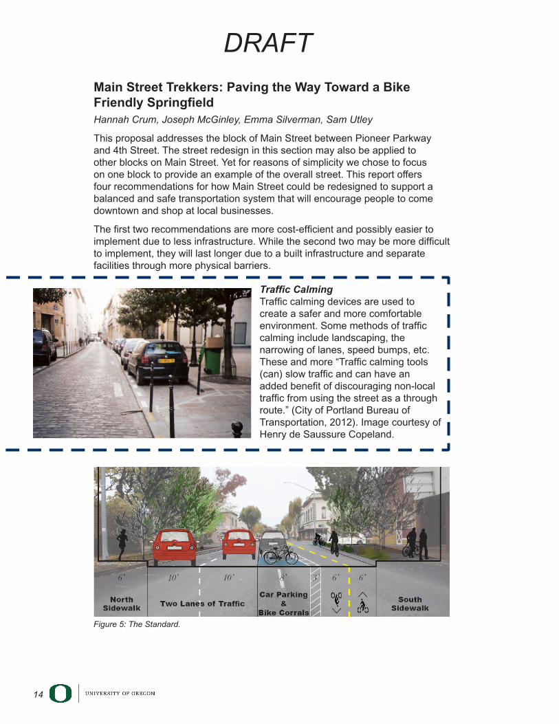
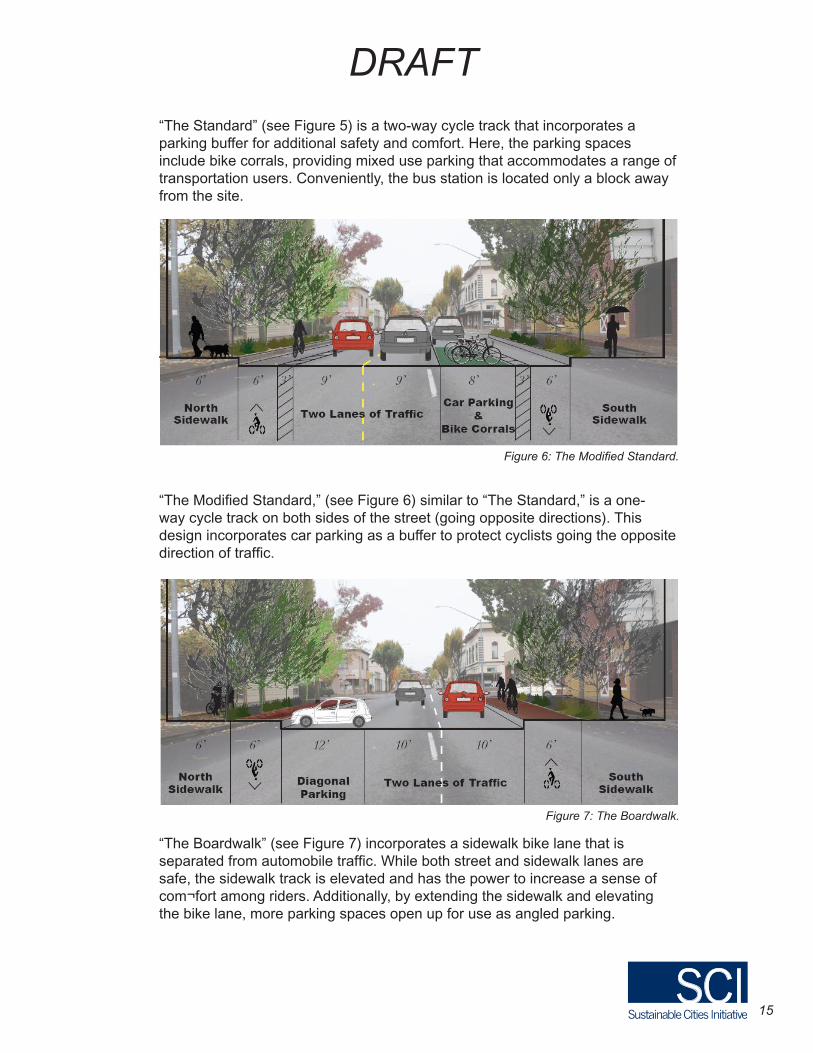
Traffic Calming Traffic calming devices are used to create a safer and more comfortable environment. Some methods of traffic calming include landscaping, the narrowing of lanes, speed bumps, etc. These and more “Traffic calming tools (can) slow traffic and can have an added benefit of discouraging non-local traffic from using the street as a through route.” (City of Portland Bureau of Transportation, 2012). Image courtesy of Henry de Saussure Copeland.
Figure 5: The Standard.
15
DRAFT
“The Standard” (see Figure 5) is a two-way cycle track that incorporates a parking buffer for additional safety and comfort. Here, the parking spaces include bike corrals, providing mixed use parking that accommodates a range of transportation users. Conveniently, the bus station is located only a block away from the site.
“The Modified Standard,” (see Figure 6) similar to “The Standard,” is a one-way cycle track on both sides of the street (going opposite directions). This design incorporates car parking as a buffer to protect cyclists going the opposite direction of traffic.
“The Boardwalk” (see Figure 7) incorporates a sidewalk bike lane that is separated from automobile traffic. While both street and sidewalk lanes are safe, the sidewalk track is elevated and has the power to increase a sense of com¬fort among riders. Additionally, by extending the sidewalk and elevating the bike lane, more parking spaces open up for use as angled parking.
Figure 6: The Modified Standard.
Figure 7: The Boardwalk.
16
DRAFT
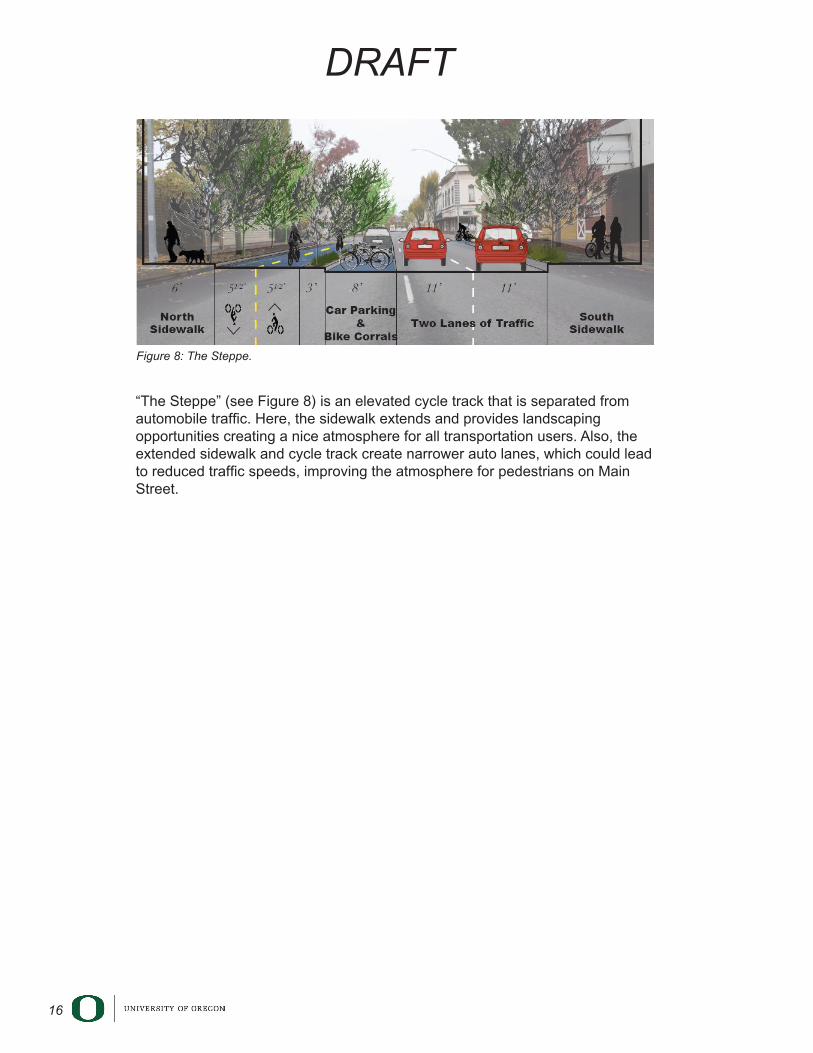
“The Steppe” (see Figure 8) is an elevated cycle track that is separated from automobile traffic. Here, the sidewalk extends and provides landscaping opportunities creating a nice atmosphere for all transportation users. Also, the extended sidewalk and cycle track create narrower auto lanes, which could lead to reduced traffic speeds, improving the atmosphere for pedestrians on Main Street.
Figure 8: The Steppe.
17
DRAFT
The Gateway to RiverBend Connection
BackgroundWhile the City of Springfield is relatively easy to navigate, the area between the Gateway Mall and the Sacred Heart Medical Center at RiverBend is not. While the addition of RiverBend Medical Center has generated tremendous activity, its infrastructure has not kept pace. RiverBend is the area’s largest regional hospital, employing 4,300 workers (Farrington 2011). These workers create additional traffic on the roadways. While the hospital has taken steps toward improving bicycle transportation by including multi-use pathways, the pathways remain unconnected to other bicycle networks. As a result they are under-utilized. The hospital stands to benefit from bicycle infrastructure, as it would allow its workers to safely commute to and from work. Yet, as of now, the surrounding roadways leave much to be desired in the way of active transportation. Without an integrated bicycle network these bicycle facilities will remain disconnected.
Likewise, the I-5 bike path is also unconnected to any other bike paths, ending at the Gateway Mall with no further continuation. The I-5 path also has poorly marked bicycle lanes and unmarked crosswalks.
The ideas and proposals in this report provide for a comprehensive transportation network between the hospital and the mall to create a safer and more comfortable active transportation environment. This environment will encourage more people to bike and utilize different modes of transportation.
Gateway to RiverBend Connection 1: Addition of a bike lane on the connection between Gateway and RiverBendErin Finley, Casey Hawkes, Alex Mauritz, Katrina Simonsen
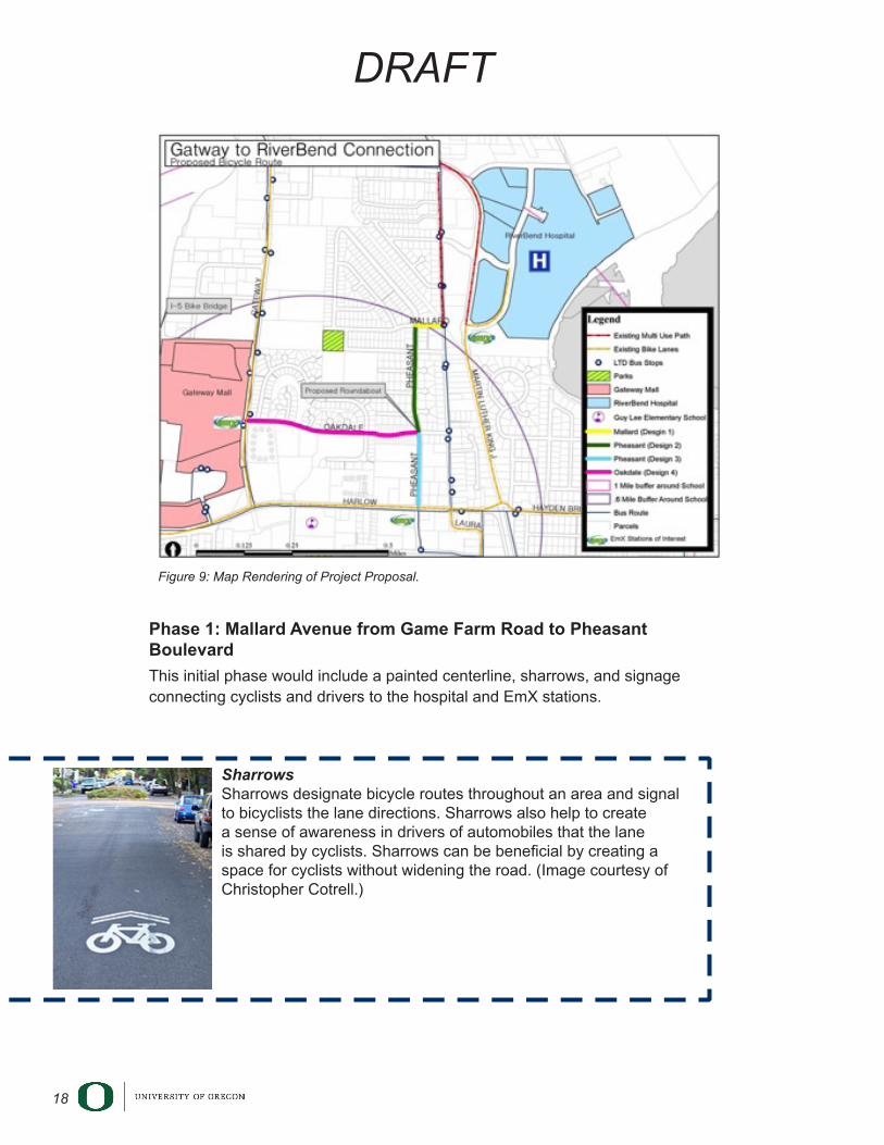
This report focuses on creating safer access for active modes of transportation between Gateway Mall and RiverBend Medical Center. The proposed route begins at the intersection of Gateway Street and Oakdale Avenue, proceeds east down Oakdale Street to Pheasant Boulevard, turns north at Pheasant Boulevard, and finally proceeds east on Mallard Avenue toward the Medical Center (Figure 9). The design components and features include traffic calming devices such as speed bumps, a roundabout, sharrows, bike lanes, and indicative and directional signage.
The people of Springfield would benefit from access to adequate bicycle facilities, and the city has an opportunity to better the area’s multi-modal accessibility. Springfield could take advantage of this opportunity by pursuing the following recommendations:
18
DRAFT
Phase 1: Mallard Avenue from Game Farm Road to Pheasant Boulevard
This initial phase would include a painted centerline, sharrows, and signage connecting cyclists and drivers to the hospital and EmX stations.
SharrowsSharrows designate bicycle routes throughout an area and signal to bicyclists the lane directions. Sharrows also help to create a sense of awareness in drivers of automobiles that the lane is shared by cyclists. Sharrows can be beneficial by creating a space for cyclists without widening the road. (Image courtesy of Christopher Cotrell.)
Figure 9: Map Rendering of Project Proposal.
19
DRAFT
Phase 2: Residential section of Pheasant Boulevard, Oakdale Avenue to Mallard Avenue
This phase would add bike lanes on each side of the road eliminating existing street parking on Pheasant Boulevard, a center road divider with landscaped elements, painted centerlines, and speed bumps to serve as traffic calming elements. Signage will consists of “no parking” signs, bike lane signs, directional signs (to hospital and EmX), and signs indicating speed bumps.
Phase 3: Pheasant Street, South of Oakdale Avenue
The intention of this phase is to connect cyclists to the nearby EmX stations and the Gateway Mall. Features primarily include bike lanes but also add sharrows on some stretches of this street. On-street parking on the east side of the road would be replaced with a bike lane. Signage will consist of parking signs, no parking signs, bike lane signs, and directional signage to the hospital and to other local landmarks and bicycle routes.
Phase 4: Oakdale Avenue from Pheasant Street to Gateway Street
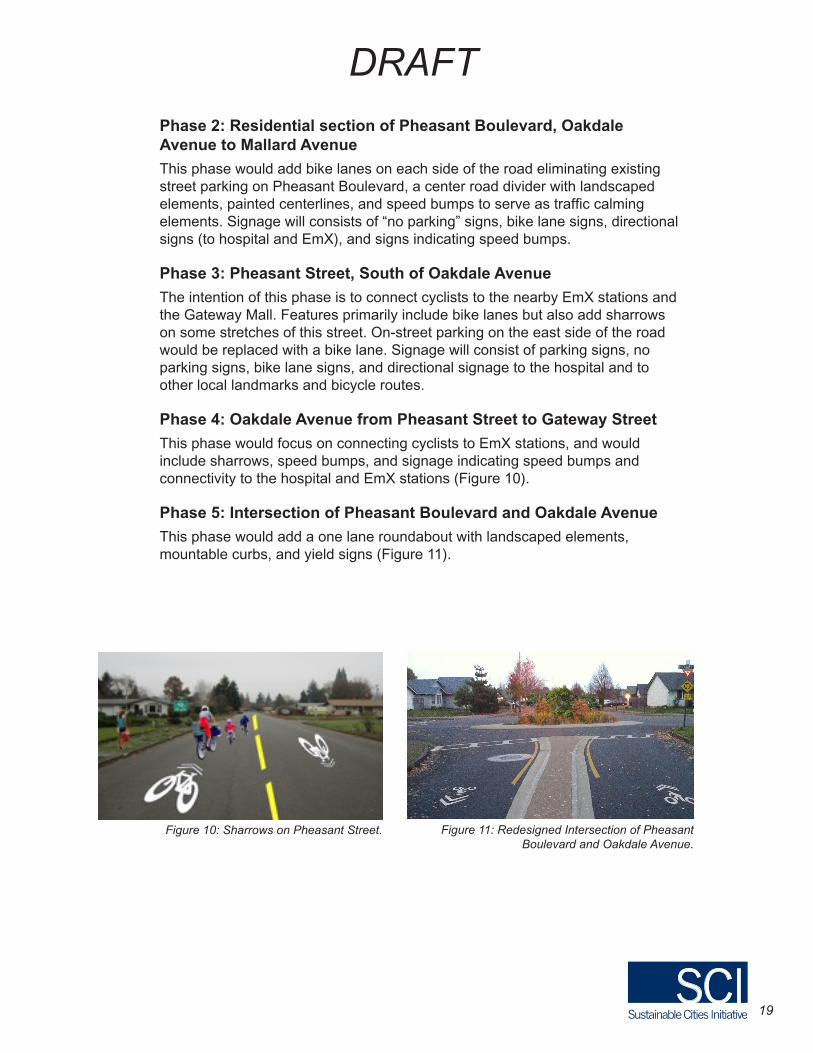
This phase would focus on connecting cyclists to EmX stations, and would include sharrows, speed bumps, and signage indicating speed bumps and connectivity to the hospital and EmX stations (Figure 10).
Phase 5: Intersection of Pheasant Boulevard and Oakdale Avenue
This phase would add a one lane roundabout with landscaped elements, mountable curbs, and yield signs (Figure 11).
Figure 11: Redesigned Intersection of Pheasant Boulevard and Oakdale Avenue.
Figure 10: Sharrows on Pheasant Street.
20
DRAFT
Gateway to RiverBend Connection 2: The Call for Bicycle InfrastructureThis report addresses the streets of Game Farm Road, Mallard Avenue, and Oakdale Street in Springfield. These streets provide access to the area around the Gateway Mall and RiverBend Hospital areas. Currently these streets do not accommodate the needs of cyclists or pedestrians in terms of facilities, safety, and comfort. These streets all have parking on both sides that is not being utilized to its full capacity. Removing a lane of parking would make room for the bicycle facilities discussed below.
Contra-flow bike lane on Oakdale Street: By removing the parking on the north side of Oakdale Street, space would be made for a contra-flow bike lane. On the South side of the street there would be parallel parking.
Creating sharrows on Mallard Avenue and Pheasant Boulevard: A sharrow is a lane that both bicycles and cars share, as indicated by a bicycle symbol and directional arrows on the street. Sharrows are beneficial because they create a space for cyclists without widening the road.
Pedestrian safety features: Crosswalks would allow for pedestrians to cross intersections safely and be seen by all modes of traffic.
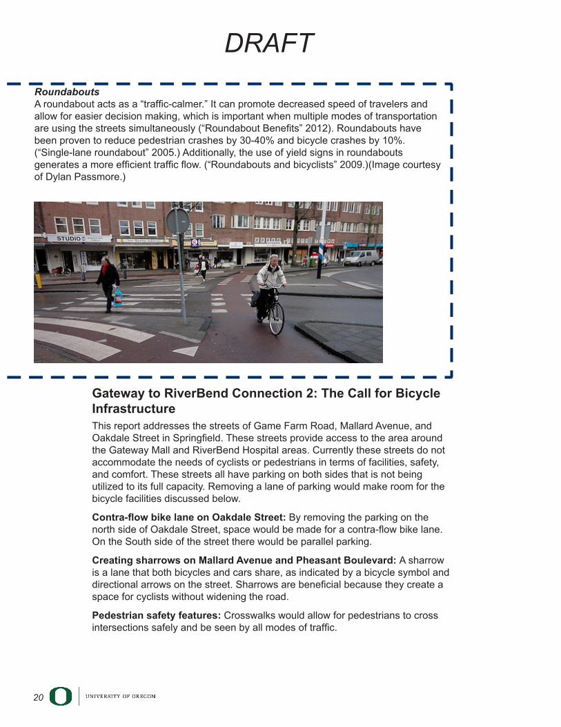
RoundaboutsA roundabout acts as a “traffic-calmer.” It can promote decreased speed of travelers and allow for easier decision making, which is important when multiple modes of transportation are using the streets simultaneously (“Roundabout Benefits” 2012). Roundabouts have been proven to reduce pedestrian crashes by 30-40% and bicycle crashes by 10%. (“Single-lane roundabout” 2005.) Additionally, the use of yield signs in roundabouts generates a more efficient traffic flow. (“Roundabouts and bicyclists” 2009.)(Image courtesy of Dylan Passmore.)
21
DRAFT
Connecting I-5 Gateway Pedestrian Bridge to RiverBend Medical CenterAnna Maier, Natalie Kessler, Jason Vanzwol, John Olson
This report proposes a continuous bicycle path connecting the I-5 Gateway Pedestrian Bridge to RiverBend Medical Center. The focus of this report is on the provision of a bicycle path that would connect people and goods to the places they want to go and to create a more walkable and bicycle friendly atmosphere. Our proposed path would also allow people the option to bicycle to the mall through Gamebird Park, and to RiverBend Medical Center, ultimately giving the community more transportation opportunities.
These recommendations, if followed, would expand the connectivity and transportation options for Gateway Mall, Pacific Village Apartments, Gamebird Park, Food for Lane County’s Youth Farm, among others.
One concern in this proposal is that some of the bicycle facilities would be on private property, but this may not be of concern to some private property owners, including restaurants such as Carl’s Jr., which could enjoy more business from the close proximity of bicycle facilities.
Proposed bicycle facilities:
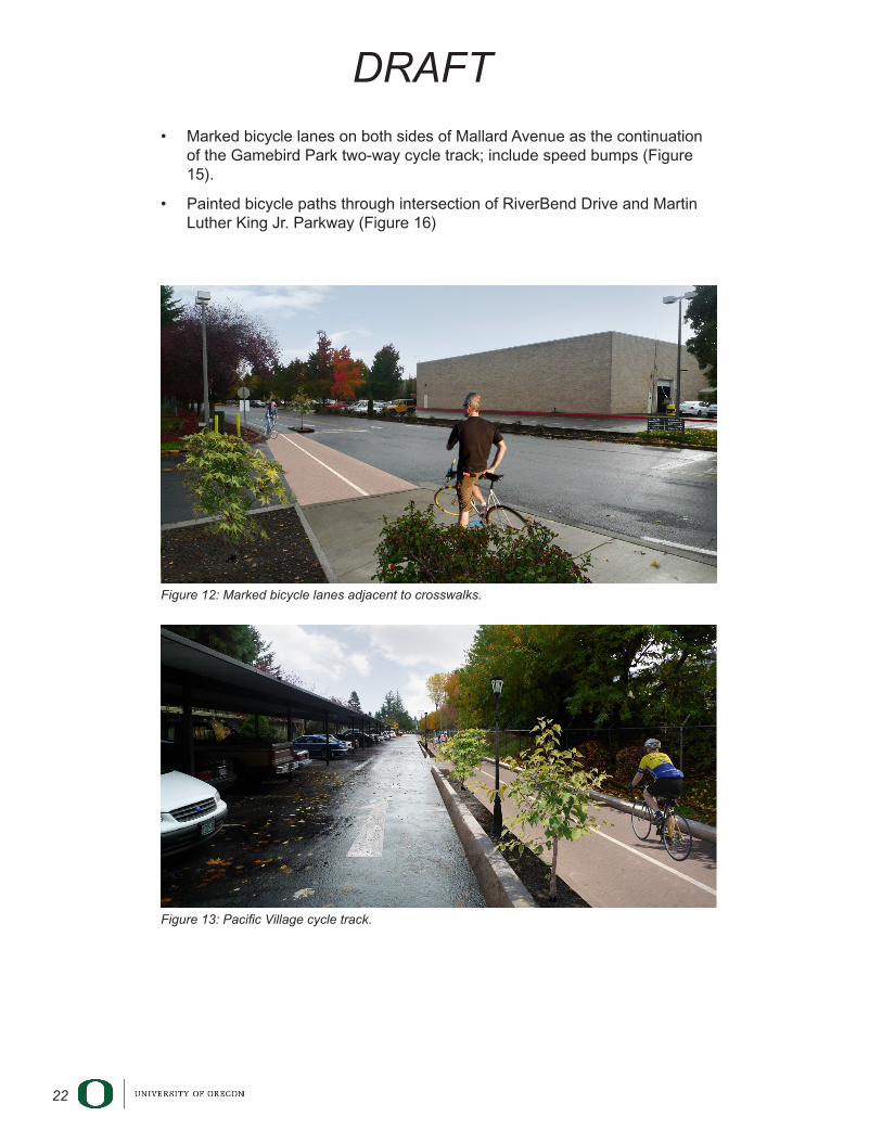
• Paint marked bicycle lanes that run adjacent to crosswalks and connect bicyclists to the I-5 Gateway Pedestrian Bridge (Figure 12).
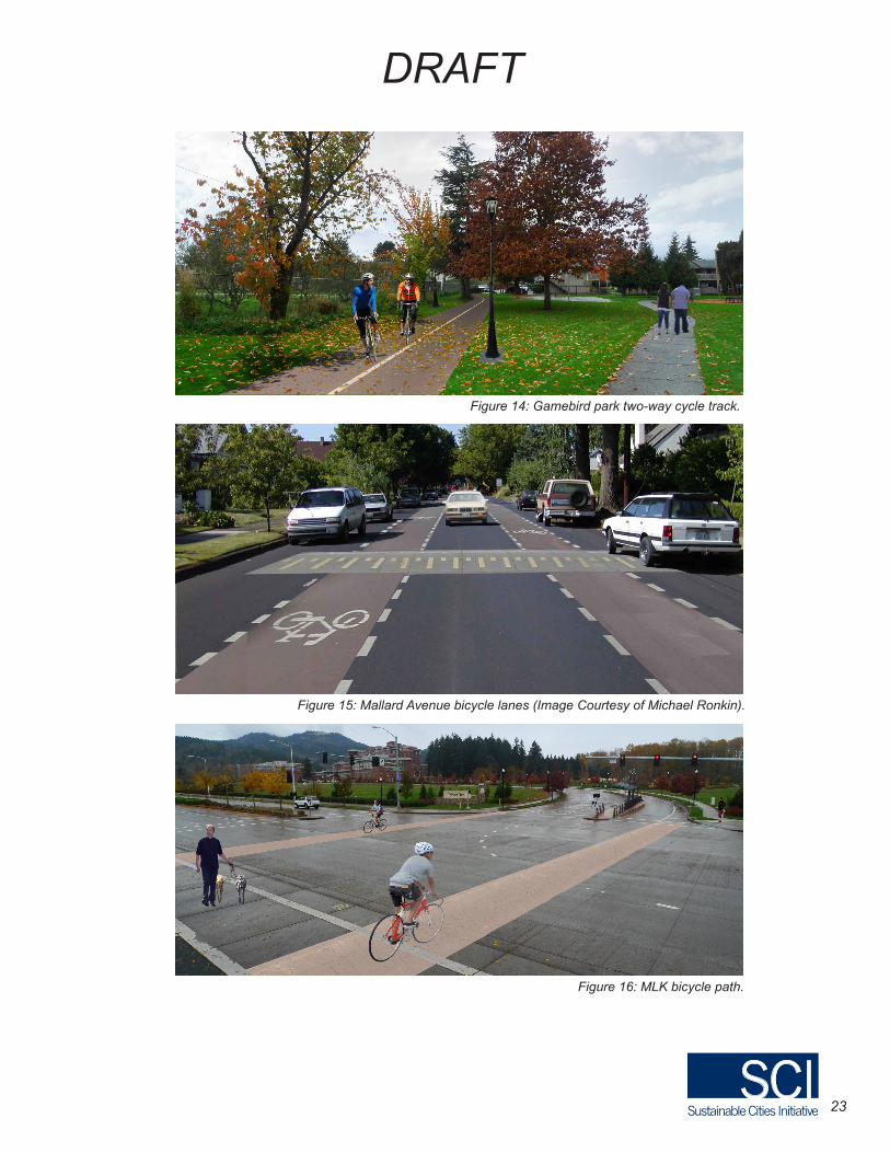
• Colored, marked bicycle lane going across Gateway Street and continuing through the parking lot of Pacific Village Apartments as a cycle track. Include islands or dividers in the middle of the marked bicycle lane and minor improvements to the existing marked bicycle lane (Figure 13)
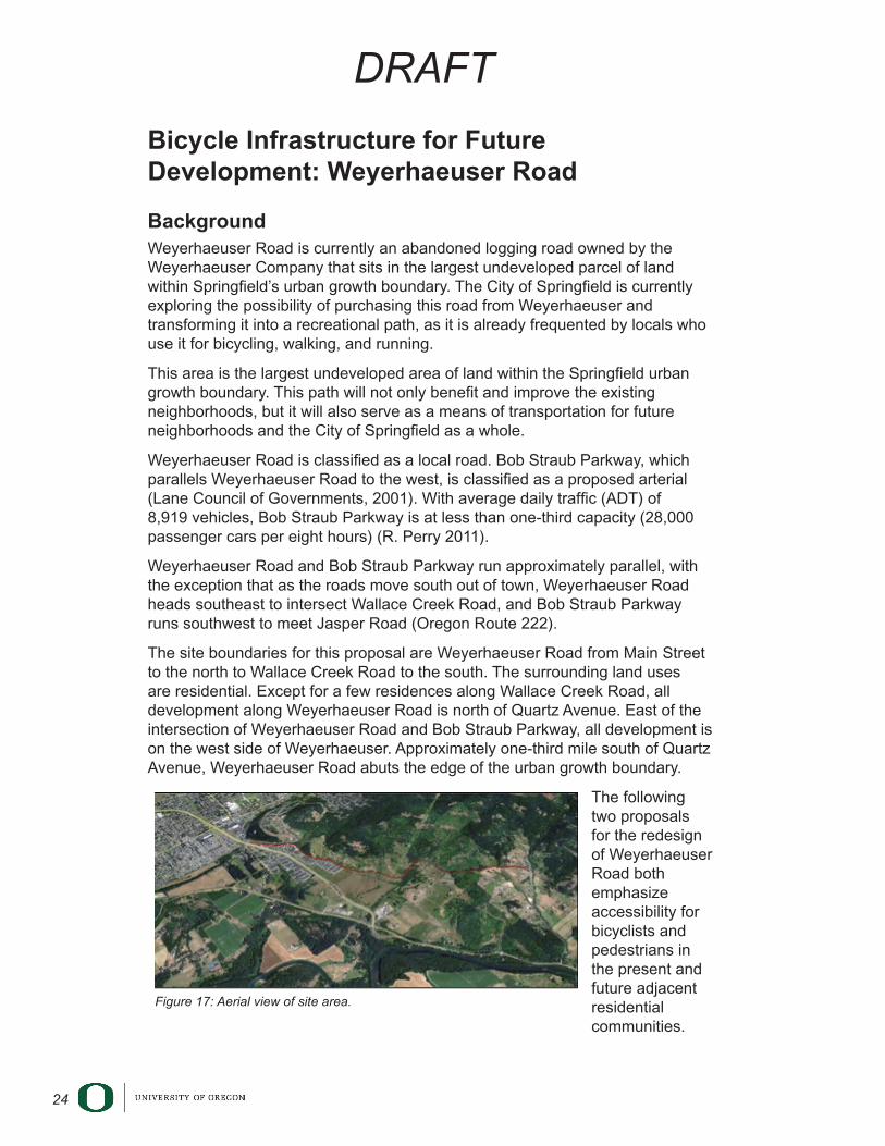
• Two-way cycle path through Gamebird Park as the continuation from the Pacific Village cycle track (Figure 14).
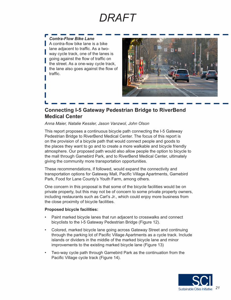
Contra-Flow Bike LaneA contra-flow bike lane is a bike lane adjacent to traffic. As a two-way cycle track, one of the lanes is going against the flow of traffic on the street. As a one-way cycle track, the lane also goes against the flow of traffic.
22
DRAFT
• Marked bicycle lanes on both sides of Mallard Avenue as the continuation of the Gamebird Park two-way cycle track; include speed bumps (Figure 15).
• Painted bicycle paths through intersection of RiverBend Drive and Martin Luther King Jr. Parkway (Figure 16)
Figure 13: Pacific Village cycle track.
Figure 12: Marked bicycle lanes adjacent to crosswalks.
23
DRAFT
Courtesy of Michael Ronkin
Figure 15: Mallard Avenue bicycle lanes (Image Courtesy of Michael Ronkin).
Figure 14: Gamebird park two-way cycle track.
Figure 16: MLK bicycle path.
24
DRAFT
Bicycle Infrastructure for Future Development: Weyerhaeuser Road
BackgroundWeyerhaeuser Road is currently an abandoned logging road owned by the Weyerhaeuser Company that sits in the largest undeveloped parcel of land within Springfield’s urban growth boundary. The City of Springfield is currently exploring the possibility of purchasing this road from Weyerhaeuser and transforming it into a recreational path, as it is already frequented by locals who use it for bicycling, walking, and running.
This area is the largest undeveloped area of land within the Springfield urban growth boundary. This path will not only benefit and improve the existing neighborhoods, but it will also serve as a means of transportation for future neighborhoods and the City of Springfield as a whole.
Weyerhaeuser Road is classified as a local road. Bob Straub Parkway, which parallels Weyerhaeuser Road to the west, is classified as a proposed arterial (Lane Council of Governments, 2001). With average daily traffic (ADT) of 8,919 vehicles, Bob Straub Parkway is at less than one-third capacity (28,000 passenger cars per eight hours) (R. Perry 2011).
Weyerhaeuser Road and Bob Straub Parkway run approximately parallel, with the exception that as the roads move south out of town, Weyerhaeuser Road heads southeast to intersect Wallace Creek Road, and Bob Straub Parkway runs southwest to meet Jasper Road (Oregon Route 222).
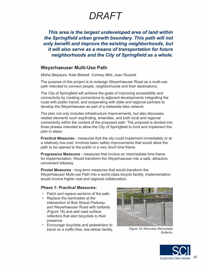
The site boundaries for this proposal are Weyerhaeuser Road from Main Street to the north to Wallace Creek Road to the south. The surrounding land uses are residential. Except for a few residences along Wallace Creek Road, all development along Weyerhaeuser Road is north of Quartz Avenue. East of the intersection of Weyerhaeuser Road and Bob Straub Parkway, all development is on the west side of Weyerhaeuser. Approximately one-third mile south of Quartz Avenue, Weyerhaeuser Road abuts the edge of the urban growth boundary.
The following two proposals for the redesign of Weyerhaeuser Road both emphasize accessibility for bicyclists and pedestrians in the present and future adjacent residential communities.
Figure 17: Aerial view of site area.
25
DRAFT
Weyerhaeuser Multi-Use Path
Misha Belyayev, Kate Bidwell, Cortney Mild, Joan Russick
The purpose of this project is to redesign Weyerhaeuser Road as a multi-use path intended to connect people, neighborhoods and their destinations.
The City of Springfield will achieve the goals of improving accessibility and connectivity by creating connections to adjacent developments integrating the route with public transit, and cooperating with state and regional partners to develop the Weyerhaeuser as part of a statewide bike network.
The plan not only includes infrastructure improvements, but also discusses related elements such wayfinding, amenities, and both local and regional connectivity within the context of the proposed path. The proposal is divided into three phases intended to allow the City of Springfield to fund and implement the plan in steps:
Practical Measures - measures that the city could implement immediately or at a relatively low-cost. Involves basic safety improvements that would allow the path to be opened to the public in a very short time frame.
Progressive Measures - measures that involve an intermediate time frame for implementation. Would transform the Weyerhaeuser into a safe, attractive, convenient bikeway.
Pivotal Measures - long-term measures that would transform the Weyerhaeuser Multi-use Path into a world-class bicycle facility. Implementation would involve higher cost and regional collaboration.
Phase 1: Practical Measures:
• Patch and repave sections of the path.• Replace the barricades at the
intersection of Bob Straub Parkway and Weyerhaeuser Road with bollards (Figure 18) and add road surface reflectors that alert bicyclists to their presence.
• Encourage bicyclists and pedestrians to travel on a traffic-free, low-stress facility.
This area is the largest undeveloped area of land within the Springfield urban growth boundary. This path will not only benefit and improve the existing neighborhoods, but
it will also serve as a means of transportation for future neighborhoods and the City of Springfield as a whole.
Figure 18: Remotely Retractable Bollards.
26
DRAFT
Phase 2: Progressive Measures
• Install a bicycle sensor-activated traffic signal and diagonal crosswalk markings at the intersection of Bob Straub Parkway and Weyerhaeuser Road to make crossing safe and convenient.
• Create connections to adjacent developments; for example where Weyerhaeuser Road connects to Quartz Avenue.
• Integrate the route with public transit.
• Install wayfinding signage and lighting along the path for navigation purposes.
Phase 3: Pivotal Measures
• Build a bicycle-pedestrian bridge across Bob Straub Parkway at Weyerhaeuser Road.
• Integrate Weyerhaeuser multi-use path with
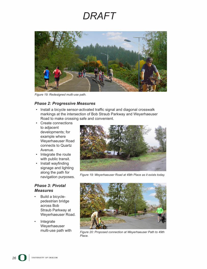
Figure 19: Redesigned multi-use path.
Figure12.1Extendingexistingstreetstoconnecttothepath
Figure12.2:WeyerhaeuserRoadat49thPlaceasitexiststoday
Figure12.3:ProposedconnectionoftheWeyerhaeuserPathto49thPlace
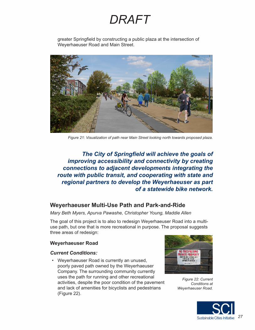
Figure 19: Weyerhaeuser Road at 49th Place as it exists today.
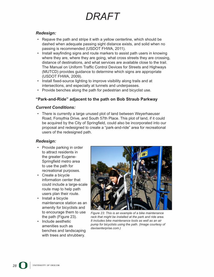
Figure 20: Proposed connection at Weyerhaeuser Path to 49th Place.
Figure12.1Extendingexistingstreetstoconnecttothepath
Figure12.2:WeyerhaeuserRoadat49thPlaceasitexiststoday
Figure12.3:ProposedconnectionoftheWeyerhaeuserPathto49thPlace
27
DRAFT
greater Springfield by constructing a public plaza at the intersection of Weyerhaeuser Road and Main Street.
Weyerhaeuser Multi-Use Path and Park-and-RideMary Beth Myers, Apurva Pawashe, Christopher Young, Maddie Allen
The goal of this project is to also to redesign Weyerhaeuser Road into a multi-use path, but one that is more recreational in purpose. The proposal suggests three areas of redesign:
Weyerhaeuser Road
Current Conditions:
• Weyerhaeuser Road is currently an unused, poorly paved path owned by the Weyerhaeuser Company. The surrounding community currently uses the path for running and other recreational activities, despite the poor condition of the pavement and lack of amenities for bicyclists and pedestrians (Figure 22).
Figure 21: Visualization of path near Main Street looking north towards proposed plaza.
The City of Springfield will achieve the goals of improving accessibility and connectivity by creating
connections to adjacent developments integrating the route with public transit, and cooperating with state and
regional partners to develop the Weyerhaeuser as part of a statewide bike network.
Figure 22: Current Conditions at
Weyerhaeuser Road.
28
DRAFT
Redesign:
• Repave the path and stripe it with a yellow centerline, which should be dashed when adequate passing sight distance exists, and solid when no passing is recommended (USDOT FHWA, 2011).
• Install wayfinding signs and route markers to assist path users in knowing where they are, where they are going, what cross streets they are crossing, distance of destinations, and what services are available close to the trail. The Manual on Uniform Traffic Control Devices for Streets and Highways (MUTCD) provides guidance to determine which signs are appropriate (USDOT FHWA, 2009).
• Install fixed-source lighting to improve visibility along trails and at intersections, and especially at tunnels and underpasses.
• Provide benches along the path for pedestrian and bicyclist use.
“Park-and-Ride” adjacent to the path on Bob Straub Parkway
Current Conditions:
• There is currently a large unused plot of land between Weyerhaeuser Road, Forsythia Drive, and South 57th Place. This plot of land, if it could be acquired by the City of Springfield, could also be incorporated into our proposal and redesigned to create a “park-and-ride” area for recreational users of the redesigned path.
Redesign:
• Provide parking in order to attract residents in the greater Eugene-Springfield metro area to use the path for recreational purposes.
• Create a bicycle information center that could include a large-scale route map to help path users plan their route.
• Install a bicycle maintenance station as an amenity for bicyclists and to encourage them to use the path (Figure 23).
• Include aesthetic amenities such as benches and landscaping with trees and shrubbery.
Figure 23: This is an example of a bike maintenance rack that might be installed at the park and ride area. It includes bike maintenance tools as well as an air pump for bicyclists using the path. (Image courtesy of davisenterprise.com.)
29
DRAFT
Intersection of Booth-Kelly Road and Bob Straub Parkway
Current Conditions:
• Although it is equipped with pedestrian crossing lights, the current intersection of Bob Straub Parkway and Booth-Kelly Road is not a friendly one for bicyclists, especially if they are trying to access the Weyerhaeuser path that is located diagonally across the intersection from Booth-Kelly Road.
Redesign:
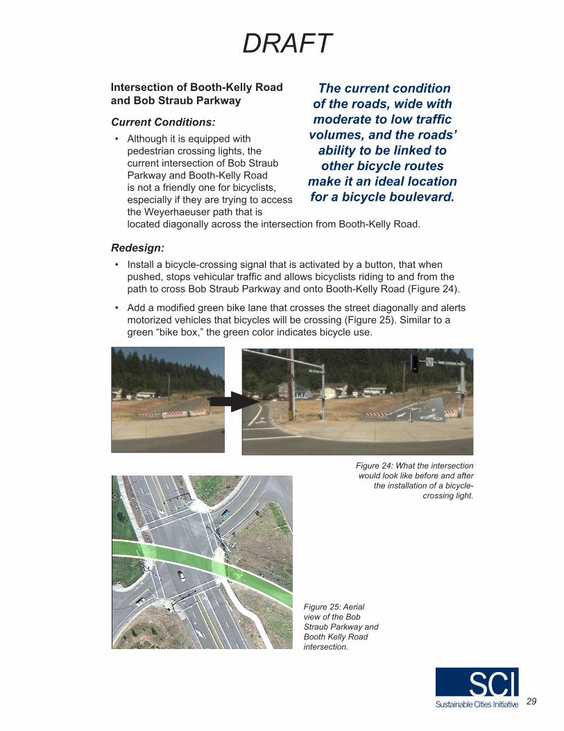
• Install a bicycle-crossing signal that is activated by a button, that when pushed, stops vehicular traffic and allows bicyclists riding to and from the path to cross Bob Straub Parkway and onto Booth-Kelly Road (Figure 24).
• Add a modified green bike lane that crosses the street diagonally and alerts motorized vehicles that bicycles will be crossing (Figure 25). Similar to a green “bike box,” the green color indicates bicycle use.
The current condition of the roads, wide with moderate to low traffic
volumes, and the roads’ ability to be linked to other bicycle routes
make it an ideal location for a bicycle boulevard.
Figure 24: What the intersection would look like before and after
the installation of a bicycle-crossing light.
Figure 25: Aerial view of the Bob Straub Parkway and Booth Kelly Road intersection.
30
DRAFT
A Bicycle Boulevard in Springfield: Sharing the Virginia-Daisy Corridor Sheila McGraw, Carson Quam, Josh Little, Lauren Eberle
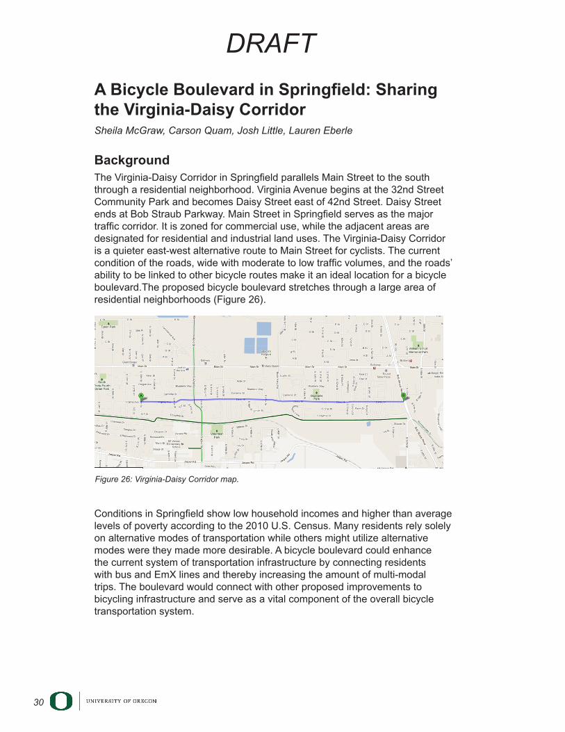
BackgroundThe Virginia-Daisy Corridor in Springfield parallels Main Street to the south through a residential neighborhood. Virginia Avenue begins at the 32nd Street Community Park and becomes Daisy Street east of 42nd Street. Daisy Street ends at Bob Straub Parkway. Main Street in Springfield serves as the major traffic corridor. It is zoned for commercial use, while the adjacent areas are designated for residential and industrial land uses. The Virginia-Daisy Corridor is a quieter east-west alternative route to Main Street for cyclists. The current condition of the roads, wide with moderate to low traffic volumes, and the roads’ ability to be linked to other bicycle routes make it an ideal location for a bicycle boulevard.The proposed bicycle boulevard stretches through a large area of residential neighborhoods (Figure 26).
Conditions in Springfield show low household incomes and higher than average levels of poverty according to the 2010 U.S. Census. Many residents rely solely on alternative modes of transportation while others might utilize alternative modes were they made more desirable. A bicycle boulevard could enhance the current system of transportation infrastructure by connecting residents with bus and EmX lines and thereby increasing the amount of multi-modal trips. The boulevard would connect with other proposed improvements to bicycling infrastructure and serve as a vital component of the overall bicycle transportation system.
Figure 26: Virginia-Daisy Corridor map.
31
DRAFT
Virginia-Daisy Corridor Bicycle Boulevard: Design Elements
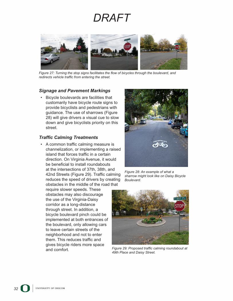
Turning Stop Signs
• Currently there are three stop signs on the Virginia-Daisy corridor that stop through traffic. These stop signs are located at 37th Street and Virginia Avenue, 38th Street and Virginia Avenue, and 49th Street and Daisy Street. Rotating these stop signs by 90 degrees to face drivers on north-south streets will allow cyclists to maintain their forward momentum (Figure 27).
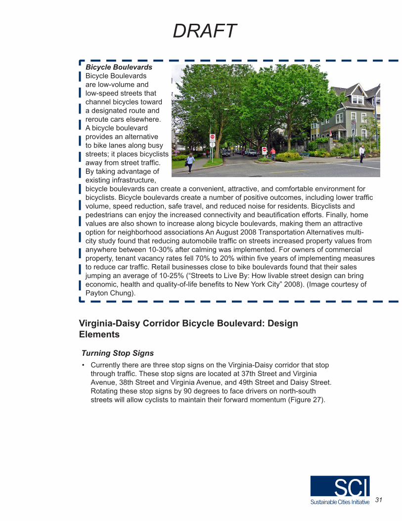
Bicycle BoulevardsBicycle Boulevards are low-volume and low-speed streets that channel bicycles toward a designated route and reroute cars elsewhere. A bicycle boulevard provides an alternative to bike lanes along busy streets; it places bicyclists away from street traffic. By taking advantage of existing infrastructure, bicycle boulevards can create a convenient, attractive, and comfortable environment for bicyclists. Bicycle boulevards create a number of positive outcomes, including lower traffic volume, speed reduction, safe travel, and reduced noise for residents. Bicyclists and pedestrians can enjoy the increased connectivity and beautification efforts. Finally, home values are also shown to increase along bicycle boulevards, making them an attractive option for neighborhood associations An August 2008 Transportation Alternatives multi-city study found that reducing automobile traffic on streets increased property values from anywhere between 10-30% after calming was implemented. For owners of commercial property, tenant vacancy rates fell 70% to 20% within five years of implementing measures to reduce car traffic. Retail businesses close to bike boulevards found that their sales jumping an average of 10-25% (“Streets to Live By: How livable street design can bring economic, health and quality-of-life benefits to New York City” 2008). (Image courtesy of Payton Chung).
32
DRAFT
Signage and Pavement Markings
• Bicycle boulevards are facilities that customarily have bicycle route signs to provide bicyclists and pedestrians with guidance. The use of sharrows (Figure 28) will give drivers a visual cue to slow down and give bicyclists priority on this street.
Traffic Calming Treatments
• A common traffic calming measure is channelization, or implementing a raised island that forces traffic in a certain direction. On Virginia Avenue, it would be beneficial to install roundabouts at the intersections of 37th, 38th, and 42nd Streets (Figure 29). Traffic calming reduces the speed of drivers by creating obstacles in the middle of the road that require slower speeds. These obstacles may also discourage the use of the Virginia-Daisy corridor as a long-distance through street. In addition, a bicycle boulevard pinch could be implemented at both entrances of the boulevard, only allowing cars to leave certain streets of the neighborhood and not to enter them. This reduces traffic and gives bicycle riders more space and comfort.
Figure 27: Turning the stop signs facilitates the flow of bicycles through the boulevard, and redirects vehicle traffic from entering the street.
Figure 28: An example of what a sharrow might look like on Daisy Bicycle Boulevard.
Figure 29: Proposed traffic calming roundabout at 49th Place and Daisy Street.

33
DRAFT
Redesign of Intersection at 42nd Street and Daisy Street Currently the intersection at 42nd Street and Daisy Street is perceived to be dangerous for cyclists and pedestrians. It is also an area where cars are exiting the corridor they use for through traffic. This intersection has a lot of potential to be transformed into a much safer and calmer space. The following are suggestions designed to improve the safety of the intersection and subsequently increase the use of the proposed bicycle boulevard on the adjacent Virginia-Daisy corridor.
• Implementing a refuge island or an area where pedestrians or cyclists can stop in the middle of the street to look both ways would create a safer space. The refuge island could extend across the intersection to prevent cars from turning left or continuing straight across the Virginia-Daisy corridor. However, there would be a small gap in the middle of the refuge island to allow bicycles to continue their movement across the Virginia-Daisy bicycle boulevard.
• Installing a crosswalk that lights up when activated will alert cars to the presence of cyclists and pedestrians moving across the intersection (Figures 30, 31).
Bike BoxesBike boxes are used as an intersection safety design tool to prevent bicycle/car collisions between cars turning right into the perpendicular street, and bicyclists attempting to go straight through the intersection. Bike boxes increase safety by coloring the bike lane through the intersection and by reminding motorists to be alert for cyclists. At a red light, cyclists are more visible to motorists by being in front of them. At a green light, the green bike lane through the intersection reminds motorists and cyclists to watch for each other (Birk et al. 2012). (Image courtesy of the Institute for Transportation and Development Policy.)
34
DRAFT
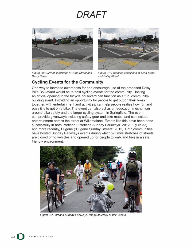
Cycling Events for the CommunityOne way to increase awareness for and encourage use of the proposed Daisy Bike Boulevard would be to host cycling events for the community. Hosting an official opening to the bicycle boulevard can function as a fun, community-building event. Providing an opportunity for people to get out on their bikes together, with entertainment and activities, can help people realize how fun and easy it is to get on a bike. The event can also act as an education mechanism around bike safety and the larger cycling system in Springfield. The event can provide giveaways including safety gear and bike maps, and can include entertainment across the street at Willamalane. Events like this have been done successfully in both Portland (“Portland Sunday Parkways” 2012, Figure 32) and more recently, Eugene (“Eugene Sunday Streets” 2012). Both communities have hosted Sunday Parkways events during which 2-3 mile stretches of streets are closed off to vehicles and opened up for people to walk and bike in a safe, friendly environment.
Figure 30: Current conditions at 42nd Street and Daisy Street.
Figure 31: Proposed conditions at 42nd Street and Daisy Street.
Figure 32: Portland Sunday Parkways. Image courtesy of Will Vanlue.
35
DRAFT
Springfield Community Incorporated: Connecting the Community through Innovative Design Eric Kovner, John McManis, Melanie Greenspan, Spencer Pedemonte, Tanja Janssen
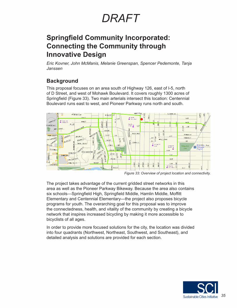
BackgroundThis proposal focuses on an area south of Highway 126, east of I-5, north of D Street, and west of Mohawk Boulevard. It covers roughly 1300 acres of Springfield (Figure 33). Two main arterials intersect this location: Centennial Boulevard runs east to west, and Pioneer Parkway runs north and south.
The project takes advantage of the current gridded street networks in this area as well as the Pioneer Parkway Bikeway. Because the area also contains six schools—Springfield High, Springfield Middle, Hamlin Middle, Moffitt Elementary and Centennial Elementary—the project also proposes bicycle programs for youth. The overarching goal for this proposal was to improve the connectedness, health, and vitality of the community by creating a bicycle network that inspires increased bicycling by making it more accessible to bicyclists of all ages.
In order to provide more focused solutions for the city, the location was divided into four quadrants (Northwest, Northeast, Southwest, and Southeast), and detailed analysis and solutions are provided for each section.
Figure 33: Overview of project location and connectivity.
36
DRAFT
NorthwestThe northwest section is connected to other neighborhoods, schools, and parks via Centennial Boulevard. In order to provide useful connections to other neighborhoods, the northwest section needs to include bicycle boulevards and school paths to encourage more bicyclists in the area.
N Street Bicycle Boulevard
This bicycle boulevard will run along West N Street from the west end where the street opens to Centennial Elementary School fields to the east where it intersects Mill Street. Because it is currently a low-volume motorized vehicle street, it could easily be repaved and transformed into a bicycle boulevard.
Aspen Two-Way Buffered Bike Lane
The current infrastructure between Aspen Street and Centennial Elementary School consists of one car lane in each direction, bike lanes on both sides, and some on-street parking. In order to encourage more students to bike and increase connectivity to the southwest neighborhood, a two-way buffered bike lane could be constructed on the southwest section and continue to Centennial Elementary. The buffered bike lane would take up the north side of the street, replacing some of the existing on-street parking there.
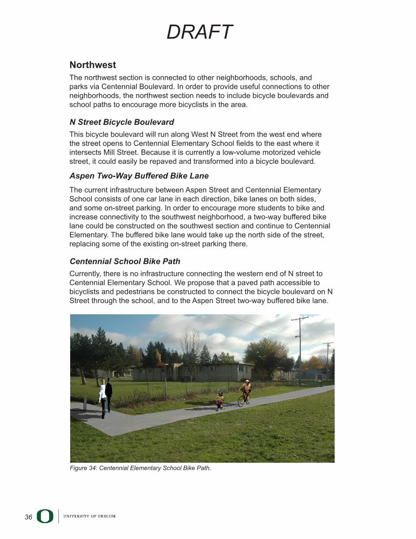
Centennial School Bike Path
Currently, there is no infrastructure connecting the western end of N street to Centennial Elementary School. We propose that a paved path accessible to bicyclists and pedestrians be constructed to connect the bicycle boulevard on N Street through the school, and to the Aspen Street two-way buffered bike lane.
Figure 34: Centennial Elementary School Bike Path.
37
DRAFT
NortheastThe northeast section is residential, with most of its quiet neighborhood laid out in a grid. There are two public schools—Moffitt Elementary School and Hamlin Middle School— in the area. Another major amenity in this area is the Hamlin Sports Complex, which consists of a baseball and track field to accommodate the community’s recreational needs. Bicycle infrastructure in this section would connect residents to these amenities, and to the northwest and southeast sections.
Hamlin Sports Complex Bike Path
The northeast section of this area currently has no bike trails. By placing a bike path along the north end of the Hamlin Sports Complex (adjacent to Highway 126) starting from 5th Street and heading west towards Pioneer Parkway and the Hamlin Bike Tunnel, bicyclists will be able to access both neighborhoods and the sports facilities.
5th Street Lane Diets
5th Street is a wide street that has little to no bicycle infrastructure and is built in a way that allows drivers to drive faster than they would in a smaller residential area. In order to increase safety for bicyclists and pedestrians, and allow children safe access to the adjacent elementary and middle schools in this area, we suggest implementing a road diet on 5th Street. The object of a lane diet is to decrease the width of a road lane in order to reduce vehicle speeds and yield space for alternative modes of transportation via shoulders, sidewalks, and bike lanes.
Southeast
The southeast section contains Brattain Elementary School, Springfield Middle School, and Springfield High School. It also contains Willamalane Park, the Willamalane Adult Activity Center, and Silke Field, a track and field facility that currently serves both Springfield Middle (currently being converted to an elementary school) and Springfield High Schools. With the exception of these neighborhood facilities and schools, the southeast section is essentially a grid of residential housing. Currently none of the streets are designated bicycle routes, but most of them connect to major arterials that have bike lanes or paths. Bicycle infrastructure in this area would increase connectivity to both arterials and community facilities and schools.
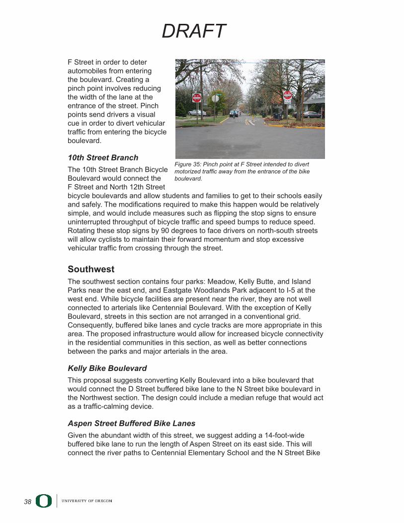
F Street and North 12th Street Bicycle Boulevard
This bicycle boulevard would connect existing infrastructure and major points of interest in this area (businesses, schools and a church) on the west end to the end of the Pioneer Parkway Bicycle Path on the east end. The proposal suggests adding a pinch point at the entrance of this bicycle boulevard on
38
DRAFT
F Street in order to deter automobiles from entering the boulevard. Creating a pinch point involves reducing the width of the lane at the entrance of the street. Pinch points send drivers a visual cue in order to divert vehicular traffic from entering the bicycle boulevard.
10th Street Branch
The 10th Street Branch Bicycle Boulevard would connect the F Street and North 12th Street bicycle boulevards and allow students and families to get to their schools easily and safely. The modifications required to make this happen would be relatively simple, and would include measures such as flipping the stop signs to ensure uninterrupted throughput of bicycle traffic and speed bumps to reduce speed. Rotating these stop signs by 90 degrees to face drivers on north-south streets will allow cyclists to maintain their forward momentum and stop excessive vehicular traffic from crossing through the street.
SouthwestThe southwest section contains four parks: Meadow, Kelly Butte, and Island Parks near the east end, and Eastgate Woodlands Park adjacent to I-5 at the west end. While bicycle facilities are present near the river, they are not well connected to arterials like Centennial Boulevard. With the exception of Kelly Boulevard, streets in this section are not arranged in a conventional grid. Consequently, buffered bike lanes and cycle tracks are more appropriate in this area. The proposed infrastructure would allow for increased bicycle connectivity in the residential communities in this section, as well as better connections between the parks and major arterials in the area.
Kelly Bike Boulevard
This proposal suggests converting Kelly Boulevard into a bike boulevard that would connect the D Street buffered bike lane to the N Street bike boulevard in the Northwest section. The design could include a median refuge that would act as a traffic-calming device.
Aspen Street Buffered Bike Lanes
Given the abundant width of this street, we suggest adding a 14-foot-wide buffered bike lane to run the length of Aspen Street on its east side. This will connect the river paths to Centennial Elementary School and the N Street Bike
Figure 35: Pinch point at F Street intended to divert motorized traffic away from the entrance of the bike boulevard.
39
DRAFT
Boulevard, providing community residents in the nearby N Street residential area, students, and their families with convenient and safe bicycle access to both the school and recreational facilities.
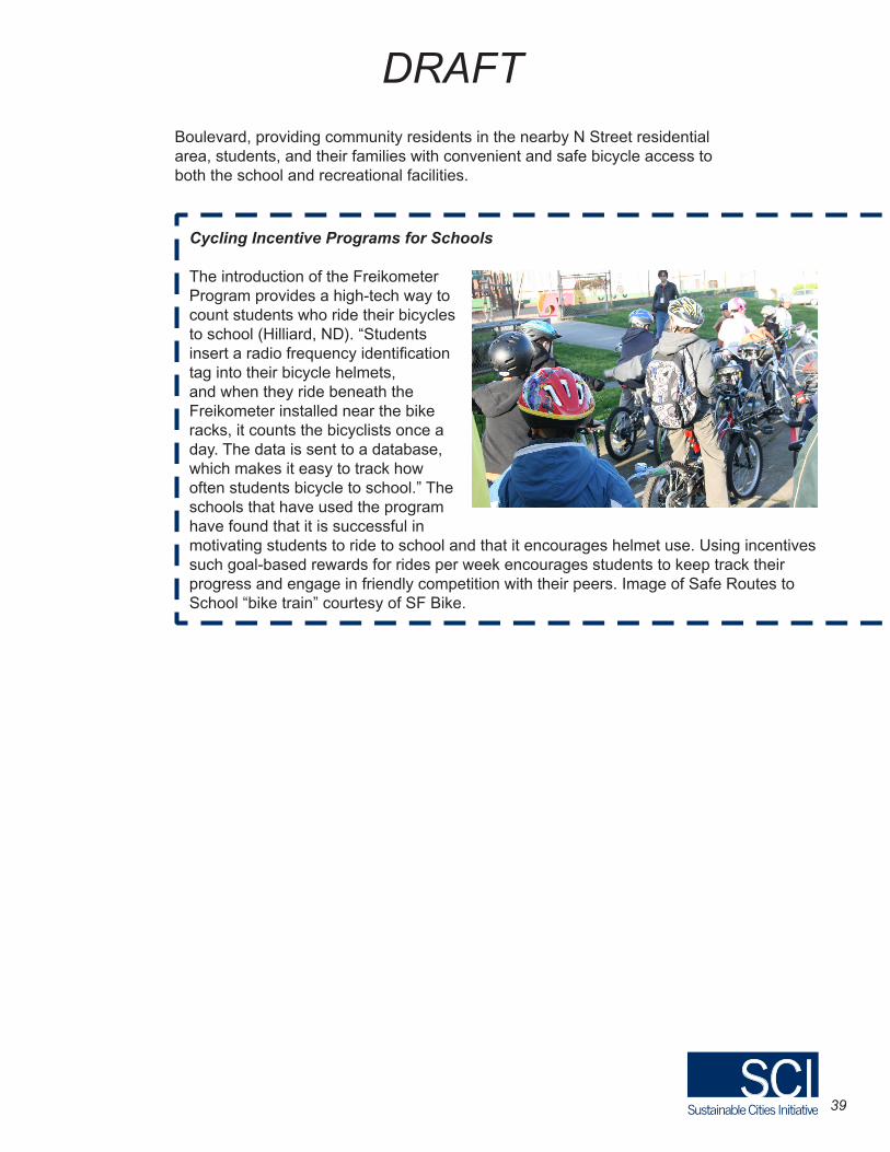
Cycling Incentive Programs for Schools
The introduction of the Freikometer Program provides a high-tech way to count students who ride their bicycles to school (Hilliard, ND). “Students insert a radio frequency identification tag into their bicycle helmets, and when they ride beneath the Freikometer installed near the bike racks, it counts the bicyclists once a day. The data is sent to a database, which makes it easy to track how often students bicycle to school.” The schools that have used the program have found that it is successful in motivating students to ride to school and that it encourages helmet use. Using incentives such goal-based rewards for rides per week encourages students to keep track their progress and engage in friendly competition with their peers. Image of Safe Routes to School “bike train” courtesy of SF Bike.
40
DRAFT
Conclusion This report compiles the nine group proposals that emerged from a University of Oregon Sustainable City Year course on Bicycle Transportation. Four general themes emerged from the proposals: A Bicycle-Friendly Main Street, the Gateway to RiverBend Connection, Bicycle Infrastructure for Future Development: Weyerhaeuser, and Increasing Neighborhood Connectivity. These proposals provide specific suggestions for bicycle infrastructure tools and social improvement and education programs to enhance bicycle safety and encourage bicycle use in Springfield.
Although this is not a comprehensive plan for implementation, many aspects of these proposals may be useful in part or in full to enhance the bicycle and pedestrian infrastructure, safety, and connectivity within and around the City of Springfield. The following are highlights of the proposals’ infrastructure suggestions made for each focal area.
A Bicycle-Friendly Main StreetTwo group proposals examined and suggested ideas for transforming Main Street, a critical east-west arterial in Springfield, into a safer and more accessible route for bicyclists, and encourage increased bicycle use in downtown Springfield.
• Build a two-way cycle track in the place of a current bike lane and/or some car parking in order to give bicyclists designated road space on this busy street.
• Include aesthetically pleasing and sustainable features such as bioswales in medians that act as a buffer between cycle-tracks and/or bike lanes and increase comfort for bicyclists on the road and act as a traffic-calming device.
• Insert bicycle traffic lights with sensors at critical intersection to facilitate bicycle movement.
• Add bicycle parking on the middle of each block on either side of the street.
The Gateway ConnectionThree group proposals addressed the issue of increasing connectivity between Gateway Mall, the new I-5 Bike Path, and RiverBend Medical Center.
• Make use of sharrows on residential streets to signal direction of bicycle traffic flow and put drivers on notice that they are to share the road with bicyclists.
• At certain residential intersections, include roundabouts that both act as a traffic-calming device and add aesthetic appeal to neighborhoods.
• Consider adding painted bicycle paths through major arterial intersections in order to facilitate safe bicycle crossing.
41
DRAFT
Bicycle Infrastructure for Future Development: WeyerhaeuserTwo groups proposed a new vision for Weyerhaeuser Road as a multi-use path for bicyclists and pedestrians. These projects emphasized the value a Weyerhaeuser Multi-use Path would bring to both the current Jasper-Natron community and to the neighborhoods that will expand under future development in that area.
• Repave, and add amenities for bicyclists and pedestrians such as signage and lighting to existing Weyerhaeuser Road.
• Install a bicycle sensor-activated traffic signal at the intersection of Bob Straub Parkway and Weyerhaeuser to make crossing to Weyerhaeuser path from adjacent neighborhoods safe and convenient.
• Consider transforming the adjacent undeveloped plot of land at the head of Weyerhaeuser Multi Use path into a park and ride area with way finding and maintenance facilities for bicyclists and pedestrians.
Increasing Neighborhood ConnectivityTwo groups addressed the issue of increasing neighborhood connectivity in two prominent Springfield residential areas: the Daisy Virginia Corridor, and the residential communities and schools near the intersection of Centennial Boulevard and Pioneer Parkway.
• Designate residential corridors with heavy bicycle traffic as bicycle boulevards to decrease automotive traffic in these areas and facilitate the movement of bicycles through the area and increasing the bicycle route connectivity of the community as a whole.
• Implement traffic calming elements of design such as road diets, roundabouts at intersections, and channelization to reduce automotive traffic speed and increase safety for active modes of transportation.
• Consider including two-way buffered bike lanes on busier, arterial roads in order to fully separate bicyclists from automated vehicle traffic thereby increasing the comfort of both bicyclists and drivers.
By implementing some of the changes highlighted above, the City of Springfield can improve the ease and appeal of active transportation for Springfield residents and help make the city a more enjoyable, attractive, and sustainable place for residents of all ages.

42
DRAFT
Appendix: Potential Project Funding Resources
The Oregon Pedestrian & Bicycle Program Grants
• This is a statewide competitive grant program that provides approximately $5 million dollars every two years to Oregon cities, counties and ODOT regional and district offices for projects related to the design and construction of pedestrian and bicycle facilities. Grants are awarded by the Oregon Bicycle and Pedestrian Advisory Committee (OBPAC) and the next round of applications will be accepted in Spring 2012.
Urban Trails Fund
• The Urban Trails Fund provides resources for developing and maintaining multi-use trails within urban growth boundaries for non-motorized vehicles and pedestrians. The Urban Trails Fund was created in 2009 as part of HB 2001, also known as the Oregon Jobs and Transportation Act. In a later bill, the legislature appropriated $1 million for the Fund.
Recreational Trails Program Grants
• As part of the national Recreational Trail Program (RTP), this source of funding is primarily set aside for recreational trail projects. This includes building new recreation trails, installing wayfinding signs, restoring existing trails and signing, developing and rehabilitating trailhead facilities, and acquiring land and permanent easements.
Bikes Belong Grant Program
• Bikes Belong is a national non-profit organization that aims to fund projects that build momentum for bicycling communities across the country. Since 1999, Bikes Belong has invested almost $1.9 million in community bicycling projects and leveraged more than $657 million in federal, state, and private funding. Some of the projects they have funded have included bike paths and rail trails.

43
DRAFT
ReferencesBirk, Mia Layne, and Joe Kurmaskie. Joyride: Pedaling toward a Healthier
Planet. Portland: Cadence, 2012.
Birk, Mia, Lindsay Walker, and Mike Tresidder. “Fundamentals of Bicycle Design.” The Initiative for Bicycle and Pedestrian Innovation. Alta Planning Design and The University of Portland, 08/2009. Web. 8 Dec 2011. http://www.ibpi.usp.pdx.edu/media/BicycleBoulevardGuidebook.pdf
David Evans and Associates. City of Springfield. Department of Planning. Springfield Bicycle Plan. By Karen Swirsky. Springfield, Or.: City of Springfield, 1998.Springfield Transportation System Plan. City of Springfield. Web.
“Design Details.” Bicyclinginfo.org. PBIC, USDOT FHWA. Web. 07 Dec. 2011.http://www.bicyclinginfo.org/engineering/paths-details.cfm
Farrington, P. (2011, December 05). Interview by W Sercombe. [Personal Interview]. Interview with PeaceHealth planning director: Project input.
Hilliard, Landon. “Boulder, Colorado: Foothill Parents Expand SRTS Program.” National Center for Safe Routes to School, . http://www.saferoutesinfo.org/data-central/success-stories/boulder-colorado-foothill-parents-expand-srts-program (accessed November 10, 2011).
Portland Bureau of Transportation, “Portland Sunday Parkways.”
Last modified 2012. Accessed February 23, 2012. http://www.portlandsundayparkways.org/.
“Part 9: Traffic Control for Bicycle Facilities.” Manual on Uniform Traffic Control Devices for Streets and Highways (MUTCD). [Washington, D.C.]: U.S. Dept. of Transportation, Federal Highway Administration, 2009. 789-816. Print.
“Principles of Shared Use Path Planning and Design.” Bicyclinginfo.org. PBIC, USDOT
FHWA. Web. 07 Dec. 2011. http://www.bicyclinginfo.org/engineering/paths-principles.cfm
“Streets to Live By: How livable street design can bring economic, health and quality-of life benefits to New York City.” Transportation Alternatives, 2008. http://www.transalt.org/files/newsroom/reports/streets_to_live_by.pdf (accessed February 23, 2012).
Smart Trips Eugene, “Eugene Sunday Streets.” Last modified 2012. Accessed February 23, 2012. http://www.smarttripseugene.com/sunday-streets.
SRTS. Safe Routes to School and Health. Rep. National Center for Safe Routes to School, Sept. 2010. Web. 27 Nov. 2011.
44
DRAFT
SE//NE 50’’s Bikeway Project Open House, Bikeway Design Options.” City of Portland Bureau of Transportation. 2012. http://www.portlandonline.com/transportation/index.cfm?a=335728&c=53345
Washington State Department of Transportation, “Roundabout Benefits.” Last modified 2012. Accessed February 23, 2012. http://www.wsdot.wa.gov/Safety/roundabouts/benefits.htm.