Embed Size (px)
Citation preview
FFFIIINNNAAALLL EEENNNVVVIIIRRROOONNNMMMEEENNNTTTAAALLL IIIMMMPPPAAACCCTTT AAASSSSSSEEESSSSSSMMMEEENNNTTT
RRREEEPPPOOORRRTTT
OOOFFF
MMM///sss HHHIIIMMMAAACCCHHHAAALLL SSSTTTOOONNNEEE CCCRRRUUUSSSHHHEEERRR SSSAAANNNDDD,,, SSSTTTOOONNNEEE &&&
BBBAAAJJJRRRIII MMMIIINNNIIINNNGGG PPPRRROOOJJJEEECCCTTT
Village: Riyali, Tehsil: Fatehpur, District: Kangra, State: Himachal Pradesh
Area: 18.4597 Ha, Proposed Capacity: 80,000 TPA,
Monitoring Time period: March-May 2011
AAAPPPPPPLLLIIICCCAAANNNTTT
Sh. Praveen Kumar Sharma,
M/s. Himachal Stone Crushing Co.,
R/o Village and PO Riyali,
Tehsil Fatehpur District Kangra,H.P.
PPPrrreeepppaaarrreeeddd BBByyy
CONSULTANT
M/s IDMA LABORATORIES LIMITED
391,INDUSTRIAL AREA, PHASE-1,
PANCHKULA, HARYANA.
i
LIST OF CONTENTS
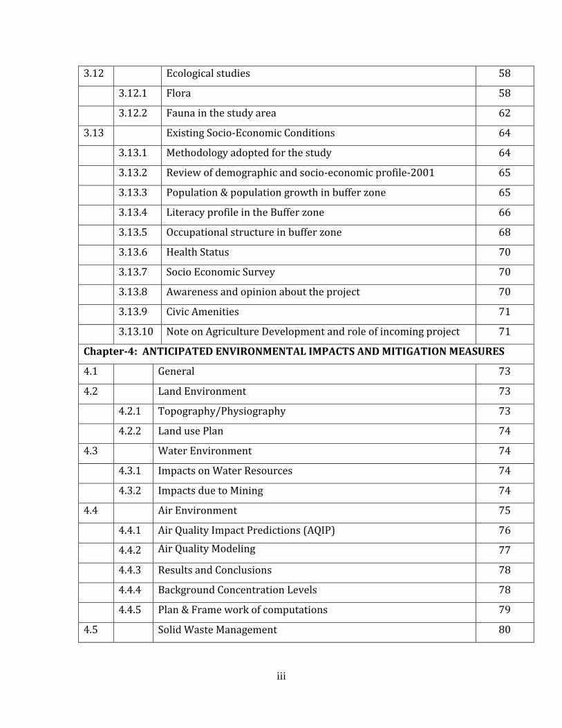
CHAPTER-1: INTRODUCTION
1.1 Preamble 1
1.2 General Information of Mines 2
1.3 Details of Project Proponent 2
1.4 Brief Description of the Project 3
1.4.1 Size of the project 3
1.4.2 Location of the project 3
1.5 Post-Environmental Clearance Monitoring 8
1.6 Generic structure of Environmental Impact Assessment 8
1.7 Analysis of Alternatives 9
1.8 Importance to the country and region 9
1.9 Scope of EIA study 9
CHAPTER-2: PROJECT DESCRIPTION
2.0 General 10
2.1 Physiography/ Topography 10
2.2 Leasehold Area 11
2.3 Geology 14
2.3.1 Regional Geology 14
2.3.2 Local Geology 15
2.3.3 Geology of the lease area. 16
2.4 Mineable Reserves, Quality And Anticipated Life of The Mine 17
2.5 Details Of Mining 18
2.5.1 Year wise development for the first five years 18
2.5.2 Year wise production for First five years 18
2.5.3 Proposed method of mining 20
2.5.4 Conceptual mining plan 20
2.6 Use Of Mineral 20
ii
2.7 Mineral Transportation 20
2.8 Site Services 21
2.9 Employment Potential 21
2.10 Water Requirement And Source 22
CHAPTER-3: DESCRIPTION OF ENVIRONMENT
3.1 Introduction 23
3.2 Study area at a glance 24
3.3 Land Environment 24
3.4 Land Use Studies 25
3.5 Methods for Monitoring 28
3.6 Climatology & Meteorology 28
3.6.1 Methodology 28
3.6.2 Meteorological Data Recorded at Proposed Project Site 28
3.7 Baseline Data 33
1. Air Environment 33
3.7.1 Methodology adopted for Air Quality Survey 33
3.7.2 Frequency & Parameters for Sampling 35
3.7.3 Instruments used for sampling 35
3.7.4 Sampling & Analytical Techniques 35
3.7.5 Preparation of result 35
3.8 Water Environment 42
3.8.1 Quality of water 43
3.8.2 Methodology 43
3.8.3 Water Sampling Locations 43
3.8.4 Presentation of Results 45
3.8.5 Observations 48
3.9 Soil Characteristics 49
3.10 Noise level survey 53
3.11 Traffic Density 57
iii
3.12 Ecological studies 58
3.12.1 Flora 58
3.12.2 Fauna in the study area 62
3.13 Existing Socio-Economic Conditions 64
3.13.1 Methodology adopted for the study 64
3.13.2 Review of demographic and socio-economic profile-2001 65
3.13.3 Population & population growth in buffer zone 65
3.13.4 Literacy profile in the Buffer zone 66
3.13.5 Occupational structure in buffer zone 68
3.13.6 Health Status 70
3.13.7 Socio Economic Survey 70
3.13.8 Awareness and opinion about the project 70
3.13.9 Civic Amenities 71
3.13.10 Note on Agriculture Development and role of incoming project 71
Chapter-4: ANTICIPATED ENVIRONMENTAL IMPACTS AND MITIGATION MEASURES
4.1 General 73
4.2 Land Environment 73
4.2.1 Topography/Physiography 73
4.2.2 Land use Plan 74
4.3 Water Environment 74
4.3.1 Impacts on Water Resources 74
4.3.2 Impacts due to Mining 74
4.4 Air Environment 75
4.4.1 Air Quality Impact Predictions (AQIP) 76
4.4.2 Air Quality Modeling 77
4.4.3 Results and Conclusions 78
4.4.4 Background Concentration Levels 78
4.4.5 Plan & Frame work of computations 79
4.5 Solid Waste Management 80
iv
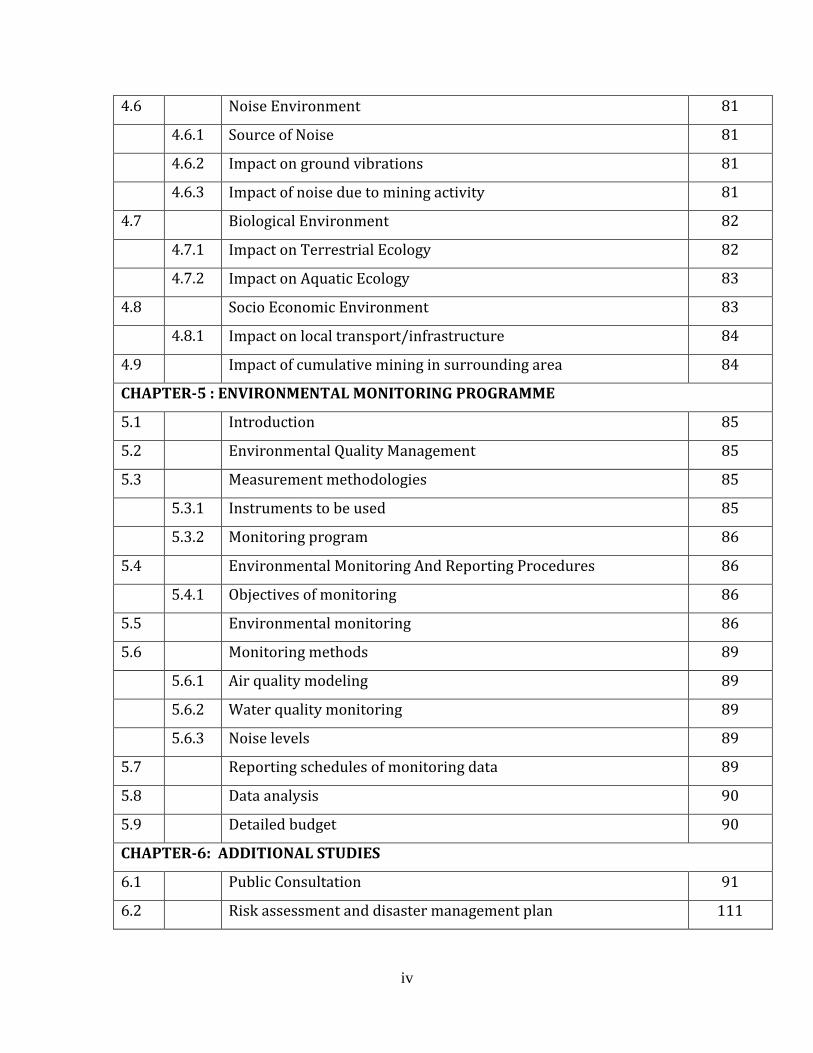
4.6 Noise Environment 81
4.6.1 Source of Noise 81
4.6.2 Impact on ground vibrations 81
4.6.3 Impact of noise due to mining activity 81
4.7 Biological Environment 82
4.7.1 Impact on Terrestrial Ecology 82
4.7.2 Impact on Aquatic Ecology 83
4.8 Socio Economic Environment 83
4.8.1 Impact on local transport/infrastructure 84
4.9 Impact of cumulative mining in surrounding area 84
CHAPTER-5 : ENVIRONMENTAL MONITORING PROGRAMME
5.1 Introduction 85
5.2 Environmental Quality Management 85
5.3 Measurement methodologies 85
5.3.1 Instruments to be used 85
5.3.2 Monitoring program 86
5.4 Environmental Monitoring And Reporting Procedures 86
5.4.1 Objectives of monitoring 86
5.5 Environmental monitoring 86
5.6 Monitoring methods 89
5.6.1 Air quality modeling 89
5.6.2 Water quality monitoring 89
5.6.3 Noise levels 89
5.7 Reporting schedules of monitoring data 89
5.8 Data analysis 90
5.9 Detailed budget 90
CHAPTER-6: ADDITIONAL STUDIES
6.1 Public Consultation 91
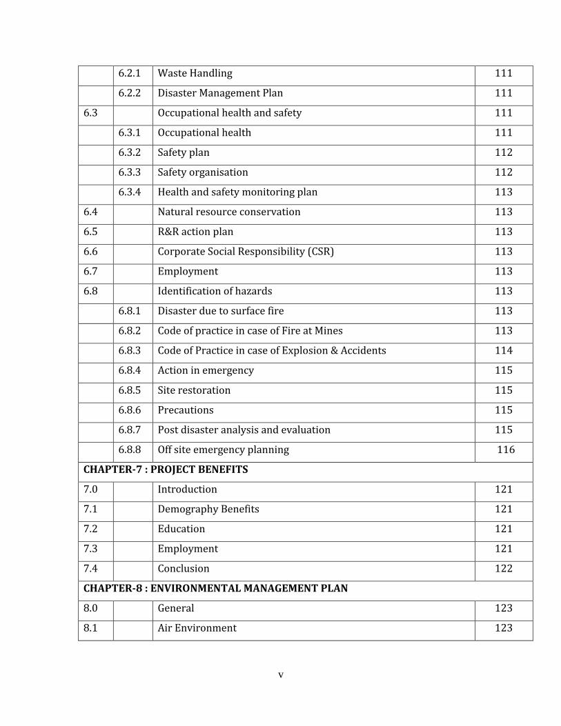
6.2 Risk assessment and disaster management plan 111
v
6.2.1 Waste Handling 111
6.2.2 Disaster Management Plan 111
6.3 Occupational health and safety 111
6.3.1 Occupational health 111
6.3.2 Safety plan 112
6.3.3 Safety organisation 112
6.3.4 Health and safety monitoring plan 113
6.4 Natural resource conservation 113
6.5 R&R action plan 113
6.6 Corporate Social Responsibility (CSR) 113
6.7 Employment 113
6.8 Identification of hazards 113
6.8.1 Disaster due to surface fire 113
6.8.2 Code of practice in case of Fire at Mines 113
6.8.3 Code of Practice in case of Explosion & Accidents 114
6.8.4 Action in emergency 115
6.8.5 Site restoration 115
6.8.6 Precautions 115
6.8.7 Post disaster analysis and evaluation 115
6.8.8 Off site emergency planning 116
CHAPTER-7 : PROJECT BENEFITS
7.0 Introduction 121
7.1 Demography Benefits 121
7.2 Education 121
7.3 Employment 121
7.4 Conclusion 122
CHAPTER-8 : ENVIRONMENTAL MANAGEMENT PLAN
8.0 General 123
8.1 Air Environment 123
vi
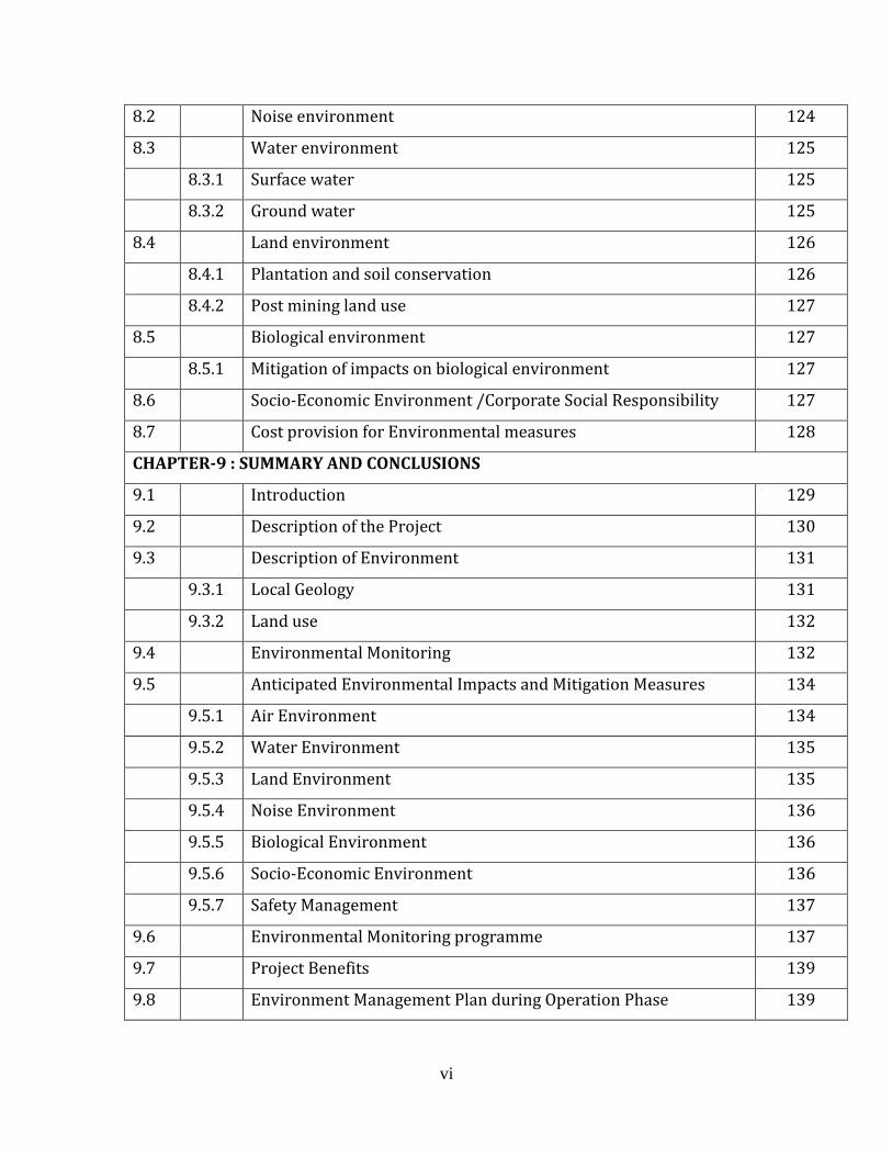
8.2 Noise environment 124
8.3 Water environment 125
8.3.1 Surface water 125
8.3.2 Ground water 125
8.4 Land environment 126
8.4.1 Plantation and soil conservation 126
8.4.2 Post mining land use 127
8.5 Biological environment 127
8.5.1 Mitigation of impacts on biological environment 127
8.6 Socio-Economic Environment /Corporate Social Responsibility 127
8.7 Cost provision for Environmental measures 128
CHAPTER-9 : SUMMARY AND CONCLUSIONS
9.1 Introduction 129
9.2 Description of the Project 130
9.3 Description of Environment 131
9.3.1 Local Geology 131
9.3.2 Land use 132
9.4 Environmental Monitoring 132
9.5 Anticipated Environmental Impacts and Mitigation Measures 134
9.5.1 Air Environment 134
9.5.2 Water Environment 135
9.5.3 Land Environment 135
9.5.4 Noise Environment 136
9.5.5 Biological Environment 136
9.5.6 Socio-Economic Environment 136
9.5.7 Safety Management 137
9.6 Environmental Monitoring programme 137
9.7 Project Benefits 139
9.8 Environment Management Plan during Operation Phase 139

vii
9.8.1 Air Pollution Management 139
9.8.2 Water Pollution Management 140
9.8.3 Noise Pollution Management 140
9.8.4 Occupational safety and health 140
9.9 Socioeconomic 140
9.10 Conclusion 141
CHAPTER-10 : DISCLOSURE OF CONSULTANTS

viii
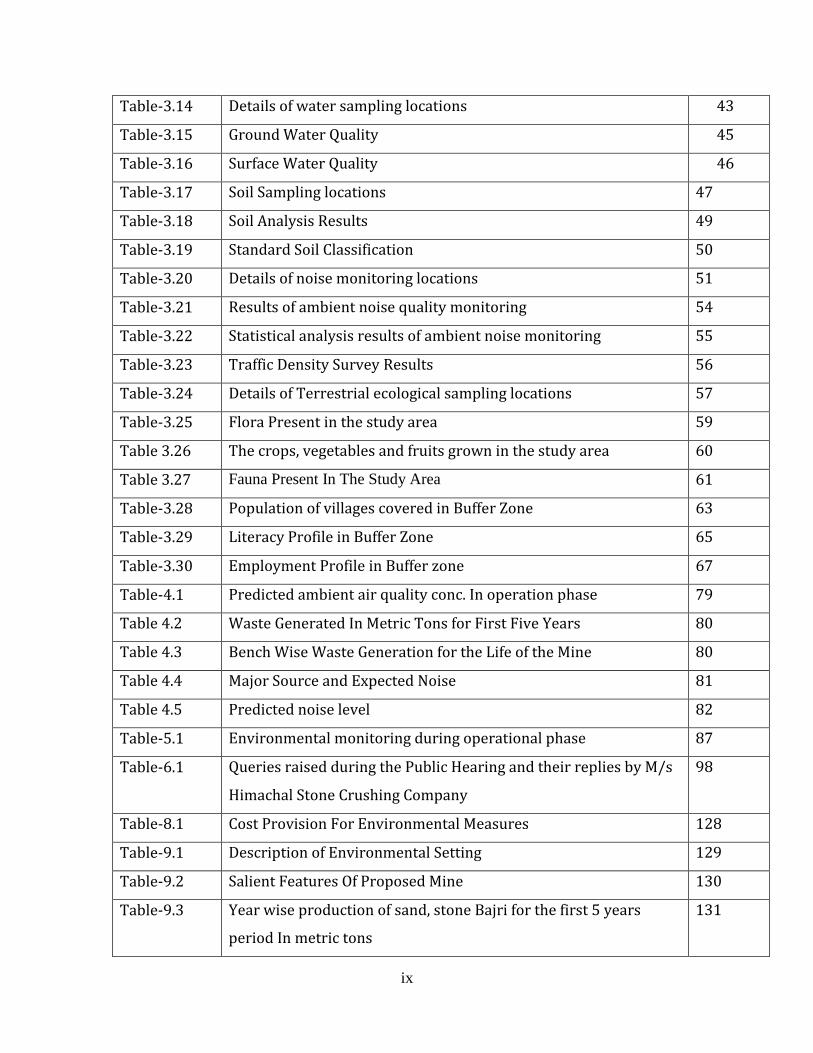
LIST OF TABLES
Table No. Title Page .No.
Table-1.1 Distance of the major towns/habitations from the mine lease area 4
Table -1.2 Brief Description of the Project 7
Table-2.1 Details of Mine Lease Area 12
Table-2.2 Water reuirement details 12
Table-2.3 Stratigraphy of the Region 15
Table-2.4 Litho-units exposed in the area 17
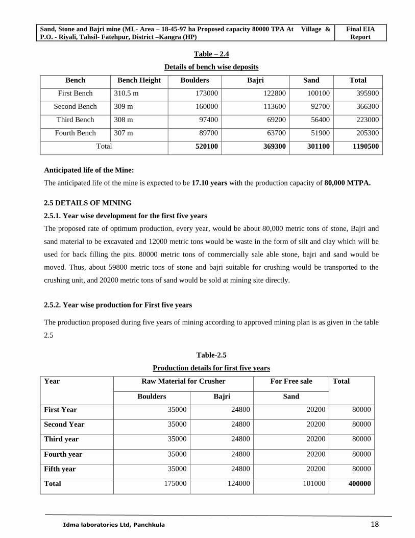
Table-2.5 Details of bench wise deposits 18
Table-2.6 Production details for first five years 18
Table-2.7 Details of waste generation in five years 19
Table-2.8 Bench wise waste generation 19
Table-3.1 Land use pattern Land Use Pattern in the Study Area 25
Table-3.2 Methods for monitoring 28
Table-3.3 Average meteorological data recorded at mine site in March-2011 29
Table-3.4 Average meteorological data recorded at mine site in April-2011 30
Table-3.5 Average meteorological data recorded at mine site in May-2011 31
Table-3.6 Details of ambient air quality monitoring locations 33
Table-3.7 Monitored AAQ parameters and frequency of sampling 35
Table-3.8 Techniques used for ambient air quality monitoring 35
Table-3.9 Ambient air quality monitoring results- Mine Site 36
Table-3.10 Ambient air quality monitoring results- Village Riyali 37
Table-3.11 Ambient air quality monitoring results- Village Bela Thakran 38
Table-3.12 Ambient air quality monitoring results- Village Nangal 39
Table-3.12(a) Ambient air quality monitoring results- Village Punal 40
Table-3.13 Summary of ambient air quality monitoring 41
ix
Table-3.14 Details of water sampling locations 43
Table-3.15 Ground Water Quality 45
Table-3.16 Surface Water Quality 46
Table-3.17 Soil Sampling locations 47
Table-3.18 Soil Analysis Results 49
Table-3.19 Standard Soil Classification 50
Table-3.20 Details of noise monitoring locations 51
Table-3.21 Results of ambient noise quality monitoring 54
Table-3.22 Statistical analysis results of ambient noise monitoring 55
Table-3.23 Traffic Density Survey Results 56
Table-3.24 Details of Terrestrial ecological sampling locations 57
Table-3.25 Flora Present in the study area 59
Table 3.26 The crops, vegetables and fruits grown in the study area 60
Table 3.27 Fauna Present In The Study Area 61
Table-3.28 Population of villages covered in Buffer Zone 63
Table-3.29 Literacy Profile in Buffer Zone 65
Table-3.30 Employment Profile in Buffer zone 67
Table-4.1 Predicted ambient air quality conc. In operation phase 79
Table 4.2 Waste Generated In Metric Tons for First Five Years 80
Table 4.3 Bench Wise Waste Generation for the Life of the Mine 80
Table 4.4 Major Source and Expected Noise 81
Table 4.5 Predicted noise level 82
Table-5.1 Environmental monitoring during operational phase 87
Table-6.1 Queries raised during the Public Hearing and their replies by M/s
Himachal Stone Crushing Company
98
Table-8.1 Cost Provision For Environmental Measures 128
Table-9.1 Description of Environmental Setting 129
Table-9.2 Salient Features Of Proposed Mine 130
Table-9.3 Year wise production of sand, stone Bajri for the first 5 years
period In metric tons
131

x
Table-9.4 Land use pattern in the 10 km study area 132
Table-9.5 Summary of the meteorological data generated at site 132
Table-9.6 Summary of Ambient Air Quality for all the locations 133
Table 9.7 Environmental Monitoring Programme 137
xi
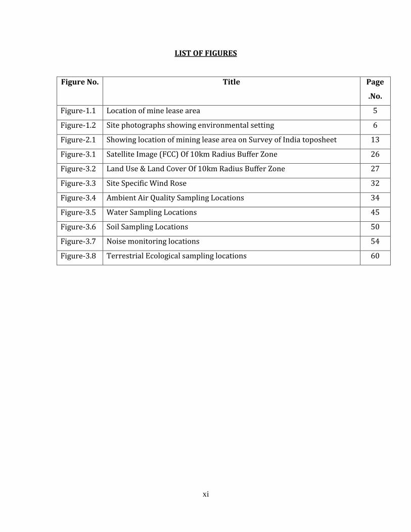
LIST OF FIGURES
Figure No. Title Page
.No.
Figure-1.1 Location of mine lease area 5
Figure-1.2 Site photographs showing environmental setting 6
Figure-2.1 Showing location of mining lease area on Survey of India toposheet 13
Figure-3.1 Satellite Image (FCC) Of 10km Radius Buffer Zone 26
Figure-3.2 Land Use & Land Cover Of 10km Radius Buffer Zone 27
Figure-3.3 Site Specific Wind Rose 32
Figure-3.4 Ambient Air Quality Sampling Locations 34
Figure-3.5 Water Sampling Locations 45
Figure-3.6 Soil Sampling Locations 50
Figure-3.7 Noise monitoring locations 54
Figure-3.8 Terrestrial Ecological sampling locations 60
xii
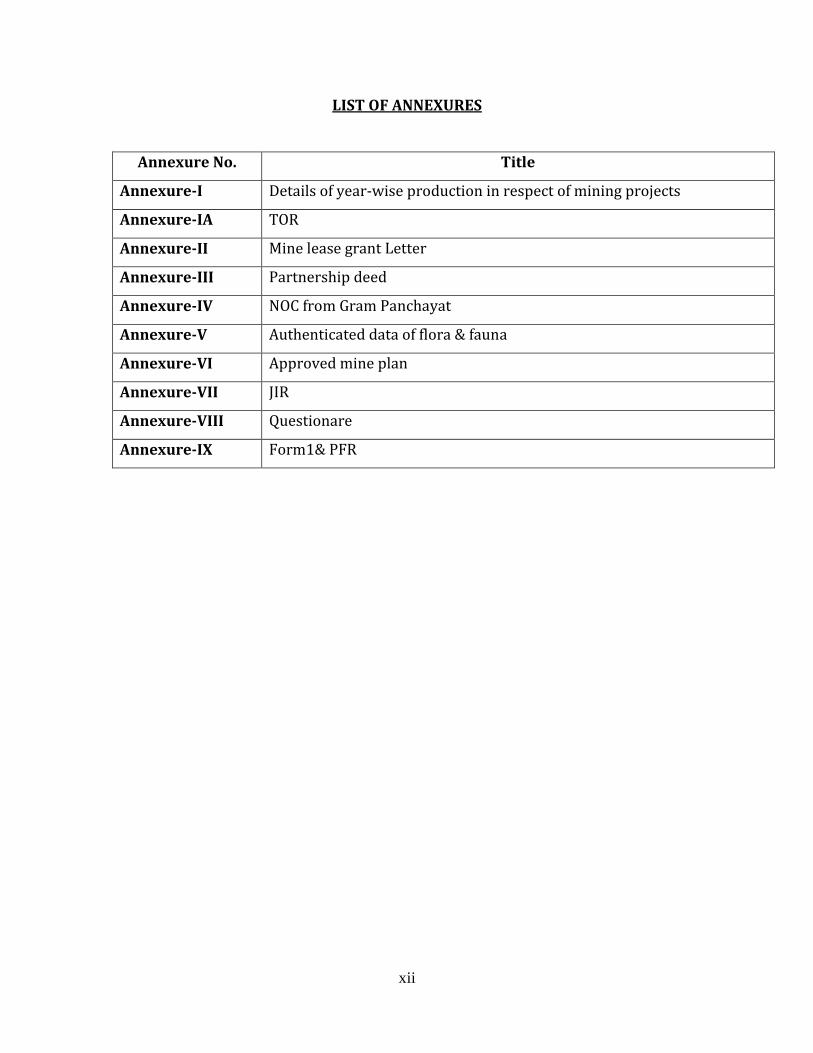
LIST OF ANNEXURES
Annexure No. Title
Annexure-I Details of year-wise production in respect of mining projects
Annexure-IA TOR
Annexure-II Mine lease grant Letter
Annexure-III Partnership deed
Annexure-IV NOC from Gram Panchayat
Annexure-V Authenticated data of flora & fauna
Annexure-VI Approved mine plan
Annexure-VII JIR
Annexure-VIII Questionare
Annexure-IX Form1& PFR
Sand, Stone and Bajri mine (ML- Area – 18-45-97 ha Proposed capacity 80,000 TPA At Village & P.O. - Riyali, Tahsil- Fatehpur, District –Kangra (HP)
FEIA Report
Idma laboratories Ltd, Panchkula 1
CHAPTER - 1
INTRODUCTION
1.1 PREAMBLE
Every anthropogenic activity has some impact on the environment. However, mankind as it is developed
today cannot live without taking up these activities for his food, security and other needs. Consequently, there
is a need to harmonize developmental activities with the environmental concerns. Environmental Impact
Assessment (EIA) is one of the tools available with the planners to achieve the above mentioned goal.
It is desirable to ensure that the development options under consideration are sustainable. In doing so,
environmental consequences must be characterized early in the project cycle and accounted for in the project
design.
Law requires that every project proponent must take Environmental Clearance from Ministry of Environment
and Forests, New Delhi, before starting up any project. The environmental clearance is also mandatory for
the expansion, modernization or renewal projects. The conditions are applicable as per the MoEF guidelines
and EIA notifications issued and amended time to time.
There are many Acts / Rules & Notifications issued by MoEF, New Delhi for keeping the environment in and
around project sites congenial for healthy/better standard of living. Few of them are mentioned below:
1. Environment (Protection) Act, 1986
2. Environment (Protection) Rules, 1986
3. Water (Prevention & Control of Pollution) Act, 1974
4. Air (Prevention & Control of Pollution) Act, 1981
5. Environment Impact Assessment (EIA) Notification, dated 27th January, 1994
6. Environment Impact Assessment (EIA) Notification, dated 14th September, 2006 and as amended on
1st December 2009.
This mining project falls in category-A as the site is situated within 10 Km of interstate boundary of
H.P and Punjab (General condtion applied). All these mining projects are statutorily required to
conduct Environmental Impact Assessment study for obtaining environmental clearance
Sand, Stone and Bajri mine (ML- Area – 18-45-97 ha Proposed capacity 80,000 TPA At Village & P.O. - Riyali, Tahsil- Fatehpur, District –Kangra (HP)
FEIA Report
Idma laboratories Ltd, Panchkula 2
1.2 GENERAL INFORMATION OF MINES
Crushed stone, gravel and sand are one of the largest non-fuel mineral commodities by tonnage produced in
Himachal Pradesh, supplying some of the most important construction materials. Further, average unit value of
crushed stone, sand and gravel is one of the lowest of all mineral commodities.
This production of aggregate in a particular area is a function of the availability of natural resources, the size of
population, the economy of the area and various developmental and infrastructural works being undertaken in the
area like road construction, hydro-electric projects etc. Further, being a low- value, high-volume mineral
commodity, the prices are dramatically affected by transportation distances. If the distances increase, the
transportation cost may increase much more than the cost of the aggregates.
Although river bed deposits of sand stone & bajri form significant resource that is seasonally replenished, their
excessive extraction may cause scouring and erosion of river and other environmental problem. The extraction of
river terrace deposits is alternative to riverbed mining. Substantial resources of sand and stone exists in river terrace
beneath land assessed through geological /resource mapping and site exploration survey involving test pits,
geophysical surveys, and sampling and laboratory studies.
Mining of the stones from river terrace is done, which are processed for production of stone of various size, grit and
sand essential for construction activities. Environmental impacts can arise during all activities of the mining process.
Minimizing the damage due to mining operations depends on sound environmental practices in a framework of
balanced environmental legislation. The potential adverse effects of river terrace mining activities include change in
land use pattern, air pollution, degradation of land, noise, damage to local ecology, natural topography and drainage,
etc. All these environmental components have been considered while selecting a proper methodology of mining,
mitigation measures to reduce pollution load, conservation of natural resources, etc.
M/s. Himachal Stone Crushing Co., C/o Sh. Praveen Kumar Sharma, R/o Village and PO Riyali, Tahsil Fatehpur
District Kangra, Himachal Pradesh, partnership concern for mining activity proposes to mine Sand, Stone and Bajri.
The stone will be used in captive stone crushing unit. The proponent has been granted mining lease for mining of
sand, stone and bajri vide order no. Udyog – Bhu (Khani - 4) Laghu – 303/08 – 11439 dated 08- 01- 2010 for a
period of fifteen years for manufacture of grit.
1.3 DETAILS OF PROJECT PROPONENT
The details of the project proponent are given below:
M/s. Himachal Stone Crushing Co.,
C/o Sh. Praveen Kumar Sharma,
R/o Village and PO Riyali,
Tahsil Fatehpur District Kangra,
Himachal Pradesh
Sand, Stone and Bajri mine (ML- Area – 18-45-97 ha Proposed capacity 80,000 TPA At Village & P.O. - Riyali, Tahsil- Fatehpur, District –Kangra (HP)
FEIA Report
Idma laboratories Ltd, Panchkula 3
1.4 BRIEF DESCRIPTION OF THE PROJECT
1.4.1 Size of the project
The project involves mining / collection of 80000 MTPA of stone, bajri and sand from old terrace of Beas
River for a stone crushing unit to be set by the project proponent. The total area of mine lease is 18-45-97
Hectares. The proponent has been granted mining lease for mining of sand, stone and bajri vide order no.
Udyog – Bhu (Khani - 4) Laghu – 303/08 – 11439 dated 08- 01- 2010(Annexure I) for a period of fifteen
years for setting up of a stone crusher unit under the provisions of Himachal Pradesh Minor Minerals
(Concession) Revised Rules, 1971.
1.4.2 Location of the project
The proposed mining site is located near the Beas River on its old terrace comprising Khasra no 3032/2, falling
in Mauza Riyali, Tahsil Fatehpur, and District Kangra of Himachal Pradesh. The area is covered in Survey of
India (SOI) toposheet No. 44 M/13.
Latitude - 310 59’ 35” N to 31
0 59’ 43” N
Longitude - 750 48’52.6”E to 750 49’ 3.5”E
Sand, Stone and Bajri mine (ML- Area – 18-45-97 ha Proposed capacity 80,000 TPA At Village & P.O. - Riyali, Tahsil- Fatehpur, District –Kangra (HP)
FEIA Report
Idma laboratories Ltd, Panchkula 4
Table-1.1
Distance of the major towns/habitations from the mine lease area
Location Name Distance from ML area
Nearest Town Talwara ( Punjab ) 15 kilometers
Nearest Railway Station Pathankot 38 kilometers
Tahsil Fatehpur 20 kilometers
Sub divisional Head Quarter Nurpur 40 kilometers
District Head Quarter Dharmsala 104 kilometers
Sand, Stone and Bajri mine (ML- Area – 18-45-97 ha Proposed capacity 80,000 TPA At Village & P.O. - Riyali, Tahsil- Fatehpur, District –Kangra (HP)
FEIA Report
Idma laboratories Ltd, Panchkula 5
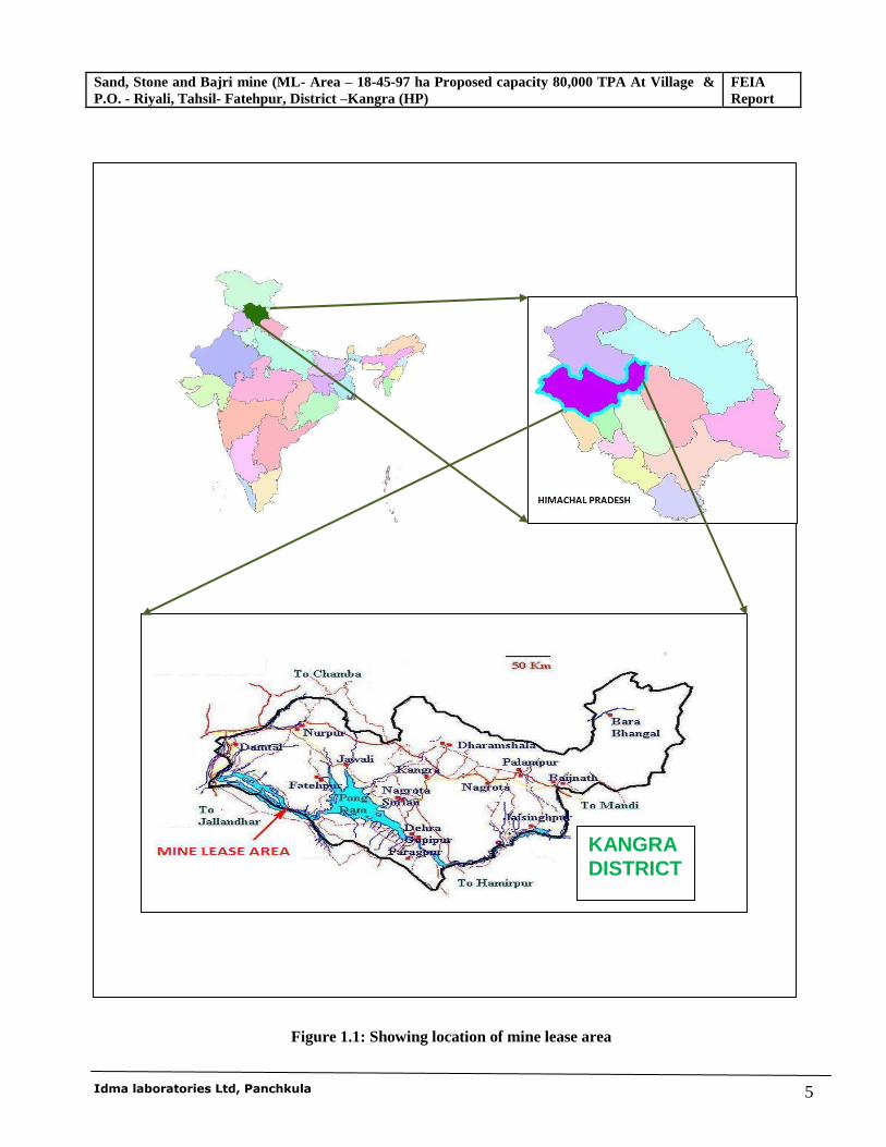
Figure 1.1: Showing location of mine lease area
KANGRA DISTRICT
Sand, Stone and Bajri mine (ML- Area – 18-45-97 ha Proposed capacity 80,000 TPA At Village & P.O. - Riyali, Tahsil- Fatehpur, District –Kangra (HP)
FEIA Report
Idma laboratories Ltd, Panchkula 6
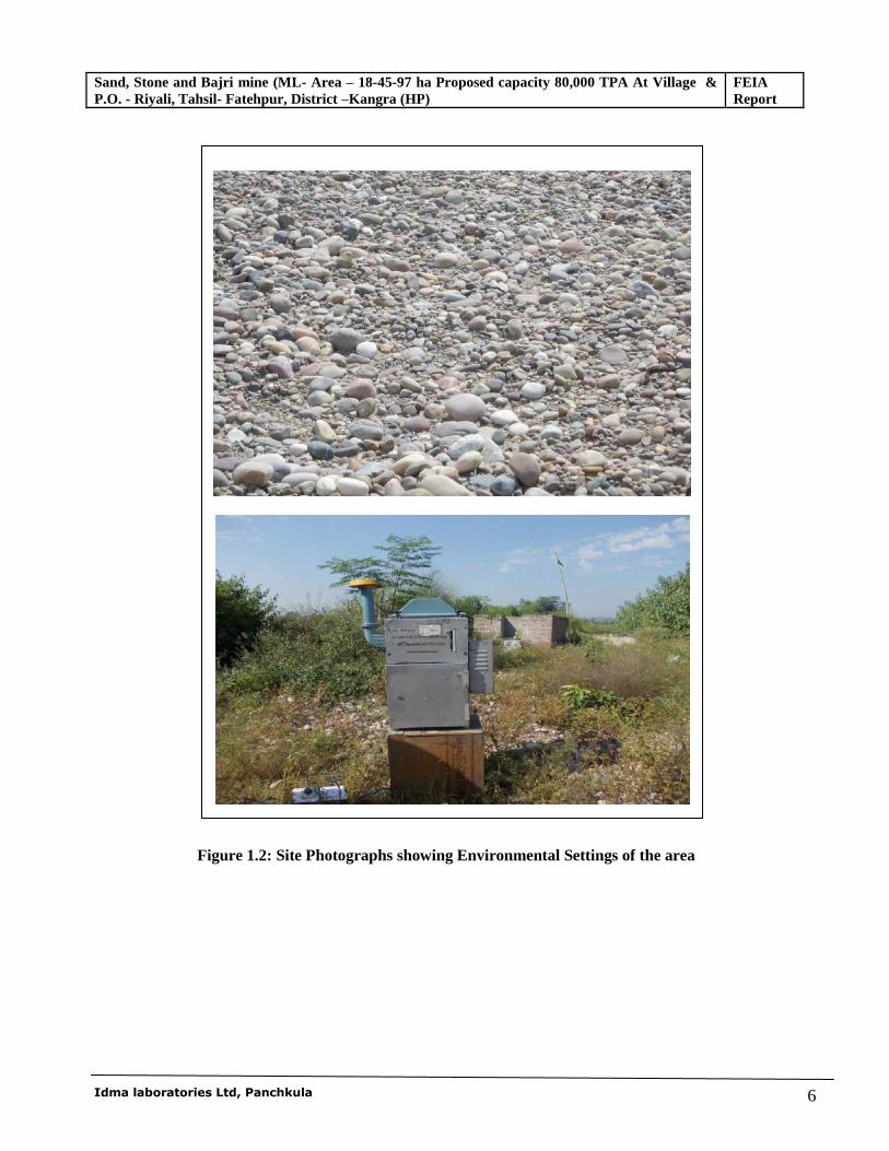
Figure 1.2: Site Photographs showing Environmental Settings of the area
Sand, Stone and Bajri mine (ML- Area – 18-45-97 ha Proposed capacity 80,000 TPA At Village & P.O. - Riyali, Tahsil- Fatehpur, District –Kangra (HP)
FEIA Report
Idma laboratories Ltd, Panchkula 7
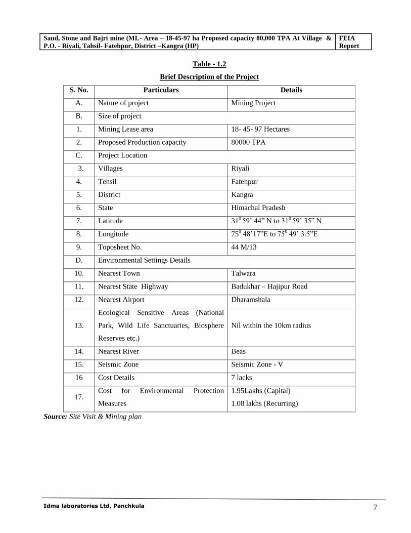
Table - 1.2
Brief Description of the Project
S. No. Particulars Details
A. Nature of project Mining Project
B. Size of project
1. Mining Lease area 18- 45- 97 Hectares
2. Proposed Production capacity 80000 TPA
C. Project Location
3. Villages Riyali
4. Tehsil Fatehpur
5. District Kangra
6. State Himachal Pradesh
7. Latitude 310 59’ 44” N to 31
0 59’ 35” N
8. Longitude 750 48’17”E to 750 49’ 3.5”E
9. Toposheet No. 44 M/13
D. Environmental Settings Details
10. Nearest Town Talwara
11. Nearest State Highway Badukhar – Hajipur Road
12. Nearest Airport Dharamshala
13.
Ecological Sensitive Areas (National
Park, Wild Life Sanctuaries, Biosphere
Reserves etc.)
Nil within the 10km radius
14. Nearest River Beas
15. Seismic Zone Seismic Zone - V
16 Cost Details 7 lacks
17. Cost for Environmental Protection
Measures
1.95Lakhs (Capital)
1.08 lakhs (Recurring)
Source: Site Visit & Mining plan
Sand, Stone and Bajri mine (ML- Area – 18-45-97 ha Proposed capacity 80,000 TPA At Village & P.O. - Riyali, Tahsil- Fatehpur, District –Kangra (HP)
FEIA Report
Idma laboratories Ltd, Panchkula 8
1.5 POST-ENVIRONMENTAL CLEARANCE MONITORING
For category A projects, it shall be mandatory for the project proponent to make public the environmental
clearance granted for their project along with the environmental conditions and safeguards at their cost by
prominently advertising it at least in two local newspapers of the district or state where the project is located
and in addition, this shall also be displayed in the project proponent’s website permanently.
The project management shall submit half-yearly compliance reports in respect of the stipulated prior
environmental clearance terms and conditions on 1st June and 1st December of each calendar year. All such
reports shall be public documents. The latest such compliance report shall be displayed on the web site of the
concerned regulatory authority.
1.6 GENERIC STRUCTURE OF ENVIRONMENTAL IMPACT ASSESSMENT
In terms of the EIA notification of the MoEF dated 14th September 2006 as amended 1st Dec 2009, 4th
April 2011, 13th Dec 2012, 13th March 2013, 9th Sep 2013 &7th Dec. 2013 and also the EIA Guidance
Manual for Mining of Minerals (Feb, 2010) of MoEF,, the generic structure of the EIA document should
be as under:
1. Introduction
2. Project Description
3. Analysis of Alternatives( Technology and site)
4. Description of the Environment
5. Anticipated Environmental Impact & Mitigation Measures
6. Environmental Monitoring Programme
7. Additional Studies
8. Project Benefits
9. Environmental Cost Benefit Analysis
10. Environmental Management Plan
11. Summary & Conclusion
12. Disclosure of Consultants engaged
1.7 ANALYSIS OF ALTERNATIVES
Consideration of alternatives to a project proposal is a requirement of EIA process. During the scoping process,
alternatives to a proposal can be considered or refined, either directly or by reference to the key issues
identified. A comparison of alternatives help to determine the best method of achieving the project objectives
with minimum environmental impacts or indicates the most environmentally friendly and cost effective options.
Sand, Stone and Bajri mine (ML- Area – 18-45-97 ha Proposed capacity 80,000 TPA At Village & P.O. - Riyali, Tahsil- Fatehpur, District –Kangra (HP)
FEIA Report
Idma laboratories Ltd, Panchkula 9
1.7.1 Analysis of Alternative Sites
Mineral deposits are site specific, and therefore, selection of a mine site has limited alternatives. This is old
River terrace mining where the material will be lifted manually into truck-trolley.
1.7.2 Analysis of Alternative Technology
This is a small mine and there is no new technology is involved to extract the minerals. Mining shall be done by
opencast manual method as per laid down procedures and given in approved mining plan.
1.8 IMPORTANCE TO THE COUNTRY AND REGION
India is a developing country which required large infrastructure development. Sand, Stone and Bajri mine are
important source of raw materials for Infrastructure. Hence, considering the demand of Sand, Stone and Bajri &
sufficient availability in the area, it is very much necessary to have Sand, Stone and Bajri projects to sustain
Infrastructure project as well as household requirement in the area and to provide employment opportunities to
the locals.
1.9 SCOPE OF EIA STUDY
The First technical presentation (TOR Presentation) with respect to Environmental Clearance was held on
November 28-30, 2010.The committee has suggested Terms of References (ToR) for preparation of the
Environmental Impact Assessment (EIA) Report and Environmental Management Plan (EMP), No.J-
11015/19/2011-IA.II (M) dated 20th May, 2011 which has already been annexed in EIA/EMP Report as
Annexure I. M/s Golden Stone Crusher has got NoC from Gram Panchayat annexed as Annexure IV. This
report contains performance testing data of ambient air monitoring as well as the ecological studies, biological
environment study, socio-economic study, noise and hydrological studies carried out in the area during study
period, As per the TOR issued, all data have been collected and incorporated in this EIA/EMP Report.
The disciplines covered under the work programme are prerequisite information of the site, production process,
effluent generation and its proper disposal, impacts and management plans. The above disciplines include the
following method of collection & compilation of data and the resulting predictions.
*********
Sand, Stone and Bajri mine (ML- Area – 18-45-97 ha Proposed capacity 80000 TPA At Village & P.O. - Riyali, Tahsil- Fatehpur, District –Kangra (HP)
Final EIA Report
Idma laboratories Ltd, Panchkula 10
CHAPTER-2
PROJECT DESCRIPTION
2.0 GENERAL
The project involves mining / collection 80,000 TPA of stone, bajri and sand from old terrace of Beas River
and the stone and bajri will be used in a captive stone crushing unit for making angular grid and sand would be
sold at mining site directly.
The chapter deals with the location, physiographic feature of the area, description and characteristics of
regional and local geology, mineral reserves, method of mining, annual rate of production and generation of
waste.
2.1 PHYSIOGRAPHY / TOPOGRAPHY The lease area lies in Paleao terrace area of river Beas. The river is snow/rain fed and it originates at a height of
4000 MSL near Beas Kund on Rohtang Top. The Highest catchment peak runs in NW-SE direction. The
highest contour value of mining lease area is 316 meters above mean sea level. The upper surface in terrace
area is covered with sandy loam soil where small bushes are present. The project area has gentle slope so
topography is not likely to change much as remaining silt material will be filled back.
The lease area is part of old terrace of Beas River downstream of Pong Dam. In general the area is a part of
Siwalik hills. The ongoing erosion and tectonic activity has greatly affected the topography of the Siwaliks.
Their present-day morphology is comprised of hogback ridges, consequent, subsequent, obsequent, and
resequent valleys of various orders, gullies, choes (seasonal streams), earth-pillars, rilled earth buttresses of
conglomerate formations, semi-circular choe-divides, talus cones, colluvial cones, water-gaps, and choe
terraces. Associated badlands features include the lack of vegetation, steep slopes, high drainage density, and
rapid erosion rates. To the south of the Siwaliks are the Indo-Gangetic plains.
The Beas valley is about five kilometers wide in this area. The width of the Beas valley increase as it flows
towards North West for about 18 kilometers from the lease area and then takes an elbow turn toward south and
then towards South-west into the Plains of Punjab.
Ridges:
In the SSE is the sub watershed ridge dividing the Kamli Devi Khad catchment from plains of Punjab.
The ridge rises from near Khagwal village, south of Hajipur town toward ∆ 472, point 528, 577, 594 and
Sand, Stone and Bajri mine (ML- Area – 18-45-97 ha Proposed capacity 80000 TPA At Village & P.O. - Riyali, Tahsil- Fatehpur, District –Kangra (HP)
Final EIA Report
Idma laboratories Ltd, Panchkula 11
takes a turn to South East to point 467 and 635. This ridge and surrounding area is covered by Bindraban
Reserve Forest and Nand Bir Reserve Forest.
The eastern side the Kamahi Devi Khad catchment has a divider ridge running NNW - SSE with peaks
point marked at 616, ∆ 687 and ∆ 724. On the east, the ridge drains into Sohan Khad, a tributary of Beas
River.
In the eastern catchment of Sohan Khad (right bank) the ridge with point 428, ∆ 470 and ∆ 575 is
watershed divider with Ghamir Khad catchment.and the area is covered by Sansarpur Reserve Forest.
In the east is Beas River with Samlian Reserve Forest in the north of it. These areas have crisscrossing
ridges with several khads draining it. The prominent ridge points in north east of the lease area are ∆ 560,
519, 479, 409, 486, 480, 460, 512, ∆ 568 and 442 with several patches of protected Forests.
Drainage: The Beas River and its tributaries drain the area around the mining lease.
In the Southeast about 12.2 kilometers from the lease area is the Pong Dam impounding the waters of
Beas River. The Pong Dam, also known as the Beas Dam, is an earth-fill embankment dam on the Beas
River just upstream of Talwara.The purpose of the dam is water storage for irrigation and hydroelectric
power generation. The lake created by the dam, Maharana Pratap Sagar, is a renowned bird sanctuary. It is
about 11 kilometers from the lease boundary.
In the south the area is drained by Kamahi di Khad and Sohan Khad and their tributaries.
In the north and north east the Siwalik Hills are drained by Jakhbari Khad, Kusnager di Khad, Sukar di
Khad, Gandhiri di Khad and Sanjuwan di Khad in to the Beas River.
In the west the undulating land merges into Punjab Plains.
2.2 LEASEHOLD AREA
The proposed mining site is located near the Beas River on its old terrace falling in Mauza Riyali, Tahsil
Fatehpur, and District Kangra of Himachal Pradesh.
The mine lease area covered by Survey of India Toposheet No. H43D13 (44 M/13) and details of leased out
area are as follows.
Sand, Stone and Bajri mine (ML- Area – 18-45-97 ha Proposed capacity 80000 TPA At Village & P.O. - Riyali, Tahsil- Fatehpur, District –Kangra (HP)
Final EIA Report
Idma laboratories Ltd, Panchkula 12
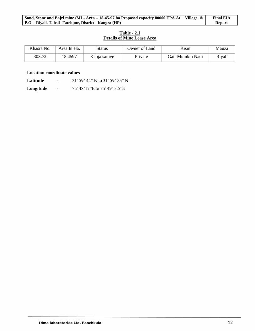
Table - 2.1 Details of Mine Lease Area
Khasra No. Area In Ha. Status Owner of Land Kism Mauza
3032/2 18.4597 Kabja samve Private Gair Mumkin Nadi Riyali
Location coordinate values
Latitude - 310 59’ 44” N to 31
0 59’ 35” N
Longitude - 750 48’17”E to 750
49’ 3.5”E
Sand, Stone and Bajri mine (ML- Area – 18-45-97 ha Proposed capacity 80000 TPA At Village & P.O. - Riyali, Tahsil- Fatehpur, District –Kangra (HP)
Final EIA Report
Idma laboratories Ltd, Panchkula 13
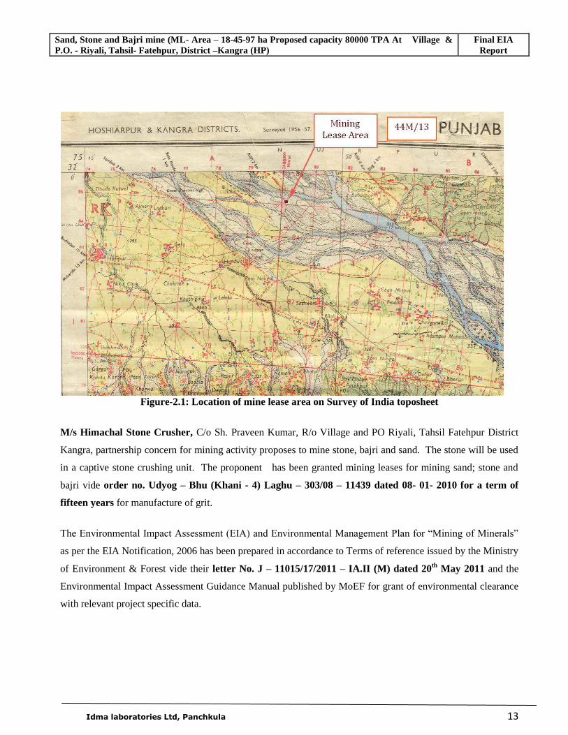
Figure-2.1: Location of mine lease area on Survey of India toposheet
M/s Himachal Stone Crusher, C/o Sh. Praveen Kumar, R/o Village and PO Riyali, Tahsil Fatehpur District
Kangra, partnership concern for mining activity proposes to mine stone, bajri and sand. The stone will be used
in a captive stone crushing unit. The proponent has been granted mining leases for mining sand; stone and
bajri vide order no. Udyog – Bhu (Khani - 4) Laghu – 303/08 – 11439 dated 08- 01- 2010 for a term of
fifteen years for manufacture of grit.
The Environmental Impact Assessment (EIA) and Environmental Management Plan for “Mining of Minerals”
as per the EIA Notification, 2006 has been prepared in accordance to Terms of reference issued by the Ministry
of Environment & Forest vide their letter No. J – 11015/17/2011 – IA.II (M) dated 20th May 2011 and the
Environmental Impact Assessment Guidance Manual published by MoEF for grant of environmental clearance
with relevant project specific data.
Sand, Stone and Bajri mine (ML- Area – 18-45-97 ha Proposed capacity 80000 TPA At Village & P.O. - Riyali, Tahsil- Fatehpur, District –Kangra (HP)
Final EIA Report
Idma laboratories Ltd, Panchkula 14
2.3 GEOLOGY
2.3.1 Regional Geology
Geology of Himachal Pradesh can be broadly divided into two major geo-tectonic zones viz. the Lesser
Himalayan tectogen in the south and the Tethys Himalayan Tectogen in the north. These two tectonic zones are
juxtaposed with each other along a major tectonic break collectively designated as Main Central Thrust in the
sense defined by Srikantia (1988). Mandi District lying within the Lesser Himalaya and the Shiwalik Foothill
comprises rocks ranging in age from Proterozoic to Quaternary. The oldest rocks are of undifferentiated
Proterozoic age, comprising canrbonaceous phyllite, schist, gneiss, quartzite and marble. The Ghoghar Dhar
(Undifferentiated Proterozoic age) occurs as an intrusive body within the Chail Group of rock. This granite
body is well foliated and composed of gneisses, granite with minor aplite and basic veinlets.
The Sundernagar Group of Rocks of Meso- Proterozoic age is represented by quartzite with basic flows. The
Shali Group of Rocks (Meso- Proterozoic) Comprising limestone, dolomite (at places stromatolytic), slate, &
quartzite. The Subathu consists mainly, of olive green shales and grey shales. At the top, a band of white
quartzite is exposed; this band of white quartzite has been taken as the marker, defining the top of the Subathu
sequence. The thick sequence of brackish and fresh water sediments immediately succeeding the fossiliferous
marine Subathu are classified as Dharamshala Formation .The Dharamshala Formation are widely exposed in
the Mandi parautochthon, further west in the autochthon, these rocks are exposed, in the core of the Sarkaghat
anticline. The Shiwalik Group of Middle Miocene of Early Pleistocene age comprises coarse clastic fluviatile
deposits of sandstone, clay and conglomerates. The Quaternary sediments ( Older Alluvium and Newer
Alluvium) along prominent channels consisting of sand, silt, clay, pebbles and cobbles occurring along present
channels of Middle to Late Pleistone and Holocene age.
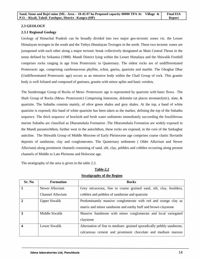
The stratigraphy of the area is given in the table 2.2.
Table-2.2
Stratigraphy of the Region
Sr. No Formation Rocks
1 Newer Alluvium
Channel Alluvium
Grey micaceous, fine to coarse grained sand, silt, clay, boulders,
cobbles and pebbles of sandstone and quartzite
2 Upper Siwalik Predominantly massive conglomerate with red and orange clay as
matrix and minor sandstone and earthy buff and brown claystone
3 Middle Siwalik Massive Sandstone with minor conglomerate and local variegated
claystone
4 Lower Siwalik Alternation of fine to medium- grained sporadically pebbly sandstone,
calcareous cement and prominent chocolate and medium maroon
Sand, Stone and Bajri mine (ML- Area – 18-45-97 ha Proposed capacity 80000 TPA At Village & P.O. - Riyali, Tahsil- Fatehpur, District –Kangra (HP)
Final EIA Report
Idma laboratories Ltd, Panchkula 15
claystone in the middle part
5 Upper Dharamshala Medium to fine grained, hard, bluish grey and massive Sandstone,
green clay and siltstone
6 Lower Dharamshala Hard, grey, well bedded and high mica content sandstone
7 Chail Formation Slate, Phyllite and Schist
8 Dhauladhar Granitoid Mylonitic Gneiss, Slate, Phyllite
2.3.2 Local Geology
The geology of the catchment area is very important from the point of view of the fact that entire terrace has
derived deposits from the catchment and nature of stones, bajri and sand etc was dependent upon the type rocks
in the catchment.
Dharamshala Group
Dharmsala Group is divided into two Formations:
1 Upper Dharmsala
2 Lower Dharmsala
The thick sequence of brackish and fresh water sediments immediately succeeding the fossilliferous marine
Subathu formation is the Dharamshala Formation. The Dharamshala Formation are widely exposed in the
Mandi parautochthon, further west in the autochthon, these rocks are exposed, in the core of the Sarkaghat
anticline.
This highly folded and faulted sequence of Dharamshala aggregating to about 4000 meter displays a contrasting
topography with that of younger and softer Siwalik rocks. The thick, hard and highly competent Dharamshala
rocks stand out as prominent ridges with higher relief.
Siwalik Group
The Siwalik deposits are one of the most comprehensively studied fluvial sequences in the world. They
comprise mudstones, sandstones, and coarsely bedded conglomerates laid down when the region was a vast
basin during Middle Miocene, to Upper Pleistocene times. The sediments were deposited by rivers flowing
southwards from the Greater Himalayas, resulting in extensive multi-ordered drainage systems. Following this
deposition, the sediments were uplifted through intense tectonic regimes (commencing in Upper Miocene
times), subsequently resulting in a unique topographical entity - the Siwalik Hills. The Siwaliks are divided
stratigraphically into three major Subgroups - Lower, Middle, and Upper. These Subgroups are further divided
into individual Formations that are all laterally and vertically exposed today in varying linear and random
patterns. <
Sand, Stone and Bajri mine (ML- Area – 18-45-97 ha Proposed capacity 80000 TPA At Village & P.O. - Riyali, Tahsil- Fatehpur, District –Kangra (HP)
Final EIA Report
Idma laboratories Ltd, Panchkula 16
Ongoing erosion and tectonic activity has greatly affected the topography of the Siwaliks. Their present-day
morphology is comprised of hogback ridges, consequent, subsequent, obsequent, and resquent valleys of
various orders, gullies, choes (seasonal streams), and earth-pillars, filled earth buttresses of conglomerate
formations, semi-circular choe-divides, talus cones, colluvial cones, water-gaps, and choe terraces. Associated
badlands features include the lack of vegetation, steep slopes, high drainage density, and rapid erosion rates.
In the advent of Neogene a depression was formed in front of the rising mountains (Proto- Himalaya).
This depression becomes a repository of a thick sequence of molassic sediments of the Siwalik. The Siwalik
Group comprising conglomerates friable micaceous sandstone, siltstone and clay-stone.
The conglomerates in general are poorly cemented but at places they are very hard. These consist mainly of
pebbles and cobbles of quartzite. The stray pebbles of granite, limestone, sandstone, breccias and lumps of
clay-stone are also observed at places. Often the size of pebbles is large enough to be called as Boulders. The
conglomerates not only occur as regular band but also as lenticular bands alternative with micaceous sandstone
and clay-beds. The sediments were bought down 2 to 25 million years ago by the numerous fast flowing rivers
issuing forth from rapidly Rising Mountain mass of the Himalaya, in the north.
The Siwalik Group is divisible into three sub-groups respectively the Lower, Middle and Upper on the basis of
the litho-stratigraphy as given in the table (Table 2.3.1)
Newer Alluvium
Newer Alluvium is composed of cyclic sequence of grey, micaceous, fine to coarse grained sand, silt, boulders,
cobble, pebble and clays. Newer alluvium exposed as point bar/channel bars within the active channels.
2.3.3 Geology of the mine lease area
The leased out area forms a part of the terrace comprising boulders, cobbles, pebbles, bajri, sand and clay
deposit of terrace alluvium. The rocks in the catchments of Beas River are mainly of Siwalik and Dharmsala
Formations.
The area comprises predominantly the quartzite Boulders, Sand and bajri of Sand, stone.The boulders are
white, spotted white, greenish white, pink, purple and dark green in color.
Sand, Stone and Bajri mine (ML- Area – 18-45-97 ha Proposed capacity 80000 TPA At Village & P.O. - Riyali, Tahsil- Fatehpur, District –Kangra (HP)
Final EIA Report
Idma laboratories Ltd, Panchkula 17
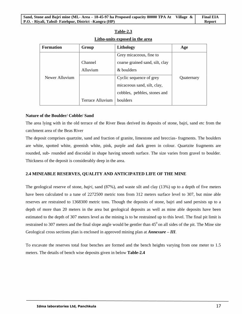
Table-2.3
Litho-units exposed in the area
Formation Group Lithology Age
Newer Alluvium
Channel
Alluvium
Grey micaceous, fine to
coarse grained sand, silt, clay
& boulders
Quaternary
Terrace Alluvium
Cyclic sequence of grey
micaceous sand, silt, clay,
cobbles, pebbles, stones and
boulders
Nature of the Boulder/ Cobble/ Sand
The area lying with in the old terrace of the River Beas derived its deposits of stone, bajri, sand etc from the
catchment area of the Beas River
The deposit comprises quartzite, sand and fraction of granite, limestone and breccias- fragments. The boulders
are white, spotted white, greenish white, pink, purple and dark green in colour. Quartzite fragments are
rounded, sub- rounded and discoidal in shape having smooth surface. The size varies from gravel to boulder.
Thickness of the deposit is considerably deep in the area.
2.4 MINEABLE RESERVES, QUALITY AND ANTICIPATED LIFE OF THE MINE
The geological reserve of stone, bajri, sand (87%), and waste silt and clay (13%) up to a depth of five meters
have been calculated to a tune of 2272500 metric tons from 312 meters surface level to 307, but mine able
reserves are restrained to 1368300 metric tons. Though the deposits of stone, bajri and sand persists up to a
depth of more than 20 meters in the area but geological deposits as well as mine able deposits have been
estimated to the depth of 307 meters level as the mining is to be restrained up to this level. The final pit limit is
restrained to 307 meters and the final slope angle would be gentler than 450 on all sides of the pit. The Mine site
Geological cross sections plan is enclosed in approved mining plan at Annexure – III.
To excavate the reserves total four benches are formed and the bench heights varying from one meter to 1.5
meters. The details of bench wise deposits given in below Table-2.4
Sand, Stone and Bajri mine (ML- Area – 18-45-97 ha Proposed capacity 80000 TPA At Village & P.O. - Riyali, Tahsil- Fatehpur, District –Kangra (HP)
Final EIA Report
Idma laboratories Ltd, Panchkula 18
Table – 2.4
Details of bench wise deposits
Bench Bench Height Boulders Bajri Sand Total
First Bench 310.5 m 173000 122800 100100 395900
Second Bench 309 m 160000 113600 92700 366300
Third Bench 308 m 97400 69200 56400 223000
Fourth Bench 307 m 89700 63700 51900 205300
Total 520100 369300 301100 1190500
Anticipated life of the Mine:
The anticipated life of the mine is expected to be 17.10 years with the production capacity of 80,000 MTPA.
2.5 DETAILS OF MINING
2.5.1. Year wise development for the first five years
The proposed rate of optimum production, every year, would be about 80,000 metric tons of stone, Bajri and
sand material to be excavated and 12000 metric tons would be waste in the form of silt and clay which will be
used for back filling the pits. 80000 metric tons of commercially sale able stone, bajri and sand would be
moved. Thus, about 59800 metric tons of stone and bajri suitable for crushing would be transported to the
crushing unit, and 20200 metric tons of sand would be sold at mining site directly.
2.5.2. Year wise production for First five years
The production proposed during five years of mining according to approved mining plan is as given in the table
2.5
Table-2.5
Production details for first five years
Year Raw Material for Crusher For Free sale Total
Boulders Bajri Sand
First Year 35000 24800 20200 80000
Second Year 35000 24800 20200 80000
Third year 35000 24800 20200 80000
Fourth year 35000 24800 20200 80000
Fifth year 35000 24800 20200 80000
Total 175000 124000 101000 400000
Sand, Stone and Bajri mine (ML- Area – 18-45-97 ha Proposed capacity 80000 TPA At Village & P.O. - Riyali, Tahsil- Fatehpur, District –Kangra (HP)
Final EIA Report
Idma laboratories Ltd, Panchkula 19
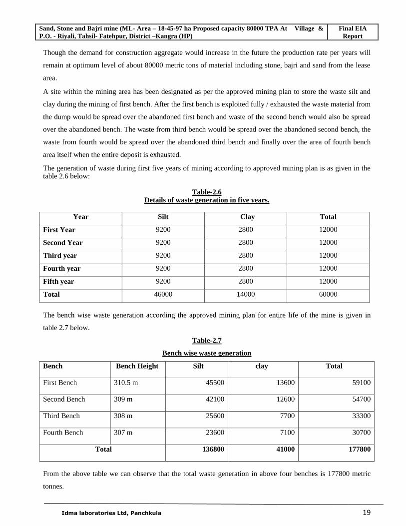
Though the demand for construction aggregate would increase in the future the production rate per years will
remain at optimum level of about 80000 metric tons of material including stone, bajri and sand from the lease
area.
A site within the mining area has been designated as per the approved mining plan to store the waste silt and
clay during the mining of first bench. After the first bench is exploited fully / exhausted the waste material from
the dump would be spread over the abandoned first bench and waste of the second bench would also be spread
over the abandoned bench. The waste from third bench would be spread over the abandoned second bench, the
waste from fourth would be spread over the abandoned third bench and finally over the area of fourth bench
area itself when the entire deposit is exhausted.
The generation of waste during first five years of mining according to approved mining plan is as given in the table 2.6 below:
Table-2.6
Details of waste generation in five years.
Year Silt Clay Total
First Year 9200 2800 12000
Second Year 9200 2800 12000
Third year 9200 2800 12000
Fourth year 9200 2800 12000
Fifth year 9200 2800 12000
Total 46000 14000 60000
The bench wise waste generation according the approved mining plan for entire life of the mine is given in
table 2.7 below.
Table-2.7
Bench wise waste generation
Bench Bench Height Silt clay Total
First Bench 310.5 m 45500 13600 59100
Second Bench 309 m 42100 12600 54700
Third Bench 308 m 25600 7700 33300
Fourth Bench 307 m 23600 7100 30700
Total 136800 41000 177800
From the above table we can observe that the total waste generation in above four benches is 177800 metric
tonnes.
Sand, Stone and Bajri mine (ML- Area – 18-45-97 ha Proposed capacity 80000 TPA At Village & P.O. - Riyali, Tahsil- Fatehpur, District –Kangra (HP)
Final EIA Report
Idma laboratories Ltd, Panchkula 20
2.5.3. Proposed method of mining
It is an open cast mine, bench wise mining will be undertaken manually. No mining machinery shall be
deployed. The material is sorted manually at mining site and sand is separated from stone and bajri. Stone and
bajri shall be transported to the Crusher for crushing and Sand will be sold in the open market.
2.5.4. Conceptual mining plan
Reserves: The geological reserve of stone, bajri, sand (87%), and waste silt and clay (13%) up to a depth of five
metres have been calculated to a tune of 2272500 metric tons from 312 metres surface level to 307, but mine
able reserves of stone, bajri and sand are restrained to 1368300 metric tons.
Pit Depth: Though the deposits of stone, bajri and sand persists up to a depth of more than 20 metres in the area
but geological deposits as well as mine able deposits have been estimated to the depth of 307 metres level as
the mining is to be restrained up to this level.
Pit Wall Angle: The final pit limit is restrained to 307 metres and the final slope angle would be gentler than
450 on all sides of the pit.
Waste Disposal: A site within the mining area has been designated as per the approved mining plan to store the
waste silt and clay during the mining of first bench. After the first bench is exploited fully / exhausted the waste
material from the dump would be spread over the abandoned first bench and waste of the second bench would
also be spread over the abandoned bench. The waste from third bench would be spread over the abandoned
second bench, the waste from fourth bench would be spread over the abandoned third bench and finally over
the area of fourth bench area itself when the entire deposit is exhausted.
Reclamation: Thus the entire waste of 177800 metric tons would be spread over the exhausted benches and the
land being private land; it would be used either for agricultural purpose or for commercial plantation.
The conceptual mining plan (ultimate pit plan) is enclosed in mining plan at Annexure – X
2.6 USE OF MINERAL
The material is sorted manually at mining site and sand is separated from stone and bajri. Stone and bajri shall
be transported to the crusher for crushing and sand will be sold in the market.
2.7 MINERAL TRANSPORTATION
The lease area is having gentle slope with less than the one degree moreover the pit depth would be maximum
of one and a half metres with six metres width, therefore tracks for the trucks and trolley tractors can be easily
maintained.
Sand, Stone and Bajri mine (ML- Area – 18-45-97 ha Proposed capacity 80000 TPA At Village & P.O. - Riyali, Tahsil- Fatehpur, District –Kangra (HP)
Final EIA Report
Idma laboratories Ltd, Panchkula 21
The loaded tractor trolleys / tipper trucks would carry the material to the crusher site, which is being set up
adjoining to the lease boundary. About 300 metric tons of stone, bajri and sand would be required to be moved
daily. Four tipper trucks will be able to move this material to the crusher site.
2.8 SITE SERVICES
In view of the fact that the project is a small mine it will not need much specialized facilities in the mining
area. However, following site services will be provided near the mine and shared with the crusher operations.
• Mine Office.
• Rest Shelter.
• Latrine/Urinal.
• First aid station.
• Store for mining equipment.
Proposed Infrastructure
As the project will be enlisting local workers for the mining as well as for transportation of minerals
no infrastructure for their residential purposes is needed.
As about four tractor trolleys/tipper trucks will be engaged in the transportation of minerals to the
adjoining crusher site, no existing public road would be utilized.
The drinking water supply to the worker will be provided from existing local water supply system.
The latrine / urinal with the mine rest shelter will have its own septic tank.
No mining/industrial/solid waste requiring special management would be generated.
Power supply to the Mine office and other facilities will be drawn from the local power supply lines of
H P State electricity Board.
2.9 EMPLOYMENT POTENTIAL
The mining activity in the lease area will thus give direct employment to about 15 persons engaged in
extraction of stone, bajri and sand; loading of material into tractor trolleys and tipper trucks. The stone and bajri
shall be transported to the crusher. Thus, for transportation of material drivers and equal number of helpers
shall be engaged. At the crusher skilled and semiskilled workers are deployed. Moreover, the construction
industry using the raw material from the mine will generate employment for more than 40 skilled and semi-
skilled workers. Thus, the production of construction aggregates, such as sand stone and bajri has tremendous
impact on multiple generation of employment in downstream activities.
Sand, Stone and Bajri mine (ML- Area – 18-45-97 ha Proposed capacity 80000 TPA At Village & P.O. - Riyali, Tahsil- Fatehpur, District –Kangra (HP)
Final EIA Report
Idma laboratories Ltd, Panchkula 22
Mine Munshi (Clerk) - 1
Drivers - 4
Helpers - 4
Skilled persons - 2
Unskilled - 4
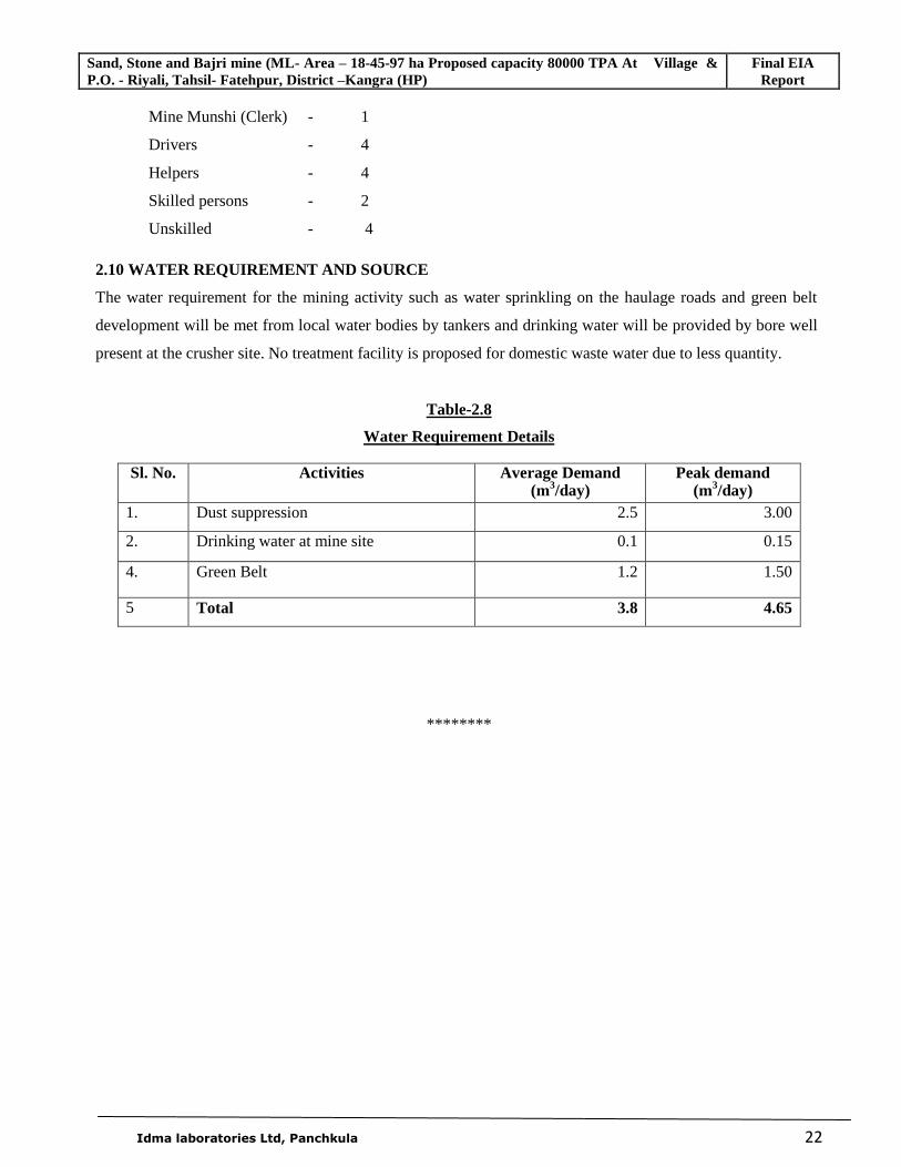
2.10 WATER REQUIREMENT AND SOURCE
The water requirement for the mining activity such as water sprinkling on the haulage roads and green belt
development will be met from local water bodies by tankers and drinking water will be provided by bore well
present at the crusher site. No treatment facility is proposed for domestic waste water due to less quantity.
Table-2.8
Water Requirement Details
Sl. No. Activities Average Demand (m3/day)
Peak demand (m3/day)
1. Dust suppression 2.5 3.00
2. Drinking water at mine site 0.1 0.15
4. Green Belt 1.2 1.50
5 Total 3.8 4.65
********
Sand, Stone and Bajri mine (ML- Area – 18-45-97 ha Proposed capacity 80000 TPA At Village & P.O. - Riyali, Tahsil- Fatehpur, District –Kangra (HP)
Final EIA Report
Idma Laboratories Ltd., Panchkula
23
CHAPTER-3
DESCRIPTION OF ENVIRONMENT
3.1 INTRODUCTION
A regional background to the baseline data is being presented at the very onset, which will help in
better appreciation of micro-level field data, generated on several environmental and ecological
attributes of the study area. The base line status of the project environs is described section wise for
better understanding of the broad-spectrum conditions. The main objectives of environmental baseline
study are
(i) To assess present environmental quality and the environmental impacts.
(ii) To identify environmentally significant factors for taking mitigating measures.
The chapter contains information on existing environmental scenario for the following parameters.
Land Environment
Meteorology
Air Environment
Water Environment
Soil Environment
Noise Environment
Biological Environment
Socio-economic Environment
Although the mining activity will remain confined to very small area and of little magnitude hence the
zone of influence will be only surrounding field of leased out area. The monitoring of the
environmental parameters within the core zone and buffer zone (10 km. radial distance) from the mine
site has been undertaken in accordance with the terms of reference and guidelines for the EIA issued by
the Ministry of Environment And Forest, Govt. of India. This chapter and related discussions contains
the result of field studies carried to evaluate the base line status of the project site and were carried out
for three months covering March, April and May, 2011 in compliance with CPCB guidelines.
Sand, Stone and Bajri mine (ML- Area – 18-45-97 ha Proposed capacity 80000 TPA At Village & P.O. - Riyali, Tahsil- Fatehpur, District –Kangra (HP)
Final EIA Report
Idma Laboratories Ltd., Panchkula
24
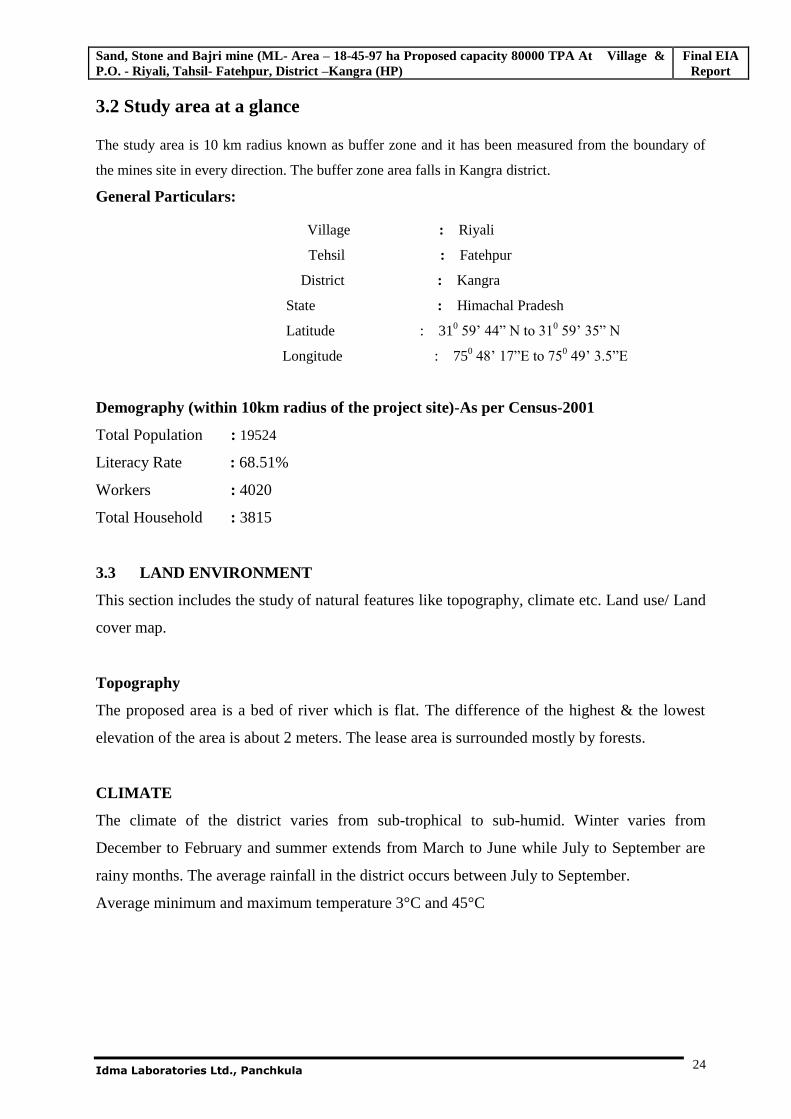
3.2 Study area at a glance
The study area is 10 km radius known as buffer zone and it has been measured from the boundary of
the mines site in every direction. The buffer zone area falls in Kangra district.
General Particulars:
Village : Riyali
Tehsil : Fatehpur
District : Kangra
State : Himachal Pradesh
Latitude : 310 59’ 44” N to 310 59’ 35” N
Longitude : 750 48’ 17”E to 750 49’ 3.5”E
Demography (within 10km radius of the project site)-As per Census-2001
Total Population : 19524
Literacy Rate : 68.51%
Workers : 4020
Total Household : 3815
3.3 LAND ENVIRONMENT
This section includes the study of natural features like topography, climate etc. Land use/ Land
cover map.
Topography
The proposed area is a bed of river which is flat. The difference of the highest & the lowest
elevation of the area is about 2 meters. The lease area is surrounded mostly by forests.
CLIMATE
The climate of the district varies from sub-trophical to sub-humid. Winter varies from
December to February and summer extends from March to June while July to September are
rainy months. The average rainfall in the district occurs between July to September.
Average minimum and maximum temperature 3°C and 45°C
Sand, Stone and Bajri mine (ML- Area – 18-45-97 ha Proposed capacity 80000 TPA At Village & P.O. - Riyali, Tahsil- Fatehpur, District –Kangra (HP)
Final EIA Report
Idma Laboratories Ltd., Panchkula
25
3.4 LAND USE STUDIES
Studies on land use aspects of eco-system play an imperative role in identifying susceptible issues and
to take appropriate action to uphold Ecological equilibrium in the region. The main objective of this
section is to provide a baseline status of the study area covering 10-km radius around the proposed plant
site so that temporal changes due to the industrial activities on the surroundings can be assessed in
future.
3.4.1 Objectives
The objectives of land use studies are:
To determine the present land use pattern;
To ascertain the temporal changes in land use pattern due to construction and operation phase;
and
To scrutinize the impacts on land use due to proposed plant activities in the study area.
3.4.2 Methodology
The land use of the study area is studied and analyzed by using the latest available satellite imagery from
National Remote Sensing Centre (NRSC), Hyderabad.
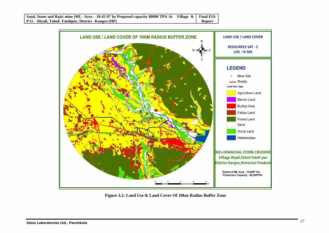
3.4.3 Land Use Pattern
The study area of 10-km around the plant boundary is considered in the land use pattern study.
For computation of the land use pattern in the study area Erdas and Arc GIS softwares are used. The
geographical area of all settlements covered within the study area is considered. For this land use study
multi spectral, high resolution (LISS-IV) satellite image of Resourcesat-2 is taken. The False Color
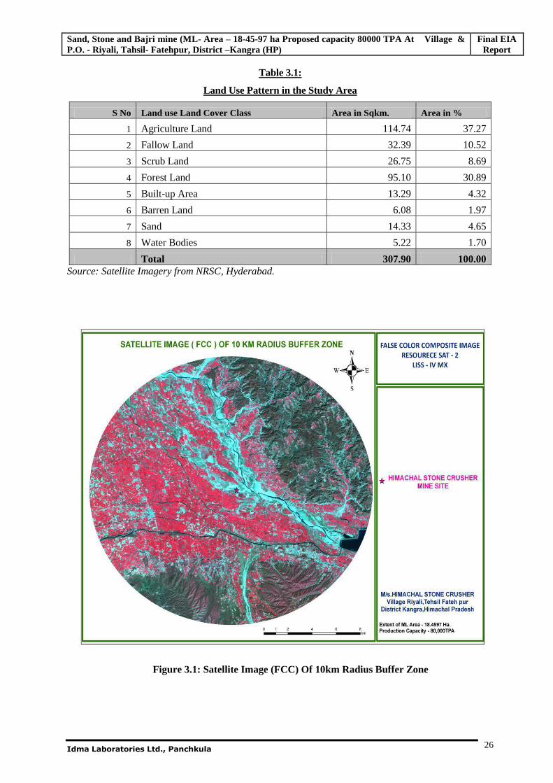
Composite (FCC) image is given below in Fig 3.1.
The land use is classified into eight types and details are given below with area covered by each class in
square kilometers. The land-use pattern of the study area is given in Table 3.1 and shown in Fig 3.2.
Sand, Stone and Bajri mine (ML- Area – 18-45-97 ha Proposed capacity 80000 TPA At Village & P.O. - Riyali, Tahsil- Fatehpur, District –Kangra (HP)
Final EIA Report
Idma Laboratories Ltd., Panchkula
26
Table 3.1:
Land Use Pattern in the Study Area
S No Land use Land Cover Class Area in Sqkm. Area in %
1 Agriculture Land 114.74 37.27
2 Fallow Land 32.39 10.52
3 Scrub Land 26.75 8.69
4 Forest Land 95.10 30.89
5 Built-up Area 13.29 4.32
6 Barren Land 6.08 1.97
7 Sand 14.33 4.65
8 Water Bodies 5.22 1.70
Total 307.90 100.00 Source: Satellite Imagery from NRSC, Hyderabad.
Figure 3.1: Satellite Image (FCC) Of 10km Radius Buffer Zone
Sand, Stone and Bajri mine (ML- Area – 18-45-97 ha Proposed capacity 80000 TPA At Village & P.O. - Riyali, Tahsil- Fatehpur, District –Kangra (HP)
Final EIA Report
Idma Laboratories Ltd., Panchkula 27
Figure 3.2: Land Use & Land Cover Of 10km Radius Buffer Zone
Sand, Stone and Bajri mine (ML- Area – 18-45-97 ha Proposed capacity 80000 TPA At Village & P.O. - Riyali, Tahsil- Fatehpur, District –Kangra (HP)
Final EIA Report
Idma Laboratories Ltd., Panchkula
28
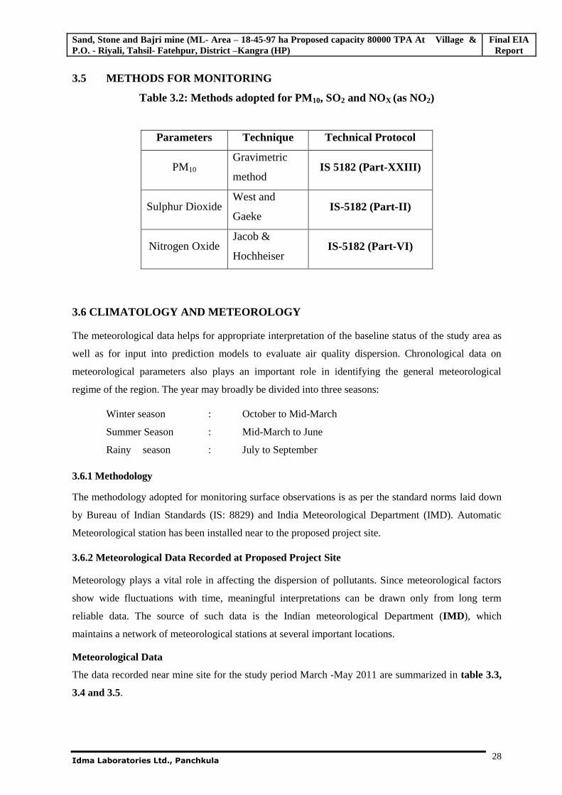
3.5 METHODS FOR MONITORING
Table 3.2: Methods adopted for PM10, SO2 and NOX (as NO2)
Parameters Technique Technical Protocol
PM10 Gravimetric
method IS 5182 (Part-XXIII)
Sulphur Dioxide West and
Gaeke IS-5182 (Part-II)
Nitrogen Oxide Jacob &
Hochheiser IS-5182 (Part-VI)
3.6 CLIMATOLOGY AND METEOROLOGY
The meteorological data helps for appropriate interpretation of the baseline status of the study area as
well as for input into prediction models to evaluate air quality dispersion. Chronological data on
meteorological parameters also plays an important role in identifying the general meteorological
regime of the region. The year may broadly be divided into three seasons:
Winter season : October to Mid-March
Summer Season : Mid-March to June
Rainy season : July to September
3.6.1 Methodology
The methodology adopted for monitoring surface observations is as per the standard norms laid down
by Bureau of Indian Standards (IS: 8829) and India Meteorological Department (IMD). Automatic
Meteorological station has been installed near to the proposed project site.
3.6.2 Meteorological Data Recorded at Proposed Project Site
Meteorology plays a vital role in affecting the dispersion of pollutants. Since meteorological factors
show wide fluctuations with time, meaningful interpretations can be drawn only from long term
reliable data. The source of such data is the Indian meteorological Department (IMD), which
maintains a network of meteorological stations at several important locations.
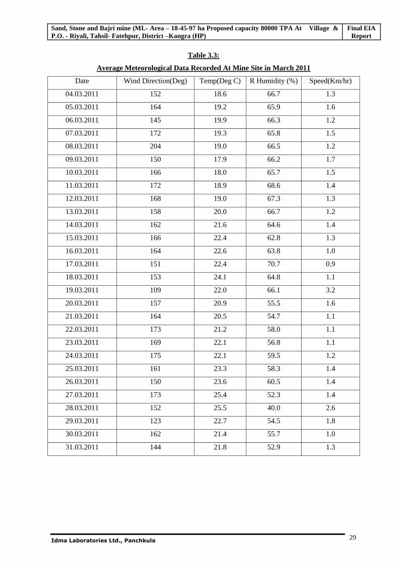
Meteorological Data
The data recorded near mine site for the study period March -May 2011 are summarized in table 3.3,
3.4 and 3.5.
Sand, Stone and Bajri mine (ML- Area – 18-45-97 ha Proposed capacity 80000 TPA At Village & P.O. - Riyali, Tahsil- Fatehpur, District –Kangra (HP)
Final EIA Report
Idma Laboratories Ltd., Panchkula
29
Table 3.3:
Average Meteorological Data Recorded At Mine Site in March 2011
Date Wind Direction(Deg) Temp(Deg C) R Humidity (%) Speed(Km/hr)
04.03.2011 152 18.6 66.7 1.3
05.03.2011 164 19.2 65.9 1.6
06.03.2011 145 19.9 66.3 1.2
07.03.2011 172 19.3 65.8 1.5
08.03.2011 204 19.0 66.5 1.2
09.03.2011 150 17.9 66.2 1.7
10.03.2011 166 18.0 65.7 1.5
11.03.2011 172 18.9 68.6 1.4
12.03.2011 168 19.0 67.3 1.3
13.03.2011 158 20.0 66.7 1.2
14.03.2011 162 21.6 64.6 1.4
15.03.2011 166 22.4 62.8 1.3
16.03.2011 164 22.6 63.8 1.0
17.03.2011 151 22.4 70.7 0.9
18.03.2011 153 24.1 64.8 1.1
19.03.2011 109 22.0 66.1 3.2
20.03.2011 157 20.9 55.5 1.6
21.03.2011 164 20.5 54.7 1.1
22.03.2011 173 21.2 58.0 1.1
23.03.2011 169 22.1 56.8 1.1
24.03.2011 175 22.1 59.5 1.2
25.03.2011 161 23.3 58.3 1.4
26.03.2011 150 23.6 60.5 1.4
27.03.2011 173 25.4 52.3 1.4
28.03.2011 152 25.5 40.0 2.6
29.03.2011 123 22.7 54.5 1.8
30.03.2011 162 21.4 55.7 1.0
31.03.2011 144 21.8 52.9 1.3
Sand, Stone and Bajri mine (ML- Area – 18-45-97 ha Proposed capacity 80000 TPA At Village & P.O. - Riyali, Tahsil- Fatehpur, District –Kangra (HP)
Final EIA Report
Idma Laboratories Ltd., Panchkula
30
Table 3.4:
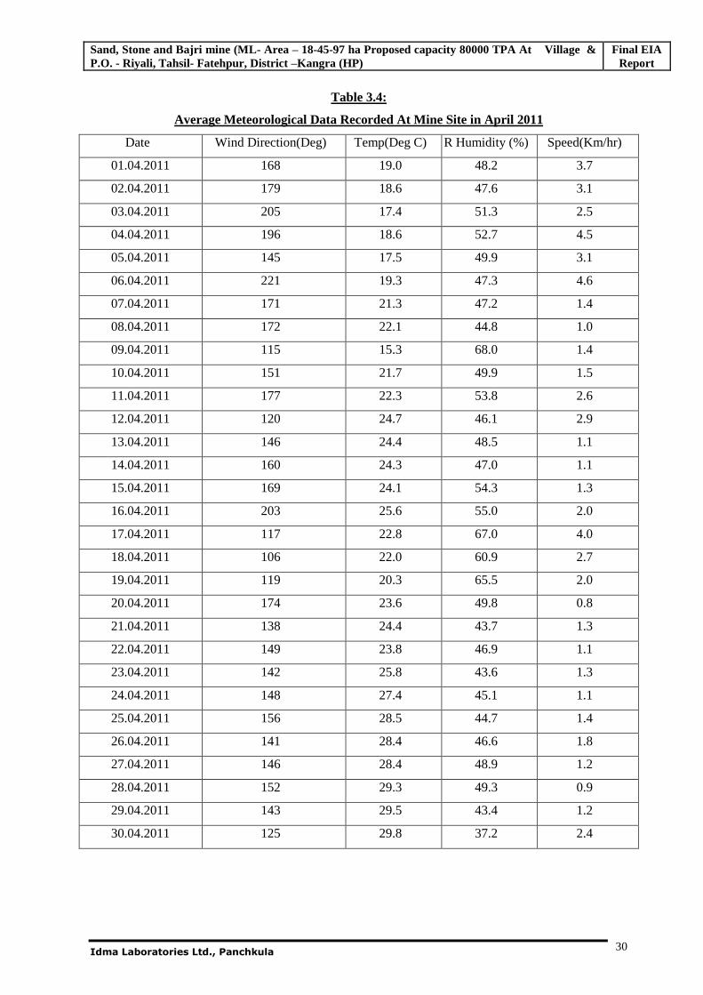
Average Meteorological Data Recorded At Mine Site in April 2011
Date Wind Direction(Deg) Temp(Deg C) R Humidity (%) Speed(Km/hr)
01.04.2011 168 19.0 48.2 3.7
02.04.2011 179 18.6 47.6 3.1
03.04.2011 205 17.4 51.3 2.5
04.04.2011 196 18.6 52.7 4.5
05.04.2011 145 17.5 49.9 3.1
06.04.2011 221 19.3 47.3 4.6
07.04.2011 171 21.3 47.2 1.4
08.04.2011 172 22.1 44.8 1.0
09.04.2011 115 15.3 68.0 1.4
10.04.2011 151 21.7 49.9 1.5
11.04.2011 177 22.3 53.8 2.6
12.04.2011 120 24.7 46.1 2.9
13.04.2011 146 24.4 48.5 1.1
14.04.2011 160 24.3 47.0 1.1
15.04.2011 169 24.1 54.3 1.3
16.04.2011 203 25.6 55.0 2.0
17.04.2011 117 22.8 67.0 4.0
18.04.2011 106 22.0 60.9 2.7
19.04.2011 119 20.3 65.5 2.0
20.04.2011 174 23.6 49.8 0.8
21.04.2011 138 24.4 43.7 1.3
22.04.2011 149 23.8 46.9 1.1
23.04.2011 142 25.8 43.6 1.3
24.04.2011 148 27.4 45.1 1.1
25.04.2011 156 28.5 44.7 1.4
26.04.2011 141 28.4 46.6 1.8
27.04.2011 146 28.4 48.9 1.2
28.04.2011 152 29.3 49.3 0.9
29.04.2011 143 29.5 43.4 1.2
30.04.2011 125 29.8 37.2 2.4
Sand, Stone and Bajri mine (ML- Area – 18-45-97 ha Proposed capacity 80000 TPA At Village & P.O. - Riyali, Tahsil- Fatehpur, District –Kangra (HP)
Final EIA Report
Idma Laboratories Ltd., Panchkula
31
Table 3.5:
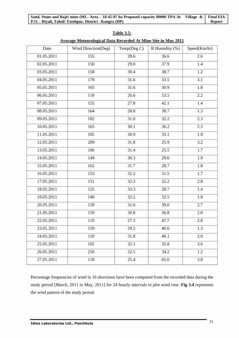
Average Meteorological Data Recorded At Mine Site in May 2011
Date Wind Direction(Deg) Temp(Deg C) R Humidity (%) Speed(Km/hr)
01.05.2011 155 28.6 36.6 2.6
02.05.2011 150 29.0 37.9 1.4
03.05.2011 158 30.4 38.7 1.2
04.05.2011 178 31.6 33.5 3.1
05.05.2011 165 31.6 30.9 1.8
06.05.2011 118 26.6 53.5 2.2
07.05.2011 155 27.8 42.1 1.4
08.05.2011 164 28.8 38.7 1.3
09.05.2011 182 31.0 32.2 2.3
10.05.2011 165 30.1 36.2 2.3
11.05.2011 185 30.9 33.1 1.9
12.05.2011 209 31.8 25.9 3.2
13.05.2011 186 31.4 25.5 1.7
14.05.2011 149 30.3 29.6 1.9
15.05.2011 162 31.7 28.7 1.8
16.05.2011 153 32.2 31.5 1.7
17.05.2011 151 32.3 32.2 2.8
18.05.2011 125 33.3 28.7 1.4
19.05.2011 140 33.2 32.5 1.8
20.05.2011 139 31.6 39.0 2.7
21.05.2011 159 30.8 36.8 2.0
22.05.2011 119 27.3 47.7 2.8
23.05.2011 159 29.5 40.6 1.3
24.05.2011 150 31.8 40.1 2.0
25.05.2011 102 32.1 35.8 3.6
26.05.2011 250 32.5 34.2 1.2
27.05.2011 118 25.4 65.0 3.8
Percentage frequencies of wind in 16 directions have been computed from the recorded data during the
study period [March, 2011 to May, 2011] for 24 hourly intervals to plot wind rose. Fig 3.4 represents
the wind pattern of the study period.
Sand, Stone and Bajri mine (ML- Area – 18-45-97 ha Proposed capacity 80000 TPA At Village & P.O. - Riyali, Tahsil- Fatehpur, District –Kangra (HP)
Final EIA Report
Idma Laboratories Ltd., Panchkula
32
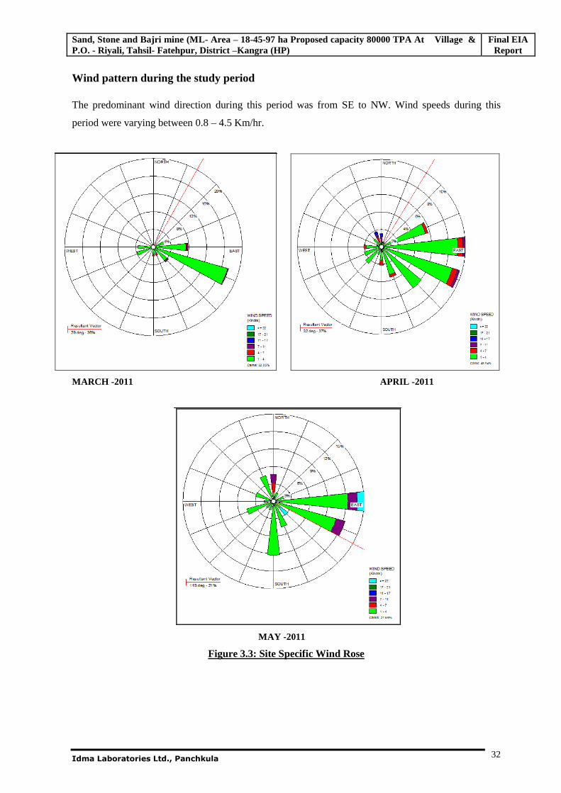
Wind pattern during the study period
The predominant wind direction during this period was from SE to NW. Wind speeds during this
period were varying between 0.8 – 4.5 Km/hr.
MARCH -2011 APRIL -2011
MAY -2011
Figure 3.3: Site Specific Wind Rose
Sand, Stone and Bajri mine (ML- Area – 18-45-97 ha Proposed capacity 80000 TPA At Village & P.O. - Riyali, Tahsil- Fatehpur, District –Kangra (HP)
Final EIA Report
Idma Laboratories Ltd., Panchkula
33
3.7 BASELINE DATA
AIR ENVIRONMENT
1. Ambient Air Quality
The prime objective of the baseline air monitoring was to evaluate the existing air quality of the area.
This will also be useful for assessing the conformity to standards of the ambient air quality during the
operation of the proposed mine.
This section describes the selection of sampling locations, methodology adopted for sampling, analytical
techniques and frequency of sampling. The results of monitoring carried out for study period March, to
May, 2011 is presented in Table-3.11 to Table-3.14
3.7.1 Methodology adopted for Air Quality Survey
The baseline status of the air quality in the study area has been assessed through a scientifically designed
ambient air quality monitoring network. The design of monitoring network in the air quality surveillance
program has been based on the following considerations:
Meteorological conditions on synoptic scale;
Topography of the study area;
Representatives of regional background air quality for obtaining baseline status; and
Representatives of likely impact areas.
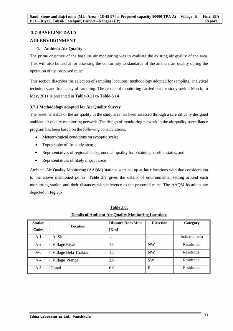
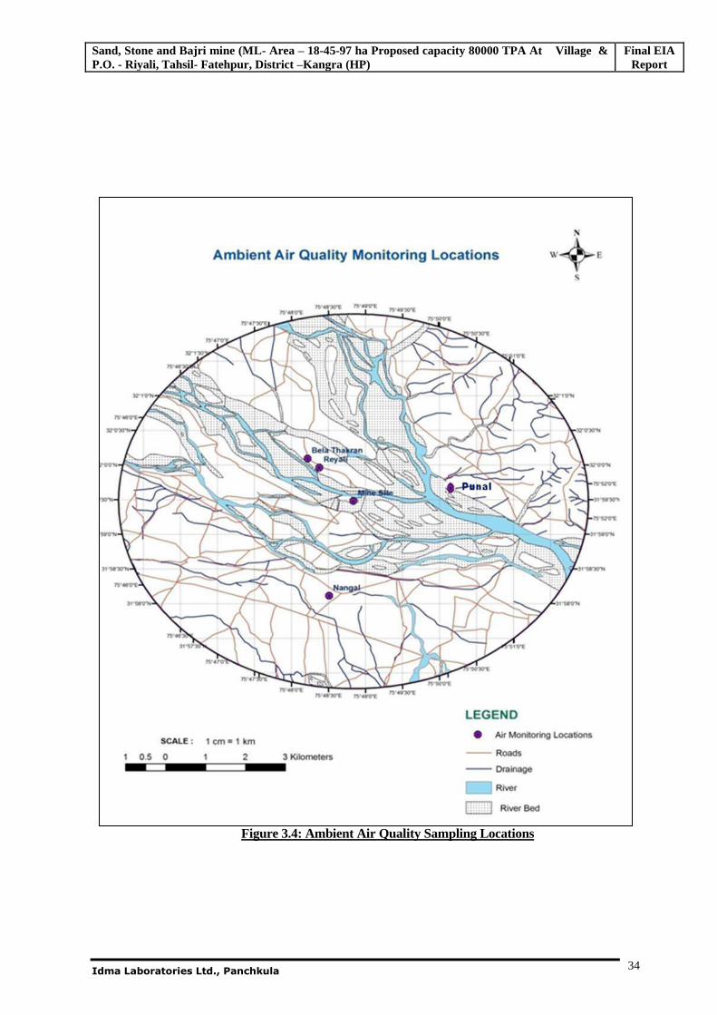
Ambient Air Quality Monitoring (AAQM) stations were set up at four locations with due consideration
to the above mentioned points. Table 3.8 gives the details of environmental setting around each
monitoring station and their distances with reference to the proposed mine. The AAQM locations are
depicted in Fig 3.5
Table 3.6:
Details of Ambient Air Quality Monitoring Locations
Station
Codes Location
Distance from Mine
[Km]
Direction
Category
A-1 At Site -- - Industrial area
A-2 Village Riyali 1.0 NW Residential
A-3 Village Bela Thakran 1.5 NW Residential
A-4 Village Nangal 2.6 SW Residential
A-5 Punal 6.0 E Residential
Sand, Stone and Bajri mine (ML- Area – 18-45-97 ha Proposed capacity 80000 TPA At Village & P.O. - Riyali, Tahsil- Fatehpur, District –Kangra (HP)
Final EIA Report
Idma Laboratories Ltd., Panchkula
34
Figure 3.4: Ambient Air Quality Sampling Locations
Sand, Stone and Bajri mine (ML- Area – 18-45-97 ha Proposed capacity 80000 TPA At Village & P.O. - Riyali, Tahsil- Fatehpur, District –Kangra (HP)
Final EIA Report
Idma Laboratories Ltd., Panchkula
35
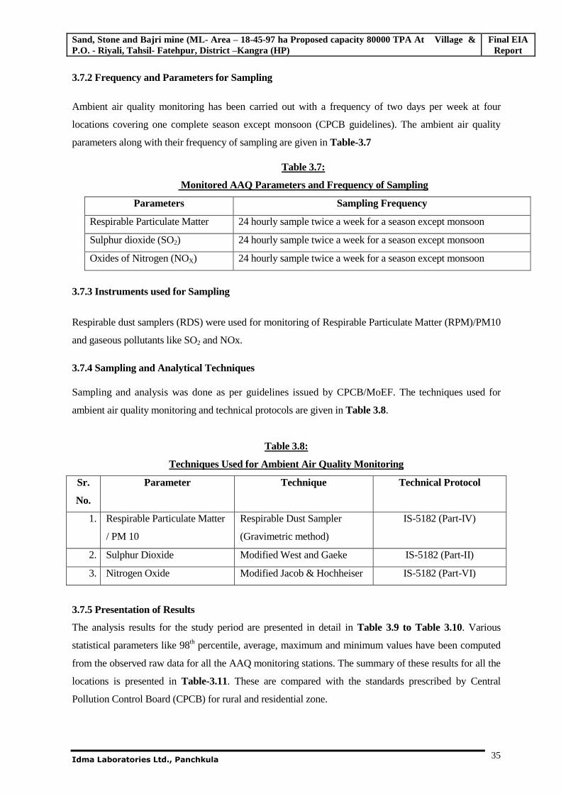
3.7.2 Frequency and Parameters for Sampling
Ambient air quality monitoring has been carried out with a frequency of two days per week at four
locations covering one complete season except monsoon (CPCB guidelines). The ambient air quality
parameters along with their frequency of sampling are given in Table-3.7
Table 3.7:
Monitored AAQ Parameters and Frequency of Sampling
Parameters Sampling Frequency
Respirable Particulate Matter 24 hourly sample twice a week for a season except monsoon
Sulphur dioxide (SO2) 24 hourly sample twice a week for a season except monsoon
Oxides of Nitrogen (NOX) 24 hourly sample twice a week for a season except monsoon
3.7.3 Instruments used for Sampling
Respirable dust samplers (RDS) were used for monitoring of Respirable Particulate Matter (RPM)/PM10
and gaseous pollutants like SO2 and NOx.
3.7.4 Sampling and Analytical Techniques
Sampling and analysis was done as per guidelines issued by CPCB/MoEF. The techniques used for
ambient air quality monitoring and technical protocols are given in Table 3.8.
Table 3.8:
Techniques Used for Ambient Air Quality Monitoring
Sr.
No.
Parameter Technique Technical Protocol
1. Respirable Particulate Matter
/ PM 10
Respirable Dust Sampler
(Gravimetric method)
IS-5182 (Part-IV)
2. Sulphur Dioxide Modified West and Gaeke IS-5182 (Part-II)
3. Nitrogen Oxide Modified Jacob & Hochheiser IS-5182 (Part-VI)
3.7.5 Presentation of Results
The analysis results for the study period are presented in detail in Table 3.9 to Table 3.10. Various
statistical parameters like 98th percentile, average, maximum and minimum values have been computed
from the observed raw data for all the AAQ monitoring stations. The summary of these results for all the
locations is presented in Table-3.11. These are compared with the standards prescribed by Central
Pollution Control Board (CPCB) for rural and residential zone.
Sand, Stone and Bajri mine (ML- Area – 18-45-97 ha Proposed capacity 80000 TPA At Village & P.O. - Riyali, Tahsil- Fatehpur, District –Kangra (HP)
Final EIA Report
Idma Laboratories Ltd., Panchkula
36
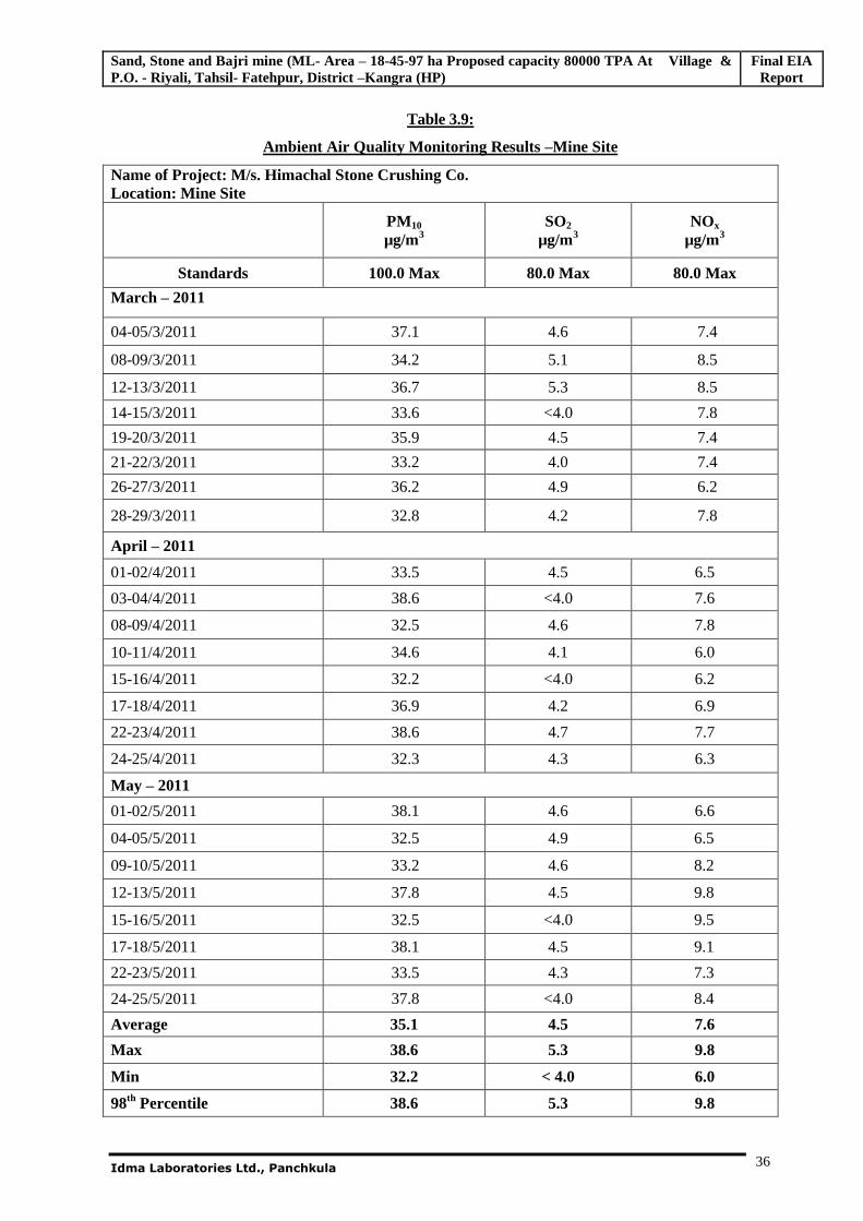
Table 3.9:
Ambient Air Quality Monitoring Results –Mine Site
Name of Project: M/s. Himachal Stone Crushing Co. Location: Mine Site
PM10 µg/m3
SO2
µg/m3 NOx
µg/m3
Standards 100.0 Max 80.0 Max 80.0 Max
March – 2011
04-05/3/2011 37.1 4.6 7.4
08-09/3/2011 34.2 5.1 8.5
12-13/3/2011 36.7 5.3 8.5
14-15/3/2011 33.6 <4.0 7.8
19-20/3/2011 35.9 4.5 7.4
21-22/3/2011 33.2 4.0 7.4
26-27/3/2011 36.2 4.9 6.2
28-29/3/2011 32.8 4.2 7.8
April – 2011
01-02/4/2011 33.5 4.5 6.5
03-04/4/2011 38.6 <4.0 7.6
08-09/4/2011 32.5 4.6 7.8
10-11/4/2011 34.6 4.1 6.0
15-16/4/2011 32.2 <4.0 6.2
17-18/4/2011 36.9 4.2 6.9
22-23/4/2011 38.6 4.7 7.7
24-25/4/2011 32.3 4.3 6.3
May – 2011
01-02/5/2011 38.1 4.6 6.6
04-05/5/2011 32.5 4.9 6.5
09-10/5/2011 33.2 4.6 8.2
12-13/5/2011 37.8 4.5 9.8
15-16/5/2011 32.5 <4.0 9.5
17-18/5/2011 38.1 4.5 9.1
22-23/5/2011 33.5 4.3 7.3
24-25/5/2011 37.8 <4.0 8.4
Average 35.1 4.5 7.6
Max 38.6 5.3 9.8
Min 32.2 < 4.0 6.0
98th Percentile 38.6 5.3 9.8
Sand, Stone and Bajri mine (ML- Area – 18-45-97 ha Proposed capacity 80000 TPA At Village & P.O. - Riyali, Tahsil- Fatehpur, District –Kangra (HP)
Final EIA Report
Idma Laboratories Ltd., Panchkula
37
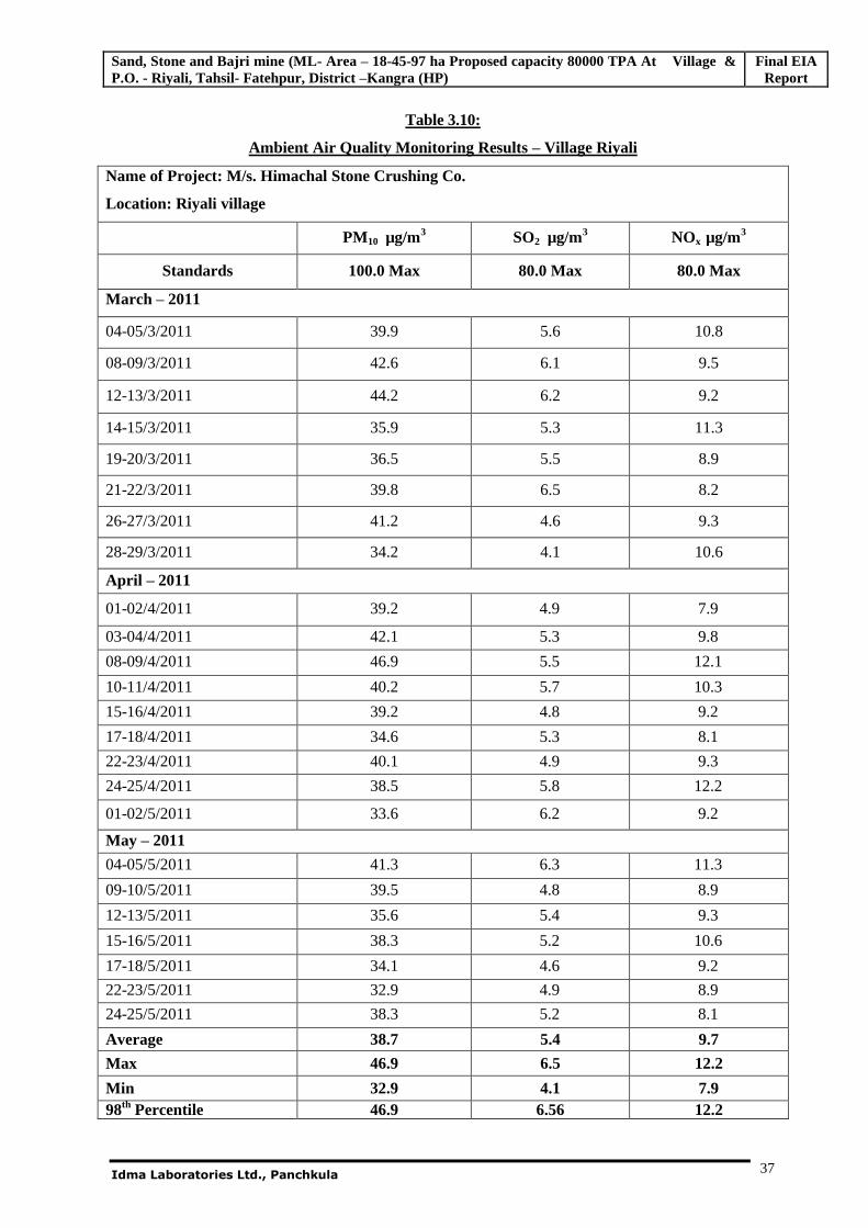
Table 3.10:
Ambient Air Quality Monitoring Results – Village Riyali
Name of Project: M/s. Himachal Stone Crushing Co.
Location: Riyali village
PM10 µg/m3 SO2 µg/m3 NOx µg/m3
Standards 100.0 Max 80.0 Max 80.0 Max
March – 2011
04-05/3/2011 39.9 5.6 10.8
08-09/3/2011 42.6 6.1 9.5
12-13/3/2011 44.2 6.2 9.2
14-15/3/2011 35.9 5.3 11.3
19-20/3/2011 36.5 5.5 8.9
21-22/3/2011 39.8 6.5 8.2
26-27/3/2011 41.2 4.6 9.3
28-29/3/2011 34.2 4.1 10.6
April – 2011
01-02/4/2011 39.2 4.9 7.9
03-04/4/2011 42.1 5.3 9.8
08-09/4/2011 46.9 5.5 12.1
10-11/4/2011 40.2 5.7 10.3
15-16/4/2011 39.2 4.8 9.2
17-18/4/2011 34.6 5.3 8.1
22-23/4/2011 40.1 4.9 9.3
24-25/4/2011 38.5 5.8 12.2
01-02/5/2011 33.6 6.2 9.2
May – 2011
04-05/5/2011 41.3 6.3 11.3
09-10/5/2011 39.5 4.8 8.9
12-13/5/2011 35.6 5.4 9.3
15-16/5/2011 38.3 5.2 10.6
17-18/5/2011 34.1 4.6 9.2
22-23/5/2011 32.9 4.9 8.9
24-25/5/2011 38.3 5.2 8.1
Average 38.7 5.4 9.7
Max 46.9 6.5 12.2
Min 32.9 4.1 7.9 98th Percentile 46.9 6.56 12.2
Sand, Stone and Bajri mine (ML- Area – 18-45-97 ha Proposed capacity 80000 TPA At Village & P.O. - Riyali, Tahsil- Fatehpur, District –Kangra (HP)
Final EIA Report
Idma Laboratories Ltd., Panchkula
38
Table-3.11:
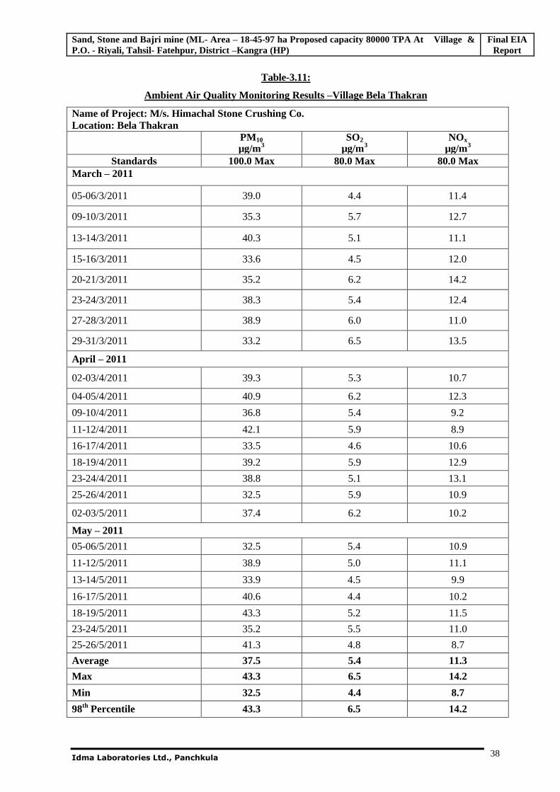
Ambient Air Quality Monitoring Results –Village Bela Thakran
Name of Project: M/s. Himachal Stone Crushing Co. Location: Bela Thakran
PM10 µg/m3
SO2
µg/m3 NOx
µg/m3 Standards 100.0 Max 80.0 Max 80.0 Max
March – 2011
05-06/3/2011 39.0 4.4 11.4
09-10/3/2011 35.3 5.7 12.7
13-14/3/2011 40.3 5.1 11.1
15-16/3/2011 33.6 4.5 12.0
20-21/3/2011 35.2 6.2 14.2
23-24/3/2011 38.3 5.4 12.4
27-28/3/2011 38.9 6.0 11.0
29-31/3/2011 33.2 6.5 13.5
April – 2011
02-03/4/2011 39.3 5.3 10.7
04-05/4/2011 40.9 6.2 12.3
09-10/4/2011 36.8 5.4 9.2
11-12/4/2011 42.1 5.9 8.9
16-17/4/2011 33.5 4.6 10.6
18-19/4/2011 39.2 5.9 12.9
23-24/4/2011 38.8 5.1 13.1
25-26/4/2011 32.5 5.9 10.9
02-03/5/2011 37.4 6.2 10.2
May – 2011
05-06/5/2011 32.5 5.4 10.9
11-12/5/2011 38.9 5.0 11.1
13-14/5/2011 33.9 4.5 9.9
16-17/5/2011 40.6 4.4 10.2
18-19/5/2011 43.3 5.2 11.5
23-24/5/2011 35.2 5.5 11.0
25-26/5/2011 41.3 4.8 8.7
Average 37.5 5.4 11.3
Max 43.3 6.5 14.2
Min 32.5 4.4 8.7
98th Percentile 43.3 6.5 14.2
Sand, Stone and Bajri mine (ML- Area – 18-45-97 ha Proposed capacity 80000 TPA At Village & P.O. - Riyali, Tahsil- Fatehpur, District –Kangra (HP)
Final EIA Report
Idma Laboratories Ltd., Panchkula
39
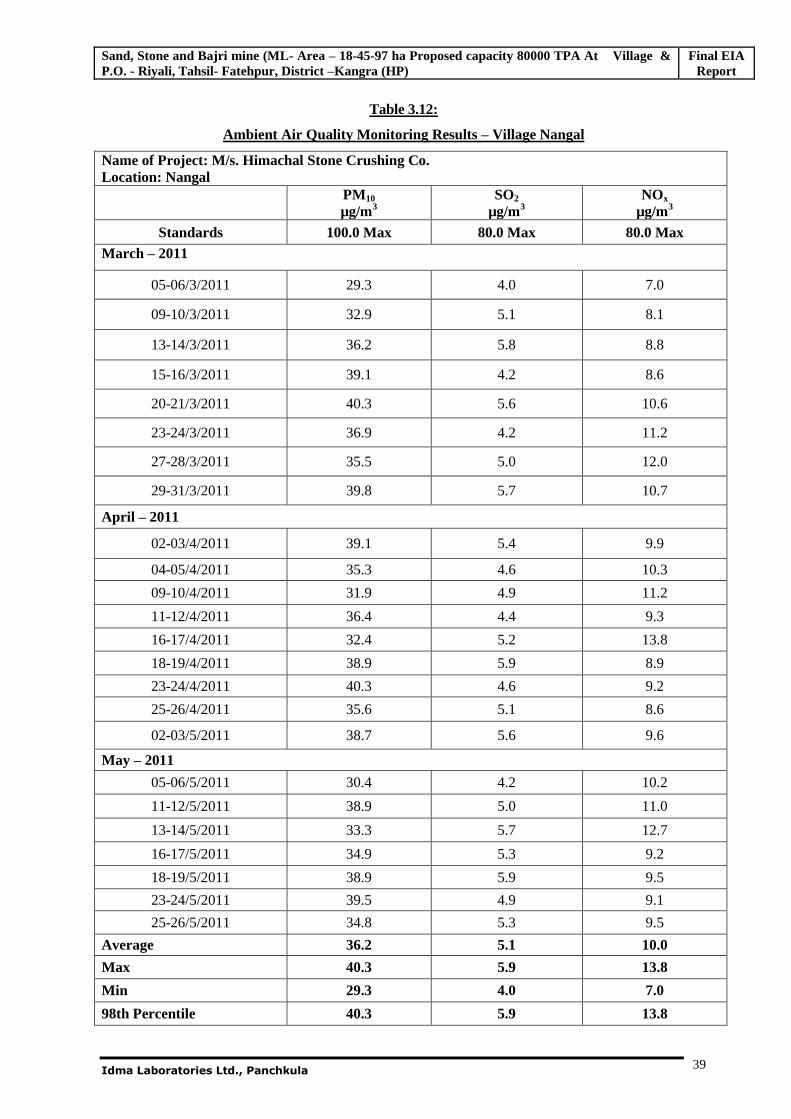
Table 3.12:
Ambient Air Quality Monitoring Results – Village Nangal
Name of Project: M/s. Himachal Stone Crushing Co. Location: Nangal
PM10 µg/m3
SO2
µg/m3 NOx
µg/m3 Standards 100.0 Max 80.0 Max 80.0 Max
March – 2011
05-06/3/2011 29.3 4.0 7.0
09-10/3/2011 32.9 5.1 8.1
13-14/3/2011 36.2 5.8 8.8
15-16/3/2011 39.1 4.2 8.6
20-21/3/2011 40.3 5.6 10.6
23-24/3/2011 36.9 4.2 11.2
27-28/3/2011 35.5 5.0 12.0
29-31/3/2011 39.8 5.7 10.7
April – 2011
02-03/4/2011 39.1 5.4 9.9
04-05/4/2011 35.3 4.6 10.3
09-10/4/2011 31.9 4.9 11.2
11-12/4/2011 36.4 4.4 9.3
16-17/4/2011 32.4 5.2 13.8
18-19/4/2011 38.9 5.9 8.9
23-24/4/2011 40.3 4.6 9.2
25-26/4/2011 35.6 5.1 8.6
02-03/5/2011 38.7 5.6 9.6
May – 2011
05-06/5/2011 30.4 4.2 10.2
11-12/5/2011 38.9 5.0 11.0
13-14/5/2011 33.3 5.7 12.7
16-17/5/2011 34.9 5.3 9.2
18-19/5/2011 38.9 5.9 9.5
23-24/5/2011 39.5 4.9 9.1
25-26/5/2011 34.8 5.3 9.5
Average 36.2 5.1 10.0
Max 40.3 5.9 13.8
Min 29.3 4.0 7.0
98th Percentile 40.3 5.9 13.8
Sand, Stone and Bajri mine (ML- Area – 18-45-97 ha Proposed capacity 80000 TPA At Village & P.O. - Riyali, Tahsil- Fatehpur, District –Kangra (HP)
Final EIA Report
Idma Laboratories Ltd., Panchkula
40
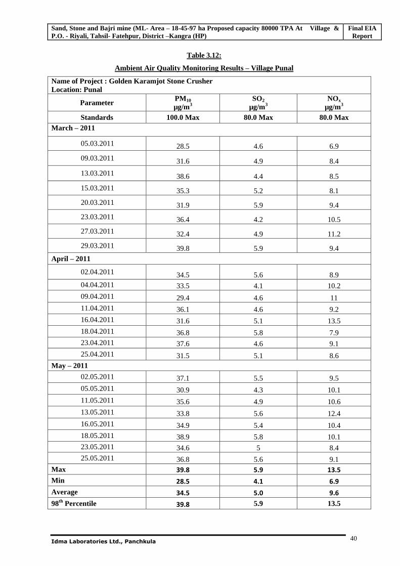
Table 3.12:
Ambient Air Quality Monitoring Results – Village Punal
Name of Project : Golden Karamjot Stone Crusher Location: Punal
Parameter PM10 µg/m3
SO2
µg/m3 NOx
µg/m3 Standards 100.0 Max 80.0 Max 80.0 Max
March – 2011
05.03.2011 28.5 4.6 6.9
09.03.2011 31.6 4.9 8.4
13.03.2011 38.6 4.4 8.5
15.03.2011 35.3 5.2 8.1
20.03.2011 31.9 5.9 9.4
23.03.2011 36.4 4.2 10.5
27.03.2011 32.4 4.9 11.2
29.03.2011 39.8 5.9 9.4 April – 2011
02.04.2011 34.5 5.6 8.9 04.04.2011 33.5 4.1 10.2
09.04.2011 29.4 4.6 11 11.04.2011 36.1 4.6 9.2 16.04.2011 31.6 5.1 13.5 18.04.2011 36.8 5.8 7.9 23.04.2011 37.6 4.6 9.1
25.04.2011 31.5 5.1 8.6 May – 2011
02.05.2011 37.1 5.5 9.5 05.05.2011 30.9 4.3 10.1 11.05.2011 35.6 4.9 10.6 13.05.2011 33.8 5.6 12.4 16.05.2011 34.9 5.4 10.4 18.05.2011 38.9 5.8 10.1 23.05.2011 34.6 5 8.4 25.05.2011 36.8 5.6 9.1
Max 39.8 5.9 13.5
Min 28.5 4.1 6.9
Average 34.5 5.0 9.6
98th Percentile 39.8 5.9 13.5
Sand, Stone and Bajri mine (ML- Area – 18-45-97 ha Proposed capacity 80000 TPA At Village & P.O. - Riyali, Tahsil- Fatehpur, District –Kangra (HP)
Final EIA Report
Idma Laboratories Ltd., Panchkula
41
Observations of the results
Core Zone – Mine Area (A1)
Respirable particulate matter (PM10) monitored in the Mine area showed 98th percentile value of
38.6µg/m3
98th percentile values of Sulphur dioxide and Oxides of Nitrogen in the mine area from the monitored
data were 5.3 g/m3 and 9.8µg/m3 respectively.
Buffer Zone (Stations A2 to A4)
Particulate Matter – PM 10
PM10 values monitored at 3 locations showed 98th percentile values in the range of 40.3-46.9µg/m3.
Highest value of 46.9µg/m3 was recorded at Riyali Site. However this value is well within the limits of
NAAQ.
Sulphurdioxide - SO2
98th percentile value of Sulphur dioxide in the study area from the monitored data was in the range of
5.9-6.56 g/m3. Maximum value of 6.56 g/m3 was obtained near the sampling station located at
Riyali village. The values of SO2 monitored in the study area are well within the limits of NAAQ
standards.
Oxides of Nitrogen - NOx
Ambient air quality status monitored for nitrogen oxides in the study area were in the range with 98th
percentile values between 12.2-14.2 g/ m3. A maximum value of 14.2 g/m3 was prevailing at the
time of sampling at Bela Thakran village.
Results of the ambient air quality at all the above locations were found to be well within the limits of
National Ambient Air Quality (NAAQ) standards. Concentrations of, PM10, SO2 and NOx are mainly
contributed due to vehicular traffic and local activities.
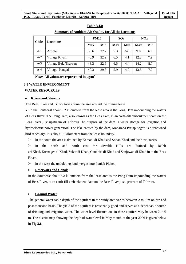
Sand, Stone and Bajri mine (ML- Area – 18-45-97 ha Proposed capacity 80000 TPA At Village & P.O. - Riyali, Tahsil- Fatehpur, District –Kangra (HP)
Final EIA Report
Idma Laboratories Ltd., Panchkula
42
Table 3.13:
Summary of Ambient Air Quality for All the Locations
Code Locations PM10 SO2 NOx
Max Min Max Min Max Min
A-1 At Site 38.6 32.2 5.3 <4.0 9.8 6.0
A-2 Village Riyali 46.9 32.9 6.5 4.1 12.2 7.9
A-3 Village Bela Thakran 43.3 32.5 6.5 4.4 14.2 8.7
A-4 Village Nangal 40.3 29.3 5.9 4.0 13.8 7.0
Note: All values are represented in g/m3
3.8 WATER ENVIRONMENT
WATER RESOURCES
Rivers and Streams
The Beas River and its tributaries drain the area around the mining lease.
In the Southeast about 8.2 kilometers from the lease area is the Pong Dam impounding the waters
of Beas River. The Pong Dam, also known as the Beas Dam, is an earth-fill embankment dam on the
Beas River just upstream of Talwara.The purpose of the dam is water storage for irrigation and
hydroelectric power generation. The lake created by the dam, Maharana Pratap Sagar, is a renowned
bird sanctuary. It is about 11 kilometers from the lease boundary.
In the south the area is drained by Kamahi di Khad and Sohan Khad and their tributaries.
In the north and north east the Siwalik Hills are drained by Jakhb
ari Khad, Kusnager di Khad, Sukar di Khad, Gandhiri di Khad and Sanjuwan di Khad in to the Beas
River.
In the west the undulating land merges into Punjab Plains.
Reservoirs and Canals
In the Southeast about 8.2 kilometers from the lease area is the Pong Dam impounding the waters
of Beas River, is an earth-fill embankment dam on the Beas River just upstream of Talwara.
Ground Water
The general water table depth of the aquifers in the study area varies between 2 to 6 m on pre and
post monsoon basis. The yield of the aquifers is reasonably good and serves as a dependable source
of drinking and irrigation water. The water level fluctuations in these aquifers vary between 2 to 6
m. The district map showing the depth of water level in May month of the year 2006 is given below
in Fig 3.6.
Sand, Stone and Bajri mine (ML- Area – 18-45-97 ha Proposed capacity 80000 TPA At Village & P.O. - Riyali, Tahsil- Fatehpur, District –Kangra (HP)
Final EIA Report
Idma Laboratories Ltd., Panchkula
43
3. 8.1: QUALITY OF WATER
Selected water quality parameters of ground water and surface water resources within 10-km radius of
the study area have been studied for assessing the hydrological environment to evaluate anticipated
impact of the proposed mine. Understanding the water quality is essential in the preparation of
Environmental Impact statement. It also assists to identify critical issues in a view to suggest appropriate
mitigation measures for implementation.
The purpose of this study is to:
Assess the water quality characteristics for critical parameters;
Evaluate the impacts on agricultural productivity, habitat conditions, recreational resources and
aesthetics in the vicinity; and
Predict the likely impacts on water quality due to the project and related activities.
3.8.2 Methodology
Reconnaissance survey was undertaken and monitoring locations were finalized based on the following
aspects:
Drainage pattern of the regional area;
Location of residential areas representing different activities/likely impact areas; and
Areas representing the existing baseline environment.
Two surface water samples and two ground water samples were collected in the study area were
examined for physico8-chemical parameters in order to assess the effect of industrial and other activities
on the hydrosphere resources. The samples were collected and analyzed as per the procedures specified
in 'Standard Methods for the Examination of Water and wastewater' published by American Public
Health Association (APHA).
3.8.3. Water Sampling Locations
Two surface water samples and two ground water samples were collected as grab samples and were
analyzed for various parameters. The analyzed results were compared with the standards for drinking
water as per IS: 10500. The water sampling locations are listed below in Table 3.14 and are depicted in
Fig 3.7.
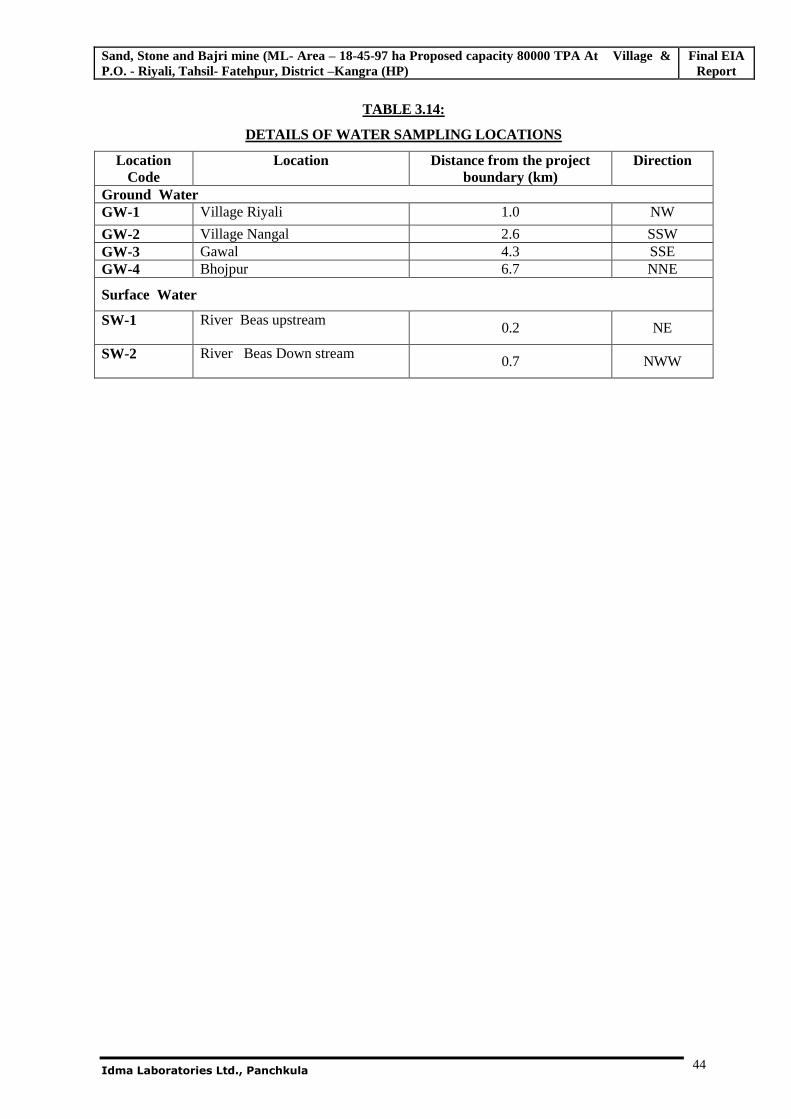
Sand, Stone and Bajri mine (ML- Area – 18-45-97 ha Proposed capacity 80000 TPA At Village & P.O. - Riyali, Tahsil- Fatehpur, District –Kangra (HP)
Final EIA Report
Idma Laboratories Ltd., Panchkula
44
TABLE 3.14:
DETAILS OF WATER SAMPLING LOCATIONS
Location Code
Location Distance from the project boundary (km)
Direction
Ground Water GW-1 Village Riyali 1.0 NW
GW-2 Village Nangal 2.6 SSW GW-3 Gawal 4.3 SSE GW-4 Bhojpur 6.7 NNE
Surface Water
SW-1 River Beas upstream 0.2 NE
SW-2 River Beas Down stream 0.7 NWW
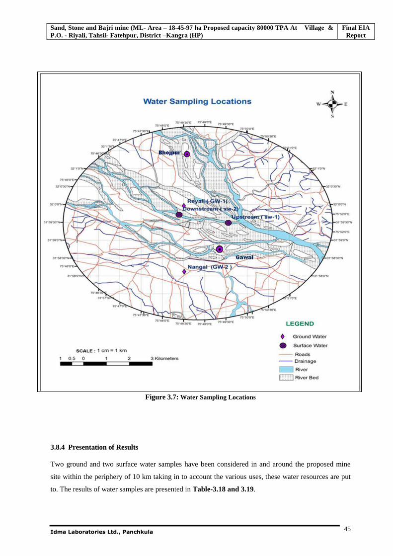
Sand, Stone and Bajri mine (ML- Area – 18-45-97 ha Proposed capacity 80000 TPA At Village & P.O. - Riyali, Tahsil- Fatehpur, District –Kangra (HP)
Final EIA Report
Idma Laboratories Ltd., Panchkula
45
Figure 3.7: Water Sampling Locations
3.8.4 Presentation of Results
Two ground and two surface water samples have been considered in and around the proposed mine
site within the periphery of 10 km taking in to account the various uses, these water resources are put
to. The results of water samples are presented in Table-3.18 and 3.19.
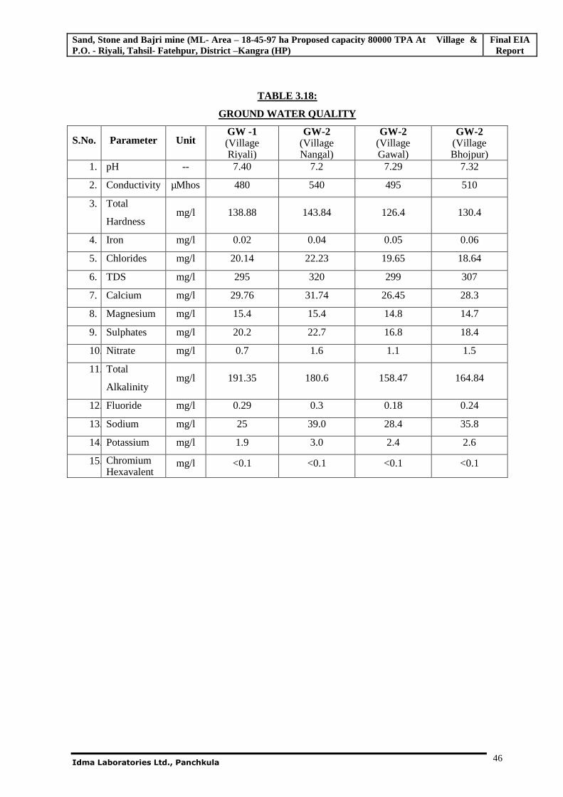
Sand, Stone and Bajri mine (ML- Area – 18-45-97 ha Proposed capacity 80000 TPA At Village & P.O. - Riyali, Tahsil- Fatehpur, District –Kangra (HP)
Final EIA Report
Idma Laboratories Ltd., Panchkula
46
TABLE 3.18:
GROUND WATER QUALITY
S.No. Parameter Unit GW -1 (Village Riyali)
GW-2 (Village Nangal)
GW-2 (Village Gawal)
GW-2 (Village Bhojpur)
1. pH -- 7.40 7.2 7.29 7.32
2. Conductivity µMhos 480 540 495 510
3. Total
Hardness mg/l 138.88 143.84 126.4 130.4
4. Iron mg/l 0.02 0.04 0.05 0.06
5. Chlorides mg/l 20.14 22.23 19.65 18.64
6. TDS mg/l 295 320 299 307
7. Calcium mg/l 29.76 31.74 26.45 28.3
8. Magnesium mg/l 15.4 15.4 14.8 14.7
9. Sulphates mg/l 20.2 22.7 16.8 18.4
10. Nitrate mg/l 0.7 1.6 1.1 1.5
11. Total
Alkalinity mg/l 191.35 180.6 158.47 164.84
12. Fluoride mg/l 0.29 0.3 0.18 0.24
13. Sodium mg/l 25 39.0 28.4 35.8
14. Potassium mg/l 1.9 3.0 2.4 2.6
15. Chromium Hexavalent
mg/l <0.1 <0.1 <0.1 <0.1
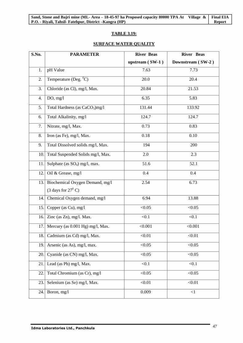
Sand, Stone and Bajri mine (ML- Area – 18-45-97 ha Proposed capacity 80000 TPA At Village & P.O. - Riyali, Tahsil- Fatehpur, District –Kangra (HP)
Final EIA Report
Idma Laboratories Ltd., Panchkula
47
TABLE 3.19:
SURFACE WATER QUALITY
S.No. PARAMETER
River Beas
upstream ( SW-1 )
River Beas
Downstream ( SW-2 )
1. pH Value 7.63 7.73
2. Temperature (Deg. 0C) 20.0 20.4
3. Chloride (as Cl), mg/l, Max. 20.84 21.53
4. DO, mg/l 6.35 5.83
5. Total Hardness (as CaCO3)mg/l 131.44 133.92
6. Total Alkalinity, mg/l 124.7 124.7
7. Nitrate, mg/l, Max. 0.73 0.83
8. Iron (as Fe), mg/l, Max. 0.18 0.10
9. Total Dissolved solids mg/l, Max. 194 200
10. Total Suspended Solids mg/l, Max. 2.0 2.3
11. Sulphate (as SO4) mg/l, max. 51.6 52.1
12. Oil & Grease, mg/l 0.4 0.4
13. Biochemical Oxygen Demand, mg/l
(3 days for 270 C)
2.54 6.73
14. Chemical Oxygen demand, mg/l 6.94 13.88
15. Copper (as Cu), mg/l <0.05 <0.05
16. Zinc (as Zn), mg/l. Max. <0.1 <0.1
17. Mercury (as 0.001 Hg) mg/l, Max. <0.001 <0.001
18. Cadmium (as Cd) mg/l, Max. <0.01 <0.01
19. Arsenic (as As), mg/l, max. <0.05 <0.05
20. Cyanide (as CN) mg/l, Max. <0.05 <0.05
21. Lead (as Pb) mg/l, Max. <0.1 <0.1
22. Total Chromium (as Cr), mg/l <0.05 <0.05
23. Selenium (as Se) mg/l, Max. <0.01 <0.01
24. Boron, mg/l 0.009 <1
Sand, Stone and Bajri mine (ML- Area – 18-45-97 ha Proposed capacity 80000 TPA At Village & P.O. - Riyali, Tahsil- Fatehpur, District –Kangra (HP)
Final EIA Report
Idma Laboratories Ltd., Panchkula
48
3.8.5 Observations
3.8.5.1 Ground water quality
The analysis results indicate that the pH and conductivity of the ground waters was to be in the range of
7.2 - 7.4 and 480 - 540 mhos. The TDS were found to be in the range of 295 – 320 mg/L. Other
parameters like Chlorides and Sulphates were observed to be well with in the prescribed limits. From
the table, it is seen that the physico chemical analysis for all the parameters has within the standards as
per IS: 10500.
3.8.5.2 Surface water Quality
The analysis results indicate that the pH of the surface waters was to be in the range of 7.63 - 7.73. The
TDS were found to be in the range of 194-200 mg/L. Other parameters like Chlorides and Sulphates
were observed to be well within the prescribed limits. From the table, it is seen that the physico
chemical analysis for all the parameters has within the standards as per IS: 10500.
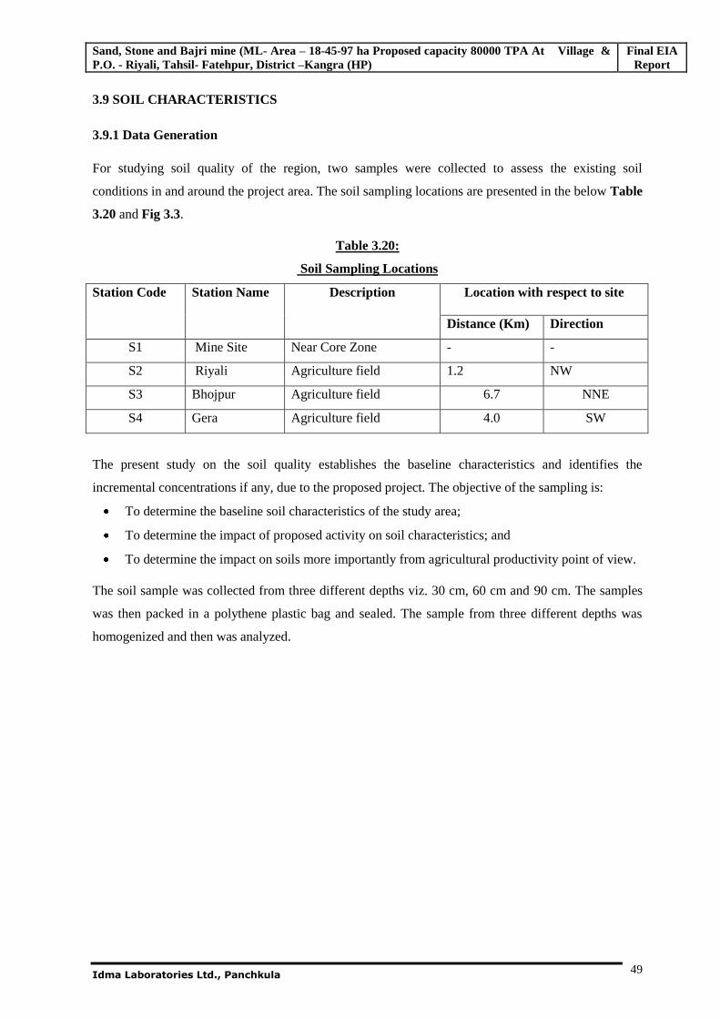
Sand, Stone and Bajri mine (ML- Area – 18-45-97 ha Proposed capacity 80000 TPA At Village & P.O. - Riyali, Tahsil- Fatehpur, District –Kangra (HP)
Final EIA Report
Idma Laboratories Ltd., Panchkula
49
3.9 SOIL CHARACTERISTICS
3.9.1 Data Generation
For studying soil quality of the region, two samples were collected to assess the existing soil
conditions in and around the project area. The soil sampling locations are presented in the below Table
3.20 and Fig 3.3.
Table 3.20:
Soil Sampling Locations
Station Code Station Name Description Location with respect to site
Distance (Km) Direction
S1 Mine Site Near Core Zone - -
S2 Riyali Agriculture field 1.2 NW
S3 Bhojpur Agriculture field 6.7 NNE
S4 Gera Agriculture field 4.0 SW
The present study on the soil quality establishes the baseline characteristics and identifies the
incremental concentrations if any, due to the proposed project. The objective of the sampling is:
To determine the baseline soil characteristics of the study area;
To determine the impact of proposed activity on soil characteristics; and
To determine the impact on soils more importantly from agricultural productivity point of view.
The soil sample was collected from three different depths viz. 30 cm, 60 cm and 90 cm. The samples
was then packed in a polythene plastic bag and sealed. The sample from three different depths was
homogenized and then was analyzed.
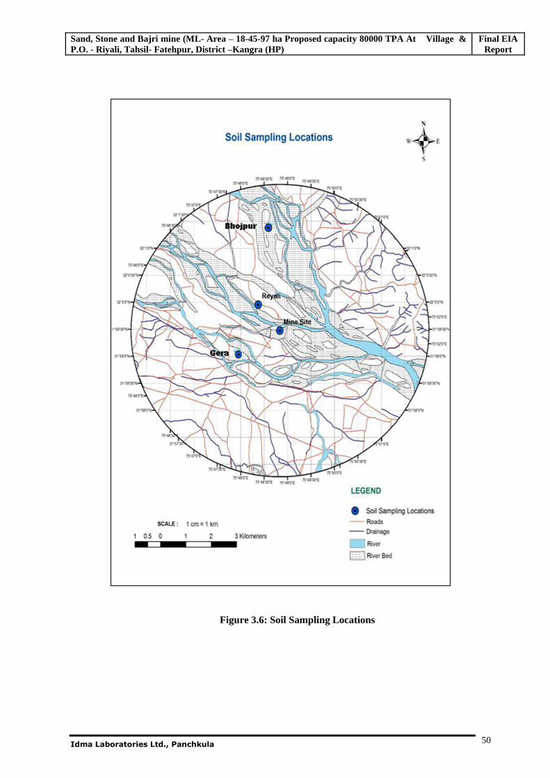
Sand, Stone and Bajri mine (ML- Area – 18-45-97 ha Proposed capacity 80000 TPA At Village & P.O. - Riyali, Tahsil- Fatehpur, District –Kangra (HP)
Final EIA Report
Idma Laboratories Ltd., Panchkula
50
Figure 3.6: Soil Sampling Locations
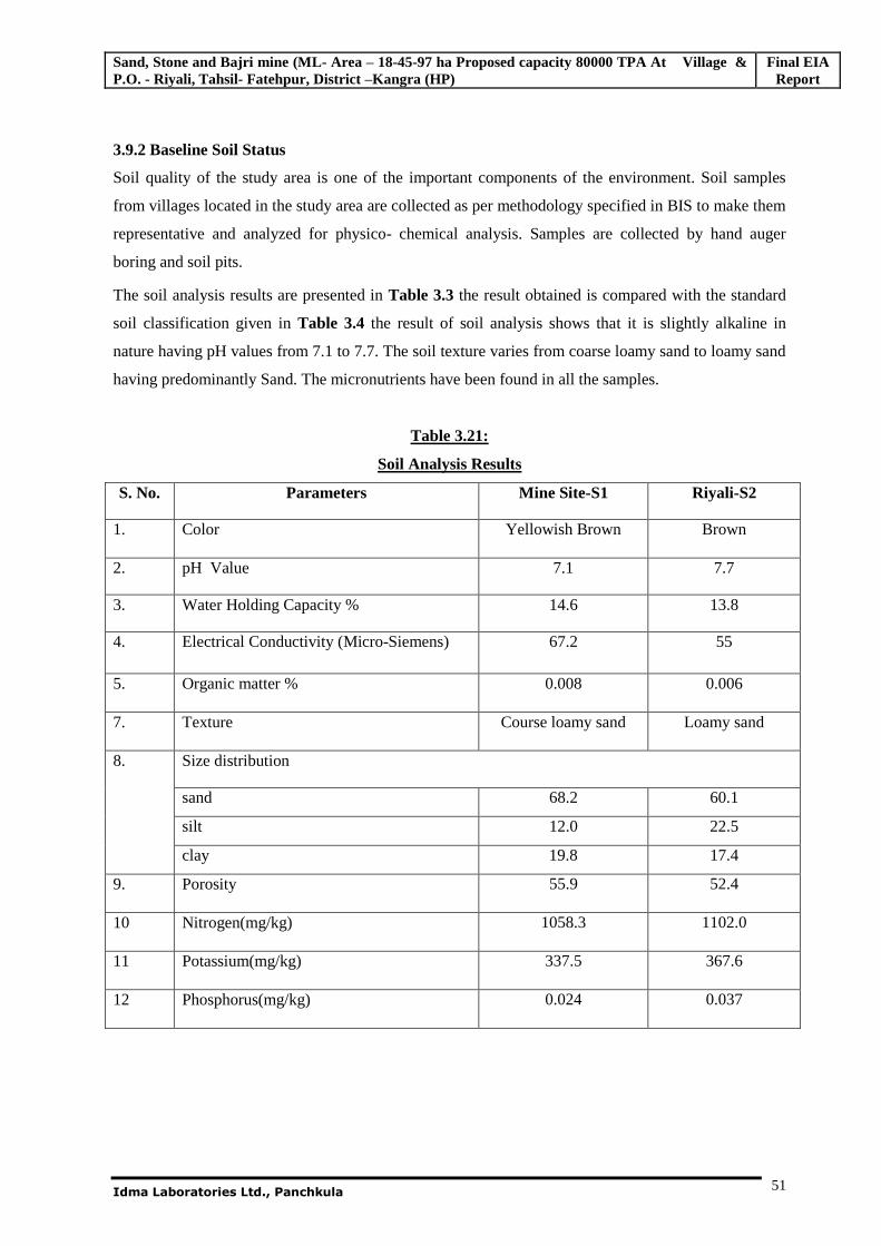
Sand, Stone and Bajri mine (ML- Area – 18-45-97 ha Proposed capacity 80000 TPA At Village & P.O. - Riyali, Tahsil- Fatehpur, District –Kangra (HP)
Final EIA Report
Idma Laboratories Ltd., Panchkula
51
3.9.2 Baseline Soil Status
Soil quality of the study area is one of the important components of the environment. Soil samples
from villages located in the study area are collected as per methodology specified in BIS to make them
representative and analyzed for physico- chemical analysis. Samples are collected by hand auger
boring and soil pits.
The soil analysis results are presented in Table 3.3 the result obtained is compared with the standard
soil classification given in Table 3.4 the result of soil analysis shows that it is slightly alkaline in
nature having pH values from 7.1 to 7.7. The soil texture varies from coarse loamy sand to loamy sand
having predominantly Sand. The micronutrients have been found in all the samples.
Table 3.21:
Soil Analysis Results
S. No. Parameters Mine Site-S1 Riyali-S2
1. Color Yellowish Brown Brown
2. pH Value 7.1 7.7
3. Water Holding Capacity % 14.6 13.8
4. Electrical Conductivity (Micro-Siemens) 67.2 55
5. Organic matter % 0.008 0.006
7. Texture Course loamy sand Loamy sand
8. Size distribution
sand 68.2 60.1
silt 12.0 22.5
clay 19.8 17.4
9. Porosity 55.9 52.4
10 Nitrogen(mg/kg) 1058.3 1102.0
11 Potassium(mg/kg) 337.5 367.6
12 Phosphorus(mg/kg) 0.024 0.037
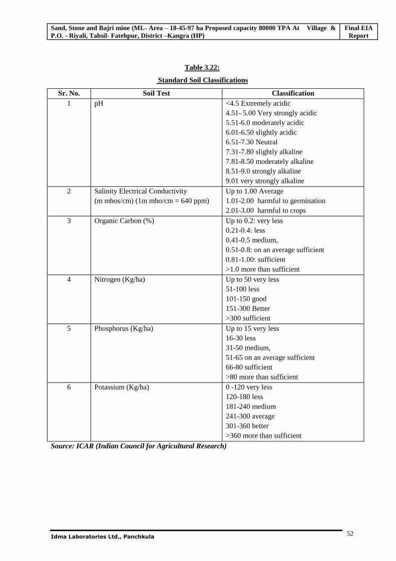
Sand, Stone and Bajri mine (ML- Area – 18-45-97 ha Proposed capacity 80000 TPA At Village & P.O. - Riyali, Tahsil- Fatehpur, District –Kangra (HP)
Final EIA Report
Idma Laboratories Ltd., Panchkula
52
Table 3.22:
Standard Soil Classifications
Sr. No. Soil Test Classification 1 pH <4.5 Extremely acidic
4.51- 5.00 Very strongly acidic 5.51-6.0 moderately acidic 6.01-6.50 slightly acidic 6.51-7.30 Neutral 7.31-7.80 slightly alkaline 7.81-8.50 moderately alkaline 8.51-9.0 strongly alkaline 9.01 very strongly alkaline
2 Salinity Electrical Conductivity (m mhos/cm) (1m mho/cm = 640 ppm)
Up to 1.00 Average 1.01-2.00 harmful to germination 2.01-3.00 harmful to crops
3 Organic Carbon (%) Up to 0.2: very less 0.21-0.4: less 0.41-0.5 medium, 0.51-0.8: on an average sufficient 0.81-1.00: sufficient >1.0 more than sufficient
4 Nitrogen (Kg/ha) Up to 50 very less 51-100 less 101-150 good 151-300 Better >300 sufficient
5 Phosphorus (Kg/ha) Up to 15 very less 16-30 less 31-50 medium, 51-65 on an average sufficient 66-80 sufficient >80 more than sufficient
6 Potassium (Kg/ha) 0 -120 very less 120-180 less 181-240 medium 241-300 average 301-360 better >360 more than sufficient
Source: ICAR (Indian Council for Agricultural Research)
Sand, Stone and Bajri mine (ML- Area – 18-45-97 ha Proposed capacity 80000 TPA At Village & P.O. - Riyali, Tahsil- Fatehpur, District –Kangra (HP)
Final EIA Report
Idma Laboratories Ltd., Panchkula
53
3.10 NOISE LEVEL SURVEY
The physical description of sound concerns its loudness as a function of frequency. Noise in general is
sound, which is composed of many frequency components of various types of loudness distributed
over the audible frequency range. The most common and universally accepted scale is the A weighted
scale, which is measured as dB (A). This is more suitable for audible range of 20 to 20,000 Hz. The
scale has been designed to weigh various components of noise according to the response of human ear.
The environmental impact of noise can have several effects varying from Noise Induced Hearing Loss
(NIHL) to annoyance depending on loudness of noise.
The main objective of noise monitoring in the study area is to establish the baseline noise levels and
assess the impact of the total noise expected to be generated during the project operations around the
project site.
3.10.1 Identification of Sampling Locations
A preliminary reconnaissance survey has been undertaken to identify the major noise generating sources
in the area. Noise at different noise generating sources has been identified based on the residential,
industrial and commercial activities in the area.
The noise monitoring has been conducted for determination of noise levels at three locations covering
both core and buffer zones in the study area. The noise levels at each location were recorded for 24-hrs.
The environment setting of each noise monitoring location is given in Table 3.20 and shown in Fig 3.8.
Table 3.23:
Details of Noise Monitoring Locations
Station
Codes
Location Distance from
Mine [Km]
Direction
Category
N1 Mine Site Industrial
N2 Riyali Village 1.0 NW Residential
N3 Nangal Village 2.6 SSW Residential
N4 Gera 4.0 SW Residential
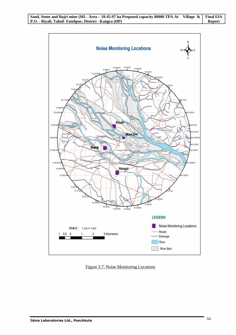
Sand, Stone and Bajri mine (ML- Area – 18-45-97 ha Proposed capacity 80000 TPA At Village & P.O. - Riyali, Tahsil- Fatehpur, District –Kangra (HP)
Final EIA Report
Idma Laboratories Ltd., Panchkula
54
Figure 3.7: Noise Monitoring Locations
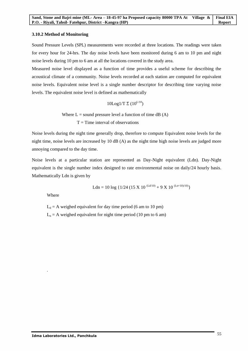
Sand, Stone and Bajri mine (ML- Area – 18-45-97 ha Proposed capacity 80000 TPA At Village & P.O. - Riyali, Tahsil- Fatehpur, District –Kangra (HP)
Final EIA Report
Idma Laboratories Ltd., Panchkula
55
3.10.2 Method of Monitoring
Sound Pressure Levels (SPL) measurements were recorded at three locations. The readings were taken
for every hour for 24-hrs. The day noise levels have been monitored during 6 am to 10 pm and night
noise levels during 10 pm to 6 am at all the locations covered in the study area.
Measured noise level displayed as a function of time provides a useful scheme for describing the
acoustical climate of a community. Noise levels recorded at each station are computed for equivalent
noise levels. Equivalent noise level is a single number descriptor for describing time varying noise
levels. The equivalent noise level is defined as mathematically
10Log1/T (10L/10)
Where L = sound pressure level a function of time dB (A)
T = Time interval of observations
Noise levels during the night time generally drop, therefore to compute Equivalent noise levels for the
night time, noise levels are increased by 10 dB (A) as the night time high noise levels are judged more
annoying compared to the day time.
Noise levels at a particular station are represented as Day-Night equivalent (Ldn). Day-Night
equivalent is the single number index designed to rate environmental noise on daily/24 hourly basis.
Mathematically Ldn is given by
Ldn = 10 log {1/24 (15 X 10 (Ld/10) + 9 X 10 (Ln+10)/10)}
Where
Ld = A weighed equivalent for day time period (6 am to 10 pm)
Ln = A weighed equivalent for night time period (10 pm to 6 am)
.
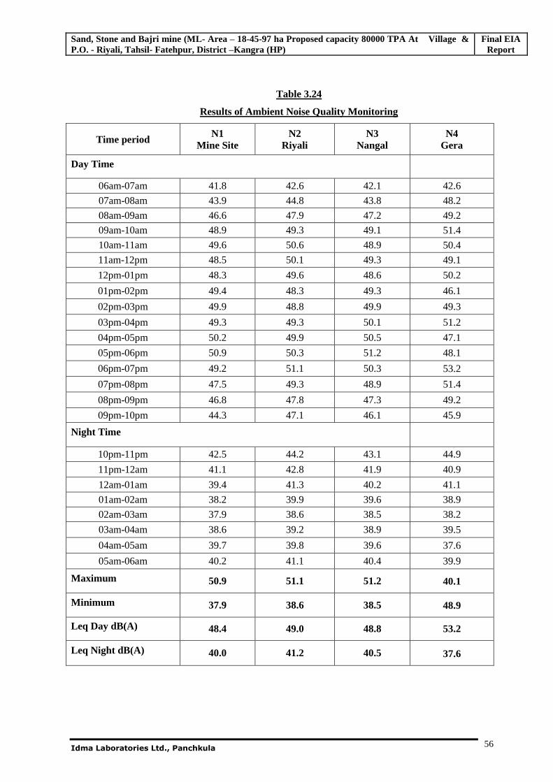
Sand, Stone and Bajri mine (ML- Area – 18-45-97 ha Proposed capacity 80000 TPA At Village & P.O. - Riyali, Tahsil- Fatehpur, District –Kangra (HP)
Final EIA Report
Idma Laboratories Ltd., Panchkula
56
Table 3.24
Results of Ambient Noise Quality Monitoring
Time period N1 Mine Site
N2 Riyali
N3 Nangal
N4 Gera
Day Time
06am-07am 41.8 42.6 42.1 42.6
07am-08am 43.9 44.8 43.8 48.2
08am-09am 46.6 47.9 47.2 49.2
09am-10am 48.9 49.3 49.1 51.4
10am-11am 49.6 50.6 48.9 50.4
11am-12pm 48.5 50.1 49.3 49.1
12pm-01pm 48.3 49.6 48.6 50.2
01pm-02pm 49.4 48.3 49.3 46.1
02pm-03pm 49.9 48.8 49.9 49.3
03pm-04pm 49.3 49.3 50.1 51.2
04pm-05pm 50.2 49.9 50.5 47.1
05pm-06pm 50.9 50.3 51.2 48.1
06pm-07pm 49.2 51.1 50.3 53.2
07pm-08pm 47.5 49.3 48.9 51.4
08pm-09pm 46.8 47.8 47.3 49.2
09pm-10pm 44.3 47.1 46.1 45.9
Night Time
10pm-11pm 42.5 44.2 43.1 44.9
11pm-12am 41.1 42.8 41.9 40.9
12am-01am 39.4 41.3 40.2 41.1
01am-02am 38.2 39.9 39.6 38.9
02am-03am 37.9 38.6 38.5 38.2
03am-04am 38.6 39.2 38.9 39.5
04am-05am 39.7 39.8 39.6 37.6
05am-06am 40.2 41.1 40.4 39.9
Maximum 50.9 51.1 51.2 40.1
Minimum 37.9 38.6 38.5 48.9
Leq Day dB(A) 48.4 49.0 48.8 53.2
Leq Night dB(A) 40.0 41.2 40.5 37.6
Sand, Stone and Bajri mine (ML- Area – 18-45-97 ha Proposed capacity 80000 TPA At Village & P.O. - Riyali, Tahsil- Fatehpur, District –Kangra (HP)
Final EIA Report
Idma Laboratories Ltd., Panchkula
57
3.10.3 Presentation of Results
The statistical analysis is done for measured noise levels at three locations in the study area. The
parameters are analyzed for Lday, Lnight, and Ldn. The statistical analysis results are given in Table-3.22.
Table-3.25:
Statistical Analysis Results of Ambient Noise Monitoring
Location Noise Level dB (A)
Day
Equivalent
Night
Equivalent
N1 [Mine Site] 48.4 40.0
N2 [Riyali Village ] 49.0 41.2
N3 [Nangal Village] 48.8 40.5
N4 [Gera Village] 48.9 40.1
3.10.4 Observation of Results
a) Day time Noise Levels (Lday)
The daytime (Lday) noise levels at all the residential locations are observed to be in the range of 48.4 dB
(A) to 49.0 dB (A). The maximum noise level of 49.0 dB (A) was observed at Riyali village and the
minimum noise level of 48.4 dB (A) was observed at Project site during the study period. It is observed
that the day time noise levels are in accordance to the prescribed limit of 55 dB (A).
b) Night time Noise Levels (Lnight)
The nighttime (Lnight) noise levels at all the residential locations was observed to be in the range of 40.0
dB (A) to 41.2 dB (A). The maximum noise level of 41.2 dB (A) was observed at Riyali village during
the study period. It is observed that the night time noise levels are in accordance to the prescribed limit of
45 dB (A) at all the locations.
3.11 TRAFFIC DENSITY
Traffic density measurements were performed at two locations near village Riyali and state highway.
The Monitoring was performed in March 2011
Traffic density measurements were made continuously for 24 hours by visual observations and
counting of vehicles under three categories viz. heavy motor vehicles, light motor vehicles and two
wheelers. As traffic densities on the roads are high, two skilled persons were deployed simultaneously
at each station during each shift-one person on each of the two directions for counting the traffic. At
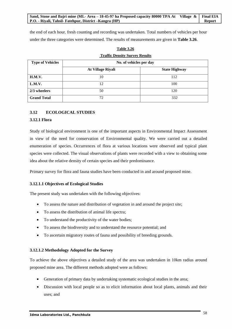
Sand, Stone and Bajri mine (ML- Area – 18-45-97 ha Proposed capacity 80000 TPA At Village & P.O. - Riyali, Tahsil- Fatehpur, District –Kangra (HP)
Final EIA Report
Idma Laboratories Ltd., Panchkula
58
the end of each hour, fresh counting and recording was undertaken. Total numbers of vehicles per hour
under the three categories were determined. The results of measurements are given in Table 3.26.
Table 3.26
Traffic Density Survey Results
Type of Vehicles No. of vehicles per day
At Village Riyali State Highway
H.M.V. 10 112
L.M.V. 12 100
2/3 wheelers 50 120
Grand Total 72 332
3.12 ECOLOGICAL STUDIES
3.12.1 Flora
Study of biological environment is one of the important aspects in Environmental Impact Assessment
in view of the need for conservation of Environmental quality. We were carried out a detailed
enumeration of species. Occurrences of flora at various locations were observed and typical plant
species were collected. The visual observations of plants were recorded with a view to obtaining some
idea about the relative density of certain species and their predominance.
Primary survey for flora and fauna studies have been conducted in and around proposed mine.
3.12.1.1 Objectives of Ecological Studies The present study was undertaken with the following objectives:
To assess the nature and distribution of vegetation in and around the project site;
To assess the distribution of animal life spectra;
To understand the productivity of the water bodies;
To assess the biodiversity and to understand the resource potential; and
To ascertain migratory routes of fauna and possibility of breeding grounds.
3.12.1.2 Methodology Adopted for the Survey To achieve the above objectives a detailed study of the area was undertaken in 10km radius around
proposed mine area. The different methods adopted were as follows:
Generation of primary data by undertaking systematic ecological studies in the area;
Discussion with local people so as to elicit information about local plants, animals and their
uses; and
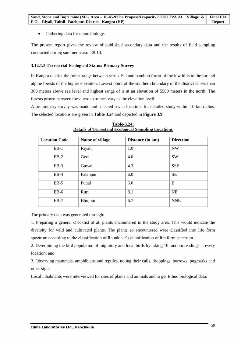
Sand, Stone and Bajri mine (ML- Area – 18-45-97 ha Proposed capacity 80000 TPA At Village & P.O. - Riyali, Tahsil- Fatehpur, District –Kangra (HP)
Final EIA Report
Idma Laboratories Ltd., Panchkula
59
Gathering data for ethno biology.
The present report gives the review of published secondary data and the results of field sampling
conducted during summer season-2010.
3.12.1.3 Terrestrial Ecological Status: Primary Survey In Kangra district the forest range between scrub, Sal and bamboo forest of the low hills to the fur and
alpine forests of the higher elevation. Lowest point of the southern boundary of the district is less than
300 meters above sea level and highest range of is at an elevation of 5500 meters in the north. The
forests grown between these two extremes vary as the elevation itself.
A preliminary survey was made and selected seven locations for detailed study within 10-km radius.
The selected locations are given in Table 3.24 and depicted in Figure 3.9.
Table-3.24: Details of Terrestrial Ecological Sampling Locations
Location Code Name of village Distance (in km) Direction
EB-1 Riyali 1.0 NW
EB-2 Gera 4.0 SW
EB-3 Gawal 4.3 SSE
EB-4 Fatehpur 6.0 SE
EB-5 Punal 6.0 E
EB-6 Ruri 8.1 NE
EB-7 Bhojpur 6.7 NNE
The primary data was generated through:-
1. Preparing a general checklist of all plants encountered in the study area. This would indicate the
diversity for wild and cultivated plants. The plants so encountered were classified into life form
spectrum according to the classification of Raunkiaer’s classification of life form spectrum.
2. Determining the bird population of migratory and local birds by taking 10 random readings at every
Iocation; and
3. Observing mammals, amphibians and reptiles, noting their calls, droppings, burrows, pugmarks and
other signs
Local inhabitants were interviewed for uses of plants and animals and to get Ethno biological data.
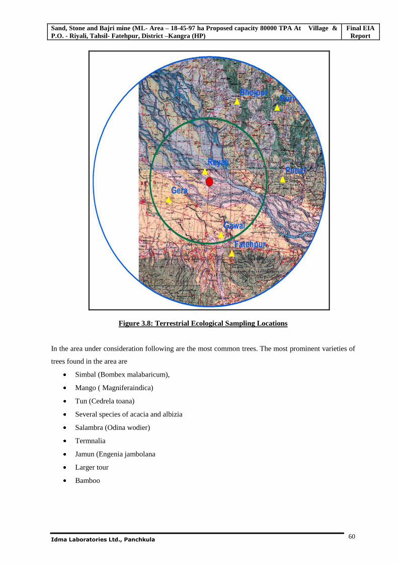
Sand, Stone and Bajri mine (ML- Area – 18-45-97 ha Proposed capacity 80000 TPA At Village & P.O. - Riyali, Tahsil- Fatehpur, District –Kangra (HP)
Final EIA Report
Idma Laboratories Ltd., Panchkula
60
Figure 3.8: Terrestrial Ecological Sampling Locations
In the area under consideration following are the most common trees. The most prominent varieties of
trees found in the area are
Simbal (Bombex malabaricum),
Mango ( Magniferaindica)
Tun (Cedrela toana)
Several species of acacia and albizia
Salambra (Odina wodier)
Termnalia
Jamun (Engenia jambolana
Larger tour
Bamboo
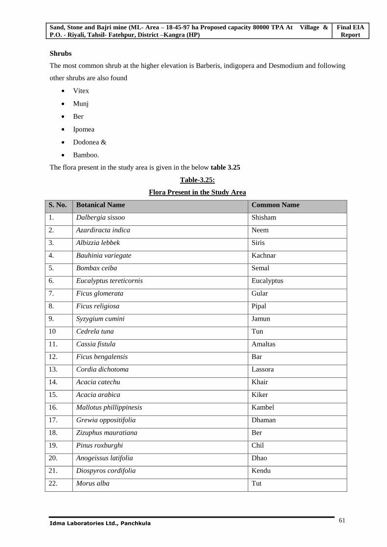
Sand, Stone and Bajri mine (ML- Area – 18-45-97 ha Proposed capacity 80000 TPA At Village & P.O. - Riyali, Tahsil- Fatehpur, District –Kangra (HP)
Final EIA Report
Idma Laboratories Ltd., Panchkula
61
Shrubs
The most common shrub at the higher elevation is Barberis, indigopera and Desmodium and following
other shrubs are also found
Vitex
Munj
Ber
Ipomea
Dodonea &
Bamboo.
The flora present in the study area is given in the below table 3.25
Table-3.25:
Flora Present in the Study Area
S. No. Botanical Name Common Name
1. Dalbergia sissoo Shisham
2. Azardiracta indica Neem
3. Albizzia lebbek Siris
4. Bauhinia variegate Kachnar
5. Bombax ceiba Semal
6. Eucalyptus tereticornis Eucalyptus
7. Ficus glomerata Gular
8. Ficus religiosa Pipal
9. Syzygium cumini Jamun
10 Cedrela tuna Tun
11. Cassia fistula Amaltas
12. Ficus bengalensis Bar
13. Cordia dichotoma Lassora
14. Acacia catechu Khair
15. Acacia arabica Kiker
16. Mallotus phillippinesis Kambel
17. Grewia oppositifolia Dhaman
18. Zizuphus mauratiana Ber
19. Pinus roxburghi Chil
20. Anogeissus latifolia Dhao
21. Diospyros cordifolia Kendu
22. Morus alba Tut
Sand, Stone and Bajri mine (ML- Area – 18-45-97 ha Proposed capacity 80000 TPA At Village & P.O. - Riyali, Tahsil- Fatehpur, District –Kangra (HP)
Final EIA Report
Idma Laboratories Ltd., Panchkula
62
23. Acacia modesta Phulai
Table 3.26:
The crops, vegetables and fruits grown in the study area
1. Triticum aestivum Wheat
2. Oryza sativa (Paddy)
3. Brassica Comoistris Mustard
4. Zea mays Corn
5. Brassica oleraces Cabbage
6. Solaunum melongena Brinjal
7. Capsicum annuum Chilli
8. Chaseolus vulgoris Bean
9. Lucopersicum esculentum Tomato
10. Spinacea oleracea Palak
11. Solanum tuberosum Potato
12. Cucumis sativus Cucumber etc.
13. Mangferra Indica Mango
14. Litchi chinensis Litchi
15. Citrus limon Lemon
16. Citrus spp. Orange
17. Eriobotrya japonica Loquat
3.12.2 Fauna in the Study Area
Due to rich forest cover many fauna is expected to be found in this area .The wild lives present in the
study area mainly includes monkeys, Sambhar, rabbit, deer, fox, leopard etc. Domestic animals include
cow, buffalo, mules, hen, dogs, goat, oxen, cat are common.
Deer of many species including hiran ( Antilope cervicrapa), spotted deer ( Axis masculates), Barking
Deer (Muntiacus muntjak), kakkar, sambhar (Cervis unicolor) are common. Panthera pardus
(leopard): Its population has reduced considerably. Porcupine (Hystrix indica), Indian wild boar (Sus
scorfa), jackal (Canis spp.), wild cat (Felis chaos),leopard cat, Monkey (Macaca mulata),Langur
(Presbytis entellus).
Wild birds: The resident birds include peafowl black grey partridges and gooses, jungle fowls, black
partridges, chakor (Alectoris gracea), Jungle thrush, common grey quail, blue rock pegion(Colombia
livia), dove (streptopelis spp.),wood pecker and the migrants include variety of water birds which can
be often seen in Beas river in winters. Black eagle, Golden eagle, shahin, fallons, Forest eagle, owl,
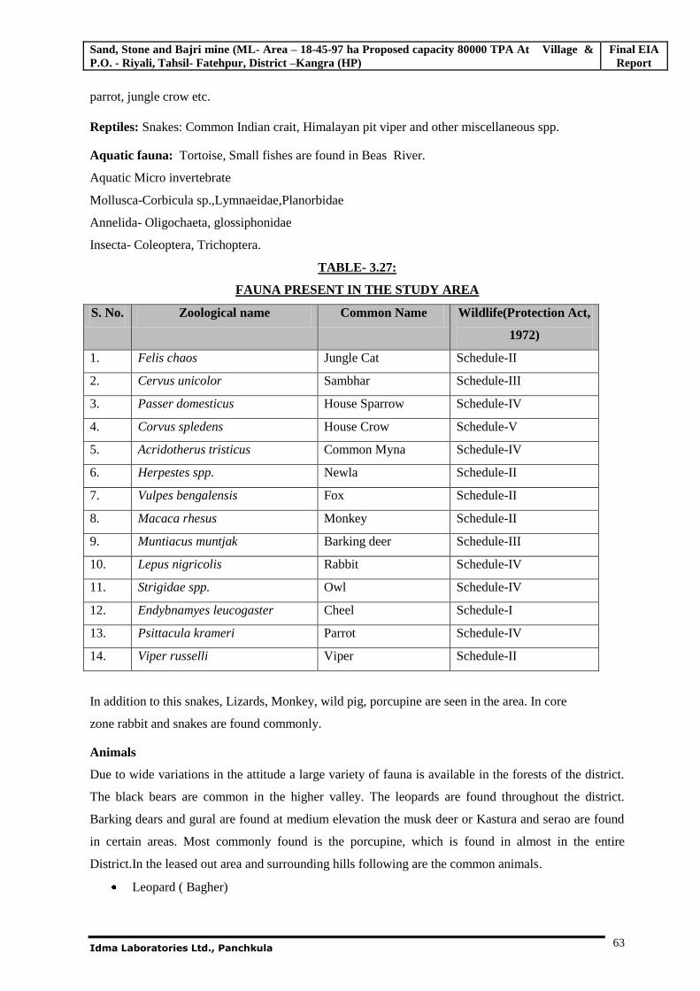
Sand, Stone and Bajri mine (ML- Area – 18-45-97 ha Proposed capacity 80000 TPA At Village & P.O. - Riyali, Tahsil- Fatehpur, District –Kangra (HP)
Final EIA Report
Idma Laboratories Ltd., Panchkula
63
parrot, jungle crow etc.
Reptiles: Snakes: Common Indian crait, Himalayan pit viper and other miscellaneous spp.
Aquatic fauna: Tortoise, Small fishes are found in Beas River.
Aquatic Micro invertebrate
Mollusca-Corbicula sp.,Lymnaeidae,Planorbidae
Annelida- Oligochaeta, glossiphonidae
Insecta- Coleoptera, Trichoptera.
TABLE- 3.27:
FAUNA PRESENT IN THE STUDY AREA
S. No. Zoological name Common Name Wildlife(Protection Act,
1972)
1. Felis chaos Jungle Cat Schedule-II
2. Cervus unicolor Sambhar Schedule-III
3. Passer domesticus House Sparrow Schedule-IV
4. Corvus spledens House Crow Schedule-V
5. Acridotherus tristicus Common Myna Schedule-IV
6. Herpestes spp. Newla Schedule-II
7. Vulpes bengalensis Fox Schedule-II
8. Macaca rhesus Monkey Schedule-II
9. Muntiacus muntjak Barking deer Schedule-III
10. Lepus nigricolis Rabbit Schedule-IV
11. Strigidae spp. Owl Schedule-IV
12. Endybnamyes leucogaster Cheel Schedule-I
13. Psittacula krameri Parrot Schedule-IV
14. Viper russelli Viper Schedule-II
In addition to this snakes, Lizards, Monkey, wild pig, porcupine are seen in the area. In core
zone rabbit and snakes are found commonly.
Animals
Due to wide variations in the attitude a large variety of fauna is available in the forests of the district.
The black bears are common in the higher valley. The leopards are found throughout the district.
Barking dears and gural are found at medium elevation the musk deer or Kastura and serao are found
in certain areas. Most commonly found is the porcupine, which is found in almost in the entire
District.In the leased out area and surrounding hills following are the common animals.
Leopard ( Bagher)
Sand, Stone and Bajri mine (ML- Area – 18-45-97 ha Proposed capacity 80000 TPA At Village & P.O. - Riyali, Tahsil- Fatehpur, District –Kangra (HP)
Final EIA Report
Idma Laboratories Ltd., Panchkula
64
Hare
Wild Bore ( Jangli Soor)
Jackal
Barking Deer ( Kakkar)
Monkey
Sambar
Pig
Birds
Chakor
Crow
Red Jungle Fowl ( Jangli Murga)
Black Partridge ( Kala Titar)
Grey Partridge ( Safed Titar)
Woodpecker
3.13 EXISTING SOCIO-ECONOMIC CONDITIONS
The growth of industrial sectors and infrastructure developments in villages and towns is bound to
create its impact on the socio-economic aspects of the local population. The impacts may be positive
or negative depending upon the developmental activity. To assess the impacts on the socio-economics
of the local people, it is necessary to study the existing socio-economic status of the local population,
which will be helpful for making efforts to further improve the quality of life in the area of study. To
study the socio-economic aspects of people in the study area around proposed mine, the required data
has been collected from various secondary sources and supplemented by the primary data generated
through the process of a limited door to door socio-economic survey.
3.13.1 Methodology Adopted for the Study
Review of secondary data, such as District Census Statistical Handbooks-2001 and the records of
National Informatics Center data, for the parameters of demography, occupational structure of people
within the general study area of 10 km radius around the project site.
Sand, Stone and Bajri mine (ML- Area – 18-45-97 ha Proposed capacity 80000 TPA At Village & P.O. - Riyali, Tahsil- Fatehpur, District –Kangra (HP)
Final EIA Report
Idma Laboratories Ltd., Panchkula
65
3.13.2 Review of Demographic and Socio-Economic Profile - 2001
The information on socio-economic aspects of the study area has been compiled from secondary
sources, which include various public offices as indicated in the above section. The sociological
aspects of this study include human settlements, demography, social such as Scheduled castes and
Scheduled Tribes and literacy levels besides infrastructure facilities available in the study area. The
economic aspects include occupational structure of workers.
CORE ZONE:
There are no villages falling within the core zone. The entire mine lease area is private lands and falls
under Riyali village.
BUFFER ZONE:
The buffer zone of the proposed mine, encompassing 10 km radius from the periphery of the core
zone, consists of 49 villages falling under Fatehpur and Indora Tehsils of Kangra district.
The study details based on the 2001 census are highlighted below:
3.13.3 Population & population growth in buffer zone
The total population of the buffer zone is 19524 with 3815 households with average family size are 5
persons per family. The population density is 62 persons per sq. km.
Table – 3.28:
Population of villages covered in Buffer Zone
S.No. Name of villages No. of Households Male Female Total 1. Aghar 96 228 251 479 2. Badala 76 248 223 471 3. Badukhar 398 1004 944 1948 4. Bahadpur 89 246 223 469 5. Bela Thakuran 35 103 85 188 6. Beli Jattani 42 118 99 217 7. Bhabroli 18 42 48 90 8. Bhadaurian 135 380 305 685 9. Bhati Anutra 6 16 17 33 10. Bhati Dangbalian 11 22 24 46 11. Bhati joghian 1 3 5 8 12. Bhati Upparli 4 18 11 29 13. Bhatoli 20 62 51 113 14. Bhera 86 235 236 471 15. Damwal 18 46 50 96 16. Dholpur 129 325 345 670 17. Diana 84 205 194 399
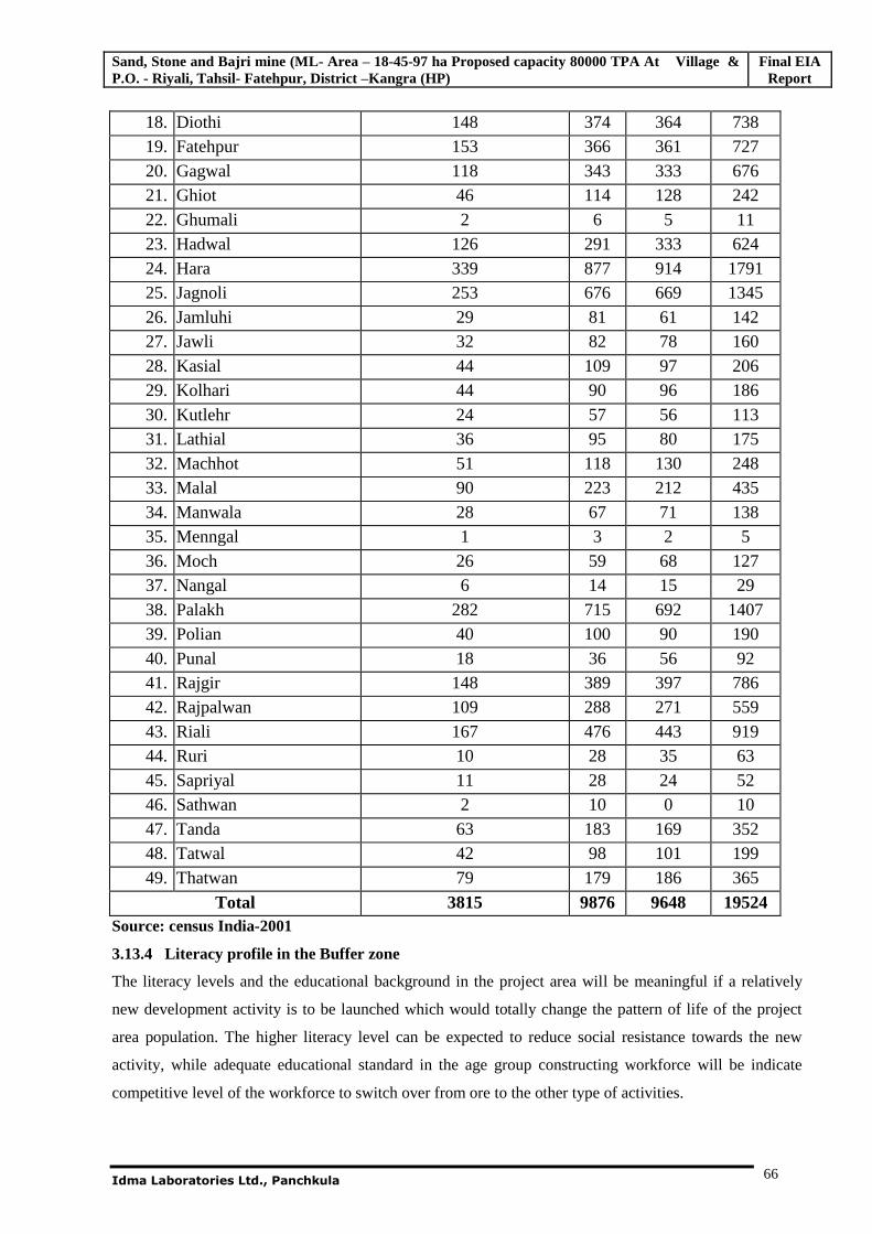
Sand, Stone and Bajri mine (ML- Area – 18-45-97 ha Proposed capacity 80000 TPA At Village & P.O. - Riyali, Tahsil- Fatehpur, District –Kangra (HP)
Final EIA Report
Idma Laboratories Ltd., Panchkula
66
18. Diothi 148 374 364 738 19. Fatehpur 153 366 361 727 20. Gagwal 118 343 333 676 21. Ghiot 46 114 128 242 22. Ghumali 2 6 5 11 23. Hadwal 126 291 333 624 24. Hara 339 877 914 1791 25. Jagnoli 253 676 669 1345 26. Jamluhi 29 81 61 142 27. Jawli 32 82 78 160 28. Kasial 44 109 97 206 29. Kolhari 44 90 96 186 30. Kutlehr 24 57 56 113 31. Lathial 36 95 80 175 32. Machhot 51 118 130 248 33. Malal 90 223 212 435 34. Manwala 28 67 71 138 35. Menngal 1 3 2 5 36. Moch 26 59 68 127 37. Nangal 6 14 15 29 38. Palakh 282 715 692 1407 39. Polian 40 100 90 190 40. Punal 18 36 56 92 41. Rajgir 148 389 397 786 42. Rajpalwan 109 288 271 559 43. Riali 167 476 443 919 44. Ruri 10 28 35 63 45. Sapriyal 11 28 24 52 46. Sathwan 2 10 0 10 47. Tanda 63 183 169 352 48. Tatwal 42 98 101 199 49. Thatwan 79 179 186 365
Total 3815 9876 9648 19524 Source: census India-2001
3.13.4 Literacy profile in the Buffer zone
The literacy levels and the educational background in the project area will be meaningful if a relatively
new development activity is to be launched which would totally change the pattern of life of the project
area population. The higher literacy level can be expected to reduce social resistance towards the new
activity, while adequate educational standard in the age group constructing workforce will be indicate
competitive level of the workforce to switch over from ore to the other type of activities.
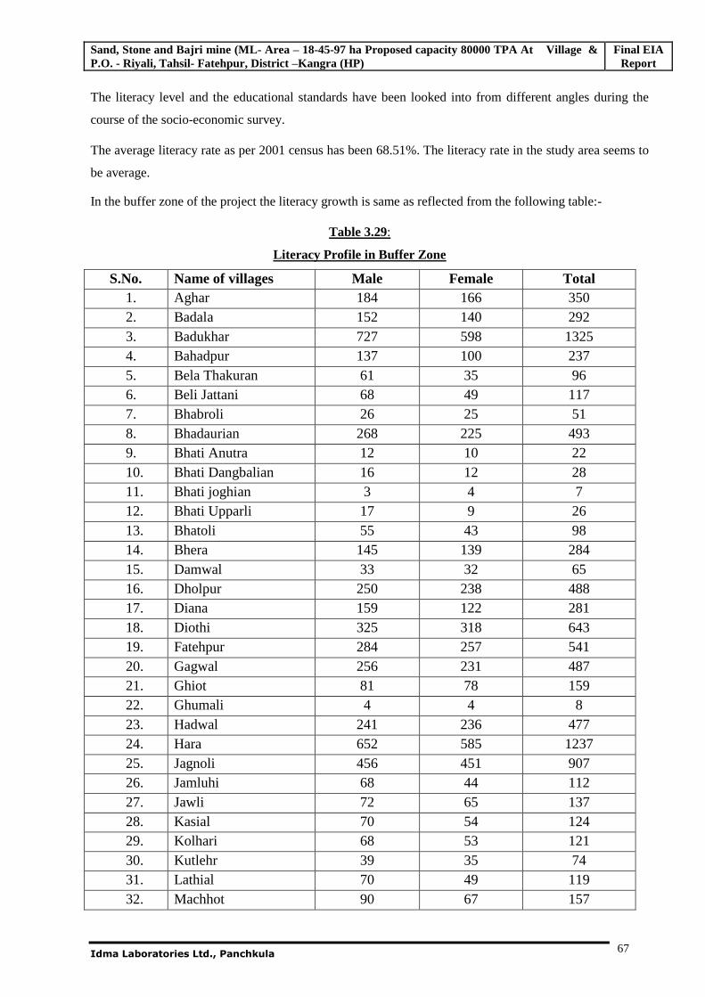
Sand, Stone and Bajri mine (ML- Area – 18-45-97 ha Proposed capacity 80000 TPA At Village & P.O. - Riyali, Tahsil- Fatehpur, District –Kangra (HP)
Final EIA Report
Idma Laboratories Ltd., Panchkula
67
The literacy level and the educational standards have been looked into from different angles during the
course of the socio-economic survey.
The average literacy rate as per 2001 census has been 68.51%. The literacy rate in the study area seems to
be average.
In the buffer zone of the project the literacy growth is same as reflected from the following table:-
Table 3.29:
Literacy Profile in Buffer Zone
S.No. Name of villages Male Female Total 1. Aghar 184 166 350 2. Badala 152 140 292 3. Badukhar 727 598 1325 4. Bahadpur 137 100 237 5. Bela Thakuran 61 35 96 6. Beli Jattani 68 49 117 7. Bhabroli 26 25 51 8. Bhadaurian 268 225 493 9. Bhati Anutra 12 10 22 10. Bhati Dangbalian 16 12 28 11. Bhati joghian 3 4 7 12. Bhati Upparli 17 9 26 13. Bhatoli 55 43 98 14. Bhera 145 139 284 15. Damwal 33 32 65 16. Dholpur 250 238 488 17. Diana 159 122 281 18. Diothi 325 318 643 19. Fatehpur 284 257 541 20. Gagwal 256 231 487 21. Ghiot 81 78 159 22. Ghumali 4 4 8 23. Hadwal 241 236 477 24. Hara 652 585 1237 25. Jagnoli 456 451 907 26. Jamluhi 68 44 112 27. Jawli 72 65 137 28. Kasial 70 54 124 29. Kolhari 68 53 121 30. Kutlehr 39 35 74 31. Lathial 70 49 119 32. Machhot 90 67 157
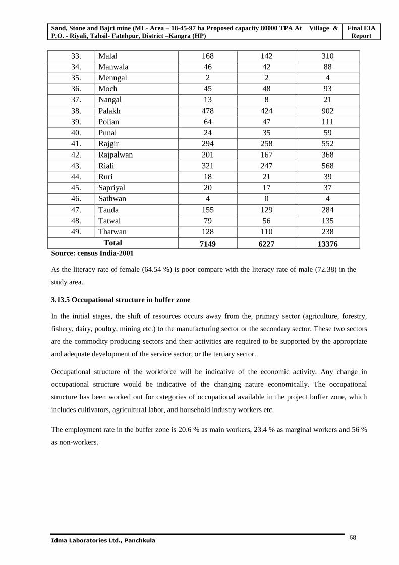
Sand, Stone and Bajri mine (ML- Area – 18-45-97 ha Proposed capacity 80000 TPA At Village & P.O. - Riyali, Tahsil- Fatehpur, District –Kangra (HP)
Final EIA Report
Idma Laboratories Ltd., Panchkula
68
33. Malal 168 142 310 34. Manwala 46 42 88 35. Menngal 2 2 4 36. Moch 45 48 93 37. Nangal 13 8 21 38. Palakh 478 424 902 39. Polian 64 47 111 40. Punal 24 35 59 41. Rajgir 294 258 552 42. Rajpalwan 201 167 368 43. Riali 321 247 568 44. Ruri 18 21 39 45. Sapriyal 20 17 37 46. Sathwan 4 0 4 47. Tanda 155 129 284 48. Tatwal 79 56 135 49. Thatwan 128 110 238
Total 7149 6227 13376 Source: census India-2001
As the literacy rate of female (64.54 %) is poor compare with the literacy rate of male (72.38) in the
study area.
3.13.5 Occupational structure in buffer zone
In the initial stages, the shift of resources occurs away from the, primary sector (agriculture, forestry,
fishery, dairy, poultry, mining etc.) to the manufacturing sector or the secondary sector. These two sectors
are the commodity producing sectors and their activities are required to be supported by the appropriate
and adequate development of the service sector, or the tertiary sector.
Occupational structure of the workforce will be indicative of the economic activity. Any change in
occupational structure would be indicative of the changing nature economically. The occupational
structure has been worked out for categories of occupational available in the project buffer zone, which
includes cultivators, agricultural labor, and household industry workers etc.
The employment rate in the buffer zone is 20.6 % as main workers, 23.4 % as marginal workers and 56 %
as non-workers.
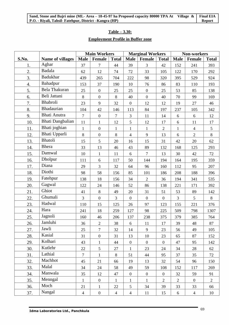
Sand, Stone and Bajri mine (ML- Area – 18-45-97 ha Proposed capacity 80000 TPA At Village & P.O. - Riyali, Tahsil- Fatehpur, District –Kangra (HP)
Final EIA Report
Idma Laboratories Ltd., Panchkula
69
Table – 3.30:
Employment Profile in Buffer zone
S.No. Name of villages Main Workers Marginal Workers Non-workers
Male Female Total Male Female Total Male Female Total 1. Aghar 37 7 44 39 3 42 152 241 393
2. Badala 62 12 74 72 33 105 122 170 292
3. Badukhar 439 265 704 222 98 320 395 529 924
4. Bahadpur 153 37 190 10 76 86 83 110 193
5. Bela Thakuran 25 0 25 25 0 25 53 85 138
6. Beli Jattani 8 0 8 40 0 40 70 99 169
7. Bhabroli 23 9 32 0 12 12 19 27 46
8. Bhadaurian 104 42 146 113 84 197 237 105 342
9. Bhati Anutra 7 0 7 3 11 14 6 6 12
10. Bhati Dangbalian 11 1 12 5 12 17 6 11 17
11. Bhati joghian 1 0 1 1 1 2 1 4 5
12. Bhati Upparli 8 0 8 4 9 13 6 2 8
13. Bhatoli 15 5 20 16 15 31 42 20 62
14. Bhera 33 13 46 43 89 132 168 125 293
15. Damwal 10 1 11 6 7 13 30 42 72
16. Dholpur 111 6 117 50 144 194 164 195 359
17. Diana 29 3 32 64 96 160 112 95 207
18. Diothi 98 58 156 85 101 186 208 188 396
19. Fatehpur 138 18 156 34 2 36 194 341 535
20. Gagwal 122 24 146 52 86 138 221 171 392
21. Ghiot 41 8 49 20 31 51 53 89 142
22. Ghumali 3 0 3 0 0 0 3 5 8
23. Hadwal 110 15 125 26 97 123 155 221 376
24. Hara 241 18 259 127 98 225 509 798 1307
25. Jagnoli 160 46 206 137 238 375 379 385 764
26. Jamluhi 36 2 38 6 11 17 39 48 87
27. Jawli 25 7 32 14 9 23 56 49 105
28. Kasial 31 0 31 13 10 23 65 87 152
29. Kolhari 43 1 44 0 0 0 47 95 142
30. Kutlehr 22 5 27 1 23 24 34 28 62
31. Lathial 7 1 8 51 44 95 37 35 72
32. Machhot 45 21 66 19 13 32 54 96 150
33. Malal 34 24 58 49 59 108 152 117 269
34. Manwala 35 12 47 0 0 0 32 59 91
35. Menngal 1 0 1 1 1 2 2 0 2
36. Moch 21 1 22 5 34 39 33 33 66
37. Nangal 4 0 4 4 11 15 6 4 10
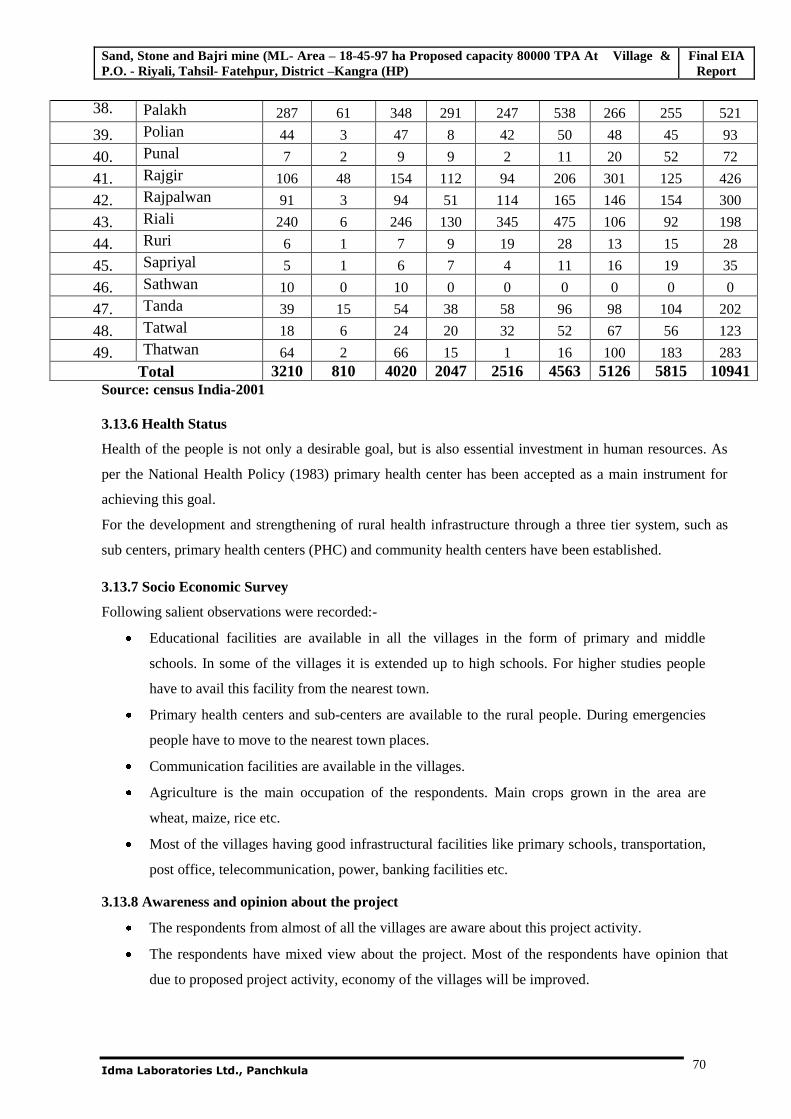
Sand, Stone and Bajri mine (ML- Area – 18-45-97 ha Proposed capacity 80000 TPA At Village & P.O. - Riyali, Tahsil- Fatehpur, District –Kangra (HP)
Final EIA Report
Idma Laboratories Ltd., Panchkula
70
38. Palakh 287 61 348 291 247 538 266 255 521
39. Polian 44 3 47 8 42 50 48 45 93
40. Punal 7 2 9 9 2 11 20 52 72
41. Rajgir 106 48 154 112 94 206 301 125 426
42. Rajpalwan 91 3 94 51 114 165 146 154 300
43. Riali 240 6 246 130 345 475 106 92 198
44. Ruri 6 1 7 9 19 28 13 15 28
45. Sapriyal 5 1 6 7 4 11 16 19 35
46. Sathwan 10 0 10 0 0 0 0 0 0
47. Tanda 39 15 54 38 58 96 98 104 202
48. Tatwal 18 6 24 20 32 52 67 56 123
49. Thatwan 64 2 66 15 1 16 100 183 283 Total 3210 810 4020 2047 2516 4563 5126 5815 10941
Source: census India-2001
3.13.6 Health Status
Health of the people is not only a desirable goal, but is also essential investment in human resources. As
per the National Health Policy (1983) primary health center has been accepted as a main instrument for
achieving this goal.
For the development and strengthening of rural health infrastructure through a three tier system, such as
sub centers, primary health centers (PHC) and community health centers have been established.
3.13.7 Socio Economic Survey
Following salient observations were recorded:-
Educational facilities are available in all the villages in the form of primary and middle
schools. In some of the villages it is extended up to high schools. For higher studies people
have to avail this facility from the nearest town.
Primary health centers and sub-centers are available to the rural people. During emergencies
people have to move to the nearest town places.
Communication facilities are available in the villages.
Agriculture is the main occupation of the respondents. Main crops grown in the area are
wheat, maize, rice etc.
Most of the villages having good infrastructural facilities like primary schools, transportation,
post office, telecommunication, power, banking facilities etc.
3.13.8 Awareness and opinion about the project
The respondents from almost of all the villages are aware about this project activity.
The respondents have mixed view about the project. Most of the respondents have opinion that
due to proposed project activity, economy of the villages will be improved.
Sand, Stone and Bajri mine (ML- Area – 18-45-97 ha Proposed capacity 80000 TPA At Village & P.O. - Riyali, Tahsil- Fatehpur, District –Kangra (HP)
Final EIA Report
Idma Laboratories Ltd., Panchkula
71
As regards the respondents from the nearby villages also shown favorable opinion about activity
that it may lead to increase in infrastructural facilities, job opportunities and business
opportunities in the project area.
People from the villages under the study area have put their opinion and willingness for the
allotment of the land for the project.
The educated youths opined that the management should give preference to them/ local people for
employment as per their ability.
3.13.9 Civic Amenities
Infrastructure resources are base of the villages with reference to education, drinking water resources, post
and telegraph, communications and supply.
Secondary School Education and College education facilities are available within 13 kilometers
from mining lease area at Talwara.
Primary Health center is available within range of six kilometers at Badukher.
Banking facilities are also available at Badukher.
For drinking water, villages are dependent on ground water resource
Most of the villages are connected through road network and are also approachable through public
transport.
Electricity is available in all the villages.
3.13.10 Note on Agriculture Development and role of incoming project
The economy of Kangra district is predominately agrarian and majority of population is dependent on
agriculture and activities allied to it for earning their livelihood. The moisture retention capacity of the
area is poor due mainly to the fact the bed rocks are argillaceous and the land the uneven. The crops
usually face moisture stress during the remaining period of the year due to inadequate and irregular
rainfall. The irrigation facilities are provided by lifting water from steams, shallow dug wells and
medium to deep tube wells in the valley area.
Major food crops are grouped into three categories:
1. Cereals
2. Pulses
3. Other food crops like Chilies, ginger, sugarcane and turmeric.
Non- food crop area is of two kinds:
1. Oil seeds
2. Other non-food crops such as cotton, tobacco and fodder crop
Agriculture in this area plays vital role in the socio-economic development of the area as it constitutes the
main source of livelihood. Majority of the families in the periphery of 10Km radius of the proposed
Sand, Stone and Bajri mine (ML- Area – 18-45-97 ha Proposed capacity 80000 TPA At Village & P.O. - Riyali, Tahsil- Fatehpur, District –Kangra (HP)
Final EIA Report
Idma Laboratories Ltd., Panchkula
72
project mainly depended on agriculture activity. Attention will be therefore focused on this source of
income while developing the projects in this area.
In this context following points may be noted:-
a. In a totally rain fed agriculture, the green revolution components can be appropriately used. As a
matter of fact irrigation is the basic inputs for the development of agriculture which facilitate the
use of inorganic fertilizers, insecticides and pesticides, improved seeds, improved high yielding
varieties of seed and use of modern agriculture implement and mechanization to what extent
possible by proper.
b. Farmers find it increasingly difficult to support their families’ entirely on agriculture and since
the avenues for employment outside agriculture are not developing fast enough, the population
pressure on land has kept on increasing all the time. Under these circumstances, the farmers
appear to be convinced:-
a. Agriculture is not likely to sustain them and their future generations.
b. Non-agricultural sources of employment are not likely to develop at fast rate enough to
accommodate and employ gainfully the subsequent additional force labors.
c. That such, if the present structure of economic activity in the project area were to continue
without any change, the farmers and their generation are likely to suffer untold hardship.
*******
Sand, Stone and Bajri mine (ML- Area – 18-45-97 ha Proposed capacity 80,000 TPA At Village & P.O. - Riyali, Tahsil- Fatehpur, District –Kangra (HP)
FEIA Report
Idma Laboratories Ltd., Panchkula 73
CHAPTER - 4
ANTICIPATED ENVIRONMENTAL IMPACTS AND
MITIGATION MEASURES
4.1 General
Environmental impacts both direct and indirect on various environmental attributes due to proposed mining
activity in the surrounding environment, during pre-operational, operational and post-operational.
The impacts due to mining operations commence from the exploration activities, extend through extraction
and processing of minerals, may continue up to post-closure of the operation, with the nature and extent of
impacts varying throughout the stages of project development.
Identification of possible impacts specific to an activity is an important task since this helps in focusing
attention upon relevant environmental parameters and relating them with the activities involved. As far as
the proposed mine is concerned, the following parameters are of significance in the Environmental Impact
Assessment and is being discussed in detail.
1. Land Environment
2. Water Environment
3. Air Environment
4. Noise Environment
4. Waste Generation
6. Biological Environment
7. Socio-Economic
4.2 Land Environment 4.2.1 Topography/Physiography
The total Mine lease area of 18.4597 ha is private unused lands. The mine lease is devoid of any vegetation.
Practically, no soil cover is available on the mineralized zone. The conservation of top soil is not required
as it is not available in proposed mining area. The impact on soil in the lease area and surroundings will be
negligible.
After mining, the mined out area will be reclaimed by waste dump and developed for agricultural or
commercial plantation use. Hence, no perceptible change in the general landscape is anticipated.
Sand, Stone and Bajri mine (ML- Area – 18-45-97 ha Proposed capacity 80,000 TPA At Village & P.O. - Riyali, Tahsil- Fatehpur, District –Kangra (HP)
FEIA Report
Idma Laboratories Ltd., Panchkula 74
4.2.2 Land use Plan
The mining lease area is an old terrace deposit well above the highest flood level of river Beas. The
proposed mine lease area belongs to private individuals and not available for any agricultural purposes. In
operational period it doesn’t have much of infrastructure needed and no dumping is proposed. It therefore
can be put to use, eventually as agricultural land as it belongs to private individuals. Post mining the area
will be rehabilitated as a productive agricultural land.
Hence; impact on land environment due to the mining will be least.
4.3 Water Environment
4.3.1 Impacts on Water Resources
The proposed mine is very small and its activity is limited. The employment potential of this mine is also
very less. So, water requirement for this project is very less, The water required for the project for
sprinkling on haulage roads for dust suppression is sourced from the local water supply by tankers and
drinking water will be sourced from bore well present in the crusher area. Hence the impact on water
resources is minimal or no significant in nature.
4.3.2 Impacts due to Mining
The area under mining is not affected by surrounding catchment as it is located on a terrace and it
discharges the rain water directly in to the Beas River. Damage in the water body, depends on its
assimilative capacity. To find out assimilative capacity of receiving water body, water samples were
collected from different bore wells, and surface water bodies. The study indicates that assimilative capacity
of the River water bodies still exists, but effective measures should be taken to check water pollution.
Mining operation shall be undertaken beyond the HFL of the river bed; hence there shall practically be no
effect on surrounding water sources due to mining of stone, bajri and sand. Drainage can be developed
around the mining area to manage the rain water and it can be channelized to the river flowing nearby.
As, such no effluents are generated due to the proposed mining activity. The generation of waste water from
domestic activities also very less. However this water will be disposed followed by soak pit. Hence, there is
no significant impact on water environment due to proposed mining activity.
Sand, Stone and Bajri mine (ML- Area – 18-45-97 ha Proposed capacity 80,000 TPA At Village & P.O. - Riyali, Tahsil- Fatehpur, District –Kangra (HP)
FEIA Report
Idma Laboratories Ltd., Panchkula 75
4.3.2.1 Ground Water Regime
The study area itself being part of River terrace above and away from HF L carries no surface water. The
ground water table as per the observations of records of tube wells in the surrounding area indicates to be at
least seven to eight meters below surface level. The flow of ground water (sub surface flow) is following
the trend of topography, which is in the East to west direction.
The ground water table which will be about six meters below the surface level of mining lease area will not
be disturbed as ultimate working depth will be 307 MRL. Thus the mine operation will not affect the
hydrological conditions of the area. Proposed working will not intersect Ground water. The details of site
elevation, working depth and ground water table are given below.
Height of the First Bench - 310.5 MRL
Ultimate mining depth - 307 MRL
Water table in Pre monsoon - 304 MRL
Water Table in Post monsoon - 305 MRL
To find the depth of ground water table, test pit was excavated on March 30, 2011in the leased area.
The test pit indicated depth of water table to be about six meters.
Keeping in view the above the mining pits will be restrained a depth of three metres.
The publication of Central Ground Water Board (CGWB) GROUND WATER INFORMATION
BOOKLET,KANGRA DISTRICT, HIMACHAL PRADESH in the year 2008 also indicating that the
ground water depth in the study area is about 6 meters.
From the above it can be concluded that there will be no impact on the ground water regime.
4.3.2.2 Drainage/Storm Water Management
There will be no impact on this drainage channel due to the mining activity.
4.4 IMPACT ON AIR QUALITY & MITIGATION MEASURES
The major sources of Air pollution due to the proposed mine is dust generation due to excavation,
loading and transportation of mineral, wind erosion of exposed material..
Details of Uncontrolled Emissions:
A. Area source emission
Mineral / Waste Excavation form the mine lease area.
B. Loading of Mineral
Sand, Stone and Bajri mine (ML- Area – 18-45-97 ha Proposed capacity 80,000 TPA At Village & P.O. - Riyali, Tahsil- Fatehpur, District –Kangra (HP)
FEIA Report
Idma Laboratories Ltd., Panchkula 76
Loading of mineral into the tractor trolleys, Lorries etc
C. Haulage Emissions
Transport of mineral from working area to crusher
4.4.1 Modeling Procedure
Prediction of ground level concentrations (glc’s) due to Proposed Enhancement Project has
been made by ISCST3. It is US-EPA approved model to predict the air quality. The model uses
rural dispersion and regulatory defaults options. For this study uniform polar receptors on flat
terrain have been assumed.
Meteorological inputs required are wind speed, direction, ambient temperature, stability
classes, and mixing height. The model details are as follows.
Gaussian Plume Model The model is based on a numerical integration over the area in the upwind and cross wind
directions of Gaussian plume formula. This can be applied to the Point, Area, Line, Volume
sources (& other forms of area sources) simultaneously and their resultant incremental
concentration of the pollutant can be predicted.
Stability Classification
Hourly stability is determined by wind direction fluctuation method as suggested by Slade(1965)and recommended by CPCB (PROBES/70/1997-1998).
= Wdr/6
, is standard deviation of wind direction fluctuation, Wdr is the overall wind direction fluctuation or width of the wind direction in degrees. The table for stability classes is given as under.
Stability Class (degree)
A > 22.5 B 22.4 – 17.5 C 17.4 – 12.5 D 12.4 – 7.5 E 7.4 – 3.5 F < 3.5
Dispersion Parameters
Dispersion parameters y and z for open country conditions (Briggs, 1974) are used as the project is located on a flat terrain in a rural area. Atmospheric dispersion coefficients vary with downwind
Sand, Stone and Bajri mine (ML- Area – 18-45-97 ha Proposed capacity 80,000 TPA At Village & P.O. - Riyali, Tahsil- Fatehpur, District –Kangra (HP)
FEIA Report
Idma Laboratories Ltd., Panchkula 77
distance (x) from emission sources for different atmospheric stability conditions. (CPCB – PROBES/70/1997-98). Rural Conditions
Stability Class y
z
A 0.22x(1+0.0001x)-.5 0.20x B 0.16x(1+0.0001x)-.5 0.12x C 0.11x(1+0.0001x)-.5 0.08x(1+0.0002x).5
D 0.08x(1+0.0001x)-.5 0.06(1+0.0015x).5
E 0.06x(1+0.0001x)-.5 0.03x(1+0.0003x)-1
F 0.04x(1+0.0001x)-.5 0.16x(1+0.0003x)-1
4.4.2 Meteorological Data
On site hourly meteorological data for winter months (March to May 2011) in respect of wind
speed, wind direction, temperature and cloud amount are utilized in this study. The data was put in model
format. The mixing heights have been extracted from CPCB publications.
4.4.3 Emission Rates
Dust emission rate from the Mining area, based on the following empirical formula.
a) Dust emission due to excavation:
Pa x 23.6 Dust emission (DE) = ----------------------
Wd x Wh x 1000
DE = Dust emission in kg/hr Pa = Annual Excavation in Tonnes Wd = No. of days of operation in a year Wh = Effective working hrs in a day
23.6 Quantity of dust emitted in kg/for 1000 tonnes of excavation Dust emission rate=(80, 000x23.6)/ 300x8x1000)= 0.786 kg/hr
The above mentioned emission rate is without adoption of dust control measures. The literature suggests
that dust control measures reduce the emissions and effective emission rate is one third of the computed
emission. Accordingly emission rate to be in the modeling is (0.786/3) i.e. 0.262 kg/hr.
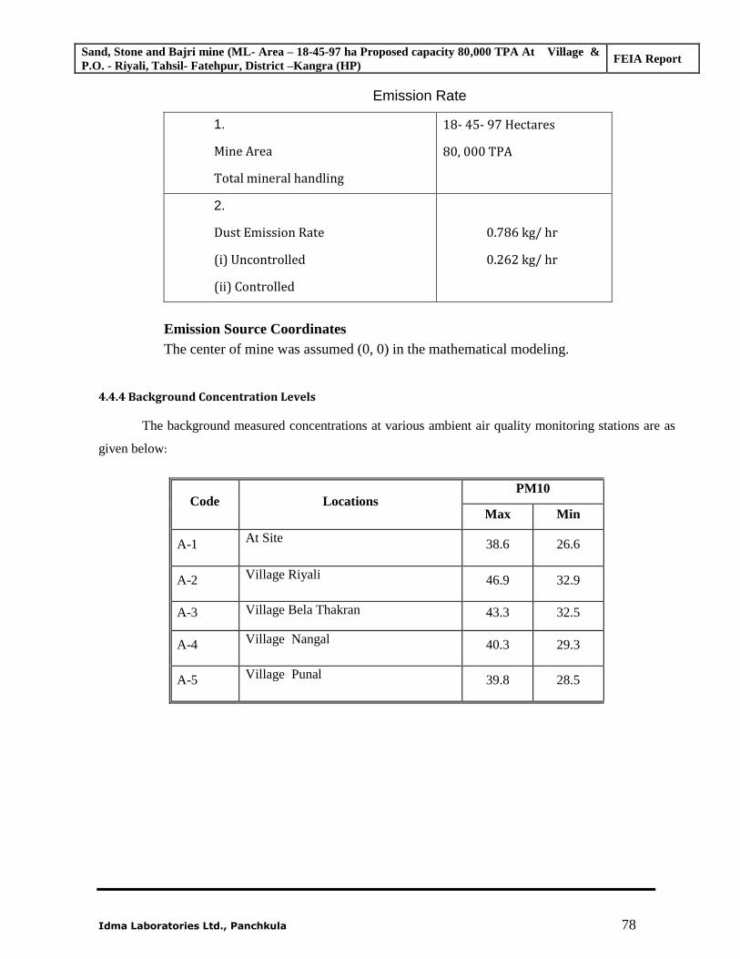
Sand, Stone and Bajri mine (ML- Area – 18-45-97 ha Proposed capacity 80,000 TPA At Village & P.O. - Riyali, Tahsil- Fatehpur, District –Kangra (HP)
FEIA Report
Idma Laboratories Ltd., Panchkula 78
Emission Rate
1.
Mine Area
Total mineral handling
18- 45- 97 Hectares
80, 000 TPA
2.
Dust Emission Rate
(i) Uncontrolled
(ii) Controlled
0.786 kg/ hr
0.262 kg/ hr
Emission Source Coordinates The center of mine was assumed (0, 0) in the mathematical modeling.
4.4.4 Background Concentration Levels
The background measured concentrations at various ambient air quality monitoring stations are as
given below:
Code Locations PM10
Max Min
A-1 At Site 38.6 26.6
A-2 Village Riyali 46.9 32.9
A-3 Village Bela Thakran 43.3 32.5
A-4 Village Nangal 40.3 29.3
A-5 Village Punal 39.8 28.5
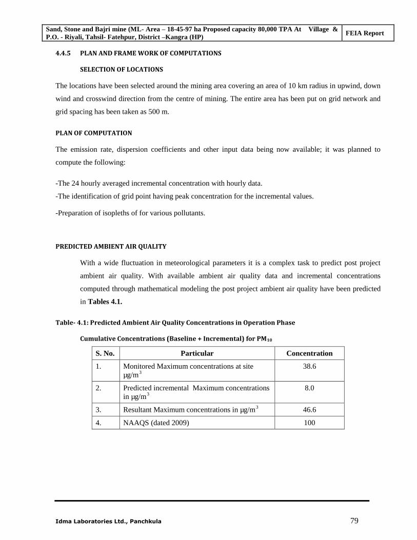
Sand, Stone and Bajri mine (ML- Area – 18-45-97 ha Proposed capacity 80,000 TPA At Village & P.O. - Riyali, Tahsil- Fatehpur, District –Kangra (HP)
FEIA Report
Idma Laboratories Ltd., Panchkula 79
4.4.5 PLAN AND FRAME WORK OF COMPUTATIONS
SELECTION OF LOCATIONS
The locations have been selected around the mining area covering an area of 10 km radius in upwind, down
wind and crosswind direction from the centre of mining. The entire area has been put on grid network and
grid spacing has been taken as 500 m.
PLAN OF COMPUTATION
The emission rate, dispersion coefficients and other input data being now available; it was planned to
compute the following:
-The 24 hourly averaged incremental concentration with hourly data.
-The identification of grid point having peak concentration for the incremental values.
-Preparation of isopleths of for various pollutants.
PREDICTED AMBIENT AIR QUALITY
With a wide fluctuation in meteorological parameters it is a complex task to predict post project
ambient air quality. With available ambient air quality data and incremental concentrations
computed through mathematical modeling the post project ambient air quality have been predicted
in Tables 4.1.
Table- 4.1: Predicted Ambient Air Quality Concentrations in Operation Phase
Cumulative Concentrations (Baseline + Incremental) for PM10
S. No. Particular Concentration
1. Monitored Maximum concentrations at site µg/m3
38.6
2. Predicted incremental Maximum concentrations in µg/m3
8.0
3. Resultant Maximum concentrations in µg/m3 46.6
4. NAAQS (dated 2009) 100
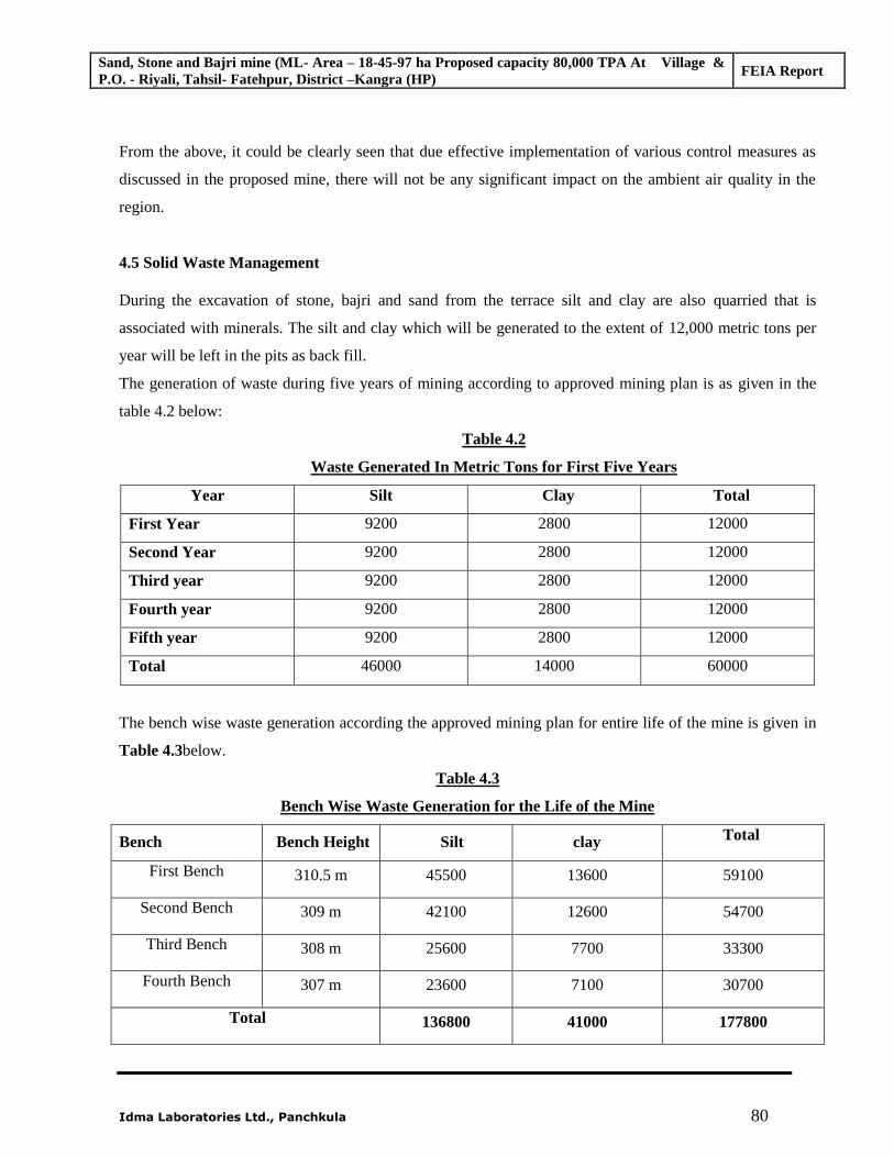
Sand, Stone and Bajri mine (ML- Area – 18-45-97 ha Proposed capacity 80,000 TPA At Village & P.O. - Riyali, Tahsil- Fatehpur, District –Kangra (HP)
FEIA Report
Idma Laboratories Ltd., Panchkula 80
From the above, it could be clearly seen that due effective implementation of various control measures as
discussed in the proposed mine, there will not be any significant impact on the ambient air quality in the
region.
4.5 Solid Waste Management
During the excavation of stone, bajri and sand from the terrace silt and clay are also quarried that is
associated with minerals. The silt and clay which will be generated to the extent of 12,000 metric tons per
year will be left in the pits as back fill.
The generation of waste during five years of mining according to approved mining plan is as given in the
table 4.2 below:
Table 4.2
Waste Generated In Metric Tons for First Five Years
Year Silt Clay Total
First Year 9200 2800 12000
Second Year 9200 2800 12000
Third year 9200 2800 12000
Fourth year 9200 2800 12000
Fifth year 9200 2800 12000
Total 46000 14000 60000
The bench wise waste generation according the approved mining plan for entire life of the mine is given in
Table 4.3below.
Table 4.3
Bench Wise Waste Generation for the Life of the Mine
Bench Bench Height Silt clay Total
First Bench 310.5 m 45500 13600 59100
Second Bench 309 m 42100 12600 54700
Third Bench 308 m 25600 7700 33300
Fourth Bench 307 m 23600 7100 30700
Total 136800 41000 177800
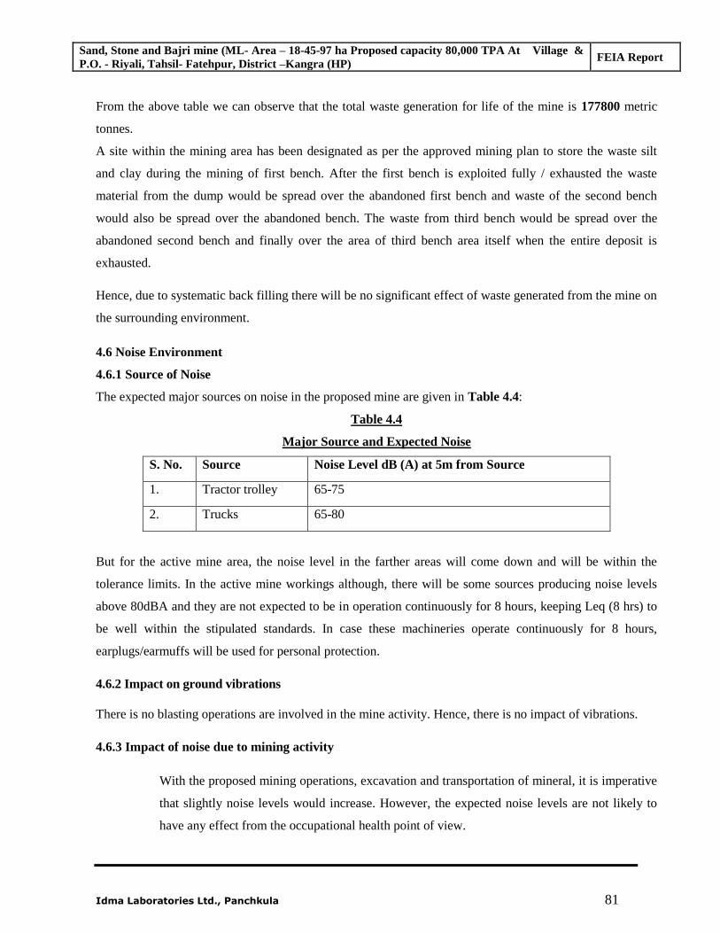
Sand, Stone and Bajri mine (ML- Area – 18-45-97 ha Proposed capacity 80,000 TPA At Village & P.O. - Riyali, Tahsil- Fatehpur, District –Kangra (HP)
FEIA Report
Idma Laboratories Ltd., Panchkula 81
From the above table we can observe that the total waste generation for life of the mine is 177800 metric
tonnes. A site within the mining area has been designated as per the approved mining plan to store the waste silt
and clay during the mining of first bench. After the first bench is exploited fully / exhausted the waste
material from the dump would be spread over the abandoned first bench and waste of the second bench
would also be spread over the abandoned bench. The waste from third bench would be spread over the
abandoned second bench and finally over the area of third bench area itself when the entire deposit is
exhausted.
Hence, due to systematic back filling there will be no significant effect of waste generated from the mine on
the surrounding environment.
4.6 Noise Environment
4.6.1 Source of Noise
The expected major sources on noise in the proposed mine are given in Table 4.4:
Table 4.4
Major Source and Expected Noise
S. No. Source Noise Level dB (A) at 5m from Source
1. Tractor trolley 65-75
2. Trucks 65-80
But for the active mine area, the noise level in the farther areas will come down and will be within the
tolerance limits. In the active mine workings although, there will be some sources producing noise levels
above 80dBA and they are not expected to be in operation continuously for 8 hours, keeping Leq (8 hrs) to
be well within the stipulated standards. In case these machineries operate continuously for 8 hours,
earplugs/earmuffs will be used for personal protection.
4.6.2 Impact on ground vibrations
There is no blasting operations are involved in the mine activity. Hence, there is no impact of vibrations.
4.6.3 Impact of noise due to mining activity
With the proposed mining operations, excavation and transportation of mineral, it is imperative
that slightly noise levels would increase. However, the expected noise levels are not likely to
have any effect from the occupational health point of view.
Sand, Stone and Bajri mine (ML- Area – 18-45-97 ha Proposed capacity 80,000 TPA At Village & P.O. - Riyali, Tahsil- Fatehpur, District –Kangra (HP)
FEIA Report
Idma Laboratories Ltd., Panchkula 82
From the above, it is clearly seen that there will be no significant impact on the surrounding community due
to noise from the mine.
Thus due to natural attenuation effects, by proper green belt development, design / maintenance of
machines, etc., the impact on noise levels will be minimal.
4.7 Biological Environment ,
4.7.1 Impact on Terrestrial Ecology
The proposed mine lease area is ‘gair mumkin Nadi’’ falling in category “land not available for
cultivation”. There is no forest land within the mine lease area. The forest area is far away from the mining
area and will not be disturbed during proposed mining operations. There are no national parks, sanctuaries,
notified biospheres, Tiger/Elephant Corridors, Birds migratory routes, etc. within 10 km radius.
The dust is the only major pollutant which will be generated from different activities of mining. The effect
of particulate matter on vegetation is in the form of incrustation, plugging of stomata, and loss of
chlorophyll and reduction of photosynthesis process. Disturbance in plant metabolism due to deposition of
dust particles on foliar surfaces leads to reduction in plant growth. The atmospheric concentrations
normally do not reach a level sufficient to induce acute injury.
Air dispersion modeling studies have been carried to assess the impact on sensitive location like village and
other sensitive receptors.
A perusal of previous section reveals that the maximum incremental ground level concentrations for PM10
likely to be encountered in the mine operations are well within the NAAQM standards.
Moreover, progressive afforestation programme activity over a period of time in the core zone will create
favorable conditions for fauna in the area and hence reversible impact is anticipated after presence of
favorable condition.
4.7.2 Impact on Aquatic Ecology
The proposed mining activity is on the Beas River Terrace. Since the mining activity is on the terrace away
from the river flow, therefore there shall be no significant impact on the aquatic flora and fauna.
4.8 Socio Economic Environment
Opening of proposed mine definitely provides the following series of positive impacts:
Direct employment for over 15 persons in the various mine activities.
Indirect employment in transport sector, offer of contract laborers.
Sand, Stone and Bajri mine (ML- Area – 18-45-97 ha Proposed capacity 80,000 TPA At Village & P.O. - Riyali, Tahsil- Fatehpur, District –Kangra (HP)
FEIA Report
Idma Laboratories Ltd., Panchkula 83
Improvement in the general living standards and knowledge sharing.
The wage level and the living standard of the local and the migrated people will also improve
as a result of higher earnings.
Improvement in the economic growth in the region
Benefit to the State and the Central governments through financial revenues by way of royalty,
tax, duties, etc from this project directly and also indirectly.
Additional mineral availability for the region.
From the above it can be confidently concluded that the project activities in short and long terms are
expected to enhance the economic growth and all kinds of facilities of the area which is industrially and
economically backward and hence the Impact on socio- economic environment will be positive.
4.8.1 Impact on local transport/infrastructure
A detailed traffic survey was carried out in the study period to know the traffic density of the local transport
near to the mine site. The detailed traffic survey method and number of vehicle passing through these roads
are given in a tabular form in category wise in Table 3.23 in Chapter-3.
In addition to these traffic survey results, the traffic load will definitely increase on local transport. But in
proposed mining, production capacity is very less and for transporting of excavated material, less number of
vehicles is required. Hence, the local transport / infrastructure facilities are capable of handling the
increased load due to mining activities.
4.9 Impact of cumulative mining in surrounding area:
There are about four numbers of mining leases in 10 kilometers buffer zone area of the mining lease.
Golden Karamjot Stone Crusher is having one corner common with proposed mining lease area and
Raghava Singh Mining lease is present in North within 3 km distance of the proposed mining lease area.
The Mining of sand stone and Bajri is being carried out in accordance with the approved mining plans
which are prepared keeping in view the sustainability of the area.
******
Sand, Stone and Bajri mine (ML- Area – 18-45-97 ha Proposed capacity 80000 TPA At Village & P.O. - Riyali, Tahsil- Fatehpur, District –Kangra (HP)
Final EIA Report
85 Idma Laboratories Ltd., Panchkula
CHAPTER - 5
ENVIRONMENTAL MONITORING PROGRAMME
5.1 Introduction
Regular monitoring of environmental parameters is of immense importance to assess the status of
environment during project operation. With the knowledge of baseline conditions, the monitoring
programme will serve as an indicator for any deterioration in environmental conditions due to
operation of the project, to enable taking up suitable mitigatory steps in time to safeguard the
environment. Monitoring is as important as that of control of pollution since the efficiency of control
measures can only be determined by monitoring.
Usually, as in the case of the study, an impact assessment study is carried over short period of time
and the data cannot bring out all variations induced by the natural or human activities. Therefore,
regular monitoring programme of the environmental parameters is essential to take into account the
changes in the environmental quality.
5.2 Environmental Quality Management
In order to maintain the environmental quality within the standards, regular monitoring of various
environmental components is necessary. The project management will take care of pollution
monitoring aspects and implementation of control measures. The project management will manage the
following responsibility during the mining operation:
Environmental monitoring of the surrounding area.
Commissioning of pollution control equipment.
Specification and regulation of maintenance schedules for pollution control equipment.
Ensuring that standards of housekeeping in the mine are maintained.
Developing the green belt.
Ensuring Water use is minimized.
Carrying out the Environmental Management Plan.
5.3 Measurement Methodologies
5.3.1 Instrument to be used
The following instruments will be used for data collection work in the monitoring schedule:
1. Respirable dust sampler.
2. Fine volume sampler
3. Water level indicator
4. Sound level meter
Sand, Stone and Bajri mine (ML- Area – 18-45-97 ha Proposed capacity 80000 TPA At Village & P.O. - Riyali, Tahsil- Fatehpur, District –Kangra (HP)
Final EIA Report
86 Idma Laboratories Ltd., Panchkula
5.3.2 Monitoring Programme
The post project monitoring will include details of any major/ minor impact in the core zone and area
within buffer zone in respect of the following parameters: -
Micro - meteorological data
Ambient air quality monitoring
Noise level monitoring
Water quality & level
Soil monitoring
5.4 Environmental Monitoring and Reporting Procedure
Monitoring shall confirm that commitments are being met. This may take the form of direct
measurement and recording of quantitative information, such as amounts and concentrations of
discharges, emissions and wastes, for measurement against corporate or statutory standards, consent
limits or targets. It may also require measurement of ambient environmental quality in the vicinity of
a site using ecological/biological, physical and chemical indicators. Monitoring may include socio-
economic interaction, through local liaison activities or even assessment of complaints.
The preventive approach to management may also require monitoring of process inputs, for example,
type and method used, resource consumption, equipment and pollution control performance etc.
The key aims of monitoring are, first, to ensure that results/conditions are as forecast during the
planning stage, and where they are not, to pinpoint the cause and implement action to remedy the
situation. A second objective is to verify the evaluations made during the planning process, in
particular with risk and impact assessments and standard & target setting and to measure operational
and process efficiency. Monitoring will also be required to meet compliance with statutory and
corporate requirements. Finally, monitoring results provide the basis for auditing.
5.4.1 Objectives of Monitoring
The objectives of monitoring are to:
Verify effectiveness of planning decisions;
Measure effectiveness of operational procedures;
Conform statutory and corporate compliance; and
Identify unexpected changes.
5.5 Environmental Monitoring
The monitoring program can serve as an indicator for any deterioration in environmental conditions
due to operation of the mine, and helps in planning suitable mitigatory steps that could be taken in
time to safeguard the environment. Monitoring is as important as that of control of pollution since the
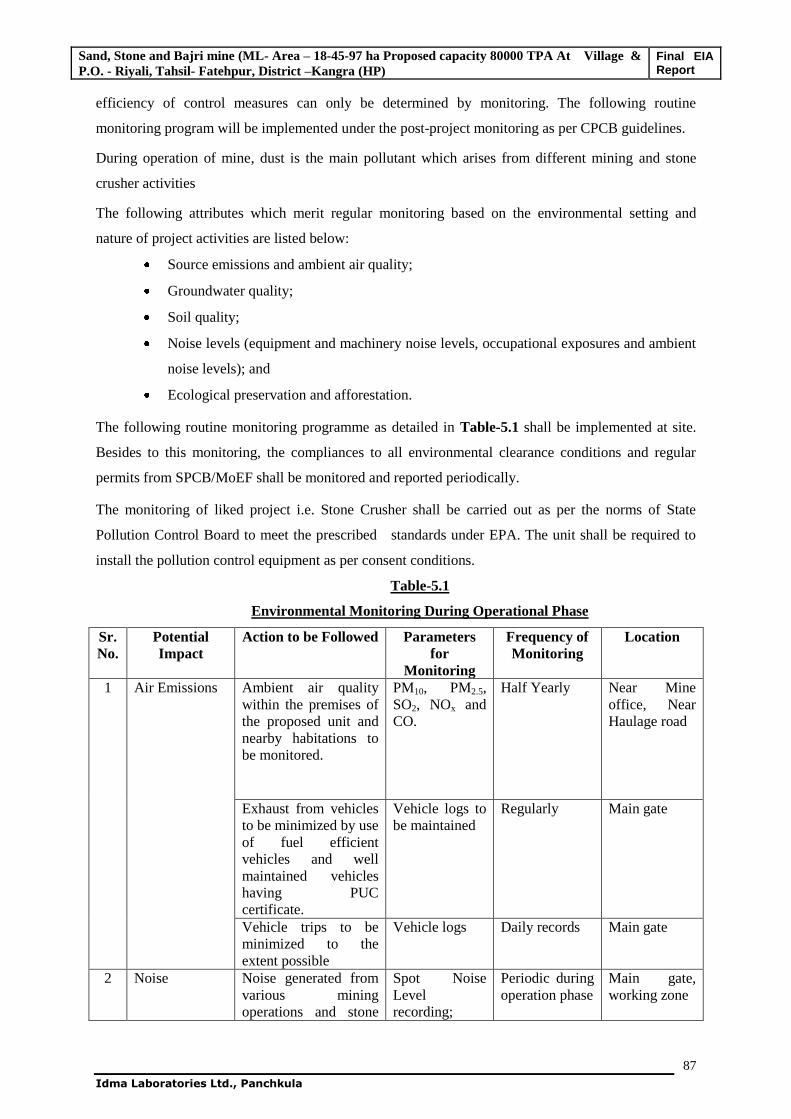
Sand, Stone and Bajri mine (ML- Area – 18-45-97 ha Proposed capacity 80000 TPA At Village & P.O. - Riyali, Tahsil- Fatehpur, District –Kangra (HP)
Final EIA Report
87 Idma Laboratories Ltd., Panchkula
efficiency of control measures can only be determined by monitoring. The following routine
monitoring program will be implemented under the post-project monitoring as per CPCB guidelines.
During operation of mine, dust is the main pollutant which arises from different mining and stone
crusher activities
The following attributes which merit regular monitoring based on the environmental setting and
nature of project activities are listed below:
Source emissions and ambient air quality;
Groundwater quality;
Soil quality;
Noise levels (equipment and machinery noise levels, occupational exposures and ambient
noise levels); and
Ecological preservation and afforestation.
The following routine monitoring programme as detailed in Table-5.1 shall be implemented at site.
Besides to this monitoring, the compliances to all environmental clearance conditions and regular
permits from SPCB/MoEF shall be monitored and reported periodically.
The monitoring of liked project i.e. Stone Crusher shall be carried out as per the norms of State
Pollution Control Board to meet the prescribed standards under EPA. The unit shall be required to
install the pollution control equipment as per consent conditions.
Table-5.1
Environmental Monitoring During Operational Phase
Sr. No.
Potential Impact
Action to be Followed Parameters for
Monitoring
Frequency of Monitoring
Location
1 Air Emissions Ambient air quality within the premises of the proposed unit and nearby habitations to be monitored.
PM10, PM2.5, SO2, NOx and CO.
Half Yearly Near Mine office, Near Haulage road
Exhaust from vehicles to be minimized by use of fuel efficient vehicles and well maintained vehicles having PUC certificate.
Vehicle logs to be maintained
Regularly Main gate
Vehicle trips to be minimized to the extent possible
Vehicle logs Daily records Main gate
2 Noise Noise generated from various mining operations and stone
Spot Noise Level recording;
Periodic during operation phase
Main gate, working zone
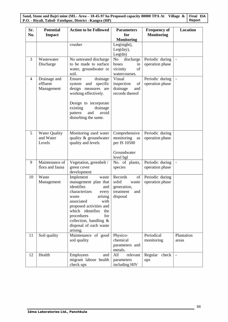
Sand, Stone and Bajri mine (ML- Area – 18-45-97 ha Proposed capacity 80000 TPA At Village & P.O. - Riyali, Tahsil- Fatehpur, District –Kangra (HP)
Final EIA Report
88 Idma Laboratories Ltd., Panchkula
Sr. No.
Potential Impact
Action to be Followed Parameters for
Monitoring
Frequency of Monitoring
Location
crusher Leq(night), Leq(day), Leq(dn)
3 Wastewater Discharge
No untreated discharge to be made to surface water, groundwater or soil.
No discharge hoses in vicinity of watercourses.
Periodic during operation phase
-
4 Drainage and effluent Management
Ensure drainage system and specific design measures are working effectively. Design to incorporate existing drainage pattern and avoid disturbing the same.
Visual inspection of drainage and records thereof
Periodic during operation phase
-
5 Water Quality and Water Levels
Monitoring used water quality & groundwater quality and levels
Comprehensive monitoring as per IS 10500 Groundwater level bgl
Periodic during operation phase
9 Maintenance of flora and fauna
Vegetation, greenbelt / green cover development
No. of plants, species
Periodic during operation phase
-
10 Waste Management
Implement waste management plan that identifies and characterizes every waste arising associated with proposed activities and which identifies the procedures for collection, handling & disposal of each waste arising.
Records of solid waste generation, treatment and disposal
Periodic during operation phase
11 Soil quality Maintenance of good soil quality
Physico-chemical parameters and metals.
Periodical monitoring
Plantation areas
12 Health Employees and migrant labour health check ups
All relevant parameters including HIV
Regular check ups
-
Sand, Stone and Bajri mine (ML- Area – 18-45-97 ha Proposed capacity 80000 TPA At Village & P.O. - Riyali, Tahsil- Fatehpur, District –Kangra (HP)
Final EIA Report
89 Idma Laboratories Ltd., Panchkula
5.6 Monitoring Methods
5.6.1 Air Quality Monitoring
5.6.1.1 Workspace Monitoring
The concentration of air borne pollutants in the workspace/work zone environment shall be monitored
periodically. If concentrations higher than threshold limit values are observed, the source of fugitive
emissions shall be identified and necessary measures taken. If the levels are high suitable measures as
detailed in EMP shall be initiated.
5.6.1.2 Ambient Air Quality Monitoring
The ground level concentrations of PM10, SO2 and NOX in the ambient air shall be monitored at
regular intervals. Any abnormal rise shall be investigated to identify the causes and appropriate action
shall be initiated. Greenbelt shall be developed for minimising dust propagation.
5.6.2 Water Quality Monitoring
Periodic water audits shall be conducted to explore further possibilities for water conservation.
Methods prescribed in "Standard Methods for Examination of Water and Wastewater" prepared and
published jointly by American Public Health Association (APHA), American Water Works
Association (AWWA) are recommended.
5.6.2.1 Groundwater
The monitoring of groundwater is the most important tool to test the efficiency of plant performance.
It is suggested to collect water samples and analyse. Records of analysis should be maintained.
5.6.2.2 Surface Water
Nearest surface water source is Beas River. It is suggested to collect surface water samples from
upstream and downstream directions to assess the quality of the water.Records of analysis should be
maintained
5.6.3 Noise Levels
Noise levels shall be monitored in the mine area. The noise monitoring shall be conducted in regular
intervals at working zone and near entrance.
5.7 Reporting Schedules of the Monitoring Data
It is proposed that voluntary reporting of environmental performance with reference to the EMP
should be undertaken. The environmental monitoring cell shall co-ordinate all monitoring
programmes at site and data thus generated shall be regularly furnished to the State regulatory
agencies.
Sand, Stone and Bajri mine (ML- Area – 18-45-97 ha Proposed capacity 80000 TPA At Village & P.O. - Riyali, Tahsil- Fatehpur, District –Kangra (HP)
Final EIA Report
90 Idma Laboratories Ltd., Panchkula
The frequency of reporting shall be on six monthly bases to the local state PCB officials and to Regional
office of MoEF. The Environmental Audit reports shall be prepared for the entire year of operations and
shall be regularly submitted to regulatory authorities.
5.8Data Analysis
Monitoring data analysis will be done as per CPCB guidelines by EPA approved laboratory & shall
be submitted to concern authority (specified in Environment Clearance Letter issued by MoEF, &
Consent issued by HPSPCB) on regular basis.
5.9 Detailed Budget
Project Cost is Rs.7,00,000
Cost proposed for EMP measures is 1.98 lakhs
Recurring Cost for EMP is 1.08 lakhs
************
Sand, Stone and Bajri mine (ML- Area – 18-45-97 ha Proposed capacity 80000 TPA At Village & P.O. - Riyali, Tahsil- Fatehpur, District –Kangra (HP)
FINAL EIA Report
Idma laboratories Ltd., Panchkula 91
Chapter - 6
ADDITIONAL STUDIES
6.1 Public Consultation
As per the new EIA Notification dated 14th September 2006, Public hearing for this project was
conducted in accordance with the procedure to obtain the Environmental Clearance. The details are as
under:
Date of submission of proposal in MoEF - 24.12.2010
Date of ToR presentation - 27.04.2011
Date of Public Hearing - 10.05.2013
As per the new EIA notification dated 14.06.2006, the first technical presentation i.e. the ToR
presentation has been done on 27th April 2011. After this MoEF has prescribed the additional ToR
letter and after the preparation of Draft EIA in accordance with ToR letter the Public Hearing for this
project has been successfully conducted on 10th May, 2013 at 11:00 a.m. near crusher site adjoining to
mine lease area, V.P.O. Riyali, Tehsil Fatehpur, District Kangra, H.P., under the Chairmanship of
Additional District Magistrate, Kangra. During public hearing some issues were raised, but most of
the persons have favoured the proposal. The details are appended herewith.
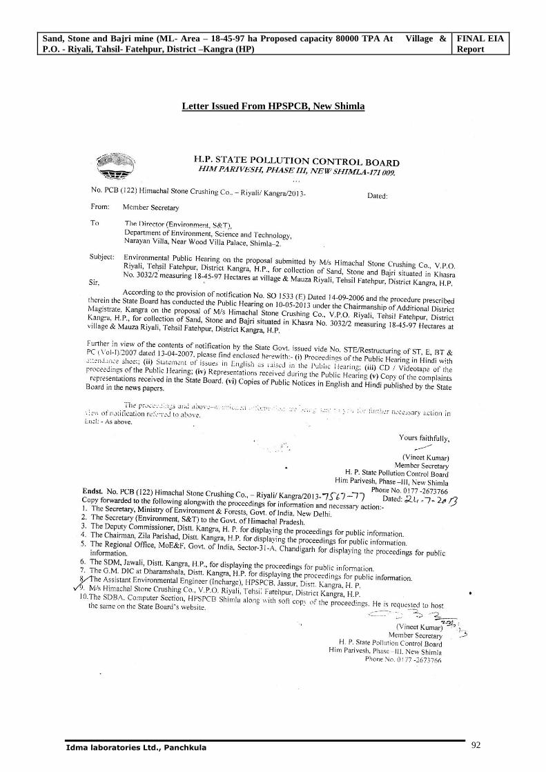
Sand, Stone and Bajri mine (ML- Area – 18-45-97 ha Proposed capacity 80000 TPA At Village & P.O. - Riyali, Tahsil- Fatehpur, District –Kangra (HP)
FINAL EIA Report
Idma laboratories Ltd., Panchkula 92
Letter Issued From HPSPCB, New Shimla
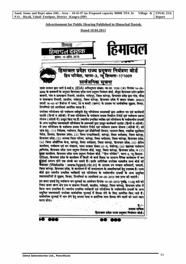
Sand, Stone and Bajri mine (ML- Area – 18-45-97 ha Proposed capacity 80000 TPA At Village & P.O. - Riyali, Tahsil- Fatehpur, District –Kangra (HP)
FINAL EIA Report
Idma laboratories Ltd., Panchkula 93
Advertisement for Public Hearing Published in Himachal Dastak.
Dated 10.04.2013
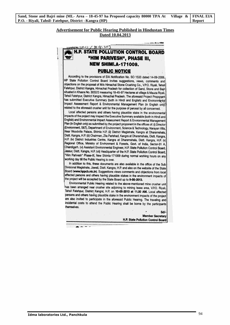
Sand, Stone and Bajri mine (ML- Area – 18-45-97 ha Proposed capacity 80000 TPA At Village & P.O. - Riyali, Tahsil- Fatehpur, District –Kangra (HP)
FINAL EIA Report
Idma laboratories Ltd., Panchkula 94
Advertisement for Public Hearing Published in Hindustan Times Dated 10.04.2013
Sand, Stone and Bajri mine (ML- Area – 18-45-97 ha Proposed capacity 80000 TPA At Village & P.O. - Riyali, Tahsil- Fatehpur, District –Kangra (HP)
FINAL EIA Report
Idma laboratories Ltd., Panchkula 95
Proceedings of the Environmental Public Hearing on Dated 10/05/2013
Sand, Stone and Bajri mine (ML- Area – 18-45-97 ha Proposed capacity 80000 TPA At Village & P.O. - Riyali, Tahsil- Fatehpur, District –Kangra (HP)
FINAL EIA Report
Idma laboratories Ltd., Panchkula 96
Statement of Issues raised in environmental Public hearing on dated: 10/05/2013
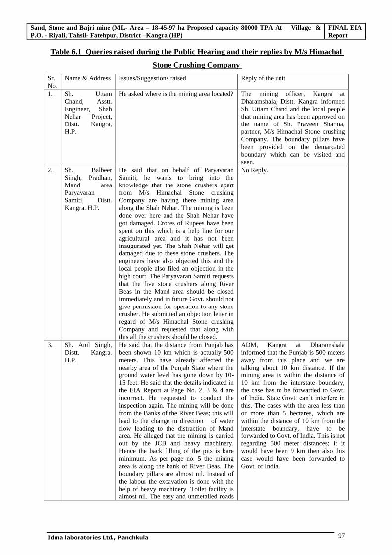
Sand, Stone and Bajri mine (ML- Area – 18-45-97 ha Proposed capacity 80000 TPA At Village & P.O. - Riyali, Tahsil- Fatehpur, District –Kangra (HP)
FINAL EIA Report
Idma laboratories Ltd., Panchkula 97
Table 6.1 Queries raised during the Public Hearing and their replies by M/s Himachal
Stone Crushing Company
Sr. No.
Name & Address Issues/Suggestions raised Reply of the unit
1. Sh. Uttam Chand, Asstt. Engineer, Shah Nehar Project, Distt. Kangra, H.P.
He asked where is the mining area located? The mining officer, Kangra at Dharamshala, Distt. Kangra informed Sh. Uttam Chand and the local people that mining area has been approved on the name of Sh. Praveen Sharma, partner, M/s Himachal Stone crushing Company. The boundary pillars have been provided on the demarcated boundary which can be visited and seen.
2. Sh. Balbeer Singh, Pradhan, Mand area Paryavaran Samiti, Distt. Kangra. H.P.
He said that on behalf of Paryavaran Samiti, he wants to bring into the knowledge that the stone crushers apart from M/s Himachal Stone crushing Company are having there mining area along the Shah Nehar. The mining is been done over here and the Shah Nehar have got damaged. Crores of Rupees have been spent on this which is a help line for our agricultural area and it has not been inaugurated yet. The Shah Nehar will get damaged due to these stone crushers. The engineers have also objected this and the local people also filed an objection in the high court. The Paryavaran Samiti requests that the five stone crushers along River Beas in the Mand area should be closed immediately and in future Govt. should not give permission for operation to any stone crusher. He submitted an objection letter in regard of M/s Himachal Stone crushing Company and requested that along with this all the crushers should be closed.
No Reply.
3. Sh. Anil Singh, Distt. Kangra. H.P.
He said that the distance from Punjab has been shown 10 km which is actually 500 meters. This have already affected the nearby area of the Punjab State where the ground water level has gone down by 10-15 feet. He said that the details indicated in the EIA Report at Page No. 2, 3 & 4 are incorrect. He requested to conduct the inspection again. The mining will be done from the Banks of the River Beas; this will lead to the change in direction of water flow leading to the distraction of Mand area. He alleged that the mining is carried out by the JCB and heavy machinery. Hence the back filling of the pits is bare minimum. As per page no. 5 the mining area is along the bank of River Beas. The boundary pillars are almost nil. Instead of the labour the excavation is done with the help of heavy machinery. Toilet facility is almost nil. The easy and unmetalled roads
ADM, Kangra at Dharamshala informed that the Punjab is 500 meters away from this place and we are talking about 10 km distance. If the mining area is within the distance of 10 km from the interstate boundary, the case has to be forwarded to Govt. of India. State Govt. can’t interfere in
this. The cases with the area less than or more than 5 hectares, which are within the distance of 10 km from the interstate boundary, have to be forwarded to Govt. of India. This is not regarding 500 meter distances; if it would have been 9 km then also this case would have been forwarded to Govt. of India.
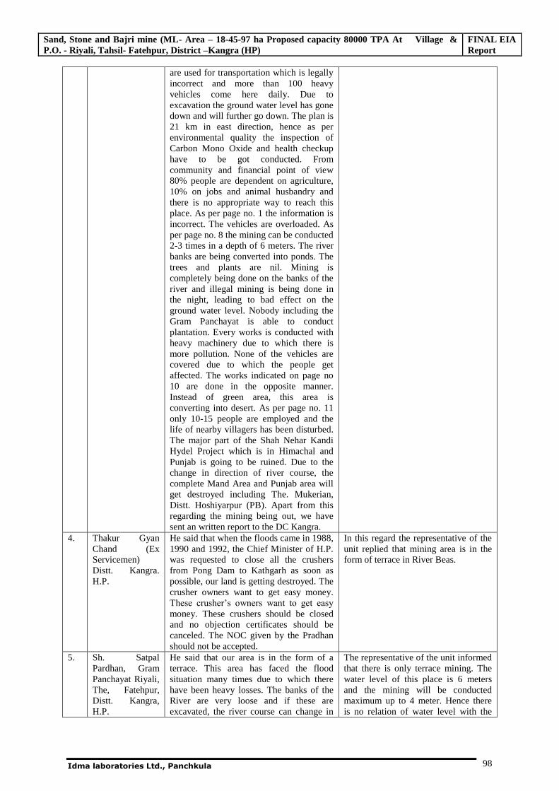
Sand, Stone and Bajri mine (ML- Area – 18-45-97 ha Proposed capacity 80000 TPA At Village & P.O. - Riyali, Tahsil- Fatehpur, District –Kangra (HP)
FINAL EIA Report
Idma laboratories Ltd., Panchkula 98
are used for transportation which is legally incorrect and more than 100 heavy vehicles come here daily. Due to excavation the ground water level has gone down and will further go down. The plan is 21 km in east direction, hence as per environmental quality the inspection of Carbon Mono Oxide and health checkup have to be got conducted. From community and financial point of view 80% people are dependent on agriculture, 10% on jobs and animal husbandry and there is no appropriate way to reach this place. As per page no. 1 the information is incorrect. The vehicles are overloaded. As per page no. 8 the mining can be conducted 2-3 times in a depth of 6 meters. The river banks are being converted into ponds. The trees and plants are nil. Mining is completely being done on the banks of the river and illegal mining is being done in the night, leading to bad effect on the ground water level. Nobody including the Gram Panchayat is able to conduct plantation. Every works is conducted with heavy machinery due to which there is more pollution. None of the vehicles are covered due to which the people get affected. The works indicated on page no 10 are done in the opposite manner. Instead of green area, this area is converting into desert. As per page no. 11 only 10-15 people are employed and the life of nearby villagers has been disturbed. The major part of the Shah Nehar Kandi Hydel Project which is in Himachal and Punjab is going to be ruined. Due to the change in direction of river course, the complete Mand Area and Punjab area will get destroyed including The. Mukerian, Distt. Hoshiyarpur (PB). Apart from this regarding the mining being out, we have sent an written report to the DC Kangra.
4. Thakur Gyan Chand (Ex Servicemen) Distt. Kangra. H.P.
He said that when the floods came in 1988, 1990 and 1992, the Chief Minister of H.P. was requested to close all the crushers from Pong Dam to Kathgarh as soon as possible, our land is getting destroyed. The crusher owners want to get easy money. These crusher’s owners want to get easy
money. These crushers should be closed and no objection certificates should be canceled. The NOC given by the Pradhan should not be accepted.
In this regard the representative of the unit replied that mining area is in the form of terrace in River Beas.
5. Sh. Satpal Pardhan, Gram Panchayat Riyali, The, Fatehpur, Distt. Kangra, H.P.
He said that our area is in the form of a terrace. This area has faced the flood situation many times due to which there have been heavy losses. The banks of the River are very loose and if these are excavated, the river course can change in
The representative of the unit informed that there is only terrace mining. The water level of this place is 6 meters and the mining will be conducted maximum up to 4 meter. Hence there is no relation of water level with the
Sand, Stone and Bajri mine (ML- Area – 18-45-97 ha Proposed capacity 80000 TPA At Village & P.O. - Riyali, Tahsil- Fatehpur, District –Kangra (HP)
FINAL EIA Report
Idma laboratories Ltd., Panchkula 99
any direction. Recently the flood which came in 2011 led to many losses. Due to mining the water level of the tube wells have gone down. If it continues in the same manner than the Mand area from Riyali to Mirthal will get destroyed. The land of this place is very fertile. We don’t have any
objection from the installation of the crusher but the location selected for the crusher is inappropriate. If the farmer tries to construct a kuhal, even it turns into a River. Recently a bridge has been installed nearby started the excavation on the left side and the water used to flow under the bridge. The crusher installed nearby started the excavation on the left side and the water started flowing from that side. We started the resistance the resistance one year back on 10-05-2012 and today it is 10-05-2013. In 1988 when there was flood situation, then there was no stone crusher. The level of this area was 2 feet higher than the river water level. Due to mining the level of the land is going down and if the mining continues in the same manner the level will go down. If feet and protection is done on both the sides, then there is no objection. The crusher owners should be directed to increase the depth of the river so that the people can be protected. Even if you go up to 50-60 feet, we don’t have any objection.
mining. Secondly regarding the flood, it is not due to mining. He further clarified that the flood situation appears due to the release of excess water from the dam instead of mining. Mining will be done in a terrace and will be done in a river bed area. He further pointed out that the mining area is in the terrace and is not related to the land along the river.
6. Sh. Hans Raj, Secretary, Mand Area, Paryavaran Samiti, Distt. Kangra (H.P)
He said that the mining have been done up to 50 feet in this area. We are sitting in the river and one day this river will come into the village and the area up to Milwan will get destroyed. This land have been given to us by Govt. of H.P. whose area is measuring 15287 Hect., which will get destroyed by this mining, If your want to finish the people and the Shah Nehar, so give NOC's to all. You all give NOC to them and send people out of this place.
The representative of the unit informed that the damage caused to the Shah Nehar is not due to mining, as the mining is not done in the river bed area but is done in the terrace area only. There cannot be any danger to the Nehar from this mining.
7. Capt. Lal Chand, Vill. Riyali, Distt. Kangra (H.P)
He said that the river has taken two ways. The place where we are sitting is home of river. In 1988 when there was flood situation then we lived in 3-4 feet water. Where 25-30 feet excavation has been done and our land is adjoining to the river, will there be no land loss due to soil erosion because of the water. We all people are dependent on the land and do not have any other source of income. We have requested these people many times not to carry out so much of mining. The excavation is done by-the machines and if it continues in the same manner, people of the area will be ruined. We people will not be able to live here. This whole area is flood
The representative of the unit clarified that, if there are more rains, floods will be there. There are heavy rains after every 7-8 yrs. Than the floods are bound to come which are not due to the mining.
‘
Sand, Stone and Bajri mine (ML- Area – 18-45-97 ha Proposed capacity 80000 TPA At Village & P.O. - Riyali, Tahsil- Fatehpur, District –Kangra (HP)
FINAL EIA Report
Idma laboratories Ltd., Panchkula 100
affected area and if you go through this, the truth and the lies will be in front of you.
8. Thakur Gyan Chand, Pardhan, Punjab State, Samaj Vadi Janta Party
He said that when this nehar was constructed they faced many problems. Dr. Rajan Sushant has made many efforts for it. This nehar was constructed for agricultural purposes and not for mining. Today, this nehar and the farmers are also in worst condition and ruining is responsible for everything. When they installed the crusher there were no roads. As informed by the representative of the unit, there will be no loss to water due to mining, but all our water sources have dried up. Due to mining the water level has gone down.
No Reply
9. Sh. Satish Kumar, Distt. Kangra (HP)
He said that when natural disasters take place then nobody is exempted. The floods can take place any time. Two no. crushers are going to he established in Punjab areas, these units don't have approved mining area and they transport the raw material from here. Our employment is shifted to other regions; Establishment of this crusher will provide us the employment in this region only. Our vehicles are plying in this region. We don't have any objection as everybody wants employment.
No Reply
10. Sh. Brijhmohan, Vill. Changrava, Teh. Fatehpur, Distt. Kangra (H.P)
He said that it is a flood region and after the construction of dam flood incidents have decreased. In 1988 when flood came, there were no crushers and flood came due to heavy rains, but the flow of the water took its own directions. When they reach to the banks while carrying out their mining operations then the flow of water will get diverted. Closing down the crusher units is not a solution to it. We all have to find the solution jointly. The river stretch is required to be channelized, to avoid the fear of flood, the water level has gone down and the reason is the increase in no. of tube wells. In past there Was one no. tube well and today we have 50 numbers there. As the No. of tube wells will increase, the water extraction will also get increased. He further requested to find a permanent solution so that the fear of people can be removed. If there are crushers, mining will be there. If crushers have some disadvantages, it is having few benefits also. People got employment, and roads got improved. Industry will definitely be established. It will be wrong if the crusher owners will carry out mining against the law.
No Reply
11. Sh. Puran Sharma, Vill. & Teh. indora,
He said that as informed by these people that the water levels don’t goes down by
conducting mining. The Chakki &
The representative of the unit informed that they are conducting the mining only in a terrace and not in the river
Sand, Stone and Bajri mine (ML- Area – 18-45-97 ha Proposed capacity 80000 TPA At Village & P.O. - Riyali, Tahsil- Fatehpur, District –Kangra (HP)
FINAL EIA Report
Idma laboratories Ltd., Panchkula 101
Distt. Kangra (H.P.)
Shaunch Khad is nearby. The one side is H.P. and on the other bank is Punjab. After the inspection of both the khads. It has been observed that these areas are suffering from water shortage. In regard to the crusher these people when excavate this area, should back fill it with soil to prevent this area from destruction. We request you to inspect this again. Around 40 feet deep excavation has been done and the blue water has been taken out. If any people or animal fall in this water they cannot come out of there on. Why should the crusher owners do such work which is to be done at the night time? They should do the work in the day time. if these people can install some other industry instead of the crusher, we welcome these people
bed area. Sh. Praveen Sharma informed that the mining area in Khasra No. 332/2 is adjoining to the land of Sh. Brij Mohan. If the owner of this land is not having any problem then why others should. He further informed that the pits have been backfilled and the land have been made fertile by filling in the soil and have planted 2000 trees of popular plant.
12. Sh. Balram Singh, Ex. Pardhan Mandal Area Paryavaran Samiti, Distt. Kangra (H.P.)
He asked that in which Panchayat this Paryavaran Samiti formed have been named? When the Govt. can't find the solution in this regard, then how can we people find its solution? There is no benefit of resistance. In 1988, 1996 & 2011 when the flood come this river diverted from three locations. When the flood came did these crusher owners release the water? To prevent the floods check darns should be provided
The representative of the unit said that they have provided the material free of cost for the obstruction constructed for the water flow along the river & even today it can be seen on the site. He further informed that earlier also they have provided the check dams free of cost for the prevention of flood.
13. Maulvi Gulam Rasul, Gujjar, Vill. Takoli, Paitrika Nivasi, Chamba (H.P)
He said that due to the installation of the crusher, the water of the river will disturb the adjoining lands for which appropriate measures have to be taken for the people living along the river. If the crusher is installed here then even a single child of Mand cannot live here. It is not known that where will the water flow, which comes from the dam. When the flood came in 2011 the people faced lot of problems.
The representative of the unit said that earlier also they have done the plantation in this area and will also be done in future.
14. Sh. Puran Sharma. Distt. Kangra (H.P)
He said that if the plantation is done by them, then whether the shadow of 2000 trees is sufficient for the area from Talwara to Mirthal. Before destroying this area the crusher owners should make this area green.
The representative of the unit said that they have done the plantation in their own land and in future also after the mining they will convert the land for agricultural purposes and will do plantation on it. The plantation will be done as per the directions of the villagers.
15.
Capt. Lal Singh, Riyali
He said that the plantation has been done but the manner in which the land has been cut down/excavated to 20-25 feet can also be inspected. If the water comes from the place where the land has been cut down/excavated, all the land will be destroyed. It has been requested earlier not to use the machinery but it was not followed. If we will flow away in the water, it will be due to the land which has been cut down/excavated because more water is released than the requirement. He
The representative of the unit said that their mining area is 2 km away from the bank of the river. He further said that there is no permission of mining up to the distance of 60 mtr. from the bank of the river. The mining can be done beyond of 60 mtr. and the mining plan has been made accordingly. With
Sand, Stone and Bajri mine (ML- Area – 18-45-97 ha Proposed capacity 80000 TPA At Village & P.O. - Riyali, Tahsil- Fatehpur, District –Kangra (HP)
FINAL EIA Report
Idma laboratories Ltd., Panchkula 102
further asked whether the permission for mining is 20-25 feet deep and if the mining is done up to this level, will the people of this area survive.
regard to the depth it was informed that the mining can be done up to the water level whereas this mining area is at a distance of 500-600 mtr from the river which is quiet far from the buffer zone required for the protection. ADM, Kangra at Dharamshala said that as informed by the representative of the unit that they will not carry out any mining activity up to the distance of 500 rntr. Further Mining Officer, Kangra at Dharamshala said that whenever a mining area is approved, an HOC from the Gram Panchyat is obtained before approval. The mining lease of this area has been approved in 2010 and in 2008- 2009 the join inspection of these areas would have been conducted by the committee which includes the presence of the members from the various Govt. Departments. The mining areas are of two types: 1.) River bed mining 2.) Terrace Mining. In River bed mining there is permission of three feet or one meter excavation. River bed mining policy has been formed for river bed. Here there are two mining areas i.e. one is of Himachal Stone Crushing Company & the other is of Golden Karamjot Stone Crusher, both are not in river bed, and in this respect the written NOC from the Gram Panchayat have been obtained. Only then these have been approved. Today after three years the problems have arisen. Here there are two mining areas i.e. one is of Himachal Stone Crushing Company to whom 18.5 hectares of land, which is a private land, have been permitted to work on it. in reference to the adjoining land, the inspection has been conducted earlier also and it was found that they have not maintained the buffer zone of 60 meter, which has been brought in their knowledge and they have been directed to protect the same and create a buffer zone. The adjoining private land will be got protected. The distance of Himachal Stone Crushing Company from river Beas is approximately 500 meter. Hence the crusher owners always have to maintain a distance of 500 mtr and under no circumstances the water will traverse this distance of 500 mtr.
Sand, Stone and Bajri mine (ML- Area – 18-45-97 ha Proposed capacity 80000 TPA At Village & P.O. - Riyali, Tahsil- Fatehpur, District –Kangra (HP)
FINAL EIA Report
Idma laboratories Ltd., Panchkula 103
The main reason of water in this area is that the place where the crusher has been installed used to be the water drainage area. Due to the construction of the Dam, the water flow has been regulated but due to the irregular water release the flood situation arises. As per their mining plan they can excavate up to 4.5 to 5 mtr. of depth and if it is done accordingly then there will be no damage. After the study of EIA report, it has been concluded that there should be no losses. Their area which has already been excavated from 4.5 to 5 mtr. , has been back filled with soil and the plantation of popular plants have been started which has already been included in the mining plan. There may not be any chances of flood, but if the BBMB releases the water in the uncontrolled way then the flood will certainly come. In future also it will be taken care that mining activities are conducted as per the mining plan. The Shah Nehar authority has given it in writing that if there is any mining area beyond 150 mtr., away from the Shah Nehar then there is no danger/ damage to the Nehar. The department will also not know wherever the crusher will be installed, there mining area should be between the Beas River so that the depth of the river can increase and water flows through it and there is no damage to the people. Suggestions were invited from the Mand Area Paryavaran Samiti regarding the increase of the depth of River.
16. Sh. Balbeer Singh, Pardhan
He suggested and said that the sand and Bajri from the crusher will be transported to the outer areas, but from where will the soil be arranged for back filling? Nearly 100 vehicles from a crusher are sent out daily and if the pits are there, from where will the soil be arranged. Hence the Paryavaran Samiti has passed there resolution that the Mand area should be made mining free and the crushers over here should be closed.
It was clarified that the clay/soil left out after the washing of sand and stone is back field into the pits.
17. Sh. Prem Singh, Paryavaran Samiti Mand Area, Distt. Kangra (H.P)
He said that the two crushers, one Himachal Stone Crushing Company & the, other Golden Karamjot Stone Crusher have not been installed incorrectly as per the geographical condition of this area. There mining area is from banks of the river to the end of the both sides. Apart from this the joint inspections conducted for the grant of new mining leases are also in this
The ADM, Kangra at Dharamshala said that as requested by the people for the inspection, the views and facts have been recorded in the report and the SDM Nurpur and the Mining Officer have been directed to visit the spots of complaints and to take corrective measures.
Sand, Stone and Bajri mine (ML- Area – 18-45-97 ha Proposed capacity 80000 TPA At Village & P.O. - Riyali, Tahsil- Fatehpur, District –Kangra (HP)
FINAL EIA Report
Idma laboratories Ltd., Panchkula 104
area which will be in the form of a chain from Shah Nehar head works Punjab up to here. When the mining will be done in this area, then the river will hang on to one side and the slope in this area will be five meters in every one kilometer, than if the water released is less or more it will start changing the slope. It is requested that the area where the river has left should he inspected. The Govt. should keep an eye and the profit generated from these crushers should be given to the people having their land.
18. Sh. Vijay Kumar, Paryavaran Samiti Mand Area, Distt. Kangra (H.P)
He said that there are many cases of the crusher owners regarding threats of life. money laundering and producing fake documents. There roads have been closed by the DC Hoshiarpur. We would like to give a suggestion on behalf of local people, Himachal and Punjab that this area should be maintained as peaceful and agriculture area.
No Reply
In addition to this, 14 numbers of written Issues/suggestions were received during the public
hearing Enclosed as Annexure- II.
Sh. Rakesh Sharma, ADM, Kangra at Dharamshala further assured the people that the public
grievances will be solved on priority bases.
In the end, Sh.S.K Dhiman. AEE, HPSPCB thanked all the participants for attending the
Environmental Public Hearing.
Additional District Magistrate
Kangra at Dharamshala,
District, Kangra (H.P.)
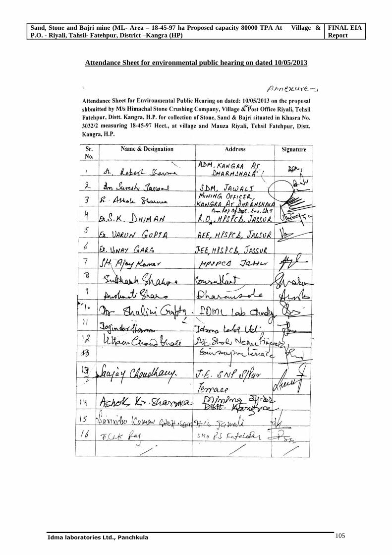
Sand, Stone and Bajri mine (ML- Area – 18-45-97 ha Proposed capacity 80000 TPA At Village & P.O. - Riyali, Tahsil- Fatehpur, District –Kangra (HP)
FINAL EIA Report
Idma laboratories Ltd., Panchkula 105
Attendance Sheet for environmental public hearing on dated 10/05/2013
Sand, Stone and Bajri mine (ML- Area – 18-45-97 ha Proposed capacity 80000 TPA At Village & P.O. - Riyali, Tahsil- Fatehpur, District –Kangra (HP)
FINAL EIA Report
Idma laboratories Ltd., Panchkula 106
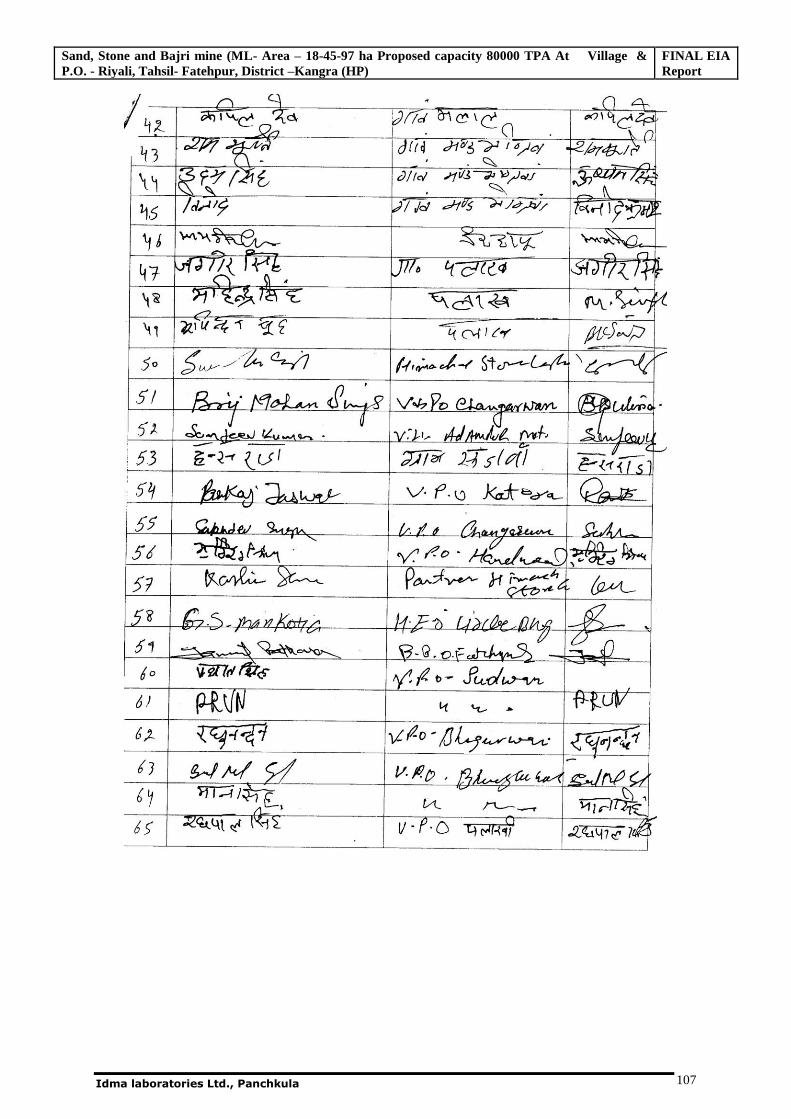
Sand, Stone and Bajri mine (ML- Area – 18-45-97 ha Proposed capacity 80000 TPA At Village & P.O. - Riyali, Tahsil- Fatehpur, District –Kangra (HP)
FINAL EIA Report
Idma laboratories Ltd., Panchkula 107
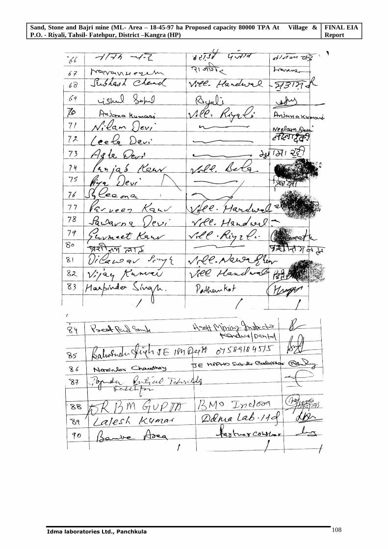
Sand, Stone and Bajri mine (ML- Area – 18-45-97 ha Proposed capacity 80000 TPA At Village & P.O. - Riyali, Tahsil- Fatehpur, District –Kangra (HP)
FINAL EIA Report
Idma laboratories Ltd., Panchkula 108
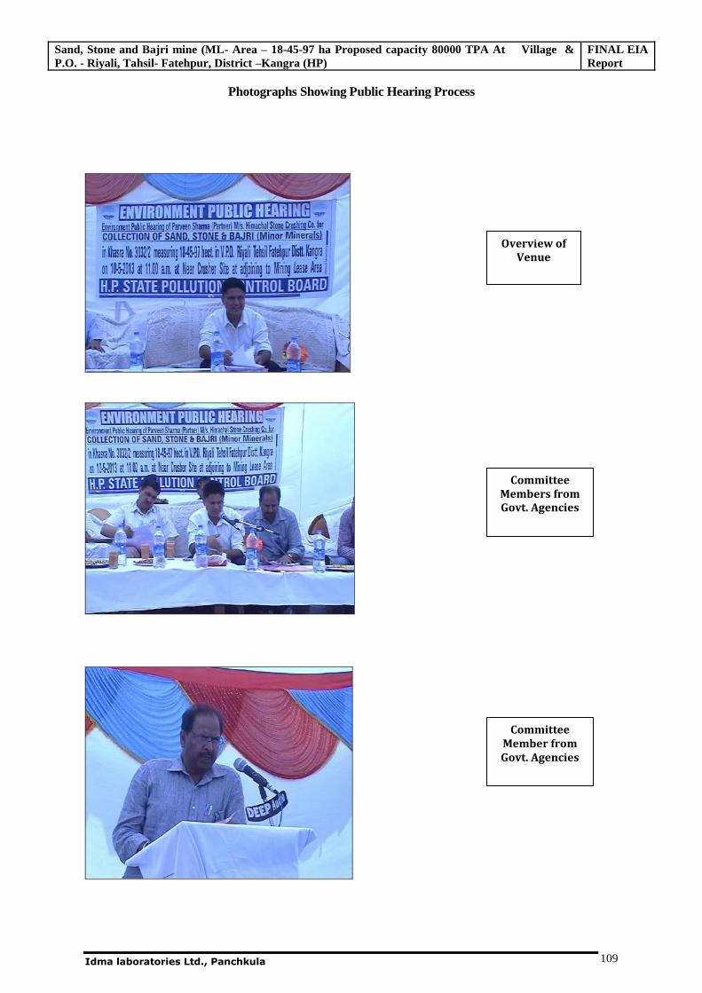
Sand, Stone and Bajri mine (ML- Area – 18-45-97 ha Proposed capacity 80000 TPA At Village & P.O. - Riyali, Tahsil- Fatehpur, District –Kangra (HP)
FINAL EIA Report
Idma laboratories Ltd., Panchkula 109
Photographs Showing Public Hearing Process
Overview of Venue
Committee Members from Govt. Agencies
Committee Member from Govt. Agencies
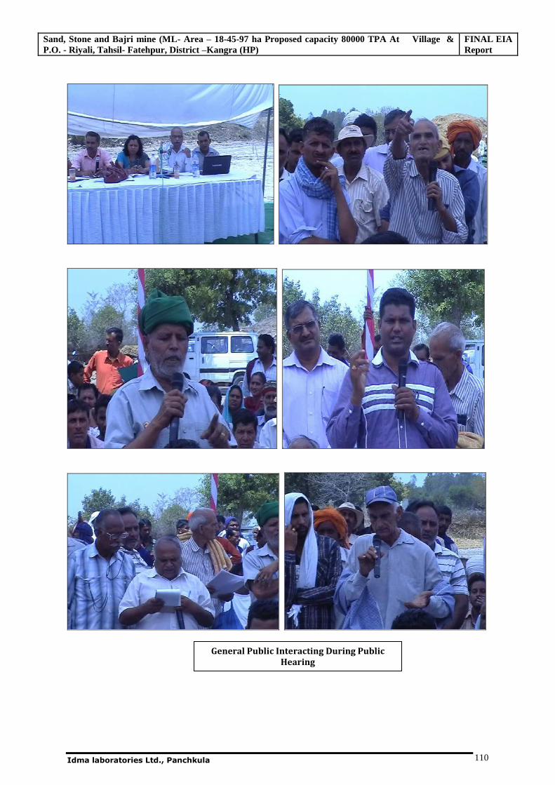
Sand, Stone and Bajri mine (ML- Area – 18-45-97 ha Proposed capacity 80000 TPA At Village & P.O. - Riyali, Tahsil- Fatehpur, District –Kangra (HP)
FINAL EIA Report
Idma laboratories Ltd., Panchkula 110
General Public Interacting During Public Hearing
Sand, Stone and Bajri mine (ML- Area – 18-45-97 ha Proposed capacity 80000 TPA At Village & P.O. - Riyali, Tahsil- Fatehpur, District –Kangra (HP)
FINAL EIA Report
Idma laboratories Ltd., Panchkula 111
6.2 Risk Assessment and Disaster Management Plan
Risk Assessment and Disaster Management Plan is prepared keeping in view that location of the
proposed project is close to the river. This plan is prepared based on the below considerations.
The mining operations in the lease area would be confined to day light hours, from 9 A.M. to 5
P.M.
The highest contour in the lease area is 312 meters above MSL
The nearest HFL of Beas River is at 313 from MSL, at a distance of more than 120 meters from
lease area
The mining shall be restrained well above this level.
6.2.1 Waste Handling
During the extraction of sand stone and bajri from the river bed silt and clay will also be removed
being associated mineral.
Generally they find little commercial utility. But, these are used as filler for compaction in the road
construction work when the grit is laid. Moreover, in the sandy agricultural fields, silt and clay are
spread over to increase the moisture retention capacity of the soil.
Annually, about 12000 metric tons of waste will be generated which will mostly be utilized for
spreading over sandy reclaimed parts of mining lease land to make it suitable for agriculture.
6.2.2 Disaster Management Plan
In order to handle disaster/emergency situations, an organizational chart entrusting responsibility to
various project personnel will be prepared with their specific roles during emergency.
6.3 Occupational Health and Safety
6.3.1 Occupational Health
Operation and Maintenance
Occupational health needs attention during operation phase. The problem of occupational health, in the
operation and maintenance phase is primarily due to dust and noise which could affect the workers from
respiratory and hearing problems. The necessary personal protective equipments will be given to all the
workers. The working personnel shall be given the following appropriate personnel protective
equipments.
Industrial Safety Helmet;
Zero power plain goggles with cut type filters on both ends;
Cylindrical type earplug;
Sand, Stone and Bajri mine (ML- Area – 18-45-97 ha Proposed capacity 80000 TPA At Village & P.O. - Riyali, Tahsil- Fatehpur, District –Kangra (HP)
FINAL EIA Report
Idma laboratories Ltd., Panchkula 112
Ear muffs;
Dust mask;
hand gloves;
Industrial safety shoes with steel toe.
All working personnel will be medically examined at least once in every year and at the end of his term
of employment. This is in addition to the pre-employment medical examination.
6.3.2 Safety Plan
Safety of both men and materials during operation phase is of concern. Safety plan shall be prepared and
implemented in the proposed site. The preparedness of an industry for the occurrence of possible disasters
is known as emergency plan.
Keeping in view the safety requirement during construction, operation and maintenance phases a safety
policy will be formulated with the following regulations:
To allocate sufficient resources to maintain safe and healthy conditions of work;
To ensure that adequate safety instructions are given to all employees;
To provide wherever necessary protective equipment, safety appliances and clothing and to ensure
their proper use;
To inform employees about materials, equipment or processes used in their work which are known
to be potentially hazardous to health or safety;
To keep all operations and methods of work under regular review for making necessary changes
from the point of view of safety in the light of experience and up to date knowledge;
To provide appropriate facilities for first aid and prompt treatment of injuries and illness at work;
To provide appropriate instruction, training, retraining and supervision to employees in health and
safety, first aid and to ensure that adequate publicity is given to these matters;
To organize collection, analysis and presentation of data on accident, sickness and incident
involving people injury or injury to health with a view to taking corrective, remedial and preventive
action;
To promote through the established machinery, joint consultation in health and safety matters to
ensure effective participation by all employees;
To publish/notify regulations, instructions and notices in the common language of employees;
To prepare separate safety rules for each type of occupation/processes involved in at site.
6.3.3 Safety Organization
A qualified and experienced safety officer shall be appointed. The responsibilities of the safety officer
include identification of the hazardous conditions and unsafe acts of workers and advice on corrective
actions, conduct safety audit, organize training programs and provide professional expert advice on
Sand, Stone and Bajri mine (ML- Area – 18-45-97 ha Proposed capacity 80000 TPA At Village & P.O. - Riyali, Tahsil- Fatehpur, District –Kangra (HP)
FINAL EIA Report
Idma laboratories Ltd., Panchkula 113
various issues related to occupational safety and health. He is also responsible to ensure compliance of
Safety Rules/ Statutory Provisions.
6.3.4 Health and Safety Monitoring Plan
The health of all employees shall be monitored once in a year for early detection of any ailment due to
exposure to dust, heat and noise.
6.4 Natural Resource Conservation
A green belt will be developed so that minimum soil erosion takes place.
In any case the natural habitats of the existing flora and fauna will not be disturbed.
Use of traditional knowledge in all aspects of conservation;
Time to time analysis of the soil, water resources etc will be done in order to analyze the
negative impacts of mining activities on the environment.
6.5 R & R Action Plan
There will be no resettlement or rehabilitation issues involved in this project.
6.6 Corporate Social Responsibilities (CSR)
It is proposed to take up the CSR activities in line with the findings of socioeconomic survey done.
The project proponent agrees to provide free of cost boulders, bajri and sand for social projects as
Panchayat ghar, schools in the area.
6.7 Employment - The Company will provide direct employment to around 15 skilled and semi
skilled persons and indirect employment to around 200 persons. The company will give preference to
local peoples.
6.8 Identification of Hazards
The possibility of the following may be there for such projects:
(a) Fire associated with storage of combustible material, lubricants, oil.
(b) Accidents during mining.
To deal the above emergencies, the Emergency Plan should be prepared.
6.8.1 Disaster Due To Surface Fire
The fire could be due to surface fire. Such case has so far not been reported. Likewise equipment
sometimes catches fire which needs to be dealt.
6.8.2 Code of Practice in Case of Fire at Mines
Objective:
To deal with fire efficiently and quickly at different locations of mine
Source of Fire:
i) Oil & Lubricant Room.
Sand, Stone and Bajri mine (ML- Area – 18-45-97 ha Proposed capacity 80000 TPA At Village & P.O. - Riyali, Tahsil- Fatehpur, District –Kangra (HP)
FINAL EIA Report
Idma laboratories Ltd., Panchkula 114
ii) Mine machineries.
Line of Action:
i) Sufficient fire extinguishers will be installed at selected locations on site. Besides, numbers of water
hydrants with sufficient length of hosepipes will be made available at the surface for fire protection.
ii) Any person notices any sign of fire shall immediately take steps to give warning by blowing the
siren continuously and take steps to extinguish the fire by using appliances available near the site.
iii) Duties of mine Official: - The Mine officials receiving the warning will forthwith inform at
following places.
a) Fire fighting station
b) Mines Manager
c) Mines Agent / Owner
After intimation he should reach the spot, remove Men & Machinery and take steps to tackle the fire
in accordance with the fire fighting instructions. Inform the security office to get an ambulance if
required.
a) Duties of Fire Fighting Team: - On receiving warning, the team shall reach the site of fire and
depending on its nature, class and extent shall take steps to extinguish it and rescue persons who may
be caught in fire.
b) Duties of Mines Manager: -
(i) On receipt of information about fire, the Manager will forthwith rush to the spot and assess the
situation. He will oversee the overall rescue operation and make necessary arrangement for medical
aid to the affected persons, if any.
(ii) Inform the management and statutory bodies.
6.8.3 Code of Practice in case of Explosion & Accidents
Objective
How to deal with an accident in an effective and efficient manner, if occurs during mine operations.
Line of Action
Any person, who notices any explosion or accident, should immediately take steps to give warning by
suitable mean and at the same time, take necessary action for withdrawal of men from the site. He/
She will also inform the mine’s Manager and other officials without any delay.
Duties of Mine’s Manager
(a) On receipt of information about explosion or accident, the manager shall forthwith rush to the spot
and the situation. He shall make the arrangements for withdrawal of affected persons, if any.
(b) Inform the hospital for Ambulance for affected persons, if any.
(c) Provide First aid to affected persons.
(d) Inform the senior officials and statutory bodies.
Sand, Stone and Bajri mine (ML- Area – 18-45-97 ha Proposed capacity 80000 TPA At Village & P.O. - Riyali, Tahsil- Fatehpur, District –Kangra (HP)
FINAL EIA Report
Idma laboratories Ltd., Panchkula 115
6.8.4 Action in Emergency
If any emergency like fire arises in the mine one should immediately inform to Security Supervisor.
Security will inform key personnel and act as detailed above and consequently inform to CCR for
broad announcement by Public Address System and to blow the Alarm if CCR is not affected itself.
The emergency alarm will be wailing sound for two minutes on hearing telephone or alarm; the key
personnel will act as per responsibilities. The procedure for all emergency situations as mentioned
above would be same.
6.8.5 Site Restoration
The incident controller will check the areas thoroughly for possible hazards such as toxic fume or live
wires after emergency and will inform site controller accordingly. The key personnel will meet to
evaluate their individuals and overall performance in responding to situation after the emergency is
over. The review shall determine.
Effectiveness of emergency response plan.
Mine crew performance.
Any need for updating or revision of the emergency response plan.
Suitable arrangement for restart of the work.
Evaluation and control of efficient arising out of mitigating measures like foam discharge &
overflow of oil in water.
Rehabilitate evacuated area.
Adopt measures to prevent similar recurrence.
6.8.6 Precautions
To avoid all these disasters at working place and to minimize their effects following precautions shall
be taken and arrangement shall be made at the working place.
The persons shall be trained properly to handle the situation.
Detailed warning system, implementation procedure, emergency control centre, shall be
maintained at the mine with names of trained persons.
Details and availability of machinery, fire-fighting equipment shall be available at the site.
Proper arrangements shall be made for treatment of injured person, if any.
All the safety equipment shall be available at the mine.
6.8.7 Post Disaster Analysis and Evaluation
When the emergency is over, the team will carry out a detailed analysis of cause of
accident/occurrence, evaluate the influence of various factors and find out the procedures to minimize
them in future. At the same time adequacy of disaster management plan shall be evaluated and
shortcomings shall be rectified to improve the plan.
Sand, Stone and Bajri mine (ML- Area – 18-45-97 ha Proposed capacity 80000 TPA At Village & P.O. - Riyali, Tahsil- Fatehpur, District –Kangra (HP)
FINAL EIA Report
Idma laboratories Ltd., Panchkula 116
6.8.8 Off-Site Emergency Planning
Introduction
The off-site emergency plan is an integral part of any hazard control system. It would be based on
those accidents identified by the works management, which could affect people and the environment
outside the works. Thus, the off-site plan follows logically from the analysis that took place to provide
the basis for the on-site plan and the two plans should therefore complement each other. The key
feature of a good off-site emergency plan is flexibility in its application to emergencies other than
those specifically included in the formation of the plan. The roles of the various parties that may be
involved in the implementation of an off-site plan are described below. The responsibility for the off-
site plan will be likely to rest either with the works management or with the local authority.
Either way, the plan must identify an emergency coordinating officer who would take overall
command of the off-site activities. As with the on-site plan, an emergency control center will be
required within which the emergency coordinating officer can operate. An early decision will be
required in many cases on the advice to be given to people living “within range” of the accident – in
particular whether they should be evacuated or told to go indoors. Consideration of evacuation may
include the following factors:
a. In the case of a major fire but without explosion risk (e.g. an oil storage tank), only houses close to
the fire are likely to need evacuation, although a severe smoke hazard may require this to be reviewed
periodically.
b. But if the fire is escalating it might be necessary to evacuate people nearby, but only if there is
time; if insufficient time exists, people would be advised to stay indoors and shield themselves from
the fire.
6.8.8.1 Aspects to Be Included In an Off-Site Emergency Plan
Some of the aspects to be included in off-site emergency plan are as follows:
a) Organization
Details of command structure, warning systems, implementation procedures, emergency control
centers Name and appointments of incident controller, site main controller, their deputies and other
key personnel.
c) Communications
Identification of personnel involved, communication center, call signs, network, list of telephone
numbers.
d) Voluntary Organizations
Detail of organizers, telephone numbers, resources etc.
e) Humanitarian Arrangements
Sand, Stone and Bajri mine (ML- Area – 18-45-97 ha Proposed capacity 80000 TPA At Village & P.O. - Riyali, Tahsil- Fatehpur, District –Kangra (HP)
FINAL EIA Report
Idma laboratories Ltd., Panchkula 117
Transport, evacuation centers, emergency feeding, treatment of injured, first aid, ambulances.
f) Public Information
Arrangements for:
Dealing with the media-press office
Informing relatives, etc.
g) Assessment
Arrangements for: -
Collecting information on the causes of the emergency
Reviewing the efficiency and effectiveness of all aspects of the emergency plan.
6.8.8.2 Role of the Emergency Coordinating Officer
The various emergency services will be coordinated by an Emergency Coordinating Officer (ECO).
The ECO will liaise closely with the site main controller. Again depending on local arrangements, for
very severe incidents with major or prolonged off-site consequences, the external control may pass to
a senior local authority administrator or even an administrator appointed by the Central or State
Government.
6.8.8.3 Roles of Major Hazard Works Managements
Where the local authority has the organization to formulate the plan, the role of works managements
in off-site emergency planning will be to establish liaison with those preparing the plans and to
provide information appropriate to such plans. This will include a description of possible on-site
accidents with potential for off-site harm, together with their consequences and an indication of the
relative likelihood of the accidents.
Advice should be provided by works managements to all the outside organizations which may
become involved in handling the emergency off-site and which will need previously to have
familiarized themselves with some of the technical aspects of the works activities, e.g. emergency
services, medical departments, etc.
6.8.8.4 Role of the Local Authority
In some places the duty to prepare the off-site plan lies with the local authorities. They may have
appointed an emergency planning officer (EPO) to carry out all this duty as part of the EPO’s roles in
preparing for a whole range of different emergencies within the local authority area. The EPO will
need to liaise with the works to obtain the information to provide the basis for the plan.
Rehearsals for off-site plans are important for the same reasons as on-site plans and will need to
be organized by the EPO.
6.8.8.5 Role of the Police
The police normally assume the overall control of an emergency, with a senior officer designated as
emergency coordinating officer. Formal duties of the police during an emergency include protecting
life and property and controlling traffic movements. The functions include controlling bystanders,
Sand, Stone and Bajri mine (ML- Area – 18-45-97 ha Proposed capacity 80000 TPA At Village & P.O. - Riyali, Tahsil- Fatehpur, District –Kangra (HP)
FINAL EIA Report
Idma laboratories Ltd., Panchkula 118
evacuating the public, identifying the dead and dealing with casualties and informing relatives of dead
or injured.
6.8.8.6 Role of the Fire Authorities
The control of a fire is normally the responsibility of the senior fire brigade officer who would take
over the handling of the fire from the site incident controller on arrival at the site. The senior fire
brigade officer may also have a similar responsibility for other events. Fire authorities having major
hazard works in their area should have familiarized themselves with the location on site of all stores
of flammable materials, water and foam supply points and fire-fighting equipments.
6.8.8.7 Role of the Health Authorities
Health authorities, including doctors, surgeons, hospitals, ambulances and so on, have a vital part to
play following a major accident and they should form an integral part of any emergency plan. For
major fires, injuries will be the result of the effects of thermal radiation to a varying degree and the
knowledge and experience to handle this in all, but extreme, cases may be generally available in most
hospitals.
6.8.8.8 Roles of the Government Safety Authority
The Inspectors of Director General of Mines Safety are likely to want to satisfy themselves that the
organization responsible for including the off-site plan has made adequate arrangements for handling
emergencies of all types including major emergencies.
In the event of an accident, local arrangements regarding the role of the factory inspector will apply.
In the aftermath, factory inspectors may wish to ensure that the affected areas are rehabilitated safely.
*********
Sand, Stone and Bajri mine (ML- Area – 18-45-97 ha Proposed capacity 80000 TPA At Village & P.O. - Riyali, Tahsil- Fatehpur, District –Kangra (HP)
EIA/EMP Report
Idma Laboratories Ltd., Panchkula 121
Chapter - 7
PROJECT BENEFITS
7.0 Introduction
As we know that the stone, sand and Bajri are the back bone of infrastructure development and its
demand is expected to increase further more in coming year to meeting demand of infrastructure
development. The proposed project would enable to meet a small part of the growing demand in the
state of Himachal Pradesh. Further, the proposed project will result in improvement of upliftment of
social structure in the area. The people residing in the nearby areas will be benefited indirectly. It is
anticipated that the proposed project will provide benefits for the locals.
7.1 Demography benefits
During the operational phase, about 15 people shall be employed. Considering that most of the
skilled/unskilled personnel proposed to be employed for the proposed project shall be from within the
study area, the proposed project would add to the population in the study area which results in better
scope for indirect employment etc. in addition to the workforce the indirect employment also be
generated for about 200 members or even more.
7.2 Education
Unskilled people and limited skilled people (depending on availability) shall be hired from local
population. Due to economic growth of these people there may be chances to growth of education in
that locality.
7.3 Employment
The man power requirements for the operational phase of the proposed project shall be about 15
persons. Many of these persons however shall be unskilled people and shall be satisfied from local
population. In addition to the direct employment mentioned above, there will be indirect employment
of local people by utilizing their expertise in different areas like horticulture, site clearing, road
development, etc. Also, due to secondary development in the study area, employment opportunities
will be generated. About 200 or more people are expected to get indirect employment.
Preference shall be given to local populace based on their qualifications, skill set and availability.
Sand, Stone and Bajri mine (ML- Area – 18-45-97 ha Proposed capacity 80000 TPA At Village & P.O. - Riyali, Tahsil- Fatehpur, District –Kangra (HP)
EIA/EMP Report
Idma Laboratories Ltd., Panchkula 122
7.4 Conclusion
M/s Himachal Stone Crushing Co. management has undertaken and will undertake various Socio
Economic upliftment activities. Development Projects are planned after a participatory need
assessment of the communities around the activity area. Each project has a one-year and a three-year
rolling plan, with milestones and measurable targets. The objective is to phase out the presence over a
period of time and then further hand over the reins of further development to the people. This also
enables the company to widen their reach.
The management supports the local administration and other form of assistance for the development
of public facilities in the region. Mainly they are providing the basic amenities to nearby villagers for
water distribution, building of schools, hospitals, etc. and all this adds to the economic positivity and
benefits to the locals of the activity area.
In conclusion we may write that the Project Proponent proposes to extraction of sand from lease area.
There will be further generation of direct and indirect employment due to this project. There will be
increase in revenue generation to the government by way of royalty, excise and government taxes.
There will be further improvement in infrastructure like education, roads, availability of drinking
water, medical facilities in adjacent villages. The increase in earnings of local villagers who will get
employment in the mine and due to increased spending on social welfare measures by the company
will provide better standard of living for the villagers.
*********
Sand, Stone and Bajri mine (ML- Area – 18-45-97 ha Proposed capacity 80000 TPA At Village & P.O. - Riyali, Tahsil- Fatehpur, District –Kangra (HP)
Final EIA Report
Idma Laboratories Ltd.Panchkula
123
Chapter-8
ENVIRONMENTAL MANAGEMENT PLAN
8.0 General
Environmental Management Plan (EMP) aims at the preservation of ecological system by considering
in-built pollution abatement facilities at the proposed site. Some of the major criteria governing the
environmental measures will be adopted, and the same is described in ensuring paragraphs.
The prime objective of any environmental management plan is utilisation of non-renewable resources
of the study area and within the limits of permissible capacity. The assimilative capacity of the study
area is the maximum amount of pollution load that can be discharged in the environment without
affecting the designated use and is governed by dilution, dispersion and removal due to physico-
chemical and biological processes. The EMP is required to ensure sustainable development in the
study area of 10 Km radius of the proposed mining site; hence it needs to be an all encompassive plan
for the proposed activity. Government regulating agencies like Pollution Control Board working in the
region and more importantly the people living in the study area need to extend their co-operation and
contribution.
It has been evaluated that the study area has not been affected adversely with the proposed activity and
likely to get new economical fillip, not only for the study area but also for the region as a whole.
Mitigation measures at the source level and an overall management plan at the study area level are
elicited so as to improve the supportive capacity of the receiving bodies. The EMP aims at controlling
pollution at the source level to the possible extent with the available and affordable technology
followed by treatment before they are discharged.
Environmental management for the proposed mining activity is discussed for the environmental
impact pertains to the operational phase. Even though reversible in nature - all the impacts will be
visible only during operational phase. It is planned to take corrective measures to ensure that these
effects are kept to bare minimum. The EMP will therefore, be initiated during planning stage itself.
8.1 Air Environment
The proposed mining operations are not anticipated to raise the concentration of the pollutants beyond
prescribed limits. However, the following measures would be adopted to mitigate the pollution levels
Sand, Stone and Bajri mine (ML- Area – 18-45-97 ha Proposed capacity 80000 TPA At Village & P.O. - Riyali, Tahsil- Fatehpur, District –Kangra (HP)
Final EIA Report
Idma Laboratories Ltd.Panchkula
124
in ambient air. Dust particles generated during various mining activities when become airborne lead to
increase in particulates level in the ambient air. The major source of dust generation is the transport of
material by trucks and tractor trolleys. Adequate control measures shall be taken during mining
operations as well as transportation of minerals. The following measures will be taken to mitigate the
fugitive dust from different operations.
Laying of haul roads as per the standards to avoid or eliminate air – borne dust.
Watering of haul roads and other roads at regular intervals
Spraying of water on permanent transport roads at required frequencies.
Provision of dust filters / mask to workers working at highly dust prone and affected areas.
Provision of green belt by vegetation for trapping dust.
Greenbelt development along the haul roads, dumps and along the boundaries of the lease
area.
Utmost care will be taken to prevent spillage of sand and stone from the trucks.
The extracted mineral should be transported from the mine to crusher and the end user by
adopting following measures so as to minimize dust emissions.
Speed of the vehicles should be maintained with in the prescribed limits.
Trucks should not be over loaded and should be maintained to the body level.
8.2 Noise Environment
As there will be no heavy earth moving machinery there will not be any major impact on noise level
due to sand mining and other association activities a detailed noise survey has been carried out and
results were cross referenced with standards and were found to be well within the limits.
Blasting technique is not used for sand and stone lifting, hence no possibility of land vibration. It was
found that the proposed mining activity will not have any significant impact on the noise environment
of the region. The only impact will be due to transportation of sand and stone by trucks and tractor
trolleys.
As the only impact is due to transportation of stone to the stone crushing unit and sand to the market
though village roads, the following control measures shall be taken to keep the ambient noise levels
well within limits:
Use of personal protective devices i.e., earmuffs and earplugs by workers, working in high
noise areas.
Sand, Stone and Bajri mine (ML- Area – 18-45-97 ha Proposed capacity 80000 TPA At Village & P.O. - Riyali, Tahsil- Fatehpur, District –Kangra (HP)
Final EIA Report
Idma Laboratories Ltd.Panchkula
125
The greenbelt with species of rich canopy around the lease area and along the roads will further
attenuate the noise levels.
Conducting periodical medical check up of all workers for any noise related health problems
Proper training to personnel to create awareness about adverse noise level effects.
Planned noise monitoring at suitable locations in the plant and outside location for proper
effective remedial actions.
Minimum use of horns and speed limit of 10 kmph
Timely maintenance of vehicles and their silencers to minimize vibration and Sound.
Phasing out of old and worn out trucks.
Proper loading and unloading of sand and stone so that minimum sound will produce.
The greenbelt, which is being provided, will act as noise attenuator. With the noise abatement measures
(as indicated above), it is expected that the noise levels will be maintained in compliance with DGMS
standards.
8.3 Water Environment
8.3.1 Surface Water
The major source of surface water pollution due to sand mining is insignificant, however the following
measures shall be undertaken to prevent water pollution.
Utmost care will be taken to minimize spillage of stone and sand.
Drainage around the mining area would be undertaken so that rain water do not enter the
mining pits.
Plantation will be under taken as per green belt development plan enclosed in approved
mining plan
8.3.2 Ground Water
There would not be any adverse effect on the ground water quality. The mineral formation does not
contain any harmful element, which could percolate into the ground and pollute the ground water.
Hence, no control measures are required. However, regular monitoring of quality in the existing hand
pumps/tube wells in the vicinity would be carried out both with reference to area and times intervals to
study the hydrodynamics of the strata.
Sand, Stone and Bajri mine (ML- Area – 18-45-97 ha Proposed capacity 80000 TPA At Village & P.O. - Riyali, Tahsil- Fatehpur, District –Kangra (HP)
Final EIA Report
Idma Laboratories Ltd.Panchkula
126
8.4 Land Environment
Any mining activity may alter the land use pattern in the lease area. In order to minimise the adverse
affects, the following suggestions have been made. Degradation of land is not a very significant adverse
impact of river terrace mining due creation of access roads, mining operations, transportation of mined
material. In order to prevent the environmental degradation of leased mine area and its surroundings, the
following measures shall be taken;
No mining is proposed up to 100 meters from the HFL.
Minimal damage to the flora standing around the lease area.
Operations during daylight only.
No foreign material should be allowed to remain/spill in lease area and catchments area, or no
pits/pockets will be allowed to be filled with such material,
No stockpiling of harvested sand and stone shall be done outside the lease area.
Movement of the vehicles on the road will be increased; however, non metalled road leading to sand
and stone mining area will be sprinkled with water at regular intervals. In addition to prevent spillage
by trucks/tractor trolley, over loading should be controlled along with speed limit.
There will be minimum numbers of access roads to lease area. No Access points to the lease area shall
be from the river bed side.
8.4.1 Plantation and Soil Conservation
The main objective of the green belt is to provide a barrier between the source of pollution and the
surrounding areas. The green belt helps to capture the fugitive emission and to attenuate the noise
generated apart from improving the aesthetics. Development of green belt and other forms of greenery
shall also prevent soil erosion and washing away of topsoil besides helping in stabilizing the
functional ecosystem and further to make the climate more conducive and to restore water balance.
While making choice of plant species for cultivation in green belts, weightage has to be given priority
to the natural factor of bio-climate. It is also presumed that the selected plants will be grown as per
normal horticultural (or forestry) practice and authorities responsible for plantation will also make
sure that adequate provision for watering and protection of the saplings exists at site.
Soil Quality will be monitored on yearly basis in the area surrounding the core zone used for
agricultural activity to check for any negative impacts on the soil quality.
Sand, Stone and Bajri mine (ML- Area – 18-45-97 ha Proposed capacity 80000 TPA At Village & P.O. - Riyali, Tahsil- Fatehpur, District –Kangra (HP)
Final EIA Report
Idma Laboratories Ltd.Panchkula
127
Year wise plantation activity shall be undertaken as proposed in the approved ‘Working cum
Environment Management Plan’ and shown in approved mining plan in Annexure-VI.
8.4.2 Post mining land use
As the mining lease area is part of old river terrace and at a safe distance of about 100 meters from the
river bank, and it belong to private individuals, it would be converted into agricultural fields
surrounded by plantation undertaken during the mining period.
8.5 Biological Environment
The mining activity will have insignificant effect on the existing flora and fauna. Data have been
collected from various Government Departments such as forests, agriculture, fisheries, animal
husbandry and various offices to establish the pre project biological environmental conditions. The
project area is surrounded by reserved forests on the banks are also lined with agricultural land. The
purpose of the project itself is to convert the existing not cultivable land into land suitable for
agriculture and horticulture. It was found that the sand and stone mining activity will not have any
significant impact on the biological environment of the region.
8.5.1 Mitigation of Impacts on Biological Environment
There is a requirement to establish a stable ecosystem with both ecological and economic returns.
Minimization of soil erosion and dust pollution enhances the beauty of the core and the buffer zone.
To achieve this it is planned to increase plantation activities. The basic objectives of plantations are as
follows.
Improvement of Soil quality
Quick vegetative cover to check soil erosion
Improvement in river bank stability
Conservation of biological diversity
8.6 Socio-Economic Environment /Corporate Social Responsibility
This project operation will provide livelihood to the poorest section of the society. The overall impact
of riverbed mining of sand stone and bajri on the social economics of the area shall be a very positive
one, as not only it will generate employment opportunities for local population at mine site but also in
associated activity i.e. at stone crushing plant , for transportation of mined material, etc. It will also
give a good boost to the general economy of the area.
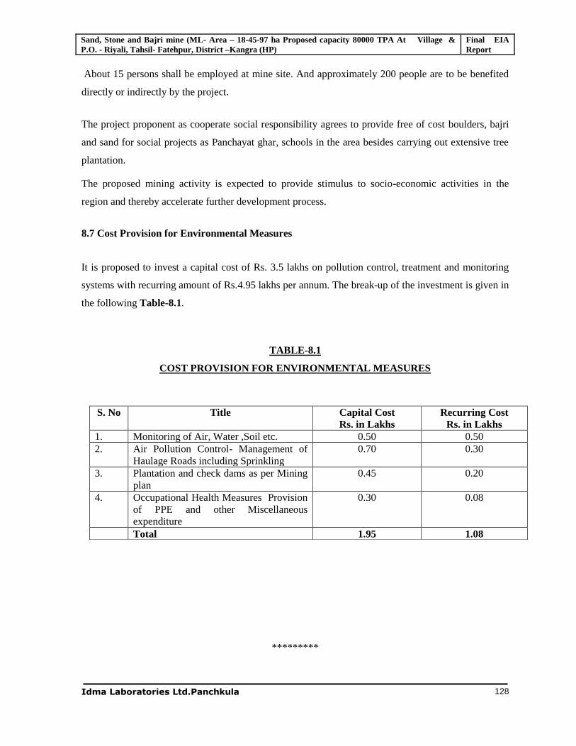
Sand, Stone and Bajri mine (ML- Area – 18-45-97 ha Proposed capacity 80000 TPA At Village & P.O. - Riyali, Tahsil- Fatehpur, District –Kangra (HP)
Final EIA Report
Idma Laboratories Ltd.Panchkula
128
About 15 persons shall be employed at mine site. And approximately 200 people are to be benefited
directly or indirectly by the project.
The project proponent as cooperate social responsibility agrees to provide free of cost boulders, bajri
and sand for social projects as Panchayat ghar, schools in the area besides carrying out extensive tree
plantation.
The proposed mining activity is expected to provide stimulus to socio-economic activities in the
region and thereby accelerate further development process.
8.7 Cost Provision for Environmental Measures
It is proposed to invest a capital cost of Rs. 3.5 lakhs on pollution control, treatment and monitoring
systems with recurring amount of Rs.4.95 lakhs per annum. The break-up of the investment is given in
the following Table-8.1.
TABLE-8.1
COST PROVISION FOR ENVIRONMENTAL MEASURES
*********
S. No Title Capital Cost Rs. in Lakhs
Recurring Cost Rs. in Lakhs
1. Monitoring of Air, Water ,Soil etc. 0.50 0.50 2. Air Pollution Control- Management of
Haulage Roads including Sprinkling 0.70 0.30
3. Plantation and check dams as per Mining plan
0.45 0.20
4. Occupational Health Measures Provision of PPE and other Miscellaneous expenditure
0.30 0.08
Total 1.95 1.08
Sand, Stone and Bajri mine (ML- Area – 18-45-97 ha Proposed capacity 80000 TPA At Village & P.O. - Riyali, Tahsil- Fatehpur, District –Kangra (HP)
FINAL EIA Report
Idma Laboratories Ltd., Panchkula 129
Chapter-9
SUMMARY AND CONCLUSIONS
9.1 Introduction
The proposed production of stone, bajri and sand are of 80,000 TPA. The total project cost of the
mine is estimated to be Rs. 7 lakhs. The proposed mine is located at old terrace of Beas River falling
in Mauza Reyali, Tehsil Fatehpur, and District Kangra of Himachal Pradesh. The area is covered in
Survey of India (SOI) toposheet No. 44 M/13.
The details of environmental setting are given below. The map showing the project site and 10 km
study area is shown in Table 9.1 and Figure-9.1.
Table-9.1
Details of Environmental Setting
S. No.
Particulars Details
1 Location A Village Riyali B Tehsil Fatehpur C District Kangra D State Himachal Pradesh
E Latitude 31o 59’ 44’’N – 310 59’ 35’’N F Longitude 750 48’ 35’’E –75º 49’3.5’’ E G Khasra Nos. 3032/2 H Total Mine Lease Area 18-45-97 Hectares
2 Land use at the project area Unused land belongs to private individuals
3 Nearest habitation Riyali Village
4 Nearest major town Talwara(about 15km)
5 Nearest railway Station Pathankot(about 38 km)
6 Nearest airport Dharamshala ,about 128km
7 Nearest tourist places Nil within 10km radius
8 Defence installations Nil within 10km radius
9 Archaeological important Nil within 10km radius
10 Ecological sensitive zones Nil within 10km radius
11 Reserved/Protected forest (from mine boundary)
Karanpur RF-5.8km Bindraban RF-6.8km Menngal PF- 9.5km
12 Nearest streams / Rivers / water bodies (from mine boundary)
Beas River
13 Other Industries /Mines Stone crusher industries
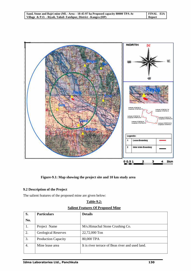
Sand, Stone and Bajri mine (ML- Area – 18-45-97 ha Proposed capacity 80000 TPA At Village & P.O. - Riyali, Tahsil- Fatehpur, District –Kangra (HP)
FINAL EIA Report
Idma Laboratories Ltd., Panchkula 130
Figure-9.1: Map showing the project site and 10 km study area
9.2 Description of the Project
The salient features of the proposed mine are given below:
Table-9.2:
Salient Features Of Proposed Mine
S.
No.
Particulars Details
1. Project Name M/s.Himachal Stone Crushing Co.
2. Geological Reserves 22,72,000 Ton
3. Production Capacity 80,000 TPA
4.
Mine lease area It is river terrace of Beas river and used land.
Sand, Stone and Bajri mine (ML- Area – 18-45-97 ha Proposed capacity 80000 TPA At Village & P.O. - Riyali, Tahsil- Fatehpur, District –Kangra (HP)
FINAL EIA Report
Idma Laboratories Ltd., Panchkula 131
5. Lease Period Fifteen years
6. Location Khasra No. 3032/2, Village Riyali, Tehsil Fatehpur,
Dist. Kangra, Himachal Pradesh.
Latitude: 31o 59’ 44’’N – 31o 59’ 35’’N
Longitude:75º 48’17’’ E – 75o 49’ 3.5’’E
7 Use of mineral Captive to stone crusher and sand will be salable in open market
8. Method of mining Open Manual method using hand tools
9. Mineral Transportation By Road
10. Water Requirement 3 KLD
11. Source of Water Outsource tanker
12. Manpower 12 persons
13. Wastewater generation 0.15 KLD
14. Solid waste generation No solid waste
15. Project Cost 7 Lakhs
16. EMP costs Capital Cost: 1.98Lakhs
Recurring Cost:1.08 Lakhs
Production details
The details of year wise production of sand, stone and bajri for the first 5 years period are given
below:
Table 9.3: Year wise production of sand, stone Bajri for the first 5 years period in metric tons
Year Raw Material for Crusher For Free sale Total
Boulders Bajri Sand
First Year 35000 24800 20200 80000
Second Year 35000 24800 20200 80000
Third year 35000 24800 20200 80000
Fourth year 35000 24800 20200 80000
Fifth year 35000 24800 20200 80000
Total 175000 124000 101000 400000
9.3 Description of Environment , 9.3.1 Local Geology
The leased out area forms a part of the terrace comprising boulders, cobbles, pebbles, bajri, sand and
clay deposit of terrace alluvium. The rocks in the catchments of Beas River are mainly of Siwalik and
Dharmsala Formations.
Sand, Stone and Bajri mine (ML- Area – 18-45-97 ha Proposed capacity 80000 TPA At Village & P.O. - Riyali, Tahsil- Fatehpur, District –Kangra (HP)
FINAL EIA Report
Idma Laboratories Ltd., Panchkula 132
The area comprises predominantly the quartzite Boulders, Sand and bajri of Sandstone. The boulders
are white, spotted white, greenish white, pink, purple and dark green in color.
9.3.2 Land use
The land-use pattern of the study area is determined based on the latest satellite imagery purchased from
NRSA,Hyderabad.To know the present land use pattern the satellite imagery is interpreted as per
standard classification procedure of NRSA to determine the area covered by each land use pattern. The
classification results are mentioned below.
`Table 9.4 Land use pattern in the 10 km study area
S No Land use Land Cover Class Area in Sqkm Area in %
1 Agriculture Land 114.74 37.27
2 Fallow Land 32.39 10.52
3 Scrub Land 26.75 8.69
4 Forest Land 95.10 30.89
5 Builtup Area 13.29 4.32
6 Barren Land 6.08 1.97
7 Sand 14.33 4.65
8 Water Bodies 5.22 1.70
Total 307.90 100.00 Source: Satellite Imagery from NRSC, Hyderabad.
9.4 Environmental Monitoring
For monitoring of the environmental parameters like meteorology, air, water, soil and noise quality,
the monitoring stations have been established at different locations in and around the mine lease area.
The base line data has been collected in the summer season from March to May, 2011
Meteorology
The recorded meteorological data for the study period at project site is presented below:
Table 9.5: Summary of the meteorological data generated at site
Month Temp (°C) Relative
Humidity (%)
Prominent wind
direction/ wind speed
(kmph) from Min. Max. Min. Max.
March 2011 18.5 28.5 34.5 77.1 W & NW calm-5.2
April 2011 17.2 34.1 28.3 77.3 W & NW calm -12.7
May 2011 25.1 37.2 18.1 67.1 W & NW calm 8.2
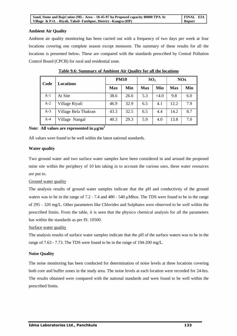
Sand, Stone and Bajri mine (ML- Area – 18-45-97 ha Proposed capacity 80000 TPA At Village & P.O. - Riyali, Tahsil- Fatehpur, District –Kangra (HP)
FINAL EIA Report
Idma Laboratories Ltd., Panchkula 133
Ambient Air Quality
Ambient air quality monitoring has been carried out with a frequency of two days per week at four
locations covering one complete season except monsoon. The summary of these results for all the
locations is presented below. These are compared with the standards prescribed by Central Pollution
Control Board (CPCB) for rural and residential zone.
Table 9.6: Summary of Ambient Air Quality for all the locations
Code Locations PM10 SO2 NOx
Max Min Max Min Max Min
A-1 At Site 38.6 26.6 5.3 <4.0 9.8 6.0
A-2 Village Riyali 46.9 32.9 6.5 4.1 12.2 7.9
A-3 Village Bela Thakran 43.3 32.5 6.5 4.4 14.2 8.7
A-4 Village Nangal 40.3 29.3 5.9 4.0 13.8 7.0
Note: All values are represented in g/m3
All values were found to be well within the latest national standards.
Water quality
Two ground water and two surface water samples have been considered in and around the proposed
mine site within the periphery of 10 km taking in to account the various uses, these water resources
are put to.
Ground water quality
The analysis results of ground water samples indicate that the pH and conductivity of the ground
waters was to be in the range of 7.2 - 7.4 and 480 - 540 Mhos. The TDS were found to be in the range
of 295 – 320 mg/L. Other parameters like Chlorides and Sulphates were observed to be well within the
prescribed limits. From the table, it is seen that the physico chemical analysis for all the parameters
has within the standards as per IS: 10500.
Surface water quality
The analysis results of surface water samples indicate that the pH of the surface waters was to be in the
range of 7.63 - 7.73. The TDS were found to be in the range of 194-200 mg/L.
Noise Quality
The noise monitoring has been conducted for determination of noise levels at three locations covering
both core and buffer zones in the study area. The noise levels at each location were recorded for 24-hrs.
The results obtained were compared with the national standards and were found to be well within the
prescribed limits.
Sand, Stone and Bajri mine (ML- Area – 18-45-97 ha Proposed capacity 80000 TPA At Village & P.O. - Riyali, Tahsil- Fatehpur, District –Kangra (HP)
FINAL EIA Report
Idma Laboratories Ltd., Panchkula 134
Ecology
There are no endemic and endangered species of flora within the study region. There is no schedule-I
species in this area. There are no national parks, sanctuaries, tiger/ Elephant corridors, migratory route
for birds, etc within the 10 km radius from the mine site.
Socioeconomic
There are no villages falling within the core zone. The entire mine lease area is private individual
lands falls under Reyali village. The buffer zone of the proposed mine, encompassing 10 km radius
from the periphery of the core zone, consists of 49 villages falling under Fatehpur and Indore Tehsils
of Kangra district with following features:
The total population of the buffer zone is 19524 with 3815 households with average family size
are 5 persons per family. The population density is 62 persons per sq. km.
The average literacy rate as per 2001 census has been 68.51%. The literacy rate in the study area
seems to be average. As the literacy rate of female (64.54 %) is poor compare with the literacy
rate of male (72.38) in the study area.
The employment rate in the buffer zone is 20.6 % as main workers, 23.4 % as marginal workers
and 56 % as non-workers.
Primary health care and medical facilities are available at major grampanchayats/towns. Rest of
the villages avail the facility within 5-10 km. distance.
For drinking water, villages are dependent on ground water source
Electricity is available in all the villages.
9.5 Anticipated Environmental Impacts and Mitigation Measures
The summary of anticipated adverse environmental impacts due to the proposed project and mitigation
measures are given below.
9.5.1 Air Environment
Particulate matter would be the predominant pollutant affecting the air quality during the operation
phase. Dust will be generated mainly during excavation, loading & unloading and hauling operations
along with transportation activities. Sprinkling of water from tankers would be undertaken for the
suppression of fugitive dust. Undesirable gaseous pollutants will be generated mostly by the vehicle
movement. However, this would not lead to any tangible effect, as the expected emission volume is
low. It would be ensured that all the vehicles plying in the working zone are properly tuned and
maintained to keep emissions within the permissible limits. At loading and unloading points,
arrangement for Water sprinkling is being made so that dust generation during transportation of
materials is minimized further.
Sand, Stone and Bajri mine (ML- Area – 18-45-97 ha Proposed capacity 80000 TPA At Village & P.O. - Riyali, Tahsil- Fatehpur, District –Kangra (HP)
FINAL EIA Report
Idma Laboratories Ltd., Panchkula 135
In order to predict the particulate emissions, FDM model was used to predict changes in air quality
The maximum ground level concentrations of PM 10 from the different mining activities for study
period (summer season) with EMP were observed to be 8.2 g/m3.The maximum GLC’s were falling
within the mine lease area at a distance of 100 m from the source for the given meteorological and
topographical conditions. The predominant wind direction is towards NW. The resultant will remain
within the National Ambient Air Quality Standards for industrial/rural/residential areas.
9.5.2 Water Environment
Impact on water resources/hydrology
There are no streams/nallahs flowing in the lease area. Proposed lease is on the terrace of the Beas
River. As such there will be no impact on this drainage channel due to the mining activity.
The study area itself being part of River terrace above and away from H F L carries no surface water.
The ground water table as per the observations of records of tube wells in the surrounding area
indicates to be at least seven to eight meters below surface level. The flow of ground water (sub
surface flow) is following the trend of topography, which is in the East to west direction.
The ground water table which will be about six meters below the surface level of mining lease area
will not be disturbed as ultimate working depth will be 304.5 MRL. Thus the mine operation will not
affect the hydrological conditions of the area. Proposed working will not intersect Ground water.
Impacts due to mining activity
As such no effluents are generated due to the proposed mining activity. However, domestic effluent to
a tune of 0.15 KLD will be generated which will be treated in the septic tank followed by soak pit.
9.5.3 Land Environment
The total Mine lease area of 18.4597 ha is private unused lands. The mine lease is devoid of any
vegetation. Practically, no soil cover is available on the mineralized zone. The conservation of top soil
is not required as it is not available in proposed mining area. The impact on soil in the lease area and
surroundings will be negligible.
After mining, the mined out area will be reclaimed by waste dump and developed for agricultural use.
Hence, no perceptible change in the general landscape is anticipated.
Post Mining Land use Plan
The proposed mine doesn’t need much of infrastructure needed and no dumping is proposed. After
the completion of life of the mine, the mined out area shall be reclaimed by the waste dump and
utilized for agricultural purposes.
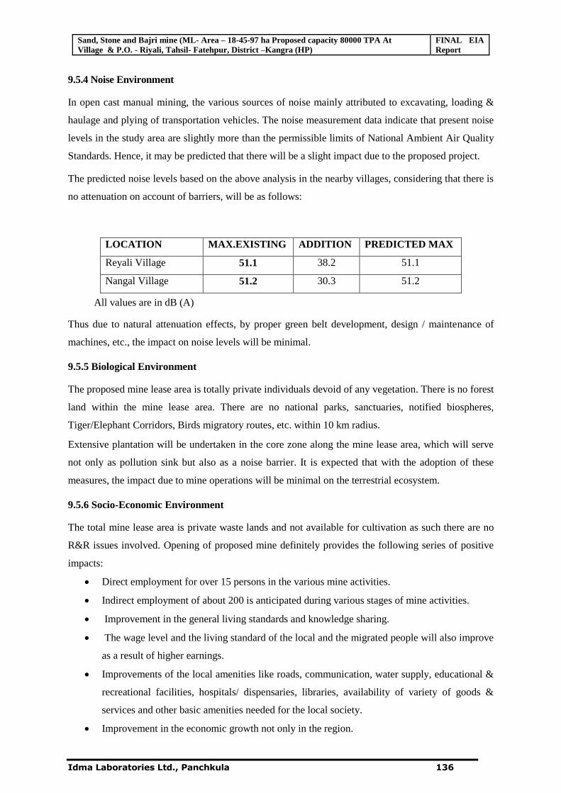
Sand, Stone and Bajri mine (ML- Area – 18-45-97 ha Proposed capacity 80000 TPA At Village & P.O. - Riyali, Tahsil- Fatehpur, District –Kangra (HP)
FINAL EIA Report
Idma Laboratories Ltd., Panchkula 136
9.5.4 Noise Environment
In open cast manual mining, the various sources of noise mainly attributed to excavating, loading &
haulage and plying of transportation vehicles. The noise measurement data indicate that present noise
levels in the study area are slightly more than the permissible limits of National Ambient Air Quality
Standards. Hence, it may be predicted that there will be a slight impact due to the proposed project.
The predicted noise levels based on the above analysis in the nearby villages, considering that there is
no attenuation on account of barriers, will be as follows:
LOCATION MAX.EXISTING ADDITION PREDICTED MAX
Reyali Village 51.1 38.2 51.1
Nangal Village 51.2 30.3 51.2
All values are in dB (A)
Thus due to natural attenuation effects, by proper green belt development, design / maintenance of
machines, etc., the impact on noise levels will be minimal.
9.5.5 Biological Environment
The proposed mine lease area is totally private individuals devoid of any vegetation. There is no forest
land within the mine lease area. There are no national parks, sanctuaries, notified biospheres,
Tiger/Elephant Corridors, Birds migratory routes, etc. within 10 km radius.
Extensive plantation will be undertaken in the core zone along the mine lease area, which will serve
not only as pollution sink but also as a noise barrier. It is expected that with the adoption of these
measures, the impact due to mine operations will be minimal on the terrestrial ecosystem.
9.5.6 Socio-Economic Environment
The total mine lease area is private waste lands and not available for cultivation as such there are no
R&R issues involved. Opening of proposed mine definitely provides the following series of positive
impacts:
Direct employment for over 15 persons in the various mine activities.
Indirect employment of about 200 is anticipated during various stages of mine activities.
Improvement in the general living standards and knowledge sharing.
The wage level and the living standard of the local and the migrated people will also improve
as a result of higher earnings.
Improvements of the local amenities like roads, communication, water supply, educational &
recreational facilities, hospitals/ dispensaries, libraries, availability of variety of goods &
services and other basic amenities needed for the local society.
Improvement in the economic growth not only in the region.
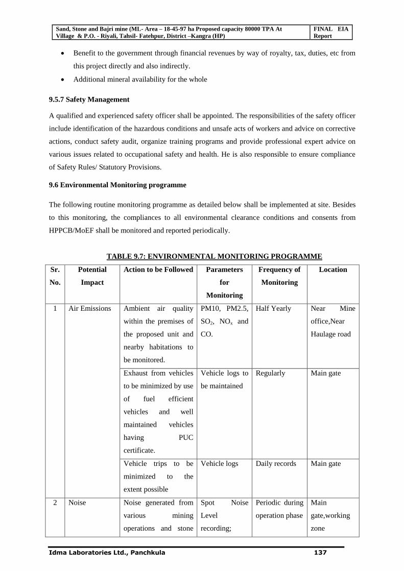
Sand, Stone and Bajri mine (ML- Area – 18-45-97 ha Proposed capacity 80000 TPA At Village & P.O. - Riyali, Tahsil- Fatehpur, District –Kangra (HP)
FINAL EIA Report
Idma Laboratories Ltd., Panchkula 137
Benefit to the government through financial revenues by way of royalty, tax, duties, etc from
this project directly and also indirectly.
Additional mineral availability for the whole
9.5.7 Safety Management
A qualified and experienced safety officer shall be appointed. The responsibilities of the safety officer
include identification of the hazardous conditions and unsafe acts of workers and advice on corrective
actions, conduct safety audit, organize training programs and provide professional expert advice on
various issues related to occupational safety and health. He is also responsible to ensure compliance
of Safety Rules/ Statutory Provisions.
9.6 Environmental Monitoring programme
The following routine monitoring programme as detailed below shall be implemented at site. Besides
to this monitoring, the compliances to all environmental clearance conditions and consents from
HPPCB/MoEF shall be monitored and reported periodically.
TABLE 9.7: ENVIRONMENTAL MONITORING PROGRAMME
Sr.
No.
Potential
Impact
Action to be Followed Parameters
for
Monitoring
Frequency of
Monitoring
Location
1 Air Emissions Ambient air quality
within the premises of
the proposed unit and
nearby habitations to
be monitored.
PM10, PM2.5,
SO2, NOx and
CO.
Half Yearly Near Mine
office,Near
Haulage road
Exhaust from vehicles
to be minimized by use
of fuel efficient
vehicles and well
maintained vehicles
having PUC
certificate.
Vehicle logs to
be maintained
Regularly Main gate
Vehicle trips to be
minimized to the
extent possible
Vehicle logs Daily records Main gate
2 Noise Noise generated from
various mining
operations and stone
Spot Noise
Level
recording;
Periodic during
operation phase
Main
gate,working
zone
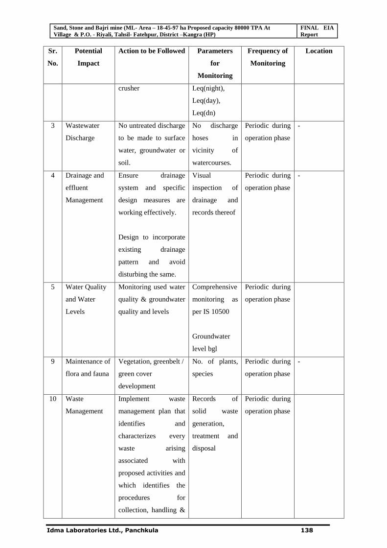
Sand, Stone and Bajri mine (ML- Area – 18-45-97 ha Proposed capacity 80000 TPA At Village & P.O. - Riyali, Tahsil- Fatehpur, District –Kangra (HP)
FINAL EIA Report
Idma Laboratories Ltd., Panchkula 138
Sr.
No.
Potential
Impact
Action to be Followed Parameters
for
Monitoring
Frequency of
Monitoring
Location
crusher Leq(night),
Leq(day),
Leq(dn)
3 Wastewater
Discharge
No untreated discharge
to be made to surface
water, groundwater or
soil.
No discharge
hoses in
vicinity of
watercourses.
Periodic during
operation phase
-
4 Drainage and
effluent
Management
Ensure drainage
system and specific
design measures are
working effectively.
Design to incorporate
existing drainage
pattern and avoid
disturbing the same.
Visual
inspection of
drainage and
records thereof
Periodic during
operation phase
-
5 Water Quality
and Water
Levels
Monitoring used water
quality & groundwater
quality and levels
Comprehensive
monitoring as
per IS 10500
Groundwater
level bgl
Periodic during
operation phase
9 Maintenance of
flora and fauna
Vegetation, greenbelt /
green cover
development
No. of plants,
species
Periodic during
operation phase
-
10 Waste
Management
Implement waste
management plan that
identifies and
characterizes every
waste arising
associated with
proposed activities and
which identifies the
procedures for
collection, handling &
Records of
solid waste
generation,
treatment and
disposal
Periodic during
operation phase
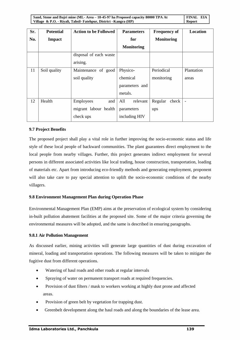
Sand, Stone and Bajri mine (ML- Area – 18-45-97 ha Proposed capacity 80000 TPA At Village & P.O. - Riyali, Tahsil- Fatehpur, District –Kangra (HP)
FINAL EIA Report
Idma Laboratories Ltd., Panchkula 139
Sr.
No.
Potential
Impact
Action to be Followed Parameters
for
Monitoring
Frequency of
Monitoring
Location
disposal of each waste
arising.
11 Soil quality Maintenance of good
soil quality
Physico-
chemical
parameters and
metals.
Periodical
monitoring
Plantation
areas
12 Health Employees and
migrant labour health
check ups
All relevant
parameters
including HIV
Regular check
ups
-
9.7 Project Benefits
The proposed project shall play a vital role in further improving the socio-economic status and life
style of these local people of backward communities. The plant guarantees direct employment to the
local people from nearby villages. Further, this project generates indirect employment for several
persons in different associated activities like local trading, house construction, transportation, loading
of materials etc. Apart from introducing eco-friendly methods and generating employment, proponent
will also take care to pay special attention to uplift the socio-economic conditions of the nearby
villagers.
9.8 Environment Management Plan during Operation Phase
Environmental Management Plan (EMP) aims at the preservation of ecological system by considering
in-built pollution abatement facilities at the proposed site. Some of the major criteria governing the
environmental measures will be adopted, and the same is described in ensuring paragraphs.
9.8.1 Air Pollution Management
As discussed earlier, mining activities will generate large quantities of dust during excavation of
mineral, loading and transportation operations. The following measures will be taken to mitigate the
fugitive dust from different operations.
Watering of haul roads and other roads at regular intervals
Spraying of water on permanent transport roads at required frequencies.
Provision of dust filters / mask to workers working at highly dust prone and affected
areas.
Provision of green belt by vegetation for trapping dust.
Greenbelt development along the haul roads and along the boundaries of the lease area.
Sand, Stone and Bajri mine (ML- Area – 18-45-97 ha Proposed capacity 80000 TPA At Village & P.O. - Riyali, Tahsil- Fatehpur, District –Kangra (HP)
FINAL EIA Report
Idma Laboratories Ltd., Panchkula 140
The extracted mineral should be transported from the quarry to the crusher by adopting
following measures so as to minimize dust emissions.
Water sprinkling should be done prior and after loading into the trucks.
Speed of the vehicles should be maintained with in the prescribed limits.
Trucks should not be over loaded and should be maintained to the body level.
9.8.2 Water Pollution Management
Domestic Sewage
The sewage to a tune of 0.15 KLD generated from the mine office and toilets will be diverted to the
septic tank followed by soak pit.
9.8.3 Noise Pollution Management
The major noise generating source from the proposed activity is excavation, loading, unloading and
plying of vehicles. The following control measures are to be undertaken to bring down the noise levels.
Use of personal protective devices i.e., earmuffs and earplugs by workers, working in high
noise areas.
Proper maintenance and tuning of Vehicles would be ensured.
The greenbelt with species of rich canopy around the lease area and along the roads will further
attenuate the noise levels.
Conducting periodical medical check up of all workers for any noise related health problems
Proper training to personnel to create awareness about adverse noise level effects.
Planned noise monitoring at suitable locations in the plant and outside location for proper
effective remedial actions.
9.8.4 Occupational safety and health:
To avoid any adverse effect on the health of workers due to dust, noise etc. extensive measures has to
be adapted related to safety aspect. Regular maintenance and testing of all tools & equipments as per
guidelines. Provision of personal protective equipments to the workers working in the mine.
Periodical medical examination of all workers by medical specialists shall be conducted.
9.9 Socioeconomic
The following measures will be taken up to improve the socioeconomic conditions of the area:
• Local people will be employed on priority basis as per their skills
• It is estimated that about 15 persons will be directly employed and about 200 persons will
be indirectly employed
• Direct & indirect development of the society.
• As a part of Corporate Social Responsibility the project proponent agrees to provide free
of cost boulders, bajri and sand for social projects as Panchayat ghar, schools in the area.
• Medical facilities to the workers employed at site
Sand, Stone and Bajri mine (ML- Area – 18-45-97 ha Proposed capacity 80000 TPA At Village & P.O. - Riyali, Tahsil- Fatehpur, District –Kangra (HP)
FINAL EIA Report
Idma Laboratories Ltd., Panchkula 141
9.10Conclusions
It is predicted that socio-economic impact due to this project will positively increase the chance of
more employment opportunities for local inhabitants. There are no Resettlement and Rehabilitation
issues involved in this project. The revenue of the State Govt. shall be definitely increasing due to the
enhanced production. The entire project area is devoid of any endangered flora and fauna. Thus the
proposed project is not likely to affect the environment or adjacent ecosystem adversely.
*********
Page 1
Chapter 10
Disclosure of Consultant
Idma Laboratories Limited the group’s Flagship Company was incorporated in 1981. It is a
multidisciplinary center for excellence in testing and analysis including capacity building.
Punjab Agri Food Parks Limited (PAFPL) was incorporated in 2002 is a dedicated
agricultural hub that has the resources and infrastructure to provide world-class facilities and
services for demand driven agriculture and better farming practices. Punjab Agri Ventures
Limited (PAVL) incorporated in 2004 is a state of the art, horticulture & food-processing
complex. Founded in 1999, Idma Foundation for Sustainable Development works on
environmental problems associated with development. It is registered under the Societies
Registration Act XXI of 1860 at Chandigarh, India as a not-for-profit organization.
Idma represents our corporate philosophy- Invest energy and ingenuity in programme
areas; develop knowledge networks for new insights through interaction of different perspectives
and approaches; manage resources in a sustainable manner and be accountable.
IDMA Laboratories Ltd. is ISO-9001: 2008, 14001& 18000certified company.
EIA Division has been accredited with National Accreditation Board for Education & Training
(NABET) (Quality Council of India) vide Minutes of 47th AC meeting for Surveillance
assessment dated April 12, 2013 .
IDMA Laboratories Ltd. has its own Environmental Laboratory at Plot No. 391, Industrial
Area, Phase I, Panchkula (Haryana) approved by the Ministry of Environment & Forests, Govt.
of India, New Delhi vide notification No.1150(E) dated 22.05.2012. The Environmental
Laboratory is also approved by the National Accreditation Board for Calibration and Testing
Laboratories (NABL) vide certificates no. T-0187 dated 25.05.2012 as ISO/IEC -17025: 2005 in
chemical testing and T-0188 for Mechanical testing. The laboratory also recognized by Bureau
of Indian Standards (BIS) vide Ref.No.CI/COAPD/OSL (9123236), dated 04 July, 2011.
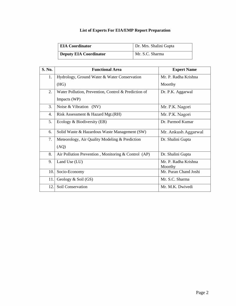
Page 2
List of Experts For EIA/EMP Report Preparation
EIA Coordinator Dr. Mrs. Shalini Gupta
Deputy EIA Coordinator Mr. S.C. Sharma
S. No. Functional Area Expert Name
1. Hydrology, Ground Water & Water Conservation
(HG)
Mr. P. Radha Krishna
Moorthy
2. Water Pollution, Prevention, Control & Prediction of
Impacts (WP)
Dr. P.K. Aggarwal
3. Noise & Vibration (NV) Mr. P.K. Nagori
4. Risk Assessment & Hazard Mgt.(RH) Mr. P.K. Nagori
5. Ecology & Biodiversity (EB) Dr. Parmod Kumar
6. Solid Waste & Hazardous Waste Management (SW) Mr. Ankush Aggarwal
7. Meteorology, Air Quality Modeling & Prediction
(AQ)
Dr. Shalini Gupta
8. Air Pollution Prevention , Monitoring & Control (AP) Dr. Shalini Gupta
9. Land Use (LU) Mr. P. Radha Krishna Moorthy
10. Socio-Economy Mr. Puran Chand Joshi
11. Geology & Soil (GS) Mr. S.C. Sharma
12. Soil Conservation Mr. M.K. Dwivedi
Page 3
THE FOLLOWING TEAM MEMBERS WERE INVOLVED:
Project Name: M/s. Himachal stone crusher
Name and address of
the Consultant
Idma Laboratories Ltd,
391,Panchkula, Haryana
ISO 9001:2008 Certified,
OHSAS 18001:2007 Certified and
QCI-NABET Accredited.
Team involved in
preparation of
EIA/EMP report under
the guidance of
approved Experts
Ravinder Kaur Saini
Pooja Sharma
Base line data Idma Laboratories Ltd,
391,Panchkula, Haryana
MoEF Recognized, PPCB &
NABL Accredited Laboratory.
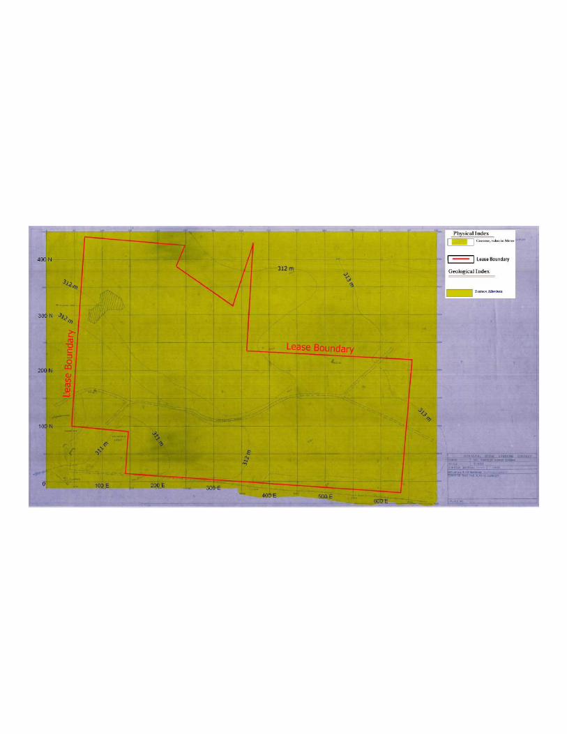

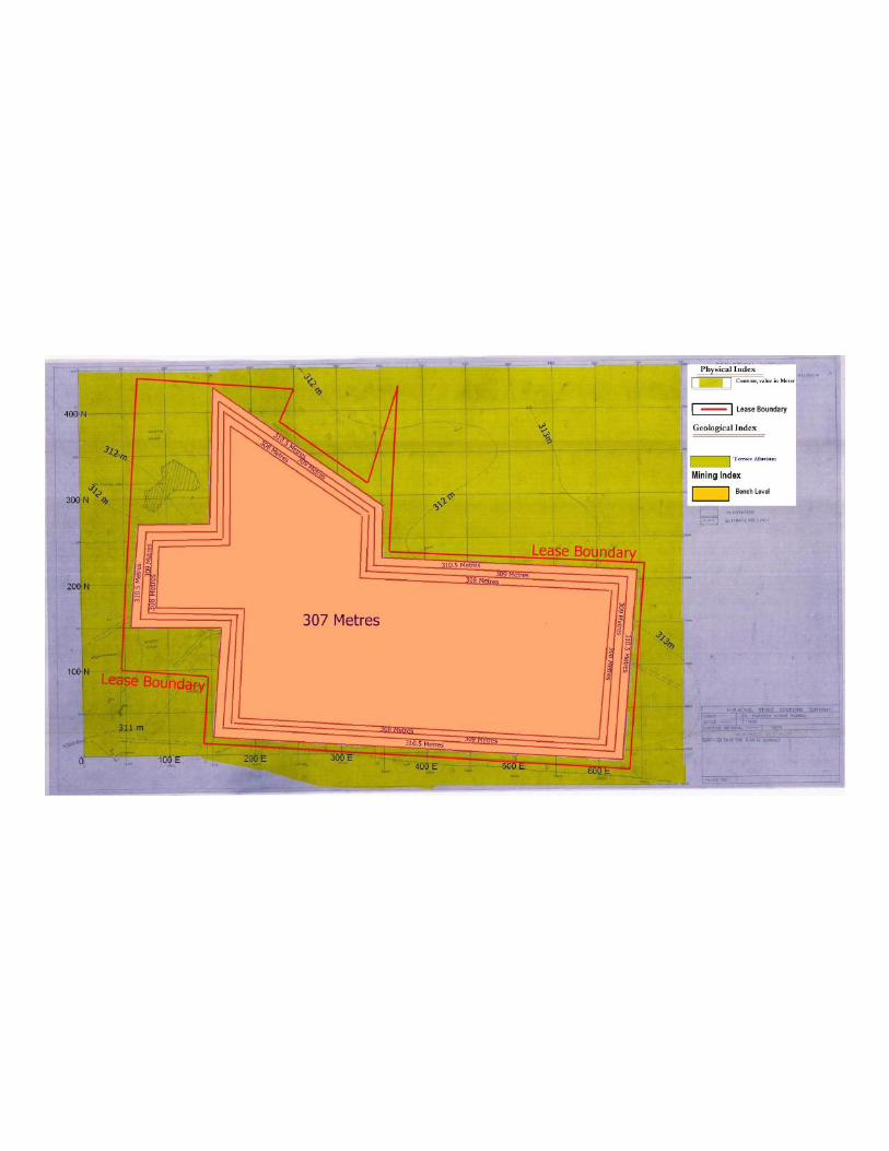
TOR REPLY
The Expert Appraisal Committee (EAC) for mining projects considered the project during its
meeting. Based on the information contained in the documents submitted and the presentation
made, the EAC-MoEF prescribed the Terms of Reference (TOR). The points raised by the
MoEF in the TOR and its compliance are as under:-
S. No. ToR Cross Ref. in EIA
Report
Point-3
1. A copy of document in support of the fact that the proponent
is rightful lessee of the mine should be given.
The copy of Mine
grant letter and
Partnership Deed are
enclosed in
Annexure-II and III
respectively.
2. All documents including approved mine plan , EIA report
and public hearing should be compatible with one another in
terms of the mine lease area, production levels, waste
generation and its management and mining technology and
should be in the name of the lessee.. The mine plan should
take in account the conditions of the mine lease, if any, in
terms of distance to be left un worked from the river flowing
nearby.
The documents
submitted are
compatible with one
another & all the
documents are in the
name of the lease.
3. The impact of other mines and the crusher located within the
impact zone should also be taken into account.
Details given in
Chapter-4.
4. While working out the impacts and their mitigation, the
standards prescribed under EP Act, for stone crushers should
be taken into account.
The standards
prescribed under EP
Act, taken into
account and worked
out on impacts and
their mitigation
accordingly.
5. The study area will comprise of 10 km zone around the mine
lease from lease periphery and the data contained in the EIA
such as waste generation etc. should be for the life of the
mine/ lease period.
Study area comprises
of 10 km radius
around the Mining
Lease boundary.
Buffer map attached
given in chapter one.
Data like reserves,
production details,
waste generation, etc
have been
incorporated in
chapter-4.
6. Land use of the study area delineating forest area,
agricultural land, grazing land, wildlife sanctuary and national
park, migratory routes of fauna, water bodies, human
settlements and ecological features should be indicated.
Satellite imagery
showing the present
land use pattern for
the study area has
been prepared and
incorporated in
Chapter-3.
7. Land use plan of the mine lease area should be prepared to
encompass pre-operational, operational and post-operational
phases and submitted.
The details of Land
use plan of the lease
area are given in
chapter-4.
8. Location of National Parks, Sanctuaries, Biosphere
Reserves, wildlife Corridors, Tiger/Elephant Reserves
(existing as well as proposed) within 10 km of the mine lease
should be clearly supported by a location map duly
authenticated by Chief Wildlife Warden. Necessary clearance
if any , as may be applicable to such projects due to proximity
of the ecologically sensitive areas as mentioned above
should be obtained from the Chief Wildlife Warden under the
There is no National
Parks, Sanctuaries,
Biosphere Reserves,
wildlife Corridors,
Tiger/Elephant
Reserves (existing as
well as proposed)
within 10 km of the
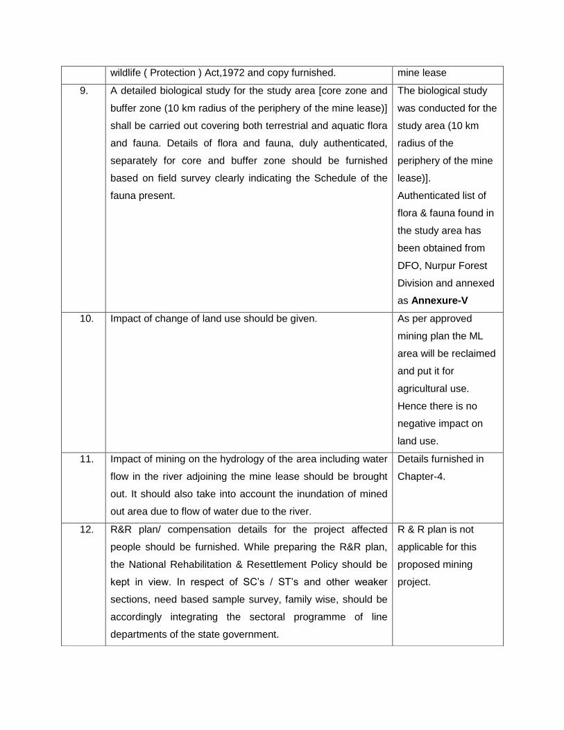
wildlife ( Protection ) Act,1972 and copy furnished. mine lease
9. A detailed biological study for the study area [core zone and
buffer zone (10 km radius of the periphery of the mine lease)]
shall be carried out covering both terrestrial and aquatic flora
and fauna. Details of flora and fauna, duly authenticated,
separately for core and buffer zone should be furnished
based on field survey clearly indicating the Schedule of the
fauna present.
The biological study
was conducted for the
study area (10 km
radius of the
periphery of the mine
lease)].
Authenticated list of
flora & fauna found in
the study area has
been obtained from
DFO, Nurpur Forest
Division and annexed
as Annexure-V
10. Impact of change of land use should be given. As per approved
mining plan the ML
area will be reclaimed
and put it for
agricultural use.
Hence there is no
negative impact on
land use.
11. Impact of mining on the hydrology of the area including water
flow in the river adjoining the mine lease should be brought
out. It should also take into account the inundation of mined
out area due to flow of water due to the river.
Details furnished in
Chapter-4.
12. R&R plan/ compensation details for the project affected
people should be furnished. While preparing the R&R plan,
the National Rehabilitation & Resettlement Policy should be
kept in view. In respect of SC’s / ST’s and other weaker
sections, need based sample survey, family wise, should be
accordingly integrating the sectoral programme of line
departments of the state government.
R & R plan is not
applicable for this
proposed mining
project.
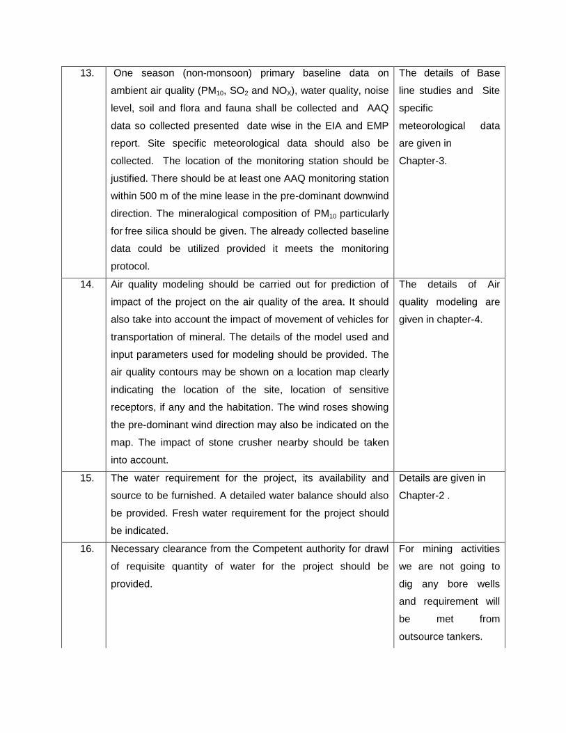
13. One season (non-monsoon) primary baseline data on
ambient air quality (PM10, SO2 and NOX), water quality, noise
level, soil and flora and fauna shall be collected and AAQ
data so collected presented date wise in the EIA and EMP
report. Site specific meteorological data should also be
collected. The location of the monitoring station should be
justified. There should be at least one AAQ monitoring station
within 500 m of the mine lease in the pre-dominant downwind
direction. The mineralogical composition of PM10 particularly
for free silica should be given. The already collected baseline
data could be utilized provided it meets the monitoring
protocol.
The details of Base
line studies and Site
specific
meteorological data
are given in
Chapter-3.
14. Air quality modeling should be carried out for prediction of
impact of the project on the air quality of the area. It should
also take into account the impact of movement of vehicles for
transportation of mineral. The details of the model used and
input parameters used for modeling should be provided. The
air quality contours may be shown on a location map clearly
indicating the location of the site, location of sensitive
receptors, if any and the habitation. The wind roses showing
the pre-dominant wind direction may also be indicated on the
map. The impact of stone crusher nearby should be taken
into account.
The details of Air
quality modeling are
given in chapter-4.
15. The water requirement for the project, its availability and
source to be furnished. A detailed water balance should also
be provided. Fresh water requirement for the project should
be indicated.
Details are given in
Chapter-2 .
16. Necessary clearance from the Competent authority for drawl
of requisite quantity of water for the project should be
provided.
For mining activities
we are not going to
dig any bore wells
and requirement will
be met from
outsource tankers.
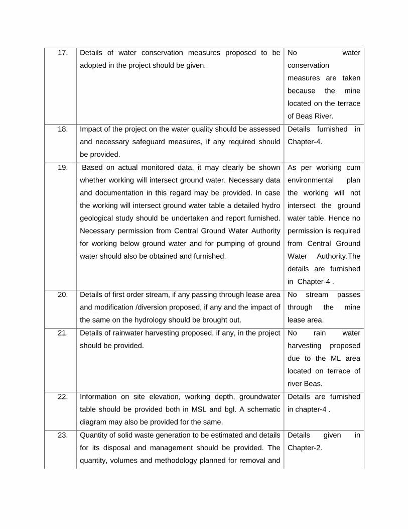
17. Details of water conservation measures proposed to be
adopted in the project should be given.
No water
conservation
measures are taken
because the mine
located on the terrace
of Beas River.
18. Impact of the project on the water quality should be assessed
and necessary safeguard measures, if any required should
be provided.
Details furnished in
Chapter-4.
19. Based on actual monitored data, it may clearly be shown
whether working will intersect ground water. Necessary data
and documentation in this regard may be provided. In case
the working will intersect ground water table a detailed hydro
geological study should be undertaken and report furnished.
Necessary permission from Central Ground Water Authority
for working below ground water and for pumping of ground
water should also be obtained and furnished.
As per working cum
environmental plan
the working will not
intersect the ground
water table. Hence no
permission is required
from Central Ground
Water Authority.The
details are furnished
in Chapter-4 .
20. Details of first order stream, if any passing through lease area
and modification /diversion proposed, if any and the impact of
the same on the hydrology should be brought out.
No stream passes
through the mine
lease area.
21. Details of rainwater harvesting proposed, if any, in the project
should be provided.
No rain water
harvesting proposed
due to the ML area
located on terrace of
river Beas.
22. Information on site elevation, working depth, groundwater
table should be provided both in MSL and bgl. A schematic
diagram may also be provided for the same.
Details are furnished
in chapter-4 .
23. Quantity of solid waste generation to be estimated and details
for its disposal and management should be provided. The
quantity, volumes and methodology planned for removal and
Details given in
Chapter-2.
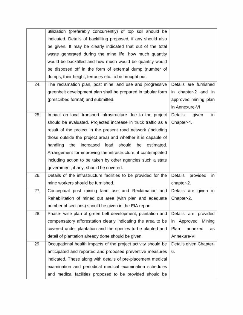
utilization (preferably concurrently) of top soil should be
indicated. Details of backfilling proposed, if any should also
be given. It may be clearly indicated that out of the total
waste generated during the mine life, how much quantity
would be backfilled and how much would be quantity would
be disposed off in the form of external dump (number of
dumps, their height, terraces etc. to be brought out.
24. The reclamation plan, post mine land use and progressive
greenbelt development plan shall be prepared in tabular form
(prescribed format) and submitted.
Details are furnished
in chapter-2 and in
approved mining plan
in Annexure-VI
25. Impact on local transport infrastructure due to the project
should be evaluated. Projected increase in truck traffic as a
result of the project in the present road network (including
those outside the project area) and whether it is capable of
handling the increased load should be estimated.
Arrangement for improving the infrastructure, if contemplated
including action to be taken by other agencies such a state
government, if any, should be covered.
Details given in
Chapter-4.
26. Details of the infrastructure facilities to be provided for the
mine workers should be furnished.
Details provided in
chapter-2.
27. Conceptual post mining land use and Reclamation and
Rehabilitation of mined out area (with plan and adequate
number of sections) should be given in the EIA report.
Details are given in
Chapter-2.
28. Phase- wise plan of green belt development, plantation and
compensatory afforestation clearly indicating the area to be
covered under plantation and the species to be planted and
detail of plantation already done should be given.
Details are provided
in Approved Mining
Plan annexed as
Annexure-VI
29. Occupational health impacts of the project activity should be
anticipated and reported and proposed preventive measures
indicated. These along with details of pre-placement medical
examination and periodical medical examination schedules
and medical facilities proposed to be provided should be
Details given Chapter-
6.

incorporated in the EMP. Special attention should be given in
view of the stone crusher nearby.
30. Measures of socio economic influence to the local
community, proposed to be provided by project proponent
should be indicated. As far as possible, quantitative
dimensions should be given with time frame for
implementation.
Details are given in
Chapter-3.
31. Detailed environmental management plan to mitigate the
environmental impacts which should inter –alia also include
the impact due to change of land use, due loss of agricultural
land use, due to loss of agricultural land and grazing land, if
any, occupational health impacts besides other impacts of
projects It should also take into account the impacts due to
stone crusher nearby and also provide for preventing the silt
from going into the river.
Detailed
Environmental
Management Plan is
given in Chapter-8
32. Risk assessment and disaster management plan due to
inundation of mine as a result of its location close to river
should be examined and addressed.
Details are given in
Chapter-6.
33. Public hearing points raised and commitment of the project
proponent on the same along with time bound action plan to
implement the same should be provided.
Details incorporated
in Chapter 6
34. Details of litigation pending against the project, if any, with
direction/order passed by any Court of Law against the
project should be given.
No litigations pending
against the project.
35. The cost of the project (capital cost and recurring cost) as
well as the cost towards implementation of EMP should be
clearly spelt out.
Details provided in
Chapter-8.
Point No.4
a) A note confirming compliance of the TOR, with cross
referencing of the relevant sections / pages of the EIA report
shod be provided.
Provided
b) All documents may be properly referenced with the index and
continuous page numbering.
Compiled
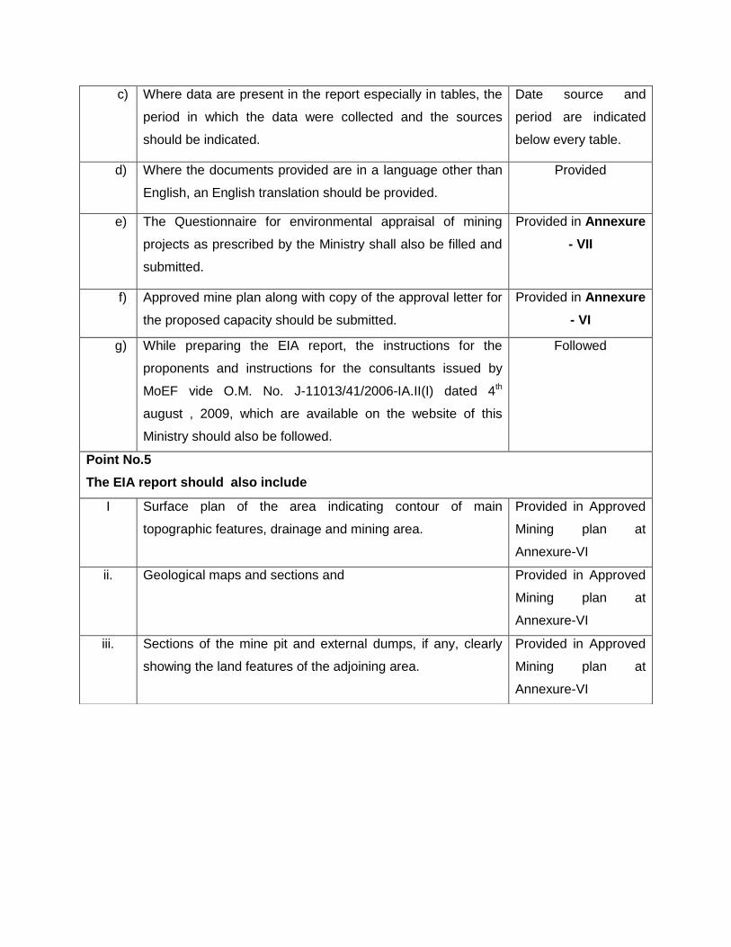
c) Where data are present in the report especially in tables, the
period in which the data were collected and the sources
should be indicated.
Date source and
period are indicated
below every table.
d) Where the documents provided are in a language other than
English, an English translation should be provided.
Provided
e) The Questionnaire for environmental appraisal of mining
projects as prescribed by the Ministry shall also be filled and
submitted.
Provided in Annexure
- VII
f) Approved mine plan along with copy of the approval letter for
the proposed capacity should be submitted.
Provided in Annexure
- VI
g) While preparing the EIA report, the instructions for the
proponents and instructions for the consultants issued by
MoEF vide O.M. No. J-11013/41/2006-IA.II(I) dated 4th
august , 2009, which are available on the website of this
Ministry should also be followed.
Followed
Point No.5
The EIA report should also include
I Surface plan of the area indicating contour of main
topographic features, drainage and mining area.
Provided in Approved
Mining plan at
Annexure-VI
ii. Geological maps and sections and Provided in Approved
Mining plan at
Annexure-VI
iii. Sections of the mine pit and external dumps, if any, clearly
showing the land features of the adjoining area.
Provided in Approved
Mining plan at
Annexure-VI
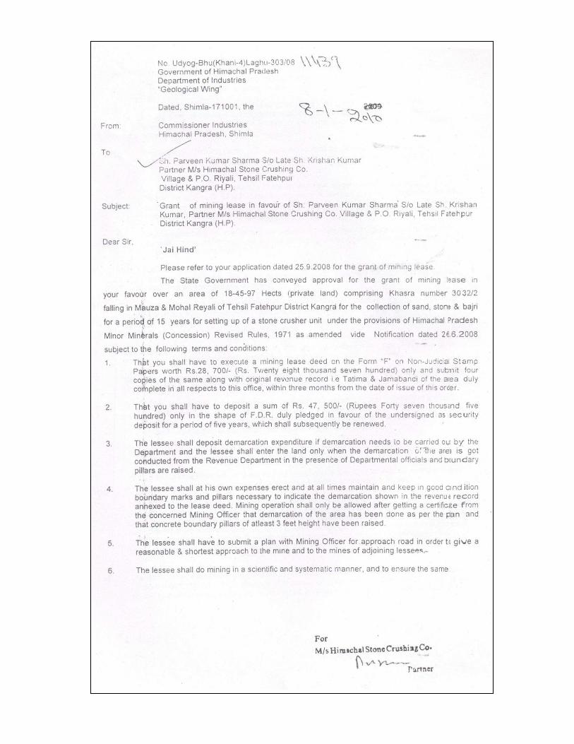
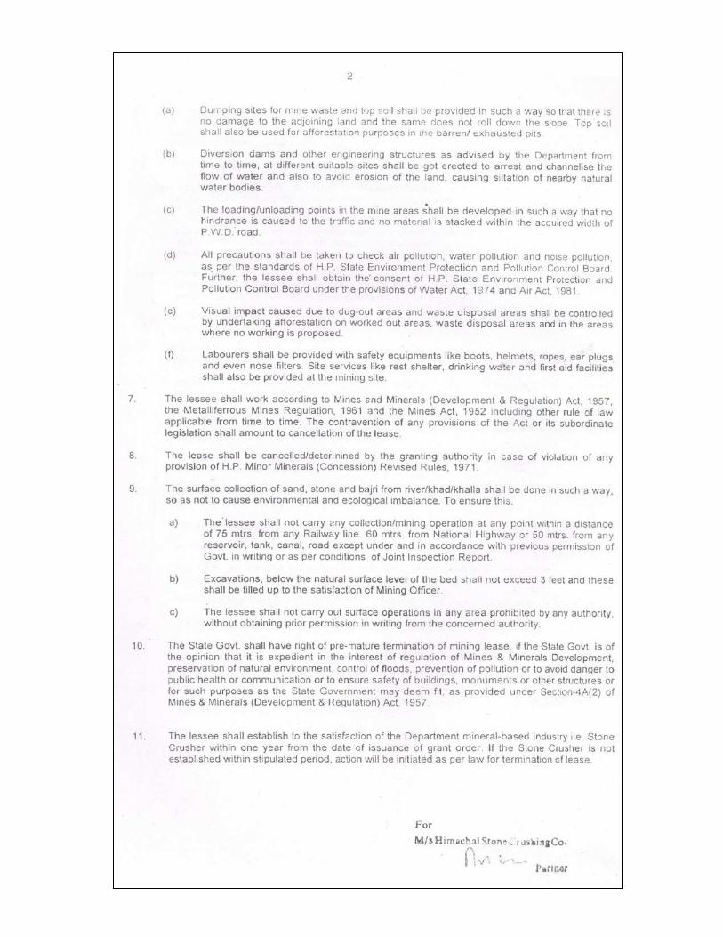
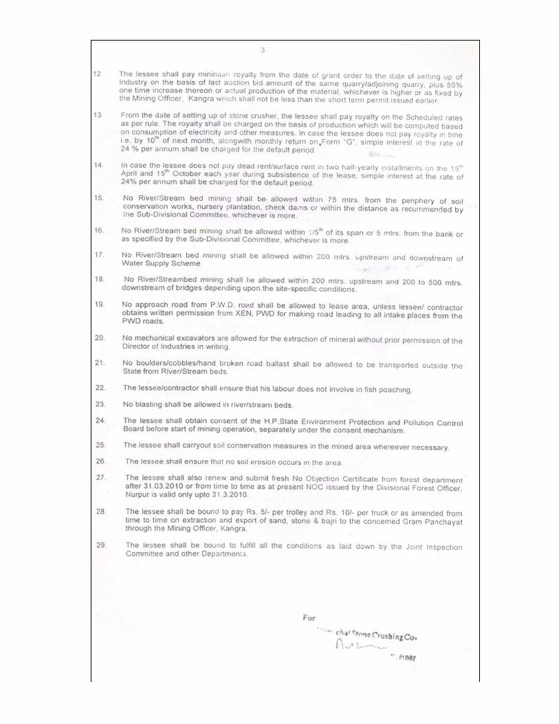
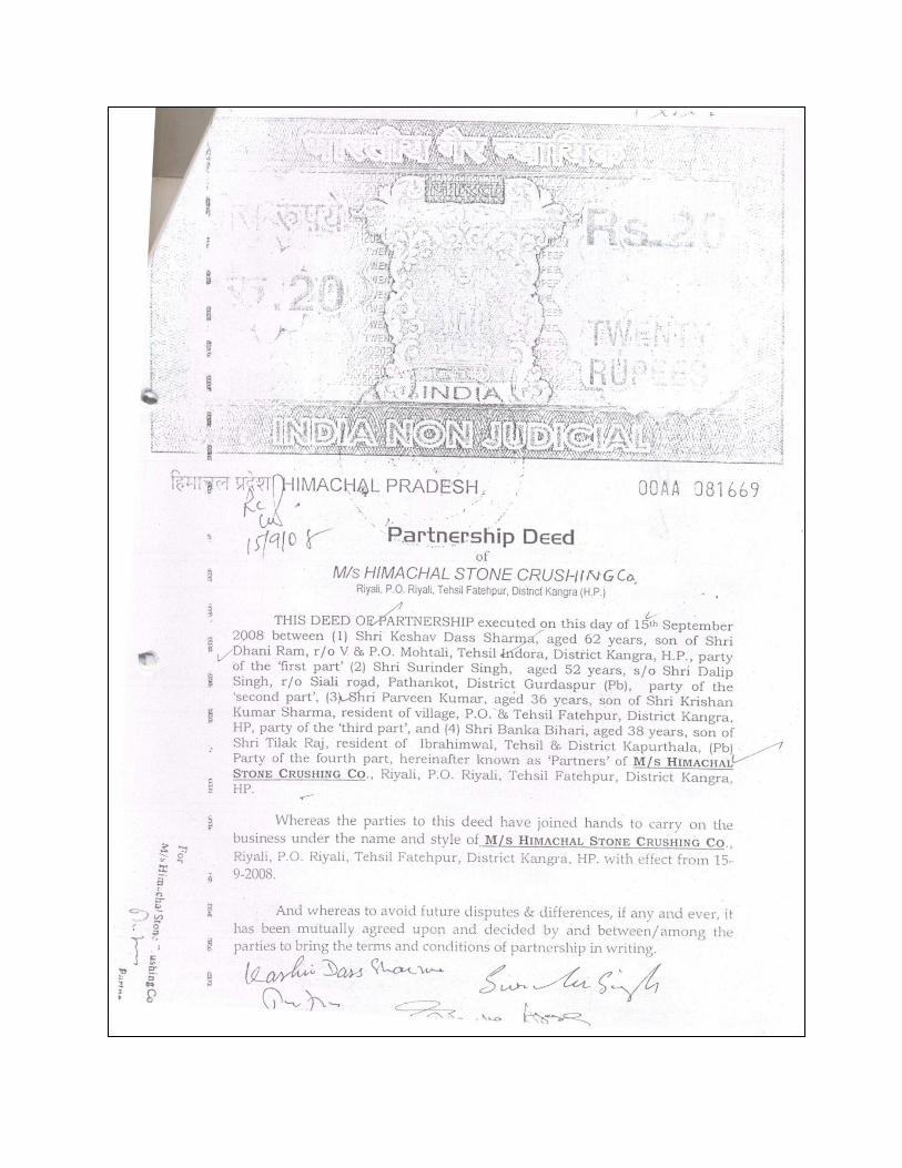
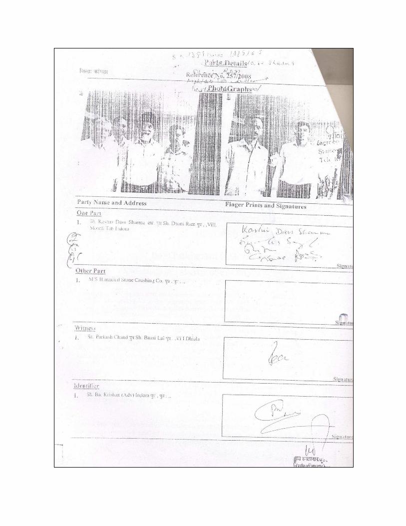
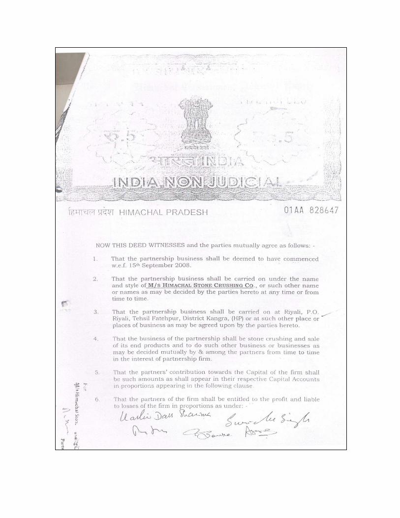
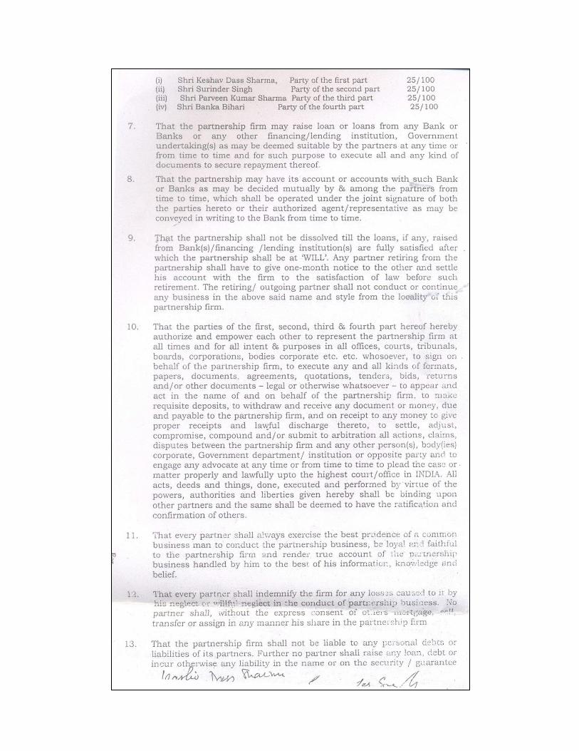
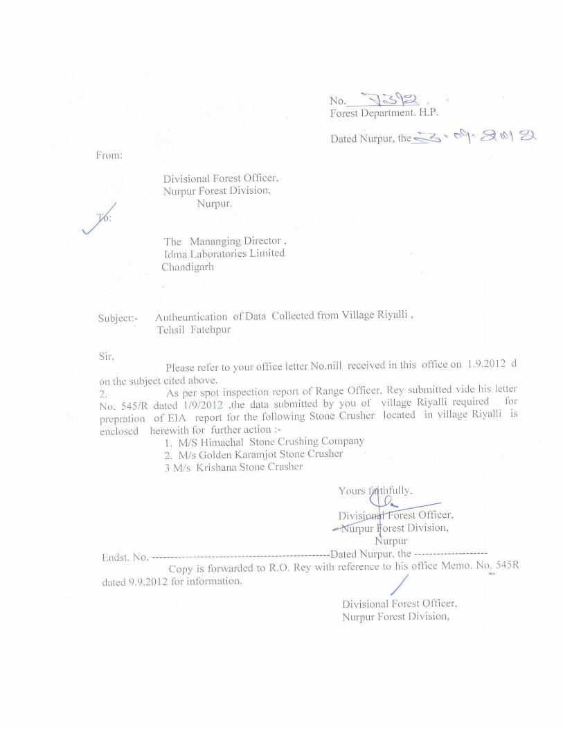
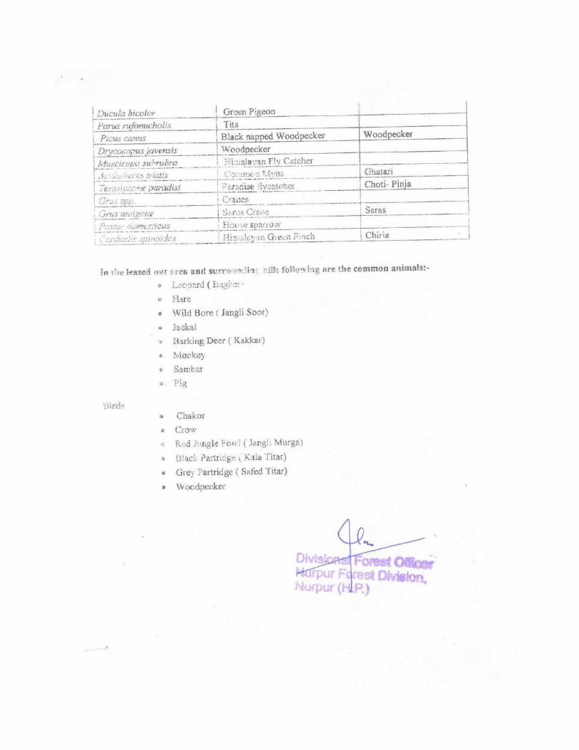
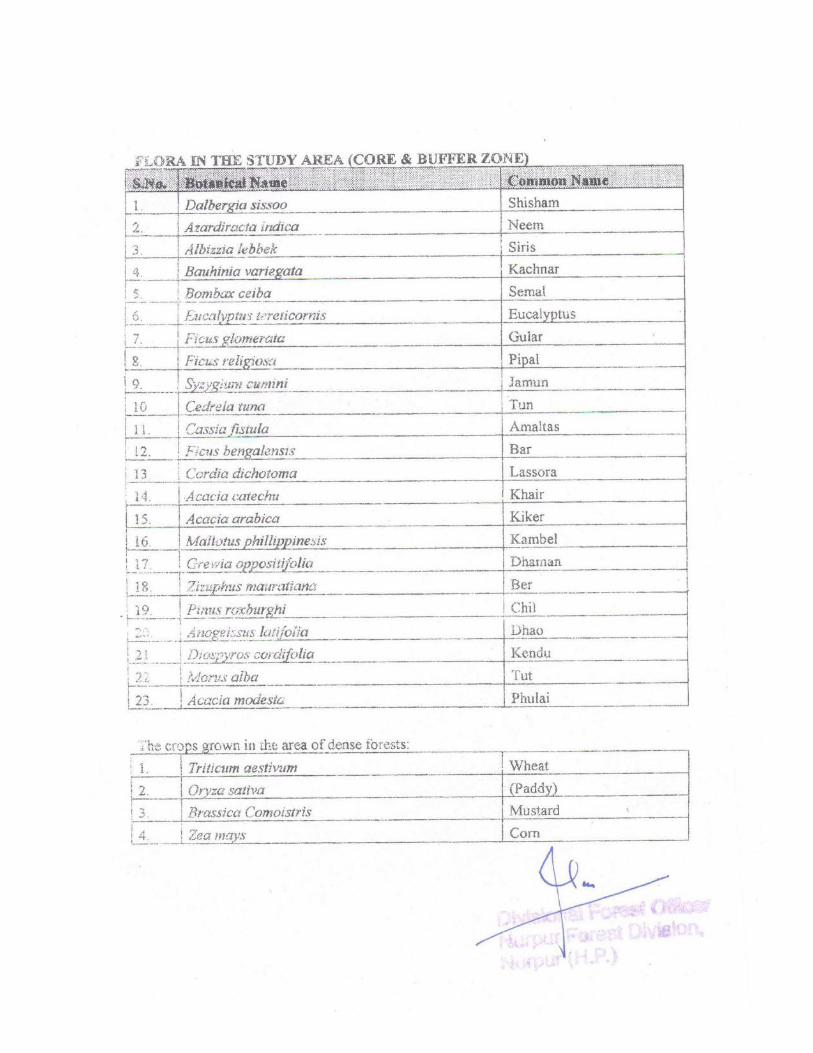
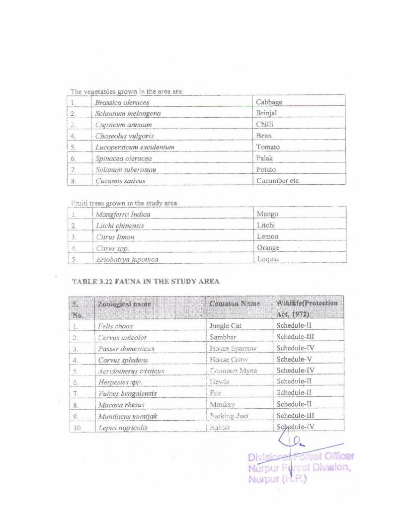
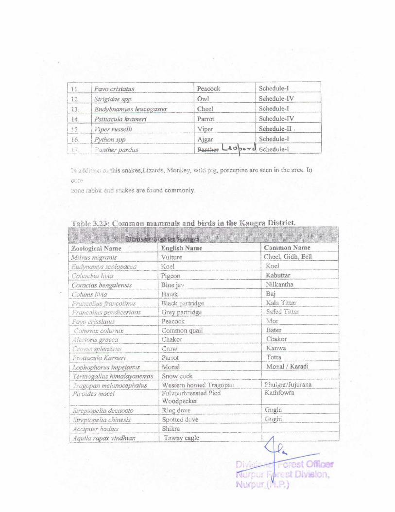
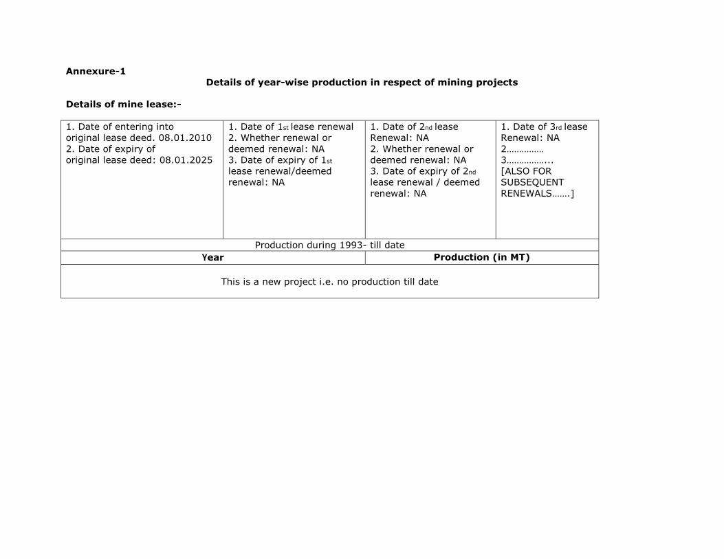
Annexure-1
Details of year-wise production in respect of mining projects
Details of mine lease:-
1. Date of entering into
original lease deed. 08.01.2010
2. Date of expiry of
original lease deed: 08.01.2025
1. Date of 1st lease renewal
2. Whether renewal or
deemed renewal: NA
3. Date of expiry of 1st
lease renewal/deemed
renewal: NA
1. Date of 2nd lease
Renewal: NA
2. Whether renewal or
deemed renewal: NA
3. Date of expiry of 2nd
lease renewal / deemed
renewal: NA
1. Date of 3rd lease
Renewal: NA
2……………
3……………...
[ALSO FOR
SUBSEQUENT
RENEWALS…….]
Production during 1993- till date Year Production (in MT)
This is a new project i.e. no production till date
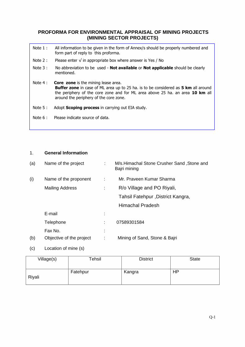
Q-1
PROFORMA FOR ENVIRONMENTAL APPRAISAL OF MINING PROJECTS (MINING SECTOR PROJECTS)
1. General Information (a) Name of the project : M/s.Himachal Stone Crusher Sand ,Stone and
Bajri mining
(i) Name of the proponent : Mr. Praveen Kumar Sharma
Mailing Address : R/o Village and PO Riyali,
Tahsil Fatehpur ,District Kangra,
Himachal Pradesh
E-mail :
Telephone : 07589301584
Fax No. :
(b) Objective of the project : Mining of Sand, Stone & Bajri
(c) Location of mine (s)
Village(s) Tehsil District State
Riyali
Fatehpur Kangra HP
Note 1 : All information to be given in the form of Annex/s should be properly numbered and
form part of reply to this proforma.
Note 2 : Please enter √ in appropriate box where answer is Yes / No
Note 3 : No abbreviation to be used - Not available or Not applicable should be clearly mentioned.
Note 4 : Core zone is the mining lease area.
Buffer zone in case of ML area up to 25 ha. is to be considered as 5 km all around
the periphery of the core zone and for ML area above 25 ha. an area 10 km all around the periphery of the core zone.
Note 5 : Adopt Scoping process in carrying out EIA study.
Note 6 : Please indicate source of data.
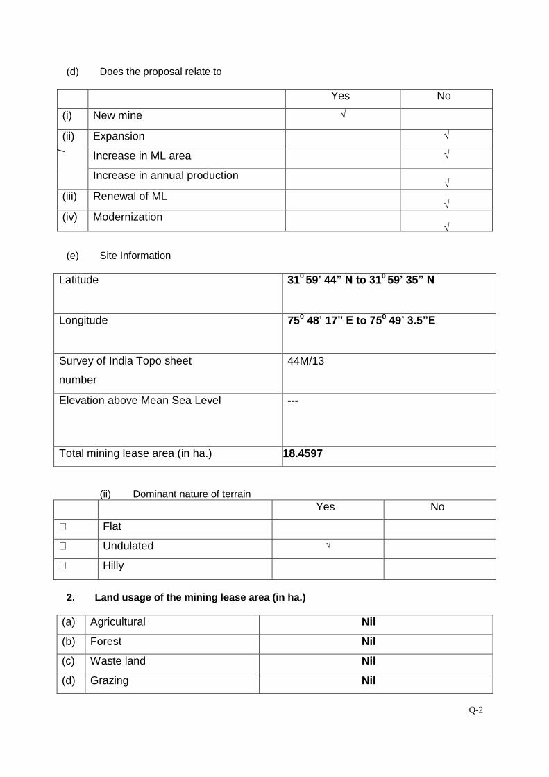
Q-2
(d) Does the proposal relate to
Yes No
(i) New mine √
(ii) Expansion
√
Increase in ML area √
Increase in annual production √ (iii) Renewal of ML √ (iv) Modernization √
(e) Site Information
Latitude 310 59’ 44” N to 310 59’ 35” N
Longitude 750 48’ 17” E to 750 49’ 3.5”E
Survey of India Topo sheet
number
44M/13
Elevation above Mean Sea Level ---
Total mining lease area (in ha.) 18.4597
(ii) Dominant nature of terrain Yes No
Flat
Undulated √
Hilly
2. Land usage of the mining lease area (in ha.)
(a) Agricultural Nil
(b) Forest Nil
(c) Waste land Nil
(d) Grazing Nil
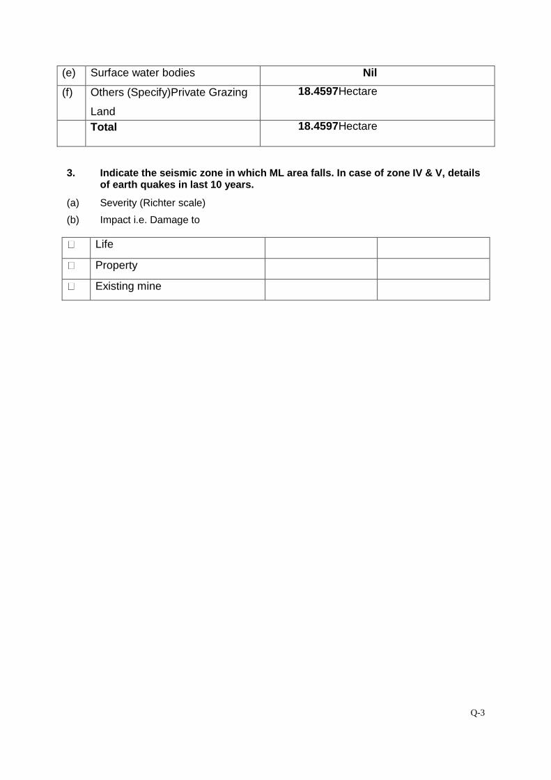
Q-3
(e) Surface water bodies Nil
(f) Others (Specify)Private Grazing
Land
18.4597Hectare
Total 18.4597Hectare
3. Indicate the seismic zone in which ML area falls. In case of zone IV & V, details of earth quakes in last 10 years.
(a) Severity (Richter scale)
(b) Impact i.e. Damage to
Life
Property
Existing mine
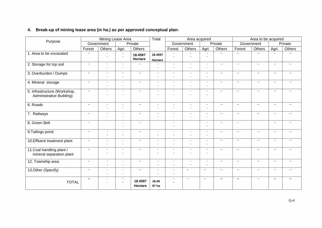
Q-4
4. Break-up of mining lease area (in ha.) as per approved conceptual plan:
Purpose Mining Lease Area Total Area acquired Area to be acquired
Government Private Government Private Government Private Forest Others Agri. Others Forest Others Agri. Others Forest Others Agri. Others
1. Area to be excavated
-- --
-- 18.4597
Hectare 18.4597
Hectare
--
--
--
-- -- -- -- --
2. Storage for top soil
-- --
--
-- --
--
--
--
-- -- -- -- --
3. Overburden / Dumps
-- --
--
-- --
--
--
--
-- -- -- -- --
4. Mineral storage
-- --
--
-- --
--
--
--
-- -- -- -- --
5. Infrastructure (Workshop, Administrative Building)
-- --
--
-- --
--
--
--
-- -- -- -- --
6. Roads
-- --
--
-- --
--
--
--
-- -- -- -- --
7. Railways
-- --
--
-- --
--
--
--
-- -- -- -- --
8. Green Belt
-- --
-- -- -
- -- -- -- --
9.Tailings pond
-- --
--
-- --
--
--
--
-- -- -- -- --
10.Effluent treatment plant
-- --
--
-- --
--
--
--
-- -- -- -- --
11.Coal handling plant / mineral separation plant
-- --
--
-- --
--
--
--
-- -- -- -- --
12. Township area
-- --
--
-- --
--
--
--
-- -- -- -- --
13.Other (Specify)
-- --
--
-- --
--
-- -- -- -- -- -- --
TOTAL
-- --
-- 18.4597
Hectare 18.45
97 ha
--
-- -- -- -- -- -- --
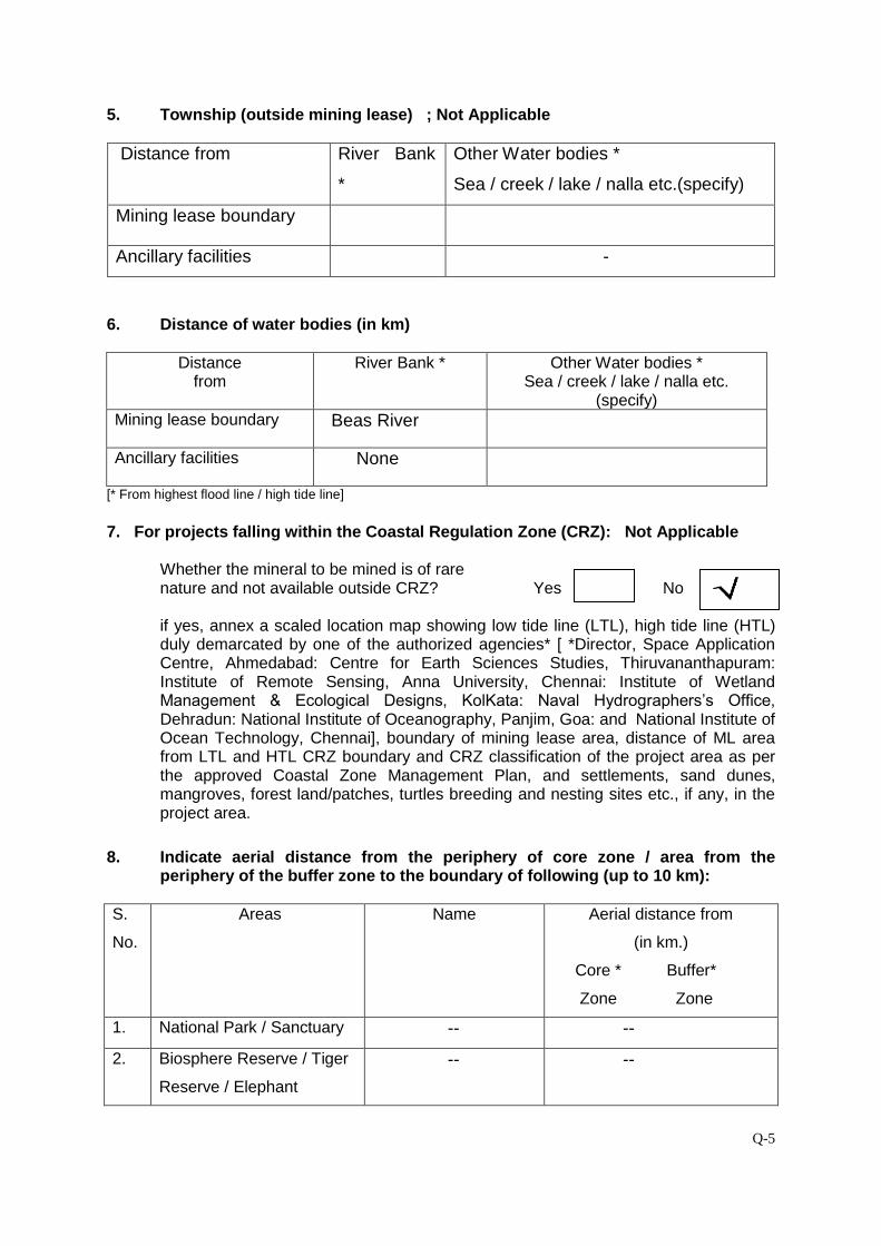
Q-5
5. Township (outside mining lease) ; Not Applicable
Distance from River Bank
*
Other Water bodies *
Sea / creek / lake / nalla etc.(specify)
Mining lease boundary
Ancillary facilities -
6. Distance of water bodies (in km)
Distance from
River Bank * Other Water bodies * Sea / creek / lake / nalla etc.
(specify) Mining lease boundary
Beas River
Ancillary facilities
None
[* From highest flood line / high tide line]
7. For projects falling within the Coastal Regulation Zone (CRZ): Not Applicable
Whether the mineral to be mined is of rare nature and not available outside CRZ? Yes No
if yes, annex a scaled location map showing low tide line (LTL), high tide line (HTL) duly demarcated by one of the authorized agencies* [ *Director, Space Application Centre, Ahmedabad: Centre for Earth Sciences Studies, Thiruvananthapuram: Institute of Remote Sensing, Anna University, Chennai: Institute of Wetland Management & Ecological Designs, KolKata: Naval Hydrographers’s Office, Dehradun: National Institute of Oceanography, Panjim, Goa: and National Institute of Ocean Technology, Chennai], boundary of mining lease area, distance of ML area from LTL and HTL CRZ boundary and CRZ classification of the project area as per the approved Coastal Zone Management Plan, and settlements, sand dunes, mangroves, forest land/patches, turtles breeding and nesting sites etc., if any, in the project area.
8. Indicate aerial distance from the periphery of core zone / area from the periphery of the buffer zone to the boundary of following (up to 10 km):
S.
No.
Areas Name Aerial distance from
(in km.)
Core * Buffer*
Zone Zone
1. National Park / Sanctuary -- --
2. Biosphere Reserve / Tiger
Reserve / Elephant
-- --
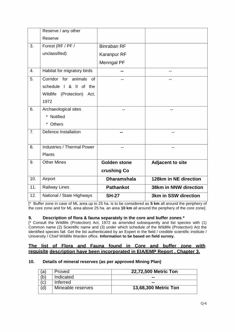
Q-6
Reserve / any other
Reserve
3. Forest (RF / PF /
unclassified)
Binraban RF
Karanpur RF
Menngal PF
4. Habitat for migratory birds -- --
5. Corridor for animals of
schedule I & II of the
Wildlife (Protection) Act,
1972
-- --
6. Archaeological sites
* Notified
* Others
-- --
7.
Defence Installation
-- --
8. Industries / Thermal Power
Plants
-- --
9. Other Mines Golden stone
crushing Co
Adjacent to site
10. Airport Dharamshala 128km in NE direction
11. Railway Lines Pathankot 38km in NNW direction
12. National / State Highways SH-27 3km in SSW direction
[* Buffer zone in case of ML area up to 25 ha. is to be considered as 5 km all around the periphery of the core zone and for ML area above 25 ha. an area 10 km all around the periphery of the core zone]. 9. Description of flora & fauna separately in the core and buffer zones.* [* Consult the Wildlife (Protection) Act, 1972 as amended subsequently and list species with (1) Common name (2) Scientific name and (3) under which schedule of the Wildlife (Protection) Act the identified species fall. Get the list authenticated by an Expert in the field / credible scientific institute / University / Chief Wildlife Warden office. Information to be based on field survey. The list of Flora and Fauna found in Core and buffer zone with requisite description have been incorporated in EIA/EMP Report , Chapter 3. 10. Details of mineral reserves (as per approved Mining Plan)
(a) Proved 22,72,500 Metric Ton (b) Indicated -- (c) Inferred -- (d) Mineable reserves 13,68,300 Metric Ton
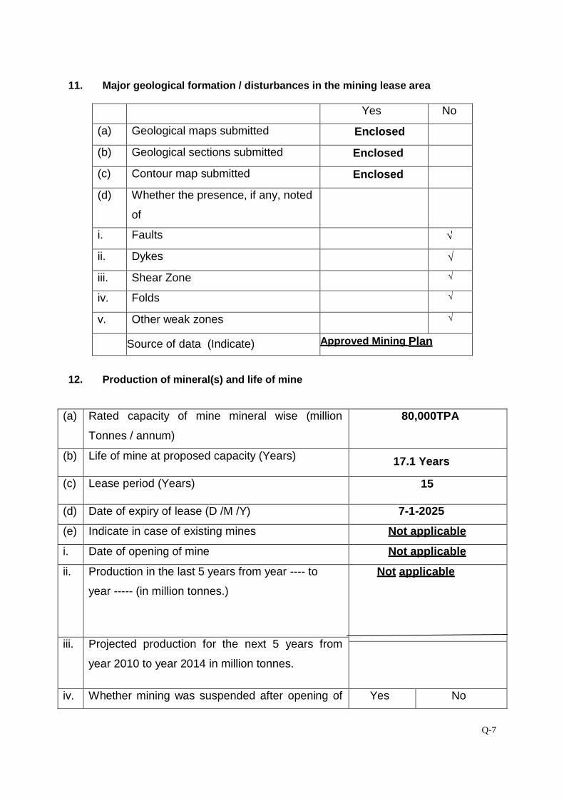
Q-7
11. Major geological formation / disturbances in the mining lease area
Yes No
(a) Geological maps submitted Enclosed
(b) Geological sections submitted Enclosed
(c) Contour map submitted Enclosed
(d) Whether the presence, if any, noted
of
i. Faults
ii. Dykes √
iii. Shear Zone √
iv. Folds √
v. Other weak zones √
Source of data (Indicate) Approved Mining Plan
12. Production of mineral(s) and life of mine
(a) Rated capacity of mine mineral wise (million
Tonnes / annum)
80,000TPA
(b) Life of mine at proposed capacity (Years)
17.1 Years
(c) Lease period (Years) 15
(d) Date of expiry of lease (D /M /Y) 7-1-2025
(e) Indicate in case of existing mines Not applicable
i. Date of opening of mine
Not applicable
ii. Production in the last 5 years from year ---- to
year ----- (in million tonnes.)
Not applicable
iii. Projected production for the next 5 years from
year 2010 to year 2014 in million tonnes.
iv. Whether mining was suspended after opening of
Yes No
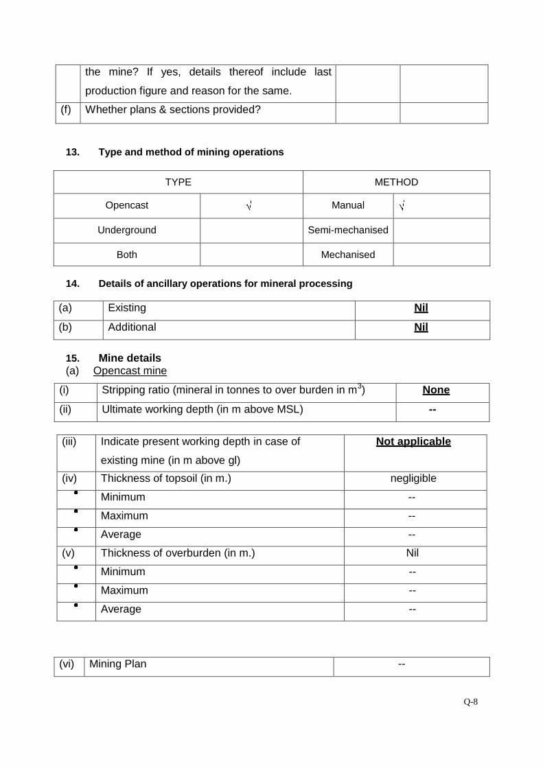
Q-8
the mine? If yes, details thereof include last
production figure and reason for the same.
(f) Whether plans & sections provided?
13. Type and method of mining operations
TYPE METHOD
Opencast Manual
Underground Semi-mechanised
Both Mechanised
14. Details of ancillary operations for mineral processing
(a) Existing Nil
(b) Additional Nil
15. Mine details (a) Opencast mine
(i) Stripping ratio (mineral in tonnes to over burden in m3) None
(ii) Ultimate working depth (in m above MSL) --
(iii) Indicate present working depth in case of
existing mine (in m above gl)
Not applicable
(iv) Thickness of topsoil (in m.) negligible Minimum -- Maximum -- Average --
(v) Thickness of overburden (in m.) Nil Minimum -- Maximum -- Average --
(vi) Mining Plan --
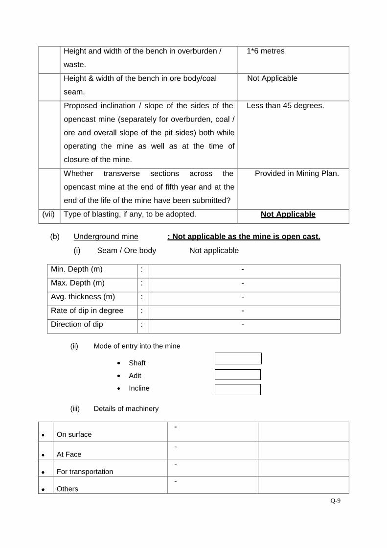
Q-9
Height and width of the bench in overburden /
waste.
1*6 metres
Height & width of the bench in ore body/coal
seam.
Not Applicable
Proposed inclination / slope of the sides of the
opencast mine (separately for overburden, coal /
ore and overall slope of the pit sides) both while
operating the mine as well as at the time of
closure of the mine.
Less than 45 degrees.
Whether transverse sections across the
opencast mine at the end of fifth year and at the
end of the life of the mine have been submitted?
Provided in Mining Plan.
(vii) Type of blasting, if any, to be adopted. Not Applicable
(b) Underground mine : Not applicable as the mine is open cast.
(i) Seam / Ore body Not applicable
Min. Depth (m) : -
Max. Depth (m) : -
Avg. thickness (m) : -
Rate of dip in degree : -
Direction of dip : -
(ii) Mode of entry into the mine
Shaft
Adit
Incline
(iii) Details of machinery
On surface
-
At Face
-
For transportation
-
Others
-
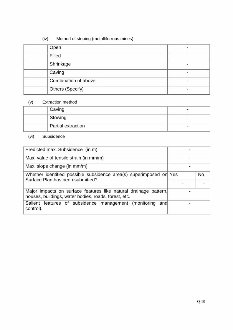
Q-10
(iv) Method of stoping (metalliferrous mines)
Open - Filled - Shrinkage - Caving - Combination of above - Others (Specify) -
(v) Extraction method
Caving - Stowing - Partial extraction -
(vi) Subsidence
Predicted max. Subsidence (in m) -
Max. value of tensile strain (in mm/m) -
Max. slope change (in mm/m) -
Whether identified possible subsidence area(s) superimposed on Surface Plan has been submitted?
Yes No
- -
Major impacts on surface features like natural drainage pattern, houses, buildings, water bodies, roads, forest, etc.
-
Salient features of subsidence management (monitoring and control).
-
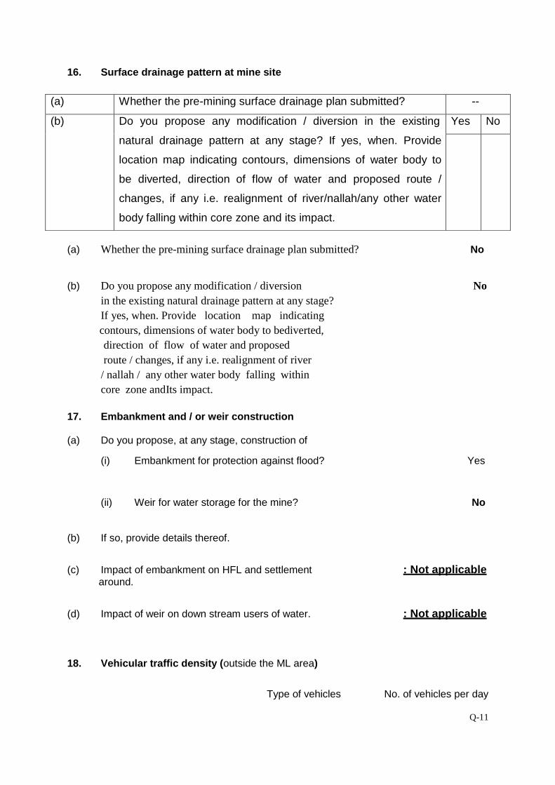
Q-11
16. Surface drainage pattern at mine site
(a) Whether the pre-mining surface drainage plan submitted? No
(b) Do you propose any modification / diversion No in the existing natural drainage pattern at any stage? If yes, when. Provide location map indicating
contours, dimensions of water body to bediverted, direction of flow of water and proposed route / changes, if any i.e. realignment of river / nallah / any other water body falling within core zone andIts impact.
17. Embankment and / or weir construction (a) Do you propose, at any stage, construction of
(i) Embankment for protection against flood? Yes
(ii) Weir for water storage for the mine? No
(b) If so, provide details thereof. (c) Impact of embankment on HFL and settlement : Not applicable around. (d) Impact of weir on down stream users of water. : Not applicable 18. Vehicular traffic density (outside the ML area)
Type of vehicles No. of vehicles per day
(a) Whether the pre-mining surface drainage plan submitted? --
(b) Do you propose any modification / diversion in the existing
natural drainage pattern at any stage? If yes, when. Provide
location map indicating contours, dimensions of water body to
be diverted, direction of flow of water and proposed route /
changes, if any i.e. realignment of river/nallah/any other water
body falling within core zone and its impact.
Yes No
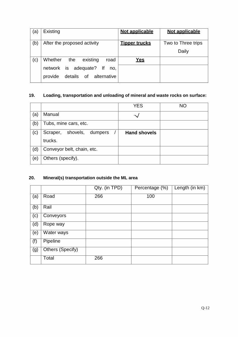
Q-12
(a) Existing Not applicable Not applicable
(b) After the proposed activity Tipper trucks Two to Three trips
Daily
(c) Whether the existing road
network is adequate? If no,
provide details of alternative
proposal?
Yes
19. Loading, transportation and unloading of mineral and waste rocks on surface:
YES NO
(a) Manual
(b) Tubs, mine cars, etc.
(c) Scraper, shovels, dumpers /
trucks.
Hand shovels
(d) Conveyor belt, chain, etc.
(e) Others (specify).
20. Mineral(s) transportation outside the ML area
Qty. (in TPD) Percentage (%) Length (in km)
(a) Road 266 100
(b) Rail
(c) Conveyors
(d) Rope way
(e) Water ways
(f) Pipeline
(g) Others (Specify)
Total 266
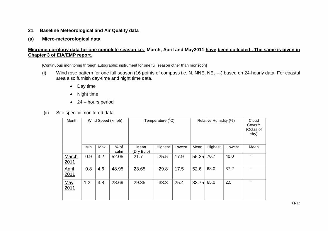
Q-12
21. Baseline Meteorological and Air Quality data
(a) Micro-meteorological data Micrometeorology data for one complete season i.e. March, April and May2011 have been collected . The same is given in Chapter 3 of EIA/EMP report.
[Continuous monitoring through autographic instrument for one full season other than monsoon]
(i) Wind rose pattern for one full season (16 points of compass i.e. N, NNE, NE, ---) based on 24-hourly data. For coastal area also furnish day-time and night time data.
Day time
Night time
24 – hours period (ii) Site specific monitored data
Month Wind Speed (kmph) Temperature (oC) Relative Humidity (%) Cloud Cover**
(Octas of sky)
Min Max. % of calm
Mean (Dry Bulb)
Highest Lowest Mean Highest Lowest Mean
March 2011
0.9 3.2 52.05 21.7 25.5
17.9 55.35 70.7 40.0 -
April 2011
0.8 4.6 48.95 23.65 29.8
17.5 52.6 68.0 37.2 -
May 2011
1.2 3.8 28.69 29.35 33.3
25.4 33.75 65.0 2.5 -
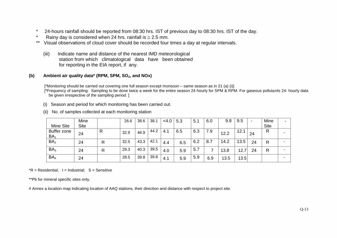
Q-13
* 24-hours rainfall should be reported from 08:30 hrs. IST of previous day to 08:30 hrs. IST of the day. * Rainy day is considered when 24 hrs. rainfall is 2.5 mm. ** Visual observations of cloud cover should be recorded four times a day at regular intervals.
(iii) Indicate name and distance of the nearest IMD meteorological
station from which climatological data have been obtained for reporting in the EIA report, if any.
(b) Ambient air quality data* (RPM, SPM, SO2, and NOx)
[*Monitoring should be carried out covering one full season except monsoon – same season as in 21 (a) (i)] [*Frequency of sampling: Sampling to be done twice a week for the entire season 24 hourly for SPM & RPM. For gaseous pollutants 24- hourly data
be given irrespective of the sampling period. ]
(i) Season and period for which monitoring has been carried out.
(ii) No. of samples collected at each monitoring station
Mine Site
Mine Site
26.6 38.6 38.1 <4.0 5.3 5.1 6.0 9.8 9.5 - Mine Site
-
Buffer zone BA1
24
R 32.9 46.9 44.2 4.1 6.5 6.3 7.9 12.2 12.1
24 R -
BA2 24 R 32.5 43.3 42.1 4.4 6.5 6.2 8.7 14.2 13.5 24 R -
BA3 24 R 29.3 40.3 39.5 4.0 5.9 5.7 7 13.8 12.7 24 R -
BA4 24 28.5 39.8 39.8 4.1 5.9 5.9 6.9 13.5 13.5 -
*R = Residential; I = Industrial; S = Sensitive **Pb for mineral specific sites only. # Annex a location map indicating location of AAQ stations, their direction and distance with respect to project site.
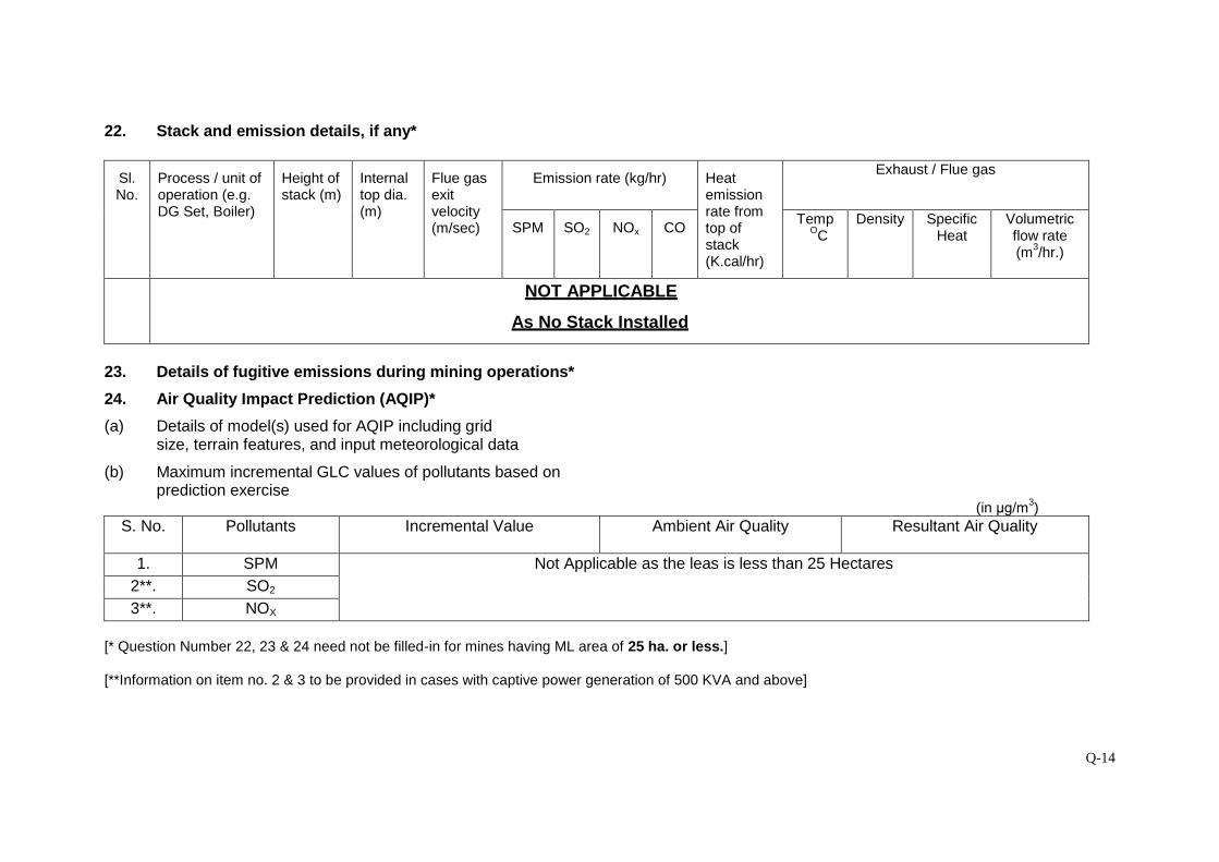
Q-14
22. Stack and emission details, if any*
Sl. No.
Process / unit of operation (e.g. DG Set, Boiler)
Height of stack (m)
Internal top dia. (m)
Flue gas exit velocity (m/sec)
Emission rate (kg/hr) Heat emission rate from top of stack (K.cal/hr)
Exhaust / Flue gas
SPM SO2 NOx CO Temp
OC Density Specific
Heat Volumetric flow rate (m3/hr.)
NOT APPLICABLE
As No Stack Installed
23. Details of fugitive emissions during mining operations*
24. Air Quality Impact Prediction (AQIP)*
(a) Details of model(s) used for AQIP including grid size, terrain features, and input meteorological data
(b) Maximum incremental GLC values of pollutants based on prediction exercise
(in μg/m3)
S. No. Pollutants
Incremental Value Ambient Air Quality Resultant Air Quality
1. SPM Not Applicable as the leas is less than 25 Hectares 2**. SO2 3**. NOX
[* Question Number 22, 23 & 24 need not be filled-in for mines having ML area of 25 ha. or less.] [**Information on item no. 2 & 3 to be provided in cases with captive power generation of 500 KVA and above]
Q-15
25. Water requirement (m3/day)
Purpose Avg. Demand Peak Demand
A. Mine site
1. Mine operation
2. Land reclamation
3. Dust suppression 2.5 3.0
4. Drinking 0.1 0.15
5. Green Belt 1.2 1.50
6. Beneficiation
7. Washeries
8. Fire Service
9. Others Domestic
B. Township
1. Green Belt
2. Domestic
3. Other (specify)
Total 3.8 4.65
26. Source of water supply*
The water requirement for the mining activity such as water sprinkling on the haulage roads and green
belt development will be met from local water bodies by tankers and drinking water will be provided by
bore well present at the crusher site
[*Annex a copy of sanction letter / permission from the concerned authority (Central Ground Water Authority in case of ground water abstraction is from notified area / State Ground Water Board in case of non-notified area / State Irrigation Department for surface water pumping) for drawing water.]
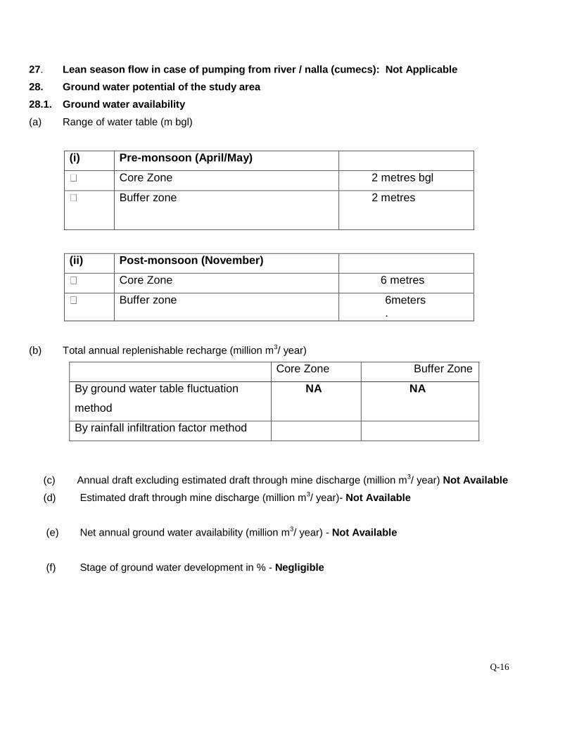
Q-16
27. Lean season flow in case of pumping from river / nalla (cumecs): Not Applicable
28. Ground water potential of the study area
28.1. Ground water availability
(a) Range of water table (m bgl)
(i) Pre-monsoon (April/May)
Core Zone 2 metres bgl
Buffer zone 2 metres
(ii) Post-monsoon (November)
Core Zone 6 metres
Buffer zone 6meters.
(b) Total annual replenishable recharge (million m3/ year)
Core Zone Buffer Zone
By ground water table fluctuation
method
NA NA
By rainfall infiltration factor method
(c) Annual draft excluding estimated draft through mine discharge (million m3/ year) Not Available
(d) Estimated draft through mine discharge (million m3/ year)- Not Available
(e) Net annual ground water availability (million m3/ year) - Not Available
(f) Stage of ground water development in % - Negligible
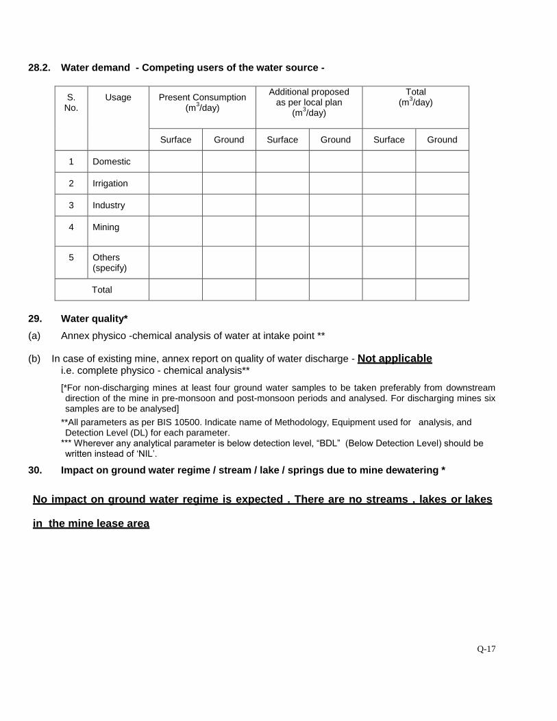
Q-17
28.2. Water demand - Competing users of the water source -
S. No.
Usage Present Consumption (m3/day)
Additional proposed as per local plan
(m3/day)
Total (m3/day)
Surface Ground Surface Ground Surface Ground
1 Domestic
2 Irrigation
3 Industry
4 Mining
5 Others (specify)
Total
29. Water quality*
(a) Annex physico -chemical analysis of water at intake point **
(b) In case of existing mine, annex report on quality of water discharge - Not applicable i.e. complete physico - chemical analysis**
[*For non-discharging mines at least four ground water samples to be taken preferably from downstream direction of the mine in pre-monsoon and post-monsoon periods and analysed. For discharging mines six samples are to be analysed]
**All parameters as per BIS 10500. Indicate name of Methodology, Equipment used for analysis, and Detection Level (DL) for each parameter.
*** Wherever any analytical parameter is below detection level, “BDL” (Below Detection Level) should be written instead of ‘NIL’.
30. Impact on ground water regime / stream / lake / springs due to mine dewatering *
No impact on ground water regime is expected . There are no streams , lakes or lakes
in the mine lease area
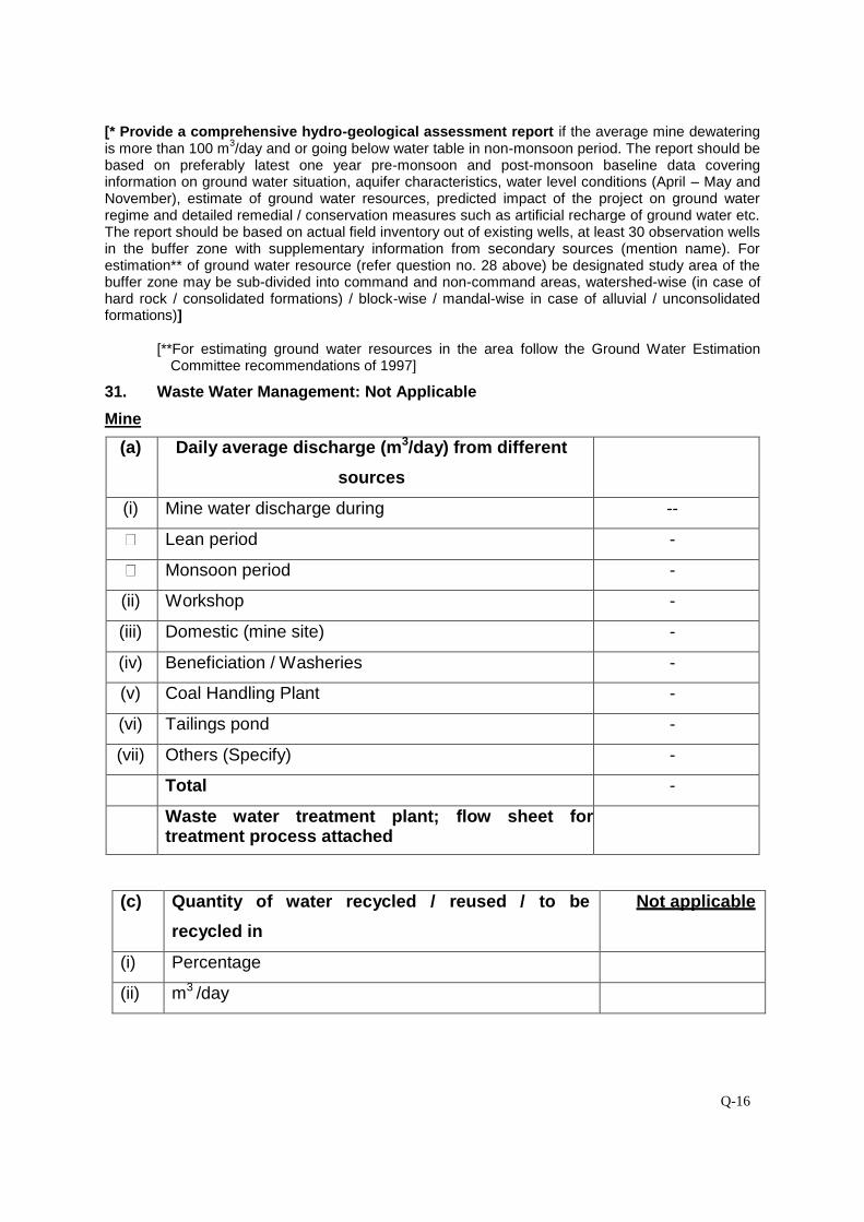
Q-16
[* Provide a comprehensive hydro-geological assessment report if the average mine dewatering is more than 100 m3/day and or going below water table in non-monsoon period. The report should be based on preferably latest one year pre-monsoon and post-monsoon baseline data covering information on ground water situation, aquifer characteristics, water level conditions (April – May and November), estimate of ground water resources, predicted impact of the project on ground water regime and detailed remedial / conservation measures such as artificial recharge of ground water etc. The report should be based on actual field inventory out of existing wells, at least 30 observation wells in the buffer zone with supplementary information from secondary sources (mention name). For estimation** of ground water resource (refer question no. 28 above) be designated study area of the buffer zone may be sub-divided into command and non-command areas, watershed-wise (in case of hard rock / consolidated formations) / block-wise / mandal-wise in case of alluvial / unconsolidated formations)]
[**For estimating ground water resources in the area follow the Ground Water Estimation
Committee recommendations of 1997]
31. Waste Water Management: Not Applicable
Mine
(a) Daily average discharge (m3/day) from different
sources
(i) Mine water discharge during --
Lean period -
Monsoon period -
(ii) Workshop -
(iii) Domestic (mine site) -
(iv) Beneficiation / Washeries -
(v) Coal Handling Plant -
(vi) Tailings pond -
(vii) Others (Specify) -
Total -
Waste water treatment plant; flow sheet for treatment process attached
(c) Quantity of water recycled / reused / to be
recycled in
Not applicable
(i) Percentage
(ii) m3 /day
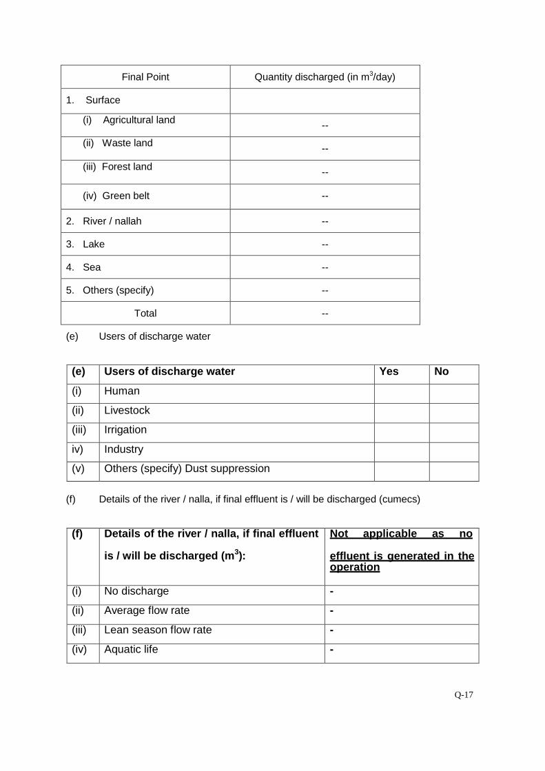
Q-17
Final Point Quantity discharged (in m3/day)
1. Surface
(i) Agricultural land --
(ii) Waste land
--
(iii) Forest land
--
(iv) Green belt --
2. River / nallah --
3. Lake --
4. Sea --
5. Others (specify) --
Total --
(e) Users of discharge water
(e) Users of discharge water Yes No
(i) Human
(ii) Livestock
(iii) Irrigation
iv) Industry
(v) Others (specify) Dust suppression
(f) Details of the river / nalla, if final effluent is / will be discharged (cumecs) (f) Details of the river / nalla, if final effluent
is / will be discharged (m3):
Not applicable as no
effluent is generated in the operation
(i) No discharge -
(ii) Average flow rate -
(iii) Lean season flow rate -
(iv) Aquatic life -
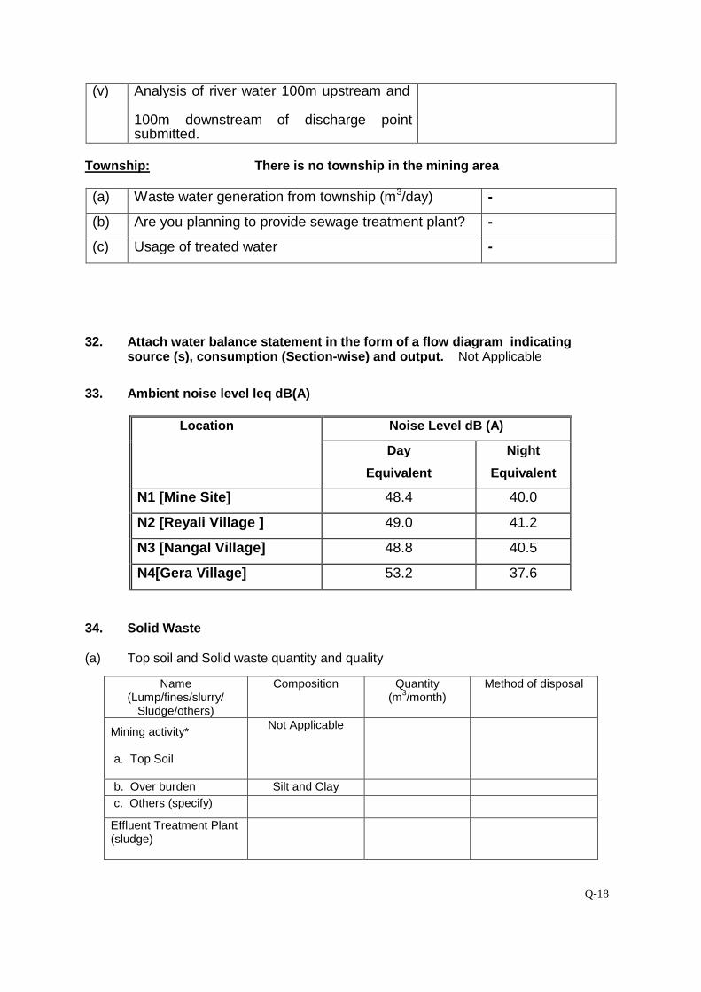
Q-18
(v) Analysis of river water 100m upstream and
100m downstream of discharge point submitted.
Township: There is no township in the mining area (a) Waste water generation from township (m3/day) -
(b) Are you planning to provide sewage treatment plant? -
(c) Usage of treated water -
32. Attach water balance statement in the form of a flow diagram indicating source (s), consumption (Section-wise) and output. Not Applicable
33. Ambient noise level leq dB(A)
Location Noise Level dB (A)
Day
Equivalent
Night
Equivalent
N1 [Mine Site] 48.4 40.0
N2 [Reyali Village ] 49.0 41.2
N3 [Nangal Village] 48.8 40.5
N4[Gera Village] 53.2 37.6
34. Solid Waste (a) Top soil and Solid waste quantity and quality
Name (Lump/fines/slurry/
Sludge/others)
Composition Quantity (m3/month)
Method of disposal
Mining activity* a. Top Soil
Not Applicable
b. Over burden Silt and Clay c. Others (specify)
Effluent Treatment Plant (sludge)
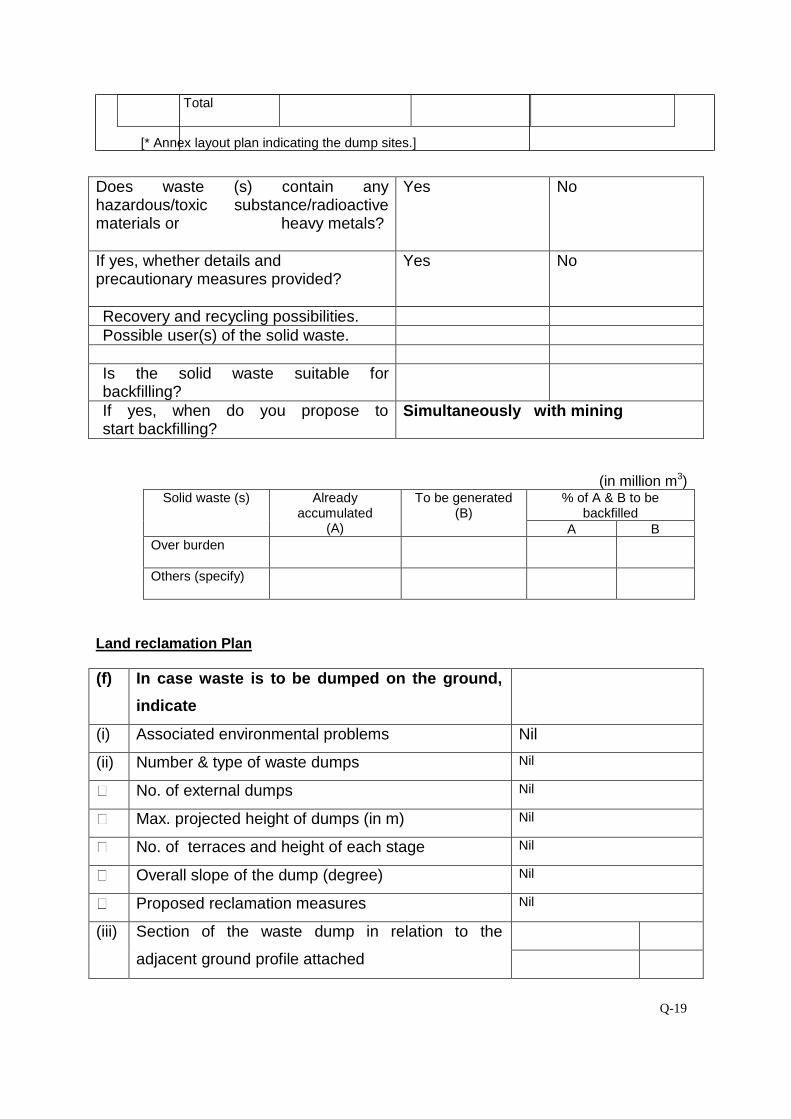
Q-19
Total
[* Annex layout plan indicating the dump sites.]
Does waste (s) contain any hazardous/toxic substance/radioactive materials or heavy metals?
Yes No
If yes, whether details and precautionary measures provided?
Yes No
Recovery and recycling possibilities. Possible user(s) of the solid waste. Is the solid waste suitable for backfilling?
If yes, when do you propose to start backfilling?
Simultaneously with mining
(in million m3) Solid waste (s) Already
accumulated (A)
To be generated (B)
% of A & B to be backfilled
A B Over burden
Others (specify)
Land reclamation Plan (f) In case waste is to be dumped on the ground,
indicate
(i) Associated environmental problems Nil
(ii) Number & type of waste dumps Nil
No. of external dumps Nil
Max. projected height of dumps (in m) Nil
No. of terraces and height of each stage Nil
Overall slope of the dump (degree) Nil
Proposed reclamation measures Nil
(iii) Section of the waste dump in relation to the
adjacent ground profile attached
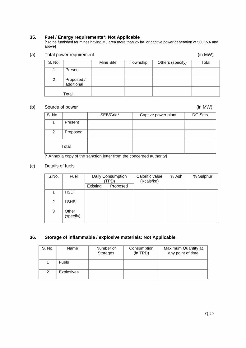
Q-20
35. Fuel / Energy requirements*: Not Applicable
[*To be furnished for mines having ML area more than 25 ha. or captive power generation of 500KVA and above]
(a) Total power requirement (in MW)
S. No. Mine Site Township Others (specify) Total
1 Present
2 Proposed / additional
Total
(b) Source of power (in MW)
S. No. SEB/Grid* Captive power plant DG Sets
1 Present
2 Proposed
Total
[* Annex a copy of the sanction letter from the concerned authority]
(c) Details of fuels
S.No. Fuel Daily Consumption (TPD)
Calorific value (Kcals/kg)
% Ash % Sulphur
Existing Proposed
1
2
3
HSD LSHS Other (specify)
36. Storage of inflammable / explosive materials: Not Applicable
S. No. Name Number of Storages
Consumption (in TPD)
Maximum Quantity at any point of time
1 Fuels
2 Explosives
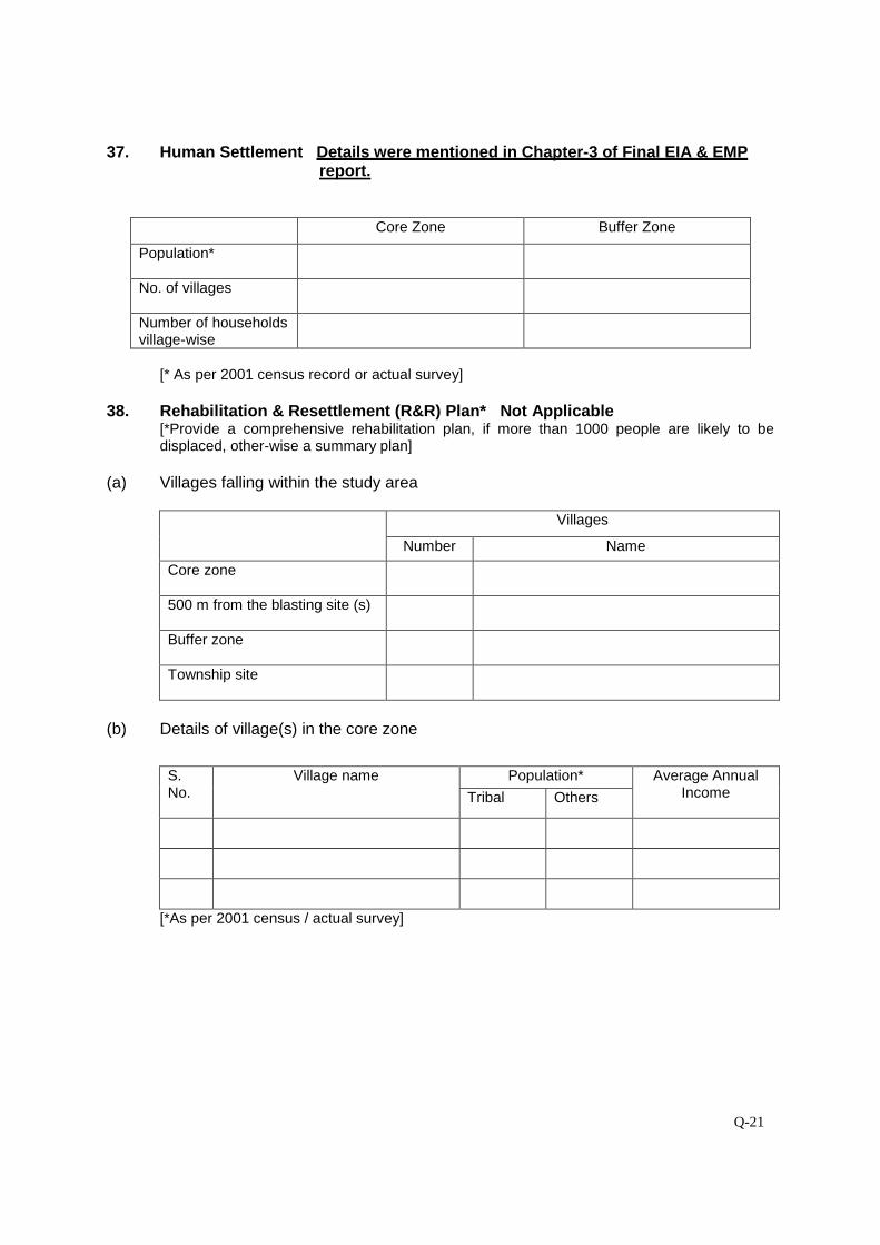
Q-21
37. Human Settlement Details were mentioned in Chapter-3 of Final EIA & EMP report.
Core Zone Buffer Zone
Population*
No. of villages
Number of households village-wise
[* As per 2001 census record or actual survey]
38. Rehabilitation & Resettlement (R&R) Plan* Not Applicable
[*Provide a comprehensive rehabilitation plan, if more than 1000 people are likely to be displaced, other-wise a summary plan]
(a) Villages falling within the study area
Villages
Number Name
Core zone
500 m from the blasting site (s)
Buffer zone
Township site
(b) Details of village(s) in the core zone
S. No.
Village name
Population* Average Annual Income Tribal Others
[*As per 2001 census / actual survey]
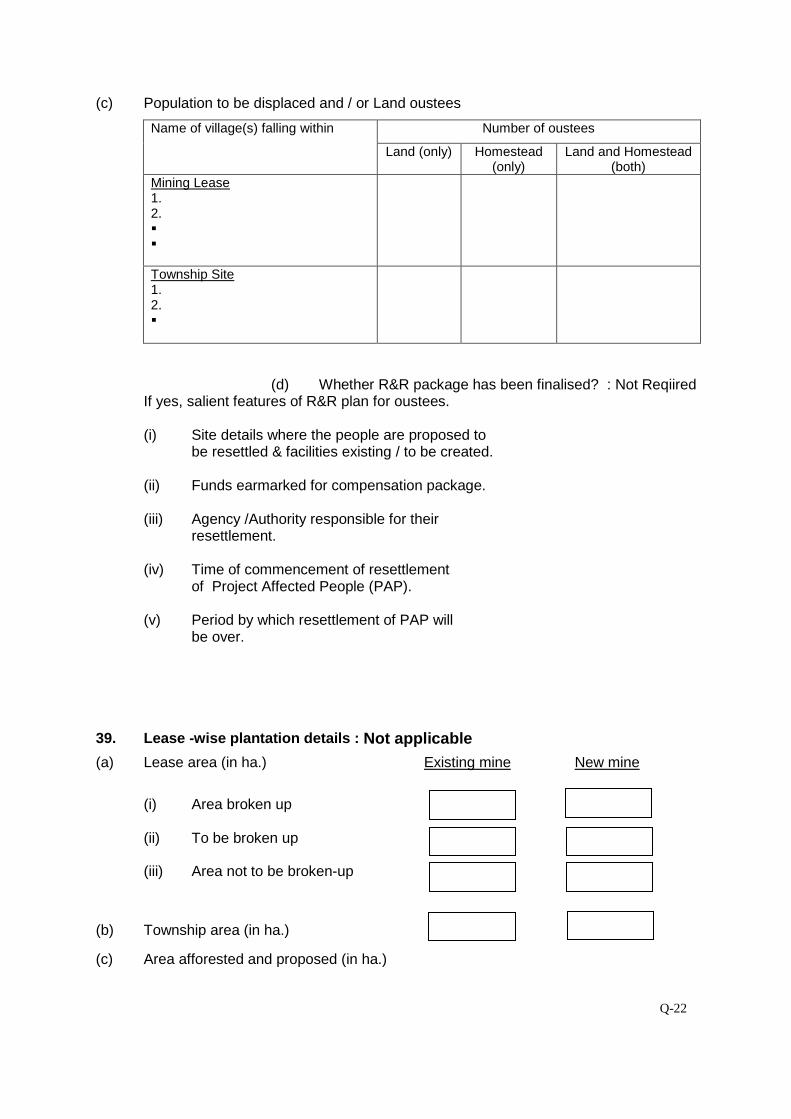
Q-22
(c) Population to be displaced and / or Land oustees
Name of village(s) falling within Number of oustees
Land (only) Homestead (only)
Land and Homestead (both)
Mining Lease 1. 2.
Township Site 1. 2.
(d) Whether R&R package has been finalised? : Not Reqiired
If yes, salient features of R&R plan for oustees. (i) Site details where the people are proposed to
be resettled & facilities existing / to be created.
(ii) Funds earmarked for compensation package.
(iii) Agency /Authority responsible for their resettlement.
(iv) Time of commencement of resettlement
of Project Affected People (PAP).
(v) Period by which resettlement of PAP will be over. 39. Lease -wise plantation details : Not applicable
(a) Lease area (in ha.) Existing mine New mine
(i) Area broken up
(ii) To be broken up
(iii) Area not to be broken-up
(b) Township area (in ha.)
(c) Area afforested and proposed (in ha.)
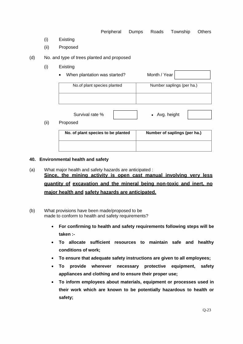
Q-23
Peripheral Dumps Roads Township Others
(i) Existing
(ii) Proposed
(d) No. and type of trees planted and proposed
(i) Existing
When plantation was started? Month / Year
No.of plant species planted Number saplings (per ha.)
Survival rate % ● Avg. height
(ii) Proposed
No. of plant species to be planted Number of saplings (per ha.)
40. Environmental health and safety (a) What major health and safety hazards are anticipated :
Since, the mining activity is open cast manual involving very less
quantity of excavation and the mineral being non-toxic and inert, no
major health and safety hazards are anticipated.
(b) What provisions have been made/proposed to be
made to conform to health and safety requirements?
For confirming to health and safety requirements following steps will be
taken :-
To allocate sufficient resources to maintain safe and healthy
conditions of work;
To ensure that adequate safety instructions are given to all employees;
To provide wherever necessary protective equipment, safety
appliances and clothing and to ensure their proper use;
To inform employees about materials, equipment or processes used in
their work which are known to be potentially hazardous to health or
safety;
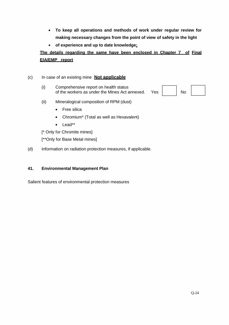
Q-24
To keep all operations and methods of work under regular review for
making necessary changes from the point of view of safety in the light
of experience and up to date knowledge;
The details regarding the same have been enclosed in Chapter 7 of Final
EIA/EMP report
(c) In case of an existing mine Not applicable
(i) Comprehensive report on health status
of the workers as under the Mines Act annexed. Yes No
(ii) Mineralogical composition of RPM (dust)
Free silica
Chromium* (Total as well as Hexavalent)
Lead**
[* Only for Chromite mines]
[**Only for Base Metal mines]
(d) Information on radiation protection measures, if applicable. 41. Environmental Management Plan
Salient features of environmental protection measures
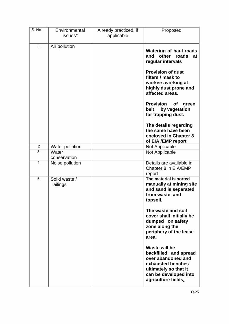
Q-25
S. No.
Environmental issues*
Already practiced, if applicable
Proposed
1 Air pollution
Watering of haul roads and other roads at regular intervals Provision of dust filters / mask to workers working at highly dust prone and affected areas. Provision of green belt by vegetation for trapping dust. The details regarding the same have been enclosed in Chapter 8 of EIA /EMP report.
2 Water pollution Not Applicable 3. Water
conservation Not Applicable
4. Noise pollution Details are available in Chapter 8 in EIA/EMP report
5. Solid waste / Tailings
The material is sorted manually at mining site and sand is separated from waste and topsoil. The waste and soil cover shall initially be dumped on safety zone along the periphery of the lease area. Waste will be backfilled and spread over abandoned and exhausted benches ultimately so that it can be developed into agriculture fields.
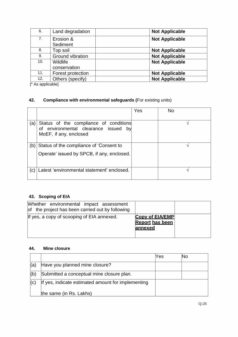
Q-26
6. Land degradation Not Applicable 7. Erosion &
Sediment Not Applicable
8. Top soil Not Applicable 9. Ground vibration Not Applicable 10. Wildlife
conservation Not Applicable
11. Forest protection Not Applicable 12. Others (specify) Not Applicable
[* As applicable] 42. Compliance with environmental safeguards (For existing units)
Yes No
(a) Status of the compliance of conditions of environmental clearance issued by MoEF, if any, enclosed
√
(b) Status of the compliance of ‘Consent to
Operate’ issued by SPCB, if any, enclosed.
√
(c) Latest ‘environmental statement’ enclosed. √
43. Scoping of EIA
Whether environmental impact assessment of the project has been carried out by following scoping process?
If yes, a copy of scooping of EIA annexed. Copy of EIA/EMP Report has been annexed
44. Mine closure
Yes No
(a) Have you planned mine closure?
(b) Submitted a conceptual mine closure plan.
(c) If yes, indicate estimated amount for implementing the same (in Rs. Lakhs)
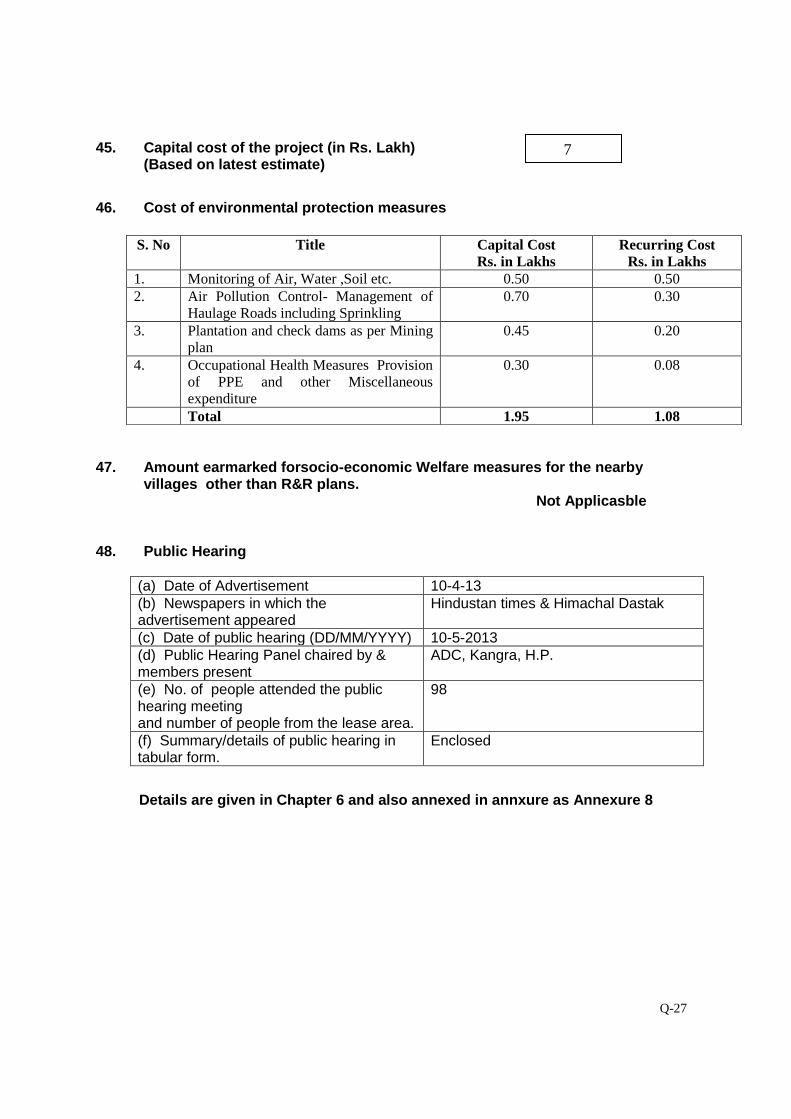
Q-27
45. Capital cost of the project (in Rs. Lakh) (Based on latest estimate)
46. Cost of environmental protection measures
47. Amount earmarked forsocio-economic Welfare measures for the nearby
villages other than R&R plans. Not Applicasble
48. Public Hearing
(a) Date of Advertisement 10-4-13 (b) Newspapers in which the advertisement appeared
Hindustan times & Himachal Dastak
(c) Date of public hearing (DD/MM/YYYY) 10-5-2013 (d) Public Hearing Panel chaired by & members present
ADC, Kangra, H.P.
(e) No. of people attended the public hearing meeting and number of people from the lease area.
98
(f) Summary/details of public hearing in tabular form.
Enclosed
Details are given in Chapter 6 and also annexed in annxure as Annexure 8
S. No Title Capital Cost Rs. in Lakhs
Recurring Cost Rs. in Lakhs
1. Monitoring of Air, Water ,Soil etc. 0.50 0.50 2. Air Pollution Control- Management of
Haulage Roads including Sprinkling 0.70 0.30
3. Plantation and check dams as per Mining plan
0.45 0.20
4. Occupational Health Measures Provision of PPE and other Miscellaneous expenditure
0.30 0.08
Total 1.95 1.08
7
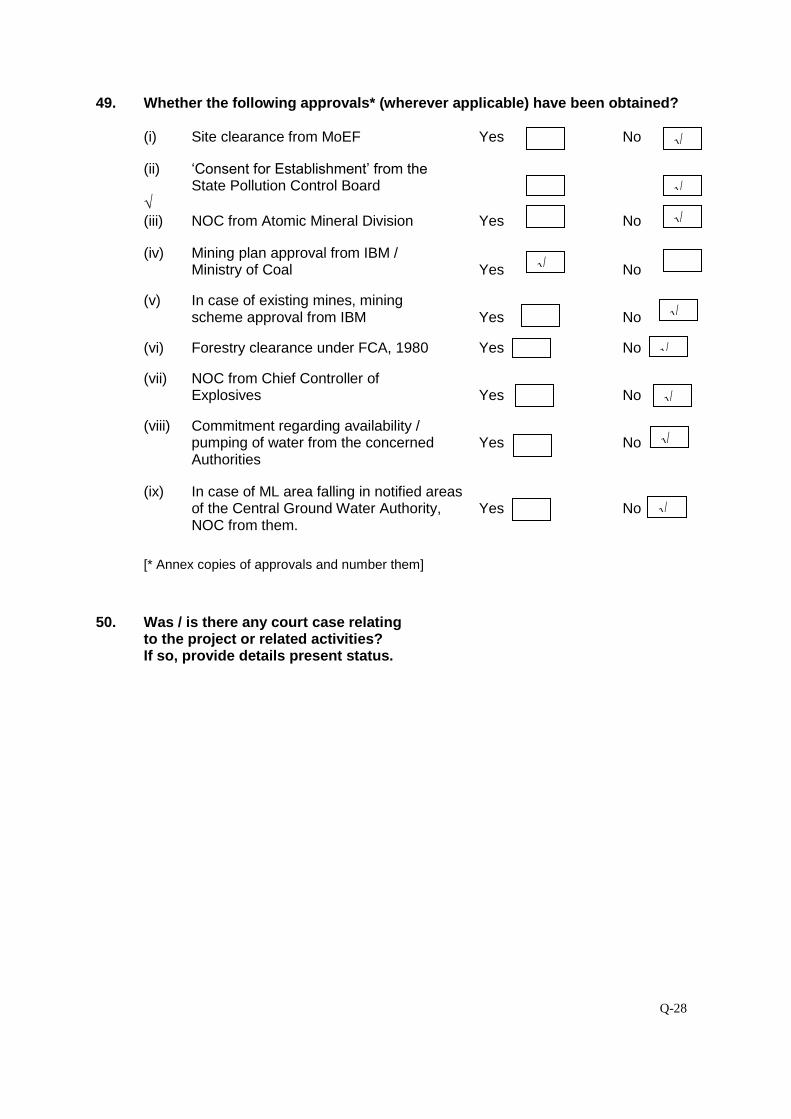
Q-28
49. Whether the following approvals* (wherever applicable) have been obtained?
(i) Site clearance from MoEF Yes No (ii) ‘Consent for Establishment’ from the
State Pollution Control Board Yes No √ (iii) NOC from Atomic Mineral Division Yes No
(iv) Mining plan approval from IBM /
Ministry of Coal Yes No (v) In case of existing mines, mining scheme approval from IBM Yes No
(vi) Forestry clearance under FCA, 1980 Yes No (vii) NOC from Chief Controller of Explosives Yes No
(viii) Commitment regarding availability /
pumping of water from the concerned Yes No Authorities
(ix) In case of ML area falling in notified areas of the Central Ground Water Authority, Yes No
NOC from them.
[* Annex copies of approvals and number them]
50. Was / is there any court case relating
to the project or related activities? If so, provide details present status.
√
√
√
√
√
√
√
√
√
Q-29
Verification: The data and information given in this proforma are true to the best of my knowledge and belief.
Date: Signature of the applicant* with Full name & address Place: [* Owner or his authorized signatory]
Given under the seal of organisation on behalf of whom the applicant is signing