Embed Size (px)
Citation preview

A St
Base Line Rd
Oak St
16th
St
14th
St
Tanw
ood
AveG St
East Town Center DrWest Town Center Dr
A St
Baseline Rd
PFE Rd
W Elverta Rd
S Br
ewer
Rd
Wat
t Ave
Foot
hills
Blv
d
Fidd
ymen
t Rd
Phillip Rd
Pleasant Grove Blvd
Wal
erga
Rd
Blue Oaks Blvd
Palla
day
Rd
Indu
stria
l Ave
Main St
Rosevil
le Rd
Vineyard Rd
Antelope Rd
Cirby Way
Junction Blvd
Fairway Dr
Atk
inso
n St
Cook
Rio
lo R
d
Sunr
ise
Ave
Aubu
rn B
lvd
Rive
rsid
e Av
e
9th
St
Was
hing
ton
Blvd
28th
St
16th
St
Ant
elop
e Rd
·|}þ65
EXISTING TRANSIT SERVICEFIGURE 1C:\Users\trysen\Desktop\RS13-3105_PlacerVineyards\GIS\MXD\fig01_ex_transit_serv_forPrint.mxd
Placer Vineyards Specific Plan
City ofRoseville
§̈¦80
19 19
84
84
95
9321
103
21
Commuter Express &Auburn to Light Rail
Lincoln/Sierra College
R
S
M
SM
S
M
MI
D
I D
M
ID
R
I D
AB
M
S
M
IDR
R C
C
A B
ABC
L
AB
S
L
AB
AB
SC!
Galleria Transfer Point:Routes: A,B,M,S,SC
!
Civic CenterTransfer Point:
Routes:A,B,D,I,L
!
Louis/OrlandoTransfer Point
Not to Scale
* Route 'SC' denotes Sierra College Evening Shuttle
High Density Residential
Medium Density Residential
Low Density Residential
Commercial
Commercial/Mixed Use
Roseville Transit *X
Sacramento Regional TransitX
Project Land Use
Business Park
Office
Public/Quasi-Public
School
Park/Open Space
Placer County TransitXXX
March 2014RS13-3105
Prepared for:
Placer Vineyards Transit Master Plan
2990 Lava Ridge CourtSuite 200
Roseville, CA95661
Submitted by:
Final
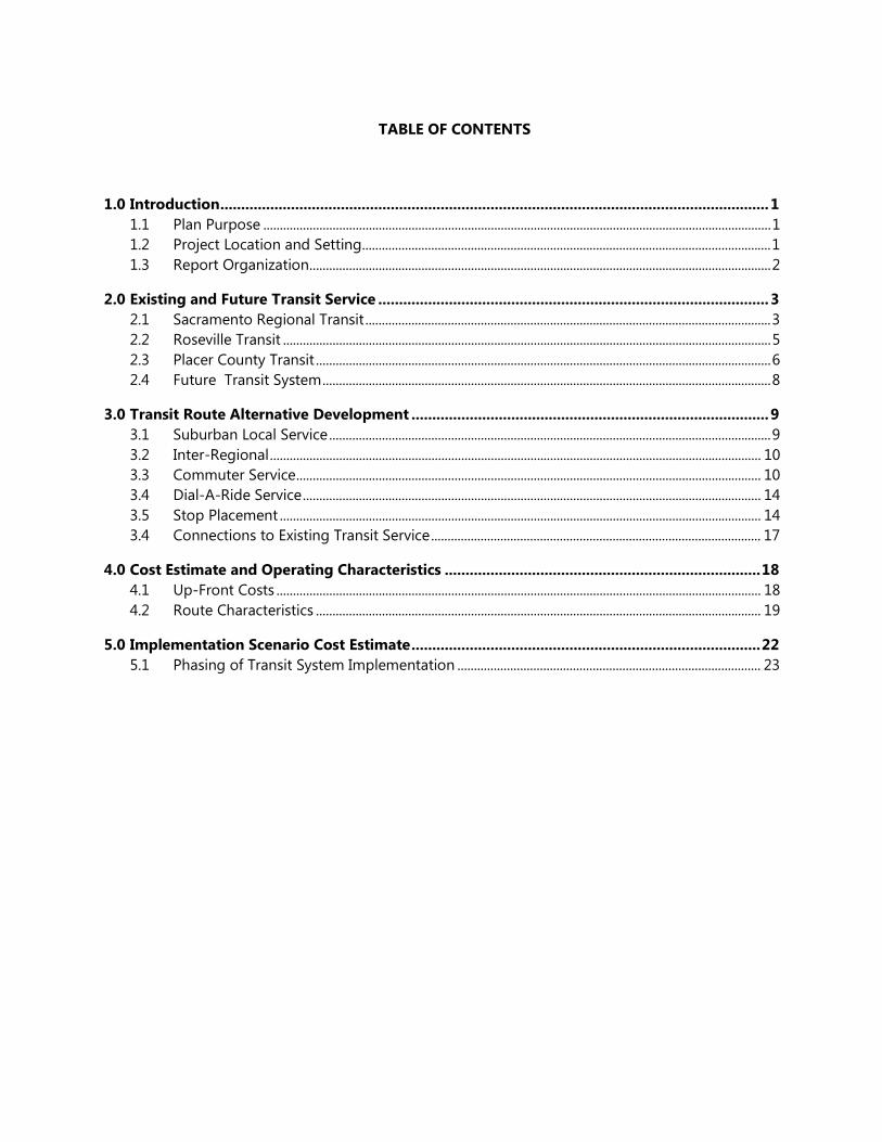
TABLE OF CONTENTS
1.0 Introduction .................................................................................................................................... 1
1.1 Plan Purpose .......................................................................................................................................................... 1
1.2 Project Location and Setting ............................................................................................................................ 1
1.3 Report Organization ............................................................................................................................................ 2
2.0 Existing and Future Transit Service .............................................................................................. 3
2.1 Sacramento Regional Transit ........................................................................................................................... 3
2.2 Roseville Transit .................................................................................................................................................... 5
2.3 Placer County Transit .......................................................................................................................................... 6
2.4 Future Transit System ........................................................................................................................................ 8
3.0 Transit Route Alternative Development ...................................................................................... 9
3.1 Suburban Local Service ...................................................................................................................................... 9
3.2 Inter-Regional ..................................................................................................................................................... 10
3.3 Commuter Service ............................................................................................................................................. 10
3.4 Dial-A-Ride Service ........................................................................................................................................... 14
3.5 Stop Placement .................................................................................................................................................. 14
3.4 Connections to Existing Transit Service .................................................................................................... 17
4.0 Cost Estimate and Operating Characteristics ............................................................................ 18
4.1 Up-Front Costs ................................................................................................................................................... 18
4.2 Route Characteristics ....................................................................................................................................... 19
5.0 Implementation Scenario Cost Estimate .................................................................................... 22
5.1 Phasing of Transit System Implementation ............................................................................................ 23

LIST OF FIGURES
Figure 1 Existing Transit Service .............................................................................................................................................. 7
Figure 2 Proposed Suburban Local Service ..................................................................................................................... 11
Figure 3 Proposed Inter-Regional Service ........................................................................................................................ 12
Figure 4 Proposed Commuter Service ............................................................................................................................... 13
Figure 5 One-Quarter Mile Walkshed ................................................................................................................................ 15
Figure 6 Paratransit Service Area ......................................................................................................................................... 16
Figure 7 Proposed Transit Service ....................................................................................................................................... 24
LIST OF TABLES
Table 1: Cost Estimate of Transit Route Alternatives ........................................................................................................ 21
Table 2: Opening Day Cost Estimate ...................................................................................................................................... 25

Final Transit Master Plan
Placer Vineyards
March 2014
1
1.0 INTRODUCTION
1.1 PLAN PURPOSE
The Placer Vineyards Development Agreement requires the completion of an approved Transit Master
Plan (TMP) prior to “the approval for recordation of the first Final Large Lot Map within any portion of
the Specific Plan” or “of any Final Development Entitlement.” The agreement requires that the TMP use
the “service requirements and service levels described in Alternative No. 5” of the West Placer Transit
Study (October 2005) as the basis for determining appropriate transit services within the Specific Plan
area. Subsequent to this agreement, Placer County staff indicated support for a TMP aligned with the
service levels described in Alternative No. 3 of the West Placer Transit Study, for consideration by the
Board of Supervisors. This change effectively allows for reduced headways on local bus service within
the Plan area by replacing “High Suburban Local” bus service with “Typical Suburban Local” bus service.
In addition to transit-related requirements contained in the development agreement, the environmental
documentation for the Placer Vineyards Specific Plan includes the following transit-related mitigation
measures:
1. An internal transit system will be planned and implemented as the project is constructed that
connects the Village Centers with the Town Center and other areas as deemed appropriate.
2. An ADA dial-a-ride service will be provided
3. Commuter service will be provided to downtown Sacramento
4. Placer Vineyards will participate in regional service with connections to the Watt Avenue Light
Rail Station in Sacramento County, Regional University, Galleria Mall and other Regional Centers
1.2 PROJECT LOCATION AND SETTING
The Plan Area consists of approximately 5,230 acres of flat grassland bounded to the north by Baseline
Road, to the east by Walerga Road, and to the south and west by the Placer County line. The land to the
immediate north and south of the project site is undeveloped, but the project will feature similar land
use characteristics to the adjacent communities of Antelope and western Roseville, located to the
southeast and northeast of the project area, respectively. Both Baseline Road and Watt Avenue provide
regional connections to the project, connecting the site to Interstate 5, downtown Roseville, Interstate
80, and Business 80 (Capital City Freeway). Watt Avenue also provides a direct connection between
Final Transit Master Plan
Placer Vineyards
March 2014
2
Placer Vineyards and the nearest light rail station to the area – the Watt Avenue Station, which serves as
the northern terminus of the Sacramento Regional Transit Agency’s (RT) Blue Line.
1.3 REPORT ORGANIZATION
The remainder of this report is organized into four sections and an appendix. Section 2 presents an
inventory of all existing transit service in close proximity to the project, and discusses future planned
service in the vicinity of Placer Vineyards. Section 3 discusses the proposed placement of transit stops
and proposed alignment of route alternatives. Section 4 outlines operating characteristics of each route
alternative and presents cost estimates based on those characteristics. Finally, Section 5 discusses one
potential combination of alternatives that serves as a potential implementation scenario, and provides
the total estimated costs and revenues associated with this scenario. Additionally, section 5 discusses
opportunities for future system expansion and enhancement, and phasing considerations for the
ultimate transit system.

Final Transit Master Plan
Placer Vineyards
March 2014
3
2.0 EXISTING AND FUTURE TRANSIT SERVICE
Existing transit service in the project’s vicinity is provided by Placer County Transit, Roseville Transit, and
Sacramento Regional Transit. Figure 1 depicts the transit routes currently operating in this area. As
shown in Figure 1, the Galleria Transfer point, located adjacent to the Roseville Galleria Shopping Mall,
serves as a transfer point between existing Placer County Transit and Roseville Transit bus routes that
operate to the east of the Plan Area.
2.1 SACRAMENTO REGIONAL TRANSIT
The Sacramento Regional Transit District (RT) operates 67 bus routes and 38.6 miles of light rail lines
throughout a 418 square-mile service area. Light rail headways are 15 minutes during the day and 30
minutes in the evening and on weekends and holidays. Fixed-route bus service operates on headways
ranging from 12 to 75 minutes, depending on the route. Regional Transit routes 19 and 84 provide
service closest to Placer Vineyards, travelling as far north as Elverta Road (approximately one mile south
of the Plan Area).
- Route 19 begins service at the Arden/Del Paso Light Rail Station, travels north through Rio Linda
to Elverta Road, and continues south on Watt Avenue to the Watt Avenue/I-80 Light Rail Station.
- Route 84 operates primarily on Watt Avenue, connecting the Watt/Manlove Light Rail Station
with the Kaiser Hospital, McClellan Business Park, and Elverta Road where service terminates.
Other RT service is available at the Roseville Transit
Louis Lane / Orlando Avenue transfer point near the
interchange of Auburn Boulevard and Interstate 80. RT
Routes 21, 93, and 103 provide service to this location.
The Watt Avenue/I-80 Light Rail Station is the northern
terminus of the Sacramento RT blue line and is the
closest light rail station to the Placer Vineyards project
site. The station is approximately 7.5 miles south of the
project.
Similar to other transit systems that operate both bus and fixed rail service, RT modified its bus route
system after the construction of the light rail system to allow the two services to complement one
another. Several bus routes were changed to include stops at light rail stations, and serve as “feeders”

Final Transit Master Plan
Placer Vineyards
March 2014
4
for the light rail system. Riders using feeder routes typically utilize the bus system as a connection to
their final destination, but travel the bulk of their journey on the light rail system. This set-up is designed
to result in greater efficiencies for the overall transit system and to help capitalize on the investment in
light rail infrastructure.
This structure benefits riders by increasing the number of locations within reach of transit. If a rider’s
final destination is not within walking distance of one of the forty-seven light rail stations in the region,
the regional bus system supplements light rail by providing connections to destinations outside of the
immediate station areas. Direct bus connections are provided at the majority of light rail stations, and
include not only RT bus service, but connections to regional operators including Placer County Transit,
Elk Grove Transit, Roseville Transit, Yolo County Transit, as well as private shuttle operators.
However, many of the region’s top destinations are within walking distance of the light rail system, and
do not require a bus connection. These destinations include the following:
• Downtown Sacramento/Central Business District (various stations)
• Sacramento Valley Station1 (Sacramento Valley Station)
• UC Davis Medical Center (29th Street, 39th Street Stations)
• State Capitol (various stations)
• Old Sacramento (Sacramento Valley Station)
• California State University, Sacramento / Sacramento Center for Innovation
(University/65th Street Station)
• Downtown Folsom (Historic Folsom Station)
• City College (City College Station)
1 This station is served by to long distance Amtrak routes, the Cost Starlight (Seat Seattle-Portland-Sacramento-Los
Angeles) and the California Zephyr (Emeryville-Sacramento-Denver-Chicago). Additionally, the station is served by two
Amtrak California regional routes, the Capitol Corridor (San Jose-Sacramento-Auburn), and the San Joaquin (Sacramento-
Bakersfield). Amtrak’s Fiscal Year 2012 National Fact Sheet lists the Sacramento Valley Station as 7th in the nation in total
Amtrak ridership.
Final Transit Master Plan
Placer Vineyards
March 2014
5
2.2 ROSEVILLE TRANSIT
Roseville Transit operates 11 local routes, commuter service to downtown Sacramento, and a demand-
responsive dial-a-ride service within the City of Roseville. Local service operates Monday thru Friday from
5:30 AM until 10:00 PM and Saturday from 8:00 AM to 5:00 PM.
The project is closest to stops along local routes M, D, and I.
- Routes D and I connect Junction Boulevard west of Foothills Boulevard to downtown and central
Roseville. Service is provided on an hourly headway roughly between the hours of 6:00 AM and
6:00 PM on weekdays, and 8:00 AM and 4:30 PM on Saturdays. No Sunday service is provided.
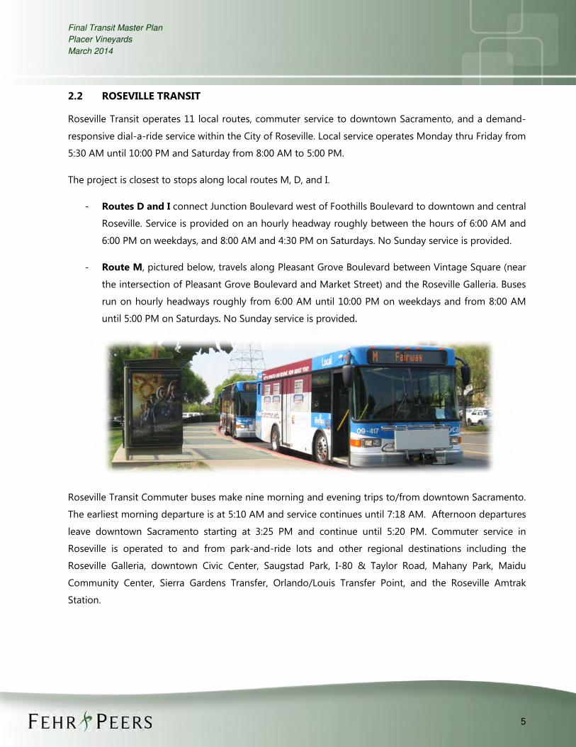
- Route M, pictured below, travels along Pleasant Grove Boulevard between Vintage Square (near
the intersection of Pleasant Grove Boulevard and Market Street) and the Roseville Galleria. Buses
run on hourly headways roughly from 6:00 AM until 10:00 PM on weekdays and from 8:00 AM
until 5:00 PM on Saturdays. No Sunday service is provided.
Roseville Transit Commuter buses make nine morning and evening trips to/from downtown Sacramento.
The earliest morning departure is at 5:10 AM and service continues until 7:18 AM. Afternoon departures
leave downtown Sacramento starting at 3:25 PM and continue until 5:20 PM. Commuter service in
Roseville is operated to and from park-and-ride lots and other regional destinations including the
Roseville Galleria, downtown Civic Center, Saugstad Park, I-80 & Taylor Road, Mahany Park, Maidu
Community Center, Sierra Gardens Transfer, Orlando/Louis Transfer Point, and the Roseville Amtrak
Station.

Final Transit Master Plan
Placer Vineyards
March 2014
6
2.3 PLACER COUNTY TRANSIT
Placer County Transit operates three routes in the vicinity of Placer Vineyards.
- Commuter Express: Operates between Colfax and downtown Sacramento via Interstate 80.
Stops include Colfax Depot, Clipper Gap Park-n-Ride, Auburn Station, Penryn Park-n-Ride,
Loomis Park-n-Ride, Rocklin Station, and the Roseville Transit I-80 / Taylor Road park-n-ride lot
before continuing into downtown Sacramento. Service is provided as four inbound and four
afternoon outbound trips per day on weekdays only. Morning service operates between 5:20 AM
until 6:37 AM, and afternoon service operates between 4:17 PM and 5:15 PM.
- Auburn to Light Rail: This route provides service Monday thru Saturday between Auburn and
the Watt Avenue / I-80 Sacramento RT Light Rail Station. No Sunday or holiday service is
available on this route. Both inbound and outbound headways are hourly between 5:00 AM (first
inbound trip) and 8:00 PM (last outbound trip). Stops include Auburn Station, Sierra College, the
Roseville Galleria, the Louis Lane / Orlando Avenue transfer point, and the Watt Avenue / I-80
Light Rail Station.
- Lincoln to Sierra College: This route provides service between Lincoln and Sierra College via
Rocklin Road, Pacific Street, Sunset Blvd, Industrial Avenue, and State Route 65. Major stops
include Sierra College, the Roseville Galleria, Thunder Valley Casino, and the Twelve Bridges
Library. Service is provided Monday thru Saturday with no service on Sundays or holidays.
Headways are hourly between 6:00 AM and 7:00 PM.

A St
Base Line Rd
Oak St
16th
St
14th
St
Tanw
ood
AveG St
East Town Center DrWest Town Center Dr
A St
Baseline Rd
PFE Rd
W Elverta Rd
S Br
ewer
Rd
Wat
t Ave
Foot
hills
Blv
d
Fidd
ymen
t Rd
Phillip Rd
Pleasant Grove Blvd
Wal
erga
Rd
Blue Oaks Blvd
Palla
day
Rd
Indu
stria
l Ave
Main St
Rosevil
le Rd
Vineyard Rd
Antelope Rd
Cirby Way
Junction Blvd
Fairway Dr
Atk
inso
n St
Cook
Rio
lo R
d
Sunr
ise
Ave
Aubu
rn B
lvd
Rive
rsid
e Av
e
9th
St
Was
hing
ton
Blvd
28th
St
16th
St
Ant
elop
e Rd
·|}þ65
EXISTING TRANSIT SERVICEFIGURE 1\\Fpse03\fpse2\Data2\2013Projects\RS Projects\RS13-3105_PlacerVineyards\GIS\MXD\fig01_ex_transit_serv_forPrint2.mxd
Placer Vineyards Specific Plan
City ofRoseville
§̈¦80
84
84
95
9321
103
21Commuter Express &Auburn to Light Rail
Lincoln/Sierra College
R
S
M
SM
S
M
MI D
I DM
I D
R
I D
AB
M
S
M
IDR
R C
C
A B
ABC
L
AB
S
L
AB
AB
SC!
Galleria Transfer Point:Routes: A,B,M,S,SC
!
Civic CenterTransfer Point:
Routes:A,B,D,I,L
!
Louis/OrlandoTransfer Point
Not to Scale
Roseville Transit *X
Sacramento Regional TransitX Placer County TransitXXX
* Route 'SC' denotes Sierra College Evening Shuttle
High Density Residential
Medium Density Residential
Low Density Residential
Commercial
Commercial/Mixed Use
Project Land UseBusiness Park
Office
Public/Quasi-Public
School
Park/Open Space
19 19

Final Transit Master Plan
Placer Vineyards
March 2014
8
2.4 FUTURE TRANSIT SYSTEM
In April 2009 RT adopted the TransitAction Plan. This plan recognizes that future transit investment
decisions must be integrated with land use planning, and that transit-supportive communities and
transit-oriented development are essential to increasing transit mode share in the region. The
TransitAction plan provides an ambitious vision of the future of transit in the Sacramento region,
developed from a clear public desire for a more robust system of transit options.
In addition to expanded bus, light rail transit (LRT), and commuter rail service, the plan includes new
streetcar and “Hi-Bus” networks. The Hi-Bus network is proposed as a system of high-speed, high-
frequency bus routes including new bus rapid transit (BRT) vehicles using dedicated lanes, enhanced
service on existing bus corridors, and regional express bus service. The Hi-Bus network is intended to
augment the rail components of the system to provide a regional high-capacity transit system. Although
the implementation of any given route would be subject to more detailed planning and review, as well as
funding considerations, the TransitAction Plan identifies several corridors for inclusion in a future Hi-Bus
network. The Watt Avenue corridor, which runs through Placer Vineyards, is included as part of this
future network,2 and would provide a direct connection between Placer Vineyards and the Watt Avenue
Light Rail Station.
2 The Metropolitan Transportation Plan for 2035 project list does not identify funding specifically for Hi-Bus enhancements
on Watt Avenue. However, the plan includes $216,001,000 for annual operating and maintenance (O&M) cost for bus
rapid transit within Placer County (transit operator to-be-determined). The plan also includes $270,544,000 in funding for
region-wide “Operational & transit-specific street improvements to support BRT/Enhanced Bus on major arterials with
service” that could be used for this purpose.

Final Transit Master Plan
Placer Vineyards
March 2014
9
3.0 TRANSIT ROUTE ALTERNATIVE DEVELOPMENT
Route alignments have been designed provide as much coverage within the Plan Area as possible, with a
focus on serving the most transit-supportive land use types and linking destinations both within the plan area
as well as in the surrounding region. All identified route alternatives provide service to the project’s Transit
Center located on Watt Avenue north of the planned Town Center Drive, as well as to the project’s Town
Center. The transit center will serve as a primary transfer point between the various routes proposed within
the Placer Vineyards, and would also accommodate planned future BRT service along Watt Avenue. The Town
Center is located near the center of the development and includes a complementary mix of land use types
including commercial development and high density residential.
While the future operator of transit services within Placer Vineyards remains unknown at this time, transit
routes were designed to tie in with the surrounding regional transit network and to complement existing and
transit services within the area. The intent of this master plan is to allow for flexibility in terms of which entity
ultimately operates the transit routes described below.
As identified in the West Placer Transit Study (October 2005), this plan includes provisions for the following
bus service types:
- Suburban Local: Fixed-route local circulator service operating within Placer Vineyards that links
residential areas to commercial areas, the Town Center, school locations, and the transit center.
- Inter-regional: Longer distance fixed-route service between the Placer Vineyards Plan Area and
nearby regional destinations (e.g., Roseville Galleria and the Watt Avenue Light Rail Station).
- Commuter: Routes providing morning and evening one-way service with limited stops between
the Placer Vineyards Plan Area and downtown Sacramento.
- Dial-a-Ride: Demand-responsive paratransit service operating within three-quarters of a mile of
fixed routes within Placer Vineyards.
3.1 SUBURBAN LOCAL SERVICE
The identified local loop route addresses the need of internal circulation within Placer Vineyards. The primary
purpose of this route alternative is to connect the project’s residential neighborhoods with local attractions
(i.e. retail and commercial centers) and to connect passengers to inter-regional and commuter routes. The
suburban local service provides relatively closely spaced stops designed to enhance access for land uses along
the route.

Final Transit Master Plan
Placer Vineyards
March 2014
10
As shown in Figure 2, the identified route travels on portions of A Street, West Town Center Drive, East Town
Center Drive, and Dyer Lane. This route would provide a high level of coverage within the Plan Area, and
would be approximately nine miles in length. The identified route provides for flexibility in that it is likely to
initially operate in one direction (i.e., clockwise loop to minimize left-turn delay), but operations could be
expanded to bi-directional travel along the route in the future.
3.2 INTER-REGIONAL
Figure 3 presents two proposed inter-regional route alternatives. As shown, relative to the proposed
suburban local service, the inter-regional routes have stops spaced farther apart and travel longer distances.
The primary purpose of these routes is to connect Placer Vineyards to nearby regional destinations,
specifically, the Galleria Mall (and adjacent transfer point), and the Watt Avenue Light Rail Station, the closest
light rail station to the Plan Area. These routes would link transit riders from Placer Vineyards to the region’s
existing transit system (and vice versa).
3.3 COMMUTER SERVICE
Proposed commuter service, shown in Figure 4, would have the most limited number of stops within the Plan
Area. Unlike the two previously discussed bus service types, commuter service would have only two stops
within Placer Vineyards before departing for Downtown Sacramento (the Town Center and transit center).
Serving only these two stops reduces the travel time and costs of operation, while maintaining service at a
convenient location that is easily accessed by transfer from the local bus route or potential future nearby
park-n-ride lots. Additionally, since the primary purpose of the commuter is to connect Placer Vineyards to
the region’s primary employment center in Downtown Sacramento, routing this service through residential
areas may produce duplicative service and increase operating costs.
The proposed commuter service will likely utilize Watt Avenue and Business 80 to travel to Downtown
Sacramento; however this route is not fixed, and a combination of Baseline Road and Interstate 5 could also
be used if it would provide a shorter travel time. Unlike the suburban local and inter-regional bus services,
commuter service does not necessarily operate on a fixed route.

!
!!
!!
!!
!!
!!
!
!
!
!
!
!!
!
!
! !
!
!
!
!!
!!
Baseline Rd
W Elverta Rd
Wat
t Ave
PFE Rd
Wal
erga
RdPa
llada
y Rd
S Br
ewer
Rd
N Loop Blvd
9th
St
28th
St
16th
St
Rio Linda Blvd
A St
Dyer Ln
Oak St
16th
St
14th
St
Wat
t Ave
17th
St
11th
St
12th
St
Tanw
ood
Ave
18th St
13th
St
West Town Center Dr
Locu
st R
d
Park St
South Town Center Dr
15th
St
19th St
East Town Center Dr
East Town Center Dr
G St
Dyer Ln
A St
18th St
West Town Center Dr
A St
15th
St
PROPOSED LOCAL SERVICEFIGURE 2\\Fpse03\fpse2\Data2\2013Projects\RS Projects\RS13-3105_PlacerVineyards\GIS\MXD\fig02_LS_OL.mxd
J1
TransitCenter
Placer Vineyards Specific Plan
Not to Scale
Project Land UseHigh Density Residential
Medium Density Residential
Low Density Residential
Commercial
Commercial/Mixed Use
Business Park
Office
Public/Quasi-Public
School
Park/Open Space
! Bus Stop
Local Service

!!
!
!
!
!
!
! !!
Baseline Rd
PFE Rd
W Elverta Rd
S Br
ewer
Rd
Wat
t Ave
Foot
hills
Blv
d
Fidd
ymen
t Rd
Pleasant Grove Blvd
Wal
erga
Rd
Palla
day
Rd
Indu
stria
l Ave
Main St
Roseville
Rd
Vineyard Rd
Antelope Rd
Cirby Way
Junction Blvd
Fairway Dr
Atki
nson
St
Cook
Rio
lo R
d
Sunr
ise
Ave
Aubu
rn B
lvd
Rive
rsid
e Av
e
9th
St
Was
hing
ton
Blvd
28th
St
16th
St
Ante
lope
Rd
Watt Ave
Wat
t Ave
A StBase Line Rd
Oak St16th
St
14th
St
Tanw
ood
Ave
G St
East Town Center DrWest Town Center Dr
A St
PROPOSED INTER-REGIONAL SERVICEFIGURE 3\\Fpse03\fpse2\Data2\2013Projects\RS_Projects\RS13-3105_PlacerVineyards\GIS\MXD\fig03_I-RS_working.mxd
Placer Vineyards Specific Plan
Route 1 -To Roseville Galleria $
City ofRoseville
J1
TransitCenter
SeeInset 2
Route 2 -To Watt Ave / I-80Light Rail Station$
§̈¦80
·|}þ65
See Inset 1
Roseville Pw
Gal
leria
Bl
Heritage D
r
Diamond Oaks Rd
Trehowell Dr
Rese
rve
Dr
Galleria
Ci
Belvedere Ci
Inset 1
WestfieldGalleria
·|}þ65 Inset 2
J2
Watt/I-80Station §̈¦80
)*+,-80
Wat
t Ave
Business Park
Office
Public/Quasi-Public
School
Park/Open Space
Project Land UseHigh Density Residential
Medium Density Residential
Low Density Residential
Commercial
Commercial/Mixed Use
Not to ScaleInter-Regional Service
Bus Stop!

!
!
Baseline Rd
W Elverta Rd
Wat
t Ave
PFE Rd
Wal
erga
RdPa
llada
y Rd
S Br
ewer
Rd
N Loop Blvd
9th
St
28th
St
16th
St
Rio Linda Blvd
A St
Dyer Ln
Oak St
16th
St
14th
St
Wat
t Ave
17th
St
11th
St
12th
St
Tanw
ood
Ave
18th St
13th
St
West Town Center Dr
Locu
st R
d
Park St
South Town Center Dr
15th
St
19th St
East Town Center Dr
East Town Center Dr
G St
Dyer Ln
A St
18th St
West Town Center Dr
A St
15th
St
PROPOSED COMMUTER SERVICEFIGURE 4\\Fpse03\fpse2\Data2\2013Projects\RS Projects\RS13-3105_PlacerVineyards\GIS\MXD\fig04_CS.mxd
J1
TransitCenter
$
ToDowntownSacramentovia Watt Ave
Placer Vineyards Specific Plan
Project Land UseHigh Density Residential
Medium Density Residential
Low Density Residential
Commercial
Commercial/Mixed Use
Business Park
Office
Public/Quasi-Public
School
Park/Open Space
! Bus Stop
Commuter Route via Watt Ave Not to Scale

Final Transit Master Plan
Placer Vineyards
March 2014
14
3.4 DIAL-A-RIDE SERVICE
Dial-A-Ride service provides on-demand, door-to-door paratransit service for persons with disabilities. The
Americans with Disabilities Act (ADA) requires the provision of such service within 0.75 miles of fixed-route
transit service, not including commuter services. The portions of the inter-regional routes identified in this
study that fall outside of the Placer Vineyards Plan Area feature limited stops, and qualify as commuter service
under ADA. Therefore, these portions of the inter-regional routes are not included in the identified dial-a-ride
service area. Figure 6 illustrates the area in which Dial-A-Ride service would be required according to ADA
regulations. As shown, the paratransit service area would cover the vast majority of Placer Vinyeards, with the
exception of the westernmost portion of the Plan Area.
3.5 STOP PLACEMENT
Transit planning best practices suggests that one-quarter mile is the furthest distance most potential riders
would walk to utilize fixed-route bus service. The latest site plan for Placer Vineyards, obtained from the
development group, shows most intersections occurring roughly along a grid at intervals of one-half mile.
Therefore, bus stops are proposed at roughly every intersection served by the suburban local route, especially
targeting higher density residential areas of the project and commercial areas. This route alignment maximizes
the potential ridership of new routes by placing stops in the most transit-oriented areas of the Placer
Vineyards project.
3.5.1 Buffer Analysis
Land use data supplied by the applicant contained a count of residential dwelling units within each parcel for
parcels designated for low, medium, and high density residential uses. With this data, it was possible to
calculate the number of dwelling units within one-quarter mile distance from transit stops. The proposed
placement of bus stops serves roughly 10,300 dwelling units, or approximately 75% of Placer Vineyards’
13,721 total dwelling units,3 within a quarter-mile distance. Figure 5 displays the areas of Placer Vineyards
within a quarter-mile of a transit stop.
3 The Placer Vineyards Specific Plan includes 14,132 total dwelling units, however 411 of the units are located within
“special planning areas” that are outside of the scope of this master plan.

!
!!
!
!!
!
!!
!
!
!
!
!
!!
!
!
! !
!
!
!!
!
!
!
!
!
!
!!!
!!
Baseline Rd
W Elverta Rd
Wat
t Ave
PFE Rd
Wal
erga
RdPa
llada
y Rd
S Br
ewer
Rd
N Loop Blvd
9th
St
28th
St
16th
St
A St
Dyer Ln
Oak St
16th
St
14th
St
Wat
t Ave
17th
St
11th
St
12th
St
Tanw
ood
Ave
18th St
13th
St
West Town Center Dr
Locu
st R
d
Park St
South Town Center Dr
15th
St
19th St
East Town Center Dr
East Town Center Dr
G St
Dyer Ln
A St
18th St
West Town Center Dr
A St
15th
St
QUARTER-MILE WALK SHEDS FROMBUS STOP LOCATIONSFIGURE 5\\Fpse03\fpse2\Data2\2013Projects\RS Projects\RS13-3105_PlacerVineyards\GIS\MXD\fig05_1Qmi_WalkShed.mxd
Placer Vineyards Specific Plan
Not to Scale
Business Park
Office
Public/Quasi-Public
School
Park/Open Space
Project Land UseHigh Density Residential
Medium Density Residential
Low Density Residential
Commercial
Commercial/Mixed Use
Quarter Mile Walk ShedFrom Bus Stop Locations
! Bus Stop (Inter-Regional& Local Transit Routes)

Baseline Rd
W Elverta Rd
Wat
t Ave
PFE Rd
Wal
erga
RdPa
llada
y Rd
S Br
ewer
Rd
N Loop Blvd
9th
St
28th
St
16th
St
A St
Dyer Ln
Oak St
16th
St
14th
St
Wat
t Ave
17th
St
11th
St
12th
St
Tanw
ood
Ave
18th St
13th
St
West Town Center Dr
Locu
st R
d
Park St
South Town Center Dr
15th
St
19th St
East Town Center Dr
East Town Center Dr
G St
Dyer Ln
A St
18th St
West Town Center Dr
A St
15th
St
PARATRANSIT SERVICE AREAFIGURE 6\\Fpse03\fpse2\Data2\2013Projects\RS Projects\RS13-3105_PlacerVineyards\GIS\MXD\fig06_3Qmi_ServArea.mxd
Placer Vineyards Specific Plan
Not to ScaleNot to Scale
Three-Quarter MileFixed Route Service Area
Business Park
Office
Public/Quasi-Public
School
Park/Open Space
Project Land UseHigh Density Residential
Medium Density Residential
Low Density Residential
Commercial
Commercial/Mixed Use
Inter-Regional &Local Transit Routes

Final Transit Master Plan
Placer Vineyards
March 2014
17
3.4 CONNECTIONS TO EXISTING TRANSIT SERVICE
Coordination between new and existing transit service is essential to provide effective regional connections.
Opportunities for such connections exist in both of the currently proposed inter-regional routes. The
alternative to Watt Avenue / Interstate 80 Light Rail Station connects to RT light rail as well as RT bus Route 1.
RT’s light rail system connects to downtown Sacramento and Route 1 travels through Carmichael to American
River College. The inter-regional alternative to the Roseville Galleria connects with numerous Roseville Transit
and Placer County Transit routes that also serve the Galleria transfer point.
Future opportunities for connections may include modifying route alignments to connect with existing
Sacramento RT routes in Antelope or Roseville Transit route M north of the project on Pleasant Grove
Boulevard. Given these potential connections, operations plans and schedules should incorporate timed
transfers between routes to minimize passenger wait time when utilizing routes from multiple transit
providers during one trip. To this end, all route operating plans have been designed with 30 or 60 minute
headway to match existing Sacramento RT, Placer County Transit, and Roseville Transit service and to facilitate
the timing of connections between routes and service providers.

Final Transit Master Plan
Placer Vineyards
March 2014
18
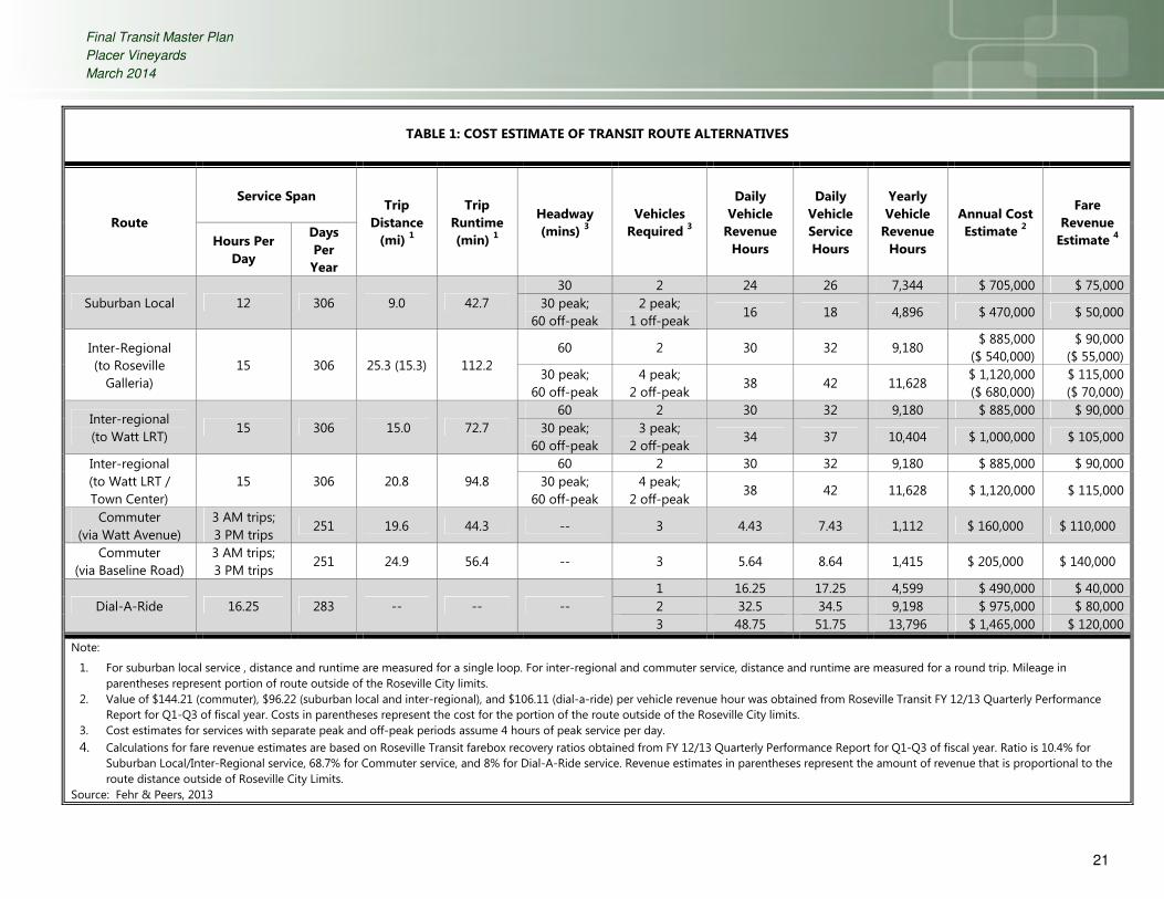
4.0 COST ESTIMATE AND OPERATING CHARACTERISTICS
This section of the Transit Master Plan describes the development of route operating characteristics (i.e.
number of vehicles and route headway) and the resulting cost estimates. In each case, the cost is dependent
on several operational details of service. For local and inter-regional services, the table displays the effect of
increased peak period frequency. In cases where two costs are presented for the same route alternative, each
cost figure should give a general indication of the financial implications of operational changes. Other
potential operational adjustments which may affect the service cost include:
• Increasing or decreasing daily revenue hours
• Increasing or decreasing yearly service days
• Shortening or lengthening the route alignment
4.1 UP-FRONT COSTS
A transit center and transit-oriented roadway design features are important elements of transit service within
Placer Vineyards. The transit center will be located along Watt Avenue on a two-acre site in the east village
center and will serve as a convergence point for all Placer Vineyards transit routes and services operated by
other regional operators. This includes the Watt Avenue Bus Rapid Transit proposed in the 2009 Regional
Transit TransitAction Plan. According to the Placer Vineyards Public Facilities Financing Plan (July 2007), a total
of $212,000 has been allocated for construction of the transit center.
Roadway designs within Placer Vineyards will include features to facilitate transit service within the project and
encourage its use among residents. Such features include bus turnouts and transit stop amenities. Bus
turnouts allow traffic to pass transit vehicles as passengers board and alight. Turnouts also provide space
between the road and transit stops, which provide passengers with an additional sense of safety. The
placement of amenities such as benches and shelters at transit stops should be phased to reflect ridership
growth as it occurs. While stops may be initially placed as a single signpost, future growth in ridership at a
particular stop may warrant the installations of benches or shelters. Select stops, particularly those located
near activity centers (e.g., the Town Center) or those that will serve multiple routes, will feature benches
and/or shelters upon initial implementation of the transit system. The capital costs for bus turnouts and transit
stops are embedded in the design costs of the project’s roadways that will be constructed by the developer.
The plan will provide $6,815,000 for rolling stock (busses) and transit center improvements that will be paid in
the form of a fee on each PVSP unit at the time of building permit issuance.

Final Transit Master Plan
Placer Vineyards
March 2014
19
4.2 ROUTE CHARACTERISTICS
4.2.1 Suburban Local and Inter-Regional Service
Table 1 displays the operating characteristics of each route alternative. Target headways are based on the
West Placer Transit Study and coordination with Placer County staff. In cases where peak and off-peak
headways differ, the duration of peak periods was assumed to cover two hours in the morning and two hours
in the afternoon. All headways are shown at either 30 or 60 minutes to facilitate timed transfers between new
and existing transit service. However, in some cases a more frequent headway is achievable with the same
number of vehicles in service and no additional costs.
After calculating the headway and vehicle requirements, annual vehicle revenue hours and cost estimates
were developed for each alternative. Cost estimates are based on data obtained from Roseville Transit, which
currently operates transit service in an area with similar land use patterns and transportation network
characteristics to those planned within Placer Vineyards. New transit service is expected to mimic existing
Roseville Transit service in both the number of days per year that service is provided as well as the
approximate cost incurred per revenue hour. Roseville Transit reports a cost of $96.22 per vehicle revenue
hour for local and inter-regional routes. These values include all costs associated with running local service,
including operations, maintenance, administration, marketing, and planning.
The inter-regional route to the Roseville Galleria overlaps with Roseville Transit’s existing Route M service for
much of the portion of the route that is located within the City of Roseville. Although the entity that will
ultimately operate the routes identified as part of this study remains unknown at this time, one potential
operating scenario for the Galleria inter-regional route would be to extend Route M service beyond the City of
Roseville to Placer Vineyards. For this reason, Table 1 includes data shown in parenthesis for this route that
indicate the values for the portion of the route located outside of the City of Roseville.
4.2.2 Commuter and Dial-A-Ride Service
Unlike suburban local and inter-regional service, the cost calculation for commuter and dial-a-ride services is
based solely on hours of operation and run time and is not affected by headway. The commuter service
alternatives assume the operation of three inbound and three outbound trips per day to and from downtown
Sacramento. Commuter vehicles do not necessarily operate on a fixed alignment and may be dispatched on a
route believed to have the least amount of traffic congestion. The cost of commuter routes is based on the
Roseville Transit cost per vehicle revenue hour for commuter service of $144.21. This value includes all costs
associated with running the commuter service, including operations and maintenance.

Final Transit Master Plan
Placer Vineyards
March 2014
20
Dial-A-Ride cost estimates assume between one and three paratransit vehicles will be in service for an average
of 16 hours per day, which mirrors the hours of operation for Roseville Transit dial-a-ride. As with commuter
service, the cost estimate is derived solely from the number of annual vehicle revenue hours and is based
upon data from Roseville Transit. The resulting cost per vehicle revenue hour for dial-a-ride service is $106.11.
Similar to cost estimates, fare revenue estimates have been developed with the expectation that new service
would operate with a similar farebox recovery ratio to existing Roseville Transit service. As such, estimates in
the following table present fare revenue estimates as a fixed percentage of operating costs, based on data
obtained from Roseville Transit for Fiscal Year 2012/2013. Based on this information, the following farebox
recovery estimates were developed and utilized in the cost estimates developed for this study:
• 10.4% for Suburban Local/Inter-regional service
• 68.7% for Commuter service
• 8% for Dial-A-Ride service
Final Transit Master Plan
Placer Vineyards
March 2014
21
TABLE 1: COST ESTIMATE OF TRANSIT ROUTE ALTERNATIVES
Route
Service Span Trip
Distance
(mi) 1
Trip
Runtime
(min) 1
Headway
(mins) 3
Vehicles
Required 3
Daily
Vehicle
Revenue
Hours
Daily
Vehicle
Service
Hours
Yearly
Vehicle
Revenue
Hours
Annual Cost
Estimate 2
Fare
Revenue
Estimate 4
Hours Per
Day
Days
Per
Year
Suburban Local 12 306 9.0 42.7
30 2 24 26 7,344 $ 705,000 $ 75,000
30 peak;
60 off-peak
2 peak;
1 off-peak 16 18 4,896 $ 470,000 $ 50,000
Inter-Regional
(to Roseville
Galleria)
15 306 25.3 (15.3) 112.2
60 2 30 32 9,180 $ 885,000
($ 540,000)
$ 90,000
($ 55,000)
30 peak;
60 off-peak
4 peak;
2 off-peak 38 42 11,628
$ 1,120,000
($ 680,000)
$ 115,000
($ 70,000)
Inter-regional
(to Watt LRT) 15 306 15.0 72.7
60 2 30 32 9,180 $ 885,000 $ 90,000
30 peak;
60 off-peak
3 peak;
2 off-peak 34 37 10,404 $ 1,000,000 $ 105,000
Inter-regional
(to Watt LRT /
Town Center)
15 306 20.8 94.8
60 2 30 32 9,180 $ 885,000 $ 90,000
30 peak;
60 off-peak
4 peak;
2 off-peak 38 42 11,628 $ 1,120,000 $ 115,000
Commuter
(via Watt Avenue)
3 AM trips;
3 PM trips 251 19.6 44.3 -- 3 4.43 7.43 1,112 $ 160,000 $ 110,000
Commuter
(via Baseline Road)
3 AM trips;
3 PM trips 251 24.9 56.4 -- 3 5.64 8.64 1,415 $ 205,000 $ 140,000
Dial-A-Ride 16.25 283 -- -- --
1 16.25 17.25 4,599 $ 490,000 $ 40,000
2 32.5 34.5 9,198 $ 975,000 $ 80,000
3 48.75 51.75 13,796 $ 1,465,000 $ 120,000
Note:
1. For suburban local service , distance and runtime are measured for a single loop. For inter-regional and commuter service, distance and runtime are measured for a round trip. Mileage in
parentheses represent portion of route outside of the Roseville City limits.
2. Value of $144.21 (commuter), $96.22 (suburban local and inter-regional), and $106.11 (dial-a-ride) per vehicle revenue hour was obtained from Roseville Transit FY 12/13 Quarterly Performance
Report for Q1-Q3 of fiscal year. Costs in parentheses represent the cost for the portion of the route outside of the Roseville City limits.
3. Cost estimates for services with separate peak and off-peak periods assume 4 hours of peak service per day.
4. Calculations for fare revenue estimates are based on Roseville Transit farebox recovery ratios obtained from FY 12/13 Quarterly Performance Report for Q1-Q3 of fiscal year. Ratio is 10.4% for
Suburban Local/Inter-Regional service, 68.7% for Commuter service, and 8% for Dial-A-Ride service. Revenue estimates in parentheses represent the amount of revenue that is proportional to the
route distance outside of Roseville City Limits. Source: Fehr & Peers, 2013

Final Transit Master Plan
Placer Vineyards
March 2014
22
5.0 IMPLEMENTATION SCENARIO COST ESTIMATE
This section discusses and estimates the cost of one of many potential combinations of transit service
alternatives to serve Placer Vineyards. Table 2 presents a potential transit service implementation
scenario, which consists of options previously presented in Table 1. Consistent with the West Placer
Transit Study, this scenario includes suburban local, inter-regional, commuter, and paratransit (dial-a-
ride) services. This selection of alternatives represents a cost estimate for providing one of each of the
various service types required to be provided within Placer Vineyards, and allows for opportunities to
modify or enhance future service using additional options previously identified in Table 1. For example,
future service modifications could include adding a second inter-regional route, adjusting route
headways, or adding a second paratransit vehicle. Table 1 details the cost implications for each of these
potential changes.
The information below, based on data obtained from APTA’s 2012 Public Transportation Fact Book,
provides a breakdown of the typical costs associated with operating and maintaining a bus system. As
shown, salaries wages, and benefits account for about two-thirds of the on-going costs.
Operating Expense % of Overall Cost
Salaries & Wages 39.7%
Fringe Benefits 28.4%
Services 6.0%
Materials & Supplies 12.9%
Utilities 1.2%
Casualty & Liability 2.7%
Purchased Transportation 9.1%
Total 100%
Table 2 shows the ultimate transit program proposed for Placer Vineyards which would result in a current
total cost of $2,890,000/year. The cost of this program would be offset by farebox revenue, Local
Transportation Fund apportionments, State Transit Assistance allocations, Federal Transit Administration
Section 5307 allocations, and contributions from other entities. The current net cost of the services after
taking into account the various transit revenues is approximately $556,000/year which is presumed to be

Final Transit Master Plan
Placer Vineyards
March 2014
23
collected by a special tax through a County Service Area on Placer Vineyards properties in an estimated
cost of $41/unit/year.
Service would be expected to begin slowly and build over time based on demand and available
revenues. Figure 7 displays the resulting transit system proposed for Placer Vineyards.
5.1 PHASING OF TRANSIT SYSTEM IMPLEMENTATION
At this time, the phasing of land use development within the Plan Area remains uncertain. Therefore, the
phasing of transit services within the Plan Area should be reviewed as development occurs within Placer
Vineyards. The following principles are intended to guide the phased introduction of transit services:
• Inter-regional service to the Watt Avenue Light Rail Station or the Roseville Galleria will likely be
the first transit service to have a ridership market in Placer Vineyards. As residential housing
stock is still under construction, this route would provide the link between the project’s new
residents and existing established regional attractions. In the early stages of construction,
commuter bus service may not be sustainable as the project would not immediately have a large
residential population. However, during this time, the Watt Avenue Light Rail bus would serve as
a commuter service as passengers would be able to utilize this route to transfer to Sacramento
RT light rail trains to downtown.
• Commuter service ridership will grow as the construction of new houses continues. Increased
commuter ridership on the inter-regional routes may cause capacity issues and trigger the need
to offer dedicated service between Placer Vineyards and downtown Sacramento.
• Finally, demand for the suburban local service will develop as the local attractions in Placer
Vineyards (i.e. schools, library, etc.) are constructed.
• Initially, all service types would operate with the minimum headways identified in Table 1; as
ridership increases, headways would also increase to meet demand (i.e., suburban local service
would increase to 30 minute headways during all service hours, and inter-regional service would
increase to 30 minute headways during peak periods).

!
!!
!!
!!
!!
!!
!
!
!
!
!
!!
!
!
! !
!
!
!
!!
!!
!
!!
!
!
!
!
!
!
!!!
Baseline Rd
W Elverta Rd
Wat
t Ave
PFE Rd
Wal
erga
RdPa
llada
y Rd
S Br
ewer
Rd
N Loop Blvd
9th
St
28th
St
16th
St
Rio Linda Blvd
A St
Dyer Ln
Oak St
16th
St
14th
St
Wat
t Ave
17th
St
11th
St
12th
St
Tanw
ood
Ave
18th St
13th
St
West Town Center Dr
Locu
st R
d
Park St
South Town Center Dr
15th
St
19th St
East Town Center Dr
East Town Center Dr
G St
Dyer Ln
A St
18th St
West Town Center Dr
A St
15th
St
PROPOSED TRANSIT SERVICEFIGURE 7\\Fpse03\fpse2\Data2\2013Projects\RS_Projects\RS13-3105_PlacerVineyards\GIS\MXD\fig07_pts.mxd
J1
TransitCenter
Placer Vineyards Specific Plan
$
Commuter Service ToDowntown Sacramentovia Watt Ave
Inter-Regional Route 1 -To Roseville Galleria
$
Inter-Regional Route 2 -To Watt Ave / I-80Light Rail Station
$
Not to Scale
Project Land UseHigh Density Residential
Medium Density Residential
Low Density Residential
Commercial
Commercial/Mixed Use
Business Park
Office
Public/Quasi-Public
School
Park/Open Space
Commuter Route via Watt Ave
Local ServiceInter-Regional Service
Bus Stop!

Draft Transit Master Plan
Placer Vineyards
March 2014
25
TABLE 2: IMPLEMENTATION COST ESTIMATE
Route
Service Span Trip
Distance
(mi) 1
Trip
Runtime
(min) 1
Headway
(mins) 3
Vehicles
Required 3
Daily
Vehicle
Revenue
Hours
Daily
Vehicle
Service
Hours
Yearly
Vehicle
Revenue
Hours
Annual
Cost
Estimate 2
Fare
Revenue
Estimate 4
LTF
Estimate 5
Hours Per
Day
Days
Per
Year
Suburban Local 12 306 9.0 42.7 30 peak;
60 off-peak
2 peak;
1 off-
peak
16 18 4,896 $ 470,000 $ 50,000 $350,000
Inter-Regional
(to Roseville
Galleria)
15 306 15.3 112.2 60 2 30 32 9,180 $885,000 $ 55,000 $250,000
Inter-regional
(to Watt LRT /
Town Center)
15 306 20.8 94.8 60 2 30 32 9,180 $ 885,000 $ 90,000 $250,000
Commuter
(to Downtown
Sacramento)
3 AM trips;
3 PM trips 251 19.6 44.3 -- 3 4.43 7.43 1,112 $ 160,000 $ 110,000 $120,000
Dial-A-Ride 16.25 283 -- -- -- 1 16.25 17.25 4,599 $ 490,000 $ 40,000 $370,000
Total $ 2,890,000 $ 345,000 $1,340,000
Note:
1. For suburban local service (outer loop), distance and runtime are measured for a single loop. For inter-regional and commuter service, distance and runtime are measured for a round trip.
2. Value of $144.21 (commuter), $96.22 (suburban local and inter-regional), and $106.11 (dial-a-ride) per vehicle revenue hour was obtained from Roseville Transit FY 12/13 Quarterly
Performance Report for Q1-Q3 of fiscal year.
3. Cost estimates for services with separate peak and off-peak periods assume 4 hours of peak service per day.
4. Calculations for fare revenue estimates are based on Roseville Transit farebox recovery ratios obtained from FY 12/13 Quarterly Performance Report for Q1-Q3 of fiscal year. Ratio is 10.4%
for Suburban Local/Inter-Regional service, 68.7% for Commuter service, and 8% for Dial-A-Ride service.
5. LTF: Local Transportation Fund. This per capita estimate of LTF funding is based upon the FY 2013/14 PCTPA Final LTF Apportionment ($44.57).
Source: Fehr & Peers, 2013