Embed Size (px)
Citation preview
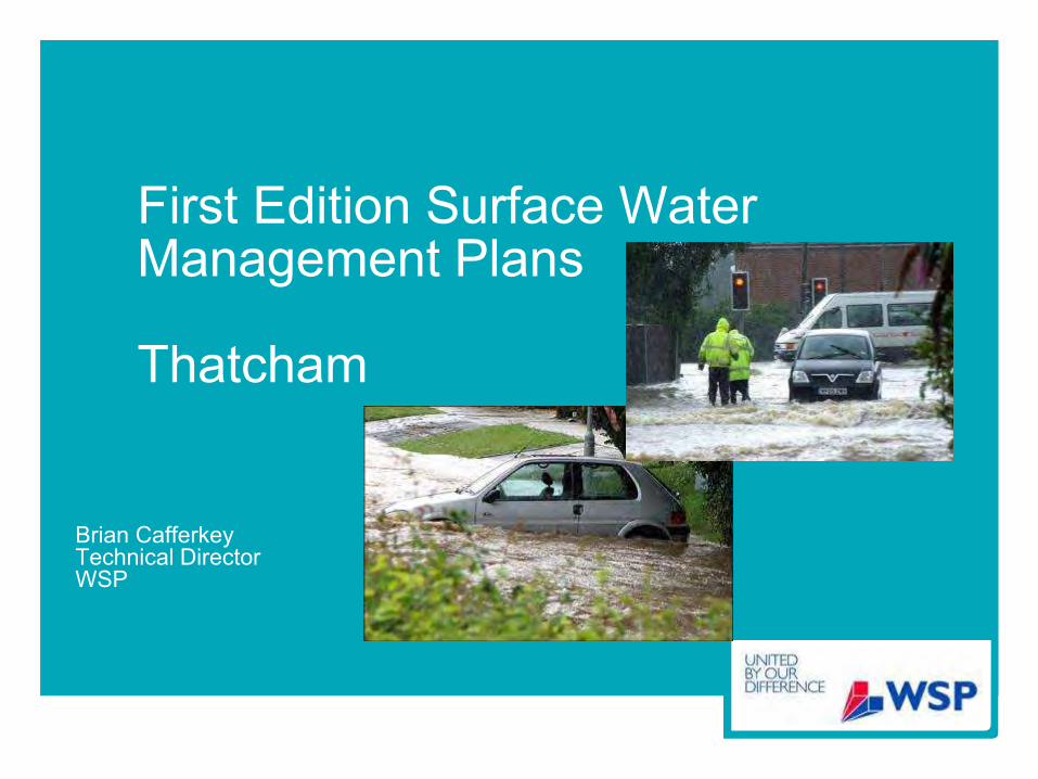
First Edition Surface Water Management Plans
Thatcham
Brian CafferkeyTechnical DirectorWSP
FWR Forum16 March 2010
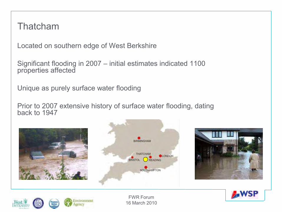
Thatcham
Located on southern edge of West Berkshire
Significant flooding in 2007 – initial estimates indicated 1100 properties affected
Unique as purely surface water flooding
Prior to 2007 extensive history of surface water flooding, dating back to 1947
Notes
Slide 2
• Thatcham located on southern edge of West Berkshire, 15 miles west of Reading• Population 23,000 approx and covers an area of approx 23km2• Thatcham badly affected in 2007 floods with initial records of 1100 houses flooded but this was not the
first incidents of flooding – records of flooding date back to early 1900s• Group of interested parties came together to come up with a solution – beginnings of a partnership for the
SWMPSlide 4
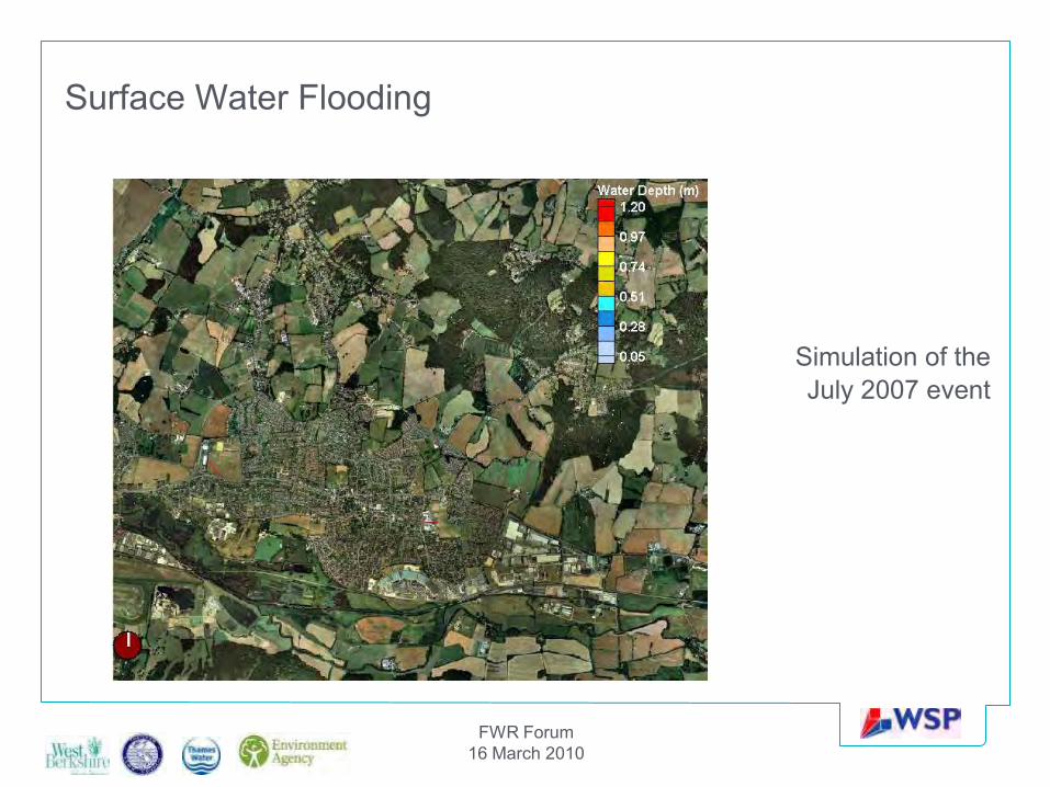
• This simulation gives you an idea of the flood risk problems facing Thatcham – based on modelling undertaken as part of the SWMP
Slide 5
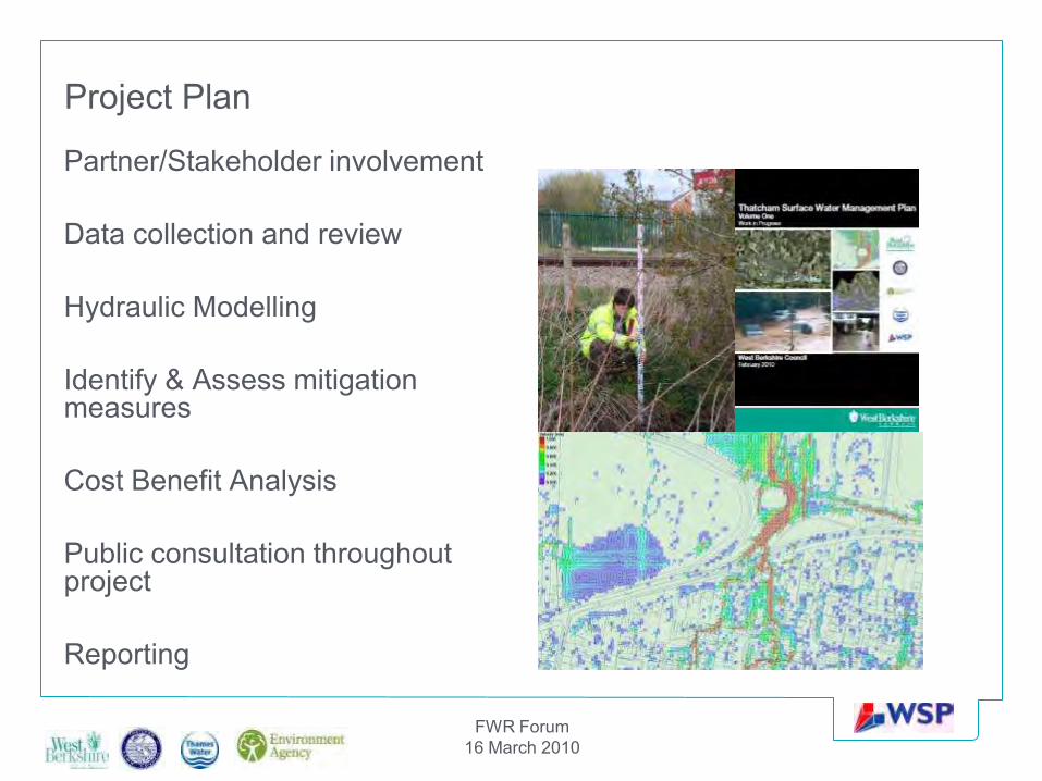
• This slide sets out our project plan – we followed the wheel from the guidance.• Steering group engaged throughout the process• Do not underestimate the time taken for data collection and review – a central GIS databse makes life
easierSlide 6
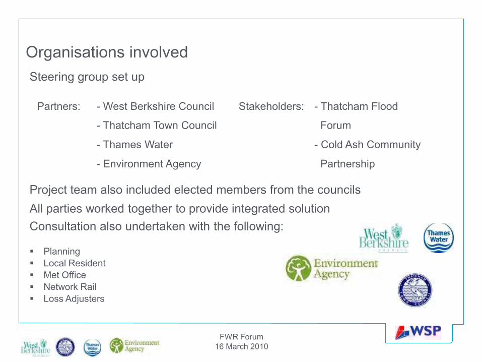
• Project team made up of partners and stakeholders but all attended meetings• Initially tried to set up a memorandum of agreement for each party to sign up to but faced problems on
getting an agreement to this – in the end had to rely on trust• Whilst it was good to have a large number of parties it did present some problems due to size of group
and staff changes etc – will discuss problems later in the presentation• Consultation was made with other parties outside of the project team – this was for both information
gathering and disseminating information• In-house staff used to keep costs down
FWR Forum16 March 2010
Surface Water Flooding
Simulation of the July 2007 event
FWR Forum16 March 2010
Project Plan
Partner/Stakeholder involvement
Data collection and review
Hydraulic Modelling
Identify & Assess mitigation measures
Cost Benefit Analysis
Public consultation throughout project
Reporting
FWR Forum16 March 2010
Consultation also undertaken with the following:
Planning Local Resident Met Office Network Rail Loss Adjusters
Organisations involvedSteering group set up
Project team also included elected members from the councilsAll parties worked together to provide integrated solution
Partners: - West Berkshire Council Stakeholders: - Thatcham Flood
- Thatcham Town Council Forum
- Thames Water - Cold Ash Community
- Environment Agency Partnership
FWR Forum16 March 2010
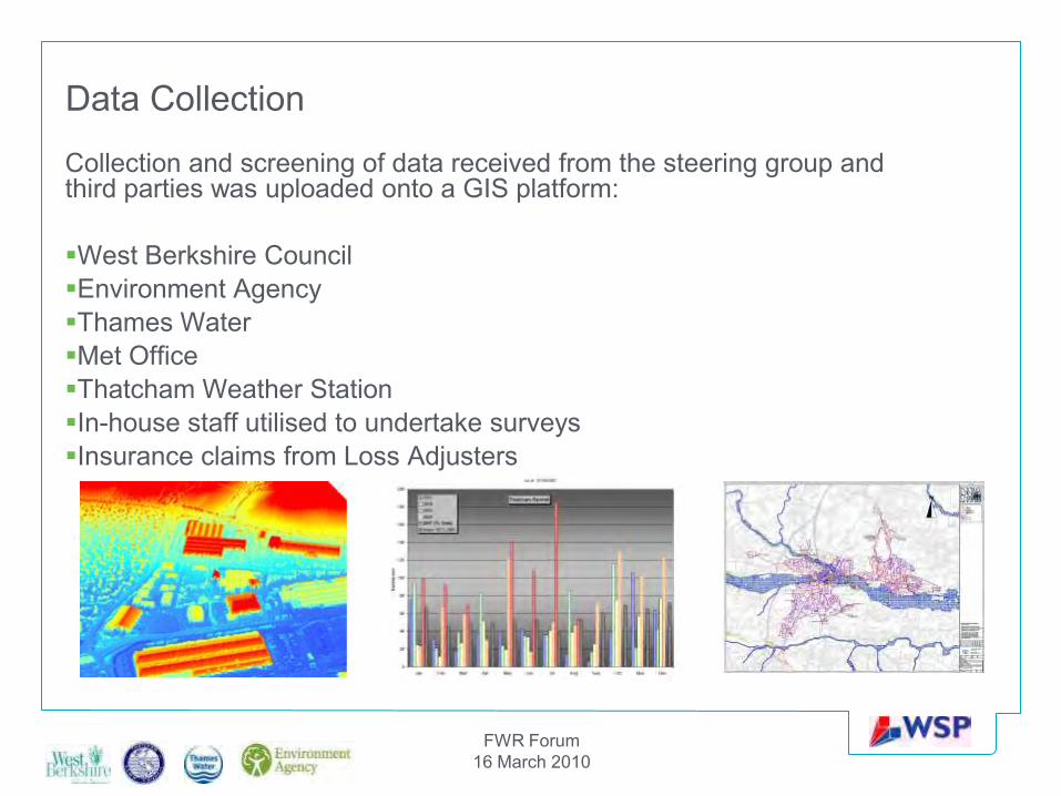
Data Collection
Collection and screening of data received from the steering group and third parties was uploaded onto a GIS platform:
West Berkshire CouncilEnvironment AgencyThames WaterMet OfficeThatcham Weather StationIn-house staff utilised to undertake surveysInsurance claims from Loss Adjusters
Notes
Slide 7
Data collection included:• LiDAR data (EA)• Asset data – sewers, pumping stations, syphons (TW)• Highway Drainage (WBC)• s105 Tuflow and ISIS model of River Kennet (EA)• Focued site surveys (In house staff)• Future development areas, core strategy data (WBC)• Thames Catchment Flood Management Plan (EA)• SFRA for West Berkshire (WBC)• Thames River Basin Management Plan (EA)• Rainfall data (Met Office and Thatcham Weather Station)The data were uploaded onto a central GIS platform Gaps in the data meant that in-house staff had to undertaken additional site surveysSlide 10
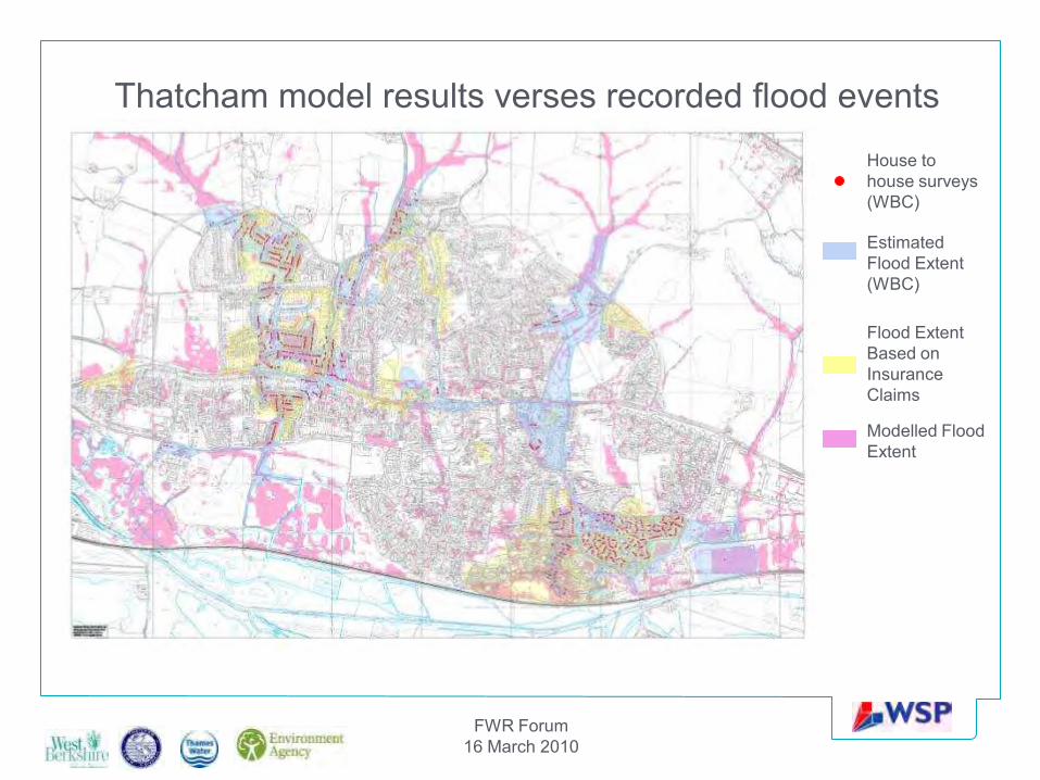
We were able to clarify the results by a comparison against actual data of the 2007 floods1. Properties identified as having flooded by WBC2. 2007 flood extent3. Insurance claims4. Modelled results
FWR Forum16 March 2010
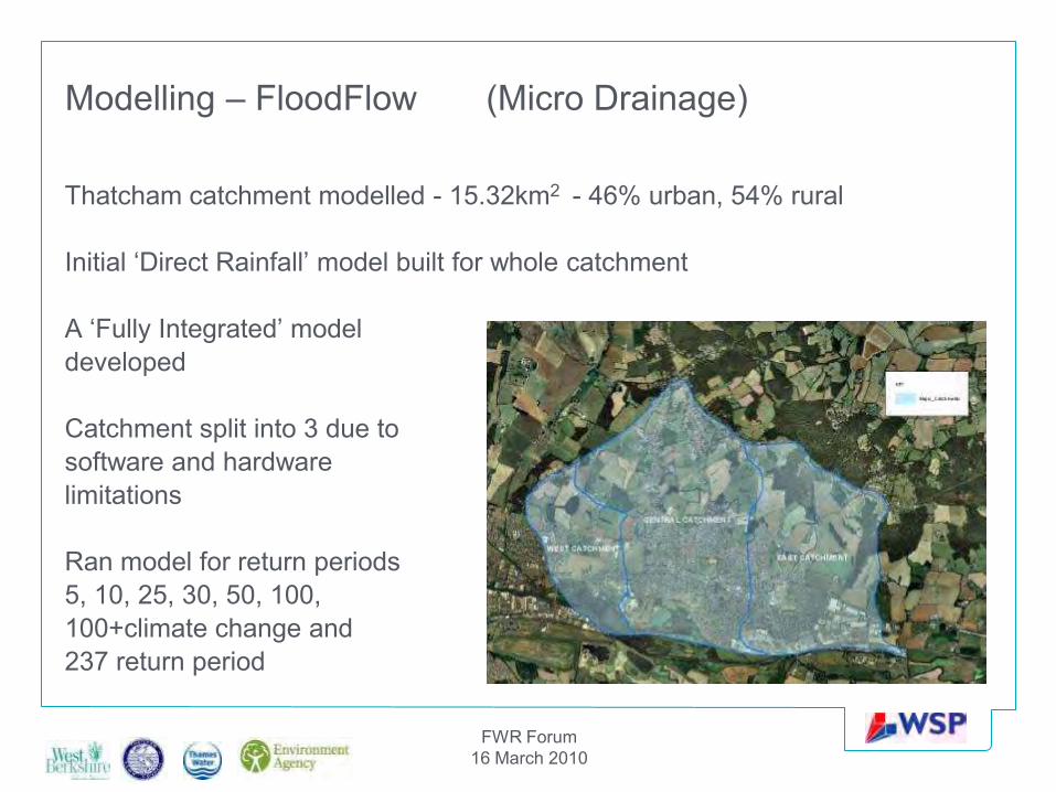
Modelling – FloodFlow (Micro Drainage)
Thatcham catchment modelled - 15.32km2 - 46% urban, 54% rural
Initial ‘Direct Rainfall’ model built for whole catchment
A ‘Fully Integrated’ modeldeveloped
Catchment split into 3 due tosoftware and hardware limitations
Ran model for return periods5, 10, 25, 30, 50, 100, 100+climate change and 237 return period
FWR Forum16 March 2010
Thatcham model results verses recorded flood events
House to house surveys (WBC)
Estimated Flood Extent (WBC)
Flood Extent Based on Insurance Claims
Modelled Flood Extent
FWR Forum16 March 2010
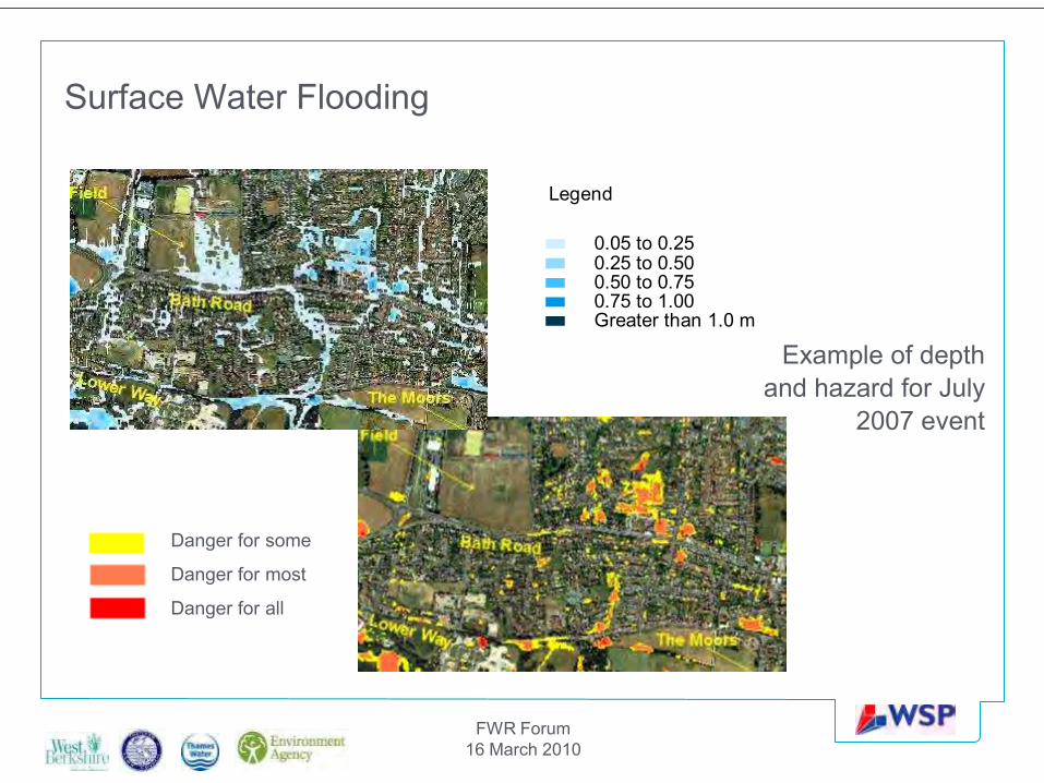
Surface Water Flooding
Example of depth and hazard for July
2007 event
Legend
Greater than 1.0 m0.75 to 1.000.50 to 0.750.25 to 0.500.05 to 0.25
Danger for some
Danger for most
Danger for all
FWR Forum16 March 2010
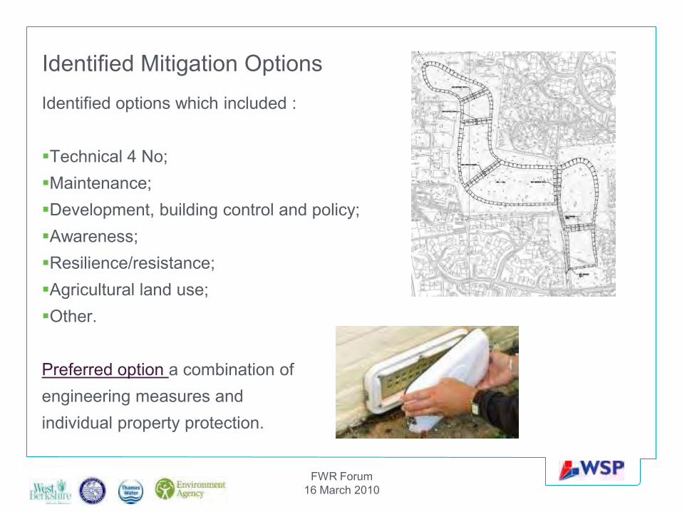
Identified Mitigation OptionsIdentified options which included :
Technical 4 No;Maintenance;Development, building control and policy;Awareness;Resilience/resistance; Agricultural land use;Other.
Preferred option a combination of engineering measures and individual property protection.
Notes
Slide 12
The mitigation works for Option 2 are as follows:7 new detention basins with associated bunding and controls of which four address the main overland flow
routes from the rural areas while the remaining three address urban flooding. The total area of detention basins equate to 15.46ha
One major road crossing along Cold Ash Hill;Proposed new ditch and swale; andProvision of new surface water sewers to be maintained by West Berkshire Council and Thames Water.
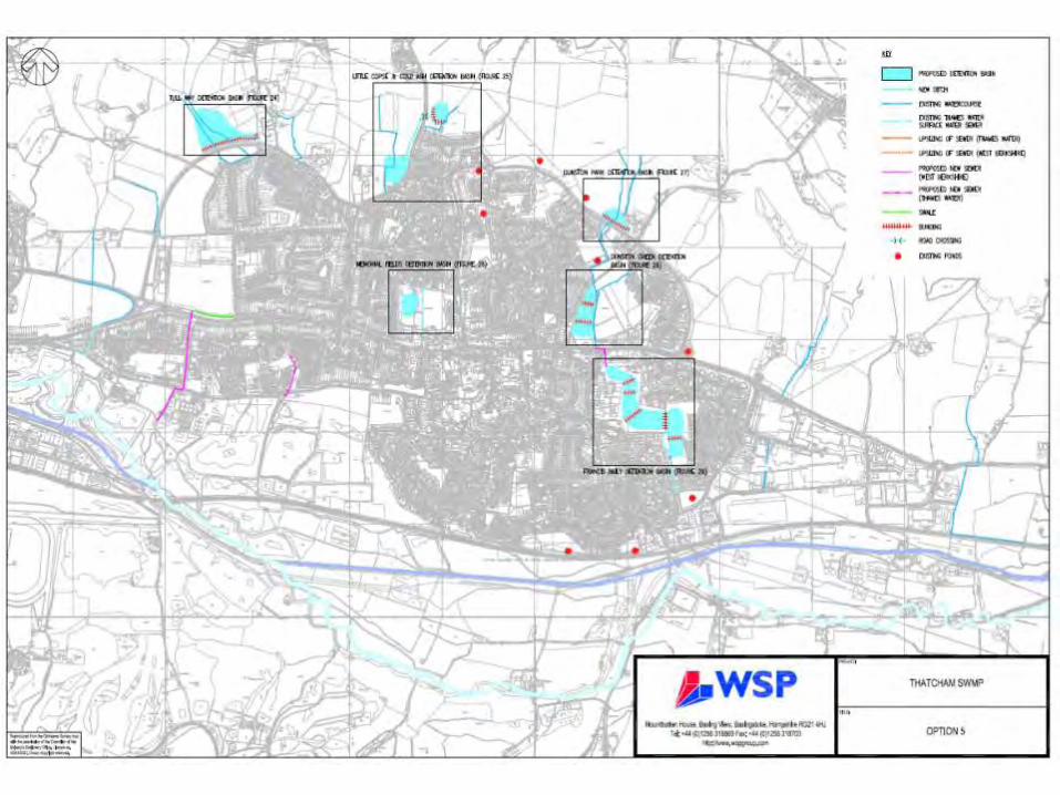
Option 3 comprises the following proposed works:11 new detention basins with associated bunding and controls of which 8 address the main rural overland flow
routes while the remaining 3 deal with urban flooding. The total area of detention basins equate to 19.79ha;
Two major road crossing, Cold Ash Hill and Turnpike Road;Proposed new cut off ditch to the north of Thatcham and swale; andProvision of new surface water sewers and up sizing of existing sewers to be maintained by West Berkshire
Council and Thames Water.The proposals in Option 4 replicate the options put forward from Option 2 together with upsizing a number of
critical sewers within Thatcham.Modelling indicated majority of flooding occured at levels below 150mm, therefore in addition to the Cost
Benefit Analysis of the technical options, an analysis was also undertaken for the combination of Option 2 and retro-fitting resistance measures to residential properties (Option 5).
These measures would include flood barriers, air brick caps and sealing external walls etc and would require residents to sign up to an early flood warning system.
FWR Forum16 March 2010
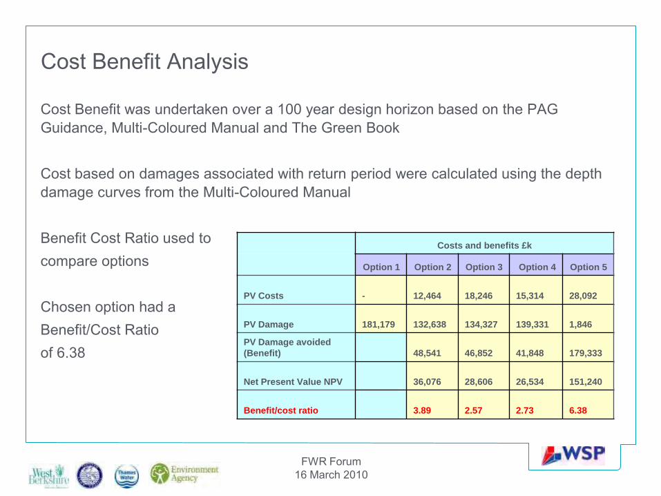
Cost Benefit Analysis
Cost Benefit was undertaken over a 100 year design horizon based on the PAG Guidance, Multi-Coloured Manual and The Green Book
Cost based on damages associated with return period were calculated using the depth damage curves from the Multi-Coloured Manual
Benefit Cost Ratio used to compare options
Chosen option had a Benefit/Cost Ratio of 6.38
Costs and benefits £k
Option 1 Option 2 Option 3 Option 4 Option 5
PV Costs - 12,464 18,246 15,314 28,092
PV Damage 181,179 132,638 134,327 139,331 1,846
PV Damage avoided
(Benefit) 48,541 46,852 41,848 179,333
Net Present Value NPV 36,076 28,606 26,534 151,240
Benefit/cost ratio 3.89 2.57 2.73 6.38
Notes
Slide 14
• Cost Benefit Analysis is a key part of the project as it is the point at which true comparisons can be made to determine the preferred option
• Many funding streams look for a Benefit Cost Ratio of 5 or above to be consideredSlide 16
• Due to the sensitive nature of residential property flooding and the extensive flooding experienced in Thatcham, particularly during the July 2007 floods, the SWMP project steering group meetings included representation from the public at all stages of the project. The general public were represented through Thatcham Flood Forum and Cold Ash Community Partnership, both of whom have had a representative present at the meetings.
• The public have been informed of progress throughout the SWMP process through the presentation at key milestones and results of the modelling through graphical interfaces and video simulations at project meetings. In addition ongoing email communication between Thatcham Flood Forum and it’s members, progress of the project reported in the newsletter for Thatcham Town Council, presentations by various members of the steering group at council meetings, a roadshow held by West Berkshire Council and inclusion of the project on various websites.
• It was decided that once all partners and stakeholders had agreed to the flood extent and options to take forward, a more focused public consultation could take place.
Slide 17
• The Thatcham SWMP has been issued as a Work-in-progress. This is due to restrictions on the timing and funding agreements in place for the project.
• SWMPs need to be treated as a living document, with the focus on regular reviews• The Thatcham SWMP concludes with an action plan of how to go forward following the issue of the
SWMP. The main focus is on continuing the project partnership, however is must be recognised that there are resourcing implications on continuing this partnership that not all stakeholders may not be able to sign up to
FWR Forum16 March 2010
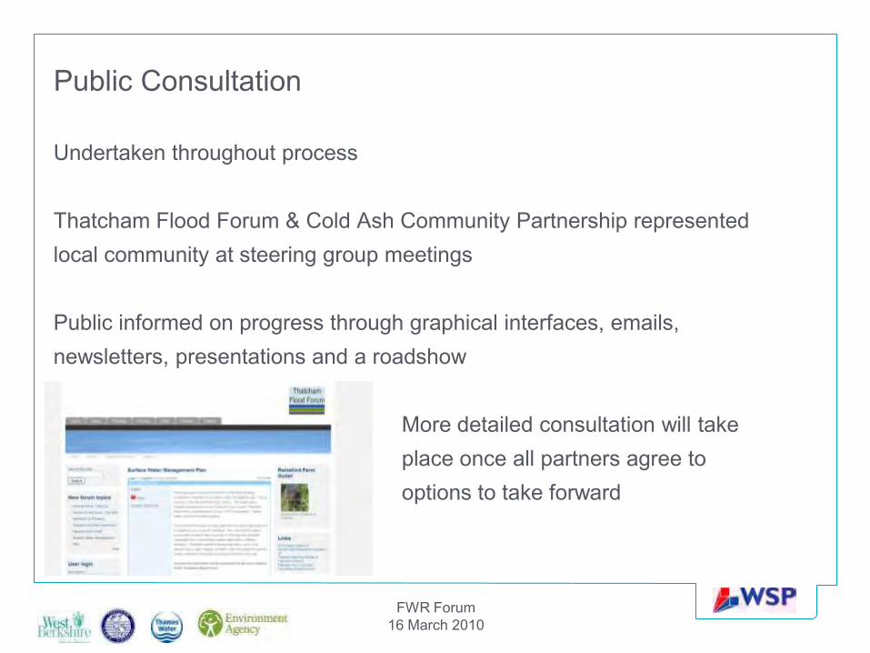
Public Consultation
Undertaken throughout process
Thatcham Flood Forum & Cold Ash Community Partnership representedlocal community at steering group meetings
Public informed on progress through graphical interfaces, emails,newsletters, presentations and a roadshow
More detailed consultation will takeplace once all partners agree tooptions to take forward
FWR Forum16 March 2010
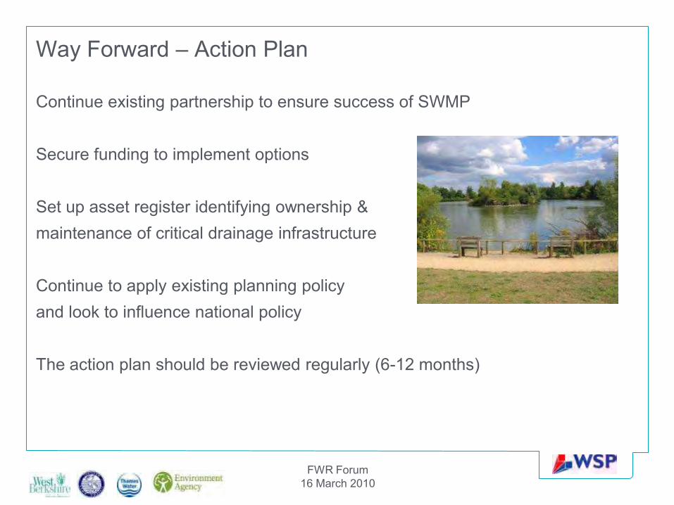
Way Forward – Action Plan
Continue existing partnership to ensure success of SWMP
Secure funding to implement options
Set up asset register identifying ownership &maintenance of critical drainage infrastructure
Continue to apply existing planning policy and look to influence national policy
The action plan should be reviewed regularly (6-12 months)
FWR Forum16 March 2010
Summary
Need to ensure partners and stakeholders are engaged and clear roles and responsibilities identified
Detailed information required to assess options
Cost Benefit Analysis undertaken to determine preferred option
Outcome of the SWMP is an Action Plan which is reviewed every 6 to 12 months
Continue to review SWMP every 3-5 years
FWR Forum16 March 2010
Any Questions?
Brian Cafferkey
Technical DirectorWSP Development and
TransportationMountbatten House
Basing ViewBasingstokeRG21 4HJ
Tel: 01256 [email protected]