Embed Size (px)
Citation preview

a
Fishing Communities of the United States 2006 Economics and SocioculturalStatus and Trends Series
U.S. Department of CommerceNational Oceanic and Atmospheric AdministrationNational Marine Fisheries ServiceNOAA Technical Memorandum NMFS-F/SPO-98May 2009

b

i
Fishing Communitiesof the United States, 2006
Economics and Social Analysis DivisionOffice of Science and TechnologyNational Marine Fisheries Service1315 East-West HighwaySilver Spring, MD 20910
NOAA Technical Memorandum NMFS-F/SPO-98May 2009
U.S. Department of CommerceGary Locke, Secretary of Commerce
National Oceanic and Atmospheric AdministrationJane Lubchenco, Ph.D., Administrator of NOAA
National Marine Fisheries ServiceJames W. Balsiger, Ph.D., Acting Assistant Administrator for Fisheries

ii
Front cover photo: Unisea seafood processing plant, Dutch Harbor/Unalaska, in the Aleutian Islands, Alaska, the largest U.S. port by pounds landed
Inside front photo: A fleet of longline fishing vessels crowd Pier 17 in Honolulu
Photo credits: Susan Abbott-Jamieson, Charlie Ess,
William B. Folsom, Palma Ingles, Edward J. Pastula,
Jenifer Sepez, Tony Suber, NOAA Photo Library
Suggested citation:
National Marine Fisheries Service. 2009. Fishing Communities of the United States, 2006. U.S.Dept. Commerce, NOAA Tech. Memo. NMFS-F/SPO-98, 84 p. Available at:http://www.st.nmfs.noaa.gov/st5/publication/index.html
A copy of this report may be obtained from:
Economics and Social Analysis DivisionAttn: Susan Abbott-Jamieson or Rita CurtisOffice of Science and TechnologyNational Marine Fisheries Service1315 East-West HighwaySilver Spring, MD 20910
Or online at:
http://www.st.nmfs.noaa.gov/st5/publication/index.html

iii
Contentsv Preface1 National Overview2 U.S. Summary7 North Pacific8 North Pacific Summary11 Alaska Tables13 Pacific14 Pacific Summary18 California Tables19 Oregon Tables20 Washington Tables21 Western Pacific22 Western Pacific Summary24 Hawai`i Tables25 New England26 New England Summary30 Connecticut Tables31 Maine Tables32 Massachusetts Tables33 New Hampshire Tables34 Rhode Island Tables35 Mid-Atlantic36 Mid-Atlantic Summary40 Delaware Tables41 Maryland Tables42 New Jersey Tables43 New York Tables44 Virginia Tables45 South Atlantic46 South Atlantic Summary50 East Florida Tables51 Georgia Tables

iv
52 North Carolina Tables53 South Carolina Tables55 Gulf of Mexico56 Gulf of Mexico Summary61 Alabama Tables62 West Florida Tables63 Louisiana Tables64 Mississippi Tables65 Texas Tables67 Appendix69 Data Sources73 Resources81 Glossary

v
PrefaceFishing Communities of the U.S., 2006
Fishing Communities of the U.S., 2006 is the first volume in this new periodic series. It reports descriptive demographic data on a subset of each coastal state’s commercial fishing communities and ports, as well as descriptive geographic information and other social indicator data for each state. It is a companion to Fisheries Economics of the U.S., 2006. The purpose of the publication is to provide the public with easily accessible information about the Nation’s fishing communities and the states where they are located. Up to ten communities and ports per state were selected by experts in each region primarily on the basis of commercial landings data for 2006. These communities are not neces-sarily “fishing communities” as defined by the Magnuson-Stevens Fishery Conservation and Management Act (see Appendix).
Sources of Data
Information in this report came from many sources. The commercial landings data for 2006 used to select com-munities and ports were obtained from various NMFS field offices (Fisheries Science Centers and Regional offices) in cooperation with various state agencies and interstate Ma-rine Fisheries Commissions. Other sources of data include the U.S. Census Bureau, Bureau of Labor Statistics, Environ-mental Protection Agency, Federal Emergency Management Agency, World Atlas, and the Central Intelligence Agency World Fact Book.
Acknowledgements
Many people helped make this publication possible. Rita Curtis is Division Chief and originator for this series.

vi
Preface
Rosemary Kosaka is Editor for this series. Susan Abbott-Jamieson is Senior Author for Fishing Communities of the U.S., 2006; Rita Curtis and Rosemary Kosaka are contribut-ing authors. All are located in the NMFS Office of Science & Technology in Silver Spring, Maryland. Contributing analysts include John Primo and Alexandria Zirbel, both formerly of the NMFS Office of Science & Technology. Deborah Hogans, NMFS Office of Science & Technology, also assisted with the preparation of this report. Willis L. Hobart and David G. Stanton, NMFS Scientific Publications Office, Office of Science & Technology, Seattle, Washington, provided publication and design guidance for this new se-ries, and Sandi Sellars, NMFS Office of Science & Technol-ogy, Silver Spring, Maryland created the layout and design for the final report. NMFS staff social scientists in the regional Fisheries Sci-ence Centers and Regional Offices who provided guidance in selecting communities and ports for their region, sets of demographic and geographic data on those communities, and comments on drafts on the sections for their regions include: Stewart Allen, Patricia M. Clay, Palma Ingles, Karma Norman, Julia Olsen, Jennifer Sepez, and Brent Stoffle. Other contributors include Kim Engie, Jena McNeal, and Leila Sievanen.
Address all comments or questions to:
Economic and Sociocultural Analysis Division, (F/ST5)National Marine Fisheries Service, NOAA1315 East-West Highway, Rm. 12361Silver Spring, MD 20910-3282Phone: 301-713-2328 / FAX: 301-713-4137Website: http://www.st.nmfs.noaa.gov/st5/index.htm
Gloucester Fisherman’s Memorial, Gloucester, Massachusetts

1
National Overview

2
U.S. Summary
Overview of the Report
This report presents descriptive demographic data on a subset of the Nation’s fishing communities and ports for each of the Nation’s coastal states, as well as descriptive geographic and other social indicator data for the states where these communities are located. The communi-ties all have one feature in common: they participate in some aspect of commercial fishing. They were selected by experts in each region primarily because they had the highest landings volume in pounds in their state for 2006. By placing these community and state data snapshots side by side, we can compare the communities and the states where they are located to identify their similarities and differences. Identifying patterned similarities and differ-ences among the Nation’s fishing communities within and between regions is one of the steps in developing scientific understanding of how fishing communities are integrated into larger regional ecologies. Fisheries ecosystem-based management recognizes that human sociocultural and economic systems interact with marine ecosystems in pro-found ways. Additionally, these are some of the data used to assess how different kinds of communities in particular states and regions are impacted by fisheries management actions. The National Oceanic & Atmospheric Administration’s Na-tional Marine Fisheries Service (NMFS or NOAA Fisheries) divides the United States’ twenty-four coastal states and its four territories and Puerto Rico among six distinct regions: the Northeast, Southeast, Southwest, Northwest, Alaska, and the Pacific Islands. Each region has responsibility for conducting relevant fisheries-related scientific research in support of the agency’s mandated mission to conserve and manage the Nation’s living marine resources under the Magnuson-Stevens Fisheries Conservation and Manage-ment Act (P.L. 94-265, as amended by P.L. 109-479).
These six NMFS regions are included in or overlap eight Fishery Management Council regions: New England, Mid-Atlantic, South Atlantic, Gulf of Mexico, Caribbean, Pacific, North Pacific, and the Western Pacific. Fishery Manage-ment Councils (FMCs) are responsible for creating fisheries management plans with the advice of scientific advisory committees and others. The management plans must be ap-proved by the Secretary of Commerce before they go into effect.
This report is divided into eight sections: a National Over-view and regional overviews for the North Pacific, Pacific, Western Pacific, New England, Mid-Atlantic, South Atlantic, and Gulf of Mexico regions. All twenty-three coastal states are included in one of these seven regions.1 ________________________________1Pennsylvania is not included in this report. Florida is included for the South Atlantic and Gulf of Mexico regions as East and West Florida, respectively.
The Caribbean territories of the U.S. Virgin Islands and the Commonwealth of Puerto Rico were not included in this report due to data limitations. Similarly, the territories of American Samoa, Guam, and the Commonwealth of the Northern Marianas Islands are also excluded.
The report groups the information on the top fishing com-munities by state within each region. Each section begins with a regional summary that provides an overview of the regional coastal physical geography, some information on historical importance and involvement in marine fishing, some highlights of the demographic similarities and dif-ferences among the fishing communities, and ends with a list of “Fishing Communities Facts” for the region. This is followed by one page of tables for each state in the region. The tables compare: sex and age and race/ethnicity dis-tributions in 2000 for the fishing communities combined compared to the state as a whole; demographic attributes for the individual fishing communities in 2000 compared to the state; and indicators of growth and population well-being for the state for 1997-2006. A list of other com-munities and ports in the state with involvement in marine fisheries concludes each state’s section. The report con-cludes with: a Data Sources list identifying the report’s data sources, a Resources section listing web-based resources and publications for those who want to learn more about U.S. marine fishing communities and the management of our living marine resources, and a Glossary providing defi-nitions of specialized terminology.
U.S. Summary
Great diversity characterizes the Nation’s marine fishing communities and ports. Patterned similarities also exist. A few highlights follow.
Physical Geography
The United States’ fishing communities and ports are located in coastal areas within the North Pacific region’s arctic and polar zones, as well as the temperate middle latitudes that characterize the New England and Mid-

3
National Overview
Atlantic regions, most of the Pacific region, and some of the South Atlantic region. The southern third of California, the coastal areas of the South Atlantic region’s states of South Carolina, Georgia, and Florida are all subtropical, as are the coastal areas of all the states in the Gulf of Mexico region. The tip of the Florida Keys, the Caribbean region, and the Western Pacific region are in the tropics. These differences affect local and regional fisheries.
Among the regions, the North Pacific (Alaska) has the longest ocean coastline (6,640 miles), while the shortest ocean coastlines are found in New England (473 miles) and the Mid-Atlantic (428 miles). The other regions fall in between as follows: South Atlantic (1,168 miles), Gulf of Mexico (1,631 miles), and the Pacific (1,293 miles). Hawai`i in the Western Pacific region is composed of islands. The chain is 1,500 miles long, and the seven inhabited islands share 750 miles of coastline.
Susceptibility to Natural Disasters
Fishing communities and ports are located in coastal zones putting them at risk for hurricanes and tropical storms, and other dangers like tsunamis. Fishing communities and ports around the Gulf of Mexico share the Nation’s highest potential for annual hurricane seasons that disrupt commercial and recreational fishing, and the worst among these storms can destroy entire communities, such as the devastation caused by Hurricanes Katrina and Rita in 2005. The Gulf of Mexico’s per annum average is 10.7 declared disasters and emergencies due to hurricanes, tropical storms, and depressions combined, while the South Atlantic region comes in second with an average of 6.4 major weather-related disasters. Severe winter storms are most likely to affect marine fisheries in the North Pacific region.
Early History
For thousands of years prior to European colonization of North America, Native Americans were utilizing marine and aquatic resources along the coasts, while Polynesian peoples whose cultures were intimately involved with the marine environment began occupying the Pacific islands by at least 400 A.D. The earliest European arrivals found a variety of marine resources already being utilized in most coastal areas. Marine resources were among the first natural resources targeted by these early Europeans.
Historic patterns of involvement in commercial fishing by particular racial or ethnic groups continue to characterize contemporary commercial fishing in many parts of the country. Some examples include: Scandinavians (Norwegians, Danes, and Swedes) in the New England, Mid-Atlantic, and Pacific regions; Portuguese and Sicilians in the New England region and Italians in the Pacific region; francophone Acadians in New England and Cajuns in the
Gulf of Mexico; British in the New England and Mid-Atlantic regions; African Americans in the Mid-Atlantic, South Atlantic, and Gulf of Mexico; Chinese in the Pacific region; Vietnamese in the Gulf of Mexico and the Western Pacific; and Native Americans in the Pacific and North Pacific regions.
Some Fishing Community Contrasts Across Regions
The Nation’s top commercial fishing communities and ports range from subareas of major metropolitan centers such as Houston, Texas (pop. 1,953,631), San Diego, California (pop. 1,223,400), Honolulu, Hawai`i (pop. 876,156), and Jacksonville, Florida (pop. 735,617), to small villages such as Winter Harbor, Maine (pop. 988), Naknek, Alaska (pop. 678), La Push, Washington (pop. 371), Wachapreague, Virginia (pop. 236), and Valona, Georgia (pop. 123). Some interesting points made in the regional summaries follow.
The North Pacific region’s top fishing communities all tend to be smaller communities, with an average population of 3,620, within a state in which 99% of its fishing com-munities have populations below 12,000. Alaska’s fishing communities with shoreside processing facilities attract large temporary populations who sometimes outnumber permanent residents.
Fishing communities in the State of Hawai’i are defined as the seven main inhabited islands. Most small-scale com-mercial fishing boats are transported by trailer so they can be launched at diverse sites. Honolulu is the home port for the Hawai`i-based longline fishing fleet, responsible for the majority of commercial fish landed in Hawai`i.
The median population for the top commercial fishing communities in the Pacific region’s three states combined is 84,038. Seven of California’s, nine of Washington’s top fishing communities, and all ten of Oregon’s top fishing communities fall below the median. Five of Washington’s top commercial fishing communities have populations of fewer than 1,000 compared to three of California’s and none of Oregon’s. Four of California’s top commercial fish-ing communities are located in urban areas of more than 75,000 people, while only one of Washington’s, and none of Oregon’s top commercial fishing communities are in urban areas.
The Gulf of Mexico’s top fishing communities tend to be smaller towns and villages with populations below 20,000 persons. However one major metropolitan center approach-ing 2 million (Houston, Texas), and a few larger coastal cities also have significant fisheries involvement (Tampa and St. Petersburg, Florida; Mobile, Alabama; and Browns-ville, Texas). The majority of Louisiana’s and Alabama’s top fishing communities have populations below 5,000. Nine of Louisiana’s top fishing communities and seven of

4
U.S. Summary
Alabama’s top fishing communities fall in this group.
Florida’s top commercial fishing communities are the larg-est in the South Atlantic region. They include subareas of large cities like Jacksonville (pop. 735,617) and Miami (pop. 362,470); none have populations below 10,000. In contrast, North Carolina’s top commercial fishing communi-ties have populations below 6,000 and six are smaller than 2,000. Both Georgia and South Carolina are more mixed. Each has a larger city ‒ Savannah, Georgia (pop. 131,510) and Charleston, South Carolina (pop. 96,650) ‒ involved in commercial and saltwater recreational fishing, as well as some small fishing villages. Examples include Valona (pop. 123) and Midway (pop. 1,100), Georgia, and McClellan-ville (pop. 459) and Wadmalaw Island (pop. 2,611), South Carolina.
Several major metropolitan areas are located in the Mid-Atlantic region, a center of population for the United States. The Mid-Atlantic region’s top fishing communities located within larger urban areas are all located in Virginia. They include Virginia Beach (pop. 425,257), Richmond (pop. 197,790), Newport News (pop. 180,150), and Hampton (pop. 146,437). Seven of the region’s top fishing communi-ties are smaller cities with populations between 10,000 and 41,000. Examples include Atlantic City (pop. 40,517) and Point Pleasant (pop. 19,306), New Jersey, and Ocean-side (pop. 32,733), Islip (pop. 20,575), and Hampton Bays (pop. 12,236), New York. The majority of Maryland’s (seven of nine), Delaware’s (three of five), New Jersey’s (seven of ten), and New York’s (five of eight) top fishing communities fall between 1,000 and 7,700 in population. Six of the region’s top fishing communities have fewer than 1,000 inhabitants.
The largest metropolitan area in the New England region is Boston (pop. 589,141), a center for financial services and insurance for the fishing industry, as well as the home of the Nation’s oldest continuously operating daily fish pier. The other New England region’s top fishing communities that are located within urban areas of more than 100,000 population are Providence (pop. 173,618), Rhode Island, and Bridgeport (pop. 139,529) and New Haven (pop. 123,626), Connecticut. Exclusive of these large cities, the average population for the top fishing communities is 32,846 for Massachusetts, 31,456 for Connecticut, and 26,175 for Rhode Island. Maine averages 3,196 (excludes Portland, pop. 64,249), while New Hampshire averages 6,115 (excludes Portsmouth, pop. 20,784). Both Maine and New Hampshire’s top fishing communities are pre-dominantly smaller communities. Eight of Maine’s and four of New Hampshire’s have populations of less than 8,000. Only two of Massachusetts’ and one of Rhode Island’s top fishing communities have populations of less than 8,000, while Connecticut has none.
The Effects of Population Growth on Coastal Areas
Many coastal areas in these states are experiencing growth in their populations as people seek homes near the ocean. This is particularly true in the areas with milder climates. These patterns affect everything from fish habitat, par-ticularly nursery grounds in shallow coastal waters, to the continued availability of commercial fishing infrastructure like docking facilities and other support services, as real estate values increase in the face of demand for alternative uses. In some regions, commercial fishing is being eclipsed by saltwater recreational fishing. The South Atlantic region, which includes the Atlantic Coast of Florida and several desirable beach vacation areas in Georgia, South Carolina, and North Carolina, is a good example of this change. The Mississippi’s Gulf Coast in the Biloxi area is another exam-ple. In this area, Hurricane Katrina’s devastation has served to speed the transformation of real estate from commer-cial fishing support uses to uses that support the gaming industry.
Community Resiliency, Growth, and Well Being
According to the 2000 U.S. Census, 9.2% of family house-holds in the U.S. live below the poverty rate. The 222 top fishing communities in the U.S. have an average poverty rate of 10.1%, just above the national rate. Poverty rates range in top fishing communities from 0% in Valona, Geor-gia to 33.7% in Crescent City, California, with the majority of communities falling between 2% and 10%. All states except Alaska, Delaware, Maine, and New Hampshire have fishing communities with poverty rates above 11%. The majority of fishing communities in Georgia (seven of ten), Alabama (seven of ten), Texas (seven of ten), Mississippi (four of seven), and Louisiana (nine of ten), and half of the fishing communities in Oregon and South Carolina have poverty rates above 11%.
Nationwide, 18% of residents five years of age or older speak a language other than English at home according to the 2000 U.S. Census. Overall, top fishing communi-ties ranged from 0% of residents five years of age or older speaking a language other than English at home (Cres-cent, Georgia) and 1% (Bowers Beach, Delaware) to 87% (Brownsville, Texas) and 93% (Ni’ihau, Hawai`i). Twenty-two percent (48 of 222) of the top fishing communities in the U.S. had a higher rate than the national rate. The majority of fishing communities in Hawai`i (six of seven), California (seven of ten), and Texas (seven of ten), and half of the communities in Alaska, reported rates above the national rate.
The national median household income was $42,000 according to the 2000 U.S. Census. Top fishing communi-ties had median household incomes that ranged between

5
National Overview
$18,000 (Crisfield, Maryland) to $146,755 (Darien, Connecticut). Thirty-eight percent (84 of 222) of the top fishing communities in the U.S. had a higher median income than the national median. The majority of fishing communities in Alaska (nine of ten), California (seven of ten), Connecticut (seven of ten), Rhode Island (seven of ten), New Jersey (seven of ten), New York (six of eight), Hawai`i (four of seven), and all fishing communities in New Hampshire had median household incomes above $42,000.
Conclusion
The above concludes our overview of the Nation’s coast-lines. The following sections return in detail to individual regions embracing the twenty-three states covered by this report. A list of fishing communities and ports is provided at the end of each regional summary. More detailed infor-mation on some of these communities can be found in the regional community profiles. If available, citations for these profiles are also listed at the end of each regional summary. For additional information related to fishing communities and sociocultural research conducted by NMFS social science staff, a detailed bibliography and list of other source materials appears at the end of this publication.

6

7
North Pacific Alaska

8
Regional Context
The North Pacific region includes only the state of Alaska. The state’s coastline is 6,640 miles; its tidal shoreline is enormous at 33,904 miles, more than 2.8 times longer than the next longest regional tidal shoreline. Fishing com-munities can be found along most of the subarctic parts of Alaska’s coastline and some of its tidal shoreline. Com-mercially important communities occur adjacent to the Gulf of Alaska from the Canadian border, north to the end of the Alaskan Peninsula on Kodiak Island and on some of the islands in the Aleutian chain and the Pribilof Islands, and along Bristol Bay on the Bering Sea. Located in the high northern latitudes, Alaska is characterized by short sum-mers and long, dark, cold winters, creating rigorous, often dangerous fishing conditions for its fishermen. Important species sought by commercial fishermen include pollock, mackerel, cod, herring, salmon, crab, and groundfish spe-cies such as rockfish, sablefish and halibut.
Communities that are heavily involved in processing as well as commercial harvesting activities attract large temporary populations of workers, including many Asians and Hispan-ics, from outside the region. In these communities, tempo-rary workers sometimes outnumber permanent residents, and in some places are housed in group quarters during the fishing season, for example, Akutan (90% of the popu-lation) and Sand Point (36% of the population). This is a regionally unique feature.
Native Americans comprise 80-90% of the population in some remote areas of Alaska. They continue to fish, hunt sea mammals, and gather other marine resources as part of their annual round of subsistence activities. Native Americans have continuously inhabited the region for at least 14,000 years, closely tied to the marine environment since their arrival. Major coastal cultural-linguistic groups include Inupiaq, Yupik, Aleut, Alutiiq, Tlingit, and Haida. Even communities in the interior of Alaska are tied to the marine environment by dependence on anadromous fish (for example, salmon) that spend part of their lives in the ocean and then return to inland watersheds to spawn.
Recreational fishing has also become economically impor-tant in Southeast and South Central Alaska. Many remote Alaska communities are also dependent on subsistence fisheries and the harvest of marine mammals.
The Fishing Communities
The Alaskan region is unique in the number and proportion of communities that are involved in, and dependent on, commercial fishing to earn their livelihoods. Overall, 136 fishing communities have been profiled by NMFS social scientists because of the nature of their links with commercial and/or recreational fishing. In 2006, 11 of the
United States’ top 50 ports by pounds landed were located in Alaska. By order of ranking, they are: Dutch Harbor/Unalaska (1); Kodiak (4); Naknek-King Solomon (12); Petersburg (17); Ketchikan (18); Sitka (19); Cordova (21); Seward (25); Juneau (39); Homer (44); and Kenai (49). On average, from 1997-2006, Alaska accounted for 53% of U.S. landings and 32% of landings revenue.
Alaska has the smallest population (626,932 in 2000) among the nation’s coastal states. Alaska’s fishing communities also have small populations ranging from fewer than 100 to only a few thousand for even major fishing communities. The ten top commercial fishing communities have an average population of 3,620 ranging from the smallest, Akutan at 713, to Sitka, the largest at 8,835. Sitka is also Alaska’s fifth largest city.
Community, Resiliency, Growth, and Well Being
According to the 2000 U.S. Census, 9.2% of families in the U.S. live below the poverty line, the median income level is $42,000, and 18% of residents over five years of age speak a language other than English at home. The state of Alaska has a lower percentage of families living in poverty (6.7%), a higher median income level ($52,000), and a lower num-ber of residents older than five who speak a language other than English at home (14.3%) than the rest of the U.S. More information on these and other factors that may affect community resiliency are discussed below.
Alaska’s top fishing communities generally have family household poverty rates below the national average. The lone exceptions are Dillingham and Sand Point with pov-erty rates of 10%.1 The percentage of residents over five ________________________________1Note that in contrast to its top fishing communities, many of Alaska’s other fishing communities have relatively high poverty rates. (See Sepez et al. for additional information.)
A fisherman mends his nets at St. Paul Harbor, Alaska
North Pacific Summary

9
North Pacific Region
Fishing Communities Facts Alaska communities are small. Ninety-nine percent of
Alaska’s communities have fewer than 12,000 residents; 65% have less than 400 residents.
Fishing activities The isolated Aleutian outpost of Dutch
Harbor/Unalaska (pop. 4,283) is the nation’s busiest fishing port by volume of landings.
The pollock fishery is the largest in the U.S. Though pursued by a relatively small fleet, including about 21 large catcher/processor vessels and 133 catcher vessels, it comprises about 58% of landings in Alaska.
Commercial fishing communities with shoreside processing plants tend to have a higher proportion of males in the population than the state. For example, Akutan (77% male), Dutch Harbor/Unalaska (66% male), and Sand Point (62% male) all have higher proportions of males than the state as a whole (52%).
Many non-Alaskans participate in commercial fisheries in the state. Many of these participants come from Washington and Oregon.
Seaford, VA and Pleasantville, NJ are home to the majority of the permit holders for the specialized Alaskan scallop fishery.
Each year, more than 15,000 people from all over the world buy an Alaska Commercial Fishing Vessel Crewmember license.
The number of crew has declined since 1993 when about 32,000 held crew licenses. In 2006, 18,498 crew licenses were sold.
Almost half a million people buy sport fishing licenses in Alaska each year, catching over three million fish. Halibut and salmon are the most popular species.
Subsistence activities Alaskans harvest a lot of food from the wild and 65%
of this harvest is fish. On average, each person harvests 22 pounds of food each year from the wild. Alaskans in rural areas average 375 pounds per year.
Native Alaskans Sixty-five Alaska Native villages along the Bering Sea
belong to a Community Development Quota (CDQ) Program that have been allocated 10% of the harvest from several different Bering Sea fisheries.
Marine mammals, including bowhead whales and several seal species, are important food sources for Alaska Natives in many coastal communities.
Historical context Several World War II battles were fought on Alaska’s
fishing grounds. While the United States fought the Japanese in the Aleutian Islands, the entire Native population in the archipelago was forcibly removed to internment camps.
The community of Adak, once a large military base in the Aleutian Islands, is currently being redeveloped by the Aleut Corporation as a fishing community.
years of age who spoke a language other than English was 14% for the state. In contrast, the percentage of residents who spoke a language other than English at home was more than twice the national rate in Akutan (66%), Dutch
Harbor/Unalaska (42%), Kodiak, (42%), King Cove (37%), and Sand Point (36%).
Another factor potentially affecting community resiliency is the relative isolation of Alaska’s fishing communities. Most of Alaska’s fishing communities are reached only by sea or air; no roads connect them to other communities. Weather conditions can make sea and air travel unreliable. This means that these communities can be very isolated. It also means that many foodstuffs and other commercial goods including fuel must be shipped in, raising their local cost. Further, many basic services including medical care are more difficult to access.
The state population grew 8.2% from 1997-2006. The number of building permits issued grew 7% and the unem-ployment rate declined 8.5% for this period. From 2005-2006, the number of building permits issued decreased 5.1%. There were 12 disaster declarations during the 1997-2006 time period and no emergency declarations.
List of Fishing Communities and Ports
The following list contains fishing communities and ports that have been identified by NMFS social science staff as having ties to commercial and/or recreational fisheries in the North Pacific region. Profiles of these fishing communities can be found in Community Profiles for North Pacific Fisheries ‒ Alaska, currently available at http://www.afsc.noaa.gov/Publications/techmemos.htm. For the other states, see Community Profiles for West Coast and North Pacific Fisheries ‒ Washington, Oregon, California, and Other U.S. States, currently available at http://www.nwfsc.noaa.gov/publications/displayallinfo.cfm?docmetadataid=6718.
Alaska
AdakAkhiokAkiachakAkutanAleknagikAlitak BayAnchor PointAnchorageAngoonAtkaAuke BayBethelChefornakChignik (Bay)Chignik LagoonChignik LakeChugiakClam GulchClarks Point
CordovaCraigDillinghamDouglasDutch Harbor/UnalaskaEagle RiverEdna BayEekEgegikEkukEkwokElfin CoverElimEmmonakExcursion InletFairbanksFalse PassFritz CreekGalenaGirdwoodGoodnews Bay

10
North Pacific Summary
GustavusHainesHalibut CoveHobart BayHomerHoonahHooper BayHydaburgIgiugigIliamnaIvanof BayJuneauKakeKarlukKasilofKenaiKetchikanKing CoveKing SalmonKipnukKlawockKodiakKokhanokKoliagnekKongiganakKotlikKwigillingokLarsen BayLevelockManokotakMarshallMekoryukMetlakatlaMeyers ChuckNaknekNapakiakNelson LagoonNew StuyahokNewhalenNewtokNightmuteNikiskiNikolaevskNinilchikNomeOld HarborOuzinkiePalmerPedro BayPelicanPerryvillePetersburgPilot PointPilot StationPlatinum
Point BakerPort AlexanderPort AlsworthPort GrahamPort HeidenPort LionsPort MollerPort ProtectionPortage CreekPrudhoe BayQuinhagakSaint GeorgeSaint MarysSaint PaulSand PointScammon BaySeldoviaSewardShaktoolikSitkaSkwentnaSoldotnaSouth NaknekSterlingTenakee SpringsThorne BayTogiakToksook BayTuntutuliakTununakTwin HillsUgashikUnalakleetValdezWard CoveWasillaWhale PassWhittierWillowWrangellYakutat
Washington
AnacortesBellinghamBothellCathlametChinookEdmondsEverettLakewoodSeattleSilvanaWoodinville
Oregon
AstoriaNewportSisters
New Jersey
Pleasantville
Virginia
Seaford

11
Alaska Tables
Geographic Characteristics State land area (sq. mi): 571,951 % of U.S.: 16.2 Coastline (mi): 6,640 Shoreline (mi): 33,904 County equivalents: 27 Coastal: 23 Marine: 23
2000 Sex by Age: State of Alaska and Average of Selected Fishing Communities
M Total
F Under
5 5 to 14 15 to 24
25 to 34
35 to 44
45 to 54
55 to 64
65 to 74
75 to 84
85 and over
51.7% Alaska 626,932 48.3% 7.6% 17.6% 14.4% 14.3% 18.2% 15.1% 7.2% 3.6% 1.7% 0.4%
57.7% Fishing Communities 36,199 42.3% 6.2% 13.7% 12.6% 15.4% 21.8% 17.4% 7.8% 3.2% 1.5% 0.4%
2000 Race and Hispanic/Latino Ethnicity: Alaska and Average of Selected Fishing Communities
Race Ethnicity
Total Population
White Black or African
American
American Indian and
Alaska Native
Asian
Native Hawaiian and other
Pacific Islander
Some other race
Two or
more races
% Hispanic or Latino
(of any race)
Alaska 626,932 69.3% 3.5% 15.6% 4.0% 0.5% 1.6% 5.4% 4.1% Fishing Communities 36,199 46.2% 1.2% 26.4% 16.6% 0.4% 4.4% 4.9% 7.7%
2000 Demographic Attributes: Selected Fishing Communities Compared to State Total
Fishing Communities
Total Population
Median Household
Income
% Family Households
below Poverty Level
% Persons over 16 in
Labor Force
Median Educational Attainment
% >5 yrs Speak Language other than English at
Home
Alaska 626,932 $51,571 6.7% 71.3% Some college 14.3%
Akutan 713 $33,7501 0.0% 94.1% HS graduate 65.9%
Dillingham 2,466 $51,458 10.1% 73.0% Some college 15.8% Dutch Harbor / Unalaska2 4,283 $69,539 2.0% 83.2% Some college 42.1%
Ketchikan 7,922 $45,802 4.9% 70.9% Some college 11.7%
King Cove 792 $45,8931 3.3% 73.2% HS graduate 37.0%
Kodiak 6,334 $55,142 3.7% 73.9% Some college 41.6%
Naknek 678 $53,393 3.1% 71.1% Some college 4.2%
Petersburg 3,224 $49,028 3.3% 70.8% Some college 6.6%
Sand Point 952 $55,4171 10.3% 74.2% HS graduate 35.5%
Sitka 8,835 $51,901 4.2% 73.6% Some college 9.6%
Indicators for Growth and Population Well-being in Alaska
Indicator 1997 1998 1999 2000 2001 2002 2003 2004 2005 2006
Population3 619,500 615,205 608,846 626,932 632,241 640,544 647,747 656,834 663,253 670,053
Building Permits 2,560 2,874 2,211 2,147 2,939 3,003 3,531 3,133 2,885 2,739 Unemployment Rate 7.1 6.1 6.2 6.2 6.2 7.1 7.7 7.4 6.9 6.5 Disaster Declarations 0 0 0 1 0 3 1 1 2 4 Emergency Declarations 0 0 0 0 0 0 0 0 0 0
1Figures do not include residents living in group quarters: Akutan (638=90% of population), King Cove (299=38% of population, Sand Point (340=36% of population). 2Census data for Dutch Harbor/Unalaska was identified as Unalaska city. 3Estimated population for all years except 2000; actual count was available for this year.

12

13
Pacific California Oregon Washington

14
Regional Context
The Pacific region includes the states of California, Oregon, and Washington which share 1,293 miles of coastline extending from the Canadian border in the north to the Mexican border in the south. California has 840 miles (65%) of this coastline, followed by Oregon (296 miles) and Washington (157 miles). These states also share 7,863 miles of tidal shoreline: California has 3,427 miles; Washington, 3,026 miles; and Oregon, 1,410 miles. Communities involved in marine fishing and harvesting are found along both the coastline and the tidal shoreline that includes Washington’s Puget Sound and the region’s largest inland waterway, the Columbia River. The Columbia River forms the boundary between Washington and Oregon.
The region’s coastal mountain ranges, strong Pacific currents, and more than 16 degrees difference between its north and south latitudes help create diverse coastal ecological and climatic conditions. These range from Washington’s temperate rainforest on the Olympic Peninsula in the north through Oregon’s forested coastlines and California’s Mediterranean climate around Monterey Bay, to southern California’s semi-arid coastal hills and coastlines. Important species sought by commercial fishermen include Dungeness crab, Pacific sardines, Pacific whiting, California market squid, Chinook salmon, albacore tuna, and numerous groundfish species including rockfish, sablefish and halibut. The attributes of fishing communities have changed over the last century along with related changes in the industry and the fish stocks. Historically most of the Pacific region’s fishing communities were relatively small and isolated. Over the last century, ecological (including the degradation of fish stocks), demographic, technological, and commercial-industrial trends have resulted in the consolidation of fishing activities. Today, centers of marine commercial and recreational fishing include large cities like San Diego, California and Seattle, Washington, as well as subareas of major metropolitan areas like San Pedro, California, an area within Los Angeles.
Four of California’s top commercial fishing communities are located in urban areas of more than 75,000 people. There is only one such fishing community in Washington and none in Oregon. Two of these California fishing communities have populations of over 750,000: San Francisco (776,733) and San Diego (1,223,341). Centers for fishing activity also include smaller cities like Bellingham and Olympia, Washington and Coos Bay, Oregon, as well as very small fishing communities with fewer than a thousand people in rural areas like Point Arena, California (474), Pacific City, Oregon (1,027), and La Push, Washington (371). Five of Washington’s top commercial fishing communities have populations of fewer
than 1,000, compared to three in California and none in Oregon.
Native Americans have harvested the region’s marine life for millennia. Contemporary archaeology indicates that Native Americans arrived in the coastal areas as early as 14,000 years ago. Native peoples reliant on marine and aquatic species for a major portion of their diet were living in coastal and shoreline settlements when the earliest Europeans arrived between the 16th and 18th centuries. Native fishermen continue to harvest fish and other marine resources today for consumption and ceremonial purposes, and as commercial and recreational fishermen. The right to harvest marine and other aquatic resources on traditional fishing grounds is guaranteed under government-to-government treaties made between tribal groups and the United States in the 19th century, and reaffirmed by the 1974 Boldt Decision. Some fishing communities, for example, Neah Bay and La Push, Washington, are primarily Native American communities with their own distinctive governing and socioeconomic structure.
Several salmon species, including Chinook (Oncorhynchus tshawytscha), coho (Oncorhynchus kisutch), sockeye (Oncorhynchus nerka), and chum (Oncorhynchus keta), have been important commercial species and continue to have cultural significance to the region. Local festivals that memorialize and celebrate the salmon can be found in several communities. The issues surrounding the continued existence, harvest, and protection of the species are complex. This iconic species continues to draw broad attention throughout the region.
Recreational fishing is an important part of Pacific Coast recreational culture and contributes to the tourism economy in many locations. Opportunities for recreational fishing vary widely within the region. Washington’s Puget Sound offers an array of inner coastal waters as well as opportunities to fish the Pacific Ocean. Oregon
Pacific Summary
Tomich Bros. offloading and icing, San Pedro, Los Angeles California

15
Pacific Region
and California both offer coastal fishing opportunities for marine species like salmon and tuna. Communities with a reputation for good fishing also tend to be linked to the tourism industry in general with more tourism infrastructure such as lodging, restaurants, and other amenities. Examples of fishing communities with important recreational fishing sectors include Westport, Washington, Monterey, California, and Gold Beach, Oregon. Puget Sound and the Straits of Juan De Fuca, Washington are home to an active whale watching tourism industry.
Fishing Communities Facts Many West Coast communities start their fishing
seasons with spring time blessings of the fleet festivals and celebrations.
In 2000, 1,004 communities in states across the country had some link to Pacific West Coast fisheries. These links included fishing permits, landings, and vessel ownership.
Although they are thousands of miles away from some of Alaska’s fisheries, West Coast communities like Seattle and Bellingham serve as hubs for North Pacific fishermen, crew, vessels, and companies.
The community of Astoria, Oregon hosts a Fisher Poets Annual Gathering which features original poetry and songs written by participants in the fishing industry.
Fishing ports The port of Los Angeles is a major Pacific Coast
port, landing 164.5 million pounds of fish in 2006. In 2000, Seattle was the homeport for 1,012
fishing vessels that were registered to participate in Alaskan state water fisheries.
Native Americans There are 50 federally-recognized Native American
tribes in the Pacific region: 29 in Washington, 10 in Oregon, and 11 in California.
Tribal rights to harvest marine resources are significant features of the fisheries in the Northwest. Twenty Native American tribes are included within the purview of U.S. treaties assuring these rights.
Protected species Twenty-eight evolutionarily significant units (ESUs)
of West Coast salmon and steelhead species have been listed under the Endangered Species Act (ESA). All of these are of traditional, recreational, and/or commercial value to the communities of the region.
Oceanographic conditions The “California Current” along the length of the
Pacific West Coast is linked to an upwelling of nutrients supporting abundant seabirds, marine mammals, and fisheries. Productive fisheries allowed for the development of marine-dependent communities including those of historical and literary note such as Monterey, California and its famed Cannery Row.
Fishing Communities
Overall, 125 fishing communities have been profiled by NMFS social scientists because of the nature of their links with commercial and/or recreational fishing in the Pacific region: 53 in California, 32 in Oregon, and 40 in Washington. In 2006, 11 of the U.S. top 50 ports by pounds landed were located on the West Coast. They are: Crescent City, Eureka, Los Angeles, Moss Landing, and Port Hueneme-Oxnard-Ventura, California; Astoria, Coos Bay-Charleston, and Newport, Oregon; and Bellingham, Ilwaco-Chinook, and Westport, Washington. On average, California, Oregon, and Washington accounted for 9.5% of U.S. landings from 1997-2006 and 10% of U.S. landings revenue during this period.1
Neither Washington nor Oregon has major metropolitan cities located directly on their marine coastline. However, Seattle, Tacoma, and Olympia, Washington are located on Puget Sound. California, the U.S.’s most populous state based on the 2000 U.S. Census, has several coastal cities with links to marine fisheries including San Francisco, San Jose, Los Angeles, and San Diego.
Several of the Pacific region’s fishing communities are home ports for fishing vessels that split their fishing year between Alaska’s North Pacific regional waters and those off Washington, Oregon, and California. The owners and crew of these fishing vessels hold both Pacific and North Pacific region permits. Seattle and Bellingham, Washington are typical examples of these ports. Vessels also come from communities in Oregon such as Newport, and places in California, including communities like Eureka and San Francisco. Seattle is home to large seafood companies with very large fishing vessels that focus almost exclusively on Alaskan fishing, and some Alaskan fishing vessels also come south to the Pacific region to fish. These patterns create networks of fishing activity over a vast expanse of U.S. territorial waters off the Pacific Coast, the Gulf of Alaska, and the Bering Sea far to the north.
Community, Resiliency, Growth, and Well Being
According to the 2000 U.S. Census, 9.2% of families in the U.S. live below the poverty line, the median income level is $42,000, and 18% of residents over five years of age speak a language other than English at home. The poverty rates, median income levels, and residents older than five who speak a language other than English at home vary across the states of the Pacific region and their fishing communities. More information on these and other factors that may affect community resiliency are discussed in the following sections. ________________________________1Landings and landings revenue from offshore processors are excluded from this estimate.

16
California
Based upon the 2000 Census, the percentage of family households below the poverty level was 10.6% in California. Crescent City (33.7%), Point Arena (24.1%), San Pedro (13.2%), Fort Bragg (11.9%), and San Diego (10.6%) had the highest poverty rates across California’s top fishing communities. The poverty rate in the other five fishing communities was below the national rate. The percentage of residents over five years of age who spoke a language other than English was 39.5% for the state, more than twice the national rate. Four of the top fishing communities, including San Francisco (45.7%) and San Pedro (40.0%), had comparably high rates. Only Crescent City (13.9%), Point Reyes (14.9%), and Bodega Bay (18.4%) had rates at or lower than the national rate.
At the state level, indicators show that since 1997, population has grown 13.2%, annual building permit issuance increased 46.5%, and the unemployment rate fell 23.4%. Building permit issuance fell 21.7% from 2005-2006. There were 13 disaster declarations during the 1997-2006 time period and two emergency declarations.
Oregon
In 2000, the percentage of family households below the poverty level in Oregon was 7.9%. With the exception of Depoe Bay (5.5%) and Port Orford (16.1%), the family household poverty rates in Oregon’s top fishing communities ranged from 8.4% to 12.7%. The median income levels in the fishing communities were markedly lower than the state median income level ($41,000), averaging $31,000. The percentage of residents speaking English at home was 12.1% at the state level but less than 10% in all of the top fishing communities.
The state population grew 14.1% between 1997 and 2006. In contrast, the number of building permits issued decreased 1.4% during this period, largely due to a 14.2% decline in building permits issued in 2006 from 2005 levels. The unemployment rate (5.3% in 2006) decreased 5.4% during this period. There were six disaster declarations and one emergency declaration from 1997-2006.
Washington
In Washington, the percentage of family households below the poverty line was 7.3%. Neah Bay (26.3%) and La Push (20.9%) had the highest poverty rates among Washington’s top fishing communities. The median income level in Neah Bay was less than half the state median income level. In Washington’s other top fishing communities, the family household poverty rate ranged from 6% to 13.2%, and median income levels in these communities ranged from
Pacific Summary
Washington
Aberdeen Anacortes* Bay CenterBellingham*BlaineBothell*Cathlamet*Chinook*Edmonds*Everett*FerndaleFox IslandFriday HarborGig HarborGraylandIlwacoLa ConnerLa PushLakewood*Long BeachLopezMount VernonNaselleNeah BayOlympiaPort AngelesPort TownsendRaymondSeattle*SeaviewSedro-Woolley
SequimSheltonSilvana*South BendStanwoodTacomaTokeland WestportWoodinville*
Oregon
Astoria*BandonBeaverBrookingsCharlestonClatskanieCloverdaleCoos BayDepoe BayFlorenceGaribaldiGold BeachHammondHarborLogsdonMonumentNewport*North BendPacific CityPort OrfordReedsport
$30,000 to $42,000. The median education level was “some college” for all communities except La Push (“high school graduate”).
The state population grew 14.1% between 1997 and 2006. The unemployment rate (4.9% in 2006) ranged from 4.8% in 1998 and 1999, to 7.4% in 2003. The issuance of building permits increased 22% between 1997 and 2006. There were 10 disaster declarations and one emergency declaration during the 1997-2006 time period.
List of Fishing Communities and Ports
The following list contains fishing communities and ports that have been identified by NMFS social science staff as having ties to commercial and/or recreational fisheries in the Pacific region. Communities that also have strong involvement in Alaska fisheries are identified with an asterisk (*). Profiles of these fishing communities are available to the public in Community Profiles for West Coast and North Pacific Fisheries - Washington, Oregon, California, and Other U.S. States at http://www.nwfsc.noaa.gov/publications/displayallinfo.cfm?docmetadataid=6718.

17
Pacific Region
Rockaway BeachRoseburgSeasideSiletzSisters*South BeachTillamookToledoWarrentonWinchester Bay
California
AlbionArroyo GrandeAtascaderoAvila BeachBodega BayCorte MaderaCosta MesaCrescent CityCulver CityDana PointDillon BeachEl GranadaEl SobranteEurekaFields LandingFort BraggHalf Moon BayKneelandLafayetteLong BeachLos AngelesLos OsosMarinaMcKinleyvilleMontereyMorro BayMoss Landing NovatoOxnardPebble BeachPoint ArenaPort HuenemePrincetonSan DiegoSan FranciscoSan JoseSan PedroSanta AnaSanta BarbaraSanta CruzSanta RosaSausalitoSeasideSebastopol
Sunset BeachTarzanaTerminal IslandTorranceTrinidadUkiahValley FordVentura
New Jersey
Pleasantville*
Virginia
Seaford*

18
California Tables
Geographic Characteristics State land area (sq. mi): 155,959 % of U.S.: 4.41 Coastline (mi): 840 Shoreline (mi): 3,427 County equivalents: 58 Coastal: 29 Marine: 18
2000 Sex by Age: State of California and Average of Selected Fishing Communities
M Total
F Under
5 5 to 14
15 to 24
25 to 34
35 to 44
45 to 54
55 to 64
65 to 74
75 to 84
85 and over
49.8% California 33,871,648 50.2% 7.3% 15.6% 14.2% 15.4% 16.2% 12.8% 7.7% 5.6% 3.8% 1.3%
49.7% Fishing Communities 2,239,735 50.3% 6.5% 14.0% 14.3% 15.2% 15.5% 13.9% 8.7% 5.9% 4.4% 1.6%
2000 Race and Hispanic/Latino Ethnicity: California and Average of Selected Fishing Communities
Race Ethnicity
Total Population
White Black or African
American
American Indian and
Alaska Native
Asian
Native Hawaiian and other
Pacific Islander
Some other race
Two or
more races
% Hispanic or Latino
(of any race)
California 33,871,648 59.5% 6.7% 1.0% 10.9% 0.3% 16.8% 4.7% 32.4% Fishing Communities 2,239,735 72.3% 3.0% 2.0% 6.3% 0.2% 12.0% 4.2% 23.3%
2000 Demographic Attributes: Selected Fishing Communities Compared to State Total
Fishing Communities
Total Population
Median Household
Income
% Family Households
below Poverty Level
% Persons over 16 in
Labor Force
Median Educational Attainment
% >5 yrs Speak
Language other than English at
Home
California 33,871,648 $47,493 10.6% 62.4% Some college 39.5%
Bodega Bay 474 $56,818 2.0% 54.2% Some college 18.4%
Crescent City 4,006 $20,133 33.7% 49.9% Some college 13.9%
Fort Bragg 7,026 $28,539 11.9% 62.4% Some college 21.4%
Point Arena 474 $27,083 24.1% 80.8% Some college 28.9%
Point Reyes 818 $57,292 6.0% 72.3% Some college 14.9%
Santa Barbara 92,325 $47,498 7.7% 67.0% Some college 36.0%
Santa Cruz 54,593 $50,605 6.6% 68.7% Some college 22.3%
San Diego 1,223,400 $45,733 10.6% 65.7% Some college 37.4%
San Francisco 776,733 $55,221 7.8% 66.3% Some college 45.7%
San Pedro1 79,886 $43,941 13.2% 60.9% Some college 40.0%
Indicators for Growth and Population Well-being in California
Indicator 1997 1998 1999 2000 2001 2002 2003 2004 2005 2006
Population2 32,217,708 32,682,794 33,145,121 33,871,648 34,550,466 35,024,517 35,466,365 35,841,254 36,154,147 36,457,549 Building Permits 109,589 124,035 138,039 145,575 146,739 159,573 191,948 207,390 205,020 160,502 Unemployment Rate 6.4 6.0 5.3 4.9 5.4 6.7 6.9 6.3 5.4 4.9 Disaster Declarations 1 1 1 1 0 0 1 4 2 2 Emergency Declarations 0 0 1 0 0 0 0 0 1 0
1Census data for San Pedro was identified as zip code tabulation areas 90731 and 90732. 2Estimated population for all years except 2000; actual count was available for this year.

19
Geographic Characteristics State land area (sq. mi): 95,997 % of U.S.: 2.71 Coastline (mi): 296 Shoreline (mi): 1,410 County equivalents: 36 Coastal: 21 Marine: 7
2000 Sex by Age: State of Oregon and Average of Selected Fishing Communities
M Total
F Under
5 5 to 14
15 to 24
25 to 34
35 to 44
45 to 54
55 to 64
65 to 74
75 to 84
85 and over
49.6% Oregon 3,421,399 50.4% 6.5% 14.0% 13.8% 13.8% 15.4% 14.8% 8.9% 6.4% 4.7% 1.7%
48.1% Fishing Communities 58,580 51.9% 4.7% 11.5% 10.2% 9.3% 13.3% 15.3% 12.7% 12.0% 8.4% 2.6%
2000 Race and Hispanic/Latino Ethnicity: Oregon and Average of Selected Fishing Communities
Race Ethnicity
Total Population
White Black or African
American
American Indian and
Alaska Native
Asian
Native Hawaiian and other
Pacific Islander
Some other race
Two or
more races
% Hispanic or Latino
(of any race)
Oregon 3,421,399 86.6% 1.6% 1.3% 3.0% 0.2% 4.2% 3.1% 8.0% Fishing Communities 58,580 92.5% 0.3% 1.7% 1.0% 0.2% 1.7% 2.6% 4.5%
2000 Demographic Attributes: Selected Fishing Communities Compared to State Total
Fishing Communities
Total Population
Median Household
Income
% Family Households
below Poverty Level
% Persons over 16 in Labor
Force
Median Educational Attainment
% >5 yrs Speak Language other than English at
Home
Oregon 3,421,399 $40,916 7.9% 65.2% Some college 12.1%
Astoria 9,813 $33,011 11.6% 64.2% Some college 8.2%
Brookings 5,447 $31,656 9.1% 56.2% Some college 6.1%
Coos Bay 15,374 $31,212 12.7% 57.9% Some college 5.5%
Depoe Bay 1,174 $35,417 5.5% 53.1% Some college 4.2%
Florence 7,263 $30,505 10.0% 39.0% Some college 4.6%
Gearheart/Seaside1 5,900 $31,074 11.6% 61.8% Some college 9.9%
Gold Beach 1,897 $30,243 8.8% 58.7% Some college 5.0%
Newport 9,532 $31,996 12.2% 62.7% Some college 9.7%
Pacific City 1,027 $33,250 8.4% 54.7% Some college 6.6%
Port Orford 1,153 $23,289 16.1% 44.5% Some college 4.0%
Indicators for Growth and Population Well-being in Oregon
Indicator 1997 1998 1999 2000 2001 2002 2003 2004 2005 2006
Population2 3,243,254 3,282,055 3,316,154 3,421,399 3,474,183 3,523,529 3,561,155 3,589,168 3,638,871 3,700,758 Building Permits 26,999 25,854 23,249 19,877 21,322 22,186 25,015 27,309 31,024 26,623 Unemployment Rate 5.6 5.7 5.5 5.1 6.4 7.6 8.1 7.3 6.2 5.3 Disaster Declarations 1 1 0 0 0 1 0 1 0 2 Emergency Declarations 0 0 0 0 0 0 0 0 1 0
1Census data for Gearheart/Seaside was identified as Seaside city. 2Estimated population for all years except 2000; actual count was available for this year.
Oregon Tables

20
Washington Tables
Geographic Characteristics State land area (sq. mi): 66,544 % of U.S.: 1.88 Coastline (mi): 157 Shoreline (mi): 3,026 County equivalents: 39 Coastal: 19 Marine: 13
2000 Sex by Age: State of Washington and Average of Selected Fishing Communities
M Total
F Under
5 5 to 14
15 to 24
25 to 34
35 to 44
45 to 54
55 to 64
65 to 74
75 to 84
85 and over
49.8% Washington 5,894,121 50.2% 6.7% 14.6% 13.9% 14.3% 16.5% 14.4% 8.4% 5.7% 4.1% 1.4%
49.8% Fishing Communities 222,833 50.2% 6.0% 14.4% 14.4% 12.1% 14.3% 14.5% 9.8% 7.2% 5.3% 2.0%
2000 Race and Hispanic/Latino Ethnicity: Washington and Average of Selected Fishing Communities
Race Ethnicity
Total Population
White Black or African
American
American Indian and
Alaska Native
Asian
Native Hawaiian and other
Pacific Islander
Some other race
Two or
more races
% Hispanic or Latino
(of any race)
Washington 5,894,121 81.8% 3.2% 1.6% 5.5% 0.4% 3.9% 3.6% 7.5% Fishing Communities 222,833 74.0% 1.0% 17.2% 2.4% 0.2% 1.7% 3.6% 4.8%
2000 Demographic Attributes: Selected Fishing Communities Compared to State Total
Fishing Communities
Total Population
Median Household
Income
% Family Households
below Poverty Level
% Persons over 16 in
Labor Force
Median Educational Attainment
% >5 yrs Speak Language other than English at
Home
Washington 5,894,121 $45,776 7.3% 66.5% Some college 14.0%
Anacortes 14,557 $41,930 6.0% 56.0% Some college 4.8%
Bellingham Bay 67,171 $32,530 9.4% 66.4% Some college 9.8%
Blaine 3,770 $36,900 10.2% 58.7% Some college 10.7%
Chinook 457 $30,417 13.2% 55.4% Some college 7.8%
Everett 91,488 $40,100 10.1% 68.8% Some college 15.8%
Ilwaco 950 $29,632 10.3% 60.3% Some college 9.3%
La Conner 761 $42,344 8.8% 66.9% Some college 4.8%
La Push1 371 $33,571 20.9% 64.3% HS graduate 2.4%
Neah Bay 794 $21,635 26.3% 66.9% Some College 10.8%
Olympia 42,514 $40,846 6.9% 67.5% Some college 9.8%
Indicators for Growth and Population Well-being in Washington
Indicator 1997 1998 1999 2000 2001 2002 2003 2004 2005 2006
Population2 5,604,105 5,687,832 5,756,361 5,894,121 5,995,397 6,070,176 6,130,323 6,205,535 6,291,899 6,395,798 Building Permits 41,089 45,727 42,752 39,021 38,345 40,200 42,825 50,089 52,988 50,033 Unemployment Rate 4.9 4.8 4.8 5.0 6.2 7.3 7.4 6.2 5.5 4.9 Disaster Declarations 4 2 0 0 1 0 1 0 0 2 Emergency Declarations 0 0 0 0 0 0 0 0 1 0
1Census data for La Push was identified as zip code tabulation area 98350. 2Estimated population for all years except 2000; actual count was available for this year.

21
Western Pacific Hawai`i

22
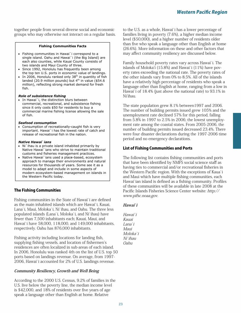
Regional Context
The state of Hawai`i, part of the Western Pacific region1, is composed of the 1,500 mile-long Hawai`ian Island chain. It contains coral atolls and reefs, as well as volcanic islands located between latitudes 19° N and 29° N in the Pacific Ocean. The Hawai`ian Island archipelago is the most iso-lated grouping of islands on earth; the nearest continent, North America, is over 2,000 miles away. Volcanic activ-ity originating on the ocean floor continues to build new islands at the eastern end of the chain. Elevation above sea level creates many microclimates on the larger islands. For example, snow occurs above 13,000 ft. on the island of Hawai`i.
Seven of the main Hawai`ian Islands are inhabited. The island of Oahu where Honolulu is located has the largest population at 876,156, while Ni`ihau has the smallest at 160 persons. Important species sought by commercial fishermen include lobsters, mahimahi (dolphinfish), marlin, moonfish (opah), pomfret, scad, snappers, swordfish, tunas, and wahoo.
In 2007, the Papahanaumokuakea Marine National Monu-ment was created encompassing the 1,200 mile-long west-ern section of the island chain ‒ an area the size of Califor-nia ‒ into a vast marine sanctuary that includes habitat for rare and endangered species like the Hawai`ian monk seal.
Voyagers traveling by canoe from the Cook Islands, Tahiti-nui, or Hiva (Marquesas Islands) settled Hawai’i around 400 A.D. or earlier. The canoes were navigated without instruments by seafarers who depended on their observa-tions of the ocean and sky and traditional knowledge of the patterns of nature. The connection between discovery and fishing is part of a pan-Polynesian tradition where, in a sense, islands were fished out of the sea. Fishermen were likely the most frequent discoverers of islands in ancient times while searching for new fishing grounds or chasing schools of pelagic fish.
Native Hawai`ians used a place-based, ecosystem approach to manage their environments and natural resources for thousands of years. Islands, called mokopuni, were divided into districts or moku which were further divided into ahupua`a, sections of land that extended through dispersed ecological zones from mountain summits out into the fishing grounds, or koas. The ahupua`a were social units containing nearly all of the resources required for survival. The ahupua`a system lasted until the early 1800s, when western concepts of property rights began to take root in Hawai`i.________________________________1The territories of American Samoa, Guam, and the Commonwealth of the Northern Marianas are also part of the Western Pacific Region, but are not included in this publication.
Europeans first contacted the Hawai`ian Islands in 1778 when the Englishman Captain Cook arrived. He was fol-lowed by whaling fleets from around the world throughout the 19th century. Hawai`i became a United States territory in 1900 and the 50th state in 1959.
The city of Honolulu, on Oahu, is the home port for the Hawai`i-based longline fishing fleet, responsible for the majority of commercial fish landed in Hawai`i. The longline fleet primarily targets bigeye tuna but also catches yellow-fin, swordfish, other pelagic species, and numerous sharks ‒ nearly all of which are released. Longline vessel owner-ship is divided along ethnic lines ‒75% are split about equally between Vietnamese-American operators and those of European descent, and 25% are operated by Korean-Americans. The three ethnic groups tend to have different operational practices, attitudes toward regulations, and so-cial networks, although there are differences within ethnic groups.
Fishing comprises a relatively small component of the state of Hawai`i’s total economy but is nevertheless economically important to some local communities. Small-scale commer-cial fishermen sell a portion of their catch, and then divide the remaining fish among family and friends, an important cultural and social obligation around which intimate social networks develop and are perpetuated through time. The vast majority of small-scale commercial fishing vessels are trailered (transported by a trailer), allowing fishermen to launch at diverse sites.
Recreational fishing is an important part of the Hawai`ian Islands recreational culture and contributes to the tourism economy in many locations. Hawai`i is known as the blue marlin trolling capital of the world. The annual Hawai`i In-ternational Billfish Tournament has been held for the past 45 years in Kona, Hawai`i, which is also a center for char-ter fishing in the state. Fishing clubs and tournaments are an important social aspect of recreational fishing, bringing
Weigh-in during an Ahi Fever tournament, Oahu Island, Hawai`i
Western Pacific Summary
23
Western Pacific Region
together people from several diverse social and economic groups who may otherwise not interact on a regular basis.
Fishing Communities Facts Fishing communities in Hawai`i correspond to a
single island. Oahu and Hawai`i (the Big Island) are each also counties, while Kauai County consists of two islands and Maui County of three.
Since 1992, Honolulu has frequently been among the top ten U.S. ports in economic value of landings.
In 2006, Honolulu ranked only 38th in quantity of fish landed (20.9 million pounds) but 4th in value ($54.6 million), reflecting strong market demand for fresh fish.
Role of subsistence fishing In Hawai`i, the distinction blurs between
commercial, recreational, and subsistence fishing since it only costs $50 for residents to buy a commercial marine fishing license allowing the sale of fish.
Seafood consumption Consumption of recreationally-caught fish is very
important. Hawai`i has the lowest rate of catch and release of recreational fish in the nation.
Native Hawai`ians Ni`ihau is a private island inhabited primarily by
Native Hawai`ians who strive to maintain traditional customs and fisheries management practices.
Native Hawai`ians used a place-based, ecosystem-approach to manage their environments and natural resources for thousands of years. Some see it as a model to adapt and include in some aspects of modern ecosystem-based management on islands in the Western Pacific today.
The Fishing Communities
Fishing communities in the State of Hawai`i are defined as the main inhabited islands which are Hawai`i, Kauai, Lana`i, Maui, Moloka`i, Ni`ihau, and Oahu. The three less populated islands (Lana`i, Moloka`i, and Ni`ihau) have fewer than 7,500 inhabitants each; Kauai, Maui, and Hawai`i have 58,000, 118,000, and 149,000 inhabitants, respectively. Oahu has 876,000 inhabitants.
Fishing activity including locations for landing fish, supplying fishing vessels, and location of fishermen’s residences are often localized in sub-areas of each island. In 2006, Honolulu was ranked 4th on the list of U.S. top 50 ports based on landings revenue. On average, from 1997-2006, Hawai`i accounted for 2% of U.S. landings revenue.
Community Resiliency, Growth and Well Being
According to the 2000 U.S. Census, 9.2% of families in the U.S. live below the poverty line, the median income level is $42,000, and 18% of residents over five years of age speak a language other than English at home. Relative
to the U.S. as a whole, Hawai`i has a lower percentage of families living in poverty (7.6%), a higher median income level ($50,000), and a higher number of residents older than five who speak a language other than English at home (26.6%). More information on these and other factors that may affect community resiliency are discussed below.
Family household poverty rates vary across Hawai`i. The islands of Moloka’i (15.8%) and Hawai`i (11%) have pov-erty rates exceeding the national rate. The poverty rates of the other islands vary from 0% to 8.5%. All of the islands have a relatively high percentage of residents who speak a language other than English at home, ranging from a low in Hawai`i of 18.4% (just above the national rate) to 93.1% in Ni’ihau.
The state population grew 8.1% between1997 and 2006. The number of building permits issued grew 105% and the unemployment rate declined 57% for this period, falling from 5.8% in 1997 to 2.5% in 2006; the lowest unemploy-ment rate among the coastal states. From 2005-2006, the number of building permits issued decreased 23.4%. There were four disaster declarations during the 1997-2006 time period and no emergency declarations.
List of Fishing Communities and Ports
The following list contains fishing communities and ports that have been identified by NMFS social science staff as having ties to commercial and/or recreational fisheries in the Western Pacific region. With the exceptions of Kaua`i and Maui which have multiple fishing communities, each Hawai`ian island is defined as a fishing community. Profiles of these communities will be available in late 2008 at the Pacific Islands Fisheries Science Center website: http://www.pifsc.noaa.gov.
Hawai`i
Hawai`iKauaiLana`iMauiMoloka`iNi`ihauOahu

24
Geographic Characteristics State land area (sq. mi): 6,423 % of U.S.: 0.18 Coastline (mi): 750 Shoreline (mi): 1,052 County equivalents: 5 Coastal: 5 Marine: 5
2000 Sex by Age: State of Hawai`i and Average of Selected Fishing Communities
M Total
F Under
5 5 to 14
15 to 24
25 to 34
35 to 44
45 to 54
55 to 64
65 to 74
75 to 84
85 and over
50.2% Hawai`i 1,211,537 49.8% 6.5% 13.9% 13.6% 14.1% 15.8% 14.1% 8.8% 7.0% 4.8% 1.4%
49.6% Fishing Communities 1,211,537 50.4% 7.4% 16.6% 12.9% 12.6% 15.7% 14.0% 8.7% 6.2% 4.6% 1.4%
2000 Race and Hispanic/Latino Ethnicity: Hawai`i and Average of Selected Fishing Communities
Race Ethnicity
Total Population
White Black or African
American
American Indian and
Alaska Native
Asian
Native Hawaiian and other
Pacific Islander
Some other race
Two or more races
% Hispanic or Latino (of any race)
Hawai`i 1,211,537 24.3% 1.8% 0.3% 41.6% 9.4% 1.3% 21.4% 7.2% Fishing Communities 1,211,537 21.0% 0.6% 0.3% 33.1% 21.2% 0.8% 23.1% 6.5%
2000 Demographic Attributes: Selected Fishing Communities Compared to State Total
Fishing Communities1
Total Population
Median Household
Income
% Family Households
below Poverty Level
% Persons over 16 in
Labor Force
Median Educational Attainment
% >5 yrs Speak Language other than English at
Home
Hawai`i 1,211,537 $49,820 7.6% 64.5% Some college 26.6%
Hawai`i2 148,677 $39,805 11.0% 61.7% Some college 18.4%
Honolulu (Oahu)3 876,156 $51,914 7.0% 64.7% Some college 28.9%
Kauai4 58,303 $45,057 8.4% 63.1% Some college 19.4%
Lana`i5 3,193 $43,271 8.5% 65.9% HS graduate 37.6%
Maui6 117,644 $50,546 7.1% 67.3% Some college 23.8%
Moloka`i7 7,404 $32,906 15.8% 56.9% HS graduate 23.2%
Ni`ihau8 160 $25,927 0.0% 80.9% HS graduate 93.1%
Indicators for Growth and Population Well-being in Hawai`i
Indicator 1997 1998 1999 2000 2001 2002 2003 2004 2005 2006
Population9 1,189,322 1,190,472 1,185,497 1,211,537 1,221,419 1,233,249 1,245,606 1,259,299 1,273,278 1,285,498 Building Permits 3,676 3,324 4,211 4,905 4,790 5,902 7,284 9,034 9,828 7,530 Unemployment Rate 5.8 5.7 5.0 4.0 4.2 4.0 3.9 3.2 2.7 2.5 Disaster Declarations 0 0 0 1 0 0 0 0 1 2 Emergency Declarations 0 0 0 0 0 0 0 0 0 0
1Fishing communities in Hawai`i correspond to a single island and each island is usually a county. Kauai and Maui islands are exceptions; each has multiple fishing communities. 2Census data for Hawai`i was identified as Hawai`i County. 3Census data for Honolulu (Oahu) was identified as Honolulu County. 4Census data for Kauai was identified as Kauai County minus Census Tract 410 (Kauai County). 5Census data for Lana`i was identified as Census Tract 316 in Maui County. 6Census data for Maui was identified as Maui County minus Census Tracts 316, 317, and 318 (Maui County). 7Census data for Moloka`i was identified as Census Tracts 318 and 317 (Maui County) and Census Tract 319 (Kalawao County). 8Census data for Ni`ihau was identified as Census Tract 410 in Kauai County. 9Estimated population for all years except 2000; actual count was available for this year.
Hawai`i Tables

25
New England Connecticut Maine Massachusetts New Hampshire Rhode Island

26
Regional Context
The New England region includes Connecticut, Maine, Massachusetts, New Hampshire, and Rhode Island. These states combined share 473 miles of coastline: 13 miles to New Hampshire, 40 miles to Rhode Island, 192 miles to Massachusetts, and 228 miles to Maine. Connecticut has no ocean coastline but does have 618 miles of the region’s tidal shoreline on Long Island Sound and its inlets. Many sounds, bays, inlets, islands and related features characterize the coastal area of these states. Some examples are: Nantucket Sound; Cape Cod, Casco, and Penobscot Bays; and the Gulf of Maine with its historically rich fishing grounds including Georges Bank. Martha’s Vineyard and Nantucket, Massachusetts, and Vinalhaven, Deer Isle, and Mt. Desert, Maine are some larger islands among the many that characterize this region, particularly along the Maine coast. The region’s 6,130 miles of tidal shoreline is distributed as follows: New Hampshire (131 miles); Rhode Island (384 miles); Connecticut (618 miles); Massachusetts (1,519 miles); and Maine (3,478 miles).
As one of the areas of oldest European settlement in North America, the region’s fisheries have been very important historically. The cod fisheries helped feed Europe’s industrial revolution, and were an important part of the 17th through early 19th century’s trade route between Africa, the Caribbean, North America, and Europe. New England’s whalers ‒ especially from New Bedford, Fairhaven, Provincetown, and Nantucket, Massachusetts ‒ hunted their prey around the world to provide the primary source of oil used for domestic lighting, among other products, beginning in the Colonial era and extending into the early 19th century. Ethnic groups particularly associated with the region’s commercial fishing include the Portuguese in New Bedford and Provincetown, the Sicilians in Gloucester, and the Norwegians in New Bedford ‒ all Massachusetts fishing communities ‒ and the “Yankees” (actually white Protestants of British descent), and to a small extent, the Acadians (French) in Maine.
Multiple factors have led to reduced commercial fishing in this region over the past twenty years including stock depletion, changes in fishing regulations, and pollution. Loss of commercial fishing infrastructure to alternative uses also increasingly constrains commercial fishing. All these factors are changing the nature of fishing communities. Gentrification and tourism are factors in communities such as Chatham, Marblehead, and Scituate, Massachusetts; Stonington, Connecticut; Little Compton, Rhode Island; and Vinalhaven, Maine. Many processors and fish houses have ceased operating in the last decade and most rely on imported rather than local product. A recent buyout of the last herring and sardine cannery left in Maine, a plant in Corea (a village within the town of
Gouldsboro) will likely mean a switch away from local to imported product.
Saltwater recreational fishing is found along the entire coast. In 2006, Massachusetts received the most saltwater recreational fishing trips, followed by Connecticut, Rhode Island, New Hampshire, and Maine. Among the top fishing communities that service saltwater anglers are New London, Connecticut, and Fall River and Marblehead, Massachusetts, offering a variety of shoreside support services. Sportfish tournaments are held in the top fishing communities of Groton, Connecticut and Scituate, Massachusetts, as well as in other communities such as Waterford, Connecticut; Bailey Island, and Swans Island, Maine; Barnstable, Danvers, and Marshfield, Massachusetts; and Block Island and Wakefield, Rhode Island.
A large number of the region’s fishing communities host seafood festivals and fishing-related festivals such as blessings of the fleet in the warmer months, including the communities of Point Judith, Newport, and North Kingstown, Rhode Island; New Bedford, Gloucester, Marblehead, Sandwich, Provincetown, and Scituate, Massachusetts; New London, Connecticut; Hampton/Seabrook and Portsmouth, New Hampshire; and Winter Harbor, Bar Harbor, Portland, and Rockland, Maine.
The Fishing Communities
Overall, 11 fishing communities in Connecticut, 50 in Maine, 29 in Massachusetts, 7 in New Hampshire, and 12 in Rhode Island have been profiled by NMFS social scientists because of the nature of their links with commercial and/or recreational fishing. In 2006, 5 of the United States’ top 50 ports by pounds landed were located in the New England region. They are: Gloucester and Provincetown-Chatham, Massachusetts; Point Judith,
New England Summary
A pier crowded with fishing gear, Beals Island, Maine

27
New England Region
Fishing Communities Facts
Gloucester, Massachusetts has been a fishing community continuously since its founding in 1623.
Boston’s Fish Pier, which opened in 1914, is the oldest continuously operating fish pier in the U.S.
There is a lot of support for the fishing industry by state and local governments, as indicated by special loan programs and support for town docks in many communities.
The “Man at the Wheel” statue of the Gloucester Fishermen’s Memorial is one of the most famous fishing monuments in the U.S.
Marblehead, Massachusetts is known as the “Yachting Capital of America.”
Historical context John Cabot, in his 1497 voyage to the new world,
discovered huge schools of cod which soon attracted European fishermen, including the Norwegians, the Portuguese, the British, and the French – ethnicities still represented in today’s fishing communities.
In the late 1800s, a portion of income derived from fishing licenses in Plymouth, Massachusetts was set aside for public schools.
In 1877 the states with the most ocean fishermen were Massachusetts with 17,106 men and Maine with 8,110.
Fishing activities New Bedford, Massachusetts had the highest landed
value from commercial fishing among all ports in the entire United States from 2000 to 2006.
In 2006, there were 4,187 vessels with a Northeast federal permit whose owners lived in New England, but 2,261 vessels which landed in New England.
Fishing-related activities There are a number of active fishermen’s and
fishermen’s wives associations in the region. One of the oldest (founded in 1954) and largest (1,200 members in 2006) is the Maine Lobstermen’s Association.
Provincetown, Massachusetts has the largest and safest harbor in New England.
New England includes critical habitat for northern right whales and habitat for harbor porpoises, impacting fishermen in those areas.
Seascape Stellwagen Bank National Marine Sanctuary and four
National Estuarine Research Reserves are found in New England waters.
Rhode Island; and Portland and Stonington, Maine. Perhaps somewhat surprisingly, the New England region accounted for only 7% of U.S. landings from 1997-2006, on average. In contrast, New England accounted for 20% of U.S. landings revenue during this period.
The largest metropolitan area in the New England region is Boston, a center for financial services and insurance for the fishing industry as well as the home of the Nation’s oldest continuously operating fish pier. The region’s other
top fishing communities that are located within urban areas with populations greater than 100,000 are: Providence, Rhode Island; and Bridgeport and New Haven, Connecticut. Exclusive of these large cities, the average population for the top fishing communities is 32,846 for Massachusetts, 31,456 for Connecticut, and 26,175 for Rhode Island. Maine averages 9,979, while New Hampshire averages 8,211. Both Maine and New Hampshire’s top fishing communities are predominantly smaller communities. Eight of Maine’s and four of New Hampshire’s top ten fishing communities have populations of less than 8,000. Only two of Massachusetts’s and one of Rhode Island’s top fishing communities have populations of less than 8,000, while Connecticut has none.
Community Resiliency, Growth, and Well Being
According to the 2000 U.S. Census, 9.2% of families in the U.S. live below the poverty line, the median income level is $42,000, and 18% of residents over five years of age speak a language other than English at home. The New England region has a lower percentage of families living in poverty, a higher median income level, and a comparable percentage of residents older than five who speak a language other than English at home relative to the U.S. as a whole. Not all fishing communities follow to these trends, however. More information on these and other factors that may affect community resiliency are discussed below.
Connecticut
Based upon the 2000 Census, the percentage of family households below the poverty level was 5.6% in Connecticut. New London (13.4%), Bridgeport (16.2%), and New Haven (20.5%) had the highest poverty rates in the state and among the highest in the region. The poverty rate in the other fishing communities was 5% or less. These three communities and Norwalk had the highest percentage of residents who spoke a language other than English at home (24% to 44%).
At the state level, indicators show that population has grown 7.2% and annual building permit issuance has fallen 1% between 1997 and 2006. The average unemployment rate dropped 8%. From 2005‒2006, the number of building permits fell 22%. There were two disaster declarations and five emergency declarations during the 1997-2006 time period.
Maine
The percentage of family households below the poverty rate in Maine in 2000 was 7.8%. The family household poverty rates in the fishing communities were generally lower. Portland, Rockland, and Stonington were exceptions, all with poverty rates at 10%. The percentage of fishing

28
New England Summary
Maine
AddisonBailey IslandBar HarborBathBealsBelfastBoothbay HarborBremenBucks HarborCape PorpoiseCoreaCundys HarborCushingCutlerDeer IsleEastport
FalmouthFrenchboroFriendshipGouldsboro Town*HarpswellIslesfordJonesportKennebunkportKitteryMilbridgeNew HarborNorth HavenOgunquitOwls HeadPemaquidPort ClydePortlandProspect Harbor
community residents speaking English at home was generally lower than the state average, with Portland providing the lone exception (10%). In three of the nine selected fishing communities, the median education level was “high school.” The median education level for the state and the other fishing communities was “some college.”
The state population grew 6.1% between 1997 and 2006. In contrast, the number of building permits issued grew 55%. The unemployment rate fell 10%, averaging 4.4% for the period. From 2005-2006, the number of building permits issued fell 19%. There were ten disaster declarations and ten emergency declarations during the 1997-2006 time period.
Massachusetts
In Massachusetts, the percentage of family households below the poverty line was 6.7%. Across fishing communities, the household poverty rate ranged from 1% to 17%, with five fishing communities having poverty rates lower than the state poverty rate. The highest poverty rates were in New Bedford (17%), Boston (15%), and Fall River (14%). These fishing communities also had the highest percentage of residents over five years who spoke a language other than English at home: 38%, 33%, and 35%, respectively. The median education levels for the state and five fishing communities was “some college.” Marblehead had the highest median educational attainment (“Bachelor’s degree”) and Fairhaven, Fall River, and New Bedford had the lowest (“high school graduate”).
State population growth between 1997 and 2006 was 5.3% and averaged 6.3 million. The unemployment rate (4.8% in 2006) increased 17%, while the issuance of building permits increased 14% during this period. From 2005-2006, building permit issuance fell 20%. There were five disaster declarations and seven emergency declarations during the 1997-2006 time period.
New Hampshire
The percentage of family households below the poverty line in New Hampshire was the lowest in the region at 4.3%. The family household poverty rate across the selected fishing communities was also relatively low, ranging from 0% to 6%. The percentage of residents over five years of age who spoke a language other than English at home was 8.3% for the state but generally lower across the fishing communities. New Hampshire fishing communities had the highest median education level attained, with three communities having “bachelor’s degrees” as the median level attained by their residents.
At the state level, population grew 12% between 1997 and 2006. The average unemployment rate during this period was low, averaging 3.5%. The number of building
permits issued from 1997-2006 increased 5%, falling 25% from 2005-2006. There were six disaster declarations and seven emergency declarations during the 1997-2006 time period.
Rhode Island
The percentage of family households below the poverty line in Rhode Island was the highest in the region, 8.9%. The poverty rate was lower in fishing communities with the exceptions of Providence (24%, the highest in the region) and Newport (13%). The percentage of residents over five years of age who spoke a language other than English was 20% for the state, also a regional high. With the exceptions of Providence (43%) and Bristol (21%), most fishing communities had a lower rate than the state rate. The median educational attainment of the state and all fishing communities was “some college.”
Rhode Island’s population growth was 8% between1997 and 2006. In contrast, building permit issuance fell 11% for the period. The unemployment rate fell 2%, averaging 4.9% for the period. From 2005-2006, the number of building permits issued fell 16%. There were no disaster declarations and three emergency declarations during the 1997-2006 time period.
List of Fishing Communities and Ports
The following list contains fishing communities and ports that have been identified by NMFS social science staff as having ties to commercial and/or recreational fisheries in the New England region. Profiles of most of these communities are available at http://www.nefsc.noaa.gov/read/socialsci/community_profiles/. Profiled communities were chosen by regional indicators rather than by state. Communities listed here but not profiled are identified with an asterisk (*).

29
New England Region
RocklandSaint George Town*Sebasco Estates/PhippsburgSorrentoSouth BristolSouth Thomaston Southwest HarborSpruce HeadStoningtonSwans IslandTenants HarborTremontVinalhavenWestportWhitingWinter Harbor
New Hampshire
Durham*HamptonNew Castle*NewingtonPortsmouthRyeSeabrook
Massachusetts
BarnstableBeverlyBostonChathamChilmarkCohassetDanversFairhavenFall RiverGloucesterHarwich PortHullManchesterMarbleheadMarshfieldNantucketNew BedfordNewburyportOrleansPlymouthProvincetownRockportSalisburySandwichSaugusScituateWellfleet
WestportWoods Hole
Rhode Island
Block IslandBristol*Little ComptonNewport North KingstownPoint Judith/NarragansettPortsmouthProvidence*South Kingstown*Tiverton WakefieldWarrenWarwick*
Connecticut
Branford*Bridgeport*Darien*East Haven*GrotonNew Haven*New LondonNorwalk*Portland*StoningtonWaterford

30
Connecticut Tables
Geographic Characteristics State land area (sq. mi): 4,845 % of U.S.: 0.14 Coastline (mi): 0 Shoreline (mi): 618 County equivalents: 8 Coastal: 8 Marine: 4
2000 Sex by Age: State of Connecticut and Average of Selected Fishing Communities
M Total
F Under
5 5 to 14
15 to 24
25 to 34
35 to 44
45 to 54
55 to 64
65 to 74
75 to 84
85 and over
48.4% Connecticut 3,405,565 51.6% 6.6% 14.3% 11.9% 13.3% 17.1% 14.1% 9.1% 6.8% 5.1% 1.9%
43.5% Fishing Communities 514,801 46.6% 6.3% 12.6% 11.0% 12.7% 15.0% 12.1% 7.6% 6.2% 4.7% 1.6%
2000 Race and Hispanic/Latino Ethnicity: Connecticut and Average of Selected Fishing Communities
Race Ethnicity
Total Population
White Black or African
American
American Indian and
Alaska Native
Asian
Native Hawaiian and other
Pacific Islander
Some other race
Two or
more races
% Hispanic or Latino
(of any race)
Connecticut 3,405,565 81.6% 9.1% 0.3% 2.4% 0.0% 4.3% 2.2% 9.4% Fishing Communities 514,801 70.2% 10.8% 0.3% 2.1% 0.1% 4.2% 2.4% 10.1%
2000 Demographic Attributes: Selected Fishing Communities Compared to State Total
Fishing Communities
Total Population
Median Household
Income
% Family Households
below Poverty
Level
% Persons over 16 in
Labor Force
Median Educational Attainment
% >5 yrs Speak Language other than English at
Home
Connecticut 3,405,565 $53,935 5.6% 66.6% Some college 18.3%
Branford1 28,683 $58,009 3.3% 69.9% Some college 9.0%
Bridgeport 139,529 $34,658 16.2% 61.2% HS graduate 43.5%
Darien 19,607 $146,755 0.6% 61.6% Bachelor's degree 11.4%
East Haven 28,189 $47,930 3.5% 66.9% HS graduate 12.1%
Groton2 39,907 $46,154 4.9% 70.9% Some college 9.0%
New Haven 123,626 $29,604 20.5% 60.0% Some college 28.4%
New London 25,671 $33,809 13.4% 65.8% Some college 23.6%
Norwalk 82,951 $59,839 5.0% 70.8% Some college 26.8%
Portland3 8,732 $63,285 3.0% 71.9% Some college 8.4%
Stonington4 17,906 $52,437 2.9% 65.0% Some college 7.5%
Indicators for Growth and Population Well-being in Connecticut
Indicator 1997 1998 1999 2000 2001 2002 2003 2004 2005 2006
Population5 3,268,514 3,272,563 3,282,031 3,405,565 3,433,201 3,457,927 3,482,326 3,493,893 3,500,701 3,504,809 Building Permits 9,311 11,863 10,637 9,376 9,290 9,731 10,435 11,837 11,885 9,236 Unemployment Rate 4.8 3.2 2.7 2.3 3.1 4.4 5.5 4.9 4.9 4.4 Disaster Declarations 0 0 1 0 0 0 0 0 1 0 Emergency Declarations 0 0 0 0 0 0 1 1 2 1
1Census data for Branford was identified as Branford town in the New Haven County subdivision. 2Census data for Groton was identified as Groton town in the New London County subdivision. 3Census data for Portland was identified as Portland town in the Middlesex County subdivision. 4Census data for Stonington was identified as Stonington town in the New London County subdivision. 5Estimated population for all years except 2000; actual count was available for this year.

31
Maine Tables
Geographic Characteristics State land area (sq. mi): 30,862 % of U.S.: 0.87 Coastline (mi): 228 Shoreline (mi): 3,478 County equivalents: 16 Coastal: 14 Marine: 8
2000 Sex by Age: State of Maine and Average of Selected Fishing Communities
M Total
F Under
5 5 to 14
15 to 24
25 to 34
35 to 44
45 to 54
55 to 64
65 to 74
75 to 84
85 and over
48.7% Maine 1,274,923 51.3% 5.5% 13.7% 12.5% 12.4% 16.7% 15.1% 9.7% 7.5% 5.0% 1.8%
48.2% Fishing Communities 89,813 51.8% 5.5% 12.4% 11.5% 12.7% 15.3% 14.8% 10.5% 9.2% 6.0% 2.1%
2000 Race and Hispanic/Latino Ethnicity: Maine and Average of Selected Fishing Communities
Race Ethnicity
Total Population
White Black or African
American
American Indian and
Alaska Native
Asian
Native Hawaiian and other
Pacific Islander
Some other race
Two or
more races
% Hispanic or Latino
(of any race)
Maine 1,274,923 96.9% 0.5% 0.6% 0.7% 0.0% 0.2% 1.0% 0.7%
Fishing Communities 89,813 96.1% 0.7% 0.4% 0.8% 0.0% 0.4% 1.7% 0.7%
2000 Demographic Attributes: Selected Fishing Communities Compared to State Total
Fishing Communities
Total Population
Median Household
Income
% Family Households
below Poverty Level
% Persons over 16 in
Labor Force
Median Educational Attainment
% >5 yrs Speak Language other than English at
Home
Maine 1,274,923 $37,240 7.8% 65.3% Some college 7.8%
Bar Harbor 4,820 $37,481 4.9% 66.9% Some college 4.8%
Cundys Harbor1 5,239 $40,611 3.3% 59.5% Some college 6.9%
Port Clyde2 2,580 $41,211 3.8% 60.6% Some college 2.5%
Portland 64,249 $35,650 9.7% 69.1% Some college 9.9%
Prospect Harbor3 1,941 $36,542 7.0% 60.5% HS graduate 4.0%
Rockland 7,609 $30,209 10.4% 63.0% Some college 3.7%
Stonington4 1,152 $28,894 9.6% 52.4% HS graduate 3.2%
Vinalhaven 1,235 $34,087 5.7% 53.9% HS graduate 4.0%
Winter Harbor5 988 $28,571 5.5% 67.7% Some college 5.9%
Indicators for Growth and Population Well-being in Maine
Indicator 1997 1998 1999 2000 2001 2002 2003 2004 2005 2006
Population6 1,245,215 1,247,554 1,253,040 1,274,923 1,286,419 1,296,817 1,307,151 1,313,921 1,318,220 1,321,574 Building Permits 4,706 6,280 5,688 6,177 6,492 7,207 7,933 8,771 8,969 7,293 Unemployment Rate 5.1 4.5 4.0 3.3 3.8 4.4 5.0 4.6 4.8 4.6 Disaster Declarations 0 2 2 1 1 0 1 1 1 1 Emergency Declarations 0 0 0 0 1 0 1 2 5 1
1Census data for Cundys Harbor was identified as Harpswell town in the Cumberland County subdivision. Harpswell town also includes Harpswell, South Harpswell, Bailey Island, and Orrs Island. 2Census data for Port Clyde was identified as St. George town in the Knox County subdivision. St. George town also includes Tenants Harbor. 3Census data for Prospect Harbor was identified as Gouldsboro town in the Hancock County subdivision. Gouldsboro town also includes Gouldsboro, Corea, and Birch. 4Census data for Stonington was identified as Stonington town in the Hancock County subdivision. 5Census data for Winter Harbor was identified as Winter Harbor town in the Hancock County subdivision. 6Estimated population for all years except 2000; actual count was available for this year.

32
Massachusetts Tables
Geographic Characteristics State land area (sq. mi): 7,840 % of U.S.: 0.22 Coastline (mi): 192 Shoreline (mi): 1,519 County equivalents: 14 Coastal: 12 Marine: 8
2000 Sex by Age: State of Massachusetts and Average of Selected Fishing Communities
M Total
F Under
5 5 to 14
15 to 24
25 to 34
35 to 44
45 to 54
55 to 64
65 to 74
75 to 84
85 and over
48.2% Massachusetts 6,349,097 51.8% 6.3% 13.6% 12.9% 14.6% 16.7% 13.8% 8.6% 6.7% 5.0% 1.8%
48.2% Fishing Communities 884,753 51.8% 5.4% 12.3% 10.7% 12.5% 16.6% 15.1% 10.1% 8.6% 6.4% 2.5%
2000 Race and Hispanic/Latino Ethnicity: Massachusetts and Average of Selected Fishing Communities
Race Ethnicity
Total Population
White Black or African
American
American Indian and
Alaska Native
Asian
Native Hawaiian and other
Pacific Islander
Some other race
Two or
more races
% Hispanic or Latino
(of any race)
Massachusetts 6,349,097 84.5% 5.4% 0.2% 3.8% 0.0% 3.7% 2.3% 6.8% Fishing Communities 884,753 89.2% 4.4% 0.3% 1.4% 0.0% 2.5% 2.2% 0.3%
2000 Demographic Attributes: Selected Fishing Communities Compared to State Total
Fishing Communities
Total Population
Median Household
Income
% Family Households
below Poverty Level
% Persons over 16 in
Labor Force
Median Educational Attainment
% >5 yrs Speak
Language other than English at
Home
Massachusetts 6,349,097 $50,502 6.7% 66.2% Some college 18.7%
Boston 589,141 $39,629 15.3% 63.6% Some college 33.4%
Chatham 1,667 $47,037 0.9% 51.6% Some college 4.9%
Fairhaven1 16,159 $41,696 6.5% 63.3% HS graduate 10.6%
Fall River 91,938 $29,014 14.0% 59.1% HS graduate 34.6%
Gloucester 30,273 $47,722 7.1% 66.1% Some college 10.3%
Marblehead 20,377 $73,968 3.2% 68.7% Bachelor's degree 7.3%
New Bedford 93,768 $27,569 17.3% 57.7% HS graduate 37.8%
Provincetown2 3,431 $32,716 8.5% 64.2% Some college 9.9%
Sandwich3 20,136 $61,250 2.2% 66.8% Some college 4.6%
Scituate4 17,863 $70,868 1.4% 67.6% Some college 5.5%
Indicators for Growth and Population Well-being in Massachusetts
Indicator 1997 1998 1999 2000 2001 2002 2003 2004 2005 2006
Population5 6,115,476 6,144,407 6,175,169 6,349,097 6,406,727 6,431,247 6,439,592 6,435,995 6,433,367 6,437,193 Building Permits 17,186 19,254 18,967 18,000 17,034 17,465 20,257 22,477 24,549 19,580 Unemployment Rate 4.1 3.4 3.3 2.8 3.7 5.3 5.8 5.2 4.9 4.8 Disaster Declarations 0 1 0 0 1 0 0 1 1 1 Emergency Declarations 0 0 1 0 1 0 1 1 3 0
1Census data for Fairhaven was identified as Fairhaven town in the Bristol County subdivision. 2Census data for Provincetown was identified as Provincetown town in the Barnstable County subdivision. 3Census data for Sandwich was identified as Sandwich town in the Barnstable County subdivision. 4Census data for Scituate was identified as Scituate town in the Plymouth County subdivision. 5Estimated population for all years except 2000; actual count was available for this year.

33
New Hampshire Tables
Geographic Characteristics State land area (sq. mi): 8,969 % of U.S.: 0.25 Coastline (mi): 13 Shoreline (mi): 131 County equivalents: 10 Coastal: 6 Marine: 1
2000 Sex by Age: State of New Hampshire and Average of Selected Fishing Communities
M Total
F Under
5 5 to 14
15 to 24
25 to 34
35 to 44
45 to 54
55 to 64
65 to 74
75 to 84
85 and over
49.2% New Hampshire 1,235,786 50.8% 6.1% 14.7% 12.6% 13.0% 17.9% 14.9% 8.9% 6.3% 4.2% 1.5%
48.2% Fishing Communities 57,475 51.8% 4.6% 11.7% 15.3% 10.7% 15.8% 15.2% 11.0% 8.8% 5.3% 1.2%
2000 Race and Hispanic/Latino Ethnicity: New Hampshire and Average of Selected Fishing Communities
Race Ethnicity
Total Population
White Black or African
American
American Indian and
Alaska Native
Asian
Native Hawaiian and other
Pacific Islander
Some other race
Two or
more races
% Hispanic or Latino
(of any race)
New Hampshire 1,235,786 96.0% 0.7% 0.2% 1.3% 0.0% 0.6% 1.1% 1.7%
Fishing Communities 57,475 96.6% 0.8% 0.2% 1.3% 0.0% 0.2% 0.9% 0.4%
2000 Demographic Attributes: Selected Fishing Communities Compared to State Total
Fishing Communities
Total Population
Median Household
Income
% Family Households
below Poverty Level
% Persons over 16 in Labor
Force
Median Educational Attainment
% >5 yrs Speak Language other than English at
Home
New Hampshire 1,235,786 $49,467 4.3% 70.5% Some college 8.3%
Durham1 12,664 $51,697 2.8% 61.0% Bachelor's degree 8.4%
Hampton 9,126 $57,356 1.9% 69.1% Some college 6.7%
New Castle2 1,010 $83,708 0.0% 57.6% Bachelor's degree 6.1%
Newington3 775 $59,464 5.0% 75.8% Some college 7.7%
Portsmouth 20,784 $45,195 6.4% 69.9% Some college 6.6%
Rye4 5,182 $63,152 1.6% 59.9% Bachelor's degree 5.3%
Seabrook5 7,934 $42,874 6.1% 69.3% HS graduate 5.5%
Indicators for Growth and Population Well-being in New Hampshire
Indicator 1997 1998 1999 2000 2001 2002 2003 2004 2005 2006
Population6 1,173,239 1,185,823 1,201,134 1,235,786 1,258,408 1,273,970 1,285,918 1,297,961 1,306,819 1,314,895 Building Permits 5,404 5,771 6,326 6,680 6,624 8,708 8,641 8,653 7,586 5,677 Unemployment Rate 3.1 2.9 2.8 2.7 3.4 4.6 4.5 3.9 3.6 3.5 Disaster Declarations 0 2 1 0 0 0 1 0 1 1 Emergency Declarations 0 0 0 0 1 0 1 1 4 0
1Census data for Durham was identified as Durham town in the Strafford County subdivision. 2Census data for New Castle was identified as New Castle town in the Rockingham County subdivision. 3Census data for Newington was identified as Newington town in the Rockingham County subdivision. 4Census data for Rye was identified as Rye town in the Rockingham County subdivision. 5Census data for Seabrook was identified as Seabrook town in the Rockingham County subdivision. 6Estimated population for all years except 2000; actual count was available for this year.

34
Rhode Island Tables
Geographic Characteristics State land area (sq. mi): 1,045 % of U.S.: 0.03 Coastline (mi): 40 Shoreline (mi): 384 County equivalents: 5 Coastal: 5 Marine: 4
2000 Sex by Age: State of Rhode Island and Average of Selected Fishing Communities
M Total
F Under
5 5 to 14
15 to 24
25 to 34
35 to 44
45 to 54
55 to 64
65 to 74
75 to 84
85 and over
48.0% Rhode Island 1,048,319 52.0% 6.1% 13.7% 14.1% 13.4% 16.2% 13.5% 8.5% 7.0% 5.5% 2.0%
48.2% Fishing Communities 409,191 51.8% 5.5% 12.7% 15.3% 12.3% 15.8% 14.3% 9.3% 7.4% 5.4% 1.9%
2000 Race and Hispanic/Latino Ethnicity: Rhode Island and Average of Selected Fishing Communities
Race Ethnicity
Total Population
White Black or African
American
American Indian and
Alaska Native
Asian
Native Hawaiian and other
Pacific Islander
Some other race
Two or
more races
% Hispanic or Latino
(of any race)
Rhode Island 1,048,319 85.0% 4.5% 0.5% 2.3% 0.1% 5.0% 2.7% 8.7%
Fishing Communities 409,191 90.7% 2.9% 0.6% 1.5% 0.1% 2.3% 1.9% 0.4%
2000 Demographic Attributes: Selected Fishing Communities Compared to State Total
Fishing Communities
Total Population
Median Household
Income
% Family Households
below Poverty Level
% Persons over 16 in Labor
Force
Median Educational Attainment
% >5 yrs Speak Language other than English at
Home
Rhode Island 1,048,319 $42,090 8.9% 64.6% Some college 20.0%
Bristol 22,469 $43,689 5.2% 63.6% Some college 21.4%
Little Compton1 3,593 $55,368 3.7% 65.4% Some college 5.6%
Newport 26,475 $40,669 12.9% 70.1% Some college 9.6%
North Kingstown2 26,326 $60,027 5.8% 71.9% Some college 6.4%
Point Judith3 16,361 $50,363 4.9% 67.0% Some college 5.6%
Providence 173,618 $26,867 23.9% 57.7% Some college 43.0%
South Kingstown4 27,921 $56,325 3.1% 67.4% Some college 10.2%
Tiverton5 15,260 $49,977 2.9% 66.9% Some college 10.3%
Warren6 11,360 $41,285 5.2% 67.0% Some college 13.3%
Warwick 85,808 $46,483 4.2% 66.5% Some college 7.9%
Indicators for Growth and Population Well-being in Rhode Island Indicator 1997 1998 1999 2000 2001 2002 2003 2004 2005 2006
Population7 986,966 987,704 990,819 1,048,319 1,058,510 1,068,568 1,074,783 1,078,930 1,073,579 1,067,610
Building Permits 2,672 2,642 3,414 2,596 2,407 2,848 2,286 2,532 2,836 2,370 Unemployment Rate 5.2 4.6 4.2 4.2 4.5 5.1 5.4 5.2 5.1 5.1 Disaster Declarations 0 0 0 0 0 0 0 0 0 0 Emergency Declarations 0 0 0 0 0 0 1 0 2 0
1Census data for Little Compton was identified as Little Compton town in the Newport County subdivision. 2Census data for North Kingstown was identified as North Kingstown in the Washington County subdivision. 3Census data for Point Judith was identified as Narragansett town in the Washington County subdivision. 4Census data for South Kingstown was identified as South Kingstown town in the Washington County subdivision. 5Census data for Tiverton was identified as Tiverton town in the Newport County subdivision. 6Census data for Warren was identified as Warren town in the Bristol County subdivision. 7Estimated population for all years except 2000; actual count was available for this year.

35
Mid-Atlantic Delaware Maryland New Jersey New York Virginia

36
Regional Context
The Mid-Atlantic region includes Delaware, Maryland, New Jersey, New York, and Virginia. These states combined share 428 miles of coastline: 130 miles in New Jersey, 127 miles in New York, 112 miles in Virginia, 31 miles in Maryland, and 28 miles in Delaware. Many sounds, bays, inlets, and related features characterize the coastal area of these states such as the Chesapeake Bay and Long Island Sound. Although the region’s seacoast is not particularly lengthy, it shares 10,528 miles of tidal shoreline distributed among the states as follows: Virginia, 3,315 miles; Maryland, 3,190 miles; New York, 1,850 miles; New Jersey, 1,792 miles; and Delaware, 381 miles. The most commercially important species today in the Mid-Atlantic region are sea scallop, blue crab, surf clam, menhaden, quahog (inshore), summer flounder, striped bass, lobster, squid (loligo), and monkfish.
Historically, the Chesapeake Bay has had one of the Nation’s and the region’s more productive commercial fisheries dominated by blue crab and oysters, but also including finfish like striped bass. Many Maryland and some Virginia fishing communities are located on its tidal creeks and islands. Examples include: Smith Island, Solomons, and Deale, Maryland; and Reedville, Wachapreague, and Cheriton, Virginia. Today many of these areas provide recreational fishing opportunities and second homes for people from metropolitan Washington, D.C. and Baltimore, Maryland, and increasingly primary homes for others. This is another local example of the national trend of population movement to coastal zones. Both shores of the Chesapeake Bay and the whole Delaware/Maryland/Virginia or “Delmarva” Peninsula are undergoing transformation, impacting local fisheries and fishing communities. Commercial fisheries production in the Chesapeake Bay and its tributaries is in decline for complex reasons including pollution from agriculture and urban expansion throughout its vast watershed, and species-specific disease. The Chesapeake Bay area’s experience is typical of the region as a whole.
Loss of commercial fishing infrastructure to alternate uses increasingly constrains commercial fishing and is changing the nature of fishing communities. Gentrification and tourism are factors in communities including: Barnegat Light/Long Beach, Belford, and Atlantic City, New Jersey; Greenport and Hampton Bays/Shinnecock, New York; Lewes, Delaware; Ocean City, Maryland; and Hampton, Virginia. Many processors and fish houses have ceased operating in the last decade. Some examples of fishing communities where this is happening include Chincoteague and Norfolk, Virginia and Ocean City, Maryland.
Saltwater recreational fishing is found along the entire coast and its importance is increasing. In 2006, New Jersey received the most saltwater recreational fishing trips,
followed by New York, Virginia, Maryland, and Delaware. Among the top fishing communities that service saltwater anglers are Barnegat Light/Long Beach, Point Pleasant, and Belmar, New Jersey; Mattituck and Montauk, New York; Lewes and Indian River, Delaware; Ocean City, Maryland; and Hampton, Newport News, Wachapreague, and Chincoteague, Virginia. These offer a variety of shoreside support services as well as sportfish tournaments.
A large number of the region’s fishing communities host seafood festivals and fishing-related festivals such as bless-ings of the fleet in the warmer months. Examples include the communities of Lewes, Delaware; Ocean City, Maryland; Atlantic City, Avalon, Barnegat Light/Long Beach, Belmar, Cape May, and Point Pleasant, New Jersey; Greenport, Oceanside, Point Lookout, Mattituck, and Montauk, New York; and Chincoteague, Hampton, Newport News, and Seaford, Virginia.
The Fishing Communities
Overall, 58 fishing communities have been profiled by NMFS social scientists because of the nature of their links with commercial and/or recreational fishing in the Mid-Atlantic region. These communities are distributed as follows: Delaware, 5 communities; Maryland, 9 communities; New Jersey, 17 communities; New York, 13 communities; North Carolina, 24 communities; Pennsylvania, 2 communities; and Virginia, 12 communities.1 In 2006, six of the United States’ top 50 ________________________________1Neither North Carolina nor Pennsylvania are included in this regional summary. North Carolina is described in the South Atlantic Regional Summary. Pennsylvania was omitted here due to its limited engagement in marine-related commercial harvest and recreational fishing sectors. Most of Maryland’s fishing communities were identified by non-NMFS regional specialists because most fisheries landings are not tied to ports in that state.
Mid-Atlantic Summary
Fresh fish and seafood at The New Fulton Fish Market, Bronx, New York

37
Mid-Atlantic Region
ports by pounds landed were located in the Mid-Atlantic region. They are: Reedville and Hampton Roads, Virginia; Cape May-Wildwood, Atlantic City, and Point Pleasant, New Jersey; and Montauk, New York.
Several major metropolitan areas are located in the Mid-Atlantic region, a center of population for the United States. The region’s top fishing communities located within larger urban areas are all located in Virginia. They include Virginia Beach, Richmond, Newport News, and Hampton. Another seven of the region’s top fishing communities are smaller cities between 10,000 and 41,000 population. Some examples include Atlantic City and Point Pleasant, New Jersey, and Oceanside and Hampton Bays, New York. The remaining top fishing communities have populations of 7,000 or less and are located as follows: Maryland has seven and New Jersey has eight fishing communities of this size; and Delaware, New York, and Virginia each have five fishing communities of this size. Six top fishing communities in the region have fewer than 1,000 inhabitants: Barnegat Light, New Jersey; Port Mahon/Little Creek and Bowers Beach, Delaware; Wachapreague and Cheriton, Virginia; and Smith Island, Maryland.
Community Resiliency, Growth, and Well Being
According to the 2000 U.S. Census, 9.2% of families in the U.S. live below the poverty line, the median income level is $42,000, and 18% of residents over five years of age speak a language other than English at home. The Mid-Atlantic region and its fishing communities are fairly comparable to the national picture, with state-level poverty rates ranging from 6.1% to 11.5%, median income levels ranging from $43,000-$55,000, and the percentage of residents over five years of who speak a language other than English at home ranging from 9.5% to 28%. More information on these and other factors that may affect community resiliency are discussed below.
Delaware
The percentage of family households below the poverty level in Delaware was 6.5%. The poverty rates in fishing communities varied but were still comparable to the national rate. Indian River and Lewes had the lowest poverty rates at 1.7% and 3.4%, respectively. The poverty rates in the other top fishing communities ranged from 7.7% to 10.6%. The percentage of residents over five years of age who spoke a language other than English at home was 9.5% for the state (a regional low) but generally lower across the fishing communities.
At the state level, indicators show that population has grown 16.1% between1997and 2006 and the unemployment rate fell 10.3%. The number of annual building permits issued increased 37%, despite falling 21%
Fishing Communities Facts The community of Belford, New Jersey is reported to be
one of the oldest fishing ports on the East Coast. Smith Island, Maryland, with a population of under
400, is one of only three Mid-Atlantic islands to still have year-round residents.
The landing site of Port Mahon, Delaware is located in a Nature Conservancy Preserve and can be accessed only by four-wheel drive vehicle. Fishermen do not reside here but in nearby Little Creek, Delaware.
Commercial fisheries In 2006, there were 1,382 vessels with a Northeast
federal permit whose owners lived in the Mid-Atlantic, but 982 vessels which landed in the Mid-Atlantic.
Traditionally many menhaden fishermen, though few captains, have been African American. The menhaden is a small fish caught in large quantity used to produce fish meal and other products.
Delaware fishermen generally land their catch in Ocean City, Maryland as there have been no fish packing facilities in Delaware since 1986.
North Carolina commercial fisheries are so intertwined with certain primarily Mid-Atlantic species that North Carolina has a seat on the Mid-Atlantic Fishery Management Council, in addition to its seat on the South Atlantic Fishery Management Council.
Recreational fishing The Cape May County Fishing Tournament in New
Jersey is one of the longest continuously running fishing tournaments on the East Coast. Avalon, Cape May, Wildwood, and Sea Isle City, New Jersey are all within Cape May County.
Freeport, New York (near Oceanside, New Jersey and Point Lookout, New York) hosts the largest annual shark tournament on the East Coast.
Seafood sales The Fulton Fish Market in New York City is the largest
consortium of seafood wholesalers in the country. Historical context & recognition In 1871, there was a whaling “lookout” station
established on what is now known as Point Lookout, New York.
In 1877, if oystermen were added to the total, the states with second and third most fishermen in the U.S. were Virginia and Maryland with 16,000 each.
The village of Greenport and Mattituck Inlet in New York have been designated as historic maritime areas by the Town of Southold, within which they are located.
Reedville, Virginia is home to Omega Protein Corp. The company can trace its roots back to a primitive fish processing facility begun by John Haynie in what is now Reedville in 1678.
Other fish facts According to some researchers, Slaughter Beach in
Milford, Delaware is the most important horseshoe crab spawning ground in the world.
Newport News, Hampton, and Virginia Beach, Virginia, as well as some other nearby communities, are sometimes referred to collectively as the Hampton Roads area.
Dorchester County, Maryland (location of Cambridge, Maryland) is the original home of the skipjack, a type of sailboat developed on the Chesapeake Bay specifically for oyster dredging.

38
Mid-Atlantic Summary
from 2005‒2006. There were six disaster declarations and two emergency declarations during the 1997-2006 time period.
Maryland
The percentage of family households below the poverty level in Maryland was 6.1% in 2000, the lowest in the region. The family household poverty rate in fishing communities varied. Four fishing communities (Ocean City, Deale, Shady Side, and Solomons) had poverty rates at 6% or less. Crisfield (30.5%), Cambridge (17.2%), and Smith Island (14.4%) had the highest poverty rates. The percentage of fishing community residents over five years of age who spoke a language other than English at home was 12.6% for the state but markedly lower across the fishing communities (7% or lower, less than half the national average). The median education level for the fishing communities was “high school” for six communities and “some college” for three. The median education level for the state was “some college.”
The state population grew 10.3% between 1997 and 2006 and the unemployment rate fell 19% during this period to 3.8% in 2006. The number of building permits issued declined 10.4% during this time, largely due to a 23% decline from 2005-2006. There were five disaster declarations and two emergency declarations during the 1997-2006 time period.
New Jersey
In New Jersey, the percentage of family households below the poverty line was 6.3%. Eight fishing communities had poverty rates less than the national rate and six were below the state poverty rate. Atlantic City (19.1%) and Wildwood (20.2%) had poverty rates twice the national average. These fishing communities also had the highest percentage of residents who spoke a language other than English at home, 38.4% and 20.6%, respectively. Among New Jersey’s top fishing communities, Wildwood ($24,000), Atlantic City ($27,000), and Cape May ($33,000) had the lowest median income levels.
Between 1997 and 2006, state population growth was 8.3% and the unemployment rate fell 11.3%. The issuance of building permits increased 22.5%, despite falling 11.1% from 2005-2006, the lowest decrease in the Mid-Atlantic region. There were eight disaster declarations and four emergency declarations during the 1997-2006 time period.
New York
The percentage of family households below the poverty line in New York was the highest in the region at 11.5%. With the exception of Greenport (21.1%), the family household poverty rate across the selected fishing communities was lower than the state and national rates. The percentage of residents over five years of age who spoke a language other than English at home was 28% for the state but generally lower across the fishing communities. Montauk (30.3%) had the highest percentage of residents who spoke a language other than English at home, while Mattituck (8.1%), Amagansett (9.5%), and Point Lookout (9.5%) had rates roughly half the national average. The New York fishing communities had the highest median education level attained in the region (“some college”).
At the state level, population grew 6.4% between1997 and 2006 to 19.3 million residents. The unemployment rate dropped 29% during this time period to 4.6% in 2006. The number of building permits issued increased 65%, declining 12.2% from 2005-2006. There were 18 disaster declarations and 11 emergency declarations during the 1997-2006 time period.
Virginia
The percentage of family households below the poverty line in Virginia was 7%. The poverty rate was generally lower or comparable in Virginia’s fishing communities, with the exception of Richmond (17.1%) and Newport News (11.3%). The percentage of residents over five years of age who spoke a language other than English was 11.1% for the state. The fishing communities all had lower rates, averaging 5.3%. Only three fishing communities (Seaford, Poquoson, and Virginia Beach) had median income levels higher than either the state or national median income levels.
Virginia’s population growth rate was 13.5% between 1997 and 2006 and the unemployment rate fell 19% during this period to 3% in 2006. Building permit issuance, which peaked in 2004, fell 23% from 2005-2006. There were 16 disaster declarations and two emergency declarations during the 1997-2006 time period.
List of Fishing Communities and Ports
The following list contains fishing communities and ports that have been identified by NMFS social science staff as having ties to commercial and/or recreational fisheries in the Mid-Atlantic region. Profiles of most of these communities are available at http://www.nefsc.noaa.gov/read/socialsci/community_profiles/. Profiled communities

39
Mid-Atlantic Region
New York
Amagansett*BrooklynCaptree IslandCity IslandFreeportGreenportHampton Bays/ShinnecockIslip*MontaukMattituckNew YorkOceansidePoint Lookout
New Jersey
Atlantic CityAvalonBarnegat Light/Long BeachBelford/MiddletownBelmarBrielleCape MayCape May Court HouseHighlandsNewarkPoint Pleasant/Point Pleasant BeachPort NorrisSea Isle CityToms RiverVinelandWaretownWildwood
Delaware
Indian RiverLewes Milford
Maryland
CambridgeOcean City
Pennsylvania
BloomsburgPhiladelphia*
Virginia
CarroltonCheritonChincoteagueHamptonNewport NewsNorfolkPoquosonSeafordVirginia BeachWachapreague
North Carolina
AtlanticAtlantic BeachAuroraAvonAydenBayboroBeaufortBelhavenColumbiaEngelhardHatterasKill Devil HillsLowlandManteoMorehead CityNags HeadNew BernOcracoke*OrientalSneads FerrySwan QuarterSwansboro* VandemereWanchese
were chosen by regional indicators rather than by state. Communities listed here but not profiled are identified with an asterisk (*). Though not mentioned in the regional summary for the Mid-Atlantic, both Pennsylvania and North Carolina have communities that have ties to fisheries in this Region. North Carolina is described in the South Atlantic Regional Summary.

40
Delaware Tables
Geographic Characteristics State land area (sq. mi): 1,954 % of U.S.: 0.06 Coastline (mi): 28 Shoreline (mi): 381 County equivalents: 3 Coastal: 3 Marine: 3
2000 Sex by Age: State of Delaware and Average of Selected Fishing Communities
M Total
F Under
5 5 to 14
15 to 24 25 to
34 35 to
44 45 to
54 55 to
64 65 to
74 75 to
84
85 and over
48.6% Delaware 783,600 51.4% 6.6% 14.2% 13.7% 13.9% 16.3% 13.3% 9.1% 7.2% 4.4% 1.3%
47.1% Fishing Communities 13,008 52.9% 5.1% 12.2% 9.5% 11.5% 13.9% 13.1% 11.4% 11.9% 8.3% 3.1%
2000 Race and Hispanic/Latino Ethnicity: Delaware and Average of Selected Fishing Communities
Race Ethnicity
Total Population
White Black or African
American
American Indian and
Alaska Native
Asian
Native Hawaiian and other
Pacific Islander
Some other race
Two or
more races
% Hispanic or Latino
(of any race)
Delaware 783,600 74.6% 19.2% 0.3% 2.1% 0.0% 2.0% 1.7% 4.8%
Fishing Communities 13,008 86.9% 9.2% 0.2% 0.8% 0.0% 1.3% 1.5% 0.7%
2000 Demographic Attributes: Selected Fishing Communities Compared to State Total
Fishing Communities
Total Population
Median Household
Income
% Family Households
below Poverty Level
% Persons over 16 in
Labor Force
Median Educational Attainment
% >5 yrs Speak Language other than English at
Home
Delaware 783,600 $47,381 6.5% 65.7% Some college 9.5%
Bowers Beach1 305 $37,031 10.6% 63.4% HS graduate 0.7%
Indian River2 2,844 $53,397 1.7% 53.7% Some college 6.5%
Lewes 2,932 $48,707 3.4% 48.5% Some college 3.6%
Milford 6732 $32,525 10.4% 60.1% Some college 13.4% Port Mahon / Little Creek3 195 $39,375 7.7% 64.4% HS graduate 3.5%
Indicators for Growth and Population Well-being in Delaware
Indicator 1997 1998 1999 2000 2001 2002 2003 2004 2005 2006
Population4 735,024 744,066 753,538 783,600 795,450 805,591 816,861 828,762 841,741 853,476
Building Permits 4,732 5,287 5,285 4,611 4,814 6,331 7,760 7,858 8,195 6,504 Unemployment Rate 3.9 3.5 3.3 3.3 3.5 4.0 4.2 4.0 4.0 3.5 Disaster Declarations 0 1 1 0 0 0 2 1 0 1 Emergency Declarations 0 0 0 0 0 0 1 0 1 0
1Census data for Bowers Beach was identified as Bowers town. 2Census data for Indian River was identified as Census Tract 511 in Sussex County. Census Tract 511 also includes Dewey Beach and Rehoboth Beach. 3Census data for Port Mahon / Little Creek was identified as Little Creek town. 4Estimated population for all years except 2000; actual count was available for this year.

41
Maryland Tables
Geographic Characteristics State land area (sq. mi): 9,774 % of U.S.: 0.28 Coastline (mi): 31 Shoreline (mi): 3,190 County equivalents: 24 Coastal: 20 Marine: 14
2000 Sex by Age: State of Maryland and Average of Selected Fishing Communities
M Total
F Under
5 5 to 14
15 to 24
25 to 34
35 to 44
45 to 54
55 to 64
65 to 74
75 to 84
85 and over
48.3% Maryland 5,296,486 51.7% 6.7% 14.8% 12.6% 14.1% 17.3% 14.3% 8.9% 6.1% 4.0% 1.3%
47.3% Fishing Communities 38,556 52.7% 5.4% 12.3% 10.3% 10.9% 15.4% 13.9% 11.3% 9.6% 7.9% 3.0%
2000 Race and Hispanic/Latino Ethnicity: Maryland and Average of Selected Fishing Communities
Race Ethnicity
Total Population
White Black or African
American
American Indian and
Alaska Native
Asian
Native Hawaiian and other
Pacific Islander
Some other race
Two or
more races
% Hispanic or Latino
(of any race)
Maryland 5,296,486 64.0% 27.9% 0.3% 4.0% 0.0% 1.8% 2.0% 4.3%
Fishing Communities 38,556 79.1% 18.5% 0.3% 0.4% 0.0% 0.3% 1.4% 0.3%
2000 Demographic Attributes: Selected Fishing Communities Compared to State Total
Fishing Communities1
Total Population
Median Household
Income
% Family Households
below Poverty Level
% Persons over 16 in
Labor Force
Median Educational Attainment
% >5 yrs Speak Language other than English at
Home
Maryland 5,296,486 $52,868 6.1% 67.8% Some college 12.6%
Cambridge 10,911 $25,967 17.2% 59.4% HS graduate 3.8%
Crisfield 2,723 $17,979 30.5% 53.1% HS graduate 4.1%
Deale 4,796 $66,016 1.9% 75.2% Some college 3.1%
Ocean City 7,173 $35,772 6.0% 60.4% HS graduate 7.0%
Pocomoke City 4,098 $28,938 13.6% 60.3% HS graduate 4.0%
Rock Hall 1,396 $32,833 10.5% 64.9% HS graduate 2.0%
Shady Side 5,559 $68,406 3.9% 77.0% Some college 4.8%
Smith Island 364 $26,324 14.4% 50.8% HS graduate 2.2%
Solomons 1,536 $48,532 2.1% 43.6% Some college 4.9%
Indicators for Growth and Population Well-being in Maryland
Indicator 1997 1998 1999 2000 2001 2002 2003 2004 2005 2006
Population2 5,092,914 5,130,072 5,171,634 5,296,486 5,379,795 5,441,349 5,506,684 5,553,249 5,589,599 5,615,727 Building Permits 25,966 30,863 29,757 30,358 29,059 29,293 29,914 27,382 30,180 23,262 Unemployment Rate 4.7 4.3 3.6 3.6 4.1 4.5 4.5 4.3 4.1 3.8 Disaster Declarations 0 0 1 1 0 1 1 0 0 1 Emergency Declarations 0 0 0 0 0 0 1 0 1 0
1Maryland attributes fisheries landings to water bodies where fish are caught, not by port or community. Maryland fishing communities were identified by experts on the state's fishing communities rather than by commercial fisheries landings in 2006. 2Estimated population for all years except 2000; actual count was available for this year.

42
New Jersey Tables
Geographic Characteristics State land area (sq. mi): 7,148 % of U.S.: 0.21 Coastline (mi): 130 Shoreline (mi): 1,792 County equivalents: 21 Coastal: 20 Marine: 7
2000 Sex by Age: State of New Jersey and Average of Selected Fishing Communities
M Total
F Under
5 5 to 14
15 to 24
25 to 34
35 to 44
45 to 54
55 to 64
65 to 74
75 to 84
85 and over
48.5% New Jersey 8,414,350 51.5% 6.7% 14.2% 11.9% 14.1% 17.1% 13.8% 8.9% 6.8% 4.8% 1.6%
49.2% Fishing Communities 84,002 50.9% 5.3% 11.7% 10.2% 11.5% 14.8% 13.6% 12.1% 10.9% 7.6% 2.1%
2000 Race and Hispanic/Latino Ethnicity: New Jersey and Average of Selected Fishing Communities
Race Ethnicity
Total Population
White Black or African
American
American Indian and
Alaska Native
Asian
Native Hawaiian and other
Pacific Islander
Some other race
Two or
more races
% Hispanic or Latino
(of any race)
New Jersey 8,414,350 72.6% 13.6% 0.2% 5.7% 0.0% 5.4% 2.5% 13.3%
Fishing Communities 84,002 86.8% 7.1% 0.2% 1.5% 0.1% 2.8% 1.5% 1.5%
2000 Demographic Attributes: Selected Fishing Communities Compared to State Total
Fishing Communities
Total Population
Median Household
Income
% Family Households
below Poverty Level
% Persons over 16 in
Labor Force
Median Educational Attainment
% >5 yrs Speak Language other than English at
Home
New Jersey 8,414,350 $55,146 6.3% 64.2% Some college 25.5%
Atlantic City 40,517 $26,969 19.1% 56.8% HS graduate 38.4%
Avalon 2,143 $59,196 2.2% 47.5% Some college 3.3%
Barnegat Light 764 $52,361 2.6% 46.9% Some college 7.3%
Belford 1,340 $66,964 1.3% 74.6% Some college 10.0%
Belmar 6,045 $44,896 4.5% 68.5% Some college 11.0%
Cape May 4,034 $33,462 7.7% 57.5% Some college 8.9%
Point Pleasant1 19,306 $55,987 2.0% 66.5% Some college 5.5%
Sea Isle City 2,835 $45,708 6.4% 56.6% Some college 7.6%
Waretown 1,582 $44,410 1.7% 59.6% HS graduate 5.2%
Wildwood 5,436 $23,981 20.2% 62.1% HS graduate 20.6%
Indicators for Growth and Population Well-being in New Jersey
Indicator 1997 1998 1999 2000 2001 2002 2003 2004 2005 2006
Population2 8,054,178 8,095,542 8,143,412 8,414,350 8,506,516 8,577,514 8,632,553 8,675,879 8,703,150 8,724,560 Building Permits 28,018 31,345 31,976 34,585 28,267 30,441 32,984 35,936 38,588 34,323 Unemployment Rate 5.3 4.6 4.5 3.7 4.3 5.8 5.9 4.9 4.5 4.7 Disaster Declarations 1 1 1 1 0 0 0 2 1 1 Emergency Declarations 0 0 2 0 0 0 1 0 1 0
1Census data for Point Pleasant was identified as Point Pleasant borough. 2Estimated population for all years except 2000; actual count was available for this year.

43
New York Tables
Geographic Characteristics State land area (sq. mi): 47,214 % of U.S.: 1.33 Coastline (mi): 127 Shoreline (mi): 1,850 County equivalents: 62 Coastal: 39 Marine: 8
2000 Sex by Age: State of New York and Average of Selected Fishing Communities
M Total
F Under
5 5 to 14
15 to 24
25 to 34
35 to 44
45 to 54
55 to 64
65 to 74
75 to 84
85 and over
48.2% New York 18,976,457 51.8% 6.5% 14.1% 13.4% 14.5% 16.2% 13.5% 8.9% 6.7% 4.5% 1.6%
49.0% Fishing Communities 78,180 51.0% 5.9% 13.0% 9.8% 11.2% 16.6% 15.0% 11.0% 9.0% 6.0% 2.4%
2000 Race and Hispanic/Latino Ethnicity: New York and Average of Selected Fishing Communities
Race Ethnicity
Total Population
White Black or African
American
American Indian and
Alaska Native
Asian
Native Hawaiian and other
Pacific Islander
Some other race
Two or
more races
% Hispanic or Latino
(of any race)
New York 18,976,457 67.9% 15.9% 0.4% 5.5% 0.0% 7.1% 3.1% 15.1%
Fishing Communities 78,180 91.1% 3.1% 0.1% 0.9% 0.1% 3.1% 1.6% 1.3%
2000 Demographic Attributes: Selected Fishing Communities Compared to State Total
Fishing Communities
Total Population
Median Household
Income
% Family Households
below Poverty Level
% Persons over 16 in
Labor Force
Median Educational Attainment
% >5 yrs Speak Language other than English at
Home
New York 18,976,457 $43,393 11.5% 61.1% Some college 28.0%
Amagansett 1,067 $56,406 2.4% 57.0% Some college 9.5%
Greenport 2,048 $31,675 21.1% 59.7% Some college 18.0%
Hampton Bays 12,236 $50,161 6.7% 60.6% Some college 17.2%
Islip 20,575 $65,657 2.6% 67.1% Some college 14.8%
Mattituck 4,198 $55,353 4.5% 60.2% Some college 8.1%
Montauk 3,851 $42,329 8.3% 61.5% Some college 30.3%
Oceanside 32,733 $75,719 2.8% 63.0% Some college 15.4%
Point Lookout 1,472 $69,821 4.6% 58.6% Some college 9.5%
Indicators for Growth and Population Well-being in New York
Indicator 1997 1998 1999 2000 2001 2002 2003 2004 2005 2006
Population1 18,143,184 18,159,175 18,196,601 18,976,457 19,095,604 19,167,600 19,238,252 19,291,526 19,315,721 19,306,183 Building Permits 32,881 38,420 42,593 44,105 45,542 49,149 49,708 53,497 61,949 54,382 Unemployment Rate 6.5 5.7 5.2 4.5 4.9 6.2 6.4 5.8 5.0 4.6 Disaster Declarations 0 4 1 1 1 2 2 3 1 3 Emergency Declarations 0 0 3 2 0 1 2 1 1 1
1Estimated population for all years except 2000; actual count was available for this year.

44
Virginia Tables
Geographic Characteristics State land area (sq. mi): 39,594 % of U.S.: 1.12 Coastline (mi): 112 Shoreline (mi): 3,315 County equivalents: 95 Coastal: 61 Marine: 24
2000 Sex by Age: State of Virginia and Average of Selected Fishing Communities
M Total
F Under
5 5 to 14
15 to 24
25 to 34
35 to 44
45 to 54
55 to 64
65 to 74
75 to 84
85 and over
49.0% Virginia 7,078,515 51.0% 6.5% 14.0% 13.6% 14.6% 17.0% 14.1% 9.0% 6.1% 3.9% 1.2%
48.1% Fishing Communities 972,008 51.9% 5.4% 12.3% 11.5% 11.7% 15.4% 14.1% 12.0% 9.7% 6.1% 1.8%
2000 Race and Hispanic/Latino Ethnicity: Virginia and Average of Selected Fishing Communities
Race Ethnicity
Total Population
White Black or African
American
American Indian and
Alaska Native
Asian
Native Hawaiian and other
Pacific Islander
Some other race
Two or
more races
% Hispanic or Latino
(of any race)
Virginia 7,078,515 72.3% 19.6% 0.3% 3.7% 0.1% 2.0% 2.0% 4.7%
Fishing Communities 972,008 74.5% 21.3% 0.3% 1.3% 0.0% 1.0% 1.5% 0.9%
2000 Demographic Attributes: Selected Fishing Communities Compared to State Total
Fishing Communities
Total Population
Median Household
Income
% Family Households
below Poverty Level
% Persons over 16 in
Labor Force
Median Educational Attainment
% >5 yrs Speak Language other than English at
Home
Virginia 7,078,515 $46,677 7.0% 66.8% Some college 11.1%
Cheriton 499 $26,429 7.8% 54.7% HS graduate 1.9%
Chincoteague 4,317 $28,514 9.7% 62.0% HS graduate 4.0%
Hampton 146,437 $39,532 8.8% 62.4% Some college 6.7%
Newport News 180,150 $36,597 11.3% 68.3% Some college 8.3%
Poquoson 11,566 $60,920 3.0% 66.8% Some college 3.8%
Reedville1 2,315 $39,310 4.4% 38.1% HS graduate 3.2%
Richmond 197,790 $31,121 17.1% 62.4% Some college 6.7%
Seaford2 3,441 $64,392 1.1% 68.5% Some college 6.0%
Virginia Beach 425,257 $48,705 5.1% 72.9% Some college 10.3%
Wachapreague 236 $36,625 2.9% 59.8% Some college 2.2%
Indicators for Growth and Population Well-being in Virginia
Indicator 1997 1998 1999 2000 2001 2002 2003 2004 2005 2006
Population3 6,732,878 6,789,225 6,872,912 7,078,515 7,192,701 7,285,707 7,375,863 7,472,448 7,564,327 7,642,884 Building Permits 45,523 50,204 53,151 48,402 52,860 59,445 55,936 63,220 61,518 47,704 Unemployment Rate 3.7 2.9 2.7 2.3 3.2 4.2 4.1 3.7 3.5 3.0 Disaster Declarations 0 1 2 1 2 2 3 3 0 2 Emergency Declarations 0 0 0 0 1 0 0 0 1 0
1Census data for Reedville was identified as zip code tabulation area 22539. 2Census data for Seaford was identified as zip code tabulation area 23696. 3Estimated population for all years except 2000; actual count was available for this year.

45
South Atlantic East Florida Georgia North Carolina South Carolina

46
South Atlantic Summary
Regional Context
The South Atlantic region includes North Carolina, South Carolina, Georgia, and the Atlantic Coast of Florida. These states combined share 1,168 miles of coastline: 580 miles in Florida’s Atlantic Coast, 301 miles in North Carolina, 187 miles in South Carolina, and 100 miles in Georgia. These states also share 11,926 miles of tidal shoreline: 3,375 miles in North Carolina, 3,331 miles in Florida’s Atlantic Coast, 2,876 miles in South Carolina, and 2,344 miles in Georgia.
The coastal area of these states is characterized by large sounds, strips of salt marsh, networks of tidal creeks and rivers, barrier islands, and a coastal plain. Some of these barrier islands include those that constitute the Outer Banks of North Carolina; Hilton Head and Kiawah Islands, South Carolina; and Tybee and St. Simon’s Islands in Georgia. The numerous estuaries are nurseries for diverse marine species including finfish and shrimp. The most com-mercially important marine species and species groups are: the grouper species (for example, gag and black), snapper species (for example, red, vermilion, and yellowtail), king and Spanish mackerel, flounder, shark, tuna, shrimp, lob-ster, and blue crab.
The South Atlantic region has the second highest potential for annual hurricane seasons that can disrupt commercial and recreational fishing, and life in its towns and cities. Fishing communities located along the region’s low-lying coastlines are at risk from hurricanes’ high winds, associ-ated storm surges, and heavy rain. Since 1960, Florida has received more major disaster declarations for hurricanes and tropical storms combined than the region’s other states, followed in descending order by North Carolina, South Carolina, and Georgia. North Carolina’s barrier island chain protrudes far out into the Atlantic; Cape Hatteras is only about 40 miles from the continental shelf and the Gulf Stream. This contributes to that state’s increased vulner-ability to this kind of natural disaster.
Coastal areas in the South Atlantic region are undergo-ing intense gentrification pressure. This development is impacting commercial fishing communities as people from other areas buy or build second homes or relocate in these areas to work or to retire. Some areas including the Outer Banks in North Carolina, Charleston and Hilton Head Island in South Carolina, Savannah, Tybee Island, and nearby areas in Georgia, and Florida’s Atlantic Coast have been tourist destinations for decades. Other areas, however, are in earlier stages of redevelopment. For example, housing developments in parts of coastal Georgia are a more recent phenomenon. Many seafood processors and fish houses have ceased operating in the last decade. In 2000, there were 695 seafood processors and wholesalers operating in these states. In 2006, the number dropped to 477 sea-food processors and wholesalers, a decline of 31.4%. Loss
of commercial fishing infrastructure reflects the general decline of commercial fishing in many locations throughout the region.
Saltwater recreational fishing is found along the entire coast and its importance is increasing. In 2006, Florida received the most saltwater recreational fishing trips, followed by North Carolina, South Carolina, and Georgia. Several of Florida’s top commercial fishing communities service saltwater anglers, offering a variety of shoreside support services. Miami, Cape Canaveral, West Palm Beach, and St Augustine, Florida, are examples of these commu-nities. Other fishing communities with strong state and federal saltwater recreational fisheries include Savannah, Georgia; Charleston, Murrell’s Inlet, and Little River, South Carolina; and Morehead City/Beaufort/Atlantic Beach, Wilmington; and Manteo, North Carolina.
Blessings of the fleet can be found in some of the region’s top commercial and recreational fishing communities including Morehead City, North Carolina, McClellanville, South Carolina, and Jacksonville, St. Augustine, and Pom-pano, Florida. Seafood festivals are also held in many of the region’s top commercial and recreational fishing com-munities to celebrate the region’s seafood, an important ingredient in the region’s traditional low country cuisine. Some examples include: the South Atlantic Seafood Festival in Charleston, South Carolina; the North Carolina Seafood Festival held in Morehead City; and the Blue Crab Festival in Little River, South Carolina. Other seafood festivals are held on the South Carolina and Georgia coasts.
The Fishing Communities
Overall, 82 fishing communities in the South Atlantic region have been identified by NMFS social scientists because of the nature of their links with commercial and/or recreational fishing. They are distributed as follows: East Florida, 24 communities; Georgia, 13 communities;
A North Carolina charter boat unloads yellowfin tuna and dolphinfish

47
South Atlantic Region
North Carolina, 26 communities; and South Carolina, 19 communities. Historically, North Carolina has had the most productive and diverse commercial fisheries in the region. Today, it is the region’s only state with a commercial fishing port, Wanchese-Stumpy Point, that had sufficient landings by volume to be included in the top 50 U.S. commercial fishing ports in 2006. Wanchese-Stumpy Point ranked 31st in the U.S. In contrast, Georgia’s fisheries generated the lowest landings revenue of any state in the South Atlantic.
Fishing Communities Facts North Carolina's commercial fishing communities
tend to be the smallest in the region, yet they service the region's historically most diverse and productive commercial fisheries.
The number of commercial fish processors and wholesale dealers for North Carolina, South Carolina, Georgia, and Florida combined declined 31.4% between 2000 and 2006.
Exceeded only by the Gulf of Mexico region, the South Atlantic region has the nation's second highest potential for annual hurricane seasons. Hurricanes can disrupt commercial and recreational fishing, as well as life in its towns and cities.
Recreational fishing In 2006, Florida had the highest number of saltwater
recreational angler fishing trips in the U.S. The Big Rock Blue Marlin Fishing Tournament in
Morehead City, North Carolina is an important tournament with a long history, drawing tourists and fishermen from the East Coast of the U.S. to compete for more than one million dollars in prize money.
Fishing tournaments with big prize money throughout Florida inject significant income into local communities. Fishermen try to catch big game species like marlin, swordfish, kingfish, tuna, wahoo and dolphin.
Seafood festivals The North Carolina Seafood Festival is held in
October in Morehead City each year. It is one of the largest of its kind in the South Atlantic.
Awareness of the need to conserve the nation's seafood resources is recognized in a new kind of regional seafood festival first held in Charleston, South Carolina in 2003: the Sustainable Seafood Festival.
The region’s top commercial fishing communities range in size from sub-areas of large cities like Jacksonville (pop. 735,617) and Miami (pop. 362,470), Florida, and Savannah, Georgia (pop. 131,510), to small villages like McClellanville, South Carolina (pop. 459) and Bath, North Carolina (pop. 275). East Florida’s top commercial fishing communities tend to be the largest in the region ‒ all have populations of more than 10,000. At the other extreme, North Carolina’s top commercial fishing communities all have populations of less than 6,000, and six of these communities are smaller than 2,000. Georgia and South
Carolina’s fishing community populations are more varied. Each state has a larger city such as Savannah, Georgia and Charleston, South Carolina (pop. 96,650), that are involved in commercial and saltwater recreational fishing, as well as smaller fishing villages such as Valona, Georgia (pop. 123) and McClellanville, South Carolina (pop. 459).
Community Resiliency, Growth, and Well Being
According to the 2000 U.S. Census, 9.2% of families in the U.S. live below the poverty line, the median income level is $42,000, and 18% of residents over five years of age speak a language other than English at home. The South Atlantic region and its fishing communities are fairly comparable to the national picture with state-level poverty rates ranging from 9% to 10.7%; median income levels ranging from $37,000 to $42,000; and the percentage of individuals over five years of age who speak a language other than English at home ranging from 5.2% to 23.1%. The fishing communities showed more variability. More information on these and other factors that may affect community resiliency are discussed below.
East Florida
The percentage of family households below the poverty level in Florida was 9%. The highest poverty rates were in Fort Pierce (25.4%), Miami (23.5%), and Cocoa Beach (21.8%). Jacksonville and Titusville had poverty rates at about 9%, while the other top fishing communities had poverty rates of less than 6.4%. Miami (75%), Margate (25%), and Fort Pierce (25%) had the highest percentage of residents over 5 years of age who spoke a language other than English at home. All other fishing communities ranged from 6.6% to 9.5%. The median education level in Miami and Fort Pierce was “high school,” while in the other top fishing communities and the state overall, the median education level was “some college.”
At the state level, indicators show that population has grown 23.2%, the unemployment rate fell 32%, and the number of annual building permits issued increased 52% between 1997 and 2006. Disaster declarations averaged 2.3 per year during this period and there were six emergency declarations. From 2005‒2006, the number of building permits issued fell 29%, the largest decrease in the South Atlantic region.
Georgia
The percentage of family households below the poverty rate in Georgia in 2000 was 9.9%, which is comparable to the national rate. The family household poverty rate in Georgia’s top fishing communities was generally higher. Brunswick (25.2%), Darien (21.3%), Savannah (17.7%), Midway (15.2%), and Crescent (15.2%) had the highest poverty rates. The median income levels in each of these
48
South Atlantic Summary
communities was below $30,000. The percentage of individuals over five years of age who spoke a language other than English at home was 9.9% for the state but generally lower across the fishing communities at 7% or less.
From 1997-2006, the state population grew 25.1%, the unemployment rate rose 4.5% (4.6% in 2006), and the number of building permits issued increased 38.7%. There were six disaster declarations during the 1997-2006 time period and two emergency declarations.
North Carolina
In North Carolina, the percentage of family households below the poverty line was 9%, comparable to the national rate. Five fishing communities had poverty rates less than the national rate, four communities had poverty rates ranging from 9.5% to 13.3%, and one had a family household poverty rate of 27.9% (Columbia), three times the national rate. The median income level in Columbia ($21,000) was almost half the median income level in the state and lower than the other fishing communities. The median education level in North Carolina’s other top fishing communities and the rest of the state was a mix of “high school” and “some college.” The percentage of residents over five years of age who spoke a language other than English at home was relatively low at both the state (8%) and fishing community level (1%-12%).
From 1997-2006, state population growth was 19.2%, the unemployment rate increased 20% (4.7% in 2006), and the issuance of building permits increased 37%. The number of building permits issued from 2005-2006 increased 2.1%, the only increase in the region.
South Carolina
The percentage of family households below the poverty line in South Carolina was the highest in the region (10.7%). Georgetown (19.9%) had the highest poverty rate among South Carolina’s top fishing communities. The poverty in four fishing communities (Beaufort, Burton, Charleston, and Wadmalaw Island) ranged from 11.5% to 14.1%, while the poverty rate in the other communities was less than 9%. The percentage of residents over five years of age who spoke a language other than English at home ranged from 2.7% (Murrells Inlet) to 9.9% (Burton), averaging 5.2% at the state level.
At the state level, population grew 14% from 1997-2006 to 4.3 million residents. The unemployment rate increased 45%, increasing from 4.4% in 1997 to 6.4% in 2006. The number of building permits issued increased 69%, despite declining 6.2% from 2005-2006.
North Carolina
Atlantic Beach*Bath* Beaufort* Belhaven*Carolina Beach*Columbia Elizabeth City*Engelhard Harker’s Island*Hatteras* Kill Devil HillsManteo*Morehead City*Ocracoke*Oriental* Shiloh Sneads Ferry* Southport/Bald Head Island*Surf City/Topsail Beach*Swan QuarterSwansboro* Vandemere/Mesic*Varnamtown*Wanchese*Wilmington*Wrightsville Beach*
South Carolina
Beaufort/ Port Royal* Bluffton BurtonCharleston Edisto Beach* Georgetown* Green Pond Hilton Head Island* Isle of Palms*Little River*McClellanville* Mt. Pleasant* Murrells Inlet*
North Charleston Port RoyalSeabrook Island* Saint Helena Island Wadmalaw Island Walterboro
Georgia
Brunswick* CrescentDarien* Midway Richmond Hill Savannah Saint Mary’s*Saint Simons Island* Thunderbolt*Townsend Tybee Island*WaynesvilleValona
Florida, east coast only
Atlantic Beach*Big Pine Key*Boca Raton*Cape Canaveral*Cocoa Beach Fernandina Beach* Key West*Fort Lauderdale Fort Pierce* Islamorada*JacksonvilleJupiter*Key Largo*Marathon* Margate MayportMerritt Island* MiamiPalm Beach*
List of Fishing Communities and Ports
The following list contains fishing communities and ports that have been identified by NMFS social science staff as having ties to commercial and/or recreational fisheries in the South Atlantic region. Profiles of the fishing communities marked with an asterisk (*) are available to the public in Potential Fishing Communities in the Carolinas, Georgia and Florida: An Effort in Baseline Profiling and Mapping, at http://sero.nmfs.noaa.gov/sf/sf/socialsci/pdfs/SA%20Fishing%20Community%20Report.pdf.

49
Ponce Inlet* Port Orange Saint Augustine* Sebastian*Titusville Sebastian*Titusville
South Atlantic Region

50
East Florida Tables
Geographic Characteristics State land area (sq. mi): 53,927 % of U.S.: 1.52 Coastline (mi): 580 Shoreline (mi): 3,331 County equivalents: 67 Coastal: 40 Marine: 35
2000 Sex by Age: State of Florida and Average of Selected Fishing Communities
M Total
F Under
5 5 to 14
15 to 24
25 to 34
35 to 44
45 to 54
55 to 64
65 to 74
75 to 84
85 and over
48.8% Florida 15,982,378 51.2% 5.9% 13.1% 12.1% 13.0% 15.5% 12.9% 9.7% 9.1% 6.4% 2.1%
48.3% Fishing Communities 1,331,618 51.7% 5.3% 11.7% 11.8% 12.4% 15.3% 13.6% 10.4% 9.8% 7.3% 2.5%
2000 Race and Hispanic/Latino Ethnicity: Florida and Average of Selected Fishing Communities
Race Ethnicity
Total Population
White Black or African
American
American Indian and
Alaska Native
Asian
Native Hawaiian and other
Pacific Islander
Some other race
Two or
more races
% Hispanic or Latino
(of any race)
Florida 15,982,378 78.0% 14.6% 0.3% 1.7% 0.1% 3.0% 2.4% 16.8%
Fishing Communities 1,331,618 78.9% 15.5% 0.3% 1.3% 0.1% 1.9% 2.1% 2.2%
2000 Demographic Attributes: Selected Fishing Communities Compared to State Total
Fishing Communities
Total Population
Median Household
Income
% Family Households
below Poverty Level
% Persons over 16 in
Labor Force
Median Educational Attainment
% >5 yrs Speak Language other than English at
Home
Florida 15,982,378 $38,819 9.0% 58.6% Some college 23.1%
Cocoa Beach 12,482 $27,062 21.8% 60.4% Some college 8.8%
Fernandina Beach 10,549 $40,893 6.4% 58.9% Some college 6.1%
Fort Pierce 37,516 $25,121 25.4% 55.1% HS graduate 24.8%
Jacksonville 735,617 $40,316 9.4% 67.2% Some college 9.5%
Margate 53,909 $38,722 4.2% 58.7% Some college 25.2%
Mayport1 20,990 $46,922 5.5% 73.4% Some college 6.9%
Miami 362,470 $23,483 23.5% 50.3% HS graduate 74.6%
Port Orange 45,823 $38,783 5.0% 57.4% Some college 7.4%
St. Augustine 11,592 $52,090 2.3% 66.3% Some college 6.8%
Titusville 40,670 $35,607 9.3% 56.6% Some college 6.6%
Indicators for Growth and Population Well-being in Florida
Indicator 1997 1998 1999 2000 2001 2002 2003 2004 2005 2006
Population2 14,683,350 14,908,230 15,111,244 15,982,378 16,354,728 16,682,250 16,981,800 17,366,593 17,768,191 18,089,888 Building Permits 133,990 148,603 164,722 155,269 167,035 185,431 213,567 255,893 287,250 203,238 Unemployment Rate 5.0 4.5 4.0 3.8 4.7 5.7 5.3 4.7 3.9 3.4 Disaster Declarations 0 6 2 2 3 0 2 5 3 0 Emergency Declarations 0 1 3 0 0 0 0 0 2 0
1Census data for Mayport was identified as Jacksonville Beach city. 2Estimated population for all years except 2000; actual count was available for this year.

51
Georgia Tables
Geographic Characteristics State land area (sq. mi): 57,906 % of U.S.: 1.64 Coastline (mi): 100 Shoreline (mi): 2,344 County equivalents: 159 Coastal: 28 Marine: 7
2000 Sex by Age: State of Georgia and Average of Selected Fishing Communities
M Total
F Under
5 5 to 14
15 to 24
25 to 34
35 to 44
45 to 54
55 to 64
65 to 74
75 to 84
85 and over
49.2% Georgia 8,186,453 50.8% 7.3% 14.9% 14.5% 15.9% 16.5% 13.2% 8.1% 5.3% 3.2% 1.1%
48.7% Fishing Communities 172,358 51.3% 6.6% 14.9% 12.8% 12.5% 15.8% 14.4% 10.2% 6.5% 4.5% 1.8%
2000 Race and Hispanic/Latino Ethnicity: Georgia and Average of Selected Fishing Communities
Race Ethnicity
Total Population
White Black or African
American
American Indian and
Alaska Native
Asian
Native Hawaiian and other
Pacific Islander
Some other race
Two or
more races
% Hispanic or Latino
(of any race)
Georgia 8,186,453 65.1% 28.7% 0.3% 2.1% 0.1% 2.4% 1.4% 5.3%
Fishing Communities 172,358 68.8% 28.6% 0.3% 0.7% 0.1% 0.6% 1.0% 1.0%
2000 Demographic Attributes: Selected Fishing Communities Compared to State Total
Fishing Communities
Total Population
Median Household
Income
% Family Households
below Poverty Level
% Persons over 16 in
Labor Force
Median Educational Attainment
% >5 yrs Speak Language other than English at
Home
Georgia 8,186,453 $42,433 9.9% 66.1% Some college 9.9%
Brunswick 15,600 $22,272 25.2% 58.7% HS graduate 3.5%
Crescent1 5,171 $29,824 15.2% 59.9% HS graduate 0.0%
Darien 1,719 $24,135 21.3% 60.4% HS graduate 5.1%
Midway 1,100 $29,205 15.2% 45.6% HS graduate 7.1%
Richmond Hill 6,959 $47,061 9.8% 73.6% Some college 6.7%
Savannah 131,510 $29,038 17.7% 60.5% Some college 4.8%
Townsend 3,538 $33,531 14.6% 56.4% HS graduate 4.0%
Tybee Island 3,392 $49,741 5.3% 61.9% Some college 4.2%
Valona2 123 $47,292 0.0% 62.7% Some college NA3
Waynesville4 3,246 $30,929 12.6% 63.3% HS graduate 7.1%
Indicators for Growth and Population Well-being in Georgia
Indicator 1997 1998 1999 2000 2001 2002 2003 2004 2005 2006
Population5 7,486,094 7,636,522 7,788,240 8,186,453 8,424,033 8,597,927 8,750,259 8,935,151 9,132,553 9,363,941 Building Permits 75,123 85,401 89,581 91,820 93,059 97,523 96,704 108,356 109,336 104,200 Unemployment Rate 4.4 4.2 3.8 3.5 4.0 4.8 4.8 4.7 5.2 4.6 Disaster Declarations 0 1 1 2 0 0 0 2 0 0 Emergency Declarations 0 0 1 0 0 0 0 0 1 0
1Census data for Crescent was identified as zip code tabulation area 31305. 2Census data for Valona was identified as zip code tabulation area 31319. 3NA = data not available. 4Census data for Waynesville was identified as Block Group 1, Census Tract 9801 in Brantley County. 5Estimated population for all years except 2000; actual count was available for this year.

52
North Carolina Tables
Geographic Characteristics State land area (sq. mi): 48,711 % of U.S.: 1.38 Coastline (mi): 301 Shoreline (mi): 3,375 County equivalents: 100 Coastal: 37 Marine: 16
2000 Sex by Age: State of North Carolina and Average of Selected Fishing Communities
M Total
F Under
5 5 to 14
15 to 24
25 to 34
35 to 44
45 to 54
55 to 64
65 to 74
75 to 84
85 and over
49.0% North Carolina 8,049,313 51.0% 6.7% 13.8% 13.9% 15.1% 16.0% 13.5% 9.0% 6.6% 4.1% 1.3%
48.5% Fishing Communities 21,930 51.5% 5.2% 12.8% 11.1% 12.6% 15.5% 14.8% 11.0% 9.0% 5.6% 2.4%
2000 Race and Hispanic/Latino Ethnicity: North Carolina and Average of Selected Fishing Communities
Race Ethnicity
Total Population
White Black or African
American
American Indian and
Alaska Native
Asian
Native Hawaiian and other
Pacific Islander
Some other race
Two or
more races
% Hispanic or Latino
(of any race)
North Carolina 8,049,313 72.1% 21.6% 1.2% 1.4% 0.0% 2.3% 1.3% 4.7%
Fishing Communities 21,930 79.5% 17.3% 0.3% 0.6% 0.0% 1.3% 1.0% 2.2%
2000 Demographic Attributes: Selected Fishing Communities Compared to State Total
Fishing Communities
Total Population
Median Household
Income
% Family Households
below Poverty Level
% Persons over 16 in
Labor Force
Median Educational Attainment
% >5 yrs Speak Language other than English at
Home
North Carolina 8,049,313 $39,184 9.0% 65.7% Some college 8.0%
Bath 275 $50,625 8.0% 56.1% Some college 2.8%
Beaufort 3,771 $28,763 13.3% 56.3% Some college 7.6%
Columbia 819 $20,588 27.9% 49.1% HS graduate 8.0%
Engelhard1 1,852 $22,452 8.7% 52.4% HS graduate 4.2%
Hatteras2 2,642 $39,479 0.0% 64.8% Some college 4.2%
Kill Devil Hills 5,897 $39,713 5.2% 76.6% Some college 5.3%
Shiloh3 1,941 $38,939 9.5% 58.9% Some college 2.0%
Sneads Ferry 2,248 $34,509 11.7% 59.0% HS graduate 4.3%
Swan Quarter4 958 $31,136 11.0% 54.5% HS graduate 12.0%
Wanchese 1,527 $39,250 5.1% 66.6% Some college 1.2%
Indicators for Growth and Population Well-being in North Carolina
Indicator 1997 1998 1999 2000 2001 2002 2003 2004 2005 2006
Population5 7,428,672 7,545,828 7,650,789 8,049,313 8,199,541 8,313,494 8,415,710 8,531,040 8,672,459 8,856,505 Building Permits 73,015 80,514 84,754 78,376 82,030 79,824 79,226 93,077 97,910 99,979 Unemployment Rate 3.9 3.5 3.3 3.7 5.6 6.6 6.5 5.6 5.3 4.7 Disaster Declarations 0 3 2 1 0 1 2 2 1 0 Emergency Declarations 0 0 2 0 0 0 0 0 2 0
1Census data for Engelhard was identified as Lake Landing township in the Hyde County subdivision. 2Census data for Hatteras was identified as Hatteras township in the Dare County subdivision. 3Census data for Shiloh was identified as Shiloh township in the Camden County subdivision. 4Census data for Swan Quarter was identified as Swan Quarter township in the Hyde County subdivision. 5Estimated population for all years except 2000; actual count was available for this year.

53
South Carolina Tables
Geographic Characteristics State land area (sq. mi): 30,109 % of U.S.: 0.85 Coastline (mi): 187 Shoreline (mi): 2,876 County equivalents: 46 Coastal: 22 Marine: 6
2000 Sex by Age: State of South Carolina and Average of Selected Fishing Communities
M Total
F Under
5 5 to 14
15 to 24
25 to 34
35 to 44
45 to 54
55 to 64
65 to 74
75 to 84
85 and over
48.6% South Carolina 4,012,012 51.4% 6.6% 14.3% 14.4% 14.0% 15.6% 13.7% 9.3% 6.7% 4.1% 1.3%
48.6% Fishing Communities 207,762 51.4% 5.9% 12.5% 13.6% 12.8% 14.4% 14.7% 10.9% 8.5% 5.3% 1.5%
2000 Race and Hispanic/Latino Ethnicity: South Carolina and Average of Selected Fishing Communities
Race Ethnicity
Total Population
White Black or African
American
American Indian and
Alaska Native
Asian
Native Hawaiian and other
Pacific Islander
Some other race
Two or
more races
% Hispanic or Latino
(of any race)
South Carolina 4,012,012 67.2% 29.5% 0.3% 0.9% 0.0% 1.0% 1.0% 2.4%
Fishing Communities 207,762 62.9% 30.6% 4.1% 0.6% 0.1% 0.7% 1.0% 1.8%
2000 Demographic Attributes: Selected Fishing Communities Compared to State Total
Fishing Communities
Total Population
Median Household
Income
% Family Households
below Poverty Level
% Persons over 16 in Labor
Force
Median Educational Attainment
% >5 yrs Speak Language other than English at
Home
South Carolina 4,012,012 $37,082 10.7% 63.4% Some college 5.2%
Beaufort 12,950 $36,532 11.5% 67.7% Some college 8.7%
Burton 7,180 $39,753 12.3% 70.9% Some college 9.9%
Charleston 96,650 $35,295 13.3% 62.2% Some college 6.8%
Georgetown 8,950 $29,424 19.9% 56.3% HS graduate 4.1%
Little River 7,027 $40,427 4.7% 58.0% Some college 3.7%
McClellanville 459 $42,500 8.3% 56.7% Some college 9.0%
Mt. Pleasant 47,609 $61,054 3.2% 69.9% Some college 6.2%
Murrells Inlet 5,519 $39,877 5.4% 61.6% Some college 2.7%
St. Helena1 18,807 $45,060 8.5% 57.4% Some college 5.4%
Wadmalaw Island2 2,611 $31,653 14.1% 51.6% Some college 4.6%
Indicators for Growth and Population Well-being in South Carolina
Indicator 1997 1998 1999 2000 2001 2002 2003 2004 2005 2006
Population3 3,790,066 3,839,578 3,885,736 4,012,012 4,060,728 4,101,122 4,142,356 4,194,694 4,246,933 4,321,249 Building Permits 30,072 33,576 36,161 32,812 30,133 34,104 38,191 43,230 54,157 50,776 Unemployment Rate 4.4 3.6 4.1 3.6 5.2 5.9 6.7 6.8 6.8 6.4 Disaster Declarations 0 1 1 1 0 0 1 4 0 1 Emergency Declarations 0 0 1 0 0 0 0 0 1 0
1Census data for St. Helena was identified as St. Helena CCD in the Beaufort County subdivision. 2Census data for Wadmalaw Island was identified as Wadmalaw Island CCD in the Charleston County subdivision. 3Estimated population for all years except 2000; actual count was available for this year.

54

55
Gulf of Mexico Alabama West Florida Louisiana Mississippi Texas

56
Regional Context
The Gulf of Mexico region includes Alabama, Louisiana, Mississippi, Texas, and the Gulf Coast of Florida. These states combined share 1,631 miles of coastline divided as follows: Alabama, 53 miles; Louisiana, 397 miles; Mississippi, 44 miles; Texas, 367 miles; and the Gulf Coast of Florida, 770 miles. The tidal shoreline is much longer at 17,141 miles encompassing complicated networks of bayous, inlets, tidal rivers, and islands in some areas. Louisiana (7,721 miles) has the most extensive tidal shoreline, followed by Florida’s Gulf Coast (5,095 miles), together accounting for 75% of the region’s tidal shoreline. The inshore habitat created by this extensive tidal shoreline combined with the Gulf of Mexico’s relatively warm sub-tropical waters help to create an area second only to Alaska in fisheries productivity.
The Gulf of Mexico’s warm waters also help to create the country’s highest potential for annual hurricane seasons that can disrupt commercial and recreational fishing, and every other aspect of life in its towns and cities. Because most fishing communities are located in low-lying coastal zones they are always at risk from the effects of hurricanes’ high winds, associated storm surges, and heavy rain. Hurricanes Katrina, Rita, and Wilma in 2005 provide recent examples of the devastating potential of these storms.1 Katrina was particularly damaging to fishing communities in Florida, Alabama, Mississippi, and Louisiana; Rita also affected Louisiana as well as Texas; and Wilma affected Florida. Since 1960, Florida has received more major disaster declarations due to hurricanes and tropical storms than the region’s other states, followed in descending order by Louisiana and Texas. Alabama and Mississippi have received the fewest major disaster declarations for this cause.
Coastal erosion is another threat in this region. It is particu-larly notable along Louisiana’s coastline. Most of Louisi-ana’s fishing communities are located in this vulnerable area, for example, Empire, Venice, and Grand Isle.
The Gulf Coast is the center of a large fish processing industry that handles both domestically caught and im-ported products for consumption and other uses. Biloxi and its surrounding areas in Mississippi, and Bayou La Batre in Alabama, have been centers of this industry. Hurricane Katrina damaged or destroyed many processing facilities in these states.
In the aftermath of the storm, Mississippi changed its laws to allow casinos to be built on land within 800 feet of the
________________________________1The assessment of Hurricane Katrina’s impact on Gulf fishing communities and their fishing infrastructure can be accessed at: http://sero.nmfs.noaa.gov/sf/socialsci/socialsci.htm (accessed 10 June 2008).
shoreline, resulting in increased demand for the real estate in the areas adjacent to the casinos. This has dramatically increased the value of this property leading many land owners including processors to relocate their businesses. These areas are now being redeveloped for non-fisheries uses, while many former fisheries workers are finding work in other industries.
The Gulf Coast is a rapidly developing center for a diverse tourism industry and has long been a destination for those seeking milder climates and coastal waters in retirement. Biloxi, Mississippi offers a quickly growing gaming and entertainment industry, but is declining as a destination for recreational fishing. Texas offers Padre Island National Seashore and saltwater angler services in a variety of places like Corpus Christi.
Although saltwater recreational fishing is found along the entire coast, Florida and Louisiana are particularly notable destinations. Several of Florida’s top fishing communities that service saltwater anglers, for example, Key West, Ft. Myers, and Panama City, offer a variety of shoreside support services. Louisiana fishing communities with notable recreational fishing activity include Grand Isle and Venice.
The importance of the Gulf’s fishing industry is celebrated in many coastal communities with seafood festivals that are held across the Gulf Coast every year. Festivals include the Blessing of the Fleet in places like Brownsville, Texas, Grand Isle, Louisiana, and Bayou la Batre, Alabama. There are also numerous seafood festivals that are focused on one or more species of seafood that are important to a given area such as the Florida Seafood Festival in Apalachicola, Florida, the Shrimp Festival in Gulf Shores, Alabama, and the annual Shrimporee in Aransas Pass, Texas.
Gulf of Mexico Summary
Houses near marshy waters, Grand Isle, Louisiana

57
Gulf of Mexico Region
Fishing Communities Facts
Many communities in the Gulf of Mexico were originally founded to exploit the rich marine resources.
Some communities in the Gulf of Mexico, for example, Empire and Venice in Louisiana, are below sea level and protected by levies.
In many coastal communities, fishermen can no longer afford to live near the water because increasing development and redevelopment of these areas has raised the cost of living beyond their means.
Seafood processing and sales In 2006, there were 174 fish processing plants and
255 wholesale businesses located in the Gulf region that together employed 10,841 workers.
Louisiana had the most wholesaler plants in 2006 (126) that together employed 661 workers, while Texas had the second highest number (77) that together employed 825 workers.
Shrimp fishery The combination of long term increases in expenses
including marine diesel fuel, combined with the dramatic increase in the amount of relatively cheap imported farm raised shrimp, is making it very difficult for many Gulf fishermen to make a living in commercial fishing. Over 90% of the Nation's shrimp supply is now imported.
Vietnamese fishermen are now an important part of the shrimp fishery in Mississippi and Louisiana.
Recreational fishing Florida had the most saltwater recreational fishermen
in the United States in 2006: 3.7 million, and another 2.9 million saltwater anglers from other states reported saltwater fishing trips to Florida in that year. These recreational fishermen released just over 44% of their catch in 2006.
Historical context Coastal dwelling American Indians relied on the Gulf
of Mexico's inshore marine resources for part of their subsistence for thousands of years before Europeans began arriving in the 16th century.
Some of the first scientific studies of the Gulf's fishery resources were begun in 1884 by the U.S. Commission of Fish and Fisheries. They eventually included surveys of the oyster beds in areas near Apalachicola, Florida, and inshore waters of Alabama as well as other areas.
Some communities have memorials dedicated to fishing including parks and monuments that honor commercial fishing (for example, Cortez, Florida and Biloxi, Mississippi). Some have museums with exhibits that highlight commercial and recreational fishing in the Gulf of Mexico (for example, the Texas Maritime Museum in Rockport, Texas).
The Fishing Communities
Overall, 30 fishing communities in Alabama, 99 in Louisiana, 14 in Mississippi, 68 in Texas, and 119 in West Florida have been profiled by NMFS social scientists because of the nature of their links with commercial and/or recreational fishing. In 2006, 14 of the United States’ top 50 ports by landings revenue were located in the Gulf region. They were: Bayou La Batre, Alabama; Dulac-Chauvin, Empire-Venice, Golden Meadow-Leeville, Intracoastal City, and Laffitte-Barataria, Louisiana; Brownsville-Port Isabel, Port Arthur, Galveston, and Palacios, Texas; and Apalachicola, Fort Myers, Key West, and Tampa Bay-St. Petersburg, Florida. On average, the Gulf of Mexico accounted for 21% of U.S. annual landings revenue from 1997-2006.
The Gulf’s top fishing communities were typically smaller towns and villages with populations below 20,000 persons. However, one major metropolitan center approaching two million (Houston, Texas), and a few larger coastal cities also have significant fisheries involvement (Tampa and St. Petersburg, Florida; Mobile, Alabama; and Brownsville, Texas). Louisiana’s and Alabama’s top fishing communities are most likely to have populations below 5,000. Nine of Louisiana’s top ten fishing communities and seven of Alabama’s top ten fishing communities fall in this group.
Community Resiliency, Growth, and Well Being
According to the 2000 U.S. Census, 9.2% of families lived below the poverty line in the U.S., the median income level was $42,000, and 18% of residents over five years of age spoke a language other than English at home. In comparison, the Gulf region has a higher percentage of families living in poverty, a lower median income level, and a higher percentage of residents older than five who spoke a language other than English at home. The differences between the demographics of most, though not all, of the Gulf region’s fishing communities and the rest of the U.S. is quite striking. More information on these and other factors that may affect community resiliency are discussed below.
Alabama
The percentage of family households below the poverty level in Alabama in 2000 was 12.5%. The family household poverty rate in fishing communities was generally higher. Coden (24.3%), Bayou la Batre (22.9%), Irvington (18%) and Mobile (17.9%) had the highest poverty rates. The poverty rates in three of the top fishing communities (Dauphin Island, Grand Bay, and Foley) was lower than the national average.
58
The percentage of residents over five years of age who spoke a language other than English was 3.9% for the state. With the exception of Bayou La Batre (29.1%), the other fishing communities for which information was available, had a much lower rate of residents who spoke a language other than English at home when compared to the national rate.
The state population grew 6.5% between 1997 and 2006. The number of building permits issued grew 81% and the unemployment rate declined 20% for this period. From 2005-2006, the number of building permits issued increased 4.6%. There were 16 disaster declarations and three emergency declarations during the 1997-2006 time period.
Louisiana
In Louisiana, the percentage of households below the poverty line was 15.8%. Across fishing communities, the household poverty rate ranged from 9.1% (Grand Isle) to 33% (Abbeville), with three fishing communities (Abbeville, 33%, St. Bernard, 30%, and Dulac, 27.8%) having poverty rates more than three times the national average.
The percentage of Louisiana residents over five years of age who spoke a language other than English was approxi-mately half the national average. However, some fishing communities (Golden Meadow, 40%, Chauvin, 34%, and Du-lac, 37.4%) had roughly double or more the national aver-age. The median education level attained in Venice (“some high school”) was lower than both the state (“some college”) and other fishing communities’ levels (“high school gradu-ate”).
State population declined 1.5% between 1997 and 2006, largely due to out-migration after Hurricanes Katrina and Rita (5% decline 2005-2006). In contrast, the issuance of building permits increased 89% during this period, with a 26% increase occurring from 2005-2006. There were 15 disaster declarations and seven emergency declarations from 1997 to 2006.
Mississippi
The percentage of family households below the poverty line in Mississippi was the highest in the region (16%), and the percentage of residents who spoke a language other than English at home was the lowest in the region (3.6%). With the exception of Pascagoula (18.1%), Mississippi’s top fishing communities had poverty rates at or lower than the state rate. However, four of these communities had rates above the national poverty level. The percentage of resi-dents in the top fishing communities over five years of age who spoke a language other than English was well below the national rate though generally higher than the state rate.
Mississippi’s population growth was 6.5% between 1997 and 2006. The unemployment rate increased 11.5% during this period (6.8% in 2006, the highest in the region). The issuance of building permits increased 65% from 1997-2006, increasing 24% post Hurricane Katrina (2005-2006). There were 14 disaster declarations and two emergency declarations during the 1997-2006 time period.
Texas
In Texas, the percentage of family households below the poverty line was 12%. The poverty rates in the top fishing communities were substantially higher and five of the top Texas fishing communities were roughly twice the national average or more: Brownsville, 32.4%, Port Arthur, 22.9%, Freeport, 22.3%, Port Isabel, 21.7%, and Palacios, 19.8%.
Brownsville (87%), Port Isabel (71%), Palacios (50%), and Freeport (45%) also had the highest percentage of resi-dents over five years of age who spoke a language other than English at home. With the exception of Nederland ($45,000) and Port Neches ($48,000), the median income level in the top fishing communities was lower than the national median income level.
Between 1997 and 2006, Texas’ population increased 22%, the number of building permits issued increased 72%, and the unemployment rate fell 9.3%. The number of building permits issued increased 2.9% from 2005-2006. There were 16 disaster declarations and five emergency declara-tions during the 1997-2006 time period.
West Florida
The percentage of family households below the poverty line in Florida was 9%, with poverty rates in the fishing communities the lowest on average in the region. The western Florida fishing communities of Cortez (7.3%), Key West (5.8%), Madeira Beach (4.1%), and Fort Myers Beach (3%) all had poverty rates below the state and national rates. The poverty rate in Apalachicola (20%) was twice the national rate, while the poverty rates in the other fishing communities ranged from 9.2% to 14%. The percentage of residents over five years of age who spoke a language other than English was less than 8% for six communities, but between 23% and 25% in three other fishing communities.
At the state level, population grew 23% between 1997 and 2006. The number of building permits issued increased 52% despite falling 30% from 2005-2006. There were 23 disaster declarations ‒ more than any other state in the region ‒ and six emergency declarations during the 1997-2006 time period.
Gulf of Mexico Summary

59
Gulf of Mexico Region
List of Fishing Communities and Ports
The following list contains fishing communities and ports that have been identified by NMFS social science staff as having ties to commercial and/or recreational fisheries in the Gulf of Mexico region. Profiles of these fishing communities are available to the public in the following publications: Identifying Fishing Communities Associated with the Fishing Industry along the Florida Gulf Coast ‒ Final Report. Vol. 1, Escambia- Levy Counties - Final Report http://
sero.nmfs.noaa.gov/sf/socialsci/pdfs/VolumeI_Escambia-LevyCos.pdf
Vol. 2, Alachua - Pinellas Counties - Final Report http://sero.nmfs.noaa.gov/sf/socialsci/pdfs/VolumeII_Alachua-PinellasCos.pdf
Vol. 3, Hillsborough - Collier Counties - Final Report http://sero.nmfs.noaa.gov/sf/socialsci/pdfs/VolumeIII_Hillsborough-CollierCos-Summary&Refs.pdf
Identifying Communities Associated with the Fishing Industry in Louisiana - Final Report. Vol. 1, Ascension - Lafayette Parishes - Final Report
http://sero.nmfs.noaa.gov/sf/socialsci/pdfs/VolumeIAscension-LafayetteParishes.pdf
Vol. 2, Lafourche - St. Landry Parishes - Final Report http://sero.nmfs.noaa.gov/sf/socialsci/pdfs/VolumeIILafourche-StLandryParishes.pdf
Vol. 3, St. Martin - Vermillion, Summary - Final Report http://sero.nmfs.noaa.gov/sf/socialsci/pdfs/VolumeIIIStMartin-VermilionSummaryRefAppendix.pdf
Identifying Communities Associated with the Fishing Industry in Texas Identifying Communities - Final Report. http://sero.nmfs.noaa.gov/sf/socialsci/pdfs/Texas_
collapsed-Feb06.pdf
Identifying Communities Associated with the Fishing Industry in Alabama and Mississippi - Final Report. http://sero.nmfs.noaa.gov/sf/socialsci/pdfs/AlaMiss_
PublicReleaseVersion_pdf_Feb06.pdf
Texas
AlvinAnahuacAransas PassBacliffBaycityBaysideBaytownBeaumontBrazoriaBridge CityBrownsville
CarrolltonChannelviewCluteCorpus ChristiCrystal BeachDickinsonFreeportFriendswoodFultonGalvestonGrovesHighlandsHouston
IndianolaInglesideKemahKingsvilleLaguna VistaLake JacksonLa MarqueLeague CityLibertyLos FresnosMatagordaNederlandOak IslandOrangePalaciosPasadenaPearlandPort AcresPort AransasPort ArthurPort BolivarPort IsabelPort LavacaPort MansfieldPort NechesPort O’ConnorPortlandRobstownRockportRiviera/Riviera BeachSabine PassSan BenitoSan LeonSargentSeabrookSeadriftSintonSouth Padre IslandSweenyTaftTexas CityTivoliVictoriaVidor
Louisiana
AbbevilleAkers/Port ManchacAmeliaArabiArnaudvilleAvondaleBaldwinBaratariaBelle ChasseBelle Rose
BerwickBoothvilleBourgBraithwaiteBreaux BridgeBridge CityBurasCameronChalmetteCharentonChauvinCocodrieCreoleCut OffCypremort PointDelacroixDelcambreDenham SpringsDes AllemandsDestrehanDevilleDonaldsonvilleDulacEmpireErathFranklinGallianoGheensGibsonGolden MeadowGonzalesGrand IsleGrand ChenierGrayGretnaGrosse TeteGueydanGueydanHarveyHoumaIntracoastal CityJeaneretteJonesvilleKaplanKrotz SpringsLacombeLafitteLake ArthurLake CharlesLa PlaceLaroseLeevilleLockportLulingLydiaMadisonvilleMandeville
60
MarerroMaringouinMerauxMetairieMontegutNew OrleansParadisPattersonPearl RiverPecan IslandPierre PartPlaqueminePointe a la HachePonchatoulaPort FourchonRacelandReserveSt. BernardSt. MartinvilleSimmesportSlidellTerrytownTheriotThibodauxVacherieVeniceVintonVioletWestlakeWestwegoYoungsvilleYscloskey
Mississippi
Bay St. LouisBiloxiD’IbervilleGautierGulfportKilnLakeshoreLong BeachMoss PointOcean SpringsPascagoulaPass ChristianPearlingtonWaveland
Alabama
AtmoreAxisBay MinetteBayou La BatreBon Secour
CodenDaphneDauphin IslandEight MileElbertaFairhopeFoleyGrand BayGulf ShoresIrvingtonLillianLoxleyMagnolia SpringsMobileOrange BeachPerdido BeachRobertsdaleSaralandSemmesSilverhillSpanish FortSt. ElmoStapletonSummerdaleTheodore
Florida
AlvaAncloteAnna MariaApollo BeachApalachicolaArcherAripekaBagdadBellBelleairBoca GrandeBradentonBradenton BeachBrandonBrooksvilleCantonmentCape CoralCaptiva IslandCarrabelleCedar KeyChieflandChokoloskeeClearwaterCopelandCortezCrawfordvilleCrystal RiverDeFuniak SpringsDestin
DoverDunedinEast PointEl JobeanEnglewoodEsteroEverglades CityFort MyersFort Myers BeachFort Walton BeachFreeportGibsontonGoodlandGulf BreezeGulf HammockGulfportHernandoHolidayHolmes BeachHomosassaHomosassa SpringsHudsonIndian Rocks BeachInglisInvernessJenaKeaton BeachLakelandLamontLanark VillageLargoLecantoLongboat KeyLutzLynn HavenMadeira BeachMarco IslandMary EstherMexico BeachMexico BeachMiltonNavarreNew Port RicheyNokomis/OdessaNorth Fort MyersOld TownOldsmarOspreyOzonaPacePalm HarborPalmettoPanaceaPanama CityPanama City BeachPensacolaPine Island Communities
(includes Pineland, Matlacha, Bokeelia, St. James City)PlacidaPort CharlottePort RicheyPort St. JoePunta GordaRedington BeachRiverviewRoyal Palm HammockRuskinSanibel IslandSanta Rosa BeachSarasotaSeminoleShalimarSopchoppySouthportSpring HillSt. GeorgeSt MarksSt PetersburgSteinhatcheeSuwanneeTampaTarpon SpringsTerra CeiaTierra VerdeTreasure IslandTrentonValparaisoVeniceWhite CityYankeetownYoungstown
Gulf of Mexico Summary

61
Geographic Characteristics State land area (sq. mi): 50,744 % of U.S.: 1.43 Coastline (mi): 53 Shoreline (mi): 607 County equivalents: 61 Coastal: 8 Marine: 2
2000 Sex by Age: State of Alabama and Average of Selected Fishing Communities
M Total
F Under
5 5 to 14
15 to 24
25 to 34
35 to 44
45 to 54
55 to 64
65 to 74
75 to 84
85 and over
48.3% Alabama 4,447,100 51.7% 6.7% 14.3% 14.2% 13.6% 15.4% 13.5% 9.4% 7.1% 4.4% 1.5%
49.3% Fishing Communities 227,399 50.7% 6.8% 14.7% 13.7% 12.8% 15.1% 13.6% 10.0% 7.7% 4.6% 1.1%
2000 Race and Hispanic/Latino Ethnicity: Alabama and Average of Selected Fishing Communities
Race Ethnicity
Total Population
White Black or African
American
American Indian and
Alaska Native
Asian
Native Hawaiian and other
Pacific Islander
Some other race
Two or
more races
% Hispanic or Latino
(of any race)
Alabama 4,447,100 71.1% 26.0% 0.5% 0.7% 0.0% 0.7% 1.0% 1.7%
Fishing Communities 227,399 75.1% 14.8% 0.6% 7.3% 0.1% 0.5% 1.5% 1.6%
2000 Demographic Attributes: Selected Fishing Communities Compared to State Total
Fishing Communities
Total Population
Median Household
Income
% Family Households
below Poverty Level
% Persons over 16 in
Labor Force
Median Educational Attainment
% >5 yrs Speak Language other than English at
Home
Alabama 4,447,100 $34,135 12.5% 59.7% Some college 3.9%
Bayou La Batre 2,313 $24,539 22.9% 53.7% HS graduate 29.1%
Bon Secour1 1,803 $39,120 11.3% 65.3% Some college NA2
Coden3 1,318 $24,750 24.3% 50.0% HS graduate NA2
Dauphin Island 1,371 $44,219 6.0% 59.5% Some college 4.7%
Foley 7,590 $31,596 7.1% 57.0% Some college 5.7%
Grand Bay 3,918 $38,941 6.9% 57.9% HS graduate 2.3%
Irvington4 1,750 $26,310 18.0% 60.6% HS graduate NA2
Lillian5 1,610 $35,813 14.6% 59.8% Some college NA2
Mobile 198,915 $31,445 17.9% 58.7% Some college 5.4%
Theodore 6,811 $33,750 16.3% 58.6% HS graduate 2.8%
Indicators for Growth and Population Well-being in Alabama
Indicator 1997 1998 1999 2000 2001 2002 2003 2004 2005 2006
Population6 4,320,281 4,351,037 4,369,862 4,447,100 4,466,618 4,477,571 4,495,089 4,517,442 4,548,327 4,599,030 Building Permits 17,732 20,533 19,029 17,406 17,706 18,403 22,256 27,411 30,612 32,034 Unemployment Rate 4.4 3.9 4.3 4.1 4.7 5.4 5.4 5.1 3.9 3.5 Disaster Declarations 1 3 1 3 2 2 1 1 2 0 Emergency Declarations 0 1 0 0 0 0 0 0 2 0
1Census data for Bon Secour was identified as Block Group 4, Census Tract 114.01 in Baldwin County. 2NA = data not available. 3Census data for Coden was identified as Block Group 1, Census Tract 73 in Mobile County. 4Census data for Irvington was identified as Block Group 1, Census Tract 67 in Mobile County. 5Census data for Lillian was identified as Block Group 4, Census Tract 116 in Baldwin County. 6Estimated population for all years except 2000; actual count was available for this year.
Alabama Tables

62
West Florida Tables
Geographic Characteristics State land area (sq. mi): 53,927 % of U.S.: 1.52 Coastline (mi): 770 Shoreline (mi): 5,095 County equivalents: 67 Coastal: 40 Marine: 35
2000 Sex by Age: State of Florida and Average of Selected Fishing Communities
M Total
F Under
5 5 to 14
15 to 24
25 to 34
35 to 44
45 to 54
55 to 64
65 to 74
75 to 84
85 and over
48.8% Florida 15,982,378 51.2% 5.9% 13.1% 12.1% 13.0% 15.5% 12.9% 9.7% 9.1% 6.4% 2.1%
49.7% Fishing Communities 645,370 50.3% 4.4% 9.9% 9.5% 11.4% 15.3% 15.3% 12.6% 11.7% 7.8% 2.4%
2000 Race and Hispanic/Latino Ethnicity: Florida and Average of Selected Fishing Communities
Race Ethnicity
Total Population
White Black or African
American
American Indian and
Alaska Native
Asian
Native Hawaiian and other
Pacific Islander
Some other race
Two or
more races
% Hispanic or Latino
(of any race)
Florida 15,982,378 78.0% 14.6% 0.3% 1.7% 0.1% 3.0% 2.4% 16.8%
Fishing Communities 645,370 81.0% 14.9% 0.3% 1.0% 0.0% 1.2% 1.5% 7.3%
2000 Demographic Attributes: Selected Fishing Communities Compared to State Total
Fishing Communities
Total Population
Median Household
Income
% Family Households
below Poverty Level
% Persons over 16 in
Labor Force
Median Educational Attainment
% >5 yrs Speak Language other than English at
Home
Florida 15,982,378 $38,819 9.0% 58.6% Some college 23.1%
Apalachicola 2,334 $23,073 19.9% 50.5% HS graduate 2.6%
Cortez 4,491 $36,577 7.3% 34.3% Some college 4.8%
Ft. Myers Beach 6,561 $48,045 3.0% 41.5% Some college 7.2%
Key West 25,478 $43,021 5.8% 70.1% Some college 24.8%
Madeira Beach 4,511 $36,671 4.1% 61.5% Some college 6.8%
Marathon 10,255 $36,010 9.4% 63.7% Some college 23.6%
Panama City 36,417 $31,572 12.1% 56.4% Some college 7.2%
Port St. Joe 3,644 $33,800 11.2% 49.8% HS graduate 4.7%
St. Petersburg 248,232 $34,597 9.2% 62.4% Some college 11.7%
Tampa 303,447 $34,415 14.0% 64.0% Some college 22.9%
Indicators for Growth and Population Well-being in Florida
Indicator 1997 1998 1999 2000 2001 2002 2003 2004 2005 2006
Population1 14,683,350 14,908,230 15,111,244 15,982,378 16,354,728 16,682,250 16,981,800 17,366,593 17,768,191 18,089,888 Building Permits 133,990 148,603 164,722 155,269 167,035 185,431 213,567 255,893 287,250 203,238 Unemployment Rate 5.0 4.5 4.0 3.8 4.7 5.7 5.3 4.7 3.9 3.4 Disaster Declarations 0 6 2 2 3 0 2 5 3 0 Emergency Declarations 0 1 3 0 0 0 0 0 2 0
1Estimated population for all years except 2000; actual count was available for this year.

63
Louisiana Tables
Geographic Characteristics State land area (sq. mi): 43,562 % of U.S.: 1.23 Coastline (mi): 397 Shoreline (mi): 7,721 County equivalents: 64 Coastal: 38 Marine: 11
2000 Sex by Age: State of Louisiana and Average of Selected Fishing Communities
M Total
F Under
5 5 to 14
15 to 24
25 to 34
35 to 44
45 to 54
55 to 64
65 to 74
75 to 84
85 and over
48.4% Louisiana 4,468,976 51.6% 7.1% 15.3% 15.5% 13.5% 15.5% 13.1% 8.5% 6.3% 3.9% 1.3%
50.6% Fishing Communities 27,188 49.4% 7.1% 15.8% 14.7% 11.7% 15.0% 13.5% 10.0% 7.2% 3.8% 1.2%
2000 Race and Hispanic/Latino Ethnicity: Louisiana and Average of Selected Fishing Communities
Race Ethnicity
Total Population
White Black or African
American
American Indian and
Alaska Native
Asian
Native Hawaiian and other
Pacific Islander
Some other race
Two or
more races
% Hispanic or Latino
(of any race)
Louisiana 4,468,976 63.9% 32.5% 0.6% 1.2% 0.0% 0.7% 1.1% 2.4%
Fishing Communities 27,188 80.4% 10.0% 6.0% 1.8% 0.0% 0.5% 1.3% 2.5%
2000 Demographic Attributes: Selected Fishing Communities Compared to State Total
Fishing Communities
Total Population
Median Household
Income
% Family Households
below Poverty Level
% Persons over 16 in
Labor Force
Median Educational Attainment
% >5 yrs Speak Language other than English at
Home
Louisiana 4,468,976 $32,566 15.8% 59.4% Some college 9.2%
Abbeville 11,887 $19,714 33.3% 50.9% HS graduate 24.3%
Boothville1 291 $49,375 11.9% 51.4% HS graduate 10.0%
Chauvin 3,229 $25,922 17.1% 44.7% HS graduate 33.9%
Dulac 2,458 $22,900 27.8% 44.9% HS graduate 37.4%
Empire 2,211 $27,208 24.1% 54.6% HS graduate 9.7%
Golden Meadow 2,193 $28,690 15.4% 50.1% HS graduate 40.0%
Grand Isle 1,541 $33,548 9.1% 57.8% HS graduate 18.4%
Lafitte 1,576 $33,872 14.4% 53.9% HS graduate 7.6%
St. Bernard2 1,342 $23,566 30.0% 36.9% HS graduate NA3
Venice4 460 $30,000 22.2% 42.7% Some HS 9.5%
Indicators for Growth and Population Well-being in Louisiana
Indicator 1997 1998 1999 2000 2001 2002 2003 2004 2005 2006
Population5 4,351,390 4,362,758 4,372,035 4,468,976 4,463,421 4,470,543 4,480,925 4,495,706 4,507,331 4,287,768 Building Permits 15,144 16,483 17,836 14,720 15,653 18,425 22,220 22,989 22,811 28,671 Unemployment Rate 5.7 5.3 4.7 4.9 5.4 5.9 6.2 5.5 6.7 4.0 Disaster Declarations 1 1 2 1 2 2 0 2 3 1 Emergency Declarations 0 0 2 1 1 0 1 0 2 0
1Census data for Boothville was identified as zip code tabulation area 70038. 2Census data for St. Bernard was identified as Block Group 1, Census Tract 301.01 in St. Bernard Parish. 3NA = data not available. 4Census data for Venice was identified as zip code tabulation area 70091. 5Estimated population for all years except 2000; actual count was available for this year.

64
Mississippi Tables
Geographic Characteristics State land area (sq. mi): 46,907 % of U.S.: 1.33 Coastline (mi): 44 Shoreline (mi): 359 County equivalents: 82 Coastal: 12 Marine: 3
2000 Sex by Age: State of Mississippi and Average of Selected Fishing Communities
M Total
F Under
5 5 to 14
15 to 24
25 to 34
35 to 44
45 to 54
55 to 64
65 to 74
75 to 84
85 and over
48.3% Mississippi 2,844,658 51.7% 7.2% 15.3% 15.7% 13.4% 15.0% 12.7% 8.6% 6.5% 4.0% 1.5%
49.4% Fishing Communities 120,074 50.6% 6.8% 14.3% 13.6% 13.2% 15.1% 13.7% 9.8% 7.4% 4.4% 1.5%
2000 Race and Hispanic/Latino Ethnicity: Mississippi and Average of Selected Fishing Communities
Race Ethnicity
Total Population
White Black or African
American
American Indian and
Alaska Native
Asian
Native Hawaiian and other
Pacific Islander
Some other race
Two or
more races
% Hispanic or Latino
(of any race)
Mississippi 2,844,658 61.4% 36.3% 0.4% 0.7% 0.0% 0.5% 0.7% 1.4%
Fishing Communities 120,074 67.6% 27.3% 0.7% 2.4% 0.0% 0.7% 1.2% 1.3%
2000 Demographic Attributes: Selected Fishing Communities Compared to State Total
Fishing Communities
Total Population
Median Household
Income
% Family Households
below Poverty Level
% Persons over 16 in
Labor Force
Median Educational Attainment
% >5 yrs Speak Language other than English at
Home
Mississippi 2,844,658 $31,330 16.0% 59.4% Some college 3.6%
Bay St. Louis 8,209 $34,106 10.0% 60.7% Some college 7.1%
Biloxi 50,644 $34,106 11.2% 66.8% Some college 10.1%
Gautier 11,681 $41,244 15.1% 64.8% Some college 5.8%
Lakeshore1 910 $31,071 5.7% 57.3% Some college NA2
Moss Point 15,851 $32,075 15.8% 55.3% HS graduate 2.3%
Pascagoula 26,200 $32,042 18.1% 61.3% Some college 6.8%
Pass Christian 6,579 $40,743 8.2% 60.0% Some college 7.8%
Indicators for Growth and Population Well-being in Mississippi
Indicator 1997 1998 1999 2000 2001 2002 2003 2004 2005 2006
Population3 2,731,826 2,751,335 2,768,619 2,844,658 2,856,108 2,863,091 2,874,171 2,892,668 2,908,496 2,910,540 Building Permits 10,079 12,879 12,871 11,270 9,908 11,276 12,010 14,532 13,396 16,618 Unemployment Rate 6.1 5.4 5.3 5.6 5.6 6.7 6.4 6.3 7.8 6.8 Disaster Declarations 1 1 1 0 4 2 2 1 2 0 Emergency Declarations 0 1 0 0 0 0 0 0 1 0
1Census data for Lakeshore was identified as Block Group 5, Census Tract 302 in Hancock County. 2NA = data not available. 3Estimated population for all years except 2000; actual count was available for this year.

65
Texas Tables
Geographic Characteristics State land area (sq. mi): 261,797 % of U.S.: 7.4 Coastline (mi): 367 Shoreline (mi): 3,359 County equivalents: 254 Coastal: 41 Marine: 17
2000 Sex by Age: State of Texas and Average of Selected Fishing Communities
M Total
F Under
5 5 to 14
15 to 24
25 to 34
35 to 44
45 to 54
55 to 64
65 to 74
75 to 84
85 and over
49.6% Texas 20,851,820 50.4% 7.8% 15.7% 15.2% 15.2% 15.9% 12.5% 7.7% 5.5% 3.3% 1.1%
49.3% Fishing Communities 2,262,819 50.7% 7.9% 16.4% 14.8% 13.1% 14.9% 12.4% 8.3% 7.1% 4.1% 1.1%
2000 Race and Hispanic/Latino Ethnicity: Texas and Average of Selected Fishing Communities
Race Ethnicity
Total Population
White Black or African
American
American Indian and
Alaska Native
Asian
Native Hawaiian and other
Pacific Islander
Some other race
Two or
more races
% Hispanic or Latino
(of any race)
Texas 20,851,820 71.0% 11.5% 0.6% 2.7% 0.1% 11.7% 2.5% 32.0%
Fishing Communities 2,262,819 70.1% 16.9% 0.5% 3.1% 0.0% 12.1% 2.5% 30.3%
2000 Demographic Attributes: Selected Fishing Communities Compared to State Total
Fishing Communities
Total Population
Median Household
Income
% Family Households
below Poverty Level
% Persons over 16 in
Labor Force
Median Educational Attainment
% >5 yrs Speak Language other than English at
Home
Texas 20,851,820 $39,927 12.0% 63.6% Some college 31.2%
Brownsville 139,722 $24,468 32.4% 52.4% HS graduate 87.2%
Freeport 12,708 $30,245 22.3% 54.3% HS graduate 45.3%
Galveston 57,247 $28,895 17.8% 59.7% Some college 26.5%
Houston 1,953,631 $36,616 16.0% 63.2% Some college 41.3%
Nederland 17,422 $45,188 5.5% 62.0% Some college 8.2%
Palacios 5,153 $27,623 19.8% 50.7% HS graduate 49.9%
Port Arthur 57,755 $26,455 22.9% 52.8% HS graduate 23.2%
Port Bolivar1 715 $38,631 8.8% 53.5% HS graduate NA2
Port Isabel 4,865 $25,323 21.7% 57.2% HS graduate 71.3%
Port Neches 13,601 $47,523 4.4% 63.1% Some college 8.6%
Indicators for Growth and Population Well-being in Texas
Indicator 1997 1998 1999 2000 2001 2002 2003 2004 2005 2006
Population3 19,355,427 19,712,389 20,044,141 20,851,820 21,357,926 21,762,430 22,134,047 22,517,901 22,928,508 23,507,783 Building Permits 125,974 156,729 146,564 141,231 150,342 165,027 177,194 188,842 210,611 216,642 Unemployment Rate 5.4 4.9 4.7 4.4 5.0 6.4 6.7 6.0 5.4 4.9 Disaster Declarations 1 3 2 1 2 3 1 0 1 2 Emergency Declarations 0 1 1 0 0 0 1 0 2 0
1Census data for Port Bolivar was identified as Block Group 3, Census Tract 7239 in Galveston County. 2NA = data not available. 3Estimated population for all years except 2000; actual count was available for this year.

66 FIshing boat docked in Biloxi, Mississippi

67
Appendix

68
Appendix
Shrimp boats in Grand Isle, Louisiana
The Definition of Fishing Communities
The use of the term “fishing community” in this report is not the same as the legal use of the term in the Magnuson-Stevens Fishery Conservation and Management Act or MSA (P.L. 94-264, as amended by P.L. 109-479). The authors of this report use “fishing community” to refer to any place in which landings of commercially or recreationally caught fish are made or processed.
Section 3(17) of the MSA defines a fishing community as “a community which is substantially dependent on or substantially engaged in the harvest or processing of a fishery to meet social and economic needs, and includes fishing vessel owners, operators, and crew and United States fish processors that are based in such community.” National Standard 8 (section 301(a)(8)) of the MSA states that “[c]onservation and management measures shall, consistent with the conservation requirements of this Act (including the prevention of overfishing and rebuilding of overfished stocks), take into account the importance of fishery resources to fishing communities by utilizing economic and social data that meet the requirements of paragraph (2),1 in order to (A) provide for the sustained participation of such communities, and (B) to the extent practicable, minimize adverse economic impacts on such communities.”
Subsequent NMFS guidelines specified that the definition of “fishing community” referred only to a geographic location or place, including its residents and businesses, substantially dependent on or substantially engaged in the harvest or processing of fish to meet the social and economic needs of that community.2 These guidelines have been in force since 1998. It must be noted that ports or places which do not meet these criteria for a “fishing community” and communities of interest ‒ such as gear groups or groups targeting a particular species ‒ are considered under the fishery impact assessment requirements of MSA section 303(a)(9). Minorities and/or low income populations are further considered under Executive Order 12898 on environmental justice.
The communities included in this report were selected by experts in each region primarily on the basis of pounds of fish reported landed in 2006, and are not necessarily Magnuson-Stevens Act “fishing communities.” Further analysis would be required to make this determination. ________________________________1 “Paragraph (2)” refers to National Standard 2 (section 301(a)(3)) which states that “[c]onservation and management measures shall be based upon the best scientific information available.”
2For more information, please refer to the “Guidelines for Assessment of the Social Impact of Fishery Management Actions” available at: http://www.nmfs.noaa.gov/sfa/reg_svcs/social_impact_assess.htm.

69
Data Sources

70
Geographic Characteristics
State land area and miles of coastline:
“The World Factbook.” [Accessed 25 August 2008] Central Intelligence Agency. https://www.cia.gov/library/publications/the-world-factbook/index.html
“The Coastline of the United States.” [Accessed 25 August 2008] National Oceanic & Atmospheric Administration, U.S. Department of Commerce.http://shoreline.noaa.gov/_pdf/Coastline_of_the_US_1975.pdf
Miles of shoreline and number of coastal counties or coastal county equivalents:
“WorldAtlas.com.” [Accessed 25 August 2008] http://worldatlas.com
“The World Factbook.” [Accessed 25 August 2008] Central Intelligence Agency. https://www.cia.gov/library/publications/the-world-factbook/index.html
Sex by Age Tables
Total population and sex by age information::
U.S. Census Bureau. [Accessed 9 October 2008]. Summary File 1: Tables P1 (Total Population) and P12 (Sex by Age (Total Population))http://www.census.gov/
Race and Ethnicity Tables
Race and Hispanic/Latino ethnicity information:
U.S. Census Bureau. [Accessed 9 October 2008]. Summary File 1: Tables P1 (Total Population), P3 (Race), and P4 (Hispanic or Latino, and Not Hispanic or Latino by Race (Total Population))http://www.census.gov/ Demographic Attributes for Selected Fishing Communities Tables
U.S. Census Bureau. [Accessed 7 October 2008]. Summary File 1: Table P1 (Total Population). Summary File 3: Tables P37 (Sex by Educational Attainment for the Population 25+ Years), P43 (Sex by Employment Status for the Population 16+ Years), P53 (Median Household Income in 1999 (Dollars)), P92 (Poverty Status in 1999 of Households by Household Type by Age of Householder), and PCT10 (Age by Language Spoken at Home for the Population 5+ Years)http://www.census.gov/
Commercial fisheries landings by weight (used to select fishing communities):
Commercial Landings Database. [Obtained 20 May 2008] Office of Science & Technology, National Marine Fisheries Service, National Oceanic & Atmospheric Administration (NOAA Fisheries). http://www.st.nmfs.noaa.gov/st1/commercial/index.html
Pacific Fisheries Information Network (PacFIN). [Obtained 20 May 2008] (Primary differences between the Commercial Landings Database, NMFS Office of Science & Technology, and PacFIN is that the PacFIN database does not include kelp, seaweed, and some shellfish species.)http://www.psmfc.org/pacfin/website.disclaimers.caveats
Data Sources

71
Alaska Fisheries Science Center, National Marine Fisheries Service, National Oceanic & Atmospheric Administration (NOAA Fisheries). [Obtained 20 May 2008] http://www.afsc.noaa.gov/
Southeast Fisheries Science Center, National Marine Fisheries Service, National Oceanic & Atmospheric Administration (NOAA Fisheries). [[Obtained 20 May 2008]http://www.sefsc.noaa.gov/
Northeast Fisheries Science Center, National Marine Fisheries Service, National Oceanic & Atmospheric Administration (NOAA Fisheries). [Obtained 20 May 2008] http://www.nefsc.noaa.gov/
Pacific Islands Fisheries Science Center, National Marine Fisheries Service, National Oceanic & Atmospheric Administration (NOAA Fisheries). [Obtained 20 May 2008] http://www.pifsc.noaa.gov/
Indicators for Community Resiliency, Growth, and Population Well-Being Tables
Annual population estimates:
U.S. Census Bureau. [Accessed 3 November 2008]: For 2000-2006: http://factfinder.census.gov/home/saff/main.html?_lang=en For 1997-1999: http://www.census.gov/popest/archives/1990s/ST-99-03.txt
Housing units authorized by building permits:
U.S. Census Bureau. [Accessed 3 November 2008]:Table C40: http://www.census.gov/const/www/C40/table2.html
Unemployment rates:
U.S. Bureau of Labor Statistics (BLS). [Accessed 13 November 2008]. Average annual, seasonally-adjusted unemployment rates were calculated for each year, 1997-2006.http://www.bls.gov
Major declared disasters and emergency declarations:
Federal Emergency Management Agency (FEMA). [Accessed 3 November 2008]:Major declared disasters and emergency declarations by state: http://www.fema.gov/hazard/index.shtm

72 Trawlers overlook the waters of Port Orford, Oregon

73
Resources
74
Resources
Selected publications by NOAA Fisheries Economics & Social Sciences Program Staff
U.S.
Sociocultural Research Clay, P.M. and J. Olson. 2008. Defining “fishing communities”: vulnerability and the Magnuson-Stevens Fishery Conservation and Management Act. Human Ecology Review, 15(2): 143-160.
Abbott-Jamieson, S. 2007. Using oral history techniques in a NOAA Fisheries Service (NMFS) education and outreach project: preserving local fisheries knowledge, linking generations, and improving environmental literacy. NAPA Bulletin, 28(1): 136-147.
Clay, P.M. and J. Olson. 2007. Defining fishing communities: issues in theory and practice. NAPA Bulletin, 28(1): 27-42.
Ingles, P. and J. Sepez. 2007. Anthropology’s contributions to fisheries management. NAPA Bulletin, 28(1): 1-12.
Sepez, J., Norman, K., and R. Felthoven. 2007. A quantitative model for ranking and selecting communities most involved in commercial fisheries. NAPA Bulletin, 28(1): 43-56.
Colburn, L.L., Abbott-Jamieson, S., and P.M. Clay. 2006. Anthropological applications in the management of federally managed fisheries: context, institutional history, and prospectus. Human Organization, 65(3): 231-239.
Pollnac, R.B., Abbott-Jamieson, S., Smith, C., Miller, M.L., Clay, P.M., and B. Oles. 2006. Toward a model for fisheries social impact assessment. Marine Fisheries Review, 68(1-4): 1-18. Olson, J. 2005. Re-placing the space of community: a story of cultural politics, policies, and fisheries management. Anthropological Quarterly, 78(1): 233-254.
Sepez, J. 2005. Introduction to traditional environmental knowledge in federal natural resource management agencies. Practicing Anthropology, 27(1): 2-5.
Sepez, J. and H. Lazrus. 2005. Traditional environmental knowledge in federal natural resource management agencies. Practicing Anthropology, 27(1): 33-37.
Sepez, J. 2002. Treaty rights and the right to culture: Native American subsistence issues in US law. Cultural Dynamics, 14(2): 143-159.
U.S. Territories and International Research Griffith et al., 2007. Entangled Communities: Socioeconomic Profiles of Fishers, Their Communities, and Their Responses to Marine Protective Measures in Puerto Rico. J.J. Agar and B. Stoffle, eds. NOAA Technical Memorandum NMFS-SEFSC-556, 524 p.
Impact Assessment Inc. 2007. Community Profiles and Socioeconomic Evaluations of Marine Conservation Districts: St. Thomas and St. John, U.S. Virgin Islands. J.J. Agar and B. Stoffle, eds. NOAA Technical Memorandum NMFS-SEFSC-557, 123 p.
Miller, M.M., McClellan, D.B., Wiener, J.W., and B. Stoffle. 2007. Comment: apparent rapid fisheries escalation at a remote Caribbean island. Environmental Conservation, 34(2):1-3.

75
North Pacific
Sociocultural Fisheries Research
Norman, K., Sepez, J., Lazrus, H., Milne, N., Package, C., Russell, S., Grant, K., Petersen, R., Primo, J., Styles, M., Tilt, B., and I. Vaccaro. 2007. Community Profiles for West Coast and North Pacific Fisheries - Washington, Oregon, California, and other U.S. States. NOAA Technical Memorandum, NMFS-NWFSC-85, 602p.
Sepez, J., Norman, K., and R. Felthoven. 2007. A quantitative model for ranking and selecting communities most involved in commercial fisheries. NAPA Bulletin, 28(1): 43-56.
Poole, A. and J. Sepez. 2006. Distribution and abundance of human populations in the Bering Sea and Aleutian Islands. Pp. 255-276 in 2005 North Pacific Groundfish Stock Assessment and Fishery Evaluation Reports for 2006, Economic Status of the Groundfish Fisheries Off Alaska, 2006, Terry Hiatt, ed. Alaska Fisheries Science Center: Seattle, Washington.
Poole, A. and J. Sepez. 2006. Historic and current human population trends in the Bering Sea and Aleutian Islands. Pp. 323-326 in 2005 North Pacific Groundfish Stock Assessment and Fishery Evaluation Reports for 2006, Appendix, Ecosys-tem Considerations for 2006, Jennifer Boldt, ed. Alaska Fisheries Science Center: Seattle, Washington.
Sepez, J., Norman, K., Poole, A., and B. Tilt. 2006. Fish scales: scale and method in social science research for North Pa-cific and West Coast fishing communities. Human Organization, 65(3): 280-293.
Lazrus, H. and J. Sepez. 2005. The NOAA Fisheries Alaska Native Traditional Knowledge Database. Practicing Anthropol-ogy, 27(1): 33-37.
Sepez, J., Tilt, B., Package, C., Lazarus, H., and I. Vaccaro. 2005. Community Profiles for North Pacific Fisheries - Alaska. U.S. Department of Commerce, NOAA Tech. Memo. NMFS-AFSC-160, 552p.
Package, C. and J. Sepez. 2004. Fishing communities of the North Pacific: social science research at the Alaska Fisheries Science Center. AFSC Quarterly Report, April-May-June 2004, available online at: http://www.afsc.noaa.gov/Quarterly/amj2004/amj04featurelead.htm
Sepez, J. 2003. Makah. In Dictionary of American History, 3rd Edition. Charles Scribner’s Sons, New York.
Pacific
Sociocultural Research
Norman, K., Sepez, J., Lazrus, H., Milne, N., Package, C., Russell, S., Grant, K., Petersen, R., Primo, J., Styles, M., Tilt, B., and I. Vaccaro. 2007. Community Profiles for West Coast and North Pacific Fisheries - Washington, Oregon, California, and other U.S. States. NOAA Technical Memorandum, NMFS-NWFSC-85, 602p.
Sepez, J., Norman, K., and R. Felthoven. 2007. A quantitative model for ranking and selecting communities most involved in commercial fisheries. NAPA Bulletin, 28(1): 43-56.
Western Pacific
Sociocultural Research
Allen, S. and A. Gough. 2007a. Hawaii Longline Fishermen’s Experiences with the Observer Program. U.S. Dept. Commerce, NOAA Tech. Memo. NOAA-TM-NMFS-PIFSC-8, 39 p.
Allen, S. and A. Gough. 2007b. Filipino crew community in Hawai’i-based longline fishing fleet. National Association for the Practice of Anthropology (NAPA) Bulletin, 28(1): 87-98.
76
Resources
Allen, S.D. and A. Gough. 2006a. A Sociocultural Assessment of Filipino Crew Members Working in the Hawaii-based Longline Fleet. U.S. Dept. Commerce, NOAA Tech. Memo. NOAA-TM-NMFS-PIFSC-6, 54 p.
Allen, S.D. and A. Gough. 2006b. Monitoring environmental justice impacts: Vietnamese-American longline fishermen adapt to the Hawaii swordfish fishery closure. Human Organization, 65(3): 319-328.
New England
Sociocultural Research
Abbott-Jamieson, S. 2007. Using oral history techniques in a NOAA Fisheries Service (NMFS) education and outreach project: preserving local fisheries knowledge, linking generations, and improving environmental literacy. National Association for the Practice of Anthropology (NAPA) Bulletin, 28(1): 136-147.
Pinto da Silva, P. and C. Fulcher. 2007. Human dimensions of marine fisheries: using GIS to illustrate land-sea connections in the Northeast U.S. herring fishery. Marine Fisheries Review, 67(4): 19-25.
Olson, J. 2006. Changing property, spatializing difference: the sea scallop fishery in New Bedford, Massachusetts. Human Organization, 65(3): 307-318.
Pinto da Silva, P. 2006. Fishermen at the frontlines of conservation. The Common Property Resource Digest. March 2006 Issue.
Pinto da Silva, P. and A. Kitts. 2006. Collaborative fisheries management in the Northeast US: emerging initiatives and future directions. Marine Policy, 30(6): 832-841.
Ise, J. and S. Abbott-Jamieson. 2005. Students gather local fisheries knowledge as part of a NOAA Fisheries education and outreach project. Practicing Anthropology, 27(1): 29-32.
Olson, J. and P.M. Clay. 2001. An Overview of the Social and Economic Survey Administered During Round II of the Northeast Multispecies Fishery Disaster Assistance Program. NOAA Technical Memorandum NMFS-NE-164. 80p. Available at: http://www.nefsc.noaa.gov/nefsc/publications/tm/tm164/
Mid-Atlantic
Sociocultural Research
Olson, J. and P.M. Clay. 2001. An Overview of the Social and Economic Survey Administered During Round II of the Northeast Multispecies Fishery Disaster Assistance Program. NOAA Technical Memorandum NMFS-NE-164. 80p. Available at: http://www.nefsc.noaa.gov/nefsc/publications/tm/tm164/
South Atlantic
[No sociocultural publications for this region.]
Gulf of Mexico
Sociocultural Research
Ingles, P. 2008. Sunken boats, tangled nets, and disrupted lives: Impacts of Hurricane Katrina on two coastal areas of Louisiana. Pp. 145-167 in Mitigating impacts of natural disasters on fisheries ecosystems. Katherine D. McLaughlin, ed. American Fisheries Society: Bethesda, MD.
Ingles, P. and H. McIlvaine-Newsad. 2007. Any port in the storm: the effects of Hurricane Katrina on two fishing communities in Louisiana. National Association for the Practice of Anthropology (NAPA) Bulletin, 28(1): 69-86.

77
Federal Agencies
U.S.
Economics & Social Analysis DivisionOffice of Science & Technology, NOAA Fisherieshttp://www.st.nmfs.gov/st5/index.html
Office of Science & Technology, NOAA Fisherieshttp://www.st.nmfs.gov/index.html
Marine Recreational Information Program http://www.st.nmfs.noaa.gov/mrip/index.html
Office of International Affairs, NOAA Fisherieshttp://www.nmfs.noaa.gov/ia/index.htm
North Pacific
Economic & Social Sciences ResearchAlaska Fisheries Science Center, NOAA Fisherieshttp://www.afsc.noaa.gov/REFM/Socioeconomics/Default.php
Alaska Fisheries Science Center, NOAA Fisherieshttp://www.afsc.noaa.gov/
Alaska Regional Office, NOAA Fisherieshttp://www.fakr.noaa.gov/
Alaska Region, U.S. Fish & Wildlife Servicehttp://alaska.fws.gov/
District 17, U.S. Coast Guardhttp://www.uscg.mil/D17/
Office of Marine ConservationU.S. Department of Statehttp://www.state.gov/g/oes/ocns/
Pacific
Human Dimensions ProgramNorthwest Fisheries Science Center, NOAA Fisherieshttp://www.nwfsc.noaa.gov/research/divisions/cbd/humandim.cfm
Groundfish Analysis Economics TeamFishery Resource Analysis & Monitoring DivisionNorthwest Fisheries Science Center, NOAA Fisherieshttp://www.nwfsc.noaa.gov/research/divisions/fram/economics.cfm
Northwest Fisheries Science Center, NOAA Fisherieshttp://www.nwfsc.noaa.gov/
Northwest Regional Office, NOAA Fisherieshttp://www.nwr.noaa.gov/
Socioeconomics ResearchSouthwest Fisheries Science Center, NOAA Fisherieshttp://swfsc.noaa.gov/textblock.aspx?id=1038&ParentMenuId=109
Southwest Fisheries Science Centerhttp://swfsc.noaa.gov/
Southwest Regional Officehttp://swr.nmfs.noaa.gov/
Pacific Region, U.S. Fish & Wildlife Servicehttp://www.fws.gov/pacific/
California & Nevada, U.S. Fish & Wildlife Servicehttp://www.fws.gov/cno/
District 13, U.S. Coast Guardhttp://www.uscg.mil/D13/
Office of Marine ConservationU.S. Department of Statehttp://www.state.gov/g/oes/ocns/
Western Pacific
Fisheries Monitoring & Socioeconomics DivisionPacific Islands Fisheries Science Center, NOAA Fisherieshttp://www.pifsc.noaa.gov/fmsd/
Pacific Islands Fisheries Science Center, NOAA Fisherieshttp://www.pifsc.noaa.gov/index.php
Pacific Islands Regional Office, NOAA Fisherieshttp://www.fpir.noaa.gov/
Pacific Region, U.S. Fish & Wildlife Servicehttp://www.fws.gov/pacific/
District 14, U.S. Coast Guardhttp://www.uscg.mil/d14/
Office of Marine ConservationU.S. Department of Statehttp://www.state.gov/g/oes/ocns/
New England
Social Sciences BranchNortheast Fisheries Science Center, NOAA Fisherieshttp://www.nefsc.noaa.gov/read/socialsci/

78
Resources
Northeast Fisheries Science Center, NOAA Fisherieshttp://www.nefsc.noaa.gov/
Northeast Regional Office, NOAA Fisherieshttp://www.nero.noaa.gov/nero/
Northeast Region, U.S. Fish & Wildlife Servicehttp://www.fws.gov/northeast/
District 1, U.S. Coast Guardhttp://www.uscg.mil/D1/
Office of Marine ConservationU.S. Department of Statehttp://www.state.gov/g/oes/ocns/
Mid-Atlantic
Social Sciences BranchNortheast Fisheries Science Center, NOAA Fisherieshttp://www.nefsc.noaa.gov/read/socialsci/
Northeast Fisheries Science Center, NOAA Fisherieshttp://www.nefsc.noaa.gov/
Northeast Regional Office, NOAA Fisherieshttp://www.nero.noaa.gov/nero/
Northeast Region, U.S. Fish & Wildlife Servicehttp://www.fws.gov/northeast/
District 5, U.S. Coast Guardhttp://www.uscg.mil/D5/
Office of Marine ConservationU.S. Department of Statehttp://www.state.gov/g/oes/ocns/
South Atlantic
Social Science Research GroupSoutheast Fisheries Science Center, NOAA Fisherieshttp://www.sefsc.noaa.gov/socialscience.jsp
Southeast Fisheries Science Center, NOAA Fisherieshttp://www.sefsc.noaa.gov/
Southeast Regional Office, NOAA Fisherieshttp://sero.nmfs.noaa.gov/
Southeast Region, U.S. Fish & Wildlife Servicehttp://www.fws.gov/southeast/
Southwest Region, U.S. Fish & Wildlife Servicehttp://www.fws.gov/southwest/
District 7, U.S. Coast Guardhttp://www.uscg.mil/D7/
Office of Marine ConservationU.S. Department of Statehttp://www.state.gov/g/oes/ocns/
Gulf of Mexico
Social Science Research GroupSoutheast Fisheries Science Center, NOAA Fisherieshttp://www.sefsc.noaa.gov/socialscience.jsp
Southeast Fisheries Science Center, NOAA Fisherieshttp://www.sefsc.noaa.gov/
Southeast Regional Office, NOAA Fisherieshttp://sero.nmfs.noaa.gov/
Southeast Region, U.S. Fish & Wildlife Servicehttp://www.fws.gov/southeast/
Southwest Region, U.S. Fish & Wildlife Servicehttp://www.fws.gov/southwest/
District 8, U.S. Coast Guardhttp://www.uscg.mil/D8/
Office of Marine ConservationU.S. Department of Statehttp://www.state.gov/g/oes/ocns/
State Agencies
North Pacific
Alaska Department of Fish & Gamehttp://www.adfg.state.ak.us/
Pacific
Washington Department of Fish & Wildlifehttp://wdfw.wa.gov/
Oregon Department of Fish & Wildlifehttp://www.dfw.state.or.us/
California Department of Fish & Gamehttp://www.dfg.ca.gov/
Western Pacific
Hawaii Department of Land & Natural Resourceshttp://www.hawaii.gov/dlnr/

79
Guam Office of the Governorhttp://www.guamgovernor.net/
Department of Marine & Wildlife ResourcesAmerican Samoa Office of the Governorhttp://www.asg-gov.net/MARINE%20&%20WILDLIFE%20RESOURCES.htm
Division of Fish & WildlifeCommonwealth of the Northern Mariana Islandshttp://www.dfw.gov.mp/
New England
Maine Department of Marine Resourceshttp://www.maine.gov/dmr/index.htm
Rhode Island Department of Environmental Managementhttp://www.dem.ri.gov/
Massachusetts Division of Marine Fisheries http://www.mass.gov/dfwele/dmf/
Connecticut Department of Environmental Protectionhttp://www.ct.gov/dep/site/default.asp
New Hampshire Fish & Game Departmenthttp://www.wildlife.state.nh.us/
Mid-Atlantic
Bureau of Marine ResourcesNew York Department of Environmental Conservationhttp://www.dec.ny.gov/about/796.html
New Jersey Division of Fish & Wildlifehttp://www.state.nj.us/dep/fgw/
Pennsylvania Fish & Boat Commissionhttp://www.dfg.ca.gov/
Delaware Division of Fish & Wildlifehttp://www.fw.delaware.gov/
Fisheries ServiceMaryland Department of Natural Resourceshttp://www.dnr.state.md.us/fisheries/
Virginia Marine Resources Commissionhttp://www.mrc.state.va.us/
Division of Marine FisheriesNorth Carolina Department of Environment & Natural Resourceshttp://www.ncfisheries.net/
South Atlantic
North Carolina Division of Marine Fisherieshttp://www.ncfisheries.net/
Marine Resources DivisionSouth Carolina Department of Natural Resourceshttp://www.dnr.sc.gov/
Coastal Resources DivisionGeorgia Department of Natural Resourceshttp://crd.dnr.state.ga.us/
Florida Fish & Wildlife Conservation Commissionhttp://myfwc.com/
Gulf of Mexico
Division of Marine FisheriesFlorida Fish & Wildlife Conservation Commissionhttp://myfwc.com/marine/
Marine Resources DivisionAlabama Department of Conservation & Natural Resourceshttp://www.outdooralabama.com/
Mississippi Department of Marine Resourceshttp://www.dmr.state.ms.us/
Louisiana Department of Wildlife & Fisherieshttp://www.wlf.state.la.us/
Texas Parks & Wildlife Departmenthttp://www.tpwd.state.tx.us/
Councils and Commissions
North Pacific
North Pacific Fishery Management Councilhttp://www.fakr.noaa.gov/npfmc/
Pacific States Marine Fisheries Commissionhttp://www.psmfc.org/index.php
Fisheries Economics Data ProgramPacific States Marine Fisheries Commissionhttp://www.psmfc.org/efin/
International Pacific Halibut Commissionhttp://www.iphc.washington.edu/halcom/default.htm

80
Resources
Pacific
Pacific Fishery Management Councilhttp://www.pcouncil.org/
Pacific States Marine Fisheries Commissionhttp://www.psmfc.org/index.php
Fisheries Economics Data ProgramPacific States Marine Fisheries Commissionhttp://www.psmfc.org/efin/
International Pacific Halibut Commissionhttp://www.iphc.washington.edu/halcom/default.htm
Western Pacific
Western Pacific Fishery Management Councilhttp://www.wpcouncil.org/
New England
New England Fishery Management Councilhttp://www.nefmc.org/
Atlantic States Marine Fisheries Commissionhttp://www.asmfc.org/
Mid-Atlantic
Mid-Atlantic Fishery Management Councilhttp://www.mafmc.org/mid-atlantic/mafmc.htm
Atlantic States Marine Fisheries Commissionhttp://www.asmfc.org/
South Atlantic
South Atlantic Fishery Management Councilhttp://www.safmc.net/
Atlantic States Marine Fisheries Commissionhttp://www.asmfc.org/
Gulf of Mexico
Gulf of Mexico Fishery Management Councilhttp://www.gulfcouncil.org/
Gulf States Marine Fisheries Commissionhttp://www.gsmfc.org/
International Organizations
Pacific Salmon Commission http://www.psc.org
North Atlantic Salmon Conservation Organization http://www.nasco.int/
International Pacific Halibut Commissionhttp://www.iphc.washington.edu/halcom/default.htm
InterAmerican Tropical Tuna Commission http://www.iattc.org/HomeENG.htm
Western & Central Pacific Fisheries Commissionhttp://www.wcpfc.int/
International Commission for the Conservation of Atlantic Tunas http://www.iccat.es/
Commission for the Conservation of Antarctic Marine Living Resourceshttp://www.ccamlr.org/
International Maritime Organizationhttp://www.imo.org/
International Pacific Halibut Commissionhttp://www.iphc.washington.edu/halcom/default.htm
Red List of Threatened Specieshttp://www.iucnredlist.org/
Professional Organizations
The Society for Applied Anthropology http://www.sfaa.net/
International Association for Society and Natural Resources http://www.iasnr.org/
Other Organizations and Information
The Center for Independent Experts, University of MiamiRosenstiel School of Marine & Atmospheric Sciencehttp://www.rsmas.miami.edu/groups/cie/
FishWatch ‒ U.S. Seafood Facts http://www.nmfs.noaa.gov/fishwatch/
The Minnow Cafe serves Santa Barbara, California fishermen and tourists

81
Glossary

82
Glossary
Coastal County1
A coastal county meets one of the following criteria: 1) at least 15% of a county’s total land area is located within the Nation’s coastal watershed; or 2) a portion of or an entire county accounts for at least 15% of a coastal cataloging unit. Any U.S. county that meets these criteria is classified as coastal.
Coastline2
The coastline is the line that forms the boundary between the coast and the shore. This is the line where terrestrial processes give way to marine processes such as tidal cur-rents and wind waves.
County EquivalentStates use alternative terminology to designate the geo-graphic area that is larger than a municipality but smaller than a state. The most commonly used term for this entity is “county.” Louisiana calls these entities “parishes,” while Alaska calls then “boroughs” and “census areas.” Parishes, boroughs, and census areas are considered county equiva-lents.
Disaster Declaration3
A Disaster Declaration is made by a U.S. President, upon request of a governor, in the face of a major event like a hurricane, tornado, or a severe and disrupting winter storm that overwhelms local and state resource and response capabilities. The authority to declare disasters and emer-gencies resides in the Robert T. Stafford Disaster Relief and Emergency Assistance Act (PL 100-707, November 23, 1988) as amended by the Disaster Relief Act of 1974 (PL 93-288). The Federal Emergency Management Agency (FEMA) oversees this process.
Emergency Declaration3
An Emergency Declaration is more limited in scope and without the long-term federal recovery programs of a Major Disaster Declaration. It is made by a U.S. President, upon the request of a governor. Generally, federal assis-tance and funding are provided to meet a specific emergen-cy need or to help prevent a major disaster from occurring. The authority to declare emergencies resides in the Robert T. Stafford Disaster Relief and Emergency Assistance Act (PL 100-707, November 23, 1988) as amended by the Disaster Relief Act of 1974 (PL 93-288). The Federal Emer-gency Management Agency (FEMA) oversees this process.
Ethnicity or Ethnic Group4
This discussion of ethnic groups applies to both Census 2000 and the American Community Survey 2004 and later years, unless otherwise stated. For detailed information about race and ethnic groups, see the technical documenta-tion for each survey or census available at the U.S. Census Bureau website.
There are two minimum categories for ethnicity: “Hispanic or Latino” and “Not Hispanic or Latino.” The federal govern-ment considers race and Hispanic origin to be two separate and distinct concepts. Hispanics and Latinos may be of any race.
The responses in the 1990 census showed that the place-ment of the question on Hispanic origin may have contrib-uted to some confusion about the federal government’s distinction between race and ethnicity. In the 1990 census the question on race appeared before the question on Hispanic origin, with two intervening questions, and about 40% of the respondents who selected “Other Race” wrote in a Hispanic or Latino ethnicity. To highlight the distinction between race and Hispanic origin beginning with Census 2000, the question on race was placed after the question on Hispanic origin. Also, there was a note to respondents instructing them to answer both questions.
Exclusive Economic Zone or EEZ5
The EEZ is the area that extends from the seaward bound-aries of the coastal states to 200 nautical miles. The seaward boundary for most states is 3 nautical miles with the exceptions of Texas, Puerto Rico, and the Gulf Coast of Florida which is 9 nautical miles. The U.S. claims and exercises sovereign rights and exclusive fishery manage-ment authority over all fish and continental shelf resources to this 200 nautical mile boundary.
Federally-recognized Native American (American Indian) Tribes or NationsThe list of current federally-recognized tribes can be found on the Bureau of Indian Affairs website, accessible from http://www.doi.gov/bia/docs/TLD-Final.pdf. A government-to-government relationship pertains between these Native American Tribal entities and the U.S. Government.
Fish Stock5
The living resources in the community or population from which catches are taken in a fishery. Use of the term fish stock usually implies that the particular population is more or less isolated from other stocks of the same species and hence self-sustaining. In a particular fishery, the fish stock may be one or several species of fish but here is also in-tended to include commercial invertebrates and plants.
Fishery5
1. Generally, a fishery is an activity leading to harvesting of fish. It may involve capture of wild fish or raising of fish through aquaculture; 2. A unit determined by an author-ity or other entity that is engaged in raising or harvesting fish. Typically, the unit is defined in terms of some or all of the following: people involved, species or type of fish, area of water or seabed, method of fishing, class of boats, and purpose of the activities; 3. The combination of fish and fishermen in a region, the latter fishing for similar or the same species with similar or the same gear types.

83
Fishery Management Council or Regional Fishery Man-agement Council or FMC5 A regional fisheries management body established by the Magnuson-Stevens Act to manage fishery resources in eight designated regions of the United States.
Fishery Management Plan or FMP5
1. A document prepared under supervision of the appro-priate fishery management council (FMC) for management of stocks of fish judged to be in need of management. The plan must generally be formally approved. An FMP includes data, analyses, and management measures; 2. A plan containing conservation and management measures for fishery resources, and other provisions required by the Magnuson-Stevens Act, developed by fishery management councils or the Secretary of Commerce.
Fishing CommunityFor this report, a selected fishing community refers to a community that was selected by an expert in a region primarily based on the highest commercial landings by weight in 2006. This definition differs from what is pre-sented in the Magnuson-Stevens Fishery Conservation and Management Act (16 U.S.C. 1802, Sec. 3(16)).
Group Quarters4The U.S. Census Bureau classifies all people not living in households as living in group quarters. There are two types of group quarters: institutional (for example, correc-tional facilities, nursing homes, and mental hospitals) and non-institutional (for example, college dormitories, military barracks, group homes, missions, and shelters). In Alas-kan fishing communities, group quarters are dormitories occupied by fishing industry seasonal workers who come from elsewhere.
Hispanic or Latino origin4
People who identify with the terms “Hispanic” or “Latino” are those who classify themselves in one of the specific Hispanic or Latino categories listed on the Census 2000 or American Community Survey questionnaire: “Mexican,” “Puerto Rican,” or “Cuban,” as well as those who indicate that they are “other Spanish, Hispanic, or Latino.” Origin can be viewed as the heritage, nationality group, lineage, or country of birth of the person or the person’s parents or ancestors before their arrival in the United States. People who identify their origin as Spanish, Hispanic, or Latino may be of any race.
Household4
A household includes all the people who occupy a housing unit as their usual place of residence.
Magnuson-Stevens Fishery Conservation and Manage-ment Act or Magnuson-Stevens Act or MSA5
Federal legislation responsible for establishing the fishery management councils (FMCs) and the mandatory and dis-
cretionary guidelines for federal fishery management plans (FMPs). This legislation was originally enacted in 1976 as the Fishery Management and Conservation Act; its name was changed to the Magnuson Fishery Conservation and Management Act in 1980, and in 1996 it was renamed the Magnuson-Stevens Fishery Conservation and Management Act.
Marine Coastal CountyFor this report, a marine coastal county is a coastal county that is adjacent to an ocean coastline.
Permit5Also known as a license, a permit is a document giving a producer the right to operate in a fishery according to the terms established by the regulating authority.
Protected Species5Refers to any species which is protected by either the En-dangered Species Act (ESA) or the Marine Mammal Protec-tion Act (MMPA), and which is under the jurisdiction of the National Marine Fisheries Service (NMFS). This includes all threatened, endangered, and candidate species, as well as all cetaceans and pinnipeds, excluding walruses.
Race4
Race is a self-identification data item in which respondents choose the race or races with which they most closely identify.
Species5A group of animals or plants having common character-istics that are able to breed together to produce fertile (capable of reproducing) offspring, and maintain their separateness from other groups of animals or plants.
Species Group5
A group of species considered together because they are difficult to differentiate without detailed examination (very similar species) or because data for the separate species are not available (e.g. in fishery statistics or commercial categories).
Territorial Sea5
Extends 12 nautical miles offshore of the United States. Individual states exercise authority over marine fisheries in water from the coastline to 3 nautical miles offshore, and out to 9 nautical miles for Texas, Puerto Rico, and the Gulf coast of Florida.
Tidal Shoreline6
The tidal shoreline is the line of contact between the land and waters that change their elevation with the rise and fall of the tides. Because the water elevation changes with tidal fluctuations, the practice is to calculate the mean high water line. This value is then used to draw the lines repre-senting the tidal shoreline.
84
Glossary Source Materials
1”Coastal Counties” (accessed 16 July 2008). U.S. Cen-sus Bureau, U.S. Department of Commerce. Available at: http://www.census.gov/geo/landview/lv6help/coastal_cty.html
2“Glossary of Coastal Terminology” (accessed 16 July 2008). B. Voigt. Washington State Department of Ecology, Olympia, WA, March 1998. Publication No. 98-105. Avail-able at: http://www.csc.noaa.gov/text/glossary.html
3”The Disaster Process and Disaster Aid Programs” (ac-cessed 10 September 2008). Federal Emergency Man-agement Agency, U.S. Department of Homeland Security. Available at: http://www.fema.gov/hazard/dproc.shtm
4”Glossary” (accessed 16 July 2008). American FactFinder, U.S. Census Bureau, U.S. Department of Commerce. Avail-able at: http://factfinder.census.gov/home/saff/main.html?_lang=en
5NOAA Fisheries Glossary. October 2005. K. Blackhart, D.G. Stanton, and A.M. Shimada, eds. Revised edition, June 2006. NOAA Technical Memorandum NMFS-F/SPO-69. National Oceanic & Atmospheric Administration, U.S. De-partment of Commerce. Available at: http://www.st.nmfs.gov/st4/documents/F_Glossary.pdf
6“Glossary” (accessed 16 July 2008). NOAA’s Coral Reef Information System. National Oceanic & Atmospheric Ad-ministration, U.S. Department of Commerce. Available at: http://www.coris.noaa.gov/glossary/welcome.html
Glossary

85