Embed Size (px)
Citation preview
Fluvial Geomorphology and Its use in River
Stabilization – Part 1
Instructor:
David T. Williams, Ph.D., P.E.David T. Williams and Associates, Engineers
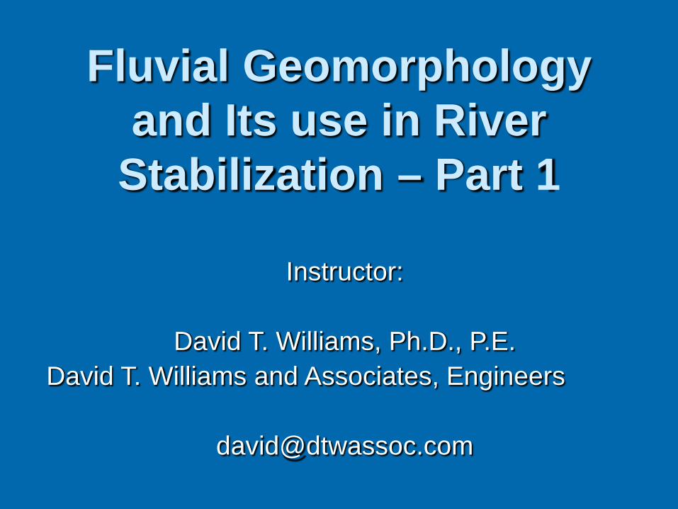
What is Fluvial Geomorphology?
Fluvial – Fluvius = River
Geo – of or relating to earth, ground or soil
Morphology – Study of form and structure
Geomorphology - the study of landforms, the processes that created them, and the history of their development.
Fluvial geomorphology - the examination of the processes that operate in river systems and the landforms which they create or have created.
Fluvial Geomorphology
Numerous Time Scales
Geologic Paleo Historic Engineering (50 yrs) Event Time to Retirement
Things to Remember
A River is part of a System:
System is:
• Dynamic• Complex• Thresholds Do Exist• Geomorphology Provides Historical Perspective• Size / Power of Stream is Important
A River is Part of System
The entire watershed forms a system Rainfall => Runoff (Land Use) Runoff Transports Sediment (Land
Use/Cover) Slope / Meanders Impact Transport Sediment Size Impacts Transport and
Erosion/Deposition Manmade Features Impact Everything Nature has its own plans and goals!!!
• It’s not always what we expect!
River Sizing/Shape Relationships
Lane Leopold & Wolmann Schumm Kennedy Regime Theory
Channel Forming Discharge Rosgen/Thorne Lots of Uncertainty and Discussion
Fluvial Geomorphology
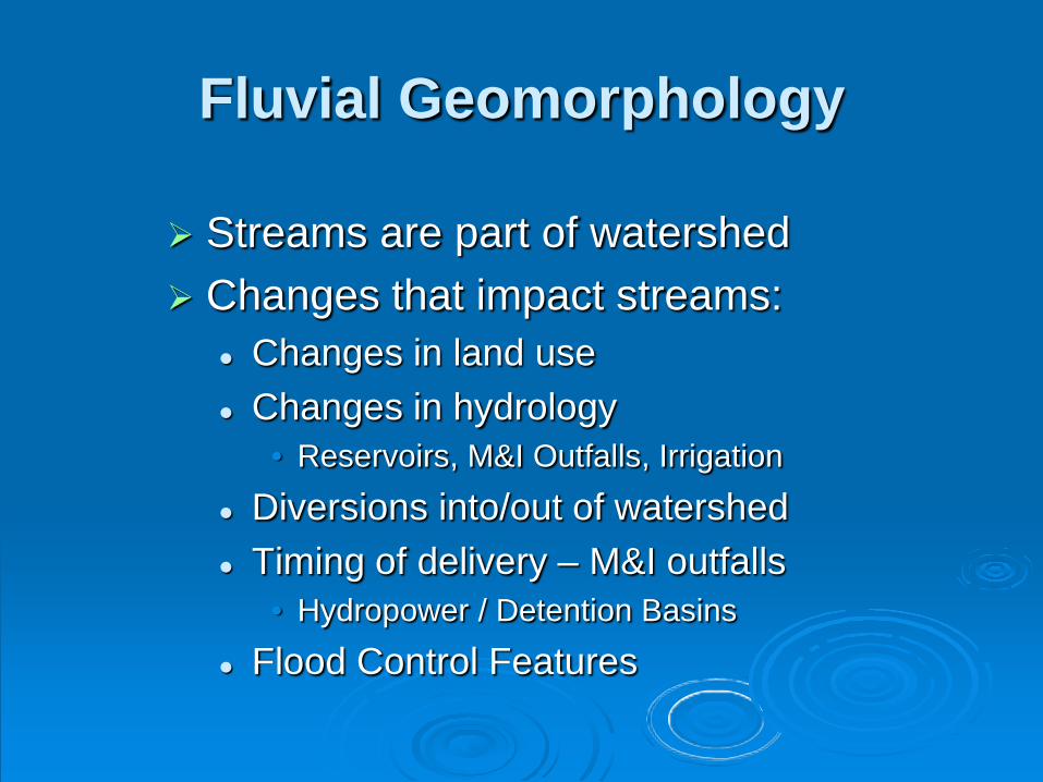
Streams are part of watershed Changes that impact streams:
Changes in land use Changes in hydrology
• Reservoirs, M&I Outfalls, Irrigation
Diversions into/out of watershed Timing of delivery – M&I outfalls
• Hydropower / Detention Basins
Flood Control Features
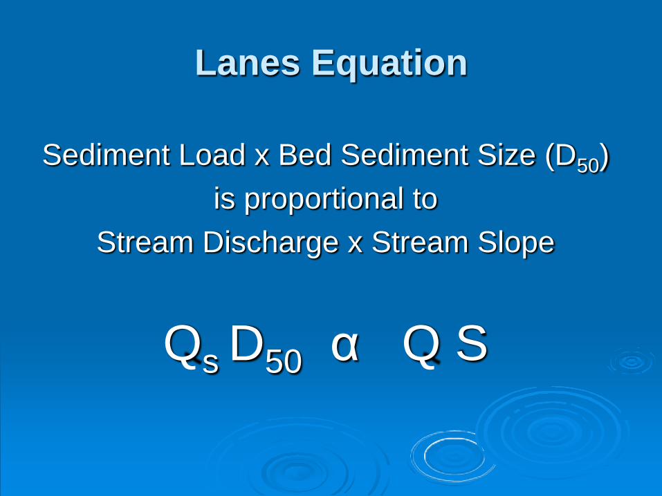
Lanes Equation
Sediment Load x Bed Sediment Size (D50)is proportional to
Stream Discharge x Stream Slope
Qs D50 α Q S
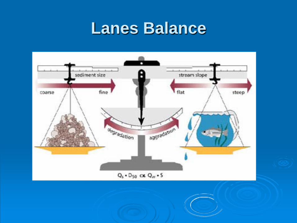
Lanes Balance
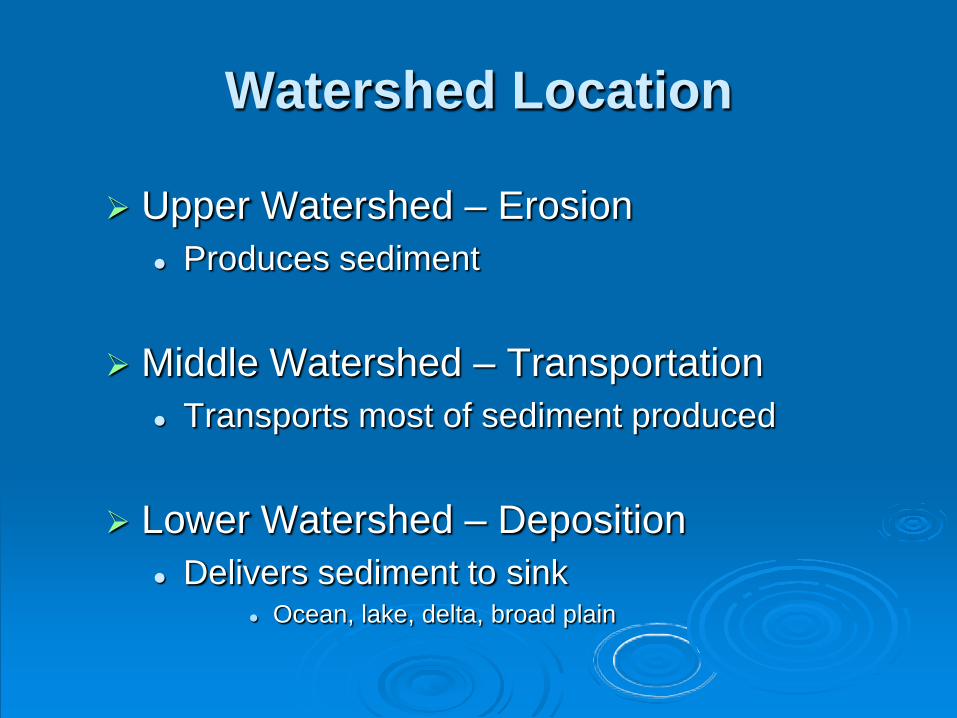
Watershed Location
Upper Watershed – Erosion Produces sediment
Middle Watershed – Transportation Transports most of sediment produced
Lower Watershed – Deposition Delivers sediment to sink
Ocean, lake, delta, broad plain
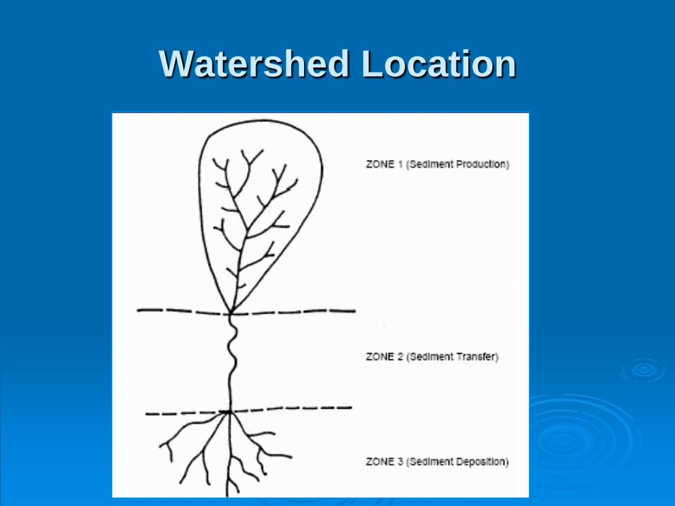
Watershed Location
Sediment Transport
IT’S NOT THAT SIMPLE
Every river/stream reach has erosion, transport and deposition
occurring at the same time!
Transport Reach
Point or mid-channel bars are always changing
Outer banks erode
Inner banks deposit
Sediment moves from outer bank to inner banks and bars
Meanders move down valley
What is Stable?
Absolute Stability – Doesn’t Change in Engineering Time Scale
Think Concrete / Bed Rock / Etc.
Dynamic Stability – Changes but Relationships are Constant in Engineering Time Scale
Unstable – Major Changes in Width, Depth, Flow, Sediment Transport, Sinuosity, Planform or all of These are Occurring over a Period of Days, Months or Years
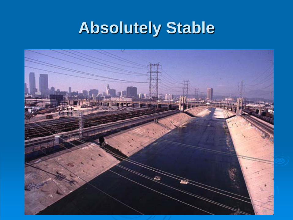
Absolutely Stable
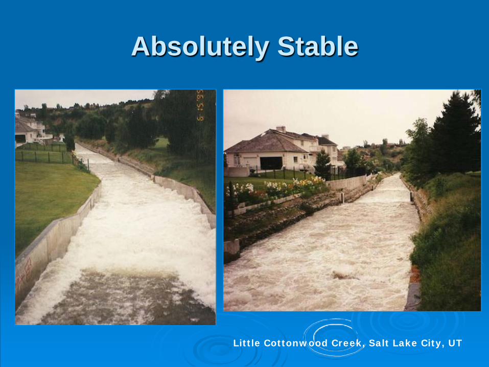
Absolutely Stable
Little Cottonwood Creek, Salt Lake City, UT
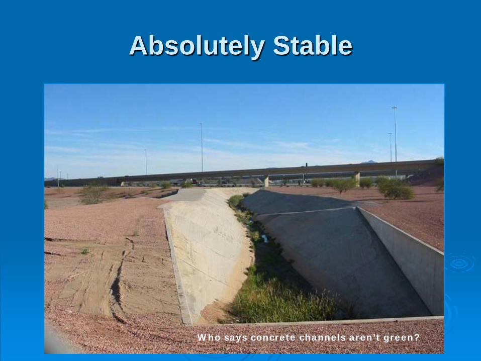
Absolutely Stable
Who says concrete channels aren’t green?
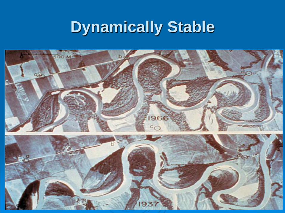
Dynamically Stable
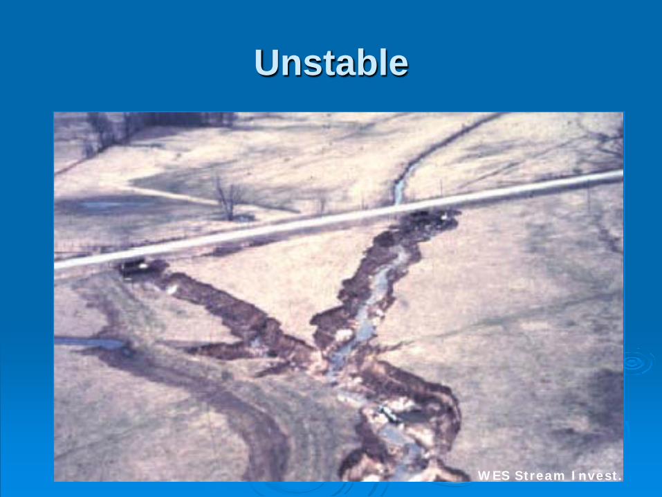
Unstable
WES Stream Invest.
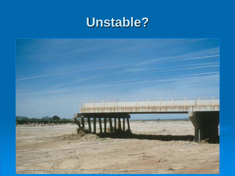
Unstable?
Stability
Rivers want to be Dynamically Stable Not Necessarily Constant / The Same
• Bank Location• Meander Locations• Sand / Gravel Bars• Anything having to do with location of features
Remember Locations Move under Dynamic Stability!
StabilitySome Streams are more Stable
Clay Bed & Banks
Rock Outcrops or Banks• Mountain Streams / Torrents• Steep Sediment Starved Systems
Concrete / Designed Channels
Stability
Less Stable Systems
Silt Bed & Banks Sand or Gravel Banks Any Non-cohesive / Uncemented Banks Braided Systems
• High Sediment Loads Fill Flow Areas• Channels Constantly Moving
Channels without Bedrock Controls
Stability Depends on Perspective
How fast does an unstable river move?
How long does change take to be classed stable?
If a river moves at 10’ per year it’s probably stable until it gets to 50’ of your house!
Stream Stabilization
Rivers are Mobile
Hard Points• Protect Permanently (Engineering Time)• Concrete• Riprap
Soft Points• Protect for a While then Fail (Melt Away)• Bio-Engineering
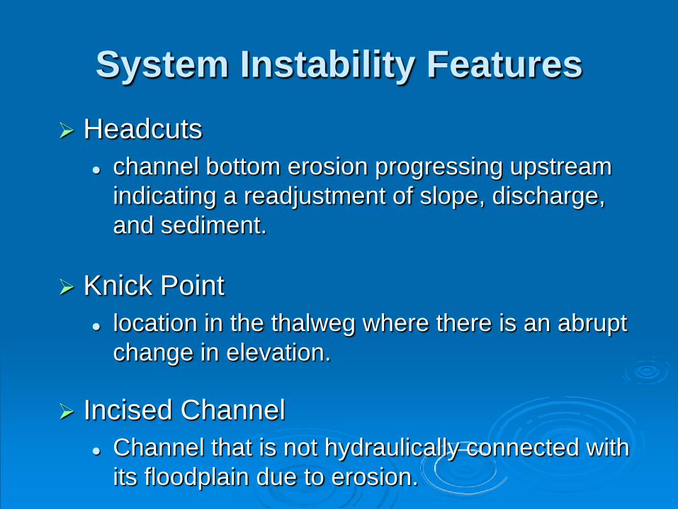
System Instability Features Headcuts
channel bottom erosion progressing upstream indicating a readjustment of slope, discharge, and sediment.
Knick Point location in the thalweg where there is an abrupt
change in elevation.
Incised Channel Channel that is not hydraulically connected with
its floodplain due to erosion.
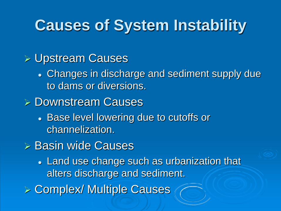
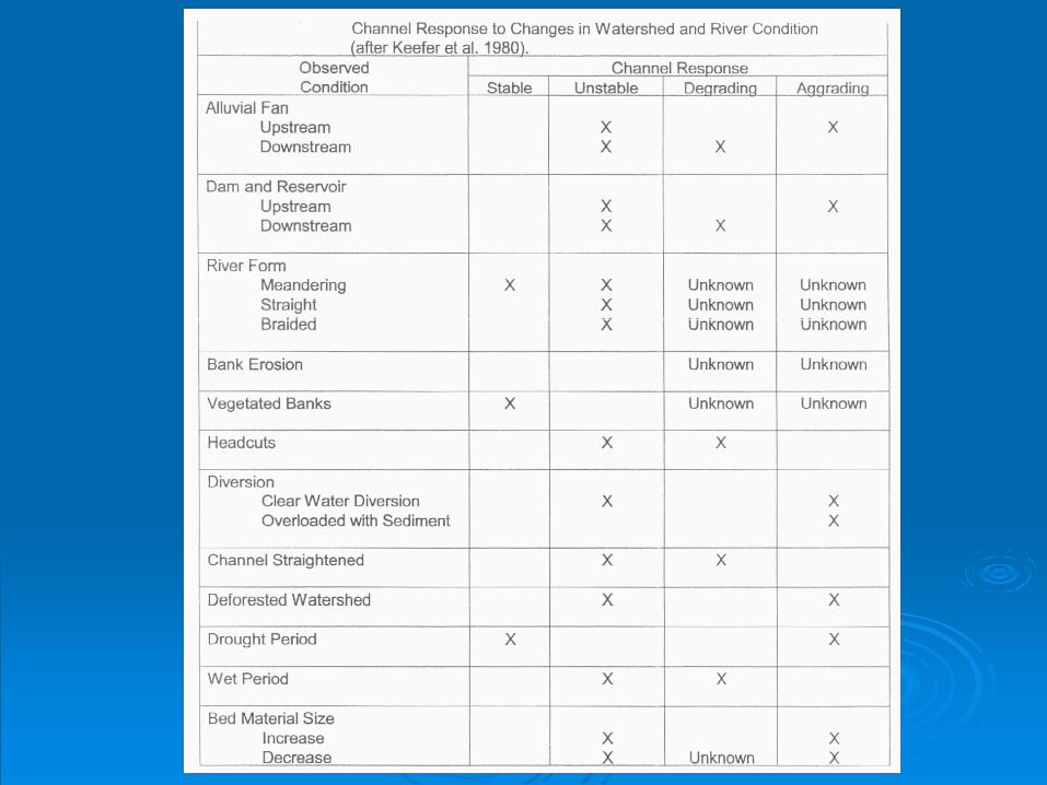
Causes of System Instability
Upstream Causes Changes in discharge and sediment supply due
to dams or diversions. Downstream Causes
Base level lowering due to cutoffs or channelization.
Basin wide Causes Land use change such as urbanization that
alters discharge and sediment. Complex/ Multiple Causes
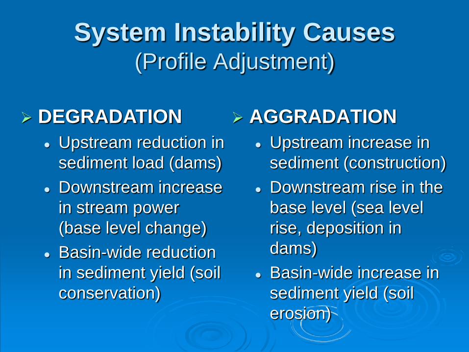
System Instability Causes(Profile Adjustment)
AGGRADATION Upstream increase in
sediment (construction) Downstream rise in the
base level (sea level rise, deposition in dams)
Basin-wide increase in sediment yield (soil erosion)
DEGRADATION Upstream reduction in
sediment load (dams) Downstream increase
in stream power (base level change)
Basin-wide reduction in sediment yield (soil conservation)
Local Instability
Definition: Localized instability such as bank erosion that is not caused due to systemic dis-equilibrium in the watershed, but results from site-specific factors or processes. (example, eroding outer bank in a meandering channel)
Note: Stream bank erosion may also be a symptom of system instability.
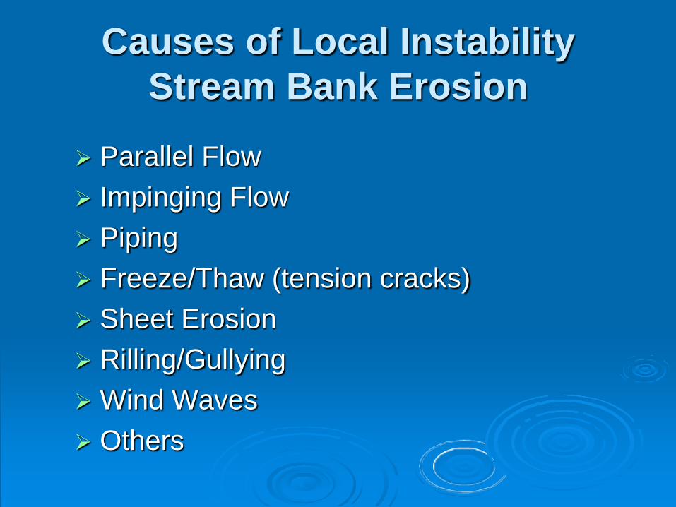
Causes of Local InstabilityStream Bank Erosion
Parallel Flow Impinging Flow Piping Freeze/Thaw (tension cracks) Sheet Erosion Rilling/Gullying Wind Waves Others
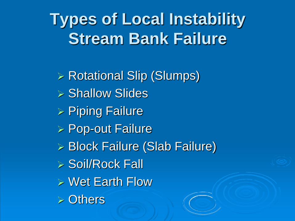
Types of Local InstabilityStream Bank Failure
Rotational Slip (Slumps) Shallow Slides Piping Failure Pop-out Failure Block Failure (Slab Failure) Soil/Rock Fall Wet Earth Flow Others
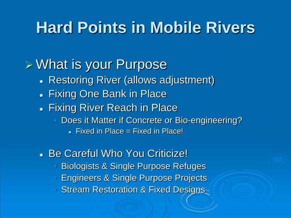
Hard Points in Mobile Rivers
What is your Purpose Restoring River (allows adjustment) Fixing One Bank in Place Fixing River Reach in Place
• Does it Matter if Concrete or Bio-engineering? Fixed in Place = Fixed in Place!
Be Careful Who You Criticize!• Biologists & Single Purpose Refuges• Engineers & Single Purpose Projects• Stream Restoration & Fixed Designs

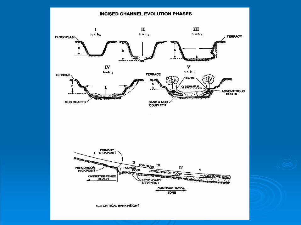
Channel Evolution Model
What Happens to Channels Over Time?
(It’s a “Natural” Process!)
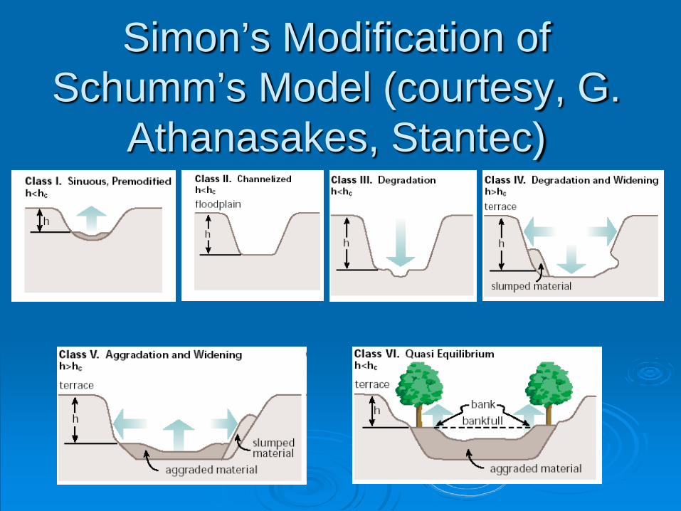
Simon’s Modification of Schumm’s Model (courtesy, G.
Athanasakes, Stantec)
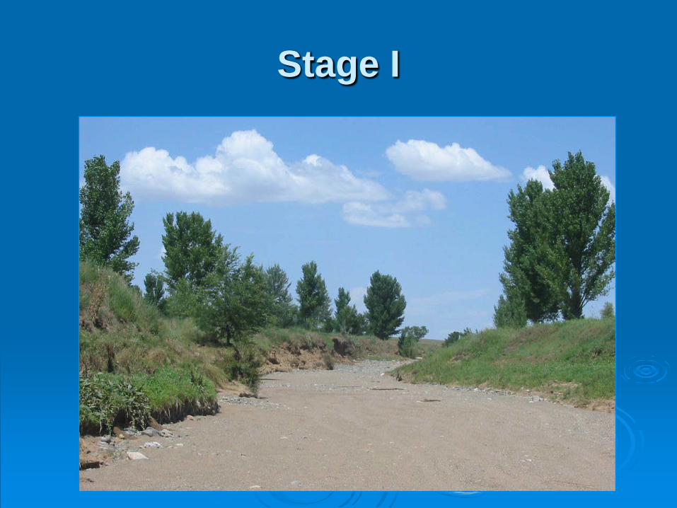
Stage I
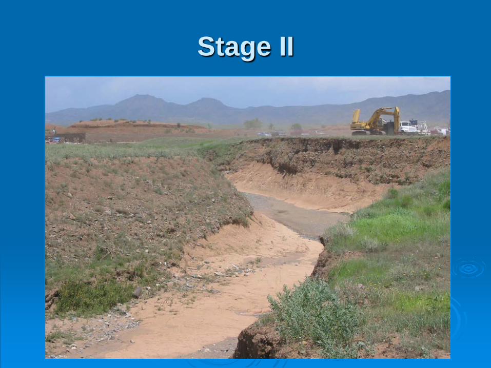
Stage II
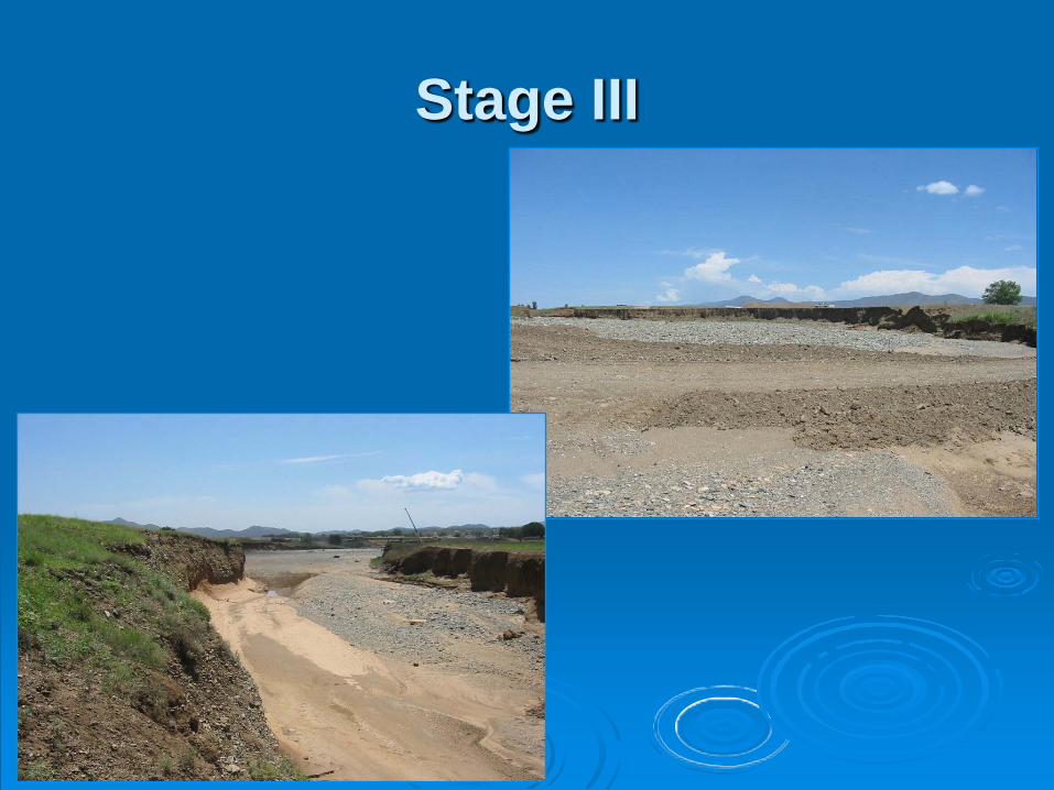
Stage III
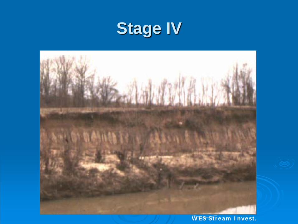
Stage IV
WES Stream Invest.
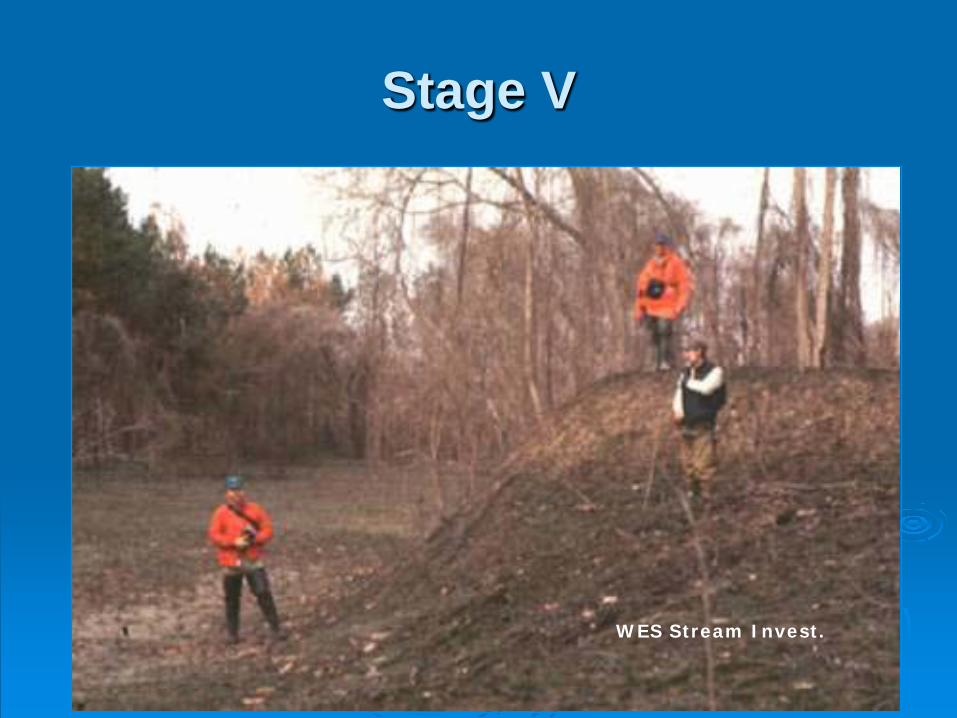
Stage V
WES Stream Invest.
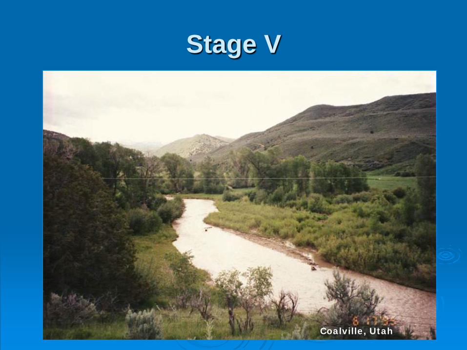
Stage V
Coalville, Utah
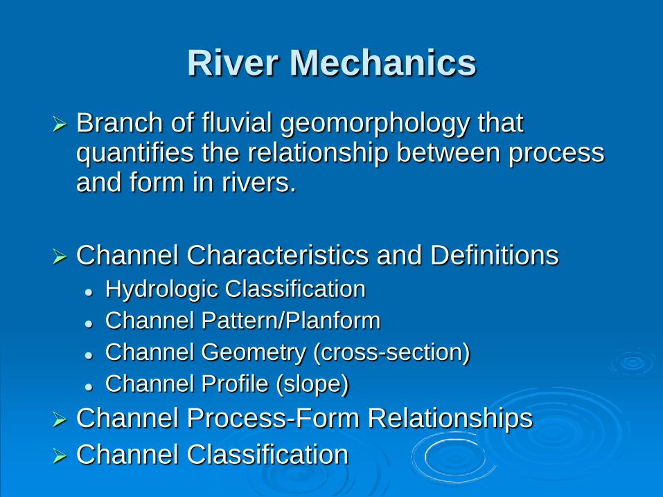
River Mechanics Branch of fluvial geomorphology that
quantifies the relationship between process and form in rivers.
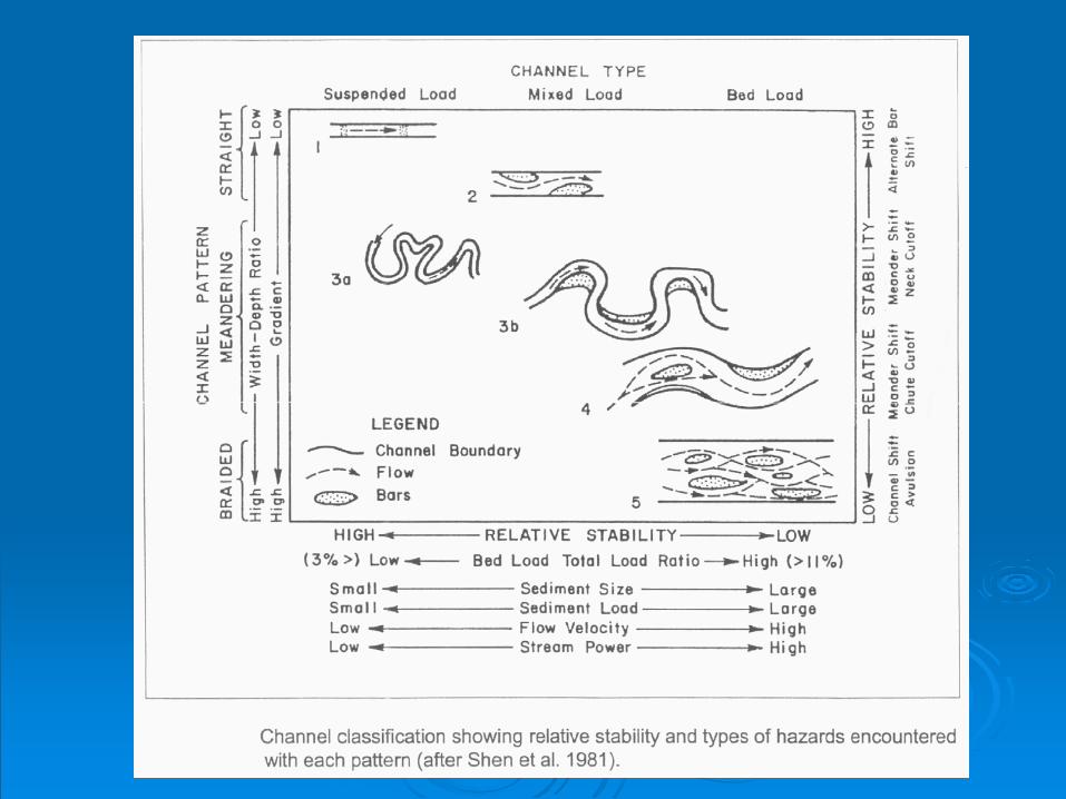
Channel Characteristics and Definitions Hydrologic Classification Channel Pattern/Planform Channel Geometry (cross-section) Channel Profile (slope)
Channel Process-Form Relationships Channel Classification
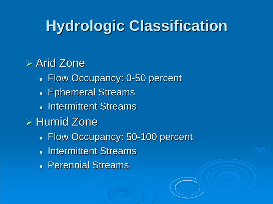
Hydrologic Classification
Arid Zone Flow Occupancy: 0-50 percent Ephemeral Streams Intermittent Streams
Humid Zone Flow Occupancy: 50-100 percent Intermittent Streams Perennial Streams
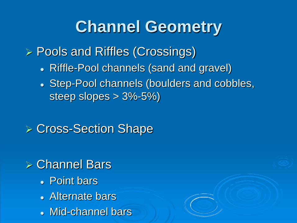
Channel Geometry Pools and Riffles (Crossings)
Riffle-Pool channels (sand and gravel) Step-Pool channels (boulders and cobbles,
steep slopes > 3%-5%)
Cross-Section Shape
Channel Bars Point bars Alternate bars Mid-channel bars
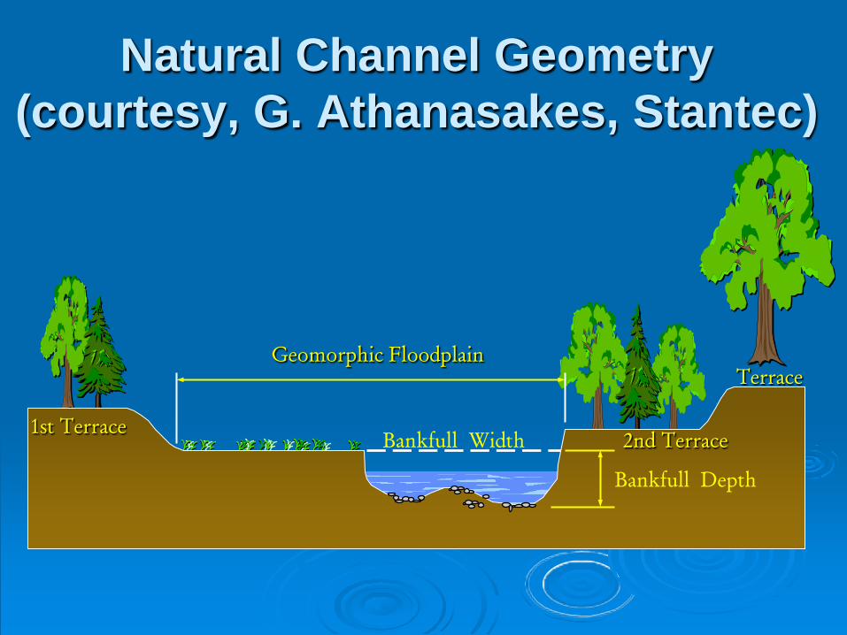
Terrace
Bankfull Depth
2nd Terrace 1st Terrace
Geomorphic Floodplain
Bankfull Width
Natural Channel Geometry (courtesy, G. Athanasakes, Stantec)
Channel Profile (Slope)
Product of discharge (Q) and slope (S) is defined as STREAM POWER.
Stream power is the ability of the channel to do work.
Channel slope is defined as the water surface slope or the stream bed slope.

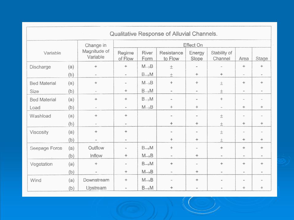
Channel Process-Form Relationships
W = Ca x QaD = Cb x QbV = Cc x Qc
Qs = Cd x Qd
where:
W = width, Q = water discharge, D = mean depth,
V = mean velocity, Qs = suspended sediment load
Ca, Cb, Cc, Cd, a, b, c, d are numerical constants
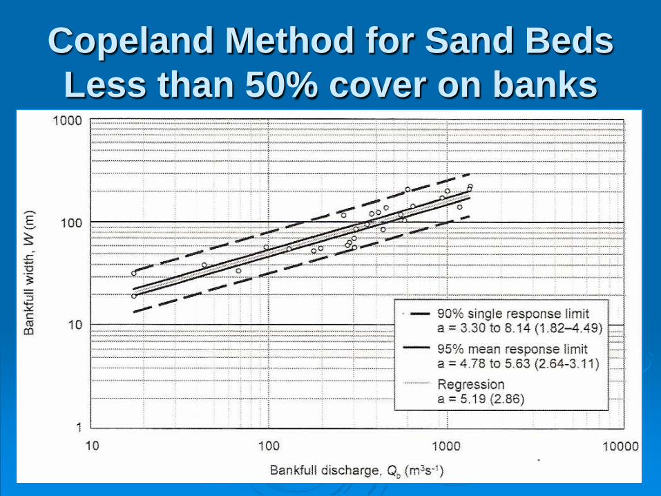
Copeland Method for Sand BedsLess than 50% cover on banks
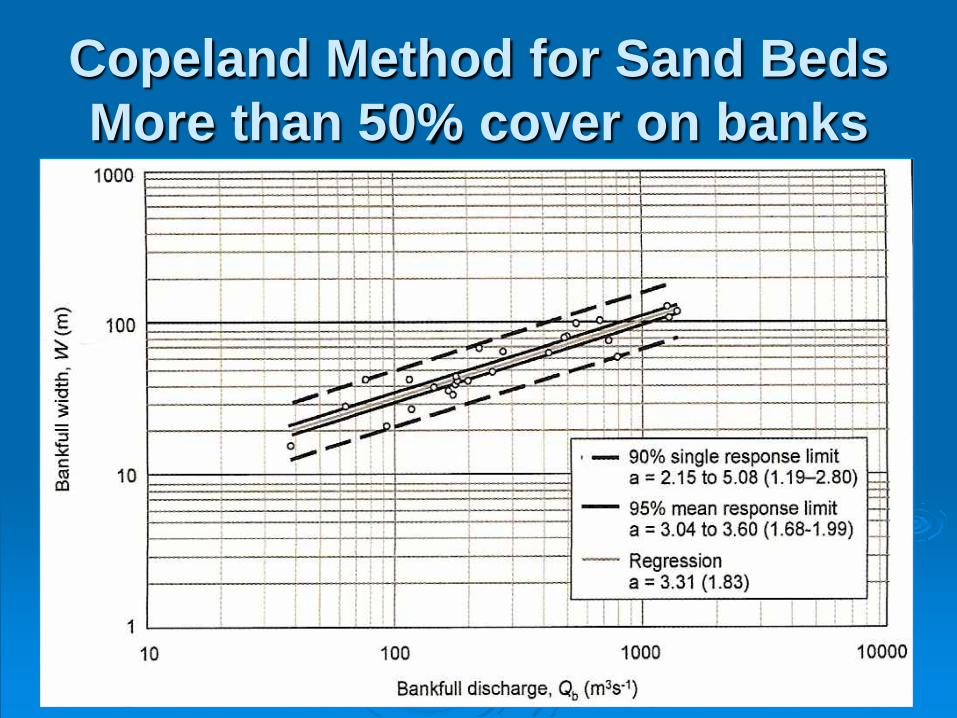
Copeland Method for Sand BedsMore than 50% cover on banks
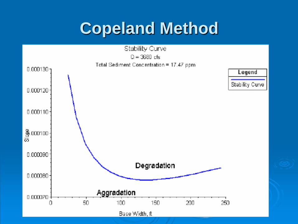
Copeland Method
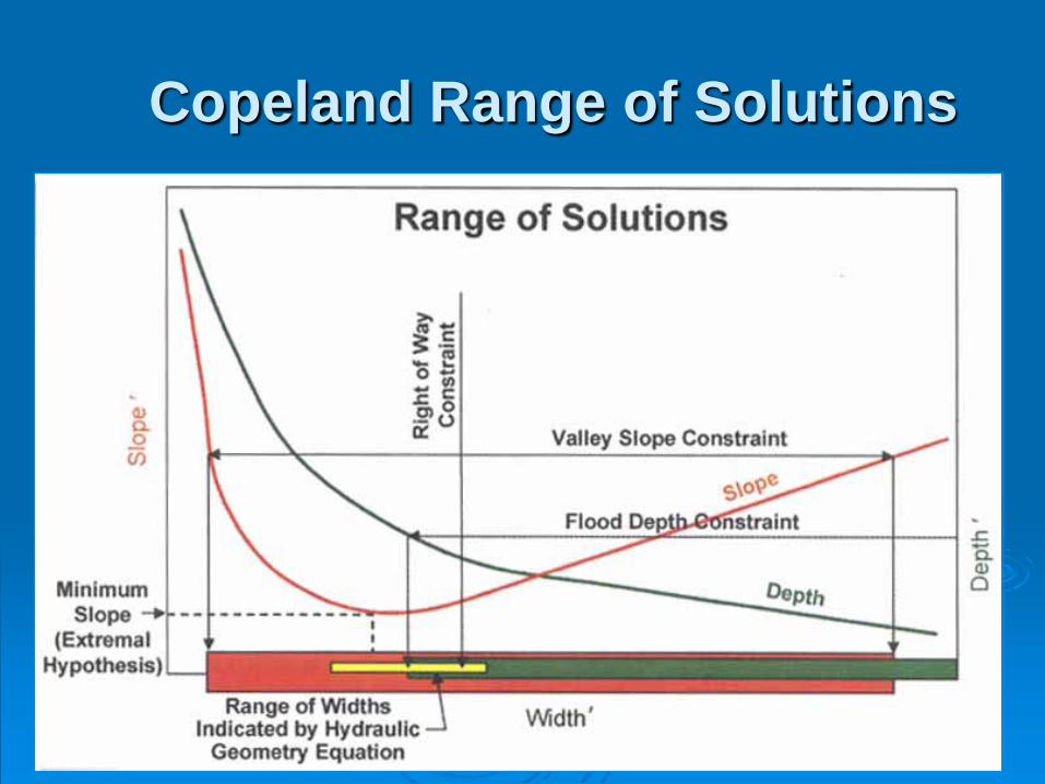
Copeland Range of Solutions