Embed Size (px)
Citation preview

sessionProgramm
Conference program
4-7 November 2014, Riva del Garda (TN), Italy
ForestSAT 2014A bridge between forest sciences, remote sensing and geo-spatial applications
www.forestsat2014.com
2
www.forestsat2014.com

WELCOME TO FORESTSAT 2014
ForestSAT2014 is the 6th international conference in a series focusing on the applications of forest geomatics (the SAT of ForestSAT is for Spatial Analysis Techniques not for satellites!).Previous conferences have taken place in Scotland, Sweden, France, Spain and USA.
ForestSAT2014 conference is aimed at promoting the integration of earth observation with other geo-spatial applications and traditional forest sciences. The conference covers all possible scientifically-based developments and applications of remote sensing and GIS tools for monitoring, mapping or modeling forest systems. Aiding a better understanding of their functioning and supporting their inventory and sustainable management.
We are happy to host ForestSAT2014 for the first time in Italy. We organized it in the picturesque town of Riva del Garda, located on the north shore of Lake Garda, which is the largest lake in Italy. In the 17th century, Lake Garda became a popular destination, the list of its guests includes Goethe, Freud, Nietzsche, the Mann brothers, Kafka, Lawrence.
Fondazione Edmund Mach is the very local host, but the conference is the result of the cooperation between a large number of scientific organizations that worked together to create the largest ForestSAT conference ever: more than 300 delegates with more than 330 contributions organized in 37 oral sessions and a non-stop poster session. 7 keynote speeches and, for the first time in ForestSAT, 2 courses (on LASTOOLS for manipulating Airborne Laser Scanning data and on Open Source geospatial tools for forest remote sensing) complete the conference program. In this ForestSAT conference we also have for the first time 6 exhibitors, this probably means that our conference is starting to became interesting for the industry too.
We worked very hard in cooperation with scientists responsible for invited sessions to create oral tracks which may be as much homogeneous as possible. We hope this effort results in a strong thematic consistency of contributions which are included in the same session. This should stimulate a more interesting scientific debate.
My good friend Ronald McRoberts is used to say that a conference is successful when you go back home after it taking with you some good ideas for a couple of future experiments. This is what we wish you all! But we also hope that thanks to ForestSAT2014 you will meet new interesting people, you will have ideas for setting up new international cooperation, and you will be stimulated to create new projects. This will help the growth of our community and at a very end will contribute to a better comprehension of our forests.
So, welcome in Italy at Riva del Garda, and… enjoy ForestSAT2014!
Gherardo Chirici
ForestSAT 2014 Director
3
www.forestsat2014.com

SCIENTIFIC COMMITTEE
GREGORY ASNER, Stanford University (US)
FRÉDÉRIC BARET, INRA (FR)
AnnEmarie BASTRUP-BIRK, European Environmental Agency (International)
PIERO BOCCARDO,Politecnico di Torino(IT)
LORENZO BRUZZONE,Università di Trento (IT)
JAVIER CANO,Scuela de Ingeniería Forestal de la Universidad Mayor in Santiago (CN)
LIN CAO,Nanjing Forestry University (CN)
LUIS CARVALHO,Universidade Federal de Lavras (BR)
GHERARDO CHIRICI,Università degli Studi di Firenze (IT)
WARREN COHEN,USDAForest Service (US)
RICHARD FOURNIER,Université de Sherbrooke (CA)
Damiano GIANELLE,Fondazione Edmund Mach (IT)
HUBERT HASENAUER,BOKU(AT)
ROSS HILL,Bournemouth University (UK)
YASUMASA Hirata,Forestry and Forest Products Research Institute (JP)
BARBARA KOCH,University of Freiburg(DE)
MICHAEL KOEHL,World Forest Institute(DE)
TATJANA KOUKAL,BOKU (AU)
ERIK LINDQUIST,FAO (International)
STEEN MAGNUSSEN, Canadian Forest Service (CA)
JEFFERY MASEK, NASAGoddard Space Flight Center (US)
FABIO MASELLI, Consiglio Nazionale delle Ricerche (IT)
ALEXANDER MASLOV, Inst. of Forest Science RAS / R&D Center SCANEX (RU)
DANIEL MCINERNEY, Laboratoire des Sciences du Climatet de l’Environnement (FR)
RONALD MCROBERTS, USDA Forest Service (US)
DAVID MIRANDA, University of Santiago de Compostela (ES)
ERIK NÆSSET, Norwegian University of Life Sciences, (NO)
ROSS NELSON, NASA Goddard Space Flight Center (US)
HÅKAN OLSSON, Swedish University of Agricultural Sciences (SW)
SIMONETTA PALOSCIA, Consiglio Nazionale delle Ricerche (IT)
STUART PHINN, University of Queensland (AU)
JESUS SAN MIGUELAYANZ, JRC European Commission, International
MATHIAS SCHARDT, Joanneum Research and Graz University of Technology (AT)
STEVE STEHMAN, State University of New York (US)
JUAN SUAREZ, Forest Research (UK)
MARGARIDA TOMÈ, Instituto Superior de Agronomia (PT)
ERKKI TOMPPO, METLA (FI)
FRIEKE VAN COILLIE, Ghent University (BE)
LARS WASER, WSL National Forest Inventory (CH)
JOANNE WHITE, Canadian Forest Service (CA)
MICHAEL WULDER, Canadian Forest Service (CA)
Steering Committee
GHERARDO CHIRICI, Università degli Studi di Firenze (IT)
PIERMARIA CORONA,CRA-SEL (IT)
MARCO MARCHETTI,Università del Molise (IT)
ROBERTO TOGNETTI, Università del Molise (IT)
DAMIANO GIANELLE, Fondazione Edmund Mach (IT)
FRANCO MIGLIETTA,FoxLab Joint CNR-FEM Initiative(IT)
RONALD MCROBERTS, Forest Service USDA (US)
WARREN COHEN, Forest Service USDA(US)
JUAN SUAREZ, Forest Research (UK)
DAVID MIRANDA, University of Santiago (ES)
TATJANAKOUKAL,BOKU(AT)
ROSS HILL, Bournemouth University (UK)
Organizing Committee
Gherardo CHIRICI, Università di Firenze (IT) Giorgio ALBERTI, Università di Udine (IT) Maureen DUANE, Oregon State University (US) Davide TRAVAGLINI, Università di Firenze (IT) Alessandro MONTAGHI, Aarhus University (DK) Alberto MATTEDI, FoxLab Joint CNR-FEM Initiative (IT) Michele DALPONTE, Fondazione Edmund Mach (IT) Giovanni LOPEZ, Università del Molise (IT) Alessandro GRETTER, Fondazione Edmund Mach (IT) Cristina CASTELLANI, Fondazione Edmund Mach (IT)
4
www.forestsat2014.com

PROGRAM OVERVIEW
5
www.forestsat2014.com

Tuesday, November 4th 14.00-18.00 REGISTRATION at the Reception of Riva del Garda Fierecongressi
16-1
8.00
Welcome icebreacking cocktail
Wednesday, November 5th
7.30-8.00 REGISTRATION
8.00
-9.3
0
Welcome to ForestSAT 2014
Gherardo CHIRICI, Università di Firenze
Keynote: The potential role of global forests in mitigating climate change
Steve RUNNING, University of Montana
Keynote: The use of LiDAR information to reduce nonresponse bias and improve accuracy of volume estimates in forest inventories
Lorenzo FATTORINI, Università di Siena
SALA 300+BELVEDERE
SALA 300 SALA 100 SALA BELVEDERE SALA STAMPA
Using biogeochemical-mechanistic models to assess the ecosystem
fluxes, Invited
Hubert HASENAUER, moderator
A productivity and carbon cycle analysis for a tropical montane rainforest. Sebastian PAULICK, C DISLICH, A HUTH
Carbon losses due to tropical forest fragmentation: a forgotten process in the global carbon cycle? Andreas HUTH, R FISCHER, K BRINCK, J GROENEVELD, S PUETZ
Contribution to a higher accuracy of aboveground biomass estimations in tropical forests: linking LiDAR data and
Supporting and improving NFIs
Matthias DEES, moderator
The role of aerial photographs in the Swiss national forest inventory: review and perspectives. Berthold TRAUB, C GINZLER, A LANZ
Comparing the precision of biomass estimates from a sample based forest inventory and a model-assisted approach utilizing small footprint LiDAR data-A case study from Central Kalimantan. Paul MAGDON, ES PURNAMA, E GONZÁLEZ FERREIRO, C PÉREZ, C KLEINN
An optimal linear model parameter estimation method for forest inventory with a reduced number of field plots. Virpi JUNTTILA,
Fire risk assessment
Warren COHEN, moderator
Decomposing MODIS NDVI time series to monitor changes in annual and evergreen vegetation in Mediterranean forests – Implications for management and fire risk assessment David HELMAN, IM LENSKY, Y OSEM, N TESSLER
Validation of a new broadband spectral index to map live fuel moisture content with MODIS. Carmine MAFFEI, L BONORA, L BOTTAI, M MENENTI
Are low-density airborne LiDAR data suitable to map Mediterranean fuel types? Alessandro QUATRINI, A BARBATI, P CORONA
Hyperspectral EO
Rudolf SEITZ, moderator
Retrieving tree species and tree cover density maps from hyperspectral images using the ISMA unmixing approach in a multitemporal setup. Sandra DOTZLER, H BUDDENBAUM, J HILL
Lessons learned from the first carbon neutral airborne hyperspectral mission in Costa Rica: Mission Airborne Carbon 13. Margaret KALACSKA, R SOFFER, JP ARROYO-MORA
Subpixel vegetation class cover estimation with MixSSMA: a Mixture of Stratified Spectral Mixture Analysis models. Alexander KOLTUNOV, C RAMIREZ
9.45
-11.
15
6
www.forestsat2014.com

forest simulations. Rico FISCHER, NKNAPP, AHUTH
Multi-year simulation of forest carbon fluxes in Italy by the combination of ground and remotely sensed data. Marta CHIESI, G CHIRICI, P CORONA, DPAPALE, R SALVATI, F MASELLI
The use of a process based canopy photosynthesis model for the evaluation of a satellite-based primary productivity model. Nikolaos MARKOS, S STAGAKIS, T VANIKIOTIS, E LEVIZOU, A KYPARISSIS
TKAURANNE
Automated production of forestry thematic maps – a concept of remotely sensed data fusion in the Czech NFI2. Filip HÁJEK, RADOLT, M KANTOROVÁ, KSTUDENÁ, OTOMANČÁK
Using model inputs from remote sensing to improve forest production forecast. Jackie ROSETTE, J SUÁREZ
Production of a nationwide forest attribute map of Sweden using airborne laser scanning and national forest inventory plot data. Håkan OLSSON, J WALLERMAN, K NORDKVIST, JJONZÉN, P AXENSTEN, N LINDGREN, M NILSSON, LL NILSSON, S LARSSON
MARCHETTI, F BOTTALICO, DTRAVAGLINI
Wildland-urban interface: characterization using Lidar and aerial photography as a tool for prevention and management of the fire risk on local scale. Sandra BUJÁN, MJ ENRÍQUEZ-GARCÍA, M CORDERO, D MIRANDA
Model of fire protection zone in the University Forest of Taxiarchi – Vrastama in Greece.Nikolaos S KARATZIDIS, E KARAGIANNIS,KAG DOUCAS,VC DROSOS, SAG LIAMPAS
Assessment of fire hazard zones in the forest landscape in Simitli Municipality (Bulgaria) on the base of terrestrial and satellite data. Daniela A VETISYAN, R NEDKOV
Tree species mapping by combining hyperspectral with LiDAR data. Pieter KEMPENEERS, F VAN COILLIE, W LIAO, M VERDONCK, K VANDEKERKHOVE
Estimating above ground biomass and biodiversity in Ghana tropical forests with LiDAR and Hyperspectral data. Gaia VLAURIN, Q CHEN, VLIESENBERG, RAVEZZANO, RVALENTINI
Preprocessing EO-1 Hyperion hyperspectral data applied to forests and vegetation classification. Youcef SMARA, Z HAMADACHE, S CHOUAF
11.15-11.45 BREAK – coffee, tea and refreshments
Statistical Issues, Invited
Piermaria CORONA and
Lorenzo FATTORINI, moderators
Estimation for inaccessible, non-sampled forest areas using model-based inference and remotely sensed auxiliary information. Ronald E MCROBERTS, E NÆSSET, T GOBAKKEN
Regression estimators in three-phase sampling. Daniel MANDALLAZ
Random-effect or spatial-autocorrelation? Inference on stand-level in remote sensing-assisted forest inventories. Johannes BREIDENBACH, R ASTRUP
Comparison of Model-Assisted Estimators for Two-Stage Cluster Sampling. Stephen STEHMAN
Recent Applications and Developments in Randomized Branch Sampling. Timothy G GREGOIRE, DLR AFFLECK, HT VALENTINE
Earth Observation for operational support to forest management and
decision makers
Joan LUTHER, moderator
Use of high resolution satellite imagery for forestry management applications within New Zealand. Michael Stuart WATT
Estimating stem diameter distributions from airborne laser scanning data and their effects on long term forest management planning. Rami SAAD, J WALLERMAN, T LÄMÅS
Assessing stand structure of beech forests in the Ukrainian Carpathians using WorldView-2 satellite imagery. Natalia REHUSH, LT WASER
Initializing Climate Sensitive Forest Dynamics Models via Remotely Sensed Data. Michael FALKOWSKI, P FEKETY, A HUDAK, L NAGEL
Effect of natural disturbances on direct protection forests assessed by remote sensing. Giorgio VACCHIANO, EB MONDINO, R BERRETTI, R MOTTA, F MELONI
Data fusion from multiple platforms
Flor ALVAREZ-TABOADA, moderator
Classification of forests site types using airborne laser scanning data and satellite images. Inka Pippuri, P PACKALEN, M MALTAMO, KT KORHONEN, A SUVANTO, J PITKÄNEN
Synergistic use of satellite laser altimetry and optical imagery for developing forest biomass map in Japan. Masato HAYASHI, NSAIGUSA, H BORJIGIN, Y SAWADA, HOGUMA, Y YAMAGATA
Estimation of aboveground biomass in Siberian boreal forest from optical and radar remote sensing data. Martyna ASTELMASZCZUK-GÓRSKA, P RODRIGUEZ-VEIGA, CTHIEL, HBALZTER, CSCHMULLIUS
Fusing Landsat and PALSAR time-series data for detecting forest change. Johannes REICHE, J VERBESSELT, DHOEKMAN, M HEROLD
Upscaling studies from leaf to Earth Observation
Roberto TOGNETTI, moderator
Leaf to image scalability based on spectral libraries: a case study using forest plantations in Northern Costa Rica. Margaret KALACSKA, MFAGAN, JPARROYO-MORA
Measuring sun-induced fluorescence of forest ecosystems from ground and airborne scale. Micol ROSSINI, L ALONSO, A BURKART, M CELESTI, C CILIA, S COGLIATI, R COLOMBO, A DAMM, L GUANTER, J HANUS, T JULITTA, P KOKKALIS, J MORENO, C PANIGADA, F PINTO, A SCHICKLING, D SCHÜTTEMEYER, F ZEMEK, U RASCHER
UP-Scalinggross primary production in a Mediterranean savanna (Dehesa) ecosystem using field spectroscopy and radiative transfer models. Javier PACHECO-LABRADOR
Biophysical parameter retrieval of a forest by combining structural information and hyperspectral data. Gianfranco INDRIO
11.4
5-13
.15
7
www.forestsat2014.com

Producing country-level maps for climate change research and decision making in Finland: Climforisk web tool. Sanna HÄRKÖNEN, J PÖNTINEN, A LEHTONEN, T KALLIOKOSKI, P MUUKKONEN, A MÄKELÄ, S NEUVONEN, S SIRKIÄ, S NEVALAINEN, A POUTTU, M PELTONIEMI
High-resolution pan-tropical vegetation height and biomass mapping from ALOS/PALSAR and ICESAT/GLAS observations. Josef KELLNDORFER, J BISHOP, O CARTUS, W WALKER, A ROSENQVIST, M SHIMADA
Satellite based Forest Biomass Modelling: Fusion of Hyperspectral data and interferometric respectively photogrammetric canopy height models. Teja KATTENBORN, J MAACK, F ENßLE, B KOCH
Monitoring multi-layer canopy spring phenology of temperate deciduous and evergreen forests using low-cost spectral sensors. Youngryel RYU, G LEE, YH WANG
Leaf vs Canopy reflectance of Coniferous Species in Mexican Conservation Area. Jose M MADRIGAL
13.15-14.15 LUNCH
Spatially estimating forest variables, Invited
Lars WASER, moderator
A comparison of forest inventories based on aerial image matching and Airborne Laser Scanning data. Jonas BOHLIN, J WALLERMAN, JES FRANSSON
Timber volume predictions and their spatial autocorrelation based on four different 3D remote sensing methods. Johannes RAHLF, J BREIDENBACH, S SOLBERG, E NÆSSET, R ASTRUP
Forest attribute model extrapolation to adjacent areas by means of image based canopy height models. Christoph STEPPER, C STRAUB, HPRETZSCH
Accuracy of tree species separation in dependence on satellite sensor and classification method. Fabian ENßLE, AC BRAUN, B KOCH
Using auxiliary data to improve accuracy of NFI target parameter estimates: a case study based on normalized digital surface model and Czech NFI1 data. Radim ADOLT, HFILIP
Forest cover and forest type mapping
Marco MARCHETTI, moderator
Detection of trees outside forest (TOF) using digital aerial images – a cross-country approach. Christoph BAUERHANSL, L WASER, C GINZLER, F KROIHER, K OEHMICHEN, G CHIRICI, C VIDAL
Mapping of spruce and pine fractional coverage at 1 ha resolution for entire Bavaria. Clement A TZBERGER, M IMMITZER, K EINZMANN, M MATTIUZZI, WT NG, N PINNEL, A REICHMUTH, A WALLNER, M FROST, R SEITZ
Unmasking forest borderlines with a LIDAR-based automatic delineation. Alessandro ALIVERNINI, A BARBATI, P CORONA
Automatic Tree Species Recognition Using High Resolution Aerial Winter Imagery. Anton KUZMIN, L KORHONEN, T MANNINEN, M MALTAMO
Comparison of maximum likelihood, support vector machine and random forest for forest type mapping. Emmanuelle CANO
Application of Haralick texture features for the discrimination of conifer and broadleaf dominated stands using digital aerial orthoimages. Hans-Joachim K LEMMT, B FOERSTER, C STRAUB, C STEPPER, R SEITZ, G LERMER
Assessing forest structure
Annemarie BASTRUP-BIRK, moderator
Robust characterization of forest canopy structure using Bayesian mixture models. Reik LEITERER, F MORSDORF, R FURRER, ME SCHAEPMAN
Comparison of forest structure estimates using discrete and full-waveform LiDAR metrics. Luis ARUIZ, T HERMOSILLA, AN KAZAKOVA, LM MOSKAL
Why Lorenz Ordering Applies to Airborne Laser Scanning Remote Sensing of Forests? Ruben VALBUENA, P PACKALÉN, M MALTAMO
Evaluation of the effect of accessibility on forest stand structure with airborne laser scanning data and GIS-based models. Jérémy BELLIER, JM MONNET, S DUPIRE, T CORDONNIER
Airborne spectro-directional information for large-area classification of forest structure. Tatjana KOUKAL
Continental Scale Forest and Woodland Structure Mapping using Landsat, ALOS Palsar and GLAS ICESat. Peter SCARTH
LiDAR Course
I PART
14.1
5-15
.45
8
www.forestsat2014.com
Hands-on LiDAR processing course
Organized by:Martin Isenburg

15.45-16.15 BREAK – coffee, tea and refreshments
Tree health and forest decline Invited
Juan SUÀREZ, moderator
Measuring photosynthesis of Beech Seedlings with VNIR and TIR Field Imaging Spectroscopy. Henning BUDDENBAUM, GROCK, J HILL, W WERNER
Spatial and temporal analysis of drought impacts on semi-arid woodlands. Timothy ASSAL, J SIBOLD
Multi-sensor and multi-scale system for monitoring forest health in Pinusradiata stands defoliated by Lymantriadispar in NW Spain. Flor ALVAREZ-TABOADA, E SANZ-ABLANEDO, JR RODRIGUEZ-PÉREZ, F CASTEDO-DORADO, MJ LOMBARDERO
Development of an algorithm for monitoring insect defoliation in pure scots pine stands using RapidEye data. Alexander MARX
Detecting damage precisely in coastal forest stands caused by the Tohoku earthquake tsunami using airborne LiDAR. EijiK ODANI
Biomass and carbon spatial estimation
Iain WOODHOUSE, moderator
Deriving airborne laser scanning based computational canopy volume for forest biomass and allometry studies. Jari VAUHKONEN, E NÆSSET, T GOBAKKEN
A tool for monitoring woody biomass (change) in woodland ecosystems. Simone VACCARI
On the potential of multi-temporal TanDEM-X data to assess the aboveground biomass (AGB) of two temperate forests in Germany. Christian BERGER, S ENGELHARDT, J TRUCKENBRODT, C THIEL, F ENSSLE, F FASSNACHT, C SCHMULLIUS, B KOCH
Using Leaf-on and Leaf-off LiDAR to model fine scale carbon storage from trees, understory, and coarse woody debris. Kristen Brubaker, M KAYE
High Resolution Carbon Estimation Using Remote Sensing and Ecosystem Modeling In NASA's Carbon Modeling System. Ralph DUBAYAH, ASWATANTRAN, KJOHNSON, G HURTT, M ZHAO, A FINLEY, R BIRDSEY, J O'NEIL-DUNNE, L DUNCANSON, W HUANG
Estimating aboveground biomass in the miombo woodlands of Tanzania combining field measurements and airborne laser scanning data. Liviu T ENE, E NÆSSET, T GOBAKKEN, E ZAHABU, TG GREGOIRE, G STHÅL
Terrestrial Laser Scanning
Felix MORSDORF, moderator
Assessing the accuracy of co-registered terrestrial and airborne laser scanning data in forests. Marius HAUGLIN, E NÆSSET, T GOBAKKEN
Monitoring tree health with dual-wavelength laser scanning. Rachel GAULTON, S HANCOCK, M DANSON
Improving the efficiency of forest inventory with Terrestrial LiDAR: what about Hand-held Mobile LiDAR? Sebastien BAUWENS, KCALDERS, A PIBOULE, S BONNET, P LEJEUNE
Towards improving forest structure ground truth using mobile terrestrial laser scanning. David KELBE
Comparing voxelisation methods of 3D terrestrial laser scanning with Radiative Transfer simulation to assess vegetation density. Eloi GRAU, S DURRIEU, R FOURNIER, JP GASTELLU-ETCHEGORRY, T YIN, N LAURET, M BOUVIER
Dynamic Forest Ecology Plot Layouts for Terrestrial Lidar. Ian L PAYNTER, E SAENZ, A ERB, F PERI, J VAN AARDT, C SCHAAF
LiDAR Course
II PART
17.45-19.00 POSTER SESSION
Coffee Break partially supported by:
16.1
5-17
.45
9
www.forestsat2014.com
Hands-on LiDAR processing course
Organized by:Martin Isenburg

Thursday, November 6th 7.30-8.15 REGISTRATION
8.15
-9.3
0
Keynote: On the development of a Forest Information System for Europe
JesusSAN-MIGUEL AYANTZ, European Commission, Joint Research Centre
Keynote: Remote Sensing of Forests: Perspectives from the Editor of Remote Sensing of Environment
Marvin BAUER, University of Minnesota
SALA 300+BELVEDERE
SALA 300 SALA 100 SALA BELVEDERE SALA STAMPA
Trajectory methods, Invited
Warren COHEN & Sean HEALEY, moderators
Plot-based estimates of forest disturbance derived from Landsat time series data for the conterminous US. Warren B COHEN, ZYANG, SV STEHMAN
Using a remote sensing-based photo-interpretation approach to improve national forest inventory estimates of disturbance. Todd A SCHROEDER, SP HEALEY, GG MOISEN, TS FRESCINO, WB COHEN, CHUANG, RE KENNEDY, ZYANG
Estimates of U.S. forest biomass loss as a result of disturbance from a Landsat time-series approach. Scott L POWELL, WB COHEN, RE KENNEDY, SP HEALEY
Monitoring carbon emissions from deforestation and forest degradation in mosaic landscapes of Southeast Asia using dense Landsat time series. Dirk PFLUGMACHER, K GROGAN, S THONGMANIVONG, P HOSTERT
Forest monitoring by using high resolution SAR images, Invited
Simonetta PALOSCIA, moderator
Demonstrating the Potential of ALOS PALSAR Backscatter and INSAR Coherence for Forest Growing Stock Volume Estimation in Central Siberia. Christian THIEL, CSCHMULLIUS
Perspectives and interpretation of forest 3D structure for future spaceborne SAR missions. Astor T CAICOYA, D BAYER, P BIBER, M HEYM, K PAPATHANASSIOU, M PARDINI, M TELLO ALONSO
The potential of SAR images in identifying forest characteristics. Simone PETTINATO, S PALOSCIA, ESANTI
Measuring Forest Change in the Congo Basin 2007-2010 using Synthetic Aperture Radar. James EM WHEELER, K TANSEY, H BALZTER
Synergetic use of multi-annual and seasonal multi-frequency spaceborne SAR data for land cover mapping at national scale. Massimo BARBIERI
Investigating forest fluxes with moderate resolution imagery
Fabio MASELLI, moderator
An integrated measurement and modeling approach for predicting landscape-level carbon and water budgets at the Priest River Experimental Forest in northern Idaho, USA. Andrew T HUDAK,P FEKETY, LWEI, J MARSHALL, TLINK, KKAVANAGH, MFALKOWSKI
How and where are terrestrial primary productivity regimes changing across the globe? Shanley D THOMPSON, TA NELSON, NC COOPS, MA WULDER
Analysis of forest GPP response to water stress in Spain. MA GILABERT, A MORENO, F MASELLI, B MARTÍNEZ, M CHIESI, S SÁNCHEZ, ACARRARA
A New Satellite-Based Methodology for Detecting Vulnerability of Forests to Climate Change. David JMILDREXLER, ZYANG, WB COHEN
Retrieving evapotranspiration in forests by combining geostationary and polar orbit satellite data. José MBARRIOS, N GHILAIN, AARBOLEDA, F GELLENS-MEULENBERGHS
Monitoring forest plantations with different tools
Yasumasa HIRATA, moderator
Nearest Neighbour Estimation of Stand Yields and Associated Errors Using Aerial LiDAR in a Commercial Plantation Forest in New Zealand. Jonathan DASH, HMARSHALL, B RAWLEY, D PONT, MWATT
Yearly-variation Analysis of Acacia Plantation Forests using ALOS PALSAR Polarimetric Data. Shoko KOBAYASHI
Integrating hyperspectral and multitemporal Landsat imagery to monitor tree plantation expansion in northeastern Costa Rica. Matthew EFAGAN, RSDEFRIES, SS SESNIE, JPARROYO-MORA, CSOTO, RLCHAZDON
Estimating forest age and carbon accumulation in pine tree plantations across the southeastern US using G-LiHTLiDAR and Landsat disturbance maps. Matthew FAGAN, DCMORTON, BDCOOK, RFNELSON, JGMASEK
Analysis of oil palm plantations using multi-sensor and multi-temporal remotely sensed data in Indonesia and Malaysia.Valentin LOUIS,
9.45
-11.
15
10
www.forestsat2014.com

Monte Carlo Simulation of Map Error in Carbon Assessments. Sean HEALEY, P PATTERSON, C GARRARD
Assessing boreal forest dynamics through space-borne measurements of greenness, chlorophyll fluorescence and model GPP. Sophia WALTHER, L GUANTER, M VOIGT, P KÖHLER, J JOINER, M JUNG
H BALZTER, S PAGE, P FEARN
Bats in an ‘ecological desert’: activity and abundance of batsin commercial coniferous plantations. Lucinda KIRKPATRICK
11.15-11.45 BREAK – coffee, tea and refreshments
Use of LiDAR for change estimation, Invited
Erik NAESSET, moderator
Indirect and direct lidar-assisted estimation of forest biomass change. Ronald E MCROBERTS, E NÆSSET, T GOBAKKEN, OMBOLLANDSÅS
Estimation of biomass change in montane forest in Norway. Ole M BOLLANDSÅS, T GOBAKKEN, E NÆSSET
Terrestrial LiDAR and 3D tree reconstruction modeling for quantification of biomass loos and characterization of impacts of selective logging in tropical forest of Peruvian Amazon. Multi-sensor assessment combining near and remote sensing. Jose Gonzalo de TANAGO, M HEROLD, V ABITABILE
Use of multi-temporal, multi-level remote sensing and field data for retrospective estimation of aboveground carbon levels and associated uncertainty on the Kenai Peninsula of Alaska over a ten-year period (1999-2009). Hans EANDERSEN
Estimating the efficacy of fuel reduction treatments with field data and multi-temporal Airborne Laser Scanner data. Nicholas S SKOWRONSKI, A SIMEONI, K CLARK, R KREMENS, W MELL, M GALLAGHER, E MUELLER
Large scale investigations
Håkan OLSSON, moderator
Will continental forest data enable downstream services for regional studies? Global and pan-European forest change maps under a closer look.Lucia M SEEBACH, P STROBL, P VOGT, P ADLER, A RÖDER, V BRAUNISCH
The Global Ecosystem Dynamics Investigation (GEDI) Lidar. Ralph DUBAYAH,S GOETZ,JB BLAIR, S LUTHCKE, S HEALEY, M HANSEN, M HOFTON, G HURTT,J KELLNER, T FATOYINBO, A SWATANTRAN, K PAPATHANASSIOU
Assessment of forest stand parameters in Britain using satellite lidar. Jackie ROSETTE, SLOS, J SUÁREZ, S BATHGATE
NI-SAR: A joint NASA/ISRO L-band SAR mission for large-scale forest assessment and monitoring. Josef M KELLNDORFER, BCHAPMAN, R DUBAYAH, P ROSEN, S SAATCHI, P SIQUEIRA
Our Ecosystem, a webmapping tool for publishing, sharing and managing remote sensing-derived data for forest applications. Karin VIERGEVER, V MOREL
COSMO-SkyMed X-Band SAR Constellation: Expanding VHR remote sensing capabilities in forestry monitoring.Filippo BRITTI, N BERTONI, L PIETRANERA, F VOLPE, L PAGLIA, V GENTILE, L CESARANO, G CAMMAROTA
Vegetation monitoring and
phenology
Mark DANSON, moderator
Variability in the phenology of global land surfaces (1982-2012) using NDVI3g. Irene GARONNA, R DE JONG, ME SCHAEPMAN
Validation of main phonological key stages estimation from MODIS using in-situ observations.Federico FILIPPONI, M BOSCHETTI, A CAMPANARO, P COLANGELO, L BUSETTO, A OGGIONI
A study of 4D phenology in UK woodland canopies using a dual-wavelength full-waveform TLS. Lucy WALKER, FM DANSON, N ENTWISTLE
Comparison of data and methods to best estimate starting of season dates across RENECOFOR forest plots (France) based on MODIS imagery. Stefano TESTA, L BOSCHETTI, EBORGOGNOMONDINO
Survey on the state and dynamics of the forest vegetation in Haskovo Region (Bulgaria) by applying vegetation indices and climate data, based on satellite and terrestrial data. Daniela AVETISYAN, R NEDKOV
Understanding phenology of larch trees on alpine slopes in optical satellite imagery. Martin RUTZINGER, M BREMER, K SCHMIDTNER
Proximal sensing
Loris VESCOVO, moderator
Separating Structure Measurements of Leaves and Woody Materials of Forests with Dual-Wavelength Echidna Lidar. Zhan LI, A STRAHLER, C SCHAAF, G HOWE, J MARTEL, K HEWAWASAM, E DOUGLAS, S CHAKRABARTI, T COOK, I PAYNTER, EJ SAENZ, Z WANG, X YANG, CE WOODCOCK, DL BJUPP, M SCHAEFER, DS CULVENOR, GJ NEWNHAM, JL LOVELL
Evaluating the interaction of light with forest canopies using terrestrial laser scanning data in a ray-tracing environment. Renato CIFUENTES, D VANDER ZANDE, J FARIFTEH, L TITS, P COPPIN
Comparison of terrestrial laser scanners for forest canopy characterization. Mark DANSON, L WALKER, J ARMSTON, Z LI, G NEWNHAM, I PAYNTER, C SCHAAF, AH STRAHLER, Z ZHANG
Using consumer grade infrared cameras in proximal sensing systems for monitoring phenology. Wiebe NIJLAND, RDE JONG, NC COOPS
A Forest Measurement Method by using high density point cloud data derived from video images. Yasumichi YONE, H OGUMA
ForeStereo: 3D forest measurement based on stereoscopic hemispherical images. Fernando MONTES, MS ÁNCHEZ-GONZÁLEZ, R VALLEJO, I CAÑELLAS
11:4
5-13
.15
11
www.forestsat2014.com

13.15-14.15 LUNCH
REDD / FLEGT, Invited
Ronald E. MC ROBERTS, moderator
Suitability of Global Forest Change data to report forest cover estimates at national level in Gabon. Christophe SANNIER, RE MC ROBERTS, LV FICHET
Estimating forest carbon stock using a combination of remote sensing techniques for REDD+ implementation. Yasumasa HIRATA, N FURUYA, H SAITO, L CHIVIN, P CHEALY, T OTA, T KAJISA, N MIZOUE, T SANO
Remote Sensing for Detecting and Monitoring Forest Degradation in Tanzania, Africa. Sizwe MABASO, P BUNTING, A HARDY, S BROWN, R LUCAS
Satellite Data Time-series Analysis in Support of REDD+ and FLEGT Voluntary Partnership Agreements processes: an Opportunity for Synergies. Brice MORA, YTTEGEGNE, M HEROLD, M LINDNER
Monitoring costs, uncertainties, and economic benefits in REDD. Michael KOEHL, DPLUGGE, T BALDAUF
Use of ALS for estimating unusual
forest variables
Michele DALPONTE, moderator
Predicting the occurrence of large-diameter trees using airborne laser scanning. Lauri KORHONEN, C SALAS, T ØSTGÅRD, V LIEN, T GOBAKKEN, E NÆSSET
A novel algorithm for detection of small trees in the forest-tundra ecotone. Marius HAUGLIN, OM BOLLANDSÅS, T GOBAKKEN, E NÆSSET
Mapping stand diversity of tropical rainforest in northern Borneo using airborne LiDAR. Keiko IOKI, S TSUYUKI, Y HIRATA, M-H PHUA, W WONG, ZY LING, SA JOHARI, H SAITO, G TAKAO
Spatially estimating forest wood fiber attributes with multi-scale ground, airborne and satellite data. Joan E LUTHER, OVAN LIER, RR FOURNIER, M BUJOLD, WW BOWERS, TAMOULTON
Exploring small-footprint full-waveform LiDAR derived canopy metrics for tree species classification in subtropical forests.Lin CAO, N COOPS, J DAI
Estimation of forestry stand variables and structural diversity in Mediterranean broadleaved and coniferous forests using Airborne Laser Scanning data. Francesca BOTTALICO, R GIANNINI, SMELE, M
PUXEDDU, MMURA, G CHIRICI, D TRAVAGLINI
Earth observation for habitat
modeling and wildlife monitoring
Scott GOETZ, moderator
Developing a Landscape Modeling Framework and a Time-Aware Forest Geodatabase for Land and Wildlife Management in Nova Scotia, Canada. David COLVILLE, R MILTON, S BASQUILL, J MACKAY, M GEMMELL
Analyzing the structure of moose (Alcesalces) calving sites by integrating GPS-collar data with airborne LiDAR data. Markus MELIN, J MATALA, L MEHTÄTALO, J PUSENIUS, P PACKALEN
Using ALS and Landsat data in an integrated habitat classification for wildlife management. Wiebe NIJLAND, NC COOPS, GB STENHOUSE
Predicting great ape habitat suitability in Central Africa. Nadine TLAPORTE, D MORGAN, N HORNING
Linking predation risk with forest vegetation structure: Airborne laser scanning elucidates risk landscapes and habitat selection for roe deer. Karen LONE, TGOBAKKEN, A MYSTERUD, J ODDEN, J LINNELL, LE LOE
Characterizing Forest for Wildlife Habitat Models: Past, Present, and Future. Jody C VOGELER, WB COHEN
Open Source Course
I PART
15.45-16.15 BREAK – coffee, tea and refreshments
14.1
5-15
.45
12
www.forestsat2014.com
Open Source geospatial tools for forest remote sensing
Organized by:Daniel McInerneyPieter Kempeneers

Object-based image analysis,
Invited
Frieke VAN COILLIE, moderator
Evaluating Land Cover Maps Derived from Synthetic Landsat Images. Carolina SOUZA, LCARVALHO, PSANTOS, TARANTES, APEREIRA, QCARDOSO, ICORRÊA
Mapping small scale deforestation in the La Amistad-Caribe Conservation Area using object-based image analysis. J Pablo ARROYO-MORA, GIFIMOV, MKALACSKA
UAV and Worldview-2 imagery for the object based mapping of the invasive species Hakeasericea in the North of Portugal. Claudio PAREDES, J JULIAN-PELAZ, M ÁRODRÍGUEZ-GARRIDO, AR DE LA FUENTE, F ALVAREZ-TABOADA
Multi-scale forest information maps derived from ALS data for the implementation in forest management strategies. Dirk TIEDE, T STRASSER, B MAIER
Individual tree crown delineation algorithm using hierarchical data structures and LIDAR data. Bogdan MSTRIMBU
Successive updating of cartographic land cover databases using image segmentation, GIS analysis and visual interpretation. Jean-Francois MAS, R GONZÁLEZ
Monitoring forest disturbances, Invited
Mathias SCHARDT, moderator
Running ForestGALES with high resolution data estimated from airborne LiDAR and WAsP. A case study in the Trossacs-Ben Lomond National Park in Scotland.Juan SUAREZ
Applying shape selection methods to Landsat time series for mapping forest disturbance history and cause. Gretchen MOISEN, M MEYER, T SCHROEDER, C TONEY, X LIAO, K SCHLEEWEIS, WB COHEN, S HEALEY
Assessing forest condition from airborne remotely sensed data. Ross A HILL, MJ SUMNALL, SA HINSLEY
Quantifying Forest Disturbance on a National Scale: Using MODIS to Adjust Current Forest Conditions for the US National Insect and Disease Risk Map. James ELLENWOOD
Can the challenges for operational satellite based storm damage mapping in forests be met? – An analysis of Rapid Eye based mapping of a medium scale storm damage event in forests in North-West Poland. Matthias DEES
Investigating 3D forest properties
from non-ALS data
TatjanaKOUKAL, moderator
Tree structure captured by UAV-SfM and TLS for field validation of satellite remote sensing. Akira KATO, YHAYAKAWA, HOBANAWA, G CHRISTOPHER
Nation-wide image matched point clouds for biodiversity assessments in Switzerland. Martina Lena HOBI, CGINZLER
Estimating species-specific stand volume by means of 3D image-matching data. Stefano PULITI, T GOBAKKEN, HO ØRKA, E NÆSSET
Reliability of forest canopy height extraction from digital aerial images. Petra ADLER, T NAAKE, S PETERS, C GINZLER, C BAUERHANSL, C STEPPER
Combining large timespan photogrammetrically derived forest point clouds with lidar. Paula LITKEY, K NURMINEN, E HONKAVAARA, M VASTARANTA, TKANTOLA, P LYYTIKÄINEN-SAARENMAA, M HOLOPAINEN
Assessment of Terra-X Stereogrammetry Product for UK Forest Height Mapping. Veronique SMOREL, I WOODHOUSE, K VIERGEVER, S SNAPE
Open Source Course
II PART
17.45 -19.00 POSTER SESSION
19.00 BUS TO SOCIAL DINNER
16.1
5-17
.45
13
www.forestsat2014.com
Open Source geospatial tools for forest remote sensing
Organized by:Daniel McInerneyPieter Kempeneers

Friday, November 7th 7.30-8.00 REGISTRATION
8-9.
30
Keynote: Remote Sensing of Forest Canopy Chemistry Susan USTIN, University of California
Keynote: On the use of remote sensing techniques to assess forest gas exchange Josep PENUELAS, Universitat Autònoma de Barcelona
SALA 300+BELVEDERE Keynote: On the use of Remote Sensing in Terrestrial Vegetation Carbon Cycling: Past, Present and FutureFrankVEROUSTRAETE, Antwerp University
SALA 300
Biodiversity mapping and modelling using remote sensing data, Invited
Ross HILL, moderator
9.45
-11.
15
The potential of LiDAR for forest structure assessment in biodiversity monitoring. Marc BOUVIER, BHERPIGNY, SDURRIEU, FGOSSELIN, RFOURNIER, EGRAU
Mapping and modeling patterns of breeding bird diversity across the United State. Scott GOETZ, R DUBAYAH
Linking biological field data and remote sensing for decision making – Examples from Kakamega Forest, Kenya. Gertrud SCHAAB, T LUNG, T LEVINE, N FARWIG, K BÖHNING-GAESE
Estimating biodiversity in a Free and Open Source environment. Duccio ROCCHINI, GM FOODY, C RICOTTA, M MARCANTONIO, L DELUCCHI, M METZ, M NETELER
Global distribution of Pistacia with focus on the Mediterranean species – remote sensing and GIS analyses. Giorgi KOZHORIDZE, N ORLOVSKY, L ORLOVSKY, DG BLUMBERG, A GOLAN-GOLDHIRSH
SALA 100
Validating ALS surveys
Ronald E. MCROBERTS, moderator
Impact of plot size on precision of lidar-assisted estimation of aboveground biomass in a submontane rain forest in Tanzania. Erik NÆSSET, T GOBAKKEN, E HHANSEN, E MAUYA, E ZAHABU
Efficient field validation of tropical rainforest biomass using terrestrial laser for satellite remote sensing. Akira KATO, M BRADFORD, K KAJIWARA, Y HONDA
The influence of LiDAR pulse density on the precision of relationships between LiDAR and inventory metrics in young unthinned Douglas-fir stands. Michael Stuart WATT
Sensitivity of LAIe and CHP retrieved from airborne full-waveform LiDAR data to incidence angle in discontinuous forest canopy. Karolina D FIEBER,IJ DAVENPORT,MA TANASE, JM FERRYMAN, RJ GURNEY, JP WALKER, JM HACKER Scale dependence in Area-based Approach with Airborne Laser Scanning. Petteri PACKALEN, J STRUNK, L MEHTÄTALO, M MALTAMO
Evaluation of survey flight parameters for the accuracy of single tree extraction based on high resolution aerial
images. Steven BAYER, A WIEDEN,T BUCHER
SALA BELVEDERE
Monitoring temporal
trends Cristina GOMEZ, moderator
Mapping Time-Series Changes in Global Mangrove Extent using L-band SAR.Nathan M THOMAS
UAVs for change detection in forestry: preliminary insights and assessment. Francesco PIROTTI, M PELLEGRINI, N MARCHI, M GARBARINO, E SIBONA, F MELONI, R MOTTA, D FEDEL, P COMIN, A WOLYNSKI, B COMINI, A VITALI, E LINGUA
Combining remote sensing and graph theory to analyse multi-temporal montado fragmentation. Sérgio GODINHO, R MACHADO, A GIL, T PINTO-CORREIA
Predicting the spatial distribution of Tsugacanadensis in Maine using remote sensing and GIS. Kathleen L DUNCKEL, E LATTY, A ARNETT
Multitemporal dynamic of boreal forest landscape, eastern Canada for the last 33 years. Eliana MOLINA, O VALERIA, L DE GRANDPRÉ, A LEDUC
Spatial and temporal patterns of forest disturbance within and between geographically distinct regions of the US: rates, intensity, and size distribution. Katelyn DOLAN, GC HURTT, C HUANG, JG MASEK, J FISK, RO DUBAYAH
11.15 BREAK – coffee, tea and refreshments
14
www.forestsat2014.com

Image compositing and temporal analysis, Invited
Gherardo CHIRICI, moderator
11.4
5-13
.15
Reconstructing the history of Canada’s forests using Landsat pixel-based image composites. Joanne WHITE, MA WULDER, G HOBART, T HERMOSILLA, NC COOPS, C GÓMEZ, JE LUTHER
Landscape-level forest change characterized with spatio-temporal segmentation of an annual time series of Landsat pixel-based image composites. Cristina GOMEZ, J WHITE, M WULDER, P ALEJANDRO
Industrial forest mapping: a Landsat Spatial and Temporal Approach. Luigi BOSCHETTI, A SMITH, R KEEFE, A HUDAK, PA BRIVIO
Regional rates of U.S. forest regeneration measured from annual Landsat disturbance history and IKONOS stereo imagery. Christopher S NEIGH
Monitoring dynamics of semi-arid riparian Tugai forests at the Tarim River with RapidEye and Landsat data fusion products. Philipp GÄRTNER, M FÖRSTER, T SCHMIDT, A KURBAN, B KLEINSCHMIT
Pan-European services and research projects
David Miranda BARROS, moderator
NEWFOR - Enhancing the wood supply chain within the alpine space – An insight in forest delineation, stratification of growing stock models and forest roads extraction based on LIDAR data. Lothar EYSN, M HOLLAUS, F BERGER
EUFODOS – Development of Forest Downstream Services based on COPERNICUS High Resolution CORE Services. Gernot RAMMINGER, M DEES, HOTT, J ERMERT, D HERRMANN, H SAGISCHEWSKI, M PROBECK
Copernicus pan-European forest products: status, use-cases, future development. Tobias LANGANKE, H DUFOURMONT, G BÜTTNER, A BASTRUP-BIRK, G ZEUG
Development of Forest Services in the frame of EUFODOS FP7 Project in Bulgaria. Vassil VASSILEV, I IVANOV, A VASSILEVA
Remote Sensing of Forests at ESA. Frank M SEIFERT
EUFODOS –European forest downstream services on improved information on forest structure and damages – The service for the alpine region of Styria, Austria. Klaus
GRANICA, M SCHARDT
Tropical deforestation and logging monitoring
Yasumasa HIRATA, moderator
Correlating Socioeconomic and Biogeophysical Factors to Forest Fragmentation and Deforestation in the Brazilian Atlantic Forest. Lisiane ZANELLA, L CARVALHO, A BLACKBURN, A FOLKARD
Integration of remote sensing techniques and information on ecosystem services to measure tropical forest degradation - A case study from the tropical rain forest of Ecuador. Maria J DELGADO, C SCHMITT
Impact of logging on the canopy structure of a Bornean peat swamp forest. Beatrice WEDEUX, DCOOMES
Assessing Deforestation Patterns in Mexico Using Geographically Weighted Regression Models. Jean-Francois MAS, A RODRÍGUEZ, G CUEVAS-GARCÍA, J PANEQUE-GÁLVEZ, Y GAO, J LOYA, MSKUTSCH
Predicting Regeneration of the Brazilian Amazon From the Synergy of a Process-based Model and EO data. Joshua JONES
Synergy of TanDEM-X bistatic data &TerraSAR-X to map the state and evolution of forest degradation. Felicitas VON PONCET, ML SCHLUND, S KUNTZ
13.15 - 14.15 LUNCH
Tropical forest monitoring for biological and functional diversity, Invited
Håkan OLSSON, moderator
Ultraportable Terrestrial Lidar in Tropical Forest Ecosystems. Edward SAENZ, I PAYNTER, A ERB, F PERI, C SCHAAF, L FATOYINBO, M ROMAN, D CLARK, C DE LA ROSA, A VEGA
Assessment of Spectral Indices Derived from Landsat Data for Discriminating Burned Areas in Northern. Minas Gerais, Brazil. Allan PEREIRA, L CARVALHO
New opportunities for estimating the state and fate of terrestrial ecosystems from MODIS. Thomas Hilker
Time series analysis of multi-angle MODIS observations to evaluate patterns of rainfall and forest
Monitoring burnt areas and fire effects
Luis CARVALHO, moderator
The use of Landsat derived albedo to track post-fire recovery in high latitude forests. Angela M ERB, CB SCHAAF, Z WANG, Q SUN, Y SHUAI, JG MASEK
Post fire monitoring in Mediterranean area with cosmoskymed products. Ruggero G AVEZZANO, G VAGLIOLAURIN, V BACCIU, F COVELLO, F CALTAGIRONE, M VIRELLI, F DEL FRATE, G SCHIAVON, R VALENTINI
Monitoring post-fire vegetation green vegetation cover dynamics in European Burnt Areas from MODIS scaled NDVI time series.Lorenzo BUSETTO, P STROBL, TH DURRANT, R BOCA, F BOCCACCI, A CAMIA, J SAN MIGUEL-AYANZ
Mapping post-fire habitat characteristics through the fusion
Single tree level applications of ALS
Damiano GIANELLE, moderator
Single tree crowns delineation using multireturn ALS data in an Alpine forest. Kaja KANDARE, M DALPONTE, J CHEUNG-WAI CHAN, HO ØRKA, D GIANELLE
Radiometric waveform LiDAR features for Scandinavian trees – species classification and statistical analysis of feature variation. Aarne HOVI, I KORPELA, J VAUHKONEN
Rethinking single-tree remote sensing: Histogram matching of remotely sensed and field measured tree size distributions. Jari VAUHKONEN, L MEHTÄTALO
Identification and delineation of individual tree crowns in mixed forests using multispectral and Lidar data fusion. Linda GULBE
15
www.forestsat2014.com14
.15
- 15.
45

cover in the Amazon. Yhasmin M MOURA, T HILKER, LS GALVAO, JR DOS SANTOS, R DAL`AGNOL DA SILVA
Monitoring the carbon stocks of tropical habitat corridors. Scott GOETZ
of remote sensing tools. Jody C VOGELER, Z YANG, WB COHEN
Monitoring the dynamics and post-fire recovery processes of different vegetation communities using MODIS satellite images. Nataliya STANKOVA, R NEDKOV
Estimating burned area in Brazilian Amazon, using a systematic sample of medium resolution satellite images. Yosio E SHIMABUKURO, R BEUCHLE, RC GRECCHI, D SIMONETTI, F ACHARD, J MIETTINEN
Estimation of forest attributes at single tree level using hyperspectral and ALS data. Michele DALPONTE, L FRIZZERA, D GIANELLE
Individual tree segmentation using the space colonization algorithm. Matthew PARKAN, D TUIA
15.45 BREAK – coffee, tea and refreshments
16
www.forestsat2014.com
16.15-18.00 Plenary session - Round Table - Future of ForestSAT
SALA 300

17
www.forestsat2014.com
The Combined Pack: Unbeatable Value
geoconnexion.com
Join today for only £2.50 a month
The monthly Print Magazine, the eNewsletter, and full access to the Website with Daily !"#$%&'(%)*+,-"$%.,+/%0+1,%2"+$3&*-&4%-'(1$*,0%$"5*+,$%341$%+*6",%7"'"8%*$
Geoconnexion International Magazine
July/August Volume 11 Issue 7
· GIS
· GPS
· CAD
· REMOTE SENSING
· PHOTOGRAMMETRY
· SURVEYING
· CARTOGRAPHY
· IMAGE PROCESSING
· BUSINESS GEOGRAPHICS
The latest geoinformation serving the World
This month incorporating July/August 2012
ASIAN SPOTLIGHTGEO:INNOVATION
BORDERLINE CASES IN GERMANYEDUCATION
RISK MANAGEMENT
SPOT THE DETAILPLÉIADES 50 CM IMAGERY
CAPTURES IT ALL
Just !£2.5
n0
tha
MoJust £1 a month
Print and Online Combined Pack
Never miss news as it happensOnline Pack
!"#$%&*%0+1,%8%'9",%*-3$
Join and enjoy access to:
Privileged access to online news, comment and features sections
Unlimited access to archive of news, articles, latest recruitments and training
!"#"$%&%'()*%"+,-./01"%"1"#&/%2#3%/4",02-%)5%"(/%)#%0#3./&(6%("4)(&/
7)#&8-6%"9:";/-"&&"(<%42,="3%;0&8%latest news and what’s on in the regions
Join and enjoy access to:
>).(%);#%4(0#&"3%,)46%)'%?")@)##"+0)#%A#&"(#2&0)#2-%2#3%?")@)##"+0)#%BC%*2D2E0#"/%F%GH%0//."/%2%6"2(
Privileged access to online news, comment and features sections
Unlimited access to archive of news, articles, latest recruitments and training
!"#"$%&%'()*%"+,-./01"%"1"#&/%2#3%/4",02-%)5%"(/%)#%0#3./&(6%("4)(&/
7)#&8-6%"9:";/-"&&"(<%42,="3%;0&8%latest news and what’s on in the regions
Subscribe and stay ahead of the game The content that you can trust

POSTERS
006 - REDD+ opportunities in the Kashmir region of Western Himalayas -a geospatial modeling approach.Akhlaq Amin Wani, PK Joshi, Ombir Singh
007- Estimating biomass and carbon mitigation in temperate coniferous forests using spectralmodeling and field inventory data.Akhlaq Amin Wani, P K Joshi, Ombir Sing
009- A synergy of multi-date medium resolution earth observation data to characterize infestations by European bark beetle.HoomanLatifi, Fabian Ewald Fassnacht, Bastian Schumann, Stefan Dech
011 - Comparing the importance of sample size, data type and extrapolation method for remote sensing-based estimations of aboveground forest biomass.Fabian Ewald Fassnacht
014- Forest fire hazard mapping using remotely sensed data and geographic information system (Case study: the GOLESTAN province, Northern IRAN).Amin AbbasiHabashi, MehranSattari, Ahmad Rajabi, BehnamTahmasebiBoldaji, OmidDana
015- Habitat Identification using Remote sensing Applications. Rick Hagdu
019- Evaluating the potential of WorldView-2 data to classify tree species and different levels of ash and Scots pine mortality.Lars T. Waser, Kai Jütte, TheresiaStampfer
021- Early detection and quantification of spruce beetle outbreaks through the use of imaging spectroscopy. AdriannaCatherine Foster
022- Estimating Forest Carbon with Terrestrial LiDAR.Atticus E Stovall, Herman H Shugart
023- Using remote sensed data to assess danger from virus vector in Portugal.Maria-ConceiçãoProença
026- Estimating aboveground biomass of oil palm plantation using alospalsar l-band data. Putri Ida Sunaryathy
047- Comparison of aboveground carbon pool estimation using satellite images and LiDAR.Him Lal Shrestha
052- Areal sampling strategies for estimating totals and averages on a grid of quadrats: applications to forest surveys.Maria ChiaraPagliarella, Fattorini Lorenzo
054- Detecting forest and tree cover in Swiss mountain regions using historical B&W images.Zuyuan Wang, Christian Ginzler
059- Inferring forest inventory information from LiDAR remote sensing data.Rebecca Spriggs, David Coomes, Mark Vanderwel, John Caspersen
066- Estimating land use by two-phase schemes.Maria ChiaraPagliarella, Lorenzo Fattorini
076- The Ecosystem Disturbance and Recovery Tracker (eDaRT) system prototype for high-fidelity near-real time ecosystem monitoring.Alexander Koltunov, Carlos Ramirez
079- Investigating robustness and accuracy of different radiometric correction approaches for RapidEye imagery employed for operational forest monitoring of scots pine stands. Alexander Marx
090- Evaluation of different scan configurations for an effective field procedure on a Terrestrial LiDAR Scanner in Tropical Forest.Alvaro Ivan Lau Sarmiento, Harm Bartholomeus, Jose Gonzalez de Tanago
091- Investigation of the relationship between MODIS-derived Vegetation Indices (VI) and evapotranspiration (ET) in annual vegetation systems and evergreen forests. David Helman, Itamar M Lensky, Eyal Rotenberg, YagilOsem, Dan Yakir
105- Early detection of changes in health status of Norway spruce using hyperspectral data.Markus Immitzer, Kathrin Einzman, Wai-Tim Ng, Lea Henning, Nicole Pinnel, AdelheidWallner, Matthias Frost, Monika Kanzian, Rudolf Seitz, Clement Atzberger
111- Estimating forest structural information to support stand-wise growth simulator prediction using RapidEye satellite data.AdelheidWallner, Thomas Schneider, Thomas Knoke
113- Improved forest site productivity estimates using high-density LiDAR data: application in the uneven-aged mixed forests of high karts terrain.David Hladnik, Milan Kobal
114- Extracting digital terrain models under tropical forest canopy using LiDAR data.Almasi S Maguya, VirpiJunttila, TuomoKauranne
119- Disturbance trends in the pan-boreal forest derived from Landsat observations.Paul D Pickell, Nicholas C Coops
126- Majorforest-forming tree species in Central Siberia under climate change of the 21st Century.Elena Parfenova, NadezhdaTchebakova
128- Gis based conservation studies on thecritically endamgeredKemerOrhid (OphrysclimacisHeimeier&Perschke). Ismail GökhanDeniz, CandanAykurt, Mehmet Ali Basaran
129- Making accurate biomass maps: How do DEM and the size of ground plots affect woody carbon estimation from ALOS PALSAR images in Miombo Woodlands?Yaqing Gou, Casey Ryan, Iain McNicol
130- Validation of satellite-based fPAR in a boreal forest site.TittaMajasalmi, MiinaRautiainen, Pauline Stenberg, TerhikkiManninen
133- Potential of WorldDEM to estimate forest canopy height in a tropical peat swamp forest.Michael Schlund, Felicitas von Poncet, Steffen Kuntz, Simon D. Hennig, HanjoKahabka
134- Modelling studies on critically endangered species-olympos saffron (Crocus wattiorum (B.Mathew) B.Mathew).CandanAykurt, Ismail GökhanDeniz, Mehmet Ali Başaran
18
www.forestsat2014.com

136- Can full-waveform metrics help predict forest variables in tropical forests?Francesco Pirotti, Antonio Vettore, Gaia Vaglio Laurin, Ruggero Avezzano, Roberto Cazzolla-Gatti, Riccardo Valentini
137- Mapping urban forest leaf area index using LiDAR at field plot and individual crown scales.Michael Alonzo, Joseph P McFadden, BodoBookhagen, Dar A. Roberts, Alex Sun
146- Estimation of forest characteristics from ALS data in Estonia.TauriArumäe, Mait Lang
162- Workflow description for making laser scanning data collected with experimental remote sensing platforms openly accessible.EetuPuttonen, Paula Litkey
167- An efficient Python-based application for forest vitality & change monitoring. Gideon OkpotiTetteh
172- Creation of a degradation baseline under verify carbon standard in the Mediterranean native forest from Chile.Javier Cano, Paulina Vidal, Pablo Cruz, Jesus Torralba
179- Investigating the relationship between airborne laser scanning derived forest canopy vertical structure and Landsat ETM+ derived indices. Phil Wilkes, Simon Jones, Lola Suarez, Andrew Skidmore, Andrew Haywood, Andrew Mellor, Will Woodgate, Mariela Soto-Berelov
186- Mapping forest allometric variability: implications for allometric scaling theory and biomass mapping. Laura Duncanson, Ralph Dubayah
189- Interactions between macro and micro climate and anthropogenic disturbance on the distribution of aspen near its northern edge in Quebec: implications for climate change related range expansions. Kristen Lee Whitbeck
195- Development of an automatic method by remote sensing of chronological deforestation-afforestation. The case of Southern Chile.Nicolas Maestripieri, Gilles Selleron, Martin Paegelow
196- Classification trees to discriminate forest structural clusters through metrics extracted from discrete return airborne laser scanner data. Chiara Torresan, Gianfranco Scrinzi, Piermaria Corona, Joan VallsMarsal
200– Development of a Remote sensing based fast response system for the handling of calamities in forests. Oliver Bauer, Rudolf Seitz, Clement Atzberger, Kathrin Einzmann, Andreas Müller, Anne Reichmuth, Andreas Hirner, Matthias Frost, Monika Kanzian
202- A Comparison of Simulated Leaf Area Index values and Satellite-derived LAI values from an Oak-Hickory Forest Complex in southwestern Virginia, USA. John Shepherd Iiames, Ellen Cooter
203- Suitability analysis: application to Mâamora forest. Said lahssini, BM Bagaram
205- Characterisation and monitoring of forest disturbance in Ireland from active microwave satellite platforms. Preethi Malur Balaji, Fiona Cawkwell, Ned Dwyer, Brain Barrett
219– Assessing dendrometric parameters in urban forest areas using airborne LiDAR and field data.Vincenzo
Giannico, RaffaeleLafortezza, Giuseppe Colangelo, Giovanni Sanesi
223 - Estimation of forest stem volume using ALS data and field data collected with relascopic technique. Mathilde Erfurt, Michele Dalponte, DamianoGianelle
225- TARGETSTARS: an accuracy performance evaluation system for GNSS technologies in forest environments.Gianfranco Scrinzi, FabrizioClementel, Giacomo Colle, Antonio Floris
226- Large-area estimation of forest variables with spaceborne SAR: recent applications of Envisat ASAR and ALOS PALSAR. Maurizio Santoro
231- The application of remote sensing data and GIS-based automated classification for mapping permanent and reversible paludification in boreal black spruce forests. Ahmed Laamrani, Osvaldo Valeria, Yves Bergeron, Nicole Fenton, Li-Zhen Cheng
236- Estimating forest attributes through k-Nearest Neighbours methods using Landsat imagery and forest monitoring plots. Andrew Haywood, Andrew Mellor, Phil Wilkes, Will Woodgate, Mariela Soto-Berelov, Lola Suarez, Simon Jones
237- Forest cover mapping and estimation along the FAO forest definition using RapidEye and MODIS imagery, a case study for the dry landscapes of Burkina Faso.Christoph Fischer, Paul Magdon, ChristophKleinn, Hans Fuchs, Lutz Fehrmann
238- Filtering methods and interpolation routines assessment for generating Digital Elevation Models to normalize LiDAR point clouds in forestry applications in a Mediterranean environment. Antonio Luis Montealegre, María Teresa Lamelas, Juan de la Riva
240- Towards complete operational inventories of regeneration forest using airborne laser scanning. Hans Ole Ørka, TerjeGobakken, Erik Næsset
241- Combining remote sensing and sampling-based forest inventory data to improve volume estimates of mature forest stands.DonatasJonikavicius, GintautasMozgeris, GintarasKulbokas
246- Drought assessment in the alpine forest of South Tyrol – EOF analyses of MODIS derived time series of vegetationindices. KatarzynaEwaLewińska, Eva Ivits, Mathias Schardt, Marc Zebisch
251- Limits and potentialities of gridded LiDAR data in the forest context: the case of the new Piemonte Region dataset. Vanina Fissore, Enrico Borgogno Mondino, Renzo Motta
253- Combining field survey with LIDAR and hyperspectral airborne data to map timber volume at forest stand level. Ugo Chiavetta, Nicola Puletti, Francesco Pelleri, Marcello Miozzo, Piermaria Corona
254- Potential of terrestrial laser scanning in Mediterranean broadleaf trees.Grazia Pellizzaro, Roberto Ferrara, Andrea Ventura, Tiziano Ghisu, Bachisio Arca, Angelo Arca, Pierpaolo Masia, Pierpaolo Duce
255- Characterizing gap dynamics in forest areas from time series of archive aerial images for biodiversity monitoring
19
www.forestsat2014.com
and management. Sylvie Durrieu, Xavier Lucie, EloiGrau, Frédéric Gosselin
261- Use of operational airborne and satellite remote sensing to Forest Fire Mapping in Catalonia: lessons learned. Lydia Pineda, Anna Tardà, VicençPalà, Jordi Corbera
267The Copernicus in-situ component - requirements, challenges and opportunities. Gunter Zeug
274- sCASE: a primary productivity monitoring system for the forests of North Pindus National Park (Epirus, Greece).Stavros Stagakis, Nikos Markos, TheofilosVanikiotis, Angelos Tzotsos, Olga Sykioti, Aris Kyparissis
275- Investigation of forest vegetation dynamics before and after fire by using GIS on the base of aerospace data. Nataliya Stankova, Roumen Nedkov
276- Modelling land surface interactions at forested ecosystems: results from the global validation of a 1-D SVAT model. Matthew Robert North, Daisy Veronica Rendall, Stefania Amici, Patrick N.L Lamptey, George P Petropoulos, Salim Lamine
281- Forest opening up in mountainous Greek (Mediterranean) conditions.Sarantis-Angelos G Liampas, Vasileios C Drosos, Aristotelis – Kosmas G Doucas, Vasileios J Giannoulas
282- Τhe effect of the canopy and foliage of Scots pines (P.
sylvestris) in positioning accuracy utilizing the Network of Permanent GPS reference stations of the HEllenicPOsitioning System(HEPOS). Vasileios C. Drosos, Chrysanthi Argiropoulou, Kosmas-Aristotelis G Doucas, Vasileios J Giannoulas
284- Land use changes in periurban and mountainous forest areas of Greece. Vasileios C. Drosos, ApostolosKantartzis, Kosmas-Aristotelis G Doucas
290- Mapping and Monitoring Large Forest Fire Vulnerability for western U.S.Zhiqiang Yang, Raymond J. Davis, Warren B. Cohen, Cole Belongie
294- Using Full-Waveform Airborne LiDAR to Analyze ASAR Time-Series over Forest. MilutinMilenkovic, Alena Dostalova, Markus Hollaus, Wolfgang Wagner, Norbert Pfeifer
298- Mapping undisturbed forest for biodiversity conservation in Haiti. Zhiqiang Yang, Warren B. Cohen, Erik Haunreiter, Blair Hedges
302- Implementation of an adaptive morphological filter for LiDAR data in the free GRASS GIS software: comparison of results with other software alternatives on the ISPRS benchmark dataset and field data from fast-growing forests of northwestern Spain. Miguel Cordero, Sandra Buján, Rafael Crecente, David Miranda
310- Object-based image metrics for modeling Forest attribute parameters. Mustafa El-Abbas, ُ◌ElmarCsaplovics
312- Hierarchical multi-scale object-based for mapping categorical patterns. Mustafa El-Abbas, ُ◌ElmarCsaplovics,Taisser H. H. Deafalla
313- Cross-border comparison of forest cover changes in Northeastern Europe caused by clear-cutting and
afforestation of former agricultural land. Julia Budenkova, Anton Kardakov, JaanLiira, Urmas Peterson
317- Spatio-temporal analysis for forest planning and management in Sahel region.Taisser H. H. Deafalla, Elmar Csaplovics, Mustafa M. El Abbas
318 - Land cover change of the small area of Balikpapan Bay, Indonesia, between from 1989 to 2014 using Landsat imagery: pixel versus object based classification. Helena Soumarová, Milan Lazecký, Stanislav Lhota, ZuzanaPohanková
320- The use of funds for restoring forestry production potential damaged by natural disasters and introducing appropriate prevention instruments in Poland in the period 2007–2013. Hubert Kryszk, krystynakurowska
321- The impact of forest management and climate change on forest entomofauna in north-eastern Poland. KrystynaKurowska, Hubert Kryszk, Tadeusz Bieniaszewski, ZbigniewBrodzinski, JanuszSzwałkiewicz
324 - Landsat Based Woody Vegetation Change Detection using the Google Earth Engine. Kasper Johansen, Peter Scarth, Stuart Phinn, Martin Taylor
330- HemisSPherical Project Manager - a software to calculate forest canopy transmittance from hemispherical images without thresholding. Mait Lang, Ave Kodar, TauriArumäe
331- Estimation of mountain forest using Landsat data in the Republic of Tyva. KhulermaaBolat-oolovnaKuular
332- Mapping of forest stem volume with k-nearest neighbor technique, medium spatial resolution multispectral images and stand-wise forest inventory data in Kurzeme, Latvia. Mait Lang, Linda Gulbe, AgrisTraškovs, ArtūrsStepčenko
342- Comparison of estimation accuracy for forest stand stock using aerial photograph and LiDAR in Japanese plantation and natural forest. Tomoko Furuta
346- Benefits of a multi-temporal approach to forest mapping and change detection in a highly dynamic area of China. Giovanni Buzzo, Joachim Hill, Thomas Udelhoven
350 - Characterizing Tropical Montane Forest Structure Using IKONOS-2 and Airborne LiDAR data. Mui-How How Phua, Keiko Ioki
353- A comparison of Terrestrial Laser Scanning instruments for assessing forested ecosystems.John Armston, Glenn Newnham, Alan Strahler, Crystal Schaaf, Mark Danson, Zhan Li, Rachel Gaulton, Zhenyu Zhang, Mathias Disney, Michael Schaefer, Andrew Burt, Angela Erb, Steven Hancock, Jasmine Muir, Ian Paynter, Stuart Phinn, Edward Saenz, Peter Scarth, Ben Sparrow, Lucy Walker, William Woodgate
355- Comparison of carbon stock estimates for Kakamega Forest (Kenya) based on VHR imagery and SAR data. Inés Martínez, Luis A. Ruiz, Gertrud Schaab
356- Validation of optical and SAR Satellite-based forest maps with field data in the Mai NdombeDiscrict, Democratic Republic of Congo. JörgHaarpaintner, Miguel Kohling, Fabian Enssle, PawanjeetDatta, André Mazinga, Joseph Likunda
20
www.forestsat2014.com

359- Remote sensing of forests CO2 uptake. Karolina Sakowska, Edoardo Cremonese, Marta Galvagno, Radoslaw Juszczak, Umberto Morra di Cella, Janusz Olejnik, Micol Rossini, Matteo Sottocornola, Marek Urbaniak, Loris Vescovo, Damiano Gianelle
362 - LiDAR data processing with SPDlib in QGIS. Roberto Antolin, Juan Suárez, Peter Bunting, Georgios Xenakis
367 - The potential of WorldDEMTM for forest related applications.HanjoKahabka, Michael Schlund, Felicitas von Poncet, Gertrud Riegler, Marek Tinz
371- Design-based three-phase regression estimation in continuous inventory designs: applications to the Swiss National Forest Inventory.Alexander Massey, Daniel Mandallaz, Adrian Lanz
376 - Delineation of Individual Tree Crowns from ALS and Hyperspectral data: a comparison among four methods. Francesco Reyes
378- Spatio-temporal monitoring of Acacia longifolia invasion in Portuguese coastal forest areas: assessment of its distribution before biological control release. Nuno César de Sá
384- Investigation of Forest Inversion Using RVoG and ERVoG models. Sofiane TAHRAOUI, Mounira OUARZEDDINE, Youcef SMARA
385-New methods of the Cross-country movement analysis.Marie Brenova, Lucie Ceplova
389- Estimation of standardized vegetation index in a semideciduous seasonal forest remnants region of the Atlantic Forest, Brazil. Marcos CicariniHott, Luis Marcelo Tavares Carvalho, PolyanneAguiar Santos, TássiaBorges Arantes, João César Resende
391- Evaluating the vegetation change tracker for mapping forest cover changes in mountain environments using RapidEye imagery. Ruth Sonnenschein, Ruben Remelgado, Marc Zebisch
403- Hedge detection in surface models using weak spatial constraints. RuediBoesch
404- Upscaling spectral reflectance of Afromontane forest species in Eastern Cape, South Africa: amultiscale approach to species discrimination. Vhusomuzi Blessing Sithole, Vincent Kakembo
407- Spatial dynamics of the Sundarbans study between 1973 and 2014: a robust remote sensing approach.Abu RJ Mahmood
415 - Data assimilation for forest inventory using series of digital aerial photos. MattiasNyström, JörgenWallerman, Nils Lindgren, Sarah Ehlers, Anton Grafström, Anders Muszta, Kenneth Nyström, Johan Sonesson, Johan E. S. Fransson, Jonas Bohlin, Håkan Olsson, GöranStåhl
417- Towards an understanding of shifting cultivation systems as a form of forest degradation: a case study in Western Mexico. Lucia Morales
419- Towards the Evaluation of the SEVIRI Evapotranspiration Operational Product Accuracy on a Continental scale: Findings Over Diverse European ecosystems.Gareth Ireland, Alexander Cass, George P. Petropoulos, Salim Lamine, Prashant K. Srivastava
422– Vegetation response to drought and its subsequent recovery across the Yucatan peninsula, Mexico.Betsabé De la Barreda-Bautista, Doreen Boyd, Sarah Metcalfe
423- Developing a Forest Naturalness map for Europe: a case study for Beech dominated forests. Gherardo Chirici, Dania Abdul Malak, Jeannette Eggers, Michael den Herder, Marcus Lindner, Anna Barbati, Katarzyna Biala, Ivone Pereira Martins, Catherine Zolli, Marco Marchetti, Annemarie Bastrup-Birk
425- Monitoring the urban growth in Tuxtla Gutierrez (Chiapas, Mexico) using remote sensing to optimize the correct planning. Moisés Silva
426- LiDAR Point Cloud Analysis using 3D Shape Descriptors with Zernike Moments.StewartHe, Nina Amenta
428- Area estimation of Trees Outside Forest: searching for effective sampling strategies on the basis of aerial photo imagery. Gherardo Chirici, Piermaria Corona, Cristina Gazzarri, Marco Marchetti, Matteo Mura, Lorenzo Fattorini
429- Is a Canopy Height Model enough for estimating forest biomass with Airborne Laser Scanning?Gherardo Chirici, Matteo Mura, Giovanni Lopez, Ronald E. McRoberts, Lorenzo Fattorini, Marco Marchetti
430– Change detection analysis over tropical Peatlands in central Kalimantan with Bi-temporal airbornLiDAR measurements.Viktor Boehm
432- Framework and principles of the EFI project centre MOUNTFOR. Roberto Tognetti, Giorgio Alberti, Franco Miglietta
438- Mapping above ground biomass, uncertainty, and forest area using Multi-Platform Earth Observation datasets. Pedro Rodriguez Veiga, HeikoBalzter, Kevin Tansey, SassanSaatchi
439 – Comparing satellite images forestimation of forest burnt areas in Republic Mari EL.EldarKurbanov, Oleg Vorobiev, Sergey Lezhnin, AlexanderGubayev
443 - Effect of forest health and structure to the relative surface temperature captured by airborne thermal imagery – Case study in Norway Spruce-dominated stands inSouthern Finland. SamuliJunttila, MikkoVastaranta, JarnoHämäläinen, Markus Holopainen
444-Making principled predictions: a truth serum for interrogating big data.Andrew Robinson
446-Operational Forest Monitoring in Siberia Using Multi-source Earth Observation Data. Christian Huttich
21
www.forestsat2014.com
449- FORSAT: 3D forest monitoring with optical satellite images. Daniela Poli, Devrim Akca, Stratos Stylianidis, Martin Hofer
EXHIBITORS
_______________________________________________________________________________________
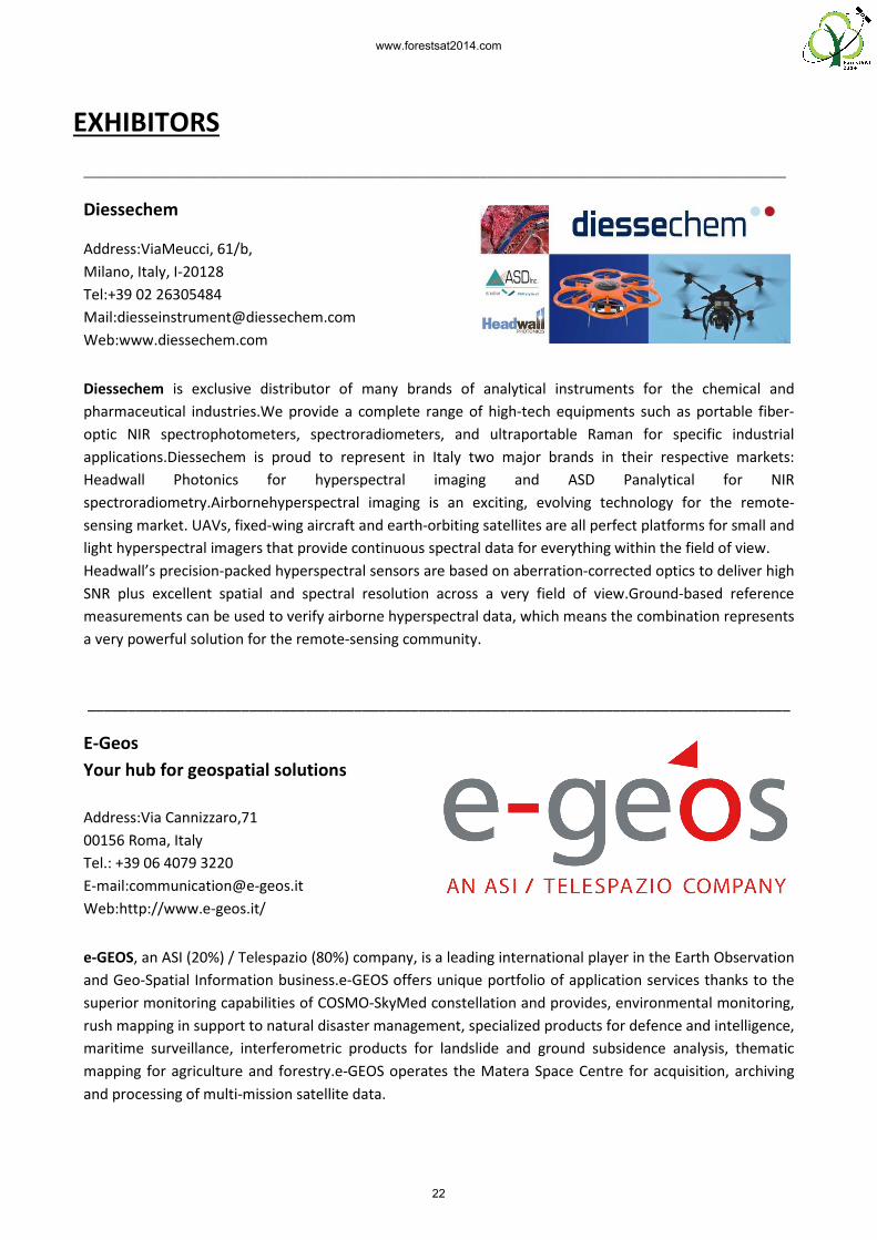
Diessechem
Address:ViaMeucci, 61/b,
Milano, Italy, I-20128
Tel:+39 02 26305484
Mail:[email protected]
Web:www.diessechem.com
Diessechem is exclusive distributor of many brands of analytical instruments for the chemical and
pharmaceutical industries.We provide a complete range of high
optic NIR spectrophotometers, spectroradiometers, and ultraportable
applications.Diessechem is proud to represent in Italy two major brands in their respective markets:
Headwall Photonics for hyperspectral imaging and ASD Panalytical for NIR
spectroradiometry.Airbornehyperspectral imaging is
sensing market. UAVs, fixed-wing aircraft and earth
light hyperspectral imagers that provide continuous spectral data for everything within the fiel
Headwall’s precision-packed hyperspectral sensors are based on aberration
SNR plus excellent spatial and spectral resolution across a very field of view.Ground
measurements can be used to verify a
a very powerful solution for the remote
_______________________________________________________________________________________
E-Geos
Your hub for geospatial solutions
Address:Via Cannizzaro,71
00156 Roma, Italy
Tel.: +39 06 4079 3220
E-mail:[email protected]
Web:http://www.e-geos.it/
e-GEOS, an ASI (20%) / Telespazio (80%) company, is a leading international player in the Earth Observation
and Geo-Spatial Information business.e
superior monitoring capabilities of COSMO
rush mapping in support to natural disaster management, special
maritime surveillance, interferometric products for landslide and ground subsidence analysis, thematic
mapping for agriculture and forestry.
and processing of multi-mission satellite data.
_______________________________________________________________________________________
is exclusive distributor of many brands of analytical instruments for the chemical and
pharmaceutical industries.We provide a complete range of high-tech equipments such as portable fiber
optic NIR spectrophotometers, spectroradiometers, and ultraportable Raman for specific industrial
applications.Diessechem is proud to represent in Italy two major brands in their respective markets:
Headwall Photonics for hyperspectral imaging and ASD Panalytical for NIR
spectroradiometry.Airbornehyperspectral imaging is an exciting, evolving technology for the remote
wing aircraft and earth-orbiting satellites are all perfect platforms for small and
light hyperspectral imagers that provide continuous spectral data for everything within the fiel
packed hyperspectral sensors are based on aberration-corrected optics to deliver high
SNR plus excellent spatial and spectral resolution across a very field of view.Ground
measurements can be used to verify airborne hyperspectral data, which means the combination represents
a very powerful solution for the remote-sensing community.
_______________________________________________________________________________________
Your hub for geospatial solutions
, an ASI (20%) / Telespazio (80%) company, is a leading international player in the Earth Observation
Information business.e-GEOS offers unique portfolio of application services tha
superior monitoring capabilities of COSMO-SkyMed constellation and provides, environmental monitoring,
rush mapping in support to natural disaster management, specialized products for defence and intelligence,
maritime surveillance, interferometric products for landslide and ground subsidence analysis, thematic
mapping for agriculture and forestry.e-GEOS operates the Matera Space Centre for acquisition, archiving
mission satellite data.
_______________________________________________________________________________________
is exclusive distributor of many brands of analytical instruments for the chemical and
tech equipments such as portable fiber-
Raman for specific industrial
applications.Diessechem is proud to represent in Italy two major brands in their respective markets:
Headwall Photonics for hyperspectral imaging and ASD Panalytical for NIR
an exciting, evolving technology for the remote-
orbiting satellites are all perfect platforms for small and
light hyperspectral imagers that provide continuous spectral data for everything within the field of view.
corrected optics to deliver high
SNR plus excellent spatial and spectral resolution across a very field of view.Ground-based reference
irborne hyperspectral data, which means the combination represents
_______________________________________________________________________________________
, an ASI (20%) / Telespazio (80%) company, is a leading international player in the Earth Observation
GEOS offers unique portfolio of application services thanks to the
SkyMed constellation and provides, environmental monitoring,
ized products for defence and intelligence,
maritime surveillance, interferometric products for landslide and ground subsidence analysis, thematic
GEOS operates the Matera Space Centre for acquisition, archiving
22
www.forestsat2014.com

_______________________________________________________________________________________
Exelis Visual Information Solutions Italia s.r.l.
Address:Via Salvo D’Acquisto, 31
20863 Concorezzo (MB)
Tel: +39 039 6058605
E-mail: [email protected]
Web: www.exelisvis.it
Exelis Visual Information Solutions provides solutions, desktop, mobile and cloud to help professionals
from various industrial branches to transform images and geospatial data into useful information. More
than 150,000 customers from over 80 Countries in the world using our services and our products – ENVI,
IDL-to display, analyze quickly and easily, and deliver all kinds of data and images that allow you to take
better decisions and greater awareness.
_______________________________________________________________________________________
GAF AG
Address:Arnulfstr. 199
D-80634 Munich, Germany
Tel.: +49-89-121528-0
E-mail:[email protected]
Web:http://www.gaf.de
GAF AG is an e-Geos/Telespazio company based in Munich, Germany. It is a leading solutions provider with
an international reputation as a skilled and reliable supplier of data, products and services in the fields of
geo-information, satellite remote sensing, spatial IT and consulting for private and public clients. GAF is one
of the most experienced European service providers in the EU/ESA Copernicus Programme and covers all
thematic domains: Land, Marine, Atmosphere, Emergency Management and Security. The company has a
proven track-record in performing complete technical assistance projects in the natural resources and
environment sector including dedicated capacity building and institutional support.
Over the past 29 years, GAF has been active in more than 100 countries throughout Europe, Africa, South
America and Asia. Further information is available at http://www.gaf.de.
___________________________________________________________________________________
23
www.forestsat2014.com

_______________________________________________________________________________________
MicroGeo
Address:ViaPetrarca, 42
Campi Bisenzio,
50145 Firenze (Italy)
Tel.: 055-8954766
E-mail:[email protected]
Web:http://www.microgeo.it/
MicroGeo is active in three important sectors concerning survey: 3D Laser Scanner, Thermography, Digital
Photogrammetry. In thermography, it distributes brands NecAvio, Testo spa, and Optris. In the field of
digital photogrammetry, it also employs drones, electrically-powered multirotors that can carry survey
instrumentation such as thermal cameras, radar, laser scanner. In the field of laser scanners, it is exclusive
distributor for Italy, Spain and Rumania for brands Riegl and Zoller+Fröhlich.
_______________________________________________________________________________________
Oben
Address:I Trv. S. Anatolia 36
07100 Sassari (Italy)
Tel.: +39 328 2320752
E-mail:[email protected]
Web:http://www.oben.it/
Oben realizes drone-based aerial surveys (mainly using multicopters, besides an airship), employing state-
of-the-art technology for photogrammetry and laser scanning, and visibile- and infrared-imaging. It
processes data also using internally-developed innovative application-specific methodologies, providing a
complete, integrated, and accurately geo-referenced product, with detailed documentation on precision,
and up to abstract meaning extraction (thematic maps, specific indicators).
_______________________________________________________________________________________
24
www.forestsat2014.com

_______________________________________________________________________________________
rapidlasso GmbH
Address:FriedrichshafenerStraße 1
82205 Gilching
GERMANY
Tel:+49 176 34623245
E-Mail:[email protected]
Web:http://rapidlasso.com
Technology start-up rapidlasso GmbH specializes in efficient LiDAR processing tools that are widely known
for their high productivity. They combine robust algorithms with efficient I/O and clever memory
management to achieve high throughput for data sets containing billions of points. The company's flagship
product - the LAStools software suite - has deep market penetration and is heavily used in industry,
government agencies, research labs, and educational institutions.
_______________________________________________________________________________________
Skye Instruments Ltd
Address:21Ddole Enterprise Park
Llandrindod Wells
Powys
LD1 6DF, UK
Tel.: +44 (0)1597 824811
E-mail:[email protected]
Web:www.skyeinstruments.com
Skye Instruments Ltd have been designing and manufacturing instrumentation for Remote Sensing,
Environmental Monitoring, Plant and Agricultural Research for over 30 years. We have a range of Remote
Sensing Instruments for ground, tower and airborne installations, which include Eddy Covariance/Flux
Towers & UAV’s. Our Multi-Spectral Sensors include wavelengths for LANDSAT, SPOT, NOAA, AVHRR,
MODIS, plus many more Earth observation satellites.
_______________________________________________________________________________________
25
www.forestsat2014.com

NSORS
O DEL
In collaboration with
THANKS TO OUR SP SPONSORS
CON IL PATROCICON IL PATROCINIO DELLA
TRENTOLA PROVINCIA AUTONOMA D
26
www.forestsat2014.com

Abstract book editors
Alberto Mattedi | Cristina Castellani
Editorial board
Gherardo Chirici | Alberto Mattedi | Gianantonio Battistel
Printing
Litotipografia AlcionePrinted in November 2014
27
www.forestsat2014.com

www.forestsat2014.com
Supported by:
In coordination with:
Media partner: