Embed Size (px)
Citation preview
Frances Roberts-GregorySpelman College
2nd Year SOARS ProtégéUNO-CHART
July 27th, 2012
An exercise in Participatory Action Research (PAR) blending Traditional Ecological Knowledge (TEK) and geospatial information systems to
identify vulnerable plant species valued by southern Louisiana’s coastal Native American tribes
Ethnobotanical Conversations Along the Bayou
Chief Chuckie, PACIT, discussing plants Elderberry Community Liaison Jamie Berdin in Pointe au Chien
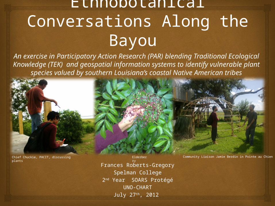
Establish rapport using PAR
Pointe-Au-Chien Indian Tribe (PACIT) Isle de Jean Charles Band of the Biloxi-Chitimacha-
Choctaw Confederation of Muskogees (BCCM) Grand Caillou/Dulac Bands of the Biloxi-Chitimacha
Choctaw Confederation of Muskogees (BCCM)
Design appropriate mixed methods methodology
Identify vulnerable plant species
Explore intergenerational ethnobotanical knowledge transfer
Investigate historical, current, and future implications of geomorphological change and climate change
Generate interest in preservation of both traditional plants and local knowledge Community garden revitalization
Objectives
1948 Isle de Jean CharlesTraiteur Joseph Bud Naquin Gardening
Le Jardín des Traíteurs at La Maíson Acadíenne
Vermilionville Living History Museum and Folklife Park
Historic Cajun/Creole Village Healer’s Garden
Ethnobotany
study of relation between plants and people
Traditional Ecological Knowledge (TEK) indigenous and local knowledge, practice and belief concerning the use and maintenance
of natural resources that integrates the physical and spiritual into a holistic cosmology
Participatory Action Research (PAR) applied, experimental research that promotes a collaborative information gathering
process between researchers and the people for their direct empowerment and benefit
Grounded Theory social scientific methodology to discover theory throughout course of research through
analysis of data
Mixed Methods Approach research methodology that combines both qualitative and quantitative approaches
Operationalization
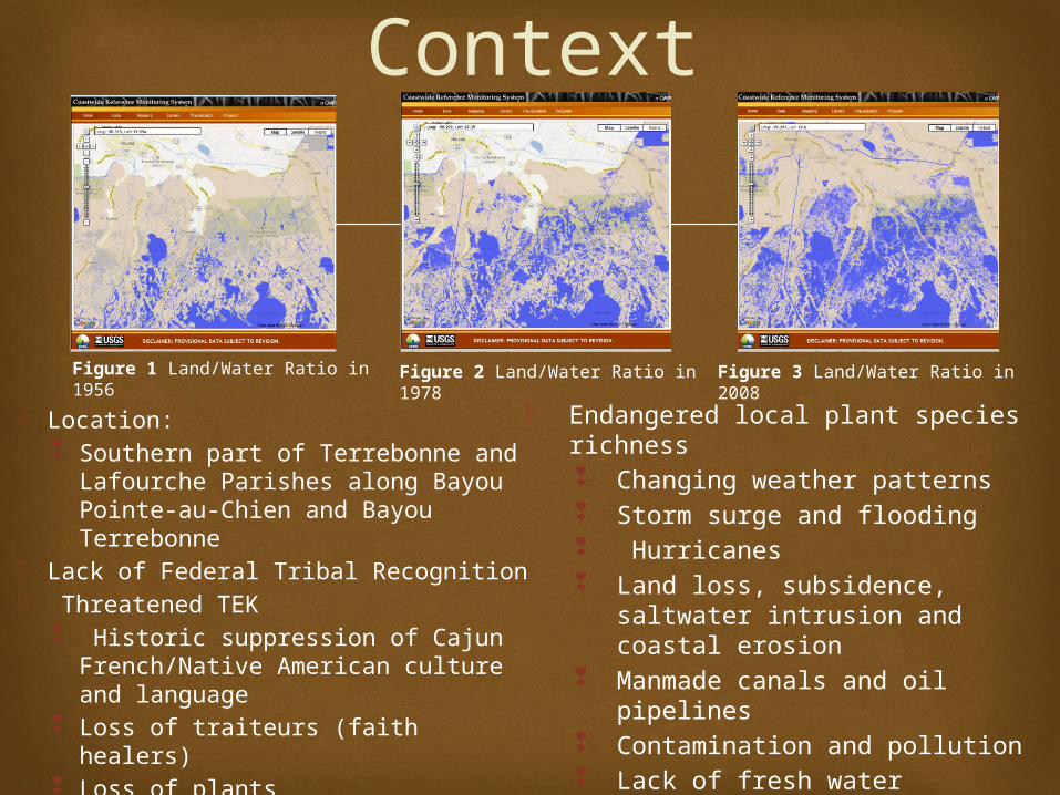
Location: Southern part of Terrebonne and
Lafourche Parishes along Bayou Pointe-au-Chien and Bayou Terrebonne
Lack of Federal Tribal Recognition Threatened TEK
Historic suppression of Cajun French/Native American culture and language
Loss of traiteurs (faith healers) Loss of plants
Context
Endangered local plant species richness Changing weather patterns Storm surge and flooding Hurricanes Land loss, subsidence, saltwater
intrusion and coastal erosion Manmade canals and oil pipelines Contamination and pollution Lack of fresh water Reduction of barrier islands Hotter temperatures
Figure 3 Land/Water Ratio in 2008Figure 2 Land/Water Ratio in 1978Figure 1 Land/Water Ratio in 1956

Ideal Methodology: Mixed Methods
Accomplishments• Participatory Action Research• Conversations • Semi-structured interviews
• Intergenerational knowledge• Elders and traiteurs
• Atlas-TI software• Qualitative Data Analysis
Software• Integration of ethnobotanical
knowledge with long-term scientific projections
• Vegetation Maps
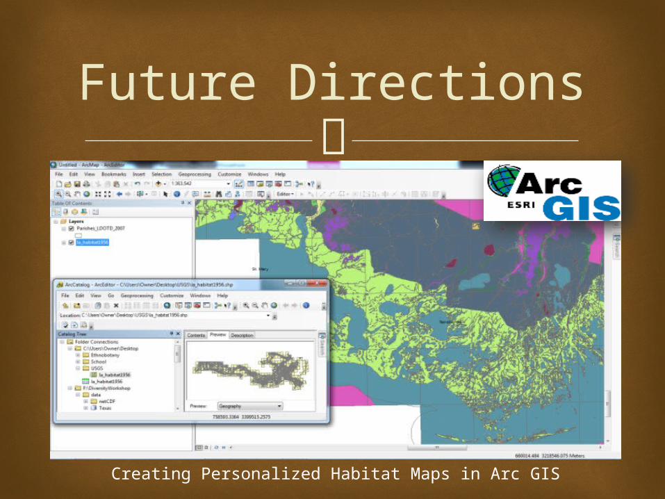
Future Directions• Incorporation of local soil types,
elevation and geographical coordinates of localities where plant species are still found
• Participatory Mapping• Cross-reference historical
documents with geographical range maps housed in the USDA Plant Resource Database and participatory maps using Arc GIS software
iPhone used in fieldwork Frances Roberts-Gregory and Science Mentor Andrew Barron at BTNEP
Materials and Supplies
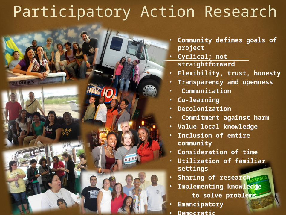
Participatory Action Research• Community defines goals of
project• Cyclical; not straightforward• Flexibility, trust, honesty• Transparency and openness• Communication• Co-learning• Decolonization• Commitment against harm• Value local knowledge• Inclusion of entire community• Consideration of time• Utilization of familiar settings• Sharing of research• Implementing knowledge to solve problems • Emancipatory• Democratic • Collaborative• Conscientization
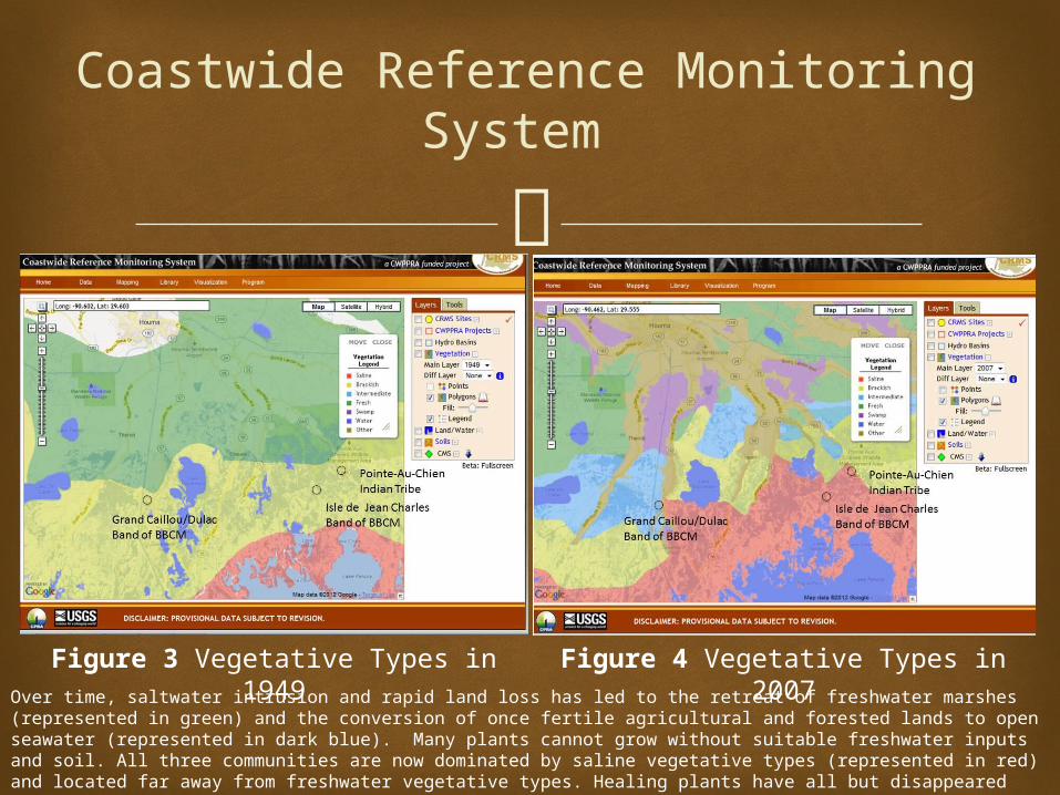
Coastwide Reference Monitoring System
Figure 3 Vegetative Types in 1949 Figure 4 Vegetative Types in 2007Over time, saltwater intrusion and rapid land loss has led to the retreat of freshwater marshes (represented in green) and the conversion of once fertile agricultural and forested lands to open seawater (represented in dark blue). Many plants cannot grow without suitable freshwater inputs and soil. All three communities are now dominated by saline vegetative types (represented in red) and located far away from freshwater vegetative types. Healing plants have all but disappeared from many of the communities. Cancer, rare diseases and other health ills are common in the region due to genetic, environmental and social factors.
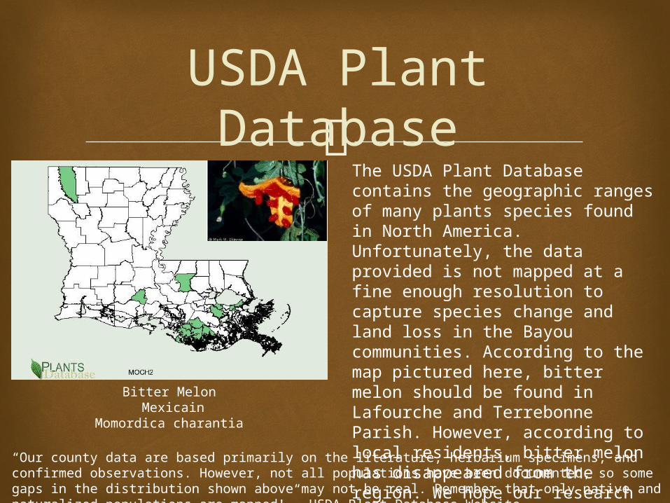
USDA Plant Database
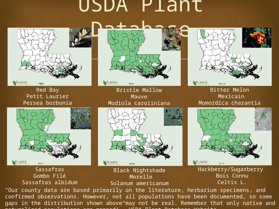
“Our county data are based primarily on the literature, herbarium specimens, and confirmed observations. However, not all populations have been documented, so some gaps in the distribution shown above may not be real. Remember that only native and naturalized populations are mapped!”- USDA Plant Database Website
Bitter Melon Mexicain
Momordica charantia
The USDA Plant Database contains the geographic ranges of many plants species found in North America. Unfortunately, the data provided is not mapped at a fine enough resolution to capture species change and land loss in the Bayou communities. According to the map pictured here, bitter melon should be found in Lafourche and Terrebonne Parish. However, according to local residents, bitter melon has disappeared from the region. We hope our research can contribute to more accurate maps drawn at finer scales.
USDA Plant Database
Red BayPetit Laurier
Persea borbonia
Bristle MallowMauve
Modiola caroliniana
“Our county data are based primarily on the literature, herbarium specimens, and confirmed observations. However, not all populations have been documented, so some gaps in the distribution shown above may not be real. Remember that only native and naturalized populations are mapped!”- USDA Plant Database Website
Bitter Melon Mexicain
Momordica charantia
SassafrasGombo Filé
Sassafras albidum
Black Nightshade Morelle
Solanum americanum
Hackberry/Sugarberry Bois Connu
Celtis L.
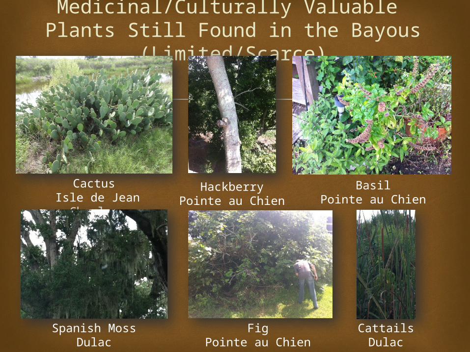
Medicinal/Culturally Valuable Plants Still Found in the Bayous (Limited/Scarce)
Cactus Isle de Jean Charles
HackberryPointe au Chien
BasilPointe au Chien
Spanish MossDulac
FigPointe au Chien
CattailsDulac
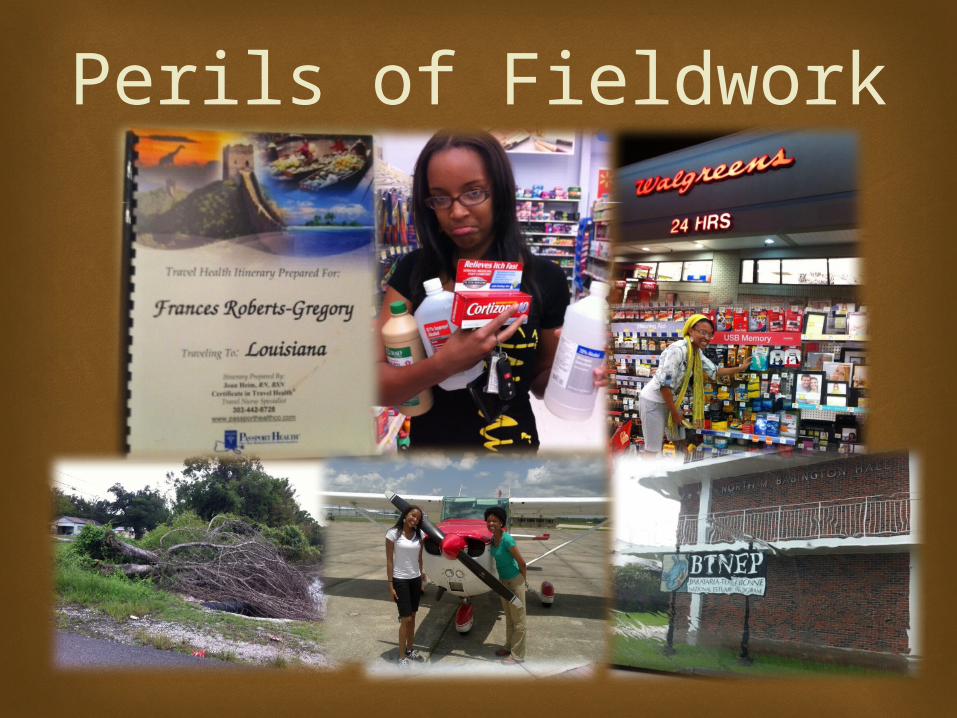
Perils of Fieldwork
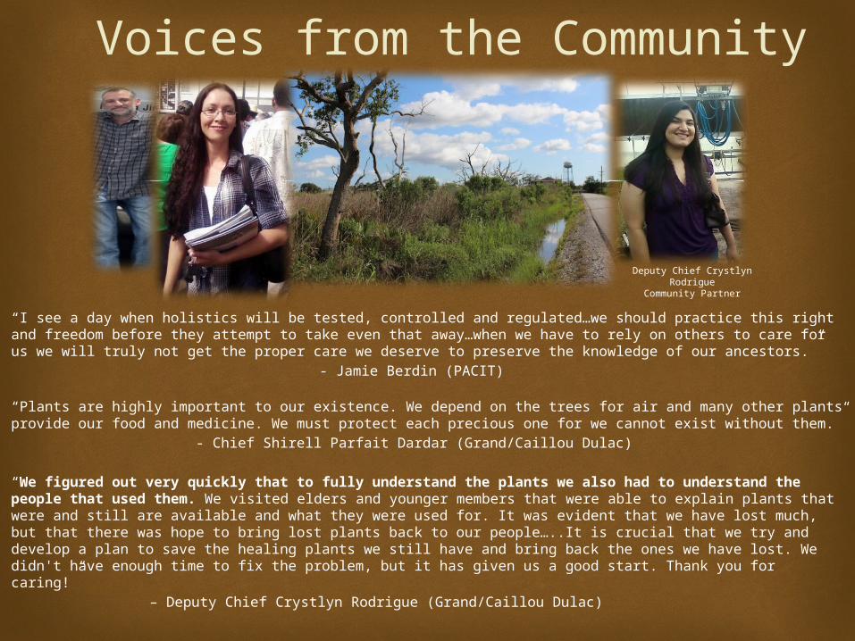
“I see a day when holistics will be tested, controlled and regulated…we should practice this right and freedom before they attempt to take even that away…when we have to rely on others to care for us we will truly not get the proper care we deserve to preserve the knowledge of our ancestors.”
- Jamie Berdin (PACIT)
“Plants are highly important to our existence. We depend on the trees for air and many other plants provide our food and medicine. We must protect each precious one for we cannot exist without them.”
- Chief Shirell Parfait Dardar (Grand/Caillou Dulac)
“We figured out very quickly that to fully understand the plants we also had to understand the people that used them. We visited elders and younger members that were able to explain plants that were and still are available and what they were used for. It was evident that we have lost much, but that there was hope to bring lost plants back to our people…..It is crucial that we try and develop a plan to save the healing plants we still have and bring back the ones we have lost. We didn't have enough time to fix the problem, but it has given us a good start. Thank you for caring!”
– Deputy Chief Crystlyn Rodrigue (Grand/Caillou Dulac)
Voices from the Community
Deputy Chief Crystlyn RodrigueCommunity Partner
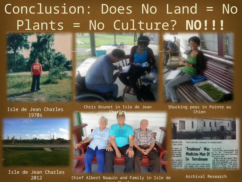
Conclusion: Does No Land = No Plants = No Culture? NO!!!
Isle de Jean Charles 1970s
Isle de Jean Charles 2012Chief Albert Naquin and Family in Isle de Jean
Charles
Shucking peas in Pointe au ChienChris Brunet in Isle de Jean Charles
Archival Research
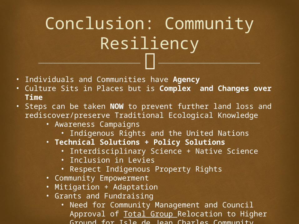
Conclusion: Community Resiliency
• Individuals and Communities have Agency• Culture Sits in Places but is Complex and Changes over Time• Steps can be taken NOW to prevent further land loss and
rediscover/preserve Traditional Ecological Knowledge• Awareness Campaigns
• Indigenous Rights and the United Nations• Technical Solutions + Policy Solutions
• Interdisciplinary Science + Native Science• Inclusion in Levies• Respect Indigenous Property Rights
• Community Empowerment • Mitigation + Adaptation • Grants and Fundraising
• Need for Community Management and Council Approval of Total Group Relocation to Higher Ground for Isle de Jean Charles Community

Elevated Raised Bed Gardens in Grand Bayou
Potential Solutions 2010-11 Coastal Garden
Collaborative 14 (4x3x15’) elevated container
gardens Model for other communities HESCO-BASTION containers
provides a barrier which helps protect against erosion and flooding
reduces the effect of storm surge
Tree plantings provide habitat for wetland
and migratory birds as well as edible and medicinal plants for communities
Educational Tool
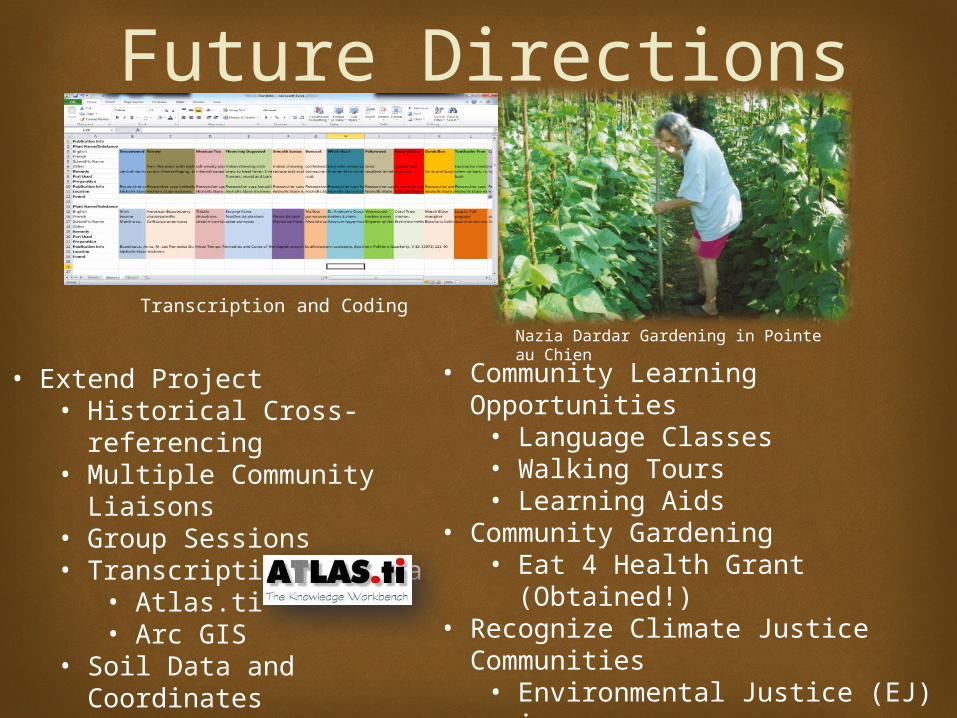
• Extend Project• Historical Cross-
referencing• Multiple Community
Liaisons• Group Sessions• Transcription of Data
• Atlas.ti• Arc GIS
• Soil Data and Coordinates• Validation of Results
Future Directions
• Community Learning Opportunities• Language Classes• Walking Tours• Learning Aids
• Community Gardening• Eat 4 Health Grant (Obtained!)
• Recognize Climate Justice Communities• Environmental Justice (EJ) issues• Long Term Investment Needed• More Inclusion in Louisiana’s
2012 Coastal Master Plan
Nazia Dardar Gardening in Pointe au Chien
Transcription and Coding
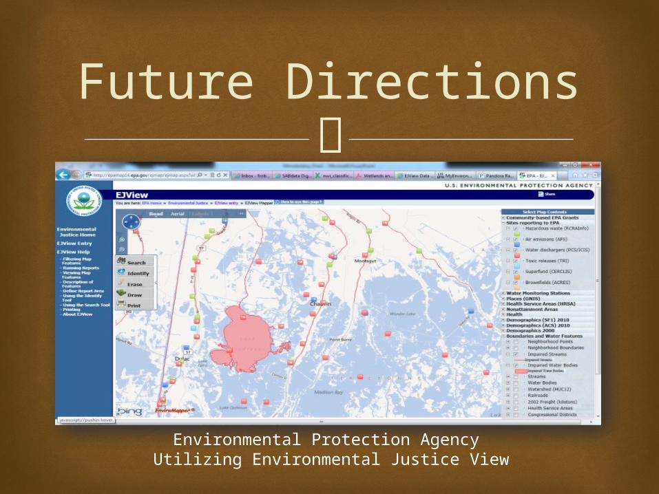
Future Directions
Environmental Protection Agency Utilizing Environmental Justice View
Future Directions
Creating Personalized Habitat Maps in Arc GIS
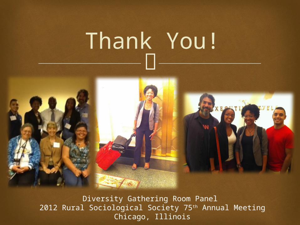
Thank You!
Diversity Gathering Room Panel 2012 Rural Sociological Society 75th Annual Meeting
Chicago, Illinois
Acknowledgements

This work was performed under the
auspices of the Significant Opportunities in Atmospheric Research and Science
Program."SOARS is managed by the University Corporation for Atmospheric Research and is funded by the National Science Foundation, the National Oceanic and Atmospheric Administration,
the Cooperative Institute for Research in Environmental Science, and by the Center for Multiscale Modeling of Atmospheric Processes .“
Acknowledgements