Embed Size (px)
Citation preview

555
Chapter 14. Functions and Applications of Spatial Cognition
Daniel R. Montello and Martin Raubal
In this chapter, we address the question of why it is important to study spatial cognition.
Spatial cognition plays a central role in numerous human activities and helps solve numerous
human problems. In other words, cognition of and with spatiality is both a fundamental
component of human experience, and functional and relevant in many situations, both routine
and exceptional. In fact, it is difficult to overstate the importance and even ubiquity of spatial
cognition in mental and behavioral structures and processes. We discuss research on human
spatial cognition with a focus on its functions in life activities and experiences. Then we discuss
how studying spatial cognition can inform applications such as designing and evaluating
personnel selection methods, training procedures, built environments, and various information
tools and systems, such as mobile geographic information services.
Our goals in writing this chapter lead us to consider the essential meaning of spatial
cognition. After all, it is impossible to say whether some task or activity involves or exemplifies
spatial cognition unless we are prepared to offer a view on what is and is not spatial cognition.
As most readers will suppose, this is no easy task, but we think the effort proves edifying. We
start with the essential meaning of space and spatiality—its ontology, in the traditional sense of
the philosophical study of metaphysics. Providing a clear, correct, and complete definition of
space and spatiality is, of course, notoriously difficult to do, especially if we wish to avoid
invoking space itself in the definition. After all, spatiality is pervasive and fundamental to
existence and experience, as we suggested above. Recognizing these difficulties, we can define
spatiality as the collection of all “extensional properties” of reality. In the sense we mean here,

556
extensionality refers to the property of occupying space or having spatiality, which of course is
circular. Spatiality is the property of reality that reflects the fact that everything is not at one
location, a definition that is somewhat tongue-in-cheek but at least less circular. Alternatively,
we can explicate the meaning of spatiality by listing a collection of spatial properties: location,
size, distance, direction, shape, connectivity, overlap, dimensionality, hierarchy, and so on. But
however we define spatiality, we probably do not want simply to classify any cognition
involving spatial properties as “spatial cognition.” After all, one can make a good case that all
cognition occurs in space and involves spatial information, at least implicitly. This includes
linguistic, numerical, social, and other domains of cognition that we probably do not want to
include as central foci of the study of spatial cognition. Thus, we can restrict spatial cognition to
cognition that is primarily about spatiality—that serves primarily to solve problems involving
spatial properties as a core component. As a contrasting example, reading requires spatial
processing as part of orthography and syntax, but it is primarily about understanding written
language, not solving a spatial problem (except when reading route directions, etc.).
A list of spatial properties is large and diverse, although not unlimited. One way to
organize our understanding of spatial properties is in terms of their level of geometric complexity
or sophistication. Especially since the nineteenth century, we have come to understand geometry
as more than just Euclidean metric geometry (Sklar, 1974; van Fraassen, 1985). Alternatives
include both non-Euclidean metric geometries and non-metric geometries such as affine,
projective, and topological geometries. The appropriate geometry one should use to model
human spatial cognition has been the subject of behavioral research in recent decades (e.g.,
Cheng & Newcombe, 2005; Dehaene, Izard, Pica, & Spelke, 2006; Golledge & Hubert, 1982;
Hartley, Trinkler, & Burgess, 2004; Montello, 1992; Rinck & Denis, 2004). Clearly, spatial

557
tasks do not necessarily require metric spatial knowledge, and in fact, can often be performed
well without it. Evidence indicates that people often have a poor or nonexistent understanding of
metric spatial properties, especially as it concerns larger “environmental” spaces. Conversely,
evidence also shows that at least some people do acquire something like metric information of
fairly high quality about the layout of environments (Ishikawa & Montello, 2006), even if it does
not strictly obey the metric axioms.
In addition to the meaning of spatiality, we also delimit the scope of our discussion by
considering what to include as cognitive. A broad definition of cognition includes both relatively
low-level and high-level mental processes, both implicit and explicit processes, and processes
that are both bottom-up and top-down. The domain of spatial cognition, as it has been studied in
various cognitive disciplines, has tended to focus on relatively high-level tasks, such as those
involving reasoning, communication, imagination, symbolic representation and interpretation,
and the like—tasks that are thought to incorporate internally represented spatial knowledge that
is potentially accessed explicitly. Work like this has excluded tasks requiring only perception-
action coordination from the study of spatial cognition (of course, there are debates about how
much “cognitive” processing is required for particular tasks). That is, deciding which door to
walk through to get outside is a spatial cognition problem; moving one’s body to avoid running
into the door jamb as you leave is not, notwithstanding that the latter is nontrivial and certainly
involves psychological processing of spatial information. Although this distinction is imperfect,
and might at times mislead us, we follow this approach in our chapter and delimit our scope by
distinguishing the cognition of space from the perception of space and from behavior in space.
We do not consider, except incidentally, spatial problems that are primarily perceptual and
motor, such as object recognition or maintaining balance while walking.

558
Thus, we define spatial cognition as the area of research that studies activities centrally
involving explicit mental representations of space (or at least potentially explicit).1 We
recognize this will still fail to satisfy some readers; we are not completely comfortable ourselves
with this restriction. At the same time we recognize that many activities we would not want to
include as spatial cognition have spatial cognitive components, we also see that most (all?)
spatial cognitive tasks have non-spatial and non-cognitive components, or can be carried out in
alternative ways that are not spatial (e.g., you can reconstruct and scan a spatial mental model or
retrieve a verbal description of a situation) or particularly cognitive (you can reason how to get
back to your car or simply ask your companion).
Functions of Spatial Cognition
To discuss the functions of spatial cognition is to discuss what spatial cognition is useful
for. What tasks does spatial cognition contribute to in a significant way? We include both
everyday tasks, such as choosing the right street to take while driving to the store, and
specialized tasks, such as choosing the right vein area to examine while searching for tumors in a
patient’s liver. This is a large number of tasks taken individually, although they can be grouped
into subsets for which spatial cognition clearly plays a similar role or contributes in similar ways
to their successful performance. For example, interviews and observations summarized by
Hegarty, Keehner, Cohen, Montello, and Lippa (2007) suggest that, like pedestrians in a
neighborhood, surgeons and surgery residents use “landmarks” in the human body to remain
oriented.
We consider functions of spatial cognition by listing categories of spatial cognitive tasks
that people perform—everyday and specialized tasks that involve spatial cognition to a
substantial degree (e.g., Eliot & Czarnolewski, 2007). In Table 1, we propose six categories of
559
spatial-cognitive tasks.2 Although we attempt to be comprehensive with our list, we are fairly
confident it overlooks some things; for instance, we considered including reasoning about social
space as a type. Furthermore, our attempt to formulate distinct categories notwithstanding, they
clearly overlap, and we are skeptical that any fairly comprehensive list of functions could
approach mutual exclusivity. Wayfinding sometimes utilizes spatial symbolic representations
and spatial language, for example. The list is clearly only a starting point.
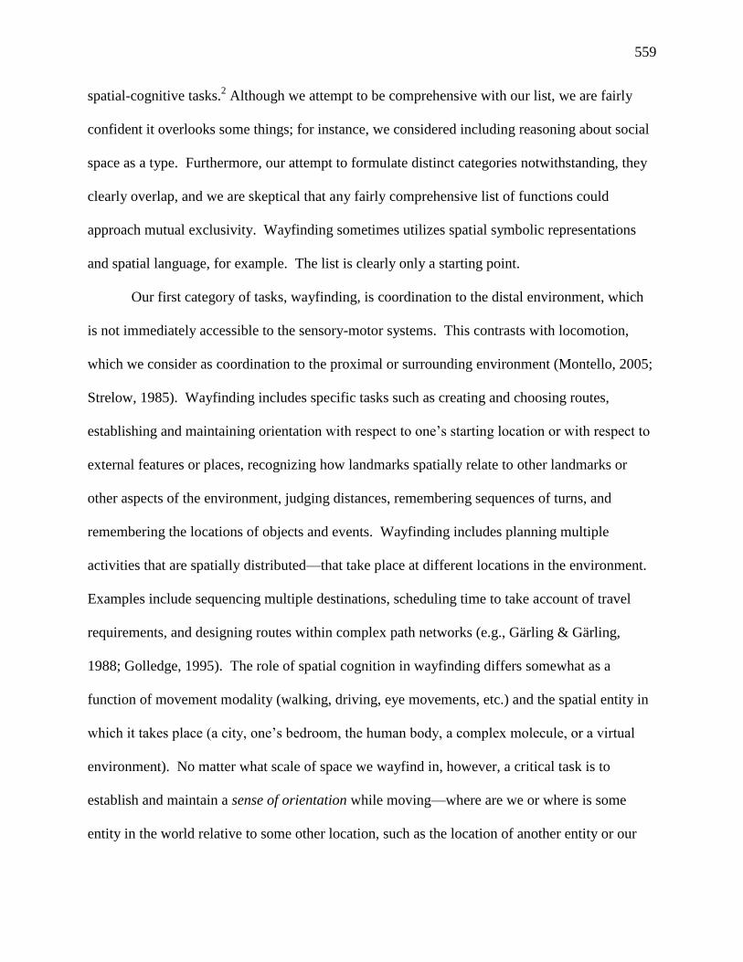
Our first category of tasks, wayfinding, is coordination to the distal environment, which
is not immediately accessible to the sensory-motor systems. This contrasts with locomotion,
which we consider as coordination to the proximal or surrounding environment (Montello, 2005;
Strelow, 1985). Wayfinding includes specific tasks such as creating and choosing routes,
establishing and maintaining orientation with respect to one’s starting location or with respect to
external features or places, recognizing how landmarks spatially relate to other landmarks or
other aspects of the environment, judging distances, remembering sequences of turns, and
remembering the locations of objects and events. Wayfinding includes planning multiple
activities that are spatially distributed—that take place at different locations in the environment.
Examples include sequencing multiple destinations, scheduling time to take account of travel
requirements, and designing routes within complex path networks (e.g., Gärling & Gärling,
1988; Golledge, 1995). The role of spatial cognition in wayfinding differs somewhat as a
function of movement modality (walking, driving, eye movements, etc.) and the spatial entity in
which it takes place (a city, one’s bedroom, the human body, a complex molecule, or a virtual
environment). No matter what scale of space we wayfind in, however, a critical task is to
establish and maintain a sense of orientation while moving—where are we or where is some
entity in the world relative to some other location, such as the location of another entity or our

560
own previous location.
-- Table 1 about here --
The second category of tasks on our list is acquiring and using spatial knowledge learned
directly, that is, from perceptual-motor experience in the world. This occurs at figural, vista, and
environmental scales of space. At figural scales, vision and haptics are the most important
sensori-motor systems involved in spatial learning by humans. Vista-scale learning depends
almost entirely on vision, and head and eye movements. Spaces at environmental scales require
considerable body locomotion for their direct apprehension; thus visual and proprioceptive
senses are of principal importance. At environmental scales, we learn about the locations of
prominent features (landmarks), path network structures that connect places, and spatial
relationships among places, even those we have not directly traveled between. At all scales, we
learn spatial properties at all levels of geometric sophistication, including connections,
containments, sequences, distances, directions, shapes, configurations, and so on. This
knowledge is acquired both intentionally, during exploration, and incidentally, while we are
otherwise carrying out goal-directed tasks such as travel.
Our third category of spatial tasks is using spatially iconic symbolic representations.
These are graphical and volumetric symbolic representations that represent spatial and non-
spatial information via their own spatial properties (and sometimes their temporal and thematic
properties). Spatial cognition can be involved in both producing and interpreting these external
representations. By definition, spatial learning at miniscule and gigantic scales occurs only via
symbolic representations (we do not learn the relative locations of cities in Africa from direct
experience but from examining maps), but of course, all scales of spaces are sometimes learned
in this way. Two-dimensional (graphical) symbolic representations include maps, graphs,

561
drawings and diagrams (including blueprints), photographs, movies, and other “pictorial”
representations. Three-dimensional (volumetric) symbolic representations include physical
models and globes.
The cognition involved in producing and interpreting different symbolic representations
can vary quite substantially from one to another. For instance, cartographic maps depict a
portion of the Earth’s surface, diagrams typically depict architectural or object spaces, and
graphs usually use space metaphorically to depict nonspatial relationships (such as quantitative
magnitude) (Tversky, 1997). Even within each type, there is a large amount of variation in how
these representations depict information, what information they depict, how they are used, and
more. For instance, maps may be reference maps or thematic maps, they may be used for
navigation or for learning world geography, and they may depict metric information like distance
accurately or distort metric information in order to focus on relationships such as connectivity
and sequence. Recently, multivariate representations of very large data sets called
spatializations have been generated that use landscape depictions to represent nonspatial
information metaphorically (Skupin & Fabrikant, 2008). Research by Fabrikant and her
colleagues (e.g., Fabrikant, Montello, Ruocco, & Middleton, 2004) has looked at the spatial
reasoning involved in interpreting spatialized displays.
Our fourth category of spatial tasks is using spatial language, a non-iconic form of spatial
symbolic representation system (see Taylor & Brunyé, this volume). Natural languages describe
or instruct about space and spatiality abstractly; they exploit semantics (i.e., word, phrase, and
sentence meanings) to communicate spatial properties of individual entities and relations among
entities. Of course, there are substantial differences between the psychology of graphical and
volumetric representations and that of natural language representations, although in the case of

562
spatial descriptions, they may contain surprisingly similar spatial information content. For
instance, Tversky and Lee (1999) found that routes depicted in sketch maps and described
verbally similarly included particular landmark features, segmented the environment, and
schematized elements such as curves. The way spatial information is encoded and
communicated via language is studied in the context of tasks such as describing scenes and
giving verbal route directions (Allen, 1997; Bloom, Peterson, Nadel, & Garrett, 1996; Jarvella &
Klein, 1982). Researchers are interested in issues such as the precision or vagueness of spatial
language, the absence or inclusion of landmarks in route directions, how deictic references
convey spatial information, cross-linguistic differences and similarities in spatial language and
thought, and more. But several prominent theories of language and thought have come to accord
spatial thinking a central role in interpreting linguistic expressions in the first place, whether its
semantic content is spatial or not. That is, spatial cognition has come to be recognized as
essential to nonspatial thinking and communication with language. For instance, the theory of
image schemata (Johnson, 1987) proposes that language is interpreted via the metaphorical
extension of a few basic iconic mental representations to capture all semantics. Gentner and her
colleagues have discussed the role of spatial thinking in temporal thinking and in the spatial
alignment of conceptual structures during analogical reasoning more generally (Gattis, 2001;
Gentner & Medina, 1998). The geometric theory of conceptual spaces (Gärdenfors, 2000)
proposes that concepts are mentally represented as iconic representations whose geometric
properties express relational meaning. Such iconic spatial theories of the psychology of
semantics are, in fact, consistent with the effort described above to use iconic external
representations called spatializations to communicate nonspatial information.
Our fifth category involves imagining places and reasoning about them with mental

563
models, spatial mental representations constructed in working memory. Mental models are
apparently constructed as part of interpreting narratives in language (Johnson-Laird, 1983). But
they are also constructed from non-linguistic sources, such as direct experience with entities at
figural, vista, or environmental scales (Hegarty & Just, 1993). They are even constructed out of
imagination, and can represent spatial entities that a person has never directly experienced in any
way. Thus, it is sensible to talk about reasoning with mental models of fictional entities that do
not exist.
Our sixth category is location allocation, which is finding optimal or adequate locations
for putting facilities such as retail businesses, hospitals, and schools. Locations are identified
that minimize or reduce various relative cost functions, including traveled distance, that result
from putting facilities in particular locations. This task is often handled non-cognitively now, by
algorithmic and heuristic computer routines that do not mimic human cognition. But before
location-allocation was formalized as a computational task, people attempted informally to locate
facilities in an adaptive manner. This was a very intensive cognitive task that incorporated a
great deal of spatial thinking. For example, in pre-industrial times, when siting a house, a person
would need to consider factors such as the daily path of the sun, distance from water, distances
from relatives, location within agricultural fields, safety from wild animals or other mobile
threats, and so on. But even today, decisions such as picking a place of residence, a school, or a
job, require spatial thinking that can be quite challenging. One must still consider factors such as
the distance from one’s job, from one’s friends or family, from schools one’s children might
attend, from public transit, and so on. Individuals rarely if ever use formal technologies and
analytic methods to solve these problems, as cognitively challenging as they are.
Applications of Spatial Cognition

564
In the first part of our chapter, we provided an overview of various functions of spatial
cognition. This overview demonstrates that spatial cognition plays a major role in our daily
experience and activities, and that it helps solve various problems we encounter both regularly
and occasionally. Clearly then, understanding spatial cognition should have application in a
variety of practical domains (Allen, 2007; Golledge, 2004), involving objects and environments,
as well as external spatial representations such as maps, graphs, linguistic descriptions, and
more. The advent of digital media such as GPS-enabled navigation systems is providing new
applications for spatial cognition. In this section, we selectively highlight and describe some
important application areas of spatial cognition research (Table 2). This list is very definitely not
comprehensive. We can see potential applications for spatial cognition research in a variety of
other areas, such as forensic psychology, clinical and counseling psychology (disabilities,
Alzheimer’s and other syndromes), athletic training, aviation psychology, transportation and
transit engineering, video gaming and digital communities, and more.
Before turning to specific application areas, a general point is warranted about applying
research findings in spatial cognition. The experimental tradition in research manipulates
variables in order to explore ways that varying stimulus materials, task settings, and other
external factors influence the mental and behavioral responses of individuals. Of course, no two
individuals are exactly alike, and that applies to virtually every aspect of spatial cognition
(Hegarty & Waller, 2005). Furthermore, although researchers in the comparative tradition often
explore these differences in terms of aggregate factors that differentiate people, such as age, sex,
and culture, we can ultimately identify differences at the level of the individual (see Casey, this
volume). That is, we can distinguish three levels of user parameters for system design and other
purposes: generic, group, and individual (Raubal, 2009). The generic level covers the general
565
set of cognitive parameters assumed to be applicable to all people. For example, people in
general use landmarks for finding their way and for communicating wayfinding directions to
others. Groups of users can be defined by common sets of cognitive parameters, such as similar
abilities, interests, concerns, goals, beliefs, or behavioral practices. This results in various
overlaps between different groups of users. Examples are gender groups, such as all women or
all men, and cultural groups defined, for example, by sharing a common language. An important
question for the design of cognitively engineered technology is what kinds of differences should
be taken into account when forming a group of users within a particular spatio-temporal context.
Wayfinding instructions, for example, need to be adapted for specific groups in order to be most
useful. On the individual level every single person is ultimately different. Although
personalization can potentially go a long way, the more parameters that need to be adapted, the
more difficult and complex personalization becomes. For example, location-based services must
represent individual user preferences, such as “I want to go from location X to location Y by
public transport.” So all people share some cognitive parameters but they also fall into various
“user groups” and have their individual preferences. Thus, we strongly advocate the need to
consider group and individual variations when applying spatial cognition. It is also critical to
explore the domain-generality and consistency of differences; to what tasks or skills does a
particular difference apply, and how consistently? An informative discussion of these issues can
be found in Appendix C of the report by the Committee on Support for Thinking Spatially
(2006).
<Insert Table 2 Here>
Location-based services (LBS). Over the last decades, developed societies have
become mobile information societies with the proliferation of spatial technologies. Such

566
technologies comprise geospatial tools and services that support people in making spatio-
temporal decisions. Finding one’s way from the airport to a hotel in an unfamiliar city can be a
demanding task that requires utilizing different cognitive abilities in the context of space and
time. Location-aware technologies and location-based services (LBS) support users during such
mobile decision making. They are sensitive to the location of a mobile person, having global
positioning system (GPS) technology built into them, and relate the person’s location to the
surrounding environment via a geographic information system (GIS) database. This in turn
allows the system to provide location-based information in the form of written instructions or
cartographic maps that facilitate the successful completion of spatio-temporal tasks. The
widespread adoption of LBS has resulted in tremendous benefits for their users by providing
them with real-time spatio-temporal decision support for purposes ranging from the trivial (e.g.,
friend-finder services) to the critical (e.g., emergency response).
Highly important for this process of information seeking and decision making is the
notion of geographic relevance, defined as “a relation between a geographic information need
and the spatio-temporal expression of the geographic information objects needed to satisfy it”
(Raper, 2007). That is, the system works well only when it is capable of organizing and filtering
information according to the needs of a user. Achieving geographic relevance requires one to
consider cognitive abilities and strategies people bring to the spatial problem-solving process.
This is the goal of spatial cognitive engineering: to design spatial information systems and
services based on principles of human communication and reasoning (Raubal, 2009; Taylor,
Brunyé, & Taylor, 2009). It is an interdisciplinary endeavor, involving the disciplines of
geographic information science, cognitive science, computer science, and engineering. A special
focus is put on human-computer interaction based on the integration and processing of spatial

567
and temporal aspects of phenomena. This includes various conceptualizations of space and time,
matching spatial and temporal concepts between users and systems, effective communication of
information, and qualitative methods of spatial reasoning and decision making that more closely
mimic human thought.
Digital navigation services are the most successful and widely adopted category of LBS
to date. They support users in finding optimal routes while driving, biking, or walking; they
communicate through maps and verbal turn-by-turn instructions; and their maintenance is low
(given that up-to-date street network data are used). Navigation services for pedestrians are
generally more difficult to implement because pedestrians are not bound to a street network.
These services strongly need personalization. For example, route instructions for people in
wheelchairs must not include segments with stairways. These days, more and more of these
services integrate landmarks because it has been realized that route instructions that rely mainly
on quantitative values, such as “go straight for 1.5 km, then turn right, go 0.8 km” are difficult to
follow while being on the move. Cognitive research has shown that providing landmark-based
instructions, such as “turn right after the 6-story building” or “go straight until you reach In-N-
Out Burger”3
facilitates navigation for most users, at least in many situations (Denis, Michon, &
Tom, 2007). Consequently, a research focus has developed that investigates methods for the
automatic detection of landmarks to be used in wayfinding instructions (Sadeghian &
Kantardzic, 2008). Spatial cognition research continues to contribute to developing better
navigation services that incorporate landmarks people perceive, find salient, and readily identify.
Navigation services are often a part of mobile guides, which are portable and location-
sensitive digital guides that provide an abundance of information to travelers and tourists. They
have been slowly replacing traditional guide books and paper maps. Recently, several

568
innovative LBS applications have emerged, and some of them focus on the integration of small
mobile displays and large static paper maps. An illustrative application is WikEar (Schöning,
Hecht, & Starosielski, 2008) (Figure 1), which integrates different perceptual modes (visual and
auditory) and generates customized location-based guided tours by mining data from Wikipedia
(www.wikipedia.org). These data are automatically organized according to principles from
narrative theory (from cognitive science and semiotics) and integrated into an educational audio
tour that starts and ends at stationary city maps.
-- Figure 1 here --
Different media can be utilized for communicating location-based and navigation
information. Maps have been the most prominent medium, but several cognitive research issues
arise when using maps on cell phones and Personal Digital Assistants (PDAs). Mobile displays
are limited in size and resolution compared to larger screens, which makes map reading more
difficult for the average user (Dillemuth, 2005) (and mobile devices are often used in situations
of divided attention!). Maps are traditionally aligned on the display with north facing up. Just as
users of traditional analog maps often turn the map as travel direction changes, users of mobile
devices typically prefer digital maps to maintain “track-up” alignment (Aretz & Wickens, 1992).
Sensor-based information can be used to determine a user’s direction of movement and
automatically provide track-up oriented maps on mobile devices. Mobile map adaptation based
on the user’s preferences, task, and location, among other context parameters, can help reduce
both user interaction with the device and cognitive load for the user. For example, when the user
reaches a decision point during a navigation task, the service can automatically zoom in to local
detail (Raubal & Panov, 2009). For several applications—notably, navigation services—maps
are often complemented or even substituted by verbal instructions (Streeter, Vitello, &

569
Wonsiewicz 1985). The benefit for car drivers is that they can keep their eyes on the road while
listening to and following route instructions. Other graphic and pictorial aids, such as arrow
graphics or scene photographs, can facilitate the transfer of wayfinding instructions to a
traveler’s surrounding environment by directing travelers to pertinent information and by
depicting the environment in a less abstract way (Hirtle & Sorrows, 1998).
Geographic and other information systems. Spatial cognition research is relevant to
spatial information technologies besides LBS. Generically, geographic information systems
(GIS) are computer-based systems for storing, processing, and visualizing geographic
information (Longley, Goodchild, Maguire, & Rhind, 2011). Their applications are manifold,
including resource management, land-use planning, environmental monitoring, transportation,
health, emergency management, and geomarketing. GIS have also been used to simulate human
behavior in space, such as modeling lost person behavior and managing the search for lost
persons (Heth & Cornell, 2007). By simulating individual wayfinding strategies for particular
persons within representations of real-world environments modeled with GIS data, these systems
can aid search planners and, through the use of mobile devices, search-and-rescue workers in the
field.
Spatial cognition can potentially contribute to improving the effectiveness, efficiency,
and usability of GIS in many ways (Hoffman & Markman, 2001; Mark, Freksa, Hirtle, Lloyd, &
Tversky, 1999; Montello, 2009), especially with regard to the different ways users and systems
interact. The design of GIS should benefit from considering how individuals understand and
represent space (Medyckyj-Scott & Blades, 1992). For example, it has been suggested that
spatializing user interfaces consistent with the spatial concepts and experiences of users will
facilitate human-computer interaction in GIS (Kuhn, 1996). The metaphor of navigation can

570
also be applied to other domains, including the Internet and other information systems that are
not explicitly or directly geographic. For example, topologic and metric relations have been used
to represent neighborhoods of related web pages and the distances between them, with web
pages serving as information “landmarks.” In this way, navigation in electronic spaces can be
supported by applying what we know about real environments and human interaction with real
environments (Hirtle & Sorrows, 2007).
Information display. Information displays are patterned graphical representations,
usually apprehended visually, that symbolically communicate information about something
(Card, MacKinlay, & Schneiderman, 1999). Displays often communicate spatial information
iconically, by using their own spatial properties to represent spatial properties of information
content. An example would be a typical cartographic map, which represents distances in the
world via distances on the map display. Displays also communicate spatial information
abstractly, by using their own spatial properties to represent non-spatial properties of information
content. An example would be a graph, which might use height on the graphic space to represent
magnitude in an information set (of course, information displays also use many non-spatial
properties to represent information content). Computer technology has allowed the development
of interactive displays, which can be modified on the go by users who wish to create more
customized looks at information. Animations add dynamic properties to the static properties of
traditional displays, in order to use changing spatial and non-spatial properties of displays to
represent spatial, temporal, and thematic properties of information. The metaphorical
representation of non-spatial information via spatial properties of displays can be taken much
further, by using complex and realistic visuo-spatial structures, such as natural or urban
landscapes, to facilitate knowledge discovery in very large and complex information sets, relying
571
for instance on principles like the “distance-similarity metaphor” (Fabrikant, Montello, & Mark,
2010; Fabrikant et al., 2004). This principle states that more similar entities should be placed
closer together when represented in a display, because users will interpret closer entities as being
more similar.
It has been recognized for nearly a century that spatial cognition research might
contribute to producing better displays and to training people how to use them (Montello, 2002;
Trickett & Trafton, 2006), and that display tools should provide representations that are
consistent with and support human cognition (MacEachren, 1995). A cognitive approach to
information visualization brings individual perception, understanding, and decision making to
the design process, for example, providing a theory that explains why particular symbol shapes
work or do not work for users. Modern displays, with their increased multivariate information
and interactivity, make this even more true (Slocum et al., 2001).
Architecture and planning. As with information displays, it has been recognized for
some time that architecture and planning are essentially environmental design for people, and
understanding human characteristics should help design more effective environments (Carlson,
Hölscher, Shipley, & Dalton, 2010; Evans, Fellows, Zorn, & Doty, 1980). Effective
environments might be easy to orient in, lead to an appropriate level of privacy or sociability,
appear interesting without being too confusing, induce feelings of safety, and so on. Spatial
cognition is being applied to all of these issues, either at the time an environment is originally
designed and built, or later, when attempts are made to improve the usability of environments
already constructed.
Clearly, the visual and structural characteristics of environments make it easier or harder
to establish orientation while navigating (Montello & Sas, 2006). Weisman (1981) identified four

572
physical variables of environments that affect orientation: signage, differentiation of appearance,
visual access, and layout complexity. All of these variables apply to built environments like
buildings and cities, and the first three apply to natural environments like wilderness areas as
well. These variables influence the perceptibility and salience of features in the environment, the
memorability of features and spatial relations among features, the ease of updating as one travels
about, and the applicability of different strategies for wayfinding. In fact, their importance is
even broader, influencing where people are able or allowed to move, how they respond
affectively to places, the ease or difficulty of particular kinds of social interactions, and more.
With respect to signage, research shows that signs are more effective when they are well
designed and placed at decision points during travel; conversely, poor signage can certainly
confuse (e.g., Arthur & Passini, 1992). The disorienting effect of misaligned “You-Are-Here”
maps (which can be considered as a type of signage) is one of the most robust and well-known
phenomena in spatial cognition research (Klippel, Hirtle, & Davies, 2010; Levine, 1982).
Differentiation of appearance is the extent to which different parts of the environment look
similar or different from each other, in terms of size, form, color, architectural style, and so on.
Environments that are more differentiated generally make orientation easier, but too much
unorganized differentiation can become illegible and confusing. Visual access is how far one
can see in different directions from different places (auditory access is of some relevance, too).
It depends on the environmental shape created by opaque structures, but also on topography and
atmospheric conditions when outdoors. It also depends on a viewer’s position and other
characteristics (height, visual acuity). Environments with more visual access generally make
orientation easier. Isovist analysis provides a method for spatial cognition researchers to
measure visual access in different places (Benedikt & Burnham, 1985). An isovist is the

573
collected spatial extent of all views, or “vistas,” from a single place within an environment.
For spatial cognition researchers, layout complexity is probably the most interesting and
subtle of Weisman’s four variables. It involves the shapes or patterns of rooms, halls, path
networks, clearings, and so on. Environments with less layout complexity generally make
orientation easier. But determining layout complexity is not always straightforward and is an
ongoing research issue. Cognitive researchers must be part of this effort, as complexity is not
simply an objective matter to be analyzed, for example, by information theory (e.g., Attneave,
1959). Of concern to cognitive scientists is what makes a layout complex to a person, not just
complex mathematically or logically. A variety of factors probably influence subjective
complexity, including the overall size of a layout, the orthogonality or obliqueness of turns and
intersections (Werner & Schindler, 2004), and the degree of articulation of sub-spaces, like
hallways or rooms. Some environmental shapes have better form (as in the Gestalt concept of
Prägnanz) and are probably easier to comprehend, remember, and verbally describe; in fact,
layouts appear to be cognitively distorted toward good form (Tversky, 1992). A very promising
approach to studying layout complexity and spatial cognition is the theory and method of space
syntax (Penn, 2003). Space syntax is a formal language for describing and measuring properties
of layout, especially network patterns and interconnectivity. It simplifies place layout by
identifying “pieces” that can then be related in terms of topology, specifically the sequences of
connected nodes linked in abstract graph structures. These pieces can represent convex
subspaces, or straight-line axes of movement or vistas.
Personnel selection. Spatial cognition research can help to select people who will more
likely succeed at a particular activity or career. Personnel selection has been a primary aim of
spatial-test development since its inception in the 19th
century (Eliot & Smith, 1983). If an

574
activity requires spatial thinking for its successful completion, then people who think better
spatially should be more likely to succeed at it. In fact, tests of spatial thinking have been used
to select from applicants to dental and medical school (Hegarty et al., 2007). Of course, general
aptitude tests such as the SAT and GRE include spatial thinking items, although these items are
typically aggregated with nonspatial logical and mathematical items when used to make
admissions decisions.
Although the validity of using measures of spatial abilities to select personnel would hold
to some degree no matter the genesis of ability differences, it would be more useful to do so if
the differences are relatively less modifiable by training or other experiences. Although innate
abilities are not necessarily immutable, they may be less easily improved than those resulting
from experience, especially relatively short-term experience. In fact, as Hegarty et al. (2007)
discuss in detail, there is a considerable debate in the medical education field about whether the
abilities involved in learning anatomy, performing surgery, and so on, are relatively changeable
or not (e.g., Gilligan, Welsh, Watts, & Treasure, 1999; Wanzel et al., 2003). If they are, it would
probably be misguided to reject applicants with lower scores on those abilities, as they may be
able to achieve adequate levels of performance on relevant tasks with particular types or amounts
of experience. In their review, Hegarty et al. (2007) concluded that “high-spatial” students have
an advantage early in medical training, but that all students who are otherwise qualified will
likely be able to acquire necessary skills involving particular types of spatial ability; the
relationship of ability with success at mastering medical skills diminishes with training and
practice.
Finally, we note that it is important that researchers and practitioners do not restrict
themselves to the notion of a unitary, monolithic “spatial ability.” Instead, we should continue to

575
refine our understanding of not only “components” of spatial thinking in the traditional
psychometric sense, but of task and situation contexts in which different types of spatial thinking
are important. We will best be able to predict how well people perform some spatial task if we
develop a detailed understanding of the specific knowledge structures and processes involved in
performing the task (e.g., Hegarty & Waller, 2005). An example is the apparent difference
between reasoning at figural and environmental scales. As another example, the predictors of
success at reaching a destination in a timely manner during travel will be rather different for
people who conceive of an environment as a collection of one-dimensional routes than for people
who conceive of it as a two-dimensional layout (Devlin, 2001).
Spatial education. Closely related to using spatial cognition research to help with
personnel selection is using it to improve education in spatially-intensive disciplines and
occupations. Many occupations and avocations involve spatial thinking quite centrally, and
research in spatial cognition is being applied to designing and evaluating education programs and
procedures in these fields (Hsi, Linn, & Bell, 1997). Although people differ in their spatial
cognitive abilities, evidence shows that such abilities are trainable, at least to some extent (e.g.,
Lohman & Nichols, 1990; Newcombe & Frick, 2010). In most domains, spatial thinking
concerns both the phenomenon of interest and symbolic representations of the phenomenon, such
as maps, diagrams, and models. Examples of academic and scientific fields for which spatial
education is likely to be useful include geography (Gersmehl & Gersmehl, 2006; Marsh,
Golledge, & Battersby, 2007) and earth sciences (Kastens & Ishikawa, 2006; Plumert, 1993),
mathematics (Bishop, 1980), and medicine and dentistry (Hegarty et al., 2007). Education in
spatial cognition can also apply to many non-academic endeavors, such as carpentry or taxi
driving (Maguire et al. 2000).

576
Several researchers and educators have pushed for the incorporation of technologies like
GIS and CAD (computer-aided design) into the classroom at all grade levels, on the grounds that
such technologies fundamentally entail spatial thinking and will therefore foster more and better
spatial thinking (Albert & Golledge, 1999; Committee on Support for Thinking Spatially, 2006).
However, as we discuss in our conclusions below, spatial technologies usually work largely by
replacing spatial thinking, rather than enhancing it. In many cases, for instance, the technology
turns a thinking problem into a perception problem—I enter a command and then read the
answer off a screen. That reservation aside, we agree with the recent recognition that spatial
thinking is fundamentally important in many areas of life, and that it is under-recognized and
under-instructed in education programs. In addition to the 2006 report of the Committee on
Support for Thinking Spatially we have already cited, see the Spatial Intelligence and Learning
Center, http://www.spatiallearning.org/; the Center for Spatial Studies, http://spatial.ucsb.edu/;
and Spatial Literacy in Teaching, http://www.le.ac.uk/gg/splint/.
Summary and Future Prospects
In this chapter, we have reviewed conceptual ideas and empirical results that focus on
functions and applications of spatial cognition. We hope that our review stimulates further
questions and future research directions. In particular, we appreciate that many questions remain
about the role of spatial cognition research in the development of spatial technologies, and about
the appropriate use of spatial technologies and their ultimate implications for human life and
experience. By now, as we have briefly discussed, there are several demonstrations of
successfully applying spatial cognition research to a variety of problem areas, including aspects
of the design of information systems (whether specifically for navigation, search and rescue, or
more generally), the design and redesign of architectural spaces, the use of spatial tests for

577
student selection, and the development of education programs in spatial thinking. Nonetheless,
we consider it an ongoing question as to what degree research in spatial cognition can improve
the functionality of technology, and if so, how. For members of the spatial cognition
community, like ourselves, belief in the practical usefulness of such research is almost a matter
of faith. In fact, there are not that many clear demonstrations of this, and there are some reasons
to question it. For instance, should navigation systems present maps and verbal directions that
mimic human thinking (e.g., Tversky & Lee, 1999), or do we accept that tools and technologies
are useful precisely because they do not mimic the limited memory of humans, limited
quantitative precision and accuracy, limited reasoning complexity, and so on?
The great benefits of spatial technologies are evident, such as in emergency situations
where lives are saved. As spatial technologies become more common in societies around the
world, however, it is worth contemplating what negative effects they may have. Will our
navigation systems make us spatially witless, anti-social, or otherwise less happy and healthy?
We have arguments and evidence that using such systems places higher visual and cognitive
demands on the driver (Burnett, Summerskill, & Porter, 2004). In the long run, we think it is
likely that the regular use of GPS-enabled navigation systems will diminish people’s ability to
maintain orientation by using old-fashioned perceptual-motor and cognitive systems. Research
is starting to verify this (Ishikawa, Fujiwara, Imai, & Okabe, 2008; Parush, Ahuvia-Pick, & Erev,
2007). This technological “infantilization” is admittedly nothing new. Celebrated feats of pre-
technological orientation such as the navigation systems of the Micronesians (Gladwin, 1970) do
not result from some “innate primitive intelligence,” but on training, practice, and focusing
attention on particular details in the world. Our own navigation technologies and environmental
modifications partially replace these psychological skills and tendencies with structure and

578
information that do much of the cognitive work for us. Similarly, one can wonder if the drive to
integrate spatial technologies like GIS into educational settings will end up replacing thinking
rather than enhancing it.
We also note that the widespread use and distribution of LBS has led to concerns about
people’s trust in the information provided by these services; several accidents have been reported
which occurred partly because of gullibility about the accuracy of the systems. The question of
what factors influence the credibility of information displays is partially a question for spatial
cognition researchers (e.g., Smallman & St. John, 2005).
In sum, we believe that addressing issues about spatial technology and cognition would
benefit from more studies of how people actually use navigational technologies in daily
situations. We recommend that researchers and developers consider how to adapt technology so
users achieve immediate and longer-term objectives. Can travelers get to their destinations
safely and efficiently, at the same time they learn more about their surroundings, not less? That
is, can technologies provide functionality but also enhance spatial cognition by integrating
cognition in the head with cognition in the world (Norman, 1988)?
Suggested References for Further Reading
Allen, G. L. (Ed.). (2004). Human spatial memory: Remembering where. Mahwah, NJ:
Lawrence Erlbaum Associates. Recent edited collection that surveys basic and applied
topics in human spatial memory, particularly at the spatial scale of rooms and larger.
Allen, G. L. (Ed.). (2007). Applied spatial cognition: From research to cognitive technology.
Mahwah, NJ: Lawrence Erlbaum. Recent edited collection that is the most focused and
comprehensive discussion of applications of spatial cognition, including in the areas of
wayfinding, visualization, architecture, information system design and training, managing
579
search for lost persons, military training, and medical training.
Committee on Support for Thinking Spatially: The Incorporation of Geographic Information
Science Across the K-12 Curriculum, N. R. C. (2006). Learning to think spatially.
Washington, DC: National Academies Press. Report by a multidisciplinary committee,
organized and supported by the U.S. National Academies, which discusses widely
ranging functions and applications of spatial cognition in earth and environmental
sciences, social sciences, and other disciplines; its Appendix C on “Individual differences
in spatial thinking: The effects of age, development, and sex” is one of the best concise
pieces available on the subject.
Hirtle, S. C. (2011). Geographical design: Spatial cognition and geographical information
science. San Rafael, CA: Morgan & Claypool Publishers. Recent overview of
applications of spatial cognition in the field of geographical information science that is
deeply informed by spatial cognition research and theory across the disciplines of
psychology, geography, and computer and information science.
Hutchins, E. (1995). Cognition in the wild. Cambridge, MA: The MIT Press. Thoroughly
overviews navigation at a functional and mechanistic level, and compares traditional
Pacific Island navigation with modern technical navigation, thereby presenting a
fascinating perspective on the artifactual and social aspects of cognition in non-laboratory
situations.
Newcombe, N. S., & Huttenlocher, J. (2000). Making space: The development of spatial
representation and reasoning. Cambridge, MA: The MIT Press. Recent summary of
theory and research on spatial cognition, particularly its development in infancy and
childhood; includes cognition based on direct environmental experience and cartographic

580
maps.
Passini, R. (1992). Wayfinding in architecture, 2nd ed. New York: Van Nostrand Reinhold
Company. The most complete discussion available of spatial cognition in the design and
experience of architecture, from the perspective of trained architects.
References
Albert, W. S., & Golledge, R. G. (1999). The use of spatial cognitive abilities in geographical
information systems: The map overlay operation. Transactions in GIS, 3, 7–21.
Allen, G. L. (1997). From knowledge to words to wayfinding: Issues in the production and
comprehension of route directions. In S. C. Hirtle & A. U. Frank (Eds.), Spatial
information theory: A theoretical basis for GIS (pp. 363–372). Berlin: Springer.
Allen, G. L. (Ed.). (2007). Applied spatial cognition: From research to cognitive technology.
Mahwah, NJ: Lawrence Erlbaum.
Aretz, A. J., & Wickens, C. D. (1992). The mental rotation of map displays. Human
Performance, 5, 303–328.
Arthur, P., & Passini, R. (1992). Wayfinding: People, signs, and architecture. Toronto: McGraw-
Hill Ryerson.
Attneave, F. (1959). Applications of information theory to psychology: A summary of basic
concepts, methods, and results. New York: Holt.
Benedikt, M., & Burnham, C. A. (1985). Perceiving architectural space: From optic arrays to
isovists. In W. H. Warren & R. E. Shaw (Eds.), Persistence and change: Proceedings of
the First International Conference on Event Perception (pp. 103–114). Hillsdale, NJ:
Lawrence Erlbaum Associates.
Bishop, A. J. (1980). Spatial abilities and mathematics education—A review. Educational

581
Studies in Mathematics, 11, 257–269.
Bloom, P., Peterson, M. A., Nadel, L., & Garrett, M. F. (Eds.) (1996). Language and space.
Cambridge, MA: The MIT Press.
Burnett, G., Summerskill, S., & Porter, J. (2004). On-the-move destination entry for vehicle
navigation systems: unsafe by any means? Behaviour and Information Technology, 23,
265–272.
Card, S. K., MacKinlay, J. D., & Schneiderman, B. (1999). Readings in information
visualization: Using vision to think. San Francisco: Morgan Kaufmann.
Carlson, L. A., Hölscher, C., Shipley, T. F., & Dalton, R. C. (2010). Getting lost in buildings.
Current Directions in Psychological Science, 19, 284–289.
Cheng, K., & Newcombe, N. S. (2005). Is there a geometric module for spatial orientation?
Squaring theory and evidence. Psychonomic Bulletin & Review, 12, 1–23.
Committee on Support for Thinking Spatially: The Incorporation of Geographic Information
Science Across the K-12 Curriculum, N. R. C. (2006). Learning to think spatially.
Washington, DC: National Academies Press.
Dehaene, S., Izard, V., Pica, P., & Spelke, E. (2006). Core knowledge of geometry in an
Amazonian indigene group. Science, 311, 381–384.
Denis, M., Michon, P.-E., & Tom, A. (2007). Assisting pedestrian wayfinding in urban settings:
Why references to landmarks are crucial in direction-giving. In G. L. Allen (Ed.), Applied
spatial cognition: From research to cognitive technology (pp. 25–51). Hillsdale, NJ:
Lawrence Erlbaum.
Devlin, A. S. (2001). Mind and maze: Spatial cognition and environmental behavior. Westport,
CT: Praeger.
582
Dillemuth, J. (2005). Map design evaluation for mobile display. Cartography and Geographic
Information Science, 32, 285–301.
Eliot, J., & Czarnolewski, M. Y. (2007). Development of an everyday spatial behavioral
questionnaire. The Journal of General Psychology, 134, 361–381.
Eliot, J., & Smith, I. M. (1983). An international directory of spatial tests. Windsor, Berkshire:
NFER-NELSON Publishing Company.
Evans, G. W., Fellows, J., Zorn, M., & Doty, K. (1980). Cognitive mapping and architecture.
Journal of Applied Psychology, 65, 474–478.
Fabrikant, S. I., Montello, D. R., & Mark, D. M. (2010). The natural landscape metaphor in
information visualization: The role of commonsense geomorphology. Journal of the
American Society for Information Science and Technology, 61, 253–270.
Fabrikant, S. I., Montello, D. R., Ruocco, M., & Middleton, R. S. (2004). The distance-similarity
metaphor in network-display spatializations. Cartography and Geographic Information
Science, 31, 237–252.
Gärdenfors, P. (2000). Conceptual spaces: The geometry of thought. Cambridge, MA: MIT
Press.
Gärling, T., & Gärling, E. (1988). Distance minimization in downtown pedestrian shopping.
Environment and Planning A, 20, 547–554.
Gattis, M. (Ed.) (2001). Spatial schemas in abstract thought. Cambridge, MA: MIT Press.
Gentner, D., & Medina, J. (1998). Similarity and the development of rules. Cognition, 65, 263–
297.
Gersmehl, P. J., & Gersmehl, C. A. (2006). Wanted: A concise list of neurologically defensible
and assessable spatial-thinking skills. Research in Geographic Education, 8, 5–38.

583
Gilligan, J. H., Welsh, F. K., Watts, C., & Treasure, T. (1999). Square pegs in round holes: Has
psychometric testing a place in choosing a surgical career? A preliminary report of work
in progress. Annals of the Royal College of Surgeons of England, 81, 73–79.
Gladwin, T. (1970). East is a big bird. Cambridge, MA: Harvard University Press.
Golledge, R. G. (1995). Path selection and route preference in human navigation: A progress
report. In A. U. Frank & W. Kuhn (Eds.), Spatial information theory: A theoretical basis
for GIS (pp. 207–222). Berlin: Springer.
Golledge, R. G. (2004). Spatial cognition. In C. Spielberger (Ed.), Encyclopedia of applied
psychology (Vol. 3, pp. 443–452). Oxford, Boston: Elsevier Academic Press.
Golledge, R. G., & Hubert, L. J. (1982). Some comments on non-Euclidean mental maps.
Environment and Planning A, 14, 107–118.
Hartley, T., Trinkler, I., & Burgess, N. (2004). Geometric determinants of human spatial
memory. Cognition, 94, 39–75.
Hegarty, M., & Just, M. A. (1993). Constructing mental models of machines from text and
diagrams. Journal of Memory and Language, 32, 717–742.
Hegarty, M., Keehner, M., Cohen, C. A., Montello, D. R., & Lippa, Y. (2007). The role of spatial
cognition in medicine: Applications for selecting and training professionals. In G. L.
Allen (Ed.), Applied spatial cognition: From research to cognitive technology (pp. 285–
315). Mahwah, NJ: Lawrence Erlbaum.
Hegarty, M., & Waller, D. A. (2005). Individual differences in spatial abilities. In P. Shah & A.
Miyake (Eds.), The Cambridge handbook of visuospatial thinking (pp. 121–169).
Cambridge: Cambridge University Press.
Heth, D., & Cornell, E. (2007). A geographic information system for managing search for lost

584
persons. In G. Allen (Ed.), Applied spatial cognition: From research to cognitive
technology (pp. 267–284). Mahwah, NJ: Lawrence Erlbaum.
Hirtle, S. C., & Sorrows, M. E. (1998). Designing a multi-modal tool for locating buildings on a
college campus. Journal of Environmental Psychology, 18, 265–276.
Hirtle, S., & Sorrows, M. (2007). Navigation in electronic environments. In G. Allen (Ed.),
Applied spatial cognition: From research to cognitive technology (pp. 103–126).
Mahwah, NJ: Lawrence Erlbaum.
Hoffman, R. R., & Markman, A. B. (Eds.) (2001). The interpretation of remote sensing imagery:
The human factor. Boca Raton, FL: Lewis Publishers.
Hsi, S., Linn, M. C., & Bell, J. E. (1997). The role of spatial reasoning in engineering and the
design of spatial instruction. Journal of Engineering Education, April, 151–158.
Ishikawa, T., Fujiwara, H., Imai, O., & Okabe, A. (2008). Wayfinding with a GPS-based mobile
navigation system: a comparison with maps and direct experience. Journal of
Environmental Psychology 28, 74–82.
Ishikawa, T., & Montello, D. R. (2006). Spatial knowledge acquisition from direct experience in
the environment: Individual differences in the development of metric knowledge and the
integration of separately learned places. Cognitive Psychology, 52, 93–129.
Jarvella, R. J., & Klein, W. (Eds.) (1982). Speech, place, and action: Studies in deixis and
related topics. New York: John Wiley & Sons.
Johnson, M. (1987). The body in the mind: The bodily basis of meaning, imagination, and
reason. Chicago: The University of Chicago Press.
Johnson-Laird, P. N. (1983). Mental models: Towards a cognitive science of language,
inference, and consciousness. Cambridge: Cambridge University Press.

585
Kastens, K. A., & Ishikawa, T. (2006). Spatial thinking in the geosciences and cognitive
sciences: A cross-disciplinary look at the intersection of the two fields. In C. A. Manduca
& D. Mogk (Eds.), Earth and mind: How geologists think and learn about the Earth (pp.
51–74). Geological Society of America Special Paper 413.
Klippel, A., Hirtle, S., & Davies, C. (Eds.) (2010). Special Issue on “You-are-here maps:
Creating spatial awareness through map-like representations.” Spatial Cognition and
Computation, 10.
Kuhn, W. (1996). Handling data spatially: Spatializing user interfaces. In M. Kraak & M.
Molenaar (Eds.), SDH’96, Advances in GIS Research II, Proceedings (Vol. 2, pp.
13B.11–13B.23). Delft: International Geographical Union.
Levine, M. (1982). You-are-here maps: Psychological considerations. Environment and
Behavior, 14, 221–237.
Lohman, D. F., & Nichols, P. D. (1990). Training spatial abilities: Effects of practice on rotation
and synthesis tasks. Learning and Individual Differences, 2, 67–93.
Longley, P. A., Goodchild, M. F., Maguire, D. J., & Rhind, D. W. (2011). Geographic
information systems and science (3rd ed.). Chichester, England: John Wiley and Sons.
MacEachren, A. M. (1995). How maps work: Representation, visualization, and design. New
York: Guilford Press.
Maguire, E. A., Gadian, D. G., Johnsrude, I. S., Good, C. D., Ashburner, J., Frackowiak, R. S. J.,
& Frith, C. D. (2000). Navigation-related structural change in the hippocampi of taxi
drivers. Proceedings of the National Academy of Sciences of the United States of
America, 97, 4398–4403.
Mark, D., Freksa, C., Hirtle, S., Lloyd, R., & Tversky, B. (1999). Cognitive models of

586
geographical space. International Journal of Geographical Information Science, 13, 747–
774.
Marsh, M., Golledge, R. G., Battersby, S. E. (2007). Geospatial concept understanding and
recognition in G6–college students: A preliminary argument for minimal GIS. Annals of
the Association of American Geographers, 97, 696–712.
Medyckyj-Scott, D., & Blades, M. (1992). Human spatial cognition: Its relevance to the design
and use of spatial information systems. Geoforum, 23, 215–226.
Montello, D. R. (1992). The geometry of environmental knowledge. In A. U. Frank, I. Campari,
& U. Formentini (Eds.), Theories and methods of spatio-temporal reasoning in
geographic space (pp. 136–152). Berlin: Springer-Verlag.
Montello, D. R. (2002). Cognitive map-design research in the twentieth century: Theoretical and
empirical approaches. Cartography and Geographic Information Science, 29, 283–304.
Montello, D. R. (2005). Navigation. In P. Shah & A. Miyake (Eds.), The Cambridge handbook of
visuospatial thinking (pp. 257–294). Cambridge: Cambridge University Press.
Montello, D. R. (2009). Cognitive research in GIScience: Recent achievements and future
prospects. Geography Compass, 3, 1824–1840.
Montello, D. R., & Sas, C. (2006). Human factors of wayfinding in navigation. In W. Karwowski
(Ed.), International encyclopedia of ergonomics and human factors (2nd ed., pp. 2003–
2008). London: CRC Press/Taylor & Francis, Ltd.
Newcombe, N. S., & Frick, A. (2010). Early education for spatial intelligence: Why, what, and
how. Mind, Brain, and Education, 4, 102–11.
Norman, D. A. (1988). The design of everyday things. New York: Basic Books.
Parush, A., Ahuvia-Pick, S., & Erev, I. (2007) Degradation in spatial knowledge acquisition

587
when using automatic navigation systems. In S. Winter, M. Duckham, L. Kulik, & B.
Kuipers (Eds.), Spatial information theory (pp. 238–254). Berlin: Springer. Lecture Notes
in Computer Science 4736.
Penn, A. (2003). Space syntax and spatial cognition: Or why the axial line? Environment and
Behavior, 35, 30–65.
Plumert, J. M. (1993). The development of children’s spatial knowledge: Implications for
geographic education. Cartographic Perspectives, 16, 9–18.
Raper, J. (2007). Geographic relevance. Journal of Documentation, 63, 836–852.
Raubal, M. (2009). Cognitive engineering for geographic information science. Geography
Compass, 3, 1087–1104.
Raubal, M., & Panov, I. (2009). A formal model for mobile map adaptation. In G. Gartner & K.
Rehrl (Eds.), Location based services and telecartography II: From sensor fusion to
context models (pp. 11–34). Selected Papers from the 5th International Symposium on
LBS & TeleCartography 2008, Salzburg, Austria. Berlin: Springer.
Rinck, M., & Denis, M. (2004). The metrics of spatial distance traversed during mental imagery.
Journal of Experimental Psychology: Learning, Memory, and Cognition, 30, 1211–1218.
Sadeghian, P., & Kantardzic, M. (2008). The new generation of automatic landmark detection
systems: Challenges and guidelines. Spatial Cognition and Computation, 8, 252–287.
Schöning, J., Hecht, B., & Starosielski, N. (2008). Evaluating automatically generated location-
based stories for tourists. Paper presented at the Conference on Human Factors in
Computing Systems (CHI '08), Florence, Italy.
Sklar, L. (1974). Space, time, and spacetime. Berkeley: University of California.
Skupin, A., & Fabrikant, S. I. (2008). Spatialization. In J. Wilson and S. Fotheringham (Eds.),

588
The handbook of geographic information science (pp. 61–79). Malden, MA: Blackwell
Publishing.
Slocum, T. A., Blok, C., Jiang, B., Koussoulakou, A., Montello, D. R., Fuhrmann, S., & Hedley,
N. R. (2001). Cognitive and usability issues in geovisualization. Cartography and
Geographic Information Science, 28, 61–75.
Smallman, H. S., & St. John, M. (2005). Naïve realism: Misplaced faith in realistic displays.
Ergonomics in Design, 13, 6–13.
Streeter, L. A., Vitello, D., & Wonsiewicz, S. A. (1985). How to tell people where to go:
comparing navigational aids. International Journal of Man/Machine Studies, 22, 549–
562.
Strelow, E. R. (1985). What is needed for a theory of mobility: Direct perception and cognitive
maps-lessons from the blind. Psychological Review, 92, 226–248.
Taylor, H. A., Brunyé, T. T., & Taylor, S. (2009). Wayfinding and navigation: Mental
representation and implications for navigational system design. In C. M. Carswell (Ed.),
Reviews of human factors and ergonomics (Vol. 4, pp. 1–40). Santa Monica, CA: Human
Factors and Ergonomics Society.
Trickett, S. B., & Trafton, J. G. (2006). Toward a comprehensive model of graph
comprehension: Making the case for spatial cognition. In D. Barker-Plummer et al.
(Eds.), Diagrams 2006 (pp. 286–300). LNAI 4045. Berlin, Heidelberg: Springer-Verlag.
Tversky, B. (1992). Distortions in cognitive maps. Geoforum, 23, 131–138.
Tversky, B. (1997). Memory for pictures, environments, maps, and graphs. In D. Payne & F.
Conrad (Eds.), Intersections in basic and applied memory research (pp. 257–277).
Mahwah, NJ: Erlbaum.

589
Tversky, B., & Lee, P. U. (1999). Pictorial and verbal tools for conveying routes. In C. Freksa &
D. M. Mark (Eds.), Spatial information theory: Cognitive and computational foundations
of geographic information science (pp. 51–64). Berlin: Springer.
van Fraassen, B. C. (1985). An introduction to the philosophy of time and space (2nd ed.). New
York: Columbia University Press.
Wanzel, K. R., Hamstra, S. J., Caminiti, M. F., Anastakis, D. J., Grober, E. D., & Reznick, R. K.
(2003). Visual-spatial ability correlates with efficiency of hand motion and successful
surgical performance. Surgery, 134, 750–757.
Weisman, J. (1981). Evaluating architectural legibility: Way-finding in the built environment.
Environment and Behavior, 13, 189–204.
Werner, S., & Schindler, L. E. (2004). The role of spatial reference frames in architecture:
Misalignment impairs way-finding performance. Environment and Behavior, 36, 461–
482.
Footnotes
1. Like the referents of verbs, we do not restrict activities only to situations involving
movement of all or part of one’s body; they include states of being, such as contemplating or
sleeping.
2. Reg Golledge provided special insight and inspiration in developing the list of spatial
tasks. The list has also benefited from discussions we have had with Karl Grossner, Mary
Hegarty, and Andrea Nuernberger.
3. This is a regional chain of fast food restaurants with locations in the western United
States. Palm trees planted to form an X in front of the restaurants add to the “landmarkness” of
the sites.

590
Table 1
Tasks Involving Substantial and Significant Spatial Cognition in Their Performance
———————————————————————————————————
1. Wayfinding as Part of Navigation
2. Acquiring and Using Spatial Knowledge from Direct Experience
3. Using Spatially Iconic Symbolic Representations
4. Using Spatial Language
5. Imagining Places/Reasoning with Mental Models
6. Location Allocation

591
Table 2
Some Important Application Areas for Spatial Cognition Research
———————————————————————————————————
A. Location-Based Services (LBS)
B. Geographic and Other Information Systems
C. Information Display
D. Architecture and Planning
E. Personnel Selection
F. Spatial Education