Embed Size (px)
Citation preview

7/28/2019 Fundamentals of Geology - 19th century - Russia text in English
http://slidepdf.com/reader/full/fundamentals-of-geology-19th-century-russia-text-in-english 1/375
7/28/2019 Fundamentals of Geology - 19th century - Russia text in English
http://slidepdf.com/reader/full/fundamentals-of-geology-19th-century-russia-text-in-english 2/375
ACADEMICIANV. OBRUCHEV
POPULAR OUTLINE
Second Impression
FOREIGN LANGUAGES PUBLISHING HOUSE
Moscow

7/28/2019 Fundamentals of Geology - 19th century - Russia text in English
http://slidepdf.com/reader/full/fundamentals-of-geology-19th-century-russia-text-in-english 3/375
Translated from the Russian by David Myshneand Persy Ludwick
7/28/2019 Fundamentals of Geology - 19th century - Russia text in English
http://slidepdf.com/reader/full/fundamentals-of-geology-19th-century-russia-text-in-english 4/375
CONTENTS
Introduction 5
I. What the Brook Murmurs 9
II. At the Sea-Shore 37
III. How Water Works Underground 58
IV. Rock Weathering 75
V. Wind Action 99
VI. Travelling Stones 127
VII. Products of the Earth's Entrails 164
VIII. Building and Destruction of Mountains ......... 204
IX. Why the Earth Shakes Now Here and Now There 242
X. Brief History of Our Earth 258
XI, Catastrophes in the History of the Earth , . 292
XII. What Riches the Earth Contains 329
XIII. The Young Pathfinder 351
Russian Bibliography 372

7/28/2019 Fundamentals of Geology - 19th century - Russia text in English
http://slidepdf.com/reader/full/fundamentals-of-geology-19th-century-russia-text-in-english 5/375
7/28/2019 Fundamentals of Geology - 19th century - Russia text in English
http://slidepdf.com/reader/full/fundamentals-of-geology-19th-century-russia-text-in-english 6/375
INTRODUCTION
The reader probably is acquainted with some books of the
series: Physics for Everybody, Chemistry for Everybody, Me-
chanics for Everybody, Algebra for Everybody, Geometry for
Everybody and Arithmetic for Everybody. In the form of short
stories, these books write of the interesting processes and
phenomena that take place in nature, and describe unique
mechanisms; they answer riddles in mathematics, physics,
chemistry and mechanics, put posers, and explain the funda-
mentals of some sciences in a simple and entertaining manner.
Academician A. E. Fersman in his Mineralogy for Everyone,which has had a run of several editions, has shown that this
seemingly dry subject, with its enumerations of minerals, their
forms, properties and occurrence, is quite fascinating. He has
made rocks come alive and has told of their varied uses in
everyday life and in technology. The author transports his
readers to mountains, quarries and mines, to a fairyland of
minerals and crystals.
Geology, therefore, the science of the Earth, which reveals to
us how it took shape, its composition and the changes it has un-
dergone in its millions of years has every right to be interest-
ing. It penetrates deeply into time, explains the changes the
Earth's surface has undergone as a result of the processes that
we see every day. The sun's heat, the wind, raindrops, dew,
frost, the snow crystals, even the plants and animals all are
geological agents whose action we are taught to understand.
The Earth's surface, i.e., the landscapes that we often admire,were created by these agents and by others hidden beneath the
surface which make themselves felt in such awesome events as
the eruption of volcanoes and earthquakes.
7/28/2019 Fundamentals of Geology - 19th century - Russia text in English
http://slidepdf.com/reader/full/fundamentals-of-geology-19th-century-russia-text-in-english 7/375
The person unversed in geology is like a blind man. He can-
not distinguish between various rocks. The different colours
of rock tell him nothing. He cannot understand how gullies
were formed. He sees layers of rock in some gully and wonders
why they are strangely twisted in one place, while elsewhere
they stand upright. This person may admire a picturesque cliff,
an austere canyon or waterfall, but these sights evoke but
superficial impressions. He can only appreciate nature's outward
forms, but not the substance of the phenomena, he will see but
not comprehend. Geology teaches us to understand nature and
learn how it developed.
Moreover, it helps us to prospect for ores, coal, oil, salt and
other useful deposits. Without a knowledge of geology we can-
not engage in systematic prospecting, we shall simply wander
around the country at random in the hope of stumbling on some
mineral. Without geology we can estimate neither the quality
nor the quantity of the minerals we find, nor be able to exploit
their deposits. Thus, geology not only adds to our general
knowledge and broadens our horizon, but it is of enormous
practical value.
This science is not limited to prospecting for minerals
and studying them, it embraces a far wider field. To erect
buildings, lay roads, railways and airfields, bore tunnels, build
dams for hydropower stations we must make a thorough
study of the local ground, we must know its composition and
structure. It is impossible to plan and build rationally, with a
minimum expenditure of labour, materials and time without
geological data.
Geology also studies ground waters, how to extract them
to meet industrial and civilian needs, how to drain land, it
examines mineral springs and how they reach the surface.
Hence, we are entitled to say that every person should be
acquainted with its basic principles. And the purpose of this
book is to impart him this knowledge. Geology, therefore, can-
not be a collection of stories about interesting things, mysterious
events, or instructive comparisons taken at random from the
vast realm of science, it must be expounded systematically. The
reader will become acquainted with the activity of nature's
forces which he can personally observe in the neighbourhood of
his town or village, in the highlands or on the plains, with the
work of running, still and ground waters, with the activity of
7/28/2019 Fundamentals of Geology - 19th century - Russia text in English
http://slidepdf.com/reader/full/fundamentals-of-geology-19th-century-russia-text-in-english 8/375
the wind and ice and with its results, visible both in the rock
formations which make up the land forms and in the destruction
and transformation of the latter.
When the reader has become acquainted with the work of
these forces, which we call external, he will be told of other
forces hidden in the bowels of the Earth which give vent to
their energy in mountain-building, eruption of volcanoes and
earthquakes. Then, he will be given a brief outline of the Earth's
history, of the origin and development of life and he will be
told about the catastrophic events that have taken place during
this time. He will learn of the formation of useful minerals and
the regularity of their occurrence, especially in the U.S.S.R.
Theconcluding chapter
deals withgeological
documents and the
methods used in studying traces of past events which throw
light on the Earth's history.
This book, naturally, cannot embrace the entire realm
of geology; it is confined to physical or dynamic geology,
a branch dealing with the activity of the external and
internal forces which shape and change the Earth's crust.
Very little is said of historical geo/ogy, which covers a wide
fieldof the history of the Earth, and only scanty
attention is
paid to the science of useful deposits the third branch of
geology which examines the results of the activity of the
natural forces.
Of the fourth branch petrography or petrology the science
of rock formations that make up the earth's crust, we give only
the essentials. Physical geology is an introduction to these
more specialized branches of geology and the book serves this
purpose.It is a popular book, designed for young readers who are
acquainted with the rudiments of physics and chemistry.

7/28/2019 Fundamentals of Geology - 19th century - Russia text in English
http://slidepdf.com/reader/full/fundamentals-of-geology-19th-century-russia-text-in-english 9/375
7/28/2019 Fundamentals of Geology - 19th century - Russia text in English
http://slidepdf.com/reader/full/fundamentals-of-geology-19th-century-russia-text-in-english 10/375
I
WHATTHE
BROOK MURMURSHow Water Erodes and Carries Away Soil. Bank Erosion.
Log Jams. Gully Formation. Rock Transportation. Regions
of Erosion and Deposition. Meanders. Deltas. Shoals and
Islands. River Terraces. Base Level. Rapids. Waterfalls.
High Water. Torrents (Sills). Alluvium and Proluvium.
What a downpour. Gusts of wind drive the raindrops against
the window-panes, where they collect and stream downwards.The sky is murky and it is sloppy and unpleasant in the street.
In such weather one prefers to remain indoors where it is warmand cosy and wait for it to clear up.
But let us overcome our reluctance to leave home and put on
our high boots, or at least overshoes, don raincoats, or take
an umbrella, and set out, preferably for the open country. For
when it rains we can see how flowing water changes the sur-
face of the Earth. The heavier the rain, the more effective its
geological action.
Erosion. The action of water on the earth's surface can be
observed everywhere. Even in town, where the soil is hidden
under asphalt or stone, we see that the rain water in the gutter
is muddy, discoloured by the sand, dust and rubbish washed
from the streets. It is more clearly visible in the country, in the
fields and woods, where a heavy rain fills every hollow, every
rut with muddy water which erodes the soil and carries awayits particles. The kind of soil being washed away can be deter-
mined by the colour of the water; if the hollow or rut is cut in
black earth the water will be grey, in clay or sandy soil brown
or yellow.
7/28/2019 Fundamentals of Geology - 19th century - Russia text in English
http://slidepdf.com/reader/full/fundamentals-of-geology-19th-century-russia-text-in-english 11/375
The more rapid the flow, the more silt it carries away, for its
carrying capacity, i.e., its ability to pick up and bear away par-
ticles, and its erosive capacity its ability to loosen the soil
from the banks increases.
Let us follow the course of rain water on soft soil, say, on
black earth, sand or loam. Where the ground slopes gently, the
water trickles slowly in a shallow rut. But now the slope is
steeper, the rain burrow gathers speed, becomes noisier and cuts
deeper. The sides of the rut are vertical and if we linger a
while and look closely, we shall see clods of earth falling here
and there, saturate quickly and float away bit by bit. Here tiny
waterfalls are formed.
In this manner we have witnessed in miniature the action
of running water the erosion and transportation of fine
matter.
Rain water trickles from ruts and hollows into rivulets, the
rivulets join streams which, in turn, flow into rivers. Their
waters become muddy after rainy weather. Finally the rivers
flow into lakes or seas whose "stagnant" waters receive all the
matter, all the debris.
And how, you may ask, do streams and rivers behave in good
weather? Their waters seem to be pure and may be safely drunk.
If you hold up a glass of water to the light it is quite transparent.
But actually this is not so. Pure water is found only in streams
and rills which have earthen banks overgrown with vegetation
and which slowly flow through meadow land. But not even this
water is absolutely pure, for it still contains salts extracted from
the soil. An analysis of the water would reveal some milligrams
of salts per litre, though it may be quite tasteless.
A muddy river is immediately noticeable. One cannot see
deeper than one metre. This shows that the water is not trans-
parent, though in a glass it may seem so. Some rivers are very
muddy. The Kura in Transcaucasia, for instance, is dark
grey, the Amu-Darya in Central Asia has a coffee-and-milk
colour, and the Hwang Ho in China is brownish-yellow (hwang
in Chinese means yellow). These rivers carry dissolved salts,
sand and clay particles similar to those found in the rivulets
formed by rain water.River banks unprotected by vegetation succumb easily to ero-
sion. Matted grass roots afford good protection. The banks with
little or no vegetation erode quickly, especially in the spring,
10
7/28/2019 Fundamentals of Geology - 19th century - Russia text in English
http://slidepdf.com/reader/full/fundamentals-of-geology-19th-century-russia-text-in-english 12/375
summer or autumn when the river is in spate and its rate of
flow increases.
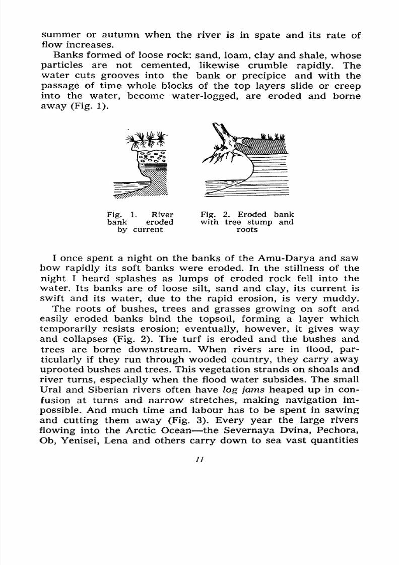
Banks formed of loose rock: sand, loam, clay and shale, whose
particles are not cemented, likewise crumble rapidly. The
water cuts grooves into the bank or precipice and with the
passage of time whole blocks of the top layers slide or creep
into the water, become water-logged, are eroded and borne
away (Fig. 1).
Fig. 1. River
bank eroded
by current
Fig. 2. Eroded bank
with tree stump and
roots
I once spent a night on the banks of the Amu-Darya and saw
how rapidly its soft banks were eroded. In the stillness of the
night I heard splashes as lumps of eroded rock fell into the
water. Its banks are of loose silt, sand and clay, its current is
swift and its water, due to the rapid erosion, is very muddy.
The roots of bushes, trees and grasses growing on soft and
easily eroded banks bind the topsoil, forming a layer which
temporarily resists erosion; eventually, however, it gives wayand collapses (Fig. 2). The turf is eroded and the bushes and
trees are borne downstream. When rivers are in flood, par-
ticularly if they run through wooded country, they carry away
uprooted bushes and trees. This vegetation strands on shoals and
river turns, especially when the flood water subsides. The small
Ural and Siberian rivers often have log jams heaped up in con-
fusion at turns and narrow stretches, making navigation im-
possible. And much time and labour has to be spent in sawingand cutting them away (Fig. 3). Every year the large rivers
flowing into the Arctic Ocean the Severnaya Dvina, Pechora,
Ob, Yenisei, Lena and others carry down to sea vast quantities
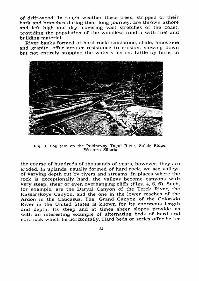
7/28/2019 Fundamentals of Geology - 19th century - Russia text in English
http://slidepdf.com/reader/full/fundamentals-of-geology-19th-century-russia-text-in-english 13/375
of drift-wood. In rough weather these trees, stripped of their
bark and branches during their long journey, are thrown ashore
and left high and dry, covering vast stretches of the coast,
providing the population of the woodless tundra with fuel and
building material.
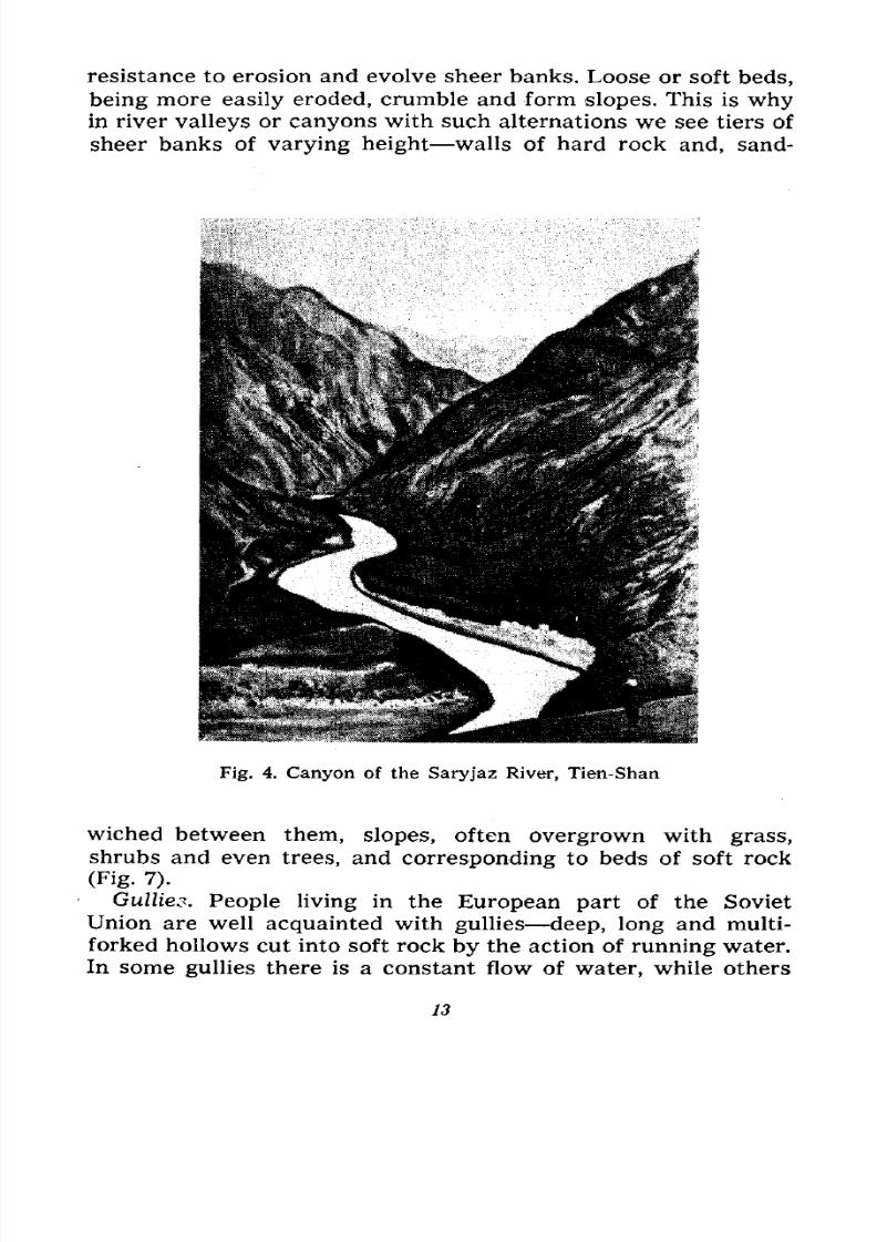
River banks formed of hard rock: sandstone, shale, limestone
and granite, offer greater resistance to erosion, slowing down
but not entirely stopping the water's action. Little by little, in
Fig. 3. Log jam on the Poldnevny Tagul River, Salair Ridge,
Western Siberia
the course of hundreds of thousands of years, however, they are
eroded. In uplands, usually formed of hard rock, we see valleys
of varying depth cut by rivers and streams. In places where the
rock is exceptionally hard, the valleys become canyons with
very steep, sheer or even overhanging cliffs (Figs. 4, 5, 6). Such,
for example, are the Daryal Canyon of the Terek River, the
Kassarskoye Canyon, and the one in the lower reaches of the
Ardon in the Caucasus. The Grand Canyon of the Colorado
River in the United States is known for its enormous length
and depth. Its steep and at times sheer slopes provide us
with an interesting example of alternating beds of hard and
soft rock which lie horizontally. Hard beds or series offer better
12
7/28/2019 Fundamentals of Geology - 19th century - Russia text in English
http://slidepdf.com/reader/full/fundamentals-of-geology-19th-century-russia-text-in-english 14/375
resistance to erosion and evolve sheer banks. Loose or soft beds,
being more easily eroded, crumble and form slopes. This is whyin river valleys or canyons with such alternations we see tiers of
sheer banks of varying height walls of hard rock and, sand-
Fig. 4. Canyon of the Saryjaz River, Tien-Shan
wiched between them, slopes, often overgrown with grass,
shrubs and even trees, and corresponding to beds of soft rock
(Fig. 7).
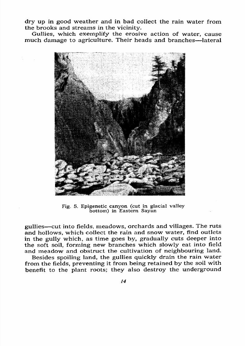
Gullies. People living in the European part of the SovietUnion are well acquainted with gullies deep, long and multi-
forked hollows cut into soft rock by the action of running water.
In some gullies there is a constant flow of water, while others
13
7/28/2019 Fundamentals of Geology - 19th century - Russia text in English
http://slidepdf.com/reader/full/fundamentals-of-geology-19th-century-russia-text-in-english 15/375
dry up in good weather and in bad collect the rain water from
the brooks and streams in the vicinity.
Gullies, which exemplify the erosive action of water, cause
much damage to agriculture. Their heads and branches lateral
Fig, 5. Epigenetic canyon (cut in glacial valley
bottom) in Eastern Sayan
gullies cut into fields, meadows, orchards and villages. The ruts
and hollows, which collect the rain and snow water, find outlets
in the gully which, as time goes by, gradually cuts deeper into
the soft soil, forming new branches which slowly eat into field
and meadow and obstruct the cultivation of neighbouring land.
Besides spoiling land, the gullies quickly drain the rain water
from the fields, preventing it from being retained by the soil with
benefit to the plant roots; they also destroy the underground
14
7/28/2019 Fundamentals of Geology - 19th century - Russia text in English
http://slidepdf.com/reader/full/fundamentals-of-geology-19th-century-russia-text-in-english 16/375
water beds and drain the surrounding terrain (Figs. 8
and 9).
Their spread, then, must be combated. Places where the hol-
lows deepen and turn into ruts, the most dangerous, need protec-
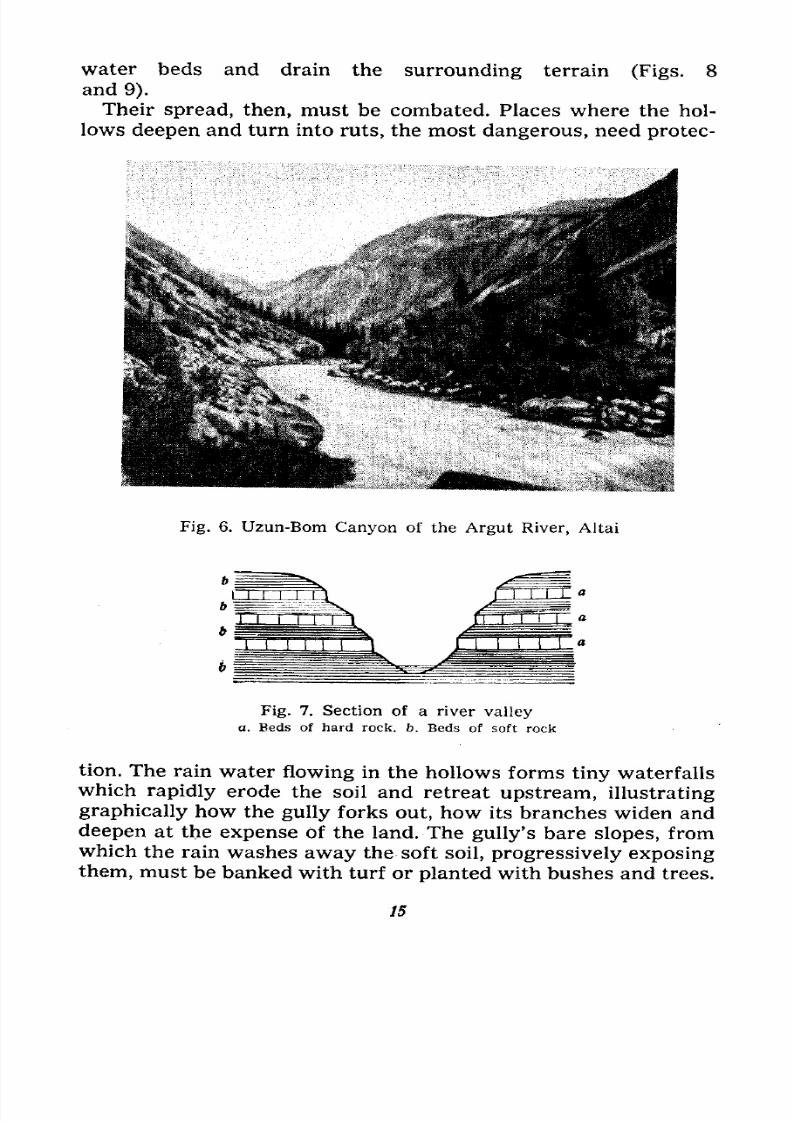
Fig. 6. Uzun-Bom Canyon of the Argut River, Altai
Fig. 7. Section of a river valley
a. Beds of hard rock. fo. Beds of soft rock
tion. The rain water flowing in the hollows forms tiny waterfalls
which rapidly erode the soil and retreat upstream, illustrating
graphically how the gully forks out, how its branches widen anddeepen at the expense of the land. The gully's bare slopes, from
which the rain washes away the soft soil, progressively exposing
them, must be banked with turf or planted with bushes and trees.
15
7/28/2019 Fundamentals of Geology - 19th century - Russia text in English
http://slidepdf.com/reader/full/fundamentals-of-geology-19th-century-russia-text-in-english 17/375
With relatively little labour and materials, most gullies can in
time be turned into groves, which render them harmless and
create future sources of timber.
Rock Transportation. We have become acquainted with the
erosive action of running water. Now let us see what happens to
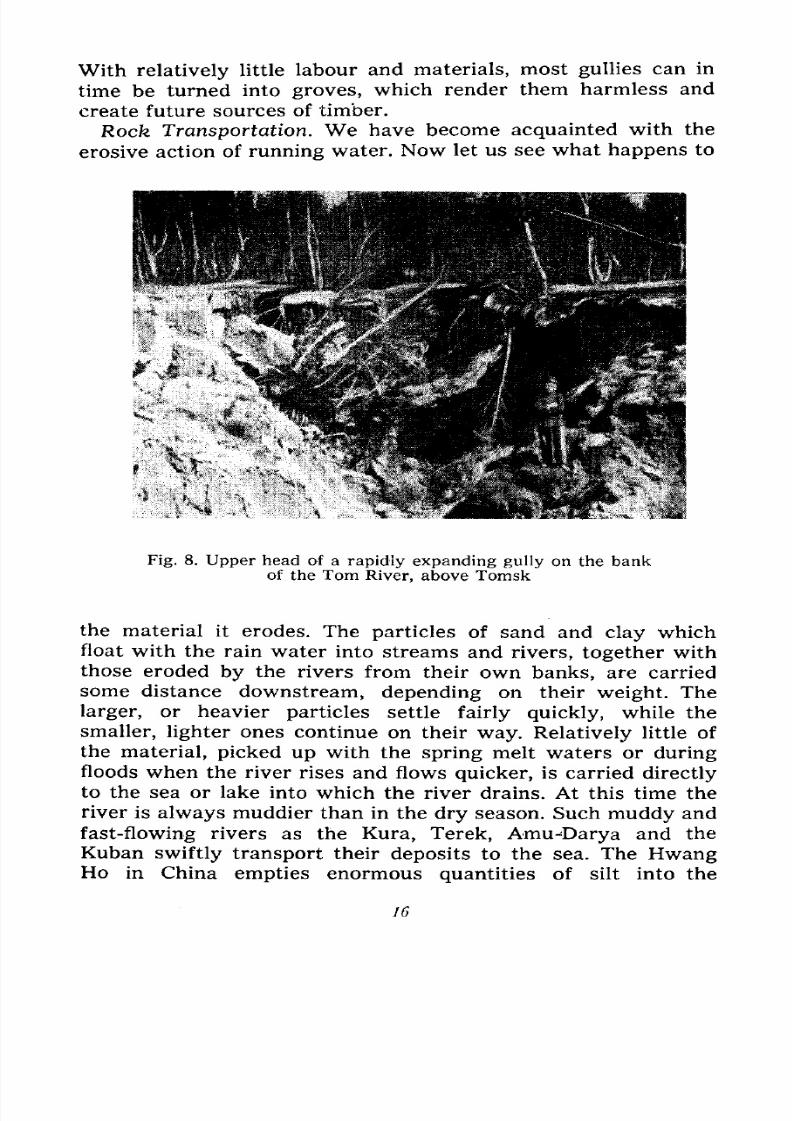
Fig. 8. Upper head of a rapidly expanding gully on the bankof the Tom River, above Tomsk
the material it erodes. The particles of sand and clay which
float with the rain water into streams and rivers, together withthose eroded by the rivers from their own banks, are carried
some distance downstream, depending on their weight. The
larger, or heavier particles settle fairly quickly, while the
smaller, lighter ones continue on their way. Relatively little of
the material, picked up with the spring melt waters or during
floods when the river rises and flows quicker, is carried directly
to the sea or lake into which the river drains. At this time the
river is always muddier than in the dry season. Such muddy andfast-flowing rivers as the Kura, Terek, Amu-Darya and the
Kuban swiftly transport their deposits to the sea. The HwangHo in China empties enormous quantities of silt into the
16
7/28/2019 Fundamentals of Geology - 19th century - Russia text in English
http://slidepdf.com/reader/full/fundamentals-of-geology-19th-century-russia-text-in-english 18/375
Pacific, making it dirty for a considerable area; no wonder this
part of the ocean is called the Yellow Sea. The amount of silt
annually brought down to sea by some rivers is enormous. It is
calculated by taking the quantity of silt in a given volume of
water at various times and multiplying the result by the annual
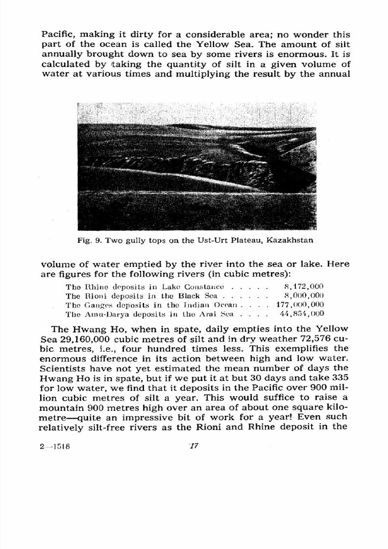
Fig. 9. Two gully tops on the Ust-Urt Plateau, Kazakhstan
volume of water emptied by the river into the sea or lake. Here
are figures for the following rivers (in cubic metres):
The Rhino deposits in Lake Constance 8,172,000
The Rioni deposits in the Black Sea 8,000,000
The Ganges deposits in the Indian Ocean .... 177,000,000
The Amu-Darya deposits in the Aral Sea .... 44,854,000
The Hwang Ho, when in spate, daily empties into the Yellow
Sea 29,160,000 cubic metres of silt and in dry weather 72,576 cu-
bic metres, i.e., four hundred times less. This exemplifies the
enormous difference in its action between high and low water.
Scientists have not yet estimated the mean number of days the
Hwang Ho is in spate, but if we put it at but 30 days and take 335
for low water, we find that it deposits in the Pacific over 900 mil-
lion cubic metres of silt a year. This would suffice to raise amountain 900 metres high over an area of about one square kilo-
metre quite an impressive bit of work for a year! Even such
relatively silt-free rivers as the Rioni and Rhine deposit in the
21518 "ft
7/28/2019 Fundamentals of Geology - 19th century - Russia text in English
http://slidepdf.com/reader/full/fundamentals-of-geology-19th-century-russia-text-in-english 19/375
Black Sea and Lake Constance respectively sufficient silt to raise
hillocks eight metres high over an area of one square kilometre.
This gives us a pretty good idea of the amount of sediment depos-
ited every year in the seas, oceans and lakes by all the rivers in
the world. And how much sediment settles at the bottom of the
Fig. 10. Upper reaches of the Ui-Tas River, Jungarian Alatau,
Kazakhstan
rivers, continually raising them, and how much remains on the
floodlands!
Regions of Erosion and Deposition. Now let us study the
action of a river from source to mouth in order to understandhow flowing water erodes and transports soil.
A river basin is made up of its main stream and tributaries
and it is not always easy to determine the branch which merits
its geographical name for instance, the Volga, Dnieper or Don.
A branch can originate as a spring rising at the head of a gully,
or as a brook, draining a marsh or lake, flowing merrily through
a wooded or steppe valley. A number of brooks merge into a
stream, while the streams in turn meet and form a river. Thesebrooks, streams and rivers either erode soil and rock or deposit
them, depending mainly on their bed gradients which determine
their velocity. The quicker the rate of flow, the greater their
18
7/28/2019 Fundamentals of Geology - 19th century - Russia text in English
http://slidepdf.com/reader/full/fundamentals-of-geology-19th-century-russia-text-in-english 20/375
erosive action and the faster and deeper their beds cut into the
valley floor. As a rule the gradient is more pronounced in the
river's upper reaches, and it is here that erosion takes place. At
first glance this erosive action is barely noticeable, the stream
seems to be clear, turning muddy only after rain or when the
snow melts, when the water trickling from the surrounding
locality brings silt into the stream.
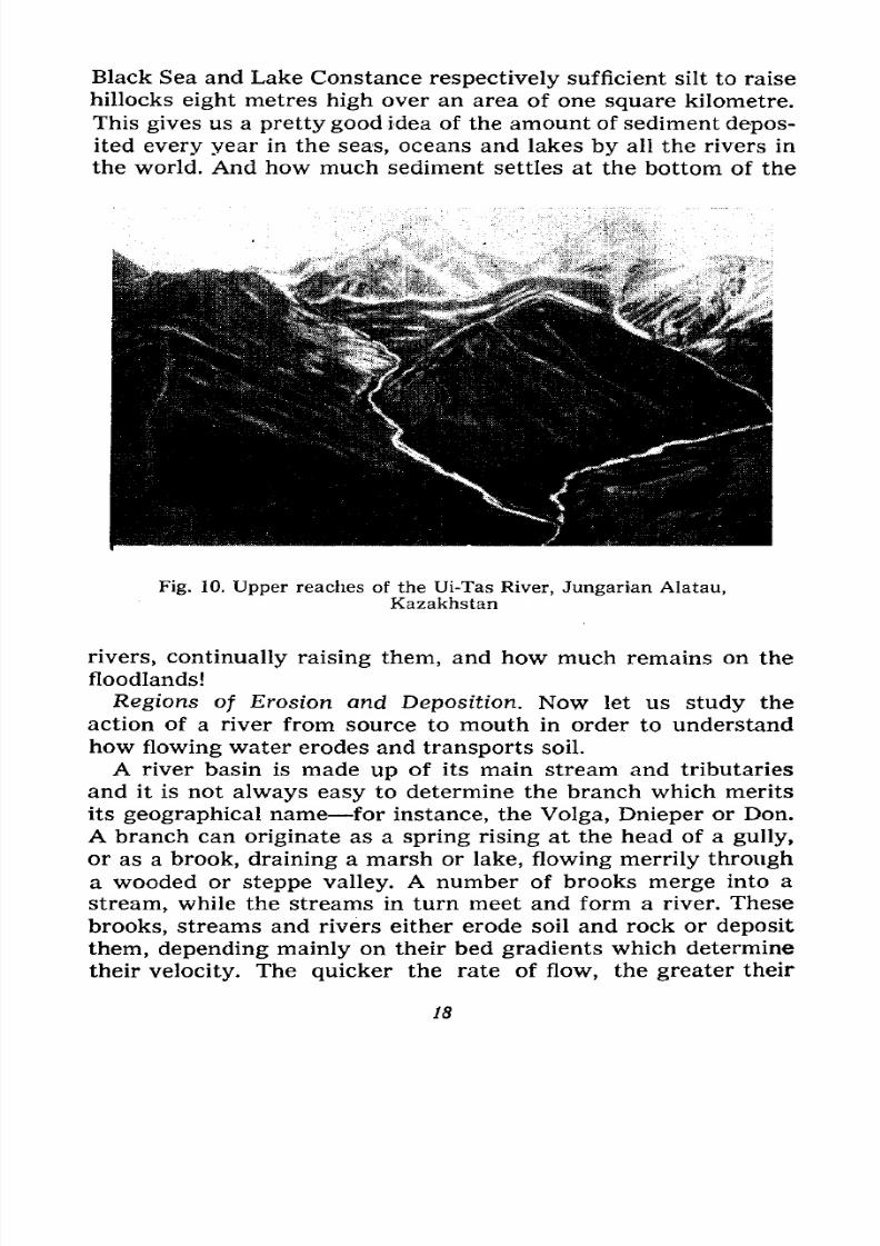
Even in uplands the water in the upper reaches of a river
flowing swiftly through a valley of hard rock, along beds of
sand, pebbles and boulders, forming in places cascades and
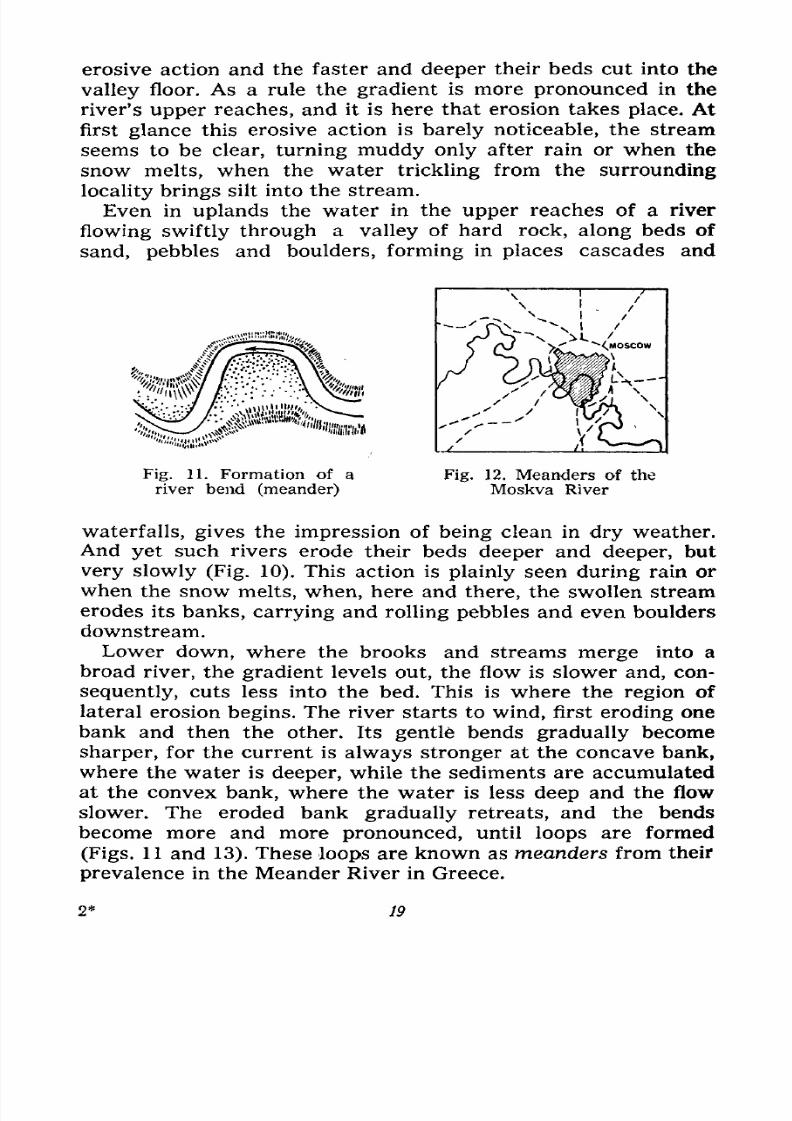
Fig. 11. Formation of a
river bend (meander)
Fig. 12. Meanders of the
Moskva River
waterfalls, gives the impression of being clean in dry weather.
And yet such rivers erode their beds deeper and deeper, but
very slowly (Fig. 10). This action is plainly seen during rain or
when the snow melts, when, here and there, the swollen stream
erodes its banks, carrying and rolling pebbles and even boulders
downstream.
Lower down, where the brooks and streams merge into abroad river, the gradient levels out, the flow is slower and, con-
sequently, cuts less into the bed. This is where the region of
lateral erosion begins. The river starts to wind, first eroding one
bank and then the other. Its gentte bends gradually become
sharper, for the current is always stronger at the concave bank,
where the water is deeper, while the sediments are accumulated
at the convex bank, where the water is less deep and the flow
slower. The eroded bank gradually retreats, and the bendsbecome more and more pronounced, until loops are formed
(Figs. 11 and 13). These loops are known as meanders from their
prevalence in the Meander River in Greece.
19
7/28/2019 Fundamentals of Geology - 19th century - Russia text in English
http://slidepdf.com/reader/full/fundamentals-of-geology-19th-century-russia-text-in-english 21/375
Eroding each bank in turn and forcing the high bank to re-
treat, the river gradually widens its valley, hence the region of
lateral erosion can also be called the region of valley widening.
Many small and medium-sized rivers which flow through flat
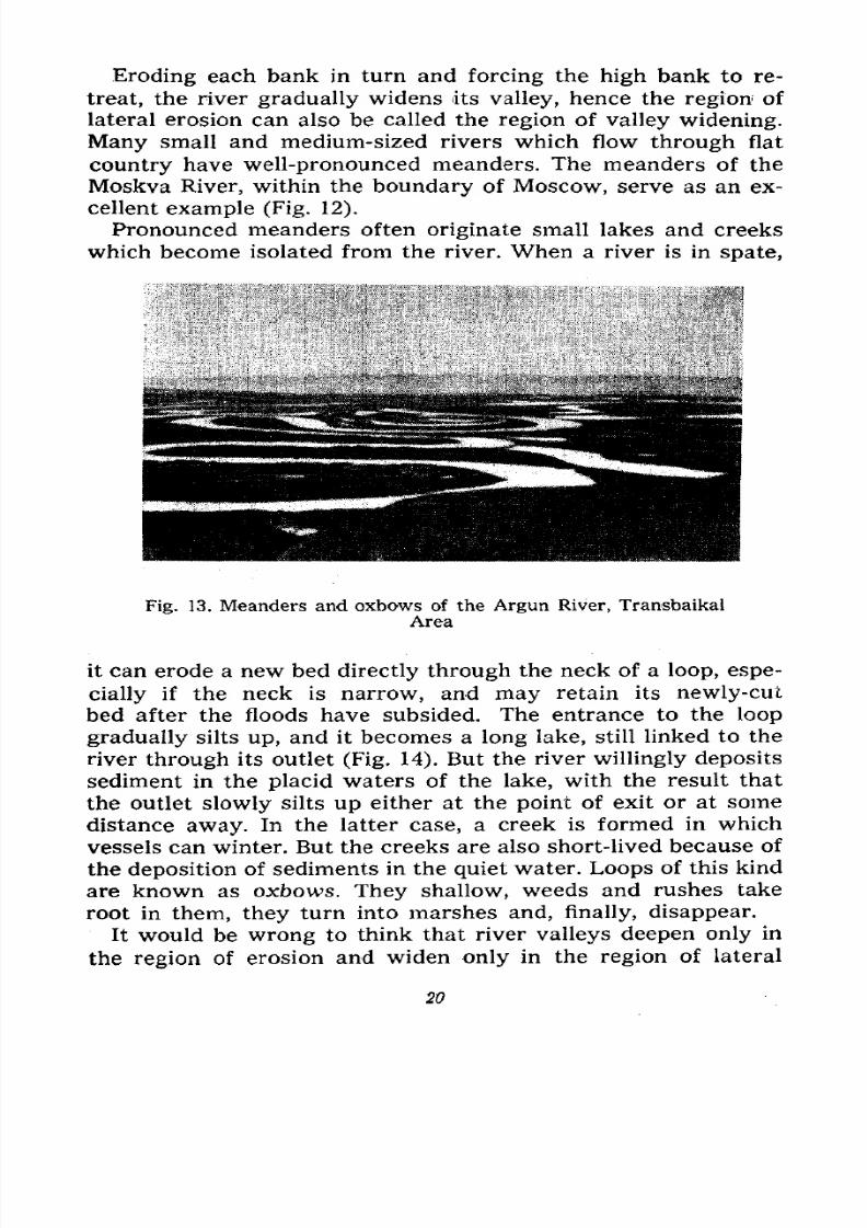
country have well-pronounced meanders. The meanders of the
Moskva River, within the boundary of Moscow, serve as an ex-
cellent example (Fig. 12).
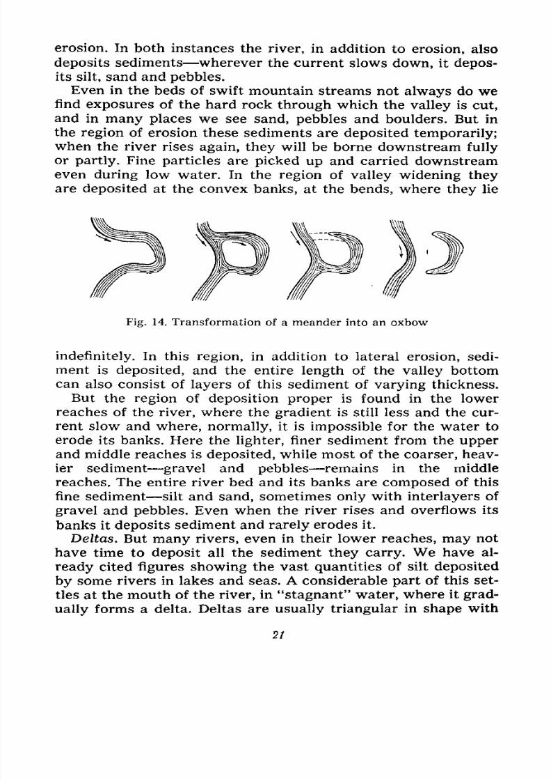
Pronounced meanders often originate small lakes and creeks
which become isolated from the river. When a river is in spate,
Fig. 13. Meanders and oxbows of the Argun River, Transbaikal
Area
it can erode a new bed directly through the neck of a loop, espe-
cially if the neck is narrow, and may retain its newly-cut
bed after the floods have subsided. The entrance to the loop
gradually silts up, and it becomes a long lake, still linked to the
river through its outlet (Fig. 14). But the river willingly deposits
sediment in the placid waters of the lake, with the result that
the outlet slowly silts up either at the point of exit or at some
distance away. In the latter case, a creek is formed in which
vessels can winter. But the creeks are also short-lived because of
the deposition of sediments in the quiet water. Loops of this kind
are known as oxbows. They shallow, weeds and rushes takeroot in them, they turn into marshes and, finally, disappear.
It would be wrong to think that river valleys deepen only in
the region of erosion and widen only in the region of lateral
20
7/28/2019 Fundamentals of Geology - 19th century - Russia text in English
http://slidepdf.com/reader/full/fundamentals-of-geology-19th-century-russia-text-in-english 22/375
erosion. In both instances the river, in addition to erosion, also
deposits sediments wherever the current slows down, it depos-
its silt, sand and pebbles.
Even in the beds of swift mountain streams not always do wefind exposures of the hard rock through which the valley is cut,
and in many places we see sand, pebbles and boulders. But in
the region of erosion these sediments are deposited temporarily;
when the river rises again, they will be borne downstream fully
or partly. Fine particles are picked up and carried downstream
even during low water. In the region of valley widening they
are deposited at the convex banks, at the bends, where they lie
Fig. 14. Transformation of a meander into an oxbow
indefinitely. In this region, in addition to lateral erosion, sedi-
ment is deposited, and the entire length of the valley bottom
can also consist of layers of this sediment of varying thickness.
But the region of deposition proper is found in the lower
reaches of the river, where the gradient is still less and the cur-
rent slow and where, normally, it is impossible for the water to
erode its banks. Here the lighter, finer sediment from the upper
and middle reaches is deposited, while most of the coarser, heav-ier sediment gravel and pebbles remains in the middle
reaches. The entire river bed and its banks are composed of this
fine sediment silt and sand, sometimes only with interlayers of
gravel and pebbles. Even when the river rises and overflows its
banks it deposits sediment and rarely erodes it.
Deltas. But many rivers, even in their lower reaches, may not
have time to deposit all the sediment they carry. We have al-
ready cited figures showing the vast quantities of silt deposited
by some rivers in lakes and seas. A considerable part of this set-
tles at the mouth of the river, in "stagnant" water, where it grad-
ually forms a delta. Deltas are usually triangular in shape with
2!
7/28/2019 Fundamentals of Geology - 19th century - Russia text in English
http://slidepdf.com/reader/full/fundamentals-of-geology-19th-century-russia-text-in-english 23/375
their apex pointed upstream. The name is derived from the
resemblance to the Greek letter A . Consisting of sand, silt and
even pebbles (for some mountain rivers are so powerful that
they carry coarse material to their lower reaches), the deltas
gradually grow and rise out of the water as stretches of low,
and often boggy, land (for instance that of the Rioni River). In
the area of the delta the river branches out, and splits up into
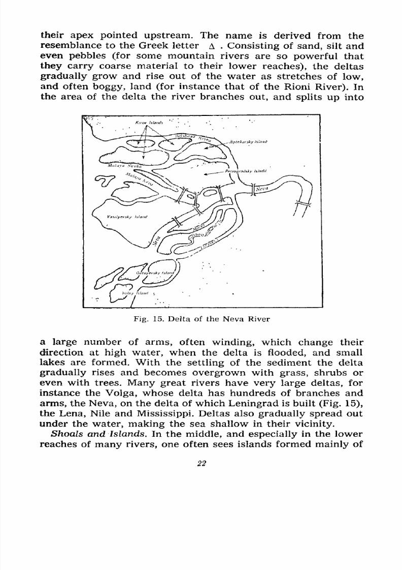
Fig. 15. Delta of the Neva River
a large number of arms, often winding, which change their
direction at high water, when the delta is flooded, and small
lakes are formed. With the settling of the sediment the delta
gradually rises and becomes overgrown with grass, shrubs or
even with trees. Many great rivers have very large deltas, for
instance the Volga, whose delta has hundreds of branches and
arms, the Neva, on the delta of which Leningrad is built (Fig. 15),
the Lena, Nile and Mississippi. Deltas also gradually spread outunder the water, making the sea shallow in their vicinity.
Shoals and Islands. In the middle, and especially in the lower
reaches of many rivers, one often sees islands formed mainly of
22
7/28/2019 Fundamentals of Geology - 19th century - Russia text in English
http://slidepdf.com/reader/full/fundamentals-of-geology-19th-century-russia-text-in-english 24/375
sediments, and, in rare cases, of stone. The stone islands are rock
outcrops, especially of hard rock, preserved from the time the
river cut its bed. The Katun River in the Altai, for instance, has
in its middle reaches a number of stone islands in the vicinity of
rapids. Some of them jut above water level with their rugged
edges, while others rise higher and are covered with vegetation.
More often they are composed only of sand or sand and pebbles
and are built up usually from shoals formed at places where the
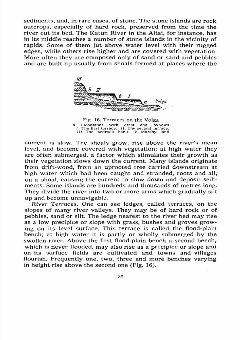
Fig. 16. Terraces on the Volgaa. Floodlands with crest and oxbows
7 The first terrace. II. The second terrace.
III. The bedrock bank. b. Marshy land
current is slow. The shoals grow, rise above the river's mean
level, and become covered with vegetation; at high water they
are often submerged, a factor which stimulates their growth as
their vegetation slows down the current. Many islands originate
from drift-wood, from an uprooted tree carried downstream at
high water which had been caught and stranded, roots and all,
on a shoal, causing the current to slow down and deposit sedi-
ments. Some islands are hundreds and thousands of metres long.
They divide the river into two or more arms which gradually silt
up and become unnavigable.
River Terraces. One can see ledges, called terraces, on the
slopes of many river valleys. They may be of hard rock or of
pebbles, sand or silt. The ledge nearest to the river bed may rise
as a low precipice or slope with grass, bushes and groves grow-
ing on its level surface. This terrace is called the flood-plain
bench; at high water it is partly or wholly submerged by the
swollen river. Above the first flood-plain bench a second bench,
which is never flooded, may also rise as a precipice or slope andon its surface fields are cultivated and towns and villages
flourish. Frequently one, two, three and more benches varying
in height rise above the second one (Fig. 16).
23
7/28/2019 Fundamentals of Geology - 19th century - Russia text in English
http://slidepdf.com/reader/full/fundamentals-of-geology-19th-century-russia-text-in-english 25/375
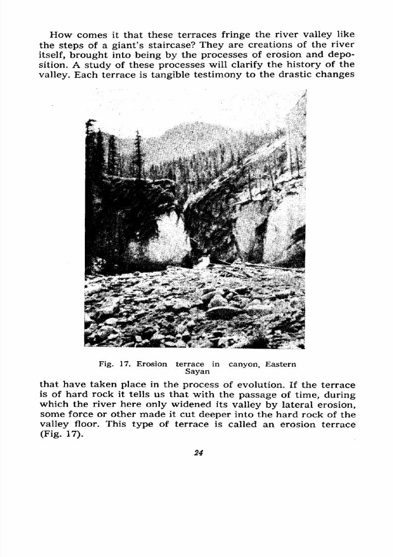
How comes it that these terraces fringe the river valley like
the steps of a giant's staircase? They are creations of the river
itself, brought into being by the processes of erosion and depo-
sition. A study of these processes will clarify the history of the
valley. Each terrace is tangible testimony to the drastic changes
Fig. 17. Erosion terrace in
Sayancanyon, Eastern
that have taken place in the process of evolution. If the terrace
is of hard rock it tells us that with the passage of time, during
which the river here only widened its valley by lateral erosion,some force or other made it cut deeper into the hard rock of the
valley floor. This type of terrace is called an erosion terrace
(Fig. 17).
24
7/28/2019 Fundamentals of Geology - 19th century - Russia text in English
http://slidepdf.com/reader/full/fundamentals-of-geology-19th-century-russia-text-in-english 26/375
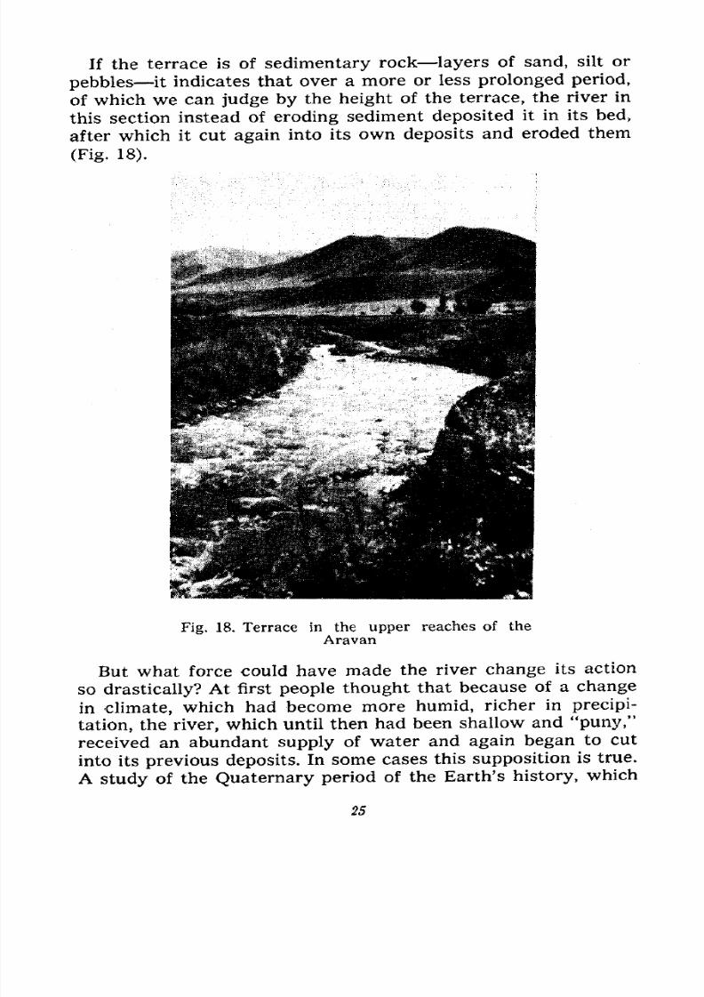
If the terrace is of sedimentary rock layers of sand, silt or
pebbles it indicates that over a more or less prolonged period,
of which we can judge by the height of the terrace, the river in
this section instead of eroding sediment deposited it in its bed,
after which it cut
again
into its own deposits and eroded them
(Fig. 18).
Fig. 18. Terrace in the upper reaches of the
Aravan
But what force could have made the river change its action
so drastically? At first people thought that because of a change
in climate, which had become more humid, richer in precipi-
tation, the river, which until then had been shallow and "puny,"received an abundant supply of water and again began to cut
into its previous deposits. In some cases this supposition is true.
A study of the Quaternary period of the Earth's history, which
25
7/28/2019 Fundamentals of Geology - 19th century - Russia text in English
http://slidepdf.com/reader/full/fundamentals-of-geology-19th-century-russia-text-in-english 27/375
dates from the appearance of man and continues to this day,
shows that periods of dry climate have been succeeded by
periods of more humid climate. We shall return to this later on.
But in most cases there was another and more important reason
for the river changing its action its increased rate of flow on
which its action chiefly depends. And the reason for this should
be sought in the change of the river's gradient.
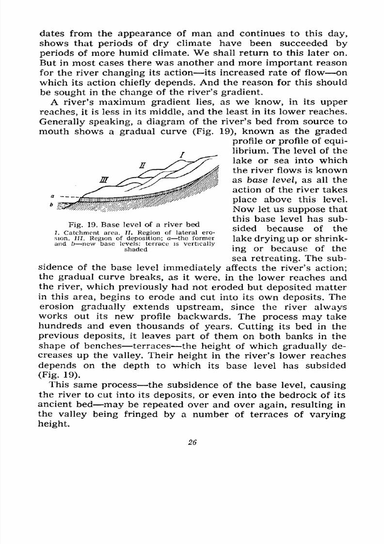
A river's maximum gradient lies, as we know, in its upper
reaches, it is less in its middle, and the least in its lower reaches.
Generally speaking, a diagram of the river's bed from source to
mouth shows a gradual curve (Fig. 19), known as the graded
profile or profile of equi-
librium. The level of the
lake or sea into which
the river flows is known
as base level, as all the
action of the river takes
place above this level.
Now let us suppose that
this base level has sub-
sided because of the
lake drying up or shrink-
ing or because of the
sea retreating. The sub-
sidence of the base level immediately affects the river's action;
the gradual curve breaks, as it were, in the lower reaches and
the river, which previously had not eroded but deposited matter
in this area, begins to erode and cut into its own deposits. The
erosion gradually extends upstream, since the river always
works out its new profile backwards. The process may takehundreds and even thousands of years. Cutting its bed in the
previous deposits, it leaves part of them on both banks in the
shape of benches terraces the height of which gradually de-
creases up the valley. Their height in the river's lower reaches
depends on the depth to which its base level has subsided
(Fig. 19).
This same process the subsidence of the base level, causing
the river to cut into its deposits, or even into the bedrock of its
ancient bed may be repeated over and over again, resulting in
the valley being fringed by a number of terraces of varying
height.
Fig. 19. Base level of a river bed
I. Catchment area. II. Region of lateral ero-
sion. III. Region of deposition; a the formerand b new base levels: terrace is vertically
shaded
26
7/28/2019 Fundamentals of Geology - 19th century - Russia text in English
http://slidepdf.com/reader/full/fundamentals-of-geology-19th-century-russia-text-in-english 28/375
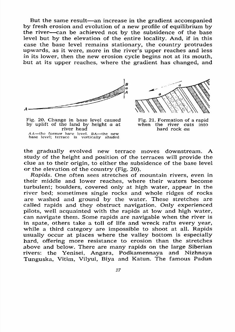
But the same result an increase in the gradient accompanied
by fresh erosion and evolution of a new profile of equilibrium bythe river can be achieved not by the subsidence of the base
level but by the elevation of the entire locality. And, if in this
case the base level remains stationary, the country protrudes
upwards, as it were, more in the river's upper reaches and less
in its lower, then the new erosion cycle begins not at its mouth,
but at its upper reaches, where the gradient has changed, and
Fig. 20. Change in base level caused
by uplift of the land by height a at
river headAA the former bar.e level. BA the newbase level; terrace is vertically shaded
Fig. 21. Formation of a rapid
when the river cuts into
hard rock aa
the gradually evolved new terrace moves downstream. Astudy of the height and position of the terraces will provide the
clue as to their origin, to either the subsidence of the base level
or the elevation of the country (Fig. 20).
Rapids. One often sees stretches of mountain rivers, even in
their middle and lower reaches, where their waters become
turbulent; boulders, covered only at high water, appear in the
river bed; sometimes single rocks and whole ridges of rocksare washed and ground by the water. These stretches are
called rapids and they obstruct navigation. Only experienced
pilots, well acquainted with the rapids at low and high water,
can navigate them. Some rapids are navigable when the river is
in spate, others take a toll of life and wreck rafts every year,
while a third category are impossible to shoot at all. Rapids
usually occur at places where the valley bottom is especially
hard, offering more resistance to erosion than the stretchesabove and below. There are many rapids on the large Siberian
rivers: the Yenisei, Angara, Podkamennaya and Nizhnaya
Tunguska, Vitim, Vilyui, Biya and Katun. The famous Padun
27
7/28/2019 Fundamentals of Geology - 19th century - Russia text in English
http://slidepdf.com/reader/full/fundamentals-of-geology-19th-century-russia-text-in-english 29/375
and Shaman rapids protrude from the middle reaches of the
Angara.
At the rapids the water flows faster, becomes agitated (form-
ing whirlpools), foams, skirts the rocks or tumbles over them,
and boils spraying in all directions. Upon shooting the rapids the
river calms down. Its swift rate of flow shows that the bed has
suddenly steepened because a stretch of exceptionally hard rock
has violated, broken its profile of equilibrium (Fig. 21). Above
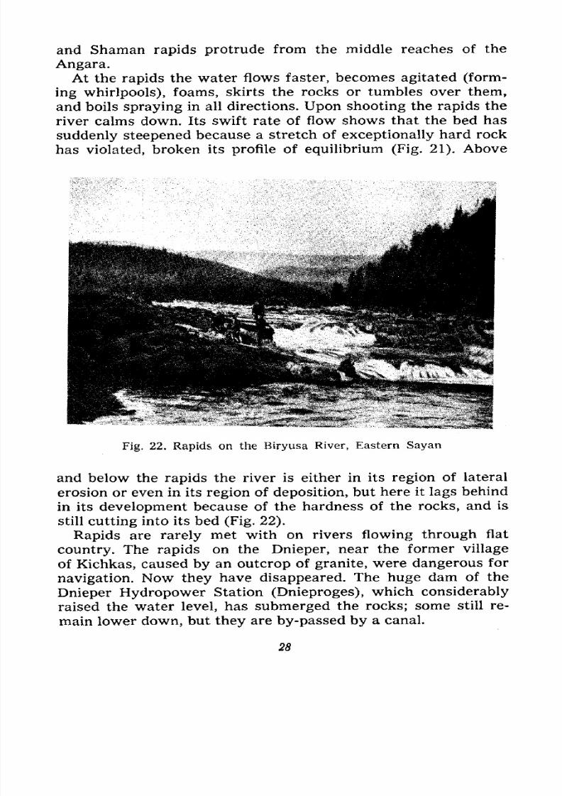
Fig. 22. Rapids on the Biryusa River, Eastern Sayan
and below the rapids the river is either in its region of lateral
erosion or even in its region of deposition, but here it lags behind
in its development because of the hardness of the rocks, and is
still cutting into its bed (Fig. 22).
Rapids are rarely met with on rivers flowing through flat
country. The rapids on the Dnieper, near the former village
of Kichkas, caused by an outcrop of granite, were dangerous for
navigation. Now they have disappeared. The huge dam of the
Dnieper Hydropower Station (Dnieproges), which considerably
raised the water level, has submerged the rocks; some still re-
main lower down, but they are by-passed by a canal.
28
7/28/2019 Fundamentals of Geology - 19th century - Russia text in English
http://slidepdf.com/reader/full/fundamentals-of-geology-19th-century-russia-text-in-english 30/375
Fig. 23. Kok-Kul Waterfall, Altai
7/28/2019 Fundamentals of Geology - 19th century - Russia text in English
http://slidepdf.com/reader/full/fundamentals-of-geology-19th-century-russia-text-in-english 31/375
Some rapids can be rendered harmless by blasting.
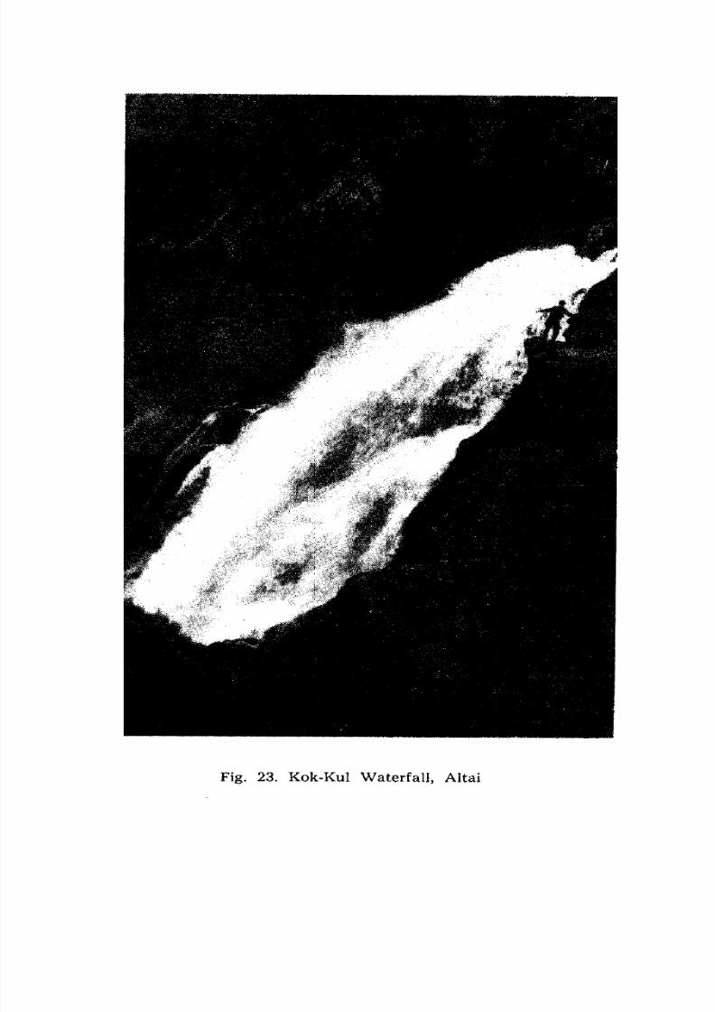
Waterfalls. Still more beautiful and majestic are the water-
falls on streams and rivers. These, too, are caused by outcrops
of hard rock in the form of ledges or shelves in the river bed
from which the river drops from varying heights. Waterfalls
are numerous on mountain streams and rivulets, for instance
those in the Caucasus, the Altai (Fig. 23) and in Switzerland.
They are encountered less frequently on large rivers. The
Niagara Falls in North America, and the Victoria Falls on the
Zambezi in South Africa are well known. The Kivach Falls
in Karelia have several ledges. The
Imatra Falls in Finland are virtual-
ly steep rapids.
The Niagara waters (Fig. 24)
plunge from a height of 50
metres. Goat Island divides the
falls into two sections: the
Canadian, or Horseshoe Falls,
with a frontage of 792 metres
and the American Falls (frontage
427 metres). Lower down, the river
has cut a narrow gorge ten kilo-
metres long.
The erosive force of water falling from a height is very great,
and this is why we often see deep pits and whirlpools in the
falls' "plunge pool" floor which undermine the ledge from which
the water drops, causing the overhanging rock to collapse, and
forcing the waterfall to retreat slowly upstream. The Horseshoe
Falls recedes 1.5 metres, and the American Falls, 0.9 metre
every year. The ten-kilometre gorge was cut backwards in this
manner.
Still more majestic are the Victoria Falls on the Zambezi,
which have a frontage of 1,800 metres and a drop of 120 metres,
while the Iguassu Falls on the border between "Brazil and
Argentina have a frontage of 1,500 metres and a drop of 65-70
metres. Below the falls the Zambezi flows through a deep canyonwith two hairpin bends which it has eroded itself.
Rapids are sometimes found in canyons. For instance, the
Daryal Canyon on the Terek River in the Caucasus is actually a
cascade of rapids. The greatest canyon in the world, the Colo-
rado Grand Canyon, which is over 320 kilometres long, 900-
Fig. 24. Section of Nia-
gara Falls
J Hard limestone 2. Soft
shale 3. Soft sandstone
30
7/28/2019 Fundamentals of Geology - 19th century - Russia text in English
http://slidepdf.com/reader/full/fundamentals-of-geology-19th-century-russia-text-in-english 32/375
1,800 metres deep and 60-90 metres wide, has a series of rapids
along its course.
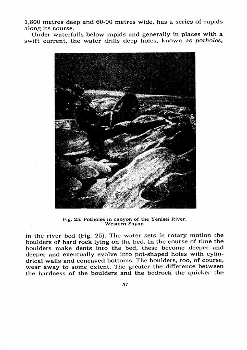
Under waterfalls below rapids and generally in places with a
swift current, the water drills deep holes, known as potholes,
Fig. 25. Potholes in canyon of the Yenisei River,
Western Sayan
in the river bed (Fig. 25). The water sets in rotary motion the
boulders of hard rock lying on the bed. In the course of time the
boulders make dents into the bed, these become deeper and
deeper and eventually evolve into pot-shaped holes with cylin-
drical walls and concaved bottoms. The boulders, too, of course,
wear away to some extent. The greater the difference between
the hardness of the boulders and the bedrock the quicker the
31
7/28/2019 Fundamentals of Geology - 19th century - Russia text in English
http://slidepdf.com/reader/full/fundamentals-of-geology-19th-century-russia-text-in-english 33/375
potholes are drilled. Sometimes we meet with whole series of
potholes. When they are found above high-water mark we can
assume that the river bed was deepened fairly recently.
High Water. So far we have examined the action of runningwater at mean level, although we have mentioned high water
several times. Now we shall speak a little about the behaviour
of rivers during high water, i.e., when they are in spate.
In our moderate zone, where the rivers rise in the spring,
their high-water mark depends on how rapidly the snow melts.
The melt waters fill hollows, ruts and gullies, transforming them
into muddy rivulets, making them difficult to jump over and im-
possible to ford. The streams and rivers which take these waters
become swollen, their ice breaks up and floats downstream, the
rivers overflow their banks and submerge the flood-plains. If the
spring is a cold one, the snow melts slowly and the rivers rise
less, but they remain in spate longer. A warm and early spring
immediately produces a large volume of water.
Spring waters are muddy and dirty; the streamlets drain the
fields, erode their own banks and beds, and bring large quanti-
ties of silt and sand to the rivers. In their turn, the swollen
streams and rivers erode more vigorously, the volume of water
increases and they flood stretches of land normally out of their
reach. Rivulets are transformed into wide and deep torrents.
Their muddy waters carry uprooted bushes and trees and all
kinds of debris washed away from gardens, fields and the streets
of villages and towns. The larger the river, the higher it rises;
in its lower reaches it rises 10, 15 and even 20 metres above
mean level.
Rivers rise not only in spring but in summer or autumn,
depending on the duration and force of the local rains. For
.instance, the spring waters drained by the entire basin of the
Selenga River, which flows into Lake Baikal, and by the basin
of the Amur River in the Far East, are insignificant as the snow-
fall there is negligible. But the heavy rainfall of late summer in
these areas often causes highly devastating floods coinciding
with the hay-making or harvesting season and flooding the
meadows; the unmowed grass is covered with silt and spoilt, the
mowed grass is carried away; harvesting is delayed or theharvested grain becomes wet and sprouts.
In countries with mild winters Western and Southern
Europe, the South of the United States and the Caucasus
32
7/28/2019 Fundamentals of Geology - 19th century - Russia text in English
http://slidepdf.com/reader/full/fundamentals-of-geology-19th-century-russia-text-in-english 34/375
where it rains, instead of snowing, rivers rise in the winter andsometimes in the autumn. In the tropics, where the winter is
dry and clear and the summer is the rainy season, the reverse
is the case.
Whenever rivers rise their erosive and depository action is
greatly increased.
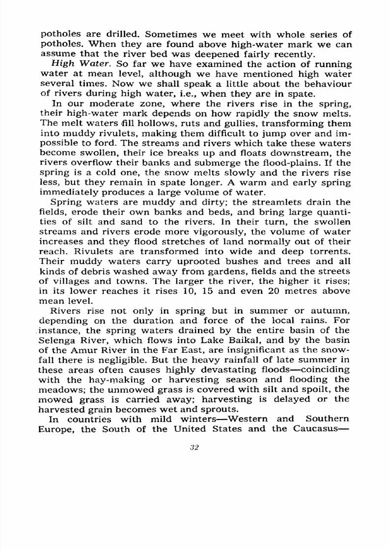
Fig. 26. Fine sediment washed down by torrent,. Stillwater
Mountain, Nevada, U.S.A.
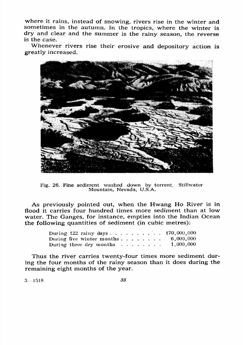
As previously pointed out, when the Hwang Ho River is in
flood it carries four hundred times more sediment than at low
water. The Ganges, for instance, empties into the Indian Ocean
the following quantities of sediment (in cubic metres):
During 122 rainy days . 170,000,000
During five winter months 6,000,000
During three dry months 1,000,000
Thus the river carries twenty-four times more sediment dur-
ing the four months of the rainy season than it does during the
remaining eight months of the year.
31518 33
7/28/2019 Fundamentals of Geology - 19th century - Russia text in English
http://slidepdf.com/reader/full/fundamentals-of-geology-19th-century-russia-text-in-english 35/375
In countries with a more even climate the volume of river
water at high level is two or three times that at mean level, and
in countries with wet winters, with abundant snow and rain-
fall, from five to twenty times and over. The volume of water of
the Moskva River, for instance, when in spate, is thirty and even
a hundred times greater than that at low water; this was the
case during the severe flood in 1880.
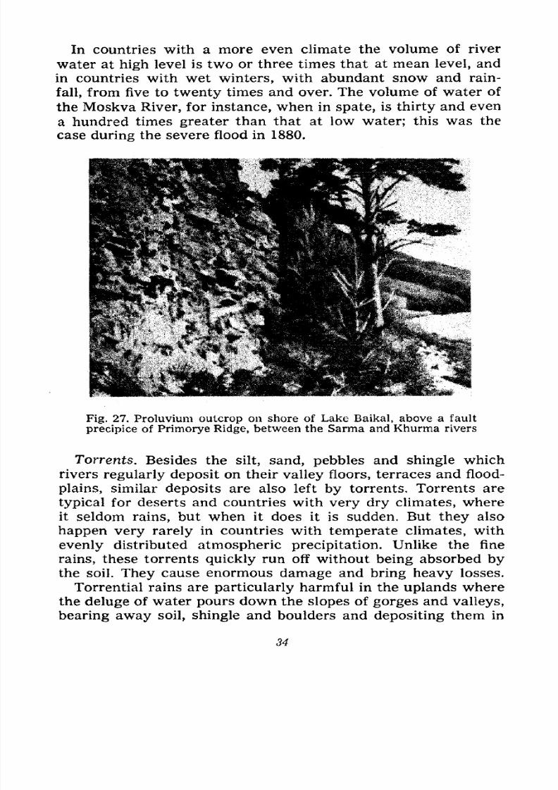
Fig. 27. Proluvium outcrop on shore of Lake Baikal, above a fault
precipice of Primorye Ridge, between the Sarma and Khurma rivers
Torrents. Besides the silt, sand, pebbles and shingle whichrivers regularly deposit on their valley floors, terraces and flood-
plains, similar deposits are also left by torrents. Torrents are
typical for deserts and countries with very dry climates, where
it seldom rains, but when it does it is sudden. But they also
happen very rarely in countries with temperate climates, with
evenly distributed atmospheric precipitation. Unlike the fine
rains, these torrents quickly run off without being absorbed by
the soil. They cause enormous damage and bring heavy losses.
Torrential rains are particularly harmful in the uplands where
the deluge of water pours down the slopes of gorges and valleys,
bearing away soil, shingle and boulders and depositing them in
34
7/28/2019 Fundamentals of Geology - 19th century - Russia text in English
http://slidepdf.com/reader/full/fundamentals-of-geology-19th-century-russia-text-in-english 36/375
the plains and valleys. There the waters quickly subside and lose
their force, leaving thick layers of sediments on roads, gardens,
fields and village streets. Hundreds of tons of this debris have to
be carted away, buildings and roads repaired, etc.
In Europe these torrents are known as muris, in Central
Asia sills and their deposits, sill deposits. They sometimes fall
Fig. 28. Alluvial fan C trans-
ported from lateral valley AAinto the main valley
in the mountains of Yugoslavia, in the Soviet Union (the Crimea,
the Caucasus, Armenia, Turkmenia and Kazakhstan); they are
frequent in deserts, where the rainfall is negligible, but as they
are particularly violent they bring down to the plains vast
quantities of deposits.
Sill deposits differ from those of the rivers in their extremely
chaotic mixture: huge rocks, gravel, sand and silt, all are mixed
up in confusion, regardless of size or weight. As a rule river
deposits are stratified and graded: we see a layer of sand of a
certain thickness sandwiched between layers of silt or shingle
the latter being of a uniform size, and this stratification recursover and over again in a bank or terrace. Only in the mountains,
in the area of erosion, where the heavy rain quickly increases
the volume of water, does stratification become chaotic, similar
to sill deposits (Figs. 26 and 27).
Later we shall describe several instances of catastrophic
torrents.
The deposits left by running water are known as alluvial
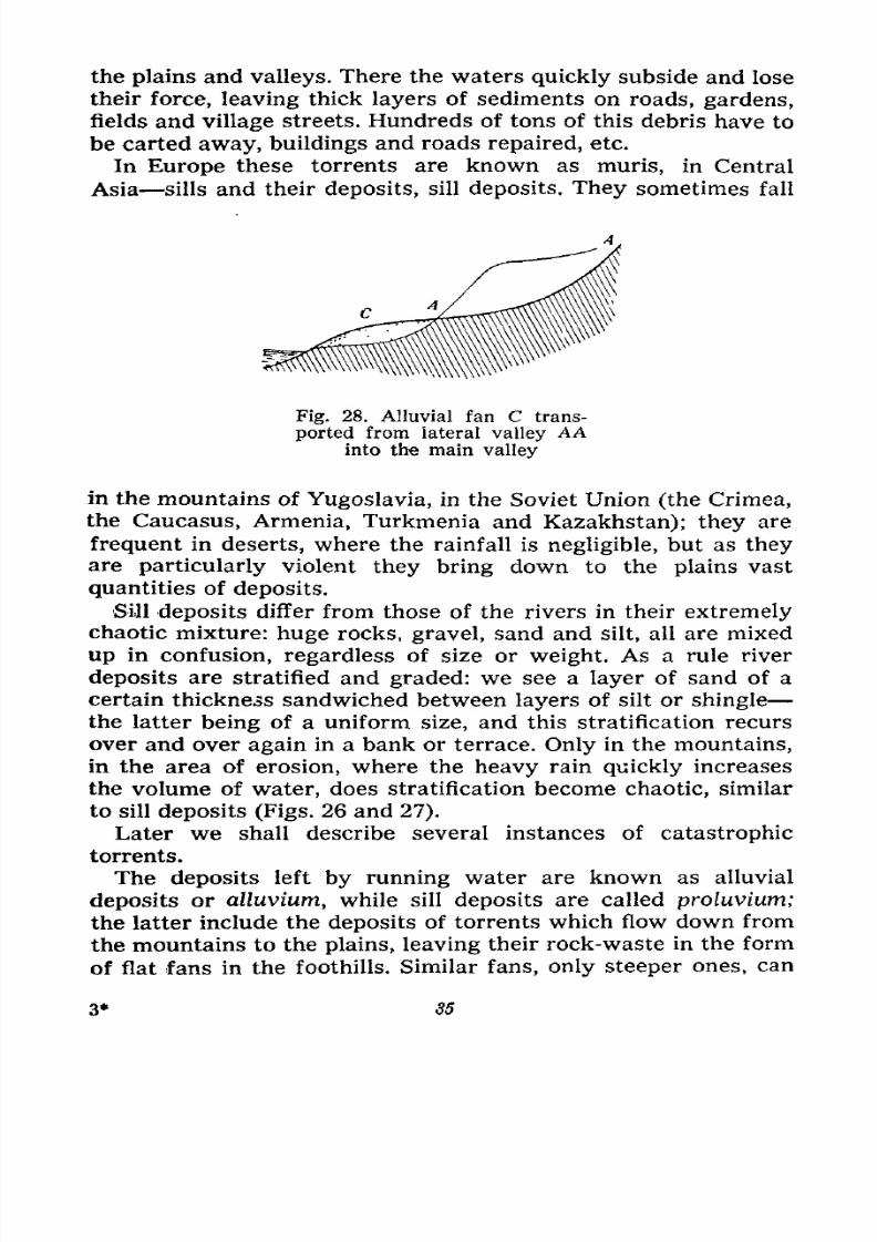
deposits or alluvium, while sill deposits are called proluvium;the latter include the deposits of torrents which flow down from
the mountains to the plains, leaving their rock-waste in the form
of flat fans in the foothills. Similar fans, only steeper ones, can
3* 35

7/28/2019 Fundamentals of Geology - 19th century - Russia text in English
http://slidepdf.com/reader/full/fundamentals-of-geology-19th-century-russia-text-in-english 37/375
be found at gully heads and valley outlets of mountain streams.
In the latter case the stream, which on the steep slope swept
along the coarse sediment, loses its energy because of the abrupt
change in its gradient, and it hurriedly drops its boulders and
pebblesin disorder. If the
valleyhas been cut
throughloose
and soft rock, the deposits are of sand, silt and rock fragments.
Fans of this kind are called alluvial fans. Actually they are
miniature deltas, differing from river deltas by their steeper
angle of inclination and chaotic formation (Fig. 28).
7/28/2019 Fundamentals of Geology - 19th century - Russia text in English
http://slidepdf.com/reader/full/fundamentals-of-geology-19th-century-russia-text-in-english 38/375
AT THE SEA-SHORE
Surf Waves. Marine Erosion. Notches and Terraces.
Gently Sloping and Steep Shores. Shore Swells. HowPebbles Migrate. Currents. Sedimentary Rock Forma-
tion. Stratification. Outcrops. Estuaries, Lagoons, Limans,
Lakes.
We have become acquainted with the action of water in con-
stant motion flowing down the earth's surface gradients as rivu-
lets, streams and rivers, and with how they change the surface
on their way. In some places the water erodes and destroys the
layers of the earth's crust, elsewhere it deposits the products of
its destructive work, the boulders, gravel, sand and silt, i.e., it
forms new layers.
The volume of moving, flowing water on the earth's surface
is not particularly great. A far greater volume is in a calm state,
filling small and large depressions such as lakes, seas and oceans.
But this "stagnant" water, as it is called, also changes the
earth's surface, for not everywhere and not always is it quiet
and motionless.
In lakes, seas and oceans, considerable volumes of this "stag-
nant" water are continuously migrating, forming currents, and
the wind, transmitting its force to the surface layers in all the
basins of "stagnant" water, agitates them. In some places the
pounding sea waves erode the shore, in others they deposit sedi-
ments and build up the shore.
Surf Waves. To observe the action of the surf waves one must
go to the seashore or a large lake, for on ponds or small lakeseven strong winds cause only small waves whose action is barely
noticeable. First of all let us watch the wave motion. Upon
approaching the shore the relatively smooth billows of the
37
7/28/2019 Fundamentals of Geology - 19th century - Russia text in English
http://slidepdf.com/reader/full/fundamentals-of-geology-19th-century-russia-text-in-english 39/375
agitated sea undergo an abrupt change; their crests rise quickly,
tilt forward and topple over. This happens because near the
shore the sea is shallow, and the wave's surface water, driven
forward by the wind, surges ahead of its deeper water, the motion
of which is slowed down by the friction against the sea bot-
tom. Moreover, the water of the preceding spent wave, receding
along the slope of the sea bottom, undercuts the oncoming wave.
When the wave breaks it develops considerable force. This
can be experienced by proffering one's back to a wave while
bathing. A large wave can knock a bather off his feet and toss
him about like a cork. This breaking of the waves near shore is
known as surf. It has been
estimated that surf waves can
exert pressures from 3,000 to
30,000 kilograms per square
metre. In stormy weather
they can move and even toss
rocks weighing hundreds of
tons across piers and can
drive small ships ashore. Surf
spray dashing against cliffs
rises to a height of 60 metres
and over. The windows of a
lighthouse in Scotland, 80 me-
tres above sea level, are sometimes broken by stones cast up
during stormy weather. Waves which do not topple over also
exert enormous force when they pound against cliffs in deepwater.
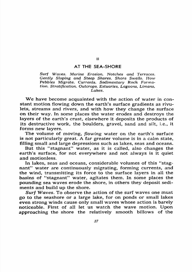
Marine Erosion. By continuously attacking the steep shore the
surf waves gradually erode it. They wear away a horizontal
groove in the rock at sea level called a notch (Fig. 29, a), the
dimensions of which depend on the hardness of the rock (Figs.
30 and 31). This notch gradually deepens until with the passageof time the overhanging layers collapse and the steep shore
recedes. The surf waves continue their action and eventually a
smooth shelf is evolved at the base of the cliffs, slightly slanted
towards the sea, called the wave-cut terrace, which slowly eats
into the steep shore (Fig. 29, b).
At sea-shore tidal places, where the sea level changes four
times a day twice reaching maximum and twice minimum
level, two wave-cut terraces, divided by a small precipice, are
h.t;
Fig. 29. Cliff erosion
a Surf notch; b. Surf terrace at high-tide level h. t.; c. Surf terrace at low-
tide level I. t.
38
7/28/2019 Fundamentals of Geology - 19th century - Russia text in English
http://slidepdf.com/reader/full/fundamentals-of-geology-19th-century-russia-text-in-english 40/375
eroded during both tides one more smooth, below the level at
high tide, the second, below that at low tide (Fig. 29, c). This
erosive action by the surf is always stronger during high tide.
The wave-cut terrace remains clean and packed by the surf
wavesonly
if the steep shore is of loose rock, which is pounded
into fine particles and borne away. When the coast is entirely or
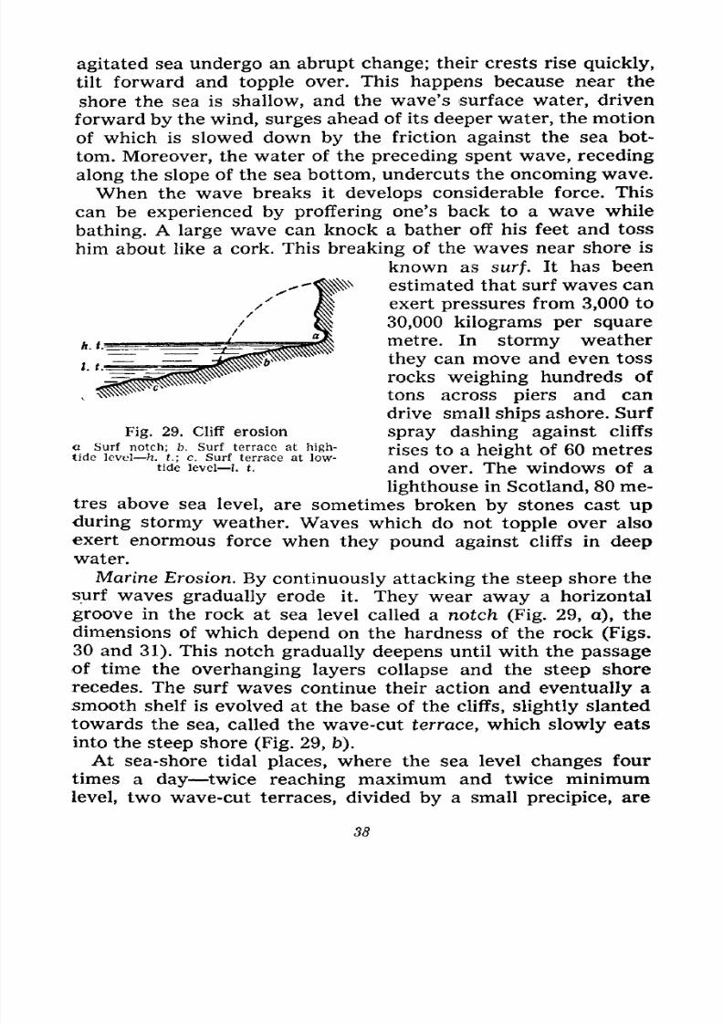
Fig. 30. Surf notch in horizontal beds on Nikolai Is-
land, Aral Sea
partly of hard rock, the wave-cut terrace is strewn with the
fragments resulting from the erosion and collapse of the shore.
The waves roll these fragments about, they rub against one an-
other, are gradually rounded and turn into the boulders and
pebbles which usually fringe a more or less wide stretch at the
foot of the cliffs, forming a beach.
Sometimes on wave-cut terraces one can see rocks of different
size and shape called stacks residual rock of the steep shore
still being eroded and destroyed by the surf. These stacks are
often weirdly shaped. They resemble pillars, towers, gates of
different size, etc. (Fig. 32).
When the level of the sea or lake remains constant for some
time, the gradually receding steep shore eventually finds itself
39
7/28/2019 Fundamentals of Geology - 19th century - Russia text in English
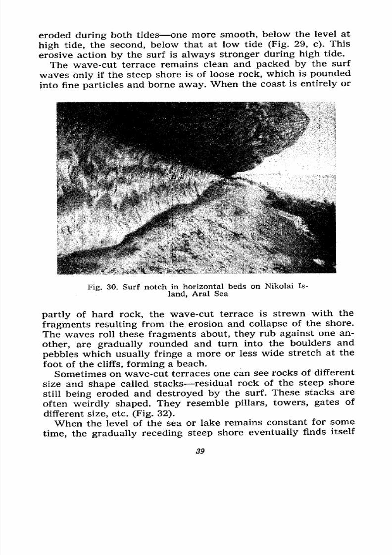
http://slidepdf.com/reader/full/fundamentals-of-geology-19th-century-russia-text-in-english 41/375
out of reach of the waves. At first the shore is eroded by the
waves of any storm, then, as it retreats, it is reached only by the
waves of the more violent storms, until, finally, it is beyond the
reach of any waves. Then its retreat, which had slowed down
progressively, stops, and landslides gradually round out the
shore and it becomes covered with vegetation. But the boulders
and pebbles on the wave-cut terrace within reach of the waves
Fig. 31. Surf notch in sharply inclined beds, Khobot Cliff,
Shaman Cape, Lake Baikal
continue to be rolled about, worn away, and pounded into fine
particles. Boulder and pebble beaches are formed in this manner
at the base of retreating steep shores, which one can observe
on the Black Sea shore of the Crimea and the Caucasus and
elsewhere.
But the sea level is not always stationary. Exact observations
have established that in some places the mainland slowly rises,
while it appears that the sea is retreating, that its level is sub-
siding. In other places it is the mainland that is subsiding, whileit seems that the sea is advancing, its level rising. When the
sea retreats, the steep shore gets out of reach of the surf action
more quickly and becomes immobile, but when the sea advances
40
7/28/2019 Fundamentals of Geology - 19th century - Russia text in English
http://slidepdf.com/reader/full/fundamentals-of-geology-19th-century-russia-text-in-english 42/375
ever more stretches of land are seized and gradually trans-
formed into wave-cut terraces.
Hence, given prolonged subsidence of the mainland, extensive
areas are created, which are smoothed by the advancing sea
areas of marine abrasion, i.e., scraped-off surfaces.
Gently Sloping Shores. Now let us visit a gently sloping shore
and observe the action of the surf there. When the crest of a
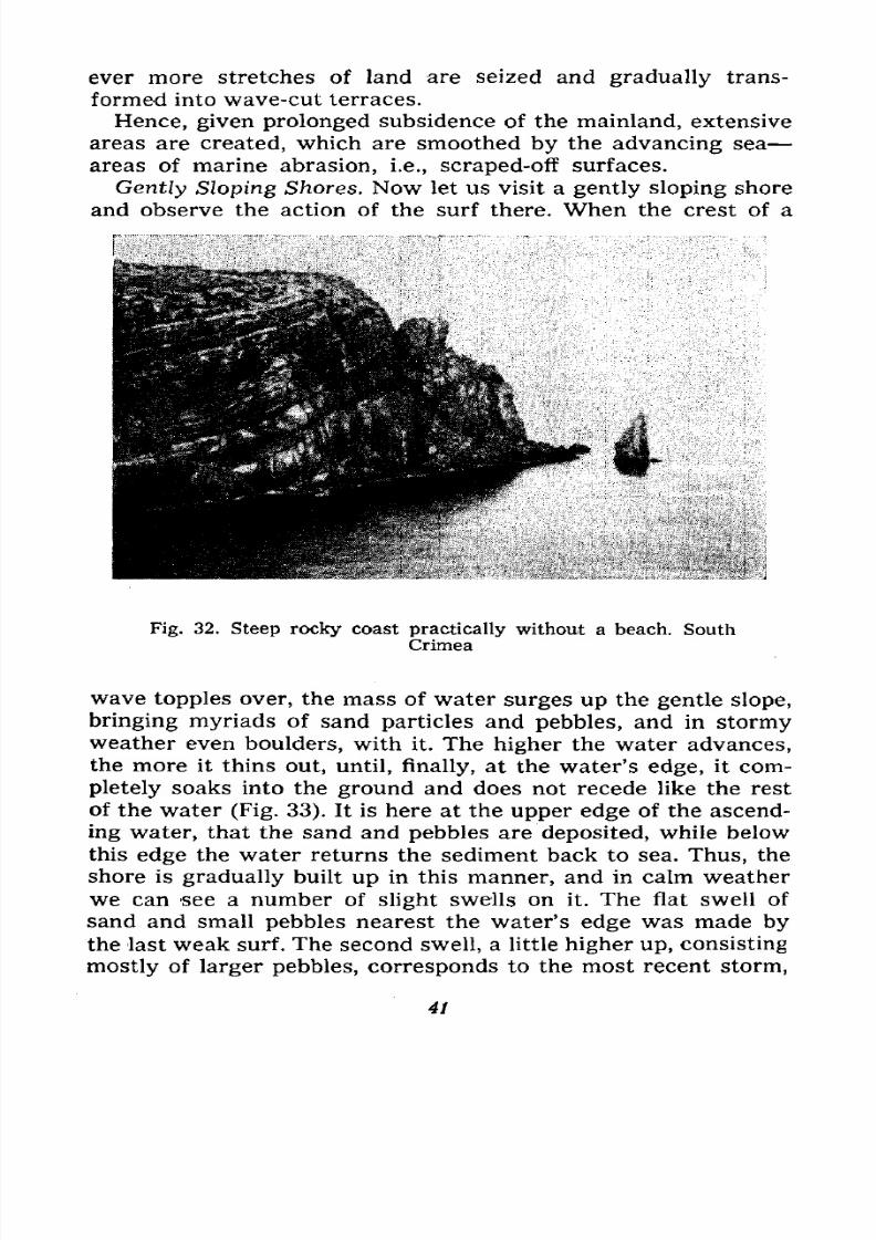
Fig. 32. Steep rocky coast practically without a beach. South
Crimea
wave topples over, the mass of water surges up the gentle slope,
bringing myriads of sand particles and pebbles, and in stormyweather even boulders, with it. The higher the water advances,
the more it thins out, until, finally, at the water's edge, it com-
pletely soaks into the ground and does not recede like the rest
of the water (Fig. 33). It is here at the upper edge of the ascend-
ing water, that the sand and pebbles are deposited, while below
this edge the water returns the sediment back to sea. Thus, the
shore is gradually built up in this manner, and in calm weather
we can see a number of slight swells on it. The flat swell ofsand and small pebbles nearest the water's edge was made by
the last weak surf. The second swell, a little higher up, consisting
mostly of larger pebbles, corresponds to the most recent storm,
41
7/28/2019 Fundamentals of Geology - 19th century - Russia text in English
http://slidepdf.com/reader/full/fundamentals-of-geology-19th-century-russia-text-in-english 43/375
while the farthest and highest, an agglomeration of large stones,
testifies to a severe storm which had raged perhaps six or twelve
months earlier, when the waves swept inshore, stranding
even boulders.
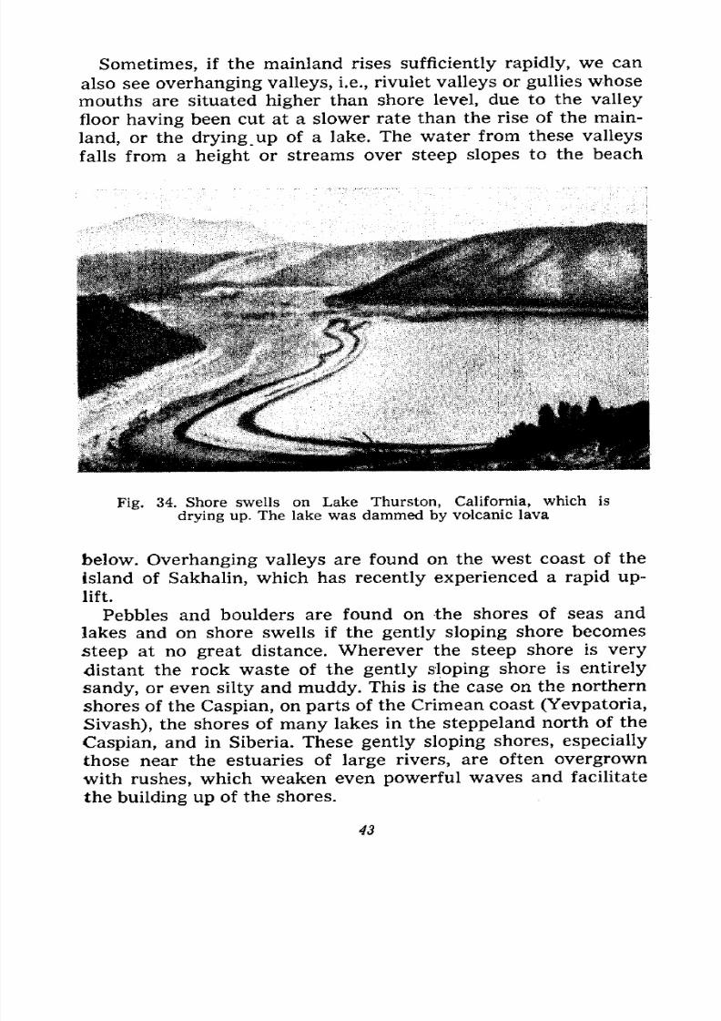
These swells, called shore swells (Fig. 34), run parallel to the
shore. The ones nearest the water's edge have been recently
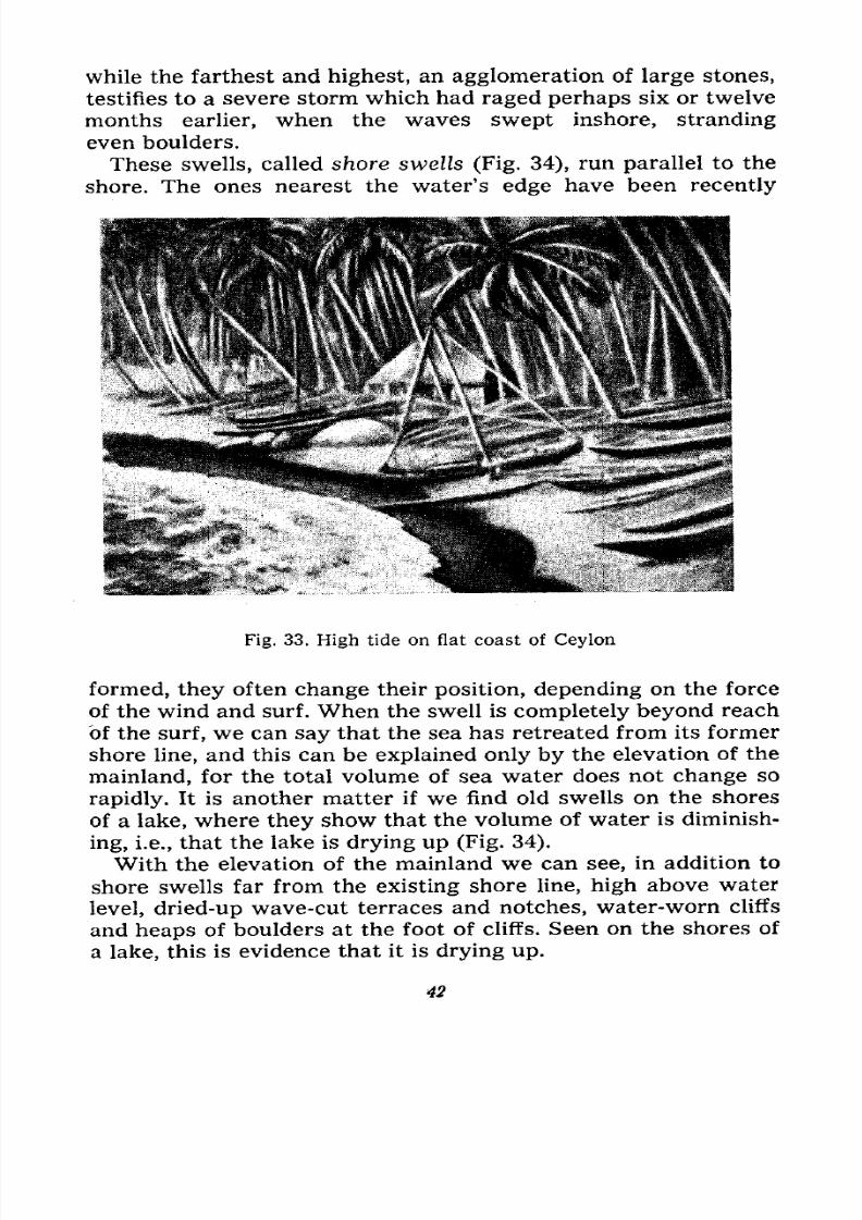
Fig. 33, High tide on flat coast of Ceylon
formed, they often change their position, depending on the force
of the wind and surf. When the swell is completely beyond reach
of the surf, we can say that the sea has retreated from its former
shore line, and this can be explained only by the elevation of the
mainland, for the total volume of sea water does not change so
rapidly. It is another matter if we find old swells on the shores
of a lake, where they show that the volume of water is diminish-
ing, i.e., that the lake is drying up (Fig. 34).
With the elevation of the mainland we can see, in addition to
shore swells far from the existing shore line, high above waterlevel, dried-up wave-cut terraces and notches, water-worn cliffs
and heaps of boulders at the foot of cliffs. Seen on the shores of
a lake, this is evidence that it is drying up.
42
7/28/2019 Fundamentals of Geology - 19th century - Russia text in English
http://slidepdf.com/reader/full/fundamentals-of-geology-19th-century-russia-text-in-english 44/375
Sometimes, if the mainland rises sufficiently rapidly, we can
also see overhanging valleys, i.e., rivulet valleys or gullies whose
mouths are situated higher than shore level, due to the valley
floor having been cut at a slower rate than the rise of the main-
land, or the drying _up of a lake. The water from these valleys
falls from a height or streams over steep slopes to the beach
Fig. 34. Shore swells on Lake Thurston, California, which is
drying up. The lake was dammed by volcanic lava
below. Overhanging valleys are found on the west coast of the
island of Sakhalin, which has recently experienced a rapid up-
lift.
Pebbles and boulders are found on the shores of seas and
lakes and on shore swells if the gently sloping shore becomes
steep at no great distance. Wherever the steep shore is very
distant the rock waste of the gently sloping shore is entirely
sandy, or even silty and muddy. This is the case on the northern
shores of the Caspian, on parts of the Crimean coast (Yevpatoria,
Sivash), the shores of many lakes in the steppeland north of the
Caspian, and in Siberia. These gently sloping shores, especially
those near the estuaries of large rivers, are often overgrown
with rushes, which weaken even powerful waves and facilitate
the building up of the shores.
43
7/28/2019 Fundamentals of Geology - 19th century - Russia text in English
http://slidepdf.com/reader/full/fundamentals-of-geology-19th-century-russia-text-in-english 45/375
How Pebbles Migrate. If, however, the steep shore is located
at no great distance, the rock-waste may form shore swells
and beaches even several kilometres away from the rock out-
crop, and we must understand how the rock-waste migrates,
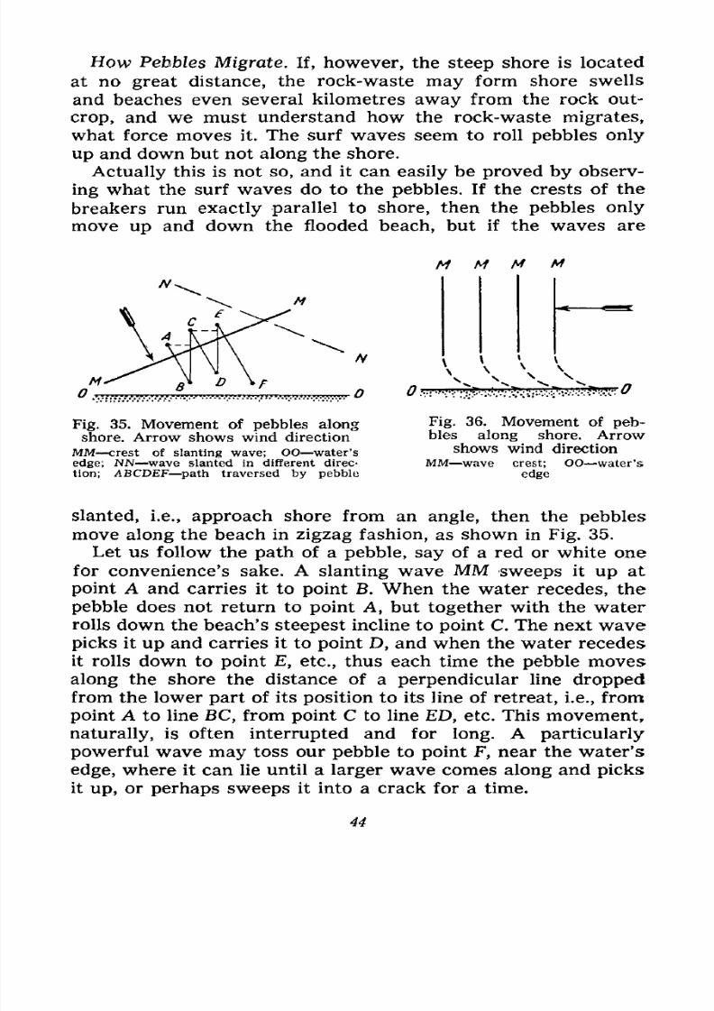
what force moves it. The surf waves seem to roll pebbles only
up and down but not along the shore.
Actually this is not so, and it can easily be proved by observ-
ing what the surf waves do to the pebbles. If the crests of the
breakers run exactly parallel to shore, then the pebbles only
move up and down the flooded beach, but if the waves are
M M M
Fig. 35. Movement of pebbles along
shore. Arrow shows wind directionMM crest of slanting wave; OO water's
edge; NN wave slanted In different direo
tion; ABCDEF -path traversed by pebble
Fig. 36. Movement of peb-bles
alongshore.
Arrowshows wind direction
MM wave crest; OO water's
edge
slanted, i.e., approach shore from an angle, then the pebbles
move along the beach in zigzag fashion, as shown in Fig. 35.
Let us follow the path of a pebble, say of a red or white one
for convenience's sake. A slanting wave MM sweeps it up at
point A and carries it to point B. When the water recedes, the
pebble does not return to point A, but together with the water
rolls down the beach's steepest incline to point C. The next wave
picks it up and carries it to point D, and when the water recedes
it rolls down to point E, etc., thus each time the pebble moves
along the shore the distance of a perpendicular line droppedfrom the lower part of its position to its line of retreat, i.e., from
point A to line BC, from point C to line ED, etc. This movement,
naturally, is often interrupted and for long. A particularly
powerful wave may toss our pebble to point F, near the water's
edge, where it can lie until a larger wave comes along and picks
it up, or perhaps sweeps it into a crack for a time.
44
7/28/2019 Fundamentals of Geology - 19th century - Russia text in English
http://slidepdf.com/reader/full/fundamentals-of-geology-19th-century-russia-text-in-english 46/375
If the reader happens to be on the South Coast of the Crimea
or on the Black Sea shore of the Caucasus he can easily observe
this movement. With a sufficiently strong slanting wave, youshould select a noticeable pebble, observe its movement for a
time, and then measure the distance it has covered from the
point you first started your observation.
If the slanting waves come from the opposite direction (NN on
Fig. 35), the pebbles, of course, will move backwards. Waves
SEVASTOPOL-.
Fig. 37. Map of South Coast of the Crimea
running perpendicular to the shore will, upon approaching it,
also slant (Fig. 36). Generally speaking, the movement of the
pebbles in any direction depends on the prevailing direction of
the strongest winds blowing slantly inshore. For instance, the
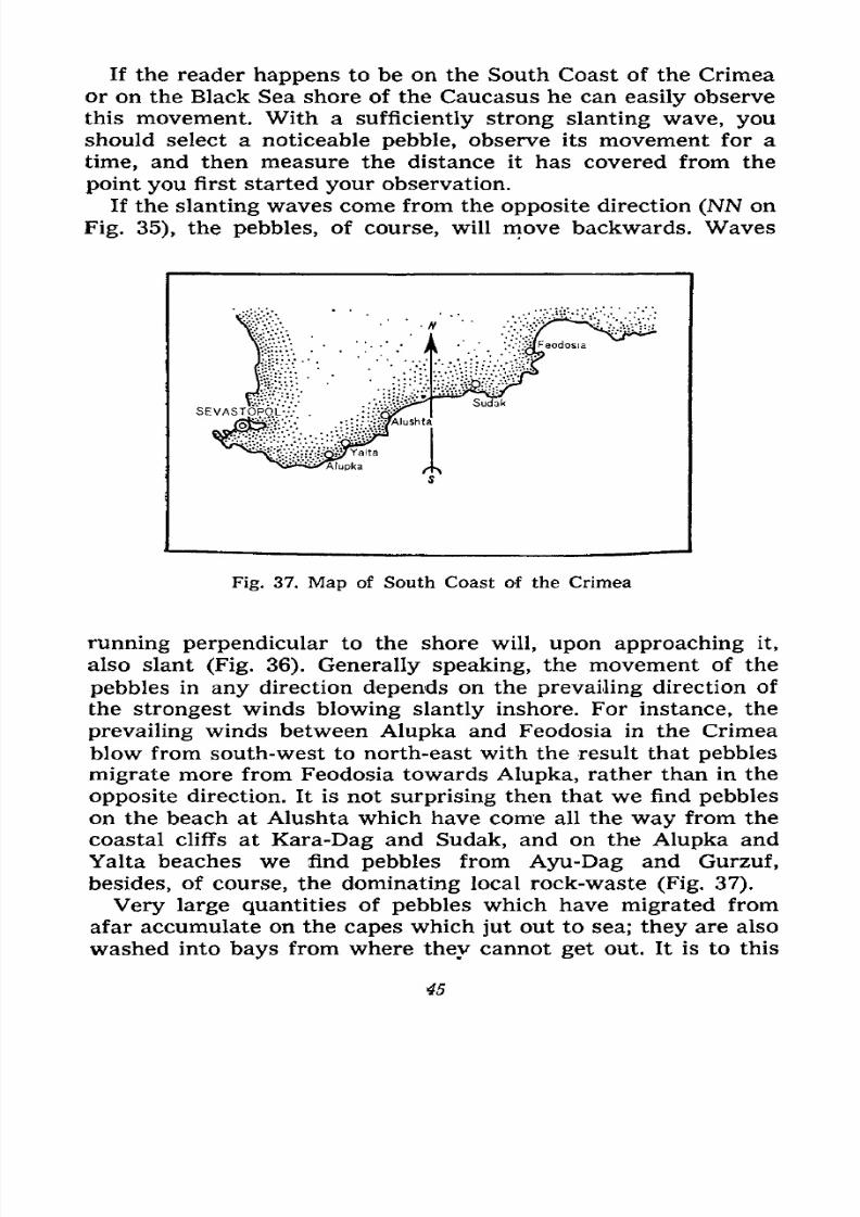
prevailing winds between Alupka and Feodosia in the Crimea
blow from south-west to north-east with the result that pebbles
migrate more from Feodosia towards Alupka, rather than in the
opposite direction. It is not surprising then that we find pebbles
on the beach at Alushta which have come all the way from the
coastal cliffs at Kara-Dag and Sudak, and on the Alupka and
Yalta beaches we find pebbles from Ayu-Dag and Gurzuf,
besides, of course, the dominating local rock-waste (Fig. 37).
Very large quantities of pebbles which have migrated from
afar accumulate on the capes which jut out to sea; they are also
washed into bays from where they cannot get out. It is to this
45
7/28/2019 Fundamentals of Geology - 19th century - Russia text in English
http://slidepdf.com/reader/full/fundamentals-of-geology-19th-century-russia-text-in-english 47/375
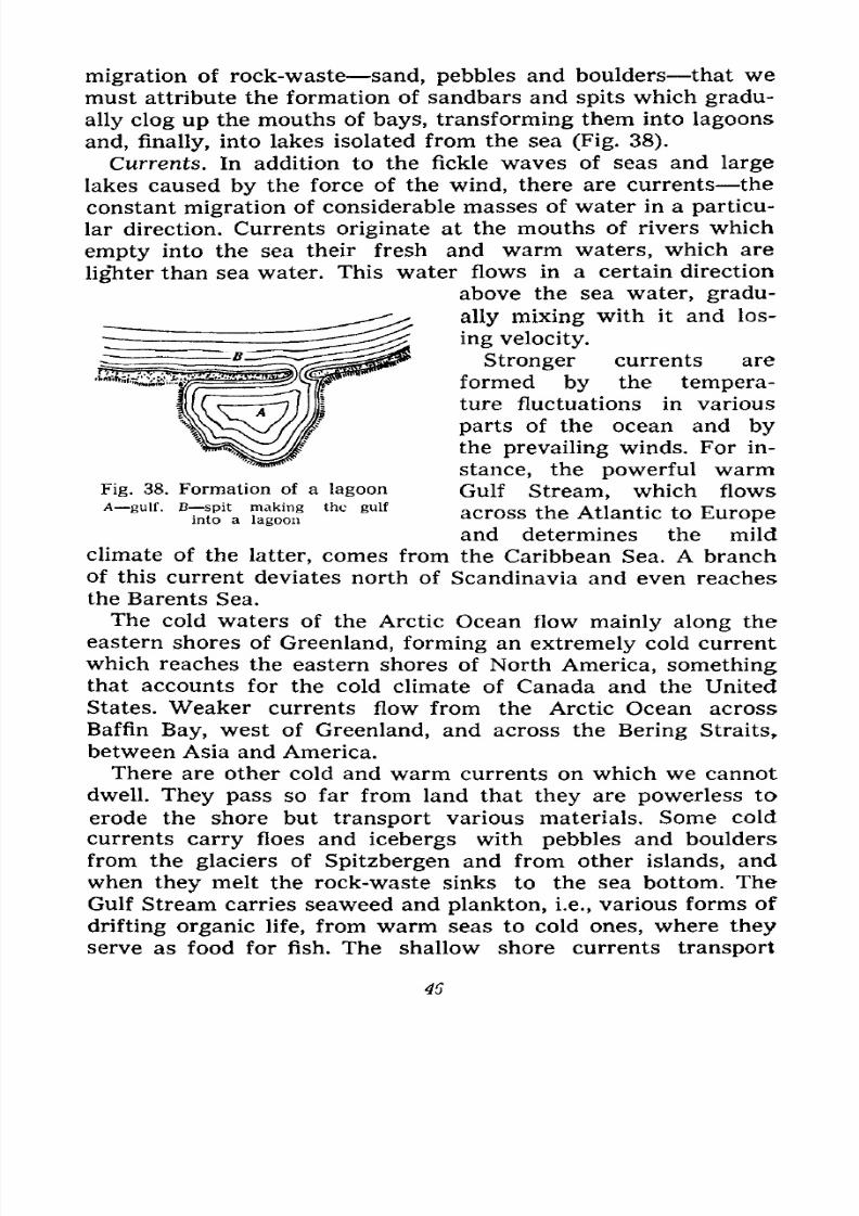
migration of rock-waste sand, pebbles and boulders that we
must attribute the formation of sandbars and spits which gradu-
ally clog up the mouths of bays, transforming them into lagoons
and, finally, into lakes isolated from the sea (Fig. 38).
Currents. In addition to the fickle waves of seas and large
lakes caused by the force of the wind, there are currents the
constant migration of considerable masses of water in a particu-
lar direction. Currents originate at the mouths of rivers which
empty into the sea their fresh and warm waters, which are
lighter than sea water. This water flows in a certain direction
above the sea water, gradu-
ally mixing with it and los-
ing velocity.
Stronger currents are
formed by the tempera-
ture fluctuations in various
parts of the ocean and bythe prevailing winds. For in-
stance, the powerful warmFig. 38. Formation of a lagoon Gulf Stream, which flowsA~8Ulf> ^fa Tagoorf
thc 8ulf across th^ Atlantic to Europe
and determines the mild
climate of the latter, comes from the Caribbean Sea. A branch
of this current deviates north of Scandinavia and even reaches
the Barents Sea.
The cold waters of the Arctic Ocean flow mainly along the
eastern shores of Greenland, forming an extremely cold current
which reaches the eastern shores of North America, somethingthat accounts for the cold climate of Canada and the United
States. Weaker currents flow from the Arctic Ocean across
Baffin Bay, west of Greenland, and across the Bering Straits,
between Asia and America,
There are other cold and warm currents on which we cannot
dwell. They pass so far from land that they are powerless to
erode the shore but transport various materials. Some cold
currents carry floes and icebergs with pebbles and boulders
from the glaciers of Spitzbergen and from other islands, and
when they melt the rock-waste sinks to the sea bottom. TheGulf Stream carries seaweed and plankton, i.e., various forms of
drifting organic life, from warm seas to cold ones, where they
serve as food for fish. The shallow shore currents transport
7/28/2019 Fundamentals of Geology - 19th century - Russia text in English
http://slidepdf.com/reader/full/fundamentals-of-geology-19th-century-russia-text-in-english 48/375
along the coasts the fine sediment sand and silt which the
rivers bring down to sea, and the sediment created by the surf.
Sedimentary Rock Formation, Now what happens to the sedi-
ment which the rivers empty into the lakes, seas and oceans and
which the surf erodes on sea-shores?
Fig. 39. Sea lily Acanthocrinus rex. Rare com-
plete specimen. Found in Devonian slate in
HunsrUck
The river silt settles gradually in the seas and lakes, the larger
particles earlier, nearer the river mouth or coast, the smaller and
lighter ones later, farther from shore. In a large lake the finest
particles settle only in its central part, while those in the sea are
carried away by currents dozens and hundreds of kilometres
from shore. And everywhere this sediment settles at the bottom
of the sea, particle by particle, daily, yearly, during thousandsof centuries.
This sedimentary matter accumulates layer by layer at the
bottom of lakes and seas; the larger, sandy particles settle closer
47
7/28/2019 Fundamentals of Geology - 19th century - Russia text in English
http://slidepdf.com/reader/full/fundamentals-of-geology-19th-century-russia-text-in-english 49/375
to shore, the grains of sand forming layers of sand; farther out
to sea the smaller particles form layers of various clays: sandy
clay layers accumulate in the vicinity of the region of deposition
of sand particles where the finest grains settle together with the
clay particles; the layers of pure clay take shape further away.
Lime and mica particles often mix with the sand and clay. Re-
cently deposited sediment is semi-liquid as it is saturated with
water. We encounter this sediment while bathing, when our feet
get stuck in the mud at the
river bottom.
But with the passage of
time, with the piling upof deposits, the layers
become firmer, their water
is squeezed out, their
particles compress, and if
we pick up sediment a
few metres from the ba-
sin bottom it will not be
semi-liquid nor will it ooze
through our fingers it will
be more solid, though still
soft rock. Gradually, at
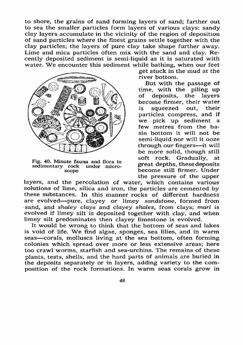
great depths, these depositsFig. 40. Minute fauna and flora in
sedimentary rock under micro-
scope become still firmer. Under
the pressure of the upper
layers, and the percolation of water, which contains various
solutions of lime, silica and iron, the particles are cemented bythese substances. In this manner rocks of different hardness
are evolved pure, clayey or limey sandstone, formed from
sand, and shaley clays and clayey shales, from clays; marl is
evolved if limey silt is deposited together with clay, and when
limey silt predominates then clayey limestone is evolved.
It would be wrong to think that the bottom of seas and lakes
is void of life. We find algae, sponges, sea lilies, and in warmseas corals, molluscs living at the sea bottom, often forming
colonies which spread over more or less extensive areas; here
too crawl worms, starfish and sea-urchins. The remains of these
plants, tests, shells, and the hard parts of animals are buried in
the deposits separately or in layers, adding variety to the com-
position of the rock formations. In warm seas corals grow in
48
7/28/2019 Fundamentals of Geology - 19th century - Russia text in English
http://slidepdf.com/reader/full/fundamentals-of-geology-19th-century-russia-text-in-english 50/375
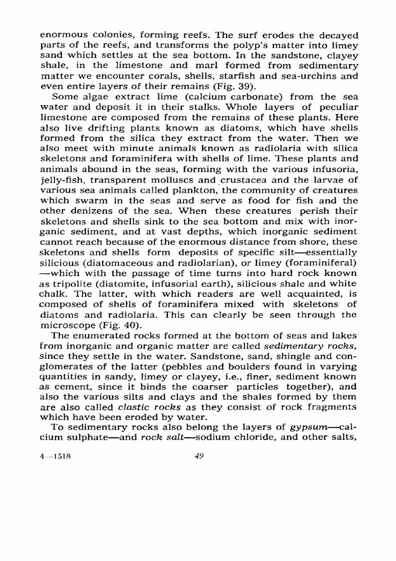
enormous colonies, forming reefs. The surf erodes the decayed
parts of the reefs, and transforms the polyp's matter into limeysand which settles at the sea bottom. In the sandstone, clayey
shale, in the limestone and marl formed from sedimentary
matter we encounter corals, shells, starfish and sea-urchins and
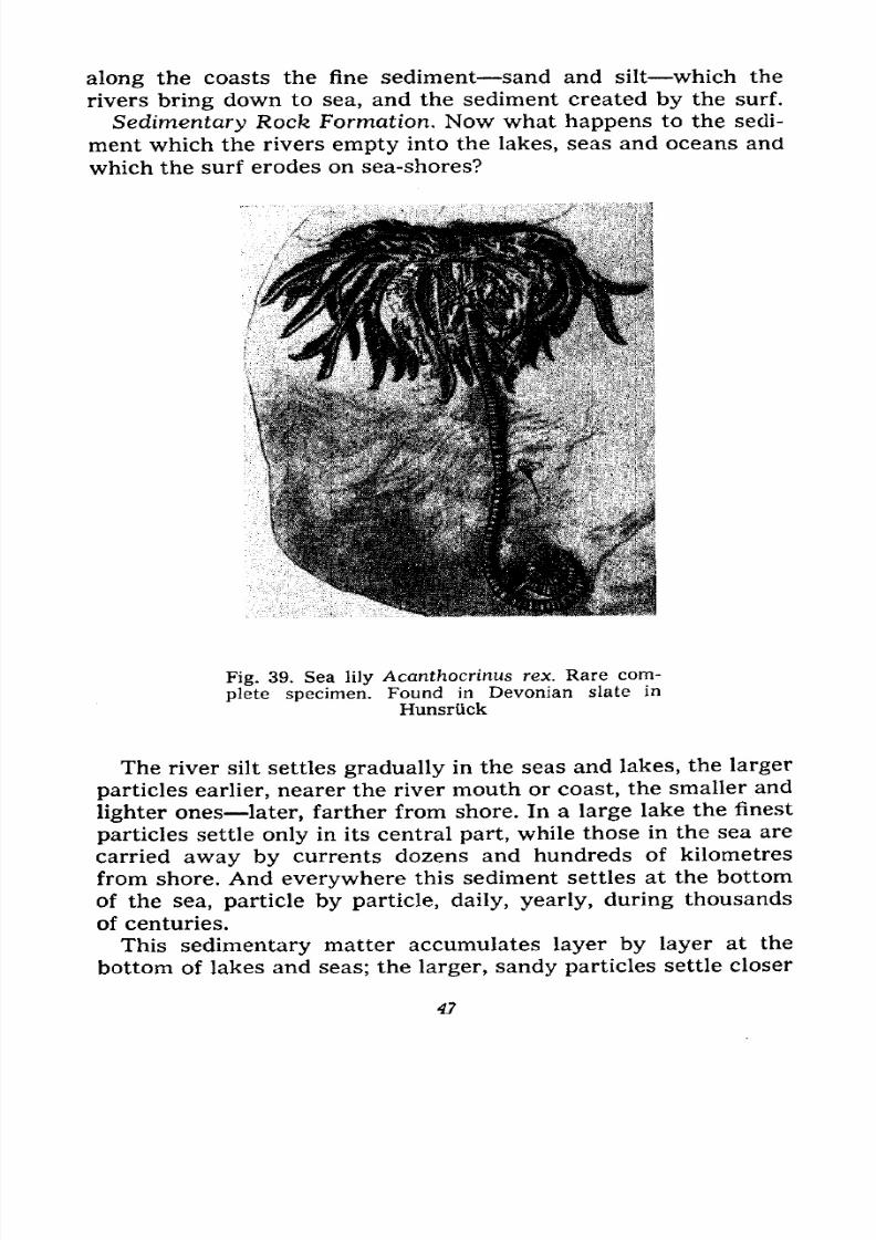
even entire layers of their remains (Fig. 39).
Some algae extract lime (calcium carbonate) from the sea
water and deposit it in their stalks. Whole layers of peculiar
limestone are composed from the remains of these plants. Here
also live drifting plants known as diatoms, which have shells
formed from the silica they extract from the water. Then wealso meet with minute animals known as radiolaria with silica
skeletons and foraminifera with shells of lime. Theseplants
and
animals abound in the seas, forming with the various infusoria,
jelly-fish, transparent molluscs and Crustacea and the larvae of
various sea animals called plankton, the community of creatures
which swarm in the seas and serve as food for fish and the
other denizens of the sea. When these creatures perish their
skeletons and shells sink to the sea bottom and mix with inor-
ganic sediment, and at vast depths, which inorganic sediment
cannot reach because of the enormous distance from shore, theseskeletons and shells form deposits of specific silt essentially
silicious (diatomaceous and radiolarian), or limey (foraminiferal)
which with the passage of time turns into hard rock known
as tripolite (diatomite, infusorial earth), silicious shale and white
chalk. The latter, with which readers are well acquainted, is
composed of shells of foraminifera mixed with skeletons of
diatoms and radiolaria. This can clearly be seen through the
microscope (Fig. 40).
The enumerated rocks formed at the bottom of seas and lakes
from inorganic and organic matter are called sedimentary rocks,
since they settle in the water. Sandstone, sand, shingle and con-
glomerates of the latter (pebbles and boulders found in varying
quantities in sandy, limey or clayey, i.e., finer, sediment known
as cement, since it binds the coarser particles together), and
also the various silts and clays and the shales formed by them
are also called clastic rocks as they consist of rock fragmentswhich have been eroded by water.
To sedimentary rocks also belong the layers of gypsum cal-
cium sulphate and rock salt sodium chloride, and other salts,
41518 49
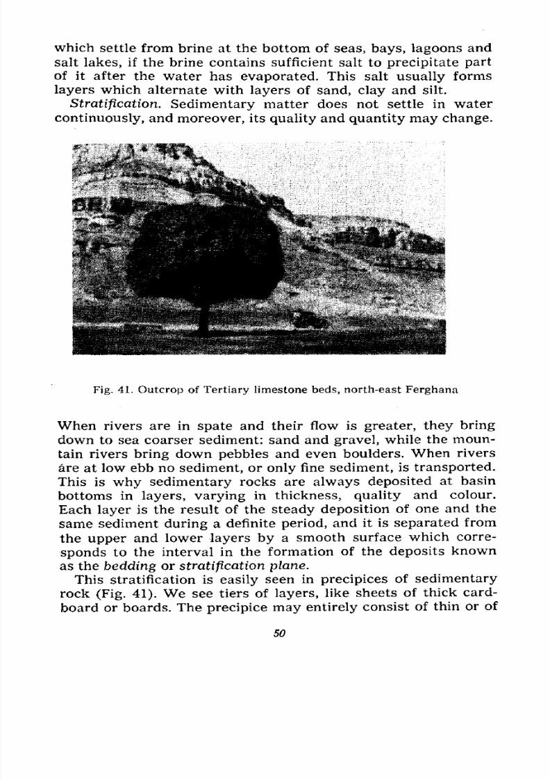
7/28/2019 Fundamentals of Geology - 19th century - Russia text in English
http://slidepdf.com/reader/full/fundamentals-of-geology-19th-century-russia-text-in-english 51/375
which settle from brine at the bottom of seas, bays, lagoons and
salt lakes, if the brine contains sufficient salt to precipitate part
of it after the water has evaporated. This salt usually forms
layers which alternate with layers of sand, clay and silt.
Stratification. Sedimentary matter does not settle in water
continuously, and moreover, its quality and quantity may change.
Fig. 41. Outcrop of Tertiary limestone beds, north-east Ferghana
When rivers are in spate and their flow is greater, they bring
down to sea coarser sediment: sand and gravel, while the moun-
tain rivers bring down pebbles and even boulders. When rivers
are at low ebb no sediment, or only fine sediment, is transported.
This is why sedimentary rocks are always deposited at basin
bottoms in layers, varying in thickness, quality and colour.
Each layer is the result of the steady deposition of one and the
same sediment during a definite period, and it is separated from
the upper and lower layers by a smooth surface which corre-
sponds to the interval in the formation of the deposits known
as the bedding or stratification plane.
This stratification is easily seen in precipices of sedimentary
rock (Fig. 41). We see tiers of layers, like sheets of thick card-
board or boards. The precipice may entirely consist of thin or of
50
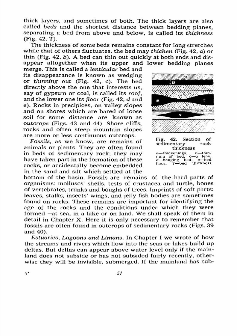
7/28/2019 Fundamentals of Geology - 19th century - Russia text in English
http://slidepdf.com/reader/full/fundamentals-of-geology-19th-century-russia-text-in-english 52/375
thick layers, and sometimes of both. The thick layers are also
called beds and the shortest distance between bedding planes,
separating a bed from above and below, is called its thickness
(Fig. 42, T).
The thickness of some beds remains constant for long stretches
while that of others fluctuates, the bed may thicken (Fig. 42, a) or
thin (Fig. 42, b). A bed can thin out quickly at both ends and dis-
appear altogether when its upper and lower bedding planes
merge. This is called a lenticular bed and
its disappearance is known as wedgingor thinning out (Fig. 42, c). The bed
directly above the one that interests us,
say of gypsum or coal, is called its roof,
and the lower one its floor (Fig. 42, d and
e). Rocks in precipices, on valley slopes
and on shores which are bared of loose
soil for some distance are known as
outcrops (Figs. 43 and 44). Shore cliffs,
rocks and often steep mountain slopes
are more or less continuous outcrops.
Fossils, as we know, are remains of
animals or plants. They are often found
in beds of sedimentary rock; they mayhave taken part in the formation of these
rocks, or accidentally become embedded
in the sand and silt which settled at the
bottom of the basin. Fossils are remains of the hard parts of
organisms: molluscs' shells, tests of Crustacea and turtle, bones
of vertebrates, trunks and boughs of trees. Imprints of soft parts:
leaves, stalks, insects' wings, and jelly-fish bodies are sometimesfound on rocks. These remains are important for identifying the
age of the rocks and the conditions under which they were
formed at sea, in a lake or on land. We shall speak of them in
detail in Chapter X. Here it is only necessary to remember that
fossils are often found in outcrops of sedimentary rocks (Figs. 39
and 40).
Estuaries, Lagoons and Limans. In Chapter I we wrote of how
the streams and rivers which flow into the seas or lakes build updeltas. But deltas can appear above water level only if the main-
land does not subside or has not subsided fairly recently, other-
wise they will be invisible, submerged. If the mainland has sub-
Fig. 42. Section of
sedimentary rock
thickness
a thickenings. b thin-
ning of bed. c a lens,
d hanging bed. e bed
floor. T bed thickness
51

7/28/2019 Fundamentals of Geology - 19th century - Russia text in English
http://slidepdf.com/reader/full/fundamentals-of-geology-19th-century-russia-text-in-english 53/375
Fig. 43. Unconformable bedding of Upper Jurassic limestone
on Middle Jurassic shale, Urukh River
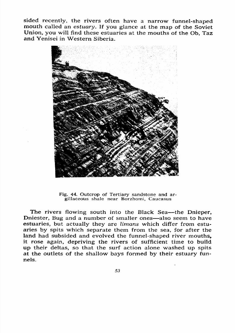
7/28/2019 Fundamentals of Geology - 19th century - Russia text in English
http://slidepdf.com/reader/full/fundamentals-of-geology-19th-century-russia-text-in-english 54/375
sided recently, the rivers often have a narrow funnel-shapedmouth called an estuary. If you glance at the map of the Soviet
Union, you will find these estuaries at the mouths of the Ob, Taz
and Yenisei in Western Siberia.
Fig. 44. Outcrop of Tertiary sandstone and ar-
gillaceous shale near Borzhomi, Caucasus
The rivers flowing south into the Black Sea the Dnieper,
Dniester, Bug and a number of smaller ones also seem to have
estuaries, but actually they are limans which differ from estu-
aries by spits which separate them from the sea, for after the
land had subsided and evolved the funnel-shaped river mouths,
it rose again, depriving the rivers of sufficient time to build
up their deltas, so that the surf action alone washed up spits
at the outlets of the shallow bays formed by their estuary fun-
nels.
53
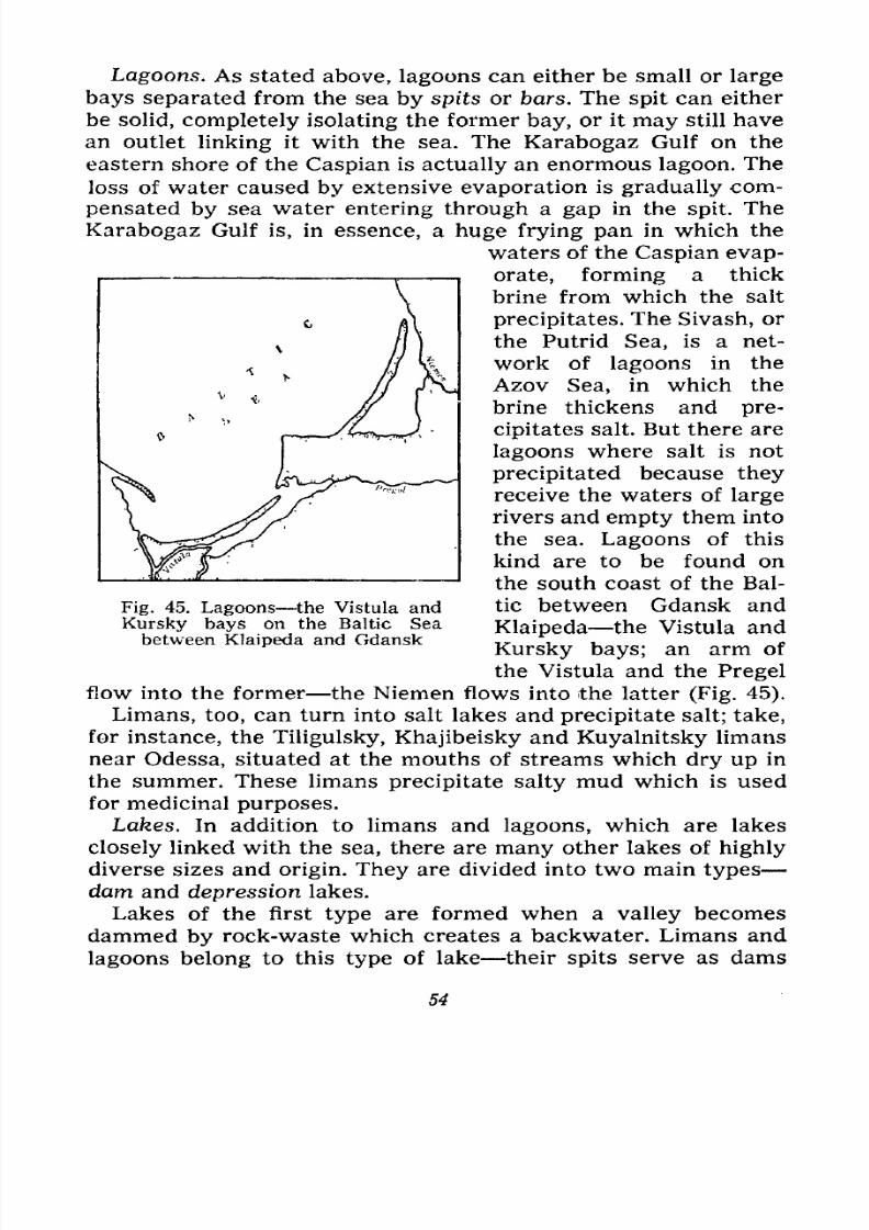
7/28/2019 Fundamentals of Geology - 19th century - Russia text in English
http://slidepdf.com/reader/full/fundamentals-of-geology-19th-century-russia-text-in-english 55/375
Lagoons. As stated above, lagoons can either be small or large
bays separated from the sea by spits or bars. The spit can either
be solid, completely isolating the former bay, or it may still have
an outlet linking it with the sea. The Karabogaz Gulf on the
eastern shore of the Caspian is actually an enormous lagoon. The
loss of water caused by extensive evaporation is gradually com-
pensated by sea water entering through a gap in the spit. The
Karabogaz Gulf is, in essence, a huge frying pan in which the
waters of the Caspian evap-
orate, forming a thick
brine from which the salt
precipitates. The Sivash, or
the Putrid Sea, is a net-
work of lagoons in the
Azov Sea, in which the
brine thickens and pre-
cipitates salt. But there are
lagoons where salt is not
precipitated because they
receive the waters of large
rivers and empty them into
the sea. Lagoons of this
kind are to be found on
the south coast of the Bal-
tic between Gdansk and
Klaipeda the Vistula and
Kursky bays; an arm of
the Vistula and the Pregel
flow into the former the Niemen flows into the latter (Fig. 45).
Limans, too, can turn into salt lakes and precipitate salt; take,
for instance, the Tiligulsky, Khajibeisky and Kuyalnitsky limans
near Odessa, situated at the mouths of streams which dry up in
the summer. These limans precipitate salty mud which is used
for medicinal purposes.
Lakes. In addition to limans and lagoons, which are lakes
closely linked with the sea, there are many other lakes of highly
diverse sizes and origin. They are divided into two main types
dam and depression lakes.Lakes of the first type are formed when a valley becomes
dammed by rock-waste which creates a backwater. Limans and
lagoons belong to this type of lake their spits serve as dams
Fig. 45. Lagoons the Vistula and
Kursky bays on the Baltic Sea
between Klaipeda and Gdansk
54
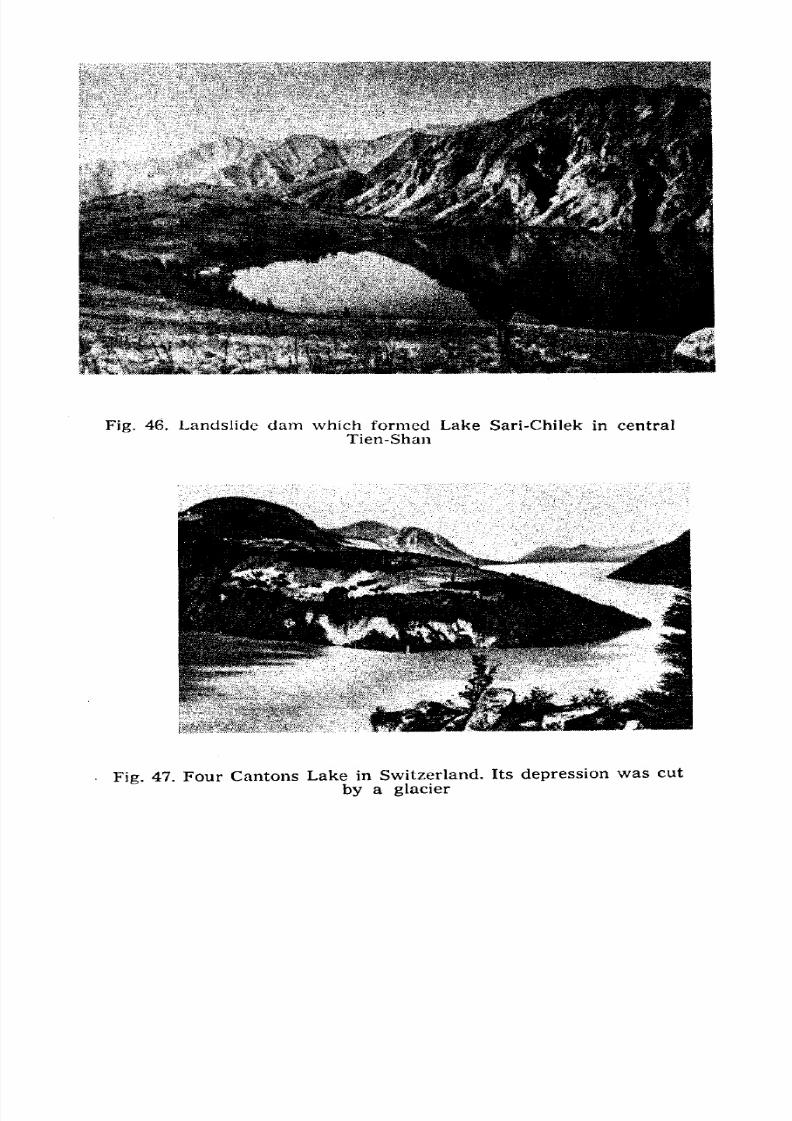
7/28/2019 Fundamentals of Geology - 19th century - Russia text in English
http://slidepdf.com/reader/full/fundamentals-of-geology-19th-century-russia-text-in-english 56/375
Fig. 46. Landslide dam which formed Lake Sari-Chilek in central
Tien-Shan
** ^, , ,.
Fig. 47. Four Cantons Lake in Switzerland. Its depression was cut
by a glacier
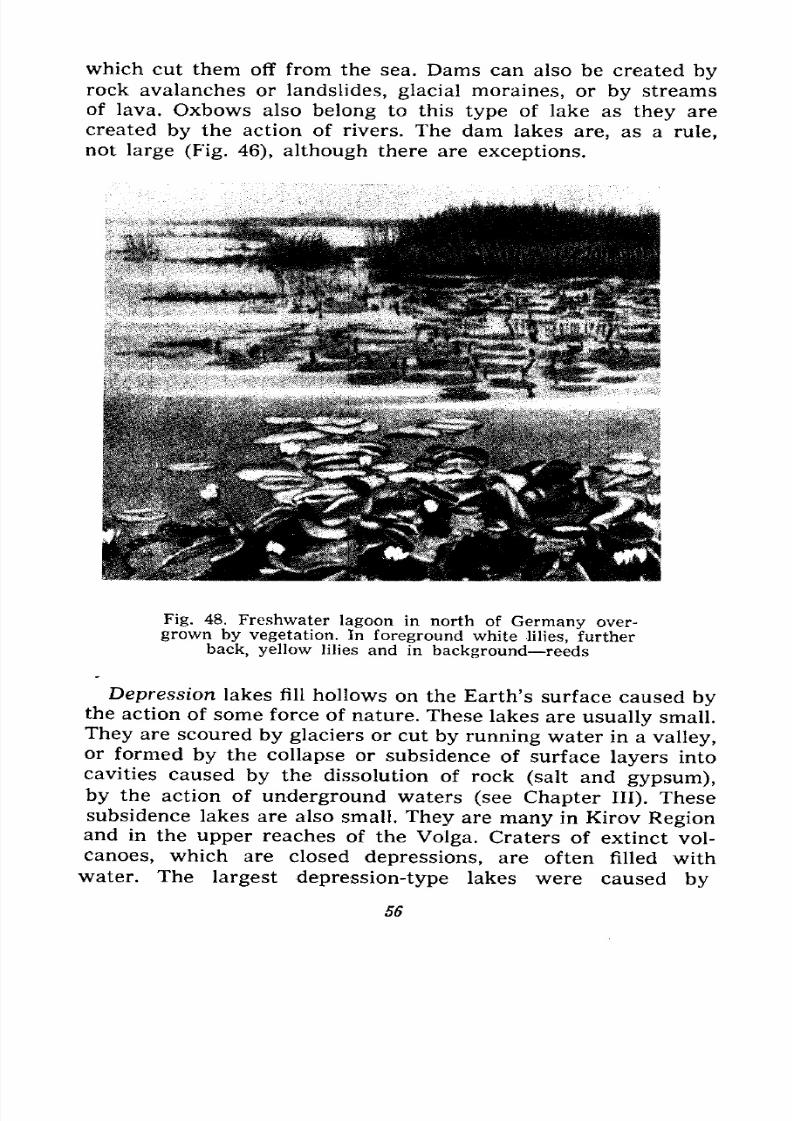
7/28/2019 Fundamentals of Geology - 19th century - Russia text in English
http://slidepdf.com/reader/full/fundamentals-of-geology-19th-century-russia-text-in-english 57/375
which cut them off from the sea. Dams can also be created byrock avalanches or landslides, glacial moraines, or by streams
of lava. Oxbows also belong to this type of lake as they are
created by the action of rivers. The dam lakes are, as a rule,
not large (Fig. 46), although there are exceptions.
Fig. 48. Freshwater lagoon in north of Germany over-
grown by vegetation. In foreground white lilies, further
back, yellow lilies and in background reeds
Depression lakes fill hollows on the Earth's surface caused bythe action of some force of nature. These lakes are usually small.
They are scoured by glaciers or cut by running water in a valley,or formed by the collapse or subsidence of surface layers into
cavities caused by the dissolution of rock (salt and gypsum),
by the action of underground waters (see Chapter III). These
subsidence lakes are also small. They are many in Kirov Regionand in the upper reaches of the Volga. Craters of extinct vol-
canoes, which are closed depressions, are often filled with
water. The largest depression-type lakes were caused by
56

7/28/2019 Fundamentals of Geology - 19th century - Russia text in English
http://slidepdf.com/reader/full/fundamentals-of-geology-19th-century-russia-text-in-english 58/375
the subsidence of considerable areas of the earth's crust during
the process of mountain-building. Such are, for instance, Lake
Issyk-Kul in Kazakhstan, Lake Baikal in Siberia, Kosso Gol
Lake in Mongolia, Lake Tanganyika and others in Africa and
the Dead Sea in Palestine.
In the Soviet Union some lakes are recently formed lagoons
and limans, others, like the Elton and Baskunchak lakes, are
ancient lagoons; then there are subsidence and moraine lakes (in
the Altai, Tien-Shan and Sayan mountains), glacial lakes (such
as Lake Teletskoye in the Altai), oxbow lakes and volcanic lakes
(on Kamchatka).
A. special branch of science known as limnology studies the
physical phenomena of lakes.
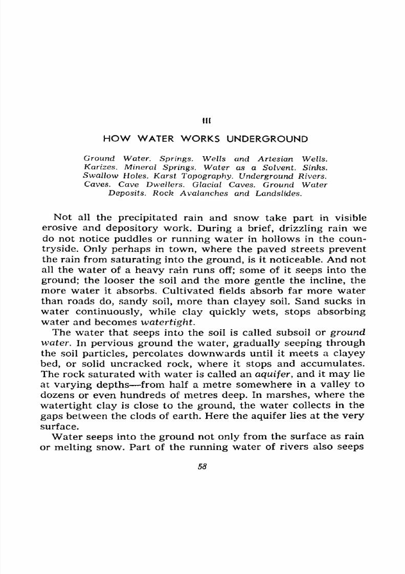
7/28/2019 Fundamentals of Geology - 19th century - Russia text in English
http://slidepdf.com/reader/full/fundamentals-of-geology-19th-century-russia-text-in-english 59/375
HOW WATER WORKS UNDERGROUND
Ground Water. Springs. Wells and Artesian Wells.
Karizes. Mineral Springs. Water as a Solvent. Sinks.
Swallow Holes. Karst Topography. Underground Rivers.
Caves. Cave Dwellers. Glacial Caves. Ground Water
Deposits. Rock Avalanches and Landslides.
Not all the precipitated rain and snow take part in visible
erosive and depository work. During a brief, drizzling rain wedo not notice puddles or running water in hollows in the coun-
tryside. Only perhaps in town, where the paved streets preventthe rain from saturating into the ground, is it noticeable. And not
all the water of a heavy rain runs off; some of it seeps into the
ground; the looser the soil and the more gentle the incline, the
more water it absorbs. Cultivated fields absorb far more water
than roads do, sandy soil, more than clayey soil. Sand sucks in
water continuously, while clay quickly wets, stops absorbing
water and becomes watertight.
The water that seeps into the soil is called subsoil or groundwater. In pervious ground the water, gradually seeping through
the soil particles, percolates downwards until it meets a clayey
bed, or solid uncracked rock, where it stops and accumulates.
The rock saturated with water is called an aquifer, and it may lie
at varying depths from half a metre somewhere in a valley to
dozens or even hundreds of metres deep. In marshes, where the
watertight clay is close to the ground, the water collects in the
gaps between the clods of earth. Here the aquifer lies at the verysurface.
Water seeps into the ground not only from the surface as rain
or melting snow. Part of the running water of rivers also seeps
58
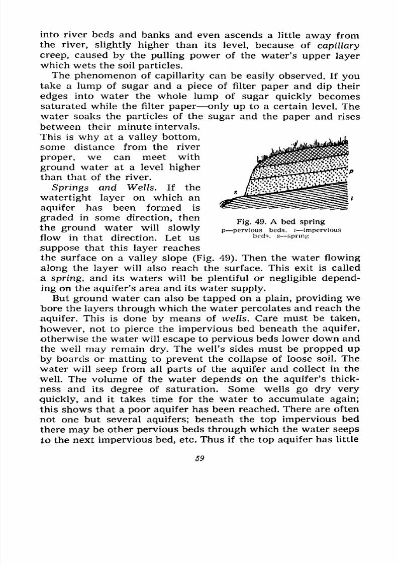
7/28/2019 Fundamentals of Geology - 19th century - Russia text in English
http://slidepdf.com/reader/full/fundamentals-of-geology-19th-century-russia-text-in-english 60/375
into river beds and banks and even ascends a little away from
the river, slightly higher than its level, because of capiHary
creep, caused by the pulling power of the water's upper layer
which wets the soil particles.
The phenomenon of capillarity can be easily observed. If youtake a lump of sugar and a piece of filter paper and dip their
edges into water the whole lump of sugar quickly becomes
saturated while the filter paper only up to a certain level. The
water soaks the particles of the sugar and the paper and rises
between their minute intervals.
This is why at a valley bottom,
some distance from the river
proper, we can meet with
ground water at a level higher
than that of the river.
Springs and Wells. If the
watertight layer on which an
aquifer has been formed is
graded in some direction, then
the ground water will slowly
flow in that direction. Let us
suppose that this layer reaches
the surface on a valley slope (Fig. 49). Then the water flowing
along the layer will also reach the surface. This exit is called
a spring, and its waters will be plentiful or negligible depend-
ing on the aquifer's area and its water supply.
But ground water can also be tapped on a plain, providing webore the layers through which the water percolates and reach the
.aquifer. This is done by means of wells. Care must be taken,
however, not to pierce the impervious bed beneath the aquifer,
otherwise the water will escape to pervious beds lower down and
the well may remain dry. The well's sides must be propped up
by boards or matting to prevent the collapse of loose soil. The
water will seep from all parts of the aquifer and collect in the
well. The volume of the water depends on the aquifer's thick-
ness and its degree of saturation. Some wells go dry very
quickly, and it takes time for the water to accumulate again;
this shows that a poor aquifer has been reached. There are oftennot one but several aquifers; beneath the top impervious bed
there may be other pervious beds through which the water seeps
to the next impervious bed, etc. Thus if the top aquifer has little
Fig. 49. A bed spring
p pervious beds, i-imperviousbeds, s spring
59
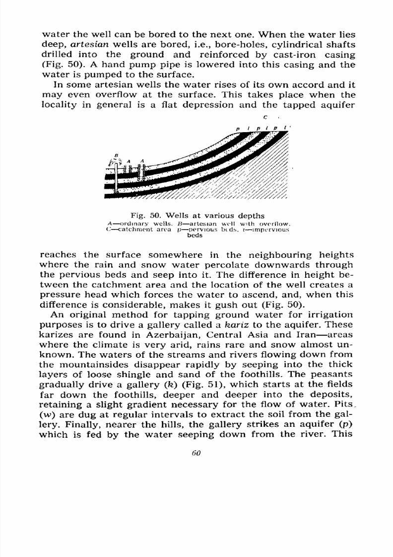
7/28/2019 Fundamentals of Geology - 19th century - Russia text in English
http://slidepdf.com/reader/full/fundamentals-of-geology-19th-century-russia-text-in-english 61/375
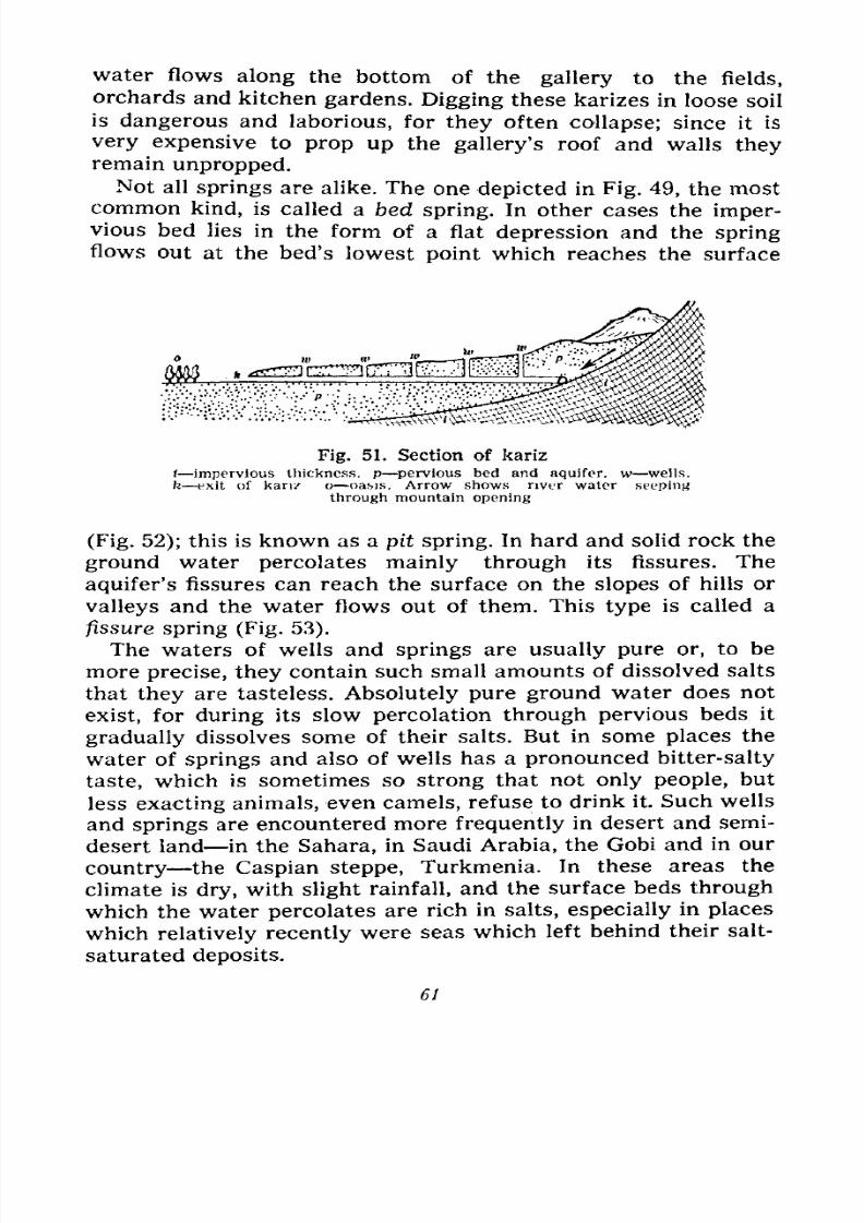
7/28/2019 Fundamentals of Geology - 19th century - Russia text in English
http://slidepdf.com/reader/full/fundamentals-of-geology-19th-century-russia-text-in-english 62/375
water flows along the bottom of the gallery to the fields,
orchards and kitchen gardens. Digging these karizes in loose soil
is dangerous and laborious, for they often collapse; since it is
very expensive to prop up the gallery's roof and walls theyremain unpropped.
Not all springs are alike. The one depicted in Fig. 49, the most
common kind, is called a bed spring. In other cases the imper-vious bed lies in the form of a flat depression and the springflows out at the bed's lowest point which reaches the surface
Fig. 51. Section of kariz
1 impervious thickness, p pervious bed and aquifer, w wells.
k exit of kanz o oasis. Arrow shows river water seeping
through mountain opening
(Fig. 52); this is known as a pit spring. In hard and solid rock the
ground water percolates mainly through its fissures. The
aquifer's fissures can reach the surface on the slopes of hills or
valleys and the water flows out of them. This type is called a
fissure spring (Fig. 53).
The waters of wells and springs are usually pure or, to be
more precise, they contain such small amounts of dissolved salts
that they are tasteless. Absolutely pure ground water does not
exist, for during its slow percolation through pervious beds it
gradually dissolves some of their salts. But in some places the
water of springs and also of wells has a pronounced bitter-salty
taste, which is sometimes so strong that not only people, but
less exacting animals, even camels, refuse to drink it. Such wells
and springs are encountered more frequently in desert and semi-
desert land in the Sahara, in Saudi Arabia, the Gobi and in our
country the Caspian steppe, Turkmenia. In these areas the
climate is dry, with slight rainfall, and the surface beds throughwhich the water percolates are rich in salts, especially in places
which relatively recently were seas which left behind their salt-
saturated deposits.
61
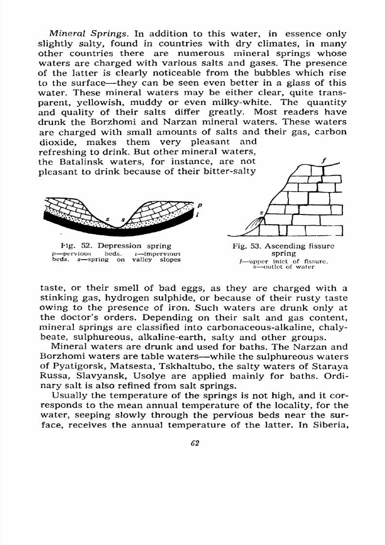
7/28/2019 Fundamentals of Geology - 19th century - Russia text in English
http://slidepdf.com/reader/full/fundamentals-of-geology-19th-century-russia-text-in-english 63/375
Mineral Springs. In addition to this water, in essence only
slightly salty, found in countries with dry climates, in manyother countries there are numerous mineral springs whose
waters are charged with various salts and gases. The presence
of the latter is clearly noticeable from the bubbles which rise
to the surface they can be seen even better in a glass of this
water. These mineral waters may be either clear, quite trans-
parent, yellowish, muddy or even milky-white. The quantity
and quality of their salts differ greatly. Most readers have
drunk the Borzhomi and Narzan mineral waters. These waters
are charged with small amounts of salts and their gas, carbon
dioxide, makes them very pleasant and
refreshing to drink. But other mineral waters,
the Batalinsk waters, for instance, are not
pleasant to drink because of their bitter-salty
fig. 52. Depression spring
p pervious beds, i imperviousbeds, s spring on valley slopes
Fig. 53. Ascending fissure
spring
/ upper inlet of fissure,
s outlet of water
taste, or their smell of bad eggs, as they are charged with a
stinking gas, hydrogen sulphide, or because of their rusty taste
owing to the presence of iron. Such waters are drunk only at
the doctor's orders. Depending on their salt and gas content,
mineral springs are classified into carbonaceous-alkaline, chaly-
beate, sulphureous, alkaline-earth, salty and other groups.
Mineral waters are drunk and used for baths. The Narzan and
Borzhomi waters are table waters while the sulphureous waters
of Pyatigorsk, Matsesta, Tskhaltubo, the salty waters of Staraya
Russa, Slavyansk, Usolye are applied mainly for baths. Ordi-
nary salt is also refined from salt springs.
Usually the temperature of the springs is not high, and it cor-
responds to the mean annual temperature of the locality, for the
water, seeping slowly through the pervious beds near the sur-
face, receives the annual temperature of the latter. In Siberia,
62
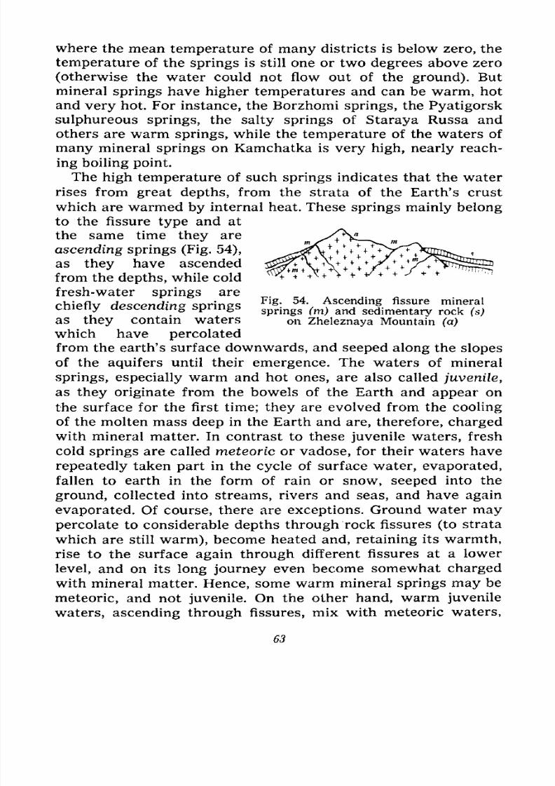
7/28/2019 Fundamentals of Geology - 19th century - Russia text in English
http://slidepdf.com/reader/full/fundamentals-of-geology-19th-century-russia-text-in-english 64/375
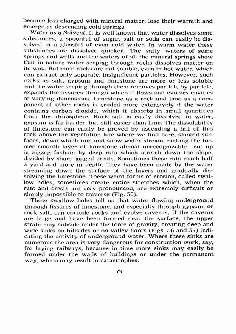
7/28/2019 Fundamentals of Geology - 19th century - Russia text in English
http://slidepdf.com/reader/full/fundamentals-of-geology-19th-century-russia-text-in-english 65/375
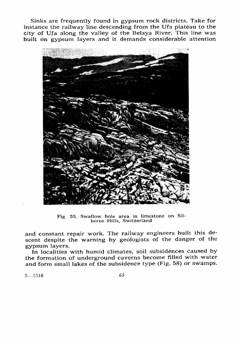
7/28/2019 Fundamentals of Geology - 19th century - Russia text in English
http://slidepdf.com/reader/full/fundamentals-of-geology-19th-century-russia-text-in-english 66/375
Sinks are frequently found in gypsum rock districts. Take for
instance the railway line descending from the Ufa plateau to the
city of Ufa along the valley of the Belaya River. This line was
built on gypsum layers and it demands considerable attention
Fig. 55. Swallow hole area in limestone on Sil-
berne Hills, Switzerland
and constant repair work. The railway engineers built this de-
scent despite the warning by geologists of the danger of the
gypsum layers.
In localities with humid climates, soil subsidences caused by
the formation of underground caverns become filled with water
and form small lakes of the subsidence type (Fig. 58) or swamps.
51518 65
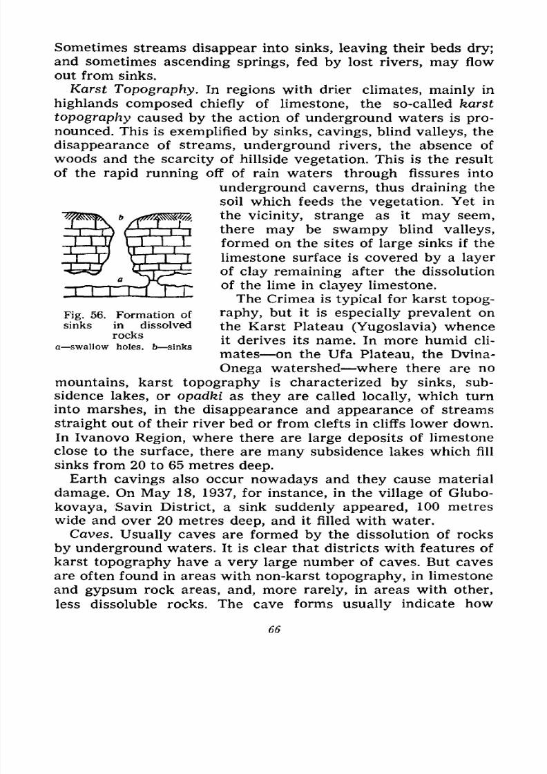
7/28/2019 Fundamentals of Geology - 19th century - Russia text in English
http://slidepdf.com/reader/full/fundamentals-of-geology-19th-century-russia-text-in-english 67/375
Sometimes streams disappear into sinks, leaving their beds dry;
and sometimes ascending springs, fed by lost rivers, may flow
out from sinks.
Karst Topography. In regions with drier climates, mainly in
highlands composed chiefly of limestone, the so-called karst
topography caused by the action of underground waters is pro-
nounced. This is exemplified by sinks, cavings, blind valleys, the
disappearance of streams, underground rivers, the absence of
woods and the scarcity of hillside vegetation. This is the result
of the rapid running off of rain waters through fissures into
underground caverns, thus draining the
soil which feeds the vegetation. Yet in
the vicinity, strange as it may seem,
there may be swampy blind valleys,
formed on the sites of large sinks if the
limestone surface is covered by a layer
of clay remaining after the dissolution
of the lime in clayey limestone.
The Crimea is typical for karst topog-
raphy, but it is especially prevalent on
the Karst Plateau (Yugoslavia) whence
it derives its name. In more humid cli-
mates on the Ufa Plateau, the Dvina-
Onega watershed where there are no
mountains, karst topography is characterized by sinks, sub-
sidence lakes, or opadki as they are called locally, which turn
into marshes, in the disappearance and appearance of streams
straight out of their river bed or from clefts in cliffs lower down.
In Ivanovo Region, where there are large deposits of limestone
close to the surface, there are many subsidence lakes which fill
sinks from 20 to 65 metres deep.
Earth cavings also occur nowadays and they cause material
damage. On May 18, 1937, for instance, in the village of Glubo-
kovaya, Savin District, a sink suddenly appeared, 100 metres
wide and over 20 metres deep, and it filled with water.
Caves. Usually caves are formed by the dissolution of rocks
by underground waters. It is clear that districts with features of
karst topography have a very large number of caves. But cavesare often found in areas with non-karst topography, in limestone
and gypsum rock areas, and, more rarely, in areas with other,
less dissoluble rocks. The cave forms usually indicate how
Fig. 56. Formation of
sinks in dissolved
rocksa swallow holes, b sinks
66
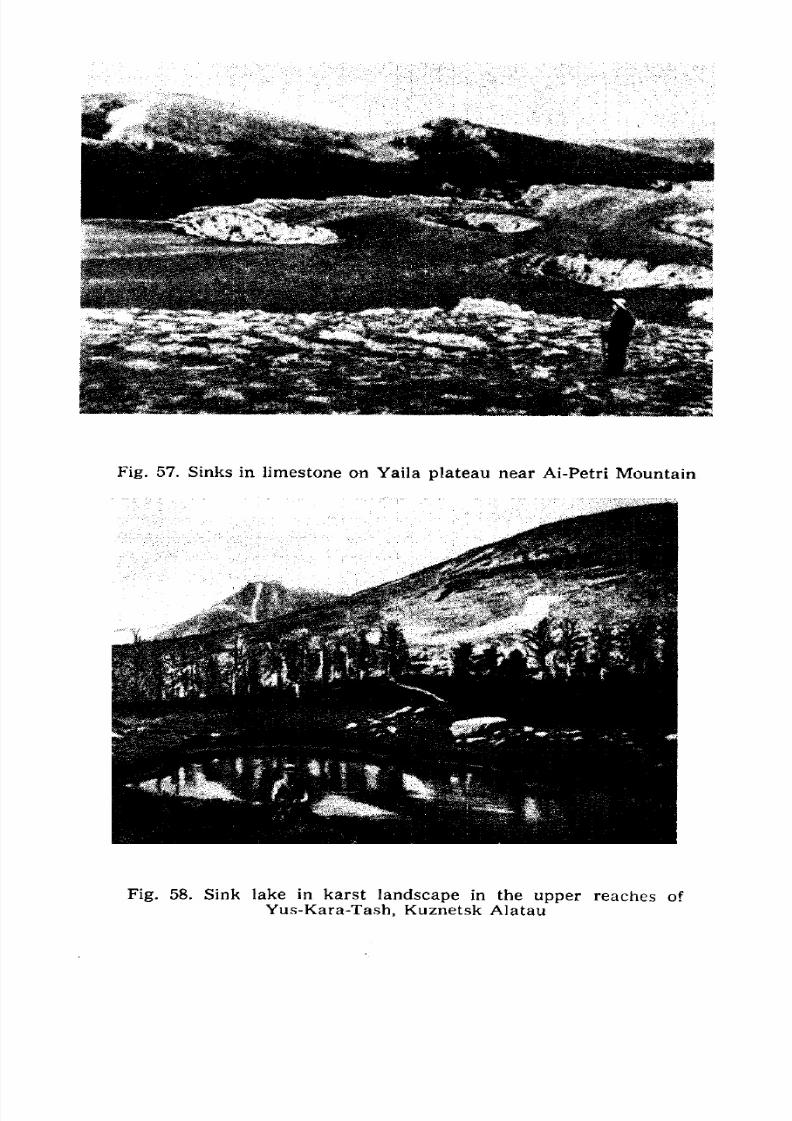
7/28/2019 Fundamentals of Geology - 19th century - Russia text in English
http://slidepdf.com/reader/full/fundamentals-of-geology-19th-century-russia-text-in-english 68/375
Fig. 57. Sinks in limestone on Yaila plateau near Ai-Petri Mountain
Fig. 58. Sink lake in karst landscape in the upper reaches of
Yus-Kara-Tash, Kuznetsk Alatau
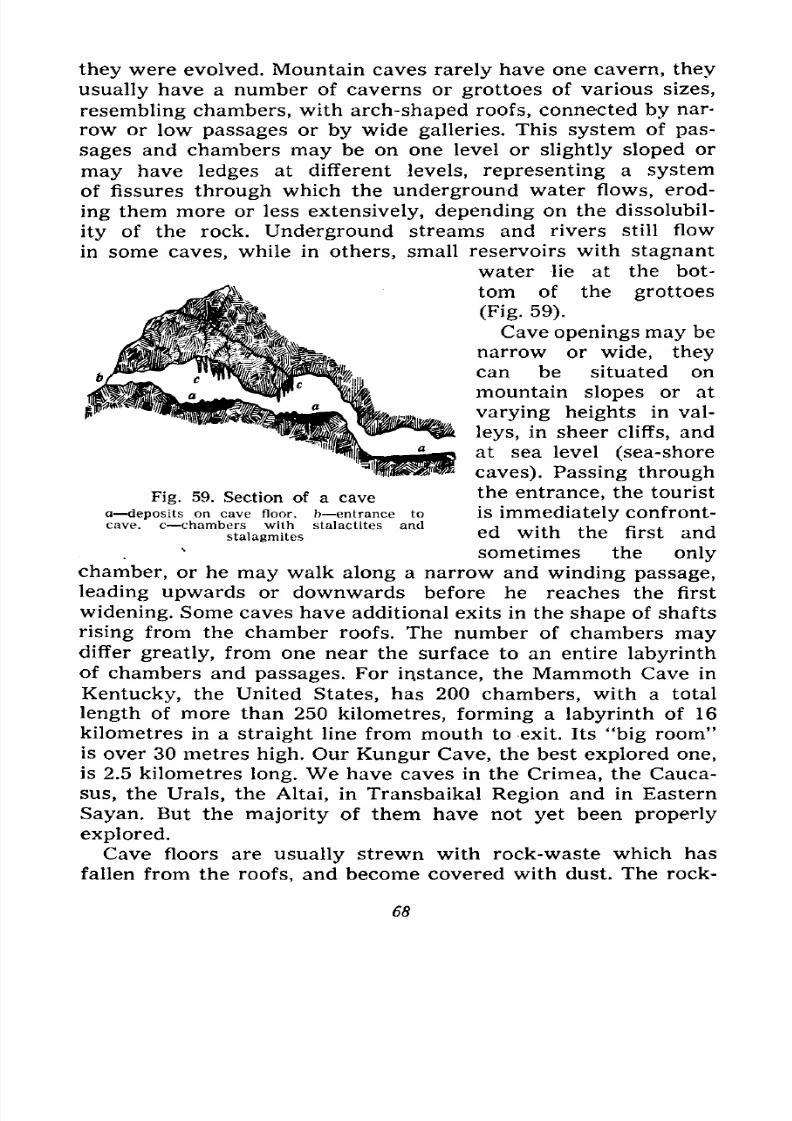
7/28/2019 Fundamentals of Geology - 19th century - Russia text in English
http://slidepdf.com/reader/full/fundamentals-of-geology-19th-century-russia-text-in-english 69/375
they were evolved. Mountain caves rarely have one cavern, they
usually have a number of caverns or grottoes of various sizes,
resembling chambers, with arch-shaped roofs, connected by nar-
row or low passages or by wide galleries. This system of pas-
sages and chambers may be on one level or slightly sloped or
may have ledges at different levels, representing a system
of fissures through which the underground water flows, erod-
ing them more or less extensively, depending on the dissolubil-
ity of the rock. Underground streams and rivers still flow
in some caves, while in others, small reservoirs with stagnant
water lie at the bot-
tom of the grottoes
(Fig. 59).
Cave openings may be
narrow or wide, they
can be situated on
mountain slopes or at
varying heights in val-
leys, in sheer cliffs, and
at sea level (sea-shore
caves). Passing through
the entrance, the tourist
is immediately confront-
ed with the first and
sometimes the only
chamber, or he may walk along a narrow and winding passage,
leading upwards or downwards before he reaches the first
widening. Some caves have additional exits in the shape of shafts
rising from the chamber roofs. The number of chambers maydiffer greatly, from one near the surface to an entire labyrinth
of chambers and passages. For instance, the Mammoth Cave in
Kentucky, the United States, has 200 chambers, with a total
length of more than 250 kilometres, forming a labyrinth of 16
kilometres in a straight line from mouth to exit. Its "big room"
is over 30 metres high. Our Kungur Cave, the best explored one,
is 2.5 kilometres long. We have caves in the Crimea, the Cauca-
sus, the Urals, the Altai, in Transbaikal Region and in Eastern
Sayan. But the majority of them have not yet been properly
explored.
Cave floors are usually strewn with rock-waste which has
fallen from the roofs, and become covered with dust. The rock-
Fig. 59. Section of a cave
a deposits on cave floor, b entrance to
cave, c -chambers with stalactites and
stalagmites
68
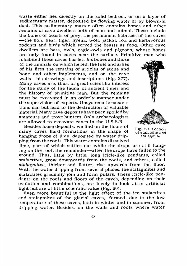
7/28/2019 Fundamentals of Geology - 19th century - Russia text in English
http://slidepdf.com/reader/full/fundamentals-of-geology-19th-century-russia-text-in-english 70/375
waste either lies directly on the solid bedrock or on a layer of
sedimentary matter, deposited by flowing water or by blown-in
dust. This sedimentary matter often contains bones and other
remains of cave dwellers both of man and animal. These include
the bones of beasts of prey, the permanent habitues of the caves
the lion, bear, tiger, hyena, wolf, jackal, fox and herbivorous
rodents and birds which served the beasts as food. Other cave
dwellers are bats, owls, eagle-owls and pigeons, whose bones
are only found in caves near the surface. Primitive man who
inhabited these caves has left his bones and those
of the animals on which he fed, the fuel and ashes
of his fires, the remains of articles of stone and
bone and other implements, and on the cave
walls his drawings and inscriptions (Fig. 277).
Many caves are, thus, of great scientific interest
for the study of the fauna of ancient times and
the history of primitive man. But the remains
must be excavated in an orderly manner under
the supervision of experts. Unsystematic excava-
tions can but lead to the destruction of valuable
material. Many cave deposits have been spoiled by
amateurs and trove hunters. Only archaeologists
are allowed to excavate caves in the U.S.S.R.
Besides loose deposits, we find on the floors of
many caves hard formations in the shape of
hanging drops of lime, deposited by water drip-
ping from the roofs. This water contains dissolved
lime, part of which settles out while the drops are still hang-
ing on the roof, the remainder after the drops have fallen to the
ground. Thus, little by little, long icicle-like pendants, called
stalactites, grow downwards from the roofs, and others, called
stalagmites, thicker and flatter, rise upwards from the floor.
With the water dripping from several places, the stalagmites and
stalactites gradually join and form pillars. These icicle-like pen-
dants on the roofs and floors of the caves, depending on their
evolution and combinations, are lovely to look at in artificial
light but are of little scientific value (Fig. 60).
Even more beautiful is the light effect of the ice stalactites
and stalagmites of the glacial caves, formed due to the low
temperature of these caves, both in winter and in summer, from
dripping water. Besides, on the walls and roofs where water
Fig. 60. Section
of stalactite and
stalagmite
69
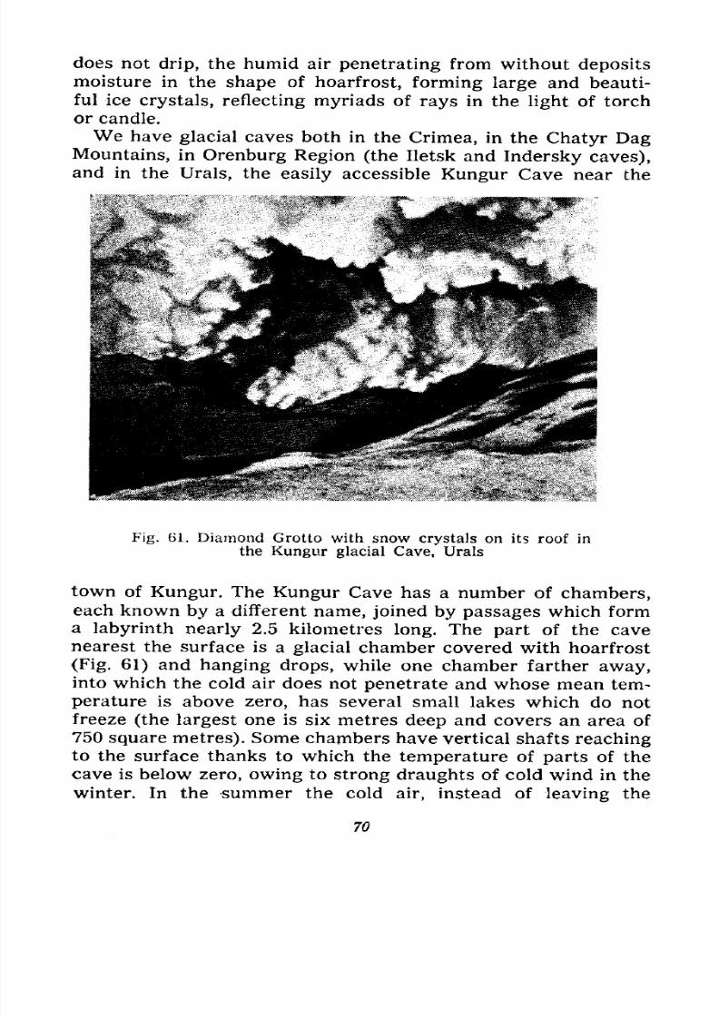
7/28/2019 Fundamentals of Geology - 19th century - Russia text in English
http://slidepdf.com/reader/full/fundamentals-of-geology-19th-century-russia-text-in-english 71/375
does not drip, the humid air penetrating from without deposits
moisture in the shape of hoarfrost, forming large and beauti-
ful ice crystals, reflecting myriads of rays in the light of torch
or candle.
We have glacial caves both in the Crimea, in the
Chatyr DagMountains, in Orenburg Region (the Iletsk and Indersky caves),
and in the Urals, the easily accessible Kungur Cave near the
Fig. 61. Diamond Grotto with snow crystals on its roof in
the Kungur glacial Cave, Urals
town of Kungur. The Kungur Cave has a number of chambers,each known by a different name, joined by passages which form
a labyrinth nearly 2.5 kilometres long. The part of the cave
nearest the surface is a glacial chamber covered with hoarfrost
(Fig. 61) and hanging drops, while one chamber farther away,into which the cold air does not penetrate and whose mean tem-
perature is above zero, has several small lakes which do not
freeze (the largest one is six metres deep and covers an area of
750 square metres). Some chambers have vertical shafts reachingto the surface thanks to which the temperature of parts of the
cave is below zero, owing to strong draughts of cold wind in the
winter. In the summer the cold air, instead of leaving the
70
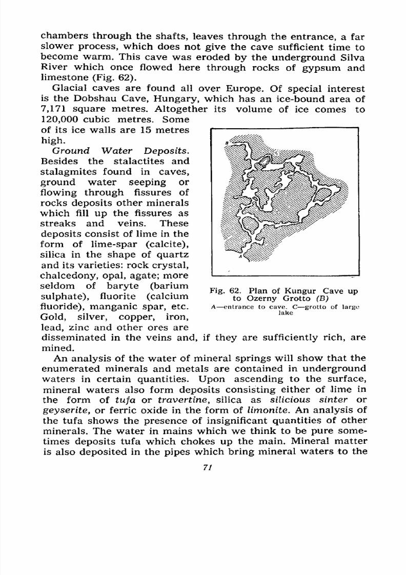
7/28/2019 Fundamentals of Geology - 19th century - Russia text in English
http://slidepdf.com/reader/full/fundamentals-of-geology-19th-century-russia-text-in-english 72/375
chambers through the shafts, leaves through the entrance, a far
slower process, which does not give the cave sufficient time to
become warm. This cave was eroded by the underground Silva
River which once flowed here through rocks of gypsum and
limestone (Fig. 62).
Glacial caves are found all over Europe. Of special interest
is the Dobshau Cave, Hungary, which has an ice-bound area of
7,171 square metres. Altogether its volume of ice comes to
120,000 cubic metres. Some
of its ice walls are 15 metres
high.
Ground Water Deposits.
Besides the stalactites and
stalagmites found in caves,
ground water seeping or
flowing through fissures of
rocks deposits other minerals
which fill up the fissures as
streaks and veins. These
deposits consist of lime in the
form of lime-spar (calcite),
silica in the shape of quartz
and its varieties: rock crystal,
chalcedony, opal, agate; more
seldom of baryte (barium
sulphate), fluorite (calcium
fluoride), manganic spar, etc.
Gold, silver, copper, iron,
lead, zinc and other ores are
disseminated in the veins and, if they are sufficiently rich, are
mined.
An analysis of the water of mineral springs will show that the
enumerated minerals and metals are contained in underground
waters in certain quantities. Upon ascending to the surface,
mineral waters also form deposits consisting either of lime in
the form of tufa or travertine, silica as silicious sinter or
geyserite, or ferric oxide in the form of limonite. An analysis of
the tufa shows the presence of insignificant quantities of other
minerals. The water in mains which we think to be pure some-
times deposits tufa which chokes up the main. Mineral matter
is also deposited in the pipes which bring mineral waters to the
Fig. 62. Plan of Kungur Cave upto Ozerny Grotto (B)
A entrance to cave. C grotto of large
lake
71
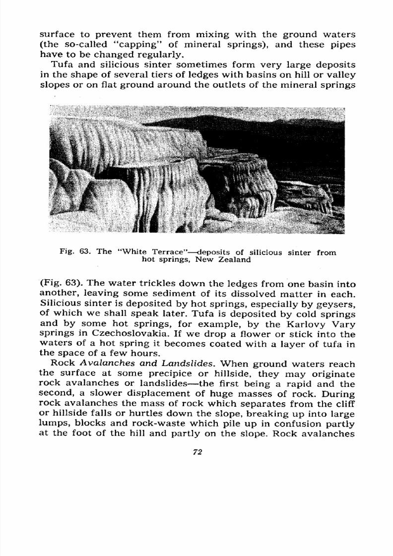
7/28/2019 Fundamentals of Geology - 19th century - Russia text in English
http://slidepdf.com/reader/full/fundamentals-of-geology-19th-century-russia-text-in-english 73/375
surface to prevent them from mixing with the ground waters
(the so-called "capping" of mineral springs), and these pipes
have to be changed regularly.
Tufa and silicious sinter sometimes form very large deposits
in the shape of several tiers of ledges with basins on hill or valley
slopes or on flat ground around the outlets of the mineral springs
Fig. 63. The "White Terrace" deposits of silicious sinter fromhot springs, New Zealand
(Fig. 63). The water trickles down the ledges from one basin into
another, leaving some sediment of its dissolved matter in each.
Silicious sinter is deposited by hot springs, especially by geysers,of which we shall speak later. Tufa is deposited by cold springs
and by some hot springs, for example, by the Karlovy Varysprings in Czechoslovakia. If we drop a flower or stick into the
waters of a hot spring it becomes coated with a layer of tufa in
the space of a few hours.
Rock Avalanches and Landslides. When ground waters reach
the surface at some precipice or hillside, they may originaterock avalanches or landslides the first being a rapid and the
second, a slower displacement of huge masses of rock. During
rock avalanches the mass of rock which separates from the cliff
or hillside falls or hurtles down the slope, breaking up into large
lumps, blocks and rock-waste which pile up in confusion partlyat the foot of the hill and partly on the slope. Rock avalanches
72
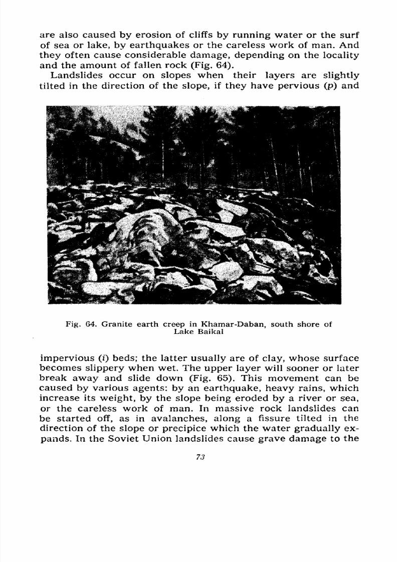
7/28/2019 Fundamentals of Geology - 19th century - Russia text in English
http://slidepdf.com/reader/full/fundamentals-of-geology-19th-century-russia-text-in-english 74/375
are also caused by erosion of cliffs by running water or the surf
of sea or lake, by earthquakes or the careless work of man. And
they often cause considerable damage, depending on the locality
and the amount of fallen rock (Fig. 64).
Landslides occur on slopes when their layers are slightly
tilted in the direction of the slope, if they have pervious (p) and
Fig.64.
Granite earth creepin
Khamar-Daban, south shore ofLake Baikal
impervious (i) beds; the latter usually are of clay, whose surface
becomes slippery when wet. The upper layer will sooner or later
break away and slide down (Fig. 65). This movement can be
caused by various agents: by an earthquake, heavy rains, which
increase its weight, by the slope being eroded by a river or sea,
or the careless work of man. In massive rock landslides canbe started off, as in avalanches, along a fissure tilted in the
direction of the slope or precipice which the water gradually ex-
pands. In the Soviet Union landslides cause grave damage to the
73
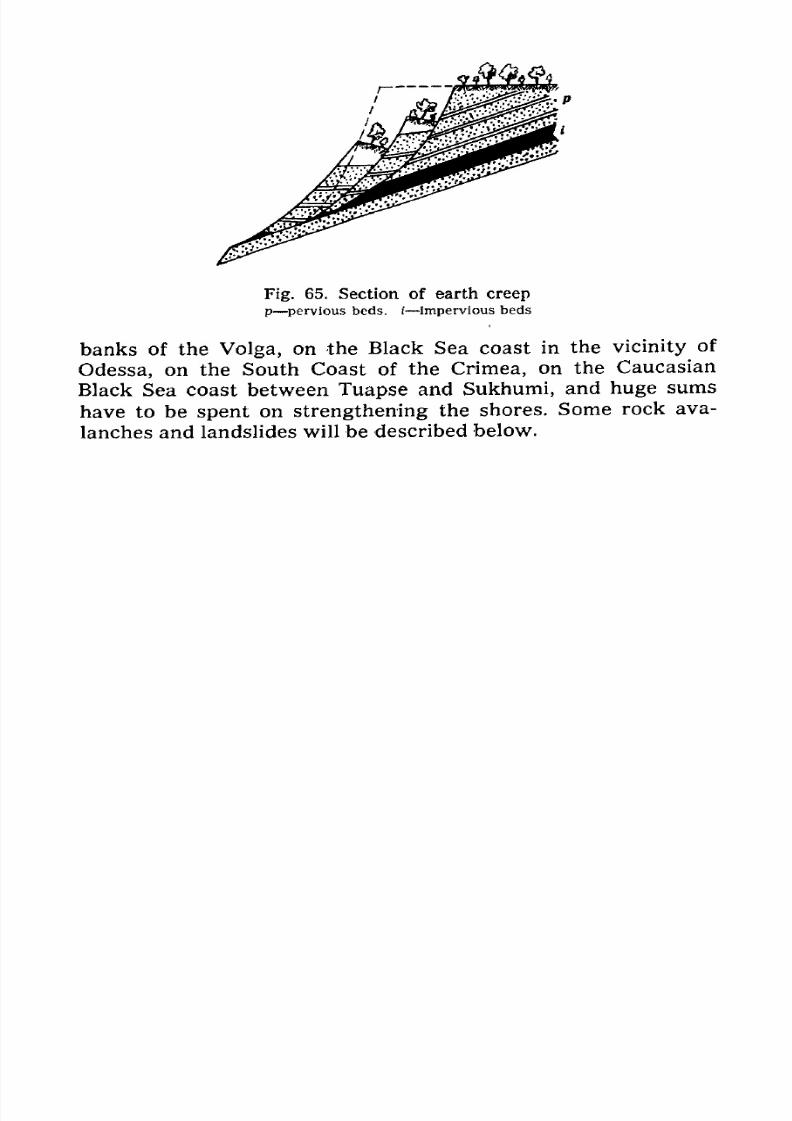
7/28/2019 Fundamentals of Geology - 19th century - Russia text in English
http://slidepdf.com/reader/full/fundamentals-of-geology-19th-century-russia-text-in-english 75/375
Fig. 65. Section of earth creep
p pervious beds, i impervious beds
banks of the Volga, on the Black Sea coast in the vicinity of
Odessa, on the South Coast of the Crimea, on the Caucasian
Black Sea coast between Tuapse and Sukhumi, and huge sums
have to be spent on strengthening the shores. Some rock ava-
lanches and landslides will be described below.
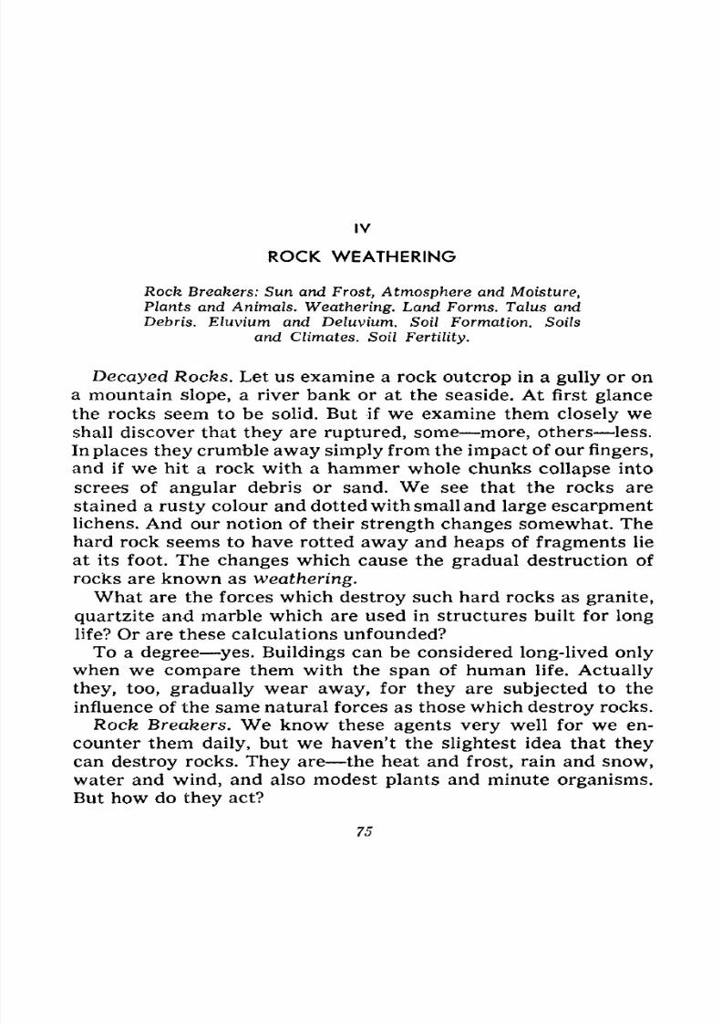
7/28/2019 Fundamentals of Geology - 19th century - Russia text in English
http://slidepdf.com/reader/full/fundamentals-of-geology-19th-century-russia-text-in-english 76/375
IV
ROCK WEATHERING
RockBreakers:
Sun and Frost, Atmosphere and Moisture,Plants and Animals. Weathering. Land Forms. Talus and
Debris. Eluvium and Deluvium. Soil Formation. Soils
and Climates. Soil Fertility.
Decayed Rocks. Let us examine a rock outcrop in a gully or on
a mountain slope, a river bank or at the seaside. At first glance
the rocks seem to be solid. But if we examine them closely we
shall discover that they are ruptured, some more, others less.
In places they crumble away simply from the impact of our fingers,
and if we hit a rock with a hammer whole chunks collapse into
screes of angular debris or sand. We see that the rocks are
stained a rusty colour and dotted with small and large escarpmentlichens. And our notion of their strength changes somewhat. The
hard rock seems to have rotted away and heaps of fragments lie
at its foot. The changes which cause the gradual destruction of
rocks are known as weathering.
What are the forces which destroy such hard rocks as granite,
quartzite and marble which are used in structures built for long
life? Or are these calculations unfounded?
To a degree yes. Buildings can be considered long-lived only
when we compare them with the span of human life. Actually
they, too, gradually wear away, for they are subjected to the
influence of the same natural forces as those which destroy rocks.
Rock Breakers. We know these agents very well for we en-
counter them daily, but we haven't the slightest idea that theycan destroy rocks. They are the heat and frost, rain and snow,
water and wind, and also modest plants and minute organisms.
But how do they act?
75
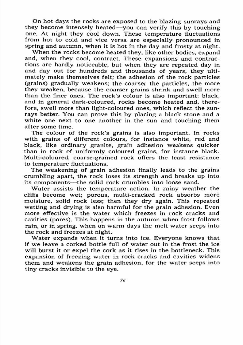
7/28/2019 Fundamentals of Geology - 19th century - Russia text in English
http://slidepdf.com/reader/full/fundamentals-of-geology-19th-century-russia-text-in-english 77/375
On hot days the rocks are exposed to the blazing sunrays and
they become intensely heated you can verify this by touching
one. At night they cool down. These temperature fluctuations
from hot to cold and vice versa are especially pronounced in
spring and autumn, when it is hot in the day and frosty at night.
When the rocks become heated they, like other bodies, expand
and, when they cool, contract. These expansions and contrac-
tions are hardly noticeable, but when they are repeated day in
and day out for hundreds and thousands of years, they ulti-
mately make themselves felt; the adhesion of the rock particles
(grains) gradually weakens; the coarser the particles, the more
they weaken, because the coarser grains shrink and swell more
than the finer ones. The rock's colour is also important: black,
and in general dark-coloured, rocks become heated and, there-
fore, swell more than light-coloured ones, which reflect the sun-
rays better. You can prove this by placing a black stone and a
white one next to one another in the sun and touching them
after some time.
The colour of the rock's grains is also important. In rocks
with grains of different colours, for instance white, red and
black, like ordinary granite, grain adhesion weakens quicker
than in rock of uniformly coloured grains, for instance black.
Multi-coloured, coarse-grained rock offers the least resistance
to temperature fluctuations.
The weakening of grain adhesion finally leads to the grains
crumbling apart, the rock loses its strength and breaks up into
its components the solid rock crumbles into loose sand.
Water assists the temperature action. In rainy weather the
cliffs become wet; porous, multi-cracked rock absorbs more
moisture, solid rock less; then they dry again. This repeated
wetting and drying is also harmful for the grain adhesion. Even
more effective is the water which freezes in rock cracks and
cavities (pores). This happens in the autumn when frost follows
rain, or in spring, when on warm days the melt water seeps into
the rock and freezes at night.
Water expands when it turns into ice. Everyone knows that
if we leave a corked bottle full of water out in the frost the ice
will burst it or expel the cork as it rises in the bottleneck. This
expansion of freezing water in rock cracks and cavities widens
them and weakens the grain adhesion, for the water seeps into
tiny cracks invisible to the eye.
76
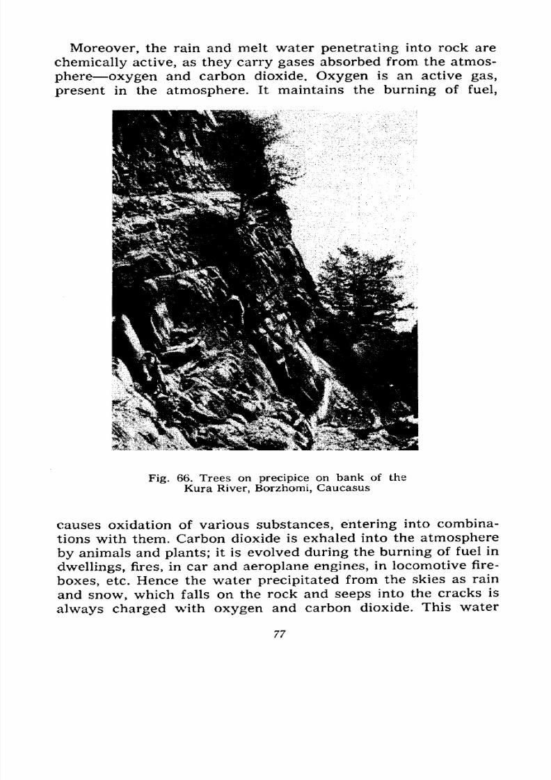
7/28/2019 Fundamentals of Geology - 19th century - Russia text in English
http://slidepdf.com/reader/full/fundamentals-of-geology-19th-century-russia-text-in-english 78/375
Moreover, the rain and melt water penetrating into rock are
chemically active, as they carry gases absorbed from the atmos-
phere oxygen and carbon dioxide. Oxygen is an active gas,
present in the atmosphere. It maintains the burning of fuel,
Fig. 66. Trees on precipice on bank of the
Kura River, Borzhomi, Caucasus
causes oxidation of various substances, entering into combina-
tions with them. Carbon dioxide is exhaled into the atmosphere
by animals and plants; it is evolved during the burning of fuel in
dwellings, fires, in car and aeroplane engines, in locomotive fire-
boxes, etc. Hence the water precipitated from the skies as rain
and snow, which falls on the rock and seeps into the cracks is
always charged with oxygen and carbon dioxide. This water
77
7/28/2019 Fundamentals of Geology - 19th century - Russia text in English
http://slidepdf.com/reader/full/fundamentals-of-geology-19th-century-russia-text-in-english 79/375
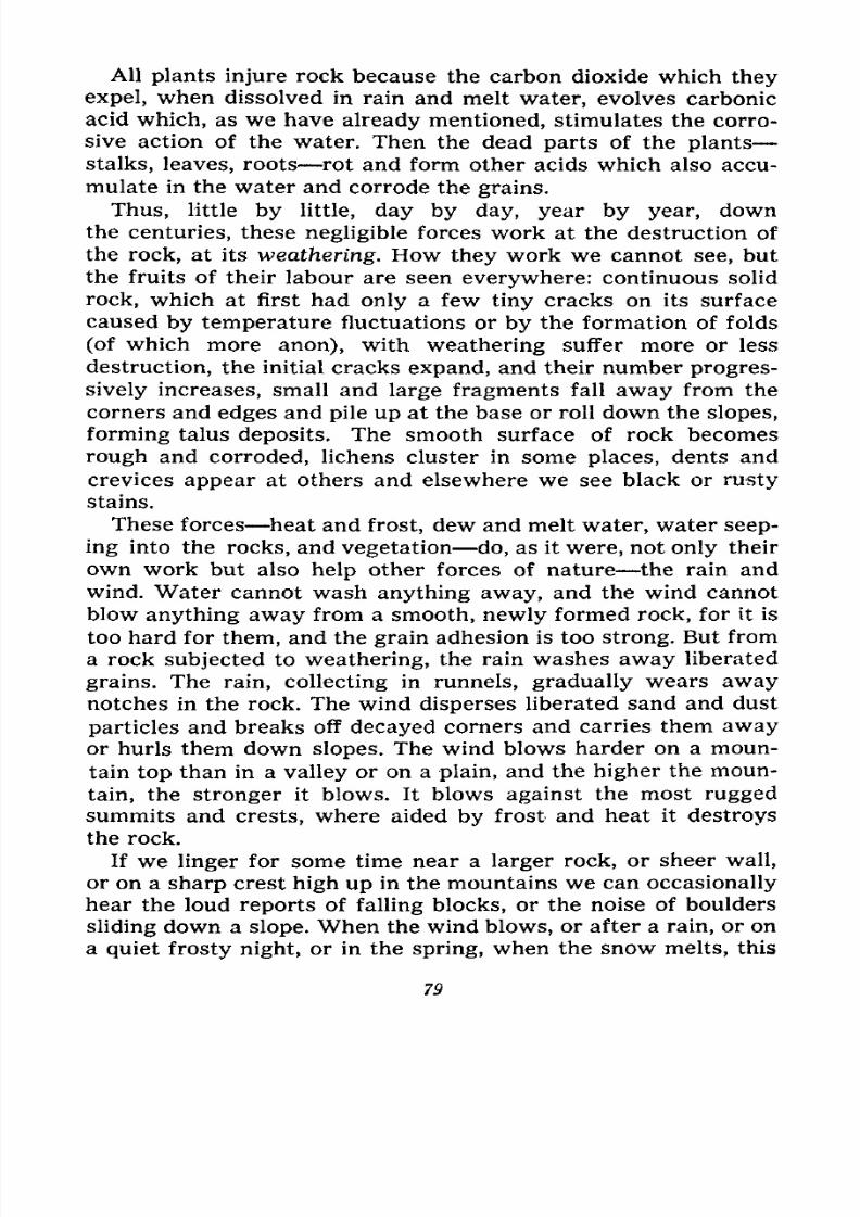
7/28/2019 Fundamentals of Geology - 19th century - Russia text in English
http://slidepdf.com/reader/full/fundamentals-of-geology-19th-century-russia-text-in-english 80/375
All plants injure rock because the carbon dioxide which they
expel, when dissolved in rain and melt water, evolves carbonic
acid which, as we have already mentioned, stimulates the corro-
sive action of the water. Then the dead parts of the plants
stalks, leaves, roots rot and form other acids which also accu-
mulate in the water and corrode the grains.
Thus, little by little, day by day, year by year, downthe centuries, these negligible forces work at the destruction of
the rock, at its weathering. How they work we cannot see, but
the fruits of their labour are seen everywhere: continuous solid
rock, which at first had only a few tiny cracks on its surface
caused by temperature fluctuations or by the formation of folds
(ofwhich more
anon),with
weatheringsuffer
moreor less
destruction, the initial cracks expand, and their number progres-
sively increases, small and large fragments fall away from the
corners and edges and pile up at the base or roll down the slopes,
forming talus deposits. The smooth surface of rock becomes
rough and corroded, lichens cluster in some places, dents and
crevices appear at others and elsewhere we see black or rusty
stains.
These forces heat and frost, dew and melt water, water seep-ing into the rocks, and vegetation do, as it were, not only their
own work but also help other forces of nature the rain and
wind. Water cannot wash anything away, and the wind cannot
blow anything away from a smooth, newly formed rock, for it is
too hard for them, and the grain adhesion is too strong. But from
a rock subjected to weathering, the rain washes away liberated
grains. The rain, collecting in runnels, gradually wears away
notches in the rock. The wind disperses liberated sand and dust
particles and breaks off decayed corners and carries them awayor hurls them down slopes. The wind blows harder on a moun-
tain top than in a valley or on a plain, and the higher the moun-
tain, the stronger it blows. It blows against the most rugged
summits and crests, where aided by frost and heat it destroys
the rock.
If we linger for some time near a larger rock, or sheer wall,
or on a sharp crest high up in the mountains we can occasionallyhear the loud reports of falling blocks, or the noise of boulders
sliding down a slope. When the wind blows, or after a rain, or on
a quiet frosty night, or in the spring, when the snow melts, this
79
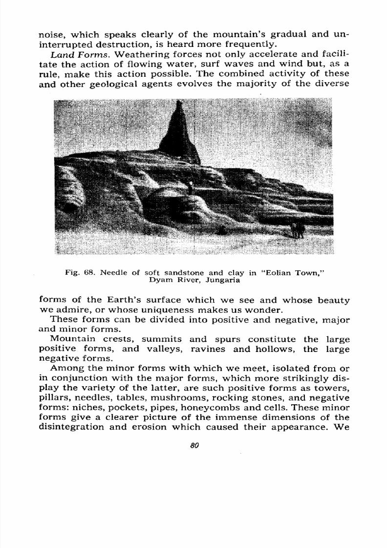
7/28/2019 Fundamentals of Geology - 19th century - Russia text in English
http://slidepdf.com/reader/full/fundamentals-of-geology-19th-century-russia-text-in-english 81/375
noise, which speaks clearly of the mountain's gradual and un-
interrupted destruction, is heard more frequently.
Land Forms. Weathering forces not only accelerate and facili-
tate the action of flowing water, surf waves and wind but, as a
rule, make this action possible. The combined activity of these
and other geological agents evolves the majority of the diverse
Fig. 68. Needle of soft sandstone and clay in "Eolian Town,"Dyam River, Jungaria
forms of the Earth's surface which we see and whose beautywe admire, or whose uniqueness makes us wonder.
These forms can be divided into positive and negative, majorand minor forms.
Mountain crests, summits and spurs constitute the large
positive forms, and valleys, ravines and hollows, the large
negative forms.
Among the minor forms with which we meet, isolated from or
in conjunction with the major forms, which more strikingly dis-
play the variety of the latter, are such positive forms as towers,
pillars, needles, tables, mushrooms, rocking stones, and negativeforms: niches, pockets, pipes, honeycombs and cells. These minor
forms give a clearer picture of the immense dimensions of the
disintegration and erosion which caused their appearance. We
80
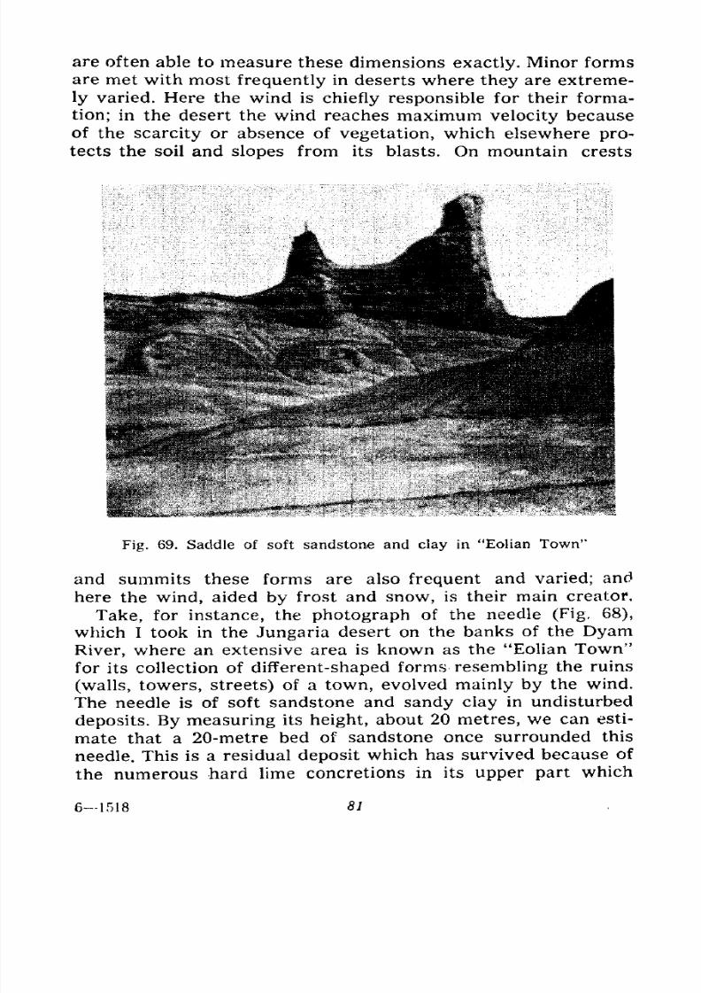
7/28/2019 Fundamentals of Geology - 19th century - Russia text in English
http://slidepdf.com/reader/full/fundamentals-of-geology-19th-century-russia-text-in-english 82/375
are often able to measure these dimensions exactly. Minor forms
are met with most frequently in deserts where they are extreme-
ly varied. Here the wind is chiefly responsible for their forma-
tion; in the desert the wind reaches maximum velocity because
of the scarcity or absence of vegetation, which elsewhere pro-
tects the soil and slopes from its blasts. On mountain crests
Fig. 69. Saddle of soft sandstone and clay in "Eolian Town"
and summits these forms are also frequent and varied; and
here the wind, aided by frost and snow, is their main creator.
Take, for instance, the photograph of the needle (Fig, 68),
which I took in the Jungaria desert on the banks of the DyamRiver, where an extensive area is known as the "Eolian Town"
for its collection of different-shaped forms resembling the ruins
(walls, towers, streets) of a town, evolved mainly by the wind.
The needle is of soft sandstone and sandy clay in undisturbed
deposits. By measuring its height, about 20 metres, we can esti-
mate that a 20-metre bed of sandstone once surrounded this
needle. This is a residual deposit which has survived because of
the numerous hard lime concretions in its upper part which
61518 81
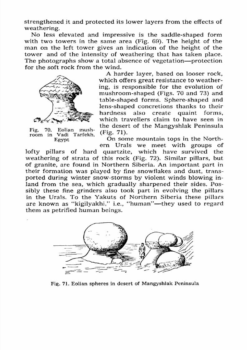
7/28/2019 Fundamentals of Geology - 19th century - Russia text in English
http://slidepdf.com/reader/full/fundamentals-of-geology-19th-century-russia-text-in-english 83/375
strengthened it and protected its lower layers from the effects of
weathering.
No less elevated and impressive is the saddle-shaped form
with two towers in the same area (Fig. 69). The height of the
man on the left towergives
an indication of theheight
of the
tower and of the intensity of weathering that has taken place.
The photographs show a total absence of vegetation protection
for the soft rock from the wind.
A harder layer, based on looser rock,
which offers great resistance to weather-
ing, is responsible for the evolution of
mushroom-shaped (Figs. 70 and 73) and
table-shaped forms. Sphere-shaped andlens-shaped concretions thanks to their
hardness also create quaint forms,
which travellers claim to have seen in
the desert of the Mangyshlak Peninsula
(Fig. 71).
On some mountain tops in the North-
ern Urals we meet with groups of
lofty pillars of hard quartzite, which have survived the
weathering of strata of this rock (Fig. 72). Similar pillars, but
of granite, are found in Northern Siberia. An important part in
their formation was played by fine snowflakes and dust, trans-
ported during winter snow-storms by violent winds blowing in-
land from the sea, which gradually sharpened their sides. Pos-
sibly these fine grinders also took part in evolving the pillars
in the Urals. To the Yakuts of Northern Siberia these pillars
are known as "kigilyakhi," i.e., "human" they used to regard
them as petrified human beings.
Fig. 70. Eolian mush-
room in Vadi Tarfekh,
Egypt
Fig. 71. Eolian spheres in desert of Mangyshlak Peninsula
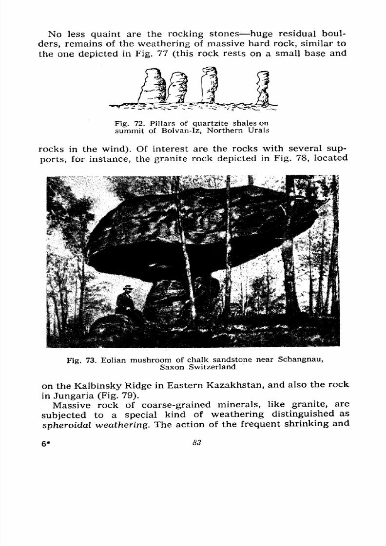
7/28/2019 Fundamentals of Geology - 19th century - Russia text in English
http://slidepdf.com/reader/full/fundamentals-of-geology-19th-century-russia-text-in-english 84/375
No less quaint are the rocking stones huge residual boul-
ders, remains of the weathering of massive hard rock, similar to
the one depicted in Fig. 77 (this rock rests on a small base and
Fig. 72. Pillars of quartzite shales on
summit of Bolvan-Iz, Northern Urals
rocks in the wind). Of interest are the rocks with several sup-
ports, for instance, the granite rock depicted in Fig. 78, located
Fig. 73. Eolian mushroom of chalk sandstone near Schangnau,
Saxon Switzerland
on the Kalbinsky Ridge in Eastern Kazakhstan, and also the rock
in Jungaria (Fig. 79).
Massive rock of coarse-grained minerals, like granite, are
subjected to a special kind of weathering distinguished as
spheroidal weathering. The action of the frequent shrinking and
6* 83
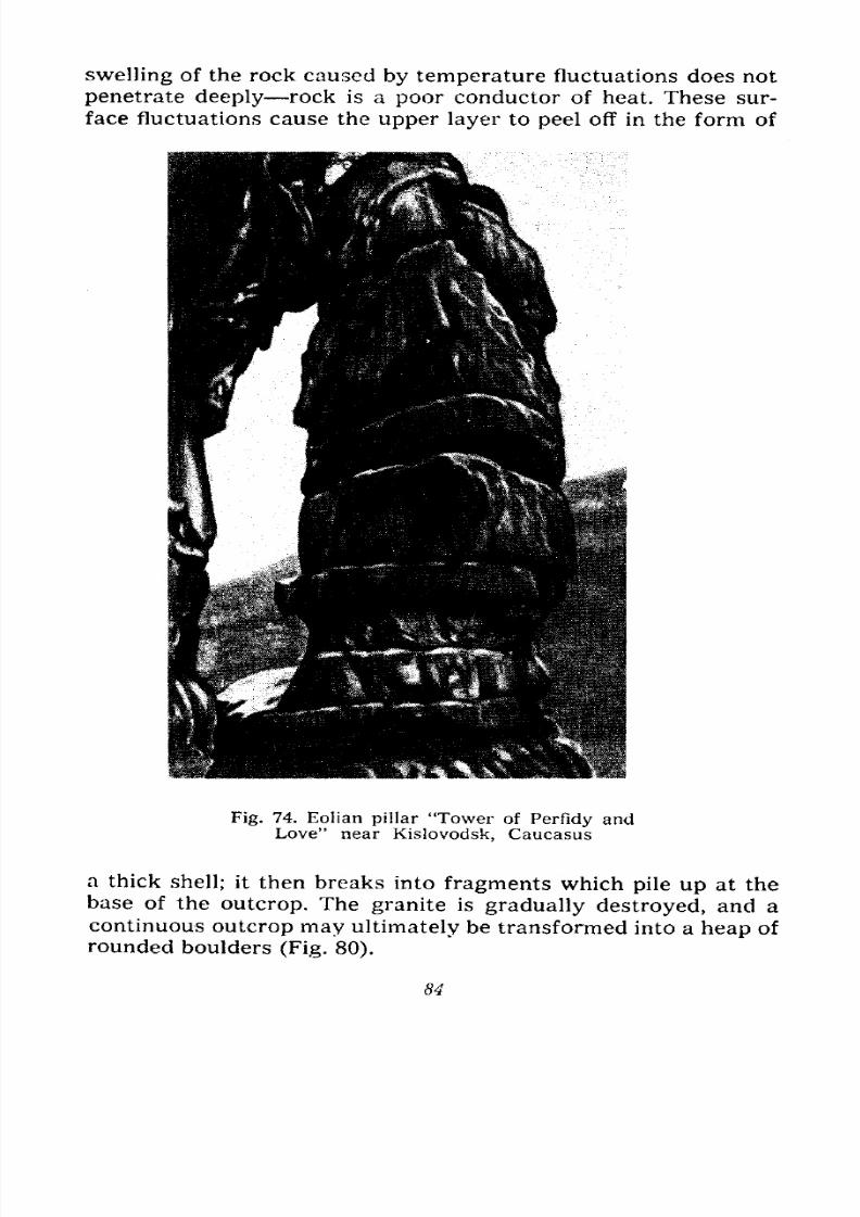
7/28/2019 Fundamentals of Geology - 19th century - Russia text in English
http://slidepdf.com/reader/full/fundamentals-of-geology-19th-century-russia-text-in-english 85/375
swelling of the rock caused by temperature fluctuations does not
penetrate deeply rock is a poor conductor of heat. These sur-
face fluctuations cause the upper layer to peel off in the form of
Fig. 74. Eolian pillar 'Tower of Perfidy andLove" near Kislovodsk, Caucasus
a thick shell; it then breaks into fragments which pile up at thebase of the outcrop. The granite is gradually destroyed, and a
continuous outcrop may ultimately be transformed into a heap of
rounded boulders (Fig. 80).
84
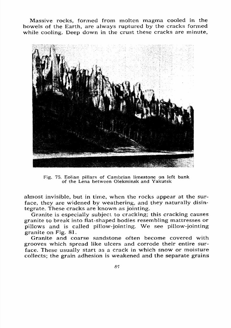
7/28/2019 Fundamentals of Geology - 19th century - Russia text in English
http://slidepdf.com/reader/full/fundamentals-of-geology-19th-century-russia-text-in-english 86/375
Massive rocks, formed from molten magma cooled in the
bowels of the Earth, are always ruptured by the cracks formed
while cooling. Deep down in the crust these cracks are minute,
Fig. 75. Eolian pillars of Cambrian limestone on left bank
of the Lena between Olekminsk and Yakutsk
almost invisible, but in time, when the rocks appear at the sur-
face, they are widened by weathering, and they naturally disin-
tegrate. These cracks are known as jointing.
Granite is especially subject to cracking; this cracking causes
granite to break into flat-shaped bodies resembling mattresses or
pillows and is called pillow-jointing. We see pillow-jointing
granite on Fig. 81.
Granite and coarse sandstone often become covered withgrooves which spread like ulcers and corrode their entire sur-
face. These usually start as a crack in which snow or moisture
collects; the grain adhesion is weakened and the separate grains
8r>
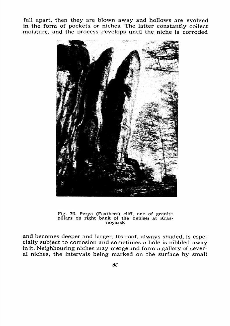
7/28/2019 Fundamentals of Geology - 19th century - Russia text in English
http://slidepdf.com/reader/full/fundamentals-of-geology-19th-century-russia-text-in-english 87/375
fall apart, then they are blown away and hollows are evolved
in the form of pockets or niches. The latter constantly collect
moisture, and the process develops until the niche is corroded
Fig. 76. Perya (Feathers) cliff, one of granite
pillars on right bank of the Yenisei at Kras-
noyarsk
and becomes deeper and larger. Its roof, always shaded, is espe-
cially subject to corrosion and sometimes a hole is nibbled awayin it. Neighbouring niches may merge and form a gallery of sever-
al niches, the intervals being marked on the surface by small
86
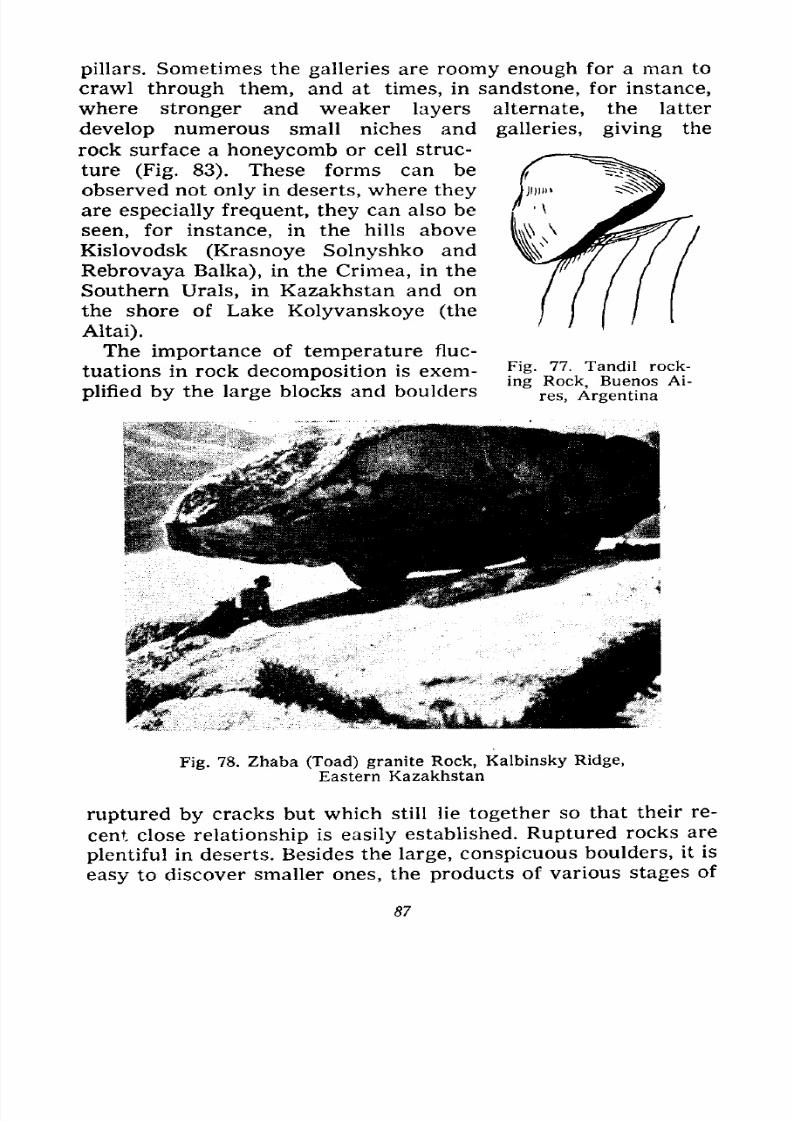
7/28/2019 Fundamentals of Geology - 19th century - Russia text in English
http://slidepdf.com/reader/full/fundamentals-of-geology-19th-century-russia-text-in-english 88/375
pillars. Sometimes the galleries are roomy enough for a man to
crawl through them, and at times, in sandstone, for instance,
where stronger and weaker layers alternate, the latter
develop numerous small niches and galleries, giving the
rock surface a honeycomb or cell struc-
ture (Fig. 83). These forms can be
observed not only in deserts, where they
are especially frequent, they can also be
seen, for instance, in the hills above
Kislovodsk (Krasnoye Solnyshko and
Rebrovaya Balka), in the Crimea, in the
Southern Urals, in Kazakhstan and on
the shore of Lake Kolyvanskoye (the
Altai).
The importance of temperature fluc-
tuations in rock decomposition is exem- Tl& 77 - Tandl1
ie j i ^i i 111 j i 11 ing Rock, Buenos Ai-
plmed by the large blocks and boulders res Argentina
Fig. 78. Zhaba (Toad) granite Rock, Kalbinsky Ridge,
Eastern Kazakhstan
ruptured by cracks but which still lie together so that their re-
cent close relationship is easily established. Ruptured rocks are
plentiful in deserts. Besides the large, conspicuous boulders, it is
easy to discover smaller ones, the products of various stages of
87
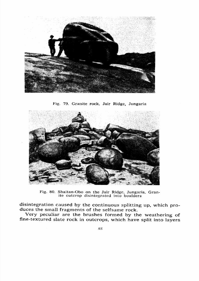
7/28/2019 Fundamentals of Geology - 19th century - Russia text in English
http://slidepdf.com/reader/full/fundamentals-of-geology-19th-century-russia-text-in-english 89/375
Fig. 79. Granite rock, Jair Ridge, Jungaria
Fig. 80. Shaitan-Obo on the Jair Ridge, Jungaria. Gran-ite outcrop disintegrated into boulders
disintegration caused by the continuous splitting up, which pro-duces the small fragments of the selfsame rock.
Very peculiar are the brushes formed by the weathering of
fine-textured slate rock in outcrops, which have split into layers

7/28/2019 Fundamentals of Geology - 19th century - Russia text in English
http://slidepdf.com/reader/full/fundamentals-of-geology-19th-century-russia-text-in-english 90/375
Fig. 81. Pillow-jointing granite in the Arkat Mountains,south of Semipalatinsk
Fig. 82. Grooves and cornices in red sandstone caused
by weathering in basin of the Jity-Oguz River, Tien-Shan
and spread out fan-wise at the rock surface, while deeper downthey still touch one another.
Desert varnish is a singular product of weathering. It is an
exceedingly thin film, hundredths of a millimetre thick, formed
89

7/28/2019 Fundamentals of Geology - 19th century - Russia text in English
http://slidepdf.com/reader/full/fundamentals-of-geology-19th-century-russia-text-in-english 91/375
on the surface of rock, separate blocks and even on boulders
and pebbles. It is of a dark brown or black colour and is
more or less shiny, like a stone's coat of varnish. This film is
composed of salts of iron, manganese and silica; a darker and
more brilliant film is evolved on the hardest and finest-grained
rocks which contain these elements; on coarse-grained granite
Fig. 83. Honeycomb weathering of chalk sand-
stone on the Alma River, Crimea
it forms brown spots, and on pure quartz dull yellow-brownish
spots. They appear only on the upper sides and are not found onthe lower sides of the boulders or debris.
In the desert, where this varnish is widespread, a fantastic
picture is produced: cliffs, rock fragments and boulders on level
ground are painted black, and when the weather is overcast it
is a miserable, depressing spectacle. But in fine weather the
scene brightens up, the varnish reflects the sunrays like a mirror
and tiny bluish lights sparkle everywhere on the slopes, rocks
and boulders. The origin of this varnish is not quite clear. It is
presumed that it is chiefly caused by dew and the fine dust
precipitated from the atmosphere; the dew derives the varnish
salts from the rock itself and from the dust. The spheroidal gran-
90
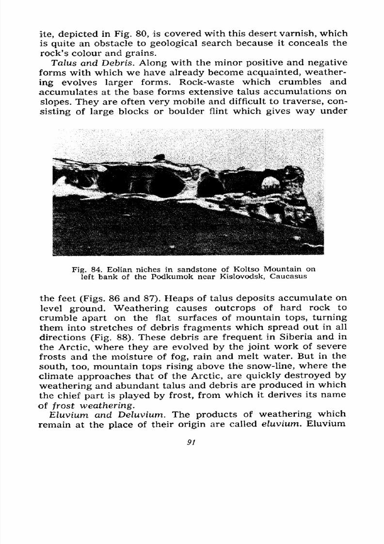
7/28/2019 Fundamentals of Geology - 19th century - Russia text in English
http://slidepdf.com/reader/full/fundamentals-of-geology-19th-century-russia-text-in-english 92/375
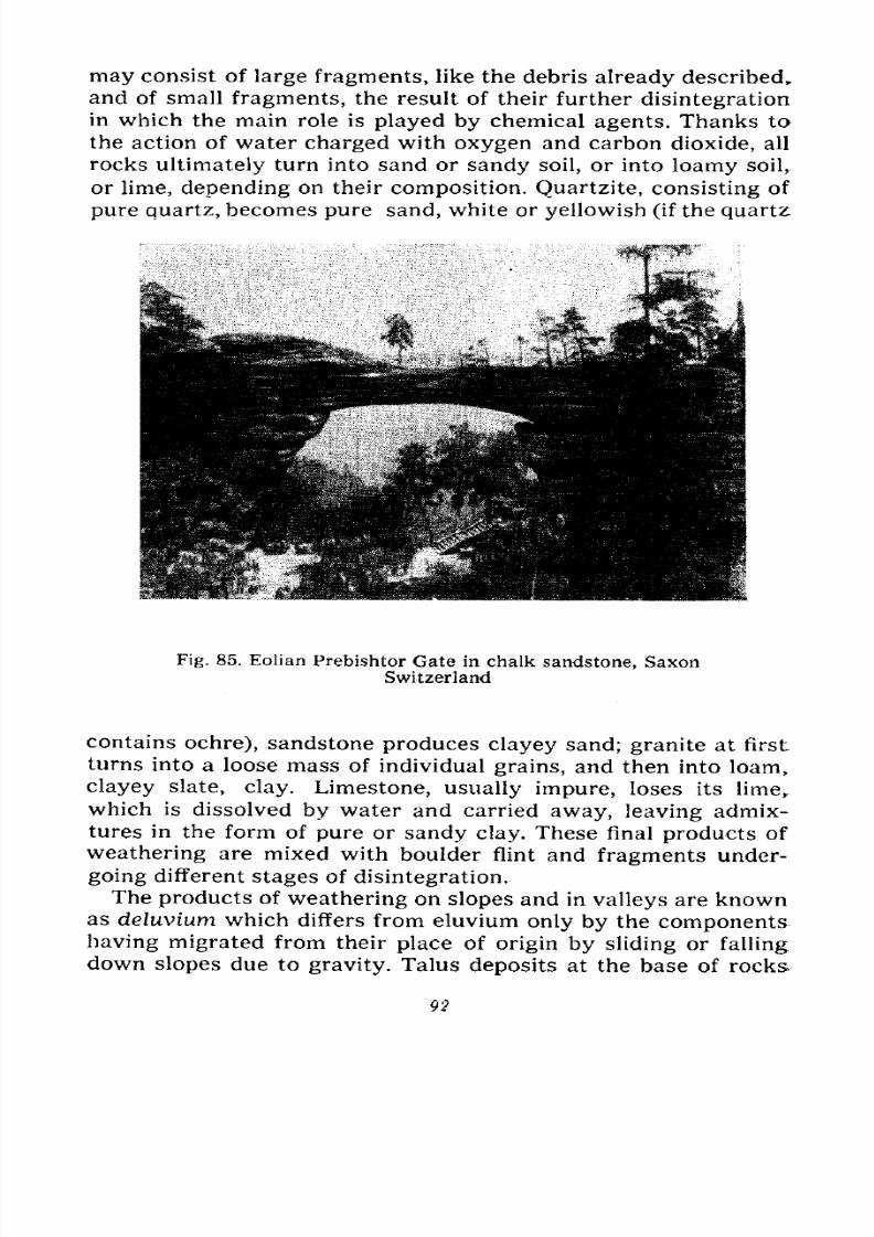
7/28/2019 Fundamentals of Geology - 19th century - Russia text in English
http://slidepdf.com/reader/full/fundamentals-of-geology-19th-century-russia-text-in-english 93/375
may consist of large fragments, like the debris already described,
and of small fragments, the result of their further disintegration
in which the main role is played by chemical agents. Thanks to
the action of water charged with oxygen and carbon dioxide, all
rocks ultimately turn into sand or sandy soil, or into loamy soil,
or lime, depending on their composition. Quartzite, consisting of
pure quartz, becomes pure sand, white or yellowish (if the quartz:
Fig. 85. Eolian Prebishtor Gate in chalk sandstone, SaxonSwitzerland
contains ochre), sandstone produces clayey sand; granite at first
turns into a loose mass of individual grains, and then into loam,
clayey slate, clay. Limestone, usually impure, loses its lime,
which is dissolved by water and carried away, leaving admix-
tures in the form of pure or sandy clay. These final products of
weathering are mixed with boulder flint and fragments under-
going different stages of disintegration.
The products of weathering on slopes and in valleys are knownas deluvium which differs from eluvium only by the components
having migrated from their place of origin by sliding or falling
down slopes due to gravity. Talus deposits at the base of rocks
92
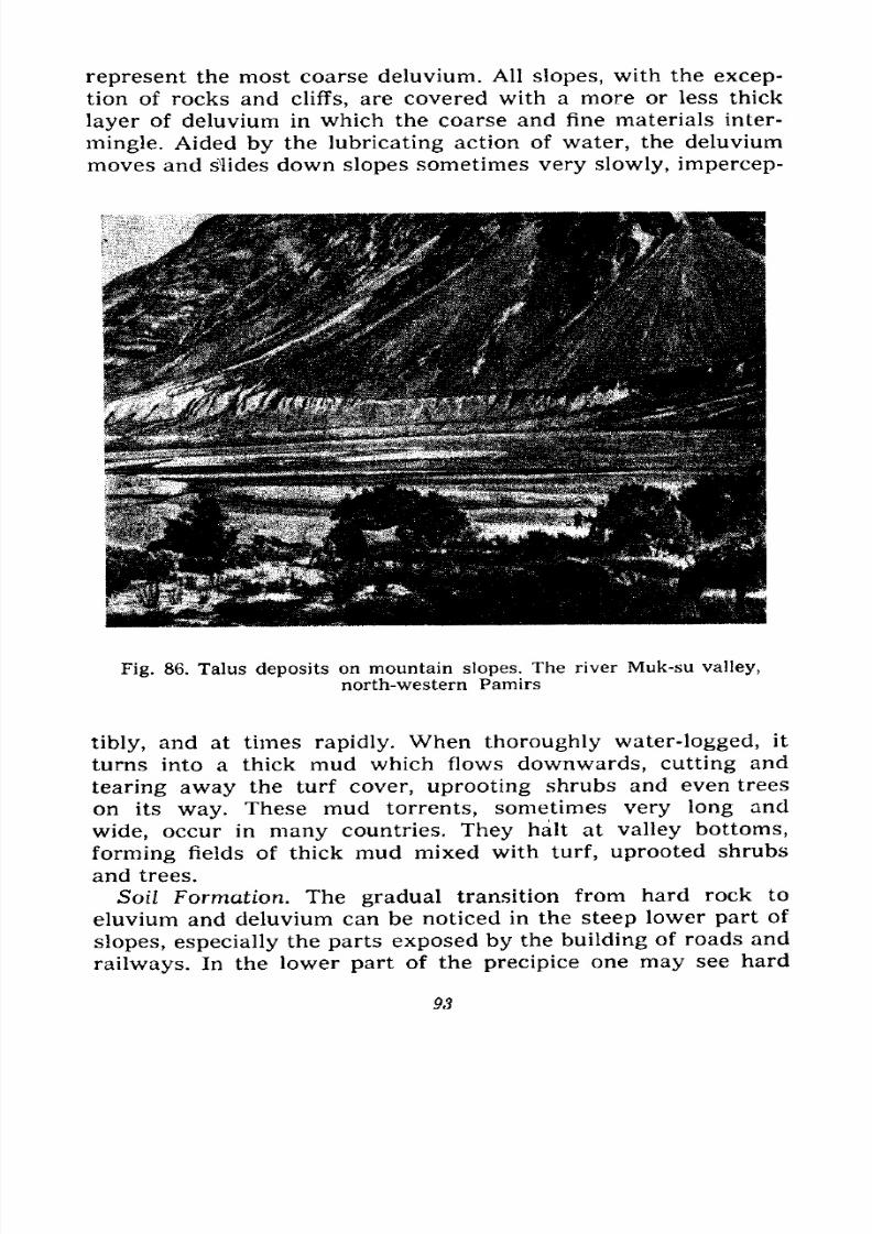
7/28/2019 Fundamentals of Geology - 19th century - Russia text in English
http://slidepdf.com/reader/full/fundamentals-of-geology-19th-century-russia-text-in-english 94/375
represent the most coarse deluvium. All slopes, with the excep-
tion of rocks and cliffs, are covered with a more or less thick
layer of deluvium in which the coarse and fine materials inter-
mingle. Aided by the lubricating action of water, the deluvium
moves and slides down slopes sometimes very slowly, impercep-
Fig. 86. Talus deposits on mountain slopes. The river Muk-su valley,
north-western Pamirs
tibly, and at times rapidly. When thoroughly water-logged, it
turns into a thick mud which flows downwards, cutting and
tearing away the turf cover, uprooting shrubs and even trees
on its way. These mud torrents, sometimes very long and
wide, occur in many countries. They halt at valley bottoms,
forming fields of thick mud mixed with turf, uprooted shrubs
and trees.
Soil Formation. The gradual transition from hard rock to
eluvium and deluvium can be noticed in the steep lower part of
slopes, especially the parts exposed by the building of roads and
railways. In the lower part of the precipice one may see hard
93
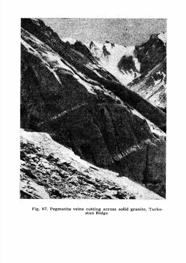
7/28/2019 Fundamentals of Geology - 19th century - Russia text in English
http://slidepdf.com/reader/full/fundamentals-of-geology-19th-century-russia-text-in-english 95/375
Fig. 87. Pegmatite veins cutting across solid granite, Turke-
stan Ridge
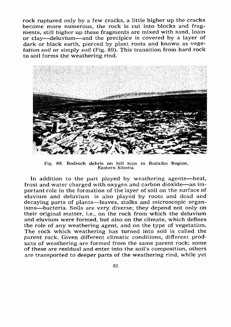
7/28/2019 Fundamentals of Geology - 19th century - Russia text in English
http://slidepdf.com/reader/full/fundamentals-of-geology-19th-century-russia-text-in-english 96/375
rock ruptured only by a few cracks, a little higher up the cracks
become more numerous, the rock is cut into blocks and frag-
ments, still higher up these fragments are mixed with sand, loam
or clay deluvium and the precipice is covered by a layer of
dark or black earth, pierced by plant roots and known as vege-
tation soil or simply soil (Fig. 89). This transition from hard rock
to soil forms the weathering rind.
Fig. 88. Bedrock debris on hill tops in Bodaibo Region,
Eastern Siberia
In addition to the part played by weathering agents heat,
frost and water charged with oxygen and carbon dioxide an im-
portant role in the formation of the layer of soil on the surface of
eluvium and deluvium is also played by roots and dead and
decaying parts of plants leaves, stalks and microscopic organ-
isms bacteria. Soils are very diverse; they depend not only on
their original matter, i.e., on the rock from which the deluvium
and eluvium were formed, but also on the climate, which defines
the role of any weathering agent, and on the type of vegetation.
The rock which weathering has turned into soil is called the
parent rock. Given different climatic conditions, different prod-
ucts of weathering are formed from the same parent rock; some
of these are residual and enter into the soil's composition, others
are transported to deeper parts of the weathering rind, while yet
95
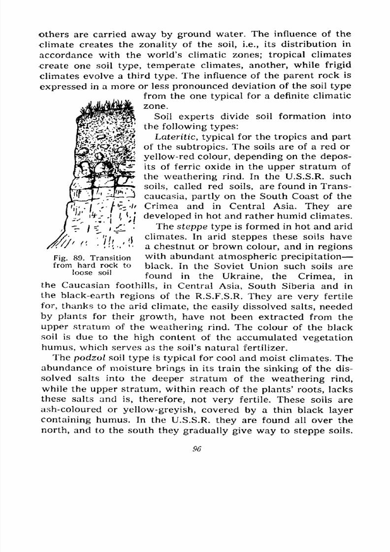
7/28/2019 Fundamentals of Geology - 19th century - Russia text in English
http://slidepdf.com/reader/full/fundamentals-of-geology-19th-century-russia-text-in-english 97/375
others are carried away by ground water. The influence of the
climate creates the zonality of the soil, i.e., its distribution in
accordance with the world's climatic zones; tropical climates
create one soil type, temperate climates, another, while frigid
climates evolve a thirdtype.
The influence of theparent
rock is
expressed in a more or less pronounced deviation of the soil type
from the one typical for a definite climatic
zone.
Soil experts divide soil formation into
the following types:
Lateritic, typical for the tropics and part
of the subtropics. The soils are of a red or
yellow-red colour, dependingon the
depos-its of ferric oxide in the upper stratum of
the weathering rind. In the U.S.S.R. such
soils, called red soils, are found in Trans-
caucasia, partly on the South Coast of the
Crimea and in Central Asia. They are
developed in hot and rather humid climates.
The steppe type is formed in hot and arid
climates. In aridsteppes
these soils have
a chestnut or brown colour, and in regions
with abundant atmospheric precipitation
black. In the Soviet Union such soils are
found in the Ukraine, the Crimea, in
the Caucasian foothills, in Central Asia, South Siberia and in
the black-earth regions of the R.S.F.S.R. They are very fertile
for, thanks to the arid climate, the easily dissolved salts, needed
byplants for their
growth,have not been extracted from the
upper stratum of the weathering rind. The colour of the black
soil is due to the high content of the accumulated vegetation
humus, which serves as the soil's natural fertilizer.
The podzol soil type is typical for cool and moist climates. The
abundance of moisture brings in its train the sinking of the dis-
solved salts into the deeper stratum of the weathering rind,
while the upper stratum, within reach of the plants' roots, lacks
these salts and is, therefore, not very fertile. These soils areash-coloured or yellow-greyish, covered by a thin black layer
containing humus. In the U.S.S.R. they are found all over the
north, and to the south they gradually give way to steppe soils.
Fig. 89. Transition
from hard rock to
loose soil
96
7/28/2019 Fundamentals of Geology - 19th century - Russia text in English
http://slidepdf.com/reader/full/fundamentals-of-geology-19th-century-russia-text-in-english 98/375
Swampy, saline and saliniferous soils are typical for all cli-
matic zones with specific local features. The swamp-type soil is
found in areas where the ground water rises practically to the
surface, i.e., in depressions and swamps. The saline and salini-
ferous soil types are typical for an abundance of sodium chloride,
which is injurious to most plants, and they develop in specific
conditions, which further the accumulation of these salts in the
upper stratum of the weathering rind. The saline soil type is
found in the zone of podzol soils, and the saliniferous type in the
zone of steppe soils.
The process of the development and transformation of soils is
highly complicated and one must be well versed in chemistry to
understand it. Hence we shall confine ourselves to the foregoing
which provides us with at least a general idea of the soil types
and their distribution according to climatic zones. We should also
note that, upon ascending mountains, the climate changes in
respect to the quantity of heat and moisture, with the result that
the soils on the slopes also reveal climatic zonality, i.e., they
correspond to definite climatic conditions (in a vertical direction).
High up in the mountains and in the Arctic, where the soil tem-
perature during a larger part of the year is below zero, and where
chemical processes are very weak, with mechanical ones domi-
nating (the simple disintegration of the parent rock into large
and small fragments), skeleton soils are evolved, representing a
simple mixture of this rock-waste subjected only to slight
chemical change. Skeleton soils are also found in deserts where
the lack of moisture likewise retards chemical processes, while
the sharp temperature fluctuations aid the mechanical disinte-
gration of the parent rock.
The fertility of the soil depends on the composition of the
easily dissolved salts, which the plants assimilate, on the dis-
tribution of these salts in the weathering rind and the structure
of the soil. If the soil is very compact and slender roots barely
penetrate it, even given ample quantities of salts, it will
be less fertile than porous soils into which roots and also
air penetrate more easily. Air is necessary both for oxida-
tion processes and the breeding of bacteria, which decompose
vegetation remains in the soil and also help to evolve andaccumulate the nitrogen needed by the plants. The main signifi-
cance of organic fertilizers for raising soil fertility is in intro-
ducing nitrogen combinations into the soil. Burrowing animals
71518 97

7/28/2019 Fundamentals of Geology - 19th century - Russia text in English
http://slidepdf.com/reader/full/fundamentals-of-geology-19th-century-russia-text-in-english 99/375
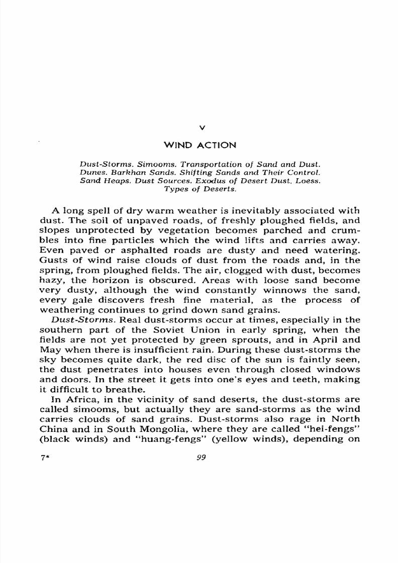
7/28/2019 Fundamentals of Geology - 19th century - Russia text in English
http://slidepdf.com/reader/full/fundamentals-of-geology-19th-century-russia-text-in-english 100/375
V
WIND ACTION
Dust-Storms. Simooms. Transportation of Sand and Dust.
Dunes. Barkhan Sands. Shifting Sands and Their Control.
Sand Heaps. Dust Sources. Exodus of Desert Dust. Loess.
Types of Deserts.
A long spell of dry warm weather is inevitably associated with
dust. The soil of unpaved roads, of freshly ploughed fields, and
slopes unprotected by vegetation becomes parched and crum-
bles into fine particles which the wind lifts and carries
away.Even paved or asphalted roads are dusty and need watering.
Gusts of wind raise clouds of dust from the roads and, in the
spring, from ploughed fields. The air, clogged with dust, becomes
hazy, the horizon is obscured. Areas with loose sand become
very dusty, although the wind constantly winnows the sand,
every gale discovers fresh fine material, as the process of
weathering continues to grind down sand grains.
Dust-Storms. Real dust-storms occur at times, especially in the
southern part of the Soviet Union in early spring, when the
fields are not yet protected by green sprouts, and in April and
May when there is insufficient rain. During these dust-storms the
sky becomes quite dark, the red disc of the sun is faintly seen,
the dust penetrates into houses even through closed windows
and doors. In the street it gets into one's eyes and teeth, makingit difficult to breathe.
In Africa, in the vicinity of sand deserts, the dust-storms are
called simooms, but actually they are sand-storms as the windcarries clouds of sand grains. Dust-storms also rage in North
China and in South Mongolia, where they are called "hei-fengs"
(black winds) and "huang-fengs" (yellow winds), depending on
7* 99
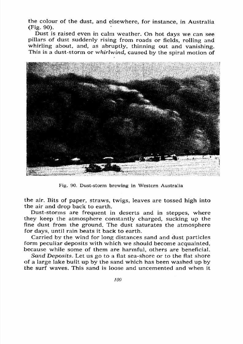
7/28/2019 Fundamentals of Geology - 19th century - Russia text in English
http://slidepdf.com/reader/full/fundamentals-of-geology-19th-century-russia-text-in-english 101/375
the colour of the dust, and elsewhere, for instance, in Australia
(Fig. 90).
Dust is raised even in calm weather. On hot days we can see
pillars of dust suddenly rising from roads or fields, rolling and
whirling about, and, as abruptly, thinning out and vanishing.
This is a dust-storm or whirlwind, caused by the spiral motion of
Fig. 90. Dust-storm brewing in Western Australia
the air. Bits of paper, straws, twigs, leaves are tossed high into
the air and drop back to earth.
Dust-storms are frequent in deserts and in steppes, where
they keep the atmosphere constantly charged, sucking up the
fine dust from the ground. The dust saturates the atmospherefor days, until rain beats it back to earth.
Carried by the wind for long distances sand and dust particles
form peculiar deposits with which we should become acquainted,
because while some of them are harmful, others are beneficial.
Sand Deposits. Let us go to a flat sea-shore or to the flat shore
of a large lake built up by the sand which has been washed up bythe surf waves. This sand is loose and uncemented and when it
100
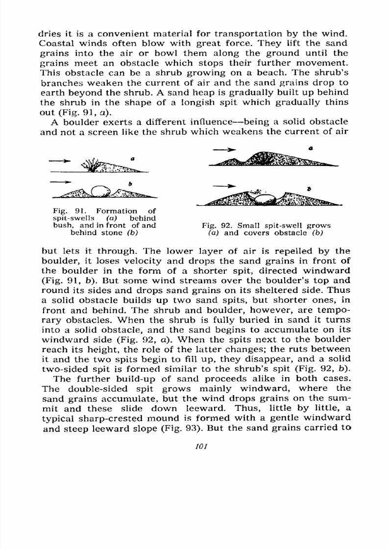
7/28/2019 Fundamentals of Geology - 19th century - Russia text in English
http://slidepdf.com/reader/full/fundamentals-of-geology-19th-century-russia-text-in-english 102/375
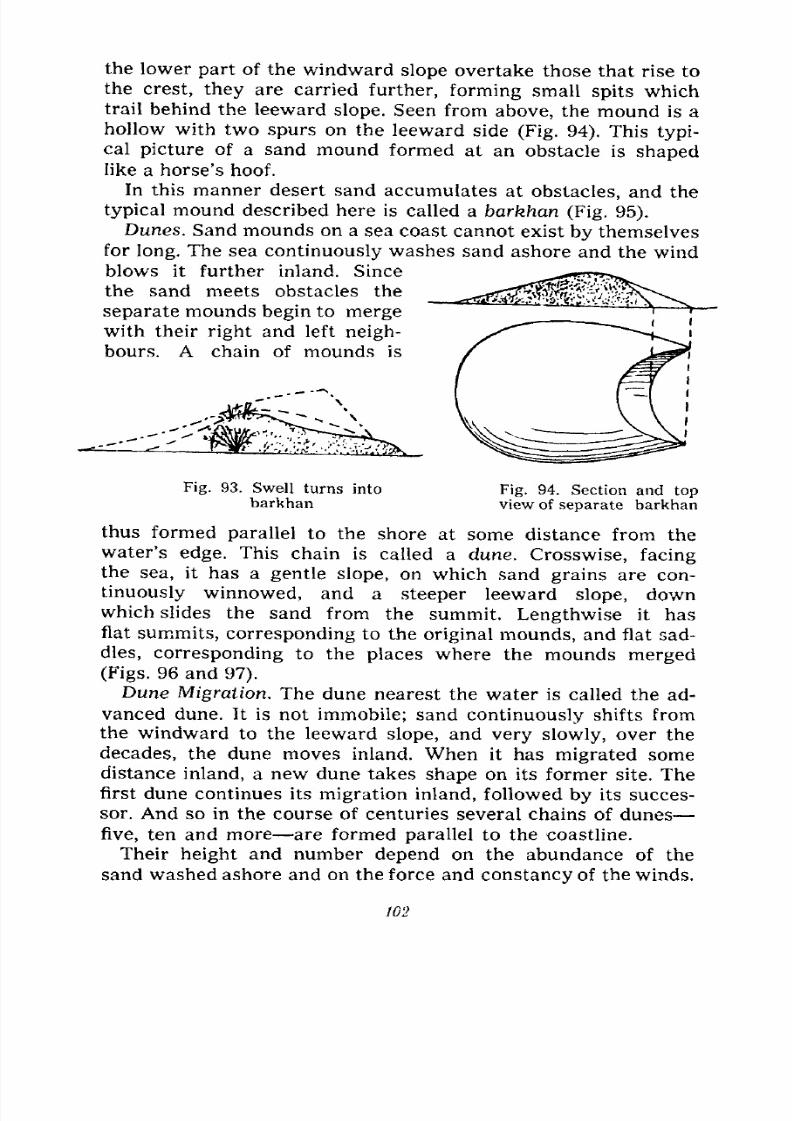
7/28/2019 Fundamentals of Geology - 19th century - Russia text in English
http://slidepdf.com/reader/full/fundamentals-of-geology-19th-century-russia-text-in-english 103/375
the lower part of the windward slope overtake those that rise to
the crest, they are carried further, forming small spits which
trail behind the leeward slope. Seen from above, the mound is a
hollow with two spurs on the leeward side (Fig. 94). This typi-
cal picture of a sand mound formed at an obstacle is shapedlike a horse's hoof.
In this manner desert sand accumulates at obstacles, and the
typical mound described here is called a barkhan (Fig. 95).
Dunes. Sand mounds on a sea coast cannot exist by themselves
for long. The sea continuously washes sand ashore and the wind
blows it further inland. Since
the sand meets obstacles the
separate mounds begin to mergewith their right and left neigh-
bours. A chain of mounds is
Fig. 93. Swell turns into
barkhanFig. 94. Section and topview of separate barkhan
thus formed parallel to the shore at some distance from the
water's edge. This chain is called a dune. Crosswise, facingthe sea, it has a gentle slope, on which sand grains are con-
tinuously winnowed, and a steeper leeward slope, downwhich slides the sand from the summit. Lengthwise it has
flat summits, corresponding to the original mounds, and flat sad-
dles, corresponding to the places where the mounds merged
(Figs. 96 and 97).
Dune Migration. The dune nearest the water is called the ad-
vanced dune. It is not immobile; sand continuously shifts from
the windward to the leeward slope, and very slowly, over the
decades, the dune moves inland. When it has migrated some
distance inland, a new dune takes shape on its former site. The
first dune continues its migration inland, followed by its succes-
sor. And so in the course of centuries several chains of dunes
five, ten and more are formed parallel to the coastline.
Their height and number depend on the abundance of the
sand washed ashore and on the force and constancy of the winds.
102
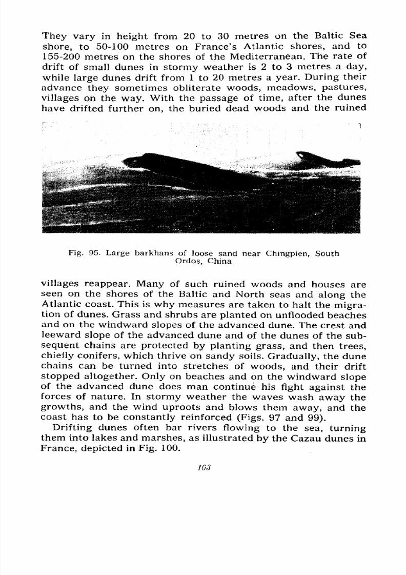
7/28/2019 Fundamentals of Geology - 19th century - Russia text in English
http://slidepdf.com/reader/full/fundamentals-of-geology-19th-century-russia-text-in-english 104/375
They vary in height from 20 to 30 metres on the Baltic Sea
shore, to 50-100 metres on France's Atlantic shores, and to
155-200 metres on the shores of the Mediterranean. The rate of
drift of small dunes in stormy weather is 2 to 3 metres a day,
while large dunes drift from 1 to 20 metres a year. During their
advance they sometimes obliterate woods, meadows, pastures,
villages on the way. With the passage of time, after the dunes
have drifted further on, the buried dead woods and the ruined
Fig. 95. Large barkhans of loose sand near Chingpien, South
Ordos, China
villages reappear. Many of such ruined woods and houses are
seen on the shores of the Baltic and North seas and along the
Atlantic coast. This is why measures are taken to halt the migra-tion of dunes. Grass and shrubs are planted on unflooded beaches
and on the windward slopes of the advanced dune. The crest and
leeward slope of the advanced dune and of the dunes of the sub-
sequent chains are protected by planting grass, and then trees,
chiefly conifers, which thrive on sandy soils. Gradually, the dune
chains can be turned into stretches of woods, and their drift
stopped altogether. Only on beaches and on the windward slope
of the advanced dune does man continue his fight against the
forces of nature. In stormy weather the waves wash away the
growths, and the wind uproots and blows them away, and the
coast has to be constantly reinforced (Figs. 97 and 99).
Drifting dunes often bar rivers flowing to the sea, turningthem into lakes and marshes, as illustrated by the Cazau dunes in
France, depicted in Fig. 100.
W3
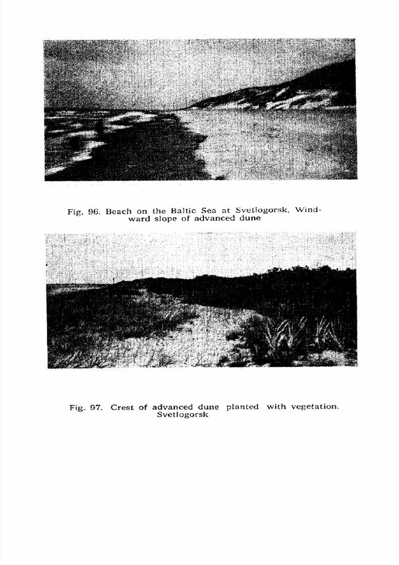
7/28/2019 Fundamentals of Geology - 19th century - Russia text in English
http://slidepdf.com/reader/full/fundamentals-of-geology-19th-century-russia-text-in-english 105/375
Fig. 96. Beach on the Baltic Sea at Svetlogorsk. Wind-
ward slope of advanced dune
Fig.97. Crest of advanced dune
plantedwith vegetation.
Svetlogorsk
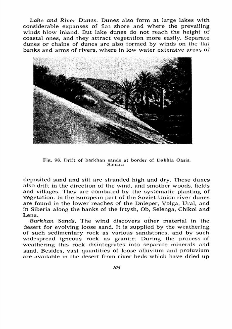
7/28/2019 Fundamentals of Geology - 19th century - Russia text in English
http://slidepdf.com/reader/full/fundamentals-of-geology-19th-century-russia-text-in-english 106/375
Lake and River Dunes. Dunes also form at large lakes with
considerable expanses of flat shore and where the prevailing
winds blow inland. But lake dunes do not reach the height of
coastal ones, and they attract vegetation more easily. Separate
dunes or chains of dunes are also formed by winds on the flat
banks and arms of rivers, where in low water extensive areas of
Fig. 98. Drift of barkhan sands at border of Dakhla Oasis,
Sahara
deposited sand and silt are stranded high and dry. These dunes
also drift in the direction of the wind, and smother woods, fields
and villages. They are combated by the systematic planting of
vegetation. In the European part of the Soviet Union river dunes
are found in the lower reaches of the Dnieper, Volga, Ural, and
in Siberia along the banks of the Irtysh, Ob, Selenga, Chikoi and
Lena.
Barkhan Sands. The wind discovers other material in the
desert for evolving loose sand. It is supplied by the weathering
of such sedimentary rock as various sandstones, and by such
widespread igneous rock as granite. During the process of
weathering this rock disintegrates into separate minerals and
sand. Besides, vast quantities of loose alluvium and proluvium
are available in the desert from river beds which have dried up
1G5
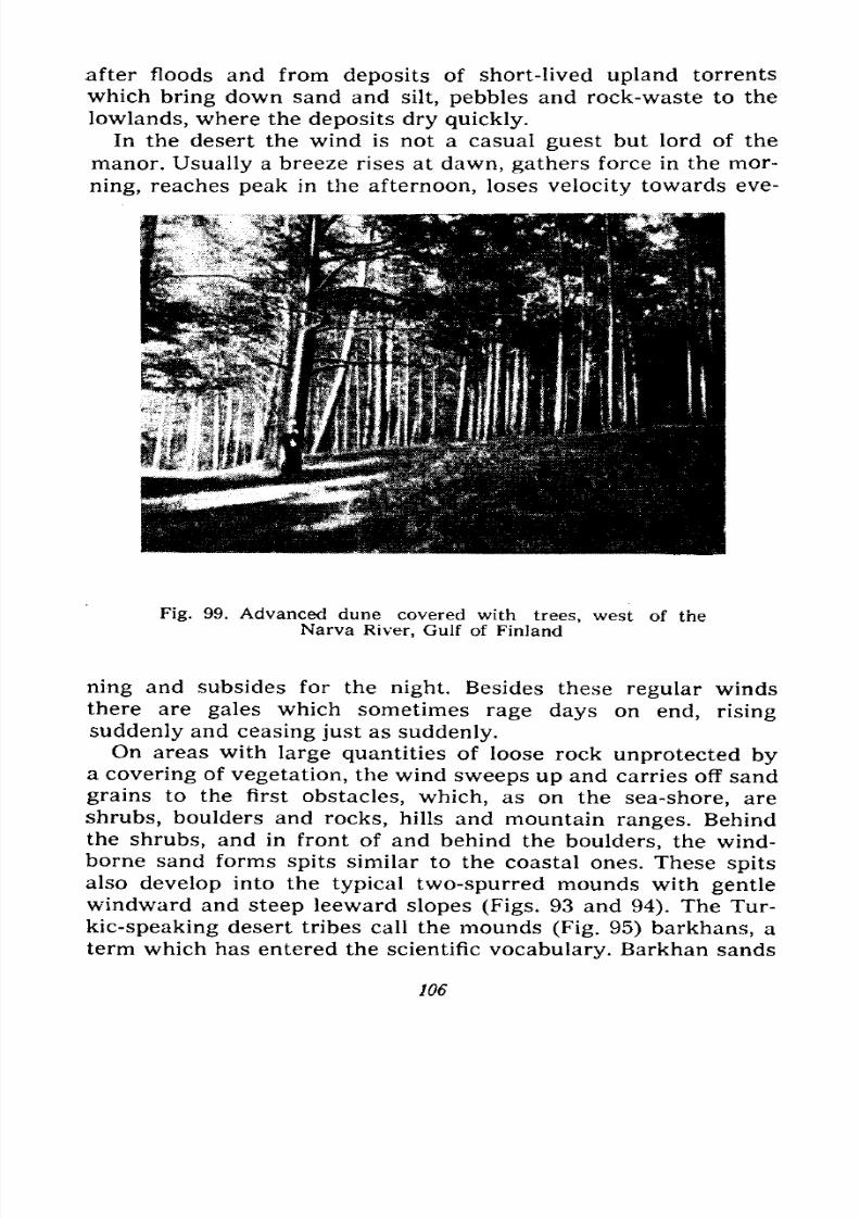
7/28/2019 Fundamentals of Geology - 19th century - Russia text in English
http://slidepdf.com/reader/full/fundamentals-of-geology-19th-century-russia-text-in-english 107/375
after floods and from deposits of short-lived upland torrents
which bring down sand and silt, pebbles and rock-waste to the
lowlands, where the deposits dry quickly.
In the desert the wind is not a casual guest but lord of the
manor. Usually a breeze rises at dawn, gathers force in the mor-
ning, reaches peak in the afternoon, loses velocity towards eve-
Fig. 99. Advanced dune covered with trees, west of the
Narva River, Gulf of Finland
ning and subsides for the night. Besides these regular winds
there are gales which sometimes rage days on end, rising
suddenly and ceasing just as suddenly.On areas with large quantities of loose rock unprotected by
a covering of vegetation, the wind sweeps up and carries off sand
grains to the first obstacles, which, as on the sea-shore, are
shrubs, boulders and rocks, hills and mountain ranges. Behind
the shrubs, and in front of and behind the boulders, the wind-
borne sand forms spits similar to the coastal ones. These spits
also develop into the typical two-spurred mounds with gentlewindward and steep leeward slopes (Figs. 93 and 94). The Tur-
kic-speaking desert tribes call the mounds (Fig. 95) barkhans, a
term which has entered the scientific vocabulary. Barkhan sands
106
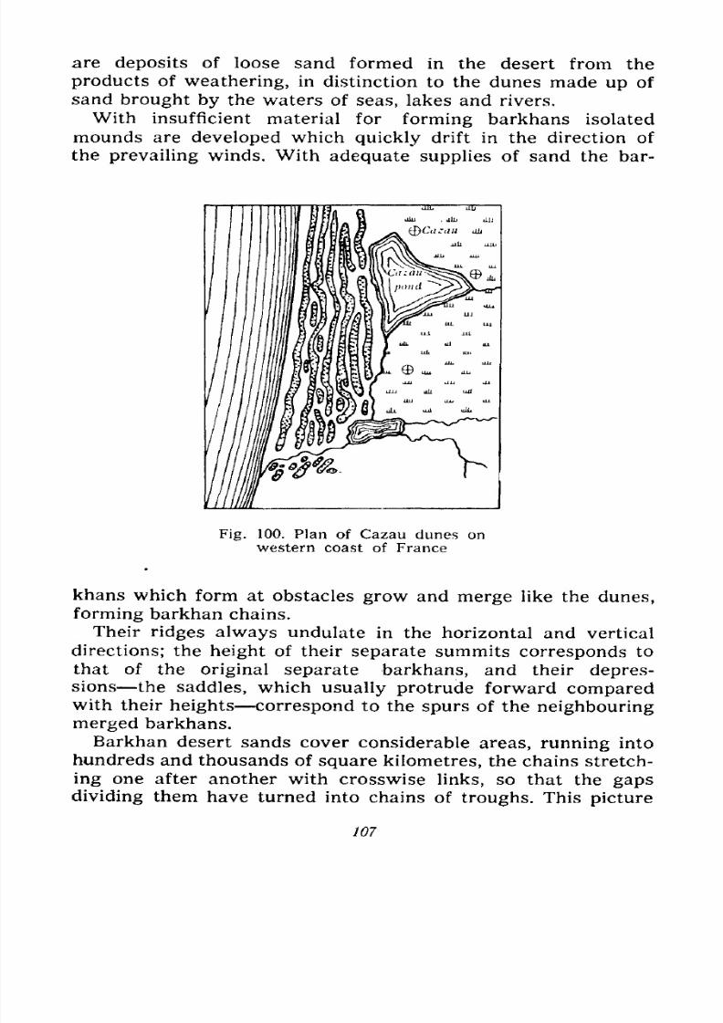
7/28/2019 Fundamentals of Geology - 19th century - Russia text in English
http://slidepdf.com/reader/full/fundamentals-of-geology-19th-century-russia-text-in-english 108/375
are deposits of loose sand formed in the desert from the
products of weathering, in distinction to the dunes made up of
sand brought by the waters of seas, lakes and rivers.
With insufficient material for forming barkhans isolated
mounds are developed which quickly drift in the direction of
the prevailing winds. With adequate supplies of sand the bar-
Fig. 100. Plan of Cazau dunes on
western coast of France
khans which form at obstacles grow and merge like the dunes,
forming barkhan chains.
Their ridges always undulate in the horizontal and vertical
directions; the height of their separate summits corresponds to
that of the original separate barkhans, and their depres-sions the saddles, which usually protrude forward comparedwith their heights correspond to the spurs of the neighbouring
merged barkhans.
Barkhan desert sands cover considerable areas, running intohundreds and thousands of square kilometres, the chains stretch-
ing one after another with crosswise links, so that the gaps
dividing them have turned into chains of troughs. This picture
107
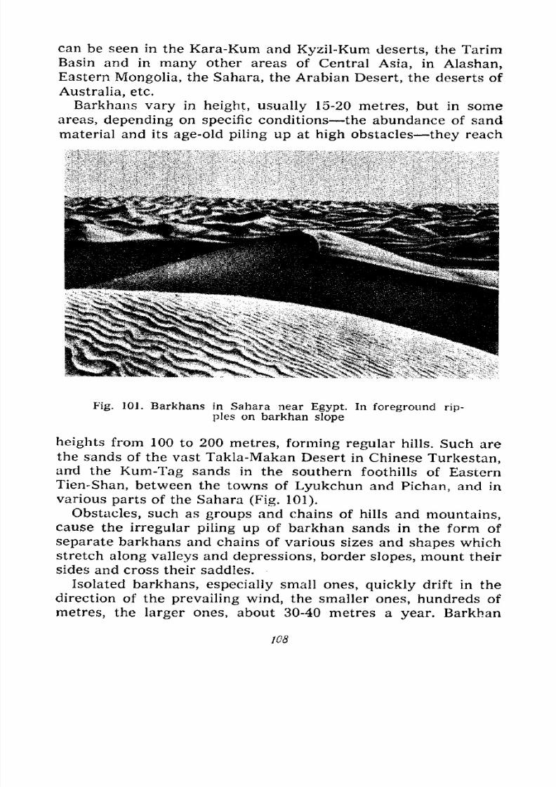
7/28/2019 Fundamentals of Geology - 19th century - Russia text in English
http://slidepdf.com/reader/full/fundamentals-of-geology-19th-century-russia-text-in-english 109/375
can be seen in the Kara-Kum and Kyzil-Kum deserts, the Tarim
Basin and in many other areas of Central Asia, in Alashan,
Eastern Mongolia, the Sahara, the Arabian Desert, the deserts of
Australia, etc.
Barkhans vary in height, usually 15-20 metres, but in some
areas, depending on specific conditions the abundance of sand
material and its age-old piling up at high obstacles they reach
Fig. 101. Barkhans in Sahara near Egypt. In foreground rip-
ples on barkhan slope
heights from 100 to 200 metres, forming regular hills. Such are
the sands of the vast Takla-Makan Desert in Chinese Turkestan,and the Kum-Tag sands in the southern foothills of Eastern
Tien-Shan, between the towns of Lyukchun and Pichan, and in
various parts of the Sahara (Fig. 101).
Obstacles, such as groups and chains of hills and mountains,
cause the irregular piling up of barkhan sands in the form of
separate barkhans and chains of various sizes and shapes which
stretch along valleys and depressions, border slopes, mount their
sides and cross their saddles.Isolated barkhans, especially small ones, quickly drift in the
direction of the prevailing wind, the smaller ones, hundreds of
metres, the larger ones, about 30-40 metres a year. Barkhan
108
7/28/2019 Fundamentals of Geology - 19th century - Russia text in English
http://slidepdf.com/reader/full/fundamentals-of-geology-19th-century-russia-text-in-english 110/375
sands advance very slowly, they send separate scout barkhans
ahead, which develop in front of the sand areas. These scout
barkhans increase in number, merge in twos and threes, and
gradually seize new territory, while the main body of sand
slowly advances behind.
These onslaughts on formerly sandless steppeland, cultivated
fields and villages are made in Turkmenia, Uzbekistan, Kara-
Kalpakia, Kazakhstan, the Tarim Basin, and on the borders of
the loose sand area in Ordos, Central Asia.
This menace cannot be coped with by individual peasants. The
sands can be one kilometre away from his fields, orchard or
home. During a gale the wind-borne sand gradually collects at
obstacles: small spits appear behind shrubs, on field furrows, in
road ditches, under hedges. With each strong wind the spits
grow in number and size; the soil becomes increasingly sandy.
After a few years the spits turn into mounds and then into
barkhans; the fields yield less. Another decade passes and the
sands lay siege to the peasant's home, his fields have practically
disappeared under a mantle of sand, the barkhans have already
penetrated into the orchards, crept along fences, crossed them,
crowded into the yard and climbed up the walls to the roof of his
house. And the peasant is obliged to forsake his farmstead. Onlycollective effort and state aid can halt this offensive. And this is
done by the extensive planting of vegetation.
It would be wrong to think that barkhan sands are completely
devoid of vegetation. There are very few such sand deserts;
these are the sands of the Sahara, of the Arabian and Takla-
Makan deserts and certain areas of the Kara-Kum and Kyzil-
Kum deserts. In most cases some grass grows and shrubs nestle
at the bottom of the troughs between the barkhans and some-times they appear on the slopes. With an abundance of vegeta-
tion the barkhans smooth out their crests round off, the steep
leeward slopes become less steep for vegetation protects their
.surface and detains the sand. These sands are called mound
sands from their mound-like shape, unlike the barkhans.
People who cut out shrubs for fuel, and cattle which eat and
trample the grass are the chief saboteurs of sand vegetation for
they help the sands to return or to conquer fresh areas. Themound sands in the vicinity of the camping sites of the former
nomad cattle-breeding tribes were especially desolate and they
turned into barkhans. Other saboteurs of sand vegetation are
109
7/28/2019 Fundamentals of Geology - 19th century - Russia text in English
http://slidepdf.com/reader/full/fundamentals-of-geology-19th-century-russia-text-in-english 111/375
rodents the suslik and sand rat which are found in large num-bers in some troughs; they injure roots by burrowing and pro-
vide loose material for wind action. Troughs colonized by these
animals are distinguished for their barrenness and withering
vegetation.
Ripples. The sand's surface on the windward slopes of
barkhans and dunes is always slightly uneven, with tiny crests
or small flat swells with grooves in between, which, in their
entirety, form ripples. These ripples are caused by breezes which
carry the sand grains for short distances. If we look closer wesee that the swells consist chiefly of smaller grains, while in the
Fig. 102. Pebbles ground and polished
by sand
grooves the grains are larger. Hence the wind grades the grains.
Actually the swells are dune and barkhan chains in miniature.
The positions of the swells and grooves change with every
change of wind, taking up a position perpendicular to its direc-
tion (Fig. 101).
Polished Stones. The numerous wind-borne grains consist
mainly of hard quartz. Striking and streaming over the surfaces
of rock-waste, pebbles and rocks the grains sharpen and polish
them. The results of this work the rock-waste and pebbles
can be seen everywhere where there is rock in the vicinity of
sandy expanses.
The sand which abrades the rock does this work with varying
degrees of success, depending on the latter's hardness; the softer
the rock, the quicker it is abraded, while very hard rock is
mostly ground and polished. The surface of rock with grains or
sections of different degrees of hardness becomes uneven, the
harder parts protrude like crests or mounds, the softer parts
correspond to hollows and grooves. Rock-waste which has lain
on the sand in the same position for long receives an all-round
sharpening, but in varying degrees, depending on the frequency
and force of the wind. In this manner interesting three- and
no
7/28/2019 Fundamentals of Geology - 19th century - Russia text in English
http://slidepdf.com/reader/full/fundamentals-of-geology-19th-century-russia-text-in-english 112/375
four-faceted highly polished stones with relatively sharp edges
are evolved from hard rock. These stones can be collected in the
desert (Fig. 102).
Sand Heaps. In places where sand is lacking for the speedy
formation of barkhans and where vegetation is abundant, the
sand slowly accumulates under the protection of this vegetation^
which successfully holds up its advance. Special forms of sand
accumulation are evolved heaps and mounds of various sizes
called sand heaps. Their shape and size depend on the kind of
vegetation growing in the
area. Small shrubs with
few thin branches pile
up sand heaps like grave
mounds from half a metre
to a metre high. Thick
shrubs like the tamarisk,
which often grows in
clusters, raise sand heaps,
like small knolls resem-
bling burial mounds 3-5
metres high. Under the
protection of reeds near
springs the sand is heaped
up like flat knolls. The
needle grass plant, with its thick, sheaf-like tufts, builds upsmall mounds (Figs. 103 and 104).
Vegetation can withstand the piling up of sand to a certain
point. When the sand deposit becomes too high the plants begin
to die their roots no longer reach the ground water. The
shrubs dry up, the wind breaks off and carries away witheredleaves and twigs and then branches. The sand heap, deprived of
its support, is gradually blown away. The wind carries the sand
to the live shrubs. Thus there is a limit to the height the sand
can pile up for each plant. Tamarisk sands, typical for salinifer-
ous soil and river banks, disappear when the river changes its
course. The water bypasses the sands, the tamarisk perishes
and the sand heaps are blown away (Fig. 105).
Dust Sources. Now we have learned that in deserts loose sandis heaped up in places where weathering provides sufficient
wind-borne material in the shape of decayed bedrock and dried-
up deposits of rivers and brief torrents. But besides the sand
Fig. 103. Types of sand heaps at a
bush, a cluster of needle grass and at
reeds
7/28/2019 Fundamentals of Geology - 19th century - Russia text in English
http://slidepdf.com/reader/full/fundamentals-of-geology-19th-century-russia-text-in-english 113/375
accumulated in these deposits, weathering provides a still finer
material specks of dust. We also know of dust-storms, which
take place not only in deserts, and of dust "devils" or vortexes,
which on hot days whirl over steppeland and fields, along roads,
raising pillars of dust. What happens to this dust? Had it re-
mained permanently in the atmosphere the latter would long
since have lost its transparency, and we would have existed in a
dense fog of dust.
Fig. 104. Sand mound overgrown with tamarisk, JungarianGate Desert
Dust specks are the finest particles of rock weathering. Theyfloat in the air for relatively long periods and are carried over
great distances. But finally they settle on the ground, mainly with
the aid of rain and snow; raindrops and snow-flakes falling from
the clouds collect the floating dust specks and beat them down to
earth. You have, of course, noticed how pure and transparent
the air is after rain or snowfall. One can see farther and better.
This is because it has been cleansed of the dust, which, while
imperceptible to the human eye, reduces the transparency of
the air (of which we can judge by seeing distant objects).
112
7/28/2019 Fundamentals of Geology - 19th century - Russia text in English
http://slidepdf.com/reader/full/fundamentals-of-geology-19th-century-russia-text-in-english 114/375
Every day we observe the settling of dust in our room, both in
town and country. It penetrates into the house together with the
outer air, from the streets, and settles on all objects. If we do not
dust our rooms regularly the layer of dust thickens and becomes
so noticeable that we cannot take up any article without soiling
our hands. But this dust, which settles everywhere, both on land
and water, merges with the soil, is transported by water, and
settles jointly with other materials without forming independent
deposits.
Given certain conditions wind-borne dust (loess) accumulates
on the ground. The desert, where due to lack of vegetation and
sharp temperature fluctuations weathering takes place much
more vigorously, is in essence a fac-
tory for the manufacture of vast
quantities of fine products grains
of sand and specks of dust. It is also
notable for the velocity of its winds.
Absolutely calm days are rare. Wehave already mentioned this and also
Fig 105 A lamarisk
noted the frequency of sand-storms sand mound being
which occur even on calm days,blown away
sucking up and raising the ground
dust aloft. Because of this desert air is less transparent than in
more humid regions with abundant vegetation, which protects
the topsoil from the wind's action.
Desert winds are usually directed centrifugally, i.e., from
internal areas to its borders. They cleanse the desert, tidy it upand sweep the weathering products away to its borders. If not
for the wind all the desert mounds and hills would have
long ago been buried under a mantle of bedrock weathering. Yettravellers in the desert meet with far more bedrock outcrops
than in humid areas. These outcrops can be seen everywhere,
on mound and hill slopes, often even on depression and valley
floors. True, they are ruptured, demolished and have often
turned into disintegrated fragments, boulders and rock-waste,
but they lack the layer of soft soil that in humid areas usually
covers the bedrock, which is rarely exposed, and then mainly in
the lower part of slopes eroded by running water. Eluvium in
deserts is either absent or forms a thin layer of coarse deposits,
while deluvium accumulates only on the lower parts of slopes.
We already know that barkhan sands are the product of desert
81518 113
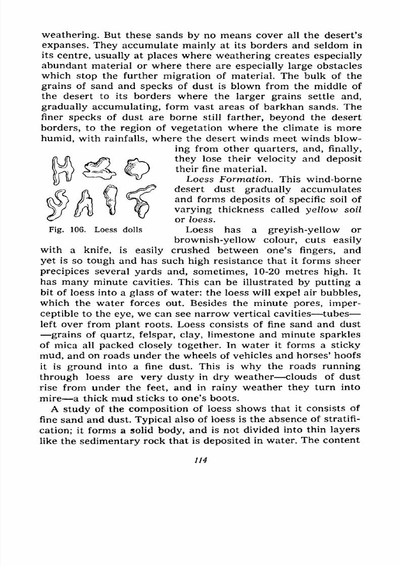
7/28/2019 Fundamentals of Geology - 19th century - Russia text in English
http://slidepdf.com/reader/full/fundamentals-of-geology-19th-century-russia-text-in-english 115/375
Fig. 106. Loess dolls
weathering. But these sands by no means cover all the desert's
expanses. They accumulate mainly at its borders and seldom in
its centre, usually at places where weathering creates especially
abundant material or where there are especially large obstacles
which stop the further migration of material. The bulk of the
grains of sand and specks of dust is blown from the middle of
the desert to its borders where the larger grains settle and,
gradually accumulating, form vast areas of barkhan sands. The
finer specks of dust are borne still farther, beyond the desert
borders, to the region of vegetation where the climate is more
humid, with rainfalls, where the desert winds meet winds blow-
ing from other quarters, and, finally,
they lose their velocity and deposit
their fine material.
Loess Formation. This wind-borne
desert dust gradually accumulates
and forms deposits of specific soil of
varying thickness called yellow soil
or loess.
Loess has a greyish-yellow or
brownish-yellow colour, cuts easily
with a knife, is easily crushed between one's fingers, and
yet is so tough and has such high resistance that it forms sheer
precipices several yards and, sometimes, 10-20 metres high. It
has many minute cavities. This can be illustrated by putting a
bit of loess into a glass of water: the loess will expel air bubbles,
which the water forces out. Besides the minute pores, imper-
ceptible to the eye, we can see narrow vertical cavities tubes
left over fromplant
roots. Loess consists of fine sand and dust
grains of quartz, felspar, clay, limestone and minute sparkles
of mica all packed closely together. In water it forms a sticky
mud, and on roads under the wheels of vehicles and horses' hoofs
it is ground into a fine dust. This is why the roads running
through loess are very dusty in dry weather clouds of dust
rise from under the feet, and in rainy weather they turn into
mire a thick mud sticks to one's boots.
A study of the composition of loess shows thatit
consistsof
fine sand and dust. Typical also of loess is the absence of stratifi-
cation; it forms a solid body, and is not divided into thin layers
like the sedimentary rock that is deposited in water. The content
114
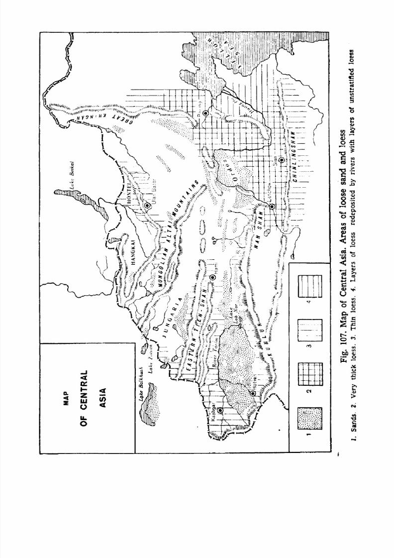
7/28/2019 Fundamentals of Geology - 19th century - Russia text in English
http://slidepdf.com/reader/full/fundamentals-of-geology-19th-century-russia-text-in-english 116/375
AWfriHf ./^i^J&MF
';;/* ^ov
vv-
;:
- >s c
^ | \
-
,-i
^:<^ i\ ^iM^mK^\ ^/rwf v A vr; % (F V7 '
w/<\ \&i* n ^f^ai* li^^i *\ =^v 1^. 3? :;.- W -:* :i
to,
cc
z S-
g 5
^ &^M/^ll(rs. i ^5/;Juv^j
- 1 Wi I//A-5S ^.^K^^/--
si*
nt
|<
15
In
>
*i
1
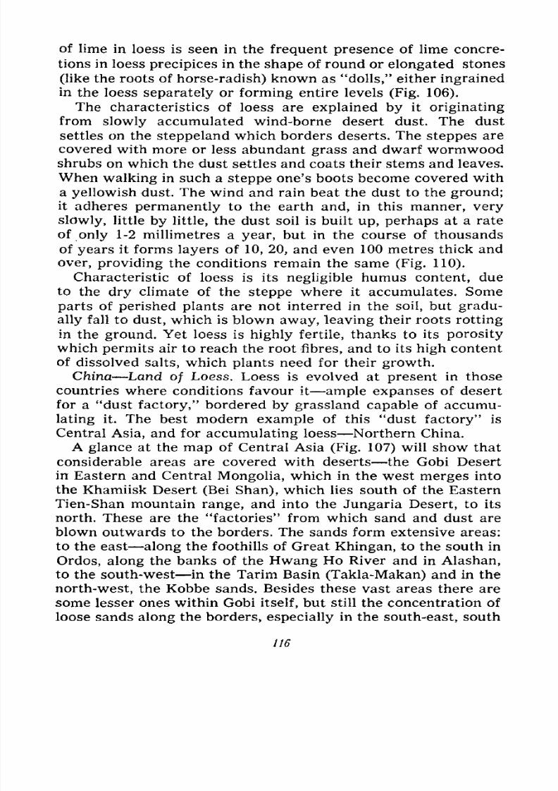
7/28/2019 Fundamentals of Geology - 19th century - Russia text in English
http://slidepdf.com/reader/full/fundamentals-of-geology-19th-century-russia-text-in-english 117/375
of lime in loess is seen in the frequent presence of lime concre-
tions in loess precipices in the shape of round or elongated stones
(like the roots of horse-radish) known as "dolls," either ingrained
in the loess separately or forming entire levels (Fig. 106).
The characteristics of loess are explainedby
it
originatingfrom slowly accumulated wind-borne desert dust. The dust
settles on the steppeland which borders deserts. The steppes are
covered with more or less abundant grass and dwarf wormwoodshrubs on which the dust settles and coats their stems and leaves.
When walking in such a steppe one's boots become covered with
a yellowish dust. The wind and rain beat the dust to the ground;
it adheres permanently to the earth and, in this manner, very
slowly, little by little, the dust soil is built up, perhaps at a rate
of only 1-2 millimetres a year, but in the course of thousands
of years it forms layers of 10, 20, and even 100 metres thick and
over, providing the conditions remain the same (Fig. 110).
Characteristic of loess is its negligible humus content, due
to the dry climate of the steppe where it accumulates. Some
parts of perished plants are not interred in the soil, but gradu-
ally fall to dust, which is blown away, leaving their roots rotting
in the ground. Yet loess is highly fertile, thanks to its porosity
which permits air to reach the root fibres, and to its high content
of dissolved salts, which plants need for their growth.
China Land of Loess. Loess is evolved at present in those
countries where conditions favour it ample expanses of desert
for a "dust factory," bordered by grassland capable of accumu-
lating it. The best modern example of this "dust factory" is
Central Asia, and for accumulating loess Northern China.
A glance at the map of Central Asia (Fig. 107) will show that
considerable areas are covered with deserts the Gobi Desert
in Eastern and Central Mongolia, which in the west merges into
the Khamiisk Desert (Bei Shan), which lies south of the Eastern
Tien-Shan mountain range, and into the Jungaria Desert, to its
north. These are the "factories" from which sand and dust are
blown outwards to the borders. The sands form extensive areas:
to the east along the foothills of Great Khingan, to the south in
Ordos, along the banks of the Hwang Ho River and in Alashan,
to the south-west in the Tarim Basin (Takla-Makan) and in the
north-west, the Kobbe sands. Besides these vast areas there are
some lesser ones within Gobi itself, but still the concentration of
loose sands along the borders, especially in the south-east, south
116
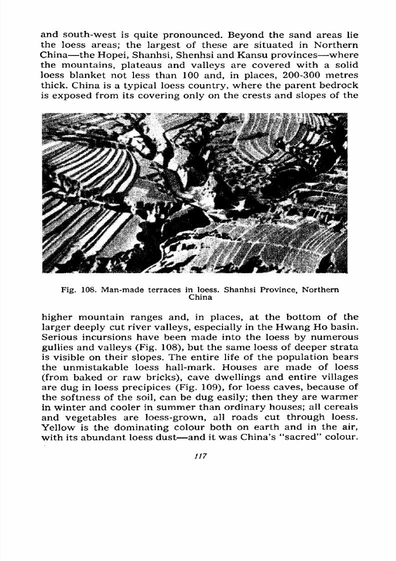
7/28/2019 Fundamentals of Geology - 19th century - Russia text in English
http://slidepdf.com/reader/full/fundamentals-of-geology-19th-century-russia-text-in-english 118/375
and south-west is quite pronounced. Beyond the sand areas lie
the loess areas; the largest of these are situated in Northern
China the Hopei, Shanhsi, Shenhsi and Kansu provinces where
the mountains, plateaus and valleys are covered with a solid
loess blanket not less than 100 and, in places, 200-300 metres
thick. China is a typical loess country, where the parent bedrock
is exposed from its covering only on the crests and slopes of the
Fig. 108. Man-made terraces in loess. Shanhsi Province, Northern
China
higher mountain ranges and, in places, at the bottom of the
larger deeply cut river valleys, especially in the Hwang Ho basin.
Serious incursions have been made into the loess by numerous
gullies and valleys (Fig. 108), but the same loess of deeper strata
is visible on their slopes. The entire life of the population bears
the unmistakable loess hall-mark. Houses are made of loess
(from baked or raw bricks), cave dwellings and entire villages
are dug in loess precipices (Fig. 109), for loess caves, because of
the softness of the soil, can be dug easily; then they are warmer
in winter and cooler in summer than ordinary houses; all cereals
and vegetables are loess-grown, all roads cut through loess.
Yellow is the dominating colour both on earth and in the air,
with its abundant loess dust and it was China's "sacred" colour.
117
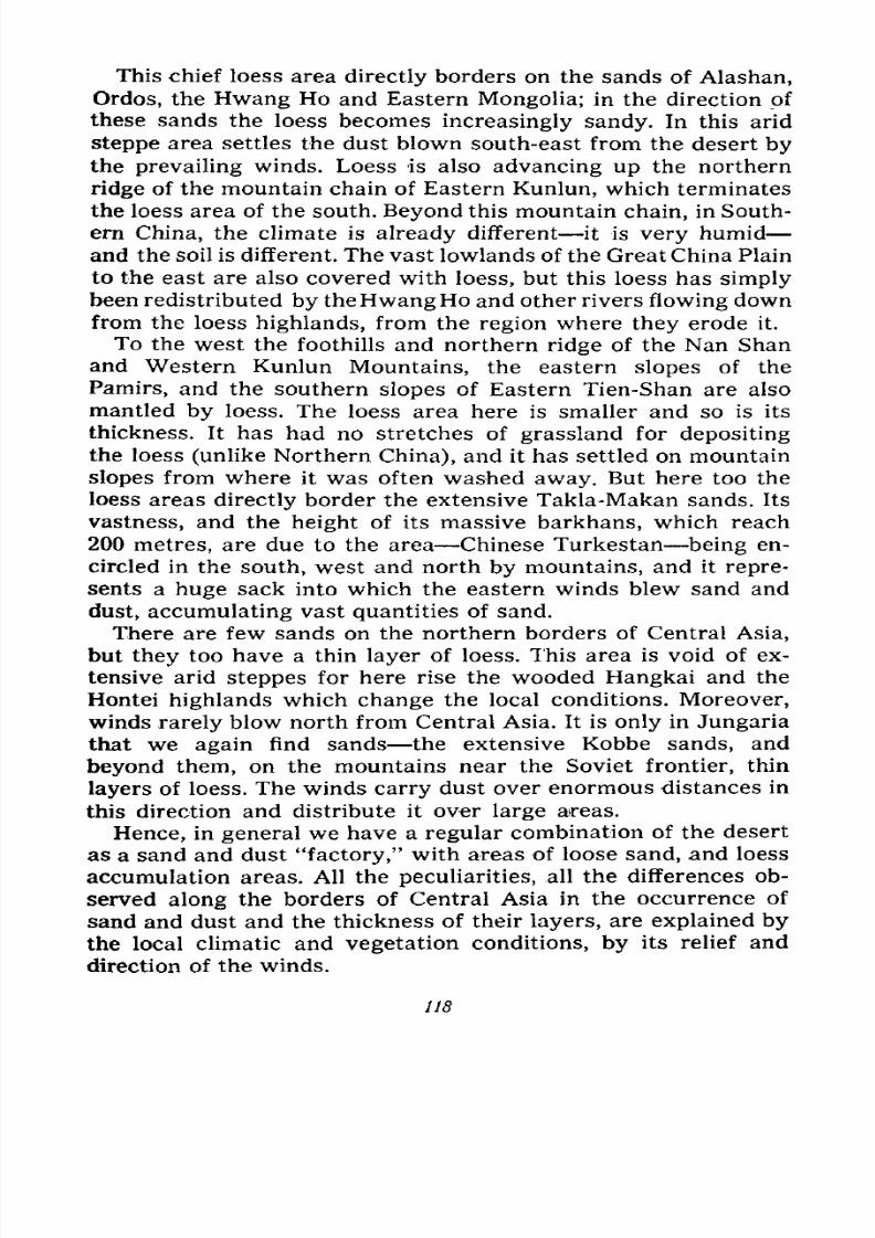
7/28/2019 Fundamentals of Geology - 19th century - Russia text in English
http://slidepdf.com/reader/full/fundamentals-of-geology-19th-century-russia-text-in-english 119/375
This chief loess area directly borders on the sands of Alashan,
Ordos, the Hwang Ho and Eastern Mongolia; in the direction of
these sands the loess becomes increasingly sandy. In this arid
steppe area settles the dust blown south-east from the desert bythe prevailing winds. Loess is also advancing up the northern
ridge of the mountain chain of Eastern Kunlun, which terminates
the loess area of the south. Beyond this mountain chain, in South-
ern China, the climate is already different it is very humid
and the soil is different. The vast lowlands of the Great China Plain
to the east are also covered with loess, but this loess has simply
been redistributed by theHwangHo and other rivers flowing down
from the loess highlands, from the region where they erode it.
To the west the foothills and northern ridge of the Nan Shan
and Western Kunlun Mountains, the eastern slopes of the
Pamirs, and the southern slopes of Eastern Tien-Shan are also
mantled by loess. The loess area here is smaller and so is its
thickness. It has had no stretches of grassland for depositing
the loess (unlike Northern China), and it has settled on mountain
slopes from where it was often washed away. But here too the
loess areas directly border the extensive Takla-Makan sands. Its
vastness, and the height of its massive barkhans, which reach
200 metres, are due to the area Chinese Turkestan being en-
circled in the south, west and north by mountains, and it repre-
sents a huge sack into which the eastern winds blew sand and
dust, accumulating vast quantities of sand.
There are few sands on the northern borders of Central Asia,
but they too have a thin layer of loess. This area is void of ex-
tensive arid steppes for here rise the wooded Hangkai and the
Hontei highlands which change the local conditions. Moreover,
winds rarely blow north from Central Asia. It is only in Jungaria
that we again find sands the extensive Kobbe sands, and
beyond them, on the mountains near the Soviet frontier, thin
layers of loess. The winds carry dust over enormous distances in
this direction and distribute it over large areas.
Hence, in general we have a regular combination of the desert
as a sand and dust "factory," with areas of loose sand, and loess
accumulation areas. All the peculiarities, all the differences ob-
served along the borders of Central Asia in the occurrence of
sand and dust and the thickness of their layers, are explained by
the local climatic and vegetation conditions, by its relief and
direction of the winds.
118
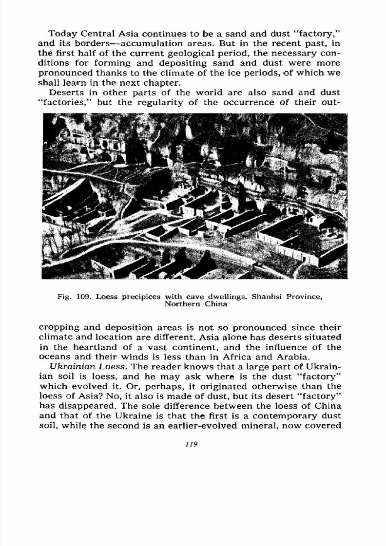
7/28/2019 Fundamentals of Geology - 19th century - Russia text in English
http://slidepdf.com/reader/full/fundamentals-of-geology-19th-century-russia-text-in-english 120/375
Today Central Asia continues to be a sand and dust "factory,"
and its borders accumulation areas. But in the recent past, in
the first half of the current geological period, the necessary con-
ditions for forming and depositing sand and dust were more
pronounced thanks to the climate of the ice periods, of which we
shall learn in the next chapter.
Deserts in other parts of the world are also sand and dust
"factories," but the regularity of the occurrence of their out-
Fig. 109. Loess precipices with cave dwellings. Shanhsi Province,
Northern China
cropping and deposition areas is not so pronounced since their
climate and location are different. Asia alone has deserts situated
in the heartland of a vast continent, and the influence of the
oceans and their winds is less than in Africa and Arabia.
Ukrainian Loess. The reader knows that a large part of Ukrain-
ian soil is loess, and he may ask where is the dust "factory"
which evolved it. Or, perhaps, it originated otherwise than the
loess of Asia? No, it also is made of dust, but its desert "factory"has disappeared. The sole difference between the loess of China
and that of the Ukraine is that the first is a contemporary dust
soil, while the second is an earlier-evolved mineral, now covered
119
7/28/2019 Fundamentals of Geology - 19th century - Russia text in English
http://slidepdf.com/reader/full/fundamentals-of-geology-19th-century-russia-text-in-english 121/375
with contemporary soil in the form of chernozem. The next
chapter will tell of the location of the desert which created the
Ukrainian loess and why it disappeared.
Hence, deserts, as dust "factories" which manufacture fer-
tile soils, play an important part in nature, a part beneficial
for man. On the other hand, we know that these sand "factories"
accumulate vast quantities of sand on desert borders, whence
they mount offensives against steppes, cultivated land and the
habitations of man. Deserts, therefore, also cause great harm.
But if we strike a balance to see what is more the bad, ex-
pressed in a narrow stretch of sand on the outer borders of
deserts, or the good seen in the fertility of extensive loess
steppes, then it is obvious that the good greatly outweighs the
bad. We can combat the sand nuisance by planting trees and
turning the sands into arable land.
Types of Deserts. We have spoken a lot about deserts as "fac-
tories" of dust and sand, as cradles of centrifugal winds, but wehave not dealt with their other aspects. Since physical geog-
raphy deals with the description of the deserts of the world, weshall limit ourselves to a brief outline of their main types.
According to their surface forms and soil composition, deserts
are divided into the following types: 1) rocky deserts, 2) stony
deserts, 3) sandy deserts, 4) clayey deserts.
Rocky deserts have uneven topography, alternating between
mountain ridges and groups of usually small hills, which turn
into hillocks with more or less wide valleys and depressions
(Fig. 111). The mountain ridges have rugged summits and crests,
steep slopes with numerous precipices and outcrops of bedrock.
Because of mechanical weathering the latter are severely ruptured
by fissures and can easily be broken by hand; the coarse-
grained rocks often have hollows shaped like the pockets, niches,
galleries, combs and cells of which we have written in Chapter
IV. Sometimes entire hillsides of granite or sandstone are full of
these hollows, resembling tree trunks pitted by insects, or a
porous cheese.
Often parts of hillsides are completely covered with the rock-
waste and boulders of bedrock which has crumbled on the spot.
These talus and scree debris are numerous on hillsides, i.e., onthe less high relief forms which sometimes have no outcrops of
bedrock whatever for they have disintegrated and crumbled
away, while outcrops dominate, or at least abound, on mountain
120
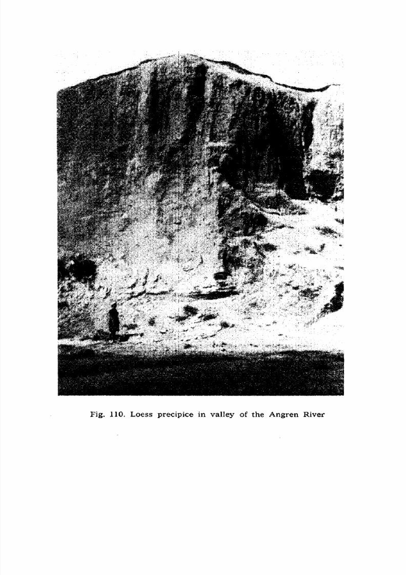
7/28/2019 Fundamentals of Geology - 19th century - Russia text in English
http://slidepdf.com/reader/full/fundamentals-of-geology-19th-century-russia-text-in-english 122/375
Fig. 110. Loess precipice in valley of the
AngrenRiver
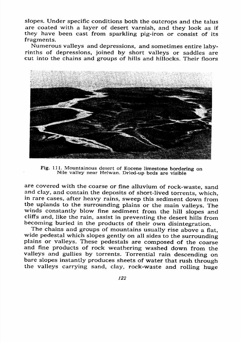
7/28/2019 Fundamentals of Geology - 19th century - Russia text in English
http://slidepdf.com/reader/full/fundamentals-of-geology-19th-century-russia-text-in-english 123/375
slopes. Under specific conditions both the outcrops and the talus
are coated with a layer of desert varnish, and they look as if
they have been cast from sparkling pig-iron or consist of its
fragments.
Numerous valleys and depressions, and sometimes entire
laby-rinths of depressions, joined by short valleys or saddles are
cut into the chains and groups of hills and hillocks. Their floors
Fig. 111. Mountainous desert of Eocene limestone bordering onNile valley near Helwan. Dried-up beds are visible
are covered with the coarse or fine alluvium of rock-waste, sandand clay, and contain the deposits of short-lived torrents, which,
in rare cases, after heavy rains, sweep this sediment down fromthe uplands to the surrounding plains or the main valleys. Thewinds constantly blow fine sediment from the hill slopes andcliffs and, like the rain, assist in preventing the desert hills from
becoming buried in the products of their own disintegration.
The chains and groups of mountains usually rise above a flat,
wide pedestal which slopes gently on all sides to the surroundingplains or valleys. These pedestals are composed of the coarse
and fine products of rock weathering washed down from thevalleys and gullies by torrents. Torrential rain descending on
bare slopes instantly produces sheets of water that rush throughthe valleys carrying sand, clay, rock-waste and rolling huge
122
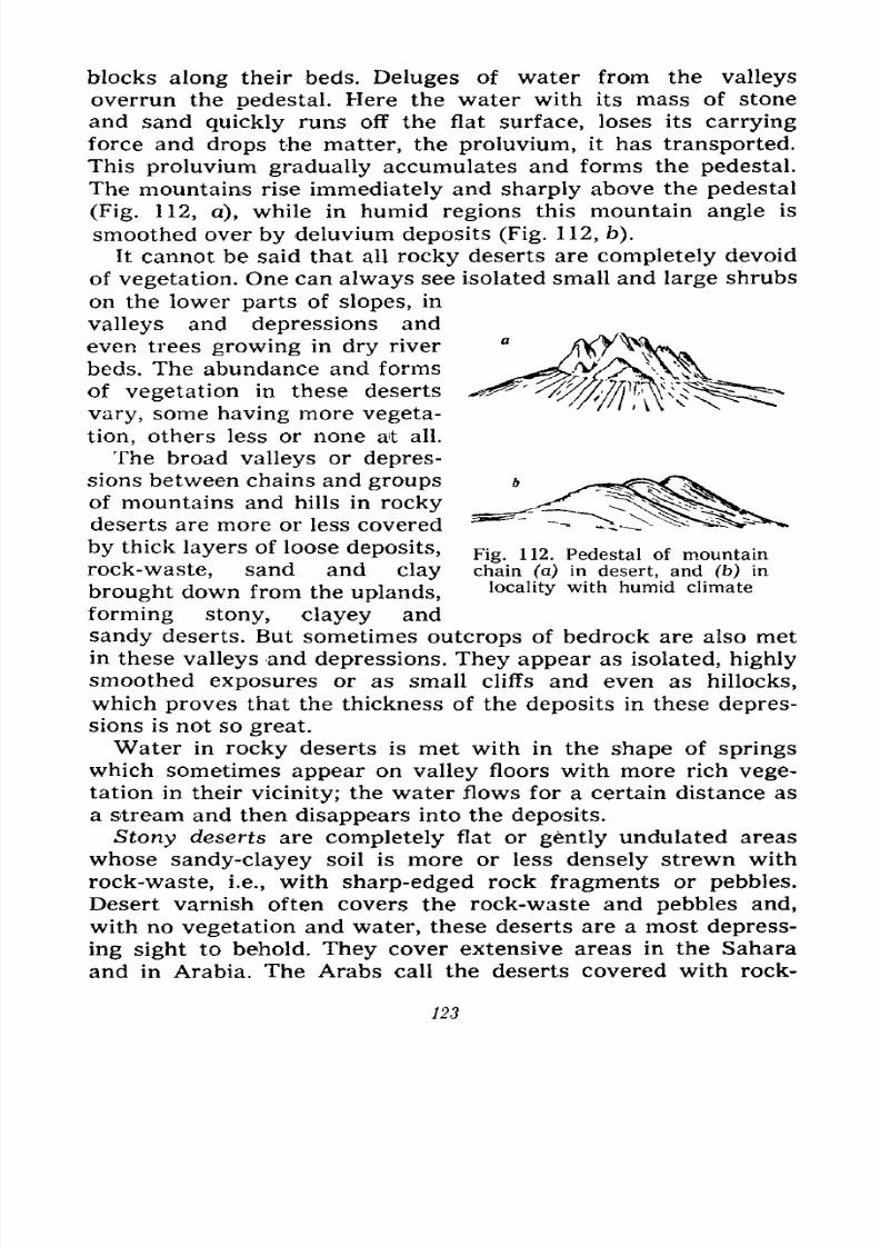
7/28/2019 Fundamentals of Geology - 19th century - Russia text in English
http://slidepdf.com/reader/full/fundamentals-of-geology-19th-century-russia-text-in-english 124/375
blocks along their beds. Deluges of water from the valleys
overrun the pedestal. Here the water with its mass of stone
and sand quickly runs off the flat surface, loses its carrying
force and drops the matter, the proluvium, it has transported.
This proluvium gradually accumulates and forms the pedestal.
The mountains rise immediately and sharply above the pedestal
(Fig. 112, a), while in humid regions this mountain angle is
smoothed over by deluvium deposits (Fig. 112, b).
It cannot be said that all rocky deserts are completely devoid
of vegetation. One can always see isolated small and large shrubs
on the lower parts of slopes, in
valleys and depressions and
even trees growing in dry river
beds. The abundance and forms
of vegetation in these deserts
vary, some having more vegeta-
tion, others less or none at all.
The broad valleys or depres-
sions between chains and groups
of mountains and hills in rocky
deserts are more or less covered
by thick layers of loose deposits,
rock-waste, sand and clay
brought down from the uplands,
forming stony, clayey and
sandy deserts. But sometimes outcrops of bedrock are also met
in these valleys and depressions. They appear as isolated, highly
smoothed exposures or as small cliffs and even as hillocks,
which proves that the thickness of the deposits in these depres-
sions is not so great.
Water in rocky deserts is met with in the shape of springs
which sometimes appear on valley floors with more rich vege-
tation in their vicinity; the water flows for a certain distance as
a stream and then disappears into the deposits.
Stony deserts are completely flat or gently undulated areas
whose sandy-clayey soil is more or less densely strewn with
rock-waste, i.e., with sharp-edged rock fragments or pebbles.
Desert varnish often covers the rock-waste and pebbles and,with no vegetation and water, these deserts are a most depress-
ing sight to behold. They cover extensive areas in the Sahara
and in Arabia. The Arabs call the deserts covered with rock-
Fig. 112. Pedestal of mountain
chain (a) in desert, and (b) in
locality with humid climate
123
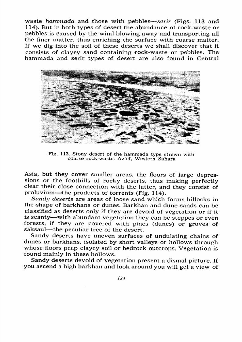
7/28/2019 Fundamentals of Geology - 19th century - Russia text in English
http://slidepdf.com/reader/full/fundamentals-of-geology-19th-century-russia-text-in-english 125/375
waste hammada and those with pebbles serir (Figs. 113 and
114). But in both types of desert the abundance of rock-waste or
pebbles is caused by the wind blowing away and transporting all
the finer matter, thus enriching the surface with coarse matter.
If we dig into the soil of these deserts we shall discover that it
consists of clayey sand containing rock-waste or pebbles. The
hammada and serir types of desert are also found in Central
Fig. 1 13. Stony desert of the hammada type strewn with
coarse rock-waste. Azlef, Western Sahara
Asia, but they cover smaller areas, the floors of large depres-sions or the foothills of rocky deserts, thus making perfectlyclear their close connection with the latter, and they consist of
proluvium the products of torrents (Fig. 114).
Sandy deserts are areas of loose sand which forms hillocks in
the shape of barkhans or dunes. Barkhan and dune sands can be
classified as deserts only if they are devoid of vegetation or if it
is scanty with abundant vegetation they can be steppes or even
forests, if they are covered with pines (dunes) or groves of
saksaul the peculiar tree of the desert.
Sandy deserts have uneven surfaces of undulating chains of
dunes or barkhans, isolated by short valleys or hollows through
whose floors peep clayey soil or bedrock outcrops. Vegetation is
found mainly in these hollows.
Sandy deserts devoid of vegetation present a dismal picture. If
you ascend a high barkhan and look around you will get a view of
124
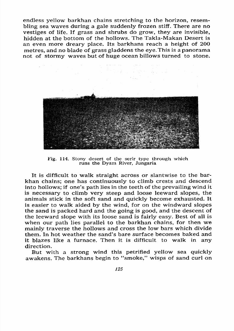
7/28/2019 Fundamentals of Geology - 19th century - Russia text in English
http://slidepdf.com/reader/full/fundamentals-of-geology-19th-century-russia-text-in-english 126/375
7/28/2019 Fundamentals of Geology - 19th century - Russia text in English
http://slidepdf.com/reader/full/fundamentals-of-geology-19th-century-russia-text-in-english 127/375
every crest, the air fills with sand which gets into your eyes
and teeth. On the windward slopes the wind whips the sand into
snake-like motion and everything comes alive. The wind blows
sand from the crests, scattering some on the leeward slopes. The
sultry
air is laden with dust. Like a dull-red disc
faintly
shines
the sun and the horizon disappears in the haze. Even on horse-
back one needs special glasses, so strongly do the grains strike
the face. In sand-storms the traveller may get lost and perish,
since in the clouds of sand and dust it is easy to lose one's wayand sense of direction and to exhaust the animals. It is advisable
to weather the storm in a hollow.
Clayey deserts are not extensive. They cover small areas of
othertypes
ofdeserts, usually depression
floors. The flat shores
of some large lakes and inland seas (the Caspian, Aral and Medi-
terranean seas) are, in places, clayey deserts. Their surface is
level, clayey, usually cracked into polygonal sections, which are
so hard that horses' hoofs leave no imprint. Vegetation is either
completely absent, or grows sparsely in cracks. In Central Asia
these clayey deserts are known as takyrs. Their soil is of fine
silt, deposited on the floors of flat depressions, which are flooded
with muddy waterin
spring orafter
heavy rainfalls, and whichdry up in a few days or weeks. Some clayey deserts are made upof solid or loose saliniferous soil. Their clayey soil is saturated
with salts. In these deserts, usually on flat mounds, grow salsola
shrubs, while kharmyk shrubs grow on higher mounds and
tamarisks, on the highest mounds.
7/28/2019 Fundamentals of Geology - 19th century - Russia text in English
http://slidepdf.com/reader/full/fundamentals-of-geology-19th-century-russia-text-in-english 128/375
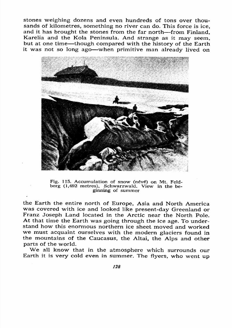
7/28/2019 Fundamentals of Geology - 19th century - Russia text in English
http://slidepdf.com/reader/full/fundamentals-of-geology-19th-century-russia-text-in-english 129/375
stones weighing dozens and even hundreds of tons over thou-
sands of kilometres, something no river can do. This force is ice,
and it has brought the stones from the far north from Finland,
Karelia and the Kola Peninsula. And strange as it may seem,
but at one time though compared with the history of the Earth
it was not so long ago when primitive man already lived on
Fig. 115. Accumulation of snow (nve") on Mt. Feld-
berg (1,492 metres), Schwarzwald. View in the be-
ginning of summer
the Earth the entire north of Europe, Asia and North Americawas covered with ice and looked like present-day Greenland or
Franz Joseph Land located in the Arctic near the North Pole.
At that time the Earth was going through the ice age. To under-
stand how this enormous northern ice sheet moved and workedwe must acquaint ourselves with the modern glaciers found in
the mountains of the Caucasus, the Altai, the Alps and other
parts of the world.
We all know that in the atmosphere which surrounds our
Earth it is very cold even in summer. The flyers, who went up
128
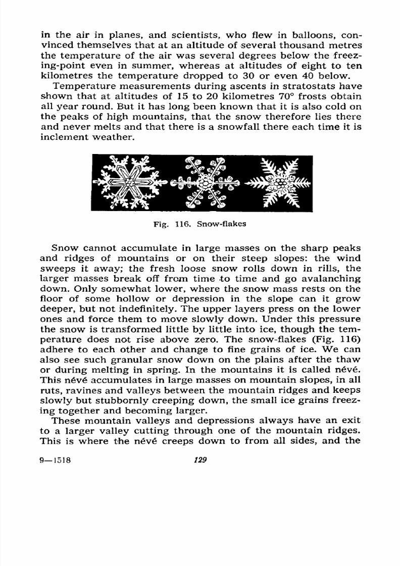
7/28/2019 Fundamentals of Geology - 19th century - Russia text in English
http://slidepdf.com/reader/full/fundamentals-of-geology-19th-century-russia-text-in-english 130/375
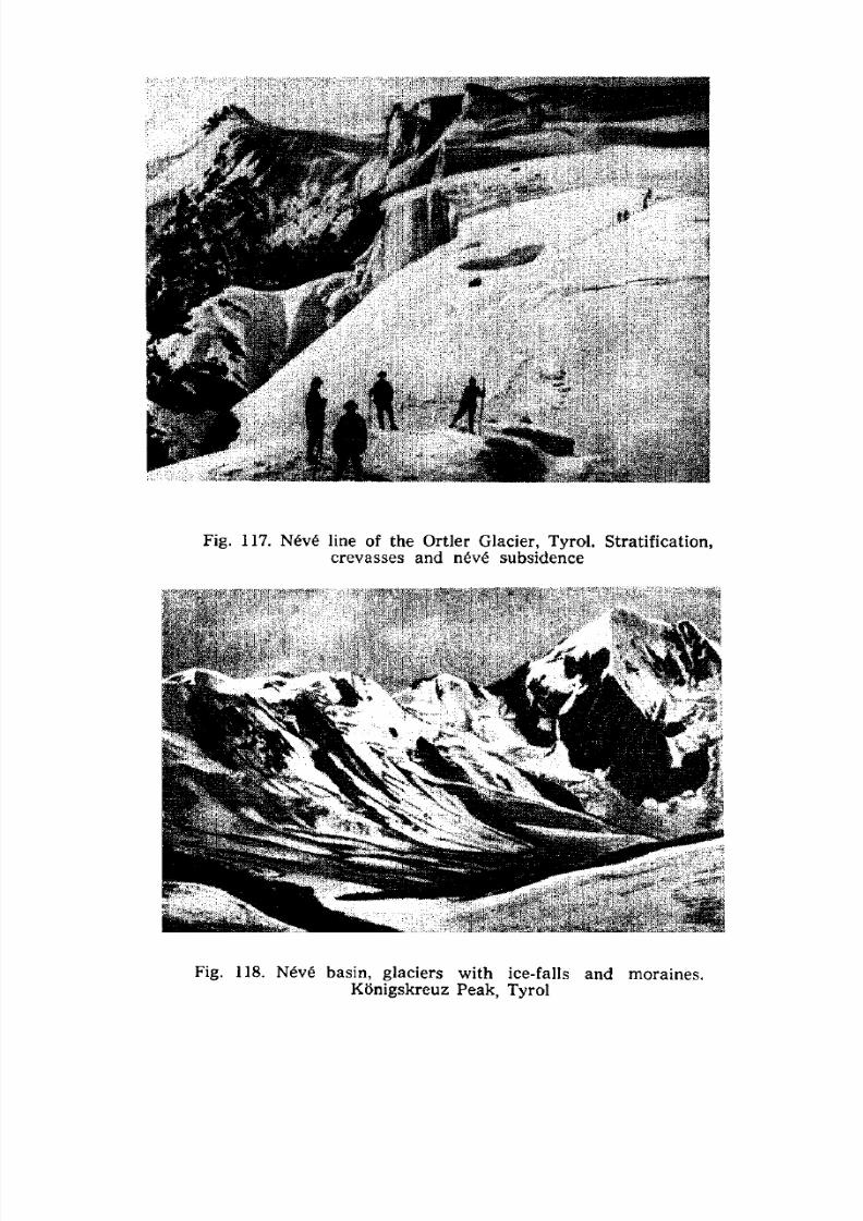
7/28/2019 Fundamentals of Geology - 19th century - Russia text in English
http://slidepdf.com/reader/full/fundamentals-of-geology-19th-century-russia-text-in-english 131/375
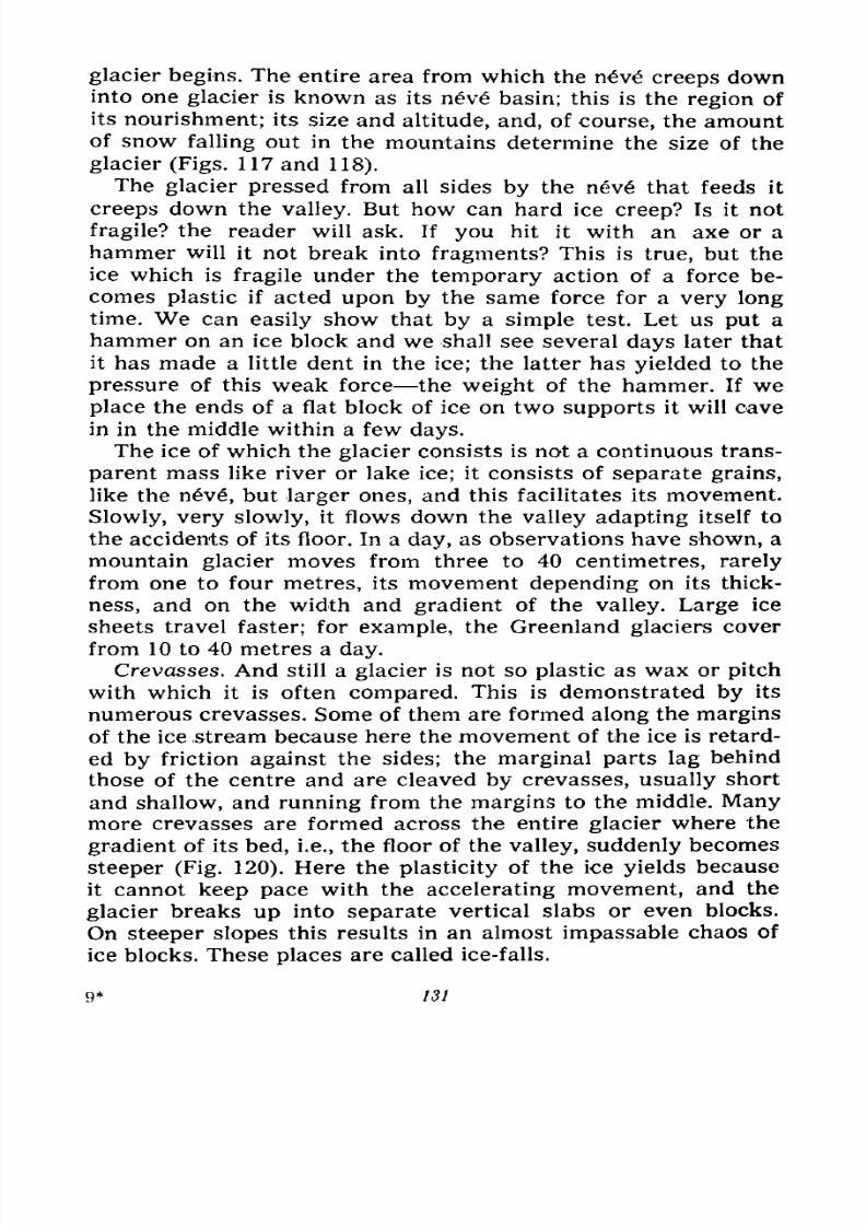
7/28/2019 Fundamentals of Geology - 19th century - Russia text in English
http://slidepdf.com/reader/full/fundamentals-of-geology-19th-century-russia-text-in-english 132/375
glacier begins. The entire area from which the nv creeps downinto one glacier is known as its nv basin; this is the region of
its nourishment; its size and altitude, and, of course, the amountof snow falling out in the mountains determine the size of the
glacier (Figs. 117 and 118).
The glacier pressed from all sides by the nev6 that feeds it
creeps down the valley. But how can hard ice creep? Is it not
fragile? the reader will ask. If you hit it with an axe or a
hammer will it not break into fragments? This is true, but the
ice which is fragile under the temporary action of a force be-
comes plastic if acted upon by the same force for a very long
time. We can easily show that by a simple test. Let us put a
hammer on an ice block and we shall see several days later that
it has made a little dent in the ice; the latter has yielded to the
pressure of this weak force the weight of the hammer. If we
place the ends of a flat block of ice on two supports it will cave
in in the middle within a few days.
The ice of which the glacier consists is not a continuous trans-
parent mass like river or lake ice; it consists of separate grains,
like the n6v, but larger ones, and this facilitates its movement.
Slowly, very slowly, it flows down the valley adapting itself to
the accidents of its floor. In a day, as observations have shown, a
mountain glacier moves from three to 40 centimetres, rarely
from one to four metres, its movement depending on its thick-
ness, and on the width and gradient of the valley. Large ice
sheets travel faster; for example, the Greenland glaciers cover
from 10 to 40 metres a day.
Crevasses. And still a glacier is not so plastic as wax or pitch
with which it is often compared. This is demonstrated by its
numerous crevasses. Some of them are formed along the marginsof the ice stream because here the movement of the ice is retard-
ed by friction against the sides; the marginal parts lag behind
those of the centre and are cleaved by crevasses, usually short
and shallow, and running from the margins to the middle. Manymore crevasses are formed across the entire glacier where the
gradient of its bed, i.e., the floor of the valley, suddenly becomes
steeper (Fig. 120). Here the plasticity of the ice yields because
it cannot keep pace with the accelerating movement, and the
glacier breaks up into separate vertical slabs or even blocks.
On steeper slopes this results in an almost impassable chaos of
ice blocks. These places are called ice-falls.
9* 131
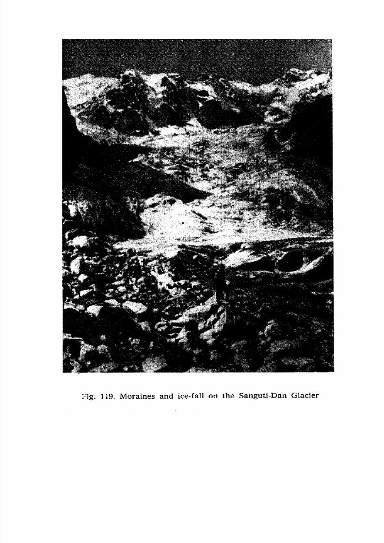
7/28/2019 Fundamentals of Geology - 19th century - Russia text in English
http://slidepdf.com/reader/full/fundamentals-of-geology-19th-century-russia-text-in-english 133/375
Fig. 119. Moraines and ice-fall on the Sanguti-Dan Glacier
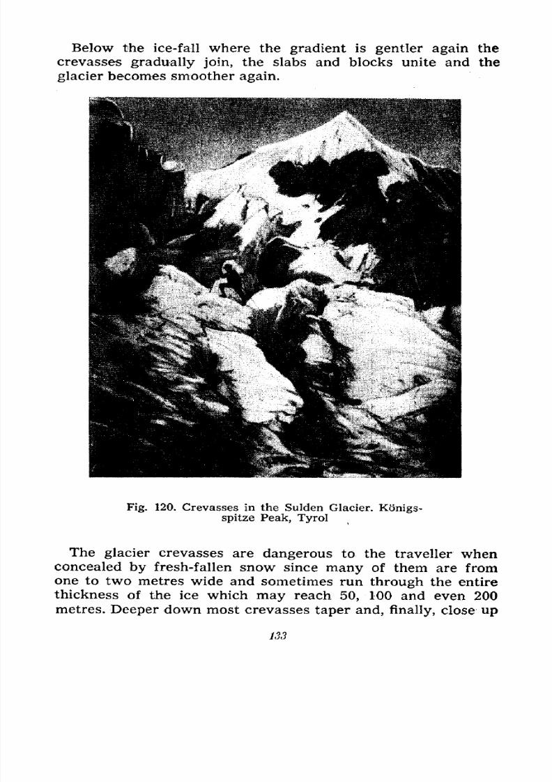
7/28/2019 Fundamentals of Geology - 19th century - Russia text in English
http://slidepdf.com/reader/full/fundamentals-of-geology-19th-century-russia-text-in-english 134/375
Below the ice-fall where the gradient is gentler again the
crevasses gradually join, the slabs and blocks unite and the
glacier becomes smoother again.
Fig. 120. Crevasses in the Sulden Glacier. Konigs-
spitze Peak, Tyrol
The glacier crevasses are dangerous to the traveller when
concealed by fresh-fallen snow since many of them are fromone to two metres wide and sometimes run through the entire
thickness of the ice which may reach 50, 100 and even 200
metres. Deeper down most crevasses taper and, finally, close up
133
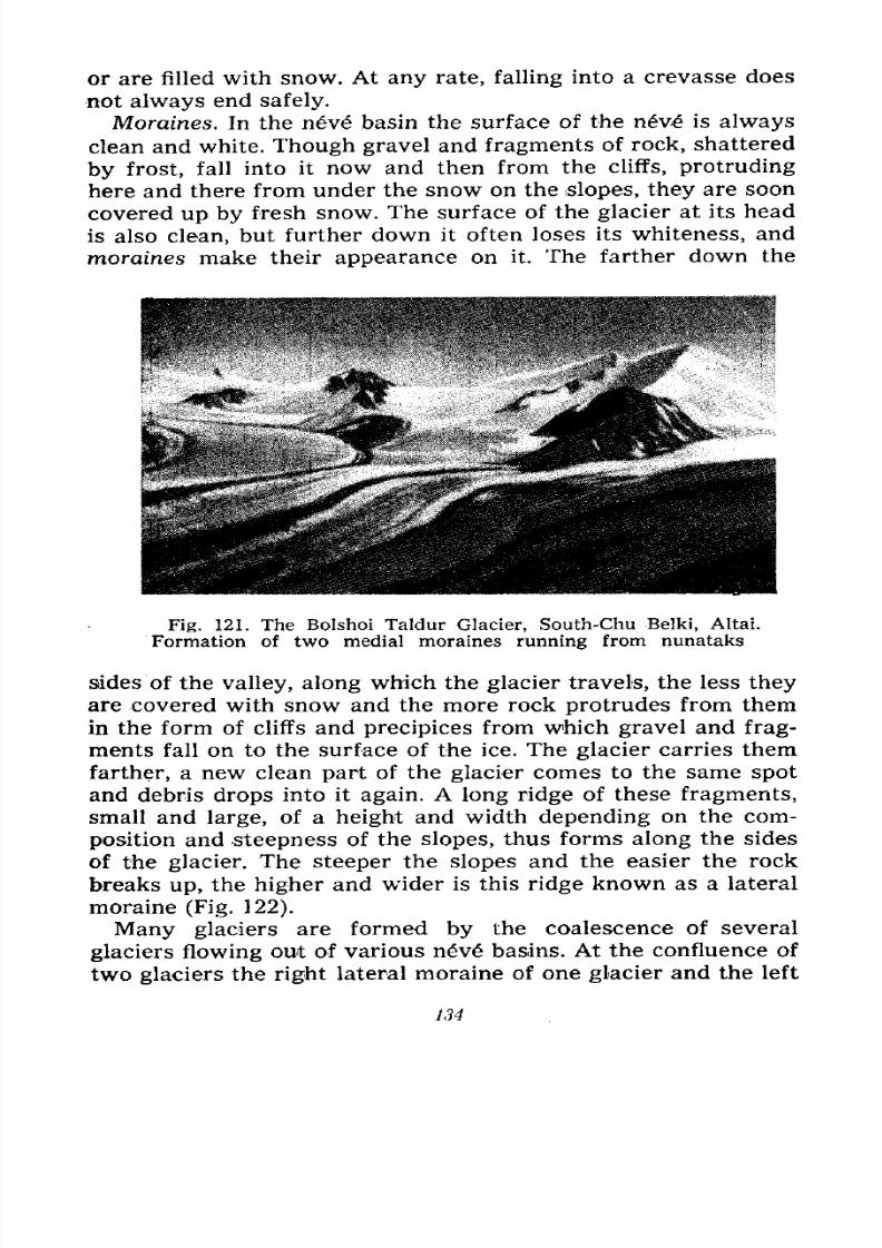
7/28/2019 Fundamentals of Geology - 19th century - Russia text in English
http://slidepdf.com/reader/full/fundamentals-of-geology-19th-century-russia-text-in-english 135/375
or are filled with snow. At any rate, falling into a crevasse does
not always end safely.
Moraines. In the nve basin the surface of the n6ve is always
clean and white. Though gravel and fragments of rock, shattered
byfrost, fall into it now and then from the cliffs, protruding
here and there from under the snow on the slopes, they are soon
covered up by fresh snow. The surface of the glacier at its head
is also clean, but further down it often loses its whiteness, and
moraines make their appearance on it. The farther down the
Fig. 121. The Bolshoi Taldur Glacier, South-Chu Belki, Altai.
Formation of two medial moraines running from nunataks
sides of the valley, along which the glacier travels, the less they
are covered with snow and the more rock protrudes from them
in the form of cliffs and precipices from which gravel and frag-
ments fall on to the surface of the ice. The glacier carries them
farther, a new clean part of the glacier comes to the same spot
and debris drops into it again. A long ridge of these fragments,
small and large, of a height and width depending on the com-
position and steepness of the slopes, thus forms along the sides
of the glacier. The steeper the slopes and the easier the rock
breaks up, the higher and wider is this ridge known as a lateral
moraine (Fig. 122).
Many glaciers are formed by the coalescence of several
glaciers flowing out of various n6v basins. At the confluence of
two glaciers the right lateral moraine of one glacier and the left
134
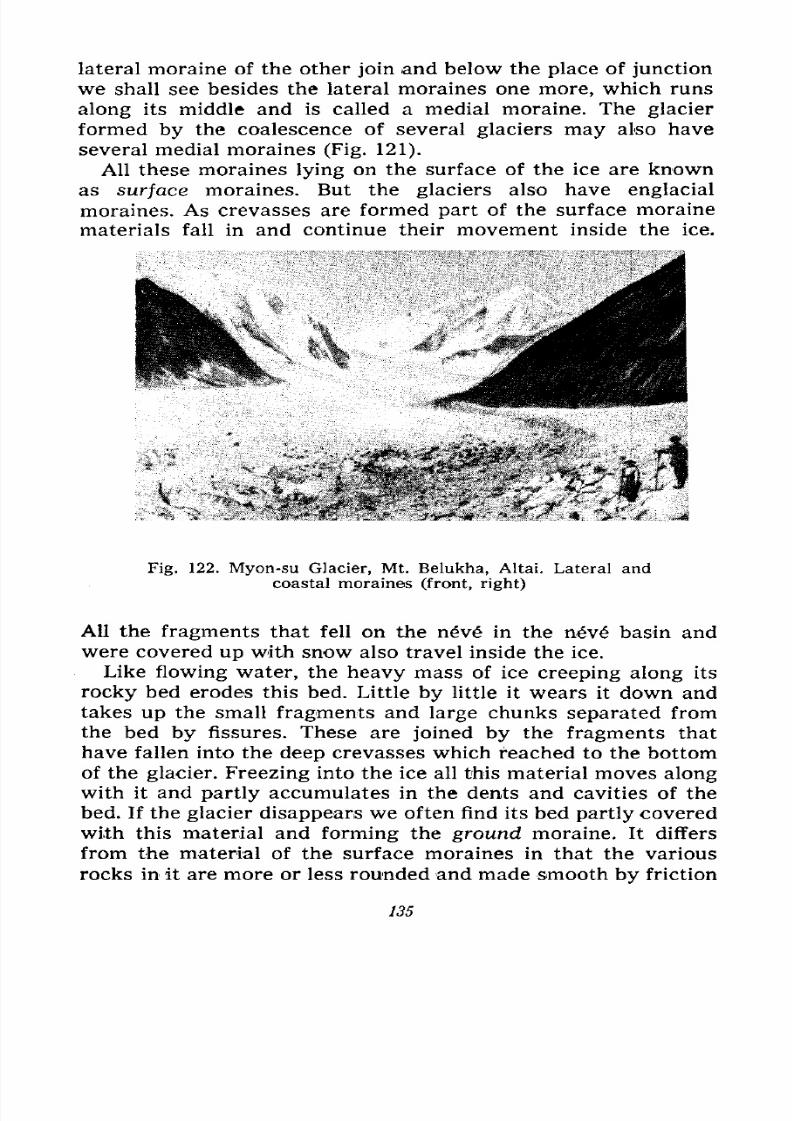
7/28/2019 Fundamentals of Geology - 19th century - Russia text in English
http://slidepdf.com/reader/full/fundamentals-of-geology-19th-century-russia-text-in-english 136/375
lateral moraine of the other join and below the place of junction
we shall see besides the lateral moraines one more, which runs
along its middle and is called a medial moraine. The glacier
formed by the coalescence of several glaciers may also have
several medial moraines (Fig. 121).
All these moraines lying on the surface of the ice are known
as surface moraines. But the glaciers also have englacial
moraines. As crevasses are formed part of the surface moraine
materials fall in and continue their movement inside the ice.
Fig. 122. Myon-su Glacier, Mt. Belukha, Altai. Lateral and
coastal moraines (front, right)
All the fragments that fell on the neve in the nev basin and
were covered up with snow also travel inside the ice.
Like flowing water, the heavy mass of ice creeping along its
rocky bed erodes this bed. Little by little it wears it down and
takes up the small fragments and large chunks separated from
the bed by fissures. These are joined by the fragments that
have fallen into the deep crevasses which reached to the bottom
of the glacier. Freezing into the ice all this material moves along
with it and partly accumulates in the dents and cavities of the
bed. If the glacier disappears we often find its bed partly coveredwith this material and forming the ground moraine. It differs
from the material of the surface moraines in that the various
rocks in it are more or less rounded and made smooth by friction
135
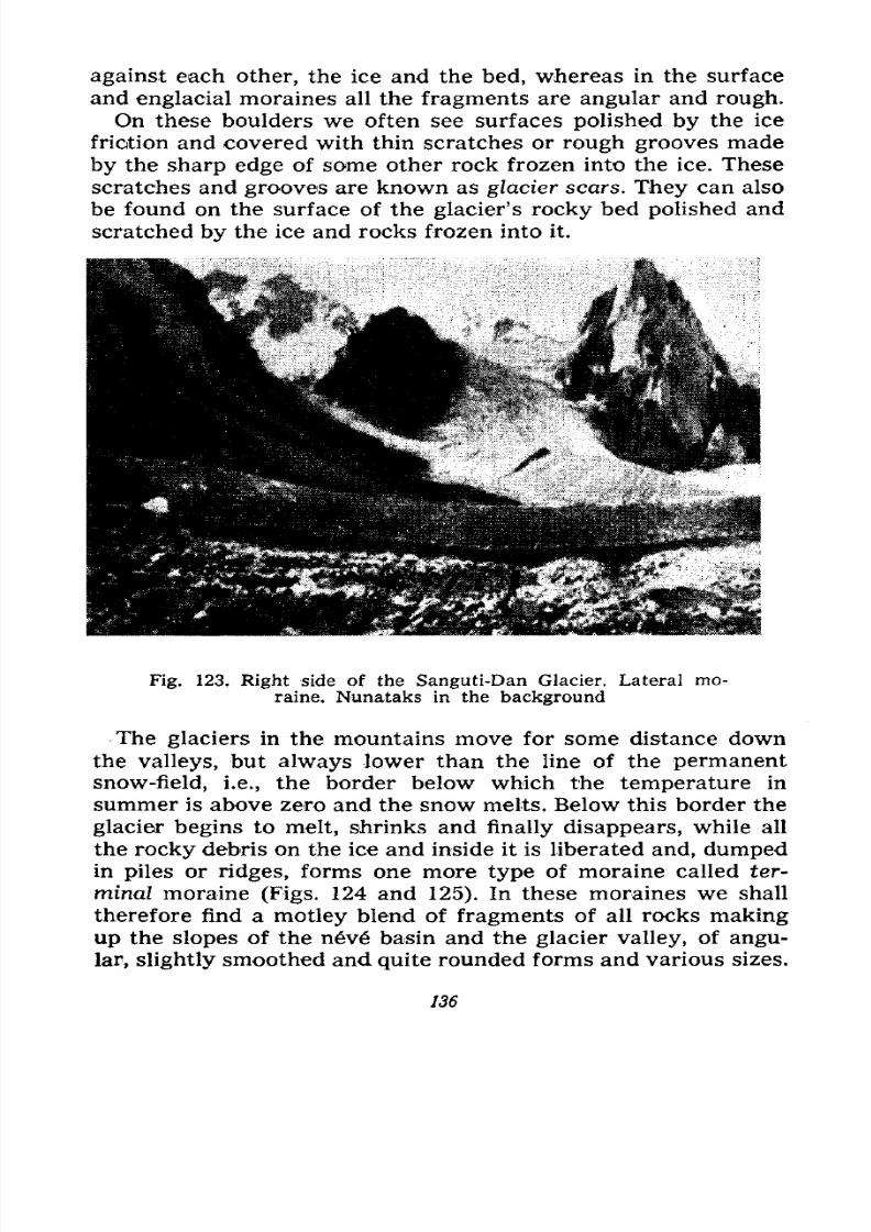
7/28/2019 Fundamentals of Geology - 19th century - Russia text in English
http://slidepdf.com/reader/full/fundamentals-of-geology-19th-century-russia-text-in-english 137/375
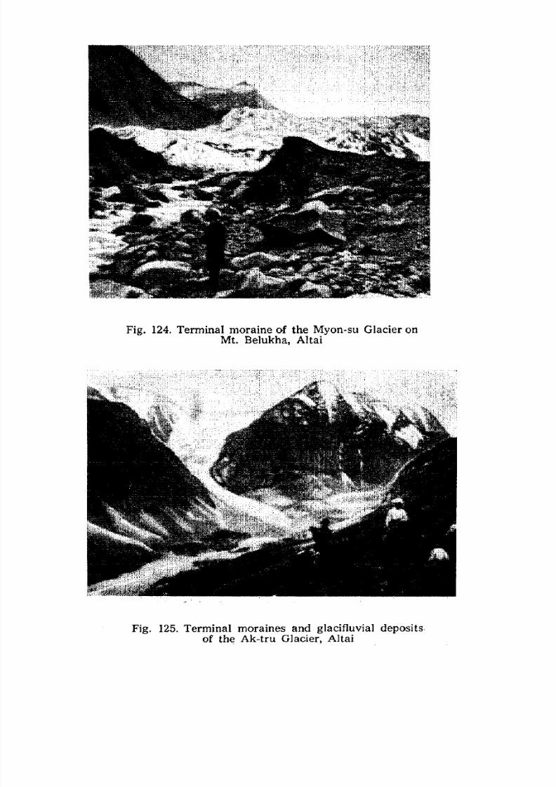
7/28/2019 Fundamentals of Geology - 19th century - Russia text in English
http://slidepdf.com/reader/full/fundamentals-of-geology-19th-century-russia-text-in-english 138/375
Fig. 124. Terminal moraine of the Myon-su Glacier on
Mt. Belukha, Altai
Fig. 125. Terminal moraines and glacifluvial deposits
of the Ak-tru Glacier, Altai
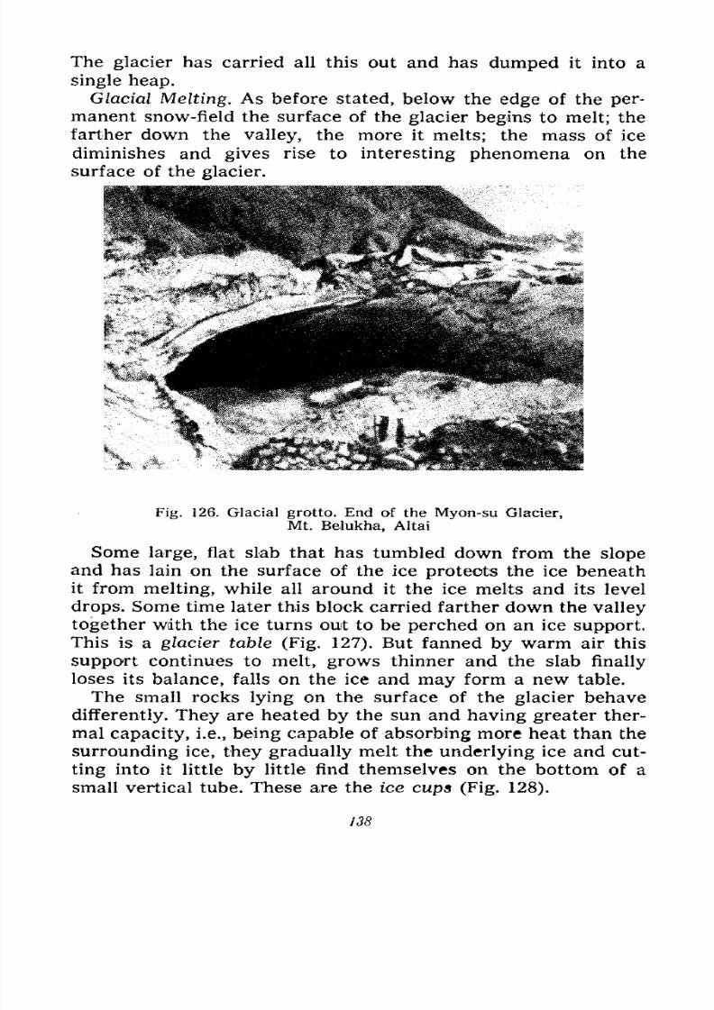
7/28/2019 Fundamentals of Geology - 19th century - Russia text in English
http://slidepdf.com/reader/full/fundamentals-of-geology-19th-century-russia-text-in-english 139/375
The glacier has carried all this out and has dumped it into a
single heap.
Glacial Melting. As before stated, below the edge of the per-
manent snow-field the surface of the glacier begins to melt; the
farther down the valley, the more it melts; the mass of ice
diminishes and gives rise to interesting phenomena on the
surface of the glacier.
Fig. 126. Glacial grotto. End of the Myon-su Glacier,
Mt. Belukha, Altai
Some large, flat slab that has tumbled down from the slope
and has lain on the surface of the ice protects the ice beneath
it from melting, while all around it the ice melts and its level
drops. Some time later this block carried farther down the valley
together with the ice turns ouit to be perched on an ice support.
This is a glacier table (Fig. 127), But fanned by warm air this
support continues to melt, grows thinner and the slab finally
loses its balance, falls on the ice and may form a new table.
The small rocks lying on the surface of the glacier behave
differently. They are heated by the sun and having greater ther-
mal capacity, i.e., being capable of absorbing more heat than the
surrounding ice, they gradually melt the underlying ice and cut-
ting into it little by little find themselves on the bottom of a
small vertical tube. These are the ice cups (Fig. 128).
138
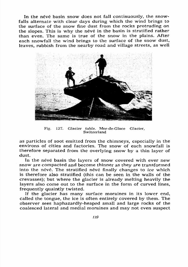
7/28/2019 Fundamentals of Geology - 19th century - Russia text in English
http://slidepdf.com/reader/full/fundamentals-of-geology-19th-century-russia-text-in-english 140/375
In the neve basin snow does not fall continuously, the snow-
falls alternate with clear days during which the wind brings to
the surface of the snow fine dust from the rocks protruding on
the slopes. This is why the nv in the basin is stratified raither
than even. The same is true of the snow in the plains. After
each snowfall the wind brings to the surface of the snow dust,
leaves, rubbish from the nearby road and village streets, as well
Fig. 127. Glacier table. Mer-de-Glace Glacier,
Switzerland
as particles of soot emitted from the chimneys, especially in the
environs of cities and factories. The snow of each snowfall is
therefore separated from the overlying snow by a thin layer of
dust.
In the neve basin the layers of snow covered with ever newsnow are compacted and become thinner as they are transformed
into the neve. The stratified nve finally changes to ice which
is therefore also stratified (this can be seen in the walls of the
crevasses); but where the glacier is already melting heavily the
layers also come out to the surface in the form of curved lines,
frequently quaintly twisted.
If the glacier has many surface moraines in its lower end,called the tongue, the ice is often entirely covered by them. The
observer sees haphazardly-heaped small and large rocks of the
coalesced lateral and medial moraines and may not even suspect
139
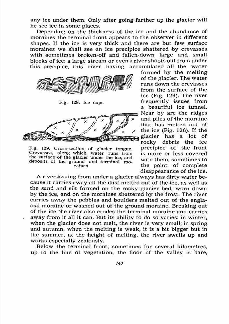
7/28/2019 Fundamentals of Geology - 19th century - Russia text in English
http://slidepdf.com/reader/full/fundamentals-of-geology-19th-century-russia-text-in-english 141/375
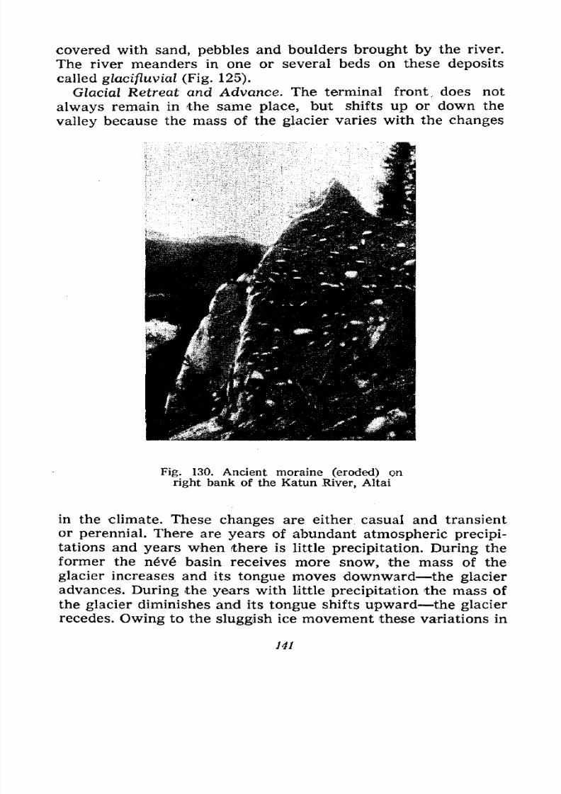
7/28/2019 Fundamentals of Geology - 19th century - Russia text in English
http://slidepdf.com/reader/full/fundamentals-of-geology-19th-century-russia-text-in-english 142/375
covered with sand, pebbles and boulders brought by the river.
The river meanders in one or several beds on these deposits
called glacifluvial (Fig. 125).
Glacial Retreat and Advance. The terminal front, does not
always remain in the same place, but shifts up or down the
valley because the mass of the glacier varies with the changes
Fig. 130. Ancient moraine (eroded) on
right bank of the Katun River, Altai
in the climate. These changes are either casual and transient
or perennial. There are years of abundant atmospheric precipi-
tations and years when (there is little precipitation. During the
former the n6v6 basin receives more snow, the mass of the
glacier increases and its tongue moves downward the glacieradvances. During the years with little precipitation the mass of
the glacier diminishes and its tongue shifts upward the glacier
recedes. Owing to the sluggish ice movement these variations in
141
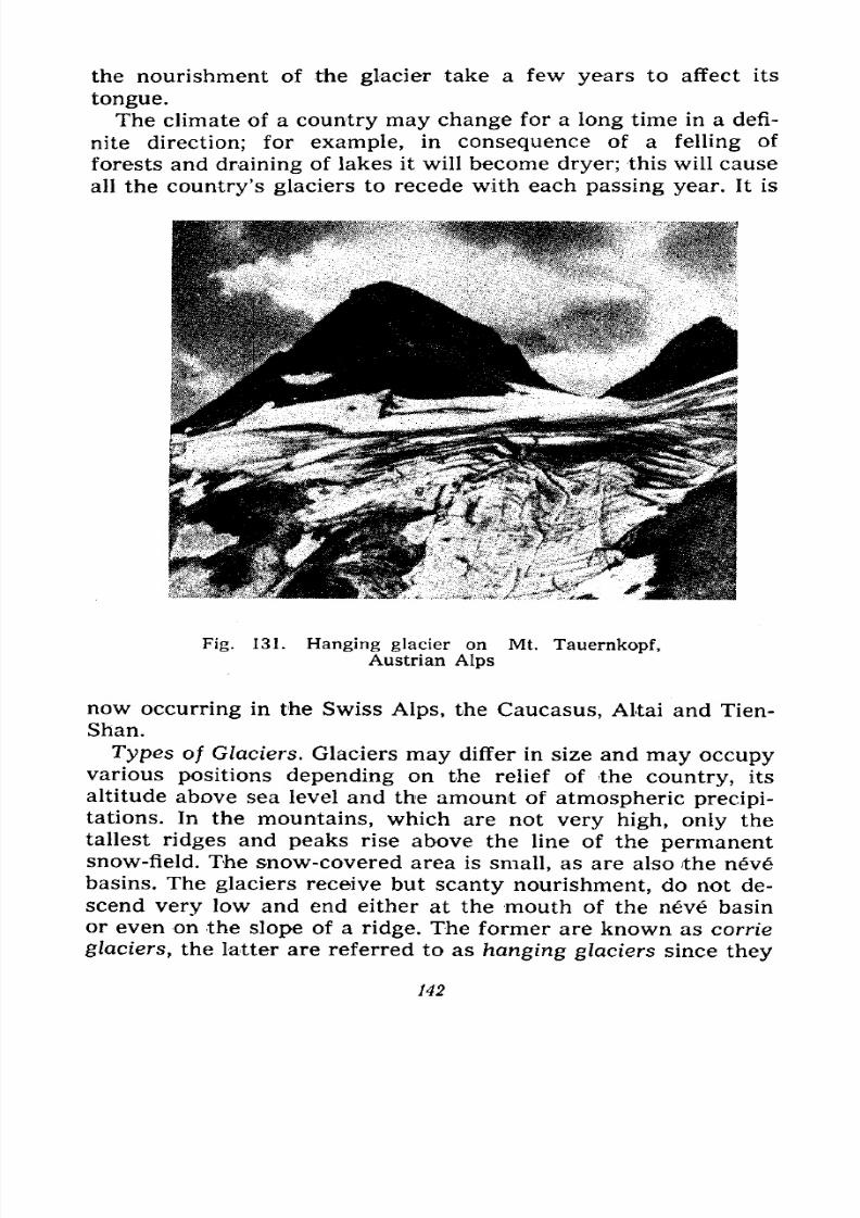
7/28/2019 Fundamentals of Geology - 19th century - Russia text in English
http://slidepdf.com/reader/full/fundamentals-of-geology-19th-century-russia-text-in-english 143/375
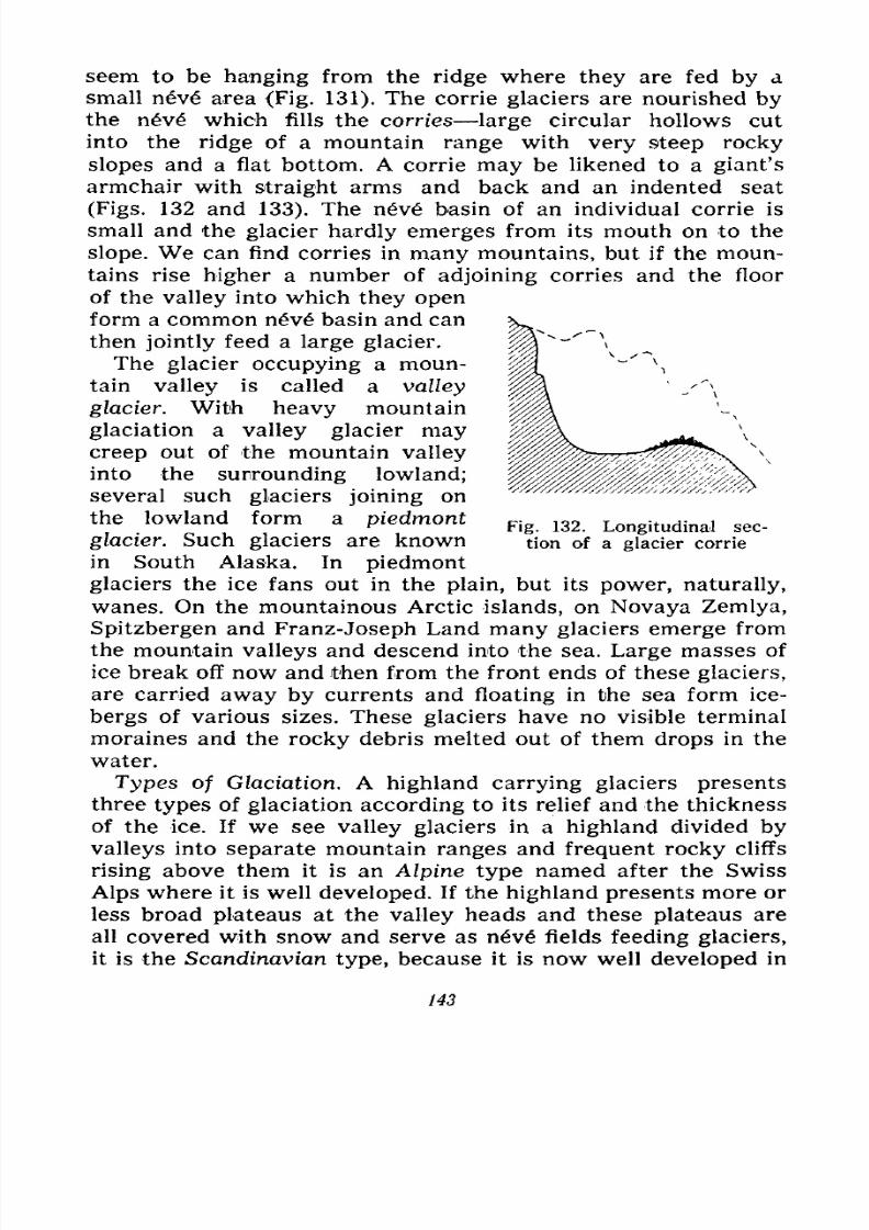
7/28/2019 Fundamentals of Geology - 19th century - Russia text in English
http://slidepdf.com/reader/full/fundamentals-of-geology-19th-century-russia-text-in-english 144/375
seem to be hanging from the ridge where they are fed by a
small nev6 area (Fig. 131). The corrie glaciers are nourished bythe nv which fills the carries large circular hollows cut
into the ridge of a mountain range with very steep rocky
slopes and a flat bottom. A corrie may be likened to a giant's
armchair with straight arms and back and an indented seat
(Figs. 132 and 133). The n6v6 basin of an individual corrie is
small and the glacier hardly emerges from its mouth on to the
slope. We can find corries in many mountains, but if the moun-
tains rise higher a number of adjoining corries and the floor
of the valley into which they open
form a common neve basin and can
then jointly feed a large glacier.
The glacier occupying a moun-
tain valley is called a valley
glacier. With heavy mountain
glaciation a valley glacier maycreep out of the mountain valley
into the surrounding lowland;
several such glaciers joining on
the lowland form a piedmont
glacier. Such glaciers are knownin South Alaska. In piedmont
glaciers the ice fans out in the plain, but its power, naturally,
wanes. On the mountainous Arctic islands, on Novaya Zemlya,
Spitzbergen and Franz-Joseph Land many glaciers emerge from
the mountain valleys and descend into the sea. Large masses of
ice break off now and then from the front ends of these glaciers,
are carried away by currents and floating in the sea form ice-
bergs of various sizes. These glaciers have no visible terminal
moraines and the rocky debris melted out of them drops in the
water.
Types of Glaciation. A highland carrying glaciers presents
three types of glaciation according to its relief and the thickness
of the ice. If we see valley glaciers in a highland divided by
valleys into separate mountain ranges and frequent rocky cliffs
rising above them it is an Alpine type named after the Swiss
Alps where it is well developed. If the highland presents more orless broad plateaus at the valley heads and these plateaus are
all covered with snow and serve as nev fields feeding glaciers,
it is the Scandinavian type, because it is now well developed in
Fig. 132. Longitudinal sec-
tion of a glacier corrie
143
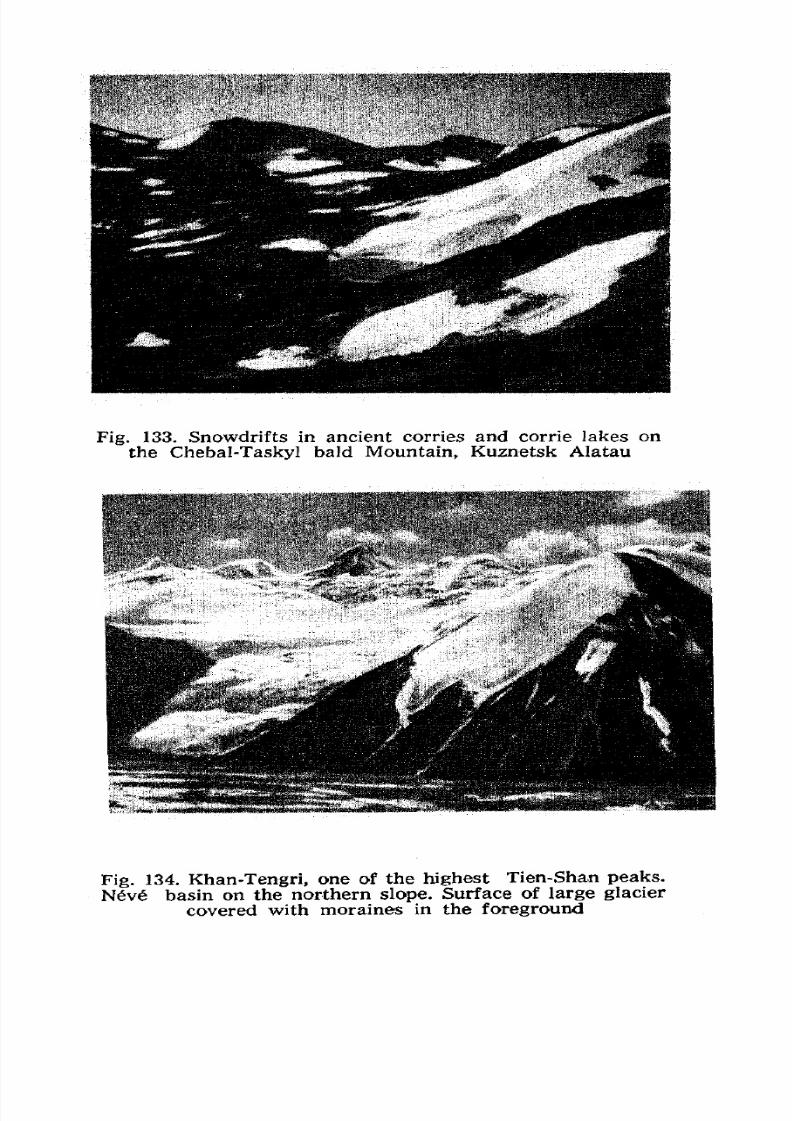
7/28/2019 Fundamentals of Geology - 19th century - Russia text in English
http://slidepdf.com/reader/full/fundamentals-of-geology-19th-century-russia-text-in-english 145/375
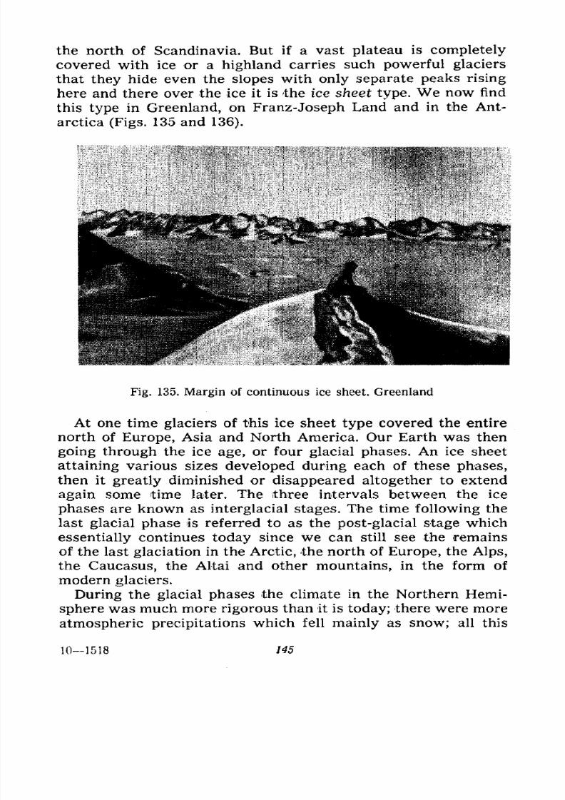
7/28/2019 Fundamentals of Geology - 19th century - Russia text in English
http://slidepdf.com/reader/full/fundamentals-of-geology-19th-century-russia-text-in-english 146/375
the north of Scandinavia. But if a vast plateau is completely
covered with ice or a highland carries such powerful glaciers
that they hide even the slopes with only separate peaks rising
here and there over the ice it is the ice sheet type. We now find
this type in Greenland, on Franz-Joseph Land and in the Ant-
arctica (Figs. 135 and 136).
^,S:'fvV V-V VSr^*'-' *
Fig. 135. Margin of continuous ice sheet. Greenland
At one time glaciers of this ice sheet type covered the entire
north of Europe, Asia and North America. Our Earth was then
going through the ice age, or four glacial phases. An ice sheet
attaining various sizes developed during each of these phases,
then it greatly diminished or disappeared altogether to extend
again some time later. The three intervals between the ice
phases are known as interglacial stages. The time following the
last glacial phase is referred to as the post-glacial stage which
essentially continues today since we can still see the remains
of the last glaciation in the Arctic, the north of Europe, the Alps,
the Caucasus, the Altai and other mountains, in the form of
modern glaciers.
During the glacial phases the climate in the Northern Hemi-
sphere was much more rigorous than it is today; there were more
atmospheric precipitations which fell mainly as snow; all this
101518 145
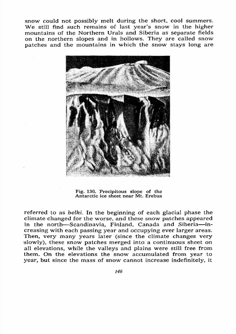
7/28/2019 Fundamentals of Geology - 19th century - Russia text in English
http://slidepdf.com/reader/full/fundamentals-of-geology-19th-century-russia-text-in-english 147/375
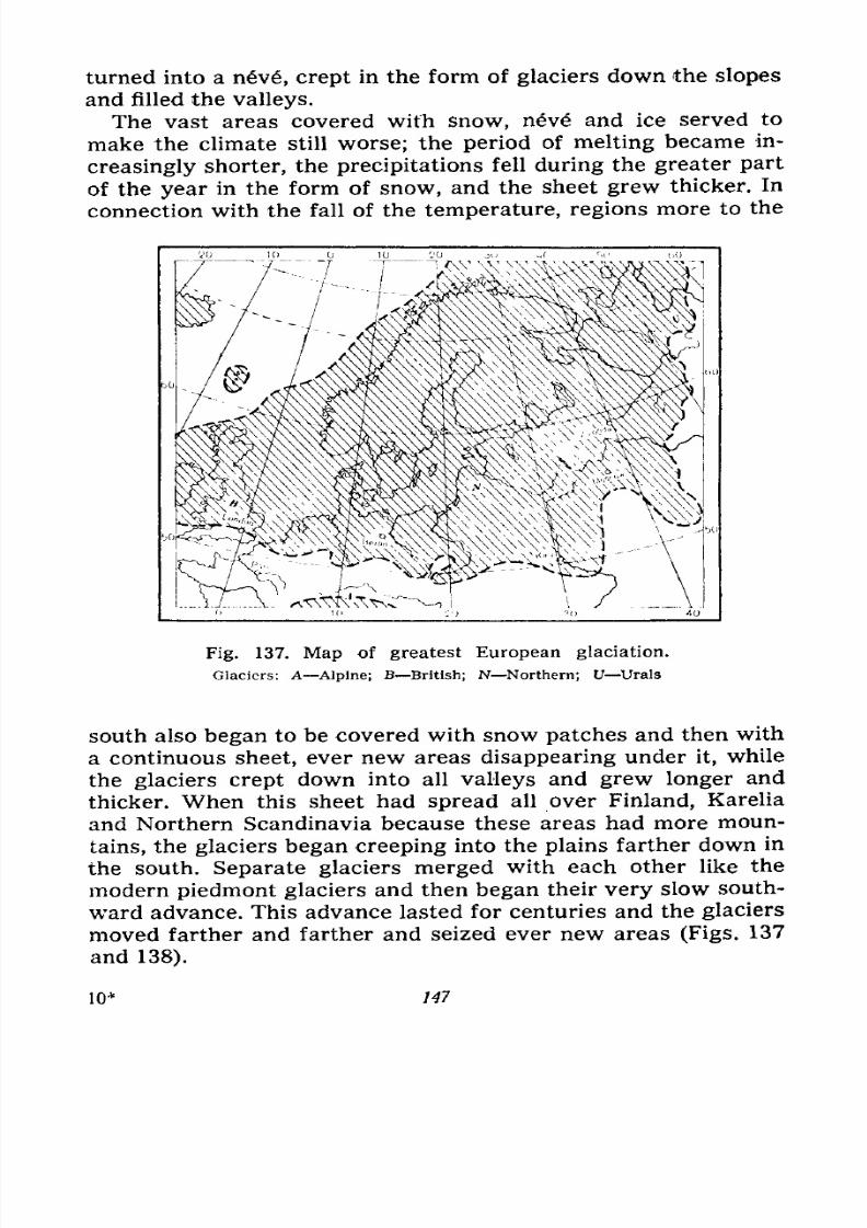
7/28/2019 Fundamentals of Geology - 19th century - Russia text in English
http://slidepdf.com/reader/full/fundamentals-of-geology-19th-century-russia-text-in-english 148/375
turned into a n6v, crept in the form of glaciers down the slopes
and filled the valleys.
The vast areas covered with snow, neve and ice served to
make the climate still worse; the period of melting became in-
creasinglyshorter, the precipitations fell during the greater part
of the year in the form of snow, and the sheet grew thicker. In
connection with the fall of the temperature, regions more to the
Fig. 137. Map of greatest European glaciation.
Glaciers: A Alpine; B British; N Northern; U Urals
south also began to be covered with snow patches and then with
a continuous sheet, ever new areas disappearing under it, while
the glaciers crept down into all valleys and grew longer and
thicker. When this sheet had spread all over Finland, Karelia
and Northern Scandinavia because these areas had more moun-
tains, the glaciers began creeping into the plains farther down in
the south. Separate glaciers merged with each other like the
modern piedmont glaciers and then began their very slow south-ward advance. This advance lasted for centuries and the glaciers
moved farther and farther and seized ever new areas (Figs. 137
and 138).
147
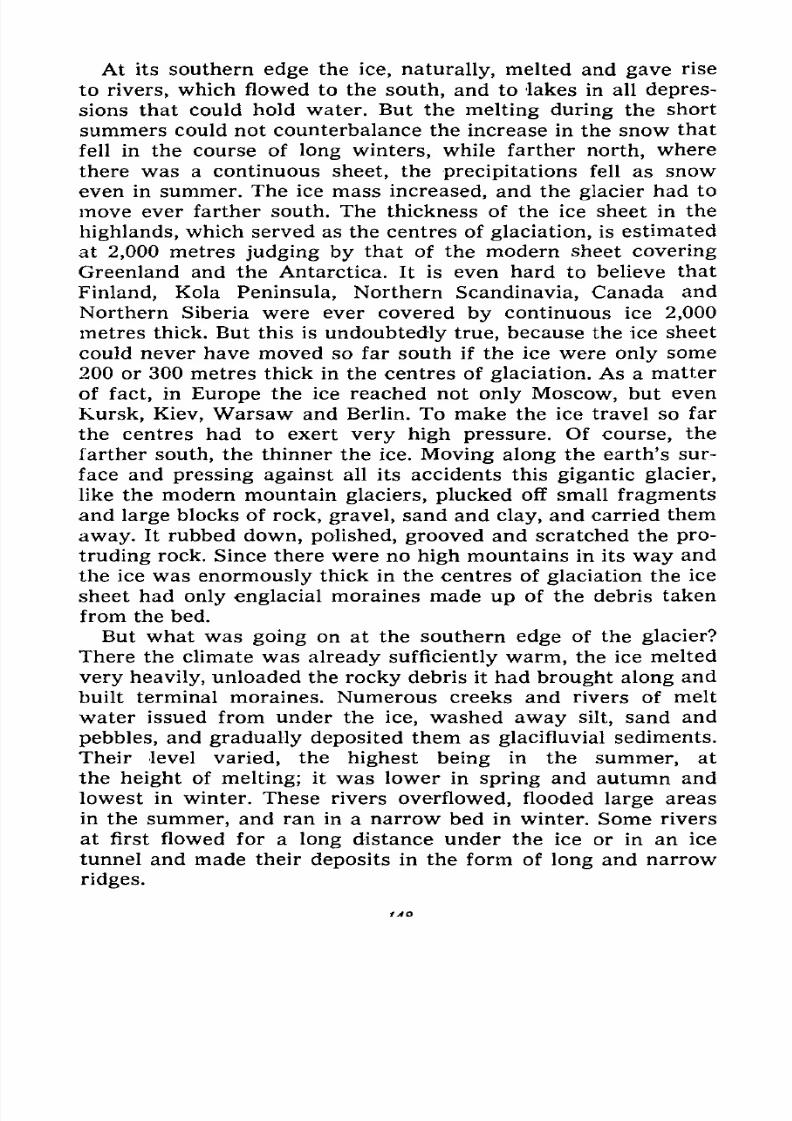
7/28/2019 Fundamentals of Geology - 19th century - Russia text in English
http://slidepdf.com/reader/full/fundamentals-of-geology-19th-century-russia-text-in-english 149/375
At its southern edge the ice, naturally, melted and gave rise
to rivers, which flowed to the south, and to lakes in all depres-
sions that could hold water. But the melting during the short
summers could not counterbalance the increase in the snow that
fell in the course of long winters, while farther north, where
there was a continuous sheet, the precipitations fell as snow
even in summer. The ice mass increased, and the glacier had to
move ever farther south. The thickness of the ice sheet in the
highlands, which served as the centres of glaciation, is estimated
at 2,000 metres judging by that of the modern sheet covering
Greenland and the Antarctica. It is even hard to believe that
Finland, Kola Peninsula, Northern Scandinavia, Canada and
Northern Siberia were ever covered by continuous ice 2,000
metres thick. But this is undoubtedly true, because the ice sheet
could never have moved so far south if the ice were only some
200 or 300 metres thick in the centres of glaciation. As a matter
of fact, in Europe the ice reached not only Moscow, but even
Kursk, Kiev, Warsaw and Berlin. To make the ice travel so far
the centres had to exert very high pressure. Of course, the
farther south, the thinner the ice. Moving along the earth's sur-
face and pressing against all its accidents this gigantic glacier,
like the modern mountain glaciers, plucked off small fragments
and large blocks of rock, gravel, sand and clay, and carried them
away. It rubbed down, polished, grooved and scratched the pro-
truding rock. Since there were no high mountains in its way and
the ice was enormously thick in the centres of glaciation the ice
sheet had only englacial moraines made up of the debris taken
from the bed.
But what was going on at the southern edge of the glacier?
There the climate was already sufficiently warm, the ice melted
very heavily, unloaded the rocky debris it had brought along and
built terminal moraines. Numerous creeks and rivers of melt
water issued from under the ice, washed away silt, sand and
pebbles, and gradually deposited them as glacifluvial sediments.
Their level varied, the highest being in the summer, at
the height of melting; it was lower in spring and autumn and
lowest in winter. These rivers overflowed, flooded large areas
in the summer, and ran in a narrow bed in winter. Some rivers
at first flowed for a long distance under the ice or in an ice
tunnel and made their deposits in the form of long and narrow
ridges.
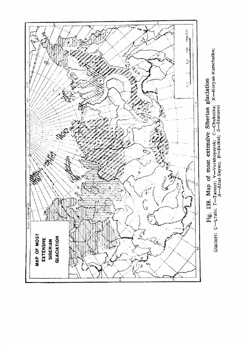
7/28/2019 Fundamentals of Geology - 19th century - Russia text in English
http://slidepdf.com/reader/full/fundamentals-of-geology-19th-century-russia-text-in-english 150/375
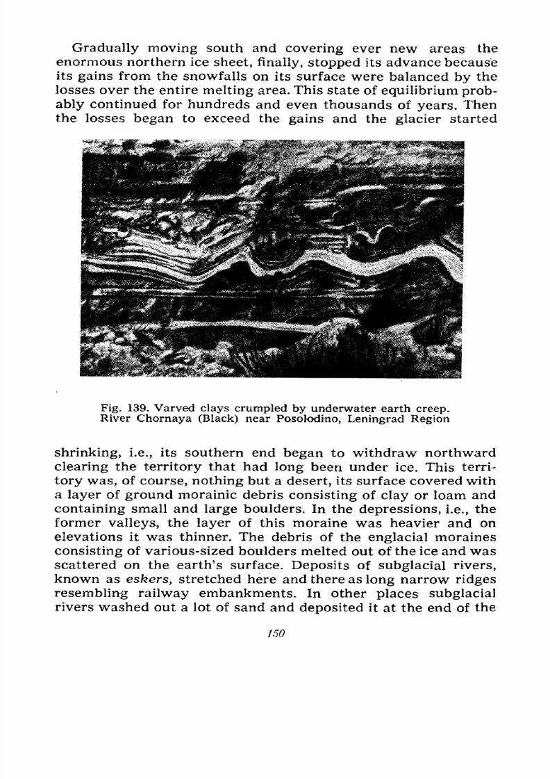
7/28/2019 Fundamentals of Geology - 19th century - Russia text in English
http://slidepdf.com/reader/full/fundamentals-of-geology-19th-century-russia-text-in-english 151/375
Gradually moving south and covering ever new areas the
enormous northern ice sheet, finally, stopped its advance because
its gains from the snowfalls on its surface were balanced by the
losses over the entire melting area. This state of equilibrium prob-
ably continued for hundreds and even thousands of years. Then
the losses began to exceed the gains and the glacier started
Fig. 139. Varved clays crumpled by underwater earth creep.River Chornaya (Black) near Posolodino, Leningrad Region
shrinking, i.e., its southern end began to withdraw northwardclearing the territory that had long been under ice. This terri-
tory was, of course, nothing but a desert, its surface covered with
a layer of ground morainic debris consisting of clay or loam and
containing small and large boulders. In the depressions, i.e., the
former valleys, the layer of this moraine was heavier and on
elevations it was thinner. The debris of the englacial moraines
consisting of various-sized boulders melted out of the ice and was
scattered on the earth's surface. Deposits of subglacial rivers,
known as eskers, stretched here and there as long narrow ridges
resembling railway embankments. In other places subglacial
rivers washed out a lot of sand and deposited it at the end of the
150
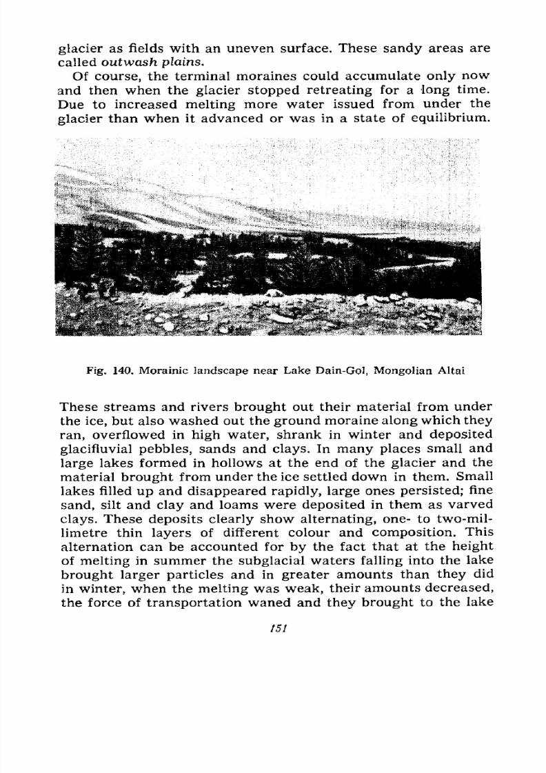
7/28/2019 Fundamentals of Geology - 19th century - Russia text in English
http://slidepdf.com/reader/full/fundamentals-of-geology-19th-century-russia-text-in-english 152/375
glacier as fields with an uneven surface. These sandy areas are
called outwash plains.
Of course, the terminal moraines could accumulate only now
and then when the glacier stopped retreating for a long time.
Due to increased melting more water issued from under the
glacier than when it advanced or was in a state of equilibrium.
Fig. 140. Morainic landscape near Lake Dain-Gol, Mongolian Altai
These streams and rivers brought out their material from under
the ice, but also washed out the ground moraine along which they
ran, overflowed in high water, shrank in winter and deposited
glacifluvial pebbles, sands and clays. In many places small and
large lakes formed in hollows at the end of the glacier and the
material brought from under the ice settled down in them. Small
lakes filled up and disappeared rapidly, large ones persisted; fine
sand, silt and clay and loams were deposited in them as varved
clays. These deposits clearly show alternating, one- to two-mil-
limetre thin layers of different colour and composition. This
alternation can be accounted for by the fact that at the height
of melting in summer the subglacial waters falling into the lake
brought larger particles and in greater amounts than they did
in winter, when the melting was weak, their amounts decreased,
the force of transportation waned and they brought to the lake
151
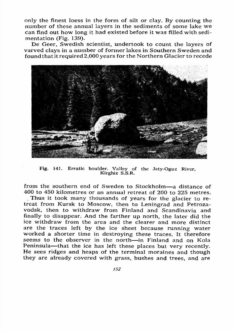
7/28/2019 Fundamentals of Geology - 19th century - Russia text in English
http://slidepdf.com/reader/full/fundamentals-of-geology-19th-century-russia-text-in-english 153/375
only the finest loess in the form of silt or clay. By counting the
number of these annual layers in the sediments of some lake we
can find out how long it had existed before it was filled with sedi-
mentation (Fig. 139).
De Geer, Swedish scientist, undertook to count the layers of
varved clays in a number of former lakes in Southern Sweden and
found that it required 2,000 years for the Northern Glacier to recede
Fig. 141. Erratic boulder. Valley of the Jety-Oguz River,
Kirghiz S.S.R.
from the southern end of Sweden to Stockholm a distance of
400 to 450 kilometres or an annual retreat of 200 to 225 metres.
.Thus it took many thousands of years for the glacier to re-
treat from Kursk to Moscow, then to Leningrad and Petroza-
vodsk, then to withdraw from Finland and Scandinavia and
finally to disappear. And the farther up north, the later did the
ice withdraw from the area and the clearer and more distinct
are the traces left by the ice sheet because running water
worked a shorter time in destroying these traces. It therefore
seems to the observer in the north in Finland and on KolaPeninsula that the ice has left these places but very recently.
He sees ridges and heaps of the terminal moraines and though
they are already covered with grass, bushes and trees, and are
152
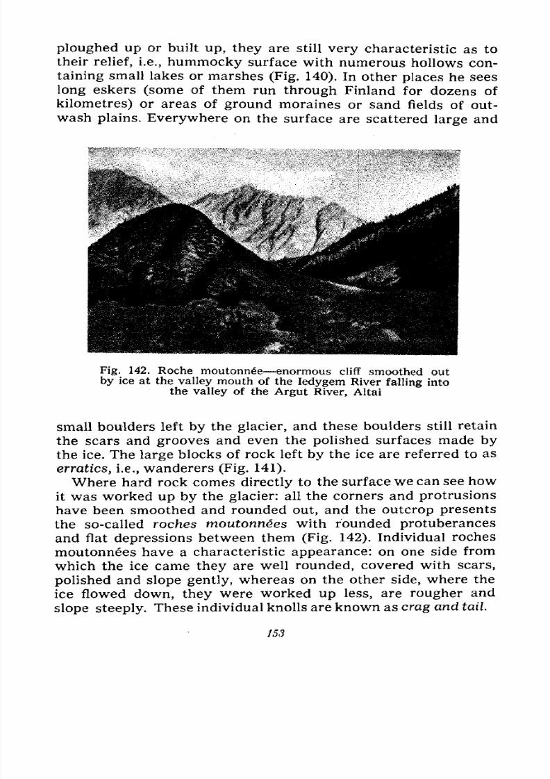
7/28/2019 Fundamentals of Geology - 19th century - Russia text in English
http://slidepdf.com/reader/full/fundamentals-of-geology-19th-century-russia-text-in-english 154/375
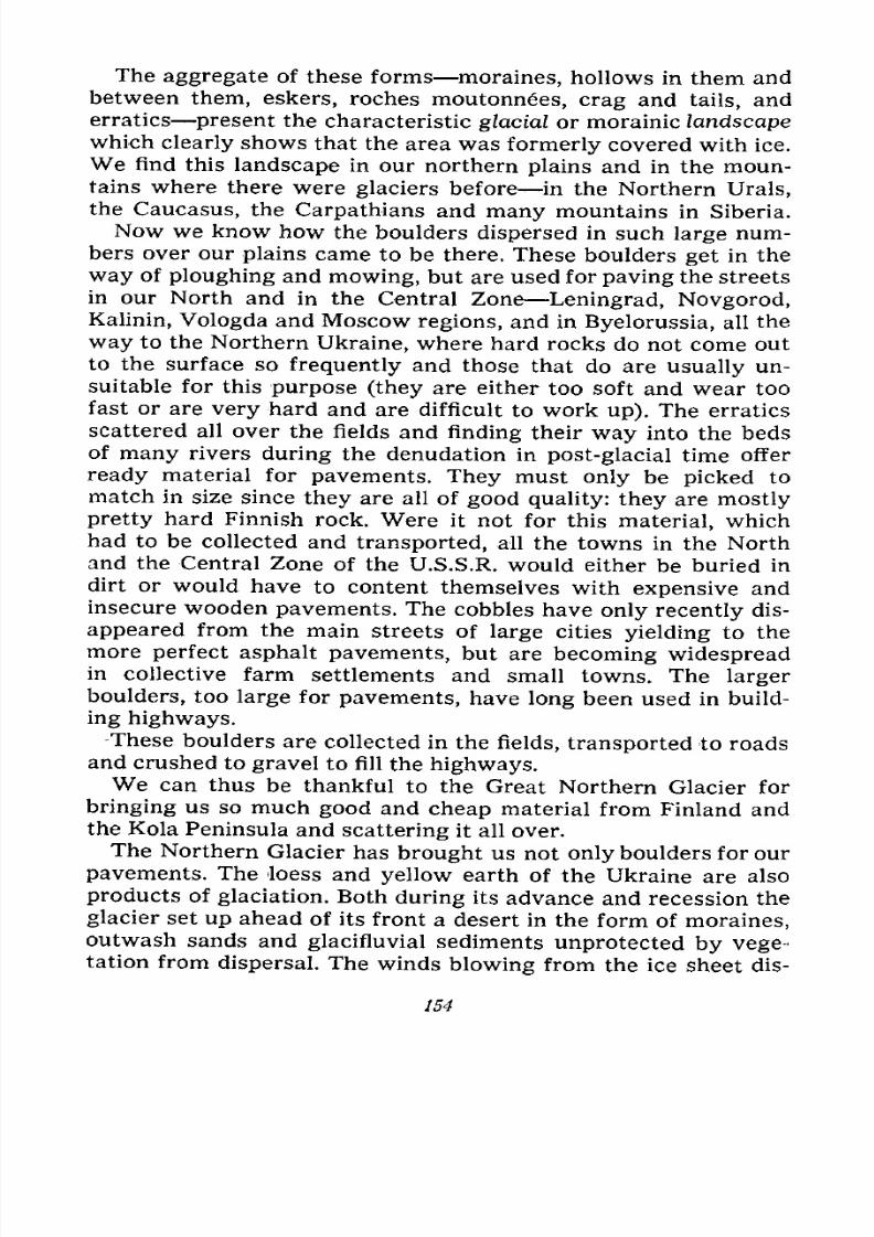
7/28/2019 Fundamentals of Geology - 19th century - Russia text in English
http://slidepdf.com/reader/full/fundamentals-of-geology-19th-century-russia-text-in-english 155/375
The aggregate of these forms moraines, hollows in them and
between them, eskers, roches moutonnes, crag and tails, and
erratics present the characteristic glacial or morainic landscape
which clearly shows that the area was formerly covered with ice.
We find this landscape in our northern plains and in the moun-
tains where there were glaciers before in the Northern Urals,
the Caucasus, the Carpathians and many mountains in Siberia.
Now we know how the boulders dispersed in such large num-
bers over our plains came to be there. These boulders get in the
way of ploughing and mowing, but are used for paving the streets
in our North and in the Central Zone Leningrad, Novgorod,
Kalinin, Vologda and Moscow regions, and in Byelorussia, all the
way to the Northern Ukraine, where hard rocks do not come out
to the surface so frequently and those that do are usually un-
suitable for this purpose (they are either too soft and wear too
fast or are very hard and are difficult to work up). The erratics
scattered all over the fields and finding their way into the beds
of many rivers during the denudation in post-glacial time offer
ready material for pavements. They must only be picked to
match in size since they are all of good quality: they are mostly
pretty hard Finnish rock. Were it not for this material, which
had to be collected and transported, all the towns in the Northand the Central Zone of the U.S.S.R. would either be buried in
dirt or would have to content themselves with expensive and
insecure wooden pavements. The cobbles have only recently dis-
appeared from the main streets of large cities yielding to the
more perfect asphalt pavements, but are becoming widespreadin collective farm settlements and small towns. The larger
boulders, too large for pavements, have long been used in build-
ing highways.-These boulders are collected in the fields, transported to roads
and crushed to gravel to fill the highways.We can thus be thankful to the Great Northern Glacier for
bringing us so much good and cheap material from Finland and
the Kola Peninsula and scattering it all over.
The Northern Glacier has brought us not only boulders for our
pavements. The loess and yellow earth of the Ukraine are also
products of glaciation. Both during its advance and recession theglacier set up ahead of its front a desert in the form of moraines,outwash sands and glacifluvial sediments unprotected by vege-tation from dispersal. The winds blowing from the ice sheet dis-
154
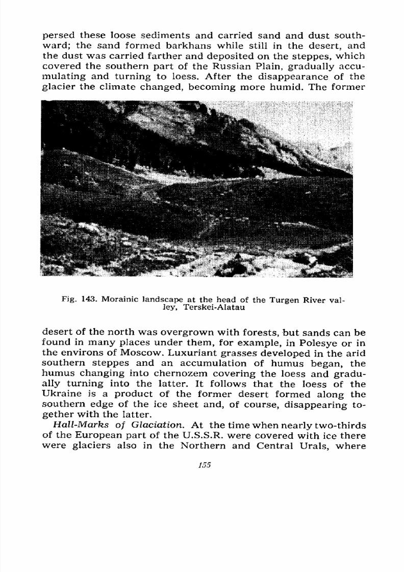
7/28/2019 Fundamentals of Geology - 19th century - Russia text in English
http://slidepdf.com/reader/full/fundamentals-of-geology-19th-century-russia-text-in-english 156/375
persed these loose sediments and carried sand and dust south-
ward; the sand formed barkhans while still in the desert, and
the dust was carried farther and deposited on the steppes, which
covered the southern part of the Russian Plain, gradually accu-
mulating and turning to loess. After the disappearance of the
glacier the climate changed, becoming more humid. The former
Fig. 143. Morainic landscape at the head of the Turgen River val-
ley, Terskei-Alatau
desert of the north was overgrown with forests, but sands can befound in many places under them, for example, in Polesye or in
the environs of Moscow. Luxuriant grasses developed in the arid
southern steppes and an accumulation of humus began, the
humus changing into chernozem covering the loess and gradu-
ally turning into the latter. It follows that the loess of the
Ukraine is a product of the former desert formed along the
southern edge of the ice sheet and, of course, disappearing to-
gether with the latter.
Hall-Marks of Glaciation. At the time when nearly two-thirds
of the European part of the U.S.S.R. were covered with ice there
were glaciers also in the Northern and Central Urals, where
755
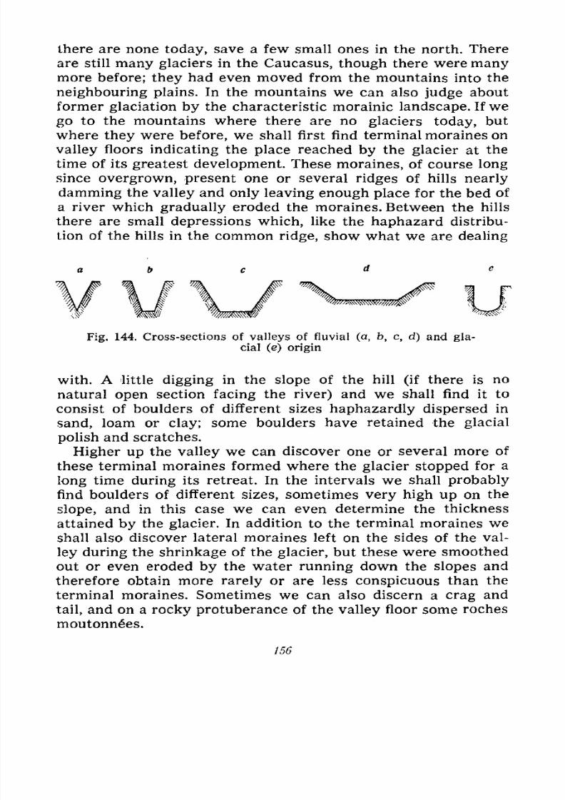
7/28/2019 Fundamentals of Geology - 19th century - Russia text in English
http://slidepdf.com/reader/full/fundamentals-of-geology-19th-century-russia-text-in-english 157/375
there are none today, save a few small ones in the north. There
are still many glaciers in the Caucasus, though there were manymore before; they had even moved from the mountains into the
neighbouring plains. In the mountains we can also judge about
former glaciation by the characteristic morainic landscape. If we
go to the mountains where there are no glaciers today, but
where they were before, we shall first find terminal moraines on
valley floors indicating the place reached by the glacier at the
time of its greatest development. These moraines, of course long
since overgrown, present one or several ridges of hills nearly
damming the valley and only leaving enough place for the bed of
a river which gradually eroded the moraines. Between the hills
there are small depressions which, like the haphazard distribu-
tion of the hills in the common ridge, show what we are dealing
Fig. 144. Cross-sections of valleys of fluvial (a, b, c, d) and gla-
cial (e) origin
with. A little digging in the slope of the hill (if there is no
natural open section facing the river) and we shall find it to
consist of boulders of different sizes haphazardly dispersed in
sand, loam or clay; some boulders have retained the glacial
polish and scratches.
Higher up the valley we can discover one or several more of
these terminal moraines formed where the glacier stopped for a
long time during its retreat. In the intervals we shall probably
find boulders of different sizes, sometimes very high up on the
slope, and in this case we can even determine the thickness
attained by the glacier. In addition to the terminal moraines we
shall also discover lateral moraines left on the sides of the val-
ley during the shrinkage of the glacier, but these were smoothed
out or even eroded by the water running down the slopes and
therefore obtain more rarely or are less conspicuous than theterminal moraines. Sometimes we can also discern a crag and
tail, and on a rocky protuberance of the valley floor some roches
moutonn6es.
156
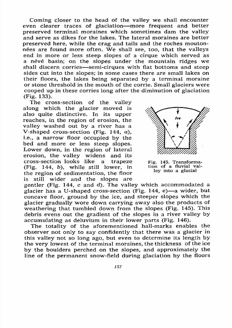
7/28/2019 Fundamentals of Geology - 19th century - Russia text in English
http://slidepdf.com/reader/full/fundamentals-of-geology-19th-century-russia-text-in-english 158/375
Coming closer to the head of the valley we shall encounter
even clearer traces of glaciation more frequent and better
preserved terminal moraines which sometimes dam the valley
and serve as dikes for the lakes. The lateral moraines are better
preserved here, while the crag and tails and the roches mouton-
n6es are found more often. We shall see, too, that the valleys
end in more or less steep slopes of a cirque which served as
a neve basin; on the slopes under the mountain ridges weshall discern corries semi-cirques with flat bottoms and steep
sides cut into the slopes; in some cases there are small lakes on
their floors, the lakes being separated by a terminal moraine
or stone threshold in the mouth of the corrie. Small glaciers were
cooped up in these corries long after the diminution of glaciation
(Fig. 133).
The cross-section of the valley
along which the glacier moved is
also quite distinctive. In its upper
reaches, in the region of erosion, the
valley washed out by a river has a
V-shaped cross-section (Fig. 144, a),
i.e., a narrow floor occupied by the
bed and more or less steep slopes.
Lower down, in the region of lateral
erosion, the valley widens and its
cross-section looks like a trapeze
(Fig. 144, b), while still lower, in
the region of sedimentation, the floor
is still wider and the slopes are
gentler (Fig. 144, c and d). The valley which accommodated a
glacier has a U-shaped cross-section (Fig. 144, e) a wider, butconcave floor, ground by the ice, and steeper slopes which the
glacier gradually wore down carrying away also the products of
weathering that tumbled down from the slopes (Fig. 145). This
debris evens out the gradient of the slopes in a river valley by
accumulating as deluvium in their lower parts (Fig. 146).
The totality of the aforementioned hall-marks enables the
observer not only to say confidently that there was a glacier in
this valley not so long ago, but even to determine its length bythe very lowest of the terminal moraines, the thickness of the ice
by the boulders perched on the slopes, and approximately the
line of the permanent snow-field during glaciation by the floors
Fig. 145. Transforma-
tion of a fluvial val-
ley into a glacial
757
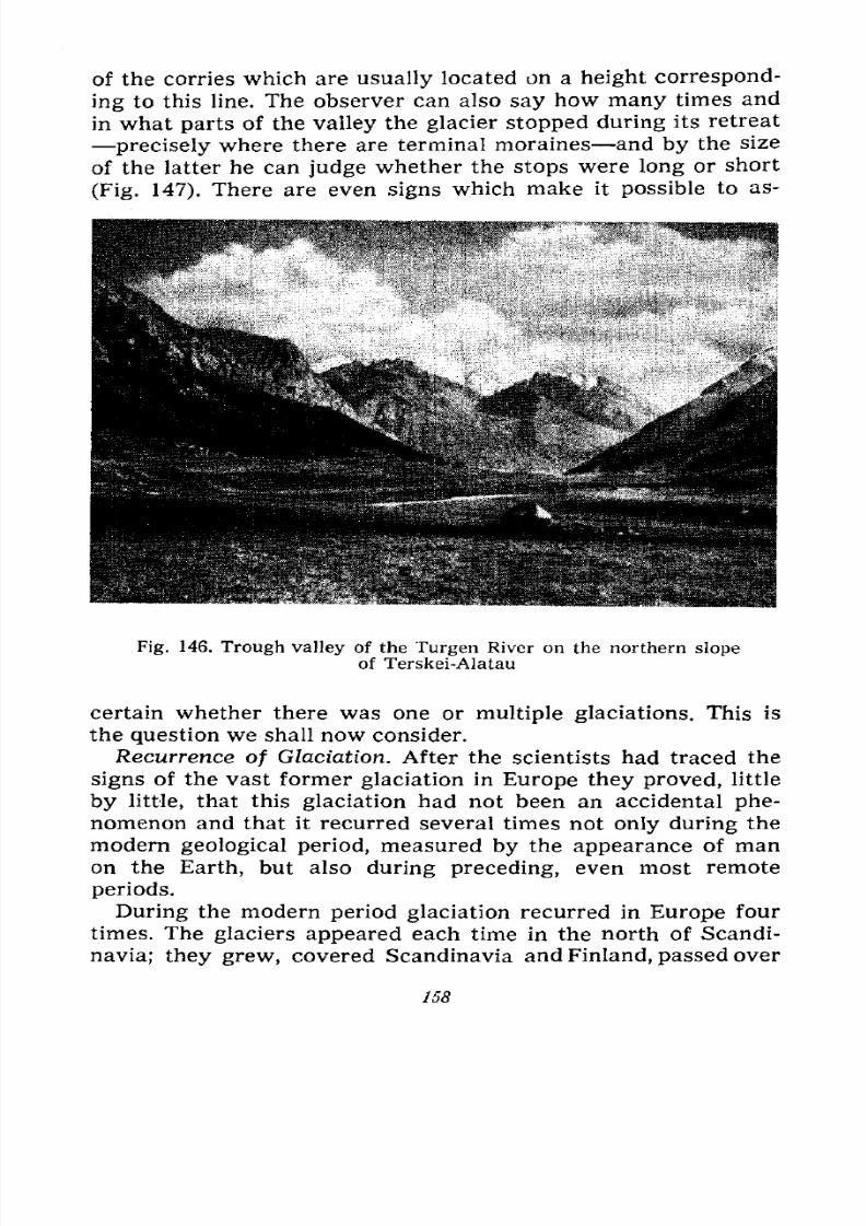
7/28/2019 Fundamentals of Geology - 19th century - Russia text in English
http://slidepdf.com/reader/full/fundamentals-of-geology-19th-century-russia-text-in-english 159/375
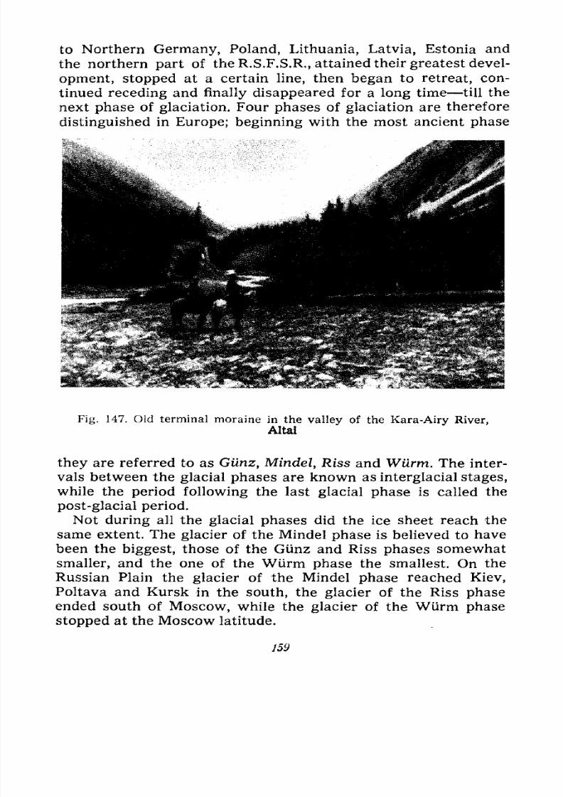
7/28/2019 Fundamentals of Geology - 19th century - Russia text in English
http://slidepdf.com/reader/full/fundamentals-of-geology-19th-century-russia-text-in-english 160/375
to Northern Germany, Poland, Lithuania, Latvia, Estonia and
the northern part of the R.S.F.S.R., attained their greatest devel-
opment, stopped at a certain line, then began to retreat, con-
tinued receding and finally disappeared for a long time till the
next phase of glaciation. Four phases of glaciation are therefore
distinguished in Europe; beginning with the most ancient phase
Fig. 147. Old terminal moraine in the valley of the Kara-Airy River,
Altai
they are referred to as Gunz, Mindel, Riss and Wtirm. The inter-
vals between the glacial phases are known as interglacial stages,
while the period following the last glacial phase is called the
post-glacial period.
Not during all the glacial phases did the ice sheet reach the
same extent. The glacier of the Mindel phase is believed to have
been the biggest, those of the Gunz and Riss phases somewhat
smaller, and the one of the Wlirm phase the smallest. On the
Russian Plain the glacier of the Mindel phase reached Kiev,Poltava and Kursk in the south, the glacier of the Riss phase
ended south of Moscow, while the glacier of the Wurm phase
stopped at the Moscow latitude.
159
7/28/2019 Fundamentals of Geology - 19th century - Russia text in English
http://slidepdf.com/reader/full/fundamentals-of-geology-19th-century-russia-text-in-english 161/375
It stands to reason that the traces left by the older phases
have not been so well preserved as those of the most recent one
because they were gradually smoothed out, washed out and even
destroyed not only by the rains and rivers of the interglacial
stages, but also by the glaciers of the following phases which
again smoothed them out, covered them over with their own
moraines and washed them out with their melt waters. To find
the lines reached by the older glaciers required painstaking
research; contrariwise, the traces left by the Wurm glacier were
easy to find because they are quite well preserved. Its terminal
and ground moraines, eskers and erratics are clearly traced on
the Russian Plain north of Moscow, in Finland and Karelia.
Scientists made attempts at estimating the durations of the
glacial and interglacial stages and have obtained the following
figures, tentative of course, but giving us an idea of how long
these stages lasted.
Duration of Glacial Phases (in years)
Post-glacial Period 10,000 to 20,000
Glaciation of the 4th (Wurm) Phase .... 52,000
3rd Interglacial Stage 65,000
Glaciation of the 3rd(Riss)
Phase53,000
2nd Interglacial Stage 183,000
Glaciation of the 2nd (Mindel) Phase .... 49,000
1st Interglacial Stage 65,000
Glaciation of the 1st (Giiuz) Phase 49,000
Total about 600,000
The glacial phases were not continuous but showed consider-
able climatic fluctuations; the ice sheet now greatly receded (but
did not completely disappear), now extended and advanced, i.e.,
was interrupted by incomplete interglacial stages; that is why
stages of advance and recession are additionally distinguished in
each glacial phase. The Gtinz and Mindel phases number two
stages of advance and one of recession each, the Riss phase
three stages of advance and two of recession, and the Wurm
phase four stages of advance and three of recession. These
heavy fluctuations of the ice sheet are, of course, most clearly
traced in the last phase (Wurm).Causes of Glaciation. About 100 years ago, when the erratics
dispersed over the fields of Germany, Denmark, Holland and
England were first noticed and it was found that they were com-
160
7/28/2019 Fundamentals of Geology - 19th century - Russia text in English
http://slidepdf.com/reader/full/fundamentals-of-geology-19th-century-russia-text-in-english 162/375
posed of rock forming Scandinavia and were entirely absent
from the countries where they were discovered (this is the reason
they were named erratics), scientists believed they had been
brought there by floating ice. They thought that in the beginning
of our modern period the aforesaid countries had been flooded
by the sea, that the currents had brought icebergs from the
north and that these icebergs containing morainic debris had
broken off from the Scandinavian glaciers. In the warmer,
southern part of the sea the icebergs melted and the boulders
they carried dropped to the bottom.
This hypothesis of drifting, i.e., floating, ice persisted in
science until the sixties or seventies of last century when some
scientists, including Kropotkin, Russian geographer and revolu-
tionary, advanced the hypothesis of continental glaciation. At
first this hypothesis appeared monstrous because it was hard to
conceive that all of Europe, down to London and Berlin, had
formerly been covered with ice. But gradually such facts as
moraines, outwash plains, eskers, crag and tails, and roches
moutonnes, which the hypothesis of drifting could not explain,
compelled everybody to accept the hypothesis of glaciation.
Subsequent detailed observations all over Europe and North
America fully confirmed it and from a hypothesis it became a
theory. But for a long time yet, almost up to the time of the
October Socialist Revolution, while recognizing the glaciation of
all of Europe and North America, scientists denied glaciation of
the north of Asia (Siberia), believing that its climate was too con-
tinental for it, i.e., poor in atmospheric precipitations. But al-
ready 70 years ago the same Kropotkin discovered signs of
glaciation in several places in Siberia and assumed that the north
of Asia had also gone through an ice age. Only the observations
accumulated little by little forced everybody to recognize that
Siberia, too, had been under an ice sheet.
But the causes of glaciation are still explained differently byvarious scientists. We cannot expose or consider in detail the
different explanations in this chapter and shall confine ourselves
to but few.
Some explanations are based on the assumption that Gulf-
stream, the warm current that brings Europe heat from the
tropics, did not exist or had a different direction; others account
for glaciation by the former greater height of the northern
countries by virtue of which the precipitations fell there only in
111518 161
7/28/2019 Fundamentals of Geology - 19th century - Russia text in English
http://slidepdf.com/reader/full/fundamentals-of-geology-19th-century-russia-text-in-english 163/375
7/28/2019 Fundamentals of Geology - 19th century - Russia text in English
http://slidepdf.com/reader/full/fundamentals-of-geology-19th-century-russia-text-in-english 164/375
that it had a uniform climate from the poles to the equator and
that the climate, only gradually growing increasingly worse, led
to the glacial stages.
Let us hope that in time science will manage to solve the
great riddle of the causes of glaciation as it has already solved
many other riddles relating to the history of the Earth.
To be sure, the time in which we are living also deserves to be
called, in a certain measure, a glacial phase, especially if we
compare it with some phases of the Tertiary period which pre-
ceded the modern; the more so, since today in the Arctic, i.e.,
around the North Pole, and in the Antarctic, around the South
Pole, vast spaces are covered with ice and offer a sufficiently
clear picture of what Europe looked like during the glacial
phases.
In the Arctic an enormous ice sheet conceals almost all of
Greenland, save a narrow coastal strip of this large island. Spitz-
bergen, Franz-Joseph Land, Bennett Island, the islands of Sever-
naya Zemlya, the northern island of Novaya Zemlya and the
North American Archipelago are also covered with large glaci-
ers, many of them reaching the sea-shore and giving rise to ice-
bergs. These glaciers move like those in the mountain valleys dis-
cussed in this book because they are nourished by the snow that
falls on their surface nearly all year round. The tongue of the
glacier descends into the sea, and from time to time large blocks
of ice break off. These are the icebergs. Winds and sea currents
carry them away and they melt very slowly until they get into
warmer seas.
Antarctica is a whole continent covered by a single very thick
sheet of ice, and only sharp peaks of separate mountains or
mountain ridges rise here and there above the ice. In manyplaces the ice descends into the sea as a high and sheer wall and
gives rise to numerous icebergs which not infrequently present
table-shaped mountains. The icebergs are carried by currents far
away to the north.
At the same time remains of plants of the Tertiary period are
found in various places on the northern islands, which proves
that at that time the islands were not only ice-free, but were
covered by forests of trees like those now growing in the warmclimate of Southern Europe.
ll"
7/28/2019 Fundamentals of Geology - 19th century - Russia text in English
http://slidepdf.com/reader/full/fundamentals-of-geology-19th-century-russia-text-in-english 165/375
VII
PRODUCTS OF THE EARTH'S ENTRAILS
Heat of the Earth's Crust. Igneous Rocks. Magma. Vol-
canoes. Eruption and Its Products. Types of Volcanic
Eruptions. Distribution of Volcanoes on the Earth.
Ancient Volcanic Regions. Fumaroles and Geysers.
Eruptions in the Interior. Types of Igneous Rocks. Harm
and Usefulness of Volcanoes.
Primitive man knew that in many places fire came out of
holes in the ground or in the mountains and attributed this
phenomenon to some mighty or evil beings in the interior of the
Earth. The ancient civilized peoples believed the entrails of the
Earth to be the abode of the souls of the deceased. They con-
sidered it an underground kingdom; the Hebrews and Christians
named it hell, the place of suffering of the sinners. The Romans
who called the ruler of the underworld Pluto, and the Greeks
Hades, at first regarded him as an enemy of everything living.
The Romans, who knew about the eruptions of volcanoes on the
Lipari Islands, Etna in Sicily, etc., believed these volcanoes to
be pipes of the underground smithies of Vulcan, the god of fire,
smithing, smelting and conflagrations, and therefore built his
temples outside city limits. The mountains expelling fire, smoke
and small fragments of rock, and effusing lava molten rock
were therefore given the name of volcanoes.
These mountains prove that in the interior of the earth's crustthe temperature is so high that the rocks there are molten.
Observations in mines and boreholes have also shown that
the deeper we penetrate into the earth's crust, the more notice-
164
7/28/2019 Fundamentals of Geology - 19th century - Russia text in English
http://slidepdf.com/reader/full/fundamentals-of-geology-19th-century-russia-text-in-english 166/375
ably the temperature rises. In some places the rise is faster than
in others; it has been found to average one degree per 33 metres.
The depth at which the temperature in the earth's crust in-
creases by one degree is referred to as a geothermal gradient.
Given 33 metres as the mean value we can easily estimate
that at a depth of 10 kilometres the temperature must be 300 C
higher than on the surface, and at a depth of 40 kilometres
it must reach 1,200C, i.e., most of the rocks must be molten.
Incidentally, it is believed that deeper into the interior the value
of the geothermal gradient must increase, i.e., the temperature
of rock-melting can be reached only much deeper. In addition,
the greatly increased pressure also raises the melting-point of
rocks. It is therefore probable that the rocks are not molten
even at great depths, though they have a higher-than-melting
temperature. A sharp weakening of the pressure, however, and
these rocks may immediately melt. As vents connecting the
earth's interior with its surface, volcanoes may so weaken this
pressure in the interior as to cause the rocks to melt.
Igneous Rocks. Magma. The study of rocks which formerly
lay deep in the interior of the Earth but are now on the surface
shows that some of them were undoubtedly molten before and
then solidified. All such rocks are described as igneous because
they were erupted at one time or another, massive because they
are not stratified like sedimentary rocks, and magmatic because
they owe their origin to magma. The Greek word magma means
dough and is used to designate the molten rocks in the interior
of the Earth.
Magma contains not only mineral matter, but also water in the
form of steam, and various gases. This is evident from direct
observations of active volcanoes and analyses of their emana-
tions, as well as from the studies of igneous rocks of different
ages in which analyses also reveal the presence of water and
various gases, while the microscope shows vesicles containing
water and gases inside the grains of minerals.
Volcanoes. Volcanic eruptions are one of the most redoubtable
and majestic natural phenomena which man can as yet neither
prevent, regulate or render harmless. Not all volcanoes erupt
alike for observations have shown several principal types of
eruption. We shall first consider the most widespread type.
Volcanoes are divided into active, extinct and ancient. Active
volcanoes are those which suffer eruptions in our days or suffered
165
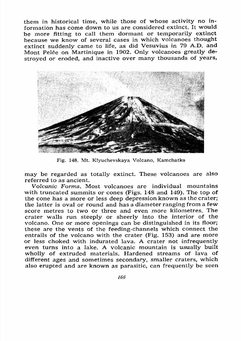
7/28/2019 Fundamentals of Geology - 19th century - Russia text in English
http://slidepdf.com/reader/full/fundamentals-of-geology-19th-century-russia-text-in-english 167/375
them in historical time, while those of whose activity no in-
formation has come down to us are considered extinct. It would
be more fitting to call them dormant or temporarily extinct
because we know of several cases in which volcanoes thought
extinct
suddenly
came to life, as did Vesuvius in 79 A.D. and
Mont Pelee on Martinique in 1902. Only volcanoes greatly de-
stroyed or eroded, and inactive over many thousands of years,
Fig. 148. Mt. Klyuchevskaya Volcano, Kamchatka
may be regarded as totally extinct. These volcanoes are also
referred to as ancient.
Volcanic Forms. Most volcanoes are individual mountains
with truncated summits or cones (Figs. 148 and 149). The top of
the cone has a more or less deep depression known as the crater;
the latter is oval or round and has a diameter ranging from a few
score metres to two or three and even more kilometres. The
crater walls run steeply or sheerly into the interior of the
volcano. One or more openings can be distinguished in its floor;
these are the vents of the feeding-channels which connect the
entrails of the volcano with the crater (Fig. 153) and are more
or less choked with indurated lava. A crater not infrequently
even turns into a lake. A volcanic mountain is usually built
wholly of extruded materials. Hardened streams of lava of
different ages and sometimes secondary, smaller craters, which
also erupted and are known as parasitic, can frequently be seen
166
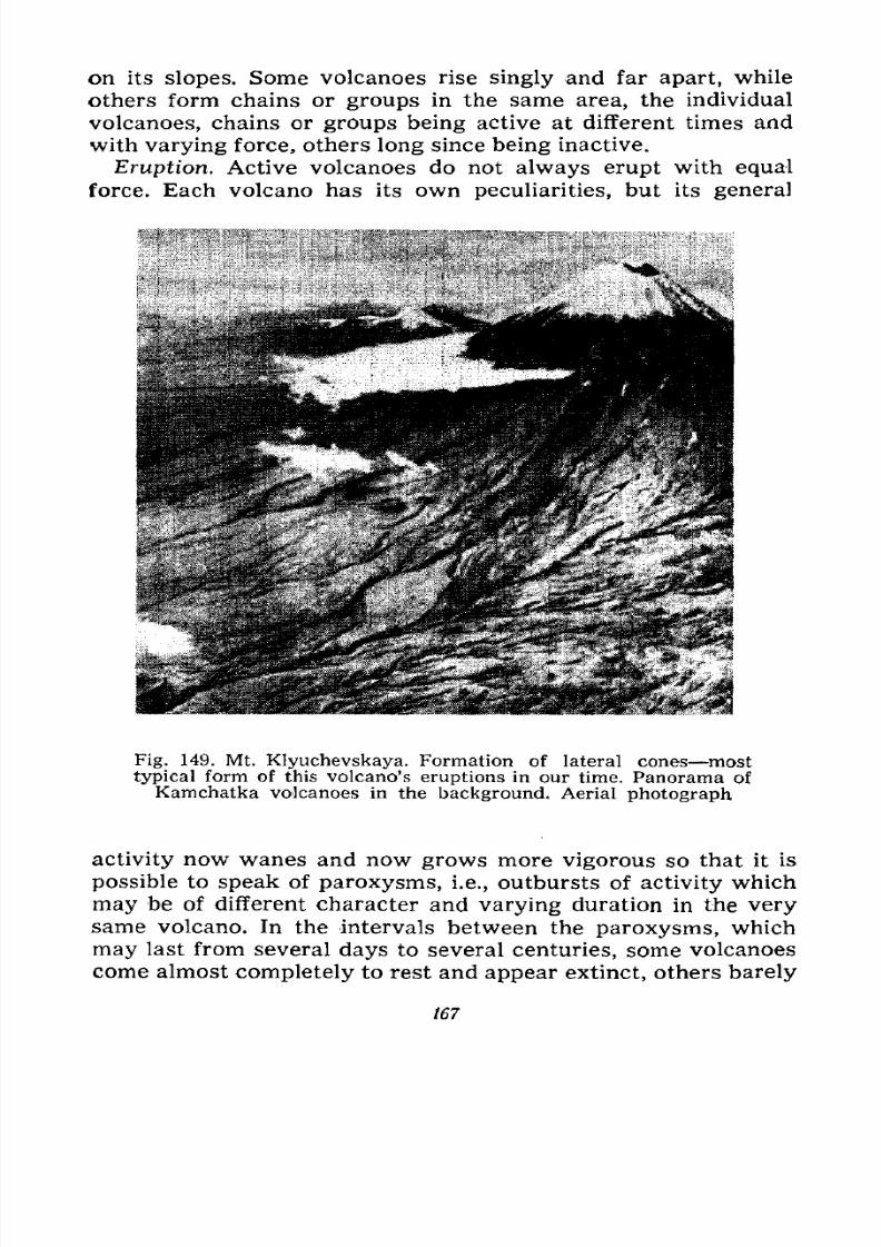
7/28/2019 Fundamentals of Geology - 19th century - Russia text in English
http://slidepdf.com/reader/full/fundamentals-of-geology-19th-century-russia-text-in-english 168/375
on its slopes. Some volcanoes rise singly and far apart, while
others form chains or groups in the same area, the individual
volcanoes, chains or groups being active at different times and
with varying force, others long since being inactive.
Eruption. Active volcanoes do not always erupt with equal
force. Each volcano has its own peculiarities, but its general
v-
yt^&ffi$ffifi ,]^:^}j,, >t
,
-
\ fi
;
p^^tet^-:;^1
''" 1
:
'-
>s*-&&*y.fo$\-g^
Fig. 149. Mt. Klyuchevskaya. Formation of lateral cones most
typical form of this volcano's eruptions in our time. Panorama of
Kamchatka volcanoes in the background. Aerial photograph
activity now wanes and now grows more vigorous so that it is
possible to speak of paroxysms, i.e., outbursts of activity which
may be of different character and varying duration in the verysame volcano. In the intervals between the paroxysms, which
may last from several days to several centuries, some volcanoes
come almost completely to rest and appear extinct, others barely
167
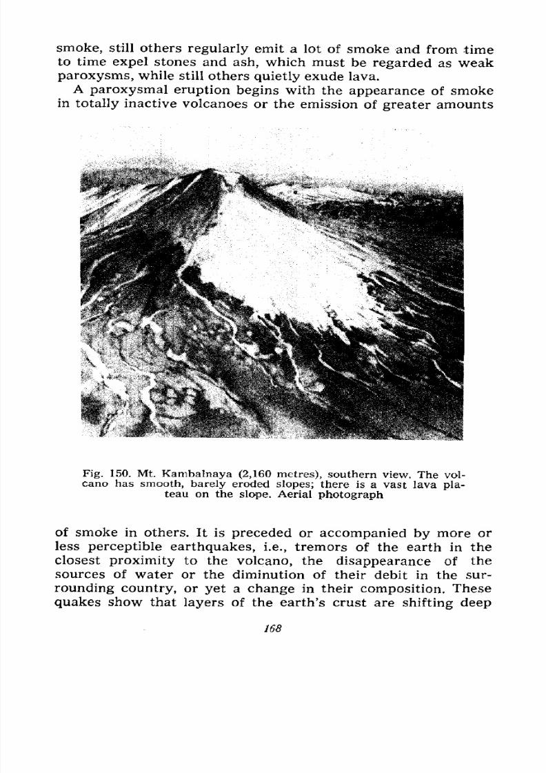
7/28/2019 Fundamentals of Geology - 19th century - Russia text in English
http://slidepdf.com/reader/full/fundamentals-of-geology-19th-century-russia-text-in-english 169/375
smoke, still others regularly emit a lot of smoke and from time
to time expel stones and ash, which must be regarded as weak
paroxysms, while still others quietly exude lava.
A paroxysmal eruption begins with the appearance of smokein totally inactive volcanoes or the emission of greater amounts
Fig. 150. Mt. Kambalnaya (2,160 metres), southern view. The vol-
cano has smooth, barely eroded slopes; there is a vast lava pla-teau on the slope. Aerial photograph
of smoke in others. It is preceded or accompanied by more or
less perceptible earthquakes, i.e., tremors of the earth in the
closest proximity to the volcano, the disappearance of thesources of water or the diminution of their debit in the sur-
rounding country, or yet a change in their composition. These
quakes show that layers of the earth's crust are shifting deep
168
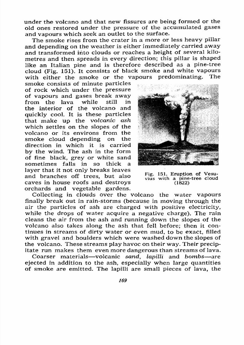
7/28/2019 Fundamentals of Geology - 19th century - Russia text in English
http://slidepdf.com/reader/full/fundamentals-of-geology-19th-century-russia-text-in-english 170/375
under the volcano and that new fissures are being formed or the
old ones restored under the pressure of the accumulated gases
and vapours which seek an outlet to the surface.
The smoke rises from the crater in a more or less heavy pillar
and depending on the weather is either immediately carried away
and transformed into clouds or reaches a height of several kilo-
metres and then spreads in every direction; this pillar is shaped
like an Italian pine and is therefore described as a pine-tree
cloud (Fig. 151). It consists of black smoke and white vapours
with either the smoke or the vapours predominating. The
smoke consists of minute particles ,,
of rock which under the pressure
of vapours and gases break away
from the lava while still in
the interior of the volcano and
quickly cool. It is these particles
that make up the volcanic ash
which settles on the slopes of the
volcano or its environs from the
smoke cloud depending on the
direction in which it is carried
by the wind. The ash in the form
of fine black, grey or white sand
sometimes falls in so thick a
layer that it not only breaks leaves
and branches off trees, but also
caves in house roofs and destroys
orchards and vegetable gardens.
Collecting in clouds over the volcano the water vapours
finally break out in rain-storms (because in moving through the
air the particles of ash are charged with positive electricity,
while the drops of water acquire a negative charge). The rain
cleans the air from the ash and running down the slopes of the
volcano also takes along the ash that fell before; then it con-
tinues in streams of dirty water or even mud, to be exact, filled
with gravel and boulders which were washed down the slopes of
the volcano. These streams play havoc on their way. Their precip-
itate run makes them even more dangerous than streams of lava.
Coarser materials volcanic sand, lapilli and bombs are
ejected in addition to the ash, especially when large quantities
of smoke are emitted. The lapilli are small pieces of lava, the
Fig. 151. Eruption of Vesu-
vius with a pine-tree cloud
(1822)
169
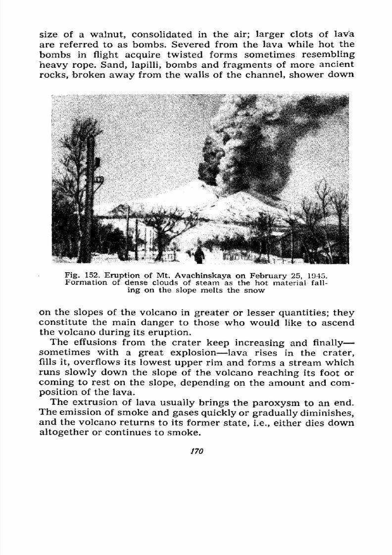
7/28/2019 Fundamentals of Geology - 19th century - Russia text in English
http://slidepdf.com/reader/full/fundamentals-of-geology-19th-century-russia-text-in-english 171/375
size of a walnut, consolidated in the air; larger clots of lava
are referred to as bombs. Severed from the lava while hot the
bombs in flight acquire twisted forms sometimes resembling
heavy rope. Sand, lapilli, bombs and fragments of more ancient
rocks, broken
awayfrom the walls of the channel, shower down
Fig. 152. Eruption of Mt. Avachinskaya on February 25, 1945.
Formation of dense clouds of steam as the hot material fall-
ing on the slope melts the snow
on the slopes of the volcano in greater or lesser quantities; they
constitute the main danger to those who would like to ascendthe volcano during its eruption.
The effusions from the crater keep increasing and finally
sometimes with a great explosion lava rises in the crater,
fills it, overflows its lowest upper rim and forms a stream which
runs slowly down the slope of the volcano reaching its foot or
coming to rest on the slope, depending on the amount and com-
position of the lava.
The extrusion of lava usually brings the paroxysm to an end.The emission of smoke and gases quickly or gradually diminishes,
and the volcano returns to its former state, i.e., either dies down
altogether or continues to smoke.
170
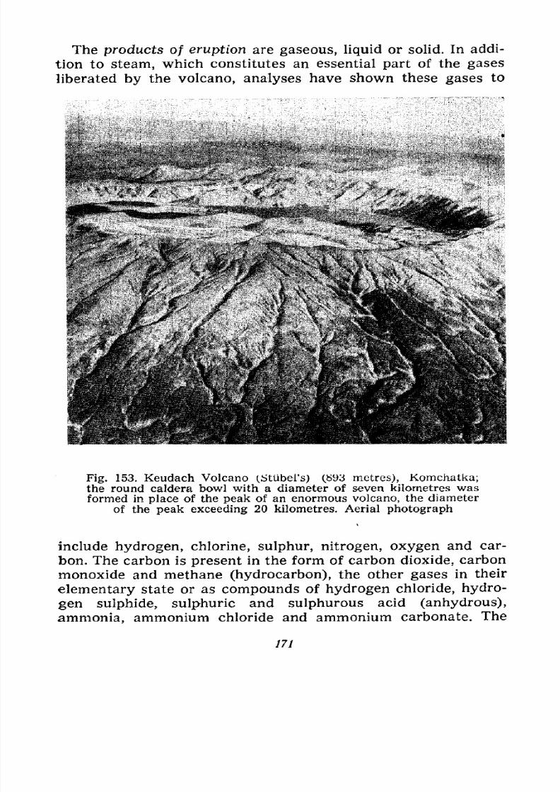
7/28/2019 Fundamentals of Geology - 19th century - Russia text in English
http://slidepdf.com/reader/full/fundamentals-of-geology-19th-century-russia-text-in-english 172/375
The products of eruption are gaseous, liquid or solid. In addi-
tion to steam, which constitutes an essential part of the gases
liberated by the volcano, analyses have shown these gases to
Fig. 153. Keudach Volcano (StUbei's) (893 metres), Komchatka;the round caldera bowl with a diameter of seven kilometres wasformed in place of the peak of an enormous volcano, the diameter
of the peak exceeding 20 kilometres. Aerial photograph
include hydrogen, chlorine, sulphur, nitrogen, oxygen and car-
bon. The carbon is present in the form of carbon dioxide, carbon
monoxide and methane (hydrocarbon), the other gases in their
elementary state or as compounds of hydrogen chloride, hydro-
gen sulphide, sulphuric and sulphurous acid (anhydrous),
ammonia, ammonium chloride and ammonium carbonate. The
171
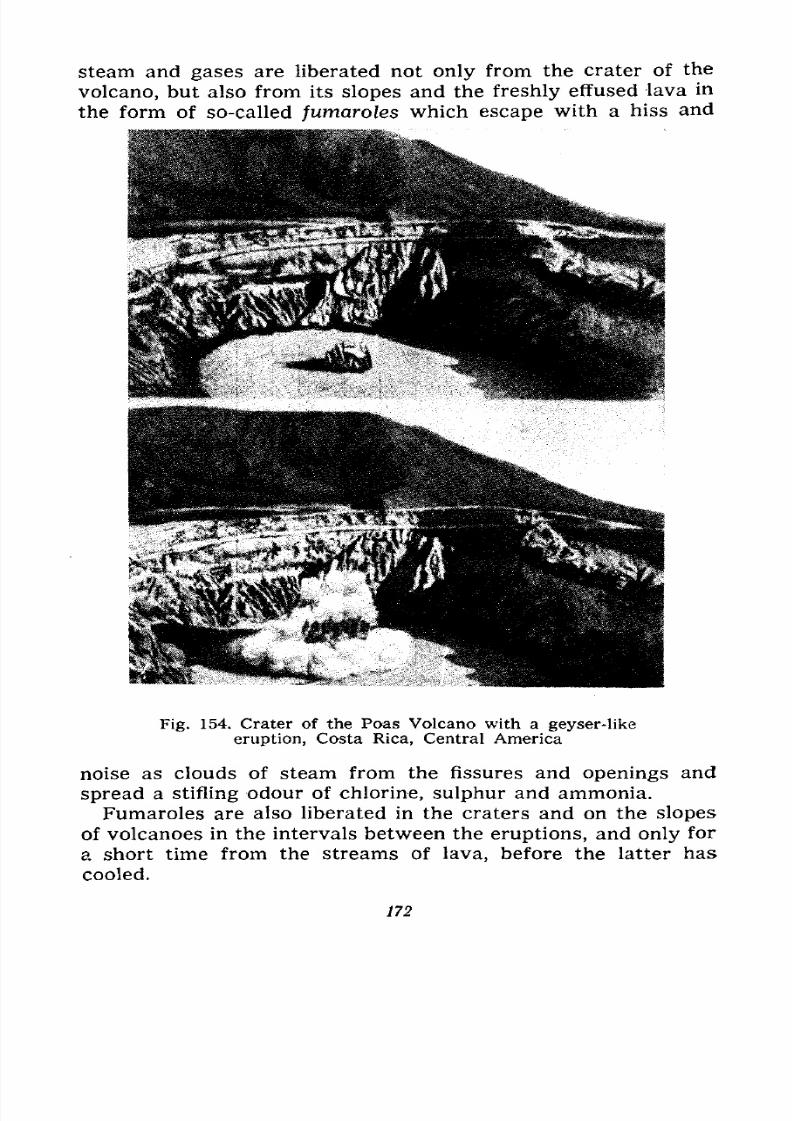
7/28/2019 Fundamentals of Geology - 19th century - Russia text in English
http://slidepdf.com/reader/full/fundamentals-of-geology-19th-century-russia-text-in-english 173/375
steam and gases are liberated not only from the crater of the
volcano, but also from its slopes and the freshly effused lava in
the form of so-called fwnaroles which escape with a hiss and
Fig. 154. Crater of the Poas Volcano with a geyser-like
eruption, Costa Rica, Central America
noise as clouds of steam from the fissures and openings and
spread a stifling odour of chlorine, sulphur and ammonia.
Fumaroles are also liberated in the craters and on the slopesof volcanoes in the intervals between the eruptions, and only for
a short time from the streams of lava, before the latter has
cooled.
172
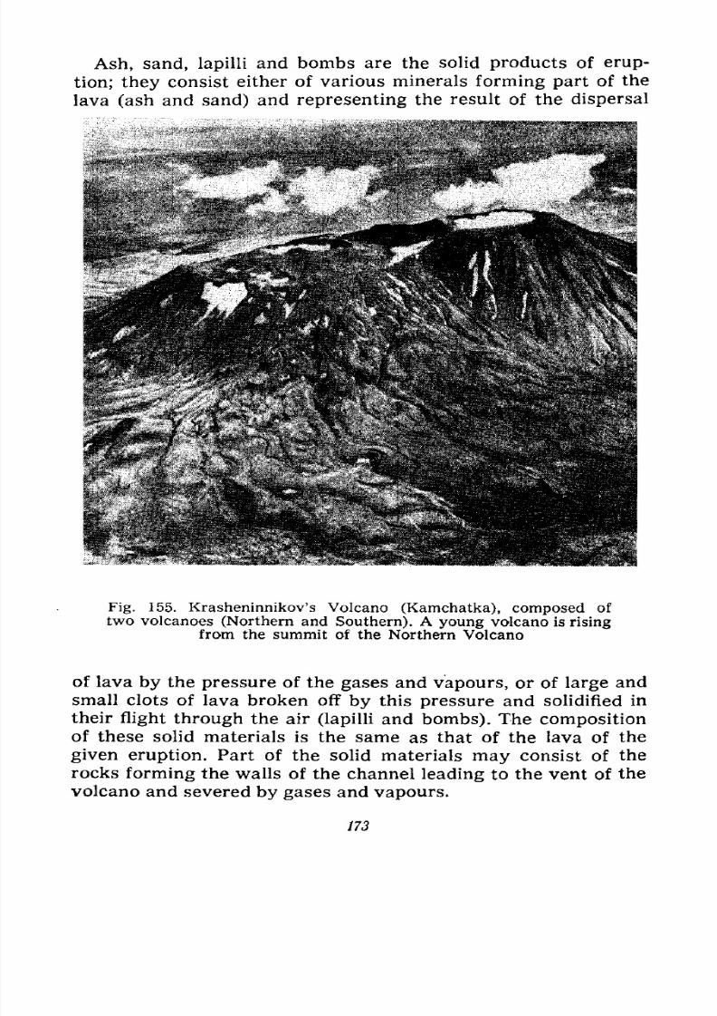
7/28/2019 Fundamentals of Geology - 19th century - Russia text in English
http://slidepdf.com/reader/full/fundamentals-of-geology-19th-century-russia-text-in-english 174/375
Ash, sand, lapilli and bombs are the solid products of erup-
tion; they consist either of various minerals forming part of the
lava (ash and sand) and representing the result of the dispersal
Fig. 155. Krasheninnikov's Volcano (Kamchatka), composed of
two volcanoes (Northern and Southern). A young volcano is risingfrom the summit of the Northern Volcano
of lava by the pressure of the gases and vapours, or of large and
small clots of lava broken off by this pressure and solidified in
their flight through the air (lapilli and bombs). The composition
of these solid materials is the same as that of the lava of the
given eruption. Part of the solid materials may consist of the
rocks forming the walls of the channel leading to the vent of the
volcano and severed by gases and vapours.
173
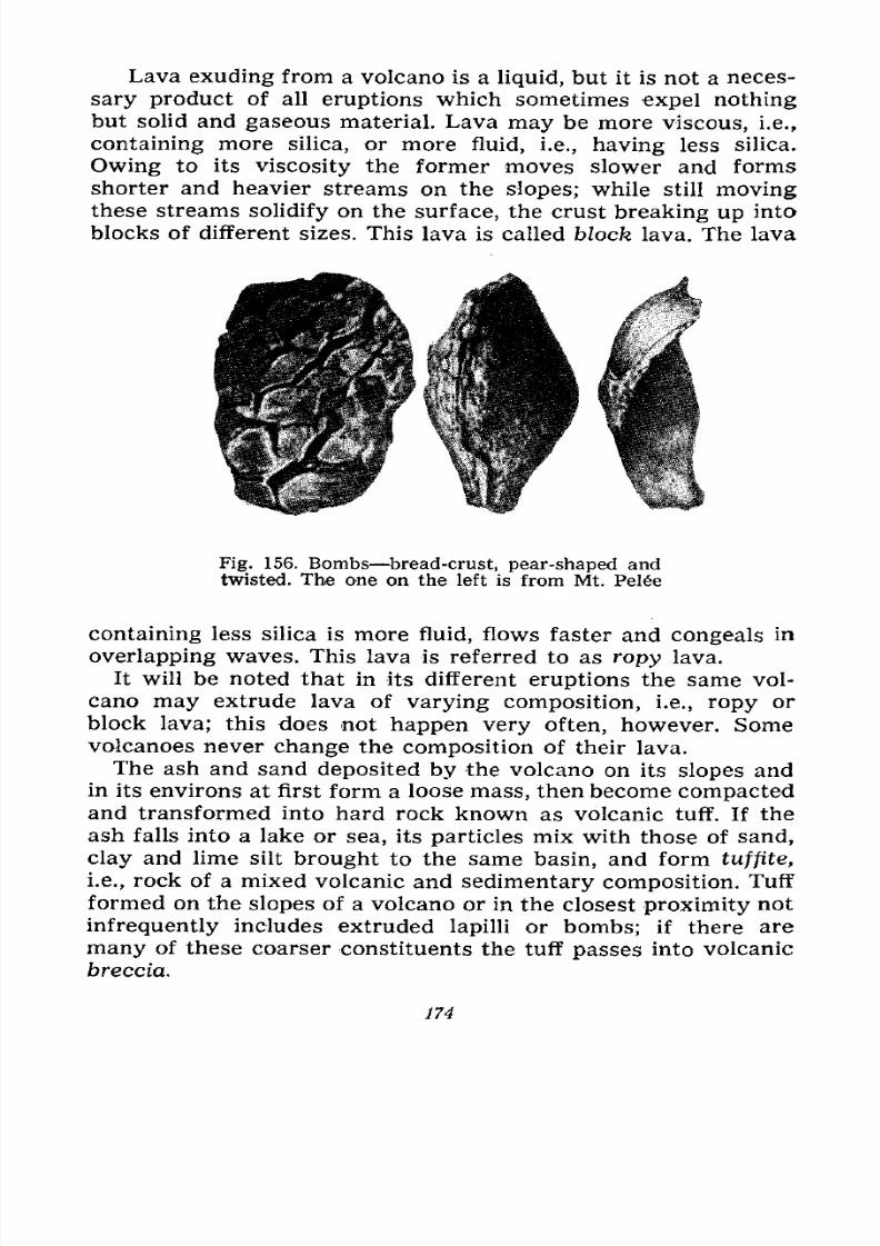
7/28/2019 Fundamentals of Geology - 19th century - Russia text in English
http://slidepdf.com/reader/full/fundamentals-of-geology-19th-century-russia-text-in-english 175/375
Lava exuding from a volcano is a liquid, but it is not a neces-
sary product of all eruptions which sometimes expel nothing
but solid and gaseous material. Lava may be more viscous, i.e.,
containing more silica, or more fluid, i.e., having less silica.
Owing to its viscosity the former moves slower and forms
shorter and heavier streams on the slopes; while still movingthese streams solidify on the surface, the crust breaking up into
blocks of different sizes. This lava is called block lava. The lava
Fig. 156. Bombs bread-crust, pear-shaped and
twisted. The one on the left is from Mt. Pel6e
containing less silica is more fluid, flows faster and congeals in
overlapping waves. This lava is referred to as ropy lava.
It will be noted that in its different eruptions the same vol-
cano may extrude lava of varying composition, i.e., ropy or
block lava; this does not happen very often, however. Somevolcanoes never change the composition of their lava.
The ash and sand deposited by the volcano on its slopes and
in its environs at first form a loose mass, then become compactedand transformed into hard rock known as volcanic tuff. If the
ash falls into a lake or sea, its particles mix with those of sand,
clay and lime silt brought to the same basin, and form tuffite,
i.e., rock of a mixed volcanic and sedimentary composition. Tuff
formed on the slopes of a volcano or in the closest proximity notinfrequently includes extruded lapilli or bombs; if there are
many of these coarser constituents the tuff passes into volcanic
breccia.
174
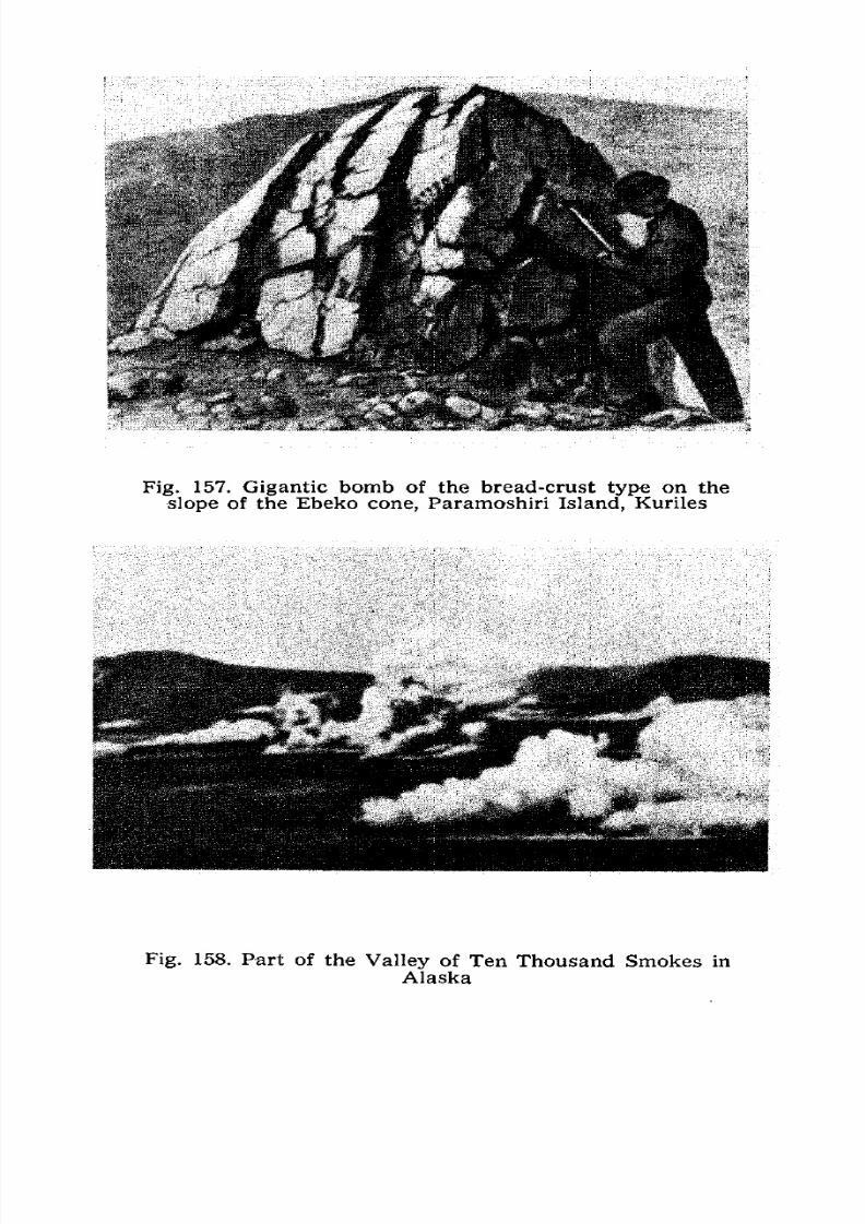
7/28/2019 Fundamentals of Geology - 19th century - Russia text in English
http://slidepdf.com/reader/full/fundamentals-of-geology-19th-century-russia-text-in-english 176/375
Fig. 157. Gigantic bomb of the bread-crust type on the
slope of the Ebeko cone, Paramoshiri Island, Kuriles
Fig. 158. Part of the Valley of Ten Thousand Smokes in
Alaska
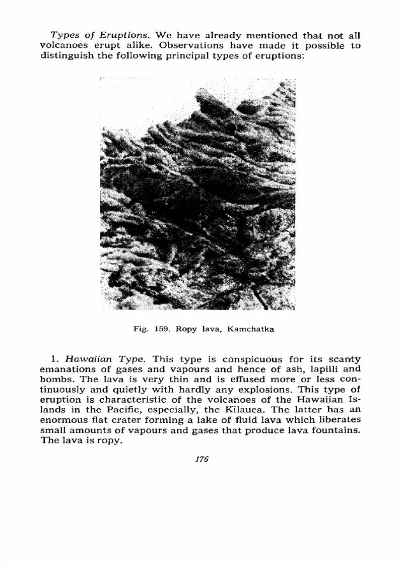
7/28/2019 Fundamentals of Geology - 19th century - Russia text in English
http://slidepdf.com/reader/full/fundamentals-of-geology-19th-century-russia-text-in-english 177/375
Types of Eruptions. We have already mentioned that not all
volcanoes erupt alike. Observations have made it possible to
distinguish the following principal types of eruptions:
Fig. 159. Ropy lava, Kamchatka
1. Hawaiian Type. This type is conspicuous for its scanty
emanations of gases and vapours and hence of ash, lapilli and
bombs. The lava is very thin and is effused more or less con-
tinuously and quietly with hardly any explosions. This type of
eruption is characteristic of the volcanoes of the Hawaiian Is-
lands in the Pacific, especially, the Kilauea. The latter has anenormous flat crater forming a lake of fluid lava which liberates
small amounts of vapours and gases that produce lava fountains,
The lava is ropy.
176
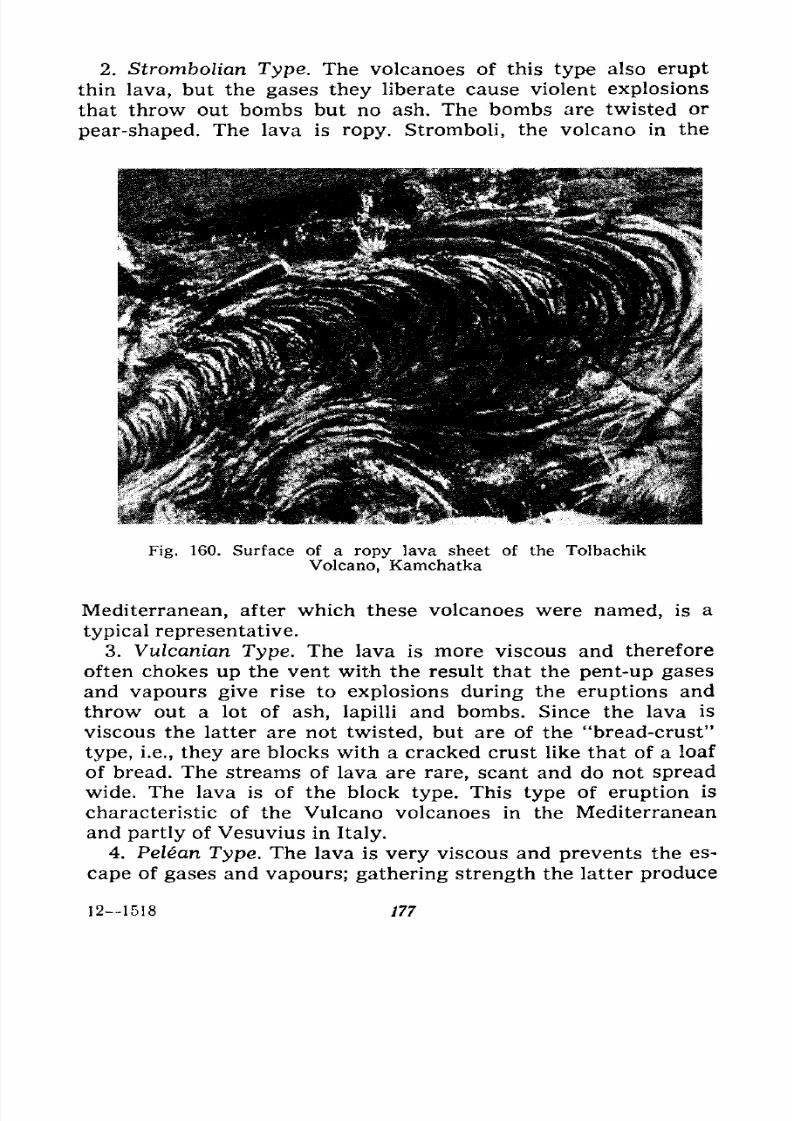
7/28/2019 Fundamentals of Geology - 19th century - Russia text in English
http://slidepdf.com/reader/full/fundamentals-of-geology-19th-century-russia-text-in-english 178/375
2. Strombolian Type. The volcanoes of this type also erupt
thin lava, but the gases they liberate cause violent explosions
that throw out bombs but no ash. The bombs are twisted or
pear-shaped. The lava is ropy. Stromboli, the volcano in the
Fig. 160. Surface of a ropy lava sheet of the Tolbachik
Volcano, Kamchatka
Mediterranean, after which these volcanoes were named, is a
typical representative.
3. Vulcanian Type. The lava is more viscous and therefore
often chokes up the vent with the result that the pent-up gases
and vapours give rise to explosions during the eruptions and
throw out a lot of ash, lapilli and bombs. Since the lava is
viscous the latter are not twisted, but are of the "bread-crust"
type, i.e., they are blocks with a cracked crust like that of a loaf
of bread. The streams of lava are rare, scant and do not spread
wide. The lava is of the block type. This type of eruption is
characteristic of the Vulcano volcanoes in the Mediterraneanand partly of Vesuvius in Italy.
4. Pelean Type. The lava is very viscous and prevents the es-
cape of gases and vapours; gathering strength the latter produce
121518 777
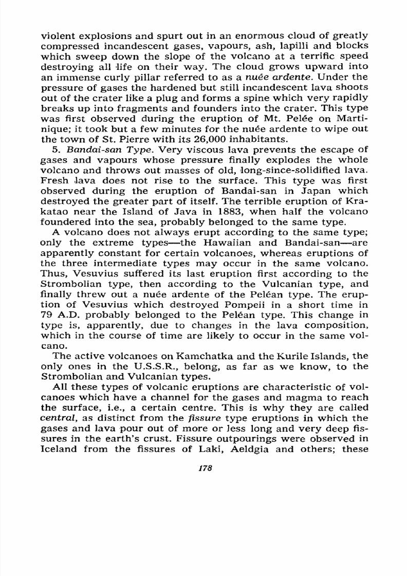
7/28/2019 Fundamentals of Geology - 19th century - Russia text in English
http://slidepdf.com/reader/full/fundamentals-of-geology-19th-century-russia-text-in-english 179/375
violent explosions and spurt out in an enormous cloud of greatly
compressed incandescent gases, vapours, ash, lapilli and blocks
which sweep down the slope of the volcano at a terrific speed
destroying all life on their way. The cloud grows upward into
an immense curly pillar referred to as a nue ardente. Under the
pressure of gases the hardened but still incandescent lava shoots
out of the crater like a plug and forms a spine which very rapidly
breaks up into fragments and founders into the crater. This type
was first observed during the eruption of Mt. Pele on Marti-
nique; it took but a few minutes for the nuee ardente to wipe out
the town of St. Pierre with its 26,000 inhabitants.
5. Bandai-san Type. Very viscous lava prevents the escape of
gases and vapours whose pressure finally explodes the whole
volcano and throws out masses of old, long-since-solidified lava.
Fresh lava does not rise to the surface. This type was first
observed during the eruption of Bandai-san in Japan which
destroyed the greater part of itself. The terrible eruption of Kra-
katao near the Island of Java in 1883, when half the volcano
foundered into the sea, probably belonged to the same type.
A volcano does not always erupt according to the same type;
only the extreme types the Hawaiian and Bandai-san are
apparently constant for certain volcanoes, whereas eruptions of
the three intermediate types may occur in the same volcano.
Thus, Vesuvius suffered its last eruption first according to the
Strombolian type, then according to the Vulcanian type, and
finally threw out a nuee ardente of the Pelan type. The erup-
tion of Vesuvius which destroyed Pompeii in a short time in
79 A.D. probably belonged to the Pelan type. This change in
type is, apparently, due to changes in the lava composition,
which in the course of time are likely to occur in the same vol-
cano.
The active volcanoes on Kamchatka and the Kurile Islands, the
only ones in the U.S.S.R., belong, as far as we know, to the
Strombolian arid Vulcanian types.
All these types of volcanic eruptions are characteristic of vol-
canoes which have a channel for the gases and magma to reach
the surface, i.e., a certain centre. This is why they are called
central, as distinct from the fissure type eruptions in which the
gases and lava pour out of more or less long and very deep fis-
sures in the earth's crust. Fissure outpourings were observed in
Iceland from the fissures of Laki, Aeldgia and others; these
178
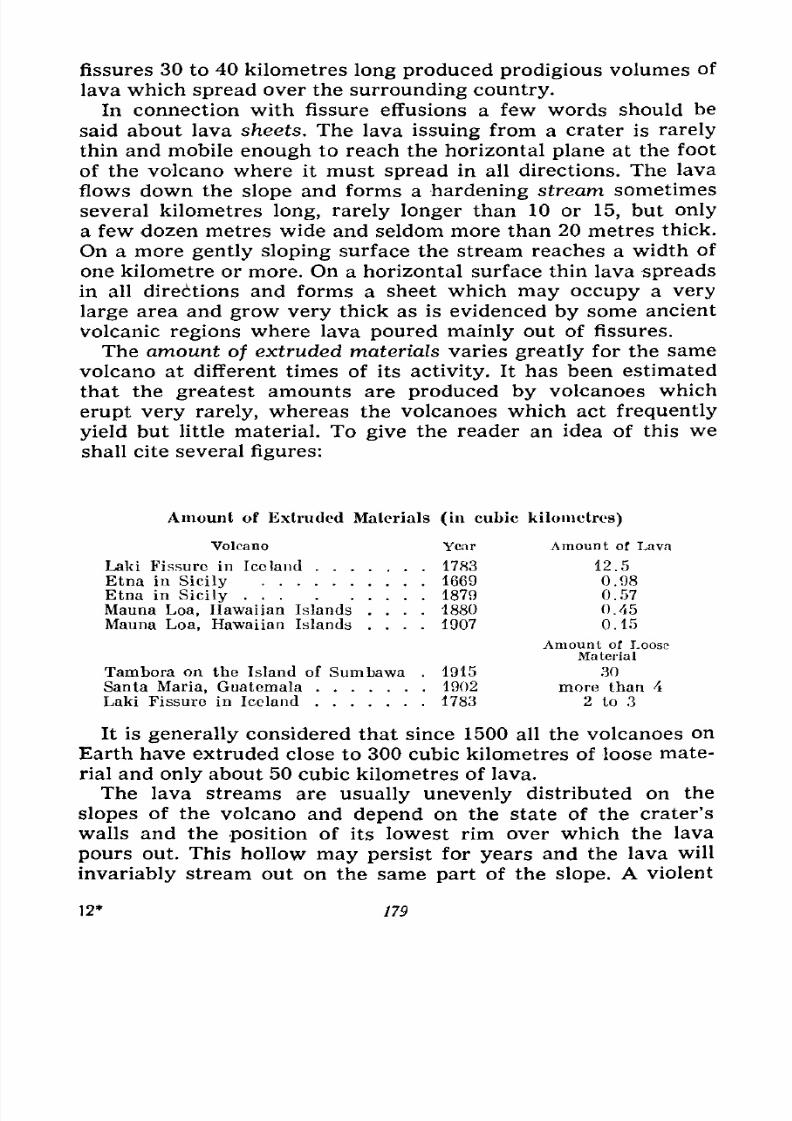
7/28/2019 Fundamentals of Geology - 19th century - Russia text in English
http://slidepdf.com/reader/full/fundamentals-of-geology-19th-century-russia-text-in-english 180/375
fissures 30 to 40 kilometres long produced prodigious volumes of
lava which spread over the surrounding country.
In connection with fissure effusions a few words should be
said about lava sheets. The lava issuing from a crater is rarely
thin and mobile enough to reach the horizontal plane at the foot
of the volcano where it must spread in all directions. The lava
flows down the slope and forms a hardening stream sometimes
several kilometres long, rarely longer than 10 or 15, but only
a few dozen metres wide and seldom more than 20 metres thick.
On a more gently sloping surface the stream reaches a width of
one kilometre or more. On a horizontal surface thin lava spreads
in all directions and forms a sheet which may occupy a very
large area and grow very thick as is evidenced by some ancient
volcanic regions where lava poured mainly out of fissures.
The amount of extruded materials varies greatly for the same
volcano at different times of its activity. It has been estimated
that the greatest amounts are produced by volcanoes which
erupt very rarely, whereas the volcanoes which act frequently
yield but little material. To give the reader an idea of this we
shall cite several figures:
Amount of Extruded Materials (in cubic kilometres)
Volcano Year Amount of Lava
Laki Fissure in Iceland 1783 12.5
Etna in Sicily 1669 0.98
Etna in Sicily 1879 0.57
Mauna Loa, Hawaiian Islands .... 1880 0.45
Mauna Loa, Hawaiian Islands .... 1907 0.15
Amount of LooseMaterial
Tambora on the Island of Sumbawa . 1915 30
Santa Maria, Guatemala 1902 more than 4
Laki Fissure in Iceland 1783 2 to 3
It is generally considered that since 1500 all the volcanoes on
Earth have extruded close to 300 cubic kilometres of loose mate-
rial and only about 50 cubic kilometres of lava.
The lava streams are usually unevenly distributed on the
slopes of the volcano and depend on the state of the crater's
walls and the position of its lowest rim over which the lava
pours out. This hollow may persist for years and the lava will
invariably stream out on the same part of the slope. A violent
12* 179
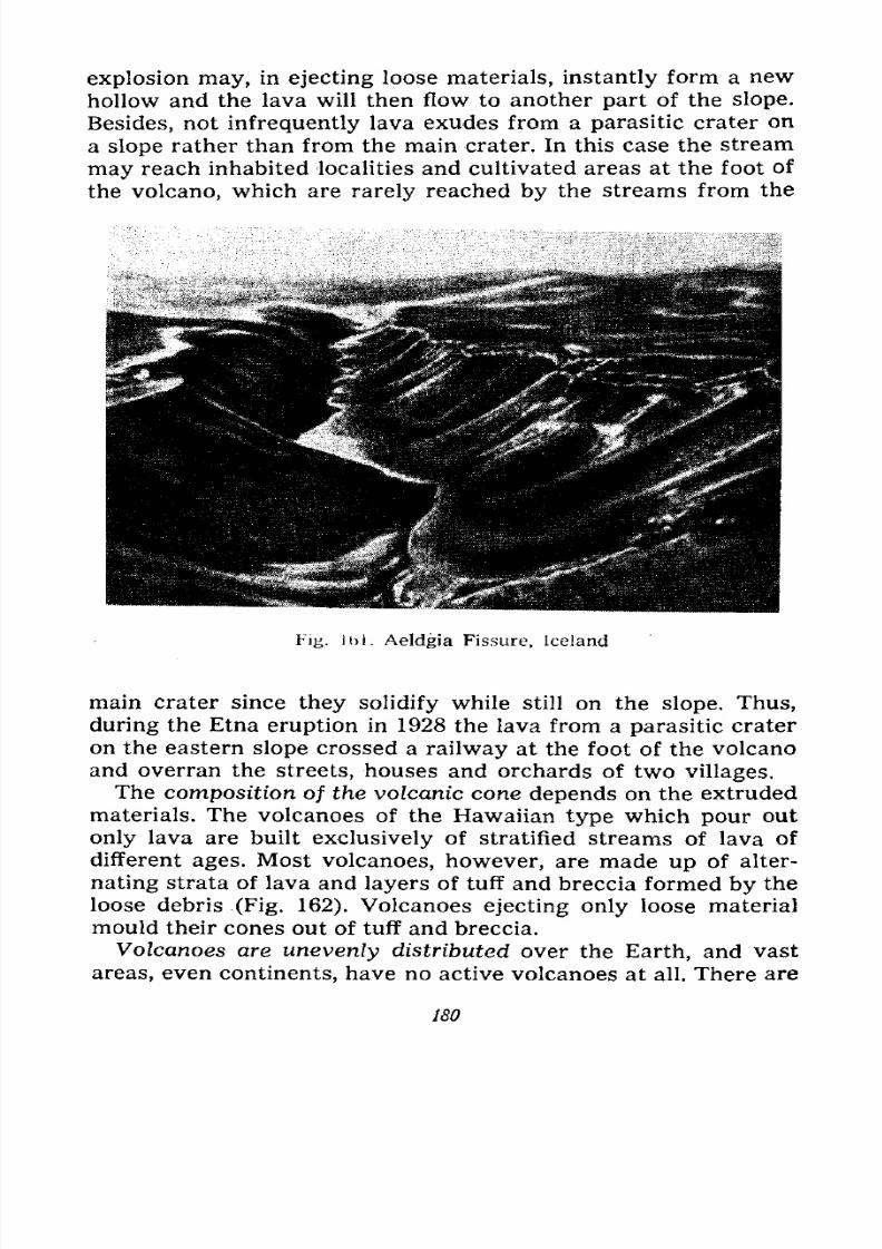
7/28/2019 Fundamentals of Geology - 19th century - Russia text in English
http://slidepdf.com/reader/full/fundamentals-of-geology-19th-century-russia-text-in-english 181/375
explosion may, in ejecting loose materials, instantly form a new
hollow and the lava will then flow to another part of the slope.
Besides, not infrequently lava exudes from a parasitic crater on
a slope rather than from the main crater. In this case the stream
mayreach inhabited localities and cultivated areas at the foot of
the volcano, which are rarely reached by the streams from the
Fig. Ibl. Aeldgia Fissure, Iceland
main crater since they solidify while still on the slope. Thus,
during the Etna eruption in 1928 the lava from a parasitic crateron the eastern slope crossed a railway at the foot of the volcano
and overran the streets, houses and orchards of two villages.
The composition of the volcanic cone depends on the extruded
materials. The volcanoes of the Hawaiian type which pour out
only lava are built exclusively of stratified streams of lava of
different ages. Most volcanoes, however, are made up of alter-
nating strata of lava and layers of tuff and breccia formed by the
loose debris (Fig. 162). Volcanoes ejecting only loose materialmould their cones out of tuff and breccia.
Volcanoes are unevenly distributed over the Earth, and vast
areas, even continents, have no active volcanoes at all. There are
180
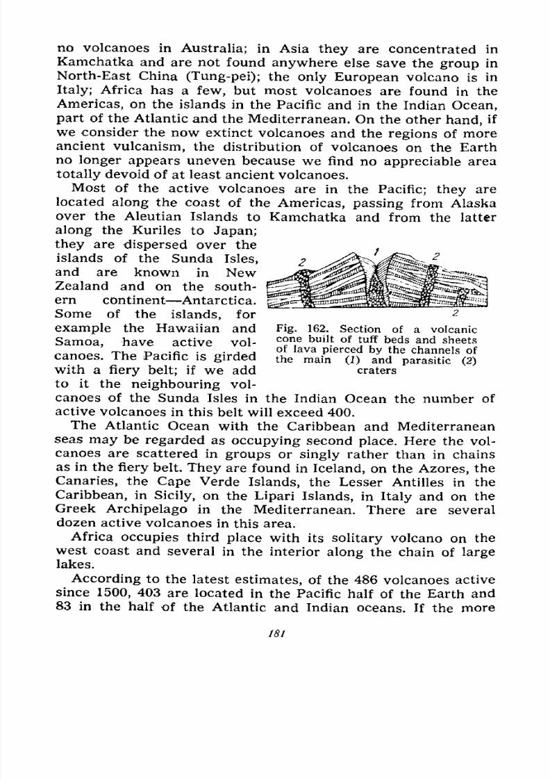
7/28/2019 Fundamentals of Geology - 19th century - Russia text in English
http://slidepdf.com/reader/full/fundamentals-of-geology-19th-century-russia-text-in-english 182/375
no volcanoes in Australia; in Asia they are concentrated in
Kamchatka and are not found anywhere else save the group in
North-East China (Tung-pei); the only European volcano is in
Italy; Africa has a few, but most volcanoes are found in the
Americas, on the islands in the Pacific and in the Indian Ocean,
part of the Atlantic and the Mediterranean. On the other hand, if
we consider the now extinct volcanoes and the regions of more
ancient vulcanism, the distribution of volcanoes on the Earth
no longer appears uneven because we find no appreciable area
totally devoid of at least ancient volcanoes.
Most of the active volcanoes are in the Pacific; they are
located along the coast of the Americas, passing from Alaska
over the Aleutian Islands to Kamchatka and from the latter
along the Kuriles to Japan;
they are dispersed over the
islands of the Sunda Isles,
and are known in NewZealand and on the south-
ern continent Antarctica.
Some of the islands, for
example the Hawaiian and Fig. 162. Section of a volcanic
Samoa, have active vol- cone buil !
:
of tuff beds ^nd sheets
canoes. The Pacific is girded the main^O) a^d
with a fiery belt; if we add craters
to it the neighbouring vol-
canoes of the Sunda Isles in the Indian Ocean the number of
active volcanoes in this belt will exceed 400.
The Atlantic Ocean with the Caribbean and Mediterranean
seas may be regarded as occupying second place. Here the vol-
canoes are scattered in groups or singly rather than in chains
as in the fiery belt. They are found in Iceland, on the Azores, the
Canaries, the Cape Verde Islands, the Lesser Antilles in the
Caribbean, in Sicily, on the Lipari Islands, in Italy and on the
Greek Archipelago in the Mediterranean. There are several
dozen active volcanoes in this area.
Africa occupies third place with its solitary volcano on the
west coast and several in the interior along the chain of large
lakes.
According to the latest estimates, of the 486 volcanoes active
since 1500, 403 are located in the Pacific half of the Earth and
83 in the half of the Atlantic and Indian oceans. If the more
181
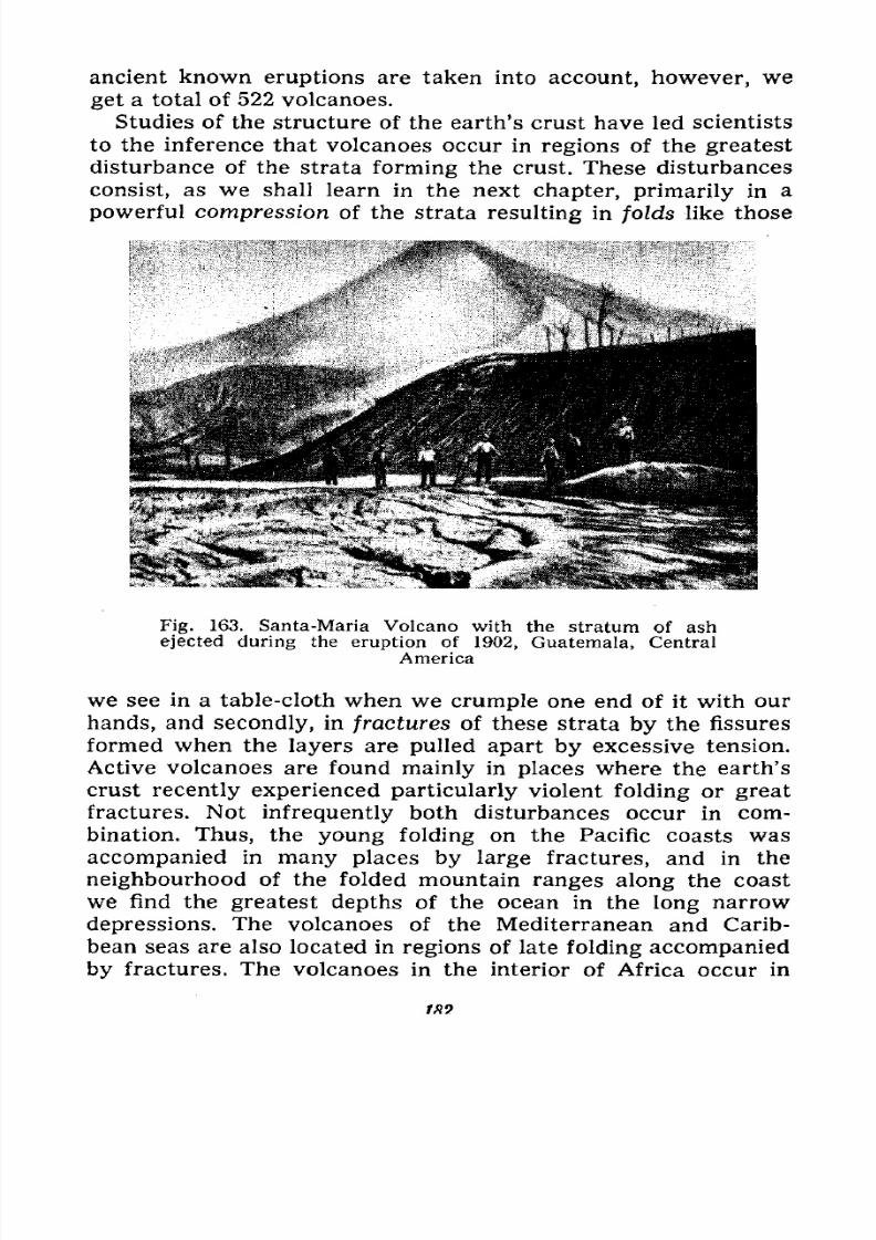
7/28/2019 Fundamentals of Geology - 19th century - Russia text in English
http://slidepdf.com/reader/full/fundamentals-of-geology-19th-century-russia-text-in-english 183/375
ancient known eruptions are taken into account, however, we
get a total of 522 volcanoes.
Studies of the structure of the earth's crust have led scientists
to the inference that volcanoes occur in regions of the greatest
disturbance of the strata
formingthe crust. These disturbances
consist, as we shall learn in the next chapter, primarily in a
powerful compression of the strata resulting in folds like those
Fig. 163. Santa-Maria Volcano with the stratum of ash
ejected during the eruption of 1902, Guatemala, Central
America
we see in a table-cloth when we crumple one end of it with our
hands, and secondly, in fractures of these strata by the fissures
formed when the layers are pulled apart by excessive tension.
Active volcanoes are found mainly in places where the earth's
crust recently experienced particularly violent folding or great
fractures. Not infrequently both disturbances occur in com-
bination. Thus, the young folding on the Pacific coasts was
accompanied in many places by large fractures, and in the
neighbourhood of the folded mountain ranges along the coast
we find the greatest depths of the ocean in the long narrowdepressions. The volcanoes of the Mediterranean and Carib-
bean seas are also located in regions of late folding accompanied
by fractures. The volcanoes in the interior of Africa occur in
1*9.
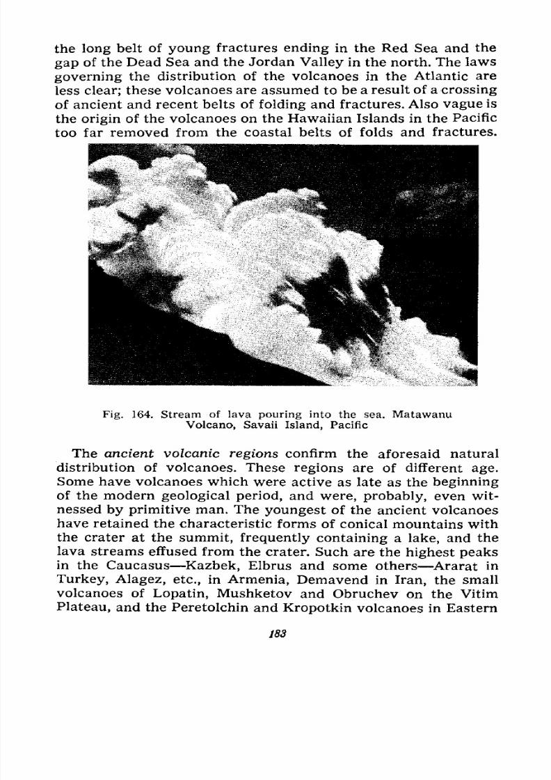
7/28/2019 Fundamentals of Geology - 19th century - Russia text in English
http://slidepdf.com/reader/full/fundamentals-of-geology-19th-century-russia-text-in-english 184/375
the long belt of young fractures ending in the Red Sea and the
gap of the Dead Sea and the Jordan Valley in the north. The laws
governing the distribution of the volcanoes in the Atlantic are
less clear; these volcanoes are assumed to be a result of a crossing
of ancient and recent belts of folding and fractures. Also vague is
the origin of the volcanoes on the Hawaiian Islands in the Pacific
too far removed from the coastal belts of folds and fractures.
Fig. 164. Stream of lava pouring into the sea. Matawanu
Volcano, Savaii Island, Pacific
The ancient volcanic regions confirm the aforesaid natural
distribution of volcanoes. These regions are of different age.
Some have volcanoes which were active as late as the beginning
of the modern geological period, and were, probably, even wit-
nessed by primitive man. The youngest of the ancient volcanoes
have retained the characteristic forms of conical mountains with
the crater at the summit, frequently containing a lake, and the
lava streams effused from the crater. Such are the highest peaks
in the Caucasus Kazbek, Elbrus and some others Ararat in
Turkey, Alagez, etc., in Armenia, Demavend in Iran, the small
volcanoes of Lopatin, Mushketov and Obruchev on the Vitim
Plateau, and the Peretolchin and Kropotkin volcanoes in Eastern
183
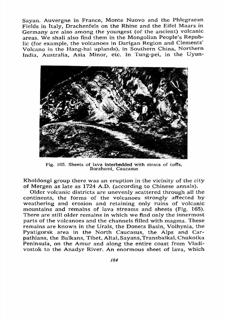
7/28/2019 Fundamentals of Geology - 19th century - Russia text in English
http://slidepdf.com/reader/full/fundamentals-of-geology-19th-century-russia-text-in-english 185/375
Sayan. Auvergne in France, Monte Nuovo and the Phlegraean
Fields in Italy, Drachenfels on the Rhine and the Eifel Maars in
Germany are also among the youngest (of the ancient) volcanic
areas. We shall also find them in the Mongolian People's Repub-
lic
(for example,the volcanoes in Darigan Region and Clements'
Volcano in the Hang-hai uplands), in Southern China, Northern
India, Australia, Asia Minor, etc. In Tung-pei, in the Uyun-
Fig. 165. Sheets of lava interbedded with strata of tuffs,
Borzhomi, Caucasus
Kholdongi group there was an eruption in the vicinity of the city
of Mergen as late as 1724 A.D. (according to Chinese annals).
Older volcanic districts are unevenly scattered through all the
continents, the forms of the volcanoes strongly affected by
weathering and erosion and retaining only ruins of volcanic
mountains and remains of lava streams and sheets (Fig. 165).
There are still older remains in which we find only the innermost
parts of the volcanoes and the channels filled with magma. These
remains are known in the Urals, the Donets Basin, Volhynia, the
Pyatigorsk area in the North Caucasus, the Alps and Car-
pathians, the Balkans, Tibet, Altai, Sayans,Transbaikal,Chukotka
Peninsula, on the Amur and along the entire coast from Vladi-
vostok to the Anadyr River. An enormous sheet of lava, which
184
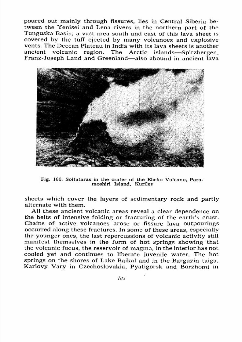
7/28/2019 Fundamentals of Geology - 19th century - Russia text in English
http://slidepdf.com/reader/full/fundamentals-of-geology-19th-century-russia-text-in-english 186/375
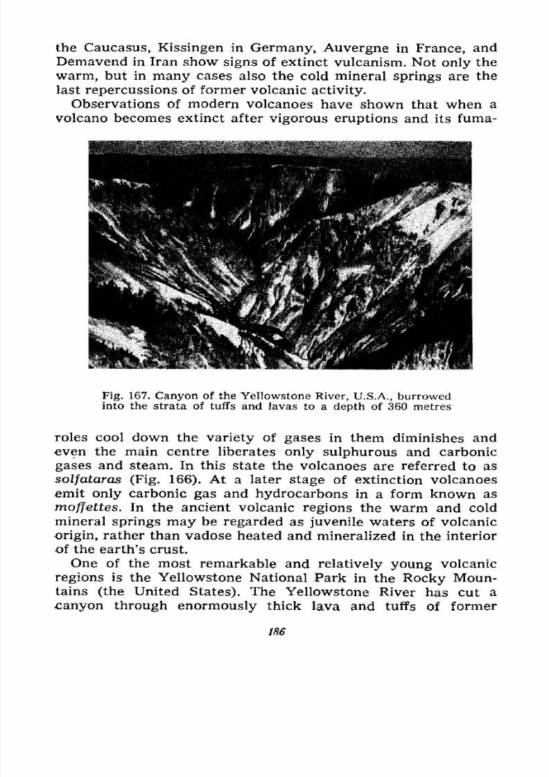
7/28/2019 Fundamentals of Geology - 19th century - Russia text in English
http://slidepdf.com/reader/full/fundamentals-of-geology-19th-century-russia-text-in-english 187/375
the Caucasus, Kissingen in Germany, Auvergne in France, and
Demavend in Iran show signs of extinct vulcanism. Not only the
warm, but in many cases also the cold mineral springs are the
last repercussions of former volcanic activity.
Observations of modern volcanoes have shown that when a
volcano becomes extinct after vigorous eruptions and its fuma-
Fig. 167. Canyon of the Yellowstone River, U.S.A., burrowedinto the strata of tuffs and lavas to a depth of 360 metres
roles cool down the variety of gases in them diminishes and
even the main centre liberates only sulphurous and carbonic
gases and steam. In this state the volcanoes are referred to as
solfataras (Fig. 166). At a later stage of extinction volcanoes
emit only carbonic gas and hydrocarbons in a form known as
moffettes. In the ancient volcanic regions the warm and cold
mineral springs may be regarded as juvenile waters of volcanic
origin, rather than vadose heated and mineralized in the interior
of the earth's crust.
One of the most remarkable and relatively young volcanic
regions is the Yellowstone National Park in the Rocky Moun-
tains (the United States). The Yellowstone River has cut a
canyon through enormously thick lava and tuffs of former
186
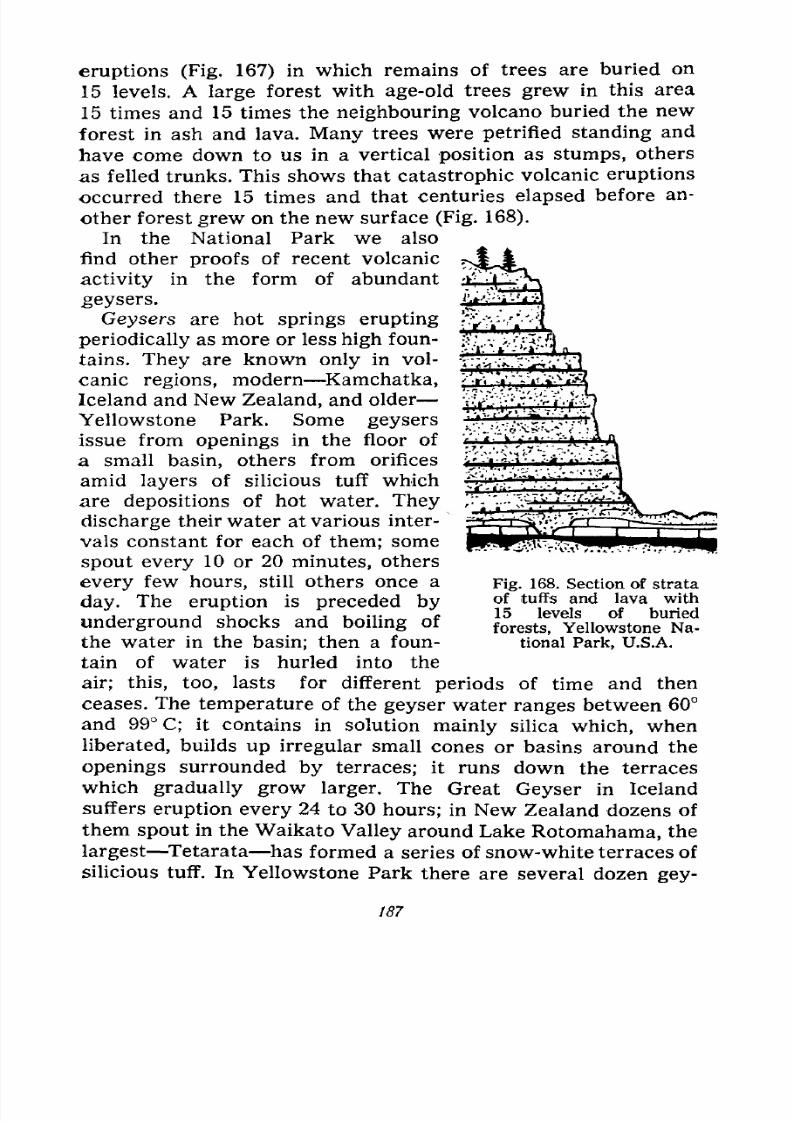
7/28/2019 Fundamentals of Geology - 19th century - Russia text in English
http://slidepdf.com/reader/full/fundamentals-of-geology-19th-century-russia-text-in-english 188/375
eruptions (Fig. 167) in which remains of trees are buried on
15 levels. A large forest with age-old trees grew in this area
15 times and 15 times the neighbouring volcano buried the new
forest in ash and lava. Many trees were petrified standing and
have come downto us in a vertical
positionas
stumps,others
as felled trunks. This shows that catastrophic volcanic eruptions
occurred there 15 times and that centuries elapsed before an-
other forest grew on the new surface (Fig. 168).
In the National Park we also
find other proofs of recent volcanic
activity in the form of abundant
geysers.
Geysers are hot springs eruptingperiodically as more or less high foun-
tains. They are known only in vol-
canic regions, modern Kamchatka,
Iceland and New Zealand, and older
Yellowstone Park. Some geysers
issue from openings in the floor of
a small basin, others from orifices
amidlayers
of silicious tuff which
are depositions of hot water. They
discharge their water at various inter-
vals constant for each of them; some
spout every 10 or 20 minutes, others
every few hours, still others once a
day. The eruption is preceded by
underground shocks and boiling of
the water in the basin; then a foun-
tain of water is hurled into the
air; this, too, lasts for different periods of time and then
ceases. The temperature of the geyser water ranges between 60
and 99 C; it contains in solution mainly silica which, when
liberated, builds up irregular small cones or basins around the
openings surrounded by terraces; it runs down the terraces
which gradually grow larger. The Great Geyser in Iceland
suffers eruption every 24 to 30 hours; in New Zealand dozens ofthem spout in the Waikato Valley around Lake Rotomahama, the
largest Tetarata has formed a series of snow-white terraces of
silicious tuff. In Yellowstone Park there are several dozen gey-
Fig. 168. Section of strata
of tuffs and lava with
15 levels of buried
forests, Yellowstone Na-
tional Park, U.S.A.
187
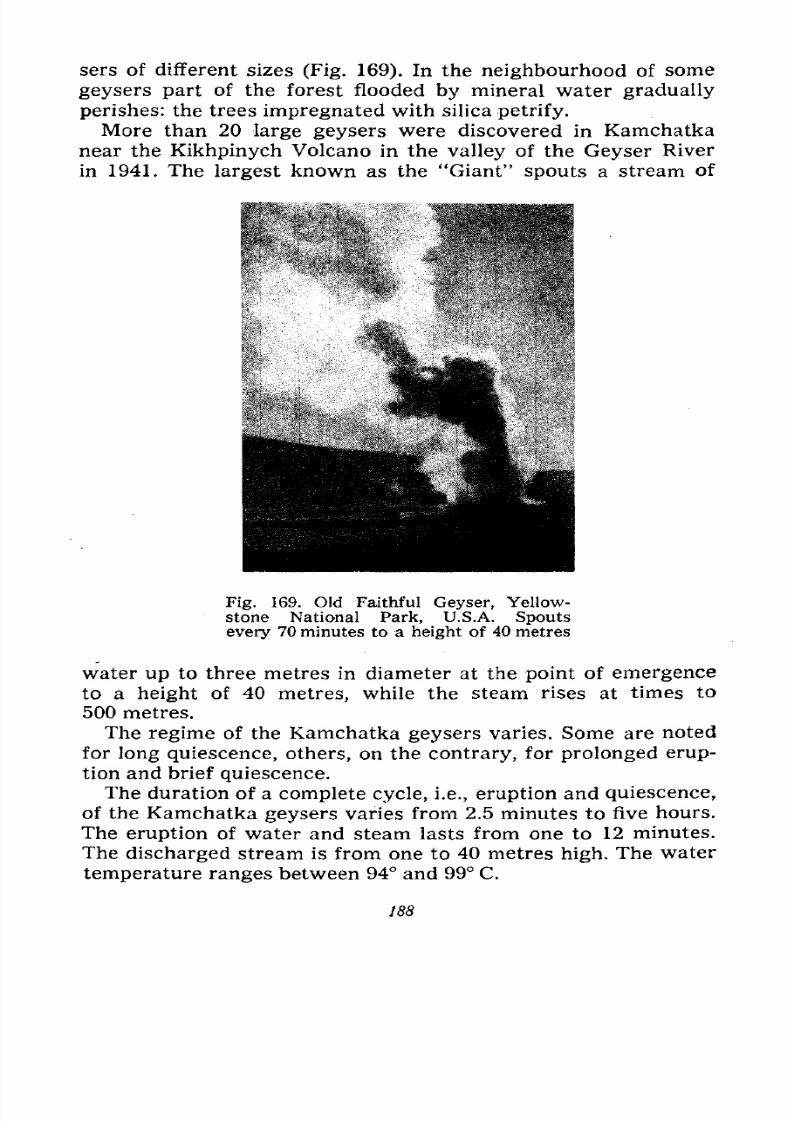
7/28/2019 Fundamentals of Geology - 19th century - Russia text in English
http://slidepdf.com/reader/full/fundamentals-of-geology-19th-century-russia-text-in-english 189/375
sers of different sizes (Fig. 169). In the neighbourhood of some
geysers part of the forest flooded by mineral water gradually
perishes: the trees impregnated with silica petrify.
More than 20 large geysers were discovered in Kamchatka
near the Kikhpinych Volcano in the valley of the Geyser River
in 1941. The largest known as the "Giant" spouts a stream of
Fig. 169. Old Faithful Geyser, Yellow-
stone National Park, U.S.A. Spouts
every 70 minutes to a height of 40 metres
water up to three metres in diameter at the point of emergence
to a height of 40 metres, while the steam rises at times to
500 metres.
The regime of the Kamchatka geysers varies. Some are noted
for long quiescence, others, on the contrary, for prolonged erup-
tion and brief quiescence.
The duration of a complete cycle, i.e., eruption and quiescence,
of the Kamchatka geysers varies from 2.5 minutes to five hours.The eruption of water and steam lasts from one to 12 minutes.
The discharged stream is from one to 40 metres high. The water
temperature ranges between 94 and 99 C.
188
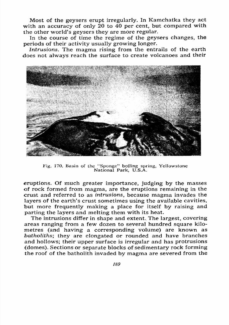
7/28/2019 Fundamentals of Geology - 19th century - Russia text in English
http://slidepdf.com/reader/full/fundamentals-of-geology-19th-century-russia-text-in-english 190/375
Most of the geysers erupt irregularly. In Kamchatka they act
with an accuracy of only 20 to 40 per cent, but compared with
the other world's geysers they are more regular.
In the course of time the regime of the geysers changes, the
periods of their activity usually growing longer.
Intrusions. The magma rising from the entrails of the earth
does not always reach the surface to create volcanoes and their
Fig. 170. Basin of the "Sponge" boiling spring, Yellowstone
National Park, U.S.A.
eruptions. Of much greater importance, judging by the masses
of rock formed from magma, are the eruptions remaining in the
crust and referred to as intrusions, because magma invades the
layers of the earth's crust sometimes using the available cavities,
but more frequently making a place for itself by raising and
parting the layers and melting them with its heat.
The intrusions differ in shape and extent. The largest, covering
areas ranging from a few dozen to several hundred square kilo-
metres (and having a corresponding volume) are known as
batholiths; they are elongated or rounded and have branchesand hollows; their upper surface is irregular and has protrusions
(domes). Sections or separate blocks of sedimentary rock forming
the roof of the batholith invaded by magma are severed from the
189
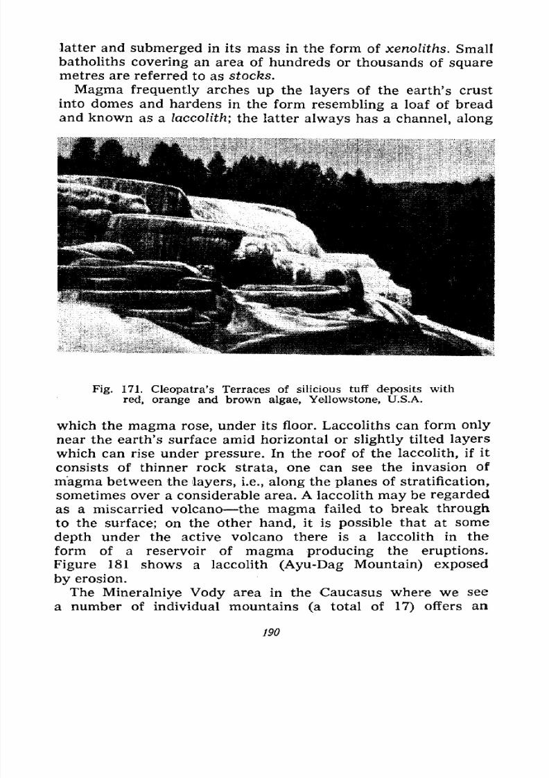
7/28/2019 Fundamentals of Geology - 19th century - Russia text in English
http://slidepdf.com/reader/full/fundamentals-of-geology-19th-century-russia-text-in-english 191/375
latter and submerged in its mass in the form of xenoliths. Small
batholiths covering an area of hundreds or thousands of square
metres are referred to as stocks.
Magma frequently arches up the layers of the earth's crust
into domes and hardens in the form resembling a loaf of bread
and known as a laccolith; the latter always has a channel, along
Fig. 171. Cleopatra's Terraces of silicious tuff deposits with
red, orange and brown algae, Yellowstone, U.S.A.
which the magma rose, under its floor. Laccoliths can form only
near the earth's surface amid horizontal or slightly tilted layers
which can rise under pressure. In the roof of the laccolith, if it
consists of thinner rock strata, one can see the invasion of
magma between the layers, i.e., along the planes of stratification,
sometimes over a considerable area. A laccolith may be regarded
as a miscarried volcano the magma failed to break through
to the surface; on the other hand, it is possible that at some
depth under the active volcano there is a laccolith in the
form of a reservoir of magma producing the eruptions.
Figure 181 shows a laccolith (Ayu-Dag Mountain) exposedby erosion.
The Mineralniye Vody area in the Caucasus where we see
a number of individual mountains (a total of 17) offers an
190
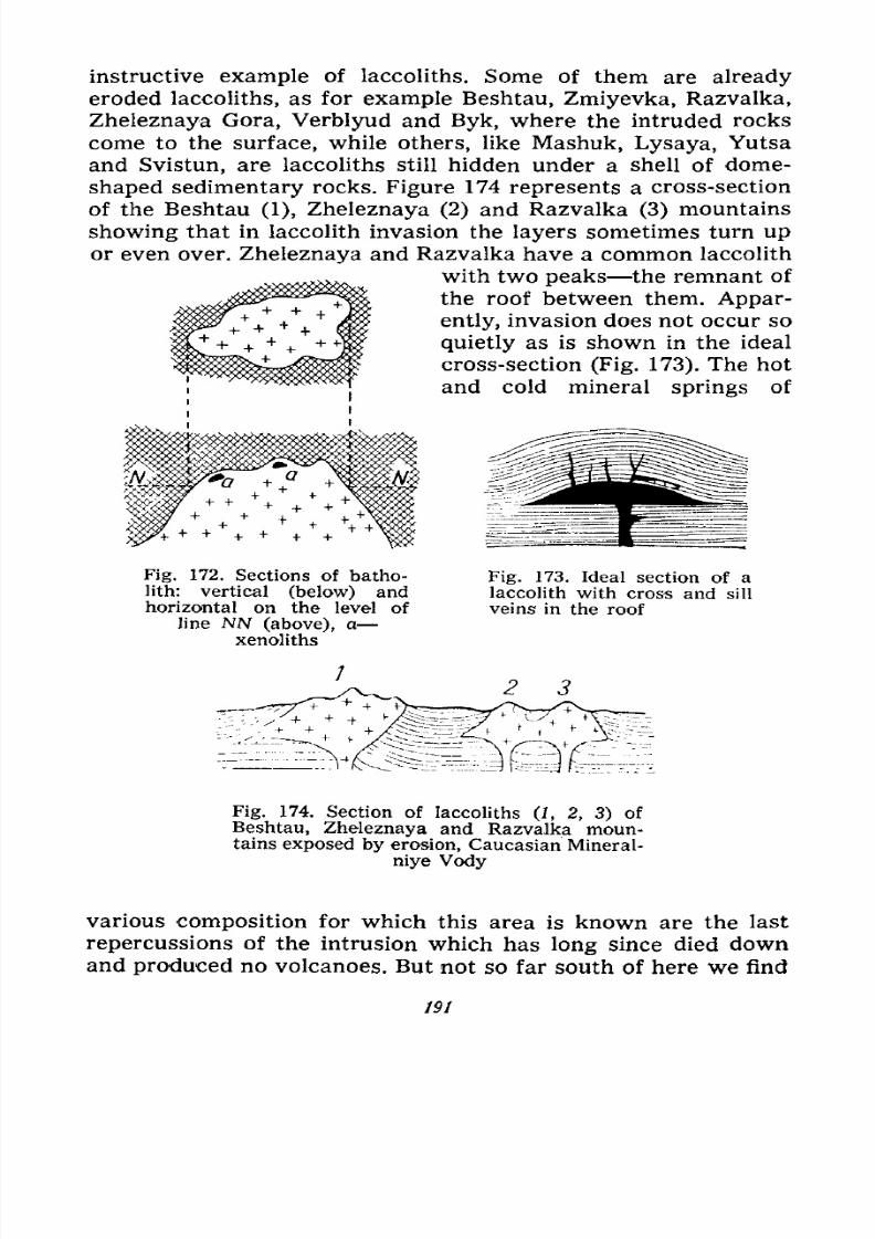
7/28/2019 Fundamentals of Geology - 19th century - Russia text in English
http://slidepdf.com/reader/full/fundamentals-of-geology-19th-century-russia-text-in-english 192/375
instructive example of laccoliths. Some of them are already
eroded laccoliths, as for example Beshtau, Zmiyevka, Razvalka,
Zheleznaya Gora, Verblyud and Byk, where the intruded rocks
come to the surface, while others, like Mashuk, Lysaya, Yutsa
and Svistun, are laccoliths still hidden under a shell of dome-
shaped sedimentary rocks. Figure 174 represents a cross-section
of the Beshtau (1), Zheleznaya (2) and Razvalka (3) mountains
showing that in laccolith invasion the layers sometimes turn upor even over. Zheleznaya and Razvalka have a common laccolith
with two peaks the remnant of
the roof between them. Appar-
ently, invasion does not occur so
quietly as is shown in the ideal
cross-section (Fig. 173). The hot
and cold mineral springs of
Fig. 172. Sections of batho-
lith: vertical (below) andhorizontal on the level of
line NN (above), a
xenoliths
Fig. 173. Ideal section of a
laccolith with cross and sill
veins in the roof
2 3
Fig. 174. Section of laccoliths (1, 2, 3) of
Beshtau, Zheleznaya and Razvalka moun-tains exposed by erosion, Caucasian Mineral-
niye Vody
various composition for which this area is known are the last
repercussions of the intrusion which has long since died down
and produced no volcanoes. But not so far south of here we find
191
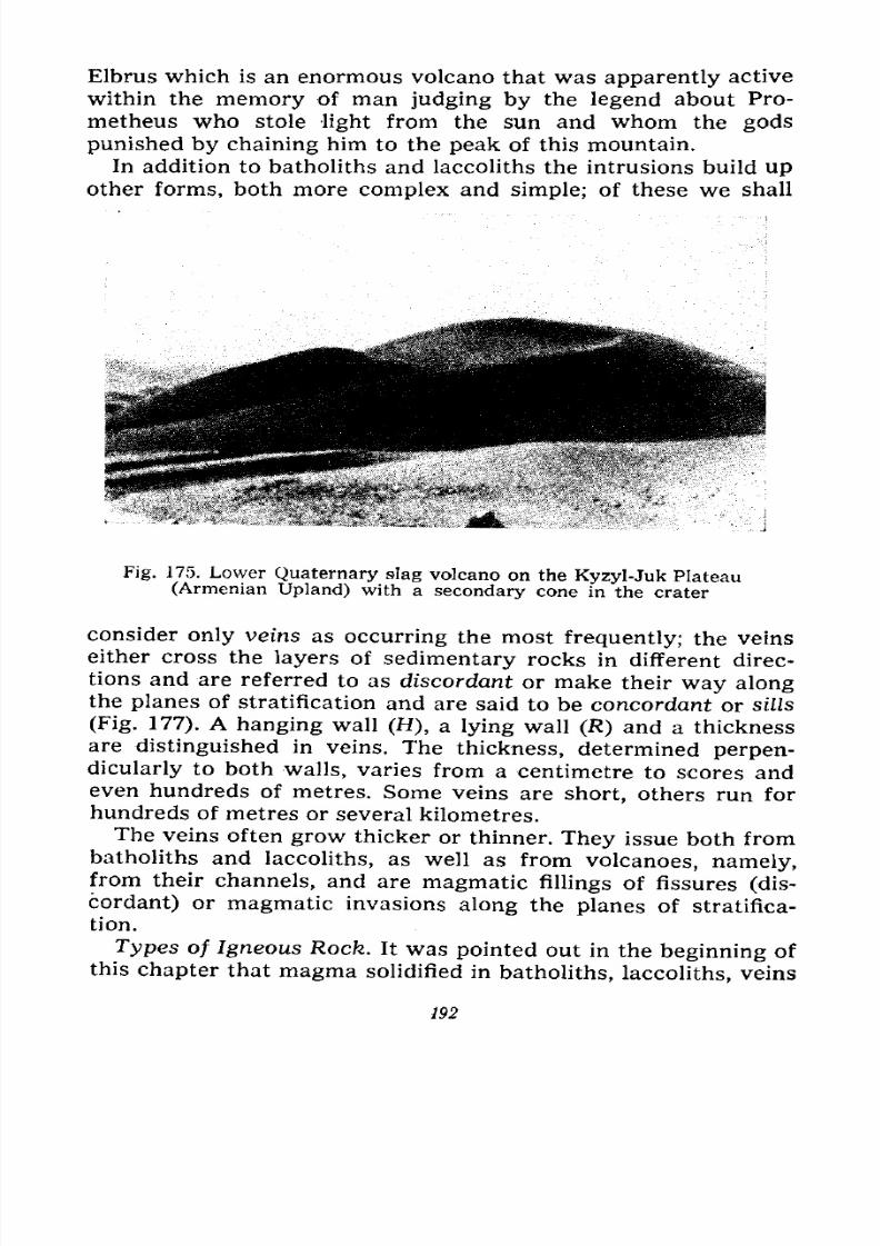
7/28/2019 Fundamentals of Geology - 19th century - Russia text in English
http://slidepdf.com/reader/full/fundamentals-of-geology-19th-century-russia-text-in-english 193/375
Elbrus which is an enormous volcano that was apparently active
within the memory of man judging by the legend about Pro-
metheus who stole light from the sun and whom the gods
punished by chaining him to the peak of this mountain.
In addition to batholiths and laccoliths the intrusions build upother forms, both more complex and simple; of these we shall
Fig. 175. Lower Quaternary slag volcano on the Kyzyl-Juk Plateau(Armenian Upland) with a secondary cone in the crater
consider only veins as occurring the most frequently; the veins
either cross the layers of sedimentary rocks in different direc-
tions and are referred to as discordant or make their way alongthe planes of stratification and are said to be concordant or sills
(Fig. 177). A hanging wall (H), a lying wall (R) and a thicknessare distinguished in veins. The thickness, determined perpen-
dicularly to both walls, varies from a centimetre to scores andeven hundreds of metres. Some veins are short, others run for
hundreds of metres or several kilometres.
The veins often grow thicker or thinner. They issue both from
batholiths and laccoliths, as well as from volcanoes, namely,from their channels, and are magmatic fillings of fissures (dis-
cordant) or magmatic invasions along the planes of stratifica-
tion.
Types of Igneous Rock. It was pointed out in the beginning of
this chapter that magma solidified in batholiths, laccoliths, veins
192
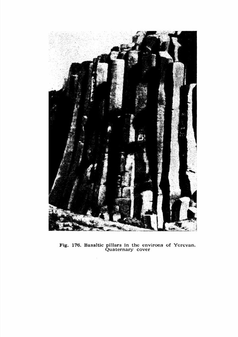
7/28/2019 Fundamentals of Geology - 19th century - Russia text in English
http://slidepdf.com/reader/full/fundamentals-of-geology-19th-century-russia-text-in-english 194/375
Fig. 176. Basaltic pillars in the environs of Yerevan.Quaternary cover
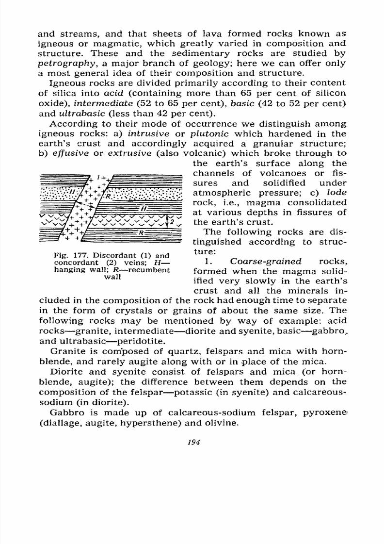
7/28/2019 Fundamentals of Geology - 19th century - Russia text in English
http://slidepdf.com/reader/full/fundamentals-of-geology-19th-century-russia-text-in-english 195/375
and streams, and that sheets of lava formed rocks known as
igneous or magmatic, which greatly varied in composition and
structure. These and the sedimentary rocks are studied by
petrography, a major branch of geology; here we can offer only
a most general idea of their composition and structure.
Igneous rocks are divided primarily according to their content
of silica into acid (containing more than 65 per cent of silicon
oxide), intermediate (52 to 65 per cent), basic (42 to 52 per cent)
and uZtrabasic (less than 42 per cent).
According to their mode of occurrence we distinguish among
igneous rocks: a) intrusive or plutonic which hardened in the
earth's crust and accordingly acquired a granular structure;
b) effusive or extrusive(also volcanic)
which brokethrough
to
the earth's surface along the
channels of volcanoes or fis-
sures and solidified under
atmospheric pressure; c) lode
rock, i.e., magma consolidated
at various depths in fissures of
the earth's crust.
The following rocks are dis-
tinguished according to struc-
ture:
1. Coarse-grained rocks,
formed when the magma solid-
Fig. 177. Discordant (1) andconcordant (2) veins; Hhanging wall; R recumbent
wallified very slowly in the earth's
crust and all the minerals in-
cluded in the composition of the rock had enough time to separate
in the form of crystals or grains of about the same size. The
following rocks may be mentioned by way of example: acid
rocks granite, intermediate diorite and syenite, basic gabbro,.
and ultrabasic peridotite.
Granite is composed of quartz, felspars and mica with horn-
blende, and rarely augite along with or in place of the mica.
Diorite and syenite consist of felspars and mica (or horn-
blende, augite); the difference between them depends on the
compositionof
the felspar potassic (in syenite) andcalcareous-
sodium (in diorite).
Gabbro is made up of calcareous-sodium felspar, pyroxene
(diallage, augite, hypersthene) and olivine.
194
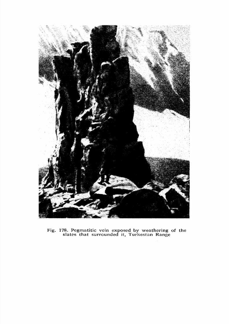
7/28/2019 Fundamentals of Geology - 19th century - Russia text in English
http://slidepdf.com/reader/full/fundamentals-of-geology-19th-century-russia-text-in-english 196/375
Fig. 178. Pegmatitic vein exposed by weathering of the
slates that surrounded it, Turkestan Range
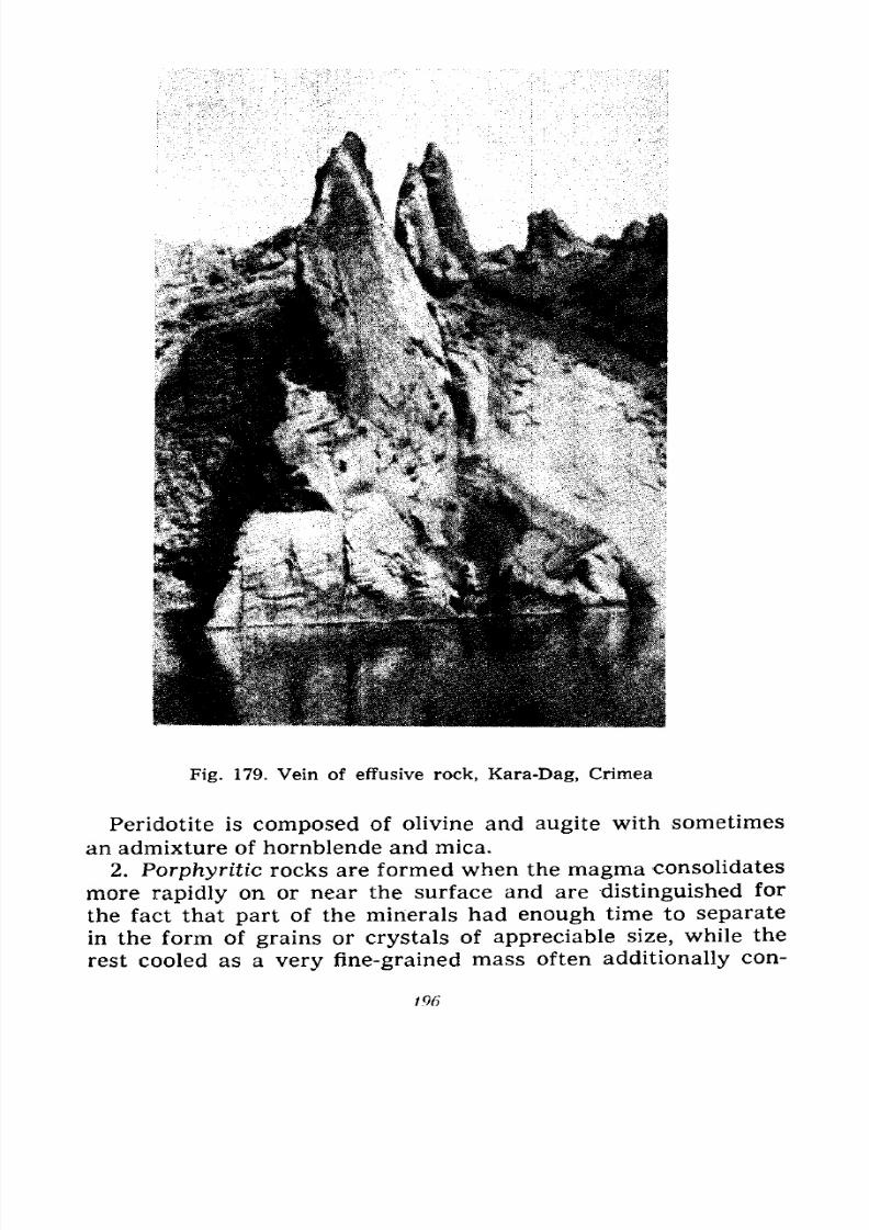
7/28/2019 Fundamentals of Geology - 19th century - Russia text in English
http://slidepdf.com/reader/full/fundamentals-of-geology-19th-century-russia-text-in-english 197/375
Fig. 179. Vein of effusive rock, Kara-Dag, Crimea
Peridotite is composed of olivine and augite with sometimes
an admixture of hornblende and mica.
2. Porphyritic rocks are formed when the magma consolidates
more rapidly on or near the surface and are distinguished for
the fact that part of the minerals had enough time to separate
in the form of grains or crystals of appreciable size, while the
rest cooled as a very fine-grained mass often additionally con-
196
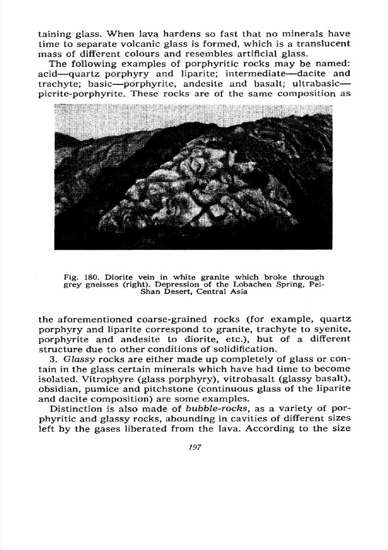
7/28/2019 Fundamentals of Geology - 19th century - Russia text in English
http://slidepdf.com/reader/full/fundamentals-of-geology-19th-century-russia-text-in-english 198/375
taining glass. When lava hardens so fast that no minerals have
time to separate volcanic glass is formed, which is a translucent
mass of different colours and resembles artificial glass.
The following examples of porphyritic rocks may be named:
acid quartz porphyry and liparite; intermediate dacite and
trachyte; basic porphyrite, andesite and basalt; ultrabasic
picrite-porphyrite. These rocks are of the same composition as
Fig. 180. Diorite vein in white granite which broke through
grey gneisses (right). Depression of the Lobachen Spring, Pei-
Shan Desert, Central Asia
the aforementioned coarse-grained rocks (for example, quartz
porphyry and liparite correspond to granite, trachyte to syenite,
porphyrite and andesite to diorite, etc.), but of a different
structure due to other conditions of solidification.
3. Glassy rocks are either made up completely of glass or con-
tain in the glass certain minerals which have had time to become
isolated. Vitrophyre (glass porphyry), vitrobasalt (glassy basalt),
obsidian, pumice and pitchstone (continuous glass of the liparite
and dacite composition) are some examples.Distinction is also made of bubble-rocks, as a variety of por-
phyritic and glassy rocks, abounding in cavities of different sizes
left by the gases liberated from the lava. According to the size
197
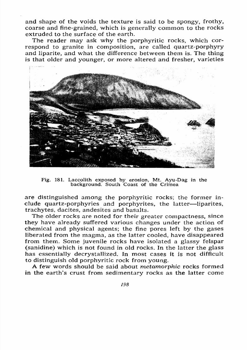
7/28/2019 Fundamentals of Geology - 19th century - Russia text in English
http://slidepdf.com/reader/full/fundamentals-of-geology-19th-century-russia-text-in-english 199/375
and shape of the voids the texture is said to be spongy, frothy,
coarse and fine-grained, which is generally common to the rocks
extruded to the surface of the earth.
The reader may ask why the porphyritic rocks, which cor-
respond to granite in composition, are called quartz-porphyry
and liparite, and what the difference between them is. The thing
is that older and younger, or more altered and fresher, varieties
Fig. 181. Laccolith exposed by erosion, Mt. Ayu-Dag in the
background, South Coast of the Crimea
are distinguished among the porphyritic rocks; the former in-
clude quartz-porphyries and porphyrites, the latter liparites,
trachytes, dacites, andesites and basalts.
The older rocks are noted for their greater compactness, since
they have already suffered various changes under the action of
chemical and physical agents; the fine pores left by the gases
liberated from the magma, as the latter cooled, have disappeared
from them. Some juvenile rocks have isolated a glassy felspar
(sanidine) which is not found in old rocks. In the latter the glass
has essentially decrystallized. In most cases it is not difficult
to distinguish old porphyritic rock from young.
A few words should be said about metamorphic rocks formed
in the earth's crust from sedimentary rocks as the latter come
198
7/28/2019 Fundamentals of Geology - 19th century - Russia text in English
http://slidepdf.com/reader/full/fundamentals-of-geology-19th-century-russia-text-in-english 200/375
7/28/2019 Fundamentals of Geology - 19th century - Russia text in English
http://slidepdf.com/reader/full/fundamentals-of-geology-19th-century-russia-text-in-english 201/375
collected gaseous emanations. This made it possible to solve
the complicated problem of the composition of gases, espe-
cially the participation of water vapours which many had dis-
puted. Later scientists began to descend into the craters of
Vesuvius and Stromboli; the scientist Mercalli lost his life in
the former, and Kerner descended on a rope to a depth of 250
metres in the latter. A Japanese geologist and a journalist
descended into the crater of the active Miharayama Volcano near
the city of Yokohama. A steel gondola equipped with an artificial
cooling system was used in the descent. Both observers wore
asbestos suits and gas masks. It was clear vision down to a depth
of 150 metres so that they were able to observe the extrusion
of the lava and explosions of gases, and to take photographs. An-
other 30 metres and visibility grew so poor that they could move
only at random. At a depth of 370 metres the gondola began to
be thrown about by the explosions of gases so violently that
further descent was rendered unsafe and they had to signal for
ascent. Samples of gases and several hundred photographs were
the scientific results of their descent into the crater.
After several unsuccessful attempts a descent was recently
made into the crater of the Klyuchevskaya Volcano in Kam-
chatka; the volcano is very high and the climb to its summitalone requires a great deal of effort. Members of a Kamchatka
expedition geologist Kulakov, chemist Trotsky, worker Mikulin
and mountain-climber Koptelov went down into the crater in
1935, collected gases and observed the liberation of smoke and
ejection of lapilli and bombs.
The Americans have long since organized a special obser-
vation post on the Kilauea Volcano and the Italians on the
Vesuvius.
The vulcanological station of the U.S.S.R. Academy of Sci-
ences built in 1935 near the Klyuchevskoi Volcano the most
active Kamchatka volcano is studying volcanic activity in its
various manifestations, i.e., the mechanism of eruptions, the
state of the volcano in the intervals between the eruptions, its
fumarolic and solfataric activity, the geysers and hot springs.
Special studies are made of the signs of impending eruptions
for the purpose of warning the population.Since the existence of the station the Shiveluch, Klyuchev-
skaya, Tolbachik, Maly Semyachik, Karymsky, Zhupanovsky,
Avachi, Mutnovsky, Sarychev and Krenitsyn's Peak have suf-
200
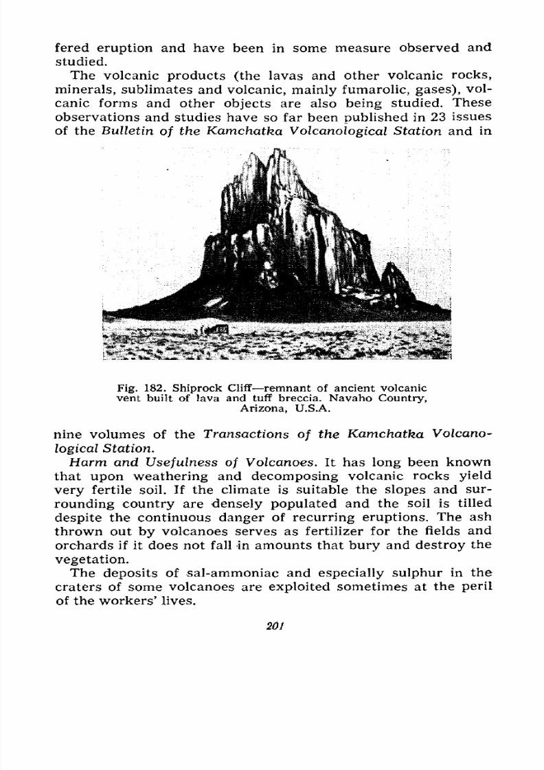
7/28/2019 Fundamentals of Geology - 19th century - Russia text in English
http://slidepdf.com/reader/full/fundamentals-of-geology-19th-century-russia-text-in-english 202/375
fered eruption and have been in some measure observed and
studied.
The volcanic products (the lavas and other volcanic rocks,
minerals, sublimates and volcanic, mainly fumarolic, gases), vol-
canic forms and other objects are also being studied. These
observations and studies have so far been published in 23 issues
of the Bulletin of the Kamchatka Volcanological Station and in
Fig. 182. Shiprock Cliff remnant of ancient volcanic
vent built of lava and tuff breccia. Navaho Country,
Arizona, U.S.A.
nine volumes of the Transactions of the Kamchatka Volcano-
logical Station.
Harm and Usefulness of Volcanoes. It has long been known
that upon weathering and decomposing volcanic rocks yield
very fertile soil. If the climate is suitable the slopes and sur-
rounding country are densely populated and the soil is tilled
despite the continuous danger of recurring eruptions. The ash
thrown out by volcanoes serves as fertilizer for the fields and
orchards if it does not fall in amounts that bury and destroy the
vegetation.The deposits of sal-ammoniac and especially sulphur in the
craters of some volcanoes are exploited sometimes at the peril
of the workers' lives.
201
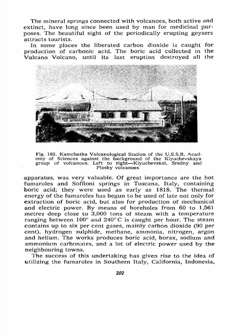
7/28/2019 Fundamentals of Geology - 19th century - Russia text in English
http://slidepdf.com/reader/full/fundamentals-of-geology-19th-century-russia-text-in-english 203/375
The mineral springs connected with volcanoes, both active and
extinct, have long since been used by man for medicinal pur-
poses. The beautiful sight of the periodically erupting geysers
attracts tourists.
In some places the liberated carbon dioxide is caught for
production of carbonic acid. The boric acid collected in the
Vulcano Volcano, until its last eruption destroyed all the
Fig. 183. Kamchatka Volcanological Station of the U.S.S.R. Acad-
emy of Sciences against the background of the Klyuchevskaya
group of volcanoes. Left to right Klyuchevskoi, Sredny and
Plosky volcanoes
apparatus, was very valuable. Of great importance are the hot
fumaroles and Soffioni springs in Toscana, Italy, containing
boric acid; they were used as early as 1818. The thermal
energy of the fumaroles has begun to be used of late not only for
extraction of boric acid, but also for production of mechanical
and electric power. By means of boreholes from 60 to 1,561
metres deep close to 3,000 tons of steam with a temperature
ranging between 100 and 240 C is caught per hour. The steam
contains up to six per cent gases, mainly carbon dioxide (90 per
cent), hydrogen sulphide, methane, ammonia, nitrogen, argon
and helium. The works produces boric acid, borax, sodium and
ammonium carbonates, and a lot of electric power used by the
neighbouring towns.
The success of this undertaking has given rise to the idea of
utilizing the fumaroles in Southern Italy, California, Indonesia,
202
7/28/2019 Fundamentals of Geology - 19th century - Russia text in English
http://slidepdf.com/reader/full/fundamentals-of-geology-19th-century-russia-text-in-english 204/375
7/28/2019 Fundamentals of Geology - 19th century - Russia text in English
http://slidepdf.com/reader/full/fundamentals-of-geology-19th-century-russia-text-in-english 205/375
VIII
BUILDING AND DESTRUCTION OF MOUNTAINS
Main Features of the
SurfaceRelief.
Foldingand Fault-
ing Dislocations. Shapes of Folds and Faults. Joints.
Shapes of Mountains. Dislocational and Volcanic Moun-
tains. Types of Dislocation Mountains. Destruction and
Eradication of Mountains. Rejuvenation of Mountains.
Geosynclines and Platforms. Orogenesis and Epeirogen-
esis. Causes of Dislocation.
We all know that the surface of the land consists of lowlands
and elevations. The lowlands are mainly plains, but their levelsurface is sometimes broken by low hills, for example, dunes
or barkhans made up of alluvial sand, or by hills composed of
country rocks evened out by weathering or marine erosion. The
relief of the elevations varies to a greater extent and shows
isolated mountains, plateaus, various mountain ranges, high-
lands and uplands. We have already considered volcanoes which
are individual mountains or groups and small chains of similar
mountains, and we know that they are built of the materialsof eruptions lavas and tuffs.
Most elevations, however, are of a different origin, though
they frequently contain igneous rocks. They have been created
by movements which disturbed the structure of the earth's crust
and caused its strata to become displaced, i.e., upset their initial
mode of occurrence. In these movements the layers of rocks
formed on the floors of seas or lakes, or on land in a horizontal
or slightly inclined attitude (when the floor of the basin or thesurface of the land are somewhat inclined) are brought out of
their initial position, rise, drop, tilt, fold like paper or a fabric,
fracture, slide over each other and even turn over. These dis-
204
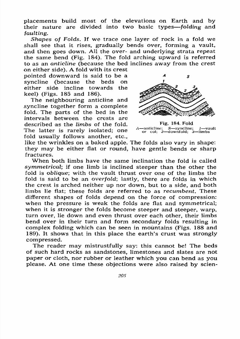
7/28/2019 Fundamentals of Geology - 19th century - Russia text in English
http://slidepdf.com/reader/full/fundamentals-of-geology-19th-century-russia-text-in-english 206/375
Fig. 184, Fold
-anticline; 5 syncline; I vault
or col; 2 downfold; 3 limbs
placements build most of the elevations on Earth and by
their nature are divided into two basic types folding and
faulting.
Shapes of Folds. If we trace one layer of rock in a fold we
shall see that it rises, gradually bends over, forming a vault,
and then goes down. All the over- and underlying strata repeat
the same bend (Fig. 184). The fold arching upward is referred
to as an anticline (because the bed inclines away from the crest
on either side). A fold with its crest
pointed downward is said to be a
syncline (because the beds on
either side incline towards the
keel) (Figs. 185 and 186).
The neighbouring anticline and
syncline together form a complete
fold. The parts of the bed in the
intervals between the crests are
described as the limbs of the fold.
The latter is rarely isolated; one
fold usually follows another, etc.,
like the wrinkles on a baked apple. The folds also vary in shape:
they may be either flat or round, have gentle bends or sharp
fractures.
When both limbs have the same inclination the fold is called
symmetrical; if one limb is inclined steeper than the other the
fold is oblique; with the vault thrust over one of the limbs the
fold is said to be an overfold; lastly, there are folds in which
the crest is arched neither up nor down, but to a side, and both
limbs lie flat; these folds are referred to as recumbent. These
different shapes of folds depend on the force of compression:when the pressure is weak the folds are flat and symmetrical;
when it is stronger the folds become steeper and steeper, warp,
turn over, lie down and even thrust over each other, their limbs
bend over in their turn and form secondary folds resulting in
complex folding which can be seen in mountains (Figs. 188 and
189). It shows that in this place the earth's crust was strongly
compressed.
The reader may mistrustfully say: this cannot be! The bedsof such hard rocks as sandstones, limestones and slates are not
paper or cloth, nor rubber or leather which you can bend as you
please. At one time these objections were also raised by scien-
205
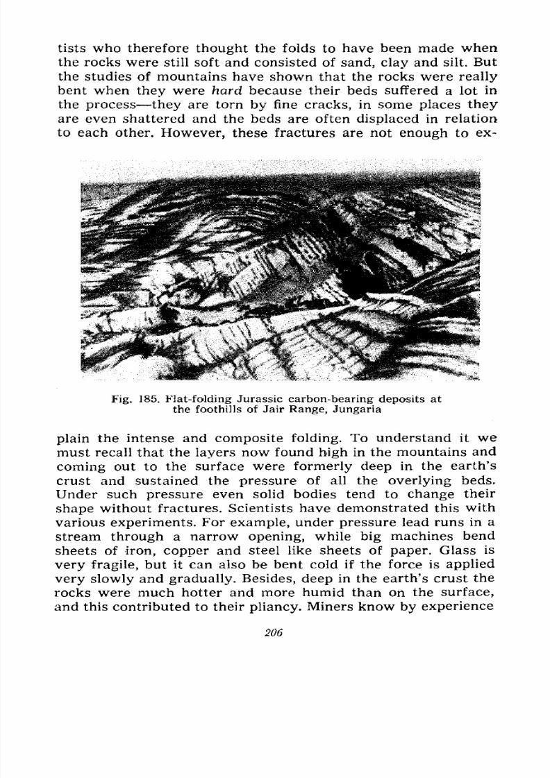
7/28/2019 Fundamentals of Geology - 19th century - Russia text in English
http://slidepdf.com/reader/full/fundamentals-of-geology-19th-century-russia-text-in-english 207/375
tists who therefore thought the folds to have been made when
the rocks were still soft and consisted of sand, clay and silt. But
the studies of mountains have shown that the rocks were really
bent when they were hard because their beds suffered a lot in
the process they are torn by fine cracks, in some places they
are even shattered and the beds are often displaced in relation
to each other. However, these fractures are not enough to ex-
Fig. 185. Flat-folding Jurassic carbon-bearing deposits at
the foothills of Jair Range, Jungaria
plain the intense and composite folding. To understand it we
must recall that the layers now found high in the mountains and
coming out to the surface were formerly deep in the earth's
crust and sustained the pressure of all the overlying beds.
Under such pressure even solid bodies tend to change their
shape without fractures. Scientists have demonstrated this with
various experiments. For example, under pressure lead runs in a
stream through a narrow opening, while big machines bend
sheets of iron, copper and steel like sheets of paper. Glass is
very fragile, but it can also be bent cold if the force is applied
very slowly and gradually. Besides, deep in the earth's crust the
rocks were much hotter and more humid than on the surface,
and this contributed to their pliancy. Miners know by experience
206
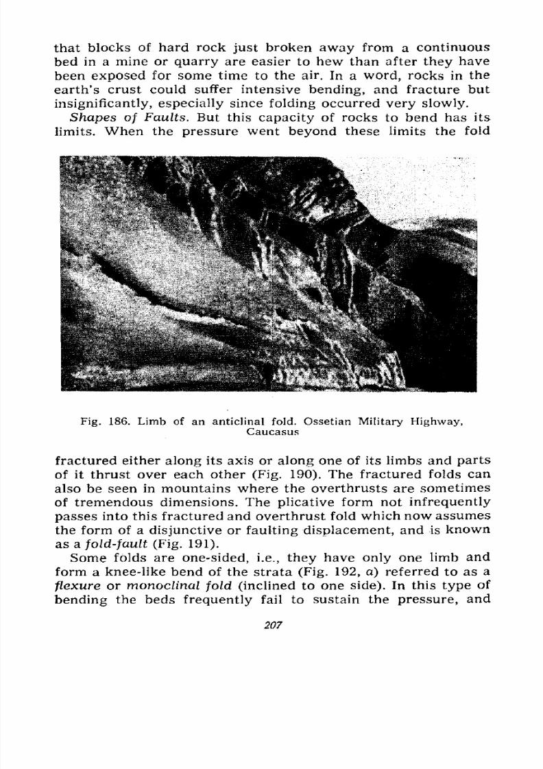
7/28/2019 Fundamentals of Geology - 19th century - Russia text in English
http://slidepdf.com/reader/full/fundamentals-of-geology-19th-century-russia-text-in-english 208/375
that blocks of hard rock just broken away from a continuous
bed in a mine or quarry are easier to hew than after they have
been exposed for some time to the air. In a word, rocks in the
earth's crust could suffer intensive bending, and fracture but
insignificantly, especially since folding occurred very slowly.
Shapes of Faults. But this capacity of rocks to bend has its
limits. When the pressure went beyond these limits the fold
Fig. 186. Limb of an anticlinal fold. Ossetian Military Highway,Caucasus
fractured either along its axis or along one of its limbs and parts
of it thrust over each other (Fig. 190). The fractured folds can
also be seen in mountains where the overthrusts are sometimes
of tremendous dimensions. The plicative form not infrequently
passes into this fractured and overthrust fold which now assumes
the form of a disjunctive or faulting displacement, and is known
as a fold-fault (Fig. 191).
Some folds are one-sided, i.e., they have only one limb andform a knee-like bend of the strata (Fig. 192, a) referred to as a
flexure or monoclinal fold (inclined to one side). In this type of
bending the beds frequently fail to sustain the pressure, and
207
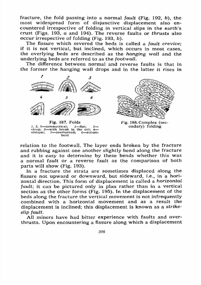
7/28/2019 Fundamentals of Geology - 19th century - Russia text in English
http://slidepdf.com/reader/full/fundamentals-of-geology-19th-century-russia-text-in-english 209/375
fracture, the fold passing into a normal fault (Fig. 192, b), the
most widespread form of disjunctive displacement also en-
countered irrespective of folding in vertical slips in the earth's
crust (Figs. 193, a and 194). The reverse faults or thrusts also
occur irrespective of folding (Fig. 193, b).
The fissure which severed the beds is called a fault crevice;
if it is not vertical, but inclined, which occurs in most cases,
the overlying beds are described as the hanging wall and the
underlying beds are referred to as the footwall.
The difference between normal and reverse faults is that in
the former the hanging wall drops and in the latter it rises in
Fig.187. Folds
1, 2, 3 symmetrical; 1 flat; 2
steep; 3 with break in the col; 4
oblique; 5 overturned; 6 recum-bent
Fig.188.
Complex (sec-ondary) folding
relation to the footwall. The layer ends broken by the fracture
and rubbing against one another slightly bend along the fracture
and it is easy to determine by these bends whether this was
a normal fault or a reverse fault as the comparison of both
parts will show (Fig. 193).
In a fracture the strata are sometimes displaced along the
fissure not upward or downward, but sideward, i.e., in a hori-
zontal direction. This form of displacement is called a horizontal
fault; it can be pictured only in plan rather than in a vertical
section as the other forms (Fig. 195). In the displacement of the
beds along the fracture the vertical movement is not infrequently
combined with a horizontal movement and as a result the
displacement is inclined; this displacement is known as a strike-
slip fault.
All miners have had bitter experience with faults and over-
thrusts. Upon encountering a fissure along which a displacement
208
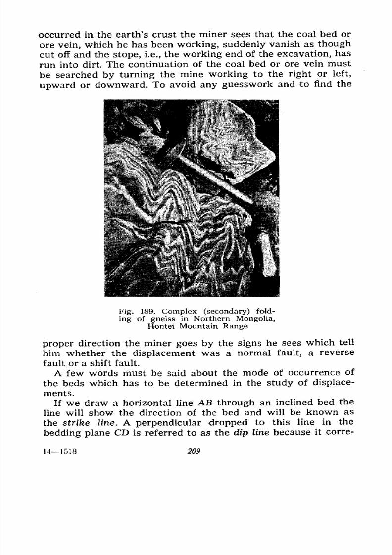
7/28/2019 Fundamentals of Geology - 19th century - Russia text in English
http://slidepdf.com/reader/full/fundamentals-of-geology-19th-century-russia-text-in-english 210/375
occurred in the earth's crust the miner sees that the coal bed or
ore vein, which he has been working, suddenly vanish as though
cut off and the stope, i.e., the working end of the excavation, has
run into dirt. The continuation of the coal bed or ore vein must
be searched by turning the mine working to the right or left,
upward or downward. To avoid any guesswork and to find the
Fig. 189. Complex (secondary) fold-
ingof gneiss in Northern Mongolia,
Hontei Mountain Range
proper direction the miner goes by the signs he sees which tell
him whether the displacement was a normal fault, a reverse
fault or a shift fault.
A few words must be said about the mode of occurrence of
the beds which has to be determined in the study of displace-
ments.
If we draw a horizontal line AB through an inclined bed theline will show the direction of the bed and will be known as
the strike line. A perpendicular dropped to this line in the
bedding plane CD is referred to as the dip line because it corre-
141518 209
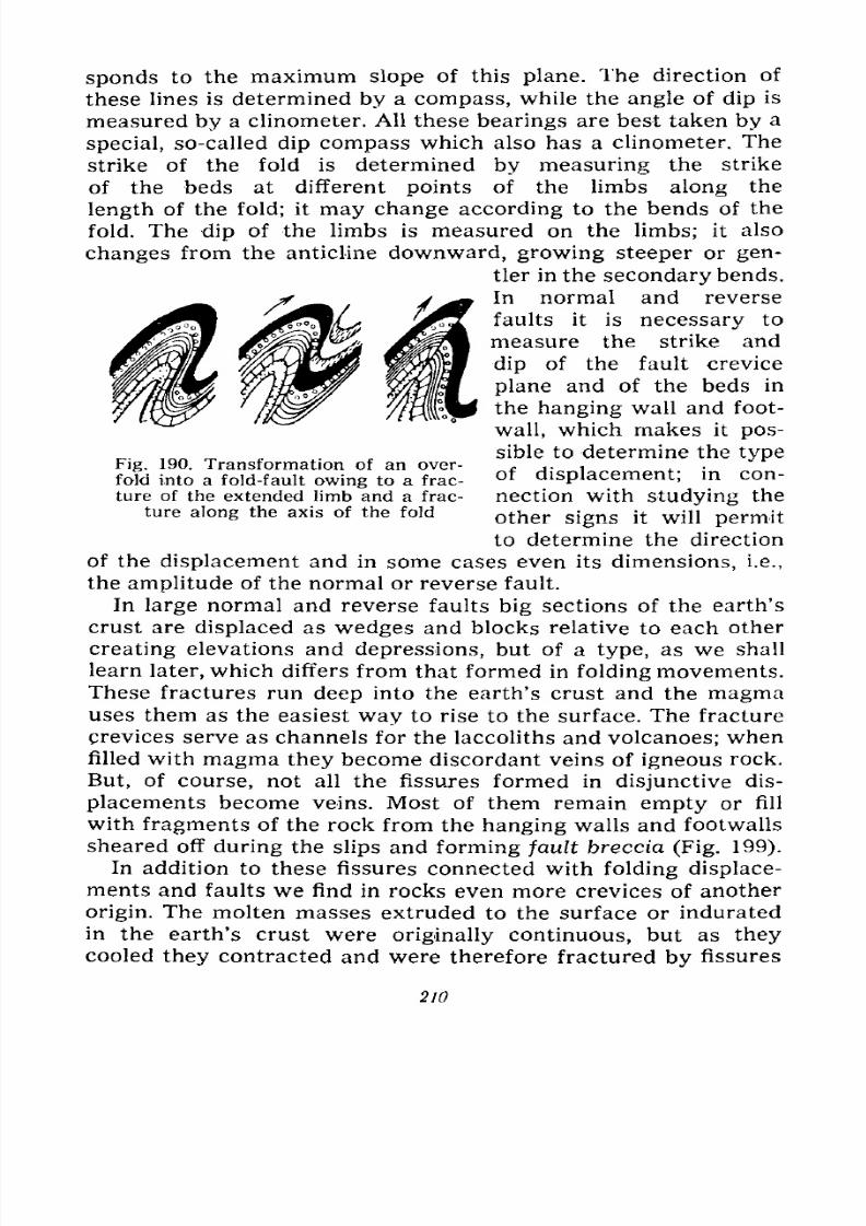
7/28/2019 Fundamentals of Geology - 19th century - Russia text in English
http://slidepdf.com/reader/full/fundamentals-of-geology-19th-century-russia-text-in-english 211/375
spends to the maximum slope of this plane. The direction of
these lines is determined by a compass, while the angle of dip is
measured by a clinometer. All these bearings are best taken by a
special, so-called dip compass which also has a clinometer. The
strike of the fold is determined by measuring the strike
of the beds at different points of the limbs along the
length of the fold; it may change according to the bends of the
fold. The dip of the limbs is measured on the limbs; it also
changes from the anticline downward, growing steeper or gen-
tler in the secondary bends.
In normal and reverse
faults it is necessary to
measure the strike and
dip of the fault crevice
plane and of the beds in
the hanging wall and foot-
wall, which makes it pos-
sible to determine the type
of displacement; in con-
nection with studying the
other signs it will permit
to determine the direction
of the displacement and in some cases even its dimensions, i.e.,
the amplitude of the normal or reverse fault.
In large normal and reverse faults big sections of the earth's
crust are displaced as wedges and blocks relative to each other
creating elevations and depressions, but of a type, as we shall
learn later, which differs from that formed in folding movements.
These fractures run deep into the earth's crust and the magma
uses them as the easiest way to rise to the surface. The fracture
crevices serve as channels for the laccoliths and volcanoes; when
filled with magma they become discordant veins of igneous rock.
But, of course, not all the fissures formed in disjunctive dis-
placements become veins. Most of them remain empty or fill
with fragments of the rock from the hanging walls and footwalls
sheared off during the slips and forming fault breccia (Fig. 199).
In addition to these fissures connected with folding displace-
ments and faults we find in rocks even more crevices of another
origin. The molten masses extruded to the surface or indurated
in the earth's crust were originally continuous, but as they
cooled they contracted and were therefore fractured by fissures
Fig. 190. Transformation of an over-
fold into a fold-fault owing to a frac-
ture of the extended limb and a frac-
ture along the axis of the fold
210
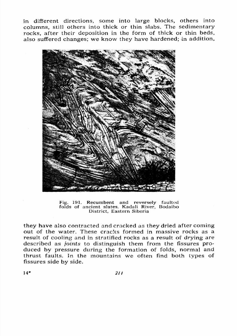
7/28/2019 Fundamentals of Geology - 19th century - Russia text in English
http://slidepdf.com/reader/full/fundamentals-of-geology-19th-century-russia-text-in-english 212/375
in different directions, some into large blocks, others into
columns, still others into thick or thin slabs. The sedimentary
rocks, after their deposition in the form of thick or thin beds,
also suffered changes; we know they have hardened; in addition,
Fig. 191. Recumbent and reversely faulted
folds of ancient slates. Kadali River, Bodaibo
District, Eastern Siberia
they have also contracted and cracked as they dried after coming
out of the water. These cracks formed in massive rocks as a
result of cooling and in stratified rocks as a result of drying are
described as joints to distinguish them from the fissures pro-duced by pressure during the formation of folds, normal and
thrust faults. In the mountains we often find both types of
fissures side by side.
14* 21t
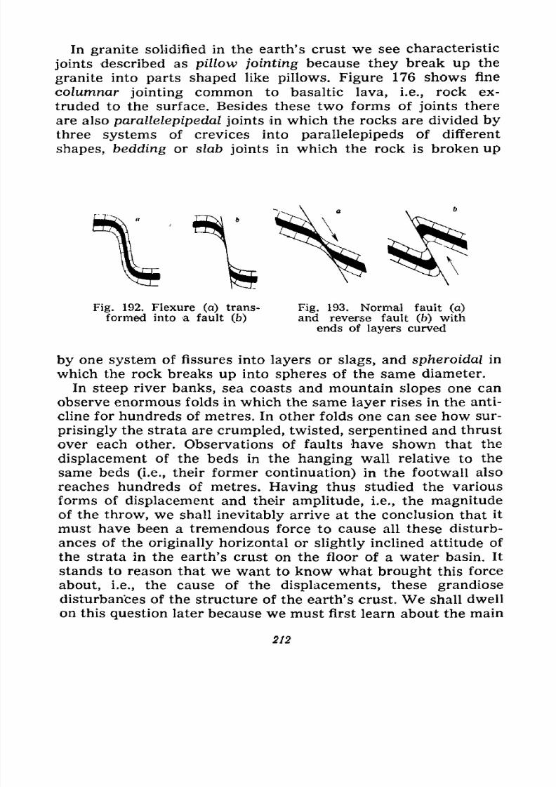
7/28/2019 Fundamentals of Geology - 19th century - Russia text in English
http://slidepdf.com/reader/full/fundamentals-of-geology-19th-century-russia-text-in-english 213/375
In granite solidified in the earth's crust we see characteristic
joints described as pillow jointing because they break up the
granite into parts shaped like pillows. Figure 176 shows fine
columnar jointing common to basaltic lava, i.e., rock ex-
truded to the surface. Besides these two forms of joints there
are also parallelepipedal joints in which the rocks are divided by
three systems of crevices into parallelepipeds of different
shapes, bedding or slab joints in which the rock is broken up
Fig. 192. Flexure (a) trans- Fig. 193. Normal fault (a)
formed into a fault (b) and reverse fault (b) with
ends of layers curved
by one system of fissures into layers or slags, and spheroidal in
which the rock breaks up into spheres of the same diameter.
In steep river banks, sea coasts and mountain slopes one can
observe enormous folds in which the same layer rises in the anti-
cline for hundreds of metres. In other folds one can see how sur-
prisingly the strata are crumpled, twisted, serpentined and thrust
over each other. Observations of faults have shown that the
displacement of the beds in the hanging wall relative to the
same beds (i.e., their former continuation) in the footwall also
reaches hundreds of metres. Having thus studied the various
forms of displacement and their amplitude, i.e., the magnitude
of the throw, we shall inevitably arrive at the conclusion that it
must have been a tremendous force to cause all these disturb-
ances of the originally horizontal or slightly inclined attitude of
the strata in the earth's crust on the floor of a water basin. It
stands to reason that we want to know what brought this force
about, i.e., the cause of the displacements, these grandiose
disturbances of the structure of the earth's crust. We shall dwell
on this question later because we must first learn about the main
212
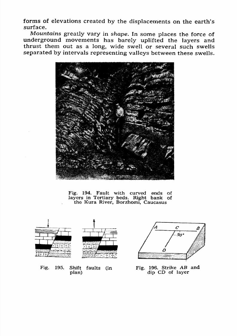
7/28/2019 Fundamentals of Geology - 19th century - Russia text in English
http://slidepdf.com/reader/full/fundamentals-of-geology-19th-century-russia-text-in-english 214/375
forms of elevations created by the displacements on the earth's
surface.
Mountains greatly vary in shape. In some places the force of
underground movements has barely uplifted the layers and
thrust them out as along, wide swell or several such swells
separated by intervals representing valleys between these swells.
SI
Fig. 194. Fault with curved ends of
layers in Tertiary beds. Right bank of
the Kura River, Borzhomi, Caucasus
Fig. 195. Shift faults (in
plan)
Fig. 196. Strike AB and
dip CD of layer
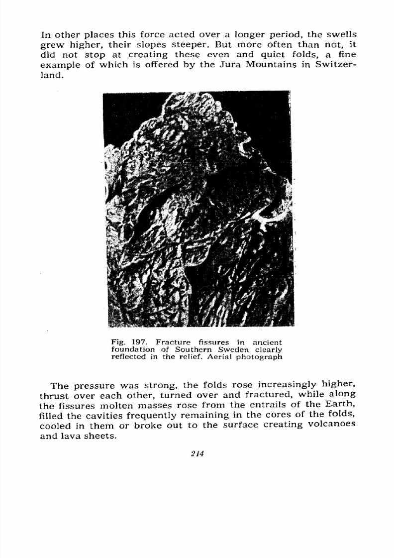
7/28/2019 Fundamentals of Geology - 19th century - Russia text in English
http://slidepdf.com/reader/full/fundamentals-of-geology-19th-century-russia-text-in-english 215/375
In other places this force acted over a longer period, the swells
grew higher, their slopes steeper. But more often than not, it
did not stop at creating these even and quiet folds, a fine
example of which is offered by the Jura Mountains in Switzer-
land.
Fig. 197. Fracture fissures in ancient
foundation of Southern Sweden clearly
reflected in the relief. Aerial photograph
The pressure was strong, the folds rose increasingly higher,
thrust over each other, turned over and fractured, while along
the fissures molten masses rose from the entrails of the Earth,
filled the cavities frequently remaining in the cores of the folds,
cooled in them or broke out to the surface creating volcanoes
and lava sheets.
214
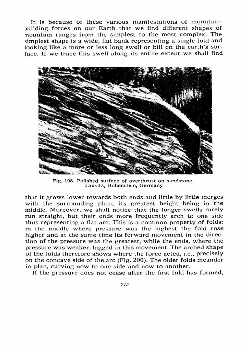
7/28/2019 Fundamentals of Geology - 19th century - Russia text in English
http://slidepdf.com/reader/full/fundamentals-of-geology-19th-century-russia-text-in-english 216/375
It is because of these various manifestations of mountain-
Duilding forces on our Earth that we find different shapes of
-nountain ranges from the simplest to the most complex. The
simplest shape is a wide, flat bank representing a single fold and
looking like a more or less long swell or hill on the earth's sur-
face. If we trace this swell along its entire extent we shall find
Fig. 198. Polished surface of overthrust on sandstone,
Lausitz, Hohenstein, Germany
that it grows lower towards both ends and little by little merges
with the surrounding plain, its greatest height being in the
middle. Moreover, we shall notice that the longer swells rarely
run straight, but their ends more frequently arch to one side
thus representing a flat arc. This is a common property of folds:
in the middle where pressure was the highest the fold rose
higher and at the same time its forward movement in the direc-
tion of the pressure was the greatest, while the ends, where the
pressure was weaker, lagged in this movement. The arched shape
of the folds therefore shows where the force acted, i.e., preciselyon the concave side of the arc (Fig. 200). The older folds meander
in plan, curving now to one side and now to another.
If the pressure does not cease after the first fold has formed,
215
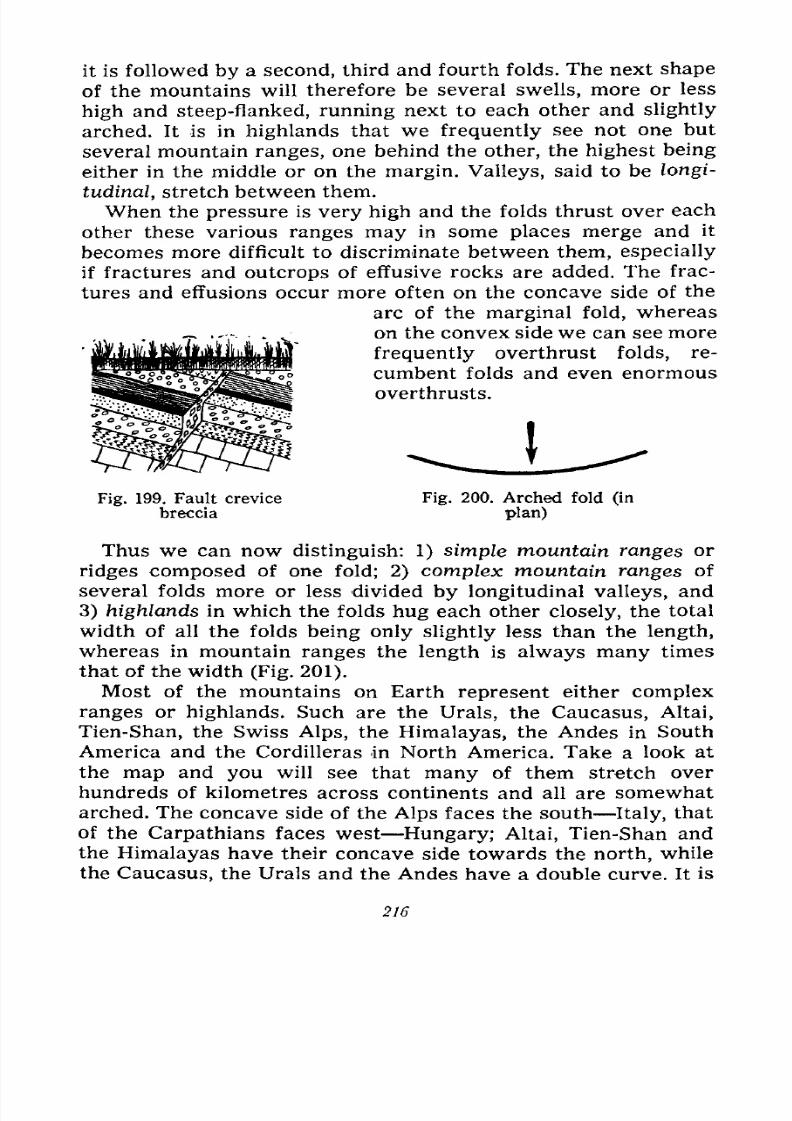
7/28/2019 Fundamentals of Geology - 19th century - Russia text in English
http://slidepdf.com/reader/full/fundamentals-of-geology-19th-century-russia-text-in-english 217/375
it is followed by a second, third and fourth folds. The next shape
of the mountains will therefore be several swells, more or less
high and steep-flanked, running next to each other and slightly
arched. It is in highlands that we frequently see not one but
several mountain ranges, one behind the other, the highest being
either in the middle or on the margin. Valleys, said to be longi-
tudinal, stretch between them.
When the pressure is very high and the folds thrust over each
other these various ranges may in some places merge and it
becomes more difficult to discriminate between them, especially
if fractures and outcrops of effusive rocks are added. The frac-
tures and effusions occur more often on the concave side of the
arc of the marginal fold, whereas
on the convex side we can see more
frequently overthrust folds, re-
cumbent folds and even enormous
overthrusts.
Fig. 199. Fault crevice
breccia
Fig. 200. Arched fold (in
plan)
Thus we can now distinguish: 1) simple mountain ranges or
ridges composed of one fold; 2) complex mountain ranges of
several folds more or less divided by longitudinal valleys, and
3) highlands in which the folds hug each other closely, the total
width of all the folds being only slightly less than the length,
whereas in mountain ranges the length is always many timesthat of the width (Fig. 201).
Most of the mountains on Earth represent either complex
ranges or highlands. Such are the Urals, the Caucasus, Altai,
Tien-Shan, the Swiss Alps, the Himalayas, the Andes in South
America and the Cordilleras in North America. Take a look at
the map and you will see that many of them stretch over
hundreds of kilometres across continents and all are somewhat
arched. The concave side of the Alps faces the south Italy, thatof the Carpathians faces west Hungary; Altai, Tien-Shan and
the Himalayas have their concave side towards the north, while
the Caucasus, the Urals and the Andes have a double curve. It is
216
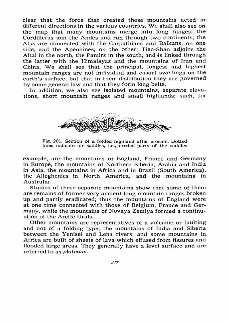
7/28/2019 Fundamentals of Geology - 19th century - Russia text in English
http://slidepdf.com/reader/full/fundamentals-of-geology-19th-century-russia-text-in-english 218/375
clear that the force that created these mountains acted in
different directions in the various countries. We shall also see on
the map that many mountains merge into long ranges: the
Cordilleras join the Andes and run through two continents; the
Alps are connected with the Carpathians and Balkans, on one
side, and the Apennines, on the other; Tien-Shan adjoins the
Altai in the north, the Pamirs in the south, and is linked through
the latter with the Himalayas and the mountains of Iran and
China. We shall see that the principal, longest and highest
mountain ranges are not individual and casual swellings on the
earth's surface, but that in their distribution they are governed
by some general law and that they form long belts.
In addition, we also see isolated mountains, separate eleva-
tions, short mountain ranges and small highlands; such, for
Fig. 201. Section of a folded highland after erosion. Dottedlines indicate air saddles, i.e., eroded parts of the saddles
example, are the mountains of England, France and Germanyin Europe, the mountains of Northern Siberia, Arabia and India
in Asia, the mountains in Africa and in Brazil (South America),
the Alleghenies in North America, and the mountains in
Australia.
Studies of these separate mountains show that some of themare remains of former very ancient long mountain ranges broken
up and partly eradicated; thus the mountains of England were
at one time connected with those of Belgium, France and Ger-
many, while the mountains of Novaya Zemlya formed a continu-
ation of the Arctic Urals.
Other mountains are representatives of a volcanic or faulting
and not of a folding type; the mountains of India and Siberia
between the Yenisei and Lena rivers, and some mountains in
Africa are built of sheets of lava which effused from fissures and
flooded large areas. They generally have a level surface and are
referred to as plateaus.
217
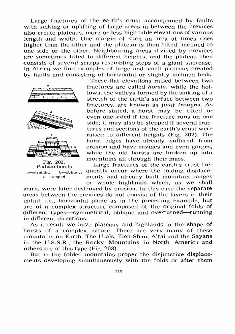
7/28/2019 Fundamentals of Geology - 19th century - Russia text in English
http://slidepdf.com/reader/full/fundamentals-of-geology-19th-century-russia-text-in-english 219/375
Large fractures of the earth's crust accompanied by faults
with sinking or uplifting of large areas in between the crevices
also create plateaus, more or less high table elevations of various
length and width. One margin of such an area at times rises
higher than the other and the plateau is then tilted, inclined to
one side or the other. Neighbouring areas divided by crevices
are sometimes lifted to different heights, and the plateau then
consists of several scarps resembling steps of a giant staircase.
In Africa we find examples of large and small plateaus created
by faults and consisting of horizontal or slightly inclined beds.
These flat elevations raised between two
^ , , ,-,-.,....Afractures are called horsts, while the hol-
lows, the valleys formed by the sinking of a
stretch of the earth's surface between two
fractures, are known as fault troughs. As
before stated, a horst may be tilted or
even one-sided if the fracture runs on one
side; it may also be stepped if several frac-
tures and sections of the earth's crust were
raised to different heights (Fig. 202). The
horst edges have already suffered from
erosion and have ravines and even gorges,
while the old horsts are broken up into
mountains all through their mass.
Large fractures of the earth's crust fre-
t> obhque; quently occur where the folding displace-
ments had already built mountain ranges
or whole highlands which, as we shall
learn, were later destroyed by erosion. In this case the separate
areas between the crevices do not consist of the layers in their
initial, i.e., horizontal plane as in the preceding example, but
are of a complex structure composed of the original folds of
different types symmetrical, oblique and overturned running
in different directions.
As a result we have plateaus and highlands in the shape of
horsts of a complex nature. There are very many of these
mountains on Earth. The Urals, Tien-Shan, Altai and the Sayans
in the U.S.S.R., the Rocky Mountains in North America andothers are of this type (Fig. 203).
But in the folded mountains proper the disjunctive displace-
ments developing simultaneously with the folds or after them
g."." a
Fig. 202.
Plateau-horsts
a straight;
c stepped
218
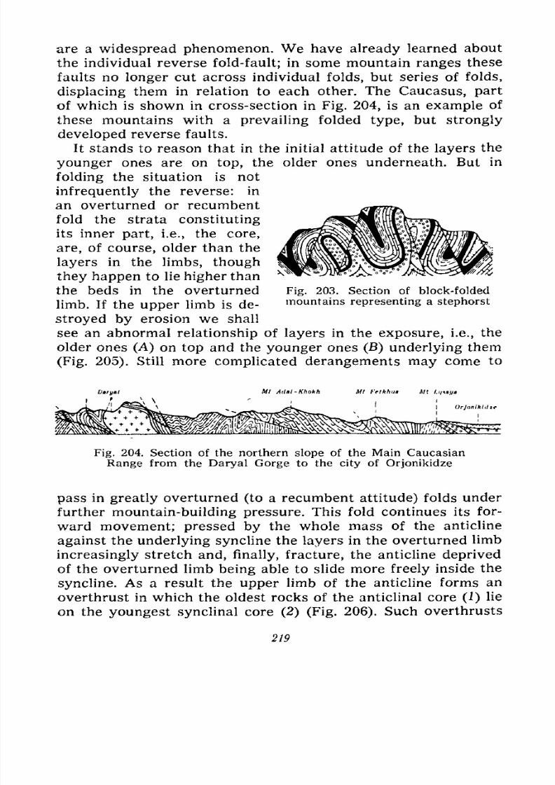
7/28/2019 Fundamentals of Geology - 19th century - Russia text in English
http://slidepdf.com/reader/full/fundamentals-of-geology-19th-century-russia-text-in-english 220/375
are a widespread phenomenon. We have already learned about
the individual reverse fold-fault; in some mountain ranges these
faults no longer cut across individual folds, but series of folds,
displacing them in relation to each other. The Caucasus, part
of which is shown in cross-section in Fig. 204, is an example of
these mountains with a prevailing folded type, but strongly
developed reverse faults.
It stands to reason that in the initial attitude of the layers the
younger ones are on top, the older ones underneath. But in
folding the situation is not
infrequently the reverse: in
an overturned or recumbent
fold the strata constituting
its inner part, i.e., the core,
are, of course, older than the
layers in the limbs, though
they happen to lie higher than
Fig. 203. Section of block-folded
mountains representing a stephorst
the beds in the overturned
limb. If the upper limb is de-
stroyed by erosion we shall
see an abnormal relationship of layers in the exposure, i.e., the
older ones (A) on top and the younger ones (B) underlying them
(Fig. 205). Still more complicated derangements may come to
Mt Adai-Khokh Ml Fettthtia Ml /,</*//
I Orjonikiilte
Fig. 204. Section of the northern slopeof
the Main CaucasianRange from the Daryal Gorge to the city of Orjonikidze
pass in greatly overturned (to a recumbent attitude) folds under
further mountain-building pressure. This fold continues its for-
ward movement; pressed by the whole mass of the anticline
against the underlying syncline the layers in the overturned limb
increasingly stretch and, finally, fracture, the anticline deprived
of the overturned limb being able to slide more freely inside the
syncline. As a result the upper limb of the anticline forms an
overthrust in which the oldest rocks of the anticlinal core (1) lie
on the youngest synclinal core (2) (Fig. 206). Such overthrusts
219
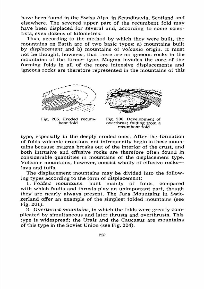
7/28/2019 Fundamentals of Geology - 19th century - Russia text in English
http://slidepdf.com/reader/full/fundamentals-of-geology-19th-century-russia-text-in-english 221/375
have been found in the Swiss Alps, in Scandinavia, Scotland and
elsewhere. The severed upper part of the recumbent fold mayhave been displaced for several and, according to some scien-
tists, even dozens of kilometres.
Thus, according to the method by which they were built, the
mountains on Earth are of two basic types: a) mountains built
by displacement and b) mountains of volcanic origin. It must
not be thought, however, that there are no igneous rocks in the
mountains of the former type. Magma invades the core of the
forming folds in all of the more intensive displacements and
igneous rocks are therefore represented in the mountains of this
Fig. 205. Eroded recum-
bent fold
Fig. 206. Development of
overthrust folding from a
recumbent fold
type, especially in the deeply eroded ones. After the formation
of folds volcanic eruptions not infrequently begin in these moun-
tains because magma breaks out of the interior of the crust, and
both intrusive and effusive rocks are therefore often found in
considerable quantities in mountains of the displacement type.
Volcanic mountains, however, consist wholly of effusive rocks
lava and tuffs.
The displacement mountains may be divided into the follow-
ing types according to the form of displacement:
1. Folded mountains, built mainly of folds, comparedwith which faults and thrusts play an unimportant part, though
they are nearly always present. The Jura Mountains in Swit-
zerland offer an example of the simplest folded mountains (see
Fig. 201).
2. Overthrust mountains, in which the folds were greatly com-plicated by simultaneous and later thrusts and overthrusts. This
type is widespread; the Urals and the Caucasus are mountains
of this type in the Soviet Union (see Fig. 204).
220
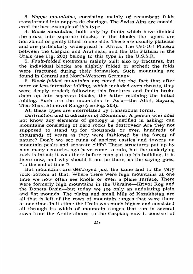
7/28/2019 Fundamentals of Geology - 19th century - Russia text in English
http://slidepdf.com/reader/full/fundamentals-of-geology-19th-century-russia-text-in-english 222/375
3. Nappe mountains, consisting mainly of recumbent folds
transformed into nappes de chariage. The Swiss Alps are consid-
ered the best example of this type.
4. BZocfe mountains, built only by faults which have divided
the crust into separate blocks; in the blocks the layers are
horizontal or gently tilted to one side. These are usually plateaus
and are particularly widespread in Africa. The Ust-Urt Plateau
between the Caspian and Aral seas, and the Ufa Plateau in the
Urals (see Fig. 202) belong to this type in the U.S.S.R.
5. Fault-folded mountains mainly built also by fractures, but
the individual blocks are slightly folded or arched; the folds
were fractured during their formation. Such mountains are
found in Central and North-Western Germany.6. Block-folded mountains are noted for the fact that after
more or less intensive folding, which included even thrusts, they
were deeply eroded; following this fractures and faults broke
them up into separate blocks, the latter retaining the initial
folding. Such are the mountains in Asia the Altai, Sayans,
Tien-Shan, Stanovoi Range (see Fig. 203).
All these types are interrelated by transitional forms.
Destruction and Eradication of Mountains. A person who does
not know any elements of geology is justified in asking: can
mountains consisting of hard rocks be destroyed? Are they not
supposed to stand up for thousands or even hundreds of
thousands of years as they were fashioned by the forces of
nature? Don't we see ruins of ancient castles and towers on
mountain peaks and separate cliffs? These structures put up byman many centuries ago have come to ruin, but the underlying
rock is intact; it was there before man put up his building, it is
there now, and why should it not be there, as the saying goes,
"to the end of time"?
But mountains are destroyed just the same and to the very
rock bottom at that. Where there were high mountains at one
time we now often see knolls or even a plane surface. There
were formerly high mountains in the Ukraine Krivoi Rog and
the Donets Basin but today we see only an undulating plain
and flat mounds. The plains and small hills of Kazakhstan are
all that is left of the rows of mountain ranges that were thereat one time. In its time the Urals was much higher and consisted
all through its width of mountain ranges that ran in several
rows from the Arctic almost to the Caspian; now it consists of
221
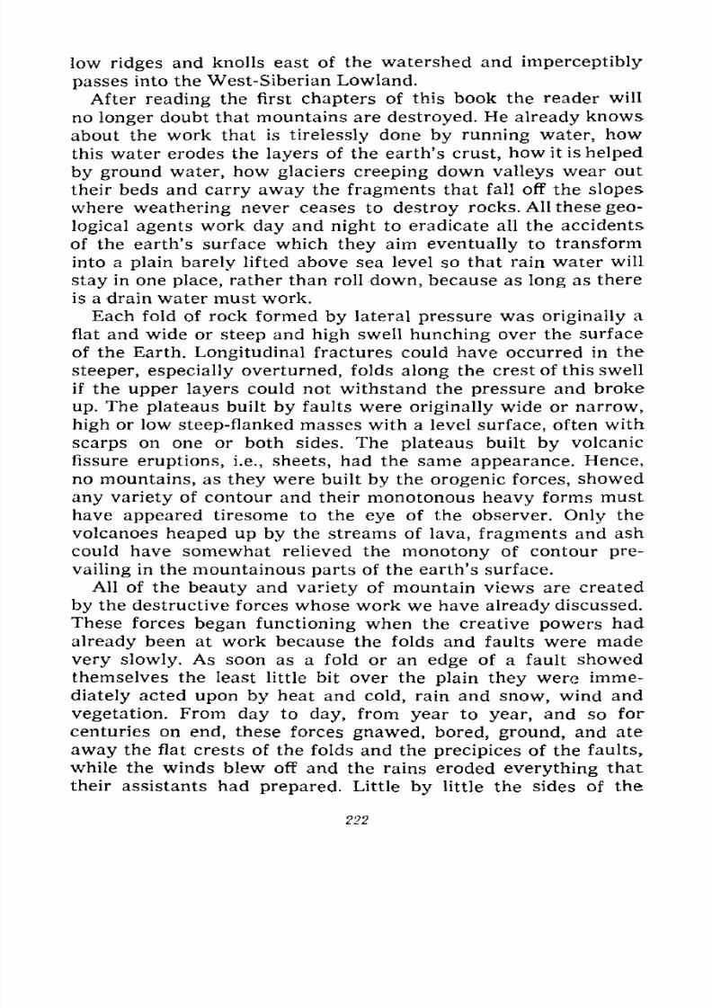
7/28/2019 Fundamentals of Geology - 19th century - Russia text in English
http://slidepdf.com/reader/full/fundamentals-of-geology-19th-century-russia-text-in-english 223/375
low ridges and knolls east of the watershed and imperceptibly
passes into the West-Siberian Lowland.
After reading the first chapters of this book the reader will
no longer doubt that mountains are destroyed. He already knows
about the work that is tirelessly done by running water, how
this water erodes the layers of the earth's crust, how it is helped
by ground water, how glaciers creeping down valleys wear out
their beds and carry away the fragments that fall off the slopes
where weathering never ceases to destroy rocks. All these geo-
logical agents work day and night to eradicate all the accidents
of the earth's surface which they aim eventually to transform
into a plain barely lifted above sea level so that rain water will
stay in one place, rather than roll down, because as long as there
is a drain water must work.
Each fold of rock formed by lateral pressure was originally a
flat and wide or steep and high swell hunching over the surface
of the Earth. Longitudinal fractures could have occurred in the
steeper, especially overturned, folds along the crest of this swell
if the upper layers could not withstand the pressure and broke
up. The plateaus built by faults were originally wide or narrow,
high or low steep-flanked masses with a level surface, often with
scarps on one or both sides. The plateaus built by volcanic
fissure eruptions, i.e., sheets, had the same appearance. Hence,
no mountains, as they were built by the orogenic forces, showed
any variety of contour and their monotonous heavy forms must
have appeared tiresome to the eye of the observer. Only the
volcanoes heaped up by the streams of lava, fragments and ash
could have somewhat relieved the monotony of contour pre-
vailing in the mountainous parts of the earth's surface.
All of the beauty and variety of mountain views are created
by the destructive forces whose work we have already discussed.
These forces began functioning when the creative powers had
already been at work because the folds and faults were made
very slowly. As soon as a fold or an edge of a fault showed
themselves the least little bit over the plain they were imme-
diately acted upon by heat and cold, rain and snow, wind and
vegetation. From day to day, from year to year, and so for
centuries on end, these forces gnawed, bored, ground, and ate
away the flat crests of the folds and the precipices of the faults,
while the winds blew off and the rains eroded everything that
their assistants had prepared. Little by little the sides of the
222
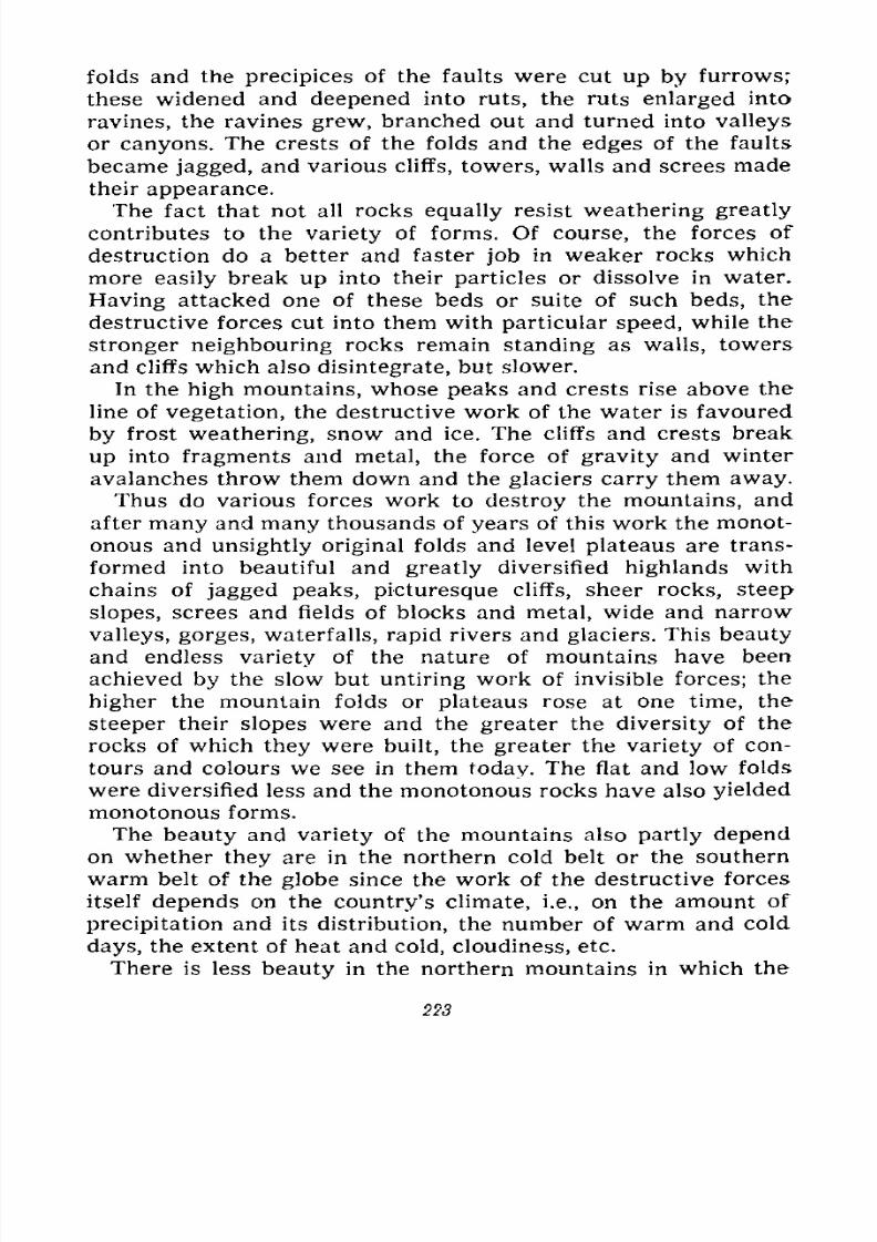
7/28/2019 Fundamentals of Geology - 19th century - Russia text in English
http://slidepdf.com/reader/full/fundamentals-of-geology-19th-century-russia-text-in-english 224/375
folds and the precipices of the faults were cut up by furrows;
these widened and deepened into ruts, the ruts enlarged into
ravines, the ravines grew, branched out and turned into valleys
or canyons. The crests of the folds and the edges of the faults
became jagged, and various cliffs, towers, walls and screes made
their appearance.
The fact that not all rocks equally resist weathering greatly
contributes to the variety of forms. Of course, the forces of
destruction do a better and faster job in weaker rocks which
more easily break up into their particles or dissolve in water.
Having attacked one of these beds or suite of such beds, the
destructive forces cut into them with particular speed, while the
stronger neighbouring rocks remain standing as walls, towers
and cliffs which also disintegrate, but slower.
In the high mountains, whose peaks and crests rise above the
line of vegetation, the destructive work of the water is favoured
by frost weathering, snow and ice. The cliffs and crests break
up into fragments and metal, the force of gravity and winter
avalanches throw them down and the glaciers carry them away.
Thus do various forces work to destroy the mountains, and
after many and many thousands of years of this work the monot-
onous and unsightly original folds and level plateaus are trans-
formed into beautiful and greatly diversified highlands with
chains of jagged peaks, picturesque cliffs, sheer rocks, steep
slopes, screes and fields of blocks and metal, wide and narrow
valleys, gorges, waterfalls, rapid rivers and glaciers. This beauty
and endless variety of the nature of mountains have been
achieved by the slow but untiring work of invisible forces; the
higher the mountain folds or plateaus rose at one time, the
steeper their slopes were and the greater the diversity of the
rocks of which they were built, the greater the variety of con-
tours and colours we see in them today. The flat and low folds
were diversified less and the monotonous rocks have also yielded
monotonous forms.
The beauty and variety of the mountains also partly depend
on whether they are in the northern cold belt or the southern
warm belt of the globe since the work of the destructive forces
itself depends on the country's climate, i.e., on the amount of
precipitation and its distribution, the number of warm and cold
days, the extent of heat and cold, cloudiness, etc.
There is less beauty in the northern mountains in which the
223
7/28/2019 Fundamentals of Geology - 19th century - Russia text in English
http://slidepdf.com/reader/full/fundamentals-of-geology-19th-century-russia-text-in-english 225/375
winter reigns too long and the summer is too short and humid;
in winter the destructive forces slumber under the heavy coat of
snow and only individual cliffs protruding from under the snow
are open to weathering; but water, one of the major agents of
destruction, is inactive many months of the year and does but
little work in the river beds under the ice. Because of the abun-
dance of moisture the mountain slopes are covered with dense
forests and moss carpets which also retard the work of a part
of the destructive forces. The valleys are very marshy or are
overgrown with shrubbery and the rivers receive little material
to carry down. The entire course of weathering is retarded, there
are but few cliffs and rocks, and there is hardly anything to do
for the wind, sun and frost.
Only in the Far North, within the Arctic Circle, where there
is hardly any vegetation, are the mountains beautiful again, but
their beauty is rather monotonous. Not infrequently sharp ridges
and cliffs jut out from under the thick coat of snow and ice, and
sheer slopes that can hold no snow loom black. Frost and wind
work alternately on these ridges, cliffs and slopes all through the
long winter, spring and autumn; the sun and water work during
the short summer, and only snow and ice are active on the rest
of the area. These mountains of the Far North can be comparedwith the uppermost parts of the high mountains rising in the realm
of eternal winter in the other zones of the Earth. Both here and
there the destructive forces are the same and they act similarly.
In the south where the foothills are in a warm and humid
climate and the peaks are crowned with snow the beauty and
variety of the mountains manifest themselves with particular
force because all the destructive powers work most successfully.
But the tall mountains of the deserts are also beautiful, thoughtheirs is a special beauty. Here, almost from top to bottom, is
the kingdom of bare rock; everywhere there are bare cliffs,
ridges and screes; the gentler slopes are covered with scant
wisps of grass or small bushes, while the floors of valleys along
rare springs give asylum to small groves of trees and shrubs,
and small overgrowths of reed which offer shelter to the
traveller and food to his animals. But these mountains very
greatly vary in form and are thoroughly and deeply disjointed;
here the forces of destruction work diligently, but not all alike.
Here there is too little moisture and too little vegetation, and the
weathering conditioned by vegetation and the water that seeps
224
7/28/2019 Fundamentals of Geology - 19th century - Russia text in English
http://slidepdf.com/reader/full/fundamentals-of-geology-19th-century-russia-text-in-english 226/375
Fig.207.
Alpine-type formsin
moderateclimate.
Mt. Matterhorn, Swiss Alps
Fig. 208. Alpine relief. Belukha Peak and morainic
lake on the Berelsky Pass, Altai
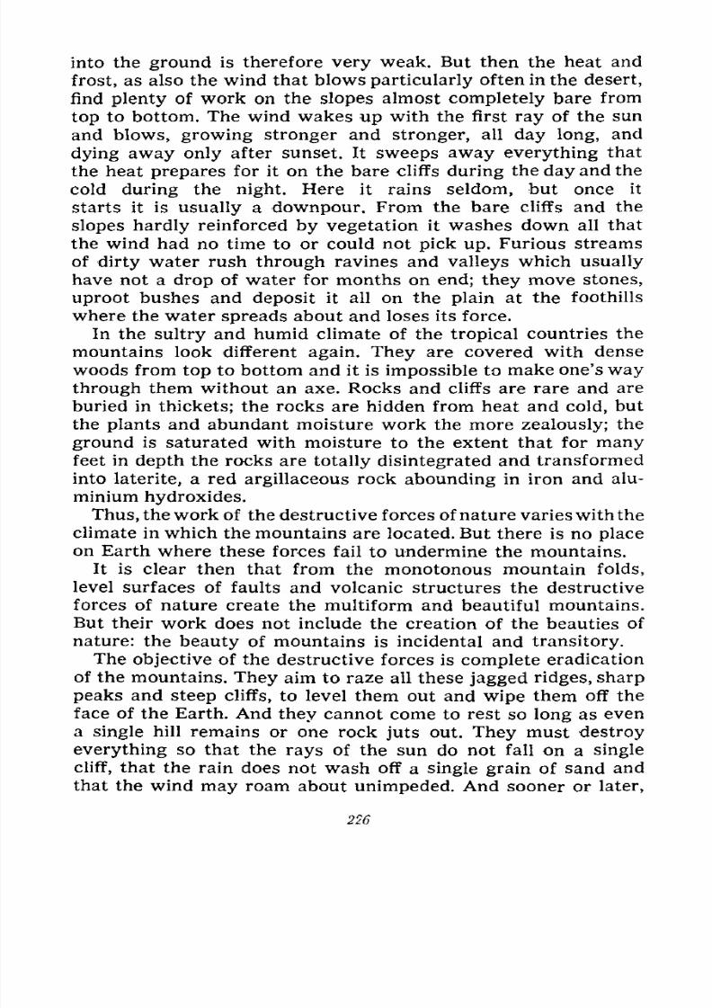
7/28/2019 Fundamentals of Geology - 19th century - Russia text in English
http://slidepdf.com/reader/full/fundamentals-of-geology-19th-century-russia-text-in-english 227/375
into the ground is therefore very weak. But then the heat and
frost, as also the wind that blows particularly often in the desert,
find plenty of work on the slopes almost completely bare from
top to bottom. The wind wakes up with the first ray of the sun
and blows, growing stronger and stronger, all day long, and
dying away only after sunset. It sweeps away everything that
the heat prepares for it on the bare cliffs during the day and the
cold during the night. Here it rains seldom, but once it
starts it is usually a downpour. From the bare cliffs and the
slopes hardly reinforced by vegetation it washes down all that
the wind had no time to or could not pick up. Furious streams
of dirty water rush through ravines and valleys which usually
have not a drop of water for months on end; they move stones,
uproot bushes and deposit it all on the plain at the foothills
where the water spreads about and loses its force.
In the sultry and humid climate of the tropical countries the
mountains look different again. They are covered with dense
woods from top to bottom and it is impossible to make one's way
through them without an axe. Rocks and cliffs are rare and are
buried in thickets; the rocks are hidden from heat and cold, but
the plants and abundant moisture work the more zealously; the
ground is saturated with moisture to the extent that for manyfeet in depth the rocks are totally disintegrated and transformed
into laterite, a red argillaceous rock abounding in iron and alu-
minium hydroxides.
Thus, the work of the destructive forces of nature varies with the
climate in which the mountains are located. But there is no place
on Earth where these forces fail to undermine the mountains.
It is clear then that from the monotonous mountain folds,
level surfaces of faults and volcanic structures the destructive
forces of nature create the multiform and beautiful mountains.
But their work does not include the creation of the beauties of
nature: the beauty of mountains is incidental and transitory.
The objective of the destructive forces is complete eradication
of the mountains. They aim to raze all these jagged ridges, sharp
peaks and steep cliffs, to level them out and wipe them off the
face of the Earth. And they cannot come to rest so long as even
a single hill remains or one rock juts out. They must destroy
everything so that the rays of the sun do not fall on a single
cliff, that the rain does not wash off a single grain of sand and
that the wind may roam about unimpeded. And sooner or later,
226

7/28/2019 Fundamentals of Geology - 19th century - Russia text in English
http://slidepdf.com/reader/full/fundamentals-of-geology-19th-century-russia-text-in-english 228/375
depending on the height of the mountains and the hardness of
the rocks, the destroyers achieve their aim and the beautiful
mountains vanish from the face of the Earth.
If we compare the different mountain ranges on our Earth
with each other we shall find that not all of them by far have
the same height or similar contours. In some places we see
Fig. 209. Mountains of medium height. Valley of the Yenisei
River below the Bolshoi (Grand) Rapid
such high and beautiful mountains as the Altai, the Caucasusor the Swiss Alps with their deep and narrow gorges, sharp
peaks and ridges, and steep and rocky slopes; in a word
mountains that are generally referred to as Alps or Alpine (Figs.
207 and 208) because of their resemblance to the Swiss Alps
which were the first to be well studied and therefore serve as a
criterion. In other places we see mountains that are not so tall
and not so beautiful, with rounded, dome-like peaks, straight or
undulating wide ridges, gentler slopes and fewer cliffs, preci-
pices and canyons. Such are the mountains of the Central Urals
and many areas in Siberia (Fig. 209) and South Germany. These
are mountains of medium height.
15* 227
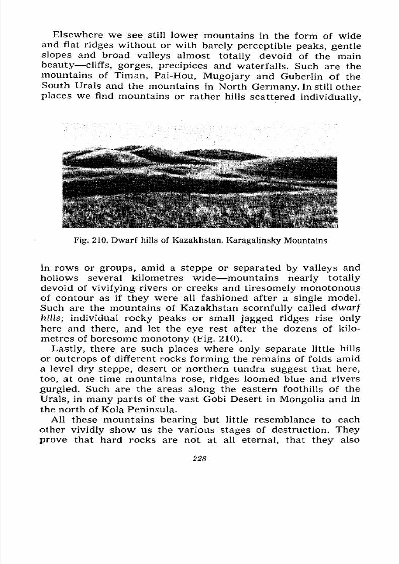
7/28/2019 Fundamentals of Geology - 19th century - Russia text in English
http://slidepdf.com/reader/full/fundamentals-of-geology-19th-century-russia-text-in-english 229/375
Elsewhere we see still lower mountains in the form of wideand flat ridges without or with barely perceptible peaks, gentle
slopes and broad valleys almost totally devoid of the main
beauty cliffs, gorges, precipices and waterfalls. Such are the
mountains of Timan, Pai-Hou,Mugojary
and Guberlin of the
South Urals and the mountains in North Germany. In still other
places we find mountains or rather hills scattered individually,
Fig. 210. Dwarf hills of Kazakhstan. Karagalinsky Mountains
in rows or groups, amid a steppe or separated by valleys and
hollows several kilometres wide mountains nearly totally
devoid of vivifying rivers or creeks and tiresomely monotonous
of contour as if they were all fashioned after a single model.
Such are the mountains of Kazakhstan scornfully called dwarf
hills; individual rocky peaks or small jagged ridges rise only
here and there, and let the eye rest after the dozens of kilo-
metres of boresome monotony (Fig. 210).
Lastly, there are such places where only separate little hills
or outcrops of different rocks forming the remains of folds amid
a level dry steppe, desert or northern tundra suggest that here,
too, at one time mountains rose, ridges loomed blue and rivers
gurgled. Such are the areas along the eastern foothills of the
Urals, in many parts of the vast Gobi Desert in Mongolia and in
the north of Kola Peninsula.All these mountains bearing but little resemblance to each
other vividly show us the various stages of destruction. They
prove that hard rocks are not at all eternal, that they also
228
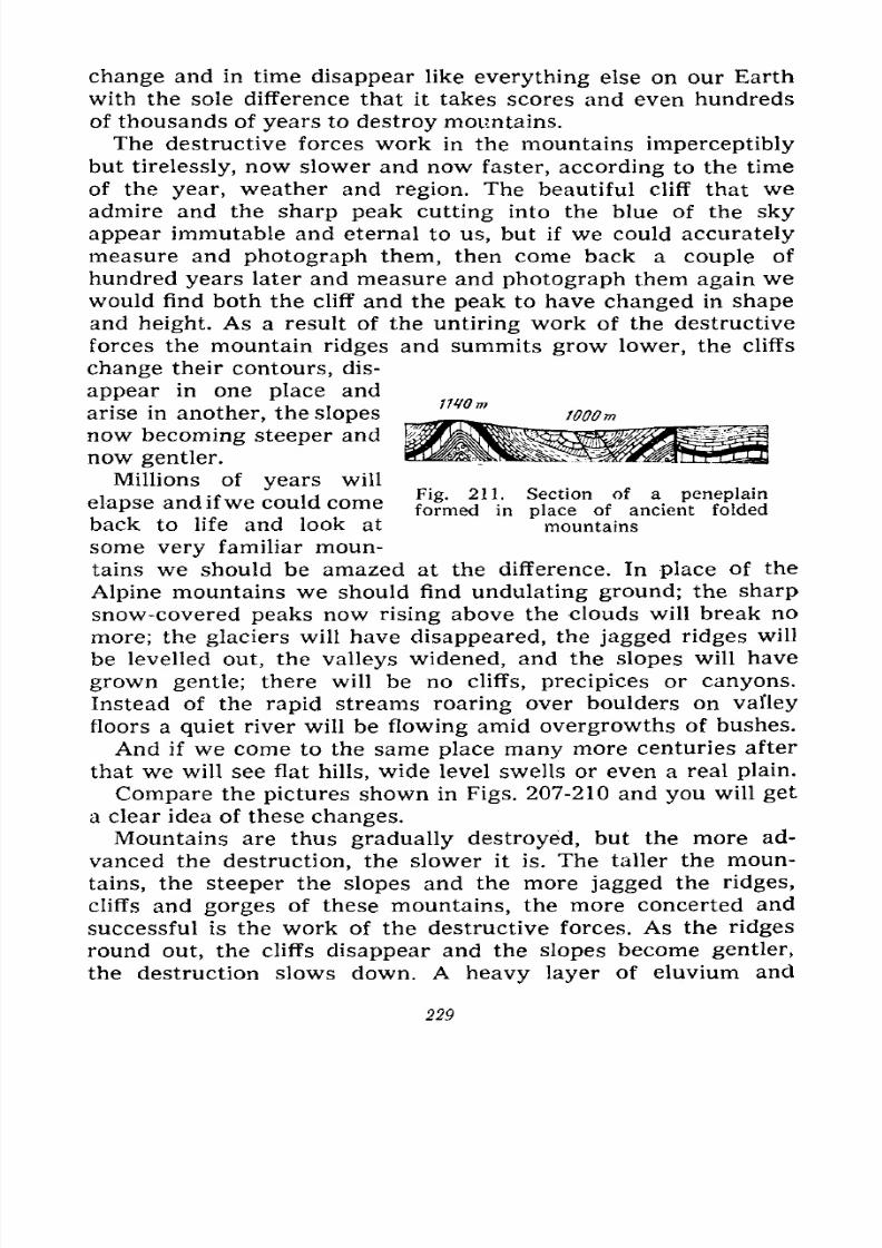
7/28/2019 Fundamentals of Geology - 19th century - Russia text in English
http://slidepdf.com/reader/full/fundamentals-of-geology-19th-century-russia-text-in-english 230/375
change and in time disappear like everything else on our Earth
with the sole difference that it takes scores and even hundreds
of thousands of years to destroy mountains.
The destructive forces work in the mountains imperceptibly
but tirelessly, now slower and now faster, according to the time
of the year, weather and region. The beautiful cliff that weadmire and the sharp peak cutting into the blue of the sky
appear immutable and eternal to us, but if we could accurately
measure and photograph them, then come back a couple of
hundred years later and measure and photograph them again wewould find both the cliff and the peak to have changed in shape
and height. As a result of the untiring work of the destructive
forces the mountain ridges and summits grow lower, the cliffs
change their contours, dis-
appear in one place and
arise in another, the slopes
now becoming steeper and
now gentler.
Millions of years will
elapse and ifwe could come
back to life and look at
some very familiar moun-tains we should be amazed at the difference. In place of the
Alpine mountains we should find undulating ground; the sharp
snow-covered peaks now rising above the clouds will break no
more; the glaciers will have disappeared, the jagged ridges will
be levelled out, the valleys widened, and the slopes will have
grown gentle; there will be no cliffs, precipices or canyons.
Instead of the rapid streams roaring over boulders on valley
floors a quiet river will be flowing amid overgrowths of bushes.
And if we come to the same place many more centuries after
that we will see flat hills, wide level swells or even a real plain.
Compare the pictures shown in Figs. 207-210 and you will get
a clear idea of these changes.
Mountains are thus gradually destroyed, but the more ad-
vanced the destruction, the slower it is. The taller the moun-
tains, the steeper the slopes and the more jagged the ridges,
cliffs and gorges of these mountains, the more concerted andsuccessful is the work of the destructive forces. As the ridges
round out, the cliffs disappear and the slopes become gentler,
the destruction slows down. A heavy layer of eluvium and
Fig. 211. Section of a peneplainformed in place of ancient folded
mountains
229
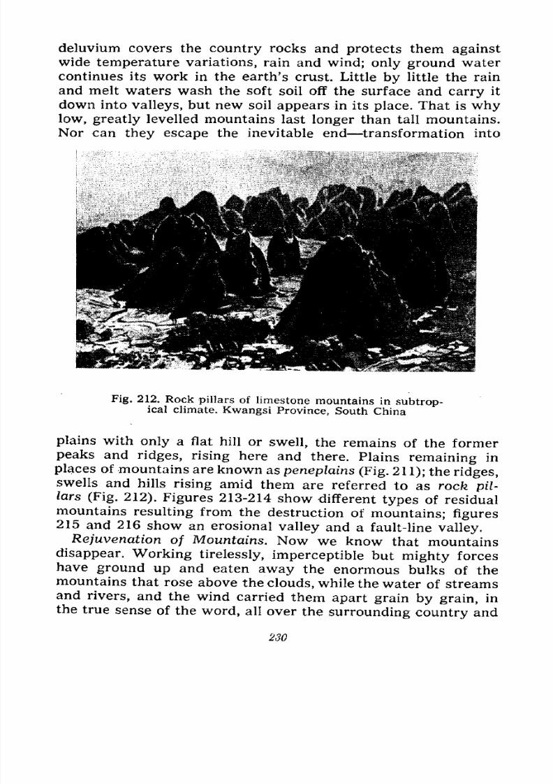
7/28/2019 Fundamentals of Geology - 19th century - Russia text in English
http://slidepdf.com/reader/full/fundamentals-of-geology-19th-century-russia-text-in-english 231/375
deluvium covers the country rocks and protects them against
wide temperature variations, rain and wind; only ground water
continues its work in the earth's crust. Little by little the rain
and melt waters wash the soft soil off the surface and carry it
down into valleys, but new soil appears in its place. That is whylow, greatly levelled mountains last longer than tall mountains.
Nor can they escape the inevitable end transformation into
Fig. 212. Rock pillars of limestone mountains in subtrop-ical climate. Kwangsi Province, South China
plains with only a flat hill or swell, the remains of the former
peaks and ridges, rising here and there. Plains remaining in
places of mountains are known as peneplains (Fig. 211); the ridges,swells and hills rising amid them are referred to as rocfe pil-
lars (Fig. 212). Figures 213-214 show different types of residual
mountains resulting from the destruction of mountains; figures215 and 216 show an erosional valley and a fault-line valley.
Rejuvenation of Mountains. Now we know that mountains
disappear. Working tirelessly, imperceptible but mighty forces
have ground up and eaten away the enormous bulks of themountains that rose above the clouds, while the water of streams
and rivers, and the wind carried them apart grain by grain, in
the true sense of the word, all over the surrounding country and
230
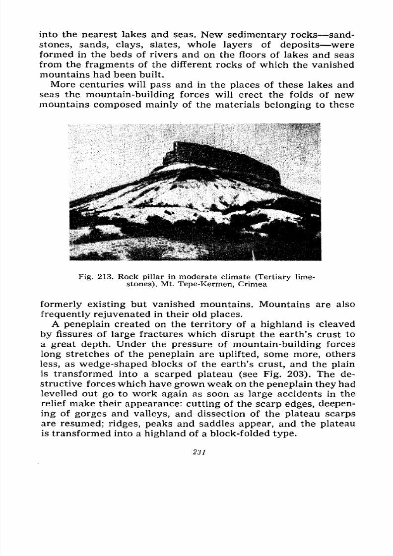
7/28/2019 Fundamentals of Geology - 19th century - Russia text in English
http://slidepdf.com/reader/full/fundamentals-of-geology-19th-century-russia-text-in-english 232/375
into the nearest lakes and seas. New sedimentary rocks sand-
stones, sands, clays, slates, whole layers of deposits were
formed in the beds of rivers and on the floors of lakes and seas
from the fragments of the different rocks of which the vanished
mountains had been built.
More centuries will pass and in the places of these lakes and
seas the mountain-building forces will erect the folds of new
mountains composed mainly of the materials belonging to these
Fig. 213. Rock pillar in moderate climate (Tertiary lime-
stones). Mt. Tepe-Kermen, Crimea
formerly existing but vanished mountains. Mountains are also
frequently rejuvenated in their old places.
A peneplain created on the territory of a highland is cleaved
by fissures of large fractures which disrupt the earth's crust to
a great depth. Under the pressure of mountain-building forces
long stretches of the peneplain are uplifted, some more, others
less, as wedge-shaped blocks of the earth's crust, and the plain
is transformed into a scarped plateau (see Fig. 203). The de-
structive forceswhich have grown weak on the peneplain they had
levelled out go to work again as soon as large accidents in the
relief make their appearance: cutting of the scarp edges, deepen-
ing of gorges and valleys, and dissection of the plateau scarps
are resumed; ridges, peaks and saddles appear, and the plateau
is transformed into a highland of a block-folded type.
231
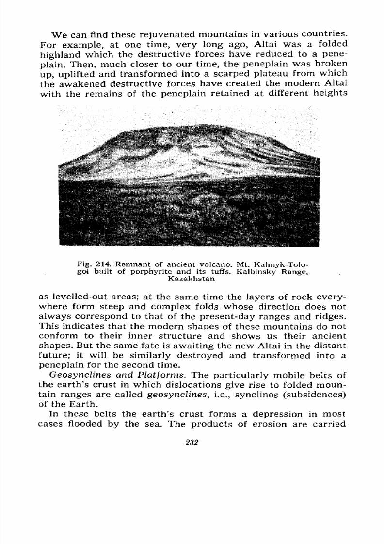
7/28/2019 Fundamentals of Geology - 19th century - Russia text in English
http://slidepdf.com/reader/full/fundamentals-of-geology-19th-century-russia-text-in-english 233/375
We can find these rejuvenated mountains in various countries.
For example, at one time, very long ago, Altai was a folded
highland which the destructive forces have reduced to a pene-
plain. Then, much closer to our time, the peneplain was broken
up, upliftedand transformed into a scarped plateau from which
the awakened destructive forces have created the modern Altai
with the remains of the peneplain retained at different heights
Fig. 214. Remnant of ancient volcano. Mt. Kalmyk-Tolo-
goi built of porphyrite and its tuffs. Kalbinsky Range,Kazakhstan
as levelled-out areas; at the same time the layers of rock every-
where form steep and complex folds whose direction does not
always correspond to that of the present-day ranges and ridges.
This indicates that the modern shapes of these mountains do not
conform to their inner structure and shows us their ancient
shapes. But the same fate is awaiting the new Altai in the distant
future; it will be similarly destroyed and transformed into a
peneplain for the second time.
Geosynclines and Platforms. The particularly mobile belts of
the earth's crust in which dislocations give rise to folded moun-
tain ranges are called geosynclines, i.e., synclines (subsidences)of the Earth.
In these belts the earth's crust forms a depression in most
cases flooded by the sea. The products of erosion are carried
232
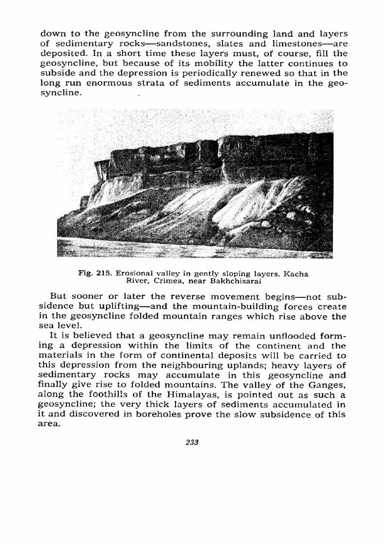
7/28/2019 Fundamentals of Geology - 19th century - Russia text in English
http://slidepdf.com/reader/full/fundamentals-of-geology-19th-century-russia-text-in-english 234/375
down to the geosyncline from the surrounding land and layers
of sedimentary rocks sandstones, slates and limestones are
deposited. In a short time these layers must, of course, fill the
geosyncline, but because of its mobility the latter continues to
subside and the depression is periodically renewed so that in the
long run enormous strata of sediments accumulate in the geo-
syncline.
Fig. 215. Erosional valley in gently sloping layers. Kacha
River, Crimea, near Bakhchisarai
But sooner or later the reverse movement begins not sub-
sidence but uplifting and the mountain-building forces create
in the geosyncline folded mountain ranges which rise above thesea level.
It is believed that a geosyncline may remain unflooded form-
ing a depression within the limits of the continent and the
materials in the form of continental deposits will be carried to
this depression from the neighbouring uplands; heavy layers of
sedimentary rocks may accumulate in this geosyncline and
finally give rise to folded mountains. The valley of the Ganges,
along the foothills of the Himalayas, is pointed out as such a
geosyncline; the very thick layers of sediments accumulated in
it and discovered in boreholes prove the slow subsidence of this
area.
233
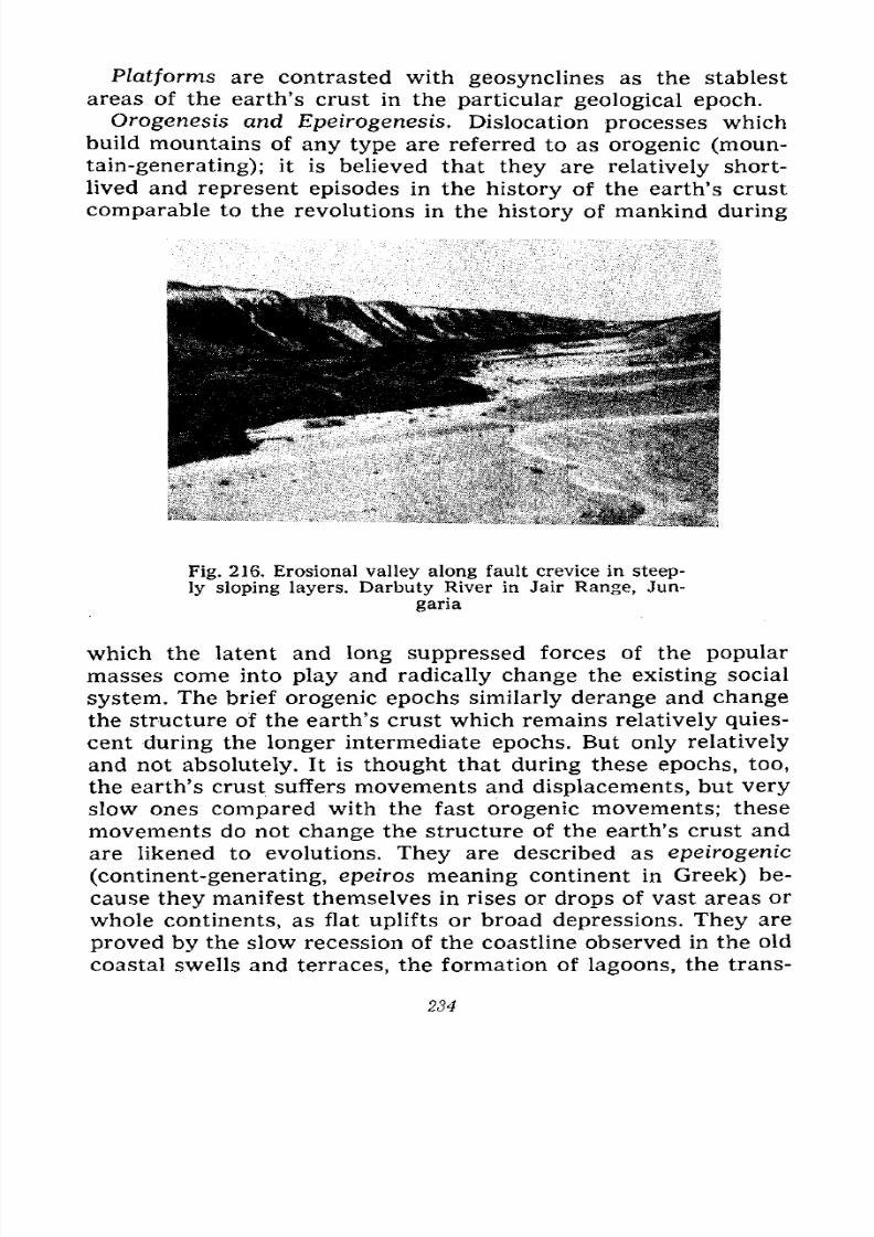
7/28/2019 Fundamentals of Geology - 19th century - Russia text in English
http://slidepdf.com/reader/full/fundamentals-of-geology-19th-century-russia-text-in-english 235/375
Platforms are contrasted with geosynclines as the stablest
areas of the earth's crust in the particular geological epoch.
Orogenesis and Epeirogenesis. Dislocation processes which
build mountains of any type are referred to as orogenic (moun-
tain-generating); it is believed that they are relatively short-
lived and represent episodes in the history of the earth's crust
comparable to the revolutions in the history of mankind during
Fig. 216. Erosional valley along fault crevice in steep-
ly sloping layers. Darbuty River in Jair Range, Jun-
garia
which the latent and long suppressed forces of the popular
masses come into play and radically change the existing social
system. The brief orogenic epochs similarly derange and change
the structure of the earth's crust which remains relatively quies-
cent during the longer intermediate epochs. But only relatively
and not absolutely. It is thought that during these epochs, too,
the earth's crust suffers movements and displacements, but very
slow ones compared with the fast orogenic movements; these
movements do not change the structure of the earth's crust and
are likened to evolutions. They are described as epeirogenic
(continent-generating, epeiros meaning continent in Greek) be-
cause they manifest themselves in rises or drops of vast areas orwhole continents, as flat uplifts or broad depressions. They are
proved by the slow recession of the coastline observed in the old
coastal swells and terraces, the formation of lagoons, the trans-
234
7/28/2019 Fundamentals of Geology - 19th century - Russia text in English
http://slidepdf.com/reader/full/fundamentals-of-geology-19th-century-russia-text-in-english 236/375
formation of islands into peninsulas, etc., or by the advance of
the sea and the flooding of the coasts. These movements are
also called slow oscillations of the earth's crust.
Incidentally, some scientists have lately concluded that the
erogenic processes are also very slow, which is provedby
the
fact that many rivers burrow not only through separate moun-tain ranges, but through whole highlands, and this can be
accounted for only by supposing that these rivers are older than
the mountains; the mountain folds arose so slowly that the
rivers had enough time to erode these accretions and retain their
directions. The existence of quiescent epochs in the intervals
between the orogenic ones is also doubted, and it is assumedthat the earth's crust always moves slowly, and that there is no
essential difference between oro- and epeirogenesis. Slow dis-
placements of the coastlines in one direction or the other, the
subsidence of land and dislocations of the youngest depositshave been observed in many countries, and evidence is ac-
cumulating that recently, during the modern geological epoch,there were uplifts on all continents, these uplifts amounting to
even several hundred metres and expressing themselves in in-
creased erosion in the highlands due to the increased gradient
of the river beds. Thus, even the modern epoch formerly con-
sidered quiescent is also orogenic.
Causes of Dislocations. Scientists have already made manydifferent assumptions relating to the causes of crustal disloca-
tions, but these are still only assumptions, i.e., hypotheses, be-
cause we can observe only the results of these processes since
the latter being abyssal cannot be observed.
The contraction hypothesis, i.e., the hypothesis of compression
of the earth's crust put forward in the middle of last century,was formerly the most widespread. Laplace's hypothesis assumesthat the Earth was originally a molten body gradually coolingand developing a hard crust. But the hot core of the Earth con-
tinues to lose heat by radiation into world space. Observations
in mines and boreholes prove that the deeper we penetrate into
the earth's crust, the hotter layers we encounter, while volcanic
eruptions confirm the presence of high temperatures and molten
masses in the interior. Hence, the entrails of the Earth are
losing heat and must therefore contract as any other body does
in cooling; the earth's crust becomes too spacious for the con-
tracted core and must shrink like the skin of an apple or potato
2,55
7/28/2019 Fundamentals of Geology - 19th century - Russia text in English
http://slidepdf.com/reader/full/fundamentals-of-geology-19th-century-russia-text-in-english 237/375
when they dry, i.e., when they lose water and diminish in
volume. The shrinkage of the earth's crust expresses itself in its
dislocations, the folds of the rocks being the wrinkles. This
process must repeat periodically. Heat is lost continuously, but
for dislocations, i.e., for the overcoming of the resistance to
crumbling by the rocks it is necessary that the tension gradually
developing in the earth's crust grow to a considerable force, in
other words, that it accumulate. This is why dislocations occur
periodically, in certain epochs separated by long epochs of quies-
cence, and spread simultaneously over the entire globe.
Other greatly differing hypotheses have been proposed, but
we cannot consider or criticize them here. Suffice it to say that
most of them are based on considerations of various processes
operating very deep under the hard crust, as, for example, cur-
rents arising in the magma, differentiation, i.e., break-up of the
magma into parts of different composition before hardening,
radioactive decay (which compensates for the loss of heat even
with an excess, i.e., expanding the core instead of compressing
it), drifting of light continents on a heavy underlying bed and
their lagging during the rotation of the Earth, etc. Unfortunately
we do not as yet have any positive knowledge concerning part
of these processes; we do not even know if they occur in the
earth's crust at all, so that these hypotheses are built on very
shaky foundations which admit of most diverse interpretations.
On the other hand, the contraction hypothesis is based on direct
observation and incontestable facts. We see the eruptions of vol-
canoes which eject into the atmosphere a lot of heat in the form
of hot gases and vapours; we see cooling streams of lava and
numerous hot springs which also liberate heat. Geological
research has shown that volcanic eruptions have occurred since
the formation of the earth's crust, and that in other epochs these
eruptions took place on a much greater scale than today. The
lavas, gases and vapours of the volcanoes, and the water and
salts of the mineral springs (which were also active in all geo-
logical epochs) represent not only a loss of heat from the interior
of the crust, but also a tremendous loss of substance transferred
from the entrails to the uppermost crustal layers in the form of
enormous intrusions of effusive rocks, and to the surface as
lavas, waters and gases.
We shall not dwell on the core of the Earth since we know too
little about its composition and the processes operating in it. But
236
7/28/2019 Fundamentals of Geology - 19th century - Russia text in English
http://slidepdf.com/reader/full/fundamentals-of-geology-19th-century-russia-text-in-english 238/375
the foregoing considerations concerning the loss of heat and
substance from the peripheral layers of this core or the lower
layers of the earth's crust irrefutably denote that these layers
are contracting, while the surface layers which receive substance
in the form of intrusions, effusions and spring depositions are
increasing in volume, i.e., are becoming too spacious in relation
to the underlying layers and must adjust themselves to them by
contraction.
It is an incontestable fact that these surface layers are con-
tracting; the numerous folds clearly reduce the area which
these layers have covered before; the reverse faults and over-
thrusts are also contractions and only the normal faults denote
a certain expansion. The geosyncline mobile belt in the earth's
crust after changing to a folded mountain range or a highland
undoubtedly also contracts. The vast Canadian, Brazilian, Baltic
and Aldan shields in which strongly folded very ancient layers
of the earth's crust are prominent occupy smaller areas than
they did before folding.
It is during this contraction that high tension, mainly tangen-
tial and acting in a horizontal direction, develops. This tension
must cause the soft and still plastic layers of sedimentary rocks
in the orogenic belts, the geosynclines, to fold. In the stable
areas or platforms which do not form a single, continuous,
monolithic whole, as some people believe, but consist of parts
of different sizes, different composition, and different rigidity
and were formed at different times, i.e., are composed of a coarse
mosaic, the tension is discharged in lifting various sections to
different heights even with possible subsidence of others, in
thrusting their edges over each other accompanied by shearing
and displacement of whole layers, which slide over one an-
other, and in crumpling the young surface strata of sedimentary
rocks into folds.
If we relinquish the supposition that dislocations occur rapidly
and only during certain brief epochs separated by epochs of
quiescence, and assume that they are slow and continuous weshall rid ourselves of one of the essential objections to the con-
traction hypothesis, namely, that the layers of the earth's crust
cannot accumulate and then communicate over considerabledistances the tangential tension they develop. We must take it
that dislocations occur very slowly and wherever layers or
sections of the earth's crust can react to the tension by some
237
7/28/2019 Fundamentals of Geology - 19th century - Russia text in English
http://slidepdf.com/reader/full/fundamentals-of-geology-19th-century-russia-text-in-english 239/375
displacement or other, i.e., by changes in the mode of their
occurrence. Their friction against each other and the law of
inertia frequently prevent these layers or sections from imme-
diately submitting to the tension and require a certain accumula-
tion of energy. The latter, therefore, sometimes resolves itself in
separate shocks, rapid displacements of strata, contortions and
faults which shake the layers over long distances. These sharp
dislocations are essentially quite small, but on the surface they
produce more or less intense, even catastrophic earthquakes
which we shall consider in the next chapter.
Precision instruments now record earthquakes at manystations and it appears that the earth's crust vibrates lightly and
imperceptibly to man, but almost continuously now here and
now there, thus proving the continuity and slowness of the dis-
locations. This does not mean, however, that the intensity of
the dislocations is always and everywhere the same. It un-
doubtedly increases during the epochs of the geological revolu-
tions and then diminishes. The intensification in some countries
may not exactly coincide with that in others; it may either be
ahead or lag behind, according to the variety of local conditions
on which the nature of the dislocations essentially depends.
The contraction hypothesis which takes into consideration
only compression as the force that determines all dislocations is
one-sided and fails to account for many facts. The recently pro-
posed hypothesis referred to as the pulsation hypothesis intro-
duces serious amendments into the contraction hypothesis by
accounting not only for the processes of compression, but also
for those of expansion.
As a luminous body the Earth, like the other cosmic bodies,
served as an arena for the struggle between the forces of attrac-
tion and repulsion. The attraction conditioned the reduction in
volume and the distribution of matter according to specific
gravity from the centre to the periphery. The repulsion created
radiation and ejection of matter into world space after the
manner of the protuberances observed on the Sun.
It should not be thought that this struggle between the antag-
onistic forces ceased after the formation of the earth's hard
crust; it must continue in other forms. The forces of attraction
express themselves in the compression of the earth's crust; the
forces of repulsion cause its expansion. These forces struggle
incessantly, but the resistance the crustal layers offer to various
238
7/28/2019 Fundamentals of Geology - 19th century - Russia text in English
http://slidepdf.com/reader/full/fundamentals-of-geology-19th-century-russia-text-in-english 240/375
displacements necessitates a periodical accumulation of energy
to overcome this resistance. All dislocations therefore occur in
leaps which correspond to the epochs of energy discharge and
are separated from each other by longer and more quiescent
epochs of energy accumulation.
The crustal contraction manifests itself in the following essen-
tially tangential movements: in the mobile belts of the crust,
i.e., the geosynclines, more or less filled with juvenile deposits,
the latter contract into folds of various complexity and the geo-
synclines narrow down under lateral pressure. On the stable
rigid platforms and shields the compression complicates the
folding of their foundations consisting of older, already folded
deposits, bends these foundations into swells and crests, crum-
ples the superficial, younger and as yet indisplaced deposits into
broad folds, and displaces large wedges of the earth's crust as
thrusts and overthrusts along the fracture crevices; the area
of these stable platforms is thus also reduced.
The expansion of the earth's crust is evinced in the following
essentially radial movements: in the mobile geosynclines the
belts of the folds created during the contraction jut out and rise
as mountain ranges and systems above the former level, while
new depressions, i.e., geosynclines, form next to them during
the expansion. Crevices fractures appear on the platforms
and shields which also rise and expand, and stretches of the
earth's crust in the form of horsts and fault troughs are dis-
placed along these crevices. The expansion is additionally ac-
companied by magmatic activity: magma invades the uplifted
geosynclines from the interior and forms intrusions and effu-
sions of igneous rocks, while on the platforms it is extrud-
ed along the fissures in the form of sheets and also builds chains
of volcanoes.
This hypothesis assumes that the struggle between the forces
of attraction and repulsion persists also after the formation of
the earth's hard crust, that the Earth develops in leaps, that
opposites replace each other and that quantity changes into
quality and therefore best conforms to the teachings of dialecti-
cal materialism; after additional elaboration it should become
the most acceptable hypothesis offering the best explanation of
the complex structure of the earth's crust. It is not one-sided as
are all the other hypotheses so far proposed, and can also ac-
count for the movements and transformations of the magma in
239
7/28/2019 Fundamentals of Geology - 19th century - Russia text in English
http://slidepdf.com/reader/full/fundamentals-of-geology-19th-century-russia-text-in-english 241/375
the entrails of the Earth, the radioactive processes, the influence
of the rotation of the Earth and the other phenomena which in
any way affect the struggle between the forces of attraction and
repulsion.
The structure of the earth's crust created by various displace-
ments and the intrusions and effusions connected with them is
referred to as tectonic (tektos being the Greek word for struc-
ture).
The idea of mountain rejuvenation occurred to geologists only
in the beginning of the twentieth century. It was formerly be-
lieved that mountain-building on Earth had been fully complet-
ed as early as the Tertiary period which preceded the modern
Quaternary period. The Tertiary period was considered the
youngest as regards mountain-building. It is the period whenall the Earth's mountain systems crowned with the highest peaks
came into being; on these summits we see accumulations of
snow and ice all year round; these accumulations give rise to
glaciers that descend into the surrounding valleys. Such are the
Alps and Carpathians in Europe, the Cordilleras and Andes in
the two Americas, some ranges in Africa, Tien-Shan, Nan-Shan,
Himalayas and other mountains in Asia.
But closer geological studies of the mountain systems of
Europe and Asia have revealed that mountains were also built in
various places at the end of the Tertiary and even in the begin-
ning of the Quaternary periods, that side by side with the old
mountain ranges already in a certain measure levelled and
lowered by processes of erosion and weathering others came
into being, and that in these not only the Tertiary but also the
Quaternary deposits were dislocated forming folds, even over-
folds and overthrusts. Thus, while studying the Kalbinsky Rangewhich is a continuation of the Altai Mountains on the left bank
of the Irtysh I noticed in 1911 that its western end near Semi-
palatinsk was greatly lowered and had old levelled forms, where-
as stretching eastward it gradually acquired sharper and more
disjointed forms, though it ran along the Irtysh in both places
and should have had the same forms of relief. My observation
led me to the assumption that this range running from west
to east came close to the Altai located on the right bank of the
Irtysh and, consequently, the Altai might also have rejuvenated
forms. I did not find any confirmation of my assumption in the
literature on Altai then available and therefore made up my
240
7/28/2019 Fundamentals of Geology - 19th century - Russia text in English
http://slidepdf.com/reader/full/fundamentals-of-geology-19th-century-russia-text-in-english 242/375
mind to go there and solve the problem myself. I was able to do
it only in 1914 and my assumption that the Altai was also a
greatly rejuvenated mountain range was confirmed.
Similar assumptions of the recency of the last mountain-
building movements were also voiced
bysome foreign geolo-
gists at the end of the nineteenth century and these views
gradually came to be dominant. In my brief report made in 1948
I proposed to designate these most recent movements of the end
of the Tertiary and the beginning of the Quaternary periods
by the term neotectonics which has since become current amongSoviet geologists.* The mountains that have recently come into
being in place of the older and greatly levelled ones or beside
them
maybe referred to as rejuvenated mountains.
* The Main Features of Neotectonic Kinetics and Plastics, "News of the
Academy of Sciences," Geological Series, 1.948, No. 5, pp. 13-24. Russ. Ed.

7/28/2019 Fundamentals of Geology - 19th century - Russia text in English
http://slidepdf.com/reader/full/fundamentals-of-geology-19th-century-russia-text-in-english 243/375
IX
WHY THE EARTH SHAKES NOW HERE
AND NOW THERE
Effect of Earthquakes on Man. Focus and Epicentre. Iso-
seismal and Plomoseismal Lines. Period of Earthquakes.
Recording. Seismometers. Depth of Origin. Intensity of
Earthquakes. Causes of Earthquakes. Area of Distribution
of Earthquakes. Portents. Results of Earthquakes.
Seaquakes. Types of Earthquakes. Correlations with
Other Natural Phenomena. Safeguards.
We have grown accustomed to regard the earth, the solid
ground under our feet, as something stable and unshakable. Webuild our heaviest structures on it and only sink our foundations
the deeper, the heavier these structures are. That is why when
the earth begins to quake under our feet so that it is impossible
to stand up, when large trees sway, and strong buildings that
have stood up for decades crack and collapse before our eyes,
when fissures disrupt the ground and we hear a roar and rumblefrom its interior as if the very entrails of the Earth were foun-
dering we are gripped by terror, lose our heads, and do not
know where to run for safety.
But, as we noted in the preceding chapter, our Earth vibrates
continuously. Precision instruments have revealed that there
are annually between eight and ten thousand earthquakes, i.e.,
approximately one earthquake every hour; actually there are
many more, because two-thirds of the earth's surface is coveredwith water on which there are no stations to record all, includ-
ing the weak, earthquakes and, besides, large areas on the con-
tinents also have no such stations. Fortunately, most of the earth-
242
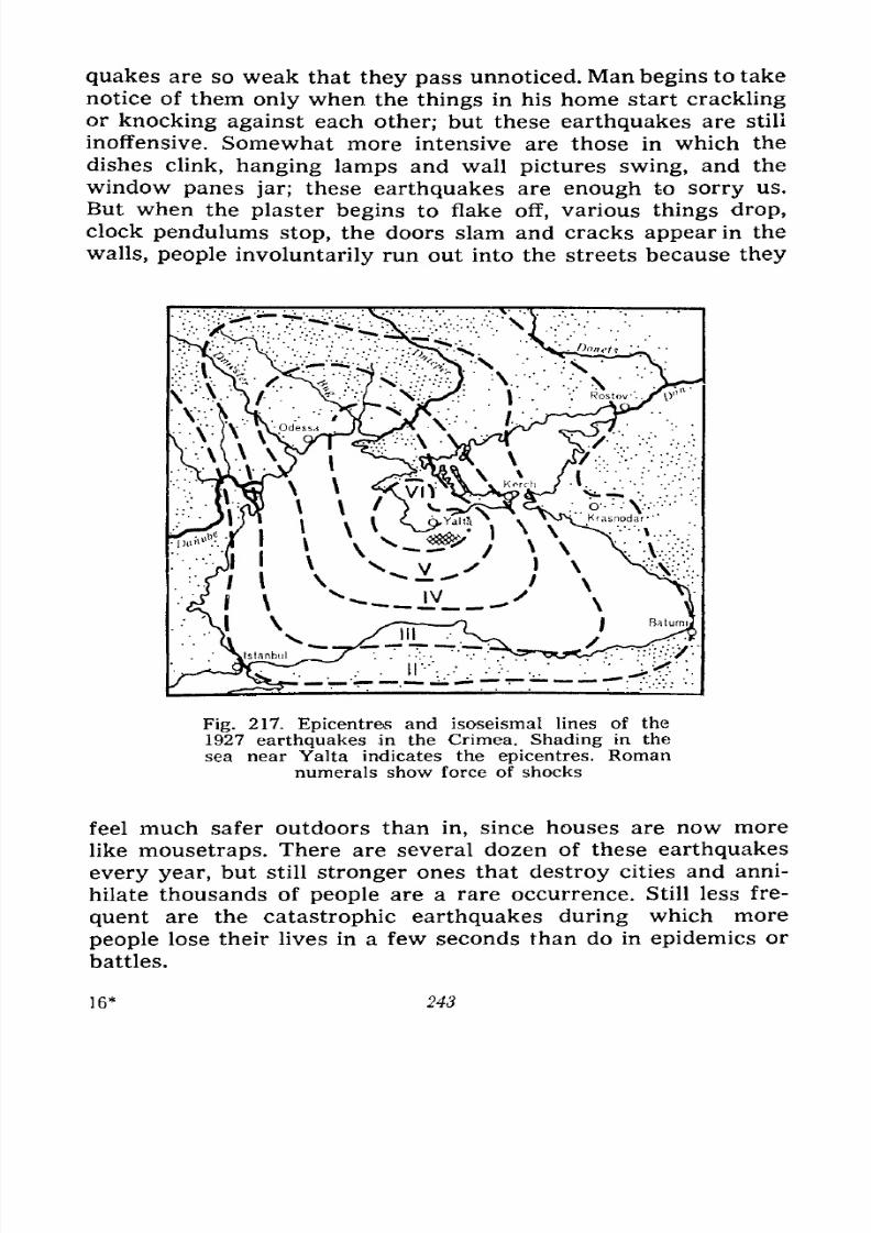
7/28/2019 Fundamentals of Geology - 19th century - Russia text in English
http://slidepdf.com/reader/full/fundamentals-of-geology-19th-century-russia-text-in-english 244/375
quakes are so weak that they pass unnoticed. Man begins to take
notice of them only when the things in his home start crackling
or knocking against each other; but these earthquakes are stili
inoffensive. Somewhat more intensive are those in which the
dishes clink, hanging lamps and wall pictures swing, and the
window panes jar; these earthquakes are enough to sorry us.
But when the plaster begins to flake off, various things drop,
clock pendulums stop, the doors slam and cracks appear in the
walls, people involuntarily run out into the streets because they
Fig. 217. Epicentres and isoseismal lines of the
1927 earthquakes in the Crimea. Shading in the
sea near Yalta indicates the epicentres. Romannumerals show force of shocks
feel much safer outdoors than in, since houses are now more
like mousetraps. There are several dozen of these earthquakes
every year, but still stronger ones that destroy cities and anni-
hilate thousands of people are a rare occurrence. Still less fre-
quent are the catastrophic earthquakes during which more
people lose their lives in a few seconds than do in epidemics or
battles.
16* 243
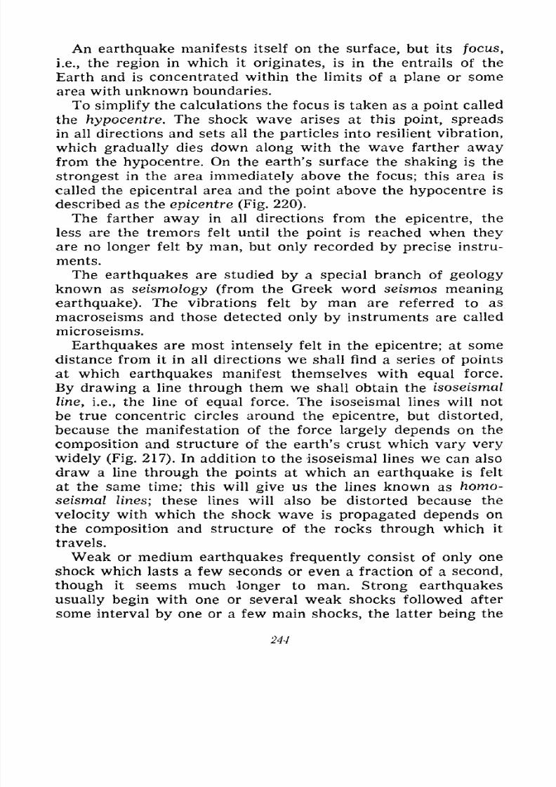
7/28/2019 Fundamentals of Geology - 19th century - Russia text in English
http://slidepdf.com/reader/full/fundamentals-of-geology-19th-century-russia-text-in-english 245/375
An earthquake manifests itself on the surface, but its focus,
i.e., the region in which it originates, is in the entrails of the
Earth and is concentrated within the limits of a plane or some
area with unknown boundaries.
To simplify the calculations the focus is taken as a point called
the hypocentre. The shock wave arises at this point, spreads
in all directions and sets all the particles into resilient vibration,
which gradually dies down along with the wave farther awayfrom the hypocentre. On the earth's surface the shaking is the
strongest in the area immediately above the focus; this area is
called the epicentral area and the point above the hypocentre is
described as the epicentre (Fig. 220).
The farther away in all directions from the epicentre, the
less are the tremors felt until the point is reached when they
are no longer felt by man, but only recorded by precise instru-
ments.
The earthquakes are studied by a special branch of geology
known as seismology (from the Greek word seismos meaning
earthquake). The vibrations felt by man are referred to as
macroseisms and those detected only by instruments are called
microseisms.
Earthquakes are most intensely felt in the epicentre; at somedistance from it in all directions we shall find a series of points
at which earthquakes manifest themselves with equal force.
By drawing a line through them we shall obtain the isoseismal
line, i.e., the line of equal force. The isoseismal lines will not
be true concentric circles around the epicentre, but distorted,
because the manifestation of the force largely depends on the
composition and structure of the earth's crust which vary very
widely (Fig. 217). In addition to the isoseismal lines we can also
draw a line through the points at which an earthquake is felt
at the same time; this will give us the lines known as homo-
seismal lines; these lines will also be distorted because the
velocity with which the shock wave is propagated depends on
the composition and structure of the rocks through which it
travels.
Weak or medium earthquakes frequently consist of only one
shock which lasts a few seconds or even a fraction of a second,
though it seems much longer to man. Strong earthquakes
usually begin with one or several weak shocks followed after
some interval by one or a few main shocks, the latter being the
244
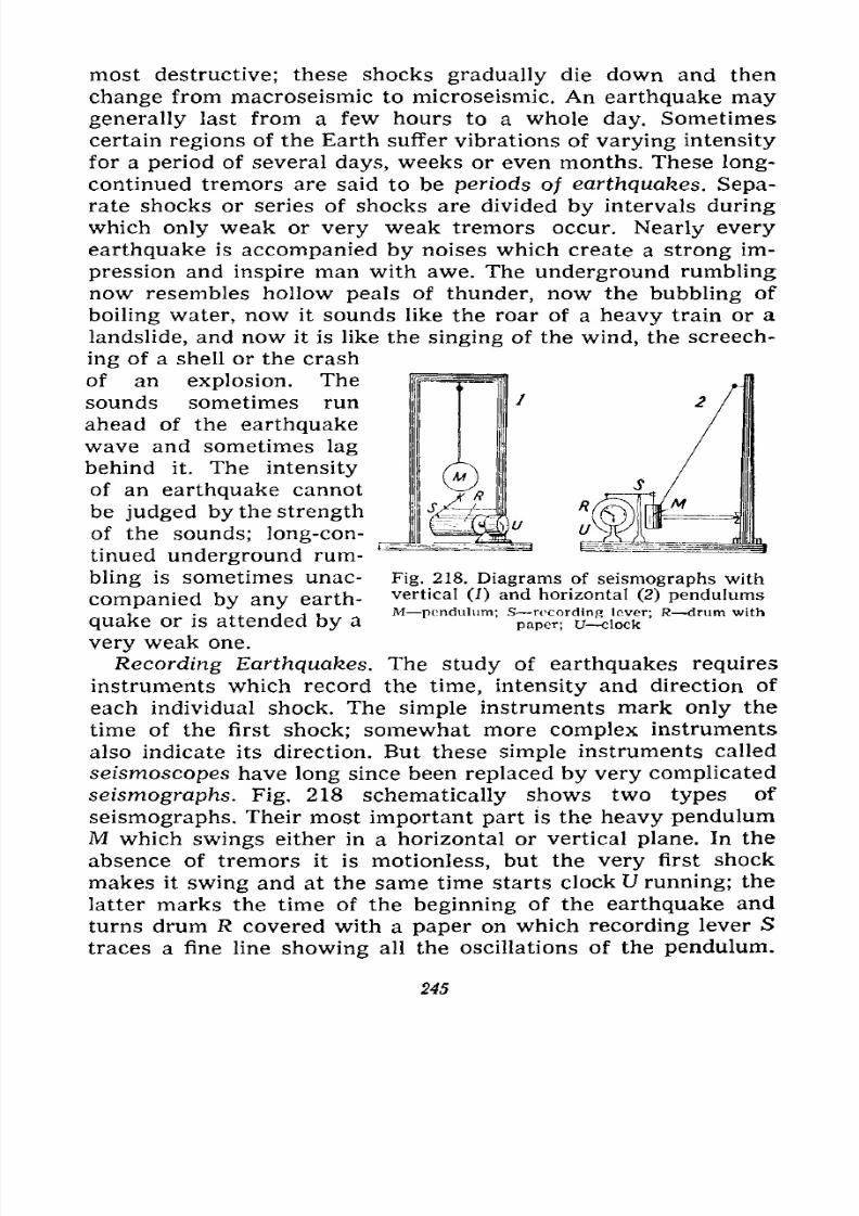
7/28/2019 Fundamentals of Geology - 19th century - Russia text in English
http://slidepdf.com/reader/full/fundamentals-of-geology-19th-century-russia-text-in-english 246/375
most destructive; these shocks gradually die down and then
change from macroseismic to microseismic. An earthquake maygenerally last from a few hours to a whole day. Sometimes
certain regions of the Earth suffer vibrations of varying intensity
for a period of several days, weeks or even months. These long-
continued tremors are said to be periods of earthquakes. Sepa-
rate shocks or series of shocks are divided by intervals during
which only weak or very weak tremors occur. Nearly every
earthquake is accompanied by noises which create a strong im-
pression and inspire man with awe. The underground rumbling
now resembles hollow peals of thunder, now the bubbling of
boiling water, now it sounds like the roar of a heavy train or a
landslide, and now it is like the singing of the wind, the screech-
ing of a shell or the crash
of an explosion. The
sounds sometimes run
ahead of the earthquake
wave and sometimes lag
behind it. The intensity
of an earthquake cannot
be judged by the strength
of the sounds; long-con-
tinued underground rum-
bling is sometimes unac- Fig. 218. Diagrams of seismographs with
vertical (1) and horizontal (2) pendulumsM pendulum; S recording lever; R drum with
paper; U clock
companied by any earth-
quake or is attended by a
very weak one.
Recording Earthquakes. The study of earthquakes requires
instruments which record the time, intensity and direction of
each individual shock. The simple instruments mark only the
time of the first shock; somewhat more complex instruments
also indicate its direction. But these simple instruments called
seismoscopes have long since been replaced by very complicated
seismographs. Fig. 218 schematically shows two types of
seismographs. Their most important part is the heavy pendulumM which swings either in a horizontal or vertical plane. In the
absence of tremors it is motionless, but the very first shock
makes it swing and at the same time starts clock U running; thelatter marks the time of the beginning of the earthquake and
turns drum R covered with a paper on which recording lever S
traces a fine line showing all the oscillations of the pendulum.
245
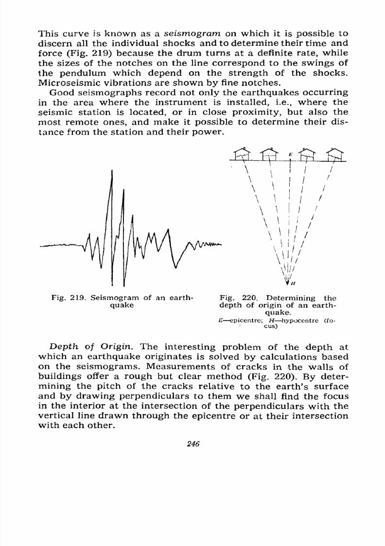
7/28/2019 Fundamentals of Geology - 19th century - Russia text in English
http://slidepdf.com/reader/full/fundamentals-of-geology-19th-century-russia-text-in-english 247/375
This curve is known as a seismogram on which it is possible to
discern all the individual shocks and to determine their time and
force (Fig. 219) because the drum turns at a definite rate, while
the sizes of the notches on the line correspond to the swings of
the pendulum which depend on the strength of the shocks.
Microseismic vibrations are shown by fine notches.
Good seismographs record not only the earthquakes occurring
in the area where the instrument is installed, i.e., where the
seismic station is located, or in close proximity, but also the
most remote ones, and make it possible to determine their dis-
tance from the station and their power.
Fig. 219. Seismogram of an earth-
quake
Fig. 220. Determining the
depth of origin of an earth-
quake.
epicentre; H hypocentre (fo-
cus)
Depth of Origin. The interesting problem of the depth at
which an earthquake originates is solved by calculations based
on the seismograms. Measurements of cracks in the walls of
buildings offer a rough but clear method (Fig. 220). By deter-
mining the pitch of the cracks relative to the earth's surface
and by drawing perpendiculars to them we shall find the focusin the interior at the intersection of the perpendiculars with the
vertical line drawn through the epicentre or at their intersection
with each other.
246
7/28/2019 Fundamentals of Geology - 19th century - Russia text in English
http://slidepdf.com/reader/full/fundamentals-of-geology-19th-century-russia-text-in-english 248/375
Observations have shown most of the earthquakes to originate
at a depth of up to 50 kilometres, few of them at a depth of from
50 to 100 kilometres and only single earthquakes to occur at
depths ranging between 300 and 700 kilometres. The region
which has suffered from earthquakes the most is located around
the epicentre and is called the pleistoseistic region. Its extent
depends not only on the force of the shock, but also on the
depth of the origin. A strong earthquake with a small pleisto-
seistic area has a very shallow focus. A large area always indi-
cates a great force and a deep origin. The terrible Lisbon earth-
quake of 1755 spread over an area four times the size of Europe.
The 1881 earthquake on the Island of Ischia (in the Mediterra-
nean) which destroyed the town of Casamicciola had an area of
only 55 square kilometres and a very shallow focus.
The intensities of earthquakes are gauged by their effects; the
scale adopted in the U.S.S.R. distinguishes 12 degrees of earth-
quakes:
I imperceptible; the microseismic vibrations are detected
only by instruments;
II very feeble; noticed by few sensitive people at rest;
III slight; felt by few people as jolts caused by a rapidly
passing carriage;
IV moderate; felt by few people outdoors and by many
indoors; slight clinking of dishes and jarring of window panes,
creaking of doors and floors;
V rather strong; felt by most people in motion and at work;
shaking of buldings as if by heavy objects falling indoors;
vibration of chairs and beds;
VIstrong;
felt
by everybody; very many peoplerun out-
doors; falling of pictures and books, breaking of dishes, appear-
ance of fine cracks in the plaster;
VII very strong; furniture falling indoors, light cracks in
the walls, parts of plaster, of stucco moulding, and of chimneys
falling; some of the weaker buildings collapse;
VIII destructive; great damage to buildings, large cracks in
the walls, some walls and all chimneys and towers collapse;
IX devastating; great damage to stone buildings; some col-
lapse;
X disastrous; landslides and landslips, crevices in the earth's
crust; most of the stone and lighter buildings destroyed;
247
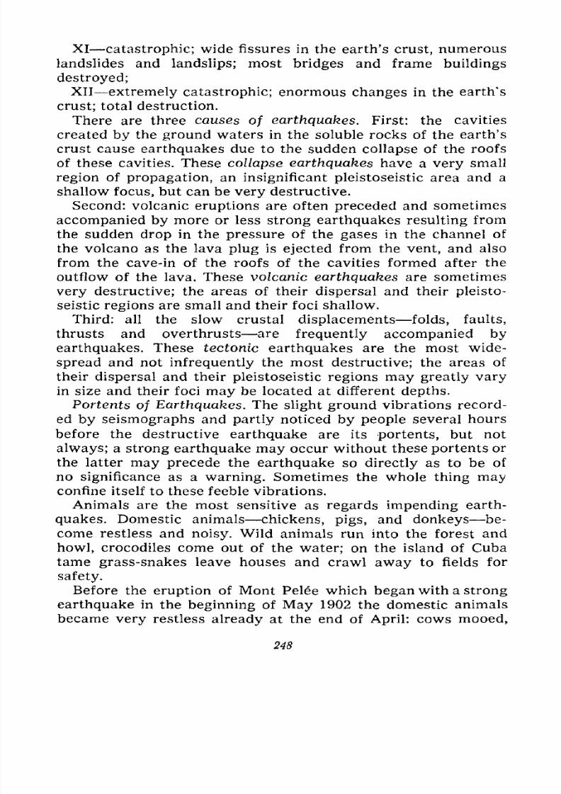
7/28/2019 Fundamentals of Geology - 19th century - Russia text in English
http://slidepdf.com/reader/full/fundamentals-of-geology-19th-century-russia-text-in-english 249/375
XI catastrophic; wide fissures in the earth's crust, numerous
landslides and landslips; most bridges and frame buildings
destroyed;
XII extremely catastrophic; enormous changes in the earth's
crust; total destruction.
There are three causes of earthquakes. First: the cavities
created by the ground waters in the soluble rocks of the earth's
crust cause earthquakes due to the sudden collapse of the roofs
of these cavities. These collapse earthquakes have a very small
region of propagation, an insignificant pleistoseistic area and a
shallow focus, but can be very destructive.
Second: volcanic eruptions are often preceded and sometimes
accompanied by more or less strong earthquakes resulting from
the sudden drop in the pressure of the gases in the channel of
the volcano as the lava plug is ejected from the vent, and also
from the cave-in of the roofs of the cavities formed after the
outflow of the lava. These volcanic earthquakes are sometimes
very destructive; the areas of their dispersal and their pleisto-
seistic regions are small and their foci shallow.
Third: all the slow crustal displacements folds, faults,
thrusts and overthrusts are frequently accompanied by
earthquakes. These tectonic earthquakes are the most wide-
spread and not infrequently the most destructive; the areas of
their dispersal and their pleistoseistic regions may greatly vary
in size and their foci may be located at different depths.
Portents of Earthquakes. The slight ground vibrations record-
ed by seismographs and partly noticed by people several hours
before the destructive earthquake are its portents, but not
always; a strong earthquake may occur without these portents or
the latter may precede the earthquake so directly as to be of
no significance as a warning. Sometimes the whole thing mayconfine itself to these feeble vibrations.
Animals are the most sensitive as regards impending earth-
quakes. Domestic animals chickens, pigs, and donkeys be-
come restless and noisy. Wild animals run into the forest and
howl, crocodiles come out of the water; on the island of Cuba
tame grass-snakes leave houses and crawl away to fields for
safety.
Before the eruption of Mont Pelee which began with a strong
earthquake in the beginning of May 1902 the domestic animals
became very restless already at the end of April: cows mooed,
248
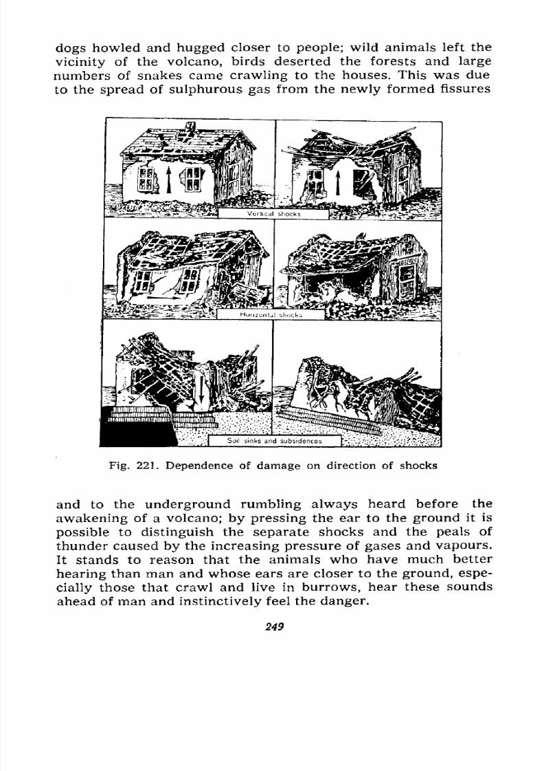
7/28/2019 Fundamentals of Geology - 19th century - Russia text in English
http://slidepdf.com/reader/full/fundamentals-of-geology-19th-century-russia-text-in-english 250/375
dogs howled and hugged closer to people; wild animals left the
vicinity of the volcano, birds deserted the forests and large
numbers of snakes came crawling to the houses. This was due
to the spread of sulphurous gas from the newly formed fissures
Fig. 221. Dependence of damage on direction of shocks
and to the underground rumbling always heard before the
awakening of a volcano; by pressing the ear to the ground it is
possible to distinguish the separate shocks and the peals of
thunder caused by the increasing pressure of gases and vapours.
It stands to reason that the animals who have much better
hearing than man and whose ears are closer to the ground, espe-
cially those that crawl and live in burrows, hear these sounds
ahead of man and instinctively feel the danger.
249
7/28/2019 Fundamentals of Geology - 19th century - Russia text in English
http://slidepdf.com/reader/full/fundamentals-of-geology-19th-century-russia-text-in-english 251/375
The results of earthquakes manifest themselves in damage
to man-made structures to the point of their complete destruc-
tion, in fissures, thrusts and overthrusts in the earth's crust,
landslides and landslips in the mountains, appearance and dis-
appearanceof
springs,
and drainage and flooding of coasts.
Fig. 222. Damage due to poor building material. Balaklava,
Crimea, 1927
The extent of the damage to the structures depends on the
quality of the construction, the composition of the soil, the
nature and strength of the shock and the angle of its emergence
(Fig. 221). The vertical shocks observed in the epicentre and in
close proximity to it are less harmful than the wave-like vibra-
tions characteristic of the surrounding country. The earth-
quake waves travelling in the ground inflict heavy damage on
buildings, especially their walls, if the latter happen to be
parallel to the waves. They not only rise on the waves, but are
also bent by them. It is well known that the greatest damage is
inflicted by shocks with a 45 to 55 angle of emergence.
The composition of the ground is of some significance: it
affects the rate of propagation of an earthquake, the latter
250
7/28/2019 Fundamentals of Geology - 19th century - Russia text in English
http://slidepdf.com/reader/full/fundamentals-of-geology-19th-century-russia-text-in-english 252/375
spreading much faster in hard than in loose rocks. In thick
layers of loose rock, for instance in deposits (the alluvium of
valleys), the wave wanes and may even die down altogether;
but a thin stratum lying on hard country rocks has not enoughtime to absorb the shock and is thrown up on its bedding. Under
these conditions the destruction will be greater. The structure
of the country rocks has the following effect: the wave travels
faster along the strike of the faults and layers than across them.
The most dangerous grounds are generally the screes and rock
debris (especially on hillsides), thin layers of alluvium on valley
floors, marshes, overgrown lakes and peat bogs; dry grounds are
less dangerous than those saturated with water.
The damage to buildings begins with a destruction of chim-
neys, plaster flaking off from the
ceilings, falling of cornices and
appearance of cracks in the walls.
In stronger shocks corners or even
whole walls of buildings cave in,
the roof also suffering some
damage. The severest shocks reduce
buildings to a heap of ruins. The
quality of the materials also plays
an important part: the walls built
of brick and good mortar will suffer
much less than those built of boul-
ders and clay; several earthquakes
in the Transcaucasia and the 1927 earthquake in the Crimea have
shown that many buildings were destroyed only because of the
poor quality of the construction (Fig. 222).
The destruction of buildings is often accompanied by fires
because the broken hearths, overturned lamps and severed
electric wires give rise to fires, while the damage to the water-
mains and the streets obstructed with debris hinder fire-fighting
in towns. Thus, during the earthquake of September 1, 1923, in
Japan fires broke out in Tokyo in 76 places after the first shock
with the result that in 48 hours three-quarters of the city was
reduced to ashes.
Heavy damage to buildings, especially during night earth-
quakes, inevitably entails loss of life people buried under the
ruins; the general panic, the fires and encumbered streets
prevent the timely digging out of the living. That is why severe
Fig. 223. Distortion of rail-
way tracks during earth-
quake
251
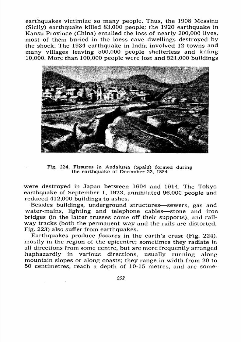
7/28/2019 Fundamentals of Geology - 19th century - Russia text in English
http://slidepdf.com/reader/full/fundamentals-of-geology-19th-century-russia-text-in-english 253/375
earthquakes victimize so many people. Thus, the 1908 Messina
(Sicily) earthquake killed 83,000 people; the 1920 earthquake in
Kansu Province (China) entailed the loss of nearly 200,000 lives,
most of them buried in the loess cave dwellings destroyed by
the shock. The 1934 earthquake in India involved 12 towns and
many villages leaving 500,000 people shelterless and killing
10,000. More than 100,000 people were lost and 521,000 buildings
Fig. 224. Fissures in Andalusia (Spain) formed duringthe earthquake of December 22, 1884
were destroyed in Japan between 1604 and 1914. The Tokyo
earthquake of September 1, 1923, annihilated 96,000 people and
reduced 412,000 buildings to ashes.
Besides buildings, underground structures sewers, gas and
water-mains, lighting and telephone cables stone and iron
bridges (in the latter trusses come off their supports), and rail-
way tracks (both the permanent way and the rails are distorted,
Fig. 223) also suffer from earthquakes.
Earthquakes produce fissures in the earth's crust (Fig. 224),
mostly in the region of the epicentre; sometimes they radiate in
all directions from some centre, but are more frequently arrangedhaphazardly in various directions, usually running along
mountain slopes or along coasts; they range in width from 20 to
50 centimetres, reach a depth of 10-15 metres, and are some-
252
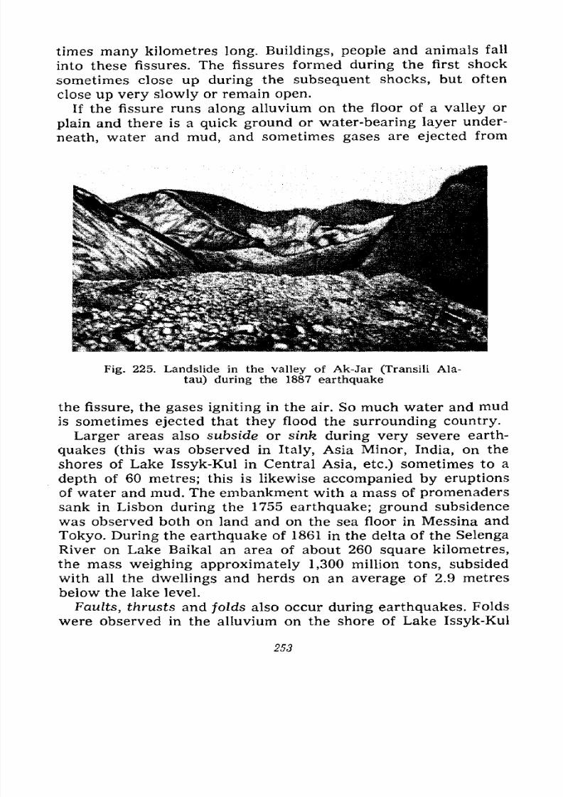
7/28/2019 Fundamentals of Geology - 19th century - Russia text in English
http://slidepdf.com/reader/full/fundamentals-of-geology-19th-century-russia-text-in-english 254/375
times many kilometres long. Buildings, people and animals fall
into these fissures. The fissures formed during the first shock
sometimes close up during the subsequent shocks, but often
close up very slowly or remain open.
If the fissure runsalong
alluvium on the floor of a valley or
plain and there is a quick ground or water-bearing layer under-
neath, water and mud, and sometimes gases are ejected from
Fig. 225. Landslide in the valley of Ak-Jar (Transili Ala-
tau) during the 1887 earthquake
the fissure, the gases igniting in the air. So much water and mud
is sometimes ejected that they flood the surrounding country.
Larger areas also subside or sink during very severe earth-
quakes (this was observed in Italy, Asia Minor, India, on the
shores of Lake Issyk-Kul in Central Asia, etc.) sometimes to a
depth of 60 metres; this is likewise accompanied by eruptions
of water and mud. The embankment with a mass of promenaders
sank in Lisbon during the 1755 earthquake; ground subsidence
was observed both on land and on the sea floor in Messina and
Tokyo. During the earthquake of 1861 in the delta of the Selenga
River on Lake Baikal an area of about 260 square kilometres,
the mass weighing approximately 1,300 million tons, subsided
with all the dwellings and herds on an average of 2.9 metresbelow the lake level.
Faults, thrusts and folds also occur during earthquakes. Folds
were observed in the alluvium on the shore of Lake Issyk-Kul
253
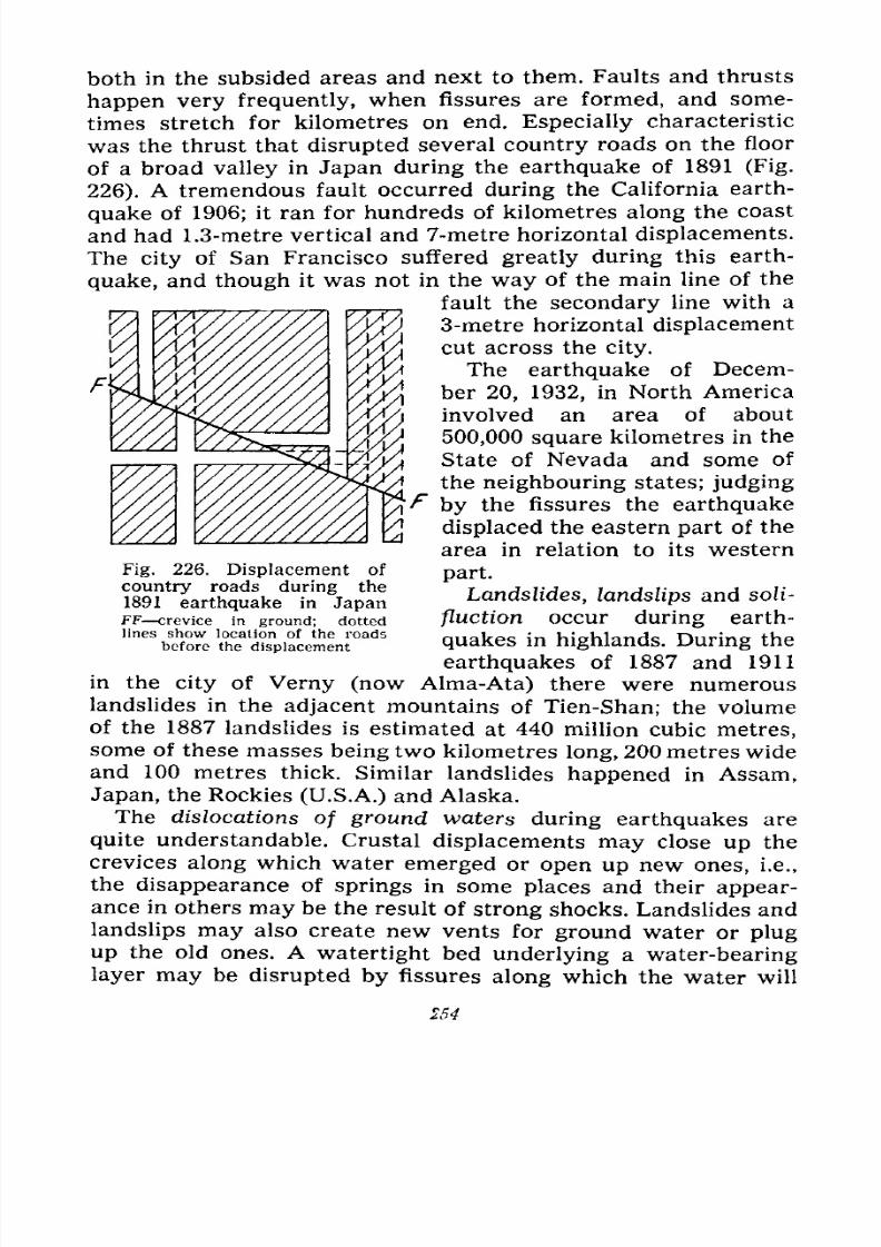
7/28/2019 Fundamentals of Geology - 19th century - Russia text in English
http://slidepdf.com/reader/full/fundamentals-of-geology-19th-century-russia-text-in-english 255/375
both in the subsided areas and next to them. Faults and thrusts
happen very frequently, when fissures are formed, and some-
times stretch for kilometres on end. Especially characteristic
was the thrust that disrupted several country roads on the floor
of a broad valley in Japan during the earthquake of 1891 (Fig.
226). A tremendous fault occurred during the California earth-
quake of 1906; it ran for hundreds of kilometres along the coast
and had 1.3-metre vertical and 7-metre horizontal displacements.
The city of San Francisco suffered greatly during this earth-
quake, and though it was not in the way of the main line of the
fault the secondary line with a
3-metre horizontal displacement
cut across the city.
The earthquake of Decem-
ber 20, 1932, in North America
involved an area of about
500,000 square kilometres in the
State of Nevada and some of
the neighbouring states; judging
\f by the fissures the earthquake
displaced the eastern part of the
area in relation to its western
part.
Landslides, landslips and soli-
fluction occur during earth-
quakes in highlands. During the
earthquakes of 1887 and 1911
in the city of Verny (now Alma-Ata) there were numerous
landslides in the adjacent mountains of Tien-Shan; the volume
of the 1887 landslides is estimated at 440 million cubic metres,
some of these masses being two kilometres long, 200 metres wide
and 100 metres thick. Similar landslides happened in Assam,
Japan, the Rockies (U.S.A.) and Alaska.
The dislocations of ground waters during earthquakes are
quite understandable. Crustal displacements may close up the
crevices along which water emerged or open up new ones, i.e.,
the disappearance of springs in some places and their appear-
ance in others may be the result of strong shocks. Landslides and
landslips may also create new vents for ground water or plug
up the old ones. A watertight bed underlying a water-bearing
layer may be disrupted by fissures along which the water will
Fig. 226. Displacement of
country roads during the
1891 earthquake in JapanFF crevice in ground; dotted
lines show location of the roadsbefore the displacement
254
7/28/2019 Fundamentals of Geology - 19th century - Russia text in English
http://slidepdf.com/reader/full/fundamentals-of-geology-19th-century-russia-text-in-english 256/375
escape into the interior, and as a result groups of wells will be
deprived of water.
Seaquakes (Tsunamis). If the focus of an earthquake is located
somewhere under the floor of an ocean or of a large sea the shake
is transmitted through the entire thickness of water and is felt
on the ships sailing the sea at this time. In a vertical shock, i.e.,
over the epicentre, the ship is suddenly raised and then lowered,
and a swelling-up of the water is observed. In lateral shocks
the ship is jolted as though it has run into an underwater cliff,
floating timber or an iceberg; unfastened objects fall, people
barely stand up and the rudder is shaken up with particular
force. The shock is often accompanied by a hollow rumble
passing from the water into the atmosphere.
The seaquakes are more destructive when the epicentre is
near the coast. In this case the sea frequently withdraws from
a large area during the first shock, then returns as an enormous-
ly powerful wave, comes down upon the coast and sweeps every-
thing off. In the Lisbon earthquake of 1755 the wave was
26 metres high and rolling for 15 kilometres inland annihilated
some 60,000 people. In 1923 the waves transported ice for a
distance of half a kilometre from the shore line in Kamchatka
and buried several buildings; the tundra was flooded for several
kilometres. The shallow coastal part of the sea is often covered
with disorderly raging waves. The waves raised by an earth-
quake near the coast then spread over large distances across the
oceans, erode the coasts and flood the coastal towns and
villages.
The distribution of earthquakes on the earth's surface shows
that they are closely linked with regions of dislocations and
vulcanism. Statistics indicate that 40 per cent of the earth-
quakes occurs on the Pacific coast, from the Strait of Magellan
across the Aleutian Islands to New Zealand which, as we know,
also abound in volcanoes. Here we find mountain ranges running
along the borders of the continents and near by the deepest
depressions in the ocean floors along the coasts, i.e., the sharpest
breaks in relief. About 50 per cent of the earthquakes happens
in the so-called "zone of fracture" which runs from Mexico in
the Western Hemisphere across the Atlantic, and along the Med-iterranean to the Caspian and India; this zone is noted for its
young folded mountains, large subsidences depressions, and
active volcanoes. Only 10 per cent of the earthquakes falls to
255
7/28/2019 Fundamentals of Geology - 19th century - Russia text in English
http://slidepdf.com/reader/full/fundamentals-of-geology-19th-century-russia-text-in-english 257/375
the other main masses of continents, the seismic areas being:
1) the zone of fracture along the African lakes, the Red and
Dead seas; 2) the mountain ranges of Tien-Shan and the Pamirs,
and 3) the southern part of Lake Baikal with the surrounding
country.
Thus the most seismic areas are those of the young folded
mountains, young faults and subsidences, i.e., the young orogens
in general; the least seismic regions are those of the oldest
structures, long since consolidated, i.e., the old platforms.
The seismic areas in the Soviet Union are: 1) the Transcau-
casia, belonging to the Mediterranean zone, and the Crimea
(earthquake of 1927); 2) Tien-Shan, especially the northern foot-
hills (earthquakes of 1887 and 1911 in Alma-Ata), Ferghana and
the Pamirs as a region of young fold-thrust and fold-block
mountains; 3) the southern part of Lake Baikal with the adjacent
areas east and west of the lake an ancient platform, but with
young subsidences (only relatively seismic); and 4) Kamchatka
and Primorye from the Anadyr River to Vladivostok, belonging
to the Pacific belt (also less seismic in this part).
The Russian and Siberian platforms with their little disturbed
structure, and the Urals, as very ancient mountains, contrariwise
have rare and weak earthquakes; there are somewhat more
earthquakes in the region of Altai in connection with the recent
movements in these fold-block mountains.
Types of Earthquakes. Earthquakes, as we already know, are
divided by origin into subsidence, volcanic and dislocation (or
tectonic). The first are the rarest, the second occur
more often, and the last are the most numerous. Amongall these categories distinction is also made according to type,
central earthquakes having a focus of dimensions limited in all
directions, and linear earthquakes with the origin considerably
elongated in one direction. The subsidence and volcanic earth-
quakes mostly belong to the central type, while the dislocation
earthquakes are more frequently linear because their origin
(hypocentre) is more or less elongated along the folds and
crevices of the fractures (faults, thrusts and shift faults).
Correlation Between Earthquakes and Other Natural Phenom-
ena. Man has long tried to find out if earthquakes occurred
mainly at certain times of the year, the lunar month, and hours
of the day. Statistics has shown earthquakes actually to happen:
1) more often in autumn and winter than in spring and summer
256
7/28/2019 Fundamentals of Geology - 19th century - Russia text in English
http://slidepdf.com/reader/full/fundamentals-of-geology-19th-century-russia-text-in-english 258/375
(4:3 ratio); 2) more frequently during the new moon and full
moon; 3) more often during the perigee, i.e., when the Moon is
closest to the Earth; 4) the shocks are more frequent and stronger
when the Moon is in the meridian of the given place.
Certain correlations are also observed with the winds,
precipitations and changes in atmospheric pressure. Thus, strong
winds themselves cause microseismic vibrations. Earthquakes
are observed somewhat more often after the period of abundant
precipitations. A sharp drop or rise in the air pressure may serve
as a trigger for the discharge of the tension in the folds or frac-
tures in the form of a displacement of the strata which will in
its turn cause an earthquake. A similar influence may be exerted
by an increase of the load on the earth's crust due to abundant
precipitations in winter and autumn, wind pressure and
strengthening of the tides according to the position of the Moon.
Safeguards. Man is unable to prevent earthquakes; all he can
do is to issue due warnings so that people may find safety; man
can also build structures capable of withstanding strong earth-
quakes.
Seismic stations equipped with precise and sensitive seismo-
graphs are set up in seismic areas for purposes of warning the
population of coming earthquakes; the seismographs must record
not only the strong vibrations, but also the microseismic waves;
by studying these the stations must ascertain if possible the
movements that presage destructive earthquakes. This has not
been achieved as yet.
The safeguards adopted in the countries greatly suffering
from earthquakes consist of certain building rules. They come
essentially to an enlargement of the foundation, use of metal
ties in the brickwork, special strength of vaults and straight
arches, a clearance between the roofs and chimneys, prohibition
of heavy cornices and stucco moulding, and use of quality
building materials. The buildings put up according to these rules
are called antiseismic; they must guarantee safety to the tenants.
171518
7/28/2019 Fundamentals of Geology - 19th century - Russia text in English
http://slidepdf.com/reader/full/fundamentals-of-geology-19th-century-russia-text-in-english 259/375
X
BRIEF HISTORY OF OUR EARTH
Earth'sEarly
Youth. Formationof Continents and
Seas.
Origin of Life. Fossils and Their Significance. Trans-
formation of the Face of the Earth. Cycles of Dislo-
cations and Erosions. Transgressions and Regressions.
Geological Chronology. Archaeozoic, Proterozoic, Palae-
ozoic, Mesozoic and Cainozoic Eras. Chronological Table.
How the Age of the Earth is Determined. Continental
Drift.
Nobody can tell us exactly how our Earth was made becausenot a single scientist was in a position to observe it himself.
Only more or less plausible assumptions in the form of hypo-
theses are therefore enunciated. Several, as we know today,
perfectly fantastic hypotheses were proposed in the civilized
Mediterranean countries of antiquity according to the knowl-
edge then current. The first scientific cosmogonic hypothesis
based on facts established by science was proposed in the eight-
eenth century by Kant and Laplace. These scientists believedthe Sun and all the planets revolving around it to have formed
by condensation of one primary incandescent nebula which
rotated even before the origin of the Sun. This nebula was
bigger than the entire planetary system and somewhat flattened
in form. Under the influence of cooling and attraction to the
centre the nebula contracted and its rotation caused a ring of
matter to break away at the equator; this ring broke up and was
transformed into a sphere which continued to rotate. Since thecontraction persisted, several rings broke off and were trans-
formed into spheres, all the planets being finally formed and
revolving each in its own orbit around the Sun. The central
258
7/28/2019 Fundamentals of Geology - 19th century - Russia text in English
http://slidepdf.com/reader/full/fundamentals-of-geology-19th-century-russia-text-in-english 260/375
part of the nebula was changed into a star which continued to
burn, lighting and heating the planets revolving around it. The
planets' satellites originated in like manner by rings breaking
away from the planets because of their fast rotation.
The Kant-Laplace hypothesis was long thought appropriately
to explain the formation of the Earth, but the rapid development
of astronomy, geophysics and geology in the nineteenth century
made it possible to reveal several errors in this hypothesis, and
new explanations appeared. For example, the scientist Cham-
berlain thought that the little Earth, formed in the manner pro-
posed by Kant and Laplace, gradually grew larger by the
addition of meteorites similar condensations of nebular sub-
stance which fell on it from cosmic space. The astronomer Jeans
believed the Solar Syctem to have formed as a result of the pas-
sage of another star very close to the Sun, the attraction of this
star causing a sharp disturbance in the balance of the internal
layers of the Sun and the ejection from it of an enormous
stream of matter which later by division and subsequent con-
densation gave rise to all the planets of the Solar System. For a
number of years this hypothesis was thought very adequate, but
was then disproved because the passage of one star so close to
another that it may cause the supposed ejections of material
is a very rare phenomenon and unlikely to explain the forma-
tion of the planets revolving around the Sun. Several serious
errors were discovered in this hypothesis chiefly by Soviet
scientists.
More than 10 years ago Academician O. Schmidt put forward
a new hypothesis of the formation of our Earth and the other
planets revolving around the Sun. He assumed that moving in
the Galaxy through the dust and gases which form the inter-
stellar matter the Sun attracted part of them and came out sur-
rounded by a cloud of this substance. According to the law of
gravity this cloud revolved around the Sun, the particles com-
posing the cloud moving in it in all directions, colliding with
each other, sometimes breaking up, but more frequently uniting,
the smaller particles joining the larger ones; the planets were
thus gradually formed in the cloud. The part of the cloud closer
to the Sun was heated more intensely, and the nearest planets
Mercury, Venus, the Earth and Mars are therefore small and
consist of dense matter, rock and metal, and little gaseous re-
mains, whereas Jupiter, Saturn, Uranus and Neptune, the more
17* 259
7/28/2019 Fundamentals of Geology - 19th century - Russia text in English
http://slidepdf.com/reader/full/fundamentals-of-geology-19th-century-russia-text-in-english 261/375
distant planets, are of enormous size and consist of gaseous and
volatile substances. The bodies that failed to join the solid inner
planets form comets and asteroids.
Schmidt originally thought that the meteorites forming part
of the primary cloud had played an important part in the mak-
ing of the planets; later he relinquished this idea and believed
the gas-dust mass to have been the initial material for the crea-
tion of the planets.
Schmidt's hypothesis successfully explains a great deal in the
formation of the planets, but it is not devoid of serious short-
comings, as was pointed out at the very first conference on
problems of cosmogony.* The hypothesis considers the formation
of the planets of the Solar System, but leaves out the Sun; it
offers a good explanation of the origin of the terrestrial type
planets, but the large planets with their physical properties do
not fit into it. Schmidt did not study the evolution of the Sun or
the problem of the origin and evolution of the stars and did not
utilize the rich material of modern astrophysics. All this shows
that Schmidt's hypothesis is as yet unable to explain the for-
mation of all the heavenly bodies and is inadequate in its
present form.
Most of the Soviet scientists studying problems of astronomy
and geophysics believe that the Earth and the other planets of
the Solar System were formed not of substance brought from
without, but of the gaseous or gas-dust matter existing within
the limits of this system.
Schmidt's and several other hypotheses assume that the Earth
and other planets of this type formed of the gas-dust substance
were originally cold. Subsequently, the substance was divided
according to its specific gravity by means of gravitational differ-
entiation and the globe was stratified into geospheres of different
densities as a result of the rise of the lighter particles to the
outer shells of the Earth.
The mean density of the globe is 5.5, while the mean density
of the outermost part of the earth's crust which we can study
on the surface, in mines and boreholes does not exceed 2.5 to
3.0. The density of the earth's core is very high, from 8 to 11.
* O. Schmidt, Four Lectures on the Theory of the Origin of the Earth,
Moscow, 1950; and Transactions of the First Conference on Problems of
Cosmogony, April 16-19, 1951, Moscow, 1951. Russ. Ed.
260

7/28/2019 Fundamentals of Geology - 19th century - Russia text in English
http://slidepdf.com/reader/full/fundamentals-of-geology-19th-century-russia-text-in-english 262/375
Some scientists suppose that the earth's core consists of nickel
and iron; others explain the physical state of the core by saying
that owing to a colossal pressure the substance of the core is in
a special "metallized" condition and that the structure of the
atoms of this substance differs from that in the earth's crust,
namely, that the outer electrons are displaced in each atom.
According to the Kant-Laplace hypothesis the molten globe
of the Earth gradually cooled from the surface inward and
was covered with a crust which was at first very thin and was
often disrupted under the pressure of gases and incandescent
masses. Subsequently, this crust grew heavier and stronger, but
beneath it, at a depth of 50 to 100 kilometres, a zone (geosphere)
of molten magma was retained just the same.
The discovery of deep-focus earthquakes originating at a depth
of more than 600 kilometres has persuaded some geologists that
the outer shell of the Earth consists of solid substance to a
depth of at least 800 kilometres. This structure of the earth's
crust conforms to the assumption of the origin of a "cold" Earth
from cosmic dust better than to the hypothesis of a fiery-liquid
Earth.
According to Schmidt's hypothesis the originally "cold" Earth
had in its composition radioactive elements which by disintegrat-
ing served as the source of energy, and the Earth gradually
melted, only the outer shell of the Earth the crust remaining
hard. On the other hand, as A. Vinogradov points out, if we take
the meteorites to be fragments of planets (this is now believed
firmly established) we must also admit that these planets went
through the stage of complete melting. Thus, the Earth, whose
internal geospheres have, according to modern assumptions, a
structure analogous to that of different types of meteorites, must,as a whole, have gone through the stages of a molten body in
which the processes of liquid differentiation, liquation and strati-
fication occurred. In Vinogradov's opinion the Earth began to
cool from the inside and long retained a molten shell.
If we summarize the discussions of Schmidt's hypothesis at
the First Cosmogonic Conference we shall see that the problem
of the origin of the Earth and planets, the problem of whether
the energy produced by the decay of radioactive elements is
alone enough to heat and melt the globe, and the problems of the
further differentiation of the Earth's substances and the process
of the Earth's cooling have as yet been inadequately elaborated
261
7/28/2019 Fundamentals of Geology - 19th century - Russia text in English
http://slidepdf.com/reader/full/fundamentals-of-geology-19th-century-russia-text-in-english 263/375
and that astronomers, geophysicists and geologists have come to
no agreement.
In his work Dialectics of Nature F. Engels pointed out that
on our Earth, as on all the other cosmic bodies, there is a con-
tinuous struggle between the forces of attraction and repulsion
and that since the hard crust was formed the forces of attraction
have gained an upper hand. "Owing to its decisive superiority
over repulsion on our present-day Earth, attraction has, on the
contrary, become entirely passive: we owe all the active move-
ment to the influx of repulsion which comes from the Sun."*
This amendment to the hypotheses of the Earth's formation was
of great significance because without the alternation in the
activity of the forces of attraction and repulsion it is impossible
to explain the structure of the earth's crust in which we observe
the results of strong attraction as fold-forming contractions as
well as the results of repulsion which has replaced the epoch of
attraction. Expansion leads to formation of fractures, faults with
downward and upward displacements of whole layers, gaping
fissures and sinking of small and large stretches of the earth's
crust in the form of so-called fault troughs. The amendment
made by Engels must be accepted since the structure of the
earth's crust cannot be understood or explained without it. It was
proposed by some geologists, who evolved the pulsation hypo-
thesis according to which the development of the earth's hard
crust after its formation represented an alternation of epochs or
periods in the activity of the forces of attraction which caused
compression of the crustal layers and the forces of repulsion
which produced its expansion, fractures, faults and fault troughs
(for details see Chapter VIII).
By assuming that the Earth was originally either a molten
sphere or, having formed as a cold body, later changed to a
molten sphere by internal melting, we can draw for ourselves
the following picture of the subsequent transformation of the
earth's crust.
The molten sphere of the Earth gradually cooled from the sur-
face inward and the liquid had to pass into a solid state and
cover itself with a crust consisting of compounds of lighter ele-
ments. This crust was at first verv thin and broke here and there
*F. Engels, Dialectics of Nature, State Publishers of Political Litera-
ture, 1955, p. 53. Russ. ed.
262
7/28/2019 Fundamentals of Geology - 19th century - Russia text in English
http://slidepdf.com/reader/full/fundamentals-of-geology-19th-century-russia-text-in-english 264/375
under the pressure of gases and vapours liberated from the
molten mass. But it gradually became stronger growing frombelow by the hardening of the deeper layers and from above
by the cooling of the lava poured out on to the surface throughthe ruptures in the crust.
The fractures now occurred less frequently and only in sepa-rate weaker places, but then grew more catastrophic because
they were followed by eruptions and effusions much more
powerful than those occurring in modern times. Under the
pressure of gases and vapours the crust rose in bubbles and
broke up with a terrible explosion throwing about enormous
fragments and letting the lava emerge; it is possible, however,that the latter sometimes poured out of the fissures in the crust
more quietly.
Since these processes did not operate uniformly over the entire
surface the crust gradually had to grow uneven and cover itself
with protrusions of various sizes in the form of fields of extruded
lava separated by hollows. Thus were the primary continents
and oceans outlined, though there was no water on the Earth as
yet; at that time the temperature of the crust was still higherthan the boiling-point of water and all the water then existed
as steam in a dense atmosphere.
The cooling continued, the steam in the atmosphere condensed
and returned to the Earth in the form of terrible downpourswhich on the hot crust quickly changed to steam again. The air
was saturated with electricity, and it is hard to conceive the aw-ful thunders that roared over the Earth and the lightning that
cleaved the dense air; there was no quiet either day or night,
and since the Earth was enveloped in continuous heavy clouds
the rays of the Sun did not penetrate to the surface of the Earthwhich was being born in storm and tempest.
Then, watered and cooled by downpours the crust cooled on
the surface to the extent that the water falling on it did not
evaporate at once, but began to fill the depressions. At first the
water in these primary seas boiled and curtains of steam hungover them; later the boiling stopped, but the seas long remained
hot. It is to be supposed that the water in them was already
salty because the gases liberated from the magma includedconstituents of various salts. The crust was still insufficiently
strong, broke here and there, and the lava pouring in heavystreams over the continents often reached the sea-shores, tre-
263
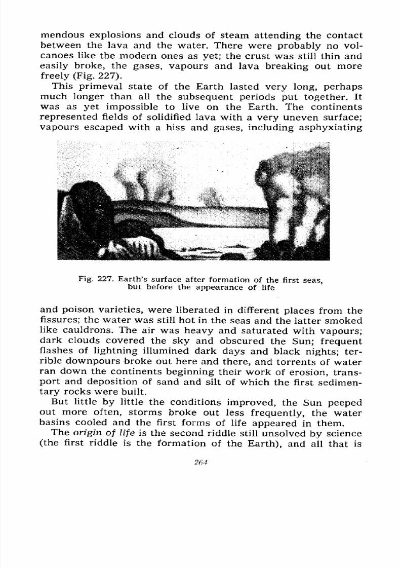
7/28/2019 Fundamentals of Geology - 19th century - Russia text in English
http://slidepdf.com/reader/full/fundamentals-of-geology-19th-century-russia-text-in-english 265/375
mendous explosions and clouds of steam attending the contact
between the lava and the water. There were probably no vol-
canoes like the modern ones as yet; the crust was still thin and
easily broke, the gases, vapours and lava breaking out more
freely (Fig. 227).
This primeval state of the Earth lasted very long, perhapsmuch longer than all the subsequent periods put together. It
was as yet impossible to live on the Earth. The continents
represented fields of solidified lava with a very uneven surface;
vapours escaped with a hiss and gases, including asphyxiating
Fig. 227. Earth's surface after formation of the first seas,but before the appearance of life
and poison varieties, were liberated in different places from the
fissures; the water was still hot in the seas and the latter smoked
like cauldrons. The air was heavy and saturated with vapours;dark clouds covered the sky and obscured the Sun; frequentflashes of lightning illumined dark days and black nights; ter-
rible downpours broke out here and there, and torrents of water
ran down the continents beginning their work of erosion, trans-
port and deposition of sand and silt of which the first sedimen-
tary rocks were built.
But little by little the conditions improved, the Sun peeped
out more often, storms broke out less frequently, the waterbasins cooled and the first forms of life appeared in them.
The origin of life is the second riddle still unsolved by science
(the first riddle is the formation of the Earth), and all that is
264
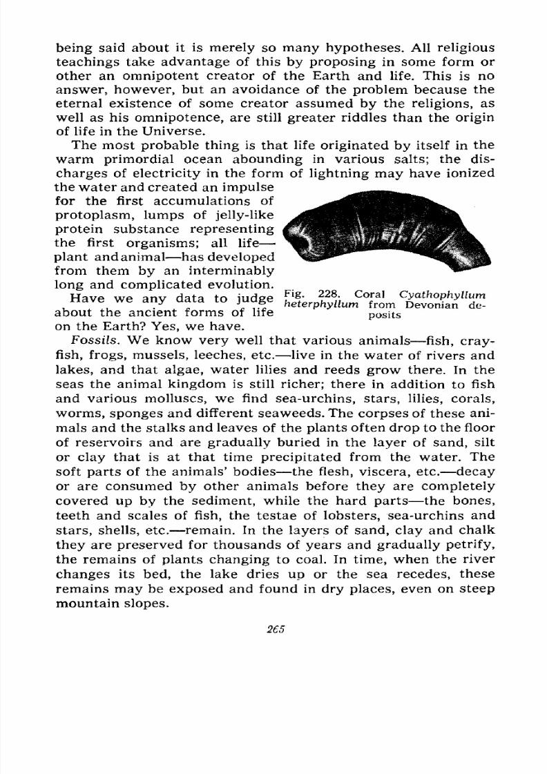
7/28/2019 Fundamentals of Geology - 19th century - Russia text in English
http://slidepdf.com/reader/full/fundamentals-of-geology-19th-century-russia-text-in-english 266/375
being said about it is merely so many hypotheses. All religious
teachings take advantage of this by proposing in some form or
other an omnipotent creator of the Earth and life. This is no
answer, however, but an avoidance of the problem because the
eternal existence of some creator assumed by the religions, as
well as his omnipotence, are still greater riddles than the origin
of life in the Universe.
The most probable thing is that life originated by itself in the
warm primordial ocean abounding in various salts; the dis-
charges of electricity in the form of lightning may have ionized
the water and created an impulse
for the first accumulations of
protoplasm, lumps of jelly-like
protein substance representing
the first organisms; all life
plant and animal has developed
from them by an interminably
long and complicated evolution.
HPIVP WP snv Hats tn inHcrpFi&- 228 - Coral CyathophyllumHave we any data to judgeheterphyllum from Devoi a de_
about the ancient forms of lifeposits
on the Earth? Yes, we have.
Fossils. We know very well that various animals fish, cray-
fish, frogs, mussels, leeches, etc. live in the water of rivers and
lakes, and that algae, water lilies and reeds grow there. In the
seas the animal kingdom is still richer; there in addition to fish
and various molluscs, we find sea-urchins, stars, lilies, corals,
worms, sponges and different seaweeds. The corpses of these ani-
mals and the stalks and leaves of the plants often drop to the floor
of reservoirs and are gradually buried in the layer of sand, silt
or clay that is at that time precipitated from the water. The
soft parts of the animals' bodies the flesh, viscera, etc. decay
or are consumed by other animals before they are completely
covered up by the sediment, while the hard parts the bones,
teeth and scales of fish, the testae of lobsters, sea-urchins and
stars, shells, etc. remain. In the layers of sand, clay and chalk
they are preserved for thousands of years and gradually petrify,
the remains of plants changing to coal. In time, when the river
changes its bed, the lake dries up or the sea recedes, these
remains may be exposed and found in dry places, even on steep
mountain slopes.
265
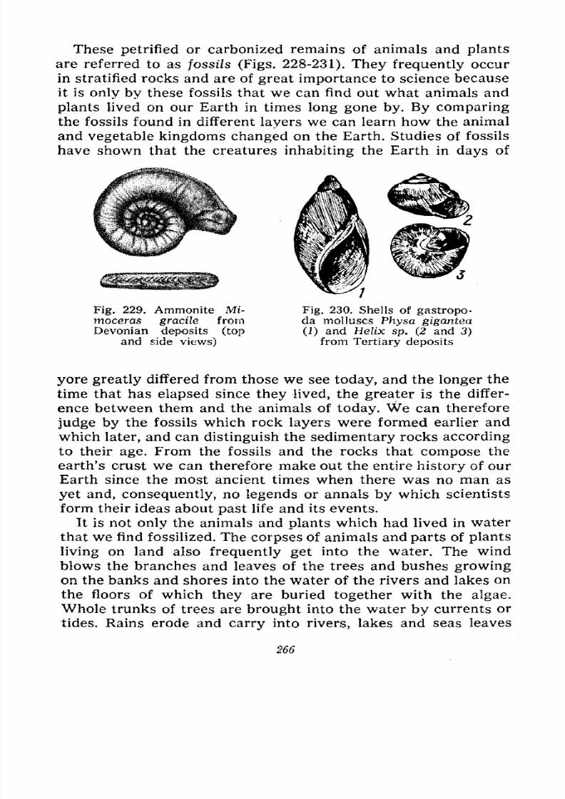
7/28/2019 Fundamentals of Geology - 19th century - Russia text in English
http://slidepdf.com/reader/full/fundamentals-of-geology-19th-century-russia-text-in-english 267/375
These petrified or carbonized remains of animals and plants
are referred to as fossils (Figs. 228-231). They frequently occur
in stratified rocks and are of great importance to science because
it is only by these fossils that we can find out what animals and
plants lived on our Earth in times long gone by. By comparing
the fossils found in different layers we can learn how the animal
and vegetable kingdoms changed on the Earth. Studies of fossils
have shown that the creatures inhabiting the Earth in days of
Fig. 229. Ammonite Mi-
moceras gracile from
Devonian deposits (top
and side views)
Fig. 230. Shells of gastropo-da molluscs Physa gigantea
(1) and Helix sp. (2 and 3)
from Tertiary deposits
yore greatly differed from those we see today, and the longer the
time that has elapsed since they lived, the greater is the differ-
ence between them and the animals of today. We can therefore
judge by the fossils which rock layers were formed earlier and
which later, and can distinguish the sedimentary rocks according
to their age. From the fossils and the rocks that compose the
earth's crust we can therefore make out the entire history of ourEarth since the most ancient times when there was no man as
yet and, consequently, no legends or annals by which scientists
form their ideas about past life and its events.
It is not only the animals and plants which had lived in water
that we find fossilized. The corpses of animals and parts of plants
living on land also frequently get into the water. The wind
blows the branches and leaves of the trees and bushes growing
on the banks and shores into the water of the rivers and lakes onthe floors of which they are buried together with the algae.
Whole trunks of trees are brought into the water by currents or
tides. Rains erode and carry into rivers, lakes and seas leaves
266
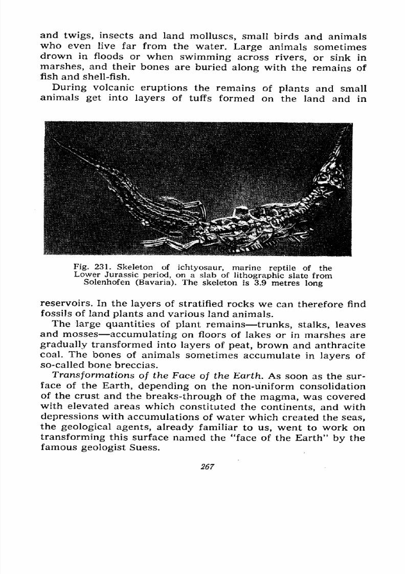
7/28/2019 Fundamentals of Geology - 19th century - Russia text in English
http://slidepdf.com/reader/full/fundamentals-of-geology-19th-century-russia-text-in-english 268/375
and twigs, insects and land molluscs, small birds and animals
who even live far from the water. Large animals sometimes
drown in floods or when swimming across rivers, or sink in
marshes, and their bones are buried along with the remains of
fish and shell-fish.
During volcanic eruptions the remains of plants and small
animals get into layers of tuffs formed on the land and in
Fig. 231. Skeleton of ichtyosaur, marine reptile of the
Lower Jurassic period, on a slab of lithographic slate fromSolenhofen (Bavaria). The skeleton is 3.9 metres long
reservoirs. In the layers of stratified rocks we can therefore find
fossils of land plants and various land animals.
The large quantities of plant remains trunks, stalks, leaves
and mosses accumulating on floors of lakes or in marshes are
gradually transformed into layers of peat, brown and anthracite
coal. The bones of animals sometimes accumulate in layers of
so-called bone breccias.
Transformations of the Face of the Earth. As soon as the sur-
face of the Earth, depending on the non-uniform consolidation
of the crust and the breaks-through of the magma, was covered
with elevated areas which constituted the continents, and with
depressions with accumulations of water which created the seas,the geological agents, already familiar to us, went to work on
transforming this surface named the "face of the Earth" by the
famous geologist Suess.
267
7/28/2019 Fundamentals of Geology - 19th century - Russia text in English
http://slidepdf.com/reader/full/fundamentals-of-geology-19th-century-russia-text-in-english 269/375
The work of these geological agents does not cease for a
single moment, though it fluctuates considerably, increasing in
some parts of the Earth and waning in others.
Not all these agents work incessantly, nor does each of them
always work with the same intensity; the work may, in fact,
temporarily die down. Thus, for example, in countries with a
moderate or cold climate the chemical and organic weathering
ceases in winter, while physical weathering increases. On quiet
days the work of the wind wanes, but while it is quiet in one
country a hurricane may rage in another. Some volcanoes are
constantly but feebly active, others temporarily die down and
then display vigorous or even catastrophic activity. The earth's
crust shakes continuously, but strong earthquakes are not so
frequent. Dislocations are created slowly and ceaselessly, but
judging by strong earthquakes sharp displacements occur only
from time to time. Running water works day and night, but
during the spring flood-time and after strong rains its work
gains in intensity, while in winter it wanes. In highlands its
work is vigorous, on plains it is barely perceptible, and in
deserts it manifests itself very rarely but with double force.
The work of the surf is connected with the inconstancy of the
winds.
The most uniform work is generally done by glaciers, but
they work with different vigour in different parts of their
beds, while over long periods of time their work is also subject
to considerable fluctuations.
This lack of uniformity in the work of the geological agents,
the more or less sharp fluctuations in the intensity of this work,
enable geologists to speak of stages, phases and cycles in the
development of geological processes on the Earth, implying
longer periods of time by cycles and shorter ones by phases and
stages. These periods may vary not only for the different proc-
esses, but also for the same process in different parts of the
Earth and in different historical times. The vigorous activity
of some volcano may thus be called a cycle or period in which
phases or rather stages of awakening, eruption of loose material,
effusion of lava, and dying down are distinguished. In one
volcano this cycle lasts several days, in another years or
decades; the same volcano may in different epochs greatly
change the duration of the cycle, as well as of the individual
phases.
268
7/28/2019 Fundamentals of Geology - 19th century - Russia text in English
http://slidepdf.com/reader/full/fundamentals-of-geology-19th-century-russia-text-in-english 270/375
Of the greatest interest in the history of the Earth are the
cycles of dislocations, erosion and glaciations. We have already
considered the latter in Chapter VI and shall now dwell on the
former.
Tectonic Cycles. Though dislocations the crustal movements
that change the structure of the crust and the interrelations
between the layers of rocks occur, as it is now believed, in-
cessantly, the varying intensity of these movements can hardly
be doubted. The history of the Earth confirms that certain inter-
vals of time characterized by mountain-building are followed
by periods during which the formerly created mountain ranges
are subjected to intensive erosion; of course, the latter also took
place during the mountain-building, but it later became domi-
nant. We are therefore justified in speaking of cycles of disloca-
tions followed by cycles of erosion or denudation, implying bythe word denudation the totality of the processes of weathering
and erosion (denudation means exposure).
To understand the terms used below and define the time of
the cycles take a look at the table of geological chronology
given on page 285. The following cycles of dislocations (tectonic)
are distinguished in the history of the Earth: several most
ancient ones that came to pass during the Archaeozoic and Pro-
terozoic eras; the Caledonian characterizing the first half of the
Palaeozoic era; the Variscian (or Hercyniari) second half of
that era; the Alpine Mesozoic and Cainozoic eras. It is nowconsidered proper to divide the latter into the Pacific, embracing
the Mesozoic era and the Alpine proper, encompassing the Cai-
nozoic era. Each of these cycles is in its turn divided into several
phases separated from each other by longer or shorter periods
of waning or, at any rate, weakening mountain-building move-ments.
Cycles of Erosion. This concept, elaborated by the Amer-
ican scientist Davis, helped to understand the developmentof the forms of the earth's surface. Each cycle is divided into
stages.* After a mountain fold is formed as a long or short
swelling of the earth's surface running water begins to cut
hollows in the limbs of the folds and changes the latter to
* Phases imply the totality of processes leading to a certain result andthen ceasing, i.e., the phases are divided by intervals, whereas the stages
imperceptibly merge into one another.
269
7/28/2019 Fundamentals of Geology - 19th century - Russia text in English
http://slidepdf.com/reader/full/fundamentals-of-geology-19th-century-russia-text-in-english 271/375
ravines and then to valleys; but the area is still weakly dis-
jointed and the valleys have gentle sides. The numerous streams
of water are not yet united into complicated systems, but fre-
quently end in small lakes; the main rivers proceed along the
natural inclines of the region. This is the stage of childhood.
The erosion gradually grows stronger, the valleys become in-
creasingly deeper and the sides steep; sharp ridges are formed
developing peaks and saddles. Individual streams unite into
systems and some lakes disappear. The relief is strongly diversi-
fied. Erosion prevails everywhere. This is the stage of youth.
The development continues. The valleys widen because of
lateral erosion; the rivers form meanders and islands and divide
into distributaries. Under the action of denudation the sides
become gentler, the ridges and summits round out, and the
watersheds grow lower. The streams unite into complex systems.
The relief is strongly diversified, but its forms are already
softened. The erosion weakens. This is the stage of maturity.
The watersheds keep growing lower and the ridges and peaks
rounder, the slopes become very gentle, the rivers in broad
valleys greatly meander forming numerous oxbows and swamps.The transport of material by rivers slows down considerably and
deposition dominates. The relief grows flat. This is the stage of
old age.
Finally, the lowering of the divides, the gentleness of the
slopes and the disappearance of all the unevennesses of the
relief reach their maximum. The work of the water entirely
wanes, the greatly meandering rivers barely flow, many valleys
are drained. The country is so levelled out that it approximates
to a plain and the relief is referred to as a peneplain. This is the
stage of senility.
It will be observed that the farther the cycle of erosion
progresses, the longer the individual stages become. During the
stages of youth and maturity this is determined by the extent of
the deepening and disjunction which the erosion must effect,
while during the stages of old age and senility it is conditioned
by the weakening of the erosion due to the negligible gradients
of the beds and the gentleness of the sides.
The following areas now at various stages of the erosion cycle
may be mentioned by way of example: North Kazakhstan and
Finland offer good examples of the stage of old age and senility,
the Eastern Urals is at the stage of old age, the watershed and
270
7/28/2019 Fundamentals of Geology - 19th century - Russia text in English
http://slidepdf.com/reader/full/fundamentals-of-geology-19th-century-russia-text-in-english 272/375
western slope of the Urals and many Siberian mountains exhibit
the stage of maturity. The Caucasus represents the stage of
youth.
Rejuvenation of the Cycle of Erosion. The cycle of erosion
may quietly go through all its stages only on the condition that
the earth's crust in the given area is entirely undisturbed
because the slow movements which increase the folds and,
especially, the sharp changes in the relief manifesting them-
selves as faults, thrusts and flexures must inevitably greatly
derange it. The history of the Earth offers quite a few examplesof these derangements. Let us imagine a peneplain or an area
in the stage of old age rapidly raised in the form of a plateau
between two faults, i.e., an ordinary horst. Running water will
immediately set to work cutting hollows in its edges where the
gradient has sharply altered. The hollows will then change to
ravines and gorges whose heads will increasingly recede into the
horst. The latter will go through the stages of childhood, youthand maturity again and after a long time may return to the stage
of old age; the cycle of erosion recurred in it, i.e., was rejuve-
nated.
This rejuvenation will be even more complex if the peneplain
is broken up by several faults into separate stretches or wedgesraised to different heights; the erosion will resume its work
along the edges and will transform the steps of the complex
horst into disjointed mountain ranges.
Many countries offer examples of this rejuvenation. Mention
can be made of the Altai which was once a folded highland, later
eroded and levelled to the state of a peneplain, broken up by
faults into wedges variously uplifted and already transformed
by a new cycle of erosion into diversified mountain ranges. Butin some places their surface still shows even sections of the
former peneplain. These sections in aggregate with the complex
structure of the ranges and their failure to coincide with the
direction of the strike of the former folds definitely suggest that
the Altai is, as we have already pointed out, a block-folded range
and that its rejuvenation as a highland was conditioned by the
rejuvenation of the cycle of erosion.
The rejuvenation of other Siberian mountains is evidenced
by the steepness of the slopes or the gorges in the valleys of the
middle and lower reaches of many rivers; they are results of the
swift flow of these rivers, the rapids and even waterfalls which
271
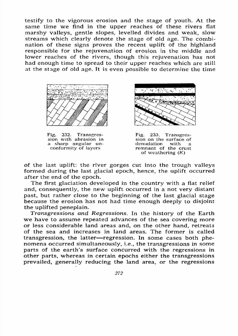
7/28/2019 Fundamentals of Geology - 19th century - Russia text in English
http://slidepdf.com/reader/full/fundamentals-of-geology-19th-century-russia-text-in-english 273/375
testify to the vigorous erosion and the stage of youth. At the
same time we find in the upper reaches of these rivers flat
marshy valleys, gentle slopes, levelled divides and weak, slow
streams which clearly denote the stage of old age. The combi-
nation of these signs proves the recent uplift of the highland
responsible for the rejuvenation of erosion in the middle and
lower reaches of the rivers, though this rejuvenation has not
had enough time to spread to their upper reaches which are still
at the stage of old age. It is even possible to determine the time
Fig. 232. Transgres-
sion with abrasion in
a sharp angular un-
conformity of layers
Fig. 233. Transgres-sion on the surface of
denudation with a
remnant of the crust
of weathering (K)
of the last uplift: the river gorges cut into the trough valleys
formed during the last glacial epoch, hence, the uplift occurred
after the end of the epoch.
The first glaciation developed in the country with a flat relief
and, consequently, the new uplift occurred in a not very distant
past, but rather close to the beginning of the last glacial stage
because the erosion has not had time enough deeply to disjoint
the uplifted peneplain.
Transgressions and Regressions. In the history of the Earth
we have to assume repeated advances of the sea covering more
or less considerable land areas and, on the other hand, retreats
of the sea and increases in land areas. The former is called
transgression, the latter regression. In some cases both phe-
nomena occurred simultaneously, i.e., the transgressions in someparts of the earth's surface concurred with the regressions in
other parts, whereas in certain epochs either the transgressions
prevailed, generally reducing the land area, or the regressions
272
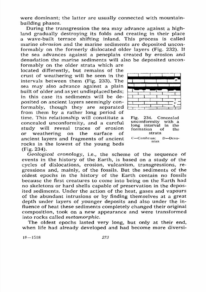
7/28/2019 Fundamentals of Geology - 19th century - Russia text in English
http://slidepdf.com/reader/full/fundamentals-of-geology-19th-century-russia-text-in-english 274/375
were dominant; the latter are usually connected with mountain-
building phases.
During the transgression the sea may advance against a high-
land gradually destroying its folds and creating in their place
a wave-built terrace shifting inland. This process is called
marine abrasion and the marine sediments are deposited uncon-
formably on the formerly dislocated older layers (Fig. 232). If
the sea advances against a peneplain created by erosion and
denudation the marine sediments will also be deposited uncon-
formably on the older strata which are
located differently, but remains of the
crust of weathering will be seen in the
intervals between them (Fig. 233). The
sea may also advance against a plain
built of older and as yet undisplacedbeds;
in this case its sediments will be de-
posited on ancient layers seemingly con-
formably, though they are separated
from them by a rather long period of
time. This relationship will constitute a
concealed unconformity, and a careful
study will reveal traces of erosion
or weathering on the surface of
ancient layers and fragments of ancient
rocks in the lowest of the young beds
(Fig. 234).
Geological cronology, i.e., the scheme of the sequence of
events in the history of the Earth, is based on a study of the
cycles of dislocations, erosion, vulcanism, transgressions, re-
gressions and, mainly, of the fossils. But the sediments of the
oldest epochs in the history of the Earth contain no fossils
because the first creatures to come into being on the Earth had
no skeletons or hard shells capable of preservation in the depos-
ited sediments. Under the action of the heat, gases and vapours
of the abundant intrusions or by finding themselves at a great
depth under layers of younger deposits and also under the in-
fluence of heat these sediments completely changed their original
composition, took on a new appearance and were transformedinto rocks called metamorphic.
The oldest epochs lasted very long, but only at their end,
when life had already developed and had become more diversi-
Fig. 234. Concealed
unconformity with a
longinterval in the
formation of the
strata
C Cambrian; D Devo-nian
18-1518 273
7/28/2019 Fundamentals of Geology - 19th century - Russia text in English
http://slidepdf.com/reader/full/fundamentals-of-geology-19th-century-russia-text-in-english 275/375
fied, did the first fossils appear in the sedimentary strata; these
were chiefly various algae which formed whole layers, imprints
of medusas and sponges, as well as forms defined as the first
Crustacea, primitive corals and traces left by the crawling of
worms. Life was still cooped up in the water, the land being an
absolute desert.
These oldest times in the history of the Earth beginning with
the formation of the first sedimentary rocks are referred to as the
Archaeozoic era. An era implies an extraordinarily long period
of time, in this case hundreds of millions of years. The forma-
tions of the Archaeozoic era contain no fossils as yet, but the
presence of carbon in the form of graphite and thick layers of
limestones most probably formed of organic calcareous silt
warrants the assumption that life had already made its appear-
ance in the upper half of this era. Archaeozoic means primeval
life (archaeos primeval, zoe life).
During this era the sedimentary rocks formed are not so
strongly altered as the Archaean and are often hardly distinguish-
able by the extent of alteration from the later normal rocks. The
next period of time is known as the Proterozoic era, i.e., the
era of earlier (proteros) life, the rocks containing obvious re-
mains of plants and animals.
Both these eras are sometimes combined into one and called
Archaean or Pre-Cambrian, but this is wrong because each of
these stages is too long. Moreover, the Proterozoic era is sepa-
rated from the Archaeozoic by a long interval during which the
Archaean rocks suffered dislocation with extensive intrusions,
following which the folded mountains created by this dislocation
were deeply eroded before the deposition of the Proterozoic
sediments began. These long and characteristic intervals serve
as the best signs to distinguish the eras from each other. These
intervals noted for phenomena of dislocation and erosion, rather
than deposition of sediments, naturally have no fossils which
renders determination of their duration difficult. Chronologi-
cally they are associated with the preceding era which they ter-
minate.
The Proterozoic era is also brought to an end by a similar
interval after which the Palaeozoic era, i.e., the era of ancientlife (palaios ancient), begins; this era already contains numer-
ous remains of multiform and rapidly developing life. Theymake it possible to divide this era into periods, i.e., shorter spaces
274
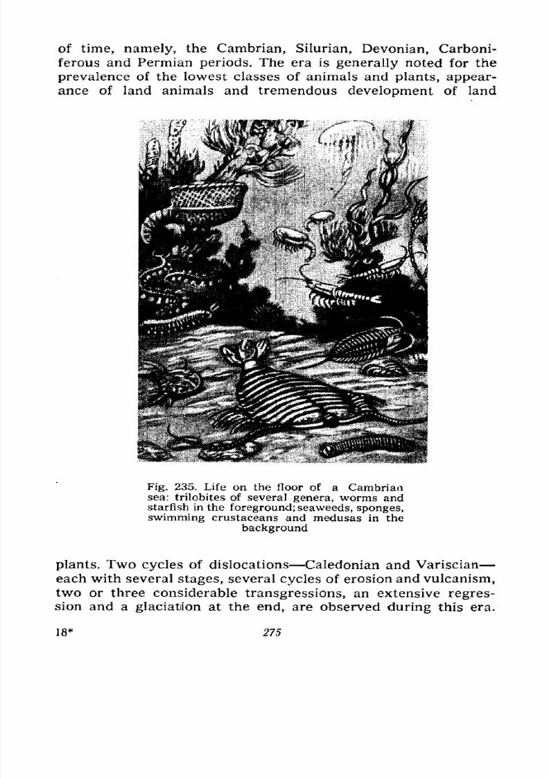
7/28/2019 Fundamentals of Geology - 19th century - Russia text in English
http://slidepdf.com/reader/full/fundamentals-of-geology-19th-century-russia-text-in-english 276/375
of time, namely, the Cambrian, Silurian, Devonian, Carboni-
ferous and Permian periods. The era is generally noted for the
prevalence of the lowest classes of animals and plants, appear-
ance of land animals and tremendous development of land
Fig. 235. Life on the floor of a Cambriansea: trilobites of several genera, worms andstarfish in the foreground; seaweeds, sponges,
swimming crustaceans and medusas in the
background
plants. Two cycles of dislocations Caledonian and Variscianeach with several stages, several cycles of erosion and vulcanism,
two or three considerable transgressions, an extensive regres-
sion and a glaciation at the end, are observed during this era.
18* 275
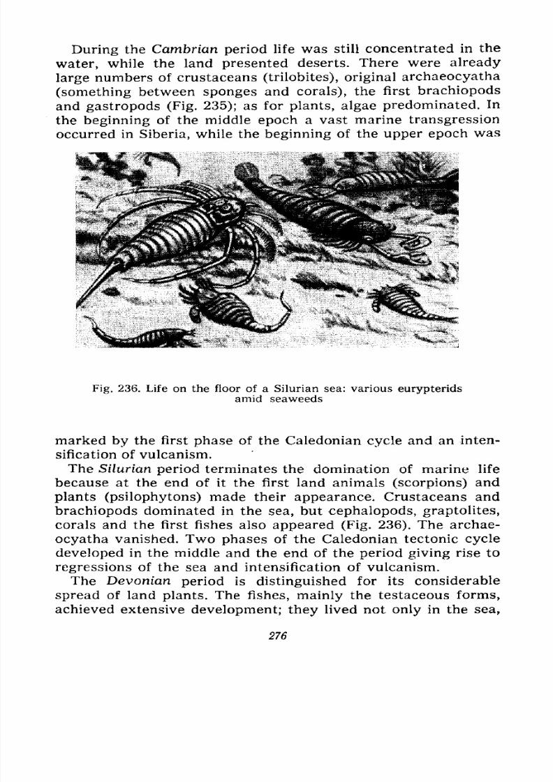
7/28/2019 Fundamentals of Geology - 19th century - Russia text in English
http://slidepdf.com/reader/full/fundamentals-of-geology-19th-century-russia-text-in-english 277/375
During the Cambrian period life was still concentrated in the
water, while the land presented deserts. There were already
large numbers of crustaceans (trilobites), original archaeocyatha
(something between sponges and corals), the first brachiopods
andgastropods
(Fig. 235); as for plants, algae predominated. In
the beginning of the middle epoch a vast marine transgression
occurred in Siberia, while the beginning of the upper epoch was
Fig. 236. Life on the floor of a Silurian sea: various eurypteridsamid seaweeds
marked by the first phase of the Caledonian cycle and an inten-
sification of vulcanism.The Silurian period terminates the domination of marine life
because at the end of it the first land animals (scorpions) and
plants (psilophytons) made their appearance. Crustaceans and
brachiopods dominated in the sea, but cephalopods, graptolites,
corals and the first fishes also appeared (Fig. 236). The archae-
ocyatha vanished. Two phases of the Caledonian tectonic cycle
developed in the middle and the end of the period giving rise to
regressions of the sea and intensification of vulcanism.The Devonian period is distinguished for its considerable
spread of land plants. The fishes, mainly the testaceous forms,
achieved extensive development; they lived not only in the sea,
276
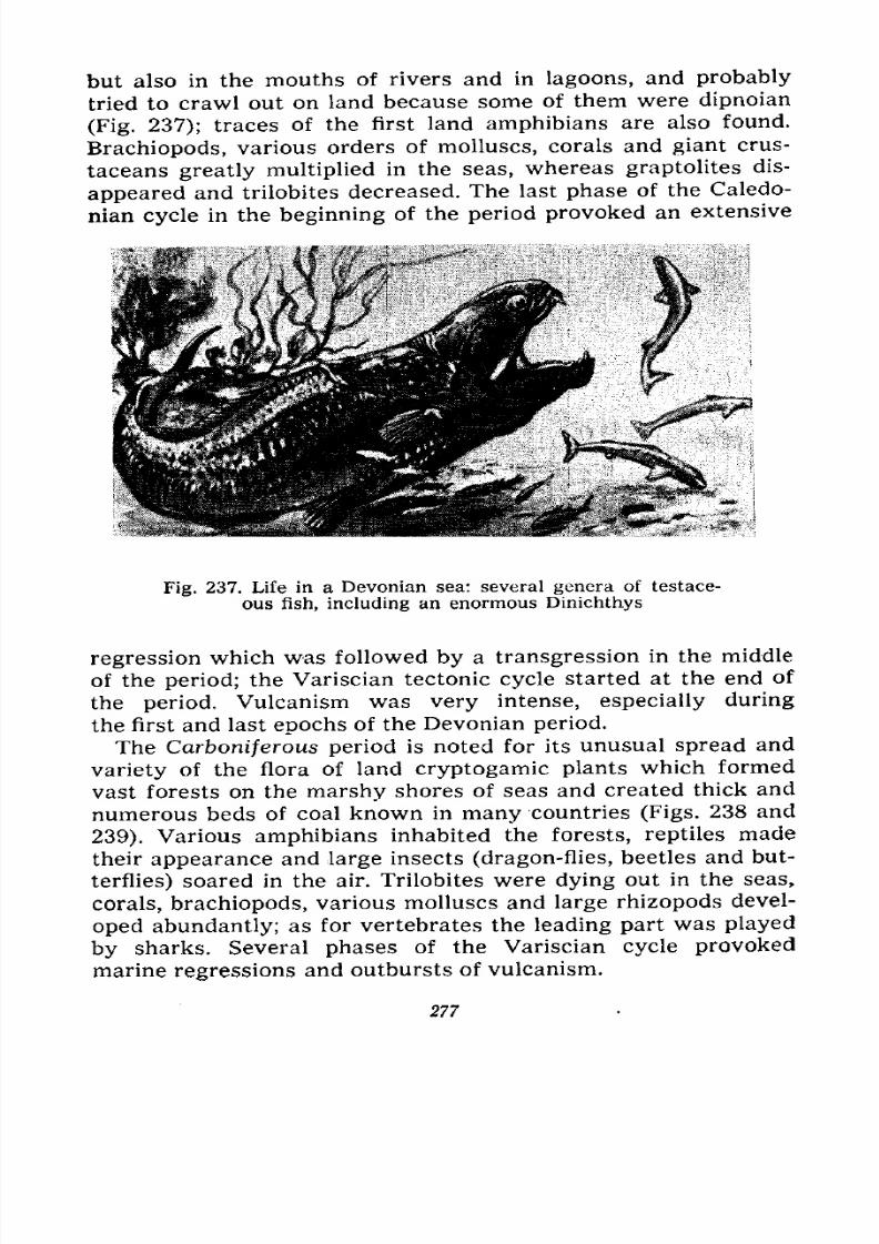
7/28/2019 Fundamentals of Geology - 19th century - Russia text in English
http://slidepdf.com/reader/full/fundamentals-of-geology-19th-century-russia-text-in-english 278/375
but also in the mouths of rivers and in lagoons, and probably
tried to crawl out on land because some of them were dipnoian
(Fig. 237); traces of the first land amphibians are also found.
Brachiopods, various orders of molluscs, corals and giant crus-
taceansgreatly multiplied
in the seas, whereas graptolites dis-
appeared and trilobites decreased. The last phase of the Caledo-
nian cycle in the beginning of the period provoked an extensive
Fig. 237. Life in a Devonian sea: several genera of testace-
ous fish, including an enormous Dinichthys
regression which was followed by a transgression in the middle
of the period; the Variscian tectonic cycle started at the end of
the period. Vulcanism was very intense, especially during
the first and last epochs of the Devonian period.
The Carboniferous period is noted for its unusual spread and
variety of the flora of land cryptogamic plants which formed
vast forests on the marshy shores of seas and created thick and
numerous beds of coal known in many countries (Figs. 238 and
239). Various amphibians inhabited the forests, reptiles made
their appearance and large insects (dragon-flies, beetles and but-
terflies) soared in the air. Trilobites were dying out in the seas,
corals, brachiopods, various molluscs and large rhizopods devel-
oped abundantly; as for vertebrates the leading part was played
by sharks. Several phases of the Variscian cycle provoked
marine regressions and outbursts of vulcanism.
277
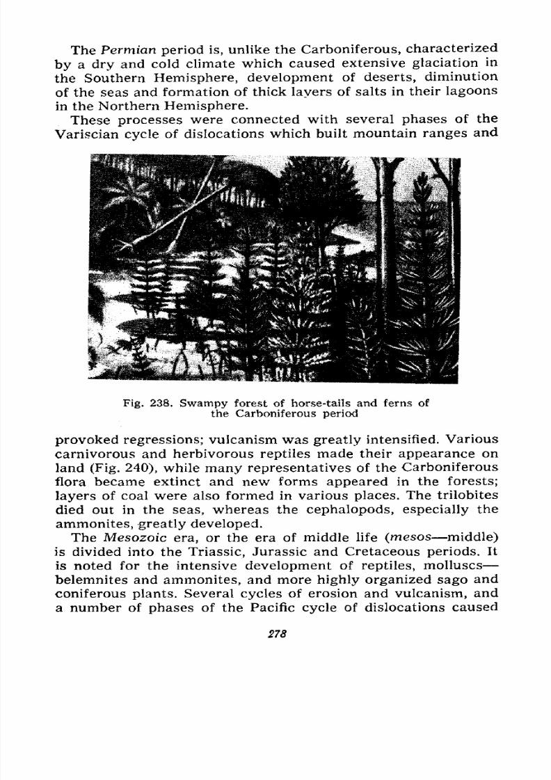
7/28/2019 Fundamentals of Geology - 19th century - Russia text in English
http://slidepdf.com/reader/full/fundamentals-of-geology-19th-century-russia-text-in-english 279/375
The Permian period is, unlike the Carboniferous, characterized
by a dry and cold climate which caused extensive glaciation in
the Southern Hemisphere, development of deserts, diminution
of the seas and formation of thick layers of salts in their lagoons
in the Northern Hemisphere.
These processes were connected with several phases of the
Variscian cycle of dislocations which built mountain ranges and
Fig. 238. Swampy forest of horse-tails and ferns of
the Carboniferous period
provoked regressions; vulcanism was greatly intensified. Various
carnivorous and herbivorous reptiles made their appearance onland (Fig. 240), while many representatives of the Carboniferous
flora became extinct and new forms appeared in the forests;
layers of coal were also formed in various places. The trilobites
died out in the seas, whereas the cephalopods, especially the
ammonites, greatly developed.
The Mesozoic era, or the era of middle life (mesos middle)
is divided into the Triassic, Jurassic and Cretaceous periods. It
is noted for the intensive development of reptiles, molluscsbelemnites and ammonites, and more highly organized sago and
coniferous plants. Several cycles of erosion and vulcanism, and
a number of phases of the Pacific cycle of dislocations caused
278
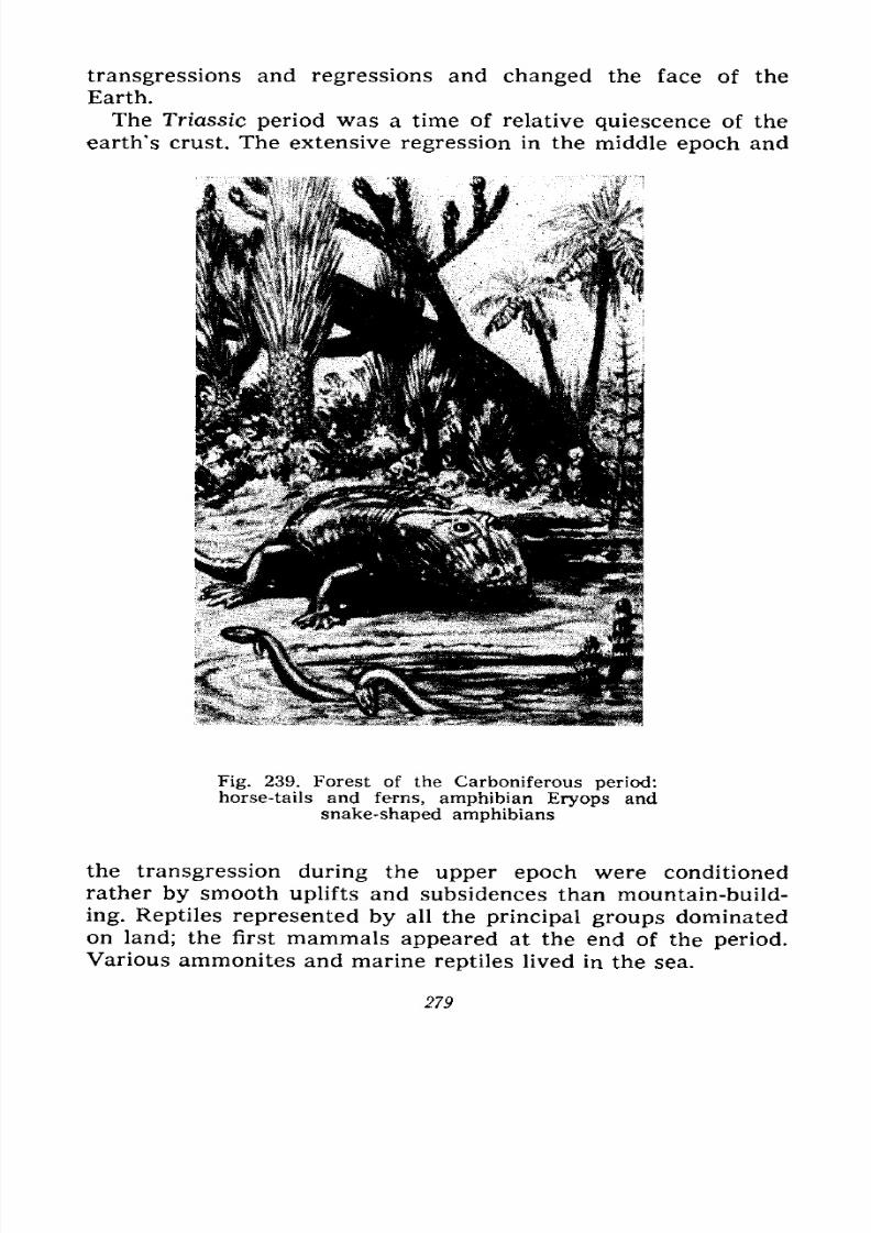
7/28/2019 Fundamentals of Geology - 19th century - Russia text in English
http://slidepdf.com/reader/full/fundamentals-of-geology-19th-century-russia-text-in-english 280/375
transgressions and regressions and changed the face of the
Earth.
The Triassic period was a time of relative quiescence of the
earth's crust. The extensive regression in the middle epoch and
Fig. 239. Forest of the Carboniferous period:horse-tails and ferns, amphibian Eryops and
snake-shaped amphibians
the transgression during the upper epoch were conditioned
rather by smooth uplifts and subsidences than mountain-build-ing. Reptiles represented by all the principal groups dominated
on land; the first mammals appeared at the end of the period.
Various ammonites and marine reptiles lived in the sea.
279
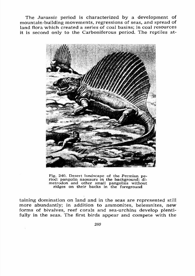
7/28/2019 Fundamentals of Geology - 19th century - Russia text in English
http://slidepdf.com/reader/full/fundamentals-of-geology-19th-century-russia-text-in-english 281/375
The Jurassic period is characterized by a development of
mountain-building movements, regressions of seas, and spread of
land flora which created a series of coal basins; in coal resources
it is second only to the Carboniferous period. The reptiles at-
Fig. 240. Desert landscape of the Permian pe-riod: pangolin naosaurs in the background; di-
metrodon and other small pangolins without
ridges on their backs in the foreground
taining domination on land and in the seas are represented still
more abundantly; in addition to ammonites, belemnites, newforms of bivalves, reef corals and sea-urchins develop plenti-
fully in the seas. The first birds appear and compete with the
280
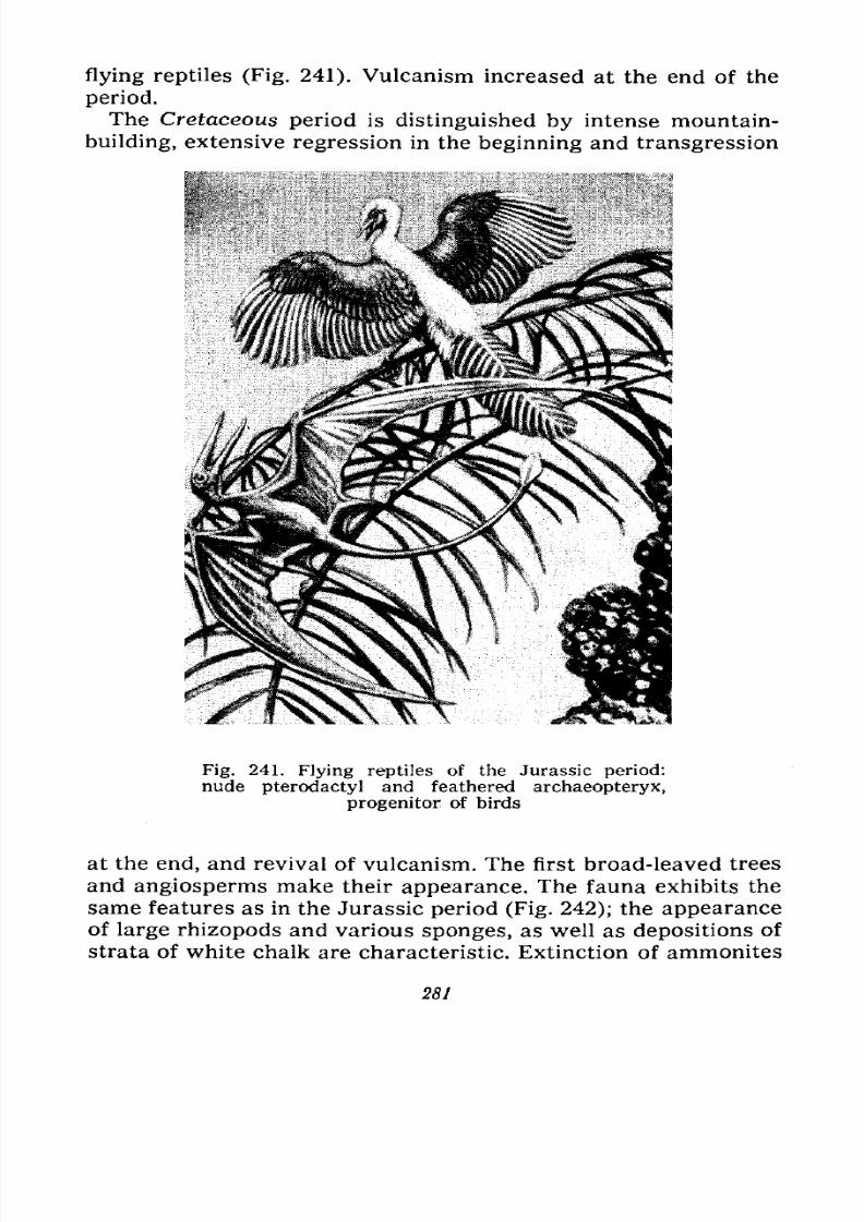
7/28/2019 Fundamentals of Geology - 19th century - Russia text in English
http://slidepdf.com/reader/full/fundamentals-of-geology-19th-century-russia-text-in-english 282/375
flying reptiles (Fig. 241). Vulcanism increased at the end of the
period.
The Cretaceous period is distinguished by intense mountain-
building, extensive regression in the beginning and transgression
Fig. 241. Flying reptiles of the Jurassic period:
nude pterodactyl and feathered archaeopteryx,
progenitor of birds
at the end, and revival of vulcanism. The first broad-leaved trees
and angiosperms make their appearance. The fauna exhibits thesame features as in the Jurassic period (Fig. 242); the appearanceof large rhizopods and various sponges, as well as depositions of
strata of white chalk are characteristic. Extinction of ammonites
281
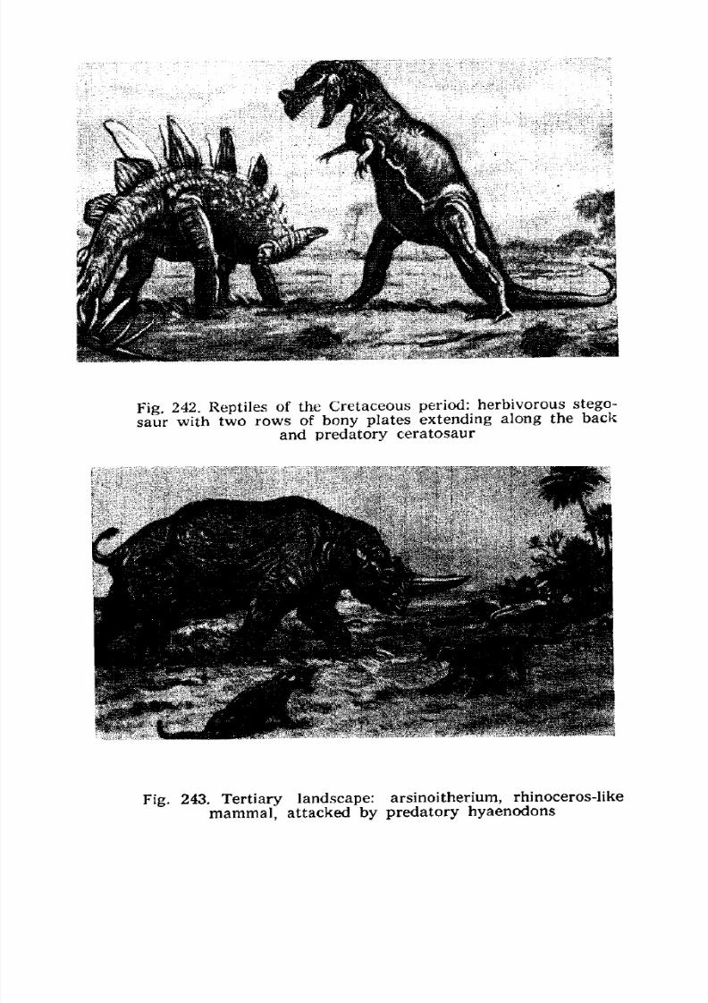
7/28/2019 Fundamentals of Geology - 19th century - Russia text in English
http://slidepdf.com/reader/full/fundamentals-of-geology-19th-century-russia-text-in-english 283/375
Fig. 242. Reptiles of the Cretaceous period: herbivorous stego-
saur with two rows of bony plates extending along the back
and predatory ceratosaur
Fig. 243. Tertiary landscape: arsinoitherium, rhinoceros-like
mammal, attacked by predatory hyaenodons
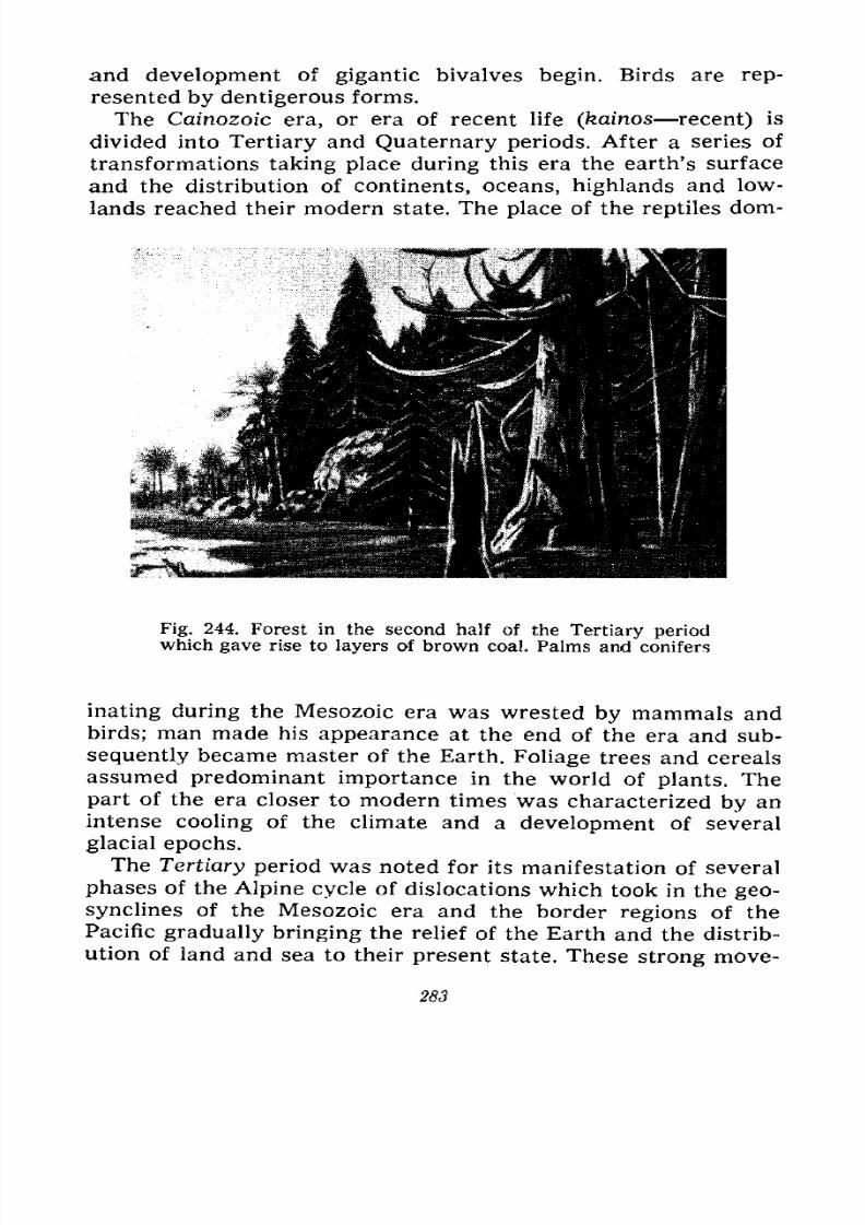
7/28/2019 Fundamentals of Geology - 19th century - Russia text in English
http://slidepdf.com/reader/full/fundamentals-of-geology-19th-century-russia-text-in-english 284/375
and development of gigantic bivalves begin. Birds are rep-
resented by dentigerous forms.
The Cainozoic era, or era of recent life (kainos recent) is
divided into Tertiary and Quaternary periods. After a series of
transformations taking place during this era the earth's surface
and the distribution of continents, oceans, highlands and low-
lands reached their modern state. The place of the reptiles dom-
Fig. 244. Forest in the second half of the Tertiary periodwhich gave rise to layers of brown coal. Palms and conifers
inating during the Mesozoic era was wrested by mammals andbirds; man made his appearance at the end of the era and sub-
sequently became master of the Earth. Foliage trees and cereals
assumed predominant importance in the world of plants. The
part of the era closer to modern times was characterized by an
intense cooling of the climate and a development of several
glacial epochs.
The Tertiary period was noted for its manifestation of several
phases of the Alpine cycle of dislocations which took in the geo-synclines of the Mesozoic era and the border regions of the
Pacific gradually bringing the relief of the Earth and the distrib-
ution of land and sea to their present state. These strong move-
283
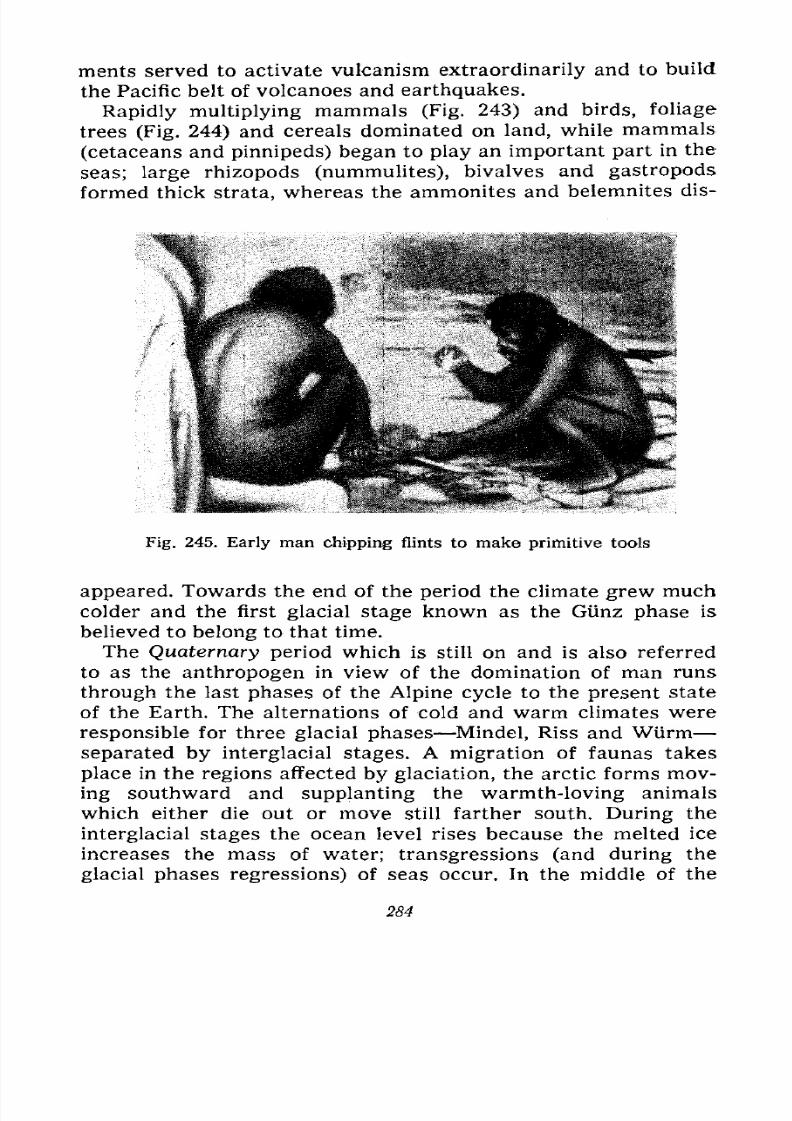
7/28/2019 Fundamentals of Geology - 19th century - Russia text in English
http://slidepdf.com/reader/full/fundamentals-of-geology-19th-century-russia-text-in-english 285/375
merits served to activate vulcanism extraordinarily and to build
the Pacific belt of volcanoes and earthquakes.
Rapidly multiplying mammals (Fig. 243) and birds, foliage
trees (Fig. 244) and cereals dominated on land, while mammals
(cetaceans and pinnipeds) began to play an important part in the
seas; large rhizopods (nummulites), bivalves and gastropods
formed thick strata, whereas the ammonites and belemnites dis-
Fig. 245. Early man chipping flints to make primitive tools
appeared. Towards the end of the period the climate grew much
colder and the first glacial stage known as the Glinz phase is
believed to belong to that time.
The Quaternary period which is still on and is also referred
to as the anthropogen in view of the domination of man runs
through the last phases of the Alpine cycle to the present state
of the Earth. The alternations of cold and warm climates were
responsible for three glacial phases Mindel, Riss and Wurm
separated by interglacial stages. A migration of faunas takes
place in the regions affected by glaciation, the arctic forms mov-
ing southward and supplanting the warmth-loving animals
which either die out or move still farther south. During the
interglacial stages the ocean level rises because the melted ice
increases the mass of water; transgressions (and during the
glacial phases regressions) of seas occur. In the middle of the
284
7/28/2019 Fundamentals of Geology - 19th century - Russia text in English
http://slidepdf.com/reader/full/fundamentals-of-geology-19th-century-russia-text-in-english 286/375
Quaternary period man makes his appearance (Fig. 245) in dif-
ferent places, judging by the various remains of tools, though
he developed from an ape-like animal before then. A series of
slow land uplifts is marked by marine and river terraces, the last
uplift by a rejuvenation of erosion.
On the other hand, there are subsidences, and the water in-
vades the former land in the eastern part of the Mediterranean,
the southern part of the Black Sea, and the north and east of
Siberia where Sakhalin is divided from the continent; sinks are
created the chains of lakes in Africa, the fault troughs of the
Red and Dead seas and Lake Baikal. Compared with the Tertiary
period vulcanism gradually wanes, though in the beginning of
the period volcanoes still smoke and lava pours out in the Cau-
casus and Eastern Siberia.
Let us now make a chronological table of the Earth's history
for the sake of convenience, taking note of the fact that the
intervals of time correspond to certain thicknesses of sedimen-
tary rocks the totality of which is designated by certain terms.
Thus the interval of time referred to as "era" corresponds to the
division of strata known as a "group"; "period" corresponds to
"system", "epoch" to "series" and "age" to "formation/'
Eras (Groups) Periods (Systems)
1. Archacozoic
2. Prolcrozoir,
/ CumbrianI Silurian
Devonian
Carboniferous
Permian
( Triassic
4. Mesnzoic < Jurassic
[Cretaceous
Today most geologists divide the Silurian period into two,
referring to the lower as Ordovician and the upper as Silurian
or Gothlandian.
Age of the Earth. Our chronological table gives us only anidea of the sequence of the various intervals of time established
for the history of the Earth. It shows that the Cambrian period
precedes the Silurian and by its age is the first in the Palaeozoic
285
7/28/2019 Fundamentals of Geology - 19th century - Russia text in English
http://slidepdf.com/reader/full/fundamentals-of-geology-19th-century-russia-text-in-english 287/375
era which is brought to an end by the Permian period; it indi-
cates that the period in which we live is the tenth of those more
accurately determined by the study of fossils buried in the strata
of the earth's crust and that these ten periods were preceded
by two very long eras during which life had already made its
appearance. But this table does not give the age expressed in
years, i.e., the unit of time we use for the history of man. At the
same time it would be very interesting to know the duration of
each of these periods and the age of the Earth in general.
This problem has, naturally, long agitated the scientists, es-
pecially since science rejected the truthfulness of biblical chro-
nology which estimates the age of the Earth since its creation by
an "omnipotent maker/' According to the Anglican Church, the
Earth is now 5,962 years old, whereas according to the old
Russian chronology it is 7,467 years old. The figures cited in
Chapter VI are alone enough to disprove these for they show
that it required about 2,000 years for the northern glacier to
retreat from Southern Sweden a mere 400 kilometres; this inter-
val, of time is only a small part of the last glacial phase which
lasted, as it is believed, more than 50,000 years, while all this
phase is only a small part of the Quaternary period.
It is interesting to note that the biblical chronology does not
agree even with the annals and legends of other peoples. Thus,
the annals of ancient Babylon read that after the creation of the
world the forefathers of the Babylonians ruled the country for
several hundred thousand years. Japanese legends tell us that
the Japanese islands have been inhabited by man for several
million years. The ancient Chinese annalists believed that
3,266,000 years divided into 10 periods had elapsed before the
beginning of Patriarch Yao's rule in 2357 B.C. Other Chinesesources offer an estimate of two million years. The Chinese and
Japanese figures must, of course, be regarded as exaggerated
because the entire duration of the Quaternary period is now
estimated, as we shall see below, at one million years, and this
period encompasses all of man's history, including the ancient
stone age of which no legends could have come down to our
time.
Various methods have been used in attempts to estimate the
age of the Earth. The time required for the formation of the
Nile delta was calculated on the basis of its area, the thickness
of the layers and the rate at which they are deposited by the
286
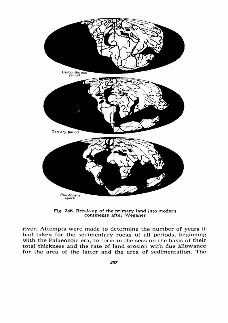
7/28/2019 Fundamentals of Geology - 19th century - Russia text in English
http://slidepdf.com/reader/full/fundamentals-of-geology-19th-century-russia-text-in-english 288/375
Pleistocene
epoch
Fig. 246. Break-up of the primary land into moderncontinents after Wegener
river. Attempts were made to determine the number of years it
had taken for the sedimentary rocks of all periods, beginningwith the Palaeozoic era, to form in the seas on the basis of their
total thickness and the rate of land erosion with due allowance
for the area of the latter and the area of sedimentation. The
287
7/28/2019 Fundamentals of Geology - 19th century - Russia text in English
http://slidepdf.com/reader/full/fundamentals-of-geology-19th-century-russia-text-in-english 289/375
geothermal gradient was used to estimate the time it took the
Earth to cool to its present state. The theory of evolution was
applied in an endeavour to compute the time since the origin
of organic life. Astronomic data changes in the eccentricity
of the Earth, periods of the perihelion and aphelion, shifts of the
Solar System within the Milky Way, eccentricity of Mercury,
hypothesis of the tidal origin of the Moon were also made use
of in calculating the age of the Earth. The accumulation of salts
in the oceans has made it possible to figure up the time that
has elapsed since they began to be formed. But all these methods
yielded greatly varying and unreliable results, the age of the
Earth ranging from 20 million to 5,000 million years, because
they were all based either on the assumption that the processes
of erosion and sedimentation, as well as the accumulation of
salts, operated with the same intensity during the former
periods as they do now, or on the hypothesis of the constancy of
astronomical data which is also doubtful.
Much better results were obtained with the methods based
on the transformation of some elements into others discovered
in the twentieth century. All the substances containing radium
form two series of changing elements gradually passing into
each other; one series begins with thorium, the other with
uranium, both ending in lead; radium is one of the intermediate
members of the uranium-lead series. In this series the closer it
is to the end, the faster is the change of one element into an-
other.
If we, therefore, take a mineral containing uranium and lead
or thorium and lead and determine the amount of both we
shall be able to compute the time that has elapsed since the
formation of this mineral, and insofar as such minerals can befound among the sediments of various periods we shall deter-
mine by this method the age of each of them.
The second method consists in determining the amount of
helium liberated during the intermediate transformations of
uranium and thorium; the age of the rock is determined by the
ratio between uranium or thorium, on the one hand, and helium,
on the other.
The third method is based on radioactive decay of potassiumwhich leads to the formation of argon. Since potassium occurs
very widely it is possible to find out the absolute age of manyrocks by determining the potassium-argon ratio. There are
288
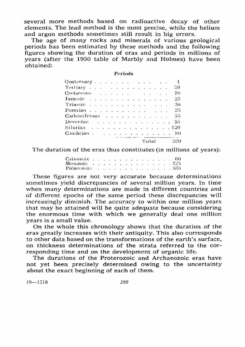
7/28/2019 Fundamentals of Geology - 19th century - Russia text in English
http://slidepdf.com/reader/full/fundamentals-of-geology-19th-century-russia-text-in-english 290/375
several more methods based on radioactive decay of other
elements. The lead method is the most precise, while the helium
and argon methods sometimes still result in big errors.
The age of many rocks and minerals of various geological
periods has been estimated by these methods and the following
figures showing the duration of eras and periods in millions of
years (after the 1950 table of Marbly and Holmes) have been
obtained:
Periods
Quaternary 1
Tertiary 59
Cretaceous . . . . 70
Jurassic 25
Triassic 30
Permian 25
Carboniferous 55
Devonian 55
Silurian 120
Cambrian 80
Total 520
The duration of the eras thus constitutes (in millions of years):
Caiiiozoic GO
Mcsozoic 125
Palaeozoic 335
These figures are not very accurate because determinations
sometimes yield discrepancies of several million years. In time
when many determinations are made in different countries and
of different epochs of the same period these discrepancies will
increasingly diminish. The accuracy to within one million yearsthat may be attained will be quite adequate because considering
the enormous time with which we generally deal one million
years is a small value.
On the whole this chronology shows that the duration of the
eras greatly increases with their antiquity. This also corresponds
to other data based on the transformations of the earth's surface,
on thickness determinations of the strata referred to the cor-
responding time and on the development of organic life.
The durations of the Proterozoic and Archaeozoic eras have
not yet been precisely determined owing to the uncertainty
about the exact beginning of each of them.
191518 289
7/28/2019 Fundamentals of Geology - 19th century - Russia text in English
http://slidepdf.com/reader/full/fundamentals-of-geology-19th-century-russia-text-in-english 291/375
It is believed that both these eras together lasted at least
1,500 million years of which 500 million or 600 million years
fall to the Proterozoic era. The age of the Earth since the for-
mation of the first continents and oceans may generally and with
sufficient reason be set at 2,000 million years.
Continental Drift. A hypothesis that was recently enunciated
by the German scientist Wegener (1912) and the American scien-
tist Taylor in 1910 (elaborated in lesser detail) offers a different
explanation for the formation of the modern seas. These scien-
tists believe that the various original protrusions of the earth's
crust gathered in one place in the manner small bubbles on the
surface of water are attracted to each other and unite into large
ones. Thus the first large continent Pangaea, the mother con-
tinent, was formed uniting all the modern continents, including
Antarctica. Then, during the Carboniferous period Pangaea
began to break up into parts, Australia and Antarctica drifting
southward and America westward.
This fragmentation continued over scores of millions of years
and the hollow of the Atlantic which has separated the two
Americas from Europe and Africa was formed only during the
Tertiary period and took its final shape during the Quaternary
(see Fig. 246). The idea of the former union of the continents
arose as a result of an examination of the map: the contours of
the eastern and western coasts of the Atlantic really coincide,
especially those of Africa and South America; brought close to
each other across the ocean the coasts will touch nearly all
along, the small gaps being easily explained by erosion. Of
Russian scientists this was noticed in 1877 by Y. Bykhanov.
But the question is, why did the continents first unite andthen drift apart again?
Wegener believes that the break-up of Pangaea was due to
the rotation of the Earth. The Earth rotates on its axis from
west to east and the western part of Pangaea gradually had to
lag behind in this motion and break away from the eastern part
by force of inertia, i.e., the tendency of the masses to remain in
the place which opposes the force of motion eastward developed
on the surface of the Earth during its rotation. Precise deter-minations of the position of the Atlantic coasts are now being
made in order to find out whether the continents had drifted
apart or not.
290
7/28/2019 Fundamentals of Geology - 19th century - Russia text in English
http://slidepdf.com/reader/full/fundamentals-of-geology-19th-century-russia-text-in-english 292/375
But you will, of course, ask how the enormous masses of
continents can move, even though very slowly, along the sur-
face of the Earth.
You are familiar with the force of gravity conditioned bythe attraction of the Earth. It is by virtue of this force that we
keep on the earth's surface despite the rapid rotation of the
Earth; it is because of this force that a ball or stone thrown high
up in the air falls down again. It is due to the same force that
the globe consists of layers of different composition; when it was
in a molten state the heaviest substances iron, lead and other
metals gathered in large masses closer to the centre of the
globe while the lighter ones remained on its surface and in cool-
ing formed the crust. Wegener, therefore, came to the conclusion
that the continents composed of lighter rocks floated on a heavi-
er internal basaltic layer like icebergs float on water. And if
they float they are likely to shift, very slowly, of course, since
the basaltic layer is much more viscous than water.
The upper layer composed of rocks in which silica and
aluminium prevail is referred to as "sial" (by combining the
first syllables of the words "silicon" and "aluminium"), while
the underlying heavier layer on which the sial floats is called
"sima" because in addition to silica it contains a lot of magne-sium.
Wegener's hypothesis explains the formation of the high
mountain ranges of the Cordilleras and Andes bordering the
coast of the two Americas by the fact that during the shift of
this continent westward the sedimentary strata near the west
coast were strongly crumpled by the resistance offered by the
layer "sima" to the pressure produced by the layer "sial" in the
westerly direction.
At first winning over many scientists Wegener's hypothesis
now arouses serious objections because the distribution of the
various mountain ranges on the earth's surface does not agree
with it and even contradicts it. Europe and Africa which must
also press westward in connection with the eastward rotation
of the Earth have no mountain ranges along the western shores,
whereas in Asia the mountain ranges are located along the
eastern coast which, according to this hypothesis, is not subject
to pressure by the layer "sima."
Today geologists regard the hypothesis of continental drift
as unable to explain the changes on the face of the Earth.
19*
7/28/2019 Fundamentals of Geology - 19th century - Russia text in English
http://slidepdf.com/reader/full/fundamentals-of-geology-19th-century-russia-text-in-english 293/375
XI
CATASTROPHES IN THE HISTORY OF THE EARTH
What a Catastrophe Is. Floods. Sills. Landslides, Earth
Creeps and Sinks. Hurricanes Simooms, Typhoons.Avalanches. Volcanic Eruptions Vesuvius, Mont Pelee,
Bandaisan, Krakatao, Santa-Maria. Earthquakes Lisbon,
Messina, Crimea, Alma-Ata, Caucasus, America, New
Zealand, Japan. Catastrophes of the Past. Sodom and
Gomorrah. Atlantis. Transgressions and Regressions.
Glaciations. Extinction of Faunas and Floras. Cemeteries.
The Deluge.
A sudden event lasting a relatively short time and involving
a loss of human life and property is said to be a catastrophe.
A railway, plane or automobile accident, a collapse of a house
and fires are all short-lived catastrophes. The catastrophes con-
ditioned by natural forces are frequently also sudden and of
short duration, or they may last hours, days and even weeks.
The former include landslides, avalanches and earthquakes, the
latter floods, earth creeps and volcanic eruptions. These latter
catastrophes can be foreseen and safety measures can be taken;
they are not sudden or fortuitous, though they are also called
catastrophes. Epidemics, famine and wars may thus also be
referred to as catastrophes, i.e., events which unsettle the
normal course of life.
In geology the sudden destructive phenomena were formerly
called cataclysms. In the infancy of this science they were
ascribed a universal nature and, using the Deluge as incontest-
able proof, scientists explained geological periods by them. Inthe eighteenth century the prominent French geologist Buffon
maintained in his famous ten-volume work Epochs of Nature
that at the end of each of the epochs established by him im-
292
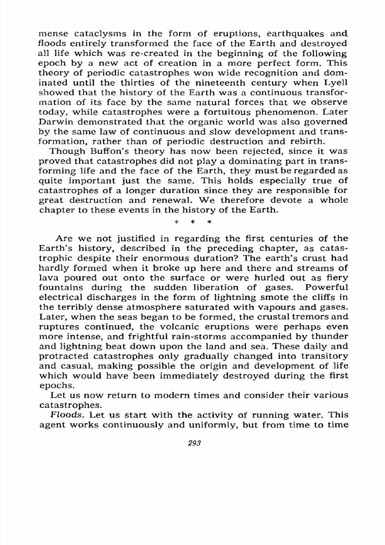
7/28/2019 Fundamentals of Geology - 19th century - Russia text in English
http://slidepdf.com/reader/full/fundamentals-of-geology-19th-century-russia-text-in-english 294/375
mense cataclysms in the form of eruptions, earthquakes and
floods entirely transformed the face of the Earth and destroyed
all life which was re-created in the beginning of the following
epoch by a new act of creation in a more perfect form. This
theory of periodic catastrophes won wide recognition and dom-
inated until the thirties of the nineteenth century when Lyell
showed that the history of the Earth was a continuous transfor-
mation of its face by the same natural forces that we observe
today, while catastrophes were a fortuitous phenomenon. Later
Darwin demonstrated that the organic world was also governed
by the same law of continuous and slow development and trans-
formation, rather than of periodic destruction and rebirth.
Though Buffon's theory has now been rejected, since it was
proved that catastrophes did not play a dominating part in trans-
forming life and the face of the Earth, they must be regarded as
quite important just the same. This holds especially true of
catastrophes of a longer duration since they are responsible for
great destruction and renewal. We therefore devote a whole
chapter to these events in the history of the Earth.
Are we not justified in regarding the first centuries of the
Earth's history, described in the preceding chapter, as catas-
trophic despite their enormous duration? The earth's crust had
hardly formed when it broke up here and there and streams of
lava poured out onto the surface or were hurled out as fiery
fountains during the sudden liberation of gases. Powerful
electrical discharges in the form of lightning smote the cliffs in
the terribly dense atmosphere saturated with vapours and gases.
Later, when the seas began to be formed, the crustal tremors andruptures continued, the volcanic eruptions were perhaps even
more intense, and frightful rain-storms accompanied by thunder
and lightning beat down upon the land and sea. These daily and
protracted catastrophes only gradually changed into transitory
and casual, making possible the origin and development of life
which would have been immediately destroyed during the first
epochs.
Let us now return to modern times and consider their various
catastrophes.
Floods. Let us start with the activity of running water. This
agent works continuously and uniformly, but from time to time
293
7/28/2019 Fundamentals of Geology - 19th century - Russia text in English
http://slidepdf.com/reader/full/fundamentals-of-geology-19th-century-russia-text-in-english 295/375
streams and rivers overflow their banks and flood the surround-
ing country causing damage. Every spring high water may turn
into a flood if the snow-rich winter and the vigorous thaw in the
spring produce more water than the rivers can hold. In warm-
winter countries floods frequently occur in autumn or winter
because of the abundant and, mainly, incessant rainfall respon-
sible for an excessive rise in water. Southern France, Spain and
Italy often suffer from these floods. In other countries the floods
happen in summer-time when there is a lot of rain. These in-
clude the Transbaikal areas, especially Amur Region and
Primorye, the spring high water being relatively safe because
there is but little snow there in winter.
It is not rain, but wind that is responsible for the floods from
which Leningrad suffers mainly in autumn: the winds blowing
from the west, from the Gulf of Finland, drive water into the
mouth of the Neva, impede drainage, raise the level of the Neva,
force it out of its banks and make it flood the streets of the city
located in the flat delta. The water not infrequently rises in
autumn, but catastrophic floods happen only once in a hundred
years, the last two occurring in 1824 and 1924. Similar floods
conditioned by sea-storms are characteristic of the lowlands in
the mouths of the Indus, Ganges, Huang Ho and Yangtze rivers
whose drainage is obstructed by the sea waves. Low-lying river
banks even away from estuaries may also be flooded when very
strong winds blow from the sea; this was observed in Germany,Holland and England during very big storms in the Baltic and
North seas.
A river that overflows its banks erodes roads, spoils pave-
ments (especially those made of wood blocks because the latter
come to the surface and are carried away), covers the fields
and meadows with sand and silt, undermines stone houses and
easily washes away frame buildings severed from their founda-
tions. In houses remaining intact it inundates the basements
and lower floors which stay damp long after the flood has sub-
sided. Firewood and lumber yards on the banks may be com-
pletely carried away. The foodstuffs and other goods stored in
flooded buildings spoil, and machines rust.
The following are two examples of floods.
Because of the silting of its bed with deposits of loess which
it erodes in the mountainous parts of China the Huang Ho
River in its lower reaches on the Great Chinese Plain flows in
294
7/28/2019 Fundamentals of Geology - 19th century - Russia text in English
http://slidepdf.com/reader/full/fundamentals-of-geology-19th-century-russia-text-in-english 296/375
some places between artificial earth dikes above the level of the
plain. Every spring these dikes are eroded here and there and
the river floods more or less large areas, their villages, fields and
orchards. The population has always struggled against these
breaches in the dams and called the river "China's misfortune."
Only since the liberation of China has the Government of the
Chinese People's Republic undertaken extensive hydrotechnical
construction which now prevents the possibility of dam
breaches, the surplus of the Huang Ho waters being diverted
into irrigation systems and navigable canals.
During the second half of January 1937 long-continued down-
pours alternating with snowfalls caused an unprecedented flood
in the United States of America. All of the Mississippi tributaries,
especially the Ohio, the Arkansas and the Red River began
to rise and by January 25 constituted a flood menace. More than
a million people had already been affected in the Ohio Valley by
that time, while on January 27 it was necessary to evacuate the
population of the entire Mississippi Valley from the Ohio down
to the mouth of the Mississippi, the zone being 80 kilometres
wide along both banks, because this part of the valley was in
danger of being inundated. The Ohio River alone poured out
135,000 centilitres per minute and it was clear that the dams
along the Mississippi constructed for protection against floods
providing for a water discharge of about 108,000 centilitres
would not withstand the pressure. For the evacuation of the
population 35,000 motor vehicles were delivered the very first
day, but many were unable to leave the threatened zone. Down-
stream the water flooded ever new towns and in most cases the
houses, especially those made of concrete, collapsed within a few
hours; the people who sought safety on the upper floors whenthe flood began went down together with the houses. The current
developed the enormous velocity of 56 kilometres an hour and
the river washed away all the structures. Three-fourths of all
the houses were destroyed in some towns in the course of one
day, and most of the people were left shelterless; the destruc-
tion of the petrol tanks in the high part of Louisville spared by
the flood caused fires. Instead of helping the victims gangs of
robbers who arrived in motor boats indulged in plunder. Thecontinuing rains and cold aggravated the calamity. The damages
were estimated at between 2,000 million and 3,000 million
dollars.
295
7/28/2019 Fundamentals of Geology - 19th century - Russia text in English
http://slidepdf.com/reader/full/fundamentals-of-geology-19th-century-russia-text-in-english 297/375
In countries with a dry climate accidental downpours produc-
ing furious torrents, known as sills, also cause catastrophes. For
example, on July 8, 1921, a rain-storm broke out in the city
of Alma-Ata in the afternoon and lasted for four hours. In the
evening the Malaya Almaatinka River overflowed its banks and
rushed into the city in waves reaching from 1 to 2 metres in
height and carrying large firs uprooted in the Tien-Shan Moun-
tains, and logs and boards from the country-houses destroyed
by the river in the mountain valley. The main stream went down
the central street carrying away small frame buildings with all
their inhabitants, the water also flooding the side streets and
yards and playing havoc everywhere. Many adobe houses were
damaged and large frame buildings were dislodged. The torrent
brought along a lot of gravel, pebbles and boulders, the latter
weighing several tons each, and deposited all this in a layer up
to 1.5 metres thick. A rut 2 metres deep was cut by the water in
the upper part of the main street and the boulders weighing up
to 25 tons each got stuck in the rut. Many people were caught by
the torrent and drowned, the dead estimated at 500. By mid-
night the torrent stopped. According to a rough estimate it had
brought 3.6 million tons of solid material to the city and since it
had worked for a period of five hours it had deposited 200 tons
a second. Destructive mountain torrents sills were observed
the same day for a distance of 25 kilometres west and 60 kilo-
metres east of Alma-Ata. The main mass of precipitations fell
in the mountains, whereas in Alma-Ata there was only 27 mmof rain that day.
A catastrophic downpour occurred in the Khamar-Daban
Mountains on the southern shore of Lake Baikal near Slyu-
dyanka railway station on June 29, 1934. Previous to that it
had rained in the mountains incessantly for three days and
saturated the soil with water; the last day torrents ran down the
smallest valleys which had always been waterless before then;
down the slopes the water flowed in a continuous sheet. On the
night of June 28 the Slyudyanka River overflowed its banks,
rushed towards the station in an enormous stream, flooded the
station settlement, carried away eight houses, smashed the
concrete dam of the reservoir into fragments transporting someof them into Lake Baikal. All the vegetable gardens were ruined,
their area transformed into a field covered with large boulders
up to 1.5 metres in diameter each, while all the tracks of the
296
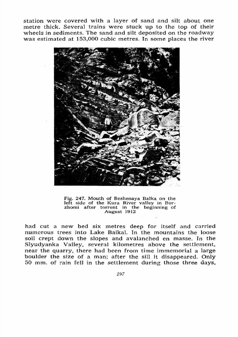
7/28/2019 Fundamentals of Geology - 19th century - Russia text in English
http://slidepdf.com/reader/full/fundamentals-of-geology-19th-century-russia-text-in-english 298/375
station were covered with a layer of sand and silt about one
metre thick. Several trains were stuck up to the top of their
wheels in sediments. The sand and silt deposited on the roadwaywas estimated at 153,000 cubic metres. In some places the river
Fig. 247. Mouth of Beshenaya Balka on the
left side of the Kura River valley in Bor-
zhomi after torrent in the beginning of
August 1912
had cut a new bed six metres deep for itself and carried
numerous trees into Lake Baikal. In the mountains the loose
soil crept down the slopes and avalanched en masse. In the
Slyudyanka Valley, several kilometres above the settlement,near the quarry, there had been from time immemorial a large
boulder the size of a man; after the sill it disappeared. Only50 mm. of rain fell in the settlement during those three days,
297
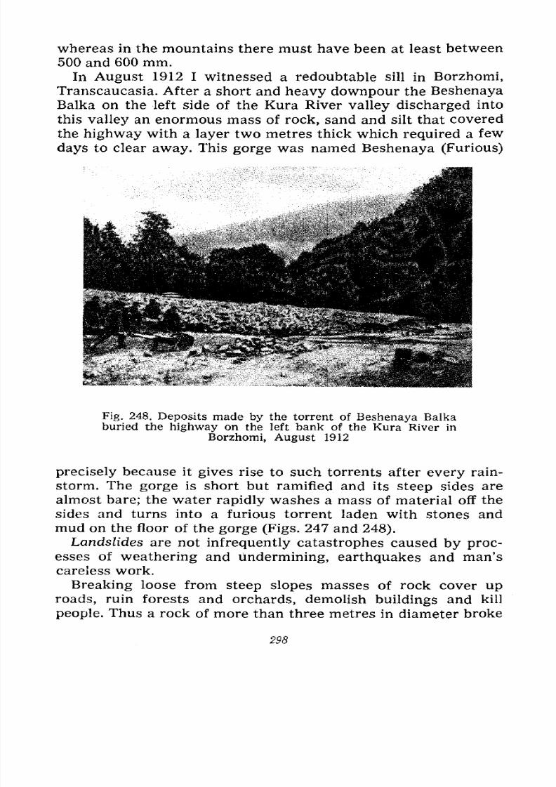
7/28/2019 Fundamentals of Geology - 19th century - Russia text in English
http://slidepdf.com/reader/full/fundamentals-of-geology-19th-century-russia-text-in-english 299/375
whereas in the mountains there must have been at least between
500 and 600 mm.
In August 1912 I witnessed a redoubtable sill in Borzhomi,
Transcaucasia. After a short and heavy downpour the Beshenaya
Balka on the left side of the Kura River valley discharged into
this valley an enormous mass of rock, sand and silt that covered
the highway with a layer two metres thick which required a few
days to clear away. This gorge was named Beshenaya (Furious)
Fig. 248. Deposits made by the torrent of Beshenaya Balkaburied the highway on the left bank of the Kura River in
Borzhomi, August 1912
precisely because it gives rise to such torrents after every rain-
storm. The gorge is short but ramified and its steep sides are
almost bare; the water rapidly washes a mass of material off the
sides and turns into a furious torrent laden with stones and
mud on the floor of the gorge (Figs. 247 and 248).
Landslides are not infrequently catastrophes caused by proc-
esses of weathering and undermining, earthquakes and man's
careless work.Breaking loose from steep slopes masses of rock cover up
roads, ruin forests and orchards, demolish buildings and kill
people. Thus a rock of more than three metres in diameter broke
298
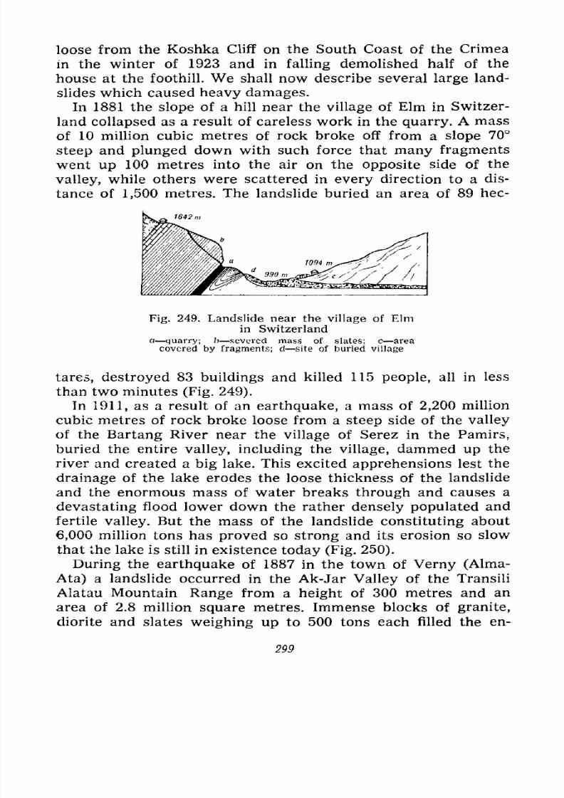
7/28/2019 Fundamentals of Geology - 19th century - Russia text in English
http://slidepdf.com/reader/full/fundamentals-of-geology-19th-century-russia-text-in-english 300/375
loose from the Koshka Cliff on the South Coast of the Crimea
in the winter of 1923 and in falling demolished half of the
house at the foothill. We shall now describe several large land-
slides which caused heavy damages.
In 1881 the slope of a hill near the village of Elm in Switzer-
land collapsed as a result of careless work in the quarry. A mass
of 10 million cubic metres of rock broke off from a slope 70
steep and plunged down with such force that many fragments
went up 100 metres into the air on the opposite side of the
valley, while others were scattered in every direction to a dis-
tance of 1,500 metres. The landslide buried an area of 89 hec-
Fig. 249. Landslide near the village of Elmin Switzerland
a quarry; b severed mass of slates; c area
covered by fragments; d site of buried village
tares, destroyed 83 buildings and killed 115 people, all in less
than two minutes (Fig. 249).
In 1911, as a result of an earthquake, a mass of 2,200 million
cubic metres of rock broke loose from a steep side of the valley
of the Bartang River near the village of Serez in the Pamirs,
buried the entire valley, including the village, dammed up the
river and created a big lake. This excited apprehensions lest the
drainage of the lake erodes the loose thickness of the landslide
and the enormous mass of water breaks through and causes a
devastating flood lower down the rather densely populated and
fertile valley. But the mass of the landslide constituting about
6,000 million tons has proved so strong and its erosion so slow
that the lake is still in existence today (Fig. 250).
During the earthquake of 1887 in the town of Verny (Alma-
Ata) a landslide occurred in the Ak-Jar Valley of the TransiliAlatau Mountain Range from a height of 300 metres and an
area of 2.8 million square metres. Immense blocks of granite,
diorite and slates weighing up to 500 tons each filled the en-
299
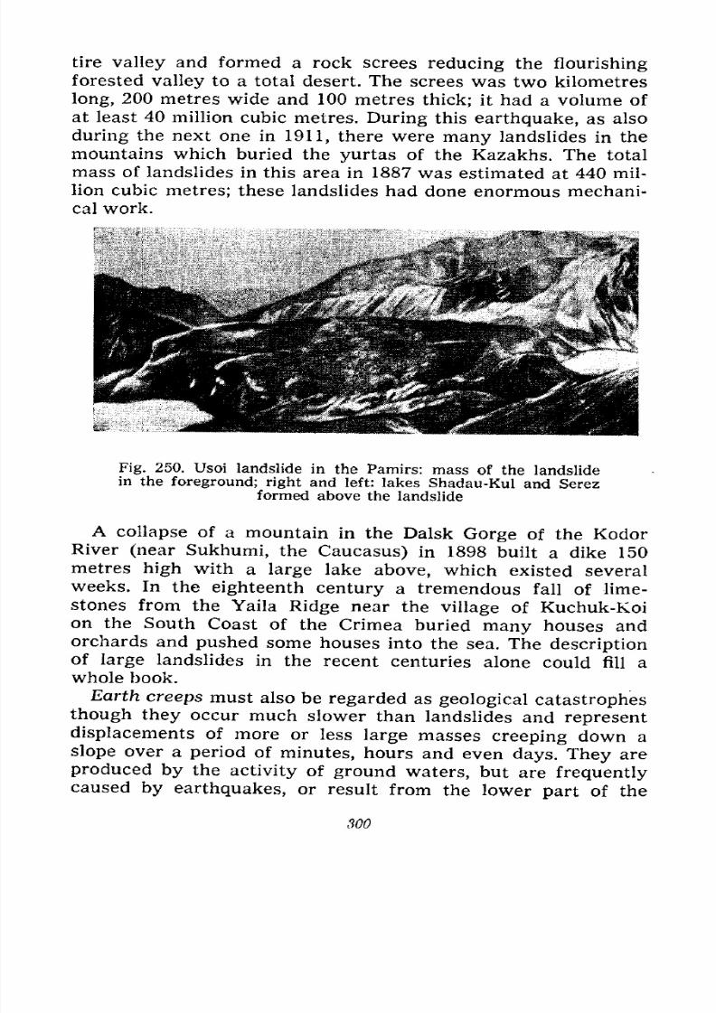
7/28/2019 Fundamentals of Geology - 19th century - Russia text in English
http://slidepdf.com/reader/full/fundamentals-of-geology-19th-century-russia-text-in-english 301/375
tire valley and formed a rock screes reducing the flourishing
forested valley to a total desert. The screes was two kilometres
long, 200 metres wide and 100 metres thick; it had a volume of
at least 40 million cubic metres. During this earthquake, as also
during the next one in 1911, there were
manylandslides in the
mountains which buried the yurtas of the Kazakhs. The total
mass of landslides in this area in 1887 was estimated at 440 mil-
lion cubic metres; these landslides had done enormous mechani-
cal work.
Fig. 250. Usoi landslide in the Pamirs: mass of the landslidein the foreground; right and left: lakes Shadau-Kul and Serez
formed above the landslide
A collapse of a mountain in the Dalsk Gorge of the KodorRiver (near Sukhumi, the Caucasus) in 1898 built a dike 150
metres high with a large lake above, which existed several
weeks. In the eighteenth century a tremendous fall of lime-stones from the Yaila Ridge near the village of Kuchuk-Koi
on the South Coast of the Crimea buried many houses and
orchards and pushed some houses into the sea. The descriptionof large landslides in the recent centuries alone could fill a
whole book.
Earth creeps must also be regarded as geological catastrophes
though they occur much slower than landslides and represent
displacements of more or less large masses creeping down a
slope over a period of minutes, hours and even days. They are
produced by the activity of ground waters, but are frequentlycaused by earthquakes, or result from the lower part of the
300

7/28/2019 Fundamentals of Geology - 19th century - Russia text in English
http://slidepdf.com/reader/full/fundamentals-of-geology-19th-century-russia-text-in-english 302/375
slope being undermined by running water and the surf, or bythe slope being cut off during excavations and loaded with
buildings.
The description of catastrophic earth creeps would also fill
many pages, but we can offer only a few examples here.
The earth creep on the sea-shore near Lime Ridges in England
is very typical. The shore is built of white chalk, sandstones
with flints and loose sand of the Cretaceous system resting on
a bed of watertight Jurassic clay. The layers dip towards the
sea and the ground water runs down
the clay forming numerous springs
and creating conditions for the creep
of the overlying strata. After the
rainy weather of 1839 which satu-
rated these strata with water and
thus increased their weight the entire
shore started moving on December 24,
broke up into enormous blocks di-
vided by crevices and ravines, and
crept towards the sea. The pressure
of the masses of rock raised from the
sea floor a ridge one kilometre
long and 12 metres high consisting of severed blocks covered
with algae, shells, starfishes, etc., and now forming several
cliffs.
Near Odessa the sea-shore consists of Tertiary clays resting
on a bed of limestone with blue clay underlying the latter; the
ground waters run down the blue clay to the sea and cause
periodical earth creeps (Fig. 251). Large blocks break away
from the shore, creep and turn over; the entire coast is disrupted
by crevices and ravines with sand banks rising from the sea
bed. These earth creeps systematically reduce the area of
Odessa's countryside, ruining the orchards and destroying the
buildings. The earth creeps have increased since limestone
began to be quarried here for the city's structures and the vast
quarries exposed the lower clay to the atmospheric precipi-
tations.
The South Coast of the Crimea suffers from earth creeps al-
most along its entire extent. Here on the surface of strongly fold-
ed slates and sandstones of the Triassic and Lower Jurassic periods
lies a thick layer of coarse deluvium built by the destruction
Fig. 251. Section of earth
creeps near Odessa
a clay; b limestone; c blue
clay; d raised sea floor; c
slipped mass. Dotted line showsthe profile of the shore before
the earth creep
301
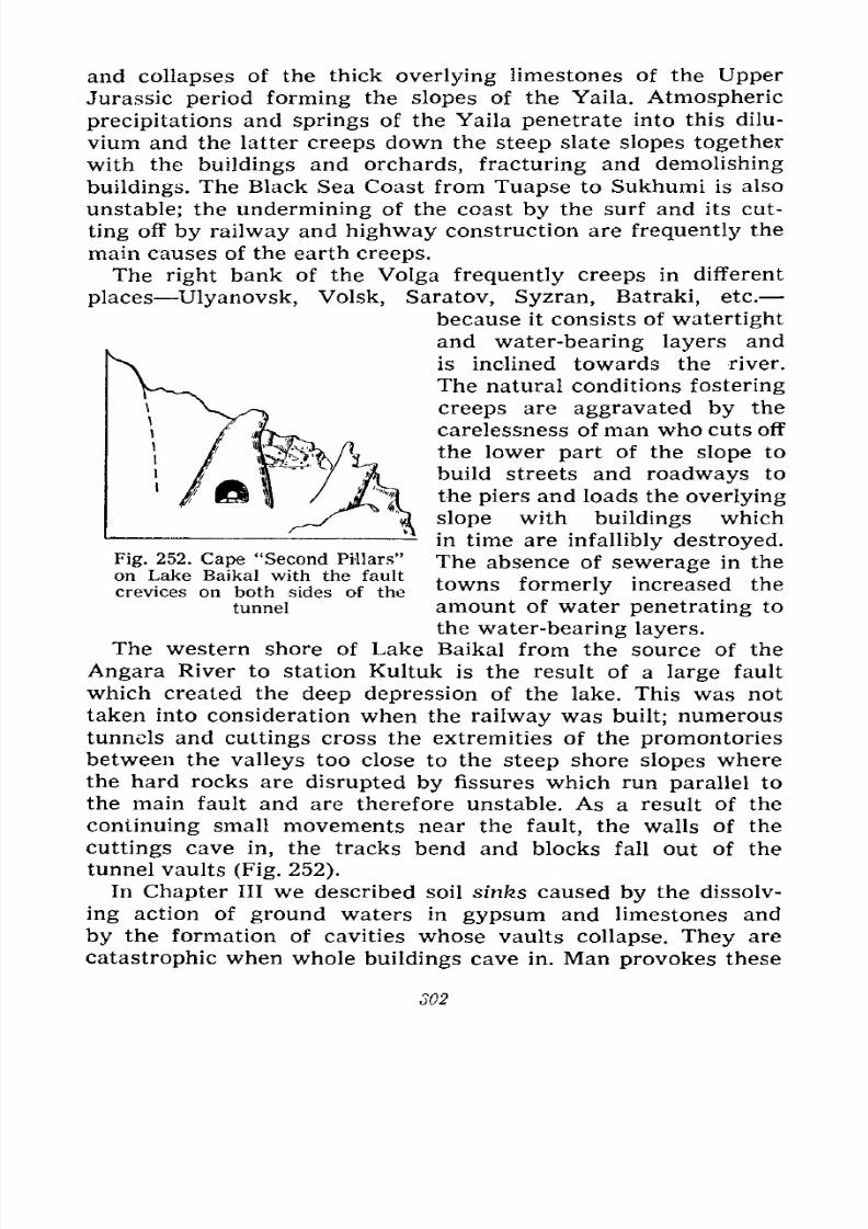
7/28/2019 Fundamentals of Geology - 19th century - Russia text in English
http://slidepdf.com/reader/full/fundamentals-of-geology-19th-century-russia-text-in-english 303/375
and collapses of the thick overlying limestones of the Upper
Jurassic period forming the slopes of the Yaila. Atmospheric
precipitations and springs of the Yaila penetrate into this dilu-
vium and the latter creeps down the steep slate slopes together
with the buildings and orchards, fracturing and demolishing
buildings. The Black Sea Coast from Tuapse to Sukhumi is also
unstable; the undermining of the coast by the surf and its cut-
ting off by railway and highway construction are frequently the
main causes of the earth creeps.
The right bank of the Volga frequently creeps in different
places Ulyanovsk, Volsk, Saratov, Syzran, Batraki, etc.
because it consists of watertight
and water-bearing layers and
is inclined towards the river.
The natural conditions fostering
creeps are aggravated by the
carelessness of man who cuts off
the lower part of the slope to
build streets and roadways to
the piers and loads the overlying
slope with buildings which
in time are infallibly destroyed.
The absence of sewerage in the
towns formerly increased the
amount of water penetrating to
the water-bearing layers.
The western shore of Lake Baikal from the source of the
Angara River to station Kultuk is the result of a large fault
which created the deep depression of the lake. This was not
taken into consideration when the railway was built; numeroustunnels and cuttings cross the extremities of the promontories
between the valleys too close to the steep shore slopes where
the hard rocks are disrupted by fissures which run parallel to
the main fault and are therefore unstable. As a result of the
continuing small movements near the fault, the walls of the
cuttings cave in, the tracks bend and blocks fall out of the
tunnel vaults (Fig. 252).
In Chapter III we described soil sinks caused by the dissolv-
ing action of ground waters in gypsum and limestones and
by the formation of cavities whose vaults collapse. They are
catastrophic when whole buildings cave in. Man provokes these
Fig. 252. Cape "Second Pillars"
on Lake Baikal with the fault
crevices on both sides of the
tunnel
302
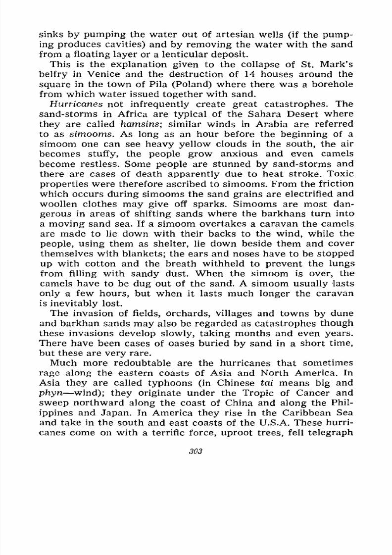
7/28/2019 Fundamentals of Geology - 19th century - Russia text in English
http://slidepdf.com/reader/full/fundamentals-of-geology-19th-century-russia-text-in-english 304/375
sinks by pumping the water out of artesian wells (if the pump-
ing produces cavities) and by removing the water with the sand
from a floating layer or a lenticular deposit.
This is the explanation given to the collapse of St. Mark's
belfry in Venice and the destruction of 14 houses around the
square in the town of Pila (Poland) where there was a borehole
from which water issued together with sand.
Hurricanes not infrequently create great catastrophes. The
sand-storms in Africa are typical of the Sahara Desert where
they are called hamsins; similar winds in Arabia are referred
to as simooms. As long as an hour before the beginning of a
simoom one can see heavy yellow clouds in the south, the air
becomes stuffy, the people grow anxious and even camels
become restless. Some people are stunned by sand-storms and
there are cases of death apparently due to heat stroke. Toxic
properties were therefore ascribed to simooms. From the friction
which occurs during simooms the sand grains are electrified and
woollen clothes may give off sparks. Simooms are most dan-
gerous in areas of shifting sands where the barkhans turn into
a moving sand sea. If a simoom overtakes a caravan the camels
are made to lie down with their backs to the wind, while the
people, using them as shelter, lie down beside them and cover
themselves with blankets; the ears and noses have to be stopped
up with cotton and the breath withheld to prevent the lungs
from filling with sandy dust. When the simoom is over, the
camels have to be dug out of the sand. A simoom usually lasts
only a few hours, but when it lasts much longer the caravan
is inevitably lost.
The invasion of fields, orchards, villages and towns by dune
and barkhan sands may also be regarded as catastrophes thoughthese invasions develop slowly, taking months and even years.
There have been cases of oases buried by sand in a short time,
but these are very rare.
Much more redoubtable are the hurricanes that sometimes
rage along the eastern coasts of Asia and North America. In
Asia they are called typhoons (in Chinese tai means big and
phyn wind); they originate under the Tropic of Cancer and
sweep northward along the coast of China and along the Phil-
ippines and Japan. In America they rise in the Caribbean Sea
and take in the south and east coasts of the U.S.A. These hurri-
canes come on with a terrific force, uproot trees, fell telegraph
303
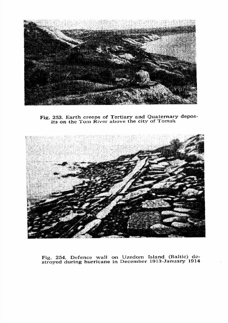
7/28/2019 Fundamentals of Geology - 19th century - Russia text in English
http://slidepdf.com/reader/full/fundamentals-of-geology-19th-century-russia-text-in-english 305/375
Fig. 253. Earth creeps of Tertiary and Quaternary depos-
its on the Tom River above the city of Tomsk
Fig. 254. Defence wall on Uzedom Island (Baltic) de-
stroyed during hurricane in December 1913-January 1914
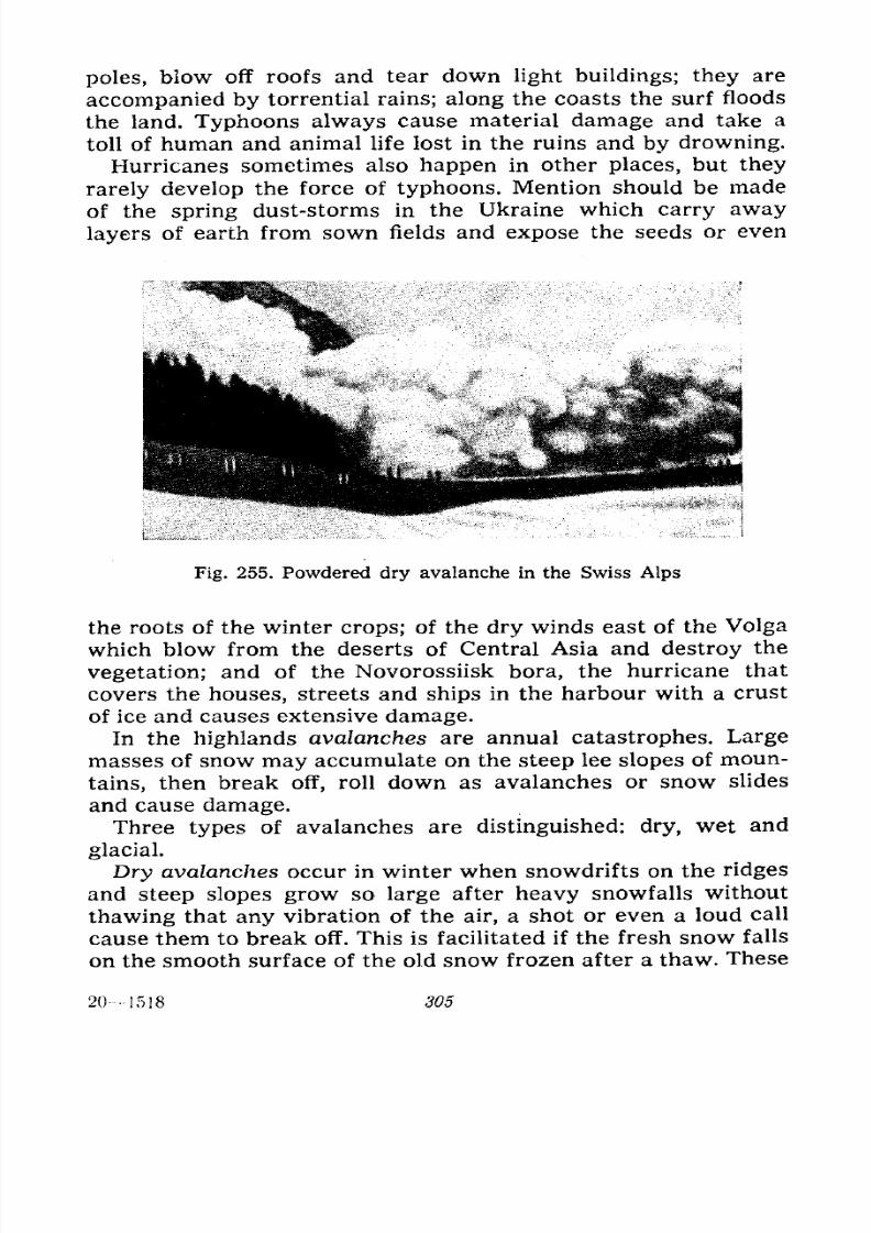
7/28/2019 Fundamentals of Geology - 19th century - Russia text in English
http://slidepdf.com/reader/full/fundamentals-of-geology-19th-century-russia-text-in-english 306/375
poles, blow off roofs and tear down light buildings; they are
accompanied by torrential rains; along the coasts the surf floods
the land. Typhoons always cause material damage and take a
toll of human and animal life lost in the ruins and by drowning.
Hurricanes sometimes also happen in other places, but they
rarely develop the force of typhoons. Mention should be made
of the spring dust-storms in the Ukraine which carry away
layers of earth from sown fields and expose the seeds or even
Fig. 255. Powdered dry avalanche in the Swiss Alps
the roots of the winter crops; of the dry winds east of the Volga
which blow from the deserts of Central Asia and destroy the
vegetation; and of the Novorossiisk bora, the hurricane that
covers the houses, streets and ships in the harbour with a crust
of ice and causes extensive damage.In the highlands avalanches are annual catastrophes. Large
masses of snow may accumulate on the steep lee slopes of moun-
tains, then break off, roll down as avalanches or snow slides
and cause damage.
Three types of avalanches are distinguished: dry, wet and
glacial.
Dry avalanches occur in winter when snowdrifts on the ridges
and steep slopes grow so large after heavy snowfalls withoutthawing that any vibration of the air, a shot or even a loud call
cause them to break off. This is facilitated if the fresh snow falls
on the smooth surface of the old snow frozen after a thaw. These
201518 305
7/28/2019 Fundamentals of Geology - 19th century - Russia text in English
http://slidepdf.com/reader/full/fundamentals-of-geology-19th-century-russia-text-in-english 307/375
avalanches come down, simultaneously filling the air with snow-
dust which forms a veritable cloud (Fig. 255).
Wet avalanches occur in winter, after heavy snowfalls, dur-
ing intensive thawing and also during spring thawing; they con-
sist of more or less sticky, water-logged snow. The masses of
snow in the snowdrifts grow heavy during thawing, while the
underlying surface becomes slippery from being moistened by
the melt water; the snow finally breaks away and slides down
taking along the snow lying on its way on the lower slope;
individual blocks roll down with snow adhering to them on their
way. These avalanches have a very uneven surface and produce
no snow cloud as they come down (Fig. 256).
Glacial avalanches are the terminal parts of hanging glaciers
sometimes breaking away from the main mass and rolling down
to the foot of the slope as a chaos of fragments. As the name
indicates these avalanches consist of ice.
In the highlands avalanches cause great damage: they destroy
forests that lie across their tracks, block up river valleys, rail-
ways and other roads thus interrupting communication, bury
houses and outbuildings together with the people and cattle in
them, often tear off roofs and break in walls and windows. The
snow where the avalanche has stopped is not infrequently from
10 to 20 metres deep so that trenches must be dug to clear the
houses, clean the roads and save the people and animals. The
following statistics offers an idea of the damages caused by ava-
lanches in a single Swiss area in the beginning of February 1689
when there was an exceptionally heavy snowfall:
Human lives lost 120
People saved 180
Houses destroyed 119
Bams and haylofts destroyed 629
Cattle killed 326
Goats and sheep killed 584
Trees broken 1,830
This was an unprecedented catastrophe; lesser ones occur
quite often and small ones take place annually in the Swiss,
French and Italian Alps.
In the U.S.S.R. many areas suffer from avalanches in the Cau-casus. Annual avalanches on the Georgian Military Highwaysometimes disrupt communication for days on end. In the Altai,
Tien Shan and the Pamirs avalanches are also not infrequent.
306
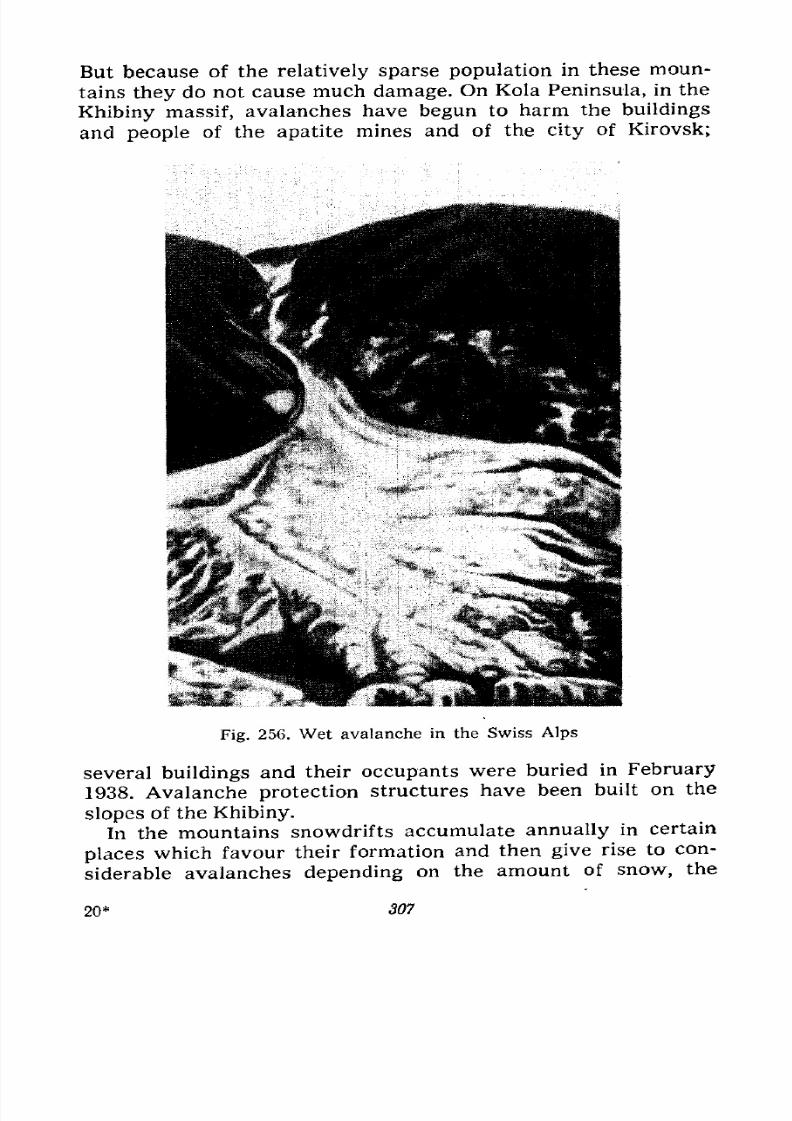
7/28/2019 Fundamentals of Geology - 19th century - Russia text in English
http://slidepdf.com/reader/full/fundamentals-of-geology-19th-century-russia-text-in-english 308/375
But because of the relatively sparse population in these moun-
tains they do not cause much damage. On Kola Peninsula, in the
Khibiny massif, avalanches have begun to harm the buildings
and people of the apatite mines and of the city of Kirovsk;
Fig. 256. Wet avalanche in the Swiss Alps
several buildings and their occupants were buried in February
1938. Avalanche protection structures have been built on the
slopes of the Khibiny.In the mountains snowdrifts accumulate annually in certain
places which favour their formation and then give rise to con-
siderable avalanches depending on the amount of snow, the
20* 307
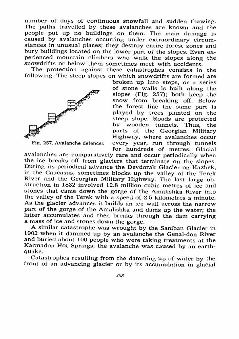
7/28/2019 Fundamentals of Geology - 19th century - Russia text in English
http://slidepdf.com/reader/full/fundamentals-of-geology-19th-century-russia-text-in-english 309/375
number of days of continuous snowfall and sudden thawing.The paths travelled by these avalanches are known and the
people put up no buildings on them. The main damage is
caused by avalanches occurring under extraordinary circum-
stances in unusual places; they destroy entire forest zones and
bury buildings located on the lower part of the slopes. Even ex-
perienced mountain climbers who walk the slopes along the
snowdrifts or below them sometimes meet with accidents.
The protection against these catastrophes consists in the
following. The steep slopes on which snowdrifts are formed are
broken up into steps, or a series
of stone walls is built along the
slopes (Fig. 257); both keep the
snow from breaking off. Below
the forest line the same part is
played by trees planted on the
steep slope. Roads are protected
by wooden tunnels. Thus, the
parts of the Georgian Military
Highway, where avalanches occur
every year, run through tunnels
for hundreds of metres. Glacial
Fig. 257. Avalanche defences
avalanches are comparatively rare and occur periodically whenthe ice breaks off from glaciers that terminate on the slopes,
During its periodical advance the Devdorak Glacier on Kazbek,in the Caucasus, sometimes blocks up the valley of the TerekRiver and the Georgian Military Highway. The last large ob-
struction in 1832 involved 12.8 million cubic metres of ice andstones that came down the gorge of the Amalishka River into
the valley of the Terek with a speed of 2.5 kilometres a minute.As the glacier advances it builds an ice wall across the narrow
part of the gorge of the Amalishka and dams up the water; the
latter accumulates and then breaks through the dam carryinga mass of ice and stones down the gorge.A similar catastrophe was wrought by the Saniban Glacier in
1902 when it dammed up by an avalanche the Genal-don River
and buried about 100 people who were taking treatments at the
Karmadon Hot Springs; the avalanche was caused by an earth-
quake.
Catastrophes resulting from the damming up of water by the
front of an advancing glacier or by its accumulation in glacial
308
7/28/2019 Fundamentals of Geology - 19th century - Russia text in English
http://slidepdf.com/reader/full/fundamentals-of-geology-19th-century-russia-text-in-english 310/375
caves occurred several times in the Swiss and the Savoian
Alps.
Volcanic eruptions are not infrequently accompanied by con-
siderable catastrophes the description of which would fill a
book. Of the older ones we are familiar with the destruction
of Herculaneum and Pompeii in 79 A.D. at the foot of Vesuvius
which was considered an extinct volcano. Its crater was even
overgrown with a forest in which Spartacus, leader of the slaves
who revolted, found asylum; its fertile slopes were covered with
vegetation, and numerous prosperous villages were located at its
foot. Judging by the description of Pliny the Younger, who was
an eyewitness, the eruption started suddenly without prelimi-
nary signs; Pliny the Elder, naturalist and uncle of the former,
was killed in the catastrophe. Pliny's description is the oldest
vulcanological document.
Vesuvius began its activity with a terrific explosion which
destroyed the plug in the vent and hurled it out in a shower
of rocks; then it threw out an enormous mass of white pumice
which buried Pompeii; this was followed by darker pumice, then
still darker slags and during the main phase by tremendous
masses of ash which obscured the sun in the surrounding
country. Strong earthquakes that accompanied the eruption
devastated the country; rains fell on the slopes of the volcano
and mixing with the ash formed a muddy mass which streamed
down and flooded Herculaneum. Lava in the form of the Castello
di Cisterna sheet probably broke out at the end and poured into
the uninhabited marshes at the foot of the northern slope. Such
was the catastrophe that befell the two cities and annihilated
25,000 people who were buried in the ash or drowned in the
mud, as revealed by the excavations which have unearthed
buildings, streets, all the household goods and remains of the
people overtaken by death in various postures in the streets and
at home.
A similar catastrophe occurred befbre our eyes in 1902 on
the Island of Martinique, one of the Lesser Antilles, when the
volcano of Mont Pelee awakened. It was also believed extinct
and the population had no legends relating to its activity. Its
slopes were covered with a forest, there was a small lake amida forest in its crater inhabited by birds and animals.
The volcano began to show signs of life at the end of April
by light tremors of the ground and by liberating from its crater
309

7/28/2019 Fundamentals of Geology - 19th century - Russia text in English
http://slidepdf.com/reader/full/fundamentals-of-geology-19th-century-russia-text-in-english 311/375
smoke and vapours with ashes, and from its fissures sulphurous
gases, which poisoned many birds. The animals started anexodus from the forest, but the people who lived on the numer-ous farms on the slopes and in the town of St. Pierre were
Fig. 258. Spine on Mont Pelee (Martinique)
ejected from crater in an incandescent state
during the 1902 eruption
afraid to leave their property to the mercy of fate and remained.
On May 5 a mud stream destroyed the factory on the slope; it
seems the lake in the crater was ejected by the explosion. On
May 7 dense ash and incandescent bombs fell again and heavyrain-storms produced mud streams. Finally, an immense cloud
broke out of the crater with an explosion on May 8 and rushed
with the speed of an express train down the slope at the same
310
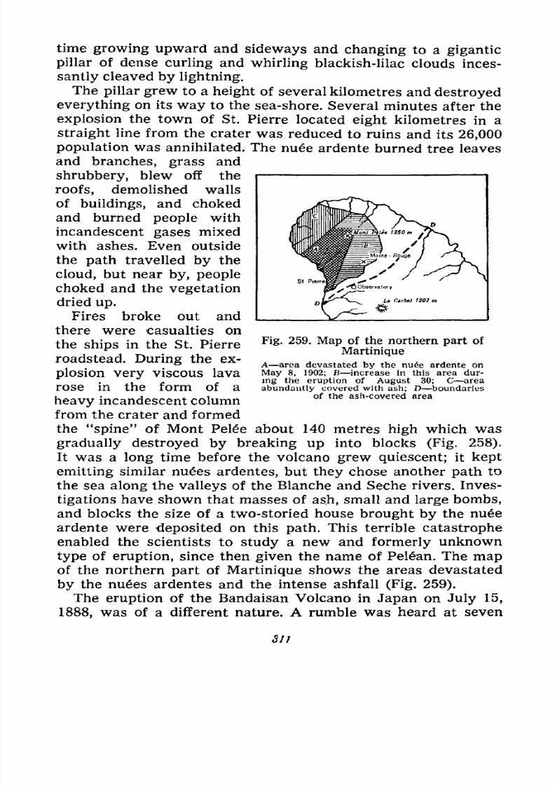
7/28/2019 Fundamentals of Geology - 19th century - Russia text in English
http://slidepdf.com/reader/full/fundamentals-of-geology-19th-century-russia-text-in-english 312/375
time growing upward and sideways and changing to a gigantic
pillar of dense curling and whirling blackish-lilac clouds inces-
santly cleaved by lightning.
The pillar grew to a height of several kilometres and destroyed
everything on its way to the sea-shore. Several minutes after the
explosion the town of St. Pierre located eight kilometres in a
straight line from the crater was reduced to ruins and its 26,000
population was annihilated. The nu6e ardente burned tree leaves
and branches, grass and
shrubbery, blew off the
roofs, demolished walls
of buildings, and choked
and burned people with
incandescent gases mixed
with ashes. Even outside
the path travelled by the
cloud, but near by, people
choked and the vegetation
dried up.
Fires broke out and
there were casualties on
the ships in the St. Pierre
roadstead. During the ex-
plosion very viscous lava
rose in the form of a
heavy incandescent column
from the crater and formed
the "spine" of Mont Pele about 140 metres high which was
gradually destroyed by breaking up into blocks (Fig. 258).
It was a long time before the volcano grew quiescent; it kept
emitting similar nues ardentes, but they chose another path to
the sea along the valleys of the Blanche and Seche rivers. Inves-
tigations have shown that masses of ash, small and large bombs,
and blocks the size of a two-storied house brought by the nuee
ardente were deposited on this path. This terrible catastrophe
enabled the scientists to study a new and formerly unknown
type of eruption, since then given the name of Pelan. The map
of the northern part of Martinique shows the areas devastated
by the nuees ardentes and the intense ashfall (Fig. 259).
The eruption of the Bandaisan Volcano in Japan on July 15,
1888, was of a different nature. A rumble was heard at seven
Fig. 259. Map of the northern part ofMartinique
A area devastated by the nu6e ardente on
May 8, 1902; B increase in this area dur-
ing the eruption of August 30; C area
abundantly covered with ash; D boundariesof the ash-covered area
311
7/28/2019 Fundamentals of Geology - 19th century - Russia text in English
http://slidepdf.com/reader/full/fundamentals-of-geology-19th-century-russia-text-in-english 313/375
o'clock in the morning; this was followed by shocks half an hour
later, and soon a column of vapours and dust rose almost 1,300
metres in the air. Then came from 15 to 20 explosions which
threw out masses of hard rocks in an almost horizontal direction.
The column rose to a height of nearly 6,000 metres, the hot ashes
plunged the area in total darkness; one of the explosions blew
out a horseshoe-shaped crater in the volcano two kilometres in
diameter and all of the material of the explosion was ejected
horizontally in the form of a hot avalanche; it was preceded bya hurricane with a velocity of 40 metres a second, which felled
trees. An area of 71 square kilometres was covered with debris
and 400 human lives were lost. The entire eruption lasted only
two hours, but the darkness continued for eight hours. This
volcano had been inactive for 1,000 years; its awakening almost
destroyed the old cone which was 670 metres high.
The eruption of Krakatao, a volcano in the Sunda Isles, on
August 26 and 27, 1883, was an unusual catastrophe; it was
accompanied by such explosions and shocks resembling artillery
firing that they were heard in India, Australia, the New Guinea
and the Philippines, i.e., 3,600 to 4,800 kilometres away. The air
blasts caused by the explosions shook up buildings for a distance
of 850 kilometres. Half the volcano which was an island between
Sumatra and Java partly disappeared under the waves and
partly was transformed into debris and ash. The latter created
such darkness that a ship overtaken in the Java Sea had to stop;
a rain of ash, thin mud and pieces of pumice fell on the deck;
the people choked with sulphurous gas; pieces as large as a
human head fell 20 kilometres away from the volcano and those
the size of a fist were carried for 40 kilometres; they were dis-
charged with the speed of cannon balls. The sea waves produced
by the collapse of the volcano constituted the chief menace;
near the shores of Java and Sumatra they reached a height of
20 to 35 metres, flooded the coast, swept off villages and took a
toll of 35,000 lives. These waves travelled as far as India, South
Africa and the coast of North America between Panama and
Alaska. The layer of ash around Krakatao was up to 16 metres
thick and on Sumatra up to one metre. Fine ash obscured the
sun in Japan and other places more than 3,000 kilometres away.This ash floated in the atmosphere for a long time and lent a
bluish shade to the light of the sun and moon in Africa, America
and the Pacific islands; it was also responsible for the remark -
312
7/28/2019 Fundamentals of Geology - 19th century - Russia text in English
http://slidepdf.com/reader/full/fundamentals-of-geology-19th-century-russia-text-in-english 314/375
able red sunsets observed all over the world at the end of 1883
and in the beginning of 1884.
We shall also briefly mention the eruption of the Santa-Maria
Volcano in Guatemala (Central America) that occurred on Octo-
ber 24, 1902, after a period of total quiescence. It began with an
earthquake after which a cloud of rocks and ash was thrown upto a height of 10,000 metres; the ejection of ash and pumice con-
tinued for 18 hours; debris fell at a distance of 14 kilometres
from the volcano. The eruption came to an end on October 26; it
had vielded 5.5 cubic kilometres of loose material which covered
the surrounding country with a layer ranging from one to three
and more metres thick and destroyed numerous plantations. Anew crater 600 metres deep and one kilometre in diameter
was formed on the slope of the volcano and continued weakly to
emit vapours and ash. At the end of the year it began to fill with
water; in 1906 explosions from time to time hurled this water
skyward like geysers.
No lava was poured out during the eruptions of the Bandaisan,
Krakatao and Santa-Maria volcanoes and it is generally not
lava, but the gaseous and loose materials of the eruptions that are
mainly responsible for the toll of human life, as was also shown
by the eruption of Vesuvius in 79 and that of Mont Pele in 1902.
Owing to the heating of the air during the eruption of the
Tambora Volcano on Java (April 10, 1815) a terrific wind-spout
arose and swept away whole villages and forests, lifting trees,
houses and cattle into the air and whirling them until its force
waned one hour later; many of the things thus lifted fell into the
sea. More than 56,000 people were killed during this eruption,
The very incomplete figures of human lives lost in 57 volcanic
eruptions since the year 1500 run into 190,000; of these 93 per
cent falls to the Pacific Hemisphere and only seven per cent to
the Atlantic where the main losses were suffered by Italy, Sicily
and Iceland. The damages caused by the loss of cattle, destruc-
tion of buildings and ruin of plantations are incalculable. The
chief causes of the catastrophes are the nues ardentes, ash,
bombs, hot gases, air blasts and sea waves, lava being the least
important. The forest and field fires, as well as the epizootics are
also regarded as results of eruptions.As for their effects on man earthquakes lead the catastrophes
in the history of the Earth. Their description would also fill a
book, but we can describe only a few of them. In the catastrophes
313
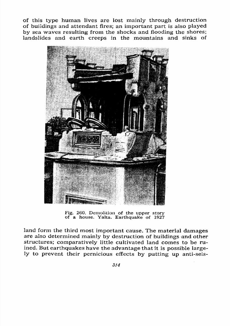
7/28/2019 Fundamentals of Geology - 19th century - Russia text in English
http://slidepdf.com/reader/full/fundamentals-of-geology-19th-century-russia-text-in-english 315/375
of this type human lives are lost mainly through destruction
of buildings and attendant fires; an important part is also played
by sea waves resulting from the shocks and flooding the shores;
landslides and earth creeps in the mountains and sinks of
Fig. 260. Demolition of the upper storyof a house. Yalta. Earthquake of 1927
land form the third most important cause. The material damages
are also determined mainly by destruction of buildings and otherstructures; comparatively little cultivated land comes to be ru-
ined. But earthquakes have the advantage that it is possible large-
ly to prevent their pernicious effects by putting up anti-seis-
314
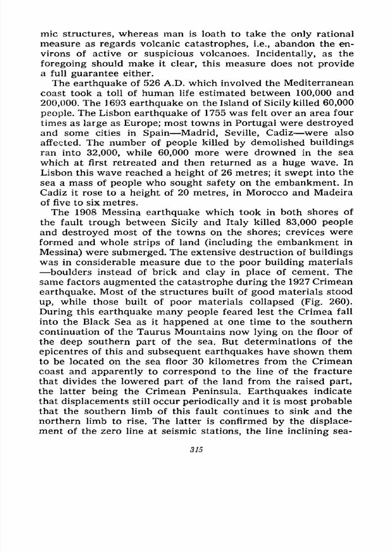
7/28/2019 Fundamentals of Geology - 19th century - Russia text in English
http://slidepdf.com/reader/full/fundamentals-of-geology-19th-century-russia-text-in-english 316/375
mic structures, whereas man is loath to take the only rational
measure as regards volcanic catastrophes, i.e., abandon the en-
virons of active or suspicious volcanoes. Incidentally, as the
foregoing should make it clear, this measure does not provide
a full guarantee either.
The earthquake of 526 A.D. which involved the Mediterranean
coast took a toll of human life estimated between 100,000 and
200,000. The 1693 earthquake on the Island of Sicily killed 60,000
people. The Lisbon earthquake of 1755 was felt over an area four
times as large as Europe; most towns in Portugal were destroyed
and some cities in Spain Madrid, Seville, Cadiz were also
affected. The number of people killed by demolished buildings
ran into 32,000, while 60,000 more were drowned in the sea
which at first retreated and then returned as a huge wave. In
Lisbon this wave reached a height of 26 metres; it swept into the
sea a mass of people who sought safety on the embankment. In
Cadiz it rose to a height of 20 metres, in Morocco and Madeira
of five to six metres.
The 1908 Messina earthquake which took in both shores of
the fault trough between Sicily and Italy killed 83,000 people
and destroyed most of the towns on the shores; crevices were
formed and whole strips of land (including the embankment in
Messina) were submerged. The extensive destruction of buildings
was in considerable measure due to the poor building materials
boulders instead of brick and clay in place of cement. The
same factors augmented the catastrophe during the 1927 Crimean
earthquake. Most of the structures built of good materials stood
up, while those built of poor materials collapsed (Fig. 260).
During this earthquake many people feared lest the Crimea fall
into the Black Sea as it happened at one time to the southerncontinuation of the Taurus Mountains now lying on the floor of
the deep southern part of the sea. But determinations of the
epicentres of this and subsequent earthquakes have shown them
to be located on the sea floor 30 kilometres from the Crimean
coast and apparently to correspond to the line of the fracture
that divides the lowered part of the land from the raised part,
the latter being the Crimean Peninsula. Earthquakes indicate
that displacements still occur periodically and it is most probablethat the southern limb of this fault continues to sink and the
northern limb to rise. The latter is confirmed by the displace-
ment of the zero line at seismic stations, the line inclining sea-
315
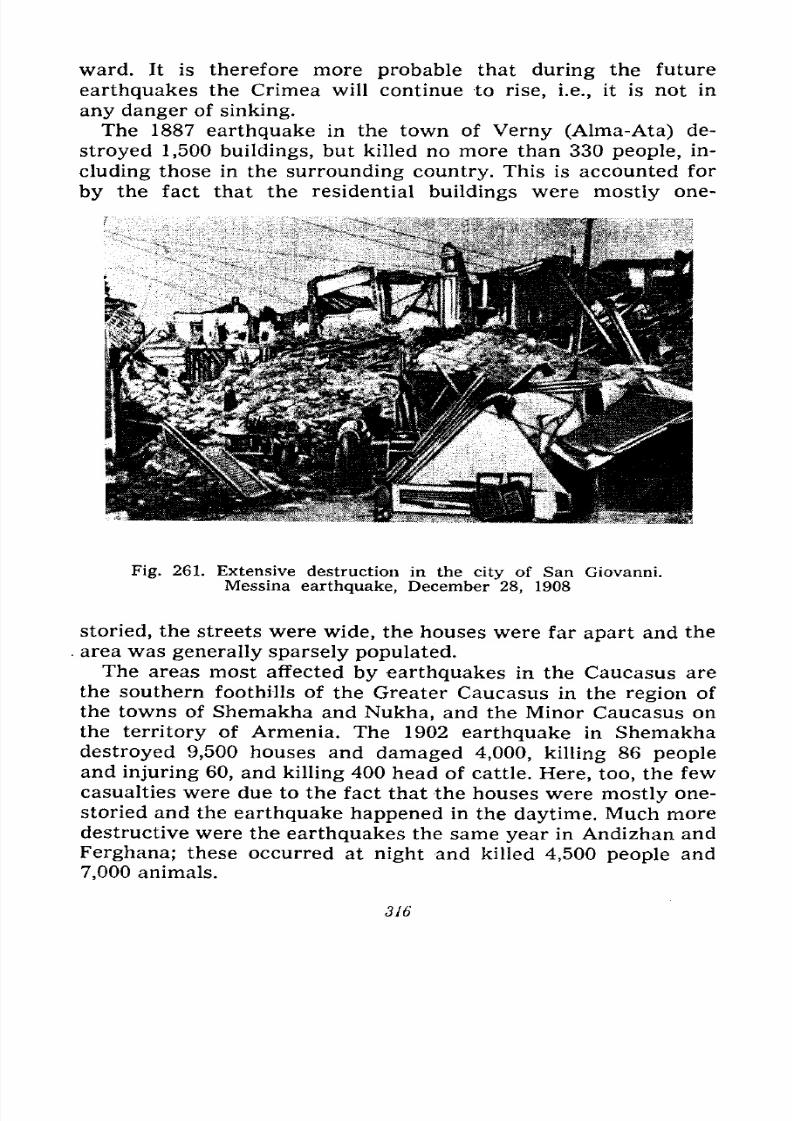
7/28/2019 Fundamentals of Geology - 19th century - Russia text in English
http://slidepdf.com/reader/full/fundamentals-of-geology-19th-century-russia-text-in-english 317/375
ward. It is therefore more probable that during the future
earthquakes the Crimea will continue to rise, i.e., it is not in
any danger of sinking.
The 1887 earthquake in the town of Verny (Alma-Ata) de-
stroyed 1,500 buildings, but killed no more than 330 people, in-
cluding those in the surrounding country. This is accounted for
by the fact that the residential buildings were mostly one-
Fig. 261. Extensive destruction in the city of San Giovanni.
Messina earthquake, December 28, 1908
storied, the streets were wide, the houses were far apart and the
area was generally sparsely populated.The areas most affected by earthquakes in the Caucasus are
the southern foothills of the Greater Caucasus in the region of
the towns of Shemakha and Nukha, and the Minor Caucasus on
the territory of Armenia. The 1902 earthquake in Shemakha
destroyed 9,500 houses and damaged 4,000, killing 86 people
and injuring 60, and killing 400 head of cattle. Here, too, the few
casualties were due to the fact that the houses were mostly one-
storied and the earthquake happened in the daytime. Much moredestructive were the earthquakes the same year in Andizhan and
Ferghana; these occurred at night and killed 4,500 people and
7,000 animals.
316
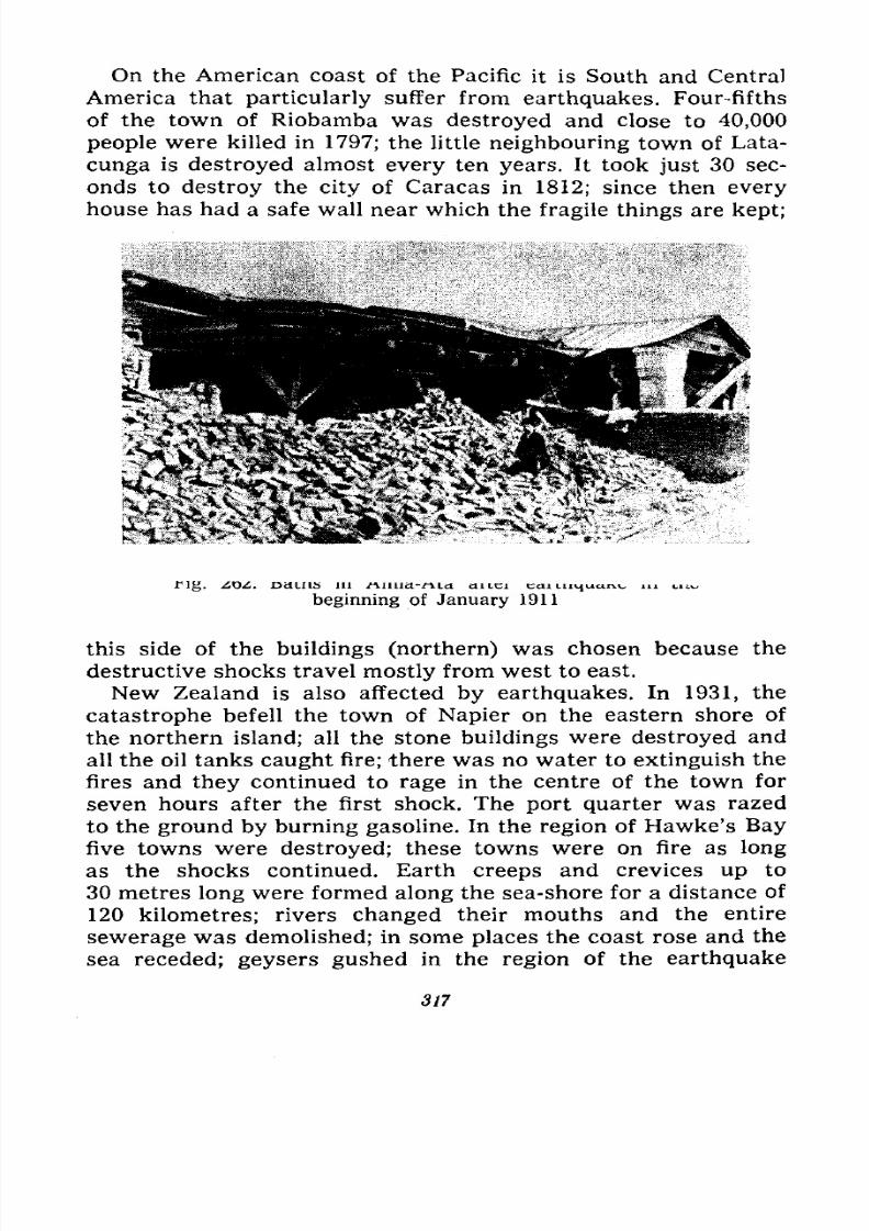
7/28/2019 Fundamentals of Geology - 19th century - Russia text in English
http://slidepdf.com/reader/full/fundamentals-of-geology-19th-century-russia-text-in-english 318/375
On the American coast of the Pacific it is South and Central
America that particularly suffer from earthquakes. Four-fifths
of the town of Riobamba was destroyed and close to 40,000
people were killed in 1797; the little neighbouring town of Lata-
cunga is destroyed almost every ten years. It took just 30 sec-
onds to destroy the city of Caracas in 1812; since then every
house has had a safe wall near which the fragile things are kept;
Tig. ZO<. 13 cl LI IS 111 .fVUllcl-rvicl cutci ecu tn^war^ in mwbeginning of January 1911
this side of the buildings (northern) was chosen because the
destructive shocks travel mostly from west to east.
New Zealand is also affected by earthquakes. In 1931, the
catastrophe befell the town of Napier on the eastern shore of
the northern island; all the stone buildings were destroyed and
all the oil tanks caught fire; there was no water to extinguish the
fires and they continued to rage in the centre of the town for
seven hours after the first shock. The port quarter was razed
to the ground by burning gasoline. In the region of Hawke's Bay
five towns were destroyed; these towns were on fire as long
as the shocks continued. Earth creeps and crevices up to
30 metres long were formed along the sea-shore for a distance of120 kilometres; rivers changed their mouths and the entire
sewerage was demolished; in some places the coast rose and the
sea receded; geysers gushed in the region of the earthquake
317
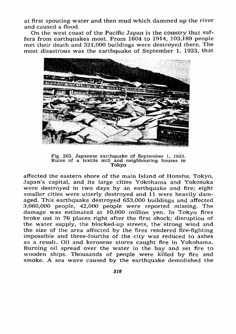
7/28/2019 Fundamentals of Geology - 19th century - Russia text in English
http://slidepdf.com/reader/full/fundamentals-of-geology-19th-century-russia-text-in-english 319/375
at first spouting water and then mud which dammed up the river
and caused a flood.
On the west coast of the Pacific Japan is the country that suf-
fers from earthquakes most. From 1604 to 1914, 103,189 people
met their death and 521,000 buildings were destroyed there. The
most disastrous was the earthquake of September 1, 1923, that
Fig. 263. Japanese earthquake of September 1, 1923.
Ruins of a textile mill and neighbouring houses in
Tokyo
affected the eastern shore of the main Island of Honshu. Tokyo,
Japan's capital, and its large cities Yokohama and Yokosuka
were destroyed in two days by an earthquake and fire; eight
smaller cities were utterly destroyed and 11 were heavily dam-aged. This earthquake destroyed 653,000 buildings and affected
3,060,000 people, 42,000 people were reported missing. The
damage was estimated at 10,000 million yen. In Tokyo fires
broke out in 76 places right after the first shock; disruption of
the water supply, the blocked-up streets, the strong wind and
the size of the area affected by the fires rendered fire-fighting
impossible and three-fourths of the city was reduced to ashes
as a result. Oil and kerosene stores caught fire in Yokohama.Burning oil spread over the water in the bay and set fire to
wooden ships. Thousands of people were killed by fire and
smoke. A sea wave caused by the earthquake demolished the
318

7/28/2019 Fundamentals of Geology - 19th century - Russia text in English
http://slidepdf.com/reader/full/fundamentals-of-geology-19th-century-russia-text-in-english 320/375
shore and swept off more than 500 houses; 356 shocks were re-
corded during September 1 and 2 (Fig. 263).
All in all only the seven stronger earthquakes that occurred
between 1755 and 1915 took a toll of 300,000 lives, while the 1923
Japanese earthquake killed 142,000 people.According
to old
annals 1,415,000 people died in earthquakes in China between
1038 and 1850, and 200,000 were additionally killed in 1920.
These large numbers are accounted for by the fact that manypeople lost their lives in the loess caves in which a considerable
part of the population of Northern China formerly lived. This
very incomplete statistics proves that earthquakes cause a much
greater loss of life and damage to property than do any other
catastrophes.
Catastrophes of the Past. All the catastrophes described
happened either before our eyes or in the very recent past,
in the last millenniums. No doubt there had also been catastro-
phes in antiquity, and some of them perhaps very extensive. Wemay regard as such catastrophes the biblical legend about Sodomand Gomorrah which were swallowed up by the ground presum-
ably for the sins of their inhabitants. These towns were located
on the territory now occupied by the Dead Sea, while the latter,
as geology has demonstrated, is located in a fault trough, i.e., in
a sink hole that terminates a large zone of subsidences and sinks
running from the centre of Africa along large lakes and then
representing the depression of the Red Sea and the valley of the
Dead Sea and Jordan. It is therefore quite possible that the
Bible describes in a distorted form an actual event that took
place in ancient times, i.e., the sinking of two towns during an
earthquake.
Even more stupendous was the catastrophe that destroyed the
Atlantis, as the state located on the large islands in the Atlantic
west of Gibraltar was called. According to Timaeus and Critios,two of Plato's dialogues, 8,000 years before the time of Solon
numerous troops of the king of Atlantis conquered the entire
area of the Mediterranean and only Athens successfully resisted,
but it, too, would have been subdued were it not for the terrible
earthquake during which Atlantis was submerged in one night,while the waves caused by the earthquake devastated the
Mediterranean coasts. The legend sounds plausible because all
the islands in the East Atlantic are volcanic and some geological
319
7/28/2019 Fundamentals of Geology - 19th century - Russia text in English
http://slidepdf.com/reader/full/fundamentals-of-geology-19th-century-russia-text-in-english 321/375
and zoological data imply the former existence of extensive land
between Europe and America.
The catastrophe by which the Aegean Sea was formed prob-
ably occurred in a similar manner as a sink in the beginning of
Quaternary period and gave the waters of the Mediterranean
access to the Black Sea.
All the aforementioned catastrophes are natural components
of volcanic eruptions, earthquakes and other natural forces, but
are territorially limited. But are there not in the history of the
Earth some proofs of great catastrophes simultaneously involving
large areas of land and therefore capable of exerting an essential
influence on the organic world?
We already know about transgressions, i.e., advances of the
sea which involved vast territories; we also know about the
epochs of glaciation in which even greater areas were covered by
an ice sheet. In the history of the Earth both these phenomenahave the right to be considered catastrophes though they did not
come about suddenly and did not last a short time, but developed
very gradually and persisted for tens of thousands of years.
Both regressions, i.e., retreats, and transgressions of the sea
took place during each geological period. Some of them were
confined to one continent, others affected more or less simul-
taneously all the continents. The living conditions had to change
both on land and in the sea during the transgressions and re-
gressions alike; during regressions the climate grew drier and
more continental, and during transgressions it was more humid
and showed lesser temperature variations. The neritic zone of
the sea, i.e., the area of small depths (up to 200 metres) in
which the most diverse and abundant organic life is concentrat-
ed, greatly increased during the transgressions thus setting up
optimal conditions for the development of this life and for the
rise of new varieties, species and genera. During regressions
this zone of the sea greatly contracted; in its drained area all
the permanent marine part of the population perished, whereas in
the section that was retained a cruel struggle for existence began
for the organisms not confined to the floor, and all those that
could not adapt themselves to the new conditions also died out.
Glaciations also radically changed the living conditions onthe Earth. Seizing large areas the ice destroyed all life on them;
the climate of the territory bordering the ice sheet altered; it
grew cold and the forest supplanted the steppe and was in its
320
7/28/2019 Fundamentals of Geology - 19th century - Russia text in English
http://slidepdf.com/reader/full/fundamentals-of-geology-19th-century-russia-text-in-english 322/375
turn replaced by the tundra; the warmth-loving forms of animals
and plants perished or slowly migrated south, while their place
was taken by forms adapted to cold and humidity. Some forms
died out, others were modified. During the retreat of the ice
sheet the fauna and flora moved in the reverse direction, but no
longer in their former composition since some of the older
forms died out and new ones appeared. The climate also changed
outside the areas involved in glaciation. It is believed that during
the glacial epochs in the moderate regions zones of a pluvial
climate, i.e., abounding in rain, were formed much farther south.
Thus, transgressions and regressions, as well as glaciations
may with certain justification be regarded as catastrophic phe-
nomena. But it may be urged that since the entire history of the
Earth essentially consists of transgressions and regressions it
therefore all consists of catastrophes. The answer to this is "yes"
cr "no." Yes, because the difference between these prolonged
and other catastrophes is only in time, in the duration of the
phenomenon, which is a very conditional feature. No, because
in the intervals between the transgressions and regressions and
between the glaciations the conditions of existence remained
approximately the same for a more or less long time. At any
rate these protracted catastrophes do not resemble those assumed
by Buffon in his Theory of the Earth during which all life was
totally destroyed at the end of each epoch. Long-continued catas-
trophes resulted in a slow extinction of some forms, transforma-
tion of others and appearance of still others.
Extinction of Faunas and Floras. The history of life on the
Earth really shows that during certain periods of time some
genera, families, orders and classes of animals and plants came
into being, attained their greatest development and distribution
and then died out or considerably diminished.
Thus, the archaeocyatha, organisms intermediate between
sponges and corals, appeared, reached unusual development and
became extinct all during the Cambrian period alone. Am-
monites, cephalopod molluscs with a spiral shell, appeared in the
Palaeozoic era, developed an enormous diversity of species and
genera during the Mesozoic era and died out towards the begin-
ning of the Tertiary period. The reptiles made their appearanceat the end of the Palaeozoic era, became the kings of nature on
land, in the air and in water during the Mesozoic era and receded
into the background during the Tertiary period by ceding their
21 1518 321
7/28/2019 Fundamentals of Geology - 19th century - Russia text in English
http://slidepdf.com/reader/full/fundamentals-of-geology-19th-century-russia-text-in-english 323/375
place to the mammals; the \? Lter dominated during the Miocene
and Pliocene periods and have now yielded the primacy to one
of their genera man, who developed during the Quaternary
period. The trilobites, quaint crustaceans which became extreme-
ly diversified during the Cambrian and Silurian periods and
held first place in the marine fauna, lost it with the appearance
of cephalopods, the most dangerous and wildest of the marine
predatory invertebrates.
Owing to the hot and humid climate during the Carboniferous
period cryptogamous plants ferns, horse-tails and lycopodia
attained unusual development and formed vast forests on
marshes. During the Permian period with its drier and colder
climate many of their species and genera disappeared and were
replaced by gymnosperms, cycadophyta and coniferous plants
fertilized with the aid of the wind and better adapted to the
dry climate; they dominated during the Mesozoic era, while
during the Tertiary period they were supplanted by angiosperms
better adjusted to considerable climatic variations.
Many more of these examples could be cited. The leading part
was played by climatic changes connected with the transgres-
sions and regressions of the sea, the epochs of mountain-build-
ing and glacial phases.
But in addition to these slow transformations of the fauna
and flora connected with climatic changes, which can be regard-
ed as catastrophes only with the aforementioned reservations,
we find in annals of the Earth proofs of real catastrophes which
in a short time exterminated large numbers of animals and plants.
Their remains form whole strata of the earth's crust and maybe called fossil cemeteries or fields of corpses.
We have already made mention of the fact that in Yellow-stone Park (U.S.A.) the side of the river gorge reveals 15 levels
of petrified trees interbedded with volcanic tuffs. Age-old forests
grew up there 15 times and were then ruined by volcanic erup-
tions. The layers of coal which in many places of the Earth are
imbedded with strata of sandstones, clays and limestones are
essentially also cemeteries of trees which existed under favour-
able conditions as forests for some time and were then rapidly
destroyed by a transgression of a lake or sea or by a river flood.
Cemeteries of reptile corpses of Cretaceous age are known in
North America and East Africa. In Mongolia recent expeditions
of the Palaeontological Institute of the U.S.S.R. Academy of
322
7/28/2019 Fundamentals of Geology - 19th century - Russia text in English
http://slidepdf.com/reader/full/fundamentals-of-geology-19th-century-russia-text-in-english 324/375
Sciences have also discovered in various places accumula-
tions of bones of Cretaceous pangolins and even their nests with
eggs, and in other places accumulations of remains of Tertiary
mammals. Similar cemeteries of Permian reptiles and amphib-
ians are known in South America and in Germany. Accumula-
tions of remains of Tertiary mammals are also found in the
U.S.S.R. Bessarabia, the Taman Peninsula and in Western
Siberia near Lake Chelkar-Tengiz, in the basin of the Turgai
River and near Pavlodar on the Irtysh River. Such cemeteries
were recently discovered in the lower layers of the Tertiary
conglomerates and sands in the lower reaches of the Chu River,
in the Ketmen Ridge near Tashkent, and in the sands of the
Kyzyl-Kum. Here the bones of the Cretaceous pangolins, the
scutes of turtles and the trunks of trees are badly chipped,
rounded and mixed with pebbles representing remains of a vast
cemetery of animals and plants of the end of the Cretaceous
period which existed in this area and were eroded probably by
torrents in the beginning of the Tertiary period.
The cemetery of Permian and Triassic herbivorous and carniv-
orous amphibians and reptiles discovered by Professor Ama-
litsky on the Northern Dvina has been known for a long time;
the skeletons of these animals have formed a whole gallery, part
of which is now on exhibition at the Palaeontological Museum of
the Academy of Sciences in Moscow. This cemetery runs from
the Unzha River across the Northern Dvina almost to the Kama
River and the bones are found in a bed of sandstone with
pebbles and sand from 20 centimetres to three metres thick,
above and beneath which are mixed marls entirely devoid of
remains. A regression of the sea had apparently set up favour-
able conditions in the form of vast marshes and river floods for
the existence of great numbers of these animals in this area,
and then a rapid transgression buried their remains.
The asphalt deposit in the Rancho la Brea near Los Angeles,
California, is famous for its bones of Quaternary mammals and
birds. Today it is a large hollow formed as a result of hard-as-
phalt quarrying; on the floor of the hollow amid reeds and
shrubbery there are puddles of water from which here and there
large bubbles of combustible gas escape; the water is darkbrown, dirty and smells of oil. It is rain water accumulated
above heavy viscous oil, liquid asphalt, which makes up the
entire floor of the hollow. Woe unto the animal that attracted
21* 323
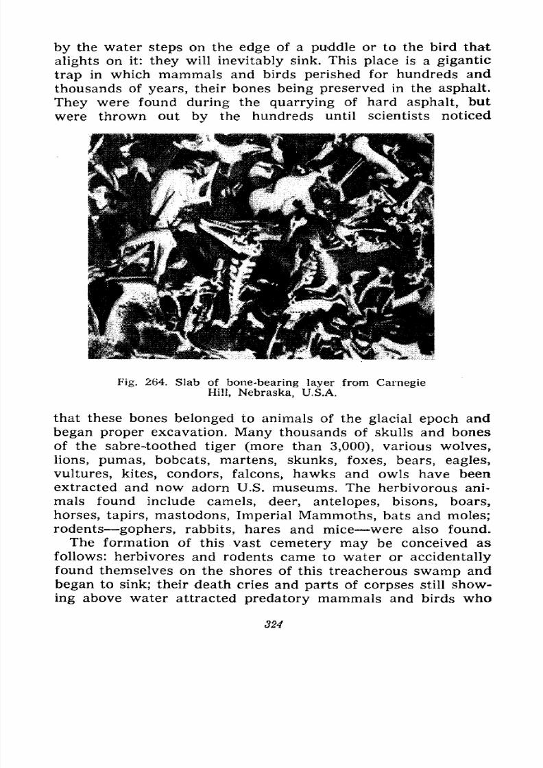
7/28/2019 Fundamentals of Geology - 19th century - Russia text in English
http://slidepdf.com/reader/full/fundamentals-of-geology-19th-century-russia-text-in-english 325/375
by the water steps on the edge of a puddle or to the bird that
alights on it: they will inevitably sink. This place is a gigantic
trap in which mammals and birds perished for hundreds and
thousands of years, their bones being preserved in the asphalt.
They were found during the quarrying of hard asphalt, but
were thrown out by the hundreds until scientists noticed
Fig. 264. Slab of bone-bearing layer from Carnegie
Hill, Nebraska, U.S.A.
that these bones belonged to animals of the glacial epoch and
began proper excavation. Many thousands of skulls and bones
of the sabre-toothed tiger (more than 3,000), various wolves,
lions, pumas, bobcats, martens, skunks, foxes, bears, eagles,
vultures, kites, condors, falcons, hawks and owls have been
extracted and now adorn U.S. museums. The herbivorous ani-
mals found include camels, deer, antelopes, bisons, boars,
horses, tapirs, mastodons, Imperial Mammoths, bats and moles;
rodents gophers, rabbits, hares and mice were also found.
The formation of this vast cemetery may be conceived as
follows: herbivores and rodents came to water or accidentallyfound themselves on the shores of this treacherous swamp and
began to sink; their death cries and parts of corpses still show-
ing above water attracted predatory mammals and birds who
324
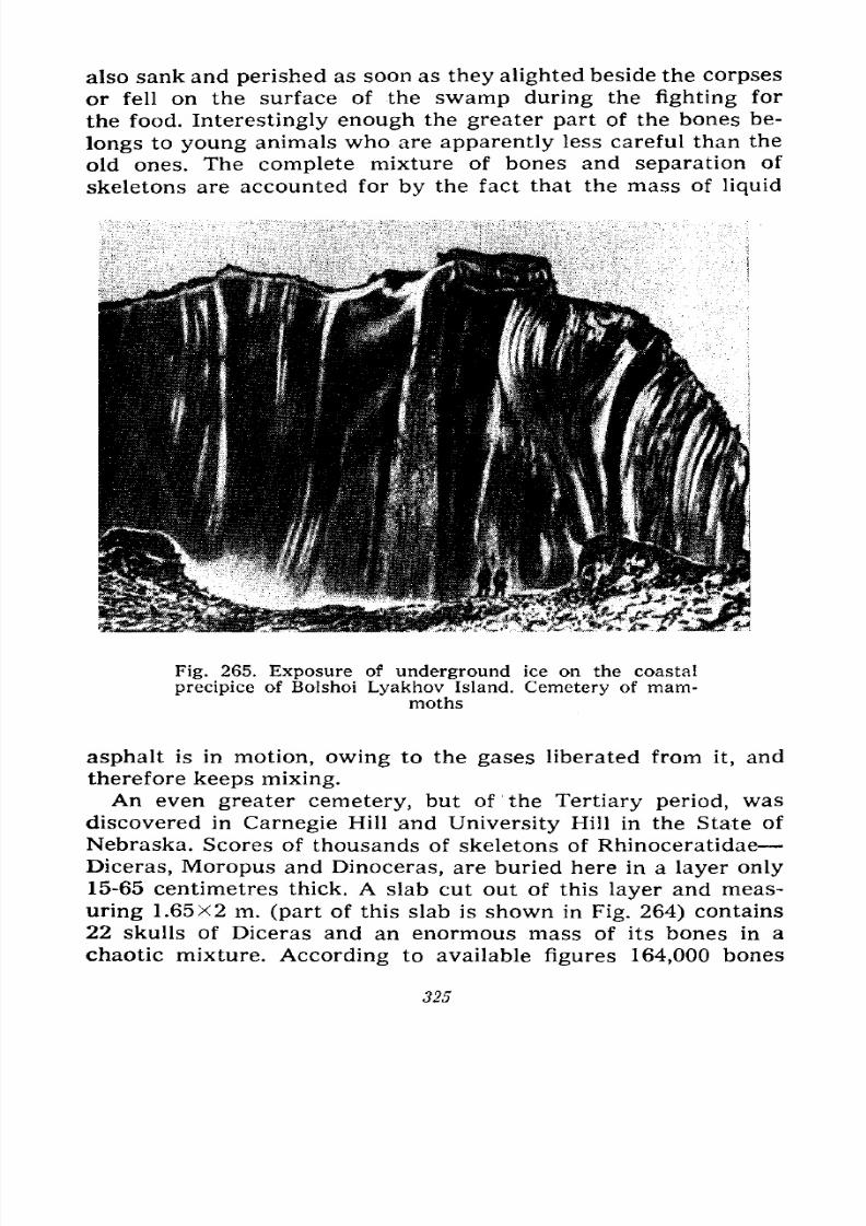
7/28/2019 Fundamentals of Geology - 19th century - Russia text in English
http://slidepdf.com/reader/full/fundamentals-of-geology-19th-century-russia-text-in-english 326/375
also sank and perished as soon as they alighted beside the corpses
or fell on the surface of the swamp during the fighting for
the food. Interestingly enough the greater part of the bones be-
longs to young animals who are apparently less careful than the
old ones. The complete mixture of bones and separation of
skeletons are accounted for by the fact that the mass of liquid
Fig. 265. Exposure of underground ice on the coastal
precipice of Bolshoi Lyakhov Island. Cemetery of mam-moths
asphalt is in motion, owing to the gases liberated from it, and
therefore keeps mixing.
An even greater cemetery, but of the Tertiary period, was
discovered in Carnegie Hill and University Hill in the State of
Nebraska. Scores of thousands of skeletons of Rhinoceratidae
Diceras, Moropus and Dinoceras, are buried here in a layer only
15-65 centimetres thick. A slab cut out of this layer and meas-uring 1.65X2 m. (part of this slab is shown in Fig. 264) contains
22 skulls of Diceras and an enormous mass of its bones in a
chaotic mixture. According to available figures 164,000 bones
325
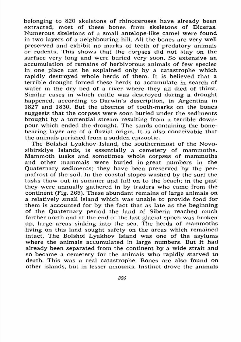
7/28/2019 Fundamentals of Geology - 19th century - Russia text in English
http://slidepdf.com/reader/full/fundamentals-of-geology-19th-century-russia-text-in-english 327/375
belonging to 820 skeletons of rhinoceroses have already been
extracted, most of these bones from skeletons of Diceras.
Numerous skeletons of a small antelope-like camel were found
in two layers of a neighbouring hill. All the bones are very well
preserved and exhibit no marks of teeth of predatory animals
or rodents. This shows that the corpses did not stay on the
surface very long and were buried very soon. So extensive an
accumulation of remains of herbivorous animals of few species
in one place can be explained only by a catastrophe which
rapidly destroyed whole herds of them. It is believed that a
terrible drought forced these herds to accumulate in search of
water in the dry bed of a river where they all died of thirst.
Similar cases in which cattle was destroyed during a drought
happened, according to Darwin's description, in Argentina in
1827 and 1830. But the absence of tooth-marks on the bones
suggests that the corpses were soon buried under the sediments
brought by a torrential stream resulting from a terrible down-
pour which ended the drought. The sands containing the bone-
bearing layer are of a fluvial origin. It is also conceivable that
the animals perished from a sudden epizootic.
The Bolshoi Lyakhov Island, the southernmost of the Novo-
sibirskiye Islands, is essentially a cemetery of mammoths.Mammoth tusks and sometimes whole corpses of mammoths
and other mammals were buried in great numbers in the
Quaternary sediments; they have been preserved by the per-
mafrost of the soil. In the coastal slopes washed by the surf the
tusks thaw out in summer and fall on to the beach; in the past
they were annually gathered in by traders who came from the
continent (Fig. 265). These abundant remains of large animals on
a relatively small island which was unable to provide food for
them is accounted for by the fact that as late as the beginning
of the Quaternary period the land of Siberia reached much
farther north and at the end of the last glacial epoch was broken
up, large areas sinking into the sea. The herds of mammoths
living on this land sought safety on the areas which remained
intact. The Bolshoi Lyakhov Island was one of the asylums
where the animals accumulated in large numbers. But it had
already been separated from the continent by a wide strait andso became a cemetery for the animals who rapidly starved to
death. This was a real catastrophe. Bones are also found on
other islands, but in lesser amounts. Instinct drove the animals
326
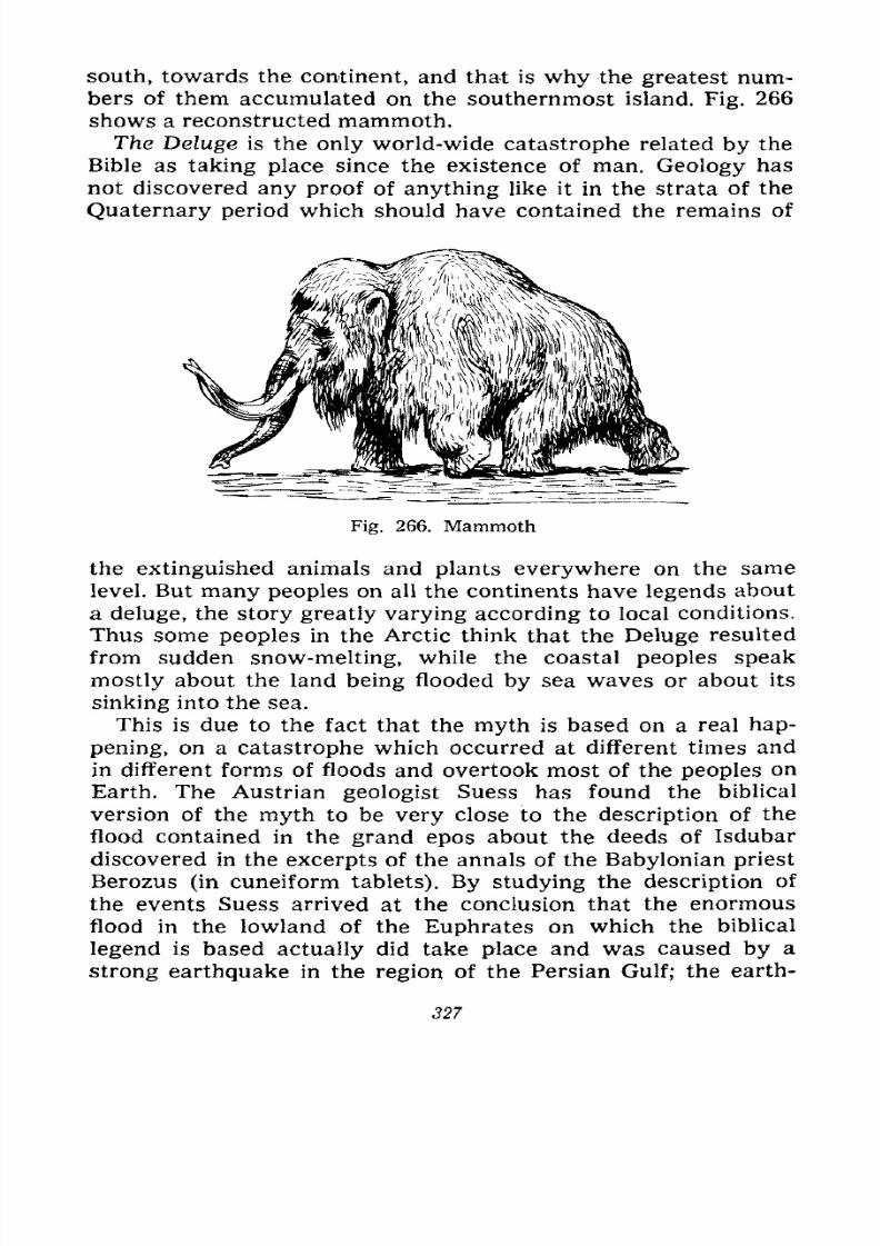
7/28/2019 Fundamentals of Geology - 19th century - Russia text in English
http://slidepdf.com/reader/full/fundamentals-of-geology-19th-century-russia-text-in-english 328/375
south, towards the continent, and that is why the greatest num-
bers of them accumulated on the southernmost island. Fig. 266
shows a reconstructed mammoth.
The Deluge is the only world-wide catastrophe related by the
Bible as taking place since the existence of man. Geology has
not discovered any proof of anything like it in the strata of the
Quaternary period which should have contained the remains of
Fig. 266. Mammoth
the extinguished animals and plants everywhere on the same
level. But many peoples on all the continents have legends about
a deluge, the story greatly varying according to local conditions.
Thus some peoples in the Arctic think that the Deluge resulted
from sudden snow-melting, while the coastal peoples speak
mostly about the land being flooded by sea waves or about its
sinking into the sea.
This is due to the fact that the myth is based on a real hap-
pening, on a catastrophe which occurred at different times and
in different forms of floods and overtook most of the peoples on
Earth. The Austrian geologist Suess has found the biblical
version of the myth to be very close to the description of the
flood contained in the grand epos about the deeds of Isdubar
discovered in the excerpts of the annals of the Babylonian priest
Berozus (in cuneiform tablets). By studying the description of
the events Suess arrived at the conclusion that the enormousflood in the lowland of the Euphrates on which the biblical
legend is based actually did take place and was caused by a
strong earthquake in the region of the Persian Gulf; the earth-
327

7/28/2019 Fundamentals of Geology - 19th century - Russia text in English
http://slidepdf.com/reader/full/fundamentals-of-geology-19th-century-russia-text-in-english 329/375
quake forced the sea to recede which then returned as a tre-
mendous tidal wave augmented by a terrible cyclone coming on
from the south; the wave flooded the entire lowland of Meso-
potamia. But the Babylonian annals do not say it was a world-
wide flood; they describe a purely local event. There had been
similar floods giving food for myths in other countries, but their
causes may have differed very widely unusual overflows of
rivers after rains, sudden snow-melting, typhoons on sea-shores,
tidal waves of earthquakes or intense volcanic eruptions (like
the 1883 eruption of Krakatao). That is why the myths of dif-
ferent peoples assumed different forms; based on real happen-
ings they were in some measure or other embellished by fantasy.
7/28/2019 Fundamentals of Geology - 19th century - Russia text in English
http://slidepdf.com/reader/full/fundamentals-of-geology-19th-century-russia-text-in-english 330/375
XII
WHAT RICHES THE EARTH CONTAINS
Minerals and Their Properties. Relationship between
Minerals and Rocks. Formation of Rocks and Minerals.
Endogenous and Exogenous, Primary and Secondary
Deposits. Natural Distribution of Minerals. Mosaics of
the Earth's Crust GeosyncJines, Shields and Plates.
Distribution of Minerals over the Territory of the
U.S.S.R. Objectives of Geochemistry.
The earth's crust contains various minerals required by civi-
lized man; these minerals have to be dug out, extracted from
different layers of the earth. Even primitive man made use of
these minerals in the form of chips of flint and other hard rocks
in order better to defend himself from predatory animals, to
procure animal food and to fight his fellow-men, i.e., to wagewar in its elementary form. The higher man rose in his devel-
opment the more extensive and varied use he made of minerals.
Modern engineering is absolutely impossible without their wideemployment; only coarse food and clothes and simple dwellings,
like nomadic tents and huts, can be procured and made from
vegetable and animal products without using any minerals.
Some of these minerals can be used in the form in which
they are extracted from the ground, as for example, coal,
lignite, peat, clay, sand and quarrystone. Others require a simple
processing such as cleaning, cutting, hewing, sorting, grinding
and concentrating; these include mica, asbestos, amber, phos-
phorites, rock salt, salt brines, placer gold, facing and precious
stones. Still others need more or less complicated factory
operations to yield the useful product; among these we find all
329
7/28/2019 Fundamentals of Geology - 19th century - Russia text in English
http://slidepdf.com/reader/full/fundamentals-of-geology-19th-century-russia-text-in-english 331/375
the ores, i.e., compounds of metals with oxygen, sulphur,
arsenic, etc., as well as oil; the latter may incidentally be used
in its raw state as a fuel.
The conspicuous feature of the minerals which distinguishes
them from the other natural resources such as animals and
plants, white coal (water power), yellow coal (solar energy) and
blue coal (wind power), is their scantiness and impossibility of
renewal. The resources created by the natural processes during
the long centuries of the Earth's history are limited and are not
renewed on a scale necessary for their practical utilization. This
should impel man to use them sparingly; on the other hand, the
increase in population, development of industry and exhaustion
of the worked deposits drive man to search for new ones and
for methods of their more economical utilization, force man to
work the poor deposits and to employ various substitutes.
Most important in the search for new mineral deposits is the
knowledge of the geological processes which created these
deposits during the past periods in the life of the Earth; these
processes are still creating them today, but so slowly that in
most cases their products cannot be regarded as industrial
reserves. The studies of geological processes help us explain the
origin of minerals and the laws of their distribution; conse-
quently, they help us expediently and most successfully to
direct the search for new and as yet unknown deposits, as well
as correctly to estimate their reserves and practical importance.
Mineral deposits consist of an accumulation of one or several
varieties of minerals and are, therefore, formed by the same
processes which generally create minerals. Rocks are the largest
accumulations of minerals, while the accumulations that form
useful deposits are generally private cases of rock formation
depending on some special conditions which create a concen-
tration of these minerals large enough to be profitably exploited.
These are determined by the value of the mineral and maytherefore greatly differ from very thick layers or large stocks
to thin veins or even separate disseminations. Only such min-
erals as brick clay, sand and various building stones represent
the layers or series of the rocks themselves.
We already know that rocks are formed in three ways. Someare formed by the hardening of magma, i.e., molten masses ris-
ing to the surface from the entrails of the Earth. These are
igneous rocks which are in their turn divided into intrusive or
330
7/28/2019 Fundamentals of Geology - 19th century - Russia text in English
http://slidepdf.com/reader/full/fundamentals-of-geology-19th-century-russia-text-in-english 332/375
plutonic rocks that solidified at some depth, and voJcanic or
effusive rocks that consolidated on the surface. Other rocks
are created as chemical or mechanical deposits in water basins
precipitating out of the solution or from the suspension and are
therefore referred to as sedimentary or fragmented rocks. Still
others were originally either igneous or sedimentary rocks, but
were later in one way or another altered by pressure during
mountain-building, by remelting or intensive heating, by impreg-
nation with hot gases or vapours in sinking to a great depth, or
by contact with newly extruded magma. These rocks are known
as metamorphic.
It follows that the mineral deposits as private cases of moun-
tain-building processes represent the same three main cate-
gories. Those connected with the formation of igneous rocks
are called magmatic or endogenous, i.e., created by depth proc-
esses. The deposits formed in water basins or by weathering
processes on land are said to be sedimentary, weathered or
exogenous deposits, i.e., created by processes on the surface.
The deposits formed or transformed during the processes of
rock alteration are called metamorphic.
But the primary source of all minerals that form the earth's
crust and, consequently, the mineral deposits is the magma.
Analyses show that igneous rocks contain in some measure or
other all the chemical elements known on the Earth. The sub-
stances found in the exogenous deposits were originally found
in some form in igneous rocks and were liberated from them by
weathering and erosion; later they got into water solutions or
weathering residues and accumulated into deposits again which
are therefore generally secondary, whereas the deposits con-
nected with igneous rocks are essentially the only primary
deposits. Even the most ancient sedimentary rocks are products
of disintegration of the primary earth's crust so that the oldest
exogenous mineral deposits are secondary. In later periods of
the Earth's history magmatic extrusions from the depths created
ever new primary deposits, while the processes of weathering
and erosion formed from them and from the very igneous rocks
and ancient secondary deposits new secondary deposits. The
processes of rock alteration simultaneously created metamorphicdeposits. All three processes are still operating today.
Let us now briefly consider the processes by which mineral
deposits are formed.
331
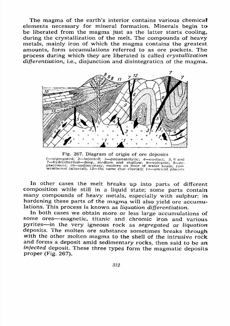
7/28/2019 Fundamentals of Geology - 19th century - Russia text in English
http://slidepdf.com/reader/full/fundamentals-of-geology-19th-century-russia-text-in-english 333/375
The magma of the earth's interior contains various chemical
elements necessary for mineral formation. Minerals begin to
be liberated from the magma just as the latter starts cooling,
during the crystallization of the melt. The compounds of heavy
metals, mainly iron of which the magma contains the greatest
amounts, form accumulations referred to as ore pockets. The
process during which they are liberated is called crystallization
differentiation, i.e., disjunction and disintegration of the magma.
Fig. 267. Diagram of origin of ore deposits] segregated; 2 injected; 3 pneumatolytic; 4 contact; 5, ft and7 hydrothermal- deep, medium and shallow; 8 volcanic; 9 re-
placement; JO sedimentary, modern on floor of water basin; 11
weathered (alluvial); 1 2 the same (but eluvial); 13 ancient placers
In other cases the melt breaks up into parts of different
composition while still in a liquid state; some parts contain
many compounds of heavy metals, especially with sulphur; in
hardening these parts of the magma will also yield ore accumu-lations. This process is known as liquation differentiation.
In both cases we obtain more or less large accumulations of
some ores magnetic, titanic and chromic iron and various
pyrites in the very igneous rock as segregated or liquation
deposits. The molten ore substance sometimes breaks through
with the other molten magma to the shell of the intrusive rockand forms a deposit amid sedimentary rocks, then said to be an
injected deposit. These three types form the magmatic deposits
proper (Fig. 267).
332
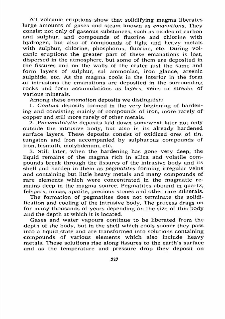
7/28/2019 Fundamentals of Geology - 19th century - Russia text in English
http://slidepdf.com/reader/full/fundamentals-of-geology-19th-century-russia-text-in-english 334/375
All volcanic eruptions show that solidifying magma liberates
large amounts of gases and steam known as emanations. Theyconsist not only of gaseous substances, such as oxides of carbon
and sulphur, and compounds of fluorine and chlorine with
hydrogen, but also of compounds of light and heavy metals
with sulphur, chlorine, phosphorus, fluorine, etc. During vol-
canic eruptions the greater part of these emanations is lost,
dispersed in the atmosphere, but some of them are deposited in
the fissures and on the walls of the crater just the same and
form layers of sulphur, sal ammoniac, iron glance, arsenic
sulphide, etc. As the magma cools in the interior in the form
of intrusions the emanations are deposited in the surrounding
rocks and form accumulations as layers, veins or streaks of
various minerals.
Among these emanation deposits we distinguish:
1. Contact deposits formed in the very beginning of harden-
ing and consisting mainly of compounds of iron, more rarely of
copper and still more rarely of other metals.
2. Pneumatolytic deposits laid down somewhat later not only
outside the intrusive body, but also in its already hardened
surface layers. These deposits consist of oxidized ores of tin,
tungsten and iron accompanied by sulphurous compounds of
iron, bismuth, molybdenum, etc.
3. Still later, when the hardening has gone very deep, the
liquid remains of the magma rich in silica and volatile com-
pounds break through the fissures of the intrusive body and its
shell and harden in them as pegmatites forming irregular veins
and containing but little heavy metals and many compounds of
rare elements which were concentrated in the magmatic re-
mains deep in the magma source. Pegmatites abound in quartz,
felspars, micas, apatite, precious stones and other rare minerals.
The formation of pegmatites does not terminate the solidi-
fication and cooling of the intrusive body. The process drags on
for many thousands of years depending on the size of this body
and the depth at which it is located.
Gases and water vapours continue to be liberated from the
depth of the body, but in the shell which cools sooner they pass
into a liquid state and are transformed into solutions containing
compounds of various elements which also include heavy
metals. These solutions rise along fissures to the earth's surface
and as the temperature and pressure drop they deposit on
333
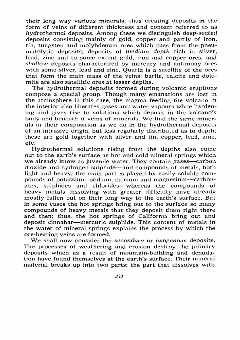
7/28/2019 Fundamentals of Geology - 19th century - Russia text in English
http://slidepdf.com/reader/full/fundamentals-of-geology-19th-century-russia-text-in-english 335/375
their long way various minerals, thus creating deposits in the
form of veins of different thickness and content referred to as
hydrothermal deposits. Among these we distinguish deep-seated
deposits consisting mainly of gold, copper and partly of iron,
tin, tungsten and molybdenum ores which pass from the pneu-
matolytic deposits; deposits of medium depth rich in silver,
lead, zinc and to some extent gold, iron and copper ores; and
shallow deposits characterized by mercury and antimony ores
with some silver, lead and zinc. Quartz is a satellite of the ores
that form the main mass of the veins; barite, calcite and dolo-
mite are also satellitic ores at lesser depths.
The hydrothermal deposits formed during volcanic eruptions
compose a special group. Though many emanations are lost in
the atmosphere in this case, the magma feeding the volcano in
the interior also liberates gases and water vapours while harden-
ing and gives rise to solutions which deposit in the volcano's
body and beneath it veins of minerals. We find the same miner-
als in their composition as we do in the hydrothermal deposits
of an intrusive origin, but less regularly distributed as to depth;
these are gold together with silver and tin, copper, lead, zinc,
etc.
Hydrothermal solutions rising from the depths also comeout to the earth's surface as hot and cold mineral springs which
we already know as juvenile water. They contain gases carbon
dioxide and hydrogen sulphide and compounds of metals, both
light and heavy; the main part is played by easily soluble com-
pounds of potassium, sodium, calcium and magnesium carbon-
ates, sulphides and chlorides whereas the compounds of
heavy metals dissolving with greater difficulty have already
mostly fallen out on their long way to the earth's surface. Butin some cases the hot springs bring out to the surface so many
compounds of heavy metals that they deposit them right there
and then; thus, the hot springs of California bring out and
deposit cinnabar mercuric sulphide. This content of metals in
the water of mineral springs explains the process by which the
ore-bearing veins are formed.
We shall now consider the secondary or exogenous deposits.
The processes of weathering and erosion destroy the primarydeposits which as a result of mountain-building and denuda-
tion have found themselves at the earth's surface. Their mineral
material breaks up into two parts: the part that dissolves with
334
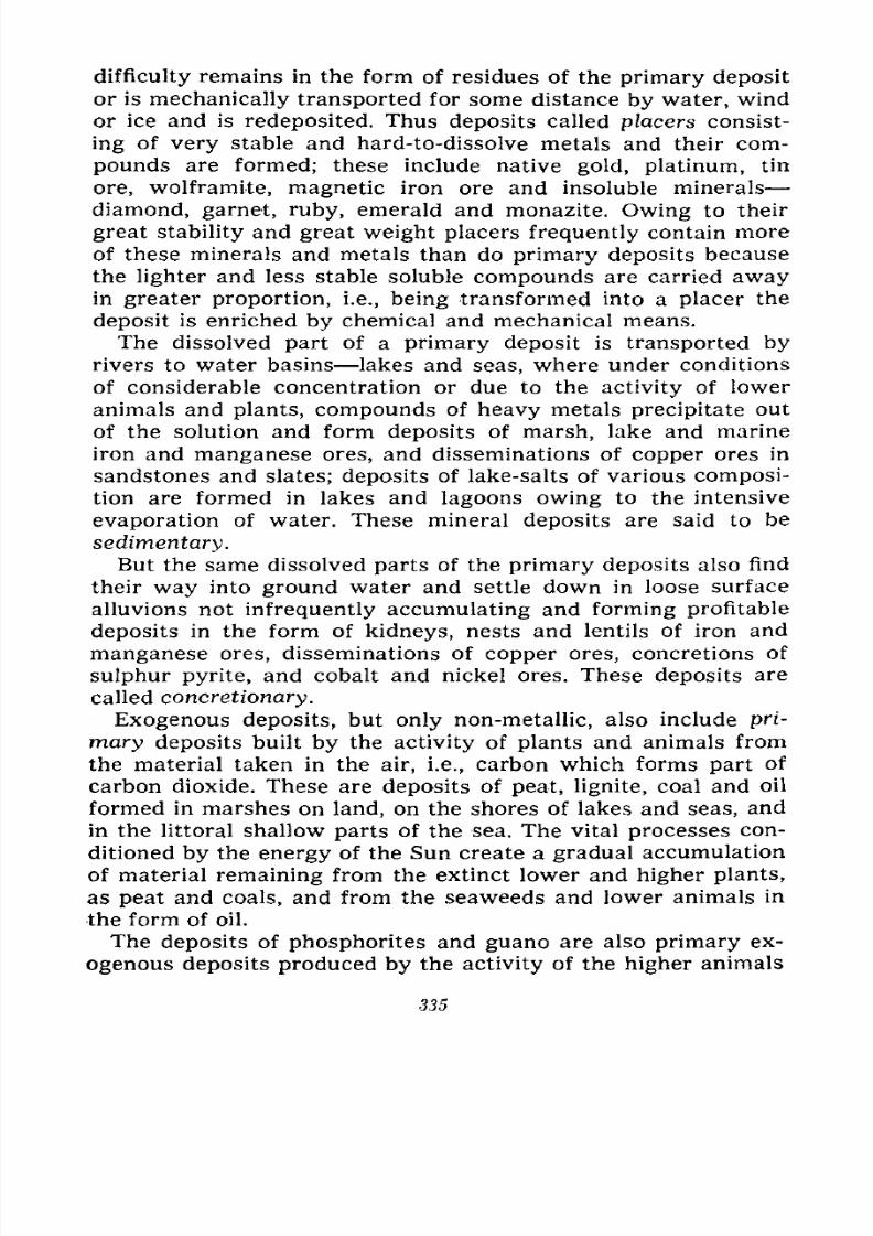
7/28/2019 Fundamentals of Geology - 19th century - Russia text in English
http://slidepdf.com/reader/full/fundamentals-of-geology-19th-century-russia-text-in-english 336/375
difficulty remains in the form of residues of the primary deposit
or is mechanically transported for some distance by water, wind
or ice and is redeposited. Thus deposits called placers consist-
ing of very stable and hard-to-dissolve metals and their com-
pounds are formed; these include native gold, platinum, tin
ore, wolframite, magnetic iron ore and insoluble minerals
diamond, garnet, ruby, emerald and monazite. Owing to their
great stability and great weight placers frequently contain more
of these minerals and metals than do primary deposits because
the lighter and less stable soluble compounds are carried awayin greater proportion, i.e., being transformed into a placer the
deposit is enriched by chemical and mechanical means.
The dissolved part of a primary deposit is transported by
rivers to water basins lakes and seas, where under conditions
of considerable concentration or due to the activity of lower
animals and plants, compounds of heavy metals precipitate out
of the solution and form deposits of marsh, lake and marine
iron and manganese ores, and disseminations of copper ores in
sandstones and slates; deposits of lake-salts of various composi-
tion are formed in lakes and lagoons owing to the intensive
evaporation of water. These mineral deposits are said to be
sedimentary.
But the same dissolved parts of the primary deposits also find
their way into ground water and settle down in loose surface
alluvions not infrequently accumulating and forming profitable
deposits in the form of kidneys, nests and lentils of iron and
manganese ores, disseminations of copper ores, concretions of
sulphur pyrite, and cobalt and nickel ores. These deposits are
called concretionary.
Exogenous deposits, but only non-metallic, also include pri-
mary deposits built by the activity of plants and animals from
the material taken in the air, i.e., carbon which forms part of
carbon dioxide. These are deposits of peat, lignite, coal and oil
formed in marshes on land, on the shores of lakes and seas, and
in the littoral shallow parts of the sea. The vital processes con-
ditioned by the energy of the Sun create a gradual accumulation
of material remaining from the extinct lower and higher plants,
as peat and coals, and from the seaweeds and lower animals in
the form of oil.
The deposits of phosphorites and guano are also primary ex-
ogenous deposits produced by the activity of the higher animals
335
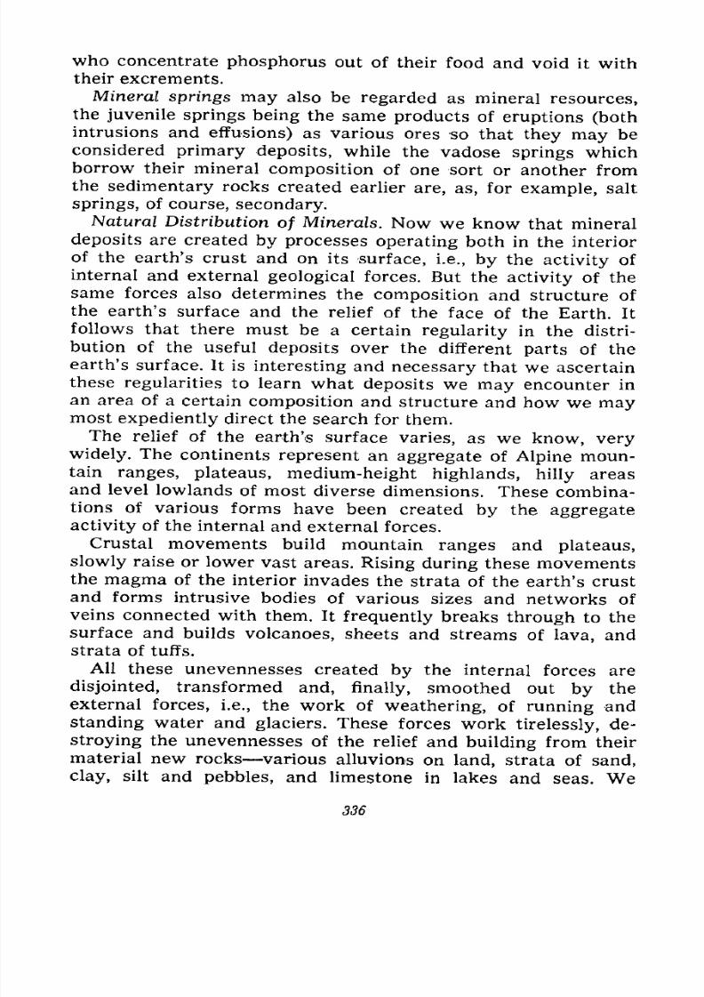
7/28/2019 Fundamentals of Geology - 19th century - Russia text in English
http://slidepdf.com/reader/full/fundamentals-of-geology-19th-century-russia-text-in-english 337/375
who concentrate phosphorus out of their food and void it with
their excrements.
Mineral springs may also be regarded as mineral resources,
the juvenile springs being the same products of eruptions (bothintrusions and effusions) as various ores so that they
maybe
considered primary deposits, while the vadose springs whichborrow their mineral composition of one sort or another from
the sedimentary rocks created earlier are, as, for example, salt
springs, of course, secondary.
Natural Distribution of Minerals. Now we know that mineral
deposits are created by processes operating both in the interior
of the earth's crust and on its surface, i.e., by the activity of
internal and external geological forces. But the activity of the
same forces also determines the composition and structure of
the earth's surface and the relief of the face of the Earth. It
follows that there must be a certain regularity in the distri-
bution of the useful deposits over the different parts of the
earth's surface. It is interesting and necessary that we ascertain
these regularities to learn what deposits we may encounter in
an area of a certain composition and structure and how we maymost expediently direct the search for them.
The relief of the earth's surface varies, as we know, very
widely. The continents represent an aggregate of Alpine moun-tain ranges, plateaus, medium-height highlands, hilly areas
and level lowlands of most diverse dimensions. These combina-
tions of various forms have been created by the aggregate
activity of the internal and external forces.
Crustal movements build mountain ranges and plateaus,
slowly raise or lower vast areas. Rising during these movements
the magma of the interior invades the strata of the earth's crustand forms intrusive bodies of various sizes and networks of
veins connected with them. It frequently breaks through to the
surface and builds volcanoes, sheets and streams of lava, and
strata of tuffs.
All these unevennesses created by the internal forces are
disjointed, transformed and, finally, smoothed out by the
external forces, i.e., the work of weathering, of running and
standing water and glaciers. These forces work tirelessly, de-
stroying the unevennesses of the relief and building from their
material new rocks various alluvions on land, strata of sand,
clay, silt and pebbles, and limestone in lakes and seas. We
336
7/28/2019 Fundamentals of Geology - 19th century - Russia text in English
http://slidepdf.com/reader/full/fundamentals-of-geology-19th-century-russia-text-in-english 338/375
already know that this activity of the external and internal
forces creates, transforms, destroys and gives rise to new forms
of useful deposits. The study of the composition of the earth's
crust and of a country's history makes it possible to determine
the deposits it may have, as well as where and how they are
distributed.
Mosaic of the Earth's Crust. Mountain ranges consisting of
folds of rock are formed mainly in geosynclines, i.e., long and
more or less wide depressions located amidst the land or along
the margins of continents. These depressions whose floors peri-
odically subside gradually accumulate thick strata of sediments
from the materials brought down by rivers from the neighbour-
ing land and by the surf from the shores. When the depression
is more or less filled with sediments it gives rise to mountain-
building, the reasons for which are not yet clear and excite
discussion. But it cannot be doubted that the strata of sedimen-
tary rocks accumulated in such depressions rise from them in
the form of more or less complicated folds which build moun-
tain ranges. At the same time, since the floor of the depression
in its downward flexing sank deep into the earth's crust and
reached the layers with high temperature, the lower layers of
the depression were already able to melt and the magma during
the formation of the folds invaded the sedimentary strata in
the form of massifs of different size and numerous veins, even
breaking through to the surface and building volcanoes.
The studies of mountain ranges have shown the formation of
folds usually to be accompanied by an intrusion of magma. And
since magma is the primary source of all ores, mountain-build-
ing is ordinarily attended by various types of ore deposition,
from magmatic to hydrothermal, i.e., by a formation of primaryore deposits of a deep-seated origin.
What minerals can we expect to find in a highland raised
from a geosyncline? The answer will depend on the age of the
country. If it is young and but recently uplifted we can expect
to find shallow hydrothermal, as well as volcanic, deposits pro-
vided there are any volcanoes thereabout. The other deposits
are still hidden at great depths and are inaccessible. If the high-
land is a bit older the external forces have already been able to
cut deeper into the folds and we can then find, in addition to
the aforesaid (which may have been partly destroyed), also
deposits of medium depth. Lastly, in an old and greatly eroded
221518 337
7/28/2019 Fundamentals of Geology - 19th century - Russia text in English
http://slidepdf.com/reader/full/fundamentals-of-geology-19th-century-russia-text-in-english 339/375
highland we should find near the surface not only deep-seated
deposits but also pneumatolytic, contact and magmatic deposits
in different combinations varying with the extent of the erosion.
Besides these endogenous deposits, highlands of different ages
may reveal exogenous deposits sedimentary iron and copper
ores, layers of coal and phosphorites, provided favourable con-
ditions for their formation were set up in some places of the
geosyncline.
The history of the Earth shows that the folded highlands were
built successively in different parts of most continents because
in the course of time the geosynclines shifted. The uplifted
mountain ranges gradually aged, were eroded, became lower,
were transformed into mountains of medium height, then into
hilly country and, finally, into peneplains. And in the neigh-
bourhood, either on one side or the other, the earth's crust
flexed again, a new geosyncline was formed and was again filled
with sediments giving rise to a new mountain range subject to
the same fate.
We thus see in the north of Europe remains of the oldest
Archaean and Proterozoic mountains in the form of the Baltic
Shield transformed into a peneplain. This is the most ancient Europeor Arch-Europe. In the west it adjoins a highland built by folds
of the Caledonian cycle in the first half of the Palaeozoic era;
this highland encompasses the west of Scandinavia, Great Brit-
ain, and the north of France and Germany. This is Palaeo-
Europe. Farther south from Poland to France and Spain run the
mountain folds of the Variscian cycle of the second half of the
Palaeozoic era which form Meso-Europe. Lastly, in the south,
along the Mediterranean, we find the mountain ranges of Asia
Minor, the Caucasus, Balkans, Carpathians, Alps, Pyrenees,
Apennines and Atlas built during the Alpine cycle of the Meso-
zoic and Cainozoic eras and forming Neo-Europe.
Thus, the mountain-building in the geosynclines creating the
modern face of Europe shifted from north to south and with it
shifted the magmatic activity, which has created the ore depos-
its, as well as the activity of the external forces which exposedever deeper layers in the mountain folds gradually destroying
the deposits of the upper horizons and creating secondary de-
posits from their materials.
But mountain-building is not confined, as we know, to geo-
synclines. The pressure developing in the earth's crust and rais-
338
7/28/2019 Fundamentals of Geology - 19th century - Russia text in English
http://slidepdf.com/reader/full/fundamentals-of-geology-19th-century-russia-text-in-english 340/375
ing the strata of sediments accumulated in the geosynclines (the
most mobile zones of the earth's crust) also acts on other re-
gions, on areas of former geosynclines already transformed into
highlands more or less eroded and levelled out. These areas
show little mobility and are rigid because of the former fold-
ing and of the invasions of magma which have pierced them as
igneous rocks. Here new folds form but weakly, and fractures
and ruptures prevail; considerable series of strata shift, thrust
themselves over each other, whole stretches of the earth's crust
are uplifted, some more, others less, and form horsts and fault
troughs. Ejected by the pressure from the depths magma also
rises and forms new intrusions in the strata of rocks and the
networks of veins, and breaking through to the surface builds
volcanoes or sheets of effusive lava. This magmatic activity is
also connected with the formation of primary mineral deposits,
whereas sedimentary and weathered deposits are formed in
lakes, swamps and on the surface of these rigid areas.
The oldest areas of the earth's crust that suffered mountain-
building as early as the Pre-Cambrian eras and were never again
subjected to intensive folding are known as ancient platforms.
In the platforms distinction is made of shields sections which
since the last stage of folding have been characterized by a
stable uplift and have never been covered by the sea. But larger
areas of the platforms periodically sank and rose and were
seized by the sea; they are overlain by a rather thick cover of
sedimentary rocks which is not crumpled by intensive folding
and has almost horizontal layers. Such sections of platforms are
called plates.
Platforms constitute the central part of the continents: in
Eurasia it is the Russian platform with the Baltic and Ukrainian
shields, the Siberian platform with the Anabar and Aldan shields
and the projections of the ancient foundation on the edge of the
platform in the Yenisei Mountain Ridge, the Eastern Sayans
and the Baikal upland, the Sinian platform (Northern China) with
small shields, and the Arabian and Hindustani shields. In North
America it is the North American platform with the Canadian
Shield, and in South America the South American platform with
the Brazilian Shield. Nearly all of Africa presents a platformwith several shields, as also does Australia with a large shield
in the east. Almost the entire Antarctica constitutes a platform
and a large ancient shield.
22* 339
7/28/2019 Fundamentals of Geology - 19th century - Russia text in English
http://slidepdf.com/reader/full/fundamentals-of-geology-19th-century-russia-text-in-english 341/375
Deeply eroded shields may contain primary deposits of the
greatest depth magmatic proper, emanation and rather rarely
very deep hydrothermal. Metamorphic deposits created in Pre-
Cambrian time frequently occur on the shields. The occurrence
of various kinds of secondary deposits is also possible; these
were created on the surface of the shield from the products of
destruction of the primary deposits in the form of placers, lake
and swamp iron ores, as well as coal seams in the depositions
of lakes of different ages. When the shield was pierced by effu-
sive rocks the latter could bring along volcanic-type minerals.
The platforms in which the ancient foundation is overlain by
strata of sedimentary deposits of different ages never subjected
to intensive folding may contain secondary deposits built from
the products of destruction of the primary deposits included in
the ancient foundation, but more frequently sedimentary depos-
its of coal, iron ores, phosphorites, various salts and oil formed
in the seas, which flooded the platform, and in their lagoons,
as well as in lakes and on land during the regressions of the sea
and drainage of the platform. In some sections of the ancient
foundation projecting from the platforms the minerals may be
the same as on the shields.
The modern continents thus present a mosaic of areas of dif-
ferent geological histories and therefore different composition.
Side by side with the stable deeply eroded ancient shields we
see less stable platforms covered with but little disturbed sedi-
mentary rocks of different ages and the most unstable geosyn-
clines transformed into highlands of various ages and, con-
sequently, of varying depth of erosion and the latest very com-
plicatedtransformation. The
depositsof various minerals are
distributed in the mosaic according to the different compositions
and different histories of these areas. With the knowledge of the
geological structure of a country we can therefore tell what
minerals can be found in its various parts.
Distribution of Minerals over the Territory of the U.S.S.R.
Covering one-sixth of the earth's surface and stretching across
two continents the Soviet Union naturally includes areas with
varying geological histories and different structures and there-fore with varying combinations of mineral deposits. Let us
briefly trace the distribution of the latter over its territory
(Fig. 268).
340
7/28/2019 Fundamentals of Geology - 19th century - Russia text in English
http://slidepdf.com/reader/full/fundamentals-of-geology-19th-century-russia-text-in-english 342/375
We find the eastern and northern margins of the ancient Baltic
Shield in the European part of the country (Karelia and Kola
Peninsula); most of the territory is occupied by the vast Russian
platform in the southern part of which the Ukrainian Pre-
Cambrian massif comes to the fore; it would be more appro-
priate not to call it a shield, but a section of the ancient founda-
tion of a plate exposed as a result of an uplift and erosion,
because it is overlain by Tertiary and partly Mesozoic and, at its
western end, in Volhynia, by Palaeozoic marine sediments which
have suffered only weak and local folding dislocation. Side byside with it is the Donets Basin, a Palaeozoic geosyncline
strongly folded and at one time forming a real highland. In the
east the plate is bordered by the mountain system of the Urals,
also a Palaeozoic geosyncline whose mountain ranges are deeply
eroded. In the extreme south we see the Crimean and the Cau-
casian mountains taking their final origin in a Tertiary geo-
syncline with Alpine forms of relief.
The minerals are generally distributed over the aforemen-
tioned areas of varying structures as follows:
On the deeply eroded margins of the Baltic Shield we find
only magmatic proper, pegmatitic and metamorphic deposits;
iron ores (iron quartzites and hematites) of metamorphosed
sedimentary formation, pyrites (pyrrhotite with copper, nickel
and zinc) in the form of deep veins; micas and felspar in peg-
matitic veins, garnets in Archaean slates. In the Khibiny Massif
near the town of Ki,rovsk tremendous deposits of apatites and
various rare minerals are found in the younger Palaeozoic
intrusion. The marshes and lakes also contain iron ores of the
latest eroded-type formation, while the Karelian shungite is an
ancient metamorphosed bed of coal.
The Russian platform covered with sedimentary rocks of dif-
ferent ages, only slightly dislocated and unpierced by intrusions,
contains no deep-seated ore formations. The following numerous
deposits are found: coal Moscow and Pechora basins; iron ores
sedimentary and weathered Kirov, Tula and Lipetsk regions,
lake Novgorod Region; oil various parts of the Western Urals
from the Kama to the Lower Volga Emba District at the
Caspian Sea, and the North Caucasus Grozny and Maikop;rock salt and other salts Solikamsk, Bakhmut, Iletskaya
Zashchita, etc.; bauxite (aluminium ore) Tikhvin; lake-salt
lakes in the area east of the lower Volga and Sivash; phospho-
341
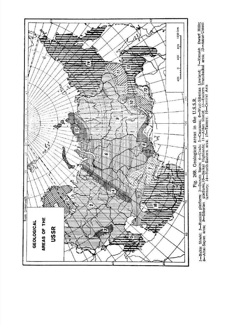
7/28/2019 Fundamentals of Geology - 19th century - Russia text in English
http://slidepdf.com/reader/full/fundamentals-of-geology-19th-century-russia-text-in-english 343/375
7/28/2019 Fundamentals of Geology - 19th century - Russia text in English
http://slidepdf.com/reader/full/fundamentals-of-geology-19th-century-russia-text-in-english 344/375
rites deposits of different ages. Large deposits of metamorphlciron ores have been discovered under strata of sedimentary
rocks in the Pre-Cambrian foundation of the platform in Kursk
Region. Similar deposits come to the surface in the Pre-Cam-
brian rocks of the Krivoi Rog area in the Ukraine; the same zone
of Pre-Cambrian formations has mica, felspars in pegmatites,
deposits of graphite, and layers of brown coal and sedimentary
manganese ores in the overlying Tertiary deposits near Nikopol.
The eroded geosyncline of the Donets Basin contains numerous
layers of coal in the strata of the Carboniferous sedimentary
rocks, while in the overlying Cretaceous and Tertiary sediments
we find deposits of white chalk, cement marls and tripolites. The
silver and lead veins of the Nagolny Ridge and the mercury
deposit of Nikitovka are connected with but few intrusions.
The deeply eroded geosyncline of the Urals in which numerous
and various intrusions occurred is rich in magmatic proper,
pegmatitic, emanation and deep hydrothermal ore deposits;
these include native and placer deposits of gold and platinum,
magnetic, titanic and chromic iron ores, tungsten and nickel
ores, copper and copper-containing pyrites, pegmatites with
mica and emeralds, magnesite and asbestos. There are also sedi-
mentary and weathered iron and aluminium ores, while on the
slopes where we find younger strata there are layers of coal and
sedimentary iron and manganese ores.
The young mountain ranges of the Caucasus abounding in
various intrusions contain hydrothermal deposits of different
depths yielding gold, copper, silver-lead-zinc, molybdenum and
tungsten, as well as contact deposits of iron ores. Large deposits
of oil are known in Azerbaijan (Baku); Western Georgia pos-
sesses sedimentary deposits of coal and manganese.In Siberia we find a vast lowland west of the Ob composed
of the most recent sedimentary formations which overlie older
layers probably dislocated and pierced by intrusions, but so far
known only by the data obtained from boreholes and as yet in-
accessible. The surface deposits contain nothing but peat, sands
and clays.
Farther south, in the northern part of Kazakhstan are the
Kazakh Dwar/ Hills; their structure is very complicated. Afterthe Pre-Cambrian cycles this was apparently an ancient Palae-
ozoic geosyncline transformed by the Caledonian cycle into a
folded highland, later eroded. A new subsidence created in the
343
7/28/2019 Fundamentals of Geology - 19th century - Russia text in English
http://slidepdf.com/reader/full/fundamentals-of-geology-19th-century-russia-text-in-english 345/375
same place an UpperPalaeozoic geosyncline, verywide but shallow
and with numerous islands remains of Caledonian mountains.
The Variscian cycle transformed it into a folded highland which
was also eroded; during the Mesozoic era there were lakes on its
surface, while in the beginning of the Tertiary period the steppe
was flooded by the sea. The Alpine cycle affected it with
fractures and overthrusts insufficient to change it to a block-
folded highland except the eastern part where the Kalbinsky,
Saur and Tarbagatai ranges were uplifted as horsts. Erosion
was therefore able extensively to level out the relief of the
greater part of the country. This former geosynclinal area widely
pierced by intrusions possesses rich ore formations of almost all
types, from the magmatic to the medium-depth hydrothermal:
ore and placer gold, tin, tungsten, copper, silver-lead-zinc in the
form of vein deposits, contact-metamorphic iron ores, various
types of disseminated copper ores, corundum deposits, coal layers
of Carboniferous and Jurassic ages, lake-salt, gypsum and
weathered aluminium ores.
The Aftaf-Sayan Highland adjoining the steppe in the east
and running across South Siberia to Lake Baikal represents
block-folded mountains which arose on the site of older folded
mountains Caledonian and in the western part also Variscian
uplifted from geosynclines. The endogenous ore formation is
abundant and diversified: ore and placer gold, tungsten, molyb-
denum, copper, silver-lead-zinc in the form of vein deposits,
Pre-Cambrian iron quartzites, asbestos, graphite, nephrite, con-
tact iron and copper ores, copper pyrites, beryl, weathered alu-
minium ores, and here and there Tertiary coal. The deep Kuz-
netsk and Minusinsk depressions fault troughs cut into this
highland contain Carboniferous, Permian and Jurassic coal;
the Minusinsk depression also has lake-salt and in the outcrops
of Palaeozoic rocks it contains iron and copper ores.
The Siberian platform differs from the Russian in that it
does not have part of the Mesozoic and Tertiary marine deposits,
in the prevalence of ancient Palaeozoic and vast intrusions and
outwellings of igneous rock the Siberian trap. The latter is
connected with deposits of iron ores and copper pyrite contain-
ing nickel and platinum, marine sediments of the ancient Palaeo-zoic era salt springs, rock salt and signs of oil, while the beds
of coal (and graphite in the Permian deposits of the Tunguska
Basin) and Jurassic combustible shales of the Irkutsk and Vilyui
344
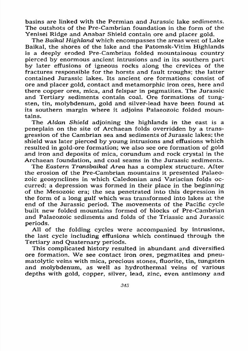
7/28/2019 Fundamentals of Geology - 19th century - Russia text in English
http://slidepdf.com/reader/full/fundamentals-of-geology-19th-century-russia-text-in-english 346/375
basins are linked with the Permian and Jurassic lake sediments.
The outshots of the Pre-Cambrian foundation in the form of the
Yenisei Ridge and Anabar Shield contain ore and placer gold.
The Baikal Highland which encompasses the areas west of Lake
Baikal, the shores of the lake and the Patomsk-Vitim Highlands
is a deeply eroded Pre-Cambrian folded mountainous country
pierced by enormous ancient intrusions and in its southern part
by later effusions of igneous rocks along the crevices of the
fractures responsible for the horsts and fault troughs; the latter
contained Jurassic lakes. Its ancient ore formations consist of
ore and placer gold, contact and metamorphic iron ores, here and
there copper ores, mica, and felspar in pegmatites. The Jurassic
and Tertiary sediments contain coal. Ore formations of tung-
sten, tin, molybdenum, gold and silver-lead have been found at
its southern margin where it adjoins Palaeozoic folded moun-
tains.
The Aldan Shield adjoining the highlands in the east is a
peneplain on the site of Archaean folds overridden by a trans-
gression of the Cambrian sea and sediments of Jurassic lakes; the
shield was later pierced by young intrusions and effusions which
resulted in gold-ore formation; we also see ore formation of gold
and iron and deposits of mica, corundum and rock crystal in the
Archaean foundation, and coal seams in the Jurassic sediments.
The Eastern Transbaikal Area has a complex structure. After
the erosion of the Pre-Cambrian mountains it presented Palaeo-
zoic geosynclines in which Caledonian and Variscian folds oc-
curred; a depression was formed in their place in the beginning
of the Mesozoic era; the sea penetrated into this depression in
the form of a long gulf which was transformed into lakes at the
end of the Jurassic period. The movements of the Pacific cycle
built new folded mountains formed of blocks of Pre-Cambrian
and Palaeozoic sediments and folds of the Triassic and Jurassic
periods.
All of the folding cycles were accompanied by intrusions,
the last cycle including effusions which continued through the
Tertiary and Quaternary periods.
This complicated history resulted in abundant and diversified
ore formation. We see contact iron ores, pegmatites and pneu-
matolytic veins with mica, precious stones, fluorite, tin, tungsten
and molybdenum, as well as hydrothermal veins of various
depths with gold, copper, silver, lead, zinc, even antimony and
345
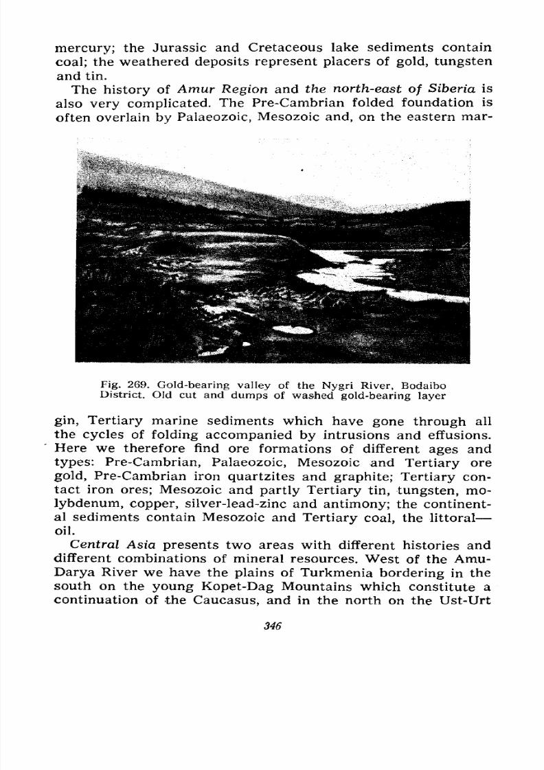
7/28/2019 Fundamentals of Geology - 19th century - Russia text in English
http://slidepdf.com/reader/full/fundamentals-of-geology-19th-century-russia-text-in-english 347/375
mercury; the Jurassic and Cretaceous lake sediments contain
coal; the weathered deposits represent placers of gold, tungsten
and tin.
The history of Amur Region and the north-east of Siberia is
also very complicated. The Pre-Cambrian folded foundation is
often overlain by Palaeozoic, Mesozoic and, on the eastern mar-
Fig. 269. Gold-bearing valley of the Nygri River, BodaiboDistrict. Old cut and dumps of washed gold-bearing layer
gin, Tertiary marine sediments which have gone through all
the cycles of folding accompanied by intrusions and effusions.
Here we therefore find ore formations of different ages and
types: Pre-Cambrian, Palaeozoic, Mesozoic and Tertiary ore
gold, Pre-Cambrian iron quartzites and graphite; Tertiary con-
tact iron ores; Mesozoic and partly Tertiary tin, tungsten, mo-
lybdenum, copper, silver-lead-zinc and antimony; the continent-
al sediments contain Mesozoic and Tertiary coal, the littoral
oil.
Central Asia presents two areas with different histories and
different combinations of mineral resources. West of the Amu-Darya River we have the plains of Turkmenia bordering in the
south on the young Kopet-Dag Mountains which constitute a
continuation of the Caucasus, and in the north on the Ust-Urt
346
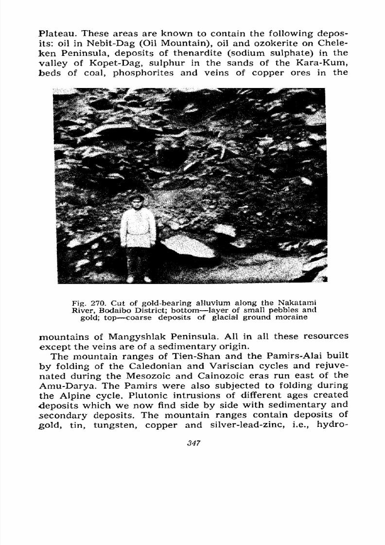
7/28/2019 Fundamentals of Geology - 19th century - Russia text in English
http://slidepdf.com/reader/full/fundamentals-of-geology-19th-century-russia-text-in-english 348/375
Plateau. These areas are known to contain the following depos-
its: oil in Nebit-Dag (Oil Mountain), oil and ozokerite on Chele-
ken Peninsula, deposits of thenardite (sodium sulphate) in the
valley of Kopet-Dag, sulphur in the sands of the Kara-Kum,
beds of coal, phosphorites and veins of copper ores in the
Fig. 270. Cut of gold-bearing alluvium along the Nakatami
River, Bodaibo District; bottom layer of small pebbles and
gold; top coarse deposits of glacial ground moraine
mountains of Mangyshlak Peninsula. All in all these resources
except the veins are of a sedimentary origin.
The mountain ranges of Tien-Shan and the Pamirs-Alai built
by folding of the Caledonian and Variscian cycles and rejuve-
nated during the Mesozoic and Cainozoic eras run east of the
Amu-Darya. The Pamirs were also subjected to folding during
the Alpine cycle. Plutonic intrusions of different ages created
deposits which we now find side by side with sedimentary and
secondary deposits. The mountain ranges contain deposits of
.gold, tin, tungsten, copper and silver-lead-zinc, i.e., hydro-
347
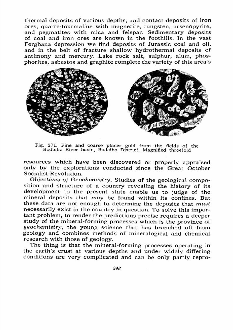
7/28/2019 Fundamentals of Geology - 19th century - Russia text in English
http://slidepdf.com/reader/full/fundamentals-of-geology-19th-century-russia-text-in-english 349/375
thermal deposits of various depths, and contact deposits of iron
ores, quartz-tourmaline with magnetite, tungsten, arsenopyrite,
and pegmatites with mica and felspar. Sedimentary deposits
of coal and iron ores are known in the foothills. In the vast
Ferghana depression we find deposits of Jurassic coal and oil,
and in the belt of fracture shallow hydrothermal deposits of
antimony and mercury. Lake rock salt, sulphur, alum, phos-
phorites, asbestos and graphite complete the variety of this area's
Fig. 271. Fine and coarse placer gold from the fields of theBodaibo River basin, Bodaibo District. Magnified threefold
resources which have been discovered or properly appraised
only by the explorations conducted since the Great October
Socialist Revolution.
Objectives of Geochemistry. Studies of the geological compo-sition and structure of a country revealing the history of its
development to the present state enable us to judge of themineral deposits that may be found within its confines. But
these data are not enough to determine the deposits that must
necessarily exist in the country in question. To solve this impor-tant problem, to render the predictions precise requires a deeper
study of the mineral-forming processes which is the province of
geochemistry, the young science that has branched off from
geology and combines methods of mineralogical and chemical
research with those of geology.The thing is that the mineral-forming processes operating in
the earth's crust at various depths and under widely differing
conditions are very complicated and can be only partly repro-
348
7/28/2019 Fundamentals of Geology - 19th century - Russia text in English
http://slidepdf.com/reader/full/fundamentals-of-geology-19th-century-russia-text-in-english 350/375
duced and studied in laboratories. Rising from the interior, con-
taining various elements and forming the primary ore deposits
on which the formation of the secondary ore deposits depends,
the magma may have a varying chemical composition to begin
with. Invading the crustal strata during the formation of the
intrusive body it dissolves by its contact some rocks or others
limestones, slates, sandstones, marls or more ancient igneous
rocks and must change its composition as a result of enriching
itself with the water that impregnates the rocks, as well as with
silica, alumina, lime and compounds of alkalis, according to the
composition of the pierced rocks. The composition of the
magma, the mode of its occurrence and solidification at a partic-
ular depth are responsible for the process of its differentiation,
i.e., division into partial magmas of some composition or other,
and the process of emanations and composition of the latter,
and consequently the nature of the ore formation. The nature
of the country rocks, their composition, mode of occurrence
and jointing are also important. For example, some rocks, es-
pecially those that contain lime, yield more easily to ore forma-
tion than do others; the mode of occurrence, hardness, stratifi-
cation and jointing of the rocks in some cases facilitate ore
formation and in others render it difficult; they also affect the
form of the deposits.
That is why, despite the general similarity of the various
types of ore formation magmatic, emanation and hydrothermal
we also observe wide local differences, i.e., prevalence of
some ores and infrequency or absence of others. For example,
sometimes it is the magmatic deposits proper that are absent,
sometimes it is the pegmatites or the contact deposits. The com-
position of magma which gives rise to pegmatites is especially
reflected in the latter; the pegmatites produced by acid rocks
differ from those formed by basic rocks; they also differ in
mineralization. Some igneous massifs have conditioned poor or
monotonous ore formation, others rich and diversified.
All these different conditions observed in nature necessitate a
deep study of the magmatic rocks and the entire mode of ore
formation in the given area to ascertain all the circumstances
and to come closer to the solution of the problem of the deposits
that should be found there, naturally also taking the history of
this area into consideration. This is the principal aim of geo-
chemistry.
349

7/28/2019 Fundamentals of Geology - 19th century - Russia text in English
http://slidepdf.com/reader/full/fundamentals-of-geology-19th-century-russia-text-in-english 351/375
Our cursory review has shown the various mineral resources
of the U.S.S.R. The country has all the varieties of metals
needed for industry, as well as the so-called non-metallic miner-
als such as coal, oil, peat, various salts, asbestos, graphite,
magnesite and different building materials. These resources are
not only diverse, but also extensive, i.e., their reserves ensure
industrial development for many decades.
Suffice it to say that the U.S.S.R. holds one of the world's
leading places in the most important mineral reserves. Only the
United States of America can in any way compare with us in
the diversity and extent of the mineral resources.
The resources of all the other countries are very uneven. For
example, Germany has a lot of coal and salt, but little iron,
copper and other ores and hardly any oil. There is but little oil,
coal and iron ores in Japan and Italy. Spain abounds in iron,
copper and mercurial ores, but is poor in coal and oil. Switzer-
land, a country of continuous mountains, is very poor in miner-
als, except building materials.
The shortage of the most important ores and fuel was one of
the causes of aggressive wars and the striving to seize colonies
on other continents. Spain conquered Mexico and South America
because they had rich silver deposits, England subdued the
Transvaal Republic because the latter had rich gold resources.
One of the important causes of modern imperialist wars is the
struggle for minerals ore, coal and oil. During the Second
World War Germany and Japan primarily strove to conquer the
countries that supplied them with the minerals which their
own territories either lacked or had in insufficient quantities.
7/28/2019 Fundamentals of Geology - 19th century - Russia text in English
http://slidepdf.com/reader/full/fundamentals-of-geology-19th-century-russia-text-in-english 352/375
XIII
THE YOUNG PATHFINDER
What the Traces on Snow, Sand, Mud and Stone Tell
Us. Fossil Traces: Raindrops, Ripples, Molehills and
Mollusc Pits. Archive of Manuscripts and the Archive
of the Earth. Examples of Trace Studies. Studies of
Outcrops, Relief and Minerals. Fossils, Their Collection
and Preservation. Pathfinder's Equipment.
If you ever go skiing out of town, not where hundreds of
skiers have furrowed the snow in every direction but farther
out where the surface of the recently fallen snow is intact, see
if you can find tracks of animals and try to tell whom they
belong to. Learn to distinguish the tracks left by a hare, a fox,
a dog, a wolf, a crow, a sparrow or other small birds.
You can tell bird tracks by their form and the fact that they
end abruptly; besides, near the footprints you can always see
traces left by the birds' wings as they take off.
It is also interesting to observe the tracks on the surface of
quicksands away from wells where they have not been trampled
down by the cattle going to water. There you can see tracks of a
hare, a fox, a gopher, a lizard, various birds, beetles and even
snakes. If you spend a few hours hiding in the bushes to check
on your conjectures you may see some of the creatures who
have left the tracks.
In the moist sand or silt of the flat shores of lakes and seas or
in the sticky clay of takyr freed of water you can also observetraces of various animals, but these will live longer than the
tracks on the snow or sand. The latter will be destroyed by the
next snowfall or wind, whereas the traces in the clay will dry
351
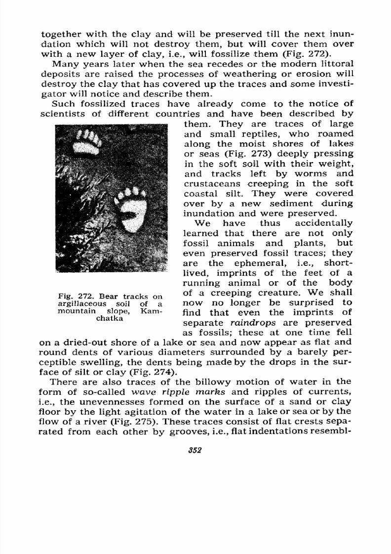
7/28/2019 Fundamentals of Geology - 19th century - Russia text in English
http://slidepdf.com/reader/full/fundamentals-of-geology-19th-century-russia-text-in-english 353/375
together with the clay and will be preserved till the next inun-
dation which will not destroy them, but will cover them over
with a new layer of clay, i.e., will fossilize them (Fig. 272).
Many years later when the sea recedes or the modern littoral
deposits are raised the processes of weathering or erosion will
destroy the clay that has covered up the traces and some investi-
gator will notice and describe them.
Such fossilized traces have already come to the notice of
scientists of different countries and have been described by
them. They are traces of large
and small reptiles, who roamed
along the moist shores of lakes
or seas (Fig. 273) deeply pressing
in the soft soil with their weight,
and tracks left by worms and
crustaceans creeping in the soft
coastal silt. They were covered
over by a new sediment during
inundation and were preserved.
We have thus accidentally
learned that there are not only
fossil animals and plants, but
even preserved fossil traces; they
are the ephemeral, i.e., short-
lived, imprints of the feet of a
running animal or of the bodyof a creeping creature. We shall
now no longer be surprised to
find that even the imprints of
separate raindrops are preserved
as fossils; these at one time fell
on a dried-out shore of a lake or sea and now appear as flat and
round dents of various diameters surrounded by a barely per-
ceptible swelling, the dents being made by the drops in the sur-
face of silt or clay (Fig. 274).
There are also traces of the billowy motion of water in the
form of so-called wave ripple marks and ripples of currents,
i.e., the unevennesses formed on the surface of a sand or clayfloor by the light agitation of the water in a lake or sea or by the
flow of a river (Fig. 275). These traces consist of flat crests sepa-
rated from each other by grooves, i.e., flat indentations resembl-
Fig. 272. Bear tracks on
argillaceous soil of a
mountain slope, Kam-chatka
352
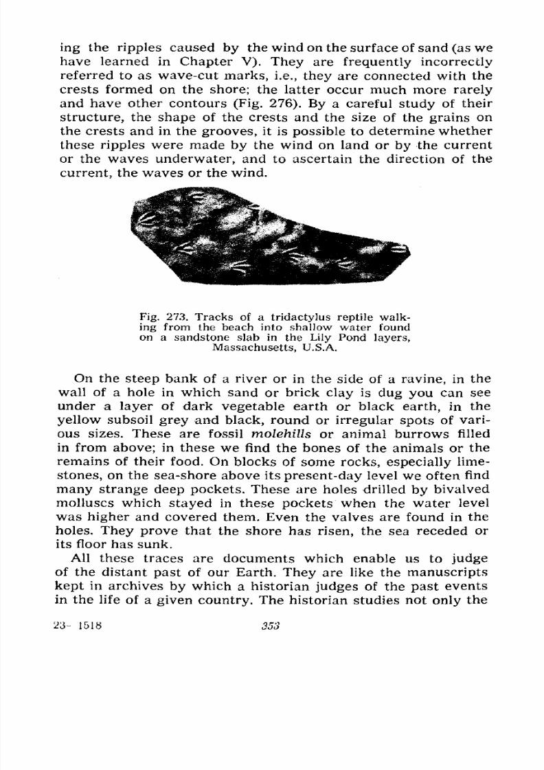
7/28/2019 Fundamentals of Geology - 19th century - Russia text in English
http://slidepdf.com/reader/full/fundamentals-of-geology-19th-century-russia-text-in-english 354/375
ing the ripples caused by the wind on the surface of sand (as we
have learned in Chapter V). They are frequently incorrectly
referred to as wave-cut marks, i.e., they are connected with the
crests formed on the shore; the latter occur much more rarely
and have other contours (Fig. 276). By a careful study of their
structure, the shape of the crests and the size of the grains on
the crests and in the grooves, it is possible to determine whether
these ripples were made by the wind on land or by the current
or the waves underwater, and to ascertain the direction of the
current, the waves or the wind.
Fig. 273. Tracks of a tridactylus reptile walk-
ing from the beach into shallow water found
on a sandstone slab in the Lily Pond layers,
Massachusetts, U.S.A.
On the steep bank of a river or in the side of a ravine, in the
wall of a hole in which sand or brick clay is dug you can see
under a layer of dark vegetable earth or black earth, in the
yellow subsoil grey and black, round or irregular spots of vari-
ous sizes. These are fossil molehills or animal burrows filled
in from above; in these we find the bones of the animals or theremains of their food. On blocks of some rocks, especially lime-
stones, on the sea-shore above its present-day level we often find
many strange deep pockets. These are holes drilled by bivalved
molluscs which stayed in these pockets when the water level
was higher and covered them. Even the valves are found in the
holes. They prove that the shore has risen, the sea receded or
its floor has sunk.
All these traces are documents which enable us to judgeof the distant past of our Earth. They are like the manuscripts
kept in archives by which a historian judges of the past events
in the life of a given country. The historian studies not only the
23- -1518 353
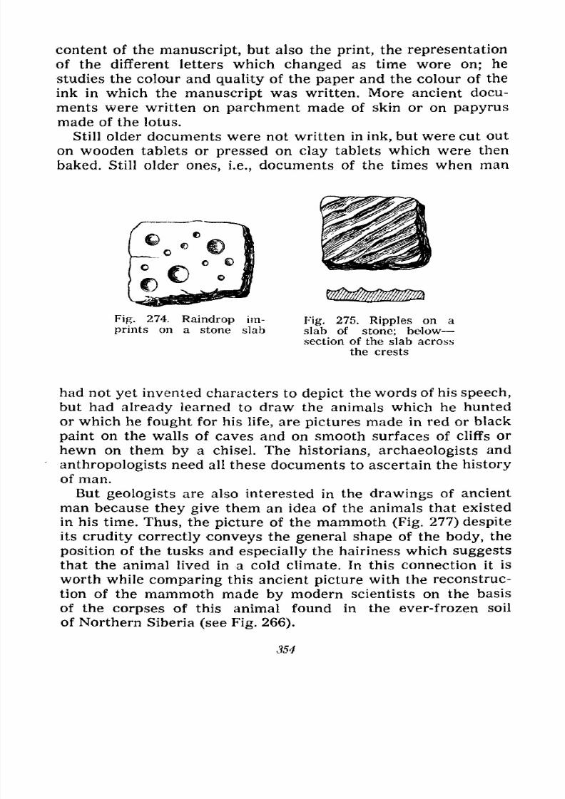
7/28/2019 Fundamentals of Geology - 19th century - Russia text in English
http://slidepdf.com/reader/full/fundamentals-of-geology-19th-century-russia-text-in-english 355/375
content of the manuscript, but also the print, the representation
of the different letters which changed as time wore on; he
studies the colour and quality of the paper and the colour of the
ink in which the manuscript was written. More ancient docu-
ments were written on parchment made of skin or on papyrus
made of the lotus.
Still older documents were not written in ink, but were cut out
on wooden tablets or pressed on clay tablets which were then
baked. Still older ones, i.e., documents of the times when man
Fig. 274. Raindrop im-
prints on a stone slabFig. 275. Ripples on a
slab of stone; below
section of the slab across
the crests
had not yet invented characters to depict the words of his speech,
but had already learned to draw the animals which he hunted
or which he fought for his life, are pictures made in red or black
paint on the walls of caves and on smooth surfaces of cliffs or
hewn on them by a chisel. The historians, archaeologists and
anthropologists need all these documents to ascertain the history
of man.
But geologists are also interested in the drawings of ancient
man because they give them an idea of the animals that existed
in his time. Thus, the picture of the mammoth (Fig. 277) despite
its crudity correctly conveys the general shape of the body, the
position of the tusks and especially the hairiness which suggests
that the animal lived in a cold climate. In this connection it is
worth while comparing this ancient picture with the reconstruc-tion of the mammoth made by modern scientists on the basis
of the corpses of this animal found in the ever-frozen soil
of Northern Siberia (see Fig. 266).
354
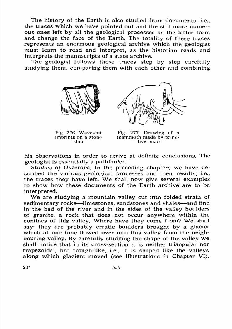
7/28/2019 Fundamentals of Geology - 19th century - Russia text in English
http://slidepdf.com/reader/full/fundamentals-of-geology-19th-century-russia-text-in-english 356/375
The history of the Earth is also studied from documents, i.e.,
the traces which we have pointed out and the still more numer-
ous ones left by all the geological processes as the latter form
and change the face of the Earth. The totality of these traces
represents an enormous geological archive which the geologist
must learn to read and interpret, as the historian reads and
interprets the manuscripts of a state archive.
The geologist follows these traces step by step carefully
studying them, comparing them with each other and combining
Fig. 276. Wave-cut
imprints on a stone
slab
Fig. 277. Drawing of a
mammoth made by primi-
tive man
his observations in order to arrive at definite conclusions. The
geologist is essentially a pathfinder.
Studies of Outcrops. In the preceding chapters we have de-
scribed the various geological processes and their results, i.e.,
the traces they have left. We shall now give several examples
to show how these documents of the Earth archive are to be
interpreted.
We are studying a mountain valley cut into folded strata of
sedimentary rocks limestones, sandstones and shales and find
in the bed of the river and in the sides of the valley boulders
of granite, a rock that does not occur anywhere within the
confines of this valley. Where have they come from? We shall
say: they are probably erratic boulders brought by a glacier
which at one time flowed over into this valley from the neigh-
bouring valley. By carefully studying the shape of the valley weshall notice that in its cross-section it is neither triangular nor
trapezoidal, but trough-like, i.e., it is shaped like the valleys
along which glaciers moved (see illustrations in Chapter VI).
23* 355
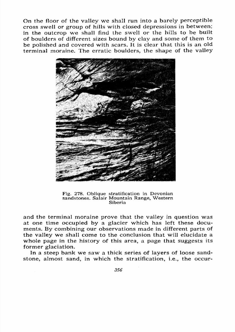
7/28/2019 Fundamentals of Geology - 19th century - Russia text in English
http://slidepdf.com/reader/full/fundamentals-of-geology-19th-century-russia-text-in-english 357/375
On the floor of the valley we shall run into a barely perceptible
cross swell or group of hills with closed depressions in between;
in the outcrop we shall find the swell or the hills to be built
of boulders of different sizes bound by clay and some of them to
be polished and covered with scars. It is clear that this is an old
terminal moraine. The erratic boulders, the shape of the valley
Fig. 278. Oblique stratification in Devoniansandstones. Salair Mountain Range, Western
Siberia
and the terminal moraine prove that the valley in question was
at one time occupied by a glacier which has left these docu-
ments. By combining our observations made in different parts of
the valley we shall come to the conclusion that will elucidate a
whole page in the history of this area, a page that suggests its
former glaciation.
In a steep bank we saw a thick series of layers of loose sand-
stone, almost sand, in which the stratification, i.e., the occur-
356
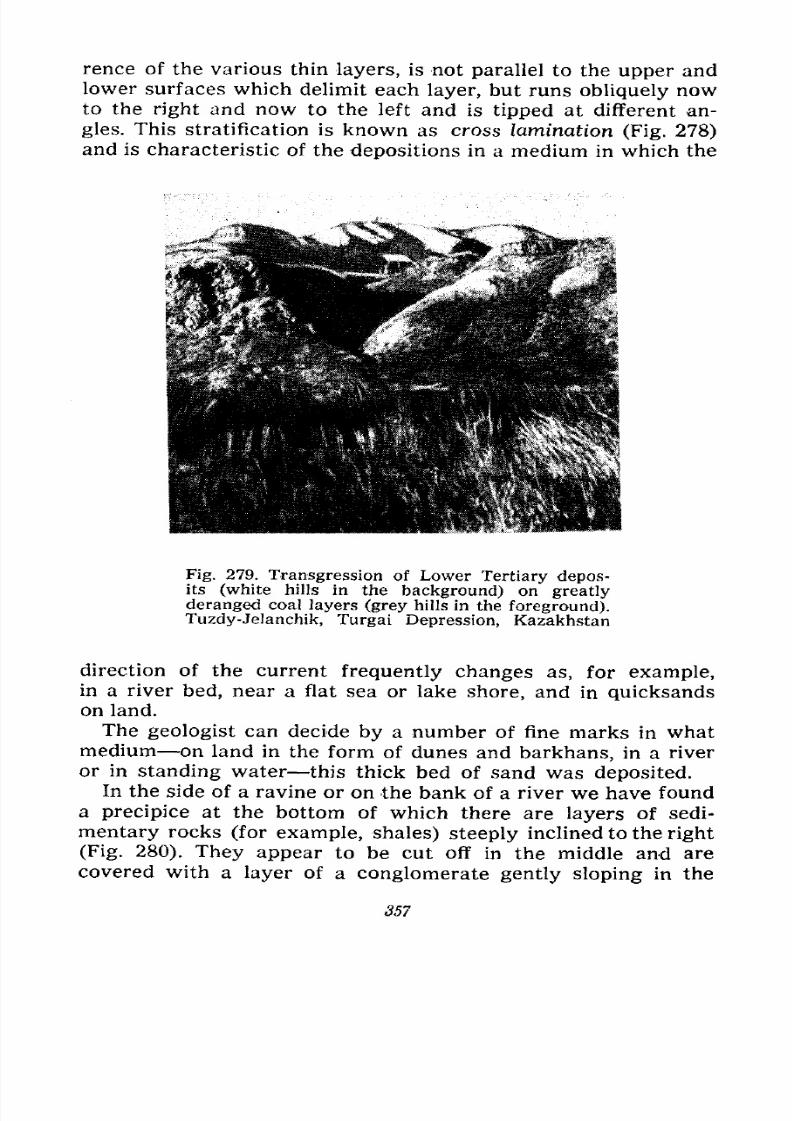
7/28/2019 Fundamentals of Geology - 19th century - Russia text in English
http://slidepdf.com/reader/full/fundamentals-of-geology-19th-century-russia-text-in-english 358/375
rence of the various thin layers, is not parallel to the upper and
lower surfaces which delimit each layer, but runs obliquely nowto the right and now to the left and is tipped at different an-
gles. This stratification is known as cross lamination (Fig. 278)
and is characteristic of the depositions in a medium in which the
Fig. 279. Transgression of Lower Tertiary depos-its (white hills in the background) on greatly
deranged coal layers (grey hills in the foreground).
Tuzdy-Jelanchik, Turgai Depression, Kazakhstan
direction of the current frequently changes as, for example,in a river bed, near a flat sea or lake shore, and in quicksandson land.
The geologist can decide by a number of fine marks in what
medium on land in the form of dunes and barkhans, in a river
or in standing water this thick bed of sand was deposited.
In the side of a ravine or on the bank of a river we have found
a precipice at the bottom of which there are layers of sedi-
mentary rocks (for example, shales) steeply inclined to the right
(Fig. 280). They appear to be cut off in the middle and are
covered with a layer of a conglomerate gently sloping in the
357
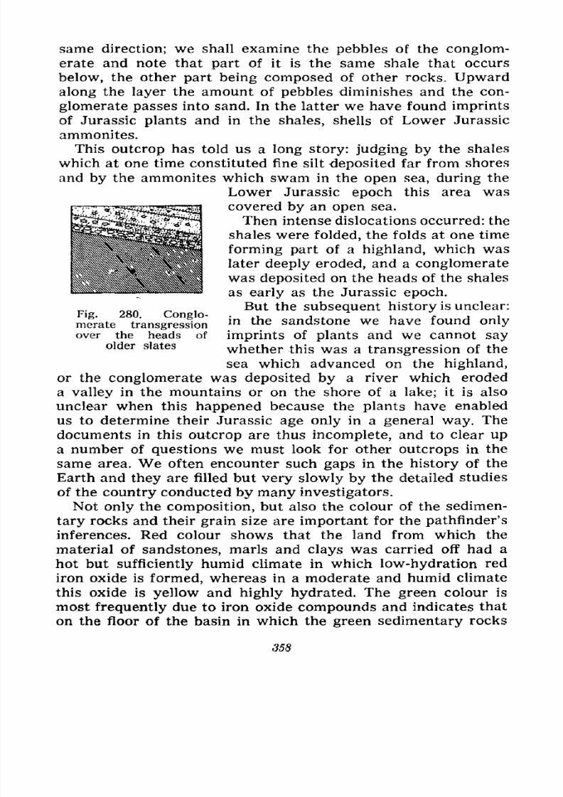
7/28/2019 Fundamentals of Geology - 19th century - Russia text in English
http://slidepdf.com/reader/full/fundamentals-of-geology-19th-century-russia-text-in-english 359/375
^J-. We?Si~U2,- : - < 4. :--..i: .47
same direction; we shall examine the pebbles of the conglom-
erate and note that part of it is the same shale that occurs
below, the other part being composed of other rocks. Upward
along the layer the amount of pebbles diminishes and the con-
glomerate passes into sand. In the latter we have found imprints
of Jurassic plants and in the shales, shells of Lower Jurassic
ammonites.
This outcrop has told us a long story: judging by the shales
which at one time constituted fine silt deposited far from shores
and by the ammonites which swam in the open sea, during the
Lower Jurassic epoch this area was
covered by an open sea.
Then intense dislocations occurred: the
shales were folded, the folds at one time
forming part of a highland, which was
later deeply eroded, and a conglomerate
was deposited on the heads of the shales
as early as the Jurassic epoch.
But the subsequent history is unclear:
mfrate transgression*n the sandstone we have found only
over the heads of imprints of plants and we cannot say
older slates whether this was a transgression of the
sea which advanced on the highland,
or the conglomerate was deposited by a river which eroded
a valley in the mountains or on the shore of a lake; it is also
unclear when this happened because the plants have enabled
us to determine their Jurassic age only in a general way. The
documents in this outcrop are thus incomplete, and to clear up
a number of questions we must look for other outcrops in the
same area. We often encounter such gaps in the history of the
Earth and they are filled but very slowly by the detailed studies
of the country conducted by many investigators.
Not only the composition, but also the colour of the sedimen-
tary rocks and their grain size are important for the pathfinder's
inferences. Red colour shows that the land from which the
material of sandstones, marls and clays was carried off had a
hot but sufficiently humid climate in which low-hydration red
iron oxide is formed, whereas in a moderate and humid climatethis oxide is yellow and highly hydrated. The green colour is
most frequently due to iron oxide compounds and indicates that
on the floor of the basin in which the green sedimentary rocks
358
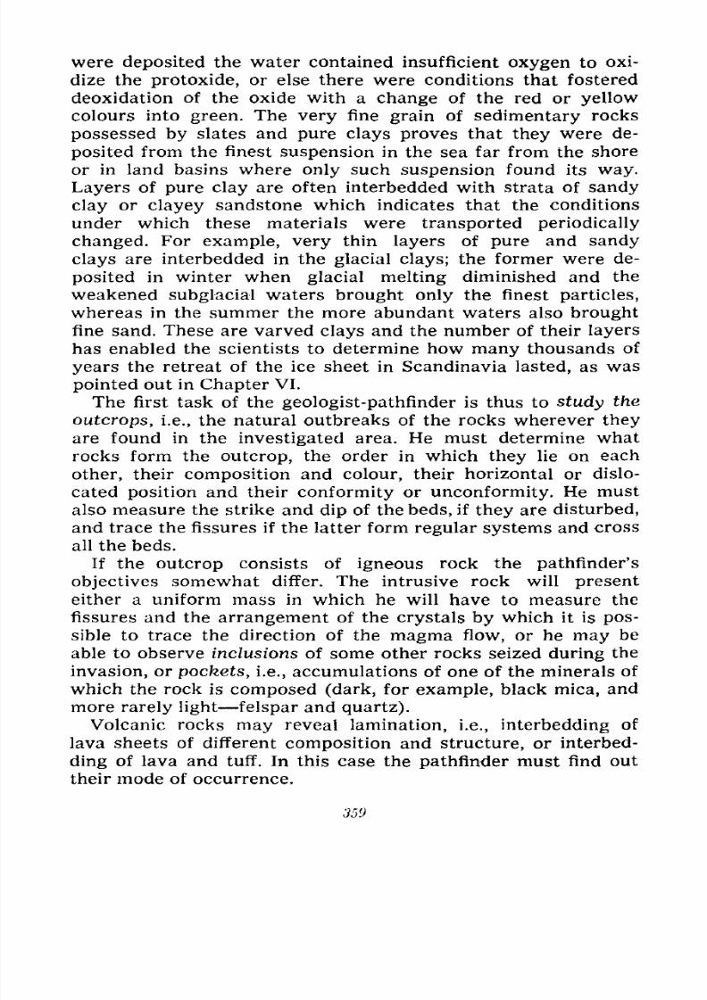
7/28/2019 Fundamentals of Geology - 19th century - Russia text in English
http://slidepdf.com/reader/full/fundamentals-of-geology-19th-century-russia-text-in-english 360/375
were deposited the water contained insufficient oxygen to oxi-
dize the protoxide, or else there were conditions that fostered
deoxidation of the oxide with a change of the red or yellow
colours into green. The very fine grain of sedimentary rocks
possessed by slates and pure clays proves that they were de-
posited from the finest suspension in the sea far from the shore
or in land basins where only such suspension found its way.
Layers of pure clay are often interbedded with strata of sandy
clay or clayey sandstone which indicates that the conditions
under which these materials were transported periodically
changed. For example, very thin layers of pure and sandy
clays are interbedded in the glacial clays; the former were de-
posited in winter when glacial melting diminished and the
weakened subglacial waters brought only the finest particles,
whereas in the summer the more abundant waters also brought
fine sand. These are varved clays and the number of their layers
has enabled the scientists to determine how many thousands of
years the retreat of the ice sheet in Scandinavia lasted, as was
pointed out in Chapter VI.
The first task of the geologist-pathfinder is thus to study the
outcrops, i.e., the natural outbreaks of the rocks wherever they
are found in the investigated area. He must determine whatrocks form the outcrop, the order in which they lie on each
other, their composition and colour, their horizontal or dislo-
cated position and their conformity or unconformity. He must
also measure the strike and dip of the beds, if they are disturbed,
and trace the fissures if the latter form regular systems and cross
all the beds.
If the outcrop consists of igneous rock the pathfinder's
objectives somewhat differ. The intrusive rock will presenteither a uniform mass in which he will have to measure the
fissures and the arrangement of the crystals by which it is pos-
sible to trace the direction of the magma flow, or he may be
able to observe inclusions of some other rocks seized during the
invasion, or pockets, i.e., accumulations of one of the minerals of
which the rock is composed (dark, for example, black mica, and
more rarely light felspar and quartz).
Volcanic rocks may reveal lamination, i.e., interbedding of
lava sheets of different composition and structure, or interbed-
ding of lava and tuff. In this case the pathfinder must find out
their mode of occurrence.
359
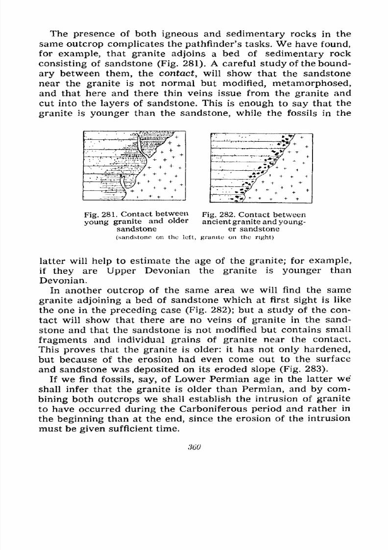
7/28/2019 Fundamentals of Geology - 19th century - Russia text in English
http://slidepdf.com/reader/full/fundamentals-of-geology-19th-century-russia-text-in-english 361/375
The presence of both igneous and sedimentary rocks in the
same outcrop complicates the pathfinder's tasks. We have found,
for example, that granite adjoins a bed of sedimentary rock
consisting of sandstone (Fig. 281). A careful study of the bound-
ary between them, the contact, will show that the sandstone
near the granite is not normal but modified, metamorphosed,
and that here and there thin veins issue from the granite and
cut into the layers of sandstone. This is enough to say that the
granite is younger than the sandstone, while the fossils in the
Fig. 281. Contact between Fig. 282. Contact between
young granite and older ancientgranite and young-sandstone er sandstone
(sandstoneon the left,
graniteon the
right)
latter will help to estimate the age of the granite; for example,
if they are Upper Devonian the granite is younger than
Devonian.
In another outcrop of the same area we will find the same
granite adjoining a bed of sandstone which at first sight is like
the one in the preceding case (Fig. 282); but a study of the con-
tact will show that there are no veins of granite in the sand-
stone and that the sandstone is not modified but contains small
fragments and individual grains of granite near the contact.
This proves that the granite is older: it has not only hardened,
but because of the erosion had even come out to the surface
and sandstone was deposited on its eroded slope (Fig. 283).
If we find fossils, say, of Lower Permian age in the latter we
shall infer that the granite is older than Permian, and by com-
bining both outcrops we shall establish the intrusion of graniteto have occurred during the Carboniferous period and rather in
the beginning than at the end, since the erosion of the intrusion
must be given sufficient time.
360
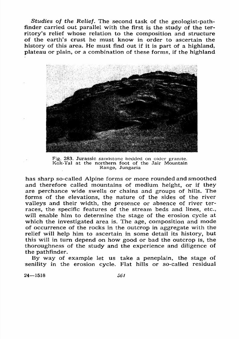
7/28/2019 Fundamentals of Geology - 19th century - Russia text in English
http://slidepdf.com/reader/full/fundamentals-of-geology-19th-century-russia-text-in-english 362/375
Studies of the Relief. The second task of the geologist-path-
finder carried out parallel with the first is the study of the ter-
ritory's relief whose relation to the composition and structure
of the earth's crust he must know in order to ascertain the
history of this area. He must find out if it is part of a highland,
plateau or plain, or a combination of these forms, if the highland
Fig. 283. Jurassic sandstone bedded on older granite.
Kok-Tal at the northern foot of the Jair Mountain
Range, Jungaria
has sharp so-called Alpine forms or more rounded and smoothed
and therefore called mountains of medium height, or if they
are perchance wide swells or chains and groups of hills. The
forms of the elevations, the nature of the sides of the river
valleys and their width, the presence or absence of river ter-
races, the specific features of the stream beds and lines, etc.,
will enable him to determine the stage of the erosion cycle at
which the investigated area is. The age, composition and mode
of occurrence of the rocks in the outcrop in aggregate with the
relief will help him to ascertain in some detail its history, but
this will in turn depend on how good or bad the outcrop is, the
thoroughness of the study and the experience and diligence ofthe pathfinder.
By way of example let us take a peneplain, the stage of
senility in the erosion cycle. Flat hills or so-called residual
241518 361
7/28/2019 Fundamentals of Geology - 19th century - Russia text in English
http://slidepdf.com/reader/full/fundamentals-of-geology-19th-century-russia-text-in-english 363/375
mountains or rock pillars rise on it here and there; in some
places we find a ridge of hard rocks, a smooth granite outcrop
protruding from the grass or its gruss covering the soil amid the
grass; in a ravine we see outcrops of several destroyed layers of
sandstone, limestone or slate. The geologist-pathfinder will study
all these documents, which at first sight appear to .be of little
importance, will measure the position of the layers, their strike
and dip, will determine the composition of all the outcrops, will
find fossils in them, will estimate the age of the layers and the
sequence of the past events, will plot his observations on a mapof the area and will tell his unlearned companion (who is help-
ing him in his work) the entire history of this country: the
mountains that at one time rose on the site of this plain, the
rocks of which they were composed and the direction of the
mountain folds; he will also tell him if these mountains had any
volcanoes or igneous massifs in their depths, when they were
built and when destroyed. In studying the traces the documents
of the former events the geologist-pathfinder divines the his-
tory of the area through which his companion walked for many
years ignorant of the fact that he was trampling the last remains
of Alpine mountains, the area in which he unnoticeably crosses
former high mountain ridges and calmly sits in the grass on a
site at one time covered with the seething lava of a volcano.
The third task of the geologist-pathfinder, carried out simul-
taneously with the former two, is to find and study the various
types of minerals which may occur amid the rocks in the area
explored. He must determine their quality and mode of occur-
rence and on the basis of these data ascertain if the discovered
deposit is worthy of any reconnaissance without which it is in
many cases impossible to decide whether or not there is suffi-
cient mineral in the various outcrops, i.e., whether it is of any
practical importance. If it is a good outcrop it is possible roughly
to estimate the probable amount of mineral by local obser-
vation and by a laboratory study; the analysis will establish the
percentage of ore or other mineral in the vein, deposit or rock.
If the outcropping is inadequate it requires prospecting deep-
ening of prospect pits, digging of more or less deep ditches on
the sides or on the plain and boring of holes. This constitutesthe tasks of reconnaissance in which the invention of precision
instruments has made it possible to use geophysical methods in
recent years; these methods are based on a determination of
362
7/28/2019 Fundamentals of Geology - 19th century - Russia text in English
http://slidepdf.com/reader/full/fundamentals-of-geology-19th-century-russia-text-in-english 364/375
magnetism, electrical conductivity, gravity and propagation of
seismic waves produced by explosions in various rocks and
minerals.
In his search for minerals the pathfinder must take notice of
the remains of ancient ore workings funnel-shaped holes,
crevice-like excavations, filled-in mines and adits, accumula-
tions of ancient slags and foundry forms, etc.; deposits from
which ore was mined in prehistoric times may be found near
these old mines.
Fossils, Their Collection and Preservation. We already know
that the remains of the formerly existing animals and plants
buried in the layers of sedimentary rocks are of great importance
for determining the relative age of the thicknesses in which they
are found. They indicate not only the age, but also the environ-
ment in which the given organisms existed. Thus the remains of
algae show that the rocks were deposited in water, while re-
mains of land plants suggest deposits in lakes, swamps or seas
but close to the shore (if the layers that contain them are inter-
bedded with strata containing marine organisms).
The bones of land mammals are found in land or lake deposits.
Shells with thick valves live in a shallow sea where the waves
go down to the bottom, whereas shells with thin valves live at
great depths. Fossil corals suggest warm sea water, certain
molluscs cold water. Shark teeth are found only in marine de-
posits, while testae of Palaeozoic fish are encountered in deposits
at the mouths of rivers, lagoons and shallow seas. Imprints of
insects are known exclusively in continental deposits.
Marine deposits, especially in shallow water, contain more
fossils than do continental deposits, and their fauna is of greater
diversity; they abound in sponges, corals, sea lilies, brachiopodsand crustaceans. Only the lowest forms various foraminifers,
radiolarians and diatoms can be found in the deepest water de-
posits.
In continental deposits the remains of plants occur more fre-
quently than those of animals, though in some places the latter
are plentiful and the bones of vertebrates form continuous layers
as, for example, in the Permian deposits along the North Dvina,
the Triassic deposits of Kirov Region, and the Cretaceous andTertiary deposits of North America, Mongolia and Kazakhstan.
The sedimentary rocks that most frequently contain fossils are
marls, bituminous and argillaceous limestones, calcareous and
24* "363
7/28/2019 Fundamentals of Geology - 19th century - Russia text in English
http://slidepdf.com/reader/full/fundamentals-of-geology-19th-century-russia-text-in-english 365/375
glauconitic sands, and not infrequently also sandstones and argil-
laceous shales. Quartzites and quartz sandstones are usually
very poor in organic remains; the conglomerates may contain
only large and hard remains which endured friction and shocks
of pebbles and boulders in the zone of the surf or in the stream
bed as, for example, the bones and teeth of vertebrates, thick
valves of shells and stems of plants. The organic remains, es-
pecially of animals, are frequently responsible for the formation
of lime-rich concretions totally enveloping the fossil which is
discovered when the concretions are broken up. The latter con-
tain ammonites and other molluscs, fish, bones of vertebrates,
even whole skeletons around which the concretions gradually
formed. The concretions in the layers of sedimentary rocks must
therefore be broken up to see if they contain any fossils. There
are, of course, no organic remains in intrusive rocks; they are
extremely rare in volcanic rocks, but in tuffs, especially fine-
grained and clearly stratified, we sometimes find very good im-
prints, particularly of plants.
Fossils occur in rock either separately (singly) or may be
plentiful and even form continuous layers. Such layers are built,
for example, of corals, algae, brachiopods, molluscs, and bones
and their fragments. Corals form whole fossil reefs, algae
thick strata, and shells shell banks. Plants most frequently
form imprints in thin layers of rock which may abound in them
all along its surface. Beds and veins of coal consist wholly of
vegetable material, which has been transformed into a continu-
ous mass; individual forms (leaves and stems) are rarely distin-
guishable, though good imprints often occur in the soil or the
roof of a coal bed.
The remains of invertebrates present the hard parts of their
bodies shells of molluscs and brachiopods, stems and arms of
sea lilies, testae and needles of echinoderms, shells of foramini-
fers and testae of crustaceans, the original material being re-
placed by lime carbonate, more rarely by silica and sometimes
by sulphur pyrites; the place formerly occupied by the soft body
parts are also filled with rock.
Separate bones or whole skeletons, horns and teeth of mam-
mals, scutes of testaceous fish, reptiles and amphibians, as wellas their teeth and needles, are also preserved. Only in exception-
al cases, in the ever-frozen soil of Siberia and in asphalt are the
soft body parts, viscera and skin preserved.
364
7/28/2019 Fundamentals of Geology - 19th century - Russia text in English
http://slidepdf.com/reader/full/fundamentals-of-geology-19th-century-russia-text-in-english 366/375
These finds are of particularly great scientific importance.
They have made it possible to reconstruct the exact likeness of
the hairy rhinoceros and mammoth, whereas the numerous re-
constructions of other higher animals made by different scien-
tists are not so reliable; they were made on the basis of skele-
tons, often very incomplete and without any data pertaining to
the nature and colour of the cutaneous covering.
It is always easiest to discover remains of animals on the
weathered surface of rocks, in outcrops and screes at foothills
because they are of a different composition, sometimes harder
than the rocks that contain them and therefore somewhat jut
out during weathering and free themselves during the destruc-
tion of rock. That is why the geologist-pathfinder first of all
carefully examines the small products of weathering in the
screes, on the surfaces of blocks at the foothills and on the
surface of the outcrop itself. If the rock contains any fauna the
latter will always show itself during such examination. But the
fossils collected in screes and separate blocks must not be con-
fused with those obtained in the outcrop itself because they
could have fallen out of different horizons of the latter. During
geological studies each outcrop receives a separate number in
the description and on the map, while the layers of the different
rocks of which it is composed are designated by individual
letters under the same number. The fauna obtained in the out-
crop itself will therefore have a number with a letter corre-
sponding to the layer from which it was taken, whereas the
fauna collected in the scree will have only a number.
The pebbles in the bed of a stream or river are not infre-
quently rounded fossils and serve as a clue in the search for
the outcrop of a corresponding rock higher upstream.After the discovery of organic remains in an outcrop the
former are extracted with the aid of a hammer and chisel, an
attempt being made to obtain a large piece containing the
remains so that this piece may later be carefully cleaved into
layers or chipped off on the edges if the rock is not stratified.
Of course, one should never strike with a hammer the fossil
itself. A piece containing a lot of remains should best be taken
home as it is in order that it may be thoroughly attended to at
leisure. If the rock is soft the fossils are cautiously extracted
together with the enveloping rock with the aid of a chisel. The
fossils taken from different layers of one outcrop, and naturally
365
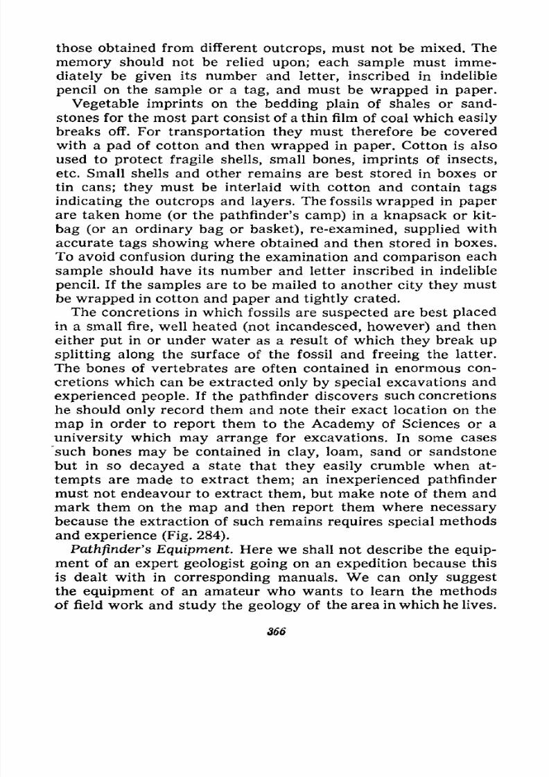
7/28/2019 Fundamentals of Geology - 19th century - Russia text in English
http://slidepdf.com/reader/full/fundamentals-of-geology-19th-century-russia-text-in-english 367/375
those obtained from different outcrops, must not be mixed. The
memory should not be relied upon; each sample must imme-
diately be given its number and letter, inscribed in indelible
pencil on the sample or a tag, and must be wrapped in paper.
Vegetable imprints on the bedding plain of shales or sand-
stones for the most part consist of a thin film of coal which easily
breaks off. For transportation they must therefore be covered
with a pad of cotton and then wrapped in paper. Cotton is also
used to protect fragile shells, small bones, imprints of insects,
etc. Small shells and other remains are best stored in boxes or
tin cans; they must be interlaid with cotton and contain tags
indicating the outcrops and layers. The fossils wrapped in paper
are taken home (or the pathfinder's camp) in a knapsack or kit-
bag (or an ordinary bag or basket), re-examined, supplied with
accurate tags showing where obtained and then stored in boxes.
To avoid confusion during the examination and comparison each
sample should have its number and letter inscribed in indelible
pencil. If the samples are to be mailed to another city they must
be wrapped in cotton and paper and tightly crated.
The concretions in which fossils are suspected are best placed
in a small fire, well heated (not incandesced, however) and then
either put in or under water as a result of which they break up
splitting along the surface of the fossil and freeing the latter.
The bones of vertebrates are often contained in enormous con-
cretions which can be extracted only by special excavations and
experienced people. If the pathfinder discovers such concretions
he should only record them and note their exact location on the
map in order to report them to the Academy of Sciences or a
university which may arrange for excavations. In some cases
such bones may be contained in clay, loam, sand or sandstonebut in so decayed a state that they easily crumble when at-
tempts are made to extract them; an inexperienced pathfinder
must not endeavour to extract them, but make note of them and
mark them on the map and then report them where necessary
because the extraction of such remains requires special methods
and experience (Fig. 284).
Pathfinder's Equipment. Here we shall not describe the equip-
ment of an expert geologist going on an expedition because this
is dealt with in corresponding manuals. We can only suggest
the equipment of an amateur who wants to learn the methods
of field work and study the geology of the area in which he lives.
366
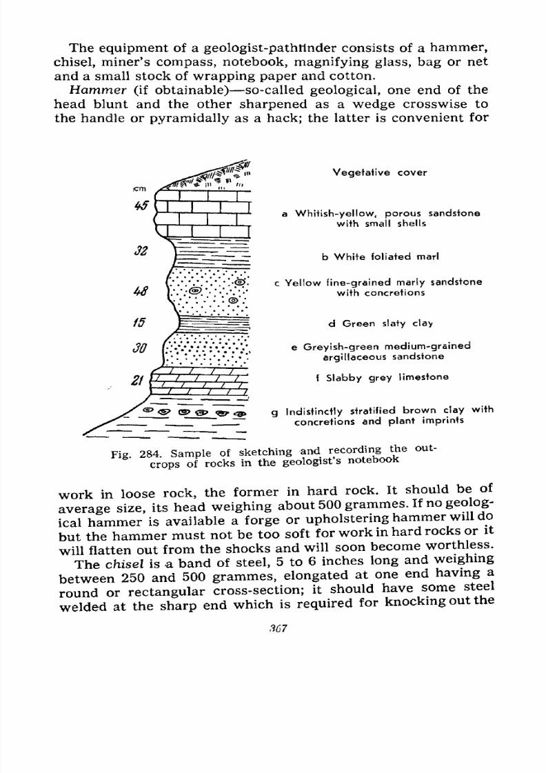
7/28/2019 Fundamentals of Geology - 19th century - Russia text in English
http://slidepdf.com/reader/full/fundamentals-of-geology-19th-century-russia-text-in-english 368/375
The equipment of a geologist-pathtinder consists of a hammer,
chisel, miner's compass, notebook, magnifying glass, bag or net
and a small stock of wrapping paper and cotton.
Hammer (if obtainable) so-called geological, one end of the
head blunt and the other sharpened as a wedge crosswise to
the handle or pyramidally as a hack; the latter is convenient for
Vegetative cover
a Whitish-yellow, porous sandstone
with small shells
b White foliated marl
<S>*. c Yellow fine-grained marly sandstone
''''{?''.''''/ w 'th concretions
d Green slaty clay
e Greyish-green medium-grained
argillaceous sandstone
f Slabby grey limestone
/<& <& (5> <& <g?> <3 g Indistinctly stratified brown clay with~~
concretions and plant imprints
Fig 284. Sample of sketching and recording the out-
crops of rocks in the geologist'snotebook
work in loose rock, the former in hard rock. It should be of
average size, its head weighing about 500 grammes. If no geolog-
ical hammer is available a forge or upholstering hammer will do
but the hammer must not be too soft for work in hard rocks or it
will flatten out from the shocks and will soon become worthless.
The chisel is a band of steel, 5 to 6 inches long and weighing
between 250 and 500 grammes, elongated at one end having a
round or rectangular cross-section; it should have some steel
welded at the sharp end which is required for knocking out the
,967
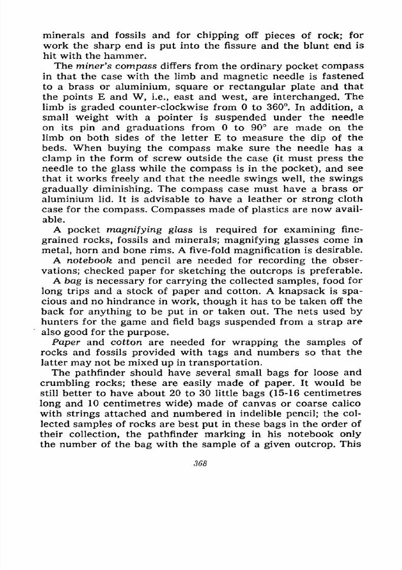
7/28/2019 Fundamentals of Geology - 19th century - Russia text in English
http://slidepdf.com/reader/full/fundamentals-of-geology-19th-century-russia-text-in-english 369/375
minerals and fossils and for chipping off pieces of rock; for
work the sharp end is put into the fissure and the blunt end is
hit with the hammer.
The miner's compass differs from the ordinary pocket compassin that the case with the limb and magnetic needle is fastened
to a brass or aluminium, square or rectangular plate and that
the points E and W, i.e., east and west, are interchanged. The
limb is graded counter-clockwise from to 360. In addition, a
small weight with a pointer is suspended under the needle
on its pin and graduations from to 90 are made on the
limb on both sides of the letter E to measure the dip of the
beds. When buying the compass make sure the needle has a
clamp in the form of screw outside the case (it must press the
needle to the glass while the compass is in the pocket), and see
that it works freely and that the needle swings well, the swings
gradually diminishing. The compass case must have a brass or
aluminium lid. It is advisable to have a leather or strong cloth
case for the compass. Compasses made of plastics are now avail-
able.
A pocket magnifying glass is required for examining fine-
grained rocks, fossils and minerals; magnifying glasses come in
metal, horn and bone rims. A five-fold magnification is desirable.
A notebook and pencil are needed for recording the obser-
vations; checked paper for sketching the outcrops is preferable.
A bag is necessary for carrying the collected samples, food for
long trips and a stock of paper and cotton. A knapsack is spa-
cious and no hindrance in work, though it has to be taken off the
back for anything to be put in or taken out. The nets used byhunters for the game and field bags suspended from a strap are
also good for the purpose.
Paper and cotton are needed for wrapping the samples of
rocks and fossils provided with tags and numbers so that the
latter may not be mixed up in transportation.
The pathfinder should have several small bags for loose and
crumbling rocks; these are easily made of paper. It would be
still better to have about 20 to 30 little bags (15-16 centimetres
long and 10 centimetres wide) made of canvas or coarse calico
with strings attached and numbered in indelible pencil; the col-
lected samples of rocks are best put in these bags in the order of
their collection, the pathfinder marking in his notebook only
the number of the bag with the sample of a given outcrop. This
368
7/28/2019 Fundamentals of Geology - 19th century - Russia text in English
http://slidepdf.com/reader/full/fundamentals-of-geology-19th-century-russia-text-in-english 370/375
makes the wrapping of the sample in paper and writing out the
tag in the field unnecessary. All these operations are then per-
formed at home during the sorting of the collection, the bags
being freed for the next excursion.
The pathfinder will do well to keep a diary recording in detail
(in ink) all the observations made during the excursion. In the
field the observations may be written down in the notebook
hastily and concisely during the sketching of the outcrops. At
home, while the memory is still fresh, the details are recorded
and the drawing made accurately with the aid of crayons.
The sizes of the samples differ and are from 3X5 to 7X10 cm.
(width and length; the thickness depends on the quality of the
rock, but in general should not exceed the width). A young
pathfinder does not need large ones. The samples should be
chipped off on several sides so that they have fresh fractures
rather than a weathered surface. Fossils must naturally not be
chipped. The collections should be kept in little flat cartons the
size of the samples.
The pathfinder should have a penknife for sharpening pencils
and testing the hardness of minerals and rocks. It is good to
have a tape-measure at least one metre long for measuring the
thickness of the layers and veins.
If possible the pathfinder should have a good topographic mapof the area; it will prove very useful for his orientation, the
choice of routes and recording the examined outcrops. The mapshould be cut into pocket-size parts and pasted on canvas or
calico because a paper map folded to this size soon wears out in
the folds if carried in the pocket. The map must be carefully
guarded against moisture and if it gets wet it must be cau-
tiously dried and smoothed out.
It is good to have a portable camera to photograph the relief
of the terrain and the outcrops in addition to describing them.
We shall point out in conclusion how the mode of occurrence
of the strata of sedimentary rocks is to be determined with
the aid of a compass. In its inclined position each layer has a
certain strike and dip at some angle to one side or another; the
measurements of the line of strike, direction and angle of dip
determine the mode of occurrence. Choose a level ground onthe stratification plane of one of the layers in the outcrop and
place the compass on it with the long side of its plate in a hori-
zontal position; by drawing a pencil line along the edge of the
369
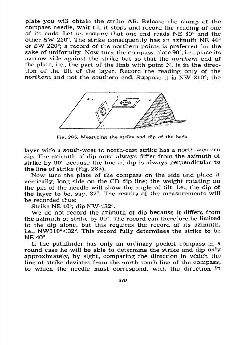
7/28/2019 Fundamentals of Geology - 19th century - Russia text in English
http://slidepdf.com/reader/full/fundamentals-of-geology-19th-century-russia-text-in-english 371/375
plate you will obtain the strike AB. Release the clamp of the
compass needle, wait till it stops and record the reading of one
of its ends. Let us assume that one end reads NE 40 and the
other SW 220. The strike consequently has an azimuth NE 40
or SW 220; a record of the northern points is preferred for the
sake of uniformity. Now turn the compass plate 90, i.e., place its
narrow side against the strike but so that the northern end of
the plate, i.e., the part of the limb with point N, is in the direc-
tion of the tilt of the layer. Record the reading only of the
northern and not the southern end. Suppose it is NW 310; the
Fig. 285. Measuring the strike and dip of the beds
layer with a south-west to north-east strike has a north-western
dip. The azimuth of dip must always differ from the azimuth of
strike by 90 because the line of dip is always perpendicular to
the line of strike (Fig. 285).
Now turn the plate of the compass on the side and place it
vertically, long side on the CD dip line; the weight rotating on
the pin of the needle will show the angle of tilt, i.e., the dip of
the layer to be, say, 32. The results of the measurements will
be recorded thus:
Strike NE 40; dip NW<32.We do not record the azimuth of dip because it differs from
the azimuth of strike by 90. The record can therefore be limited
to the dip alone, but this requires the record of its azimuth,
i.e., NW310<32. This record fully determines the strike to be
NE 40.
If the pathfinder has only an ordinary pocket compass in a
round case he will be able to determine the strike and dip only
approximately, by sight, comparing the direction in which the
line of strike deviates from the north-south line of the compass,
to which the needle must correspond, with the direction in
370
7/28/2019 Fundamentals of Geology - 19th century - Russia text in English
http://slidepdf.com/reader/full/fundamentals-of-geology-19th-century-russia-text-in-english 372/375
which the layer is tilted. The angle of dip will also be estimated
by sight.
The strike and dip of veins and joints are measured the same
way as the layers on a level ground. If there is no such groundthe measurement is made by sight in the air and is, of course,
not so accurate.
We are finishing our book in which we have endeavoured to
instil in the reader an interest for the science about the Earth
and its practical importance, as well as to explain what can be
observed and how on the vast territory of the U.S.S.R. with a
modicum of training and the simplest instruments. The natural
conditions in the Soviet Union are so diverse that the young
pathfinder will find sufficient material for observation of the
composition and structure of the Earth and its relation to its
present relief wherever he lives. He may discover and collect
fossils, describe interesting outcrops, find signs of minerals and
become a connoisseur of the surrounding country. It has been
the aim of this book to acquaint him with the fundamentals of
geology and to help him in this work.
7/28/2019 Fundamentals of Geology - 19th century - Russia text in English
http://slidepdf.com/reader/full/fundamentals-of-geology-19th-century-russia-text-in-english 373/375
RUSSIAN BIBLIOGRAPHY
1. Popular Editions
1. BAPABAHOB B. O. Kan co6Hparb MHnepajibi H ropiibie nopoAbi. 1952.
2. BYBJIEHHHKOB <D. A. H 1UEPBAKOB A. H. Ha IIOHCKH pyA H MHiiepa-
JIOB. 1939.
3. BAPCAHOObEBA B. A. >Kn3 iib rop. 1950.
4. BAPCAHOObEBA B. A. npoHCxcmzieHHC H cipoeHHC SCMJIH. 1945.
5. BJIOAABELJ, B. H. ByjiKanw CoBexcKoro Coioaa. 1949.
6. rOPLlIKOB F. 0. SeMJiCTpHcennn Ha TeppHiopHH CoBercKoro Coiosa. 1949.
7. 3ABAPHUKA3 E. H. ByjiKanw. 1948.
8. MY3AOAPOB B. P. Onpe^cjiHTejib MUHCpajioa H ropubix nopoA. 1950.
9. OBPYMEB B. A. 06pa30B3HHe rop H py^Hbix MecTopOKAeHnii. PHA H3,aa-
HHH OOCJieAHHX jlGT.
10. OBPYMEB B. A. OPOHCXOKACHHC rop H MaiepHKon. PHA H's^aHiifi nocjie/i-
HHX jiei.
11. CABEJlbEB Jl. Cjie/ibi na KaMiie. HcropHH seMJiH H >KH3iin na Heft.
pe^. B. A. O6pyqeBa. 1940.
12. CHHEPYB E. C. KaK co6Hpaib Ko.a.ieKUHH ropHbix nopo^ H
1951.
13. CTABPOBCKHPI A. E. OnpeAeJiHiejib MHiiepajios H ropubix nopoA. 1949.
14 CTABPOBCKHH A. E. Oo/iesHbie HCKonaeMbie. 1951.
15. cJ>EPCMAH A. E. SaHHMare^biiaH MHHepajiorHH. 1954.
16. OEPCMAH A. E. SanHMarejibHaq reoxHMHH. 1952.
17. HKOBJIEB A. A. B OOXOA sa nojiesHHMH HCKonaeMbiMH. 1954.
18. flKOBJIEB A. A. B MHpe KaMiia. 1951.
19. Hsynafi CBOH Kpan. Kunra KpaeseAa. PIoA peA- C. B. OdpyneBa. 1951.
20. CnpaBOMHHK nyTemecTBennHKa H KpaeseAa. HOA peA- C. B. O6pyneBa, T. I
1949, T. II, 1950.
372
7/28/2019 Fundamentals of Geology - 19th century - Russia text in English
http://slidepdf.com/reader/full/fundamentals-of-geology-19th-century-russia-text-in-english 374/375
2. Systematized Manuals
21. BEJIOYCOB B. B. OcnoBHbie Bonpocw reoTCKionHKH. 1954. (2-oe H3A.
O6men reoieKTOHHKH. 1948).
22.
BETEXTHH A.T.
Kypc MHHepajiorHH. 1951.
23. BETEXTHH A. P., TATAPHHOB H. M. H ap. Kypc MecTopoameHMH no-
jieaHbix HCKonaeMbix. 2-e HSAanHe. 1946.
24. BHJIJIHHrC M. H. GrpyKTypHaa reojiorHH. 1949.
25. BOJlflblPEBCKHH B. H. Majibift auiac pyKOBo/iniuHx HCKonaeMbix. 1951.
26. BYHJIOB H. H. CipyKTypnan nojieBan reojiornfl. 1953.
27. JO.EBHTAUIBHJIH Jl. Ul. Kypc najiooHTOjiorHH. 2-e HSA. 1949.
28. 3ABAPHUKHH A. H. HsBepweniibie ropiibie nopOAbi 1955.
29. 3YBKOB. KpaTKHH Kypc nexporpa^HH. 1950.
30. KA/IECHHK C. B. O6maji rjiHUHOJiorHH. 1939.
31. KPHTCKHH B. B. H METBEPHKOB C. fl. KpaiKHH Kypc Mimepa/ionin H
nerporpacfiHH c nanajibiibiMH ceeACUHHiviH no KpHCTa.uiorpa(j)nn 6-c USA.
1953.
32. KOPOBHH M. K. HciopHHecKan reojiorHH. 1941.
33. KPHLQTOOOBHM A. H. Kypc najieotfoiaHHKH. 1945.
34. JiyqHUKHH B. H. Herporpa^HH. T. I, 1947, T. II, 1949
35. JIOflOMHHKOB B. H. KpaiKan nexpojiorHH 6ea MHKpocKona (A.HH necne-
UHajiHCTOB). 1934.
36. OBPYMEB B. A. PyAHwe MeciopowAenHH. 1935.
37. OBPyMEB B. A. HojieBaji rco/iorHH. 4-e mj\. TT. I H II, 1932.
38. POMEP A. III. FlajieoHTOJiorHH noaBonomibix. 1939.
39. PVXHH Jl. B. OcHOBbi JIHTOJIOFHH. 1953.
40. CABAPEHCKHH O. U. HHwenepHaa reojiorHH. 1937.
41. CMOJIb^HHHOB H. A. KaK onpeAe/iHTb MHnepa.ibi no BHCIIIHHM npn:i-
naKaM. 1951.
42. CMOJlb^IHHHOB H. A. HpaKTHHecKoc pyKOBcacxpo no MHHepajiornH.
1948.
43. CTPAXOB H. M. OCHOBM HcropHMecKoft reojiorHH. TT. I H II, 1949.
44. THTOB A. P. MHHCpa.norHH c OCHOBHUMH CBCAGHHJIMH no KpHerajuiorpa-
<J)HH. 1941.
45. TOPOHOB H. A. H BYJIAK Jl. H. Kypc MHiiepajioniH H neiporpa^HH c
ocHonaMH reojiorHH. 1953.
46. YCOB M. A. CrpyKTypifaH reojiorHH. 1940.
47. UHTTEJIb K. OCIIOBH najiconTOJiorHH.
LI.
I.
BecnosBonomibie. 1934.
48. UJBEUOB M. C. FleTporpac^HH ocaAOMHbix nopoA. 2-e H3A. 1948.
49. IIiyKHH H. C. O6man MOp<j)OJiorHH cyiiJH. T. I, 1934, T. II, 1938.
50. SflEJlbUITEHH H. C. OCHOBM reoMOp(J)o,norHH. 2-e H3A. 1947.
373

7/28/2019 Fundamentals of Geology - 19th century - Russia text in English
http://slidepdf.com/reader/full/fundamentals-of-geology-19th-century-russia-text-in-english 375/375
51. flKOBJlEB H. H. VMe6HHK najieoHmnorHH. 1934.
52. flKOBJlEB C. A. O6maa reo^orHH. 9-e H3AanHe. 1949.
53. flKOBJIEB C, A. H /ip. MeTOAH^ecKoe pyKOBOACTBo no HayqeiiHK) H reojio-
FHHCCKOH CtCMKC MGTBepTHMHblX OTJIOKeHHH. MaCTH I H II. \\3Jl. BcGC. H.-M.
reoji. HIICT. 1954-1955.
54. FeojiorimecKHH cjioBaph. HSA. Bcec. H.-H. reoji. HHCT., no/i, peA. A. H. KpHiu-
TO())OBHHa H T. H. CnH>KapCKoro. TT. I H II, 1955.
55. MexoAHqecKoe PYKOBOACTBO no reojiorHHecKoft c-bCMKe H noHcnaM. COCT.
rpynnoii reojioroB Bcec. H.-H. reoji. HHCT. no^ odu;. pyK. C. A. MysbLiesa.
1954.
56. CnyiHHK nojieBoro reo^ora-iie^THiiHKa. OOA o6m. pe/i. H. B. BaccoeBH^a.
2-c H3fl. TT. I H II, 1954.