Embed Size (px)
Citation preview

LessON 2 Into the Deep
Lesson at a Glance Students pose questions about the ocean fl oor and make a prediction about what they think the ocean fl oor might look like and the kinds of Earth materials that make up the ocean fl oor. They learn about the continental slope, continental rise, abyssal plain, mid ocean ridge, trench and much more.
Lesson DurationTwo 45-minute periods
Essential Question(s)What would the world look like if all the water were drained out?
Key Concepts• Each ocean has specifi c and unique features. In the Pacifi c Ocean, the largest ocean, the Hawaiian Islands and the Northwest Hawaiian Islands form distinctive geographic features. • An ocean basin’s size, shape, and features (such as, trenches, mid-ocean ridges, abyssal plains) vary due to the movement of Earth’s crust.
Instructional Objectives• I can read and understand a simple bathymetric map (underwater map).
Related HCPSIIIBenchmark(s):
Social Studies: SS 4.7.2 Collect, organize, and analyze data to interpret and construct geographic representations.
Science: SC 4.1.1 Describe a testable hypothesis and an experimental procedure.
1
G4 U8 L2
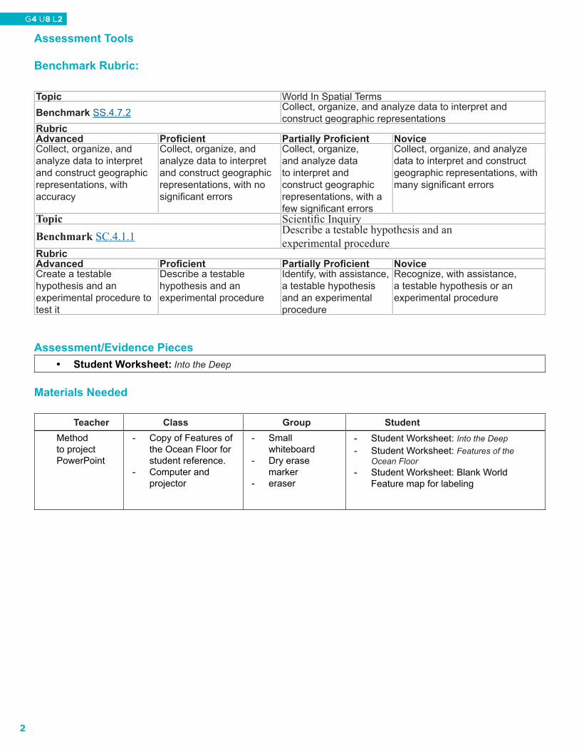
Assessment Tools
Benchmark Rubric:
Assessment/Evidence Pieces• Student Worksheet: Into the Deep
Materials Needed
Teacher Class Group StudentMethod to project PowerPoint
- Copy of Features of the Ocean Floor for student reference.
- Computer and projector
- Small whiteboard
- Dry erase marker
- eraser
- Student Worksheet: Into the Deep- Student Worksheet: Features of the
Ocean Floor- Student Worksheet: Blank World
Feature map for labeling
Topic World In Spatial TermsBenchmark SS.4.7.2 Collect, organize, and analyze data to interpret and
construct geographic representationsRubricAdvanced Proficient Partially Proficient NoviceCollect, organize, and analyze data to interpret and construct geographic representations, with accuracy
Collect, organize, and analyze data to interpret and construct geographic representations, with no significant errors
Collect, organize, and analyze data to interpret and construct geographic representations, with a few significant errors
Collect, organize, and analyze data to interpret and construct geographic representations, with many significant errors
Topic Scientific InquiryBenchmark SC.4.1.1 Describe a testable hypothesis and an
experimental procedureRubricAdvanced Proficient Partially Proficient NoviceCreate a testable hypothesis and an experimental procedure to test it
Describe a testable hypothesis and an experimental procedure
Identify, with assistance, a testable hypothesis and an experimental procedure
Recognize, with assistance, a testable hypothesis or an experimental procedure
2
G4 U8 L2
Instructional Resources Teacher Reading: Into the DeepStudent Worksheet: Into the DeepStudent Worksheet: Features of the Ocean FloorPowerPoint: Ocean’s DrainingPowerPoint: Map GameSupplemental Resource: Ocean Geography Interactive Game
Student Vocabulary Wordsabyss: the bottom of the deep ocean below the continental shelf, usually deeper than 13,000 feet (4,000 meters). abyssal plain: very deep, flat ocean floor covered with a thin layer of sediment.bathymetry: depth measurement to determine the contours of the ocean floor.bathymetric map: maps that show depths below sea level (also called charts).canyon: a deep narrow gorge with steep sides. An underwater canyon is called a submarine canyon.continental rise: the gently inclined region of ocean floor between the base of the continental slope and the abyssal plain.continental slope: the steep incline between the continental shelf and the abyssal zone.contour line: a line on a map representing an imaginary line on land or bottom of the sea that has the same elevation or depth along its entire length.contour interval: the difference in elevation or depth between contour lines.gorge: a deep narrow valley with cliff walls. mid-ocean ridge: a chain of undersea mountains in every ocean that circles the Earth like the seam of a baseball for nearly 37,000 miles (59,545 kilometers).ridge: a long narrow rise in the seafloor with steep sides and a bumpy shape.seamount: a volcanic peak or mountain that is underwater.sediment: debris deposited on the ocean floor.submarine canyon: a deep, underwater valley sliced into the continental margin.trench: narrow deep cuts in the ocean floor.topographic map: a map that shows physical features of elevation above sea level.
3
G4 U8 L2
Lesson Plan
Lesson Preparation• Make copies of the Student Worksheet Into the Deep and Features of the Ocean Floor, one per student.• Preview PowerPoint Ocean’s Draining and Map Game, make arrangements to project them.• Preview an interview with John Wiltshire of NOAA's Hawai‘i Undersea Research Laboratory (HURL)
regarding another technology used to explore undersea environments at http://www.Earthsky.org/interviewpost/water/john-wiltshires-undersea-laboratory-explores-expanding-Hawai‘i
• Preview the interactive piece Ocean Geography and Geology to be completed at the end of Step III.
I. Teaching the LessonA. Begin the lesson by telling the students that they are going to take an imaginary dive into the deep, dark
depths of the ocean. 1. Engage students in a conversation about forming a hypothesis.
i. What is a hypothesis?ii. What is the role of the hypothesis in a scientific investigation?iii. What is the difference between a hypothesis and a procedure?
2. Distribute the student worksheet, Into the Deep.3. Ask students to think of questions they have concerning the deep ocean, and to record their
questions in their worksheet. Model the idea of posing a question and forming a testable hypothesis using starters such as: If the water were to drain from the ocean basin, then what would be left would be .... , because…. During this quiet journey to the depths, students will sketch in their journal a picture of what they think the ocean depths may look like.
4. After 10–15 minutes of quiet reflecting and sketching, have students share their sketches.
B. Show PowerPoint Ocean’s Draining. Now that students have had a chance to see what the Earth looks like with no ocean water pass out the Student Worksheet, Features of the Ocean Floor. Have students spend a few moments to review the picture. Go over the vocabulary on page 2 of the worksheet with them.
4
G4 U8 L2
II. Map GameA. Show the first several slides of PowerPoint Map Game. This will help introduce the vocabulary
topographic map and bathymetric map, and show an example of each.
B. The PowerPoint will be part of the game, instructions and quiz questions are provided within. Divide the class into 4-6 teams, depending on the number of small whiteboards available to the class. Distribute to each team: one white board, one dry erase marker, an eraser. Students may use paper if whiteboards are not available.
1. Quiz questions are listed in the slide notes section of the PowerPoint. These questions pertain to topographic maps, bathymetric maps, ocean floor features, and importance of ocean covering so much of the Earth.
2. Each group will write their answer on the white board and hold it up for the teacher to see.3. The first group to answer correctly receives a point.4. The group with the most points at the end is the winning group.
III. The Ocean FloorA. Have students revisit their hypothetical drawing they did at the beginning of this activity by completing
the second page of the Student Worksheet: Into the Deep. Using the Features of the Ocean Floor and the other maps, have students compare to their drawings. Have students do a new revised drawing based on what they have learned. Use the following guiding questions to stimulate discussion or have students do a writing exercise about what they have learned:
1. Were you surprised that the ocean floor is not flat?2. What are your biggest “ah-ha’s” about the ocean floor?3. How is your drawing different/same as what you saw?4. What kind of underwater features were the Hawaiian Islands before they broke through the
ocean’s surface? 5. Based on what you learned, what are your wonderings about the ocean floor?
B. In order to reinforce the student learning have the class work in pairs on the computer using the Ocean Geography and Geology Interactive Game.
5
G4 U8 L2
LessON 2 Teacher Reading
Into the Deep
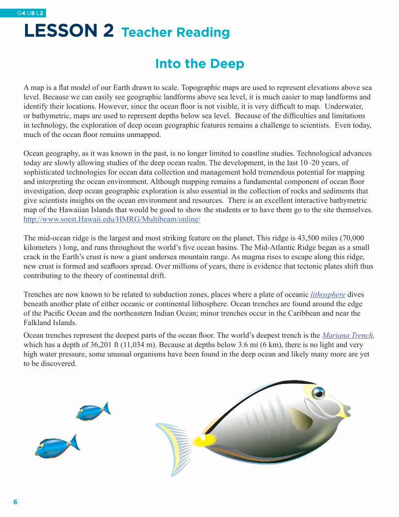
A map is a fl at model of our Earth drawn to scale. Topographic maps are used to represent elevations above sea level. Because we can easily see geographic landforms above sea level, it is much easier to map landforms and identify their locations. However, since the ocean fl oor is not visible, it is very diffi cult to map. Underwater, or bathymetric, maps are used to represent depths below sea level. Because of the diffi culties and limitations in technology, the exploration of deep ocean geographic features remains a challenge to scientists. Even today, much of the ocean fl oor remains unmapped.
Ocean geography, as it was known in the past, is no longer limited to coastline studies. Technological advances today are slowly allowing studies of the deep ocean realm. The development, in the last 10–20 years, of sophisticated technologies for ocean data collection and management hold tremendous potential for mapping and interpreting the ocean environment. Although mapping remains a fundamental component of ocean fl oor investigation, deep ocean geographic exploration is also essential in the collection of rocks and sediments that give scientists insights on the ocean environment and resources. There is an excellent interactive bathymetric map of the Hawaiian Islands that would be good to show the students or to have them go to the site themselves. http://www.soest.Hawaii.edu/HMRG/Multibeam/online/
The mid-ocean ridge is the largest and most striking feature on the planet. This ridge is 43,500 miles (70,000 kilometers ) long, and runs throughout the world’s fi ve ocean basins. The Mid-Atlantic Ridge began as a small crack in the Earth’s crust is now a giant undersea mountain range. As magma rises to escape along this ridge, new crust is formed and seafl oors spread. Over millions of years, there is evidence that tectonic plates shift thus contributing to the theory of continental drift.
Trenches are now known to be related to subduction zones, places where a plate of oceanic lithosphere dives beneath another plate of either oceanic or continental lithosphere. Ocean trenches are found around the edge of the Pacifi c Ocean and the northeastern Indian Ocean; minor trenches occur in the Caribbean and near the Falkland Islands. Ocean trenches represent the deepest parts of the ocean fl oor. The world’s deepest trench is the Mariana Trench, which has a depth of 36,201 ft (11,034 m). Because at depths below 3.6 mi (6 km), there is no light and very high water pressure, some unusual organisms have been found in the deep ocean and likely many more are yet to be discovered.
6
G4 U8 L2
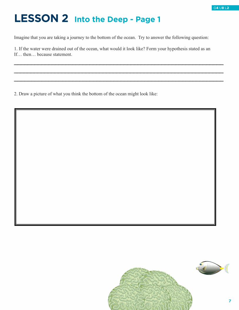
LessON 2 Into the Deep - Page 1
Imagine that you are taking a journey to the bottom of the ocean. Try to answer the following question:
1. If the water were drained out of the ocean, what would it look like? Form your hypothesis stated as an If… then… because statement.
_______________________________________________________________________________________________________________________________________________________________________________________
2. Draw a picture of what you think the bottom of the ocean might look like:
7
G4 U8 L2

LessON 2 Into the Deep - Page 2
3. Based on what I have learned, I now think the bottom of the ocean will look like…
4. Explain what you learned about the bottom of the ocean. Was your hypothesis supported? Why or why not?
______________________________________________________________________________________________________________________________________________________________________________________________________________________________________________________________________________________________________________________________________________________________________________
8
G4 U8 L2

8
G4 U8 L2
Lesson 2Features of the O
cean Floor - Page 1
Le
ss
ON
2 Featu
res o
f the
Oce
an
Flo
or - P
ag
e 1
9
G4 U8 L2
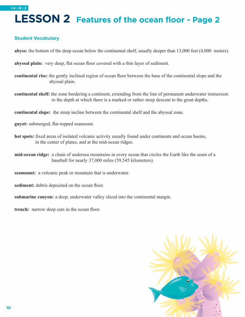
LessON 2 Features of the ocean floor - Page 2
Student Vocabulary
abyss: the bottom of the deep ocean below the continental shelf, usually deeper than 13,000 feet (4,000 meters).
abyssal plain: very deep, fl at ocean fl oor covered with a thin layer of sediment.
continental rise: the gently inclined region of ocean fl oor between the base of the continental slope and the abyssal plain.
continental shelf: the zone bordering a continent, extending from the line of permanent underwater immersion to the depth at which there is a marked or rather steep descent to the great depths.
continental slope: the steep incline between the continental shelf and the abyssal zone.
guyot: submerged, fl at-topped seamount.
hot spots: fi xed areas of isolated volcanic activity usually found under continents and ocean basins, in the center of plates, and at the mid-ocean ridges.
mid-ocean ridge: a chain of undersea mountains in every ocean that circles the Earth like the seam of a baseball for nearly 37,000 miles (59,545 kilometers).
seamount: a volcanic peak or mountain that is underwater.
sediment: debris deposited on the ocean fl oor.
submarine canyon: a deep, underwater valley sliced into the continental margin.
trench: narrow deep cuts in the ocean fl oor.
10
G4 U8 L2