Embed Size (px)
Citation preview
EDM Height Traversing Levelling Survey ReportFunafuti, Tuvalu, May 2012
GEOSCIENCE AUSTRALIARECORD 2014/29
S. J. K. Yates1, A. Lal2
1. National Geospatial Reference Systems, Geospatial and Earth Monitoring Division, Geoscience Australia GPO Box 378 Canberra ACT 2601
2. Secretariat of the Pacific Community (SPC)

Department of IndustryMinister for Industry: The Hon Ian Macfarlane MPParliamentary Secretary: The Hon Bob Baldwin MPSecretary: Ms Glenys Beauchamp PSM
Geoscience AustraliaChief Executive Officer: Dr Chris PigramThis paper is published with the permission of the CEO, Geoscience Australia
© Commonwealth of Australia (Geoscience Australia) 2014
With the exception of the Commonwealth Coat of Arms and where otherwise noted, all material in this publication is provided under a Creative Commons Attribution 3.0 Australia Licence. (http://www.creativecommons.org/licenses/by/3.0/au/deed.en)
Geoscience Australia has tried to make the information in this product as accurate as possible. However, it does not guarantee that the information is totally accurate or complete. Therefore, you should not solely rely on this information when making a commercial decision.
Geoscience Australia is committed to providing web accessible content wherever possible. If you are having difficulties with accessing this document please email [email protected].
ISSN 2201-702X (PDF)
ISBN 978-1-925124-18-7 (PDF)
GeoCat 76793
Bibliographic reference: Yates, S. J. K. & Lal, A., 2014, EDM Height Traversing Levelling Survey Report: Funafuti, Tuvalu, May 2012. Record 2014/29. Geoscience Australia, Canberra. http://dx.doi.org/10.11636/Record.2014.029
Contents
1 Introduction.......................................................................................................................................... 1
2 The Survey.......................................................................................................................................... 22.1 Bench Mark Locality Diagram........................................................................................................32.2 The Tuvalu Datum.......................................................................................................................... 52.3 Equipment...................................................................................................................................... 52.4 Method........................................................................................................................................... 52.5 Survey Support.............................................................................................................................. 62.6 Issues............................................................................................................................................. 62.7 Description of Marks – Funafuti, Tuvalu.........................................................................................6
3 Comparisons........................................................................................................................................ 73.1 Comparisons between 2012 and 2010 EDM Surveys....................................................................73.2 Combined Comparisons 1993 to 2012...........................................................................................83.3 Time Series of Bench Mark Movement relative to Fixed Deep Bench Mark BM22........................9
4 Deep Bench Mark Locality Diagrams.................................................................................................13
5 Permanent Holding Mark Locality Diagrams......................................................................................19
6 TUVABM and TUVA Reference Mark Locality Diagrams..................................................................24
7 References........................................................................................................................................ 28
EDM Height Traversing Levelling Survey Report: Funafuti, Tuvalu, May 2012 iii
iv EDM Height Traversing Levelling Survey Report: Funafuti, Tuvalu, May 2012

1 Introduction
This report outlines the level survey completed during the visit to Funafuti, Tuvalu between 22 and 29 May 2012.
Personnel involved in the survey were Steve Yates, Surveyor, Geoscience Australia and Andrick Lal, Surveyor, Secretariat of the Pacific Community (SPC).
This is the fifth Electronic Distance Measurement (EDM) height traversing levelling survey of the deep bench mark array in Funafuti Atoll, Tuvalu. The previous levelling surveys using this technique were performed in 2005, 2007, 2009 and 2010.
Precise Differential Levelling surveys were performed on eight occasions between 1993 and 2003 by the National Tidal Centre Australia (NTCA) and the survey in 2005 included a comparison between the precise differential levelling and EDM height traversing technique. This report contains a comparison between the 2010 and 2012 EDM height traversing results as well as a combined comparison since the first levelling survey in 1993.
EDM Height Traversing Levelling Survey Report: Funafuti, Tuvalu, May 2012 1
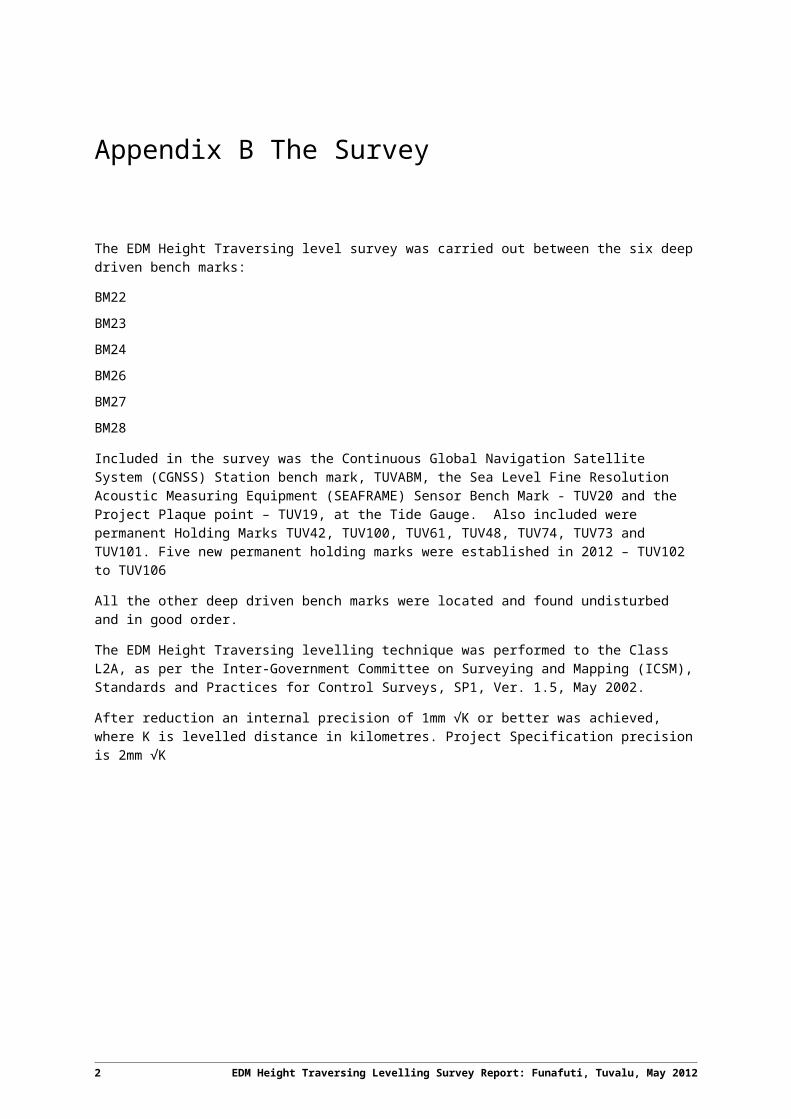
2 The Survey
The EDM Height Traversing level survey was carried out between the six deep driven bench marks:
BM22
BM23
BM24
BM26
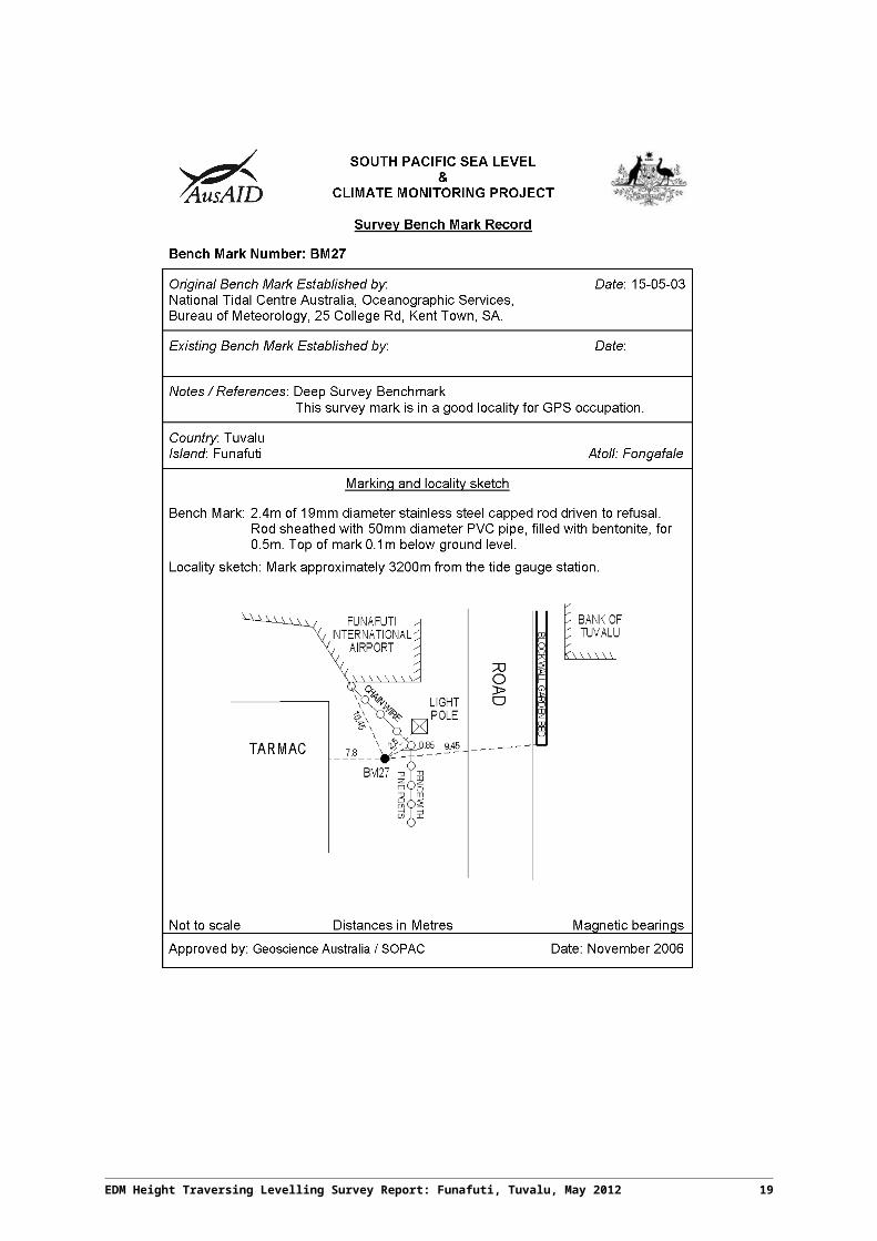
BM27
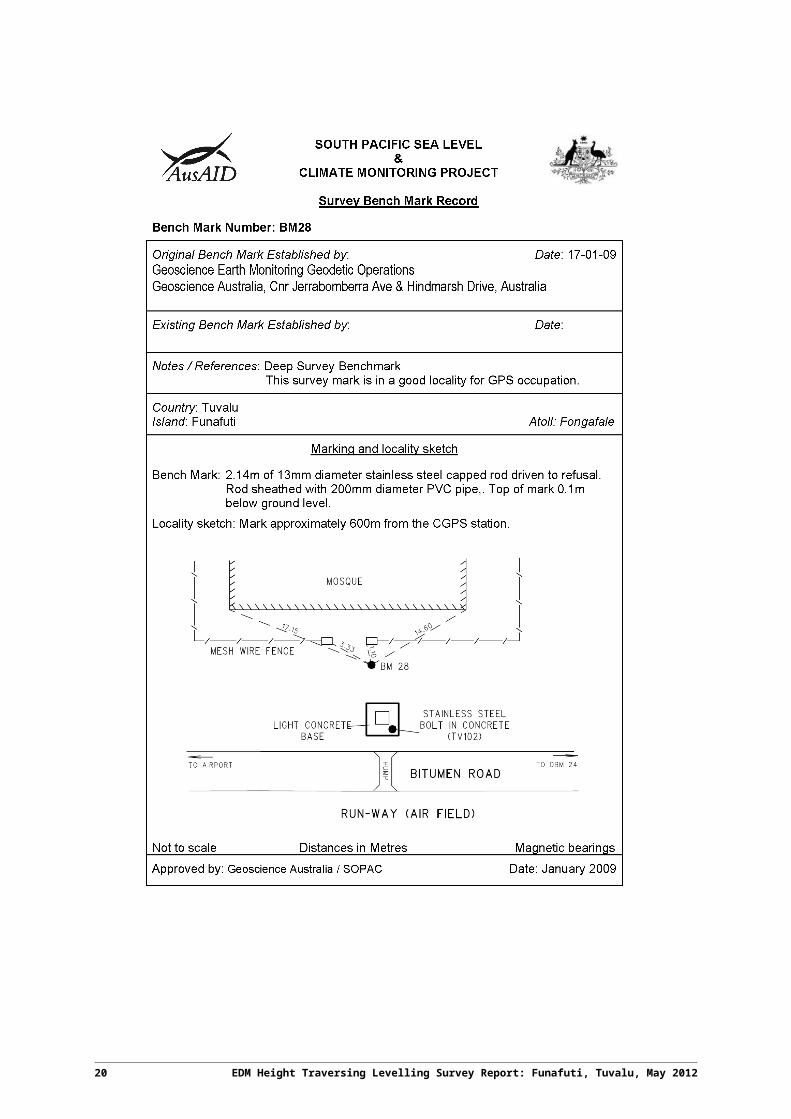
BM28
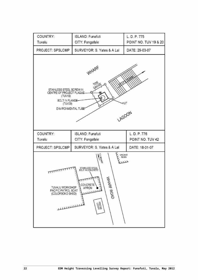
Included in the survey was the Continuous Global Navigation Satellite System (CGNSS) Station bench mark, TUVABM, the Sea Level Fine Resolution Acoustic Measuring Equipment (SEAFRAME) Sensor Bench Mark - TUV20 and the Project Plaque point – TUV19, at the Tide Gauge. Also included were permanent Holding Marks TUV42, TUV100, TUV61, TUV48, TUV74, TUV73 and TUV101. Five new permanent holding marks were established in 2012 – TUV102 to TUV106
All the other deep driven bench marks were located and found undisturbed and in good order.
The EDM Height Traversing levelling technique was performed to the Class L2A, as per the Inter-Government Committee on Surveying and Mapping (ICSM), Standards and Practices for Control Surveys, SP1, Ver. 1.5, May 2002.
After reduction an internal precision of 1mm √K or better was achieved, where K is levelled distance in kilometres. Project Specification precision is 2mm √K
2 EDM Height Traversing Levelling Survey Report: Funafuti, Tuvalu, May 2012
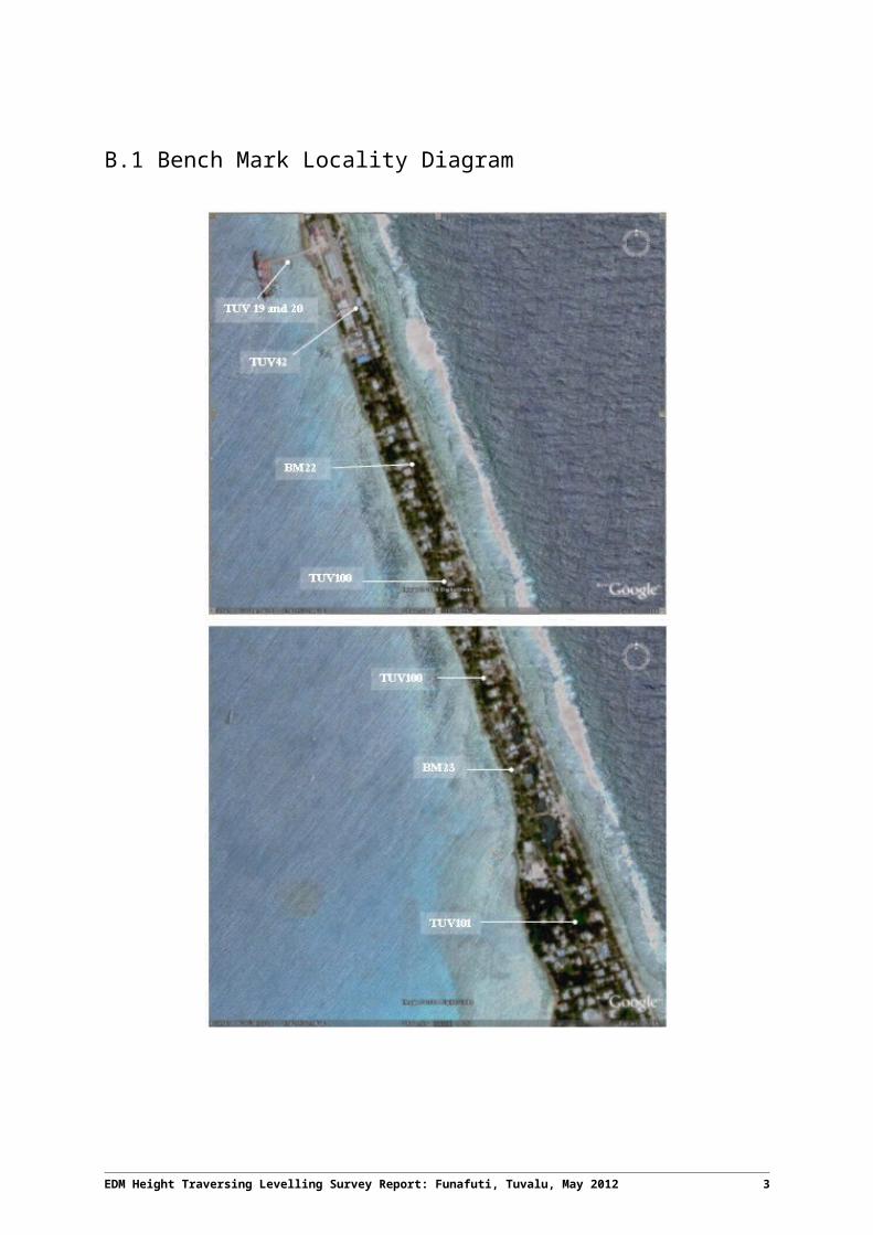
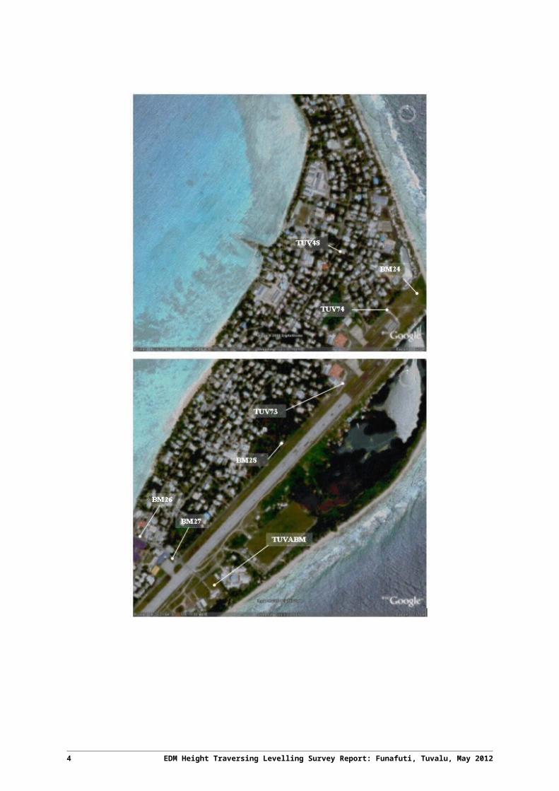
2.1 Bench Mark Locality Diagram
EDM Height Traversing Levelling Survey Report: Funafuti, Tuvalu, May 2012 3
4 EDM Height Traversing Levelling Survey Report: Funafuti, Tuvalu, May 2012
2.2 The Tuvalu DatumThe Datum for the survey is the University of Hawaii Tide Staff Zero (TSZ).
Reduction of the data has been calculated holding BM22 fixed at 3.22540 metres TSZ, this value was determined by the NTCA in 1993 by:
Adopting the height of UH 1
RL = 3.0072 metres TSZ
Adopting the height of BM22 as derived from the 1993 survey
RL = 3.22540 metres.
2.3 Equipment Leica total station model TM30 (Serial No: 361441)
Leica precision prisms GPH1P (2).
Leica rigid tripod.
Stainless steel target poles supported by Leica telescopic bi-poles (2).
Shortened stainless steel target pole for the SEAFRAME sensor BM connection.
Leica cast iron change plates (2).
Kestral 4000 pocket weather tracker
2.4 MethodThe “Leap-Frog” EDM height traversing technique was employed for the Funafuti tide gauge levelling survey. This technique involves setting up a total station (TCA1800L) midway between two target/reflectors (on reflector rods with struts). The targets remain at a particular change point for the back-sight and fore-sight observations. The instrument measures slope distances (±1mm) and vertical angle (1”) to derive height differences (between the instrument’s trunnion axis and the reflectors). In support of the slope distance observations, the ambient temperature, pressure and humidity are recorded (Kestral 4000 pocket weather tracker) and input into the instrument to apply the first velocity correction to the observed distances (Rüeger & Brunner, 1982). Four rounds of observations are taken to the back-sight and fore-sight targets from each instrument setup. All levelling runs started and finished with the same reflector and reflector rod, i.e. an even number of setups when the two reflector rod configuration was used. This eliminates any reflector rod zero error. This technique can also be performed using a single set-up / single rod configuration which is particularly useful when levelling between bench marks which are close together e.g. between the CGNSS RMs.
Reduction of the digital data was computed by the Geoscience Australia levelling program “leveling1.exe”. This program computes the height difference between the two reflectors.
EDM Height Traversing Levelling Survey Report: Funafuti, Tuvalu, May 2012 5
2.5 Survey SupportThe Acting Director of the Tuvalu Meteorological Service, Mr. Tauala Katea and his staff provided valuable support during our visit.
Special mention to Mr. Faatasi Malologa – Director, Lands and Survey Department for arranging the car hire and also providing us with a surveyor for field assistance for the survey.
2.6 Issues
No issues or concerns of any importance with regards to the levelling survey were encountered during the 2012 survey.
Please note that due to fewer flights to Funafuti, it is advisable to book 2 cargo seats for the survey equipment to and from Funafuti as DHL cannot guarantee the air freight to arrive.
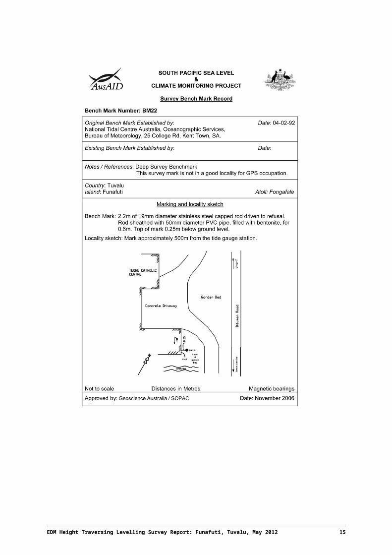
2.7 Description of Marks – Funafuti, TuvaluBM22 is the bench mark held fixed with an RL = 3.22540 metres
The height of BM22 was derived in 1993 by NTC by means of:
1993 Adopting the height of UH 1
RL = 3.0072 metres TSZ.
1994 Adopting the height of BM22 from the 1993 survey.
RL = 3.22540
Bench Marks:
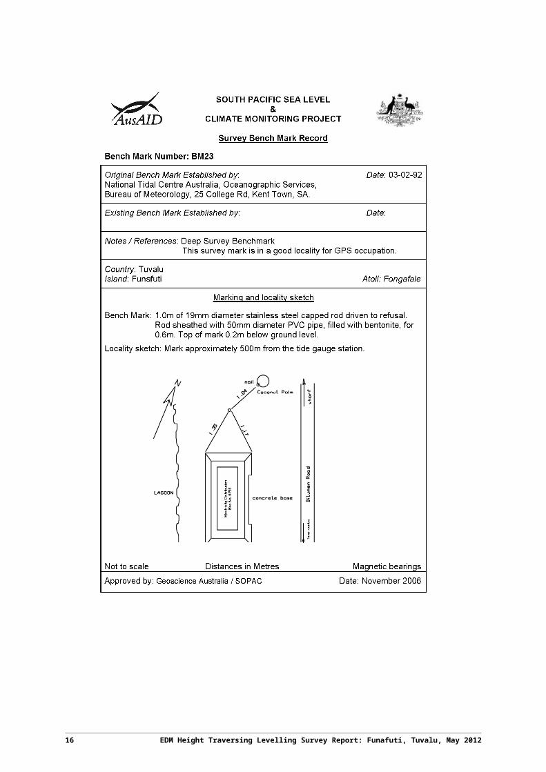
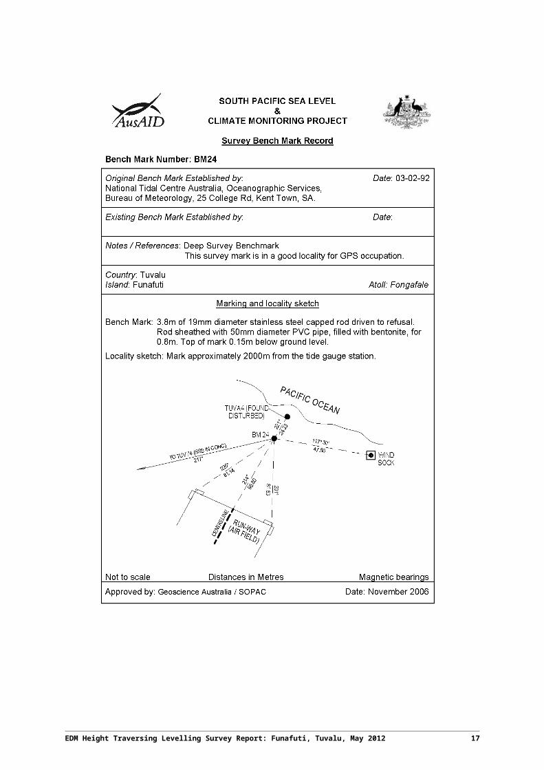
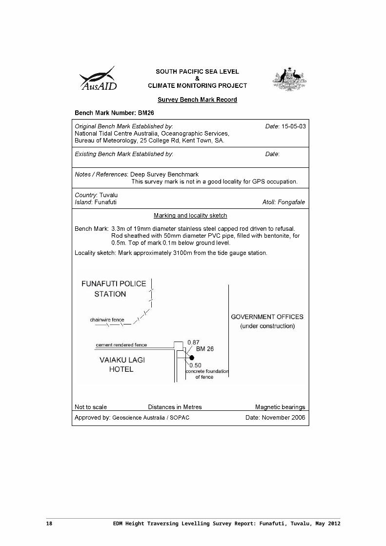
BM22, BM23, BM24, BM26, BM27 and BM28 are all Deep Driven BM’s
* BM25 has been destroyed.
TUV20 is the SEAFRAME Sensor Bench Mark
TUV19 is the Project Plaque point
TUVABM is the Reference Bench Mark for the CGPS Pillar.
TUV42, TUV100, TUV101, TUV61, TUV48, TUV74 and TUV73 are all permanent stainless steel bolt holding marks, drilled in concrete and glued in place. The holding marks TUV102 to TUV106 are all new marks established in 2012 and are stainless steel bolts glued in place.
6 EDM Height Traversing Levelling Survey Report: Funafuti, Tuvalu, May 2012
3 Comparisons
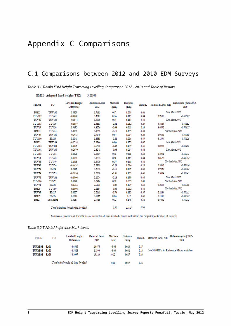
3.1 Comparisons between 2012 and 2010 EDM Surveys
Table 3.1 Tuvalu EDM Height Traversing Levelling Comparison 2012 - 2010 and Table of Results
Table 3.2 TUVALU Reference Mark levels
EDM Height Traversing Levelling Survey Report: Funafuti, Tuvalu, May 2012 7
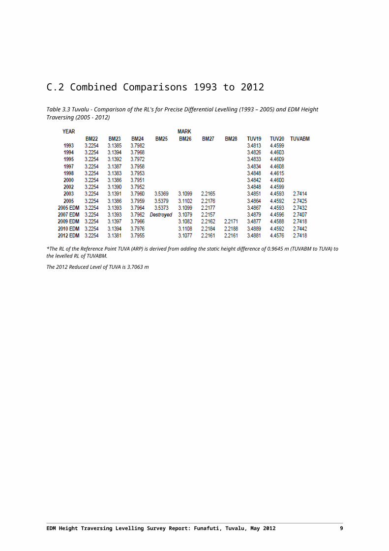
3.2 Combined Comparisons 1993 to 2012
Table 3.3 Tuvalu - Comparison of the RL's for Precise Differential Levelling (1993 – 2005) and EDM Height Traversing (2005 - 2012)
*The RL of the Reference Point TUVA (ARP) is derived from adding the static height difference of 0.9645 m (TUVABM to TUVA) to the levelled RL of TUVABM.
The 2012 Reduced Level of TUVA is 3.7063 m
8 EDM Height Traversing Levelling Survey Report: Funafuti, Tuvalu, May 2012
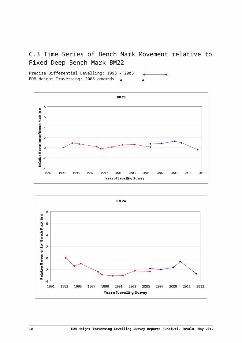
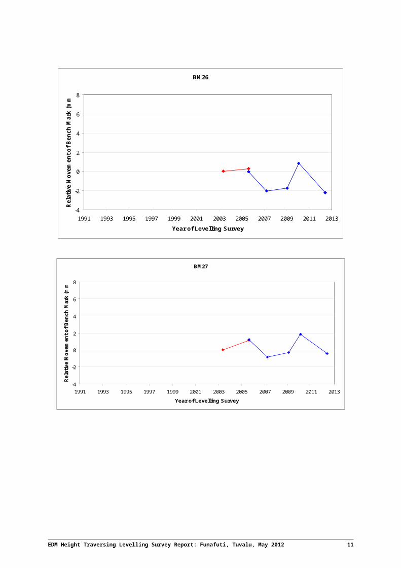
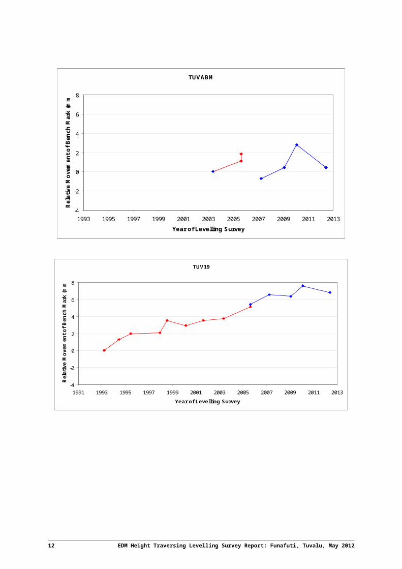
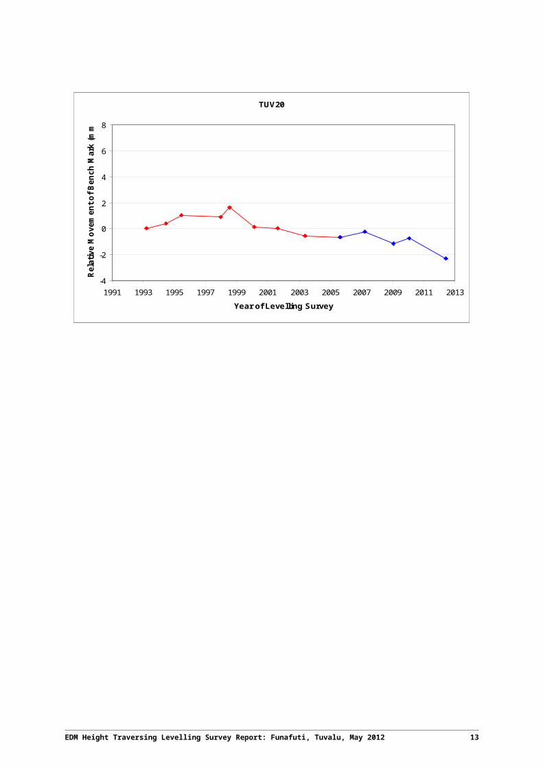
3.3 Time Series of Bench Mark Movement relative to Fixed Deep Bench Mark BM22
Precise Differential Levelling: 1993 - 2005EDM Height Traversing: 2005 onwards
BM23
-4
-2
0
2
4
6
8
1991 1993 1995 1997 1999 2001 2003 2005 2007 2009 2011 2013
Year of Levelling Survey
Rela
tive
Mov
emen
t of B
ench
Mar
k (m
m)
BM24
-4
-2
0
2
4
6
8
1991 1993 1995 1997 1999 2001 2003 2005 2007 2009 2011 2013
Year of Levelling Survey
Rela
tive
Mov
emen
t of B
ench
Mar
k (m
m)
EDM Height Traversing Levelling Survey Report: Funafuti, Tuvalu, May 2012 9
BM26
-4
-2
0
2
4
6
8
1991 1993 1995 1997 1999 2001 2003 2005 2007 2009 2011 2013
Year of Levelling Survey
Rela
tive
Mov
emen
t of B
ench
Mar
k (m
m)
BM27
-4
-2
0
2
4
6
8
1991 1993 1995 1997 1999 2001 2003 2005 2007 2009 2011 2013
Year of Levelling Survey
Rela
tive
Mov
emen
t of B
ench
Mar
k (m
m)
10 EDM Height Traversing Levelling Survey Report: Funafuti, Tuvalu, May 2012
TUVABM
-4
-2
0
2
4
6
8
1993 1995 1997 1999 2001 2003 2005 2007 2009 2011 2013
Year of Levelling Survey
Rela
tive
Mov
emen
t of B
ench
Mar
k (m
m)
TUV19
-4
-2
0
2
4
6
8
1991 1993 1995 1997 1999 2001 2003 2005 2007 2009 2011 2013
Year of Levelling Survey
Rela
tive
Mov
emen
t of B
ench
Mar
k (m
m)
EDM Height Traversing Levelling Survey Report: Funafuti, Tuvalu, May 2012 11
TUV20
-4
-2
0
2
4
6
8
1991 1993 1995 1997 1999 2001 2003 2005 2007 2009 2011 2013
Year of Levelling Survey
Rela
tive
Mov
emen
t of B
ench
Mar
k (m
m)
12 EDM Height Traversing Levelling Survey Report: Funafuti, Tuvalu, May 2012
4 Deep Bench Mark Locality Diagrams
EDM Height Traversing Levelling Survey Report: Funafuti, Tuvalu, May 2012 13
14 EDM Height Traversing Levelling Survey Report: Funafuti, Tuvalu, May 2012
EDM Height Traversing Levelling Survey Report: Funafuti, Tuvalu, May 2012 15
16 EDM Height Traversing Levelling Survey Report: Funafuti, Tuvalu, May 2012
EDM Height Traversing Levelling Survey Report: Funafuti, Tuvalu, May 2012 17
18 EDM Height Traversing Levelling Survey Report: Funafuti, Tuvalu, May 2012
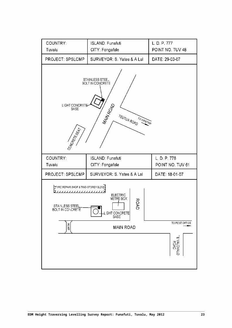
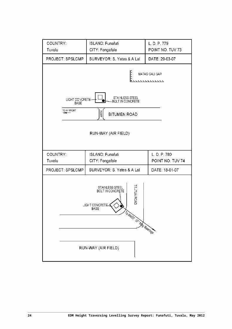
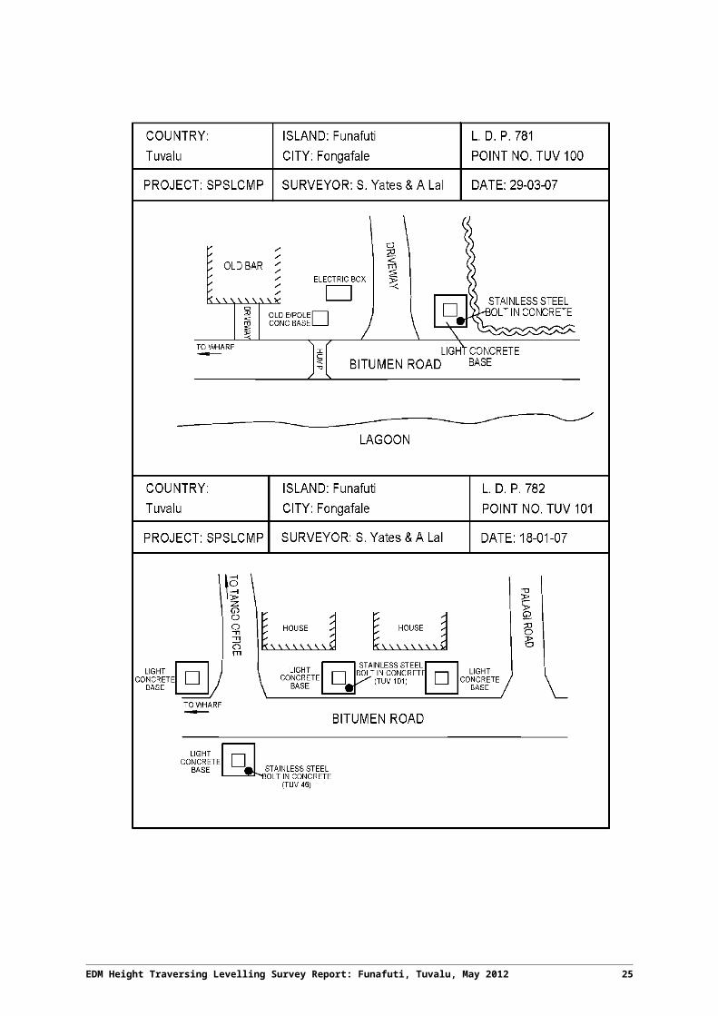
5 Permanent Holding Mark Locality Diagrams
EDM Height Traversing Levelling Survey Report: Funafuti, Tuvalu, May 2012 19
20 EDM Height Traversing Levelling Survey Report: Funafuti, Tuvalu, May 2012
EDM Height Traversing Levelling Survey Report: Funafuti, Tuvalu, May 2012 21
22 EDM Height Traversing Levelling Survey Report: Funafuti, Tuvalu, May 2012
EDM Height Traversing Levelling Survey Report: Funafuti, Tuvalu, May 2012 23
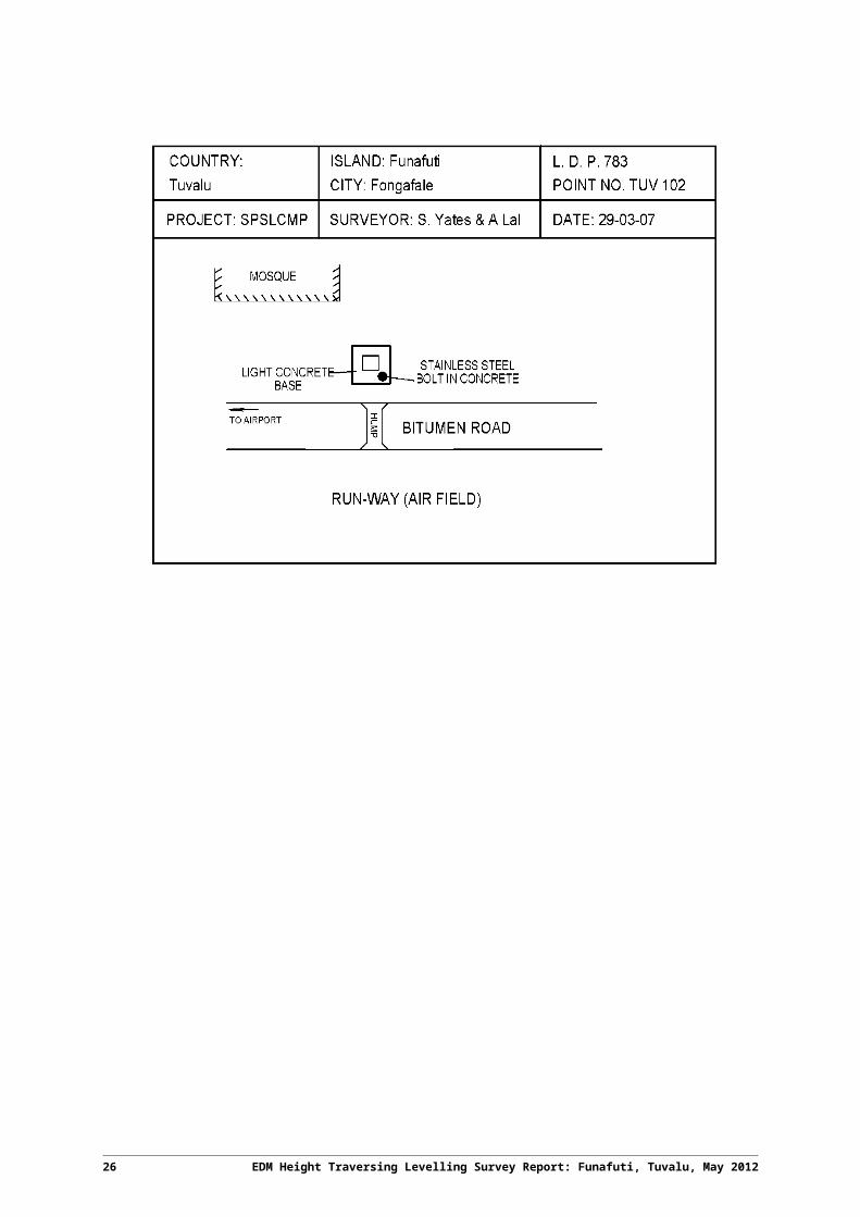
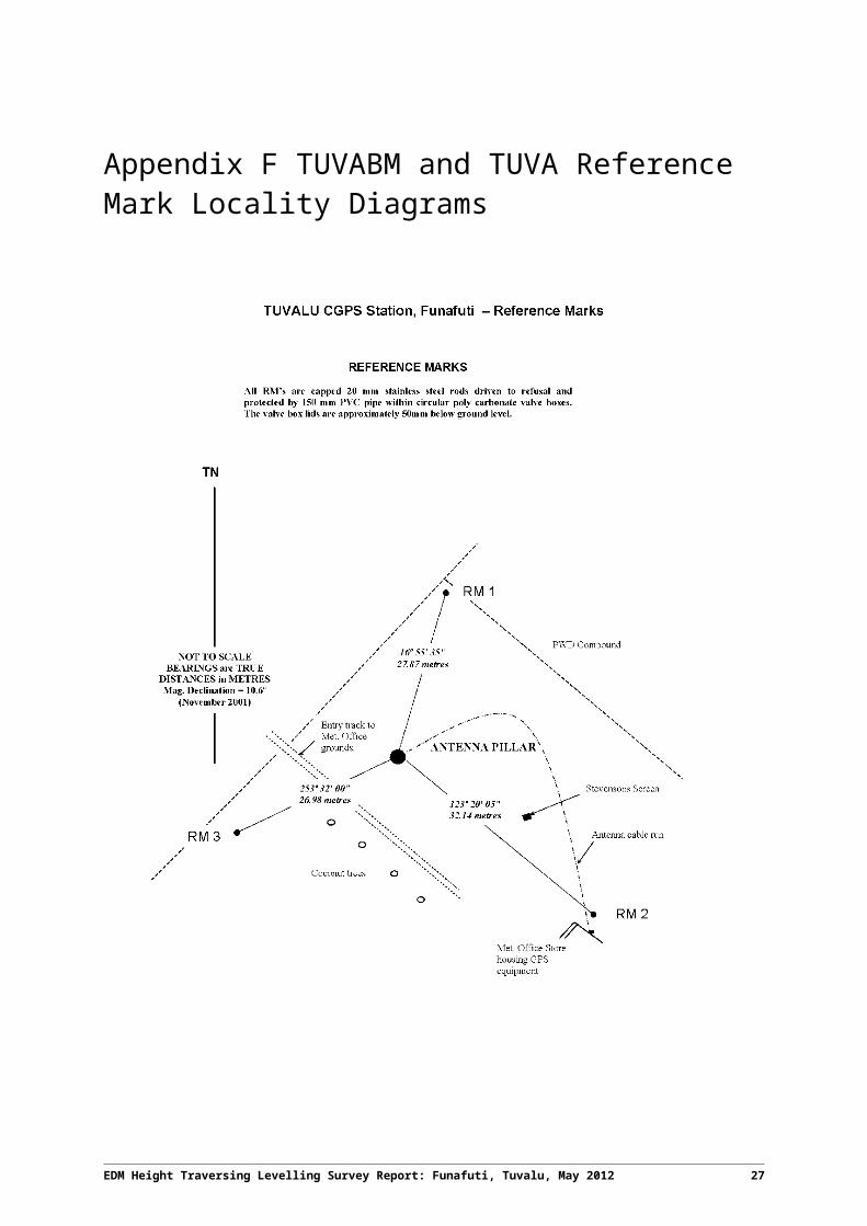
6 TUVABM and TUVA Reference Mark Locality Diagrams
24 EDM Height Traversing Levelling Survey Report: Funafuti, Tuvalu, May 2012
EDM Height Traversing Levelling Survey Report: Funafuti, Tuvalu, May 2012 25
26 EDM Height Traversing Levelling Survey Report: Funafuti, Tuvalu, May 2012
EDM Height Traversing Levelling Survey Report: Funafuti, Tuvalu, May 2012 27
7 References
Rüeger, J.M. & Brunner, F.K. 1982, ‘EDM Height Traversing versus Geodetic Levelling’, The Canadian Surveyor, vol. 36, no. 1, pp. 69-87.
Inter-Government Committee on Surveying and Mapping (ICSM) 2002, Standards and Practices for Control Surveys, SP1, Ver. 1.5, May 2002.
28 EDM Height Traversing Levelling Survey Report: Funafuti, Tuvalu, May 2012