Embed Size (px)
Citation preview

GEO101C: EARTH SCIENCE WITH LAB
Credit Hours: 4 Contact Hours: This is a 4-credit course, offered in accelerated format. This means that 16 weeks of material is
covered in 8 weeks. The exact number of hours per week that you can expect to spend on each course will vary based upon the weekly coursework, as well as your study style and preferences. You should plan to spend 14-20 hours per week in each course reading material, interacting on the discussion boards, writing papers, completing projects, and doing research.
Faculty Information: Faculty contact information and office hours can be found on the faculty profile page.
COURSE DESCRIPTION AND OUTCOMES
Course Description:
This course emphasizes four regions: the hydrosphere (water), the atmosphere (air), the lithosphere (rock), and space. This course fulfills a general education Physical and Natural Science requirement. This is an approved Colorado gtPathways course. Appendix A, located at the end of this syllabus, reviews the gtPathways coverage for this GT-SC1 course.
Course Overview:
This course will provide you with general knowledge of the world around you. You will go on a journey from the center of the Earth, becoming part of the crust as a volcano, earthquake, rock, or mineral. Then you will see how gases follow us into the atmosphere, eventually falling as rain and filling the oceans and rivers. Next you will examine how those waters interact with the gases and the crust to control our weather and climate. Finally, you will study how humans have influenced all of this, for better or for worse, and how we have been able to leave our planet to explore the stars, both figuratively and literally.
Course Learning Outcomes:
1. Explain how the Universe, Milky Way, Solar System, and Earth evolved, and examine how the Earth’s crust interacts to cause volcanoes and earthquakes.
2. Identify properties of minerals and explain how they form to become rocks via cooling, heating, pressure, weathering, and erosion.
3. Examine the physical aspects of the oceans and seas including waves, tides, currents, and the ocean basin, and how they are linked to climate.
4. Describe the dynamics of atmospheric convection and explain how it relates to weather.
5. Describe the sequence of star formation, maturity, and death, methods in astronomical data collection including spectral analysis, and characteristics of the planets.
6. Examine the role of water on the landscape, related geomorphology, glacial and desert landscape evolution, and water usage.
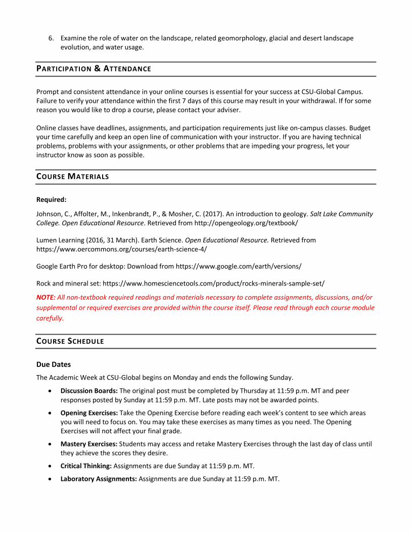
PARTICIPATION & ATTENDANCE
Prompt and consistent attendance in your online courses is essential for your success at CSU-Global Campus. Failure to verify your attendance within the first 7 days of this course may result in your withdrawal. If for some reason you would like to drop a course, please contact your adviser. Online classes have deadlines, assignments, and participation requirements just like on-campus classes. Budget your time carefully and keep an open line of communication with your instructor. If you are having technical problems, problems with your assignments, or other problems that are impeding your progress, let your instructor know as soon as possible.
COURSE MATERIALS
Required:
Johnson, C., Affolter, M., Inkenbrandt, P., & Mosher, C. (2017). An introduction to geology. Salt Lake Community College. Open Educational Resource. Retrieved from http://opengeology.org/textbook/
Lumen Learning (2016, 31 March). Earth Science. Open Educational Resource. Retrieved from https://www.oercommons.org/courses/earth-science-4/
Google Earth Pro for desktop: Download from https://www.google.com/earth/versions/
Rock and mineral set: https://www.homesciencetools.com/product/rocks-minerals-sample-set/
NOTE: All non-textbook required readings and materials necessary to complete assignments, discussions, and/or
supplemental or required exercises are provided within the course itself. Please read through each course module
carefully.
COURSE SCHEDULE
Due Dates
The Academic Week at CSU-Global begins on Monday and ends the following Sunday.
Discussion Boards: The original post must be completed by Thursday at 11:59 p.m. MT and peer responses posted by Sunday at 11:59 p.m. MT. Late posts may not be awarded points.
Opening Exercises: Take the Opening Exercise before reading each week’s content to see which areas you will need to focus on. You may take these exercises as many times as you need. The Opening Exercises will not affect your final grade.
Mastery Exercises: Students may access and retake Mastery Exercises through the last day of class until they achieve the scores they desire.
Critical Thinking: Assignments are due Sunday at 11:59 p.m. MT.
Laboratory Assignments: Assignments are due Sunday at 11:59 p.m. MT.

Portfolio Milestone: Assignment is due Sunday at 11:59 p.m. MT.
Portfolio Project: Assignment is due Sunday at 11:59 p.m. MT.
WEEKLY READING AND ASSIGNMENT DETAILS
Module 1
Readings
· Chapter 1 Introduction to Science in An introduction to geology. Salt Lake Community College. Open
Educational Resource
· Chapter 2 Plate Tectonics in An introduction to geology. Salt Lake Community College. Open
Educational Resource
· Chapter 4 Igneous Processes and Volcanoes (Section 4.5 only) in An introduction to geology. Salt Lake
Community College. Open Educational Resource
· Chapter 8 Earth History in An introduction to geology. Salt Lake Community College. Open
Educational Resource
· BBC. (2014). Secrets of the solar system [Video file]. Retrieved from https://fod-infobase-com.csuglobal.idm.oclc.org/p_ViewVideo.aspx?xtid=86548&tScript=0
· Frebel, A., & Beers, T. C. (2018). The formation of the heaviest elements. Physics Today, 71(1), 30. Retrieved
from https://physicstoday.scitation.org/doi/10.1063/PT.3.3815
· Kious, W. J., & Tilling, R. I. (1994). This dynamic Earth: The story of plate tectonics. United States
Geological Survey.
· Pumpkin TV. (2015). Waves, seismic imaging and tectonics [Video file]. Retrieved from https://fod-infobase-com.csuglobal.idm.oclc.org/p_ViewVideo.aspx?xtid=94712&tScript=0
Opening Exercise (0 points)
Discussion (25 points)
Laboratory Assignment (40 points)
Introduction to Plate Tectonics with Google Earth
Plate tectonics is a unifying framework for understanding the dynamic geology of the Earth. The theory
posits that the outermost layers of the Earth (the crust and uppermost mantle) make up the brittle
lithosphere of the Earth. The lithosphere is broken up into a number of thin plates, which move on top
of the asthenosphere (middle mantle). The asthenosphere is solid, but flows plastically over geologic
time scales. Plate interiors are relatively stable, and most of the tectonic action (earthquakes, volcanism)
takes place where plates meet—where they collide at convergent boundaries, move away from one
another at divergent boundaries, or slide past one another at transform boundaries.
Reconstructions of the Earth’s tectonic plate locations through time are available, for example, at:
· http://www.scotese.com/newpage13.htm
· http://www.ucmp.berkeley.edu/geology/tectonics.html
But how do we define plates and plate boundaries? On what are plate reconstructions and animations
based? How do we know plates are moving, how can we track their positions in the past, and how can
we predict their positions in the future?
To answer these questions, this assignment guides you through an examination of patterns on Earth—
the topography of the Earth’s surface above sea level, the bathymetry of the ocean floor below sea
level, and the distribution of earthquakes and volcanic rock ages. These patterns reveal plate
boundaries, just as they did for geologists first developing plate tectonic theory in the 1960s. You’ll then
use geologic data to determine long-term average plate motions, to predict how our dynamic planet will
change in the future. To do this, you’ll use the program Google Earth, and Google Earth layers compiled
from various sources.
Prepare a report documenting this lab activity. Your report should discuss how plate tectonic theory
relates to earthquakes, volcanoes, and the bathymetry (sea floor topography) of oceans. Along the way,
include answers to all of the questions in this lab. Your paper should be accompanied by the two
drawings of your ocean floor profile sketches in questions 3 and 4. Your paper should be well organized
and written in flowing paragraph form, instead of just a numbered list of questions and answers. Use
APA format, including a title page, and citing and referencing any sources that you use to support your
work, apart from this lab sheet.
Portfolio Milestone (0 points)
This week, examine Options #1 and #2 in the Portfolio Project description, listed in brief below and
which can be accessed in full within Module 8. You may also wish to examine the Portfolio Project
grading rubric to see how you will be graded for this assignment. This final project is due at the end of
Module 8 and represents a substantial portion of your final grade. If you have any questions concerning
the Portfolio Project, contact your instructor as soon as possible.
Topic Option #1: As we cover Earth Science topics throughout the course, the knowledge may spark
your curiosity about what is happening right where you live. For this first option, you will do an Earth
Science “reading” of your home place—where you are living right now. In your paper, you will discuss
the plate tectonic setting of your home place, chronicle its geologic history including present-day
evidence of that history, describe the landscape as it exists now and the earth processes happening
there, and discuss the region’s dominant weather patterns and overall climate. Include maps, diagrams,
and photos to support your text.
Topic Option #2: One amazing setting for appreciating our planet Earth is in one of the many national
parks across the United States. For this second option, you will do an Earth Science “reading” of a
national park of your choice. In your paper, you will discuss the plate tectonic setting of the park,
chronicle its geologic history including present-day evidence of that history, describe the landscape as it
exists now and the earth processes happening there, and discuss the region’s dominant weather
patterns and overall climate. Include maps, diagrams, and photos to support your text.
Mastery Exercise (10 points)

Module 2
Readings
· Chapter 3 Minerals in An introduction to geology. Salt Lake Community College. Open Educational
Resource
· Chapter 4 Igneous Processes and Volcanoes (Sections 4.1-4.4 only) in An introduction to geology.
Salt Lake Community College. Open Educational Resource
· Chapter 5 Weathering, Erosion, and Sedimentary Rocks (Sections 5.3-5.5 only) in An introduction to
geology. Salt Lake Community College. Open Educational Resource
· Chapter 6 Metamorphic Rocks in An introduction to geology. Salt Lake Community College. Open
Educational Resource
· Chapter 7 Geologic Time (Section 7.2 only) in An introduction to geology. Salt Lake Community
College. Open Educational Resource
· Burbank Jr., J. A. (2012). Metamorphic rock classification. Earth Science: Earth Materials &
Resources, 273.
· Carver, R. E. (2012). Sedimentary rock classification. Earth Science: Earth Materials & Resources,
457.
· Cerebellum Corporation. (2010). Rocks and minerals [Video file]. Retrieved from https://fod-infobase-
com.csuglobal.idm.oclc.org/p_ViewVideo.aspx?xtid=155242&tScript=0
· Cerebellum Corporation. (2013). Putting dates to the past [Video file]. Retrieved from https://fod-
infobase-com.csuglobal.idm.oclc.org/p_ViewVideo.aspx?xtid=155091&tScript=0
Opening Exercise (0 points)
Discussion (25 points)
Laboratory Assignment (40 points)
Rock Identification Guide
Minerals are naturally occurring, solid substances composed of chemical elements. This means that
minerals, ranging from salt to rubies, are made up of compounds of elements that appear on the
periodic table. Each type of mineral has a specific chemical composition and consistent physical
properties. They are inorganic, not living or made up of living things. Minerals form a crystalline
structure which gives rocks their "rough" texture.
Rocks are mixtures, or aggregates, of different minerals. Some rocks, like limestone, are composed
mostly of one mineral, but the majority of rocks are made up of several major minerals. Rocks are
divided into three categories based on how they are formed: igneous, sedimentary, and metamorphic.
This kit includes 15 common rocks with examples from each category. Observe them closely with the
included magnifying lens and acid test for: color, texture, structure, and mineral composition.
Critical Thinking (40 points)
Option #1: Having a Blast with Active Volcanoes

Choose an active volcano from somewhere on Earth, from this online list:
http://www.geo.mtu.edu/volcanoes/world.html. In a well-crafted essay, cover all of the questions
below. (Tip: Investigate your volcano online a bit before committing to it for this assignment; make sure
there is sufficient information available about it, in English, for you to be able to meet the paper length
requirement.)
· What is the name of your volcano? How did it get that name?
· Where on Earth is it located? (If possible, include a map.)
· What kind of volcano is it?
· How old is it? (if known)
· What is its tectonic setting? Is it near a plate boundary? If so, which boundary, and how are the plates
moving relative to each other?
· When have its major eruptions taken place? What happened during those eruptions?
· What kinds of rock has the volcano produced?
· What is the likelihood this volcano will erupt again in our lifetimes? How dangerous might these future
eruptions be?
· Include at least one photograph of your volcano. Be sure to use APA format to document its source.
· Share any other fascinating facts you have learned about your volcano.
o Your paper should meet the following requirements:
· 2-3 pages in length (not counting title page, reference page, and visuals)
· 3-4 credible outside sources
· Formatted according to the CSU Global Guide to Writing and APA Requirements
It is strongly recommended that you submit all assignments to the TurnItIn Originality Check prior to
submitting the assignment to your instructor for grading. If you are uncertain how to submit an
assignment to TurnItIn, please review the TurnItIn Originality Check Student Guide for step-by-step
instructions.
Option #2: Fascinating Formations
Choose a rock formation from this list of 101 around the world (https://www.backpackertravel.org/
wanderlist/101-incredible-rock-formations-around-world/). In a well-crafted essay, cover all of the
questions below. (Tip: Investigate your rock formation online a bit before committing to it for this
assignment; make sure there is sufficient information available about it, in English, for you to be able to
meet the paper length requirement).
• What is the name of your rock formation? How did it get that name?
• Where on Earth is it located? (If possible, include a map.)
• What kind of rock is it composed of?
• How old is it? (if known)
• How did it form? Take the reader through the series of events that led to what can be seen
today.
• What makes this formation particularly noteworthy?

• Include at least one photograph of this formation. Be sure to use APA format to document its
source.
• Share any other fascinating facts you have learned about your chosen rock formation
Your paper should meet the following requirements:
• 2-3 pages in length (not counting title page, reference page, and visuals)
• 3-4 credible outside sources
• Formatted according to the CSU Global Guide to Writing and APA Requirements
It is strongly recommended that you submit all assignments to the TurnItIn Originality Check prior to
submitting the assignment to your instructor for grading. If you are uncertain how to submit an
assignment to TurnItIn, please review the TurnItIn Originality Check Student Guide for step-by-step
instructions.
Mastery Exercise (10 points)
Module 3
Readings
· Chapter 5 Weathering, Erosion, and Sedimentary Rocks (Sections 5.1 & 5.2 only) in An introduction
to geology. Salt Lake Community College. Open Educational Resource
· Chapter 10 Mass Wasting in An introduction to geology. Salt Lake Community College. Open
Educational Resource
· Chapter 13 Deserts in An introduction to geology. Salt Lake Community College. Open Educational
Resource
· Chapter 14 Glaciers in An introduction to geology. Salt Lake Community College. Open Educational
Resource
· California State University Long Beach. (n.d.). Mass wasting. Retrieved from
https://web.csulb.edu/depts/geology/facultypages/bperry/Mass%20Wasting/Types_of_Mass_Wasti
ng.htm
· Iverson, R. M., George, D. L., Allstadt, K., Reid, M. E., Collins, B. D., Vallance, J. W., Schilling, S.P., Godt, J.W.,
Cannon, C.M., Magirl, C.S., Baum, R.L., Coe, J.A., Schulz, W.H., & Bower, J.B. (2015). Landslide mobility and
hazards: Implications of the 2014 Oso disaster. Earth and Planetary Science Letters, 412, 197-208.
· Omosanya, K. O., Harishidayat, D., Marheni L., Johansen, S. E., Felix, M., & Abrahamson, P. (2017).
Recurrent mass-wasting in the Sorvestsnaget Basin Southwestern Barents Sea: A test of multiple
hypotheses. Marine Geology, 376(2016), 175-193. doi:gor/10.1016/j.margeo.2016.03.003
Opening Exercise (0 points)
Discussion (25 points)
Laboratory Assignment (40 points)
Laboratory 3 will teach you how to read topographic maps. These maps show the elevations of different
parts of Earth, and are set by the longitude and latitude grid system. With this lab, you will learn about
the grid system, and determine where on Earth, and how much of it, any given topographic map is

showing you. You will learn how to read the various map scales, and calculate some common
conversions. The main objective of a topographic map is for the reader to be able to ‘see’ the lay of the
land, shape of the land, and determine elevations. Thus, in this lab you will learn how to interpret
contour lines, find spot elevations, and determine the direction of stream flow. With this information,
you will learn how to construct a profile based on the contour lines. Finally, you will answer questions
based on a specific topographic map, and learn how to find a topographic map for anywhere in the
United States.
Critical Thinking (40 points)
Option #1: Weathering, Erosion, and Deposition (Oh, My!)
For this essay, consider how the forces of weathering, erosion, and deposition shape landscapes around
the world. Be sure to explain clearly and in your own words the differences between these three
processes. Include abundant examples of each process, considering its impacts on specific landscapes in
particular places on Earth. Include at least three photographs (one for each of the three) to illustrate
your discussion. Be sure to use APA format to document their sources.
Your paper should meet the following requirements:
· 2-3 pages in length (not counting title page, reference page, and visuals)
· 3-4 credible outside sources
· Formatted according to the CSU-Global Guide to Writing and APA Requirements
It is strongly recommended that you submit all assignments to the TurnItIn Originality Check prior to
submitting the assignment to your instructor for grading. If you are uncertain how to submit an
assignment to TurnItIn, please review the TurnItIn Originality Check Student Guide for step-by-step
instructions.
Option#2: Freeze or Burn: The Shaping of Glaciated Landscapes and Deserts
For this paper, select either glaciated environments or deserts. Consider, in depth and with abundant
examples, exactly how that kind of landscape has been modified over time by the forces of erosion,
deposition, and weathering. Provide specific examples from different places on Earth. Include a
minimum of three different photos in your essay; use APA format to document their sources.
Your paper should meet the following requirements:
· 2-3 pages in length (not counting title page, reference page, and visuals)
· 3-4 credible outside sources
· Formatted according to the CSU-Global Guide to Writing and APA Requirements
It is strongly recommended that you submit all assignments to the TurnItIn Originality Check prior to
submitting the assignment to your instructor for grading. If you are uncertain how to submit an
assignment to TurnItIn, please review the TurnItIn Originality Check Student Guide for step-by-step
instructions.
Mastery Exercise (10 points)

Module 4
Readings
· Chapter 11 Water in An introduction to geology. Salt Lake Community College. Open Educational
Resource
· Gleeson, T., Befus, K. M., Jasechko, S., Luijendijk, E., & Cardenas, M. B. (2016). The global volume and
distribution of modern groundwater. Nature Geoscience, 9(2), 161. Retrieved from
https://www.researchgate.net/publication/283834673_The_global_volume_and_distribution_of_m
odern_groundwater
· Green Planet Films. (2015). Written on water [Video file]. Retrieved from
https://csuglobal.idm.oclc.org/login?url=https://fod.infobase.com/PortalPlaylists.aspx?wID=257764
&xtid=137756
· Guardian News & Media Ltd. (2017). The Yamuna, India's most polluted river [Video file]. Retrieved
from
https://csuglobal.idm.oclc.org/login?url=https://fod.infobase.com/PortalPlaylists.aspx?wID=257764
&xtid=149971
· Latrubesse, E. M., Arima, E. Y., Dunne, T., Park, E., Baker, V. R., d’Horta, F. M., Wright, C.,
Whittmann, F., Zuanon, J., Baker, P.A., Ribas, C.C., Norgaard, R.B., Filizola, N., Ansar, A., Flyvbjer, B.,
Stevaux, J.C. (2017). Damming the rivers of the Amazon basin. Nature, 546(7658), 363-369.
doi:http://dx.doi.org.csuglobal.idm.oclc.org/10.1038/nature22333
Opening Exercise (0 points)
Discussion (25 points)
Laboratory Assignment (40 points)
The lab this week is in three parts. In the first part, you will study rivers using Google Earth. In the
second part, you will use a few household materials to build a stream table model, to make observations
about water flow firsthand. Before beginning this lab, take a few minutes to review the list of
materials required to complete Part 2, on page 5. Also please note, that the stream table setup
includes an overnight step. Contact your instructor if you have any questions.
Your final product for this lab, the third part, will be a lab report. It is not necessary to submit this
worksheet. Your report should cover all of the questions you have answered here (in paragraph essay
form, not question and answer format), as well as your stream table observations (including drawings
and photographs). It should discuss how these two tools – Google Earth and a stream table – can be
used to study different aspects of rivers.
Portfolio Milestone (50 points)
Prepare a detailed outline for your final paper. The outline should have six major sections:
Section 1: Begin this section with your introduction, which must include a thesis statement (the central
argument, or main point, of your paper).

Sections 2-5: These sections should cover the four topic areas specified in the assignment instructions, in
whichever order you choose to cover them; and 6)
Section 6: Your outline should end with the conclusion, summarizing the key points and re-stating the
thesis.
Your outline should meet the following requirements:
2-3 pages in length (not counting your references)
8 credible outside sources. These sources should be cited within the outline where you plan to use them.
9 Formatted according to the CSU-Global Guide to Writing and APA Requirements (Links to an
external site.)
You are welcome to include visual elements; however, they also will not count toward the minimum
length. The outline content does not have to be in complete sentences but should be sufficiently clear for the reader to understand easily. Your finished outline will be reviewed both by the instructor and your peers.”
Mastery Exercise (10 points)
Module 5
Readings
· Chapter 12 Coastlines in An introduction to geology. Salt Lake Community College. Open Educational
Resource
· Introduction to the Oceans in Earth science. Open Educational Resource
· Composition of Ocean Water in Earth science. Open Educational Resource
· The Seafloor in Earth science. Open Educational Resource
· Ocean Currents in Earth science. Open Educational Resource
· Oceans and Coastal Environments in Earth science. Open Educational Resource
· Tides in Earth science. Open Educational Resource
· Currents in Earth science. Open Educational Resource
· Network Ireland Television. (2015). Problems with plastic [Video file]. Retrieved from
https://csuglobal.idm.oclc.org/login?url=https://fod.infobase.com/PortalPlaylists.aspx?wID=257764
&xtid=144330&loid=477230
· PBS. (2014). Oceans [Video file]. Retrieved from
https://csuglobal.idm.oclc.org/login?url=https://fod.infobase.com/PortalPlaylists.aspx?wID=257764
&xtid=93434
Opening Exercise (0 points)
Discussion (25 points)
Critical Thinking (40 points)

Option#1: Coastlines
The coastlines of the world are constantly being impacted by waves, currents, and storms. Choose your
favorite coastline (or least favorite) and describe how it is affected by those factors. The section of
coastline you select should be less than 100 miles in length. In your essay, discuss how your coastline
changed over time, through erosion and deposition. Consider including air photos, satellite images,
and/or maps to show the historic changes to the coastline. What features are found along it? Ones you
might mention include but are not limited to barrier islands, headlands, bays, caves, arches, sea stacks,
cliffs, and wave-cut platforms. Finally, consider the future of your coastline. How might it change as sea
level rises due to global climate change, and how might waves, currents, and storms contribute to those
changes?
Your paper should meet the following requirements:
· 2-3 pages in length (not counting title page, reference page, and visuals)
· 3-4 credible outside sources
· Formatted according to the CSU-Global Guide to Writing and APA Requirements
It is strongly recommended that you submit all assignments to the TurnItIn Originality Check prior to
submitting the assignment to your instructor for grading. If you are uncertain how to submit an
assignment to TurnItIn, please review the TurnItIn Originality Check Student Guide for step-by-step
instructions.
Option#2: Oceanic Impacts
Humans have been utilizing the ocean for millennia, but also causing problems in the oceans. Choose
one of these negative issues, such as overfishing, plastic trash, invasive species, coral bleaching, marine
dumping, habitat destruction, acidification, dead zones, or another. Describe what the problem is, how
humans caused the problem, where the problem is, and how is it destructive. Suggest possible solutions
for this problem.
Your paper should meet the following requirements:
· 2-3 pages in length (not counting title page, reference page, and visuals)
· 3-4 credible outside sources
· Formatted according to the CSU-Global Guide to Writing and APA Requirements
It is strongly recommended that you submit all assignments to the TurnItIn Originality Check prior to
submitting the assignment to your instructor for grading. If you are uncertain how to submit an
assignment to TurnItIn, please review the TurnItIn Originality Check Student Guide for step-by-step
instructions.
Portfolio Milestone – Peer Review Assignment (50 points)
For this peer review assignment, you should begin by posting your outline to the discussion board. In the
body of your post, include your outline title and thesis statement. Then, attach your outline as a Word
document to your post.
Next, select a minimum of three outlines posted by your peers. Download each outline and review it in a
response post to that student. Your review should cover both the overall content (clarity, organization)
and details on each of the outline’s six sections. You are welcome to point out spelling and grammatical
errors, but your review should primarily focus on content. Include at least three constructive
suggestions for how the outline might be improved.
Mastery Exercise (10 points)
Module 6
Readings
· The Atmosphere in Earth science. Open Educational Resource
· Weather Processes and Systems in Earth science. Open Educational Resource
· BBC. (2014). Operation cloud lab: Episode 1 [Video file]. Retrieved from
https://csuglobal.idm.oclc.org/login?url=https://fod.infobase.com/PortalPlaylists.aspx?wID=257764
&xtid=86531
· Lawson, R. P., Woods, S., & Morrison, H. (2015). The microphysics of ice and precipitation development
in tropical cumulus clouds. Journal of the Atmospheric Sciences, 72(6), 2429-2445.
· PBS. (2014). Wild weather [Video file]. Retrieved from
https://csuglobal.idm.oclc.org/login?url=https://fod.infobase.com/PortalPlaylists.aspx?wID=257764
&xtid=151338
· Zhou, X., Bei, N., Liu, H., Cao, J., Xing, L., Lei, W., Molina, L.T., & Li, G. (2017). Aerosol effects on the
development of cumulus clouds over the Tibetan Plateau. Atmospheric Chemistry and Physics, 17(12), 7423-
7434.
Opening Exercise (0 points)
Discussion (25 points)
Laboratory Assignment (40 points)
For this week’s lab, you will build a backyard weather station that you will use to collect at least five
days’ worth of measurements (see Module 7 lab). The instructions for building most of the weather
instruments are located here: https://aamboceanservice.blob.core.windows.net/oceanservice-
prod/education/for_fun/BuildyourownWeatherStation.pdf. Directions for a do-it-yourself thermometer
are found here: https://www.scientificamerican.com/article/measure-up-with-a-homemade-
thermometer/. Following the instructions provided, construct a barometer and a thermometer, along
with at least one of the other four possible instruments (hygrometer, wind vane, anemometer, rain
gauge). When constructing your thermometer, please complete the calibration step, which will require a
store-bought one (listed as optional in the instructions). Take a digital photograph of each instrument
that you construct. Include in your photo a strip of paper with your name and the date on it.
For your lab report this week, submit a short essay covering every weather instrument in turn:
thermometer, hygrometer, barometer, wind vane, anemometer, rain gauge (even the ones you did not
build). For each one, provide a brief history behind it; discuss what it measures; explain how your

instrument works; and explain what information it provides about current and potential future weather
conditions. Follow APA formatting guidelines for the title page and sources cited.
Critical Thinking (40 points)
Option#1: Meteorological Phenomena
The study of meteorology includes an array of phenomena with which most of us are unfamiliar, even
though many of these weather components and processes affect our daily lives. For this week’s essay,
select one of the terms from the list below (or, if you have an idea for a term not listed here, please run
it by the instructor first). Your essay should cover a thorough description of what the term means, how it
works, and what effect it has upon humans and the environment. Include one or more visuals (diagrams,
photos, etc.) that make your term clearer to the reader; be sure to refer to the visual(s) in your paper.
The length requirement does not include a title page, references page, or any of the visual elements
present.
List of terms to choose from:
backing and veering winds
ball lightning
blizzard
bombogenesis
capped inversion
chinook wind
clipper
cold front
contrails
derecho
dust devil
flash freeze
fog
graupel
haboob
hail
heat burst
heat lightning
heat wave
hoarfrost
ice storm
inflow bands (also called feeder bands)
jet stream
lake effect snowfall
mesocyclone
microburst
nor’easter
polar vortex
St. Elmo’s fire
sleet
squall line
supercell thunderstorm
virga
wall cloud
warm front
volcanic lightning
waterspout
Your paper should meet the following requirements:
· 2-3 pages in length (not counting title page, reference page, and visuals)
· 3-4 credible outside sources
· Formatted according to the CSU-Global Guide to Writing and APA Requirements
It is strongly recommended that you submit all assignments to the TurnItIn Originality Check prior to
submitting the assignment to your instructor for grading. If you are uncertain how to submit an
assignment to TurnItIn, please review the TurnItIn Originality Check Student Guide for step-by-step
instructions.
Option#2: Weather Disasters
Hurricanes and tornadoes together represent two of the most dramatic and destructive meteorological
processes on Earth. For this week’s essay, select one historic hurricane or tornado that significantly
impacted humans to discuss. Begin with a narrative of the event—how the hurricane or tornado
developed, the path it took, and the damage it inflicted. Be sure to cover its destruction and death tolls,
its environmental and economic impacts, and any permanent consequences it caused. Include at least
one or more visuals (diagrams, maps, photos, etc.) that make your account clearer to the reader; be sure
to refer to the visual(s) in your paper. The length requirement does not include a title page, references
page, or any of the visual elements present.
Your paper should meet the following requirements:
· 2-3 pages in length (not counting title page, reference page, and visuals)
· 3-4 credible outside sources
· Formatted according to the CSU-Global Guide to Writing and APA Requirements
It is strongly recommended that you submit all assignments to the TurnItIn Originality Check prior to

submitting the assignment to your instructor for grading. If you are uncertain how to submit an
assignment to TurnItIn, please review the TurnItIn Originality Check Student Guide for step-by-step
instructions.
Mastery Exercise (10 points)
Module 7
Readings
· Climate Systems and Change in Earth science. Open Educational Resource
· Chapter 15 Global Climate Change in An introduction to geology. Salt Lake Community College. Open
Educational Resource
· Sun-Earth Relationship – The Seasons in Earth science. Open Educational Resource
· Gattuso, J. P., Magnan, A. K., Bopp, L., Cheung, W. W., Duarte, C. M., Hinkel, J., Mcleod, E., Micheli,
F., Oschlies, A., Williamson, P., Bille, R., Chalastani, V.I., Gates, R.D., Irisson, J.O., Middelburg, J.J.,
Portner, H.O., & Rau, G. H. (2018). Ocean solutions to address climate change and its effects on
marine ecosystems. Frontiers in Marine Science, 5, 337.
· Hansen, J., Ruedy, R., Sato, M., & Lo, K. (2009). If it’s that warm, how come it’s so damned cold?
Retrieved from http://www.columbia.edu/~jeh1/mailings/2010/20100115_Temperature2009.pdf
· Hansen, J., Sato, M., & Ruedy, R. (2012). Perception of climate change. Retrieved from
https://www.pnas.org/content/pnas/109/37/E2415.full.pdf
· Nordhaus, W. (2018). Projections and uncertainties about climate change in an era of minimal
climate policies. American Economic Journal: Economic Policy, 10(3), 333-60.
Opening Exercise (0 points)
Discussion (25 points)
Laboratory Assignment (40 points)
For the first part of this week’s lab, you will need to collect at least five consecutive days’ worth of local
weather data. Using measurements from your homemade weather instruments, complete the table
below. For those instruments you did not build, use data from a weather website such as weather.com
or wunderground.com. Collect your data once each day, keeping as close to the same time of day as
possible. For sky conditions, note the approximate percent of the sky that is overcast, and identify the
cloud types present if you can.
Secondly you will create data samples of high and low temperatures for one month over the course of
60 years and create graph of your results.
Your third component of this lab to review the animation at http://apod.nasa.gov/apod/ap130731.html
to assess the differences between 1884 to 2011 and respond to the corresponding questions.
Mastery Exercise (10 points)

Module 8
Readings
· Introduction to the Solar System in Earth science. Open Educational Resource
· Inner Planets in Earth science. Open Educational Resource
· Outer Planets in Earth science. Open Educational Resource
· Other Objects in the Solar System in Earth science. Open Educational Resource
· Stars in Earth science. Open Educational Resource
· Stellar Life Cycle in Earth science. Open Educational Resource
· Electromagnetic Spectrum in Earth science. Open Educational Resource
· Batygin, K., & Brown, M. E. (2016). Evidence for a distant giant planet in the solar system. The Astronomical
Journal, 151(2), 22. Retrieved from https://iopscience.iop.org/article/10.3847/0004-6256/151/2/22
· BBC. (2013). Spectroscope [Video file]. Retrieved from
https://csuglobal.idm.oclc.org/login?url=https://fod.infobase.com/PortalPlaylists.aspx?wID=257764
&xtid=57589&loid=254773
· BBC. (2016). The weirdest weather in the universe [Video file]. Retrieved from
https://csuglobal.idm.oclc.org/login?url=https://fod.infobase.com/PortalPlaylists.aspx?wID=257764
&xtid=141288
· Black, B. A., Perron, J. T., Hemingway, D., Bailey, E., Nimmo, F., & Zebker, H. (2017). Global drainage patterns
and the origins of topographic relief on Earth, Mars, and Titan. Science, 356(6339), 727-731. Retrieved from
https://science.sciencemag.org/node/694350.full
· Cambridge Educational. (2006). The planets [Video file]. Retrieved from
https://csuglobal.idm.oclc.org/login?url=https://fod.infobase.com/PortalPlaylists.aspx?wID=257764
&xtid=34741
Opening Exercise (0 points)
Discussion (25 points)
Laboratory Assignment (40 points)
In the first part of this week’s lab, we will leave Earth behind and venture to our neighboring planet of
Mars. Using Google Mars, we will explore the terrain of the Red Planet, looking at evidence of past
water flow across its surface. In the second part of the lab, you will build a spectrometer, a device for
observing the spectra of different light sources. Spectrometers enable astronomers to determine the
composition of distant stars, as well as how far away they are from us. Before beginning this lab, take a
few minutes to review the list of materials required to complete Part 2, on page 3.
Your final product for this lab will be a lab report. It is not necessary to submit this worksheet. Your
report should cover all of the questions you have answered here (in paragraph essay form, not question
and answer format). It should discuss how these two tools – Google Mars and spectrometers – can be
used to study distant places (planets and stars).
Portfolio Project (250 points)

Option #1: Earth Science Where You Live
What does Earth Science reveal about your home place through time? This research paper will provide
you with an opportunity to learn more about where you live. In your report, be sure to cover the
following topics:
· The geography of your home place – where it is located on Earth, what the topography is like
(major mountains, lakes, etc.), and what surface processes are currently shaping it (rivers, ocean
waves, etc.)
· The plate tectonic setting of your home place – where you are located relative to plate boundaries,
and what tectonic processes are active in your region (earthquakes, volcanoes, etc.)
· The geologic story of your home place – what rocks and minerals are found there, and what stories
they tell about how your place has changed over geologic time. (For instance, was it once the site of
an ocean or sea? If so, what evidence is there for that, and when did it happen?)
· The weather and climate of your home place – what the climate is like where you live, what
extreme weather your area experiences, what effects of global climate change your place is already
experiencing, what the projected impacts of climate change on your home place may be—and what
is currently being done, if anything, to address these challenges.
Your final paper should meet the following requirements:
· 6-8 pages in length (does not include title page, reference page, visual elements)
· 8-10 credible outside sources
· 4-6 visual elements that contribute to your paper (your own photographs particularly encouraged)
· Formatted according to the CSU Global Guide to Writing and APA Requirements.
Option#2: Earth Science in a National Park
Choose a national park of particular interest to you; here is a list of all 58 of them:
https://www.nationalpark-adventures.com/united-states-national-parks.html. What does Earth Science
reveal about that national park through time? This research paper will provide you with an opportunity
to learn more about a chosen park. In your report, be sure to cover the following topics:
· The geography of your national park – where it is located on Earth, what the topography is like
(major mountains, lakes, etc.), and what surface processes are currently shaping it (rivers, ocean
waves, etc.)
· The plate tectonic setting of your national park – where it is located relative to plate boundaries,
what tectonic processes are active in your region (earthquakes, volcanoes, etc.)
· The geologic story of your national park – what rocks and minerals are found there, and what
stories they tell about how your park has changed over geologic time. (For instance, was it once the
site of an ocean or sea? If so, what evidence is there for that, and when did it happen?)
· The weather and climate of your national park – what the climate is like in your park, what extreme
weather your park experiences, what effects of global climate change your park is already
experiencing, what the projected impacts of climate change on your park may be—and what is
currently being done, if anything, to address these challenges.

Your final paper should meet the following requirements:
· 6-8 pages in length (does not include title page, reference page, visual elements)
· 8-10 credible outside sources
· 4-6 visual elements that contribute to your paper (your own photographs particularly encouraged)
· Formatted according to the CSU-Global Guide to Writing and APA Requirements.
Mastery Exercise (10 points)
COURSE POLICIES
Grading Scale
A 95.0 – 100
A- 90.0 – 94.9
B+ 86.7 – 89.9
B 83.3 – 86.6
B- 80.0 – 83.2

Course Grading
20% Discussion Participation 0% Opening Exercises
28% Labs 8% Mastery Exercises 16% Critical Thinking Assignments
28% Final Portfolio Project
C+ 75.0 – 79.9
C 70.0 – 74.9
D 60.0 – 69.9
F 59.9 or below

IN-CLASSROOM POLICIES
For information on late work and incomplete grade policies, please refer to our In-Classroom Student Policies
and Guidelines or the Academic Catalog for comprehensive documentation of CSU-Global institutional policies.
Academic Integrity Students must assume responsibility for maintaining honesty in all work submitted for credit and in any other work designated by the instructor of the course. Academic dishonesty includes cheating, fabrication, facilitating academic dishonesty, plagiarism, reusing/repurposing your own work (see CSU-Global Guide to Writing & APA for percentage of repurposed work that can be used in an assignment), unauthorized possession of academic materials, and unauthorized collaboration. The CSU-Global Library provides information on how students can avoid plagiarism by understanding what it is and how to use the library and internet resources. Citing Sources with APA Style All students are expected to follow the CSU-Global Guide to Writing & APA when citing in APA (based on the most recent APA style manual) for all assignments. A link to this guide should also be provided within most assignment descriptions in your course.
Disability Services Statement CSU-Global is committed to providing reasonable accommodations for all persons with disabilities. Any student with a documented disability requesting academic accommodations should contact the Disability Resource Coordinator at 720-279-0650 and/or email [email protected] for additional information to coordinate reasonable accommodations for students with documented disabilities. Netiquette Respect the diversity of opinions among the instructor and classmates and engage with them in a courteous, respectful, and professional manner. All posts and classroom communication must be conducted in accordance with the student code of conduct. Think before you push the Send button. Did you say just what you meant? How will the person on the other end read the words? Maintain an environment free of harassment, stalking, threats, abuse, insults, or humiliation toward the instructor and classmates. This includes, but is not limited to, demeaning written or oral comments of an ethnic, religious, age, disability, sexist (or sexual orientation), or racist nature; and the unwanted sexual advances or intimidations by email, or on discussion boards and other postings within or connected to the online classroom. If you have concerns about something that has been said, please let your instructor know.

APPENDIX A
Colorado General Transfer Pathways Alignment
Course Learning Outcomes
GT Pathways Competencies & Content Criteria
Assessment Methods
CLO1. Describe and explain how the Universe, Milky Way, Solar System, and Earth evolved, and examine how the Earth’s crust interacts to cause volcanoes and earthquakes.
CC1. The lecture
a. Develop foundational knowledge in specific field(s) of science.
b. Develop an understanding of the nature and process of science.
c. Demonstrate the ability to use scientific methodologies.
d. Examine quantitative approaches to study natural phenomena.
CC2. The laboratory
a. Perform hands-on activities with demonstration and simulation components playing a secondary role.
b. Engage in inquiry-based activities.
c. Demonstrate the ability to use the scientific method.
d. Obtain and interpret data, and communicate the results of inquiry.
QL1. Interpret Information
a. Explain information presented in mathematical forms (e.g., equations, graphs, diagrams, tables, words).
QL2. Represent Information
a. Convert information into and between various mathematical
For CC1 a-d.
Mastery Exercises 1 requires the student to develop knowledge and understanding of how the Universe, Milky Way, Solar System, and Earth evolved, and how the Earth’s crust interacts to cause volcanoes and earthquakes. This is also shown through the Discussion 1 where students must discuss one tectonic plate, and explain features found there. Lab 1 requires students to use scientific methodologies to analyze items found in the laboratory assignment. The Portfolio also requires the student to understand the natural processes and explain them.
For CC2a-d.
Lab 1: Students must explain the scientific method and then use it to collect data and then analyze the data in a written report.
For QL1a.
Lab 1: Students must read graphs and tables to be able to explain the information on the various parts of the laboratory assignment.
Discussion 1: Students must look at different plate boundaries and volcanoes and explain them in words.
The Portfolio also requires the student to understand the natural processes, utilizing graphs or diagrams as well as mathematical forms of the data and explain them.

forms (e.g., equations, graphs, diagrams, tables, words).
IA4. Select or Develop a Design Process
a. Select or develop elements of the methodology or theoretical framework to solve problems in a given discipline.
IA5. Analyze and Interpret Evidence
a. Examine evidence to identify patterns, differences, similarities, limitations, and/or implications related to the focus.
b. Utilize multiple representations to interpret the data.
IA6. Draw Conclusions
a. State a conclusion based on findings.
For QL2a.
Lab 1: Students must assess data from Google Earth to determine topographic and bathymetric profiles and diagram plate boundaries from those profiles, and explain the relationship between earthquakes and volcanic arcs from profiles and other data.
The Portfolio also requires the student to understand the natural processes, utilizing graphs or diagrams as well as mathematical forms of the data and explain them.
For IA4a.
Lab 1: Students have to use the scientific method to complete the laboratory experiment to be able to solve various geological natured problems.
The Portfolio also requires the student to understand the natural processes, utilizing graphs or diagrams as well as mathematical forms of the data and explain them.
For IA5a.
Lab 1: Students have to use the scientific method to complete the laboratory experiment to be able to look at data to figure out various geological natured problems. Then to be able to make conclusions on the various parts of the laboratory assignment.
The Portfolio also requires the student to understand the natural processes, utilizing graphs or diagrams as well as mathematical forms of the data and explain them.
For IA5b.
Lab 1: Students have to use the scientific method to complete the laboratory experiment to be able to represent data

in different manners and analyze what it means in the various parts of the laboratory assignment.
The Portfolio also requires the student to understand the natural processes, utilizing graphs or diagrams as well as mathematical forms of the data and explain them.
For IA6a.
Lab 1: Students have to use the scientific method to complete the laboratory experiment to be able to solve various geological natured problems to be able to make conclusions on the various parts of the laboratory assignment.
The Portfolio also requires the student to understand the natural processes, utilizing graphs or diagrams as well as mathematical forms of the data and explain them making conclusions based on the data utilized.
CLO2. Identify properties of minerals and explain how they form to become rocks via cooling, heating, pressure, weathering and erosion.
CC1. The lecture
a. Develop foundational knowledge in specific field(s) of science.
b. Develop an understanding of the nature and process of science.
c. Demonstrate the ability to use scientific methodologies.
d. Examine quantitative approaches to study natural phenomena.
CC2. The laboratory
a. Perform hands-on activities with demonstration and simulation components playing a secondary role.
b. Engage in inquiry-based activities.
For CC1 a-d.
Mastery Exercises 2,3, and 4 require the student to develop knowledge and understanding of how to identify properties of minerals and explain how they form to become rocks via cooling, heating, pressure, weathering and erosion. This is also shown through the Discussion 2, 3, and 4 where students must discuss humans use of minerals and rocks and how we use them and mine them; to the varieties of mass wasting and how it works, what type of material is involved, and that type of movement; as well as how river systems affect every living thing on this planet. Lab 2, 3, 4 requires students to use scientific methodologies to analyze items in the different laboratory assignments from rock and mineral identification to topographical maps and finally water usage and understand the processes and natural phenomena. CT2 and 3: Students

c. Demonstrate the ability to use the scientific method.
d. Obtain and interpret data, and communicate the results of inquiry.
QL1. Interpret Information
a. Explain information presented in mathematical forms (e.g., equations, graphs, diagrams, tables, words).
QL2. Represent Information
a. Convert information into and between various mathematical forms (e.g., equations, graphs, diagrams, tables, words).
IA4. Select or Develop a Design Process
a. Select or develop elements of the methodology or theoretical framework to solve problems in a given discipline.
IA5. Analyze and Interpret Evidence
a. Examine evidence to identify patterns, differences, similarities, limitations, and/or implications related to the focus.
b. Utilize multiple representations to interpret the data.
IA6. Draw Conclusions
a. State a conclusion based on findings.
must be able to use the scientific method to outline the steps and the process involved in solving a problem. This includes the interpretation of the data and the conclusions they were able to make on tracking earthquake data, consequences of volcanoes and earthquakes and the processes of geomorphology and slope stability.
The Portfolio also requires the student to understand the natural processes, utilizing graphs or diagrams as well as mathematical forms of the data and explain them making conclusions based on the data utilized.
For CC2a-d.
Lab 2,3 and 4: Students must explain the scientific method and then use it to collect data and then analyze the data in a written report.
For QL1a.
Lab 2,3 and 4: Students must read graphs and tables to be able to make conclusions on the data and explain the meanings on the various parts of the laboratory assignment.
CT2 and 3: Students must be able to gather data from graphs or tables, convert between different forms and explain the meanings of items such as tracking earthquake data, consequences of volcanoes and earthquakes and the processes of geomorphology and slope stability.
The Portfolio also requires the student to understand the natural processes, utilizing graphs or diagrams as well as mathematical forms of the data and explain them making conclusions based on the data utilized.
For QL2a.

Lab 2,3 and 4: Students must convert between different units for earthquakes in tables to other units and also be able to explain them.
CT2 and 3: Students must be able to gather data from graphs or tables, convert between different forms and explain the meanings of items such as tracking earthquake data, consequences of volcanoes and earthquakes and the processes of geomorphology and slope stability.
The Portfolio also requires the student to understand the natural processes, utilizing graphs or diagrams as well as mathematical forms of the data and explain them making conclusions based on the data utilized.
For IA4a.
Lab 2, 3 and 4: Students have to use the scientific method to complete the laboratory experiment to be able to solve various geological natured problems.
CT2 and 3: Students must be able to gather data from graphs or tables, convert between different forms and explain the meanings of items such as tracking earthquake data, consequences of volcanoes and earthquakes and the processes of geomorphology and slope stability.
The Portfolio also requires the student to understand the natural processes, utilizing graphs or diagrams as well as mathematical forms of the data and explain them making conclusions based on the data utilized.
For IA5a.
Lab 2, 3 and 4: Students have to use the scientific method to complete the laboratory experiment to be able to solve various geological natured problems to

be able to make conclusions on the various parts of the laboratory assignment.
CT2 and 3: Students must be able to gather data from graphs or tables, and represent them in various forms to interpret the data meaning of items such as tracking earthquake data, consequences of volcanoes and earthquakes and the processes of geomorphology and slope stability.
The Portfolio also requires the student to understand the natural processes, utilizing graphs or diagrams as well as mathematical forms of the data and explain them making conclusions based on the data utilized.
For IA5b.
Lab 2, 3 and 4: Students have to use the scientific method to complete the laboratory experiment to be able to solve various geological natured problems to be able to make conclusions on the various laboratory assignments.
The Portfolio also requires the student to understand the natural processes, utilizing graphs or diagrams as well as mathematical forms of the data and explain them making conclusions based on the data utilized.
For IA6a.
Lab 2, 3 and 4: Students have to use the scientific method to complete the laboratory experiment to be able to solve various geological natured problems to be able to make conclusions on the various parts of the laboratory assignment.
CT2 and 3: Students must be able to gather data from graphs or tables, convert between different forms and explain the meanings of items such as tracking earthquake data, consequences
of volcanoes and earthquakes and the processes of geomorphology and slope stability.
The Portfolio also requires the student to understand the natural processes, utilizing graphs or diagrams as well as mathematical forms of the data and explain them making conclusions based on the data utilized.
CLO3. Examine the physical aspects of the oceans and seas including waves, tides, currents, and the ocean basin, and how they are linked to climate.
CC1. The lecture
a. Develop foundational knowledge in specific field(s) of science.
b. Develop an understanding of the nature and process of science.
c. Demonstrate the ability to use scientific methodologies.
d. Examine quantitative approaches to study natural phenomena.
CC2. The laboratory
a. Perform hands-on activities with demonstration and simulation components playing a secondary role.
b. Engage in inquiry-based activities.
c. Demonstrate the ability to use the scientific method.
d. Obtain and interpret data, and communicate the results of inquiry.
QL1. Interpret Information
a. Explain information presented in mathematical forms (e.g., equations, graphs, diagrams, tables, words).
QL2. Represent Information
For CC1 a-d.
Mastery Exercises 5 and 6 requires the student to develop knowledge and understanding of the physical aspects of the oceans and seas including waves, tides, currents, and the ocean basin, and how they are linked to climate. This is also shown through the Discussion 5 and 7 where students must discuss humans use of the oceans and seas as well as climate change. Lab 7 requires students to use scientific methodologies to analyze weather data that was collected, graphed, and interpreted. CT5 and 6: Students must be able to use the scientific method to outline the steps and the process involved in solving a problem. This includes the interpretation of the data and the conclusions they were able to make on ocean processes and the influences on land and understanding climate change and the human influence.
The Portfolio also requires the student to understand the natural processes, utilizing graphs or diagrams as well as mathematical forms of the data and explain them making conclusions based on the data utilized.
For CC2a-d.
Lab 7 requires students to use scientific methodologies to analyze weather data that was collected, graphed, and interpreted.
For QL1a.

a. Convert information into and between various mathematical forms (e.g., equations, graphs, diagrams, tables, words).
IA4. Select or Develop a Design Process
a. Select or develop elements of the methodology or theoretical framework to solve problems in a given discipline.
IA5. Analyze and Interpret Evidence
a. Examine evidence to identify patterns, differences, similarities, limitations, and/or implications related to the focus.
b. Utilize multiple representations to interpret the data.
IA6. Draw Conclusions
a. State a conclusion based on findings.
Lab 7 requires students to use scientific methodologies to analyze weather data that was collected, graphed, and interpreted.
CT5 and 6: Students must be able to gather data from graphs or tables, convert between different forms and explain the meanings of items such as ocean processes and the influences on land and understanding climate change and the human influence.
The Portfolio also requires the student to understand the natural processes, utilizing graphs or diagrams as well as mathematical forms of the data and explain them making conclusions based on the data utilized.
For QL2a.
Lab 7 requires students to use scientific methodologies to analyze weather data that was collected, graphed, and interpreted.
CT5 and 6: Students must be able to gather data from graphs or tables, convert between different forms and explain the meanings of items such as ocean processes and the influences on land and understanding climate change and the human influence.
The Portfolio also requires the student to understand the natural processes, utilizing graphs or diagrams as well as mathematical forms of the data and explain them making conclusions based on the data utilized.
For IA4a.
Lab 7 requires students to use scientific methodologies to analyze weather data that was collected, graphed, and interpreted.
CT5 and 6: Students must be able to gather data from graphs or tables,

convert between different forms and explain the meanings of items such as ocean processes and the influences on land and understanding climate change and the human influence.
The Portfolio also requires the student to understand the natural processes, utilizing graphs or diagrams as well as mathematical forms of the data and explain them making conclusions based on the data utilized.
For IA5a.
Lab 7 requires students to use scientific methodologies to analyze weather data that was collected, graphed, and interpreted.
CT5 and 6: Students must be able to gather data from graphs or tables, and represent them in various forms to interpret the data meaning.
The Portfolio also requires the student to understand the natural processes, utilizing graphs or diagrams as well as mathematical forms of the data and explain them making conclusions based on the data utilized.
For IA5b.
Lab 7 requires students to use scientific methodologies to analyze weather data that was collected, graphed, and interpret conclusions in various formats.
The Portfolio also requires the student to understand the natural processes, utilizing graphs or diagrams as well as mathematical forms of the data and explain them making conclusions based on the data utilized.
For IA6a.
Lab 7 requires students to use scientific methodologies to analyze weather data that was collected, graphed, and

interpreted and state conclusions in a report format.
CT5 and 6: Students must be able to gather data from graphs or tables, convert between different forms and explain the meanings of items such as ocean processes and the influences on land and understanding climate change and the human influence.
The Portfolio also requires the student to understand the natural processes, utilizing graphs or diagrams as well as mathematical forms of the data and explain them making conclusions based on the data utilized.
CLO4. Describe the dynamics of atmospheric convection and explain how it relates to weather.
CC1. The lecture
a. Develop foundational knowledge in specific field(s) of science.
b. Develop an understanding of the nature and process of science.
c. Demonstrate the ability to use scientific methodologies.
d. Examine quantitative approaches to study natural phenomena.
CC2. The laboratory
a. Perform hands-on activities with demonstration and simulation components playing a secondary role.
b. Engage in inquiry-based activities.
c. Demonstrate the ability to use the scientific method.
d. Obtain and interpret data, and communicate the results of inquiry.
QL1. Interpret Information
For CC1 a-d.
Mastery Exercise 6 requires the student to describe the dynamics of atmospheric convection and explain how it relates to weather. This is also shown through the Discussion 6 where students must discuss how cloud types are often indicative, and even predictive, of specific storm types by choosing a cloud type or a storm type and describing it. Lab 6 requires students to use scientific methodologies to analyze items regarding experimental results on atmospheric heating to make conclusions.
The Portfolio also requires the student to understand the natural processes, utilizing graphs or diagrams as well as mathematical forms of the data and explain them making conclusions based on the data utilized.
For CC2a-d.
Lab 6 requires students to use scientific methodologies to analyze items regarding experimental results on atmospheric heating to make conclusions.
For QL1a.
Lab 6 requires students to use scientific methodologies to analyze and explain

a. Explain information presented in mathematical forms (e.g., equations, graphs, diagrams, tables, words).
QL2. Represent Information
a. Convert information into and between various mathematical forms (e.g., equations, graphs, diagrams, tables, words).
IA4. Select or Develop a Design Process
a. Select or develop elements of the methodology or theoretical framework to solve problems in a given discipline.
IA5. Analyze and Interpret Evidence
a. Examine evidence to identify patterns, differences, similarities, limitations, and/or implications related to the focus.
b. Utilize multiple representations to interpret the data.
IA6. Draw Conclusions
a. State a conclusion based on findings.
experimental results on atmospheric heating so as to make conclusions.
The Portfolio also requires the student to understand the natural processes, utilizing graphs or diagrams as well as mathematical forms of the data and explain them making conclusions based on the data utilized.
For QL2a.
Lab 6 requires students to use scientific methodologies to analyze and explain experimental results on atmospheric heating so as to make conclusions.
The Portfolio also requires the student to understand the natural processes, utilizing graphs or diagrams as well as mathematical forms of the data and explain them making conclusions based on the data utilized.
For IA4a.
Lab 6 requires students to use scientific methodologies to analyze and explain experimental results on atmospheric heating so as to make conclusions.
The Portfolio also requires the student to understand the natural processes, utilizing graphs or diagrams as well as mathematical forms of the data and explain them making conclusions based on the data utilized.
For IA5a.
Lab 6 requires students to use scientific methodologies to analyze and explain experimental results on atmospheric heating so as to make conclusions.
The Portfolio also requires the student to understand the natural processes, utilizing graphs or diagrams as well as mathematical forms of the data and explain them making conclusions based on the data utilized.

For IA5b.
Lab 6 requires students to use scientific methodologies to analyze and explain experimental results on atmospheric heating so as to make conclusions. The Portfolio also requires the student to understand the natural processes, utilizing graphs or diagrams as well as mathematical forms of the data and explain them making conclusions based on the data utilized.
For IA6a.
Lab 6 requires students to use scientific methodologies to analyze and explain experimental results on atmospheric heating so as to make conclusions. The Portfolio also requires the student to understand the natural processes, utilizing graphs or diagrams as well as mathematical forms of the data and explain them making conclusions based on the data utilized.
CLO5. Describe the sequence of star formation, maturity and death, methods in astronomical data collection including spectral analysis, and characteristics of the planets.
CC1. The lecture
a. Develop foundational knowledge in specific field(s) of science.
b. Develop an understanding of the nature and process of science.
c. Demonstrate the ability to use scientific methodologies.
d. Examine quantitative approaches to study natural phenomena.
CC2. The laboratory
a. Perform hands-on activities with demonstration and simulation components playing a secondary role.
b. Engage in inquiry-based activities.
For CC1 a-d.
Mastery Exercise 8 requires the student to develop knowledge and understanding of sequence of star formation, maturity and death, methods in astronomical data collection including spectral analysis, and characteristics of the planets. This is also shown through the Discussion 8 where students must discuss what we know about Earth, its structure, atmosphere, geologic activities and processes to prove or disprove our theories of other planets. Lab 8 requires students to use scientific methodologies to compare patterns of light from spectrometer to determine composition of light source, limitations of viewing the night sky through an atmosphere, differences and similarities in planets in our solar system and then analyze and explain the data in a written report making conclusions based on the results.

c. Demonstrate the ability to use the scientific method.
d. Obtain and interpret data, and communicate the results of inquiry.
QL1. Interpret Information
a. Explain information presented in mathematical forms (e.g., equations, graphs, diagrams, tables, words).
QL2. Represent Information
a. Convert information into and between various mathematical forms (e.g., equations, graphs, diagrams, tables, words).
IA4. Select or Develop a Design Process
a. Select or develop elements of the methodology or theoretical framework to solve problems in a given discipline.
IA5. Analyze and Interpret Evidence
a. Examine evidence to identify patterns, differences, similarities, limitations, and/or implications related to the focus.
b. Utilize multiple representations to interpret the data.
IA6. Draw Conclusions
a. State a conclusion based on findings.
The Portfolio also requires the student to understand the natural processes, utilizing graphs or diagrams as well as mathematical forms of the data and explain them making conclusions based on the data utilized.
For CC2a-d.
Lab 8 requires students to use scientific methodologies to compare patterns of light from spectrometer to determine composition of light source, limitations of viewing the night sky through an atmosphere, differences and similarities in planets in our solar system and then analyze and explain the data in a written report making conclusions based on the results.
For QL1a.
Lab 8 requires students to use scientific methodologies to compare patterns of light from spectrometer to determine composition of light source, limitations of viewing the night sky through an atmosphere, differences and similarities in planets in our solar system and then analyze and explain the data in a written report making conclusions based on the results.
The Portfolio also requires the student to understand the natural processes, utilizing graphs or diagrams as well as mathematical forms of the data and explain them making conclusions based on the data utilized.
For QL2a.
Lab 8 requires students to use scientific methodologies to compare patterns of light from spectrometer to determine composition of light source, limitations of viewing the night sky through an atmosphere, differences and similarities

in planets in our solar system and then analyze and explain the data in a written report making conclusions based on the results.
The Portfolio also requires the student to understand the natural processes, utilizing graphs or diagrams as well as mathematical forms of the data and explain them making conclusions based on the data utilized.
For IA4a.
Lab 8 requires students to use scientific methodologies to compare patterns of light from spectrometer to determine composition of light source, limitations of viewing the night sky through an atmosphere, differences and similarities in planets in our solar system and then analyze and explain the data in a written report making conclusions based on the results.
The Portfolio also requires the student to understand the natural processes, utilizing graphs or diagrams as well as mathematical forms of the data and explain them making conclusions based on the data utilized.
For IA5a.
Lab 8 requires students to use scientific methodologies to compare patterns of light from spectrometer to determine composition of light source, limitations of viewing the night sky through an atmosphere, differences and similarities in planets in our solar system and then analyze and explain the data in a written report making conclusions based on the results.
The Portfolio also requires the student to understand the natural processes, utilizing graphs or diagrams as well as mathematical forms of the data and

explain them making conclusions based on the data utilized.
For IA5b.
Lab 8 requires students to use scientific methodologies to compare patterns of light from spectrometer to determine composition of light source, limitations of viewing the night sky through an atmosphere, differences and similarities in planets in our solar system and then analyze and explain the data in a written report making conclusions based on the results.
The Portfolio also requires the student to understand the natural processes, utilizing graphs or diagrams as well as mathematical forms of the data and explain them making conclusions based on the data utilized.
For IA6a.
Lab 8 requires students to use scientific methodologies to compare patterns of light from spectrometer to determine composition of light source, limitations of viewing the night sky through an atmosphere, differences and similarities in planets in our solar system and then analyze and explain the data in a written report making conclusions based on the results.
The Portfolio also requires the student to understand the natural processes, utilizing graphs or diagrams as well as mathematical forms of the data and explain them making conclusions based on the data utilized.
CLO6. Examine the role of water on the landscape, related geomorphology, glacial and desert landscape evolution, and water usage.
CC1. The lecture
a. Develop foundational knowledge in specific field(s) of science.
For CC1 a-d.
Mastery Exercise 4 requires the student examine the role of water on the landscape, related geomorphology, glacial and desert landscape evolution, and water usage. This is also shown

b. Develop an understanding of the nature and process of science.
c. Demonstrate the ability to use scientific methodologies.
d. Examine quantitative approaches to study natural phenomena.
CC2. The laboratory
a. Perform hands-on activities with demonstration and simulation components playing a secondary role.
b. Engage in inquiry-based activities.
c. Demonstrate the ability to use the scientific method.
d. Obtain and interpret data, and communicate the results of inquiry.
QL1. Interpret Information
a. Explain information presented in mathematical forms (e.g., equations, graphs, diagrams, tables, words).
QL2. Represent Information
a. Convert information into and between various mathematical forms (e.g., equations, graphs, diagrams, tables, words).
IA4. Select or Develop a Design Process
a. Select or develop elements of the methodology or theoretical framework to solve problems in a given discipline.
IA5. Analyze and Interpret Evidence
through the Discussion 4 where students must discuss how river systems affect every living thing on this planet. Lab 4 requires students to use scientific methodologies to scientifically determine personal water use and analyze and apply it to a larger scale explaining methodology and making any conclusions at the local city level.
CT3: Students must be able to use the scientific method to outline the steps on how weathering and erosion shape the landscape, including explanations and any conclusions one can make about the two phenomena.
The Portfolio also requires the student to understand the natural processes, utilizing graphs or diagrams as well as mathematical forms of the data and explain them making conclusions based on the data utilized.
For CC2a-d.
Lab 4 requires students to use scientific methodologies to scientifically determine personal water use and analyze and apply it to a larger scale explaining methodology and making any conclusions at the local city level.
For QL1a.
Lab 4 requires students to use scientific methodologies to scientifically determine personal water use and analyze and apply it to a larger scale explaining methodology and making any conclusions at the local city level.
CT3: Students must be able to use the scientific method to outline the steps on how weathering and erosion shape the landscape, including explanations and any conclusions one can make about the two phenomena.
The Portfolio also requires the student to understand the natural processes,

a. Examine evidence to identify patterns, differences, similarities, limitations, and/or implications related to the focus.
b. Utilize multiple representations to interpret the data.
IA6. Draw Conclusions
a. State a conclusion based on findings.
utilizing graphs or diagrams as well as mathematical forms of the data and explain them making conclusions based on the data utilized.
For QL2a.
Lab 4 requires students to use scientific methodologies to scientifically determine personal water use and analyze and apply it to a larger scale explaining methodology and making any conclusions at the local city level.
CT3: Students must be able to use the scientific method to outline the steps on how weathering and erosion shape the landscape, including explanations and any conclusions one can make about the two phenomena.
The Portfolio also requires the student to understand the natural processes, utilizing graphs or diagrams as well as mathematical forms of the data and explain them making conclusions based on the data utilized.
For IA4a.
Lab 4 requires students to use scientific methodologies to scientifically determine personal water use and analyze and apply it to a larger scale explaining methodology and making any conclusions at the local city level.
CT3: Students must be able to use the scientific method to outline the steps on how weathering and erosion shape the landscape, including explanations and any conclusions one can make about the two phenomena.
The Portfolio also requires the student to understand the natural processes, utilizing graphs or diagrams as well as mathematical forms of the data and explain them making conclusions based on the data utilized.
For IA5a.
Lab 4 requires students to use scientific methodologies to scientifically determine personal water use and analyze and apply it to a larger scale explaining methodology and making any conclusions at the local city level.
CT3: Students must be able to use the scientific method to outline the steps on how weathering and erosion shape the landscape, including explanations and any conclusions one can make about the two phenomena.
The Portfolio also requires the student to understand the natural processes, utilizing graphs or diagrams as well as mathematical forms of the data and explain them making conclusions based on the data utilized.
For IA5b.
Lab 4 requires students to use scientific methodologies to scientifically determine personal water use and analyze and apply it to a larger scale explaining methodology and making any conclusions at the local city level.
The Portfolio also requires the student to understand the natural processes, utilizing graphs or diagrams as well as mathematical forms of the data and explain them making conclusions based on the data utilized.
For IA6a.
Lab 4 requires students to use scientific methodologies to scientifically determine personal water use and analyze and apply it to a larger scale explaining methodology and making any conclusions at the local city level.
CT3: Students must be able to use the scientific method to outline the steps on

how weathering and erosion shape the landscape, including explanations and any conclusions one can make about the two phenomena.
The Portfolio also requires the student to understand the natural processes, utilizing graphs or diagrams as well as mathematical forms of the data and explain them making conclusions based on the data utilized.
CLO – Course Learning Outcome
CC – gtPathways Content Criteria
IA – gtPathways Inquiry and Analysis Competency
QL – gtPathways Quantitative Literacy Competency
Content Criteria for Designating a Natural & Physical Sciences Course as GT Pathways:
1. The lecture content of a GT Pathways science course (GT-SC1 or GT-SC2):
Students should be able to:
a. Develop foundational knowledge in specific field(s) of science.
b. Develop an understanding of the nature and process of science.
c. Demonstrate the ability to use scientific methodologies.
d. Examine quantitative approaches to study natural phenomena.
2. The laboratory (either a combined lecture and laboratory, or a separate laboratory tied to a science lecture course) content of a GT Pathways science course (GT-SC1):
Students should be able to:
a. Perform hands-on activities with demonstration and simulation components playing a secondary role.
b. Engage in inquiry-based activities.
c. Demonstrate the ability to use the scientific method.
d. Obtain and interpret data, and communicate the results of inquiry.
e. Demonstrate proper technique and safe practices.
Inquiry and Analysis Competency
3. Select or Develop a Design Process (required for GT-SC1 & GT-SC2)
a. Select or develop elements of the methodology or theoretical framework to solve problems in a given discipline.

4. Analyze and Interpret Evidence (required for GT-SC1 & GT-SC2)
a. Examine evidence to identify patterns, differences, similarities, limitations, and/or implications related to the focus.
b. Utilize multiple representations to interpret the data.
5. Draw Conclusions (required for GT-SC1 & GT-SC2)
a. State a conclusion based on findings.
Quantitative Literacy Competency
Students should be able to:
1. Interpret Information (required for GT-MA1, GT-SC1 & GT-SC2)
a. Explain information presented in mathematical forms (e.g., equations, graphs, diagrams, tables, words).
2. Represent Information (required for GT-MA1, GT-SC1 & GT-SC2)
a. Convert information into and between various mathematical forms (e.g., equations, graphs, diagrams, tables, words).