Embed Size (px)
Citation preview

Geographic Information Systems: Putting it all together

The thing about GIS

Some examples of GIS online
Maricopa County Assessors’ Office Interactive Maps
http://www.maricopa.gov/assessor/gis/map.html
Yavapai County Interactive GIS http://mapserver.co.yavapai.az.us/Interactive/map.asp
USGS – Various web mapping applications related to environmental studies and management
http://rockys20.cr.usgs.gov/RMMC/Main/hud.html

What GIS is NOT:
Maps A software system It is not GPS (Global
Positioning System)
Often these are components of an effective use of a geographic information system.

What is a Geographic Information System (GIS)?
National Science Foundation:
A computer-based system for capture, storage, retrieval, analysis and display of spatial (locationally defined) data

Definition 1: a tool box for data capture
Alabama 4,461,130 Alaska 628,933 Arizona 5,140,683
StateApportionment
Population
digitize
scan
convert
format
manual entry
graphical
nongraphical

Definition 2: an information system for data management
Storage
Retrieval updates
Querying:Retrieving a particular subset of data

river factory
With the type of flood that
occurs on an average once in a hundred years, what area would
flood?
If there was a chemical
explosion, how far would the
toxic chemicals spread?
Definition 3: manipulation & analysis

Definition 4: an approach to science
“The generic issues that surround the use of GIS technology, impede its successful implementation, or
emerge from an understanding of its potential capabilities”
(Goodchild, 1992) GIScience is research both on and with GIS GISystems changed the entire approach to spatial
data analysis Technology has become simpler and easier to use GISystems and GIScience has crossed disciplinary
boundaries

GISystems, GIScience and GIStudies
GISystems Emphasis on technology and tools
GIScience Fundamental issues raised by the use of GIS
and related technologies (e.g.) Spatial analysis Map projections Accuracy Scientific visualization
GIStudies Systematic study of the use of geographic
information
GIServices

100 yearflood zone
area affectedby chemical
explosion
Definition 5: a display

Definition 6: a multi-billion dollar business
“The growth of GIS has been a marketing phenomenon of amazing breadth and depth and will remain so for many years to come. Clearly,
GIS will integrate its way into our everyday life to such an extent that it will soon be impossible to
imagine how we functioned before”
(Clarke)

August 2004, Geospatial technology is listed by the US Department of Labor as one of the three most important emerging fields.
GIS industry is worth over $7 billion Software Data Services Publishing Education
…a multi-billion dollar business

What is Geospatial Technology?
Computer Cartography

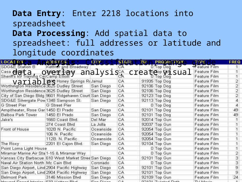
Data Entry: Enter 2218 locations into spreadsheetData Processing: Add spatial data to spreadsheet: full addresses or latitude and longitude coordinatesData Analysis: Classification, range grade data, overlay analysis, create visual variables

Cartography by Conrad Brewjo
Every detailed map =
hours of work

Global Positioning Systems
What is Geospatial Technology?


Remote Sensing
What is Geospatial Technology?

30m, LANDSAT


1m, IKONOS

http://www.geoplace.com/gw/2002/0201/0201wtc.asp
http://www.geoplace.com/hottopics/groundzero/default.asp

http://visibleearth.nasa.gov/cgi-bin/viewrecord?7846

GoogleEarth! http://earth.google.com

…a multi-billion dollar business
Critical to the growth of the industry 1. Federal Government Data
2. Successful advocate of itself at all levels and internally
3. GUI software and automation
4. Merged with parallel technologies to become “geospatial technology industry”

Definition 7: a societal role
GIS as “organized activity by which people measure and represent geographic
phenomena, and then transform these representations into other forms while
interacting with social structures”(Chrisman 1999)

Organized collection of Hardware Software Data People Procedures Networks
PeopleSoftware
Data
Procedures
Hardware
Societal Role…

Moral and ethical implications Favors generalization Not always neutral Technological rather than human-need
focused Maintains and extends societal power
structures
Societal Role…

Functional definition of GIS:
A system for dealing with space-time data, that has the following functions:
Data input
Data management
Data manipulation and analysis
Data reporting
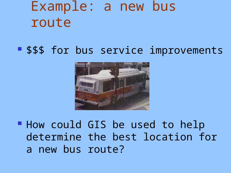
Example: a new bus route
$$$ for bus service improvements
How could GIS be used to help determine the best location for a new bus route?

Where can we get relevant data?
Population density
Potential ridership
Existing bus routes
Distance willing to walk
Environmental impact?
US Census bureau, topographic maps, town records, aerial photographs
Marketing questionnaire, demographics
Valley Metro
Marketing questionnaire
Air quality measurements, estimates of pollution in microclimates

Key GIS elements
Organize each type of information into its own data layer

Key GIS elements
Set up data so it overlays correctly

More key elements:
Analysis Create a buffer of ¼
mile around existing bus routes
To learn more, take advantage of links between locations and attributes

GIS links location and attributes
linkslinks
Location files:store info about boundaries,locations, adjacency
Attribute files:store info on non-spatial characteristicsof the features

In summary …
GIS allows for spatial data acquisition, storage, manipulation, and analysis
Output can be many different forms!