Embed Size (px)
Citation preview

T h e
Geographical Journal . No. 11. FEBRUARY, 1913.
- -- ---
VOL. XLI.
THE ABOR EXPEDITION : GEOGRAPHICAL RESULTS." By A. BENTINCK.
I PROPOSE to deal with the exploration of the valley and course of the river Dihong and its main tributaries, so far as it was effected by the Abor Expeditionary Force to which I was attached as a Political Officer. I am under certain disabilities, as having enjoyed the usual public school and university education I am in no way a scientific observer, and the duties of an executive officer in the Eastern Provinces of India allow hirn no leisure for new acquirements. On the other hand, I had been able during the three and a half years before the expedition started, and more especially in the six months which elapsed before i t was possible to under- take the punishment of the murderers of Mr. Williamson and Dr. Gregorson, to obtain some knowledge of the language and manners of the tribes on the North-East Frontier of India. The expedition had many objects in view besides exploration ; I am not a t liberty to detail all these, but may mention the exaction of reparation from a most elusive enemy, the con- struction of a mule-road over heart-breaking country, the opening up of friendly relations with tribes and villages whose very names were either unknown or matters of vague and generally incorrect conjecture, and the necessity of appearing always in sufficient force to ensure against accidents. All these still further curtailed-the time strictly limited by the climate during which exploration was possible. More surveying might have been done had i t not been made a sine qua non that the work should be linked up with the Indian triangulation, but this is a matter in which quantity may yield to quality, and the nature and extent of the work done is in itself a tribute to the indomitable spirit of the survey officers in the face of exasperating obstacles. I have nothing to say on the two missions
* Royal Geographical Society, December 2, 1912, Map, p. 200. No. 11.-FEBRUARY, 191 3.1 H

98 THE ABOR EXPEDITION : GEOGRAPHICAL RESULTS.
which were working simultaneously with us ; the Mishmi mission along the upper Lohit covered little ground that had not been previously visited by Mr. Needham and by Mr. Williamson and described by them; the Subansiri mission, as I prefer to call what was officially known as the Miri mission, because the tribes it visited are not and have never been connected with the Miris, broke a good deal of new ground, but I have no firsthand knowledge of its results.
The Dihong, even for the 25 miles or so of its course from where it leaves the hills to its junction with the Brahmaputra, has hardly been visited by Eluropeans, and until Mr. Williamson took over charge a t Sadiya in 1906, the claim of the Abors to turn ba& even fishing parties that wished to go more than a few miles above the mouth had been admitted by default. A lamentably unsuccessful expedition in 1858, which penetrated nearly as far as Kebang, returned without making much addition to our knowledge of the country, and between that date and 1894 no expedition or traveller got further than the villages facing the plains on the outer slopes of the hills. In 1894 a punitive expedition directed against the Padam Abors nearly succeeded in reaching Damro, the principal village of that section, and gained some Icnowledge of the valley of the Yamne, one of the largest tributaries of the Dihong. They had, however, no surveyor with them, and the margin of error in their work was rather large. The first survey work in this area was done in 1901 by two Gurkha surveyors from the Survey of India, who succeeded in getting up the right bank as far as Kebang. Perhaps deservedly satisfied with the accuracy of their work up to that point, they seem to have let themselves go on the subject of the country beyond ; they describe it as open and undulating and as absurdly easy compared with that as far as Kebang. It is certainly more open, in fact it could hardly be less ; we may also admit the undulations, but as these are continuous; seldom less than 1200 feet high, and often two or three times as much, and seldom have as mild a slope as one in three, it must be conceded that as undulations they are somewhat bold. As to the ease of the country, our impression on returning from it was that the country between Kebang and the plains was mild and harmless, and in saying so I do not wish to withdraw the epithet I have already given that country of heart-breaking. The most amazing statement of these surveyors was that Gyala Sindong was only ten stages from Kebang and visible on a clear day. -Mr. Sam Weller on a well-known occasion protested that his eyes were not patent double-million magni- fying gas microscopes, but the surveyors seem to have laboured under no such disabilities. As a matter of fact, twenty-four marches took us less than halfway to where Gyala probably stands, and with an immense snowy range in between, while from Kebang, which is not more than 3000 feet high, the view up the Dihong extends not for ten stages, but for rather less than 10 miles, the valley then bending eastwards a t right angles and a 5000-foot ridge shutting out everything behind.

THE ABOR EXPEDITION : GEOGRAPHICAL RESULTS. 99
Mr. Williamson's journey of 1909 to Kebang covered much the same ground, but he then made the acquaintance of a remarkable man in the person of Madu, Gam or headman of the important village Riu, and received from him the invitation upon which he undertook his last journey in March, 1911. This is not the place to discuss the murders ; their actual occurrence was brought about by the folly of a messenger and the hot- headedness of the younger men of Kebang and Rotung, who cut short the career of one who had in five years created our influence over the tribes of the frontier without force or show of force, but by the unaided strength of his own personality.
In speaking of previous explorers I should not omit the well-known name of Kinthup, who alone claims to have entered the country from the north. I shall return to him later on.
It may be as well to mention that all travelling by Abor paths has to be done on foot and in single file ; obstacles such as fallen trees, steep places where hands are needed as well as feet, and ravines where the track is along steps cut in a succession of slippery logs are common incidents, and a t such places each man causes an additional delay. British officers had to limit their personal effects to the 60 lbs. carried by one coolie and sepoys to 10 lbs. only, and thus no tents could be taken, and it was neces- sary to end each march by 3 p.m. a t latest to enable a camping-ground to be cleared and shelters and a defensible perimeter to be run up before dark.
We left the headquarters camp below Kebang on December 27, with rations for a month, which meant that a t first we had many more loads than carriers unless we could induce the villages we visited to help us. As, however, it was necessary to leave friendly feelings behind us, we were not likely in any case to go very fast a t first. On that day we reached Pangin, a village which, though i t borders on Kebang, whence the plains are reached in two days by an Abor, had never been down and had never seen a white man. I had previously got into touch with the Gam, and we were received here as elsewhere with the utmost confidence, friendliness, and no little curiosity, especially on the part of the women and children, who regularly came out to meet us and would press on the British officers a doubtful egg or a damaged banana for the privilege of examining all that they had on. The Abors weave themselves a rough cotton cloth, and obtain by trade, generally through the Mishmis, a good deal of coarse Tibetan stuff, but the ordinary cotton materials in use in India are prac- tically unknown in these further villages, and provided they are white or scarlet or bright blue are highly prized. The amount of dress worn by an Abor is regulated entirely by the heat of the weather, and though the women wash with fair regularity, the men decline throughout the winter months to part with the warmth given by a coating of steadily accumulated grime.
From Pangin we crossed the Dihong to Komsing, but while H 2

100 TIlE ABOR ESPEDITIOS : GEOGRAI'HICAT, RESULTS.
preparations were going on we paid a visit to Yekshing village across the Siyom and had an interesting day. After making our way along the rocks a t the river-side we came to the great cane bridge which crosses the Dihong rather below Komsing. This has been described in the Journal for August last, and I need not therefore delay upon it. The Komsing bridge when we saw it was getting old, and, except for its size, was not as well made as several other such bridges that we crossed. I have no doubt, however, that it is a good deal stronger than has been stated. I have seen thirty or more Abors running across such a bridge over the Shimang where it is some 80 yards wide, though that bridge was in worse repair than that below Komsing. A similar bridge a good deal smaller and much newer a t Yugong was so rigid that it was unnecessary to hold on while crossing, and it supported the weight of most of the villagers who gathered on it to watch Captain Hore, the Intelligence officer, and myself bathing underneath it. One cane that I happened to notice was nearly 90 yards long, and few are less than 50 ; the whole structure is put together without a particle of iron and underfoot is close enough for dogs to cross over readily. Such bridges are common on all the larger streams, but numbers of other types are found, from the primitive tree-trunks, split and hauled into position, to cantilever bridges of bamboos weighted with piles of boulders, suspension bridges with rigid bamboo footways, trestle bridges and combinations of these types. There is nothing so rudimentary as the cable and sliding ring which contents the Mishmis.
On the same day we crossed the Siyom river to Yekshing village, which stands on the steep ridge a t its junction with the Dihong. The Siyom probably rises about lat. 28' 45", and collects most of the drainage of the area east of a well-marked range averaging some 11,000 feet which runs north and south and divides the Suban~iri system from that of the Dihong. Where we crossed the Siyom it is some 90 yards wide, with an average depth of about 30 feet, and a current of about 4 miles an hour, but just below i t dashes down for some 2 miles in continuous rapids which carry its dark clear waters far out into the green stream of the Dihong. Its existence had hitherto been based on rumour only, and its size was un- suspected. While we were visiting Yekshing, a poor village full of goitre, deformities, and eye-diseases, rafts had been got ready, and on these we crossed the Dihong next day and marched to Komsing. Here we were able to recover some of the remains of Mr. Williamson and those who were murdered a t the same time, a task which was completed by those who came after us. Pushing on with the help of 120 Abor carriers, we next arrived a t Riu and halted there for two or three days. At Riu the Abor system of local self-government is seen a t its best, and a few words on it may be apposite. Though I have used the term Abor, it is a name of which the Abors themselves are ignorant and for which they have no equivalent. I t covers a number of tribes, each of which is loosely coherent,

ABORS AT RIGA CAMP.
P
DIHONG VALLEY NEAR GETTE.
THE ABOR EXPEDITION : GEOGRAPHICAL RESULTS. 1 0 1
generally by its connection with some parent village, but not otherwise recognizing any community of interests or policy. The real unit, as the nature of the country requires, is the village, and each village acts indepen- dently. All questions of policy are debated a t the village assembly, which all may attend, including the women. I am not aware, however, that the latter have obtained or desire the right of recording their opinions. Of these assemblies the Gams or headmen are the mouthpieces, but a Gam of standing will have a large share in forming the opinion which he transmits ; it is, in fact, on the success of his policy that the influence of a Gam rests. He must a t the same time be a man of superior intelligence and foresight, a ready, fluent, and persuasive speaker, and have a backing of personal adherents of his own family and clan, for each tribe is sub- divided into clans which differ from one another in glory. As the Gam cannot risk a failure, the line he takes is always one of caution, and he has, where his influence is tolerably secure, a sound modifying effect on the more hot-headed young men. A village which has been doing badly may have no recognized Gam, but this is generally regarded as a discreditable state of things, and in the stronger villages Gams are many. None is more remarkable than Madu, Gam of Riu, who is a born politician, diplomat, and statesman. He has always seen that his people had everything to gain by friendly relations with us ; it was on his invitation that Williamson made his last journey, and after the murders, which he strongly disapproved but could not foresee nor prevent, he went out of his way to send down messages protesting his innocence and friendship, kept the villages near him from joining against us, and came to meet us on the first opportunity. The esteem which he enjoys is a strong testimony to the generally peace- able and orderly nature of the Abors, and to their power of recognizing a good thing when they have got one. He helped us on to the next village, Geku, the headquarters of the Panggi tribe, between whom and Riu there had been for some years past an intermittent hostility, which we were able to compose to the satisfaction of both. Geku had already been visited by a party under Colonel McIntyre, which, starting from Rotung a t the same time as we from the camp below Kebang, had worked up the comparatively easy valley of the Yamne through the Panggi villages. The southern- most Panggi village of Pongging had picked up a fugitive from Williamson's party, who reached them badly wounded, had tended and kept him a t some danger to themselves from their neighbours, and had sent him back to us on our arrival; they could not do so before, as the villages below them rigidly excluded them from all intercourse with the plains. The Panggis are a weak and poor tribe shut in between the powerful Padams and Minyongs, and only saved from absorption by the mutual jealousy of these two and by their own friendship with the strong Simong community further north.
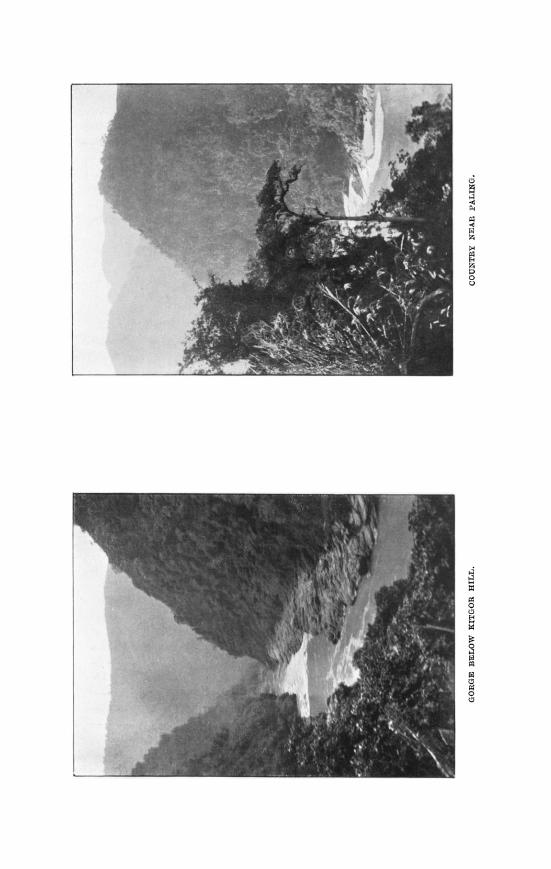
There is not much to be said of the geography of the country traversed up to this point; the path runs a t some distance from the Dihong, up and

102 THE ABOR EXPEDITION : GEOGRAPHICAL RESULTS.
down and in and out of continual spurs a t right angles to the ever-changing course of the river. The lower slopes of these ridges where they face south are cleared or only moderately overgrown, but the uppcr parts are covered with dense jungle which completely shuts out all view ahead, and only occasionally allowed us glimpses of the huge bends which the river indulges in about here. These, however, were enough to make us already cautious about prophesying on the course of the river further on. The Yamne valley party had not had these advantages, and on this account, coupled with an ignorance of local nomenclature, arrived a t hasty con- clusions which a t the time obtained some publicity. While we were a t Geku the fine weather came to an end, and the cloudless days we had enjoyed hitherto were replaced by rain on three days out of five, while on the rest the sun shone only fitfully, and the high hills hardly ever emerged. It was important to get in touch with the village of Riga, the parent village of the Minyongs, and we therefore, largely by the good offices of Madu Gam, made rafts and crossed to the right bank. The Abor raft is built up of bamboos of a special kind, very large and light ; it is some 20 feet long and 5 wide, carries a small platform for passengers and baggage, and is worked by three or four men with sticks, of whom the man in the.bows does such steering as is possible. The only crossing- places are where the river widens out, and the current in shore is therefore very slack. The raft is towed up the bank as far as the steepness of the rocks allows, and is cast off with the head well upstream. Then follows an exciting period of furious paddling, during which the raft goes slowly across the stream and rapidly down it until if successful it strikes the slack water on the far side. Bad steering results in its being carried far down, and there is no saying where i t may stop. We tried without success to improvise apparatus to take soundings a t this point ; our geologist reckoned that from the set of the rocks the average depth would not be less than SO feet, and close under the bank there was no bottom a t 60 feet. The river narrows here to about 120 yards, and the current was approximately 54 miles an hour, the river being then a t its lowest ; the rocks for some distance above this and right down to the plains are volcanic and generally lava. From the river-side our Survey officer, Captain Trenchard, made his way to the top of Arte hill, some 8700 feet, on the lofty ridge behind Riga, but apart from the fact that the weather was hopelessly thick, he found the top not only covered with dense tropical jungle, which we expected, but also under 3 feet of snow, in which our bare-legged Nagas who were to have made a clearing were helpless. At this time we received orders to push on up the Dihong, therefore recrossed and marched next day to Komkar, the only village of a small tribe akin to but distinct from the Padams, and maintaining itself by alliances with both Damro and Riga, and a reputation for sorcery and witchcraft of a dangerous kind. On the next day we camped just short of Simong, which now became our advanced base. Komkar is the first village of any size on this bank
THE ABOR EXPEDITION : GEOGRAPHICAL RESULTS. 103
which faces the Dihong, and a few miles beyond it the volcanic rooks end in a fine bluff of some 3000 feet, from which there is a view up the river as far as Puging. The valley here opens out, and, in place of jungle-covered cliffs descending almost sheer to the water's edge, the land falls away in innumerable small plateaus with very steep sides to a gently sloping strip often a mile wide between 100 and 200 feet above the river, intersected everywhere with deep precipitous ravines. On the opposite bank the slope is steeper, but the fields run unbroken from 4000 feet down to the river. Simong dominates the remaining Abor villages on the left bank, and is on friendly terms with the small Karko group of four villages which face i t on the other side, and are a t war with Riga ; it is also on good terms with the Bomo-Janbo group beyond. These last villages we were not able to visit, but we saw something of their inhabitants ; they differ slightly from the other Abors of the Dihong valley in that they generally wear very dark-coloured clothes, and instead of both sexes wearing their hair cropped all round they allow i t to grow long behind and hang down. Simong itself is a large village of nearly three hundred houses, compact but not crowded, built on a broad steep-sided spur, and when we first visited i t with all its peach and plum trees in blossom it was far from un- attractive ; most Abor villages are a t their best from a distance. I t would have been well if we could have waited here for a few days before pushing on in order to make ourselves better known ; the Abors generally think of us as a tribe not more numerous than one of their own and inhabiting the villages of Dibrugarh and Sadiya, but here we were entirely unknown. Moreover, the most influential Gam, who is known alternatively as Mi Okko, or Bapor, is in spite of the current reputation of the Abors the only one whom I have found habitually surly and unresponsive. Time however pressed, and when we set out we found, partly from the wish of the village not to lose its good name for hospitality and partly from a desire to make it appear that we passed through with their permission and consent, an opposition which threatened to make our further progress slow and difficult and did in fact delay us a day. We had more of this a t Gette, which we reached on January 24, but circumvented it by taking a side-path, crossing the ridge on which the village stands a t its narrowest part, and camping on the further side. At Puging, two days later, the villagers a t Okko's direction denied that the path went any further, but as we had to wait here until a convoy with supplies for our final advance overtook us, we were able to make friends by an exchange of presents and to give examples of the effect of rifle-he. At Gette we met two interesting strangers in the persons of two Tibetans, refugees from the Kongbo district in Tibet and settled in Shirang village on this side of the high snowy range. From them we tried to get information about the course of the river, but partly from the want of an efficient interpreter and partly from the fear of the Abors that we might interfere with the trade with Tibet which Sinlong largely controls, the results were small. They certainly regarded the

104 THE ABOR EXPEDITIOS : GEOGRAPHICAL RESTLTS.
Dihong as the same river which passed their homes, and knew nothing of any falls on i t ; but of its course we were able to get no clear idea.
At Puging a cane bridge crosses the Dihong to Bomdo, or Bomo, and is largely used by the Janbo villages and the Boris behind them, as the path down the right bank is very bad and difficult a t this point. On the left bank also the valley closes in above Puging, and our path took us high up along the Puging fields, on which, as on all the very steep hillsides, the tree-trunks, after felling and trimming, are allowed to lie supported by the stumps to hold up the exposed soil from slipping into the river. Turning our backs on the river, we climbed to the narrow top of a high precipitous ridge, which we followed until a very abrupt and laborious descent of 3000 feet down a rocky difficult path brought us out on the Dihong again. The river here runs from the north-west, bends sharply to the south-west through a narrow gorge, the hillsides running up nearly 4000 feet from either bank, covered with jungle, and very steep indeed. Our 3000-feet descent took us less than half a mile forward, and the hills in the gorge are steeper. Where we again met the Dihong it was running south-east ; it then, after running south-west in an almost continuous rapid for about half a mile, again turns right angled to the north- west, swings round a long projecting spur, and passes Puging running slightly east of south. Above our camp there is a succession of rapids as far as Rikor village, which we passed through on the following day. Here the rain, which had held off the last few days, though snow had been falling heavily down to some 6000 feet, set in, and continued almost without intermission for the next nine days and nights ; even when it was not raining the mist was so thick that no plane-tabling could be done. Immediately above Rikor the hills close right in on the river, and after a steep and slippery climb of 1700 feet we could catch through the mist glimpses of deep narrow valleys running in all directions with nothing to indicate the course of the Dihong. We had long been waiting for the Dihong valley to make a more decided trend to the north-west, and when we got down again to the river a very well-marked valley straight ahead, though several others were available, seemed to fulfil the requirements. This turned out, however, to be occupied by the Anbo, quite a small stream, while the Dihong disappeared through a quite inconspicuous opening in the opposite direction. Another stiff climb brought us up to Paling, a small poor village high up on a bleak ridge, and obtaining its water through about half a mile of bamboo piping from a mere trickle on the hillside. From the village we could see that the Dihong cut right across our front ; that the high hills, especially that behind Panggo village, which the Survey were hankering after, were all across the river; and that we might go on for some days on the left bank without getting appreciably nearer the main range. For the last two days we had gone on three-quarter rations, and therefore had a small margin, and as the march to Singging promised to be fairly easy, and the large tributary, the Sigon, came in somewhere near it,

T H E ABOR EXPEDITION : GEOGRAPHICAL RESCLTS. 105
we decided to push on to see what we could. The march turned out to be the worst we had had ; first a steep drop of 1800 feet to the river-bank from Paling, then a steep pull up of about 3200 feet on to the narrow top of a long ridge, and then a long descent, a t first fairly easy, but for the last few hundred feet with a slope, if it can be so called, of 3 in 1. On all these steep places the path is merely a series of well-worn footholds of rocks or tree-roots, for no hillside seems to be too steep for a thick growth of jungle, and it was long before we got rid of the habit of walking with short steps and eyes fixed on the ground. A few more hundred feet up the opposite hill brought us to fairly level ground close to Singging village shortly before dark, and we were very grateful to the villagers who turned out and helped to clear a camp and collect hewood. In nearly seven hours' actual marching we had covered 64 miles. It was plain that we were getting near the end of the inhabited country on the left bank ; the villages had shrunk to little hamlets of between 30 and 40 small houses, and the widespreading fields to little patches of cultivation wherever the hillside is not sunless or too steep. Pigs and fowls are scarce, and the scanty supply of grain, generally millet, is supplemented with rats and squirrels, snared in the jungle. The latter are regarded as something of a dainty, and whenever a small gift of salt or tobacco produced a long search in the capacious satchel which every Abor carries, it usually ended in the production of a smoke-dried squirrel extended on a wooden skewer. These are largely used in trade with the Mimat, a tribe living far back in the hills whose reputation as cannibals extends right down to the plains. We did not see a Mimat, but they visit Singging with salt, which they exchange for anything edible, including, as we were once more assured, human dead bodies. They live close to the snow-line, dress in skins, and are spoken of by the Abors with disgust and contempt. Beyond Singging on the left bank is the small village of Angging, a t two days' journey for an Abor, which means three for any one else ; another two Abor days on is Namying, and a little further Jido, beyond which the country on the left bank is said to be impassable, and the path crosses by a cane bridge to the Menba village of Kopu. The three Menba villages of Kopu, Jeling, and Shirang are inhabited partly by Abors and partly by another tribe probably nearer akin to Tibetans proper than the Abors are. The Dihong valley is said to run for some &stance beyond the last village in a north-easterly direction, but the country is so steep that not even an Abor can go there.
Rain and dense mist continued all the while we were a t Singging, and though a further reduction of rations gave us an extra day in the hope that the weather would improve, it was useless, and on February 3 we turned back, having with us rations up to the following evening. We were now moving down the same path that Kinthup claims to have used twenty-eight years before ; he has given a description of his route, and I do not propose to detail points in which he is wrong, as that would be unduly

106 T H E ABOR EXPEDITION : GEOGRAPHICAL RESULTS.
tedious and lengthy ; it is possible to give his correct statements in very few words. The first identifiable Abor village reached by him is Angging ; going southwards he gets four village names correct out of eleven, two of them being misplaced, and three others more or less correct. In his descriptions he is right twice only ; he says that a t one point he crossed two or three streams, and ascended a hill covered with jungle ; the traveller in Aborland is seldom doing anything else : he says that from Mobuk village the Dihong is not visible ; this is right, but I believe by a mere fluke, as every other statement is irreconcilable with anything that is or ever has been in that part of the world. I do not think i t possible that he can have penetrated further than a prominent hill near Jido, from which there is an extensive view, and was there told the names of the villages on that bank. This is probable, as he calls his furthest point Damro by the impossible name of Miri Padam, an obvious confusion with Miri Pamdi, which means the Snowy Mountain of the Wizard, and is a very prominent peak which from Jido would exactly indicate the direction of Damro. Where he got his other information I cannot say, but when his journey into Aborland is described, as has recently been done as " one of the romances of the Survey of India," I am prepared to let it go a t that.
We were back a t the Simong camp on February 8. The transport line, when stretched to its furthest, could only get us one day further up the left bank than we had been already; our carriers were pretty well worn out with four months' incessant work, and to replace them and engage others in sufficient numbers would have required nearly two months, by which time the season would have been a t its unhealthiest, and storms and floods always threatening. While, therefore, we awaited orders the Survey started observations from the highest point above Simong. Here, a t 6000 feet, the jungle was so thick that it required 150 men for ten days to clear it, while on the very few favourable days the distant hills were free of cloud only for an hour a t sunrise. Below in the camp we made friends with the Simong Gams, and learnt from them about as much about the river as they could tell us. One of them, called Asan, had in his earlier days been carried off as a prisoner across the snowy range. He crossed the Dihong a t Jido, and was then carried over four ranges of hills to a country much like that of the Abors, where people lived in wooden houses and used neither ponies nor yaks. The path through the hills does not follow the river, but joins it again a t Bapung. The river among the snows is said to be deep, narrow, and very rapid, and the banks precipitous ; again, nothing was known of any falls, and i t may be remembered that, while on the Dihong the river in a course of not less than 85 miles from Singging to Gyala has to drop some 10,000 feet, the Teesta, not so very far west, descends 16,000 feet in a course of 70 miles without any falls a t all. Moreover, if there are falls on the Dihong a t the place where Kinthup saw rainbows, this must be before the river pierces the main range. It may be said in a word that the nearer we got

THE ABOR EXPEDITION : GEOGRAPHICAI, RESULTS. 107
to where the falls ought to be the less was there to be known of them. We questioned the Simong Gams about the floods on the Dihong, especially the great flood of 1900, which brought down a number of bodies then supposed to be of Tibetans and a quantity of coniferous trees, none of which grow in the Abor country. These floods, they said, are caused not by the Dihong, but by a large tributary called the Yigrung, which comes in from the east ; both the bodies and the timber in 1900 came from the country of the people known to the Abors as Pobas, and considered by them quite distinct from the Tibetans. It seems, therefore, likely that the Yigrung is identical with the Ngong Chu, and from the fact of i t having an Abor name, i t may be inferred that it joins the Dihong on the south side of the main range, probably near a great 25,000-foot peak in long. go0, lat. 90" 45' approximately. The Gams were quite willing to guide a small party as far beyond the hills as they themselves could go, so long as we ourselves whom they knew composed it ; i t was impossible, however, to go a t that season, which was no doubt true, and they would not care to take only one of us ; two would be better, and three best of all. The reason given for this is most characteristic of the Abors. " One of you," they said, " will probably die because the country is so bad, and then you will blame us, whereas if three go two may die, but there will still be one to come back and say that it was not our fault." We left Simong on February 24 with kindly feelings on both sides ; here, as elsewhere, the Gams met us as friends and equals, with an absence alike of insolence and servility which a long sojourn in the eastern provinces of India made all the more refreshing. At Komkar I held a conference, which was attended by all the principal Gams of the tribes we had met, to discuss our future relations and settle minor disputes, and we then had a short halt a t Geku, where survey work, under the same difficulties from thick jungles on the hilltops and bad weather, was proceeding. Here, during our absence, much highly-appreciated medical work had been done, but the centre of attraction was the two trained dogs brought up by Major Wilson of the 8th Gurkhas. It is not in my province to speak of their war services, but in peace they were a valuable asset, as the Abors are noticeably fond of animals. It is customary, when meeting a mithan (the domesticated bison, Bos frontalis, of the hills) in the jungle, to speak to it and give it a lick of salt ; and I have seen an Abor carrying a dog under each arm across a stream to save them from getting their feet wet.
From Ceku we crossed again to Riga to enable survey work to be done from Arte hill. A survey camp was made a t about 8000 feet, and a detachment of sappers sent up to make a clearing, and here Captain Tren- chard had to wait for three weeks before a thunderstorm, more severe than usual, cleared the air sufficiently for a few hours to enable him to get a few observations. At the same time another party moved up the Shimang valley, and by great exertions struggled to the top of Moling, a 10,000-feet hill west of Arte, only to find the jungle a t the top as thick as ever, 10 feet

108 THE ABOR EXPEDITION : GEOGRAPHICAL RESTLTS.
of snow on the ground, and all round dense cloud which refused to lift before it was time to return. While this was going on I was able, with Captain Hore, to make a journey westwards from Riga to visit the villages in that direction. The country is exceedingly broken, and the hillsides so steep that not even an Abor thinks of tackling them ; the path, there- fore, climbs up the crest of narrow ridges to the point whence they diverge, and so down again. A fourteen-hour march from Riga, involving a climb of 6000 feet up over Arte and another 6000 down, brought us to Shupsing, in the Shimang valley, and a t the end of three days we had done rather more than 20,000 feet up and down, and had advanced 27 miles ; two days later another climb of 3250 feet over the Yillo ridge took us into the Siyom valley a t Rangku village. The Siyom here is some 80 yards across, with an average depth of about 20 feet, but lower down it widens out sufficiently to contain wooded islands, a very unusual feature. We crossed the Siyom on rafts in the hope of reaching one of the partly Gallong, partly Bori, villages on the other side, but this we were unable to do in the time avail- able, to the disappointment of the Gams, who invited us cordially to return next year. We followed a different path on our journey back, mainly along the very devious valley of the Yubung, crossed the Shimang a t Pareng, and after doing the 5600 feet to the crest of the ridge, were once more in the Dihong valley. The trip was more successful politically than geographically, as though we were constantly reaching excellent points for survey work, and enjoyed fine weather throughout, the haze which marks the approach of the hot weather was over everything, and was much thickened by the smoke of burning trees and undergrowth wherever the fields were being cleared for sowing. There is no wind to carry it off and, in consequence, we could never see beyond the hill we happened to be on. Few sights were more impressive than the expanse of the Riga fields, seen from above ; those now in use cover three great valleys, and the ridges between, once under thick forest, but now with some 15 square miles cleared of all that, and a t sowing time without a weed anywhere to be seen. The system of Abor cultivation is the same as that practised by many hill tribes. The crops are mainly rice and millet, and as much is cleared as is required for one year's supply, this heavy work being all done by the men ; the land is cropped for three or four years, and the jungle is then allowed to grow up again on it while more is cleared. In most villages each set of fields gets a rest of nine to twelve years, but where the population is pressing on the soil, as is markedly the case with an old village like Riga, not only is the land harder worked, but there is a strong tendency for tree jungle to be replaced by grass and reeds which still further impoverish the soil, and will, until better methods are learnt, increase the overflow fiom the hills down into the plains, where the Abor deteriorates both in physique and in character. The matter is in many places one of some urgency, but can everywhere be met by improved methods, improved implements, and new kinds of crops.

THE ABOR EXPEDITION : GXOGRAPHIC-4L RESULTS-1)ISCVSSION. 109
Three of the Riga Gams had gone with us on the last trip, and they accompanied us on our return, which began on March 25 ; they were joined by others from the villages on the right bank which we passed through, all eager to see the world, and more particularly to look for possible loc&- tions for new colonies which were to keep open their communications with the plains, and prevent the re-establishment of the trade barrier formed by Kebang and the villages under its influence. Little need be said of the return journey ; from Kebang downwards it ran along a wide, evenly graded, and finely bridged mule-road. The Abors with us frankly admitted that they thought i t superhuman, and it is not hard to understand and even to share their enthusiasm. By the middle of April frequent and heavy rain is to be expected in the hills, and in their outskirts fever, mosquitoes, and leeches abound. The expeditionary force was, therefore, withdrawn with all speed, and on April 1 we were once more in the plains.
I t would, I think, have been generally admitted that much had been done if more had not been hoped for. It would be fairer, perhaps, to say that if the information and conjecture upon which those hopes were founded had been correct they would have been fulfilled. In any case, the way has been made incomparably easier for the survey party now at work ; there should be no risk whatever of friction with the tribes, but whether in that country further exploration can be carried on with large parties is a point about which I am less sanguine.
I have purposely avoided discussing the habits, characters, and beliefs of the Abors ; others with less opportunities have rushed in to print, but I prefer for myself to be on the side of the angels until wider experience has been gained. This, I trust, may be possible in the near future. One who has the welfare of the tribes a t heart may be excused a feeling of relief that their country shows no sign whatever of mineral wealth, and that they, therefore, have a better chance of working out their own salva- tion along their own lines. In this they will need guidance, and they are willing and anxious to learn ; their methods of warfare have been shown to be useless, and their methods of agriculture have, as I have already said, brought many villages to a point a t which the rising generation must emigrate or starve. Difficulties are not altogether wanting, slavery is one of them, but I believe that the time is now, and that the opportunity has been made.
The PRESIDENT (before the paper) : I am glad to see so large an audience present to listen to what I have no doubt will be a most instructive paper. The subject of the address is the geographical results of the recent Abor Expedition on thenorth- east frontier of India. In those parts of the world is a remote mountain tract, almost unknown to Europeans, inhabited by inhospitable and semi-barbarous tribes, lying partly inside and partly outside the administrative frontier of India. This region, which has excited the interest of geographers and travellers for years, but has been visited by few, was suddenly brought under our notice less than two years ago by the news of the murder of a distinguished young British

I
17:
N .E .FRONTIER QF INDIA - Map to illustrate the

Map to illustra.te the
GEOGRAPHICAL RESULTS of the
dUBOR EXmDETEOH A . BENTINCK
Pi"@ 1911 - 12. - 8 Scale 1: 500.000 or l,Iuah 1-89 Stcc.M,ilem.
Rouy OC tke*.Qlitiarv.. .. " " N?Ahdh&b p w ------- ,, ,, 0- p h ........ .............
Note - l%a rnnp i. a of (Ib prwisiond "-"? 0- d v the Abor 8*==-1"d~~$"-;~* & pm.&'ee2b%svl*sd-.


ABOR ~~ -

11 0 THE ABOK. EXPEDITION : GEOGRAPHICAL RESULTS-DISCUSSION.
officer, Mr. Williamson, who had advanced beyond the frontier to conduct certain investigations in the tribal area in those parts. An expedition was sent out by the Government of India to avenge the murder of Mr. Wiiiamson and to pursue geographical and scientific inquiries, and Mr. Bentinck is better qualified than almost any man to acquaint us with its results. He himself was Deputy Com- missioner of that portion of British territory to which I refer. As such he was also Political Officer for the tribes in question, and poor Mr. Williamson was his subordinate. When the expedition took place it was not unnatural that Mr. Bentinck's knowledge should be utilized for the assistance of the force, and he went as Political Officer to General Bower, who commanded it and who is with us this evening. There were many results of that expedition, political and other- wise, about which we should like to hear a good deal. But we are a Geographical Society and are not admitted into the secrets of Government, and we are there- fore not a t liberty to-night to discuss more than the geographical results.
General Sir HAMILTON BOWER: Mr. Bentinck has given us a very clear idea of the geographical work that was done on the Abor Expedition, but there is one point he has very much minimized, and that is his own di%culties as Political Officer, and the tact required to enable the work to be carried on. At the time that Mr. Bentinck left us a certain amount of punishment had been inflicted upon the culpable villages, but they had not yet made submission. Mr. Bentinck and his party proceeded up the river. Now, we had no quarrel with the people above, but savages in their ignorance are often like a nervous horse that does not mean any harm, but in its nervousness may become dangerous. It required very careful handling to avoid a collision which we did not want, and go beyond that and get the assistance and confidence of the tribes ; their assistance was very valuable in the exploration work we hoped to carry out, and it is due to Mr. Bentinck's great tact and patience that this was successfully accomplished. Mr. Bentinck has mentioned the absence of any mineral wealth in tho country as a matter of congratulation-well, that is so, and it rather directs attention to the geological formation of the country. We find first of all, from the Brahmaputra running right along the hills, a flat alluvial soil covered with jungle known generally as the Terai-a general feature all along the foot of the Himalayas. Inside that we come to hills known in the western part of the Himalayas as the Siwaliks; this lower range of hills, formed from river deposit, presents at the mouth of the Dihong exactly the same characteristic as it does further west.
In the country beyond that we come to Carboniferous strata, and in that there are signs of coal, but very poor coal it is. We passed through that and came to the volcanic system to which Mr. Bentinck has alluded, and behind that there is the crystalline core of the Himalayas; this forms the core of the main range. There we find peaks rising up to 26,000 feet, and we may be quite assured that the Dihong, beyond where it was explored, runs in a most stupendous gorge. It is rather interesting to observe, in the course of the various rivers in this part, the almost eccentric turns they take, and also how often big rivers nearly meet and then turn aside, and this is characteristic over a very large area of country. The Yangtse, rising in Tibet, flows east, turning due south, then north again, and then away east to the sea. We find the Subansiri and the Dihong present similar characteristics. Between the Yangtse and the Salween in one place it is only about 58 miles, and yet a big river like the Mekong flows between them. The curves of the rivers everywhere are most eccentric; this arises from the Himalayas which lie generally east and west meeting the system on the north of Burma which runs north and south, so we have as the result the most confused crumbled-up mass of mountains in the world. It is not at all surprising to find

THE ABOR EXI'EDITION : GEOGRAPHICAL RESULTS-DISCUSSION. 11 1
that geographical problems, when examined on the spot, differ very materially from what was expected or conjectured.
Captain L. A. B ~ H E L L : The other day I put before the secretary of the Society a few facts I have been able to gather lately in Abor land. It seems rather venturesome to open a subject of this sort, but what I want to talk about is whether the Tsang-po and the Diiong are one and the same river. I have been asked to put the matter before you to-night. If you will refer to your maps you will see that the Dihong, as it is marked on the map, comes out into the plains a t a place called Pasighat. When the Abor expedition left the country they left behind two hundred military police to look after it, and one of the principal posts we had was this place Pasighat. We stayed there most of the time, -thoughwe moved about a bit. Well, while we were there we had every oppor- tunity of studying the river, and the volume of water that came down, under all sorts of weather conditions. That is how the question starts. When we went to Lhasa in 1904 with Sir Francis Younghusband, we crossed the Tsang-po t w i c e once a t a place called Chaksam, and, on the way back, crossed it again a t a point 6 miles further up. While we were there both at Chaksam and this point further up, we got to know the river rather well. We shot and fished on the river-banks. The thing that struck one then about the river was that it was a very big river indeed, and wherever it came out in India it must be a thing well worth looking at. That was in August, 1904, in the rainy season. Eight years later down at-this place Pasighat one saw the same river, or what was called the same river, a t the same time of the year-anything from June to September-and it struck one at once that the water output of the' Dihong, where it emerges from the hills, is actually less than one had seen at Chaksam and a t this crossing 6 miles north of it. You cannot account for it by the fact that the water might have been deeper although the breadth of the river is the same, because opposite where we were there was a rapid which ran right across the river from side to side, and, through this rapid, the water looked nowhere more than 6 feet deep. After we had watched the river for a bit, it became absolutely borne in on one that the thing hadn't the amount of water that the Tsang-po has a t Chaksam, a point more th2n 700 miles above Pasighat. If that is the case, and the river is not the same, one has to ask, What is the Dihong? Where does it come from? One cannot help thinking it is a river of local origin, and the arguments I wish to place before you are these. You will see that brown patch marked on your maps; it forms a huge catchment area. It is a huge basin that catches all the local rain in one of the most rainy places in the whole of Asia, I suppose. All the tributaries n that catchment-area mn into the Dihong, and it strikes one that this huge
basin is sufficiently large to hold enough affluents to account for every gallon of water that comes out a t Pasighat.
The second point is the extreme sensitiveness of the river, where it joins the plains, to localkeather conditions. The rain we got up there came across the plains from the south-west, whence the monsoon comes, and we were able to see every storm that came up. As soon as a storm came up and passed over the foothills into this big catchment area behind, the river rose at once, and so long as the storm went on among the foothills the river remained high; when each storm stopped the river began to fall again. I would suggest to you that a river with pretensions to the length and volume of the Tsang-po has no business to behave in this skittish fashion. There i another argument. The rivers Dibang and the Sisseri, both of which come from the same part of the world, join into the main Brahmaputra river very near the mouth of the Dihong. Both of these are considerable rivem. These rivers we investigated last year in the Mkhmi
11 2 THE ABOR EXPEDITION : GEOGRAPHICAI; RF:SI-L1'S-DISCCSSION.
exploration. You went up them about ten marches and they became fordable streams. If you grant that theDihong is twice as big as the Dibangorthe Sisseri, or possibly three times as big, I do not see what is to prevent the Dihong becom- ing fordable in thirty marches. Those are only the arguments from a point of view which is strange and may not have very much else to support it. There is an expedition up there this winter which we trust will settle the matter once and for all. It will probably double the number of known affluents that run into the Dihong. It is ticklish work, dashing into a large question of this sort; but I would remind you that the question is still an open one. Our best authority for believing the two rivers to be one and the same, is the opinion of Kinthup, and our recently ascertained facts have not yet put the seal of finality on his opinion. If it should prove the case that this geographical question has not yet been cleared up--if the Dihong should prove, as is surmised, to be a local stream and not the Tsang-po-then we are left with our old question, where does the Tsang-po go to ? And as General Bower reminds us, "Rivers do marvellous things in that part of the world." They twist and screw themselves between barriers into unexpected places. If the Dihong and the Tsmg-po are not one, then it remains to us ti, find out where the Tsang-po does go to. That is a problem worth having in these days when unsolved geographical questions are rare.
Sir THOMAS HOLDICH: 1 have listened with something more than interest, with considerable sympathy, to the account which Mr. Bentinck has given us of the exasperating difficulties of dealing with the Abor country, for I have had some little experience of it myself; of the everlasting waiting for clouds to roll by which never roll, for mists to lift up sufficiently to allow one to see just a few miles further than the place where one stands. Considering all these difficulties you will not be surprised that our mapping of that part of the world has been of a somewhat sketchy nature, derived partly from reconnaissance and partly from the reports only of native surveyors and explorers who have been able to make their way sufficiently far over the border to get useful observations. Mr. Bentinck was rather sarcastic about the Gurkhas speaking of the Himalayas as "undulations." I do not think that this is necessary. I never heard of "undulating" as a Gurkha word, and I think you will probably find that that expression is much more due to the translator than it is to the Gurkha. It may happen that just as we climb up the rocky sides of the mountains and talk df " going to the hills," the Gurkha may regard the whole mass of the Himalayas as mere undulations, but I doubt that. I think you will find probably that the explanatioil of that expression lies with a translator.
But about the explorer Kinthup there should be no misapprehension. He left India for a particular purpose. It was his business to discover, if he could, whether the sangPo and the Brahmaputra were one and the same river or not, and after three years of most strenuous work, during which a great deal of misadventure befell him, during which he was sold as a slave and lost all his survey instruments so that he was quite unable to bring anything in the shape of a map-record back with him, he finally did (I think most conclusively) prove that the Sangpo and the Brahmaputra were one and the same river. It is really quite interesting to me to hear that question raised again to-night, but if Kinthup was wrong, you have got to get rid of this difficulty. Certain marked logs were put into the Sangpo by him which were to float down to the Brahma- putra. I have always understood that they did reach the Brahmaputra and were identified ; if so, it is a little difficult to see how they failed to follow a con- tinuous stream. I think we must say that'we have known now for the last twenty-five years that the Sangpo and Brahmaputra are one and the same river,

THE ABOR EXPEDITION : GEOGRAPHICdL RESULTS-DISCUSSION. 113
and the credit of that discovery distinctly belongs to Kinthup. Now, Kinthup, like Mr. Bentinck himself, was, there is no doubt, a little dependent on informa- tion which he derived from hearsay evidence. It is always a most dangerous form of evidence to take. 'I have known many officers, both political and military, find themselves most inconveniently tied up in a web of apocryphal geo- graphy woven by too zealous informers. However that may be, Kinthup did certainly claim two things. He claimed to have visited the falls on the Brahma- putra and the rough monastery which is just below the falls, and to have passed through the mountains into the Abor country. Whether he was on the same route or any part of the same route as that followed by Mr. Bentinck is problem- atical. For if the north-east frontier is anything like the north-west frontier (and I believe it is), not only do routes change, but villages constantly change the names which they adopt sometimes from the hills and the natural features about them, and sometimes from the hame of the ruling chief. I think myself it is no exaggeration whatever to say that in another thirty years' time there are none of our frontier maps from the borders of Persia to the borders of China that won't need very drastic correction. It is never safe to say, when dealing with the records of past years, that they were wrong a t the time they were made. Kinthup's rep& was simply his reminiscence of what happened to him, and I think we should any of us, if we spent three years such as he spent, find it a little ditlicult to recall correctly all the names of the villages and the places we had seen during such a very eventful period.
Regarding the falls, I find that they are placed in the position where they are on our map (91' 17' E. long.) on the evidence of a well-educated Tibetan lama who knew the monastery below the falls and who related his experiences to that eminent orientalist Colonel Waddell. Now, Colonel Waddell has obtained not only the evidence of this lama, but that of many other Tibetans besides who had visited the monastery, and amongst them one who showed some artistic skill in the production of a sketch of the falls. When that artist depicted the King Demon of the falls showing his face out a little from the water, he doubtless drew on his imagination; but I decline to believe that the whole thing was imagination, and I do not see how such a feature as falls should be invented by people who previously had no acquaintance with them. I believe myself that those falls exist. The estimated height of them is only 70 feet, but probably that is enough to be impressive to people who had seen nothing like them before. On the whole perhaps we may congratulate ourselves that there is at least one little corner in this far-off north-east frontier of ours about which a little mystery still hangs, for surely the unexplored portions of the globe now are getting all too narrow for our practical explorers.
The PRESIDENT: We have had a very interesting evening, not less so because there has developed a difference of opinion on a matter which is of high scientific importance. The question of the Sangpo-Dihong is one that has puzzled all geo- graphers who have studied that part of the Indian frontier. I heard for the first time to-night Captain Bethell's theory, and, knowing that Sir Thomas Holdich was seated on my right, was certain that it would he sharply contested by that eminent geo- grapher. I was glad to hear Sir Thomas say a word for our native lndian surveyors, who, in spite of occasional inaccuracies, natural enough, have in general maintained a high standard of ability and accuracy on the frontiers of India. AS regards Kinthup in particular, I am not concerned to defend him, because his character for veracity still lies in the womb of the future, and will be decided by considerations not yet a t our disposal. For myself, I have always imagined that the falls do not exist in the form of any substantial cataract, but are probably a
No. I[.-FEBRUARY, 1513.1 f
114 FROM THE YICTORIA NYANZA TO TIIE KISII HIGHLANDS.
series of rapids of no very great elevation, though capable of being misrepresented as, or even of being mistaken for, falls. Sir Thomas did not say anything about the big lake which I think has been supposed to extend a t the foot of the falls. However, that ,is a matter which the future will decide. The other issue raised by Captain Bethel1 is a much more important one, and it would be with the greatest reluctance that I should surrender theview that the Sangpo and Dihong are identical. Captain Bethell, after ingeniously showing us the area from which the Dihong might derive its water, was confronted with the problem of what to do with the Sangpo. Aware of the existence of the latter, with a great volumc of water only a few hundred miles away, if he had expected us to accept his view he should have endeavoured to dispose of that formidable claim. Mr. Bentinck's lecture has been marked not only with a good deal of novel information, but by a vein of sub-acid humour, which must have rendered him a most agree- able companion of journeys in those parts. Inotedfrom his paperwith pleasure that although the tribes have been guilty of these unhappy and depIorable murders, their general attitude appears to be friendly. If this be so, it would be the more regrettable that the cyfiain, once lifted, should be allowed again to fall. I hope, therefore, that from the germs of this expedition may emanate in future a wider exploration and a much greater knowledge of that interesting borderland. With regard to a point made by General Bower, every one who had anything to do with frontier expeditions is aware how much of success is due to the tact, skill, and knowledge of the people possessed by the political officer attached to them. During the time I was in India, I can recall no successful expedition which was not in the main successful because of the abilities of the political officer. I am quite certain that the compliment paid to Mr. Bentinck by General Bower was deserved, and I will ask you to join me in giving a cordial vote of thanks to him for his paper.
FROM THE VICTORIA NYANZA TO THE KISII HIGHLANDS." By FELIX OSWALD, D.So., B.A., F.G.S.
THE immediate object of my journey last winter to the Victoria Nyanza was the investigation on behalf of the British Museum of some Miocene deposits found early in 1911 by Mr. G. R. Chesnaye near Karungu, on the east coast of the lake. Subsequently Mr. C. W. Hobley, c.M.G., H.M. Provincial Commissioner, presented to the British Museum a fragmentary mandible of a Dimtherium, and some other fossils which had been col- lected a t his instigation by the late Mr. D. B. Pigott, a Government official, who was shortly afterwards killed by crocodiles when his raft was upset by a hippopotamus he had wounded. Much interest had been aroused in scientific circles by Dr. C. W. Andrews' description of the specimen, and since nothing was known of the nature of the deposits in which it was found, I offered to collect specimens and to make a thorough examination of the 1ocality.t To save time in reaching Karungu, H. E.
* Royal Geographical Society, December 16, 1912. Map, p. 200. t By the generosity of Mr. Charles Storey, together with the Rev. R. Ashington
Bullen, Sir Henry Howorth, Dr. G. B. Longstaff, Dr. A. Smith Woodward, and