Embed Size (px)
Citation preview

1
Geography 12: Maps and MappingLecture 10:
Cartometry: Lines and Areas
Line and Area features on topo maps

2
Land surveys and roads
A “length” datum
3
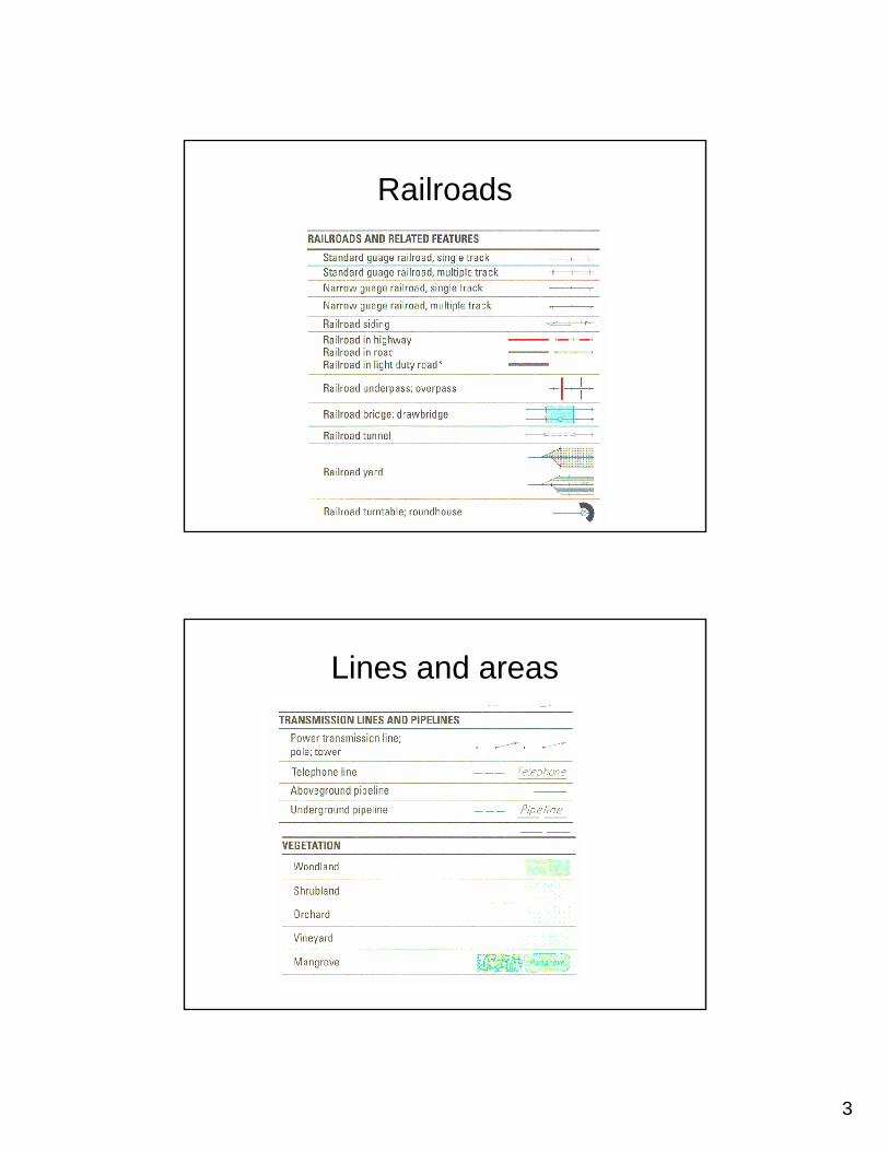
Railroads
Lines and areas

4
More water
Ice and snow

5
Watery symbols
Surface features

6
Contours: Whole separate lecture
Distance measurement: from the ground
• Pacing• Survey
– Chain/Pole– Wheel– Stadia– EDM– GPS
• Tape• Triangulation• Ships log

7
Distance on the ground
• Odometer• GPS point trace• Dead reckoning• Record coordinates and compute
Pacing
• Measure a base line using a superior method
• Devise method for pace counting• Repeat measurement several times• Average result and divide for length of
pace• Note how pace varies with terrain

8
Measuring on the map
Length from coordinates
(x1, y1) (xnpts, ynpts)

9
Area measurement: From the mapPolar planimeter
James Clerk Maxwell (1855)

10
Four methods for area
For example, Lake Los Carneros

11
Area from coordinates
Equivalence